LOUGHS AGENCY OF THE FOYLE CARLINGFORD AND IRISH LIGHTS COMMISSION
Foyle Area and Tributaries Catchment Status Report 2017 Conservation and assessment of fish populations and aquatic habitats Art Niven & Emmett Clarkin August 2018
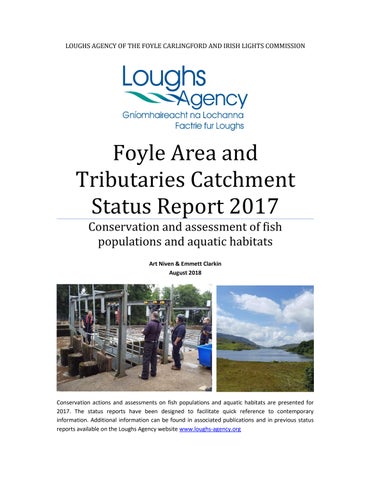
Conservation actions and assessments on fish populations and aquatic habitats are presented for 2017. The status reports have been designed to facilitate quick reference to contemporary information. Additional information can be found in associated publications and in previous status reports available on the Loughs Agency website www.loughs-agency.org
[Type a quote from
COPYRIGHT © 2018 LOUGHS AGENCY OF THE FOYLE CARLINGFORD AND IRISH LIGHTS COMMISSION
Headquarters 22, Victoria Road Derry~Londonderry BT47 2AB Northern Ireland Tel: +44(0)28 71 342100 Fax: +44(0)28 71 342720 general@loughs-agency.org www.loughs-agency.org
Regional Office Dundalk Street Carlingford Co Louth Republic of Ireland Tel+353(0)42 938 3888 Fax+353(0)42 938 3888 carlingford@loughs-agency.org www.loughs-agency.org
Report Reference LA/CSR/F/18 Written and Prepared by Art Niven & Emmett Clarkin For further information contact art.niven@loughs-agency.org Page 2 of 46
COPYRIGHT © 2018 LOUGHS AGENCY OF THE FOYLE CARLINGFORD AND IRISH LIGHTS COMMISSION
DOCUMENT CONTROL
Name of Document
Foyle Area and Tributaries Catchment Status Report 2017
Author (s):
Art Niven & Emmett Clarkin
Authorised Officer:
John McCartney
Description of Content:
Conservation and assessment of fish populations
Approved by:
John McCartney
Date of Approval:
31/08/18
Assigned review period:
12 months
Date of next review:
31/07/19
Document Code
LA/CSR/F/18
This documents comprises
TOC
Text List of tables
X
X
X
Table of Figures
No. Appendices
X
Version Control Table Version No. Version 1
Status Draft
Author (s) Art Niven E. Clarkin
Reviewed by
Approved by
Data of issue
Art Niven
John McCartney
31/08/18
Revision 2 Version 3
Page 3 of 46
COPYRIGHT © 2018 LOUGHS AGENCY OF THE FOYLE CARLINGFORD AND IRISH LIGHTS COMMISSION
TABLE OF CONTENTS TABLE OF CONTENTS ......................................................................................... 4 1.0
INTRODUCTION ........................................................................................ 7
2.0
ATLANTIC SALMON STOCKS SUMMARY .................................................... 9
2.1
NET FISHERIES .................................................................................. 10
Fig.1 Atlantic Salmon total commercial catch 1952-2017 ......................... 10 2.2 ROD CATCH.......................................................................................... 11 Fig 2. Loughs Agency reported and corrected rod catch with % returns made. ....................................................................................................... 12 Fig.3 Reported rod catch for salmon/grilse in the Loughs Agency area and 5 year average.......................................................................................... 12 2.3 FISH COUNTERS ................................................................................... 13 Fig.4 River Mourne annual fish counts with 5 year average, management target (MT) and conservation limit (CL).................................................... 13 Fig.5 River Mourne monthly fish counts. Negative counts represent kelts moving downstream. ............................................................................... 14 Fig.6 River Finn annual fish counts with 5 year average, management target and conservation limit. .................................................................. 14 Fig.7 River Finn monthly fish counts. Negative counts represent kelts moving downstream. ............................................................................... 15 Fig.8 River Faughan annual fish counts with 5 year average, management target and conservation limit. NB: No Data for 2017 .............................. 15 Fig.9 River Faughan monthly fish counts. Negative counts represent kelts moving downstream. NB: No data for 2017 ............................................ 16 Fig.10 River Roe annual fish counts with 5 year average, management target and conservation limit. .................................................................. 16 Fig.11 River Roe monthly fish counts. Negative counts represent kelts moving downstream. ............................................................................... 17 2.4 REDD COUNTS ..................................................................................... 17 Fig 12. Annual redd counts and 5 year running average. .......................... 17 Page 4 of 46
COPYRIGHT © 2018 LOUGHS AGENCY OF THE FOYLE CARLINGFORD AND IRISH LIGHTS COMMISSION
2.5 JUVENILE ABUNDANCE/ELECTROFISHING SURVEYS ............................ 18 Fig.13 Foyle area salmon fry index comparison chart 2017 ...................... 18 Fig.14 Foyle area salmon fry electrofishing classifications 2017 ............... 19 2.6 MARINE SURVIVAL............................................................................... 20 2.7 DISCUSSION ......................................................................................... 20 3.0
TROUT STOCKS SUMMARY ..................................................................... 21
3.1 ROD CATCH.......................................................................................... 22 Fig.15 Loughs Agency reported and corrected rod catch (Sea trout) with % returns made. .......................................................................................... 23 Fig.16 Reported rod catch for Sea trout in the Loughs Agency area and 5 year average. ........................................................................................... 24 3.2 JUVENILE ABUNDANCE/ELECTROFISHING SURVEYS ............................ 24 Fig.17 Foyle area trout fry index comparison chart 2017 ......................... 24 Fig.18 Foyle area trout fry electrofishing classifications 2017. ................. 25 3.3 DISCUSSION ......................................................................................... 26 Fig.19 Sea trout captured during electrofishing survey on the Altnaghree Burn, 2017. .............................................................................................. 26 4.0
SUMMARY OF OTHER SURVEYS AND FISH STOCK ASSESSMENTS ........... 27
4.1 WATER FRAMEWORK DIRECTIVE FISH MONITORING .......................... 28 Fig.20 River Faughan WFD fish surveillance site 2017 .............................. 28 Fig.21 Camowen River WFD fish surveillance site 2017. ........................... 29 Fig.22 Water Framework Directive fish surveillance monitoring stations within the Foyle area. .............................................................................. 30 Fig.23 Loughs Agency WFD fish surveillance water body classifications 2017 Foyle area. ....................................................................................... 31 Fig.24 Loughs Agency WFD fish surveillance water body classifications 2017 Carlingford area............................................................................... 32 5.0
FOYLE SEA TROUT SURVEYS .................................................................... 33
5.1 SEA TROUT STATUS REPORT ................................................................ 33 Page 5 of 46
COPYRIGHT © 2018 LOUGHS AGENCY OF THE FOYLE CARLINGFORD AND IRISH LIGHTS COMMISSION
6.0
RIVER FAUGHAN ROTARY SCREW TRAP .................................................. 34 Fig.26 Rotary screw trap deployment on the River Faughan, 2016. ......... 35
7.0
ASIAN CLAM (Corbicula fluminea)........................................................... 35 Fig 27. Asian clam Corbicula fluminea from the tidal River Foyle near the northern tip of Islandmore, March 2016 .................................................. 36
8.0
LAKE FISH SURVEYS................................................................................. 36 Fig 28. Depth/bathymetry survey map for Lough Finn ............................. 37 Fig 29. Depth map and net locations for Lough Finn ................................ 38 Fig 30. Lake fish survey Lough Finn. ......................................................... 38 Fig 31. Lough Fad East bathymetry and net locations. ............................. 39 Fig 32. Water sampling from Lough Fad East, Co Donegal ........................ 40
9.0
EUROPEAN SMELT SURVEYS ................................................................... 41 Fig 33. Netting locations for 2017 European smelt survey ....................... 41 Fig 34. European smelt top and survey on the tidal River Foyle ............... 42
10.0
RIVER MOURNE AND RIVER FINN FISH TRAPPING ............................... 43 Fig 35. Trapping operations on the River Mourne and River Finn 2017 .... 43
12.0
RIVER FINN HIB’s SURVEY .................................................................... 44 Fig 36. HIB’s survey on the Stranagoppogue River a tributary of the River Finn .......................................................................................................... 44
14.0
CATCHMENT INITIATIVES ..................................................................... 44
15.0
GENERAL ACTIONS FOR 2017/2018 ..................................................... 45
@loughsagency
Loughs Agency TV
This document and its contents are copyright of the Loughs Agency ©2018
Page 6 of 46
COPYRIGHT © 2018 LOUGHS AGENCY OF THE FOYLE CARLINGFORD AND IRISH LIGHTS COMMISSION
1.0
INTRODUCTION
The Loughs Agency continued to implement the freshwater fisheries monitoring programme throughout 2017 in the Foyle and Carlingford areas. The annual cycle of reporting, survey preparations, logistical arrangements and field surveys continued with the support of the freshwater fisheries monitoring team. The rare fish monitoring project commenced in March with a targeted European smelt survey in the Mourne catchment. The European smelt survey was designed to identify if spawning was taking place within the catchment. The survey recorded the presence of spawning European smelt for the first time within the Mourne catchment with smelt recorded in the vicinity of Strabane. A follow up survey is planned for 2018 and will aim to identify the extent of the spawning in space and time. Juvenile lamprey surveys were conducted within the Strule and Fairywater catchments. Surveys were conducted as part of a collaborative project involving the Loughs Agency, the Centre for Environmental Data and Recording (CEDaR) at the Ulster Museum and AFBI. In August and September lake fish surveys were conducted on the two known Arctic char loughs within the Foyle area. Char were recorded in both loughs with good numbers recorded from Lough Finn while extremely low numbers were recorded from Lough Fad East. It is feared that Arctic char may soon become locally extinct from Lough Fad East. The annual deployment of the rotary screw trap on the River Faughan to monitor out-migrant Salmon and Sea trout smolts and to collect key information from all fish passing through the trap was conducted during April and May. The peak field season was impacted by the wet summer with high river levels limiting survey opportunities. The annual Water Framework Directive fish monitoring project was completed. Adult migratory fish trapping took place on the River Mourne at Sion Mills and the River Finn at Killygordon where the refurbished trap and fisheries monitoring station were used to collect key biological information on the fish species encountered. Annual Habitat impacts, Invasive species and Barriers to Migration (HIB’s) surveys were concluded on the Finn catchment. The data collected by the Page 7 of 46
COPYRIGHT © 2018 LOUGHS AGENCY OF THE FOYLE CARLINGFORD AND IRISH LIGHTS COMMISSION
freshwater fisheries monitoring team from 2013 to 2017 will help to direct a series of instream and riparian habitat improvement works as part of the EU INTERREG VA Catchment CARE (Catchment Actions for Resilient Eco-systems) project. On the 22nd August 2017 many catchments in the North West area encountered the most severe rainfall and flooding events experienced in living memory. Intensive rainfall led to landslides in the uplands which mobilised huge quantities of silt, peat, debris and other materials and deposited them on the floodplains. Numerous bridges were swept away with extensive damage being caused to housing, roads, agricultural land and other parts of important infrastructure. Such events may become more regular occurrences due to continued climate change. Climate change adaptation is therefore more important than ever. Potentially increasing pressures require appropriate adaptations to be made to minimise future impacts. Giving rivers space, reconnecting rivers to their historic floodplains for flood storage and native tree planting in our uplands and riparian corridors are all essential tools for adapting to future climate change. The partnerships the Loughs Agency has developed over recent years with the Woodland Trust other non-statutory and statutory bodies appear more relevant than ever in light of the widespread devastation caused by the flooding. During December 2017 collaborative surveys and planning was conducted in partnership with the Woodland Trust as part of developing the Burntollet native riparian tree planting project. The 2017 status reports provide a synopsis of the key information collected by the Loughs Agency during the year. Specific project reports are also available which provide more detail on particular aspects of the freshwater fisheries monitoring programme. For more information contact art.niven@loughs-agency.org
Page 8 of 46
COPYRIGHT © 2018 LOUGHS AGENCY OF THE FOYLE CARLINGFORD AND IRISH LIGHTS COMMISSION
2.0
ATLANTIC SALMON STOCKS SUMMARY There were no net fisheries pursued for Atlantic salmon in the Foyle area in 2017. This is due to the continued failure of the River Finn to meet its conservation limits as outlined under the Foyle Area (Control of Fishing) Regulations 2010. Angling is permitted in the River Finn and River Foyle on a catch and release basis only. Total declared Atlantic salmon rod catch for the Foyle and Carlingford area in 2017 was 2056. Catch and release for the Foyle and Carlingford areas was 57%. Returning adult Atlantic salmon counts derived from electronic fish counters in 2017 at Sion Mills on the River Mourne were 912 salmon/grilse, no count from the River Faughan due to counter problems, Limavady bypass on the River Roe 2371 and Killygordon on the River Finn 1985. Spawning redd counts for the Foyle area were 1361 in 2017/18. Juvenile electrofishing surveys within the Foyle system at 119 sites recorded an average of 9 salmon fry (Young of Year). The low number of sites monitored was due to poor weather and high water levels persisting throughout the survey season.
Loughs Agency Management Strategy for Atlantic salmon The Loughs Agency uses an audit point management system for monitoring the populations of Atlantic salmon within the Foyle and Carlingford areas. Population estimates and indices are derived for various life history stages including adult counts from electronic fish counters situated at key locations, spawning redd counts, juvenile electrofishing indices, rod catch and commercial net catches. Numbers of Atlantic salmon stocks particularly grilse (1SW fish) from southern populations of north east Atlantic stocks are currently at a low point. International research has highlighted climate change and marine ecosystem change as potential causes for this observed decline. The Loughs Agency is working with colleagues at regional, national and international levels to understand this decline and to implement best practice conservation actions.
Page 9 of 46
COPYRIGHT © 2018 LOUGHS AGENCY OF THE FOYLE CARLINGFORD AND IRISH LIGHTS COMMISSION
2.1
NET FISHERIES
Net fisheries have not been operated in the Foyle area since 2009 (Figure 1). The Foyle Area (Control of Fishing) Regulations 2010 provides various mechanisms for regulating both commercial and rod fisheries for salmon including under Section 3. (1) The Commission shall make a declaration.....if it is satisfied that...... (d) the number of salmon which have migrated upstream of the River Finn fish counter during each of any two of the previous five calendar years has not exceeded 5,410. A declaration under this shall..... (d) in the case of sub-paragraph (d), suspend netting in the River Foyle, Lough Foyle and seaward of Lough Foyle and restrict angling in the River Finn to angling on a catch and release basis only from the date and time specified in the declaration....The Commission can make the relevant declaration ending the suspension of netting and restriction on angling if it is satisfied that the number of salmon migrating upstream of the relevant counter during each of any four of the previous five calendar years has exceeded the number of salmon for that river.
Fig.1 Atlantic Salmon total commercial catch 1952-2017 and 5 year average total commercial catch. * Denotes no commercial fisheries conducted since 2009
Page 10 of 46
COPYRIGHT © 2018 LOUGHS AGENCY OF THE FOYLE CARLINGFORD AND IRISH LIGHTS COMMISSION
2.2
ROD CATCH
Total rod catch returns were 11% in 2017 (Figure 2). A total of 2056 salmon/grilse were caught in the Foyle and Carlingford areas in 2017 (Figure 2 & 3). 57% of the reported rod catch of salmon and grilse in the Foyle and Carlingford area were caught and released.
It is your legal obligation to make an accurate and timely rod catch return. There are a number of important reasons for making rod catch returns.
How many fish were caught in YOUR RIVER OR LAKE? What % of fish were caught and released in YOUR RIVER OR LAKE? Is catch and release increasing? What species were caught? Essential for developing sustainable fishery management policy. Screening of future developments (roads, hydro etc.) against fishery interests. An important tool for assessing strength of runs. Aids with developing access and infrastructure (stiles etc.). It is required by law that all rod licence holders make an accurate catch return. Facilitates long term trend monitoring. Participate in the management of your river (doing your bit). At a time of reduced marine survival for Atlantic salmon accurate information is essential for sustainable management. Aids in ensuring good decision making so that future generations can enjoy the sport of fishing. Ensuring that all species caught are sustainably managed now and in the future.
An unreported fish is a wasted opportunity, for economic development, for conservation, for protection of our fishery resources, for education and for future generations.
Page 11 of 46
COPYRIGHT © 2018 LOUGHS AGENCY OF THE FOYLE CARLINGFORD AND IRISH LIGHTS COMMISSION
Corrected Rod Catch
90
Rod Catch % Return
2015
2012
2009
2006
0 2003
0 2000
10
1997
2000
1994
20
1991
4000
1988
30
1985
6000
1982
40
1979
8000
1976
50
1973
10000
1970
60
1967
12000
1964
70
1961
14000
1958
80
1955
16000
Rod Catch % Returns
Reported Rod Catch
1952
Number of Salmon
18000
Year
Fig 2. Loughs Agency reported and corrected rod catch with % returns made. 7000 Reported Rod Catch
5 Year Average
6000
Number of Salmon and Grilse
5000 4000 3000 2000 1000
2015
2012
2009
2006
2003
2000
1997
1994
1991
1988
1985
1982
1979
1976
1973
1970
1967
1964
1961
1958
1955
1952
0
Year
Fig.3 Reported rod catch for salmon/grilse in the Loughs Agency area and 5 year average.
Page 12 of 46
COPYRIGHT © 2018 LOUGHS AGENCY OF THE FOYLE CARLINGFORD AND IRISH LIGHTS COMMISSION
2.3
FISH COUNTERS
The Loughs Agency operates a network of electronic fish counters throughout the Foyle and Carlingford areas to monitor the migration of Atlantic salmon into freshwaters. The counters are used to assess the attainment of conservation limits and management targets for key catchments. In 2017 the key fish counts as recorded by the electronic fish counters on the River Mourne, River Faughan, River Roe and River Finn were; Mourne 912 with a 5 year average of 2220, the management target for the Mourne is 8000 and the conservation limit is 6400. No count has been reported for the Faughan in 2017 (2012-20165 year average of 2428), the management target for the Faughan is 800 and the conservation limit is 640. Roe 2371 with a 5 year average of 3255, the management target for the Roe is 1833 and the conservation limit is 1466. Finn 1985 with a 5 year average of 2818, the management target for the Finn is 5410 and the conservation limit is 4328. 20000
TOTAL
18000
CL
16000
MT
Number of Fish > 45cm
14000
5 Year Average
12000 10000 8000 6000 4000 2000
*1957 1959 1961 1963 1965 1967 1969 1971 1973 *1975 1977 1979 1981 1983 1985 1987 1989 1991 1993 1995 1997 1999 2001 2003 2005 2007 2009 2011 2013 2015 2017
0
Year
Fig.4 River Mourne annual fish counts with 5 year average, management target (MT) and conservation limit (CL).
Page 13 of 46
COPYRIGHT © 2018 LOUGHS AGENCY OF THE FOYLE CARLINGFORD AND IRISH LIGHTS COMMISSION
2500
Number of fish >45cm
2000
2013 2014 2015 2016 2017
1500 1000 500 0
DEC
NOV
OCT
SEPT
AUG
JULY
JUN
MAY
APR
MAR
FEB
JAN
-500 Month
Fig.5 River Mourne monthly fish counts. Negative counts represent kelts moving downstream.
Number of fish >45cm
9000 8000
Finn Annual Salmon/Grilse Counts 5 Year Average
7000
Conservation Limit
6000
Management Target
5000 4000 3000 2000 1000 0 2001 2002 2003 2004 2005 2006 2007 2008 2009 2010 2011 2012 2013 2014 2015 2016 2017 Year
Fig.6 River Finn annual fish counts with 5 year average, management target and conservation limit.
Page 14 of 46
COPYRIGHT © 2018 LOUGHS AGENCY OF THE FOYLE CARLINGFORD AND IRISH LIGHTS COMMISSION
2500
2013
2000
2014 Number of Fish > 45cm
2015 1500
2016 2017
1000
500
0 JAN -500
FEB
MAR
APR
MAY
JUN
JULY
AUG
SEPT
OCT
NOV
DEC
Year
Fig.7 River Finn monthly fish counts. Negative counts represent kelts moving downstream. 14000
TOTAL
13000 5 YEAR AVERAGE
12000 11000
CONSERVATION LIMIT
Number of Fish > 45cm
10000 MANAGEMENT TARGET
9000 8000 7000 6000 5000 4000 3000 2000 1000
1961 1963 1965 1967 1969 1971 1973 1975 1977 1979 1981 1983 1985 1987 1989 1991 1993 1995 1997 1999 2001 2003 2005 2007 2009 2011 2013 2015 2017
0 Year
Fig.8 River Faughan annual fish counts with 5 year average, management target and conservation limit. NB: No Data for 2017
Page 15 of 46
COPYRIGHT © 2018 LOUGHS AGENCY OF THE FOYLE CARLINGFORD AND IRISH LIGHTS COMMISSION 1400 1200 2012
1000 Number of Fish >45 cm
2013 2014
800
2015 2016
600 400 200 0 JAN
FEB
MAR
APR
MAY
JUN
JULY
AUG
SEPT
OCT
NOV
DEC
-200 Month
Fig.9 River Faughan monthly fish counts. Negative counts represent kelts moving downstream. NB: No data for 2017 Roe Annual Salmon/Grilse Counts
6000
5 Year Average Conservation Limit
5000 Number of Fish > 45cm
Management Target 4000
3000
2000
1000
2017
2016
2015
2014
2013
2012
2011
Year
2010
2009
2008
2007
2006
2005
2004
2003
2002
2001
0
Fig.10 River Roe annual fish counts with 5 year average, management target and conservation limit.
Page 16 of 46
COPYRIGHT © 2018 LOUGHS AGENCY OF THE FOYLE CARLINGFORD AND IRISH LIGHTS COMMISSION
1600
2013 2014
1400
2015
Number of Fish > 45cm
1200
2016 2017
1000 800 600 400 200 0 JAN
FEB
MAR
APR
MAY
JUN
-200
JULY
AUG
SEPT
OCT
NOV
DEC
Month
Fig.11 River Roe monthly fish counts. Negative counts represent kelts moving downstream. 2.4
REDD COUNTS
Atlantic salmon redds (spawning nests) are counted on an annual basis and have been shown to be a good indicator of returning population size. Annual redd counts and the 5 year running average are displayed in Figure 12. In 2017/18 there was a total count of 1361 redds with a five year running average of 2672. 25000
Total Redd Count
5 Year Moving Average
Number of Redds
20000 15000 10000 5000
2015/16
2012/13
2009/10
2006/7
2000
1997
1994
2003/4
Year
1991
1988
1985
1982
1979
1976
1973
1970
1967
1964
1961
1958
1955
1952
0
Fig 12. Annual redd counts and 5 year running average.
Page 17 of 46
COPYRIGHT © 2018 LOUGHS AGENCY OF THE FOYLE CARLINGFORD AND IRISH LIGHTS COMMISSION
2.5
JUVENILE ABUNDANCE/ELECTROFISHING SURVEYS
Juvenile Atlantic salmon abundance is measured on an annual basis by following a standardised procedure (Crozier and Kennedy, 1996). Sampling stations are monitored using this semi-quantitative (5 minute timed) electrofishing methodology. Over many years an index has been developed to show trends for individual catchments (Figure 13). In 2017 the mean number of salmon fry (young of year) recorded at 119 sampling stations in the Foyle area was 7. The low number of sites surveyed in 2017 was due to poor weather and high water levels encountered throughout the survey season. 30
Average Fry/5 Minute Fishing
25
20
15
10
5
Foyle South
Fairywater
Glenmornan
Catchment
Burn Dennet
Strule
Culdaff
Camowen
Finn
Faughan
Derg
0
Fig.13 Foyle area salmon fry index comparison chart 2017 (NB: the number of standard monitoring stations varies between catchments, Note very few sites surveyed in 2017 due to poor weather).
Page 18 of 46
COPYRIGHT © 2018 LOUGHS AGENCY OF THE FOYLE CARLINGFORD AND IRISH LIGHTS COMMISSION
Fig.14 Foyle area salmon fry electrofishing classifications 2017
Page 19 of 46
COPYRIGHT © 2018 LOUGHS AGENCY OF THE FOYLE CARLINGFORD AND IRISH LIGHTS COMMISSION
2.6
MARINE SURVIVAL
Marine survival continues to be of significant concern throughout the southern range of Atlantic salmon in the North East Atlantic. The nearest monitoring station to the Foyle area which provides robust survival data to the International Council for the Exploration of the Seas Working Group on North Atlantic Salmon is the River Bush in Co Antrim. Marine survival rates for One Sea Winter (1SW) grilse pre the mid 1990’s was around 30%, in recent years this has fallen as low as 2.4%. A marine survival rate of 3.76% has been calculated for the 2016 cohort returning to the river in 2017. This is a decrease from the 6.66% marine survival rate recorded for the 2015 cohort, and is well below historic highs. Multi Sea Winter (MSW) Atlantic salmon appear to be doing slightly better. The international SALSEA Merge project investigating the marine portion of the Atlantic salmon’s life cycle reported in 2011. Further information can be found at http://www.nasco.int/sas/salseamerge_documents.htm this will provide a firm platform on which to develop future salmon management strategy at an international level that takes into consideration the complex lifecycle of Atlantic salmon and its place within both freshwater and marine ecosystems.
2.7
DISCUSSION
As outlined above Atlantic salmon have a complex lifecycle which can be impacted upon by many factors. The impacts cannot always be quantified making it difficult to accurately estimate the number of returning adult salmon/grilse to our rivers each year. An analysis of cohort/age class strength throughout its lifecycle from egg to spawning adult is complicated by numerous factors. These include varying egg survival rates, differing age at smolting, marine survival rates, time spent at sea/age at spawning and number of spawning migrations made. It is extremely difficult to infer from one life history stage or stages what the strength of any returning cohort will be. This is currently exacerbated by extremely low marine survival rates possibly as a result of altered marine food webs and oceanic prey distribution all in the context of climate change. Page 20 of 46
COPYRIGHT © 2018 LOUGHS AGENCY OF THE FOYLE CARLINGFORD AND IRISH LIGHTS COMMISSION
3.0
TROUT STOCKS SUMMARY In 2017 the total declared Sea trout rod catch for the Foyle and Carlingford areas was 371. Total declared Brown trout rod catch for the Foyle and Carlingford areas was 312. In 2017 juvenile electrofishing surveys within the Foyle area at 119 standard sites recorded an average of 10 trout fry. 2017 was noted by many anglers as a better year for Sea trout catches. This was also observed by Loughs Agency reported catch returns. The Loughs Agency continued to develop and conduct sea trout research projects in 2017 to monitor local sea trout populations. The Loughs Agency is keen to develop a Foyle Sea Trout Partnership in tandem with local angling associations to help monitor the distribution and abundance of Foyle Sea Trout stocks and to contribute towards their conservation and protection
Development of a Loughs Agency Trout Management Strategy In 2013 the Loughs Agency published its Trout strategy. The strategy contains 19 policies which relate to six main areas: Habitat improvement Exploitation Stock management Barriers to migration Culverting Water abstraction and impoundment At present Loughs Agency monitor stocks of trout in a number of ways including analysis of rod catch data, and juvenile electrofishing surveys. During 2017 the sea trout monitoring programme on a tributary of the Burndennet was expanded to include the Culdaff River and adult trapping on the River Mourne and River Finn. This is addition to the long term multi species monitoring project on the River Faughan.
Page 21 of 46
COPYRIGHT © 2018 LOUGHS AGENCY OF THE FOYLE CARLINGFORD AND IRISH LIGHTS COMMISSION
3.1
ROD CATCH
Sea trout are a prized quarry in both the Foyle and Carlingford areas but display very different life history strategies to both the resident brown trout and Atlantic salmon. Rod catch provides one of the key “audit points” for the management of this species. Declared rod catch has highlighted the significant declines over recent decades. It should be noted that sea trout populations fluctuate greatly and like many wild populations of animals they are prone to boom and bust cycles. Over the duration of the decline in sea trout populations various reasons for the decline have been suggested including spawning habitat loss, barriers to migration, increased numbers of sea lice due to salmon aquaculture, natural population fluctuations, inshore marine ecosystem change, over fishing, pollution of key spawning streams etc. All of these will have impacted the Sea trout populations to some extent. Within the Foyle area Sea trout average weight tends not to exceed 2-3 lbs with larger specimens being quite rare. In the Carlingford area, Sea trout are considerably larger with average weight somewhere between 5-8lbs with larger double figure specimens encountered from time to time. The difference between west and east may be down to the quality and availability of suitable prey species. Irish Sea populations of Sea trout tend to be much larger and may be indicative of less impacted prey species populations. A parallel could be made between documented north coast of Ireland sea bird populations and Irish Sea populations, with Irish Sea populations doing better because of better availability of prey species. North coast of Ireland sea bird populations have been in decline over recent decades, in parallel with the plight of Sea trout. In the Foyle and Carlingford area the minimum size for retaining a Brown trout or Sea trout is 25.4cm. All Sea trout over 40cm must be tagged and there is a bag limit of 1 Sea trout per day, up to a maximum of 5 during the period from the start of the season to 31st May. A bag limit of 2 Sea trout over 40cm per day applies from the 1st June to the end of the season up to a maximum of 20. There is also a daily bag limit of 4 Brown trout or Sea trout of 40cm or less in length throughout the season. Stricter club/association rules may apply.
Page 22 of 46
COPYRIGHT © 2018 LOUGHS AGENCY OF THE FOYLE CARLINGFORD AND IRISH LIGHTS COMMISSION
Within the Foyle area there is generally a geographic north south divide with sea trout dominant in the northern catchments and brown trout dominant in the southern catchments. Historically the northern catchments and their associated small streams provided excellent spawning and nursery habitat and when associated with high densities of salmon may have been a major reason for seaward migration of juvenile trout in search of prey and less competition. The southern catchments still hold good populations of resident Brown trout with significant angling development potential. These populations however are more susceptible to pollution events. Figures 15 & 16 outline Sea trout rod catch for the Foyle and Carlingford areas. Many catchments within the Foyle area would merit further investigation in relation to developing collaborative Sea trout monitoring projects with interested parties. Contact art.niven@loughsagency.org to discuss potential project development. 40000
90 Reported Rod Catch
Corrected Rod Catch
Rod Catch % Returns 80
35000
70
30000
60 50 20000 40
% Returns
Numbert of Sea Trout
25000
15000 30 10000
20
2015
2012
2009
2006
2003
2000
1997
1994
1991
1988
1985
1982
1979
1976
1973
1970
1967
1964
1961
0 1958
0 1955
10
1952
5000
Year
Fig.15 Loughs Agency reported and corrected rod catch (Sea trout) with % returns made.
Page 23 of 46
COPYRIGHT © 2018 LOUGHS AGENCY OF THE FOYLE CARLINGFORD AND IRISH LIGHTS COMMISSION 14000
Reported Rod Catch
5 Year Average
12000
Number of Sea Trout
10000 8000 6000 4000 2000
2015
2012
2009
2006
2003
2000
1997
1994
1991
1988
1985
1982
1979
1976
1973
1970
1967
1964
1961
1958
1955
1952
0 Year
Fig.16 Reported rod catch for Sea trout in the Loughs Agency area and 5 year average. 3.2
JUVENILE ABUNDANCE/ELECTROFISHING SURVEYS
As for juvenile Atlantic salmon, juvenile Trout abundance is also measured on an annual basis by following the same standardised procedure (Crozier and Kennedy, 1996). Sampling stations are monitored using this semi-quantitative (5 minute timed) electrofishing methodology. Over many years an index has been developed to show trends for individual catchments (Figure 17). In 2017 the mean number of trout fry (young of year) recorded at 119 monitoring stations within the Foyle area was 10. 15 13
9 7 5 3
Finn
Derg
Fairywater
Strule
Burn Dennet
Camowen
Faughan
-1
Culdaff
1 Glenmornan
Average Trout Fry/ 5 Minute
11
Catchment
Fig.17 Foyle area trout fry index comparison chart 2017 (NB: the number of standard monitoring stations varies between catchments).
Page 24 of 46
COPYRIGHT © 2018 LOUGHS AGENCY OF THE FOYLE CARLINGFORD AND IRISH LIGHTS COMMISSION
Fig.18 Foyle area trout fry electrofishing classifications 2017.
Page 25 of 46
COPYRIGHT © 2018 LOUGHS AGENCY OF THE FOYLE CARLINGFORD AND IRISH LIGHTS COMMISSION
3.3
DISCUSSION
At present rod catch and juvenile electrofishing surveys are the two main monitoring programmes conducted annually on Trout populations within the Foyle and Carlingford areas. In order to extend the baseline of information future expansion of the monitoring programmes could include the development of a Trout redd index on key tributaries. This would facilitate the analysis of trends over time and the effects of any remedial works. Adult Sea trout electrofishing surveys could also be conducted to gain key biological information which could assist with regulating catch size. The Foyle area forms a significant habitat for Sea trout. Within the catchments of the Foyle area there is competition with Atlantic salmon for feeding territories. While both species have slightly different habitat requirements at times they do overlap. The general trend is that salmon dominate the main stem and swifter water while trout dominate the smaller tributaries. Collaborative monitoring of Sea trout populations should be a priority within the tributaries of the Foyle area; contact art.niven@loughs-agency.org to discuss this potential further. Ongoing monitoring is essential for the development of appropriate and contemporary regulation of the rod fishery.
Fig.19 Sea trout captured during electrofishing survey on the Altnaghree Burn, 2017.
Page 26 of 46
COPYRIGHT © 2018 LOUGHS AGENCY OF THE FOYLE CARLINGFORD AND IRISH LIGHTS COMMISSION
4.0 SUMMARY OF OTHER SURVEYS AND FISH STOCK ASSESSMENTS Eight Water Framework Directive fish surveillance monitoring stations were surveyed within the Foyle area in 2017. All eight stations were in Northern Ireland. Further details can be found in the 2017 WFD Fish Surveillance Report on the Loughs Agency website under the publications section www.loughsagency.org River Faughan Rotary Screw Trap long term monitoring project. Genetic samples were collected from River and Brook Lamprey caught in a rotary screw trap on the River Faughan in 2017. Key biological data including scale samples were taken from all Sea trout caught in the trap. A census was conducted on all other species captured. The Altnaghree Burn Sea trout project an index tributary for Sea trout in the Foyle area continued in 2017. Asian clam Corbicula fluminea surveys were supported within the Foyle catchment.
Additional Surveys and Fish Stock Assessments Fish stock assessments are an extremely important part of fishery management. They provide the information on which to develop policy and to implement appropriate legislation and regulation to ensure future sustainable management of fishery resources. During 2017 a combined habitat impacts, invasive species and barriers to migration project continued in the River Finn. A European smelt survey was conducted on the River Mourne. Two lake fish surveys were conducted in the Foyle area (Lough Fad East and Lough Finn). Revised biosecurity protocols were developed and rolled out to all field crews to prevent and control the spread of invasive alien species.
Sion Mills fish counter channel validation was conducted through a programme of adult trapping. Page 27 of 46
COPYRIGHT © 2018 LOUGHS AGENCY OF THE FOYLE CARLINGFORD AND IRISH LIGHTS COMMISSION
In 2017 the Loughs Agency continued to meet its obligations under a raft of national and international legislation. In addition to meeting its statutory duties the Loughs Agency plans its monitoring works to best inform current and future policy development, and to deliver on conservation and protection targets as outlined in the Loughs Agency Corporate and Business Plans. 4.1
WATER FRAMEWORK DIRECTIVE FISH MONITORING
The WFD is a key piece of European environmental legislation designed to facilitate improvements in our aquatic environments. The Loughs Agency under the guidance of the Northern Ireland WFD Fish Group is responsible for fish monitoring within the Foyle and Carlingford areas. This involves the monitoring of 27 surveillance monitoring stations on a rolling three year basis. Quantitative electrofishing is the preferred method where possible and the data collected is used to derive a fish classification which is then combined with the results from other monitored parameters to create an overall surface water body classification. This ranges from High Ecological Status through Good Ecological Status, Moderate Ecological Status, and Poor Ecological Status to Bad Ecological Status. The target set by the WFD is that all water bodies must reach Good Ecological Status by 2021. In 2017 the Loughs Agency monitored nine surveillance stations within the Foyle and Carlingford areas. All nine Water Framework Directive fish surveillance monitoring stations surveyed within the Loughs Agency jurisdictions were within Northern Ireland. 22% of sites surveyed were classified as high status, 33% as good status and 45% as moderate status.
Fig.20 River Faughan WFD fish surveillance site 2017
Page 28 of 46
COPYRIGHT © 2018 LOUGHS AGENCY OF THE FOYLE CARLINGFORD AND IRISH LIGHTS COMMISSION
High 22%
Good Moderate Poor Bad
45%
33%
Classification in 2017 was completed using the WFD compliant classification tool, Fish Classification Scheme 2 Ireland (FCS2 Ireland) with the option of a professional judgement over ride. No results were over ridden using professional judgement in 2017. Additional indicative classifications have been derived for water bodies within the Foyle and Carlingford areas where certain criteria have been applied to semi quantitative Salmon Management Plan electrofishing data. These criteria have been developed by the Northern Ireland Water Framework Directive Fish Group and are outlined within the annual Water Framework Directive report which is available under the publications section of the Loughs Agency website.
Fig.21 Camowen River WFD fish surveillance site 2017.
Page 29 of 46
COPYRIGHT © 2018 LOUGHS AGENCY OF THE FOYLE CARLINGFORD AND IRISH LIGHTS COMMISSION
Fig.22 Water Framework Directive fish surveillance monitoring stations within the Foyle area.
Page 30 of 46
COPYRIGHT © 2018 LOUGHS AGENCY OF THE FOYLE CARLINGFORD AND IRISH LIGHTS COMMISSION
Fig.23 Loughs Agency WFD fish surveillance water body classifications 2017 Foyle area.
Page 31 of 46
COPYRIGHT © 2018 LOUGHS AGENCY OF THE FOYLE CARLINGFORD AND IRISH LIGHTS COMMISSION
Fig.24 Loughs Agency WFD fish surveillance water body classifications 2017 Carlingford area.
Page 32 of 46
COPYRIGHT © 2018 LOUGHS AGENCY OF THE FOYLE CARLINGFORD AND IRISH LIGHTS COMMISSION
5.0
FOYLE SEA TROUT SURVEYS
The Loughs Agency monitors three index sites for returning adult Sea trout, the Altnaghree Burn, the River Mourne at Sion Mills and the River Finn. These are all significant Sea trout rivers. Monitoring commenced on the Altnaghree Burn in the autumn of 2011 after habitat improvement works had been undertaken on some stretches of the river in 2010. In the autumn of 2017 this index tributary was surveyed using standard electrofishing techniques. A total of 24 returning, pre spawning adult Sea trout were captured. Lengths and weights were recorded for each individual fish. Scale samples were taken for age analysis from all fish, before they were released back into the river. During the summer of 2017 a project continued to biologically validate the electronic fish counter on channel 1 of the River Mourne at Sion Mills through adult fish trapping. In 2017 a total of 36 adult Sea trout were sampled in addition to Atlantic salmon during this project which ran periodically in June and July 2017. For the River Finn In 2017 at total of 42 adult Sea Trout were sampled in addition to Atlantic salmon during this project which ran periodically in June and July 2017. A key recommendation from this work is that additional adult Sea trout index sites are incorporated into this monitoring programme to provide key biological information for management purposes. It is hoped that by extending the programme into other known Sea trout tributaries, it may be possible to identify any potential diversity in run timing and key biological characteristics such as length, weight, age and sex ratios. The Loughs Agency is keen to develop a wider Foyle Sea Trout Partnership project in conjunction with local angling associations with the aim of monitoring the abundance and distribution of Foyle Sea Trout stocks on a variety of tributaries. 5.1
SEA TROUT STATUS REPORT
A Sea trout status report has been developed which provides an appraisal of available historical and contemporary information on Sea trout populations in the Loughs Agency areas. Potential management measures are proposed for this important natural resource with a view to conserving, protecting and Page 33 of 46
COPYRIGHT © 2018 LOUGHS AGENCY OF THE FOYLE CARLINGFORD AND IRISH LIGHTS COMMISSION
improving Sea trout populations and their habitats. The report highlights threats to and declines of Sea trout stocks and the potentially significant under reporting of small Sea trout. An assessment of Loughs Agency survey data suggests that it would be appropriate to recommend the setting of ‘slot limits’ when deciding the size and numbers of Sea trout which anglers are permitted to retain. This could be implemented through direct regulation by the Loughs Agency, a voluntary code of best practice or through angling association rules/permit conditions. Controlling the taking of Sea trout within clearly defined size limits could conserve and protect active breeders while maintaining the option for retaining a predetermined number of Sea trout. The concept of “slot limits” is a common fishery management tool used in other jurisdictions which can facilitate a more tailored approach to individual river/stock management. It is evidence based management in practice. The Sea trout Status Report can be accessed on the Loughs Agency website.
6.0
RIVER FAUGHAN ROTARY SCREW TRAP
The long term deployment of a Rotary Screw Trap (RST) continued on the River Faughan in 2017. The original rationale for carrying out trapping operations at the tidal barrage on the River Faughan had been to facilitate the coded wire tagging of Atlantic salmon smolts on their seaward migration. This tagging Page 34 of 46
COPYRIGHT © 2018 LOUGHS AGENCY OF THE FOYLE CARLINGFORD AND IRISH LIGHTS COMMISSION
programme continued from 2002 to 2009. There was a break in the project in 2010 with the closure of the commercial mixed stock interceptory drift net fisheries which had been the main recapture method. During the spring of 2014 the rotary screw trap was reinstated as part of the Loughs Agency Freshwater Fisheries Monitoring Programme. Although initially the trap had been used to assist with the coded wire tagging project, the scope of the project has since expanded to act as a census of all fish caught. In 2017 a particular focus was placed on the collection of Sea trout biological data including scale samples. Salmon smolts have continued to be counted to add to the long term data set on the run timing and abundance of Faughan Salmon smolts.
Fig.26 Rotary screw trap deployment on the River Faughan, 2016.
7.0
ASIAN CLAM (Corbicula fluminea)
During a survey for European smelt on the Tidal River Foyle in March 2016 the Invasive Alien Species (IAS) Asian Clam (Corbicula fluminea) was identified by the Loughs Agency Fisheries Biologist. This was the first recorded occurrence of the species in Northern Ireland and the first recorded occurrence in the Foyle area Page 35 of 46
COPYRIGHT © 2018 LOUGHS AGENCY OF THE FOYLE CARLINGFORD AND IRISH LIGHTS COMMISSION
within Ireland. The relevant authorities were alerted on both sides of the border and an inter-agency team met to discuss and plan the way forward. It was agreed that a baseline survey would be commissioned by NIEA and supported by Loughs Agency. In June 2016 INVAS Biosecurity supported by Loughs Agency conducted the baseline survey for Asian clam to identify the areas colonised. The downstream spread is controlled by the marine influence as Asian clam cannot survive in marine conditions. Upstream spread appears to be limited to the area around the island downstream of Strabane/Lifford. Further survey work was conducted in 2017 to monitor the abundance and distribution of Asian clam.
Fig 27. Asian clam Corbicula fluminea from the tidal River Foyle near the northern tip of Islandmore, March 2016
The Loughs Agency has communicated the findings to it’s staff and developed biosecurity protocols for use during all field operations. 8.0
LAKE FISH SURVEYS
Two lake fish surveys were conducted in 2017. Both of these were in the Foyle area at Lough Finn and Lough Fad East in Co Donegal. The full reports can be accessed through the publications section of the Loughs Agency website www.loughs-agency.org
Page 36 of 46
COPYRIGHT © 2018 LOUGHS AGENCY OF THE FOYLE CARLINGFORD AND IRISH LIGHTS COMMISSION
The lake fish surveys required a full depth survey of each lake prior to the lake fish survey being conducted. Utilising Loughs Agency bathymetric equipment (integrated depth sounder and GPS) detailed transects of each lake were surveyed with depth and location data logged. This information was then extrapolated to create a detailed depth chart/bathymetry chart for use during the full lake fish survey.
Fig 28. Depth/bathymetry survey map for Lough Finn
The Loughs Agency follows the methodology developed for lake fish surveying under the Water Framework Directive. The method requires that a predetermined number of benthic (bottom fishing) survey gillnets are set overnight within pre-selected depth zones. In addition a number of floating gill nets and fyke nets are also set. The key data collected can be used to derive common statistics to compare lake fish populations over time and to compare trends with other lakes across Ireland and Europe.
Page 37 of 46
COPYRIGHT © 2018 LOUGHS AGENCY OF THE FOYLE CARLINGFORD AND IRISH LIGHTS COMMISSION
Fig 29. Depth map and net locations for Lough Finn
Fig 30. Lake fish survey Lough Finn.
Page 38 of 46
COPYRIGHT © 2018 LOUGHS AGENCY OF THE FOYLE CARLINGFORD AND IRISH LIGHTS COMMISSION
Fig 31. Lough Fad East bathymetry and net locations.
Page 39 of 46
COPYRIGHT © 2018 LOUGHS AGENCY OF THE FOYLE CARLINGFORD AND IRISH LIGHTS COMMISSION
Fig 32. Water sampling from Lough Fad East, Co Donegal
Page 40 of 46
COPYRIGHT © 2018 LOUGHS AGENCY OF THE FOYLE CARLINGFORD AND IRISH LIGHTS COMMISSION
9.0
EUROPEAN SMELT SURVEYS
During March and April 2017 a number of surveys targeting European smelt were conducted on the River Mourne. The survey was conducted to appraise the presence and location of a spawning population of the European smelt. Fyke nets were deployed in multiple locations over multiple nights and key data collected. A report is in preparation and will provide an overview of the key findings. Core biological data including lengths, weights, scale samples, stomach content analysis and gill raker counts were conducted. Further survey is planned for 2017.
Fig 33. Netting locations for 2017 European smelt survey
Page 41 of 46
COPYRIGHT © 2018 LOUGHS AGENCY OF THE FOYLE CARLINGFORD AND IRISH LIGHTS COMMISSION
Fig 34. European smelt top and survey on the tidal River Foyle
Page 42 of 46
COPYRIGHT © 2018 LOUGHS AGENCY OF THE FOYLE CARLINGFORD AND IRISH LIGHTS COMMISSION
10.0 RIVER MOURNE AND RIVER FINN FISH TRAPPING Biological validation of the River Mourne electronic fish counter on channel 1 was conducted from June to August 2017. Sampling window were randomly selected and the trap operated. All fish caught were measured, weighed and had scale samples taken.
Fig 35. Trapping operations on the River Mourne and River Finn 2017
Page 43 of 46
COPYRIGHT © 2018 LOUGHS AGENCY OF THE FOYLE CARLINGFORD AND IRISH LIGHTS COMMISSION
12.0 RIVER FINN HIB’s SURVEY In 2017 the Habitats impacts, Invasive species and Barriers to migration survey was completed within the River Finn catchment. The valuable information generated from this survey will drive programmes of measures designed to target specific impacts which will be having a negative impact on water quality within the catchment. An extensive survey taking a number of field seasons to complete the HIB’s survey combines a number of surveys into one walkover survey. The survey information is recorded on a handheld data logger with integrated GPS. This information is stored within the Loughs Agency GIS. The survey has been designed to collect information which will facilitate the development of improvement projects.
Fig 36. HIB’s survey on the Stranagoppogue River a tributary of the River Finn
14.0 CATCHMENT INITIATIVES Integrated catchment management can only be delivered through the development of true partnerships between statutory and non-statutory partners. An understanding of desired outcomes and methods of delivery is essential in matching requirements and expectations to actions. Page 44 of 46
COPYRIGHT © 2018 LOUGHS AGENCY OF THE FOYLE CARLINGFORD AND IRISH LIGHTS COMMISSION
Exemplar catchment management planning is an iterative process developed and refined over time between parties who have fostered and developed productive working relationships. Environmental legislation in tandem with societal requirements dictates that steps are taken to improve our natural habitats. From an aquatic perspective the Water Framework Directive and transposing national legislation is the key driver towards integrated management of our aquatic environments. The Loughs Agency acknowledges this and is eager to encourage participatory approaches as a way to effectively and efficiently meet challenging objectives. In 2017/18 and beyond the Loughs Agency will continue to engage local stakeholders in participating in a wide variety of actions designed to develop and implement aquatic and riparian conservation and protection projects. This may river corridor litter picks, the development of habitat improvement works and collaborative trout monitoring programmes. If you are a member of an organisation which may be interested in working on collaborative conservation and protection projects within the Foyle please contact art.niven@loughs-agency.org to discuss potential projects.
15.0 GENERAL ACTIONS FOR 2017/2018 Communicate monitoring findings through various media to stakeholders.
Page 45 of 46
COPYRIGHT © 2018 LOUGHS AGENCY OF THE FOYLE CARLINGFORD AND IRISH LIGHTS COMMISSION
Continue to Implement and develop the fisheries monitoring programme. Facilitate the implementation of habitat improvement projects including riparian buffer zone creation, fencing, native species planting and inchannel habitat improvements including spawning bed and nursery habitat improvement. Work with interested statutory and non-statutory partners to improve water quality and native fish populations.
Page 46 of 46