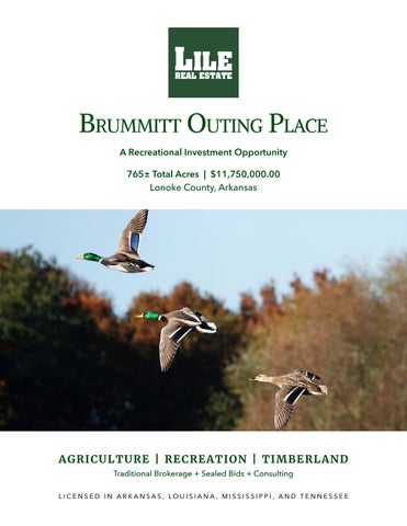
Brummitt Outing Place A Recreational Investment Opportunity 765± Total Acres | $11,750,000.00 Lonoke County, Arkansas
A G RICU L TU RE | RE CR E AT I ON | T I M BE R LAN D Traditional Brokerage + Sealed Bids + Consulting LICENSED IN ARKANSAS, LOUISIANA, MISSISSIPPI, AND TENNESSEE
Brummitt Outing Place Q U I C K FAC T S Acreage
765± total acres • 325± tillable acres • 231± acres of green timber reservoir • 75± acres in south reservoir • 46.5± acres in tail water pits, roads, ditches, etc. • 39± acres in north reservoir • 25± acres in bottomland hardwoods • 12.5± acres in wildlife food plots • 11± acres in Conservation Reserve Program
Location
Humnoke, Arkansas
Access
Brown Water Road and Brummett Road
Recreation
Proven waterfowl hunting, as well as deer hunting
Notable Features • • • •
2,372± sq. ft. main lodge, heated & cooled 1,494± sq. ft. secondary camp Impounded green timber hunting Tillable acreage irrigated and leveled to a zero grade
Offering Price
$11,750,000.00
2
GAR LILE | 501.920.7015 GLILE@LILEREALESTATE.COM
GARDNER LILE | 501.658.9275 GARDNER@LILEREALESTATE.COM
W W W. L I L E R E A L E S TAT E . C O M
3
Vicinity Map
SUBJECT PROPERTY
TRACT #3
4
GAR LILE | 501.920.7015 GLILE@LILEREALESTATE.COM
GARDNER LILE | 501.658.9275 GARDNER@LILEREALESTATE.COM
Property Description BRUMMITT OUTING PLACE The Brummitt Outing Place is approximately 765± acres in Lonoke County, Arkansas offering a very rare opportunity to acquire historically proven and diverse waterfowl hunting property within the “Big Ditch” corridor. The offering consists of two tracts in the Bayou Meto flyway with the south tract having frontage along “Big Ditch” and the north tract features over 8,500 feet of frontage along Bayou Meto. Both properties border other historic waterfowl hunting properties that include Hildebrand’s Reservoir, also known as Bam-Bam, Magnum 12, Poor Boy, and Dog Island. Collectively the properties feature 231± acres of impounded green timber in three impoundments with the largest being 175± acres on the south tract. There is also a 75± acre reservoir on the northeast side of the south tract that helps anchor waterfowl near the green timber reservoir. This reservoir has recently been split into two units allowing the landowner to plant hot food in the south unit. There is a relift at the northeast corner of the reservoir that allows the landowner to pump water out of Big Ditch which can then be gravity flowed into the green timber reservoir. Additionally there is a relift at the southeast corner of the GTR that pumps water off the woods to speed up dewatering the property after season is over.
W W W. L I L E R E A L E S TAT E . C O M
5
The northern tract has a variety of habitat which is key to consistently harvesting waterfowl. The Farm Service Agency reports a total of 325± tillable acres that are all irrigated and leveled to a zero grade, except for 33.41± acres. The irrigation infrastructure on the farm is extensive with three tail water recovery pits, three relifts and two wells. When the farm was leveled the goal was to maximize the use of surface water and recapture that water as it is drained which allows the farm to grow a strong percentage of rice each year. This is great for income and waterfowl. There is a 39± acre reservoir on the northwest portion of the farm that has been drained and converted to waterfowl habitat that complements the other 24± acres of dedicated waterfowl habitat across the farm. There are also two green timber impoundments on the north tract with the largest being 44± acres and is located on the west side of the farm next to Magnum 12. The lodge on the north tract was constructed and designed for entertaining family and friends, and features three bedrooms and four bathrooms. The first level features an open concept floor plan with a great room that flows into the full, modern kitchen. The great room’s vaulted ceilings open up the space even more and allow for plenty of natural light to come in. Another nice feature of the lodge is the tongue and groove walls and ceiling throughout, as well as the balcony on the second story that provides incredible views of the east side of the farm. The second level is loft style and holds the three bedrooms and three private, full bathrooms. To top it off there is a hunting garage that provides ample space for storing hunting gear and has an electric roll up door that makes it very convenient to store a side-by-side. The south tract’s camp consists of 1,494± square feet with two bedrooms and one bathroom and offers scenic views of waterfowl coming in to roost in the reservoir each evening.
6
GAR LILE | 501.920.7015 GLILE@LILEREALESTATE.COM
GARDNER LILE | 501.658.9275 GARDNER@LILEREALESTATE.COM
Location Map
W W W. L I L E R E A L E S TAT E . C O M
7
8
GAR LILE | 501.920.7015 GLILE@LILEREALESTATE.COM
GARDNER LILE | 501.658.9275 GARDNER@LILEREALESTATE.COM
W W W. L I L E R E A L E S TAT E . C O M
9
10
GAR LILE | 501.920.7015 GLILE@LILEREALESTATE.COM
GARDNER LILE | 501.658.9275 GARDNER@LILEREALESTATE.COM
W W W. L I L E R E A L E S TAT E . C O M
11
Farm Information Tillable Acreage 325± tillable acres Crop Rotation Rice and soybeans Irrigation • North tract: Three tail water recovery pits, three relifts, and two wells • South tract: Two relifts and one well
12
GAR LILE | 501.920.7015 GLILE@LILEREALESTATE.COM
Farm Contract The tillable acreage is leased for the 2026 growing season on a 50 / 50 crop share. Farm Bases Copies of the Farm Service Agency (FSA) 156EZ can be found in this brochure.
GARDNER LILE | 501.658.9275 GARDNER@LILEREALESTATE.COM
Irrigation Map
W W W. L I L E R E A L E S TAT E . C O M
13
Irrigation Map
14
GAR LILE | 501.920.7015 GLILE@LILEREALESTATE.COM
GARDNER LILE | 501.658.9275 GARDNER@LILEREALESTATE.COM
W W W. L I L E R E A L E S TAT E . C O M
15
16
GAR LILE | 501.920.7015 GLILE@LILEREALESTATE.COM
GARDNER LILE | 501.658.9275 GARDNER@LILEREALESTATE.COM
Location & Access Humnoke, Lonoke County, Arkansas Eastern Central Region of Arkansas Mileage Chart Stuttgart, AR Pine Bluff, AR Little Rock, AR Lake Village, AR Memphis, TN Jonesboro, AR
14 Miles 36 Miles 40 Miles 112 Miles 121 Miles 124 Miles
The southern tract has good access from Brown Water Road, and the north tract has good access from Brummett Road both of which are graveled county-maintained roads.
W W W. L I L E R E A L E S TAT E . C O M
17
Topography Map
18
GAR LILE | 501.920.7015 GLILE@LILEREALESTATE.COM
GARDNER LILE | 501.658.9275 GARDNER@LILEREALESTATE.COM
Topography Map
W W W. L I L E R E A L E S TAT E . C O M
19
20
GAR LILE | 501.920.7015 GLILE@LILEREALESTATE.COM
GARDNER LILE | 501.658.9275 GARDNER@LILEREALESTATE.COM
W W W. L I L E R E A L E S TAT E . C O M
21
22
GAR LILE | 501.920.7015 GLILE@LILEREALESTATE.COM
GARDNER LILE | 501.658.9275 GARDNER@LILEREALESTATE.COM
Notable Features Main Lodge • 2,372± square feet, heated and cooled • 400± square foot boot room / ATV parking • Three bedroom / four bathroom • Tongue and groove ceilings and wall • Rock floors • Large updated kitchen connected to great room • Vaulted ceilings in great room • Second story balcony that overlooks the east side of the farm • Boot room with electric roll up door for storing hunting equipment • Laundry room with storage South Camp • 1,494± square feet • Two bedroom / one bathroom • Kitchen with living room
W W W. L I L E R E A L E S TAT E . C O M
23
24
GAR LILE | 501.920.7015 GLILE@LILEREALESTATE.COM
GARDNER LILE | 501.658.9275 GARDNER@LILEREALESTATE.COM
Soil Map
W W W. L I L E R E A L E S TAT E . C O M
25
Soil Map
26
GAR LILE | 501.920.7015 GLILE@LILEREALESTATE.COM
GARDNER LILE | 501.658.9275 GARDNER@LILEREALESTATE.COM
Soil Map Key
W W W. L I L E R E A L E S TAT E . C O M
27
28
GAR LILE | 501.920.7015 GLILE@LILEREALESTATE.COM
GARDNER LILE | 501.658.9275 GARDNER@LILEREALESTATE.COM
W W W. L I L E R E A L E S TAT E . C O M
29
Resources & Price Mineral Rights All mineral rights owned by the Seller, if any, shall transfer to the Buyer. Offering Price $11,750,000.00
To learn more about the Brummitt Outing Place or to schedule a property tour, contact Gar Lile or Gardner Lile of Lile Real Estate, Inc. Gar Lile 501-920-7015 (m) glile@lilerealestate.com Gardner Lile 501-658-9275 (m) gardner@lilerealestate.com
30
GAR LILE | 501.920.7015 GLILE@LILEREALESTATE.COM
GARDNER LILE | 501.658.9275 GARDNER@LILEREALESTATE.COM
Lodge Pictures
W W W. L I L E R E A L E S TAT E . C O M
31
32
GAR LILE | 501.920.7015 GLILE@LILEREALESTATE.COM
GARDNER LILE | 501.658.9275 GARDNER@LILEREALESTATE.COM
W W W. L I L E R E A L E S TAT E . C O M
33
34
GAR LILE | 501.920.7015 GLILE@LILEREALESTATE.COM
GARDNER LILE | 501.658.9275 GARDNER@LILEREALESTATE.COM
W W W. L I L E R E A L E S TAT E . C O M
35
36
GAR LILE | 501.920.7015 GLILE@LILEREALESTATE.COM
GARDNER LILE | 501.658.9275 GARDNER@LILEREALESTATE.COM
W W W. L I L E R E A L E S TAT E . C O M
37
38
GAR LILE | 501.920.7015 GLILE@LILEREALESTATE.COM
GARDNER LILE | 501.658.9275 GARDNER@LILEREALESTATE.COM
W W W. L I L E R E A L E S TAT E . C O M
39
40
GAR LILE | 501.920.7015 GLILE@LILEREALESTATE.COM
GARDNER LILE | 501.658.9275 GARDNER@LILEREALESTATE.COM
W W W. L I L E R E A L E S TAT E . C O M
41
42
GAR LILE | 501.920.7015 GLILE@LILEREALESTATE.COM
GARDNER LILE | 501.658.9275 GARDNER@LILEREALESTATE.COM
W W W. L I L E R E A L E S TAT E . C O M
43
44
GAR LILE | 501.920.7015 GLILE@LILEREALESTATE.COM
GARDNER LILE | 501.658.9275 GARDNER@LILEREALESTATE.COM
Farm Service Agency
W W W. L I L E R E A L E S TAT E . C O M
45
Farm Service Agency
46
GAR LILE | 501.920.7015 GLILE@LILEREALESTATE.COM
GARDNER LILE | 501.658.9275 GARDNER@LILEREALESTATE.COM
Farm Service Agency United States Department of Agriculture
Lonoke County, Arkansas
T1S R6W S32 T1S R6W S31
2 6.08 NHEL
13 26.31 NHEL
15 12.11 NHEL
5 11.84 NHEL
3 38.40 UHEL
4 33.41 NHEL
T 3430 6 9.86 NHEL
14 25.15 NHEL
16 15.50 NHEL
7 24.02 NHEL
8 45.39 NHEL T2S R6W S5
T2S R6W S6
9 37.88 NHEL
² Common Land Unit
Non-Cropland; Cropland Tract Boundary
Wetland Determination Identifiers - Restricted Use & Limited Restrictions Exempt from Conservation ) " Compliance Provisions
0
335
670
1,340 Feet
Imagery Year: 2023
2025 Program Year Map Created December 20, 2024
Farm 3523 Tract 3430
Tract Cropland Total: 285.95 acres
* #
United States Department of Agriculture (USDA) Farm Service Agency (FSA) maps are for FSA Program administration only. This map does not represent a legal survey or reflect actual ownership; rather it depicts the information provided directly from the producer and/or National Agricultural Imagery Program (NAIP) imagery. The producer accepts the data 'as is' and assumes all risks associated with its use. USDA-FSA assumes no responsibility for actual or consequential damage incurred as a result of any user's reliance on this data outside FSA Programs. Wetland identifiers do not represent the size, shape, or specific determination of the area. Refer to your original determination (CPA-026 and attached maps) for exact boundaries and determinations or contact USDA Natural Resources Conservation Service (NRCS).
W W W. L I L E R E A L E S TAT E . C O M
47
Farm Service Agency United States Department of Agriculture
Lonoke County, Arkansas T1S R6W S31
T1S R6W S32
1 10.70 NHEL
T2S R6W S6
T 2381 T2S R6W S5
2 77.59 NHEL
²
0
260
520
1,040 Feet
Common Land Unit
Non-Cropland; Cropland Tract Boundary
Wetland Determination Identifiers - Restricted Use & Limited Restrictions Exempt from Conservation ) " Compliance Provisions
Imagery Year: 2023
2025 Program Year Map Created December 20, 2024
Farm 3523 Tract 2381
Tract Cropland Total: 88.29 acres
* #
United States Department of Agriculture (USDA) Farm Service Agency (FSA) maps are for FSA Program administration only. This map does not represent a legal survey or reflect actual ownership; rather it depicts the information provided directly from the producer and/or National Agricultural Imagery Program (NAIP) imagery. The producer accepts the data 'as is' and assumes all risks associated with its use. USDA-FSA assumes no responsibility for actual or consequential damage incurred as a result of any user's reliance on this data outside FSA Programs. Wetland identifiers do not represent the size, shape, or specific determination of the area. Refer to your original determination (CPA-026 and attached maps) for exact boundaries and determinations or contact USDA Natural Resources Conservation Service (NRCS).
48
GAR LILE | 501.920.7015 GLILE@LILEREALESTATE.COM
GARDNER LILE | 501.658.9275 GARDNER@LILEREALESTATE.COM
DISCLOSURE STATEMENT: Lile Real Estate, Inc. is the listing agency for the owner of the property described within this offering brochure. A representative of Lile Real Estate, Inc. must be present to conduct a showing. The management of Lile Real Estate, Inc. respectfully requests that interested parties contact us in advance to schedule a proper showing and do not attempt to tour or trespass on the property on their own. Thank you for your cooperation. Some images shown within this offering brochure are used for representative purposes and may not have been taken on location at the subject property. This offering is subject to errors, omissions, change or withdrawal without notice. All information provided herein is intended as a general guideline and has been provided by sources deemed reliable, but the accuracy of which we cannot guarantee.
Connecting Land Buyers and Sellers Since 1993. Lile Real Estate is a dedicated team of professionals with an in-depth understanding and a network of qualified buyers within the Mid-South and across the country. For over 30 years, we’ve connected land sellers with buyers in Arkansas, Louisiana, Mississippi, and Tennessee.
For more information or to schedule a property tour, contact:
Gar Lile
Gardner Lile
501.920.7015 (m) glile@lilerealestate.com
501.658.9275 (m) gardner@lilerealestate.com
Scan for more info
1 Allied Drive, Suite 2220 Little Rock, Arkansas 72202 WWW.LILEREALESTATE.COM
501.374.3411 (Office) 501.421.0031 (Fax) INFO@LILEREALESTATE.COM