PORTFOLIO.
ARCHITECTURE - URBAN DESIGN

BY LENA SMET



BY LENA SMET
BY LENA SMET
HILL FARM
WESTWICK ROW
EXEMPLAR PASSIVE DESIGN PROJECT
The portfolio is divided into two parts: Part 1 focuses on my professional career, while Part 2 explores my broader academic experience.
NORTH STREET
REGENERATION SCHEME - HIGH DENSITY
OLDBURY ORCHARDS
OVERSIZE CHARLEROI ADAPTIVE REUSE
TRIAL & TIVOLI - COMMON SPACES CLT RESIDENTIAL DEVELOPMENT
RECYCLART KAPELLEKERK BRUSSELS
MRP: LOCALISED CHILD-FRIENDLY HIGH STREETS
REDEVELOPMENT OF HIGH STREETS


Urban Designer and Part 2 Architectural Assistant, committed to creating environments where life can thrive by balancing social, ecological, and economic vitality. The approach emphasizes context-led design that fosters community, celebrates local identity, and supports sustainable, walkable neighbourhoods. With a strong focus on adaptive, low-carbon development, projects are designed to be ecologically rich and inclusive, nurturing diverse, resilient communities.
Urban Design studies at the Bartlett involved exploring post-COVID high streets to address spatial inequality and foster connected environments. Earlier Architecture studies in Belgium and Switzerland prompted a deep consideration of sustainable materials and the adaptive reuse of vacant, oversized buildings in urban settings.
Future goals include focusing on projects that integrate architecture and urban design to create resilient, sustainable, and people-centered environments. This work aspires to respond to the evolving needs of communities while actively addressing the challenges of climate change.
Lena Smet Architecture/ Urban Design
HILL FARM
LANDSCAPE-LED DEVELOPMENT - COMMUNITY ENGAGEMENT
WESTWICK ROW
EXEMPLAR PASSIVE DESIGN PROJECT
PART 1 OF MY PORTFOLIO REFLECTS ON MY PROFESSIONAL EXPERIENCES, HIGHLIGHTING KEY PROJECTS WHERE MY SKILLS IN ARCHITECTURE AND URBAN DESIGN WERE APPLIED, WITH A FOCUS ON CREATING SUSTAINABLE, COMMUNITY-CENTERED SPACES.
LOCATION
UK - Dacorum
ABOUT
JTP - Fall 2024
OPA - Residential Development, up to 150 homes, Green Belt Site
KEY WORDS
Sustainability, Landscape-led, Community Engagement and Community Gardens
CONTRIBUTION
Day-to-day design lead
KEY SKILLS
Concept Design, Project Coordination, Proving Layout, Community Engagement Workshops, Illustrating, Masterplanning, Proving Layout, Concept and Detailed Design, Problem Solving, Technical CAD Drawing

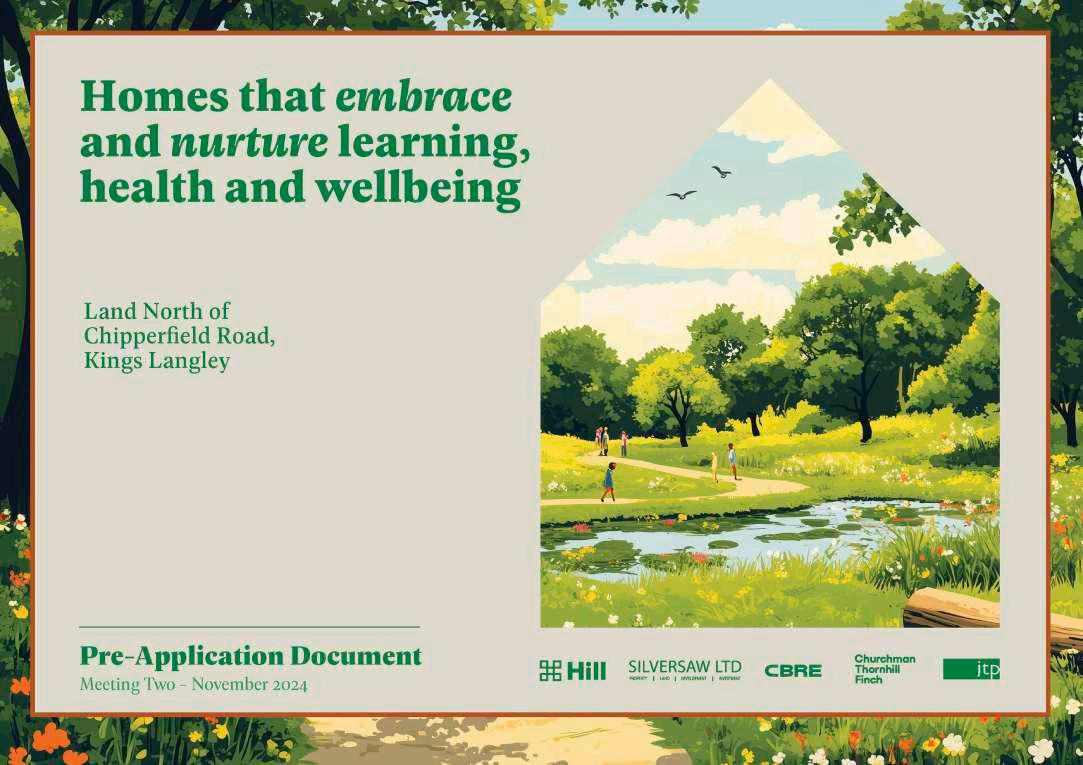

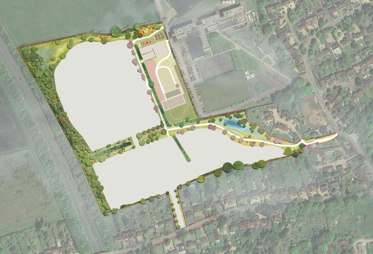
The site is located on the north-western edge of Kings Langley. The site is approximately 9.51 hectares in size and is currently designated as Green Belt. A landscape-led proposal which will deliver a series of gardens, up to 150 homes (private, affordable and custom build) and ‘the Farmstead’.
Imagining a home thoughtfully crafted to be more than just a place to live—it’s a haven where your health and well-being come first. Every aspect, from natural light to sustainable materials, is designed to enhance your physical and mental wellness. It’s a space where tranquillity meets functionality, fostering mindfulness, relaxation, and vitality. A retreat where you can truly recharge, prioritise selfcare, and cultivate a lifestyle centred around balance, serenity, and long-term well-being.




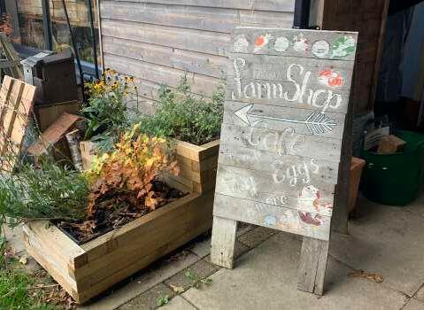
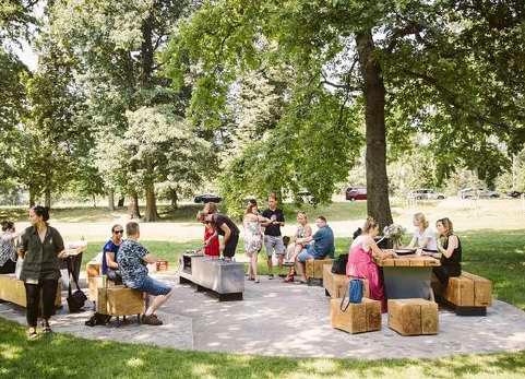
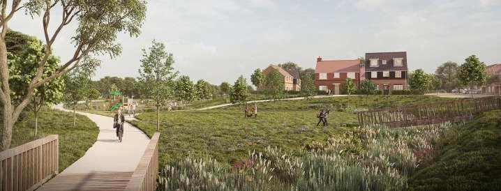
Design Principles: Active Frontages
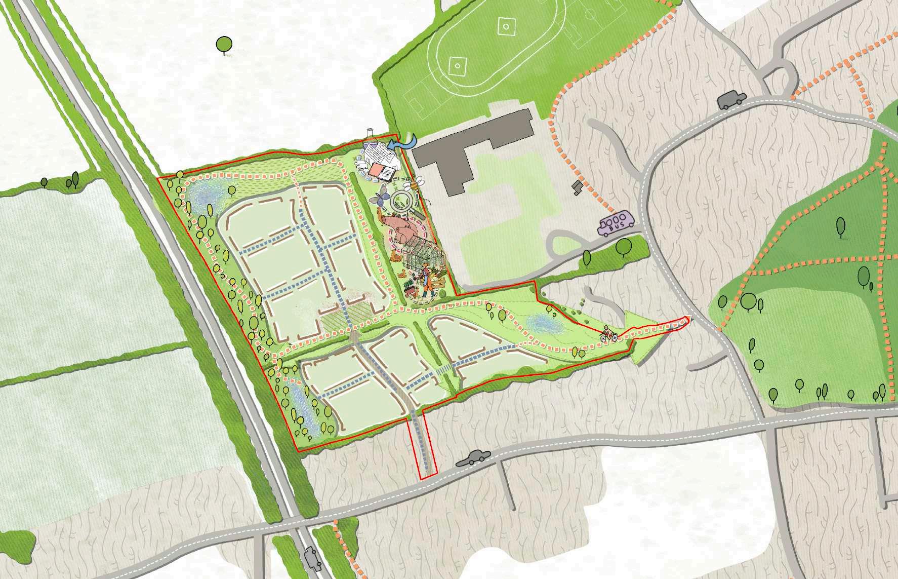
Utilising the unique location of Kings Langley Secondary School and its Sports Facilities to the north to create a vibrant community and learning hub directly connected to the school.
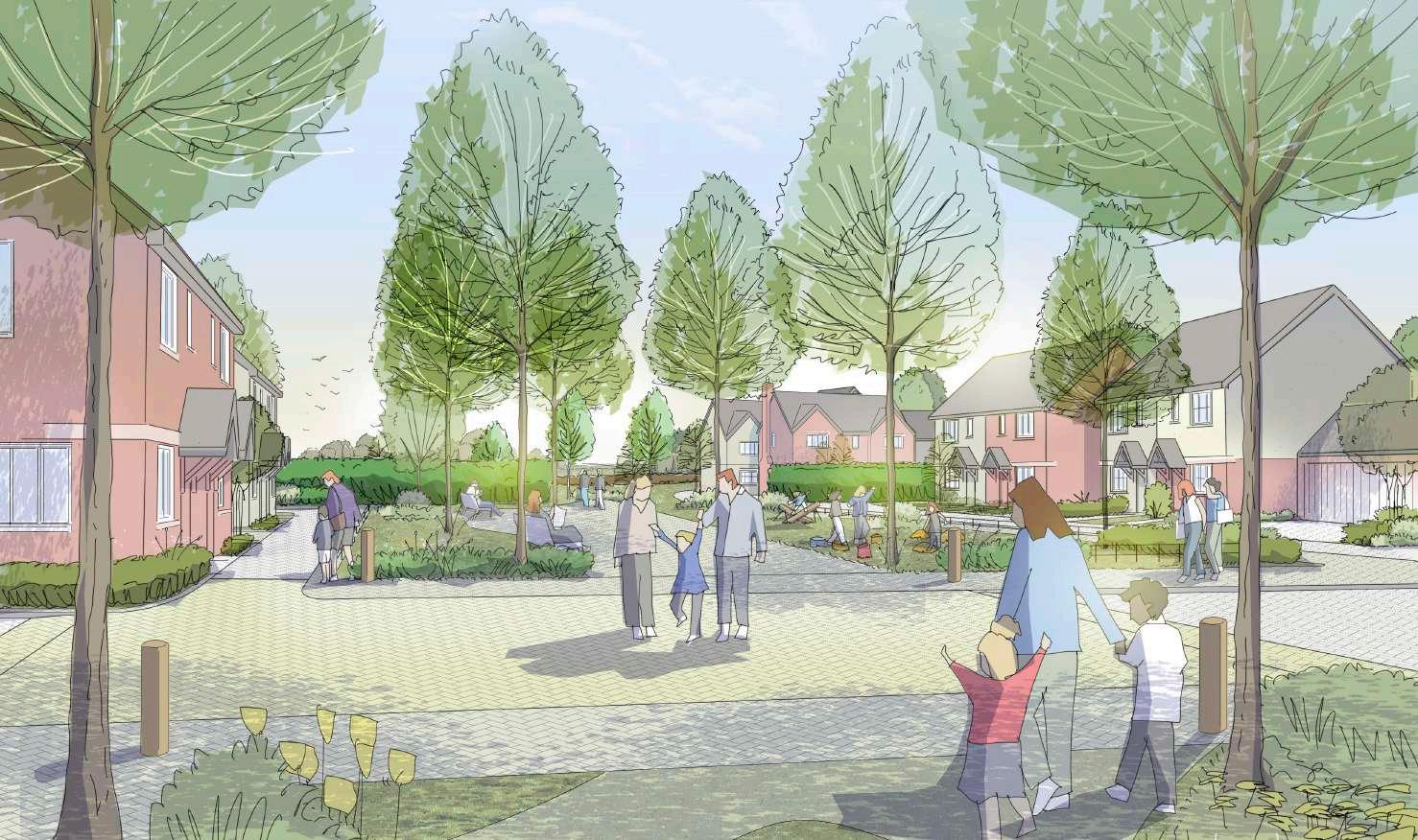
ACTIVE FRONTAGES to all streets and open space will enhance street life by encouraging interaction between indoors and outdoor spaces. Active frontages will engage street presence and will create safer and vibrant street scenes.
Illustrative Masterplan
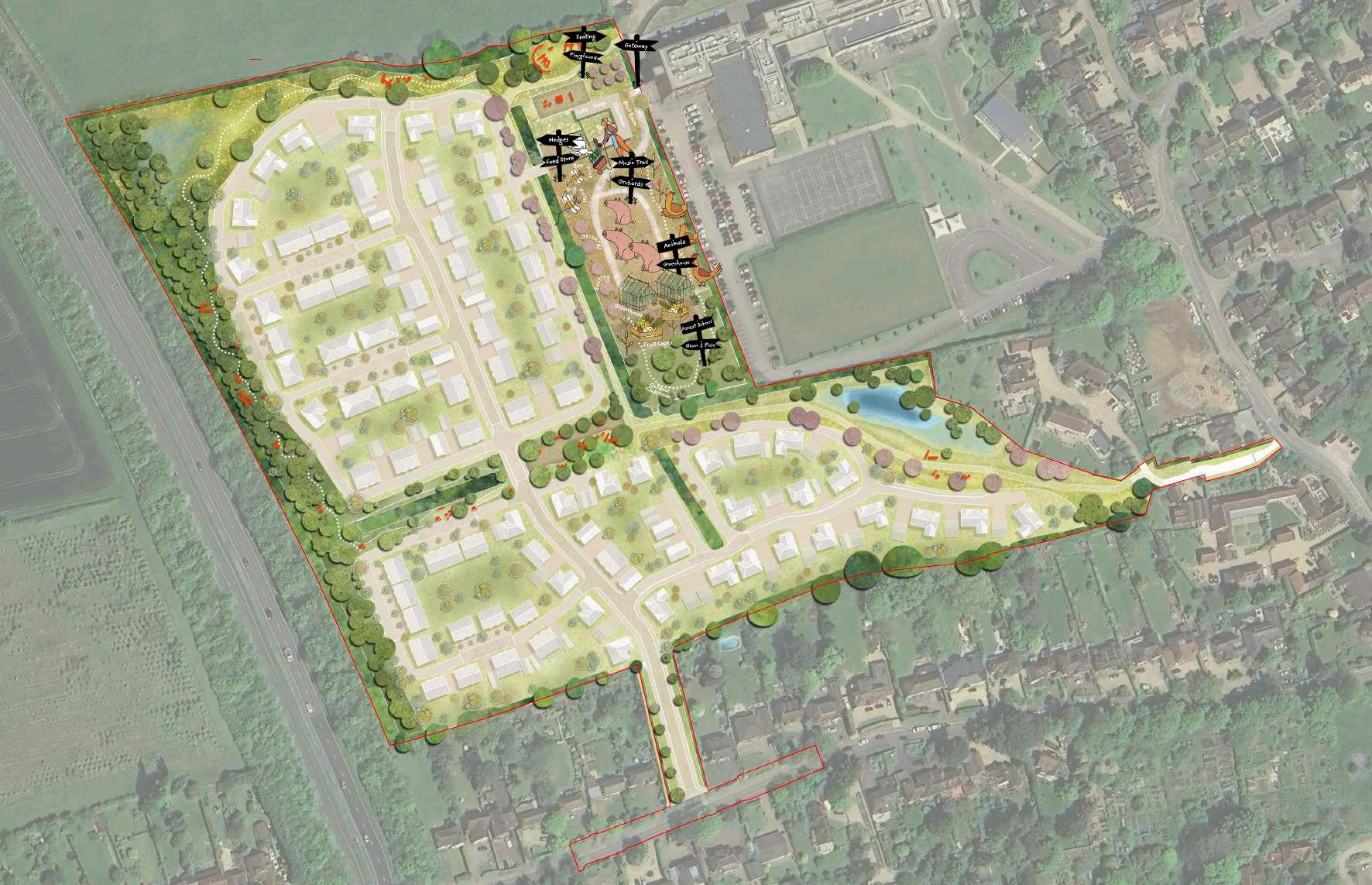
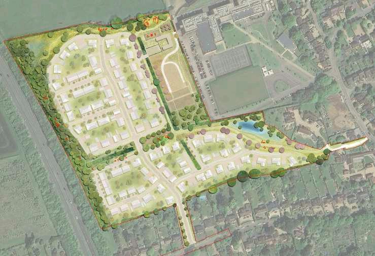
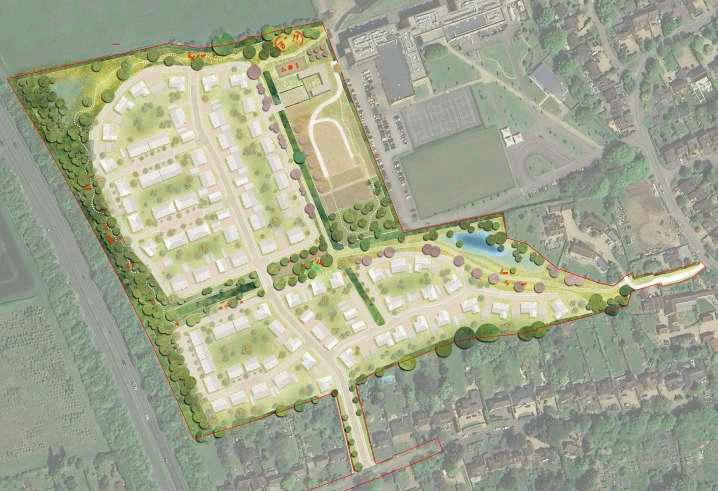
This illustrative masterplan is an example of how the design principles can be interpreted and will be included in the DAS as supporting information for future RMA’s. The illustrative masterplan has no particular presribed mix at this stage but ensures there is a balance of typologies throughout. The homes are designed along a network of streets and spaces, all of which are connected to the wider green network.
Protecting the site’s natural assets that define the character and beauty of the surroundings.
Encourage connections and nature recovery networks with key areas such as the Grove Woodland, the Nucket Woodland, and Kings Langley Common.
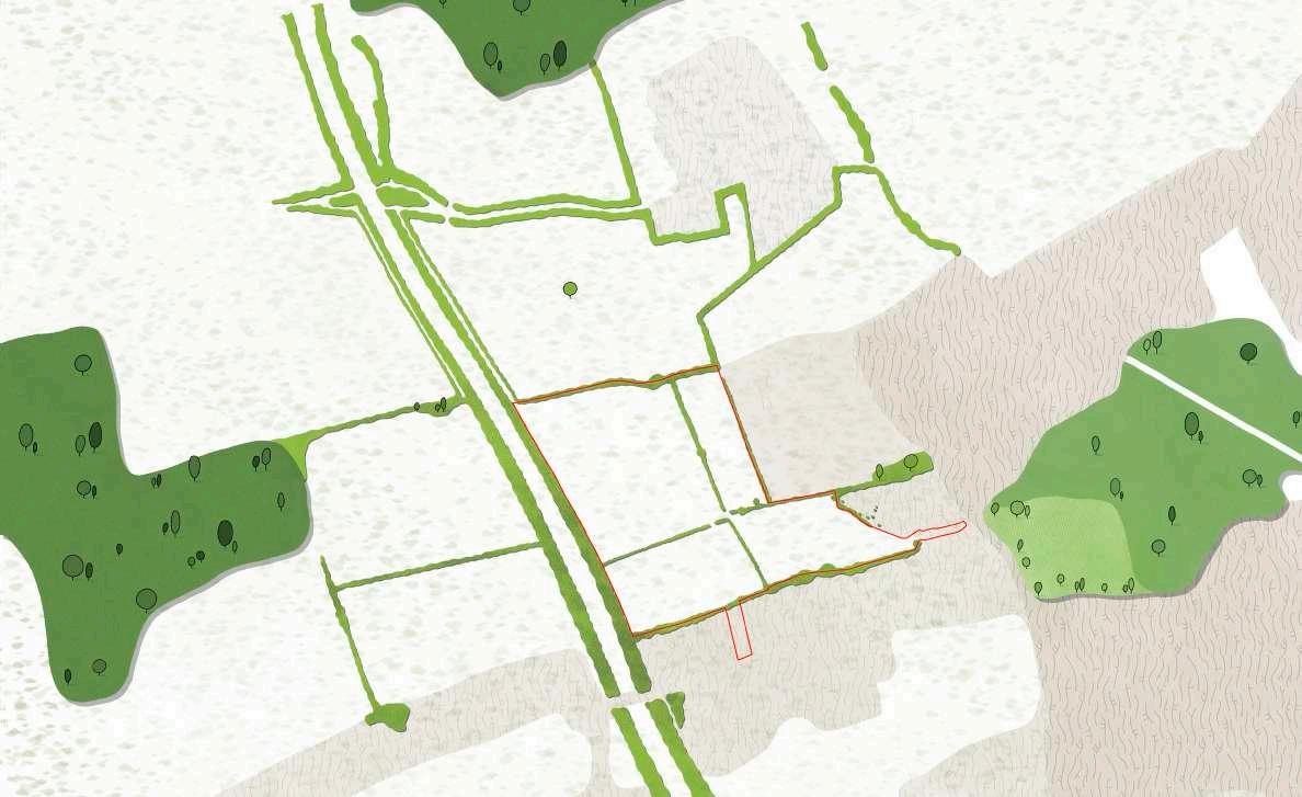

Enhance existing habitats with new planting creating a network of connected pollinator and migration routes for biodiversity to flourish.
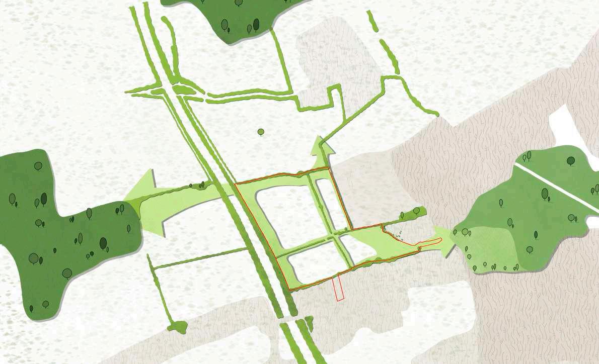


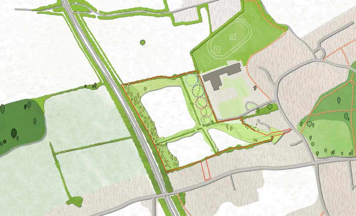
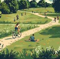
Respond to local landscape character. Pastoral meadows toward the open nature of the north. Farmstead Gardens for the community and the School to the east and a Woodland Edge to the west. Together creating a green ‘stepping stone’ between The Grove and Kings Langley Common.
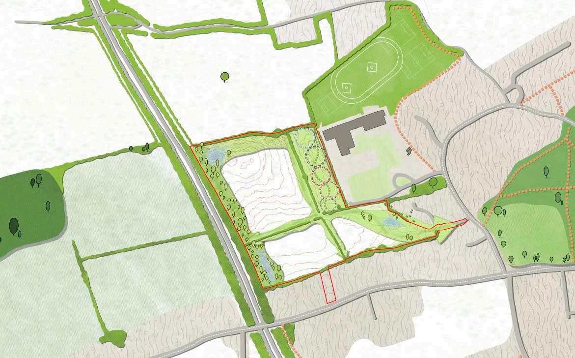
Using existing topography of the site to create naturalistic and appropriately located wet woodlands, habitat ponds and rain gardens.
Utilising the unique location of Kings Langley Secondary School and its Sports Facilities to the north to create a vibrant community and learning hub directly connected to the school.
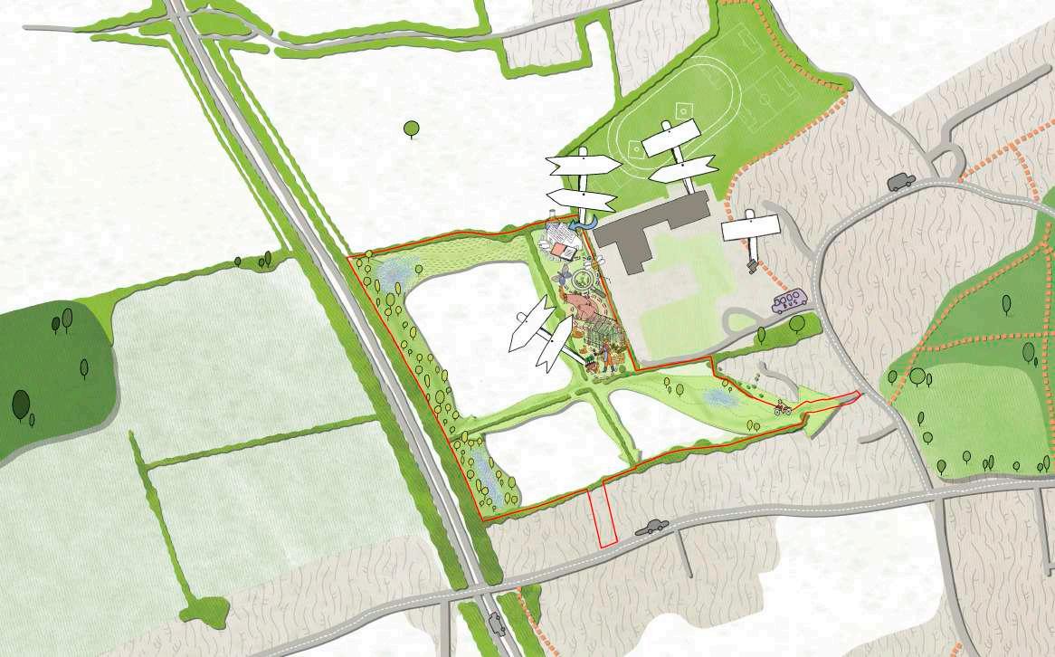

The sense of arrival ensures wayfinding and legibility; where residents and visitors have arrived somewhere meaningful and enhances their connection to the space.
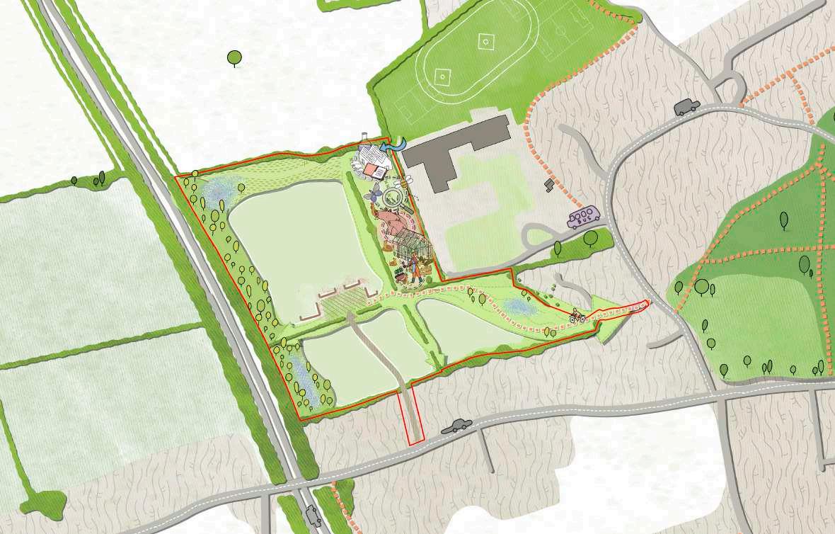


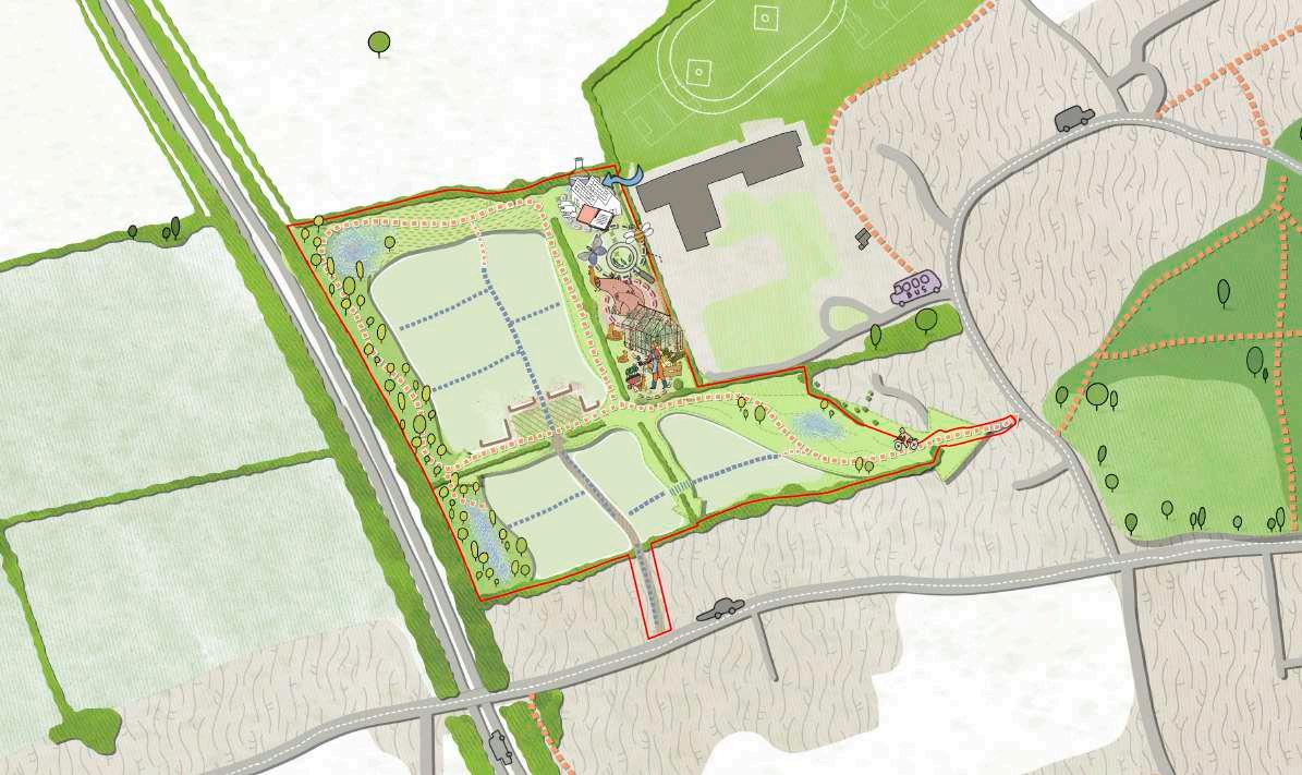
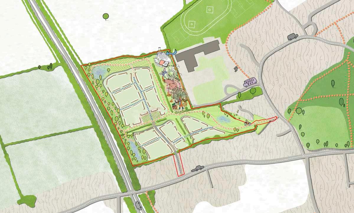
A series of movement corridors will connect to all green spaces (and beyond) ensuring there are sustainable options for travel.

Active frontages to all streets and open space will enhance street life by encouraging interaction between indoors and outdoor spaces. Active frontages will engage street presence and will create safer and vibrant street scenes.
This illustrative masterplan is an example of how the design principles can be interpreted and will be included in the Design and Access Statement as supporting information.
The illustrative masterplan has no particular prescribed mix at this stage but ensures there is a balance of house types throughout ranging from 1 Bed to 5 Bed homes. The homes are designed along a network of streets and spaces, all of which are connected to wider green landscape.
Entrance from Chipperfield Road
Entrance from Love Lane (Pedestrians and Cyclists only)
Arrival / Heart Space
Areas of Play
Habitat Ponds
Existing Trees and Hedges
Circular Walk
Education / Community Building
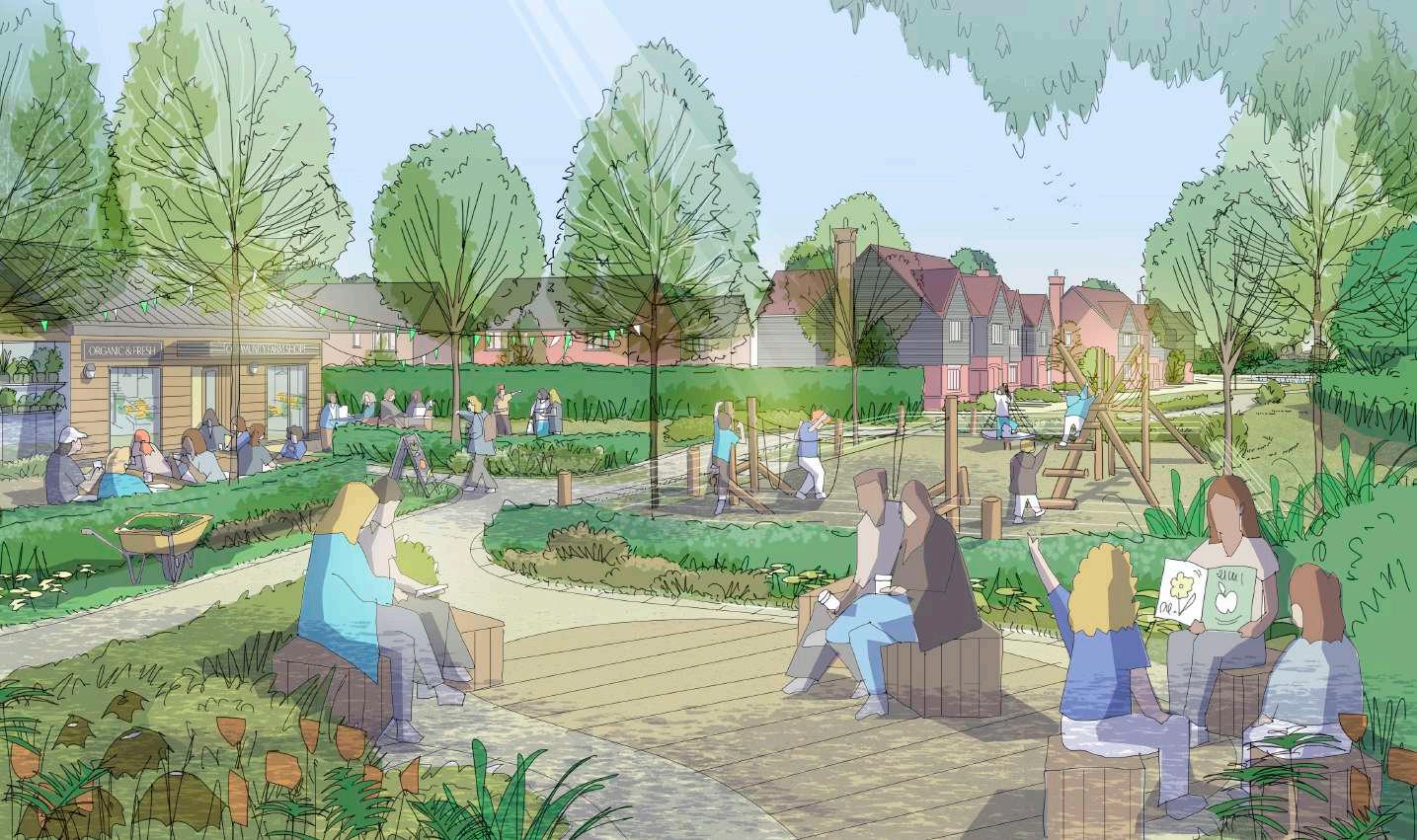
Education Farmstead
Pedestrian access to Kings Langley Secondary School and Multi-Use Games Area (MUGA)
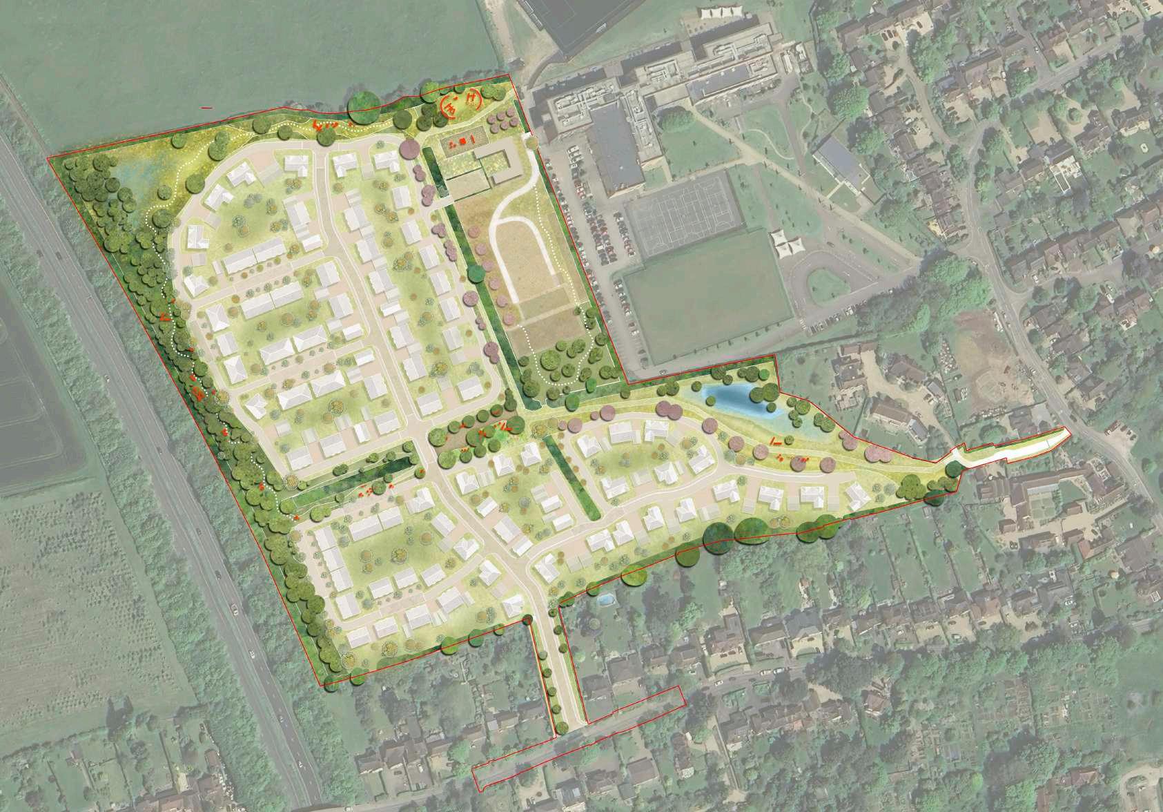
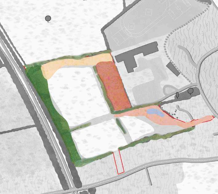
Our approach for the landscape and public open space is to embed the new homes within a hierarchy of landscape characters, that respond sensitively to the surrounding landscape.
Woodland Edge
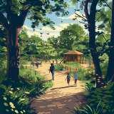
To the western boundary a distinctive woodland character defines the open spaces and streets. A leafy Arcadia to look out onto, enjoy the changing seasons. Enhanced connection for wildlife across the site.
Pastoral Meadow
To the north of the site the proposed landscape would take it’s cues from the adjacent meadow and pastoral character.
Farmstead Garden
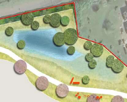
Groups of parkland trees define a series of green spaces inspired in character by the adjoining Farmstead. A central pond provides a new wetland habitat and a tranquil place to sit.
The character types would create a series of new interlinking habitat types across the site and enhance existing features such as the hedges and hedgerow trees.
Access to nature would be provided through a circular walk and informal routes through the hierarchy of landscape characters creating a memorable place that feels part of it’s surrounding context.
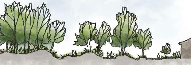
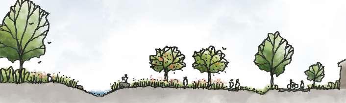
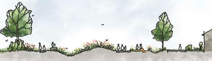

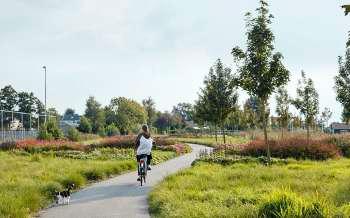
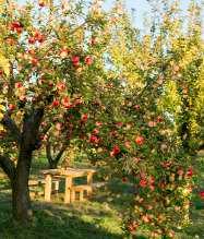
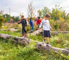
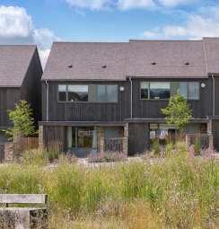
Wet meadow landscape and hedgerows enhanced for ecology which draws on surrounding pastoral landscape
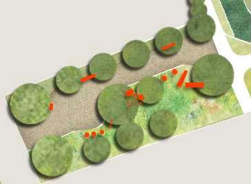
Woodland planting with circular walking routes, informal play and fitness trails
Wildlife connections retained and enhance hedgerows where possible improve wildlife connections
A pond provides a new wetland habitat and a tranquil place to sit. Parkland trees define a series of green spaces inspired in character by the adjoining Farmstead
Link to the Common and network of PRoW
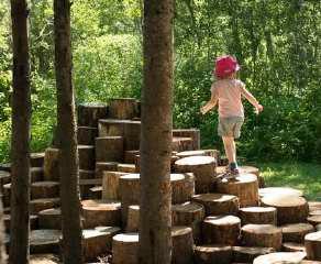
Informal natural play
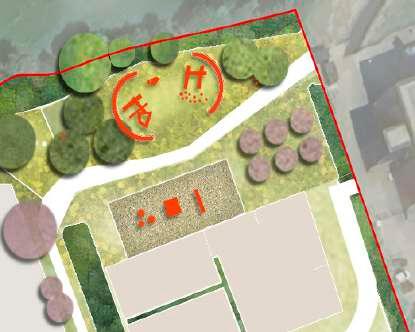
Arrival/ Heart Space
Pedestrian and Cycle Entrance from Love Lane
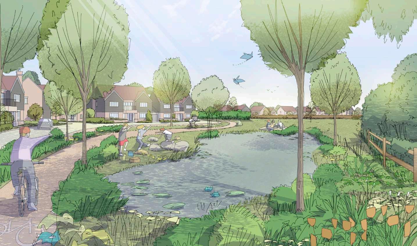
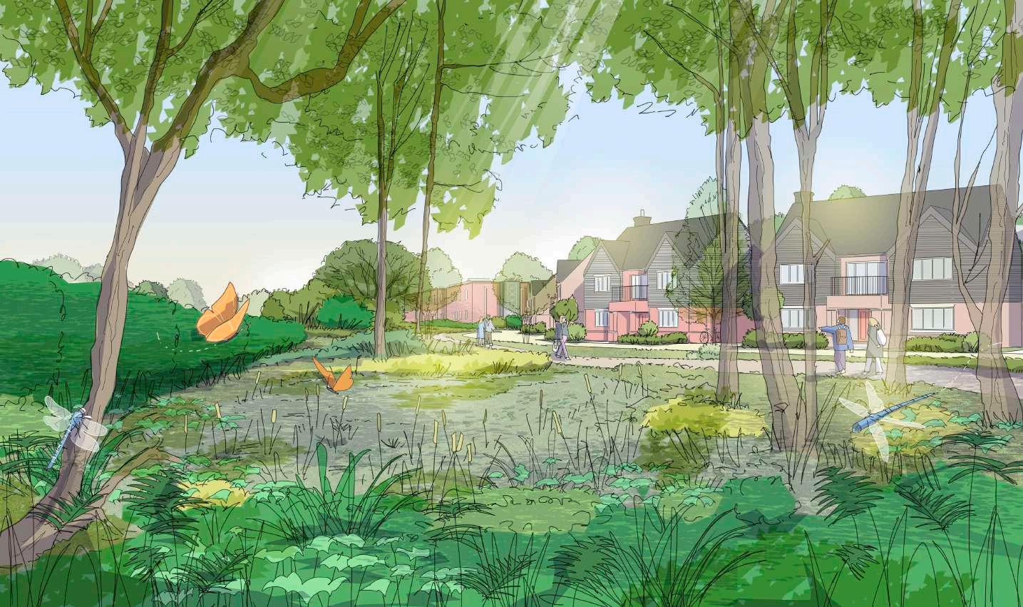
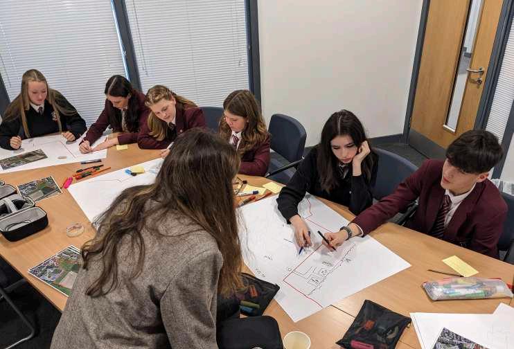
JTP worked with students from Kings Langley Secondary School to find out what they would like to see on the farmstead.
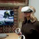
Using virtual reality headsets to get inspired, we worked with students in groups to draw their ideas which were linked to their personal interests.
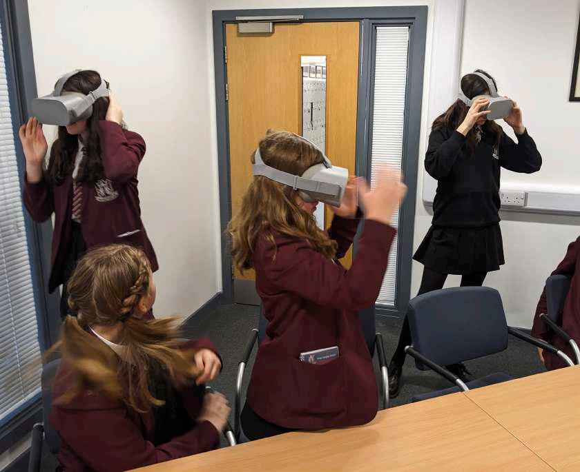
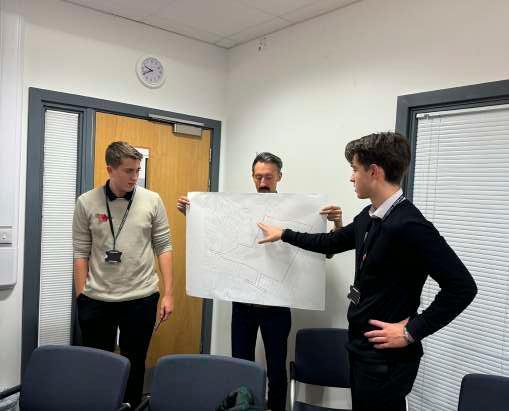
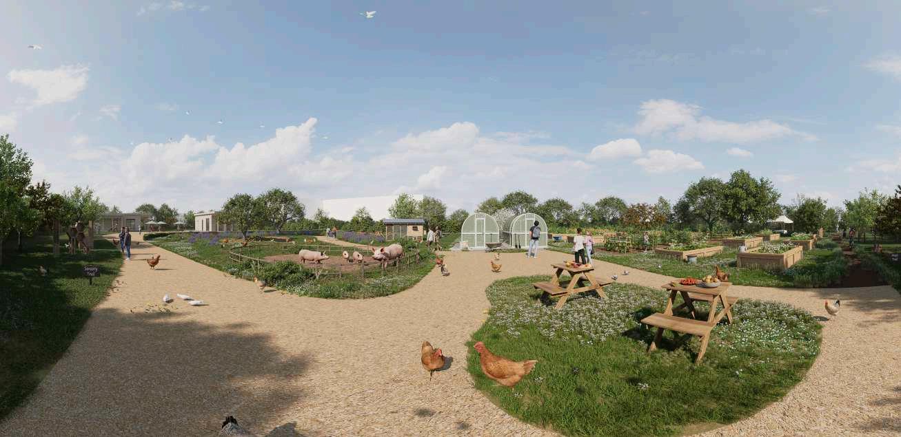
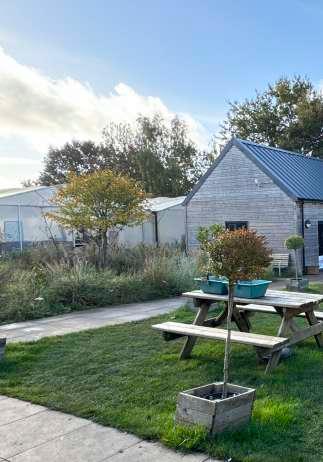
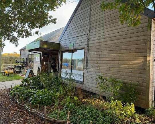
We have visited the Sunnyside Rural Trust site in Northchurch and Serge Hill with members of staff from Kings Langley Secondary School. The visit was followed by an outdoor workshop on the key elements required to achieve a successful therapy and growing space for those who will use it.
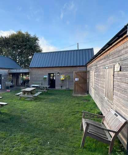
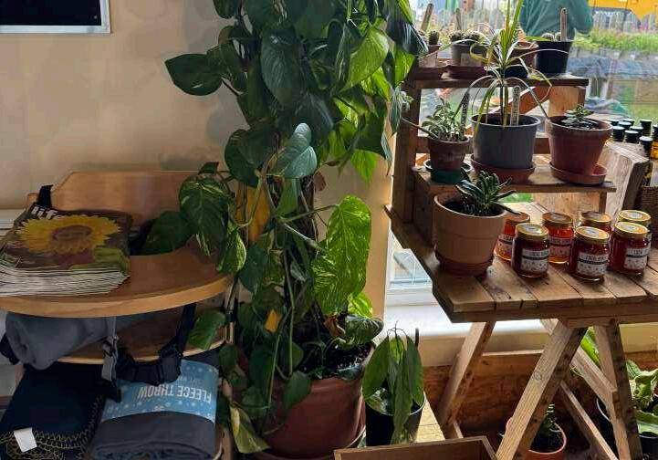
Opportunities to sell produce at the shop/ cafe as well as provide fresh vegetables to the school kitchens
‘NATURE CLASSES’
Classrooms away from the school buildings
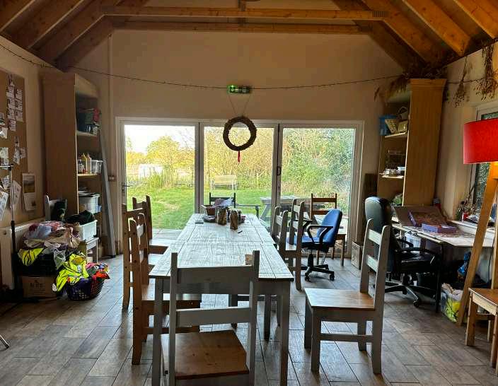
‘THE RETREAT’
A quiet place of calm and tranquility for children to retreat
‘A series of therapeutic spaces’
‘GROW AND PICK’
An area of food growing, harvesting, eating, socialising. A new way for children to contemplate
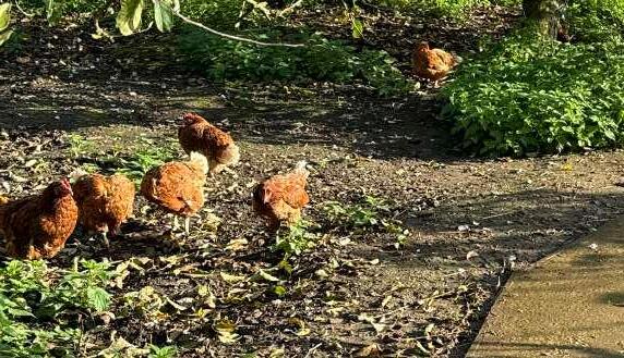
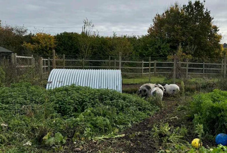
AND CHICKENS’
LOCATION
UK - Hemel Hempstead
ABOUT
JTP - January 2024
Feasibility/ Competition, 80 homes
KEY WORDS
Passive Design, Sustainability, Community Gardens
CONTRIBUTION
Core team member responsible for illustrations and collaborating with client
KEY SKILLS
Proving Layout, Passive Design, Illustrating, Concept Design, Innovative Thinking
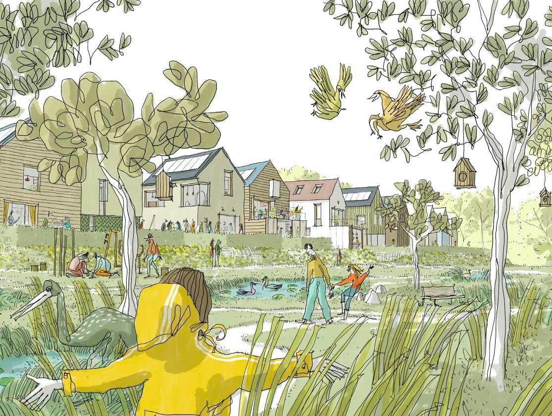
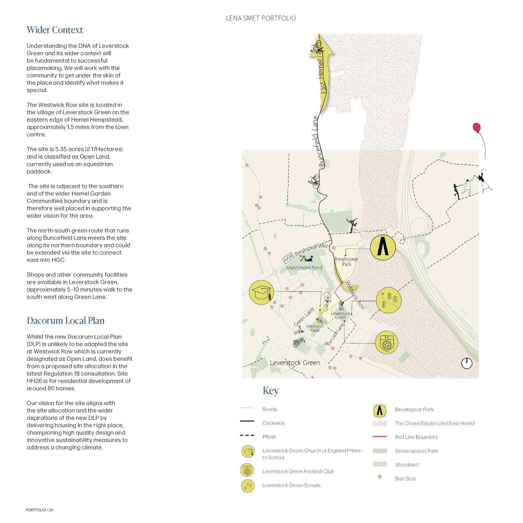
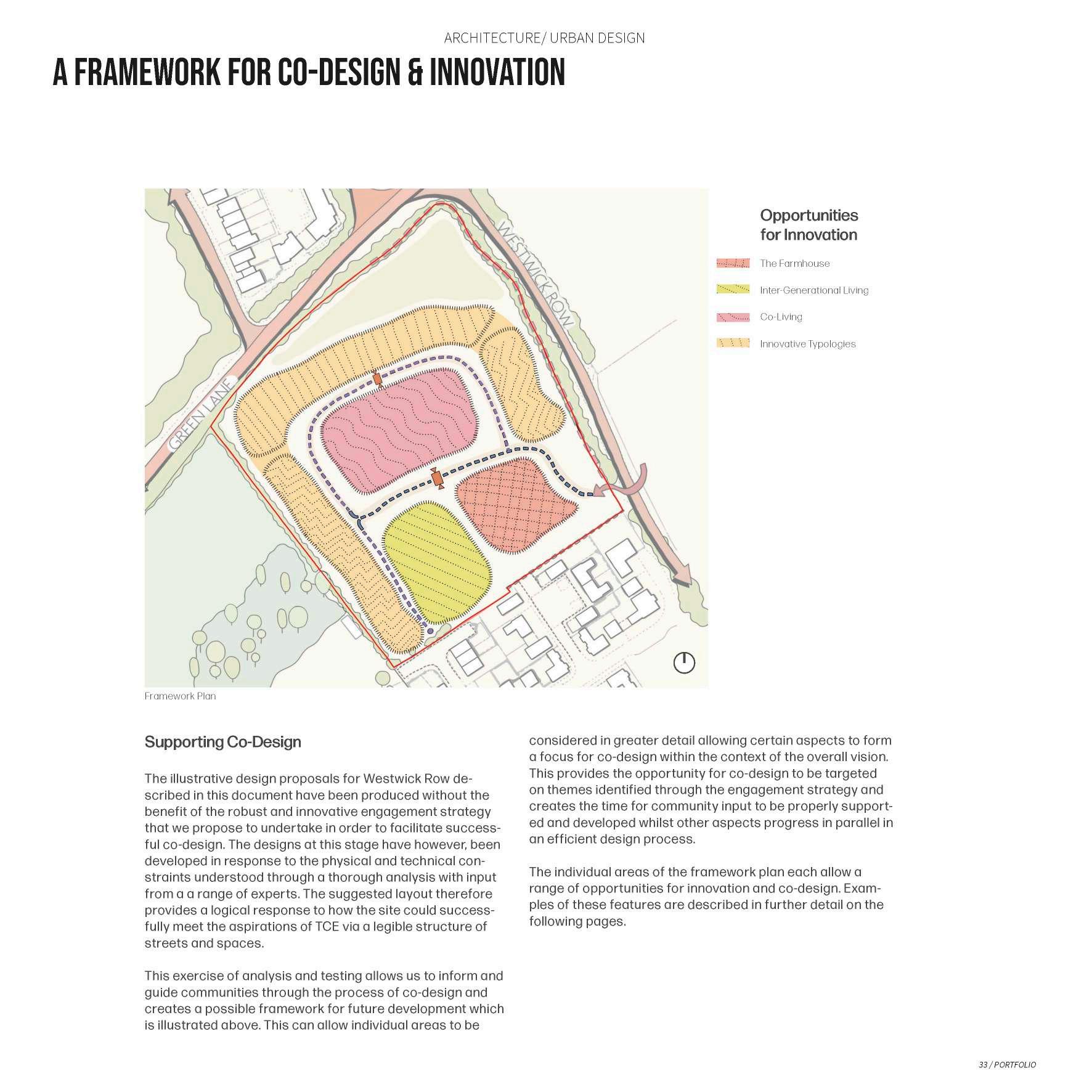
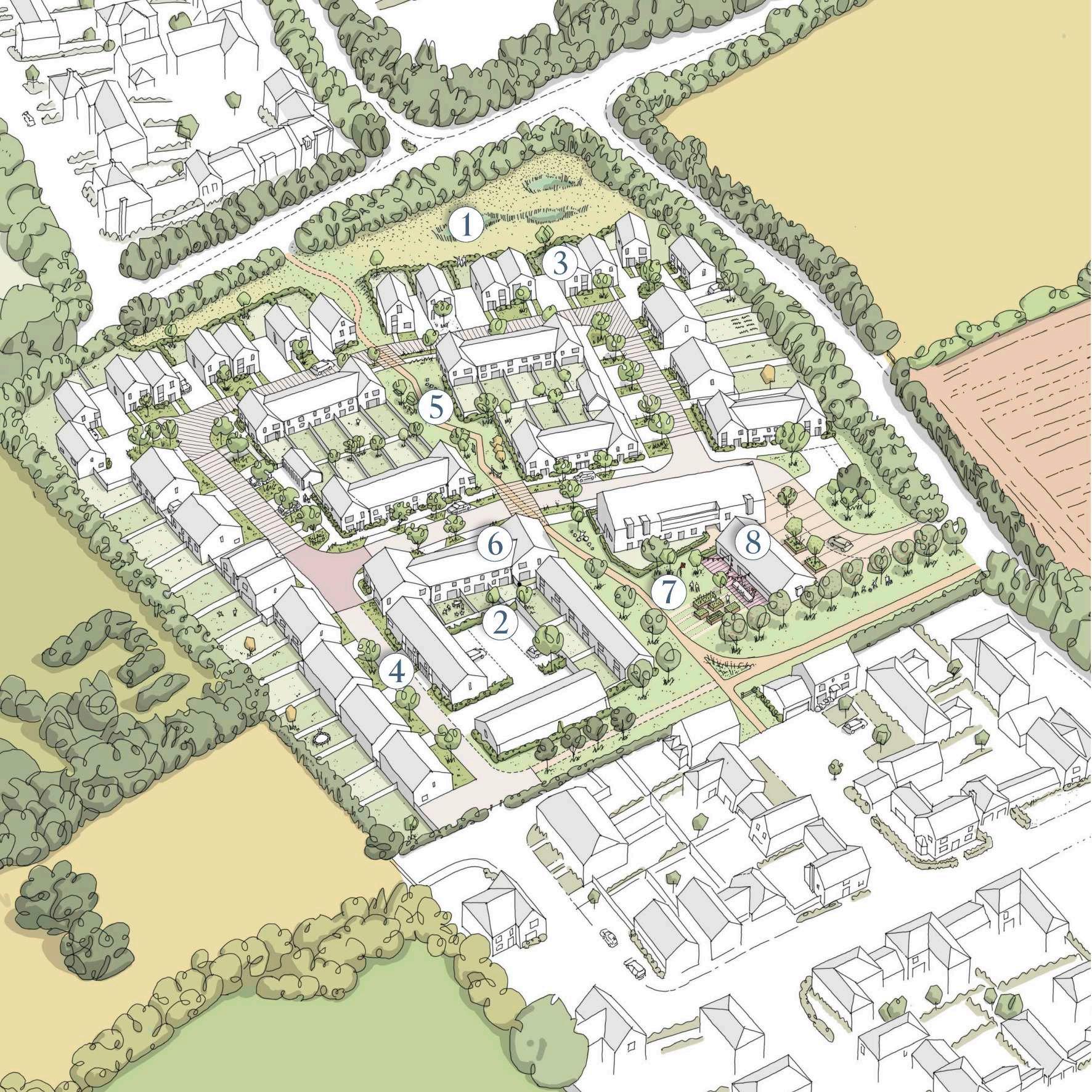
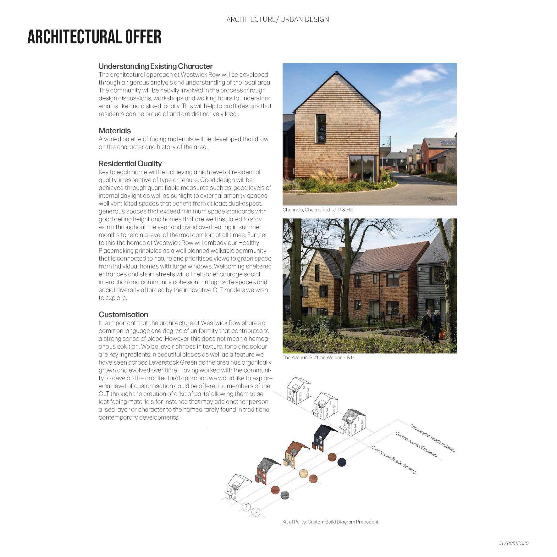
Westwick Row will be a thriving new neighbourhood, with innovation and revolution at its heart. The vision is to demonstrate new approaches to community and stakeholder engagement that responds to local needs and facilitates a healthier, more sustainable way of living. Whilst small in itself, the project will have a much wider impact as it will set the stage for Hemel Garden Communities and serve as a test bed for this wider opportunity.
The ambition is to create a true exemplar, with inclusivity and co-design woven through every stage of the design and delivery process. It will be uniquely co-designed with the people of Hemel and those who might live there in the future. This process will mean the evolving vision is distinctly Hemel and locally owned and stewarded.
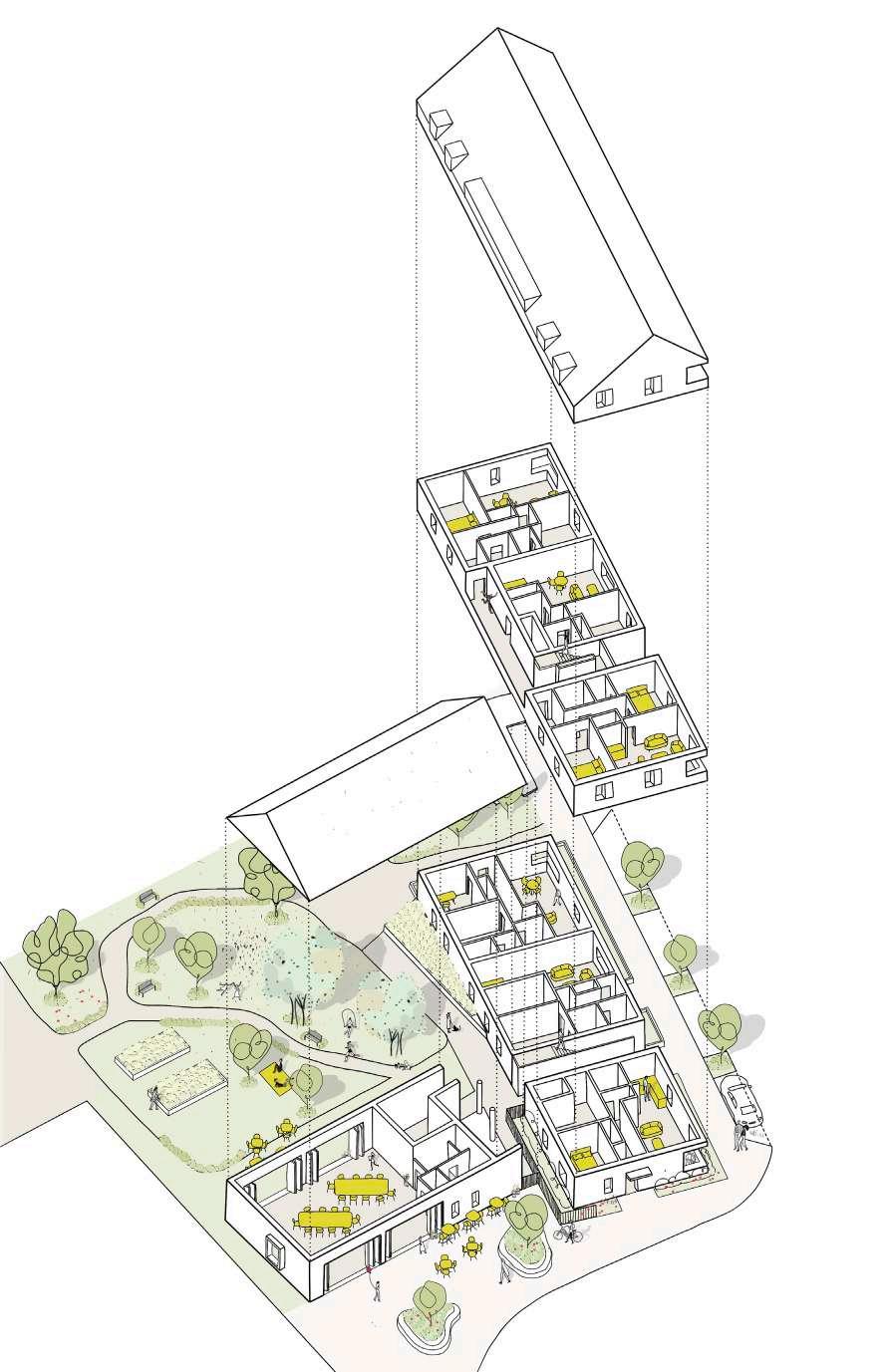
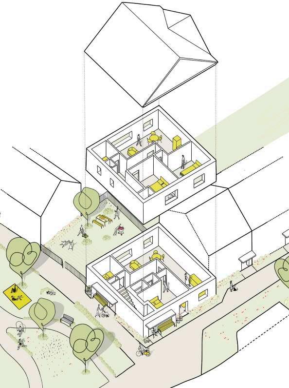
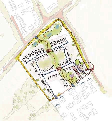
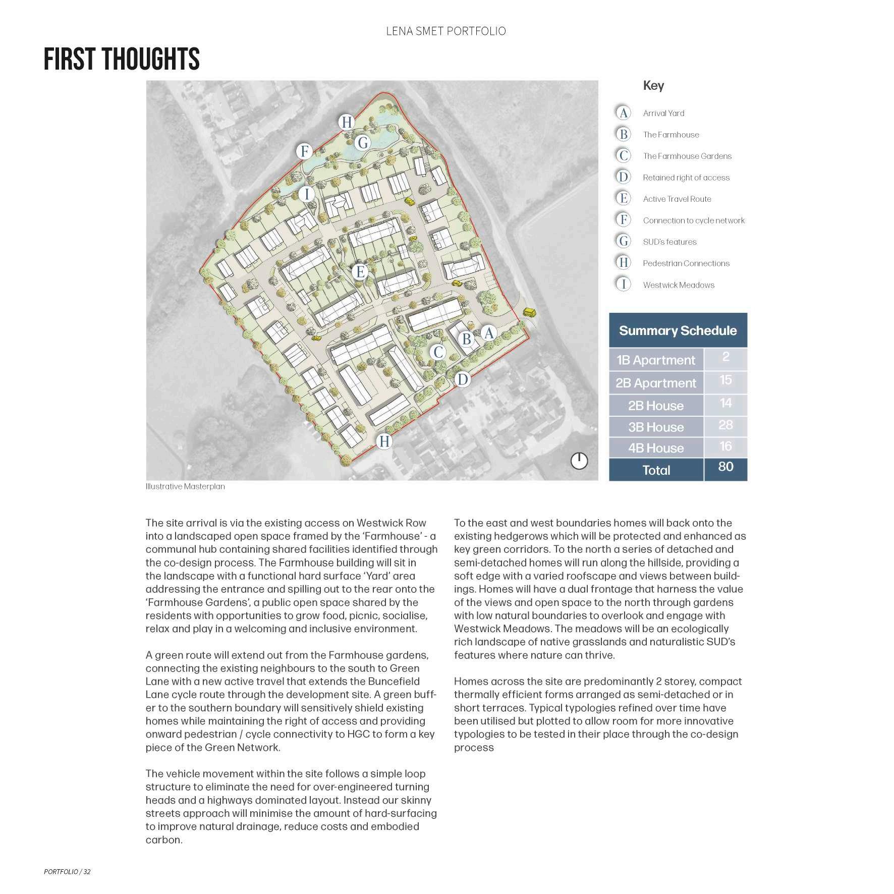
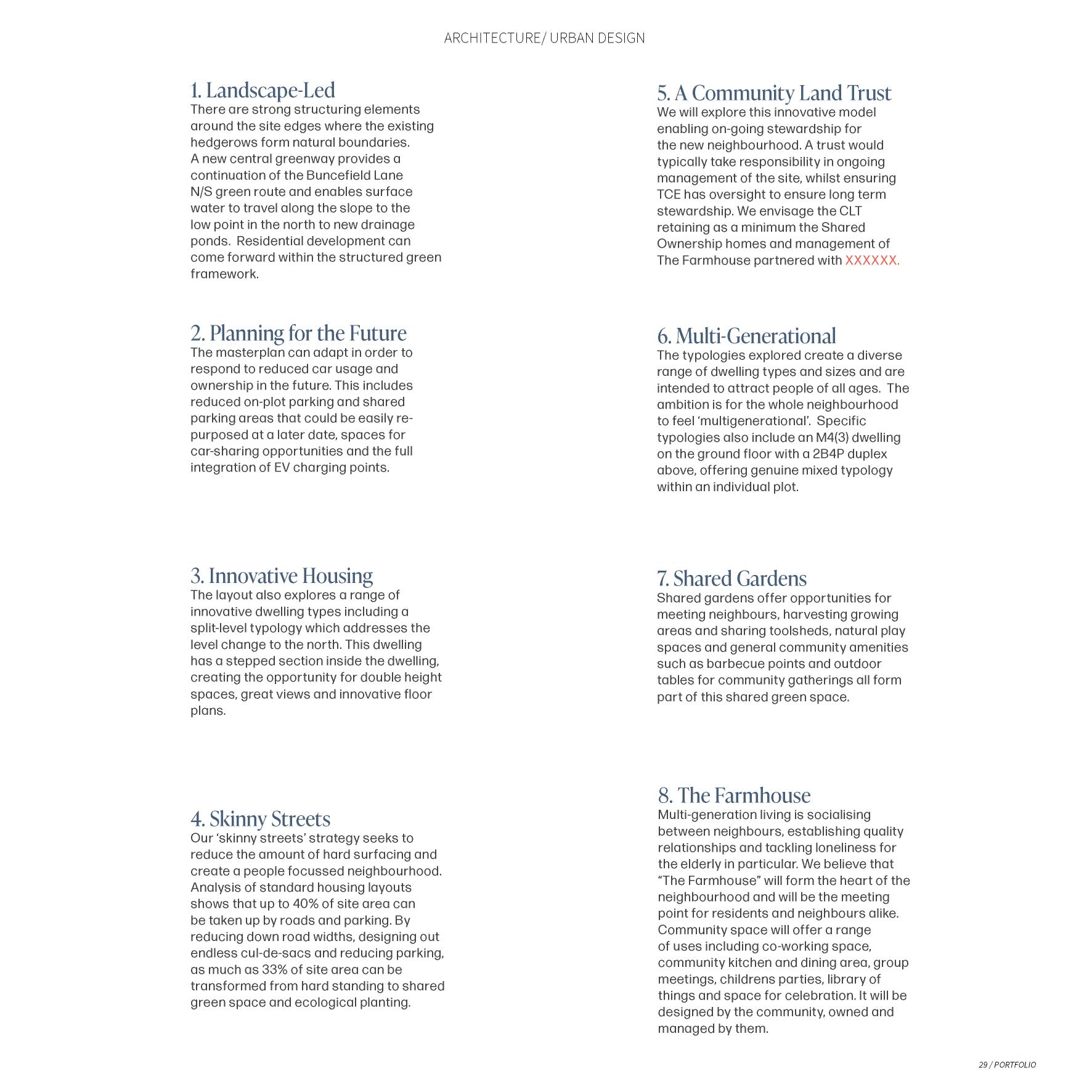
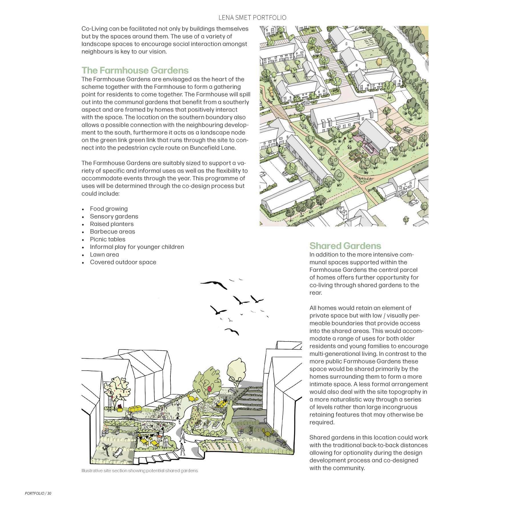
The Farmhouse, positioned at the site entrance, creates an inviting gateway to the neighborhood and a link to future HGC development. Alongside its public spaces, it will form a community hub within a larger network, fostering a strong sense of place.
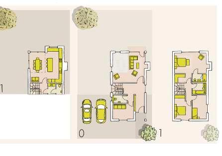
The site’s flexible layout accommodates diverse housing types, from 1- to 4-bedroom units, including M4(2) and M4(3) compliant homes to meet various accessibility needs. A unique cottage-style design also pairs a ground-floor apartment for older residents with a walk-up unit above for younger residents, promoting community interaction. Each unit enjoys a private entrance and outdoor space, encouraging neighborly connections often absent in traditional layouts.
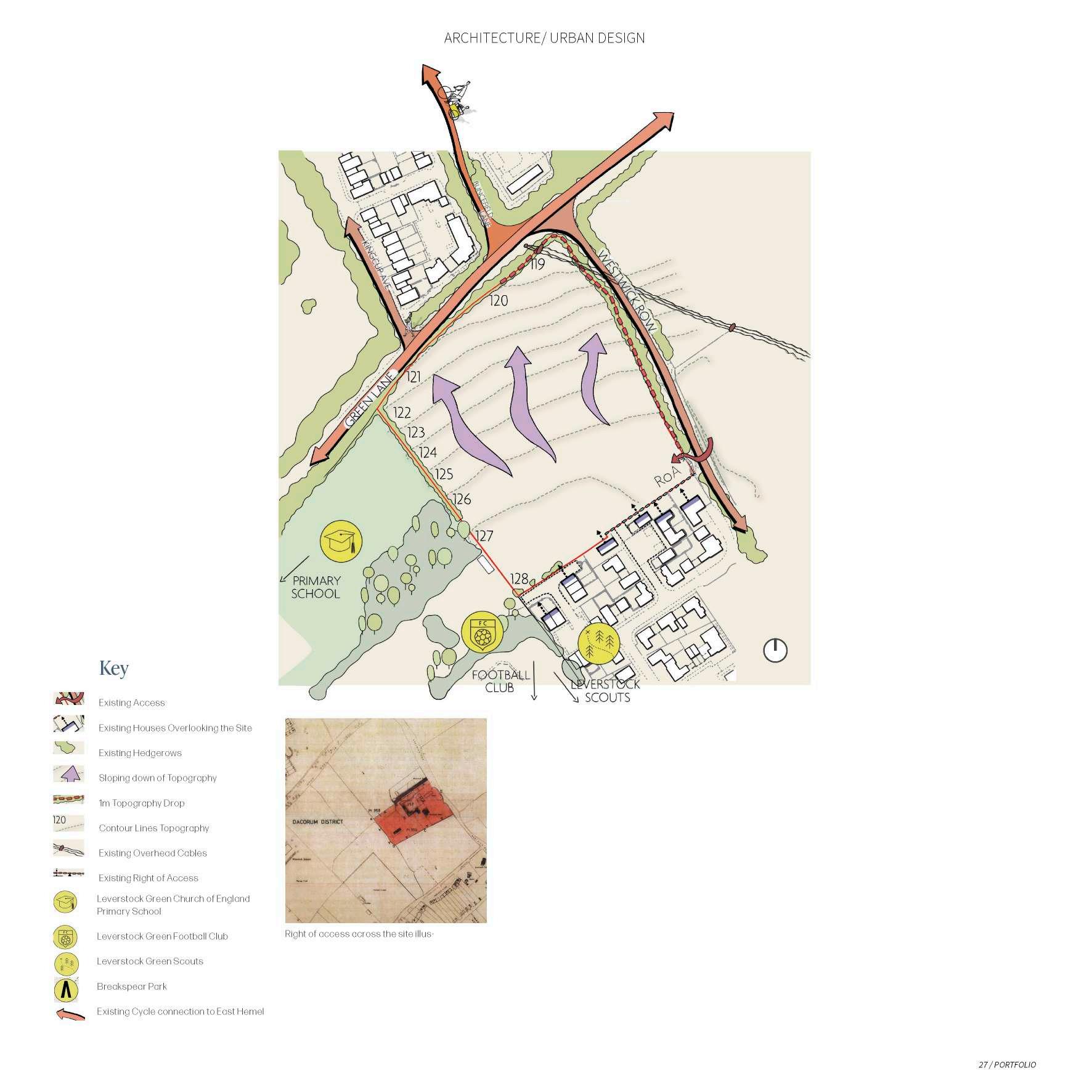
Designs for Westwick Row will be developed through the co-design process however, in order to test our ideas and inform the future process we have developed some initial proposals that respond to the physical qualities and character of the site and it’s context. Set out below are a series of design principles that may be used to guide the process.
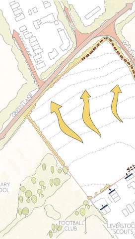
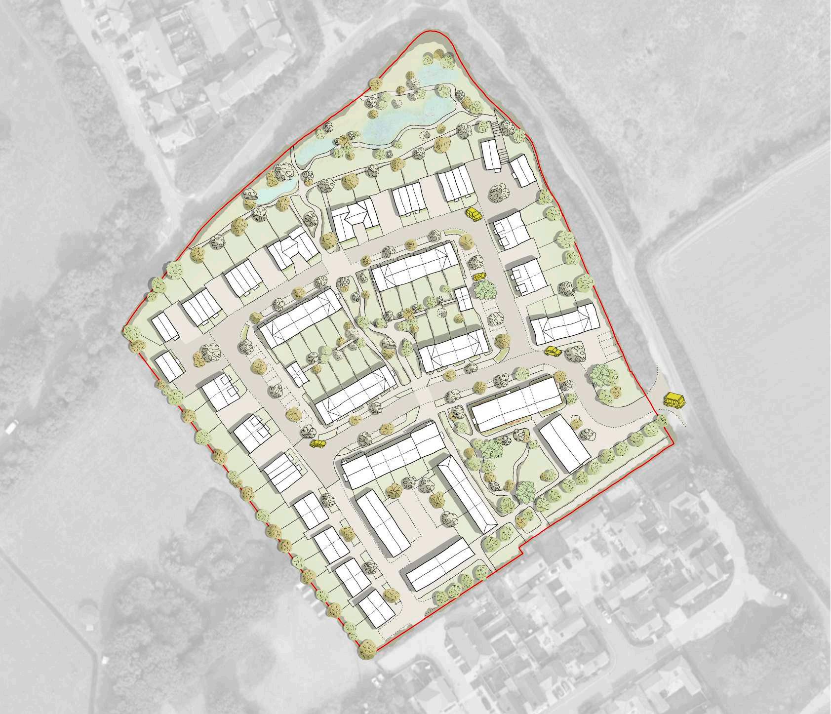
Masterplan and Proving Layout - CAD/ Procreate
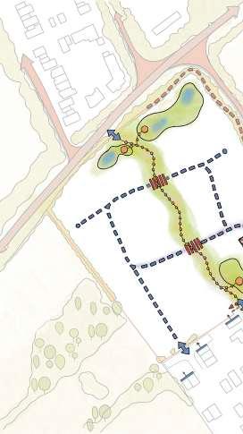
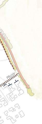
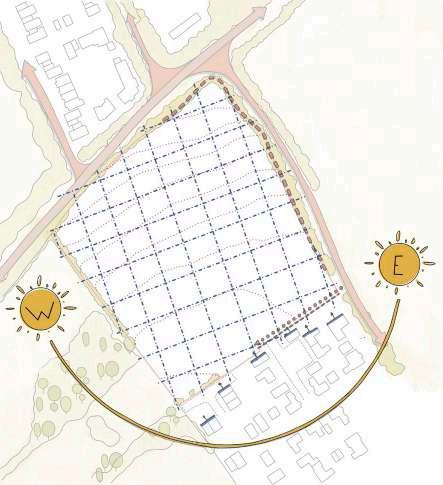
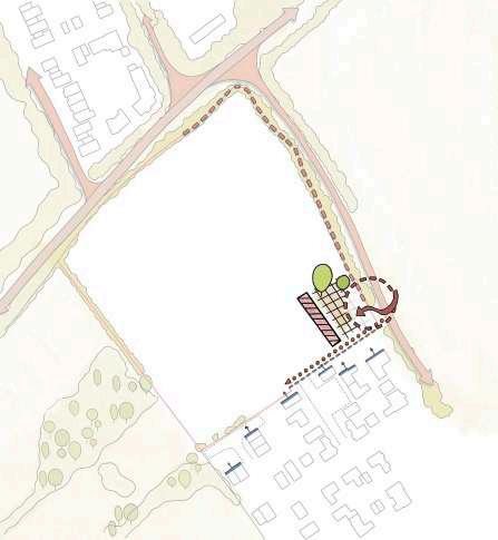
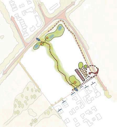
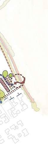
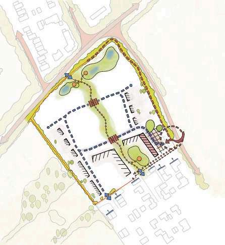
PROTECT & ENHANCE
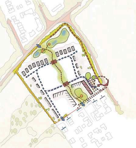
NATURE ON THE DOORSTEP
THE FARMHOUSE
LOCATION
UK - Basingstoke
ABOUT
JTP - Fall 2022
Key Phase Design Code, up to 1200 homes
KEY WORDS
Garden Village, Landscape-led
CONTRIBUTION
Integral member of the Design Team, managed Design Code under supervision
KEY SKILLS
Design Coding, Urban Design, Detailed Character Study and Street Design
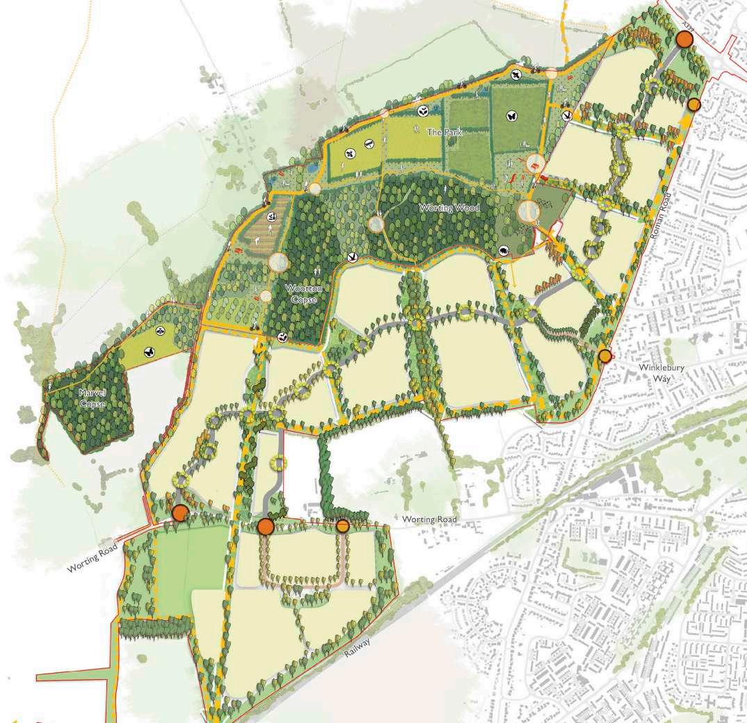
Manydown is a place of connections where characterful homes nestle into nature, healthy sociable communities evolve around shared interests, living and working are combined, and a wealth of opportunities lie within easy reach. Extract from Design Code: Chapter Key Groupings -
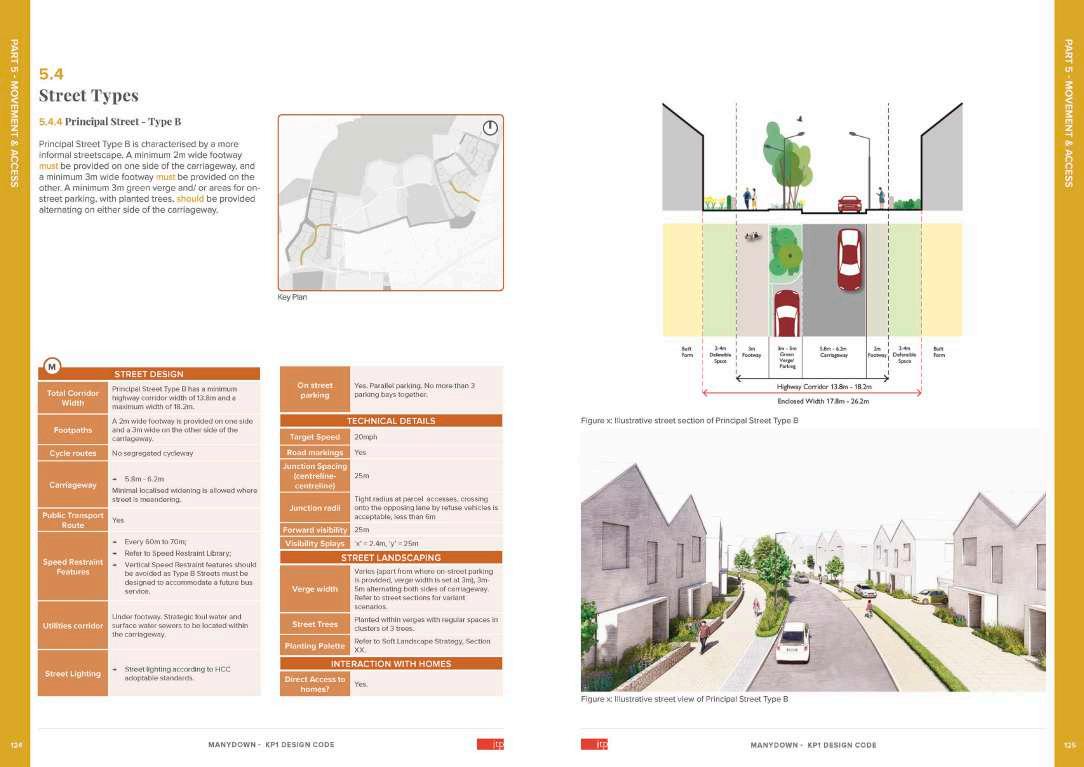
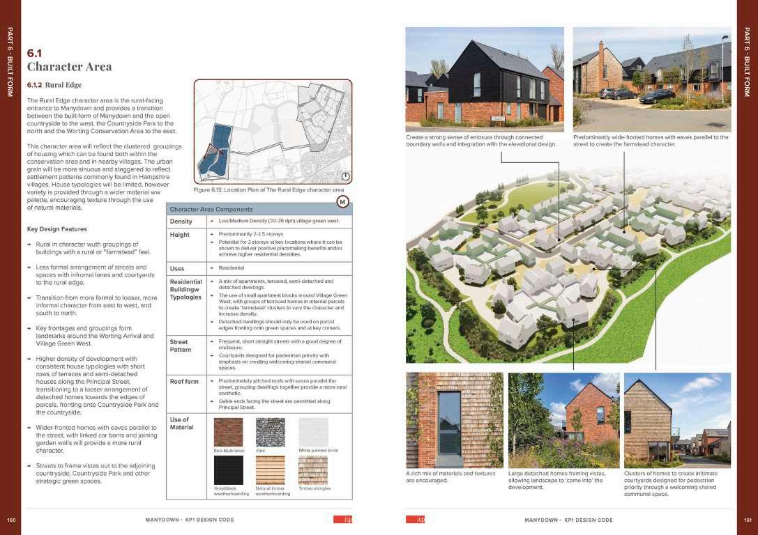
This page presents extracts from the Manydown Key Phase Design Code, structured into distinct chapters:
• Key Groupings
• Landscape & Public Realm
• Movement & Access
• Built Form
• Detailing The Place
Each section includes both guidance and policy elements. A variety of presentation methods— such as diagrams, sectional drawings, Lumion views, and precedent images—is used to effectively communicate the code to the diverse audience it serves.
LOCATION
UK - Southwest England
ABOUT
JTP - Spring 2024
Reg 18 Vision Document, 350 Homes
KEY WORDS
Carbon Free Living, Community Gardens, promoting health and wellbeing
CONTRIBUTION
Masterplan development and vision document creation
KEY SKILLS
Urban Design, Carbon Principles, Illustrating, Concept Design, Innovative Thinking
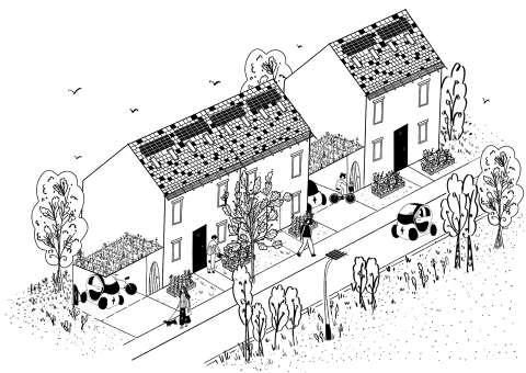
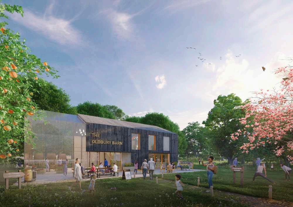
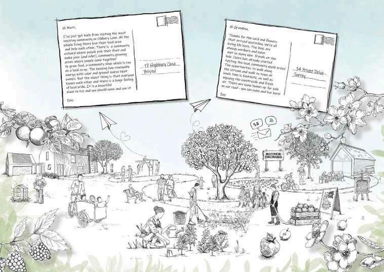
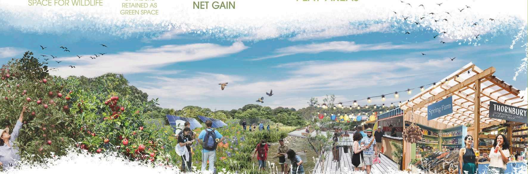
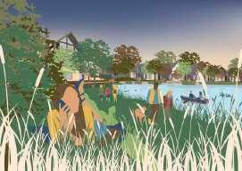
Oldbury Orchards will form a new connected and locally grown community. Living carbon free, all residents will do their part to tackle the climate emergency through the daily choices they make and to live a healthy and happy life. Oldbury Orchards will minimise the need to travel by car; streets will make walking and cycling pleasant and safe. Orchards, play facilities, gardens and food growing will improve quality of life. It will be a place that enables future generations to thrive.
The development of Oldbury Orchards, Thornbury will create a new self-contained, carbon neutral, connected community based on the principles of a 20-minute neighbourhood. The site is well located in terms of accessibility and surrounding facilities and amenities which will only be further enhanced through the development. It will be supported by the co-location of a ground mounted solar array that will provide clean energy to the new homes and the existing community.
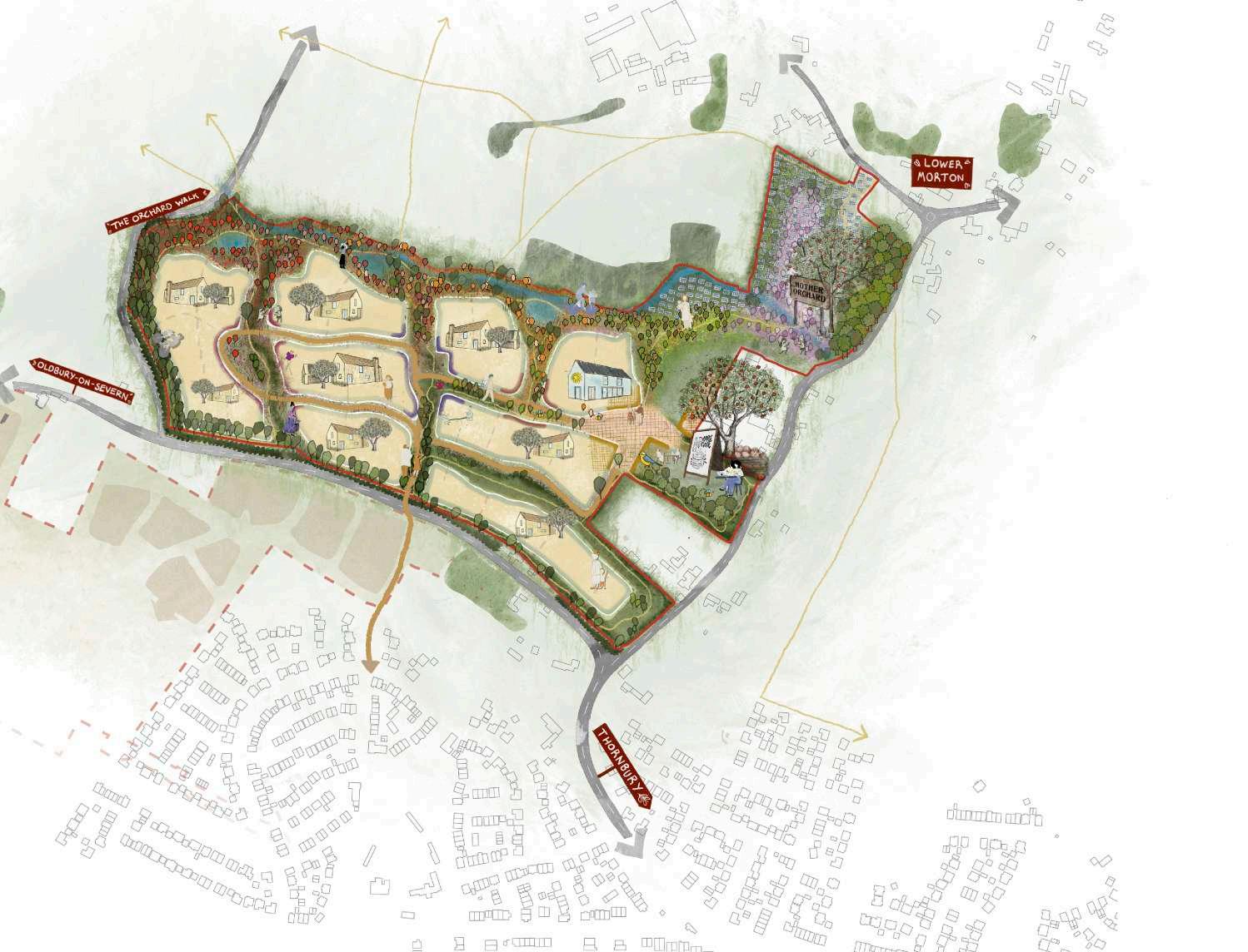
Masterplan: A New Community For All - created in procreate
LOCATION
UK - Southwest England
ABOUT
JTP - October 2024
Feasibility Study
KEY WORDS
Green Link, Courtyard Design
CONTRIBUTION
Full Ownership of the Report
KEY SKILLS
Proving Layout, Parcel Design, Conceptual and detail design
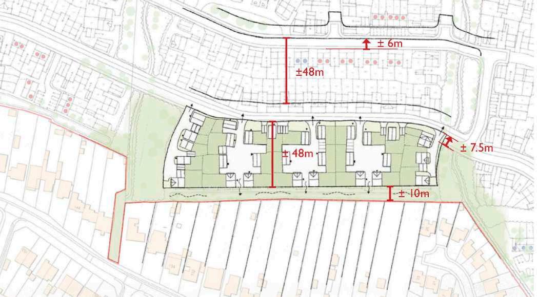
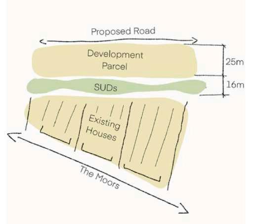
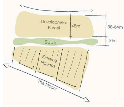
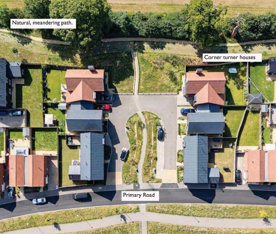
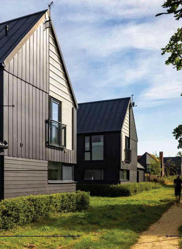
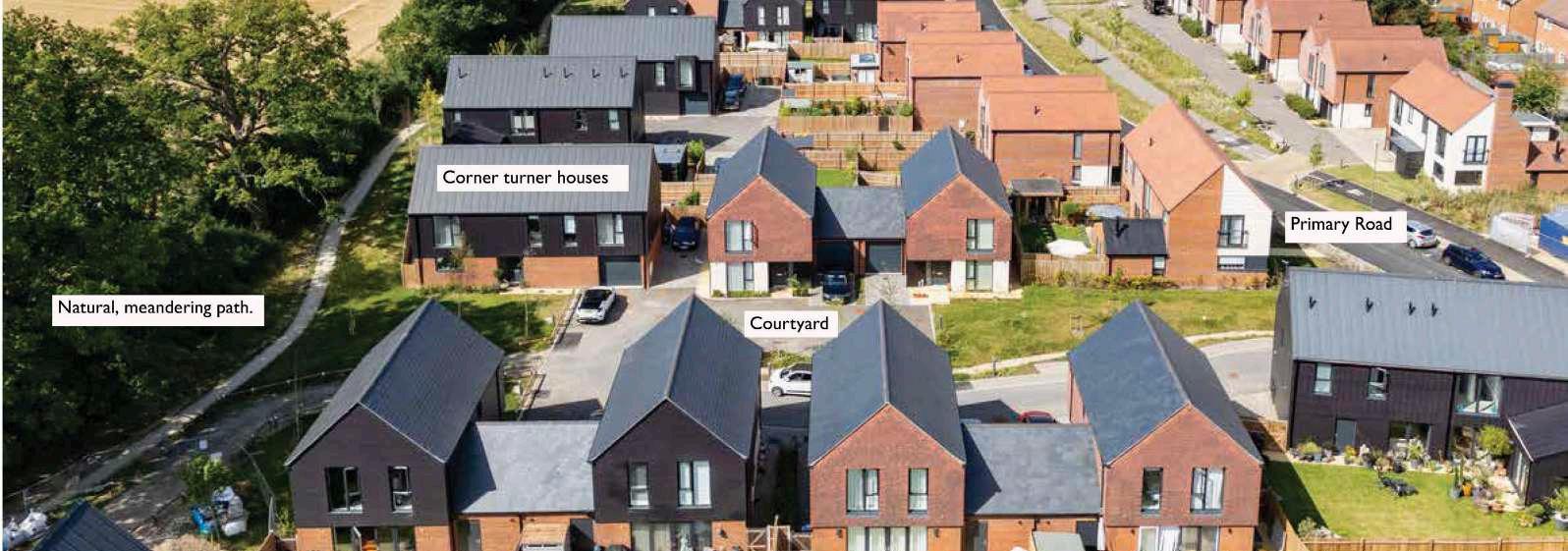
Feasibility study to review existing parameter plans and redesign the parcels to create good placemaking and efficient residential parcels. The study included testing different pacel layouts.
LOCATION
UK - Folkestone
ABOUT
JTP - Summer 2023
Design Code Phase 1B
KEY WORDS
Sustainable Neighbourhood, Landscape-led, Masterplanning, Community Engagement
CONTRIBUTION
Pivotal role: ensuring presentation for community event is coming together
KEY SKILLS
Coordination, Time management, Site Analysis, Diagrams, Collarborating with multiple consultants
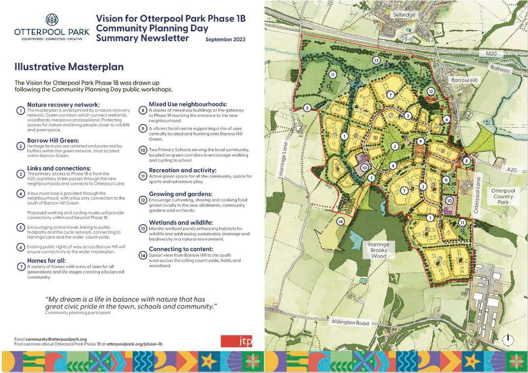
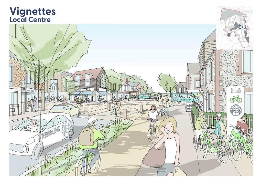
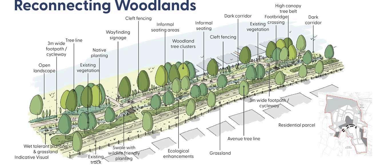
The Otterpool Park Phase 1B project envisions vibrant, sustainable new neighborhoods at Hill Top and Woodland Ridge. Designed by JTP (masterplanner) and BMD (landscape architect), this initiative prioritizes integrating nature with urban living. Phase 1B will deliver 3,000 homes, 50% green space, schools, community hubs, and local shops, fostering interconnectivity and biodiversity. Guided by comprehensive design codes, the project embraces ecological sensitivity, local heritage, and innovative infrastructure, creating a walkable, eco-friendly community with strong links to its surrounding Kentish landscape.
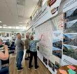
The community planning weekend for Otterpool Park Phase 1B was structured to maximise engagement and gather diverse input through a series of interactive sessions. The day began with a welcome and introductory briefing, setting the context for the development and outlining goals. Attendees then participated in thematic workshops addressing key topics such as connectivity, sustainability, housing, and community facilities. Breakout groups were formed to discuss challenges, brainstorm solutions, and envision future opportunities. Afterward, participants reconvened for report-back sessions, where each group shared their findings, sparking further dialogue. The event concluded with a summary of key insights and next steps to ensure continued collaboration.
The report back document summarises the outcomes of the community planning sessions, capturing key insights, ideas, and feedback to inform the development of the masterplan and design code for Otterpool Park Phase 1B.
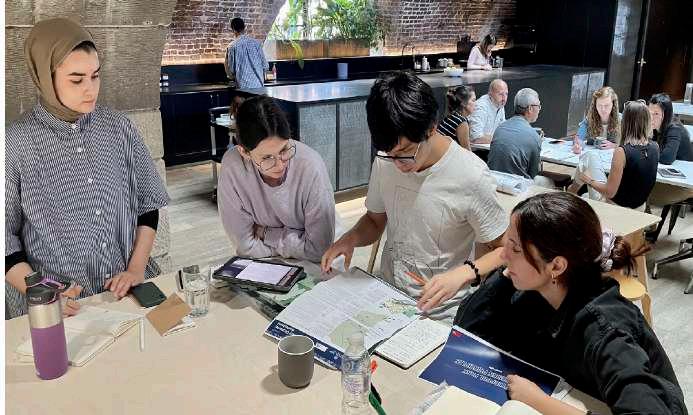
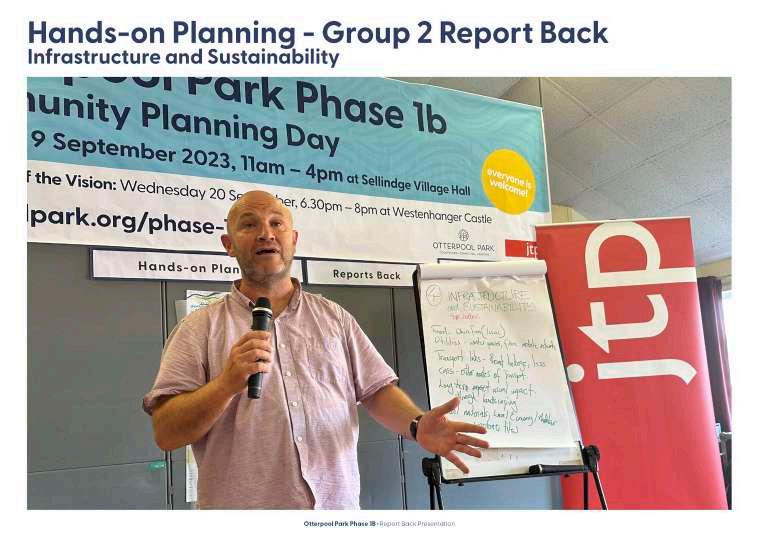
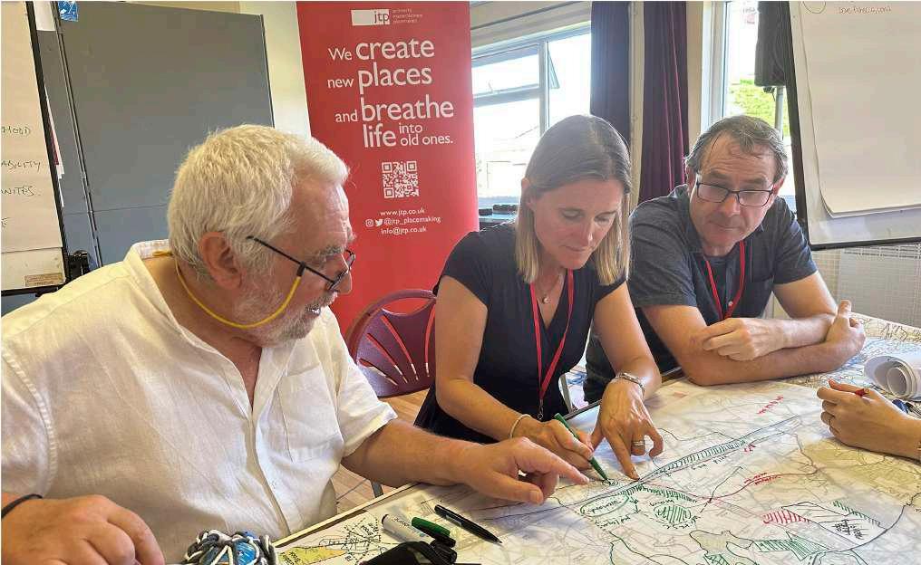
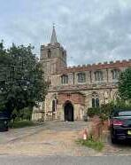
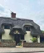
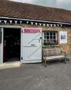
Examples of the outcomes from the hands-onplanning session.
Key
1. A well overlooked, distinctive and multifunctional space (Lympne)
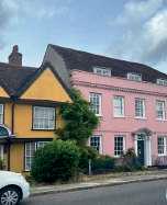
2. Typical / traditional local materials
3. Components of successful and distinctive streets
4. Relevant themes emerging from morning workshop
5. A simple distinctive local feature
6. Standard, engineering-led (wide) street design
7. Clash of roads, driveways and swales
8. The danger of tarmac of many types
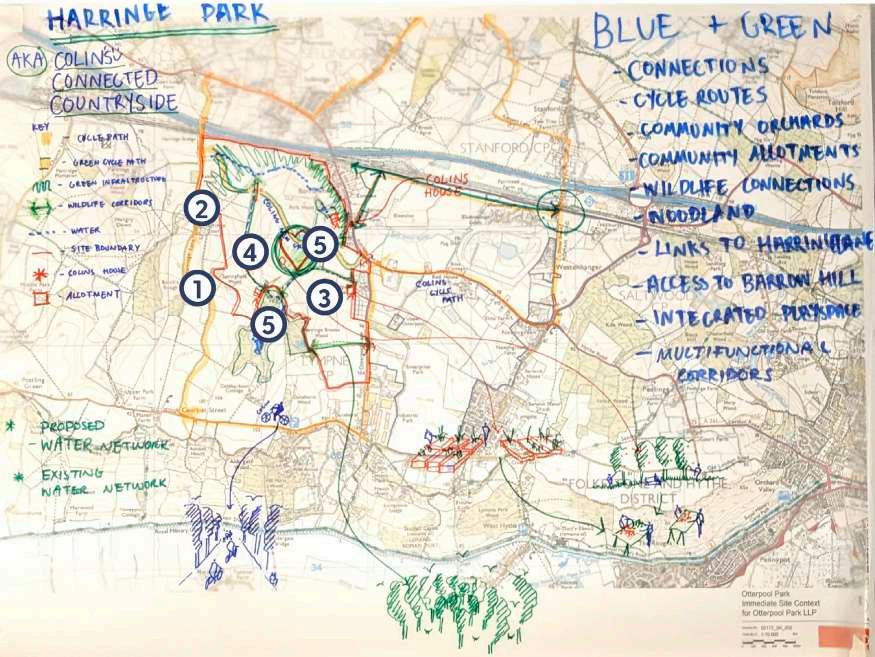
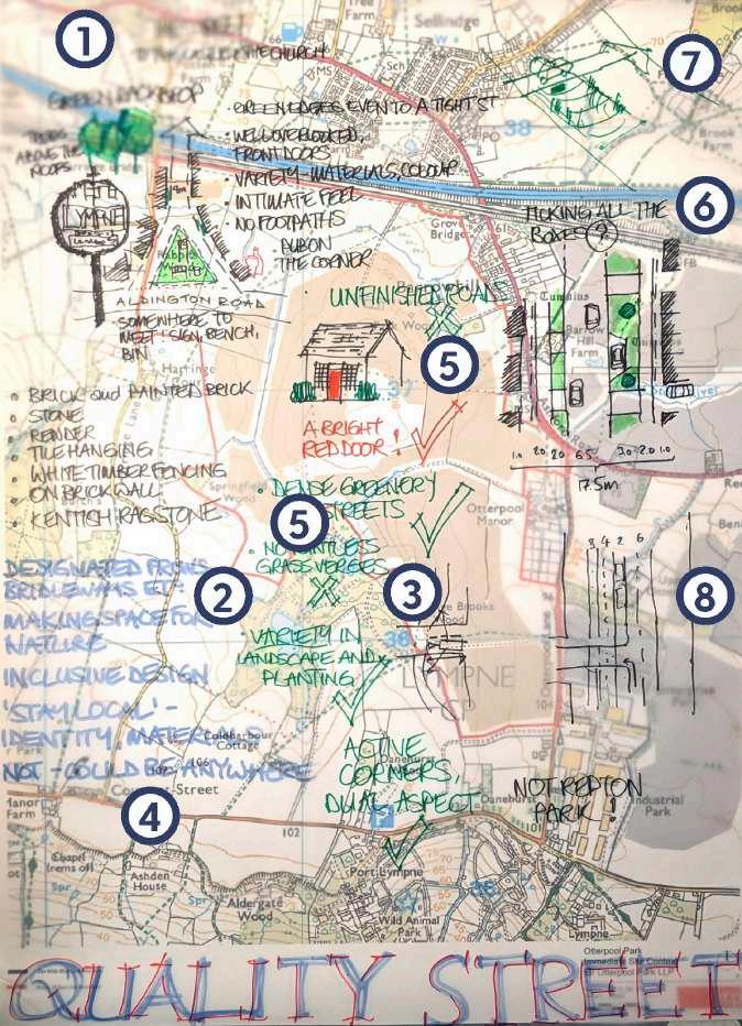
Hands-on-planning scan group ‘Quality Street’
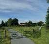
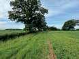
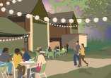
Colin’s Connected Countryside
Key
1. Improved Wider Cycle Routes and Connections
2. Links to Harringe Lane
3. Community Growing Spaces (Community orchards and allotments)
4. Multifunctional Green Corridors
5. Links to Existing Green Assets (Harringe Brooks Wood and Barrow Hill)






























LOCATION
UK - Guildford
ABOUT
JTP - February 2024
KEY WORDS
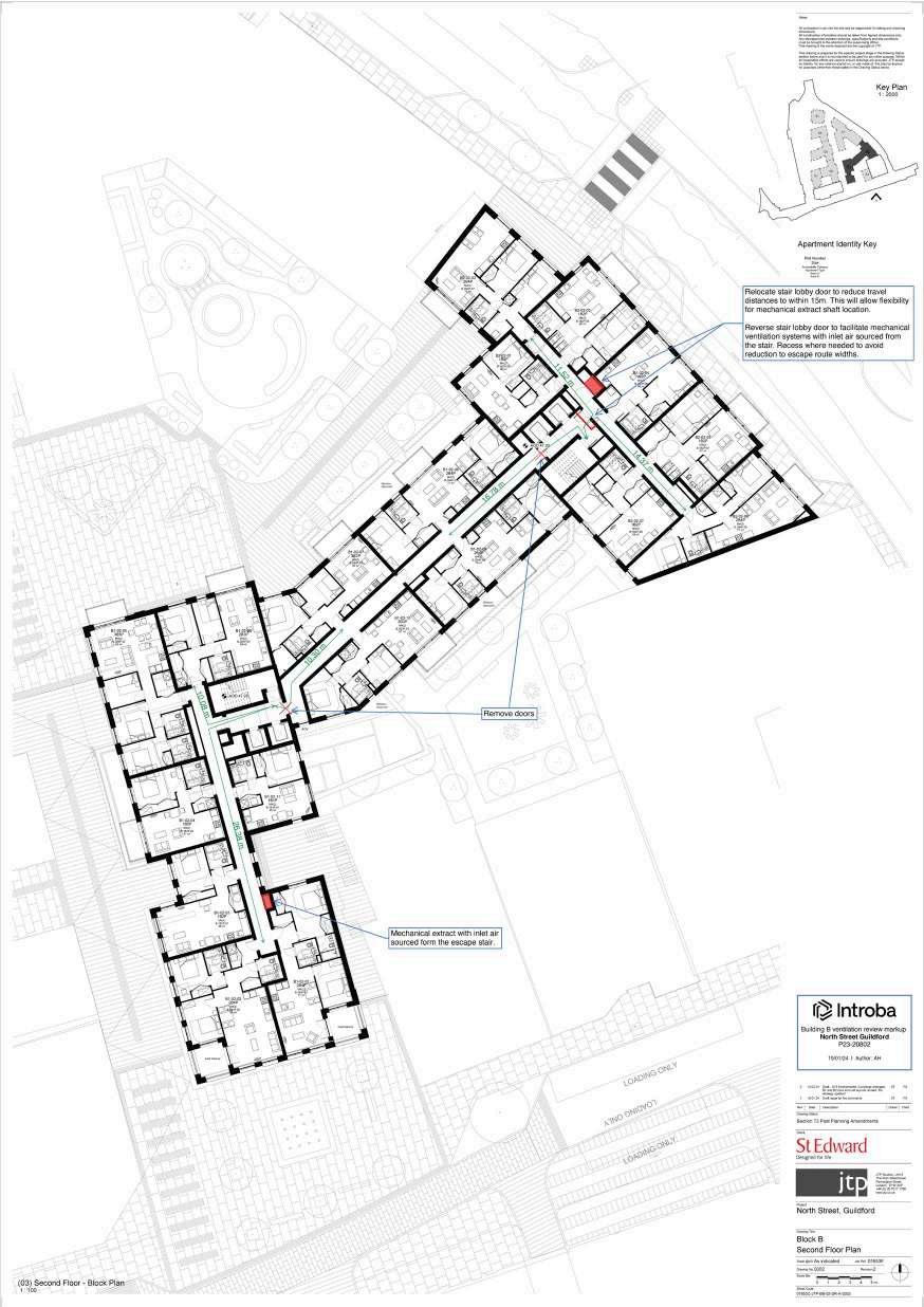
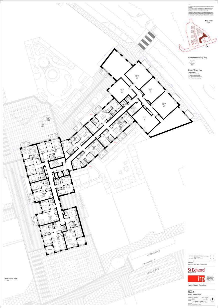
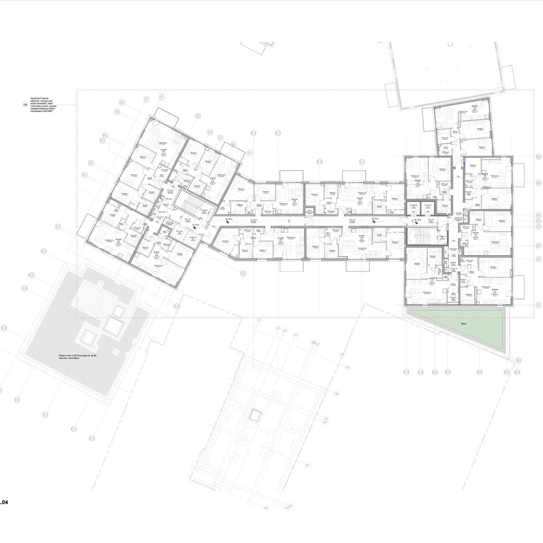
Section 73, Amendments to Floor Plans, risers and levels of Block B
CONTRIBUTION
Working through the amendments in Revit following technical advice
KEY SKILLS
Revit, National Space Standards, Part M, London Housing Design Guide, Berkeley and St Edwards Design Guide
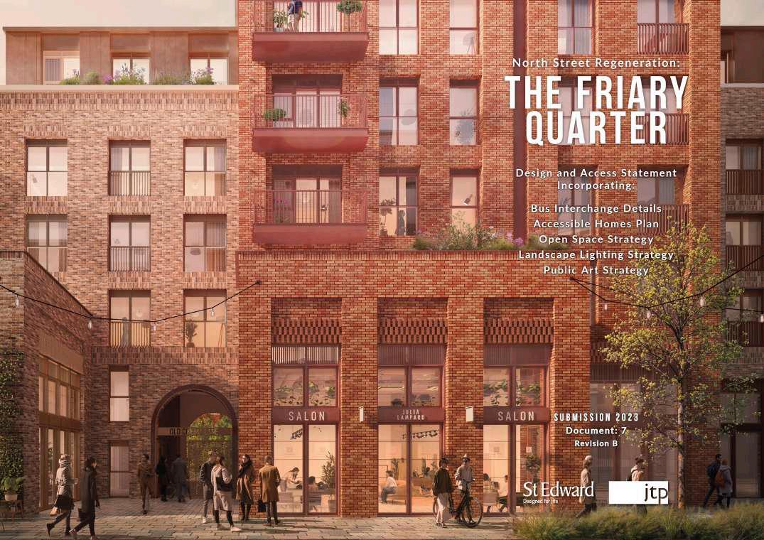
A significant mixed-use redevelopment designed to revitalise Guildford’s historic North Street area. The proposal includes 471 residential units, flexible commercial spaces, public squares, and a modern bus interchange. Key features focus on creating pedestrian-friendly streets, enhanced public transport facilities, and sustainable urban design with biodiversity and energy efficiency at its core. After planning permission was granted in October 2023 for 471 homes, JTP starting working on the S73 amendments.
My contributions to the project included:
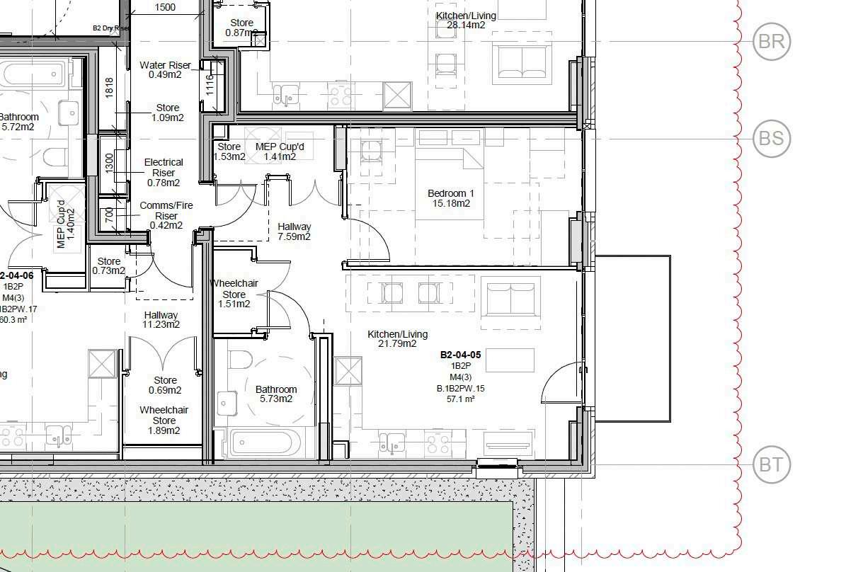
• Reviewing and refining flat layouts for optimal functionality and spatial efficiency.
• Resolving level changes within Block B.
• Calculating and confirming dimensions for technical risers, ensuring compliance with design requirements.
• Repositioning and redesigning one of the cores to improve circulation and accessibility.
The scheme seamlessly blends contemporary design with Guildford’s heritage, fostering a vibrant and inclusive urban environment.
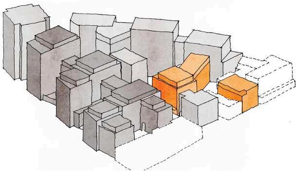
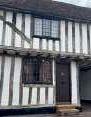
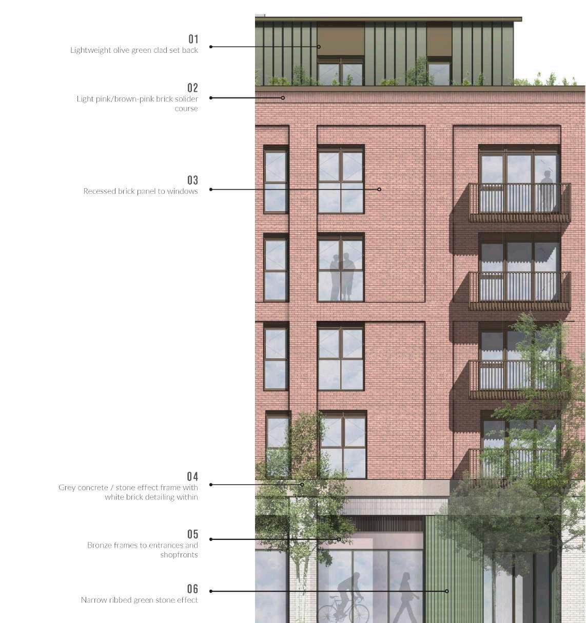
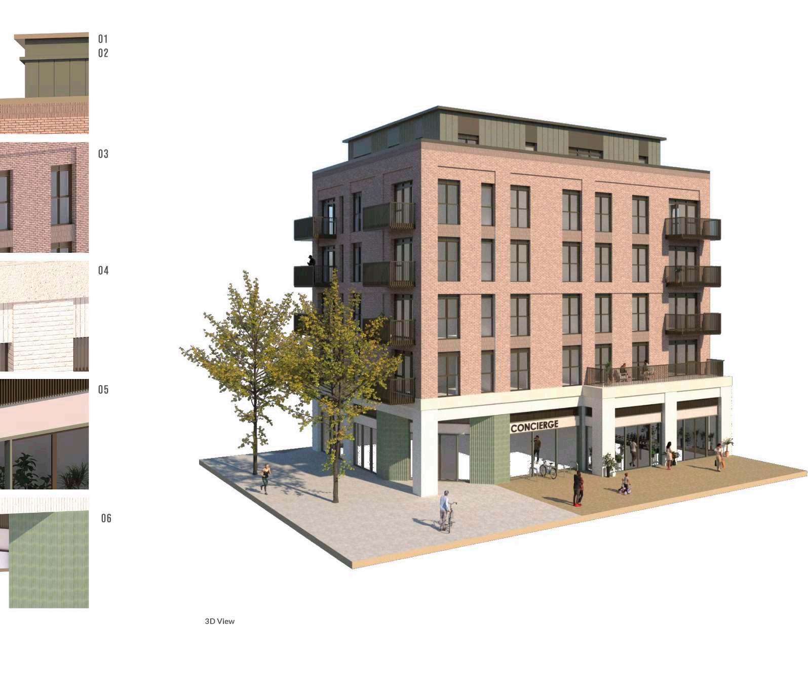
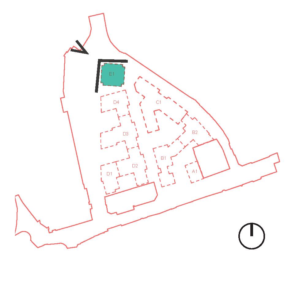
The narrow plot building on Woodbridge Road shares a language with that on North Street. A restrained and ordered facade sits above the colourful and detailed commercial ground floor. The chamfer is again used as a device to lead pedestrians into the Dial and along Astor Lane. The green clad set back storey reduces the impression of height from the street, and adds variety to the roofscape when viewed from above. The light brick and concrete/concrete effect base relates to that on the North Street Placemaker.
• Ordered arrangement of windows and balconies
• Inset brick panels group windows and storeys
• Horizontal emphasis
• Set back clad roof element
• Bronze coloured projecting balconies
• White brick to base
• Bronze coloured window frames and doors
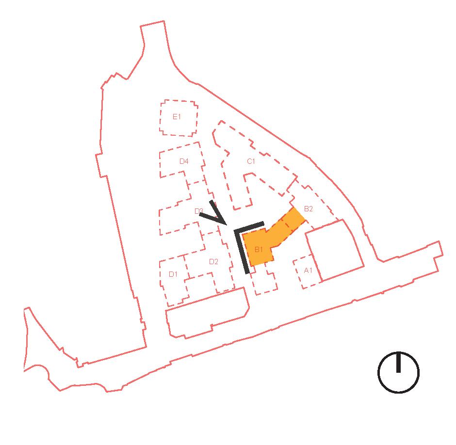
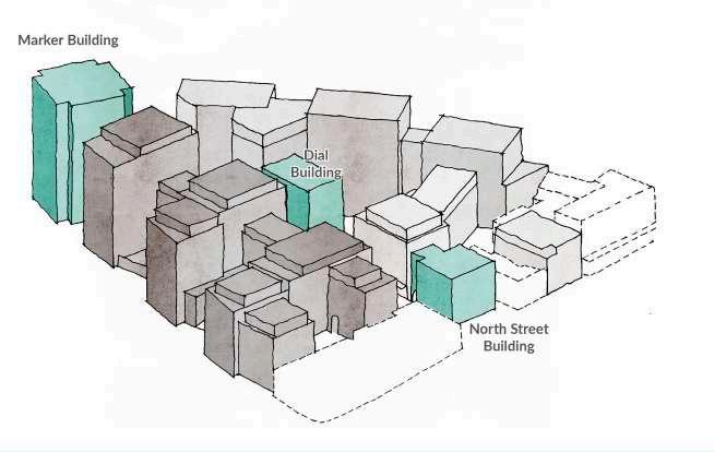
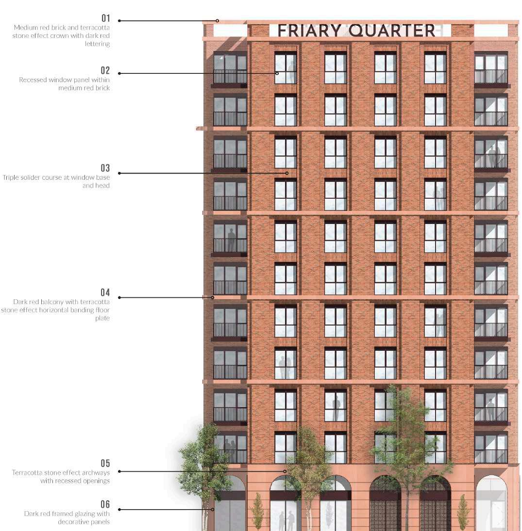
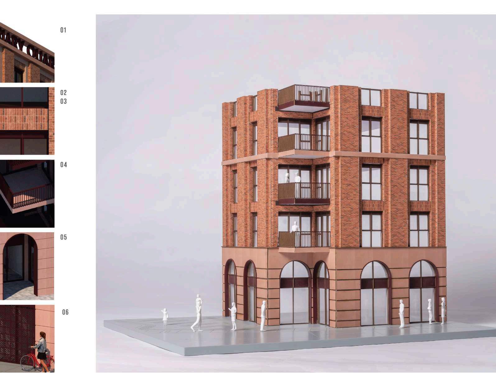
Signalling the arrival to the town from the north, the marker building is the tallest on site and in the immediate vicinity, so playing an important role in the townscape of Guildford. Cut-out corners and ordered facade give this building a strong identity, and relate to the placemaker on north street.
Expressive arched ground floor openings reference historic Guildford, but the use of terracotta toned material and slender arches feel contemporary and sculptural.
Signange to the top references the Friary Meux Brewery tower that once punctuated the skyline of Guildford in a similar fashion.
• Grouping of floors
• Vertical piers continued from crown to ground floor
• Signange to all facades
• Corner balconies
• Rational arrangement of windows
• Dark red window frames/ doors
• Distinct coloured base
IN PART 2, I DELVE INTO MY ACADEMIC JOURNEY AT THE BARTLETT AND KULEUVEN, DISCUSSING RESEARCH AND DESIGN PROJECTS THAT EXPLORE TOPICS SUCH AS POST-COVID URBAN SPACES, SUSTAINABLE MATERIALS, AND CLIMATE-RESPONSIVE DESIGN. BOTH SECTIONS HIGHLIGHT MY EVOLVING APPROACH TO INTEGRATING SOCIAL, ECOLOGICAL, AND ECONOMIC VALUES IN URBAN DESIGN AND ARCHITECTURE.
CHARLEROI ADAPTIVE REUSE TRIAL & TIVOLI - COMMON SPACES CLT RESIDENTIAL DEVELOPMENT
LOCATION
Charleroi, Belgium
ABOUT Academic - Spring 2021 Master Design Project Part 1
KEY WORDS
Vacancy Reuse, Crosspollination, Urban Revitalisation
CONTRIBUTION
Designed and researched
KEY SKILLS
CAD modelling, Site Analysis, Model Making, Illustrations
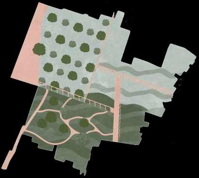
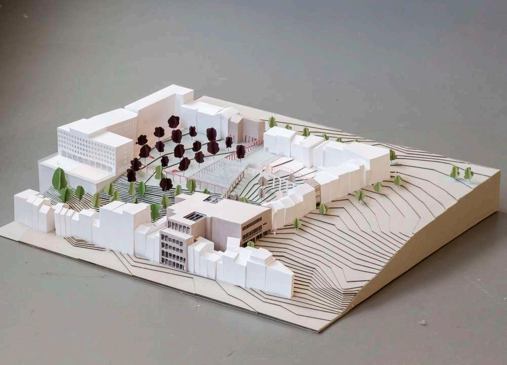
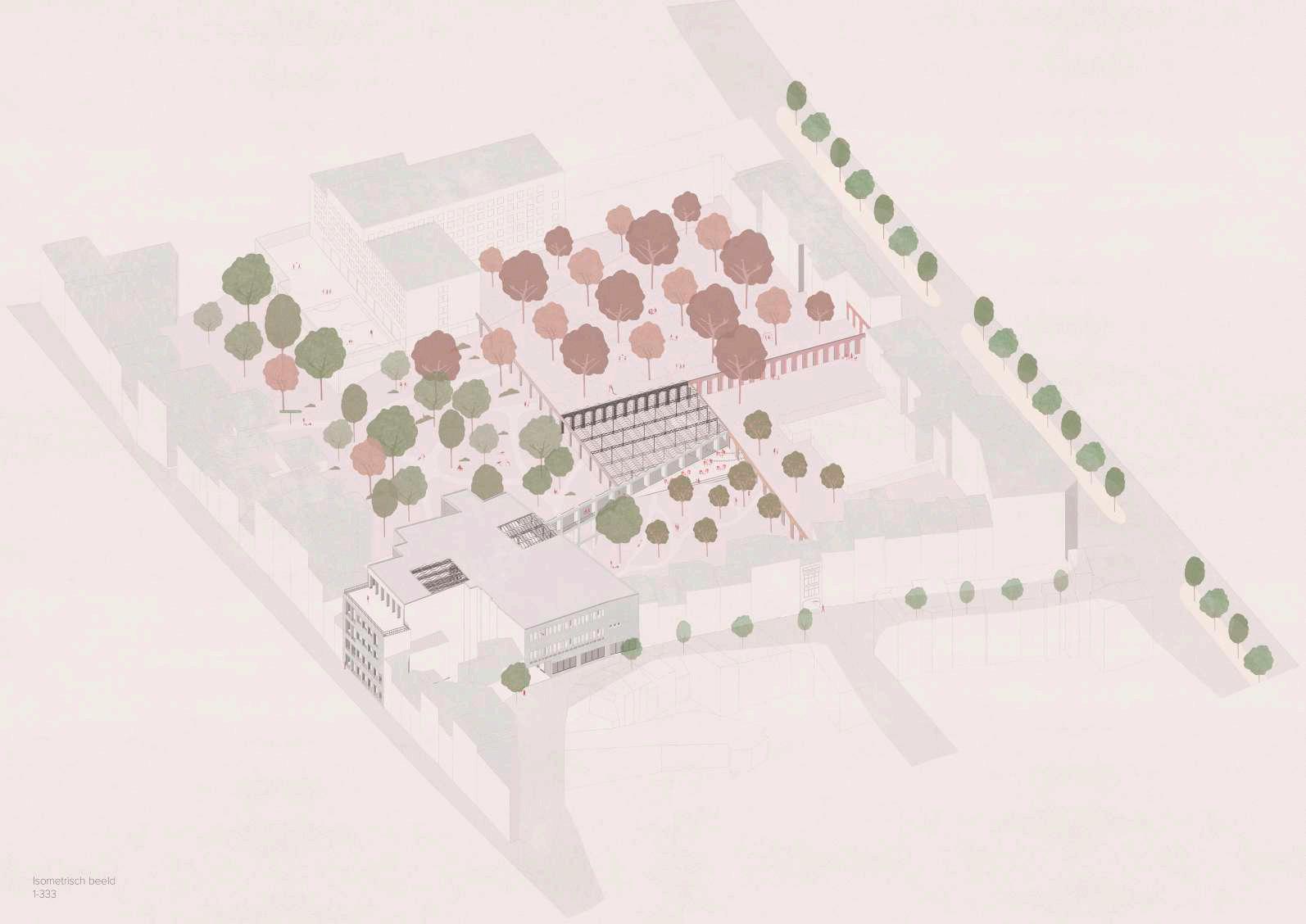
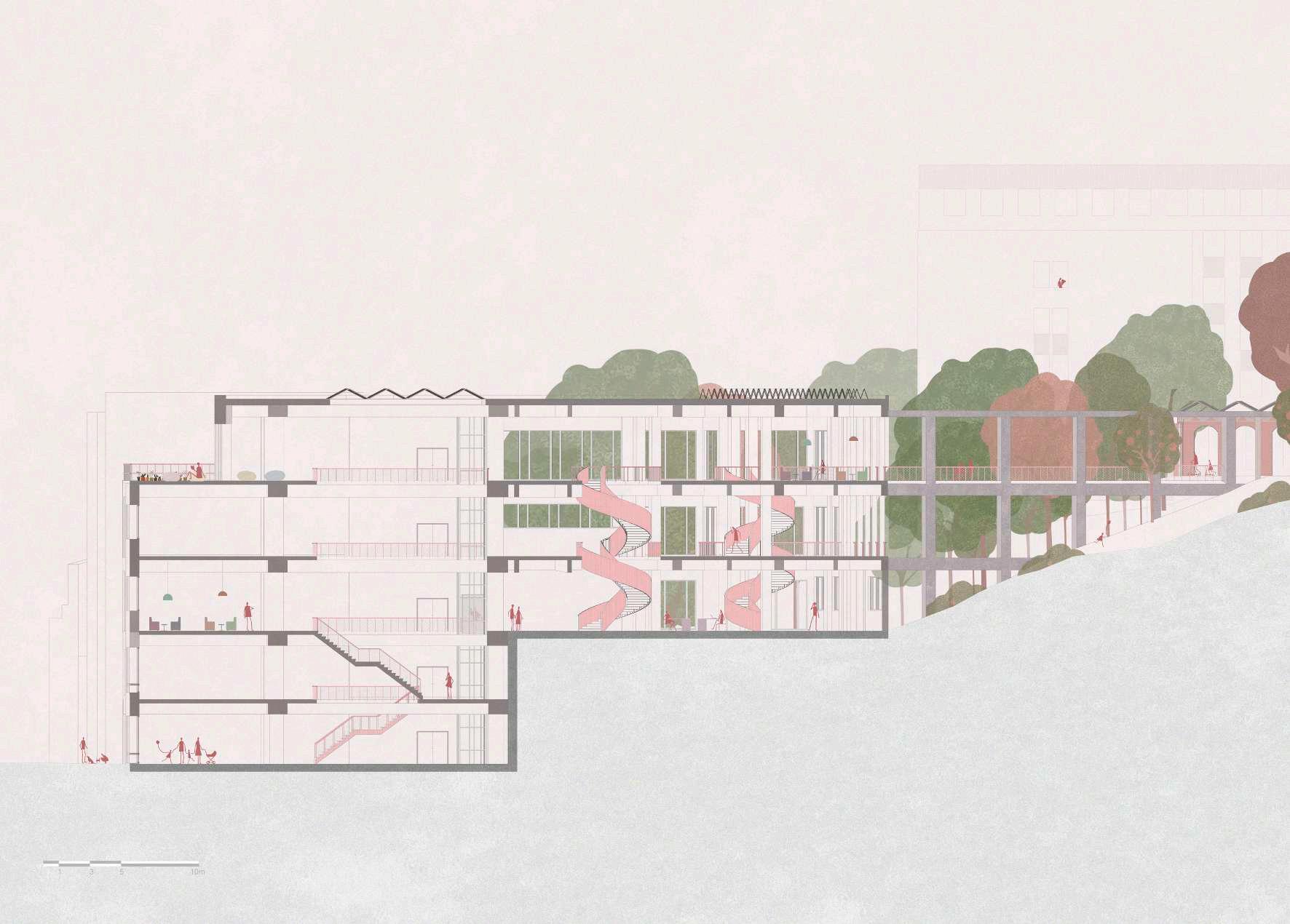
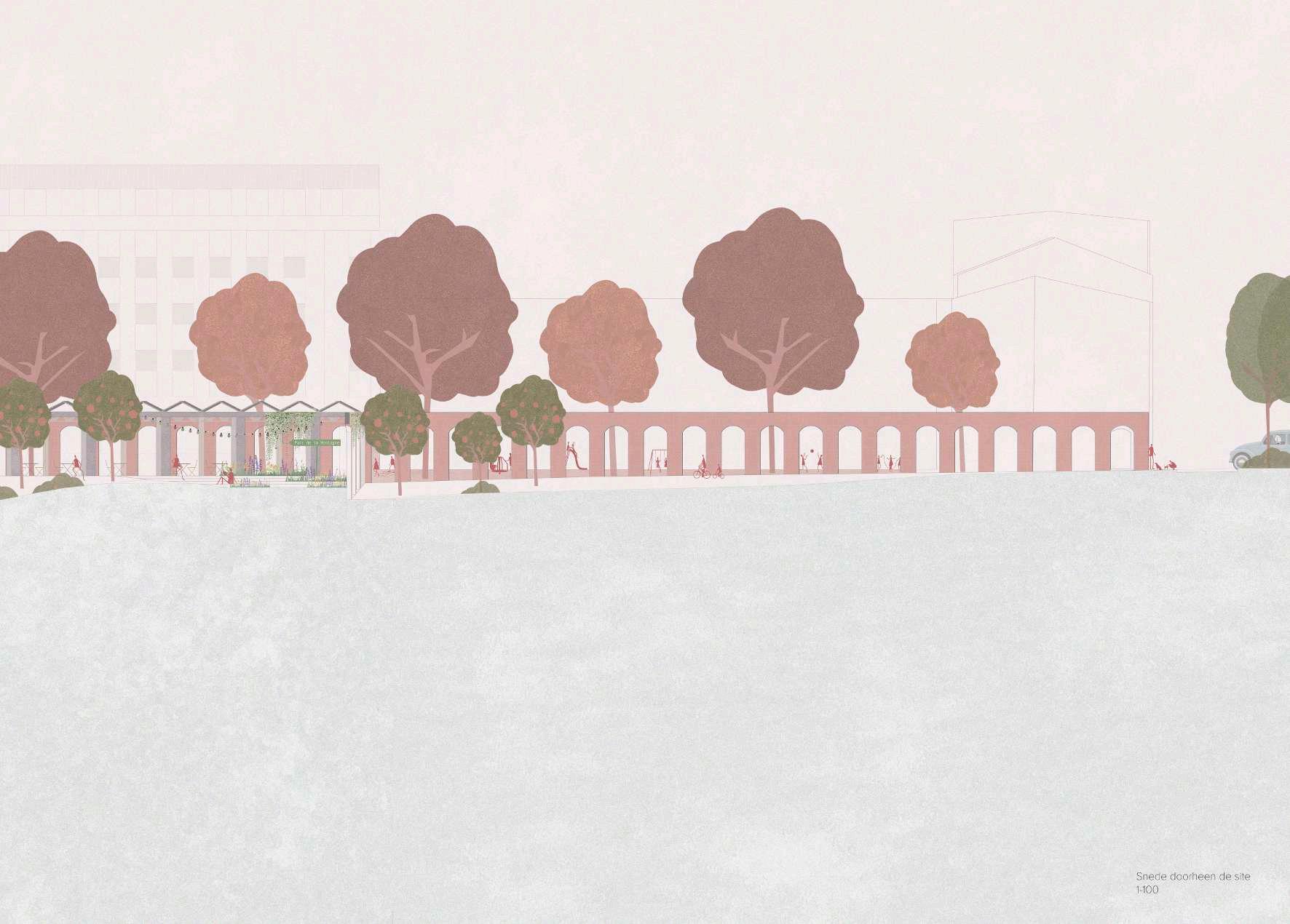
This Master Design Project addresses the high vacancy rates in Charleroi, Belgium, a former industrial hub transformed by urban decline. Inspired by the concept of cross-pollination, the design proposes strategic interventions to revitalize Rue de la Montagne, focusing on reconnecting the city through a central park.
Four gateways—situated at key points such as L’Institut Saint Joseph, the Conservatoire, and the Stynen building—link the park with its surroundings, creating access and defining three unique sub-parks. At their convergence, a greenhouse serves as a physical and symbolic meeting space, anchoring the revitalisation of this urban artery and fostering new interactions between architecture and the community.

circulation
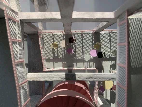
Achieving readability and accessibility within the building is the ultimate challenge. The circulation throughout the building is given an extra dimension through the creation of a third façade.
Strategically placed voids guide visitors through the building. Designing usable and flexible spaces is essential. This approach allows part of the building to be used as an extension for the school.
Due to its location on the main artery between the upper and lower city, passers-by could also make use of spaces intended for commercial purposes.
LOCATION
BELGIUM - Brussels, Tivoli
ABOUT Academic - Fall 2020
Community Land Trust Building
KEY WORDS
Social Sustainability, vacancy, activation, CLT
CONTRIBUTION
Designed and researched
KEY SKILLS
Site Analysis, Concept Design, Model Making
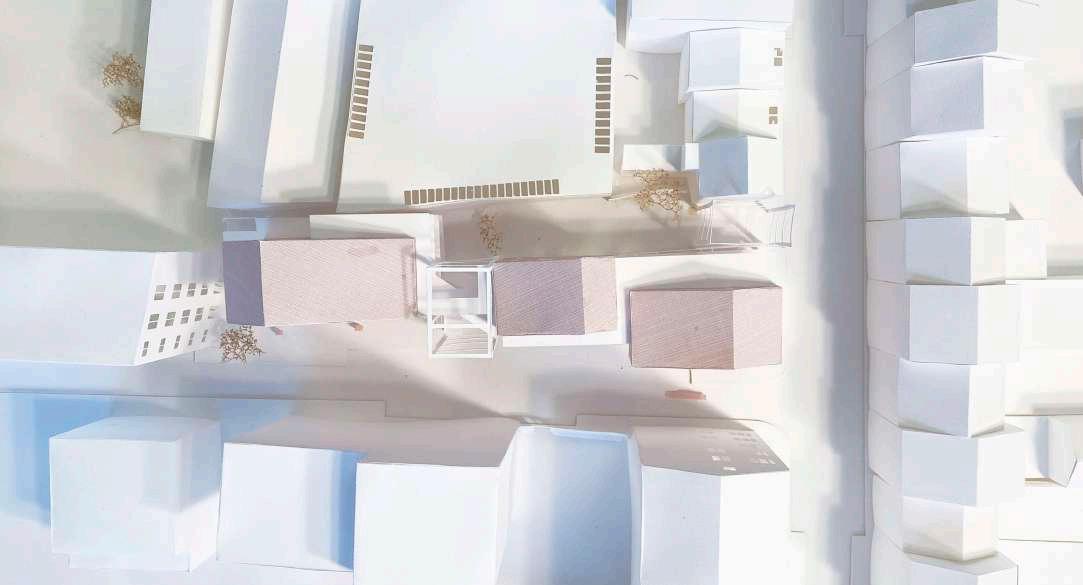
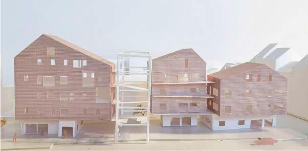
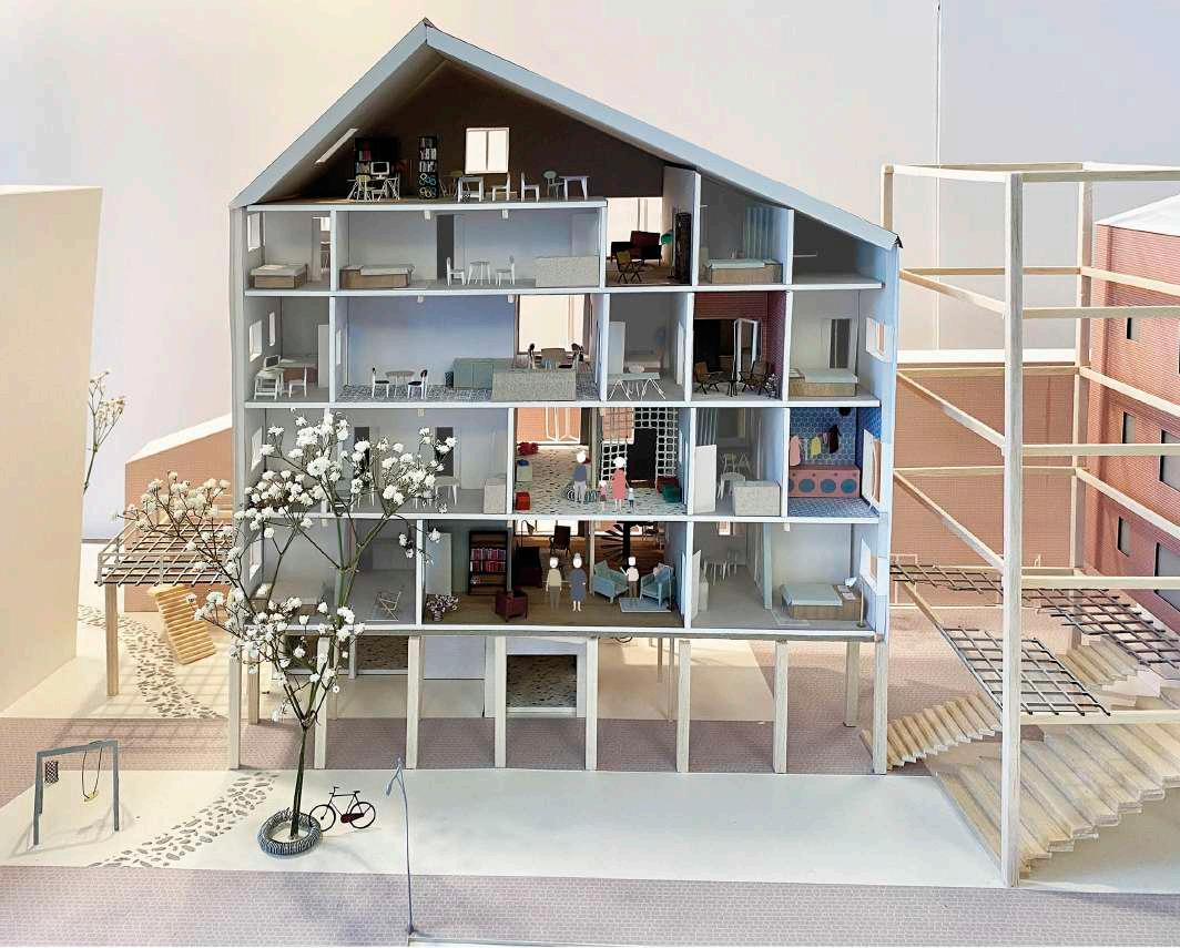
Trial & Tivoli addresses challenges within the new sustainable Tivoli neighbourhood. While sustainability is the primary objective of the development, the project recognises the need to extend beyond technical sustainability to include social sustainability. In Brussels, high vacancy rates are not only an issue in abandoned buildings but also in the under-utilisation of qualitative spaces within newly developed neighbourhoods.
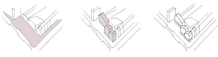
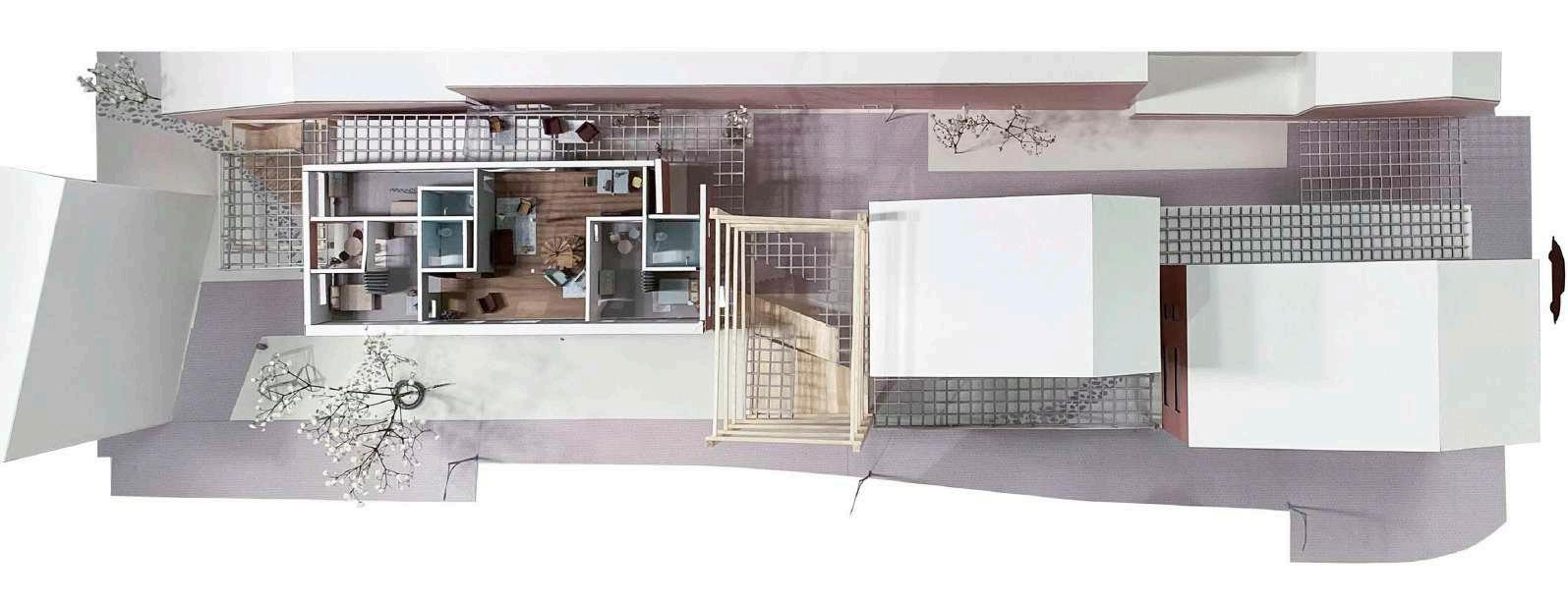
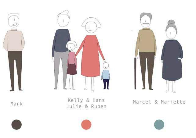
The project aims to (re)activate the entire neighbourhood through a masterplan, using the CLTB (Community Land Trust Brussels) lot as a catalyst. The approach focuses on striking a balance between private and public spaces, with a particular emphasis on the role of the inhabitants in shaping this equilibrium. The projects use 3 different families to guide you through how they experience their new neighbourhood. Integration Context Model - Top View Integration Context

community led masterplan
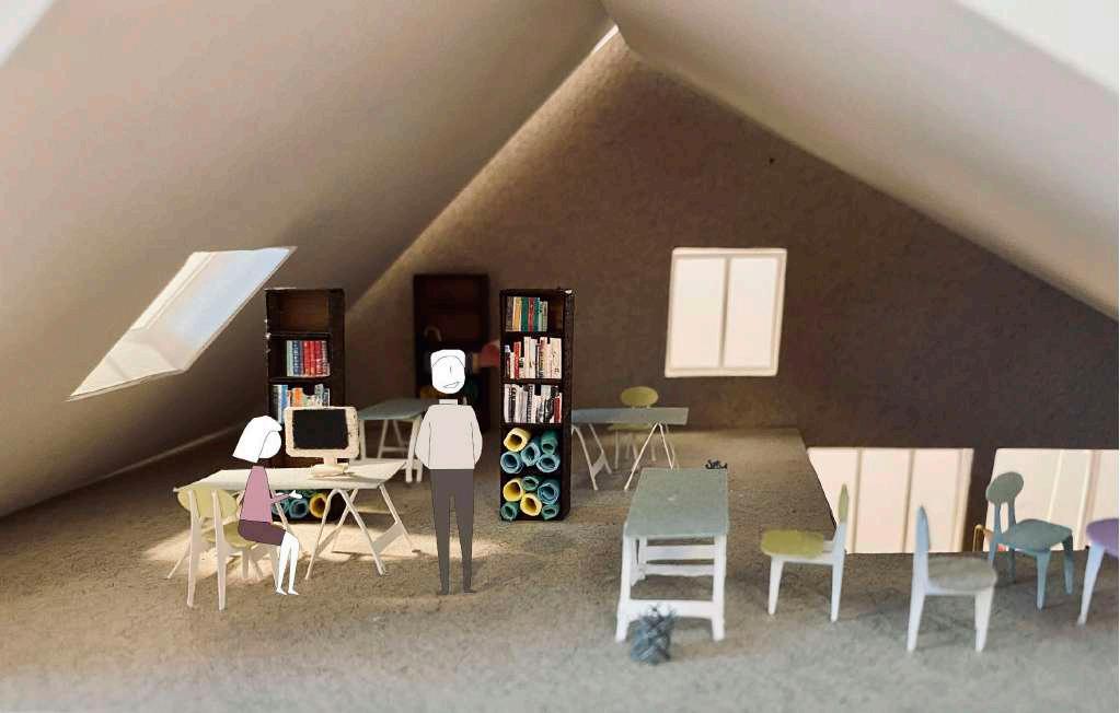
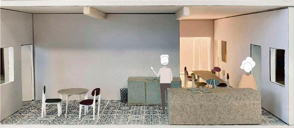
The project guides the viewer through the building by giving them a view of people living in the new Tivoli neighbourhood. On the page on the right showcases some examples of moments in Mark’s life.
LOCATION
BELGIUM - Brussels
ABOUT Academic - Fall 2020 Architecture Integration Project
KEY WORDS
Design, Structure, Fire, Ventilation, Plumbing, EPBD performance
CONTRIBUTION
Designed and researched
KEY SKILLS
CAD modelling, physical model making, site analysis, technical realisation, collaborative problemsolving
This project represents a comprehensive exploration of architectural design and technical realisation, combining creative vision with practical implementation. The first part of the project showcases my final bachelor design project, where a conceptual design was developed, rooted in innovation, functionality, and aesthetics. The design reflects a personal approach to architecture, emphasising user experience and sustainable principles.
The second part transitions from concept to constructability, undertaken as part of a collaborative group effort. The team selected the designer’s final bachelor design project as the basis for a detailed analysis and refinement process. The aim was to transform the conceptual design into a feasible building that could be constructed.
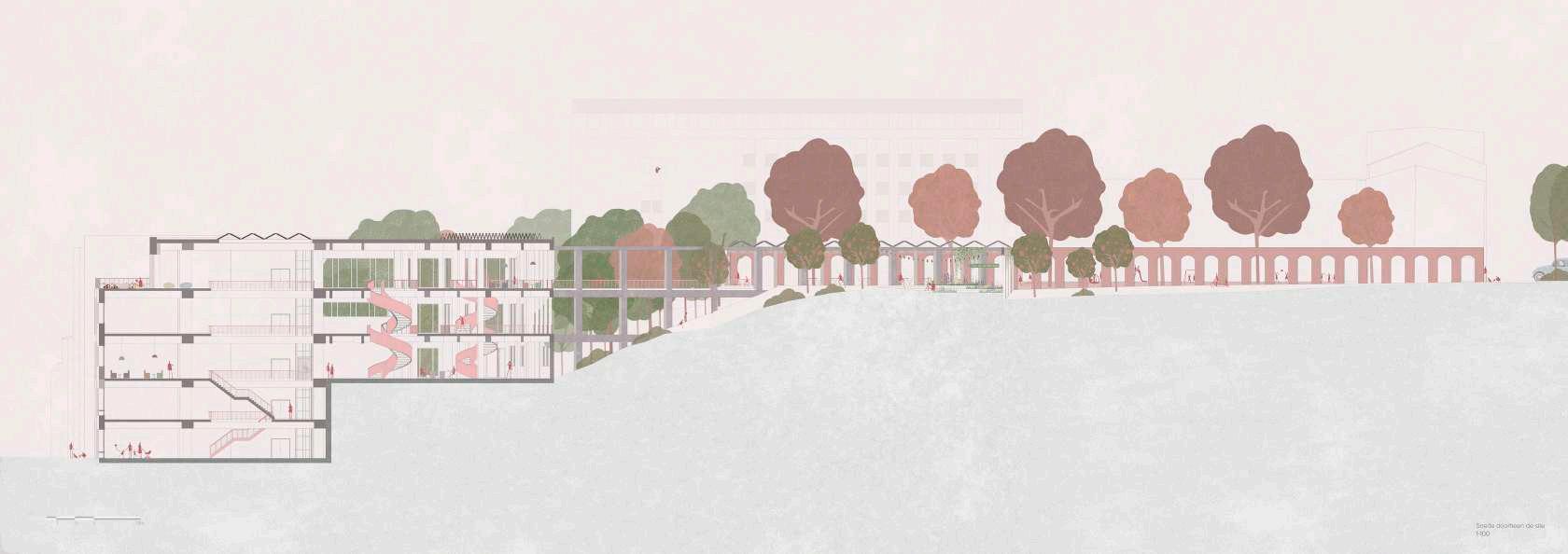
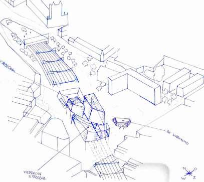
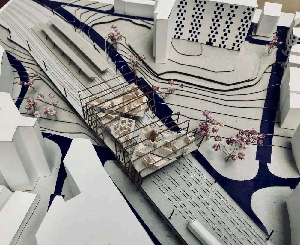
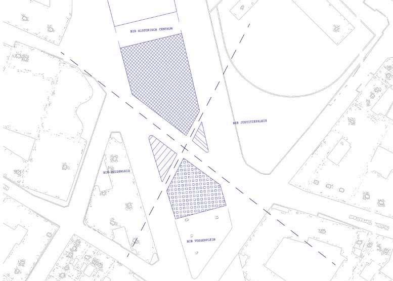
Creating a cultural centre on top of the railway tracks at the Kapellekerk station in Brussels. Connecting the separated neighbourhoods on the ground floor level by introducing more activities and creating vertical circulation to act as a ‘watchdog’ over the surrounding neighbourhoods.
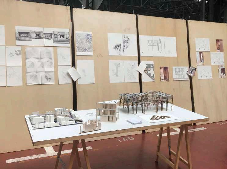
The group addressed critical aspects of building performance and functionality, including:
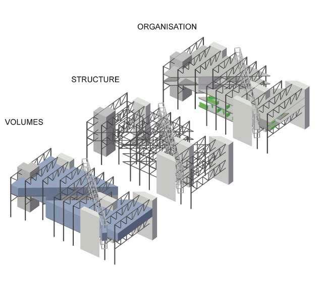
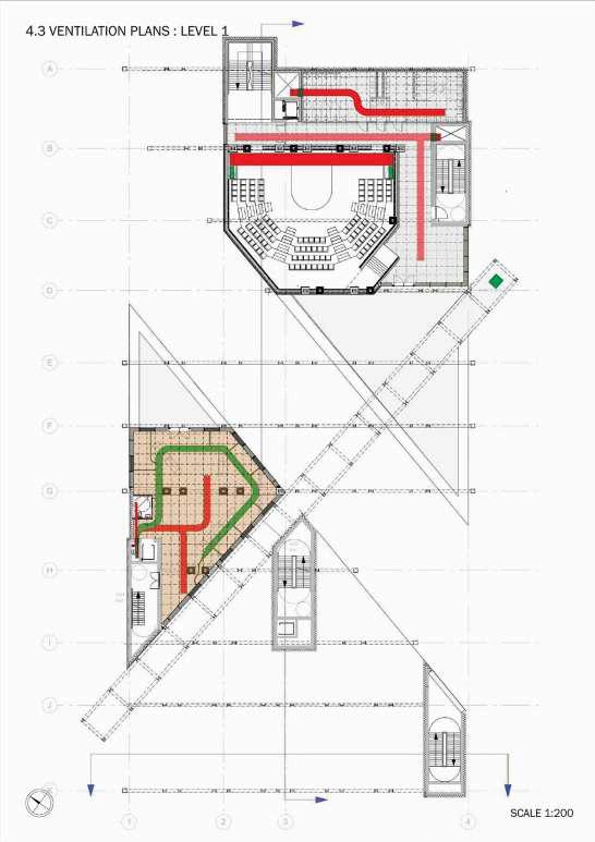
Structural strategy - Ensuring stability and feasibility of the design. Ventilation strategy: Implementing effective solutions for indoor air quality and energy efficiency.
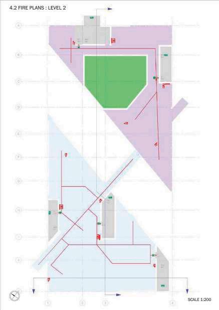
Fire strategy - Prioritising safety through compliance with fire regulations.
Daylight performance - Enhancing the building’s interior environment with optimal natural light.
Functionality - Refining spatial organisation to meet user needs effectively.
This project highlights not only my ability to develop innovative designs but also the collaborative and technical problemsolving skills required to adapt a concept into a practical, buildable structure. It is a testament to the interplay between creativity and engineering that defines architectural practice.
FIRE STRATEGY
VENTILATION
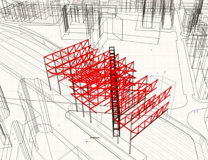
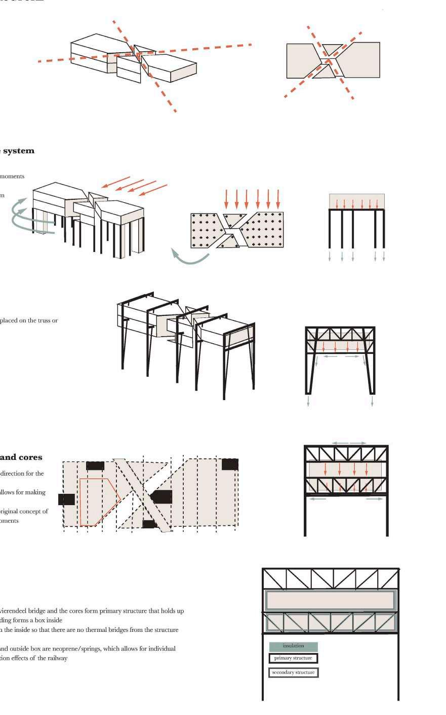
A box is cut through by two axis, standing above the railway.
Problems with the original idea:
• Insufficient rigidity to withstand moments caused by lateral wind-load
• Difficult to hold up the auditorium
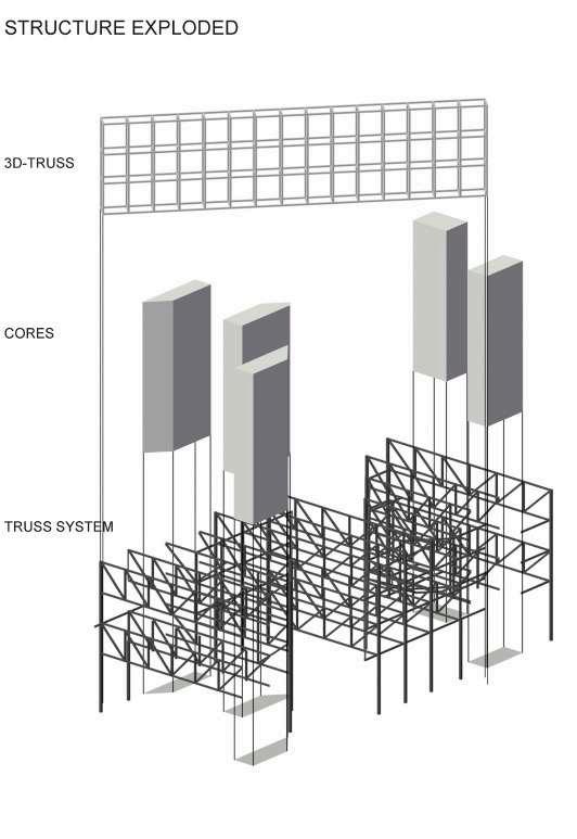
The overall stability is enhanced. The structure can support loads either on the truss or hanging from its top. However, the moments remain unresolved.
The cores provide stiffness in the third direction to the truss structure. A third level is added, freeing the second level from the primary structure. The Vierendeel bridge enhances the original two-axis concept, increasing moment resistance.
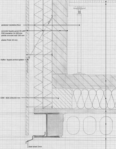
The building’s structure uses trusses, hollow-core panels, a Vierendeel bridge, and cores to form insulated boxes, preventing thermal bridges. Neoprene and spring connections between the inside and outside boxes allow movement and reduce railway vibrations.
LOCATION
UK - London
ABOUT
Academic - Spring 2022
Major Research Project. The Bartlett School of Planning, UCL
KEY WORDS
Inclusive Neighbourhoods, COVID-19, Community Silo, Cross-Pollination, ChildFriendly
CONTRIBUTION
Designed and researched
KEY SKILLS
Masterplanning, Research, Urban Design, Illustrating
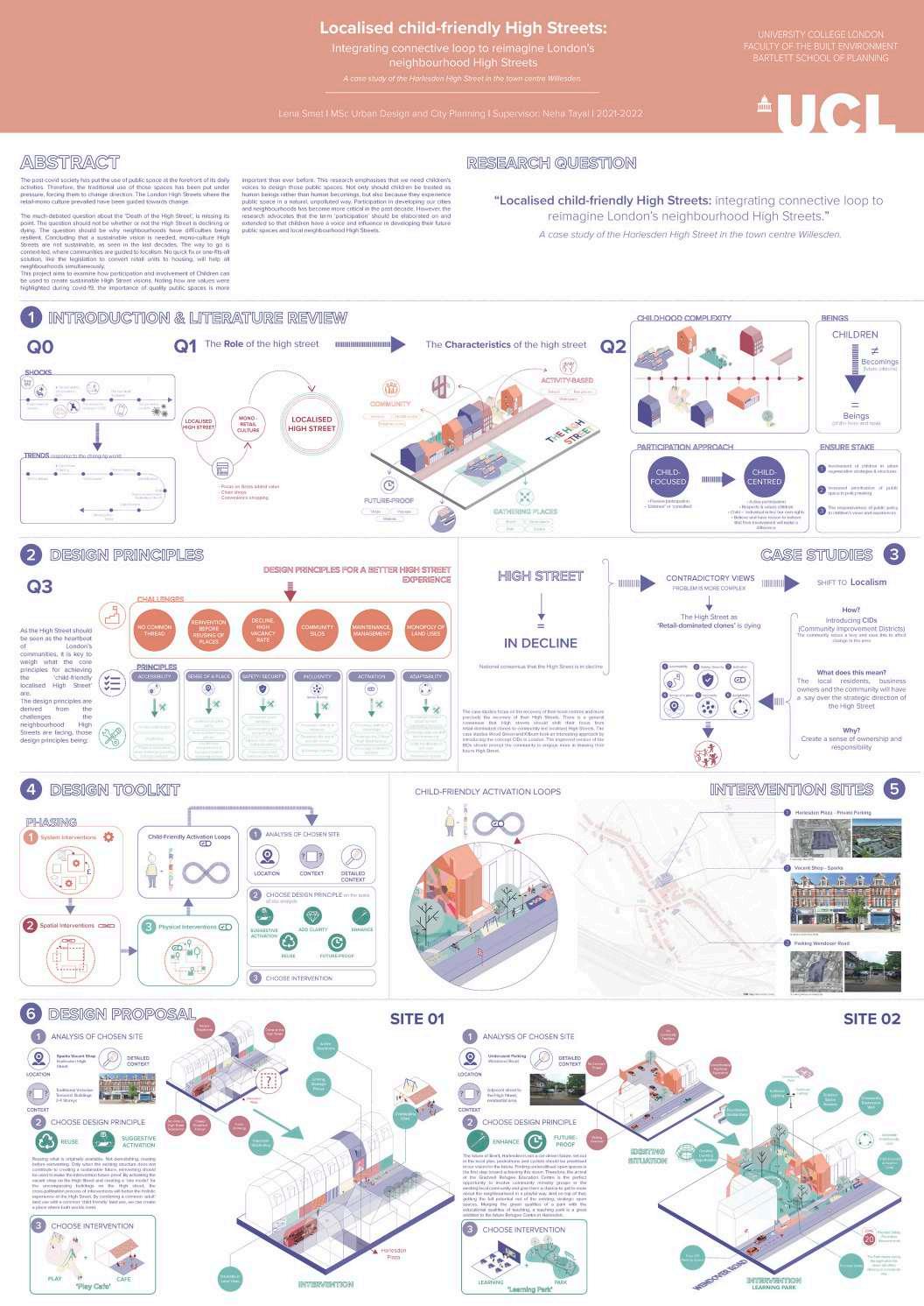
MRP: summary image - Illustrator
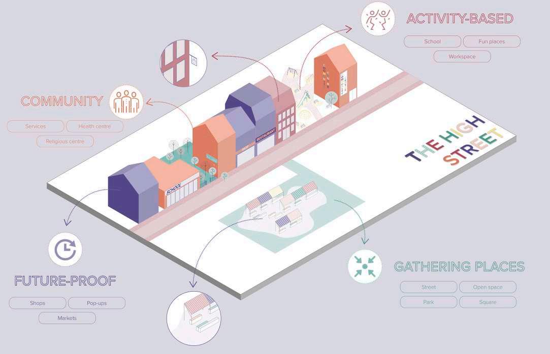
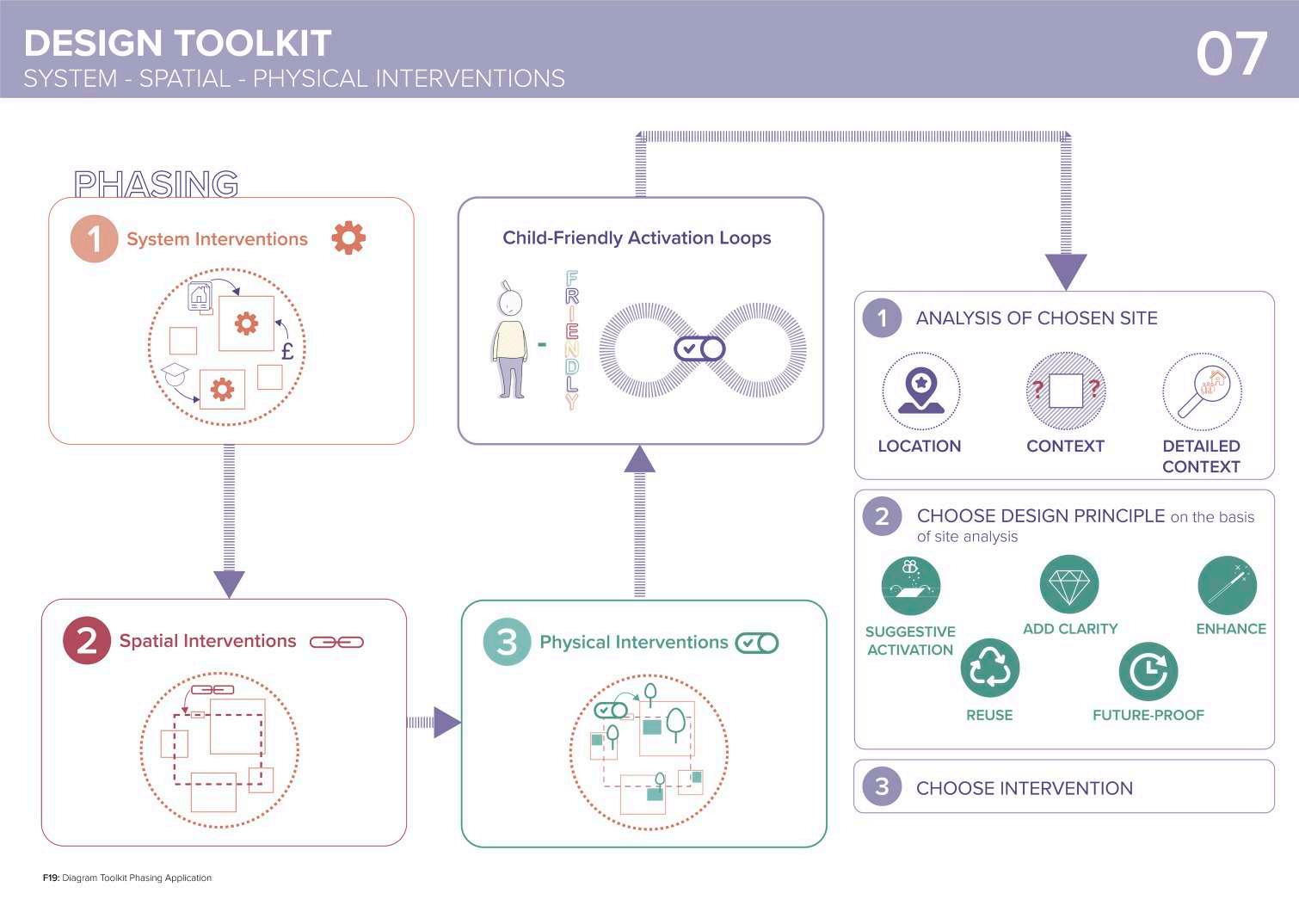
Integration a connective loop to reimagine london’s neighourhood High Streets.
The post-COVID era has brought public spaces to the forefront, pressuring traditional uses, particularly on London’s High Streets, where retail monoculture is no longer sustainable. The debate over the “Death of the High Street” misses the key issue: why neighbourhoods struggle with resilience. Sustainable, context-led solutions fostering localism are essential, as one-size-fits-all approaches, like converting shops into housing, are inadequate.
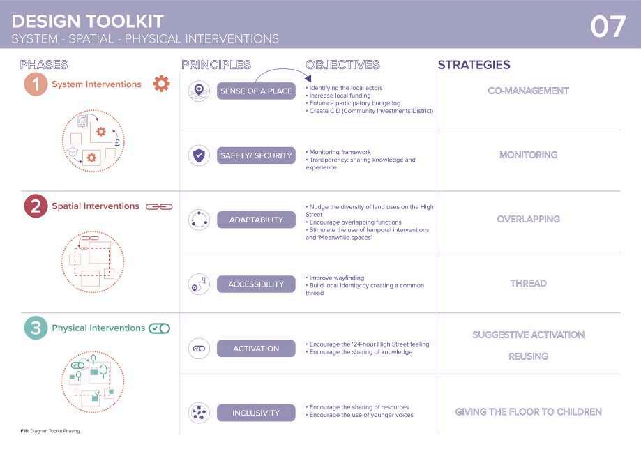
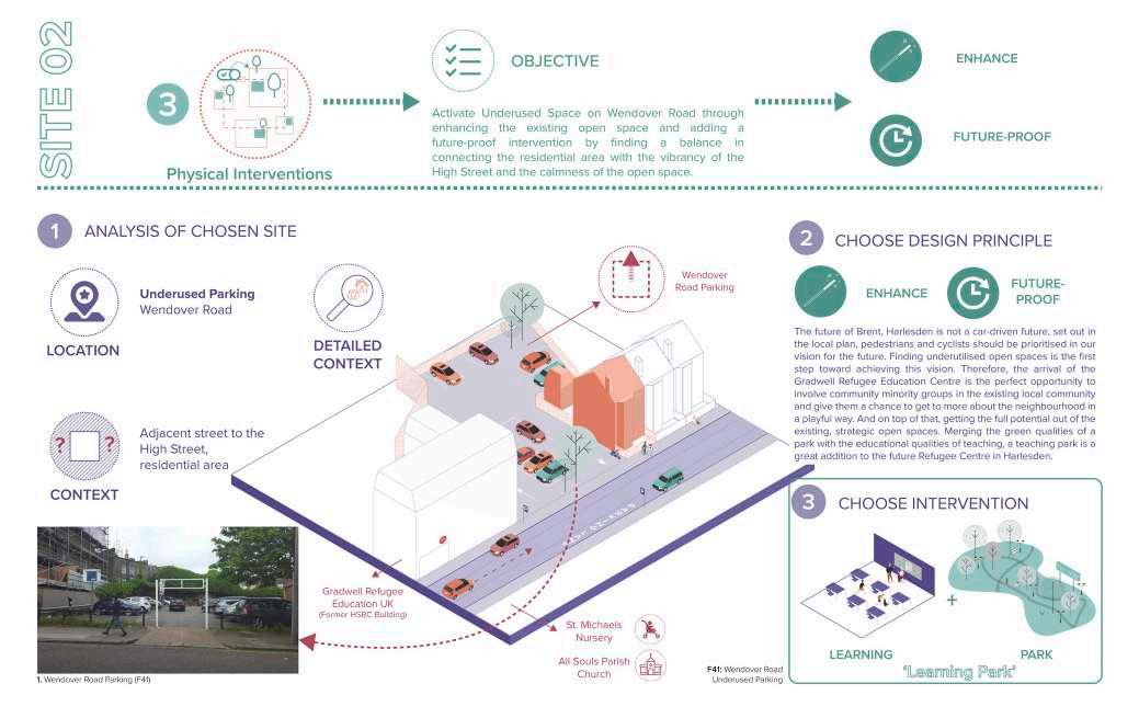
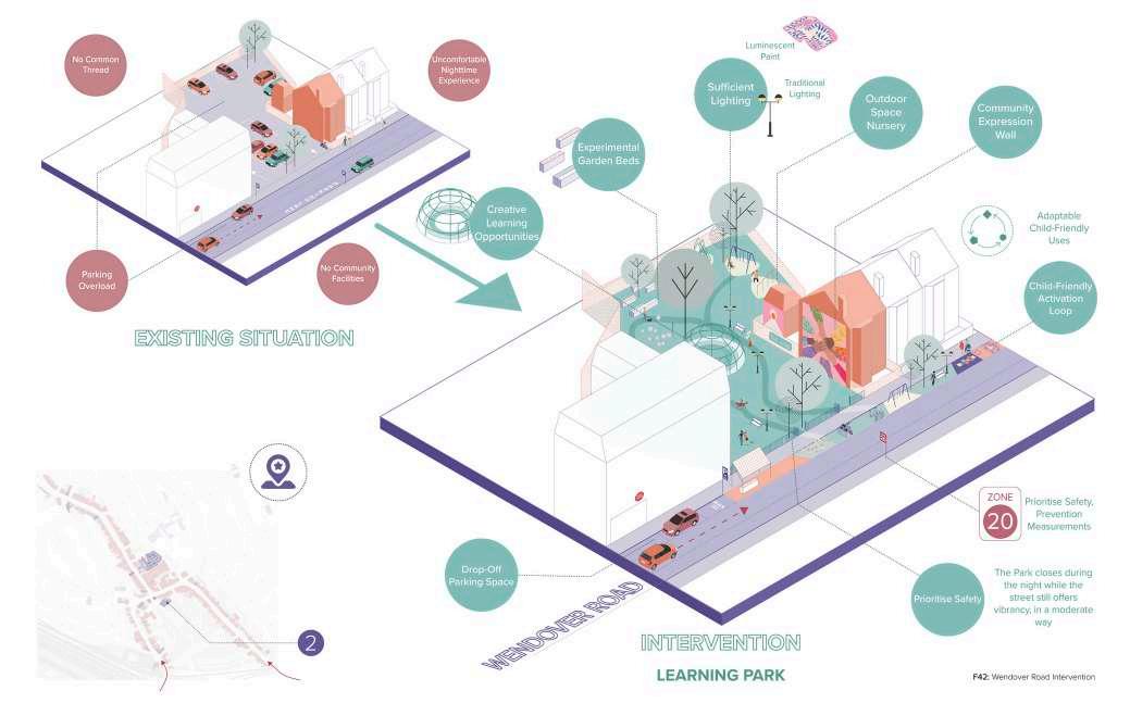
This research emphasises involving children in designing High Streets and public spaces. COVID-19 highlighted the importance of quality spaces, and children’s unfiltered experiences and voices are vital for creating sustainable, inclusive neighbourhoods. Participation must evolve to give children meaningful influence in shaping their communities’ future.
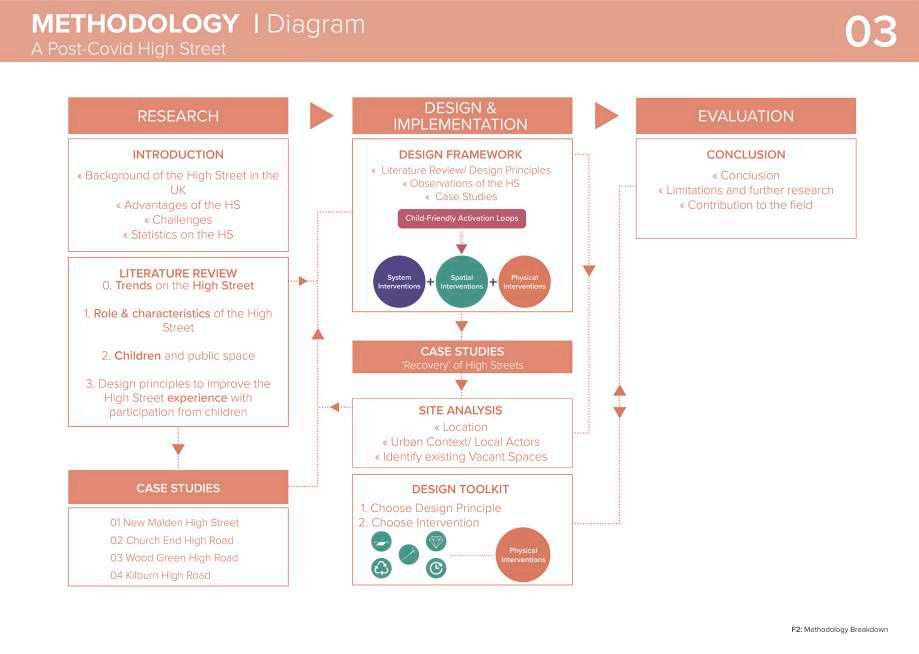
Extract from MRP submission: Methodology
Extract from MRP submission: Design Toolkit



BY LENA SMET