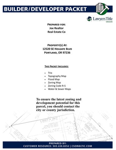
Prepared for: Joe Realtor Real Estate Co
Property(s) At: 12520 SE Holgate Blvd Portland, OR 97236
This Packet Includes: • • • • • •
Trio Topography Map Flood Map Zoning Map Zoning Code R-5 Water & Sewer Maps
To ensure the latest zoning and development potential for this parcel, you should contact the city or county jurisdiction.
Multnomah County Parcel Information
Parcel Information
Assessment Information
Parcel #: R335072 Tax Lot: 1S2E14BB00800 Site Address: 12520 SE Holgate Blvd Portland OR 97236 - 3731 Owner: Standard Investment Properties Inc 9190 W Olympic Blvd #311 Beverly Hills CA 90212 Twn/Range/Section 01S / 02E / 14 / NW : Parcel Size: 0.91 Acres (39,741 SqFt) Plat/Subdivision: Lot/Block: Map Page/Grid: 628-A3
Market Value Land: $390,000.00 Market Value Impr: $0.00 Market Value Total: $390,000.00 Assessed Value: $164,480.00 (2021)
Tax Information Levy Code Area: 113 Levy Rate: 23.2469 (2021) Tax Year: 2021 Annual Tax: $3,823.63 Exemption:
Legal SECTION 14 1S 2E, TL 800 0.91 ACRES
Census 009000 / 2003 Tract/Block:
Land Cnty Land Use: 100 - Residential, Unimproved Land Use Std: RSFR - Single Family Residence
County Bldg Use: B - Residential Improved Recreation:
Watershed: Johnson Creek-Willamette River Zoning: Portland-R5 - Residential 5,000 School District: 40 - David Douglas
Neighborhood: POWG - Powellhurst-Gilbert # Dwellings: Elementary School: Gilbert Heights Elementary School High School: David Douglas High School
Middle School: Alice Ott Middle School
Improvement Year Built: Bedrooms: Baths, Total: Roof Covering: A/C: Kitchen:
Stories: Garage: Baths, Full/Half: Exterior Walls: Heat: Porch/Patio:
Total Area: First Floor: Second Floor: Basement Fin/Unfin: Attic Fin/Unfin: Deck:
Transfer Information Sale Date: 02/04/2005
Sale Price: $12,500.00
Doc Num: 2005020928
Doc Type: BSD
Sentry Dynamics, Inc. and its customers make no representations, warranties or conditions, express or implied, as to the accuracy or completeness of information contained in this report.
Property
Owner
Property Address
2021 Assessed Value
$164,480
R335072 STANDARD INVESTMENT PROPERTIES INC 12520 SE HOLGATE BLVD, PORTLAND, OR 97236 GENERAL INFORMATION
RELATED PROPERTIES
Property Status Property Type Legal Description Alternate Account Number Neighborhood
A Active
Split/Merge data prior to February 6, 2018 is not available online, please call Multnomah County Assessment & Taxation division.
RP Residential -
Property Group ID
-
Grouped Properties
-
Split / Merge Date
-
Split / Merge Accounts
-
Split / Merge Message
-
R992141900 R091
Map Number
1S2E14BB -00800
Property Use
B - RESIDENTIAL IMPROVED
Levy Code Area
Linked Properties SECTION 14 1S 2E, TL 800 0.91 ACRES
113
OWNER INFORMATION Owner Name Mailing Address
STANDARD INVESTMENT PROPERTIES INC 9190 W OLYMPIC BLVD #311 BEVERLY HILLS, CA 90212
LAND SEGMENTS LAND NO
LAND TYPE
LAND SIZE
L1
RES RESIDENTIAL LAND
39,741 Sq. ft
TOTALS
39,741 Sq. ft / 0.91 acres
ASSESSED VALUES YEAR
IMPROVEMENTS
LAND
SPECIAL MARKET / USE
RMV
M5 VALUE
EXEMPTIONS
M50 ASSESSED
2021
-
$390,000
-/-
$390,000
$390,000
$164,480
2020
-
$377,500
-/-
$377,500
$377,500
$159,690
2019
-
$365,000
-/-
$365,000
$365,000
$155,040
2018
-
$327,500
-/-
$327,500
$327,500
$150,530
2017
$0
$280,000
$0 / $0
$280,000
$280,000
$146,150
2016
$0
$240,000
- / $0
$240,000
$240,000
$141,900
2015
$0
$195,000
$0 / $0
$195,000
$195,000
$137,770
2014
$0
$165,000
$0 / $0
$165,000
$165,000
$133,760
2013
$0
$152,500
$0 / $0
$152,500
$152,500
$129,870
SALES HISTORY DEED
SELLER
BUYER
STANDARD INVESTMENT PROPERTIES INC STANDARD INVESTMENT PROPERTIES INC
CONSIDERATION
INSTR #
DATE
2003188284
4/4/2003
$165,100
2005020928
12/2/2004
$12,500
11/15/2002
-
TRD
SCHUKIN,MIKHAIL
BSD
COADY,DEREK J & ALLEN,SARA L
DV
SCHUKIN,MIKHAIL
SCHUKIN,ANOUSH
2002208131
INST
SCHUKIN,MIKHAIL
SCHUKIN,MIKHAIL
98042038
AMOUNT
-
WD
MOLDOVAN,ANNA ET AL
MISSAELIAN,KHATCHIK C ET AL
94175329
11/1/1994
$103,000
WD
PORTLAND WELLS FARGO ASSOCIATES LTD
PORTLAND WELLS FARGO ASSOCIATES LTD
BP19210341
7/1/1986
$50,000
If applicable, the described property is receiving special valuation based upon its use. Additional rollback taxes which may become due based on the provisions of the special valuation are not indicated in this listing.
TOTAL TAXES DUE Current Year Due
TAX SUMMARY TAXYEAR
? Details
Eéective Date:
TOTAL
AD
SPECIAL
BILLED
VALOREM
ASMT
PRINCIPAL
INTEREST
DATE
TOTAL
PAID
OWED
2021
$3,823.63
$3,823.63
$0
$3,823.63
$50.98
-
$3,874.61
2020
$3,463.89
$3,463.89
$0
$3,463.89
$0.00
-
$0.00
2019
$3,353.49
$3,353.49
$0
$3,353.49
$0.00
-
$0.00
2018
$3,250.50
$3,250.50
$0
$3,250.50
$0.00
-
$0.00
2017
$3,130.57
$3,130.57
$0
$3,130.57
$0.00
-
$0.00
2016
$3,048.19
$3,048.19
$0
$3,048.19
$0.00
-
$0.00
2015
$2,915.28
$2,915.28
$0
$2,915.28
$0.00
-
$0.00
2014
$2,596.63
$2,596.63
$0
$2,596.63
$0.00
-
$0.00
2013
$2,437.89
$2,437.89
$0
$2,437.89
$0.00
-
$0.00
2012
$2,479.23
$2,479.23
$0
$2,479.23
$0.00
-
$0.00
2011
$2,510.68
$0.00
$0
$2,510.68
$0.00
-
$0.00
2010
$2,559.87
$0.00
$0
$2,559.87
$0.00
-
$0.00
2009
$2,502.27
$0.00
$0
$2,502.27
$0.00
-
$0.00
2008
$3,981.72
$0.00
$0
$3,981.72
$0.00
-
$0.00
TAXYEAR
RECEIPT NUMBER
TRANSACTION DATE
PAYMENT AMOUNT
2020
MULT-986159
3-12-2021
$3,244.98
2020
MULT-985295
3-5-2021
$3,244.48
2019
MULT-476920
11-14-2019
2018
MULT-348549
6-18-2019
($1,711.94)
2018
MULT-348549
6-18-2019
$1,711.94
2018
MULT-348586
6-18-2019
$1,711.94
2018
MULT-347528
6-13-2019
$1,711.94
2017
8905696
8-10-2018
$3,381.01
2016
8474152
11-23-2016
$2,956.74
2015
8068363
11-16-2015
$2,827.82
2014
7726327
11-18-2014
$2,518.73
2013
7387989
11-18-2013
$2,364.75
2012
7107998
4-15-2013
$2,556.36
2011
6641437
11-15-2011
$2,435.36
2010
6149526
11-8-2010
$2,483.07
2009
5965378
11-27-2009
$2,513.40
2008
5363632
11-3-2008
$3,862.27
$813.22
Past Years Due
Total Due
$3,874.61 $0.00
$3,874.61
Pay My Bills
Aerial Map
Parcel ID: R335072 Sentry Dynamics, Inc. and its customers make no representations, warranties or conditions, express or implied, as to the accuracy or completeness of information contained in this report.
Assessor Map
Parcel ID: R335072 Site Address: 12520 SE Holgate Blvd Sentry Dynamics, Inc. and its customers make no representations, warranties or conditions, express or implied, as to the accuracy or completeness of information contained in this report.
Contour Map
Parcel ID: R335072 Sentry Dynamics, Inc. and its customers make no representations, warranties or conditions, express or implied, as to the accuracy or completeness of information contained in this report.
Flood Map
Parcel ID: R335072 Sentry Dynamics, Inc. and its customers make no representations, warranties or conditions, express or implied, as to the accuracy or completeness of information contained in this report.
Zoning Map
Parcel ID: R335072 Sentry Dynamics, Inc. and its customers make no representations, warranties or conditions, express or implied, as to the accuracy or completeness of information contained in this report.
12520 SE HOLGATE BLVD Property details: Portlandmaps.com R335072 Zoning | Comp Plan Summary Existing Base Zone(s): Residential 5,000 (R5) Existing Overlay Zone(s): Constrained Sites (z) Existing Comprehensive Plan: Residential 5,000
Constrained Sites (z) Overlay Zone Currently applies: Yes Proposed to apply: No To be removed: Yes
RIP2 Proposal Summary Removing the Constrained Sites (z) Overlay Zone The Constrained Sites (z) overlay zone is applied to properties with natural hazards and/or natural resources that are unsuitable for the additional households allowed by the Residential Infill Options. This overlay was added to lots in the R2.5, R5, and R7 zones containing natural resources or hazards with the Residential Infill Project Part 1 (RIP). The methodology for how natural resource lands are identified for inclusion in the ‘z’ overlay is being updated with RIP2. Previously, all natural resource areas that were identified in the City’s Natural Resources Inventory (NRI) were included in the 'z' overlay. Under the new methodology, the environmental overlay zones (Environmental Conservation (c), Environmental Preservation (p), and the Pleasant Valley Natural Resources (v) overlays) will be used to identify the natural resource areas for the 'z' overlay. The NRI methodology included some lower-ranked natural resources that are not captured by the environmental overlays. As a result, these lower-ranked resource areas are being removed from the 'z' overlay zone. Note: this is based on current and proposed environmental zone boundaries that may change. See the Environmental Overlay Zone Map Correction project for more information on those potential changes. Removal of the Constrained Sites (z) overlay zone from a lot means that more middle housing allowances may be available to that lot. Allowed Housing Types The recommended Residential Infill Options allow a greater number of additional housing types in R7, R5 and R2.5 zones. In addition to a house plus one accessory dwelling unit, the following housing types may be allowed in these zones: House (plus two Accessory Dwelling Units) Duplex (plus one detached Accessory Dwelling Unit) Triplex Fourplex Cottage Cluster Attached Houses (aka townhouses) Already allowed
House
House & ADU
Corner lot duplex
New housing types allowed
House w/ 2 ADUs
Triplex
Duplex w/ ADU
Fourplex
Cottage Cluster
Attached Houses
Minimum Lot Size by Base Zone (ft2) Housing Type
R20
R10
R7
R5
R2.5
Attached House
1,500
1,500
1,500
1,500
1,500
House, House w/ 1 ADU, Duplex (1-2 units)
12,000
6,000
4,200
3,000
1,500
House w/ 2 ADUs, Duplex w/ 1 ADU, Triplex, Fourplex (3-4 units) *
12,000
6,000
5,000
4,500
3,200
Cottage Cluster (3-16 units) *
N/A
7,000
7,000
5,000
5,000
* Additional requirements for lots with 3 or more units include: Must also be on a street accepted for maintenance. Refer to the map which shows streets that have not been accepted for maintenance. 1/3 of units are required to be visitable. A visitable unit generally has a zero step entry with a bathroom and living space on the ground floor.
Streamlined Land Divisions In compliance with Senate Bill 458 (SB458), lots with duplexes will be allowed to be split so that each duplex unit is on its own lot. This provides for more simplified homeownership opportunities. An expedited land division process also ensures that these types of requests are reviewed more quickly. Duplexes will need to meet higher fire rated building code requirements, and utilities must serve each unit individually. In compliance with Senate Bill 458 (SB458), lots with middle housing (duplexes, triplexes, fourplexes, and cottage clusters) will be allowed to be split so that each dwelling unit is on its own lot. This provides for more simplified homeownership opportunities. An expedited land division process also ensures that these types of requests are reviewed more quickly. Structures will need to meet higher fire rated building code requirements, and utilities must serve each unit individually. Other Key Changes More opportunities for improved housing accessibility and affordability.
On sites with three or more units, one unit must be visitable with a zero-step entry, and a bathroom and living space on the ground floor. When at least one unit meets affordability requirements, provide an additional floor area bonus. When 50% of the units meet affordability requirements, allow up to six units and more floor area. More Information Several other changes to the zoning and development rules are proposed with the Residential Infill Project – Part 2 that are not summarized in this mapping tool. For more information about these other recommendations and how they may affect your property, please refer to the project website: www.portland.gov/bps/rip2 . Other zoning regulations may also apply to this property. For more information, please view the zoning information applicable to this property via Portlandmaps.com R335072
12520 Snapshot SE HOLGATE BLVD PORTLAND, OR 97236
WATER Water District(s)
City of Portland Water Bureau (503) 823-7404
Pressure Zone(s)
KELLY BUTTE 427 TANK
This map depicts the approximate location of water facilities located in the public right-of-way; the actual physical location can only be established by requesting a free utility locate. Call the Oregon Utility Notification Center by dialing 811. Location of water piping on privately owned property is unknown to the Portland Water Bureau, and is shown for illustrative purposes only.
12520 Snapshot SE HOLGATE BLVD PORTLAND, OR 97236
SEWER ASSETS (within 350 feet) Nodes ID
Description
System
Distance
ADU750
SUMPS
STORM
244'
ANV022
INLETS
INLET
250'
ANL535
MANHOLES
SEWER
262'
ACK476
SEDIMENTATION MANHOLES
STORM
268'
ANL548
INLETS
INLET
269'
ANL540
SEDIMENTATION MANHOLES
STORM
274'
ACK462
MANHOLES
SEWER
284'
ACE775
MANHOLES
SEWER
292'
ACE776
MANHOLES
SEWER
294'
AQV479
INLETS
INLET
298'
ANL541
DISCHARGE POINTS
STORM
309'
ADT451
SUMPS
STORM
315'
ANX987
WATERWAY FEATURES
STORM
317'
APJ475
INLETS
INLET
320'
ANX986
WATERWAY FEATURES
STORM
323'
ANL543
WATERWAY FEATURES
STORM
328'
ACK461
MANHOLES
SEWER
329'
ANX985
WATERWAY FEATURES
STORM
331'
ADU745
SUMPS
STORM
338'
ADU746
SUMPS
STORM
343'
ANX984
WATERWAY FEATURES
STORM
343'
APJ473
NO ACCESS POINTS
STORM
344'
ACE846
SEDIMENTATION MANHOLES
STORM
344'
ACK471
SEDIMENTATION MANHOLES
STORM
345'
ANL534
MANHOLES
SEWER
347'
APQ510
WATERWAY FEATURES
STORM
348'