
24 March, 2026
We would like to respectfully acknowledge the Traditional Custodians of the land, the Cameraygal people, and pay respect to their Elders past and present, recognising their historical and on-going connection to country.


Scope and objectives
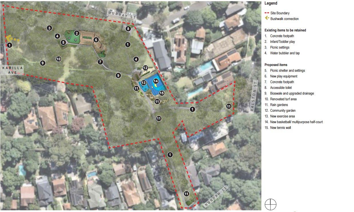
a) Stringybark Reserve Masterplan (Adopted by Council)
b) The value of WSUD
Site Analysis
a) Context and Catchment
b) Stormwater MUSIC Modelling 3. Design Response – Detail Strategy Plan
a) Stage 1: Ephemeral Creek Bed
b) Stage 2: Bioswales
c) Stage 3: Raingardens
Outcomes and assumptions
Acknowledgements

Wave Consulting Australia was engaged to develop a Water Sensitive Urban Design Detailed Strategy Plan for Stringybark Reserve, Lane Cove North, for Lane Cove Council.
The Detail Strategy Plan includes:
• Options to improve connections of the five identified private stormwater drainage outlets
• Proposed WSUD assets with the aim to:
• Provide for local retention and absorption of stormwater
• Reduce the risk of water logging in the reserve
• Slow local runoff and reduce the risk of erosion
• Reduce litter and nutrients flowing to Stringybark Creek Lane Cove River
• Report on stormwater quality benefits
• The Stringybark Reserve masterplan document had addressed a series of local concerns by identifying potential WSUD features
• The objective of this Detailed Strategy Plan is to review and refine the WSUD features from the Masterplan, through additional analysis and design development
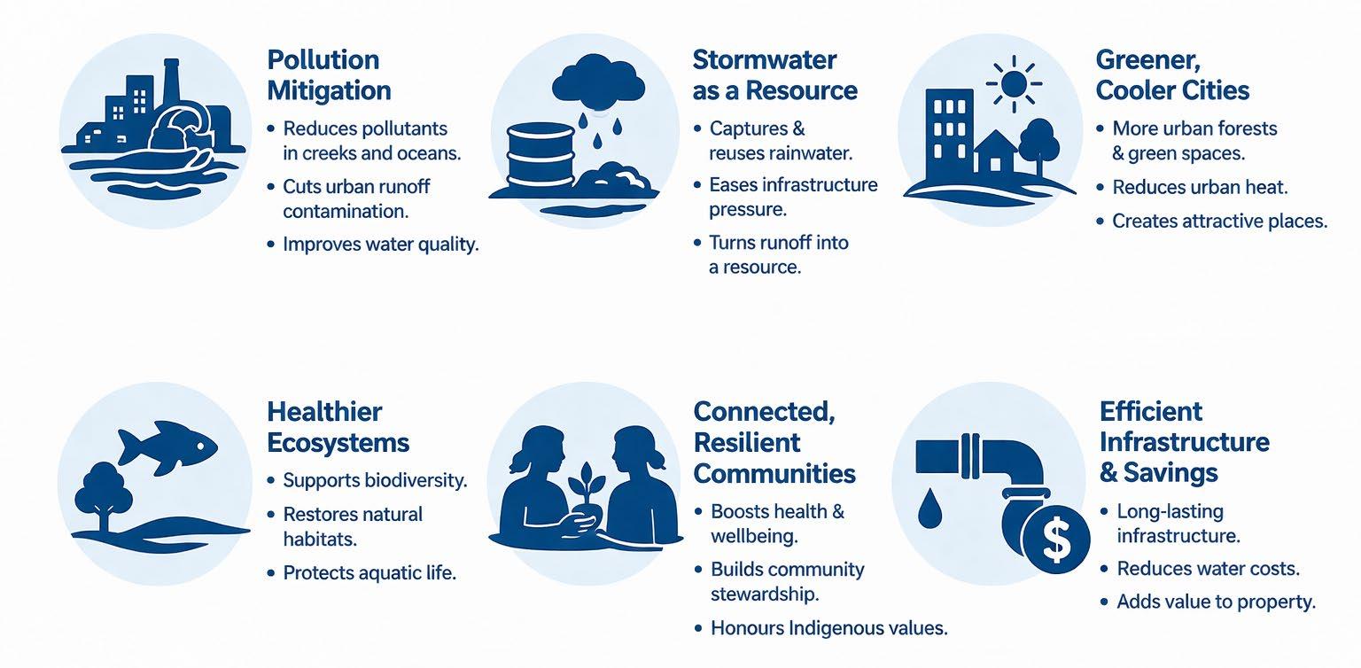
There are several values and benefits to adding WSUD assets into a public space.
In the context of Stringybark Reserve, the assets have a primarily ecological and community benefit.
The other benefits listed in the diagram are not as pronounced for this scale and context, or not a primary objective of the design intervention.
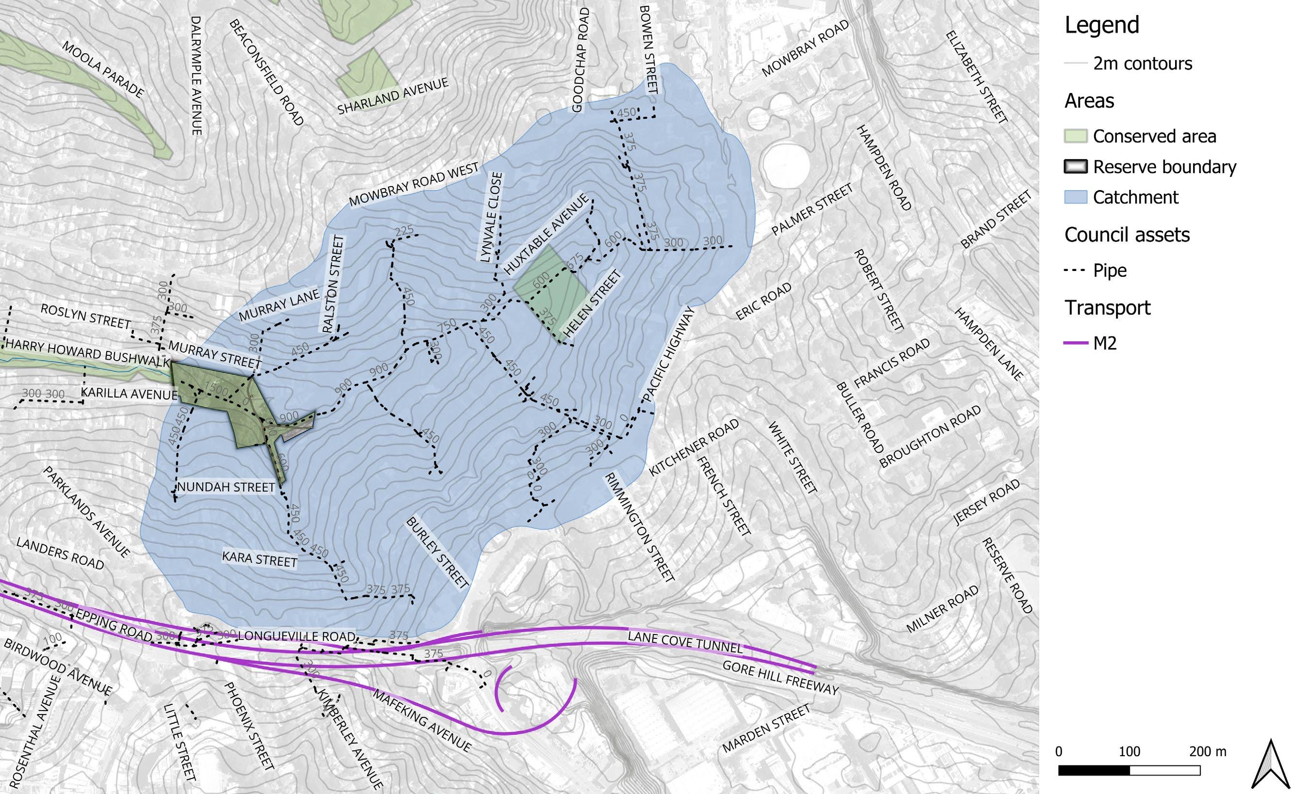
There is a 40.3 hectare catchment upstream of Stringybark Reserve, all draining into four main drainage conduits that ultimately surface from the 1500 mm pipe, into Stringybark Creek.
The reserve itself has an area of 1.17 hectares.
MUSIC (Model for Urban Stormwater Improvement Conceptualisation) is software that simulates rainfall, stormwater runoff, and pollutant generation to test the performance of Water Sensitive Urban Design (WSUD) systems. Developed by eWater, it helps designers and Councils optimise treatments like wetlands, biofiltration, and rainwater tanks to meet water quality targets.
Method
MUSIC modelling was undertaken, using the Bureau of Meteorology's pluvio rainfall station at Mosman rainfall station (066184) as the rainfall record. This station has data from 1984 to 2010.
Potential evapotranspiration estimates were taken from the Bureau of Meteorology’s monthly PET modelled grid database (see https://www.bom.gov.au/climate/maps/averages/evapotranspiration/ ?maptype=ap&period=an)
Catchment runoff nodes were assumed to be local catchment area only, not piped drainage (as it flows in concrete pipes under the reserve). Some nearby houses and impervious areas were assumed to be running into the reserve.
WSUD assets were designed in accordance with the master plan described in the previous sections and tested to assess the anticipated outcomes.
Modelled Pollution Reduction Rates (based on MUSIC)
TSS: Total suspected solids
TP: Total phosphorous
TN: Total nitrogen
Results
On average:
These are common stormwater soluble pollutants that impact on waterways and estuaries.
• 90 megalitres/year of stormwater flows from the catchment above Stringybark Reserve, into underground drains, and enters Stringybark Creek,
• an additional 23 megalitres/year of baseflow comes from the catchment and flows through the subsurface soils into Stringybark Creek.
• The local catchment (that will flow into these proposed WSUD assets), is 17,500 m2 (or 1.75 ha).
WSUD assets were successful in reducing pollution and absorbing runoff, but do not restore the creek hydrology and water quality to natural levels (modelled as a 100% pervious simulation).
All proposed WSUD assets perform well in reducing pollution and, to a lesser degree, absorbing runoff.
% flowing to creek % pollution absorbed / infiltrated
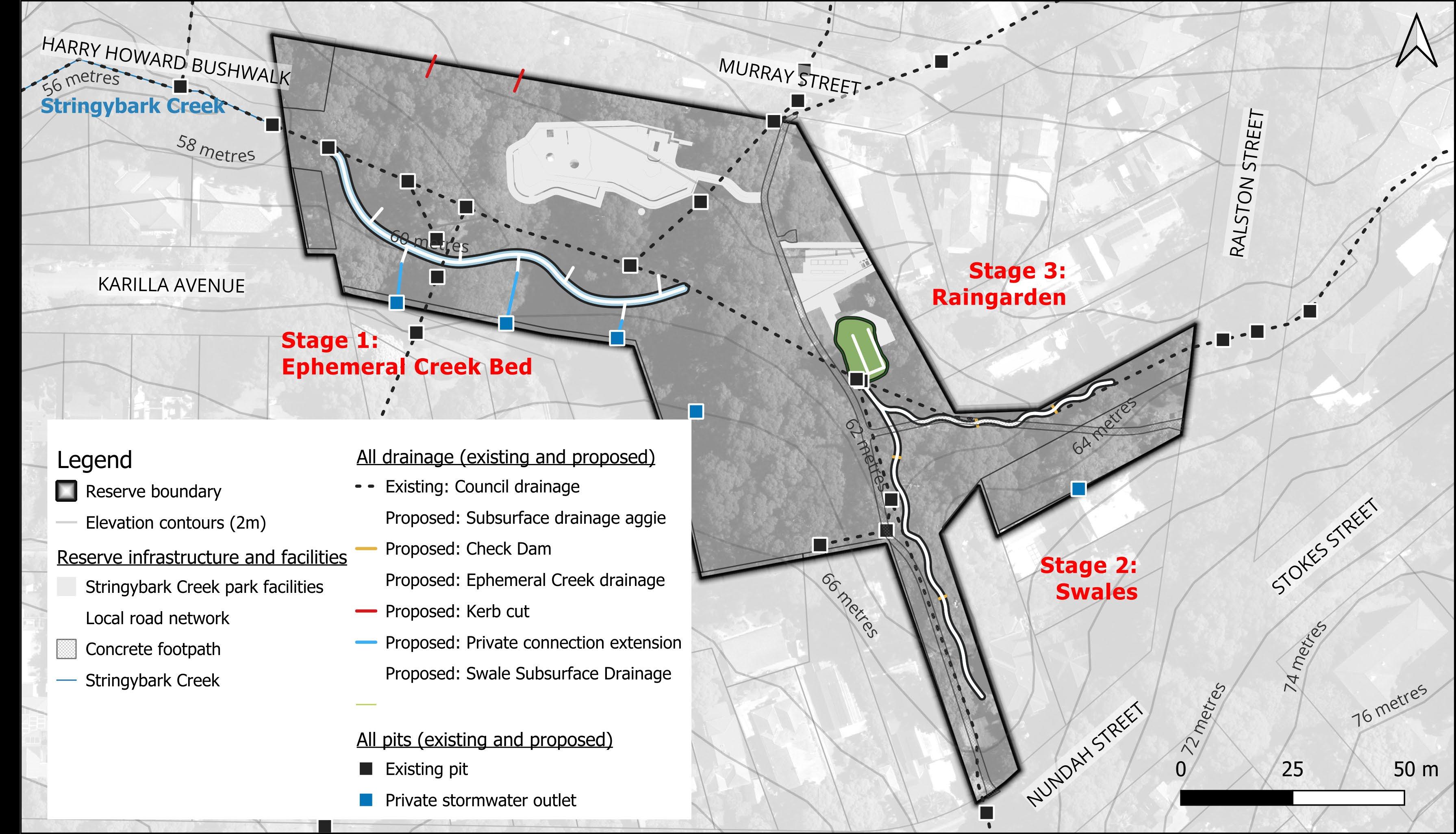
The WSUD Detailed Strategy Plan includes three staged WSUD design solutions.
The plan aims to create a series of WSUD assets that link water, landscape and amenity in a way that can add value to the park, and address specific water relates issues.
The Ephemeral Creek Bed is part of Stage 1 as it addresses several issues (private drainage connections, drainage within reserve, water quality treatment, and adds biodiversity.
The later stage WSUD assets are addressing upstream issues, but do not have the same scale of benefit.
The Raingarden requires more works to be done regarding moving existing infrastructure.
This plan has refined the WSUD proposed solutions in the Stringybark Reserve Masterplan (2025), through additional analysis and modelling.
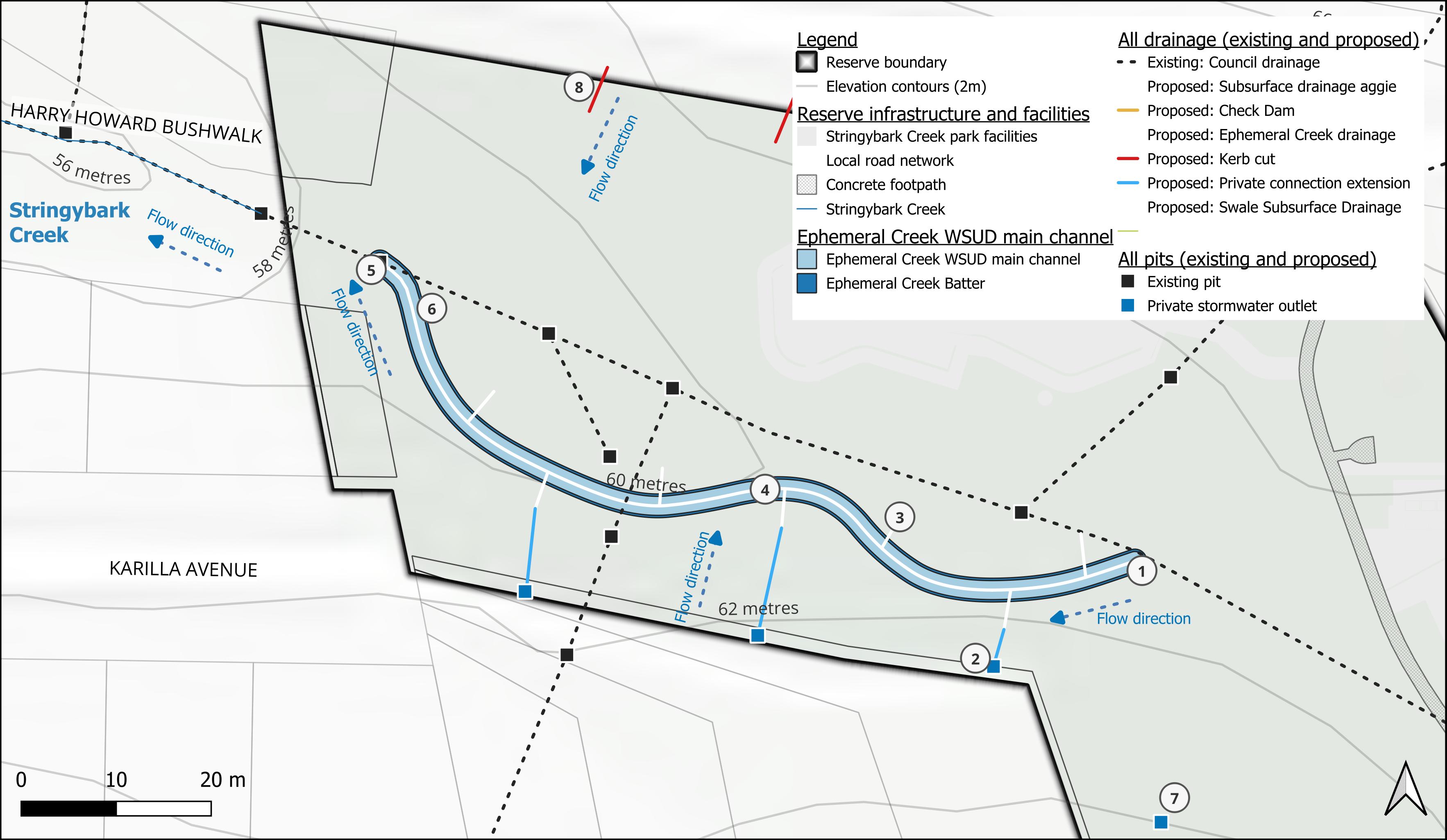
1 Ephemeral Creek Bed starts at top of raised area
2 Private drainage connections have PVC extension to new asset
3 Subsoil pipes increase drainage
4 Possible stepping stones
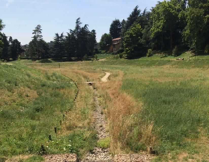
The “Ephemeral Creek” in the middle of the reserve is a means to create a natural drainage line through the reserve, which addresses several issues such as private stormwater connections, boggy areas, and does so with a minimal footprint. The bioswale is reduced in length compared to Feb 2025 Masterplan, to align with the natural topography. The area will remain suitable for passive recreation and dog walking.
The “Ephemeral Creek” (named as it will be wet and dry throughout the year) will be approximately 2 metres in width , 150 mm below the natural surface, and include subsurface drainage tributaries to connect to the main drainage line through the base of the creek (approximately 300 mm deep).
5 Use existing pit for overflow and subsurface connection
6 No submerged zone
7 No additional connection from this outlet due to minimal impact of existing pipe
8 Simple kerb cut into road reserve to allow water to flow off road
The 150 mm lowering of the centre base does not warrant, in Wave’s opinion, any barriers, fences, or stepping stones.
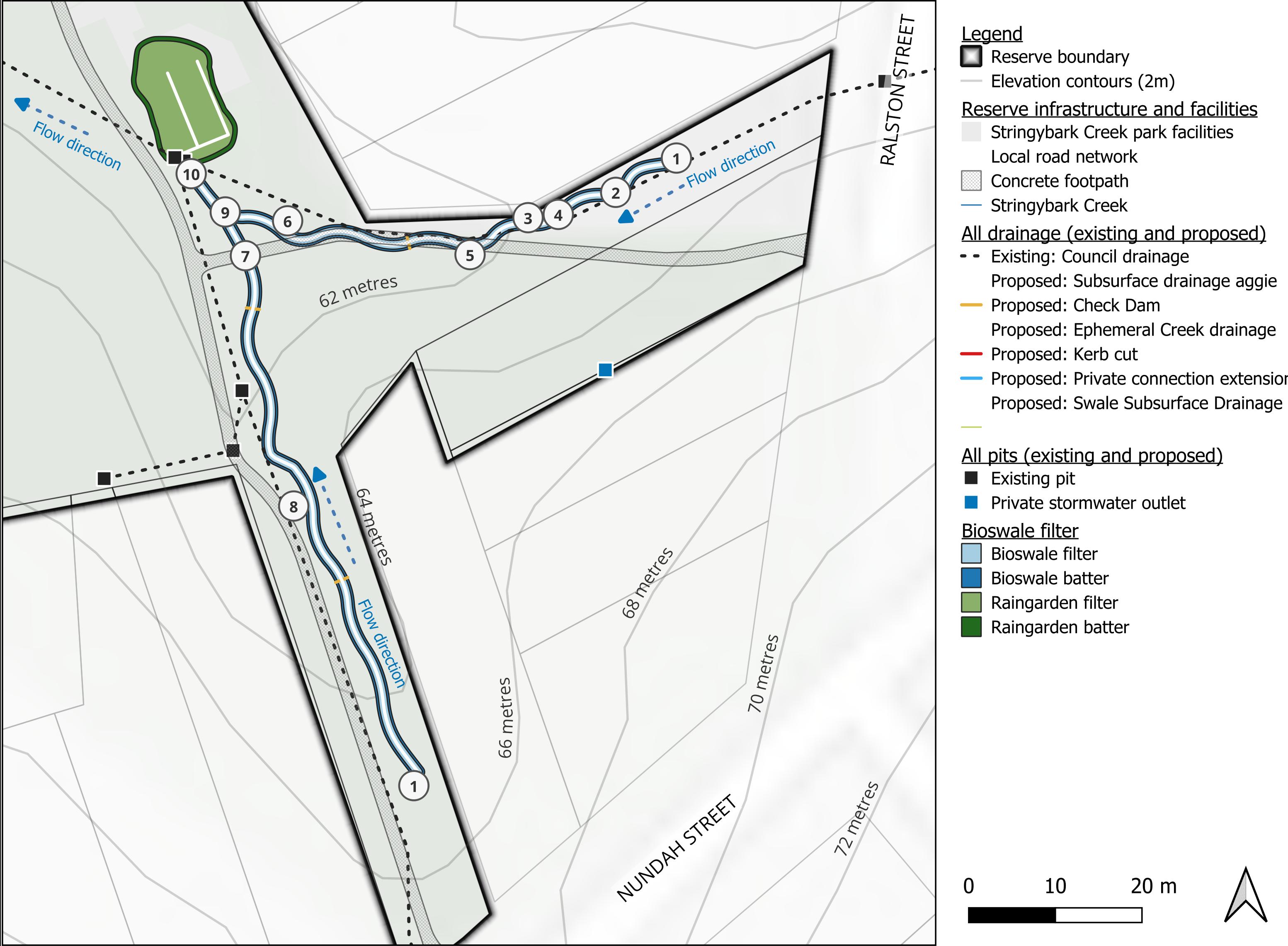
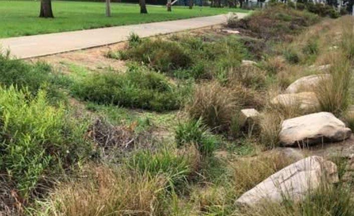
The “Upstream Bioswales” in the eastern and southern areas of the reserve create a formal (but above ground and natural) flow path to manage and direct overland flows to the main stormwater pit near the Community Garden and existing basketball court.
The assumption is that the path (and existing cricket nets) can be moved, to create enough room for the bioswales. The bioswales will be lined on the property side to avoid any impact on fences and properties.
The bioswale that starts near Nundah Street is designed to flow under the east / west concrete path. These bioswales are designed to enter the raingarden.
1 Location of start of swale is flexible
2 Meandering swale slows water
3 Edge always offset from fence line (and lined)
4 Check dams (rock) to slow water
5 Assumed path is relocated
6 Assumed basketball half court relocated
7 Conduit for swale to flow under relocated path
8 Batter to align with path to avoid small grass strip
9 Swales merge
10 Swale flows into (future) raingarden
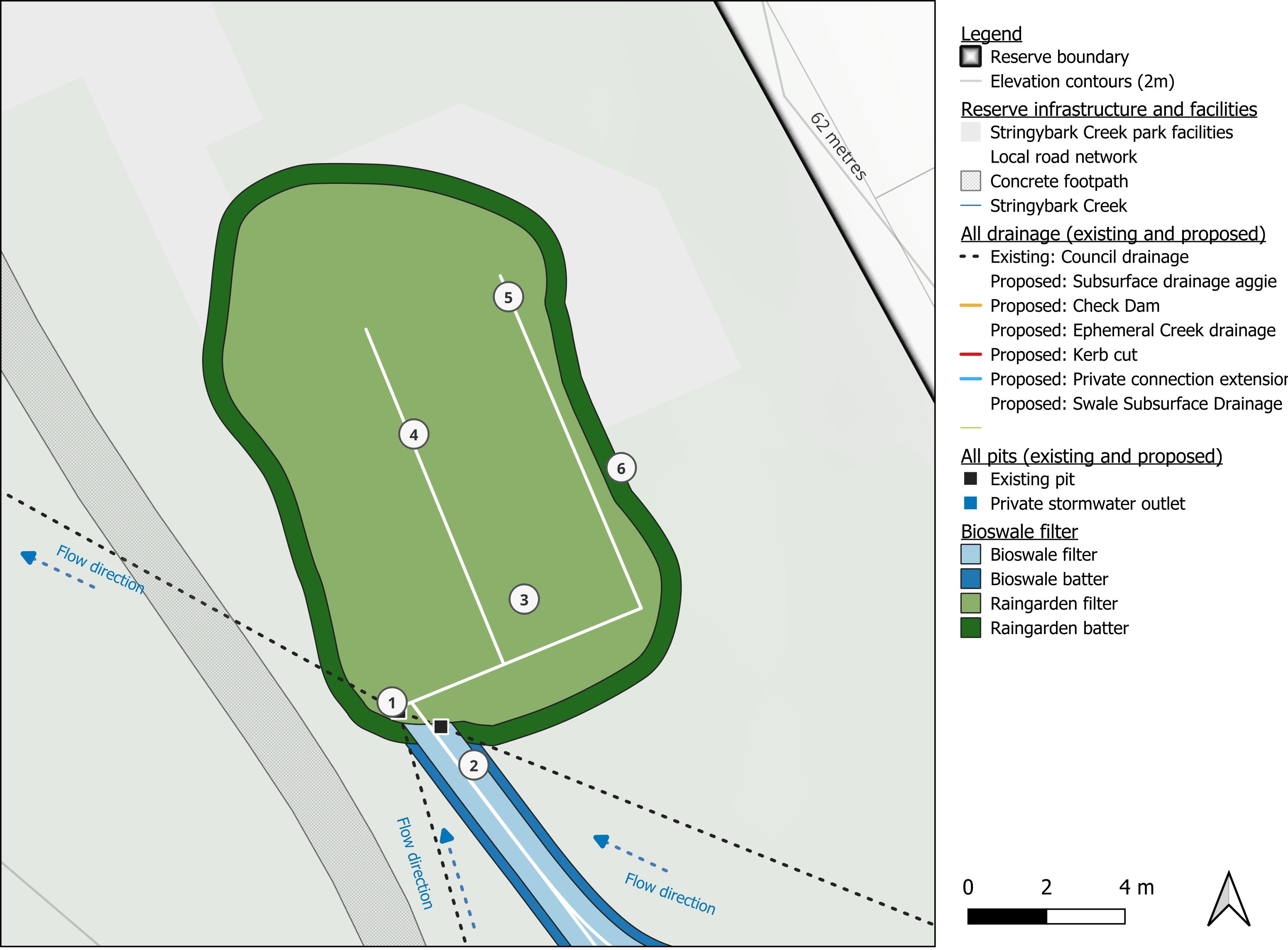
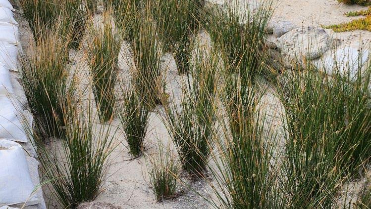
The “Raingarden” in the low point near the community garden and the stormwater pit and basketball court, is a natural place to filter runoff in this low point of the reserve. There in assumption that the existing concrete pad will be relocated. The size and shape of the raingarden as shown is indicative only and subject to change. The inflows to the raingarden come from the upstream bioswales.
Filtered water will enter the existing pit (both as an overflow and as filtered subsurface flow).
The planting of this raingarden can be flexible and should include a diversity of plants. The system will often be dry, and the planting should be consistent with a mostly dry raingarden.
This is considered a Stage 3 project, as the other WSUD assets can manage runoff without this element. However, this location is a natural low point where suitable vegetation species would thrive.
1 Existing pit for overflow
2 Upstream swales connect into raingarden
3 Existing court required to be relocated
4 Subsurface drainage lines direct filtered water to pit
5 Inspection points for flushing
6 Rock Wall Edge
1. Impact on existing infrastructure
a) The location of the WSUD assets should have minimal impact on existing infrastructure, apart from the assumed removal and relocation of the basketball court and path from Ralston Street.
b) The WSUD assets will reduce the volume and timing of flows downstream into Stringybark Creek, which will have a positive effect on the creek.
c) The Ephemeral Creek centre line will avoid being located above or near the sewer trunk line.
2. Maintenance
a) The WSUD assets are designed to have minimal maintenance. The main maintenance tasks are managing weeds, pruning and leaf litter removal. There should be minimal sediment accumulating in these assets, unlike WSUD assets on streetscapes. Typical maintenance resourcing is forecast to be 1 hour per asset per quarter.
b) Occasionally the subsurface drainage lines may need flushing.
3. Community amenity
a) These assets add more ‘natural landscape’ features to the reserve, with minimal impact. There may be a need to add a few stepping stones in the Ephemeral Creek Bed, to increase opportunities to cross the creek bed, however it is only 2 m wide, and has only a 150mm drop to the from edge to centre.
4. Indicative Plant List
Imperata cylindrica Blady Grass Poa sieberiana Grey Tussock grass
Ficinia nodosa Knobby Club Rush
Juncus usitatus Common Rush
Lomandra longifolia Mat-rush
Themeda australis Kangaroo Grass
Dianella caerulea Blue flax-lily
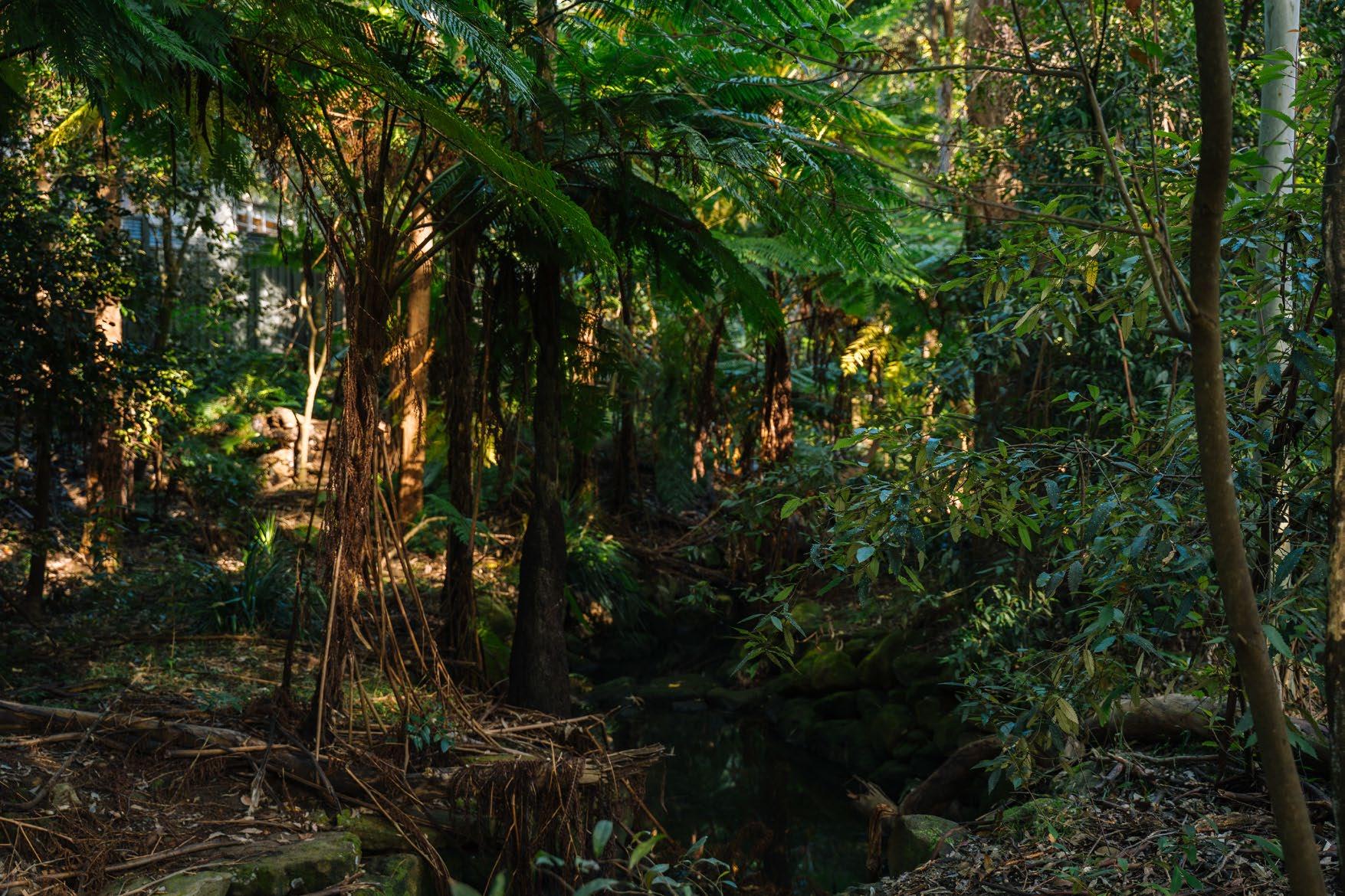
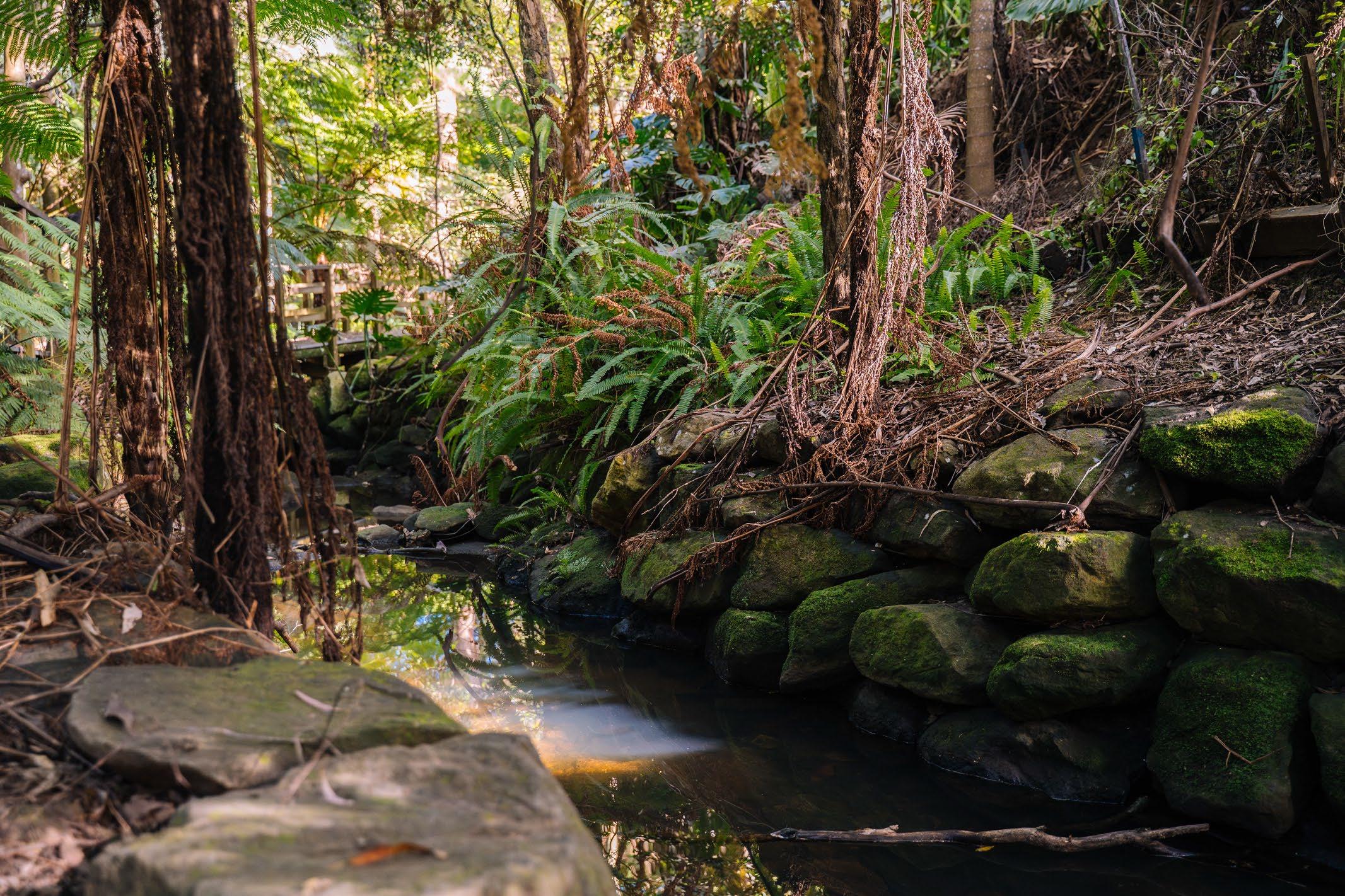
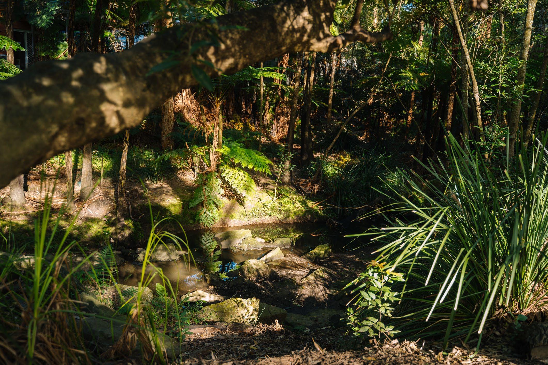
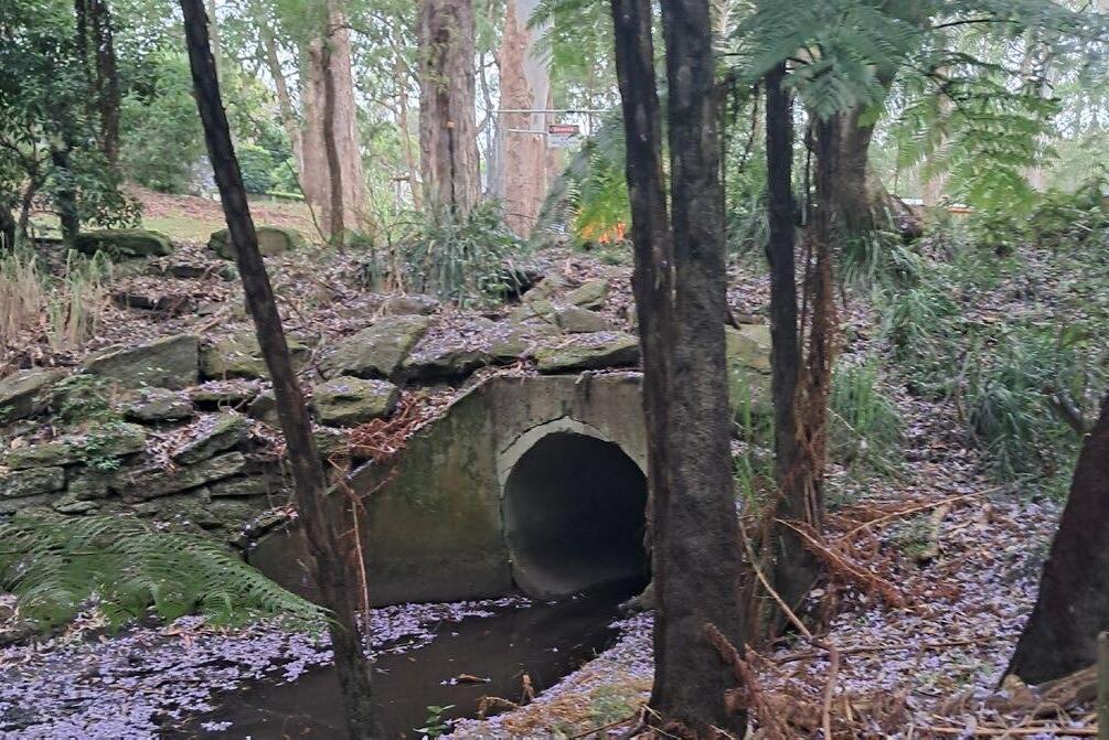
Stringybark Creek
Source: Lane Cove Council
• The team would like to acknowledge Harrison Lillis (Landscape Architect) and Millie Allsopp (Coordinator Parks and Urban Spaces) from Lane Cove Council
Document management
• Version 3. (Final draft)
• 23rd March 2026
Author
• Rob Catchlove. Director.
• rob.catchlove@waveconsulting.com.au || 0425 298 997