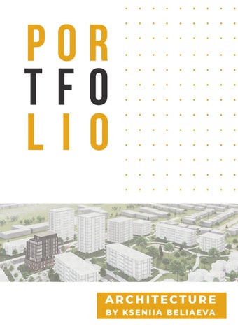
POR TFO LIO
ARCHITECTURE BY KS E N I I A B E L I A EVA
About Me My name is Kseniia. I grew up in a small town in Russia. I moved to Canada at the age of eighteen to obtain my architecture degree and further pursue my career. While studying for my bachelor’s degree, I gain experience with the House of Commons and the Government of Canada working on recognized heritage projects. I am interested in architecture in general and, more specif ically, in heritage conservation practices. I think that it is more sustainable to preserve, rehabilitate, and restore than demolish and build a new building. I believe in the idea that every building has a story that is worth saving. Furthermore, I am always compelled by a question of how to make a compatible addition that is modern in style but respectful to the characterdef ining elements of an existing heritage structure.
EDUCATION
EXPERIENCE
2016-2021 - Bachelor of Architectural Studies
2021 - Deputy Project Manager
Conservation and Sustainability Stream Carleton University
Real Property Services, Public Services and Procurement Canada
2015-2016 - Bachelor of Design
2019-2021 - Assistant Project Manager
1st year Environmental Design OCAD University
Real Property Services, Public Services and Procurement Canada
CONTACT
2018-2019 - Architect’s Assistant
kseniiabelaeva@cmail.carleton.ca
Real Property Common
Phone
+16138795772
k _arch_k
Services,
House
of
Table of Content RE-CURVE pp 04-13
ARCC4302: Conservation Studio 4 The studio focuses on the urban conservation of the Hintonburg neighbourhood in Ottawa (Canada) through the development of an adaptive reuse project in the area.
PINECREST HEIGHTS pp 14-21
ARCS4105: Housing Studio Following the larger theme of Housing, Community, City Building & Placemaking, f irst part of the studio explores the development of urban inf ill site in Ottawa.
ARMSTRONG TOWER pp 22-29
ARCS4105: Housing Studio Following the larger theme of Housing, Community, City Building & Placemaking, second part of the studio explores the development of multi-unit residential complex.
MUSKOWEKWAN M+A
pp 30-39 ARCC4303: Conservation in Practice The studio focuses on the adaptive reuse of the Muskowekwan Residential School and site in Lestock, Saskatchewan into a place of memory and healing.
LOWLINE SKYLINE pp 40-43
ARCC 4301: Conservation Studio The purpose of the studio is to propose an addition or inf ill to accommodate more rooms in the heritage hotel, Chateau Laurier.
LOCK MASTER HOUSE
pp 44-49 ARCC4207: Advanced Building Assesment The course focuses on exploring advanced documentation techniques to record the physical characteristics of the heritage structure.
Raised floor level to prevent deterioration caused by flooding
Extension at the back to connect with the Rideau River and showcase existing facade
Curved extension to allow for maximum sunlight, views and connect to natural setting
Extend the walls on the existing facade to display the existing condition caused by fire and deterioration
Make west faced of the addition the repeat the shape of the existing in a smaller scale. Connect roofs
DESCRIPTION RE-CURVE is an adaptive reuse project that explores how a designated building in ruined condition could be creatively transformed into a city landmark. The design concept is f irmly rooted in sustainable practices and determined by the trajectory of sun and shadow studies. The project showcases a sensitive conservation approach by preserving the existing structure and proposing distinguishable yet compatible addition. Surrounded by nature, the Re-Curve serves as an inspiring environment for people to discuss issues relating to ecology and water sustainability.
4
RE-C C URVE GALLERY & OFFICES
5
Architecture off ice and kids learning centre are located in the existing part of the Pumphose, while gallery and auditorium spaces are placed in the curved addition
The access is supplied by three entrances. The circulation includes an elevator and stairs providing access to the off ices on the second floor
FUNCTIONAL PROGRAM
CIRCULATION DIAGRAM
HINTONBURG NEIGHBOURHOOD, OTTAWA
RE-CURVE 1
1
2
3 4
6
6
3
2
4
5
NEIGHBOURHOOD ANALYSIS
TO CONSIDER
5
The neighbourhood of Hintonburg demonstrates a unique character that distinguishes it from other neighbourhoods in Ottawa. The character resides in variety of building typologies, architectural styles, and materials. Another significant factor is its proximity to Rideau River and downtown Ottawa. The favourable location and diversity of architectural forms and uses support public’s interest in the neighbourhood and reinforce the direction toward further intensification and development of the site. One of the important points will be to restore the connection between Hintonburg and the riverside in the near future. There are six designated heritage buildings in Hintonburg and many significant buildings that carry importance for the neighbourhood and Ottawa. Most of them are concentrated on Wellington St. Apart from the built environment, the Rideau River located north of Hintonburg is designated as the Canadian Heritage River One of the important aspects of the neighbourhood is its contribution to the history of the water distribution system of Ottawa. Three key players of the water system in Hintonburg are the Lemieux Island Water Purification Plant, the Pumphouse, and the Former Fire Station. Before Hintonburg was added to Ottawa’s sewage and water distribution system, the Pumphouse provided water to the fire station. Fire control became a key factor that allowed for further expansion of the neighbourhood. The Lemieux Island Water Purification was built later to replace the Pumphouse and to ensure clean water distribution to the neighbourhood and the rest of the City.
7
Unique character of built and environmental heritage in Hintonburg
Historical prominence of Ottawa water distribution system in the neigbourhood
6
evoltion 1
1924
evolution 2
RE-CC URVE
1899
1940 evolution 2
BRICK WALL
CUT LIMESTONE WALL
INTERIOR BRICK WALL Has two layers of brick and mortal joints in between layers
OUTSIDE PART OF THE WALL features closely placed rectangular-shaped limestone blocks. The layer of mortar is thin.
INNER PORTION OF THE WALL Consists of round-shaped stones of various sizes. The stones are loosely placed in relation to each other, bounded by a thick layer of mortar.
INTERIOR WOOD SIDING
1899
1916 storage facility 1924
pumphouse station
residence
1935
1945 residence 8
1989
2021
PUMPHOUSE ANALYSIS 1
2 WOOD
3
4
CUT LIMESTONE OUTSIDE
SLATE
CUT LIMESTONE INSIDE
5 RED BRICK
1
2 3
5
4
N East Elevation Scale: 1:150
1965 residence 9
1980
vacant
1989
vacant
2021 vacant
EXTERIOR RENDER: SUMMER
EXTERIOR RENDER: WINTER
10
Scale 1:5000
N
N
11
Ground Floor Plan Scale 1:200
2017
DETAIL RENDER: NEW ADDITION MEETING THE EXISTING STRUCTURE
INTERIOR RENDER: VIEW ON THE RIDEAU RIVER
12
DETAILED SECTION
EXPOSED CURVED TRUSSES
design details
structural assemblies
2017
PROPOSED ROOF ASSEMBLY EXTERIOR WOOD SHEATHING ROOF UNDERPAYMENT SELF-ADHESIVE MEMBRANE ROCKWOOL COMFORTBOARD BLUE SKIN DENSGLASS GOLD SHEATHING INTERIOR WOOD FINISH
INTENTIONAL GAP BETWEEN OLD AND NEW CONSTRUCTION EXISTING WALL ASSEMBLY CUT LIMESTONE MORTAR PROPOSED WALL ASSEMBLY EXTERIOR WOOD SHEATHING VENTED DRAINAGE CAVITY AIR BARRIER ROCKWOOL COMFORTBOAD BLUE SKIN DENSGLASS GOLD SHEATHING INTERIOR WOOD FINISH CONNECTION BETWEEN NEW AND EXISTING WINDOWS
RAISED FLOOR LEVEL TO ACCOUNT FOR FLOODING
N Scale 1:100
13
Pinecrest h
DESCRIPTION Pinecrest Heights is a mixed-use development that provides quality, affordable housing for the Pinecrest community in Ottawa. The proposed development targets the underutilized site that is currently populated with townhouses. The design is governed by a recent change toward a transit-oriented development (TOD), evoking a demand for intensif ication of the existing site. To achieve this goal while considering the scale of the surrounding context, the urban planning of Pinecrest Heights focuses on the gradual integration of heights in a low-rise neighbouring community.
14
heights
MIXED-USE DEVELOPMENT OTTAWA COMMUNITY HOUSING 15
Pinecrest h UNIT DISTRIBUTION
16
heights
17
SITE PLAN
Pinecrest h N
Scale 1:500
SITE DEVELOPMENT DESCRIPTION Pinecrest Heights site is vertically divided by Armstrong St. (North to South) to ensure vehicle connectivity of the site components. The rest of the site is design to promote pedestrian circulation. A pedestrian boulevard is proposed parallel to Armstrong Street to provide convenient access to the commercial plaza. Pinecrest Heights is connected to the rest of the city network by a bus route running on the South perimeter of the site. Bike paths on Elmira Dr and Iris St provide continuity of the biking network to the rest of the city. All the buildings are designed to be accessed f rom main vehicle roads/ pedestrian sidewalks.
18
CIRCULATION PLAN
heights BUILDING
N
Scale 1:500
FUTURE PROSPECT
INVOLVEMENT
Pinecrest Height is located in close proximity to the future LRT station and the existing f reeway. This makes the site more desirable for the developers and future site intensif ication.
The site is currently owned by Ottawa Housing Community which allows for complete site redevelopment.
19
a SOFTWARE USED
SITE AMENITIES
During the design development process, Autodesk Revit was primarily used to create a detailed Master Plan. This software was utilized for a schematic illustration of the heights and floor plate sizes for the proposed development. Architectural visualizations were created with Lumion v10, Adobe Photoshop and Illustrator.
The proposed development promotes health and wellness by incorporating an open green park, a commercial plaza, and other site amenities to support the various needs of the proposed and existing communities.
20
b PE D E ST R I A N CIRCULATION Pedestrian connectivity is a primary focus of site circulation. This ensures a safe and secure environment for children and their parents to use site amenities.
c a
View f rom a terrace of a commercial plaza that toward a pedestrian boulevard
b
Crossing Elmira Road to the pedestrian boulevard
c
View to the open green park that includes outdoor sports amenities, children playground, and outdoor sitting/ picnic area
Site Section Scale 1:250
21
N
ARMSTRONG TOWER
22
23
ARMSTRONG TOWER Armstrong Tower is a point-access residential building integrated with new social housing development at Pinecrest Heights. Designed for Ottawa Community Housing, a leader in the delivery of affordable housing in Ottawa, it provides 74 family units varying between 1 to 4 bedrooms. The tower is located at the intersection of Armstrong St and Elmira St and grants immediate access to the commercial plaza and paved sitting area to the East of the building.
24
RED BRICK & METAL PANELS The f irst two floors of the nine-story tower are f inished with red brick veneer, while the rest of the building is covered with black metal panels. The distinctive materiality of the ground and second floors is selected to connect Armstrong Tower with the low-rise surrounding community that mainly features two-story brick detached houses.
MATERIALS
SUSTAINABLE FEATURES Armstrong Tower is designed with sustainability concepts in mind that aim for overall building eff iciency. It provides adequate wall coverage to incorporate a suff icient layer of insulation. It also includes vertical side f ins on the facades as a shading mechanism for the building. Armstrong Tower has a green roof that moderates the heat island effect and facilitates air purif ication in the building.
25
SUSTAINABILITY
ARMSTR INTERIOR ORGANIZATION Undeground Parking
DESCRIPTION
Ground Floor
The interior circulation in the Armstrong Tower is supported by two core elevators and two sets of exit stairs. The building has underground parking encompassing 14 parking slots. A typical floor layout has f ive apartments where at least one apartment per floor is fully accessible. On the 8th and 9th floors, two-story units are situated. They have private access to the terrace on both floors. The rooms’ interior is designed to meet family requirements and support comfortable highdensity living. The main focus of the interior is to provide a spacious living area that facilitates family gatherings.
Schematic diagram of units and circulation within the building 4th Floor
TYPICAL 2-BEDROOM UNIT The main priority is to promote family gathering by providing a comfortable gathering area, including a living room, dining, balcony or terrace.
N
6th Floor Scale 1:250
Scale 1:150 26
RONG TOWER IN-UNIT AMENITIES 75% of the apartments have access to terraces or enclosed balconies. Ground floor apartments on the South and West sides have an adjacent deck and complimentary private entrance.
SOFTWARE USED For building development, including facade design, architectural plans, elevation, and sections, the main software used was Autodesk Revit. Visualizations were created in Lumion v12, Adobe Photoshop, Illustrator, and ProCreate.
N
Ground Floor with Context Scale 1:250
North Elevation Rendered 27
West Elevation Rendered Scale 1:250
ARMSTRONG TOWE 1
2
3
28
1
3
2
29
ZURICH, MAY 2019
Muskowekwan
MUSEUM + ARCHIVES DESCRIPTION The purpose of the Muskowekwan Museum + Archives is to create a place of healing for the Muskowekwa First Nation Community that suffered f rom the colonization and continuous oppression of their culture and religion. The project is formed in collaboration with representatives f rom the Indigenous Community and envisions the former residential school to become a new centre for learning. The design program aims to acknowledge the history and horrifying events that occurred during school operations while transforming it into space where Muskowekwa First Nation can recover as individuals and the community.
30
nM+A BUILDING
AVOID CONTACT WITH GROUND
OUTDOOR ACTIVITIES
The addition is supported by the existing structure on the 2nd and 3rd floors but does not reach the ground. All the necessary supports will be attached to the walls of the original building and will not disturb the sacred land.
Outdoor activities are highly encouraged in the indigenous culture and take a big part in the healing process. Therefore, a children’s playground during summertime and a skating path in winter seasons will be organized.
DESIGN VISION TRANSPERANCY The design of the intervention is created by organically shaped spaces in the interior and the exterior in a way that the existing building could be visible through a modern addition. The transparency of the design acknowledges the past while creates new positive experiences and connects visitors to the First Nation culture. 31
PRESERVING EXISTING STRUCTURE For creating harmonious relationships with the original structure, the addition is design with careful consideration of the height differences and overall architectural conf iguration of the old boarding school.
Muskowekwan
32
nM+A EXTERIOR CONCEPT The rehabilitation of the exterior consists of two parts: the restoration and the addition. Before any intervention, it is essential to restore the functionality of the structure and to preserve its history for future generations. The f ront façade is proposed to be maintained as original as possible to recreate the intimidating experience that children must have felt coming inside of this institutional building for the f irst time. From the back-facade view, the one-story addition is proposed to rest on the existing one-story structure. It will have an organic shape that covers the second to the third floor through the entire length of the elevation. It is intended to be bold, stand out and attract the attention of the viewers, while having a connection to the original building in its materiality. The endpoints of the addition are designed to penetrate the structure giving the Indigenous Community power over the past
33
Muskowekwa INTERIOR CONCEPT 2017 DESCRIPTION
Entering the Main Entrance, looking toward carved interior in a shpe of tipi
The proposed rehabilitation of the interior is composed of two main components: the carved four-stories space in the center of the original building, and organic circulation of the interior spaces. The carving will be made based on the tipi shape that cuts through each of the floor plates starting at the ground floor. Each of the carved circles will be smaller in diameter making the carved spaced narrower as it gets higher. The smallest circle will be cut through the rooftop bringing daylight inside of the building. The introduction of this design feature leads to the demolishment of the selected interior walls, which, at the same time, carries the philosophical connotation. It intends to bring a part of the indigenous culture by demolishing some of the old structures. This concept decolonizes the boarding school, while adds a new positive experience for someone, who walks inside of the original building. The new interior circulation is proposed to create organically shaped volumes inside of rectangular space. The concept will be achieved by introducing semitransparent partitions that will follow circular paths. Some of the partitions are intended to be movable and interactive giving flexibility for the use of spaces.
Entering the addition, looking at the ramp that leads to gallery and performance space 34
nM+A A circle is a basic geometrical shape that plays a signif icant role in the spiritual practices of Indigenous Communities. It also serves as a base for their traditional structure for a living - a tipi. Therefore, circles are integrated throughout the proposed design and used as a tool for creating the interior circulation and give an architectural form to the exterior addition. All of the circles shaping the interior, exterior and landscaping will be connected to the center of the original building for creating the overall integrity of the proposed design. The same concept will be used for the landscape design of the site. The focal point is the placement of children’s graves that will be acknowledged by creating a circular memorial.
Outood Winter Activities
Detail for Connectiong of Existing and New
Parti Diagram
Inveting positive environment on the exterior of the existing building
TIPI & CIRCLE 35
Tipi Interior Carving
Transverse Section
A ramp is incorporated along the curved facade to ensure the accessibility of the addition.
Symmetrically organized institutional interior is carved in a shape of a tipi
SOFTWARE USED During the design development process, Rhino and Autocad were primarily used to create a 3D model. Architectural visualizations were created with Adobe Photoshop and Illustrator, and ProCreate.
Functional design encompasses public and private function, including off ice spaces, workshop rooms, performance space, and a gallery
a 36
Longitudinal Section Scale 1:150
MATERIALITY The materiality of the addiitonal incudes Tyndall stone panels f rom the exteior side and cedar wood panels f rom the interior side.
a
b
b 37
North Facade of the addition with open panels allowing for transparency and daylight to enter the gallery space.
North facade of the addition with closed panels design for performances that requires dark settings.
Scale 1:150
38
uskowekwan M + A
39
Chateau Laur LOWLINE SKYLINE DESCRIPTION The Lowline Skyline intervention is inspired by a picturesque and irregular roofline of the Chateau Laurier. A drop of rain follows these irregularities f rom one sloping roofline and continues onto another until f inally, it comes to the lowest point of the Lowline Skyline. There it falls into a glass tree trunk and through a crowded cafe until it reaches the end and becomes an integral part of the irrig ation system of the green-wall within the labyrinth-like walls between the addition and the original Chateau. A guest coming into the rooms will f ind many experiential qualities in the Lowline Skyline. There is a staircase leading to a tall open ceiling where they can stare at the stars. The courty ard which they explore has many delightful plants to f ind. Finally, when they walk out into the park, they get a magnif icent view of the Chateau, both new and old, f ramed by the trees.
N
Scale: 1:700 North Elevation
40
TYPE
SOFTWARE USED
Re ni corem. Everro quamus. Ures mos nonsed minveli catiae ipsapis ea dent.Xim aut et ullabor eptatest ped untorum que sectatium quo mos voluptassus sum sim fuga.
Re ni corem. Everro quamus. Ures mos nonsed minveli catiae ipsapis ea dent.Xim aut et ullabor eptatest ped untorum que sectatium quo mos voluptassus sum sim fuga.
INCREASE NUMBERS OF ACCOMMODATIONS
RESPECT PROTECTED VIEWS
Create an intervention that is an inf ill and an addition to the northside of Chateau Laurier
Integrate a winter garden/ hallway between the inf ill and the existing building Design the water management system that leads the water flow down to the structural “trees” and underground, where it is treated and reused
N Scale: 1:700 41
Longitudinal Section
INTEGRATE SUSTAINABLE TECHNIQUES Conceive a low roofline that protects the view f rom Major’s Hill Park to the Chateau Laurier
BREAK BOUNDARY BETWEEN MAJOR’S HILL PARK AND CHATEAU LAURIE By integrating a winter garden around the inf ill, connect the guest to the natural setting the hotel is situated Include a restaurant on the f irst floor of the addition that serves as a public space and provides physical and visual connections to the Major’s Hill Park through the open patio
DESIGN VISION
rier
LOWLINE SKYLINE 1st Floor
ROOM DESIGN The addition accommodates 100+ new units. The unit design is family-oriented with 30 percent of two-stories guest rooms with small kitchens and multiple bedrooms for comfortable long-term visits.
MATERIALS
2nd Floor
The glass roof is designed to have a low-e-hard coated triple-pane glass f illed with argon gas, so that heat gain/ loss is minimized. Ceramic f rit is incorporated on the f irst surface of the windows to minimize bird deaths and diffuse the direct sunlight. Parts of the roof surface are made f rom copper, about both the roof of the original Chateau Laurier roof, as well as the roofs of the Parliament Buildings. The proposed structure is constructed f rom a lighter shade of Lime s tone to differentiate between new walls and existing, but still ensure continuity with the existing. .
3rd Floor
N
4th Floor Scale: 1:1000
Scale: 1:500
Room Detail 42
DESIGN APPROACH IN RELATION TO RELEVANT GENERAL STANDARDS FOR PRESERVATION, REHABILITATION AND RESTORATION IN CANADA 1. The design of the addition and inf ill doesn’t require altering any of the character-def ining elements. 2. The proposed intervention does not require modifying any of the previous additions to the Chateau Laurier except the skylight in the courtyard, which is not a character-def ining element on its own. 4. The inf ill and addition speak of the present time and do not create a false sense of historical development as they are designed in a distinguishable contemporary style. 5. The intervention integrates the same use as the Chateau Laurier. 9. The intervention to the Chateau Laurier includes a sloping roofline with a visual outline reminiscent of the original building. Chateau’s Ballroom windows inspire a simple facade of the portion of the addition.
The Chateau Laurier is located in the picturesque setting of downtown Ottawa. It is surrounded by Parliament Hill and Rideau Canal to the west and Major’s Hill Park to the north.
The proposed pedestrian circulation accommodates a path connecting the restaurant patio with the existing Major’s Hill Park, as well as a walkway between the addition and the existing building connecting Mackenzie Ave and the Canal
11. The inf ill and addition integrate the contemporary shapes and masses, which make it visually distinguishable f rom the Chateau Laurier style of the hotel. There is also a four meters gap between the ground floor ballroom of the original building and the proposed addition in f ront. 12. The design follows the minimum intervention approach as no signif icant original elements of the Chateau Laurier were altered. However, the suits inf ill is built on top of the existing two stories structures in the courtyard and, therefore, is connected to the original building structurally and permanently.
43
Views are carefully considered in the proposed intervention to respect the existing structure and surrounding context
lock ma DESCRIPTION This site study was conducted to provide an in-depth conservation investigation of the Lock Master’s House located at locks 1-8 of the Rideau Canal in Ottawa, ON. The Lock Master’s House is a landmark along the Rideau Canal and is designated as a federal heritage building due to various tangible and intangible values. Types of site recording and building assessment utilized for the documentation of the Lock Master’s House include historic research, visual inspections, digital photography, 3D laser scanning technology, photogrammetry, geographic information systems (GIS), and building code analysis.
a
BIM MODEL & POINT CLOUD Point Cloud data was used as a reference layer for generating an accurate BIM model of the heritage site and architectural drawings, such as plans, sections, and elevations.
b 44
aster house PHOTOGRAPHIC DOSSIER The photographic dossier is intended to showcase the Lock Master House in the surrounding context and document its current condition.
a
This south-facing picture introduces the Lock Master House at the pedestrian scale.
b
This north-facing picture captures the Lock Master House within its picturesque.
c
c 45
A closer image of the east facade showcases the contrast between the Master Lock House and the downtown of Ottawa in relation to the building scale, materiality, overall building form, and form composition.
LOCK MASTER HOUSE As a part of building documentation techniques, photogrammetry was used to obtain accurate and detailed elevations of the designated heritage building. The west elevation was generated f rom ortho-corrected photographs that were oriented in Agisoft Metashape software. The process is illustrated through a workflow of a sparse point cloud, mesh, dense cloud, and textured mesh data. The images are produced through Agisoft PhotoScan to achieve a f inal orthographic image.
West Elevation Photog
Scal
46
Scale: 1:250 Transverse Section
grammetry
le: 1:150
Step 1 - Sparse Point Cloud
Step 3 - Textured Mesh Data
47
Step 2 - Dense Cloud
Step 4 - Combined Image
N
WALL DEVIATION ANAL DESCRIPTION The analysis of wall deviation was conducted by comparing the Revit model to the point cloud data through multiple horizontal cuts along the north facade, differences are highlighted that communicating potential pathological conditions. The Revit model acts as a marker, while the point cloud data exhibits the current state of the Lock Masters House. The point cloud data often does not match the linearity of the Revit model, which is to be expected but should be further investigated. Climate change, soil condition, and other external factors can cause movement within the masonry facade and contribute to wall deviation f rom the linear Revit model. Based on the north wall’s gradient image presented to the right, the arrows on the schematic drawing display the direction of the wall deviation. The f indings are not dramatic but should be monitored to ensure the structural integrity of the building.
N
North Elevation Scale: 1:150
48
LYSIS
SCHEMATIC DEVIATION OF NORTH WALL
KEY PLAN OF SECTION CUT THROUHGH NORTH WALL
49