This Resolution shall be known, cited, and referred to as the "Zoning Regulations of Lincoln County, Nebraska."
Section 1.02 Purpose and Intent
In pursuance of and in compliance with the authority conferred to Nebraska counties by Section 23 of the Nebraska Statutes as amended, this Resolution is enacted for the purpose of promoting health, safety, morals, convenience, order, prosperity and welfare of the present and future inhabitants of Lincoln County and for implementation of the duly adopted Lincoln County Comprehensive Plan. This Resolution is also enacted to preserve and protect the customs and culture of the people of the County and the following specific purposes:
1. Developing both urban and non-urban areas and lessening congestion in the streets or roads and reducing the waste of excessive amounts of roads.
2. Securing safety from fire and other dangers and lessening or avoiding the hazards to persons and damage to property resulting from the accumulation or runoff of storm or flood waters.
3. Protecting light and air and preventing excessive concentration of population and excessive scattering of population or settlement.
4. Promoting such distribution of population, such classification of land uses, and such distribution of land development as will assure adequate provisions for transportation, water flowage, water supply, drainage, sanitation, recreation, soil fertility, food supply, and other public requirements.
5. Protecting the tax base and protecting property against blight and depreciation.
6. Securing economy in governmental expenditures.
7. Fostering the state’s agriculture, recreation, and other industries.
8. Encouraging the most appropriate use of land in the County, and
9. Preserving, protecting, and enhancing historic buildings, places and districts.
Section 1.03 Jurisdiction
These regulations shall be known and cited as the regulations approved and adopted in the Zoning Regulations of Lincoln County, Nebraska. The area of jurisdiction shall be all the area within the limits of Lincoln County, Nebraska, not including the jurisdiction explicitly granted to a municipality by the Nebraska Revised Statutes.
Section 1.04 Highest Standard
Whenever the regulations of this Resolution impose or require higher standards than are required in any other statute, local Regulations, or regulations, the provisions of the regulations made under authority of this Resolution as provided by the cited Nebraska Reissue Revised Statutes sections shall govern.
Section 1.05 Comprehensive Development Plan Relationship
These zoning regulations are designed to implement various elements of the Comprehensive Development Plan as required by state statutes. Any amendment to the district regulations or map shall conform to the Comprehensive Development Plan adopted by the governing body.
Section 1.06 Planning Commission Recommendations
Pursuant to Section 23-114.01 et. seq., (Nebraska Reissue Revised Statutes), it shall be the purpose of the Planning Commission to recommend the boundaries of the various original districts and appropriate regulations to be enforced therein. The Commission shall make a preliminary report and hold public hearings thereon before submitting its final report, and the County Board of Commissioners shall not hold its public hearings or take action until it has received the final report of the Commission.
Section 1.07 Conflict with Public and Private Provisions
1. Public Provisions: These regulations are not intended to interfere with, abrogate or annul other resolutions, statutes or other provisions of law. Where these regulations impose restrictions different
from those imposed by any other resolution, Resolution or statute, whichever provisions are more restricting, or impose higher standards, shall control.
2. Private Provisions: These Regulations are not intended to abrogate any easement, covenant, or any other private agreement or restriction, provided however that where these Regulations are more restrictive or impose higher standards they shall control. Where the provisions of the easement, covenant or private agreement or restriction imposes duties and obligations more restrictive, or higher standards than the provisions of these Regulations, then such private provisions shall be operative and supplemental to these Regulations.
Section 1.08 Savings Provisions
These Regulations shall not be construed as abating any action now pending under, or by virtue of, prior existing regulations, or as discontinuing, abating, modifying or altering any penalty accruing, or as affecting the liability or rights of the County lawfully existing pursuant to prior Regulations.
Article 2: Construction and Definitions
Section 2.01 Construction and General Terminology
1. For the purpose of these Regulations, certain numbers, abbreviations, terms and words used herein shall be used, interpreted and defined as set forth in this section. Words or terms not defined here shall have their ordinary meaning in relation to the context.
2. Unless the context clearly indicates to the contrary:
A. The phrase “Lincoln County” or “Lincoln County, NE” shall also be deemed the same as “The Lincoln County, NE”.
B. The word "Assessor" shall mean the County Assessor of Lincoln County, NE.
C. The words "Board" or “Board of Commissioners” shall mean the Board of Commissioners of Lincoln County, NE.
E. The term Zoning Administrator means the Planning and Zoning Administrator for Lincoln County, NE.
F. The word "Building" includes the word "Structure," but shall not include "Temporary Structures".
G. The word "Commission" shall mean the Planning Commission of Lincoln County, NE.
H. The word "County" shall mean “Lincoln County, Nebraska”.
I. The words "Register of Deeds" shall mean the County Register of Deeds of Lincoln County, NE.
J. The word "Federal" shall mean the Government of the United States of America
K. Words used in the present tense include the future tense.
L. Words used in the singular include the plural and words used in the plural include the singular.
M. The word "shall" is mandatory; the word "may" is permissive.
N. The word "Regulations" means the Regulations approved and adopted in the Zoning Regulations of Lincoln County, NE, and all amendments thereto.
O. “Person” shall mean any person, firm, partnership, association, corporation, company, or other legal entity, private or public, whether for profit or not for profit.
P. "Used" or "occupied" as applied to any land or building shall be construed to include the words "intended, arranged or designed to be used or occupied."
Q. The word “permit” can apply to any and all required permits by Lincoln County.
Section 2.02 Abbreviations and Acronyms
For purposes of this Resolution, this section contains a listing of abbreviations and acronyms used throughout this document.
AU Animal Unit
CFR Code of Federal Regulations
CO2 Carbon Dioxide
CUP Conditional Use Permit
FAA Federal Aviation Administration
FCC Federal Communication Commission
FEMA Federal Emergency Management Agency
FT Foot or Feet
GIS Geographic Information System
HUD United States Department of Housing and Urban Development
kV Kilovolt
kW Kilowatt
LFO Livestock Feeding Operation
NDA Nebraska Department of Aeronautics or successor department
NDWEE Nebraska Department of Water, Energy, and Environment or successor department
NSFM Nebraska State Fire Marshall or successor department
NHHS Nebraska Department of Health and Human Services or successor department
NDOT Nebraska Department of Transportation or successor department
R.O.W. Right-of-Way or Rights-of-Way
SF Square Feet
SY Square Yard
USDA United States Department of Agriculture
YD Yard
Section 2.03 Definitions
AAbandonment: To cease or discontinue a use or activity without demonstrated intent to resume as distinguished from short term interruptions such as during periods of remodeling, maintenance, or normal periods of vacation or seasonal closure.
Abut, Abutting: To border on, being contiguous with or have property or district lines in common, including properties separated by an alley, but not those separated by a roadway.
Access or Access Way: The means or way pedestrians and/or vehicles have safe, adequate and usable ingress and egress to a property or use as required by these regulations.
Accessibility Ramp: A slope surface used for moving individuals with disabilities from one level to the next; provided the slope of the ramp meets the requirements found in the Americans with Disabilities Act.
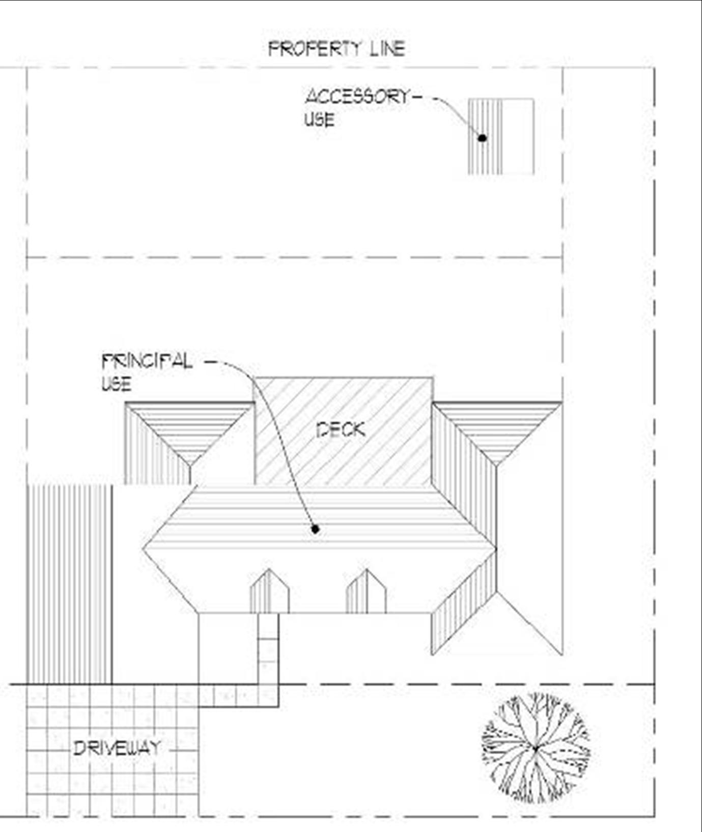
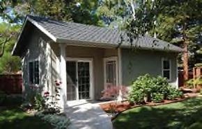
Accessory Building: A detached building, other than on an agricultural operation, which is clearly incidental or subordinate to the principal building which is located on the same premises as the principal building.
Accessory Dwelling Unit: A separate, complete housekeeping unit with a separate entrance, kitchen, sleeping area, and full bathroom facilities, which is an attached or detached extension to an existing single-family structure.
Accessory Irrigation Equipment: Equipment used with any irrigation system including gravity flow, center pivot or others. This shall include pivot points, well head, irrigation motors, etc. but does not include any structures over a motor or well head.
Accessory Structure: A detached subordinate structure located on the same lot as the principal structure, the use of which is incidental and accessory to that of the principal structure.
Accessory Use: A use incidental, related, appropriate and clearly subordinate to the main use of the lot or building, which accessory use does not alter the principal use of the subject lot or affect other properties in the district.
Accessory Building Accessory Use
Example of Accessory Dwelling
Acre: A full acre containing 43,560 square feet of area within the property lines of a lot or parcel.
Acreage: Any tract or parcel of land that does not qualify as a farm or development.
Active Recreation: A recreational activity requiring physical exertion such as swimming, tennis, soccer, baseball, softball, running and playgrounds.
Addition: Any construction which increases the size of a building or structure.
Adjacent: Near, close, or abutting; for example, an industrial district across the street or highway from a residential district shall be considered as "adjacent".
Adult Care Homes: A facility providing care for the elderly and/or functionally impaired adults in a protective setting for a 24-hour day.
Advertising Structure: Any notice or advertisement, pictorial or otherwise, and all such structures used as an outdoor display, regardless of size and shape, for the purposes of making anything known, the origin or place of sale of which is not on the property with such advertising structure.
Agricultural Accessory Equipment: This includes such things as well motors, well heads, pivot pads, open side structures covering wells.
Agricultural Complex/Compound: A place where several family members or employees associated with a farming and/or ranching operation all have their homes on as few as one lot with shared infrastructure and access.
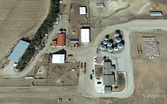
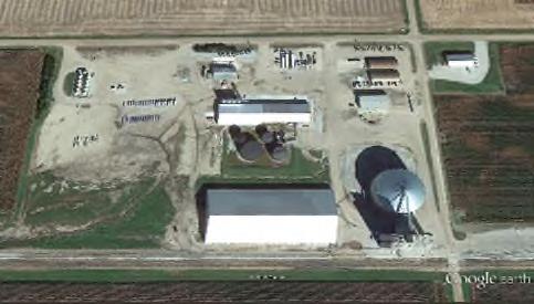
Agricultural Cooperative Production/Distribution Facility: Any facility owned and operated by a cooperative or other corporation for the purpose of manufacturing, distributing, and storage of fertilizers, herbicides and grain. This includes the offices, scales and parking areas necessary for trucks and other vehicles.
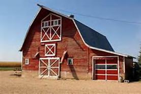
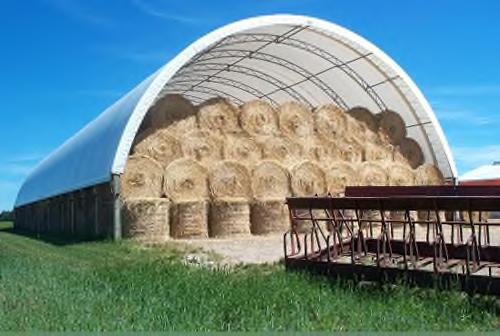
Agricultural and Farm Buildings and Structures: Any structure which is necessary or incidental to the normal conduct of a farm including but not limited to barns, buildings and sheds for housing livestock, poultry and farm machinery, buildings for the storage or shelter of grain seed, hay and other crops, silos, windmills and water storage tanks.
Agricultural Irrigation System: An artificial means for the delivery of water including accessory irrigation equipment.
Agricultural Operations: A farmstead of 20 acres or more which produces $1,000 or more of farm products each year.
Agricultural Processing: The process of turning raw agricultural products into food, feed, or other products. It includes growing and harvesting crops, packaging and selling them, and value-added activities like making cheese or wine from milk or grapes.
Example of an Agricultural Cooperative Production/ Distribution Facility
Example of Agricultural and Farm Buildings and Structures
Agricultural Accessory Building Accessory Use
Example of an Accessory Structure
Agriculture: The use of a tract of land for the growing of crops, pasturage, nursery, or the raising of livestock, including the structures necessary for carrying out farming operations.
Agriculture, By-Right: Agricultural uses such as row crops or the planting of other grains without a permit needing to be issued.
Agritourism Enterprise: Activities conducted on a working farm or ranch and offered to the public for the purpose of recreation, education, or active tourism related involvement in the farm or ranch operation.
Agronomic Rates: The application of plant nutrients, from all sources, to meet, but not exceed, the estimated annual nutrient needs of the crop being produced, based upon past or projected yields, so as to avoid build-up of nutrients.
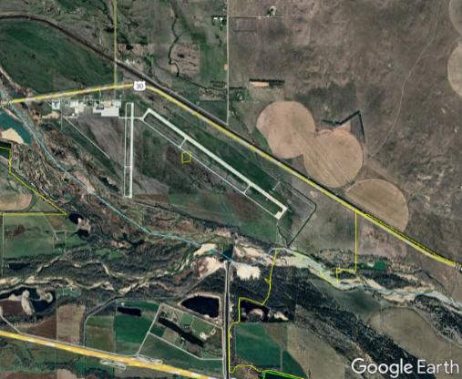
Airport: Any area which is used or is intended to be used for the taking off and landing of aircraft, including helicopters, and any appurtenant areas which are used or are intended to be used for airport buildings or facilities, including open spaces, taxiways, and tie-down areas.
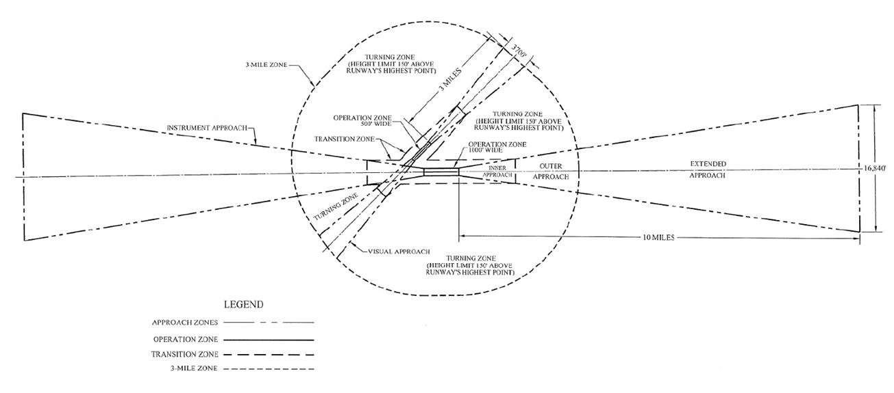
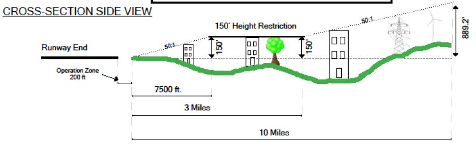
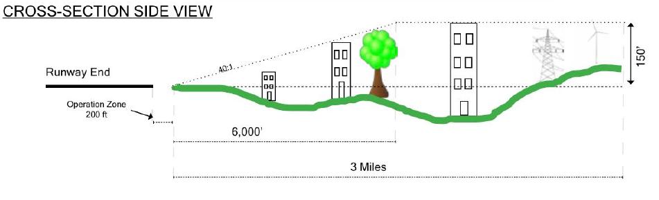
Airport Hazard Zone: See Section 4.17.02
All-Terrain Vehicle: For purposes of this Resolution this shall comply with sections §§60-6,355 to 60-6,362 of the Nebraska Revised Statutes. An all-terrain vehicle shall mean:
1. All-terrain vehicle means any motorized off-highway vehicle which (i) is fifty inches or less in width, (ii) has a dry weight of twelve hundred pounds or less, (iii) travels on three or more nonhighway tires, and (iv) is designed for operator use only with no passengers or is specifically designed by the original manufacturer for the operator and one passenger.
2. (i) Utility-type vehicle means any motorized off-highway vehicle which (A) is seventy-four inches in width or less, (B) is not more than one hundred eighty inches, including the bumper, in length, (C) has a dry weight of two thousand pounds or less, (D) travels on four or more nonhighway tires. (ii) Utility-type vehicles do not include all-terrain vehicles, golf car vehicles, or low-speed vehicles.
3. All-terrain vehicles and utility-type vehicles which have been modified or retrofit
Alteration: As applied to a building or structure, a change or rearrangement in the structural components, or an enlargement, whether by extending a side or by increasing in height, or the moving of one location or position to another, shall be considered as an alteration.
Amendment: A change in the wording, context, or substance of these regulations, an addition or deletion or a change in the district boundaries or classifications on the zoning map. “Amendment” does not include correction of typographical errors.
An example of Agriculture
Airport
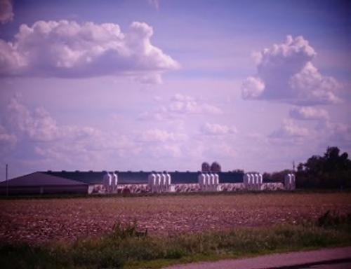
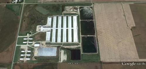
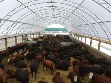
Example of an Animal Confinement Building
Anaerobic Digestion: A biological process occurring in the absence of oxygen. In very large animal production operations, it is sometimes used to produce biogas (a low energy gas which is a combination of methane and carbon dioxide) from the biodegradable organic portion of manure. This gas can be used as an energy source. After anaerobic digestion, the remaining semi-solid (which is relatively odor free but still contains most of its nutrients) can be used as a fertilizer.
Animal Confinement Building: Walled facilities where animals have been, are, or will be stabled or confined, fed and maintained.
Animal Hospital or Clinic: An establishment where animals are admitted principally for examination, treatment, board or care by a Doctor of Veterinary Medicine.
Animal Units (A.U.):
One A.U. = One Cow/Calf combination
One A.U. = One Slaughter, Feeder Cattle (1,000 pounds or more);
One A.U. = One-half Horse.
One A.U. = Seven Tenths Mature Dairy Cattle.
One A.U. = Two and One-half Swine (55 pounds or more);
One A.U. = 25 Weaned Pigs (less than 55 pounds);
One A.U. = Two Sows with litter.
One A.U. = 10 Sheep.
One A.U. = 11.25 Goats.
One A.U. = 50 Turkeys.
One A.U. = 100 Chickens, Layers
One A.U. = Five Ducks if a liquid manure handling system.
One A.U. = 3.7 Ostriches
One A.U. = One Buffalo
Animal Waste: Any animal excrement, animal carcass, feed waste, animal water waste, or any other waste associated with animals.
Animal Waste Water: Any liquid, including rainfall, which comes into contact with any animal excrement, manure, litter, bedding or other raw material or intermediate or final material or product used in or resulting from the production of animals or from products directly or indirectly usedinthe operation ofa LFO, oranyspillage or overflow from animal watering systems, or any liquid used in washing, cleaning or flushing pens, barns, or manure pits, or any liquid used in washing or spraying to clean animals, or any liquid used for dust control on the premises of a LFO.
Animals, Farm: Livestock commonly kept or raised as a part of an agricultural operation including but not limited to horses, cattle, sheep, swine, goats, chickens and turkeys.
Antenna: Any attached or external system of wires, poles, rods, reflecting disks or similar devices used for the transmission or reception of electromagnetic waves.
Antenna Support Structure: Any building other than a tower which can be used for the location of telecommunications facilities.
Apartment: A room or a suite of rooms within an apartment house or multiple family dwelling arranged, intended or designed for a place of residence of a single family or group of individuals living together as a single housekeeping unit. (See dwelling unit.)
Apartment Hotel: A multiple family dwelling under resident supervision which maintains an inner lobby through which all tenants must pass to gain access to apartments.
Applicant: The owner or duly designated representative of land proposed to be subdivided, or for which a special permit, zoning amendment variance, building permit or certificate of occupancy has been requested.
Application: A process by which the owner of a tract of land within the zoning jurisdiction of the County submits a request to develop, construct, modify, or operate upon such a tract of land. The term application includes all written documentation, verbal statements, and representations, in whatever formal forum, made by an applicant to the County concerning such request.
Application, Complete: An application for a zoning request that contains the following: (1) submittal and completion of all applicable application forms; (2) submittal of all required supporting application information; (3) submittal of all required fees.
Appropriate: The sympathetic, or fitting, to the context of the site and the whole community.
Appurtenances: The visible, functional objects accessory to and part of buildings.
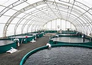
Aquaculture: Land devoted to the hatching, raising, and breeding of fish or other aquatic plants or animals for sale or personal use.
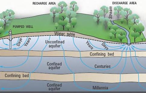
Aquifer: A geological unit in which porous and permeable conditions exist and thus are capable of bearing and producing usable amounts of water.
Aquifer, confined (artesian): Aquifers found between layers of clay, solid rock, or other material of very low permeability. Water in confined aquifers is often under pressure because the aquifer is confined between impermeable layers and is usually recharged at a higher elevation than the top confining layer.
Aquifer, unconfined (or water table): An aquifer where the top of the aquifer is identified by the water table. Above the water table, known as the zone of aeration, interconnected pore spaces are open to the atmosphere. Also known as a water table aquifer.
Example of an Aquaculture
Example of Confined, Unconfined Aquifer and Recharge Area
Aquifer Recharge Area: An area that has soils and geological features that are conducive to allowing significant amounts of surface water to percolate into groundwater.
Archery Range: A facility that may include buildings used for target practice with bows and arrows.
Area: A piece of land capable of being described with such definiteness its location may be established, and boundaries definitely ascertained.
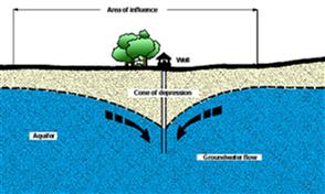
Areas of Contribution: The upland recharge area and cone of depression from which well water is drawn.
Areas of Influence: The two-dimensional area (as viewed on a map) of water table drawdown created by a pumping well, also see Cone of Depression.
Armor Coat: A bituminous liquid sprayed on road surfaces to provide a wear surface or dust control. Roads treated with armor coating are not considered as pavement.
Artisan Production Shop: A building or portion thereof used for the creation of original handmade works of art or craft items.
Artist Studio: A place designed to be used, or used as, both a dwelling place and a place of work by an artist, artisan, or craftsperson, including persons engaged in the application, teaching, or performance of fine arts such as, but not limited to, drawing, vocal or instrumental music, painting, sculpture, and writing.
Asphaltic Concrete: a dark brown to black cement-like material in which the predominating constitutes is bitumen, which occurs in nature or is obtained in petroleum processing.
Assisted Living Facility: a facility where shelter, food, and care are provided for remuneration for a period of more than 24 consecutive hours to four or more people residing at such facility who require or request such services due to age, illness, or physical disability. This definition does not include a home, apartment or facility where:
1. Casual care is provided at irregular intervals, or
2. A competent person residing in such home, apartment or facility provides for or contracts for his or her own personal or professional services if no more than 25% of persons residing in such home, apartment, or facility receive such services.
Attached Permanently: Attached to real estate in such a way as to require dismantling, cutting away, unbolting from permanent foundation or structural change in such structure in order to relocate it to another site.
Automobile Service Station: Buildings and premises where gasoline, oil, grease, batteries, tires and automotive accessories may be supplied and dispensed at retail, and where, in addition, servicing, repair, and replacement of parts may be done.
Automobile Sales-Retail: A retail business housed either in a structure or on a tract of land that sells or leases new or used automobiles, trucks, vans, recreational vehicles, boats or motorcycles or other similar motorized transportation vehicles. Retail automobile sales shall include any operation with three or more vehicles, as stated above, for sale at any time and/or a total of 10 sold during the course of a calendar year.
Automobile Sales – Wholesale: a wholesale business housed either in a structure or on a tract of land that sells new or used automobiles, trucks, vans, recreational vehicles, boats, or motorcycles or other similar motorized transportation vehicles to automobile sales retail outlets.
Automobile Wrecking Yard: Any lot, or the use of any portion of a lot, for the dismantling or wrecking of automobiles, tractors, farm machinery, or other motor vehicles, or for the storage or keeping for sale of parts and equipment resulting from such dismantling or wrecking.
BBackgrounding: Growing program for feeder cattle from time calves are weaned until they are on a finishing ration in the feedlot.
Ballroom: A place or hall used for dancing, other than those listed under the definition of “Adult Cabaret” in Section 8.08.03. Ballrooms shall also be used for reunions, weddings and receptions.
Bar: Any establishment whose principal business is serving alcoholic beverages at retail for consumption on the premises.
Basement: A portion of a building which has more than onehalf of its interior height, measured from floor to finished ceiling below the average finished grade of the ground adjoining the building.
Basin: A tract of land in which the ground is broadly tilted toward a common point. Water that falls onto any portion of the basin is carried toward the common point by a single river system.
Beacon: any light with one or more beams directed into the atmosphere or directed at one or more points not on the same zone lot as the light source; also, any light with one or more beams that rotate or move.
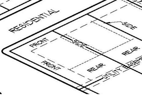
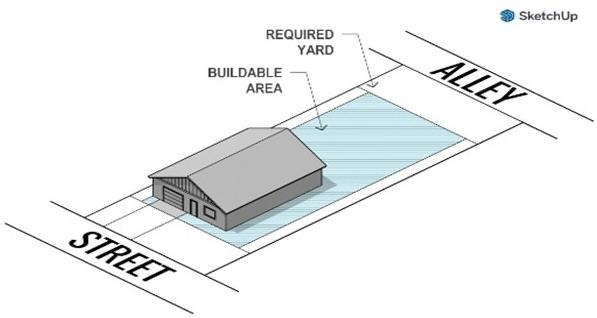
Buildable Area
Example of Buildable Area
Bed and Breakfast Inn: Any place of lodging that provides rented rooms for ten or fewer people, that is the personal residence of the owner, that is occupied by the owner at the time of rental, and in which the only meal served to renters is breakfast.
Bedding: Material such as straw, sawdust, wood shavings, shredded newspaper, sand or other similar material used in animal confinement areas for the comfort of the animal or to absorb excess moisture. Bedding can drastically affect the characteristics of the manure and must be taken into consideration in the design of the storage facility.
Bedroom: A room within a dwelling unit planned and intended for sleeping, separable from other rooms by a door.
Berm: A mound or embankment of earth, usually two to six feet in height.
Best Interest of the County: shall mean interests of the county at large and not of the immediate neighborhood.
Best Possible Management Practices: Livestock management techniques and practices as set forth by various agencies, including the NDWEE, which encourage and protect the environment and public.
Bio-fuels Manufacturing: A facility constructed for the purpose of processing a natural product such as corn and soybeans into an alcohol-based fuel/additive.
Block: A parcel of land platted into lots and bound by public streets or by waterways, rights-of-way, unplatted land, citycounty boundaries, or adjoining property lines.
Block Frontage: That section of a block fronting on a street between two intersecting streets or another block boundary.
Board of Adjustment: That board established by the County, and which has the statutory authority to hear and determine appeals, interpretations of, and variances to the zoning regulations.
Boarding and Lodging Houses: Any dwelling where, for compensation and by pre-arrangement for definite periods, meals, or lodging and meals are provided for more than three people but less than 10.
Borrow Pit: Any place or premises where dirt, soil, sand, gravel or other material is removed below the grade of surrounding land for any purpose other than that necessary and incidental to site grading or building construction.
Brew-On Premises Store: A facility that provides the ingredients and equipment for a customer to use to brew malt liquor at the store. Brew-on-premises stores do not include the sale of intoxicating liquor, unless the owner of the brew-on-premises store holds the appropriate liquor license.
Brew Pub: A restaurant or hotel which includes the brewing of beer as an accessory use. The brewing operation processes water, malt, hops, and yeast into beer or ale by mashing, cooking, and fermenting. By definition, these establishments produce no more than 20,000 barrels of beer or ale annually.
Brewery, Manufacturer: An industrial use that brews ales, beer, meads and/or similar beverages on site.
Brewery, Craft: A brew pub or a micro-brewery.
Brewery, Micro: A facility for the production and packaging of malt beverages of low alcoholic content for distribution, retail or wholesale, on or off premises, with a capacity of not more than 20,000 barrels per year. The development may include other uses such as standard restaurants, bars, or live entertainment as otherwise permitted in the zoning district.
Broiler: Meat-type chicken typically marketed at 6.5 weeks of age. Live weight at market generally averages 4 to 4.5 pounds per bird.
Buffer: A strip of land established to protect one type of land use from another incompatible land use or to intervene between a land use and a private or public road. (See screening)
Buffer Zone: An area of land that separates two zoning districts and/or land uses to soften or mitigate the effects of one use on the other.
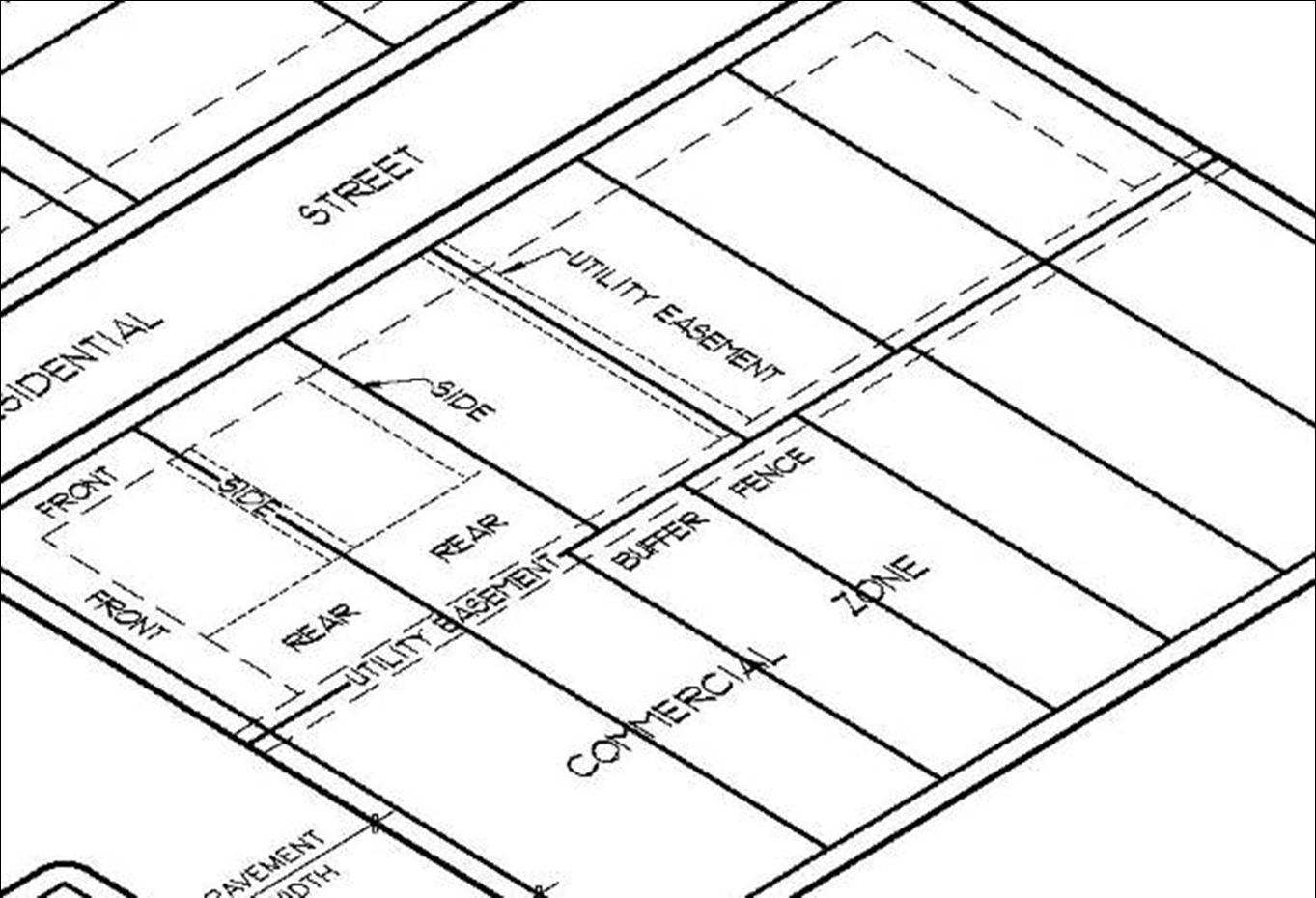
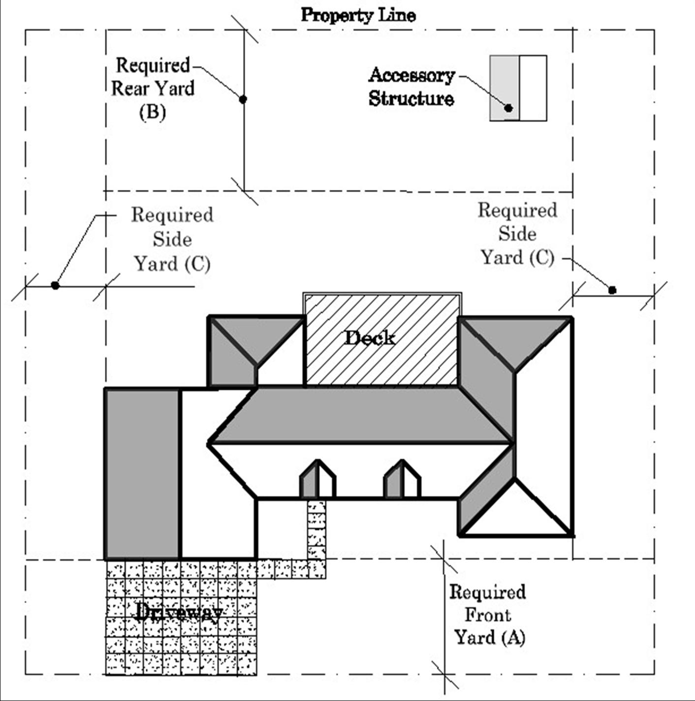
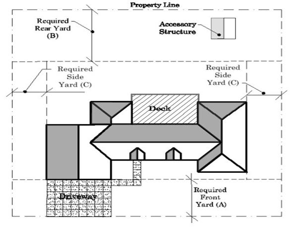
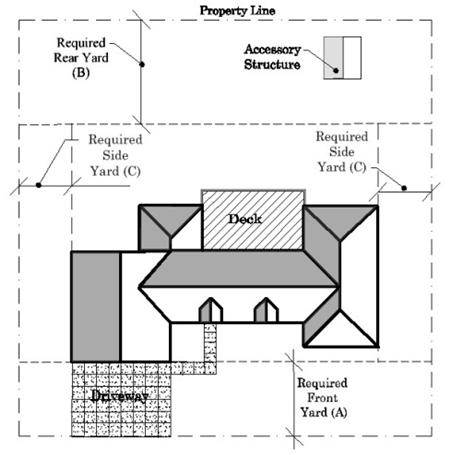
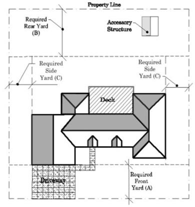
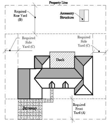
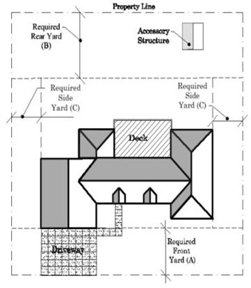
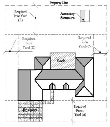
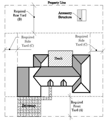
Buildable Area: That portion of a lot remaining after required yards have been allocated.
Buildable Lot: A lot that meets all of the minimum size requirements of a specific zoning district and shall apply to areas not submerged under water of any kind (lakes, creeks, river).
Building: Any structure built for the support, shelter or enclosure of persons, animals, chattels, or movable property of any kind, and including any structure.
Building Area: The sum, in square feet, of the area occupied by all buildings and structures on a lot.
Building Envelope: That area shown on a lot that encompasses all building development including but not limited to storage, structures, decks, roof overhangs, porches, patios and terraces, pools, access ways and parking. Approved plantings of landscape materials on natural grade and approved walkways may occur outside of a building envelope. Otherwise, all areas outside of a building envelope shall remain in pristine and untouched condition unless stated in the conditions of approval of the subdivision plat.
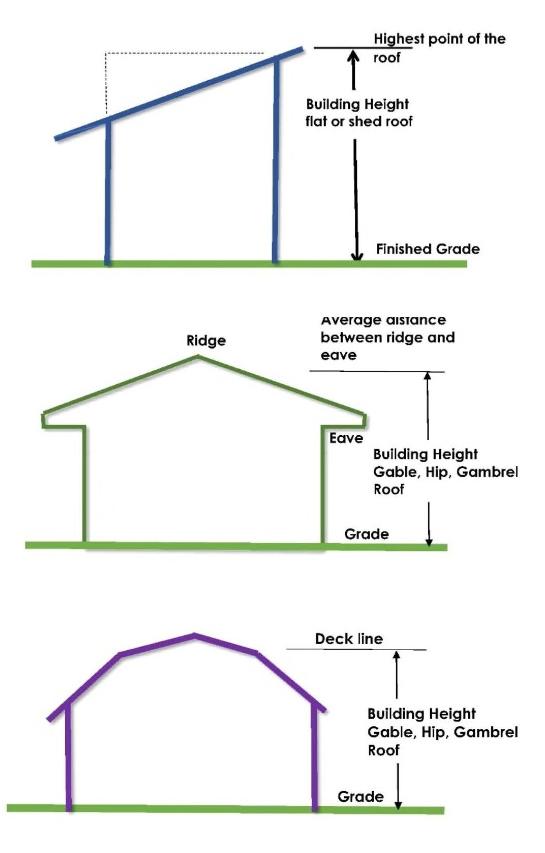
Building Height: The vertical distance above grade to the highest point of the coping of a flat roof or to the highest point of a gable, hip, mansard or shed roof.
of Buildable Area
Example of Building Height
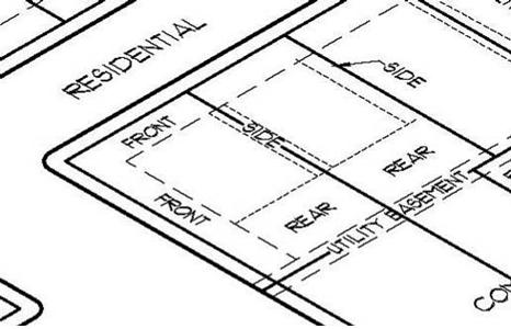
Example
of Building Setback Line
Building, Portable: A structure that may be attached to skids and can be easily moved without disconnecting it from a concrete slab or foundation.
Building, Principal: A building in which the main or principal use of the lot is conducted on which said building is situated.
Building Setback Line: The minimum distance as prescribed by these regulations between any property line and the closest point of the building line or face of any structure related thereto.
Bulk regulations: The prescribed requirements for lot area, lot area per dwelling unit, lot frontage, width, depth and height of buildings.
Business Services: Uses providing services to people, groups, businesses, dwellings and other buildings. Business services shall include but not limited to janitorial services, carpet and upholstery cleaning, painting and decorating, building maintenance, swimming pool maintenance, security service, graphics/advertising agency, photocopying/duplication, quick print shops, printing, blueprinting, sign painting, non-vehicle equipment rental, photographic studios.
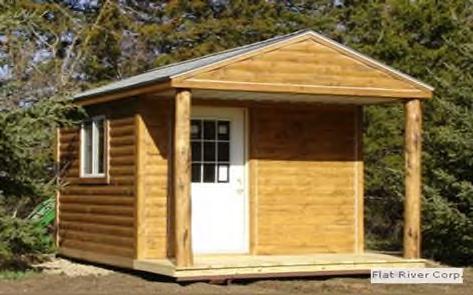
CCabin: A house built and designed for temporary living. Said cabins may also be used during hunting and fishing season as a base for hunting and fishing, and outdoor recreation.
Campground, Leased: A single tract of land with or without individually leased lots used for camping by the lease holders only. No transient camping is allowed.
Campground, Primitive: A campground accessible only by walk-in, pack-in, or equestrian campers where no facilities are provided for the comfort or convenience of the campers.
Campground, Semi-Primitive: A campground accessible only by walk-in, pack-in, equestrian, or motorized trail vehicles where rudimentary facilities (privies and/or fireplaces) may be provided for the comfort and convenience of the campers.
Campground, Semi-developed: A campground with two or more camping unit sites, accessible by vehicular traffic. Roads and facilities (toilets and/or privies) are provided.
Campground, Developed: A campground with two or more camping unit sites, accessible by vehicular traffic where sites are substantially developed and tables, refuse containers, flush toilets, bathing facilities, and water are provided.
Example
Cabin, hunting and fishing
Campground, Fully developed: A campground with two or more camping sites, accessible by vehicular traffic and provided with one or more service buildings. These sites may have individual water, sewer, and electrical connections.
Camping: Temporary living in a camper, travel trailer, pickup camper, camping bus, converted truck, tent trailers or camping tent or other non-building shelter or by sleeping in the open.
Car Wash, Industrial: A mechanical facility for the washing, waxing and vacuuming of heavy trucks and buses.
Caregiver: Caregiver means a person nineteen years of age or older who is designated by a patient or a patient's legal guardian to provide aftercare.
Cellar: A building space having more than two-thirds of its height below the average adjoining grade lines.
Cemetery: Land used or intended to be used for the burial of the dead and dedicated for such purposes, including columbarium, crematoriums, and mausoleums.
Centerline: The same meaning as "street or road center line".
Centralized Sewer: A sewer system established by an individual(s), sanitary improvement district or developer for the purpose of serving two or more buildings, structures, and/or uses. Said system shall have a central point of sanitary waste collection and processing.
Centralized Water: A water supply system established by an individual(s), sanitary improvement district or developer for the purpose of serving two or more buildings, structures, and/or uses. Said system shall have a central point(s) of supply with pressurized distribution from said supply points.
Certificate of Zoning Compliance/Certificate of Occupancy: A written certificate issued by the zoning administrator, stating that the premises has been inspected after erection, construction, reconstruction, alteration or moving of a building or structure or after a change in the use of land stating that the premises complies in all respects with the requirements of this Resolution and may be occupied for the use declared.
Change of Use: The replacement of an existing use type by a new use type.
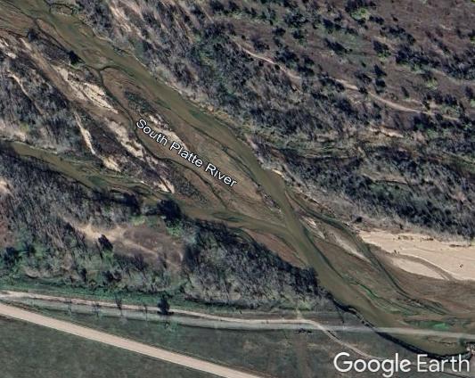
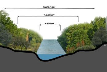
Channel: The geographical area within either the natural or artificial banks of a watercourse or surface drain.
Charitable: A public or semi-public institutional use of a philanthropic, charitable, benevolent, religious, or eleemosynary character, but not including sheltering or caring of animals.
Example of Channel
Child Care Center: An establishment other than a public or parochial school, which provides day care, play groups, nursery schools or education for nine or more children under age 13, at any one time, from families other than that of the provider. In addition to these regulations, Child Care Centers shall meet all requirements of the State of Nebraska.
Child Care Home: An operation in the provider's place of residence, which serves at least four, but not more than eight children at any one time from families other than those of the provider. In addition to these regulations, Child Care Homes shall meet all requirements of the State of Nebraska.
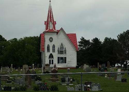
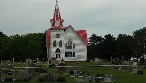
Church: a place where religious worship is conducted including accessory uses such as schools, day care centers, bingo parlors, and halls.
Club: An association of people (whether or not incorporated), religious or otherwise, for a common purpose, but not including groups which are organized primarily to render a service carried on as a business for profit and shall follow the expanded definitions in §53-103.09 of the Nebraska Revised Statutes.
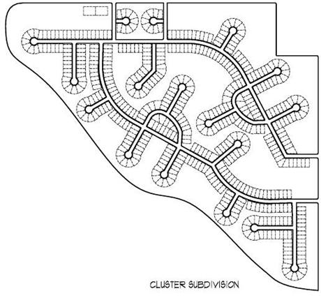
Cluster Development: a development designed to concentrate buildings in specific areas on a site to allow the remaining land to be used for recreation, common open space, and the preservation of environmentally sensitive areas.
Commence Work: The performance of substantial work, at the site, in relationship to the total project.
Commercial Building: A structure housing a use defined as commercial.
Commercial Uses: A business use or activity at a scale greater than a home business involving retail or wholesale marketing of goods and services. Examples of commercial uses include offices and retail shops.
Commission: The Lincoln County Planning Commission.
Common Area or Property: A parcel or parcels of land, together with the improvements thereon, the use and enjoyment of which are shared by the owners of the individual building sites in a planned development or condominium development.
Common Open Space: An area of land or water or combination thereof planned for passive or active recreational use by more than one homeowner or apartment dweller. Such space shall not include areas utilized for streets, parking, loading, alleys or driveways.
Example of a Cluster Development
Example of Church (background)
Common Sewer System: A sanitary sewage system in public ownership which provides for the collection and treatment of domestic effluent in a central sewage treatment plant which meets the minimum requirements of the Nebraska Department of Water, Energy, and Environment for primary and secondary sewage treatment, and which does not include individual septic tanks or portable sewage treatment facilities.
Common Water System: A water system which provides for the supply, storage and distribution of potable water on an uninterrupted basis, and which is in public ownership.
Community Center: A place, structure, or other facility used for and providing religious, fraternal, social, and/or recreational programs generally open to the public and designed to accommodate and serve various segments of the community.
Community or Public Sanitary Sewer System: An approved central sewer collecting system, meeting state and county requirements, available to each platted lot and discharging into a treatment facility. This does not include individual septic systems.
Community or Public Water Supply System: A public water supply system which serves at least 15 service connections used by year-round residents or uses or regularly serves 25 or more people year-round.
Compatible Uses: A land use, which is congruous with, tolerant of, and has no adverse effects on existing neighboring uses.
Compost: Decomposed organic material resulting from the composting process. Used to enrich or improve the consistency of soil.
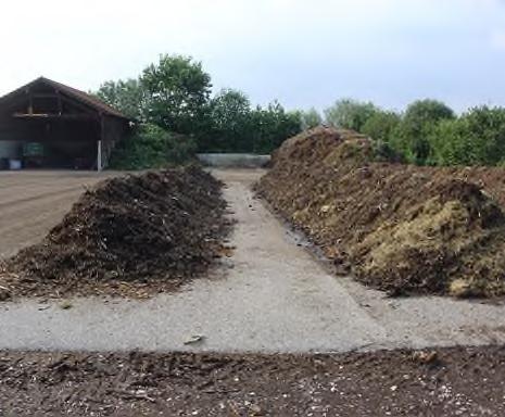
Composting: Processing waste in a controlled environment to produce a stable product by microbiologically degrading organic matter under aerobic conditions.
Comprehensive Development Plan: The Comprehensive Development Plan of Lincoln County, Nebraska, as adopted by the County Board of Commissioners, setting forth policies for the present and foreseeable future community welfare as a whole, and meeting the purposes and requirements set forth in Chapter 23 of the Revised Statutes of Nebraska, as the same, from time-to-time, may be amended.
Conditional Use: A use allowed by the district regulations that would not be appropriate generally throughout the entire zoning district without special restrictions. However, said use if controlled as to number, size, area, location, relation to the neighborhood or other minimal protective characteristics would not be detrimental to the public health, safety, and general welfare.
Example of an Outdoor Manure Composting Process Manure
Conditional Use Permit: A permit that authorizes the recipient to make use of property in accordance with the provisions of these regulations and in accordance with any additional conditions stipulated in the issued permit. A Conditional Use Permit may be a specific form called a “Conditional Use Permit” or by another name specifying a specific type of use such as a “Livestock Feeding Operation Permit”.
Condominium: As defined in the Nebraska State Statues Section 76-824 - 76-894, The Condominium Law, whereby four or more apartments are separately offered for sale.
Cone Of Depression: The three-dimensional area of water table created by a pumping well. The pumping well creates an artificial discharge area by drawing down (lowering) the water table around the well.
Confinement: Totally roofed buildings, which may be open sided (for ventilation purposes only) or completely enclosed on the sides, wherein animals or poultry are housed over solid concrete or dirt floors or slatted (partially open) floors over pits or manure collection areas in pens, stalls, cages, or alleys, with or without bedding materials and mechanical ventilation. The word "confinement" shall not mean the temporary confined feeding of livestock during seasonal adverse weather.
Conflicting Land Use: The use of property that transfers over neighboring property lines, negative economic or environmental effects. Including, but not limited to, noise, vibration, odor, dust, glare, smoke, pollution, water vapor, mismatched land uses and/or density, height, mass, mismatched layout of adjacent uses, loss of privacy, and unsightly views.
Congregate Housing: a type of low-rent housing that includes a central dining facility where residents can access nutritious and affordable meals. This housing model is designed to support individuals, often seniors or those with disabilities, by providing communal living arrangements along with essential services. There are two main categories:
1. Housing was built or under construction before January 1, 1979, with a connected dining facility.
2. Housing was constructed after January 1, 1979, that also includes a dining facility.
Conservation Areas: Environmentally sensitive and valuable lands (including but not limited to wetlands, floodways, flood plains, drainage ways, river or stream banks, and areas of significant biological productivity or uniqueness) protected except for overriding public interest, from any activity that would significantly alter their ecological integrity, balance or character.
Conservation Easement: As defined by Nebraska RRS 762,111 a right, whether or not stated in the form of an easement, restriction, covenant, or condition in any deed, will, agreement, or other instrument executed by or on behalf of the owner of an interest in real property imposing a limitation upon the rights of the owner or an affirmative obligation upon the owner appropriate to the purpose of retaining or protecting the property in its natural, scenic, or open condition. Assuring its availability for agricultural, horticultural, forest, recreational, wildlife habitat, or open space use, protecting air quality, water quality, other natural resources, or such other conservation purpose as may qualify as a charitable contribution under the Internal Revenue Code.
Construction, start of: The first placement of permanent construction of a structure on a site, such as pouring of slabs or footings or any work beyond the stage of excavation or the first permanent framing or assembly of the structure or any part thereof on its piling or foundation when a structure is without a basement or poured footings.
Construction and Demolition Waste: Waste which results from land clearing, the demolition of buildings, roads, or other structures, including but not limited to, beneficial fill materials, wood (including painted and treated wood), land clearing debris other than yard waste, wall coverings (including wallpaper, paneling, and tile), drywall, plaster, non-asbestos insulation, roofing materials, plumbing fixtures, glass, plastic, carpeting, electrical wiring, pipe and metals. Such waste shall also waste that results from construction projects. Construct and demolition waste shall not include friable asbestos waste, special waste, liquid waste, hazardous waste and waste that contains polychlorinated biphenyl (PCB), putrescible waste, household waste, industrial solid waste, corrugated cardboard, appliances, tires, drums, and fuel tanks as described herein or otherwise within Title 132.
Construction and Demolition Waste Disposal Area: Any area for the sole purpose of disposal of construction and demolition waste.
Construction Permit, Livestock: A permit required of an LFO by NDWEE, prior to construction.
Containment: Structures used to control runoff of precipitation that encounter manure, feed and other waste on open feedlots. Examples of containment structures are lagoons and holding ponds.
Convenience Store: A retail store that is designed and stocked to sell primarily food, beverages, and other household supplies to customers who purchase only a relatively few items (in contrast to a "supermarket."), it is dependent on and is designed to attract and accommodate large volumes of stop-and-go traffic.
Convent: A building or group of buildings designed to provide group housing for people under religious vows or orders.
Conventional Subdivision: A subdivision which literally meets all nominal standards of the Subdivision Regulations for lot dimensions, setbacks, street frontage, and other site development regulations.
Contiguous: Property adjoined at the property line and not separated by roads or alleys.
Country Club: Buildings and facilities owned and operated by a corporation or association of people for social and recreational purposes.
County: The Lincoln County, Nebraska.
County Board: The County Board of Commissioners of Lincoln County, Nebraska.
Cover Crop: A close-growing crop grown to protect and improve soils between periods of regular crops.
Crop Production: Commercial agricultural field and orchard uses include production of field crops, flowers and seeds, fruits, grains, melons, ornamental crops, tree nuts, trees and sod, vegetables. Also includes associated crop preparation services and harvesting activities, such as mechanical soil preparation, irrigation system construction, spraying, crop processing, and sales in the field not involving a permanent structure.
Culvert: A pipe, conduit, or similar enclosed structure with appurtenant works which carries surface or stormwater under or through an embankment or fill, roadway, or pedestrian walk, or other structure.
DDairy Farm: Any place or premises upon which milk is produced for sale or other distribution.
Dead Animal Disposal: The disposal of dead animals by methods authorized by law such as rendering, composting, burial, and incineration.
Deciduous Screen: Landscape material consisting of plants which lose their leaves in winter and eventually will grow and be maintained at six feet in height, at least.
Density: Restrictions on the number of dwelling units or other structures that may be constructed per acre or per square feet of zoning lot area.
Aerial view of Dairy Farm
Example of Crop Production
Detached: Fully separated from any other building or not joined to another building in such a manner as to constitute an enclosed or covered connection.
Detention Basin: A facility for the temporary storage of stormwater runoff.
Developer: Any person, corporation, partnership, or entity that is responsible for any undertaking that requires a building or zoning, conditional use, or sign permit.
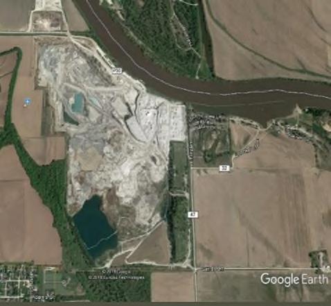
Development: Any manmade change to improved or unimproved real estate, including but not limited to buildings or other structures, mining, dredging, filling, grading, paving, excavating, or drilling operations for which necessary permits may be required.
Development Area: An area of land that may or may not have been subdivided into three or more homes per nine acres.
Development Impact Fee: A fee imposed on developers to pay for the costs to the county of providing services to a new development based upon the impact of the development.
Development of Livestock Confinement Operation:
Development of a confined livestock operation shall consist of but not be limited to contacting NDWEE, an engineer, a contractor, and/or NRCS, or by doing dirt work, excavation, or construction.
Development Review: The review, by the county, of subdivision plats, site plans, rezoning requests, or permit review.
Discontinuance of Use and Discontinue the Use of or Abandonment – Animal Feeding Operation: The situation where an animal feeding operation or concentrated animal feeding operation removes the animals that were principally using the animal waste storage facility and empties the animal waste storage facility within 180 days.
Discontinuance of Use and Discontinue the Use of or Abandonment – Other Uses: The situation where a nonconforming or use under a Conditional Use Permit is not used for a period of 12 consecutive months.
Dirt Surface: (as pertains to roads) roads typically found in non-residential areas as they only provide minimum design characteristics.
District: Any area designated on the zoning map for which detailed regulations are established herein pertaining to the uses permitted, the bulk of buildings and structures, and the size of yards and buildable area.
Dog Day Care Facility: A facility providing such services as canine day care for all or part of a day, obedience classes, training, grooming, or behavioral counseling, provided that overnight boarding is not permitted.
Detention Basin
Domestic Well: Well water used for human consumption and/or household purposes.
Dormitory: A building used as group living quarters for a student body, religious order, or other group as accessory use to a college, university, boarding school, orphanage, convent, monastery, farm labor camp, or other similar use where group kitchen facilities may be provided to serve all residents.
Downzoning: A change in zoning classification of land to a less intensive or less restrictive district such as from commercial district to residential district or from a multiple family residential district to single family residential district.
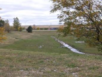
Drainageway or Surface Drain: Any depression two feet or more below the surrounding land serving to give direction to a current of water less than nine months of the year, having a bed and well-defined banks.
Driveway: Any vehicular access to an off-street parking or loading facility.
Dry Lot (dry operation): An operation using confinement buildings and handling manure and bedding exclusively as dry material, an operation using a building with a mesh or slatted floor over a concrete pit, or an operation scraping manure to a covered waste storage facility is referred to as a “dry” operation.
Dry Waste: Manure (urine or feces), litter, bedding, or feed waste from animal feeding operations.
Dry Waste Management System: A system where animal waste in the lots, pens and/or buildings of an LFO is not removed by flushing out such waste by water but is removed by shoveling out such waste by hand and/or machinery.
Dude Ranch: A ranch operated wholly or in part as a resort offering horse riding related activities as outdoor recreation opportunities and offering only temporary rental accommodations for vacation use by nonresidents.
Dump: A place used for disposal, abandonment, discarding by burial, incineration, or by any other means for any garbage, sewage, trash, refuse, rubble, waste material, offal or dead animals. Such use shall not involve any industrial or commercial process.
Dwelling: Any building or portion thereof, other than a mobile home, which is permanently affixed to a foundation imbedded in the soil and used exclusively for residential purposes. This also includes a dwelling in connection with farming operations.
Example of a Drainageway or Surface Drain
Example of a Dry Lot Operation/Dry Waste Management
Dwelling, Manufactured Home: A factory-built structure which is to be used as a place for human habitation, which is not constructed or equipped with a permanent hitch or other device allowing it to be moved other than to a permanent site, which does not have permanently attached to its body or frame any wheels or axles, and which bears a label certifying it was built in compliance with standards promulgated by HUD. However, the following criteria shall be met:
1. The home shall have no less than 900 square feet of floor area, above grade, for single story construction.
2. The home shall be no less than an 18-foot exterior wide.
3. The roof, unless it is covered by at least two feet of earth, shall be pitched with a minimum vertical rise of 2½ inches for each 12 inches of horizontal run.
4. The exterior material shall be of color, material and scale comparable with those existing in residential site-built, single-family construction.
5. The home shall have a non-reflective roof material that is or simulates asphalt or wood shingles, tiles, metal, or rock.
6. The home shall be placed on a continuous permanent foundation and have wheels, axles, transporting lights, and removable towing apparatus removed.
7. The home shall meet and maintain the same standards uniformly applied to all single-family dwellings in the zoning district; and
8. Permanent foundation to be constructed from either poured concrete or laid masonry block or brick on a footing to be placed a minimum of 42 inches below the final ground level.
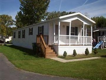
Dwelling, Mobile Home: Any prefabricated structure, composed of one or more parts, used for living and sleeping purposes, shipped or moved in essentially a complete condition and mounted on wheels, skids or roller, jacks, blocks, skirting or a permanent or temporary foundation or any prefabricated structure which has been or reasonably can be equipped with wheels or other devices for transporting the structure from place to place, whether by motor power or other means. The term mobile home shall include trailer home and camp car, but the definition shall not apply to any vehicle lawfully operated upon fixed rails.
1. Permanently Attached: Attached to real estate in such a way as to require dismantling, cutting away, unbolting from permanent continuous foundation or structural change in such mobile home in order to relocate it on another site in accordance to manufacturers’ recommendations.
2. Permanent Foundation: Base on which building rests; to be constructed from either poured concrete or laid masonry block or brick.
Source: http://transportablehomesspecialist.co m/
Example of a Dwelling, Manufactured Home
Example of a Dwelling, Mobile Home
Dwelling, Single-family
Example of Single-family Attached
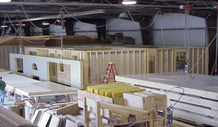
Dwelling, Modular: (Is considered a conventional type single-family dwelling). Any prefabricated structure, used for dwelling purposes, moved on to a site in an essentially complete constructed condition, in one or more parts, and when completed is a single-family unit on a permanent foundation, attached to the foundation with permanent connections. To be a modular home it shall meet or be equivalent to the construction criteria as defined by the NHHS under the authority granted by Section 71-1555 through 71-1567 Revised Statutes of Nebraska 1943.
Dwelling, Multifamily: A building or portion thereof designed for occupancy by three or more families living independently in which they may or may not share common entrances or other spaces. Individual dwelling units may be owned as condominiums or offered for rent.
Dwelling, Seasonal: A dwelling designed and used as a temporary residence for less than six months each year.
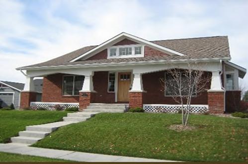
Dwelling, Single Family: A building having accommodation for or occupied exclusively by one family.
Dwelling, Single Family Attached: Two dwelling units, each owned and located on individual lots but joined along a single lot line, each of which is totally separated from the other by an unpierced wall extending from ground to roof.
Dwelling Unit, Special Types: Any dwelling type consisting of single-family detached; single-family attached, multi-family, mobile home not meeting the typical construction style of traditional stick framed structures.
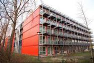
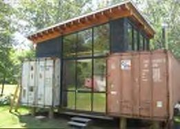
1. Cargo Container Dwelling: a dwelling unit constructed of one or more new or used cargo containers used for multi-modal shipping and meeting the definition of dwelling unit above.
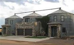
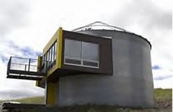
2. Grain Bin Dwelling Unit: A dwelling unit constructed of one or more grain bins, new or used meeting the definition of Dwelling Unit.
3. Park Model: Also known as recreational park trailers are built on a single chassis on wheels. They are no larger than 400 square feet and built-in compliance with ANSI housing standards.
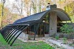
4. Quonset home: A home constructed beneath and in a structure referred to as a Quonset.
5. Shouse: A combination of a dwelling unit and machine shed under a common or connected roofing system. For purposes of a Shouse, these structures shall not be classified as farm buildings.
6. Tiny House: A structure containing living spaces including sleeping and kitchen areas which measure 500 square feet or less in area. Tiny houses can be either portable, on wheels similar to a recreational vehicle, or on a permanent foundation.
7. Tree House: A dwelling unit where the primary structure of the unit is based on one or more tree clusters.
8. Yurt (Modern): permanently built on a wooden platform using modern materials such as steam-bent wooden framing or metal framing, canvas or tarpaulin, plexiglass dome, wire rope, or radiant insulation.
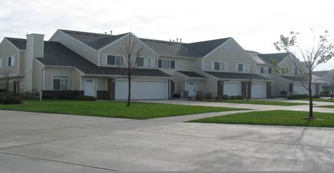
Dwelling, Townhouse: A one-family dwelling in a row of at least two such units in which each unit has its own front and rear access to the outside, no unit is located over another unit, and each unit is separated from any other unit by one or more vertical wall(s).
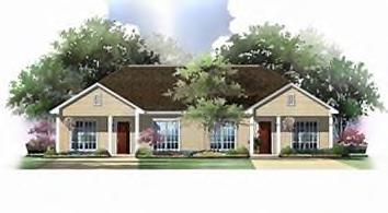
Dwelling, Two Family: A building having accommodations for and intended for use or occupancy by two independent families.
Dwelling Unit: A building, or part thereof, containing complete housekeeping facilities for a single family.
EEarthen Home: A home built into a berm or hillside covered by earth on three sides and on the roof.
Easement: A right or privilege granted by the owner of a defined parcel of land for the use of such a defined parcel of land for a specific purpose or purposes by the public, another person, corporation or other legal entity.
Educational Institution: A public or nonprofit institution or facility which conducts regular academic instruction at preschool, kindergarten, elementary, secondary, or collegiate levels, including graduate schools, universities, junior colleges, trade schools, nonprofit research institutions and religious institutions.
Effective Date: The date that this resolution shall have been adopted, amended, or the date land areas shall have become subject to the regulations contained in this resolution as a result of such adoption or amendment.
Shouse Shouse
Tiny House Tiny House
Tree House Park Model Quonset home
Quonset home Quonset home
Earthen Home/Earth sheltered home
Example of Dwelling, Two-family
Easement
Example of an Easement
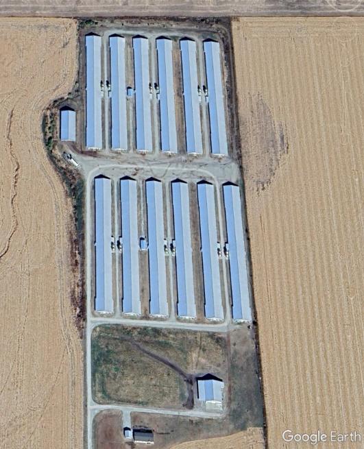
Example of Environmentally Controlled Housing
Electric Distribution Substation: An electric substation with a primary voltage of less than 161 KV, with distribution circuits served therefrom.
Electric Transmission Substation: An electric transformation or switching station with a primary voltage of more than 161 KV without distribution circuits served therefrom.
Emergency Shelter Mission: A facility which provides temporary housing for one or more individuals who are indigent, needy, homeless or transient.
Enclosed: A roofed or covered space fully surrounded by walls.
Encroachment: An advancement or intrusion beyond the lines or limits as designated and established by the Regulation, and to infringe or trespass into or upon the possession or right of others without permission.
Engineer Any engineer qualified and licensed by any state or territory of the United States of America.
Enlargement: The expansion of a building, structure, or use in volume, size, area, height, length, width, depth, capacity, ground coverage, or in number.
Environmentally Controlled Housing: Any livestock operation meeting the definition of an Livestock Feeding Operation (LFO) and is contained within a building which is roofed and may or may not have open sides and contains floors which are hard surfaced, earthen, slatted or other type of floor. The facility can maintain and regulate the environment in which the livestock is kept.
Equestrian Arena: An improved area, generally fenced, of at least 30 feet in width or length within which equestrian activities.
Equestrian Center: Commercial horse, donkey, and mule facilities including horse ranches, boarding stables, riding schools and academies, horse exhibition facilities, pack stations. This land use includes barns, stables, corrals, and paddocks accessory and incidental to the above uses.
Equestrian Event: Any exhibition or competition involving horses whose purpose is to test or advance the skills of a horse or its rider, such as but not limited to horse shows, schooling events, horse training seminars or clinics, open houses, cutting competitions, rodeos, or jackpot roping contests.
Equestrian Facilities: Commercial horse, donkey, and mule facilities including horse ranches, boarding stables, riding schools and academies, horse exhibition facilities, pack stations. This land use includes barns, stables, corrals, and paddocks accessory and incidental to the above uses.
Equestrian Trail: A natural surfaced path for equestrian use.
Erected: Constructed upon or moved onto a site.
Exceptions: Uses that are not appropriate generally in a particular district without restriction, but which, if controlled as to number, area, location, relation to adjoining properties and other factors can be appropriate. Such uses that may be permitted in districts as exceptions are allowed only if expressly provided for herein.
Existing And Lawful: The use of a building, structure, or land was in actual existence, operation, and use, as compared to the use being proposed, contemplated, applied for, or in the process of being constructed or remodeled. In addition, the use must have been permitted, authorized, or allowed by law or any other applicable regulation prior to the enactment of a zoning regulation when first adopted or permitted, authorized or allowed by the previous zoning regulation prior to the adoption of an amendment to the zoning regulation.
Extraterritorial Jurisdiction: The area beyond the corporate limits, in which a city or village has been granted the powers by the state to exercise zoning and building regulations and is exercising such powers.
FFaçade: The exterior wall of a building exposed to public view from the building's exterior.
Factory: A structure or plant within which something is made or manufactured from raw or partly wrought materials into forms suitable for use.
Family: One or more people related by blood, marriage, or adoption, living together as a single housekeeping unit; or a group of not more than four unrelated people living together as a single housekeeping unit.
Family Child Care Home I: A childcare operation in the provider’s place of residence which serves between four and eight children at any one time. A Family Childcare Home I provider may be approved to serve no more than two additional school-age children during non-school hours. In addition to these regulations, a Child Care Home shall meet the requirements of the NHHS.
Family Child Care Home II: A childcare operation either in the provider’s place of residence or a site other than the residence, serving twelve or fewer children at any one time. In addition to these regulations, a Childcare Home shall meet the requirements of NHHS.
Farm: A tract of 20 or more acres of land or water producing at least $1,000 in annual revenue from plants, animals or their products, which does not meet the criteria of a Livestock Feeding Operation.
Copyright American Planning Association
Farm Operation, General: The current employment of land for the purposes of obtaining a profit in money by raising, harvesting, and selling crops or by the feeding, breeding, management and sale of, livestock, poultry, fur-bearing animals or honeybees or for dairying and the sale of dairy products or any other agricultural or horticultural use or animal husbandry or combination thereof. Farm use includes the preparation and storage of the products raised on such land for marketing or otherwise. It includes the construction and use of buildings customarily provided in conjunction with farm use. General farm operations do not include Animal Feeding Operations as defined herein.
Farm Products: Usual products produced on an Agricultural Operation or Farm in the county such as hay, vegetables, fruit, grain, and plants as well as raising thereon the usual animal units (A.U.’s) as defined within these regulations.
Farm Winery: Any enterprise which produces and sells wines produced from grapes, other fruit, or other suitable agricultural products of which at least seventy-five percent of the finished products are grown in this state.
Farmer’s Market: The seasonal selling or offering for sale at retail of home-grown vegetables or produce, occurring in a pre-designated area, where the vendors are generally individuals who have raised the vegetables or produced the same on consignment for retail sale.
Farming: The planting, cultivating, harvesting and storage of grains, hay or plants commonly grown in Nebraska with the necessary accessory uses for treating or storing the produce and the feeding of livestock as prescribed hereunder, provided such accessory uses do not include the feeding of garbage or offal to swine or other animals.
Farmstead: In contrast to a farmstead dwelling, a tract of land of not less than one acre and not more than 20 acres, upon which a farm dwelling and other outbuildings and barns existed at the time of the adoption of this resolution and was used for single-family resident purposes.
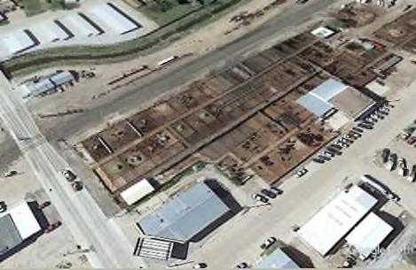
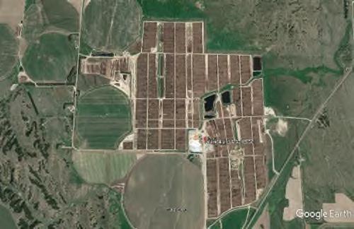
Feed Lot: Lot or building or a group of lots or buildings used for the confined feeding, breeding or holding of animals. This definition includes areas specifically designed for confinement in which manure may accumulate or any area where the concentration of animals is such that a vegetative cover cannot be maintained. Lots used to feed and raise poultry are considered to be feedlots. Pastures are not animal feedlots.
Feeder Cattle: Cattle past the calf stage that have weight increased making them salable as feedlot replacements.
Feeder Line: Any power line that carries electrical power from one or more energy sources to the point of interconnection with the electric power grid, in the case of interconnection with the high voltage transmission systems the point of interconnection shall be the substation serving any renewable energy system.
Example of a Farmer’s Market
Example of a Feed lot
Fence: A free-standing structure of metal, masonry, composition or wood or any composition thereof resting on or partially buried in the ground and rising above ground level, and used for confinement, screening or partition purposes.
Final Plat: The map or plan or record of a subdivision, and accompanying documents and materials, as described and defined in the subdivision regulations.
Finish Pig: A pig that is fed from 55 pounds until it reaches market weight.
Finishing Stage: Stage leading to and including full adulthood for swine is called the finishing stage. The pigs remain here until they reach market weight.
Flea Market: a building or open area in with stalls or sale areas are set aside, and rented or otherwise provided, and which are intended for the use by various unrelated individuals to sell articles that are either new, old, homemade, homegrown, handcrafted, obsolete, or antique and may include the selling of goods at retail by businesses or individuals who are generally engaged in retail trade. This definition does not include informal or private garage or yard sales.
Flood: The water of any watercourse or drainage way which is above the banks or outside the channel and banks of such watercourse or drainage way.
Flood Plain: The area adjoining a watercourse which has been or may be covered by flood waters.
Floodway: The channel of a watercourse or drainage way and those portions of the flood plain adjoining the channel which are reasonably required to carry and discharge the flood water of any watercourse or drainage way.
Floor Area: Whenever the term "floor area" is used in these regulations as a basis for requiring off-street parking for any structure, it shall be assumed that, unless otherwise stated, said floor area applies not only to the ground floor area but also to any additional stories of said structure. All horizontal dimensions shall be taken from the exterior faces of walls.
Forestry: The growing, harvesting, or processing of forest tree species used for commercial or related purposes.
Forty-acre tract: (see Quarter-quarter)
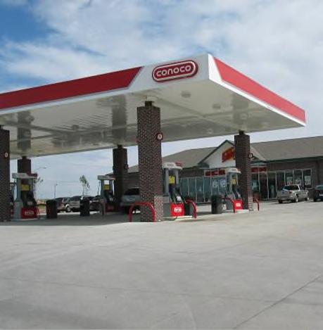
Freestanding Canopy: A permanent, freestanding, unenclosed roof structure, typical of gas stations and financial institutions, designed to provide patrons shelter from the elements.
Frontage: That side of a lot abutting on a street and ordinarily regarded as the front of the lot.
Freestanding Canopy
Diagram of Floodplain and Floodway
Fuel Station: A designated facility offering the sale of gasoline, diesel fuel, alternative fuel sources (electric, CNG, etc.) and propane.
Fuel Storage: Tanks used to storage fuel either above- or below-ground as part of an agricultural operation.
Funeral Home: A building or part thereof used for human funeral services. Such buildings may contain space and facilities for (1) a funeral chapel; (2) embalming and the performance of other services used in preparation of the dead for burial; (3) the performance of autopsies and other surgical procedures; (4) the storage of caskets, funeral urns, and other related funeral supplies; (5) the storage of funeral vehicles; and (6) facilities for cremation.
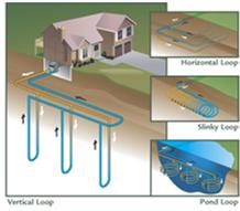
GExamples of Geothermal Heat Pump System
Source: Yahoo Images/daviddarling.info
Garage: A building for the storage of motor vehicles.
Garbage: Any waste food material of an animal or vegetable nature, including waste that may be used for the fattening of livestock.
Geothermal Heat Pump System: A well, constructed for the purpose of utilizing the geothermal properties of the earth.
1. Open Loop Heat Pump well shall mean a well that transfers heat via pumped ground water which is discharged above and/or below ground. For below ground discharge, refer to NDWEE Title 122.
2. Closed Loop Heat Pump well shall mean a well, constructed for the purpose of installing the underground closed loop pipe necessary to recirculate heat transfer fluid.
3. Horizontal Closed Loop means a trench or pit essentially parallel to the horizon and into which a closed loop pipe is placed for the purpose of heat transfer.
4. Vertical Closed Loop means a borehole essentially perpendicular to the horizon into which a closed loop pipe is placed for the purpose of heat transfer.
Governing Body: The Board of County Commissioners for Lincoln County Nebraska.
Government Facility: A structure owned, operated, or occupied by a governmental agency to provide a governmental service to the public.
Grade: Except for Earthen Homes permitted under the Nebraska State Codes and Regulations, which shall mean the following:
1. For buildings having walls facing one street only, the elevation of the sidewalk at the center of the wall facing the street shall be grade.
2. For buildings having walls facing more than one street, the grade shall be the average of the grades (as defined in “1”. above) of all walls facing each street.
3. For buildings that have no walls facing a street, the average level of the finished surface of the ground adjacent to the exterior walls of the building shall be at grade.
4. Any wall approximately parallel to and not more than 50 feet from a street line is considered as facing a street.
Grain Handling Systems: The moving, transferring, handling, storing, aerating and/or drying of grains by mechanical or natural means.
Gravel and Crushed Rock: materials (as it pertain to roads) added to the surface of dirt roads to provide all weather travel.
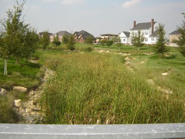
Grassed Waterway: Grassed waterways are areas planted with grass or other permanent vegetative cover where water usually concentrates as it runs off a field. They can be either natural or man-made channels. Grass in the waterway slows the water and can reduce gully erosion and aid in trapping sediment.
Grazing Land: Pasture, meadow, rangeland, or other similar areas where livestock are put to feed on the vegetation.
Greenhouse, Private: A building whose roof and sides are made largely of glass or other transparent or translucent material and in which the temperature and humidity can be regulated for the cultivation of flowers or plants for personal enjoyment.
Greenhouse, Public or Retail: A building whose roof and sides are made largely of glass or other transparent or translucent material and in which the temperature and humidity can be regulated for the cultivation of flowers or plants for subsequent sale.
Greenway: A parcel or parcels of land, together with the improvements thereon, dedicated as an easement for access and/or recreation; usually a strip of land set aside for a walkway, bicycle trail, bridle path, or other similar accessway.
Grit: Grit includes sand, gravel, cinder, or other heavy solid materials that are “heavier” (higher specific gravity) than the organic biodegradable solids in the wastewater. This includes eggshells, bone chips, seeds, coffee grounds, and large organic particles, such as food waste.
Gross Acres: The total area of a site, inclusive of all streets and/or road rights-of-way, plus, any required supporting facilities.
Groundwater: Water occurring beneath the surface of the ground that fills available openings in the rock or soil materials such that they may be considered saturated.
Groundwater Recharge: The filling of groundwater aquifers by rain and melting snow percolating into the ground and saturating the pores between rock and soil particles.
Group Care Home: A home which is operated under the auspices of an organization which is responsible for providing social services, administration, direction, and control for the home which is designed to provide 24-hour care for individuals in a residential setting.
Group Home for the Handicapped: A dwelling with resident staff shared by four or more handicapped persons who live together as a single housekeeping unit and in a long term, family-like environment in which staff persons provide care, education, and participation in community activities for the residents with the primary goal of enabling the residents to live as independently as possible in order to reach their maximum potential. As used herein, the term "handicapped" shall mean having: (1) A physical or mental impairment that substantially limits one or more of such person's major life activities so that such person is incapable of living independently; or (2) A record of having such impairment.
Group Housing: Two or more separate buildings on a lot, each containing one or more dwelling units.
Guest House: An attached or detached building used to house guests of the occupants of the principal building, and which is never rented or offered for rent.
Guest Ranch: A use incorporating two or more guest rooms, other than a boarding house, hotel or motel, and including outdoor recreational facilities, such as, but not limited to, horseback riding, swimming, tennis courts, shuffleboard courts, barbeque and picnic facilities intended primarily for use by the guests of the guest ranch. Bars and restaurants that cater primarily to those other than guests of the guest ranch are not permitted.
Guest Room: A room which is designed to be occupied by one or more guests for sleeping purposes, having no kitchen facilities, not including dormitories.
Gun Club: Any organization whether operated for profit or not, and whether public or private, which caters to or allows the use of firearms.
Gun Range: An area designated for the firing of firearms at stationary or mobile targets within the area.
HHalf-Story: A story under a gable, hip or gambrel roof, plates of which are not more than three feet above the floor of such story.
Halfway House: A licensed home for individuals on release from more restrictive custodial confinement or initially placed in lieu of such more restrictive custodial confinement, living together as a single housekeeping unit, wherein supervision, rehabilitation and counseling are provided to mainstream residents back into society, enabling them to live independently.
Hazardous Material: Materials, products, or substances that, by reason of their toxic, caustic, corrosive, explosive, abrasive, radioactivity, infectious properties, or other characteristics, that cause or may be detrimental or harmful to the health of any person or to the environment. For specific and more detailed information, current definitions, lists of hazardous material and quantities determined to pose a hazard, reference Title 40, Code of Federal Regulations, Parts 261 and 302, and /or any subsequent amendments thereto.
Hazardous Substances: Any substance or materials, by reason of their toxic, caustic, corrosive, abrasive, or otherwise coming into contact with such material or substance.
Hazardous Waste: Waste products of industrial or chemical processes including finished surplus, used, contaminated or unwanted fertilizer, herbicide, petroleum products, or other such processed waste material.
Health Care Facilities: A facility licensed or approved by the state or an appropriate agency, if required. Health Care Facility may be any of the following:
1. Hospitals, including offices or medical societies, offices of charitable public health associations, and private office space for the practice of medicine and dentistry under a license from the NHHS; provided any such private offices for the practice of medicine and dentistry shall be occupied only by those on the staff of the hospital.
2. Convalescent or nursing home.
3. A facility for outpatient physical, occupational, or vocational therapy or rehabilitation.
4. Public health clinics and facilities; and
5. Ambulatory surgical care center does not allow for overnight stay by patients. Unless an exception is made, healthcare facilities do not include doctors’, or dentists’, professional offices and private clinics.
Health Recreation Facility: An indoor or outdoor facility including uses such as game courts, exercise equipment, locker rooms, whirlpool spa and/or sauna and pro shop.
Hedges: A row of closely planted shrubs, bushes, or any kind of plant forming a boundary or fence.
Heliport: Any landing area used for the landing and taking off of helicopters, including all necessary passenger and cargo facilities, fueling, and emergency service facilities.
Helistop: An area designed to be used for the landing or takeoff of one helicopter, the temporary parking of one helicopter, and other facilities as may be required by federal and state regulations, but not including operation facilities such as maintenance, storage, fueling, or terminal facilities.
Hemp: the plant Cannabis sativa L. and any part of such plant, including the viable seeds of such plant and all derivatives, extracts, cannabinoids, isomers, acids, salts, and salts of isomers, whether growing or not, with a delta-9 tetrahydrocannabinol concentration of not more than 0.3 percent on a dry weight basis. Hemp shall be considered an agricultural commodity. Notwithstanding any other provision of law, hemp shall not be considered a controlled substance under the Uniform Controlled Substances Act.
Hemp, USDA-licensed Hemp Producer: a person licensed by the United States Department of Agriculture to produce hemp as provided in 7 C.F.R. part 990, subpart C, as such regulations existed on January 1, 2020.
Highway, Major Inter-Regional: A "U.S." or "State" designated highway with 100 feet right-of-way or more on which partial control of access and geometric design and traffic control measures are used to expedite the safe movement of through vehicular traffic.
Highway Setback Line: The future right-of-way line or plan lines of any highway.
Holding Pond: Means an impoundment made by constructing an excavated pit, dam, embankment or combination of these for temporary storage of liquid livestock wastes, generally receiving runoff from open lots, trailer washouts and contributing drainage area.
Home-based Business: An accessory use of a single-family or two-family residential structure which does not meet the definition of a home occupation. A home-based business would consist of service-oriented uses and typically be more intense than a home occupation, due to factors such as intensity of use or clients coming to their residence. A Homebased Business typically will allow a minimum amount of employment from outside the individuals residing on the property.
Home Occupation: A business, occupation, trade, or profession conducted for gain and carried on within a residential dwelling by the resident.
Example of a hoop building
Example of a Heliport
Source: Google Earth
Homeowners Association: A private, nonprofit corporation or association of homeowners of properties in a fixed area established to own, operate, and maintain various common properties and facilities.
Hoop Building: An anchored building erected to store materials, including but not limited to machinery and vehicles.
Hoop Building, Livestock: An anchored or freestanding building erected for housing livestock. Floors are typically compacted dirt or concrete covered with dry bedding.
Hospital: An institution providing medical or surgical health and emergency services to human patients and injured people. It is licensed by the state to provide facilities and services in surgery, obstetrics, and general medical practice.
Hospital, Animal: A place where animals or pets are given medical or surgical treatment and cared for during treatment. Use as a kennel shall be limited to short time boarding and only incidental to such hospital use.
Hotel or Motel: A building or portion thereof, or a group of buildings, offering transient lodging accommodation daily to the general public and providing services associated with restaurants, meeting rooms, and recreational facilities. The word "hotel" includes motels, inns, automobile courts, motor inns, motor lodges, motor courts, tourist courts, and motor hotels.
Household Pet: An animal customarily kept for personal use or enjoyment within the home. Household pets shall include but not be limited to domestic dogs, domestic cats, domestic tropical birds, fish, and rodents.
Housing for the Elderly: A building or group of buildings containing dwellings in which each dwelling unit is occupied by at least one person of 55 years of age or more. This does not include developments containing convalescent or nursing facilities.
Housing For the Physically Handicapped: A building containing a dwelling or a group of dwellings in which each occupied dwelling unit is occupied by at least one physically handicapped person with a mobility impairment, which requires certain construction design features for ingress, egress, and freedom of movement within the premises.
Example of a hoop building for livestock
IHub: The geographical area in Nebraska in which an iHub will operate. An iHub area shall be located within:
1. An economic redevelopment area.
2. An enterprise zone designated pursuant to the Enterprise Zone Act.
3. An inland port district as defined in Section 13-3303.
4. Thirty miles of the largest artificial reservoir constructed in this state for the storage of water, or
5. Any county having a population of less than 100,000 inhabitants.
Impact Easement: An easement or deed restriction recorded in the Lincoln County Register of Deeds office. Impact easements shall run with the land and are granted to the owner of use, including but not limited to:
1. Industrial use,
2. Confined or intensive animal feeding use,
3. A waste handling facility uses or
4. Other use
5. Said easement shall be granted for the period said use shall exist.
Impervious Surface: A surface that has been compacted or covered with a layer of material making the surface highly resistant to infiltration by water.
Incidental Use: A use that is subordinate to the main use of a premise.
Incompatible Use: A land use of one type that is unsuitable for direct association or location near or abutting a land use of a different type because of its inconsistency with the Intent statement of the zoning district.
Individual Septic System: A wastewater treatment system for an individual dwelling unit with a septic tank and absorption system.
Industrial Building: A structure designed and constructed to house industrial uses.
Industrial Park: A planned, coordinated development of a tract of land with two or more separate industrial buildings.
Industrial Uses: A use or activity at a scale greater than home industry involving the manufacture and distribution of materials and/or products generated from raw materials or the assemblage of a product from several premanufactured pieces.
Industrial Waste: Any material resulting from a production or manufacturing operation has no net economic value to the source producing it.
Industrial Waste Disposal: The discarding of any Industrial Waste in either a legal or illegal manner.
Industry: The manufacture, fabrication, processing reduction or destruction of any article, substance or commodity, or any other treatment thereof in such a manner as to change the form, character, or appearance thereof and including storage elevators, truck storage yards, warehouses, wholesale storage and other similar types of enterprise.
Inland Authority: An authority created by a city, a county, or a city and one or more counties under the Municipal Inland Port Authority Act to manage an inland port district.
Inland Port District: An area within the corporate boundaries or extraterritorial zoning jurisdiction or both of a city, within the boundaries of one or more counties, or within both the corporate boundaries or extraterritorial zoning jurisdiction or both of a city and the boundaries of one or more counties, and which meets at least two of the following criteria:
1. Is located within one mile of a navigable river or other navigable waterway.
2. Is located within one mile of a major rail line.
3. Is located within two miles of any portion of the federally designated National System of Interstate and Defense Highways or any other four-lane divided highway; or
4. Is located within two miles of a major airport.
Innovation District: A geographic area where leading-edge institutions, companies, and industry clusters connect with startup businesses, business incubators, research institutions, and accelerators, and that is physically compact, transitaccessible, and technically wired with mixed-use housing, office, retail, and light industrial space.
Innovation districts include, but are not limited to, the following:
1. The anchor-plus model, primarily found in the downtowns and midtowns of central cities, where largescale mixed-use development is centered around major anchor institutions and a rich base of related firms, entrepreneurs, and spin-off companies involved in the commercialization of innovation.
2. The re-imagined urban areas model, often found near or along historic waterfronts, where industrial or warehouse districts are undergoing a physical and economic transformation. Such change is powered in part by transit access, a historic building stock, and proximity to downtowns in high-rent cities which is supplemented with advanced research institutions and anchor companies; and
3. The urbanized science park model, commonly found in suburban and exurban areas, where traditionally isolated, sprawling areas of innovation are urbanizing through increased density and an infusion of new activities, including retail and restaurants, that are mixed as opposed to separated.
Inoperable Motor Vehicle: Any motor vehicle that:
1. Does not have a current state license plate; or,
2. May or may not have a current state license plate but is disassembled or wrecked in part or in whole, or is unable to move under its own power, or is not equipped as required by Nebraska State Law for operation upon streets or highways.
3. A vehicle that is wholly or partially dismantled shall not be considered inoperable when said vehicle is inside a completely enclosed building.
Institutional Building/Use: A nonprofit or quasi-public use and building, such as a religious institution, library, public or private school, cemetery, hospital, or government-owned or government-operated structure or land used for public purpose.
Intensity: The degree of concentration or activity with which land is used. Agriculture and residential areas are considered to have low intensity uses. Heavy industry is highly intense. High intensity use normally generates high concentrations of vehicular traffic and daytime population.
Intent and Purpose: The Commission and Board, through the adoption of these regulations, have made a finding that the health, safety, and welfare of the Community will be served by the creation of the regulations prescribed therein.
Intermittent Stream: Has flowing water only during certain periods of time, when groundwater provides water for stream flow. During dry periods, intermittent streams may not have flowing water. Runoff from rainfall or snowmelt is a supplemental source of water for the stream flow.
Intermodal Facility: A hub or other facility for trade combining any combination of rail, barge, trucking, air cargo, or other transportation services.
Irrigation Accessory Equipment: Equipment used with any irrigation system including gravity flow, center pivot or others. This shall include pivot points, well head, irrigation motors, etc. but does not include any structures over a motor or well head.
JJunk: Any worn-out, cast-off, old, or discarded articles of scrap, copper, brass, iron, steel, rope, rags, batteries, paper, trash, rubber, debris, waste, dismantled or wrecked automobiles, or parts thereof, and other old or scrap ferrous or nonferrous material.
Junkyard (Salvage Yard): An area of land with or without buildings, used for or occupied by a deposit, collection or storage, outside a completely enclosed building of used or discarded materials; used building materials, house furnishings, machinery, inoperable vehicles or parts thereof whether with or without the dismantling, processing, salvage, sale or other use or disposition of same.
An Example of an Institutional Use/Building
KKennel, Commercial: An establishment where 10 or more dogs or cats, or any combination thereof, other household pets, or non-farm/non-domestic animals at least four months of age are groomed, bred, boarded, trained, or sold as a business.
Kennel, Private: Any premises used for the keeping of nine or fewer dogs, cats, or a combination thereof, or other nonfarm/non-domestic animals by the owner/occupant or occupant of the premises for show, hunting, or as pets. The dogs and cats shall belong to the owner/occupant or occupant, and their keeping shall be an accessory for the main use of the premises.
Kitchen Facilities: A room or area equipped for the preparation and cooking of food when it has all of the following:
1. Kitchen sink.
2. Burner, cook stove, or microwave oven.
3. Refrigerator.
LLaboratory, Medical: An establishment that provides bacteriological, biological, medical, x-ray, pathological, and other similar analytical or diagnostic services.
Lagoon: A shallow, artificial wastewater treatment facility where sunlight, bacterial action, and oxygen interact to restore wastewater to a reasonable state of purity. This includes both human and livestock waste. All lagoons shall meet the minimum design criteria established by the NDWEE and the NDHHS. All lagoons shall have the proper permits approved before starting construction.
Landscaping: Improving any parcel of land with grass, shrubs, and/or trees. Landscaping may include pedestrian walks, flowerbeds, ornamental objects, and other natural and artificial objects designed and arranged to produce an aesthetically pleasing effect.
Landfill: A waste disposal site employing an engineered method of disposing of solid wastes in a manner that minimizes environmental hazards by spreading, compacting and applying cover material over all exposed waste designed in accordance with the requirements of the NDWEE and licensed by said Department.
Law Enforcement Center: A governmental facility working directly with the enforcement of laws through a municipality or county. A law enforcement center may be the base of operations for a sheriff, police department, or state agency, or it may be an incarceration facility (temporary or longterm), or a combination of all.
Leapfrog Development: New development separated from existing development by vacant land.
Leased Campground: A single tract of land with or without individually leased lots used for camping by the leaseholders only.
Life Care Facility: A long-term care facility includes (1)A nursing facility; (2) An assisted-living facility; (3) Any other adult care home; (4) A continuing care community; (5) Any swing bed in an acute care facility or extended care facility; and (6) Any adult day service per Neb. Rev. Stat. §81-2243.
Life Estate: A legal arrangement where an individual (the life Tenant) has the right to use and benefits from a property during their lifetime, with the remainder interest passing to another party (the remainderman) upon their death. After the life tenant's death, the estate transfers to the designated beneficiary.
Liner: Any barrier in the form of a layer, membrane, or blanket, naturally existing, constructed, or installed to prevent a significant hydrologic connection between liquids contained in retention structures and waters of the United States.
Liquid Manure: A type of livestock waste that is in a liquefied state, collected in manure pits or lagoons to be sprayed/applied on the surface or injected beneath the surface.
Liquid Manure Storage Pits: Earthen, concrete, or lined pits located wholly or partially beneath a semi or housed (ECH) livestock animal feeding operation or at some removed location used to collect waste production.
Liquid Waste Management System: A system where most of the animal waste in the lots, pens, and/or buildings of an LFO is removed by flushing out such waste with water.
Livestock: Cattle, buffalo, horses, sheep, goats, swine, poultry, and other animals or fowl, which are being produced primarily for use as food or food products for human consumption.
Livestock Feeding Operation (LFO): any farming operation in a confined area where grazing is not possible, and where the confined area is for more than six months in any one calendar year, and where the number of animals maintained exceeds 1,000 Animal Units as defined below. The confined area of the LFO shall include the pens, corrals, sheds, buildings, feed storage areas, waste disposal ponds, and related facilities. Such facilities shall be constructed and operated in conformance with applicable county, state, and federal regulations. Two or more LFO's under common ownership are deemed to be a single LFO if they are adjacent to each other and utilize a common area of system for the disposal of livestock wastes; otherwise, the separation distances shall apply as per Table 8.06.01. Animal Units (A.U.) are defined in Section 8.06
Livestock Pasturing Operation: Any livestock operation using pasture, as defined under this regulation, as the primary feed source for the animals.
Livestock Sales Yard: An enclosure or structure designed or used for holding livestock for sale or transfer by auction, consignment, or other means.
Livestock Siting Matrix: A tool authorized in 2015 by the Nebraska Legislature via LB 106. The matrix is a tool for county officials to use to help determine whether to approve a conditional use permit or special exception application.
Livestock Wastes: Animal and poultry manure including associated feed losses, bedding, spillage, or overflow from watering systems, wash and flushing waters, sprinkling waters from livestock cooling, precipitation polluted by falling on or flowing onto a livestock operation, and other materials polluted by livestock or their direct product.
Livestock Waste Control Facilities or Facility or Facilities: (see “Waste Handling System”)
Living Floor Area: The square foot area of a dwelling unit, excluding the garage, attics and areas within a full basement that do not have ground level access to the outside, as measured between the face of the interior walls.
Loading Space: An off-street space or berth on the same lot with a main building, or contiguous to a group of buildings, for the temporary parking of commercial vehicles while loading or unloading, and which abuts a street, alley, or other appropriate means of ingress and egress.
Local Street or Local Highway: A street or road primarily for service to abutting property.
Loess: shall mean a soil that is a fine-grained material, dominantly of silt-sized particles, that has been deposited by wind. The primary mineral is quartz.
Loess Canyon Region: An area, mostly on the south side of the South Platte River and Platte River, also known as the Dissected Loess Plains, which is considered a Biologically Unique Landscape by the Nebraska Game and Parks Commission.
Long-Term Care Facility: As defined in Title 15, Chapter 3, Nebraska Department of Health and Human Services and R.R.S Section 71-2017.01. These facilities include:
1. Nursing Facilities.
2. Boarding Home.
3. Adult Care Home.
4. Assisted Living Facility.
5. Center for the Developmentally Disabled.
6. Group Residence.
7. Swing Bed; and 8. Adult Day Care.
Example of a Livestock Sales Yard
Examples of Lot Types
Lot: A parcel or tract of land which is or may be occupied by a use herein permitted, together with yards and other open spaces herein required, that has frontage upon a street and is part of a recorded subdivision plat or has been recorded before the adoption of this Regulation, or a parcel of real property delineated on an approved record of survey, lot-split or sub-parceling map as filed in the office of the County Register of Deeds and abutting at least one public street or right-of-way, two thoroughfare easements, or one private road.
Lot, Corner: A lot located at the intersection of two or more streets at an angle of not more than 135 degrees. If the angle exceeds 135 degrees, the lot shall be considered an "Interior Lot."
Lot, Curve: A lot fronting on the outside curve of the right-ofway of a curved street, which street has a centerline radius of 300 feet or less.
Lot, Double Frontage, or Through Lot: A lot with frontage on two non-intersecting streets, as distinguished from a corner lot.
Lot, Flag: A lot with frontage and access provided to the bulk of the lot using a narrow corridor.
Lot, Frontage: A side of a lot abutting a legally accessible street right-of-way other than an alley or an improved county road. For this definition, all sides of a lot adjacent to streets or roads shall be considered frontage on corner lots.
Lot, Interior: A lot other than a corner lot, having a single frontage on a street.
Lot, Minimum Size: The minimum area required in a designated zoning district. The minimum lot size shall apply only to ground not covered by a waterway at the time of the application.
Lot, Nonconforming: A lot having less area or dimension than required in the district it is located and lawfully created before the zoning thereof and whereby the larger area or dimension requirements were established, or any lot other than one shown on a plat recorded in the office of the County Register of Deeds, which does not abut a public road or public road right-of-way, and which was lawfully created before the effective date of these regulations.
Lot Area: The total area, on a horizontal plane, within a lot's lot lines.
Lot Coverage: The portion of a lot or building site that is occupied by any building or structure, except paved areas, walks, and swimming pools, regardless of whether the said structure is intended for human occupancy or not.
Lot Depth: The distance between the midpoints of straight lines connecting the foremost points of the side lot lines in front and in the rear of the lot.
Lot Improvement: Any building, structure, or other object or improvement of the land they are situated constituting a physical betterment of real property.
Lot Line, Front: A street right-of-way line forming the boundary of a lot.
Lot Line, Rear: The lot line most distant from and nearly parallel to the front lot line. If a rear lot line is less than 15 feet long, or if the lot comes to a point at the rear, the rear lot line shall be at least 15 feet long, lying wholly within the lot, parallel to the front lot line. If a lot has two or more front lot lines, the remaining yards will be rear yards, or the remaining yards will be side yards, and no rear lot line will exist.
Lot, Reversed Frontage: A lot on which the frontage is at right angles, or approximately right angles, with the interior angle being less than 135 degrees, to the general pattern in the area. A reversed frontage lot may also be a corner lot (see "A-D" in the diagram), an interior lot ("B-D"), or a through lot ("C-D").
Lot Line, Side: A lot line that is neither a front nor rear lot line.
Lot of Record: A lot, which is part of a subdivision, the plat of which has been recorded in the Office of the Register of Deeds or a parcel of land the deed to which was recorded before the adoption of these Regulations.
Lot Width: The distance on a horizontal plane between the side lot lines of a lot, measured at right angles to the line establishing the lot depth at the established building setback line. Lot width shall be the average of the lot on curved or trapezoidal lot configuration.
MMachine Shop: A workshop, including tool and die shops, that turns, shapes, planes, laser metal cutting, mills or otherwise reduces or finishes metal by machine-operated tools.
Maintenance Guarantee: Any security, other than cash, that the County may accept to ensure that required improvements will be maintained. (Also, see Performance Guarantee.)
Major Recreational Equipment: Boats and boat trailers, travel trailers, pickup campers or coaches, designed to be mounted on automotive vehicles, motorized dwellings, tent trailers, and the like, as well as recreational vehicles.
Lot, Reversed Frontage
Manufactured Home Park: A parcel of land under single ownership that has been planned and improved for the placement of manufactured housing used or to be used for dwelling purposes and where manufactured home spaces are not offered for sale or sold. Two or more mobile homes or manufactured homes shall constitute a park. The term "manufactured home park" does not include sales lots on which new or used manufactured homes are parked for storage, inspection, or sale.
Manufactured Home Subdivision: Any area, piece, parcel, tract, or plot of ground subdivided and used or intended to be used to sell lots for occupancy by manufactured homes.
Manufacturing: Uses primarily engaged in the mechanical or chemical transformation of materials or substances into new products. These uses are usually described as plants, factories, or mills and characteristically use power-driven machines and materials-handling equipment.
Manure: Fecal and urinary defecations of livestock and poultry may include spilled feed, bedding, or soil.
Map, Official Zoning District: A map delineating the boundaries of zoning districts which, along with the zoning text, is officially adopted by the Lincoln County Board of Commissioners for Lincoln County, Nebraska.
Medical or Dental Clinic: Any building or portion thereof, other than a hospital, used or intended to be used as an office for the practice of any type of medicine, including chiropractic, dentistry, or optometry.
Micro-distillery: A distillery located in Nebraska that is licensed to distill liquor on the premises of the distillery licensee and produces ten thousand or fewer gallons of liquor annually.
Milking Parlor: The area of a dairy where milking takes place. Milking Parlor wash water: Water is used to rinse the animals and equipment during the milking process to improve sanitation. The wash water typically includes manure, feed solids, hoof dirt, detergents, and disinfectants used at the operation.
Mini-Storage or Mini-Warehouse: (See “Self-service Storage Facility”)
Mining and Mineral Extraction: The extraction of minerals, including solids, such as coal and ores; liquids, such as crude petroleum; gases, such as natural gas. Mining also includes quarrying, groundwater diversion, soil removal, milling, crushing, screening, washing, and floating, and other preparations customarily done at the mine location or as part of a mining activity.
Mobile Home: (See “Dwelling, Mobile Home”)
Mobile Home Park: (See “Manufactured Home Park”)
Mobile Home Subdivision: (See “Manufactured Home Subdivision”)
Mobile Home Site: A plot of ground designed to accommodate a single mobile home dwelling.
Monastery: A building or group of buildings designed to provide group housing for persons under religious vows or orders.
Motel: (See “Hotel”)
Motor Freight Terminal: A facility for freight pick-up or distribution; may include intermodal distribution facilities for truck or rail transport.
Motor Vehicle: Every self-propelled land vehicle not operated upon rails, except mopeds and self-propelled invalid chairs.
NNature Center/Preserve: Areas intended to remain in a predominately natural or undeveloped state, with or without animals and other wildlife, to provide resource protection and possible opportunities for passive recreation and environmental education for present and future generations.
Nebraska Revised Reissued Statutes: and the abbreviated term Neb. Rev. Stat. are the same.
Net Acre: Total area exclusive of street or roadway and alley easement.
Nightclub: A commercial establishment dispensing beverages for consumption on the premises, in which dancing is permitted, or entertainment is provided.
Non-Conforming Building: A building or portion thereof that was lawful when established but does not conform to subsequently established zoning or zoning regulations.
Non-Conforming Use: A use lawful when established but which does not conform to subsequently established zoning or zoning regulation.
Non-Farm Buildings: These are all buildings except those utilized for agricultural purposes on a farmstead of 20 acres or more, producing one thousand dollars or more farm products each year.
Non-Farm Dwelling: Any dwelling not part of a farm, regardless of lot size.
An Aerial of a Mining and Mineral Extraction Site and Quarry
Source: Google Earth
Nonpoint Source: Diffuse pollution sources (i.e., without a single point of origin or not introduced into a receiving stream from a specific outlet). The pollutants are generally carried off the land by stormwater. Common non-point sources are agriculture, forestry, urban, mining, construction, dams, channels, land disposal, saltwater intrusion, and streets.
No Till Farming: The soil is left undisturbed from harvest to planting except for nutrient and seed injection. Weed control is accomplished primarily with herbicides.
Normal Growing Season: The period, usually measured in days, between the last freeze in the spring and the first frost in the fall. Growing seasons vary depending on local climate and geography. It can also vary by crop as different plants have different freezing thresholds.
Nuisance: A substantial invasion of or interference with another’s interest in the private use and enjoyment of their property/land.
Nursery: The use of premises for the propagation, cultivation, and growth of trees, shrubs, plants, vines, and the like from seed or stock, and the sale thereof, including the sale of trees, shrubs, plants, vines, and the like purchased elsewhere and transplanted into the soil of the premises. In connection with the sale of plants, such fungicides, insecticides, chemicals, peat moss, humus, mulches, and fertilizers as are intended to be used in preserving the life and health of the plants may be sold.
Nursery School: (see “Preschool”)
Nursing Home: A facility used or occupied by people recovering from illness or suffering from infirmities of old age. It requires skilled nursing care and related medical services and is licensed by the appropriate state or federal agency or agencies.
Nutrient Application Levels: The levels of nutrients applied to the waste utilization area.
OOccupied Dwelling: Any residence, church, school, and/or business that has been in use at any time during the 12 months immediately before the date upon which an application for a conditional use permit to construct an LFO or expand or modify an AFO.
Off-road Vehicle: Any motorized vehicle designed for or capable of cross-country travel on or immediately over land, water, sand, snow, ice, swampland, or other natural terrain, except that such terms exclude (a) registered motorboats, (b) military, fire, emergency, and law enforcement vehicles when used for emergency purposes.
Official Map: (See Map, Official Zoning District.)
Off-Street Parking Area or Vehicular Use: To all off-street areas and spaces designed, used, required, or intended for parking, including driveways or accessways in and to such areas.
Open Lots: Pens or similar concentrated areas, including small shed-type areas or open-front buildings, with dirt or concrete (or paved or hard) surfaces, wherein animals or poultry are substantially or entirely exposed to the outside environment except for possible small portions affording some protection by windbreaks or small shed-type areas.
Open Space: A parcel or parcels of land, together with the improvements thereon, primarily set aside for recreational use and enjoyment, exclusive of land areas used for streets, alleys, roads, driveways, parking areas, structures, and buildings.
Operating Permit: An operating permit as required for an LFO by the NDWEE.
Outdoor Advertising: See the definitions of "Advertising Structure" and "Sign".
Outdoor Storage: The storage of any material for a period of greater than 24 hours, including items for sale, lease, processing, and repair (including vehicles) not in an enclosed building.
Overlay District: A district in which additional requirements will act in conjunction with the underlying zoning district. The original zoning district designation does not change.
Owner: One or more persons, including corporations, who have title to the property, structure in question.
PPaintball Course: An area typically designed around hillsides, trees, waterways, rocks, etc., to allow organized combat-like games using paintballs and the different mechanized equipment to fire the paintballs as ammunition. These facilities shall also include any buildings or structures to shelter the participants.
Parcel: A lot or a contiguous group of lots in single ownership or under single control that may be considered as a unit for development purposes.
Park: Any public or private land available for recreational, educational, cultural, or aesthetic use. To establish a setback for a Livestock Feeding Operation, a Wildlife Management Area (WMA) is not considered a park.
Parking Space, Automobile: An area, other than a street or alley, reserved for the parking of an automobile.
Example of Open Lots
Parkway: An arterial highway with full or partial control of access and located within a park or ribbon of park-like development.
Pasture: An area where crops, vegetative forage growth, and post-harvest residues are sustained to graze animals.
Paunch Manure: Partially digested material taken from an animal at the time of slaughter.
Performance Guarantee: A financial guarantee to ensure that all improvements, facilities, or work required by these Regulations will be completed in compliance with these regulations as well as with approved plans and specifications of a development (Also, see “Maintenance Guarantee”)
Performance Standards: Criteria used to regulate the impacts of land uses (e.g., noise, odor, traffic) rather than the use itself.
Permanent Foundation: A base constructed from either poured concrete or laid masonry rock or brick and placed on a footing located below ground level to a point below the frost line upon which a structure is permanently attached.
Permanently Attached: Connected to real estate in such a way as to require dismantling, cutting away, or unbolting in order to remove, relocate, or replace.
Permit: A document issued by Lincoln County, including a Conditional Use Permit, authorizing the applicant to undertake certain activities.
Permitted Use: Any land use allowed without condition within a zoning district.
Person: An individual, firm, co-partnership, joint venture, association, social club, fraternal organization, corporation, estate, trust, receiver, syndicate, City, County, special district or any other group or combination acting as an entity, except that it shall not include Lincoln County, Nebraska.
Pipeline: A pipe used to transport, transmit, convey, or store liquid or gas for hire in Nebraska interstate commerce other than a major oil pipeline, a gathering pipeline, distribution pipeline, or service line.
Pipeline, Carbon Dioxide: Transportation facilities for the conveyance of captured carbon dioxide (CO2) from facilities creating said CO2 and transporting it to a specific destination for storage or recycling.
Pipeline, Major Oil: A pipeline that is more significant than six inches in inside diameter and which is constructed in Nebraska for the transportation of petroleum, or petroleum components, products, or wastes, including crude oil or any fraction of crude oil, within, though, or across Lincoln County.
Pipeline, Petroleum Distribution: Transportation facilities for the conveyance of crude petroleum, refined petroleum products such as gasoline and fuel, natural gas, mixed, manufactured, or liquified petroleum gas, or the pipeline transmission of other commodities. It also includes pipeline surface and terminal facilities, including pumping stations, bulk storage, surge, and storage tanks.
Pit System: This system has a concrete floor and masonry, or concrete side walls constructed 2 - 6 feet below the ground. The animal cages, if used, are typically built eight feet or more above the pit floor. Care must be taken to ensure the surface and groundwater are not contaminated. Foundation drains, and external grading to direct surface water away help keep manure dry so that natural composting might occur.
Pit (Shallow): The most frequently used pit system. The concrete pit is 4–8 inches deep and 3-6 feet below the main floor. The manure and other waste are mechanically scraped or flushed out with water to a storage area or directly loaded into a spreader for direct field application.
Planned Unit Development: A zoning district providing flexible land development when planned and designed under the provisions of these regulations as a unit containing one or more land uses.
Planning Commission: The Lincoln County Planning Commission is established per Section §23-114, with the powers and authority granted.
Plat: A map showing individual properties' location, boundaries, and legal description.
Point Source: Any discernible, confined, and discrete conveyance, including but not limited to any pipe, ditch, channel, tunnel, conduit, well, discrete fixture, container, rolling stock, concentrated animal feeding operation, landfill leachate collection system, vessel, or other floating craft from which pollutants are or may be discharged.
Policy: A statement or document of the county, such as the comprehensive plan, that forms the basis for enacting legislation or making decisions.
Pollutant: Dredged spoil, solid waste, incinerator residue, filter backwash, sewage, garbage, sewage sludge, munitions, chemical wastes, biological materials, radioactive materials (except those regulated under the Atomic Energy Act of 1954, as amended (42 U.S.C. 2011 et seq.)), heat, wrecked or discarded equipment, rock, sand, cellar dirt and industrial, municipal, and agricultural waste discharged into water.
Portable Temporary Classroom: A temporary building, either stick-built or pre-manufactured (built off-site), installed on the grounds of a state-approved school to provide additional classroom space where there is a capacity shortage.
Portland Cement Concrete: An aggregate with a cement binder characterized by gray\white color. A relatively smooth, uniform concrete surface having few exposed aggregates. The United States, including Lincoln County, uses the specifications prepared by the American Society for Testing and Materials–ASTM C-150 Standard Specification for Portland cement.
Poultry, Commercial Feeding: A poultry commercial feedlot, whether the confined feeding operations are enclosed or outdoors.
Preliminary Plat: The preliminary drawings and information that indicate the proposed layout of a subdivision, as described and defined in the subdivision regulations.
Premises: A tract of land consisting of one lot or irregular tract, or more than one lot or irregular tract, provided such lots or tracts are under common ownership, contiguous, and used as a single tract.
Preschool: An early childhood program that provides primarily educational services, where children do not nap and are not served a meal.
Private Club: A non-profit association of bona fide members paying dues, which owns, hires, or leases a building or premises, or portion thereof, the use of such building or premises is restricted to members and their guests.
Private Well: A well that provides water to less than 15 service connections and serves less than 25 individuals regularly.
Prohibited Use: Any use of land other than nonconforming, which is not listed as a permitted use or conditional use within a zoning district.
Project Commencement: A project shall be considered active and started once the applicant has filed all of the required materials and application for a specific use and said application has received approval from the County based upon the type of permit required.
Professional Office: Any building or part thereof used by one or more people engaged in law, medicine, accounting, architecture, engineering, or other occupations customarily considered as a profession.
Promotional Device: Any sign intended to be displayed either with or without a frame, with or without characters, letters, illustrations, or other material, on a fabric of any kind. National flags, flags of political subdivisions, or symbolic flags of any institution or business shall be considered a promotional device for this definition. Banners, pennants, inflatable characters, streamers, fringe-type ribbons, or piping shall be considered promotional devices.
Public Conservation Lands: Land owned in fee title by State or Federal agencies and managed specifically for conservation purposes, including but not limited to State Wildlife Management Areas, State Parks, federal Wildlife Refuges, and Waterfowl Production Areas. For purposes of this Regulation, public conservation lands will also include lands owned in fee title by non-profit conservation organizations. Public conservation lands will also include private lands upon which conservation easements have been sold to public agencies or non-profit conservation organizations.
Public Improvement: Any drainage facility, roadway, street, sidewalk, sewer or water facility, or other improvement for which the government body may ultimately assume the responsibility of maintenance and operation.
Public Use Area: A portion of land owned by the United States, the state, or a political subdivision with facilities that attract the public to congregate and remain in the area for significant periods of time. Facilities include, but are not limited to, picnic grounds, campgrounds, lodges, shelter houses, playground equipment, lakes, and swimming beaches.
Public and Private Utility: Any governmental entity or business which furnishes to the general public telephone service, electricity, natural gas, water, sewer and other services so affecting the general public interest as to be subject to the supervision or regulation of a State agency.
Public Water Supply: A water supply system designed to provide public piped water fit for human consumption, if such a system has at least 15 service connections or regularly serves at least twenty-five individuals. This definition shall include: (1) Any collection, treatment, storage, or distribution facilities under the control of the operator of such system and used primarily in connection with such system; and (2) Any collection or pretreatment storage facilities not under such control which are used primarily in the connection with such system.
Pullet: Young female chicken between 10 and 32 weeks of age, usually this term denotes egg type birds.
QQuarry: See Mining and Mineral Extraction Site
Quarter Section: That portion of land approximately equal to ¼ of a section of land (160 acres)
Quarter-Quarter Section: That portion of land is approximately equal to 1/16 of a section of land (40 acres)
Railroad: The land use, including the right-of-way (R.O.W.) abutting railroad properties occupied by uses pertinent to the railroad operation and maintenance, but not including properties owned by the railroad and leased for use by others.
Railroad, Class I: a rail carrier classified as Class I pursuant to 49 C.F.R. part 1201 1-1
Railroad, Major: a rail line that is accessible to a Class I railroad as defined by the federal Surface Transportation Board.
Railroad Right-of-Way: A strip of land with tracks and auxiliary facilities for track operation, but not including freight depots or stations, loading platforms, train sheds, warehouses, or car yards.
Ranch Operation: The business and activities associated with running a ranch. This typically includes raising and managing livestock like cattle, horses, sheep, or other animals. The goal is often to produce meat, dairy, or other animal products. Key elements of a ranching operation include:
Land Management: Proper use and maintenance of grazing land to support livestock and the environment's health.
Animal Care: Ensuring the animals are well-fed, healthy, and bred appropriately.
Facilities and Equipment: Utilizing barns, fences, water sources, and other infrastructure to support the operation.
Business Aspects: Handling the financial, marketing, and logistical aspects of running the ranch, including selling livestock and products.
Ranch Products: The goods produced and sold by ranching operations. These products primarily come from the livestock raised on the ranch. They can include meat, dairy, leather, wool, live animals, and by-products such as manure for fertilizer, bones for tools or crafts, and other secondary products derived from livestock.
Ranching: The practice of raising and managing livestock such as cattle, horses, sheep, or goats on large tracts of land. It involves a variety of tasks and responsibilities aimed at maintaining the health and productivity of the animals and the land they graze on. Key aspects of ranching include animal husbandry, land management, infrastructure maintenance, and business operations. It is a lifestyle and occupation that requires a deep connection to the land and animals.
Ranch stead: The main living area and headquarters of a ranch. It typically includes the primary residence where the ranch owners or managers live, and essential buildings and facilities used in the ranching operation. Key components of a Ranch stead might include the main house, barns and Sheds, corrals and pens, outbuildings, and water sources
Rangeland: An open region over which livestock may roam and feed. The plant cover is native grasses, grass-like plants, and shrubs. It includes natural grasslands, savannahs, certain shrubs, and grass-like lands, most deserts, tundra, alpine communities, coastal marshlands, and wet meadows. It also includes lands re-vegetated naturally or artificially and managed like native vegetation.
Raw Materials Storage Area: Includes but is not limited to feeding silos, silage bunkers, and bedding materials.
Recharge Areas: The places where rain and snow melt percolate into the ground, refilling the groundwater aquifers.
Recharge Rate: The time required to add to or replenish water in an aquifer or water table.
Recreation, Active: Leisure-time activities, usually of a formal nature and often performed with others, requiring equipment and taking place at prescribed places, sites, or fields.
Recreation Equipment: Play apparatus such as swing sets and slides, sandboxes, poles for nets, picnic tables, lawn chairs, barbecue stands, and similar equipment or structures, including tree houses, swimming pools, playhouses, or sheds utilized for storage of equipment. Also see (“Major Recreational Equipment”)
Recreation, Passive: Leisure-time activities that involve relatively inactive or less energetic activities, such as walking, sitting, picnicking, card games, chess, checkers, and similar table games. This includes open space for nature and areas for nature walks and observation.
Recreational Facility: Facilities for use by the public for passive and active recreation, including tennis, handball, racquetball, basketball, track and field, jogging, baseball, soccer, skating, swimming, or golf. This includes country clubs and athletic clubs, but not facilities accessory to a private residence used only by the owner and guests, nor arenas or stadiums used primarily for spectators to watch athletic events. In addition, recreational facilities shall mean museums, amphitheaters, racetracks (including all motorpowered vehicles) wildlife conservation areas (used for public viewing), and theme parks.
Recreational Vehicle (RV): A vehicular unit primarily designed as a temporary living quarter for recreational camping or travel use having either its own power or designed to be mounted on or drawn by a motor vehicle. Recreational vehicles include motor homes, truck campers, travel trailers, camping trailers, and fifth wheels.
Recreational Vehicle and Boat Repair Facility: A business/facility solely for the repair and service of Recreational Vehicles and Boats, to include the sale of related parts and supplies.
Recreational Vehicle (RV) Park Complex: A tract of land under single ownership developed for recreational use. The complex shall accommodate a minimum of seventy-five or more recreational vehicle sites established and maintained for occupancy by recreational vehicles of the general public as temporary living quarters for recreation or vacation purposes. The complex may include the following services: restaurant, liquor sales, marina, RV and boat repair, fuel sales, and convenience store.
Recycling Facility: A facility other than a junkyard in which recoverable resources, such as paper, glass, metal cans, and plastics, are collected, bundled, stored, flattened, crushed, or reduced in some manner within a completely enclosed building in preparation for shipment to others for reuse.
Recycling Collection Point: A drop-off location for temporary storage of recoverable resources such as paper, glass, cans, and plastics, and where no processing of such items takes place.
Recycling Plant: A facility other than a junkyard where recoverable resources such as paper products, glass, metal cans and other products are recycled, reprocessed, and treated to return the products to a condition where they may be reused for production.
Remodeling: Any change in a structure (other than incidental repairs and normal maintenance) which may prolong its useful life; or the construction of any addition to, or enlargement of, a structure; or the removal of any portion of a structure.
Research Laboratory or Center: A building or group of buildings located in facilities for scientific research, investigation, testing, or experimentation, not including the manufacture or sale of products, except incidental to the main purpose of the laboratory.
Residence: See Dwelling Unit.
Restaurant: A public eating establishment whose primary function is preparing and serving food, primarily to people seated within the building.
Retail Trade: Uses primarily engaged in selling merchandise for personal or household consumption and rendering services incidental to the sale of goods.
Reverse Spot Zoning: An arbitrary zoning or rezoning of a small tract of land inconsistent with the comprehensive land use plan and uniquely burdens an individual owner primarily to secure some public benefit. Reverse spot zoning usually results from downzoning a tract of land to a less intensive use classification than that imposed on nearby properties.
Rezoning: An amendment to or change in the zoning regulations either to the text or map or both.
Rezoning, Piecemeal: The zoning reclassification of individual lots resulting in uncertainty in the future compatible development of the area.
Right-of-Way: A strip of land occupied or intended to be occupied by a street, road, railroad, electric transmission line, oil or gas pipeline, water main, sanitary or storm sewer main, or for other similar use.
Ridgeline: The highest points of a terrain along a narrow, chain of hills.
Riparian Buffer: A strip of vegetation planted along the bank of a body of water which slows the rate of flow of runoff from adjoining uplands, causing sediment and other materials to fall out onto the land before the runoff enters and pollutes the body of water.
Road, Improved: A street, county road, and/or State/Federal Highway that are graded, surfaced and maintained on a regular basis with an approved granular material or hard-surfacing material.
Road, Private: A way, other than driveways, open to vehicular ingress and egress established for the benefit of certain, adjacent properties. (Also, see Right-of-Way and Street.)
Road, Public: All public right-of-way reserved or dedicated for street or road traffic. (Also, see Right-of-Way and Street.)
Road, Unimproved: An officially declared minimum maintenance road as well as any road that is not generally graded, crowned or contains a surfacing material of either a granular or hard-surfaced nature.
Roadside Stand: A temporary structure or vehicle used primarily for the sale of farm products produced on the premises or adjoining premises including other basic crafts and drinks sold by the same vendor.
Roller Compacted Concrete: A special blend of concrete that has essentially the same ingredients as conventional concrete but in different ratios, and increasingly with partial substitution of fly ash for Portland cement.
Room: An un-subdivided portion of the interior of a dwelling unit, excluding bathroom, kitchen, closets, hallways, and service porches.
Rooming House: Any dwelling in which more than three persons, either individually or as families, are housed or lodged for hire, with or without meals.
Runoff: Precipitation, snow melt, or irrigation water that runs off the land into streams or other surface-water. It can carry pollutants from the air and land into receiving waters.
SSand or Gravel Pit: Land used to extract sand and/or gravel for public and/or commercial use.
Sandhills: A region of mixed-grass prairie on grass-stabilized sand dunes in north-central Nebraska, covering just over one quarter of the state. The dunes were designated a National Natural Landmark in 1984.
Sanitary Landfill: A type of operation in which garbage and refuse, or garbage, or refuse is deposited by a plan on a specified portion of land, is compacted by force applied by mechanical equipment, and then is covered by compacted suitable covering material to a depth of at least six to twelve inches over individual cells of garbage and/or refuse, which are closed at the end of each day, and to a depth of at least twenty-four inches over the finished landfill.
Satellite Dish Antenna: An antenna consisting of a radiation element intended for transmitting or receiving television, radio, microwave, or radiation signals and supported by a structure with or without a reflective component to the radiating dish, usually circular.
Scenic Easement: An easement to limit land development to preserve a view or scenic area.
School, Day, Pre-, or Nursery: A school or center for children under school age, whether licensed as a day care center or not, shall be approved by the Nebraska State Fire Marshall as being in safety conformance with the National Fire Protection Association, Pamphlet 101, known as the Life Safety Code and shall be approved by the Nebraska Department of Health and Welfare as meeting their health and welfare standards.
School, Elementary, Junior High, or High: Public and other non-profit institutions conducting regular academic instruction at kindergarten, elementary, and secondary levels. Such institutions offer general academic instruction equivalent to the standards prescribed by the State Board of Education.
Aerial view of a Sanitary Landfill
Aerial of a Sand and Gravel Operation
The Sandhills in Lincoln County
School, Private: An institution conducting regular academic instruction at kindergarten, elementary, or secondary levels operated by a non-governmental organization in conformance with the Nebraska Statutes.
School, Trade: An institution offering extensive instruction in technical, commercial, or trade skills and operated by a non-governmental organization.
Screening: A method by which a view of one site from another adjacent site is shielded, concealed, or hidden during all seasons of the year and may include fences, walls, hedges, beams, or other features. (Also, see Buffer.)
Sediment: Solid material in suspension is being transported or has been moved from its original location by air, water, gravity, or ice.
Sedimentation: The addition of soil to lakes, a part of the natural aging process, making lakes shallower. The process can be greatly accelerated by human activities.
Self-Service Station: An establishment where motor fuels are stored and dispensed into the fuel tanks of motor vehicles by people other than the service station attendant and may include facilities available for the sale of other retail products.
Self-Service Storage Facility: A building or group of buildings containing individual, compartmentalized, and controlled access stalls or lockers for storage.
Semi-solid Manure: Contains little bedding and usually no extra water added. In most cases, little drying occurs before handling. During wet weather the manure scraped from open lots can also be semi-solid in nature.
Separate Ownership: Ownership of a parcel of land by a person who does not own any of the land abutting such parcel.
Service Stations: Buildings and premises where the primary use is the supply and dispensing at retail of motor fuels, lubricants, batteries, tires, and motor vehicle accessories and where light maintenance activities such as engine tuneups, lubrications, and washing may be conducted, but not including heavy maintenance and repair such as engine overhauls, painting, and body repair.
Setback Line, Front Yard: The line which defines the depth of the required front yard. Said setback line shall be parallel with the right-of-way line or highway setback line when one has been established. (See illustration under “Yards”.)
Setback Line, Rear Yard or Side Yard: The line which defines the width or depth of the required rear or side yard. Said setback line shall be parallel with the property line, removed therefrom by the perpendicular distance prescribed for the yard in the district. (See illustration under “Yards”.)
Shooting Range, Outdoor: The use of land for archery and/or the discharging of firearms for target practice, skeet, and trap shooting, mock war games, or temporary competitions, such as turkey shoots. This type of use excludes general hunting and unstructured and nonrecurring discharging of firearms on private property with the property owner’s permission.
Sight Triangle: An area at a street or road intersection in which nothing shall be erected, placed, planted, or allowed to grow in such a manner as to materially impede vision of traffic at an intersection as established within these regulations.
Silo: A structure or storage area to confine livestock feed.
Similar Use: The use of land, buildings, or structures of like kind or general nature with other uses within a zoning district as related to bulk, intensity of use, traffic generation and congestion, function, public services requirements, aesthetics or other similarities.
Site Plan: A plan prepared to scale, showing accurately and with complete dimensioning the boundaries of a site and the location of all buildings, structures, uses, drives, parking, drainage, landscape features, and other principal site development improvements for a specific parcel of land.
Site, Septic: The area bounded by the dimensions required for the proper location of the septic tank system.
Sludge: Solids removed from sewage during wastewater treatment and then disposed of by incineration, dumping, burial, or land application.
Soil Excavation, Commercial: The process of altering the natural (grade) elevation by cutting or filling the earth, or any activity by which soil or rock is cut, dug, quarried, uncovered, removed, displaced, or relocated to be used on a private project for a fee.
Soil Excavation, Public: The process of altering the natural (grade) elevation by cutting or filling the earth or any activity by which soil or rock is cut, dug, quarried, uncovered, removed, displaced, or relocated by a governmental unit for a governmental purpose.
Solid Manure: Combination of urine, bedding, and feces with little or no extra water added. It is usually found in loafing barns, calving pens, and open lots with good drainage.
Example of the Sight Triangle
Solid Waste: Waste materials consisting of garbage, trash, refuse, rubble, sewage, offal, dead animals, or paunch manure.
Spot Zoning: An arbitrary zoning or rezoning of a small tract of land that is not consistent with the comprehensive land use plan and primarily promotes the private interest of the owner rather than the general welfare. Spot zoning usually results from an up-zoning to a more intensive use classification.
Stable, Private: A detached accessory building for the keeping of horses owned by the occupants of the premises and not kept for remuneration, hire, or sale.
Stable Riding: A structure in which horses or ponies, used exclusively for pleasure riding or driving, are housed, boarded, or kept for remuneration, hire, or sale.
State: The State of Nebraska.
Stockpiling: The accumulation of manure in mounds, piles, or other exposed and non-engineered site locations for the storage or holding for a period of not more than one year.
Storage: The keeping, in a roofed or unroofed area, of any goods, junk, material, merchandise, or vehicles on the same tract or premises for more than 30 days.
Storage Containers: A standardized, reusable vessel that is or appears to be: (1) originally, specifically or formerly designed for or used in the packing, shipping, movement or transportation of freight, articles, goods or commodities, or (2) designed for or capable of being mounted or moved on a rail car, or (3) designed for or capable of being mounted on a chassis or bogie for movement by truck trailer or loaded on a ship.
Story: A space in a building between the surface of any floor and the surface of the floor above, or if there is not floor above, then the space between such floor and the ceiling or roof above.
Story, One-Half: The same as "Half-Story".
Street: A public thoroughfare or right-of-way dedicated, deeded, or condemned for use as such, other than an alley, which affords the principal means of access to abutting property including avenue, place, way, drive, lane, boulevard, highway, road and any other thoroughfare except as excluded in these regulations.
Street Arterial: A street designed with the primary function of efficient movement of through traffic between and around areas of a city, village, or county with controlled access to abutting property.
Street Collection: A street or highway that is intended to carry traffic from minor streets to major streets. Collector streets are usually the principal entrance streets to residential developments and the streets for circulation within the development.
Street, Curvilinear: Local streets that deviate from straight alignment and change direction without sharp corners or bends.
Street, Frontage Access: A street parallel and adjacent to a major street, major inter-regional highway, or major collection road and primarily for service to the abutting properties and being separated from the major street by a dividing strip.
Street, Local: A street designed for local traffic that provides direct access to abutting residential, commercial, or industrial properties.
Street, Looped: A continuous local street without intersecting streets and having its two outlets connected to the same street.
Street, Major: A street or highway used primarily for fast or high-volume traffic, including expressways, freeways, boulevards, and arterial streets.
Streets, Private: An open, unoccupied space, other than a street or alley dedicated to the public but permanently established as the principal means of vehicular access to abutting properties. The term "private street" includes the term "place."
Street, Side: Street bounding a corner or reversed corner lot, and which extends in the same general direction as the line determining the depth of the lot.
Street Centerline: The centerline of a street right-of-way as established by official surveys.
Street Line: A dividing line between a lot, tract, or parcel of land and the contiguous street.
Structure: Anything constructed or built, any edifice or building of any kind, or any piece of work artificially built up or composed of parts joined together in some definite manner, which requires location on the ground or is attached to something having a location on the ground, including swimming and wading pools and covered patios, outdoor areas such as paved areas, walks, tennis courts, and similar recreation areas.
Structure, Advertising: (see "Advertising Structure")
Structure, Temporary: A structure without any foundation or footing and removed when the designated period for which the temporary structure was erected has ceased.
Structural Alteration: Any change in the support members of a building, such as in a bearing wall, column, beam or girder, floor or ceiling joists, roof rafters, roof diaphragms, foundations, piles, retaining walls, or similar components.
Subdivision: The division of land, lot, tract, or parcel into two or more lots, parcels, plats, or sites, or other land divisions for sale, lease, offer, or development, whether immediate or future. The term shall also include the division of residential, commercial, industrial, agricultural, or other land, whether by deed, metes, and bounds description, lease, map, plat, or another instrument.
Subdivision Regulations: The official Subdivision Regulations of the County and all amendments adopted pursuant to Nebraska State Statutes.
Substantial Improvement: Any repair, reconstruction, or improvement of a structure, the cost of which equals or exceeds 50% of the market value of the structure either 1. Before the improvement or repair is started or 2. If the structure has been damaged and is being restored before the damage occurs. For purposes of this definition, “substantial improvement” occurs when the first alteration of any wall, ceiling, floor or other structural part of the building commences, whether or not that alteration affects the external dimensions of the structure. The term does not, however, include any alteration to comply with existing state or local health, sanitary, building, or life safety codes or regulations.
Substations: Any electrical facility that converts electricity to a voltage greater than 35,000 (35,000 KV) for interconnection with high-voltage transmission lines.
Surface Water Class A -- Primary Contact Recreation:
Surface waters which are used, or have a high potential to be used, for primary contact recreational activities. Primary contact recreation includes activities where the body may come into prolonged or intimate contact with the water, such that water may be accidentally ingested and sensitive body organs (e.g. eyes, ears, nose, etc.) may be exposed.
Surface Waters: Waters within the jurisdiction of this state, including all streams, lakes, ponds, impounding reservoirs, marshes, wetlands, watercourses, waterways, springs, canal systems, drainage systems, and all other bodies or accumulations of water, natural or artificial, public or private, situated wholly or partly within or bordering upon the state.
TTavern: (See “Bar”)
Taxidermy Service: The business of preparing, stuffing, and mounting the skins of animals.
Temporary Use: A use intended for a limited duration to be located in a zoning district permitting such use.
Tower, Communication: A structure on a site intended to transmit or receive television, radio, or telephone communications. (Also, see “Antenna”)
Tract: A plot or parcel of land shown by survey, other than a lot in a subdivision recorded in the Office of the Register of Deeds.
Trailer: A vehicle standing on wheels or rigid support for transporting boats, cargo, or property.
Transfer Station: A fixed facility where solid waste from collected vehicles is consolidated and temporarily stored for subsequent transport to a permanent disposal site. This does not include an infectious waste incineration facility.
Transient: A person who receives accommodation for a price, with or without meals, for not more than 180 continuous days in any one year.
Transitional Housing: A project designed to provide housing and appropriate supportive services to homeless people to facilitate movement to independent living. The housing is short-term, typically less than 24 months. In addition to providing safe housing for those in need, other services are available to help participants become self-sufficient.
Transitional Use: A permitted use or structure that, by nature or level and scale or activity, acts as a transition or buffer between two or more incompatible uses.
Transmission Line: Electrical power lines that carry voltages of at least 69,000 volts (69 KV) are primarily used to carry electric energy over medium to long distances rather than directly interconnecting and supplying electric energy to retail customers.
Transmissivity: The ability of an aquifer to yield a certain output of groundwater over a set period.
Tree Cover: The area directly beneath the crown and within the dripline of a tree.
Truck Repair: The repair, including major mechanical and bodywork, straightening of body parts, painting, welding, or other work that may include noise, glare, fumes, smoke, or other characteristics to an extent greater than normally found in gasoline service stations, of trucks having a hauling capacity of over one ton and buses but excluding pickups and other vehicles designed for the transport of under eight passengers.
Truck Terminal: A building or an area where freight brought by truck is assembled and/or stored for routing or reshipment or where semitrailers, including tractor and/or trailer units and other trucks, are parked or stored for a short period.
UUpzoning: A change in zoning classification of land to a more intensive or more restrictive district, such as from a residential district to a commercial district or from a singlefamily residential district to a multi-family residential district.
Usable Open Space: That part of the ground area of a lot or development devoted to outdoor recreational space but excluding private or public roadways, accessory off-street parking and loading, and other uses and structures.
Use: Any purpose for which a structure or tract of land may be designed, arranged, intended, maintained, or occupied; also, any activity, occupation, business, or operation carried on or intended to be carried on in a structure or on a tract of land.
Use, Best: The recommended use or uses of land confined in an adopted comprehensive plan. Such use represents the best use of public facilities and promotes public health, safety, and general welfare.
Use, Highest: An appraisal or real estate market concept that identifies the use of a specific tract of land that is most likely to produce the greatest net return on investment.
Use, Principal: The main use of land or structure, as distinguished from an accessory use. (Also, see “Building, Principal”)
Use Regulations: Regulations identifying permitted and exceptional uses, accessory uses, use limitations and use conditions.
Used Materials Yard: Any lot or a portion of any lot used for the storage of used materials. This shall not include “Junk Yard” or “Automobile Wrecking Yards”.
Utility Easement: (see “Easement”)
VVariance: A relaxation of the literal terms of the zoning regulations where applicable to avoid undue hardship with a property owner and where the public interest will be served.
Vehicle: Every device in, upon, or by which any person or property is or may be transported or drawn upon a highway, excepting devices moved solely by human power or used exclusively upon stationary rails or tracks.
Vehicle, Motor: (See “Motor Vehicle”)
Visual Obstruction: Any fence, hedge, tree, shrub, wall or structure exceeding two feet in height, measured from the crown of intersecting or intercepting streets, alleys or driveways, which limit the visibility of people in motor vehicles on said streets, alleys, or driveways. This does not include trees kept trimmed of branches below a minimum height of eight feet.
WWarehouse: A building used primarily for the storage of goods and materials.
Warehouse and Distribution: A use engaged in storage, wholesale, and distribution of manufactured products, supplies, and equipment.
Waste Handling System: Any system, public or private, or combination of said structures intended to treat human, or livestock excrement shall include the following types of systems.
1. Holding pond shall mean an impoundment made by constructing an excavated pit, dam, embankment or combination of these for temporary storage of liquid livestock wastes, generally receiving runoff from open lots and contributing drainage area.
2. Lagoon shall mean an impoundment made by constructing an excavated pit, dam, embankment or combination of these for treatment of liquid livestock waste by anaerobic, aerobic or facultative digestion. Such impoundment predominantly receives waste from a confined livestock operation.
3. Liquid manure storage pits shall mean earthen or lined pits located wholly or partially beneath a semi or totally housed livestock operation or at some removed location used to collect waste production.
4. Sediment shall mean a pond constructed for the sole purpose of collecting and containing sediment.
5. Human disposal systems shall comply with the requirements of Title 124 at the Nebraska Department of Water, Energy, and Environment or subsequent agencies.
Waste, Industrial: Any material resulting from a production or manufacturing operation having no net economic value to the source producing it.
Wastewater Lagoon: (See Lagoon.)
Waste Utilization Area: Land used or reserved for the application of animal waste from an LFO.
Water Enjoyment Use: Recreational land use facilitates access to the water of a lake or river and is dependent on the person utilizing the waters or a lake or river, but the locations of buildings and structures other than walkways leading to the lake or river are not dependent on direct contact with the shorelines of a lake or river.
Watershed: The surrounding land area that drains into a lake, river, or river system.
Waters of the State: The waters within the jurisdiction of this state, including all streams, lakes, ponds, impounding reservoirs, marshes, wetlands, watercourses, waterways, wells, springs, irrigation systems, drainage systems, and all other bodies or accumulations of water surface or underground, material or artificial, public or private, situated wholly within or bordering upon the state.
Water System, Regional: A water system that has been constructed for the express purpose of supplying potable water to densely populated areas. A regional system shall be an extension of an existing municipal system and shall not depend upon individual wellfields or other water sources other than those serving the municipality.
Water Table: The upper limit of the portion of the soil completely saturated with water. The seasonal high-water table is the highest level at which the soil is saturated.
WEE Site Plan: The site plan or layout diagram on file at NDWEE for construction of a Livestock Waste Control Facility.
Wellfield: A tract of land that contains several wells supplying water.
Wetland: An area that is inundated or saturated by surface water or groundwater at a frequency and duration sufficient to support, and that, under normal circumstances, does support, a prevalence of vegetation typically adapted for life in saturated soiled conditions, commonly known as hydrophytic vegetation.
Wholesale Establishment: An establishment for the onpremises sales of goods primarily to customers engaged in reselling the goods.
An example of the Waters of the State
Wholesale Trade: A use primarily engaged in selling merchandise to retailers; to industrial, commercial, institutional, farm, or professional business users; or other wholesalers; or acting as agents or brokers in buying merchandise for or selling merchandise to such people or companies. The chief functions of uses in wholesale trade are selling goods to trading establishments or industrial, commercial, institutional, farm, and professional; and bringing buyer and seller together.
XExample of Xeriscaping Source: Google Images
YExample of different Yard Requirements
Xeriscaping: Landscaping characterized by the use of vegetation that is drought-tolerant or a low water use in character.
Yard: Open space on a lot that is unoccupied and unobstructed from the ground to the sky, except for permitted obstructions.
Yard, Front: A yard extending along the full length of the front lot line from said line to a line drawn parallel to it equal to the depth of the required front yard. On corner lots, the Zoning Administrator shall determine the front yard requirement subject to the limitation that at least one front yard shall have the required front yard depth, and the other shall have no less than one-half of the required front yard depth.
Yard, Rear: A yard extending from the rear lot line to a line drawn parallel to the rear lot line at a distance equal to the depth of the required rear yard. In the case of through lots and corner lots, there will be no rear yards but only front and side yards.
Yard, Side: A yard extending along a side lot line and back to a line drawn parallel to the side lot line at a distance equal to the width of the required minimum side yard but excluding any area encompassed within a front yard or rear yard.
Zoning Administrator: Person or persons authorized and empowered by the county to administer and enforce the requirements of these Regulations.
Zoning District: The same as "District".
Zoning District, Change of: The legislative act of removing one or more parcels of land from one zoning district and placing them in another zoning district on the zone map of the County.
Zoning Board of Adjustment: The Board established per Sections 23-168.01 through 23-168.04 R.R.S. Neb. (1943).
Zoning Regulations: The official Regulations as approved and adopted in the Zoning Regulations of the Lincoln County, Nebraska, together with all amendments, adopted according to Sections 23-114 through 23-114.05.
Article 3: General Regulations
Section 3.01 General
The zoning regulations set forth by this Resolution within each zoning district shall be minimum regulations. They shall apply uniformly to each class, kind of structure, or land, except as provided hereinafter.
In addition to all other requirements outlined in these regulations, all structures, including residences and conditional use projects, must comply with all existing federal and state Regulations.
Section 3.02 Zoning Affects Every Building and Use
Except for the provisions of Sections 3.07 through 3.11 of this Resolution regarding non-conforming uses and structures, no building, structure, or land shall hereafter be used or occupied, and no building or structure or part thereof shall hereafter be erected, constructed, reconstructed, enlarged, moved or structurally altered except in conformity with the regulations herein specified for the zoning district in which it is located. Further, no building or structure shall hereafter be erected or altered to exceed the height or bulk, to occupy a greater percentage of lot area, to have a narrower or smaller front, side, or rear setback than is required, or be in any other manner contrary to the provisions of this Resolution.
Section 3.03 Disclaimer of Building and Other Codes and County Liability
This Resolution is a zoning regulation and regulates only land use. This Resolution does not in any manner whatsoever include, imply, or otherwise create any type or form of building, plumbing, electrical, or other code that would regulate the design and construction of any building or structure within the jurisdiction of this Resolution. Any permits or certificates issued per the requirements of this Resolution are solely for the purpose of assuring compliance with the land use regulations set forth in this Resolution for the purposes described in Section 1.02 of this Resolution. Lincoln County assumes no liability and shall not in any manner be held liable for any design or construction problem or defect in any building or structure for which a zoning permit, certificate of compliance, or other form of land usage approval may have been issued nor shall Lincoln County assume any liability for any noncompliance with any Federal, State or other code, regulation or requirement.
Section 3.04 Exempt Uses
Certain uses identified within the Land Use Matrix of this Regulation may be exempted from being required to obtain any permit from Lincoln County.
Section 3.05 Principal Uses
The principal uses of land or building as hereinafter listed in each Zoning District shall be permitted in the districts indicated under the provisions of this Regulation. No land or buildings shall be devoted to any use other than the use permitted hereinafter in the Zoning District in which the land or building shall be located with the following exceptions:
1. Use lawfully established on the effective date of this Regulation and rendered non-conforming by the provisions thereof shall be subject to the provisions hereinafter set forth.
2. Conditional uses are allowed in accordance with procedures or provisions set forth herein.
Section 3.06 Conditional Uses
The development of this provision is based upon the Zoning Districts, within which Districts, the use of land and buildings in relation to the land are substantially uniform. It is recognized, however, that there are certain uses which, because of their unique characteristics, cannot be properly classified in any particular Zoning District, without consideration, in each case, of the impact or influence of those uses upon neighboring land. Such conditional uses fall into two categories:
1. Uses publicly operated or traditionally affected with a public interest.
2. Uses entirely private in character, but of such an unusual nature that their operation may give rise to unique problems with respect to their influence or impact on neighboring property.
Section 3.07 Accessory Uses
Unless otherwise prohibited or restricted, permitted use also allows uses, buildings, and structures incidental if located on the same site or building plot.
Section 3.08 Nonconforming, General Intent
This resolution intends to permit lawful non-conformities to continue until they are removed but not to encourage their survival. Such uses are declared by this resolution to be incompatible with permitted uses in the districts involved. It is further the intent of this resolution that non-conformities shall not be enlarged upon, expanded or extended nor be used as grounds for adding other structures or uses prohibited elsewhere in the same district except as may be authorized in this title.
Section 3.09 Nonconforming Lots of Record
1. In any district where buildings and structures are permitted, notwithstanding limitations imposed by other provisions of this Resolution, use and customary accessory buildings may be erected on any single lot of record at the effective date of adoption or amendment of this Resolution. This provision shall apply even though such lot fails to meet the requirements for area or width, or both that are generally applicable in the district; provided:
A. The yard dimensions and other requirements not involving area or width, or both, of the lot shall conform to the regulations for the district in which such lot is located.
B. Such lot has been owned separately and individually from adjoining tracts of land at a time when the creation of a lot of such size and width at such location would have been lawful; and
C. Has remained in separate and individual ownership from adjoining lots or tracts of land continuously during the entire period in which this or previous Resolution would have prohibited creation of such lot.
2. Variance of width and yard requirements shall be obtained only through action of the Board of Adjustment.
Section 3.10 Nonconforming Structures
1. Authority to continue: Any structure which is devoted to a use which is permitted in the zoning district in which it is located, but which is located on a lot which does not comply with the applicable lot size requirements and/or the applicable bulk regulations, may be continued, so long as it remains otherwise lawful, subject to the restrictions of this section.
2. Enlargement, Repair, Alterations: Any such structure described in Section 3.10 (1) may be enlarged, maintained, repaired or remodeled, provided, however, that no such enlargement, maintenance, repair or remodeling shall either create any additional nonconformity or increase the degree of existing nonconformity of all or any part of such structure, except that as to structures located on a lot that does not comply with the applicable lot size requirements, the side yard requirements shall be in conformance with this section, unless otherwise permitted by conditional use permit unless otherwise approved or as specified in the Residential District.
3. Damage or Destruction: In the event that any structure described in Section 3.10 (1) is damaged or destroyed, by any means, to the extent of more than 50 percent of its structural value:
A. Such structure shall not be restored unless it shall thereafter conform to the regulations for the zoning district in which it is located, unless otherwise provided herein; provided that structures located on a lot that does not comply with the applicable lot size requirements in Section 3.10, shall not have a side yard of less than five feet. When a structure is damaged to the extent of less than 50 percent of its structural value, no repairs or restoration shall be made unless a zoning permit is obtained, and restoration is actually begun within six months after the date of such partial destruction and is diligently pursued to completion.
B. When a building, the use of which does not conform to the provisions of the Lincoln County Zoning Regulation but is allowed to continue under said regulations per Section 3.10 (1), is damaged by fire, explosion, act of God, or the public enemy said building may be rebuilt within 24 months to its previous size, animal units and footprint. Said destruction shall not be an intentional act by the property owner or resident. Said building may be rebuilt within 500 feet of its previous area as long as it does not cause a violation to the Lincoln County Zoning Regulations that the original building was not in violation of. Notwithstanding, an
extension to the 12 months may be granted by the Planning Commission not to exceed an additional 12 months.
4. Moving: No structure shall be moved in whole or in part for any distance whatever, to any other location on the same or any other lot unless the entire structure shall thereafter conform to the regulations of the zoning district in which it is located after being moved.
Section 3.11 Nonconforming Uses
1. Nonconforming Uses of Land: Where at the effective date of adoption or amendment of this resolution, lawful use of land exists that is made no longer permissible under the terms of this resolution as enacted or amended, such use may be continued so long as it remains otherwise lawful, subject to the following provisions:
A. No such non-conforming use shall be enlarged or increased, nor extended to occupy a greater area of land than was occupied at the effective date of adoption or amendment of this resolution.
B. No such nonconforming use shall be moved in whole or in part to any other portion of the lot or parcel occupied by such use at the effective date of adoption or amendment of this resolution; and
C. If any such nonconforming use of land ceases for any reason for a period of more than 12 months, any subsequent use of such land shall conform to the regulations specified by this resolution for the district in which such land is located.
2. Nonconforming Uses of Structures: If a lawful use of a structure, or of structure and premises in combination, exists at the effective date of adoption or amendment of this resolution, that would not be allowed in the district under the terms of this resolution, the lawful use may be continued so long as it remains otherwise lawful subject to the following provisions:
A. No existing structure devoted to a use not permitted by this resolution in the district in which it is located shall be enlarged, extended, constructed, reconstructed, moved or structurally altered except in changing the use of the structure to use permitted in the district in which it is located.
B. Any nonconforming use may be extended throughout any parts of a building which were manifestly arranged or designed for such use at the time of adoption or amendment of this resolution, but no such use shall be extended to occupy any land outside such building.
C. If no structural alterations are made, any nonconforming use of a structure or structures and premises may be changed to another nonconforming use provided that the Planning Commission through the conditional use process either by general rule or by making findings in the specific case, shall find that the proposed use is equally appropriate or more appropriate to the district than the existing nonconforming use. In permitting such a change, the Planning Commission may require appropriate conditions and safeguards in accord with the provisions of this resolution.
D. Any structure, or structure and land in combination, in any or on which a nonconforming use is superseded by a permitted use, shall thereafter conform to the regulations for the district in which such structure is located and the nonconforming use may not thereafter be resumed.
E. When a nonconforming use of a structure or structure and premises in combination is discontinued or abandoned for 12 months, the structure or structure and premises in combination shall not thereafter be used except in conformance with the regulations of the district in which it is located; and
F. Where nonconforming use status is applied to a structure and premises in combination, removal or destruction of the structure shall eliminate the nonconforming status of the land.
Section 3.12 Repairs and Maintenance
1. On any building devoted in whole or in part to any nonconforming use, work may be done in any period of 12 consecutive months on ordinary repairs or on repair or replacement of non-bearing walls, fixtures, wiring or plumbing provided that the cubic area of the building as it existed at the time of passage of amendment of this Resolution shall not be increased.
2. Nothing in this resolution shall be deemed to prevent the strengthening or restoring to a safe condition of any building or part thereof declared to be unsafe by any official charged with protecting the public safety, upon order of such official.
Article 3: General Regulations
Section 3.13 Uses Under Conditional Use Permit Not Nonconforming Uses
Any use for which a Conditional Use Permit has been issued as provided in this Resolution shall not be deemed a nonconforming use but shall without further action be deemed a conforming use in such a district.
Section 3.14 Interpretation
In interpreting and applying the provisions of these regulations, they shall be held to be the minimum requirements for the promotion of public safety, health, convenience, comfort, moral, prosperity, and general welfare. It is not intended by these regulations to interfere with or abrogate or annul any easements, covenants or other agreements between the parties, except that if these regulations impose a greater restriction, these regulations shall control.
Section 3.15 Scope of Regulations
No building, structure, or land within the jurisdiction of Lincoln County shall hereafter be used or occupied and no structure or part thereof shall hereafter be erected, constructed, reconstructed, moved, or structurally altered, except in conformity with the provisions of this Resolution herein specified for the district in which it is located and except after receiving a zoning permit, unless exempted from the Lincoln County Zoning Administrator and:
1. Every building hereafter erected shall be located on a lot of record.
2. Only one principal building will be permitted on one lot of record, unless otherwise allowed in this regulation.
3. After a county road has been classified as a minimum maintenance road or is an unimproved road (Title 428: Board of Public Roads Classification and Standards Chapter 001.08 Minimum Maintenance), no zoning permits for livestock facilities, residential dwellings, mobile home, or manufactured home shall be issued on any property adjoining such classified road, unless an agreement is made between the applicant/county board/township board.
Section 3.16 Zoning Standards
No nonconforming building, structure, or part thereof shall hereafter be erected or altered if it does not meet the requirements described in section 3.07 through 3.11, unless a variance is granted:
1. To reduce any required yard setbacks.
2. To exceed the height or bulk.
3. To occupy a greater percentage of lot area
4. To erect or place any building, or structure, or part thereof into any zoning district to be used or occupied.
5. To relocate or transport any building, structure, or part thereof into any zoning district to be used or occupied.
6. To accommodate or house a greater number of families.
No part of a yard or other open space required in connection with any building, occupancy, or use for the purpose of complying with these regulations shall be included in the calculations to determine the size of area necessary to accommodate the off-street parking and loading space requirements.
Section 3.17 District Regulations, Restrictions, Boundary Creation
No such regulation, restriction, or boundary shall become effective until after a public hearing in relation thereto, at which parties in interest and citizens shall have an opportunity to be heard. Notice of the time and place of such hearings shall be given by publication thereof in a paper of general circulation in the County at least one time 10 days prior to such hearing.
Section 3.18 Right-of-Way Splits and Minimum Lot Requirements
In circumstances where a parcel of ground owned by one individual or party was split into two or more parcels by action taken by the NDOT, the township or Lincoln County and one or more of the resulting lots has been made a non-conforming tract(s) for development, the required minimum lot size may be less than required and may be approved administratively. However, in all circumstances, the minimum setback requirements shall be observed. In addition, said tract(s) were conforming prior to said action.
Section 3.19 Lot
1. Every building hereafter erected, reconstructed, converted, moved or structurally altered, shall be located on a lot or lot of record. In no case shall there be more than one principal building on a lot unless otherwise provided.
2. A septic site evaluation must be submitted by a professional certified with the NDWEE on lots less than 3 acres. The administrator shall retain one copy of the plot plan as a public record and return the other to the applicant.
3. More than one principal building of a single permitted use may be located upon a lot or tract in the following instances, provided a Zoning Permit is approved.
A. Institutional buildings,
B. Multiple residences as part of a farming or ranching operation.
C. Public or semi-public buildings,
D. Multiple-family dwellings,
E. Commercial or industrial buildings,
F. Agricultural complex/compound,
G. Housing for the Elderly, or
H. Agricultural buildings.
Section 3.20 Yard Requirements
Yard requirements shall be set forth under the Schedule of Lot, Yard, and Bulk Requirements for each zoning district. Front, side and rear yards shall be provided in accordance with the regulations hereinafter indicated and shall be unobstructed from the ground level to the sky, except as herein permitted.
1. All accessory buildings that are attached to principal buildings (e.g., attached garages) shall comply with the yard requirements of the principal building unless otherwise specified.
2. On Double Frontage Lots, the required front yard shall be provided on each street
3. Any side or rear yard in a residential district which is adjacent to any existing industrial or commercial use shall be no less than 25 feet and shall contain landscaping and planting suitable to provide effective screening.
4. Any yard for commercial or industrial uses which is adjacent to any residential use or district shall be increased to 40 feet and shall contain landscaping and planting suitable to provide effective screening.
Section 3.21 Caretaker’s Quarters
Caretaker quarters are permitted in all districts, providing the use is incidental to the principal use.
Section 3.22 Accessory Buildings and Uses
1. No accessory building shall be constructed upon a lot for more than 18 months prior to beginning construction of the principal building. No accessory building shall be used for more than 12 months unless the main building on the lot is also being used or unless the main building is under construction; however, in no event shall such a building be used as a dwelling unless a certificate of occupancy has been issued for such use.
2. No accessory building shall be erected in or encroach upon the required side yard on a corner lot or the front yard of a double frontage lot.
3. Detached accessory buildings or structures shall be located no closer to any other accessory or principal building than 10 feet.
4. Regulation of accessory uses shall be as follows:
A. Except as herein provided, no accessory building shall project beyond the required yard line along any street.
B. Service station pumps and pump islands may occupy the required yards, provided, however, that they are not less than 15 feet from street lines.
C. Agricultural buildings shall not be considered an accessory building if a dwelling is not present on a farm as defined in Article II of these regulations.
Section 3.23 Reductions in Lot Area Prohibited
No lot, even though it may consist of one or more adjacent lots of record, shall be reduced in area so that yards, lot area per family, lot width, building area, or other requirements of these Regulations are
not maintained. This section shall not apply when a portion of a lot is acquired for a public purpose as discussed in Section 3.18.
Section 3.24 Yard Requirements
1. Yard requirements shall be set forth under the Schedule of Lot, Yard, and Bulk Requirements for each zoning district. Front, side and rear yards shall be provided in accordance with these regulations hereinafter indicated and shall be unobstructed from the ground level to the sky, except as herein permitted.
2. All accessory buildings that are attached to the principal buildings (e.g., attached garages) shall comply with the yard requirements of the principal building, unless otherwise specified.
Section 3.25 Drainage
No building, structure, or use shall be erected on any land, and no change shall be made in the existing contours of any land, including any change in the course, width, or elevation of any natural or other drainage channel, that will obstruct, interfere with, or substantially change the drainage from such land to the detriment of neighboring lands. Anyone desiring to build or otherwise change the existing drainage situation shall be responsible for providing to the County or their designated agent that such changes will not be a detriment to the neighboring lands.
Section 3.26 Permitted Obstructions in Required Yards
The following shall not be considered obstructions when located in the required yards:
1. All Yards
A. Steps and accessibility ramps for wheelchairs and other assistance devices which are four feet or less above grade which are necessary for access to a permitted building or for access to a lot from a street or alley.
B. Chimneys may project 24 inches or less into the yard.
C. Recreational and laundry-drying equipment.
D. Approved freestanding signs.
E. Arbors and trellises.
F. Flag poles.
G. Window unit air conditioners projecting not more than 18 inches into the required yard.
H. Fences or walls subject to applicable height restrictions are permitted in all yards; and
I. Egress windows and bulkhead enclosure.
2. Front Yards
A. Bay windows projecting three feet or less into the yard are permitted.
B. Open or screened porches, platforms or terraces not over three feet above the average level of the adjoining ground, including a permanently roofed-over terrace or porch provided they do not extend or project into the yard more than six feet and has no more than 48 square feet of area: and
C. Awnings and canopies provided they do not extend or project into the yard more than six feet and have no more than 48 square feet of area.
3. Rear and Side Yards:
A. Open off-street parking spaces.
B. Balconies or outside elements of central air conditioning systems; and
C. Open or screened porches, platforms or terraces not over three feet above the average level of the adjoining ground, including a permanently roofed-over terrace or porch.
4. Double Frontage Lots:
A. The required front yard shall be provided on each street.
5. Building Groupings:
A. For the purpose of the side yard regulation a group of business or industrial buildings separated by a common party wall shall be considered as one building occupying one lot.
Section 3.27 Occupancy of Basements and Cellars
No basement or cellar shall be occupied for residential purposes until the remainder of the building has been substantially completed.
Section 3.28 Well Fields
No development of any kind shall be located closer than 1,000 feet to any wellhead location as defined by the NHHS.
Section 3.29 Permitted Modifications of Height Regulations
The height limitations of this Regulation shall not apply to:
Air-Pollution Prevention Devices
Barns, silos and other Ag. structures
Belfries
Chimneys
Church Spires
Conveyors
Cooling Towers and Ventilators
Cupolas
Derricks
Domes
Elevator Bulkheads
Commercial Elevator Penthouses
Fire Towers
Flag Poles
Grain Bins/Silos
Grain Elevators
Masts and Aerials
Non-commercial wind turbines
Ornamental Towers and Spires
Observation Towers
Public Monuments
Radio/Television Towers less than 125 feet
Smokestacks
Solar Panels
Stage Towers or Scenery Lots
Tanks
Water Towers and Standpipes
Wind Energy Conversion SystemCommercial / Utility grade
Section 3.30 Corner Lots or County Road
Intersections
On a corner lot or the intersection of two county roads or a county road and a Federal or State Highway in any district, nothing shall be erected, planted or allowed to grow in such a manner as to materially impede vision between a height of three feet and 10 feet above the grades of the centerline of the intersecting street or road, from the point of intersection 120 feet in each direction measured along the centerline of the streets or roads. This provision shall not apply to Irrigation Accessory Equipment. This does not apply to grown crops such as corn and soybeans.
Section 3.31 Building Setback
1. The building setback lines shall be determined by measuring the horizontal distance from the property line to the furthest exterior wall of the existing or proposed structure, or
2. Where the centerline of a road is identified, said setback shall be from the centerline of the road to a point horizontally located at the required minimum distance.
3. All new non-farm residences shall be located no less than the corresponding distances provided in Section 8.06 from an Existing Agricultural Operation or LFO with more than 100 animal units located in any affected adjacent Zoning District.
4. Any building, drain field, and drinking water well shall be located according to NDWEE and NHHS requirements.
Section 3.32 Recreation Equipment, Storage
No major recreational equipment shall be parked or stored on any lot in a residential district except in a carport or enclosed building or behind the nearest portion of a building to a street, provided however, that such equipment may be parked anywhere on residential premises not to exceed 24 hours during 120’
loading or unloading. No such equipment shall be used for living, sleeping or housekeeping purposes when parked or stored on a residential lot, or in any location not approved for such use.
Section 3.33 Parking and Storage of Certain Vehicles
Automotive vehicles or trailers of any kind or type without current license plates shall not be parked or stored on any residentially zoned property other than in completely enclosed buildings. On Agricultural zoned properties, a maximum of three scrapped, inoperative or dismantled motor vehicles may be parked or stored for non-commercial use purposes. On agricultural zoned properties within one-half mile of a state or federal highway, a maximum of three scrapped, inoperative or dismantled motor vehicles may be parked or stored for non-commercial purposes provided, they are in spaces visually screened from the highway by fencing and/or evergreen shrubbery.
Section 3.34 Storage of Goods and Equipment
Goods, equipment, supply materials, machinery and parts thereof, shall not be stored on any residentially zoned property except as provided under Section 3.22 other than in completely enclosed buildings or in spaces screened by fencing and/or evergreen shrubbery.
Section 3.35 Public Utility Facilities Lot Size Requirements
Notwithstanding any other provision of these regulations, none of the following public utility or public service uses shall be required to comply with the lot size requirements and bulk regulations of the zoning district in which they are located:
1. Electric and telephone substations and distribution systems, including transformer stations.
2. Gas regulator stations.
3. Poles, wires, cables, conduits, vaults, laterals, pipes, mains, valves or other similar equipment for the transmission of electricity, gas, or water.
4. Broadcasting and microwave transmitting or relay stations and towers, except as may be required to meet setback requirements.
The setback for irrigation wells, affixed irrigation accessory equipment, irrigation re-use pits and livestock pollution control facilities (the road dam being excluded) shall be exempt from any setback requirements.
Section 3.37 Historical and Environmental Sites
This section shall apply to the designating or the alteration of a historic structure or site within Lincoln County.
Designation of Historical and Environmental sites district:
1. The owner may make an application for designation to the Lincoln County Planning Administrator. 2. The criteria for application and designation of a historical or environmental site are as follows:
A. The building or structure must be at least 50 years old.
B. The structure has unique historical significance.
C. Remodeling has not covered the original architectural features of the structure.
D. A description of the characteristics of the historic or environmental site that justifies its designation.
E. A legal description of the location and boundaries of the site.
3. Revocation of designation:
A. The owner shall be entitled to revocation of designation upon the filing of the same application and following the review procedures as outlined for the original designation.
Structural alterations of buildings or land within the Historic and Environmental Sites District:
1. No person shall carry out a permit on a designated district any new construction, alteration, removal, demolition, or any other alteration of a building, land, or other designated feature without first receiving review for the proposed work, as well as any other permits required by these regulations.
2. Department review:
A. The Planning Administrator shall maintain a current record of all designated historic or environmental designated areas and pending designations.
B. The Planning Administrator shall review all development application information within these areas and make a determination as to whether there would be a significant impact or potential detriment to the character of the site as a result of the proposal.
C. The Planning Administrator shall forward all proposed changes to buildings and land to the Planning Commission.
3. Planning Commission review:
A. If the Planning Administrator determines there may be a significant impact or potential detriment to the character of the site as a result of the proposal, then prior to the Planning Administrator signing off on the building permit, the Planning Commission will be notified of the proposed change and have a maximum of 45 days to review and comment on the application. The Commission shall determine whether the proposal would significantly impact or be a potential detriment to the character of the site and if so, will make a recommendation to the applicant as a means to diminish the impact of detriment to the character of the site. The applicant will need to have Planning Commission approval before any alterations or changes are made to the site.
Section 3.38 Prohibited Uses
All uses not specifically listed within a particular zoning district are deemed to be prohibited until some point where this Resolution is amended to include a given use.
Section 3.39 Fees
The payment of any and all fees for any zoning or subdivision related action or permit request shall be required prior to the issuance or investigation of any said action or permit request. Such fees shall be adopted by the County Board of Commissioners by separate Resolution.
Article 4: Zoning Districts
Section 4.01 Establishment of Districts
Purpose: For the purpose of these Regulations, the jurisdictional area defined in Section 1.03 is hereby divided into the following districts, the respective symbol for each district being set forth opposite its title:
A-1 Agricultural Preservation District
TA-1 Transitional Agricultural District
R-1 Rural Estates Residential District
R-2 Urban Residential District
R-M Mobile Home Residential District
VAD Village Area District
C-1 General Commercial District
I-1 Industrial District
PDO Planned Development and Overlay District
AH Airport Hazard/Approach Overlay District
AGV Agricultural Valentine Soil Overlay District
LCR Loess Canyons Region Overlay District
Designation: Each such district may be designated on the Zoning Map, in the Use and Bulk Tables and elsewhere in the text of these Regulations by symbol only.
Section 4.02 Provision for Official Zoning Map
1. The county is hereby divided into districts, as shown on the Official Zoning Map, which, together with all explanatory matter thereon, is hereby adopted by reference and declared to be a part of this Resolution. The Official Zoning Map shall be identified by the signature of the Chair, attested by the County Clerk, and bearing the seal of the County under the following words: "This is to certify that this is the Official Zoning Map referred to in Section 4.02 of Resolution No. ******* of “The County of Lincoln, Nebraska", together with the date of the adoption of this Resolution. If, in accordance with the provisions of this Resolution, changes are made in the district boundaries or other matter portrayed on the Official Zoning Map, such changes shall be entered on the Official Zoning Map promptly after the amendment has been approved by the County Board of Commissioners”.
2. In the event that the Official Zoning Map becomes damaged, destroyed, lost or difficult to interpret because of the nature or number of changes and additions, the County Board of Commissioners may by resolution adopt a new Official Zoning Map. The new Official Zoning Map may correct drafting or other errors or omissions in the prior Official Zoning Map, but no such correction shall have the effect of amending the original Official Zoning Map or any subsequent amendment thereof. The new Official Zoning Map shall be identified by the signature of the Chair, attested by the County Clerk and bearing the seal of the County under the following words: "This is to certify that this Official Zoning Map supersedes and replaces the Official Zoning Map adopted ***********, Resolution No. ******** (1) of “The County of Lincoln, Nebraska." Unless the prior Official Zoning Map has been lost, or has been totally destroyed, the prior map or any significant parts thereof remaining shall be preserved, together with all available records pertaining to its adoption or amendment.
Section 4.03 Zoning Map
1. General: The areas and boundaries of such districts are hereby established as shown on the Official Zoning Map, and said Map, together with all explanatory matter thereon, is hereby adopted by reference and declared to be a part of these Regulations. The Official Zoning Map shall be identified by the signature of the Chairman of the Board of County Commissioners, attested by the County Clerk and bear the seal of the County. The Official Zoning Map shall be the final authority as to the current zoning status of land, water areas, buildings and structures.
2. Zoning Map Changes. If, in accordance with the provisions of the Regulations changes are made in the district boundaries or on other matter portrayed on the Official Zoning Map, such changes shall be entered promptly after the amendment has been approved by the legislative body with
an entry showing the nature of the change, the date, the signature of the Chairman of the County Board of Commissioners and the attestation by the County Clerk. No such change shall become effective until entry is made on the Map.
Section 4.04 Rules for Interpretation of District Boundaries on the Official Zoning Map
Where uncertainty exists as to the boundaries of districts as shown on the Official Zoning Map, the following rules shall apply:
1. Boundaries indicated as approximately following the center lines of streets, highways, or alleys shall be construed to follow such center lines.
2. Boundaries indicated as approximately following platted lot lines shall be construed as following such lot lines.
3. Boundaries indicated as approximately following City limits or the extraterritorial jurisdiction shall be construed as following such City limits or the extraterritorial jurisdiction.
4. Boundaries indicated as following railroad lines shall be construed to be midway between the main tracks.
5. Boundaries indicated as following shorelines shall be construed to follow such shorelines, and in the event of change in the shoreline shall be construed as moving with the actual shoreline.
6. Boundaries indicated as approximately following the center lines of streams, rivers, canals, lakes, or other bodies of water shall be construed to follow such center lines.
7. Boundaries indicated as parallel to, or extensions of features indicated in subsections (1) to (6) above shall be so construed. Distances not specifically indicated on the Official Zoning Map shall be determined by the scale of the map.
8. Where physical or cultural features existing on the ground are at variance with those shown on the Official Zoning Map, or in other circumstances not covered by subsections (1) to (7) above, the Board of Adjustment shall interpret the district boundaries.
9. Where a district boundary line divides a lot which was in single ownership at the time of passage of this Resolution, The Board of Adjustment may permit the extension of the regulations for either portion of the lot not to exceed 50 feet beyond the district line into the remaining portion of the lot.
10. When a district boundary line splits a lot, tract, or parcel that is in sole ownership, the zoning district with the most restrictive requirements may be extended over the entire property without amending the zoning map through the public hearing process.
11. When a lot, tract, or parcel is bisected by the extraterritorial jurisdiction boundary line, the jurisdiction with the greatest portion of the property shall have controlling interest.
Section 4.05 Land Use Categories Table Explanation
The Table found in Section 4.07 of this Resolution is a listing of uses that may be allowed within the variety of Zoning Districts.
1. The different uses are grouped into specific “Land Use Categories”.
2. The “Land Use Categories” are listed in each of the Zoning Districts in lieu of specific uses. It is important to note, if a “Land Use Category” is listed within a specific Zoning District, it DOES NOT indicate every use in the “Land Use Category” is allowed within the specific District.
The different uses within Section 4.07 are Exempt from Permit (E), Permitted (P), Conditional Use Permit (C), Temporary (T) or not permitted (-).
In order to determine if specific uses are allowed in a Zoning District, the following steps need to be followed:
1. Find the Use Type matching your application.
2. Look across the table and determine which Zoning District the use is allowed.
3. Determine any special criteria for the use(s) by referring to the specific District.
4. Determine where the specific Zoning Districts are by reviewing the Official Zoning Map.
5. Determine the necessary procedures to receive required permits after the land or property is in the control of the applicant.
6. When doubt, please confer with Planning staff.
The Table in Section 4.07 also lists Accessory Uses which may be allowed or not allowed in any specific Zoning District. The Accessory Use listing can be found at the end of the Table.
Section 4.06 - Annexation Rule
Annexation of land to any incorporated municipality within or adjoining the County of Lincoln, Nebraska shall remove such land from the jurisdiction of this Resolution and any legal extension of any zoning jurisdictional area boundary by any such municipality shall remove such land from the jurisdiction of this Resolution.
Section 4.07 Land Use Categories/Matrix
A-1 Agricultural Preservation District
TA-1 Transitional Agricultural District
R-1 Rural Estates Residential District
R-2 Urban Residential District
R-M Mobile Home Residential District
VAD Village Area District
E = Exempt from a Permit
P = Permitted Uses/Permit Required
C = Conditional Use Permit
T = Temporary Uses “-“ = Not Permitted
Agriculture and Horticulture Uses
Agricultural buildings general agricultural or storage uses
Agricultural operations
Application of livestock manure/waste products
Application of waste products from municipalities/industrial plants
C-1 General Commercial District
I-1 Industrial District
PDO Planned Development and Overlay District
AH Airport Hazard/Approach Overlay District
AGV Agricultural Valentine Soil Overlay District
LCR Loess Canyons Region Overlay District
Note: If a use below is allowed in the underlying district and not within the overlay district, then the Overlay District is the ruling standard.
Additional Requirements
See Section 8.06 and 8.19
Class V
Community Gardens
Composting of dead livestock from operations WHEN part of an approved waste management plan
Composting of dead livestock from operations within the County is NOT part of an approved waste management plan
Composting of sludge or other by-products from municipalities and/or industrial operations
Cover crops, not including industrial hemp
Crop production, including industrial hemp
Commercial Greenhouse
Livestock sales
Stockpiling of dead livestock from operations within the County WHEN part of an approved waste management plan
Stockpiling of sludge or other by-products from municipalities and/or industrial operations
Truck farming
Horses and other non-commercial livestock on the residential lot
Equestrian centers/stables
Distillation of grains for human consumption
Forestry, tree farms, plant nurseries, and timber harvesting and management
Agricultural Sales and Services
Agricultural chemicals, fertilizer, anhydrous ammonia storage & distribution for commercial
Agricultural implement & vehicle sales and service
Agriculture feed mixing and blending, seed sales and grain handling operations
Grain storage/Grain Storage System
personal
Grain storage/Grain Storage System – commercial
See Section 8.06
Note: If a use below is allowed in the underlying district and not within the overlay district, then the Overlay District is the ruling standard.
R-M
VAD
E = Exempt from a Permit
P = Permitted Uses/Permit Required
C = Conditional Use Permit
T = Temporary Uses
= Not Permitted
AH
AGV Agricultural Valentine Soil Overlay District
LCR Loess Canyons Region Overlay District
Note: If a use below is allowed in the underlying district and not within the overlay district, then the Overlay District is the ruling standard.
AGV Agricultural Valentine Soil Overlay District LCR Loess Canyons Region Overlay District
Note: If a use below is allowed in the underlying district and not within the overlay district, then the Overlay District is the ruling standard.
E = Exempt from a Permit
P = Permitted Uses/Permit Required
C = Conditional Use Permit
T = Temporary Uses
= Not Permitted
Page Intentionally Left Blank for Formatting
Section 4.08 A-1 Agricultural Preservation District
4.08.01 Intent:
The A-1 Agricultural Preservation District regulations are intended to provide for the preservation of lands best suited for agricultural uses of all types including feed lots and the commercial feeding of livestock and accessory uses; to prevent encroachment of uses that could be mutually incompatible and continue to provide for agricultural uses as a major use to the economy of the area for the use and conservation of agricultural land, to protect the value of such land, and to protect it from indiscriminate residential and urban development and other incompatible and conflicting land uses.
The A-1 Agricultural Preservation District is also intended to conserve and protect the value of open space, wooded areas, streams, mineral deposits and other natural resources and to protect them from incompatible land uses and to provide for their timely utilization. The district intends to provide for the location and to govern the establishment and operation of land uses that are compatible with agriculture and are of such nature that their location away from residential, commercial and industrial areas is most desirable. In addition, to provide for the location and to govern the establishment of residential uses which are accessory to and necessary for the conduct of agriculture and to provide for the location and to govern the establishment and use of limited non-agricultural residential uses. Such non-agricultural residential uses shall not be so located as to be detrimental to or conflict with other uses that are named as permitted or conditional uses in this district and are appropriate to other property in the area.
The nature of the A-1 Agricultural Preservation District and the uses allowed as a permitted use or by conditional use permit precludes the provision of services, amenities and protection from other land uses which are afforded to residential uses by the regulations of other districts, and it is not intended that the A-1 Agricultural Preservation District regulations afford such services, amenities and protection to residential uses located therein.
4.08.02 Permitted Uses
Permitted Uses are allowed outright provided the uses and/or structure meet the minimum bulk requirements of the district. Refer to Section 4.07 to determine specific uses allowed as Permitted Uses.
4.08.03 Conditional Uses
Conditional uses are subject to any conditions listed in this Resolution and are subject to other conditions relating to the placement of said use on a specific tract of ground in the A-1 District as reviewed by the Planning Commission and approved by the County Board. The Governing Body may, by Conditional Use Permit, authorize the Conditional Uses listed in Section 4.07 subject to such conditions as the Governing Body deems necessary, to include, but not restricted to proper setbacks, landscaping, screening, fencing, maintenance provisions and other similar requirements as provided for within these regulations.
4.08.04 Temporary Uses
Temporary uses may be permitted provided a Temporary Use Permit is obtained and said temporary use is eliminated at the expiration of the permit.
4.08.05 Accessory Uses
Refer to the definitions of Accessory Uses and Structures, as well as Table 4.07 and Sections within Article 3 for more detail.
Article 4: Zoning Districts
4.08.06 Height and Lot Requirements:
The height and minimum lot requirements shall be as follows:
* Front yard setback shall be 73 feet from the centerline of a County Road or shall be 40 feet when abutting any other platted street, road of highway.
** Rear yard setback shall be 58 feet from the centerline of a County Road or shall be 25 feet when abutting any other platted street, road of highway.
*** Side yard setback shall be 48 feet from the centerline of a County Road or shall be 15 feet when abutting any other platted street, road of highway.
**** Except as otherwise provided in the additional height, area and use regulations of this regulation, no building shall exceed the following height restrictions:
1. When a building or structure is within 150 feet of a dwelling district zone, said building or structure shall not exceed 35 feet in height.
2. When a building or structure is more than 150 feet from a dwelling district zone, said building or structure shall not exceed the maximum height permitted by FAA and FCC regulations in effect at the time the building is erected.
Note:
At county road intersections, no permanent structures, including grain bins shall be allowed to be constructed in the “No Build Zone”, see Section 3.30. This shall also apply to trees being placed within the said area.
4.08.07 Residential Development Regulations
1. Lincoln County supports agricultural practices in the A-1 District and therefore, all people seeking to construct a new dwelling unit in the A-1 District shall do so only after:
A. Making Application for a Zoning Permit for a dwelling unit in A-1 with the Zoning Administrator.
B. Within such Application, Applicant shall acknowledge and accept as reasonable and normal the effects on rural living of normal, usual, customary, or generally accepted farming practices or farming operations, and all matters in any way related to or incidental thereto, as the same now exist, or as the same may be hereafter developed in Lincoln County including but not limited to:
1) Noise from tractors or other farm equipment and aerial spraying at all hours and noise from livestock at all hours.
2) Dust from animal pens, field work, harvesting, and gravel roads.
3) Increased flies, mosquitoes, or other insects that are attracted to crops, livestock, or manure.
4) Odor from livestock operations and animal confinement operations, and order from silage, manure, and manure application procedures including liquid manure being distributed on farm ground via pivot or other method, stockpiling of manure away from the livestock feeding operation for later distribution, or distributing manure on farm ground as fertilizer.
5) Smoke from burning ditches or other approved burning.
6) The use and application practices for all livestock waste, herbicides, pesticides, fertilizer and other chemicals, including drift by aerial spraying or other applications of such products.
7) All field preparation, harvest practices, and all livestock animal husbandry practices.
8) The movement of livestock, farm products, manure, machinery and equipment on public roads; and
9) All other similar or related farming practices or farming operations, and all matter in any way related or incidental thereto.
2. Any proposed subdivisions within this district shall be required to meet the Subdivision Regulations and the minimum standards:
A. When outside of four miles of a municipality with a local fire department and water supply the subdivision shall make provisions for fire suppression within the development.
B. Provide local fire departments with passcodes for entering the development.
4.08.08 Supplementary Regulations
1. The residential density of the A-1 District shall be limited to one dwelling unit per platted lot, tract, or parcel per ¼ Section existing at the time these regulations were adopted. However, additional density shall not occur through the following means:
A. The splitting of an existing platted lot, tract, or parcel into additional platted lots, tracts, or parcels. This provision only applies to constructing a new dwelling and related accessory uses and not to the conveyance of undeveloped property.
B. Any additional density shall require a change in the Future Land Use Plan and a rezoning of the entire ¼ Section.
2. Residential dwelling units on non-agricultural land existing at the time of passage of these regulations, may construct accessory structures, make repairs, replace, remodel, rebuild, or replace the residential structure in case of damage regardless of the percentage of damage or extent of structural change provided the use does not change.
3. All new and existing livestock feeding operations and farms with livestock of 300 A.U.’s or less shall require a no-fee livestock registration permit. In addition, all new or expanded LFO’s over 1,000 A.U. shall require a Conditional Use Permit.
4. Roadside stands for sale of agricultural produce shall not exceed 200 square feet in area.
5. No salvage or wrecking yard shall be located within 1,000 feet of any public right-of-way and shall be screened from any right-of-way by a solid growth of natural plant materials not less than eight feet in height or an oblique fence not less than eight feet in height.
Table 4.08.1:
Separation distances for specific uses to dwellings & dwellings to uses
Shooting Ranges
Landfills (all types)
Racetracks including: horse tracks, auto and motorcycle racetracks and courses, off road courses or tracks
Commercial storage of flammable products or fuel including propane, fertilizer, gasoline, diesel, etc. ¼ mile
Commercial storage of hazardous waste or hazardous products including manufacturing of such ½ mile *Distances shall be measured to dwellings and dwellings to the listed uses
Section 4.09 TA-1 Transitional Agricultural District
4.09.01 Intent:
The intent of this district is to recognize the transition between agricultural uses of land and communities; to encourage the continued use of that land, which is suitable for agriculture, but limit the land uses that may be a detriment to the efficient pursuit of agricultural production.
4.09.02 Permitted Uses
Permitted Uses are allowed outright provided the uses and/or structure meet the minimum bulk requirements of the district. Refer to Section 4.07 to determine specific uses allowed as Permitted Uses.
4.09.03 Conditional Uses
Conditional uses are subject to any conditions listed in this Resolution and are subject to other conditions relating to the placement of said use on a specific tract of ground in the TA-1 District as reviewed by the Planning Commission and approved by the County Board. The Governing Body may, by Conditional Use Permit, authorize the Conditional Uses listed in Section 4.07 subject to such conditions as the Governing Body deems necessary, to include, but not restricted to proper setbacks, landscaping, screening, fencing, maintenance provisions and other similar requirements as provided for within these regulations.
4.09.04 Temporary Uses
Temporary uses may be permitted provided a Temporary Use Permit is obtained and said temporary use is eliminated at the expiration of the permit.
4.09.05 Accessory Uses
Refer to the definitions of Accessory Uses and Structures, as well as Table 4.07 and Sections within Article 3 for more detail.
4.09.06 Height and Lot Requirements:
The height and minimum lot requirements shall be as follows:
* Front yard setback shall be 73 feet from the centerline of a County Road or shall be 40 feet when abutting any other platted street, road of highway.
** Rear yard setback shall be 58 feet from the centerline of a County Road or shall be 25 feet when abutting any other platted street, road of highway.
*** Side yard setback shall be 48 feet from the centerline of a County Road or shall be 15 feet when abutting any other platted street, road of highway.
**** Except as otherwise provided in the additional height, area and use regulations of this regulation, no building shall exceed the following height restrictions:
1. When a building or structure is within 150 feet of a dwelling district zone, said building or structure shall not exceed 35 feet in height.
2. When a building or structure is more than 150 feet from a dwelling district zone, said building or structure shall not exceed the maximum height permitted by FAA and FCC regulations in effect at the time the building is erected.
Note:
At county road intersections, no permanent structures, including grain bins shall be allowed to be constructed in the “No Build Zone”, see Section 3.30. This shall also apply to trees being placed within the said area.
4.09.07 Residential Development Regulations
1. Lincoln County supports agricultural practices in the TA-1 District and therefore, all people seeking to construct a new dwelling unit in the TA-1 District shall do so only after:
A. Making Application for a Zoning Permit for a dwelling unit in TA-1 with the Zoning Administrator.
B. Within such Application, Applicant shall acknowledge and accept as reasonable and normal the effects on rural living of normal, usual, customary, or generally accepted farming practices or farming operations, and all matters in any way related to or incidental thereto, as the same now exist, or as the same may be hereafter developed in Lincoln County including but not limited to:
1) Noise from tractors or other farm equipment and aerial spraying at all hours and noise from livestock at all hours.
2) Dust from animal pens, field work, harvesting, and gravel roads.
3) Increased flies, mosquitoes, or other insects that are attracted to crops, livestock, or manure.
4) Odor from livestock operations and animal confinement operations, and order from silage, manure, and manure application procedures including liquid manure being distributed on farm ground via pivot or other method, stockpiling of manure away from the livestock feeding operation for later distribution, or distributing manure on farm ground as fertilizer.
5) Smoke from burning ditches or other approved burning.
6) The use and application practices for all livestock waste, herbicides, pesticides, fertilizer and other chemicals, including drift by aerial spraying or other applications of such products.
7) All field preparation, harvest practices, and all livestock animal husbandry practices.
8) The movement of livestock, farm products, manure, machinery and equipment on public roads; and
9) All other similar or related farming practices or farming operations, and all matter in any way related or incidental thereto.
2. Any proposed subdivisions within this district shall be required to meet the Subdivision Regulations and the minimum standards:
A. When outside of four miles of a municipality with a local fire department and water supply the subdivision shall make provisions for fire suppression within the development.
B. Provide local fire departments with passcodes for entering the development.
4.09.08
Supplementary Regulations
1. The residential density of the TA-1 District shall be limited to one dwelling unit per platted lot, tract, or parcel per ¼ Section existing at the time these regulations were adopted. However, additional density shall not occur through the following means:
A. The splitting of an existing platted lot, tract, or parcel into additional platted lots, tracts, or parcels. This provision only applies to constructing a new dwelling and related accessory uses and not to the conveyance of undeveloped property.
B. Any additional density shall require a change in the Future Land Use Plan and a rezoning of the entire ¼ Section.
2. Residential dwelling units on non-agricultural land existing at the time of passage of these regulations, may construct accessory structures, make repairs, replace, remodel, rebuild, or replace the residential structure in case of damage regardless of the percentage of damage or extent of structural change provided the use does not change.
3. All new and existing livestock feeding operations and farms with livestock of 300 A.U.’s or less shall require a no-fee livestock registration permit. In addition, all new or expanded LFO’s over 1,000 A.U. shall require a Conditional Use Permit.
4. Roadside stands for sale of agricultural produce shall not exceed 200 square feet in area.
5. No salvage or wrecking yard shall be located within 1,000 feet of any public right-of-way and shall be screened from any right-of-way by a solid growth of natural plant materials not less than eight feet in height or an oblique fence not less than eight feet in height.
Table 4.09.1: Separation distances for specific uses to dwellings & dwellings to uses
Shooting Ranges
Landfills (all types)
Race Tracks including horse racetracks, auto and motorcycle racetracks and courses, off road courses or tracks
Commercial storage of flammable products or fuel including propane, fertilizer, gasoline, diesel, etc.
Commercial storage of hazardous waste or hazardous products including manufacturing of such
*Distances shall be measured to dwellings and dwellings to the listed uses
Section 4.10 R-1 Rural Estates Residential District
4.10.01 Intent:
The R-1 district is established for the purpose of low-density single-family dwelling control and to allow certain public facilities. Regulations are intended to control density of population and to provide adequate open space around buildings and structures in the district to accomplish these purposes.
4.10.02 Permitted Uses
Permitted Uses are allowed outright provided the uses and/or structure meet the minimum bulk requirements of the district. Refer to Section 4.07 to determine specific uses allowed as Permitted Uses.
4.10.03 Conditional Uses
Conditional uses are subject to any conditions listed in this Resolution and are subject to other conditions relating to the placement of said use on a specific tract of ground in the R-1 District as reviewed by the Planning Commission and approved by the County Board. The Governing Body may, by Conditional Use Permit, authorize the Conditional Uses listed in Section 4.07 subject to such conditions as the Governing Body deems necessary, to include, but not restricted to proper setbacks, landscaping, screening, fencing, maintenance provisions and other similar requirements as provided for within these regulations.
4.10.04 Temporary Uses
Temporary uses may be permitted provided a Temporary Use Permit is obtained and said temporary use is eliminated at the expiration of the permit.
4.10.05 Accessory Uses
Refer to the definitions of Accessory Uses and Structures, as well as Table 4.07 and Sections within Article 3 for more detail.
4.10.06 Height and Lot Requirements:
The height and minimum lot requirements shall be as follows:
* Lot size may be reduced to 20,000 square feet provided the area has a community sanitary sewer collection and disposal system.
** On a corner lot when a second front yard is present the setback for the declared second yard shall be a minimum of 15 feet from the edge of the right-of-way.
*** Front yard setback shall be 58 feet from the centerline of a County Road or shall be 25 feet when abutting any other platted street, road of highway.
**** Rear yard setback shall be 58 feet from the centerline of a County Road or shall be 25 feet when abutting any other platted street, road of highway.
**** Side yard setback shall be 48 feet from the centerline of a County Road or shall be 15 feet when abutting any other platted street, road of highway.
Note:
At county road intersections, no permanent structures, including grain bins shall be allowed to be constructed in the “No Build Zone” which is measured from the intersection of two county road centerlines and measuring 130 feet in each direction and then connecting the points with a diagonal line as indicated. This shall also apply to trees being placed within the said area.
4.10.07 Supplemental Requirements:
1. All access to said properties shall meet the County Highway Superintendents specifications.
Section 4.11 R-2 – Urban Density Residential District
4.11.01 Intent:
The R-2 district is established for the purpose of urban density single-family dwelling control and to allow certain public facilities. Regulations are intended to control density of population and to provide adequate open space around buildings and structures in the district to accomplish these purposes.
4.11.02 Permitted Uses
Permitted Uses are allowed outright provided the uses and/or structure meet the minimum bulk requirements of the district. Refer to Section 4.07 to determine specific uses allowed as Permitted Uses.
4.11.03 Conditional Uses
Conditional uses are subject to any conditions listed in this Resolution and are subject to other conditions relating to the placement of said use on a specific tract of ground in the R-2 District as reviewed by the Planning Commission and approved by the County Board. The Governing Body may, by Conditional Use Permit, authorize the Conditional Uses listed in Section 4.07 subject to such conditions as the Governing Body deems necessary, to include, but not restricted to proper setbacks, landscaping, screening, fencing, maintenance provisions and other similar requirements as provided for within these regulations.
4.11.04 Temporary Uses
Temporary uses may be permitted provided a Temporary Use Permit is obtained and said temporary use is eliminated at the expiration of the permit.
4.11.05 Accessory Uses
Refer to the definitions of Accessory Uses and Structures, as well as Table 4.07 and Sections within Article 3 for more detail.
4.11.06 Height and Lot Requirements:
The height and minimum lot requirements shall be as follows:
* On a corner lot when a second front yard is present the setback for the declared second yard shall be treated as a front yard.
** Setback is either 10 feet from the property line or 50 feet from the highwater mark of the river
*** Side and/or rear yards that are adjacent to a pond, lake, or river may have a zero setback for a boat house, boat ramp, boat dock, boat lifts, seawalls, gazebos and decks.
**** Single-family dwellings attached, and townhouses may have a lesser lot width for interior lots within a series of units; however, the exterior lots shall maintain a minimum of 50 feet in width. On interior units the side yard setbacks may be zero and shall be down the middle of the common wall between each unit. Maximum coverage for the interior lots may be increased to 100% less the required setbacks.
Note:
At county road intersections, no permanent structures, including grain bins shall be allowed to be constructed in the “No Build Zone” which is measured from the intersection of two county road centerlines and measuring 130 feet in each direction and then connecting the points with a diagonal line as indicated. This shall also apply to trees being placed within the said area.
4.11.07 Supplemental Requirements:
1. All access to said properties shall meet the County Highway Superintendents specifications.
Section 4.12 RM Mobile Home Residential District
4.12.01 Intent:
The intent of the Mobile Home Residential District shall be to provide for mobile home dwellings on leased or owned property in areas where a mobile home court is appropriate, where such development is recognized as being in the best interests of the citizens and taxpayers of Lincoln County.
4.12.02 Permitted Uses:
Permitted Uses are allowed outright provided the uses and/or structure meet the minimum bulk requirements of the district.
4.12.03 Conditional Uses:
The following uses are subject to any conditions listed in this section as well as any conditions relating to the placement of said use on a specific tract of ground in the RM District as recommended by the Planning Commission and approved by the County Board.
4.12.04 Temporary Uses:
Temporary uses may be permitted provided a Temporary Use Permit is obtained and said temporary use is eliminated at the expiration of the permit. See Section 4.07
4.12.05 Accessory Uses and Structures:
Refer to the definitions of Accessory Uses and Structures, as well as Table 4.07 and Sections within Article 4 for more detail.
4.12.06 Special Design Criteria for this District
1. A mobile home development area shall have a lot area of not less than two acres. No mobile homes or other structures shall be located less than 65 feet from the road centerline when contiguous to or having frontage to a County Road or 25 feet when contiguous from a State or Federal Highway. The setback on all other court property lines shall be 10 feet. These areas shall be landscaped. The minimum lot depth in a mobile home court shall be 200 feet.
2. Each lot provided for occupancy of a single mobile home dwelling shall have an area of not less than 4,000 square feet, excluding road right-of-way, and a width of not less than 40 feet. Each individual lot shall have:
A. Side yard setback (C) shall not be less than five feet, except that on corner lots, the setback for all buildings shall be a minimum of 25 feet on the side abutting a street/road.
B. Front yard setback (A) shall not be less than 25 feet.
C. Rear yard setback (B) of not less than 25 feet.
3. There shall be a minimum livable floor area of 500 square feet in each mobile home.
4. Height of buildings shall be:
A. Maximum height for principal uses shall be 35 feet.
B. Maximum height for accessory uses shall be 10 feet.
5. Each lot shall have access to a hard-surfaced drive not less than 24 feet in width, excluding parking.
6. Community water and community sewage disposal facilities shall be provided with connections to each lot, in accordance with design standards for the County. The water supply shall be sufficient for domestic use and for fire protection.
7. Service buildings include adequate laundry and drying facilities. Common toilet facilities for mobile homes which do not have these facilities within each unit may be provided.
8. Storm shelters shall be required and shall meet the following criteria:
A. Shelter space equivalent to two persons per mobile home lot,
B. Designed in conformance with “National Performance Criteria for Tornado Shelters” by the Federal Emergency Management Agency (FEMA) and any other referenced material by FEMA,
C. Shelters shall be sited in order to provide maximum protection to park occupants and so that residents may reach a shelter within the maximum safe time frame as directed by FEMA.
9. All trailer pad locations shall be hard surfaced with properly reinforced Poured in Place Concrete.
10. Not less than 10 percent of the total court area shall be designated and used for park, playground and recreational purposes.
11. Each mobile home dwelling shall be provided with a paved patio or equivalent, other than parking spaces, of not less than 150 square feet.
4.12.07 Special Requirements
1. All lots must be platted in accordance with the Subdivision Regulations of Lincoln County and shall also contain the following information:
A. A complete plan of mobile home development shall be submitted showing:
1) A development plan and grading plan of the court.
2) The area and dimensions of the tract of land.
3) The number, location, and size of all mobile home spaces.
4) The area and dimensions of the park, playground and recreation areas.
5) The location and width of roadways and walkways.
6) The location of service buildings and any other proposed structures.
7) The location of water and sewer lines and sewage disposal facilities.
8) Plans and specifications of all buildings and other improvements constructed or to be constructed within the mobile home court.
Section 4.13 TS – Town Site District
4.13.01 Intent:
This district is intended to accommodate the different uses that can be found in former villages and cities that are now unincorporated and under the jurisdiction of the County.
4.13.02 Permitted Uses:
Permitted Uses are allowed outright provided the uses and/or structure meet the minimum bulk requirements of the district.
4.13.03 Conditional Uses:
The following uses are subject to any conditions listed in this section as well as any conditions relating to the placement of said use on a specific tract of ground in the TS District as recommended by the Planning Commission and approved by the County Board.
4.13.04 Temporary Uses:
Temporary uses may be permitted provided a Temporary Use Permit is obtained and said temporary use is eliminated at the expiration of the permit. See Section 4.07
4.13.05 Accessory Uses and Structures:
Refer to the definitions of Accessory Uses and Structures, as well as Table 4.07 and Sections within Article 4 for more detail.
4.13.06 Height and Lot Requirements:
The height and minimum lot requirements shall be as follows:
Other dwellings - not in floodplain and w/ on-site
* On a corner lot when a second front yard is present the setback for the declared second yard shall be treated as a front yard.
** Setback is either 10 feet from the property line or 50 feet from the highwater mark of the river
*** Side and/or rear yards that are adjacent to a pond, lake, or river may have a zero setback for a boat house, boat ramp, boat dock, boat lifts, seawalls, gazebos and decks.
**** Single-family dwellings attached, and townhouses may have a lesser lot width for interior lots within a series of units; however, the exterior lots shall maintain a minimum of 50 feet in width. On interior units the side yard setbacks may be zero and shall be down the middle of the common wall between each unit. Maximum coverage for the interior lots may be increased to 100% less the required setbacks.
Note:
At county road intersections, no permanent structures, including grain bins shall be allowed to be constructed in the “No Build Zone” which is measured from the intersection of two county road centerlines and measuring 130 feet in each direction and then connecting the points with a diagonal line as indicated. This shall also apply to trees being placed within the said area.
4.13.07 Supplemental Requirements:
1. All access to said properties shall meet the County Highway Superintendents specifications.
Section 4.14 C-1 – Commercial District
4.14.01 Intent:
This district is intended to provide a blend of residences and a wide range of commercial uses which are compatible with other uses permitted in this district and in adjacent districts.
4.14.02 Permitted Uses:
Permitted Uses are allowed outright provided the uses and/or structure meet the minimum bulk requirements of the district.
4.14.03 Conditional Uses:
The following uses are subject to any conditions listed in this section as well as any conditions relating to the placement of said use on a specific tract of ground in the C-1 District as recommended by the Planning Commission and approved by the County Board.
4.14.04 Temporary Uses:
Temporary uses may be permitted provided a Temporary Use Permit is obtained and said temporary use is eliminated at the expiration of the permit. See Section 4.07
4.14.05 Accessory Uses and Structures:
Refer to the definitions of Accessory Uses and Structures, as well as Table 4.07 and Sections within Article 4 for more detail.
4.14.06 Height and Lot Requirements:
The height and minimum lot requirements shall be as follows:
* On a corner lot when a second front yard is present the setback for the declared second yard shall be treated as a front yard.
Note:
At county road intersections, no permanent structures, including grain bins shall be allowed to be constructed in the “No Build Zone” which is measured from the intersection of two county road centerlines and measuring 130 feet in each direction and then connecting the points with a diagonal line as indicated. This shall also apply to trees being placed within the said area.
4.14.07 Supplemental Requirements:
1. All access to said properties shall meet the County Highway Superintendents specifications.
Section 4.15 I-1 – Industrial District
4.15.01 Intent:
This district is intended to provide a blend of residences and a wide range of industrial uses which are compatible with other uses permitted in this district and in adjacent districts.
4.15.02 Permitted Uses:
Permitted Uses are allowed outright provided the uses and/or structure meet the minimum bulk requirements of the district.
4.15.03 Conditional Uses:
The following uses are subject to any conditions listed in this section as well as any conditions relating to the placement of said use on a specific tract of ground in the I-1 District as recommended by the Planning Commission and approved by the County Board.
4.15.04 Temporary Uses:
Temporary uses may be permitted provided a Temporary Use Permit is obtained and said temporary use is eliminated at the expiration of the permit. See Section 4.07
4.15.05 Accessory Uses and Structures:
Refer to the definitions of Accessory Uses and Structures, as well as Table 4.07 and Sections within Article 4 for more detail.
4.15.06 Height and Lot Requirements:
The height and minimum lot requirements shall be as follows:
* On a corner lot when a second front yard is present the setback for the declared second yard shall be treated as a front yard.
Note:
At county road intersections, no permanent structures, including grain bins shall be allowed to be constructed in the “No Build Zone” which is measured from the intersection of two county road centerlines and measuring 130 feet in each direction and then connecting the points with a diagonal line as indicated. This shall also apply to trees being placed within the said area.
4.15.06 Site Plan Approval
An applicant for a zoning permit and/or a conditional use permit in the I-1 Industrial District shall submit a site, development plan for review and approval by the Planning Commission which shall include the following information:
1. A topographic map of the area showing contour intervals of two feet and other significant physical features of the land.
2. An area map showing streets, roads, railroads, all public improvements, such as schools and firehouses, utility easements and facilities, parks and recreational areas and other buildings and structures including any existing structure on the applicant's property.
3. An exact site plan of the lot showing:
A. Building location.
B. Building Setbacks.
C. Number of parking spaces including handicapped parking.
D. Size of parking spaces.
E. Exact or projected traffic flow on the premises including delivery traffic and delivery docks and/or areas.
F. Location and exact sizes of any outdoor sales area.
G. Location of utilities including sewer, water, natural gas or propane, electrical, telephone, storm sewers and/or retention ponds.
H. Signs.
4. The Planning Commission or the Planning Administrator may ask for any other features to be added to the site plan prior to review.
5. Any changes made to the site plan during construction must be approved by the Planning Administrator and a Site Plan Amendment must be filed by the developer.
4.15.07 Supplemental Requirements
1. Additional Use Regulations:
A. Open storage of materials attendant to a permitted use shall be screened on all sides by a solid wall, fence or sight obscuring plant material not less than six feet in height, provided that no materials or equipment shall be stored to a height greater than the wall or fence.
B. No use shall be permitted and no process, equipment or materials shall be used which are found to be objectionable to persons living or working in the district or in the vicinity in adjoining districts by reason of excessive odor, fumes, dust, smoke, cinders, dirt, refuse, wastes, noise, vibration, illumination, glare, heat, unsightliness or other nuisance conditions or by reason of undue exposure to hazard of fire, explosion or radio-activity.
C. Any industrial operation serving any of the uses in Table 4.15.1 adjacent to but on a separate lot, is not subject to the setbacks in Table 4.15.1
Table 4.15.1: Separation distances for specific uses to dwellings & dwellings to uses
Ranges
Landfills (all types)
Racetracks including: horse tracks, auto and motorcycle racetracks and courses, off road courses or tracks
Commercial storage of flammable products or fuel including propane, fertilizer, gasoline, diesel, etc.
Commercial storage of hazardous waste or hazardous products including manufacturing of such
*Distances shall be measured to dwellings and dwellings to the listed uses
Section 4.16 PDO – Planned Development Overlay District
4.16.01 Intent:
This zoning district is intended to be overlaid or appended to a residential, transitional agricultural, commercial, or industrial zoning district. It will permit a large tract of land or lot with more than one classification of land use to be developed as a single complete planned development. In addition, it will permit the placement and location of more than one building on a tract of land or lot, permit private out lots, access easements, or private roads, and other reasonable and better conditions as exceptions to the requirements of the primary zoning district. It is intended to permit a more feasible, innovative, and desirable environment for the permitted uses in the zoning district.
4.16.02 Principal Uses
All uses permitted by the district regulations for the underlying (parent) district.
4.16.03 Conditional Uses
All uses permitted as conditional uses by the district regulations for the underlying (parent) district and all uses permitted as principal uses or by conditional use in any Residential, Commercial or Industrial Zone are permitted by conditional use subject to the conditions imposed by the underlying district regulations and the County Board.
4.16.04 Accessory Uses
All uses permitted as conditional uses by the district regulations for the underlying (parent) district and all uses permitted as principal uses or by conditional use in any Residential, Commercial or Industrial Zone are permitted by conditional use subject to the conditions imposed by the underlying district regulations and the County Board.
4.16.05 Area of Tract
The minimum area of a tract of land to be zoned as an appended PDO Planned Development Overlay District shall be five acres.
4.16.06 General Provisions
1. Within the PDO Planned Development Overlay District variations and departures from normal practice may be permitted.
2. Each building need not face a public street and more than one building may be located on a lot.
3. Buildings may be constructed on platted tracts, which are smaller than the minimum lot size requirements where other adjacent permanent open space is provided. Private roads in lieu of public streets may serve buildings.
4. Buildings may be located closer to a lot line than otherwise permitted, provided such buildings are architecturally suitable for such a relationship to adjoining buildings and property.
5. Any building or portion thereof may be owned in condominium under applicable state laws governing same.
6. An approved percentage of buildings may be smaller in size than those required in the primary zoning district where their locations on specific lots are designated on the plans.
4.16.07 Other Applicable Requirements
1. Zoning Compliance Certificate
A. Prior to the application for a building permit or permits on lots or tracts of land located in residential, commercial, or industrial zoning districts appended as Planned Development District, the owner shall apply for a Zoning Compliance Certificate and shall submit to the zoning administrator the following to show that his plans conform to the requirements of these regulations set forth herein:
1) A site development plan and other drawings at a scale of not less than 1-inch equals 100 feet and calculations necessary to determine that the proposed development meets the requirements of the district in which the proposed development is located.
2) The plans shall show the number and arrangement of buildings on the land, the building bulk and height, access drives, walks, parking areas, drainage, grading plan, utility distribution, recreation areas, open spaces, landscape development and, in general, the specific land use of the site.
3) The zoning administrator shall review the plans for compliance with these regulations and, if necessary, may require additional information such as typical building floor plans, building elevations, size and type of plant materials, pavement surfacing and other major site improvements.
4) After a review of the plans and necessary information, the zoning administrator shall issue a Zoning Compliance Certificate if he finds the proposal in conformity with these regulations and informs the owner that he may make application for a building permit.
5) Should the zoning administrator find the plans not conforming with these regulations, he shall so inform the owner, along with reasons for his decision.
2. Minimum Building Area
A. A single family detached residential dwelling unit shall contain at least 900 square feet of floor area on one floor level, for living purposes, all exclusive or garages and other accessory floor area.
B. Each residential dwelling unit for more than a single family, as a duplex or multi-family building, shall contain at least 800 square feet of habitable floor area finished for living purposes, exclusive of a garages and other accessory floor area.
3. A Conditional Use Permit required by Developers or Builders to reduce the habitable floor area for single family attached or detached residential dwelling units in a Planned Development consisting of more than 10 dwelling units.
A. The County Board of Commissioners may by Conditional Use Permit, after referral to and recommendation from the Planning Commission, authorizing and permit a reduction in the minimum habitable floor area for single family detached residential units in a planned development subject to conditions that may not generally be applicable to other similarly zoned land.
1) For the purposes of preserving and enhancing the quality of the immediate surrounding or adjacent properties; and to promote the health, safety, morals, convenience, order, prosperity, and general welfare of the present and future inhabitants of Lincoln County as provided in Chapter 23, Article 1, Section 23-114.03 of the Nebraska State Statutes.
2) Subject to the conditions that may be imposed by the County Board to ensure a reasonable balance of housing types, styles, floor areas, number, density, and values in the development in the surrounding areas, or in Lincoln County.
3) Subject to conditions that may be considered to insure the adequacy of community facilities and services within reasonable allocations of the Improvement District, School, Community, or County tax funds.
B. A Conditional Use Permit may be granted to include the total Planned Development with specific conditions applicable to individual lots.
C. The Application for a Conditional Use Permit shall be accompanied by building floor plans, elevations, and other plans and data constituting a record essential to the understanding of the proposed buildings and use in relation to the other requirements of the zoning district.
4. The Board may require a Developer of a Residential Development consisting of more than 10 dwelling units shall include in the Subdivision Agreement with Lincoln County or as a part of the agreement, certain covenants that will be binding with the properties, including such conditions that may be imposed by Lincoln County that are applicable to the number, density, types, styles, floor areas, and uses of residential dwelling units.
4.16.08 Minimum Lot, Yard and Maximum Height Requirements
1. Lot area requirements, height requirements, building setbacks, size of buildings, and density of dwelling units of the primary zoning district to which the PDO, Planned Development Classification is appended may be amended or reduced.
2. Other conditions, requirements or amenities may be greater than the minimum provided for in these regulations.
3. Changes in requirements may be granted after considering the reasonable intent. All developments shall be in conformity with the Land Use District policies and criteria within the Comprehensive Plan. The purpose of the Lincoln County Zoning Regulations, including among others, such specific purposes as:
A. Developing both urban and non-urban areas.
B. Lessening congestion in the streets or roads.
C. Reducing the waste of excessive amounts of roads.
D. Securing safety from fire and similar dangers.
E. Lessening or avoiding the hazards to persons or damage to property resulting from the accumulation or runoff of storm flood waters.
F. Providing adequate light and air.
G. Preventing excessive concentration of population, and excessive and wasteful scattering of population or settlement.
H. Promoting such distribution of population, such classification of land uses, and such distribution of land development as will ensure adequate provisions for transportation, water flowage, water supply, drainage, sanitation, recreation, soil fertility, food supply, and other public requirements.
I. Protecting the tax base.
J. Protecting property against blight and depreciation.
K. Securing economy in governmental expenditures.
L. Fostering the state's agriculture, recreation, or other industries.
M. Encourage the most appropriate use of land in the country; and
N. Preserving, protecting and enhancing historic buildings, places, and districts.
4. The changes or reductions may be granted by the County Board after receiving the recommendations of the County Planning Commission, provided overall density is not increased and the variances substantially meet the following:
A. Height may be increased by not more than 15 feet.
B. Fifteen percent of the total number of lots may be reduced to have a minimum lot width of 75 feet.
C. Front yards may be reduced to a minimum of 25 feet where double car-wide driveways are provided.
D. Rear yards may be reduced to a minimum of 15 feet.
E. Fifteen percent of the total single-family residential buildings may be reduced to 900 square feet of habitable floor area.
4.16.09
Land Use Intensity or Density Computations
1. In an appended residential district, the number of dwelling units permissible on the proposed tract to be developed as a PDO, Planned Development Overlay District, shall be determined by using the lot area per dwelling unit requirements of the primary zoning district provided, however, that the total lot area of the proposed tract shall be reduced by the areas covered or occupied by existing or proposed streets, roadways, drives, parking areas, and unusable land areas such as streams, lakes, drainage ways, and creeks.
4.16.10 Other Applicable Provisions
The entire planned development may be considered as one zoned lot.
4.16.11 Procedure
1. When a property owner or developer intends to develop a tract of land containing at least the minimum area for that primary zoning district and involving more than one establishment, or in the case of a residential zoned are, more than one dwelling unit, he may apply for rezoning the property to a PDO, Planned Development Overlay District. The rezoning change shall be an amendment of the zoning map as an appendage to the existing primary zoning district. The rezoning change may also be a request to change the existing primary zoning district to another primary zoning district with the PDO as an appendage.
2. The property owner shall file, together with the rezoning application, a Site Development Plan and such other drawings or calculations necessary to determine whether the proposed development conforms with the provisions of the primary zoning district to which the PDO is to be appended
3. The plans and other drawings and calculations shall provide adequate information to show the arrangement of buildings, the number of dwelling units or establishments, building bulk and height, access drives, walks, parking areas, drainage, grading plan, utilities distribution, recreation areas, open spaces, and general landscape development.
4. The property owners may further be asked to furnish other information, such as typical building floor plans, building elevations to show the general architectural character of the buildings, some indications as to size and type of landscape plant materials, pavements, and other major site improvements.
5. The property owner shall submit the tentative construction time schedule, the description of the intended means of financing any proposed common areas or common improvements, statements covering ownership and maintenance of common easements or other common areas, such as open space or recreational facilities, documents for incorporation of Homeowners organization, restrictive covenants, and any other document that may help Lincoln County in reviewing the application. Such construction schedule shall be substantially completed as approved in this section. If, in the opinion of the planning commission or county board, sufficient development has not been commenced or completed, a public hearing to consider removing all or a portion of the planned district may be initiated. The applicant shall be given notice and may present a request for extending the construction time schedule.
6. These plans and documents, the site development plans, drawings, calculations, and other documents, form the basis for issuance of a zoning compliance permit and a building permit in conformity therewith.
7. Any major change in the development plan which may increase the number of dwelling units or establishments, the number of parking stalls, the size or number of structures, and which is a substantial change from the plans and documents approved by the County Board, in the opinion of the Zoning administrator, may require a resubmission for approval of the application for rezoning. Any minor changes or adjustments or decrease in the number of dwelling units, common facilities and recreation facilities may be approved by the County Planning Administrator without resubmission.
4.16.12 Failure to Begin the PDO
If within 18 months following approval by the County Board, the applicant does not proceed with construction in accordance with the plan as approved by the Planning Commission shall initiate action to rezone the property to the underlying district alone. A public hearing, as required by law, shall be notified, and held at which time the applicant shall be given an opportunity to show why construction has been delayed. Following the hearing, the Planning Commission shall make findings of fact and shall make a recommendation to the County Board who shall take appropriate action.
4.16.13 Phasing of Development
The construction and provision of all open spaces, recreational facilities and public improvements which are shown on the approved Final Development Plan must proceed at the same rate as the construction of dwelling units and/or commercial and industrial structures. The Zoning Administrator shall not issue zoning permits or shall revoke same if the developer is in violation of the above requirement.
Article 4: Zoning Districts
4.16.14 Issuance of Zoning Permits
The Planning Administrator shall issue building/zoning permits for buildings and structures planned in conformity with the approved Final Development Plan, the final subdivision plat and with all other applicable regulations. No permit shall be issued without an approved Final Development Plan.
4.16.15 Density Bonuses
1. The use of the PDO District, in conjunction with protected outlot(s) within a subdivision, will allow a developer of a Subdivision to institute Density Bonuses.
2. Density Bonuses shall be awarded in direct proportion to the amount of the proposed Subdivision that is placed within a protected outlot within the subdivision.
For example:
If a developer places 30 percent of the proposed Subdivision into a protected outlot within the subdivision, then the required Lot Area may be reduced by 30 percent in order to maintain the same number of lots that would have been allowed by the Subdivision lot area and the minimum lot size of the Zoning District.
Normal Development
A developer has 10 acres of land to develop = 435,600 square feet
Minimum lot area of the Zoning District = 10,000 square feet
Total lots (not including streets) = 43.56
Development with protected outlots
Same site of 10 acres = 435,600 square feet
30% of site is placed in a protected outlot within the subdivision = 130,680 square feet
Density Bonus allows total lots of 43.56
New minimum lot area for Subdivision = 7,000 square feet
3. Density bonuses shall not be a means for a developer to lower the Minimum Lot Area within a Subdivision to below three acres, when said lots are on private wells and septic systems. All lots shall be required to meet the criteria established for wells and septic as regulated by the Nebraska Department of Water, Environment and Energy.
Section 4.17 AH Airport Hazard Area District
4.17.01 Intent
The intent of this district is be appended and to overlay any of the primary zoning districts as described in this Resolution to protect the safe use of public airports and their Airport Hazard Area, in Lincoln County, by limiting the location and height of structures within the operation, approach, transition and turning zones around airports which are registered with the Nebraska Department of Aeronautics, as designated on the Official Zoning Map of Lincoln County, Nebraska.
Designated Public Airport
The designated public airport for which these regulations have been prepared is the North Platte Regional Airport/Lee Bird Field located more or less in Sections 5 and 6 Township 13 N, Range 29 W; Section 1 Township 13 N, Range 30 W; Section 31, Township 14 N, Range 29 W; and Section 8, Township 13 N, Range 29 W.
Airport Hazard Area Description
In accordance with Neb. Rev. Stat. §3-303, every political subdivision that has adopted a comprehensive plan and zoning regulations and has an airport hazard area within the area of its zoning jurisdiction, must adopt, administer, and enforce the regulations in this section for such airport hazard area.
4.17.02 Definitions
Airport shall mean an area of land or water designed and set aside that is used or intended to be used for the landing and taking off takeoff of aircraft and utilized or in the interest of the public for such purposes; includes any related buildings and facilities. Airport includes only public-use airports with state or federally approved airport layout plans and military airports with military serviceapproved military layout plans.
Airport hazard shall mean any structure or tree or use of land which obstructs the airspace required for the flight of aircraft in landing or taking off at an airport or is otherwise hazardous to such landing or taking off aircraft; that penetrates any approach, operation, transition, or turning zone.
Airport hazard area shall mean any area of land or water upon which an airport hazard might be established if not prevented as provided in the act, but such area shall not extend in any direction a distance in excess of three miles from the adjacent boundary of an airport; the limits provided for approach, operation, transition, and turning zones.
Airport layout plan shall mean a scale drawing of existing and proposed land, buildings, and facilities necessary for the operation and development of an airport prepared in accordance with state rules and regulations and federal regulations and guidelines.
Approach zone shall mean a zone that extends from the end of each operation zone and is centered along the extended runway centerlines.
Electric facility shall mean an overhead electrical line, including poles or other supporting structures, owned or operated by an electric supplier as defined in section 70-1001.01 of the Revised Nebraska State Statutes, for the transmission or distribution of electrical power to the electric supplier’s customers.
Existing runway shall mean an instrument runway or a visual runway that is paved or made of turf that has been constructed or is under construction.
Instrument runway shall mean an existing runway with precision or non-precision instrument approaches as developed and published by the Federal Aviation Administration or an existing or proposed runway with future precision or non-precision instrument approaches reflected on the airport layout plan. After the effective date of this act, an airport shall not designate an existing or
proposed runway as an instrument runway if the runway was not previously designated as such without the approval of the airport’s governing body after a public hearing on such designation.
Operation zone shall mean a zone that is longitudinally centered on each existing or proposed runway.
Person shall mean any individual, firm, partnership, limited liability company, corporation, company, association, joint-stock association, or body politic and includes any trustee, receiver, assignee, or other similar representative thereof.
Political subdivision shall mean any municipality, city, village, or county.
Proposed runway shall mean an instrument runway or a visual runway that has not been constructed and is not under construction but that is depicted on the airport layout plan that has been conditionally or unconditionally approved by, or has been submitted for approval to, the Federal Aviation Administration.
Runway shall mean a defined area at an airport that is prepared for the landing and takeoff of aircraft along its length.
Structure means any object constructed or installed by man, including, but without limitation, buildings, towers, smokestacks, and overhead transmission or distribution lines.
Transition zone shall mean a zone that extends outward at a right angle to the runway centerline and upward at a rate of one foot vertically for every seven feet horizontally. The height limit of a transition zone begins at the height limit of the adjacent approach zone or operation zone and ends at a height of one hundred fifty feet above the highest elevation on the existing or proposed runway.
Tree shall mean any object of natural growth.
Turning zone’s outer limit shall mean the area located at three miles as a radius from the corners of the operation zone of each runway and connecting adjacent arcs with tangent lines, excluding any area within the approach zone, operation zone, or transition zone. The height limit of the turning zone is one hundred fifty feet above the highest elevation on the existing or proposed runway.
Visual runway shall mean a runway intended solely for the operation of aircraft using visual approach procedures, with no straight-in instrument approach procedure and no instrument designation indicated on an airport layout plan approved by the Federal Aviation Administration, a military service-approved military layout plan, or any planning documents submitted to the Federal Aviation Administration by a competent authority.
4.17.03 Airport Zones
The following are intended for use with this specific overlay zoning district.
Airport Hazard Area consists of Operation Zones, Approach Zones, Turning Zones, and Transition Zones.
Approach Zones extend from the end of each operation zone and are centered along the extended runway centerlines. The zones’ dimensions are:
1. Instrument Runways:
A. Length and Width: The approach zones extend from the operation zone to the limits of the turning zone, measured along the extended runway centerline. The approach zones are 1,000 feet wide at the end nearest the runway and expand uniformly so that at a point on the extended runway centerline 10 miles from the operation zone where it is 16,840 feet wide.
B. Height Limit: The height limit of the approach zones begins at the elevation of the operation zone and rises one foot vertically for every 50 feet horizontally (50:1) up to a maximum of 150 feet above the nearest existing or proposed runway end. At three miles from such operation zone, the height limit resumes sloping one foot vertically for every 50 feet horizontally and continues to the 10-mile limit.
2. Visual Runways:
A. Length and Width: The approach zones extend from the operation zone to the limits of the turning zone, measured along the extended runway centerline. The approach zones are 500 feet wide at the end nearest the runway and expand uniformly so that at a point on the extended runway centerline three miles from the operation zone, the approach zone is 3,700 feet wide.
B. Height: The height limit of the approach zones begins at the elevation of the operation zone and rises one foot vertically for every 40 feet horizontally (40:1) up to a maximum of 150 feet above the nearest existing or proposed runway end.
Operation Zones are longitudinally centered on each existing or proposed runway: 1. Length:
A. For existing and proposed paved runways, the operation zones begin and end 200 feet beyond the end of each runway.
B. For existing and proposed turf runways, the operation zones begin and end at the runway ends.
C. For existing and proposed instrument runways, the operation zone is 1,000 feet wide, with 500 hundred feet on either side of the runway centerline.
D. For all other existing and proposed runways, the operation zone is 500 feet wide, with 250 feet on either side of the runway centerline;
2. Height: The height limit of the operation zones is the same as the nearest point on an existing or proposed runway or the surface of the ground, whichever is higher.
Transition Zones extend outward at right angles to the runway centerline and upward at a rate of one foot vertically for every seven feet horizontally (7:1). The height limit of these zones begins at the height limit of the adjacent operation zones or approach zones. The transition zones end at a height of 150 feet above the nearest existing or proposed runway end.
Turning Zones extend three miles as a radius from the corners of the operation zone of each runway and connect adjacent arcs with tangent lines, excluding any area within the approach zone, operation zone, or transition zone. The height limit of the turning zones is 150 feet above the nearest existing or proposed runway end.
4.17.04
Height Restrictions
No building, transmission line, pole, tower, chimney, wires, or other structure or appurtenance of any kind or character shall hereafter be erected, constructed, repaired, or established, nor shall any tree or other object of natural growth be allowed to grow, above the heights described in subsection 4.17.03 above.
4.17.05 Airport Zoning Map and Location
The boundaries, operation zones, approach zones, transition zones, and turning zones of the airport are indicated on the Airport Zoning Map, which is attached hereto and made a part hereof by reference. A copy of the Airport Zoning Regulations and Airport Zoning Map shall at all times be on file in the office of the Planning Administrator and County Clerk.
4.17.06
Permit Requirements, Exceptions, Application Forms, And Fees
1. Anyone wishing to erect, construct, reconstruct, repair, or establish any building, transmission line, communication line, pole, tower, smokestack, chimney, wires, or other structure or appurtenance thereto of any kind or character; or to plant or replant any tree or other object of natural growth which, when mature, would not violate the requirements of Section 4.17.03 above, within the Airport Hazard Area must first obtain a permit from Zoning Administrator.
2. Exception:
Within the Turning Zones, no permit shall be required for any construction, reconstruction, repair, or planting of anything which, when completed, or, in the case of natural growth, when mature, does not exceed seventy-five 75 feet above the nearest existing or proposed runway end.
3. Application Form:
Application for a permit as required under these regulations shall be made on a form to be available in the office of the Zoning Administrator and shall indicate the approximate location, ground elevation with reference to the end of the nearest runway or landing strip and height of the proposed structure or planting. (Mean Sea Level Elevation)
4. Permit Fee:
The fee for each permit issued shall be established by the County Board as a separate Resolution to the Zoning Resolution, and all fees so paid shall be deposited into the county’s general fund.
4.17.07 Non-Conforming Structures
1. Within the Airport Hazard Area, no non-conforming building, transmission line, pole, tower, chimney, wires, or other structure or appurtenance of any kind or character or object of natural growth; and no such structures or objects of natural growth have been torn down, destroyed, have deteriorated or decayed to an extent of 50% or more of their original condition, or abandoned for a period of 12 months or more; shall hereafter be replaced, substantially reconstructed, repaired, altered, replanted, or allowed to grow, as the case may be, to a height above the heights permitted by these regulations. Transmission lines and other communication lines shall be interpreted as all poles, wires, guys and all other equipment necessary for the operation and maintenance of same within the regulated zone.
2. Except as provided in subsection (3) of this section for certain electric facilities, all such airport zoning regulations adopted under the act shall provide that before any nonconforming structure or tree may be replaced, substantially altered or repaired, rebuilt, allowed to grow higher, or replanted, a permit authorizing any replacement, alteration, repair, reconstruction, growth, or replanting must be secured from the administrative agency authorized to administer and enforce the regulations. A permit shall be granted under this subsection if the applicant shows that the replacement, alteration, repair, reconstruction, growth, or replanting of the nonconforming structure, tree, or nonconforming use would not result in an increase in height or a greater hazard to air navigation than the condition that existed when the applicable regulation was adopted. For nonconforming structures other than electric facilities, no permit under this subsection shall be required for repairs necessitated by fire, explosion, act of God, or the common enemy or for repairs which do not involve expenditures exceeding more than sixty percent of the fair market value of the nonconforming structure, so long as the height of the nonconforming structure is not increased over its preexisting height.
3. An electric supplier owning or operating an electric facility made nonconforming by the adoption of airport zoning regulations under the Airport Zoning Act may, without a permit or other approval by the political subdivision, adopt such regulations, repair, reconstruct, or replace such electric facility if the height of such electric facility is not increased over its preexisting height. Any construction, repair, reconstruction, or replacement of an electric facility, the height of which will exceed the preexisting height of such electric facility, shall require a permit from the political subdivision adopting such regulations. The permit shall be granted only upon a showing that the excess height of the electric facility will not establish or create an airport hazard or become a greater hazard to air navigation than the electric facility that previously existed.
4.17.08 Marking of Non-Conforming Structures
Whenever the Zoning Administrator determines that a specific structure or object in the Airport Hazard Area exceeds the height restrictions and existed prior to the promulgation of these regulations, the owner(s) and/or the lessor(s) of the premises on which the structure or object is located shall be notified in writing by the Zoning Administrator. The owner(s) and lessor(s) shall, within a reasonable time, permit the marking and lighting of the structure or object. The Zoning Administrator shall specify the required marking and lighting, consistent with these regulations entitled “Marking and Lighting of
Structures”. The cost of marking or lighting shall not be assessed against the owner or lessor of said premises.
4.17.09 Administrative Agency; Enforcement
The Zoning Administrator shall administer and enforce these regulations and shall be the administrative agency provided for in Neb. Rev. Stat. §3-319 and shall have all the powers and perform all the duties of the administrative agency as provided in the Airport Zoning Act.
4.17.10 Variance from Regulations
1. Any person desiring to erect any structure, increase the height of any structure, permit the growth of any tree, or otherwise use his or her property in a manner inconsistent with the airport zoning regulations adopted under this regulation may apply to the board of adjustment for a variance from the zoning regulations in question. Such variances shall be allowed only if the board of adjustment makes the same findings for the granting of variances generally as set forth in Neb. Rev. Stat. §23-168.03, except that if the applicant demonstrates that the proposed structure or alteration of a structure does not require any modification or revision to any approach or approach procedure as approved or written by the Federal Aviation Administration on either an existing or proposed runway and the applicant provides signed documentation from the Federal Aviation Administration that the proposed structure or alteration of the structure will not require any modification or revision of any airport minimums, such documentation may constitute evidence of undue hardship and the board of adjustment may grant the requested variance without such findings. Any variance may be allowed subject to any reasonable conditions that the board of adjustment may deem necessary to effectuate the purposes of this regulation.
2. In granting any permit under or variance from any airport zoning regulation adopted under this regulation, the administrative agency or board of adjustment may, if it deems such action is advisable to effectuate the purposes of the regulation and reasonable in the circumstances, so condition such permit or variance as to require the owner of the structure or tree in question to permit the political subdivision, at its own expense, to install, operate, and maintain thereon such markers and lights as may be necessary to indicate to flyers the presence of an airport hazard.
4.17.11 Zoning Board of Adjustment
The Lincoln County Board of Adjustment shall be the board of adjustment with respect to these regulations. Said board shall have and exercise the powers conferred by Neb. Rev. Stat. §3-320 et. seq. and such other powers and duties as are conferred and imposed by law.
4.17.12
Permitted Principal Uses and Structures
Any use or structure that is permitted in the primary zoning district where this district is overlain, provided all buildings, structures and other obstacles comply with the height restrictions established in Section 4.17.03 above.
4.17.13
Conditional Uses
Any conditional use that is permitted in the primary zoning district where this district is overlain where such conditional use has been duly authorized by the County Board in accordance with the requirements and procedures specified in this Resolution, provided all buildings, structures and other obstacles comply with the height restrictions set forth in Section 4.17.03 above.
4.17.14
Accessory Structures
Any accessory use or structure that is permitted in the primary zoning district where this district is overlain, provided all buildings, structures and other obstacles comply with the height restrictions established in Section 4.17.03 above.
4.17.15
Conflicting Regulations
In the event of any conflict between any airport zoning regulations adopted under this regulation and any other regulations applicable to the same area, whether the conflict be with respect to the height of structures or trees, the use of land, or any other matter, and whether such other regulations were
Article 4: Zoning Districts Lincoln County, Nebraska
adopted by the political subdivision which adopted the airport zoning regulations or by some other political subdivision, the more stringent limitation or requirement shall govern.
Section 4.18 AGV – Valentine Soil (Sandhills) Overlay District
4.18.01 Intent:
The intent of this overlay district is to protect environmentally sensitive soils within the Sandhills Region, especially those designated as the Valentine Soil Association. The primary location for this soil overlay in Lincoln County is throughout the county.
4.18.02 Purpose
The purpose of this overlay district shall be to recognize those areas of the County that require special consideration and attention to soils and water quality when locating development while protecting air quality and other environmental conditions for the health, safety and general welfare of Lincoln County and its citizens.
4.18.03
Findings of Fact and General Provisions
1. These Regulations shall apply to all lands within the jurisdiction of Lincoln County that are identified as the Sandhills Overlay District.
2. The Nebraska Legislature has found that, pursuant to §70-1014.02:
A. Nebraska has the authority as a sovereign state to protect its land, natural resources, and cultural resources for economic and aesthetic purposes for the benefit of its residents and future generations by regulation of energy generation projects.
B. The unique terrain and ecology of the Nebraska Sandhills provide an irreplaceable habitat for millions of migratory birds and other wildlife every year and serve as the home to numerous ranchers and farmers.
C. The grasslands of the Nebraska Sandhills and other natural resources in Nebraska will become increasingly valuable, both economically and strategically, as the demand for food and energy increases; and
D. The Nebraska Sandhills are home to priceless archaeological sites of historical and cultural significance to American Indians.
3. The region identified within the Overlay District is, based upon #2 above, of vital statewide importance and should be protected.
4. The soil within the area is subject to:
A. Extensive erosion and high permeability rates that directly affect surface and subsurface conditions.
B. Very high levels of erodibility.
C. Under normal conditions, the soil within the Overlay District can develop blowouts which can drastically alter the form of the landscape.
D. Corrosive properties for concrete and steel due to erosion and moisture content.
5. The lands within the Overlay District contain meadows and ponds critical to the habitat of the migratory birds traveling the migratory flyway including Sandhill Cranes, Whooping Cranes, and Bald Eagles.
6. The area covered by this Overlay contains a combination of endangered species as identified within the Comprehensive Plan.
7. The area covered by the Overlay contains sensitive landscapes and flora species as identified within the Comprehensive Plan.
8. Soil and Natural Resources: Soils, soil vulnerability for pesticide contamination, soil suitability for lagoons and septic tanks, topography and other resource maps and data generated through the SSURGO data provided by Web Soil data for Lincoln County are to be reviewed to determine compatibility. Natural Resources Districts should be consulted with to determine any problems or concerns and consistency to groundwater management plans.
9. Specific uses that are to be restricted within the Overlay District:
A. All uses deemed to be a detriment to the Sandhills Region shall not be permitted within the Overlay District upon adoption of this Regulation.
B. Expansion of traditional uses such as livestock feeding operations may be allowed within the Overlay District.
4.18.04 Development Guidelines for Development
1. Landscaping Standards
A. Landscaping shall be provided as part of a site plan and any subdivision design. Said site plan shall be submitted with the applicant’s preliminary plat application. Initial review shall be by the Planning Administrator.
B. The site plan or subdivision design shall be conceived in a total pattern throughout the site, integrating the various elements of site design, while preserving key trees, plant materials and other vegetation to prevent erosion, siltation, and other harmful effects of land disturbing activities.
C. Landscaping activities may include plant materials such as trees, shrubs, ground cover, perennials, and annuals, and other materials such as rocks, water, sculpture, art, walls, fences, paving materials, and street furniture.
D. The site plan shall include the following items:
A tree survey,
Existing trees, shrubs, and ground cover,
Proposed trees, shrubs, and ground cover,
Natural features such as rock outcroppings,
Other landscaping elements
The location of any new trees or other plant materials.
The location of all existing trees and other plant materials that are to be preserved. When preserving existing trees and plant materials, the applicant shall provide the method for protecting them during construction.
A construction limits line, the construction limits line shall include all buildings, parking locations, and vehicle use areas, and all areas of required cut and fill. Outside this limit line, no tree survey shall be required, and the project developer shall be required to leave all areas of native vegetation undisturbed, including trees, shrubs, and understory vegetation.
A topographic layout of the lot or subdivision.
All wetlands, woodlands, wildlife habitats, floodplains, historic, archaeological, and cultural features. In addition, every attempt to preserve these areas within a “Conservation Easement” should be made by the developer.
Notation of all “Conservation Easements”
E. When “Conservation Easements” are a part of the development, the development shall be established as a Planned Development Overlay (PDO-1). With “Conservation Easements” and a PDO-1 designation, the developer may be eligible for “density bonuses” on the project.
2. Single Lot Developments
The Lot Area requirements apply to the entire overlay district and supersede any Lot Area requirements of the underlying Zoning Districts. Where there is a relaxation of the Lot Area requirements from the underlying Zoning District, this has been established to promote single lot development in areas with lesser slopes while providing adequate design opportunities.
A. Minimum Lot Size
Lot Size*
2 acres**
5 acres**
10 acres
20 acres
Percent Slope of 50% of site
Less than 4% slope
5% to 10% slope
11% to 16% slope
17% to 20 % slope
No development where property is over 21% slope
All residential dwelling units and infrastructure, regardless of slope and lot area shall locate the structures on the lesser sloped areas of the site.
* Lot excludes public Rights-of Way
** The USGS topographical maps shall be used for sites up to 5 acres.
Minimum Lot Area vs. Minimum Lot Width and Depth
B. Ridgeline location requirements:
Building sites may be located on ridgelines provided that the site contains a minimum of five acres with 0% to 10% slope on an unaltered ridge.
C. Slope Determination:
1) The U.S.G.S. topographical maps will be used for all sites of five acres or less with a topographic survey performed, signed, and sealed.
2) All subdivisions and lots greater than five acres shall have slopes determined by a Licensed Land Surveyor and/or Professional Engineer. The slopes within the proposed Subdivision shall be noted throughout the plat.
D. Soil Excavation:
1) Whenever soil on a building site is excavated and disturbed, all vertical and/or slopes meeting the definition of sloped areas (remaining) of 10% or more after excavation shall be protected by retaining walls designed to protect the hillside from erosion and fall-off.
2) In addition to retaining wall structures, all excavation on building sites and subdivisions shall be required to construct all necessary siltation structures and/or basin terraces. If no such structures are required, then the lot or subdivision shall be required to submit a certified statement from a civil engineer to that effect.
3) On all new building sites, the County shall require soil boring to be taken in appropriate locations to determine any potential subterranean cavities within the building area of the site. Boring costs shall be the financial responsibility of the developer.
4) All roadway design and construction shall follow the appropriate land contours. Subdivision and building sites shall design roads to minimize erosion. All necessary precautions shall be taken in controlling erosion and siltation. Standard practices for erosion and siltation control shall be followed throughout the project site.
5) Borrow pits and commercial mining, as defined, may be approved by Conditional Use Permit by the County Board.
E. Water Runoff and subsurface moisture:
1) The final design of a building site shall include steps to disperse all rainwater to minimize all erosion on the site.
2) All building sites not connected to a centralized sewer and/or water system shall be required to contain sewage within a leak-resistant septic tank and all waste shall be pumped and hauled off-site for proper disposal. This shall be performed on all building sites with slopes over a 10% slope.
Note: These requirements are due to the severe erosion conditions present when Valentine soils become saturated by water and/or other sources.
Section 4.19 LCR – Loess Canyons Region Overlay District
4.19.01 Intent:
The intent of this overlay district is to protect environmentally sensitive soil within the Loess Canyons Region. The primary location for this soil overlay in Lincoln County is the south side of the county.
4.19.02 Purpose
The purpose of this overlay district shall be to recognize those areas of the County that require special consideration and attention to soil and water quality when locating development while protecting air quality and other environmental conditions for the health, safety and general welfare of Lincoln County and its citizens.
4.19.03 Findings of Fact and General Provisions
1. These Regulations shall apply to all lands within the jurisdiction of Lincoln County that are identified as the Loess Canyons Region Overlay District.
2. The National Park Service and the United States Department of Agriculture have describe the region as follows:
A. Loess, wind-blown silt, is a relatively common soil type in the interior of North America.
B. The Dissected Loess Plains are exceptional because of the depth of loess laid down, with deposits up to 200 feet thick.
C. These deposits are dissected by a set of drainage ravines, canyons, and deep valleys. These features reflect the superimposition of water-based erosion upon the loess.
D. The Dissected Loess Plains were identified and published as a unique biome in 1948.
E. The United States Department of Agriculture characterizes the biome as a mixed-grass steppe, where not used for agriculture contains mixtures of tallgrass prairie and shortgrass prairie plants.
F. The grass and forbs are eaten by pronghorns, jackrabbits, prairie dogs, and a variety of other rodents. Coyotes prey upon the hares, prairie dogs, and smaller rodents.
3. Similar soil landscapes have been and still are protected, specifically in Western Iowa.
4. The canyons are a unique aspect of the southern portion of Lincoln County and need to be preserved.
5. The scenic vistas of the region are unique to Lincoln County and need to be preserved.
6. The soil within the area is subject to:
A. Extensive erosion and high permeability rates that directly affect surface and subsurface conditions.
B. The soil, when overly saturated, has an extreme erodibility level.
C. Under normal conditions, the soil within the Overlay District can develop blowouts which can drastically alter the form of the landscape.
D. Corrosive properties for concrete and steel due to erosion and moisture content.
7. The lands within the Overlay District contain critical habitat for migratory birds traveling the migratory flyway.
8. The area covered by this Overlay contains a combination of endangered species as identified in the Comprehensive Plan.
9. The area covered by the Overlay contains sensitive landscapes and flora species as identified in the Comprehensive Plan.
10. Soil and Natural Resources: Soils, soil vulnerability for pesticide contamination, soil suitability for lagoons and septic tanks, topography and other resource maps and data generated through the SSURGO data provided by Web Soil data for Lincoln County are to be reviewed to determine compatibility. Natural Resources Districts should be consulted with to determine any problems or concerns and consistency to groundwater management plans.
11. Specific uses that are to be restricted within the Overlay District:
A. All uses deemed to be a detriment to the Loess Canyons Region shall not be permitted within the Overlay District upon adoption of this Regulation.
B. Expansion of traditional uses such as livestock feeding operations may be allowed within the Overlay District.
C. Residential development within this region should be kept to levels identified in the A-1 and TA-1 Districts and shall meet the minimum lot size, width, and depth found in this overlay district.
D. Septic systems need to be specially designed in order to protect against oversaturation of the soil.
E. The final design of a building site shall include steps to disperse all rainwater to minimize all erosion on the site.
F. All building sites not connected to a centralized sewer and/or water system shall be required to contain sewage within a leak-resistant septic tank and all waste shall be pumped and hauled off-site for proper disposal. This shall be performed on all building sites with slopes over 10% slope.
G. Borrow pits shall be regulated extensively within this Overlay District.
4.19.04 Development Guidelines for Development
1. Landscaping Standards
A. Landscaping shall be provided as part of a site plan and any subdivision design. Said site plan shall be submitted with the applicant’s preliminary plat application. Initial review shall be by the Planning Administrator.
B. The site plan or subdivision design shall be conceived in a total pattern throughout the site, integrating the various elements of site design, while preserving key trees, plant materials and other vegetation to prevent erosion, siltation, and other harmful effects of land disturbing activities.
C. Landscaping activities may include plant materials such as trees, shrubs, ground cover, perennials, and annuals, and other materials such as rocks, water, sculpture, art, walls, fences, paving materials, and street furniture.
D. The site plan shall include the following items:
A tree survey,
Existing trees, shrubs, and ground cover,
Proposed trees, shrubs, and ground cover,
Natural features such as rock outcroppings,
Other landscaping elements
The location of any new trees or other plant materials.
The location of all existing trees and other plant materials that are to be preserved. When preserving existing trees and plant materials, the applicant shall provide the method for protecting them during construction.
A construction limits line, the construction limits line shall include all buildings, parking locations, and vehicle use areas, and all areas of required cut and fill. Outside this limit line, no tree survey shall be required, and the project developer shall be required to leave all areas of native vegetation undisturbed, including trees, shrubs, and understory vegetation.
A topographic layout of the lot or subdivision.
All wetlands, woodlands, wildlife habitats, floodplains, historic, archaeological, and cultural features. In addition, every attempt to preserve these areas within a “Conservation Easement” should be made by the developer.
Notation of all “Conservation Easements”
E. When “Conservation Easements” are a part of the development, the development shall be established as a Planned Development Overlay (PDO-1). With “Conservation Easements” and a PDO-1 designation, the developer may be eligible for “density bonuses” on the project.
3. Single Lot Developments
The Lot Area requirements apply to the entire overlay district and supersede any Lot Area requirements of the underlying Zoning Districts. Where there is a relaxation of the Lot Area requirements from the underlying Zoning District, this has been established to promote single lot development in areas with lesser slopes while providing adequate design opportunities.
A. Minimum Lot Size
Lot Size*
2 acres**
5 acres**
Percent Slope of 50% of site
Less than 4% slope
5% to 10% slope
10 acres 11% to 16% slope
20 acres
17% to 20 % slope
No development where property is over 21% slope
All residential dwelling units and infrastructure, regardless of slope and lot area shall locate the structures on the lesser sloped areas of the site.
* Lot excludes public Rights-of Way
** The USGS topographical maps shall be used for sites up to 5 acres.
Minimum Lot Area vs.
B. Ridgeline location requirements:
Building sites may be located on ridgelines provided that the site contains a minimum of five acres with 0% to 10% slope on an unaltered ridge.
C. Slope Determination:
1) The U.S.G.S. topographical maps will be used for all sites of five acres or less with a topographic survey performed, signed, and sealed.
2) All subdivision and lots greater than 5 acres shall have slopes determined by a Licensed Land Surveyor and/or Professional Engineer. The slopes within the proposed Subdivision shall be noted throughout the plat.
D. Soil Excavation:
1) Whenever soil on a building site is excavated and disturbed, all vertical and/or slopes meeting the definition of sloped areas (remaining) of 10% or more after excavation shall be protected by retaining walls designed to protect the hillside from erosion and fall-off.
2) In addition to retaining wall structures, all excavation on building sites and subdivisions shall be required to construct all necessary siltation structures and/or basin terraces. If no such structures are required, then the lot or subdivision shall be required to submit a certified statement from a civil engineer to that effect.
3) On all new building sites, the County shall require soil boring to be taken in appropriate locations to determine any potential subterranean cavities within the building area of the site. Boring costs shall be the financial responsibility of the developer.
4) All roadway design and construction shall follow the appropriate land contours. Subdivision and building sites shall design roads to minimize erosion. All necessary precautions shall be taken in controlling erosion and siltation. Standard practices for erosion and siltation control shall be followed throughout the project site.
5) Borrow pits and commercial mining, as defined and approved by the Conditional Use Permit by the County Board.
E. Water Runoff and subsurface moisture:
1) The final design of a building site shall include steps to disperse all rainwater to minimize all erosion on the site.
2) All building sites not connected to a centralized sewer and/or water system shall be required to contain sewage within a leak-resistant septic tank and all waste shall be pumped and hauled off-site for proper disposal. This shall be performed on all building sites with slopes over a 10% slope.
Note: These requirements are due to the severe erosion conditions present when Loess soils become saturated by water and/or other sources.
Article 5: Conditional Uses
Section 5.01 Purpose and Intent
The conditional use permit procedure provides for extensive public review and discretionary Commission and Board review and approval of uses and projects which have unusual site development or operating characteristics; potentially negative effects on surrounding property; or substantial impact on the County's development objectives or realization of its Comprehensive Plan. This Section is designed to incorporate complete review of such projects and to specify conditions by which such projects may be compatibly and soundly developed.
Section 5.02 Procedure
After receiving an application and fee, the amount to be established by the governing body, a public hearing shall be held by the Planning Commission, and the Planning Commission shall make a recommendation to the County Board of Commissioners. The County Board of Commissioners, after receiving a recommendation from the Planning Commission and holding a public hearing, may authorize a conditional use permitted in a zoning district, provided it is found that the location and characteristics of the use will not be injurious to the health, safety, morals and general welfare of the area. An application for a conditional use permit shall include a site plan which shall denote the location of any hazardous materials. Notice for such hearings shall be given in the manner provided by these regulations.
1. Public Hearing on Conditional Use. A proposed conditional use shall be considered by the Planning Commission at a public hearing after filing the application. The Zoning Administrator shall give notice of the hearing as prescribed in this Article.
2. Recess of the Hearing by Planning Commission. The Planning Commission may recess the hearing on a request for conditional use to obtain additional information or to send further notices upon other property owners or people whom it decides may be interested in the proposed conditional use. Upon recessing for this purpose, the Planning Commission shall announce the time and date when the hearing will be resumed.
3. Action on Conditional Use. The Planning Commission may recommend approval, approval with specified conditions or disapproval of a conditional use to the County Board of Commissioners. The County Board of Commissioners may then act upon Conditional Use after considering the Planning Commission's recommendation. A file of all recommendations and actions pertaining to Conditional Uses will be maintained in a manner prescribed by the County Board of Commissioners.
4. Notification of Action. The County Clerk shall notify the applicant for conditional use in writing of the County Board of Commissioners action within seven days after the decision has been made.
Section 5.03 Authority to Initiate
A request for a conditional use permit, or modification of a conditional use permit, may be initiated by a property owner, the owner’s authorized agent, a lessee with the authorization of the landowner, the Planning Commission or the Board of Commissioners.
Section 5.04 Application
Conditional use permit application forms shall be obtained from the Zoning Administrator. An application shall be accompanied by such site plans or drawings as are necessary for staff, Commission and Board, to decide on the request. Applications shall be filed with the Zoning Administrator. Application deadlines are as established by the Planning Department.
Section 5.05 Legal Publication and Notice Requirements for all Bodies
Upon receipt of a completed initial application, and payment of fees as specified by this Regulation, the CUP request shall be advertised. Notice of the time and place of the public hearing before the Commission shall be given by publication thereof in the County's legal newspaper at least 10 days prior to the hearing.
In addition, the county shall notify all relevant parties within one mile of the exterior boundaries, by mail not less than 10 days prior to the date of hearing. All relevant parties shall consist of all residents and title holders. These parties shall be determined by name and address as shown upon the records of the County Assessor. The notification area of property owners may be increased based upon the conditions use permit listed in the application and application of use and the required distances in each district or otherwise specified in these Regulations. The Zoning Administrator reserves the right to give notice to any
other person(s) or agency as deemed necessary. Failure to receive such notice shall not invalidate any proceedings in connection with the application for conditional use.
Section 5.06 Coordination with Other Entities
When applicable, the Planning Department shall transmit information regarding a proposed CUP to the County Highway Superintendent, Office of the Superintendent of the applicable school district, Nebraska Department of Water, Environment and Energy, State Health Department, cities, villages and other public entities that may have an interest. The Commission and Board may consider the comments from these entities.
Section 5.07 Planning Commission Public Hearing
Upon receipt of a completed initial application, and payment of fees as specified by this Regulation, the Commission will hold a hearing after the publication requirements found in 5.05 have been met. The Commission recommendation, along with the Planning Department's, shall be transmitted to the Board. Such recommendations for the CUP shall be in the form of approval, disapproval, approval with conditions, or continuance.
Section 5.08 Board of Commissioners Public Hearing
The Board shall hold a public hearing on the CUP, after the publication requirements found in 5.05 have been met, to act upon the Commission's recommendation. The Board shall consider the Commission's recommendation and shall approve the CUP without conditions, approve with conditions, or send the application to the Commission for further consideration of specified matters, continue the request, or deny the application. If the Commission fails to submit their recommendation within 90 days from the date of application, the Board may hold a public hearing and act on the CUP without the Commission's report.
Section 5.09 Conditions of Approval
The Commission and Board may require specific and reasonable conditions for approval of a CUP. Such conditions may be more restrictive than the base Zoning District regulations and may include, but not be limited to, specified time frame; provision of buffer yards; landscaping and screening; installation of erosion control measures; requirements for street improvements and dedications; improvement to access and circulation systems; rearrangement of structures and uses on the site; design character and standards for buildings and structures; location and character of signs; limitations or restrictions upon operations; and other conditions the Commission and Board consider necessary to insure compatibility with the surrounding environment and protect the public health, safety and welfare.
Section 5.10 Standards for Review
In reviewing requests for CUP’s, the following may be considered by the Commission and Board:
1. Whether the establishment, maintenance, or operation of the CUP will not be detrimental to or endanger the public health, safety, morals, comfort, or general welfare of the public.
2. Whether it will for the purpose already permitted, or whether it will substantially not be injurious to the use and enjoyment of other property in the immediate vicinity for the purpose already permitted, nor substantially diminish and impair property values within the vicinity.
3. Whether the establishment of the conditional use will not impede the normal and orderly development in improvement of the surrounding property for uses permitted in the district.
4. Whether adequate utilities, access roads, drainage, and/or necessary facilities have been or are being provided.
5. Whether adequate measures have been or will be taken to provide ingress and egress designed so as to minimize traffic congestion in the public streets.
6. Whether the use may not include any activity involving the use or storage may include any activity of flammable, or explosive material unless protected by adequate fire-fighting suppression equipment and by such safety devices as are normally used in the hauling of any such material.
7. Whether the use may not include noise that is a public nuisance due to volume, frequency, or beat unless muffled or otherwise controlled.
8. Whether the use may not include vibration which is discernible without instruments on any adjoining lot or property.
9. Whether the use may not involve any pollution of the air by fly ash, dust, vapors or other substances which are harmful to health, animals, vegetation or other property or which can cause soiling, discomfort or irritation.
10. Whether the use may not involve any malodorous gas or matter that is discernible within the immediate vicinity.
11. Whether the use may not involve any direct or reflected glare that is visible from any adjoining property or from any public street, road or highway.
12. Whether the use may not involve any activity substantially increase the movement or volume of traffic on public streets unless procedures are instituted to limit traffic hazards and congestion.
13. Whether the use may not involve any activity substantially increasing the burden on any public utilities or facilities unless provisions are made for any necessary adjustments.
14. Other relevant factors or concerns brought forth by the public during any public hearing on the CUP.
Section 5.11 Revocation of Permits
1. The Commission may, after publication and public hearing, make a recommendation to the Board to revoke a conditional use permit if it determines whether the use and/or structure is in violation of the terms and conditions of the conditional use permit or other applicable ordinances, regulations and resolutions.
2. The Board may, after publication and public hearing, revoke a CUP if it determines the use and/or structure is in violation of the terms and conditions of the CUP or other applicable ordinances, regulations and resolutions.
3. The decision to revoke a CUP shall be effective immediately.
Section 5.12 Modification of Conditional Use Permit Requirements
1. The Zoning Administrator may approve minor modifications in a CUP if it is determined the modification does not materially affect the findings related to the conditions for approval as contained in this Section
2. Other than minor modifications, a CUP shall be amended through the normal process followed for initial approval.
Section 5.13 Scope of Approval
A CUP granted pursuant to this Section applies to the specific parcel of land identified in the application and shall be binding upon the owner thereof regardless of any authority provided to the applicant.
Section 5.14 Effective Date
Approval of a CUP by the Board shall be effective immediately after Board action.
Section 5.15 Conditional Use Permits Approved Under Previous Regulations\Resolutions
Any CUP approved under regulations/resolutions in effect before the effective date of this Regulation shall be considered to have a valid CUP, subject to any requirements imposed at the time of approval. A pre-existing CUP shall be subject to the provisions of this Section regarding revocation of the permit. Any modifications of pre-existing CUP may be made only by the Board and only after review and submittal of recommendations from the staff and Commission pursuant to these regulations.
Section 5.16 Conditional Use Permit Annual Reviews
1. Any required review schedule shall be set forth within the original approved Conditional Use Permit.
2. Review times of CUP’s shall be as established by the Board, upon recommendation of the Commission and Planning Department.
3. CUP review application forms shall be obtained from the Zoning Administrator.
4. Reviews of CUP’s shall be performed administratively by the Zoning Administrator through the completion of a CUP application form.
5. Advertising CUP reviews in the County's legal newspaper, or notification of adjacent landowners, is not required.
6. However, should any County imposed conditions be violated, the specific CUP shall be placed on the next Commission agenda for action.
7. Publication shall be as per initial application.
8. The Zoning Administrator will provide a monthly CUP review report to the Commission.
9. The County shall only modify (add or delete) conditions to the original CUP if the CUP is assigned for complete renewal and following the entire process as if it were a new CUP application.
Article 6: Off-Street Parking and Loading Requirements
Section 6.01 Applicability
In any zoning district, all structures built, and all uses established hereafter shall provide accessory offstreet parking and loading spaces as indicated in the requirements set forth in this section. Where an existing structure or use is expanded, accessory off-street parking and loading spaces shall be provided in accordance with the requirements for the area, capacity or additional employees in such expanded area.
Section 6.02 Off-Street Automobile Storage
1. Off-street automobile storage or standing space shall be provided on any lot on which any of the following uses are hereafter established; such space shall be provided with vehicular access to a street or an alley. For purposes of computing the number of parking spaces available in a given area, the ratio of 250 square feet per parking space shall be used.
2. In all districts except residential districts, if vehicle storage space or standing space required in section 6.02 cannot be reasonably provided on the same lot on which the principal use is conducted in the opinion of the Planning Commission and County Board, the Planning Commission and County Board may permit such space to be provided on other off-street property, provided such property lies within the same zoning district and lies within 400 feet of an entrance to such principal use. Such vehicle standing space shall be deemed to be required open space associated with the permitted use and shall not thereafter be reduced or encroached upon in any manner. In residential districts, required off-street parking for residential use shall be provided on the lot on which is located the use to which the parking pertains.
3. Where off-street parking is located on a lot other than the lot occupied by the use, which requires it, site plan approval for both lots is required.
4. Where calculations in accordance with the foregoing list results in requiring a fractional space, any fraction less than one-half shall be disregarded and any fraction of one-half or more shall require one space.
5. Some uses may require two different use types to be calculated together in order to determine the total parking requirement (Example: Primary schools may require tabulation for classrooms and assembly areas).
6. Requirements for types of buildings and uses not specifically listed herein shall be determined by the County Board after receiving a report and recommendation from the Planning Commission, based upon comparable uses listed.
7. All parking spaces shall be paved with asphalt or concrete.
Article 6: Off-Street Parking and Loading Requirements
Section 6.03 Schedule of Minimum Off-Street Parking and Loading Requirements
Notwithstanding the provisions of Section 6.03, in cases where parking and building patterns are such that overlapping uses of a majority of the total number of parking spaces in a common parking lot are likely to occur, compliance with the standard parking ratios may be decreased by the Planning Commission and County Board.
Section 6.05 Off-Street Parking: Parking for Individuals with Disabilities
1. In conformance with the Americans with Disabilities Act (ADA) and the Nebraska Accessibility Guidelines, if parking spaces are provided for self-parking by employees or visitors, or both, then accessible spaces shall be provided in each parking area in conformance with the table in this section. Spaces required by the table need not be provided in the particular lot. They may be provided in a different, if equivalent or greater accessibility, in terms of distance from an accessible entrance, cost and convenience, is ensured.
Total Parking Spaces Required Minimum Number of Accessible Spaces
1 to 25 1
26 to 50 2
51 to 75 3
76 to 100 4
101 to 150 5
151 to 200 6
201 to 300 7
301 to 400 8
401 to 500 9
501 to 1,000 2 percent of the total 1,001 and over 20 plus 1 for each 100 over 1,000
Source: http://www.ada.gov/adastd94.pdf
2. Access aisles adjacent to accessible spaces shall be 60 inches wide at a minimum.
A. One in every eight accessible spaces, but not less than one, shall be served by an access aisle 96 inches wide minimum and shall be designated “van accessible” as required by Section 6.05 (4) of this Regulation. The vertical clearance at such spaces shall comply with 6.05 (5) of this Regulation. All such spaces may be grouped on one level of a parking structure.
B. Parking access aisles shall be part of an accessible route to the building or facility entrance. Two accessible parking spaces may share a common access aisle.
C. Parked vehicle overhangs shall not reduce the clear width of an accessible route.
D. Parking spaces and access aisles shall be level with slopes not exceeding two percent in all directions.
E. If passenger-loading zones are provided, then at least one passenger loading zone shall comply with 6.05 (6) of this Regulation.
F. At facilities providing medical care and other services for people with mobility impairments, parking spaces complying with 6.05 of this Regulation shall be provided in accordance with 6.05 (1) of this Regulation; except as follows:
1) Outpatient units and facilities: 10 percent of the total number of parking spaces provided serving each such outpatient unit or facility.
2) Units and facilities that specialize in treatment or services for people with mobility impairments: 20 percent of the total number of parking spaces provided serving each such unit or facility.
G. Valet parking: valet parking facilities shall provide a passenger loading zone complying with 6.05 (6) of this Regulation located on an accessible route to the entrance of the facility
3. Location of accessible parking spaces serving a particular building shall be located on the shortest accessible route of travel from adjacent parking to an accessible entrance.
A. In parking facilities that do not serve a particular building, accessible parking shall be located on the shortest accessible route of travel to an accessible pedestrian entrance of the parking facility.
B. In buildings with multiple accessible entrances with adjacent parking, accessible parking spaces shall be dispersed and located closest to the accessible entrances.
4. Signage of accessible parking spaces shall be designated as reserved by a sign showing the symbol of accessibility. Spaces complying with Section 6.05. (2) (A) shall have an additional sign stating the
Article 6: Off-Street Parking and Loading Requirements
stall is “Van Accessible” mounted below the symbol of accessibility. Such signs shall be located so they cannot be obscured by a vehicle parked in space.
5. Minimum vertical clearance of 114 inches at accessible passenger loading zones and along at least one vehicle access route to such areas from site entrance(s) and exit(s). Regarding parking spaces complying with 6.05 (2) (A), provide minimum vertical clearance of 98 inches at the parking space and along at least one vehicle access route to such spaces from site entrance(s) and exit(s).
6. Passenger Loading Zones shall provide an access aisle at least 60 inches wide and 240 inches long adjacent and parallel to the vehicle pull-up space. If there are curbs between the access aisle and the vehicle pull-up space, then a curb ramp complying with accessibility standards shall be provided. Vehicle standing spaces and access aisles shall be level with surface slopes not exceeding two percent in all directions.
Section 6.06 Off-Street Parking Design Criteria
1. Standard parking stall dimensions shall not be less than nine feet by 18 feet, plus the necessary space for maneuvering into and out of space. Where the end of the parking space abuts a curbed area at least five feet in width (with landscaping or sidewalk), an overhang may be permitted which would reduce the length of the parking space by two feet. Such overhang shall be measured from the face of the curb. For standard parking lots, minimum dimensions shall be as follows:
Parking Configuration
Aisle Width (A)
(B)
2. Minimum dimensions for a parallel parking space shall be 10 feet by 23 feet.
3. Minimum parking dimensions for other configurations or for parking lots with compact car spaces shall be determined by the Planning Commission and County Board.
Article 7: Sign Regulations
Article 7: Sign Regulations
Section 7.01 Applicability
No accessory sign, advertising display or structure, poster or device shall be erected, moved, enlarged, maintained or reconstructed except as expressly permitted by this section, however, such state and County signs and traffic signs as are installed for public purposes are exempt from these requirements. All signs shall be constructed in such a manner and of such materials, so they are safe and legible. Scale drawings of the sign shall be furnished to the Zoning Administrator in the application for a sign permit for all signs. Sign permits given in conjunction with NDOT Sign Permits will expire simultaneously.
Section 7.02 On and Off-Site Signs on Interstate or Federal Aid Primary Highways
The erection or maintenance of any advertising sign, display or device which is visible to the traveled way of the National System of Interstate and Defense Highways, and the system of federal-aid primary roads of the State of Nebraska as defined by the NDOT, is hereby prohibited unless in compliance with the regulations set forth in Rules and Regulations Relating to the Control of Advertising in Areas Adjacent to the Interstate and Federal-Aid Primary Highways, as amended, adopted and published by the NDOT and incorporated herein by reference.
Section 7.03 Prohibited Signs
Flashing signs (does not include message signs), which project over a public street and any artificial light or reflected device connected or used with a sign or otherwise located or displayed in such a way that it interferes with, competes for attention or may be mistaken for a traffic signal are hereby prohibited.
Section 7.04 Obstructing Visibility at Corners
No freestanding sign shall be erected or maintained on any corner lot within the required site triangle; nor shall any sign be permitted within 20 feet of any railroad crossing.
Section 7.05 Exemptions
1. The following signs shall be exempt from the requirements of this article:
A. Flags, signs or emblems of a government or of a political, civic, philanthropic, educational or religious organization, displayed on private property.
B. Signs of a duly constituted governmental body, including traffic or similar regulatory devices, legal notices, warnings at railroad crossings, and other instructional or regulatory signs having to do with health, hazards, parking, dumping, etc.
C. Memorial signs and tablets displayed on private property.
D. Address numerals and other signs required to be maintained by law or governmental order, rule or regulation, provided that the content and size of the signs do not exceed the requirements of such law, order, rule or regulation.
E. Small signs, not exceeding five square feet in area, displayed on private property for the convenience of the public including signs to identify entrance and exit drives, parking area, oneway drives, restrooms, freight entrances, and the like.
F. Scoreboards in athletic stadiums.
G. Political campaign signs not exceeding 32 square feet in area.
H. Temporary agricultural signs not exceeding 20 square feet in area and not displayed for more than 120 days during the appropriate season.
2. The following signs are exempt from the sign permit section of this Article, but shall comply with all of the other regulations imposed by this Article:
A. Bulletin board signs not exceeding 40 square feet in gross area accessory to a subdivision, church, school or public or non-profit institution.
B. Business signs for Home Occupations not exceeding six square feet in area.
C. Construction signs not exceeding 32 square feet in area.
D. Identification signs not exceeding 32 square feet in area.
E. Name Plate signs not exceeding two square feet in gross area accessory to a single-family or twofamily dwelling.
Section 7.06 Gross Area of Sign
The gross area of a sign is calculated using the entire area within a single continuous perimeter enclosing the extreme limits of the sign, exclusive of the base on which it is mounted or from which it is suspended. If more than one side of a sign is utilized as a sign, then it shall also be computed and shall be counted as a portion of the gross area. For computing the gross area of any wall sign which consist of letters mounted or painted on a wall, the area shall be deemed to be the area of the smallest rectangular figure which can encompass all of the letters.
Section 7.07 Sign Height
Sign height shall be measured from the ground elevation at the base of the sign to the highest element of the sign. Maximum height of signs shall be 30 feet. Any sign over 15 feet in height needs a seal or stamp of a structural engineer to be submitted to the Zoning Administrator along with the permit.
Section 7.08 Illuminated Signs
A sign designed to give forth artificial light or designed to reflect light derived from any source. Illuminated signs shall be designed as to reflect or direct light away from any residential dwelling district and any illuminated sign located on a lot adjacent to, in front of, or across the street from any residential district, which sign is visible from such residential district, shall not be illuminated between the hours of 11 p.m. and 7 a.m.
Section 7.09 Flashing or Moving Signs
Any illuminated sign on which the artificial light is not constant in intensity and color at all times. For the purpose of this regulation, any revolving, rotating, moving, animated, signs with moving lights or signs which create the illusion of movement shall be considered as a flashing sign and shall not be permitted except as used as a message sign.
Section 7.10 Required Setback and Distance Between Signs
A sign may be at the edge of road right-of-way provided the sign does not infringe at all onto said rightof-way. Each sign shall be no less than 100 feet from any other sign erected on the same side of a street.
Section 7.11 Nonconforming Signs
Nonconforming signs which exist at the effective date of the amendment of this Resolution shall be allowed to continue longer than a reasonable amortization period of the nonconforming sign. For the purpose of this section, a reasonable amortization period shall be defined as a period of five years from the date of adoption of this amendment. Only the sign’s message may be changed. The support structure of the sign may not be improved or altered in any way.
Section 7.12 Classification of Signs
Functional Sign Types
Advertising Sign: A sign which directs attention to a business, commodity, service or entertainment conducted, sold, or offered at a location other than the premises on which the sign is located, or to which it is affixed.
Bulletin Board Sign: A sign that indicates the name of an institution or organization on whose premises it is located, and which contains the name of the institution or organization, the name or names of people connected with it, and announcements of people, events or activities occurring at the institution. Such signs may also present a greeting or similar message.
Business Sign: A sign which directs attention to a business or profession conducted, or to a commodity or service sold, offered or manufactured, or an entertainment offered, on the premises where the sign is located or to which it is affixed.
Construction Sign: A temporary sign indicating the names of architects, engineers, landscape architects, contractors, and similar artisans involved in the design and construction of a structure or project only during the construction period and only on the premises on which the construction is taking place.
Identification Sign: A sign giving the name and address of a building, business, development or establishment. Such signs may be wholly or partly devoted to a readily recognized symbol.
Article 7: Sign Regulations
Nameplate Sign: A sign giving the name and/or address of the owner or occupant of a building or premises on which it is located, and where applicable, a professional status.
Temporary Sign: A sign in relation to anything advertised for a specific period of time and then removed.
Structural Types.
Awnings, Canopy and Marquee Sign: A sign that is mounted or painted on, or attached to, an awning, canopy or marquee that is otherwise permitted by this ordinance. No such sign shall project above, below, or beyond the physical dimensions of the awning, canopy or marquee, and a minimum of eight feet of clearance shall be provided above grade.
Ground Sign: Any sign placed upon, or supported by, the ground independently of the principal building or structure on the property. Signs on accessory structures shall be considered ground signs.
Pole Sign: A sign that is mounted on a free-standing pole, the bottom edge of which sign is six feet or more above ground level.
Projecting Sign: A sign that is wholly or partly dependent upon a building for support and which projects more than 12 inches from such building.
Roof Sign: A sign erected, constructed, and maintained wholly upon or over the roof of a building and having the roof as the principal means of support.
Wall Sign: A sign fastened to or painted on a wall of a building or structure in such a manner that the wall becomes merely the supporting structure or forms the background surface, and which does not project more than 12 inches from such building.
Section 7.13 District Regulations Sign Schedule
Signs shall be permitted in the various districts according to the following schedule:
Table 7.1 Sign Type & Maximum Size Allowed
Table 7.2
Signs shall be permitted in the various districts at the listed square footage and heights according to the following schedule, unless stricter provisions apply:
Sign Type Animated/Electric Message Board
Max.
Max.
Max.
Article 7: Sign Regulations
-: not permitted NA: Not Applicable
1: Maximum letter height is equal to 12 inches
2: percentage of total Canopy area
3: percentage of total window area
4: When constructed as a landscaping element on an outlot or plat lot
5: Per Entrance
Table 7.3 Wall Signs
A. All wall signs shall be mounted to the primary face of the use.
B. The following criteria apply to Wall Signs:
A-1 1.5 square feet per lineal foot of building / storefront to Max. of 400 sq. ft.
TA-1 1.5 square feet per lineal foot of building / storefront to Max. of 400 sq. ft.
TS-1 1.5 square feet per lineal foot of building / storefront to Max. of 400 sq. ft.
C-1 1.5 square feet per lineal
foot of building / storefront to Max. of 400 sq. ft.
I-1 1.5 square feet per lineal
foot of building / storefront to a Max. of 400 sq. ft.
AGV 1.5 square feet per lineal foot of building / storefront to Max. of 400 sq. ft.
feet above grade
45 feet above grade
45 feet above grade
45 feet above grade
45 feet above grade
LCR The maximum allowed within the underlying zoning district The maximum allowed within the underlying zoning district
One per storefront
Dual Frontage = one additional Wall Sign may be used provided the combined total area does not exceed 150% of the initial allowable area.
One per storefront
Dual Frontage = one additional Wall Sign may be used provided the combined total area does not exceed 150% of the initial allowable area.
One per storefront
Dual Frontage = one additional Wall Sign may be used provided the combined total area does not exceed 150% of the initial allowable area.
One per storefront
Dual Frontage = one additional Wall Sign may be used provided the combined total area does not exceed 150% of the initial allowable area.
One per storefront
Dual Frontage = one additional Wall Sign may be used provided the combined total area does not exceed 150% of the initial allowable area.
One per main frontage
Dual Frontage = one additional Wall Sign may be used provided the combined total area does not exceed 150% of the initial allowable area.
The maximum allowed within the underlying zoning district
Residential Districts shall not allow these sign types.
Table 7.4 Ground Monument
A. Monument signs shall be located along the frontage of the zoned lot. All signs shall be of permanent construction and are subject to the provisions of local codes and Resolutions. On corner lots, the monument sign may be place on either frontage.
B. All ground monument signs shall be located on the same lot as the advertised use.
C. Change panels may include advertised gasoline prices and any other service provided in the D. principal building / structure.
E. Setbacks for all ground monument signs are 10 feet.
F. The following criteria apply to Ground Monument signs:
Article 7: Sign Regulations
One (1) per lot frontage. 1
PD The maximum allowed within the underlying zoning district The maximum allowed within the underlying zoning district The maximum allowed within the underlying zoning district
1 On a corner lot that adjoins two (2) Arterials or One (1) Arterial and one (1) Collector, the total number of signs may be increased to two (2) with one (1) on each frontage.
Note: All signs shall have a Vertical Clearance of nine feet above any sidewalk, private drive, or parking. All signs shall have a Vertical Clearance of 12 feet above any Public Street.
Section 7.14 Sign Permits
7.14.01 Required Permits
All signs shall be required to obtain a building permit from the Zoning Administrator’s Office prior to installing said sign. Election signs shall be exempt so long as they do not interfere with the safety and wellbeing of the public.
Article 8: Supplemental Regulations
Section 8.01 Home Occupations and Home-Based Businesses
8.01.01 Intent
A home occupation or home-based business, as defined in Article 2 of these Regulations, shall be allowed when said occupation or business is conducted on residentially used and/or zoned property or within an agricultural zoned area and is considered customary, traditional, and incidental to the primary use of the premises as a residence and shall not be construed as a business. Some home occupations and homebased business may not be allowed in certain districts as noted herein.
8.01.02 Procedure
Home Occupations and Home-based Businesses: An application for a home occupation or home-based business, within agriculturally or residentially zoned areas is not required.
8.01.03 Standards
1 A home Occupation shall only employee members of the immediate household living on the premises.
2. A Home-based Business may employee up to three full-time equivalent employees within the business,
8.01.04 Allowable home occupations and businesses
Listed below are allowed home occupations.
1. Workrooms for dressmaking, millinery, sewing, weaving, tailoring, ironing, washing, jewelry making, custom home furnishings work, carpentry work, and furniture repair.
2. Offices for professionals such as, but not limited to, attorneys, architects, engineers, planners, real estate agents, insurance, notary public, manufacturer’s representative, clergy, journalists, painters, photographers, dentists, doctors, draftspersons, insurance agents, accountants, editors, publishers, psychologists, contract management, graphic design, construction contractors, landscape design, surveyors, cleaning services, salespersons, and travel agents.
3. Child Nurseries or Child Care
4. Personal services, including Barber and Beauty Shops (limited to one station), manicure and pedicure shops, pet grooming, catering, and chauffeuring services.
5. Instructional services, including music, dance, art and craft classes and tutoring.
6. Repair services, including watch and clock, small appliances, computers, electronic devices, lawnmowers including engines (limited to garage areas).
7. Distribution and sales of products such as cosmetics, home/health care products, mail order, and other similar uses.
8. Offices for services provided outside the home such as lawn care, snow removal, and other similar uses.
9. Within the AG-1 or TA-1 Districts, agricultural uses are allowed to provide typical agricultural home occupations, such as welding services, seed corn sales, etc.
8.01.05 Prohibited home occupations and businesses
Listed below are prohibited home occupations.
1. Kennels, stables, veterinarian clinics/hospitals; except within the AG-1 or TA-1 Districts.
2. Medical and dental clinics, hospitals.
3. Restaurants, clubs, drinking establishments.
4. Motor vehicle repair
5. Undertaking and funeral parlors.
6. Adult Entertainment Uses.
Section 8.02 Radio, Television and Wireless Communication Towers
8.02.01 Intent
Based upon the Communications Act of 1934, as amended by the Telecommunications Act of 1996 and the Spectrum Act of 2012 (the Act) grants the Federal Communications Commission (FCC) exclusive jurisdiction over certain aspects of telecommunication services. This section is intended to regulate towers, telecommunications facilities and antennas in the County in conformance with the Act without prohibiting or tending to prohibit any person from providing wireless telecommunication service. Telecommunication facilities, towers and antennas in the County, to protect residential areas and land uses from potential adverse impact of installation of towers and antennas through careful design, siting, and camouflaging, to promote and encourage shared use/collocation of towers and other antenna support structures rather than the construction of additional single use towers, to avoid potential damage to property caused by towers, telecommunications facilities and antennas by ensuring such structures are soundly and carefully designed, constructed, modified, maintained, repaired and removed when no longer used or are determined to be structurally unsound and to ensure that towers and antennas are compatible with surrounding land uses.
8.02.02 Definitions
All terms in this Section which are not specifically defined herein shall be construed in accordance with the Communications Act of 1934, the Telecommunications Act of 1996, the Spectrum Act of 2012 and the Rules and Regulations of the Federal Communications Commission (FCC). As used in this Section, the following terms shall have the following meanings:
Base Station shall mean a structure that supports or houses an antenna, transceiver, or other associated equipment that constitutes part of a base station at the time of the application is filed.
Broadcasting Tower shall mean a structure for the transmission or broadcast of radio, television, radar, microwaves or other electromagnetic frequencies which exceed the maximum height permitted in the district in which it is located; provided, however, that noncommercial towers not exceeding 50 feet in height shall not be considered broadcast towers.
Collocation shall mean the mounting or installation of transmission equipment on an eligible support structure for the purpose of transmitting and/or receiving radio frequency signals for communications purposes.
Conforming commercial earth station shall mean a satellite dish which is two meters or less in diameter and is located in an area where commercial or industrial uses are generally permitted under this regulation.
Eligible facilities request is defined as any request for modification of an existing wireless tower or base station that involves (a) collocation of new transmission equipment; (b) removal of transmission equipment; or (c) replacement of transmission equipment.
In Writing refers to the means in which an applicant for a telecommunications tower is notified. The “in writing” clause has been defined to include the minutes of the governing body’s proceedings including findings of fact.
Owner shall mean any person with a fee simple title or a leasehold exceeding ten years in duration to any tract of land within the zoning jurisdiction of the County who desires to develop, construct, modify, or operate a tower upon such tract of land.
Replacement shall mean the removal and upgrade of transmission equipment and not the structure on which it is located.
Specific and absolute timeframe: this refers to the timeframe allowed for processing a telecommunication application under Section 6409 (a) of the Spectrum Act of 2012.
Stealth: Any telecommunications facility, tower, or antenna which is designed to enhance compatibility with adjacent land uses, including, but not limited to, architecturally screened roof-mounted antennas,
antennas integrated into architectural elements, and towers designed to look other than a tower, such as light poles, power poles and trees.
Telecommunications Facilities shall mean any cables, wires, lines, waive guides, antennas, or any other equipment or facilities associated with the transmission or reception of communications which a person seeks to locate or has installed upon or near a tower or antenna support structure. However, telecommunications facilities shall not include a. Any Conforming Commercial Earth Station antenna two meters or less in diameter. b. Any earth station antenna or satellite dish antenna of one meter or less in diameter.
Tower shall mean any structure built for the sole or primary purpose of supporting any Commission-licensed or authorized antennas and their associated facilities.
Tower owner shall mean any person with an ownership interest of any nature in a proposed or existing tower.
Transmission Equipment: any equipment that facilitates transmission for any Commission-licensed or authorized wireless communication service, including, but not limited to, radio transceivers, antennas and other relevant equipment associated with and necessary to their operation, including coaxial or fiberoptic cable, and regular and backup power supply.
8.02.03 Tower Construction Standards
Listed below are tower construction standards.
1. Towers shall be permitted conditional use of land in only those zoning districts where specifically listed and authorized in this regulation.
2. No person shall develop, construct, modify or operate a tower upon any tract of land within the zoning jurisdiction of the County prior to approval of its application for a Conditional Use Permit by the County Board and issuance of the permit by the County.
3. All towers, telecommunications facilities and antennas on which construction has commenced within the zoning jurisdiction of the County after the effective date of this regulation shall conform to the Building Codes and all other construction standards set forth by the County, federal, and state law and applicable American National Standards Institute (ANSI). Upon completion of construction of a tower and prior to the commencement of use, an engineer’s certification that the tower is structurally sound and in conformance with all of the aforementioned applicable regulatory standards shall be filed with the Zoning Administrator.
8.02.04
Application to develop a Tower
1. Prior to the commencement of development or construction of a tower, an application shall be submitted to the Zoning Administrator for a Conditional Use Permit and shall include the following:
A. Name, address, and telephone number of the owner and if applicable, the lessee of the tract of land upon which the tower is to be located. Applicants shall include the owner of the tract of land and all people who have an ownership interest in the proposed tower. The application shall be executed by all applicants.
B. The legal description and address of the tract of land on which the tower is to be located.
C. The names, addresses and telephone numbers of all owners of other towers or useable antenna support structures within a one-mile radius of the proposed tower, including publicly and privatelyowned towers and structures.
D. An affidavit attesting to the fact that the applicant has made diligent but unsuccessful efforts to obtain permission to install or collocate the applicants’ telecommunications facilities on a tower or useable antenna support or written technical evidence from an engineer that the applicants’ telecommunications facilities cannot be installed or collocated on another tower or useable antenna support structure.
E. Written technical evidence from an engineer that the proposed tower will meet the established Building Code, and all other applicable construction standards set forth by the County Board and federal and state and ANSI standards.
F. Color photo simulations showing the proposed location of the tower with a photo-realistic representation of the proposed tower as it would appear viewed from the nearest residentially used and / or zoned property and nearest roadway, street, or highway.
G. Descriptions and diagrams of the proposed tower, telecommunications facilities and/or antenna, manufacturers literature, appurtenances such as buildings, driveways, parking areas, and fences or other security enclosures with significant detail to allow people reviewing the application to understand the kind and nature of the proposed facility.
H. The application, based upon the specific and absolute timeframe established by the FCC, shall be processed, and decided within 60 days of the application becoming completed. However, the 60-day application processing period may be extended only:
1) By mutual agreement between Lincoln County and the applicant, or 2) By Lincoln County’s determination that the application is incomplete.
a. If Lincoln County deems the application to be incomplete, the County shall notify the applicant of the incompleteness within 30 days of the initial filing.
b. The County shall clearly and specifically delineate writing the missing information.
c. The clock shall resume when the information is provided but may be halted again if Lincoln County notifies the applicant within 10 days that the application remains incomplete.
d. The County shall not request new information beyond what is already required.
3) If the application is not acted upon within 60 days, the application shall be deemed to be approved by the governing body.
8.02.05
Setbacks and Separation or Buffer Requirements
Listed below are setbacks and separation requirements for towers and exception to height restrictions of towers.
1. All towers up to 50 feet in height shall be setback on all sides a distance equal to the underlying setback requirement in the applicable zoning district. Towers more than 50 feet in height shall be set back one additional foot for each foot of tower height more than 50 feet. The height of the tower shall be measured from the grade at the foot of the base pad to the top of any telecommunications facilities or antennas attached thereto. Setback requirements shall be measured from the base of the tower to the property line of the tract of land on which it is located.
2. Freestanding and guyed towers shall be located so that the distance from the base of the tower to any adjoining property line or the supporting structure of a separate neighboring tower is a minimum of 100 percent of the tower height. The Planning Commission and County Board of Commissioners may reduce the setback with a conditional use permit if it determines that such reduction does not constitute a hazard to safety or property on adjacent properties or rights-of-way.
3. Towers exceeding 100 feet in height may not be in any residentially zoned district and must be separated from all residentially zoned districts and occupied structures other than those utilized by the tower owner, by a minimum of 200 feet or 100 percent of the height of the proposed tower, whichever is greater.
4. Towers of 100 feet or less in height may be in residentially zoned districts provided said tower is separated from any residential structure, school, church, and/or occupied structures other than those utilized by the tower owner, by a minimum of 100% of the height of the tower.
5. Towers must meet the following minimum separation requirements from other towers:
A. Monopole tower structures shall be separated from all other towers, whether monopole, selfsupporting lattice, or guyed by a minimum of 750 feet.
B. Self-supporting lattice or guyed towers shall be separated from all other self-supporting lattice or guyed towers by a minimum of 1,500 feet.
6. Towers shall be held to all height requirements as prescribed in the Airport Hazard Area District.
7. As part of its conditional use approval process, the Planning Commission and County Board of Commissioners may, after public notice and hearing, permit the tower to exceed the height restrictions otherwise allowable in the district.
8.02.06 Structural Standards for Towers Adopted
The Structural Standards for Steel Antenna Towers and Antenna Supporting Structures, 1991 Edition (ANSI/EIA/TIA 222-E-1991) is hereby adopted, together with any amendments thereto as may be made from time to time, except such portions as are hereinafter deleted, modified, or amended by regulation and set forth in this Article of the Zoning Regulation.
8.02.07 Illumination and Security Fences
1. Towers shall not be artificially lit except as required by the FAA. Any tower subject to this Section that is required to be lit under FAA requirements and using a strobe light shall be equipped with dual mode lighting. In no case shall said tower be allowed to operate a strobe lighting system after sunset and before dawn.
2. All self-supporting lattice or guyed towers shall be enclosed within a security fence or other structure designed to preclude unauthorized access. Monopole towers shall be designed and constructed in a manner which will preclude to the extent practical, unauthorized climbing of said structure.
8.02.08 Exterior Finish
Towers not requiring FAA painting or marking shall have an exterior finish which enhances compatibility with adjacent land uses, subject to review and approval by the Planning Commission and County Board as part of the application approval process. All towers that must be approved as a conditional use shall be stealth design unless stealth features are impractical, or the cost of such features represents an undue burden on the applicant.
8.02.09 Landscaping
All tracts of land on which towers, antenna support structures, telecommunications facilities and/or antennas are located shall be subject to the landscaping requirements of the County.
8.02.10 Prohibitions
According to the FCC, “[A] state or local government may not deny, and shall approve, any eligible facilities request for a modification of an existing wireless tower or base station that does not substantially change the physical dimensions of such tower or base station.”
8.02.11 Substantial Change
Lincoln County may only require an amended conditional use permit for changes/modifications on a telecommunication tower/system that are defined by the FCC as substantial.
1. Substantial Change shall mean any of the following:
A. Towers outside the public right-of-way, a “substantial change”
• increases the height of the tower by more than 10%, or by the height of one additional antenna array with separation from the nearest existing antenna not to exceed 20 feet, whichever is greater, or
• Protrudes from the edge of the tower more than 20 feet, or more than the width of the tower structure at the level of the appurtenance, whichever is greater.
B. Towers in the right-of-way, and all base stations, a “substantial change”
increases the height of the tower or base station by more than 10% or 10 feet, whichever is greater, or
protrudes from the edge of the structure more than 6 feet
C. All Towers and base stations, a substantial change:
involves installation of more than the standard number of new equipment cabinets for the technology involved, but not to exceed four cabinets.
entails any excavation or deployment outside the current site of the tower or base station.
defeats the existing concealment elements of the tower or base station; or
does not comply with conditions associated with the prior approval of construction or modification of the tower or base station unless the non-compliance is due to any of the “substantial change” thresholds identified above.
2. Changes in Height
A. Changes in height are to be measured from the original support structure in cases where the deployments are or will be separated horizontally.
B. In other circumstances, changes in height are to be measured from the dimensions of the original tower or base station and all originally approved appurtenances, and any modifications approved prior to the passage of the Spectrum Act.
C. Note, the changes are measured cumulatively; otherwise, a series of small changes could add up to a cumulative change that exceeds the “substantial change” threshold.
8.02.12
Retention of Expert Assistance and Reimbursement by Applicant
The County Board may hire any consultant and/or expert necessary to assist the Zoning Administrator, Planning Commission and County Board in reviewing and evaluating the Application, including the construction and modification of the site, once permitted, and any site inspections.
1. The applicant shall provide the County with an engagement letter from the consultant and/or expert. The engagement letter shall include the County as a point of contact and will allow the consultant/expert to communicate their findings directly to the County.
2. If a consultant/expert is engaged, the applicant will be required to waive the 60-day approval timeline.
3. The applicant shall be responsible for direct payment to the consultant/expert.
4. Once the consultant/expert has communicated their findings to the applicant and County, the applicant shall present proof of payment to the consultant/expert to the County.
5. After the county receives the report and proof of payment, it schedules the public hearing.
8.02.13 Inspections
The County reserves the right to conduct inspection of towers, antenna support structures, telecommunications facilities and antenna upon reasonable notice to the tower owner or operator to determine compliance with this Section and to prevent structural and equipment failures and accidents which may cause damage, injuries or nuisances to the public. Inspections may be made to determine compliance with the County’s Zoning Codes and any other construction standards set forth by the County, federal, and state law or applicable ANSI standards. Inspections shall be made by either an employee of Lincoln County’s Zoning Office, or a duly appointed independent representative of the County.
8.02.14 Maintenance
The towers, antenna support structures, telecommunications facilities and antennas shall at all times be kept and maintained in good condition, order and repair so that the same does not constitute a nuisance to or a danger to the life or property of any person or the public.
8.02.15
Abandonment
If any tower ceases to be used for a period of one year, the Zoning Administrator shall notify the tower owner that the site will be subject to determination by the Zoning Administrator that the site has been abandoned. Upon issuance of written notice to show cause by the Zoning Administrator, the tower owner shall have 30 days to show preponderance of evidence that the tower has been in use or under repair during the period of apparent abandonment. In the event the owner of the tower fails to show that the tower has been in use or under repair during the relevant period, the Zoning Administrator shall issue a final determination of abandonment of the site and the tower owner shall have 75 days thereafter to dismantle and move the tower. In the event the tower is not dismantled and removed, the tower shall be declared a public nuisance by the Zoning Administrator, or his/her designee and a written request shall be directed to the County Attorney to proceed to abate said public nuisance pursuant to authority of the Revised Nebraska State Statutes and Lincoln County codes, and charge the costs thereof against the real estate on which the tower is located or the owner of record of the said real estate.
8.02.16 Approval Denial Procedures for Tower Development Permit
1. Any decision to deny an application to place, construct or modify a wireless facility must be “in writing” and supported by substantial evidence contained in a written record.
2. The regulation of placement, construction, and modification of personal wireless services facilities by Lincoln County shall not unreasonably discriminate among providers of functionally equivalent services.
3. The regulation of placement, construction, and modification of personal wireless service facilities by Lincoln County shall not prohibit or have the effect of prohibiting the provision of personal wireless services.
4. Lincoln County shall not regulate the placement, construction, or modification of personal wireless service facilities based on environmental effects of radio frequency emissions to the extent that such emissions comply with FCC regulations.
Section 8.03 Recreational Vehicle Parks
No Recreational Vehicle Park shall be constructed within the zoning jurisdiction of Lincoln County unless a Conditional Use Permit is approved and issued by the County and is constructed in conformance with the following requirements:
1. The tract to be used as a recreational vehicle park shall not be less than three acres in area. Under no circumstances shall a manufactured home be parked in a recreational vehicle park.
2. The maximum number of recreational vehicles, trailers, or camp sites shall be 15 per acre.
3. Each recreational vehicle, trailer, camp site shall be plainly marked.
4. The minimum dimensions of a recreational vehicle, trailer or camp site shall be 30 feet wide by 60 feet long.
5. Each recreational vehicle, trailer, camp site shall be separated from other recreational vehicles, trailers, or camp sites by at least 15 feet.
6. All recreational vehicles, trailers, and camp sites shall meet the required setbacks from roads and from the ordinary high-water mark and shall be located at least 50 feet from exterior lot lines.
A. The exterior lot line setback shall be maintained in open space, except for landscaping for the purpose of screening the Park from visual views from adjacent properties.
B. Screening at least six feet in height shall be provided between the recreational vehicle park and any adjoining residential area.
7. The number and location of access drives will be designed so they are controlled for traffic safety and protection of surrounding properties; provided:
A. No space shall be designed for direct access to a county road or highway outside the boundaries of the recreational vehicle park.
B. All interior access drives are to be at least 20 feet in width; and
C. All interior access drives and parking areas shall be surfaced with gravel, asphalt, or other material to free the site of mud.
8. There shall be two off-street parking spaces per individual recreational vehicle, trailer, camp site.
9. Each pad location shall be equipped with the following:
A. Electrical outlet.
B. A sanitary sewer connection per Nebraska NDWEE requirements.
C. A potable water connection per Nebraska HHS requirements.
D. If pad sites are not supplied with individual sanitary sewer and water connections, then a “Community Building” shall be constructed to the following requirements.
1) Pads shall not be located more than 300 feet from the “Community Building”.
2) Separate toilet, lavatory, and shower facilities for each sex, in the following ratio: one flushtype toilet, one lavatory and one shower or bathtub for females and one flush-type toilet, one lavatory, and one shower or bathtub for males.
3) The pervious toilet sanitary standards shall be for every 30 pad sites.
4) Have an accessible, adequate, safe and potable supply of cold water.
5) Comply with all Nebraska Building, Electrical and life safety codes.
6) Be maintained in a clean, sanitary condition and kept free of any condition that is considered a health hazard.
10. Other criteria that shall be met include:
A. No more than one wheeled recreational vehicle or trailer shall be allowed on any individual pad site. In addition to these units, a tent may be erected to serve as an auxiliary shelter but shall not be erected for more than 14 consecutive days.
B. A Recreational Vehicle Park shall be separated from all existing LFO’s by the same distances established for residential dwellings.
C. A Recreational Vehicle Park shall be separated from existing residential dwellings and subdivisions by a minimum of ½ mile.
D. These Parks are considered as a seasonal business and site, and individual recreational vehicles or trailers are considered seasonal dwelling and shall not be occupied for more than four continuous months in a 12-month period.
E. Wheels and tires shall remain in the in-transit position.
F. No porches, lean-tos, or additions shall be constructed onto any of these recreational dwellings. Canvas screen rooms or awnings shall be allowed.
G. A recreational dwelling may only be skirted with lattice; solid skirting may be installed immediately adjacent to the tires.
H. A shelter unit may be located on an individual pad site provided it is designed only to protect occupants from the elements and does not have a permanent water supply, a sewage system, electricity, or heating and cooking facilities.
One permanent dwelling unit may be constructed within the Recreational Vehicle Park and is to be used strictly by the park owner and family or the resident superintendent.
Section 8.04 Screening
1. Junkyards (salvage or wrecking yards) shall be screened with an eight-foot-high opaque, solid fence or earth berm to provide visual and aural separation between such use and adjacent areas.
2. All extractive industries shall be screened by means of plant materials, earth mounding, or solid fencing at least six feet in height to provide visual and aural separation between such use and adjacent areas.
3. All holding or incineration areas of dead livestock shall be screened by means of plant materials, earth mounding, or solid fencing at least six feet in height to provide visual and aural separation between such use and adjacent areas. No storage or incineration of dead livestock shall be located in road right-of-way or on any other land not owned or leased by the livestock operation.
Section 8.05 Sand and Gravel Mineral, Stone, Rock, and Soil Extraction and Quarries.
A Conditional Use Permit may be granted for the extraction and storage of sand and gravel, mineral, stone, rock, soil extraction and quarries in the designated zoning district; provided the following special conditions shall be considered (among others determined appropriate/relevant by the County):
1. When any extraction material is sold, removed, and transported on Lincoln County roads it shall be the responsibility of the owner of the property upon where the CUP is granted to meet the following conditions:
A. The application shall include a grading map showing contours, proposed extraction contours, and proposed final grade contours.
B. The applicant shall identify the effect of the extraction on the groundwater table and surface water of the adjoining properties.
C. Erosion controls, including retention and sediment basins shall be provided during extraction to prevent a change in the character of runoff onto adjacent land.
D. The application shall identify proposed vehicle and equipment storage areas.
E. The surface shall be maintained in such a manner that surface waters do not collect or pond, unless specifically approved. Underground drainage may be supplied if it connects to an existing facility.
F. Topsoil shall be collected and stored for redistribution on the site at termination of the operation.
G. Excavation/storage shall be conducted in such a way as not to constitute a hazard to any person, nor to the adjoining property. All cuts shall be returned to a slope of less than 3:1 as set by the County. Safety screening shall be required at the outer boundary of the site; visual screening will also be required where said boundary is adjacent to residential or recreational land.
H. Within one year after completion of the excavation on any portion of the site, the topography and soils shall be stabilized, and the land shall be graded, seeded, and sodded to prevent erosion and siltation, and to protect the health, safety, and general welfare of the public.
I. The operation shall have a current haul agreement in place with Lincoln County and the following shall be included in the agreement: Costs for any damage to the county roads or bridges used for access to the site, which require additional maintenance or repair for the normal county maintenance or repair because of additional traffic generated, shall be the responsibility of the owner of the property from which the soil is being removed. The determination of the costs and the method of repair and maintenance shall be prescribed by the Lincoln County Highway Superintendent. The property owner may appeal the Superintendent’s decision to the Lincoln County Board of Commissioners within 30 days after receiving the Superintendent’s decision.
J. The owner of the property shall obtain adequate insurance to cover any of the damage which may occur because of this operation and shall assume all liability for any damages. A copy of such insurance or other proof of such insurance shall be submitted to the Zoning Administrator’s office prior to issuing a Conditional Use Permit; and
K. To ensure all these conditions are met by the owner, a bond contingent on the size of the operation, removal, or extract, as determined by the County, shall be required to be posted with the County, prior to issuance of the CUP.
Section 8.06 Livestock Regulations
8.06.01 Intent.
This Section is written specifically to provide Livestock Feeding Operation (LFO) regulations. The contents of this Section shall be strictly adhered to in regard to any livestock use.
8.06.02 LFO Setbacks and Design Standards.
1. The following setbacks and design standards are the minimum sanitation and odor practices for Lincoln County. In addition, the Lincoln County Board of Commissioners, when considering the health, safety, and general welfare of the public, may impose more restrictive requirements. These requirements should consider such things as: property values, dust, lighting, waste disposal and dead livestock.
2. Each operation type shall be classified in one of five levels according to total number of A.U. in the operation at any one time. Levels will include:
Class I Facility = 301-1,000 animal units.
Class II Facility = 1,001 – 2,500 animal units.
Class III Facility = 2,501-5,000 animal units.
Class IV Facility = 5,001-10,000 animal units; and
Class V Facility = 10,001 or more animal units.
A. LFOs having more than one type of feeding operation at one location shall be categorized according to the total number of animal units.
B. LFOs having 301 animal units or more shall also locate at a distance as specified in the following Table from a platted residential area, occupied dwelling, public park, recreational area, church, cemetery, religious area, school, historical site, and residential district.
Table 8.06.01 LFO Spacing and Distance
Setback from Non-farm, other Residence and/or other LFOs (miles)
Class I: 301 to 1000 AU
Class II: 1001 to 2500 AU
Class III: 2501 to 5000 AU
Class IV: 5501 to 10000 AU ¾
Class V: 10001 to 20000 AU ¾
Class VI: 20001+ AU
Note: The setbacks under this section shall increase by one-fourth (1/4) mile for each 5000 AU (or fractional portion thereof) of authorized capacity above 20,000 AU, not to exceed a setback of 2 miles. No Class V LFO or larger shall be located within two miles of a municipality.
8.06.03 LFO Permit and Permit Requirements
1. All LFOs with the required permits as shown on the Land Use Matrix (Section 4.07) as provided and meeting the requirements of this section:
A. The minimum setbacks/separation distance requirements shall be met resulting in 25 points being tabulated in the Livestock Siting Matrix below (or have impact easements).
B. NDWEE requirements of the Livestock Siting Matrix below (Section 8.06.04.B) being met for an additional 25 points being tabulated in the Table below (NDWEE requirements shall be met prior to operation).
C. LFOs requiring an NDWEE Construction Permit shall score at least 25 additional points for a minimum score of 75 points on the Livestock Siting Matrix below.
2. LFOs are subject to the license requirements, waste disposal requirements and recommendation of the State of Nebraska and the Land Use specifications in the Lincoln County Comprehensive Plan.
3. A Conditional Use Permit shall be approved after public notice has been given and public hearings have been conducted as required by law and this regulation; and the applicant has met the minimum point totals required in the Livestock Siting Matrix below.
4. All existing LFOs previously granted a conditional use permit may expand within their designated level, as outlined in Table 8.06.01, or in such CUP as preliminarily permitted
without applying for another conditional use permit; except for the 20,000 and above which requires a new Conditional Use Permit for each expansion beyond 20,000 A.U.’s and shall meet the new separation requirements as outlined in Table 8.06.01.
5. All LFOs expanding to the next level shall require a zoning permit as identified in the Land Use Matrix. The LFO shall not be located less than the required distance from nonfarm residences or other residences not on an owner's property in any affected Zoning District as hereafter described. In addition, these facilities shall be required to meet the minimum requirements described above.
6. All LFOs over 20,000 Animal Units shall be required to obtain a new zoning permit prior to any expansion, unless it meets the standards of the exceptions in the Exceptions Section below.
8.06.04 Livestock Siting Matrix
the smallest separation distance between any well used for domestic purposes and a Livestock Waste Control Facility:
1 Select the primary method of manure application under normal conditions for the majority of manure applied and indicate any control practices followed for application to 50% or more of the land receiving manure:
(also referred to as "injection", "knifing in manure", etc.)
2 Cover conditions for manure application (Indicate all that apply for the selected method and majority of land receiving manure)
H
1
3
4
5
I
Additional separation provided, above and beyond minimum requirements, from land application areas to closest dwelling or public place. Applies to all application areas.
Application Procedures and Minimum Requirements
1. The producer shall have a Pre-submission meeting with the Lincoln County Zoning Administrator to discuss tentative plans and layouts prior to formal submission of any zoning application for an LFO.
2. The application material shall include:
A. A proposed site plan and conditions or requirements of this regulation pending approval of application for a proposed operation and waste disposal plan from the NDWEE or any other applicable State Agency.
B. The applicant shall submit all pertinent materials and designs.
C. The applicant shall file a copy of the proposed Operation and Maintenance Plan, the proposed Manure Management Plan, and all approved NDWEE plans and permits. The approved plans shall be submitted after NDWEE approval. Said plans shall be filed with the Lincoln County Zoning Administrator and reviewed prior to final issuance of the permit for consistency.
E. An annual manure management plan shall be submitted to the Lincoln County Zoning Administrator which shall follow “best possible management practices” as specified by NDWEE in order to protect the environment, as well as the health, safety and general welfare of the public and their property values.
F. If stockpiling of animal waste and/or composting of dead carcasses, as per State Statutes, are part of the manure management plan, the waste shall be maintained in an area as outlined in Table 8.06.01 of this Section. Said area shall also be located on the proposed site plan indicated in letter A above.
G. All ground surfaces within outside livestock pens shall be maintained to ensure proper drainage of animal waste and storm or surface runoff in such a manner as to minimize manure from being carried into any roadway ditch, drainage area or onto a neighbor's property.
H. In no event shall any manure storage unit or system be constructed where the bottom of the unit or system is either in contact with or below the existing water table where the unit or system is to be constructed. Application of manure in flooded areas of standing water shall be prohibited.
I. All runoff or waste generated by an LFO facility shall be contained within the associated farming operation, or, on the premises upon which the LFO is located. The applicant must verify that all runoff control ponds, lagoons, methods of manure disposal and dust control measures are designed to minimize odor and air pollution and avoid surface and groundwater contamination as regulated by the State of Nebraska.
J. The applicant shall provide information regarding all monitoring wells to the local NRD for review and comment.
K. Applicant shall enter into a haul route agreement with the Lincoln County Road Department.
8.06.06 Permit Review Timeline
1. The application, based upon the specific and absolute timeframe herein established by the County, shall be processed and decided within 180 days of the application becoming accepted as complete. However, the 180-day application processing period may be extended:
A. By mutual agreement between Lincoln County and the applicant, or
B. By Lincoln County’s determination that the application is incomplete.
2. If Lincoln County deems the application to be incomplete, the County shall notify the applicant of the incompleteness within 10 days of the initial filing.
A. The County shall clearly and specifically delineate in writing the missing information.
B. The clock shall resume when the information is provided but may be tolled again if Lincoln County notifies the applicant within 10 days that the application remains incomplete.
3. If final action is not taken within 180 days of an complete application, the application shall be brought before the County Board of Commissioners at their next regularly scheduled meeting for final decision.
A. The applicant may have up to 18 months to begin construction or request an extension from the Zoning Administrator.
8.06.07
New Residential Uses/Developments near Livestock Feeding Operations
The setbacks from a new non-farm residence to an existing LFO are as shown in the following table.
Table 8.06.02 Non-Farm Residence Spacing and Distance
8.06.08
Exceptions
1. Any Class I Livestock Feeding Operation use in existence as of the effective date of these Regulations, and which is located within the minimum spacing distance in Table 8.08.01 to any church, school, public use, other LFO or single-family dwelling within the current class or to the next class, may expand in animal units and/or land area following the requiring permitting process, provided the proposed expansion complies with all of the following limitations:
A. Such expansion will not decrease the distance from the LFO use to any church, school, public use, other LFO or single-family dwelling not of the same ownership and not on the same premises with said LFO which is less than the minimum prescribed spacing distance.
B. Any physical expansion of the existing LFO shall be immediately contiguous with the facilities of the existing LFO.
C. Such expansion may occur in phases over time, but in no event shall such expansion(s) result in an LFO that is more than 50% larger in animal units than the one-time capacity of the use which existed as of the effective date of this Resolution. Any expansion beyond this limitation is prohibited unless a Conditional Use Permit for expansion that meets all requirements is heard by the Planning Commission and authorized by the County Board of Commissioners.
D. If such expansion results in such LFO being required to obtain a new construction permit from NDWEE, introduction of additional animals shall be prohibited until said permit is issued by NDWEE or other applicable or successor agency has been
8.06.09
issued and such LFO shall be operated at all times in a manner consistent with the requirements of said permit and applicable regulations of this Resolution.
Impact Easements
1. The owner of a proposed new or expanded LFO requesting to build closer than allowed in Table 8.06.01 shall be required to obtain an Impact Easement from any operations and/or other uses within the required separation distance, and shall be held to the minimum conditions, as well as any others agreed upon by both parties;
A. An owner or owners of an existing LFO or residence and associated facilities that will be encroached upon may be allowed to expand in the future even though the expansion may encroach into their required separation distances.
B. Such minimum distance shall be measured from the nearest point of the area used or approved under this Resolution for the animal feeding or waste handling use, to such dwelling.
C. Application of waste which is in solid form to the surface of the land, the application of composted waste or the injection of liquid or slurry waste into the soil shall not be subject to the minimum spacing distance herein specified.
2. The owner of a proposed dwelling unit requesting to build closer than allowed in Table 8.06.02 shall be required to obtain an Impact Easement from the LFO owner within the required separation distance, and shall be held to the minimum conditions, as well as any others agreed upon by both parties.
A. The owner(s) of an existing LFO and associated facilities that will be encroached upon may be allowed to expand the operation and facilities in the future even though the expansion may encroach into their required separation distances.
B. Such minimum distance shall be measured from the nearest point of the area used or approved under this Regulation for the animal feeding or waste handling use, to such dwelling.
C. Application of waste which is in solid form to the surface of the land, application of composted waste, or the injection of liquid or slurry waste into the soil shall not be subject to the minimum spacing distance herein specified.
Section 8.07 Special Events Requirements
8.07.01 Intent
These requirements focus on special events which typically do not fall into specific zoning criteria and are temporary in nature. These events may include large numbers of people as well as vehicular traffic, including recreational vehicles. Examples of events of this nature include:
1. Tractor pulls, races
2. Fundraising events.
3. Festivals; concerts.
4. Motorcycle or similar rallies.
5. Fireworks displays.
6. Sports events.
8.07.02 Procedure
1. The Zoning Administrator, if he/she determines that the use is a one time, occasional, or annual event, under the control of a reliable sponsor, may issue a letter of "Special Events Permit" and allow the activity to proceed.
2. Any Special Event where alcoholic beverages will be sold, allowed and/or consumed shall require an additional approval of a liquor license, by the County Board of Commissioners, following all prescribed procedures for said permit.
3. If the Zoning Administrator determines whether the use will be conducted occasionally (as opposed to a single event), or that the activity is likely to be associated with site impacts (traffic, dust, noise, and activity), he/she may refer the matter to the Planning Commission and County Board of Commissioners.
4. The Planning Commission and County Board of Commissioners, after an examination of all facts and circumstances, and the imposition of appropriate conditions, may allow the use on an occasional basis, like a Conditional Use Permit or a Temporary Permit.
8.07.03 Permit Requirements
1. Special Events Permit requirements shall include, but are not limited to:
A. Establish appropriate time limits for operation, if necessary.
B. Establish necessary mitigation procedures that will need to be undertaken to minimize traffic impacts.
C. Establish the number of times the activity may operate.
D. Establish the beginning and end dates of said Special Event.
E. Access
F. Set conditions as operating principles, including the advice and approval of the Region 51 Emergency Manager, and if alcohol will be served, the Lincoln County Sheriff’s Office.
G. Incorporate rules and conditions established by the Nebraska State Fire Marshal, the Nebraska Liquor Commission, Nebraska State Patrol or other Nebraska state agency and any resolutions established by Lincoln County.
2. The Permit is a license to operate an activity. It may be revoked for failure to operate within the established conditions and shall not run from operator to operator.
3. The Permit shall be signed by both the property owner and the operator.
4. Any Permit approved by the Planning Commission and County Board of Commissioners shall also be countersigned by the Zoning Administrator.
Section 8.08 Adult Entertainment
8.08.01 Purpose; Findings and Rationale
1. Purpose.
It is the purpose of this resolution to regulate adult establishments in order to promote the health, safety, and general welfare of the citizens of the County, and to establish reasonable and uniform regulations to prevent the deleterious secondary effects of adult establishments within the County. The provisions of this resolution have neither the purpose nor effect of imposing a limitation or restriction on the content or reasonable access to any communicative materials, including sexually oriented materials. Similarly, it is neither the intent nor effect of this resolution to restrict or deny access by adults to sexually oriented materials protected by the First Amendment, or to deny access by the distributors and exhibitors of sexually oriented entertainment to their intended market. Neither is it the intent nor effect of this resolution to condone or legitimize the distribution of obscene material.
1. Findings and Rationale.
Based on evidence of the adverse secondary effects of adult uses presented in hearings and in reports made available to the Board of Commissioners, and on findings, interpretations, and narrowing constructions incorporated in the case of City of Littleton v. Z.J. Gifts D-4, L.L.C., 541 U.S. 774 (2004); Village of Winslow v Sheets, 261 Neb.203 (2001), as well as others.
3. The Board of Commissioners finds:
A. Adult establishments, as a category of commercial uses, are associated with a wide variety of adverse secondary effects including, but not limited to, personal and property crimes, prostitution, potential spread of disease, lewdness, public indecency, obscenity, illicit drug use and drug trafficking, negative impacts on surrounding properties, urban blight, litter, and sexual assault and exploitation. Alcohol consumption impairs judgment and lowers inhibitions, thereby increasing the risk of adverse secondary effects.
B. Adult establishments should be separated from sensitive land uses to minimize the impact of their secondary effects upon such uses, and should be separated from other adult establishments, to minimize the secondary effects associated with such uses and to prevent an unnecessary concentration of adult establishments in one area.
C. Each of the foregoing negative secondary effects constitutes a harm which the County has a substantial government interest in preventing and/or abating. Additionally, the County’s interest in regulating adult establishments extends to preventing future secondary effects of either current
or future adult establishments that may locate in the County. The County finds that the cases and documentation relied on in this resolution are reasonably believed to be relevant to said secondary effects.
The Board hereby adopts and incorporates herein its stated findings and legislative record related to the adverse secondary effects of adult establishments, including the judicial opinions and reports related to such secondary effects.
8.08.02 Geography:
These uses shall be permitted in the following zoning districts, provided they meet all setback requirements and the regulations stated in Section 8.08.04 of this Resolution:
1. The AG-1 District, provided the establishments are confined to within ¼ mile of any State or Federal Highway within Lincoln County.
2. The TA-1 District, provided the establishments are confined to within ¼ mile of any State or Federal Highway within Lincoln County.
3. The C-1 District, provided the establishments are confined to within ¼ mile of any State or Federal Highway within Lincoln County.
4. The I-1 District provided the establishments are confined to within ¼ mile of any State or Federal Highway within Lincoln County.
8.08.03 Definitions
Adult Bookstore Or Adult Video Store shall mean a commercial establishment which, as one of its principal business activities, offers for sale or rental for any form of consideration any one or more of the following: books, magazines, periodicals or other printed matter, or photographs, films, motion pictures, video cassettes, compact discs, digital video discs, slides, or other visual representations which are characterized by their emphasis upon the display of “specified sexual activities” or “specified anatomical areas.” A “principal business activity” exists where the commercial establishment meets any one or more of the following criteria:
1. At least 35% of the establishment’s displayed merchandise consists of said items, or
2. At least 35% of the retail value (defined as the price charged to customers) of the establishment’s displayed merchandise consists of said items, or
3. At least 35% of the establishment’s revenues derive from the sale or rental, for any form of consideration, of said items, or
4. The establishment maintains at least 35% of its floor area for the display, sale, and/or rental of said items (aisles and walkways used to access said items, as well as cashier stations where said items are rented or sold, shall be included in “floor area” maintained for the display, sale, or rental of said items); or
5. The establishment maintains at least 500 square feet of its floor area for the display, sale, and/or rental of said items (aisles and walkways used to access said items, as well as cashier stations where said items are rented or sold, shall be included in “floor area” maintained for the display, sale, or rental of said items); or
6. The establishment regularly offers for sale or rental at least 2,000 of said items; or
7. The establishment maintains an “adult arcade,” which means any place to which the public is permitted or invited wherein coin-operated or slug-operated or electronically, electrically, or mechanically controlled still or motion picture machines, projectors, or other image-producing devices are regularly maintained to show images to five or fewer persons per machine at any one time, and where the images so displayed are characterized by their emphasis upon matter exhibiting “specified sexual activities” or “specified anatomical areas.”
Adult Cabaret shall mean a nightclub, bar, juice bar, restaurant, bottle club, lounge, or similar commercial establishment that regularly features live conduct characterized by semi-nudity. No establishment shall avoid classification as an adult cabaret by offering or featuring nudity.
Adult Establishment shall mean an “adult bookstore or adult video store,” an “adult cabaret,” an “adult motion picture theater,” or an “adult paraphernalia store.”
Adult Motion Picture Theater shall mean a commercial establishment to which the public is permitted or invited wherein an image-producing device is regularly maintained to show images to more than five persons at any one time, and where the images so displayed are characterized by their emphasis upon
“specified sexual activities” or “specified anatomical areas.”
Adult Paraphernalia Store shall mean a commercial establishment that regularly offers 100 or more sexual devices for sale. This definition shall not be construed to include any establishment located within an enclosed regional shopping mall. For purposes of this definition, “sexual device” means any threedimensional object designed for stimulation of the male or female human genitals, anus, buttocks, female breast, or for sadomasochistic use or abuse of oneself or others and shall include devices commonly known as dildos, vibrators, penis pumps, cock rings, anal beads, butt plugs, nipple clamps, and physical representations of the human genital organs. “Sexual device” shall not be construed to include devices primarily intended for protection against sexually transmitted diseases or for preventing pregnancy.
Employee Of An Adult Establishment shall mean any person who performs any service on the premises of an adult establishment, on a full time, part time, or contract basis, regardless of whether the person is denominated an employee, independent contractor, agent, lessee, or otherwise. Employee does not include a person exclusively on the premises for repair or maintenance of the premises or for the delivery of goods to the premises.
Enclosed Regional Shopping Mall means a group of retail and other commercial establishments that is planned, developed, and managed as a single property, with on-site parking provided around the perimeter of the shopping center, and that is generally at least forty acres in size and flanked by two or more large anchor stores, such as department stores. The common walkway or mall is enclosed, climate controlled and lighted, usually with an inward orientation of the stores facing the walkway.
Nudity means the showing of the human male or female genitals, pubic area, vulva, or anus with less than a fully opaque covering, or the showing of the female breast with less than a fully opaque covering of any part of the nipple and areola.
Operator of Adult Establishment means any person on the premises of an adult establishment who manages, supervises, or controls the business or a portion thereof. A person may be found to be an operator regardless of whether such person is an owner, part owner, or licensee of the business.
Semi-Nude or Semi-Nudity means the showing of the female breast below a horizontal line across the top of the areola and extending across the width of the breast at that point, or the showing of the male or female buttocks. This definition shall include the lower portion of the human female breast but shall not include any portion of the cleavage of the human female breasts exhibited by a bikini, dress, blouse, shirt, leotard, or similar wearing apparel provided the areola is not exposed in whole or in part.
Specified Anatomical Areas shall mean less than completely and opaquely covered human genitals, pubic region, buttock, and/or female breast below a point immediately above the top of the areola.
Specified Sexual Activities shall mean intercourse, oral copulation, masturbation, or sodomy.
8.08.04 Performance Standards
1. No person shall establish, operate, or cause to be operated an adult establishment in Lincoln County within:
A. 1,000 feet of another adult establishment.
B. 500 feet of a business licensed to sell alcohol at the premises; or
C. 1,000 feet of a residential district, residential use, residence, church, educational institution, park, or recreational facility.
D. For the purpose of this section, measurements shall be made in a straight line in all directions without regard to intervening structures or objects, from the closest part of the structure containing the adult establishment to the closest point on a property boundary of another adult establishment, a business licensed to sell alcohol at the premises, a residential district, a residential use, a residence, a church, an educational institution, park, or a recreational facility.
2. No adult establishment shall be or remain open for business between 12:00 midnight and 6:00 a.m. on any day.
3. No patron, employee of an adult establishment, or any other person shall knowingly or intentionally, in an adult establishment, appear in a state of nudity or engage in a specified sexual activity.
4. No person shall knowingly or intentionally, in an adult establishment, appear in a semi-nude condition unless the person is an employee of an adult establishment who, while semi-nude, remains at least six feet from all patrons and on a stage at least 18 inches from the floor in a room of at least 600 square feet.
5. No employee of an adult establishment who appears semi-nude in an adult establishment shall knowingly or intentionally touch a customer or the clothing of a customer on the premises of an adult establishment. No customer shall knowingly or intentionally touch such an employee of an adult establishment or the clothing of such an employee of an adult establishment on the premises of an adult establishment.
6. No person shall bring their own alcoholic beverages onto the premises of an adult establishment.
7. No person shall knowingly or recklessly allow a person under the age of 18 years to be or remain on the premises of an adult establishment.
8. No operator of an adult establishment shall knowingly or recklessly allow a room in the adult establishment to be simultaneously occupied by any patron and any employee of an adult establishment who is semi-nude or who appears semi-nude on the premises of the adult establishment unless an operator of the adult establishment is present in the same room.
9. A person who operates or causes to be operated an adult establishment which exhibits in a booth or viewing room on the premises, through any mechanical or electronic image-producing device, a film, video cassette, digital video disc, or other video reproduction characterized by an emphasis on the display of specified sexual activities or specified anatomical areas shall comply with the following requirements.
A. The operator of the adult establishment shall, within one week of opening the adult establishment for business, submit to the County Zoning Administrator a diagram of the premises showing the location of all operator’s stations, booths or viewing rooms, overhead lighting fixtures, and restrooms, and shall designate all portions of the premises in which patrons will not be permitted. Restrooms shall not contain equipment for displaying films, video cassettes, digital video discs, or other video reproductions. A professionally prepared diagram in the nature of an engineer’s or architect’s blueprint shall not be required; however, each diagram shall be oriented to the north or to some designated street or object and shall be drawn to a designated scale or with marked dimensions sufficient to show the various internal dimensions of all areas of the interior of the premises to an accuracy of plus or minus six inches.
B. It shall be the duty of the operator of the adult establishment, and of any employees of the adult establishment present on the premises, to ensure that no patron is permitted access to any area of the premises which has been designated as an area in which patrons will not be permitted.
C. The interior premises shall be equipped with overhead lighting fixtures of sufficient intensity to illuminate every place to which patrons are permitted access at an illumination of not less than five-foot candles as measured at the floor level. It shall be the duty of the operator of an adult establishment, and of any employees of an adult establishment present on the premises, to ensure that the illumination described above is maintained at all times that the premises is occupied by patrons or open for business.
D. It shall be the duty of the operator of an adult establishment, and of any employees of an adult establishment present on the premises, to ensure that no specified sexual activity occurs in or on the licensed premises.
E. It shall be the duty of the operator of an adult establishment to post conspicuous signs in welllighted entry areas of the business stating all of the following:
1). That the occupancy of viewing rooms less than 150 square feet is limited to one person.
2). That specified sexual activity on the premises is prohibited.
3). That the making of openings between viewing rooms is prohibited.
4). That violators will be required to leave the premises.
5). That violations of these regulations are unlawful.
F. It shall be the duty of the operator of an adult establishment to enforce the regulations articulated in 8.08.04 (9)(E)(5). though 8.08.04 (9)(E)(5) above.
G. The interior of the premises shall be configured in such a manner that there is an unobstructed view from an operator of the adult establishment’s station of every area of the premises, including the interior of each viewing room but excluding restrooms, to which any patron is permitted access for any purpose. An operator’s station shall not exceed 32 square feet of floor area. If the premises have two or more operator’s stations designated, then the interior of the premises shall be configured in such a manner that there is an unobstructed view of each area of the premises
to which any patron is permitted access for any purpose, excluding restrooms, from at least one of the operator’s stations. The view required in this paragraph must be by direct line of sight from the operator’s station. It is the duty of the operator of an adult establishment to ensure that at least one employee of an adult establishment is on duty and situated in each operator’s station at all times that any patron is on the premises. It shall be the duty of the operator of an adult establishment, and it shall also be the duty of any employees of an adult establishment present on the premises, to ensure that the view area specified in this paragraph remains unobstructed by any doors, curtains, walls, merchandise, display racks or other materials or enclosures at all times that any patron is present on the premises.
H. It shall be the duty of the operator of an adult establishment to ensure that no porous materials are used for any wall, floor, or seat in any booth or viewing room.
I. It shall be unlawful for a person having a duty under subsections 8.08.04 (9)(A) through 8.08.04 (9)(H) above to knowingly or recklessly fail to fulfill that duty.
J. No patron shall knowingly or recklessly enter or remain in viewing rooms less than 150 square feet in area that is occupied by any other patron.
K. No patron shall knowingly or recklessly be or remain within one foot of any other patron while in a viewing room that is 150 square feet or larger in area.
L. No person shall knowingly or recklessly make any hole or opening between viewing rooms.
10. Unless a culpable mental state is otherwise specified herein, a showing of a reckless mental state shall be sufficient to establish a violation of a provision of this section 8.08.04.
Section 8.09 Conservation/Preservation Easements
In accordance with Nebraska Revised Statute §76-2111 a conservation easement shall mean a right, covenant or condition of any deed, will, agreement or other instrument executed by or on behalf of the owner of an interest in real property imposing a limitation upon the rights of the owner or an affirmative obligation upon the owner appropriate to the purpose of retaining or protecting the property in its natural, scenic or open condition, assuring its availability for agricultural, horticultural, forest, recreational, wildlife habitat or open space, protecting air or other natural resources or for such other conservation purpose as may qualify as a charitable contribution under the Internal Revenue Code.
8.09.01
County Approval Required
In accordance with Nebraska Revised Statutes §76-2112 in order to minimize conflicts with land use planning, each conservation / preservation easement shall be approved by the County Board of Commissioners. The County Board of Commissionersshall first refer the proposed easement to the County Planning Commission which shall, within 60 days of the referral, provide comments regarding the conformity of the proposed easement to the Lincoln County, Nebraska Comprehensive Plan. If such comments are not received within said 60 days, the proposed easement shall be deemed approved by the Planning Commission.
8.09.02
Application for Approval
The owner or agent of the owner of real property on which a conservation / preservation easement is proposed shall submit a copy of the proposed easement to the Zoning Administrator for referral to the Planning Commission and County Board of Commissioners. Said application shall be without an application fee. The Zoning Administrator shall request a meeting of the Planning Commission and shall place consideration of the proposed easement as an agenda item.
8.09.03
Planning Commission Consideration
In accordance with Nebraska Revised Statutes §76-2112, the Planning Commission shall review the proposed easement for consistency with the Lincoln County, Nebraska Comprehensive Plan of current adoption, and specifically review the proposed easement for compliance with the definition of such easements as set forth in Article 2 above and for consistency with the Future Land Use Plan set out in such Comprehensive Plan. If such proposed easement complies with said definition and the Comprehensive Plan, a recommendation of approval shall be forwarded to the County Board of Commissioners, provided that a recommendation of denial of such proposed easement may be forwarded if: 1. The proposed easement is found to be not in the public interest because the proposed easement is inconsistent with the Comprehensive Plan, or
2. The proposed easement is found to be not in the public interest because the proposed easement if inconsistent with any national, state, regional or local program furthering conservation or preservation, or
3. The proposed easement is found to be not in the public interest because the proposed easement if inconsistent with any known proposal by a governmental body for use of the land on which the easement is proposed.
8.09.04 County Board of Commissioners Consideration
After receiving a recommendation with regard to any proposed conservation / preservation easement, the County Board of Commissioners shall review the recommendation of the Planning Commission and shall approve or deny such easement based upon the same factors set forth in Section 8.09.03 above. The County Board shall provide written notification to the application regarding the Board’s decision on the proposed easement within 10 calendar days of the decision of the Board.
Section 8.10 Performance Standards for Industrial Uses
8.10.01 Physical Appearance: All operations shall be carried out within an enclosed building except that new materials or equipment in operable condition may be stored in the open. Normal daily wastes of an inorganic nature may be stored in containers not in a building when such containers are not readily visible from a street. The provisions of this paragraph shall not be construed to prohibit the display of merchandise or vehicles for sale or the storage of vehicles, boats, farm machinery, trailers, mobile homes, or similar equipment when in operable condition.
8.10.02 Fire hazard: No operation shall involve the use of highly flammable gasses, acid, liquids, grinding processes, or other inherent fire hazards. This provision shall not be construed to prohibit the use of normal heating fuels, motor fuels and welding gasses when handled in accordance with other regulations of Lincoln County.
8.10.03 Noise: No operation shall be carried on which involves noise in excess of the normal traffic noise of the adjacent street at the time of the daily peak hour of traffic volume. Noise shall be measured at the property line and when the level of such noise cannot be determined by observation with the natural senses, a suitable instrument may be used, and measurement may include breakdowns into a reasonable number of frequency ranges.
8.10.04 Sewage and Liquid Wastes: No operation shall be carried on which involves the discharge into a sewer, water course, or the ground, liquid waste of any radioactive or poisonous nature or chemical waste which are detrimental to normal sewage plant operation or corrosive and damaging to sewer pipes and installations.
8.10.05 Air Contaminants:
1. Air Contaminants and smoke shall be less dark than designated Number One on the Ringleman Chart as published by the United States Bureau of Mines, except that smoke of a density designated as Number One shall be permitted for one four-minute period in each one-half hour. Light colored contaminants of such a capacity as to obscure an observer's view to a degree equal to or greater than the aforesaid shall not be permitted.
2. Particulate matter of dust as measured at the point of emission by any generally accepted method shall not be emitted in excess of two tenths (0.2) grains per cubic foot as corrected to a temperature of 500 degrees Fahrenheit, except for a period of four minutes in any one-half hour, at which time it may equal but not exceed six tenths (0.6) grains per cubic foot as corrected to a temperature of 500 degrees Fahrenheit.
3. Due to the fact that the possibilities of air contamination cannot reasonably be comprehensively covered in this section, there shall be applied the general rule that there shall not be discharged from any sources whatsoever such quantities of air contaminants or other material in such quantity as to cause injury, detriment, nuisance, or annoyance to any considerable number of persons or to the public in general; or to endanger the comfort, repose, health, or safety of any such considerable number of persons or to the public in general, or to cause, or have a natural tendency to cause injury or damage to business, vegetation, or property.
4. Odor: The emission of odors that are generally agreed to be obnoxious to any considerable numbers of persons, shall be prohibited. Observations of odor shall be made at the property line of the
establishment causing the odor. As a guide to classification of odor it shall be deemed that strong odors of putrefaction and fermentation tend to be obnoxious and that such odors as associated with baking, or the roasting of nuts and coffee shall not normally be considered obnoxious within the meaning of this Regulations.
5. Gasses: The gasses sulphur dioxide and hydrogen sulphide shall not exceed five parts per million (5ppm), carbon monoxide shall not exceed five parts per million (5ppm). All measurements shall be taken at the zoning lot line.
6. Vibration: All machines including punch presses and stamping machines shall be so mounted as to minimize vibration and in no case, shall such vibration exceed a displacement of three thousandths of an inch (0.003”) measured at the zoning lot line. The use of steam or broad hammers shall not be permitted in this zone.
7. Glare and heat: All glare, such as welding arcs and open furnaces shall be shielded so that they shall not be visible from the zoning lot line. No heat from furnaces or processing equipment shall be sensed at the zoning lot line to the extent of raising the temperature of air or materials more than five degrees Fahrenheit.
Section 8.11 Above ground Storage Tanks (AST)
All above ground storage tanks shall comply with the following requirements.
1. All Commercial ASTs shall be on a minimum site of three acres of land.
2. All Commercial ASTs shall comply with all requirements of the Nebraska State Fire Marshal’s office. Proof of said compliance is required prior to operating said location.
3. All Commercial ASTs shall have the proper containment cells as required by NDWEE and EPA. Proof of said compliance is required prior to operating said location.
4. All Commercial ASTs shall be set back a minimum of 100 feet from any right-of-way.
5. All Commercial ASTs shall have a minimum separation distance of 300 feet from any structure not on the applicant’s property or development.
6. All Commercial ASTs shall have their own separate and distinct ingress and egress points to the site.
7. A Commercial AST that is established as a fuel or fertilizer depot may be required to have more than one point of ingress and egress.
8. All entry points shall be reviewed and signed off on, as to location, by the County Highway Superintendent in the case of a county road or NDOT in the case of a state or federal highway. Proof of said compliance is required prior to operating said location.
9. All Commercial ASTs shall provide specific list and data to the county and the local fire departments regarding the materials stored on the site.
10. A Commercial AST that is established as a fuel or fertilizer depot may be required to conduct a traffic study to determine traffic impacts of the site on the surrounding transportation system.
Section 8.12 Bed and Breakfast
Bed and Breakfasts shall meet the following requirements:
1. Maintain a residential exterior appearance.
2. Breakfast must be served on premises and included within the room charge for guest of the facility and shall be the only meal provided.
3. Owner must reside on the premises.
4. Off-street parking shall be provided at one space per occupant room.
Section 8.13 Junk Yards or Salvage Yards
Junk Yards and salvage of materials may be allowed in identified districts; provided the following minimum conditions are met (additional conditions may be required depending upon the operation and the proposed location:
1. Construction and operation shall comply with all applicable codes or requirements.
2. Receiving areas for junk or salvage material shall be designed to avoid the depositing of junk or salvage material outside a building or outside screened (solid fence) storage areas.
3. See Section 8.04 for Screening requirements.
4. Junk yards and salvage of materials shall contain a minimum of three acres and shall not be located within a designated 100-year floodplain area as identified by the Corps of Engineers.
5. Junk or salvage material kept outside a building or buildings shall not be located closer than 500 feet from any designated State or Federal highway, or locally designated Expressway, Major Arterial, and Other Arterial as per the NDOT or subsequent successor agency.
6. Junk material kept outside a building or buildings shall not be located in the required front yard.
7. Junk or salvage material kept outside a building or buildings shall be a minimum of 660 feet from the any residential district or use.
8. All motor vehicles shall have all fluids drained prior to placement within the facility.
Section 8.14 Biofuels and Distillation Facilities
The following conditions shall be met when locating a biofuels facility within the zoning jurisdiction of Lincoln County. The standards are intended to protect the health, safety, and general welfare of the residents of Lincoln County.
1. Access to the facility shall be paved and connect to a hard-surfaced street/road classified as an arterial.
2. If access is onto a county road or city street, the applicant must provide evidence that the paving of such highway, road or street is sufficient to carry, without damage to the roadway, the weight and size of the loads of grain and liquid and any by-product entering or leaving the facility by truck.
3. If the road or street is not capable of carrying the weight and size of the loads, then the applicant shall be required to make any necessary upgrades to the paving in order for the pavement to handle the size and weight of the loads.
4. The applicant shall be required to construct and acquire rights-of-way for all turning lanes and signals necessary to handle the increase in truck traffic.
5. The facility, if located adjacent to a railroad line, shall have sufficient area to provide for sidings for loading and unloading raw or finished product. The sidings shall be constructed at the applicant’s expense.
6. The facility shall not be located in an area where topography impairs the dispersal of steam, smoke, or other discharges from the facility.
7. Water supply wells for the facility shall not be located within the 20-year time of travel of any municipal well.
8. The facility shall be designed to recycle, in a manner compliant with all county and state rules and regulations, a minimum of 75 percent of the water used by the facility including water used for distillation.
9. All fuel storage tanks shall be located in a manner that will not allow for contamination of any groundwater or surface water.
10. Total equipment height limited to the requirements of the zoning district.
11. All fuel storage tanks shall be within an impermeable containment levy system.
12. Site plan review required.
13. Lighting must be compliant with all applicable regulations.
Section 8.15 Self-Storage Units (Mini-Warehouses)
1. Minimum lot size of the Self-Storage facility shall be three acres.
2. Activities within the facility shall be limited to the rental of storage cubicles and the administration and maintenance of the facility.
3. All driveways, parking, loading and vehicle circulation areas shall be surfaced with concrete, asphalt, asphaltic concrete, crushed rock, or other approved rock other than gravel. All driveways within the facility shall provide a hard surface with a minimum width of 25 feet.
4. All storage must be within enclosed buildings and shall not include the storage of hazardous materials.
5. The total area covered by buildings shall not exceed 50 percent of the site.
6. The storage of hazardous, toxic, or explosive substances, including, but not limited to, hazardous waste, industrial solid waste, medical waste, municipal solid waste, septage, or used oil shall not be allowed.
7. Facilities must maintain landscape buffer yards of 50 feet adjacent to any public Right-of-Way and 20 feet adjacent to other property lines, unless greater setbacks are required, a total of 35 percent of all yards shall be landscaped.
8. Site development shall include provisions for storm water management in accordance with the Regulations of the State of Nebraska.
9. Height limitations shall require a maximum height of 20 feet for any structure in the facility.
Section 8.16 Waste Disposal Sites
A Permit may be granted for any waste material disposal, garbage disposal, or land fill operations in the designated zoning district; provided the following criteria shall be considered (among others determined appropriate/relevant by the County):
1. The effects on the adjacent property and traffic
2. The public necessity and advantage
3. The maintenance of access routes related to all weather conditions and droppings of rubbish and litter
4. The effects on underground water quality
5. The immediate and long-term effects on the environment and the public
6. The concerns for public safety
7. The application shall include documents to indicate conformance to all applicable governmental regulations and standards
8. The application shall include affidavits or permits from the EPA and/or the NDWEE, in the event approval is required by these agencies.
Section 8.17 Standards for Open-Air Sales Display and Storage
Open-air sales display and storage, including used auto sales and storage, new auto sales and storage, new and used farm implement and equipment sales and storage, new and used truck, machinery, or other equipment sales and storage shall require a CUP.
1. The application shall be accompanied with drawings and other documents describing the intent, layout, and construction or installation in accordance with the following minimum requirements:
A. The open-air sales, display, and storage area shall be surfaced with granular, aggregate, crushed stone or rock material for a uniform depth of at least 3 inches.
B. The sides and rear lot lines, when abutting properties used for residential dwellings, shall be screened with a wall or fence with its surface at least 50 percent solid and at least 6 feet high.
C. Aside from following the County’s sign regulations, no lighted flashing signs, or revolving beacon lights shall be permitted closer than 75 feet to the street property line or residential properties and less than 15 feet above the ground or more than 35 feet above the ground.
D. The open-air area shall be maintained to be free of weeds, debris, trash, and other objectionable materials.
Section 8.18 Sanitary Landfill Regulations
8.18.01 Purpose
It is hereby found and declared that unsanitary disposal of garbage and refuse creates health and sanitary hazards, promotes the breeding of rats, flies, and other vermin, pollutes water and the atmosphere, produces noxious odors and insults the aesthetic values of the citizens of Lincoln County. It is hereby further found and declared that the elimination of open dumps and the prevention of health, sanitation and aesthetic nuisances in the future is in the best interests of the citizens of Lincoln County and the State of Nebraska; and that the accomplishment of this end will be fostered and encouraged by the enactment and enforcement of this Regulation. The enactment and enforcement of this Regulation is hereby declared to be essential to the public interest, and it is intended that the Regulation be liberally construed to effectuate the purposes as stated herein.
8.18.02 Definitions
For the purpose of this Regulation, certain terms and words are herewith defined, as set forth in this Regulation. All words used in the present tense shall include the future tense, all words in the plural number shall include the singular number and all words in the singular number shall include the plural number; unless the natural construction of the wording indicates otherwise.
Applicant: Individuals, firms, corporations, or any political subdivisions of the State including any governmental authority created by statute.
Department: The Nebraska Department Water, Environment and Energy.
Garbage: Rejected food wastes including waste accumulation of animal, fruit or vegetable matter used or intended for food or that attend the preparation, use, cooking, dealing in or storing of meat, fish, fowl, fruit or vegetables, and dead animals rejected by rendering plants.
Junk: Old scrap, copper, brass, iron, steel, rope, rags, batteries, paper, trash, rubber debris, waste, dismantled or wrecked automobiles, or parts thereof, and other old or scrap ferrous or nonferrous material; provided, however, that the placement of broken concrete for riprap and fill material for embankment reconstruction and erosion retardation only, with a County approved CUP, shall be exempt from the requirements of this Section.
Person: Any person, firm, partnership, association, corporation, company or organization of any kind.
Rubbish: Nonputrescible solid waste, excluding ashes, consisting of both combustible and noncombustible wastes, such as paper, cardboard, tin cans, wood, glass, bedding, crockery, or litter of any kind that will be a detriment to the public health and safety; provided, however, that the placement of broken concrete for rip-rap and fill material for embankment reconstruction and erosion retardation only, with a County approved CUP, shall be exempt from the requirements of this Section.
Refuse: Putrescible and nonputrescible solid wastes, except body wastes, and includes garbage, rubbish, ashes, incinerator ash, incinerator residue, street cleanings and solid market and industrial wastes; provided, however, that the placement of broken concrete for riprap and fill material for embankment reconstruction and erosion retardation only, with a County approved CUP, shall be exempt from the requirements of this Section.
Sanitary Landfill: A type of operation in which garbage, rubbish, and refuse is deposited by plan on a specified portion of land, is compacted by force applied by mechanical equipment, and then is covered by compacted suitable covering material to a depth of at least six to twelve inches over individual cells of garbage and refuse or garbage or refuse, which are closed at the end of each day, and to a depth of at least four feet over the finished landfill.
8.18.03 Permits
It shall be unlawful for any person to use any land, premises or property within Lincoln County for the disposal of any garbage, rubbish, and refuse, or garbage, rubbish, or refuse without first making application to the County.
The application to operate a sanitary landfill shall be filed with Lincoln County Planning and Zoning and shall contain:
1. A description and plat of the land on which the disposal of garbage and refuse or garbage or refuse is proposed
2. A description of the sequence and plan of operation
3. Type and capacity of equipment to be used for operations
4. Plans for fire, nuisance, and vermin control
5. Existing and proposed roadways and easements
6. Existing topography and water courses
7. A diagram and written statement explaining the proposed location and extent of earthwork and fill operations
8. Proposed measures to control storm drainage and estimated daily or weekly volume of garbage and refuse, or garbage or refuse to be placed in the sanitary landfill
9. Subsoil data including percolation tests, ground water, and soil types.
No permit to operate a sanitary landfill will be issued, unless the applicant has first complied with the requirements of the NDWEE and the applicable sections of the Nebraska State Statutes, Sections 13-1701 through 13-1714.
Any permit to operate a sanitary landfill will become null and void whenever the NDWEE revokes a license or does not renew a license.
8.18.04
Disposal Conditions
No person shall dump or otherwise dispose of any refuse, garbage, junk, or rubbish at any place except a licensed and permitted sanitary landfill area; however, this does not prohibit a person from disposing of refuse and rubbish from his own household upon his own land as long as such disposal does not create a nuisance or hazard to health or others; and provided, however, that the placement of broken concrete for rip-rap and fill material for embankment reconstruction and erosion retardation only, with a County approved permit shall be exempt from the requirements of this Section.
The following conditions shall be agreed to by the operator/owner:
1. That the permittee, his agents, and servants, will comply with all of the terms, conditions, provisions, requirements and specifications contained in these regulations.
2. That the permittee, his agents, and servants, will faithfully operate the sanitary landfill for which the permit is issued in accordance with the provisions of these Regulations.
3. That the permittee, his agents and servants, will save harmless Lincoln County from any expense incurred through the failure of the permittee, his agents and servants, to operate and maintain the sanitary landfill as required by these Regulations, including any expense Lincoln County may be put to for correcting any condition or violation of these Regulations by Lincoln County's own labor and equipment whenever the Lincoln County Board of Commissioners determines it is necessary for Lincoln County to correct any unsanitary condition or conditions that violate of these Regulations or from any damages growing out of the negligence of the permittee or his agents or servants.
4. That the permittee and his agents, as further assurance for the operation of the sanitary landfill, shall provide therein, that in the event, the permittee fails to comply and fails to operate the sanitary landfill within the terms, requirements, and conditions of these Regulations for any period of time, the Lincoln County Board of Commissioners may then, upon resolution, have the right to have hired the necessary equipment and labor to adequately bring the landfill operation to a satisfactory closing.
8.18.05
Physical Improvements
The following physical improvements shall be made before a sanitary landfill site is approved for operation:
1. The property shall be fenced as shown on approved plans for application with an entrance gate that can be locked. A temporary inner fence shall be installed bordering all active areas of landfill areas to reasonably control or to stop blowing paper and other materials.
2. Operating procedures and time schedules shall be clearly listed on signs posted at the site entrance.
3. Where employees or personnel will be on duty for more than four consecutive hours, convenient sheltered toilet facilities shall be provided.
8.18.06
Regulations
The following regulations shall be observed by any person, firm or corporation to whom a permit is granted for the operation of a sanitary landfill. These regulations shall govern the operation of all sanitary landfills in Lincoln County and any failure to observe these regulations shall be sufficient grounds for suspension or revocation of the permit as hereinafter provided.
1. All garbage and other refuse accepted by the permit holder shall be thoroughly compacted by equipment of a size and weight capable of carrying out all necessary operations. Sufficient auxiliary equipment shall be available on the site or otherwise available to permit operation in case of equipment breakdown.
2. Mixed refuse material shall be spread out on the working face of the landfill so that the depth does not exceed a maximum depth of two feet prior to its compaction.
3. The area of the landfill shall be policed as necessary to prevent fire and smoke and to collect all scattered materials; shall be neat and orderly at all times and shall be covered at the end of each day's operation, as well as when wind conditions warrant it through the day, with sufficient material to prevent blowing litter, fly and rodent attraction and breeding, release of odor, fire hazard, and unsightly appearance.
4. A minimum depth of 12 inches of compacted cover and final spread cover material shall be kept on all inactive faces of the landfill at all times. The active faces of the landfill shall be covered at the end of each day's operation, with cover material.
5. When the fill has been brought up to four feet below the desired finished grade, it shall be covered with compacted cover material for a minimum depth of four feet, graded and seeded in such a manner as to prevent erosion. The finally graded and seeded finished surface of the fill shall be
maintained at final grade free from erosion and in a well seeded manner for a period of two years after filling operations have been completed.
6. Where the trench system of sanitary landfill is used, successive parallel trenches must be at least two feet apart.
7. Where the landfill operation is conducted in a ravine, the sides of the ravine shall be terraced prior to landfilling if the slope of the sides of the ravine is 1:1 or greater.
8. In the event that refuse material exists on the site at the time the permit is issued, whether in the form of an open dump or any other form, such refuse material shall be collected, compacted, and covered with cover material at least four feet in depth at the finished grade or with at least six inches of cover material on areas in which landfilling operations will be conducted. This cover operation shall be completed within 15 working days after the issuance of a permit for the sanitary landfill unless some other period of time is specified in the permit.
9. Access roads to the disposal area shall be maintained and surfaced so as to be negotiable by trucks and other motor vehicles at all reasonable times.
10. The salvage or scavenging of materials from the landfill is prohibited.
11. The burning of garbage and refuse, or garbage or refuse, on the landfill site is prohibited.
12. No landfill operations shall be conducted so that fill will be placed in streambeds or other areas where streams would be obstructed or where erosion by the stream would remove cover material. There shall be no seepage or drainage of any material from the fill of such a nature as would constitute an odor nuisance or health hazard or pollute any water course or underground water aquifer.
13. The permittee shall provide surface drainage facilities on the landfill site which will permit the drainage of storm water. The existence of standing pools of water on the finished face of the landfill six hours after the last precipitation shall constitute evidence of inadequate surface drainage.
14. The permittee shall take such measures as are necessary to control dust.
15. Deposition of liquids and hazardous material contaminated or polluted liquids or hazardous substance shall be deposited only after receiving approval from the Nebraska Department of Water, Environment and Energy as to such time and such location with the immediate coverage.
16. Other reasonable measures shall be taken to control insects and rodents.
17. Noncombustible and non-putrescible waste such as cinders, broken paving or materials resulting from construction or demolition work may be deposited in the landfill provided such materials shall be leveled and spread at sufficient intervals to prevent unsightly appearance or rodent harborage and shall be covered as required for a completed sanitary landfill; provided, however, that the placement of broken concrete for rip-rap and fill material for embankment reconstruction and erosion retardation only, with a County approved CUP, shall be exempt from the requirements of this Section.
18. The discharging of firearms is prohibited.
19. Before any site is abandoned, all exposed refuse shall be covered with a layer of suitable cover material, to minimum compacted depth of four feet. The site otherwise shall be left in a reasonably neat condition so as not to offend adjacent property owners and incite opposition to the establishment of new sites.
20. A comment letter from the County Highway Superintendent.
8.18.07 Enforcement - Permit Suspension and Revocation
The officers responsible for the enforcement of the provisions of this Regulation shall be the Zoning Administrator and/or County Sheriff, or other designees as set by the Board of Commissioners.
The officers will notify in writing any permit holder who is violating the provisions of this Section, or of the Zoning Regulations, of the specific manner in which the Regulations are being violated. Unless said violation is corrected within a reasonable time after notice is received in writing to the permit holder, the officers shall notify the County Board of Commissioners in writing stating the non-compliance or violation. In the event the permit holder refuses to correct the violations within 24 hours after notice in writing by the officers, as directed by the Board of Commissioners, the Board of Commissioners may, in the interest of public health, direct Lincoln County either with the equipment and employees of the permit holder or with equipment and employees of Lincoln County to do such work as is necessary to correct any condition violating this Regulation, and which, if left uncorrected may be hazardous to the public health. The cost to Lincoln County of correcting such conditions shall be incurred against the permit holder who shall be required to pay all costs and expenses of Lincoln County in correcting said conditions or the County may use the cash or performance bond to pay the incurred expenses. The County Board of
Commissioners may, after the permit holder is given an opportunity for a hearing, revoke the permit for the violation of any of the provisions of this Regulation.
8.18.08 Permit Reinstatement
Whenever any sanitary landfill permit provided for in this Regulation has been revoked, a request for reinstatement shall be treated the same as the initial CUP application.
Section 8.19 Paunch Manure Regulations
8.19.01 Purpose
It is hereby found and declared that unsanitary disposal of paunch manure creates health and sanitary hazards, promotes the breeding of vermin, flies, and other pests, pollutes water and atmosphere, produces noxious odors and is an affront to the aesthetic values of the citizens of Lincoln County. It is further found and declared that the elimination of open disposal of paunch manure and the prevention of health, sanitation, and aesthetic nuisances in the future is in the best interests of the citizens of Lincoln County and the State of Nebraska; and that the accomplishment of these ends will be fostered and encouraged by the enactment and enforcement of this Regulation. The enactment and enforcement of this Regulation is hereby declared to be essential to the public interest, and it is intended that this regulation be liberally construed to effectuate the purposes as stated herein.
8.19.02 Definitions
For the purpose of this Regulation, certain terms and words are defined as set forth in this Regulation. All words used in the present tense shall include the future tense; all words in the plural shall include the singular and all words in the singular shall include the plural, unless the natural construction of the wording indicates otherwise.
Applicant: Any person who owns or is in possession of real property upon which paunch manure is proposed to be disposed.
Application Site: The property upon which paunch manure is to be disposed.
Dispose: To apply, dump, leave, place, unload, or otherwise get rid of.
Generator: Any person whose act or process produces paunch manure.
Incorporate into the Soil: To work a material into the surface of the soil by plowing, disking, or other means.
Paunch Manure: Partially digested material taken from an animal at the time of slaughter.
Person: Any federal agency, individual, partnership, association, firm, company, corporation, agent, municipality, governmental subdivision, or organization of any kind.
Storage: The temporary holding or leaving of a material in a location or position other than where it will ultimately reside or be used.
8.19.03 Permits
It shall be unlawful for any person to use any land, premises, or property in Lincoln County for the storage and disposal of any paunch manure without first making application for and securing a required permit to do so. The permit shall be issued by the Lincoln County Board of Commissioners pursuant to procedures in the Lincoln County Zoning Regulations.
The application shall include, but not be limited to, the following:
1. The name, address, telephone number, and ownership status of the generator of the paunch manure.
2. The name, address, and telephone number of the person who will be disposing paunch manure.
3. The name, address, and telephone number of the owner of the paunch manure application site.
4. The legal description of the paunch manure application site.
5. The current and future use of the proposed application site.
6. The type of vehicles or facilities used to transport paunch manure to the application site.
7. A description of the method of disposal and storage of paunch manure at the application site. If storage or disposal facilities are to be utilized, engineering plans and specifications must be included. Construction of such facilities shall not commence until the plans and specifications have been approved by the Lincoln County Board of Commissioners.
8. A description of the method of application of paunch manure.
9. A description of the method of incorporating paunch manure into the soil.
10. A topographic map of the application and storage site(s) which shall include:
A. The locations and names of neighboring home sites or farmsteads and adjacent land owned by others.
B. The location of wells within 500 feet of the application site boundary.
C. The specific location(s) of proposed storage site(s).
11. Submit a soil analysis of the application site, which analysis shall include:
A. pH
B. Soil Cation Exchange Capacity
C. Heavy metals
D. Nitrogen
E. Water Table Evaluation
F. Percolation tests
8.19.04 Conditions for Disposal
No person shall permit the unloading, dumping, or other disposal of any paunch manure at any place except a licensed and permitted application site. This shall not prohibit a person from disposing of paunch manure from his own animals or household upon his own land as long as such disposal does not create a nuisance or hazard to health of others.
8.19.05 Regulations
The following regulations shall be the minimum regulations observed by any person to whom a permit is granted for the disposal of paunch manure. These regulations shall govern the disposal, storage, and incorporation of paunch manure in Lincoln County and any failure to fully comply with these regulations shall be sufficient grounds for suspension or revocation of the permit granted.
1. Paunch manure will not be disposed of in Lincoln County unless it has 65 percent or less moisture content, unless otherwise permitted by the Lincoln County Board of Commissioners.
2. During the months of March through November, all paunch manure that is land applied shall be incorporated into the soil within 24 hours of the application. If the paunch manure cannot be incorporated into the soil within such 24-hour period, it shall not be land applied.
3. Paunch manure shall not be land applied within 500 feet of an inhabited residence, business or facility or land frequented by the public (excluding business, facility, residence or residences of owner or applicator).
4. Storage of paunch manure shall comply with recommended NDWEE guidelines.
5. A comment letter from the County Highway Superintendent regarding the various routes used within the County.
Section 8.20 Short-term Rentals
This section is intended to apply strictly to the use of property for short-term rentals within the unincorporated areas of Lincoln County.
8.20.01
Performance Standards
1. Rentals may be in a principal residential structure.
2. Rentals may be allowed in any dwelling considered part of a multi-family dwelling including duplexes, single-family attached units or larger.
3. Rentals shall not be in an accessory dwelling unit.
4. Rentals shall not allow the property to be used for party rentals.
5. Rentals shall not be used for any type of illegal activities as defined by state and federal laws.
6. Rentals shall file the required lodging taxes with the county and state.
7. Rentals shall be properly maintained, including structural maintenance and the grounds.
8. Rentals shall meet all state and federal life safety codes and display said permits in a prominent location.
9. Rentals shall not increase the normal level of traffic in the immediate area.
10. Rentals shall not be used for any of the following:
A. Housing sex offenders.
B. Operating a structured sober living home or similar enterprise.
C. Selling illegal drugs.
D. Selling alcohol or another activity that requires a permit or license under the Nebraska Liquor Control Act; or
E. Operating a sexually oriented business.
8.20.02 Remedies
Failure to comply with the regulations in Section 8.20.01, may result in any permit for a short-term rental to be revoked.
Section 8.21 Dwelling Unit, Special Types
This section is intended to establish special conditions by which Special Types of dwelling units may be established within the jurisdiction of Lincoln County.
8.21.01 Tiny Houses (Tiny Home)
Tiny houses fall under two separate categories, Site-Built and RV/Park Model/Camper.
1. Site Built Tiny Houses
A. Tiny homes shall be built to meet Appendix Q Tiny Houses of the International Residential Code (IRC edition as most recently adopted by the County);
B. Every dwelling shall have toilet facilities-water closet, lavatory, and a bathtub or shower;
C. Tiny homes shall have a kitchen area and sink;
D. The unit shall provide heating and cooling systems as required by local, state and/or federal codes;
E. All electrical shall be in compliance with all local, state and/or federal electrical codes;
F. The unit shall meet all egress requirements found in local, state, and/or federal codes;
G. All foundations shall meet local, state, and/or federal building codes;
H. All structures shall meet the maximum coverage on a lot as any ordinary single-family dwelling.
I. No Tiny House shall be placed or located in any floodplain as a long-term dwelling.
2. RV/Park Model/Camper
A. The unit shall be constructed upon a single chassis;
B. The unit shall have 400 sf or less when measured at the largest horizontal projections;
C. The unit shall be self-propelled or permanently towable by a light duty truck;
D. The unit shall not be considered to be designed for use as a permanent dwelling but as a temporary living quarter;
E. All electrical, including temporary hook-ups, shall be in compliance with all local, state and/or federal electrical codes;
F. All plumbing and other mechanical systems shall not be permanently connected to a supply or discharge source;
G. The wheels and axles shall remain on the unit at all times;
H. Accessory structures shall not be supported by these units;
I. No RV/Park Model/Camper shall be constructed in any floodplain.
3. Tiny House Villages/Communities
A. Tiny house villages/communities may be allowed as part of a Manufactured Home Park or development.
8.21.02 Grain Bin Homes
Any residential structure meeting the definition of a grain bin home shall meet the following criteria:
1. Grain bin homes shall be structurally anchored to a permanent foundation and said foundation shall meet local, state, and/or federal building codes.
2. Grain bin homes shall have at least one habitable room with not less than 120 sf of gross floor area.
3. Other habitable rooms shall have not less than 70 sf of floor area, except for kitchens.
4. Habitable rooms shall not be less than seven feet in any horizontal dimension.
5. Ceiling height effect on room area:
A. Portions of a sloped ceiling measuring less than five feet or a furred ceiling measuring less than seven feet from the finished floor;
B. The finished ceiling shall not be considered as contributing to the minimum required habitable area for the room;
6. Ceiling heights shall be a minimum of seven feet in habitable spaces, hallways, bathrooms, and toilet rooms;
7. Every dwelling shall have toilet facilities-water closet, lavatory, and a bathtub or shower.
8. Grain bin homes shall have a kitchen area and sink.
9. The unit shall provide heating and cooling systems as required by local, state and/or federal codes.
10. All electrical shall be in compliance with all local, state and/or federal electrical codes.
11. The unit shall meet all egress requirements found in local, state, and/or federal codes.
12. Any and all extensions off the grain bin home shall be structurally designed regarding all attachments and cantilevers’.
13. All modifications needed to convert the grain bin(s) into a dwelling unit shall be stamped by a licensed architect or professional engineer.
14. All structures shall meet the maximum coverage on a lot as any ordinary single-family dwelling.
8.21.03 Cargo Container Homes
Any residential structure meeting the definition of a cargo container home shall meet the following criteria:
1. Cargo container homes shall be structurally anchored to a permanent foundation and said foundation shall meet local, state, and/or federal building codes.
2. Multiple containers shall be structurally and permanently attached to each other.
3. Cargo container homes shall have at least one habitable room with not less than 120 sf of gross floor area.
4. Other habitable rooms shall have not less than 70 sf of floor area, except for kitchens.
5. Habitable rooms shall be not less than seven feet in any horizontal dimension.
6. Ceiling height effect on room area:
A. Portions of a sloped ceiling measuring less than five feet or a furred ceiling measuring less than seven feet from the finished floor.
B. The finished ceiling shall not be considered as contributing to the minimum required habitable area for the room.
7. Ceiling heights shall be a minimum of seven feet in habitable spaces, hallways, bathrooms, and toilet rooms.
8. Every dwelling shall have toilet facilities-water closet, lavatory, and a bathtub or shower.
9. Cargo container homes shall have a kitchen area and sink.
10. The unit shall provide heating and cooling systems as required by local, state and/or federal codes.
11. All electrical codes shall be in compliance with all local, state and/or federal electrical codes.
12. The unit shall meet all egress requirements found in local, state, and/or federal codes.
13. All extensions of the cargo container home shall be structurally designed regarding all attachments and cantilevers.
14. All modifications needed to convert the cargo container(s) into a dwelling unit shall be designed and engineered by a licensed architect and/or professional engineer.
15. All items requiring the structure to be structurally designed/modified shall be stamped by a licensed architect or professional engineer.
16. No Cargo Container Homes shall be constructed in any floodplain.
8.21.04 Tree-house Homes
Any residential structure meeting the definition of a tree house home shall meet the following criteria:
1. Tree house homes shall only be permitted as Accessory Use to a primary structure.
2. Tree house homes shall have at least one habitable room with not less than 120 sf of gross floor area.
3. Other habitable rooms shall have not less than 70 sf floor area, except for kitchens.
4. Habitable rooms shall not less than seven feet in any horizontal dimension.
5. Ceiling height effect on room area:
A. Portions of a sloped ceiling measuring less than five feet or a furred ceiling measuring less than seven feet from the finished floor.
B. The finished ceiling shall not be considered as contributing to the minimum required habitable area for the room.
6. Ceiling heights shall be a minimum of seven feet in habitable spaces, and hallways.
7. The unit shall provide heating and cooling systems as required by local, state and/or federal codes.
8. All electrical shall be in compliance with all local, state and/or federal electrical codes.
9. The unit shall meet all egress requirements found in local, state, and/or federal codes.
10. All tree house homes designed as recreational structures and/or sleeping quarters shall be structurally designed prior to construction and stamped by a licensed architect or professional engineer.
8.21.05 Quonset Homes
Any residential structure meeting the definition of a Quonset home shall meet the following criteria:
1. Quonset homes shall be structurally anchored to a permanent foundation and said foundation shall meet local, state, and/or federal building codes.
2. Quonset homes shall have at least one habitable room with not less than 120 sf of gross floor area.
3. Other habitable rooms shall have not less than 70 sf of floor area, except for kitchens.
4. Habitable rooms shall not less than seven feet in any horizontal dimension.
5. Ceiling height effect on room area:
A. Portions of a sloped ceiling measuring less than five feet or a furred ceiling measuring less than seven feet from the finished floor.
B. The finished ceiling shall not be considered as contributing to the minimum required habitable area for the room.
6. Ceiling heights shall be a minimum of seven feet in habitable spaces, hallways, bathrooms, and toilet rooms.
7. Every dwelling shall have toilet facilities-water closet, lavatory, and a bathtub or shower.
8. Quonset homes shall have a kitchen area and sink.
9. The unit shall provide heating and cooling systems as required by local, state and/or federal codes.
10. All electrical shall be in compliance with all local, state and/or federal electrical codes.
11. The unit shall meet all egress requirements found in local, state, and/or federal codes.
12. Any and all extensions off the Quonset home shall be structurally designed regarding all attachments and cantilevers.
13. All modifications needed to convert the Quonset into a dwelling unit shall be stamped by a licensed architect or professional engineer.
14. All structures shall meet the maximum coverage on a lot as any ordinary single-family dwelling.
8.21.06 Shouses/Barndominiums
Any residential structure meeting the definition of a Shouse shall meet the following criteria:
1. Shouses shall be structurally anchored to a permanent foundation and said foundation shall meet local, state, and/or federal building codes.
2. Once a Shouse has been established, the overall structure, including the shop area, will no longer be considered an agricultural structure/building.
3. Shouses homes shall have at least one habitable room with not less than 120 sf of gross floor area.
4. Other habitable rooms shall have not less than 70 sf of floor area, except for kitchens.
5. Habitable rooms shall not be less than seven feet in any horizontal dimension.
6. Ceiling height effect on room area:
A. Portions of a sloped ceiling measuring less than five feet or a furred ceiling measuring less than seven feet from the finished floor.
B. The finished ceiling shall not be considered as contributing to the minimum required habitable area for the room.
7. Ceiling heights shall be a minimum of seven feet in habitable spaces, hallways, bathrooms, and toilet rooms.
8. Every dwelling shall have toilet facilities-water closet, lavatory, and a bathtub or shower.
9. Shouses shall have a kitchen area and sink.
10. The unit shall provide heating and cooling systems as required by local, state and/or federal codes.
11. All electrical shall be in compliance with all local, state and/or federal electrical codes.
12. The unit shall meet all egress requirements found in local, state, and/or federal codes.
13. Any and all extensions of the Shouse shall be structurally designed regarding all attachments and cantilevers.
14. All modifications needed to convert the machine shed into a dwelling unit shall be required to have all modifications designed and engineered by a licensed architect and/or professional engineer.
15. All items requiring the structure to be structurally designed/modified shall be stamped by a licensed architect or professional engineer.
16. All structures shall meet the maximum coverage on a lot as any ordinary single-family dwelling.
Section 8.22 Data Centers
8.22.01 Intent.
The purpose of this section is to regulate the location, design, construction, and operation of data centers within the jurisdiction in order to promote efficient and responsible development, ensure compatibility with surrounding land uses, protect the environment, and safeguard public health, safety, and welfare.
8.22.02 Data Center Facilities
1. Data Centers may be established in areas with adequate infrastructure, including but not limited to reliable power supply, access to fiber-optic networks, and appropriate road capacity.
A. Applicant shall provide evidence of sufficient water and wastewater capacity from the Utility provider, or certification by a Professional Engineer if water is to be provided by well and onsite wastewater treatment systems.
B. Applicant shall provide a signed letter from the electric utility demonstrating ability to serve the facility without decreased system capacity.
C. Applicant shall be responsible for all costs to extend infrastructure to the data center site.
2. Data centers shall be allowed as a principal or accessory use within Districts designated in the Land Use Matrix.
3. Accessory uses directly related to data center operations, such as maintenance facilities, security offices, and employee amenities, are allowed as permitted.
8.22.03 Development Standards
1. Setbacks and Buffer Zones
A. Buffer zones consisting of landscaping, walls, or other appropriate measures may be required to provide visual and noise mitigation between the data center and adjacent properties, particularly in residential or sensitive use areas.
B. Data centers shall be designed to ensure compatibility with the surrounding built environment, including the use of materials, colors, and architectural elements blending into the character of the area.
C. Exterior walls and roofs should be designed to minimize the visual impact of the facility, such as through the use of earth-tone colors and non-reflective surfaces.
2. Sufficient on-site parking spaces shall be provided to meet the needs of employees and visitors, while minimizing adverse impacts on the surrounding area.
3. Access to data centers should be designed to ensure efficient traffic flow and prevent congestion, considering the volume and type of anticipated traffic.
8.22.04 Environmental Considerations
1. Data centers shall be designed and operated to maximize energy efficiency, including the use of energy-efficient servers, cooling systems, and lighting.
2. Renewable energy sources, such as solar or wind power, should be considered for on-site energy generation whenever feasible.
3. Data centers shall implement water-efficient practices, including the use of recycled water for cooling systems and landscaping, and the installation of water-saving fixtures within the facility.
8.22.05
Operational Requirements
1. Data centers shall have emergency response plans in place to address potential hazards, such as power outages, fires, and natural disasters.
2. Adequate fire suppression and detection systems shall be installed and maintained in compliance with applicable fire codes.
3. Data centers shall implement noise mitigation measures to minimize impacts on nearby residential areas, including the use of sound-insulated walls and equipment enclosures.
4. Data centers shall implement appropriate security measures, including controlled access, surveillance systems, and adequate lighting, to ensure the protection of data and infrastructure.
Section 8.23 Accessory Dwelling Units
One accessory dwelling unit per lot may be allowed as permitted in Section 4.07 under the following conditions:
1. The accessory dwelling unit shall fit within the developable area of the lot.
2. The total square footage of the ADU shall not exceed the lesser of 1,000 square feet or 40% of the square footage of the principal dwelling, excluding the garages, carports, and space used for mechanical equipment, such as heating, utilities and water heater or pumps. Any other unfinished space in a basement is included in the square footage to allow it to be furnished in the future. The calculation for the principal dwelling shall be based on the floor area as of the date the Zoning Permit application is filed.
3. No more than two bedrooms are allowed in the ADU. Bedroom shall mean any room or space used or intended to be used for sleeping purposes.
4. The owner of the lot shall file with the Register of Deeds a deed restriction agreement on the property stating the accessory dwelling cannot be sold separately from the principal dwelling.
A. The deed restriction agreement must be to the satisfaction of the County Attorney. The deed restriction agreement shall be recorded prior to approval of a zoning permit for the ADU.
5. The ADU must share the same access point to the public or private street as the principal dwelling.
6. The ADU must meet the same setback requirements as the principal dwelling of the district. The height of the ADU must meet the height limit of the district for a dwelling but be no higher than the principal dwelling.
7. A detached ADU shall be located a distance no greater than 200 feet from the principal dwelling.
8. The ADU must share utilities with the principal dwelling unless the owner can demonstrate a practical problem with sharing due to the topography or other unique site considerations.
Article 9: Renewable Energy
Section 9.01 General Purpose
9.01.01 Intent
It is the intent of this article to provide for the orderly development of renewable energy generation facilities in conformance with the Lincoln County Comprehensive Plan, while ensuring adequate protection of public health, safety, and welfare. Renewable energy generation facilities should avoid significant adverse impacts on agricultural lands.
9.01.02 Definitions
The following renewable energy terms are defined for the specific use of this article.
Battery Energy Storage Systems (BESS) shall mean devices which enable energy to be stored and then released when the power is needed, not to include a single stand-alone 12-volt car battery or an (EV) electric vehicle.
Development shall mean, for purposes of this section, any plat, subdivision, or planned unit development created under the Lincoln County subdivision and zoning regulations.
Electric Utility shall mean the public electric utility providing retail service to a given area.
Fall Zone shall mean the area, defined as the furthest distance from a tower base, in which a tower will collapse in the event of a structural failure, as certified by a Nebraska-registered Professional Engineer. This area is typically less than the total height of the structure.
Net Excess Generation shall mean the net amount of energy of an ISCS, if any, by which the output of a qualified facility exceeds a customer-generator's total electricity requirements during a billing period
Net Metering shall mean a system of metering electricity in which a local distribution utility buys excess power from customer-generator facilities with a rated capacity at or below twenty-five kilowatts. IN a net metering system, the local distribution utility:
1. Credits a customer-generator at the applicable retail rate for each kilowatt-hour produced by a qualified facility during a billing period up to the total of the customer-generator's electricity requirements during that billing period. A customer-generator may be charged a minimum monthly fee that is the same as other noncustomer-generators in the same rate class but shall not be charged any additional standby, capacity, demand, interconnection, or other fee or charge; and
2. Compensates the customer-generator for Net Excess Generation during the billing period at a rate equal to the electricutility avoided cost of electric supply over the billing period. The monetary credits shall be applied to the bills of the customer-generator for the preceding billing period and shall offset the cost of energy owed by the customer-generator. If the energy portion of the customer-generator's bill is less than zero in any month, monetary credits shall be carried over to future bills of the customer-generator until the balance is zero. At the end of each annualized period, any excess monetary credits shall be paid out to coincide with the final bill of that period.
Repowering shall mean the combined activity of dismantling or refurbishing existing renewable energy facilities and commissioning new ones. Any change from approved permits shall require amended or new permits from Lincoln County.
Rotor Diameter shall mean the diameter of the circle described by the moving rotor blades.
Small Wind Energy System (SWES)shall mean a wind energy conversion system consisting of a wind turbine, a tower, and associated control or conversion electronics, which has a rated capacity of not more than 100 kW and which is intended to primarily reduce on-site consumption of utility power.
Example of a standalone BESS Facility Source: American Planning Association
Article 9: Renewable Energy
Solar Conversion System (SCS) shall mean assembly, structure, or design, including passive elements, used for gathering, concentrating or absorbing direct or indirect solar energy, specifically designed for holding a substantial amount of useful thermal energy and to transfer that energy to a gas, solid or liquid or to use that energy directly; this may include, but is not limited to, a mechanism or process used for gathering solar energy through thermal gradients, or a component used to transfer thermal energy to a gas, solid or liquid or to convert into electricity.
Solar Conversion System, Commercial shall mean a series of solar panels and equipment connected to commercially supply the converted energy to a community and/or power grid. A CSCS shall have a oneway connection to the power grid.
Solar Conversion System, Ground-Mounted shall mean any SCS which is directly supported and attached to the ground.
Solar Conversion System, Individual shall mean an individual solar conversion system (ISCS) shall be for the specific use of an individual residential, commercial, public or industrial use.
Solar Conversion System, Neighborhood shall mean a neighborhood solar conversion system (NSCS), a series of solar panels and equipment connected together in order to supply converted energy to a specific neighborhood and itsuses.
Structurally-mounted System shall mean an energy production system designed to be mounted on a building, including residential dwellings.
Total Height shall mean the highest point, above ground level, reached by a rotor tip or any other part of the Wind Energy Conversion System (WECS).
Tower shall mean, for the purposes of this Article, the vertical structures that support electrical, rotor blades, or meteorological equipment.
Tower Height shall mean the height above grade of the first fixed portion of a wind turbine tower, excluding the wind turbine itself. AKA Hub Height.
Wind Energy Conversion System (WECS) shall mean an electrical generating facility comprised of one or more wind turbines and accessory facilities, including but not limited to: accessory BESS, power lines, transformers, substations, and meteorological towers that operate by converting the kinetic energy of wind into electrical energy. The energy may be used onsite or distributed into the electrical grid; also known as a “Wind Farm”.
Wind Energy Conversion System, Commercial (CWECS)shall mean a wind energy conversion system of equal to or greater than 100 kW in total name plate generating capacity.
Wind Turbines shall mean any piece of electrical generating equipment that converts the kinetic energy of blowing wind into electrical energy using airfoils or similar devices to capture the wind.
Example of a Solar Conversion System, Structure-mounted
Example of a Solar Conversion System, Ground-mounted
Section 9.02 Battery Energy Storage Systems (BESS)
9.02.01 Intent
A Battery Energy Storage System (BESS) shall only be installed or constructed within the zoning jurisdiction of Lincoln County, Nebraska, with approval of the appropriate conditional use permit. All BESS units shall be constructed in conformance with Nebraska building and fire codes, including applicable National Fire Prevention Association (NFPA) safety codes.1
9.02.02 Definitions
The following renewable energy terms are defined for the specific use of this section.
BESS Tier 1 is a BESS device capable of storing an aggregate energy capacity less than or equal to 600 kWh and consists of only a single energy storage system technology.
BESS Tier 2 is a BESS device capable of storing an aggregate energy capacity greater than 600 kWh or uses more than one energy storage system technology or chemistry.2
9.02.03 General Provisions for BESS
The following provisions shall apply to all BESS installations, principal use (stand-alone) or as accessory use:
1. BESS Tier 1 installations are typically located as an accessory use to an existing home or business. When located within existing buildings, Tier 1 installations are exempt from zoning permits.
2. Any BESS installation shall follow all applicable performance standards of the zoning regulations.
3. All BESS installations shall meet NFPA 855 standards safety code thresholds for batteries.
4. Non-utility on-site power lines shall be buried to ensure public safety, except where connecting to existing overhead utility lines.
9.02.04 Performance Standards
1. Setbacks
BESS installations shall conform to all required lot setback requirements for a principal or accessory use as they may be determined by the Zoning Administrator.
2. Structural Requirements
The physical structure, equipment, and connections to existing structures shall conform to the applicable local, state, and federal codes.
3. Noise
No BESS shall exceed 50 dBA, as measured at the closet neighboring inhabited dwelling unit.
4. Safety and First Responder Standards
The owner/developer of any BESS Tier 2 installation shall provide emergency plans and hazard information, and maintain such information on file with Lincoln County, identifying design requirements for fire or environmental considerations, information and training for local first responders, and codes/safety standards for equipment.
1 See Brian Ross, AICP, and Monika Vadali, PhD. “Battery Energy Storage Systems”. American Planning Association Zoning Practice, 41(3), March 2024.
2 National Fire Prevention Association (NFPA) standard 855 sets safety code thresholds for batteries. Under this standard, operators of facilities with total energy storage exceeding 600 kWh must complete a hazard mitigation analysis, utilize fire suppression designs and equipment, conduct fire and explosion testing in accordance with UL 9540A, develop emergency planning, and conduct annual training of maintenance staff.
5. Decommissioning
Whenever a BESS ceases operation on a property, the property owner shall be required to report this to the Zoning Administrator and the electric utility.
A. Whenever a BESS Tier 1 or Tier 2 is no longer operating, the property owner shall have six months to completely remove all equipment and wiring. The location of the BESS shall be returned to a usable state based upon site conditions.
B. For BESS Tier 2 installations, Lincoln County reserves the right to require the posting of a bond to ensure properdecommissioning.
9.02.05 Submittal Requirements
1. An application for a conditional use permit for a BESS shall contain the following information:
A. A site plan, drawn to scale, of the property indicating the total site acreage, landscape and buffer areas, tree preservation, location of all structures, the proposed location of the BESS installation, the distances of the BESS to structures on the property as well as distances to the propertylines. 1) The site plan shall include adjacent roads, electric lines, and/ or overhead utility lines and easements.
B. A description of the electrical storage capacity, storage chemistry, and means of interconnection to the electrical grid (if any) as coordinated and pre-approved with the appurtenant Power District.
C. Drawings or blueprints for the BESS equipment.
D. Manufacturer's recommended installations, if any.
E. Documentation of land ownership and/or legal authority to construct on the property.
F. Incident Response Plan for BESS Tier 2, documenting requirements of Section 9.02.04(4) above.
G. Decommissioning plan for BESS Tier 2, as specified in Section 9.06 below.
Section 9.03 Solar Energy Generation
9.03.01 Purpose
No solar panel, neighborhood solar, or solar farm shall be installed or constructed within the zoning jurisdiction of Lincoln County unless a Conditional Use Permit has been issued. All solar units shall be constructed in conformance with all state and national building and fire codes. For those devices that include electrical, plumbing and/or heating constructions, the applicable permits shall also be obtained. Solar panels shall meet the requirements found in this section.
9.03.02 General Solar Definitions
ACCESSORY SOLAR ENERGY SYSTEMS: include any photovoltaic, concentrated solar thermal, or solar hot water devices that are accessory to, and incorporated into the development of an authorized use of the property, and which are designed for the purpose of reducing or meeting on-site energy needs.
CONCENTRATED SOLAR POWER: A solar conversion system (SCS) that generates power by using mirrors or lenses to concentrate a large area of sunlight, or solar thermal energy, unto a small area. These include but are not limited to the following technologies: Parabolic trough, Solar power tower, enclosed trough, Fresnel reflectors and Dish Stirling.
SOLAR ACCESS: the ability to receive sunlight across real property for any solar energy device.
SOLAR ACCESS EASEMENT: A right, expressed as an easement, covenant, condition, restriction or other property interest in any deed, will or other instrument executed by or on behalf of any landowner or in any order of taking, appropriate to protect the solar skyspace of a solar collector at a particularly described location to forbid or limit any or all of the following where detrimental to access to solar energy: structures on or above ground; vegetation on or above ground; or other activities. Such right shall specifically describe a solar skyspace in three-dimensional terms in which the activity, structures or vegetation are forbidden or limited or in which such an easement shall set performance criteria for adequate collections of solar energy at a particular location.
SOLAR SKYSPACE: The maximum three-dimensional space extending from a solar collector to all
positions of the sun necessary for efficient use of the collector.
1. Where a solar energy system is used for heating purposes only, solar skyspace shall mean the maximum three-dimensional space extending from a solar energy collector to all positions of the sun between nine o'clock (9:00) A.M. and three o'clock (3:00) P.M. local apparent time from September 22 through March 22 of eachyear.
2. Where a solar energy system is used for cooling purposes only, solar skyspace shall mean the maximum three-dimensional space extending from a solar collector to all positions of the sun between eight o'clock (8:00) A.M. and four o'clock (4:00) P.M. local apparent time from March 23 through September 21 of each year.
SOLAR ORIENTED SUBDIVISION: A subdivision in which a minimum of 65 percent of the lots are solaroriented lots.
SOUTH OR SOUTH-FACING: True south, or 20 degrees east of magnetic south.
9.03.03 General Provisions Applying to ISCS, NSCS, and/orCSCS
The following provisions apply, typically, to two or more of the different solar conversion systems in this Section.
1. All ground mounted SCS shall require a land use permit. All mounted systems shall be required to be inspected by the State of Nebraska Electrical Inspector.
2. Solar panels used to provide power to agricultural irrigation wells, potable drinking wells, and other agricultural uses (not residence, barns, sheds) shall be exempt from these regulations.
3. For commercial and neighborhood SCS: Applicant shall provide evidence the project meets commonly accepted management practices for avian, wildlife,and environmental protections in place at the time ofapplication.
4. For commercial and neighborhood SCS: Applicant shall comply with specific requirements of the appropriate fire district.
5. Maintenance: All systems and components shall be kept in operational condition, including appearance of all components; plus, the ground beneath the SCS shall be kept in a presentable manner based upon the ground cover decided.
6. Decommissioning: All systems when they are no longer generating power and will no longer be used shall follow a decommissioning plan that has been agreed to upfront by Lincoln County, the electric utility, and the owner/developer.
7. Repowering: If any SCS is no longer operating for purposes of Repowering, replacement, or maintenance, Decommissioning provisions will not apply for up to six months. However, an SCS that is not operating or is operating at a substantially reduced capacity for more than six months will be considered abandoned and Decommissioning provisions willapply.
8. Repowering does not require a new Conditional Use permit or permit modification if the footprint of the SCS is the same or reduced. Any increase in the footprint of the facility will require a permit amendment.
9. Any applicant for a SCS project shall meet with and shall indicate they have met the requirements of the electric utility and have in place an interconnection agreement with the electric utility.
10. All NSCS and CSCS operations shall have located at key access points signage stating specific language as outlined by the electric utility.
11. SCS may be installed in the floodway fringe subject to the floodplain regulations, as may be amended from time to time, given that all components are installed a minimum of one foot (1’) above base flood elevation and subject to written authorization of the Floodplain Administrator.
12. No SCS shall be constructed in an identified Floodway.
13. Concentrated Solar Power (CSP) systems are prohibited within Lincoln County’s jurisdiction.
14. Financial assurances shall be in place as part of the Decommissioning Plan, including but not limited to a bond held by the owner of the land upon which the CUP is issued.
9.03.04 Individual Solar Conversion Systems
1. General Requirements for ISCS: ISCS’s shall conform to the required front, side, and rear lot setback requirements except as provided herein:
A. An SCS which is attached to an integral part of the principal building shall meet all local, state, and federal codes for building, electrical, plumbing, and accessibility.
B. A ground-mounted SCS may be located only in the required rear yard provided it does not exceed 12-feet in height and is located not less than five feet from the rear lot line and not closer than one foot to any existing easement as measured from the closest point of the structure including its foundation andanchorage.
C. No ground mounted SCS shall be located in the required side yard or frontyard.
D. All ISCS’s shall have an agreed to solar access easement, on the south side of the yard, from any neighboring properties. Said easement shall be filed as an instrument to each property’s deed and said easement shall stay in place as long as the ground mounted SCS is in place and operational.
E. The applicant for any ISCS shall provide evidence they have a working Net Metering agreement with the electric utility.
2. Structural Requirements:
The physical structure and connections to existing structures shall conform to the applicable local, state, and federal codes.
3. Plot Plan:
The application for a permit shall be accompanied by a plot plan drawn to scale showing property lines, existing structures on the lot, proposed solar panel location with respect to property lines, and dimensions of the proposed solar panel.
4. Preexisting Solar Panels:
Notwithstanding noncompliance with the requirements of this section, a solar panel erected prior to the adoption of these Regulations, pursuant to a valid building permit issued by Lincoln County, may continue to be utilized so long as it is maintained in operational condition.
5. Decommissioning
A. Whenever an SCS ceases operation on a property, it shall be required to report this to Lincoln County and the electric utility.
B. Whenever, a ground mounted SCS is no longer operating, the property owner shall have six months to completely remove the structure and wiring. The location of the SCS shall be returned to a usable state based upon the surroundingproperty.
9.03.05
Neighborhood Solar ConversionSystems
1. General Requirements for NSCS:
NSCS’s shall meet the following requirements as provided herein:
A. An NSCS shall be set on its own lot within theneighborhood/development.
B. The NSCS shall be designed and constructed for no more than the anticipated maximum solar usage in the designated neighborhood ordevelopment.
C. No excess power generated shall be sold or given to a user outside the agreed upon neighborhood or development, except via a Net Metering agreement.
D. The developer shall provide Lincoln County with all solar easements established; however, Lincoln County shall not be responsible for enforcing said easements.
E. All solar easements shall be enforced by an established Homeowners Association for the development/neighborhood.
F. A ground mounted NSCS shall be protected with fencing and/orbollards.
G. All connections to the uses within the neighborhood shall be made underground.
H. An access agreement between the developer, Homeowners Association, and any other necessary other entity and the electric utility shall exist in case of anemergency.
I. ANetMeteringagreementbetweenthedeveloper,HomeownersAssociation,and any other entity and the electric utility shall exist in case of excess electricity;and
J. All ground mounted NSCS’s shall have an agreed to solar access easement from any neighboring properties. Said easement shall be filed as an instrument to each property’s deed and said easement shall stay in place as long as the ground- mounted NSCS is in place and operational.
2. Structural Requirements:
The physical structure and connections to existing structures shall conform to the applicable local, state, and federal codes.
3. Solar Oriented Subdivision/Plot Plan:
A. Whenever a NSCS is part of a proposed new subdivision, the developer shall outline the specific lot or outlot where the NSCS will be placed. Specific developments/neighborhoods initially designed with an NSCS shall identify all solar easements on the preliminary and final plats and shall be recorded the same as other utility easements. In addition, the subdivision plats shall indicate, in addition to all other requirements in the subdivision regulations, the location of all proposed underground conduits serving the other lots in saidsubdivision.
B. The application for a permit shall be accompanied by a plot plan drawn to scale showing property lines, existing structures on the lot, proposed solar panel location with respect to property lines, and dimensions of the proposed solarpanel.
C. The developer shall install all underground wiring as prescribed by the electric utility.
D. All underground wiring shall be protected by a utility easement or located within prescribed rightsof-way.
E. The developer shall provide Lincoln County with As-builts of the wiring locations within the subdivision.
4. Discontinuation
A decommissioning plan shall be required to ensure that facilities are properly discontinued and removed after their useful life, as specified in Section 9.06 below. Decommissioning of solar panels must occur in the event they are not in use for 12 consecutive months.
1. The plan shall include provisions for removal of all structures and foundations, restoration of soil and vegetation and a plan ensuring financial resources will be available to fully decommission the site.
9.03.06 Commercial Solar Conversion Systems:
1. Applicability
The purpose of this subsection is to provide standards for fixed-panel photovoltaic solar farms or CSCS consisting of ground-mounted solar panels capturing energy from the sun and converting it to electricity. The provisions of this section are based on a ground-mounted photovoltaic facility using a rammed post construction technique and panels supporting the flow of rainwater between each module and the growth of vegetation beneath the arrays and limiting the impacts of stormwater runoff. The rammed post construction technique allows for minimal disturbance to the existing ground and grading of the site. Based on the assumed solar farm design, Lincoln County finds the use to be low intensity with minimal trip generation, low amounts of impervious cover, and low emission thus the use is compatible in urbanized, non- urbanized, or low-density areas with otheruses.
2. Site Development Standards:
A. Lot coverage: No more than one percent of the gross site area shall beoccupied by enclosed buildings and structures.
B. Setbacks: A thirty-foot side and rear setback shall apply only to the setback area measured from a lot line that abuts a residential use or residential zoning district. The side or rear setback shall be eliminated where the use does not abut a residential use or residential zoning district, or the two districts are separated by a public right-of-way.
C. Height: The average height of the solar panel arrays shall not exceed 12feet.
D. Landscaping Buffer: The primary use of the property shall determine the buffer requirement. Where a ground-mounted photovoltaic solar farm is the primary use the property shall be considered industrial or agricultural for the purposes of buffer requirements, there are no requirements for screening from public streets.
E. Stormwater Management: Fixed panel solar arrays shall be consideredpervious, and the property shall be designed to absorb or detain specific runoff. The impervious cover calculation shall include the support posts of the panels, any roads or impervious driveway surfaces, parking areas and buildings on thesite.
F. A property developed pursuant to this subsection shall be required to plat however water and sewer connections shall not be required. Suitable fire department access shall be required.
G. Signage shall conform to the Lincoln County Sign Regulations.
H. Customer owned on-site power lines shall be buried except when connecting to existing overhead utility lines. This requirement shall not apply to fiber optic connections.
I. Fencing: Due the unique security requirements of this land use, and to facilitate the educational value of seeing this land use, fencing up to eight feet in height is permitted provided the fencing material is predominantly open.
J. All State and Federal codesand provisions notspecified in thissubsection are required including but not limited to tree preservation, traffic impact analysis and historic preservation.
3. Submittal Requirements:
All Plans shall contain the following:
A. These requirements shall apply to the Conditional Use Permit.
B. A plot plan, drawn to scale, of the property indicating the total site acreage, landscape and buffer areas, tree preservation, location of all structures, the proposed location of the solar panels, the distances of the solar panels to structures on the property as well as distances to the property lines.
C. The plot plan shall include any roads, electric lines and/ or overhead utility lines.
D. The plan shall also indicate all easements used for the project.
E. The plans shall show the location of all transmission lines to be interconnected once the project is constructed.
F. A list of all surrounding non-participating landowners.
G. A description of the electrical generating capacity and means of interconnecting with the electrical grid as coordinated and pre-approved with the appurtenant Power District.
H. A copy of the interconnection agreement with the local electric utility
I. Drawings or blueprints of solar panels and arrays in conjunction withthe application for a building permit for a solar farm/solar powerplant.
J. Structural engineering analysis for a solar panel, array and its foundation, as applicable.
K. Manufacturer's recommended installations, if any;and
L. Documentation of land ownership and/or legal authority to construct on the property.
M. A decommissioning plan shall be required to ensure that facilities are properly discontinued and removed after their useful life, as specified in Section 9.06 below. Decommissioning of solar panels must occur in the event they are not in use for 12 consecutive months.
1) The plan shall include provisions for removal of all structures and foundations, restoration of soil and vegetation and a plan ensuring financial resources will be available to fully decommission the site.
4. Compliance with Other Regulations:
A. Zoning permit applications for CSCS’s shall be accompanied by a line drawing of electrical components in sufficient detail to allow for a determination that the manner of installation conforms to the State’s adopted electrical code and that has been pre- approved by the associated power district meeting their Distribution Generation Requirements and Guidelines;and
B. This subsection does not waive any requirements of any state or Federalcodes, electrical codes or other technical codes asapplicable.
5. Discontinuation:
A CSCS shall be considered abandoned after one year without energy production. The solar equipment owner shall remove all SCS equipment and appurtenances within 90 days of abandonment, as specified in Section 9.06 below.
Section 9.04 Small Wind Energy Systems (SWES)
9.04.01 Purpose
It is the purpose of this regulation to allows for the safe, effective, and efficient use of small wind energy systems installed to reduce the on-site consumption of utility supplied electricity. 3
9.04.02 Definitions
The following are defined for the specific use of this section.
Small Wind Energy System shall mean, as defined in Section 9.01.02 above, a wind energy conversion system consisting of a wind turbine, a tower, and associated control or conversion electronics, which has a rated capacity of not more than 100 kW and which is intended to primarily reduce on-site consumption of utility power.
9.04.03 Requirements
Certain requirements as set forth below shall be met:
1. Tower Height
A. For property sizes between ½ acre and one acre the tower height shall be limited to 80 feet.
B. For property sizes of one acre or more, there is no limitation on tower height, except as imposed by FAA regulations.
2. Minimum System Setbacks
No part of the wind system structure, including guy-wire anchors, may extend closer than accessory building setbacks of the appropriate zoning district to the property lines of the installation site.
3. Noise
A. Small wind energy systems shall not exceed 50 dBA, as measured at the closest neighboring inhabited dwelling unit: however,
B. The noise level may be exceeded during short-term events such as utility outages and/or severe windstorms.
4. Approved Wind Turbines
Small wind turbines must have been approved under the Emerging Technologies program of the California Energy Commission or any other small wind certification program recognized by the American Wind Energy Association.
5. Compliance with Building and Zoning Codes
A. Applications for small wind energy systems shall be accomplished by standard drawings of the wind turbine structure, including the tower base, and footings.
B. An engineering analysis of the tower showing compliance with official building code of the governing body and/or the State of Nebraska certified by a professional engineer licensed and certified in Nebraska shall also be submitted.
C. The manufacturer frequently supplies this analysis.
D. Wet stamps shall not be required.
6. Compliance with FAA and NDA Regulations
Small wind energy systems must comply with applicable FAA and NDA regulations, including any necessary approvals for installations close to airports.
7. Compliance with National Electrical Code
A. Permit applications for small wind energy systems shall be accompanied by a line drawing of the electrical components in sufficient detail to allow for a determination that the manner of installation conforms to the National Electrical Code.
3 See alsoSuzanne Rynne AICP, Larry Flowers, Eric Lantz, and Erica Heller AICP, Editors. “Planning for Wind Energy”. American Planning Association Planning Advisory Service Report, 566, 2011.
B. The manufacturer frequently supplies this analysis.
8. Utility Notification
A. No small wind energy system shall be installed until evidence has been given that the utility company has been informed of the customer's intent to install an interconnected customerowned generator,
B. Off-grid systems shall be exempt from this requirement.
9. SWES Setbacks:
Property Lines (other than right angle corners)
Neighboring Dwelling Units*
Road Rights-of-Way**
Other Rights-of-Way
Wind Turbine –Non-Commercial
One times the total height
One times the total height
One times the total height
One times the total height
Public Conservation Lands including Wildlife Management Areas and State Recreation Areas NA
Wetlands, USFW Types III, IV, and V NA
Other structures not on the applicant’s site NA
River Bluffs of over 15 feet NA
Meteorological Towers
One times the total height
One times the total height
One times the total height
One times the total height
600 ft
600 ft.
One times the total height
One times the total height
Section 9.05 Commercial/Utility Scale Wind Energy Conversion Systems (CWECS)
9.05.01 Purpose
It is the purpose of this regulation to allow for the safe, effective, and efficient use of commercial/utility scale wind energy systems (CWECS) within Lincoln County. 4
9.05.02 Definitions
The following are defined for the specific use of this section.
Aggregate Project shall mean projects that are developed and operated in a coordinated fashion, but which have multiple entities separately owning one or more of the individual WECS within the larger project. Associated infrastructure such as power lines and transformers that service the facility may be owned by a separate entity but are also part of the aggregated project.
ADLS Lighting System shall mean an Aircraft Detection Lighting System (ADLS) which provides reliable, continuous 360-degree radar surveillance of the airspace around sites and automatically activates obstruction lighting only when aircraft is detected within outer perimeter area. (See also Section 66915(1)(b) of the Nebraska Revised Statutes.)
Fail Zone shall mean the area, defined as the furthest distance from the tower base, in which a guyed tower will collapse in the event of a structural failure. This area is less than the total height of the structure.
Meteorological Tower: A tower which is erected primarily to measure wind speed and directions plus other data relevant to siting a Wind Energy Conversion System. Meteorological towers do not include towers and equipment used by airports, the NDOT, or other applications to monitor weather conditions.
Shadow Flicker shall mean the visual strobe-like effect that occurs when the rotating blades of wind turbines cast repeating shadows.
4 See also Suzanne Rynne AICP, Larry Flowers, Eric Lantz, and Erica Heller AICP, Editors. “Planning for Wind Energy”. American Planning Association Planning Advisory Service Report, 566, 2011.
Nebraska Wind and Wildlife Working Group. Guidelines for Avoiding, Minimizing, and Mitigating Impacts of Wind Energy on Biodiversity in Nebraska. Nebraska Game and Parks Commission and US Fish and Wildlife Service, March 2016.
9.05.03 Requirements
1. Commercial/Utility scale wind energy systems may be permitted as a Conditional Use within the A-1 District. Permanent Meteorological towers shall be considered part of the system.
2. Temporary meteorological towers may be permitted in the A-1 District by a Land Use Permit and limited to two years or less.
3. Application Requirements
A. When requesting a conditional use permit for a commercial/utility scale wind energy conversion system (also known as WECS), and/or a zoning permit for a temporary meteorological tower; the following requirements and information shall be met and supplied:
1) The name(s) of project applicant.
2) The name of the project owner.
3) The legal description and address of the project.
4) A list of all surrounding non-participating landowners.
5) A description of the project including Number, type, name plate generating capacity, tower height, rotor diameter, and total height of all wind turbines and means of interconnecting with the feeder lines.
6) The plan shall also indicate all easements used for the project.
7) The plans shall show the location of all transmission lines to be interconnected once the project is constructed.
8) Site layout, including the location of property lines, wind turbines, electrical grid, and all related accessory structures. This site layout shall include distances and be drawn to scale.
9) Engineer's certification.
10) Documentation of land ownership or legal control of the property.
11) The latitude and longitude of individual wind turbines.
12) A USGS topographical map, or map with similar data, of the property and surrounding area, including any other WECS not owned by the applicant, within 10 rotor distances of the proposed WECS.
13) Location of wetlands, scenic, and natural areas (including bluffs) within 1,320 feet of the proposed WECS.
14) An Acoustical Analysis that certifies that the noise requirements within this regulation can be met.
15) FAA and NDA review and permit.
16) Location of all known Communication Towers within two miles of the proposed WECS.
17) Decommissioning Plan as specified in Section 9.06 below.
18) Description of potential impacts on nearby WECS and wind resources on adjacent properties not owned by the applicant.
9.05.04 Aggregated Projects
The following concerns an aggregated project(s).
1. Aggregated projects may jointly submit a single application and be reviewed under joint proceedings, including notices, public hearings, reviews and as appropriate approvals.
2. Permits may be issued and recorded separately.
3. Joint projects will be assessed fees as one project.
4. Setbacks to property lines, not road rights-of way, may be less when adjoining property owners are within the same aggregate project.
9.05.05
Setbacks
All towers shall adhere to the setbacks as measured from the hub established in the following table:
WECS Wind Turbine –Commercial/Utility WECS
Meteorological Towers
Property Lines
Neighboring Dwelling Units*
Diameter plus applicable building setback; however, setback may be less when two adjoining property owners are within the aggregate project.
1/2 Mile
Road Rights-of-Way** 1.5 times the total height
Other Rights-of-Way 1.5 times the total height
Public Conservation Lands including Wildlife
Management Areas and State Recreation Areas 1.5 times the total height
Wetlands, USFW Types III, IV, and V 1.5 times the total height
Other structures not on the applicant’s site
River Bluffs of over 15 feet
One times the total height
One times the total height
One times the total height
One times the total height
One times the total height
One times the total height
600 ft. or a distance established by any state or Federal agency.
600 ft. or a distance established by any state or Federal agency.
One times the total height
One times the total height
* The setback for dwelling units shall be reciprocal in that no dwelling unit shall be constructed within the same distance required for a commercial/utility Wind Energy Conversion System.
** The setback shall be measured from any future Rights-of-Way if a planned change or expanded rightof-way is known.
9.05.06
Special Safety and Design Standards and Additional Requirements
Special safety and design standards for all towers and additional listed requirements are stated below, which shall be adhered to and are specifically written for this Section:
1. Clearance of rotor blades or airfoils must maintain a minimum of 50 feet of clearance between their lowest point and the ground.
2. All Commercial/Utility WECS shall have a sign or signs posted on the tower, transformer and substation, warning of high voltage. Other signs shall be posted at the entrance to the site with the 911 address and emergency contact information.
3. All wind turbines, which are a part of a commercial/utility WECS, shall be installed with a tubular, monopole type tower.
4. Consideration shall be given to painted aviation warnings on all towers less than 200 feet.
5. Color and finish: All wind turbines and towers that are part of a commercial/utility WECS shall be white, grey, or another non-obtrusive color. Blades may be black in order to facilitate deicing; Finishes shall be matte or non-reflective.
6. Lighting, including lighting intensity and frequency of strobe, shall adhere to but not exceed requirements established by the Federal Aviation Administration (FAA) permits and regulations.
A. All CWECS projects, which require notice to the FAA via 14CFR, Part 77 obstruction evaluation process, will be required by Lincoln County to submit to the FAA a request for Aircraft Detection Lighting System (ADLS) Marking and Lighting (M&L) Study.
1) Upon completion of the M&L Study, the ADLS shall be installed, commissioned, and maintained to the extent allowed by the FAA. ADLS shall be operational within 12 months of the start of construction.
B. Lighting shall be positioned or shielded to avoid visual impact to neighboring properties to the extent possible conforming to FAA rules. Red strobe lights shall be used during nighttime illumination to reduce impacts on neighboring uses and migratory birds. Red pulsating incandescent lights shall be avoided.
7. Signage
All other signage shall comply with the sign regulations found in these regulations.
8. Feeder Lines
All communications and feeder lines installed as part of a WECS shall be buried, where feasible. Feeder lines installed as part of a WECS shall not be considered an essential service.
9. Waste Disposal
Solid and Hazardous wastes, including but not limited to crates, packaging materials, damaged or worn parts, as well as used oils and lubricants, shall be removed from the site promptly and disposed of in accordance with all applicable local, state, and federal rules and regulations.
10. Discontinuation and Decommissioning
A. A WECS shall be considered a discontinued use after one year without energy production, unless a plan is developed and submitted to the Zoning Administrator outlining the steps and schedule for returning the WECS to service.
B. Each WECS project under this section shall have a Decommissioning Plan outlining the anticipated means and cost of removing WECS at the end of their serviceable life or upon being discontinued use, as specified in Section 9.06 below.
11. Noise
No Commercial/Utility WECS shall exceed 50 dBA at the nearest structure occupied by humans.
Exception: a Commercial/Utility WECS may exceed 50 dBA during periods of severe weather as defined by the US Weather Service.
12. Interference
The applicant shall minimize or mitigate interference with electromagnetic communications, such as radio, telephone, microwaves, or television signals caused by any WECS. The applicant shall notify all communication tower operators within five miles of the proposed WECS location upon application to the county for permits.
13. County Roads
In regard to roads applicants shall:
A. Identify all county, municipal or township roads to be used for the purpose of transporting WECS, substation parts, cement, and/or equipment for construction, operation or maintenance of the WECS and obtain applicable weight and size permits from the impacted jurisdictions prior to construction.
B. Conduct a pre-construction survey, in coordination with the appropriate jurisdictions to determine existing road conditions. The survey shall include photographs and a written agreement to document the condition of the public facility.
C. Be responsible for restoring the road(s) and bridges to preconstruction conditions, as determined by the Lincoln County Highway Superintendent.
14. Drainage System
The applicant shall be responsible for immediate repair of damage to public drainage systems stemming from construction, operation or maintenance of the WECS.
15. Impact Easements
Impact easements shall be allowed for any property owner to grant a reduced separation distance between themselves and a CWECS project and/or turbine. Said easement shall be recorded on the deed in the Lincoln County Register of Deeds office.
16. Permit Fees
Applicant shall remit an application fee set by the Board of Commissioners.
9.06.01 Decommissioning Plan
Each commercial-scale renewable energy generation project shall have a Decommissioning Plan outlining the anticipated means and cost of removing the facility at the end of their serviceable life or upon being discontinued use.
1. The Decommissioning Plan shall include at minimum:
A. The manner in which the facility will be decommissioned;
B. A decommissioning schedule;
1) All above-ground structures, including Meteorological Towers, shall be removed within 90 days of the discontinuation of use as defined.
2) All CWECS and accessory facilities shall be completely removed below ground level within 180 days of the discontinuation of use.
3) These periods may be extended by the Zoning Administrator following a written request by an agent of the owner of the facility.
C. Detailed estimate of the cost of decommissioning the facility by a professional engineer licensed in the State of Nebraska, including:
1) dismantling and removal of all structures a) for any WECS this includes towers, turbine generators, transformers, cables and debris of the facility;
2) Removal of all underground cables
3) Removal of all other foundations, buildings, and ancillary equipment completely below grade;
4) Site restoration and reclamation to the approximate original topography that existed prior to the construction of the facility with grading, topsoil respread over the disturbed areas at a depth similar to that in existence prior to the disturbance, and reseeding at achieve the same utility of native vegetation of the surrounding area to prevent adverse hydrological effects,
5) Repairs and reconstruction from damage to public roads, culverts and natural drainage ways resulting directly from the decommissioning of a wind generation facility;
6) The current salvageable value of the facility, as determined by an independent evaluator.
D. All access roads shall be removed, cleared, and graded, unless a property owner agreement indicates otherwise, or the County through official action of the County Board agrees to keep the road.
E. The cost estimates shall be made by a competent party, with two quotes required.
1) The plan shall also identify the financial resources available to pay for decommissioning and removal of the WECS and accessory facilities.
2) Expenses related to the decommissioning shall be the responsibility of the facility owner, including any expenses related to releasing any easements.
9.06.02 As-Built Plans
Applicant shall provide as-built plans including structural and electrical drawings of all facilities and all disturbances associated with any commercial-scale renewable energy generation facility. The as-built plans must be certified by a professional engineer licensed in the State of Nebraska as complete and accurate.
9.06.03 Standard of Review
The Board may, after hearing the Commission’s recommendation, reject a decommissioning plan if:
1. the plan does not provide for decommissioning as defined in this Article; and 2. the plan does not adequately describe the cost of decommissioning.
9.06.04 Decommissioning Guarantee
A decommissioning performance guarantee is required prior to approval of a permit granted for the installation of Commercial renewable energy generation facilities. The County Board may consider acceptance of a surety bond held by the owner of the property upon which a CUP is issued to ensure proper decommissioning.
1. Determination of Guarantee Amount
The guarantee shall be provided by the Applicant and project owner(s) in the amount of the estimated cost to Lincoln County as if the County Board had to perform the decommissioning and reclamation work required of an owner. This amount is based on the cost estimated in the Decommissioning Plan to ensure compliance with this section.
2. Guarantee Deadline
Except as provided below, and in accordance with this section the owner shall submit annual proof of financial responsibility to Lincoln County.
3. Penalties for Failure to Submit Annual Proof
If the CUP owner does not submit evidence of ongoing financial responsibility to Lincoln County within 30 days of approval or the timeframe required by conditions of approval, the CUP shall be revoked by the Board. A new CUP application for approval shall be submitted for approval prior to resuming operations.
4. Adjustment of Guarantee
A. Once every 5 years, an owner may request a reduction of the required guarantee amount upon submission of evidence to the Board of County Commissioners proving that decommissioning work, reclamation, or other circumstances will reduce the maximum estimated cost to Lincoln County to complete decommissioning and therefore warrant a reduction of the bond amount.
B. The Board of County Commissioners shall review each decommissioning plan and bond amount every 5 years. The Board may increase the required bond if the cost to decommission a wind generation facility increases.
C. Lincoln County shall notify the owner of any proposed increase in the guarantee required and provide the owner with an opportunity for an informal conference on the proposal. The owner shall increase the bond within 90 days of receiving the County Board’s revised amount.
D. If an owner does not submit the required guarantee to the County within 30 days of approval or the timeframe required by conditions of approval, the CUP shall be revoked by the Board.
Article 10: Board of Adjustment
Section 10.01 Intent
A Board of Adjustment is hereby created in accordance with Nebraska State Statutes governing such creation. The Board shall be an appeals body and may decide any matter appropriately brought before it.
Section 10.02 Membership
The Board of Adjustment shall consist of five members, plus one additional member designated as an alternate who shall attend and serve only when one of the regular members is unable to attend for any reason. Each member is to be appointed for a term of three years and may be removed for cause by the appointing authority upon written charges and after public hearing. No member of the Board of Adjustment shall be a member of the County Board of Commissioners. Vacancies shall be filled for the unexpired term of any member whose term becomes vacant. One member of the Board of Adjustment shall be appointed by the County Board from the membership of the County Planning Commission, and the loss of membership of the Planning Commission by said member shall also result in their immediate loss of membership on the Board of Adjustment and the appointment of another Planning Commissioner to the Board of Adjustment.
Section 10.03 Rules and Meetings
1. The Board of Adjustment shall adopt rules in accordance with the provisions of any resolution adopted pursuant to this act. Meetings of the Board shall be held at the call of the Chair and at such other times as the Board may determine. Said Chair, or in their absence the acting Chair, may administer oaths and compel the attendance of witnesses. All meetings of the Board shall be open to the public. The Board shall keep minutes of its proceedings, showing the vote of each member upon each question, or, if absent or failing to vote, indicating such fact, and shall keep records of its examinations and other official actions, all of which shall be immediately filed with the County Clerk and shall be a public record.
2. An appeal to the Board of Adjustment may be taken by any person or persons aggrieved or by any officer, department, board, or bureau of the County by any decision, other than the approval or denial of a conditional use permit application, of an administrative officer, planning commission, and/or County Board, depending upon the nature of aggrievement. Such appeal shall be taken within a reasonable time, as provided by the rules of the Board of Adjustment, by filing with the Board a notice of appeal specifying the grounds thereof. The officer or agency from whom the appeal is taken shall transmit to the Board of Adjustment all the papers constituting the record upon which the action appealed from was taken.
3. The Board of Adjustment shall fix a reasonable time for the hearing of the appeal, give public notice thereof as well as due notice to the parties in interest, and decide the same within a reasonable time. Any party may appear at the hearing in person, by agent, or by attorney.
Section 10.04 Powers
1. The Board of Adjustment shall, subject to such appropriate conditions and safeguards as may be established by the County Board of Commissioners, have only the following powers:
A. To hear and decide appeals where it is alleged by the appellant that there is an error in any order, requirement, decision, or refusal made by an administrative official or agency based on or made in the enforcement of any zoning regulation or any regulation relating to the location or soundness of structures.
B. To hear and decide, in accordance with the provisions of any regulation, requests for interpretation of any map, or for decisions upon other special questions upon which the board is authorized by such regulation to pass; and
C. Where by reason of exceptional narrowness, shallowness, or shape of a specific piece of property at the time of the adoption of the zoning regulations, or by reason of exceptional topographic conditions or other extraordinary and exceptional situation or condition of such piece of property, the strict application of any enacted regulation under this act would result in peculiar and exceptional practical difficulties to, or exceptional undue hardships upon the
owner of such property, to authorize, upon an appeal relating to the property, a variance from such strict application so as to relieve such difficulties or hardship, if such relief may be granted without substantially impairing the intent and purpose of any zoning regulations, but no such variance shall be authorized unless the Board of Adjustment finds that:
(1) The strict application of the resolution would produce undue hardship.
(2) Such hardship is not shared generally by other properties in the same zoning district and the same vicinity.
(3) The authorization of such variance will not be of substantial detriment to adjacent property and the character of the district will not be changed by the granting of the variance; and
(4) The granting of such variance is based upon reasons of demonstrable and exceptional hardship as distinguished from variations for purposes of convenience, profit or caprice.
D. No variance shall be authorized unless the Board finds that the condition or situation of the property concerned, or the intended use of the property concerned is not of so general or recurring a nature as to make reasonable the formulation of a general regulation to be adopted as an amendment to the zoning regulations.
2. In exercising the above-mentioned powers, the Board may, in conformity with the provision of this act, reverse or affirm, wholly or partly, or may modify the order, requirement, decision, or determination appealed from and may make such order, requirement, decision, or determination as shall be proper, and to that end shall have the power of the officer or agency from whom the appeal is taken. The concurring vote of four members of the Board shall be necessary to reverse any order, requirement, decision, or determination of any such administrative official, or to decide in favor of the applicant on any matter upon which it is required to pass under any such regulation or to affect any variation in such regulation.
Section 10.05 Appeal of Board Decisions
Any person or persons, jointly or severally, aggrieved by any decision of the Board of Adjustment or any officer, departments, board, or bureau of the county may seek review of such decision by the district court for the county in the manner provided by the laws of the state and particularly by Chapter 23, Laws of Nebraska.
Article 11: Administration and Enforcement
Section 11.01 Planning Administrator
A Planning Administrator shall be appointed by the County Board of Commissioners and shall administer and enforce these Regulations. The Planning Administrator may be provided with the assistance of such other people as the County Board of Commissioners may direct.
Section 11.02 Land Use Permit Required
1. It shall be unlawful to commence or do any excavating, erecting, constructing, reconstructing, enlarging, altering, or moving of any building or structure or to use or occupy or permit the use or occupancy of any building, land or premises, or construction or connection to water or sewer facilities or part thereof hereafter created, erected, changed, converted, or wholly or partly altered or enlarged in its use or structure until a Land Use Permit shall have been issued therefore by the Planning Administrator stating that the proposed use of the building or land conforms to these regulations.
2. The Planning Administrator may issue a temporary Land Use Permit for uses in any district for the purpose of uses and buildings incidental and required in the construction of a principal permitted use in the district in which it is located and highway construction, provided that such use be of a temporary nature and does not involve the erection of substantial buildings. Such permit shall be granted in the form of a temporary and revocable permit for not more than six months subject to conditions as will safeguard public health, safety and general welfare.
Section 11.03 Application for a Zoning Permit
1. Written application on forms prescribed and furnished by the Planning Administrator stating such information as may be required for the enforcement of these regulations shall be submitted and shall be accompanied by a site plan, showing the actual shape and dimensions of the lot to be built upon or to be changed in its use, in whole or in part, the exact location, existing and intended use of each building or structure or part thereof, the number of families or housekeeping units the building is designed to accommodate and when no buildings are involved, the location of the present use and proposed use to be made of the lot, existing and proposed water and sanitary sewer facilities, as may be necessary to determine and provide for the enforcement of these regulations. One copy of such plans shall be returned to the owner when such plans shall have been approved by the Planning Administrator together with such zoning permits as may be granted. All dimensions shown on these plans relating to the location and size of the lot to be built upon shall be based on actual survey. The lot and the location of the building thereon shall be staked out on the ground before construction is started.
2. The Planning Administrator shall issue a written permit, or denial, thereof, with reasons in writing within 15 days from the date of the acceptance of the application. Those proposed uses requiring a zoning permit that are affected directly through these Regulations by another use currently in the conditional use process must yield until such use is permitted or denied.
3. Except where an extension has been obtained in writing from the Planning Administrator, permits issued shall expire two years after the work has not been completed.
Section 11.04 Enforcement by the Planning Administrator
1. It shall be the duty of the Planning Administrator to enforce these Regulations in accordance with its provisions. All departments, officials, and public employees of Lincoln County which are vested with the duty or authority to issue permits or licenses, shall conform to the provisions of these regulations and shall issue no permit or license for any use, building or purpose, if the same would be in conflict with the provisions of these Regulations.
2. Any person, partnership, limited liability company, association, club, or corporation violating these regulations or erecting, constructing, reconstructing, altering, or converting any structure without having first obtained a permit shall be guilty of a Class III misdemeanor. Each day such violation continues after notice of violation has been given to the offender may be considered a separate offense. In addition to other remedies, the County Board or the Planning Administrator, as well as any owner or owners of real estate within the district affected by these regulations, may institute any appropriate action or proceedings to prevent such unlawful construction, erection, reconstruction, alteration, repair, conversion, maintenance, or use; to restrain, correct, or abate
Article 11: Administration and Enforcement Lincoln County, Nebraska
such violation; or to prevent the illegal act, conduct, business, or use in or about such premises. Any taxpayer or taxpayers in the county may institute proceedings or compel specific performance by the Planning Administrator, County Board or any other responsible officials of the county.
Article 12: Amendments
Section 12.01 Amendments
1. Authority:
For the purpose of promoting, and protecting the public health, safety and general welfare, the County Board may from time to time, in the manner hereinafter set forth, amend, change, supplement, revise, or repeal any or all of the regulations imposed in the districts or the Zoning map district boundaries themselves.
2. Initiation of Amendments:
Amendments may be proposed by the legislative body, the Planning Commission, any other governmental body, the owner of the property affected or any other interested person or organization.
3. Form of Proposed Amendment:
Such proposals shall be in writing and shall be accompanied by a filing fee as set by the Lincoln County Board of Commissioners, except for proposals initiated by a governmental body. The proposal shall contain the recommended language if a change in the text is proposed or a map showing the present and proposed zoning if a zoning map change is initiated.
4. Procedure for Consideration of Amendment:
A. Planning Commission Recommendation:
All proposed amendments shall first be submitted to the Planning Commission for recommendation and report prior to public hearings.
B. Notice of Hearing:
Upon the development of tentative recommendations, the Planning Commission shall:
1) Hold at least one public hearing.
2) Notice of the time and place of which shall be given by the publication thereof in a newspaper of general circulation in the County one time at least 10 days prior to such hearing.
3) Notice of the time and place of such hearing shall be given in writing to the Chairman of any municipal, county or joint planning commission, or, if no planning commission exists, to the clerks of local government units, which have jurisdiction over land within three miles of the property affected by the proposed amendment.
4) Notice, in all cases, shall contain a statement regarding the proposed changes in regulations or restrictions or in the boundaries of any district.
5) If the proposed amendment will affect specific property, it shall be designated by legal description and general street location and, in addition to publication notice, written notice shall be mailed to all owners of land located within 1,000 feet of the area proposed for amendment if said neighboring property is located within the county’s jurisdiction.
6) If said neighboring property is located within a municipal jurisdiction, notice shall be sent to property owners within 300 feet of the property to be rezoned.
7) Failure to receive notice, however, shall not invalidate any subsequent action taken by the Planning Commission or the County Board so long as such notice was in fact published and mailed in accordance with these provisions.
C. Hearing on Proposed Amendment:
1) The Planning Commission shall hold a public hearing on each proposed amendment and shall cause an accurate written summary to be made of the proceedings which summary shall be preserved by the Secretary to the Planning Commission.
2) The Planning Commission shall submit a written recommendation of approval or disapproval of such proposed amendment to the County Board within 30 days, which recommendation shall make findings based upon the evidence presented of:
a. The existing uses of land and zoning classifications of property in the area that will be affected by the proposed amendment.
b. The suitability of the property in question to the new zoning classification.
c. The effect of the proposed amendment on the use of land and administration of zoning in the County.
d. The accessibility of the property to County services; streets and roads, sewage and water facilities and refuse disposal services; an
e. The general health, safety and welfare of the community and any other considerations deemed appropriate by the Planning Commission in furtherance of the objectives of zoning and the County comprehensive plan.
D. Action by County Board:
The County Board shall not act upon a proposed amendment to these Regulations until it shall have received a written recommendation and report from the Planning Commission and until notice of the hearing on the proposed amendment has been given in the manner prescribed in Section 12.01 (4) (B) of these Regulations.
E. Notice of Hearing:
Upon the development of recommendations from the Planning Commission, the County Board shall hold at least one public hearing thereon, notice of the time and place of which shall be given by the publication thereof in a newspaper of general circulation in the County one time at least 10 days prior to such hearing.
F. Action by County Board:
The County Board may adopt, modify or reject the recommendation of the Planning Commission and may either grant the proposed amendment by Resolution adopting the change or deny the amendment by failing to adopt a Resolution. If the proposal is not acted upon by the County Board within 90 days of the date upon which the report and recommendation is received from the Planning Commission, the proposal shall be deemed to have been denied.
G. Protest:
If a protest against the proposed amendment is filed in the Office of the County Clerk within 14 days after the Planning Commission public hearing, duly signed and acknowledged by the owners of 20 percent or more either of the area of the lots, included in the proposed amendment, or of those immediately adjacent in the rear thereof extending 100 feet therefrom, or of those directly opposite thereto extending 100 feet from the street frontage of such opposite lots, such proposed amendment shall not become effective except by the favorable vote of a 2/3 majority of the County Board.
H. Upon adoption of an amendment to the Lincoln County Zoning Regulation, the following steps shall be undertaken in order to provide a clear understanding of said amendment:
1) A copy of the adopted Resolution as approved by the County Board shall be placed in a section at the back of the Zoning Regulation.
2) All deletions from the text shall be shown with a strikeout within the body of the regulation.
3) All additions to the Zoning Regulation shall be shown as bold and in italics within the body of the regulation; and
4) At the end of the amended section, in parenthesis, the date of passage and Resolution number shall be included within the body of the regulation.