Gracias
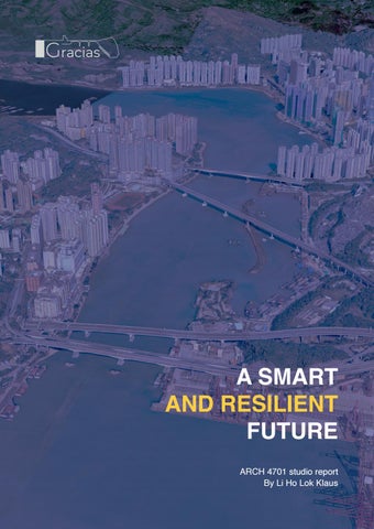
A SMART AND RESILIENT FUTURE ARCH 4701 studio report By Li Ho Lok Klaus
Coastal resilience Coastal resilience does not mean restoring coastal communities to pre-flood conditions or creating a steady state; rather, it means building dynamic systems that can transform, change, and evolve during and after a flood. ---Nordenson, 2018
A 2020 fall design study on Rambler’s Channel with using smart technology as tool and adaptive design as approach to devise an urban plan for the future.
A SMART AND RESILIENT FUTURE Chapter
1
Introduction....................................... 6 Future projection...................................... 8 Site analysis........................................... 10 Vision................................................ Aims and objectives.................................. Overview............................................ ...
14
General systems.............................. Phasing...............................................
26
Schemes........................................... An Adaptable Harbour............................
40
First Coastal Resilient Port in Hong Kong....
56
A Smart Recycling Neighbourhood............
74
5
Conclusion.......................................
84
6
Reference..........................................
90
2
3
4
16 18
28
42
Introduction Hong Kong has long been a economic central hub in the South-eastern part of Asia. While it is famous for its population density and high-rise, the edge of the city keeps expanding in height and extent. This indeed provide development opportunity, but also a risk towards the future development. Hong Kong has made its effort in constructing the Climate action plan 2030+ but most of its actions are either slogans or small scale construction instead of addressing the wide scale possible flooding among Hong Kong coastline. HK ’s C limate Ac tion Plan, 2017 Source: HKSAR
New York Resilient Plan, 2013 source: The city of New York
This design studio takes forward the area, Rambler channel. The Channel is an extent from the Victoria Harbour and located at the edge of Kwai Chung area. It is neighbour to Tsuen wan and Kwai Chung shipping terminal, with a close proximity to Tsing Yi. From the aerial photo in figure 3, the site (blue highlight) is framed by the highway, namely Tsuen Wan Road, Tsing Kwai Highway and Tsing Tsuen Road. While being surrounded by areas with dense residential areas, the area is notorious with its low pedestrian footprint and high trolley flow within the streets. In light of this, the project takes up the challenge in bringing urban regeneration in the area. But could it re-bounce?
Aerial photo of Ram bler’s C hanne l (blue highlight)
Could it adapt? The study firmly believe in one statement that natural disturbances is inevitable. Thus, instead of resisting the changes, we should adapt it, embrace it and understand it. We as landscape architect should utilize this natural modifier to help shaping our urban fabric. The project approach is built on a rationale flow. Thus, in this upcoming brief, we will first understand the site, then go into the project’s vision, systems and finally towards the implementation schemes and details of the program.
Future projection
1908 map
1970 map
1995 map
Rambler Channel was not always a shipping container. A century ago (1908 map), Rambler Channel was a natural coastline and the public cargo working area now is a vast sea. The coastline gradually expand and straighten during the British colonial period as reference to 1970 and 1995 map. It then develop one of the pillar industry in Hong Kong- port industry in light of containerization. Rambler Channel was not always a shipping container and it will not always be one. According to two major future projections that we predict, it will gradually transform the area’s direction and focus.
A photo of flooding occurs to the shipping container
Climate Change Climate change is a fact. Despite of different speculation made by research institutions, one thing is for sure that is Rambler Channel will be flooded.
C om parison of port com pe titiveness in Pearl River De lta
Decay of shipping industry Hong Kong has been an international port but its competitive edge started to loosen due to the equally competitive coastal city in the Pearl River Delta.
Site analysis The project vision is driven by three main site analysis, including the projected floodplain, urban heat island (UHI) and the existing recycling industry in Rambler Channel. Projected floodplain
Kwai C hung Flooding
In the past few years, Kwai Tsing has experienced flooding due to the low carrying capacity. While some low-lying areas in Hong Kong has already experienced some coastal flooding in the Typhoon Mangkhut. The sea level has risen up to 4.17m in the storm surge Mangkhut. Adapted from the expected high scenario of possible future sea levels from NOAA Climate, the following projections on 2050 and 2100 sea level is projected. By 2050, the average sea level will rise to 0.6m and elevate to 4.77m during storm surge. By 2100, the average sea level will rise to 2m and elevate to 6.17m during storm surge.
Hong Kong coastal flooding
With the association of ArcGIS, the two maps in the right page has been created. It shows that the coastline of Rambler Channel will be affected and the major affected land use along the harbour is the specific land use, which is mainly the container terminal port.
2050, 2100 flood plain predic tion
Floodplain and it corre lation with the surrounding land use
Different coastal typologies source: A stronger, more resilient New York
Feasibility of different typologies in Kwai Tsing
Heat distribution map in Kwai Tsing Distric t
Island
Reve tment
Bulkhead Distribution of rec ycling business in Kwai C hung
Vision
- a smart and resilient future The project envisions the site to be able to adapt and embrace towards the threat and opportunities caused by sea level changes, while at the same time using smart and innovative technology to complement and bring changes towards the surrounding environment of Gin Drinker’s Bay. It is going to be a smart and resilient in terms of environmental, economic and social aspect. Deriving from these three aspects, this design proposal suggest three aims and several objectives.
Aims and objectives First Aim: Adaptable Harbour A1 50% more habitat diversity along the Rambler’s Channel at a by 2040 [Present habitats only consists of forest and coast and island]
A2 Increasing the green cover in Kwai Tsing up to 35% [Current green cover in Kwai Tsing is 21.27%]
A3 A 100% increase of visitors visiting the promenade of Tsing Yi and Gin Drinkers’ Bay by 2050 [Current only 10% of respondents saying that they would visit the promenade once a month]
A4 Minimize the economic losses from storm surges by 50% by 2050 in Gin Drinkers’ Bay [The economic loss due to Mangkhut in 2018 is HK 4.6 billion]
A5 Reduce and maintain E.coli level to below 500 E.coli per litre. [The water quality fluctuates due to tides; ranging from 800 to 600 E.coli per litre]
Second Aim: The first coastal resilient port in Hong Kong B1 Able to response to a coastal extreme event within 15 minutes [The water quality fluctuates due to tides; ranging from 800 to 600 E.coli per litre]
B2 Maintaining the operation of the port in Gin Drinkers’ Bay by 2100 [The average sea level will rise up to 2m by 2100]
B3 Reduce the traffic flow of trucks in the port to 10% of the present traffic flow [The AAAT in Wing Shun Street is 9,310 and in Kwai Fuk road is 20,210]
Third Aim: A pioneer of a smart and recycling neighbourhood C1 Attract 150% more youth talents and 100 local innovation brands by 2040 C2 Reduce heat-related diseases by 50% [Heat related cases reaches up to 350 cases annually in Kwai Tsing District]
C3 Increasing up to 15% of paper and plastic recycling taken locally in Gin Drinkers Bay [Only 8% of Hong Kong waste was recycled locally; others are transported to mainland]
C4 Increasing the recycling rate of paper and plastic in Kwai Tsing District by 100% by 2030 [The recycling rate of paper and plastic dropped from 2800 thousand tonnes to 800 thousand tonnes from 2010 to 2018]
Adapted mode l from the com pre hensive sustainability mode l
IN
Overview RACK G T
ute Y
o n r o ti a t or p s S h i p Tr a n
C C L
P IM
ORT
EX
t
re
en
B
el
t
en
G
T
O
R
XP
e Gr
l Be
A’
Plan
2
A
3
5
B’
C’
4
B
D’
1
6
C
D
Scale 1:5500
N
8
7
Legend
1
Tsing Yi Promenade
2
Cycling platform
3
Climate resilient centre
4
Floating port
5
Wetland archipelago
6
Egret island
7
EMS rail
8
Recycling hub
Tsing Tsuen Bridge Cycling track Cycling ramp Street trees
A
A
Tsing Yi Mall
Scale 1:2000
Promenade
Rambler Channel
Pedetrian path Supporting columns Cycling track
Elevated Fishing spot
A’ 2030
A’ 2040
Road
Forest
L O N G S E C T I O N A A’
B
Industrial Building
Road
Stepped promenade
Rambler Channel
C
Industrial Building Road Mangroves Landscape dune
Rambler Channel
D
Industrial Building Road Stepped promenade
Scale 1:2000
Rambler Channel
Bridg Pier
B’
ge Floating platform
Island
Wetland
Green belt
Green belt Road
C’
Floating platform Island
Wetland
Road
Cementry
D’
Egret Island
Wood walkway
Mangroves
Wetland
Road
LONG SECTION BB’, CC’ AND DD’
Circulation
Transportation
Cycling
Greenery
Base site map
General systems
Phase 1 ! " * , % , #"&( ' ' #" ##$ % ' * ' &'% ' $ ! ' ' #" #(" #%& % " ' & $ % " $ &' # ' #" !$#% %, % ' " " * & ## " "' " # ' #" # # ' $ #$ $ " &$ "' & ' '# % "' $ "'& %&' " #' ' #" * ' $%#$ %', % ! "' " " !#) " ' + &' " % ) '! "' #*" %& $ #"' " % & # ' ' '#* % " & '#% ' " " " " #% ( " & # !$#% %, ',$ ##" & ' % '#$ & " ' & $ #!$ " & # ' %" ' '% "&$#%' %#(' !#) " ' * #( , " ('#"#!#(& & % &' ' #" " ' " " ( " !$#% %, % , " # ' #" $# "' "' '% ' '% & % " %## '#$& ! ! ! % , && &&! "' Phase 1 (2020-2025)
0
Phase 2 Phase 2 (2025-2030) 1.1.2 Viewing gallery 1.2.4 First reclamation 1.3.3 Plant wind and salt tolerable trees 1.3.4 Recycled tires tree planters 1.4.2 Reclamation 1.4.3 Planting trees 1.5.3 Incinerator park 2.1.3 Climate art gallery 2.1.4 Kwai Tsing Climate resilient centre 2.1.5 Rooftop garden 2.1.6 Laboratory 2.2.5 Floodable canteen and shelter 2.2.6 Green storage facilities 2.3.4 Make the road into one lane 2.3.5 Green paving 2.4.5 Cycling platform 2.4.6 Notice boards 2.4.7 Cycling ramps 2.5.2 Maintenance station 2.5.3 Supporting poles for EMS 2.5.4 Redevelop building 3.1.2 School engagement 3.2.3 Photovoltaic based pavement 3.2.4 Coloring the streets 3.3.6 Open platform 3.4.5 Recycling innovation centre 3.4.6 HKU designers’ hub 3.4.7 Administration office
3.4.8 Electric truck parking area 3.4.9 Recycling production line 3.4.10 Loading and unloading spot
00
Phase 3 Phase 2 (2030-2040) 1.1.3 Information panels 1.1.4 Egret protection zone 1.2.6 Second reclamation 1.2.7 Contouring islands 1.2.8 Plant mangroves 1.3.6 Plant salt and shade tolerant shrub 1.4.4 Floodable theatre 1.4.5 Constructed wetland 1.4.6 Stepped promenade 1.5.4 Recycled street furniture 1.6.2 Primary walkway 1.6.3 Secondary walkway 1.6.4 Restricted walkway 2.1.7 School collaboration 2.1.8 Boat tour 2.2.7 Release 4 short term leases 2.3.6 Pedestrianize the street 2.3.7 Increasing reliance on EMS over trucks 2.3.8 Limiting entrance of trucks to the site 2.5.5 Ship container lifter 2.5.6 Floating platform j2.5.7 Electrical monorail system 2.5.8 Smart AI 3.1.3 Lunch coupons incentives 3.1.4 Floating recycled parks 3.2.5 Colored footbridge 3.4.11 Shipping container collection
point 3.4.12 EMS storage facilitate 3.4.13 Second negotiation 3.4.14 Community designers’ studio
00
Phase 4 Phase 4 (2040-2050) 1.1.5 Egret island 1.4.7 Landscape dunes playground 1.6.5 Lookout area 1.6.6 Recycled islands 2.5.9 Connecting with the Kwai Chung Cargo Terminal 3.1.5 Recycled park 3.1.6 Recycling workshops 3.4.15 Expansion of recycling hub
00
Phase 1 2020 1.1.1 1.1.2 1.1.3 1.1.4 1.1.5 1.2.1 1.2.2 1.2.3 1.2.4 1.2.5 1.2.6 1.2.7 1.2.8 1.3.1 1.3.2 1.3.3 1.3.4 1.3.5 1.3.6 1.4.1 1.4.2 1.4.3 1.4.4 1.4.5 1.4.6 1.5.1 1.5.2 1.5.3 1.5.4 1.6.1 1.6.2 1.6.3 1.6.4 1.6.5 1.6.6 2.1.1 2.1.2 2.1.3 2.1.4 2.1.5 2.1.6 2.1.7 2.1.8 2.2.1 2.2.2 2.2.3 2.2.4 2.2.5 2.2.6 2.2.7 2.4.1 2.4.2 2.4.3 2.4.4 2.4.5 2.4.6 2.4.7 2.5.1 2.5.2 2.5.3 2.5.4 2.5.5 2.5.6 2.5.7 3.1.1 3.1.2 3.1.3 3.1.4 3.1.5 3.1.6 3.1.7 3.2.1 3.2.2 3.2.3 3.2.4 3.2.5 3.3.1 3.3.2 3.3.3 3.3.4 3.3.5 3.3.6 3.4.1 3.4.2 3.4.3 3.4.4 3.4.5 3.4.6 3.4.7 3.4.8 3.4.9 3.4.10 3.4.11 3.4.12 3.4.13 3.4.14 3.4.15
Phase 2 2025
Phase 3 2030
Phase 4 2040
2050
Time line of programs
Socio-economic system
Schemes
An Adaptable Harbour Aiming at enhancing the adaptability and embracing the opportunities during sea level change, the harbour issued a 5R Strategy that aligns with the objectives, namely RESCUE (A1), REINFORCE (A5, A1, A4)), RESTORE (A2), RESILE (A3, A4), RETURN (A3) and RECONNECT (A1, A3).
1.1 Rescue
Setting up Egret Protection Scheme
1.1.1 Ship limitation zone
1.1.5 Egret Island
The speed limit during weekend is limited to 5 knots (as reference to Discovery bay), while during weekdays the speed limit is increased to 10 knots to facilitate ship traffic.
With a total area of 0.76 ha, the Egret Island set up a low-lying edge of greenery that is accessible to the egret and also facilitate the egret flying route.
1.1.2 Viewing gallery The lease to expiry for PCWA is 2025, and thus the 0.8 ha can be retrieved and used as a viewing gallery for viewing little egret. Regular joint meeting with the bird society will be organized half-yearly.
Egre t
1.1.3 Information panels 4 Information panels, with touch screen interaction, are placed with a 85m interval in between along the viewing gallery.
Hong Kong we tland park Source: Hong Kong we tland park
1.1.4 Egret protection zone In a total of 5.14 ha, the egret protection zone prohibit passers-by to enter nor boats. It will closely monitor on the habitat development and the ecological system in the area. Hong Kong We tland park Source: Hong Kong We tland park
N
1.1.1 Ship Limitation zone 1.1.4 Egret Protection zone
1.1.2 Viewing Gallery 1.1.5 Egret Island 1.1.3 Information Panels
Legend Wetland area Ship limitation Egret Island Egret Protection zone Information panels Egret flight route
Plan of rescue strategy
Present (2020)
Phase 1 (2025)
Phase 2 (2030)
Phase 3 (2040)
Phase 4 (2050)
1.1.1 1.1.2 1.1.3 1.1.4
Construction period
1.1.5
Operation period
Phasing diagram of rescue strategy
1.2 Reinforce
Introducing wetland archipelago in Gin Drinkers’ Bay
retaining wall will be gradually removed and substituted by two control dams An inspection over the 14.5 ha harbour which will maintain the inflow speed of and several huge obstacles (e.g. water velocity at 0.6m/s. wrecked ship next to the Egret island) have to be removed. 1.2.6 Second reclamation 1.2.1 Clearing up the sea bed
1.2.2 Temporary retaining wall
Second reclamation will cover the 2 retaining wall is constructed to remaining 10.2 ha of land. The sea enclose the harbour to avoid losing of bed will be then raised to 2.5-3m. The sea level will increase when it reaches reclamation materials. to the control dams. 1.2.3 Relocation of boat people Due to the reclamation, 30 boat people needs to be relocated; an additional typhoon shelter area (1.05 ha) is offered and the climate resilient centre will offer employment places to them for boat tours.
1.2.7 Contouring the islands A total of 19 islands will be contoured and raised from the sea bed with a height of 0.5-1.5m. 1.2.8 Mangroves land
A mixture of mangroves species will be planted on the natural With a total area of 4.3ha, first islands, namely Kandelia obovata, reclamation is carried out along the Bruguiera gymnorrhiza. Mudskipper, shoreline of the PCWA using reclaimed Sesarmops sinensis and other species will also be introduced to material of sediments and debris. 1.2.4 First reclamation
diversify the wetland archipelago. 1.2.5 Removal of retaining wall Since reclamation is closely forming,
N
1.2.1 Clearing up the sea bed
1.2.4 First reclamation
1.2.3 Relocation of boat people 1.2.6 Second reclamation
1.2.8 Mangroves island 1.2.7 Contouring the islands
1.2.2 Temporary retaining wall Legend Typhoon Shelter
1.2.6 Removal of retaining wall
Initial area of Boatpeople First Reclamation Second Reclamation Temporary retaining wall Clearing up the sea bed Mangroves
Plan of reinforce strategy
Present (2020) 1.2.1 1.2.2 1.2.3 1.2.4 1.2.5 1.2.6 1.2.7 1.2.8
Phase 1 (2025) Phase 2 (2030)
Phase 3 (2040)
Phase 4 (2050)
Construction period Operation period
Phasing diagram of reinforce strategy
1.3 Restore
Improving the greenery extent along the Rambler Channel
1.3.1 Salt tolerant trees
Please refer back to 1.2.8 Mangroves land
60 salt tolerant trees like Ficus microcarpa and Ficus virens will be 1.3.6 Shade and salt tolerant shrub planted along Wing Shun Street in a 2,.5m interval. A mixture of shade and salt tolerant shrub like Aspidistra elatior, 1.3.2 Tree maintenance Aglaonema ‘Silver Queen’ and Inspection of tree health according Epipremnum aureum “All Gold” will to Development Bureau’s tree be planted along the green lane under assessment guidelines will be carried the Tsing Tsuen Bridge. out every 2 months.
1.3.3 Wind and salt tolerant trees While maintaining the original landscape, Ficus microcarpa will be planted at the peripheral of the Egret island, while a mixture of Hibiscus tiliaceus will be planted inland. They are both wind and salt tolerat trees.
Aglaonema ‘Silver Queen’ Source: CEDD
1.3.4 Recycled tires planters Tires are recycled and used as protective barriers for the plants along the Wing Shun street. There are four hubs in total. 1.3.5 Mangroves land Rec ycled tire planters Source: Southernpinning
N
1.3.6 Shade and salt tolerant shrubs
1.3.4 Recycled tires planters
1.3.1 Salt tolerent trees
1.3.5 Mangroves land
1.3.3 Wind and salt tolerant trees
Legend Phase 1 greenery Phase 2 Greenery Phase 3 Greenery
Plan of restore strategy
Present (2020)
Phase 1 (2025) Phase 2 (2030) Phase 3 (2040) Phase 4 (2050)
1.3.1 1.3.2 1.3.3 1.3.4 1.3.5 1.3.6
Construction period Operation period
Phasing diagram of restore strategy
1.4 Resile
Enhancing the coastal adaptability of recreational space with expanding the Tsing Yi Promenade
1.4.1
Removing
the
existing
With a total area of 0.6 ha, the stepped promenade invites visitors A total length of 1.15km revetment to appreciate the interaction with the outside the Tsing Yi promenade will water. be removed. 1.4.7 Landscape dune playground 1.4.2 Reclamation While acting as a coastal protection A total of 4 ha land will be reclaimed measure, landscape dune also acts using recycled materials from the as a playscape with the diversified hill recycled hub. s in different level. revetment
1.4.3 Green space A total of 10 green patches are planted along the promenade area 1.4.4 Floodable theatre
Sea-grass bed
Floodable theatre has a total area of 950 m2 and will organize cultural and water-related dramas every month. The theatre is half sunken and will interact with the tidal changes. Promenade
1.4.5 Constructed wetland Constructed wetland is created with a total area of 0.6 m2. Land scape dune playground
1.4.6 Stepped promenade
N 1.4.1 Removing the existing revetment 1.4.2 Reclamation
1.4.6 Stepped promenade
1.4.4 Floodable Theatre
1.4.5 Constructed wetland
1.4.7 Landscape dunes playground
Legend
1.4.3 Green spaces
Constructed wetland Reclamation Greenery Remove revetment
Plan of resile strategy
Present (2020)
Phase 2 (2030)
Phase 3 (2040)
Phase 4 (2050)
1.4.1 1.4.2 1.4.3 1.4.4 1.4.5 1.4.6 1.4.7
Construction period Operation period
Phasing diagram of resile strategy
1.5 Return
Reconnecting with the history context of the site
1.5.1 Ship container cafe Usage of ship container as material of the cafe will relate to the context of the site. With a total area of 120m2 the ship container cafe is operated at the PCWA in view of the increasing visitors in the future. 1.5.2 Floatable light tower The light tower in the are built shallow revetment. Due to foreseeable disappearance of light tower, 3 floatable light tower be reconstructed.
on the the will
Ship container cafe xSource: . Rec ycled stree t furniture Alibaba Source: inhabitat
1.5.3 Incinerator park At 1997, the incineration comes to a halt. To enhance relation with the site, a park will be built (total area: 0.06 ha) at the original location of the Kwai Tsing Incineration plant.
Rec ycled stree t furniture Source: inhabitat
1.5.4 Recycled street furniture Rubbish are seen in the street. Thus, the act of recycled street furnitures aims at “returning� the rubbish to the 280m lane in promenade at an artistic form to raise public awareness. G asholder park Source: Kingcro ss
N 1.5.2 Floatable light tower
1.5.4 Recycled street furniture
1.5.1 Ship container cafe
Legend Recycled furniture Cafe Floating light tower
1.5.3 Incinerator park
Incinerator park
Plan of re turn strategy
Present (2020) Phase 1 (2025)
Phase 2 (2030)
Phase 3 (2040)
Phase 4 (2050)
1.5.1 1.5.2 1.5.3
Construction period
1.5.4
Operation period
Phasing diagram of re turn strategy
1.6 Reconnect
Setting up Ecological walkways in wetland archipelago
1.6.1 Wetland management office 1.6.6 Recycled islands With a total area of 130m2, the office will help manage the habitats conditions, water flow velocity and There are two recycled islands built in examine the impacts done by the reference to the design proposal by WHIM architecture and created from surrounding disturbance. the recycling hub. They both have a 1.6.2 Primary walkway With a total length of 800m, it is a primary walkway that is 2.2m above sea level by 2020. It uses to laminated wood. it wont be flooded by 2050 . 1.6.3 Secondary walkway With a total extent of 2500m, the secondary walkway is 1.6m above sea level by 2020 and it will be flooded by 2050. 1.6.4 Restricted walkway
Rec ycled island s Source: Business inside
In reference to 1.1.4, the restricted walkway will greatly reduce the disturbance created to the egret protective zone. 1.6.5 Lookout area Three lookout areas are located in the wetland archipelago.
Wood walkway Source: Hong Kong we tland park
N 1.6.2 Primary walkway
1.6.1 Wetland management office
1.6.3 Secondary walkway
1.6.5 Lookout area
1.6.6 Recycled islands
016854 1.6.4 Restricted walkway
Legend Main walkway Secondary walkway Artificial islands Administration office
Lookout area Restricted walkway
Plan of reconnec t strategy
Present (2020) 1.6.1 1.6.2 1.6.3 1.6.4 1.6.5 1.6.6
Phase 1 (2025)
Phase 2 (2030)
Phase 3 (2040)
Phase 4 (2050)
Construction period Operation period
Phasing diagram of reconnec t strategy
First Coastal resilient port in Hong Kong Aiming at operating the port as sea level changes while acting also a hub to educate public about climate resilience, the port in Gin Drinkers’ Bay has the following strategies that align with the objectives, namely PREPARE (B1), PROTECT (A4, B2), PERCEIVE (B3), PLANNING (B3) and PASSAGE (B3)
2.1 Prepare
Develop Climate Resilient Centre to educate the public on the importance of climate resilience
2.1.1 Escalator
2.1.5 Rooftop Garden
To build 3 escalators within the With a total area of 0.66ha, the rooftop climate resilient centre and facilitate garden invites public to enter while the physically-handicapped. functioning as a green space and cooling the climate resilient centre. 2.1.2 Land (1.08 ha) obtaining from the original slaughterhouse 2.1.6 Climate Change Laboratory The lease of the slaughterhouse (DD446295) is on a yearly renewal With a total area of 0.47ha, the basis and it can be obtained by 2021. laboratory collaborates with different University (e.g. CUHK) for research and develop new coastal resilient 2.1.3 Climate Change Gallery strategy, e.g. using 3D printing technology to create living sea wall With a total area of 0.66 ha, the gallery takes reference to figure () and collaborates with 20 local artists 2.1.7 School Engagement to create climate awareness art using recycled materials found in Gin In reference to figure (), the centre engages with local school to explore Drinkers’ Bay. neighbourhood resilience and carry out “climate resilience week” every 2.1.4 Climate Change year. (administration) centre With a total area of 0.37 ha, it facilitates 2.1.8 Boat tour the monitoring and warning towards the community in Gin Drinkers’ Bay The employed boat-people under the everyday from 1000-1700. remedial scheme are invited to act as tour guide to show the visitors the changes of Rambler Channel during climate change and sea level rise.
N
2.1.7 School engagement
2.1.1 Escalator 2.1.3 Climate change gallery 2.1.4 Climate change centre 2.1.5 Rooftop Garden 2.1.6 Climate Change Laboratory
2.1.2 Land obtain
2.1.8 Boat tour Legend Climate resilient centre Clearing up land Typhoon shelter Boat tour School Connection
Plan of prepare strategy
Present (2020) 2.1.1 2.1.2 2.1.3 2.1.4 2.1.5 2.1.6 2.1.7 2.1.8
Phase 1 (2025) Phase 2 (2030)
Phase 3 (2040)
Phase 4 (2050)
Construction period Operation period
Phasing diagram of prepare strategy
Education program on Elizabe th River Projec t Source: New York Times
C onversion of Porto slaughterhouse Source: Dezeen
C onversion of Porto slaughterhouse Source: Dezeen
Sec tion of the redeve loped slaughterhouse
Exploded axonome tric drawing
Site photo inside Tsuen Wan slaughterhouse
Rendering inside Tsuen Wan slaughterhouse
2.2 Protect
Upgrading the port facilities in order to be flood resistant
Flood resistant building date of PCWA is 2050;the act of continuing to lease cargo companies guideline will come to a halt. 2.2.1
The to-be-flooded area in Tsing Yi side (total area: 5.87 ha) is mainly comprised of residential housings and industrial land use. Since they are private property, a list of guidelines will be issued to them to better anchor their buildings during flooding (e.g. setting up temporary inflatable flood walls). 2.2.2 Make G/ F flood The climate resilient centre (0.66 ha) is within the flood area. Instead of resisting the waves which at some point will reach the threshold, the building prioritizes its uses above the first floor and the ground floor is a overhanging art gallery. 2.2.3 Typhoon shelter
2.2.5 Floodable shelter and canteen It is created due to a lack of eating areas and shelter area in the region. With a total area of 02.ha, the canteen is intended to be flooded. The G/F is the canteen eating area, while the 2/F is the evacuation zone during flooding. 2.2.6 Green storage building The green storage building (total area: 0.25 ha) facilitates the cargo area that is operated in phase 3. 2.2.7 Release 4 short term leases 4 short term leases for the shipping company to transport paper and plastic recycling materials to the site.
Temporary typhoon shelter which has a total area of 1.05 ha. 2.2.4 Stop leasing the cargo companies Due to the upcoming flooding scenario by 2025 and 2050. The lease expiry
Floodable she lter and canteen Source: NYC
N
2.2.3 Typhoon shleter
2.2.2 Make G/F flood
2.2.7 Release 4 short term leases
2.2.5 Floodable shelter and canteen 1
2.2.6 Green Storage Building 2
2.2.4 Stop leasing the cargo companies
2.2.1 Flood-resistant buidling guidelines
Legend Flood area
1
Floodable shleter
2
Green storage 4 short term lease Make G/F flood Anchor buildings
Plan for protec t strategy
Present (2020) 2.2.1 2.2.2 2.2.3 2.2.4 2.2.5 2.2.6 2.2.7
Phase 1 (2025) Phase 2 (2030)
Phase 3 (2040)
Phase 4 (2050)
Construction period Operation period
Phasing diagram for protec t strategy
2.3 Perceive
Making the streets in Gin Drinkers’ Bay floodable
2.3.1 Flooding sensors
of trucks in the streets.
5 flooding sensors are installed along 2.3.6 Pedestrianize the street Wing Shun Street and the port area. Gin Drinkers’ Bay working area will one day totally rely on the EMS, and Wall that segregates the PCWA and even turn to be autonomous. With a projected zero flow in trucks on Wing Shun Street will be removed. Wing shun street and alternate route provided (from Kwai Yuet street), 2.3.3 Alternate route Wing shun street is pedestrianized. 2.3.2 Removing the wall
Alternate route is developed and issued during flooding of Wing Shun 2.3.7 Increasing reliance on EMS, Street. Foreseeing the flooded area and monorail over the trucks first can enhance the adaptability of EMS technology is introduced and the area. covers Kwai Hei Street, Wing Kin Street, Wing Chong Street, Wing Kei 2.3.4 Green paving road and Kwai Lok Street. Since the street will be at an intertidal range in the future, species like 2.3.8 Limiting truck entrance Miscanthus sinensis will be planted along the road. There is a limitation of truck entrance on Kwai Tai Road to better facilitate and alleviate the Gin Drinkers’ Bay 2.3.5 Reduce to a one lane road The area will has a gradual reduction of reliance in trucks, thus Kwai Yue street, Wing Shun Street and Kwai Hei street will reduce to a one lane road which also solves the illegal parking
traffic situation.
G reen paving source: Hill, 2019
N
N
2.3.5 Green paving
2.3.4 Reduce to a one lane road
2.3.1 Flood sensors 2.3.3 Removing the wall 2.3.2 Alternate road
Legend
Legend Truck route
Truck route (from two lane to one lane)
Flood sensors
Green lane
Alternate transport rotue
Street furniture Flood area
Phase 1 of perceive strategy
Phase 2 of perceive strategy
N
2.3. 6 Pedestrianize the street 2.3.7 Increasing reliance on EMS and monorail over the trucks
2.3.8 Limiting truck entrance
Legend Pedestrianize the street Electronic truck route Monorail link
Phase 3 of perceive strategy
2.4 Planning
Establishing a cycling network for the working community
2.4.1 Double Bicycle lanes
The storage is provided to provide Double cycling lanes are going to be one-day free storage service for the identified with white tapes in the street workers and visitors. and gradually with planter and paving to segregate from the main road. 2.4.5 Cycling platform The final phase of the bicycle lanes will expand towards the PCWA, which forms small loop over two lanes of the primary walkway in the wetland archipelago. The other two lanes are reserved for pedestrians.
Cycling platform is constructed below Tsing Tsuen bridges that changes its level with the sea level.** It will avoid users conflict with the pedestrian using the highway paths.
The total length of the cycling lane is 2.4.6 Cycling notice boards 3km. bike 6 notice board will be erected to remind the cycling rules and behaviour that should be obeyed (e.g. stay left 5 autonomous shared bike station is and swipe your hand to signal others going to be built to serve the PCWA before surpassing them). 2.4.2 Autonomous station
shared
workers and visitors.
2.4.3 Traffic lighting signals
2.4.7 Cycling ramps 3 ramps for cyclists will be built.
To avoid traffic incidents, three possible “traffic black spots” are identified and erected with traffic lighting signals to alert the vehicles’ users and cyclists. 2.4.4 Free workers’ lockers
C yclists in the site , 2020
** Shipping and Port Control(Amendment) Regulation (L.N. 228 of 1997): Tsing Tsuen North Bridge has a restriction on vessel entering the site at a height of 17m.
N
2.4.7 Cycliing ramps
2.4.5 Cycling platform
2.4.1 Double bicycle lanes
2.4.3 Traffic lighting signals
2.4.4 Free workers’ lockers
2.4.6 Cycling notice boards
2.4.2 Autonomous shared bike station Legend Cycling route Shared bike stations Ramps Traffic lighting station
Plan for planning strategy
Present (2020) 2.4.1 2.4.2 2.4.3 2.4.4 2.4.5 2.4.6 2.4.7
Phase 1 (2025) Phase 2 (2030)
Phase 3 (2040)
Phase 4 (2050)
Construction period Operation period
Phasing diagram for planning strategy
2.5 Passage
Developing a smart transportation network for ship containers
2.5.1 Obtaining building
2.5.6 Floating platform
With a total area of 1.03 ha, Wing 8 floating platform with an area of 0.65 Loi Industrial building and Hopewell ha, are built at the edge of the four logistics Centre are compensated primary walkway. and relocated. . 2.5.2 Maintenance station
2.5.7 Electrical monorail system (EMS)
The maintenance station is built in the redeveloped building (2.5.4) at an Electrical monorail system greatly area of 0.7 ha which can ensure the reference to the one developing in durability of the EMS. Guang zhou right now. The technology is new and available. 2.5.3 Supporting poles
The whole rail line stretches 2000m from the coastal edge to the industrial 15 supporting poles in total will be area that transports the recycled erected in the site to support the EMS materials and exports recycled rail. product away via shipping containers. 2.5.4 Redeveloping building
2.5.8 Smart AI monitoring the
The building at 2,5.1 will be operation redeveloped into a EMS station to collect the recycled waste from the A central AI system that connects ship container. with the EMS, smart phone device, surveillance, flood sensors and control dams all together. It will 2.5.5 Ship container lifter/ crane analyses the collected data and adjust the operation accordingly. 4 total ship container lifters are erected at the floating platform e.g. receiving the local forecast that
there’s an inflow of storm surge in the
N 2.5.6 ESM rail
2.5.2 Maintenance station
2.5.1 Obtainnig building 2.5.4 Redeveloping buidling
2.5.6 Floating platform 2.5.5 Ship container lifter
2.5.9 Connecting Kwai Chung Cargo Terminal
2.5.3 Supporting poles 2.5.7 Electricla monorail system (EMS)
2.5.8 Smart AI monitoring the operation
Legend EMS route Floating platform Redeveloped building Maintenance station Supporting poles Future devlopment Monorail route Smart AI coverage Shipping container lifter
Plan for passage strategy
Present (2020) 2.5.1 2.5.2 2.5.3 2.5.4 2.5.5 2.5.6 2.5.7 2.5.8 2.5.9
Phase 1 (2025) Phase 2 (2030)
Phase 3 (2040)
Phase 4 (2050)
Construction period Operation period
Phasing diagram for passage strategy
evening, then it will alert the climate resilient centre and local police for traffic arrangement. Also, it will adjust the control dams and declining the operation of the EMS. 2.5.9 Connecting Kwai Chung Cargo Terminal The PCWA in Gin Drinkers’ Bay is a prototype for the whole Hong Kong. If it is successful model, it will connect with the Kwai Chung Cargo in the late phase 4. It is then expected to enhance the competitive edge of Hong Kong cargo industry.
Ship container on EMS Source: kknews
Present PC WA condition
Phasing diagram for PC WA
Sec tions
Smart Recycling Neighbourhood Aiming to be able to recycle paper and plastic within the neighbourhood while at the same time creating interventions to contribute to the local community, the smart recycling neighbourhood has the following strategies that align with the objectives, namely CULTIVATE (C4), COOLING (C2, A2), CONSULT (C4) and CONVERT (C1, C3) .
3.1 Cultivate
Enhancing the awareness of recycling paper and plastic among the public
3.1.1 Temporary collection point The collection point located in between the recycling park has covered a relatively significant amount of “recycling elderly� footprint as according to the 2 minute walking circle. It mainly recycles paper and plastic. 3.1.2 School collaboration
Please refer back to 1.6.6 Recycled islands. 3.1.5 Recycled parks 4 potential sites for recycled parks are identified and the park equipment like benches will be made in recycled materials from the recycling hub. 3.1.6 Recycling workshops
The recycling hub mainly engages 7 local schools in Kwai chung to carry As part of community engagement, out communal recycling projects and monthly recycling workshops will be studies about the recycling practice carried out in the recycling hub. in Kwai Chung area. 3.1.3 Lunch coupons incentives To encourage the locals to carry out recycling habits daily, lunch coupons will be issued to them once they reached 10kg every month.
Ship container on EMS Source: kknews
Additional coupons will be issued to the recycling collectors who transport recycling materials to either the recycling hub or the temporary collection point at 3.1.1. 3.1.4 Floating recycled parks Present PC WA condition
N 10minute walking circle
3.1.2 School collaboration
3.1.5 Recycled parks
3.1.1 Temporary collection point
2 minute walking circle
3.1.3 Lunch cupons incentives 3.1.6 Recycling workshops
3.1.4 Floating recycled parks
Legend Recycling hub Floating Recycled park Recycled park Canteen Temporary paper and plastic collection point Recycling elderly movement area
Plan for cultivate strategy
Present (2020) 3.1.1 3.1.2 3.1.3 3.1.4 3.1.5 3.1.6
Phase 1 (2025)
Phase 2 (2030)
Phase 3 (2040)
Phase 4 (2050)
Construction period Operation period
Phasing diagram for Cultivate strategy
3.2 Cooling
Enhancing urban cooling
3.2.1 Planting street trees
3.2.5 Colored footbridge
Along several green lanes (4km), street trees are planted to facilitate the existing cooling corridor into Kwai Chung area.
Footbridges are colored and renamed into more energetic names “the rainbow bridge�. The initiative is similar to 3..2.4.
3.2.2 Green rooftops Green rooftops will reference to the study by the edible roof initiative from HKU and develop across the recycling hub at a 5.3 ha extent. It covers 80% of each rooftop.
C oloring the stree t Source: Bloom berg
3.2.3 Photovoltaic based pavement The photovoltaic based pavement will be located across the Kwai Fong Station and along the trail in Kwai Chung park. It can relieve the heat stress for the former, while providing adequate lighting to the latter.
Photovoltaic stree t pavement source: solar innova
3.2.4 Colouring the streets In collaboration with Makerbay, the imitative will actively engage with the local community to color the streets (length: 3.26km) and make the streets vivid with color again!
G reen rooftop source: HKU
N 3.2.2 Green rooftops
3.2.1 Planting street trees
3.2.4 Coloring the streets
3.2.5 Coloring the footbridge 3.2.3 Photovoltaic based pavements
Legend Green spaces Green rooftop Coloring the street Coloring the footbridge Photovoltaic based pavements
Plan for cooling strategy
Present (2020)
Phase 1 (2025)
Phase 2 (2030)
Phase 3 (2040)
Phase 4 (2050)
3.2.1 3.2.2 3.2.3 3.2.4
Construction period
3.2.5
Operation period
Phasing diagram for C ooling strategy
3.3 Consult
Facilitating cross-disciplinary discussion within the recycling hub
3.3.1 Monthly social gathering
3.3.5
Cooperate
with
district
councillors Took place at the green open space (0.65 ha) in recycling hub, the gathering is an academic interaction The site is overlapped with multiple of the district on the development of recycling constituencies councillors, mainly S20, S19, and S02. products. The hub will cooperate with them. 3.3.2 Yearly assessment
3.3.6 Open platform
The management board of the recycling hub will assess on the An open platform, with a 0.2 ha extent, potential and value of the local brands. over the Tsuen wan Road will be constructed. 3.3.3 Mind-wall that collect local ideas Located across Kwai Fong station, it offers a smart board and smart pen which allow citizens walked by to express their opinion. The opinions will be transmitted to central AI. 3.3.4 Half- yearly public consultation The half yearly public consultation will be organized by the community designers in the recycling hub which will get a better understanding on the communal need. This will alter the future tactic and design approach.
Social innovation festival source: megaman
G ardening social workshop source: G reen Queen
N
3.3.2 Yearly assessment
3.3.6 Open platform
3.3.1 Monthly social gathering
3.3.3 Mindwall that collect local ideas
3.3.4 Half-yearly public consultation
Legend Recycling hub Connection Innovation hub
3.3.5 Cooperate with district councillors
District Counciilors
Plan for consult strategy
Present (2020) 3.3.1 3.3.2 3.3.3 3.3.4 3.3.5 3.3.6
Phase 1 (2025)
Phase 2 (2030)
Phase 3 (2040)
Phase 4 (2050)
Construction period Operation period
Phasing diagram for consult strategy
3.4 Convert
Developing a recycling hub in the industrial area
3.4.1 Paper and plastic collection 3.4.13
zone 3.4.2 Food angle canteen
Second
negotiation
with
property owners
3.4.3 Open space
3.4.14 Community designers’ studio
3.4.4 First negotiation with property owners
3.4.15 Expansion of recycling hub
3.4.5 Recycling innovation centre 3.4.6 HKU designers’ hub 3.4.7 Administration office 3.4.8 Electric truck parking area 3.4.9 Production line
3.4.9.1 Assembly
3.4.9.2 Testing
3.4.9.3 Packaging
Plastic rec ycling fac tory source: scm p
3.4.10 Loading and unloading spot 3.4.11 Shipping container collection point 3.4.12 EMS storage facility
Rec ycled produc t source: Plugin
N 3.4.8 Electric truck parking area 3.4.12 EMS Storage facility
3.4.4 First negotiation with propety owners
3.4.5 Recycling innovation centre 3.4.6 HKU designer’s hub
3.4.9.2 Testing zone 3.4.9.3 Packaging zone 3.4.3 Open space
3.4.1 Paper and plastic collection zone
3.4.15 Expansion of recycling hub
3.4.6 HKU designers’ hub 3.4.14 Community designers’ studio
3.4.2 Food angle canteen
3.4.7 Administration office
3.4.10 Loading and unloading spot
3.4.11 Shipping container collection point
3.4.9.1 Assembly
3.4.13 Second negotiation with property owners
Legend Recycle hub phase 1
Canteen
Recycle hub expansion
Innovation Centre
Paper and plastic collection zone
Administration office
First production line -- Assembly
Green spaces
Second production line -- Testing
EMS station
Third production line -- Packaging and export
Electronic Monorail (ground level)
Loading and unloading centre
Plan for convert strategy
Present (2020) 3.4.1 3.4.2 3.4.3 3.4.4 3.4.5 3.4.6 3.4.7 3.4.8 3.4.9 3.4.10 3.4.11 3.4.12 3.4.13 3.4.14 3.4.15
Phase 1 (2025)
Phase 2 (2030)
Phase 3 (2040)
Phase 4 (2050)
Construction period Operation period
Phasing diagram for convert strategy
Conclusion
Conclusion Hong Kong is appraised internationally of her great city-line and sustainability in terms of accessibility and close neighbourhood. But with her sharp engineering edge and an array of high rise proximity to the coastline, is this a threat to this territory when encountering rising of sea level? In this design proposal, we reject the notion that sea level is a threat and Hong Kong is unable to sustain her prosperity in the future, although admitting that Hong Kong will stay vulnerable without further urban planning. Hence, we hereby propose the vision of a smart and resilient future. The three aims of the vision are Adaptable Harbour, the first coastal resilient port in Hong Kong and a smart recycling neighbourhood. They each represent a sector in the resilience circle (environment, social, economic) and with the design, it is projected to response accordingly with flexibility. In this not-near future of Hong Kong, flooding will be an inevitable issue. So the question left would not be how to resist it; but how to embrace it?
Reference Aerial transportation rail. retrieved from https://kknews. cc/tech/6avpkql.html Loo, Becky P.Y. (2018). Unsustainable Tranport and Transition in China. Longon & New York: Rouledge. Landezine. (2017). Archipelago Courtyard. Retrieved from http://landezine.com/index.php/2017/07/ archipelago-courtyard-by-terrain-nyc/ City of Newyork. (2013). A stronger, more resilient New York. HKSAR, Environment Bureau. (2017). Hong Kong’s Climate Action Plan 2030+ Southwest Kwai Chung. (2015, July 21). Retrieved October 25, 2020, from https://www.gov.hk/en/about/ abouthk/factsheets/docs/town_planning.pdf Building Design to Foster a Quality and Sustainable Built Environment. (2011, January). Retrieved October 25, 2020, from https://www.info.gov.hk/tpb/en/papers/ TPB/TWK/S_KC_26_RV/S_KC_26_RV_Annex.pdf
Gracias