10 minute read
CHAPTER 8: LAND USE AND ZONING


INTRODUCTION Three of common forms of mapping used in planning are zoning, typology, and land use. The values of a city, expressed through policies and design standards, can be seen in these kinds of maps. Cities use zoning to guide development and growth in harmony with current and future land use policy, while typology can show how the built environment develops under these policies.
Zoning Since the early 1900s, local governments in the U.S. have divided and regulated land into different zones based on what type of activity was allowed to occur in each zone. The purpose of this is to separate potentially harmful and conflicting uses, such as residential housing and factories, to protect the welfare of all concerned parties. Zoning can also be used to enhance the beauty of a community by requiring landscaping and buffers and to protect recreational areas and open spaces in neighborhoods. Zoning codes today specify what type of activity is allowed in a particular area and the standard building criteria that must be met within each zone. Since zoning codes are upheld as versions of the law, plans must coincide with the local zoning code if they are to be implemented.
Advertisement
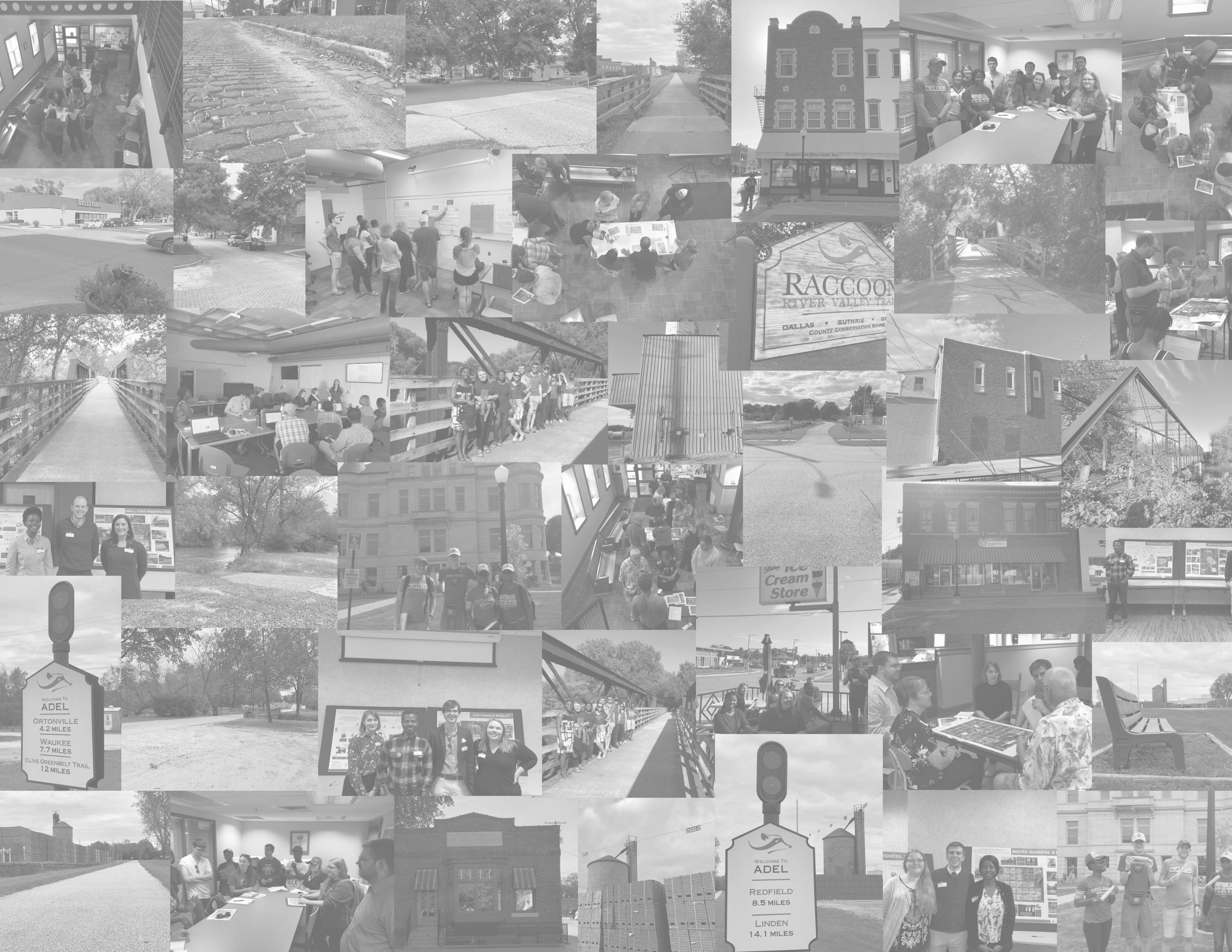
Building Typology Building typology is a tool planners can use to understand what exists in the built environment. The typology in this chapter is an inventory of the downtown Adel taken by the authors in September 2019 to understand the current appearance and make up.
Land Use Land use is closely connected to zoning policies, and officially defines the different types of activities that exist on each plot of land. Land use can help planners understand how a city’s leadership view and classify the various businesses and activities that make up the community, and can be useful in defining new plans for those activities.
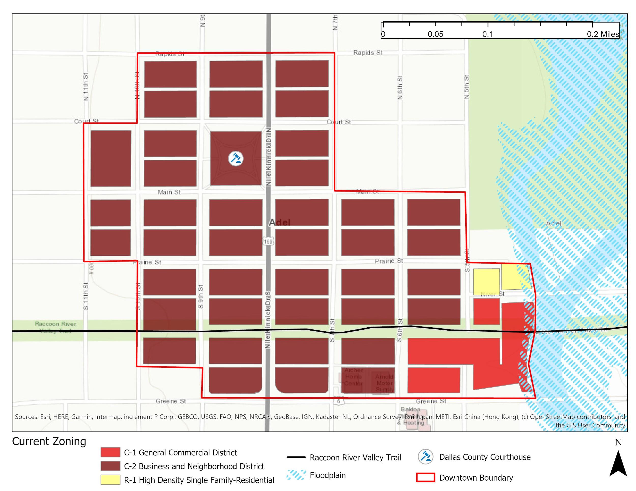
ZONING Current Zoning Currently, downtown is mostly made up of the C-2 classification, “Business & Neighborhood District.” It also includes some residential and general commercial districts. These variations in zoning are due partially to the fact that the downtown boundary has been expanded recently from just the C-2 section to include areas near the river. The current zoning can be seen in Figure 8.1, and classification purposes, as defined in the Adel Zoning Code, are described below.
C-2 Business & Neighborhood District: “This district is intended to provide for certain areas of the City for the development of service, retail and other non-residential uses, excluding industrial and agricultural uses. It is intended to permit small scale commercial uses compatible with adjacent residential neighborhoods.” C-1 General Commercial District: “The C-1 District is intended to provide an area for the business, financial, professional, and commercial needs of the community, especially those which can be most suitably located in a compact, centrally located traditional business district.” R-1 High Density Single-Family Residential: “The purpose of this district is to provide space for the smallest standard lot for single-family living where public utilities and services are available and to encourage a suitable living environment through the promotion of public health, safety, and welfare.”
Figure 8.1 Current Zoning
Future Zoning The current Adel Zoning Code lists the types of activities allowed in each zoning category. However, the permitted uses are outdated for the services downtown Adel can provide. Examples of outdated uses mentioned include shoe shining stores, philatelist or stamp collecting stores, repair of fur garment stores, etc. Not included in the list of permitted or conditional uses within these zones are more modern inventions and activities, including business incubators and outdoor seating or vending options. By revising the Zoning Code’s vocabulary to reflect modern businesses and organizations while removing the more dated entries, the zoning code can allow for growth, innovation, and conservation in downtown Adel going forward. A map of future zoning can be seen in Figure 8.2, and classification descriptions are described below.
C-2 Business & Neighborhood District: “This district is intended to provide for certain areas of the City for the development of service, retail and other non-residential uses, excluding industrial and agricultural uses. It is intended to permit small-scale commercial uses compatible with adjacent residential neighborhoods.” o A future C-2 designation will include provisions for a mix of residential and commercial use. CN Conservation District: “This designation is intended to provide benefits linked to the natural environment such as run-off and erosion control, flood mitigation, and to provide habitat for wildlife through sound ecological land management. This area can also be used for public outdoor recreation and is a high priority to be designated in areas that are especially susceptible to flooding.”
Figure 8.2 Future Zoning

BUILDING TYPOLOGY Current Typology There are many types of buildings and uses within downtown Adel to take into account when planning for the future. A deeper understanding of the region can be gained by looking at the distribution of buildings currently in place. The following typology distinguishes between the 11 categories in Table 8.1.
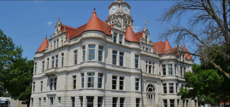
Downtown Adel currently includes a mix of retail, administrative, mixed use, and historic buildings, as seen in Figure 8.3. There are a high number of Dallas County buildings, since Adel is the county seat. Several parcels contain buildings that have been identified as historic or potentially historic. The historic area that surrounds the Dallas County Courthouse is comprised mostly of historic, mixed-use buildings that complement the scenic brick streets around The Square. There is one park within the downtown boundary just off the historic square to the West that serves as a community space.
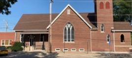
Table 8.1 Building Typology Categories Typology Description Religious Buildings Buildings that house religious institutions or services. Commercial Properties Buildings that house various businesses, including retail and service based activities. Dallas County Properties Properties that contain county services and offices. Mixed-Use Buildings Contain a combination of commercial and residential activities within the same building. Multi-Family Homes Contain multiple housing units. Single Family Homes Contains single housing units Municipal Buildings City owned and provide key city services to the public. Park Any area of open greenspace accessible by the community. Potential Historic Properties Combines currently recognized historic buildings for both the local or national registry of historic places as well as properties with the potential to gain these recognitions. Vacant Properties Includes plots of land for sale as well as commercial buildings currently lacking operating businesses. Parking Lots Located throughout downtown, these serve all other uses.
Figure 8.3 Current Downtown Typology

LAND USE Current Land Use Figure 8.4 shows the current official land use in downtown Adel. The grouping is divided into public, single- and multi-family residential, offices, commercial, and industrial uses. The majority of buildings fall under single-family residential, offices, and commercial use.
Future Land Use The proposed future land use for downtown Adel is shown in Figure 8.5. Certain categories have been subdivided, including separating public buildings into community, city, and county properties and commercial properties into those that serve the neighborhood and those that serve the broader community. Additional categories that may already be present within downtown but are not currently officially designated include open space and mixed use parcels. Significant changes in land use are listed below Figure 8.5, and the quantitative changes are summarized in Table 8.2, while examples of existing properties that may fall into each category are shown in Figure 8.6.
Significant Changes Higher Density For downtown Adel to thrive, more people should be living and working closer to downtown. The more people who live downtown, the better supported local businesses will be. To attract more people, the area should be developed to increase density and provide for more people utilizing resources that can be found only in downtown Adel. For this reason, the plan proposes that all housing parcels within the downtown boundary be zoned as the C-2 Business & Neighborhood District and have a land use policy that allows for higher density through double or multiple-family dwellings. Currently standing houses within the downtown boundaries will still be zoned as a single-family, but no more singlefamily housing should be allowed to be developed within the downtown district.
Conservation District The Raccoon River is an important water resource for the City of Adel and the State of Iowa. To protect the river, the land immediately adjacent on the west bank will be used as a park or open space. This will aid in the conservation of this critical resource and preserve the viewshed of the beautiful wild corridor. Allowing for public access will give trail users a chance to stop and relax in a unique atmosphere not found on the rest of the Raccoon River Valley Trail. Having greenspace near the river also serves to help reduce runoff pollution and erosion along the river and mitigate any flooding that may occur.
Mixed Use More mixed-use residential apartments should supplement singlefamily dwellings throughout the downtown area. We included more mixed used in the future land use plan due to the anticipated growth of downtown Adel. This will help attract new businesses to Adel, while providing more units for people to live. Most mixed-use parcels are located in or near the historic square around the Dallas County Courthouse. Existing buildings in this area are amenable to updates that would allow for mixed use.
One of the main opportunities these changes present is to enhance the identity of the downtown and improve Adel’s built environment in a way that is friendly to both bicycles and pedestrians. Overall, it is hoped that these changes will result in increased safety and ease of navigation for all those exploring downtown Adel.
Figure 8.4 Current Land Use

Figure 8.5 Future Land Use

Table 8.2 Future Land Use Matrix Land Use Categories Description/Purpose
RS Single Family Residential RS Medium Density Residential RS High Density Residential PU Public-Community PU Public-City PU Public County MX Mixed Use OS Open Space CM CommercialNeighborhood CM CommercialCommunity Minimize/eliminate new low-density development downtown. 1-5 dwelling units per acre.
Townhomes, row houses development. 5-12 dwelling units per acre.
Apartments and Condos. Promote high density and workforce housing 12 or more dwelling units per acre.
Religious or non-profit area with capacity for public and private events, business incubators.
City owned with capacity for public and private events, business incubators. Office space for general function.
County owned with capacity for public and private events, business incubators. Office space for general function.
Mixed retail, entertainment, and residential development. Retail on first floor, residential units on higher units.
Programmed and non- programmed space for events, recreation with conservation of natural feature maintained.
Space that fits into the urban fabric of a neighborhood, locally owned businesses. Pedestrian and bicycle accommodations.
Space that can be at the periphery of downtown space. Intended to serve community and beyond.
# of Parcels Currently Downtown
52/163
Change # of Parcels Proposed Downtown
-29 23/163
1/163
0/163
48/163
0/163
0/163
54/163 +17 18/163
+2
-35
+76
+4
-27 2/163
3/163
5/163
5/163
76/163
4/163
14/163
13/163
RS Single Family Residential

PU Public County
RS Medium Density Residential

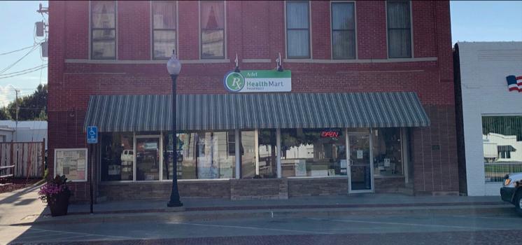
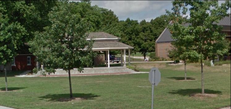
Figure 8.6 Adel Land Use Examples
RS High Density Residential

PU Public-Community
PU Public-City
MX Mixed Use
OS Open Space
CM Commercial-Neighborhood
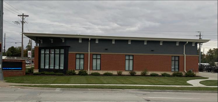


CM Commercial-Community

