1 minute read
Project Update

by kepo-mck


GIS at KEPO
by James Serendip, Environmental GIS Specialist
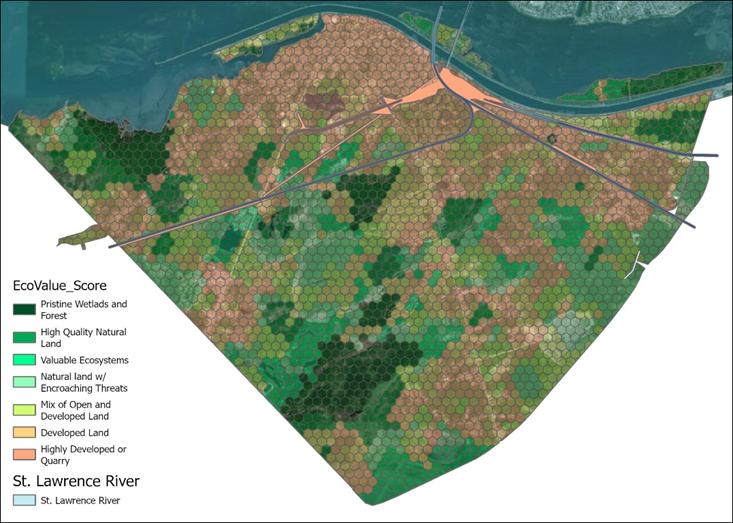
Geographic Information Systems (GIS) is the study of information from the perspective of where things are in the world GIS combines the artistry of cartography with the science of statistical analysis and computer programming to both reveal patterns, and to clearly communicate it to others Over the years, KEPO has collected a great deal of information on the different species and habitats in Kahnawà:ke and in Tioweró:ton With GIS this information can be mapped and studied to identify trends, visualize patterns, and assist with decision-making
Using GIS technology we are able to monitor things like the presence and spread of invasive species, changes in biodiversity, and changes in contaminants or the quality of water, soil, and air GIS also helps us determine appropriate locations for new projects, from environmental restoration work to climate change preparedness
GIS at KEPO works with information from lots of sources, from staff out collecting scientific data in the field with custom-made data collection apps or GPS devices, to satellite, aerial, and drone imagery, to in-place sensors and monitoring devices, to community input from online apps.
Current GIS projects at KEPO include making a predictive map of metals in the soil, tracking air quality changes with real-time air quality monitors throughout the community, monitoring changes in surface water quality, locating sites of illegal dumping, identifying key habitat areas for ecological preservation, and monitoring shipping traffic in the St. Lawrence Seaway.


