
Walk-in Fishing Access (WIFA) sites are leased from private landowners and are typically open to public fishing from March 1 – Oct. 31, though some properties are open year-round. The WIFA program provides anglers increased opportunities to enjoy fishing on the state’s streams and small impoundments, all that is required is a state fishing license. Funding for the program is provided through fishing license revenues and Sport Fish Restoration Funds. Please observe all rules and regulations, and remember that common sense and ethical behavior will influence the future of the program.
The following guidelines help maintain a good relationship between landowners and anglers:
1. Look for the WIFA signs (pictured below) before entering the property. Sites may have been withdrawn from the program. If you do not see signs, do not enter.
2. Obey lease boundaries. Stay within 50 feet of the stream or impoundment shoreline. If the WIFA property is a stream, fish only on the side of the stream that is posted as an access site. Do not walk or fish on adjacent property.
3. Respect the rights of landowners, as well as others using the area. Treat the land as if it were your own.
4. Take all trash with you when you leave. If someone before you has irresponsibly left trash, please take a moment and pick it up, too.
5. Do not open gates or enter properties with vehicles unless authorized. Park along the road or in designated parking areas. Leave field-access, drives, and rural roads open so that landowners moving large implements may pass.
6. Avoid stretching fences when crossing them, and use fence stiles where available.
7. Do not attempt to contact cooperating landowners to ask about fishing other portions of their land.
Regulations governing WIFA area use:
• Impounded WIFA waters have a creel limit of two channel catfish, a creel limit of two largemouth bass, and an 18-inch minimum length limit on largemouth bass. Otherwise, all Kansas fishing regulations and statewide creel limits apply. It’s especially important for anglers using the sites to respect and follow the rules that apply on WIFA properties. You do not need to contact the landowner for permission on WIFA waters.
• Seining is prohibited on all WIFA waters, and trotlines and setlines are prohibited on impoundments under 1,201 acres in size (KAR 115-8-6); No swimming (KAR 115-8-8); Camping by posted notice only (KAR 115-8-9); No pets, except on a leash (KAR 115-8-10); No horseback riding (KAR 115-8-11); No stocking or release of wildlife, including the dumping of live bait (KAR 115-8-12); Vehicles shall be operated only as authorized (KAR 115-8-13); No fireworks (KAR 115-8-14); No unauthorized fires (115-8-15); No target practice (KAR 115-8-1); No littering (KAR 115-8-18); No cereal malt beverages or alcoholic liquor (KAR 115-8-19); Destructive acts such as digging or destroying signs or vegetation is prohibited (KAR 115-8-20).
• All Kansas boating laws are in effect on WIFA waters.
Due to unforeseen conditions and/or renovations, some properties may be dry, lower than normal or flooded. Water quality and vegetation may vary among properties.
Look for these signs before accessing a WIFA area.
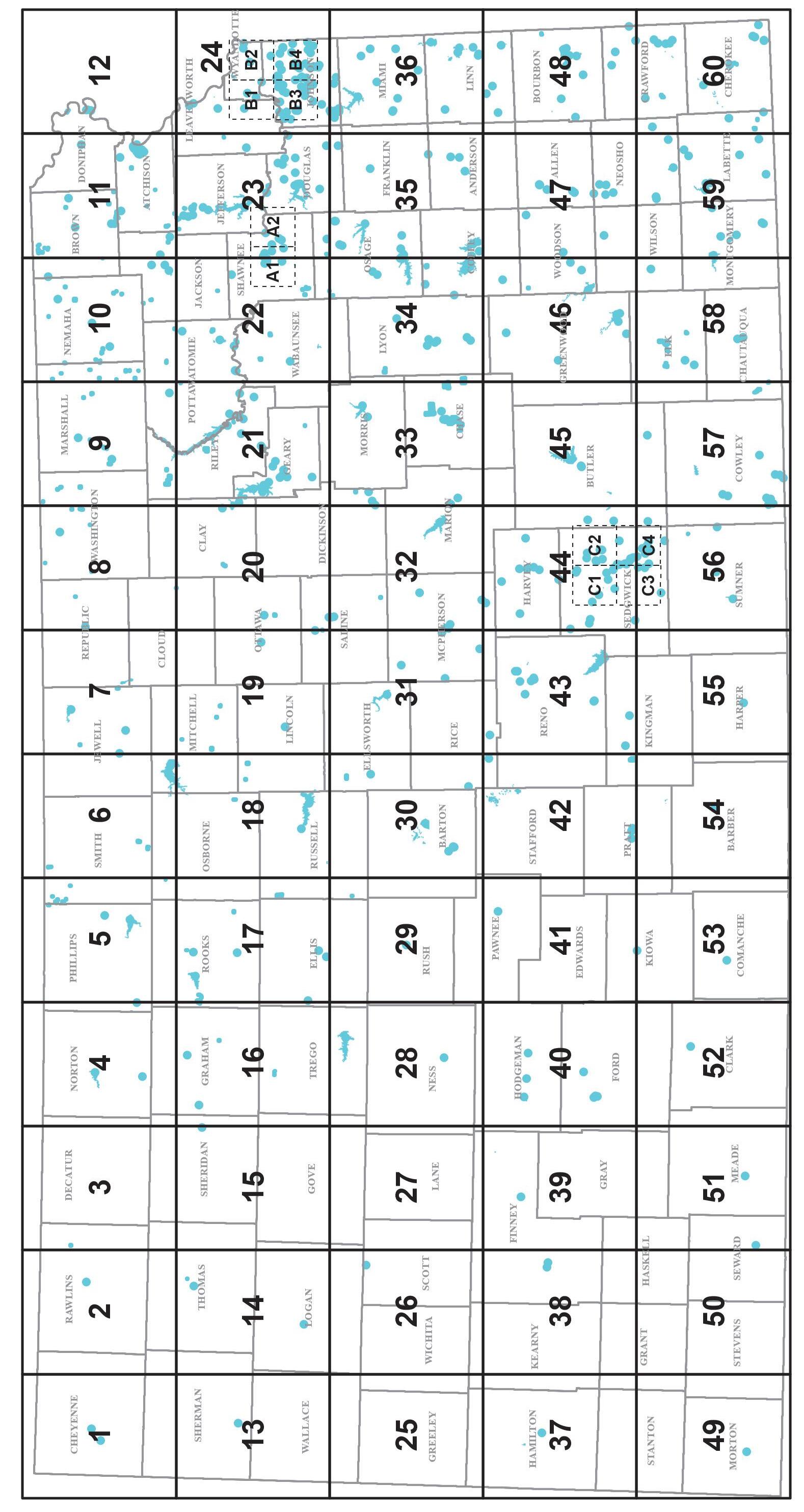
The maps in this atlas show a variety of public fishing areas, as well as public lands across Kansas. WIFA areas are privatelyowned ponds or streams the Kansas Department of Wildlife and Parks (KDWP) has leased and opened to public fishing. Each map also shows all federal reservoirs, state fishing lakes, river access sites, and community lakes. To find fishing areas near you, consult the legend below and then locate the corresponding access locations indicated on the maps.
The maps on the following page show which counties have federal, state, or community fishing opportunities, as well as those with WIFA sites.
Community lakes are impoundments owned by a city or county government.
Community lakes that are managed for public fishing through the department’s Community Fisheries Assistance Program (CFAP) and state fishing lakes are labeled with the impoundment name and marked by the blue fish symbol. There are no additional fees to fish at state fishing lakes or community lakes in the CFAP program. Community lakes not in the CFAP program are also labeled with the impoundment name and are marked by a red octagon symbol as local governments managing these lakes may require a permit and/or additional fees for fishing access.
Most WIFA areas are open to fishing from March 1 to Oct. 31, but some are open year-round, see legend. Accessing the WIFA properties prior to or after the
indicated access period is prohibited.
Maps are at a scale of 1:277,500 (1 inch represents 4.38 miles) and were compiled according to conventional cartographic standards using the most reliable information available. KDWP does not guarantee freedom from errors or inaccuracies and disclaims any legal responsibility or liability for interpretations made from these maps, or decisions based thereon.
This atlas is a continual work in progress and any comments, suggestions, or corrections are welcomed. Any such comments may be submitted to kdwp.info@ks.gov.
The Kansas Department of Wildlife and Parks (KDWP) is a cabinet-level agency with a Secretary appointed by the Governor. KDWP dates back to 1905, when fish and game laws were first organized under the Kansas Fish and Game Department, and a new state law required a license to hunt. At KDWP, we are dedicated to the conservation and enhancement of Kansas’s natural resources for the benefit of both current and future generations. From hunters and anglers to birdwatchers and adventurers, KDWP offers sustainable outdoor recreation that fosters a deep connection between people and the natural world.
KDWP’s operations, programs, and staff are funded primarily through user fees and federal grants. Most fish, wildlife, and education programs rely on revenue from hunting and fishing licenses and from federal excise taxes paid by hunters and anglers on equipment purchases. The amount of federal aid received is based in part on the number of hunting and fishing licenses sold
in Kansas. Your purchase of a hunting and fishing licenses and permits directly supports the conservation and enhancement of Kansas’ fisheries and aquatic resources, helping ensure that future generations can enjoy quality fishing opportunities.
The Kansas Wildlife and Parks Commission is a sevenmember, bi-partisan board that serves in an advisory capacity to the Governor and Secretary in formulating policies and plans of the Kansas Department of Wildlife and Parks. Current Commissioners are:
Whitney Damron, Chair
Topeka
Representative Will Carpenter El Dorado
Whitney Damron, Chair
Topeka
Representative Will Carpenter El Dorado
Emerick Cross
Kansas City
Warren Gfeller
Russell
Delia Lister Pittsburg
Keith Mark Basehor
Bruce Riedl Ellinwood
Learn more at ksoutdoors.gov.
Fishing reports are available on ksoutdoors.gov and provide information regarding seasonal fishing trends on your favorite lakes and reservoirs. On ksoutdoors.gov, anglers can also access Google Earth files showing the locations of fish attractors.
View at:
ksoutdoors.gov/Fishing/Fishing-Reports
The 2026 Kansas Fishing Forecast highlights Kansas’ top fishing spots. Download an electronic copy from ksoutdoors.gov, or grab a printed copy from most license vendors. Anglers can also view the forecast in the 2026 Spring issue of Kansas Wildlife & Parks Magazine, which can be purchased by calling (620) 6720756.
Download at: ksoutdoors.gov/Fishing/Fishing-Forecast
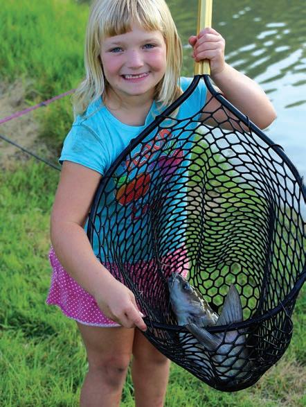

If you have a passion for the outdoors and enjoy sharing your knowledge with others, this program may be for you. The Angler Education Program is designed to recruit individuals who have a passion for fishing and want to share it with others. KDWP’s mission to reconnect kids with nature, strengthen family bonds, and instill a responsibility for stewardship of our natural resources.
Similar to KDWP’s Hunter Education Program, Angler Education will certify instructors who will become volunteers of the State of Kansas. Certification events will qualify instructors to teach everything from class design, and working with children, to environmental stewardship, knot tying, fish identification, and casting.
Certified instructors may work alone or with other instructors to teach general fishing information, specific fishing techniques, or just take families fishing.
If you are interested in any of these programs or to become a certified Kansas Angler Instructor, visit ksoutdoors.gov/fishks for upcoming certification events in your area.

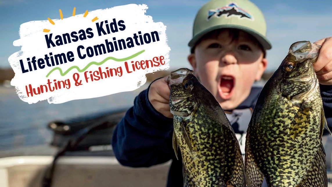
ksoutdoors.gov/kids-lifetime
Barber SFL (55 F10), 77 acres, Upper End Periodically Dry
Cedar Bluff Reservoir (28 B11), 6,869 acres, AIS Alert
Clark SFL (52 D11), 300 acres
Concannon SFL (39 C3), 50 acres
Ford SFL (40 G9), 45 acres
Glen Elder Reservoir (6 J12), 12,586 acres, AIS Alert
Goodman SFL (28 H10), 40 acres, Periodically Dry
Hodgeman SFL & WA (40 C10), 87 acres, Periodically Dry
Jewell SFL (7 G1), 57 acres
Kanopolis Reservoir (31 D3), 3,550 acres, AIS Alert
Keith Sebelius (Norton) Reservoir (4 E9), 2,300 acres
Kiowa SFL (41 J3; 53 A3), 21 acres
Kirwin Reservoir (5 H4), 5,000 acres
Logan SFL (14 I9), 60 acres, Periodically Dry
Lovewell Reservoir (7 D2), 2,986 acres
Meade SFL (51 H4), 80 acres
Ottawa SFL (20 F7), 138 acres,
Pratt - Centennial Pond / Kid's Fishing Pond (42 J9), 4 acres
Rooks SFL (17 B3), 67 acres, Periodically Dry
Saline SFL (19 J6), 38 acres, Periodically Dry
Sandsage Bison Reserve Pond (38 E12), 5 acres, Periodically Dry
Scott SFL (26 C12), 115 acres
Sheridan SFL (15 B6), 67 acres
St. Francis Sand Pits, 5 acres
Webster Reservoir (17 B1), 3,780 acres
Wilson Reservoir (18 I10), 9,040 acres, AIS Alert
Atchison SFL (11 G5), 66 acres
Brown SFL (11 D3), 62 acres
Browning Oxbow (12 D8), 100 acres, AIS Alert
Clinton Reservoir (23 I4), 7,000 acres, AIS Alert
Clinton SP - Lake Henry & Picnic Pnds (23 H4), 3.5 acres
Douglas SFL (23 J6), 180 acres
Fort Leavenworth - Merritt Lake (24 B8), 5 acres
Fort Leavenworth - Smith Lake (24 B8), 5 acres
Geary SFL (21 I2), 97 acres AIS Alert
Hillsdale Reservoir (36 B8), 4,580 acres, AIS Alert
Jeffery EC (22 C9), 125/450 acres, AIS Alert, Limited Access
John Redmond Reservoir (34 J12), 9,400 acres, AIS Alert
La Cygne Reservoir (36 G11), 2,600 acres
Leavenworth SFL (23 E6), 160 acres, AIS Alert
Lyon SFL (34 E10), 135 acres, AIS Alert
Marais des Cygnes Wildlife Area (36 I10), 1,967 acres
Melvern Reservoir (34 F12; 35 E1), 7,000 acres, AIS Alert
Melvern River Pond (35 E1), 90 acres, AIS Alert
Miami SFL (36 F10), 101 acres
Middle Creek SFL (36 E11), 280 acres
Milford Reservoir (21 E1), 16,020 acres, AIS Alert
Milford Hatchery Supply Pond (21 G1), 100 acres
Milford State Park Pond (21 F1), 2 acres
Nebo SFL (11 J1), 38 acres
Nemaha SFL (10 E9), 18 acres
Osage SFL (35 A1), 140 acres AIS Alert
Perry Reservoir (23 E3), 11,600 acres, AIS Alert
Pomona Reservoir (35 C2), 4,000 acres, AIS Alert
Pottawatomie SFL #1 (9 J6), 24 acres
Pottawatomie SFL #2 (21 D5), 75 acres
Shawnee SFL (22 D12), 135 acres, AIS Alert
Tuttle Creek Reservoir (21 C4), 15,800 acres AIS Alert
Washington SFL (8 C11), 65 acres
Big Hill Reservoir (59 E4), 1,240 acres
Big Hill WA North Lake (59 E4), 14 acres
Big Hill WA South Lake (59 E4), 5 acres
Black Kettle SFL (32 J8), 8 acres
Bourbon SFL (48 F7), 103 acres
Butler SFL (57 A4), 124 acres
Chase SFL (33 H4), 109 acres, AIS Alert
Cheney Reservoir (43 H5), 9,550 acres, AIS Alert
Council Grove Reservoir (33 C5), 3,280 acres, AIS Alert
Cowley SFL (57 I3), 84 acres
Crawford SFL (48 I10), 150 acres
El Dorado Reservoir (45 F3), 8,000 acres, AIS Alert
Elk City Reservoir (59 F1), 4,450 acres
Fall River Reservoir (46 I10), 2,500 acres
Kingman SFL (43 J1), 144 acres
Marion Reservoir (32 H12), 6,160 acres, AIS Alert
McPherson SFL (32 F8), 46 acres, AIS Alert
Mined Land WA (60 E9), 1,500 acres, Multiple Locations
Montgomery SFL (59 G1), 105 acres
Neosho SFL (59 C6), 92 acres
Neosho Wildlife Area (60 A7), 800 acres
Riverton - Empire Lake (60 H11), 800 acres
Toronto Reservoir (46 G11), 2,800 acres
Wilson SFL (47 H1), 110 acres
Woodson SFL (46 G12), 180 acres
Aquatic Invasive Species (AIS) ALERTS: Aquatic invasive species (AIS) pose a threat to native aquatic wildlife and plants. AIS species include the zebra mussel, New Zealand mud snail, rusty crayfish, silver carp, bighead carp, black carp, white perch, purple loosestrife, saltcedar, fertile grass carp, and Eurasian watermilfoil. Areas listed may have a red “AIS Alert” if AIS have been found there. Please consult a current Kansas Fishing Regulations Summary for more information about AIS and how to prevent their spread.
The Kansas Department of Wildlife and Parks (KDWP) has continued the Community Fisheries Assistance Program (CFAP) for 2026. CFAP leases the fishing rights of approximately 13,000 acres of community lakes statewide.
Community cooperators will not charge anglers additional fees to fish from the shore or from a boat, even if permits have been required in the past. State fishing license requirements still apply, and activities other than fishing at these lakes may require additional permits. KDWP hopes removing cost barriers will allow more anglers to enjoy these fishing opportunities more often. When you see the CFAP logo at your local community lake, take a friend, head on in, and wet your lines!
Family Friendly Facility (FFF): While all Community Fisheries Assistance Program (CFAP) lakes are great places to go fishing, some offer extra amenities to support family fishing trips. At these locations, no alcohol is allowed, there are flush toilets, security patrols are conducted regularly, security lighting is in place, and there are easily accessible fishing spots. Any CFAP lake that provides these amenities is termed a “Family Friendly Facility” (FFF) and is indicated as such in the list of CFAP lakes.
Agra City Lake (5 E5), 7 acres, FFF
Atwood Lake (2 E11), 31 acres
Belleville - Rocky Pond (8 D7), 27 acres, FFF, Periodically Dry
Beymer Sand Pits (38 E9), 18 acres
Cimarron Grasslands Fishing Pits (49 H3), 15 acres
Colby - Villa High Lake (14 B11), 2 acres
Coldwater City Lake (53 F2), 250 acres
Dodge City – Lake Charles (40 H8), 1 acre
Dodge City – Mariah Hills Pond (40 H8), 2 acres
Dodge City – High School Demon Lake (40 H8), 1.5 acres
Ellis City Lake (17 I1), 30 acres, FFF
Finney Co.– Wildwood Park (38 E12) 2 ponds, 10 acres each
Graham Co. – Antelope Lake (16 B8), 80 acres
Graham Co. – Trexler Lake (16 A10), 43 acres
Great Bend – Stone Park Lake (30 I8), 50 acres, AIS Alert
Great Bend – Vets Park Lake (30 H8), 13 acres, FFF
Hays – Vineyard Park Pond (17 J3), 0.5 acres
Heston Interstate Park Pond (44 B9)
Horse Thief Reservoir (40 C8), 450 acres
Inman – County Park Pond (31 J5), 1 acre
Jetmore City Lake (40 C9), 106 acres, Periodically Dry
Jewell – Emerson Lake (7 G1), 10 acres, FFF
La Crosse – Warren Stone Lk (29 E3), 30 acres, Periodically Dry
Larned City Pond (41 A5), 2 acres
Lenora City Lake (59 C1), 38 acres, Periodically Dry
Liberal – Arkalon Recreation Area (51 H1), 5 acres
Lincoln Co. – CFAP (19 H2), .5 miles
Lincoln Co. – McReynolds Park (19 H2), River Access
Logan City Lake (4 H12), 25 acres
Moundridge Park Pond (44 A8), 2 acres
Plainville Township Lake (17 D3), 144 acres
Pratt County Lake (42 J9), 51 acres
Salina – Indian Rock Pond (32 A7), 2 acres, Periodically Dry
Salina – Lakewood Lake (20 J7), 6 acres, FFF
Sherman – Smoky Gardens (13 D4), 11 acres, Periodically Dry
St. Francis – Keller Lake (1 E3), 3 acres
Syracuse – Sam's Pond (37 D3), 50 acres
Ulysses City Lake (50, A8)
Alma City Lake (22 H8), 80 acres
Atchison City Lake 23 - Warnock Lake (11 I5), 39 acres, FFF
Atchison City Lakes 1-4, 6-9, 24 (11 H5), 51 acres
Atchison Co. Lake (11 G2), 60 acres
Baldwin - Spring Creek Lake (35 A6), 7 acres
Basehor - City of Basehor Pond (24 E8), 1 acre
Basehor - Civic Campus Pond (24 E8), 1 acre
Blue Mound City Lake (48 A7), 19 acres
Bonner Springs - North Park Lake (24 F8; B1 G4), 3 acres
Carbondale - East Lake (23 J1), 265 acres, AIS Alert
Centralia City Lake (10 F8), 400 acres
Coffey Co. Lake (35 J1), 5,090 acres, AIS Alert
De Soto - Lexington Park Lakes (B3 C1), 25.4 acres
Douglas Co. - Lone Star Lake (23 J3), 195 acres
Doniphan County - Troy 4-H Lake (11 E6), 5 acres
Edgerton - Big Bull Creek Access (36 A7), 3.51 miles
Edgerton - Bridgewater Lake (36 A7), 2.5 acres
Edgerton City Lake (36 A7), 5.2 acres
Elwood - Elwood Wildlife Area Pond (12 E8), 18 acres
Emporia - Jones Park Ponds (34 G8), 3 acres
Emporia - Peter Pan Park Ponds (34 G8), 3 acres
Fort Riley Ponds (21 G2)
Gardner City Lake (24 I8; B3 I3), 100 acres, AIS Alert
Gardner - Trail Blazer Pond (24 J8), 3 acres
Garnett - Cedar Valley Res. (35 I4), 350 acres
Garnett - Crystal Lake (35 I5), 25 acres, FFF
Garnett City Lake North (35 H5), 55 acres, FFF
Gridley City Lake (46 B12), 33 acres
Herington - Fr. Padilla Pond (33 C1), 2 acres
Herington City Lake - New (33 C1), 555 acres
Herington City Lake - Old (33 C1), 367 acres
Hiawatha City Lake (11 D2), 7 acres
Holton - Elkhorn Lake (10 J12), 4 acres
Holton - Prairie Lake (11 J1), 78 acres, FFF
Horton - Little Lake (11 G2), 10 acres
Horton - Mission Lake (11 F2), 125 acres
Jackson Co. Banner Creek Reservoir (10 J12), 535 acres, FFF
Jackson Heights High School Pond (10 I12), 1 acre
Jefferson Co. - Perry Wildlife Area Ponds (23 C3), 1 acre
JO Co. - Antioch Ponds (24 G10; B2 I10)), 1 acre
JO Co. - Heritage Park Lake (24 I10; B4 I8), 20 acres
JO Co. - Kill Creek Lake & Ponds (24 H7; B3 F2), 30 acres
JO Co. - Shawnee Mission Lake (24 G9; B4 B7), 121 acres
JO Co. - Shawnee Mission Park Ponds (B4 B7), 1 acre
JO Co. - Stoll Park Lake (24 H10; B4 E9), 2 acres
Junction City - Bluffs (21 H2), 5 acres
Junction City - Homer's Pond (21 H2), 5 acres
Junction City Wetland Park and Riverwalk Ponds (21 H2), 9 acres
Lansing City Lake (24 C8), 2 acres
Lansing City Lake #2 - Bernard Park Pond (24 C8), 2 acres
Lawrence - Mary's Lake (23 H5), 6 acres, FFF
Lawrence - Oregon Trail Park Pond (23 H4), 1.5 acres
Lawrence - Pat Dawson Billings N&S Lakes (23 H4), 10 acres
Lawrence - Sandra Shaw Pond (23 G5), 3 acres
Leawood - Ironwoods Park Pond (24 I11; B4 H12), 1.5 acres
Leawood - Tomahawk Parkway Lakes (24 H11; B4 E12), 5 acres
Lebo City Lake (34 G11), 70 acres
Lenexa - Centennial Park Pond (B3 C5), 2 acres
Lenexa - Lake Lenexa (24 G9; B3 C6), 30 acres, FFF
Lenexa - Mill Creek Streamway (B3 B6), stream access
Lenexa - Mize Blvd. Lake (24 H8; B3 D4), 5 acres
Lenexa - Resurrection Pond (24 G10; B4 B9), 2 acres
Lenexa - Rose's Pond (24 G10; B4 B8), 2 acres, FFF
Linn Co. Critzer Res. (48 A8), 220 acres
Linn Co. Strip Pits (48 B11), 1 acre
Louisburg - Lewis/Young Park Lake (36 B10), 2 acres
Louisburg City Lake (36 C11), 23 acres
Manhattan - Jerry Dishman Lake (21 E4), 6 acres, FFF
Marysville - Country Club Lake (9 D4), 10 acres
Melvern - River Trail Area (35 E1) 0.6 miles
Mound City Lake (48 A9), 148 acres
Oak Lawn - Idlewild Pond (44 J10), 3 acres
Ogden City Lake (21 F3), 24 acres
Olathe - Blackbob Pk Pd (24 I10; B4 H8), 1 acre, FFF
Olathe - Cedar Lake (24 I9; B3 I6), 56 acres
Olathe - Cedar Niles Creek (B3 H4), 1.52 miles
Olathe - Frisco Lake (24 I9; B4 G7), 12 acres
Olathe - Heatherstone Park Pond (24 H10; B4 F8), 1 acre
Olathe - Lake Olathe (24 I9; B3 H5), 172 acres
Olathe - Mahaffie Farmstead Pond (24 I9; B4 F7), 1 acre
Olathe - Olathe E HS Pond (24 H10; B4 F8), 1 acre
Olathe - Oregon Trail Pond (24 I9; B3 H5), 2 acres
Olathe - Prairie Center Park Pond (24 I9; B3 G5), 5 acres, FFF
Olathe - Prairie Center Pond (24 I8; B3 H4), 1 acre, FFF
Olathe - Settler’s Park Pond (24 H9; B3 E6), 1.5 acres
Olathe - Stagecoach Park Ponds (24 I9; B4 F7), 5 acres
Olathe - Waterworks Lakes (24 I9; B4 G7), 7 acres
Olpe City Lake (34 J8), 90 acres
Olpe Kids Pond (34 I8), 1 acre
Osage City Lake (34 D12), 49 acres
Osage Kids Fishing Pond (34 C12), 1 acre
Osawatomie - Beaver Lake (36 D8), 3 acres
Osawatomie City Lake (36 D8), 21 acres
Overbrook City Lake (35 A2), 3 acres
Overbrook Kids Pond (35 A2), 3 acres, FFF
Overland Park - Amesbury Lake (24 I10; B4 G9), 3.65 acres
Overland Park - Kingston Lake (24 I11; B4 I11), 8 acres
Overland Park - Regency Park Lake (24 I11; B4 H11), 3 acres
Overland Park - South Lake (24 G10; B4 B11), 5 acres, FFF
Overland Park - Summercrest Lake (24 H10; B4 E11), 1.35 acres
Overland Park - Wilderness Lake (24 I11; B4 I12), 3 acres
Paola - Lake Miola (36 C9), 220 acres, FFF
Parker City Lake (36 H8), 7 acres
Pleasanton City Lake - East (36 J11), 127 acres
Pleasanton City Lake - Old (36 J10), 11 acres
Pleasanton City Lake - West (36 J10), 32 acres
Pottawatomie Co. Cross Creek Lake (22 A9), 49 acres
Prairie Village - Meadowbrook Ponds (B4 C12), 8.4 acres
Richmond City Lake (35 G5), 21 acres
Sabetha - Pony Creek Lake (10 B12), 171 acres
Sabetha City Lake (10 C11), 100 acres
Shawnee - Monticello Springs Lake (24 G9; B3 B5), 1.5 acres
Shawnee Co. - Lake Shawnee (23 G1; A2 G8), 416 acres, FFF, AIS Alert
Shawnee Co. - Shawnee Jr. (23 G1; A2 G8), 2 acres, FFF
Spring Hill - Woodland Ridge (36 A9), 2.5 acres
Spring Hill City Lake (36 A9), 38 acres
Topeka - Auburndale Park Stream (23 F1; A1 D5), 2 acres
Topeka - Cedar Crest Pond (22 F12; A1 D4), 3 acres
Topeka - Central Park Lake (23 G1; A1 E6), 3 acres
Topeka - Clarion Park Pond (22 G12; A1 G4), 4 acres
Topeka - Freedom Valley Lake (22 G1; A2 E7), 1 acre
Topeka - Governor's Ponds West/East (22 F12; A1 D4), 1 acre
Topeka - Horseshoe Bend Park Pond (23 H1; A1 H6), 1 acre
Topeka - West Lake (22 F12; A1 D4), 6 acres, FFF
Wamego City Lake (22 D7), 1 acre, FFF
Waterville City Lake (9 F3), 9 acres
Wyandotte Co. - Big 11 (24 E11; B2 D11), 3 acres, See local regs
Wyandotte Co. - Park Pond (Bonner Lake) (24 E8; B1 E4), 7 acres
Altamont - Idle Hour Lake East & West (59 G5), 34 acres
Andale - City Pond (44 G7), 1 acre
Andale - Renwick USD 267 Pond (44 G7)
Andover - Lake George (44 I12), 3 acres, FFF
Anthony City Lake (55 H3), 116 acres, FFF, Periodically Dry
Ark City - Knebler #1 (57 I1), 16 acres
Ark City - Knebler #2 (57 I1), 5 acres
Ark City - Veteran's Pond (57 I1), 16 acres
Arma City Lake (48 J11), 1 acre, FFF
Bartlett City Lake (59 I6), 19 acres
Baxter Springs - Riverside Park Pond (60 I11) 1.3 acres
Benton - Poling Park Lake (44 G12), 2 acres
Bone Creek Res (48 I11), 540 acres, FFF
Bourbon Co. - Cedar Creek Res (48 F10), 220 acres
Bourbon Co. - Elm Creek Lake 48 G9), 106 acres
Chanute - Highland Park Pond (47 I3), 1 acre, FFF
Chanute City Lake (Santa Fe Lake) (47 I3), 80 acres, FFF
Aquatic Invasive Species (AIS) ALERTS: Aquatic invasive species (AIS) pose a threat to native aquatic wildlife and plants. AIS species include the zebra mussel, New Zealand mud snail, rusty crayfish, silver carp, bighead carp, black carp, white perch, purple loosestrife, saltcedar, fertile grass carp, and Eurasian watermilfoil. Areas listed may have a red “AIS Alert” if AIS have been found there. Please consult a current Kansas Fishing Regulations Summary for more information about AIS and how to prevent their spread.
Cherryvale - Tanko (59 E3), 11 acres
Clearwater - Chisholm Ridge Lakes (56 B8; C3 J2)), 5 acres
Coffeyville - LeClere Lake (59 I2), 7 acres
Columbus - VFW Pond (60 G10), 2 acres
Colwich City Lake (44 G8; C1 E1), 10 acres
Council Grove City Lake (33 C5), 434 acres, AIS Alert
Derby - High Park (56 A11; C4 H10), 4 acres, FFF
Derby - Rainbow Valley (56 A11; C4 G10), 2 acres
Derby - Stone Creek (56 A11; C4 F9), 2 acres
Edna City Lake (59 I4), 11 acres
El Dorado - East Park Pond (45 G2), 1 acre
Emporia - Peter Pan Pond (34 G8), 3 acres
Emporia State University - Kings Lake (34 G9), 10 acres
Eureka City Lake (46 E7), 259 acres, FFF
Fort Scott - Lake Fort Scott (48 G10), 350 acres
Frontenac City Lake (60 B11), 5 acres
FSCC Lakes (48 F11), 2 acres
Ft. Scott - Gunn Park East (48 F11), 2 acres
Ft. Scott - Gunn Park West (48 F11), 11 acres
Ft. Scott - Rock Creek Lake (48 F10), 75 acres
Greenbush Community Lake (60, A8), 5 acres
Harvey Co. - East Park Lake (44 C11), 254 acres, FFF
Harvey Co. - West Park Lake (44 C7), 15 acres, FFF
Harvey Co. Camp Hawk (44 D10), 2 acres, FFF
Haysville - Dorner Park Lake (56 A10, C4 G7) 9 acres
Haysville - Riggs Lake (56 A10; C3 G6), 1 acre, FFF
Howard - Polk Daniels Lake (58 B8), 69 acres
Humboldt - Franklin Street Park Pond (47 G4), 1.5 acres
Hutchinson - Carey Park Pond (43 D4), 5 acres, FFF, AIS Alert
Hutchinson - Carey Park Lagoon (43 D4), 1 acre, FFF, AIS Alert
Hutchinson - Dillon Nature Center (43 C4), 3 acres, FFF
Hutchinson - North Pond (43 C4), 2 acres
Hutchinson - River Access Park (43 L3) River Access
Hutchinson - State Fair - Lake Talbott (43 C4), 1 acre
Iola - Cedarbrook Ponds (47 D4), 3 acres
Kechi Lake (44 G10; C2 D9), 1 acre
Kingman - Hoover Pond (43 J2), 1 acre, AIS Alert
Madison City Lake (46 B9), 114 acres
Marquette - Eisenhower Park Pond, (31, E5), 1 acre
Marion - Central Park - (33, H1), 2 acres
Marion County Lake (33 I1), 153 acres, FFF
McPherson - Hess Park Pond (31 H6), 1 acres
McPherson Co. - Bulldog Park Pond (32 H7), 2 acres
McPherson - Lakeside Park - (32, H7), 5 acres, FFF
McPherson Co. - Wall Park Pond (32 H7), 7.5 acres
Moline New City Lake (58 C8), 185 acres
Moline Old City Lake (South) (58 D7), 65 acres
Mt. Hope - Woodland Park Pond (44 F7), 2 acres
Mulberry Park Lake (48 J12), 3 acres
Mulvane - Cedar Brook Pond (56 B11), 1 acre
Neodesha City Pond (59 C1) 2 acres
Newton - Sand Creek (44 C10), 20 acres
Newton - Spring Lake Ponds (44 D10), 7 acres, North Newton - Sunfield Pond (44 C10), 2 acres, Park City - Chishom Pointe LK (44 G10; C2 D8), 3 acres, FFF
Parsons - Tolen Creek Pd (59 D6), 5 acres
Parsons - West Pond (59 D5), 1 acre
Parsons City Lake (59 C5), 980 acres
Pitsburg - University Lake (60 C11), 2 acres
Pittsburg - Lakeside (60 C11), 4 acres
Pittsburg - Lincoln Park Lake (60 B11), 1 acre
Pittsburg - Wilderness Park Ponds (60 B11), 3 acres
Pretty Prairie - Golf Course Ponds (43 H3), 2 acres
Rose Hill School Street Pond (56 A12), 9 acres
Sedan New City Lake (South) (58 G9), 70 acres
Sedan Old City Lake (North) (58 G9), 55 acres
Sedgwick - North and South Ponds (44 E9), 4 acres
Sedgwick Co. - Lake Afton (44 J7), 258 acres, FFF, AIS Alert
Severy City Lake (46 J9), 10 acres
Sterling City Lake (43 A1), 10 acres, FFF
Thayer City Lake (59 B3), 30 acres
Thayer City Lake - New (59 B3), 45 acres
Uniontown School Pond (48 E8), 2 acres
Valley Center - Arrowhead Park Lake (44 G9; C1 B5), 5.4 acres
Valley Center - McLaughlin Pond (44 G9; C1 B6), 3 acres
Wellington - Hargis Creek Lake (56 F10), 65 acres
Wellington City Lake (56 G8), 674 acres, FFF
Wichita - Blackbird & Sunflower Ponds (SP1&SP2) (44 H8; C1 F2), 12 acres
Wichita - Buffalo Park Lake (44 I8; C1 J3), 12 acres, FFF, Under Renovation
Wichita - Chisholm Island Pond (44 H11; C2 G9), 5 acres, FFF
Wichita - Chisholm North Lake (44 H11; C2 G9), 23 acres, FFF, AIS Alert
Wichita - Cruiser Lake (44 H10; C2 G7), 35 acres, FFF
Wichita - Dillon's Pond (44 I8; C1 J2), 2 acres, FFF
Wichita - Emery Park Pond (44 J10; C4 D8), 7 acres, FFF
Wichita - Harrison Park Pond (44 I11; C4 A10), 1 acre, FFF
Wichita - KDOT East Lake (44 H10; C2 F7), 7 acres
Wichita - KDOT West Lake (44 H10; C2 F7), 10 acres, AIS Alert
Wichita - Sedgwick Co. Park Lakes (44 I9; C1 H4), 63 acres, FFF, AIS Alert
Wichita - South Lake (56 A10; C3 F6), 17 acres, AIS Alert
Wichita - Watson Park Lake (44 J10; C4 C7), 42 acres, FFF
Windom City Lake (31 H4), 1 acre
Winfield - Island Park Lake (57 F1), 7 acres
Yates Center - South (Owl) (47 F1), 250 acres
Yates Center City Lake (46 F12), 200 acres
NORTHEAST KANSAS
Eskridge - Lake Wabunsee (22 J8), 214 acres, AIS Alert
Lebo Kids Pond (34 G12), 2 acres
New Strawn City Lake (35 I1), 3 acres
WY Co. Lake (24 D9; B2 B7), 407 acres, AIS Alert
WY Co. - Pierson Park Lake (24 F10; B2 G9), 12 acres
SOUTHEAST KANSAS
Winfield City Lake (57 D2), 1,200 acres, AIS Alert

Please Remember CLEAN•DRAIN•DRY
Boats and equipment
www.ksoutdoors.gov
“Together, we can prevent the spread.”
Learn more:
www.ProtectKSWaters.org
It is illegal to transport certain species in Kansas. Protect yourself and your natural resources.
Livewells and bilges must be drained and drain plugs removed from all vessels being removed from waters of the state before transport on a public highway.
Before leaving any body of water:
CLEAN - Inspect all equipment for anything attached (plants, animals, and mud) and remove anything that is found.
DRAIN - Drain all water from equipment (livewell, bilge, bait buckets) before using at a different location.
DRY - Dry all equipment for a minimum of 5 days before using again. If you need to use it sooner, wash with hot (120ºF) water.
Non-native species pose a serious threat to Kansas waters. If you find one of these species, do not release it back into the water. Contact the Emporia Research Office at (620) 342-0658 or your local KDWP office. For more information, visit ksoutdoors.gov.
IT IS AGAINST STATE AND FEDERAL LAW TO RELEASE ANY EXOTIC SPECIES IN KANSAS WATERS.
• Zebra mussels are found in some Kansas lakes, impoundments and streams. An AIS-Alert listing throughout this publication identifies locations known to contain bighead carp, rusty crayfish, silver carp, white perch, and/or zebra mussels. Fish may not be transported live from these waters. A more complete listing of affected waters can be found in the current fishing regulations summary.
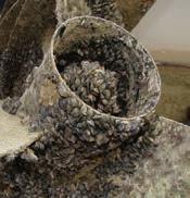
• They filter vast quantities of water, removing plankton that native fish and other aquatic organisms rely on, disrupting the entire food web within a waterbody. Although this filtering action may clear up the water in some instances, it often leads to harmful algae blooms and allows more sunlight to reach and damage fish eggs. Their filtering also concentrates toxins within their tissues, exposing mussel-eating waterfowl and fish to illnesses such as botulism.
• They attach in clusters to hard surfaces and can reach high densities, damaging docks, boat motors, and recreational equipment. They can also clog pipes, water intake systems, and municipal water supplies. Nationwide expenditures to control zebra mussels in industrial plants alone are estimated at $310 million per year.
• They have sharp shells that can cut the unprotected skin of humans or pets. Shoes or other protective clothing are recommended when wading in zebra mussel infested water.
• All aquatic users play an important role in preventing the spread of zebra mussels to other waters in Kansas. Always Clean, Drain, and Dry your watercraft, trailer, and equipment before moving between waterbodies. Protect our waters by following control recommendations and tell other how to prevent the spread of zebra mussels.
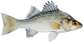
• White perch are found in some Kansas lakes, impoundments and streams. An AIS-Alert listing throughout this publication identifies locations known to contain bighead carp, rusty crayfish, silver carp, white perch, and/or zebra mussels. Fish may not be transported live from these waters. A more complete listing of affected waters can be found in the current fishing regulations summary.
• White perch have been associated with declines in both walleye and white bass populations.
• They out-compete native fishes for food and space.
• They hybridize with white bass.
• KDWP has added white perch to the prohibited species list. The possession of live white perch is prohibited. Dead white perch may still be possessed or used as bait on the waters where they were taken.
• Spiny and soft dorsal fins are connected; both fins pop-up when spiny dorsal manually erected.

Waters containing bighead carp, silver carp, rusty crayfish, white perch, and/or zebra mussels are classified as AIS designated waters. Anglers fishing AIS designated waters may not leave those waters with any live fish. AIS designated waters are listed below. New waters may be included whenever bighead carp, silver carp, white perch, rusty crayfish, and/or zebra mussels are discovered. AIS designated waters will be posted with the sign illustrated to the right.
ALLEN COUNTY
Neosho R.
ATCHISON COUNTY
Brewery Cr. • Camp Cr. • Crocked Cr. • Deer Cr. • Independence Cr. • Little Stranger Cr. • Little Walnut Cr. • Missouri R. • Mooney Cr. • North Fork Stranger Cr. • Owl Cr. • Spring Cr. • Stranger Cr. • Walnut Cr. • Whiskey Cr.
BARTON COUNTY
Great Bend Stone Lake
BROWN COUNTY
Buttermilk Cr. • Euchre Cr. • Fox Cr. • Middle Fork Wolf R. • Mulberry Cr. • Noharts Cr. • North Fork Wolf R. • Pedee Cr. • Pony Cr. • Roys Cr. • South Fork Wolf R. • Spring Branch • Spring Cr. • Squaw Cr. • Terrapin Cr. • Walnut Cr. • Wolf R.
BUTLER COUNTY
El Dorado East Pk. Pd. • El Dorado Res. • Walnut R.
CHASE COUNTY
Chase SFL • Cottonwood R. • Panther Cr.
CHEROKEE COUNTY
Neosho R.
CLAY COUNTY
Milford Res.
CLOUD COUNTY
Solomon R.
COFFEY COUNTY
Coffey Co. Lake. • John Redmond Res. • Lebo City Lake • Neosho R.• Wolf Creek
COWLEY COUNTY
Arkansas R. • Timber Cr. • Walnut R. • Winfield CL
DICKINSON COUNTY
Kansas R. • Smoky Hill R. • Solomon R.
DONIPHAN COUNTY
Browning Oxbow • Brush Cr. •
Cedar Cr. • Charlie Cr. • Cold Ryan Branch • Coon Cr. • Fox Cr. •
Halling Cr. • Independence Cr. •
Jordan Cr. • Kenney Cr. • Mill Cr. •
Mission Cr. • Missouri R. • Mosquito Cr. • Nelson Cr. • North Branch Independence Cr. • Pennell Cr. • Peters Cr. •
Rittenhouse Branch • Rock Cr. •
Smith Cr. • Springs Branch •
Spring Cr. • Striker Branch •
Squaw Cr. • Walnut Cr. • Wolf R.
DOUGLAS COUNTY
Captain Cr. • Chicken Cr. • Clinton Res. • Coal Cr. • Kansas R. • Little Wakarusa Cr. • Mud Cr. • Spring Cr. • Wakarusa R.• Washington Cr.
ELLIS COUNTY
Smoky Hill R.
ELLSWORTH COUNTY
Kanopolis Res. • Smoky Hill R.
FRANKLIN COUNTY
Marais des Cygnes R.
GEARY COUNTY
Geary SFL • Kansas R. • Lyons Cr. • Milford Res. • Republican R. • Smoky Hill R.
JEFFERSON COUNTY
Crooked Cr. • Dawson Cr. •
Delaware R. Fall Cr. • Howard Cr. • Hulls Branch • Indian Cr. •
Kansas R. • Mooney Cr. • Mud Cr. • Ninemile Cr. • Perry Res. • Plum Cr. • Prairie Cr. • Scatter Cr. • Walnut Cr.
JOHNSON COUNTY
Blue R. • Camp Branch • Captain Cr. • Clear Cr. • Camp Cr. • Cedar Cr. • Coffee Cr. • Coon Cr. •
Gardner City Lake • Hillsdale Res.
• Indian Cr. • Kansas R. • Kill Cr. • Little Cedar Cr. • Little Mill Cr. • Mill Cr. • Negro Cr. • Spoon Cr. • Tomahawk Cr. • Turkey Cr. • Wolf Creek
KINGMAN COUNTY
Cheney Res.• Kingman Hoover Pd.• North Fork Ninnescah R. • South Fork Ninnescah R.
LABETTE COUNTY
Neosho R.
LEAVENWORTH COUNTY
Branch Cr • Brush Cr. • Buckhorn Cr. • Buttermilk Cr. • Corral Cr. • Cow Cr. • Cramer Cr. • Dawson Cr. • Fall Cr. • Fivemile Cr. • Hog Cr. • Island Cr. • Jarbalo Cr. • Kansas R. • Kent Cr. • Leavenworth SFL • Little Kaw Cr. • Little Sandy Cr. • Little Snell Cr. • Little Stranger Cr. • Missouri R. • Mud Cr. • Murray Cr. • Ninemile Cr. • Plum Cr. • Pony Cr. • Prairie Cr. • Quarry Cr. • Salt Cr. • Sevenmile Cr. • Stranger Cr. • Threemile Cr. •Tonganoxie Cr. • Walnut Cr. • West Brush Cr. • Wolf Creek
LINCOLN COUNTY
Saline R. • Wilson Res. LINN COUNTY
Linn Valley Lakes-Main Lake • Marais des Cygnes R.
LYON COUNTY
Cottonwood R. • John Redmond Res • Melvern Res. • Neosho R. • Lyon SFL
MARION COUNTY
Cottonwood R. • Marion Res.
MARSHALL COUNTY
Clear Cr. • Manley Cr. • Pole Cr. • Tuttle Creek Res. • Tuttle Creek Res.-River Pd.
MCPHERSON COUNTY
Emerald Lake. • Smoky Hill R. • McPherson SFL
MIAMI COUNTY
Hillsdale Res. • Bull Cr. • Marias des Cygnes R. • Dorsey Branch • Paola CL (Lake Miola) • South Wea Cr.
MITCHELL COUNTY
Glen Elder Res. • Solomon R. MORRIS COUNTY
Canning Cr. • Council Grove CL • Council Grove Res. • Neosho R.
NEMAHA COUNTY
Burger Cr. • Clear Cr. • Deer Cr. • Fisher Cr. • Fourmile Cr. • Harris Cr. • Honey Cr. • Illinois Cr. • Manley Cr. • Negro Cr. • North Fork Wildcat Cr. • Pole Cr. • Rattlesnake Cr. • Rock Cr. • South Fork Big Nemaha R. • South Fork Wildcat Cr. • Tennessee Cr. • Turkey Cr. • Wildcat Cr. • Wolf Pen Cr. NEOSHO COUNTY
Neosho R.
OSAGE COUNTY
Camp Cr. • Carbondale East Lake • Marais des Cygnes R. • Melvern Res. • Melvern River and Rearing Ponds • Pomona Res. • Strowbridge Cr. • Osage SFL • 110-Mile Cr.
OSBORNE COUNTY
Glen Elder Res.
OTTAWA COUNTY
Saline R. • Solomon R.
POTTAWATOMIE COUNTY
Big Blue R. • Jeffery Energy Center Make-up Lake. • Jeffery Energy Center Auxiliary Lake. • Kansas R. • Tuttle Creek Res. • Tuttle Creek River Pd. • Willow Lake
RENO COUNTY
Cheney Res. • Hutchinson Carey Park Pd. • Hutchinson Carey Park Lagoon
RILEY COUNTY
Big Blue R. • Kansas R. • Tuttle Creek Res. • Tuttle Creek River Pd. • Willow Lake
RUSH COUNTY
Smoky Hill R.
RUSSELL COUNTY
Saline R. • Smoky Hill R. • Wilson Res.
SALINE COUNTY
Saline R. • Smoky Hill R. • Solomon R.
SEDGWICK COUNTY
Arkansas R. • Big Slough • Cheney Res. • Chisholm North Lake • Clearwater Cr. • Emerald Bay • Lake Afton • Ninnescah R. • North Fork Ninnescah R. • South Fork Ninnescah R. • Sedgwick Co. Park Lakes • Spirit/Boeing
Employee Assoc. Lake. • WichitaSouth Lake • MS Mitch Mitchell Floodway • Wichita-West KDOT
SHAWNEE COUNTY
Camp Cr. • Deer Cr. • Kansas R. • Lake Shawnee • Little Soldier Cr. • Shawnee SFL • Shunganunga Cr. • Soldier Cr.
SUMNER COUNTY
Arkansas R. • Chikaskia R. • East Prairie Cr. • Ninnescah R. • Prairie Cr. • Wellington CL
TREGO COUNTY
Cedar Bluff Res. • Smoky Hill R.
WABAUNSEE COUNTY
East Branch of Mill Cr. • Kansas R. • Lake Wabaunsee • Mill Cr. • South Branch Mill Cr.
WOODSON COUNTY
Neosho R.
WYANDOTTE COUNTY
Betts Cr. • Brenner Heights Cr. • Conner Cr. • Eddy Cr. • Honey Cr.
• Island Cr. • Jersey Cr. • Kansas R. • Little Turkey Cr. • Marshall Cr. • Mattoon Cr. • Mill Cr. • Missouri R. • Munice Cr. • Nearman Cr. • Piper Cr. • Turkey Cr. • West Mission Cr. • Wolf Creek • Wyandotte Co. Lake.
Now you can purchase and store your Kansas hunting and fishing licenses from any mobile device!
Available for Android and Apple/iOS devices. See device app store for details.
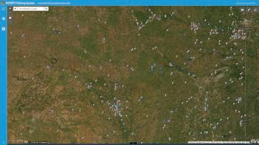
Check out the most up-to-date version of the Fishing Atlas maps. Access searchable maps highlighting Kansas’ public fishing access locations from ksoutdoors.gov/fish-atlas. Click on individual tracts and points to display location information, zoom to areas by city or county name, and choose from various base map options.
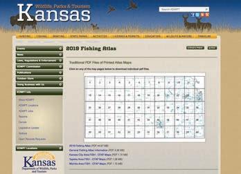
Download an electronic version of the Kansas Fishing Atlas at ksoutdoors.gov/fishatlas.
Printed copies of the Kansas Fishing Atlas are available at most license vendors.
Earn extra dollars from your farm/ranch with the Walk-in Fishing Access (WIFA) program and the Walk-In Hunting Access (WIHA/iWIHA) programs. Wildlife and Parks will be leasing ponds and river/creek access for anglers. Wildlife and Parks will also be leasing CRP, standing cover crop, milo stubble, field borders, and river/creek habitat for this coming fall hunting season and next spring’s turkey hunting season.
• KDWP pays you to allow hunting or fishing access on your land.
• KDWP will post signs to inform users of property boundaries.
• KDWP natural resource officers periodically patrol the land.
• Access by foot only. No vehicles allowed.
• State law limits normal liability.
• An atlas is printed showing all properties enrolled.
Landowners who are interested in enrolling in these programs contact the nearest regional KDWP office or the Pratt Operations Office.
For Walk-in Program information, scan the QR code or visit ksoutdoors.gov/ Walk-In-Access.
For additional information on private landowner programs, visit ksoutdoors.gov/private-lands.
Anyone who finds evidence of wildlife crime while afield should contact their local game warden. Details of the crime and any other information, such as license tag numbers, dates, and times, should be noted. Local game wardens can be contacted through county sheriffs’ offices, by phoning the KDWP’s Operation Game Thief, 1-877-426-3843, or by phoning one of the numbers listed below, for the county in which the crime was witnessed.
Do NOT use these numbers for general information calls. General information may be obtained by phoning the department's Operations Office in Pratt, (620) 672-5911 Ext. 6, or by calling local offices listed in this publication.
If you’re an active outdoorsman or woman, or just concerned about conservation in your area, get to know your local game warden. They protect the resource in your area. The following list of game warden numbers and the counties for which they are responsible are provided to help concerned citizens curb wildlife crime in Kansas:
Allen (620) 212-0183
Anderson (785) 221-2694
Atchison (785) 230-8466
Barber (620) 770-9035
Barton (785) 496-0074
Bourbon (620) 432-5058
Brown (785) 230-8466
Butler (316) 215-2123
Chase (620) 340-5968
Chautauqua (620) 388-7643
Cherokee (620) 431-8834
Cheyenne (785) 342-7382
Clark (620) 262-7019
Clay (785) 818-2050
Cloud (620) 770-9085
Coffey (785) 207-3151
Comanche (620) 727-4822
Cowley (620) 229-3104
Crawford (N ½) (620) 432-5058
Crawford (S ½) (620) 431-8834
Decatur (785) 230-5960
Dickinson (785) 452-0478
Doniphan (785) 230-8466
Douglas (785) 230-2148
Edwards (620) 770-9564
Elk (620) 388-7643
Ellis (620) 770-6148
Ellsworth (785) 342-7276
Finney (620) 388-7790
Ford (620) 450-7194
Franklin (785) 221-2694
Geary (785) 338-0096
Gove (785) 483-0504
Graham (785) 342-7265
Grant (620) 388-2951
Gray (620) 450-7194
Greeley (620) 282-7009
Greenwood (620) 431-8775
Hamilton (620) 282-7009
Harper (620) 727-6893
Harvey (316) 215-2119
Haskell (620) 388-7790
Hodgeman (620) 450-7194
Jackson (785) 940-0665
Jefferson (E ½) (620) 450-7185
Jefferson (W ½) (785) 256-3619
Jewell (785) 250-7028
Johnson (785) 250-8129
Kearny (620) 282-7009
Kingman (620) 727-6893
Kiowa (620) 727-4822
Labette (620) 875-2275
Lane (620) 770-6218
Leavenworth (785) 256-1204
Lincoln (620) 450-7190
Linn (785) 230-3567
Logan (785) 230-5593
Lyon (620) 431-9873
Marion (620) 242-4122
Marshall (785) 256-1207
McPherson (620) 242-4122
Meade (620) 262-7019
Miami (913) 205-2155
Mitchell (785) 243-0553
Montgomery (620) 432-5057
Morris (620) 340-5968
Morton (620) 388-2951
Nemaha (N ½) (785) 940-0665
Nemaha (S ½) (785) 940-0665
Neosho (N ½) (620) 212-0183
Neosho (S ½) (620) 875-2275
Ness (620) 770-6218
Norton (785) 342-7311
Osage (620) 450-7264
Kansas Department of Wildlife and Parks
Office of the Secretary (Topeka) (785) 296-2281
Operations Office (Pratt) (620) 672-5911
Region 1 Office (Hays) (785) 628-8614
Region 2 Office (Topeka) (785) 273-6740
Region 3 Office (Wichita) (316) 683-8069
Region 4 Office (Dodge City) (316) 683-8069
Chanute District Office (620) 431-0380
Colby District Office (785) 462-3367
Fort Scott District Office (620) 223-9671
Garden City District Office (620) 276-8886
Kansas City District Office (913) 422-1314
Mound City District Office (913) 795-2218
Emporia Research Office (620) 342-0658
State Park Offices
Cedar Bluff (785) 726-3212
Cheney/Sandhills (316) 542-3664
Clinton (785) 842-8562
Crawford (620) 362-3671
Cross Timbers (620)637-2213
Eisenhower (785) 528-4102
El Dorado (316) 321-7180
Elk City (620) 331-6295
Fall River (620) 637-2213
Flint Hills Trail (785) 448-2627
Glen Elder (785) 545-3345
Hillsdale (913) 594-3600
Historic Lake Scott (620) 872-2061
Kanopolis/Mushroom Rock (785) 546-2565
Kaw River (785) 273-6740
Lehigh Portland (316) 683-8069
Little Jerusalem (620) 872-2061
Lovewell (785) 753-4971
Meade (620) 873-2572
Milford (785) 238-3014
Perry (785) 246-3449
Pomona (785) 828-4933
Prairie Center (785) 250-8369
Prairie Dog (785) 877-2963
Prairie Spirit Trail (785) 448-2627
Tuttle Creek (785) 539-7941
Webster (785) 425-6775
Wilson (785) 658-2465
Osborne (785) 342-0553
Ottawa (620) 450-7190
Pawnee (620) 770-9564
Phillips (785) 342-7311
Pottawatomie (785) 256-3603
Pratt (620) 770-9035
Rawlins (785) 260-1149
Reno (316) 215-2124
Republic (620) 770-9085
Rice (N ½) (785) 342-7276
Rice (S ½) (316) 215-2124
Riley (785) 256-3614 Rooks (785) 342-7265
Cimarron Grasslands (620) 697-4621
Flint Hills NWR (620) 392-5553
Marais des Cygnes NWR (913) 352-8956
Quivira NWR (620) 486-2393
Kirwin NWR (785) 543-6673
Ft Riley (785) 239-6211
Big Hill Reservoir (620) 336-2741
Clinton Reservoir (785) 843-7665
Council Grove Reservoir (620) 767-5195
El Dorado Reservoir (316) 321-9974
Elk City Reservoir (620) 336-2741
Fall River Reservoir (620) 658-4445
Hillsdale Reservoir (913) 783-4366
John Redmond Reservoir (620) 364-8614
Kanopolis Reservoir (785) 546-2294
Marion Reservoir (620) 382-2101
Melvern Reservoir (785) 549-3318
Milford Reservoir (785) 238-5714
Perry Reservoir (785) 597-5144
Pomona Reservoir (785) 453-2202 Toronto Reservoir (620) 658-4445
Tuttle Creek Reservoir (785) 539-8511