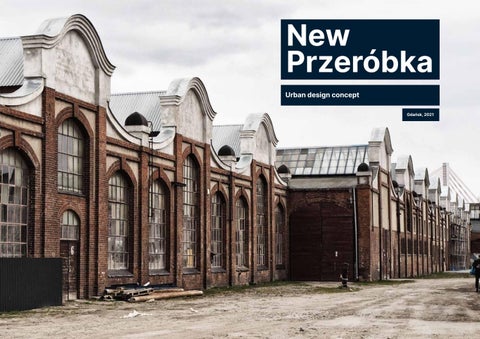
New Przeróbka Urban design concept Gdańsk, 2021
Urban concept for the area of the former Rolling Stock Repair Works in Przeróbka, Gdańsk. The publication was created as part of the master’s thesis „Productive cities in local terms. Urban concept for the area former Rolling Stock Repair Works on Przeróbka in Gdańsk” prepared in the field of Architecture of Cultural Space at the Academy of Fine Arts in Gdańsk.
Author: inż. Karol Drobniewski Supervisor: prof. ASP dr hab. Jan Sikora Reviewer: prof. ASP dra hab. Monika Zawadzka
Gdańsk, 2021
The undescribed photos belong to the author or come from private archives and websites, the authors of which are unknown.
Introduction
master thesis - project
fot. Sebastian Huber / unsplash.com
4
Introduction
New opportunities for the city’s development at the turn of recent years Gdańsk is the main Polish city located by the Baltic Sea and is an important service, cultural and economic center in the region. The connection with the sea, based on trade and exchanges with neighboring countries, is the key to the city’s success and development, and is also an integral part of its identity.
In recent years, the city landscape has changed dynamically. Gdańsk has been experiencing a real renaissance since the time after 1945, when it was rebuilt after the destruction of World War II. The main driving force behind the changes in the landscape is the dynamic real estate market, which is recording one of the largest increases in the country. From year to year, we can observe an increase in the commissioning of subsequent investments for use. The market leaders are new residential buildings and commercial buildings offering office space for rent. In addition to the southern districts of Gdańsk, post-industrial downtown areas are now experiencing a real boom, which are becoming a precursor of shaping new high-quality urban complexes in the city. These are often areas the development of which the city has waited, in some cases, even for several decades. Among them, there are completed investments in the area of Granary Island, and work is commenced on the development of the Polish Hook and the Young City, which are to create a new, vibrant urban district with mixed functions. The construction of the last vacant downtown areas, the city’s constant development, migration and economic demand force the city to expand further and look for land for development where a better new urban space will be created in the future.
master thesis - project
5
New investments in the city Polski Hak This is one of the places that went down in the history of the economic development of Gdańsk and which, after long years of degradation, are beginning to attract investors’ attention again. The area became famous in 2008, during the presentation of the vision for the Polish Hook prepared at the request of the Israeli company Landmark by the world-famous architect Daniel Libeskind. A nearly 200-meter-high tower was located in the northern part of the residential and service complex designed by the American. A few years later, the Warsaw developer Eco Classic became the owner of the plot on the promontory, which also initially planned the construction of a multi-functional skyscraper here. Dominant, designed by the Gdańsk studio KD Kozikowski Design (in the portfolio of projects including Gdańsk Baltic Philharmonic and Deo Plaza), is 170 meters high and 45 floors (including offices, hotel and restaurant). So far, there is no certainty that the above visions will be realized. At present, the quays are being recovered in Polski Hak by carrying out works to strengthen the shoreline of the headland and new housing investments are being built. One of them is Nadmotławie, erected and designed at Sienna Grobla Street by the Robyg Developer, and the Riverview estate located at Angielska Grobla street, on the Na Stępce canal. Młode Miasto Following global trends and the city’s needs, over 20 years ago, the idea of reviving the historic areas of the Gdańsk Shipyard and giving them back to their inhabitants was born. This area is to be called the Young City, which consists mainly of the historic Stocznia Cesarska Shipyard and the Schichau Shipyard, and 6
the area between the European Solidarity Center and the old Assembly building, where the construction of the Docks - an investment of the EuroStyl developer - is currently underway. As part of it, flats, offices, a service alley will be built, and the old assembly room will be converted into a multifunctional building. Competitions for masterplans were organized in the remaining areas, however, there are no signs of transformation of these areas in the near future. The concept for the development of the Stocznia Cesarska, selected in the competition for the masterplan, focuses on “open” historical buildings and apartments on the outskirts. The project involves the creation of nearly 3,500 apartments, as well as office spaces, retail outlets, leisure areas, hotels and cultural facilities. Important aspects were, above all, the preservation of the unique historical values of the area, as well as the creation of new architecture, well-integrated with the existing buildings. In 2019, design works were carried out on the first three buildings located next to the old management building. Currently, the investment is blocked by the provincial conservator of monuments, inter alia, due to the excessively high buildings proposed on the outskirts of the study area. The Drewnica Peninsula and the area of the former Schichau Shipyard is an investment area located on the western side of the Ostrów Island between Popiełuszki Street and the Kliniczna tram junction. As in the case of the Imperial Shipyard, the main assumption here is the placement of flats with accompanying services and public infrastructure. Four buildings have been chosen as dominants, which are to be no more than 55 meters high and be distinctive from an architectural point of view - the example is the Hamburg Philharmonic. The rest of the buildings will be a maxi-
mum of 25 meters. The buildings are to be modern in character, but consistent with the historical buildings. Further from the site, along Jana z Kolna Street towards the Green Triangle, the construction of sevenstory office buildings resembling a ship’s structure is planned. The Road to Freedom was selected in a competition already in 2013 and it involves the creation of a city promenade running through the area of the former shipyard. Unfortunately, the implementation of the project was postponed, but the city assures that it will be implemented. Its main assumptions are to enhance the existing shipyard buildings, as well as the use of plants as an important material, the advantage of which will be their changeability during the seasons. The road will start at the Solidarity Movement Monument and end at the pontoon bridge to Ostrów Island, which will probably also be adapted to the needs of the inhabitants in the future. Development of the Port of Gdansk The Port of Gdansk concentrates its projects in close proximity to the planned area. Investments concern not only the transshipment terminals located at the Outer Port, but also involve strengthening rail and car traffic. In a few years, a new Central Port will also be built, located on an artificial embankment towards the waters of the Bay of Gdańsk. Why is the development of the Port so important for the designed area? Due to the direct location of industrial areas managed by the Port of Gdansk, the purpose of these areas will not change over the next several dozen years. The planned district has a chance to become a place of residence for port employees, as well as the seat of companies and service or production enterprises relat-
ed to the port industry. In addition, the Port of Gdansk engages in social campaigns and tests innovations, e.g. the sustainable mobility plan, which includes, inter alia, commissioning of a passenger railway in order to transport employees to the place of work. Stogi, Przeróbka and Dolne Miasto Many Gdańsk districts are experiencing a real period of revitalization. As part of the revitalization, the districts become more beautiful and the inhabitants become more friendly. Among them is the Lower Town, which regained its former character. In addition, currently revitalization works are carried out in Stogi and Przeróbka, which are districts located directly next to the study area. The investments currently implemented in these areas include infrastructure investments related to the renovation of underground and road infrastructure, including the improvement of public transport, or thermal modernization of buildings, introduction of rainwater retention, and projects from the civic budget.
3
Drewnica Młode Stogi Stocznia Cesarska
YIT
2
5
The Road to Freedom
Doki
Bastion Wałowa
1 Brabank
Riverview
Kamiennice Dzwonika
Angielska Grobla
Legend DeoPlaza and Granaria
Długie Ogrody
- boundaries of the study Scala
- vacant development areas intended for residential and service development - investments completed / in progress 1 - Polski Hak 2 - Młode Miasto 3 - Port Gdański 4 - Przeróbka 5 - Stogi 6 - Dolne Miasto
Dwie Motławy
Stara Zajezdnia
6
4
Introduction
From the forgotten to a new urban area The design area covers nearly 36 hectares and is located in Przeróbka at ul. Siennicka 25, located on the Port Island in Gdańsk, directly on the eastern bank of the Martwa Wisła river at the mouth of the Siennicki Bridge. The area covers a large plot of land with a plan similar to a rectangle with a truncated corner from the north-west, limited from the north-east by railway tracks, south-east by Siennicka street, south-west by Przetoczna street and north-west by Ku Ujście street.
8
District
Design area
The “Przeróbka” district is located along its southern border. The district has all the necessary infrastructure, such as shops, schools and kindergartens, a library, a clinic, sports facilities and public transport stops. In recent years, revitalization works of the district have been carried out, mainly related to the renovation of residential buildings, renovation of Siennicka and Lenartowicza streets, consisting in the replacement of the tram track and replacement of the road surface with pavements, improvement of the quality of public spaces, and the release and renovation of the quays along the Martwa Wisła, next to the residential part. These works are not fully completed and new public spaces will be created in the future. The district is characterized by close access both to the districts located along the lower terrace of the city (the tunnel under the Martwa Wisła or Podwale Przedmiejskie), as well as neighboring communes and villages located outside the city (Major Sucharski route). Thanks to the attractive location, it is a 15-minute walk from the city center, which is one of the city’s key service centers and the main tourist attractions, not far from Westerplatte, the Wisłoujście Fortress, as well as very attractive natural areas such as forests and beaches.
The area is only partially developed and used. In addition to the historic building complex located at the Housing Remediation, the development is more provisional and non-permanent than it is based on creating a complete infrastructure to support this area. It is related to the nature of enterprises located in the area, for which the easy possibility of space adaptation is important. There are numerous services related to trade and small production, among others wholesalers and specialist stores, car repair shops and light industry enterprises. Almost half of the area (land and storage hall area) has been offered for sale or lease for several years. Among them is the characteristic Water Tower. Along the northwestern border there is a wild, dense green, which used to be a branch of the Stutthof concentration camp. Currently, there is no trace of him. There are bus and tram stops as well as MEVO city bike stations near the site. Creating a new urban tissue in the area and supplementing the industrial area, which is dead for the inhabitants, will allow to complete the district not only in terms of functionality, but also in terms of urban planning.
ul.
Ku
iu
c Ujś
ul. P
rzet oczn
a
icka
ul
nn . Sie
master thesis - project
9
I
Ą
N IO
A
D TA
AL
ISŁ
/S
I OG ST A IC ODN OBW
ŚR Ó
DM IEŚ CI
E
10 km
7 km
TO IAS
5 km
3 km
M DE MŁO
AŻ
O
GDAŃSK WRZESZCZ
PL
ĄW TW
P EX
LIW A
POR TG DAŃ SK
AR DM PO
R BE
SK O
IN TTE / TERM WESTERPLA
L NE TU AM
GD AŃ
Over the next dozen or so years, Gdańsk will develop towards the water, and the post-industrial areas located in Śródmieście will lose their wild character in favor of new urban development. Restoring the area to people in the ZNTK area and creating a new district on it is an opportunity to create a new, nearly 8 km long circular route through the city’s post-industrial areas, which will take nearly 2 hours. The route will include areas with both active industrial activity and new districts that have retained their industrial character. The route will run through the areas of the Imperial Shipyard and the Young City, the Main Town along the Motława River, the Polish Hook, the planned area of the ZNTK, from where it is then proposed to lead to the industrial and shipbuilding Ostrów Island via the bridge that once ran in the indicated place. In the case of the bridge construction, it is a chance not only for an interesting tourist attraction, but also for better transport connections in the city. It will also be the only walking route in Gdańsk with such a large number of bridges, and more than half of its length will run along the water.
10
No access to quays outside the downtown area
Regeneration of the quays
Bridge connection
Completely connected
Due to the high inaccessibility of the quays, the Motława quays are still the most popular walking direction, and the movement of the population takes place inside the historic city.
The slow regeneration of the quays makes Gdańsk return to its historical character of an inland port city.
The development of the Ostrów Island is only a matter of time. The reconstruction of the pedestrian and car bridge in its historic location will increase accessibility throughout the city.
Establish a ring along the four most important industrial areas in the city’s structure.
master thesis - project
11
12
Introduction
The beginnings of the Rolling Stock Repair Works
New Era
Rebuilding the enterprise
New Rolling Stock Repair Works
The establishment of the railway workshops in Przeróbka was connected with the setting out in 1905 of a railway line for cargo traffic, leading to the then dynamically developing industrial areas on the Ostrów Island. Simultaneously with the construction of the line in Ostrów, large electromechanical plants were built, closely related to the railway workshops established in 1910-1920. Their location in Gdańsk Przeróbka was also associated with the construction of a large drawbridge over the Martwa Wisła (Breitenbach Bridge) in 1911-1912, which created a convenient communication connection between Gdańsk and the industrial area of Przeróbka. Directly with the construction of the workshops, a housing estate for factory workers was built along Siennicka, Lenartowicza and Przetoczna Streets. The plant’s operation began on June 2, 1912 as Eisenbahn Hauptwerkstatt Danzig-Troyl (GdańskTrojan Main Railway Workshop), abbreviated as EHWTroyl. The plants were then equipped with the largest industrial halls in Gdańsk Pomerania, e.g. the wagon repair hall has dimensions of 251x103 m. In the years 1920-1921, over 150 type 7001 cargo steam locomotives (PKP Tr20175 series) purchased by the Polish government, which were manufactured at Baldwin Locomotive, were installed here. Works in Philadelphia (USA).
After the end of World War I, in 1922, pursuant to Art. 107 of the Versailles Treaty of 1919, the plants were transferred for a free, 50-year lease together with the former Imperial Shipyard to the newly created international company International Shipbuilding & Engineering Co Ltd., also using the name Danziger Werft und Eisenwerkstatten AG with 20% of Polish capital, 20% free The cities of Gdańsk, 30% of Great Britain and 30% of France. During World War II, the plants operated as the Repair Works (DRBAusbesserungswerke), managed by the German Reichsbahn (Deutsche Reichsbahn - DR), where, in addition to their basic activities, they converted trucks into trolleys and manufactured torpedo chaser hulls.
After the liberation in 1945, the plant began to be called the Main Workshops of Gdańsk-Trojan, and then the Railway Workshops of the Polish State Railways. By the end of 1945, about 100 locomotives and wagons were renovated. The complex was rebuilt from the war damages in the years 45-50 of the 20th century. In 1952, the area officially began to be called Rolling Stock Repair Works (ZNTK), where the plant had its own school for working people, and over 3,000 employees were employed. There were, among others, reconstruction of trains for the Fast City Railway, which were received as war compensation, buses for PKS were produced, and several snow plows were built. For many years, a service train carrying mainly ZNTK employees ran on the route Kaszubski-Port Gdańsk Główny, and these trains also reached GdyniaGłówna and Gdynia-Chylonia, and even to Wejherowo.
In 2001, the company changed its name to Rolling Stock Repair Works sp.z o.o., and its functions were significantly reduced due to the specialization resulting from the transfer of its functions and low profitability of the company. Since then, the plants have been dealing mainly with the repair of inspection electric locomotives (InterCity locomotives). The area of the plants has also changed, since then they occupy a modernist hall built in the second half of the twentieth century. The remaining land and buildings began to be sold or leased. Currently, there are over 50 enterprises in the area of study, mainly related to trade, storage and repair. In addition, there are points providing training and sports services.
master thesis - project
13
Caption on image, White
Caption on image, White
Caption on image, White
Caption on image, White
Caption on image, White
Caption on image, White
Caption on image, White
Caption on image, White
master thesis - project
Introduction
Tangible and intangible heritage
Buildings
Relics
Remembrance
Wspólnota
Beautiful, historic halls, despite their low height and simplicity, make the place sublime and majestic. The multitude of details and ornaments means that the place can be treated as an architectural puzzle, in which new details are discovered with each new visit.
The wheels, steel bars, tools and devices abandoned on the site give an expression of authenticity and create the genius loci of the place. Thanks to this, the place is one of a kind on the city map because it is strongly associated with the railway. These elements should be kept and emphasized in the future.
From the very beginning, the area has been used industrially. The high rank of the place is due to its rich tradition, which has entered the historical pages of Poland. In the past, many carriages and locomotives were built and renovated on the site. Currently, the area creates a new history based on modern services, creating a small municipal manufactory.
Community is an essential part of the history of the ZNTK. Almost six generations participated in the story, five of which were related to the construction and maintenance of railroads. Part of the society still lives in Przeróbka or nearby districts and strongly identifies with the place. Although the current companies located in the area are related to completely different industries, their employees integrate and create a community.
master thesis - project
17
master thesis - project
Introduction
Architecture and urban planning of the area The building complex is a well-preserved example of an eclectic one industrial architecture from the beginning of the 20th century, it is distinguished by its high value, original, refined and consistent in the architectural expression form, and is also one of the few complexes with such well-preserved and rich in number of preserved buildings in the voivodeship.
Building composition - development complex set for recomposition(ZNTK) - two-bay east-west route
- north-south route - preserved railway tracks - cranes (working) - removed crane - entrance to the
20
Building composition
Buildings
The composition of the buildings is distinguished by an ordered and logical spatial arrangement with two clearly visible, mutually perpendicular composition axes delineated by the main communication routes intersecting the entire width of the plot - shorter northsouth and longer two-bay in the east-west direction. The first one, set out from the main entrance from the side of Przetoczna Street, connects both production halls, located on its western side. On the eastern side of the trail, in the southern section, there is a square with an old tree stand, a square in front of the main gate and school workshops. On the northern section of the route, the track was preserved on which a large portal crane stood, which is an important element proving the identity of this place. On the east-west axis delineated between two communication routes, the area of the strip of land includes the buildings of the Tool Room, the Small Forge, the Compressor House with the Boiler House, the Water Tower, the now-defunct Chip Tower and the Production Hall II.
Despite the constant use, the state of preservation of the historic substance is described as good, requiring extensive renovation works aimed at regaining the former splendor, as well as securing the progressive degradation of these unique objects in the region. It was entered in the register of monuments in 2001. Until then, some of the existing buildings and infrastructure elements of high cultural value have been removed or have lost their value, among others, through the construction of extensions or renovations that destroyed the original nature of the facilities through the use of wrong materials or the use of the cheapest technological solutions. Nevertheless, both the facades and the interiors of the buildings preserved in the area are in good technical condition. During the inventory and analysis of documents, inaccuracies were revealed in the case of the protection status of immovable monuments. According to the municipal and provincial records of monuments of February 15, 2021, there are 11 objects under protection in the historic area of the ZNTK and 3 objects outside the area. According to the local development plan, 15 objects are subject to full protection, including 10 of them within the historic layout. There are objects on the cards of white relics that were not included in the above documents. The entire inventory made and design decisions made are illustrated on the following pages.
Original architecture elements with industrial character
Brick industrial halls with an originally preserved internal structure
Dominants and accents: Old Boiler Building and the Water Tower
Cranes and technical devices Partial or complete preserved railway tracks
Rich brick facades with original window joinery
Steel building components lying in the streets
Decorations and bas-reliefs on the facades
master thesis - project
21
Building layout - existing - buildings
Technical condition of the building body - good or average object preserved in very good or good condition, requiring minor renovation
- bad object in poor technical condition, requiring complete reconstruction
Building analysis - buildings under the protection of the conserva-
Result
tor of monuments and local development plan - buildings to protect - buildings under the protection of the local development plan - buildings on white cards
- buildings of cultural value - development complex determined for recomposition (ZNTK)
Valorization of the buildings
- buildings to be removed - buildings selected for further analysis
22
Railway wagon repair hall Locomotive repair hall Bathouse Old Boiler Building
Water Tower
Round-house
Gate complex with kiosk and concierge
Management building Tool building School workshops
Canteen
Buffet
master thesis - project
23
Gate complex with kiosk and concierge
Management building
Buffet
Bathhouse
•
•
•
•
• •
• •
Situated along the eastern border of the area with a main gate and two side gates; It is flush with the Management Building, the Bathhouse and the Conference Room with a Buffet, as well as the Kiosk and the gatehouse; A high brick wall on a brick plinth, vertically divided by brick pillars, the walls between them are plastered, sections of the wall topped with 2-slope roofs covered with tiles; Missing elements of the main gate - entrance and side doors; The south-eastern part of the wall, the kiosk and the concierge desk were renovated.
• • • •
•
24
Situated along the eastern border of the area, on the axis of Siennicka Street; It has a compact, two-storey body with high, massive cellars, built on a rectangular plan with a 2-storey veranda from the north; It is covered with a high 4-slope roof covered with tiles; On the roof there are dormers in a decorative wooden frame and a pin with a forged balustrade; The facades are faced with veneers, vertically divided with plastered pilasters and pilasters with composite heads, there are also panels under and between the windows and the gable area crowning the front break; The window woodwork has survived - windows with profiled plank.
• • •
•
Situated along the eastern border of the area, next to the main gate of the enterprise; The building was built on a rectangular plan with a transverse 3-strip layout, corresponding to the functional divisions of the interior; The 5-axis elevation is supported by a brick plinth, slightly protruding in front of the face, reaching the upper edge of the window sills. In the extreme northern axis, a deep, narrow, 2-story avant-corps, covered with a separate 3-slope roof, with a small oval window on the projection axis. It is covered with a high 4-slope roof covered with tiles.
• • •
The building is located integrally with the wall along the eastern border of the area, It has undergone a major renovation, which means it has lost its original character; 2-storey building on a plan of two rectangles; There are three bas-reliefs on the elevation axis from the street curtain - the middle one depicts a mermaid with a trident, and the side spindle medallions with sea horses.
Tool Building
Canteen
Forge
Old Boiler Building
• •
•
•
• •
• •
• • •
Situated at the eastern end of the plant; On the eastern side, the track on which the portal crane stood; A detached, compact, 1-story building; The northern and southern facades are faced with veneers, supported by massive brick buttresses, corner buttresses are located above the roof, large closed semicircular window openings in the fields between the buttresses; Steel small-section windows, mostly preserved; At the front, there are two eclectic plastered gables, and a chimney between them; In the western part, an extension of no historical value.
• • • • • •
Situated along the main internal road of the enterprise; A detached building, built on a rectangular plan, divided into two parts; Gable roof covered with tar paper (eastern part) and tiled roof (western part); Eclectic architecture; Facades faced with veneers; Most of the window woodwork is preserved; Above the entrance to the buffet, there is a colorful glazed panel with a jug.
• • • • •
Situated along the main internal road of the enterprise; A detached building, built on a rectangular plan, 1-storey; A gable roof with a very large skylight sheltered from the east by a large eclectic gable, from the west part a brick gable referring to the Forge building; Veneered pilaster strips in the eastern elevation and diagonal buttresses in the northern and southern elevations; The fields between the buttresses and pilaster strips are plastered, in the fields are high, window and gate openings closed in sections; Steel windows, mullion, in well-preserved condition.
• • • • •
Situated along the main internal road of the enterprise; A compact complex on a square plan with a rectangular annex on the eastern side; The annex is covered with a 3-slope roof with tiles from which comes out a round, brick, approx 65 meter-long chimney, reinforced with steel hoops; The main body is covered with a cylindrical roof with a central skylight along the long axis and smaller skylights situated perpendicularly; Facades of the complex faced with veneers; Steel windows, small-section, well-preserved; Decorative geometric forms in the gable fields of the eastern and western elevations.
master thesis - project
25
Railway wagon repair hall Locomotive repair hall
Water tower
Round-house
•
•
• •
• • • •
•
26
Situated in the north-eastern part of the plant along the plot border; Established on the plan of an elongated rectangle with a clearly outlined division into three parts of different width; 1-storey block, without a basement; The 18-axis elevation is vertically divided with 2-step brick buttresses; The façade decor is composed of a combination of plastered fields and elements faced with red veneer. Gables and fillings between pilaster strips and buttresses, plastered with smooth plaster; Most of the original window and door frames have been preserved.
• • • • • • • •
Located in the southern part of the plant; A high single-space hall with a high steel structure; It has neo-baroque gables behind which massive skylights are hidden; Elevations with eclectic design with two-storey divisions, faced with veneers; Gable elevations divided vertically supporting a plastered frieze crowning and plastered eclectic gables; Between pilaster strips, semi-circular blendes, relatively original; The longer walls of the hall are vertically divided with massive, brick-faced bricks; The roof is covered with tar paper.
• • • • • •
Situated at the end of the main internal road of the enterprise; Established on a circular plan with a wider overhanging floor; Plastered facades; Carved shaft with vertically semicircular lesen recesses closed; A row of small, rectangular windows in the cylindrical body of the reservoir housing; The whole is topped with a tiled tented roof with a round lantern and a separate sheet metal roof, with a flag on the top There is a primary water tank inside.
• • • •
Located in the southern part of the enterprise; The building consists of two parts - one in the shape of an irregular quadrilateral with an elongated, lower wing on the eastern side, the other rectangular; Covered with a 2-slope roof with a slight slope; Contemporary, high skylight along the ridge; The facades are faced with veneers, in the main body the gable facades are divided vertically with brick pilaster strips; The lizenes in the upper part are decorated with panels with a ceramic motif of garland wreaths. plastered gables. In the fields between pilaster strips, there are high, wide and semicircular windows.
School workshops
Battery room
Acetylene plant
•
• • •
•
• •
• • • •
Situated at the eastern wall of the plant, in the eastern frontage - the communication axis; A one-story building with two lower and higher wings, on a plan similar to the letter L; Both buildings are faced with veneers with decorative elements made of plaster - pilaster strips, pillars between the windows and crowning cornices; 2-slope roof covered with tar paper; Rectangular windows in the didactic building, large windows with small divisions in the workshop building; In the northern section, there are three large wooden gates; In the south gable there is a relief depicting an owl and a woodpecker.
• • •
Situated at the eastern wall of the plant; Low, 1-story building; Lost character of the building due to the added two wings, renovation and numerous brick defects; The walls of the building are insulated with plastered polystyrene painted brown; Little historical value; The value of the building is irretrievably lost.
• • • • •
Situated on the southern border of the ZNTK complex; A 2-storey building on a rectangular plan; 4-slope roof with a slight slope of the slope, centrally in the roof - a glazed gazebo with a separate 4-slope roof with a pinnacle; Steel doors and windows; Little historical value; Poor technical condition, it may collapse.
master thesis - project
27
Introduction
Variety of details Caption on image, White
Caption on image, White
Caption on image, White
Caption on image, White
Against the background of simple historic halls, we can see many distinctive elements. Relatively simple historic buildings are like a canvas with details that give them an intriguing, eye-catching character.
Caption on image, White
28
Caption on image, White
Caption on image, White
Caption on image, White
Caption on image, White
Caption on image, White
Caption on image, White
master thesis - project
29
Introduction
Planning conditions
Study of conditions and directions zoning for the city of Gdańsk The area of the study is industrial, service and storage areas and port areas. Study of conditions and directions zoning is not an act of local law (in Poland), therefore it does not serve as a basis for issuing administrative decisions, therefore the implementation of the investment is possible. Local Spatial Development Plan The zoning development plan for the area adopted by the resolution no. LIII / 1627/2002 of the Gdańsk City Council of September 26, 2002 indicates the area of the study as a production, service and storage area. Any commercial activity is allowed in this area, provided that the given production and the technologies used prevent the emergence of threats to the environment and life of the population. The maximum area, height and intensity of development are not specified in the area. At least 10% of the total area of the plots should be preserved as biologically active. Housing functions integrally related to the commercial activity are allowed. The local plan will require updating due to the complete change of the intended use of the area. Possible types of industrial activities Possible location of industrial activity, provided that the production and technologies used prevent the emergence of threats to the environment and life of the population, even in the event of a failure, except for: the chemical, metallurgical, mining industries, industries requiring the storage of large amounts of
30
loose materials under the open sky, production with a significant scale of nuisance resulting from the production volume, transports necessary for this production, traffic generation, pollutant emissions and the amount of post-production waste. The locations of public administration, retail services, cultural services, health and social welfare services, education services, science services, catering services, communication services, sports services, tourism and holiday services, crafts services, parking lots and garages, offices of commercial institutions are allowed. , banks, places of worship, small wholesalers with a volume of transport not exceeding that related to retail trade, zoos and animal show places, other services by analogy to the functions listed above or with a similar degree of nuisance, petrol stations, car repair points, workshops automotive, wholesalers, small production plants, small manufacturing, electronics industry, production of electrical and mechanical devices (except for the production of means of production and vehicles), food production (except large meat plants and fish processing), asylum and breeding for animals, tram and bus depots , ter for the storage of passenger cars and trucks. Protection of the conservator of monuments There are monuments under conservation protection in the area, which includes 10 buildings of the railway workshop complex, a wall with the main gate and three side gates, and a kiosk. All objects of cultural value should be preserved. In addition, relics that constitute the identity of the place, such as railroads, mechanical and industrial devices, should be preserved and displayed. These objects should be displayed in
the public space. According to the zoning plan, monuments are subject to: full protection - protection of the building’s body, decoration, details and facade materials, roofing, window and door openings, partial protection - protection of selected elements specified in the site card Plots and ownerships
Currently, the area is mainly exposed to industrial noise coming from nearby enterprises located at the northwestern border of the study, with values exceeding even 75 dB. On the north-eastern side of the area there are railway tracks that are used occasionally for industrial transport. The concept should include solutions that minimize the impact of noise.
The distribution of plots on the site may make it difficult for the investor to obtain the entire site. The project should take into account that plots located outside the property of the State Treasury and the municipality of Gdańsk may not be purchased. All plots in the study area are located within 092. Most plots are owned by the State Treasury and the Municipality of Gdańsk, while the plots:
Greenery and forms of green protection
- 6/10, 6/11, 10, 31/5 belong to natural persons, - 31/48, 31/49, 31/51, 31/61, 31/62, 337 belong to commercial law companies, - 6/5, 25/1, 25/3, 25/6, 25/11, 27, 34/1 belong to natural persons in joint ownership with legal persons
The study area is not at risk of flooding, as evidenced by the flood maps. Therefore, it is not necessary to include solutions to minimize the effects of floods in the design concept, but water retention solutions should be provided.
Building conditions
Pollutions
There are restrictions due to natural conditions. There are non-cohesive river soils and anthropogenic soils in the area. There is a gas pipeline on the site that needs to be rebuilt in order to implement the concept.
From the very beginning, the study area has been used for industrial purposes, therefore, it is necessary to take into account the possible high contamination of the soil. Appropriate land remediation techniques should be applied.
Noise
The area hasn’t forms of nature protection, and there are no protected species there. Existing trees should be preserved as much as possible and new plantings should be introduced. Flooding
master thesis - project
31
Reclaiming the area
master thesis - project
Reclaiming the area
... and creating the new district The strategy for the district results from the prepared mind map concerning the strengths and features of the area. The concept of the district should be adapted to the conditions not only of the design area, but also of the city.
How is the situation in the city shaping up?
Respect for history
investments. 2. Building housing complexes in order to meet the demand, and not introducing a well-thought-out function-
The main conclusions were categorized in three terms and answer the question „What should the future district be like?” : ideas - a productive city architecture - respect for history program - flexibility and differentiation. First, the area will be prepared for investment. A park with productive greenery will be created along the eastern border of the area, and buildings of poor technical condition and temporary nature inside the area will be dismantled and demolished. The materials from the facilities will be recycled and their elements will be used to shape the future area. Renovated historic buildings will regain their former splendor and become a catalyst for changes in space. Some of the buildings will continue to function as local manufactories, where enterprises will be more spatially condensed, while others will be allocated to socio-cultural functions. Then the community will begin to “get used to” the project area and the process of clearing the site will begin. The construction of new residential and service facilities will start from the southern part of the area along Siennicka Street and will gradually increase upwards, creating a more complete picture of the district.
1. High demand and supply for residential and office
al and spatial arrangement based on an idea. 3. Recovering industrial areas and displacing them outside the city
Flexibility and differentation
What is the current offer of the district? 1. Good availability of basic services. 2. Very good location and accessible public transport. 3. Industrial district with a residential part
What is the past of the project site? 1. Rolling Stock Repair Works 2. Stutthof sub-camp
Productive City
What is currently on the site? 1. Numerous industrial and service enterprises 2. Large green areas 3. Numerous material heritage proving the past of the place and unique historic buildings in the background of the city
34
photo Video-Drone / video-drone.com
36
Reclaiming the area
... by using resources as a catalyst for change in the district Based on the conditions of the project, four main potentials were identified that should be used as a resource that can contribute to the transformation of the site.
Collective manufactories
Existing buildings with cultural value
Green areas
People
master thesis - project
37
Collective manufactories One of the main advantages of the place is the diversified service and industrial activities, with a low degree of nuisance. Currently, there are enterprises operating in the area related to, among others, car repair, yacht repair, metalworking, woodworking, prototyping, specialist shops, printing houses, wholesalers and warehouses. They are the main potential and driving force of the district. Therefore, it is important to ensure that tenants can stay in this area and open up to new ones by creating a local manufactory. This will become the driving force behind the district, and sharing space, equipment and knowledge will result in greater economic growth. The enterprises run on the premises are to complement the offer and not be a competition for the services already existing nearby.
38
master thesis - project
39
Urban fabric
Preserved and renovated objects of historic or cultural value will act as the main magnet and catalyst for changes in the district. It is important to reactivate the existing buildings, therefore each point will receive new, assigned functions. Some of the buildings will be made available for existing enterprises and new start-ups, services and non-burdensome industrial activities. The remaining buildings, by introducing cultural functions, will provide an interesting offer of spending free time for future tourists and residents. On working days, during the day, the area will become a place of work and local business, while in the evenings and at weekends it will become a new cultural and event center on the city map.
40
master thesis - project
41
The transformation of the buildings with historical value
In the concept, it was decided to preserve all historic buildings and those in good technical condition that show signs of cultural value. All historic buildings will be renovated, which will consist in restoring the original character of the solids and original steel structures inside the buildings. Residential buildings located along Przetoczna Street will not change their function and will be repainted. The modernist building located on the axis of the Siennicki Bridge will be modernized, among others by applying aluminum panels that slightly reflect light and space. The transformation of the interiors of historic buildings intended for public, service and industrial functions will be based on their „flexible arrangement”. The use of special partition walls based on the structure will allow the creation of urban passages, in which, depending on the needs, it will be possible to create a specific amount of space for tenants. The key advantages of this solution are space savings, flexibility, affordable rent, as well as the creation of a real, complex, local manufactory.
Legenda:
- offices - co-working - shops - foodcourt - workshops - crafts
42
Productive greenery
The existing natural areas take the character of ruderal green. Due to the industrial nature of the area, it is an area with potential soil contamination. The urban concept cannot be realized without eliminating this potential risk for residents and users. It will be very expensive to excavate the contaminated soil and transport it outside the study site for cleaning, so it is proposed that the green belt in the western part of the site should become a “productive green” that will clear the area of occurring elements. The treatment will be carried out before the construction of the tissue of the future district.
44
master thesis - project
Phytoremediation
The area is a potential place of occurrence of harmful elements for humans, such as: chromium, zinc, cadmium, copper, nickel, lead. Some of them occur naturally in soil, but too high concentrations are toxic to human habitation. In addition to clearing the area of the above-mentioned elements, selected plant species will help fight PCB or PAH. The elements are for information only and are based on the analysis of elements found in similar areas. Before starting the treatment, soil tests should be ordered and the appropriate phytoremediation treatment should be selected. The aim of the process is to change contaminated soil in the most economical and environmentally friendly way possible. The reclamation strategy will help minimize the costs of, for example, the construction of underground parking lots, and will create a new ecosystem in space. •
Phytoremediation is the process of using plants to clean the environment, including soil, ground and surface water, or air. By using the right plant species and technology, we can remove pollutants. It is recommended to use the technology:
•
Phytoextraction - that is, the use of plants that accumulate heavy metals to transport these metals through the roots to the above-ground parts of plants. The following plants were used for the treatment: alpine bundle, sunflower, willow, poplar, fescue.
•
Phytostabilization - in which impurities are trapped in the roots of plants. In addition, the root system immobilizes the soil and the contaminants it contains, preventing air and water erosion, so that the
46
contaminants do not move to the deeper layers of the soil profile. •
Phytodegradation - which is the process of decomposition of pollutants accumulated in the soil due to the metabolic activity of plants. White clover, poplar and fescue were used for the treatment.
•
Phytovolatilization - is defined as the process of collecting pollutants from contaminated water or soil and transpiration of pollutants through the stomata into the atmosphere. Phytovolytilization occurs when growing plants take polluted water from the soil and transpire some of these pollutants through the stomata.
1. Identification of places and types of pollution.
3. Construction of underground car parks in the cleared area (according to the scheme of underground car parks, see chapter: mobility).
2. Extraction of contaminated land.
4. Removal of pollutants to the area of the Park and planting appropriate species of plants for the phytodegradation of the area. master thesis - project
47
People
One of the greatest assets of the site will be its users.Community involvement and establishing local initiatives may be one of the strongest assets of the shaped district. Even in the period of transformations, the area should be given back to people. Local attractions of a temporary nature will allow you to gain popularity and develop a positive attitude towards the new district. The introduction of life combined with the development of new buildings, the gradual introduction of new forms of activity and the cleaning of the area will contribute to a positive image of the district being shaped and the area’s business potential.
sightseeing
rest
48
daily affairs
night entertainment
Elektryków Street is the closest example of introducing the population to the area in order to familiarize the area.
photo Piotr Hukało / trojmiasto.pl
master thesis - project
49
Shaping the new district ...
master thesis - project
52
Shaping the new district...
... to the new productive area The makeover as a „new” productive city has to be ambitious! Aware of climate change, a green, compact, innovative district will create a framework for a new community and the development of local business. The new area that puts people at the center will become a great place to live and work.
The idea of a productive city will direct the district towards the future. The strategy covers the protection and transformation of the existing industrial heritage and helps to create an area to support and spread new creative forces that will drive the whole area. Creating the „evolutionary” character of the buildings will allow to introduce a large number of space topologies that will serve as a place for the development of local business. The district will have workshop functions that will create a living, real city and ensure that small businesses sell their products locally. Various industries will share not only their space, but also tools and know-how. The support and dissemination of emerging start-ups, creative forces and culture will be the driving force behind the created character of the district.
master thesis - project
53
Masterplan The created master plan is flexible. The buildings have been shaped in such a way as to ensure the possibility of their differentiation in further stages of the concept.
54
Shaping the new district...
Masterplan integrated city
City of short distances
City where old and new exist
City dominated by pedestrians
The priority is to create a compact, pedestrian-friendly district with a wide range of leisure activities.
The new buildings are to complement the old buildings in a contemporary way, introducing new, attractive typologies.
Public spaces and parks will become a place of spending free time rich in offer and will occupy more than half of the district’s area.
master thesis - project
55
56
master thesis - project
57
Shaping the new district...
From extensive production halls to high-rise buildings Various typologies of buildings have been introduced on the site. The existing urban fabric, consisting mostly of low-rise buildings, will be supplemented with medium and high-rise buildings in order to achieve a more complete character of the city being created.
The design area can be conventionally divided into two parts: the area of the historic urban layout and the area behind the existing entrance between multi-family buildings located at 41 Przetoczna Street (hereinafter referred to as the „new part”). One of the guidelines for the planned urban layout was the preservation of track routes, the preservation of the existing trees and green areas, as well as the existing buildings. In the historic urban layout, it was decided to introduce quarter buildings. On average, the quarters are 5 storeys high and are comparable to the buildings in the Przeróbka area. The size of the quarters is dictated by the widths and lengths of the wagon repair hall and the locomotive repair hall, as well as the surrounding buildings. It was decided to build the wagon repair hall with the buildings located on the platform with pillars that do not disturb the structure of its walls. Along the planned linear park connecting the district’s green space system, there are elevations to form local dominants that rise towards the northwest. The local plan does not introduce height limits, therefore the area becomes a “tasty morsel” for investors to build high buildings. In the concept, it was decided to build high-rise buildings that are outside the historical layout and rise in the north-west direction, ending with the highest building 96 m. Their gentle growth towards the Vistula is supposed to be a symbol of „the city’s growth towards the water”. Their location along the edge of the new Bocznicowa Street is also associated with the creation of an acoustic barrier for the active railway tracks located 300 meters away, leading towards the Port. It is important that the buildings
58
complement the city landscape in an interesting way, introducing dominants visible from important vantage points such as Biskupia Górka and Góra Gradowa, or places serving as exhibition foregrounds, e.g. Ołowianka or the Imperial Shipyard Basin, and also become a background for the old accents of the Tower Pressure and the chimney of the boiler room. Highrise buildings are not visible from the human level, so they do not disturb its intimate spatial order. For this purpose, a landscape analysis was performed using Google Earth on the following pages.
?
?
170 m
? 85 m
Most wantowy im. Jana Pawła II
82 m
70 m
Kościół św. Jana
Bazylika Mariacka
79 m
Kościół św. Katarzyny
70 m
Hotel Mercure
98 m
Organika Trade
140 m 98 m
92 m
65 m
Bastion Wałowa
170 m
Zieleniak
Polski Hak
Drewnica
Stocznia Cesarska
Miasto produktywne Przeróbka
master thesis - project
59
60
Biskupia Górka - 60 m above sea level
Góra Gradowa / Hewelianum - 46 m above sea level
Mariacki Church - 82 m above sea level
Ship entering the port - 35 m above sea level
Ołowianka - 1,8 m above sea level
Przeróbka - 2 m above sea level
Stocznia Cesarska - 1,7 m above sea level
Sucharski Route - 15 m above sea level
master thesis - project
61
Shaping the new district...
Buildings
Shaped tissue clearly separates into two parts. The historic layout of buildings will be thickened with a compact, quarter development. The new part will become a modern city with a green, urban character. Some features of the buildings in the old and new parts of the layout will be different. The boundary between the zones will run smoothly, slowly changing its architectural expression.
Due to their dimensions, buildings can offer even more mixed functions, usually not found together in Poland, e.g. offices and apartments. An important element in shaping the future development was the preservation of the human scale, which was interpreted differently in each part of the district. When determining the proportions and shape of the buildings, the main aim was to ensure the most comfortable living conditions possible. The old part of the layout will be dominated by quarter buildings consisting of 4 to 6 buildings. Different sizes will help to provide various types of apartments. Buildings will „learn” from local architecture by referring to its proportions, shapes, or by their simplicity, they will completely pay tribute to the existing architecture. The size of the building is from 4 to 7 storeys. The new part of the layout will be a place dominated by two types of buildings: skyscrapers located in the north-eastern part of the area and quarterly development which continues along the western green belt, but in a different architectural expression. Here, buildings, like skyscrapers, are on the podium and „tearing up” creating open quarters of greenery. In relation to the old part, the buildings gently rise towards the north, crowning with a 30-story building (less than 100 m). High-rise buildings cast a lot of shadow due to their rotation allowing greater access to daylight. They will offer vertical terraces intended for residents’ relaxation.
62
In the green belt located on the western border of the area, there are several existing residential buildings that will retain their current small-town character. There will also be private, home gardens.
Active ground floors
Podium as part of the street
Green terraces
Green quarters
There are various functions in the high ground floors. Services generating traffic will be located, as well as local manufactories giving character to the district.
The tall buildings will be placed on podiums, thus creating a human scale from the human level.
Green vertical gardens will be located on the podiums and terraces, which will be a resting place for residents, increase the biologically active space and contribute to the improvement of its visual values.
The quarters will be green private spaces where you can take a break from the green hustle and bustle and establish closer neighborly contacts. It will be possible to grow plants inside the quarters.
Good insolation
Attractive views
Large windows
Balconies and terraces
The insolation was taken into account when shaping the buildings. All buildings in the area have a minimum of 2 hours of full sun on the Spring Equinox.
Each of the buildings has views of the historic structure of the district, the panorama of Gdańsk, the surrounding nature or the sea, and from 1/4 of the apartments you can observe at least two types of landscape.
Large windows will allow for better sun exposure to the apartments and admire the attractive views.
Some of the residents will have private rest areas located on balconies and terraces.
64
The human scale of quarters
Social diversity
Shared traits
Urban planning that is not overwhelming significantly improves the quality of life and contributes to the mental health of the inhabitants.
The housing offer will be adapted to various social groups.
New buildings won’t copy historic buildings, but by their features refer to or emphasize their presence.
Green roofs
Renewable energy sources
Underground carparks
The roofs will become a place of greenery. This will allow for increased biodiversity, better sound insulation, water regulation and temperature processing. The vegetation on the roofs will serve insects such as bees and butterflies, and in some places will be used for growing herbs.
The self-sufficiency of the buildings is important, therefore the facilities will be supported by renewable energy sources.
Most of the buildings will have an underground car park with a guarded place for bicycles and storage rooms.
master thesis - project
65
66
March 20 - spring equinox
March 20 - spring equinox
at 12:00
at 15:00
June 21 - summer solstice
June 21 - summer solstice
at 12:00
at 15:00
master thesis - project
67
68
master thesis - project
69
lofty/apartamenty
lofts / expensive apartments lofty/apartamenty
regular housing mieszkania standardowe mieszkania standardowe student apartments mieszkania studenckie mieszkania studenckie
co-housing
co-housing co-housing
senioralne
senioral housing senioralne
na wynajem
aparthotel/airbnb na wynajem
Functional program The purpose of the land or building has a great influence on the shaping of the city. Inadequate selection of functions may lead to collisions, e.g. of flats and flats for rent, as well as cause problems related to the circulation of the population, e.g. depopulation of areas at certain times, traffic jams. It is important to prevent such mechanisms, therefore in most cases within the building should be possible different functions that are mutually non-burdensome for each other. In the service part there will be space for offices for rent, co-working, shops, public utilities and workshops. The housing offer will also be diverse. In addition to traditional flats, the area will also include lofts and apartments, student flats, senior flats, flats for rent or co-housing.
użyteczność publiczna użyteczność publiczna lokale usługowe
lokale usługowe
warsztat
warsztat
70
użyteczność publiczna
public utility publiczna użyteczność
lokale usługowe
services lokale usługowe
warsztat
workshops warsztat
biura
offices biura
start-up
start-up start-up
master thesis - project
71
Shaping the new district...
Urban public space
The new city is to be a place of stability, health and a sense of security, where the space between buildings is designed to live in a green and friendly tissue, reminiscent of railway history.
72
These places play the role of everyday scenery for the life of residents, employees and neighbors living in the Przeróbka area. Society is part of created matter. It is important that the area on offer provides a variety of seasonal activities. The cultural program will be targeted at various social groups: children, middle class, creative class, retirees and party people. This will be achieved by a system of various squares and greenery. Public spaces will be based on the theory of the third place, providing recreational functions, not only for work, but also for everyday activities. They will exist as places where the life of the local community is vibrant, where new ideas are born, consolidate or evolve values important in a given environment. The main core of public spaces is a network of preserved tracks, delineating 5 lanes in the area that integrate with the core - a compositional axis running along the historic buildings. It is on this grid that the system of local squares is based, in which each of them has assigned its own functions. The whole is filled with connections located on the north-east and south-west axis, which take the character of intimate streets.
master thesis - project
73
74
Squares
Main cores
Railway tracks
Connectings
Shaping the new district...
Elements of identity
An important element of the project is to preserve the identity of the place by introducing elements that can be used as small architecture referring to its history, as well as the current activities of the local manufactory. One of the characteristic elements will be the restored white crane, a standing overhead crane, and railroad cars on the premises. These elements can be used to build small architecture.
76
Shaping the new district...
Materials and pavements The materials on the site will be integrated as much as possible into the new landscape, emphasizing the authenticity of the district. The materials and surfaces used are presented in the visualizations.
master thesis - project
77
Shaping the new district...
Art in public space
Art is an important element complementing the program of the new district. Due to their artisanal character, local artists will be encouraged to create art from unused elements and recycled materials (e.g. from the demolition of earlier buildings), contributing to recycling. The main places of the exhibitions will be squares and parks. The art center will be a square located near the Boiler House, and the Water Tower next to it. It is here that large cultural events, exhibitions and open-air installations will take place. The Water Tower itself, serving as a small museum of the area and a local viewpoint, will become a real art building on which various art installations will be implemented. The nearby Boiler House building will also temporarily “smoke” (also in color), it will become a hallmark seen from important points in the city, attracting passers-by and inviting them to visit the area.
of the building, inside the area, there will be a reconstructed crane, which will be the exhibition space. Art installations will be hung on its reach and the surrounding buildings. Lighting will be a complementary and highlighting offer. Modern white light will emphasize and complement the buildings, making the area an interesting light illumination in the evenings.
The park in the former concentration sub-camp of Stutthof will be the second center for communing with art, but of a more metaphorical nature. Art will be passing here. Artists will be able to “abandon” their art on special pedestals (recycled from the old buildings on the site) or leave them in the green, which will sink with time along with the fourth nature developing there, creating relics of the past for the next generations. Here you will also be able to see the landart. The art is reflected in the existing buildings. The left modernist building, displayed at the main entrance to the district via the Siennicki Bridge, will be modernized with aluminum panels slightly reflecting light and space and will become a “mirror of the district”. In front
78
Wykorzystanie kotłowni
The Water Tower - as part of the art exhibition
Crane - an element for displaying an art installation
Building - „mirror of the district”
Recycled sculptures
master thesis - project
79
Shaping the new district...
Mobility
From now on, the area is to be dominated by pedestrian and nonroad transport such as bicycles, scooters and personal transporter and a trolley, which is an original form of autonomous transport.
Transportation and traffic system The traffic of cars will be based on the ring around the district, with two-way roads, which will ensure the free passage of the car during rush hours. It is allowed for cars to enter the area in order to provide accessibility for people with disabilities or access to underground car parks. These roads are schematically shown on the projection with a dashed line. This zone will be limited to a speed of 20 km / h. An important element of the historical infrastructure are the tracks left, which will be restored as fully functional. The area is intended for all kinds of non-burdensome industrial activities. The distinctive feature of the area is internal transport based on autonomous draisines, which will be used by the community to transport large-size goods, and will also act as a kind of tourist attraction. The draisines move along the north-west, south-east axis, thanks to which they reach the most important buildings that function as the district’s manufacture, ending in the north. In the future, during the implementation of the walking route (page 11), it is possible to extend the service of the draisine towards the Ostrów Island. No public transport is planned in the area due to the close location of trams and buses. The offered connections towards Stogi, Westerplatte, Gdańsk Główny, Strzyża PKM and Jelitkowo allow you to reach the most important points in the city, allowing you to change to other districts, as well as long-distance train or access to the airport. The site is located in the vicinity of the Port of Gdansk, which plans to implement a sustainable mobility plan in the coming years,
80
due to the growing number of employees and cars, therefore the concept provides for the possibility of a railway stop connecting the Port of Gdansk with other districts of the city. Parkings There is a possibility of parking in the area of the road lane on the premises. Depending on the area, parking is parallel or perpendicular to the road. There will be nearly 150 public parking spaces on the site, 20% of which will be privileged spaces (for people with disabilities, for families, for pregnant women, etc.). When changing the local development plan, it is proposed to reduce the parking rates, the values of which are outdated for the presented development concept. There are underground car parks located under the building quarters. Depending on the quarter, it has been decided that most of the underground car parks will be implemented in stages for two buildings. Their formation parallel to the axis of the separating tracks will enable the concept of creating green tracks, among which full-size trees will grow.
master thesis - project
81
ut min 10
ut min 0 1
ut min 10
inut 5m
inut 5m
inut 5m ut min 10
ut min 10
82
Railroad tracks - draisine
Public transport and stops
Main roads
Woonerfs
ut min 10
inut 5m
ut min 10
ut min 10
ut min 10
inut 5m
ut min 10
Underground car parks
Street parking places
Planned railway station
master thesis - project
83
Shaping the new district...
Green areas
The area will offer many forms of spending free time in green areas, which will be responsible for its system. When preparing the concept, the presence of greenery in its area was taken into account and the losses resulting from the introduction of new forms of development were minimized. The area offers various forms of greenery such as parks, avenues of trees, green quarters, green roofs, gardens and winter gardens.
It has always been known that greenery plays an important role in creating cities. It is a place not only for spending free time, but also responsible for a stable ecosystem of space, creating a place of life for various species of fauna and flora and being a place of retention. Despite the low requirements set out in the local plan (10% of the biologically active area), it was decided to significantly increase the green area. When implementing the concept, it was decided to minimize tree felling. Of the nearly 400 trees identified in an area with a developed root system, only 32 trees were removed, which gives us less than 1 tree per hectare. There is space for two parks in the district, which constitute 1/4 of the development area. Inner park (6.5 ha) located between the buildings and Outer park (2.3 ha) located on the western border of the site. Greenery will also be found in public spaces and between buildings, in the interiors of quarters. It is assumed that green roofs will be built. The preserved railway tracks, along which the quarters of buildings have been separated, will act as green alleys on which trees will be planted with a fully developed root system. In the road lanes located in the east-west directions, there will be low greenery and small trees in pots. This will enable the running of the underground infrastructure necessary for the functioning of the estate. The greenery is selected according to the species existing in the area. The outdoor park was previously used to carry out phytoremediation processes, and now it complements the district’s green system and connects with the squares along Bajki Street. Its linear nature will al-
84
low longer walks from now on. Human influence on its shaping will be small, because it will be based on the theory of the fourth nature, constituting a wild place of rest from the city noise, and at the same time honoring the memory of the former Stutthof - Przeróbka sub-camp. In addition to marking walking paths, there will be recycled concrete slabs (previously demolished buildings), serving as walking paths to slightly wet areas and pedestals for local art. After the land is completely cleared, it is planned to plant fruit trees there. In the future, Przetoczna Street is to be rebuilt and become one of the main access roads to the port, therefore the park will act as an acoustic barrier. The internal park is located in the new part of the urban layout between the planned buildings and has the character of arranged greenery. The pedestrian is led to it through the green alleys of the historic tracks located within the complex, which in its northern part accumulate into one common track and lead beyond the study area. The offer is supplemented by the skyscrapers located there, introducing a vertical level of greenery. On their terraces, as well as on some floors, there will be green gardens, including winter gardens.
master thesis - project
85
86
Outdoor park - phytoremediation
Green private space - quarters
Green tracks - railway tracks
Decorated greenery
Functional and spatial structure of the area
master thesis - project
87
88
Shaping the new district...
Sustainable development
Nowadays, society cannot be satisfied with „clean” urban and architectural solutions. Contemporary design is based on a passion to provide society with something more than the buildings themselves, therefore the concept uses knowledge from other disciplines to create a uniform, common whole. The development of the district assumes a parallel increase in aspects in the field of economy, society and greenery.
Use of existing istniejących resources Wykorzystanie zasobów
Optimization of the urban grid Optymalizacja siatki
urbanistycznej
Sustainable development should be represented by solid and integrated solutions that will create long-term use value. It is not only the development of the district based on respect for tradition, but one that will meet the needs of ecology, society and economy. The strategies described in this design book will have a significant impact on „implanting life” in the new productive neighborhood. The concept is strongly related to the closed circuits of the circular economy. Both on-site and future elements are to be reused in the district, while mitigating financial impact, waste and integrating society. Phytoremediation, re-use of demolition materials, or a modest and flexible form of transforming historic buildings lead to the adaptation of the area to the upcoming changes. Only later, after introducing the most important resource: society, accustomed to changes, should we go a step further and ensure responsible construction, new forms of mobility or renewable energy in buildings. The creation of a new, stable district, in which the space between buildings is based on the theory of third place, will ensure health, a sense of security and local belonging.
Producing added value
Wytwarzanie wartości dodanej Indywidualna architektura Individual architecture budynków i dobór rozwiązań and selection of design solutions projektowych
master thesis - project
89
Photographic documentation of the area
8 7
10
11
9 13
21
14 16 15
17
18
6
1
22 23
24
25
5 2
26 4
19 20
3 28
12
27 29 31 30
90
32
The photographic documentation was carried out at the turn of February and April, therefore the photos may differ from each other due to the weather conditions and time. The angles and places of taking photos are presented on the map on the right. Due to the limited availability of the area, the route was limited to the part open to visitors, located near buildings of historical value.
1
2
3
4
master thesis - project
91
92
5
6
7
8
9
10
11
12
master thesis - project
93
94
13
14
15
16
17
18
19
20
master thesis - project
95
96
21
22
23
24
25
26
27
28
master thesis - project
97
98
29
30
31
32
Bibliography
Planning documents:
Regulations and codes:
•
•
Act on public roads of March 21, 1985 (Journal of Laws 1985 No. 14 item 60, as amended)
•
•
Act of 27 March 2003 on spatial planning and development (consolidated text, Journal of Laws of 2018, item 1945, as amended),
Act of April 27, 2001, Environmental Protection Law (consolidated text, Journal of Laws of 2019, item 1396, as amended),
•
Regulation of the Minister of Infrastructure on technical conditions to be met by buildings and their location (Journal of Laws of 2002, No. 75, item 690);
Regulation of the Minister of the Environment of 16 December 2016 on the protection of animal species (Journal of Laws of 2016, item 2183),
•
•
City council resolution LI/1506/18 on the adoption of the Study of the Conditions and Directions of Spatial Development for the City of Gdańsk, City council resolution LIII/1627/2002on the adoption of the local spatial development plan No. 1301 „MPZP Przeróbka”.
•
Reports, expert opinions, guidelines: •
•
Communal register of monuments in the city of Gdańsk,
•
Historical monuments register Pomeranian,
•
White cards of monuments located in the study area,
•
Geological and engineering atlas, Gdansk.
•
Regulation of the Minister of Interior and Administration of 24 July 2009 on fire water supply and fire routes (Journal of Laws of 2009, No. 124, item 1030, as amended) Regulation of the Minister of Transport and Maritime Economy of 2 March 1999 on technical conditions to be met by public roads and their location.
•
Regulation of the Minister of Transport and Maritime Economy of 2 March 1999 on the technical conditions to be met by public roads and their location (Journal of Laws of 1999, No. 43, item 430).
•
Act of April 16, 2004 on nature protection (consolidated text, Journal of Laws of 2018, item 1614, as amended),
Websites:
Regulation of the Minister of the Environment of June 14, 2007 on the permissible noise levels in the environment (consolidated text, Journal of Laws of 2014, item 112).
•
Old Gdansk Forum www.forum.dawnygdansk.pl,
•
Gedanopedia www.gedanopedia.pl,
•
Geoportal, www.geoportal.gov.pl,
•
Central Statistical Office, www.gus.gov.pl,
•
Trójmiasto.pl, www.trojmiasto.pl,
•
Acoustic map, www.mapaakustyczna.gdansk.pl
•
Hydrography map www.mapy.isok.gov.pl
•
GIS Gdańsk, www.gis.gdansk.pl
•
Interactive maps of Gdansk, www.mapa.gdansk. gda.pl
master thesis - project
99