URBAN DESIGN · SELECTED WORK
JYOTHISHMANN
HASSAN ANILKUMAR MCD Urban Design and Planning, University of Liverpool
RTPI-accredited · 2026
+44 7400 055273
jyothishgowda21@gmail.com
linkedin.com/in/jyothishmann
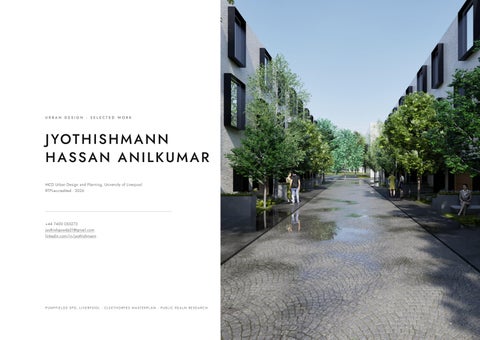
PUMPFIELDS SPD, LIVERPOOL · CLEETHORPES MASTERPL AN · PUBLIC REALM RESEARCH
CONTENTS
SELECTED WORK 2026
CONTENTS
01
02
03
PUMPFIELDS SPD
CLEETHORPES
RESEARCH 02
01 — PUMPFIELDS SPD, LIVERPOOL
S PAT I A L F R A M E WO R K
01
PUMPFIELDS A 30-hectare semi-derelict regeneration zone on the northern edge of Liverpool city centre, identified as having capacity for up to 10,000 homes. Liverpool City Council acted as client, with the City of Liverpool College representing the local community.
Within a group of six I produced the building heights strategy and the green infrastructure strategy for the whole masterplan, and went on to develop the public realm proposals, the Character Area 2 guidance and the key site design.
CLIENT — LIVERPOOL CIT Y COUNCIL
TOOLS — SKETCHUP & T WINMOTION
YEAR — 2026
B U I L D I N G H E I G H T S S T R AT E GY, P U M P F I E L D S M A S T E R P L A N — S I X S TO R E Y BA N D S F R O M 2 + TO 1 2 +
D I S U S E D R A I LWAY A R C H R E O P E N E D A S A CA F E , E X T E N D E D I N TO A N O U T D O O R T E R R AC E
03
01 — PUMPFIELDS SPD, LIVERPOOL
PUBLIC REALM · CHARACTER AREA 2
CHARACTER AREA 2 A mixed-use, pedestrian-priority area that keeps the industrial core while introducing homes, employment, green space and public life.
Blackstock Street and Pumpfields Road become the main east-west pedestrian and cycle route, with three-metre pavements and improved crossings on Vauxhall Road and Leeds Street.
The public realm is designed around comfort, safety and activity: seating, traffic calming, secure covered cycle storage and active frontages, with a new public square as the central meeting point.
L AND USE — MIXED, APARTMENTS OVER ACTIVE GROUND FLOORS
PARKING — CONSOLIDATED INTO A SINGLE MULTI-STOREY P E D E S T R I A N I S E D M I X E D - U S E S T R E E T — ACT I V E G R O U N D - F LO O R R E TA I L , R E S I D E N T I A L A B OV E
P U B L I C R E A L M A LO N G VA U X H A L L R OA D, FAC I N G T H E C O L L E G E
P U B L I C S Q U A R E I N T E G R AT I N G R E TA I N E D H E R I TAG E WA L L E L E M E N T S
S T R E E T - L E V E L D E TA I L — S E AT I N G, P L A N T I N G A N D F R O N TAG E
04
01 — PUMPFIELDS SPD, LIVERPOOL
K E Y S I T E · C O L L E G E R E C R E AT I O N A L S PAC E
M U LT I - U S E S T U D E N T S P O R T S C O U R T — F I V E - A - S I D E P I TC H A N D BA S K E T BA L L C O U R T
C O L L E G E G R E E N C O R R I D O R , S H OW N AGA I N S T N E U T R A L M A S S I N G
I N F O R M A L G R E E N GAT H E R I N G S PAC E — S H E LT E R E D A N D U N S H E LT E R E D S E AT I N G
A E R I A L O F T H E R E C R E AT I O N A L B LO C K B E S I D E T H E E X I S T I N G C O L L E G E B U I L D I N G S
05
02
02 — CLEETHORPES MASTERPLAN
I N D I CAT I V E M A S T E R P L A N
CLEETHORPES Greenfield land east of Humberston Road on the southern edge of Cleethorpes, with Weelsby Wood Country Park along its western boundary and existing housing to the north and south. The proposal is a housing-led neighbourhood at medium density, with one parcel given over to sport and recreation. AREA — 42.76 HA GROSS
CAPACIT Y — 1500 HOMES
ALLOCATION — HOU074B, NORTH EAST LINCOLNSHIRE LOCAL PL AN
MODULE — ENVS463 URBAN DESIGN STUDIO
TOOLS — SKETCHUP AND T WINMOTION
SHARED COURT YARD BET WEEN BLOCKS, OVERLOOKED FROM EVERY BALCONY
INDICATIVE MASTERPL AN IN CONTEX T — COURT YARD BLOCKS FRAMING THE CENTRAL SPACES, LOWER-DENSIT Y HOUSING TO THE NORTH-WEST, THE BLUE-GREEN SPINE THROUGH THE MIDDLE
06
02 — CLEETHORPES MASTERPLAN
STRUCTURE AND DENSITY
A WOODLAND-EDGE NEIGHBOURHOOD Three decisions set the plan: how the streets work, how density is distributed, and where the water goes.
Streets are pedestrian-priority shared surfaces, with vehicular access limited to residents reaching private garages. Density is graded rather than uniform — mid-rise courtyard blocks frame the key public spaces, with townhouses and family housing at the quieter edges.
The drainage strategy follows the site topography, directing surface water to a central retention landscape at the lowest point. AERIAL ACROSS THE WHOLE SITE, AGAINST THE EXISTING GRAIN OF CLEETHORPES
PEDESTRIAN-PRIORIT Y SHARED SURFACE, INTEGRATED WITH L ANDSCAPE AND TREE PL ANTING
CLOSER AERIAL — COURT YARD BLOCKS AT THE CENTRE, TERRACES TOWARDS THE EDGES
07
02 — CLEETHORPES MASTERPLAN
WAT E R A N D L A N D S C A P E
DRAINAGE ABOVE GROUND Surface water is directed by the site topography to a retention landscape at the lowest point, where it becomes the neighbourhood’s principal public space rather than a buried cost.
The water body runs through the centre of the plan, with planted margins, a boardwalk and crossing points. Holding the water in the open does the engineering job and produces the setting the surrounding housing is valued for.
Green corridors connect to the woodland edge rather than stopping at the site boundary.
STRATEGY — BLUE-GREEN, SURFACE-LED DRAINAGE
DRIVER — TOPOGRAPHY, HIGH GROUND TO LOW POINT
THE WATER CORRIDOR RUNNING THROUGH THE CENTRE OF THE PL AN
THE RETENTION L ANDSCAPE AS PUBLIC SPACE — BOARDWALK, SEATING, PL ANTED MARGINS
CROSSING POINT — A LOW BRIDGE KEEPS THE T WO HALVES CONNECTED ON FOOT
WATERSIDE TERRACE — A CAFE PUTS AN ACTIVE USE ON THE WATER
08
03 — RESEARCH
D I S S E R TAT I O N
03
GOVERNANCE AND CONTROL IN THE PUBLIC REALM How management practices shape everyday social use of public spaces in Liverpool. MCD dissertation, ENVS491.
Three Liverpool city-centre spaces were compared under three governance models: Liverpool ONE, a privately managed estate on a 250-year leasehold; the Royal Albert Dock, a Grade I listed heritage site under private estate management; and Church Street, a council-owned highway with a Business Improvement District overlay.
Twelve structured observation visits were carried out over ten days across four time periods — weekday morning, afternoon and evening, and weekend afternoon — using a consistent observational tool at three fixed points per site, supported by behavioural mapping, photographic recording and documentary analysis of each management regime.
Governance worked through the terms of use rather than visible enforcement. Not once was anyone observed being asked to leave or prevented from entering, and camera provision was broadly comparable across all three sites — yet recorded behaviour differed sharply. SUPERVISOR — RICHARD DUNNING, UNIVERSIT Y OF LIVERPOOL
FIELDWORK — 12 STRUCTURED OBSERVATION VISITS
SUBMIT TED — SEPTEMBER 2026
Where seating was free, people brought food and stayed. Where it was commercialised, sitting became conditional on spending — and people improvised on floors, at shop edges and against bollards.
A space can be generously provided for and still narrowly policed. For anyone designing public realm the implication is practical: whether a square becomes somewhere people linger depends as much on the management regime written alongside it as on the quality of the paving.
T H R E E I M P L I C AT I O N S F O R P R A C T I C E Where public realm is delivered through long-term leases or estate management contracts, a minimum provision of free seating could be made a condition of those agreements.
Arrangements that license informal activity — Church Street's pre-booked pitch system — offer a middle path between unregulated use and exclusion, and could extend to privately managed space.
Temporary closure of publicly accessible elements warrants notification, since those elements are often presented as public benefit at the approval stage.
THE THREE SITES LIVERPOOL ONE
R O YA L A L B E R T D O C K
CHURCH STREET
Roughly eighty people seated on the Sugar House Steps on a weekend afternoon, the highest count recorded. No protest or petitioning on any visit.
On a weekday evening, teenagers sat at the furniture of a closed restaurant. Nothing physical had changed — only the requirement to buy had gone.
Free tree seating used on every visit, with takeaway food eaten on it. The only site where protest, petitioning and begging were recorded.
Privately managed estate, 250-year leasehold
Private estate management, Grade I listed
Council-owned highway, Business Improvement District overlay
09
ARCHITECTURAL BACKGROUND
B . A R C H · C O N TA C T
FIVE YEARS OF ARCHITECTURE A
-
five year professional degree at
residential
,
commercial
and
BMS C .
.
.
institutional
ollege of
schemes
A
,
rchitecture
from
concept
followed by twelve months in practice in through
to
working
and
sanction
B
engaluru taking
drawings.
T
wo
studio
F
ive
years
of
architecture
floor
does
to
a
street
,
is
how
a
why
the
urban
courtyard
gets
design made
,
reads
at
street
where
people
level
—
actually
what end
a
ground
up
sitting.
projects and one freelance commission.
MIXED-USE DEVELOPMENT · EIGHTH SEMESTER
SOLITUDE RESORT · B.ARCH THESIS
VA C AT I O N V I L L A · F R E E L A N C E
R E TA I L AT S T R E E T L E V E L , O F F I C E S , R E S TA U R A N T S A N D H OT E L A B OV E
T H E M A I N B LO C K CA N T I L E V E R E D OV E R T H E H I L L S I D E E D G E
A G L A S S PAV I L I O N S E T W I T H I N A C O F F E E E S TAT E I N C O O R G
R E TA I L C O U R T YA R D, P L A N T E R S B U I LT A S P U B L I C S E AT I N G
A F O U R - B E D R O O M V I L L A R E AC H I N G O U T OV E R T H E CA N O PY
T H E L I V I N G S PAC E O P E N I N G D I R E CT LY O N TO T H E L A K E A N D WO O D L A N D
J YOT H I S H M A N N H A S S A N A N I L K U M A R · U R BA N D E S I G N E R , L I V E R P O O L + 4 4 7 4 0 0 0 5 5 2 7 3 · j yo t h i s h g ow d a 2 1 @ g m a i l . c o m · l i n ke d i n . c o m / i n / j yo t h i s h m a n n · E L I G I B L E F O R T H E U K G R A D U AT E R O U T E , N O S P O N S O R S H I P R E Q U I R E D
10