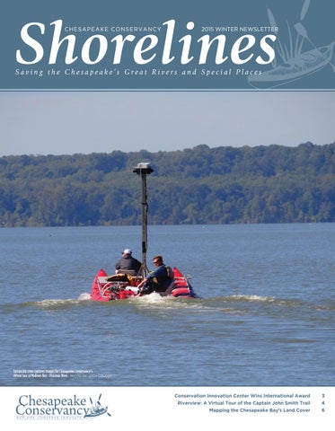
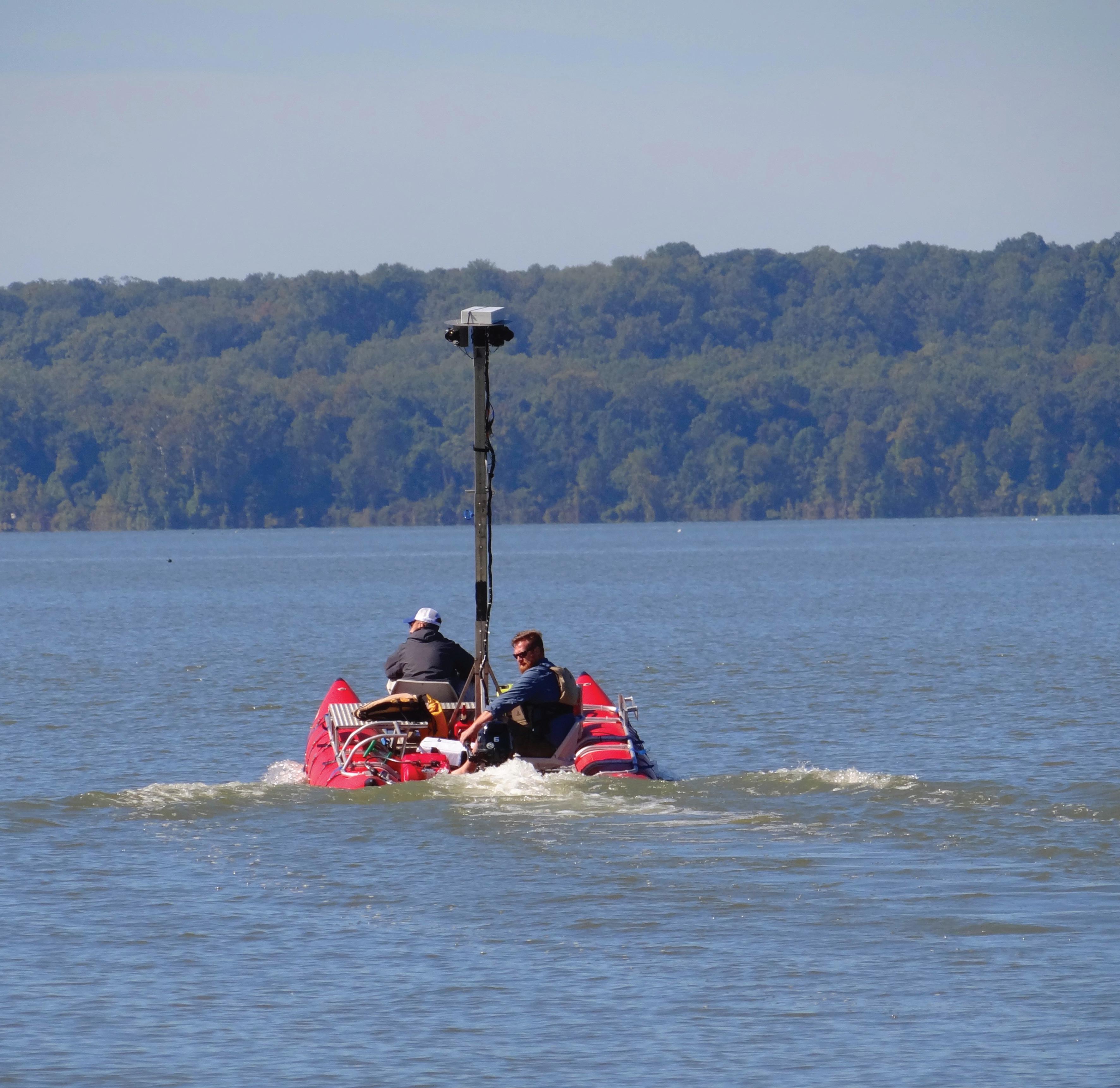
Terrain360 crew captures images for Chesapeake Conservancy’s virtual tour of Mallows Bay - Potomac River. PHOTO BY: JODY COUSER
Mission
The Chesapeake Conservancy’s mission is to strengthen the connection between people and the watershed; conserve the landscapes and special places that sustain the Chesapeake’s unique natural and cultural resources; and restore landscapes, rivers, and habitats in the Chesapeake Bay region.
Board of Directors
Paul E. Hagen, Chairman
Douglas P. Wheeler, Vice Chairman
Scott L. Beatty, Jr., Treasurer
Dr. Mamie A. Parker, Secretary
Stephen R. Adkins
Jane Danowitz
Nicholas H. Dilks
Joel Dunn
Robert E. Friend
Heather Gartman
Robert Gensler
Michael D. Hankin
Stephen F. Harper
Verna Harrison
Page Hayhurst
Ann W. Loomis
H. Turney McKnight
Jeffery More
Patrick F. Noonan
Honorary Members
Gilbert M. Grosvenor
U.S. Senator Paul Sarbanes (ret.)
Charles A. Stek
U.S. Senator John Warner (ret.)
Chesapeake Conservancy Staff
Joel Dunn, President & CEO
Jenn Aiosa, Director of Programs
Jeffrey Allenby, Director of Conservation Technology
Kate Baker, Chesapeake Conservation Partnership Coordinator
David Burke, Conservation & Strategic Planning Sr. Advisor
Jody Couser, Director of Communications
Carly Dean, Project Manager
Sarah Elder, Director of Operations
Evelina Erickson, Director of Development
Regan Gifford, Outreach Coordinator
Lacey Hankin, Project Coordinator
Chigo Ibeh, Geospatial Analyst
Louis Keddell, Geospatial Analyst
Cassie Kluse, Geospatial Analyst
Emily Myron, Project Manager
Joanna Ogburn, Sr. Conservation Advisor
Cassandra Pallai, Geospatial Project Manager
Conor Phelan, Conservation Analyst
Michael Shultz, Public Relations Advisor
Helen Sieracki, Development Coordinator
Kyle Smith, Executive Assistant
Colin Stief, Solutions Engineer
Peter Turcik,
Grant Writer/Communications Assistant
Kathryn Wesson, Geospatial Analyst
Colleen Whitlock, Director of Administration
From the President & CEO
Conservation along the Captain John Smith Trail
As 2015 comes to a close, we continue to advance our work at the Chesapeake Conservancy to protect our great rivers and special places and restore the health of the Chesapeake Bay. The busy fall season has produced a bountiful harvest for our work as well as new possibilities for our conservation efforts.
Our Envision the James (ETJ) initiative received a significant boost recently when the National Fish and Wildlife Foundation awarded a grant of almost $500,000 to the James River Association and the Conservancy. Through this funding, the ETJ partnership will be able to work with Soil and Water Conservation Districts in Virginia to identify where sediment reduction practices can make the greatest difference in improving the health of the James River watershed and restore the view for kayakers on the Captain John Smith Trail.
As a lead advocate for national wildlife refuges and national parks in the Chesapeake region, we are grateful that the Migratory Bird Conservation Commission recently approved more than $2.2 million in funding for the U.S. Fish and Wildlife Service to acquire 758 acres for Blackwater National Wildlife Refuge and along the Nanticoke River. These acquisitions will make critical additions to the network of protected lands along the river corridors, allowing wildlife to migrate and adapt to climate change.
We remain hopeful that Congress will appropriate Land and Water Conservation Fund (LWCF) monies President Obama has requested for additional tracts of land that are critical to protect wildlife habitat and maintain recreational opportunities along the Captain John Smith Trail, such as Fones Cliffs in VA.
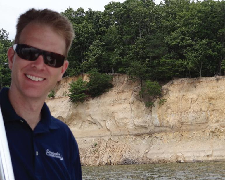
Fones Cliffs on the Rappahannock is one of the few places Captain John Smith might recognize today the way he saw it some 400 years ago. This 4-mile stretch of white colored diatomaceous cliffs rises over 100 feet above the Rappahannock River. However, this critical eagle habitat is now under threat by a proposed large resort development. If Congress appropriates the LWCF funding proposed in the President’s FY 2016 budget, this Chesapeake gem could be saved. These are the precious natural resources that motivate the Conservancy and our partners. But we must act now and we cannot do it alone. Together we can safeguard pristine, critical ecological habitats for iconic species such as the bald eagle, and protect these special places for future generations to enjoy.
Joel Dunn, President and CEO
Chesapeake Conservancy President and CEO Joel Dunn on a visit to Fones Cliffs, July 2015 PHOTO BY: JODY COUSER
Migratory Bird Conservation Commission approved more than $2.2 million to add 758 acres to Blackwater National Wildlife Refuge and along the Nanticoke River. PHOTO COURTESY OF CHESAPEAKE BAY PROGRAM
International Award Honors Conservancy GIS Achievements
The Chesapeake Conservancy was honored with a Special Achievement in GIS (SAG) Award at the 2015 Esri International User Conference in San Diego, CA. This award acknowledges vision, leadership, hard work, and innovative use of Esri’s geographic information system (GIS) technology.
Chesapeake Conservancy uses Esri ArcGIS technology for innovative conservation and restoration planning through data-driven, web-based applications. The Conservancy works with local partners to identify their biggest challenges and to develop the information and customized applications that take advantage of the latest technology and make informed decisions at the parcel scale. Among other things, the Conservancy uses Esri ArcGIS technology for high-resolution land cover mapping and change analysis, multi-resource conservation planning, and viewshed protection and
impact assessments.
“Chesapeake Conservancy is honored to receive this Special Achievement in GIS Award.
The Conservancy stood out from more than 350,000 Esri global customers,” Jeff Allenby, the Conservancy’s director of conservation technology, said.
“The SAG awards identify the organizations and people who are using the power of geography to make our world a better place,” said Esri President Jack Dangermond.
“At Esri, we are always deeply inspired by the passion and innovation of our users. They deserve recognition for their invaluable contributions to their communities and the continued evolution of geographic science,” continued Dangermond.
Ring in the New Year!
Please consider making a year-end tax deductible gift to the Chesapeake Conservancy. An envelope is enclosed for your convenience, or visit www.chesapeakeconservancy.org
New Bald Friar Petroglyph Exhibit a Must See!
By Charlie Hall, Maryland State Terrestrial Archeologist
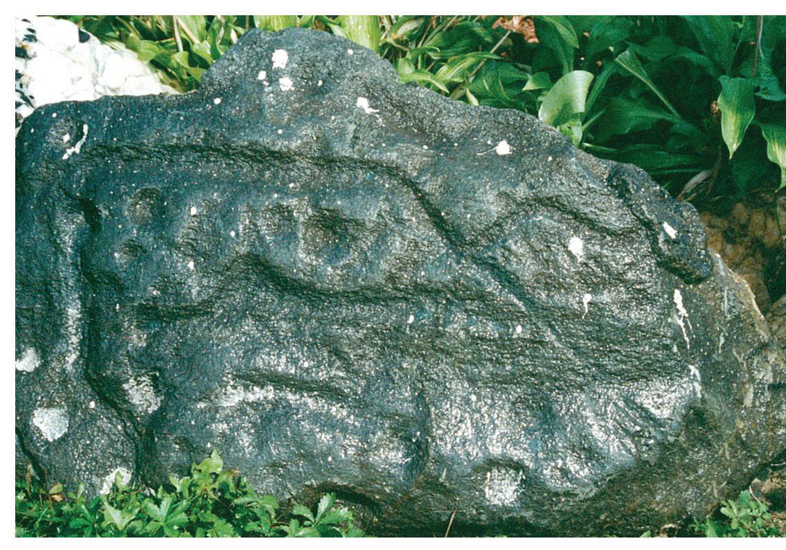
From simple pecked cups, to grooved parallel lines, to complex diamond shapes and curvilinear compositions, the Susquehanna River’s Bald Friar petroglyphs have generated interest— and mystery—for hundreds of years. Native Americans originally carved the abstract images into large, island-sized boulders between what is now the Pennsylvania line and the Conowingo Dam. In 1927, the petroglyphs were removed from their location to save them from inundation from the dam,
after which the Maryland Academy of Sciences cemented together the fragmented stones for exhibition. No one knows the precise age or meaning of the petroglyphs.
Now, in the historic Rock Run Grist Mill within view of the Susquehanna River, a new exhibit at Susquehanna State Park features some of the enigmatic artifacts, coupled with interpretive text. The exhibit is not large, but it deftly covers the mysterious history of these images carved in rock, as well as the more recent journey they have taken.
Spurred in part by a desire to present a more comprehensive picture of the Bay region and native peoples, the Chesapeake Conservancy brought together the Maryland Department of Natural Resources to house the exhibit and the Maryland Historical Trust
to execute a loan for the artifacts. Financing for the design and fabrication of the exhibit was provided by Turney McKnight, a member of the Chesapeake Conservancy’s board of directors. Turney has a deep and manifest interest in the petroglyphs, and his generosity (and good humor) literally took this exhibit from a great idea to a terrific product. Although no one fully understands the Bald Friar petroglyphs, they were not randomly or casually positioned on the landscape. Placed between the lowest ford and the deepest “sink” within the falls of the Susquehanna River, their meaning must have been connected to that place. We may never know who made the images or when, or for whom the message was intended. We can be sure, however, that by bringing some of the petroglyphs to the bank of the Susquehanna River—only about 6 miles from their original location— Turney McKnight and the Chesapeake Conservancy have returned them to the place where that message resonates best. Reprinted with permission. This article was originally published in Our History, Our Heritage, the Maryland Historical Trust’s blog.
Jack Dangermond, Esri president (second from right), with Chesapeake Conservancy staff (left to right): Colin Stief, solutions engineer; Conor Phelan, conservation analyst; and Jeff Allenby, director of conservation technology PHOTO COURTESY OF ESRI
A close-up of one of the petroglyphs removed from its original location in the Susquehanna River
Virtual Tour to Bring Captain John Smith Trail to a Screen Near You
To many people, exploring 3,800 miles of water trail seems daunting. The vast expanse of the Captain John Smith Chesapeake National Historic Trail can leave even the most experienced and intrepid pioneers scratching their heads, wondering where to even start.
Which of the great rivers of the Chesapeake do I want to paddle? Where can I put in my kayak or canoe? Where can I take a larger boat? What does the river look like, and what can I expect to see along the way? Though some enjoy the mystery of exploring new stretches of territory, the idea of terra incognito can keep the more reluctant travelers at home.
It is with these folks in mind that the Conservancy is bringing the Captain John Smith Trail to your computer screen. Through our new John Smith
Trail Riverview project, we are working with a Richmond-based company, Terrain360, to create an interactive virtual tour to allow viewers to see firsthand what a paddling experience or other adventure on the Captain John Smith Trail might be like.
“At the Conservancy, we realized that we could use technology to make it easier for people to connect with the great rivers of the Captain John Smith Trail,” Chesapeake Conservancy President and CEO Joel Dunn said. “These rivers are the lifeblood for the rich diversity of flora and fauna living within the Bay watershed. We know that if people can connect with these rivers and the trail, they will be more likely to become stewards of the Chesapeake.”
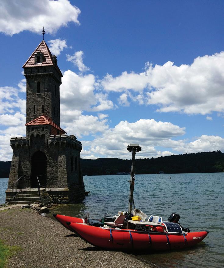
To obtain the images for the Riverview project, the Terrain360 crew deploys a one-of-a-kind, handmade boat equipped with multiple cameras to capture images along the entire length of each river. As the boat floats down a river, the crew takes high-resolution, 360-degree images every 50 feet, using six cameras mounted on the vessel 10 feet above the water’s surface. These images are then stitched together to create a digital image map of the Chesapeake’s rivers.
The maps produced from the images will include information on public access points, history, recreation, and areas of conservation value along the rivers. They will allow people to explore the rivers from their screens—whether by phone, tablet, or PC.
The James River Association and Terrain360 created a similar program as part of Envision the James, displaying nearly 100 points along the James River. The company has also created digital tours for other trails and recreational areas, among them Bryce Canyon National Park, the Appalachian National Scenic Trail, and Hatteras National Seashore.
The boat and crews spent this past summer capturing the images and creating the virtual tour of the Susquehanna
“The Susquehanna is a beautiful river, and we’re very excited to share all 700 miles of it with anyone who has an Internet connection,” said Andy Thompson of Terrain360. “We look a little strange coming down the river, with our red pontoons and cameras 10 feet in the air, but when people hear about what we’re doing, they are very excited.”
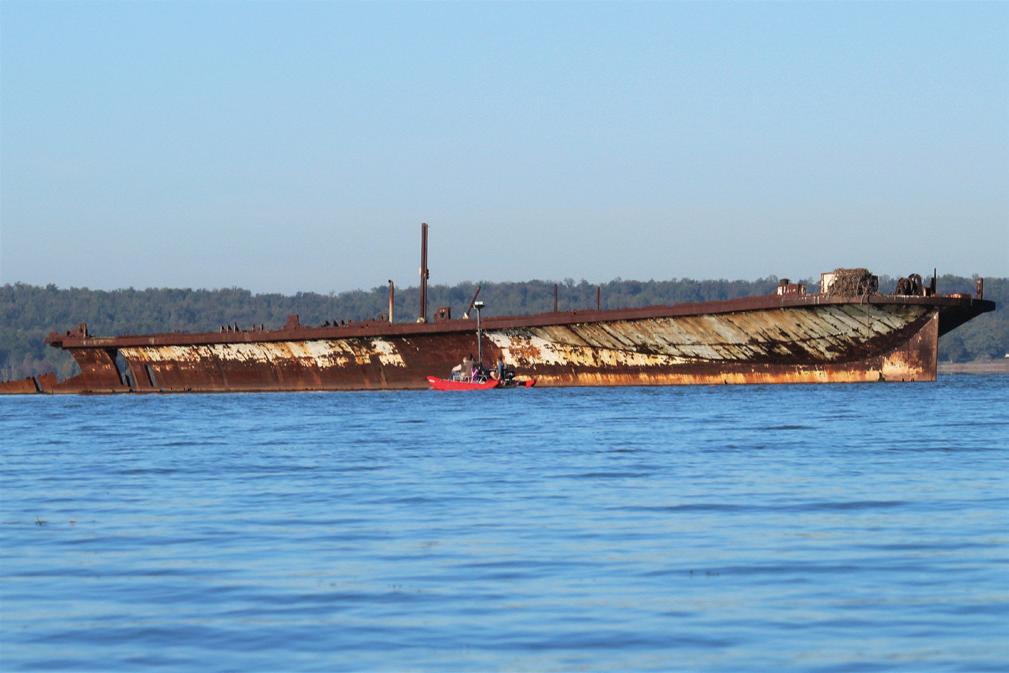
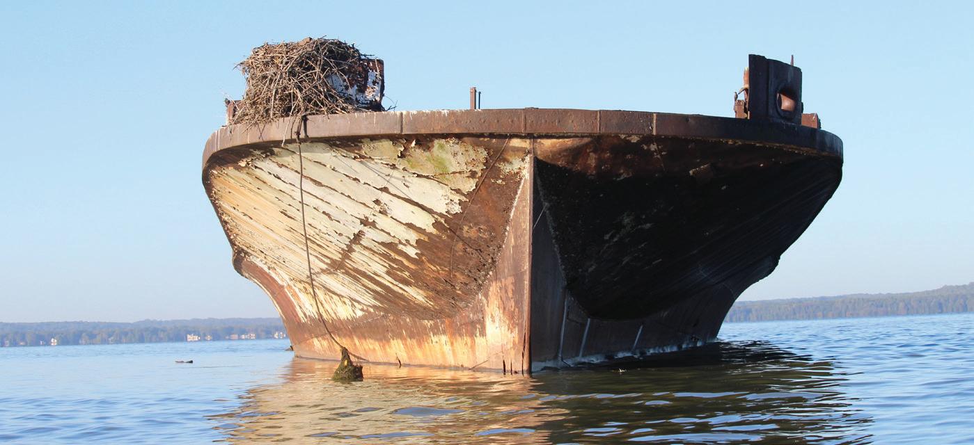
This fall, Conservancy staff joined Terrain360 to capture images of the “Ghost Fleet” at Mallows Bay on the Potomac River to create a virtual tour of this beautiful place which boasts the largest collection of historic shipwrecks in the Western Hemisphere.
The Accomac, Mallows Bay–Potomac River
PHOTO BY: KYLE SMITH
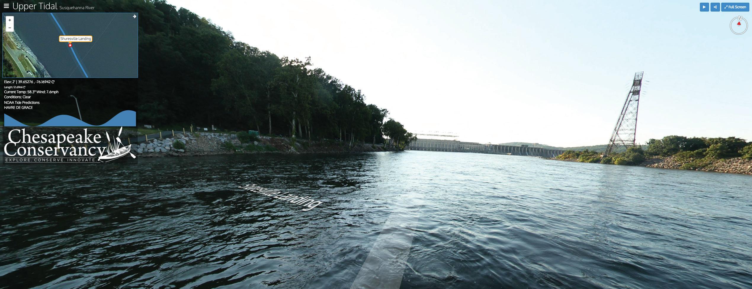
A computer screen shot of the Riverview Virtual Tour featuring Shuresville Landing near the Conowingo Dam on the Susquehanna River
“Just 30 miles south of Washington, DC, Mallows Bay–Potomac River is an important cultural resource attraction for adventure tourism,” Dunn said. “We’re very excited to produce this virtual tour, enabling our community to explore the proposed National Marine Sanctuary on their phones and computers. We hope it inspires people to help us establish the sanctuary and to get outside and explore the Chesapeake.”
“It’s an honor to be part of this project,” said Terrain360’s Thompson. “Mallows Bay is such a special place in our nation’s history and a beautiful place to visit. We’re so proud to be part of this effort to help make it virtually accessible to everyone.”
As you are stuck inside during the winter months, use Riverview to learn more about the trail and plan your next paddling or boating trip. Thanks to our supporters and through partnerships, the following locations have been completed: Susquehanna River, West Branch Susquehanna, Nanticoke River, Mallows Bay–Potomac
Power Lines Threaten James River Viewshed
River, Lake Otsego, and the James River (sponsored by James River Association). To view the virtual tours, visit www.chesapeakeconservancy.org/ riverview.
Mallows Bay–Potomac
River Is Another Step Closer to Becoming the Nation’s Next National Marine Sanctuary!
Great News! In October, the National Oceanic and Atmospheric Administration (NOAA) issued a Notice of Intent to initiate a full public procedure and Environmental Impact Statement necessary to designate Mallows Bay as a new National Marine Sanctuary.
The Chesapeake Conservancy has been a core partner in the nomination and heralds NOAA’s Notice of Intent. If designated, Mallows Bay–Potomac River would become the first National Marine Sanctuary designated in more than 20 years and the first ever in the Chesapeake. (See related article in summer 2015 Shorelines.)
As a consulting party to the Save the James River Alliance and a member of the Down to the Wire Coalition, the Conservancy is working with partners to stop a Dominion Virginia Power proposal to construct the Surry-Skiffes CreekWhealton transmission line and switching station across the lower James River within sight of Carter’s Grove, the Captain John Smith Chesapeake National Historic Trail, Colonial Parkway, and Historic Jamestown. This project would irreparably damage the integrity of the Captain John Smith Trail by marring the viewshed.
This summer, the Keeper of the National Register of Historic Places issued a decision that a portion of the Captain John Smith Trail along the James River is eligible for National Register designation. As an advocate for the Captain John Smith Trail, the Conservancy is thrilled with the Keeper’s decision which will go a long way toward helping us preserve the historic view.
Captain John Smith Compass Rose 17 oz coffee mug, $10 (plus shipping). Get yours today through our online gear shop! www.chesapeakeconservancy.org
The Accomac, Mallows Bay–Potomac River PHOTO BY: KYLE SMITH
This pontoon docked at Otsego Lake, NY, is used to capture images for a virtual tour of the Captain John Smith Trail for the Chesapeake Conservancy. PHOTO COURTESY OF TERRAIN360
Conservation Innovation Center Adds Staff, Starts Groundbreaking Project
A project manager, and four geospatial analysts recently joined the staff of the Chesapeake Conservancy to support the launch of an exciting new project that will enhance the entire conservation movement in the Chesapeake Bay Watershed.
The new staff will process datasets for the Conservancy’s Land Cover Data Project. This project is a cooperative endeavor between the Conservancy and the National Park Service funded through an interagency agreement with the Environmental Protection Agency (EPA).
EPA is the primary funder of the Chesapeake Bay Program, a regional partnership that leads and directs Chesapeake Bay restoration and protection. Bay Program partners include federal and state agencies, local governments, nonprofit organizations, and academic institutions.
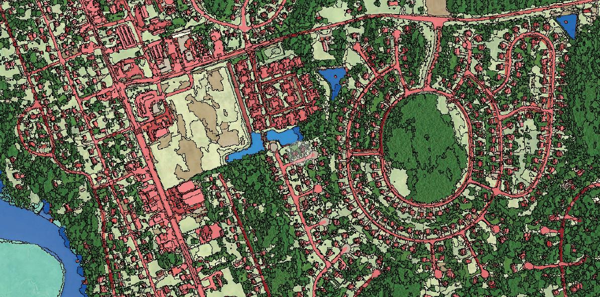
High-resolution mapping will be used to develop consistent, extremely accurate land cover datasets for all of the counties that comprise the Chesapeake watershed in New York, Pennsylvania, Maryland, Delaware, West Virginia, and the District of Columbia. The Commonwealth of Virginia will generate its own land cover data and will work with the Conservancy and the Chesapeake Bay Program to ensure consistency.
Land cover data and maps have been produced for decades. However, the datasets developed through this project
will have 900x the resolution of the National Land Cover Dataset and will provide an overall accuracy of close to 95 percent for the 10 classes of land cover that are being mapped.
The data will help guide the most efficient use of resources in conserving and managing the Captain John Smith Chesapeake National Historic Trail, as the National Park Service works with partners to identify opportunities to protect or restore resources along the trail and enhance the visitor’s experience. Other significant uses include incorporating this data into analyses for identifying and protecting significant cultural resources and predicting possible archeological and American Indian town sites along the trail.
The high-resolution data will be used for precision conservation and large landscape conservation analysis to identify priorities for conservation and restoration to achieve better results in less time at lower costs. The data will also benefit public access advocacy efforts.
The project will be completed by September 30, 2016. The data will be open access and will be hosted on the Chesapeake Bay Program Partnership’s website (www.chesapeakebay.net). This is yet another example of how the Chesapeake Conservancy is enhancing the quality and pace of conservation using innovative technology.
Donor Spotlight: Buzbee Family
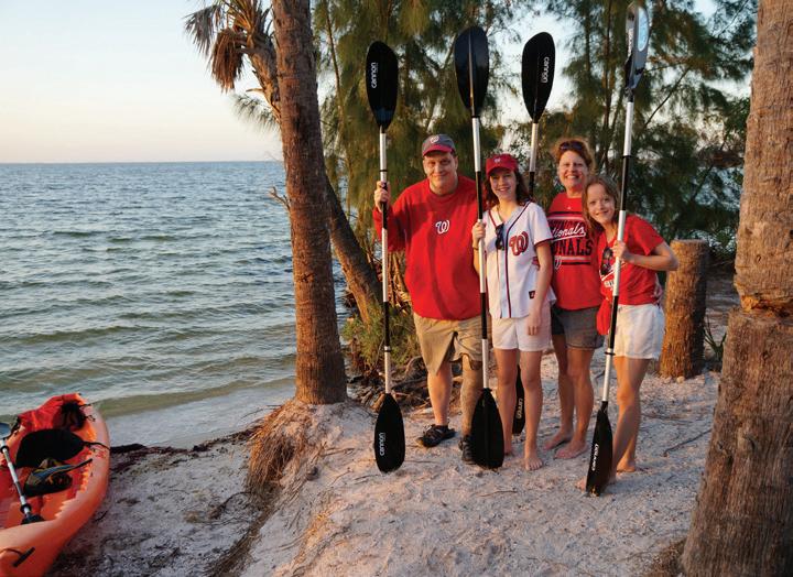
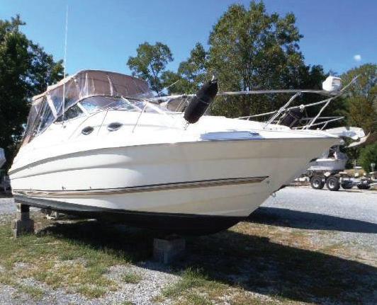
Not all donations come in the form of cash, check, or credit card. The Chesapeake Conservancy learned this firsthand earlier this year, when John and Sally Buzbee donated their 2003 Wellcraft Martinique 2600 motorboat. The money raised from the sale of the boat has gone toward the Conservancy’s annual fund.
John and Sally live with their daughters Emma and Meg in the Washington, DC, area and have faithfully supported the Conservancy since 2010. The Buzbees enjoy exploring the Chesapeake, both in the Martinique and by kayak. They
mainly ply their home waters of the Potomac River, but they also travel to farther destinations, such as Tilghman Island on Maryland’s Eastern Shore.
“We are great fans of the Chesapeake. We love to get out on the water,” John said.
“We love the opportunity for water access and think there is always a lot more work that can be done in that regard. We really appreciate the work the Conservancy has done to connect the region as a whole to the Chesapeake Bay, and the Bay to the rest of the region through river access issues.”
On their excursions, John said he and his family liked to load kayaks into the Martinique, drive it to a chosen
John, Emma, Sally, and Meg Buzbee, supporters of the Chesapeake Conservancy PHOTO COURTESY OF THE BUZBEE FAMILY
An example of a Conservation Innovation Center land cover classification map with partially transparent land cover superimposed on aerial imagery
destination, drop anchor, and then paddle into the shallow and more remote areas with the kayaks. However, John admitted that this was an impractical way to go kayaking. He also said these trips required a great deal of time, making it difficult for the family to take advantage of the boat.
“We thought it was time to move on to something else recreationally. Our favorite thing is to find some quiet time on the water with the kayaks or walking along a trail somewhere. The Chesapeake is a wonderful resource for that,” John said. “In terms of donating the boat to the Conservancy, it just
Conservancy Staff News
made sense. We have always been a supporter, and the logic of the situation said we should donate the boat to an organization that works to conserve the Chesapeake. We were delighted to do it, and I would encourage others to do so as well.”
“It is certainly a unique gift for the Conservancy, and we appreciate John and Sally’s generosity,” Conservancy director of development, Evelina Erickson, said. “A donation like this benefits more than just the Conservancy. We receive the funds from the sale and the new owner is able to explore and enjoy the Chesapeake.”
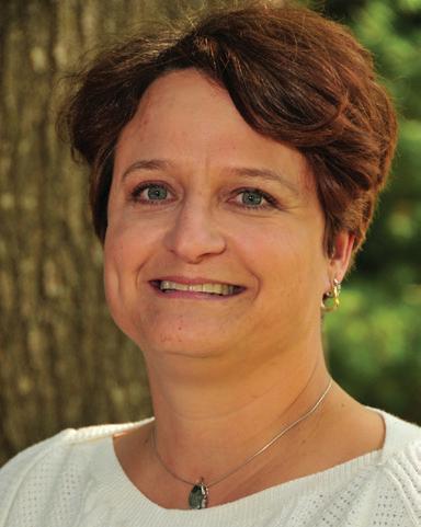
Jenn Aiosa of Baltimore joined the Conservancy as the new director of programs. She was most recently acting director of operations with the Maryland Department of Planning and was previously that agency’s director of policy and research. At the Environmental Defense Fund, Jenn served as Chesapeake senior conservation manager. As senior scientist with the Chesapeake Bay Foundation, Jenn was a leader in the Maryland environmental community and advocated for the Chesapeake for 12 years. She has also worked for the Cooperative Extension at the University of Maryland, the Maryland Coastal Bays National Estuary Program, and in the Washington, DC, office of former Congressman Wayne Gilchrest. Jenn holds a masters degree in environmental sciences from the University of Virginia and a B.S. in marine sciences from the University of South Carolina.
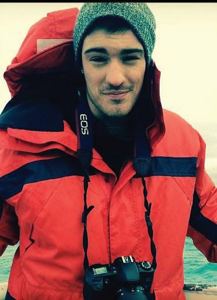
Colin Stief, solutions engineer, is helping the Conservancy find new ways to use digital media and geospatial technology to inform conservation efforts in the Chesapeake Bay. In particular, he is interested in developing intuitive web and desktop applications that can automate tedious, but critical, analytical tasks and transform raw data
into meaningful information. Prior to his current position, Colin built and maintained trails at Olympic National Park, worked at the NYC Department of Environmental Protection, and taught English overseas. He has a masters of environmental management from Duke University and a B.A. in geography from Miami University in Ohio.
Kyle Smith is the new executive assistant for Conservancy President and CEO Joel Dunn. Previously, he worked for the Congressional Progressive Caucus on environmental policy and international trade issues for Representative Raul Grijalva (AZ-03). He holds a B.S. in political science from Towson University.
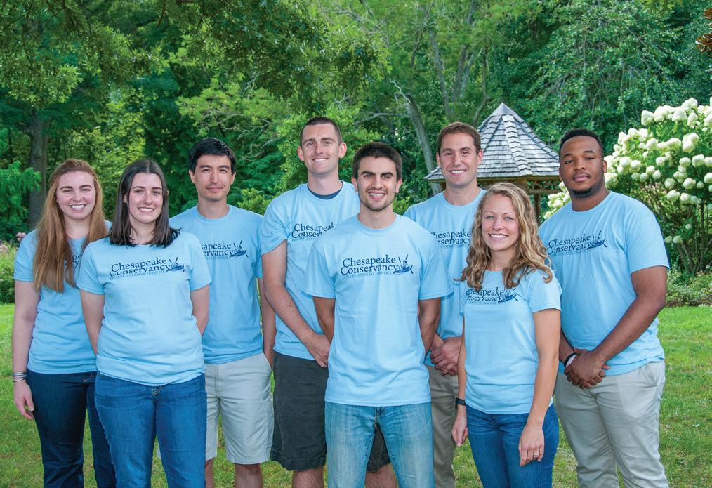
Cassandra Pallai, geospatial project manager, and Chigo Ibeh, Louis Keddell, Cassie Kluse, and Kathryn Wesson, joined the Conservancy’s Conservation Innovation Center as geospatial analysts to support the Land Cover Data Project. (See article, p. 6.) “We’re delighted that these recent technology graduates have decided to put their highly specialized skills to use for the conservation movement,” President and CEO Joel Dunn said.
Joanna Ogburn, former director of programs, will continue to work with the Conservancy on a consultant basis. A native of the Eastern Shore, she will support our mission on the Nanticoke and Choptank rivers.
Paula Degen retired in September from a long career in publications and other interpretive services, most recently with the Chesapeake Conservancy and the National Park Service Chesapeake Bay Office. She will continue to assist the Conservancy on a consultant basis.
Jeffrey Allenby, director of conservation technology, was a featured speaker at the International Land Conservation Network (ILCN) conference in Berlin, Germany. More than 100 people from around the world attended the conference in October. His presentation with Dave Tobias, City of New York, was titled “Water and Land Conservation: A Partnership with Mutual Benefit.”
PHOTO COURTESY OF KYLE SMITH
PHOTO BY PETER TURCIK
From left to right: Kathryn Wesson, geospatial analyst, Cassie Kluse, geospatial analyst, Louis Keddell, geospatial analyst, Jeffrey Allenby, director of conservation technology, Conor Phelan, conservation analyst, Colin Stief, solutions engineer, Cassandra Pallai, geospatial project manager, and Chigo Ibeh, geospatial analyst
PHOTO BY PETER TURCIK
The sale of this 26’ Wellcraft Martinique benefits the Chesapeake Conservancy. PHOTO COURTESY OF JONATHAN FOSTER YACHT SALES