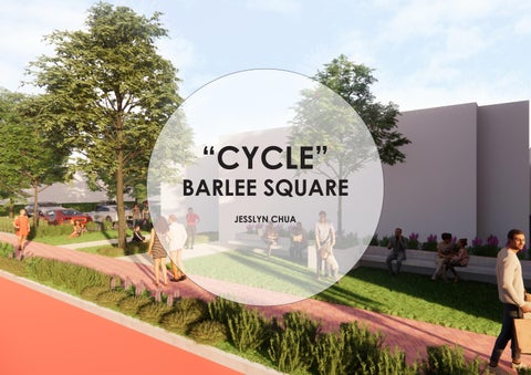
“CYCLE”
BARLEE SQUARE JESSLYN CHUA
Design Strategy Summary
Climate change has and will be a major challenge for everything and everyone if nothing is done to mitigate the dire consequences of it. It has resulted in an increase in surface temperature in Beautfort Street. This design aims to alleviate the negative impacts of climate change by targeting 3 main areas namely, heat, water and food. Firstly, vegetation has been shown to significantly reduce surface temperatures. This is done by simultaneously absorbing sunlight and shading hard surfaces, thus reducing the amount of heat that is absorbed and radiated. The plot of area that can potentially be revegetated includes small areas such as building setbacks and sidewalks. The presence of greenery has been shown to attract a higher number of potential customers. Secondly, groundwater stores have been gravely affected by climate change. An ideal solution would be to recycle storm and grey water, to water the vegetation in the area. This creates a positive feedback loop. Lastly, food literacy has been an epidemic of gargantuan proportions in the young. 1 in 5 children have absolutely no idea where their food comes from. Childhood obesity has been on the rise as well. Childhood obesity has a significant correlation to obesity in adulthood. Obesity is a leading cause in many degenerative diseases. A prospective proposal would be to include a community garden. Residents who reside in the vicinity would sow and nurture fruits and vegetables of the season. This provides opportunities for children in the area to learn more about the origin of food. Community gardens also provide a strong sense of belonging.
Table of Content 1. Heat Analysis 2. Water Analysis 3. Food Analysis 4. Heat Strategy Precinct Scale 5. Water Strategy Precinct Scale 6. Food Strategy Precinct Scale 7. Barlee Square Analysis 8. Barlee Square Strategy 9. Physical Sketch Model
HEAT ANALYSIS
Source: Ruli Zhang, Phase 01, LACH4424, 2020
Overall Green Percentage Throughout the Years
An increase of greenery percentage seen from 2009 to 2018. Surrounding parks around Beaufort Street are higher in greenery percentage and plots of land along Beaufort Street has a decrease in greenery percentage, probably due to urbanization where vegetations were removed to make space for shops and residential buildings.
Urban Heat Island Mapping An example of From Road, Adelaide Trees use solar energy to drive photosynthesis and evapotranspiration. Leaves and branches provide shade thus reducing the exposure of urban surfaces to solar radiation
Lincoln Street
Mary Street
The difference between the two residential streets from the number and density of tree canopy found in Mary St compared to Lincoln St. Rows of fig trees allows a cooler surrounding temperature by reflecting heat and providing shade to users in Mary St
Canopy Percentage of Private and Public Trees vs Hard-scape More public trees planted along roadside but lesser trees seen at residential areas - Mary Street.
1
3
More private trees grown around residential areas but not many public trees were planted along roadside - Chelmsford Road.
2
2
1
Ideal tree canopy ratio. Rows of trees to provide shade along the roadside. Residential tress to reduce urban heat - Clive Road.
3
CONSTRAINTS ANALYSIS ON URBAN HEAT Knowing the dimensions of street size, traffic volume, verge and car park areas. In search of spaces to re-vegetate. Narrowing road width with lower traffic volume in making space for trees and shrubs. Thus reducing Urban Island Heat.
Macro Circulation Lake Street
Mereny Lane
Railway Parade
Source: Cross Sections Yulou Bei, Phase 01, LACH4424, 2020
Micro Circulation BICYCLE
BUS
CAR
Lane-ways and Shared Spaces No first priority for either vehicle or pedestrian. They are both equal as there is no clear indication on vehicular and pedestrian pathway. The alley is a shared pathway between both vehicular and pedestrian
1:6500 in A2
Pedestrian pathway located alongside with a row of cafe shops, allowing easy access. Wide footpath.
Pedestrian pathway located alongside with a row of cafe shops, allowing easy access. Wide footpath.
Shared pathway along Mereny Ln.
Accompanied with human to understand the width of road
A road bumper to reduce speed of car
Shared pathway along Mereny Ln with road bumper
Shared pathway along Mereny Ln
Shared pathway along Tramway La
Continuous shared pathway along Mereny Ln.
Shared pathway along Kaata La
Extended Road from Beaufort Street
St Albans Street along the residential areas are wider compared to Mary St.
Residential pathway along Mary Street
Typical Residential Street Shared Spaces
Streets extending out from Beaufort Street are residential areas where there is a clear separation between residential footpaths and car lanes. Roadside parkings can be found along the street of residential areas as well, in both direction.
Beaufort Street
The busiest street, having clear separation between cars and pedestrian, for safety precautions. Having a clear bus lane to avoid traffic jams.
Pedestrian pathway located alongside with a row of cafe shops, allowing easy access. Wide footpath.
Typical Beaufort Street
1:6500 in A2
Streets extending out from Beaufort Street are residential areas where there is a clear separation between residential footpaths and car lanes. Roadside parkings can be found along the street of residential areas as well, in both direction.
Existing Verge and Car-parks
1:6500 in A2 Source: Zoe Zhang, Phase 02, LACH4424, 2020
WATER ANALYSIS
Annual Rainfall Rate of annual rainfall around Beaufort Street is higher than the surrounding areas of 820mm to 829mm. 770mm - 779mm
790mm - 799mm
810mm - 819mm
830mm - 839mm
780mm - 789mm
800mm - 809mm
820mm - 829mm
840mm - 849mm
Monthly Rainfall
Topography and Water Flow
How water sources change overtime Population 1.5 million
2 million
2.5 million
Average inflow into dams 13 Bl
46 Bl
92 billion liters
Water supplied 275 Bl
285 Bl
318 billion liters
Dams 8%
10%
32%
Groundwater 31%
40%
61%
Desalination 7%
48%
53%
Groundwater replenishment 2% 8% 2000
Scale 1: 150,000
Scale 1: 25,000
2019
2030
Scale 1: 1000
Geology, Perth’s Water Supply and Outages
Where does Perth Water Come From?
Soil samples indicate uniform structure around the stretch of Beaufort street. An increase number of upcoming water outage will be allocated near the denser city region in 2020. Replenish Groundwater
Current Water Outage
Groundwater
Upcoming Water Outage
Bassendean
Cannington
Karrakatta
Cottesloe
Herdsman
Southern River
Cannington
Swan
Quindalup
Desalination
Vasse
Groundwater Dams Groundwater replenishment Historic Wetlands and Existing Parks Historic wetlands were connected together, creating a stream where water flows down towards the Swan River. Several existing parks and open green spaces can Historic Wetlands
Existing Parks and Green
Scale 1: 25,000
Scale 1: 150,000
Drainage Piping
Perth Groundwater system. How Groundwater works
Groundwater availability in 2016
Reduction of groundwater in 2020
Scale 1: 150,000
FOOD ANALYSIS
Function of the buildings Cafes & restaurants
Food shops
Retail
Commercial Services
Office
Commercial Facilities
Healthcare
Education
Hair and Skin Care
Theatre
Vacancy Cafes & restaurants Food shops Retail Commercial services Office Community facilities Healthcare Education Hair and skin care Theater Scale 1: 6500 in A2
Source: Zixuan, Phase 02, LACH4424, 2020
Heat Strategy - 30 Years Later Revegetating residential streets with trees in providing shade, thus reducing urban heat island effect. Removing excessive hardscape along streets and verges, replacing them with shrubs and tree plantings. `
Scale 1: 7500 in A2
Scale 1: 7500 in A2
Present (2020)
Future (2050)
Heat Strategy - Overall revegetation of Beaufort Street
Focusing on Private land owners on setback buildings and Governement public parkings
Heat Strategy - Opportunities in revegetating setback buildings
Scale 1: 6500 in A2
Heat Strategy - Opportunities in revegetating setback buildings NAB Government Carpark along Beaufort Street Revegetating a public carpark to reduce the surface percentage of hardscape. Also influencing private carpark owners to take up this idea.
Typical scene of Beufort Street Planting shaded tree in the median of Beaufort Street. As trees are being restricted along the side due to bus lanes, shrubs or edible fruits, vegeables and herbs can be planted alongside as well.
Water Strategy - Precedent Review of Swales Streets
Verge
Carpark
Seattle, Street Edge Alternatives Project
Kronsberg, Hannover, Germany
Sheffield, Grey-to-Green Corridor
Singapore, Botanic Gardens
France, Lyon
Pennsylvania, Allen Street
Sheffield, Grey-to-Green Corridor
Pennsylvania, Black Rock Road
France, Lyon
Singapore, Margaret Drive
Thames Street, England
L.A. Zoo’s New Watershed-friendly Parking
Water Strategy - Typical Dimmensions of Bioswales Implemented
Hybrid Bioretention Planter
Bioretention Swale
Biofiltration Planter
3 types of swales will be planted around Beaufort street and the residential areas. Bio-filtration swales will be placed along the residential areas to collect grey water from houses and recycling them into usable water for watering vegetation along Precinct.
Scale 1: 7500 in A2
Water Strategy - Residential Streets in Beaufort Street Precinct
St Albans Ave (street with median)
1:150 in A3 1:150 in A3
Chatsworth Street (street without median)
1:150 in A3 1:150 in A3
Water Strategy - Scenarios on St Alban Avenue 30 years later
Option 1
Option 2
Option 3
1:200 in A3
Having surveys on residential areas on whether they would like to have a bioswale situated infront of their housing. These bioswales will then be able to recycle greywater from residential housings, thus reusing these water for better purposes, such as watering the vegetation or transported downwards to Swan River 3 Options given to Residentials: 1. Full Biofiltration Swale infront of residential building 2. Half Biofiltration Swale, Half Roadside Parking 3. Full Biofiltration Swale but a driveway for incoming car from the residential garage
1:150 in A3
Water Strategy - Residential Stormwater Collection Zone
Clarence Street
1:150 in A3 1:150 in A3
Carpark at Grosvenor Road
1:150 in A3
1:150 in A3
Food System Scenarios
1:150 in A3
1. Edible Green Wall on laneways 2. Grape Vines on on top of laneways, providing shade and food 3. Community Street Garden, thus encouraging residents to have their own agriculture plot in their backyard in the future 4. Intercropping. Fertilizers from chicken 5. Bee farm for organic sugars
Food Strategy - Volunteer Opportunities Ongoing Instagram Program such as hashtag #TransformingUrbanEdge with edible garden plots. People showcasing the food that they have harvest.
Permaculture volunteer groups and on going pro-grammes can be found in Western Australia
Popular #BeaufortStreet and #EdibleFlowerRecipes in Instagram. Understanding what the public looks forward to when coming to Beaufort Street. Majority are Art, Food and Flowers.
Community Street gardens allows people from all ages and walks of life to come together as one. Having volunteer activities that brings back to the community of Beaufort street as well as educating children from young about the important of food.
CYCLE JESSLYN CHUA
Context
1:200 in A3
Character and Inventory
1:200 in A3
Crime Prevention through Environmental Design (CPTED)
1:200 in A3
Current Uses and Users
Sun Pattern at Barlee Square without vegetations 6am
8am
2pm
4pm
5pm
6pm
1:200 in A3
Topography of Barlee Square Existing contours shows the gradient flow of water that travels downwards to Barlee Square. Resulting to a collection point of stormwater.
Plants & Art
Character
Bad
Good
Instagram Worthy Alfresco laneway. Attracting tourist and public. Water Play area for family, kids or adults to just deep their feet in the water.
1:200 in A3
Open Lawn, a place where people are able to bond together. String lights in keeping up the night life. Events, Music Busking can be held in the open lawn
1:200 in A3
A-A Cross Section
Main Entrance of Barlee Square “Cycle”, looking from Modus Coffee Cafe. Attracting the crowd towards Barlee Square through softscape plantings, creating a sense of welcoming and ashpalt grafitti art that seeps into Barlee Square.
1:200 in A3
A
A
B-B Cross Section
Overall Section of Barlee Square. Showing the different zonings and activities happening across Barlee Square B
1:200 in A3
B
Water Play Area
1 1 1
1. Native Edible wildflower located throughout Barlee Square
Tropaeolum majus
Erodium cicutarium
Fuchsia sp.
Solanum aviculare
Lantana camara
Oenothera biennis
Romulea rosea
Open Lawn
5
3
4
1
2
1. Plumeria rubra
2. Symphytum officinale
3. Agonis flexuosa
4. Persea americana
5. Delonix regia
Alfresco with Propagation planter boxes alongside suitable for handicapped users
1
2 3
2
1. Softening arches with climbers
Vitis
2. Propagation zone and herb plantings
Ocimum basilicum
Matricaria chamomilla
3. Dried Native Edible Pressed Flower Table
Symphytum officinale
Symphytum officinale
Cymnopogon sp.
By Community Volunteer members of Barlee Square
Seasonal Agricultural plot for community volunteers and the public
1
1. Row of fruit trees along pathway Removing the fences that hinders the connection between Barlee Square and Residential Area. Agriculture vegetation along the laneways encourages residential people and the public to volunteer in the community garden Prunus persica
Citrus x limon
Seasonal Fruits and Vegetables Calendar for Barlee Square Agriculture Plots Vegetables
Fruits
Different types of agricultural crops were planted for each seasons. Crops will then be harvested and in return new “in-season” crops will be planted. Cycle repeats annually.
Avocado
Apricot
Banana
Blueberry
Beetroot
Broccoli
Carrot
Chilli Blooming of Fruit Trees during Spring season. Attracting the community, public and tourists.
Fig
Cherry
Fuji Apple
Grapes
Cabbage
Cucumber
Eggplant
Garlic
Cherry Tree (Prunus avium) Grapefruit
Guava
Kiwi
Lime
Kale
Lettuce
Spring Onion
Peas
Mango
Passion fruit
Peach
Strawberry
Potato
Pumpkin
Radish
Sweet Corn
Jan
Feb
Mar
Apr
May
Jun
Jul
Aug
Sep
Oct
Nov
Dec
Peach Tree (Prunus persica)
Avocado (Persea americana)
Seasonal Calendar
Cherry (Prunus avium) Grape (Vitis) Lime (Citrus x aurantiifolia) Passion Fruit (Passiflora edulis) Strawberry (Fragaria x ananassa) Beetroot (Beta vulgaris) Cabbage (Brassica oleracea) Chilli (Capsicum frutescnes) Kale (B. oleracea var. sabellica) Spring Onion (Allium fistulosum) Pumkpin (Cucurbita)
Apple Tree (Malus domestica)
Physical Sketch Model of Barlee Square “Cycle”
Physical Sketch Model of Barlee Square “Cycle”
Physical Sketch Model of Barlee Square “Cycle”
“CYCLE” BARLEE SQUARE