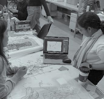
My relationship with landscape architecture has been evolving through my curiosity to learn about landscape processes, commitment to design with nature, and energy to collaborate with others. I carry everything I learn from a project through the process, build upon it, and continually refine my work to elevate it to the next level. That’s why my work is never truly complete!
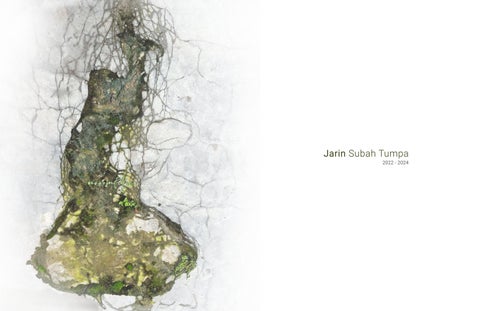
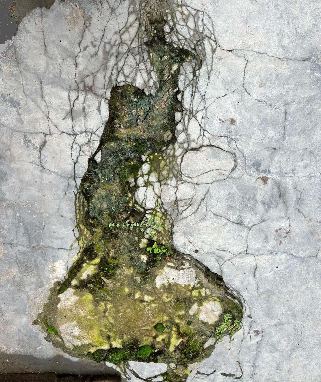
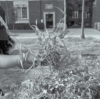
This portfolio shares my academic projects of a two-year journey in landscape architecture at the University of Illinois at Urbana Champaign. I observe profound details through my senses, and my photographs when I am outside and layer them creatively when I return to my desk. At the beginning of my career, I am motivated to work with practitioners who deal with multiple challenges creatively and work collaboratively with communities and experts from other disciplines.
Fall 2024 - Urban Planning Studio
2023 - 2024 - MLA Thesis
Fall 2022 - Graduate Foundation Studio
Summer 2024 - Internship Capstone
Fall 2023 - Planting Design
Fall 2023 - Site Engineering
- Reconnecting Memories: Restoring Ecological Corridors in Viladecans, Barcelona.
- Third Landscapes for flood-resilience: Rethinking Scales of Green Infrastructure in Neighborhood in Khulna, Bangladesh.
- Edge Effects: Integrating in-between layers in campus thresholds.
- Kentucky Ave Greenway: Repurposing left over landscapes for flood-resilience, IN.
- Weaving Plants: Planting Design for fun and function.
- Every Drop Counts: Stormwater Project
RECONNECTING MEMORIES :
Restoring Ecological Corridors
in
Viladecans, Barcelona.
Team:
Dylan Becker, Tianyi Sun
Location: Viladecans, Barcelona.
Award: Nominated for Graduate Student Design Award, Fall 2024
Context:
The Llevant neighborhood in Viladecans is a transformative urban project in an underutilized area near the boundary with Sant Boi.
Reconnecting Memories is a vision that prioritizes the connectivity of fractured streams and preserves the ecological functions and the area’s industrial heritage.
Studio Instructor : Prof. Sara Bartumeus Ferré
Jarin Tumpa,
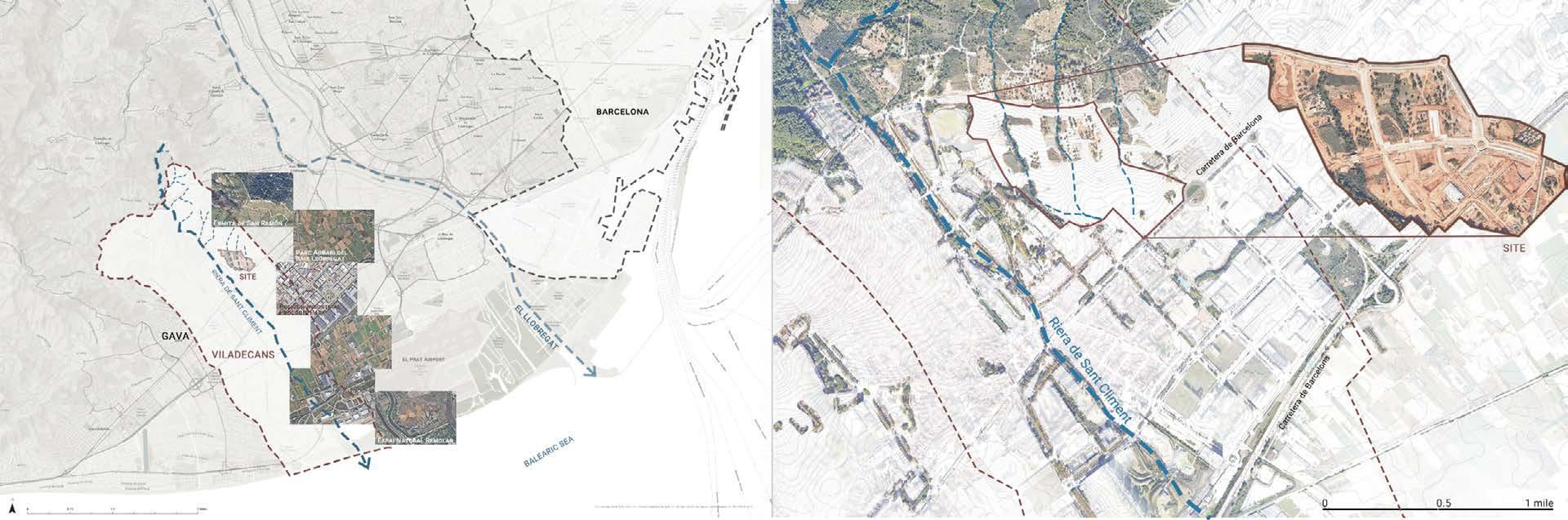
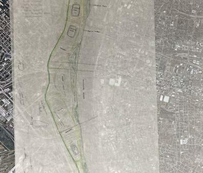
Image: Geographic context of Viladecans Barcelona; Credit: Jarin Tumpa
Image: Location of the Site Credit: Jarin Tumpa
ARC 574 - Urban Planning Studio, An International Collaborative Workshop + Studio; Fall 2024
Understanding the Site:
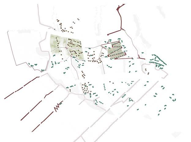
Through mapping, photographs, and site observations, the team identified critical issues, including fractured connections among three dry stream channels originating from the northern mountains.
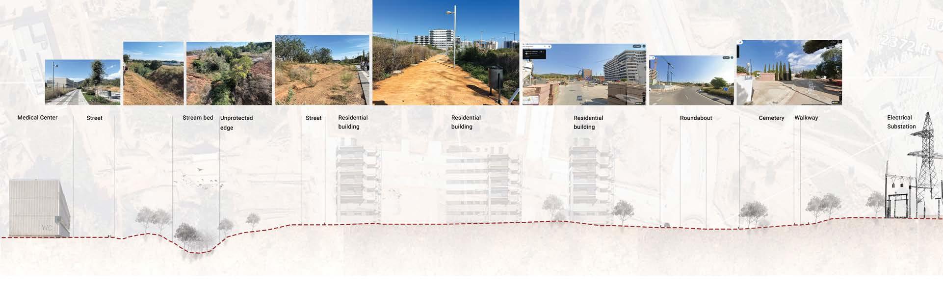
Image: Existing cross- section through the west to east; Credit: Jarin Tumpa
Image: A visionary cross- section through the west to east Credit: Jarin Tumpa
Drawing A Vision:
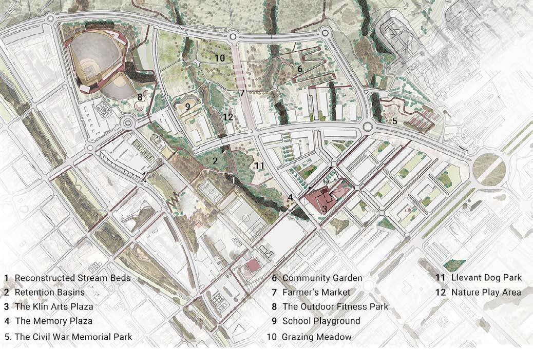
The Vision Plan is not some strategy or a one-stop solution that will successfully integrate nature with the built environment, yet the stream channels and the Memory Lane (a trail connection) outline flexible opportunities for a healthy landscape and activate the landscape by creating spaces according to the topography.
The Vision Plan determines the overall character of the site according to Viladecans’ unique landscape, which requires further exploration for site-based interventions.
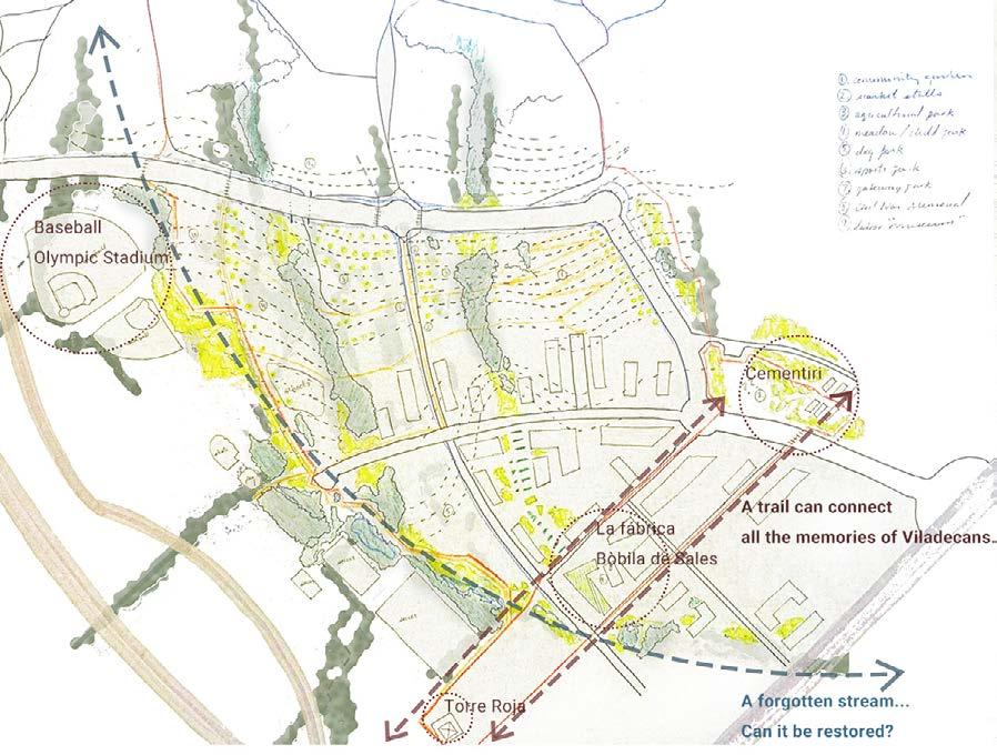
Image: Concept Plan Credit: Dylan Becker, Tianyi Sun, Jarin Tumpa
Image: The Vision Plan; Credit: Jarin Tumpa, Tianyi Sun
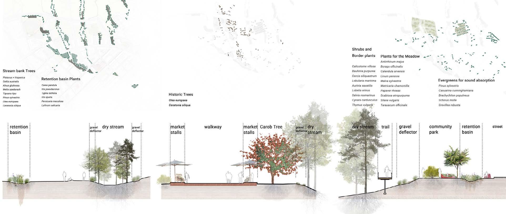
Recognizing the ecological significance of dry streams in Mediterranean landscapes for moisture retention, the project proposed three strategies.
These include--minimal landform alterations, planting native and historically significant vegetation, and creating pathways that connect cultural landmarks, promoting both ecological resilience and cultural engagement.
Vegetation for Stream Restoration
Vegetation for Historic Preservation
Vegetation for activating the neighborhood
Image: Vegetation Strategies; Credit: Jarin Tumpa
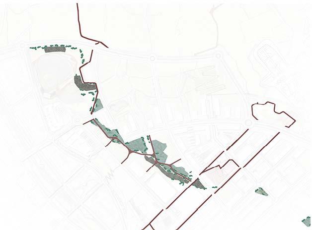
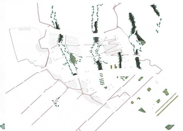
The first phase underscores restoring a lost stream bed on the southwestern edge, incorporating retention areas to manage hydrology. The second phase further extends dry stream beds southward, while the final phase focuses on activating transitional landscapes to the north of Llevant with shrubs and flowering trees.
Image: Phasing Suggestions; Credit: Jarin Tumpa
Phase 1: Reforestation along the main stream
Phase 2: Reforestation along the tributaries
Phase 3: Activating the neighborhood through vegetation
Visualizing Activities:
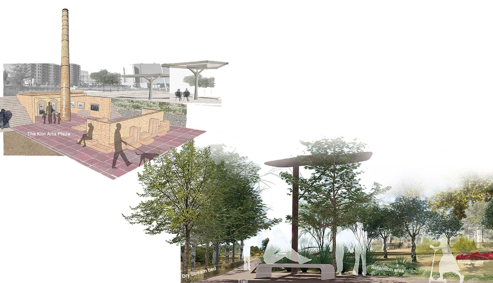
Image: La fábrica Bòbila de Sales after preservation Credit: Dylan Becker
Image: The historic trail also activates spaces for social gathering Credit: Jarin Tumpa
Reconnecting Memories sets a vision hoping that the natural heritage of the landscape will thrive along with the cultural heritage and will be celebrated with the Llevant’s human and non-human communities.
THIRD LANDSCAPES FOR FLOOD-RESILIENCE :
Rethinking
Scales of Green Infrastructure in Neighborhood in Khulna, Bangladesh.
Committee : Prof. Mary Pat McGuire (Chair), Prof. Stephen Sears, Prof. Sara Bartumeus Ferré
Location: Khulna, Bangladesh
Awards: Sasaki Day Award, Edward L. Ryerson Traveling Fellowship in Landscape Architecture LA 599 - Thesis Research; Fall 2023 - Summer 2024
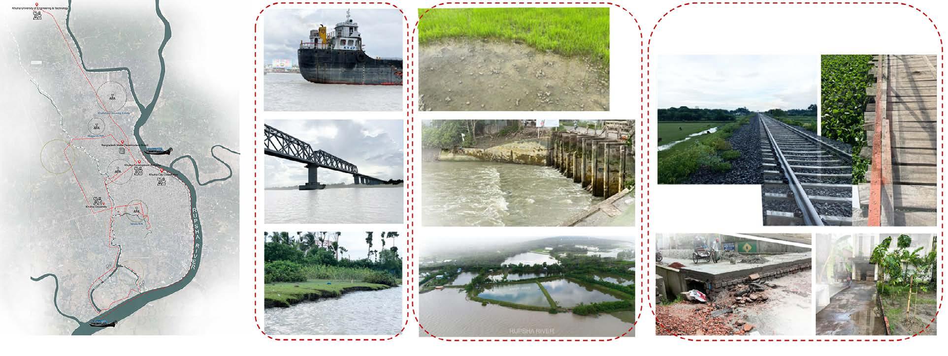
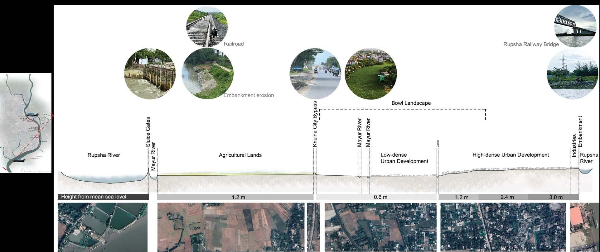
Urban flooding in Khulna city has become a burden for the inhabitants for several complex reasons. To better understand the origin of this issue, the fieldwork at the beginning of the study was crucial.
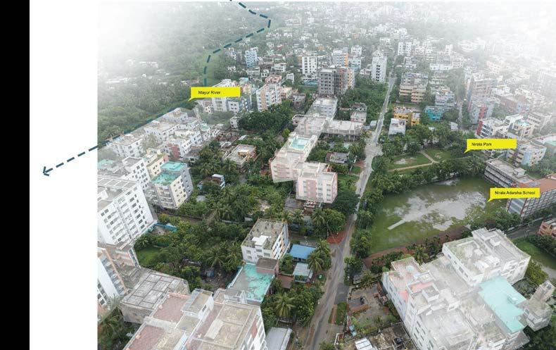
This bowl landscape traps the runoff at the city center instead of flowing it to the Mayur River. Other infrastructures, such as the Khulna City Bypass, also block the natural flow direction.
The study asks:
1. Why are there gaps between theoretical flood-mitigation models and experiences of local flooding in Khulna neighborhoods?
2. How can we rethink landscape design approaches to make the city flood-resilient in the future?
Image: Mapping the elevation differences across the Khulna City
Observations + Voices:
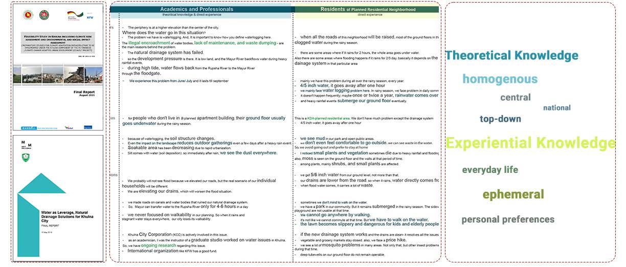
To understand the flooding issues at different levels: regional, local, and site levels the fieldwork has two parts--interviews and landscape observations
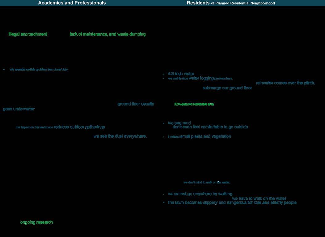
There were two participant groups--Group One included academics, planners, architects, and engineers; Group Two was residents from Khulna Development Authority (KDA) developed Nirala Residential Area (R/A) and Mujgunni R/A, who shared valuable experience and knowledge in the interview.
One key finding from the interviews was the practitioners are more concerned about the central flood mitigation infrastructures, while the residents suffer from urban flooding at the local scale.
Flooding at the Neighborhood Scale vs. the Street Scale:
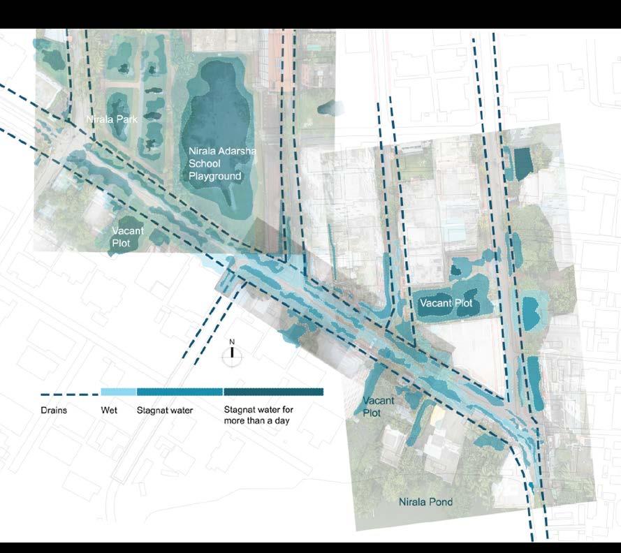
Further site assessment across different scales (neighborhood scale, and street scale) was essential to identify spatial and site-specific impacts of urban flooding in Khulna.
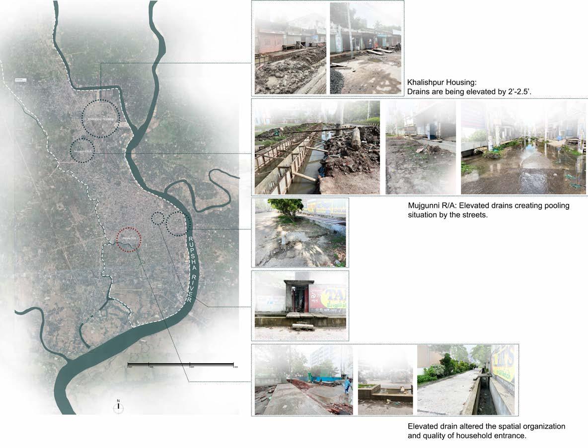
During the fieldwork, the drainage redevelopment was underway at the time of June-July 2023 by the Khulna City Corporation (KCC).
Image: Fieldwork: Drainage construction in different neighborhoods.
Image: Zooming in to a street scale to study flooding conditions; Photos: Jarin Tumpa
Tracing water at the Street Scale:
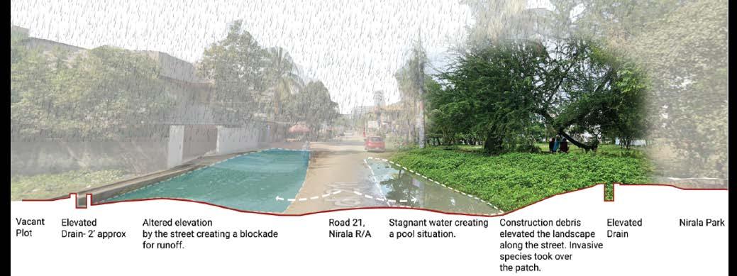
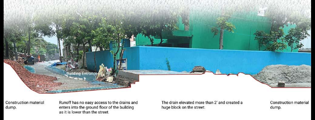
To understand the impacts of the drainage redevelopment project, it was essential to observe flooding at the street scale.
The elevated drains have altered the landforms, creating depressions along both sides where runoff water becomes trapped.
Moreover, runoff water accumulates on ground floors due to the lack of connection with the newly elevated drains.
Image: Mapping flooding conditions at the street scale.
Image: Mapping how water gets trapped along the streets.
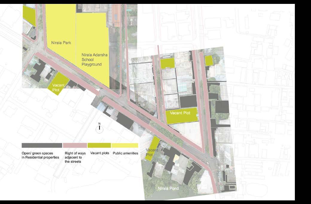
Opportunities in leftover landscapes:
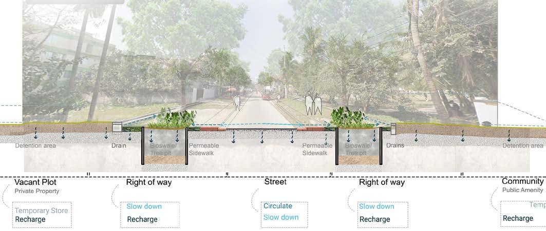
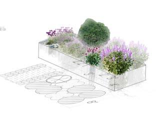
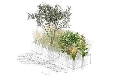
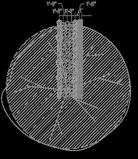
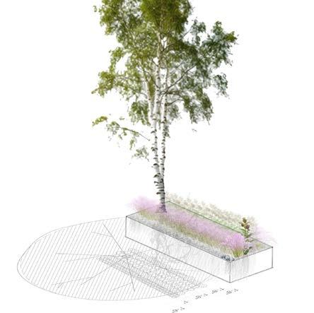
There is not one strategy or solution. There could be multiple options for example, some would prefer rain gardens for their households, and some would prefer a bio-filtration trench for the whole street, some streets would have space for stormwater tree pits, and some narrow streets would have permeable ground to soak the water.
Residents and the design team will pick the most feasible and desired alternative based on different site conditions.
Therefore, this bottom-up approach should start seeking adaptation strategies through participatory methods.
Image: Mapping third landscapes.
Image: Potential spatial organizations and types of green infrastructures in the abandoned landscapes at a street scale.
Community Park
Temporary Store
EDGE EFFECTS
LA 433 - Graduate Foundation Studio
Instructor: Prof. Mary Pat McGuire
: Integrating in-between layers in campus thresholds.
Location: Military Axis/ Arts Quad at the University of Illinois at Urbana - Champaign
Area: 7.5 acres
Activating the Edges:
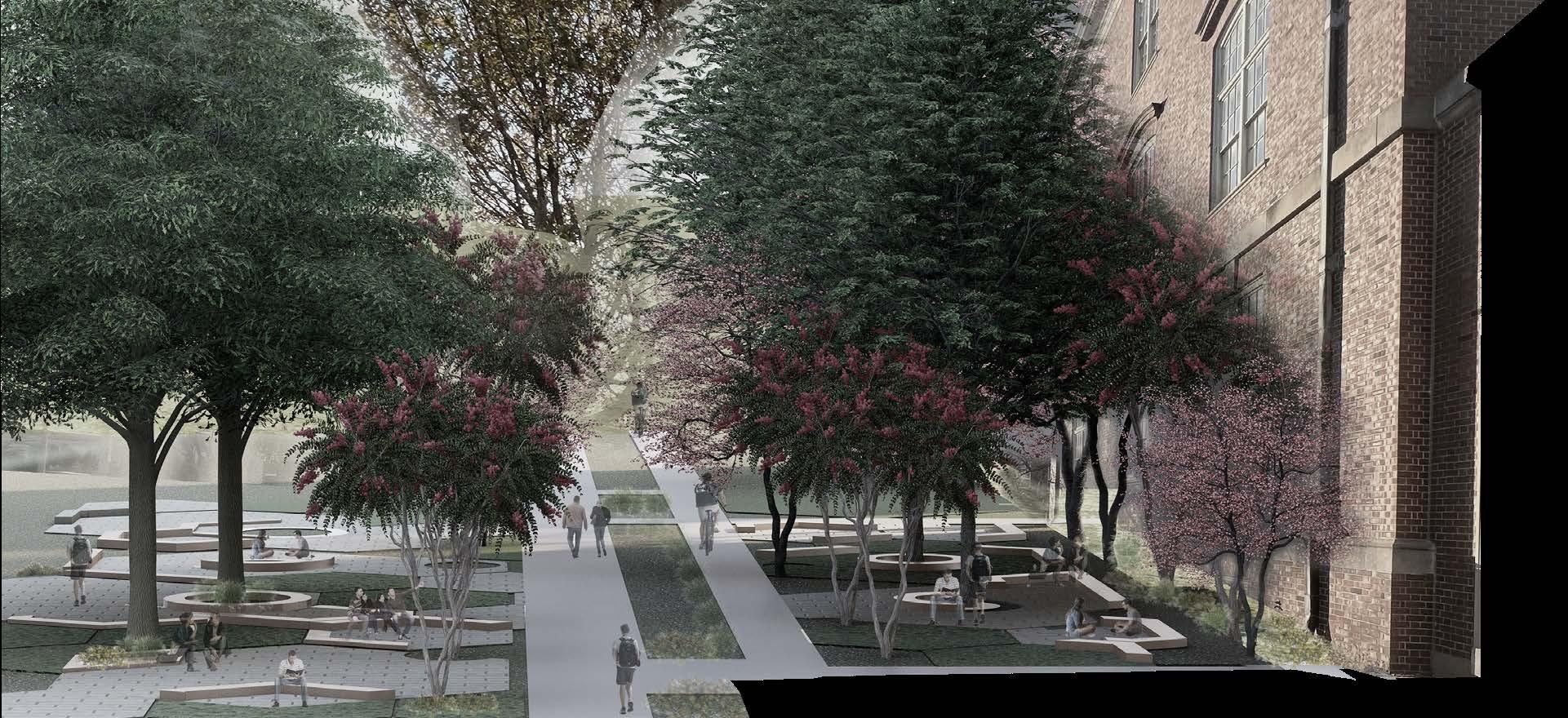
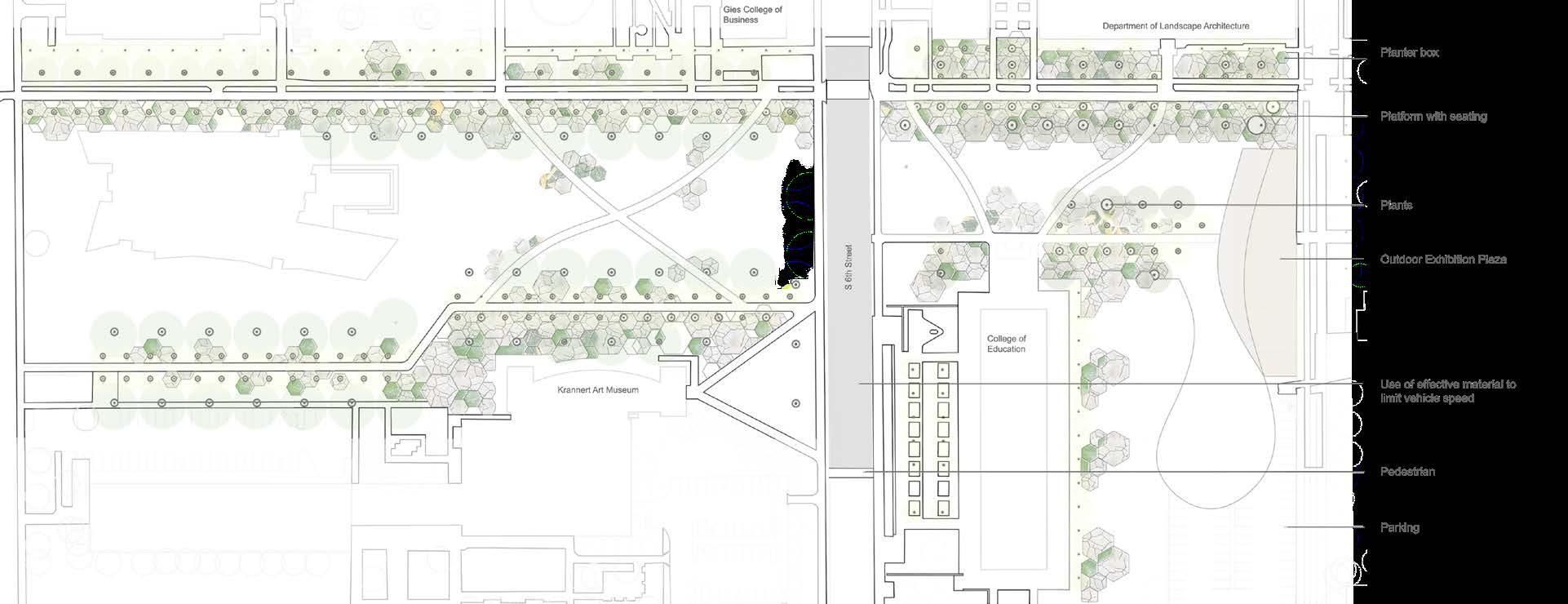
The project’s objective is to create a living-learning environment through landscape design and enhance the overall functionality of building edges.
I have noticed potential existing landscapes at the edges of academic buildings where students gather in small and large groups, share thoughts, and make connections.
Image: A view looking at the sidewalk and active gathering spaces by the Architecture Building; Media: SketchUp, Lumion, Photoshop
Spatial Organization:
Material change to limit vehicle speed
Crosswalk
Mid-Canopy Tree
Image: Proposed Site Plan Media: AutoCad, Photoshop
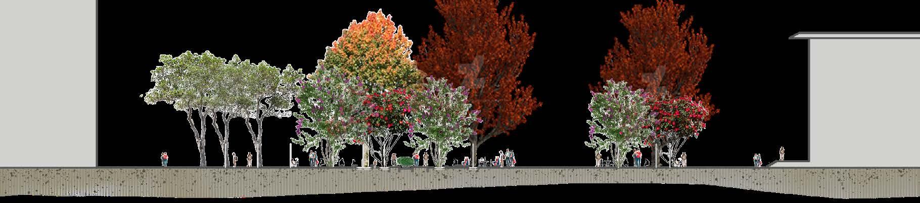
Image: A Section through north-south; Media: AutoCad, Photoshop
KENTUCKY AVE GREENWAY
: Repurposing left over landscapes for stormwater management.
A Capstone with Rundell Ernstberger Associates (REA)
Mentor : Kyle Koger, PLA, LEED GA Associate at REA
Duration: Summer 2024
Location: Kentucky Ave, Indianapolis
Context and the Issue:
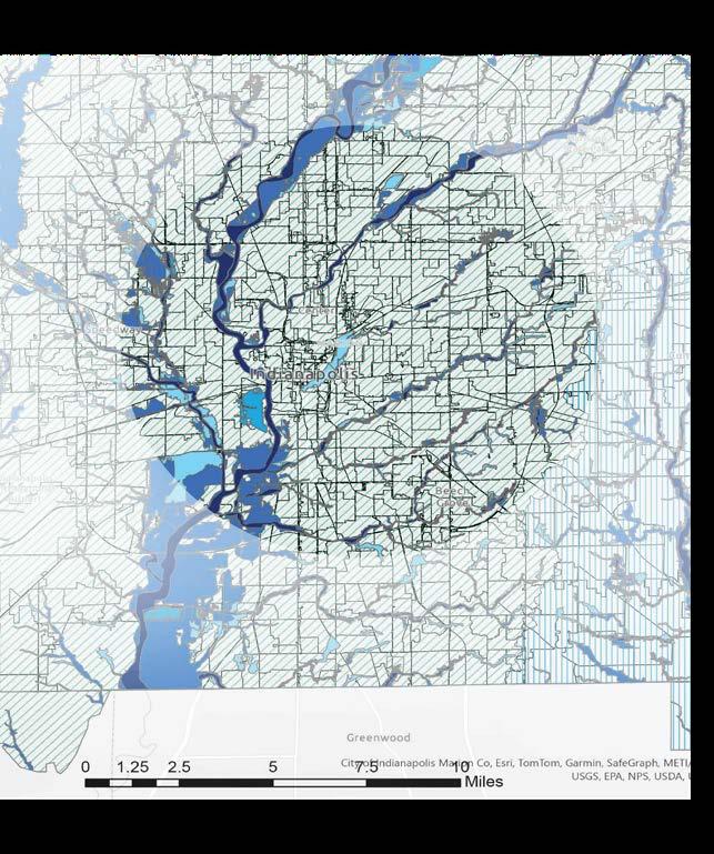
Study shows that the landscapes on both sides of the White River in southwest Indianapolis are in a 100-yr floodplain.
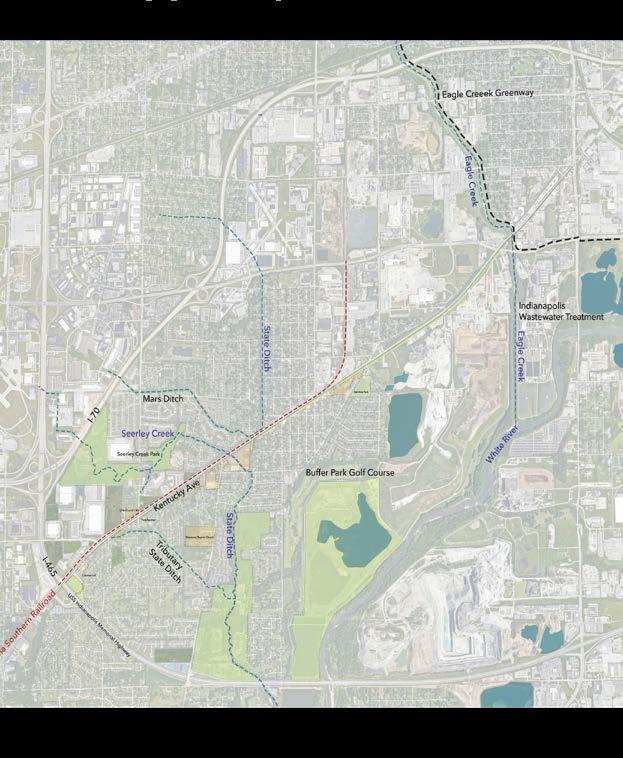
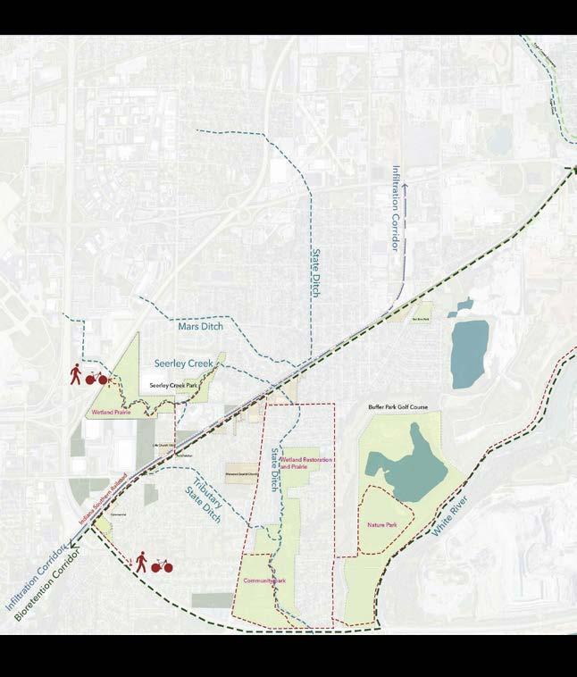
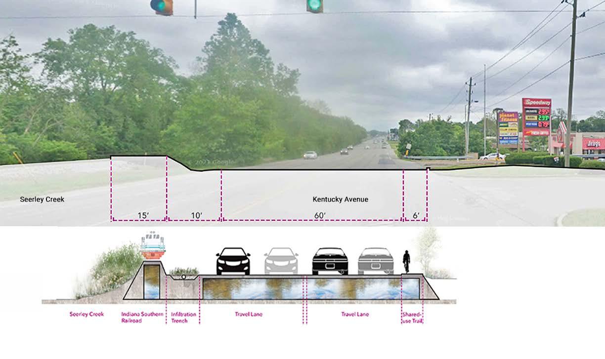
The purpose of this study is to manage stormwater through a bioretention and an infiltration corridor along Kentucky Ave.
There are opportunities to integrate a blue-green corridor along Kentucky Ave by incorporating bioretention areas, infiltration trenches, and vegetated medians.
This project also provides a shared-use trail connection parallel to the travel lanes, which also connects with the existing Eagle Creek Greenway.
Image: Existing Cross-Section through Kentucky Avenue
Image: Proposed Cross-Section
Seerley
WEAVING PLANTS : Planting Design for fun and function
LA 452 - Planting Design
Instructor: Prof. Karen May
Location: Gies Business School Quad at the University of Illinois at Urbana - Champaign
Inspiration:
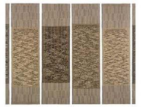
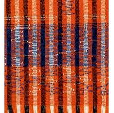
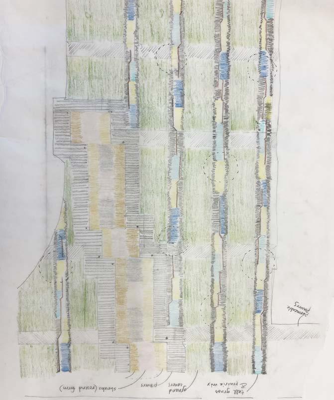
Anni Albers gave freedom to the grid pattern and kept rhythmic patterns side by side. She was also inspired by bodily motion.
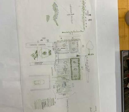
Pattern-making, threading, and experiencing motion are my primary inspirations for this planting design.
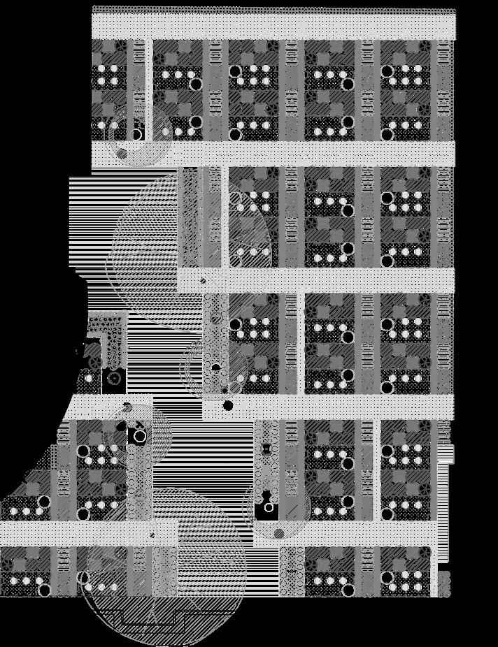
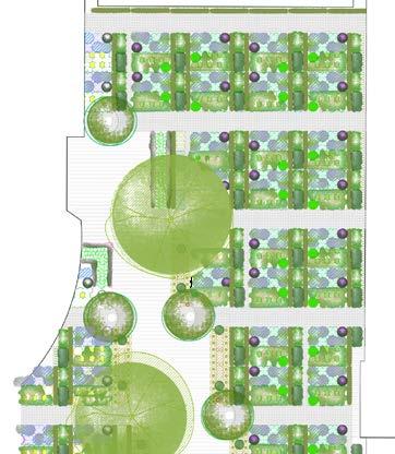
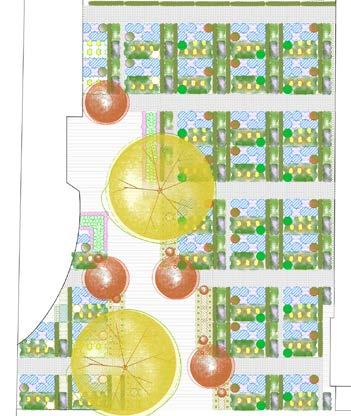
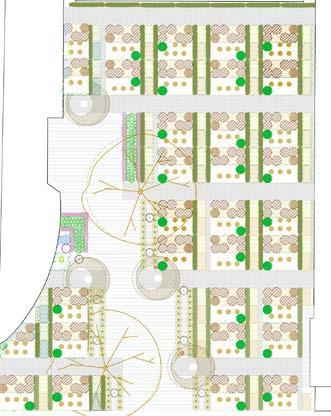
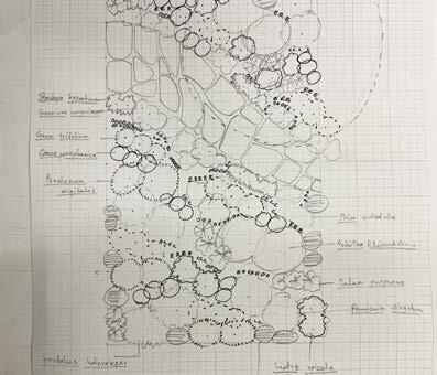
Planting Plan
Image: Textile works of Anni Albers Image: Concept Sketch
Patterns throughout the year:
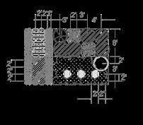
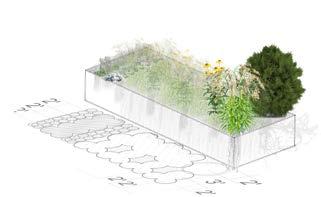
Planting Pattern 1
Planting Pattern 2
Planting Pattern 3
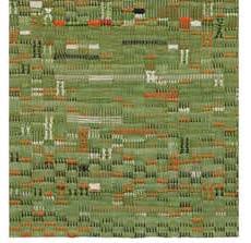
A major part of the garden is native grasses and herbaceous perennials. I made three patterns that imitate and mirror around the garden. Thus, it makes a rhythm and reveals the beauty of Illinois natives.
Late Spring - Summer Fall Winter
Plant Schedule
The garden has all season’s interests. Fall is the most vibrant of all seasons, and there are evergreen shrubs that keep the garden alive throughout the year. Winter structures provide resources for animals and insects.
A Vibrant Garden:
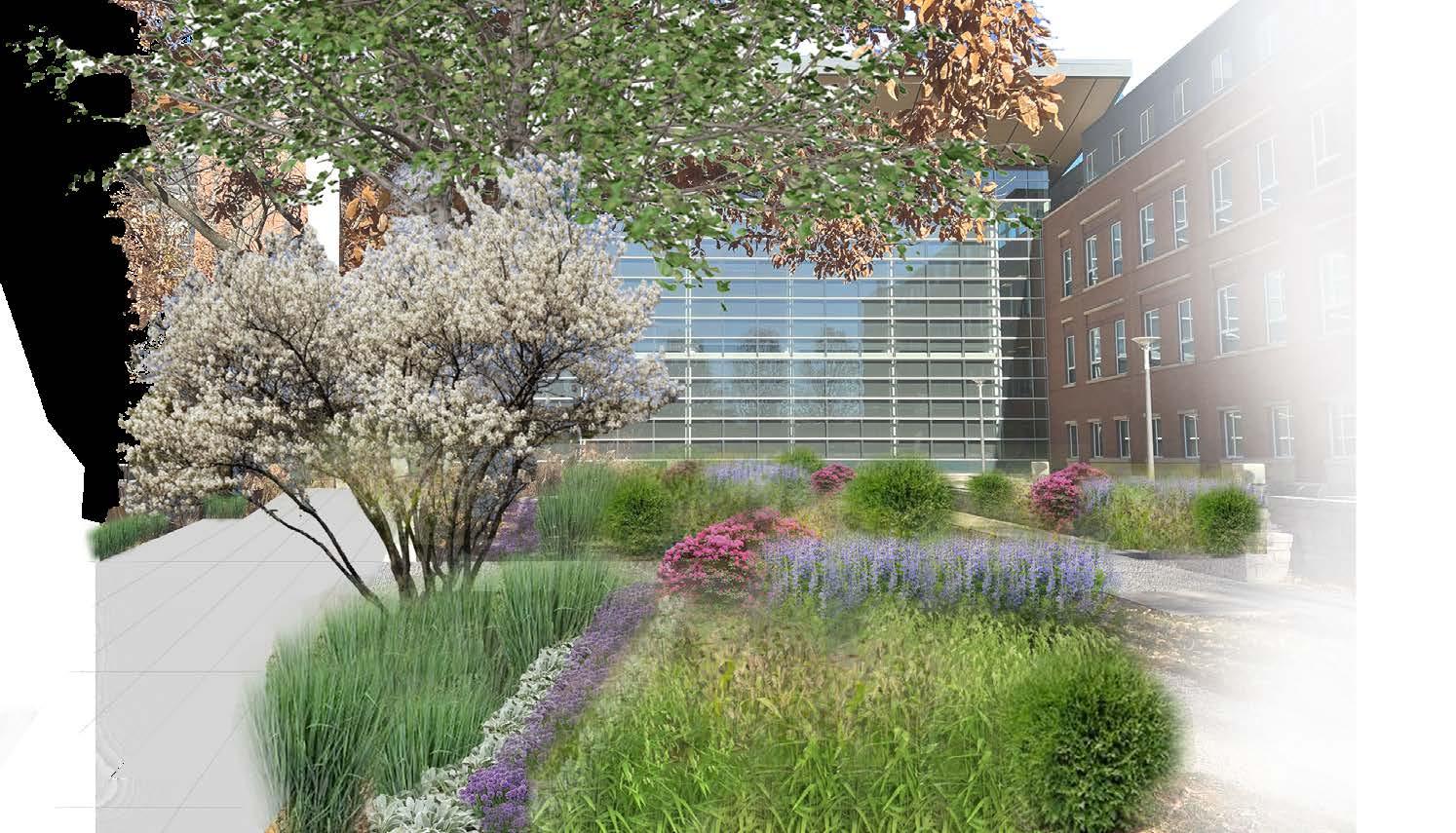
The gravel pathways allow people to experience native plants throughout the year. The garden is home to pollinators, birds, and other native insects.
Image: A perspective looking at the north showing the planting patterns created a unique rhythm in the garden.
EVERY DROP COUNTS : Stormwater Project
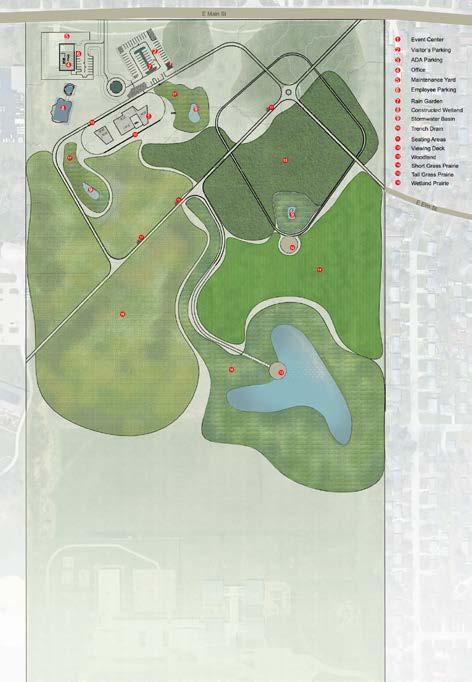
The design proposal for Weaver Park incorporates several different stormwater management techniques and recreational and wildlife activities while capturing 100% of stormwater runoff for a 50 year, 24 hour design storm.
The design proposal contains one constructed wetland, three retention basins, and utilizes the existing detention basin on site. Recreational activities include two viewing platforms for visitors and multiple seating options. Several winding trails allow for walking, running, cycling, and simply enjoying the sites natural beauty.
Instructor: Prof. Elizabeth Scott
Location: Weaver Park, Urbana, IL
Team: Vidhan Goel, Nital Gundecha, Maija Mallula, Jarin Tumpa LA 342 - Site Engineering
Site Plan Image Credit: Jarin Tumpa Grading and Stormwater Plan; Image Credit: Jarin T, Maija M, Nital G, Vidhan G
Image: Section of a constructed wetland Credit: Nital Gundecha
Each of my projects is driven by the curiosity to deeply understand the site, followed by an exploration through the creative process of drawing as a method of critical thinking. In addition to technical expertise, I offer other soft skills—particularly in active listening and effective communication. I am seeking opportunities that will allow me to nurture my skills and professional growth.
Digital Communication Portfolio: https://vimeo.com/1042219523
Master in Landscape Architecture (Fall 2022 - Anticipated May 2025)
University of Illinois at Urbana-Champaign
United States of America.
Bachelor of Architecture (July 2018)
Khulna University, Khulna, Bangladesh.
Current Position:
Research Assistant (August 2024 - Present)
Supervisor: Prof. Mary Pat McGuire, University of Illinois at Urbana Champaign.
Researching Climate Change and Landscape Architecture Education, preparing to host a panel at CELA 2025, and analyzing data for relevant studies.
Research Assistant (January 2025 - Present)
Supervisor: Prof. Elizabeth Scott, University of Illinois at Urbana Champaign.
Researching ecological benefits of GI in the Des Plaines Watershed, and exploring U.S. EPA tools and ArcGIS to measure benefits.
Software Skills:
AutoCAD
Adobe Illustrator
Adobe Photoshop
Adobe InDesign
Adobe Premier Pro Sketch Up Rhino Grasshopper
Experiences:
Summer Landscape Architecture Intern (May 2024 - August 2024)
Rundell Ernstberger Associates, Indianapolis, IN
Architect (July, 2021 - July, 2022)
Nakshabid, Dhaka, Bangladesh
Junior Architect (December, 2020 - October 2021)
Projects of BRTC, Acoustic & Interior Consultant: S M Najmul Imam (Professor, Department of Architecture, BUET), Dhaka, Bangladesh
Conference Presentations:
Third Landscapes for Flood-Resilience: Locating the Missing Scale of Green Infrastructure in Neighborhoods in Khulna, Bangladesh (CELA 2025 Annual Conference)
- Oral Presentation, Conference Track: Resilience and Climate Action, Authors: Jarin Subah Tumpa, Mary Pat McGuire
Climate Change and Landscape Architecture Education: Transformations and Expansions in Curriculum and Pedagogy Towards Future Practice (CELA 2025 Annual Conference)
- Panel Session, Conference Track: Design Education and Pedagogy, Authors: Mary Pat McGuire, Joshua Cerra, Rosalea Monacella, Brett Milligan, Aida Curtis, Jarin Subah Tumpa
Services:
Student Representative to the FAA College’s DEIA Committee (August 2024-Present)
- Attended meetings as a student representative and engaged with the FAA Associate Dean, faculty, staff, and students to increase diversity, equity, inclusion, and access in the college.
MLA Student Representative to the LA Department Faculty Meeting (August 2023-May 2024)
- Participated in the Landscape Architecture faculty meeting for principal governing and policy-making as a graduate student representative.
Global Educators at International Student and Scholar Services (ISSS) (August 2023 - May 2024)
- Organized international student events, and trainings with other student volunteers.
Member, Garden Committee (August 2023 - present)
- Developed a planting design for the courtyard garden of Temple Hoyne Buell Hall, and worked in stewardship sessions for the garden maintenance.
Member, 2024 Charrette Planning Committee (September 2023 - March 2024)
- Attended meetings with faculty members for organizing the design charrette, engaged in developing the brief and participated as a student leader with the Living Habitats team during the charrette.
Awards/ Honors:
Sasaki Day Award (2024)
- Third Landscapes for Flood-Resilience: Rethinking Scales of Green Infrastructures in neighborhoods in Khulna, Bangladesh (Level T)
MLA Nominee for the LAF Olmsted Scholars Program (2024)
- The LAF Olmsted Scholars Program recognizes and supports students with exceptional leadership
Edward L. Ryerson Traveling Fellowship in Landscape Architecture (2024)
- Excellence in landscape architecture through travel and study outside of the United States
Gold mention for Commercial Green Building for IDCOL (2019)
- A design competition organized by Institute of Architects Bangladesh (IAB)
Architect (October, 2018 - December, 2020)
Indigenous, Dhaka, Bangladesh
Honorable mention for Commercial Green Building for BERC (2020)
- A design competition organized by Institute of Architects Bangladesh (IAB)