1 minute read
TAIPEI RIPARIAN


A PATH ACROSS THE CITY'S BOUNDARY
Advertisement
PURPOSE : Design Competition Project
DURATION : Oct.2019-Dec.2019
WORKING TYPE : Team Work
CHARGING : Design Process, Final Board
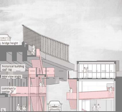
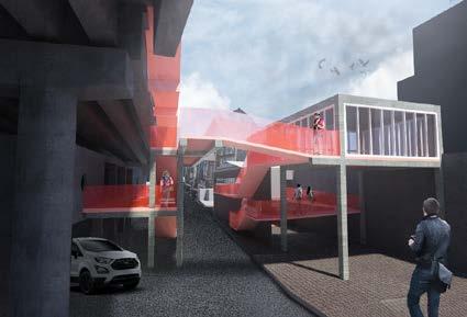
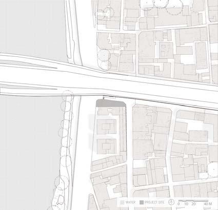
Like other cities, Taipei’s development started with the development of the Dan-Sui river. The riverside has changed throughout the years. The city’s boundary was expanded, and the river space has been narrowed down. Other than that, due to Taiwan being located in an area that will frequently generate typhoons, floods are constantly happening in Taipei. Then, the government erects a series of floodwalls, the height reaches 8 meters. It cut off the connection between citizen’s life and the nature of the river. This project’s site is in an old town area that besides a bridge.The area’s environmental
PROJECT TYPE : Community Exhibit & Path
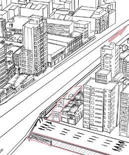
SITE LOCATION : Da Tong Distric, Taipei
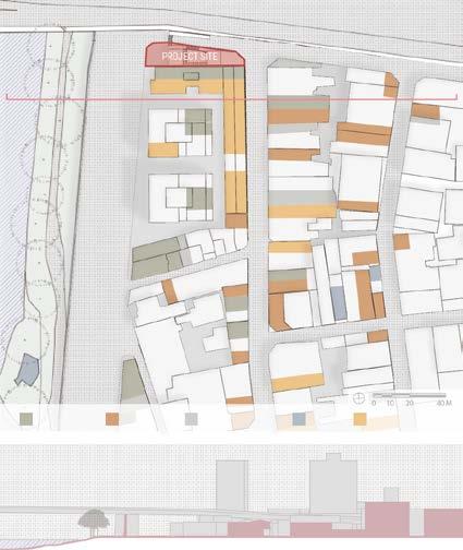
KEY WORDS : Connection, Boundary, Community History Preservation scale maintained a pedestrian-friendly scale that was designed in the past. The new construction of the bridge and the six-lane road was aimed at the city’s function, which become a huge barrier to environmental connection. Despite the low accessibility created by the barrier, there is still an 8 meters floodwall. Although the bridge has stairs and pavements, the space experience is closed and inaccessible. Coping with this reality, this project rearranges the space based on the original structure and creates a highly accessible communication path and public space in the neighborhood. new industry old industry abandoned house temples cultural industry
RESEARCH : Industry & Environment
PROGRAM : Exhibition & Connecting Path
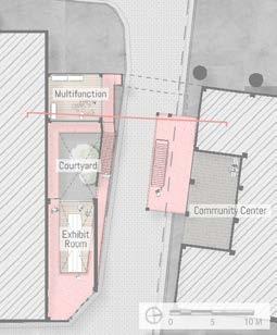
By collecting space information nearby, the surrounding neighborhood has rich historical resources and a community center isolated under the bridge. Tackling those drawbacks and lacking a connection to the riverside, the new program will provide a better function to the community.