SELECTED WORKS 2024
JAHANVI NAHATA PORTFOLIO


SELECTED WORKS 2024
I am a relentless pursuer of excellence, constantly striving towards my goal of a better tomorrow for all. Architecture and Urban Design are not just my profession, but my very passion and toolkit to make a difference. An Artist and Humanitarian at heart, I yearn to imbue each design with purpose and hope for generations to come. With every blueprint, I wish to sketch a brighter future, where the urban fabric entwines with the social realm as one to breathe with life, cradle memories, and become a canvas for shared joy.






03 02 01 04 05 06 07 08
ROOTSTOCK-ING
CENTERING MAROON PRACTICE IN JAMAICA
EFFLUENCE TO AFFLUENCE
CULTIVATING FOOD SECURITY IN JAMAICA BAY
ATLANTA AFTER PROPERTY
GARDENS WITHIN GARDENS
MIXED USE HIGH DENSITY URBAN DEVELOPMENT
ELEMENTAL HOUSE
FARMHOUSE IN RAMMED EARTH CONSTRUCTION
SANGHIYA SANSAD BHAWAN
PARLIAMENT COMPLEX, SINGHA DURBAR, KATHMANDU
SPINNER
INTERNATIONAL CRICKET STADIUM, GHAZIABAD
OCULUS
URBAN DESIGN, GREATER KAILASH 1 N BLOCK, NEW DELHI
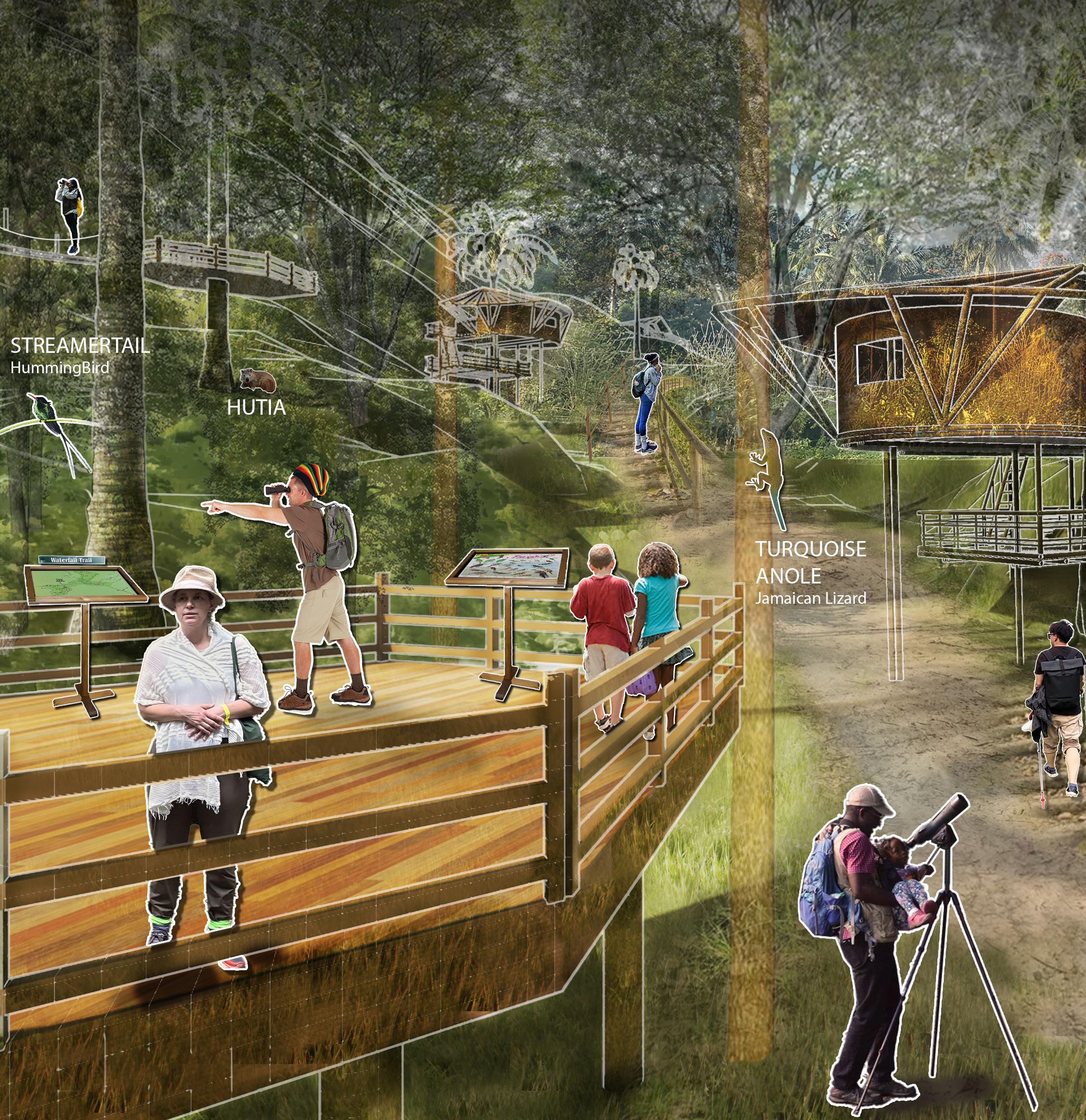
ESTABLISHING MAROON STEWARDSHIP IN THE BLUE MOUNTAINS, JAMAICA
Year
Location Area
Guides Category
Role Spring (2024) Blue Mountains, Jamaica
-
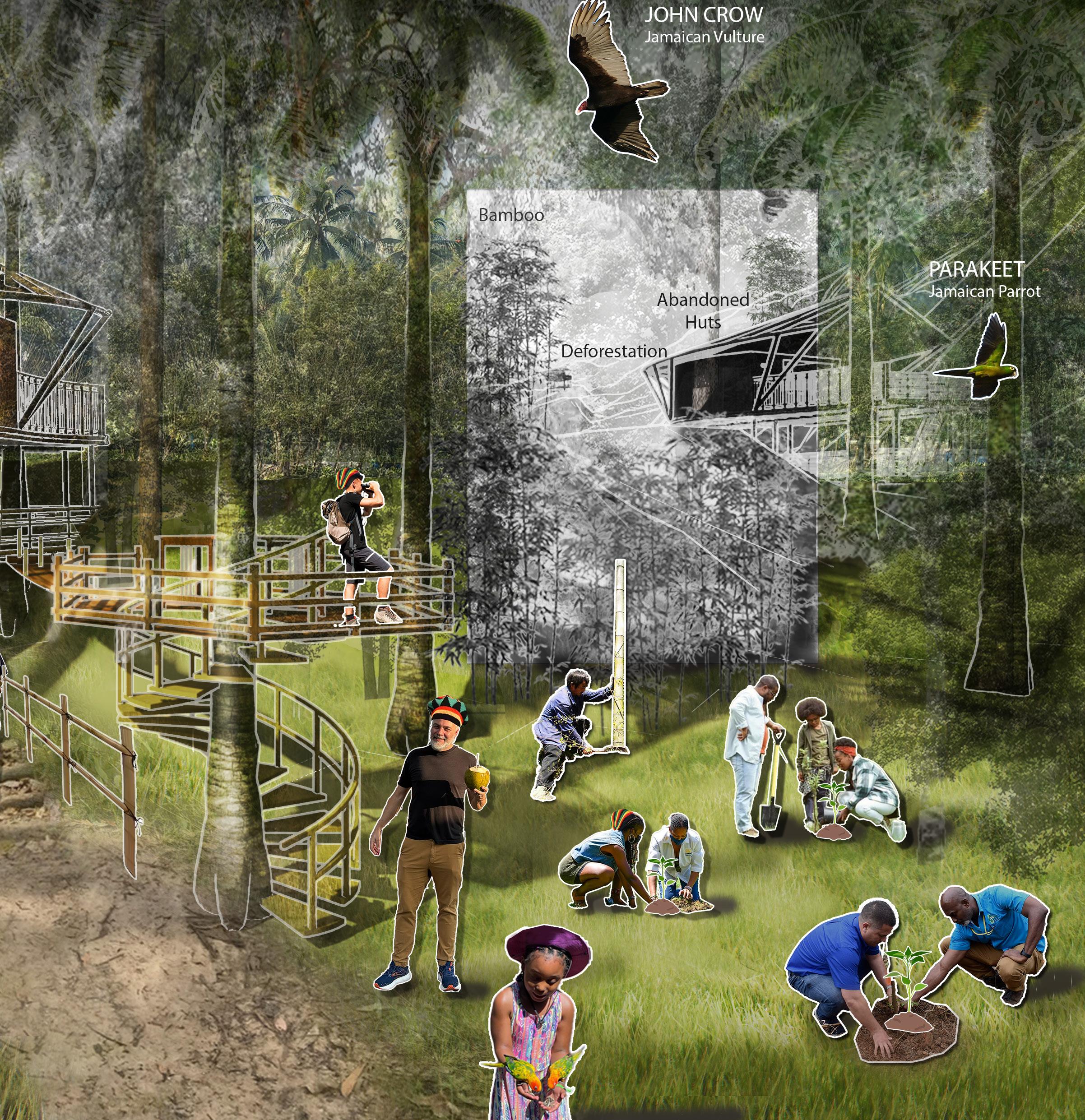
EYELEVEL VIEW: FOREST UNLOCKED - AUTHOR
The idea of rootstocking is to graft a new sapling onto old roots to create a stronger plant. In the same way, we hope to use education as a way to enhance existing maroon cultures, address the needs and concerns of the Maroons, and create opportunities from this strong foundation. Our project seeks to become an extension of our experience, an educational fellowship headed by Maroons that stretches into the deeper reaches of the Blue Mountain and beyond, an initiative that serves as an alternative to extractive tourism, one that seeks to recenter maroon
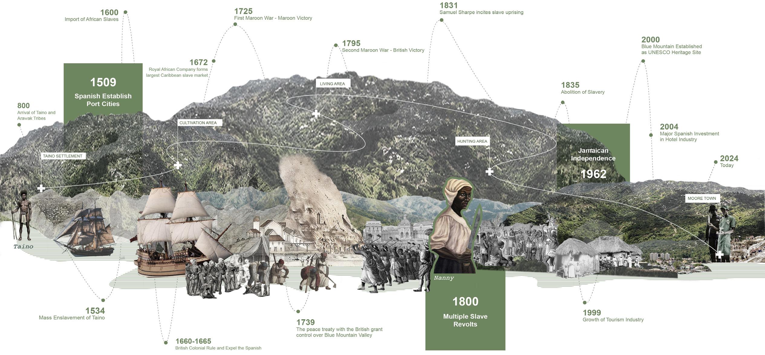
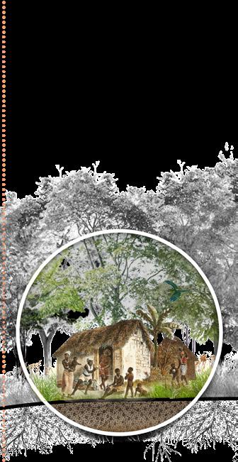
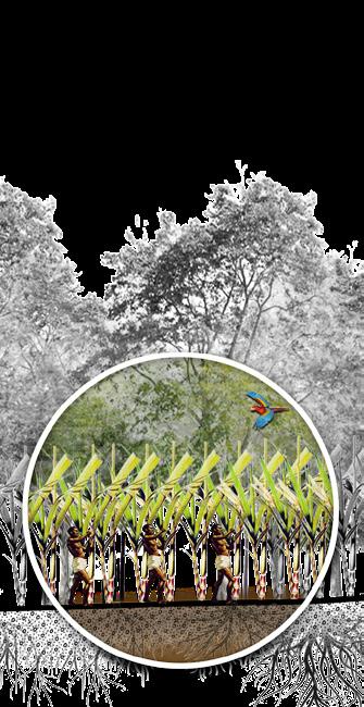
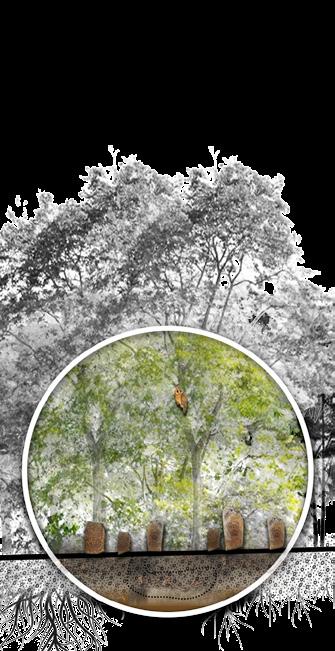
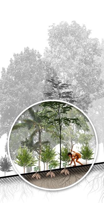
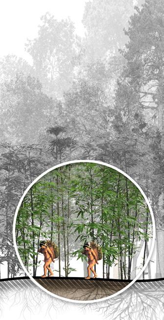
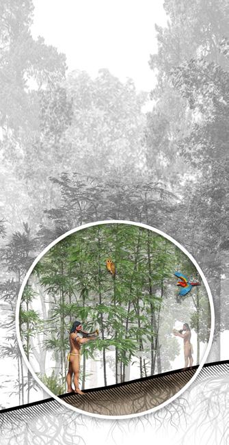
The earliest settlers Tainos, whom Spanish colonizers enslaved in the 1530s along with imported slaves in Jamaica. In response to the violence, some slaves escaped to the Blue Mountains and became known as the Maroons. Under the leadership of “Queen Nanny” they waged war against the British colonists in 1740, ending in a peace treaty granting the Maroons their freedom and 500 acres of land known today as Moore Town.
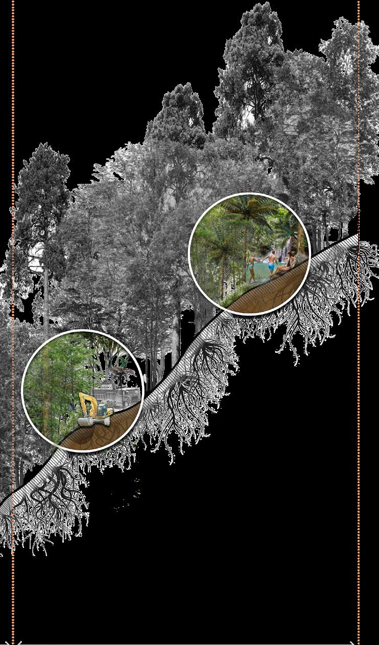
WATERFALL, SPRINGS TOURISM, RECREATION, CATCHMENT
MINING MINERALS
WET SLOPE FOREST
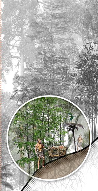
JERKING FOOD WITHOUT SMOKE
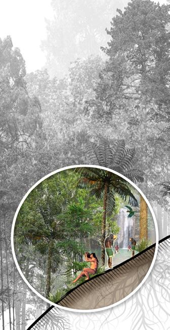
WATERFALLS/ SPRING POTABLE WATER HEALING,
NATIONAL PARK MANAGEMENT FOREST PRESERVATION
LOCAL PILGRIMAGE SPIRITUAL, FUNERARY
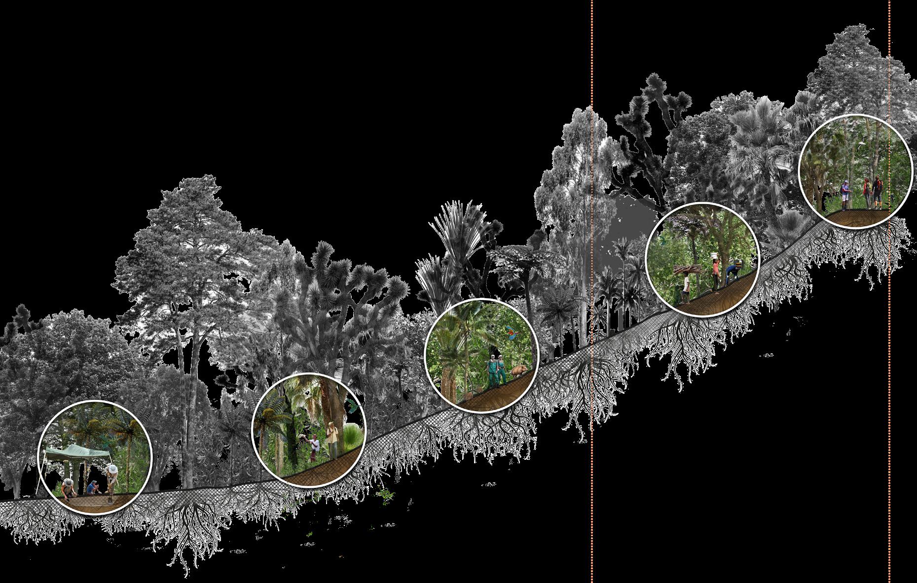
ARCHAELOGICAL EXCAVATION FORMER NANNY TOWN
GATHERING HERBS, FIREWOOD TOURISM TREKKING, BIRD WATCHING, NATURE WALKS
OF MARRONNAGE
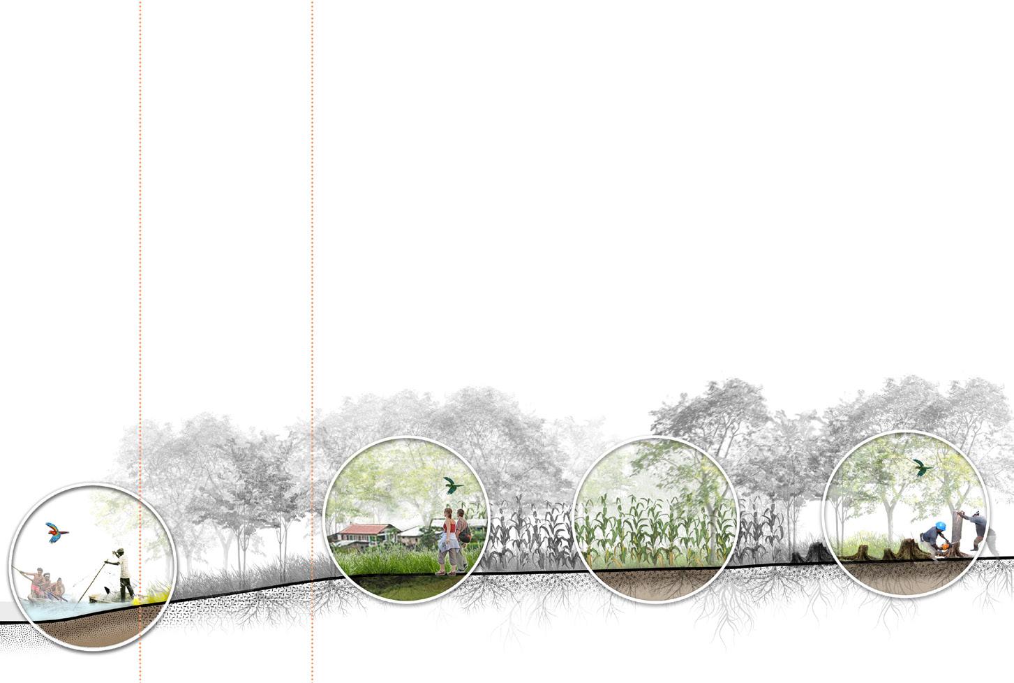
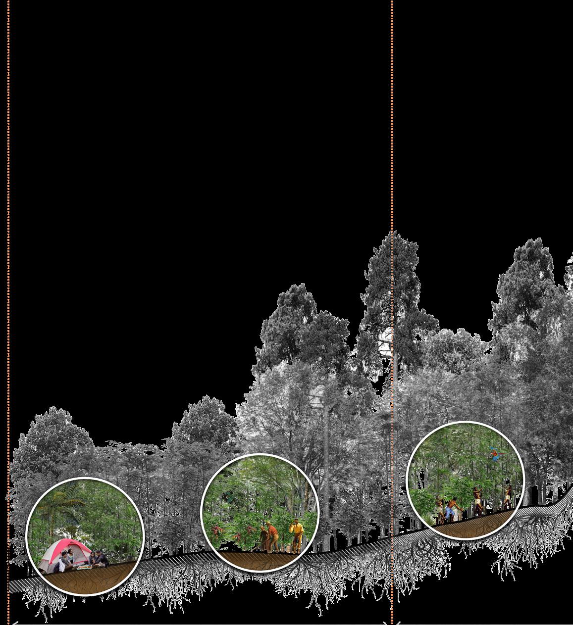
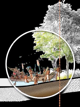
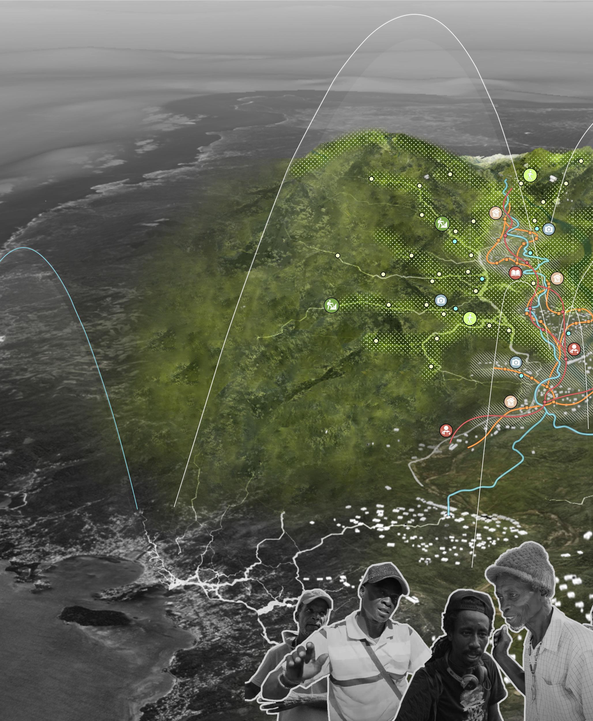
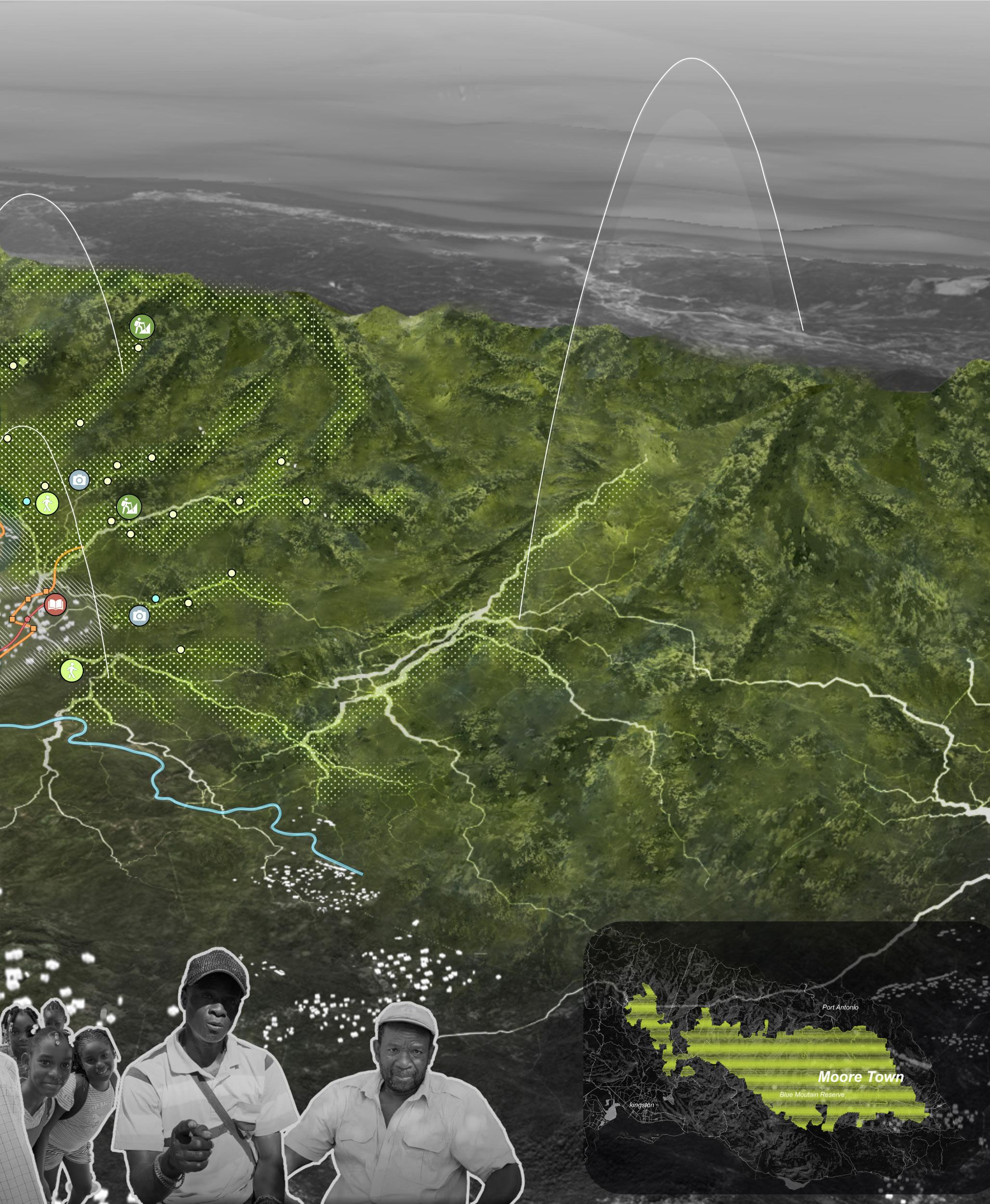
Beginning from the peak of the mountain, historically, the Maroons relied on its resources for security as well as sustenance, forming an inseparable bond with the landscape. Isolated by circumstance, the maroons are currently Located within the national park buffer zone. Where they exercise their autonomous rule from the Jamaican government, exempt from taxation but also cut off from general infrastructure.
LANDSCAPE OF MARRONAGE (CURRENT)
WET LIMESTONE FOREST
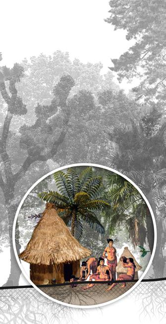
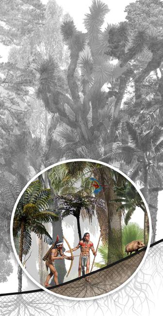
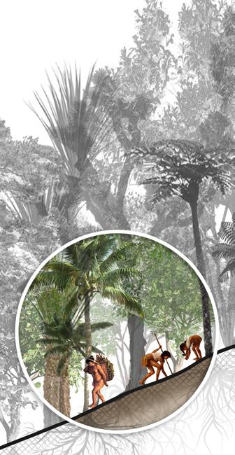
- AUTHOR
HIGH ALTITUDE RIDGE FOREST
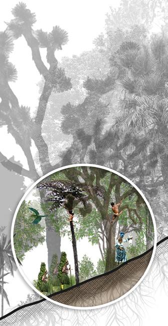
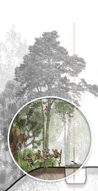
FELLOW’S JOURNEY
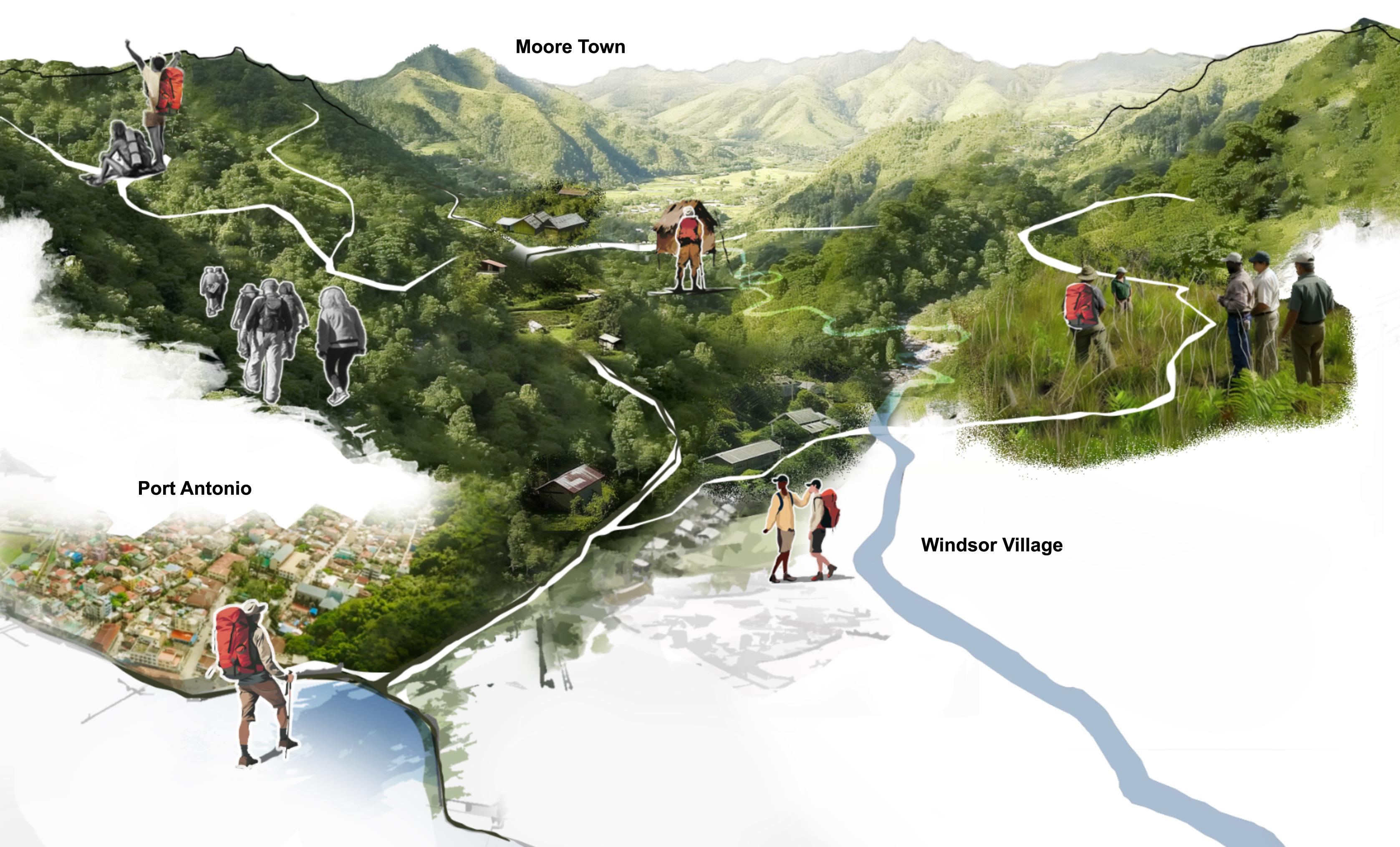
The Climate and Cultural Immersion Fellowship experience built around the journey which former maroons have paved over the centuries, immersing them in the landscape and encouraging interaction between them and locals. Expanding the knowledge of Maroon culture beyond the local confines to beyond, also reinstating Maroon stewardship of the Blue Mountains.
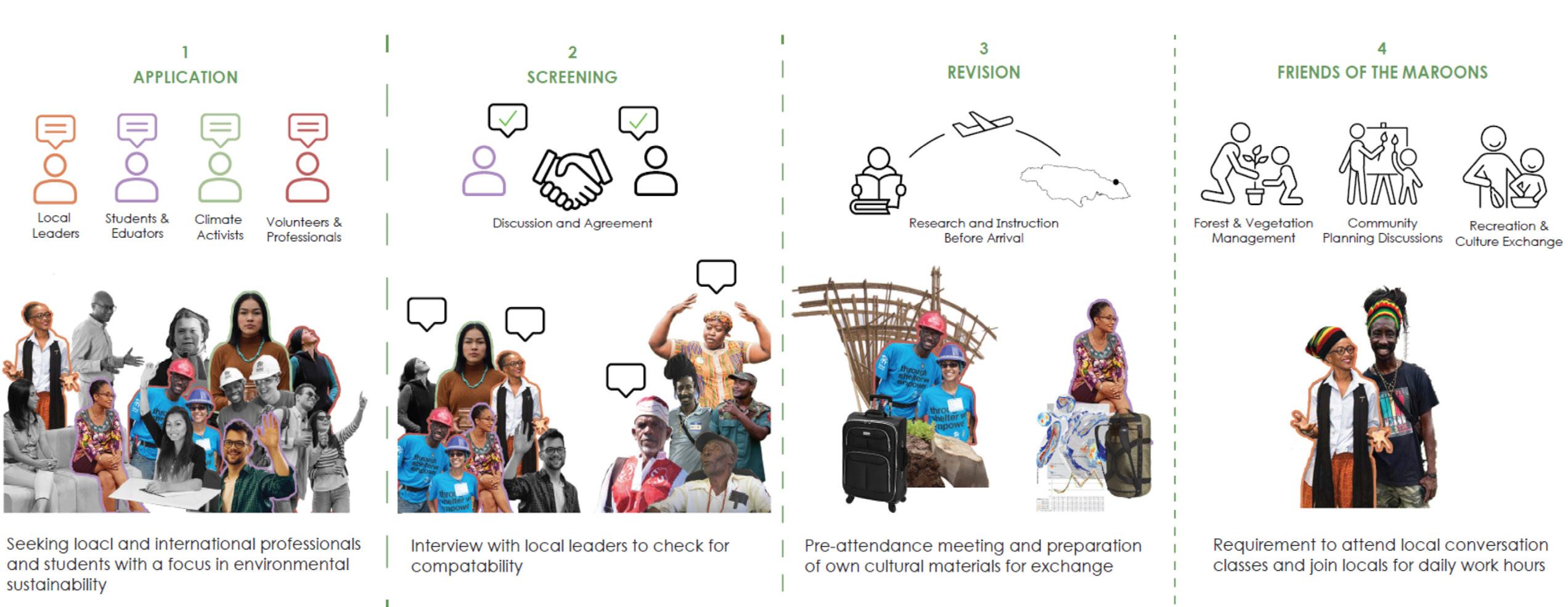
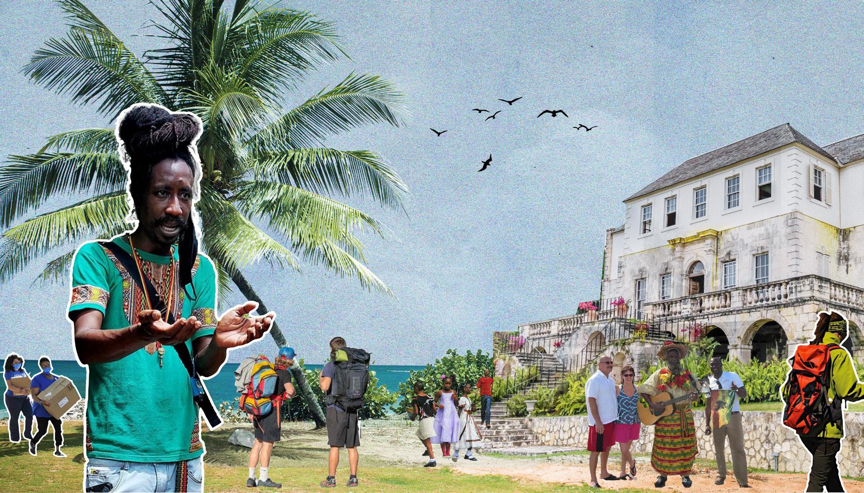
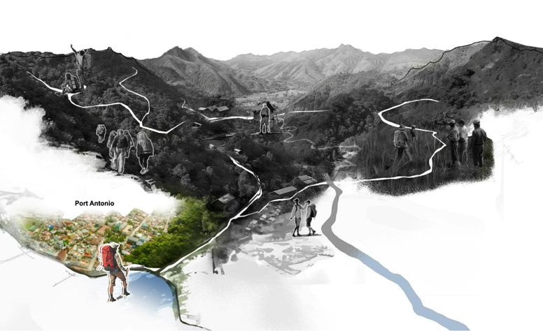
Starting from Port Antonio, where former Maroons would have once entered as slaves before they escaped into the mountains. Fellows gather at repurposed old plantation houses by the Port Harbor where they are briefed, and come to community agreements before venturing into their escape from the plantations, just like the Maroon slaves would have once done.
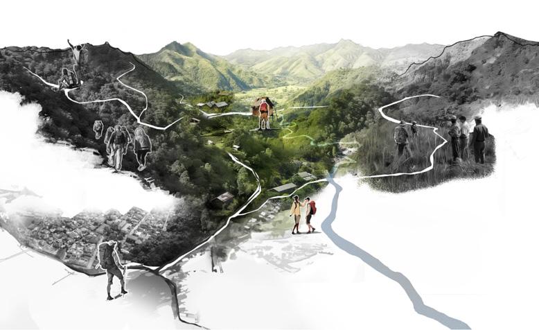
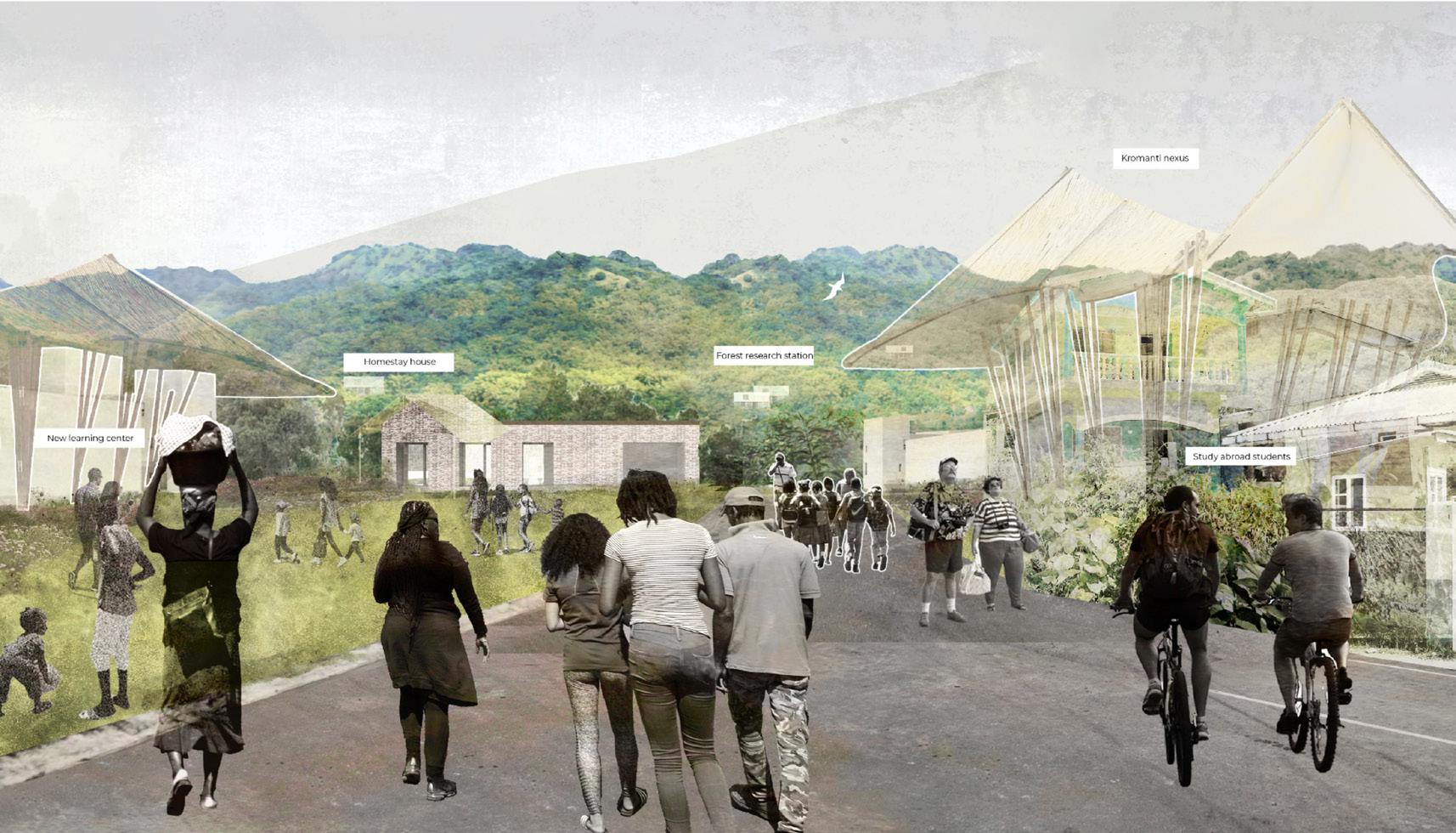
These villages in the valley form a spiritual gateway, guarding entry to the blue mountains. Where the interventions come together transforming Moore Town and other Maroon villages as a network of learning, becoming the key to facilitating cultural exchange through the fellowship program.
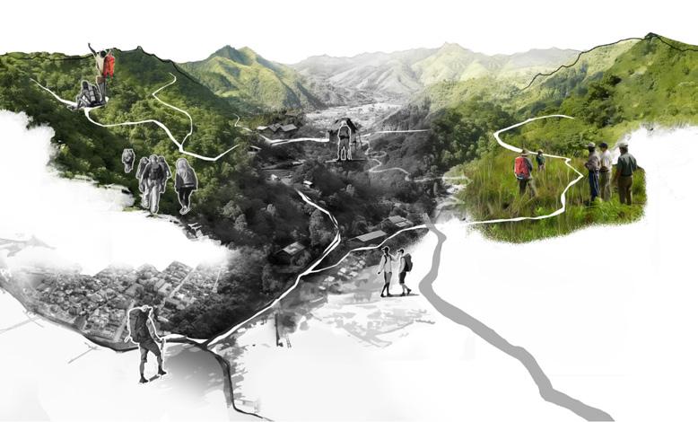
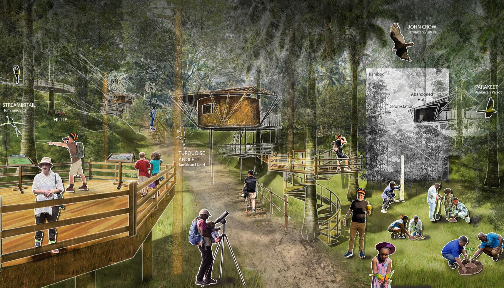
The journey then extends into the Blue and John Crow Mountains. The forest is set up as a learning hub for people from all walks of life. Huts become research stations and homestays entrenched in this majestic landscape, to understand the forest as the Maroons while others share what they know to help maintain balance in this site of great heritage.
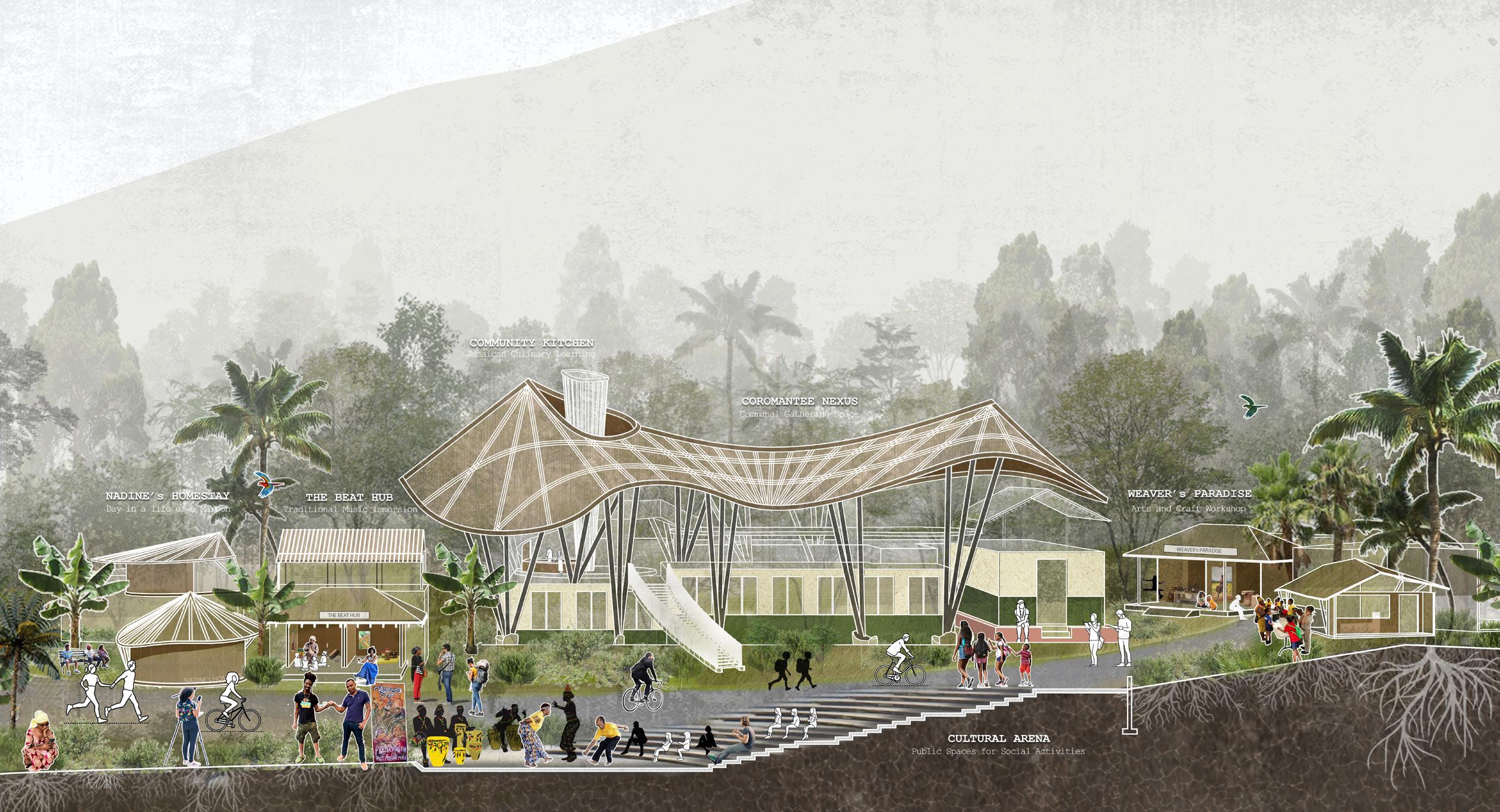
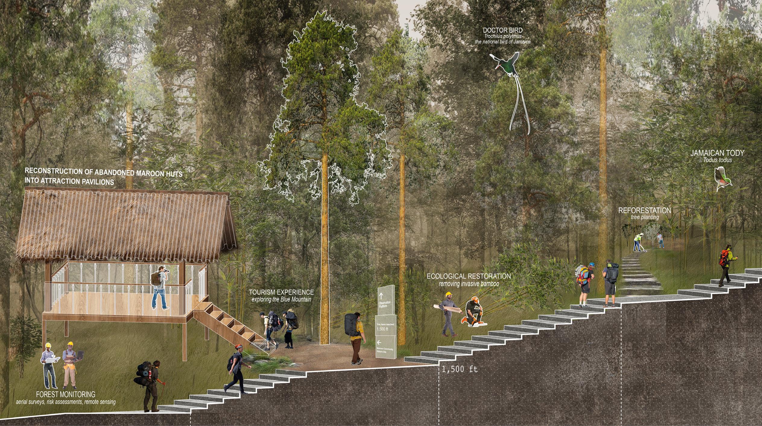
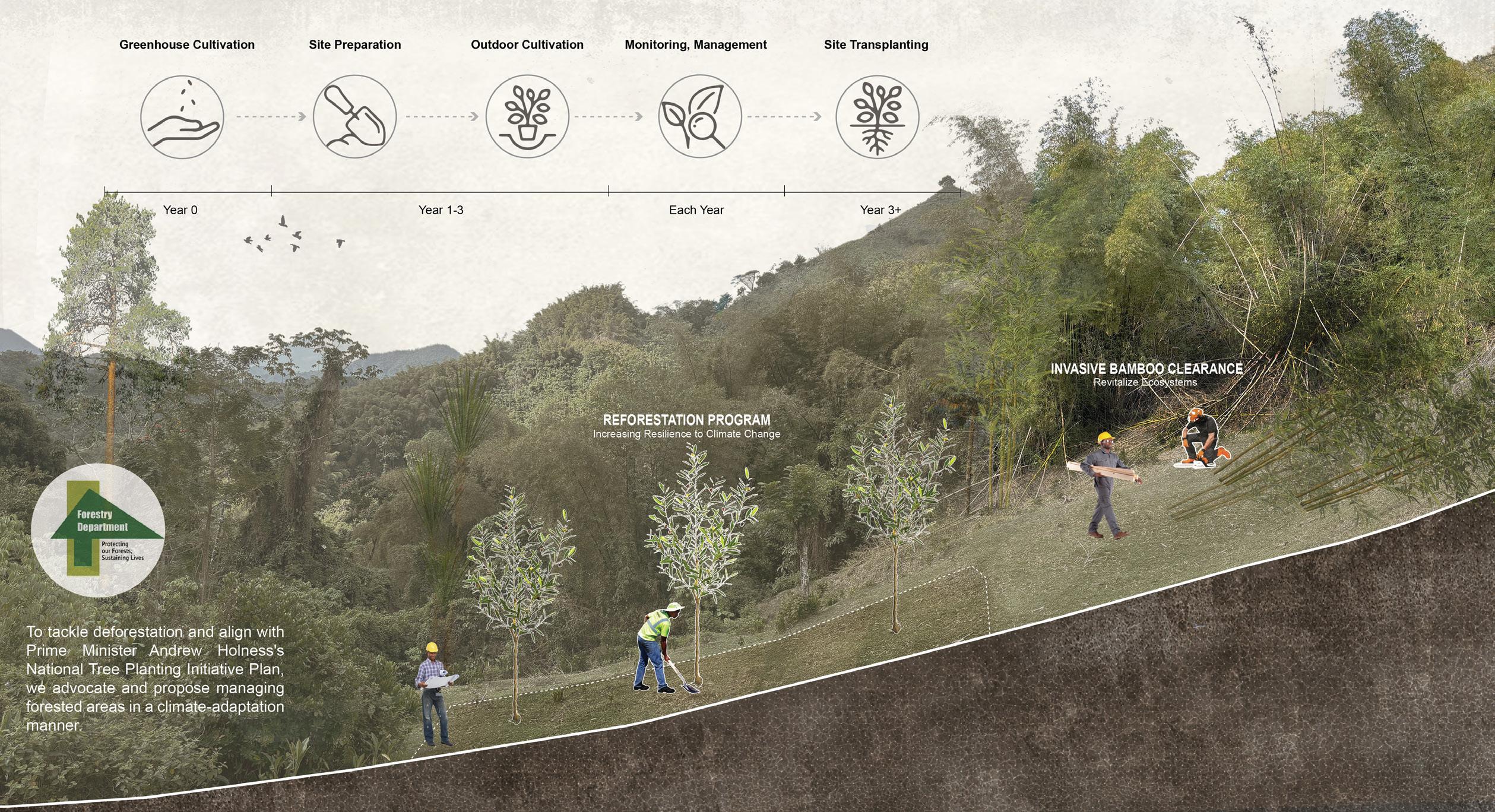
The proposed trails in the forest give fellows close contact with the Blue Mountain Forest Park. At the same time, by laying trails, we will also introduce fellows into the forest to explore the historical traces of the Maroons community. We intend to rebuild the abandoned maroons huts into forest pavilions for fellows to watch birds and rest. While giving back to the foresst and its stewards through replantation, research and bamboo removal among others.
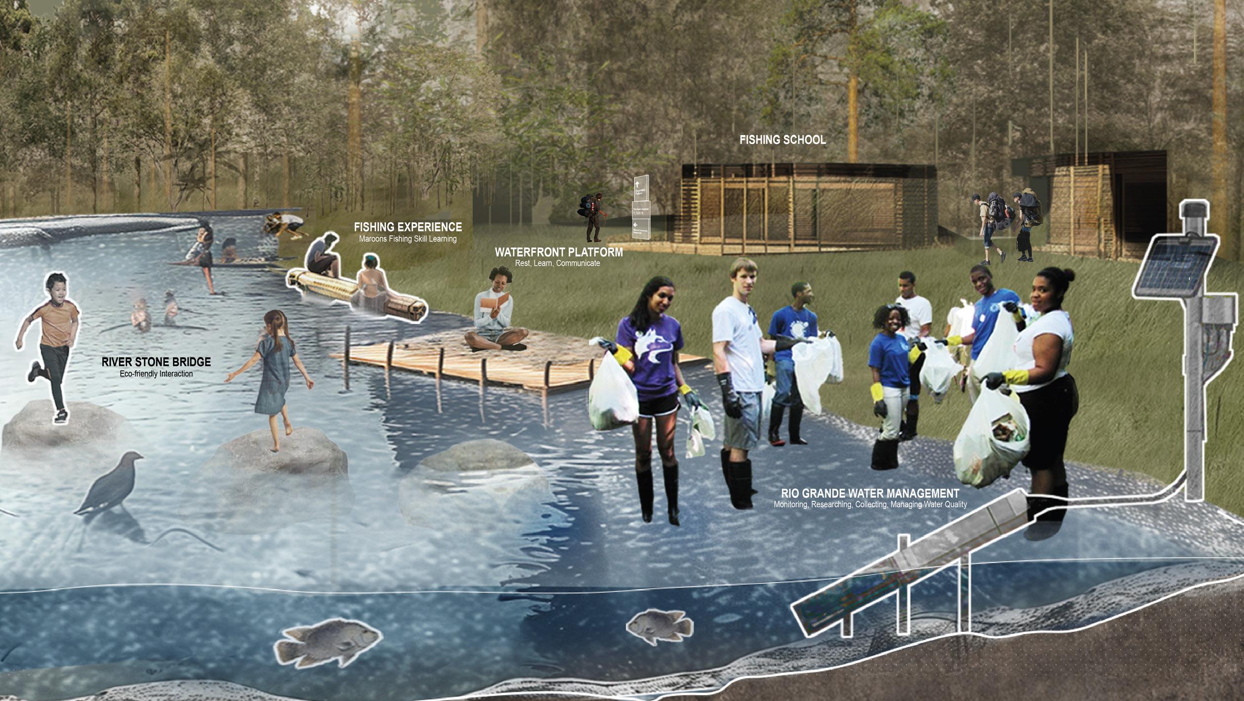
We also imagine the riverfront as another interactive space between people and nature. Our goal is to craft a gathering place where individuals can connect and discover the wonders of the Rio Grande and river network throughout the Blue Mountain. These activities encompass learning fishing skills, conducting water research, and monitoring its ecosystem.


CULTURAL CENTERS
HOMESTAYS
“Space to accomodate the culttural and educational activities. “ HOMESTAY
“Re- inherit the Forests”


“Until the lion story will always



RESEARCH EDUCATION HIKING TREE PLANTATION
UNLOCKING THE
STEPS, AND SUPPORT TO ACCESS THE FOREST
REPURPOSED ABANDONED HUTS FOR RESEARCH
learns to write, every always glorify the hunter. “
BRIDGES, FISHING AND HUNTING SCHOOLS
“Need more job opportunities to keep the youth in the villages. “
Year Location Area
Guides
Category
Role Summer (2023) Jamaica Bay, New York
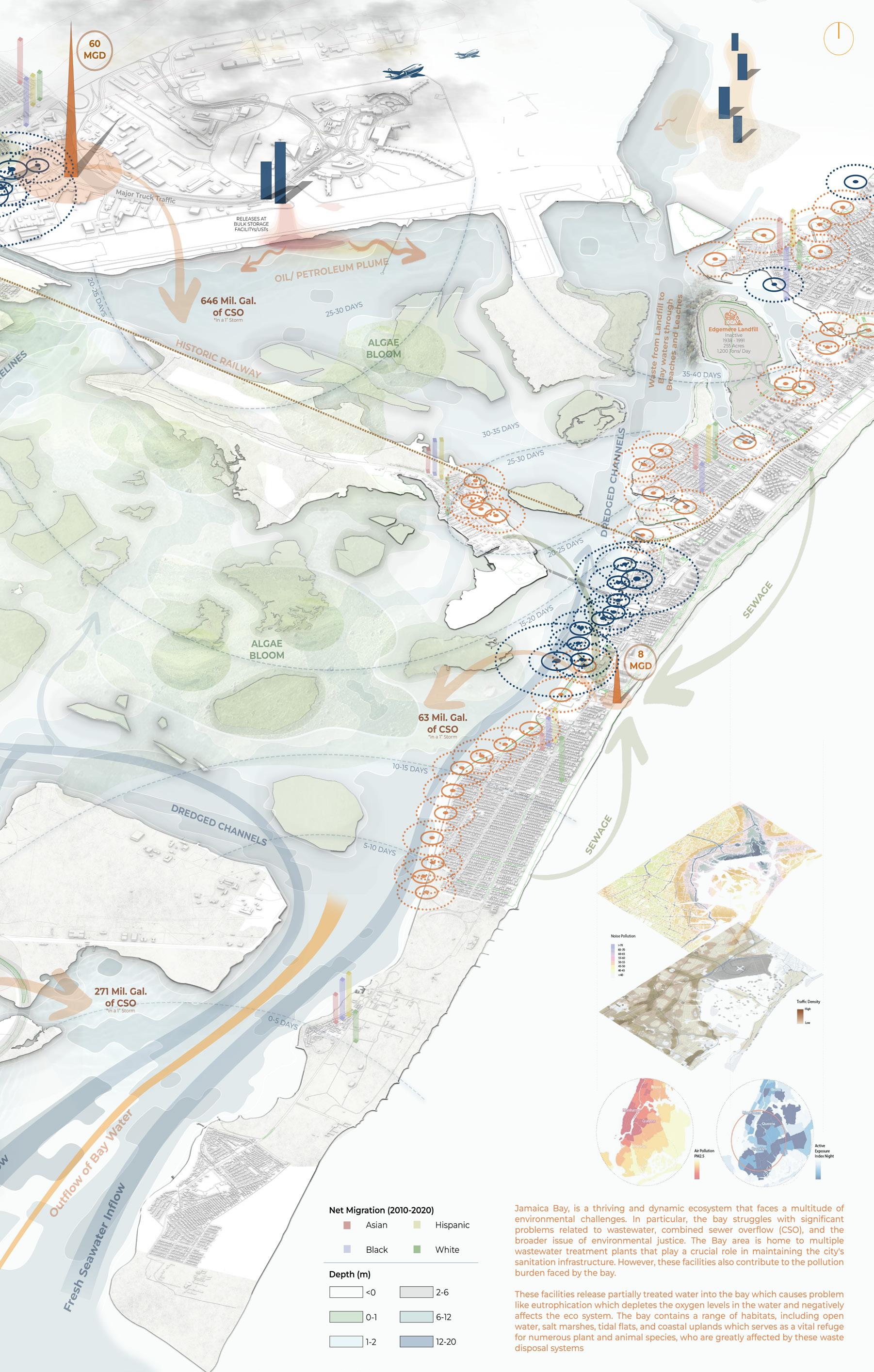
CONSTRUCTING SITE ISOMETRIC -AUTHOR
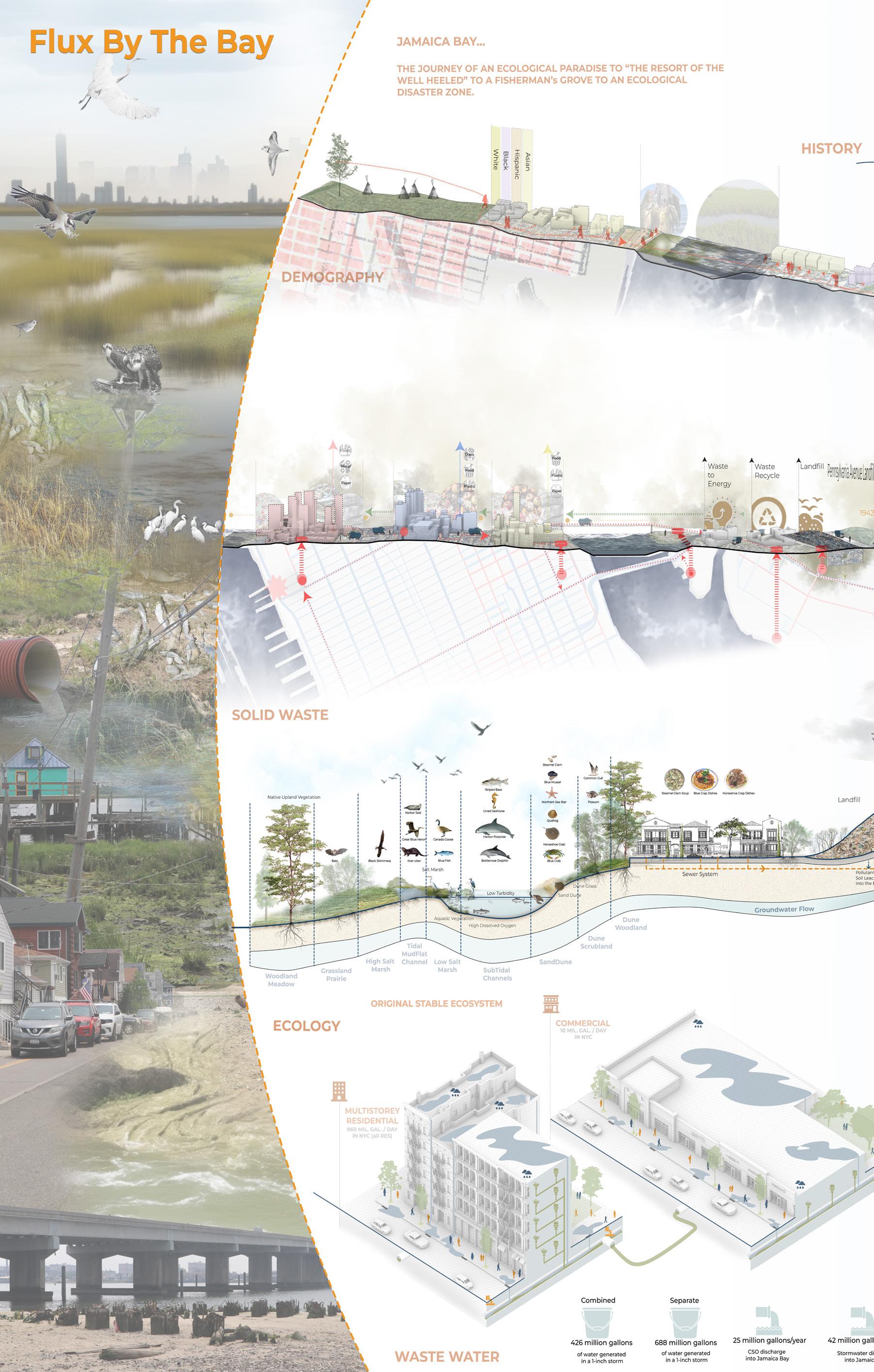
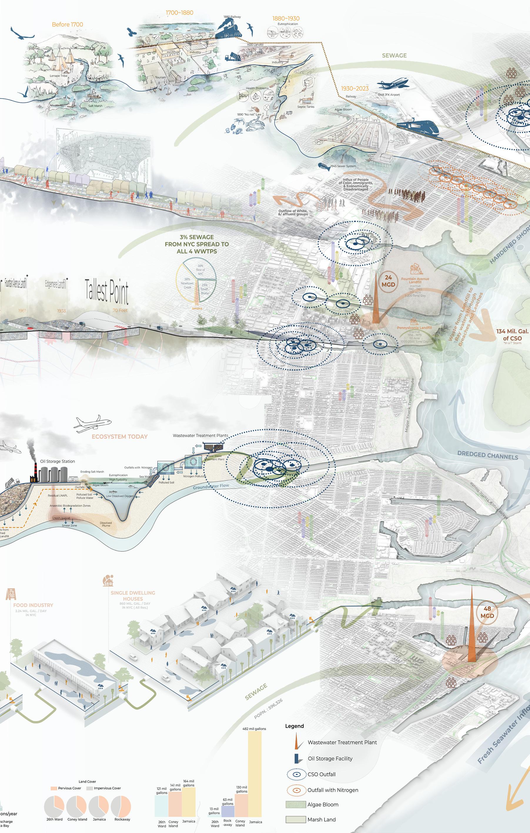
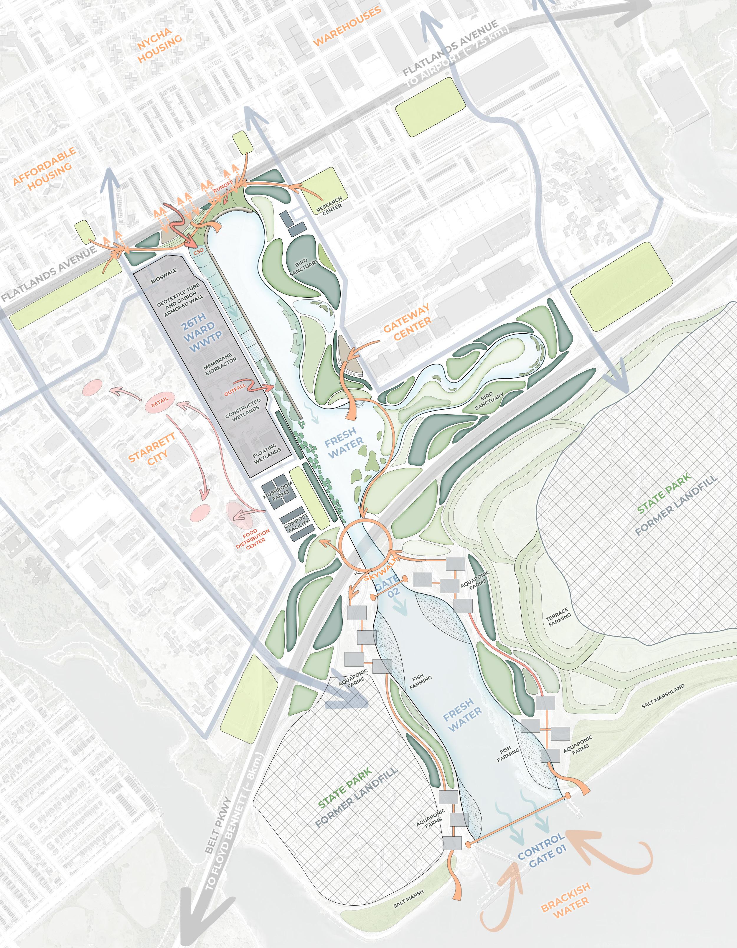
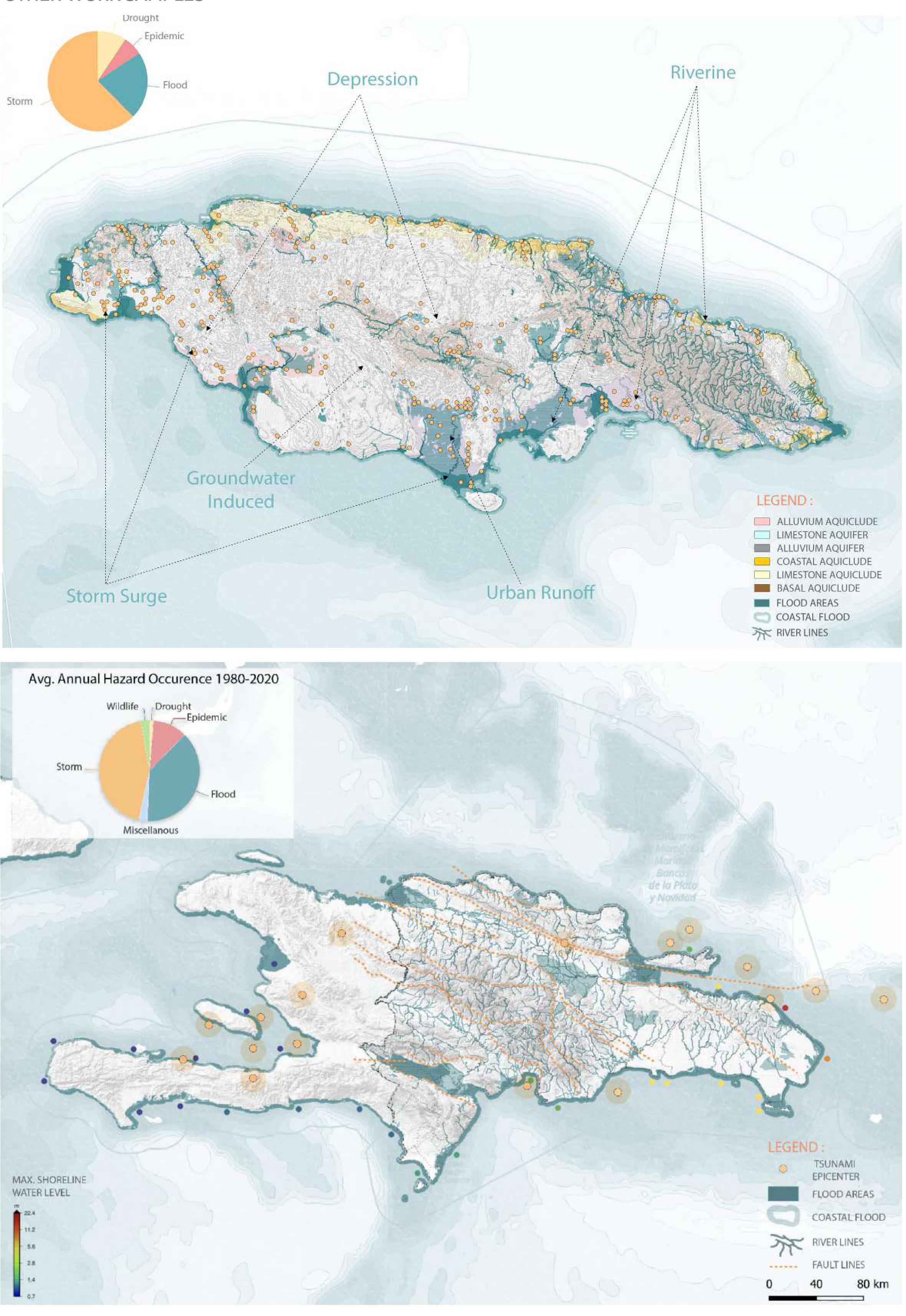
Jamaica Bay is a thriving and dynamic ecosystem that faces a multitude of environmental challenges. In particular, the Bay struggles with significant problems related to wastewater, combined sewer overflow (CSO) , and the broader issue of Environmental Justice. The bay area is home to multiple wastewater treatment plants that play a crucial role in maintaining the city’s sanitation infrastructure, however is causing pollution in the bay that is not only affecting the residents of the area but also causing irreparable damage to the ecosystem. This project Effluent to Affluent is one targeted to transform Jamaica Bay from a converging point of waste to a divergent one providing food to the city, and providing economic resilience to its residents.
CULTIVATING
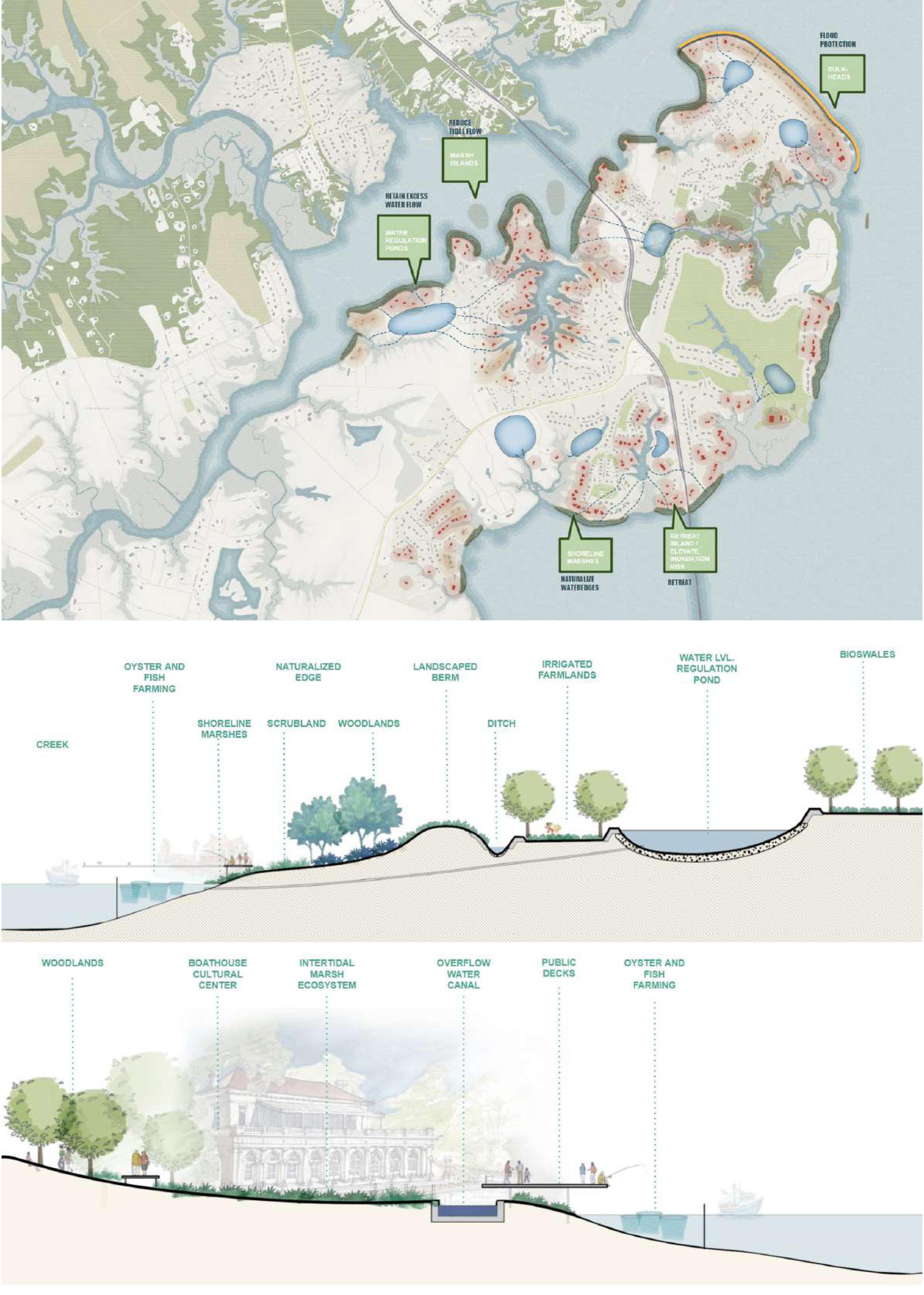
Taking two wrongs to make one right, in the process of cleaning the water discharged into Jamaica Bay we generate a food economy based on aquaponics as illustrated alongside.
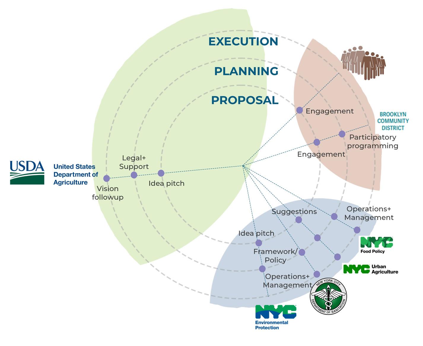
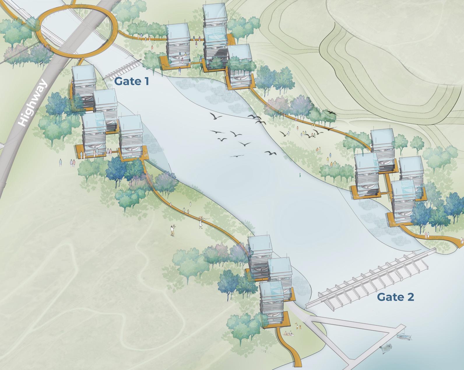
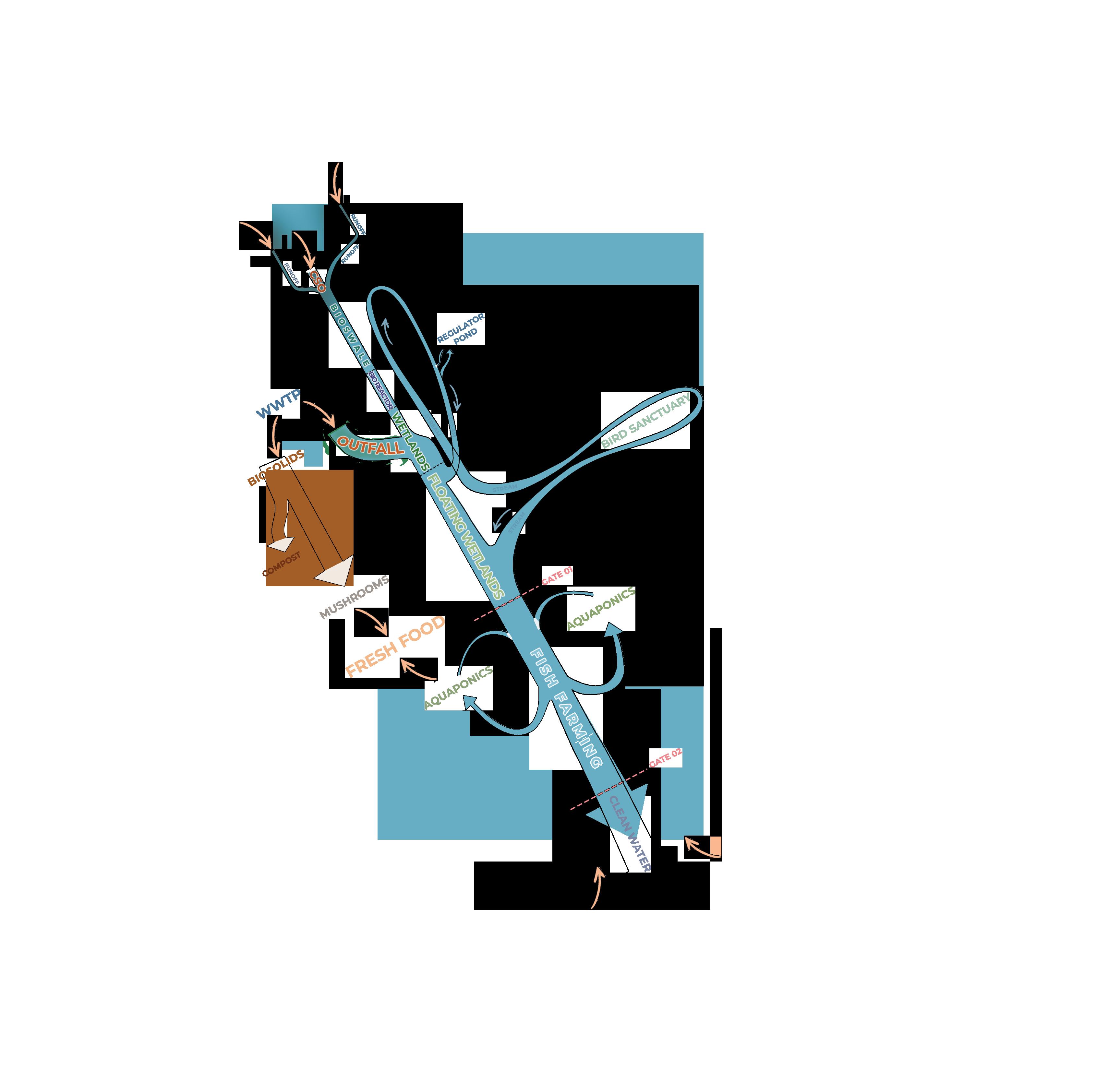
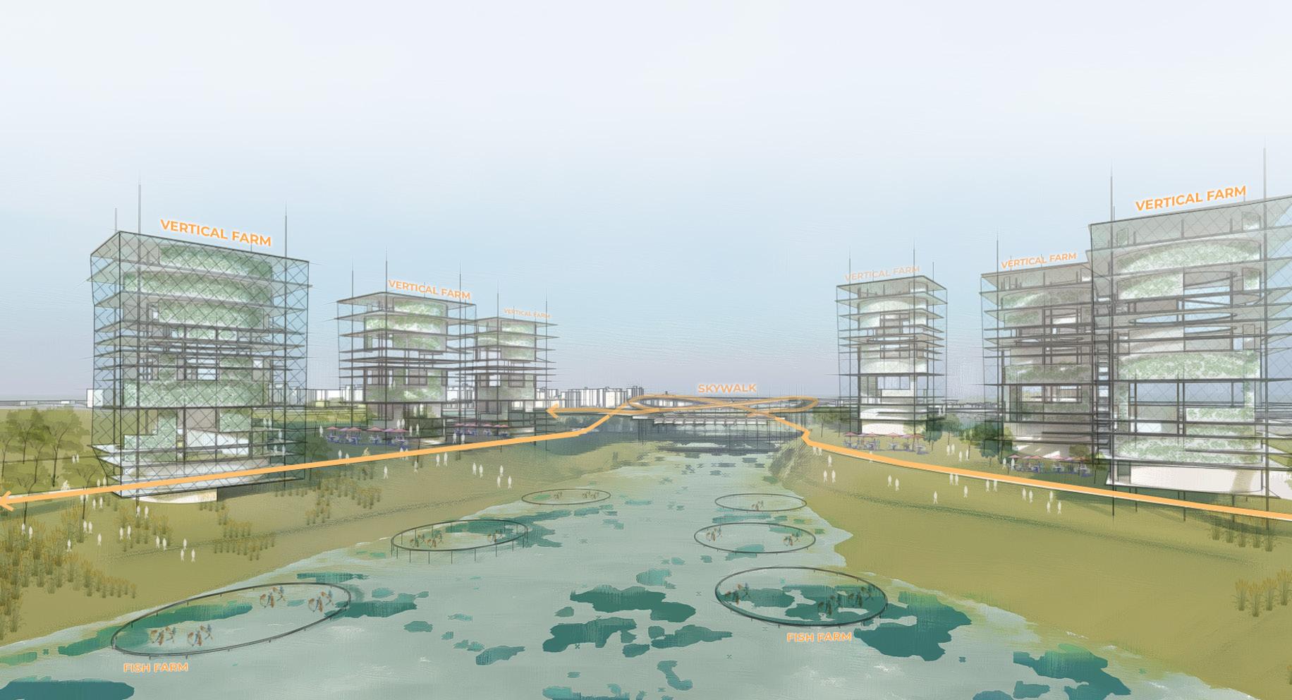
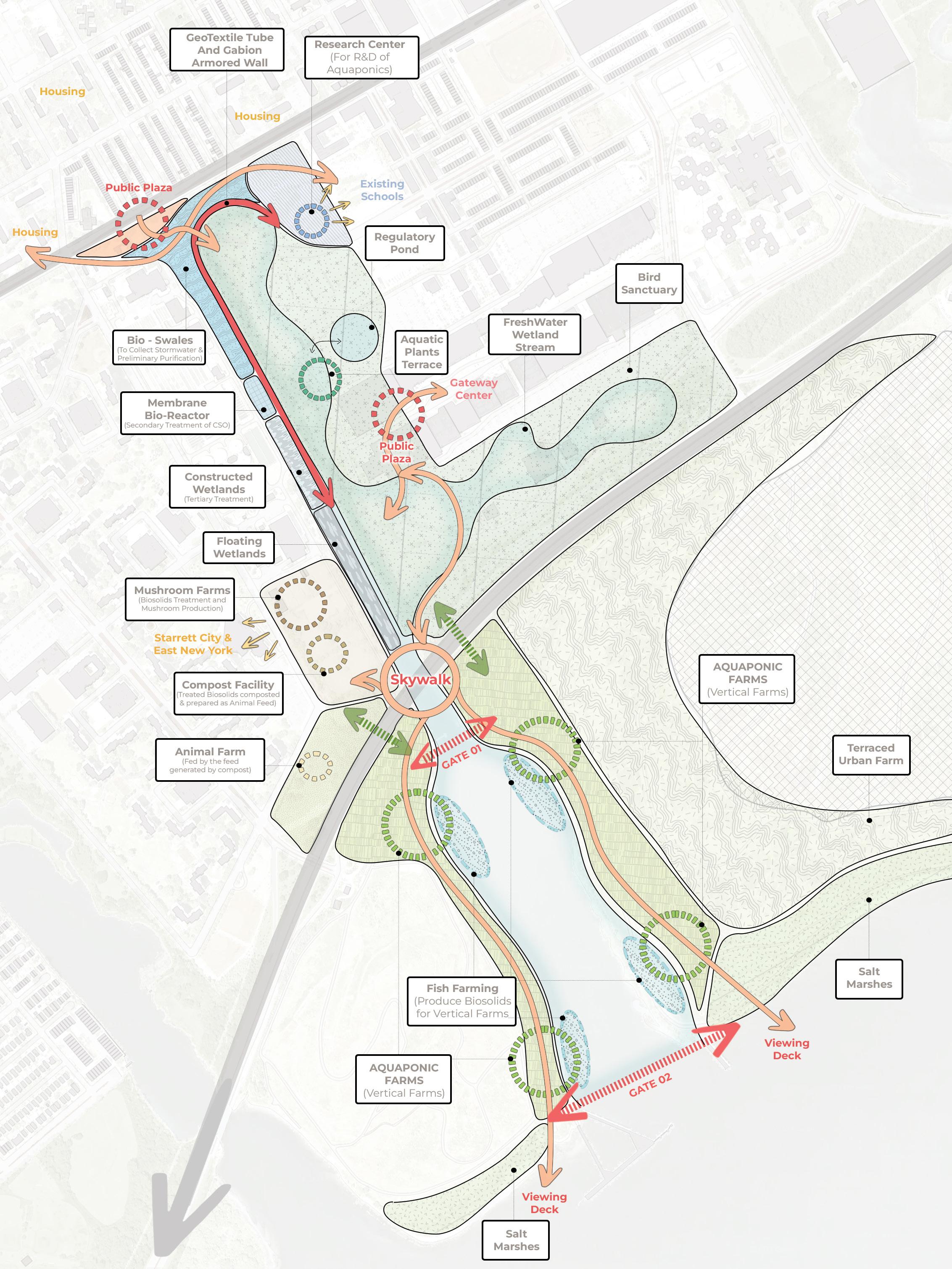
The vision is to create a prototypical development of food generating system along one of the channels that can be further replicated across the channels in Jamaica Bay ensuring Bay health as well as human health of those living around it.
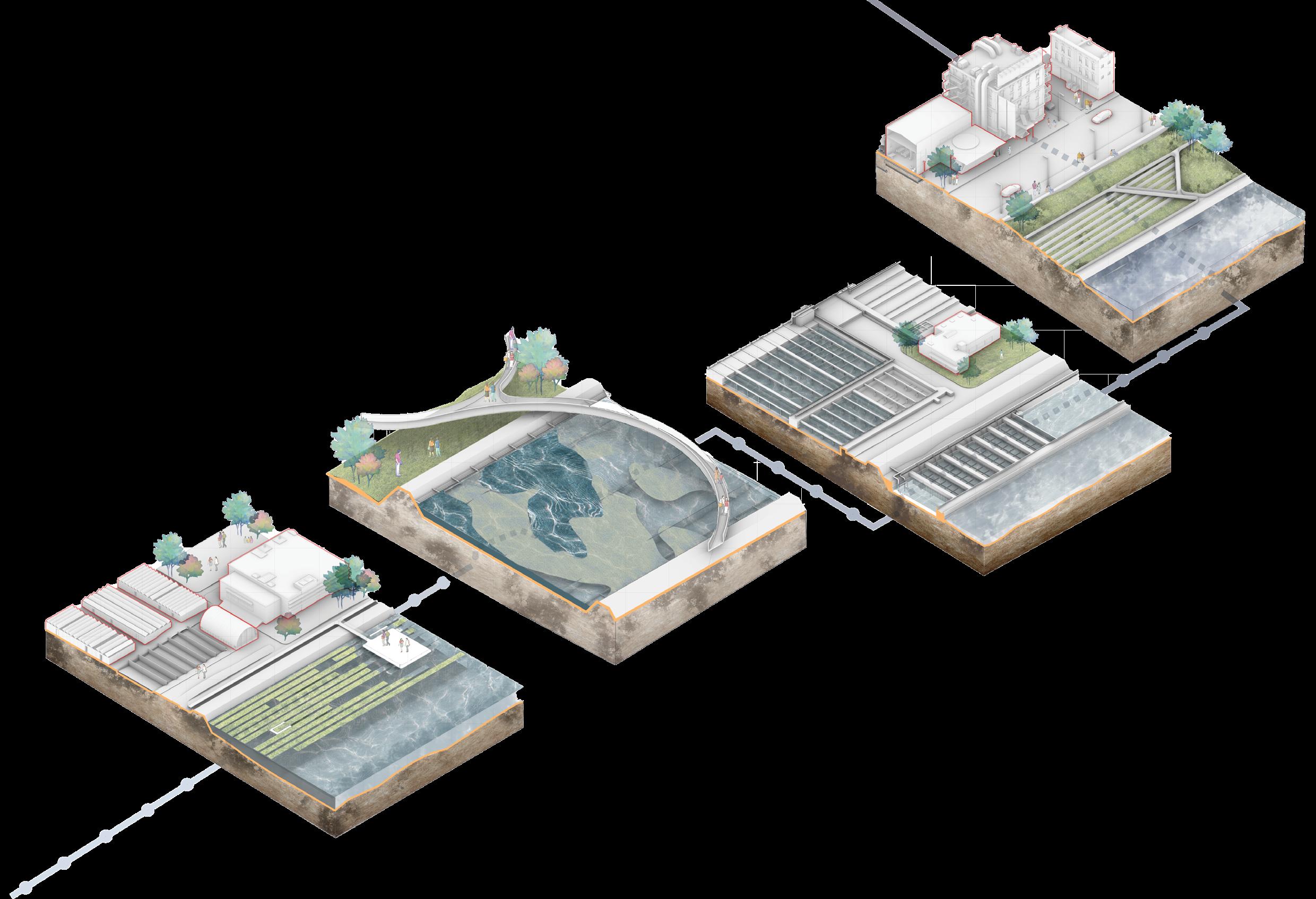
MEMBRANE BIOREACTOR WASTEWATER
FLOATING WETLANDS CONTINUED
CONSTRUCTED WETLANDS BIOFILTRATION
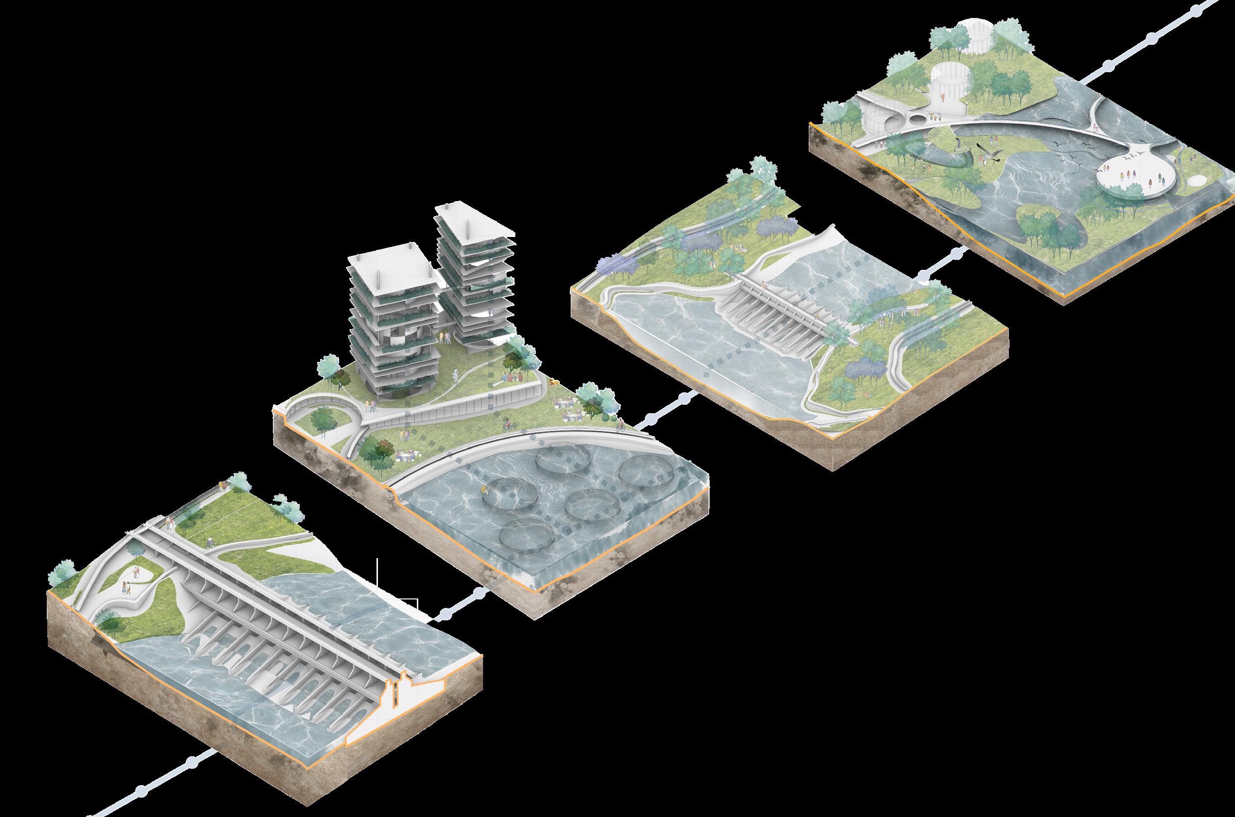
GATEWAY 02 CANAL WATER STREAM
GATEWAY 01 FRESHWATER AND
Year Location Area
Guides Category
Role
ATLANTA AFTER PROPERTY
Fall (2023) Atlanta, USA -
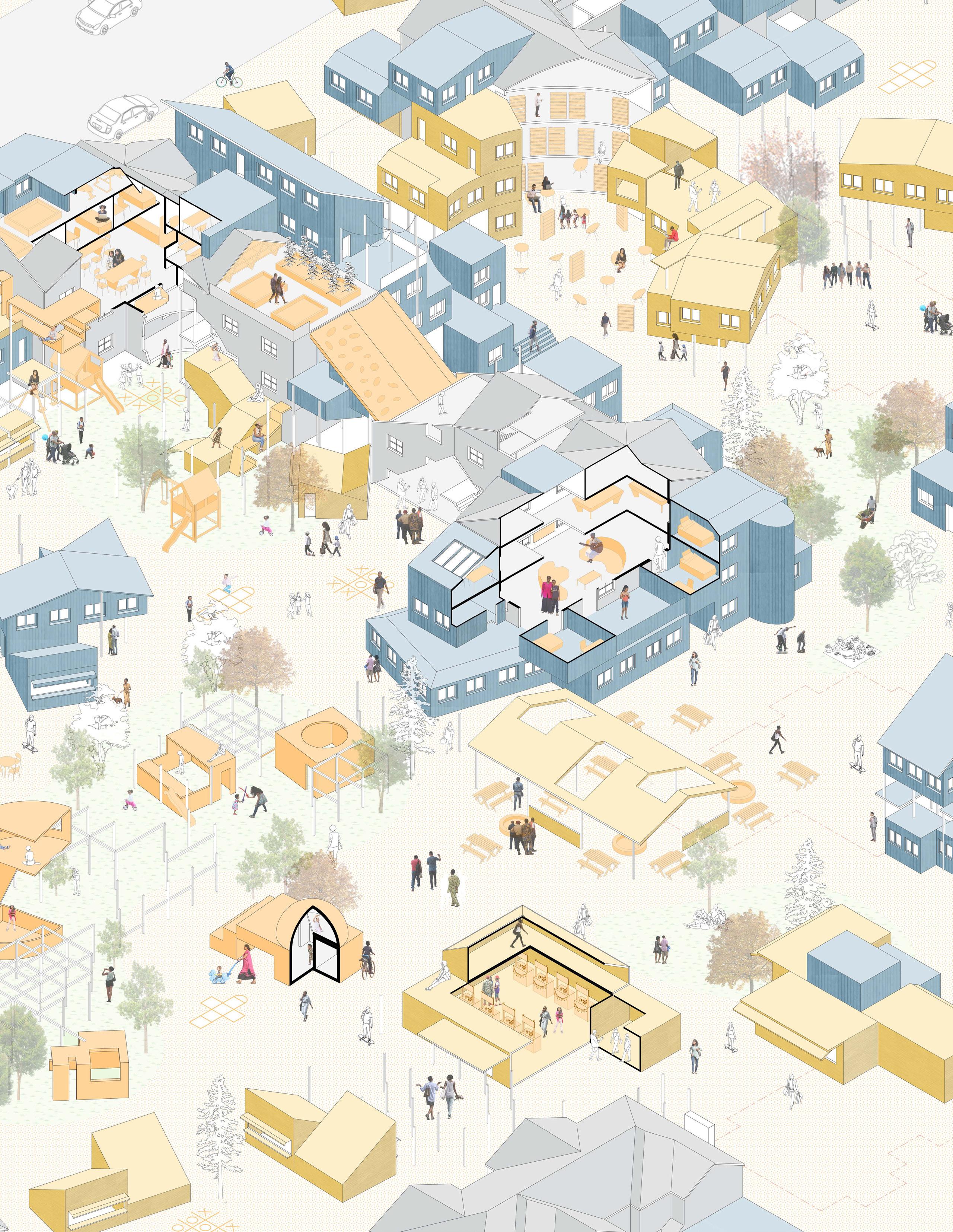
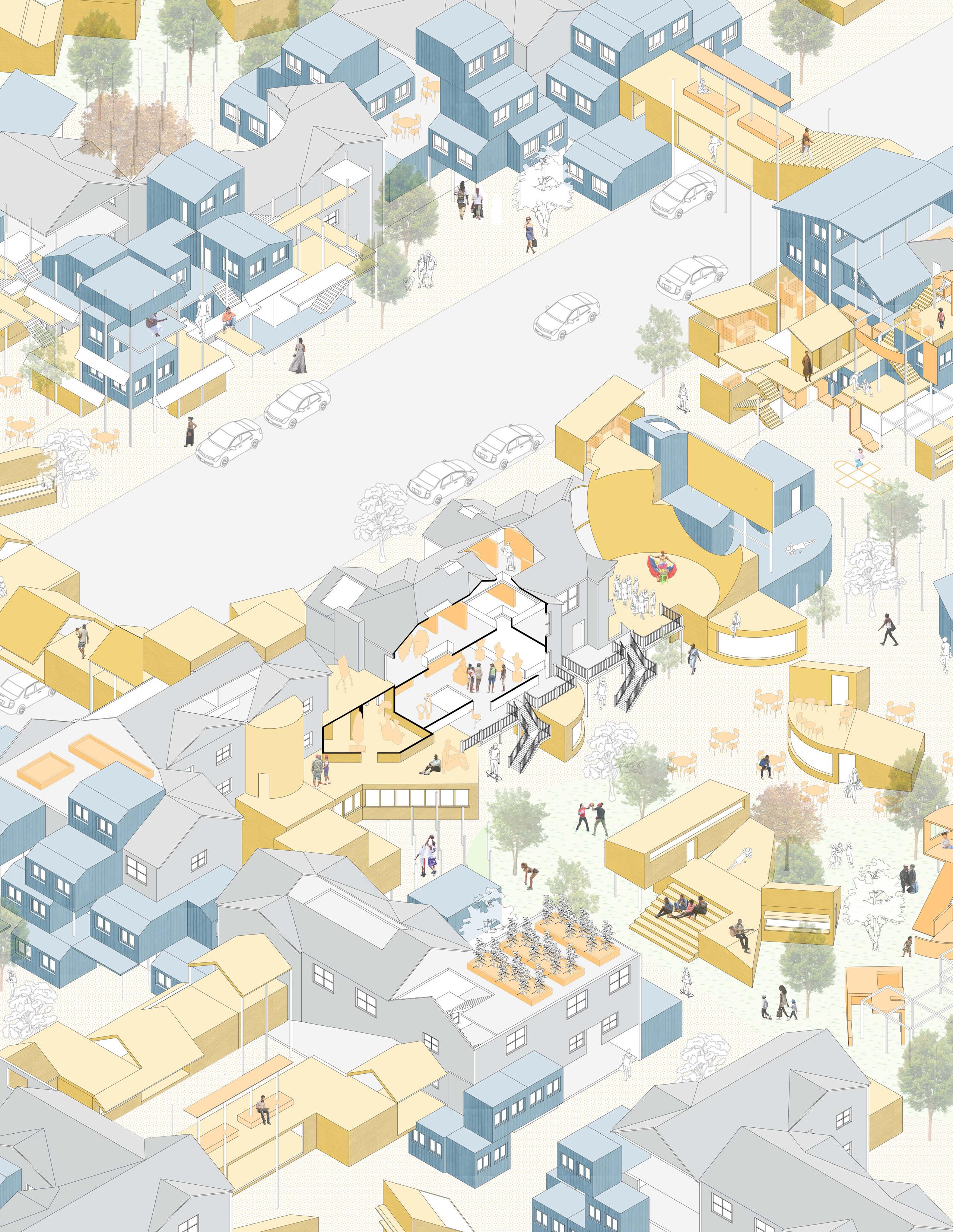
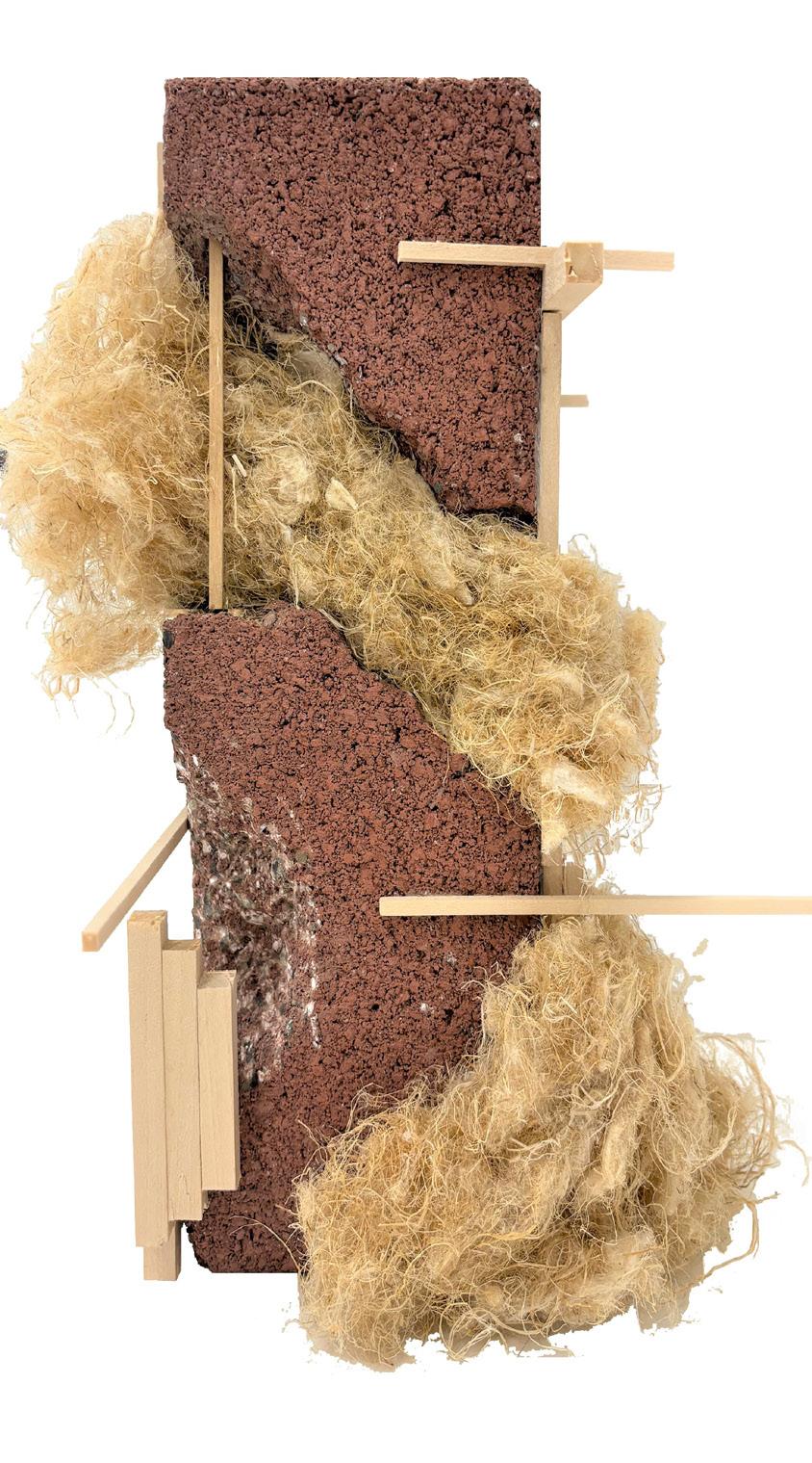
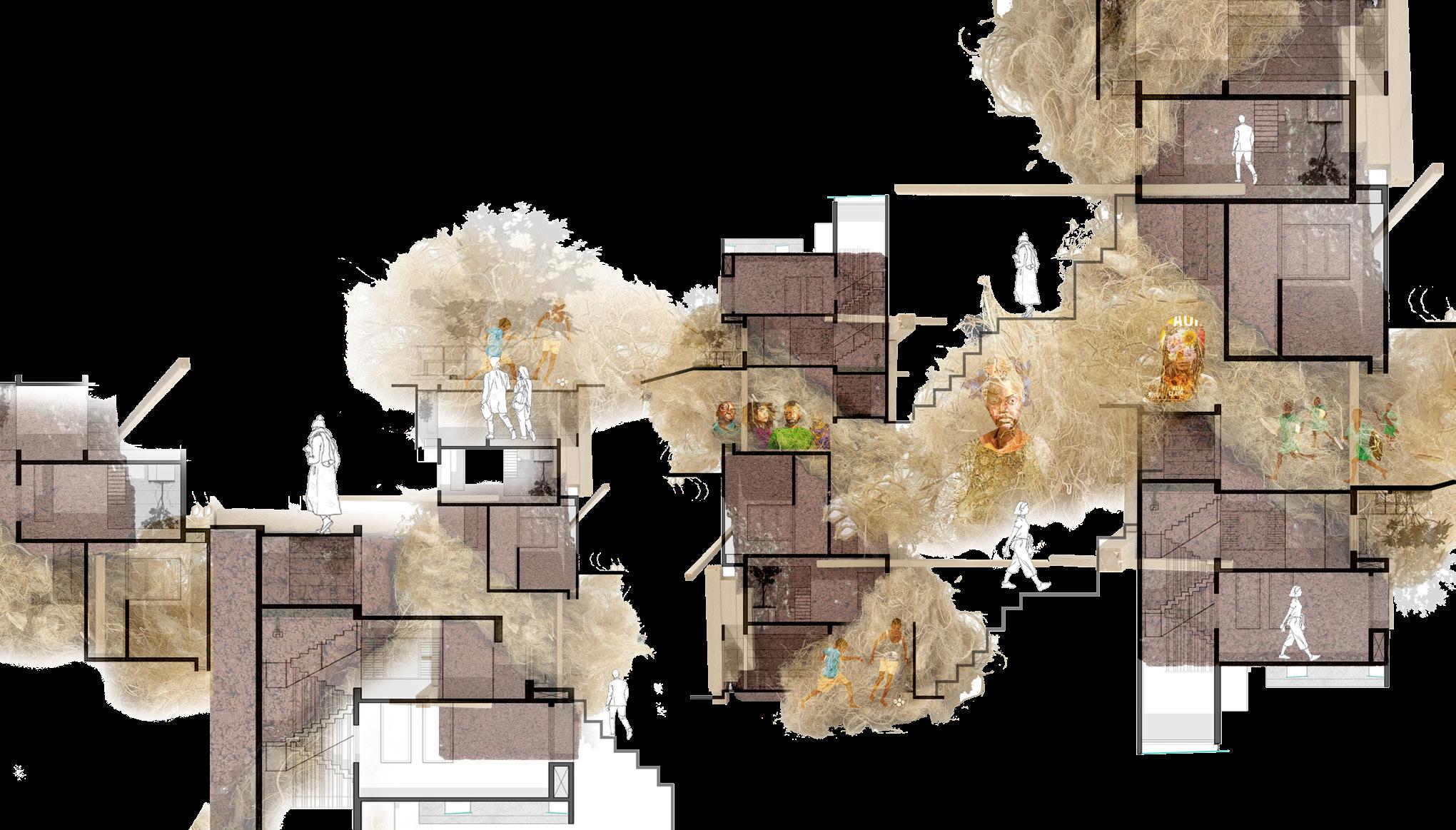
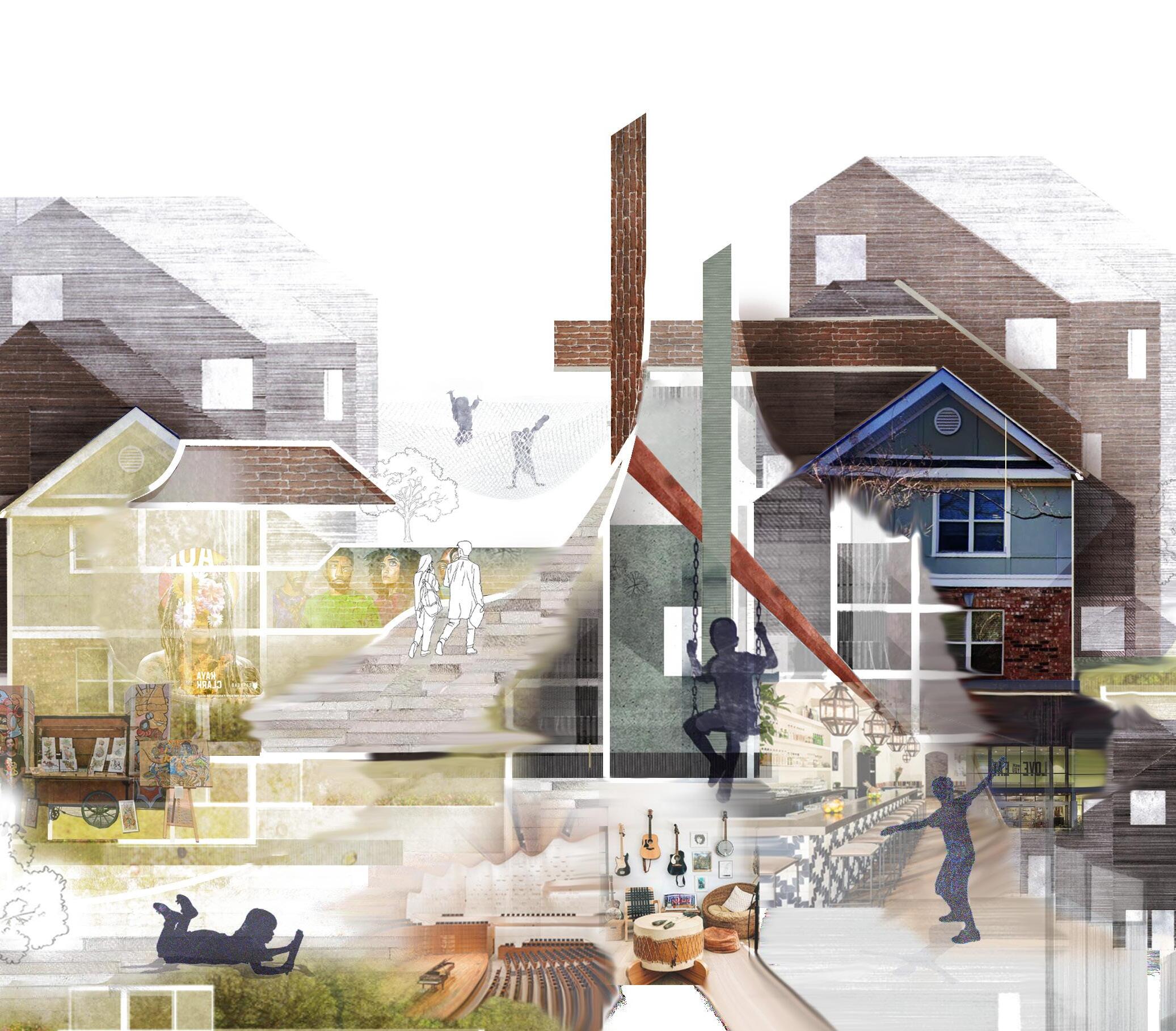
Historically, property has been a destructive tool which draws rigid lines of function and separation between communities in service to an abstract vision of a few powerful planners and designers. In imagining a world after property, we must break away from the rigidity of modernist geometry and conventional homeownership. We envision a flexible, shared scape that speaks to the needs of the community. Through the exploration of materials and stewardship between locals and public as well as private organizations, accessibility and connectivity to functions blend together beyond the boundary line and connects people from all walks of life.
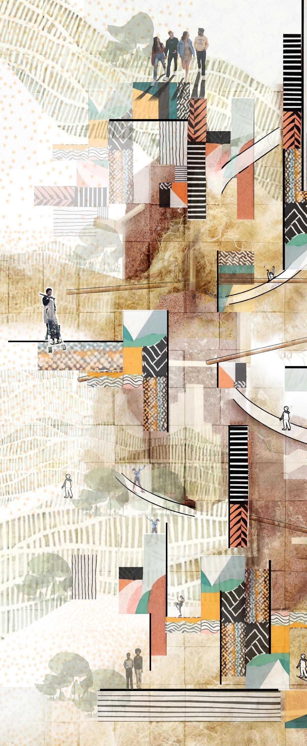
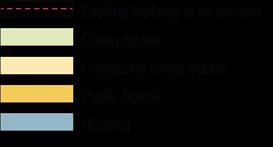
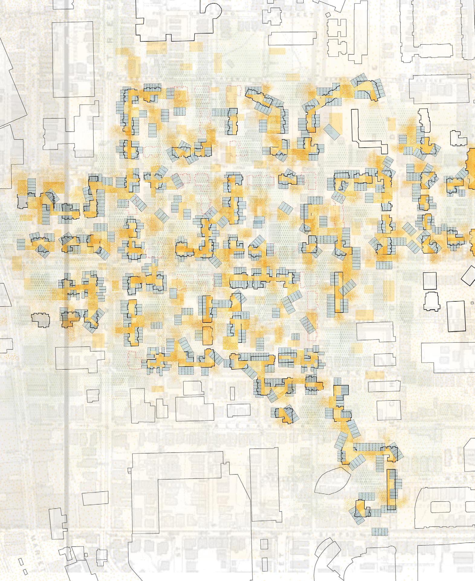
Our urban strategy envisions a shift from isolated developments to a more communal, interconnected living experience. By deconstructing the traditional grid, we foster the emergence of communal centers and garden spaces that seamlessly blend courtyards into a cohesive network of mixed-use facilities. This approach promotes organic, community-led developments, emphasizing shared spaces and collective growth.
We redefine the concept of density not merely as a way to bring together diverse groups—such as former Techwood Home residents, Georgia Tech students, and office workers—but also as an opportunity to activate currently underutilized spaces like empty parking lots with vibrant activities and communal engagements.
The significant presence of children on the site serves as a catalyst for creating dedicated childcare programs and meaningful activity spaces tailored for them. Their movements across blocks and beyond barriers underscore the necessity for safer streets and communal areas that support an inclusive, connected community.



[2] [3]
[2] [3]
[3] the and merging into living overlaid with Footprint the deconstructed of garden courtyards concentrated facilities. concept of means to people Home students, the introdcing will empty children catalyst and spaces further safer spaces. first emphasizing new and newly added existing with units
[3] of the and Section of merging into new community living overlaid with Footprint shows the deconstructed emergence of and garden courtyards concentrated facilities. concept of means to of people Techwood Home Tech students, into the introdcing that will currently empty of children catalyst programs and spaces blocks further for safer spaces. series of The first emphasizing between new and newly added existing with units
strong presence of children site act as the catalyst childcare programs and meaningful activity spaces to them. Their movements across blocks beyond fencing further emphasize the need for safer and communal spaces. proposal is a series of interventions. The first symbiotic, emphasizing relationship between new and residents, where newly added attatch to the existing populating it with units
Conceptual collage of the movements of people and
Conceptual Section of and units merging into structures
[3] the and merging into living overlaid with Footprint the deconstructed of garden courtyards concentrated facilities. concept of means to people Home students, the introdcing will empty children catalyst and spaces further safer spaces. first emphasizing new and newly added existing with units
[3] of the and Section of merging into new community living overlaid with Footprint shows the deconstructed emergence of and garden courtyards concentrated facilities. concept of means to of people Techwood Home Tech students, into the introdcing that will currently empty of children catalyst programs and spaces blocks further for safer spaces. series of The first emphasizing between new and newly added existing with units VOL. 3
- AUTHOR PROPERTY VOL. 3
PROPERTY VOL. 3
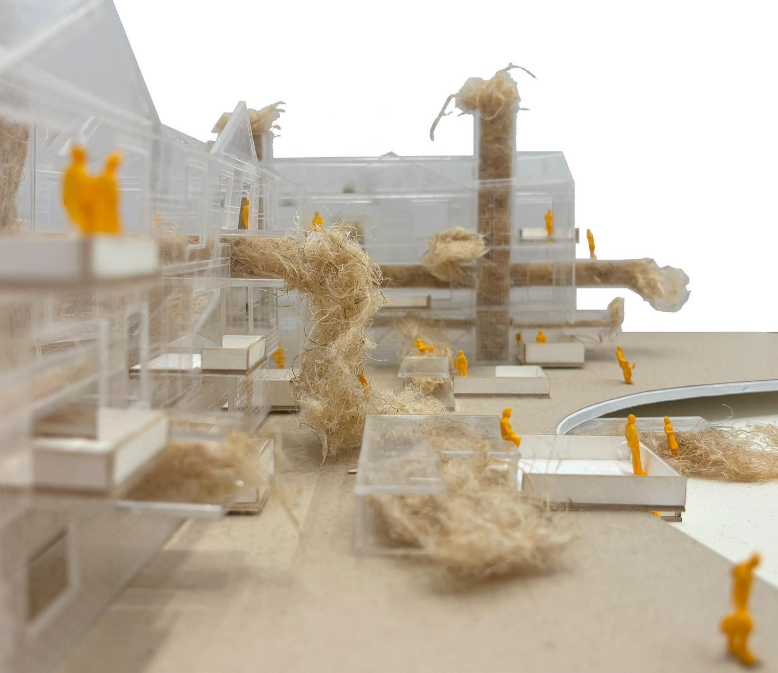
Physical model of new intentional community living Urban Strategy overlaid with Tanyard Creek Footprint urban strategy shows the form of the deconstructed the emergence of communal centers and garden that blend the courtyards into a concentrated of mixed-use facilities. introduce the concept of not just as a means to diverse groups of people former Techwood Home residents, Georgia Tech students, office workers into the but also the introdcing potential activities that will to the currently empty lots.
3

PROPERTY VOL. 3
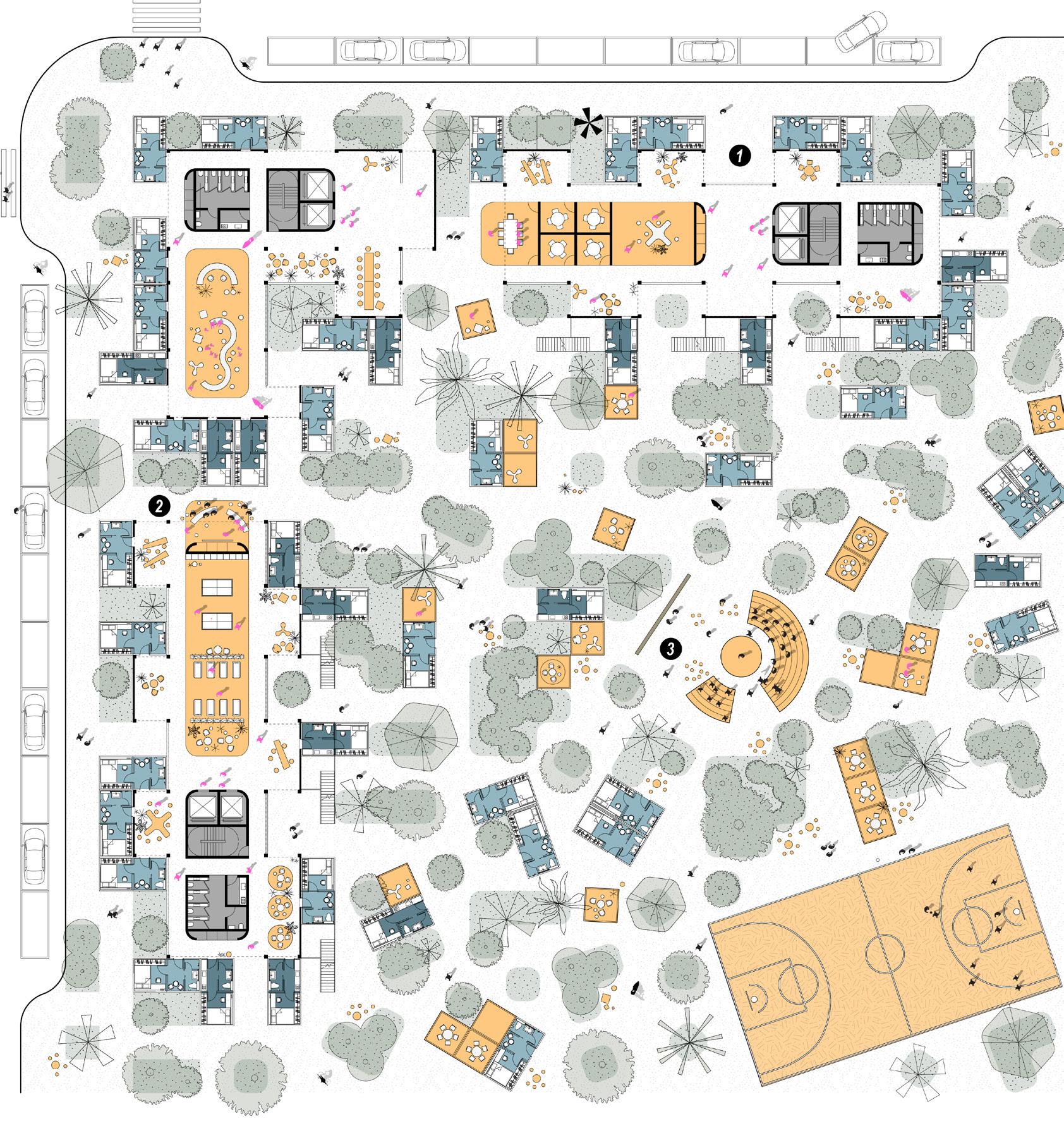
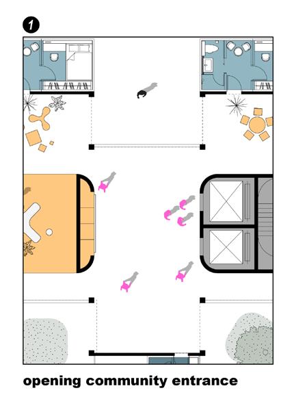
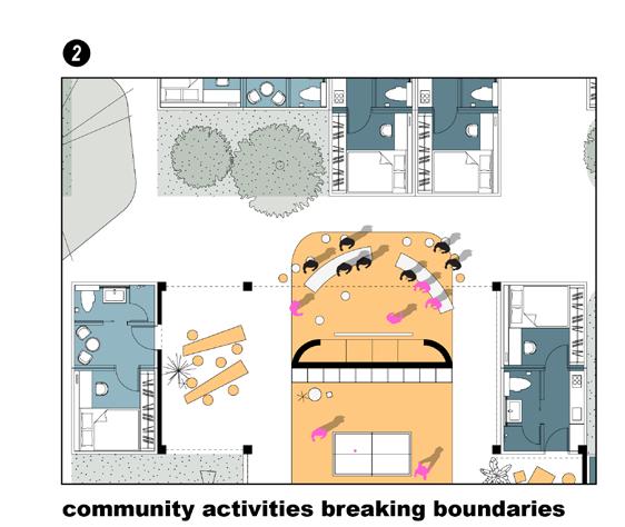
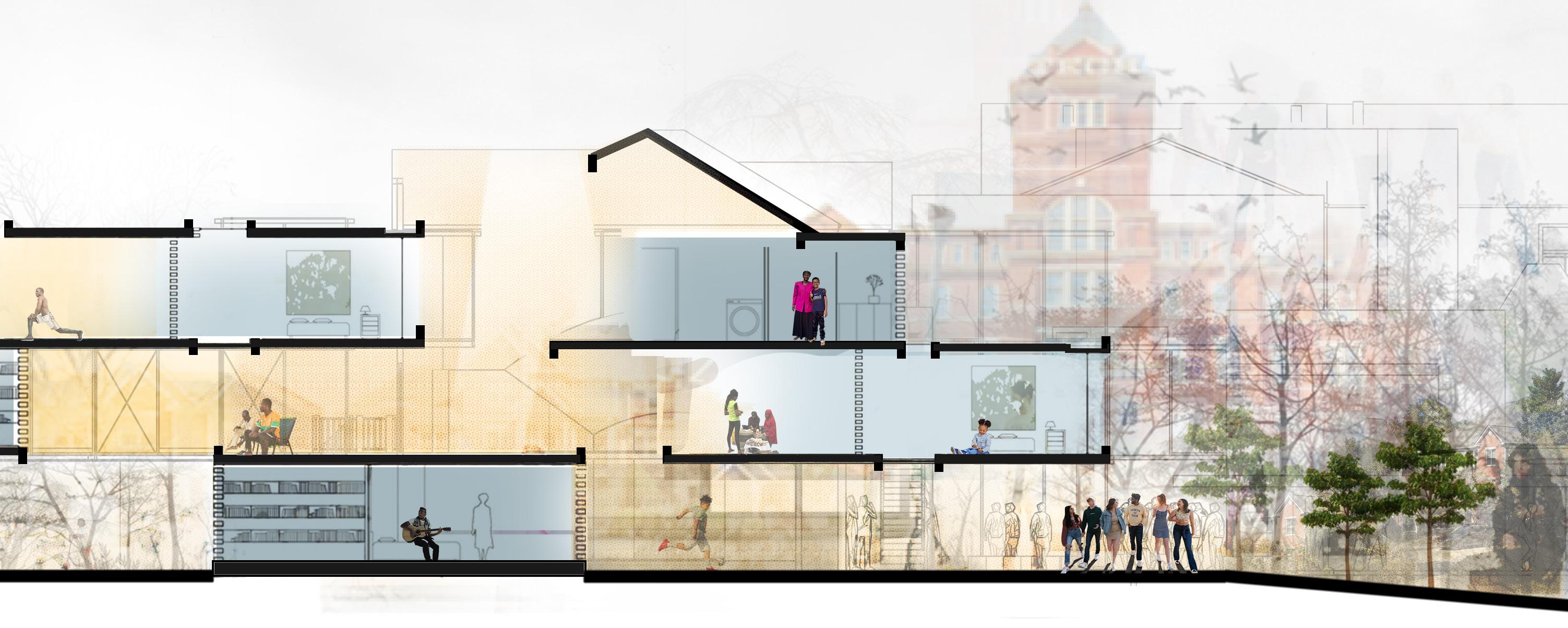
Next, the integration of new an existing units. The once separate units become a collective living space for socializing, entertainment, and shared activities which extends throughout each level of existing building.
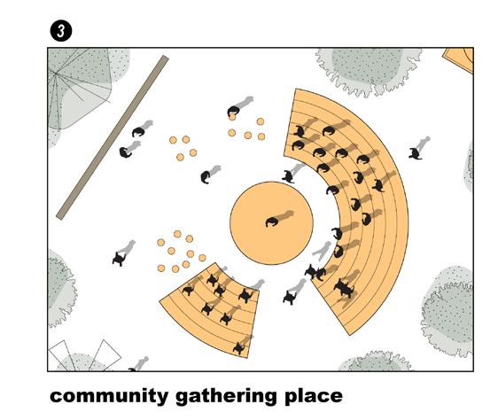
Finally, interior programs become an extension that blends into the original courtyard, introducing new activities such as open theaters, social areas, and small markets, encouraging interactions among residents of different ages and backgrounds.
Next, the integration of new an existing units. The once separate units become a collective living space for socializing, entertainment, and shared activities which extends throughout each level of existing building.
Next, the integration of new an existing units. The once separate units become a collective living space for socializing, entertainment, and shared activities which extends throughout each level of existing building.
Finally, interior programs become an extension that blends into the original courtyard, introducing new activities such as open theaters, social areas, and small markets, encouraging interactions among residents of different ages and backgrounds.
By embracing the principles of cooperation and inclusivity, these spaces have the potential to redefine our approach to living. Let us recognize the power of communal living in creating not just residences but vibrant communities that inspire and support each member.
Finally, interior programs become an extension that blends into the original courtyard, introducing New activities such as open theaters, social areas, and small markets, encouraging interactions among residents of different ages and backgrounds.
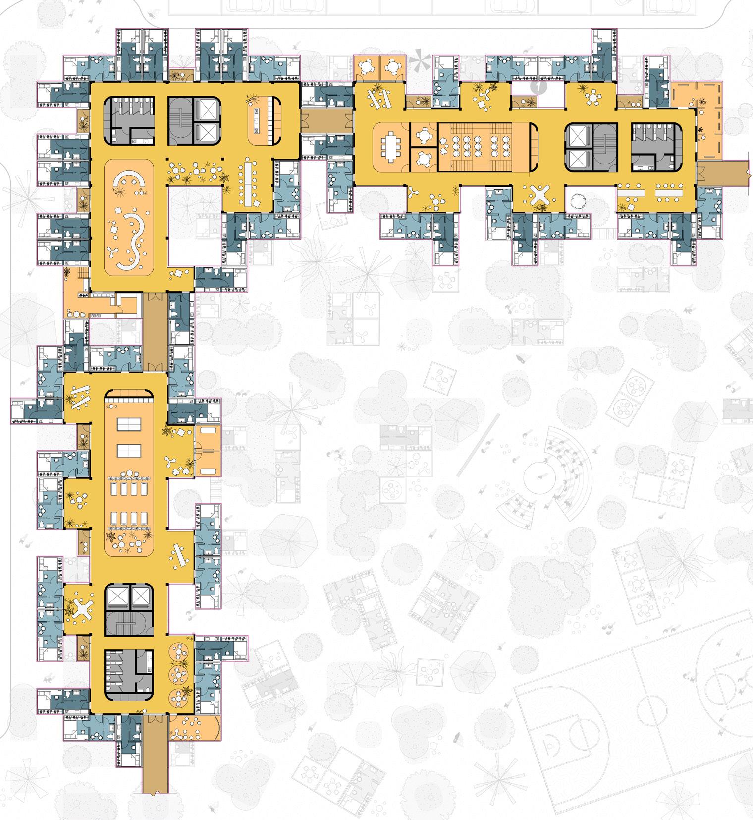
[5] Ground Floor Plan
By embracing the principles of cooperation and inclusivity, these spaces have the potential to redefine our approach to living. Let us recognize the power of communal living in creating not just residences but vibrant communities that inspire and support each member.
[6] First Floor Plan
By embracing the principles of cooperation and inclusivity, these spaces have the potential to redefine our approach to living. Let us recognize the power of communal living in creating not just residences but vibrant communities that inspire and support each member.
[5] Ground Floor Plan
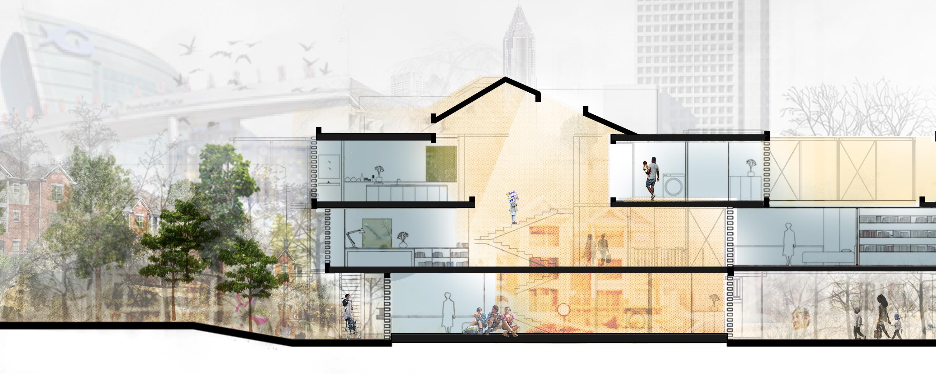
[7] Project Section
[6] First Floor Plan
[8] Axonometric focused on courtyard
[7] Project Section
[8] Axonometric focused on courtyard
GODREJ PROPERTIES - PROFESSIONAL WORK
Location Area Guides
Category Role 2022 (Ongoing) Hinjewadi, Pune
112.8 Ac., 4,56,485 Sq. m.
Prof. Msc. Mukul Arora
Collaborative Work with 2 members (Mukul Arora and Vanshika Bharaj)
Worked across conceptual design and design development stages for all aspects of the project. The diagrams included are primarily the author’s work.
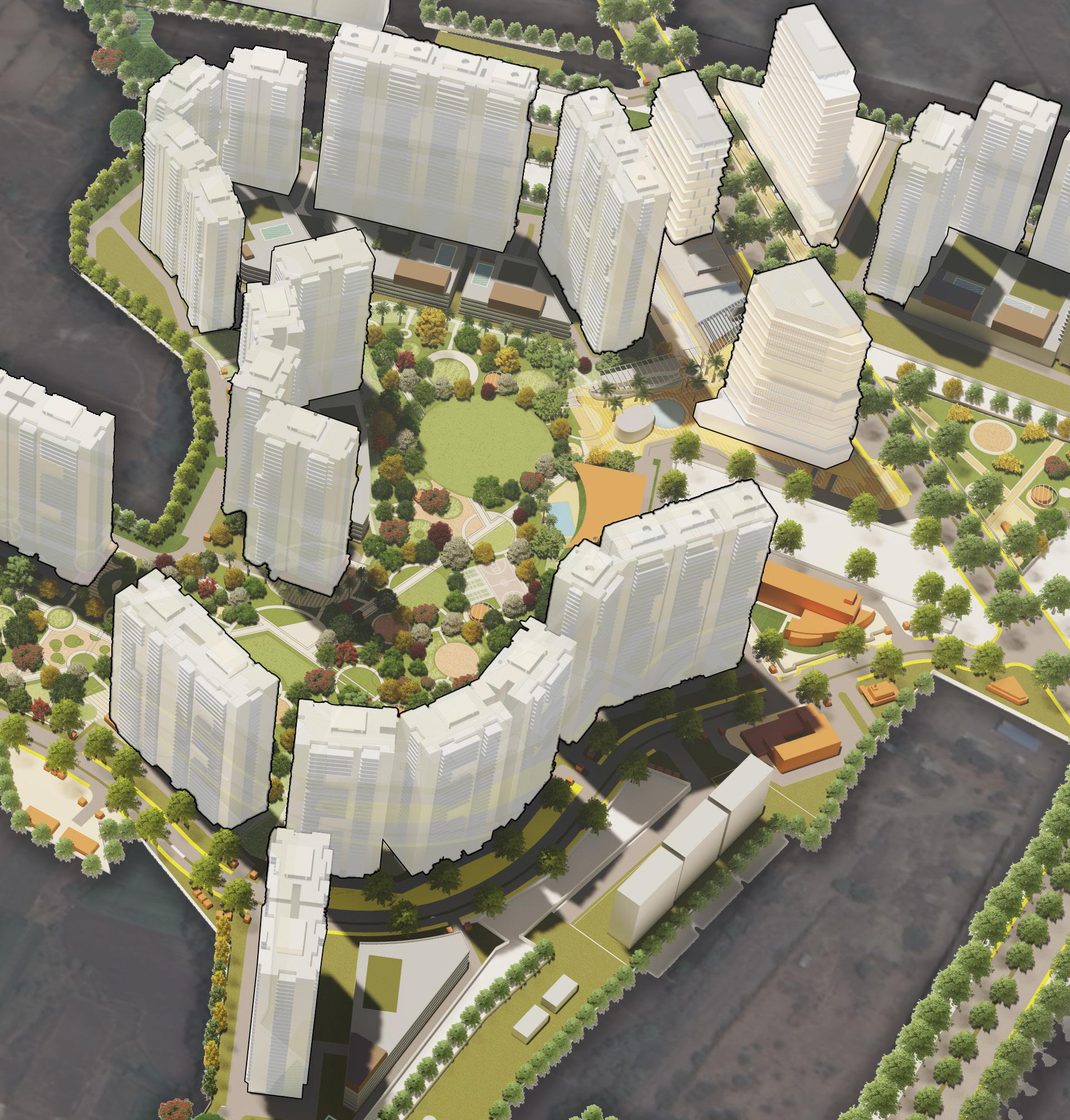
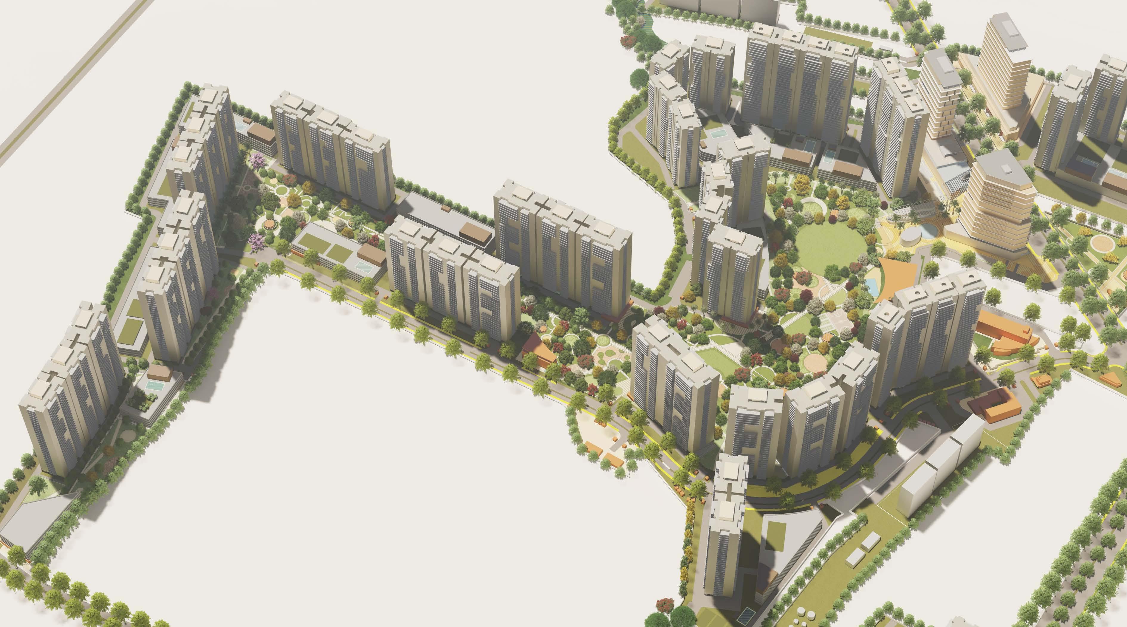
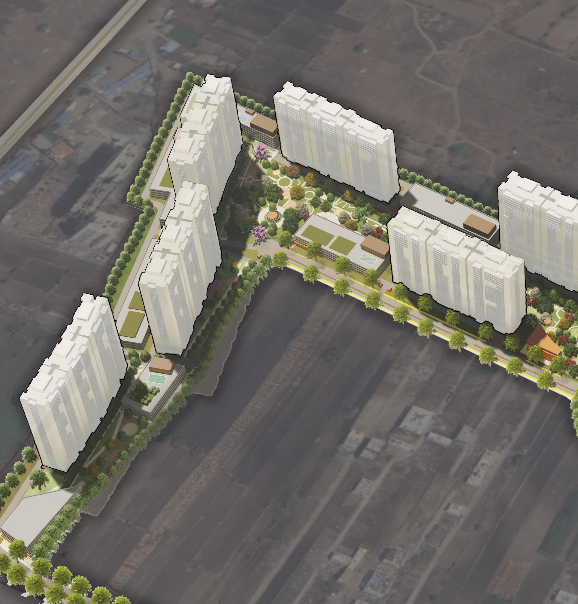
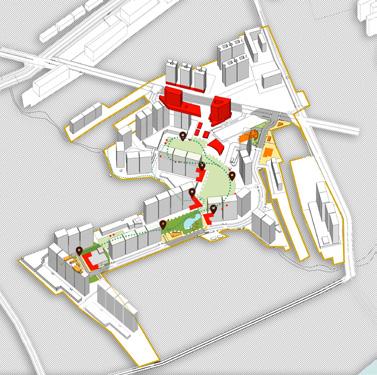
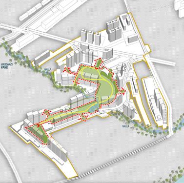
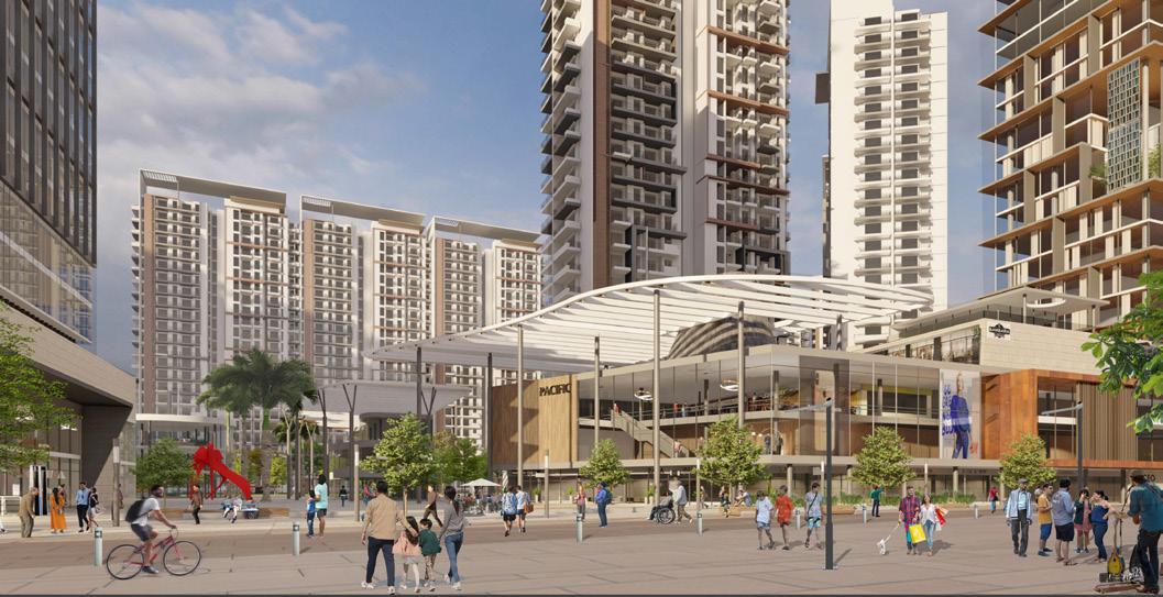
Hinjewadi Township creates a strong iconic center for a high density mixed use community on the outskirts of pune which is known for its strong employment base while at the same time has an absolute lack of public spaces or amenities. The plan explores the mythical idea of ‘gardens within gardens’ and translates it into a safe, interactive, and experiential lifestyle space for the nearly 20,000 plus residents.
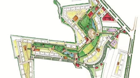
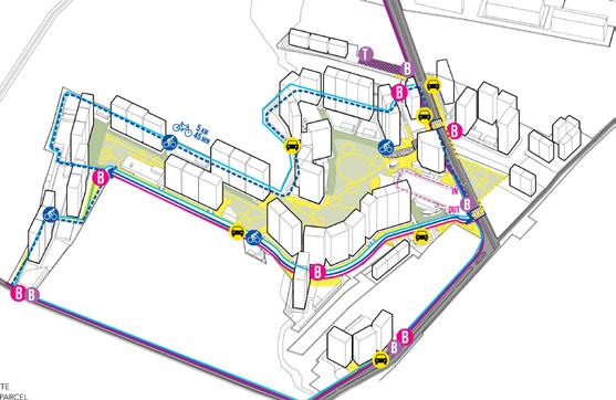
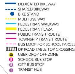
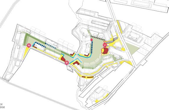
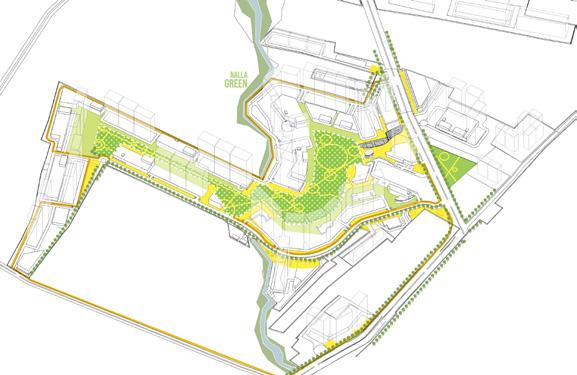
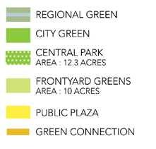
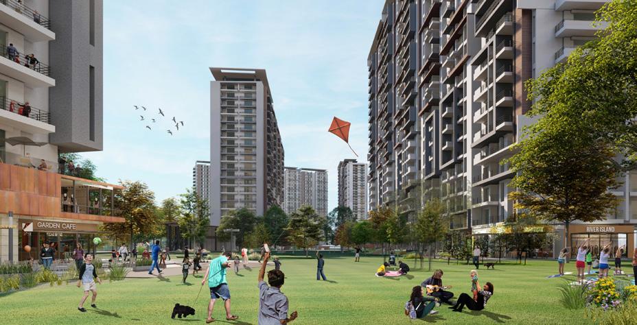
A contiguous privately managed open space system binds the 100+ acre project as a singular place and offers a safe green necklace set within a 6000+ treed urban forest for its 50,000 residents the 20 acre plus central park along with a large city club has direct access form the surrounding housing parcels and is knitted with the more intimate community level green spaces.
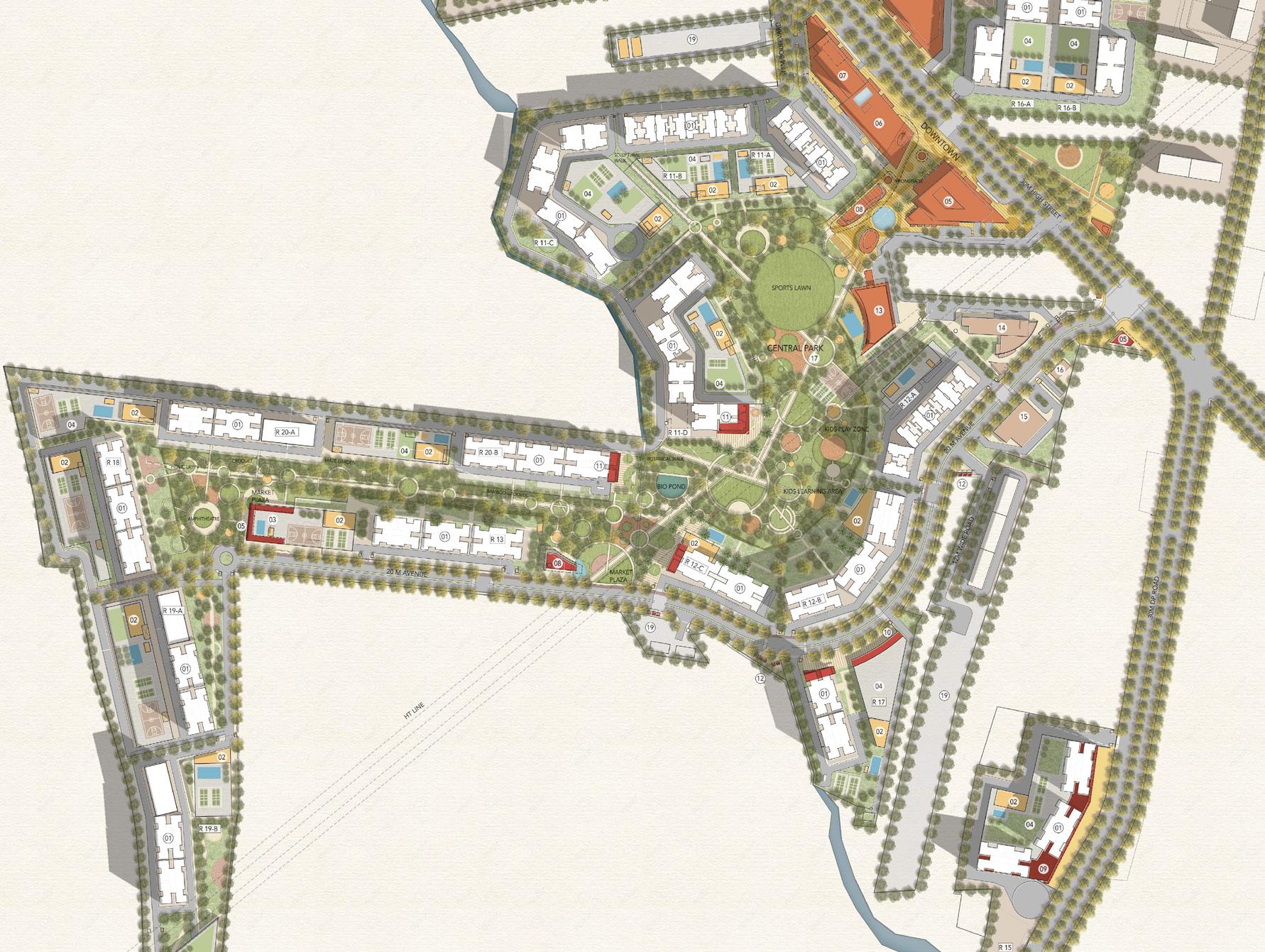
The open space system performs the critical task of integrating the whole project for the residents and at the same time offering stimulating public spaces for the city at large. The plan hinges on the principle of shared landscape where the public realm and private parcels interface and integrate to a varying degree thereby enhancing the quality of the larger open space framework.
Development regulations and guidelines for individual parcels specify levels of control/s that help create this shared landscape. The open space types for Riverhill while adding up to create a singular open space experience also create multiple and distinct spatial experiences
plan of the township core area
- DESIGN (ALL) + RENDER (AUTHOR)
DEVELOPMENT MASTERPLAN
- DESIGN (ALL) + RENDER (AUTHOR)
MAXIMIZED BUILT EDGES
MAXIMIZED BUILT EDGES
MAXIMIZED BUILT PERIMETER
MAXIMIZED BUILT PERIMETER
MULTIPLE CIVIC HUBS
GREEN NECKLACE
&
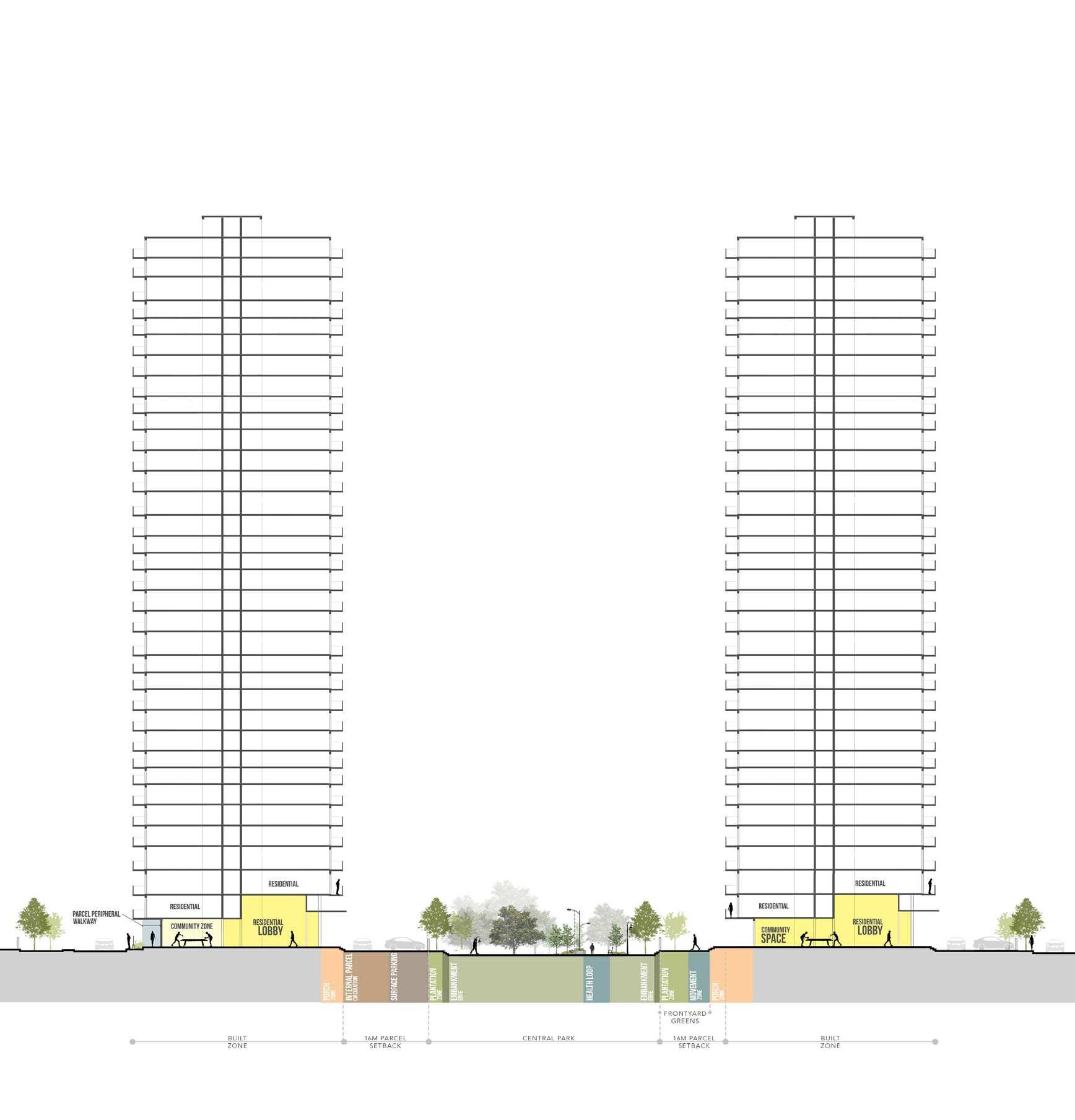
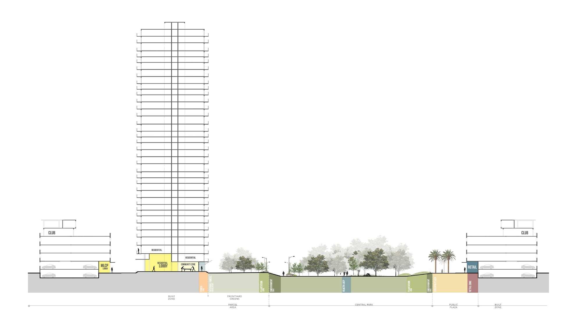
SECTION: WESTEND GREENS
AUTHOR + MUKUL ARORA
INTERNAL
INTERNAL EDGES
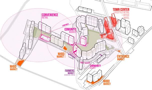
RETAIL TYPES
RETAIL TYPES
RETAIL TYPES
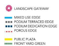
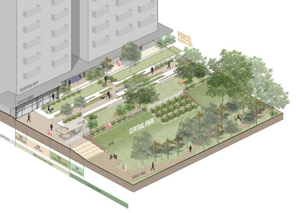
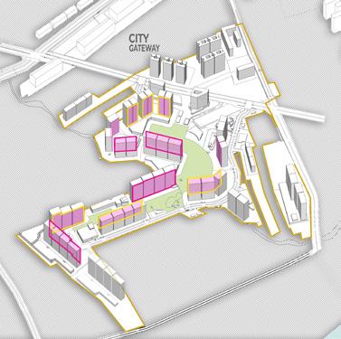
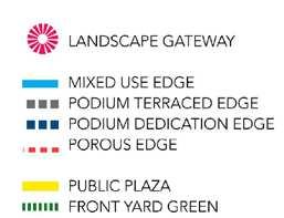
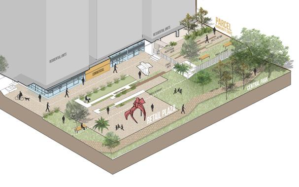
On the inside the design maximizes mixed use edges so as to replace nearly 80% inert boundary wall threshold with active edges. The remining edges shall be treated with a porous boundary (fenced) and/ or landscaped edge
Attractive and animated building frontage using elements including storefronts, large windows, front porches and steps combined with architectural variety will contribute positively to the streetscape and aid in casual surveillance opportunities condition.
MIXED-USE EDGE
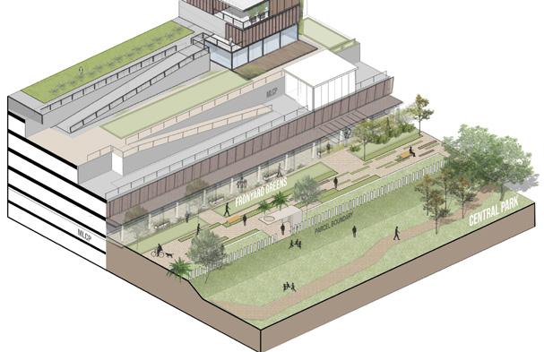
PODIUM TERRACED EDGE
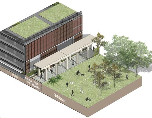
PODIUM DEDICATION EDGE
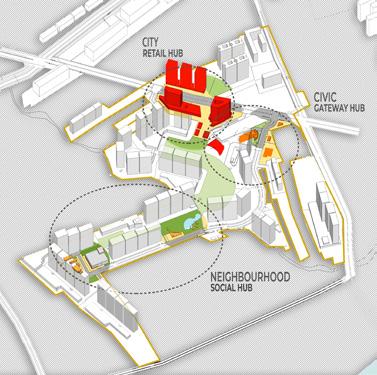
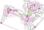
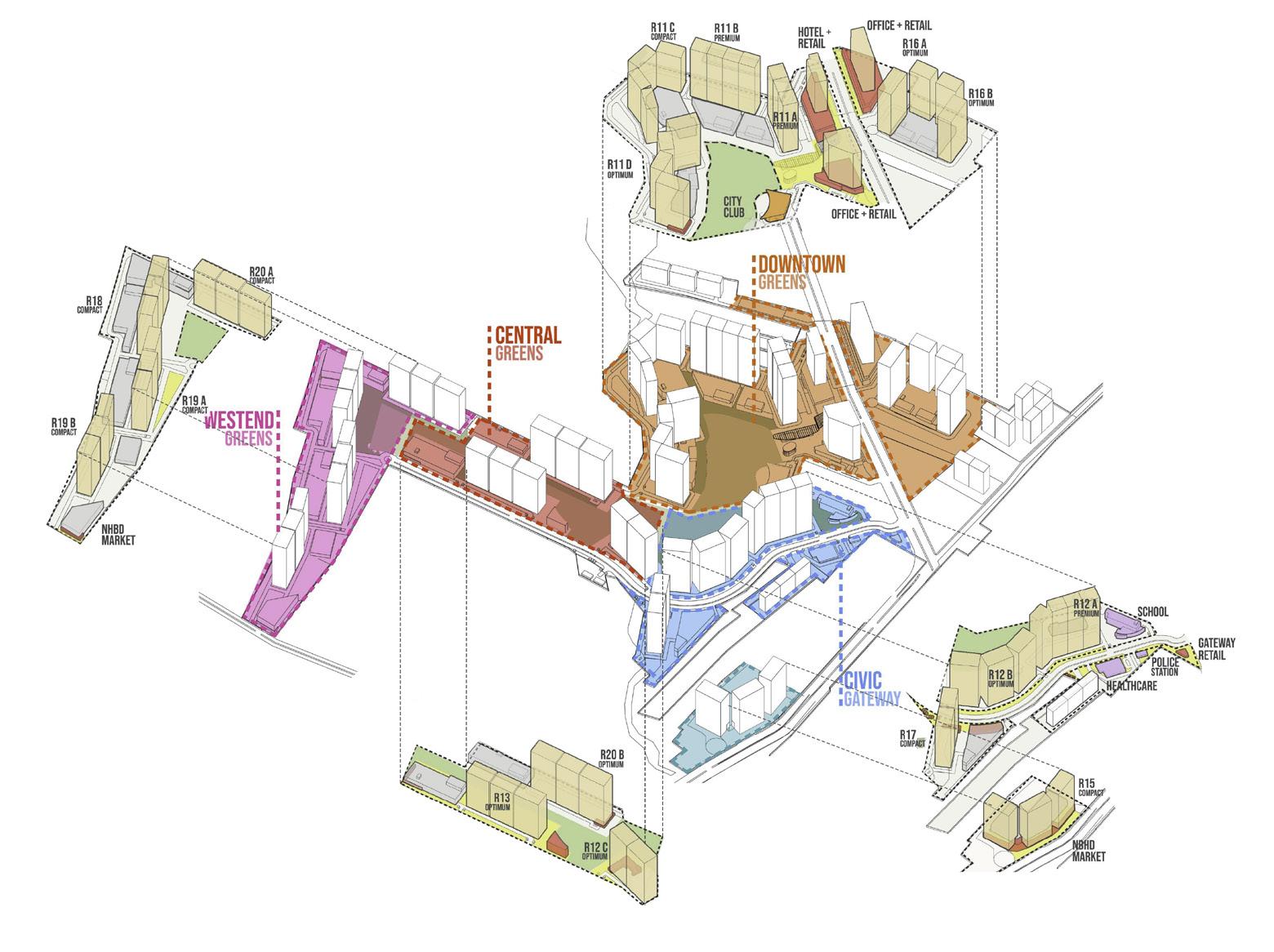
The Township weaves the qualities of the adjacent neighbourhoods into a rich tapestry of unique places. The precinct offers a wide variety of housing typologies connected through a common city wide open space system.
DOWNTOWN GREENS
The Downtown green district defines the large front face this project area of the downtown pers as well as the housing Parsons along the north part of Central Park.
CIVIC GATEWAY
The city Gateway district the front door of the Hinjewadi township. This linear district is a mixed use enclave with retail,civic, and housing parcel strung along and imageable and well landscape township Avenue.
CENTRAL GREENS
The central green district is the smallest in its extent with just three housing parcels and yet it defines the most pivotal node is the Township and central greens.
WESTEND GREENS
The end Piece of the Township holds 4 residential parcels with one front connectd to the central park and the other opening towards the DP road.
CLIENT RESIDENCE - PROFESSIONAL WORK
SINGLE FAMILY FARMHOUSE IN RAMMED EARTH CONSTRUCTION
Year Location Area Guides
Category Role 2022 (Ongoing) Sultanpur, Delhi
1.0 Ac.
Ar. MUd. Mukul Arora
Project Architect of the Project. Working with Principal Architect All work done individually under the guidance of Sir. Mukul Arora
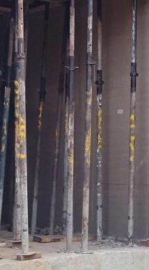
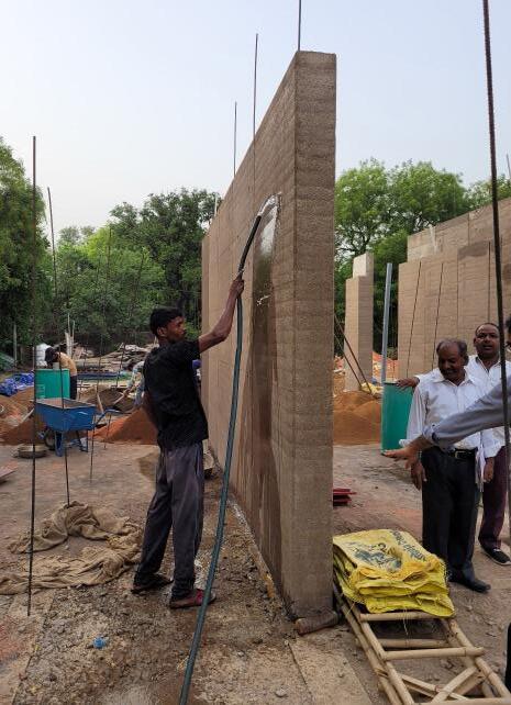
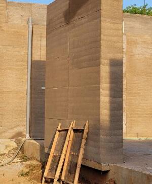
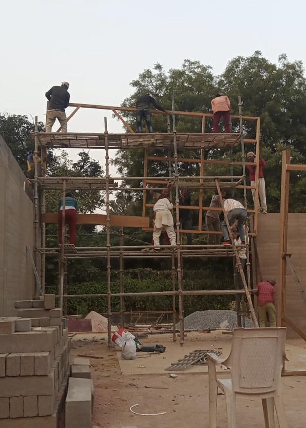
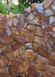
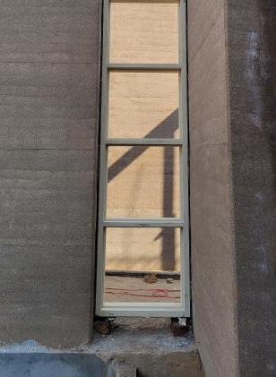
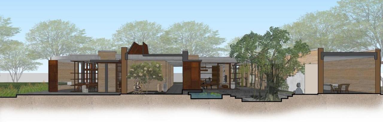
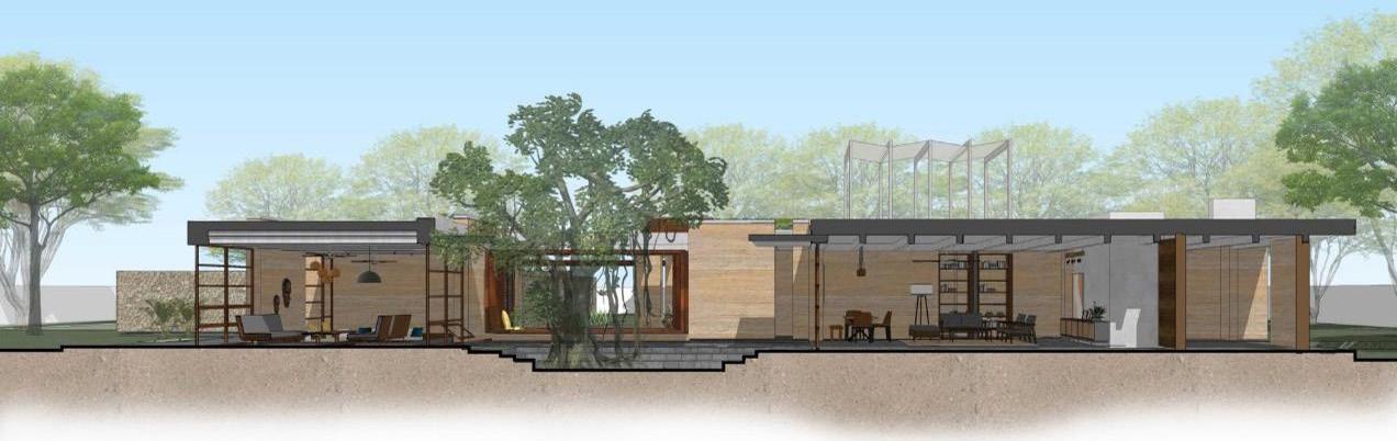
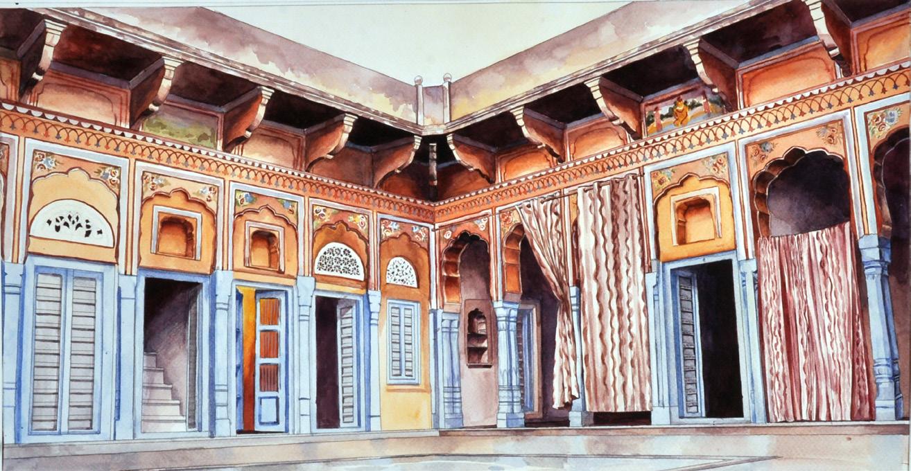
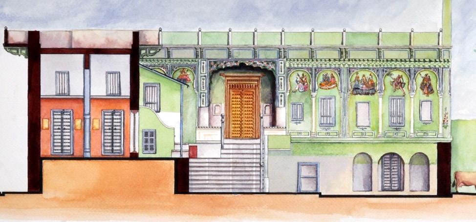
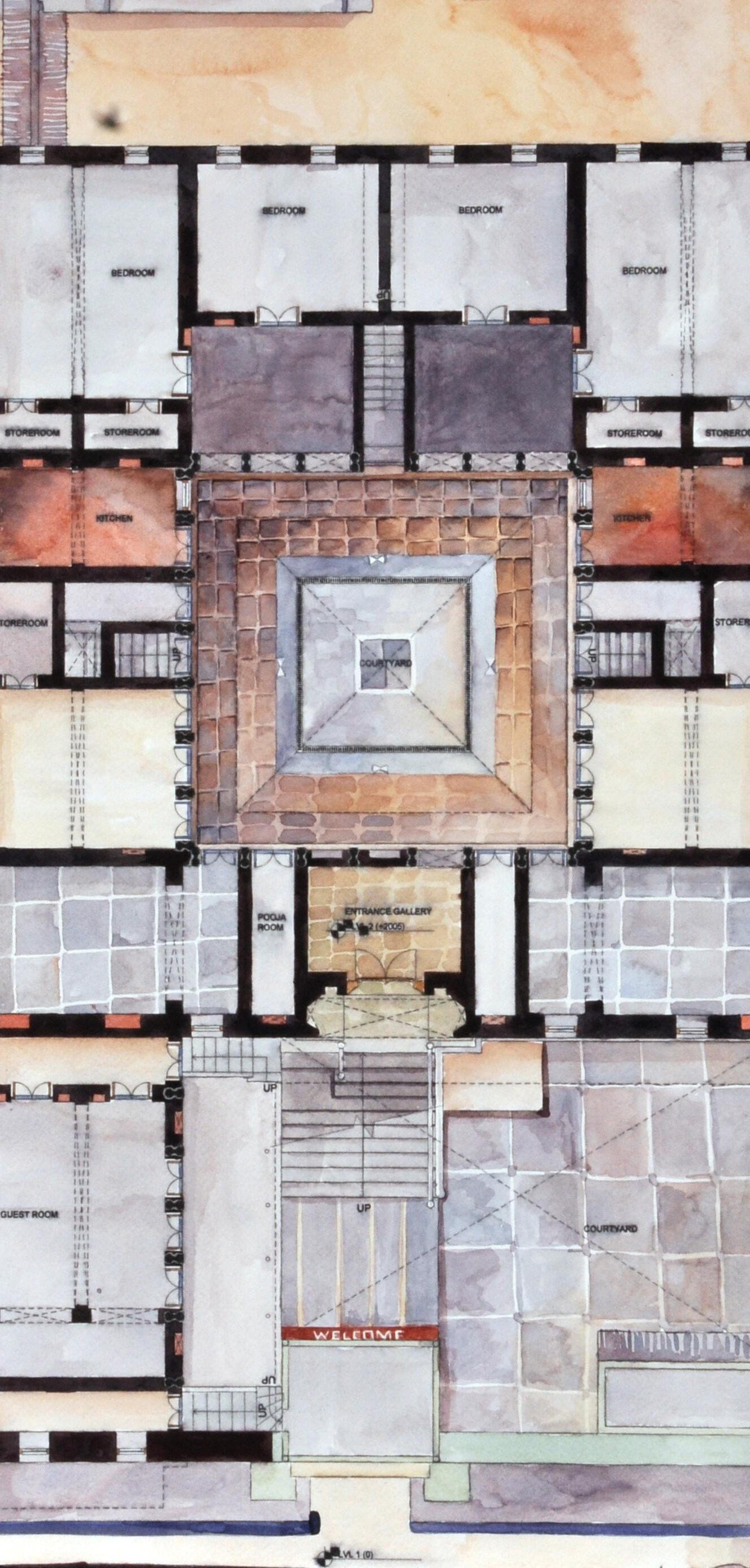
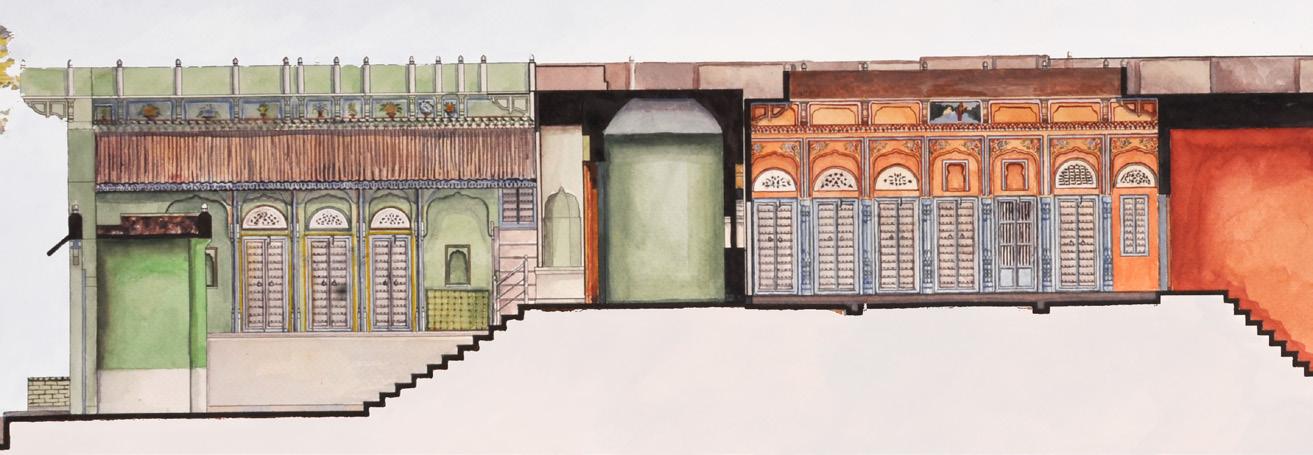
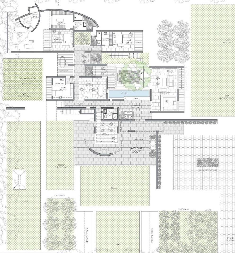
In Elemental House the intent is to preserve the true identity of all the elemens used and integrated. Thus all materials used have a raw finish, that imparts the home a rustic, yet very cosy and breathable atmosphere. The traditional Indian concept of courtyard has also been carried forward with a central waterbody.
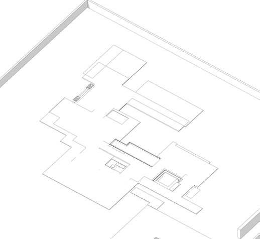
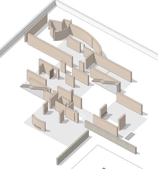
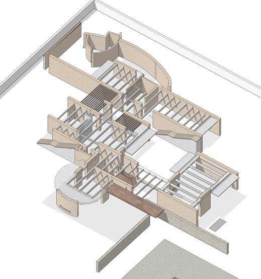
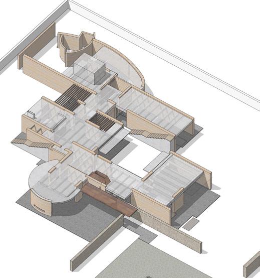
The Elements came together as the sequence shown below. Plinth, followed by rammed earth walls, wooden door windows, followed by exposed concree beams and slabs, lastly finished with corten steel work. All the downturn beams are visible and have been placed at a constant rhythm of 4’-0”.
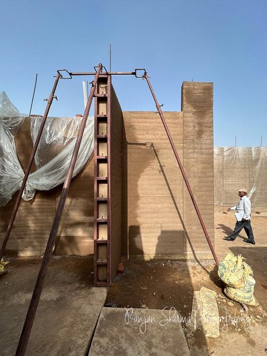
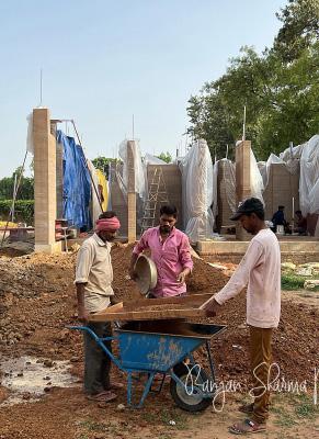
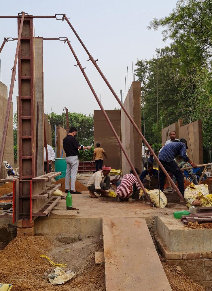
SITE PHOTOGRAPH
- PHOTOGRAPHER: RANJAN SHARMA
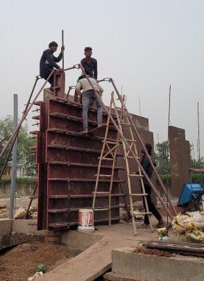
The image and section illustrate how the rammed earth wall came together at site. A combnation of 9” and 16” thk load bearing walls have been constructed. The civil work including electrical, air conditioning and plumbing all were preplanned so that they were well concealed within the rammed earth walls, and no future cuts would be required in the rammed walls.
For flooring a beige coloured microconcrete is to be overlayed on site. The landscape is to be done through a combination of cobble stone and stone slabs.
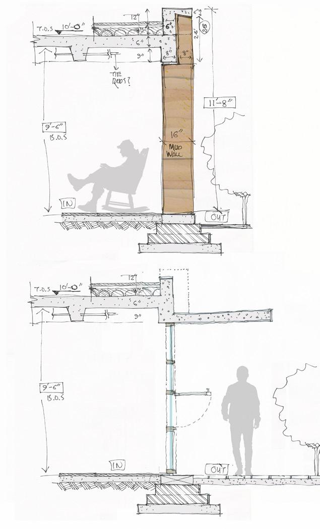


SECTION 01 ( 3 2" = 1'-0")
DRAWING TITLE:
SLABS W/ KRYTON 2% ADD-MIX WATERPROOFING, REFER STRUCTURE DWGS FOR SPECIFICATION AND REINFORCEMENT SECOND FLOOR FFL LVL 13'-5" NAVD +29'-7" TOP OF
PERIMETER SLAB PROJECTION DETAIL
CAN STUCCO FINISH CONTINUE TILL LANDSCAPE LEVEL? IS A PLINTH PROTECTION / SKIRTING REQUIRED?
PERIMETER SLAB PROJECTION DETAIL
UNDERGRADUATE ARCHITECTURE DESIGN THESIS
ARTICULATING THE ARCHITECTURE FOR DEMOCRATIC NEPAL
(2021) Singha Durbar, Kathmandu, Nepal
29.87 Ac., 120,865 Sq. m.
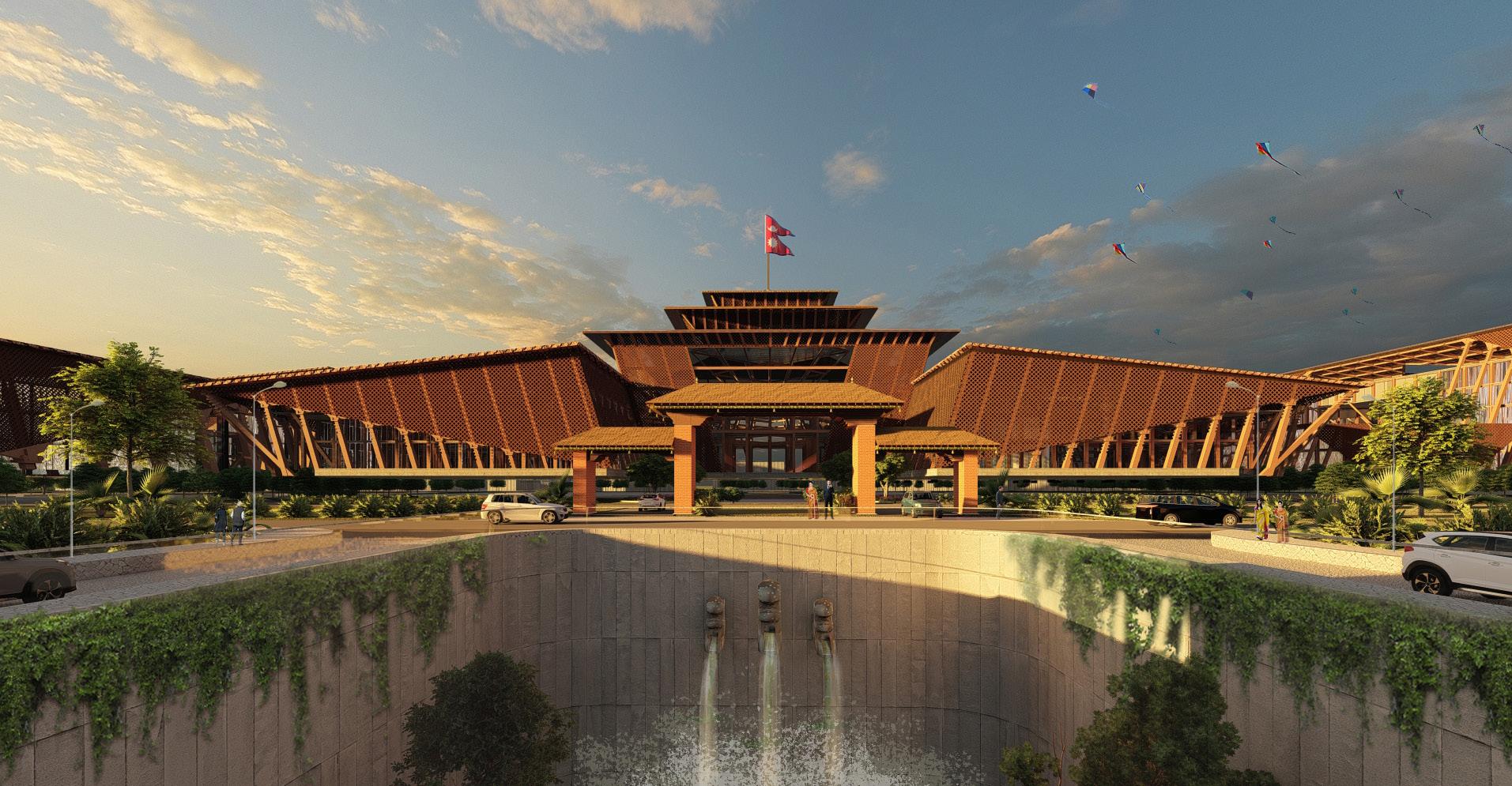
This project sets the foundation for the modern articulation of public buildings for democratic Nepal. In doing so, it re-emphasizes the importance of public participation through architecture, blurring the boundaries between people and power, reinstating democracy. Each element of democracy has been carried forward in architectural expression, setting standards for similar public buildings in the future. One of a kind, the project presents the first-ever government office building in Nepal that welcomes the general public for participation in its precinct.
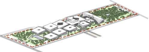
Superimposition of the listed concepts creates a vibrant and coherent complex respective of its context.
Superimposition of the listed concepts creates a vibrant and coherent complex respective of its context.
The massing comes together as one large sloping roof inspired by the traditional sloping roof system.
The massing comes together as one large sloping roof inspired by the traditional sloping roof system.
Height of the building blocks gradually decline away from the center ensuring max. visual connect.
Height of the building blocks gradually decline away from the center ensuring max. visual connect.
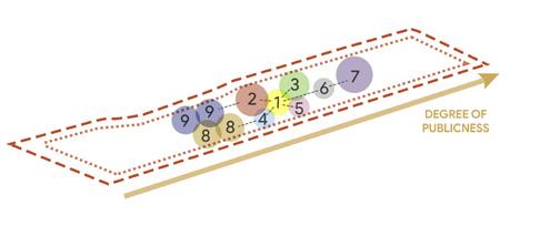
1. Central Lobby
1.
2. Upper House
3. Lower House
4. VVIP Offices
6. Canteen
7. Party Office
8. Secretariat 9. Committee Halls
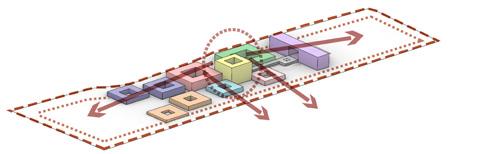
The zoning has been done as per the hierarchy of publicness of the function and its specific requirements.
The zoning has been done as per the hierarchy of publicness of the function and its specific requirements.
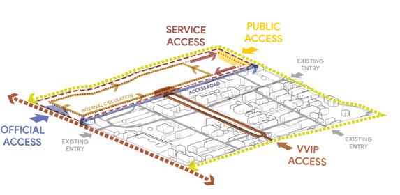
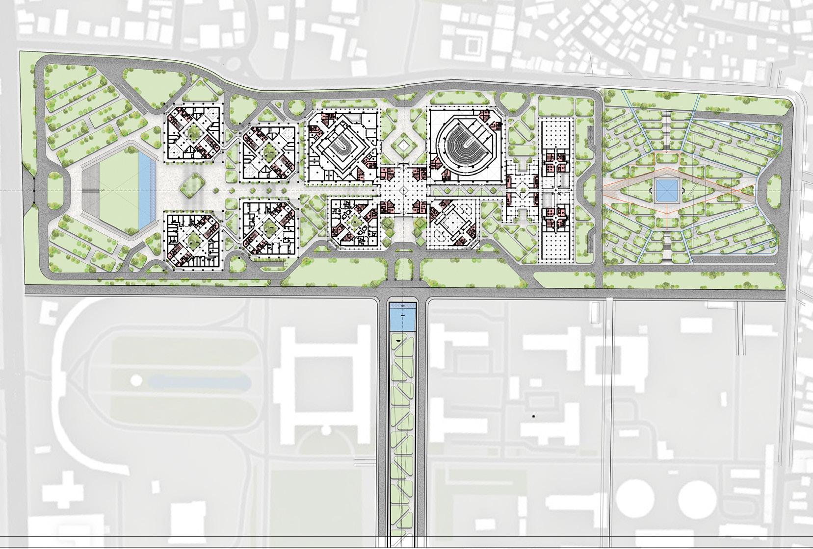
Vehicular movement limited to the site edges ensuring pedestrianised complex. VIP access provided along the primary frontages interfacing institutional zones, and public access on the residential periphery.
Vehicular movement limited to the site edges ensuring pedestrianised complex. VIP access provided along the primary frontages interfacing institutional zones, and public access on the residential periphery.
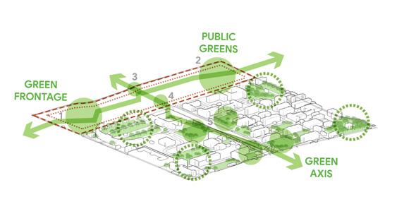
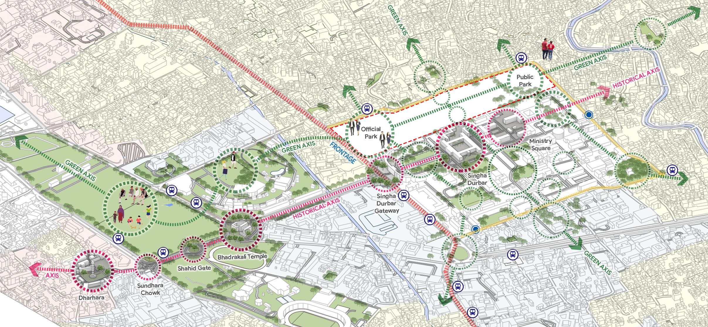
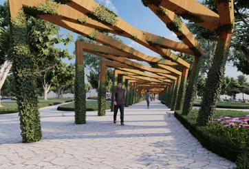
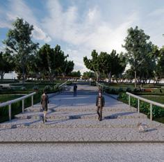
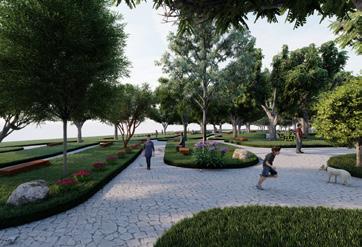
The greens in the complex have been developed keeping in mind the existing tree clusters and green parcels creating a green axis. Green parcels have been provided as buffer along the site frontages.
The greens in the complex have been developed keeping in mind the existing tree clusters and green parcels creating a green axis. Green parcels have been provided as buffer along the site frontages.
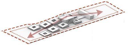
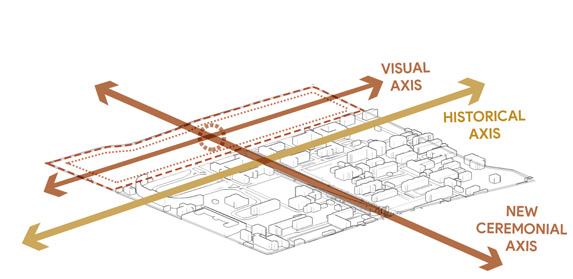
Axes have been developed on site to complement the existing historical axis and maintain visual connect throughout.
Axes have been developed on site to complement the existing historical axis and maintain visual connect throughout.
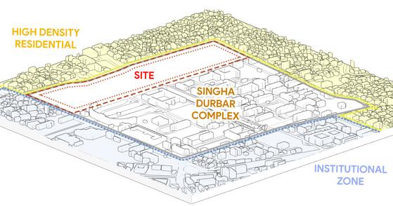
The site is located within the Singha Durbar Complex, Central Administration Zone., sandwiched between high density residential and institutional development.
The site is located within the Singha Durbar Complex, Central Administration Zone., sandwiched between high density residential and institutional development.
The vision reinstating and thus will it the symbol public, i.e.

Service Access Access Road Adjacent to Site
the project is to develop the Parliament complex as an element which brings together and orders the entire Singha Durbar Complex its former glory and making it the symbol of democracy and National importance. The complex is envisioned as a space for democracy integrate power with the public, i.e. shall be developed with spaces for both. Durbar Complex reinstating its former glory and making symbol of democracy and National importance. The complex is envisioned as a space for democracy and thus will integrate power with the shall be developed with spaces for both.
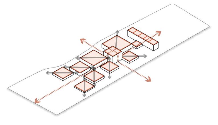
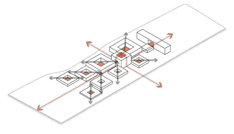
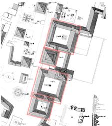
inspired by the traditional square base configuration of palaces and temples, the complex has been designed as a combination of squares each linking to another as per functional requirements.
ATRIUM
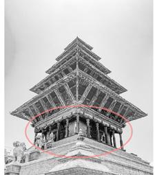
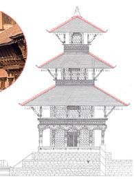
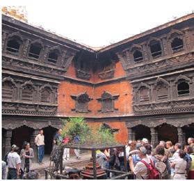
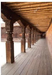
Courts and Atriums have been provided to integrate outdoor with th Indoors in all blocks. This ensures maximum daylight and ventilation of all units. The internal form of the court void reflects the traditional pagoda architecture.
COURTS ROTATED ALONG AXIS INTERNAL AND EXTERNAL CIRCUMAMBULATORY SPACE
The courts have been rotated along the functional and circulation axis. And internal and external circumambulatory space has been provided as a transition from built to open.
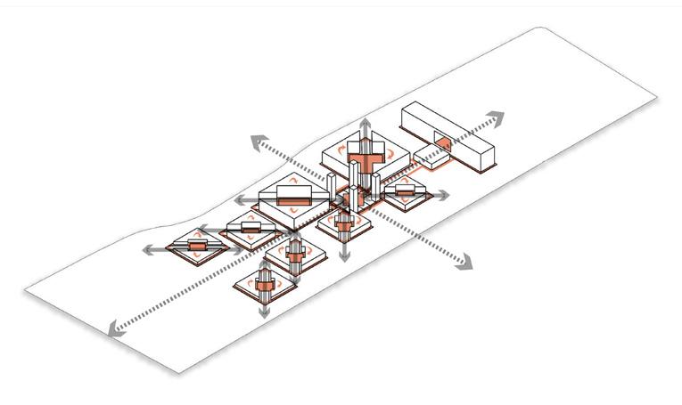
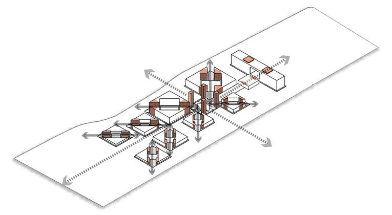
CORES ADDED ALONG AXIS
Split Cores have been added along the axis as shown for maximum efficiency . And 4 separate cores have been provided in the central lobby catering to the 4 user groups: Public, VVIP, Service and Media.

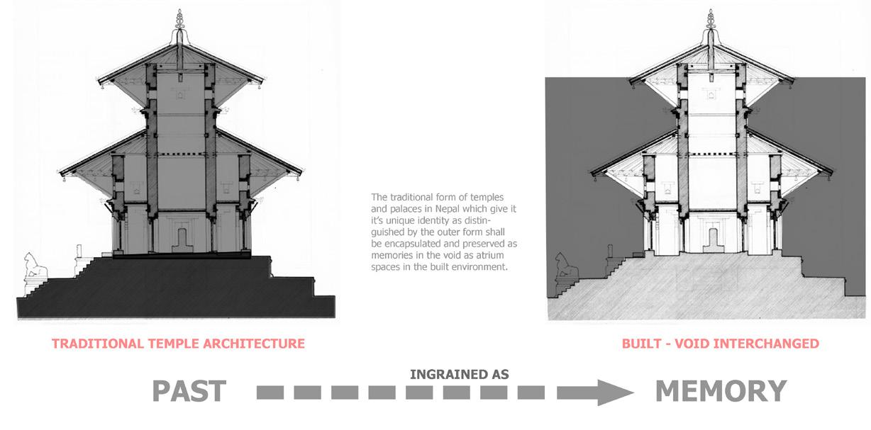
The development of this complex is not a result of a singular concept rather it is an amalgamation of multiple of them coming together to create a contemporary yet regional structure. One of the main ideas was to encapsulate the essence of the past in the structure without it being too apparent. So instead of directly using the traditional temple forms as the external articulation, it is embedded within the void spaces of the structure, storing it as memory.
The internal planning has been done based on traditional principles articulated contemporarily. One of being the large inclined steel columns designed to give an aesthetic of wood but be strong enough to support the large structure in place.
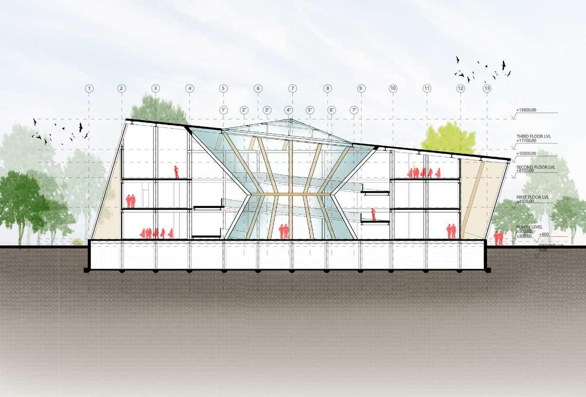
SECTION: THROUGH LIBRARY/ MUSEUM
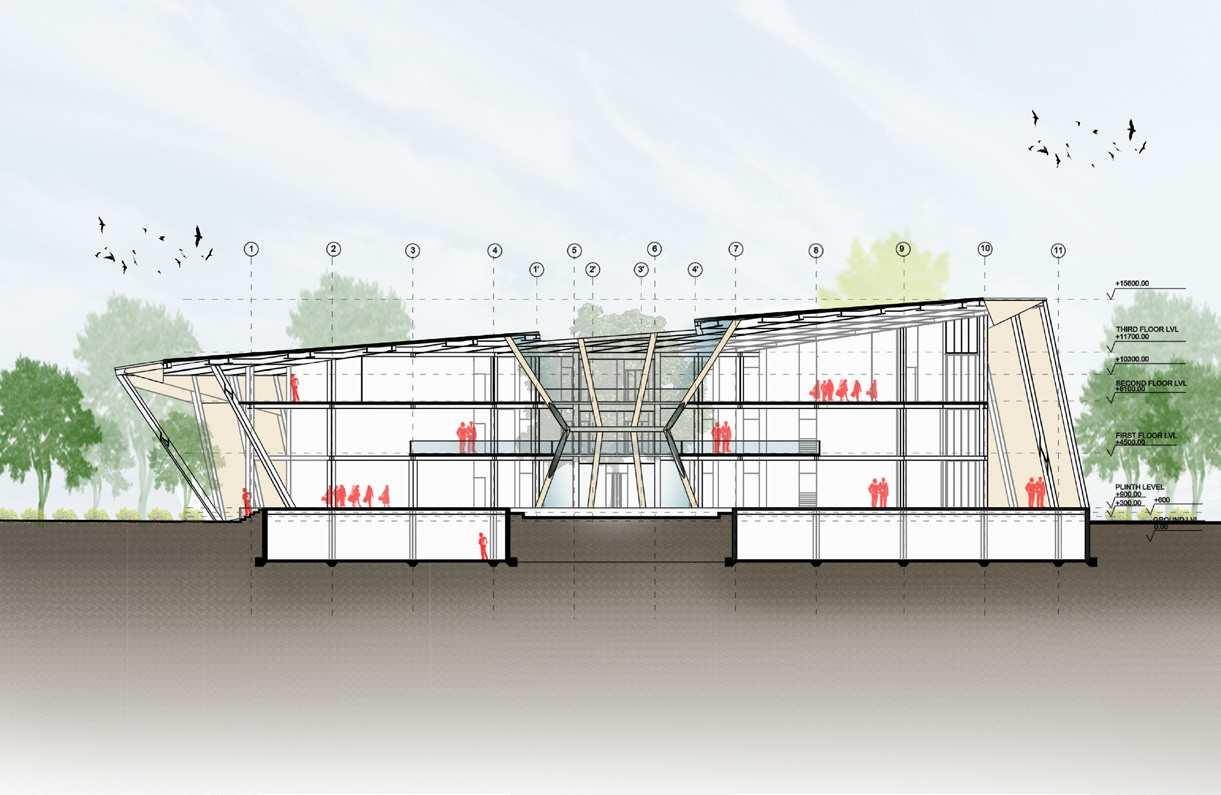
SECTION: THROUGH VVIP OFFICE
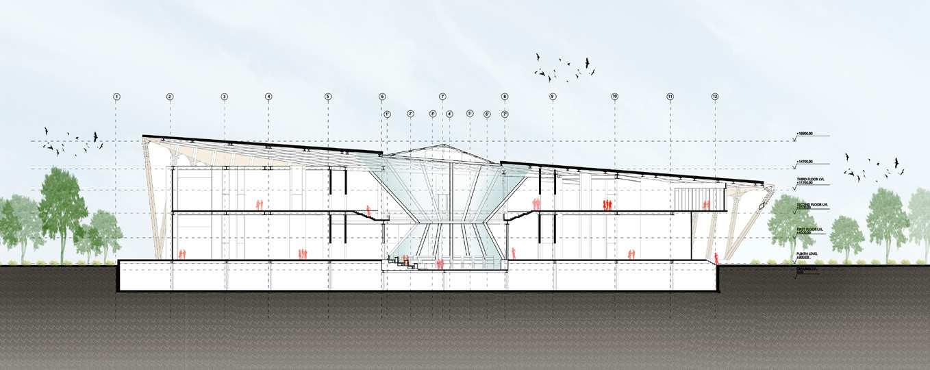
SECTION: THROUGH NATIONAL ASSEMBLY
The translation of the main idea of the development of the complex with integration of memory within the built is most apparent in the building cross sections, where the void mimics the traditional built form. The form thus though present isn’t very apparent at human scale, existing as a memory.
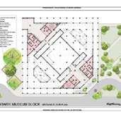
The museum has been developed in the central atrium with ramped circulation while the library exists along the periphery with maximum north and south light. Similarly the offices have also been placed along periphery with maximum light, with central area reserved for common functions like assembly hall or courtyards.
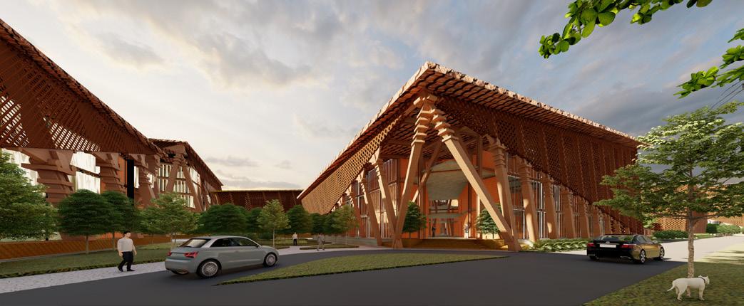
The entry of each block has been articulated with the tapered columns joining at top with one another creating a triangular entry, carrying forward the design language used across.
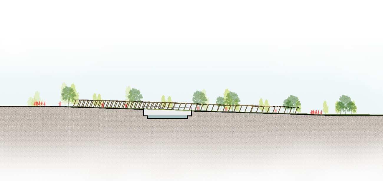
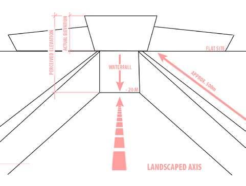
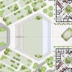
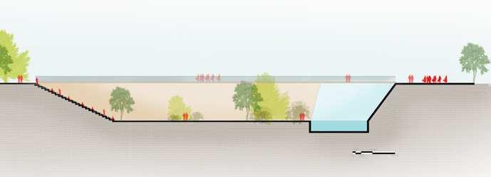
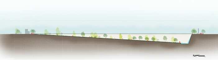
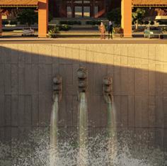
The site is mostly flat with minimal contours. The parliament building being of national imprtance and significance should ideally be placed at an elevated ground to further emphasize the grandeur and significance of the structure. However due to lack of such natural conditions or space to create that at site, the design takes an alternative approach to lower the surrounding areas to increase the perceived elevation of the Parliament. The landscapes along the ceremonial axis and official axis along the two main frontages have been lowered with waterfall at the end, which gives the impression of the structure being atop a hill with waterfall. The sound of the waterbody also helps create sound privacy across the parliament complex. Moreover, the lowered landscape near the structure ensures security within the parliament complex from the public.
This landscaped greens act as a effective buffer and provide the frontage required for appreciation of the built.
Connected to the Central Lobby,the National Assembly with a diagonal axis,houses the main hall in the central atrium with offices around in the periphery.
The design has been done with expansion consideration, upto 400 members. It houses hall in the central atrium with peripheral
OFFICIAL AXIS
The landscape along the Official Axis is like the ceremonial one, submerged to increase the perceived elevation of the Central Lobby, compensating for the flat site.
Each function has been divided into sets of two twin blocks interconnected through bridges linking the two courtyards The vehicular circulation has been restricted to the periphery with pedestrian axes running diagonally across the blocks.
This block housing the VVIPs including the Prime Minister has been luxuriously designed with large courtyard and peripheral offices and meeting rooms.
The Central Lobby articulated in grandeur a six storey atrium It is where all and people come
taken into houses the main offices
A Skywalk has been provided to connect public to the central lobby. This separates the circulation of officials and public at different levels, with controlled intersections. The space below the skywalk has been utilised as a sculpture exhibition space leading to the canteen
This landscaped greens act as a effective buffer between the public and highly secure parliament complex.
CANTEEN & SCULPTURE WALK PARK
PODIUM LVL PUBLIC CONNECT
The park slopes up one storey , connecting to the podium . This creates public circulation at an elevated level separating it from the highly secure official one.
CEREMONIAL AXIS
The landscape along the Ceremonial Axis is submerged to increase the perceived elevation of the Central Lobby, compensating for the flat site. It also creates a security buffer.
has been grandeur with atrium space. functions together.
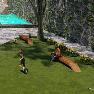
The library has been located in the periphery with maximum natural light, and Museum in the central atrium.
PARTY OFFICE
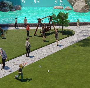
The parliamentary party office is designed as a gateway between the public and highly secure official space. The official circulation is at the ground floor level with the public circulation facilitated through the podium at first floor level.
02
Year
Location Area Guides
INTERNATIONAL CRICKET STADIUM, GHAZIABAD
Category Role 2019 Ghaziabad, India
39.6 Ac., 160,617 Sq. m.
Prof. Dr. Ranjana Mittal, Prof. Ar. Manish Gulati Collaborative Work with 1 member (Prerna Singh). Project Leader, Worked on all aspects especially Concept and Design development, 3D modelling and rendering. Included diagrams are primarily author’s work.
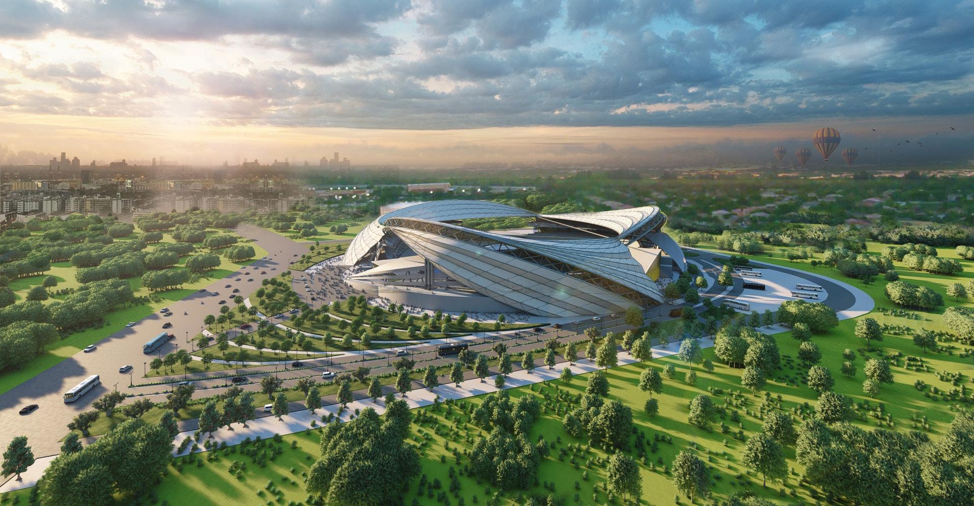
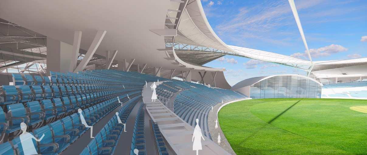
The spinner has been designed with the desire to experience the dynamism of the sport of Cricket through all five sensory perceptions. The idea is to encapsulate the essence of a spinning cricket ball, and infuse it with the architectural and structural design, for a unique user experience. The idea has been structurally captured through the tensegrity model, that is a highly stable and efficient structural system. And spatially, the stadium elegantly integrates the third dimension into its circulation through a system of interconnected ramps, unlike planar systems in conventional stadiums. The reimagined circulation ensures maximum accessibility and continuous dynamism across the stadium.
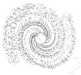
SPIN OF A CRICKET BALL
SPIN OF A CRICKET BALL
The inspiration for the stadium was derived from the geometry of a spinning cricket ball. The stadium has been articulated to encapsulate this very dynamism into all its aspects from roofing and facade to internal structure. The idea is to perceive the spin spatially. Moreover, tensegrity model has been used to resolve the roofing structure, as an innovative yet efficient system.
The inspiration for the stadium was derived from the geometry of a spinning cricket ball. The stadium has been articulated to encapsulate this very dynamism into all its aspects from roofing and facade to internal structure. The idea is to perceive the spin spatially. Moreover, tensegrity model has been used to resolve the roofing structure, as an innovative yet efficient system.
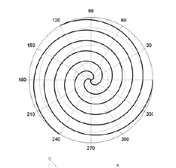
THREE ARM SPIRAL GEOMETRY
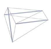
BASIC TENSEGRITY STRUCTURE
BASIC TENSEGRITY STRUCTURE
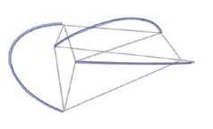
CURVED STRUTS
IMPERSONATING BALL SPIN
CURVED STRUTS IMPERSONATING BALL SPIN
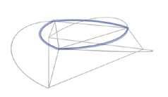
SECONDARY RINGS ADDED TO STABILIZE THE STRUCTURE
SECONDARY RINGS ADDED TO STABILIZE THE STRUCTURE
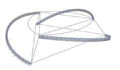
PRIMARY MEMBERS MADE WITH SQUARE SPACE TRUSS
PRIMARY MEMBERS MADE WITH SQUARE SPACE TRUSS
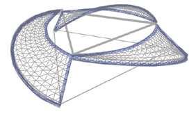
SECONDARY MEMBERS SPANNED BETWEEN THE PRIMARY MEMRANES
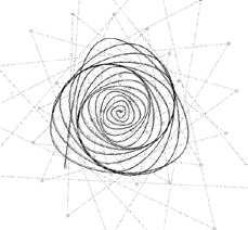
SPIRAL MODULATED AS PER SITE CORNERS
SPIRAL MODULATED AS PER SITE CORNERS
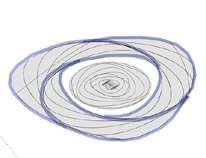
SPIRAL TAKEN AS BASE FOR SEATING BAYS
SPIRAL TAKEN AS BASE FOR SEATING BAYS
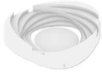
SURFACES EXTRUDED AS PER SIGHT REQUIREMENTS
SURFACES EXTRUDED AS PER SIGHT REQUIREMENTS
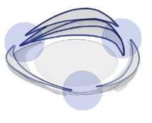
AISLES RAMPED ALONG CURVE CULMINATING AT COMMON NODES
AISLES RAMPED ALONG CURVE CULMINATING AT COMMON NODES
SECONDARY MEMBERS SPANNED BETWEEN THE PRIMARY MEMRANES
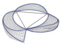
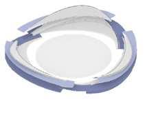
RAMPS EXTENDED AS CONCOURSE
RAMPS EXTENDED AS CONCOURSE
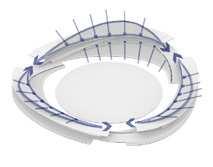
CROSS AISLES AND VOMITORIES ADDED
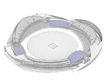
FINAL
CROSS AISLES AND VOMITORIES ADDED FINAL SEATING WITH ADDITION OF
STANDS AT INEFFICIENT JUNCTIONS
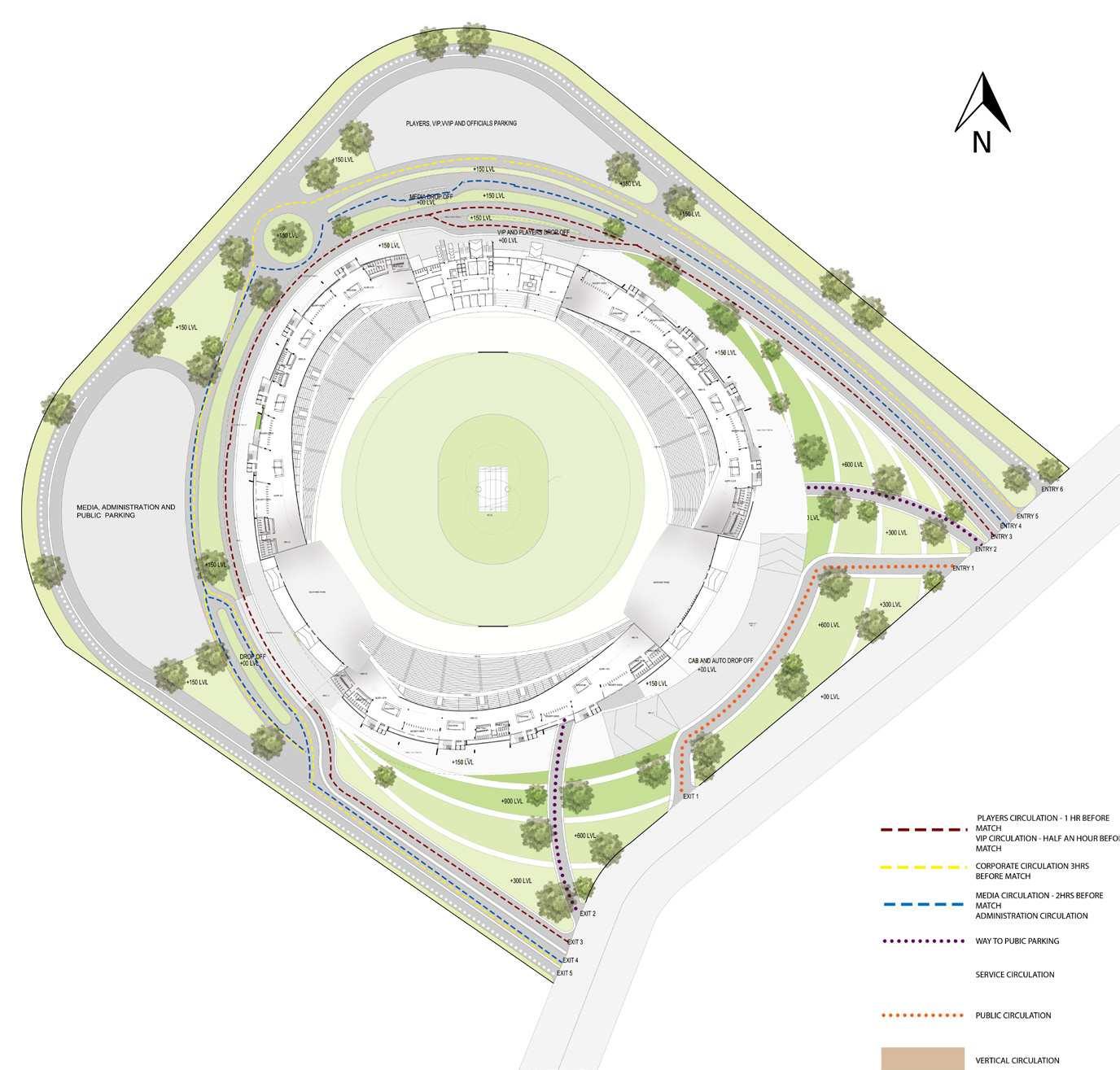


CIRCULATION ( 1 HR. BEFORE MATCH)
CIRCULATION (0.5 HR. BEFORE MATCH)
CORPORATE CIRCULATION (3HRs. BEFORE MATCH) MEDIA CIRCULATION (2HRs. BEFORE MATCH)
ADMINISTRATIVE CIRCULATION
WAY TO PUBLIC PARKING
SERVICE CIRCULATION
PUBLIC CIRCULATION
VERTICAL CIRCULATION
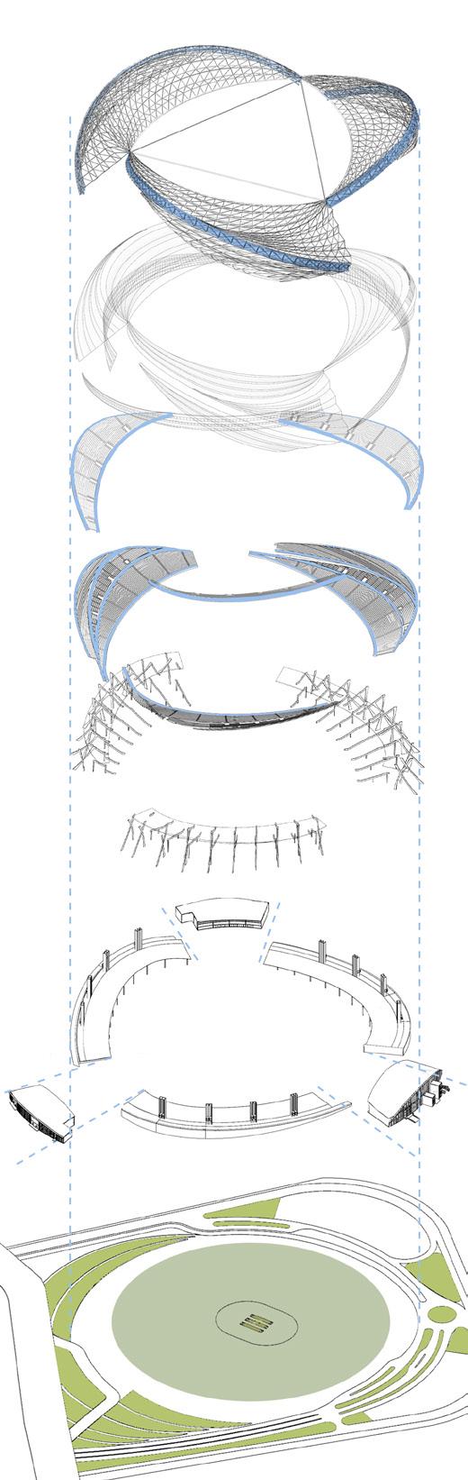
ROOFING STRUCTURE
TENSEGRITY MODEL
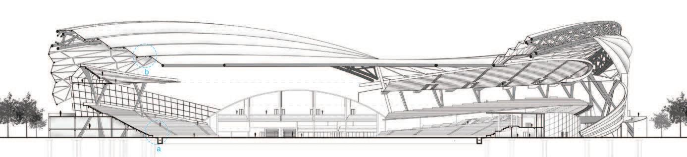
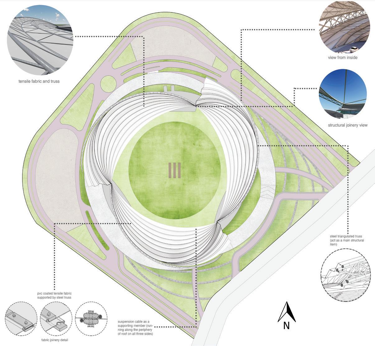
The roofing structure has been inspired by curved three strut tensegrity model. The struts in the form of steel square space truss are held together by tension rings at the top and bottom. Secondary members span between these primary members to support the roof membrane.
ROOF SKIN & FACADE MEMBRANES
For facade Curtain Glazing curved along with the form. For roofing, tensile fabric stretched in-between steel mesh roofing system.
SEATING
UPPER AND LOWER SEATING
Seating divided into two levels to ensure maximum visibility. The aisles across the seating have been ramped, which connect at the junctions creating a continuous loop .
SEATING STRUCTURE
SEATING BOWL
Steel and Concrete Composite Structure. The structure is an array of steel X-Columns braced together to support the concrete slabs of seating bowl above.
CONCOURSE & STANDS
LEVEL 1
Concourse accessed through ramped podium at level 1 , leaving space for parking below concourse. 3 VVIP Stands inserted at the junction between three concourses.
CIRCULATION & LANDSCAPE
LEVEL 0
The circulation for different uses have been differentiated yet clubbed together at the site edges to achieve maximum landscaped frontage and parcels within the site.

GK 1 N Block, South Delhi, India
12.7 Hectares, 1,27,043 Sq. m.
12.7 Hectares, 1,27,043 Sq. m.
Prof. Dr. Amit Hajela
Prof. Dr. Amit Hajela
Periyasamy,
Kathula).
Sai Busam, Ankith Kathula).
GREEN CORRIDOR EMPHASIZING EXISTING PARK
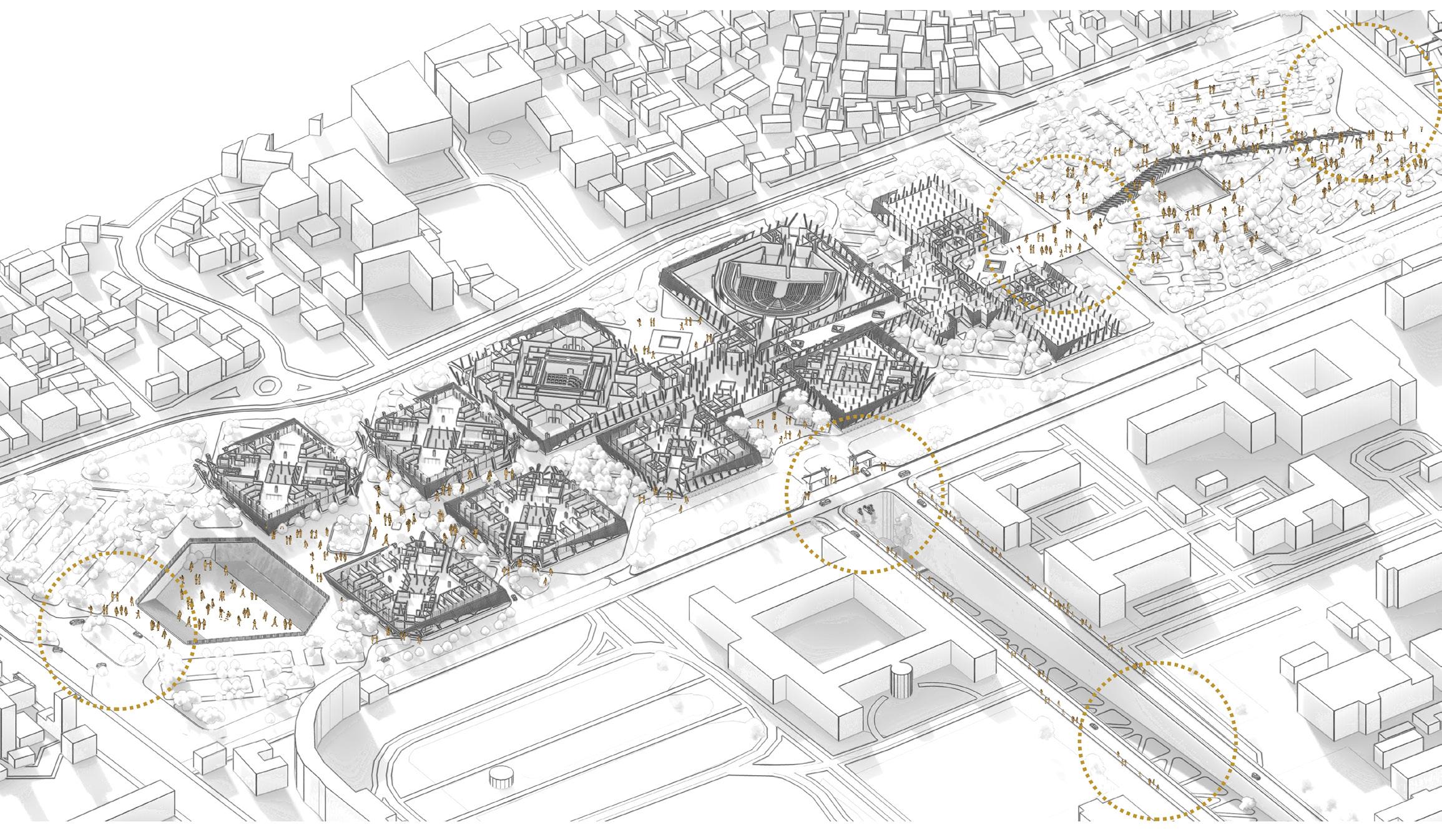
SITE AXONOMETRIC - AUTHOR

VIEW AND GREEN CONNECT
TREE WALK COMMUNITY SPILL OUT
RECESSED RETAIL AND SOCIAL INFRASTRUCTURE

RETAIL ALONG AXIS AND CENTRAL PARK
DESIGN: ALL
RENDER + HOTEL BLOCK AND SITE - AUTHOR DIAGRAM - AUTHOR
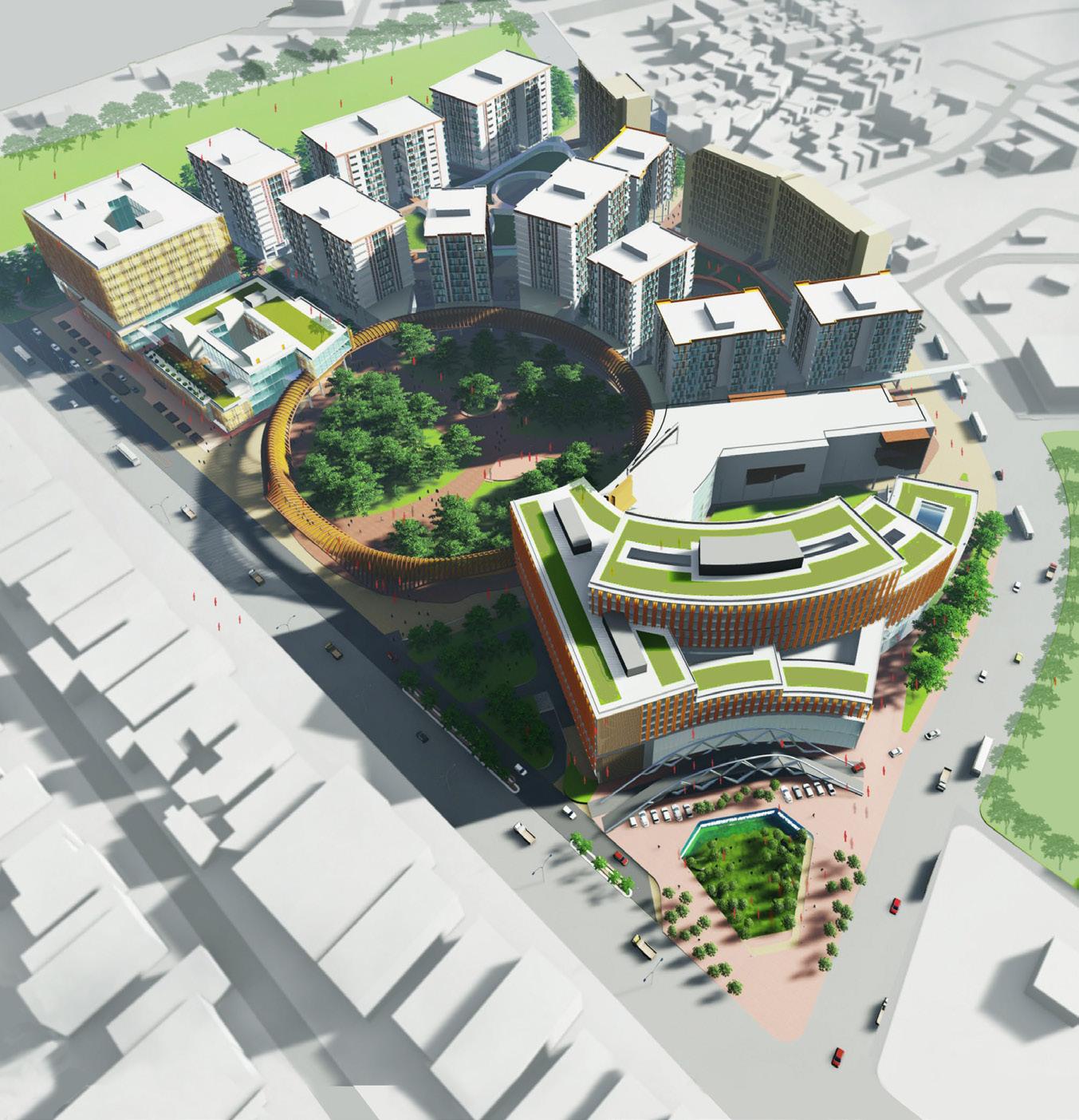
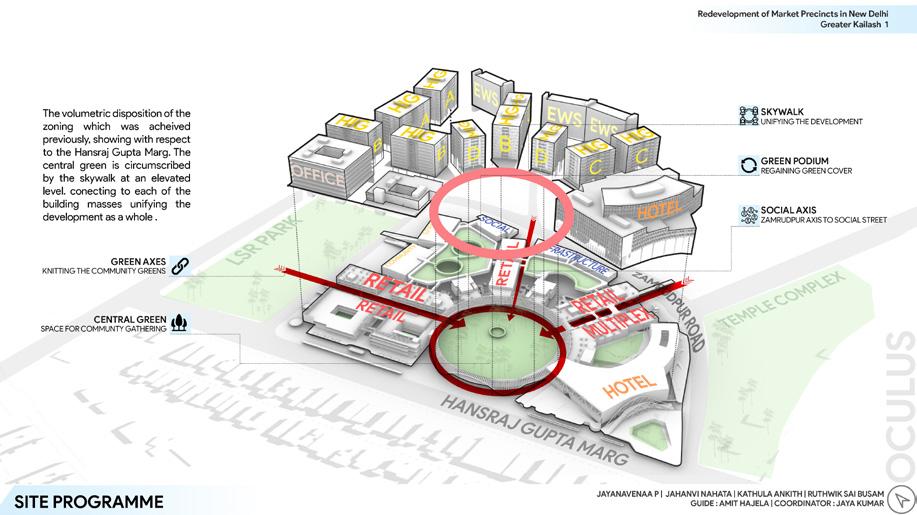
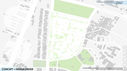
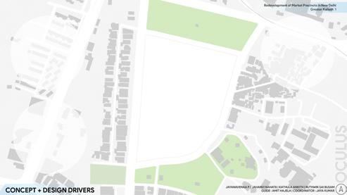
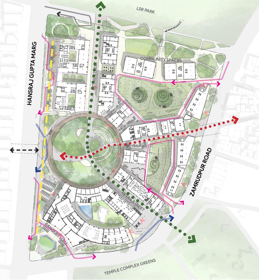
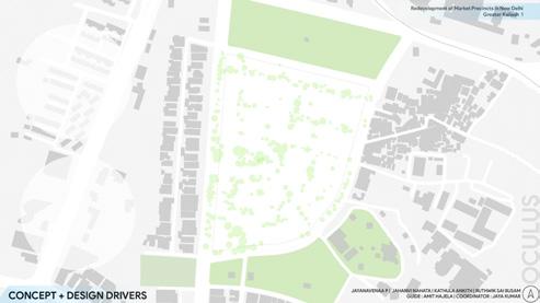
The project has developed with aspirations of integration of, all the diverse activities, communities, and green parcels in and out of site, for coherence and vibrance. The green park in the center of the development, along with the circular skywalk from which the complex derives it’s name knits together all the different functions into one. Protecting the existing trees and green parcels ahas also been a major cue for design development of this project.
The mission in lieu promotes accessibility, inclusivity and welfare creating a heightened sense of community and well-being through regeneration AERIALSITE PLAN
UNDERPASS AND TABLETOP CONNECTIONS
DIAGRAM - AUTHOR
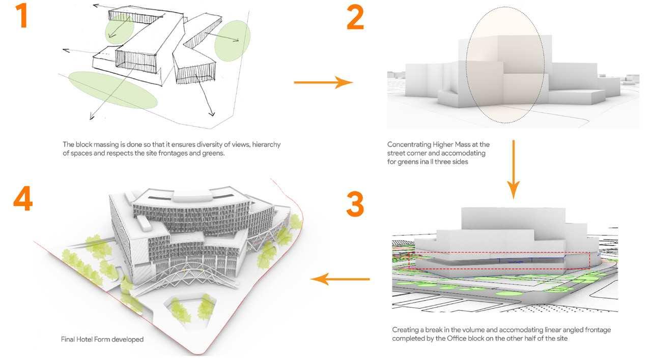
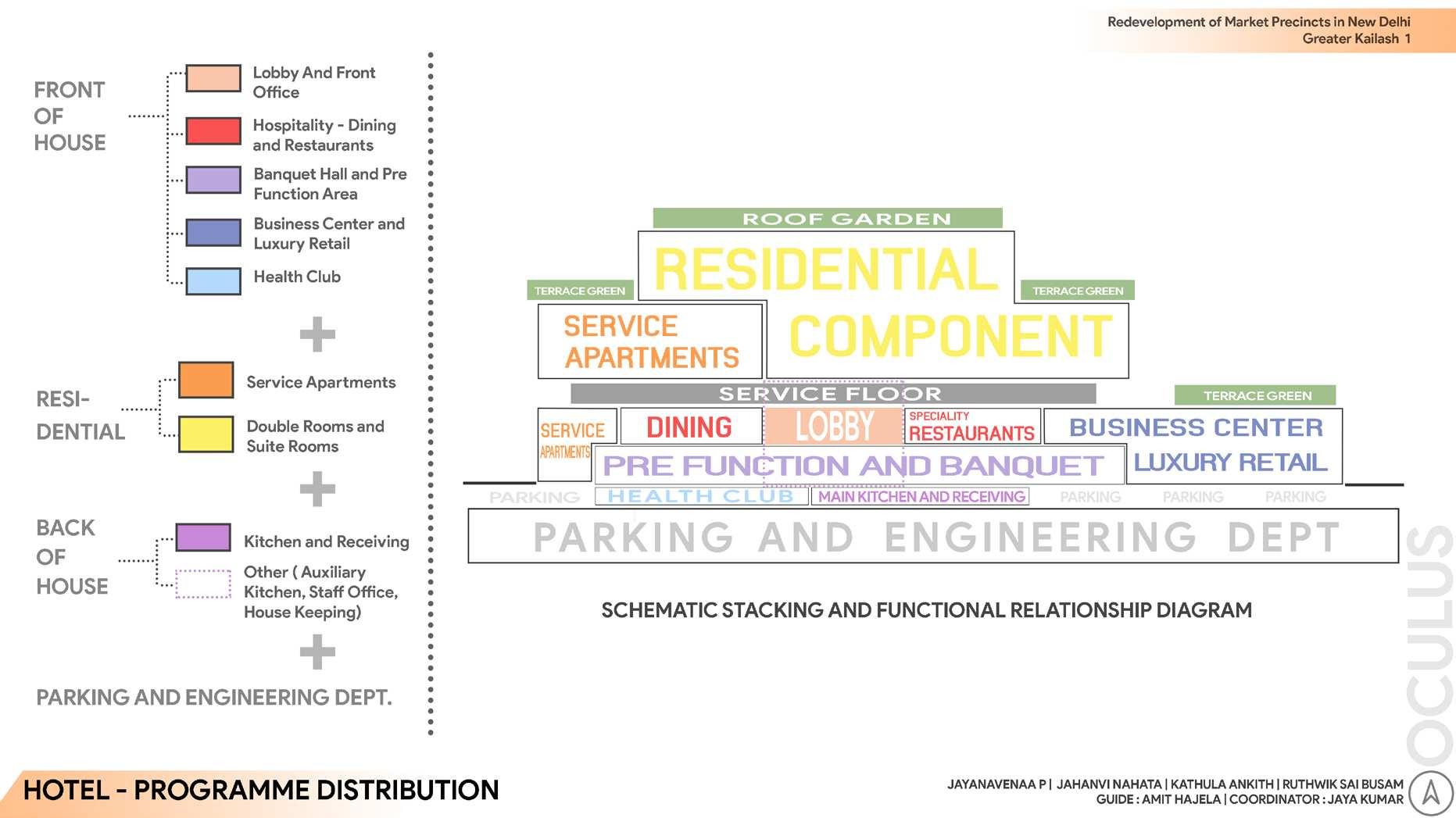
The hotel and service apartments sharing many facilities have been zoned together as one entity that caters to a population of 4000. The rooms and service apartments have been zoned near the corner of the site as the highest built providing views across the Hansraj Gupta Marg and temple park.
The hotel massing developed to cut the least number of trees in the area and develop frontages on all three sides. The massing ensured hierarchy of spaces, diversity of views multiple green pockets with varying degrees of publicness.
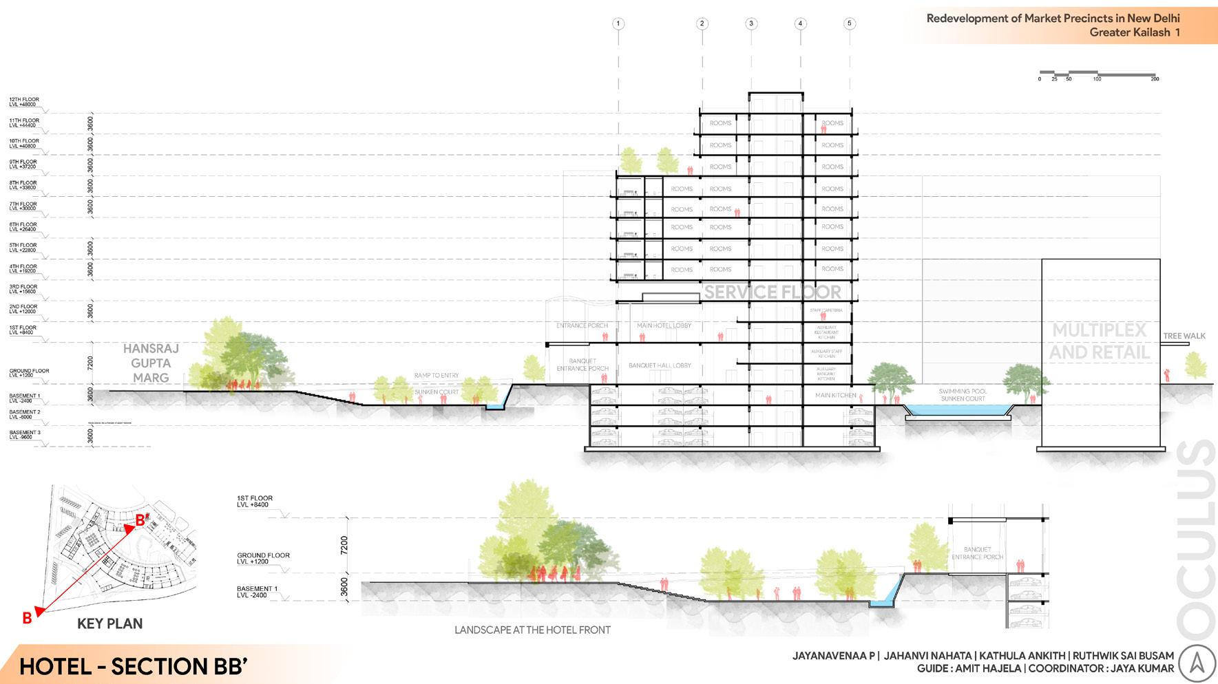
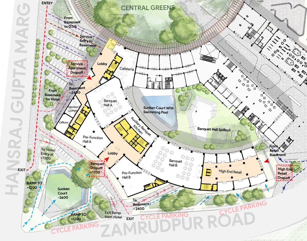
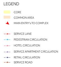
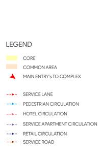
The site edges provide seamless pedestrian flow, cycle parks and the corner has a sunken court as a welcoming public plaza. The lower level public functions have been accentuated with the use of large structural V- columns coupled with structural glazing.The
SUITABILITY ANALYSIS
DESIGN DETAIL
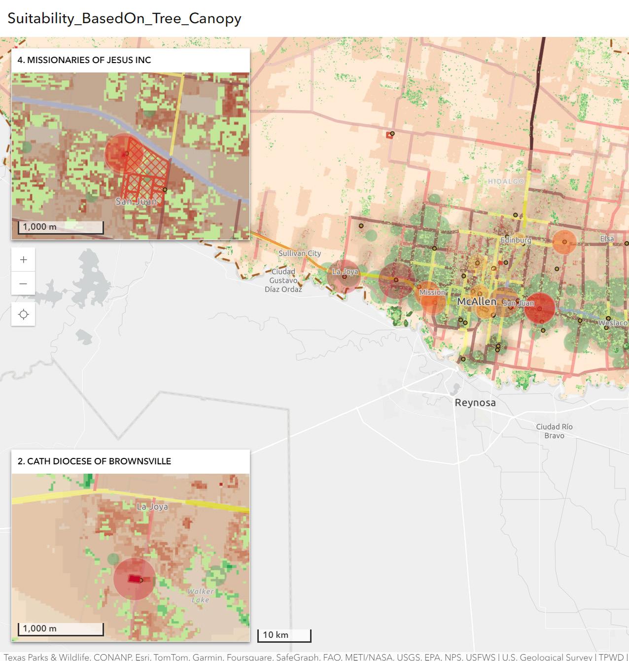
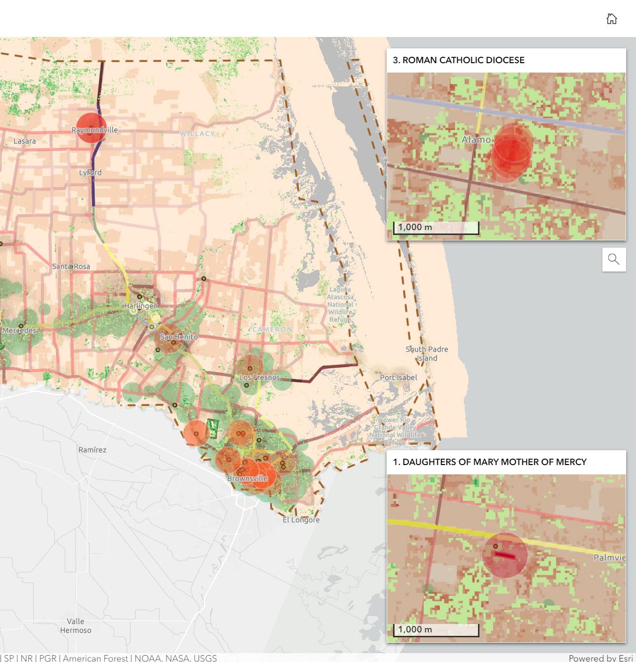
Suitability Analysis done through ARCGIS Pro to find suitable parcels for Tree Plantation on the Parcels owned by Catholic Church in Brownsville, Texas to counter the Urban Heat Island Effect. Our project delves into existing landbased solutions for climate action and humanitarian crises, focusing on integrating these strategies into property planning and management. We leverage principles from urban and landscape design, along with computational techniques, to reconceptualize property networks as catalysts for positive environmental and social transformation.
STORYMAP LINK: GEOHUB LINK:
HTTPS://STORYMAPS.ARCGIS.COM/STORIES/930D88A971C042C0ACE83F6C3A87A7C4
HTTPS://ARCHA6676-SPRING-2024-COLUMBIA.HUB.ARCGIS.COM/