Integrated Water Transportation in Ngagel, Surabaya QUT - Queensland University of Technology Farah Untara Nurul Izza Annisa Hazimah Tasyarin Prisidiyani
Lodz University of Technology Jakub Kowalczyk
UNTAG - Universitas 17 Agustus 1945 Surabaya Anisa Auliyya Sa'adah Fany Indra Yudha Pamungkas Rasta Labbaika Kaawoan
Universidad de los Andes David Diaz
Content Background Macro Climate Urban Analysis Social Analysis Sustainable Development Goals Ngagel Area History Landmark Site Analysis Risk of Natural Hazards Floods Earthquake Socio-Cultural and Historical Analysis Urban Public Space Analysis Design Exploration and Discussion Design Concept Map Program Water Transport Network Climate Adaptation Signage Mockup The Module Before-After Image Renders
Background
A tropical weather with average monthly temperature is 25°C in August up to 34°C in April. The Average rainfall per year reaches 1560mm which happen 90% during rainfall season.
Macro Climate
Geographically, Surabaya is lower than sea level. Thus creating puddles on certain areas especially in blue squared area.
The biggest proportion of land are housing and settlement development with 42% while open land recorded as 16.24% and for fish farming it reaches 15.20%.
Background
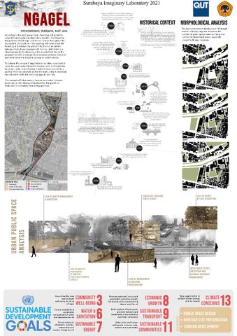
The Ngagel area lay out from south to north, start from a floodgate of the area called Pintu Air Jagir to Sulawesi Bridge. The area consist of 7 building type; Kampongs that are looks like unplanned by the government, Industrial Workshops located near residential area, there an Abandoned Buildings, an Unaccessed Green Area full of vandalism around it, Mix-use building dominance by hotels and malls, Shophouses, and Government Buildings that attached with the Pintu Air Jagir.
Urban Analysis
Background
Site - Toilet - Mosque - Historical site The site primarily works as a heritage site. The social interaction here happen mainly between tourists. NGO Building, Cafe, Shophouse and Residential - Crossroad - Ferry points The surrounding ste consist of different building type. A House Abandoned Building - Activity on the road, adjacent with transportation circulation. Car Showroom - A disadvantages point in this site.
Social Analysis
Background Ensure healthy lives and promote well-being for all of all ages through integrating people’s life with water integration transportation. Thus the sense of connecting with nature impact the well beingness of the citizen. Specially workers and tourists.
Community Well- Being
Sustainable Development Goals Clean water and sanitation has been one of the issue in the site. People are not aware with littering the river. The sustainable management of water and sanitation for all will be start through our intervention with a educational poster and rainwater collection.
Water and Sanitation
Ensure access to affordable, reliable and sustainable energy for people in Ngagel. Making sure that people in all ages get the same opportunity and availability to modern energy.
Promote the sustained, inclusive and sustainable economic growth, full and productive employment and decent work for all. In this proposal we give an idea of commute lanes route meant to worker. With this route we hope economic growth will be helped.
Sustainable Energy
Economic Growth
Build resilient infrastructure, promote inclusive and sustainable industrialisation and faster innovation. Proposed Water Transportation System utilise the river for better community.
Make ngagel and the citizens inclusive, safe, resilient and sustainable. The big aim in this proposal is to create a sustainable community in ngagel through a new network system that could make the city iconic thus attract tourist.
Raising awareness of environmental issues regarding climate change to people of Ngagel. Hence, building an environmentally conscious community in Ngagel and its surroundings.
Sustainable Transport
Sustainable Communities
Climate Conscious
Key aspects: Public Space Design Heritage site preservation Tourism development
Background
Landmark
Background
Findings: - Slow economic growth - Weak impression - Water & sanitation issue
Site Analysis
Background
Urban Development
Site Analysis
Green Spaces
Current Condition
Risk of Natural Hazards: Floods
Source:Imaduddina, Annisaa H. & Subagyo, Widiyanto H. (2014) Sea Level Rise Flood Zones: Mitigating Floods in Surabaya Coastal Area Sulma, Sayidah, et al. (2013) Coastal Physical Vulnerability of Surabaya and Its Surrounding Area to Sea Level Rise
Risk of Natural Hazards: Earthquake
Source: Pamungkas, Adjie, et al (2019) Surabaya Resilience Index for Potential Earthquakes: An Institutional Perspective Why is it relevant?: It points out the new threat to Surabaya, namely possible earthquakes and assesses the city's actions in counteracting its effects. Notes: Earthquake is a relatively new threat to Surabaya due to Kendeng Thrust and the authorities have not responded to that threat yet. Even though among 19 Asia-Pacific cities Surabaya scores average in handling general disasters, it scores low to mediocre in handling earthquakes. The actions must be taken now, when there is no serious damage yet. The UN estimates that each 1 USD spent on resilience can save 7 USD spent on recovery after damage. What needs improvement, for sure, is the early warning system. Furthermore, the city needs to include this new risk in its housing plans and policies and create a plan for the case of earthquake disaster.
Risk of Natural Hazards: Earthquake
Source: Martínez-Cuevas, S., et al (2017) Urban Modifiers of Seismic Vulnerability Aimed at Urban Zoning Regulations Why is it relevant?: It is a very interesting urban design study which analyzes plenty of urban modifiers and their impact on buildings endurance during earthquakes. So, you can find there, for example, that buildings with regular shapes (as opposed to those with cut corners) generally perform better.
Risk of Natural Hazards: Earthquake
Notes: The most interesting part of this paper is a case study of the Lorca(Spain) earthquake where buildings were analyzed according to 13 different modifiers presented in the tables below. Then there are graphs analyzing what part of these buildings suffered structural damage in the earthquake. They are split into masonry and rc buildings (and even divided according to type of soil, but that might be too specific for now). As this paper could be of great use for Surabaya Town Planners in general, it could help us analyze if buildings on our plot are in danger and if so, then help us prepare designs which improve its resilience. Effects possible on our plot are: hammering effect (when adjacent buildings hit each other), plan irregularity in Punden, and unaligned buildings (three Makams). SUMMARY: There is a need to provide practical solutions which weaken the effect of earthquakes in Ngagel area. ● ● ● ●
Adding shear walls Stiffen or reinforce masonry elements and chimneys Strengthen a soft story (story prone to earthquake due to lots of openings) Make sure it is anchored to foundations
Socio-cultural & Historical Analysis
Cultural Aspects around mataram era cemetery Keywords: Heritage sites, protected, family, Precolonial architecture HIstorical context: Ki Ageng Pengging was a notable islamic leader that had many followers, some of the followers were Mbah Suro Kuning and Mbah Boyo; who helped found Surabaya. Ki Ageng Pengging was exiled from Demak Kingdom, then killed by Sunan Kudus because of the teaching he preach about ‘Manunggaling Kawulo Gusti’ (union with God) which he learn from Syeikh Siti Jenar who was labeled heretic by the general consensus. Ki Ageng Pengging son Jaka Tingkir was the founder and first king of the Sultanate of Pajang. Source: Babad Tanah Jawi Manuscript According to the one of the interview with local government that manages the cemetery, the plan was to develop it as a religious tourism site.
Socio-cultural & Historical Analysis
Socio-cultural & Historical Analysis
HISTORICAL CONTEXT
Historical Context
Socio-cultural & Historical Analysis
HISTORICAL CONTEXT
Historical Context
Urban Public Space Analysis
Design Exploration & Discussion
Traffic/circulation issue: Water Transportation / Water Tourism ● ● ●
2 ways transportation ways 1 narrow pedestrian ways Wide river for water transportation Water transportation plan using solar energy, 20 peoples per boat
Kalimas River tour by boat near Prestasi Park, Monkasel
Design Exploration & Discussion Colour Exploration
Kampong Facade and Typology
Roof Typology
Design Exploration & Discussion
Sketches
Precedents
Gasibu Memorial wall, Bandung, West Java, Indonesia Source: Google Earth, 2021
Lapangan Banteng Monument in Jakarta, Indonesia Source: https://www.casaindonesia.com/arti cle/read/1/2019/855/Taman-FavoritFakta-Menarik-Mengenai-Lapangan -Banteng
Design Exploration & Discussion
Sketches
Precedents
Signage design to raise the awareness of local sustainable problems such as trash all over the river, sanitary problem, as well as historical storyboards.
Design Proposal Design Concept Map Program Water Transport Network Climate Adaptation Signage Mockup The Module Before-After Image Renders
Design
Concept Map
Design
Program
Design
Water Transport Network
Climate Adaptation
Wall Module with water catchment integrated system
PUBLIC SPACE
DESIGN & MANAGEMENT
CLIMATE ADAPTATION
SDG GOALS
Design
Design
Earthquake Defense Aspect of The Design
Climate Adaptation
Design
Signage mock up
HERITAGE
Signage mock up
PRESERVATION & MANAGEMENT
PUBLIC SPACE
DESIGN & MANAGEMENT
SDG GOALS
An effective signage design will communicate the intention better. This way, it is expected that people will better comprehend the purpose in relation to changing their behaviour and raising their awareness.
Design
Signage mock up
HERITAGE
Signage mock up
PRESERVATION & MANAGEMENT
PUBLIC SPACE
DESIGN & MANAGEMENT
SDG GOALS
An effective signage design will communicate the intention better. This way, it is expected that people will better comprehend the purpose in relation to changing their behaviour and raising their awareness.
Design
The Module
Ferry Point
Crossroad
Educational Wall
Commuting through Jagir river is a daily life for the locals. To integrate lifestyle of the citizen, a ferry point located near landmarks are proposed.
On the side of the river, lie road follows the river bank. But the presence of crossroads are nowhere to found. In this proposal, crossroad come in every set of module, integrating the ferry point to the building environment.
Vandalism on building wall is one of the city’s social problem. To encounter this problem, an educational wall including rain-water collect is proposed.
Design
Before
After
Before-after Render
Design
Render
HERITAGE
Ngagel Street
PRESERVATION & MANAGEMENT
PUBLIC SPACE
DESIGN & MANAGEMENT
CLIMATE ADAPTATION
Render
PUBLIC SPACE
Ferry Point
DESIGN & MANAGEMENT
CLIMATE ADAPTATION
SDG GOALS
Design
Mataram Memorial Wall with water catchment integrated system
HERITAGE PRESERVATION & MANAGEMENT
Render
PUBLIC SPACE
DESIGN & MANAGEMENT
SDG GOALS
Design - Heritage Preservation & Public space intervention
Render
HERITAGE
Mataram Era Cemetery Revitalisation
PRESERVATION & MANAGEMENT
PUBLIC SPACE
DESIGN & MANAGEMENT
SDG GOALS
Design
Render
HERITAGE
Mataram Era Cemetery Revitalisation
PRESERVATION & MANAGEMENT
PUBLIC SPACE
DESIGN & MANAGEMENT
SDG GOALS
Design
Integrated Water Transportation in Ngagel, Surabaya
Terima kasih. Gracias. Dziękuję Ci. Thank you. QUT - Queensland University of Technology Farah Untara Nurul Izza Annisa Hazimah Tasyarin Prisidiyani
Lodz University of Technology Jakub Kowalczyk
UNTAG - Universitas 17 Agustus 1945 Surabaya Anisa Auliyya Sa'adah Fany Indra Yudha Pamungkas Rasta Labbaika Kaawoan
Universidad de los Andes David Diaz