ad
ad
Mesabi MesabiTrail Trail
oa d er R Tow oad er R Tow
Maple Maple Hill Hill Park Park
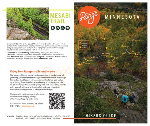
162 miles paved Mesabi Explore Explore allall 130 130 miles ofof thethe paved Mesabi Trail Trail byby bicycle, foot, horse! This trail connects bicycle, onon foot, oror byby horse! This trail connects allall ofof our Iron Range communities (and then some) and our Iron Range communities (and then some) and provides great views and activities along way. Park provides great views and activities along thethe way. Park trail heads (found every community) and walk at at trail heads (found inin every community) and walk asas you like. See map back cover. farfar asas you like. See map onon back cover.
MINNESOTA
LOCATIONS LOCATIONS OFOF NOTE NOTE Hibbing: Hibbing: North North Hibbing Hibbing history history and and mine mine views views Chisholm: Chisholm: Lakewalk, Lakewalk, Bruce Bruce Mine Mine Headframe Headframe and and Redhead Redhead Mountain Mountain Bike Bike Park Park Mountain Mountain Iron: Iron: Locomotive Locomotive Park Park Virginia: Virginia: Olcott Olcott Park Park Aurora: Aurora: Lake Lake StSt James James trail. trail.
Embarrass
MESABI TRAIL
Big Aspen
FOR FOR MAPS MAPS AND AND TOTO LEARN LEARN MORE MORE Community Explore all 162 miles of the paved Mesabi Trail by bicycle, e-bike, on foot, or Mesabi Trail mesabitrail.com by horse! This trail connects all of our Iron Range communitiesmesabitrail.com (and then some) Trail head and provides great views and activities along the way. Park at trail heads Laurentian Divide (found in every community) and walk as far as you like. AURORA AURORA| BIWABIK | BIWABIK| BUHL | BUHL| CHISHOLM | CHISHOLM| EMBARRASS | EMBARRASS| EVELETH | EVELETH| GILBERT | GILBERT| HIBBING | HIBBING| HOYT | HOYT LAKES LAKES| MOUNTAIN | MOUNTAIN IRON IRON| VIRGINIA | VIRGINIA Locations of note: Hibbing: North Hibbing history and mine views. Virginia Chisholm: Lakewalk, Bruce Mine Headframe and Redhead Mountain Bike Mountain Iron Bridgewalk Park. Mountain Iron: Locomotive Park. Virginia: Olcott Park. Aurora: Lake St Buhl Chisholm Gilbert James trail. For maps and to learn more: mesabitrail.com Redhead Carey Lake
Eveleth
Hibbing Maple Hill
Enjoy Iron Range trails and views The beauty of hiking on the Iron Range is that it can be done all year long. Different seasons bring different benefits to Iron Range hiking. See the blaze of fall leaves; smell the forest as it wakes up in spring. Enjoy the clear white beauty of a crisp winter hike on an Iron Range trail. Spend quality time with your family, friends, or by yourself with one of the simplest and most rewarding outdoor activities possible — hiking the Iron Range. Make sure to visit ironrange.org for more information on lodging, dining, attractions, shopping and events. 111 Station 44 Road, Eveleth, MN 55734 218 749 8161 | ironrange.org
AURORA | BIWABIK | BUHL | CHISHOLM | EMBARRASS | EVELETH | GILBERT HIBBING | HOYT LAKES | MOUNTAIN IRON | VIRGINIA
HIKERS GUIDE
Giants Ridge
Biwabik
St. James Trail Aurora Hoyt Lakes Bird Lake
Erickson Road
MAPLE HILL
o er R Tow
Carey Lake
W H AT TO E X P E CT
ad
What to expect Family-friendly recreation NOTABLE TOWN MILESbeach SURFACE area with picnic sites, a swimming andHibbing a fishing pier. Trail loops are two Trail loops Grass Within city limits Maple Hill to four miles long through woods near Park the lake (please remember from to pick2-4 up miles after your dog). Pines and birch make for colorful fall views. Map shows winter-use High-landFamily-friendly and Whattrails, to use expect recreation area with picnic sites, a Lakeview in the summer and fall. swimming beach and a fishing pier. Trail loops are two to four miles long Please obey signs designating trails for through winter use.woods Inside near Hibbing limits. thecity lake (please remember to pick up after your dog). Pines
LEGEND LEGEND
Trail Trail Direction
Trail Head 22 1 1 1 P1 P2 1
TrailBlack Direction Forest
Combination Trail
Southern Lights Combination Trail Classical-Only Trail
Highland Lakeview Trail Head / Parking Carey Creek Skate-Only Trail Skate-OnlyTrail Trail Classical-Only
Trail Intersections
01
---
Trail Head / Parking
P1
Trail Intersections
1 ---
P2
022
22
and birch make for colorful fall views. Map shows winter-use trails, use Highin the summer and fall. Please obey signs designating trails TOWN land and Lakeview SURFACE Hibbing, MN Grass for winter use. Inside Hibbing city limits. Mi.DISTANCE Km. NOTABLE TOWN DISTANCE 2.42Trail3.89 GETTINGHibbing, HEREMN loops from 2-4 mi. Within city limits Approx. 2 miles 1.88 3.03 FROM NORTH OR SOUTH 1.90 3.06 Turn east at the intersection of Hwy 4.06 6.53 2.80 4.51 18 169 and 25th Street in Hibbing and 17 18 17 follow approximately 2.5 miles to LAKEVIEW Lakeview Carey Lake Recreation Area 19
BLACK FOREST (LIGHTED)
CAREY LAKE
More Difficult (LIGHTED) 22 FOREST Most Difficult BLACK 21 P1 N Dublin Road
Dupont Road
22
Dupont Road
Km. 3.89 3.03 3.06 6.53 4.51
This small city park is full of ups and downs, with a pond sheltered beneath the trees, and a peak that features a scenic view for miles. True to its name, this trail system is thick with maples, making it a great fall destination. Getting here from the North: Take Hwy 73 South from Hibbing and turn east on Maple Hill Road. Getting here from the South: Use Hwy 73 heading north to Maple Hill Road, turn east.
SURFACE Grass, Dirt
NOTABLE
Fall Favorite
19
Easiest
P1
W H AT TO EXPECT
SAX ZIM BOG
TRAIL DIFFICULTY
N Dublin Road
Mi. 42 88 90 06 80
CAR E Y L A K E
Lindquist Road (49th Street)
5
21 4
16
Easiest
CAREY LAKE 8 10
20
4
TRAIL DIFFICULTY
2
20
SOUTHERN LIGHTS
P2 1
15
3 6
5
2
P2 1
16
8
11 13
HIGHLAND
7
14
12
Getting here from North or South: Turn east at the intersection 11 SOUTHERN LIGHTS of Highway 169 and 25th Street in Hibbing and follow 15 13 3 6 approximately 2.5 miles to Carey Lake Recreation Area 18 LAKEVIEW
2 | HIBBING 17
Most Difficult Combination Trail
Classical-Only Trail
9
1412
7
More Difficult Trail Direction
9
CAREY CREEK
HIGHLAND
LEGEND
10
SURFACE
TOWN
Meadowlands, MN
Natural/Boardwalk
DISTANCE
Sax-Zim Bog is a renown birding area
Varies
NOTABLE
Skate-Only Trail Trail Head / Parking
P1
P2
Birders flock to the Sax-Zim Bog in the winter to catch a glimpse 1 --22 or even a photo of the Great Grey Owl, Northern Hawk Owl, Snowy Owl, Boreal Chickadee and other species. In summer, bog wildflowers, butterflies, dragonflies and other wildlife abound. Be TRAIL DIFFICULTY prepared with plenty of bug spray! Join a naturalist-guided event Easiest for the best experience. www.saxzim.org
CAREY CREEK Trail Intersections
More Difficult Most Difficult
3 | HIBBING/ZIM
Chisholm
£ ¤
9
Iron Ore
Travel through mining history
What to expect Spend hours hiking this reclaimed
REDHEAD MTB PARK
mineland, or consider a shorter 15-30 minute walk on the Spell Bound Loop: beginning on the lower leg, walk
oad hR Hig
Th
e
5.4
R
im
M es ab iT ra il
High Roa d
oa
to
d
to a clearing with 180-degree views. Return on the Getting here: Redhead Mountain Bike Park His located in Chisholm, MN, next leg to against bike traffic. Please upper th Star Lo TOWN check the website ater ! or o pW ee D ! Minnesota Discovery pCenter, 1005 Discovery Drive, just off of Hwy 169. At the Chisholm, MNincluding £ ¤ for winter and summer trail use updates, entrance, follow signs to the designated gravel parking lot or use paved for overflow. DOWNTOWN spring and fall restrictions. Trailhead hours are dawn to CHISHOLM DISTANCE ! ( 1.1 MILES ! D e e p W a t er 23.4 miles Getting here from the South and East: Take Hwy 53 to Hwy 37 East dusk to 7-days a week excluding rain and weather related Hibbing and head North on Hwy 169. ! lunge P t i P closures. Free and open to the SURFACE public. ! North Sta r Loop Iron Ore More Information: GETTING HERE Mountain Bike Park and Trail Information: Redheadmtbpark.com | 218-254-7909 NOTABLE You Are Here Redhead MTB is located in Chisholm, MN, next to Kayak/Canoe Rental Information: mndiscoverycenter.com | 218-254-7959 Travel through miningDiscovery history Trail Intersection Minnesota Discovery Center, 1005 Drive, (2 Red Ho p Bike Rentals: 30West Bike Shop | www.30westfitandrec.com | 218-254-6008 ! just off of Hwy 169. At the entrance, follow signs to the Trail Distance (mi.) 0.8 Rolle r D erby designated gravel parking lot or use paved for overflow. 0.8 Parking
ST. LOUIS COUNTY FAIRGROUNDS
Ch is ho lm
h ig
R
3
lm to Chisho
il Mesabi Tra
N
4
169
0.5
0.4 Mesabi Trail to Chisholm
Th
e Ri
m
0.1
5
5.4
44
7
Pi tP lu ng e
6
0.3
0.6
5.4
0.5
im eR Th
6
10
5.4
0.4
Red Ho p 0.1
43 ! (
!
23
12
!
0.8
Brig ht Side Co nnector
11
Food and Drink T h e Ri m FROM VIRGINIA FROM HIBBING
d Re
0.4
2 8 28 ! ( Secret Garden
0.7
36 ! ( 0.1 37 ! (
Gl en
Li ne
MINNESOTA DISCOVERY CENTER'S GLEN LOCATION
27 ! (
North Star Loop
26 26 ! ( (8 !
! (6
0.3
9
0.5
h us Cr tor ge ec an nn Or Co
ad
5.4
im
0.2
Bo
to Chisholm
169
Mesabi Trail to Chisholm
0.4
0.2
Bright Sid eL oo
Th
10
11
neyar d Lo o
l Mesabi Trai
0.6
Crossfire
12 12
Ch is ho lm
Red Hop
Red Ho p
0.1 0.1 23
2 4 24
22
0.4
to
Pit Plunge
rby De
47
e Ri
m
44
5.4
DOWNTOWN CHISHOLM 1.1 MILES
Rep eat
Rins e
0.8
0.6
41
p Ho
0.4 38
p
0.2 19 0.1 18 Bone yard Loop 17 0.2 2 21 1
7
Crossfire
0.1
Oran ge C rus 0.6 h
20
0.1 Miles ter 5 ( ! D e e p Wa fire Cross Pit PlungeInterim ATV Route
0.1
Fr ac 0.3
BIKE, KAYAK, AND CANOE RENTALS Available during open hours inside Minnesota Discovery Center M es ab iT ra il
0.4
0.8
0.1
0.1 25
0.4
Hi gh
Gl e 0.4
45 46
! (3 0.05 40.1 ! ( Expert Trail 0.5
5.4
p
Boneyard Loo p Mine B last
16
op
0.4
st
iMin
5.4
0.1
b
40 4 0
39
im eR Th
Zen
ig h t Si de L oop
ht S i d e L o
13
la
15 0.1 15 0.1
0.6
Br
B rig
14 1 4
Zen
0.2
0.3
p Bright Si d e Lo o 1.3
Trail Distance (mi.) Parking
0.8
Restrooms Food and Drink Trailhead Changing Rooms
1.0
1.0
43
T h e Ri m
Zen
ug
a
Trail Intersection
Tou gh M ama
(2 0.8
To
REDHEAD MOUNTAIN BIKE PARK
5.4
You Are Here
W H AT TO EXPECT
Spend hours hiking this reclaimed mineland, or ! ( 0 0.05 0.1 £ ¤ consider a shorter 15-30 Emergency Access ! ( ! ( Route minute walk on the Spell Miles ! ( ! ( Bound Loop: beginning on Check the mobile phone app Trailforks for Check the mobile phone Trailforks for trailand status (open/closed) trail app status (open/closed) conditions. the lower leg, walk to a ! ( ! ( and conditions. Please do not trails. ! ( ride Please do not on rideclosed on closed trails. ! ( ! ( ! ( ! ( clearing with 180-degree ! ( ! ( ! ( ! ( ! ( views. Return on the upper leg against bike traffic. ( ! (! ! ( Please check the website for ! ( ! ( ! ( winter| and summer trail| use AURORA | BIWABIK | BUHL | CHISHOLM | EMBARRASS | EVELETH | GILBERT | HIBBING | HOYT LAKES MOUNTAIN IRON VIRGINIA updates, including spring and fall restrictions. Trailhead hours are dawn ! ( to dusk 7-days a week excluding rain and weather related closures. Free and open to the public.
re Sec t Garde n 0.2
0.1
Ro
0
Re d
29 ! (
Cro ss fir e
Glen Line
i n i0.1
Derailed 0.3 G len Line
ta r Loop tured Falls
al l s ed F tur
16
Fr ac
0.7
! ( Trail Rim Intermediate The
High Road rth Star Lo op No
1.1
0.4
R
169
0.2
35 ! (
op nd Lo 0.3 Bou ! (1 Hig ell Sp h Ro 30 3 0 ad ! ( 0.4 !2 ( North Star Loo p
The Pines 42 42
e
£ ¤ M
0.1
0.5
0.7
F ractured Fa l l s
to Chisholm Mesabi Trail
REDHEAD PARKING
MORE INFORMATION mndiscoverycenter.com | MDC Trailhead: 218-254-7959 Th
15
34 3 4 ! (
13
Easy Trail
r pe ee W
!
Line
33 ! (
!! 14
n
0.4
0.2
32 0.1 ! ( 31 3 1 ! (
169
Mesabi Trail to Chisholm
Loop ide oop t Srt h Star L North S g hNo
0.1
Weeper Connector
Trailhead
£ ¤
PARK ENTRANCE B ri
neyard Loop Bo
0.2
p Ho
Ro lle r
0.2
!
GETTING HERE FROM THE SOUTH AND EAST Take Hwy 53 to Hwy 37 East to Hibbing and head North on Hwy 169
Restrooms
0.2
!
b l a st
op
25 miles
h Ma m
Easy 0
Intermediate
0.05 0.1 Miles
Intermediate Plus Expert Trail Interim ATV Route Mesabi Trail
Check the mobile phone app Trailforks for trail status (open/closed) and conditions. Please do not ride on closed trails.
Trolley Track Emergency Access Route
4 | CHISHOLM
5 | CHISHOLM
LAURENTIAN DIVIDE
TOWN
Virginia, MN
DISTANCE 2.1 miles
TOWN
Virginia, MN
SURFACE Paved
DISTANCE 15 miles
NOTABLE Big Views!
SURFACE Dirt
NOTABLE
B R I D G E WA L K
Geological Marker
W H AT TO E X P E CT
Unwind with nature and the Mesabi Trail on your way to one of the best views the Iron Range has to offer. The Tom Rukavina Bridge was built after iron mining interests required the highway to be moved. The 1,100-foot-long, 200-foot-high, multi-modal bridge was part of a $240 million project TOWN MILES SURFACE NOTABLE completed by the Minnesota Department Virginia 2.1 miles Paved Big views! of Transportation in 2018. According to City Code, Whatpets to expect with nature thetimes Mesabi Trail on your way to must Unwind be leashed atandall within city one of the best (and newest) views the Iron Range has to offer. The Highway 53 limits, and owners must pick up pet waste and Bridge was built after iron mining interests required the highway to be moved. have dog bags on hand. The 1,100-foot-long, 200-foot-high, multi-modal bridge was part of a $240 million
W H AT TO E X P E CT
Bridge walk
Hike up Lookout Mountain for an amazing view of the Superior National Forest and this north-south watershed. This 15-mile trail system features 1-4 hour hikes, or shorter walks. Tap this trail for great fall foliage views. This trail system is open for hunting part of the year. The trailhead is just four miles north of Virginia on Hwy 53 Getting here from Virginia: Take Highway 53/169 North for 4 miles. The Trailhead is located at the Laurentian Divide Recreation Area on the northbound lane. More information: fs.usda.gov/superior
project completed by the Minnesota Department of Transportation in 2018. According to City Code, pets must be leashed at all times within city limits, and owners must pick up pet waste and have dog bags on hand.
Points of interest: Kavela
P
2
Laurentian Snowmobile Trail
E
IN M
1
AU LE H PI
3
T
Getting here from the South on Hwy 53: Take Second Ave West to Chestnut. Go right on Chestnut to parking area
UC
Go right on Chestnut to parking area
3RD NORTH
2
1ST NORTH CHESTNUT
3 A
Discover the Range
IronRange.org
6 | VIRGINIA
rea
C
1
17 7
20
16
9
1840
16
11
6
B
3RD SOUTH
1
wet a
5
F D
8
wet area
H
E
1ST SOUTH
15 12 13
4
ME
SA
7TH SOUTH
BI
TR
10
AI
L
4
V
14 1760
5TH SOUTH
158
0
HWY 53 Contour lines are drawn at 20’ intervals
9TH SOUTH
4
I
G
2ND WEST
Getting here from the North GETTING HERE FROM THE NORTH ON HWY 169 on Hwy 169: Take the 9th Take the 9th Street North entrance into Virginia and Street North entrance into follow to Chestnut Street Go left on ChestnutVirginia to parking area. and follow to Chestnut Street. Go GETTING HERE FROM THE SOUTH ONleft HWYon 53 Take SecondChestnut Ave West to Chestnut to parking area.
N
RO
POINTS OF INTEREST Hall. Oldtown-Finntown 1. Kavela Hall Overlook. East Chestnut 2. Oldtown-Finntown Overlook Street. Hwy 53 Bridge 3. East Chestnut Street 4. Hwy 53 Bridge
Take a 45-minute hike to and from the
HWY 53 BRIDGE
7 | VIRGINIA
G
Parking Intersection Points Skiing/Hiking Trail Snowmobile Trail Fitness Trail A - H Road Powerline Easiest More Difficult Most Difficult
Trail junctions 12 through 17 are meant for back country. This ski trail is not groomed. Junction 3 to 8 to 17 is meant for skiing only. It is not intended for hiking as it is very wet.
BIG ASPEN
W H AT TO EXPECT
W H A T TBig O Aspen EXPECT
Twelve miles of trail following the Superior National Forest Scenic Byway from Hoyt Lakes to Bird Lake. Hike through black spruce bogs, and aspen and birch stands. Canoe access to Bird Lake is available and a picnic spot overlooks the lake in the Superior National Forest.
Year round trail system in the Superior NationalNOTABLE Forest, just north of Virginia TOWN DISTANCE SURFACE 21 miles Dirt w Overlooks featuring scenic Virginia views of the Rice River valley,Scenic and a diversity of flora and What to expect Year round trail system in the Superior National fauna. Hike at the peak of fall foliage, or wait until Forest, the leaves are down for just north of Virginia featuring scenic views of the Rice River valley, and a some off-trail exploring new offoliage, landscape diversity of floraand and fauna. Hike at views the peak of fall or wait until the and wildlife. These are down for some off-trail exploring and new views of landscape and trails are open toleaves hunting for part of the year so stay informed about wildlife. These trails are open to hunting for part of the year so stay informed Minnesota hunting orange onat these thetimes. trails at these times. aboutseasons, Minnesota huntingand seasons,wear and wear orange on the trails
TOWN
Virginia, MN
DISTANCE
GETTING HERE FROM VIRGINIA Take Highway 53 north for 8 miles to County Road 131. Turn right on County Road 131 for 1 mile. Turn left on County Road 68 for 0.3 miles. Go straight on Pelton Road, County Road 405, for 2 miles. (405 becomes UT 8116 )
No ATVs on this loop
MORE INFORMATION fs.usda.gov/superior
21 miles
BIRD LAKE TRAIL
TOWN
SURFACE
Hoyt Lakes, MN
Dirt
DISTANCE
SURFACE Dirt
Fore s
NOTABLE
12 miles t Ro ad 2 57 is
not plow ed
.
Scenic Overlooks 2
Discover the Range
IronRange.org
Getting here from Virginia: Take Highway 53 north for 8 miles to County Road 131. Turn right on County Road 131 for 1 mile. Turn left on County Road 68 for 0.3 miles. Go straight on Pelton Road, County Road 405, for 2 miles. (405 becomes UT 8116 ) MORE INFORMATION fs.usda.gov/superior
NOTABLE
Scenic and serene
Bird Lake Trail Access: Take County Highway 110 to the parking lot at the east edge of Hoyt Lakes. Ski or hike to Bird Lake—about 5 miles. Picnic Area and Trail Access Take County Highway 110 to the parking lot at the Bird Lake Recreation Area, 4 miles southeast of Hoyt Lakes. MORE INFORMATION fs.usda.gov/superior
TOWN
Aurora, MN
DISTANCE 3 miles
SURFACE Paved
NOTABLE
Great views
Aurora Hoyt Lakes
C Na oun tio ty na Hig l F hw or a es y 1 t S 10 ce Su nic pe By rior wa y
ST. J A M E S T R A I L Circle the former St. James mine pit (now filled with water) on this trail that offers great views with every step of the way. Park at the trail head for the Mesabi Trail at Third Avenue North. Groomed for winter skiing GETTING HERE: From Hwy 100 (W 3rd Ave N) the trail kiosk is located at the junction of Hill Street. Parking at Pine Grove Park to the south. Enter Aurora from Hwy 135.
8 | VIRGINIA
9 | HOYT LAKES/AURORA
GIANTS RIDGE
TOWN
Biwabik, MN
DISTANCE
MORE INFORMATION
Getting here from the South: Take Hwy 53 N to Hwy 37 East through Gilbert and turn east on Hwy 135. Just on the edge of Biwabik, you’ll see the Giants Ridge sign to turn left
10 miles
SURFACE
Grass, Paved
NOTABLE
Winter MTB and cross country bike trails: giantsridge.com *** Note: Check website for trail conditions and closures.
On-site dining
IK H I K I N GH T R IANI G L ST R A I L S
FOR
ant Gi
Slee pin
g
SA RA JE VO
EX PR ES SL IF T
EX PR ES SL IF T
il Wyn W il ne Lake Vista Tyrnane Lake Vista Tra
B
C
A
B
WYNNE CR EEK DRIVE
D
A
C
es es irch irch Access to B Access to B D
WYNNE CR EEK DRIVE WO CO ODLA URT ND
BI SA ME
WO CO ODLA URT ND
TRAIL D TR I SATI A L NDCIES ST A N C E S
AIL TR
E ROAD RIDG NTS GIA
es
Bir ch
Bir ch
es
ce
ant Gi
SA RA JE VO
Nort hF a
w
g
E ROAD RIDG NTS GIA
WYNNE LAKE
Nort hF a Ridge Over vie loo k
Ridg Over evie loo k
ce
Hiking Trails
BIRCHES: BIRCHES: loop.Moderate Winding| through 2.2-miles theloop. SilverWinding area of our through nordic thetrail Silver area ofNARROWS: our nordic trailEasy | 0.8-miles NARROWS: loop. TheEasy Narrows | 0.8-miles trail traverses loop. The the Narrows narrowesttrail traverses the narrowest RIDGEVIEW OVERLOOK RIDGEVIEW TRAIL: EasyOVERLOOK | 0.3-mile loop. TRAIL: Accessible Easy | 0.3-mile from the top loop. of Accessible the from the top of theModerate | 2.2-miles system, theforBirches trail offers system, a truethe northern BirchesMinnesota trail offers aexperience true northern as itMinnesota immerses experience hikers as it immerses hikers portion of river between Wynne portionand of river Sabin between Lakes. Wynne Accessible andfrom Sabin theLakes. Mesabi Accessible from the Mesabi Sarajevo Chairlift, the trail’sSarajevo gentle grades Chairlift, andthespectacular trail’s gentleviews grades make andit spectacular a fun activityviews for make it a fun activity among thick Birch groves.among To access thick thisBirch trail,groves. follow the To access cart path thisastrail, it cuts follow away thefrom cart path as it cuts Trail, awaythefrom Narrows trail begins Trail,tothe theNarrows south of the trailmain begins entrance to the south to theofGiants the main entrance to the Giants all. Starting right at the topall. of the Starting lift, the right trailatsweeps the topdown of the to lift,the theright trail and sweeps into down the woods to the right and into the woods Wynne Creek Drive near Wynne The Legend Creek maintenance Drive near building, The Legend then maintenance turn right and building, follow the then turn right and follow the Ridge Alpine Area. Considered Ridge a Alpine beginner-level Area. Considered hike, the Narrows a beginner-level Trail takes hike, the Narrows Trail takes where it guides its walkerswhere throughit guides the quietitsforest walkers atop through the mountain. the quietAs forest the atop trail winds the mountain. As the trail winds path until it turns to thecart west. path From untilthere, it turns follow to thethe west. snowmobile From there, trailfollow to thethe north snowmobile before trail to hikers the north before on a true ‘woods and hikers waters’ on ahike. true ‘woods Adventure and seekers waters’ willhike. experience Adventure seekers will experience past the Rocky Top chairlift,past it traverses the Rocky above Top chairlift, steep cliffs it traverses with towering aboveviews steepofcliffs Superior with towering viewscart of Superior the trail breaks to the left and the into trail the breaks woods. to the The left signs and will into lead the woods. the way The around signs the will loop lead the way around the loop landscapes reminiscent of landscapes the Boundary reminiscent Waters Canoe of the Boundary Wilderness Waters Area, Canoe even Wilderness Area, even National Forest and SabinNational Lake to the Forest north. and Sabin Lake to the north. and back to this point. and back to this point. though hikers are just stepsthough from the hikers baseare of just Giants stepsRidge. from the base of Giants Ridge.
w
Ten miles of trails at Giants Ridge in Biwabik afford excellent views of the Superior National Forest with plenty of lakes to dot the landscape. Hike through forests to the top of the ski hill, and explore the terrain near Wynne Creek. Nice fall colors on three loop trails, all between three and four miles long. The Giants Ridge disc golf course covers over 80 acres and up to 10,000 feet (champion position) of fairway distance. Average playtime for 18 AIL TR BI SA holes is 2.5 hours. ME
Hiking Trails
FOR
218-865-8019 218-865-8019
Slee pin
W H AT TO EXPECT
0.8 miTrail 0.8 mi Wynne Lake Vista Wynne Trail Lake Vista 0.9 mi Giant 0.9 mi North Face North Sleeping Giant Sleeping 1.0 mi Face 1.0 mi WYNNE LAKE VISTA TRAIL: WYNNE Moderate LAKE |VISTA 0.8-miles TRAIL: loop.Moderate The more| challenging 0.8-miles loop. of the The more challenging of FACE: the NORTH Difficult | NORTH 1.0-mile one FACE: way. Difficult This northern | 1.0-mile route oneupway. the mountain This northern departs route up the mountain departs SLEEPING GIANT: Difficult SLEEPING | 0.9-miles GIANT: one way. Difficult Accessible | 0.9-miles from one the Mesabi way. Accessible from the Mesabi two mountain-top loops, this two trail mountain-top traverses above loops, thethis granite trail traverses slabs which above form theGiants graniteRidge slabs which formfrom Giants Ridge of the Main the hillside from Chalet the hillside and starts of the upMain the Cat Chalet Trackand ski run. startsFollowing up the Cat Cat Track Track ski run. Following Trail, onCat theTrack south side of the Trail, alpine on the area, south theside trailofdeparts the alpine the pavement area, the trail on departs the pavement on and provides outstanding views and provides of Wynne outstanding Lake. Starting viewsfrom of Wynne the topLake. of theStarting Sarajevo from the top of the up Sarajevo past the bottom of the Rocky up past Top thelift,bottom the trail ofenters the Rocky the woods Top lift,near the trail the enters bottomthe ofwoods an near the bottom an and ascendsthe the westofside through west side the forest and ascends to the topthrough of the mountain. the forest toAfter the top of the mountain. After Express, the trail follows theExpress, summerthe road traildown follows to the the summer top of the road Squaw downValley to therun, topwhere of the Squaw Valley run,affectionately where area knownarea as “The affectionately Steeps.” From known here, asa“The winding Steeps.” pathFrom up and here, around a winding the path uppassing and around manythe of the nordicpassing and bike many parkoftrails, the nordic the Sleeping and bike Giant parkarrives trails, the at the Sleeping Giant arrives at the it cuts into the woods on the it cuts rightinto sidetheofwoods the trail.onTrail themarkers right side lead of the the trail. wayTrail through markers the lead the way backside through the of the mountain leads backside to the of mountain-top the mountaintrailhead. leads to the mountain-top trailhead. mountain-top trailhead where mountain-top additionaltrailhead hiking options whereawait. additional T hiking options await. T loop, returning top ofreturning Squaw back Valleytoand the rejoining top of Squaw the road Valley for and the return rejoining to the the road for the return to the PATROL CALL PATROL CALL back to theloop, lift. This trail is the perfect fitlift. forThis those traillooking is the perfect to get off fit for thethose beaten looking path and to getexperience off the beaten the path and experience the best views Giants Ridge has besttoviews offer. Giants Ridge has to offer. WHEN CHAIRLIFT ISWHEN OPERATING CHAIRLIFT IS OPERATING 0.8 mi 0.8 mi 2.2 mi 2.2 mi Birches Birches Narrows Narrows 0.3 mi 0.3 mi Ridgeview Overlook Ridgeview Overlook
Access to Birches Access2.0 tomi Birches
E
Narro ws
E
Birches Trail
Narro ws
Narrows Trail North Face
2.2 mi Birches Trail
0.8 miTrail Narrows 1.0 mi North Face
0.8 mi Wynne Lake Vista Wynne Trail Lake Vista Trail FOOD
WYNNE LAKE
FOOD REST ROOM
LODGING REST ROOM
A MAIN CHALET
CHALET LODGE AT A CMAIN
B SOUTH CHALET
LEGEND CHALET B DSOUTH GOLF SHOP
GIANTS RIDGE
PARKING LODGING PATROL PARKING
AT C LODGE VILLASRIDGE AT EGIANTS GIANTS RIDGE D LEGEND GOLF SHOP
PATROL
SABIN LAKE
SABIN LAKE
Sleeping Giant
0.9 miGiant Sleeping
0.3 mi Ridgeview Overlook Ridgeview Overlook
2.0 mi 2.2 mi 0.8 mi 1.0 mi 0.8 mi 0.9 mi 0.3 mi
AT E VILLAS GIANTS RIDGE
G I A N T SGRIIADNGTES. R C IODMG E . C O M
1 0 | B I WA B I K
1 1 | B I WA B I K