International Research Journal of Engineering and Technology (IRJET)
e-ISSN: 2395-0056
Volume: 06 Issue: 10 | Oct 2019
p-ISSN: 2395-0072
www.irjet.net
Application of Geographical Information System (GIS) for Aquifer Parameters Investigation: A case study of Peshawar district, Pakistan Ubaid Ullah1, Javed Iqbal2, Taj Ali Khan3 1M.Sc
Research Student Department of Agricultural Engineering, UET Peshawar Pakistan 2M.Sc Scholar Department of Civil Engineering, UET Peshawar Pakistan 3Professor, Department of Agricultural Engineering, UET Peshawar Pakistan ---------------------------------------------------------------------***----------------------------------------------------------------------
Abstract - This study was conducted to investigate aquifer
parameters in district Peshawar. For this purpose 30 sites were selected, where tube wells were available. The global positioning system (GPS) was used for taking spatial data of these locations. The tube wells test data and verticals electrical sounding (VES) data were used to find the aquifer parameters on the selected locations. Analysis and mapping of aquifer data were accomplished, using geographical information system (Arc GIS 10.2.2) software. The results indicated that the aquifer parameters determined from vertical electrical sounding (VES) method are close to the results of field method. This study shows that vertical electrical sounding (VES) method can be used to estimates the aquifer’s parameters. This method reduces extra expenditures for pumping tests and offers an alternate approach for estimating the hydraulic parameters of an aquifer.
Key Words: groundwater, aquifer, aquifer parameters, vertical electrical sounding, Geographical information system
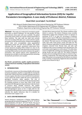
elevated above mean sea level. The climate condition of the district is extreme. The district Peshawar mean monthly temperature ranges from minimum 2.60 ºC in January to maximum 42.70 ºC in June [3]. According to Peshawar district census report 1998, the rural population is 51.31% while urban population is 48.68% of the total population of the district. The main sources of drinking water are open wells, tube wells, hand pumps, ponds and tanks [4]. The district Peshawar agriculture is mostly dependent on canal irrigation extracted from Warsak dam, and tube well irrigation is also a source existing in some elevated area. The area under canal irrigation in rural is about 73 % while other sources irrigated the reaming area containing ravine, river, spring stream and tube wells [5]. The district Peshawar location and surrounding districts maps are shown in Fig. 1 and Fig. 2 respectively. The study sites map and water table map of the project area prepared by GIS software are shown in Fig. 3 and Fig. 4 respectively. Digital elevation model of the project area is shown in Fig. 5.
1. INTRODUCTION Groundwater resources are becoming valuable with increase in human population. Aquifer is responsible for storing the fresh water, which is the most valuable underground source of water supply, when there is low rainfall [1]. Groundwater occurs, below the surface within the zone of saturation in geological formation called aquifers. The role of groundwater resources is vital due to the directly dependent for drinking purposes of more than 30% of the world population [2]. Management of groundwater is the key factor to preserve these valuable resources. The aquifer parameters quantification is very important in addressing the hydrogeological issues as low or high yield for the management of groundwater resources. Aquifer parameters indicates the aquifer behaviour, that it is suitable for demanded water supply or not
2. DATA AND METHODOLOGY District Peshawar, headquarter of Khyber Pakhtunkhwa, geographically lies between longitudes 71° 22' 0'' - 71° 42' 0'' East and latitudes .c33° 44' 0'' - 34° 15' 0'' North. The area of district Peshawar is 1,257 km2 and approximately 358 m
© 2019, IRJET
|
Impact Factor value: 7.34
|
Fig -1: District Peshawar location map.
ISO 9001:2008 Certified Journal
|
Page 1626