4 minute read
EIP Owentaraglin


Introduction
In early 2021 the government announced an open call for new EIP-Agri projects. This was the fifth call for EIP projects and was called the Farm and Community Biodiversity Initiative. Originally €1.25 million in funding had been allocated but after receiving a huge amount of interest this was upgraded to €3 million on the back of our Allow Blue Dot EIP. IRD Duhallow applied for funding for an agrienvironmental project on the River Owentaraglin for a period of one year. The application was approved and we were awarded €198,870, making this the second biggest project from the 24 successful projects that received funding under the call. The project commenced in January 2022 and at present there are 22 participating farmers.
The River Owentaraglin
The River Owentaraglin, known locally as the Araglen, is a powerful, meandering river that rises north-east of Ballydesmond and enters the Blackwater east of Rathmore. Along its course, it flows through the towns of Kiskeam and Cullen. The river is ‘high-status objective ’ under the current River Basin Management Plan, meaning its protection is of priority concern. A survey commissioned by IRD Duhallow in 2020 found that populations of critically endangered Freshwater Pearl Mussel inhabit the river and surveys from previous IRD Duhallow projects demonstrate that the river is also an important habitat for Atlantic Salmon, Brown Trout and Lamprey species. The Owentaraglin is very well-known across the country as an angling river.
The River Owentaraglin
Baseline Data
In preparation for the Owentaraglin River EIP, IRD Duhallow ecologists conducted surveys of the river for biological and physicochemical indicators. The results from this survey were promising in the uppermost stretches of the river but the team found concerning results as they moved further downstream. Under the third cycle of the River Basin Management Plan, parts of the river are deemed to be ‘At Risk’ of not meeting their objectives under the Water Framework Directive. Agriculture and urban wastewater have previously been identified by the EPA as significant pressures on parts of the river.

The river is ‘At Risk’ under the third River Basin Management Plan
Sediment Deposition


A fence post close to falling into the river due to riverbank erosion Although it is natural for a river to erode its banks and deposit sediment, excess sediment deposition can be extremely harmful as sediment can carry nitrate and phosphate into the river and sediment can also smother juvenile Freshwater Pearl Mussel, Atlantic Salmon eggs, and insects essential in the food chain. High levels of riverbank erosion on the River Owentaraglin are a lose-lose situation for both farmers and the river as farmers lose significant amounts of land every year to erosion. This is an issue the project aims to tackle through riverbank stabilisation measures such as riparian tree planting. Measures to restrict livestock access to the river such as fencing and installation of alternative drinking sources also help to stabilise the riverbank.
Project Measures
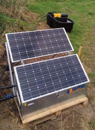
A solar-powered pump and trough eliminates the need for a cattle access point
As every farm is unique, the project team work alongside the farmer to develop measures that work for that farm and best benefit the river. The team identify potential issues or areas for improvement and then agree with the farmer on the measures that should be implemented. A wide range of measures have been selected including farm roadway upgrades, silt settlement ponds, riparian tree planting and alternative drinking source installation. Many of these measures have dual benefits. For example, planting trees will stabilise the riverbank and will also provide a habitat for biodiversity, sowing a multi-species sward will reduce fertiliser input and will also provide a greater food source for pollinators.
Setting an Example
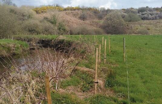
Riparian planting on the Owentaraglin south of Kiskeam
The lessons learned from this project will help to inform future agrienvironmental schemes and policies. A farmer survey will be conducted at the end of 2022 that will contain questions specific to the measures implemented on each farmer ’ s land. This will provide a useful resource for farmers across the country who are interested in implementing similar measures on their own farms. The project has also acquired a drone and informative videos will be made to demonstrate how to implement water quality measures such as farm roadway upgrades and pond installation, using the work done by Owentaraglin River EIP farmers as case studies.
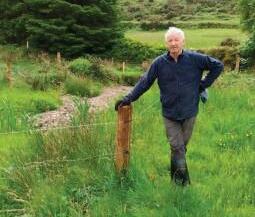
Sean Murphy, Owentaraglin River EIP farmer, has recently fenced a tributary of the river under the project