1 minute read
5. Perth’s Neighbourhood Centre Reviews


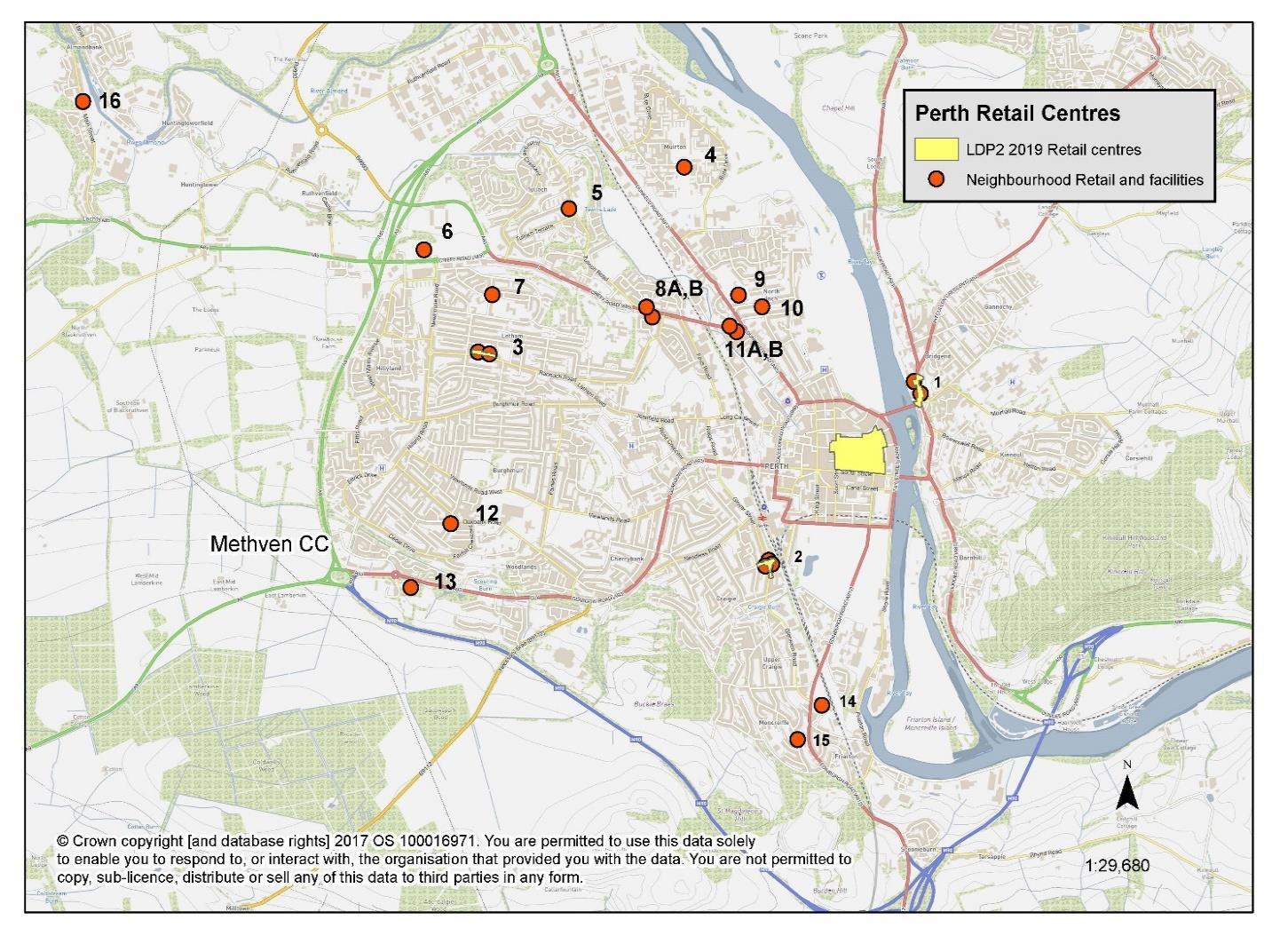
5.1 This section includes a review of the neighbourhood centres in the wider Perth City area, as identified by PKC and shown in Figure 5.1 below. The review has been completed as a desk based exercise for the majority of the neighbourhood centres, although a number have also been visited during the course of the study, whilst visiting and accessing the main centres.
5.2 The desk based review has used Google Maps, Street View and satellite imagery of the neighbourhood centres to identify the current mix / offer and surrounding area. This has included checking recent listings for current trading status for many businesses. The virtual sources are typically imagery / information dated as being from 2021 and 2022, and are therefore considered to be up-to-date and reliable.
Figure 5.1 – Location plan of the Neighbourhood Centres
5.3 The findings of the desk based review are reported in table form below (Figure 5.2). The numbers on the plan (see Figure 5.1 above) correlate to the location numbers in the table. The neighbourhood centres range from small parades or clusters of small shops to single large foodstores / supermarkets. Each of the centres have substantial ‘walk in’ catchments (given their location within or adjacent to predominantly residential areas) and some also provide significant opportunities for passing-trade due to their prominence and position along a main aerial route.
5.4 The aim of the review is to identify those centres that are robust and sustainable, and those that are weak and in need of intervention and support. We also look to identify a strong proven mix of offers to assist in future planning controls and policies.
5.5 The following table (Figure 5.2) summarises the findings of the neighbourhood centres review.

