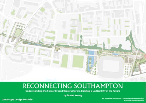
RECONNECTING SOUTHAMPTON Understanding the Role of Green Infrastructure in Building a Unified City of the Future by Daniel Young Landscape Design Portfolio
MA Landscape Architecture - Comprehensive Master Project Arts University Bournemouth
SWOT ANALYSIS AND OPPORTUNITY MAPPING
The site is located within close proximity to significant green and blue infrastructure zones Comprehensive strategies and policies outline a regenerative plan for change, aiming to tackle issues of climate change, transport congestion, and identity The site’s topography is relatively flat, with only a few metres across it’s extremities
Active travel routes share surfaces with busy, vehicular traffic, threatening the safety of users and detering wider use of active travel Wartime damage, reparations, and urban expansion make for a disconnected urban grain, particularly between the city centre and waterfront/riverbank A noisy, car-dominant layout limits the movement and habitation of urban wildlife, risking a loss of biodiversity and associated ecosystemic benefits Wartime damage and rapid urbanisation limits the presence of historical sites in the city, hindering resident’s connection to place and culture Limited sense of local identity and place constrains resident’s ability to connect to/take pride in Southampton Emissions from congested traffic/port infrastructure contribute towards poor air pollution, which can negatively impact cardiovascular health Residents identify feeling unsafe or a ‘fear of crime’ when in public space due to a lack of lighting, surveillance, or good public amenities Continual air pollution can result in environmental degradation, increased respiratory disease, and contamination of plants/soils key to urban ecosystems Further damage/extinction of wildlife may result in climate instability, food insecurity, and reduced ecosystem services vital to urban living Fig.164
Railway line creates a physical barrier through the city, obstructing pedestrian travel from east to west. Furthermore, it’s limited use results in an underutilised linear space that severs community neighbourhoods/urban mobility Flat topography and sealed surfaces in the eastern edge increases risk of flooding from sea level rise and extreme rainfall Lack of security measures within the public realm may provide opportunity for a heightened crime rate, which could damage the city’s reputation, threaten minority groups, and lead to an economic drop in housing prices/businesses Population growth could form lower-economic neighbourhoods, worsen traffic congestion, and result in further urban expansion at the cost of habitat/green space 30
Rising rate of traffic (amplified by development/population increases) contributes towards worsened air pollution, biodiversity threats, and impeded pedestrian mobility
for more connected people
Fig.163
Lack of natural public green space within Itchen Riverside to support current/ proposed residential neighbourhoods and combat high recorded levels of stress, anxiety and loneliness
Threats
for more connected place
The site is located within an area outlined for large-scale, collaborative regeneration proposals, supported by both local government and the private sector
Weaknesses
Opportunities
Fig.162
for more connected travel
Strengths
for more connected nature
RECONNECTING SOUTHAMPTON: Understanding the Role of Green Infrastructure in Unifying Cities of the Future
Identifing Opportunities:
Fig.165
to create improved toilet facilities within the public realm that grant visitors longer periods of enjoyment and security to create social spaces that allow strangers to socialise and combat issues of urban loneliness to create more green space within Industrial Riverside to provide essential support for upcoming residential developments to provide unique play areas that fosters connection between young residents and the city that mitigates environmental generational amnesia to create quiet pause places for individual relaxation or student study to create large, multifunctional spaces that foster community engagement and offer accomodation for future event hosting to create educational spaces where local residents can learn more about Southampton’s significant, storied past to improve street lighting/passive surveillance to provide residents with a greater sense of safety within the public realm, and encourage it’s use during later hours to add distinct urban furniture that offers pedestrians places to stop whilst imbuing a sense of place, history, and identity to introduce more bins that promote sustainable waste management and reduce littering/harm to biodiversity to add more ‘things to do’ in the public realm, such as sports facilities, play areas, or visually interesting trails that support and encourage public activity to introduce pocket parks at strategic locations that reconnect and support divided, dislocated residential areas to unlock the waterfront for human and wild residents by restoring historic, walkable connections to/from the city centre to restore the Terminus railway line as a linear movement corridors, unlocking a new route of active and wildlife traversal between north and south regions of the city to reconnect the Industrial Riverside and the Commercial High Street with more pedestrian friendly walking routes to create new public transport connections that work alongside the council’s Mass Transit System strategy and provide residents with more efficient and effective traversal in/out of the city to create a protected cycle network from existing highways that promotes safe, sustainable active travel across the city to introduce new routes of active travel that promote the use of soft mobility traversal over cars and less sustainable transport options to work alongside the council’s ‘Green Grid’ proposal to create a networked system of green infrastructure/wildlife interventions that connect the Central Parks with other key habitats to introduce wildlife crossings and tunnels over/under highways that allow urban species to move safely between habitat zones to introduce wildflower meadows that boost urban biodiversity and aid ecosystemic processes like pollination to increase street tree planting that combat vehicle pollution, increase shade provisions, and reduce climate threats like flooding and urban heat islands to introduce vertical/rooftop gardens to further link green spaces for wildlife and offer rainwater harvesting solutions
outlined ‘Green Grid’ network could flow from railway line’s end, creating a seamless green connection to other parks and open spaces park can act as a catalyst for further regeneration of underutilised infrstructure as community assests (e.g. a museum)
underutilised ‘gaps’ in the urban grain could be transformed into pocket parks to further connect greenery throughout the city
Daniel Young
street planting and GI solutions could help create new ‘green and healthy streets'
street planting and GI solutions could help create new ‘green and healthy streets'
street planting and GI solutions could help create new ‘green and healthy streets’
intersectional nodes like Chapel Rd level crossing could be transformed into larger, more established community green spaces
intersection at the end of the linear park could create a new crossroads with local streets and paths, aiding movement between districts
by removing the existing railway barrier, more accessible crossing points can be made to reconnect severed neighbourhoods
existing cycle lanes could be seperated from highways to form protected routes of travel that enhance the comfort and safety of users
pathways/sightlines to Itchen waterfront could be enhanced to restore connections to blue infrastructure
living green roofs/walls could be retrofitted within the existing urban grain, aiding rainwater harvesting, urban cooling and wildlife movement
existing railway could be replaced by a linear park, unlocking an active travel route, wildlife corridor, and green lung for all urban dwellers to enjoy
stadium could be enhanced as a landmark feature, with designed pathways and built features that seperate matchday fans from everyday users
street planting and GI solutions could help create new ‘green and healthy streets’
Fig.166
31
RECONNECTING SOUTHAMPTON: Understanding the Role of Green Infrastructure in Unifying Cities of the Future
Identifying Opportunities
CONCEPTUALISING A LINEAR PARK Linear Park active travel, movement, wildlife corridor, access, rewilding, preservation, railway, trail recreation, healthy living, car-free, pedestrian, cyclist, soft mobility, legibility, coherence, extent, compatability, journey, contiunity
Fig.167
Fig.168
Native planting strips provide habitat/ movement corridors for local ecology
Seperated corridors for pedestrians and cyclists ensures safer traversal
Movement corridors follow former railway tracks to preserve site history
Inspired by the above precedents, the project opens up opportunities to catalyse regeneration of the surrounding context to form a sequence of ‘stops’ that users can break off into for different activities.
Zone A
Zone B
Zone C
sport, healthy living, activity, recreation, waterfront, extent, landmark, blue infrastructure, SuDs, games, water, play, stadium, eco-architecture, event, hydrology, venue, elevation
contemplation, being away, nature, wildlife, conservation, soft fascination, education, history, biodiversity, habitat, shelter, biophilia, rewilding, quiet, escape, environment, native
social, culture, sitopia, community, shared space, melting pot, identity, museum, student, curve, market, landmark, cohesion, park, transition, crossroads, node, industry, sustainability
Fig.170
Green/blue infrastructure emphasises stadium whilst mitigating drivers of climate change
Fig.171
Sunken steps to water offer multifunctional SuDs basin, seating area, and blue habitat
32
Fig.169
Fig.173
Fig.176
Edcuational garden offers ecological learning whilst providing pleasing reception space
Market eatery boosts local economy through industry of food sharing/collective eating
Fig.174
Fig.177
Nature reserve creates safe haven for wildlife whilst offering human users mental escape
A B C
Heritage architecture emphasised to create public space with landmark identity
Fig.172
Fig.175
Fig.178
Development of public ‘sports park’ around stadium encourages active living and fitness
Elevated walkway creates sense of being away whilst offering greater contextual views
Transport museum to raise awareness of local history and offer connection with place
Fig.179
Initial concept mapping of stops along linear park
buffer between school playing field and linear park should be retained to ensure privacy and security
Daniel Young
new footbridge should align with urban grain to grants users better line of sight to visually reconnect with the riverbank
end of line should tie into approved gasworks redevelopment, granting residents greater access to pedestrian travel routes and green space heritage-themed public art display could be created along eastern boundary to screen the park from neighbouring industrial acitvity and mitigating industrial noise pollution
buffer to college should be retained to ensure activity along the linear park doesn’t disturb students
stadium should be enhanced as a landmark feature, with designed pathways and barrier landscape elements that seperate matchday activity from everyday park users
green roofs should be added to connect to Central Parks via Green Grid network
penetrations should be made through western treeline to repair severed residential neighbourhoods
penetrations should be made through western treeline to enable pedestrian traversal between housing and waterfront existing archaeology unit to be relocated to Zone B
Fig.180
derelict industrial sheds should be demolished to form new green /blue space that enhances stadium as landmark feature
path should align with urban grain to enhance line of sight/ travel towards the waterfront
industrial units should be replaced with green space, displaying a greater end-of -vista view to Marsh Lane and forming a community melting pot for previouslydivided neighbourhoods footbridge should be replaced with wider ground level crossing to improve accessibility and create shared event space for fayres/markets that encourage social connectivity
Central Trading Estate should be largely retained to preserve local businesses, but enhanced with green roofs/walls as part of wider Green Grid network
corner turning industrial unit and courtyard should be enhanced to form new public archaeology museum
level crossing should become a navigational node, allowing travellers to reorient themslves onto a horizontal axis and head towards riverbank/city centre
design accomodates approved designs to offer passive surveillance and provide a more planned urban layout
industrial unit should be repurposed as shared community food court, offering residents the chance to try locallyprepared food and participate in collective eating
American Wharf building should be removed to grant Chapel Road with waterfront endof-vista view
Nelson Street public realm should be expanded to form a protected habitat for local ecology, and offer local residents sense of soft fascination and being away Fig.181
goods shed should be repurposed as new Solent Sky museum, taking advantage of more promiment location to form heritage landmark and increase visibility of cultural history
former museum site should be regenerated as a public park, offering better pedestrian connections to Ocean Village whilst providing amenity space to support occupants of Canute Road flats
Fig.182
Key proposed route of linear park
proposed pedestrian connections to surrounding context
waterfront sightlines to be enhanced
areas to be enhanced as landmarks/ community assets
areas to be enhanced as new public green space
areas to be retained for current land use
buildings to be demolished
proposed habitat boardwalk
proposed pedestrian connection to Ocean Village marina
33
A NETWORKED GREEN GRID Alongside the proposed linear park, an interconnected network of green infrastructure interventions should also be delivered that align with Southampton’s prospective strategies for future resilience and solve issues of disconnection between neighbourhoods, habitats, and urban spaces beyond the main study area. These interventions could include:
• Reduces flooding concerns by absorbing rainwater, slowing the flow of water runoff, and filtering out pollutants • Trees can be easily integrated into existing paving using permanent treepit systems, whilst planters offer more temporal solutions that can be moved if needed
Fig.188
Green Roof on Lawrence Street, London
Pocket Parks
• Creates safe spaces for wildlife to eat, rest, or nest between larger habitats
(71)
Context Fig.190
Marvin Street Rain Garden, London
Benefits
• Can boost local economy, by increasing property value
34
‘Living Pillar’ in Maidstone Town Centre
• Attractive colour palette can offset from modern grey urbanism Fig.186
The Castle Hill site, near Swanscombe, was selected as the location for a major new development in Kent. The Garden City, as it’s otherwise referred to, is set amongst 400 acres of sensitively designed parkland and open space throughout the Ebbsfleet Valley.
To be most beneficial, pocket parks should sit within/near community neighbourhoods, especially lacking local/private green space. Brownfield sites are ideal, as this offers a space-efficient reuse of past infrastructure whilst helping to repair gaps in the urban grain
During Phase 1 of the scheme, Land Securities were granted permission to build 150 homes on the brownfield site situated on the Thames estuary, with the potential to extend this figure to 5,000 by 2019.
• Provides visual/noise buffer between pedestrian and vehicle movement corridors
Fig.185
Introduced at strategic intersections where existing wildlife paths/key habitat cores cross/abut busy highways • Offers safe passage for flightless wildlife to cross roads without risk of vehicle collision • Visual presence of wildlife interventions can educate local residents on biodiversity importance and conservation • Encourages genetic diversity between population groups formerly seperated by by habitat fragmentation • Aids key ecosystem services like pollination and seed dispersal via wildlife movement Fig.195
Segregated cycle lanes are difficult to enact everywhere, and require a specialised design to ensure an adverse effect is not had on the current flow of traffic. Min. 3m vehicle lanes should be maintained, with a further 1.5m allowance made for a new cycle lane. • Increases cyclist safety, which in turn promotes more active travel and healthy living (especially amongst women) • May encourage drivers to switch to cycling, reducing traffic congestion and pollution • Segregation barrier offers space for green infrastructure systems (e.g. treepits/planters)
Fig.193
Guiding theatway Wildlife Tunnel Ashridge Farm, Berkshire at Ashridge Farm C ASE S TUDY
As the construction industry looks for ways to mitigate its impact on biodiversity, one highways project led by Balfour Beatty implemented a number of innovative solutions to help preserve and protect local habitats. Linking a new housing estate to the wider road network, the contractor called upon ACO Water Management to establish safe routes for the animals when navigating roads.
Fig.194
Wildlife Tunnel at Castle Hill, Kent
A major new residential development in Ebbsfleet Valley was set to be the UK’s first Garden City in 100 years. Living up to its name, the developers wanted to embed sustainability in the new town’s identity from the outset, and turned to ACO Water Management to provide the perfect ecological solution to protect the area’s wildlife.
• Canopies provide shade, helping to reduce the effects of urban heat island effects and cooling pedestrians in summer • Absorption of carbon dioxide improves local air quality and mitigates climate change
ACO WILDLIFE
Context
Green Wall on New Bridge Street, London
• Visual presence of nature promotes health and wellbeing • Can increase the drainage efficiency, lifespan, and thermal performance of an existing structure, reducing energy costs and contributing towards net zero • Absorbs carbon to improve local air quality/mitigate climate change • Creates safe space for birds, insects and small mammals to shelter, eat, and move between habitats Fig.189
/
Benefits
Fig.187
Can be retrofitted to almost ACOorWater Management any existing wall roofscape (best on pitches below 30°), from high riseACO buildings to bus perfect ecological solution at Castle Hill project Wildlife provides ACO Climate Tunnel steers amphibians at new Garden City stops
(70)
Context
Context
Some aspect of street planting can be introduced along all urban streets, so long as a min. 2m footpath width is maintained for pedestrians. Traffic calming measures like chicanes can be introduced to gain further space for planting whilst also slowing vehicle speeds to mitigate roadkill
Wildlife Crossings/Habitat Creation
(69)
Benefits
Street Tree on Blackfriars Road, London
Box Planter in Derby City Centre
Green Roofs and Walls
• Visual presence of nature promotes of healthy living and mental wellbeing
Fig.183
Fig.184
(68)
Benefits
Context
Street Trees/Planters/Living Pillars
Benefits to reconnection
RECONNECTING SOUTHAMPTON: Understanding the Role of Green Infrastructure in Unifying Cities of the Future
Identifying Opportunities:
Fig.191
London Street Micro-Park, London
• Provides a shared amenity space that encourages healthy living, activity, and social meeting with neighbours.
Protected Cycle Lanes
Garden cities were the brainchild of Ebenezer Howard in 1898 and were originally intended as an alternative to industrial slums, with green space and community at their heart. Given the fact that this was a sustainable development, Arup, the acting Infrastructure Engineer on the scheme, along with other contractors involved on the project, were keen to fulfil their ecological commitment from the outset.
town and protect the local wildlife. The Climate Tunnel system is an enclosed series of polymer concrete tunnels which can be installed to sit flush with the road surface, to allow amphibians safe passage across potential ‘risk’ areas, such as roads and footpaths. It is also designed to meet load class D 400, making the range perfect for trafficked areas.
(72)
Following specialist advice from an ecological consultant, Arup specified the use of ACO Climate Tunnels in order to support the ethos of the new
Fig.196
Cycle lane protected by wands in London
• Creates a new habitat zone for urban wildlife • Can reduce noise and traffic pollution to form quiet, pause places for a mental escape Fig.192
Fig.197
Cycle lane protected by planters in Vancouver, Canada
Fig.198
Daniel Young
A
B
B
A
D
Fig.200
Fig.201
Illustrative sketch of green walls and roof systems retrofitted to Albion Tower, St Mary’s School, and other surrounding apartment buildings
Illustrative sketch of a potential pocket park replacing derelict land on Northam Road
C
D
C
Map shown at 1:7500 scale at A3 Fig.199
0m
100m
200m
500m
Fig.202
N
Illustrative sketch of a protected cycle lane along Canute Road, with a temporal barrier of box planters and hanging baskets over the footpath
Fig.203
Illustrative sketch of a wildlife tunnel underneath St Mary’s Place, and a green margin of street trees/planters to form a healthy street above
35
RECONNECTING SOUTHAMPTON: Understanding the Role of Green Infrastructure in Unifying Cities of the Future
Design Development:
LINEAR PARK FEATURES 2m cycle lane provides ample space for simultaneous journeys in two directions
soft LED bulbs on iron wires allow for sustainable biomimetic lighting at ground level that sway in the breeze
bold red asphalt surfacing provides eyecatching warning of cyclists for visually impaired pedestrians
2m wide pedestrian pathway allows for users to pass one another or walk side-by-side
red denotes excitement and activity, encouraging use by active travellers
reclaimed steel rails form edge of pathway to aid legibility and preserve railway infrastructure
permeable paths aid surface water drainage to ground
Linear park movement channels, comprising a protected cycle lane, wildflower planting strip, and wide pedestrian footpath box planters offer presence of nature in landscape ceiling
solar panel for sustainable energy use
hebe, heather, and sedums offer stimulating visuals whilst aiding pollination
accessible, inclusive design allows shared use by wheelchair users or those with limited mobility
landmark imagery aids navigation and builds locational identity
Illustrative sketch of typical park view, combining all urban furniture elements to create sense of continuity and coherence for users
Material Palette
mimicry of semaphore signals echos railway past
enhanced lighting increases public safety and deters anti-social behaviour
Semaphore signal-inspired street lighting fun design encourages responsible waste management in users (particularly children)
red lighting increases visibility of bins during later hours
36
central wildflower strip planted with tall native species to shelter animal movement and offer moments of soft fascination for park users
Reclaimed timber sleeper benches
modular design could create train of urban furniture that echos site history
animal-proof design prevents spread of waste/ecological damage to wildlife
‘Trash train’ bins for glass, recycling, and waste
sustainable recycling of timber sleepers echos railway past
aromatic species like lavendar helps mitigate pollution and aid pollination
cast-iron materiality mimics traditional urban signage
Distinct, cast-iron wayfinding signage
low height allows passersby for tactile experience with planting drainage inlets along footpath allow water to drain under paving
plant species could be changed depending to suit particular season or event
Train carriage box planters
Fig.204
tree planting creates shade, habitats and combats urban pollution/heat islands
Natratex Colour Red asphalt surfacing for cycle lane (73)
Fig.206 Soldier brickwork mimicking railway sleepers
Fig.208
loadbearing pavement support system allows roots to spread under paving
SuDs treepit
Reclaimed timber sleepers to create inclusive benches
Planting Palette
Fig.205 Permeable resin bound stone surfacing for pedestrian paths
Acer campestre for treepit planting/ carbon sequestration
Fig.207
Fig.213
Granite paving slabs for shared surface crossover areas
Fig.209 Reclaimed steel rails along path edges to mimic railway lines
Fig.212
Fig.211
Fig.210
Mediterreanean spurge to blend with retained planting buffer
Fig.216 Buddleia to provide secure habitat for butterflies
Liquidambar styraciflua for treepit planting/ carbon sequestration
Fig.214 Coral bells to blend with retained planting buffer
Ulmus ‘New Horizon’ for treepit planting/ carbon sequestration
Fig.215 Reed sweet-grass to provide secure habitat for wildlife
Fig.217
Fig.218
Lavendar to add fragrance and support pollinators
Honeysuckle to add fragrance and support pollinators
ZONE A Material Palette
Fig.219
Fig.220
Red clay surface paving to match existing and match SFC colours
Red brickwork to match existing stadium walls/ gasworks development
Fig.221
Fig.222
Contemporary steel footbridge with window to view linear park
Concrete steps to mimic stadium and provide communal seating area
Planting Palette
Fig.223
Fig.224
Acer rubrum for tree planting, leaves to match SFC colours
Himalayan birch for tree planting, bark to match SFC colours
Fig.225
Fig.226
Zoysia grass to create soft, resilient grass verges for seating
Lavender/marjoram/ivy in living wall planters to combat air pollution
Multi Use Games Area provides sport-themed end-of-vista view that encourage community recreation
existing railway passage under Northam bridge blocked with insulated brickwork to buffer passing rail sound
aligns with approved gasworks proposal to create seamless pedestrian connection between linear park and Northam district
new outdoor gym promotes active living and group recreation
A relocated footbridge allows users to bypass stadium and travel directly onto Britannia Road
new play area offers accessible play space for local school students school playing field buffer retained to ensure privacy and security
elevated space over existing fanzone could provide users with elevated views over the area, and bring stadium closer to nature
connection to existing shared surface grants pedestrian access from Golden Grove neighbourhood
Rockery plants to form unique, durable display over fanzone
Cattail reed beds to mitigate flooding and create wildlife habitats
relocation of existing substation to allow for new water feature
large windows in footbridge allows users to surveil linear park from elevated position
built wall offers opportunity for public art display of football club history football-themed play space allows children to play alongside local football team in the stadium
skylights allow natural light into sheltered fanzone below
B
designed living wall provides vertical green presence that aids urban cooling and habitat creation whilst enhancing stadium identity
exterior water wall flows from first floor level to provide vertical blue infrastructure
sloped ramps allows wheelchair users inclusive access to elevated park
new public toilets built into proposed fanzone structure
Fig.231
B
Fig. 228
openings allow permeation between park and fanzone spaces whilst retaining some seperation
Fig.230
stadium fanzone retained for matchday hosting, could be enhanced with planting
C blue connection could be made to existing waterfront to aid wildlife movement/ hydrological synergy
Fig.227
large curved steps could be used for seating, display, or traversal to elevated park
outdoor gym offers adult fitness in community environment, with pergola structure overhead to grant privacy, shade and natural light
direct stadium access via footbridge seperates casual pedestrian movement from matchday visitors
planting buffer retained to buffer flats from matchday noise and park activity
A
perimeter street trees mitigate noise of passing traffic and denote park Fig.229 boundaries
illustrated sketch not to scale
N
C
stepped seating to water echoes stadium architecture and allows water level to rise in the event of flooding
station-like structure provides shelter to allow comfortable park use of lake area in wet weather
Fig.232
Daniel Young
Design Development:
island creates secluded, private habitat space for nesting ecology
fanzone entrance curves with existing stadium structure, shielding park users from noisier football supporters
footbridges over water create sense of being away and escapism for urban dwellers, and emphasises waterfront character planted southern edge transitions hardscaped stadium into more naturalised Zone B
37
RECONNECTING SOUTHAMPTON: Understanding the Role of Green Infrastructure in Unifying Cities of the Future
Design Development:
ZONE B
relocated substation from Zone A
Material Palette
Fig.233
Fig.234
Stone walkway to mimic historic walls and enhance cultural connection
Reclaimed timber planters create physical barrier on chicanes
Fig.235
Fig.236
Wildlife friendly fencing Boardwalk mitigates wildlife encloses reserve whilst disturbance and creates allowing animal movement sense of ‘being away’
Planting Palette
Fig.237
Fig.238
Laurel bay hedgerow offers pleasant aroma and mitigates pollution
‘Medieval’ garden offers aromatic experience and enhances cultural ties
Fig.239
Fig.240
Elder trees to create seamless flow from existing tree buffer
Berberis shrubbery to form dense, sheltered habitats for wildlife
built screen buffers park from industrial activity whilst also presenting public art display of city’s history, emphasising a sense of identity and heritage familiarity
A maritime college buffer retained to ensure privacy and security
street tree planting along Chapel Road offers healthy green connection to St Marys churchyard
opportunity to relocate archaeology centre from northern part of trading estate to corner plot to create a new public history museum
B
courtyard outside of proposed museum regenerated with aromatic/sensory planting to create medieval-themed herb garden
meandering pathway through nature space creates sense of ‘mystery’ and ‘being away’ to aid cognitive wellbeing
traffic-calming chicane introduced in place of level crossing to slow flow of traffic and aid safer pedestrian/wild mobility
smaller connections through to existing ‘dead-end’ residential streets allows direct access to park for local residents
A
38
Fig. 242
Blackberry/brambles provide wildlife habitat and food for humans
Hawthorns to attract bees and form habitats for wildlife
connection through arhed tunnel enables pedestrian connection through to industrial estate
built screen presents opportunity for public art display showing historic timeline of Southampton alcoves could be fit with furniture/ lighting for specific use:
student study zone
sheltered seating
public toilets
Fig.244
B
ramps to elevated walkway allows wheelchair access to first floor
new archaeology museum takes advantage of promiment position on Chapel Road intersection to attract visitors
planting buffer along Nelson St enhanced to preserve existing habitat for native ecology
nature reserve formed of native planting, wetland areas and wildflower meadows to attract all types of local biodiversity
Fig.243
illustrated sketch not to scale
N
opportunity for new cafe pavillion to be formed within museum garden to serve refreshments to park visitors and introduce local business
fenced reserve creates sense of enclosure for visitors whilst increasing habitat security for wildlife
planting buffer pulled back near Chapel Road to extend field of view and invite passersby into park
Fig.245
Fig.241
elevated walkway echoes historic city walls and offers views from height over rest of park
traffic calming chicane slows vehicle movements to create safer crossing for pedestrians and wildlife
ZONE C Material Palette
Fig.246
Fig.247
Shared surface zone to mimic local Kingsland Square paving style
Railway inspired play area connects users to site history
Fig.248
Fig.249
New student parking hidden from view by ‘hobbit-hole’ green roof
Canute Road footbridge to mimic Titanic with timber decking surfacing
Planting Palette
Fig.250
Fig.251
Yew trees around new park to mitigate traffic pollution and treat air
Laurel bay hedgerow offers pleasant aroma and mitigates pollution
existing industrial forecourts repurposed to form visitor parking for park, local residents and food court
new multifunctional green space created in close proximity to residential housing for dog walkers and general activity
aligns with approved planning application to create wide shared surface crossing that could be use for markets or events
A
larger industrial unit repurposed to create new community food market overlooking public park
Fig.253
Blue hydrangeas to mimic water under Calshot Spit display
Ferns to mimic waves under Calshot Spit display
connection to existing ‘dead-end’ street provides pedestrian access to city centre via Captains Place housing estate
Fig. 255
Calshot Spit display relocated to create new museum garde that addresses turn in railway corridor and provide end-ofvista element that aids wayfinding / advertisment of museum
Fig.258
C
Snow in summer to mimic clouds around Solent Sky displays
Allium to mimic clouds around Solent Sky displays
N
former Solent Sky site repurposed to accomodate student parking, with elevated park overhead for community enjoyment
opportunity for park cyclists to connect with protected cycle lanes as part of Green Grid proposal street tree planting along Canute Road buffers noise/carbon pollution from passing vehicles blue infrastructure creates habitat space for biodiversity and aids sense of transition towards Ocean Village marina Fig.256
elevated park merges into existing topography change to create large multifunctional lawn space for local high-rise residents
Spitfire sculpture raises awareness of wartime history whilst also creating new wayfinding element for visitors
undercroft parking provides security and surveillance from overlooking flats for student vehicles
goods shed repurposed as new Solent Sky museum, presenting more external exhibition space within existing forecourt and allow pedestrian connection through to Royal Crescent Road
illustrated sketch not to scale
bin store for new flats relocated to allow for wide crossing to be created from Terminus Terrace
B new connections to student accomodation via museum garden provides students direct access to created green space
dining pavillion for food court encourages collective eating and grants passive surveillance over park
well-surveiled play area formed for local children
Fig.257
B Fig.254
outline of approved development 23/00649/FUL
dense hedgerow/ tree planting around park seperates space from active travel routes
C Fig.252
A
Daniel Young
Design Development:
Fig.259
living wall creates vertical green space for wildlife, urban cooling, and carbon sequestration new footbridge allows safe traversal over Canute Road whilst offering opportunity for future expansion
cylindrical funnel planters mimic Titanic to echo maritime history and emphasise arrival at port/ waterfront
39
RECONNECTING SOUTHAMPTON: Understanding the Role of Green Infrastructure in Unifying Cities of the Future
Daniel Young - 2400257
PROPOSED MASTERPLAN Terminus Food Market and Park for local trade, community activity, and collective eating
Linear Park Features
traffic calming measure on Chapel Road enables safe crossing along linear park stretch
central wildflower strip for wildlife movements and restorative ‘soft fascination’
elevated ‘Kingsland Park’ over existing fanzone forms shared space for fans and park users to merge together
Historic Walk and Nature Zone
2m pedestrian pathway allows users to pass one another or walk side-by-side
2m cycle lane in permeable red asphalt surfacing provides bold warning of cyclists to visually impaired pedestrians
St Mary’s Stadium enhanced with living walls and red/ white planting that matches club colours
Movement Channels (1:200 at A1) paved shared surfaces provide opportunity to pause, change of direction, or egress to surrounding context
I
‘Canute Crossing’ Titanic-inspired pedestrian footbridge
proposed park cycle lane links into wider protected cycle network as part of city-wide Green Grid initiative
J K
G
H
D
B
F
located at 60m centres along the linear park, or opposite proposed pedestrian access points
A
Crossing Squares (1:200 at A1)
C
I
new Solent Sky Transport Museum, with exterior landscaping at front/rear for Calshot Spit/aeroplane displays
new play area within well-surveiled St Mary’s Sports Park for young residents
E
located at 16m centres along the linear park to provide good illumination for user comfort
new sheltered outdoor gym space promotes fitness and active living
elevated Spitfire Park over student parking merges into existing topography from Central Bridge
J
F new pedestrian connection through gap in urban grain to Ocean Village marina
box planters of hebe, heather and sedums aid pollination
H
K
G
new Multi Use Games Area suitable for group tennis, basketball, and other games
Lighting (1:200 at A1)
design mimics traditional railway semaphore signals
tree planting combats environmental issues of pollution, urban heat islands and habitat fragmentation
new skate park for young people and teenagers to meet within well-surveiled public realm
E C
D
B
A
Treepits (1:100 at A1)
drainage inlets in footbath allow sustainable drainage of rainwater to tree roots located at 16m centres along the linear park to promote good waste management
Key existing planting to be retained new living roofs existing waterfront proposed blue infrastructure
new bus route improves public transport connections within Itchen riverside to the rest of the city
Solent Sky Community Hub
‘Past to Present’ heritage walkway with public art time line of city history and arched alcoves for individual activity
proposed basin could connect to Itchen Riverbank to mitigate flooding/wildlife displacement/water pollution
proposed bus route proposed bus stops protected Green Grid cycle network proposed green and healthy streets to be enhanced with planting/GI proposed pedestrian connection
Approved Development 18/02015/FUL
Approved Development 23/00649/FUL
Nelson Street Nature Zone forms protected habitat zone for local ecology and boardwalk trail for pedestrians
new Southampton Archaeology Museum and herb garden on Chapel Road intersection
retained industrial units retrofitted with living roofs/ walls where suitable
multifunctional St Mary’s Basin event/ habitat and shared surface space
St Mary’s Sport and Activity Zone
parking to the rear of St Mary’s stadium enhanced with thematic, cooling planting
modular combination of ‘trash train’ and box planters mimics train and carriages
Approved Development 22/00695
fun design encourages responsible waste management
‘Trash Trains’ (1:200 at A1)
Map shown at 1:2500 scale at A1 0m
100m
200m
300m
N
RECONNECTING SOUTHAMPTON: Understanding the Role of Green Infrastructure in Unifying Cities of the Future
Daniel Young - 2400257
ST.MARYS SPORT AND ACTIVITY ZONE Approved Planning App No. 22/00695 retained to regenerate brownfield gasworks site and provide passive surveillance over linear park
lavendar planting in central green margin offers pleasing aromatic experience for passersby that reduces stress/ anxiety during activity
red brickwork walls matches existing stadium materiality to create a consistent sense of place
climbing plants around trellis offer vertical natural presence whilst also granting views in/ out of new Kingsland fanzone
long feather grass creates habitat for wildlife to hide, whilst gentle swaying motion aids cognitive ‘soft fascination’
himalayan birch trees emphasise football club’s red and white colour scheme and form a distinct sense of place
public art of football club history along ‘Kingsland Park’ walls provides users with a trail to follow and connection to the past
50m
Multi Use Games Area encourages shared community activity and emphasises healthy living
soft zoysia grass verge between linear park and Kingsland fanzone creates multifunctional green for wildlife and seating
elevated ‘Kingsland Park’ creates sense of ‘being away’ and grants passive surveillance over the linear park
75m
N
new footbridge offers opportunity for large window, granting users a long sightline down the linear park
reclaimed steel rails repurposed as edging for footpath and cycleway to form coherent leading lines and echo past site use
25m
linear park transitions seamlessly into the approved development, offering residents direct access to the park’s green space
multifunctional steps echoes stadium architecure, and creates shared space for seating or ascending to ‘Kingsland Park’
0m
skate park makes space for young adults and teenagers to meet in areas of surveillance and engage in shared social activity
Map shown at 1:1000 at A1
outdoor gym (under lattice roof pergola structure) creates sheltered space for adults to engage in healthy recreation privately or in groups
red acer rubrum trees emphasise football club’s red and white colour scheme and form a distinct sense of place
football/sports-themed play area creates space for parents and children to exercise, meet peers, and ‘play alongside’ the local football club existing tree buffer enhanced with ‘hostile’ planting like holly/rose bushes to discourage anti-social behaviour and prevent access to public railway line
new footbridge aligns with urban grain to grant users waterfront views whilst crossing from Northam Road to the linear park, approved development, or St.Mary’s stadium
retained point of access to footbridge allows for quick traversal from Golden Grove neighbourhood to Northam Road
existing parking court enhanced with green verges, maple trees, and laurel bay hedges to ‘hide’ cars from view and offset carbon generation
existing tree buffer enhanced with ‘hostile’ planting like holly/rose bushes to discourage anti-social behaviour and prevent access to neighbouring primary school
larger sheltered interior space created below elevated park to be later designed as suitable for football club fans
St Marys Primary School
St Marys Football Stadium
new access point to Golden Grove allows local residents quick access to new shared green space and stadium
Illustrative Visualisation canopied roof over linear park mimics railway station architecture, and provides shelter for users to wait out wet weather
entrance to undercroft fanzone curves with stadium infrastructure to seperate fan movements from general park users
multifunctional steps to elevated park creates end-ofvista area for group seating, temporary displays, event hosting, or movement between levels
open, canopied pavillion overlooking water basin mimics railway station architecture to create a sheltered place to rest whilst echoing former site use
multifunctional stepped area to water offers space for group seating, temporary displays, event hosting, or individual rest
reed beds along basin edges treat water for pollutants and provide a vital habitat for water birds like mallards, geese, and oystercatchers
sloped access to Kingsland Park offers inclusive accessibility to elevated space and allows users to experience the landscape from a new perspective
wide footbridge allows users to not only cross the water basin, but stop and connect with it from a more central vantage point
strategic planting of colourful species (like lavendar, nerve plants and purple hearts) creates football-themed display that advertises the stadium whilst injecting vital green infrastructure at a vertical level
steps to water allow users to closely experience one-ofa-kind moments with wildlife that help forge a stronger connection with local nature and ecology
new water basin doubles up as a SUDs system to absorb water in the event of surface water flooding
acer rubrum and himalayan birch trees create red and white stripes along new stadium ‘promenade’ in football team colours
balance of rockery and grass planting creates balanced environment for users to rest, socialise, and escape from urban living
Key park movement routes
Central Trading Estate
stadium movement routes water basin creates new multifuncitonal blue space by forming an events venue for human visitors, habitat core for water-based wildlife, and SuDs basin to mitigate local flooding risks
Site Plan Extract - Ground Floor
pedestrian bridges cross water basin to aid urban escapism through ‘being away’ and bring users closer to blue infrastructure
reed beds along southern edge treat water for pollutants, provide sheltered habitat for water birds, and aid transition from hardscaped sports park to the next, more naturalised zone
sloped ramps around stadium to elevated Kingsland Park provides inclusive access to wheelchair users
existing parking court enhanced with green verges, maple trees, and laurel bay hedges to ‘hide’ cars from view and sequester carbon
First Floor
Extract of Site Section B-B (shown at 1:150 at A1)
0m 2m
5m
10m
RECONNECTING SOUTHAMPTON: Understanding the Role of Green Infrastructure in Unifying Cities of the Future
HISTORIC WALK AND NATURE ZONE
reclaimed timber box planters above lighting echo historic semaphore signals and provide ceilinglevel vegetation for nesting and pollination
red asphalt cycle lane provides permeable drainage for surface water to ground whilst standing out for those with limited visibility
arched alcoves under walkway can be designed later with local community consultation to provide public amenties that aid landscape enjoyment
biomimetic solar lighting illuminate pathways and sway in the wind, aiding sense of soft fascination
traditional stone construction echoes historic city walls, imbuing a sense of place and heritage awareness in passersby
student study zones
public toilets
fixed timber trellises allow for vertical planting that create visual interest and aid pollination
sheltered seating elevated ‘Past to Present’ walkway allows users for a elevated view over the park, aiding urban escapism
first floor walls screens industrial activity and creates space for public art timeline
50m
75m
N
25m
retained industrial sheds retrofitted with living roof systems to cool urban temperatures, aid wildlife movement and reduce energy consumption
0m
Map shown at 1:1000 at A1
Daniel Young - 2400257
new connection to Cental Trading Estate eases pedestrian commute/access to businesses and waterfront along Itchen Riverside
Warsash Maritime Academy Central Trading Estate
existing tree buffer enhanced with ‘hostile’ planting (e.g. holly/brambles) to discourage anti-social behaviour and prevent access to maritime academy
Central Trading Estate
relocated arcaheology unit forms new museum to allow residents and visitors to learn and familiarise themselves with Southampton’s history
traffic calming chicane on Chapel Road level crossing slows flow of traffic to prioritise safe movement by pedestrians, cyclists, and wildlife
new museum cafe formed to provide park users with refreshments and provide source of economic growth/job creation for locals
existing tree buffer enhanced with biodiversityfriendly planting (e.g. hawthorn/ berberis) to create new habitat core and benefit ecosystem services
boardwalk trail through Nelson Street Nature Reserve aids sense of ‘being away’ and urban escapism
Illustrative Visualisation elevated ‘Past to Present’ walkway and public art display documents city history in legible and coherent way for park users to explore and learn from
creation of wetlands within Nelson Street Nature Reserve create more unique habitat space for biodiversity, absorb surface water flooding, and aid mental restoration
walkway screens noise and activity from industrial estate, ensuring the park remains as quiet as possible to aid urban escapism
new access points to Carpathia Drive housing allows local residents quicker access to new shared green space and waterfront
Key park movement routes
Site Plan Extract of Character Zone B
fenced Nelson Street Nature Reserve creates protected space focused preserving urban biodiversity, habitats, and ecosystem services
pedestrian walkway through nature reserve creates restorative sense of ‘being away’ and ‘soft fascination’ in one-off animal moments
preservation of existing planting buffer retains existing habitat, and seperates quieter nature reserve from active travel up/down linear park
arched tunnel to Cental Trading Estate to enhance access to businesses/ waterfront and create sense of mystery
elevated ‘Past to Present’ walkway creates alternative route of travel that creates sense of mystery and being away
new planting along Nelson Street boundary ensures sense of enclosure and security from nearby flats
new toilet facilities allow for longer, safer enjoyment of landscape and deter anti-social behaviour
industrial estate remains partially visible behind walkway barrier, but largely hidden to keep park users undisturbed from industrial activity
sloped ramps to elevated walkway Park provides inclusive access to wheelchair users
Heritage Walk First Floor
Extract of Site Section C-C (1:150 at A1)
Extract of Site Section K-K (1:150 at A1)
0m 2m
5m
10m
RECONNECTING SOUTHAMPTON: Understanding the Role of Green Infrastructure in Unifying Cities of the Future
Daniel Young - 2400257 mediterranean spurge shrubbery creates height transition from lowlevel wildflower planting to existing vegetation buffer
SOLENT SKY COMMUNITY HUB cycle lane connects into wider Green Grid network
N Map shown at 1:1000 at A1
cycle lane connects into wider Green Grid network
new parking court for park users, food court visitors/workers, and residential visitors ‘hides’ cars from view and offset carbon generatione with street trees and laurel bay hedges seating pavillion outside food market encourages collective community eating and grants passive surveillance over Terminus Park
paved shared surfacing offers opportunity for park users to rest on benches, change direction, or cross to Solent Sky museum
Calshot Spit forms focal point of larger museum garden, with blue perennials and fern planting underneath to mimic water and waves
passage through Solent Sky Museum allows for alternative route of travel via Royal Crescent Road to Ocean Village
75m
Approved Planning App No. 23/00649 retained to regenerate disused parking site and provide passive surveillance over new community hub
50m
bin store for Approved Planning App No. 23/00649
25m
new railway-themed play area creates space for parents and children to exercise, meet peers, and play in well-surveiled environment
new Solent Sky Museum takes advantage of more promiment location and heritage architecture to form greater community asset for cultural learning and reconnection
0m
new Terminus Park creates enclosed, multifunctional green lawn within close proximity to existing and upcoming resident populations for dog-walking or community activity
tall Lucia Foster Welch student accomodation grants passive surveillance over area to aid user comfort and mitigate antisocial behaviour
shared surface crossing creates accessible, safer route of traversal from city centre to eastern edge, and could be used for community event hosting
Terminus Food Market promotes sitopia by creating space for collective eating, sharing of homegrown/ made food, and local economic growth
new access point to Captains Place allows local residents quick access to new shared green space and stadium Approved Planning App No. 18/02015 new access points to Lucia Foster Welch student accomodation offers students direct access to the park’s green space and active travel routes
elevated Spitfire Park over student parking creates new green space to service Canute Road flats and aid urban escapism
Calshot Spit relocated to create end-ofvista view for park travellers, with blue perennial/fern planting underneath to mimic water
new access tunnel through Solent Sky museum allows for alternative route of travel via Royal Crescent Road to Ocean Village
new pedestrian connection through gap in urban grain facilitates easy access to Ocean Village marina
new water feature at end of linear park creates sense of transition to historic waterfront edge
Illustrative Visualisation passive surveillance from Captains Place housing enhances user comfort by mitigating anti-social behaviour
Calshot Spit display forms tall focal landmark element to aid wayfinding and create unique sense of place
listed goods shed (now Solent Sky Museum) enhanced with living roof system to cool urban temperatures, aid wildlife movement and reduce energy consumption
museum garden and wider linear park provide new green space for urban escapism, social engagement and contemplation to offset from small, enclosed gardens
living walls around sequester passing vehicle emissions whilst blending the natural green space above to ground level
pedestrian footbridge over Canute Road aids safe crossing and offers opportunity for future expansion to the south
over 80 bays of undercroft parking provides a secure, sheltered space to replace current goods shed allocation
Key park movement routes
Site Plan Extract of Character Zone C
Undercroft Student Parking
Extract of Site Section H-H (shown at 1:150 at A1)
0m 2m
5m
10m
RECONNECTING SOUTHAMPTON: Understanding the Role of Green Infrastructure in Unifying Cities of the Future
Daniel Young - 2400257
PROPOSED SITE SECTIONS living wall retrofitted to existing building
Sections shown at 1:1000 at A1 0m
living walls/roofs retrofitted to existing buildings
skylight provides natural light to fanzone to reduce anxiety
colourful living wall retrofitted to stadium
retained planting buffer prevents disturbance of existing maritime academy
new toilet facilities for public use accessible from linear park
new ‘interior’ fanzone provides sheltered space for matchday crowds
elevated walkway allows for pedestrian change of level to create sense of ‘mystery’ and ‘being away’
25m
50m
100m elevated walkway screens activity within adjacent industrial estate
Approved Development 22/00695
Albion Tower
St Mary’s C of E Primary School
Section A-A
living roof retrofitted to existing building
living roof retrofitted to existing building
St Mary’s Football Stadium
multifunctional St Mary’s Basin event/ habitat/shared surface space
living wall retrofitted to existing stadium
Golden Grove Flats
Approved Development 22/00695
living roof retrofitted to existing building
living roof retrofitted to existing building
St Mary’s Football Stadium
living roof retrofitted to existing building
Golden Grove Flats
Section B-B
Units 7-8 Central Trading Estate
Section C-C
street trees form part of Green Grid network to churchyard green space
St Mary’s Churchyard
living roof retrofitted to existing building
Warsash Maritime Academy
Section D-D
living roof retrofitted to existing building
living roof retrofitted to existing building
new nature reserve forms protected habitat core for urban ecology
box planters on Chapel Road crossing create physical barrier between pedestrian path and road
Chapel Road Level Crossing
ramped slopes to elevated walkway ensure accessibility for wheelchair users
living wall retrofitted to existing building
Anglesea Terrace Flat Complex
Section E-E
laurel bay hedges between parking bays ‘hide’ cars to improve visual aesthetic new ‘green’ parking court
street trees form part of Green Grid network to Central Parks
new Terminus Park provides vital amenity space for local residents
Approved Development 23/00649
Central Bridge forms built boundary to car park and creates shade during certain daylight hours
Central Bridge
Section F-F
Approved Development 23/00649
Section H-H
retained food court building shelters Terminus Park from bridge traffic noise
‘new’ Solent Sky Museum retrofitted with green roof
Approved Development 18/02015
elevated Spitfire Park provides vital amenity space over student parking for local residents
street trees sequester vehicle emissions, whilst canopies create shade to mitigate heat islands
linear park continues under Central Bridge, creating sense of ‘mystery’
Central Bridge
Section G-G
living wall creates vertical natural presence whilst absorbing passing vehicle emissions
Spitifre sculpture commemorates former museum site and emphasises height difference of park
Approved Development 23/00649
living roof retrofitted to existing building
Basepoint Southampton
Underpass
living wall retrofitted to existing student accomodation living wall retrofitted to existing building
undercroft student parking replaces goods shed as secure, sheltered space for vehicles
Section I-I
South Western House Apartment Building/ Events Venue
water feature creates new habitat for wildlife and emphasises transition to Canute Road waterfront
park cycle lane switches side to connects into wider Green Grid network
RECONNECTING SOUTHAMPTON: Understanding the Role of Green Infrastructure in Unifying Cities of the Future
Daniel Young - 2400257
PROPOSED SITE SECTIONS funnel-inspired planters provide high level planting for pollination and carbon sequesteration
Section J-J
new connection via wide, accessible crossing to Evan Street suitable for event hosting/markets
new pedestrian connection to Carpathia Drive for resident access
new pedestrian connection to Carpathia Drive for resident access
Columbus House flats overlook to provide passive surveillance of walkways
planting buffer cut back in line with school play field to open space up for sports park facilities
new play area
large windows in contemporary footbridge allow for extensive views down park when crossing
new outdoor gym
St Mary’s C of E Primary School
Northam Bridge
50m
100m
Chapel Road box planters physically seperate crossing pedestrians from vehicle traffic
Chapel Road planting retained behind to buffer sports park from retained railway line
sloped ramps retain inclusive accessibility to footbridge crossing
new outdoor gym (under lattice pergola structure) provides sheltered space for group/individual fitness
elevated Kingsland Stand provides overlooking views and sense of ‘being away’
new toilet facilities allow for longer, safer enjoyment of the park
multifunctional stepped area provides seating, display space, and access to elevated park
Section J-J
Terminus Park (and play area) provides multifunctional green space for local residents
25m
Columbus House Flat Complex
new pedestrian connection to Golden Grove for resident access
Golden Grove Flats
new Multi Use Games Area
‘red’ and ‘white’ emphasise club colours to boost sense of identity and place
Terminus Food Market building overlooks park to provide passive surveillance
Central Bridge
Section J-J (A)
Warsash Maritime Academy
water curtain flows from park above to enhance waterfront character and identify public toilets
new pedestrian connection to Captains Place for resident access
South Western House
canopied ‘station’ provides park users with shelter in case of wet weather
climbing plants around trellis ‘windows’ allow obscured views in/out of fanzone
0m
Captains Place houses overlook to provide passive surveillance
footbridge over Canute Road opens opportunity for future park expansion
Section J-J (B)
Sections shown at 1:1000 at A1
Approved Development 22/00695
new elevated Kingsland Park enhances stadium visual aesthetic with public art display, water curtain, and climbing plants
Northam Bridge
living wall retrofitted to existing stadium
sloped access to Kingsland Park offers inclusive accessibility
canopied ‘station’ overlooks new basin, allowing for sheltered views over water
elevated ‘Past to Present’ walkway
access to Central Trading Estate/ waterfront via arched tunnel
St Mary’s Football Stadium
Section K-K (A)
new archaeology museum takes advantage of prominent Chapel Road location to attract visitors
public art murals document key moments from football club history to enhance cultural connection
new footbridge provides direct access over park to stadium fanzone
Chapel Road
Section K-K (B)
retained planting buffer enhanced as fenced nature reserve to aid habitation of urban ecology
gated access to nature reserve via linear park
gated access to nature reserve via linear park
Nelson Street/Glebe Road Apartments and Public Realm
bin store for Approved Development 23/00649
Approved Development 23/00649
Central Bridge
student accomodation overlooks to provide passive surveillance
Lucia Foster Welch Student Accomodation
A
B
C
D
relocated Calshot Spit display forms ornamental garden between museum and park
new Solent Sky Museum within listed goods shed
Lucia Foster Welch Student Accomodation
student accomodation overlooks to provide passive surveillance over park entrance/exit