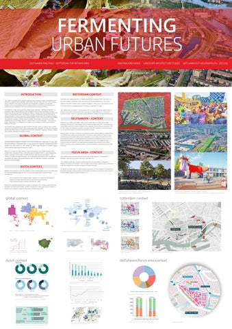
FERMENTING URBAN FUTURES ANASTAIIA KIRICHENKO
DELFSHAVEN RING PARK - ROTTERDAM, THE NETHERLANDS
LANDSCAPE ARCHITECTURE STUDIES
ARTS UNIVERSITY BOURNEMOUTH - 2025/26
ROTTERDAM CONTEXT
INTRODUCTION
Rotterdam city's migrant population is shaped by general Dutch migration waves, while due to its This research-by-design project proposes innovative urban solutions for ethnic communities in the Delfshaven neighbourhood in Rotterdam, Netherlands. The area is often termed an “ethnic enclave” and is a reflection of the issues metropolises are facing globally. As migration is rising while ecological crises are exacerbating, there is a strong necessity for solutions at the intersection of spatial justice and urbanisation for social, environmental and economic resilience. For Delfshaven, a large-scale connective ecological urban landscape – “Delfshaven Ring Park” – is proposed to solve problems related to urban segregation and structural inequalities. Concepts derived from the processes of fermentation are applied in a design solutions framework based on the creation of shared value between autochthonous and ethnic communities through time. With the applied philosophy in design, approaches from assemblage thinking and three ecologies developed by Deleuze and Guattari are applied. Part of three ecologies, social, environmental and mental realms are recognised as deeply interlinked, where the design solutions have a strong focus on mental wellbeing. With the assemblage thinking, a variety of actors in urban landscapes – human and nonhuman, institutional – are recognised in the design of socio-ecological nexuses as focus areas in Delfshaven Ring Park. Emancipatory space typologies have been developed from this research-by-design project, and the solutions are transferable to other urban contexts with similar challenges. The next step arising from the outcomes of this study is to develop a framework for emancipatory landscape urbanism, bridging policy-making, landscape and architecture fields.
port history there is a presence of other ethnic groups not found anywhere else in the country. Delfshaven has 78% of residents with a migration background, making it one of the most diverse but, at the same time, most segregated districts (See figure 23) (AlleCijfers.nl, 2016).
The neighbourhood is situated in close proximity to the city centre, shaping both opportunities for reconnection as well as risks of gentrification (See figure 17). Maps on figures 14 – 16 show the formation of ethnic enclaves in urban fabric, where Delfshaven strongly stands out (Statistiek, n.d.).
DELFSHAVEN - CONTEXT Delfshaven has a higher percentage of ethnic groups outside the EU in comparison to bigger
4
Rotterdam (See figure 22). Ethnic groups could be divided into three major ones – immigrants from former Dutch colonies (Suriname & Antillean), labour migrants (Turkey & Morocco), and others. 53% of ethnic groups are comprised of migrants from waves in the 60s, indicating a strong presence of second-generation migrants (See figure 23) (AlleCijfers.nl, 2016).
1
Walking research has been a fruitful way to understand dynamics between different neighbourhoods
GLOBAL CONTEXT
in Delfshaven. The neighbourhood across Delft's channel has a strong presence of higher-income autochthonous communities, while economic disparities are most visible on the other side of the water channel. A variety of new developments are emerging around Delfshaven, some of which are displacing existing communities, indicating a necessity for spaces for civic engagement and
Existing trends in migration indicate a rise across all continents, especially in Europe, Asia
connection with new residents. The industrial area is currently being transformed into 'Makers
and North America (See figures 7 & 9). According to the UN, migration is projected to almost
District' and hosts a variety of temporal spaces – community initiatives, local businesses, and newly
double from 280 million to 200 million by 2050 solely because of climate change
built parks.
(International Organization for Migration, 2024). Migrants are drawn to cities, where, in some metropolises, the number exceeds 50%, making them 'majority-minority cities (See figure 8). Global trends in urban segregation remain, leading to the formation of ethnic enclaves with structural problems – from Toronto to Kuwait to Auckland (Figures 10-12) (Migration data portal, 2022). Delfshaven exemplifies the above-mentioned dynamics and is a reflection of existing challenges faced by cities worldwide.
5
FOCUS AREA - CONTEXT Two neighbourhoods have been chosen as a focus area for site evaluation – Tussendijken & Bospolder, which are most central in the district (See figure 25).
2
Those neighbourhoods have a high percentage of young unmarried residents; consequently, 400 m
residents are dealing with loneliness. There are higher levels of poverty, lower education levels and a
DUTCH CONTEXT
lower percentage of social housing in comparison to bigger Rotterdam. According to the social index, the neighbourhood Tussendijken has lower indicators in comparison to
Migration has become one of the most significant drivers of demographic change in the Netherlands
Bospolder, especially on general quality of life perception. Bospolder has had recent redevelopments
over the past decades (See figure 18). There are three major migrant types in the Netherlands
and has a higher quality of living environment (n.d.).
(See figure 20): -
EU free movement, driven largely by labour migrants (e.g., Poland, Romania, Bulgaria)
-
Citizens from former colonies (Suriname, the Caribbean, and Indonesia)
-
Asylum and humanitarian migration (Jennissen et al., 2023)
People with a migration background live primarily in the largest cities, comprising half of the urban population (See figure 19 & 22)(2019). By 2050, if trends persist, major cities will host 70-80% of residents with a migration background (See figure 21) (Netherlands, 2023).
3
6 4.Cultural event in Delfshaven - opening if ‘’Slavery monument’ 5.Aerial view Delfshaven and adjacent port industry 6.’Bosploder fox’ sculpture on main street
1. Map of Rotterdam and Delfshaven 2. Aerial view Delfshaven 3. Heemraadsplein square - artwork ‘Palm Tree’
global context
rotterdam context
Text - to be added Figure 14 . Rotterdam ethnicity map - Morocco
Figure 7 . Increase of migration in all UN regions.
Figure 8. Foreign born population in some major or world cities Figure 15 . Rotterdam ethnicity map - Turkey
500 m
Pacific Asian Maori European
Figure 9 . Increase of migration in UN regions between 1990-2020
Figure 10 . Ethnicity map London.
Figure 11 . Ethnicity map Torronto.
Figure 12 . Ethnicity map Auckalnd.
Figure 16 . Rotterdam ethnicity map - Suriname
Figure 17 . Rotterdam city & Delfshaven map
delfshaven/focus area context
dutch context
Mathenesserweg
Figure 20. Top 10 countries of origin of persons with a migrant background, by generation (×1000)
Delft’s channel Schiedamseweg Western
Moroccan
Carribean
Surinamese
Turkish
Other
Figure 23. Residents migration background - Delfshaven
Delfshaven
Rotterdam
100%
Figure 18. Composition of the Dutch population by origin in 1972, 1995 and 2018.
Figure 21. Immigration to the Netherlands 200-2040 (x1000)
80% 60% 40% River Nieuwe Maas
20% 2013
Netherlands
Figure 22. Spatial distribution of the proportion of the population with a non-western migration background Figure 19. yearly immigration and emigration rates in the four largest Dutch cities
2013
2024
Europe
Figure 24. Rotterdam vs. Delfshaven migration background
2024
Non-Westren Figure 25. Focus area map
DELFSHAVEN HISTORY & IDENTITY
Theme
Sofia (13)
Daniel (40)
Nienke (40)
Winston (37)
Ali (40)
Alessia (26)
Cross-Persona Insights
Design Implications
Key activities
Spending time with friends in park 1943, shopping on Schiedamseweg, water front, events at Heemraadsplein
Child activities at sport facilities, city–neighbourh ood strong overlap
Park walks in Heemraadspark, clean-ups, events at Heemraadsplein , limited local everyday time in the neigh bourhood
Market Visserijplein, eco-garden in park 1943, shopping at Schiedamseweg
Volunteering , rooftop park, city visits
Market Vijserijplein, food places, pubs
Parks and markets are most common across ages; intensity depends on social networks strength
Design flexible, multi-age public spaces with for everyday uses where parks and markets become central community spaces
Key challenges
Poor cleanliness
Uncertain political future
Loneliness, rising rents
Loss of existing social bonds in the neighbourhood because of gentrification
Loneliness, stigma
Distance from family, affordability of housing
The major existing and uprising challenges are loneliness and affordability of housing
Create lowthreshold social spaces where residents can build and maintain strong social ties
Future aspirations
Stay long-term
Dual connection Netherlands–Eri trea
Stay if affordable
Leave in the long-term
Move out when stable
Stay if rent affordable
Long-term attachment is conditional for adults while newcomers and the youth are willing to stay
Create spaces for civic enagement to foster spatial and social agency in the neighbourhood
Cultural identity
Dutch-Moroccan
EritreanRotterdamer
Dutch
DutchSurinamese
Dutch
Italian migrant
Avoid ethnic theming
- Strong belonging in the neighbourhood is apparent among second-generation migrants, while loneliness affects newcomers and long-term residents with mental health instability. - Public spaces that are used by wide demographics are markets, parks and walking routes. Heemraadsplein square, Heemraadspark and Delfshavense Schie waterfront are areas where interviewees from both ethnic autochthon communities visit regularly.
Multicultural identity is experienced as strength, neutrality or burden
Wellbeing
Very stable
High
Medium
Very stable
Very low
Medium
Wellbeing correlates with social support
Design for mental well being and community
- Design solutions should focus on creating opportunities to establish genuine deeper relationships for both ethnic and autochthonous communities as well as spaces for civic engagement.
Social networks
Very strong family/friends
Very strong family & professional
Weak local networks
Very strong multi-layered
Almost none
Moderate migrantbased
Networks exist in parallel where half have weak social networks
Create spaces that strengthen multilayered social networks
Sense of belonging
Very strong
Very strong
Low
Medium–high
Very low
Medium
Highest among longsettled residents
Strengthen place attachment for newcomers
Civic engagement
Low
Very high
High
Very high
Medium–hig h
Low
Long-term residents have high civic engagement though do not see their future in Delfshaven
Support formal and informal participation
See Figures 8-11: Based on the analysis of environmental maps alongside base maps, Delfshaven's urban fabric shows correlations between environmental stressors and public health. The noise map reveals significant
Delfshaven was originally part of the city of Delft's harbour town and has grown due to shipbuilding,
acoustic pollution along primary transportation corridors, while the health risk map indicates
trading, and fishing. In the 19th century, it was transformed into a working-class neighbourhood
vulnerability levels clustered in similar patterns.
alongside the expansion of Rotterdam's port (See Historic Timeline) (n.d.).
The flood risks are of concern at the industrial area, showing opportunities for ecological water-
After WW2, major migration waves have reshaped Defshaven, housing migrants from Turkey &
sensitive interventions. The heat stress map shows urban heat island effects across much of the
Morocco, former Dutch colonies, asylum seekers, and more. Policies that placed people from the
neighbourhood, with major green-blue spaces mitigating these conditions.
same countries and/or religions in the same neighbourhoods have contributed to the formation of an ethnic enclave (Scholten et al., 2019).
Critical design opportunities include strengthening the network of green-blue spaces alongside highnoise corridors, simultaneously addressing issues related to public health and environmental
Having a walk in Delfshaven, a visitor can sense how different time eras and identities merge in one
resilience. environment through functional mixing and targeted public space improvements in the
urban fabric – multicultural food places, historic harbour, community-initiated art, forgotten
inner neighbourhood and nearby port area.
windmills, and more (See map Delfshaven History & Identiry). This neighbourhood has a unique character, not found anywhere else in Rotterdam or the Netherlands, where many people with multiple cultures call home and shape community spirit.
FIELD RESEARCH
.
FOCUS AREA - SITE EVALUATION
See figure 1: - Delfshaven has a strong sense of cohesion between a variety of migrant groups, where the
See Figures 5-7:
neighbourhood is experienced as a 'village in a city'. - All interviewees, besides the youth, experience degrees of exclusion from autochthonous communities. They indicated willingness to have fairer opportunities to participate in civic and professional fields, beyond widespread tokenistic inclusion.
The combined analysis of figure–ground, green–blue infrastructure, and transport networks reveals Delfshaven as a dense and morphologically layered urban district, where historic fabric is intersected by port infrastructure and fragmented open spaces. While the transport network is well-distributed, major roads lead to segregated areas and leftover spaces. Green infrastructures exist primarily as fragmented open spaces. These conditions create opportunities to connect green-blue infrastructure and leftover void spaces as connective landscape to improve spatial cohesion, strengthen ecological networks and active mobility routes for environmental and social resilience. See Figures 12-14: The combined analysis of land use, building age, and living environment quality maps shows Delfshaven as a residential district with a historic core alongside an industrial area, reflecting successive phases of urban development. Older buildings are situated along the former harbour, while post-war and late-20th-century housing dominates peripheral areas, which often have a lower quality of living environment. Areas with weaker living conditions correlate with mono-functional land use, ageing housing, and proximity to port industry. This reveals key design opportunities to revitalise the living environment through functional mixing and targeted public space improvements in the inner neighbourhood and nearby port area.
Figure 1. Field research summary table, based on in-depth interviews
HISTORIC TIMELINE 1960
Labour Migration Dutch “guest worker”
Origin of Delfshaven as the harbour of Delft
Delfshaven becomes part of Rotterdam
During Rotterdam’s bombing, Delfshaven survived mostly intact
1389
1886
1940
Growth of a Harbour
14th c.
Maritime Prosperity
Start of industries
-Colonial trade via
Transformation from an independent town
15th c.
16th c.
17th c.
18th c.
1990
1970
2000 Refugee arrivals Conflicts in Somalia, former Yugoslavia,
Surinamese & Antilles Independence
Migration continues Migrants from all over the world
2025 Migration waves Delfshaven hosts variety of migrant
20th c.
19th c.
21th c.
Growth maps 2. Delfshaven & Rotterdam
Figure 3. Historic maps - Delfshaven
1800
1902
1882
1940
1918
2008 & 2019
delfshaven history & identity
1. Abandoned winmill
2. Melvana Mosque
3. Central market
4. Sculpture - fox
focus area - site evaluation 1
Vehicle roads
Buildings
Bus stations
Green infrastructure
Metro line
Blue infrastructure
5. Rooftop park
6. Pelgrim church
7. Historic Delfshaven 8. Slavery monument
Historic Delfshven Lively street Windmill Market square
Figure 5. Map of green & blue infrastructure
Figure 7. Figure ground map
Figure 6. Map of public transport network
Figure 4. Map of Delfshaven’s history & identity
focus area - site evaluation 2
≤ 45 dB 46 – 50 dB 51 – 55 dB 56 – 60 dB 61 – 65 dB 66 – 70 dB ≥ 71 dB
Figure 8. Noise pollution map
focus area - site evaluation 3
Extremely small chance Very small chance Small chance Medium chance Large chance
Industrial Main road Recreation Cultural facility Commercial
< 3.5 3.5 - 4.0 4.0 - 4.5 4.5 - 5.0 5.0 - 5.5 5.5 - 6.0 6.0 - 6.5 6.5 - 7.0 7.0 - 7.5 7.5 - 8.0 8.0 - 8.5 8.5 - 9.0 9.0 - 9.5 9.5 - 10.0 ≥ 10.0
Figure 10. Health risk map (%)
< 0.2 0.2 - 0.4 0.4 - 0.6 0.6 - 0.8 0.8 - 1.0 1.0 - 1.2 1.2 - 1.4 1.4 - 1.6 1.6 - 1.8 1.8 - 2.0 ≥ 2.0
Figure 11. Heat stress map
Figure 12. Land use map
Very insufficient More than insufficient Insufficient Weak Sufficient More than sufficient Good Very good
before 1600 1600 – 1800 1800 – 1900 1900 – 1920 1920 – 1940 1940 – 1960 1960 – 1980 1980 – 1990 1990 – 2000 2000 – 2010 2010 – 2020 2020 and later
Residential
Figure 9. Flood risk map
Figure 13. Buildings age map
Figure 14. Quality of living environment map
DESIGN METHODOLOGY Creating alternative urban futures through the practice of fermentation for ethnic, autochthonous and multispecies communities of Delfshaven Tactics
Challenges & opportunities Structural inequality + poverty Commence neighbourhood-scale economy based on food commons: this will create opportunities for residents from disadvantaged groups to be engaged in restorative community-oriented activity and become more civically engaged
Case studies visual references
Case studies
In Utrecht, Netherlands, edible neighbourhood Rijnvliet has been designed using participatory design methods. The neighbourhood has central 150 000 m2 food forest, edible fruit & nuts street trees.
AGROECOLOGICAL INFRASTRUCTURE: central food forest, edible streetscapes (fruit/nut street trees), edible pocket parks; greenhouses
URBAN FORAGING LANDSCAPES Figure 1. Aerial view on food forest
COLLECTIVELY GOVERNED FOOD SPACES:
Upgrade reputation of Delfshaven: : combination of large-scale art and improvement of connectivity with other neighbourhoods will create shared value between neighbourhoods of different socio-economic backgrounds
ECOSYSTEMS RESTORATION FOR AQUATIC MULTISPECIES Figure 7. View on riparian zone in Park of the Docks
ENVIRONMENTAL ART: neighbourhood scale environment-responsive series of multispecies sculptures
INFRASTRUCTURAL CONNECTIVITY WITH OTHER NEIGHBOURHOODS: enhance blue-green infrastructure Delfshaven + Rotterdam & connect spatially fragmented pieces of infrastructure
Emerald Necklace is a chain of nine parks, connected by urban green zones designed both for ecological infrastructure and recreational use. It was one of the first examples of landscape urbanism aimed to create common ground for citizens of different socio-economic classes.
NATURE-INCLUSIVE DESIGN FOR NON-HUMAN SPECIES:
The neighbourhood in Aarhus, Denmark has been stigmatised and faced various social challenges. The central park works as the green backbone for the transformation of Denmark’s largest social housing area.
RESROTATIVE/THERAPUTIC SPACES:
A2 Figure 11. Perspective view on ‘The Gates’
Figure 12. Heemraadsplein square
DECONSTRUCTION RELATIONSHIPS - ETHNIC COMMUNITIES & AUTHOCHTON: - strategic spaces locations choice where autochton and ethnic communities situated closest to one another
A3 B2
Figure 15. Westzeedijk 3 lane road
Figure 14. View waterfront in Emerald Park
B1
D4
A1 A4
Figure 19. Perspective view on bridges in Yanweizhou Park
C4
Figure 21. Heemraadspark
Figure 20. Perspective view on bridges in Yanweizhou Park
LIMINAL SPACES DESIGN FOCUS Figure 24. Abandonded windmill
Figure 23. Perspective on outdoor dining space in Parcfarm
SOCIO-ECOLOGICAL NEXUSES DESIGN FOCUS
Parc de la Vilette in Paris accommodates complex cultural programme that people could appropriate to their needs with red follies. The design disrupts traditional spatial hierarchies for new life experiences to unfold.
Opportunities Shared value creation
Autochthonous neighbourhood Mixed neighbourhood
Park as a continuous experiences
Ethnic enclave
Abandoned buildings
Port & creative industry area
Pocket spaces
Park experience componetnts A - waterfront experiences B - promenade experiences C - pockets space experience D - connected flows
Figure 27. Keile park
Figure 26. Perspective view on red follie in Parc de la Vilette.
AGROECOLOGY + CARE & WONDER CONCEPTS
THEORETICAL FRAMEWORK
Diagnosis of systemic problems
D1
C1
RECREATIONAL SPACES ON WATER
Figure 25. Aerial view on Parc de la Vilette.
Socio-political context
C5
Figure 18. Rooftop park Dakpark
Figure 17. Perspective view on the lake in Gellerup park
Parckfarm, situated on a former railway, has been designed in between deprived migrant dense neighbourhood and high-end exclusive development, hosting various community-led initiatives.
RESEARCH INSIGHTS
D2
ECOSYSTEM RESTORATION FOR MULTISPECIES COMMUNITIES
Figure 22. Aerial view on Parcfarm
UNCONVENTIONAL SPACES USES DESIGN TO STRENGTHEN EXISTING COMMUNITY INITIATIVES: - multifunctional spaces that bring different demographics groups together through grassroots
B3
B4
C3
EMERALD PARK DESIGN PART OF URBAN GREEN NETWORK
Yanweizhou Park in Jinhua City, China has been designed to reconnect isolated neighbourhoods. This flood adaptive park has experiential bridges and variety of dynamic water-oriented experiences.
- water-oriented experiences - connective spaces/infrastructures - body-oriented (inclusive team sports)
D3
Figure 9. Delfshavense Schie waterfront
MULTISPECIES SCULPTURES
Figure 16. Aerial view on Gellerup park
Lack of formal facilities to get support + loneliness
C2
Figure 8. Water platform in Park of the Docks
Christo & Jeanne Claude art installation ‘The Gates’ integrated 7,503 orange gates in New York’s central park. The artist due also mentioned that The Gates brought people from segregated neighbourhoods together. Figure 10. View on ‘The Gates’ with New York skyline
living facades in sculptural shapes, habitats for endangered species & migratory birds, water as
Figure 6. Schiedameweg main street
Figure 5. Playground in Monte Laa park
Park Of The Docks in Paris incorporates rainwater collection systems, water filtration, and biodiversity zones. It has zones for users to spend prolonged time next to water, combining water management with recreation functions.
Figure 13. Aerial view on Emerald Park
Provide spaces to strengthen ethnic communities with autochton Dutch communities: : strategic choice of community spaces, unconventional spaces uses alongside restorative effects will bring historically disconnected communities in one urban landscape and create possibilities for connection
Figure 3. Park 1943
PARK AS CONTINUOUS UNINTERRUPTED EXPERIENCE Figure 4. Aerial view on Monte Laa park
RESILIENT INFRASTRUCTURE & ECOLOGICAL CYCLES - WATER FOCUS: rainwater harvesting systems, soil regeneration zones, circular waste systems, water adaptive food landscapes Stigmatization of neighbourhood & its residents + limited access to Dutch society
Figure 2. Greenhouse facilities in the neighbourhood
Monte Laa park design is based on multiple spaces and programme vision, bringing spaces for diverse needs in one linear open space. Built on a former highway, it connected two segregated neighbourhood and accommodated mixed uses residential, educational and offices.
community kitchen & outdoor dining, local food markets, fermentation lab, food preservation hub, kiosks; community gardens
Spaces to transform Delfshaven
9 design components
Urban context
Theoretical framework
Diagnosis of systemic problems based on critical urban theory
Establish normative base for equitable urban design
Conceptual development
Philosophical framework
Socio-ecological framework
Socio- mental framework
Address deeper considerations human subjectivity and relationships with the living world
Provide methodology for longterm structural urban transformation
Design at the intersection of emancipation and mental wellebing
Emancipatory spaces (Stavrides and Harvey)
Structural inequalities
Urban segregation
Spatial justice (Edward Soja)
Three ecologies
Landscape urbanism
Health inequalities
Urban smoothening
Right to the city (Henri Lefebvre)
Assemblage urbanism
Landscape as infrastructure
Tokenism
Gentrification
Environmental humanities
Social-ecological systems
Foraging and fermentation are care-orientated activities that I have been engaged with as part of my 'living by learning' journey. I have been doing an apprenticeship in urban foraging to study urban ecologies and connect with the environment I live in. I have done various courses on fermentation, read books and experimented with food. I saw many connections between the concept of fermentation applied in urban practice as solutions to uprising social and ecological issues. There is a tendency for speed and efficiency in contemporary society, while in 'fermented cities' time is slowed down. In the following chapter, the concept of 'fermented cities' will unfold with more detail as a counterculture to existing cultural, social and urban movements to contribute to the subversion of existing ecological and social crises.
Cinema and sculpture are wonder-orientated artistic expressions that have become part of the landscape design process to give it a sharper edge beyond traditional landscape practice.
Therapeutic landscapes (Gesler) Salutogenic design (Aaron Antonovsky)
Collective governance (Ostrom and Harvey)
Commodification
he conceptual foundation for this project is grounded in a personal journey turned into a professional one, rooted in migration and mental wellbeing. Being a Dutch citizen with a migration background, while coming from a country that faced a military conflict, I saw urban landscape practice as a field to help migrants to become integrated and emancipated in host countries.
I believe that genuine design solutions are rooted in in-depth living through the issues that the landscape architect is solving. As topics of both migration and mental wellbeing become more and more relevant in contemporary societies globally, I believe I can contribute to landscape and urban studies with the solutions arising from this research-by-design project.
Ladder of citizen participation (Arnstein)
Theoretical framework and key themes:
D. Landscape Urbanism and Applied Philosophy in Design
A. Migration, Segregation & Mental Wellbeing
· Three Ecologies : application of 'ecosophy', where ecological, social and mental issues are deeply interconnected. · Assemblage urbanism '''': recognition of multiple participants - human, and nonhuman, institutional - in urban landscapes. · Landscape urbanism reader : landscape as infrastructural framework for socialecological systems.
· Advanced Introduction to Urban Segregation : discusses approaches and challenges affecting urban transformations on the international scale. · Landscape citizenships : extends growing body of thought on landscape democracy and spatial justice in the face of rising migration. · Urban mental health : brings together international perspectives on urbanisation and its impacts on mental health.
Design implication: combine designing for ecological resilience with social and mental emancipation.
Design implication: spatial inclusivity = psychological inclusivity. E. Emancipation and Multispecies Relationships B. Studies of Critical Urban Conditions · Urban smoothening : proliferation of perfected urban environments and its impacts on spatial justice. · Gentrification : city space as a market product. · Tokenism : symbolic inclusion masking structural inequality.
· From Polarisation to Multispecies Relationships : studies to bridge ecology and culture, seeing landscape as cohabitation of multiple species. · Emancipatory spaces : designing for civic engagement and social support networks. · Salutogenic design ''''–: an approach to creating urban environments that promote and enhance physical and mental health, rather than just treating illness.
Design implication: subvert 'urban smoothening' by designing for strengthening communities.
Design implication: introduce care infrastructures – connective spaces for human and nonhuman species.
C. Spatial Justice and Right to the City · Right to the city : right to participate in and shape urban space. · Spatial justice ''–: spatial justice as redistribution of spatial opportunities. · Urban commons : reclaiming the city as a collective project. Design implication: create commons-based governance and collective ownership models.
DESIGN MATRIX - Fermentation as time and value related strategy
9 components park
abandoned buildings
Abandoned buildings Within the urban blueWithin variety of pocket become part of eco-social spaces, integrated private green network spaces, nexuses to bring residents spaces next to community Delfshaven is a human from diverse communities spaces for flow between superhabitat for non-human multispecies communities together. privacy, time with other as an exemplary project in time species and with time as patterns between human and urban ecological community. non-human species restoration.
ecological cycles
repetitive patterns of transition in nature
long-term project stage
project launch and maturation stage
Within the urban bluegreen network spaces, planting strategy incorporates postantropocentric, connective, edible landscape system
Multispecies sculptures grow out of abandoned buildings with the focus on cycles of life, birth & decay
Care centres and social organisations in the neighbourhood are involved in long-term maintenance of the park, employing residents from disadvantaged groups
Abandoned buildings become commons owned for community spaces
eco/socio nexus layer 2
pocket spaces
Pocket spaces become focus areas for ecological restoration for multiseasonal value for multispecies communities
Pocket spaces located in liminal zones become socio-ecological nexuses
agroecological environmental art landscape
Within Delfshaven Ring Park, combination of wild foraging landscape, human community gardens and non-human community food spaces are incorporated, time time as patterns between human and strengthening existing non-human species sustainable urban agriculture projects
TIME RELATED STRATEGY
TIME RELATED STRATEGY
eco/socio nexus layer 1
SPACE RELATED STRATEGY
ecological cycles
repetitive patterns of transition in nature
long-term project stage
Multispecies sculptures have shelters for birds, insects and bats communities alongside spontaneous season sensitive flora
Part of planting strategy, long-living native and non-naitve plant species becomes connective landmarks and symbols of intergenerational connection
Multispecies sculptures are designed out of regenerative and natural materials that mature and change through time
eco/socio nexus layer 3
water
Multispecies sculptues are Riparian restoration integrated into sociointegrates spaces for ecological nexuses to aquatic wildlife as well as bring together diverse spaces for recreation communities in common spaces
Within the urban bluegreen network spaces, planting strategy incorporates wild green edible infrastructure for foraging in different seasons
SPACE RELATED STRATEGY
Designing with water becomes integral part of socio-ecological nexuses
Within Delfshaven Ring Park, water depollution startegy with riparian water regeneration is planned for decades ahead to clean the water from port industry
TIME RELATED STRATEGY
SPACE RELATED STRATEGY
human non-human time
poetry tiles
urban furniture
materials
In socio-ecological nexuses, tiles with poetry with authors connected to Delfshaven from different cultural backgrounds are integrated
Urban furniture hosts shelters, feeding stations and other objects to connect with multispecies communities
Materials chosen throughout the park consider needs of local multispecies communities and host shelters for them alongside spontaneous vegetation for better climatic conditions
Poetry tiles are designed with cavities for spontaneous vegetation to inhabit
Urban furniture is designed out of regenerative materials
Materials chosen throughout the park consider whole carbon and ecological cycles. They include natural, regenerative climate adaptive materials
Poetry tiles are designed with the possibility to be adjusted for new generations in Delfshaven to impact the spatial arrangement
Urban furniture is adaptive Materials chosen throughout the park to the needs of local communities through time change through time and adapt to existing local due to its flexibility environment reconfigurations possibilities
time as patterns between human and non-human species
ecological cycles
repetitive patterns of transition in nature
long-term project stage
project launch and maturation stage
project launch and maturation stage
Conceptual development Fermentation as shape related strategy Figure 28. Aspergillus oryzae - Koji fungus
Figure 29. Aspergillus oryzae - Koji fungus
Figure 30. Aspergillus oryzae - Koji fungus
Figure 31. Aspergillus oryzae - Koji
Figure 32. Rhizopus - Tempeh fungus
Figure 33. Miso soybean paste
Figure 34. Miso soybean paste
Miso paste
Figure 36. Lactic acid bacteria - Fermented Figure 37. Lactic acid bacteria - Fermented Figure 38. Fungus species Aspergillus or milk ayran (1000x magnification) milk (1000x magnification) Penicillium - Mouldy cornbread
Figure 39. Mouldy millet
Figure 40. Kahm yeast
Figure 41. Brewer’s Yeast cells Saccharomyces cerevisiae
Figure 35.Sourdough starter
Miso soybean paste
Figure 42. Brewer’s Yeast cells Saccharomyces cerevisiae
Figure 43. Doubanjiang (Sichuan-style fermentation of broad beans with chilis
MASTERPLAN DELFSHAVEN RINGPARK HEEMRAADSPLEIN SQUARE
KEILE PARK
DELFSHAVENSE SCHIE WATERFRONT
DELFSHAVEN RING PARK LEGEND
Park experience componetnts
Green zones
Pavement
Roads
Pocket spaces
Part 1
Trees
Bike lanes
Tramline
Abandoned buildings
Part 2
Water
Parking lots
Metro line
Connective flows
Part 3
A - waterfront experiences B - promenade experiences C - pockets space experience D - connected flows
MASTERPLAN The macro-scale design of Delfshaven Ring Park is based on the socio-ecological model and built on three basic design components – emerald park design, pocket spaces and abandoned buildings. Emerald Park design acts as a large-scale connective ecological landscape that spans across three neighbourhoods of different socio-economic groups to create long-term shared value between diverse communities.
Delfshaven Ring Park is divided into three parts. Park experience components include waterfront, pocket spaces, promenade and connective flows. The 9 park components, derived from case study analysis, are integrated in macro-scale design. The park has three connective elements – environmental art, water and agroecology – to create a consolidated spatial experience.
This solves problems related to urban social segregation, contributing to social and cultural
Further design decisions are derived from the application of concepts from fermentation processes
resilience for human wellbeing. The Emerald Park strengthens the existing urban green
based on time and space value creation. These are based on human-non-human time, flows of
network of Rotterdam, contributing to environmental resilience on a metropolitan scale.
seasons, and long-term project stages.
Pocket spaces become areas to establish deeper relationships between a variety of social
The design is aimed at three main groups:
groups and the environment. Abandoned buildings become support facilities to strengthen existing community initiatives and act as organisational structures for future care of the
1) Segregated local communities
Delfshaven Ring Park.
2) Care centre visitors 3) External visitors
Emancipatory spaces typologies
ROUTES DIAGRAM
Physical health route Mental health route Community route
Space relations diagramming & routing
1 - Socio-ecological nexus
2 - Abandoned building
Environmetnal Community space Foraging landscape Wildlife habitat Waterscape Recreational space
Multispecies sculpture Repurpose building into community space
3 - Transitional space
4 - Long street / ecological re(connection) Active mobility route Wildlife habitat
The diagrammatic overview shows spatial relations between park experience components – pocket spaces, waterfront, promenade, and connective flows. These demonstrate the connective network of the park between three neighbourhoods, spatial accessibility and variety of walking experiences. Routing for Delfshaven Ring Park, based on the analysis of spatial relations from the diagrammatic overview, has led to the design of 3 major walking experiences – physical, mental and community. These guide the design of focus areas of the park, shown in the next slides.
Multispecies sculpture Wildlife habitat
DESIGN DIAGRAM
P3 P2 x
Y z
y
P1
P2
P3
P1
Z
X
5 - Pocket space (wildlife focus) P2
P3
P2
P1
Multispecies sculpture Wildlife habitat Recreational zone Foraging landscape
P3 x
x
P2
6 - Pocket space (community focus) Multispecies sculpture Community space Recreational zone Foraging landscape
P1
P1 P2
P1 P3
P3
x
y
Walking route Spatial link Pocket space Connective flow
7 - Infrastructural (re)connection
8 - Water / blue (re)connection
Multispecies sculpture Community space
Wildlife habitat Recreation zone Waterscape
FOCUS AREA 1 HEEMRAADSPLEIN SQUARE - SITE PLAN Planting scheme ID 1
Species Acer pseudoplatanus 'Rotterdam'
Common name Rotterdam Sycamore Maple
Layer
LEGEND
Amount 90
Existing special trees
3
Exsiting trees
87
2
Acer saccharum subsp. floridanum Florida Maple
Existing special trees
1
3
Aesculus hippocastanum
Horse Chestnut
Existing special trees
1
4
Castanea sativa
Sweet Chestnut
Edible structural trees
12
5
Corylus colurna
Turkish Hazel
Edible mid-canopy trees
17
6
Crataegus michauxii
Michaux's Hawthorn
Edible mid-canopy trees
20
7
Diospyros virginiana
Persimmon
Edible mid-canopy trees
8
8
Ficus carica 'Mission'
Mission Fig
Edible mid-canopy trees
8
9
Juglans regia
English Walnut
Edible structural trees
11
10 Laurus nobilis 'Monem'
Emerald Wave Sweet Bay
Edible mid-canopy trees
18
11 Malus sylvestris
Cultivated Apple
Edible structural trees
10
12 Prunus avium
Sweet Cherry
Edible structural trees
7
13 Prunus salicina 'Santa Rosa'
Santa Rosa Plum
Edible mid-canopy trees
10
14 Pyrus communis
Common pear
Edible structural trees
4
15 Salix babylonica
Weeping Willow
Exsiting trees
7
16 Sambucus mexicana
American Elderberry, Sweet Elderberry Edible mid-canopy trees
27
17 Taxus baccata
Common Yew, English Yew
Existing special trees
2
18 Tilia platyphyllos 'Fastigiata'
Largeleaf Linden 'Fastigiata'
Exsiting trees
51
Existing building structures
N
Abandonded buildings
10 METER
Vehicle road Tramline Paved surfaces Cycling lane Parking lots Water Green zones Main square - zone 1 Main square - zone 2 Main square - zone 3 Topographic platform Fountain Multispecies sculpture Performance stage Food forest Food forest paths Water platform
PLANTING STRATEGY Post-antropocentric, connective, edible landscape system Strategy
For whom
Tactics
Why
Species selection
Species selection
Application in Delfshaven
1. Multispecies habitats
1) local endangered existing species
- pollinator corridors - waterbodies banks regeneration - layers of forest ecosystem next to street trees
Increase ecological value for environmental resilience
1) Pollinator corridors - Common Knapweed – Centaurea nigra - Meadow Cranesbill – Geranium pratense - Tufted Hair Grass – Deschampsia cespitosa
3) Streetscapes forest ecosystem Shrub layer: - Elder – Sambucus nigra - Guelder Rose – Viburnum opulus
1) Pollinator zones & corridors - Keile park, dakpark
2) local existing species
Improve mental wellbeing by deeper connection with the environment for communities
2) Waterbodies banks regeneration - Common Reed — Phragmites australis - Meadowsweet — Filipendula ulmaria - Marsh Marigold — Caltha palustris - Himalayan Fleeceflower — Persicaria amplexicaulis
3) migratory species
2. Wild edible green infrastructure
1) Ethnic communities
- food forests - edible streetscapes - edible pocket spaces
- Connect ethnic communities and authochoon communities through food scapes
2) Authochtoon Dutch communities
- Create deeper connection between residents with migration background and their environment
3) Local multispecies communities
3. Cultural storytelling & connective landmarks
Climbers: - Ivy - Hedera Araliaceae - Honeysuckle - Lonicera
1) Ethnic communities
- ‘non-native’ & native species in thriving environments for both - 100+ years old trees as landmarks - neighbourhood identity formation through plants
2) Authochtoon Dutch communities
- Transform relationships of authothoon and ethnic communities through attitudes to diversity of plant communities
2) Water banks regeneration - Delfshavense Schie, Rochusenstraat
2) Edible shrubs - Blackberry – Rubus fruticosus - Mulberry – Morus alba - Sea Buckthorn – Hippophae rhamnoides - Blackcurrant – Ribes nigrum - Gooseberry – Ribes uva-crispa - Barberry – Berberis vulgaris
Nut Trees: - Hazelnut – Corylus avellana - Sweet Chestnut – Castanea sativa - Walnut – Juglans regia
Figure 2. Riparian floating habitat in Wild Mile park in Chicago 1) Food forest - park 1943, Heemraadspark 2) Edible streetscapes - Hoodrift, Nieuwe Binnenweg 3) Edible pocket spaces - Keile park, Bospolder square, Marconiplein square
3) Edible groundcover - Spearmint – Mentha spicata - Wild Strawberry – Fragaria vesca - Wild Garlic / Ramsons – Allium ursinum
Trees landmarks: - Ginkgo – Ginkgo biloba - Japanese Zelkova – Zelkova serrata - Dawn Redwood – Metasequoia glyptostroboides - Sweet Chestnut – Castanea sativa
Thriving non-invasive non-native species: - Persimmon Tree – Diospyros virginiana - Diospyros kaki (less hardy but possible with shelter) - Cider Gum (cold-hardy cultivar) – Eucalyptus gunnii ‘Azura’
- Foster identities with plants for ethnic communities for long-term spatial agency
Perennials & Herbaceous Layer: - Verbena / Vervain – Verbena bonariensis - Purple Coneflower – Echinacea purpurea
Figure 1. Piet Oudolf garden in Hummelo
3) Forest ecosystem streetscapes Matheneserlaan, Mathenesserdijk
Groundcover: - Wild geranium - Geranium maculatum - Bugleweed – Ajuga reptans - Lesser Periwinkle – Vinca minor
1) Edible trees Fruit trees: - Quince – Cydonia oblonga - Apple – Malus domestica - Plum – Prunus domestica - Fig – Ficus caricaMedlar – Mespilus germanica
Visual references
Figure 3. Edible streetscape in Rijnvliet in Utrecht
Figure 4. Community garden
1) Trees landmarks - Heemraadsplein, Lage Erfbrug, Mathenesserbrug, park 1943, Visewijplein square, Bospolder square 2) Concentration of native & non-native plants communities - Heemraadsplein, Mathenesrlaan, Nieuwe Binnenweg, Delfshavense Schie, Keile park 3) Plants identity formation - connective streets Hoodrift, Nieuwe Binnenweg , promenades Delfshavense Schie
Figure 5. 1400 years old Ginkgo Biloba in Xi’an, China.
Figure 1. Site plan - Heemraadsplein square Figure 6. Rijksmuseum garden
Overview
MASTERPLAN PART 1
The neighbourhood that spans across Part 1 of the Delfshaven Ring Park is an ethnic enclave facing a variety of social and economic challenges. The design
4
is focused on revitalisation of the neighbourhood and strengthening of spaces for ethnic communities. The neighbourhood has a high number of local initiatives;
1
3
thus, the design prioritises strengthening existing social infrastructures for economic and social
3
resilience.
6
2 2
Revitalisation area 1 – Schiedamseweg main street the neighbourhood, where all social groups from ethnic 5
communities use it for transport and/or shopping. The
3
4
street is in need of revitalisation due to increased air
5
and noise pollution and limited space for communities.
P3
4
P2
6
located in the neighbourhood, where many social P1
organisations and community initiatives take place. Viserijplein Square has primarily concrete coverage
Y P1
P2
and is indicated to be a low-quality living environment.
P3
Despite the lack of social areas, the square hosts a lively weekly market that is in need of extension. Park
Z
X
1943 has vast open spaces, which vulnerable groups, 7
Design focus area Abandoned buildings Green patches Trees Water Pavement Bike lanes Parking lots
1 - Liminal pocket space - culture & food square
5. Liminal landscape - food forest
Connective flows
2 - hospice
2. Liminal pocket space skatepark & community herb garden
3 - refugee support centre
3. Pocket space - community garden of elderly house
5 - mental health support centre
4 - domestic violence centre
6 - mental health support centre
4. Transitional space - wildlife habitat
2
Revitalisation area 3 – Marconiplein Square Marconiplein Square, with the pocket space next to it, is located at the edge of Delfshaven and is a liminal space between neighbourhoods. The pocket space is a vast space leftover after planning, which has the potential to become connective ground for Delfshaven and close-by neighbourhoods.
Tramline
1
unsafety.
1 - elderly home
6. Liminal landscape - riparian wildlife habitat, recreational space & active mobility route
Abandoned historic building urban foraging centre
Care centres
such as women, indicated avoiding due to perceived
Community event space
z
y
8
Areas Viserijplein Square & Park 1943 are centrally
Topographic platform
Revitalisation area 2 – Viserijplein square & Park 1943
x
Food forest
Schiedamseweg main street is situated in the heart of
6
Tramline
1
Foraging education centre
5
1
7
Multispecies sculpture
2
5
6
Figure 2. Section Heemraadsplein square 3
4
7
8
C B x
HEEMRAADSPLEIN SQUARE DESIGN
A
Heemraadsplein square becomes a socio-ecological nexus that brings together multiple participants – ethnic and autochthonous communities as well as non-human species – becoming central to social and cultural resilience.
Y
The design of the square strengthens existing cultural value with a stage for performances fused with multispecies sculpture. Food plays a major role in the reconnection of social groups. Additional value for everyday use gets created by the transformation of the park next to the square into a
z
y
A
B
C
food forest, creating additional ecological value for the park. The abandoned building is repurposed into an educational facility about urban
X
foraging to activate care and economic value for the food forest with existing organisations in the neighbourhood. A topographic platform with edible trees becomes a space to rest between cultural celebrations, adding value to the spatial experience of the square. The fountain becomes an additional play element, flexible in use, that does not obstruct the space necessary for events. The water platform becomes a grounding area to spend prolonged time in the food forest. Natural and regenerative materials chosen improve the mental wellbeing of residents, aligning with whole-life carbon and natural-cycle principles. The planting strategy for the food forest and the square incorporates edible species – both native and well-adapted foreign – to change the perception of belonging through urban ecologies. The multispecies sculpture hosts shelters for both native and non-native birds, making unconscious links about connection through non-human species.
Figure 3. Perspective view Heemraadsplein square
Z
FOCUS AREA 2 DELFSHAVENSE SCHIE WATERFRONT SITE PLAN Planting scheme ID 1
Species Acer pseudoplatanus 'Rotterdam'
Common name Rotterdam Sycamore Maple
Layer
Amount 133
Adjacent area trees
46
Fruit promenade
44
Other waterfront trees
7
Wildlife corridor
36
16 Metasequoia glyptostroboides 'Gold Rush' Gold Rush Dawn Redwood
Adjacent area trees
18
LEGEND
17 Phragmites australis
Common Reed
Eco-banks restoration
251
GROUND LEVEL
18 Prunus avium
Sweet Cherry
26 Fruit orchard
3
Fruit promenade
8
Herb garden
15
2
Alisma plantago-aquatica
European water plantain
Eco-banks restoration
244
3
Betula pendula 'Monle'
Purple Rain European White Birch
Wildlife corridor
13
Fruit orchard
4
4
Carex lacustris
Hairy sedge
Eco-banks restoration
275
Fruit promenade
11
5
Carpinus betulus 'Fastigiata'
European Hornbeam 'Fastigiata'
20
MIDLEVEL
2
6
Crataegus michauxii
17
Floating riparian habitat Boardwalk Water platform
8
Adjacent area trees
17
Community garden
Wildlife corridor
9
MIDLEVEL
2
Foraging herb garden
Black locust
40
16 5
Fruit promenade Mission Fig
Other waterfront trees 21 Salix caprea 'Kilmarnock'
Kilmarnock Willow
21
Wildlife habitat + road buffer
37
Existing building structures
11
MIDLEVEL
1
17
Other waterfront trees
13
Abandonded building structures
Wildlife corridor
23
Vehicle road
Fruit orchard
4
Fruit promenade
7
MIDLEVEL
2
Fruit promenade
9
Tramline
Other waterfront trees
4
Other waterfront trees
9
Paved surfaces
Wildlife corridor
11
Cycling lane
Eco-banks restoration
263
Parking lots
22 Sorbus domestica
Service Tree
29
8
Fraxinus excelsior
European Ash
Herb garden
13
9
Ilex aquifolium
English Holly
Wildlife corridor
10
23 Spiraea cantoniensis
Reeves' Meadowsweet
10 Ilex aquifolium 'Golden Queen'
English Holly 'Golden Queen'
Wildlife corridor
1
24 Taxus baccata
Common Yew, English Yew
11 Iris pseudacorus
Yellow flag, Pale yellow iris, Water flag Eco-banks restoration
12 Juglans regia
English Walnut
7
13 Juncus effusus
Common Rush, Soft Rush
Eco-banks restoration
282
14 Juncus repens
Lesser creeping rush
Eco-banks restoration
272
15 Mespilus germanica
Medlar
25 Tilia cordata
4
Fruit promenade
9
Other waterfront trees
2
26 Tilia vulgaris x 'Pallida'
5
Wildlife corridor
13
Green zones MID LEVEL
20 Other waterfront trees
6
Wildlife corridor
14
Common Linden 'Pallida'
Skate & parkour park Base carrying structure multispecies sculpture Bridge
10 Adjacent area trees Fruit orchard
27 Ulmus minor
Water
4
Other waterfront trees
Littleleaf Linden, Small Leaved Lime
15 Fruit orchard
22 MIDLEVEL
267
Herb garden
10 METER
Base carrying structure
Other waterfront trees
20 Robinia pseudoacacia
N
Greenhouses
3
Michaux's Hawthorn
Ficus carica 'Mission'
Hosui Asian Pear
Promenade - zone 2
MIDLEVEL
Fruit orchard
7
19 Pyrus pyrifolia 'Hosui'
Promenade - zone 1
English Elm
8
Green zone
2 16
Herb garden
6
Other waterfront trees
10
TOP LEVEL Multispecies sculpture Foraging herb garden
MATERIALS STRATEGY Whole life carbon and natural cycles materials Materials strategy principles
Why
Choices of materials
Application in Delfshaven
1. Climate adaptive materials
- Increase environmental resilience
- Permeable materials - Reflective materials - Co2 sequestering concrete - Photocatalytic concrete - Mycelium brick - Light-colored C2C concrete pavers
- Pavements - Hardscaping - Urban furniture - Extensions to abandoned buildings
- Upgrade image of Delfshaven - Foster longer time in public spaces due to improved climatic conditions, thus residents wellbeing
2. Regenerative materials
- Foster deeper relationships with human residents and non-human that inhabit materials
- planted gabions - porous ceramic for moss - rammed earth bricks - grasscrete - 3D printed ceramic habitats
- Create salutogenic urban environment and improve mental wellbeing
Visual references
- bollards - metal plates - steel plates - containers
- Transform identity of Delfshaven beyond port industry, thus upgrade image of the neighbourhood
4. Natural materials
- Increase environmental resilience
Figure 6. Porous ceramic for moss
Figure 7. Grasscrete
Figure 8. Recycled steel and metal
Figure 9. Recycled containers
Figure 10. Recycled bollards
Figure 11. Woodchip
Figure 12. Stone
Figure 13. Living willow tree
Figure 14. Poetry tiles
Figure 15. Carved out poetry
Figure 16. Connective poetry writing
- Play scape elements - Urban furniture - Extensions to abandoned buildings
- wood (oak, chessnut) - natural stone - woodchip - loose gravel - unprocessed deadwood
- Create salutogenic urban environment and improve mental wellbeing
Figure 5. Planted gabions
Figure 4. Mycelium brick ecosystem
- Grasscrete: edge of the pavements - Rammed earth bricks: multispecies habitats park 1943, dakpark - 3D printed ceramic habitats: sculptures
- Increase environmental resilience
Figure 3. Co2 sequestering concrete
- Planted gabions, porous ceramic for moss, rammed earth bricks: waterfronts Delfshavense Schie and Rochusenstraat
- Foster new relationships to time as long-term value creator due to changes of the materials
3. Reuse of materials
Figure 2. Permeable materials
- Wood: urban furniture - Woodchip, loose gravel: walking paths in food forests - Play scapes: natural stone - Sculptures and habitats: unprocessed deadwood in urban woodland
- Foster deeper connection with the environment
5. Cultural storytelling materials
- Increase environmental resilience
- terazzo poetry tiles - glass for poetry writing - metal with carved out poetry
- Transform identity of Delfshaven beyond port industry, thus upgrade image of Delfshaven
- Terazzo poetry tiles: liminal spaces e.g. Heemraadsplein - Metal with carved out poetry: urban furniture
MASTERPLAN PART 2
Figure 1. Site plan Delfshavense Schie waterfront
Overview Part 2 of Delfshaven Ring Park spans across autochthonous and mixed neighbourhoods. The neighbourhood has the highest number of social organisations, especially care centres – refugee support, domestic violence victim support, elderly houses, and more. Design solutions are focused on activating social organisations for longterm park maintenance and community agency.
7
3
Focus area 1 – Heemraadsplein square has been chosen as it is a liminal space where both ethnic and autochthonous communities host a variety of celebrations. This
4
4
public space has the potential to connect segregated communities by bringing additional value to existing space programming. 8
Focus area 2 – Since Delfshaven was founded as a port of Delft, the water channel has been used as an industrial corridor. It led to infrastructural fragmentation, playing a major role in the formation of ethnic enclaves. Recently, the channel was closed from the port, opening the value held by the waterway as a social and ecological
2 5 4
1
P2
1 P3 x
2 3 P1
x
Design focus area
1 - Pocket space - market & culture square
Connective flows
1 - mental health practice
Abandoned buildings Green patches
2 - mental health practice
2 - Pocket space - food forest & community gardens
3 - mental health practice
Trees Water Pavement
Care centres
3 - Pocket space - community space & culture square
4 - food bank
4 - Liminal pocket space community herb garden
Bike lanes Parking lots
5 - Liminal pocket space parkour park
Tramline
1
2
5
6
3
4
7
8
Figure 2. Section Delfshavense Schie waterfront
DELFSHAVENSE SCHIE WATERFRONT DESIGN The Delfshavense Schie waterfront design is divided into three parts – healing experience, community experience and promenade experience. There are three pocket spaces at the waterfront, where one becomes a healing experience for existing care centres and another a community experience. Due to its recent closure from port, the waterfront gets an extension for social and ecological programming for human and multispecies wellbeing. Floating riparian habitats are designed for environmental resilience, alongside boardwalks and water platforms for communities to connect with water-based ecologies. Two central pocket spaces become a socio-ecological nexus together with an important infrastructural connection – a bridge. Here, skate and parkour parks and multispecies sculptures with a community herb garden become magnets for segregated communities to connect. The skatepark is designed for beginner level, making it accessible for a variety of groups – teenage girls, younger children and others. The youth focus has been chosen for this nexus, as it is a social group that has the least barriers to integrate and make contact with those coming from other socioeconomic backgrounds. Bridges play an important role in the infrastructural reconnection of an ethnic enclave to other neighbourhoods. Multispecies sculpture is focused on shelters for the insects, creating a relationship with the community herb garden as well as floating riparian habitat. Multispecies sculpture also serves as a cultural pavilion for flexible uses, creating opportunities for interaction between diverse social groups. The multispecies sculpture becomes a landmark that upgrades the reputation of Delfshaven as well as a symbol of emancipation of both communities and local wildlife.
Figure 3. Perspective view Delfshavense Schie waterfront
Floating riparian habitat
P3
P2
Parkour park
P1
Bridge
1
2
Skatepark
5
Multispecies sculpture
6
Community herb garden
resource.
FOCUS AREA 3 KEILE PARK Plant list
LEGEND
ID
Species
Common name
1
Acer pseudoplatanus 'Rotterdam'
Rotterdam Sycamore Maple
2
Alopecurus arundinaceus
Creeping meadow foxtail
3
Centranthus ruber 'Coccineus'
Red Valerian 'Coccineus'
4
Cichorium intybus
Chicory
Pedestrian crossing
5
Crataegus michauxii
Michaux's Hawthorn
Ramp
6
Ficus carica 'Mission'
Mission Fig
Paved surfaces
7
Ginkgo biloba 'PNI 2720'
Princeton Sentry Ginkgo
Cycling lane
8
Melissa officinalis
Lemon Balm
Parking lots
9
Mentha x piperita f. citrata 'Chocolate' Chocolate Mint
Existing building structures Building under rooftop park
N 10 METER
Existing festival facility Vehicle road
Green zones Main square - zone 1
10 Origanum vulgare 'Hot & Spicy'
Hot & Spicy Oregano
11 Oxalis corniculata
Common Yellow Woodsorrel
12 Sorbus torminalis
Wild Service Tree
13 Spiraea cantoniensis
Reeves' Meadowsweet
14 Tilia vulgaris x 'Pallida'
Common Linden 'Pallida'
Main square - zone 2 Multispecies sculpture Grassland Medicinal plants meadow Meadow paths
LEGAL & ORGANISATIONAL FRAMEWORK
Organisational models
Legal tools
This table features a legal & organisational framework with an emphasis on urban commons theory, stakeholder engagement and long-term stewardship of Delfshaven Ring Park. The diagram features 3 key stakeholder groups involved – local organisations, care centres and local SMEs (small and medium-sized enterprises). It shows how shared value gets created between four currently segregated neighbourhoods through parks and commons-owned spaces. Legal & organisational tools
Purpose
Relevant Delfshaven Ring Park Spaces
Stakeholders involved
Examples of local
Importance of the tool
Establishment of non-profit foundation ‘Delfshaven Ring Park’
Long-term collective ownership
NA
NA
NA
Balances municipal ownership with commons governance; reduces entry barriers for vulnerable groups
Long - term ground lease agreements
Right-to-use without privatization; shared responsibility for care
Abandonded buildings Agroecological spaces (food forests Park 1943 & Heemraadspark, community gardens Delfshavense Schie & Nieuw-Mathenesse Connection)
NA
NA
Anchors emancipatory spaces in perpetuity; ensures former abandoned buildings remain community assets beyond political cycles
Cooperatives
Economic commons; shared value creation
Food production (food forests, community gardens, harvest kiosk)
NA
NA
Ties local economy activation to park stewardship
Commons Governance Council (Ring Park Commons Council)
Shared rule-making
NA
- Residents & local organisations - Care centres representatives - Local SMEs (small and medium enterprises) representatives
- Local organisations: Voice of all women: Huis van de Toekomst (House of the Future); Beter Eten (Better Food) - Care centres: Refugee centre; psychiatric hospital; domestic violence victims support centre - Local SMEs (Makers District)organisations
Prevents capture by single actors; ensures structural inclusion of multiple voices in decision-making processes
Stewardship work groups
Site-specific governance
NA
- Food production - Social use heritage buildings - Youth centres
- Food production: Voedseltuin (Food garden) - Social use heritage buildings (Delfshaven Cooperation) - Youth centres (Niteshop)
Allows differentiated care models per space
MASTERPLAN PART 3
Overview Part 3 includes two areas strikingly different in uses and socio-economic backgrounds. While DelfshavenBospolder is a residential area and what's known as an ethnic enclave, the area right next to it is a former port being transformed into a creative industry district with
2
newly built high-quality parks and community gardens. 1
The areas are separated by the highway as well as
3
differences in heights from the rooftop park. A major opportunity has been identified for infrastructural reconnection of the creative district and the
3
Delfshaven-Bospolder neighbourhood. Focus area 6 – Keile Park
7
2
2
1
Keile Park terrain is a festival ground for the creative
P1 P2
1
5
P3
6
4
8
district and has vast open spaces around it. An opportunity has been identified to transform this void
x
y
into a socio-ecological nexus that attracts residents from the neighbourhood.
4
P2 P1 P3
3
Design focus area
1 - Pocket space - community space & recreational space
Connective flows
Green patches Trees
2 - mental health support
2. Liminal pocket space community gardens & recreation space (boulder park) & wildlife habitat
3 - mental health support 4 - mental health support
Water Pavement
Care centres 1 - refugee camp
Abandoned buildings
3. Pocket space - recreational & community space
Bike lanes Parking lots Tramline
1
2
5
6
3
4
7
7
Figure 2. Section Keile Park
KEILE PARK DESIGN The design of Keile Park focuses on infrastructural connectivity with the Delfshaven neighbourhood with low-cost interventions – a ramp from the rooftop park and a pedestrian crossing on the highway. The shape for the design is derived from the bacteria of sourdough starter, where bacteria shapes for different spatial programming have subtle zoning as well as spaces to connect for diverse communities. The design takes into account existing festival facilities while creating additional value for new social groups. Climbers' playscape becomes a magnet for children to visit the neighbourhood, while also opening this new neighbourhood for their parents. Greenhouses invite ethnic communities from the neighbourhood to garden and have a sense of ownership over this new public space. A meadow with medicinal plants contributes to environmental resilience and creates foraging opportunities to connect with the environment for mental wellbeing. The meadow also acts as a connective landscape alongside pedestrian crossings, linking two neighbourhoods. The central open space becomes a connective landscape for diverse social groups and facilitates large-scale existing festivals.
Figure 3. Perspective view Keile Park
Figure 1. Site plan Keile Park