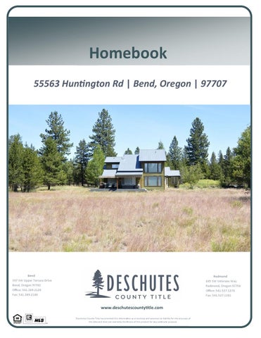
Homebook 55563 HunƟngton Rd | Bend, Oregon | 97707
Bend 397 SW Upper Terrace Drive Bend, Oregon 97702 Office: 541.389.2120 Fax: 541.389.2180
Redmond 845 SW Veterans Way Redmond, Oregon 97756 Office: 541.527.1274 Fax: 541.527.1281
www.deschutescountyƟtle.com Deschutes County Title has provided this informa on as a courtesy and assumes no liability for the accuracy of the data and does not warranty the fitness of this product for any par cular purpose.
Guest Sign-in NAME
ADDRESS
PHONE
GUIDE TO CLOSING COSTS *Customary for Seller to Pay Type of Financing Real Estate Agent Commissions Reconveyance/Release Fees Prepayment Penalties (If Applicable) Owner's Title Insurance Escrow Fee Tax Prorations Lien Search (if applicable) Mortgages & Encumbrances Any Property Tax Due
Conventional
FHA
VA
● ● ● ● ● ● ● ● ●
● ● ● ● ● ● ● ● ● ●
● ● ● ●
Buyer's Lender Fees (varies by lender)
● ● ● ● ●
Cash (no loan)
● ● ● ● ● ● ● ● ●
*Customary for Buyer to Pay Type of Financing Appraisal Fee Loan Origination Fee/Discount Credit Fee Mortgage Insurance (if applicable) Reserve Set Up Fee (if apllicable) Fire Insurance 1 year (home owners policy) Flood insurance (if applicable) Flood and Tax Certifications Prepaid Interest Home Owners Association Fees (if applicable)
Conventional
FHA
VA
● ● ● ● ● ● ● ● ● ●
● ● ● ● ● ● ● ● ● ●
● ● ●
● ● ● ●
● ● ● ●
VA Funding Fee Recording Fee Tax Proration Escrow Fee Lenders Title Insurance
* Items listed are intended to represent only what may be customarily charged and may not reflect actual charges at closing. Consult with your real estate professional or title company representtaive for actual charges specific to your transaction. Seller to pay full escrow fee (includes buyer escrow fee)
● ● ● ● ● ● ● ● ● ●
Cash (no loan)
● ● ● ●
Deschutes County Parcel Information
Parcel Information
Assessment Information
Parcel #: 137166 Tax Lot: 201130A000200 Record Type: Residential Site Address: 55563 Huntington Rd Bend OR 97707 - 2529 Owner: Thiel, William Thiel, Leona Owner Address: PO Box 230375 Anchorage AK 99523 Twn/Range/Section: 20S / 11E / 30 / NE Parcel Size: 5.00 Acres (217,800 SqFt) Plat/Subdivision: N/A Lot: Block: Census Tract/Block: 000300 / 1092 Waterfront: Little Deschutes River
Market Value Land: Market Value Impr: Market Value Total: Assessed Value:
$167,405.00 $266,050.00 $433,455.00 $307,320.00
Tax Information Levy Code Area: 1-068 Levy Rate: 14.7695 Tax Year: 2019 Annual Tax: $4,605.22
Legal
Land County Land Use: 416 - Tract - Residential zone - Waterfront Zoning: RR10 - Rural Residential 10 Acre Min Watershed: Lower Little Deschutes River Primary School: Rosland Elementary High School: LaPine Senior High School
Land Use Std: RSFR - Single Family Residence Neighborhood: School District: 1 - Bend - La Pine School District Middle School: LaPine Middle School
Improvement Year Built: 1994 1st Floor: 1,338 SqFt 2nd Floor: 548 SqFt Fireplace:
Total SqFt: 2,090 SqFt Attic Area: 204 SqFt Bsmt Area: Garage: 459 SqFt
Bedrooms: 3 Bathrooms: 3.00 Full/Half Baths: 3 / 0 Carport:
Transfer Information Rec. Date: 11/14/2016 Owner: William Thiel Orig. Loan Amt: $373,450.00 Finance Type:
Sale Price: $385,000.00
Loan Type: Conventional
Doc Num: 47334 Doc Type: Deed Grantor: Title Co: FIRST AMERICAN TITLE Lender: IMORTGAGE
Sentry Dynamics, Inc. and its customers make no representations, warranties or conditions, express or implied, as to the accuracy or completeness of information contained in this report.
Deschutes County Property Information Report Date: 7/17/2020 11:55:16 AM
Disclaimer The information and maps presented in this report are provided for your convenience. Every reasonable effort has been made to assure the accuracy of the data and associated maps. Deschutes County makes no warranty, representation or guarantee as to the content, sequence, accuracy, timeliness or completeness of any of the data provided herein. Deschutes County explicitly disclaims any representations and warranties, including, without limitation, the implied warranties of merchantability and fitness for a particular purpose. Deschutes County shall assume no liability for any errors, omissions, or inaccuracies in the information provided regardless of how caused. Deschutes County assumes no liability for any decisions made or actions taken or not taken by the user of this information or data furnished hereunder.
Account Summary Account Information
Ownership
Mailing Name:
Mailing Address:
THIEL, WILLIAM & LEONA
Map and Taxlot: 201130A000200
THIEL, WILLIAM & LEONA
Account: Tax Status:
PO BOX 230375
Situs Address:
137166 Assessable 55563 HUNTINGTON RD, BEND, OR 97707
ANCHORAGE, AK 99523 Valuation Real Market Values as of Jan. 1, 2019
Property Taxes Current Tax Year: $4,605.22 Tax Code Area:
1068
Assessment
Land
$167,405
Structures
$266,050
Total
$433,455
Subdivision:
Current Assessed Values:
Lot:
Maximum Assessed
$307,320
Block:
Assessed Value
$307,320
Assessor Acres: 5.00 Property Class: 416 -- TRACT
Veterans Exemption
Warnings, Notations, and Special Assessments Assessor's Office Special Assessments
Amount
Year
DEPT OF FORESTRY FIRE PATROL GRAZING
18.75
2020
DEPT OF FORESTRY FIRE PATROL TIMBER
18.75
2020
DEPT OF FORESTRY SURCHARGE
47.50
2020
Review of digital records maintained by the Deschutes County Assessor’s Office, Tax Office, Finance Office, and the Community Development Department indicates that there are County tax, assessment, or property development related notations associated with this account and that have been identified above. Independent verification of the presence of additional Deschutes County tax, assessment, development, and other property related considerations is recommended. Confirmation is commonly provided by title companies, real estate agents, developers, engineering and surveying firms, and other parties who are involved in property transactions or property development. In addition, County departments may be contacted directly to discuss the information.
Valuation History All values are as of January 1 of each year. Real Market Value - Land Real Market Value - Structures Total Real Market Value
Tax year is July 1st through June 30th of each year.
2015 - 2016 $154,775 $182,640 $337,415
2016 - 2017 $154,775 $255,700 $410,475
2017 - 2018 $177,085 $260,810 $437,895
2018 - 2019 $158,275 $263,420 $421,695
2019 - 2020 $167,405 $266,050 $433,455
$273,060 $273,060 $0
$281,250 $281,250 $0
$289,680 $289,680 $0
$298,370 $298,370 $0
$307,320 $307,320 $0
Maximum Assessed Value Total Assessed Value Veterans Exemption
Deschutes County Property Information Report, page 1
Tax Payment History Year
Date Due
Transaction Type
Transaction Date
As Of Date
Amount Received
Tax Due
Discount Amount
Interest Charged
Refund Interest
2019
11-15-2019
PAYMENT
11-13-2019
11-13-2019
$4,467.06
($4,605.22)
$138.16
$0.00
$0.00
2019
11-15-2019
IMPOSED
10-11-2019
11-15-2019
$0.00 Total:
$4,605.22 $0.00
$0.00
$0.00
$0.00
2018
11-15-2018
PAYMENT
11-08-2018
11-08-2018
$4,338.49
($4,472.67)
$134.18
$0.00
$0.00
2018
11-15-2018
IMPOSED
10-13-2018
11-15-2018
$0.00 Total:
$4,472.67 $0.00
$0.00
$0.00
$0.00
2017
11-15-2017
PAYMENT
11-09-2017
11-09-2017
$4,224.83
($4,355.50)
$130.67
$0.00
$0.00
2017
11-15-2017
IMPOSED
10-13-2017
11-15-2017
$0.00 Total:
$4,355.50 $0.00
$0.00
$0.00
$0.00
Sales History Sale Date
Seller
10/13/2016
PIVA, SHAUNTAE THIEL, WILLIAM & LEONA YEE, CAMERON & PETERSON, PIVA, SHAUNTAE MICHAEL MICHAEL D HAUSMAN & MARIA YEE, CAMERON & PETERSON, T ET AL TRUST MICHAEL
01/07/2011 08/21/2006
Buyer
Sale Amount
Sale Type
Recording Instrument
$385,000
30-UNCONFIRMED SALE
2016-47334
$250,000
30-UNCONFIRMED SALE
2011-1934
$499,000
30-UNCONFIRMED SALE
2006-60632
02/22/2005
HAUSMAN, MARIA T
HAUSMAN, MARIA T TRUSTEE
$1
02/22/2005
MICHAEL D HAUSMAN AND MARIA T HAUSMAN...
HAUSMAN, MARIA T
$1
12/04/2002
HAUSMAN,MARIA T
HAUSMAN,MARIA T TRUSTEE OF MICHAEL D HAU
$0
12/04/2002
HAUSMAN,MARIA T TRUSTEE OF HAUSMAN FAMIL
HAUSMAN,MARIA T
$0
12/14/1994
HAUSMAN,MICHAEL D
11/16/1988
HAUSMAN,MARIA T TRUSTEE OF MICHAEL D HAU UNKNOWN
$0 $15,000
06-GRANTEE IS RELATED/FRIENDS/BUSINES S ASSOCIATES 08-GRANTOR/GRANTEE ARE THE SAME 08-GRANTOR/GRANTEE ARE THE SAME 08-GRANTOR/GRANTEE ARE THE SAME 08-GRANTOR/GRANTEE ARE THE SAME 33-CONFIRMED SALE
2005-11383 2005-11107 2002-68913 2002-68828 1994-3610257 1988-1741450
Structures Stat Class/Description
Improvement Description
Deschutes County Property Information Report, page 2 (For Report Disclaimer see page 1)
Code Area
Year Built Total Sq Ft
143 - RESIDENCE: Two story
1068
Floor Description First Floor
Comp % 100
1994
2,090
Sq Ft 1,338
Rooms Living
Dining
Kitchen
Nook
Great
Family
Bed
Full Bath
Half Bath
Bonus
Utility
Den
Other
1
1
1
0
0
0
1
1
0
0
1
0
0
Floor Description Second Floor
Comp % 100
Sq Ft 548
Rooms Living
Dining
Kitchen
Nook
Great
Family
Bed
Full Bath
Half Bath
Bonus
Utility
Den
Other
0
0
0
0
0
0
2
2
0
0
0
0
1
Floor Description Attic- Finished
Comp % 100
Sq Ft 204
Rooms Living
Dining
Kitchen
Nook
Great
Family
Bed
Full Bath
Half Bath
Bonus
Utility
Den
Other
0
0
0
0
0
0
0
0
0
0
0
0
1
Floor Description Garage-Attached-Low Cost
Comp % 100
Improvement Inventory BATHTUB W/FIBRGL SHWR
2
CARPET
Sq Ft 459
SHOWER WDOOR, TILE
1
SIDING - LAP
D.I. RANGE
1
SOAKING TUB
1
DRYWALL
TOILET
3
FOUNDATION - CONCRETE
VAULTED CEILING
HOOD-FAN
1
VINYL FLOOR
KITCHEN SINK
1
WALL UNITS
LAVATORY
3
WATER HEATER
RECESSED LIGHTING
2,090 1
WINDOWS - DOUBLE/THERMAL PANE
ROOF - GABLE
WINDOWS - METAL
ROOF CVR - COMP
1,338
Land Characteristics Land Description
Acres
Rural Lot
5.00
Land Classification
Ownership Ownership Percentage
Name Type
Name
Ownership Type
OWNER
THIEL, WILLIAM
OWNER
100.00%
OWNER
THIEL, LEONA
OWNER
100.00%
Related Accounts Related accounts apply to a property that may be on one map and tax lot but due to billing have more than one account. This occurs when a property is in multiple tax code areas. In other cases there may be business personal property or a manufactured home on this property that is not in the same ownership as the land. Account ID
Owner Name
Record Type
245279
THIEL, WILLIAM & LEONA
Real Property
Service Providers Please contact districts to confirm.
Deschutes County Property Information Report, page 3 (For Report Disclaimer see page 1)
Category
Name
Phone
Address
COUNTY SERVICES
DESCHUTES COUNTY DESCHUTES COUNTY SHERIFF'S OFFICE LA PINE RURAL FIRE PROTECTION DISTRICT BEND - LA PINE SCHOOL DISTRICT
(541) 388-6570
1300 NW WALL ST, BEND, OR 97703
(541) 693-6911
63333 HIGHWAY 20 WEST, BEND, OR 97703
(541) 536-2935
51590 HUNTINGTON RD, LA PINE, OR 97739
(541) 355-1000
520 NW WALL ST, BEND, OR 97703
ROSLAND ELEMENTARY SCHOOL
(541) 355-8100
52350 YAEGER WAY, LA PINE, OR 97739
LA PINE MIDDLE SCHOOL
(541) 355-8200
16360 1ST ST, LA PINE, OR 97739
LA PINE HIGH SCHOOL
(541) 355-8400
51633 COACH RD, LA PINE, OR 97739
POLICE SERVICES FIRE DISTRICT SCHOOL DISTRICT ELEMENTARY SCHOOL ATTENDANCE AREA MIDDLE SCHOOL ATTENDANCE AREA HIGH SCHOOL ATTENDANCE AREA EDUCATION SERVICE TAX DISTRICT COLLEGE TAX DISTRICT LIBRARY DISTRICT GARBAGE & RECYCLING SERVICE
HIGH DESERT EDUCATION SERVICE (541) 693-5600 DISTRICT CENTRAL OREGON COMMUNITY (541) 383-7700 COLLEGE DESCHUTES PUBLIC LIBRARY (541) 617-7050 WILDERNESS GARBAGE & RECYCLING (541) 536-1194 SERVICE
145 SE SALMON AVE, REDMOND, OR 97756 2600 NW COLLEGE WAY, BEND, OR 97703 601 NW WALL ST, BEND, OR 97703 51420 RUSSEL RD, LA PINE, OR 97739
Development Summary Planning Jursidiction: Urban Growth Boundary: Urban Reserve Area:
Deschutes County
County Zone
Description
No
FP
FLOOD PLAIN
No
RR10
RURAL RESIDENTIAL - 10 ACRE MINIMUM
LM
LANDSCAPE MANAGEMENT COMBINING ZONE
WA
WILDLIFE AREA COMBINING ZONE
County Development Details Wetland (National or Local):
Yes
Conservation Easement: FEMA 100 Year Flood Plain:
No Conservation Easement Recorded
TDC/PRC Restrictive Covenant: Ground Snow Load:
No TDC/PRC Restrictive Covenant Found
Yes
50 #/sq. ft.
Deschutes County Permits Permit ID
Permit Type
Applicant
Application Date
Status
247-B32603 247-19-002022STR
Building
HAUSMAN MICHAEL D
10/15/1992
Finaled
Building
THIEL, WILLIAM & LEONA
04/19/2019
Finaled
12/18/2000
Finaled
247-E57435
Electrical
247-E20737
Electrical
HAUSMAN,MARIA T TRUSTEE OF MICHAEL D HAUSMAN & MARIA T HAUSMAN FA HAUSMAN MICHAEL D
11/19/1992
Finaled
247-E20342
Electrical
HAUSMAN MICHAEL D
10/15/1992
Expired
247-E25194
Electrical
HAUSMAN,MICHAEL D
09/28/1993
Finaled
247-E107635
Electrical
TIVA,SHAUNTAE
01/13/2011
Finaled
247-LM91127-PL
Land Use
MICHAEL HAUSMAN
11/01/1991
Finaled
247-LR88125-PL
Land Use
HAUSMAN MICHAEL D
10/27/1988
Finaled
247-M46344
Mechanical
PIVA,SHAUNTAE
12/14/2011
Finaled
247-M7476
Mechanical
HAUSMAN MICHAEL D
11/19/1992
Finaled
247-P6675
Plumbing
HAUSMAN MICHAEL D
11/19/1992
Finaled
247-S31422
Septic
HAUSMAN MICHAEL D
11/01/1991
Finaled
247-FS5330 247-19-000401AUTH
Septic
MANTHE,JOHN
07/14/1976
Septic
THIEL, WILLIAM & LEONA
04/19/2019
Finaled Authorization Approved
Permit Detail Building Permit Details Permit Number:
247-19-002022-STR
Application Date:
Deschutes County Property Information Report, page 4 (For Report Disclaimer see page 1)
04/19/2019
Status:
Finaled
Permit Name:
THIEL, WILLIAM & LEONA
Issue Date:
05/16/2019
Contractor:
JEFFREY LINFORD WOODS
Final Date:
09/20/2019
Building Class:
Residential
Square Feet:
Class of Work:
Alteration - Single Family Dwelling
Bedrooms:
Building Use:
DECK ROOF COVER 380SQ FT
Stories:
380
On Sewer: Permit Valuation:
$8,285
0
Inspections Date
Init.
07/29/2019
Michael1999 Final Building**Metal roof installed -- Insp Completed : Approved
Comments
05/21/2019
Brando 1140 Post Holes**Post holes for rear deck/roof addition n -- Insp Completed : Approved
Building Permit Details Permit Number:
247-B32603
Application Date:
10/15/1992
Permit Name:
HAUSMAN MICHAEL D
Issue Date:
02/16/1993
Status:
Contractor:
OWNER
Final Date:
02/10/1998
Building Class:
Residential
Square Feet:
1752
On Sewer: N
Class of Work:
New Construction
Bedrooms:
3
Permit Valuation:
Building Use:
RESIDENCE
Stories:
2
Finaled
$129,302
Inspections Date
Init.
Comments
02/11/1998
RRN
FINALED AGAIN 2=11=98.
02/10/1998
RRN
*FINAL APPROVED
01/16/1998
RRN
01/09/1998
RRN
1-POST PERM. ADDRESS W/3 INCH TALL NUMBERS AT STREET OR VISABLE FROM STREET. 2-STEPS AT FRONT & BACK PORCH & DOORS NOT TO CODE. ALL RISERS IN A STAIR TO BE WITHIN 3/8" OF EQUAL IN HEIGHT. ALL STAIRS OF MORE THAN 3 RISERS TO HAVE A 30" TO 38" HIGH HANDRAIL WITH A 1 1/2" TO 2 5/" WIDE GRIP. 3-FINISH BACK DECK WALKING SURFACE AND SIDING. 4-NEED STEP AT GARAGE/HOUSE DOOR. 5-WEATHER STRIP GARAGE/HOUSE DOOR. 6-RETURN ENDS OF HANDRAIL TO WALL AND MAKE HEIGTH 30 TO 38" HIGH AND GUARDRAIL TO BE MIN. 34" HIGH AT STAIRS. PROGRESS APPROVED
07/07/1997
RRN
NOT YET READY FOR FINAL.
04/11/1997
RRN
SHEETROCK APPR.
04/09/1997
RRN
CORRECTIONS: NOT READY
02/26/1997
RRN
INSULATION APPROVED.
02/07/1997
RRN
FRAME APP
05/20/1996
RRN
PROGRESS APPR.
12/08/1995
RRN
PROGRESS APPR. WORKING ON ROUGHS.
06/30/1995
RRN
PROGRESS APPR. INSTALLING SIDING.
01/05/1995
RRN
PROGRESS APPR.
07/21/1994
RVS
PROGRESS APPROVED IN FRAMING STAGE.
02/04/1994
RRN
PROGRESS APPR. ABOUT 1/2 WAY THRU FRAME.
02/03/1994
RVS
FOOTINGS WERE APPROVED ON 2-1-94.
02/01/1994
RVS
SCHOOL HOUSE FOOTINGS APPROVED. UFER GROUND APPROVED.
08/25/1993
DEB
UNDERFLOOR APPROVED.
08/18/1993
RRN
08/04/1993
DEB
THIS PROJECT DOES NOT REQUIRE UNDERFLOOR MECH. AND PLUMBING INSPECTIONS AS IT WAS APPLIED FOR PRIOR TO THE START OF THESE INSPECTIONS. FOOTING/SETBACKS APPROVED TO OWNER'S STAKES.
07/26/1993
LEL
GC-REVISED PLOT PLAN APPROVED.
11/18/1992
CEW
R-3 2026 X 60.00= 121,560.00 M-1 462 X 14.94= 6,902.00 DECK 140 X 6.00 = 840.00
10/15/1992
JKH
DALE TO SIGN OFF ON LM-91-127 ALSO THE FLOOD PLAIN
Electrical Permit Details Permit Number:
247-E107635
Application Date:
01/13/2011
Permit Name:
TIVA,SHAUNTAE
Issue Date:
01/13/2011
Deschutes County Property Information Report, page 5 (For Report Disclaimer see page 1)
Status:
Finaled
Contractor:
ALL SYSTEMS ELECTRIC LLC
Final Date:
Building Class:
Residential
Building Use:
Class of Work:
New Construction
Linked Permit:
01/18/2011
SERVICE
Service Description: 2OO AMPS OR LESS/SERVICES/FEEDERS: INSTALLATION, ALTERATION OR RELOCATION
Inspections Date
Init.
Comments
01/18/2011
CEG
4210 Service change -- Insp Completed : Approved
01/14/2011
CEG
4210 Service change -- Insp Cancelled : Information Only
01/13/2011
MAS
SERVICE CHANGE IN SAME SITE AS PREVIOUS
Electrical Permit Details Permit Number:
Contractor:
247-E57435 HAUSMAN,MARIA T TRUSTEE OF MICHAEL D HAUSMAN & MARIA T HAUSMAN FA LONE STAR ELECTRIC
Building Class:
Residential
Building Use:
Class of Work:
New Construction
Linked Permit:
Permit Name:
Application Date:
12/18/2000
Issue Date:
12/18/2000
Final Date:
05/23/2001
Status:
Finaled
Status:
Finaled
HOT TUB CIRCUIT
Service Description: BRANCH CIRCUIT/NEW, ALTER OR EXTEND 1 CIRCUIT-WITHOUT NEW SERVICE (1)
Inspections Date
Init.
Comments
05/23/2001
JAW
HOT TUB CIRCUIT APPROVED. FINAL
12/21/2000
SEB
PROGRESS APPR
Electrical Permit Details Permit Number:
247-E25194
Application Date:
09/28/1993
Permit Name:
HAUSMAN,MICHAEL D
Issue Date:
09/28/1993
Contractor:
OWNER
Final Date:
10/04/1993
Building Class:
Residential
Building Use:
Class of Work:
New Construction
Linked Permit:
RESIDENCE
Service Description: INSTALLATION, ALTERATION OR RELOCATION OF TEMPORARY SERVICE, 200 AMPS OR LESS(1)
Inspections Date
Init.
Comments
10/04/1993
CER
CORRECTIONS MADE TEMP APPROVED AND FINALED
09/29/1993
RVS
09/28/1993
STS
DENIED: 1) NEED WORKING CLEARANCE OF 30". 2) WIRE FEEDERS NOT ALLOWED IN PANEL UNLESS ENCASED IN PIPE. PREVIOUS TEMP IS EXPIRED/SEE E20342
Electrical Permit Details Permit Number:
247-E20737
Application Date:
11/19/1992
Permit Name:
HAUSMAN MICHAEL D
Issue Date:
02/16/1993
Contractor:
OWNER
Final Date:
03/23/1998
Building Class:
Residential
Building Use:
RESIDENCE
Class of Work:
New Construction
Linked Permit:
32603
Service Description:
Deschutes County Property Information Report, page 6 (For Report Disclaimer see page 1)
Status:
Finaled
RESIDENTIAL WIRING THRU 1500 SQ FT(1) RES WIRING EACH ADD. 500 FT OR PORTION(2)
Inspections Date
Init.
Comments
03/20/1998
JJD
FINALED
03/13/1998
JJD
GFCI'S FAULTY/ 2 IN GARAGE, 1 IN HALL BATH
02/25/1998
JJD
GFCI PROTECT GARAGE PLUGS, LOCK OFF ON RANGE CIRCUIT BREAKER, RECHECK HALL BATH GFCI
01/20/1998
JCM
CANCEL BY PHONE CALL THIS A.M.
05/20/1997
JJD
NEED TO MEET WITH OWNER
01/17/1997
JJD
05/20/1996
CER
ADD PLUG IN BATH, ADD 2ND GROUND ROD SIX FROM 1ST ROD, OK TO ENERGIZE AND INSULATE SUBJECT TO OTHER INSPECTIONS. WIRE 2 PLUGS. PROGRESS APPROVED
12/08/1995
CER
PROGRESS APPR. WORKING ON ROUGHS.
Electrical Permit Details Permit Number:
247-E20342
Application Date:
10/15/1992
Permit Name:
HAUSMAN MICHAEL D
Issue Date:
10/15/1992
Contractor:
OWNER
Final Date:
06/04/1993
Building Class:
Residential
Building Use:
Class of Work:
New Construction
Linked Permit:
Status:
Expired
TEMP SERVICE
Service Description: INSTALLATION, ALTERATION OR RELOCATION OF TEMPORARY SERVICE, 200 AMPS OR LESS(1)
Inspections Date
Init.
Comments
06/04/1993
SYS
GC Permit expired by system
Land Use Permit Details Permit Number:
247-LM91127-PL
Submit Date:
Permit Name:
MICHAEL HAUSMAN
Application Complete Date:
Owner:
HAUSMAN MICHAEL D
Request:
11/01/1991
Status:
Finaled
Status:
Finaled
11/04/1991
HWY LM
Conservation Easement Required:
No
Conservation Easement Recording Number: Conservation Easement Description: Conservation Easement Comments:
Land Use Permit Details Permit Number:
247-LR88125-PL
Submit Date:
Permit Name:
HAUSMAN MICHAEL D
Application Complete Date:
Owner:
HAUSMAN MICHAEL D
Request:
10/27/1988 10/27/1988
LOT OF RECORD
Conservation Easement Required:
No
Conservation Easement Recording Number: Conservation Easement Description: Conservation Easement Comments:
Mechanical Permit Details Permit Number:
247-M46344
Application Date:
12/14/2011
Permit Name:
PIVA,SHAUNTAE
Issue Date:
12/14/2011
Contractor:
SANDERS,ROGER F
Final Date:
12/22/2011
Deschutes County Property Information Report, page 7 (For Report Disclaimer see page 1)
Status:
Finaled
Building Class:
Residential
Building Use:
Class of Work:
New Construction
Linked Permit:
Service Description: ISSUANCE FEE INSTALLATION OR RELOCATION OF DOMESTIC-TYPE INCINERATOR, PELLET OR WOOD STOVE INSTALLATION, RELOCATION OR REPLACEMENT OF APPLIANCE VENT INSTALLED AND NOT INCLUDED IN AN APPLIANCE PERMIT.
Inspections No inspection records found.
Mechanical Permit Details Permit Number:
247-M7476
Application Date:
11/19/1992
Permit Name:
HAUSMAN MICHAEL D
Issue Date:
02/16/1993
Contractor:
MOUNTAIN VIEW HEATING INC
Final Date:
01/20/1998
Building Class:
Residential
Building Use:
Class of Work:
New Construction
Linked Permit:
Status:
Finaled
Status:
Finaled
Status:
Authorization Approved
Service Description: ISSUANCE FEE (1) NEW INTALL 100,001 OR MORE BTU (1) DOMESTIC TYPE INCINERATOR AND WOOD STOVE (2)
Inspections No inspection records found.
Plumbing Permit Details Permit Number:
247-P6675
Application Date:
11/19/1992
Permit Name:
HAUSMAN MICHAEL D
Issue Date:
02/16/1993
Contractor:
OWNER
Final Date:
01/20/1998
Building Class:
Residential
Class of Work:
New Construction
Linked Permit:
32603
Service Description: 1 & 2 FAMILY/2 BATH NEW CONSTRUCTION, INCLUDES 1ST 100 FEET OF SEWER AND WATER (1) WATER SERVICE, EACH ADD'L. 100 FT. (1)
Inspections Date
Init.
Comments
01/20/1998
RRN
FINAL APPROVED.
07/21/1997
RRN
SEWER LINE APPROVED
02/07/1997
RRN
TOP OUT APP
10/31/1996
LRP
PROGRESS APPROVED
05/20/1996
RRN
PROGRESS APPR.
12/08/1995
RRN
PROGRESS APPR.
12/08/1995
RRN
PROGRESS APPR. WORKING ON ROUGHS.
Septic Permit Details Permit Number:
247-19-000401-AUTH
Application Date:
04/19/2019
Permit Name:
THIEL, WILLIAM & LEONA
Issue Date:
04/19/2019
Contractor:
Final Date:
Building Class:
Residential
Tank Material:
Maximum Trench Depth:
Class of Work:
Authorization
DEQ Approval Number:
Trench Length:
Deschutes County Property Information Report, page 8 (For Report Disclaimer see page 1)
DECK ROOF COVER 380SQ FT
Building Use:
Linked Feasibility Permit:
Service Code:
Tank Capacity: Daily Flow Rate:
System Type
Inspections No inspection records found.
Septic Permit Details Permit Number:
247-S31422
Application Date:
11/01/1991
Permit Name:
HAUSMAN MICHAEL D
Issue Date:
11/06/1991
Contractor:
STRASSER EXCAVATION INC
Final Date:
12/26/1991
Building Class:
Residential
Tank Material:
Maximum Trench Depth:
Class of Work:
New System
DEQ Approval Number:
Trench Length:
0
Building Use:
FUTURE RESIDENCE
Service Code:
Tank Capacity:
1100
Daily Flow Rate:
450
Linked Feasibility Permit:
5330
Sand Filter
System Type
Status:
Finaled
Inspections Date
Init.
Comments
12/26/1991
DBR
INSPECTION # 6&7 APPROVED
12/23/1991
DBR
INSPECTION # 5 APPROVED
12/18/1991
DBR
INSPECTION # 3 & 4 APPROVED
12/17/1991
DBR
INSPECTION # 2 APPROVED PER DON STRASSER
12/06/1991
DWH
INSPECTION # 1 APPROVED
11/06/1991
DBR
PLOT PLAN OK FOR SURFACE MOUNTED BOTTOMLESS SAND FILTER
11/01/1991
LEL
LM-91-127 APPLIED FOR INCONJUNCTION WITH THIS PERMIT.
Septic Permit Details Permit Number:
247-FS5330
Application Date:
Permit Name:
MANTHE,JOHN
Issue Date:
Contractor:
07/14/1976
Status:
Finaled
Final Date:
Building Class:
Tank Material:
Maximum Trench Depth:
Class of Work:
DEQ Approval Number:
Trench Length:
Building Use:
Service Code:
Tank Capacity:
Linked Feasibility Permit:
System Type
Standard System
Inspections Date
Init.
Comments
01/10/2011
LEF
Property ID/Situs Update through Property File Program
09/21/1988
TJM
REQUIRES A SURFACE MOUNTED BOTTOMLESS SAND FILTER
Assessor's Office Supplemental Information Legal Description:
Subdivision: Lot: Block:
Property Class:
416 -- TRACT
Maintenance Area:
4
Study Area:
02
Neighborhood:
000
Deschutes County Property Information Report, page 9 (For Report Disclaimer see page 1)
Daily Flow Rate:
0
STATEMENT OF TAX ACCOUNT DESCHUTES COUNTY TAX COLLECTOR DESCHUTES SERVICES BUILDING BEND OR 97703 (541) 388-6540 17-Jul-2020 THIEL, WILLIAM & LEONA PO BOX 230375 ANCHORAGE, AK 99523 Tax Account # Account Status Roll Type Situs Address
137166 A Real 55563 HUNTINGTON RD BEND 97707
Lender Name CLG - Chase Manhattan Mortgage Corp - Utah Loan Number 1068 Property ID Interest To Jul 17, 2020
Tax Summary Tax Year 2019 2018 2017 2016 2015 2014 2013 2012 2011 2010 2009 2008 2007 2006 2005 2004 2003 2002 2001 2000 1999 1998 1997 1996
Tax Type ADVALOREM ADVALOREM ADVALOREM ADVALOREM ADVALOREM ADVALOREM ADVALOREM ADVALOREM ADVALOREM ADVALOREM ADVALOREM ADVALOREM ADVALOREM ADVALOREM ADVALOREM ADVALOREM ADVALOREM ADVALOREM ADVALOREM ADVALOREM ADVALOREM ADVALOREM ADVALOREM ADVALOREM Total
Total Due
Current Due
Interest Due
Discount Available
$0.00 $0.00 $0.00 $0.00 $0.00 $0.00 $0.00 $0.00 $0.00 $0.00 $0.00 $0.00 $0.00 $0.00 $0.00 $0.00 $0.00 $0.00 $0.00 $0.00 $0.00 $0.00 $0.00 $0.00
$0.00 $0.00 $0.00 $0.00 $0.00 $0.00 $0.00 $0.00 $0.00 $0.00 $0.00 $0.00 $0.00 $0.00 $0.00 $0.00 $0.00 $0.00 $0.00 $0.00 $0.00 $0.00 $0.00 $0.00
$0.00 $0.00 $0.00 $0.00 $0.00 $0.00 $0.00 $0.00 $0.00 $0.00 $0.00 $0.00 $0.00 $0.00 $0.00 $0.00 $0.00 $0.00 $0.00 $0.00 $0.00 $0.00 $0.00 $0.00
$0.00 $0.00 $0.00 $0.00 $0.00 $0.00 $0.00 $0.00 $0.00 $0.00 $0.00 $0.00 $0.00 $0.00 $0.00 $0.00 $0.00 $0.00 $0.00 $0.00 $0.00 $0.00 $0.00 $0.00
$0.00
$0.00
$0.00
$0.00
Deschutes County Property Information Report, page 10 (For Report Disclaimer see page 1)
Original Due $4,605.22 $4,472.67 $4,355.50 $4,147.91 $4,044.90 $3,889.39 $3,600.24 $3,346.14 $3,469.41 $3,828.36 $3,795.20 $3,535.33 $3,334.07 $3,239.74 $3,156.50 $3,089.31 $2,874.14 $2,848.83 $2,674.42 $2,570.02 $2,552.55 $2,542.23 $1,931.66 $1,558.28
Due Date Nov 15, 2019 Nov 15, 2018 Nov 15, 2017 Nov 15, 2016 Nov 15, 2015 Nov 15, 2014 Nov 15, 2013 Nov 15, 2012 Nov 15, 2011 Nov 15, 2010 Nov 15, 2009 Nov 15, 2008 Nov 15, 2007 Nov 15, 2006 Nov 15, 2005 Nov 15, 2004 Nov 15, 2003 Nov 15, 2002 Nov 15, 2001 Nov 15, 2000 Nov 15, 1999 Nov 15, 1998 Dec 15, 1997 Nov 15, 1996
Improvement Summary
Account Information Owner Name:
Mailing Address:
THIEL, WILLIAM & LEONA
Map and Taxlot: 201130A000200
THIEL, WILLIAM & LEONA
Account: Situs Address:
PO BOX 230375
137166 55563 HUNTINGTON RD, BEND, OR 97707
ANCHORAGE, AK 99523
Structures Stat Class/Description
Improvement Description
Code Area
143 - RESIDENCE: Two story
Year Built Total Sq Ft
1068
Floor Description First Floor
Comp % 100
1994
2,090
Sq Ft 1,338
Rooms Living
Dining
Kitchen
Nook
Great
Family
Bed
Full Bath
Half Bath
Bonus
Utility
Den
Other
1
1
1
0
0
0
1
1
0
0
1
0
0
Floor Description Second Floor
Comp % 100
Sq Ft 548
Rooms Living
Dining
Kitchen
Nook
Great
Family
Bed
Full Bath
Half Bath
Bonus
Utility
Den
Other
0
0
0
0
0
0
2
2
0
0
0
0
1
Floor Description Attic- Finished
Comp % 100
Sq Ft 204
Rooms Living
Dining
Kitchen
Nook
Great
Family
Bed
Full Bath
Half Bath
Bonus
Utility
Den
Other
0
0
0
0
0
0
0
0
0
0
0
0
1
Floor Description Garage-Attached-Low Cost Improvement Inventory BATHTUB W/FIBRGL SHWR
Comp % 100
2
CARPET D.I. RANGE
Sq Ft 459
SHOWER WDOOR, TILE
1
SIDING - LAP 1
SOAKING TUB
1
DRYWALL
TOILET
3
FOUNDATION - CONCRETE
VAULTED CEILING
HOOD-FAN
1
VINYL FLOOR
KITCHEN SINK
1
WALL UNITS
LAVATORY
3
WATER HEATER
RECESSED LIGHTING
WINDOWS - DOUBLE/THERMAL PANE
ROOF - GABLE ROOF CVR - COMP
WINDOWS - METAL 1,338
2,090 1
Land Characteristics Land Description
Acres
Rural Lot
5.00
Land Classification
Deschutes County Property Information Report Date: 7/17/2020 11:58:13 AM
Disclaimer The information and maps presented in this report are provided for your convenience. Every reasonable effort has been made to assure the accuracy of the data and associated maps. Deschutes County makes no warranty, representation or guarantee as to the content, sequence, accuracy, timeliness or completeness of any of the data provided herein. Deschutes County explicitly disclaims any representations and warranties, including, without limitation, the implied warranties of merchantability and fitness for a particular purpose. Deschutes County shall assume no liability for any errors, omissions, or inaccuracies in the information provided regardless of how caused. Deschutes County assumes no liability for any decisions made or actions taken or not taken by the user of this information or data furnished hereunder.
Account Summary Account Information
Ownership
Mailing Name:
Mailing Address:
THIEL, WILLIAM & LEONA
Map and Taxlot: 201130A000200
THIEL, WILLIAM & LEONA
Account: Tax Status:
245279 Assessable
PO BOX 230375
Situs Address:
**NO SITUS ADDRESS**
ANCHORAGE, AK 99523 Valuation
Property Taxes
Real Market Values as of Jan. 1, 2019
Current Tax Year: $1.00
Land
$340
Tax Code Area:
Structures
$0
Total
$340
1066
Assessment Subdivision:
Current Assessed Values:
Lot:
Maximum Assessed
$80
Block:
Assessed Value
$80
Assessor Acres: 0.01 Property Class: 416 -- TRACT
Veterans Exemption
Warnings, Notations, and Special Assessments Review of digital records maintained by the Deschutes County Assessor’s Office, Tax Office, Finance Office, and the Community Development Department indicates that there are no special tax, assessment or property development related notations associated with this account. However, independent verification of the presence of other Deschutes County tax, assessment, development, and additional property related considerations is recommended. Confirmation is commonly provided by title companies, real estate agents, developers, engineering and surveying firms, and other parties who are involved in property transactions or property development. In addition, County departments may be contacted directly to discuss the information.
Valuation History All values are as of January 1 of each year. Real Market Value - Land Real Market Value - Structures Total Real Market Value
Tax year is July 1st through June 30th of each year.
2015 - 2016 $310 $0 $310
2016 - 2017 $310 $0 $310
2017 - 2018 $360 $0 $360
2018 - 2019 $320 $0 $320
2019 - 2020 $340 $0 $340
$80 $80 $0
$80 $80 $0
$80 $80 $0
$80 $80 $0
$80 $80 $0
Maximum Assessed Value Total Assessed Value Veterans Exemption
Deschutes County Property Information Report, page 1
Tax Payment History Year
Date Due
Transaction Type
Transaction Date
As Of Date
Amount Received
Tax Due
Discount Amount
Interest Charged
Refund Interest
2019
11-15-2019
PAYMENT
11-13-2019
2019
11-15-2019
IMPOSED
10-11-2019
11-13-2019
$0.97
($1.00)
$0.03
$0.00
$0.00
11-15-2019
$0.00 Total:
$1.00 $0.00
$0.00
$0.00
$0.00
2018
11-15-2018
WRITE OFF
05-21-2019
05-21-2019
$0.00
($1.00)
$0.00
$0.00
$0.00
2018
11-15-2018
IMPOSED
10-13-2018
11-15-2018
$0.00 Total:
$1.00 $0.00
$0.00
$0.00
$0.00
2017
11-15-2017
WRITE OFF
07-09-2018
07-09-2018
$0.00
($0.99)
$0.00
$0.00
$0.00
2017
11-15-2017
IMPOSED
10-13-2017
11-15-2017
$0.00 Total:
$0.99 $0.00
$0.00
$0.00
$0.00
Sales History Sale Date
Seller
10/13/2016
PIVA, SHAUNTAE THIEL, WILLIAM & LEONA YEE, CAMERON & PETERSON, PIVA, SHAUNTAE MICHAEL MICHAEL D HAUSMAN & MARIA YEE, CAMERON & PETERSON, T ET AL TRUST MICHAEL
01/07/2011 08/21/2006
Buyer
Sale Amount
Sale Type
Recording Instrument
$385,000
30-UNCONFIRMED SALE
2016-47334
$250,000
30-UNCONFIRMED SALE
2011-1934
$499,000
30-UNCONFIRMED SALE
2006-60632
02/22/2005
HAUSMAN, MARIA T
HAUSMAN, MARIA T TRUSTEE
$1
02/22/2005
MICHAEL D HAUSMAN AND MARIA T HAUSMAN...
HAUSMAN, MARIA T
$1
No Structures Found.
Deschutes County Property Information Report, page 2 (For Report Disclaimer see page 1)
06-GRANTEE IS RELATED/FRIENDS/BUSINES 2005-11383 S ASSOCIATES 08-GRANTOR/GRANTEE ARE 2005-11107 THE SAME
Land Characteristics Land Description
Acres
Rural Lot
0.01
Land Classification
Ownership Ownership Percentage
Name Type
Name
Ownership Type
OWNER
THIEL, LEONA
OWNER
100.00%
OWNER
THIEL, WILLIAM
OWNER
100.00%
Related Accounts Related accounts apply to a property that may be on one map and tax lot but due to billing have more than one account. This occurs when a property is in multiple tax code areas. In other cases there may be business personal property or a manufactured home on this property that is not in the same ownership as the land. Account ID
Owner Name
Record Type
137166
THIEL, WILLIAM & LEONA
Real Property
Service Providers Please contact districts to confirm. Category
Name
Phone
Address
COUNTY SERVICES
DESCHUTES COUNTY DESCHUTES COUNTY SHERIFF'S OFFICE LA PINE RURAL FIRE PROTECTION DISTRICT BEND - LA PINE SCHOOL DISTRICT
(541) 388-6570
1300 NW WALL ST, BEND, OR 97703
(541) 693-6911
63333 HIGHWAY 20 WEST, BEND, OR 97703
(541) 536-2935
51590 HUNTINGTON RD, LA PINE, OR 97739
(541) 355-1000
520 NW WALL ST, BEND, OR 97703
ROSLAND ELEMENTARY SCHOOL
(541) 355-8100
52350 YAEGER WAY, LA PINE, OR 97739
LA PINE MIDDLE SCHOOL
(541) 355-8200
16360 1ST ST, LA PINE, OR 97739
LA PINE HIGH SCHOOL
(541) 355-8400
51633 COACH RD, LA PINE, OR 97739
POLICE SERVICES FIRE DISTRICT SCHOOL DISTRICT ELEMENTARY SCHOOL ATTENDANCE AREA MIDDLE SCHOOL ATTENDANCE AREA HIGH SCHOOL ATTENDANCE AREA EDUCATION SERVICE TAX DISTRICT COLLEGE TAX DISTRICT LIBRARY DISTRICT GARBAGE & RECYCLING SERVICE
HIGH DESERT EDUCATION SERVICE (541) 693-5600 DISTRICT CENTRAL OREGON COMMUNITY (541) 383-7700 COLLEGE DESCHUTES PUBLIC LIBRARY (541) 617-7050 WILDERNESS GARBAGE & RECYCLING (541) 536-1194 SERVICE
145 SE SALMON AVE, REDMOND, OR 97756 2600 NW COLLEGE WAY, BEND, OR 97703 601 NW WALL ST, BEND, OR 97703 51420 RUSSEL RD, LA PINE, OR 97739
Development Summary Planning Jursidiction:
Deschutes County
County Zone
Description
Urban Growth Boundary: Urban Reserve Area:
No
FP
FLOOD PLAIN
No
RR10
RURAL RESIDENTIAL - 10 ACRE MINIMUM
LM
LANDSCAPE MANAGEMENT COMBINING ZONE
WA
WILDLIFE AREA COMBINING ZONE
County Development Details Wetland (National or Local): Conservation Easement:
Yes
FEMA 100 Year Flood Plain: TDC/PRC Restrictive Covenant: Ground Snow Load:
Yes
No Conservation Easement Recorded No TDC/PRC Restrictive Covenant Found 50 #/sq. ft.
Permit Detail No permit records found.
Deschutes County Property Information Report, page 3 (For Report Disclaimer see page 1)
Assessor's Office Supplemental Information Legal Description:
Subdivision: Lot: Block:
Property Class:
416 -- TRACT
Maintenance Area:
4
Study Area:
02
Neighborhood:
000
Deschutes County Property Information Report, page 4 (For Report Disclaimer see page 1)
STATEMENT OF TAX ACCOUNT DESCHUTES COUNTY TAX COLLECTOR DESCHUTES SERVICES BUILDING BEND OR 97703 (541) 388-6540 17-Jul-2020 THIEL, WILLIAM & LEONA PO BOX 230375 ANCHORAGE, AK 99523 Tax Account # Account Status Roll Type Situs Address
245279 A Real
Lender Name Loan Number 1066 Property ID Interest To Jul 17, 2020
Tax Summary Tax Year 2019 2018 2017 2016 2015 2014 2013 2012 2011 2010 2009 2008 2007 2006 2005
Tax Type ADVALOREM ADVALOREM ADVALOREM ADVALOREM ADVALOREM ADVALOREM ADVALOREM ADVALOREM ADVALOREM ADVALOREM ADVALOREM ADVALOREM ADVALOREM ADVALOREM ADVALOREM Total
Total Due
Current Due
Interest Due
Discount Available
$0.00 $0.00 $0.00 $0.00 $0.00 $0.00 $0.00 $0.00 $0.00 $0.00 $0.00 $0.00 $0.00 $0.00 $0.00
$0.00 $0.00 $0.00 $0.00 $0.00 $0.00 $0.00 $0.00 $0.00 $0.00 $0.00 $0.00 $0.00 $0.00 $0.00
$0.00 $0.00 $0.00 $0.00 $0.00 $0.00 $0.00 $0.00 $0.00 $0.00 $0.00 $0.00 $0.00 $0.00 $0.00
$0.00 $0.00 $0.00 $0.00 $0.00 $0.00 $0.00 $0.00 $0.00 $0.00 $0.00 $0.00 $0.00 $0.00 $0.00
$0.00
$0.00
$0.00
$0.00
Deschutes County Property Information Report, page 5 (For Report Disclaimer see page 1)
Original Due $1.00 $1.00 $0.99 $0.95 $0.96 $0.96 $0.97 $0.97 $0.98 $1.00 $1.00 $0.98 $0.97 $0.92 $1.00
Due Date Nov 15, 2019 Nov 15, 2018 Nov 15, 2017 Nov 15, 2016 Nov 15, 2015 Nov 15, 2014 Nov 15, 2013 Nov 15, 2012 Nov 15, 2011 Nov 15, 2010 Nov 15, 2009 Nov 15, 2008 Nov 15, 2007 Nov 15, 2006 Nov 15, 2005
Deschutes County Property Information Report, page 6 (For Report Disclaimer see page 1)
★
ParcelID: 137166 55563 Huntington Rd Bend, OR 97707 This map/plat is being furnished as an aid in locating the herein described land in relation to adjoining streets, natural boundaries and other land, and is not a survey of the land depicted. Except to the extent a policy of title insurance is expressly modified by endorsement, if any, the company does not insure dimensions, distances, location of easements, acreage or other matters shown thereon.
Deschutes County Property Information - Dial Road Map
Deschutes County GIS
Map and Taxlot: 201130A000200
Deschutes County Property Information Report, page 12 (For Report Disclaimer see page 1)
Aerial Map
55563 HUNTINGTON RD
entu ry D r
Hu n
tin gto nR d
SC
Hei di C t
20 ¬ «
SISTERS
126 ¬ «
97 ¬ «
20 ¬ «
I
REDMOND
201130-A0-00200
0
125
250
500
Feet
BEND SUNRIVER 97 ¬ «
LA PINE
20 ¬ «
Map Data is deemed reliable but not guaranteed. Deschutes County Title accepts no responsibility for accuracy.
Urban Growth Boundary Map
55563 HUNTINGTON RD
La Pine UGB 20
¬ «
SISTERS
126 ¬ «
97 ¬ «
20 ¬ «
I
REDMOND
201130-A0-00200
0
1
2
4
Miles
BEND SUNRIVER 97 ¬ «
LA PINE
20 ¬ «
Map Data is deemed reliable but not guaranteed. Deschutes County Title accepts no responsibility for accuracy.
Emergency Services Map
55563 HUNTINGTON RD
Sunriver Fire Dept Station #201
Sunriver Police Department
La Pine RFPD Station #102
20
¬ «
SISTERS
126 ¬ «
97 ¬ «
20 ¬ «
I
REDMOND
201130-A0-00200
0
0.75
1.5
3
Miles
BEND SUNRIVER 97 ¬ «
LA PINE
20 ¬ «
Map Data is deemed reliable but not guaranteed. Deschutes County Title accepts no responsibility for accuracy.
Railroad Map
20
¬ «
SISTERS
126 ¬ «
97 ¬ «
20 ¬ «
55563 HUNTINGTON RD
I
REDMOND
201130-A0-00200
0
0.25
0.5
1
Miles
BEND SUNRIVER 97 ¬ «
LA PINE
20 ¬ «
Map Data is deemed reliable but not guaranteed. Deschutes County Title accepts no responsibility for accuracy.
Water Course Map
55563 HUNTINGTON RD
entu ry D r
L itt
Hu n
De sch u te s Ri ve r
tin gto nR d
SC
le
Hei di C t
20
¬ «
SISTERS
126 ¬ «
97 ¬ «
20 ¬ «
I
REDMOND
201130-A0-00200
0
125
250
500
Feet
BEND SUNRIVER 97 ¬ «
LA PINE
20 ¬ «
Map Data is deemed reliable but not guaranteed. Deschutes County Title accepts no responsibility for accuracy.
Parks Map
55563 HUNTINGTON RD
La Pine State Park
20
¬ «
SISTERS
126 ¬ «
97 ¬ «
20 ¬ «
I
REDMOND
201130-A0-00200
0
0.75
1.5
3
Miles
BEND SUNRIVER 97 ¬ «
LA PINE
20 ¬ «
Map Data is deemed reliable but not guaranteed. Deschutes County Title accepts no responsibility for accuracy.
Golf Course Map
55563 HUNTINGTON RD Woodlands Golf Course At Sunriver
Meadows Golf Course At Sunriver
Crosswater Golf Course
Quail Run Golf Course
20
¬ «
SISTERS
126 ¬ «
97 ¬ «
20 ¬ «
I
REDMOND
201130-A0-00200
0
0.75
1.5
3
Miles
BEND SUNRIVER 97 ¬ «
LA PINE
20 ¬ «
Map Data is deemed reliable but not guaranteed. Deschutes County Title accepts no responsibility for accuracy.
Subdivisions Map
55563 HUNTINGTON RD Vandevert Ranch Phase Ii
SC
entu ry D r
20
¬ «
SISTERS
Rd 126 ¬ «
97 ¬ «
20 ¬ «
ton
Lazy River West
Hu nti n g
Lazy River Dr
Cedar Ct
I
REDMOND
201130-A0-00200
He id
iC t
0
250
500
1,000
Feet
BEND SUNRIVER 97 ¬ «
LA PINE
20 ¬ «
Map Data is deemed reliable but not guaranteed. Deschutes County Title accepts no responsibility for accuracy.
55563 Huntington Rd- Zoning Map This map/plat is being furnished as an aid in locating the herein described land in relation to adjoining streets, natural boundaries and other land, and is not a survey of the land depicted. Except to the extent a policy of title insurance is expressly modi ed by endorsement, if any, the company does not insure dimensions, distances, location of easements, acreage or other matters shown thereon.
6XQULYHU
6RXWK &RXQW\ 6FKRRO %RXQGDULHV
6 &HQWXU\ 'U
6SULQJ 5LYHU 5G
6 &HQWXU\ 'U
7KUHH 5LYHUV . 6FKRRO +LJK VFKRRO VWXGHQWV PD\ FKRRVH EHWZHHQ %HQG +LJK RU /D 3LQH +LJK
6 &HQWXU\ 'U
6 &HQWXU\ 'U
WRQ 5G
6WDWH 5HFUHDWLRQ 5G
%RXQGDU\ 5G
+XQWLQJ
3DUN 'U
%X
UJH V
V 5
G
%XUJHVV 5G
5RVODQG (OHPHQWDU\ 6FKRRO
/D 3LQH (DVW
/D 3LQH +LJK 6FKRRO
+XQWLQ
JWRQ 5
G
/D 3LQH :HVW
/D 3LQH (OHPHQWDU\ 6FKRRO /D 3LQH 0LGGOH 6FKRRO /D 3LQH
0DVWHQ 5G
(IIHFWLYH
97
97
5HHG 5G )LQOH\ %XWWH 5G