
5 minute read
The stats on Jojo’s vineyard


Named - after Jojo, the dog!
Area - 2.2ha
Advertisement
Number of vines - 8,769 vines
Varieties - seven
• Pinot Noir
• Pinot Blanc
• Pinot Meunier
• Seyval Blanc
• Chardonnay
• Fruhburgender
• Bacchus much harder to do other things.”
Number of rows - 92.
Support posts - 1,800.
Support wires - 70 kilometres.
If they had that information available, he suggests, it could make subsequent management of the vines easier and more effective:
“If there’s one piece of knowledge I brought in from broad acre farming, it is that if you don’t have a shareable infrastructure it becomes
Consequently, he has worked with Innovate UK and a range of business partners on a project to map the vineyard’s digital infrastructure and make it sharable to a wide range of partners:

“If we can share our infrastructure model with technology partners we have the potential to speed up implementation and reduce costs, which is beneficial for us all,” he explains.
This is but a snippet of the lunchtime lecture which can be watched in full on the IAgrE’s YouTube channel see: https://www.youtube.com/channel/UCCiJwRVjGizSE3EZ-KQ3uVg
Josie Lynch PhD Student
The effects of conservation tillage on soil
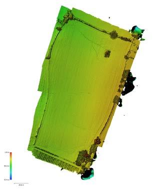
Josie Lynch is currently a full-time PhD student in the School of Science and the Environment and a member of the Sustainable Environments Research Group at the University of Worcester (UW). Her main research interest is monitoring the effects of conservation tillage on soil erosion using drones.
Josie is interested in understanding landscape change and became fascinated with the way in which drones can map and monitor this at very high resolution (e.g. 0.5cm/ pixel) and accuracy (1-3cm) by producing 3D ground elevation models from drone photographs. Josie aims to explore issues with soil erosion and its impact on the economy, environment, and farmer livelihoods. She hopes her research will help farmers understand how much soil, and therefore money, they are losing and in turn how to reduce this.
Josie’s background involves gaining a BSc (Hons) degree in Geography and a PGCert in Research Methods (both also from UW). Josie holds a CAA Approved Drone Pilot Licence and worked as a Research Assistant at UW gaining extensive experience using drones for projects including;
1. Analysing drone elevation models and their accuracy in relation to the amount and placement of ground truth measurements
2. The application of Real-Time Kinematic (RTK) drones to measure soil erosion in Herefordshire (funded by the Environment Agency)
When Josie isn’t flying drones and studying soil erosion, she enjoys being active by cycling or hiking and also likes to play the trumpet and piano.
An overview of the work
Josie’s PhD research uses ultra-high resolution drone assessments to monitor the effects of conservation tillage on soil erosion rates in arable fields within Worcestershire and Herefordshire.
Soil provides a variety of positive functions including water runoff control and attenuation, plant composition, biodiversity, ecosystem productivity and carbon sequestration. Erosion of fertile topsoil is of local, national, and global importance as this can result in lowered crop yield, increased river pollution and heightened flood risk. Some farming practices, such as conventional ploughing, leave soils more vulnerable to erosion due to the heavy overturning of soil. Consequently, the Environment Agency in England (2016) declared soil erosion and sediment management an important research priority and that UK soil management must be sustainable by 2030. The approach of ‘conservation tillage’ (minimum tillage and no tillage) is considered a more sustainable approach to agriculture, providing benefits to biodiversity, improved soil fertility, reduced labour requirements, and most significantly, reduced soil erosion whilst optimising yields. However, detailed studies at field scale are very limited.
Soil erosion monitoring techniques
Traditionally, soil erosion monitoring (e.g. using erosion pins, tape measures, catch pits) was labour intensive, time consuming and provided low resolution data (confined to individual points) which is not representative of overall erosion rates. However, technological advances using drones can collect rapid, very high-resolution data with relative ease and complete coverage of the soil surface. This method - termed ‘Structure-from-Motion’ - involves undertaking drone flights to collect hundreds of highly overlapped photographs to create 3D models of the soil surface. By obtaining a drone survey prior to the erosion event and subsequent repeat monitoring, Geomorphic Change Detection software (developed by Joseph Wheaton at the Utah State University in 2008) can be used to take measurements enabling field scale analysis of the amount and location of soil erosion.
Nevertheless, it is typically challenging to gain the soil surface information before the erosion event has taken place to quantify the ‘starting volume’ of soil. This is due to weather conditions or labour requirements, for example. Without the survey prior to the erosion event, the reconstruction of the (potential) original soil surface is required. Consequently, Rillstats was created by Markéta Báčová and colleagues at Czech Technical University in 2019.
This algorithm can perform semi-automatic calculations of soil erosion without the need for the pre-erosion data.
Josie’s PhD research aims to utilise drone technology to determine whether conservation tillage reduces soil erosion compared to conventional ploughing techniques.
Progress thus far
When using the Geomorphic Change Detection approach (by collecting a drone survey before and after the erosion event), thus far Josie has found:
• The GCD algorithm will provide a volume (m3) of soil erosion/ deposition occurring and visually display where this has happened in the field. The results are collected and processed with relative ease and complete coverage of the soil surface.
• However, this technique presents some challenges:
1. Working together – obtaining the initial survey prior to the erosion event requires working closely with farmers/landowners to understand e.g. when the field is sown and the soil is bare.
2. Drones don’t have X-Ray vision - the drone photographs will map what we can see with our eyes and not see through the crop to the soil surface. As the crop grows this will display as deposition (i.e. that the ground has raised). Therefore, mapping must take place while the soil is largely bare.
3. Erosion or compaction? – it is visually apparent that the formation of rills and gullies is a result of erosion. However, it is challenging to understand whether lowering of the overall field (sheet erosion) or erosion located inside tramlines is a result of soil erosion or compaction. Therefore, manual soil samples for lab analysis are still required.
4. ERROR! – when overlaying two elevation models to see erosion and deposition overtime, there is an element of error in both models produced. If the models do not line up exactly, this will show as ‘change’. Therefore, a threshold must be applied (minimum level of difference) to only account for ‘real change’.
Arguably, the Rillstats technique is a promising approach for a rapid and non-invasive assessment of soil erosion as the calculations are semi-automatic and do not require a pre-erosion survey. The results thus far indicate:
• It works! - manual cross section measurements were obtained to provide ground truth validation. These results gave Josie 97% confidence that drone data reflects the actual soil surface.
• Flying height – similar results were presented when the drone was flown below 95m (2.60cm/pix). However, flying higher than this resulted in a significant reduction of soil erosion volume estimates.
• Polygon - how detailed the polygon is drawn around the rill/gully shows an insignificant relationship to erosion volume calculated. However, the polygon size does influence the results with a larger polygon showing more soil erosion.

