HORDERN HOUSE
RARE BOOKS · MANUSCRIPTS · PAINT INGS
HORDERN HOUSE
RARE BOOKS · MANUSCRIPTS · PAINT INGS
Whitmont Collection
with a few additions
More images & descriptions will be found on our website by clicking the symbol or by searching the 7 digit reference number at hordern.com
Anne McCormick anne@hordern.com +61 416 299 021
Derek McDonnell derek@hordern.com +61 416 299 022
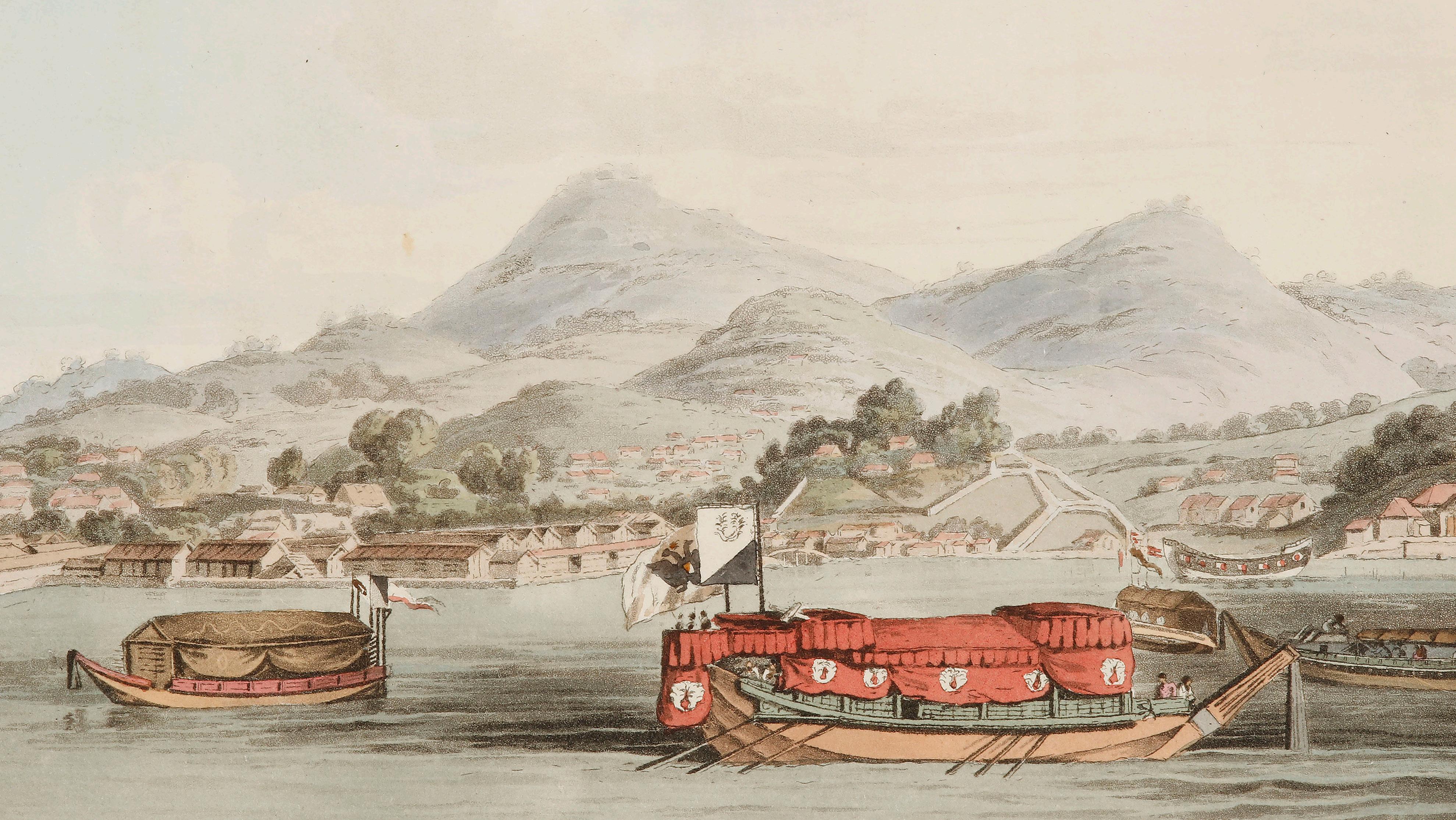
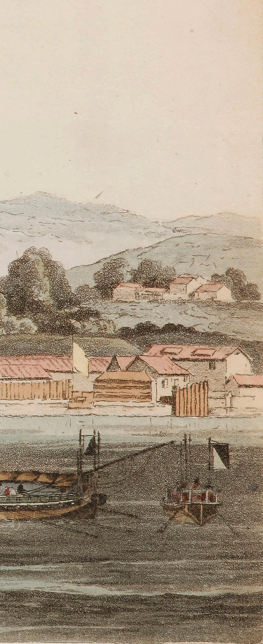
Front cover: View of Nagasaki Harbour from Krusenstern, Voyage Round the World ... (Item 23)
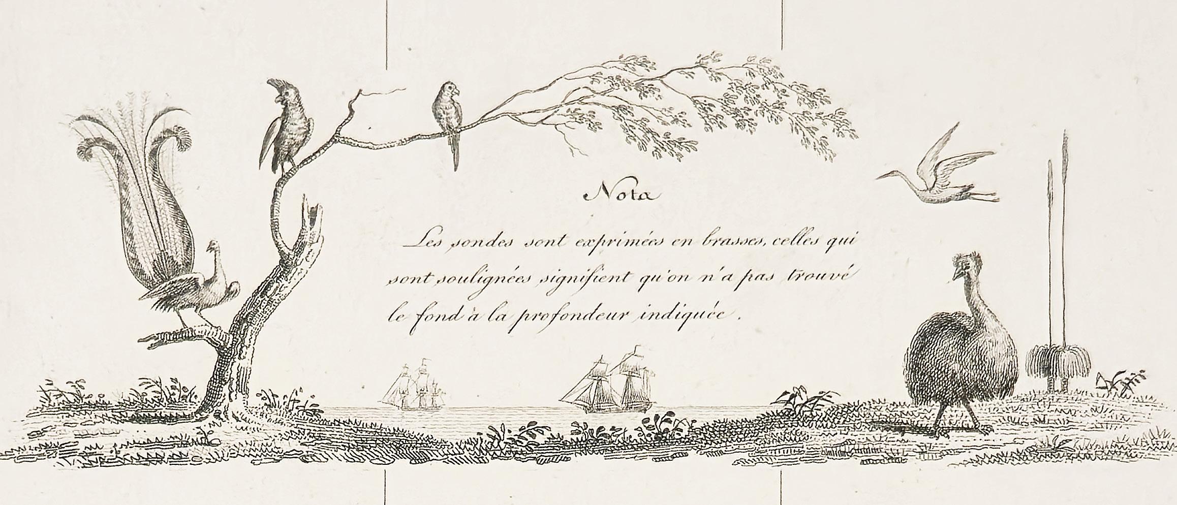
Back cover: cartouche from Carte Générale de la Terre Napoléon.… (Item 5)
Please note that all prices are in Australian dollars.


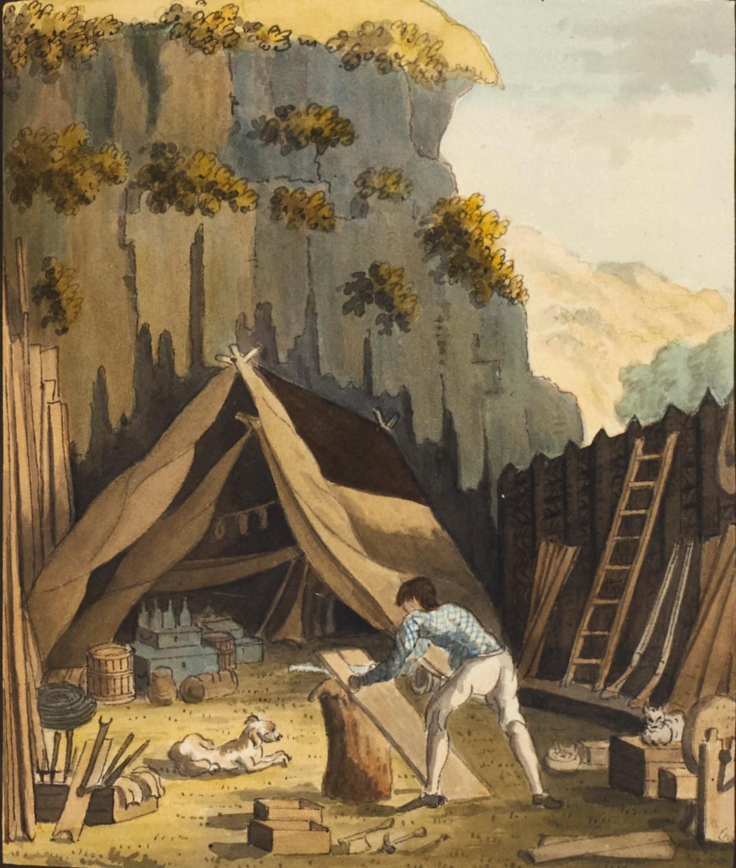
A UNIQUE CRUSOE, WITH 13 FULL PAGE ORIGINAL WATERCOLOURS
1. [ANONYMOUS ARTIST] DEFOE, Daniel.
The Life and Strange Surprizing Adventures of Robinson Crusoe, of York, Mariner…
Two volumes octavo, complete with the final 16pp. advertisements and a terminal blank; with engraved frontispieces and title-pages and 12 engraved plates by Medland after Stothard, tissue guards; the ‘Life of Daniel Defoe’ has a separate title-page and frontispiece (register and pagination continuous); extra-illustrated with 13 original drawings of the period in pencil, pen and colour wash, each within a black border; early nineteenth-century diced russia, the covers gilt with a large scalloped central wheel and cornerpieces, neatly rebacked and recornered. London, John Stockdale, 1790.
An exceptional copy of Daniel Defoe’s timeless adventure tale, published by subscription. The “extensive and beautiful illustrations made this edition the first to be so finely decorated” (Lovett 89).
First published in 1719, and still both loved and in print today, it is the classic tale of endurance and ingenuity in which the marooned sailor survives 28 years on a desert island, joined eventually by the loyal native Friday. This exceptional copy is distinguished by the addition of a brilliant extra series of original drawings, mainly in watercolour.
The anonymous artist of the suite of extra illustrations here shows a Crusoe more overwhelmed by his surroundings, which are rendered in lush tropical colour; he unloads stores from the shipwreck, constructs shelters, is surprised by a goat in a cave, navigates his canoe to the Spanish wreck. In the first four images he is in jaunty checked shirt, which gives over thereafter to his trademark furs and hat. Friday appears in two images, first in red stripes, as he and Crusoe fire on the cannibals; and then playing with the bear up a tree, a popular scene clearly derived from Stothard’s illustrations of 1781 but omitted in 1790.
Markedly contrasting in tone, the twelve fine engravings published with the book were the work of Thomas Stothard, one of the most prolific and popular illustrators of the 18th and 19th centuries. He had first illustrated Crusoe with a set of seven images in The Novelist’s Magazine (1781), described by Austin Dobson as the beginning of English book illustration “by imaginative composition”.
The 1790 Stockdale edition, “was an important contribution to the life of Defoe’s book. The handsome set restored the Crusoe text, which by then had been much abused.” For it, Stothard produced a new set of illustrations, engraved by Thomas Medland. It was “a more comprehensive series… the first pictorial treatment of Robinson Crusoe as a progress” (Blewett), which paved the way for numerous illustrated editions to follow. They show an industrious, domestic Crusoe, sociable with Friday and the Spanish soldier they rescue, and the plates are dominated by the human protagonists.
Published shortly after the official accounts of Cook’s three voyages and the earliest narratives of the First Fleet, the illustrations clearly show the influence of those publications. This was no doubt partly due to the involvement of the publisher John Stockdale, familiar to Australian book collectors as the publisher of the First Fleet books by governors Phillip and Hunter, as well as voyage accounts by Portlock, Fleurieu, Staunton, La Pérouse and Labillardière.
See David Blewett, The illustration of Robinson Crusoe, 1719-1920, 1996 and “The Iconic Crusoe: Illustrations and Images of Robinson Crusoe” in Richetti J, ed. The Cambridge Companion to “Robinson Crusoe.” Cambridge Companions to Literature, 2018.
Provenance: William John Church (stencilled armorial bookplate in each volume with motto “Nuncia pacis”).
$22,500 [5000984]
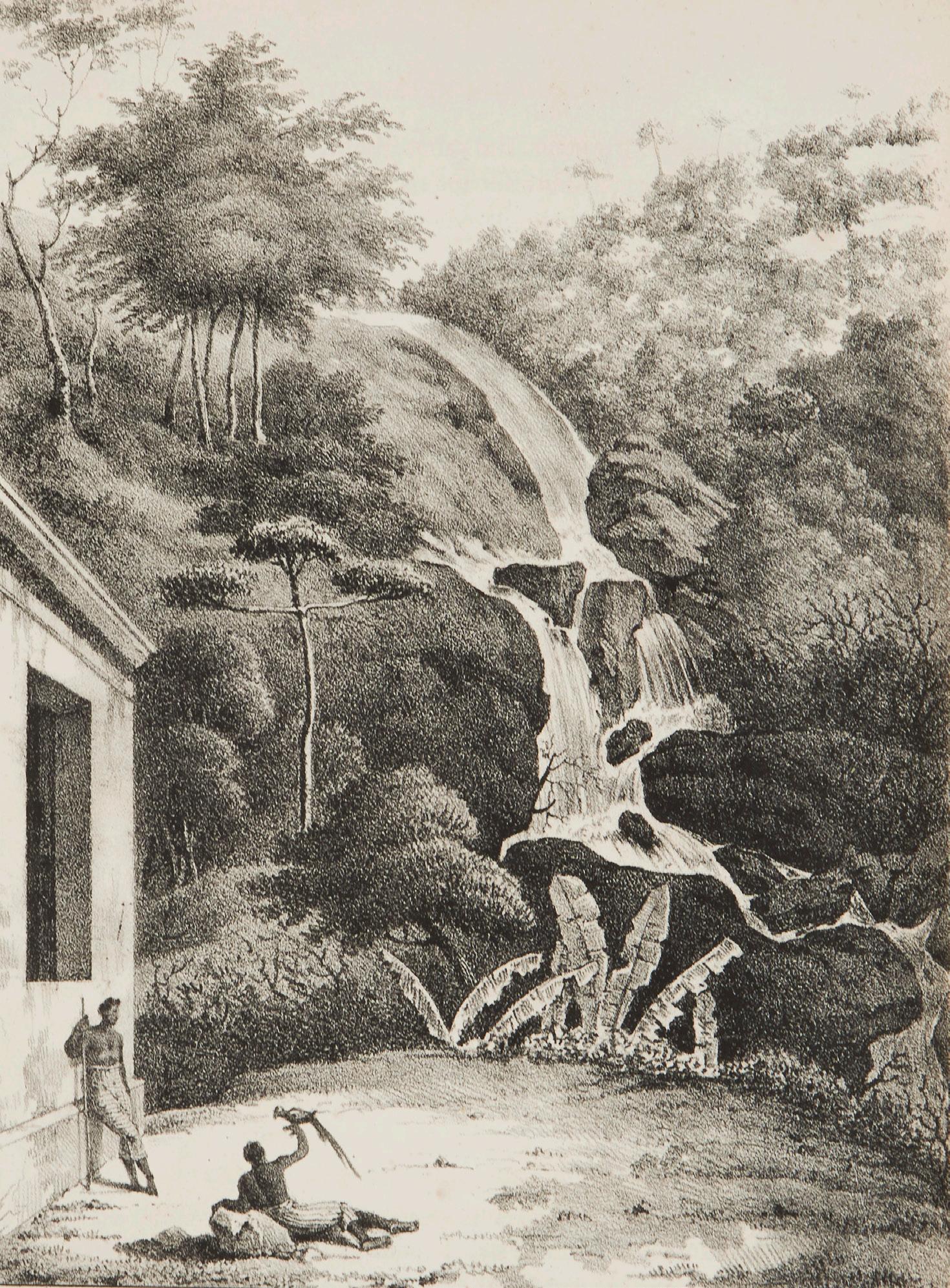
THE ARTIST’S ACCOUNT OF THE FREYCINET VOYAGE
2. ARAGO, Jacques.
Narrative of a Voyage Round the World, in the Uranie and Physicienne…
Quarto, two parts in one, with a folding map and 25 lithograph plates, a fine large copy, edges uncut, in a good modern binding of half black morocco. London, Treuttel and Wurtz, 1823.
First edition in English of this informal narrative of the Uranie voyage, the great French expedition to Australia and the Pacific commanded by Louis de Freycinet; it is also the first appearance in English of any account of the expedition. Arago was the official artist on the voyage, and the lithograph plates here are all after his own drawings. His narrative is highly readable, not least because he entirely avoids the conventional forms of the voyage narrative, ignoring the “eternal repetition of winds, currents, longitude and lattitude”. There is a long account (almost 100 pages) of their stay in Hawaii at a crucial period in the history of the islands.
Long portions relate to Australia, with descriptions of Sydney, the Blue Mountains, and of meetings with Governor Macquarie and John Oxley. Full of wry humour, the book takes the form of a series of letters to a friend, and it has been suggested that the letters may originally have been written to Arago’s brother François, the famous scientist. Certainly it is the intimacy of their personal and anecdotal tone that makes them not only so enjoyable to read today but such a fascinating source of the more minute details of life, especially in New South Wales and Hawaii. The illustrations match the text in tone: these are not the formal depictions that characterise the beautiful atlases of the full official account of the voyage, but much more informal, always charming and in some cases quite eccentric.
Despite the clear evidence of the ‘Directions for placing the Plates’ present here, there has been some unnecessary confusion about the collation of this book. Ferguson omitted the map from his plate count, while Hill erroneously called for a map and 26 plates. This copy, with the map and 25 plates is complete. Ferguson, 885; Forbes, ‘Hawaiian National Bibliography’, 562; Hill, 29; Judd, 4.
Provenance: Bernard Gore Brett (20th c. Melbourne collector, with bookplate).
$8500 [5001001]
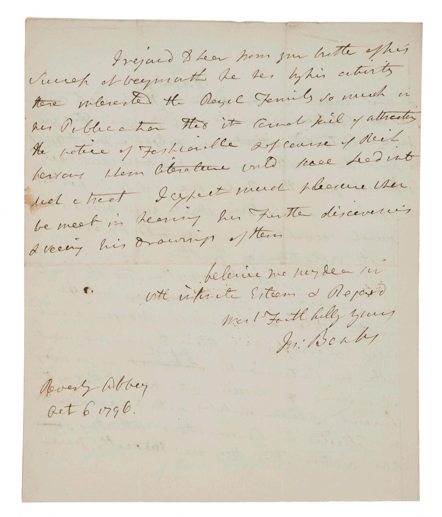
BANKS, THE GREENWICH OBSERVATORY AND THE ASTRONOMER ROYAL
3. BANKS, Sir Joseph.
Autograph letter signed, to the Rev. Daniel Lysons.
Quarto, four pages, on a single folded leaf; in excellent condition. Revesby Abbey, 6 October 1796.
A fascinating and unusually long letter in Banks’s typical open hand, penned in some haste to his friend, the antiquary and physician Rev. Daniel Lysons. The letter is written from Banks’s grand country house, Revesby Abbey in Lincolnshire, at a time when Banks was more involved than ever in far-ranging aspects of exploration and scientific discovery. Indeed, it particularly deals with a decades-long controversy arising from the papers of the former Astronomer Royal, Dr. James Bradley (1692-1762): Banks’s involvement with the observatory at Greenwich as well as the Board of Longitude were part of his lifelong encouragement of improvements in mapping and navigation.
Banks was close to Lysons, not least being behind the latter’s introduction to George III in 1794, but he was also following with the greatest interest the work of his brother, Samuel Lysons, who was then excavating the “Orpheus Mosaic” at a Roman Villa in Gloucestershire — indeed, in the present letter Banks explicitly refers to this archaeological project and the enthusiasm with which the find was being followed by the Royal Family and the entire “fashionable” world.
The closeness of their connection helps explain the informal tone of the letter, not least because Banks clearly knew he was treading on delicate ground. The controversy was a complicated one, involving both the very grand chancellor of the University of Oxford but also the reputation of the Greenwich observatory in the years when it was under the leadership of Nevil Maskelyne (who did so much to encourage Pacific exploration).
In short, Lysons was related by marriage to Bradley, who had died young, survived only by his daughter, a minor. This led to a notorious delay in publishing his last great work, the Astronomical Observations, the first volume of which only appeared in 1796, more than three decades after Bradley’s death.
The letter is Banks’s detailed and supportive answer to a letter Lysons had sent from Putney on this subject three days earlier. Lysons was keen to have Banks’s opinion on a passage about the controversy he was about to publish in his famous Environs of London. Maskelyne, then Astronomer Royal, had given Lysons a potted history of Greenwich and had strongly expressed his belief that indifference from the University of Oxford had caused the unconscionable delay in publishing. In particular, Maskelyne had sheeted home much of the fault to Lord North, 2nd Earl of Guilford (1732-1792).
Banks, no stranger to scuffles in print, therefore jumped straight in to advise his friend Lysons in some detail, especially in terms of not offending the partisans of Lord North. His explicit concern throughout is based on his awareness that Lysons was very close to the Bradley family.
Letters from the Banks/Lysons correspondence are surprisingly uncommon, being known chiefly from the edited transcripts made by Dawson Turner in the nineteenth century, although one particularly good letter from Lysons is in the Banks Papers of the SLNSW.
Bradley, Miscellaneous Works and Correspondence (1832); Carter, Sir Joseph Banks (1988); Dawson, The Banks Letters, pp. 559-561; Guide to the Lysons Family Collection (Yale); Lysons, The Environs of London, vol. IV, pp. 457-458; ODNB; SLNSW.
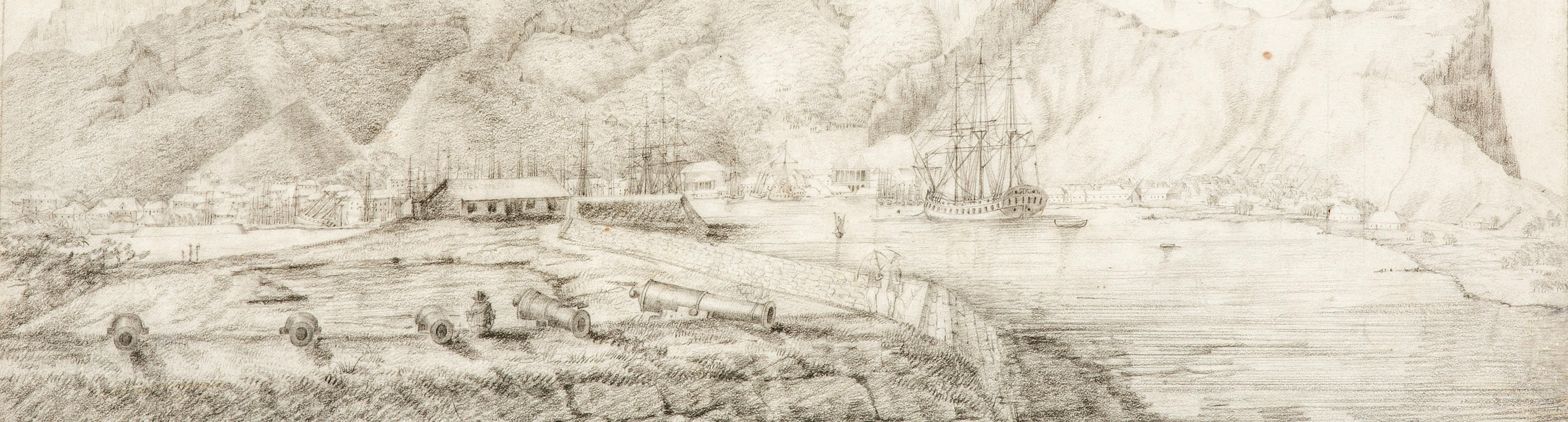
4. [BAUDIN VOYAGE] LESUEUR, Charles-Alexandre (attrib).
Original drawing of Port Louis from the Ile aux Tonneliers.
Pencil drawing, 263 x 428 mm., fugitive note in pencil lower right; mounted. Port Louis (Mauritius), circa 1801.
A superb and finely-detailed pencil sketch of Port Louis, Mauritius, with the Géographe riding at anchor in the exact spot Baudin noted in his journal (detail illustrated). At the time, Port Louis was the most important harbour in the Indian Ocean and the forward base for all of the French voyages of Australian discovery and exploration from La Pérouse to Freycinet, but is now most famous for Governor de Caen’s detention of Flinders, just a few years after this sketch was made.
This marvellous harbour scene is firmly attributed to Charles-Alexandre Lesueur (1778—1846). Lesueur was appointed to the Géographe because of his skills as a scientific artist: such was his ability that on their return to Paris he and his great friend François Péron were appointed artists in the studio run by Jacques-Gérard Milbert (another voyage veteran) to produce the official account. Together they produced what is now recognised as one of the greatest pictorial collections relating to any of the major voyages, held at the Muséum d’histoire naturelle in Le Havre.
In the foreground, ranged dramatically towards the viewer, are the cannons of the fort on the low-lying Ile aux Tonneliers, with Lesueur himself depicted sketching between two of the guns. The background is dominated by the dramatic ridges of the mountains, while the foreshore is rendered in accurate detail, ranging from the Trou Fanfaron on the left to the open country on the right.
Although not signed, the view tangibly develops a simple preliminary study by Lesueur held in Le Havre, which has
an identical perspective and includes the main features of the foreground, including the fort itself, the details of the ramparts and the position of the Géographe (“suite de la vue prise ? l’île aux tonnelliers [sic]”, Baglione & Crémière, p. 52).
Stylistically and technically, the drawing also closely resembles two very similar views of Timor and Port Jackson engraved for the official account, both also after Lesueur, and both of which show the Géographe from an almost identical angle. It is certainly possible that the present scene was being considered for publication as the third of the three main European settlements visited on the expedition, but was ultimately abandoned.
Original works by Lesueur are exceptionally rare on the market, doubly so such a major voyage piece, with the Géographe prominently figured: any original depiction of the ship is an important discovery, let alone such a comprehensive view of this
Literature: Gabrielle Baglione & Cédric Crémière, Charles-Alexandre Lesueur (Le Havre, 2009); Nicolas Baudin, The Journal of Post Captain Nicolas Baudin… Translated from the French by Christine Cornell (Adelaide, 1974); J.B.G.M. Bory de St. Vincent, Voyage to and Travels through the four principal islands of the African Seas… (London, 1805); Jean Fornasiero, Lindl Lawton & John West-Sooby (eds), The Art of Science (South Australia, 2016); Péron, François & Louis de Freycinet, Voyage de Découvertes aux Terres Australes… (Paris, 1807-1816).
Provenance: From a portfolio of works belonging to Baudin voyage artist Jacques-Gérard Milbert when he was in the USA (between 1815 and 1823), which is known to have included at least one other Lesueur watercolour and several of Milbert’s own important American views; Milbert gifted the portfolio to a friend and former student, and it remained with the latter’s family until about 1990, when it was sold to an art dealer in California.
$24,500 [4504924]
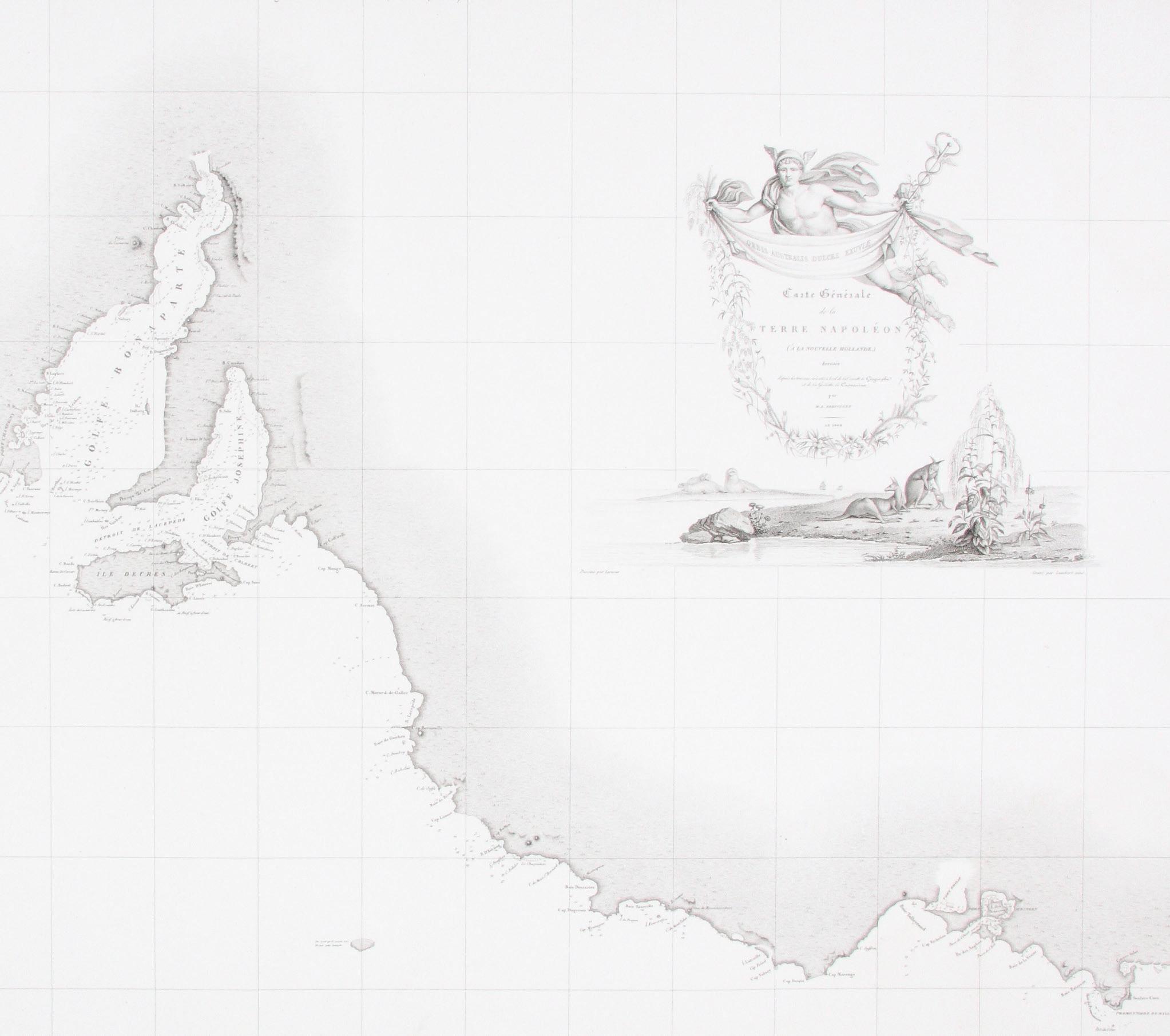
FRENCH DESIGNS FOR SOUTH AUSTRALIA.
5. [BAUDIN] FREYCINET, Louis de.
Carte Générale de la Terre Napoléon.
Engraved chart; 580 x 850 mm. Paris, gravé par Tardieu, 1808.
Impressive early chart of the South Australian coastline, a result of the survey undertaken during the Baudin expedition in Australian waters during 1802 (detail illustrated). As the title “Terre Napoléon” confirms, the map is tangible proof of French colonial ambitions for Australia. At the time of the Baudin voyage a Napoleonic order existed to conquer the continent, a plan ultimately frustrated by defeat in Europe. The place names engraved on this chart are almost entirely in French; interestingly, when the second edition of Baudin’s voyage was published in 1824, most of these names were, without comment, discreetly changed into English.
Although the map bears the engraved date of 1808 it was later included in the atlas volume of the official voyage account published in 1812; this excellent example of the map is a single unfolded sheet, therefore not deriving from an atlas, and remains in excellent condition.
A milestone in mapping the continent, this was the first Australian atlas ever published. Although Matthew Flinders charted this coastline at the same time as Baudin, and the two expeditions famously met in Encounter Bay, Flinders’ publication was delayed by several years due to his imprisonment by the French on Mauritius. The matter of precedence remained a bone of contention between the English and the French for some time: there is no acknowledgement here of Flinders’ prior discoveries.
This map is beautifully enhanced by vignettes of Australian flora and fauna based on drawings by Charles Alexandre Lesueur (featuring kangaroos and sea lions reclining composed beneath an idealised neoclassical figure).
$5500
[3912509]
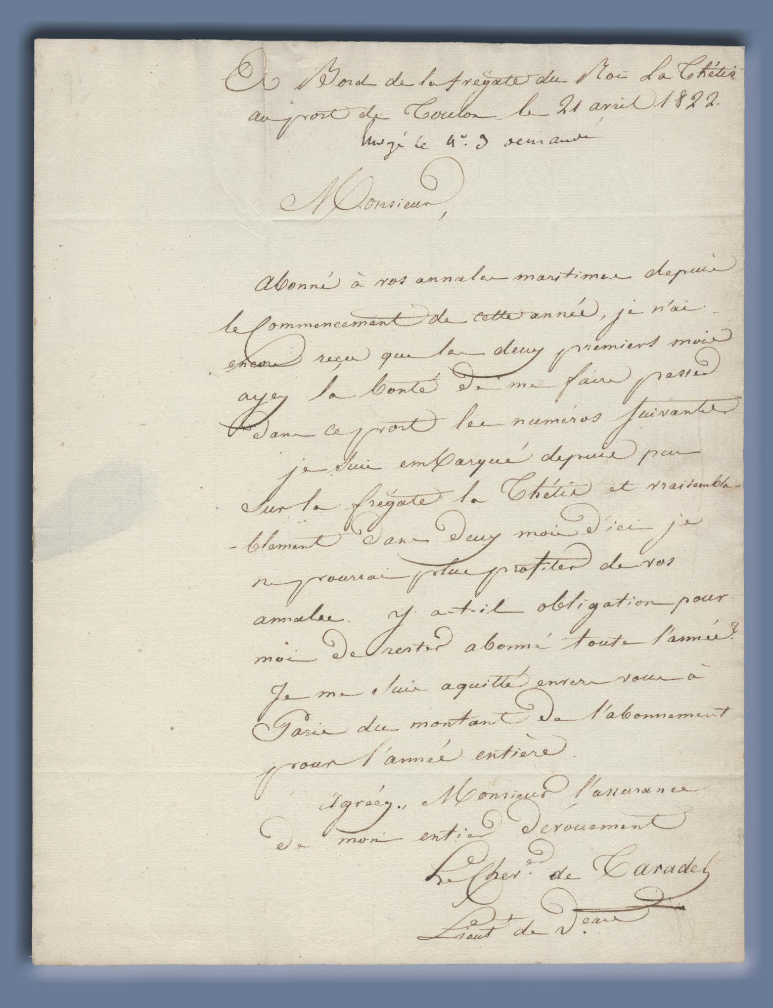
PLEASE SEND THE LATEST VOLUMES RELATING TO FRENCH VOYAGES
6. [BOUGAINVILLE, Hyacinthe de] TARADEL, Guy de
ALS written on board the Thétis.
Single-page letter on single folded sheet, 255 x 195 mm., address panel, slightly torn where originally opened at red wax seal; very good. On board, 21 April 1822.
An intriguing letter sent from on board Hyacinthe de Bougainville’s command the Thétis to Monsieur Bajot, who is noted as being the editor of the Annales Maritimes published by the Ministry of the Marine in Paris. Louis-Marie Bajot was associated with the Ministry for most of his life, and was the driving force behind the publication of the Annales Maritimes, an important annual that published the latest news of naval affairs and regulations, together with long articles and notes on voyages and other maritime matters.
The naval officer André-Antoine-Émilien Gay, baron de Taradel, writes that though he is a subscriber, he finds that he is missing the recent volumes; he has just embarked on the Thétis and expects to sail shortly, just at the moment when he might conceivably profit from having the volumes to hand. The Annales Maritimes, first published in 1816, published all manner of notes and articles on all manner of questions relating to navigation, including references to the Baudin and Freycinet voyages. Bougainville and the Thétis did sail in July 1822 to Martinique to trial the vessel, but did not sail on the circumnavigation until 1824, including making a long stay at Sydney.
$2700 [6000069]
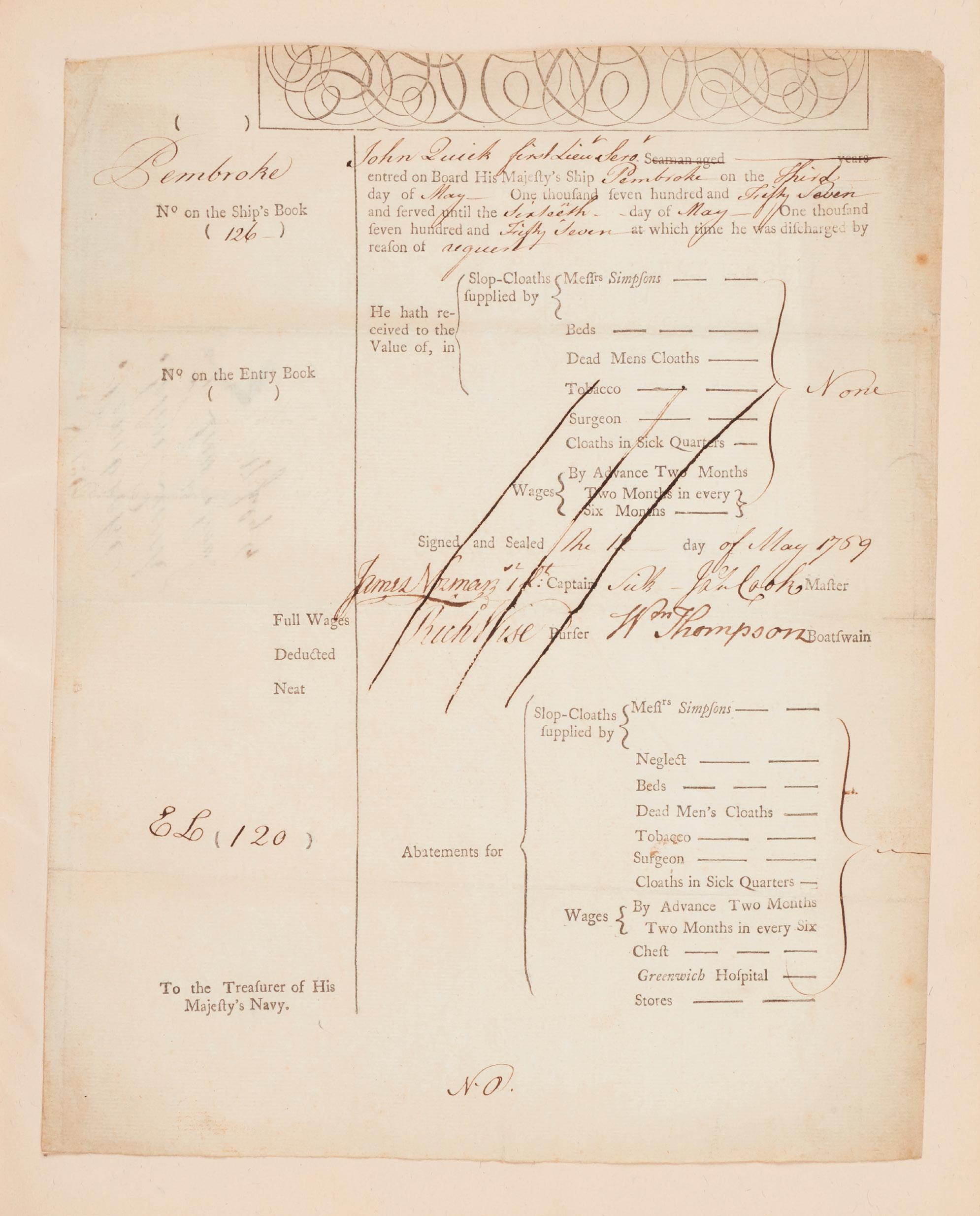
AN EXCEPTIONALLY RARE DOCUMENT SIGNED BY COOK AS MASTER OF THE PEMBROKE
7. [COOK: NEWFOUNDLAND] COOK, James.
Certificate of wages for John Quick, HMS Pembroke, signed by Lieutenant Cook.
Folio, single leaf partly printed and completed in manuscript in ink; docket-title on verso; original folds, a little dusted, head of leaf cropped; in excellent original condition, tipped into a quarter morocco binding HMS Pembroke, 12 May 1759.
Original documents that relate to Cook’s career are of extreme rarity, and this example, from a period of active duty off the American coast and a major stage in his early development, is particularly desirable.
Cook’s time on the Pembroke was pivotal in his career. He served under the intellectual Captain John Simcoe on the voyage that took them to the Gulf of St. Lawrence for surveying work between 1757 and 1759. Simcoe guided the young Cook in the study of mathematics and astronomy and started him in the field of hydrographic survey. He lent Cook reference books, and from various sources we know that during the very severe winter of 1758-59 at Halifax, Cook used every moment for detailed study.
The military surveyor Major Samuel Holland later recollected that when he met Cook in London in 1776, before he set out on his third voyage and by then the most famous sailor in the world, Cook “candidly confessed that the several improvements and instructions he had received on board the Pembroke had been the sole foundation of the services he had been enabled to perform” (Holland’s letter to Simcoe’s son 11 January 1792). He also remembered that “I was on board the Pembroke where the great cabin [was] dedicated to scientific purposes and mostly taken up with a drawing table… Under Capt. Simcoe’s eye Mr. Cook and myself compiled materials for a chart of the Gulf and River St. Lawrence”.
Cook’s time on the Pembroke was certainly the turning point in his career. The hydrographic skills that he acquired from working with Simcoe and Holland, exemplified in the charting and survey of the St. Lawrence River, led directly to his recognition by the Admiralty and his subsequent appointment to the Endeavour. This certificate, to the Treasurer of the Navy, is for payment of wages to First Lieutenant John Quick. It has four signatories, James Cook as master along with James Norman, Richard Wise as purser and William Thompson as boatswain.
$72,000 [5001037]
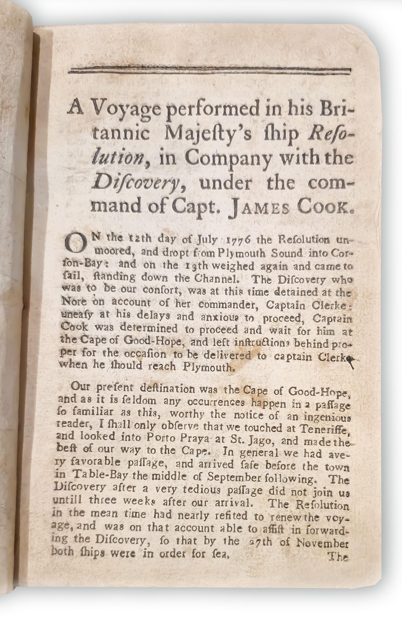
8. [COOK: THIRD VOYAGE] LEDYARD, John.
A Journal of Captain Cook’s Last Voyage…
Small octavo, lacking the map (as do virtually all known copies), top four lines of title-page in well prepared facsimile; as always a little browned throughout but generally in rather better condition than most copies; in the original dark calf binding. Hartford, Connecticut, Nathaniel Patten, 1783.
Highly important personal account of Cook’s third voyage: the first American account of Cook’s third voyage and thus the very earliest American account of the discovery of the Hawaiian Islands, later to become the fiftieth state of America. This rare and significant book is notoriously hard to find in good shape.
Ledyard, one of several Americans on the voyage and the only one to publish an account of the expedition, sailed as a corporal of marines. It is now generally acknowledged that he got hold of a copy of Rickman’s narrative which he used to help him compile this account after his return to America. He himself describes the sealing of all diaries, drawings, memorandums, and charts of all officers and crew aboard ship at Canton. However, the narrative contains considerable information not available elsewhere, including the first published description of the Russian presence on Unalaska, the first permanent Russian settlement in northwest America (only Ledyard, Samwell, and Edgar visited the settlement). The chart supposed to have been issued with the book, which seems to have been an almost direct copy of the Rickman map, is missing in almost every copy known, and in view of the erratic nature of American eighteenth-century publishing it is nowadays accepted that it was not generally issued.
Ledyard’s description of his stay at Hawaii, his expedition inland and the death of Cook occupies sixtyfour pages of the text. The account of New Zealand and Australia is short but includes his observation that ‘the island of New-Holland (for its boundaries are now ascertained) is by much the largest known, and most eligably [sic] situated on the map of nature… even the Empress of Russia might be gratified with such a portion’.
Beaglehole, III, pp. ccviii-ccix; Beddie, 1603; Hill, 991; Forbes, ‘Hawaiian National Bibliography’, 52; Hawaii One Hundred, 4; Hocken, p. 21; Holmes, 45; Judd, 108; Kroepelien, 717; Lada-Mocarski, 36; O’Reilly-Reitman, 432; Sabin, 39691.
$12,850 [5001095]
THE SUPERB OFFICIAL NARRATIVE OF COOK’S THIRD VOYAGE
9. [COOK: THIRD VOYAGE] COOK, James and James KING.
A Voyage to the Pacific Ocean…
Three volumes, quarto, and an atlas, folio, with altogether 87 engraved plates and maps, of which 63 appear in the atlas; period bindings of diced russia leather, flat spines gilt in compartments with a complex design, black leather lettering pieces and round crimson numbering-pieces within dark green labels; the atlas volume in a neat modern binding of half calf and marbled boards. London, Printed by W. and A. Strahan, for G. Nicol… and T. Cadell, 1784.
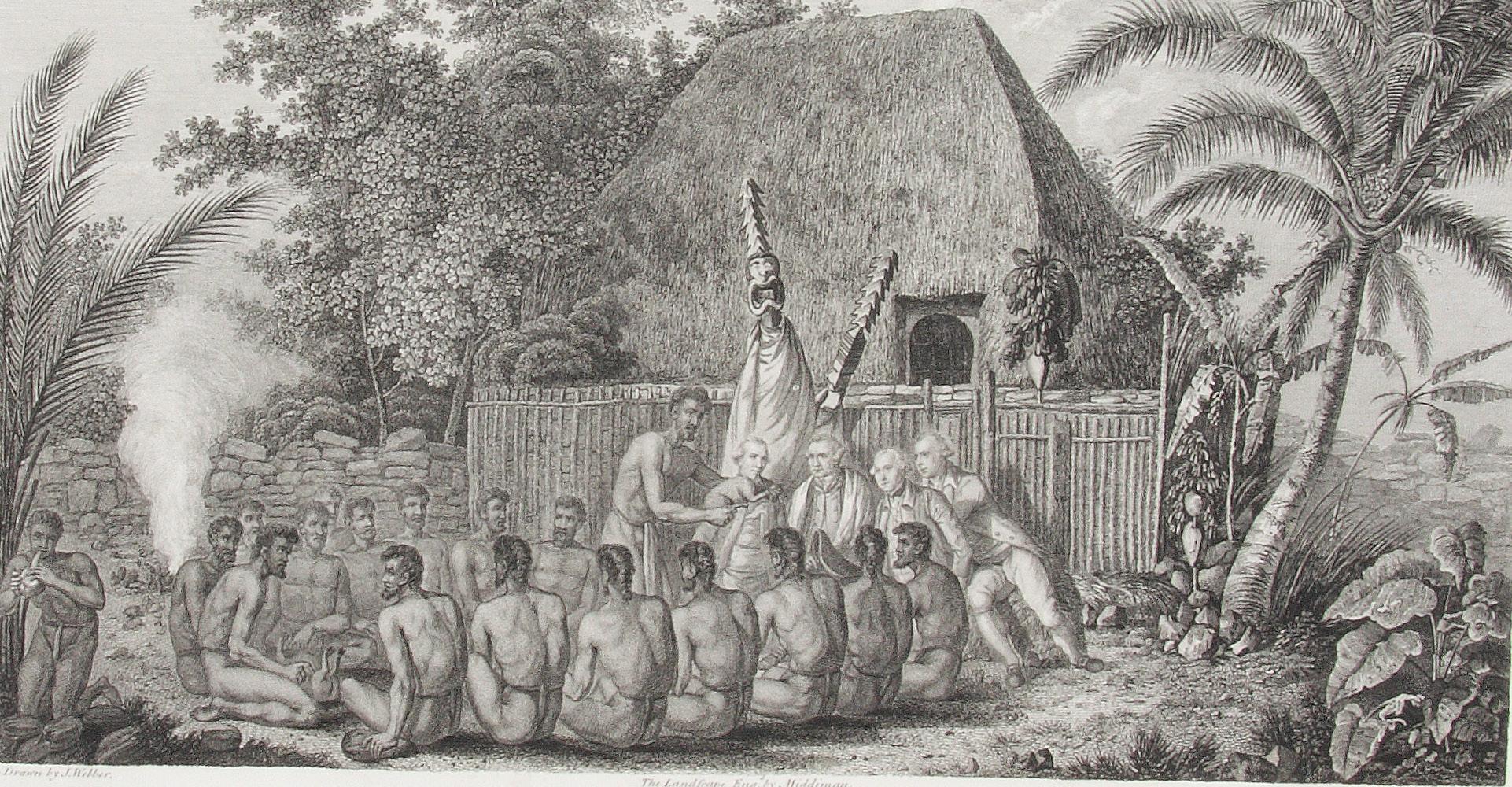
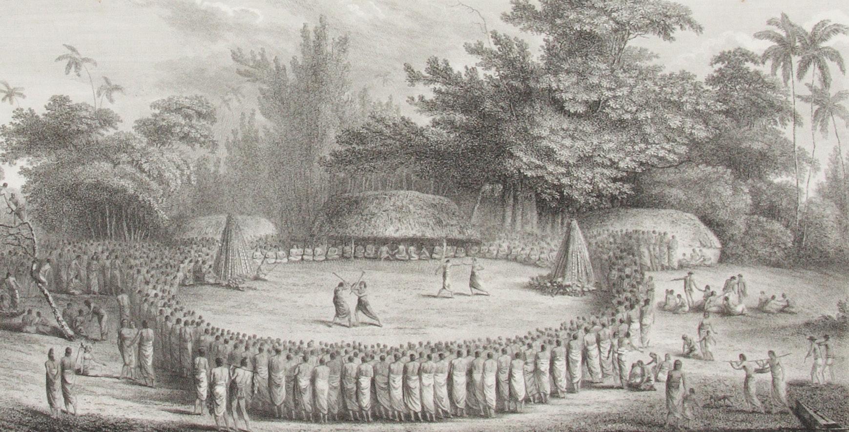
First edition of the official account of Cook’s last voyage. This is a good set of this tremendous publication, the detailed narrative of the voyage, extensively illustrated with beautiful engravings after John Webber, and so popular at the time that copies were sometimes literally read to pieces. “A magnificent summation of all the public and private journals, logs, drawings and other observations made during the voyage, and… as important a record of the exploration of the North Pacific as Cook’s first two voyages had been for the South Pacific. It is in fact one of the most important English books published in the last quarter of the eighteenth century…” (Forbes).
The Resolution and Discovery made an enormous sweep throughout the Pacific, calling at Tasmania, New Zealand, the Cook Islands, Tonga and Tahiti before heading north and making famous landfall at the Hawaiian islands, which Cook named the Sandwich Islands in honour of his patron. After exploring the Northwest coast of America and returning to Hawaii, Cook was killed in the notorious skirmish ashore. Command passed to Clerke, and, after his death, to John Gore. The shocking news of the explorer’s death reached England through overland reports from the Russian Pacific coast some months before the ships themselves returned. It marked the end of an age, and the beginning of another that would feature a number of the men who had been aboard the Cook voyage: among them Bligh, Vancouver, and Colnett.
Unlike the official narratives of the first two Cook voyages, this was planned as a grander publication with the three text volumes containing some of the lesser illustrations but the 63 more important illustrations and maps appearing on a large scale in the separate folio-sized atlas volume. The result does justice to John Webber’s superb visualisations of the Pacific. Webber was the official artist on the voyage: his romantic views remain the most evocative of all early portrayals of the islands, and helped to foster the notion of island paradise that so affected an European public eagerly reading the voyages of discovery being published in the eighteenth century.
The full story of the voyage, including the narrative of Cook’s murder at Kealakekua Bay, was so eagerly awaited by the public that the entire first edition sold out within three days, at the then huge price of four pounds fourteen shillings and sixpence, and copies were soon changing hands at up to ten guineas.
Beddie, 1552; Forbes, ‘Hawaiian National Bibliography’, 85; Hawaii One Hundred, 5; Hill, 361; O’Reilly-Reitman, 434.
Provenance: Robert Baker (early signature in volume 1), possibly the Baker whose books were sold by Sotheby in 1855 and whose copy of the Cook second voyage atlas is in the Dixson Library, State Library of New South Wales; H. Mackenzie-Begg, with his small bookplate in each volume.
$17,000 [4401862]
RARE ENCOMIUM OF COOK IN GREAT NEO-CLASSICAL STYLE
10. [COOK: MEMORIAL] GIANETTI, Michelangiolo.
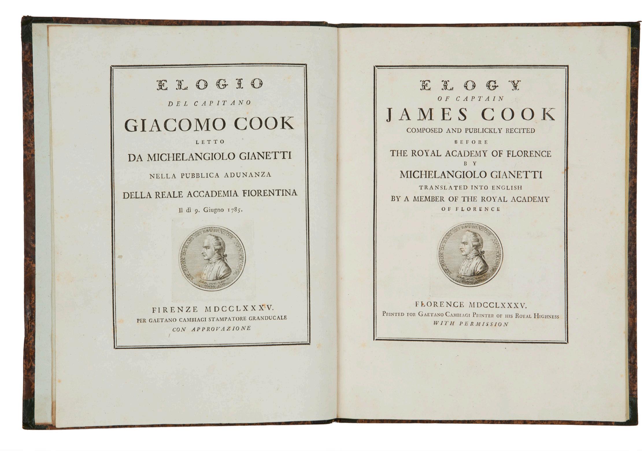
Elogio del Capitano Giacomo Cook.
Small folio, original quarter calf and boards, a fine copy. Florence, 1785.
Rare, eccentric, but beautiful elegy for Cook. This prose essay honouring the life and voyages of the navigator in florid style would have greatly embarrassed him. Describing his achievements in purple tones, “this prodigy of nature” is lauded for his mapping of the St Lawrence, to which the author ascribes much of General Wolfe’s successes. Each of the three voyages of discovery is described in some detail, while Cook, like many sailors a non-swimmer, is given powers that he never possessed: “From his infancy he was accustomed to the useful practice of swimming, and could cleave the waves of the Ocean with the facility of its inhabitants”.
Although the poem exhibits a particular interest in the exotic islands of Tahiti and Hawaii, as well as the sometimes violent interactions in New Zealand, the work does include a particularly attractive passage on Cook’s grounding on a reef and subsequent beaching at Endeavour River.
This is a beautifully printed book in the best Italian eighteenth-century tradition, much in the style of Bodoni, using elegant roman and italic types, classically composed within ruled borders. The dedication is to Sir Horace Mann, then English ambassador to the Court of Tuscany.
Gianetti was professor of anatomy at the hospital of Santa Maria Nuova, and well-known as a dilettante poet and friend of English poets such as Hester Lynch Piozzi. The English translation is signed R.M., that is, the English poet Robert Merry, who wrote under the pseudonym Della Crusca, and was the great English literary figure in Tuscany at this time. This work could be compared with Merry’s own Ode on Rodney’s defeat of De Grasse in the West Indies (1782), which appeared accompanied by a French translation by Sir Wogan Browne and an Italian translation by Gianetti himself (Brian Moloney, ‘The Della Cruscan Poets’, MLR, January 1965, p. 50).
Beddie, 1957; Forbes, ‘Hawaiian National Bibliography’, 99; Holmes, 51; Kroepelien, 486; not in the catalogue of the Hill collection; O’Reilly-Reitman, 451.
$9500
[5001066]
THE COMPLETE FIRST EDITION INCLUDING FORSTER’S LIFE OF COOK
11. [COOK: LIFE] FORSTER, Georg.
Kleine Schriften…
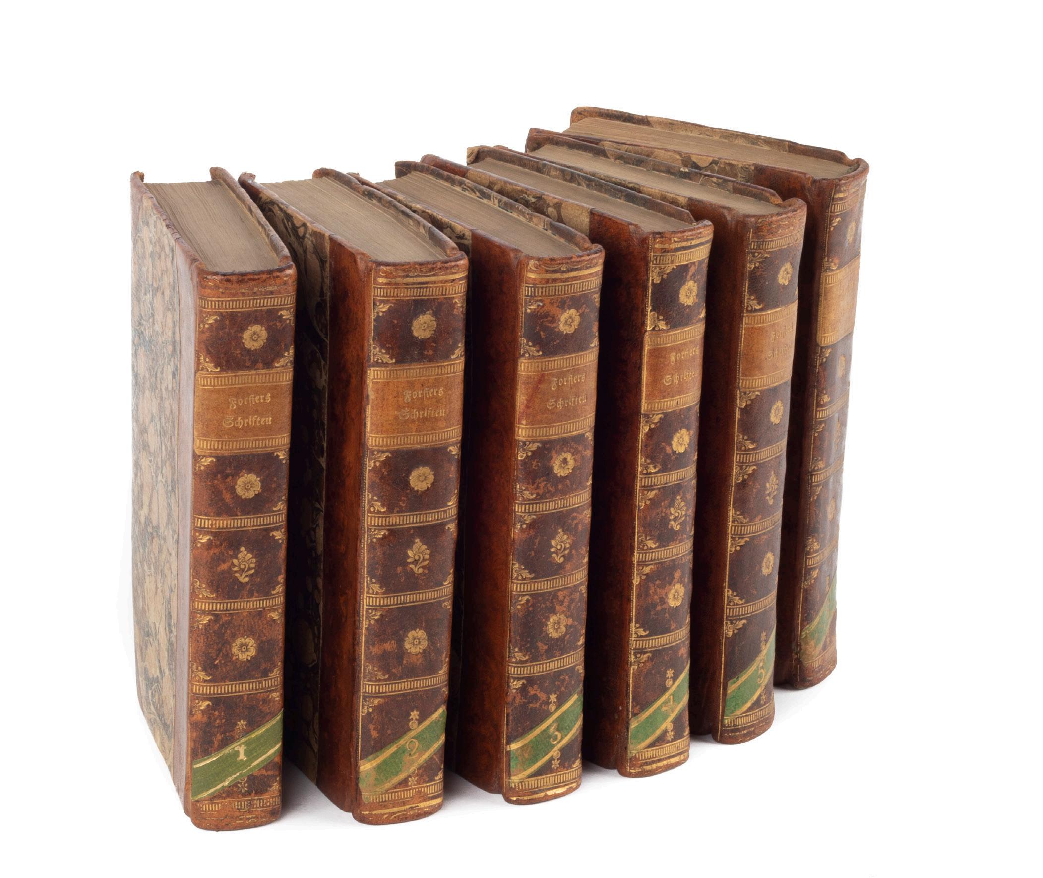
Six volumes, small octavo, two large folding engraved maps of North America, a folding plate of the breadfruit and 19 other plates; in period bindings (probably German) of half calf and marbled boards, flat spines gilt in compartments, light brown leather labels and green diagonal numbering-pieces; a very attractive set. Leipzig (vol. 1) and Berlin, 1789-1797.
A fine set of the first collected edition of the works of Georg Forster. The first volume was revised and edited by Forster himself, who died before the remaining volumes were published, and was the only volume to be published in Leipzig (it was reprinted later in Berlin); the subsequent volumes were published in Berlin between 1794 and 1797. Some sets are therefore found with the second (Berlin) rather than the first (Leipzig) edition of the initial volume. As the title implies, this set prints an important selection of Forster’s shorter pieces. A great number of the essays printed here relate to Pacific voyaging, reflecting Forster’s enduring interest in the region. Fittingly, the first essay is his important and long-overlooked memoir of Captain Cook, ‘Cook, der Entdecker’, first published as the introduction to the German edition of Cook’s third voyage, and only recently translated into English for the first time.
Any number of the essays are of tremendous interest, not least Forster’s 1787 article on the British Colony in New Holland, an essay on Tahiti and another on the breadfruit (with folding plate), the Latin preface to his Dissertatio de Plantis Esculentis insularum oceani australis of 1786, and his article on the red Bee-eater of Hawaii, first printed in the Göttingisches Magazin in 1781, and recognised as the first major natural history article relating to the Sandwich Islands (see Forbes 13). There are also two major essays on the Northwest coast of America, both accompanied by excellent large folding maps, the first with notes on the fur-trade and the map by Carl Gäck the Berlin cartographer (1791), and the second, accompanied by another large folding map by Gäck, but on this occasion based on an Arrowsmith chart of 1789. The two large folding charts were published for Forster’s own German translation of Cook’s third voyage, but were included in some copies of his Kleine Schriften, as here.
Otherwise, the essays show Forster’s wide-ranging interests, including pieces on English literature, the Comte de Volney, and his memoirs of the tumultuous year 1790, with many plates including a portrait bust of Benjamin Franklin.
Forbes, ‘Hawaiian National Bibliography’, 165; Kroepelien, 447 (with long list of contents); not in Beddie (despite considerable Cook component); O’Reilly-Reitman, 399, 461, 513, 2466; Wickersham, 3546a.
Provenance: Original manuscript purchase inscription in vol. 1 dated 1797.
$9250 [4505245]
THE RARE FRENCH EDITION OF SAMWELL’S ACCOUNT OF COOK’S DEATH.
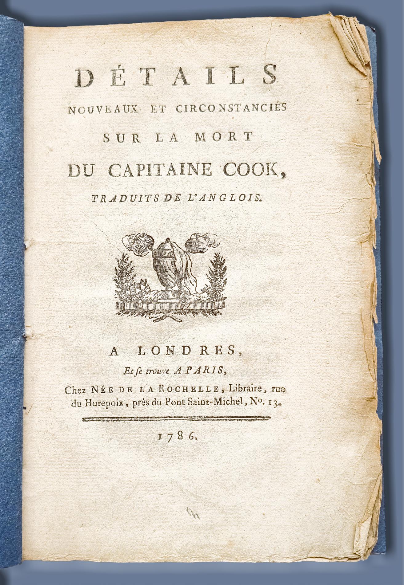
12. [COOK: DEATH] SAMWELL, David.
Détails nouveaux et circonstanciés sur la mort du Capitaine Cook…
Octavo, 56, (ii) pp and a final blank leaf; neo-classical vignette on title, woodcut head- and tailpieces; a fine uncut copy in plain dark blue wrappers. À Londres et se trouve à Paris, chez Née de la Rochelle, 1786.
Very rare: published only in English and French editions, Samwell’s book “may be considered the highlight of a Cook collection” (Hill). The French edition has been conspicuously rare on the market, with no copy appearing at auction in decades, while competition among collectors for the few copies of the English edition that have been offered has been notable. The book is missing from a number of important collections, both private and public. Samwell’s account of Cook’s death is also one of the earliest books on Hawaii, preceded only by the official account and the handful of unofficial accounts of Cook’s third voyage. Of all the early books on Hawaii, it ranks with Zimmermann’s narrative of the voyage and Shaw’s collection of tapa cloth as among the rarest and most significant.
David Samwell was a surgeon’s mate and later surgeon on Cook’s third voyage, originally on board the Discovery, but transferring to the Resolution in mid-1778. His eye-witness account of the events at Kealakakua Bay (“the frankest and most reliable of all contemporary accounts…” – Beaglehole) forms the basis of our knowledge of the details of the event, particularly since the visual record is so muddled by myth-making aspects. As a surgeon he was also well placed to make the observations that appear in a final section here about venereal disease in the islands. Perhaps however his conclusion that the disease had been indigenous before Cook’s visit looks a little doubtful today; or could it be taken as another suggestion of pre-Cook European discovery?
The official account of the third voyage had finally been published in 1784, four years after Cook’s ships returned to England. Many of the eyewitnesses to Cook’s death in Hawaii were unimpressed by the rather sanitised version included in that work, but only Samwell ventured into print, issuing what is now regarded as one of the rarest books relating to Cook as A Narrative of the Death of Captain James Cook in May 1786. By returning some of the more unpalatable truths about events in Hawaii to the record, Samwell’s influential account is now considered the most compelling and reliable version of the fatal events at Kealakekua Bay.
Beaglehole, III, ccix; Beddie, 1618; Forbes, ‘Hawaiian National Bibliography’, 118; Hawaii Hundred, 6; Hill, 1521 (not this edition); Holmes, 62; Kahn, 2/34; Kroepelien, 1144; O’Reilly-Reitman, 453.
$12,500 [6000088]

13. DENHAM, Henry Mangles, and James Glen WILSON.
Chart of six coastal profiles of Port Jackson…
Lithograph by Allan and Wigley; 500 x 610 mm, profiles and landmarks captioned; in a custom made mount. Sydney, Allan & Wigley, circa 1857.
Rare and detailed coastal profiles of Port Jackson drawn in Sydney by James Glen Wilson and lithographed by the local lithographic studio, Allan and Wigley of 23 Bridge Street (detail illustrated). The artist, an Irishman who arrived on the Denham expedition but later chose to settle in Sydney, depicts North and South Heads and the lighthouse, giving detailed illustrations of shipping, bathymetric soundings and a wide record of Sydney buildings.
HMS Herald arrived in Sydney in 1853 under the command of Captain Henry Mangles Denham: “the arrival in Sydney on February 19th, 1853 of this scientific officer of long experience was an important event in the progress of the Australian marine surveys… “ (Ingleton, Charting A Continent). Denham charted the land masses and suspected shipping hazards in Port Jackson between February and December 1857, with the Admiralty publishing his much better known map “Australia, Port Jackson” in 1859.
His close survey of Port Jackson formed a part of the Herald’s hydrographic survey throughout the South Pacific
which, beginning in 1852, continued to 1861. The Herald also worked in Shark’s Bay, Western Australia, the Fijian Islands, New Caledonia and Norfolk Island and was involved in the search for Benjamin Boyd throughout the Pacific, and in the wreck of the Dunbar just off Sydney Heads.
Widely celebrated, and knighted for his contribution to hydrographic services, Denham was appointed Commander in Chief of the Pacific Station in 1864. Denham in Western Australia was named for him, and in 1858 his ship was celebrated in Sydney by the publication of a music sheet entitled Herald Waltzes.
The profiles are (abbreviated from the captions):
The Outer South Head — Light-House bearing West…; Appearance of the Inner South Head when rounding into the Eastern Channel of the Sow and Pigs Bar [and] the new (Eastern) Obelisks…;
Inner view of the South Head with Lighthouse…; Elizabeth Bay House in line with Bradley Point…; Craig-end Mill in line with Bradley Point…; St. James’s Church its breadth open of Bradley Pt.
$8500 [4504726]
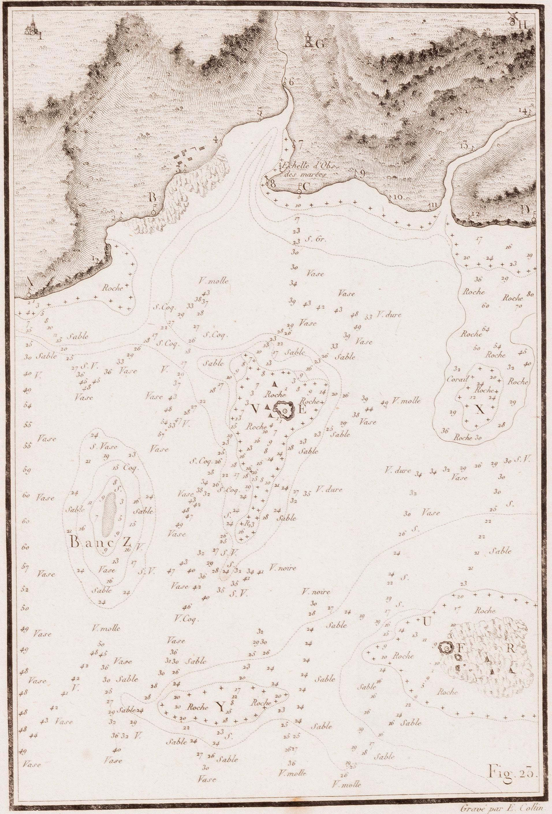
14. [D’ENTRECASTEAUX] BEAUTEMPS-BEAUPRE, Charles-François.
Appendice. Exposé des Methodes…
Quarto, with 32 folding plans and two large folding maps of Santa Cruz; in fine condition in original French pink mottled boards, spine with ms. paper label. Paris, 1808.
Presentation copy from the author, inscribed to “M. Boullanger Ingénieur de la Marine”, of the first separate edition of a rare cartographic study, one of the results of the expedition that searched for but failed to find any traces of the lost La Pérouse expedition. This is an unrecorded and quite distinct printing of this important work on marine surveying and the drafting of nautical charts, by the hydrographer on the d’Entrecasteaux voyage.
it is ironic that Beautemps-Beaupré, hydrographer on the voyage, and the father of modern French hydrography, should have chosen the Santa Cruz islands, in the eastern Solomons, to concentrate on in extreme detail: his very detailed observations made in 1793 show that the d’Entrecasteaux vessels actually came within a few hours sailing of the island of Vanikoro where we now know that La Pérouse ended up. Only 33 years later did the sandalwood trader Dillon famously stumble upon relics of the French expedition on the nearby island of Tikopia.
In its first form, this text with its extensive series of plans and maps appeared as an Appendix in the full account of the d’Entrecasteaux voyage, and later (1811) it was published as a separate work. The present version appears to be an interim issue; although it seems to be printed from the same settingup of type used in its first form, as it appeared in the d’Entrecasteaux work (with certain broken letters confirming this), it has been re-paginated and re-signed (pp. [ii], 94; one unsigned leaf, A-L in 4’s, M3) and is quite distinct from both other versions. Since this copy is in original boards that are very similar to bindings seen on the original publication of d’Entrecasteaux’s work (1808), and it predates the preparation of any separate title-page, and since it was presented by Beautemps-Beaupré to a naval colleague, it seems very likely that this was the first separate issue to appear.
The two large folding maps here (which appeared as maps 19 and 20 in the large atlas to the D’Entrecasteaux voyage account) as well as the extensive series of coastal profiles all relate to the archipelago, while the island of Vanikoro itself (Ile Ourry to the French) figures in Beautemps-Beaupré’s full charting and in a number of the coastal profiles. In fact the 23 plates of coastal profiles are all based on observations made between 19 and 23 May in the vicinity of Santa Cruz; seven of them were made on 19 and 20 May, on both of which days Beautemps-Beaupré took compass bearings on the island of Vanikoro itself several times each day and drew coastal profiles from different angles. At this point the expedition came within 15 miles of the island.
Not recorded by Ferguson or Sabin; not in the catalogue of the Hill Collection.
$8000 [5001047]
IMPORTANT MAPPING OF THE PACIFIC FROM DUPERREY’S VOYAGE OF 1822-25
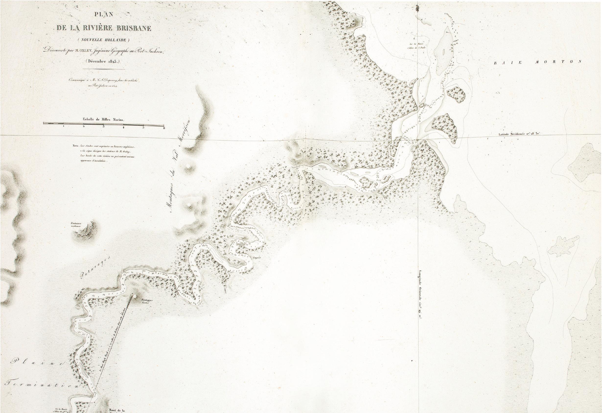
15. DUPERREY, Louis-Isidore.
Voyage autour du monde. Hydrographie Atlas.
Folio, with 49 engraved maps (18 folding) and four plates of boats, all in good, crisp impressions; an excellent copy in old French quarter calf over papered boards. Paris, Arthus Bertrand, 1827.
The complete hydrographical atlas from the Duperrey voyage, published as part of one of the immense French grands voyages series. As with most of these publications, the various components could also be bought separately, sometimes even being produced by different publishers. In fact full publication of the Duperrey voyage was never completed. His hydrographic work tended, as Dunmore comments, “towards perfecting existing maps rather than preparing charts of unknown areas”. As a result, the beautiful maps clearly display their debt to the earlier explorers, and include the discoveries and vessel tracks of luminaries such as Cook, Bougainville, La Pérouse, Bligh and Flinders.
Duperrey’s voyage gathered “vast quantities of ethnographic and scientific data” (Hill), and included two visits to the Australian mainland. The details of the harbours at the Brisbane River and Macquarie Harbour in Nouvelle Hollande are attributed in the cartouche to Oxley and Evans respectively. The wonderful map of the Bay of Islands reflects the two weeks that the Duperrey expedition spent there in 1824.
Ferguson, 1069(n); Hill, 517; O’Reilly-Reitman, 822.
$14,000 [3804550]
FRENCH AND BRITISH VOYAGES COMPARED, AND STILL NO NEWS OF LA PEROUSE
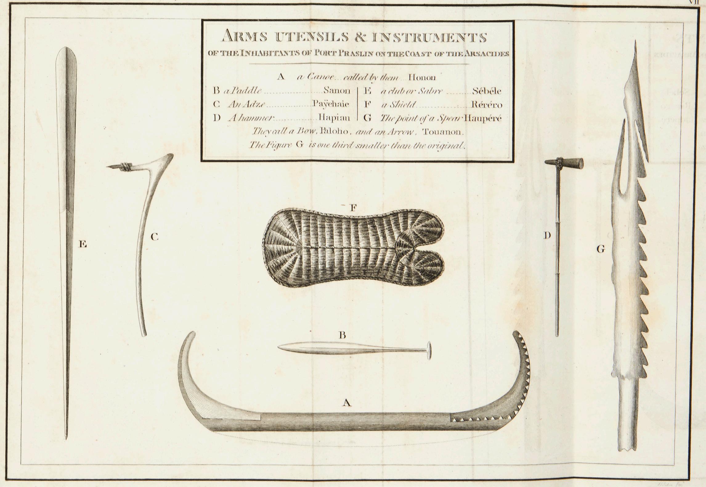
16. FLEURIEU, Charles Pierre Claret de.
Discoveries of the French in 1768 & 1769 South-East of New Guinea…
Quarto, with 12 folding engraved plates, of which nine are maps; bound without the half-title in early half mottled calf and marbled boards, a good copy with wide margins. London, Printed for John Stockdale, 1791.
First English edition of the great work on the French discovery of the Solomon Islands, and linked to Governor Phillip’s account of the voyage of the First Fleet to New South Wales: the French original was issued in 1790, an important book by the French scientist and statesman, the leading light in the early history of French exploration in the South Seas, describing in detail early discoveries around the north-eastern corner of Australia. Fleurieu gives accounts of the voyages of Mendaña in 1567 and 1568, of Quiros in 1606, Carteret, Bougainville, Surville, Cook and Shortland, especially in reference to the discovery and identification of the Solomon Islands. The accompanying maps are of particular interest, since they are partly based on actual discoveries to date, and partly on Fleurieu’s theories which D’Entrecasteaux was later to prove correct.
Fleurieu’s important book was also a direct result of the voyage of the First Fleet: Phillip’s Voyage, first published in 1789, had included the journal of Lieutenant Shortland on his return voyage in the Alexander transport from Botany Bay to England, during which he coasted along a group of large islands which he named “New Georgia”. Writing in a period of intense international rivalry over Pacific discoveries, Fleurieu denies the English discovery and promotes those of Louis de Bougainville and Jean de Surville. He draws on unpublished manuscripts as well as the printed narratives of the earlier explorers.
There are also interesting comments on the La Pérouse voyage. Fleurieu announces the receipt of journals from as far as Botany Bay, and in discussing the Great Ocean Chart (a fragment of which is published here), says publication is to be delayed until his later discoveries can be inserted. The translator of this edition notes that the explorer had still not turned up and “the apprehension for his loss increases daily”.
Beddie, 1302, 1303; Ferguson, 105; Hill, 611; Kroepelien, 437.
$6500
[5001052]
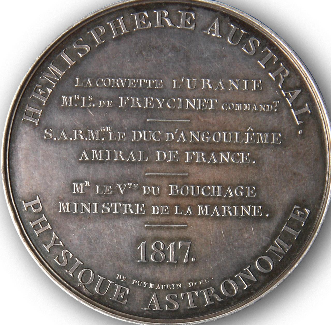
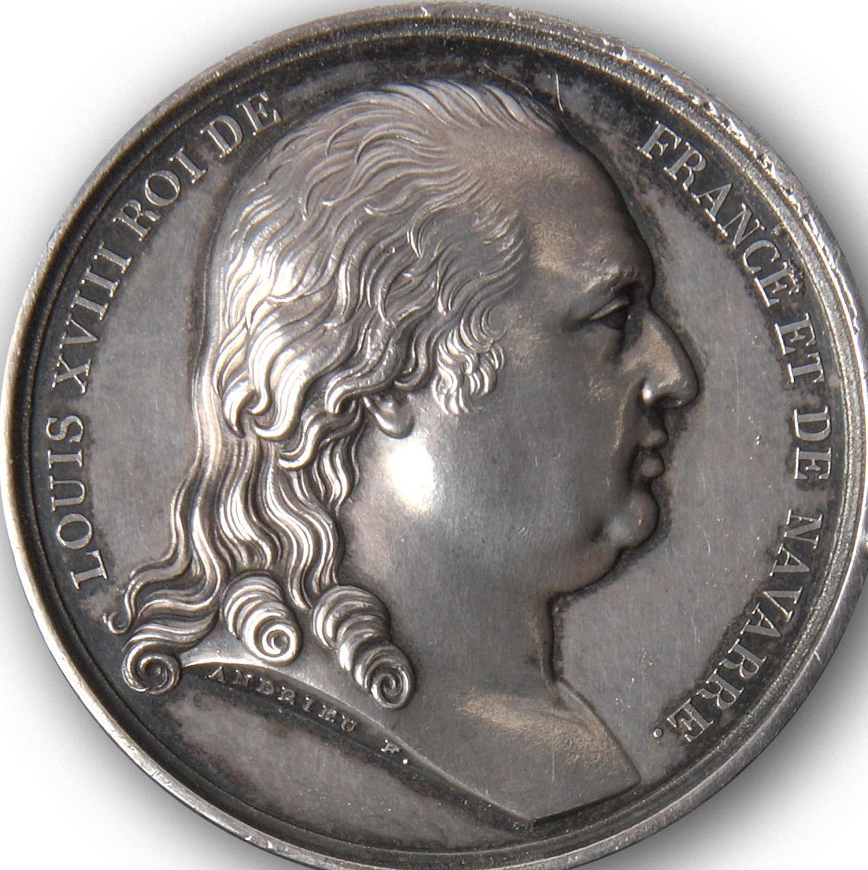
THE SILVER MEDAL FOR FREYCINET’S VOYAGE IN THE URANIE
17. [FREYCINET] LOUIS XVIII.
Medal for the voyage of the Uranie
Silver medal, 41 mm. Paris, Puymaurin & Andrieu, 1817.
A particularly fine example of the silver medal struck to commemorate the sailing of the Uranie expedition from Toulon in 1817 under Louis de Freycinet. The voyage, which would last four years, was organised by the French government to make observations on geography, magnetism and meteorology, and became noteworthy for its natural history discoveries.
The Uranie landed at Shark Bay on the West Coast of Australia, on 12 September 1818, where an observatory was set up. After visiting Timor and the Sandwich Islands they reached Port Jackson in November 1818. They left on Boxing Day that year on a course for Cape Horn but on 13 February 1820 the ship was wrecked off the Falkland Islands. However all the crew and most of the records of the voyage and natural history specimens were saved and the voyage was completed on the Physicienne
The detailed lettering on the obverse has the main caption “Hemisphere Austral. Physique Astronomie”, and also notes that Freycinet’s voyage was commissioned by the two most important French naval figures of his day, Louis-Antoine d’Artois de Bourbon, Duc d’Angoulême, then serving as Amiral de France, and the Vicomte du Bouchage, Ministre de la Marine. The design for this side of the medal is signed Puymaurin. The reverse of the medal shows the bust of Louis XVIII, designed by F. Andrieu. Marquess of Milford Haven, ‘British and Foreign Naval Medals’, 188.
$9850
[5001142]
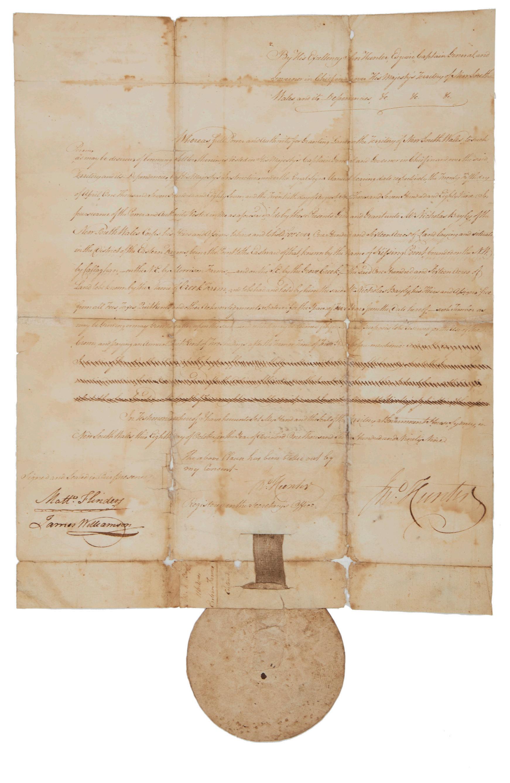
RARE EXAMPLE OF FLINDERS WORKING IN AN OFFICIAL CAPACITY
18. FLINDERS, Matthew and John HUNTER.
Land Grant to Nicholas Bayly in the District of Eastern Farms…
Manuscript in ink on paper, 410 x 330 mm.; general embrowning, original folds reinforced with Japanese tissue, but in overall good original condition, complete with paper seal. Sydney, 8 October 1799.
Extremely rare: this grant by the second governor is also one of only eight land grants witnessed by Matthew Flinders, an unusual example of his involvement in official activity whilst in Sydney. After completing his circumnavigation of Tasmania with Bass and his surveying expedition along the east coast of Australia up to Hervey Bay in the Norfolk, Flinders spent many months in and around Port Jackson. Bass was in poor health and soon sailed for England. Flinders remained and, working with John Hunter, completed several extensive boat and land surveys around the Port Jackson, Botany Bay and Broken Bay areas. Governor Hunter was an energetic explorer himself, as well as organising the earlier exploration completed by Bass and Flinders. Flinders in fact used the charts prepared by Hunter and published in his Historical Journal of the Transactions (1793) as a basis for the plans of east coast ports in his own publication of 1814.
Flinders involved himself with his friend’s administration during this Sydney period, sitting on court cases and on two occasions witnessing land grants (four each on 8 October and 18 October 1799). He left the colony in March 1800 on the Reliance, returning in 1801 to spend two years on the Investigator charting the coastline from South Australia eastwards to the Gulf of Carpentaria, before completing his circumnavigation of the continent.
This land grant — an extremely rare example of Flinders’s engagement in anything other than a navigational or hydrographical enterprise — for 116 acres in the Eastern Farms (now Ryde) was to Nicholas Bayly, of the New South Wales Corps. Bayly was a prominent man in the colony and exercised a good deal of influence under the governorships of both Hunter and King. First appointed as ensign on 29 June 1797 and promoted to lieutenant in 1802, he retired in 1808, by which time he had received altogether eleven separate grants of land.
Flinders’s joint witness was James Williamson (1758-1826), who came out with Hunter in 1795.
Governor Hunter has signed a second time above the pendant seal, where a clause has been cancelled at the governor’s command.
Ryan, Land Grants 1788-1809, no. 840.
$21,000
[5001054]
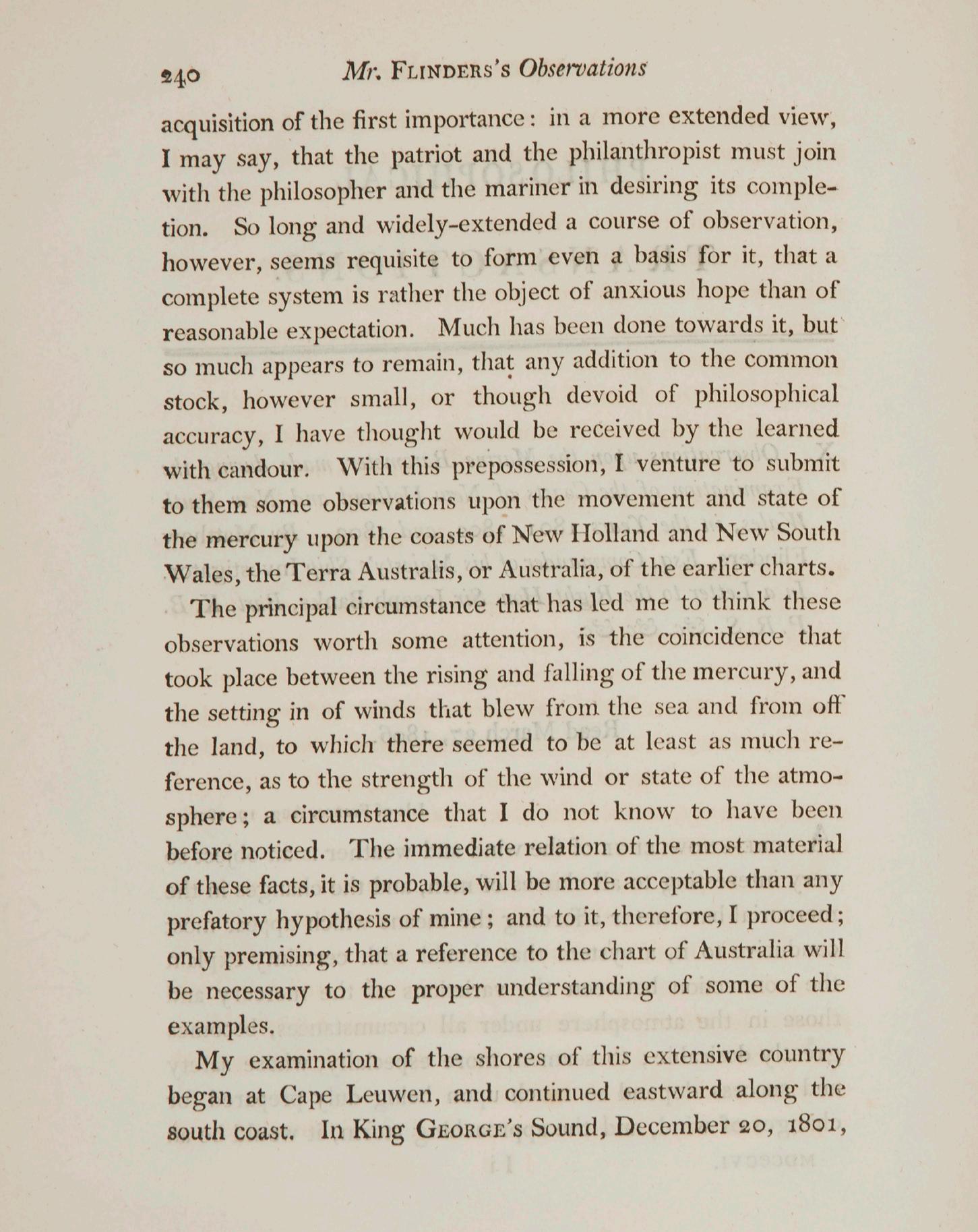
A CAPTIVE FLINDERS’ BREAKTHROUGH FOR MARITIME SCIENCE USING A LEGENDARY BAROMETER
19. FLINDERS, Matthew.
Observations on the Marine Barometer…
Small quarto, pp. 239-266; bound in modern quarter morocco. London, Royal Society, 1806.
Flinders's article on the marine barometer, written and published while he was imprisoned on Mauritius; extracted from the Philosophical Transactions of the Royal Society. Significantly, Flinders uses the name “Australia” in his text (see illustration), though without stating a preference or explaining his reasons (as he does in the following item, his paper on La Pérouse): “I venture to submit to them some observations upon the movement and state of the mercury upon the coasts of New Holland and New South Wales, the Terra Australis, or Australia, of the earlier charts….”
The paper was based on data collected during his 1801–1803 investigations. A highly important contribution to maritime science, it was a pioneering work that provided sailors with a reliable method for predicting dangerous shifts in wind and weather, effectively setting the standard for the use of barometers on ships.
“In 1805 he wrote a paper on the Marine Barometer, based upon observations made during his Australian voyages. The instrument employed was one which had been used by Cook; Flinders always kept it in his cabin. He was the first to discover, and this essay was the first attempt to show, the connection between the rise and fall of the barometer and the direction of the wind. Careful observation showed him that where his facts were collected the mercury of the barometer rose some time before a change from landbreeze to seabreeze, and fell before the change from seabreeze to landbreeze. Consequently a change of wind might generally be predicted from the barometer. The importance of these observations was at once recognised by men connected with navigation. As the Edinburgh Review wrote, dealing with Flinders' paper when presented before the Royal Society on March 27th, 1806: ‘It is very easy for us, speculating in our closet upon the theory of winds and their connection with the temperature, to talk of drawing a general inference on this subject with confidence’’. (Scott, “Life of Flinders”). Ferguson, 474a.
Provenance: Rodney Davidson (20th century Melbourne collector, with bookplate).
$1750 [5001057]
“AUSTRALIE” NAMED BY FLINDERS FOUR YEARS BEFORE HIS FAMOUS BOOK
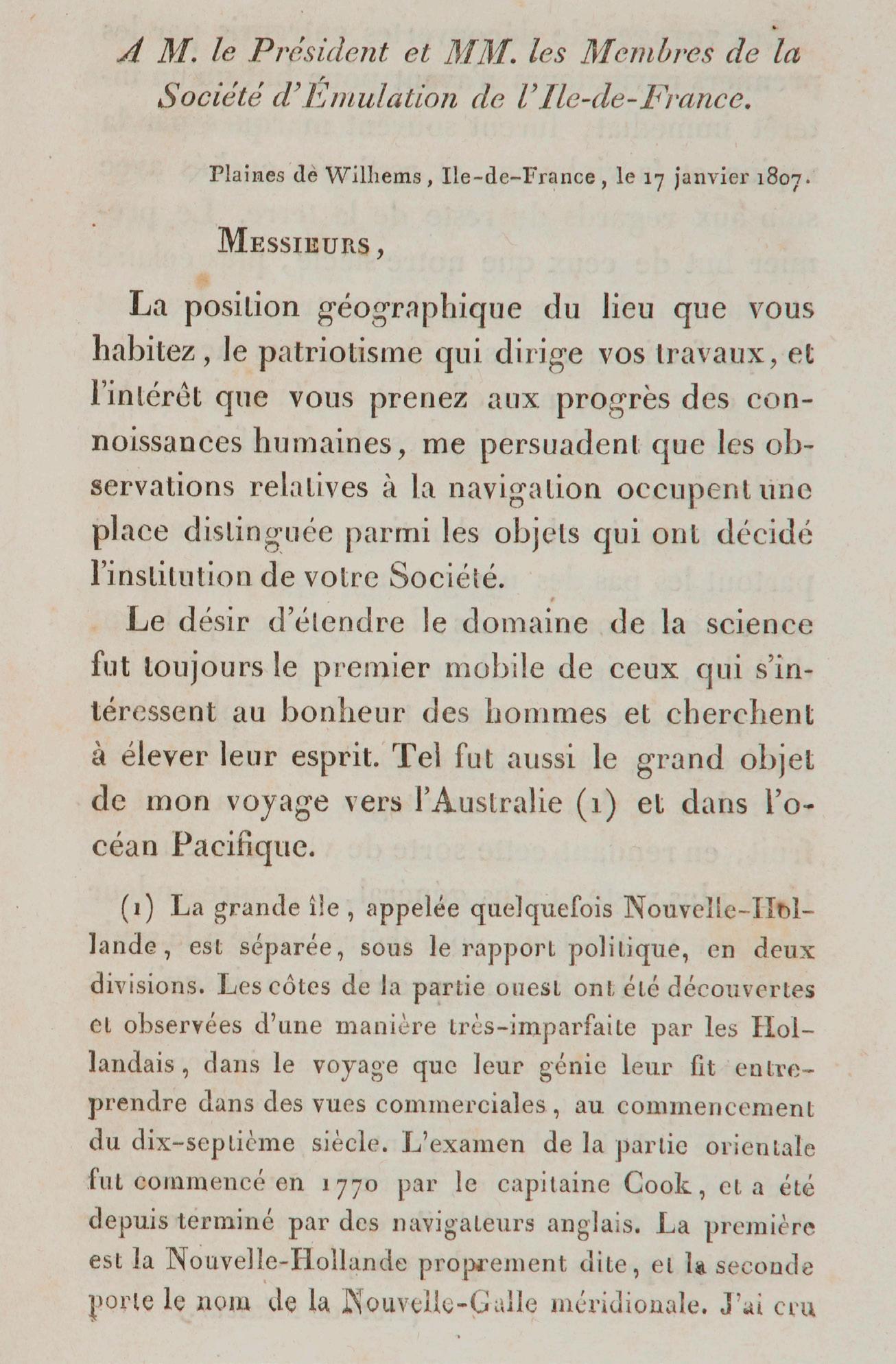
20. FLINDERS, Matthew.
Sur le banc du naufrage et sur le sort de M. de la Perouse…
Octavo; 20 pp. (89-108); uncut copy in a neat cloth binding, leather label. Paris, Annales des Voyages, 1810.
This paper was written by Matthew Flinders during 1807, while a prisoner of the French in Mauritius, for La Société d’Emulation de l’Ile-de-France, and later published by Malte-Brun in his Annales des Voyages (1810), thus preceding by four years the publication of similar material in his Voyage to Terra Australis (1814).
Flinders describes his shipwreck in the Cato in 1803, on a coral reef between the east coast of New South Wales and New Caledonia, and, on the basis of the finding of part of a ship’s sternpost, speculates that La Pérouse had been shipwrecked on the same reef. The paper is noteworthy on two accounts. First, it was the earliest publication by Flinders of the reason why he believed “New Holland” and “New South Wales” should be combined into a new name of the style “Australe” or “Australie”. British authorities did not agree to this new name and insisted that Flinders use the traditional name of “Terra Australis” on the title-page of his Voyage. Secondly, this is the first publication of his wish that this area should be given the name “The Coral Sea”. So, ironically, the name “Australia” referring to the circumnavigated continent was first used in its French form, some years before it was adopted by England.
$4850 [5001059]
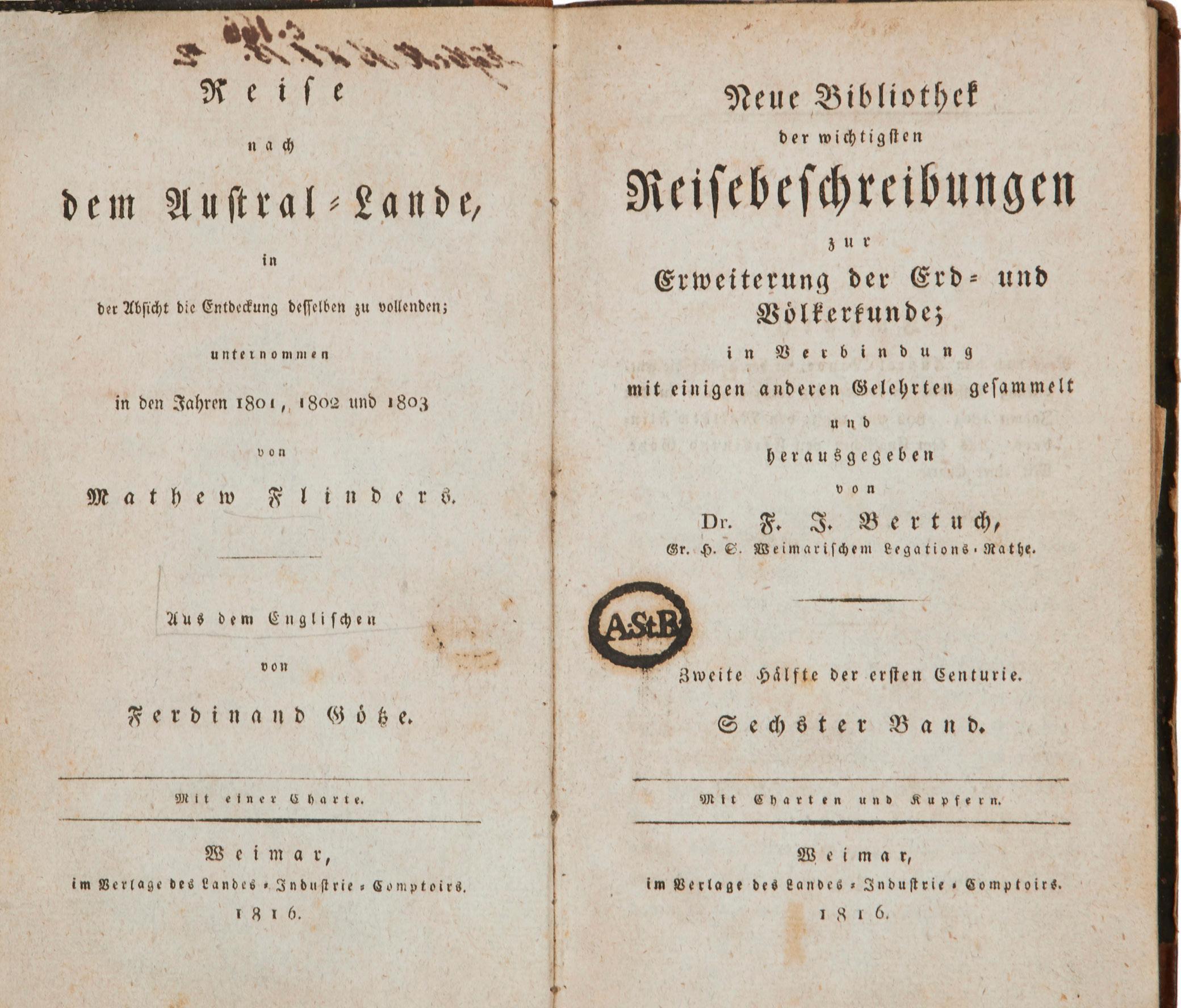
RARE GERMAN EDITION OF FLINDERS, WITH THE IMPORTANT MAP
21. FLINDERS, Matthew.
Reise nach dem Austral-Lande…
Two volumes, octavo, pp. ,, [ii], 302, pp. [303]-740 + folding handcoloured map (short tear at the gutter repaired with archival tape); mechanical tear in the blank margin of one leaf in volume one; bound in German half calf of the period; slipcase. Weimar, Landes-Industrie-Comptoir, 1816.
The very scarce first edition in German of Flinders’s great voyage account, the official narrative of his classic voyage of discovery in the Investigator, the first circumnavigation of Australia. As Rodney Davidson points out, “the German edition is of particular interest as its accompanying map shows for the first time, in varying colours, the parts of the coast discovered by the English, the Dutch and the French. However, one error on the map should be noted: it attributes the discovery of the north area of Kangaroo Island to the French and the south to the English whereas the reverse is true”. As it happens, the copy offered here was Rodney Davidson’s.
The text was translated from the English by Ferdinand Götze, who adds a brief preface and some explanatory footnotes; the appendices and two nautical/technical chapters that appeared in the original English edition are omitted. Flinders’ work was of great interest to its German audience, then and now. Henze notes that “Seine Karten übertreffen die Cookschen an Reichhaltigkeit und Präzision und waren für einige Gebiete noch während des Zweiten Weltkriegs in Gebrauch. Sein Reisewerk steht in der Entdeckungsgeschickte des fünften Kontinents nach Form und Inhalt ohne Gegenstück da” [“His maps surpass even those of Cook in their richness and accuracy, and continued in use for some areas even during the Second World War. His chief significance for the literature of discovery is in his exploration of the fifth continent, unparalleled in its scope and skilful execution”].
Although separately issued this was also published as the sixth volume in the series ‘Neue Bibliothek der wichtigsten Reisebeschreibungen’: in that form it would contain a series title, not present here in this undisturbed volume.
Davidson, ‘A Book Collector’s Notes’, p.120 ff.; Ferguson, 638; Kroepelien, 440; Henze II, 236 ff.
Provenance: Rodney Davidson (20th century Melbourne collector, with bookplate).
$7250 [5001058]
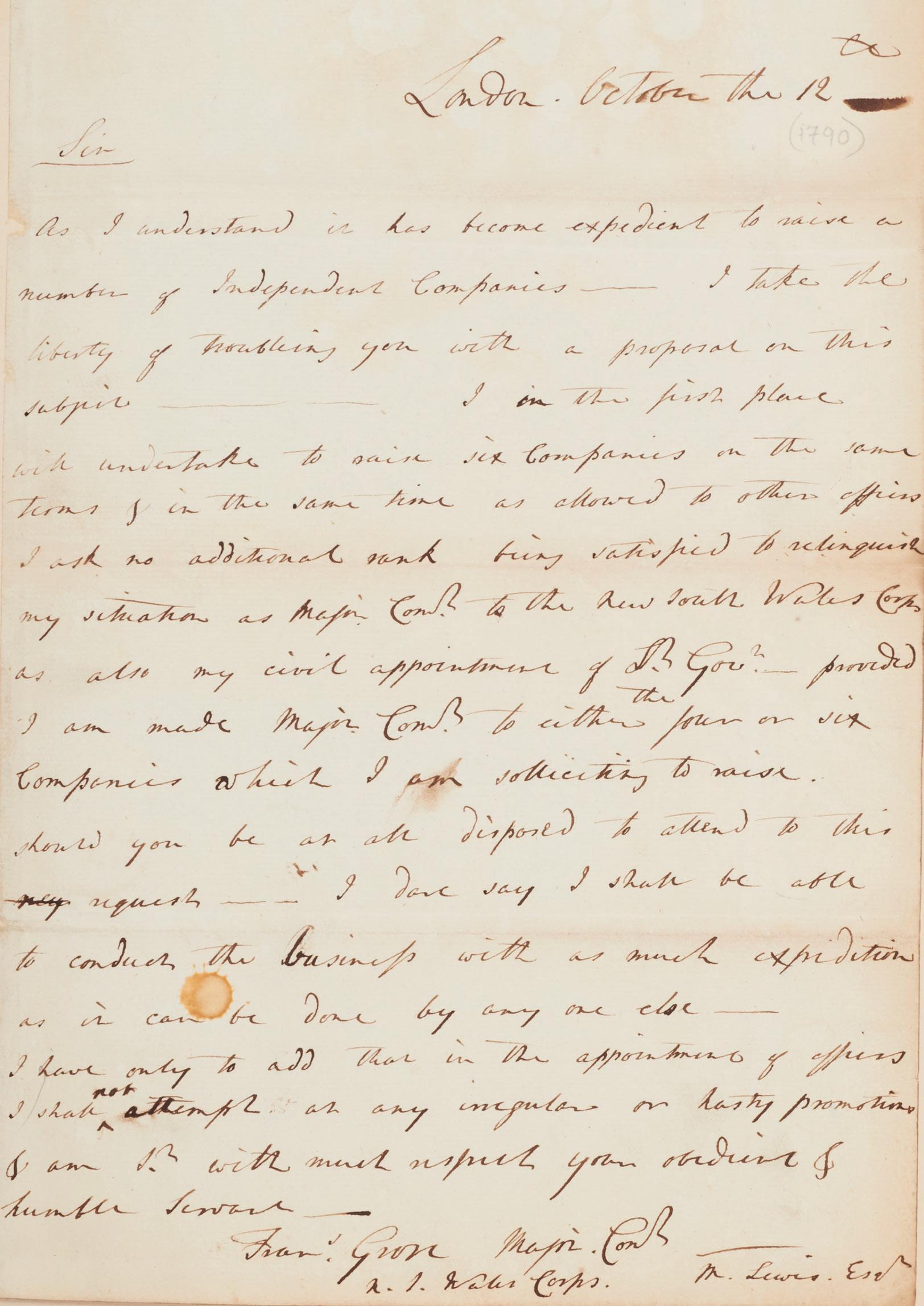
GROSE OFFERS TO RAISE SIX COMPANIES INSTEAD OF COMMANDING THE NSW CORPS
22. GROSE, Lieutenant Governor Major Francis.
Autograph letter signed.
Single page, folio, verso blank; ink on paper, well written in a legible hand, original fold marks, but in fine condition, in a binding of quarter morocco. London, 17th October [1790]. London, 17 October 1790.
An important and apparently unrecorded letter by Grose, written before his departure for Sydney. Addressed to Under Secretary Lewis, it evidently relates to a letter written five days earlier, a photograph of which is in the Mitchell Library (MLDOC 3462). Here, the subsequent successor to Governor Phillip offers to resign his positions, suggesting instead that he stay in England while he “undertake[s] to raise six companies… being satisfied to relinquish my situation as Major Commandant to the New South Wales Corps as also my civil appointment of Lt. Gov.”.
Grose had successfully raised a New South Wales Corps in 1789, part of which sailed in January 1790, while he — although commissioned Lieutenant-Governor of the Colony — stayed in Portsmouth with the remainder. He finally sailed for Sydney on the Pitt, arriving in February 1792.
When Phillip left for England in December 1792, Grose took charge of the administration for two years, immediately governing on stern military lines, and beginning the discord with the New South Wales Corps which eventually led to the Rum Rebellion and Bligh’s arrest in January 1808. It was not until the arrival of Macquarie with his own regiment that the New South Wales Corps was replaced and the dissension finally checked.
From the evidence of this letter Grose was prepared to forego his New South Wales commissions in exchange for the command of new companies to be raised in England. Presumably by late 1790 he felt that a posting to the colony was not likely to help his future prospects.
This is a rare example of the earliest stages of the successful running of the penal colony at Botany Bay. Any related manuscripts of this period are scarce indeed.
$15,500
[5001071]
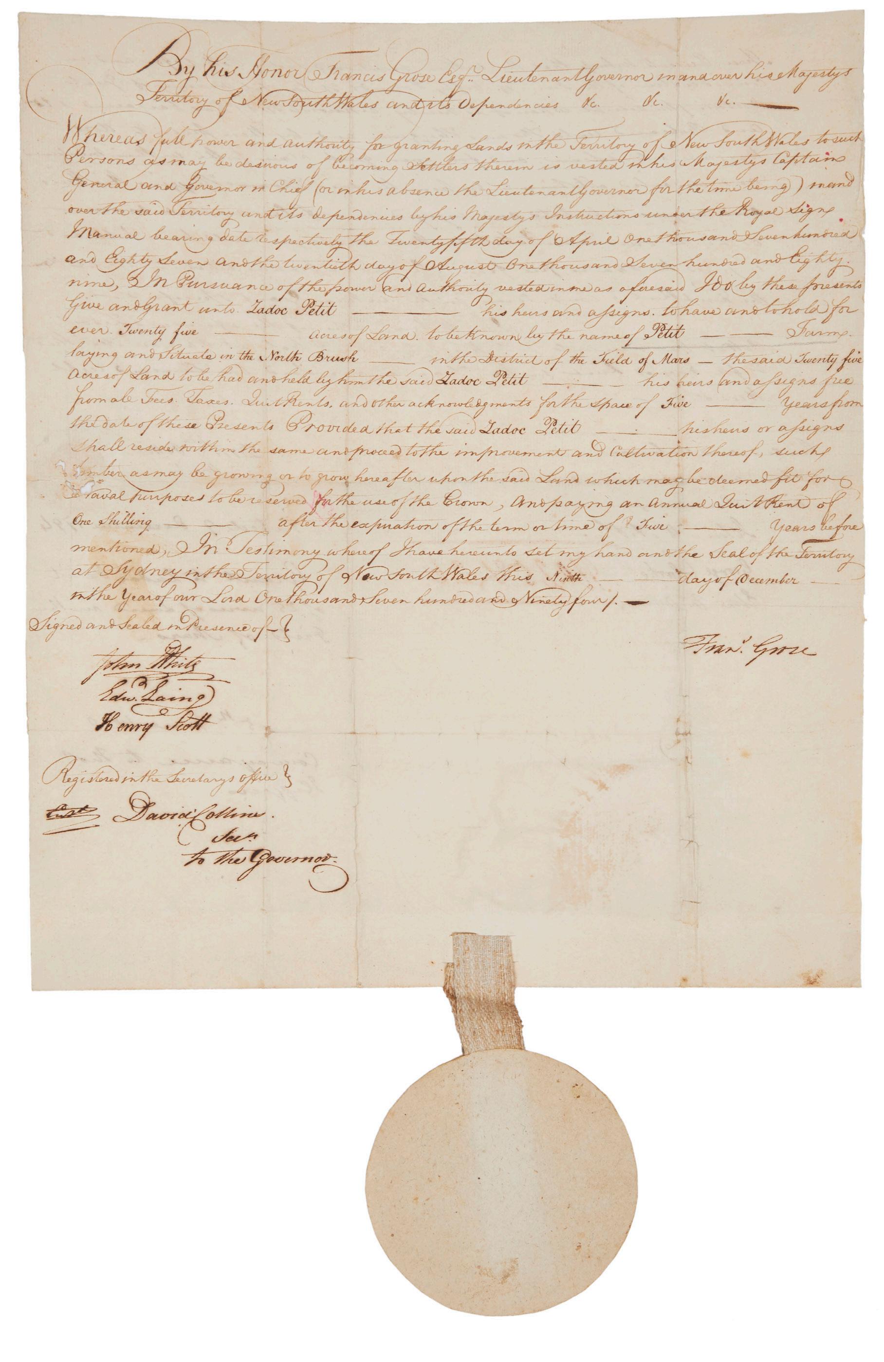
SIGNED BY GROSE AS ACTING GOVERNOR
23. GROSE, Lieutenant Governor Major Francis.
Land Grant to Zadoc Petit in the Field of Mars.
Folio, manuscript in ink on paper, 370 x 320 mm.; in excellent original condition with paper seal. Sydney, 9 December 1794.
Fine original document signed by Grose as acting governor, witnessed by John White, Edward Laing, and David Collins, and with the signatures of John Macarthur and his wife Elizabeth.
This grant of land was made to Zadoc Petit, who arrived in the colony with the Second Fleet. He was a private in the New South Wales Corps, of which Grose had been commanding officer. The twenty-five acre parcel of land in the Field of Mars (present-day Ryde) was to be known as Petit Farm. Field of Mars was an area reserved for free settlers; two years earlier eight Royal Marines were the first to take up grants in the area. At this time, Grose was still following a practice begun by Phillip of the segregation into areas of grants to ex-convicts, settlers and free settlers. Although not official policy, it was believed that the needs of each group would benefit from this.
Francis Grose (1758?-1814) had served in the American War of Independence as a young man, before becoming commandant of the New South Wales Corps and eventually lieutenant-governor of New South Wales. On the departure of Phillip in December 1792, Grose was left in control of the fledgling settlement.
This grant is completed by the signatures of many important men including the surgeon-general John White, Edward Laing, surgeon-mate to the New South Wales Corps and David Collins, judge-advocate and responsible for the colony’s legal establishment.
The verso of this document shows how land-dealing dates from the beginnings of the colony. Zadoc Petit, signing with a cross, sells his land for fifty pounds to Thomas Higgins, giving Petit a good profit on his earlier arrangement with Grose of “one shilling per year commencing after five years”; he would only have had to pay rent for one year. The subsequent transfer of title is entirely executed in the holograph of John Macarthur, witnessed by his signature and that of Elizabeth Macarthur, Australia’s “first and greatest lady”, and is dated at Parramatta, 5 June 1800.
Ryan, Land Grants 1788-1809, no. 345.
$18,000
[5001070]
FROM A FIRST FLEETER'S PERSONAL LIBRARY IN NEW SOUTH WALES
24. [JOHNSTON: LIBRARY] MONTESQUIEU, Charles de.
De l’Esprit des Loix… [and] RAFFLES, Thomas. Letters during a tour through some parts of France…
Octavo; the Montesquieu bound in a French period binding of mottled calf with raised bands, all edges red; the Raffles work uncut in (? original) plain boards Amsterdam, 1793; Liverpool, Printed for Thomas Taylor, 1819.
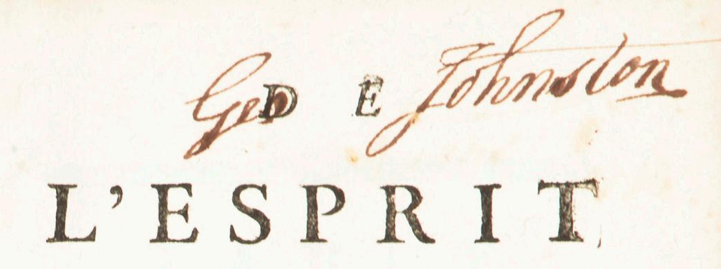
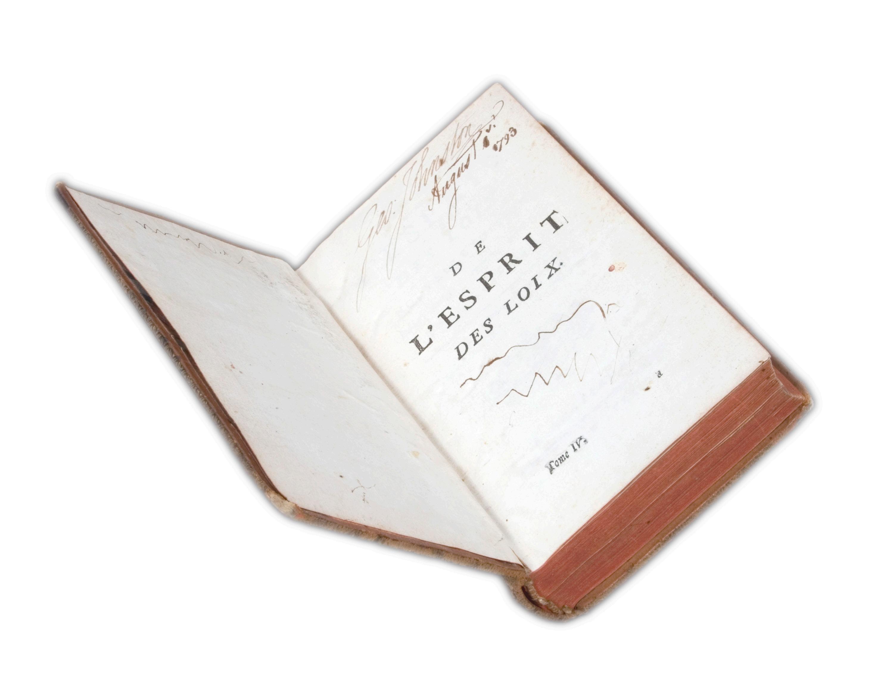
Two of very few books known to have survived from a First-Fleeter’s library, both inscribed by George Johnston as owned at his Annandale estate, the first inscribed “Geo. Johnston, August, 1793” and signed again on the titlepage, the second boldly inscribed “Geo. Johnston, Annandale, N.S. Wales July 10th, 1821”.
Books known to date from the very first years of settlement are exceedingly rare.
Johnston had many positions of responsibility during his career, including roles as Phillip’s adjutant and Hunter’s aide-de-camp. Handsome, popular and fiery, his quarrels with Governor King led to his arrest in 1800 and deportation to England for illegal trading in spirits. He soon returned to Sydney where, on 26 January 1808, twenty years to the day from the first settlement, he arrested Governor Bligh and assumed the role of lieutenantgovernor, a position he held for some six months. Despite his central involvement in the mutiny, at his 1811 trial Johnston was merely cashiered, an incredibly light penalty for the time. The Colonial Office even provided his return passage to New South Wales two years later.
Very little is documented regarding the books known to have been present in the early years of New South Wales, but George Johnston does appear to have had one of the few personal libraries of note. In the fascinating but seemingly now moribund project initiated by Colin Steele and Michael Richards regarding the books carried on the First Fleet (Bound for Botany Bay, 1988), a mere handful of known copies of books were identified as having sailed on the First Fleet (chiefly some religious works carried by the Reverend Richard Johnson, and some incomplete sets belonging to George Johnston).
The Montesquieu was published in 1793, and Johnston has also noted the date “August 1793” on the title-page, strongly suggesting that this was when he first purchased the book (although it may never be possible to fully understand the details of his purchase, it is interesting to speculate that it may have been carried to Australia on the convict ship Boddingtons, which arrived in Port Jackson on 7 August that year).
The second work is a collection of letters from the British colonial official Sir Thomas Stamford Bingley Raffles during his travels across Europe from the summer of 1817, in which he visited France, Savoy, Switzerland, Germany, and the Netherlands. Pretty much forgotten today, it was a popular book at the time, with multiple editions following this first printing (for example, a fifth edition appeared in 1832).
$12,500
[5001113]
FIRST EDITION IN ENGLISH OF THE FIRST RUSSIAN CIRCUMNAVIGATION
25. KRUSENSTERN, Captain Ivan Fedorovich.
Voyage Round the World, in the years 1803, 1804, 1805, & 1806…
Two volumes in one, quarto, bound without the leaf of binder’s directions noted by Forbes as usually absent; with a hand-coloured plate by Atkinson as frontispiece to each volume, and a folding map in vol. 1; modern half red morocco, gilt. London, John Murray, 1813.
First English edition: Ivan Fedorovich Krusenstern commanded this important Russian naval voyage to the Marquesas, Hawaii, Kamchatka, the Northwest Coast, China and Japan. His brilliant corps of officers - Lisiansky (commanding the Neva), Rezanov, Langsdorff, Kotzebue and Bellingshausen — all went on to make their mark on Pacific exploration.
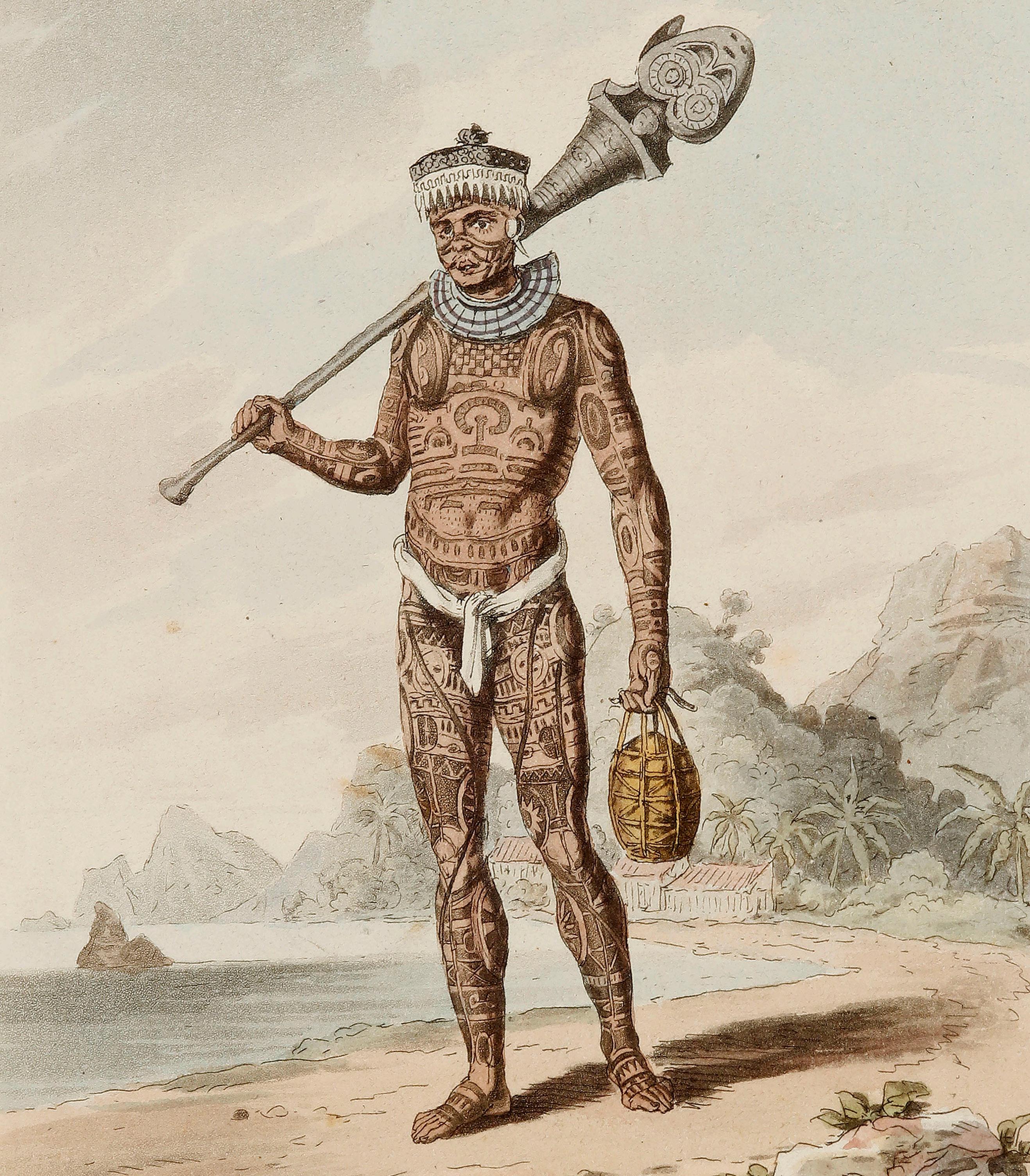
The expedition is famous for the stunning visual record created by the scientist and illustrator Georg Heinrich von Langsdorff, whose images of tattooed men of the Marquesas (including European beachcombers) are some of the most enduring early nineteenth-century images of the Pacific. One such portrait, “Native of Nukahiva”, forms the frontispiece of the first volume of this book, while a view of Nagasaki Harbour as the second frontispiece is one of the earliest views of Japan published in the west.
The expedition consisted of two vessels, the Nadezhda and Neva, under the command of Krusenstern and Yurii Lisiansky. Both had trained in the British navy as young men where they first met and formed a lasting professional association. The voyage was sponsored by the Tsar and was primarily intended for scientific research and cartography. One of the expedition’s ships spent some time on the Northwest Coast, reaffirming the Russian presence there and putting together a cargo of valuable furs bound for China. A Russian ambassador to Japan was taken aboard, and although it was intended that he stay in Japan, this advance was rebuffed and relations between the two countries were not established. Nonetheless the expedition produced good cartographic studies for the areas between the Japanese islands northwards to the Kamchatka peninsula.
This book is of great Hawaiian interest as both vessels visited the islands following their rendezvous in the Marquesas, at which point Krusenstern sailed north to Kamchatka while Lisiansky remained in Kealakekua and Waimea procuring supplies. The following year, in October 1805, the Neva was almost wrecked on an unknown reef to the north of the Hawaiian group. Daybreak revealed a small uninhabited landmass that was christened Lisyansky Island, a name retained in recent times as part of the Hawaiian Islands.
Arctic Bibliography, 9381; Cordier, Japonica, 459; Forbes, ‘Hawaiian National Bibliography’, 433; Hawaii One Hundred, 17; Hill, 952; Howes, K272; Kroepelien, 693; see Lada-Mocarski, 61 (Russian edition); O’Reilly-Reitman, 730; Sabin, 38331.
$18,500 [4505644]
LABILLARDIERE’S FIRST MAJOR BOTANICAL WORK: ILLUSTRATED BY REDOUTE
26. LABILLARDIERE, Jacques Julien Houtou de.
Icones Plantarum Syriae rariorum…
Three parts bound together, quarto, pp. 22, 18, 16, with 30 engraved plates. ten to each part; uncut, stitched in contemporary plain wrappers. Paris, at the author’s expense, and Strasbourg, Amand Koenig; [part 2 also Turin and Frankfurt; part 3 Paris, Huzard, only], 1791/1791/1809.
Rare and important early work by the notable French naturalist and explorer. Publication of this fundamental work, begun in 1791, would not be completed until two final parts appeared in 1812, the delay a direct result of Labillardière’s involvement in the D’Entrecasteaux expedition in search of La Pérouse, and his commitment to writing the narrative of the voyage. Labillardière published three major floras: this botany of Syria, published in five parts over the 21 years between 1791 and 1812, bookended his magnificent Novae Hollandiae plantarum specimen (Paris, two volumes, 1804-06), the highly important first general flora of Australia. He also published a flora of New Caledonia, Sertum austro-caledonicum (Paris, two volumes, 1824-1825). As well as the Australian flora he wrote, and supervised the illustration and publication of, the Rélation du Voyage à la Recherche de La Pérouse (two volumes and atlas, Paris, 1800).
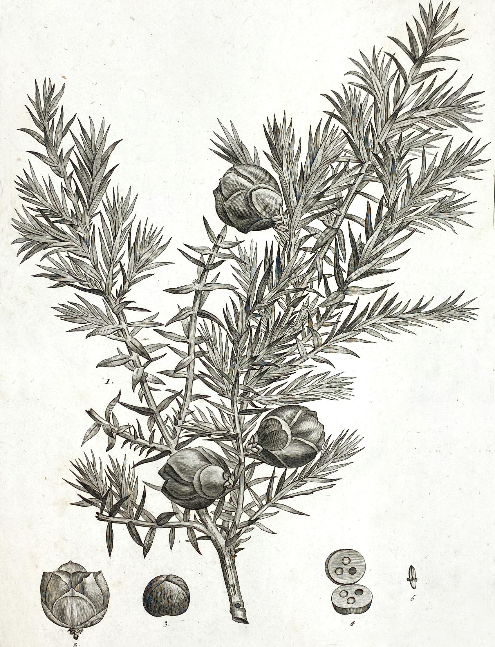
Offered here are the first three of altogether five parts published, meaning that the work is complete to 1809: it contains thirty engraved botanical plates, including all 14 of the plates created by Pierre-Joseph Redouté for the work (six were by his brother Henri, and the remaining ten by others, including Turpin and Poiteau). Two further parts, both of which appeared in 1812, would include twenty further plates, most by Poiteau.
Between publication of the second and third parts here, Labillardière spent five years as the botanist on the D’Entrecasteaux expedition in search of La Pérouse. It was during the voyage’s two visits to Tasmania, as well as the time spent in south-western Australia, that he collected the materials for his Australian flora.
Labillardière’s Syrian botany is a significant precursor to his major Australian work. As Ed Duyker has noted in his masterly biography, “Unquestionably his travels in the Levant helped refine his skills as a collector and observer of nature”. Those skills would be significant in his explorations in Australian waters and in preparing his seminal botany. James Edward Smith in naming the Billardiera (climbing apple-berry) in his Specimen of the Botany of New Holland (1793) explained that he did so “in honour of James Julien la Billardiere, M.D. F.M.L.S. now engaged as botanist on board the French ships sent in search of M. de la Peyrouse. His Icones Plantarum Syriae rariorum, the fruits of a journey into the Levant in 1786, justly entitle him to such a distinction…”.
Incidentally, while the title-pages of the second and third parts correspond to those seen in other sets, for example the bound set of the parts at Kew (available on archive.org), the first title-page differs, not least in showing multiple places of publication and a simpler typography and layout.
MacPhail, Redoutéana, 64; Nissen BBI, 1115; Stafleu & Cowan, 4069. Edward Duyker, “Citizen Labillardière: a Naturalist’s Life in Revolution and Exploration (1755-1834)”.
$6800 [5000280]
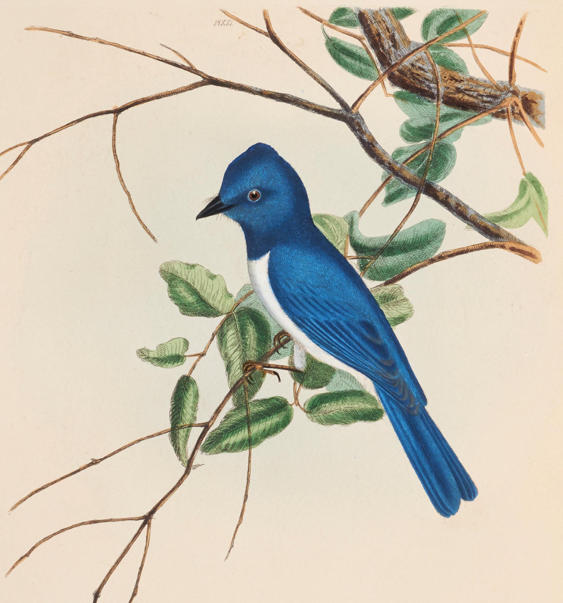
THE DESIRABLE EDITION OF 1838, ILLUSTRATED IN GOUACHE
27. LEWIN, John William.
A Natural History of the Birds of New South Wales…
Folio, 26 hand coloured engraved plates; publisher’s crimson quarter morocco and cloth boards, a fine copy preserved in a solander case. London, Henry G. Bohn, 1838.
A superb copy of Lewin’s masterpiece of design, one of the greatest Australian natural history works. Originally published in 1808 — one of the rarest of all Australian books — this edition is the first to feature updated notes by Gould (at a time when he was contemplating his own Birds of Australia), and is best-known for the introduction of the new method of colouring in gouache to give a spectacular depth of colour, more often associated with the lithographed bird books of mid-century.
John Lewin, Australia’s first professional artist, had arrived in the colony in 1800, establishing himself as the first natural history artist. He is best remembered through the superb books he published on Australian ornithology and entomology.
As the catalogue of the Wettenhall Library pointed out, “The bibliographical and historical importance of Lewin has been emphasised in recent years, but Lewin the naturalist has been somewhat neglected. Although his illustrations are in the style of the eighteenth century and predate the draughtsmanship, finesse and varied palette developed by the great nineteenth-century illustrators such as Lear, Wolf and Keulemans, they are highly competent and show the mind of an excellent observer. Lewin’s birds are correct; the feather detail, legs, particularly the positioning of the toes, posture of the bird, the understanding of male and female plumage, the interactions between male and female (in four plates the male is singing and displaying to the female) are accurate and show a keen observer at work. The other important detail in Lewin’s illustrations are the plants: they demonstrate an observer who is familiar with his subject’s habitat and life-history.”
This version of Lewin’s work was revised by leading natural history artists of the time: the title page acknowledges the involvement of T. Gould, A. Vigors, T. Horsfield and W. Swainson. The plates are coloured with gouache, and the entrepreneurial hand of John Gould is evident in this rich gouache colouring. The title page states that this is a “new and improved edition with a list of the synonymes of each species”. Ferguson, 2535; Neville, Mr. J.W. Lewin (2012); Wood, p. 434.
Provenance: Nineteenth-century armorial bookplate.
$55,000 [5001096]
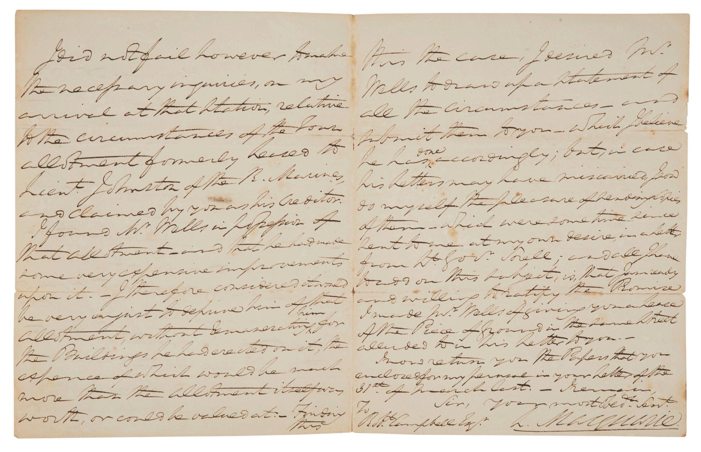
MACQUARIE SORTING PROPERTY DISPUTES BETWEEN JOHNSTON AND CAMPBELL
28. MACQUARIE, Governor Lachlan.
Autograph letter signed, to Robert Campbell.
4 pp., the last blank, quarto, manuscript in ink on paper, fully signed; half brown morocco binding. Sydney, 26 October 1821.
An important letter from the great Governor of New South Wales, discussing his recent visit to Hobart, and his examination of the merchant Robert Campbell’s claims to a piece of land originally leased to Lieutenant George Johnston of the Marines, and now claimed by Campbell as his creditor. Campbell was one of the most important figures in the early days of the colony as a successful merchant and retailer, at one time with substantial wealth. “Convivial and charming, with the flair of a bon viveur, Campbell displayed a sentimental and romantic temperament. Horse-racing was an abiding passion, and he was one of the first in the colony to participate in this sport, contriving even in his lean years to support good horseflesh. His stables in Bligh Street were well known to his contemporaries and for some years housed the famous Persian stallion Hector (now recognized as the foundation of Australian bloodstock)…” (ADB).
Letters by Macquarie are rare on the market: this fine example links three of the most important figures of the early years of the colony.
$8500 [5001104]
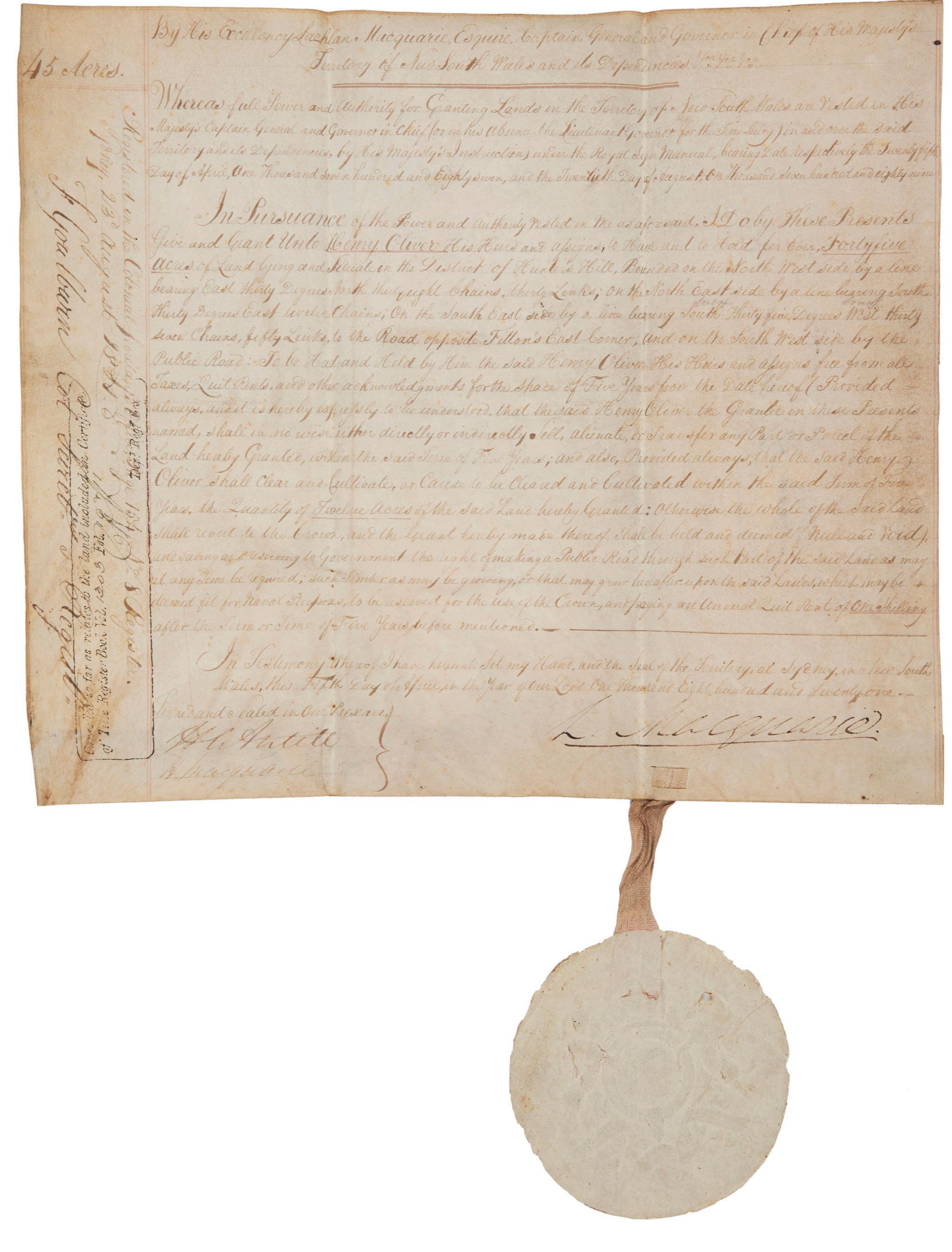
AN EARLY MACQUARIE LAND GRANT, WITH THE SIGNATURES OF GOULBURN AND ANTILL
29. MACQUARIE, Governor Lachlan.
Land Grant to Henry Oliver for forty-five acres at Hunter’s Hill.
Folio, manuscript in ink on parchment, 330 x 290 mm.; a little dusted but in fine original condition with paper seal. Sydney, 5 April 1821.
A good, early grant by Macquarie as fifth governor, with the signatures of Goulburn and Antill.
Henry Oliver received forty-five acres of land in Hunter’s Hill, one of very few grants made in this region in the first decades. His land was “bounded on the north west side by a line bearing east thirty degrees north thirty eight chains; on the south east side by a line bearing south thirty five degrees west thirty seven chains, fifty links to the Road opposite Fitton’s East Corner, and on the south west side by the Public Road”. The district of Hunter’s Hill at this time indicated a far greater area than the peninsula we know by the name today. The area granted to Oliver would now border the suburbs of Killara and Lindfield.
A grant of land in this area is especially interesting as Hunter’s Hill became one of Australia’s earliest if not the first official suburb, subdivided in the 1840s for villas and cottages in wooded allotments; much still remains of this plan today.
This land grant is on vellum, with a good signature by the governor, and is complete with Macquarie’s seal of the colony of New South Wales. When this grant was issued in 1821, Macquarie had already lost his fight against John Thomas Bigge, the royal commissioner and the man who forced his resignation as governor. History has treated Macquarie more fairly since: the colony can be seen to have enormously prospered under his leadership from 1810 to 1822, and it is now celebrated as the Age of Macquarie and the period when New South Wales found its independent entity.
The witnesses to this grant were Frederick Goulburn, the first official Colonial Secretary, who arrived in the colony in December 1820; Henry Antill, a firm friend and aide-de-camp to Macquarie, at this time governor of the Bank of New South Wales, a vocal supporter of the emancipists’ cause and concerned with the welfare of orphans and Aborigines; and Hector Macquarie, the governor’s nephew.
$7500
[5001103]
PATAGONIA AND THE STRAITS OF MAGELLAN
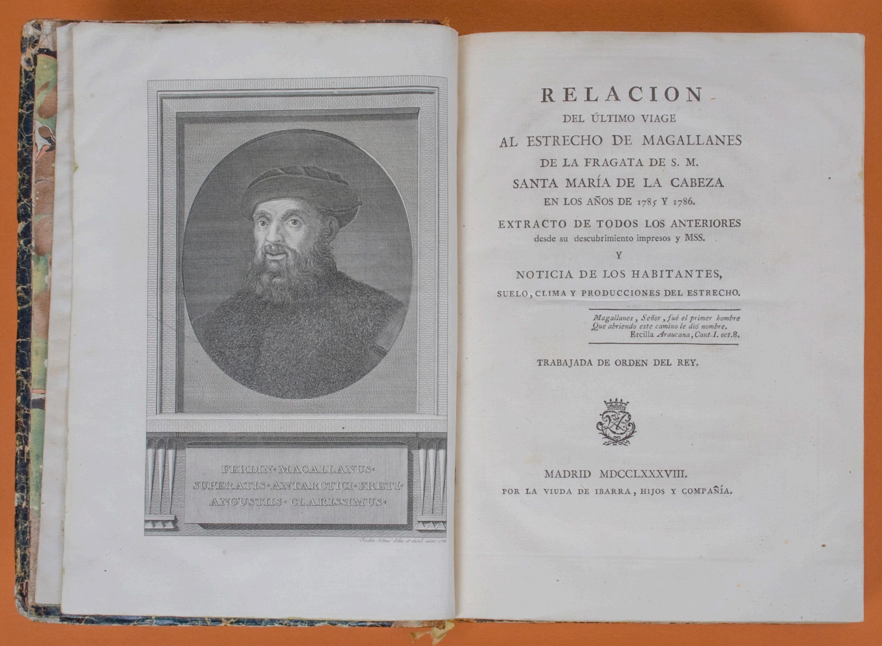
30. [MAGELLAN] VARGAS Y PONCE, José
de.
Relación del último viage al Estrecho de Magallanes…
Quarto, two volumes bound together, with an engraved portrait of Magellan as frontispiece, five fine large folding maps and five folding tables; original period binding of calf-backed marbled boards. Madrid, Ibarra, 1788-1793.
The full first edition, complete with the separately published Apendice a la Relación (Madrid, 1793) which appeared ten years after the main work and is not present in all copies. This is the best early description of Patagonia and the Straits of Magellan, giving the official account of the two expeditions made by Antonio de Córdoba to “ascertain the advisability of Spaniards continuing to use the Strait in voyages — the results indicated the negative. After these expeditions the Spanish trade routes were exclusively to east coast ports and then overland to the Pacific ports…” (Hill). As part of this, the Relación provides a general history of earlier voyages of discovery to the Strait. The large folding maps, fine and detailed, are all based on observations made during the Córdoba voyages.
Córdoba’s exploration of the Strait of Magellan — recognised then as now an area of strategic and navigational significance — is accompanied by Vargas y Ponce’s summary of the early explorations of the area, mainly from an examination of original manuscripts in the Spanish archives. He discusses various means of navigating the Strait, with detailed sailing instructions, and describes the climate, indigenous peoples and natural history of the region. Hill, 1756; JCB, III, 3224; Navarrete, II, pp. 127-9; Palau, 352514-5 (‘obra interesante y bien publicada’).
$7850 [2708028]
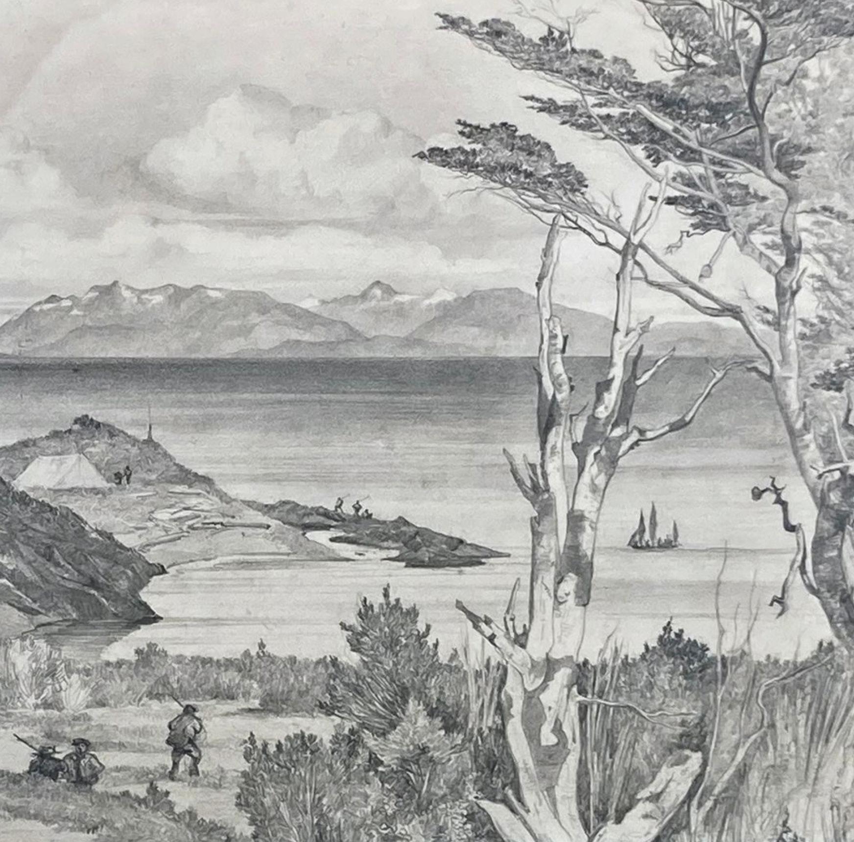
“… NOT SO MUCH TYPICAL LANDSCAPES AS TRANSCRIPTS OF NATURE…” (BERNARD SMITH)
31. [MAGELLAN] [DUMONT D’URVILLE] GOUPIL, Ernest (1814-1841).
Baie de port Famine (détroit de Magellan), 1837.
Graphite on paper 425 x 265 mm, signed and dated lower left, mounted, in a handsome timber frame with the mounted provenance panel retained on verso. .
A superb view of one of the first major landfalls of Dumont d’Urville’s second voyage to the Pacific and the Antarctic, depicting Port Famine on the shores of the Straits of Magellan, executed with great verve by the illfated lead artist of the expedition (detail illustrated).
This view is a rare example of one of Goupil’s original works, which have always been uncommon in commerce. Ernest Auguste Goupil (1814-1839), appointed by Dumont d’Urville as the official dessinateur of the voyage, had originally trained in the studio of one of his relatives, Watelet, before studying in Paris under the history painter Jules Coignet, whose influence is immediately apparent in Goupil’s work. After cutting his teeth sketching in the Mediterranean and north Africa, Goupil was so accomplished that he exhibited at the 1835 Paris Salon, when he was still only 21 years old. He died tragically young however, in mid-voyage, on the last day of 1839, in Hobart, calling at the end for champagne to toast friendship.
The two ships of the expedition reached Port Famine in December 1837 having made unexpectedly easy sailing and Goupil’s view shows the site of their first major foray ashore, being ultimately published, with major revisions, as “Vue des environs de Port Famine” (plate II in the Atlas Pittoresque).
The published plate shows marked differences to this original drawing, with substantial alterations to the figures exploring the landscape, most dramatically removing the main group of three in Goupil’s drawing, a vigorous group in heavy coats, with four more passive men attended by a newly-added dog. Further changes have been made to the figures on the far shore, while the ship’s small launch drawn by Goupil has gone missing altogether. Dumont d’Urville used the stop at Port Famine to refresh his crew before their first drive south into Antarctic waters, and was consequently delighted and relieved by the unusually fair weather they enjoyed ashore in this normally dismal and forbidding region, meaning that they could complete all of the usual shore duties with relative ease. Indeed, the skipper even took a rare moment to botanise for himself, making a foray inland where he was surprised and moved to find the memorial left there a decade earlier by Phillip Parker King, recording the nearby death by drowning of Master Ainsworth of HMS Adventure.
Provenance: By descent to Jacques Boullaire (1893-1972), grandson of Goupil and a significant artist in his own right, known particularly for his work in the south Pacific and especially Tahiti.
$28,500 [5000985]
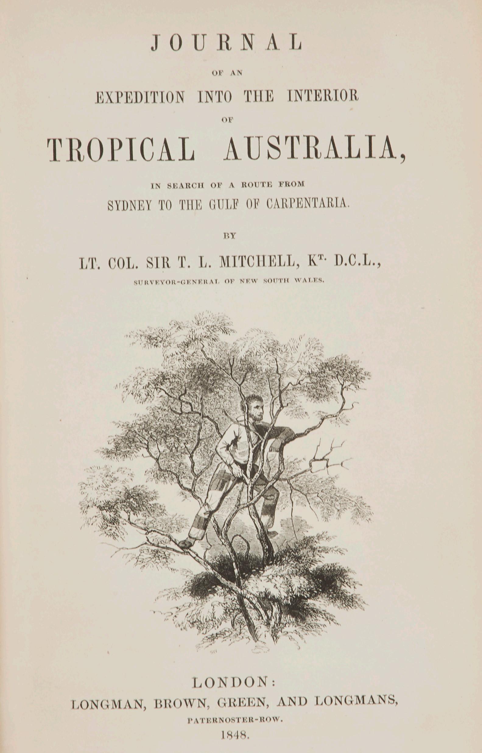
EXPLORING TROPICAL QUEENSLAND
32. MITCHELL, Sir Thomas Livingstone.
Journal of an Expedition into the Interior of Tropical Australia…
Octavo, frontispiece, 11 lithograph plates, and seven maps (four folding), a very good copy, complete with 24 pp. publisher’s advertisements, neatly recased in the original red cloth, spine gilt, the cloth in bright condition. London, Longman, Brown, Green and Longmans, 1848.
First edition of Mitchell’s account of his last expedition. In late 1845, with Edmund Kennedy as his secondin-command, Mitchell set out from Sydney in search of an overland route to the Port Essington settlement. Although he did not find the hoped-for route, over the next year he explored a vast area of unknown country in tropical Queensland, returning to Sydney in December 1846. As with his earlier expeditions, Mitchell showed contempt for official orders, preferring instead to follow his instincts. In this instance he seemed more interested in discovering the fabled Kindur River, one of his more enduring but erroneous beliefs. To justify his decision, he here represented his discovery of the Victoria River (which was in fact the Barcoo) as the legendary great northflowing source. Although Mitchell did not succeed in finding a northward route and — if anything — further confused the riddle of the inland rivers upon his return, the expedition charted a vast area of previously unknown country without significant mishap or the loss of a single man.
The fine tinted lithograph views in the books are all after Mitchell’s own drawings. His work as a topographical artist has gained increasing respect in recent years and can be appreciated in the plates prepared for this book. It is characterised by a fine attention to detail and an accomplished use of tone and shading.
An attractive copy in its original cloth binding.
Ferguson, 4828; Wantrup, 129.
$4850
[5001112]
THE FIRST COMPREHENSIVE BOOK PUBLISHED IN SINGAPORE
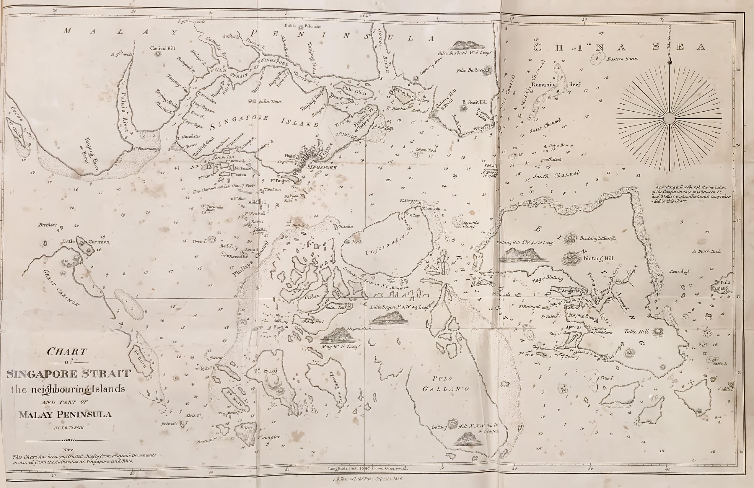

33. MOOR, John Henry.
Notices of the Indian Archipelago, and adjacent countries…
Quarto, with a large folding handcoloured frontispiece map and five folding maps (all but one handcoloured), in original binding of marbled boards with a backstrip of fine linen, remains of printed paper label. Singapore, Printed by the Mission Press of the American Board of Commissioners for Foreign Missions, [maps printed in Calcutta by Jean-Baptiste Tassin at the Oriental Lithographic Press], 1837.
First edition: a great Singapore rarity, one of the first books to be published there, and including the earliest detailed map of Singapore Town and its surroundings, “The Town and environs of Singapore”, based on a survey by G.D. Coleman. Published just after the island had become the capital of the Straits Settlements, it marks the beginning of the colony’s enormous growth as a regional trading hub and the centre of the rubber industry.
John Henry Moor moved to Singapore from Malacca in 1830 and became editor of the Singapore Chronicle, Singapore’s first newspaper, in 1831. The book is mainly composed of his articles written for the Chronicle between 1824 and 1834. “Notices has claimed its place in history as a valuable record of Singapore’s early years and is one of the first books published on the island. It curates studies on the Indian archipelago — present-day Indonesia, East Malaysia, Brunei, the Philippines, East Timor and Singapore — that were republished from newspapers or journals, including many from Singapore Chronicle, Singapore’s first English newspaper… of which no known copies from 1824 to 1826 remain; his publishing project therefore preserved some precious articles that would otherwise have been lost forever.
“One such article is an account of John Crawfurd’s formal possession of Singapore and its adjacent islands in 1825. Crawfurd, who was appointed Resident of Singapore in 1823, set off in August 1825 on a 10-day journey around Singapore on his ship the Malabar and landed at Pulau Ubin. There, the British flag was hoisted and the 21-gun salute fired as part of the ceremonial proceedings. The account also includes Crawfurd’s notes on Singapore’s outlying islands and Bukit Timah Hill; these are all documented in ‘Journal of a Voyage Round the Island of Singapore’, one of six articles in the volume of direct relevance to Singapore” (National Library, Singapore, online article “The Book that almost didn’t happen”).
Moor, who later moved to the Singapore Free Press, was the first headmaster of the Raffles Institution from 1834, and established the first free library in Singapore, which subsequently became Singapore’s National Library.
The technology to print the maps was not available in Singapore at the time and Moor arranged for them to be printed at the Oriental Lithographic Press in Calcutta, set up by the French émigré Jean-Baptiste Tassin to print government maps, which helped to cause a near two-year delay in the publication. This and other problems with the production led to the abandonment of an originally planned second volume.
Cordier, Indosinica, p. 734. Matthew H. Edney, Mapping an Empire: The Geographical Construction of British India, 1765-1843, Chicago, 1997; C.A. Gibson-Hill, “The Singapore Chronicle (1824-37)” in Journal of the Malaysian Branch of the Royal Asiatic Society, 42/1, 1969.
Provenance: Ink inscription on title-page presenting the book to an indecipherable name “A Present from Dr Martin 13 Aug 1845”. This may feasibly have been M.J. Martin, the doctor who owned the Singapore Dispensary, an advertiser in the Singapore Chronicle from 1832.
$46,500 [5000856]
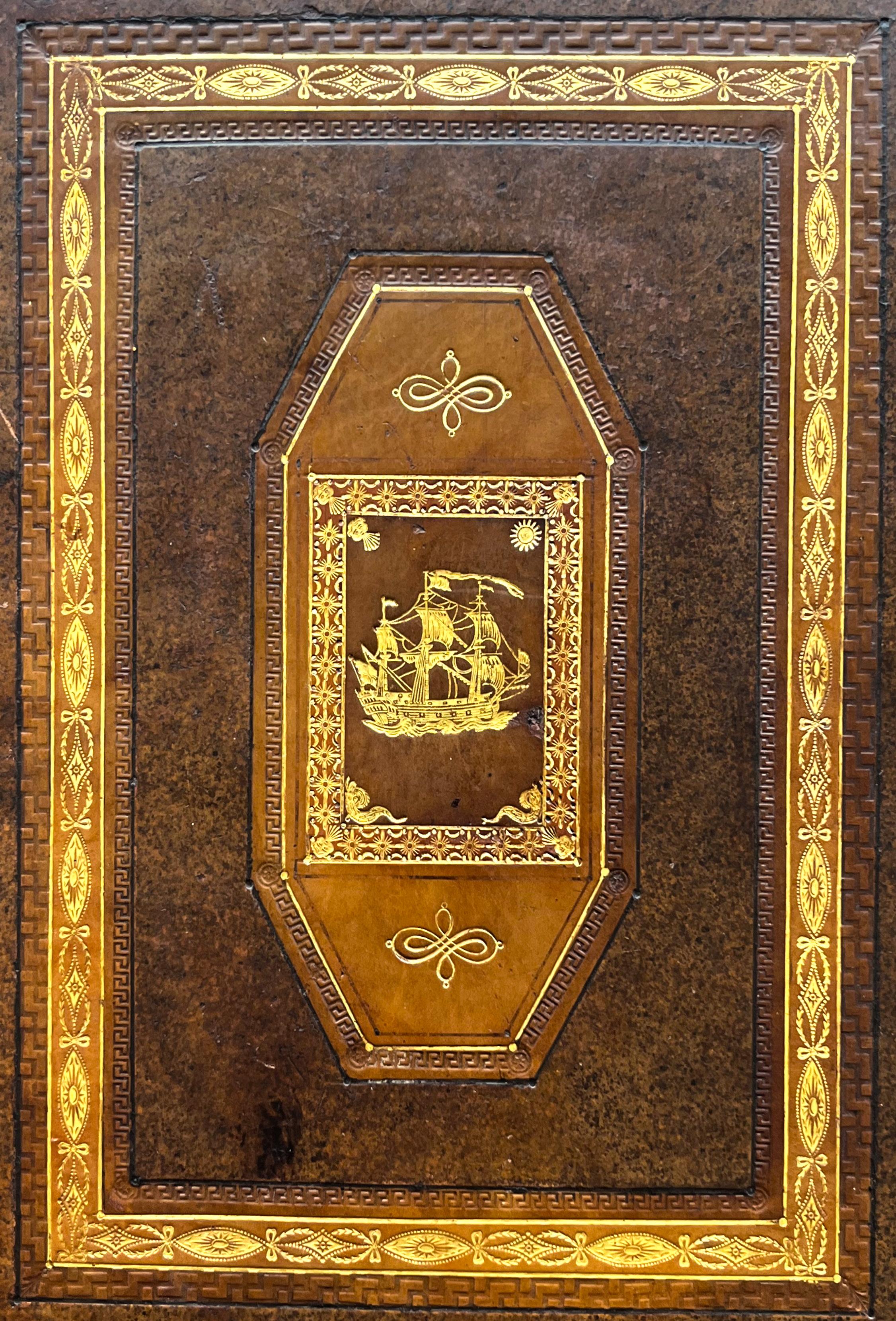
IN A REMARKABLE NAVAL BINDING FOR THE COMMANDER OF THE TEMERAIRE
34. PHILLIP, Governor Arthur.
The Voyage of Governor Phillip to Botany Bay…
Quarto, portrait and engraved title, seven folding engraved charts and 46 engraved plates; a most attractive copy in an unusual and handsome naval binding of the period, in full calf ornately gilt with ship motif on coves and anchors on spine. London, John Stockdale, 1789.
A splendid copy of the first edition: the official account of the voyage of the First Fleet to Botany Bay and the settlement of Australia. This superb copy in an unusual and handsome “naval” binding of the period, was no doubt bound specifically for its distinguished owner, Admiral Sir Eliab Harvey (1758-1830). Harvey, “as distinguished for his gambling and duelling as for his military record”, was indeed a hero of the French Revolutionary and Napoleonic Wars, notably for his experiences at the Battle of Trafalgar, when he took his ship the Temeraire into the thick of the action and forced the surrender of two French ships of the line. Temeraire’s last journey, to the breaker’s yard in 1838, was of course famously captured by J.M.W. Turner. Harvey lived a grand and dissolute life distinguished — as suggested by this unusually gorgeous binding on such a serious work — by considerable style.
Phillip’s book provides the official account of the first settlement of Australia. Based on the governor’s journals and despatches and assembled into book form by the London publisher Stockdale, it is — as the official record — the single most important book to describe the journey to Botany Bay and the foundations of modern Australia. It describes the events from March 1787, just before the First Fleet sailed from the Isle of Wight, up to September 1788.
Included are the first descriptions and engravings of a large number of Australian birds, animals, fish and plants as well as primary views of Botany Bay and Port Jackson. It contains a list of the names of the 700 convicts brought to Sydney on the six transport vessels that were part of the First Fleet.
There are appendices detailing the routes of various ships to Botany Bay, from Botany Bay to Norfolk Island and from Port Jackson to various other ports. The book also contains some excellent maps by John Hunter and William Dawes, including the first of the Sydney Cove settlement, which shows in detail the buildings and “progress” which had been made by July 1788.
Crittenden, ‘A Bibliography of the First Fleet’, 180; Ferguson, 47; Hill, 1347; Wantrup, 5.
Provenance: Admiral Harvey (with his bookplate).
$11,000
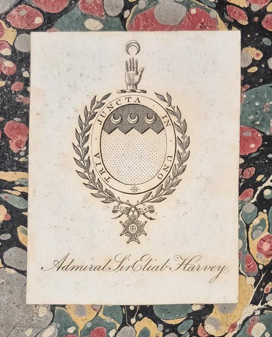
[5001122]
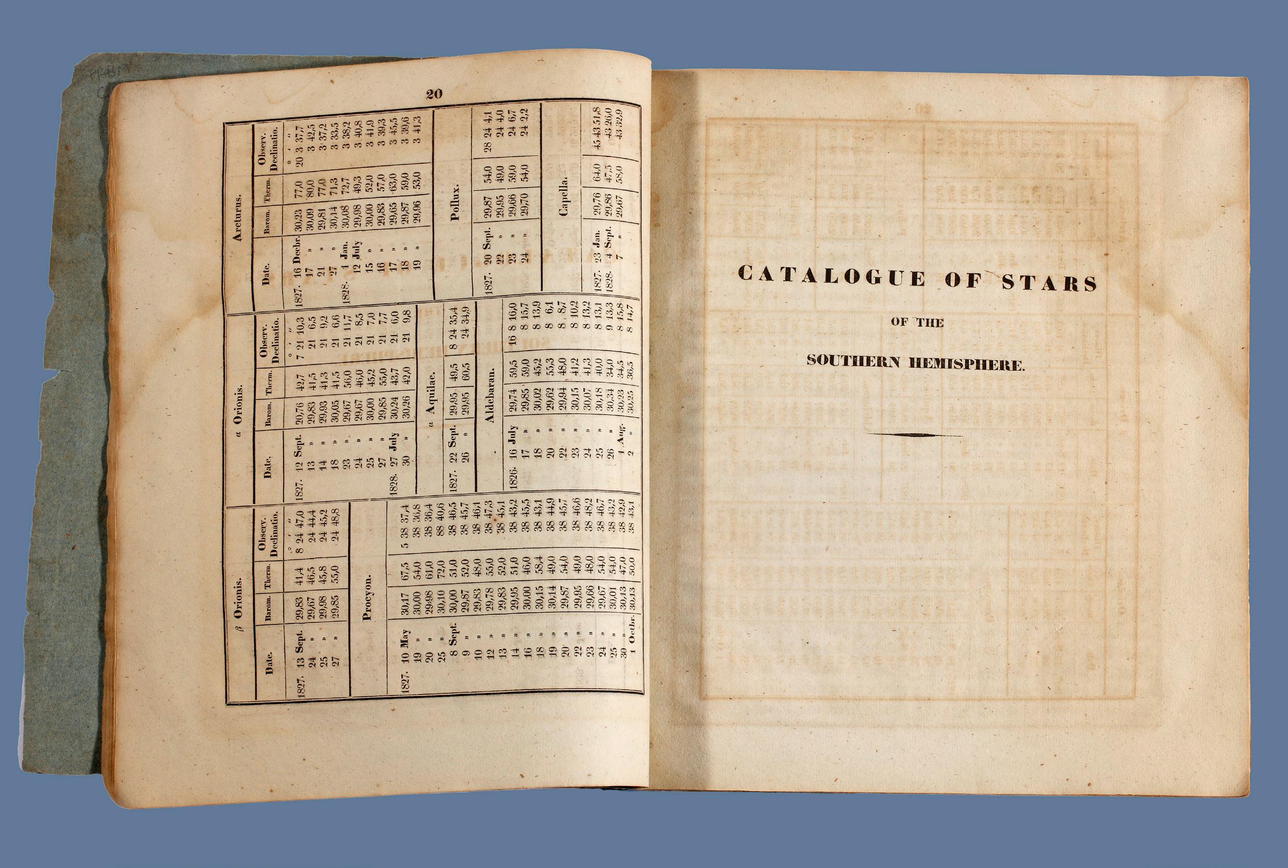
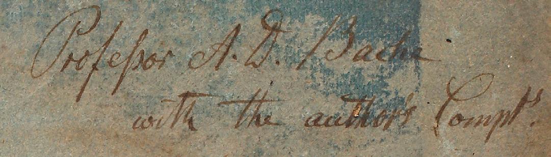
PRESENTATION COPY: THE FIRST AUSTRALIAN STAR CATALOGUE, BY THE FIRST GOVERNMENT ASTRONOMER
35. RUMKER, Christian Carl Ludwig (Charles Stargard).
Preliminary Catalogue of Fixed Stars…
Large quarto, 252 x 218 mm, pp 20, [ii], XXV; stab-sewn in the original blue-grey limp paper wrappers, with a presentation inscription on the front wrapper; preserved in a fitted quarter morocco bookform case. Hamburg, Printed for Perthes and Besser, 1832.
Very rare, a foundation work of Australian science and important in the history of world astronomy: the first Australian star catalogue, this copy inscribed by the author to Alexander Dallas Bache (1806–1867), scientist and educator, the great-grandson of Benjamin Franklin. This elusive book was probably printed in very small numbers for a specialist audience; just two copies are recorded in Australian libraries (NLA and SLNSW).
Christian Carl Ludwig Rümker (1788-1862), German astronomer, arrived in England in 1809, working for the East India Company and the merchant navy, before being press-ganged into the Royal Navy in 1813. Over the next few years he began making observations, including publishing the results of work he did at Malta. Recommended with an introduction — by Captain Peter Heywood, the involuntary participant in the Bounty mutiny — to the incoming Governor of New South Wales, Thomas Macdougall Brisbane, himself a keen astronomer, he arrived as part of the official party in 1821, beginning work at Brisbane’s Parramatta observatory, near Sydney, where he made several discoveries including “Encke’s Comet”. A bitter disagreement with Brisbane led him to resign his post, and to retreat to his new property at Picton, “Stargard”.
In 1826 he returned to Parramatta at the behest of Alexander Macleay, and was appointed government astronomer in December 1827, the first person to hold that title. He returned to London at the end of the decade, but another quarrel, this time with the president of the Royal Astronomical Society, Sir James South, led to Rümker finally being dismissed from British service and returning to Hamburg. Still working as an astronomer, at some point he became reconciled to Brisbane, as is shown by the present work’s dedication to him as “late Governor in Chief of Australia and Founder of the Observatory at Paramatta [sic]”.
Rümker’s later career was prolific, publishing scores of papers and being honoured with many fellowships, and continuing to work on his trail-blazing Parramatta observations. He died at Lisbon in 1862. His catalogue of stars visible in the southern hemisphere had both a purely scientific aim and a practical one. The systematic study and cataloguing of the stars visible with the aid of observatory-based telescopy in the southern hemisphere was in its infancy in the 1820s: The Royal Observatory at the Cape of Good Hope, established in 1820, was the first permanent astronomical observatory in the southern hemisphere, which points to the significance of the Parramatta Observatory being up and working by 1822.
“When awarding the gold medal of the Royal Astronomical Society to Rümker, the astronomer royal, Sir George Biddell Airy, said that Rümker’s dismissal was ‘the greatest misfortune that happened to Southern Astronomy’” (ADB). Ferguson, 1588; G. F. J. Bergman, ‘Rümker, Christian Carl Ludwig (1788-1862)’, Australian Dictionary of Biography (online resource); ibid, G. F. J. Bergman, ‘Christian Carl Ludwig Rümker (1788-1862), Australia’s First Government Astronomer’, Journal and Proceedings (Royal Australian Historical Society), 46 (1960); Rümker letters, 1825-49 (State Library of New South Wales); correspondence with Dr John Lee (State Library of Victoria).
Provenance: Inscribed by Rümker on the front wrapper “Professor A[lexander] D[allas] Bache with the author’s Comp[limen]ts”.
$19,500 [5000809]
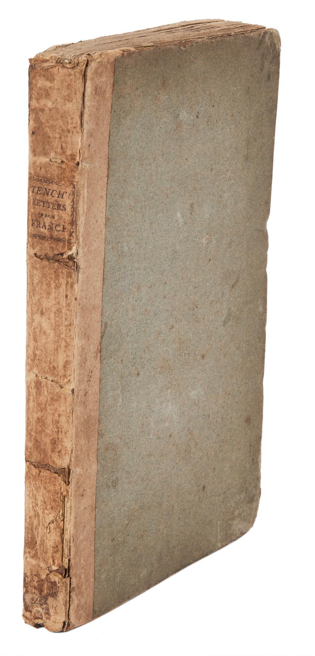
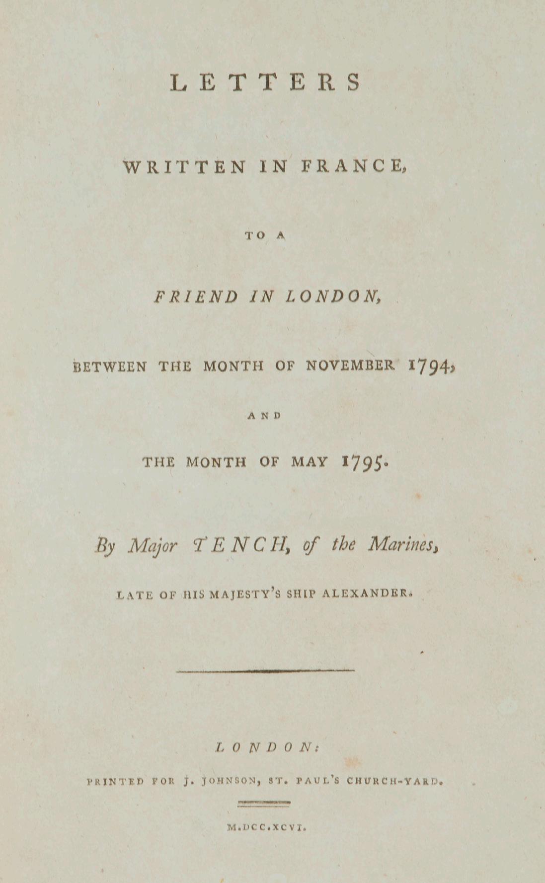
BEYOND AUSTRALIA: WITH TENCH’S CHARACTERISTIC WIT AND CANDOUR
36. TENCH, Major Watkin.
Letters written in France, to a Friend in London.
Octavo, a fine copy in its original boards binding with printed label, completely uncut, spine a little worn consistent with its age. London, 1796.
First edition, in original condition as issued, in its publisher’s binding: a rare title by the First-Fleeter better known for his Narrative of the Expedition to Botany Bay of 1789, the first account of European settlement in Australia. Watkin Tench, usually described as the most literary and the most readable of the First Fleet chroniclers, was also the only First Fleet writer to publish anything other than Australian experiences.
Tench spent altogether four years in the colony as captain-lieutenant in the marines. Previously he had served off the American coast during the War of Independence. In 1794, soon after his return from New South Wales to England, he was at sea again — this time fighting in the war against France. His ship, the Alexander, was captured, and he then spent six months as a prisoner-of-war. It was during this period that he wrote this series of letters to a friend in London. The letters display in abundance Tench’s keen and observant nature, and are a valuable document of life in France during the war with Revolutionary France, not least for his comments on Sir Richard Rodney Bligh, his commanding officer and later an Admiral.
The Letters written in France display all of Tench’s characteristic wit and candour. The work also includes one of the most tantalising comments in a passage in which Tench describes the lengths he went to in order to ensure that some remarks he had written on the French Navy remained secret: “From a fear of being searched,” he writes, “I have used some extraordinary precautions to secure them; and if they be found they will not be easily understood, for I have so transposed the natural order of the sentences, and so intermixed words from all the languages which I could recollect (not excepting that of New Holland) that it would puzzle the interpreter of the convention to decipher them.” What a prize for linguists that text would be, but it has not surfaced and is almost certainly lost.
Two modern writers have given very credible portraits of Tench: Tim Flannery by historical fact (The Birth of Sydney, 2000 and Watkin Tench, 1996) and Kate Grenville in fiction (The Lieutenant, 2008).
Crittenden, ‘A Bibliography of the First Fleet’, 244; Ferguson, 248.
$4500 [5001132]
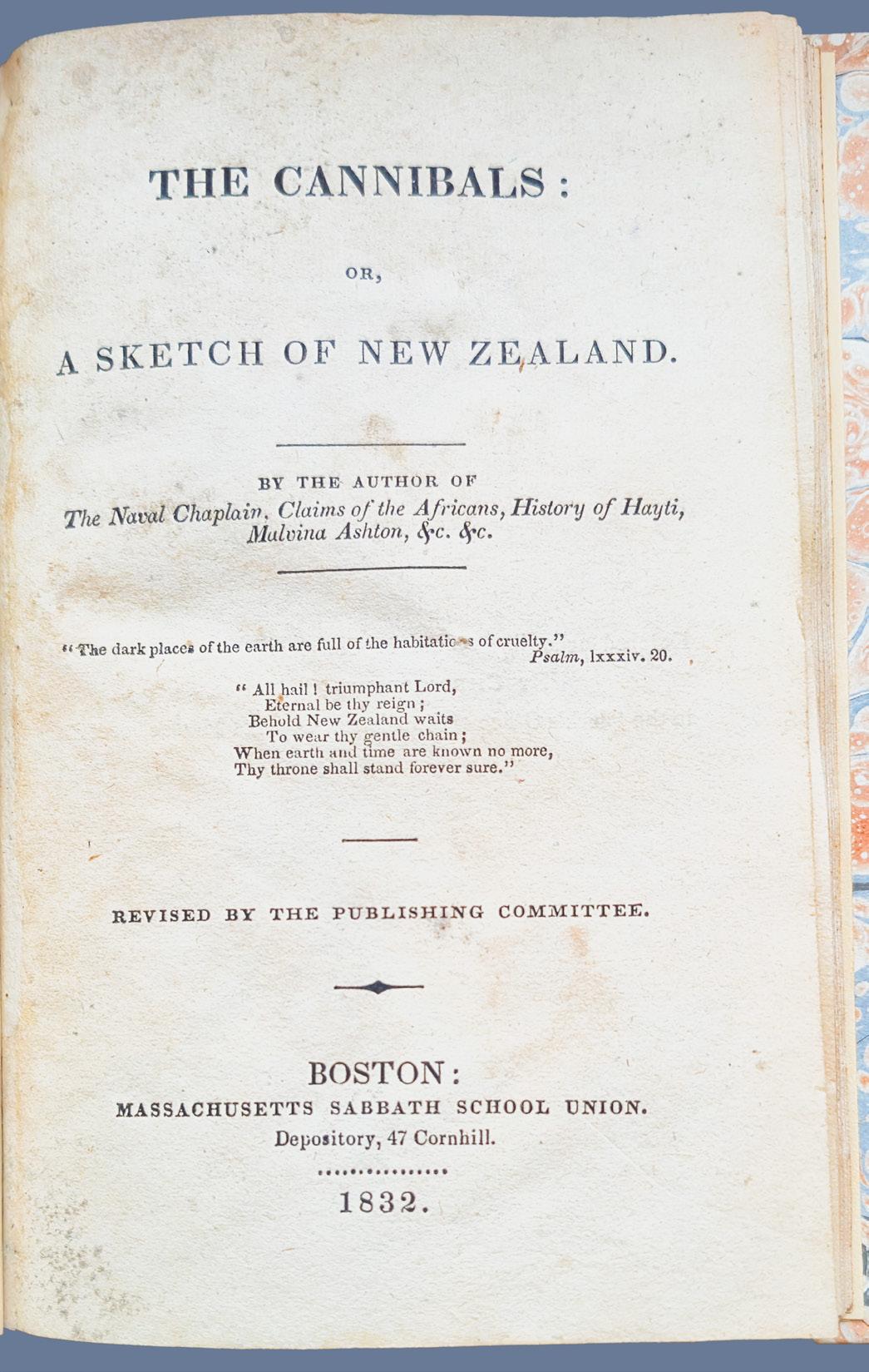
EARLY AND HIGHLY MELODRAMATIC CAUTIONARY TALES OF THE MĀORI
37. TUTTLE, Sarah [attributed].
The Cannibals: or, a Sketch of New Zealand.
32mo, 68pp + publisher’s advertisements (2 pp) and a final blank leaf; quarter leather and marbled boards. Boston, Massachussetts Sabbath School Union, 1832.
A rare piece of early American Polynesiana, predating the Treaty of Waitangi by eight years, this is one of the earliest English-language titles devoted entirely to New Zealand. Published anonymously but widely attributed to Sarah Tuttle — a prolific chronicler of indigenous cultures and missionary histories for the religious and missionary societies of New England — this slight volume offers a fascinating window into how the Western imagination processed news (and fable) of the South Seas prior to European colonisation.
By the early 1830s, New England’s appetite for Pacific narratives developed from the stories brought home by the regional whalers and sealers. Tuttle saw that New Zealand would provide a suitable rhetorical canvas for the Boston audience: a stark, sensationalised landscape of “native barbary” that could be contrasted with the civilising successes of Samuel Marsden and the Church Missionary Society. She derived her information from early missionary reports and letters but also from secondary British sources, including fragments from Cook’s voyages. Her text presents a dramatic, often lurid depiction of Māori warfare and ritual cannibalism to put in front of American children — an extreme portrayal designed to underscore the transformative power of the Christian gospel.
While ostensibly a piece of provincial Sabbath School propaganda, the book occupies a significant role in the pre-colonial literature of the Pacific, contrasting as it does with the more formal, serious voyage narratives of the era, mixing commercial curiosity, evangelical zeal, and popular myth for the American mind. Survival rates for such pamphlets were low, and this is no exception, noticeably scarce on the market. It is not recorded by Hocken, the early bibliographer of New Zealand.
Bagnall NZNB, 879; not in Hocken.
$2450 [6000087]
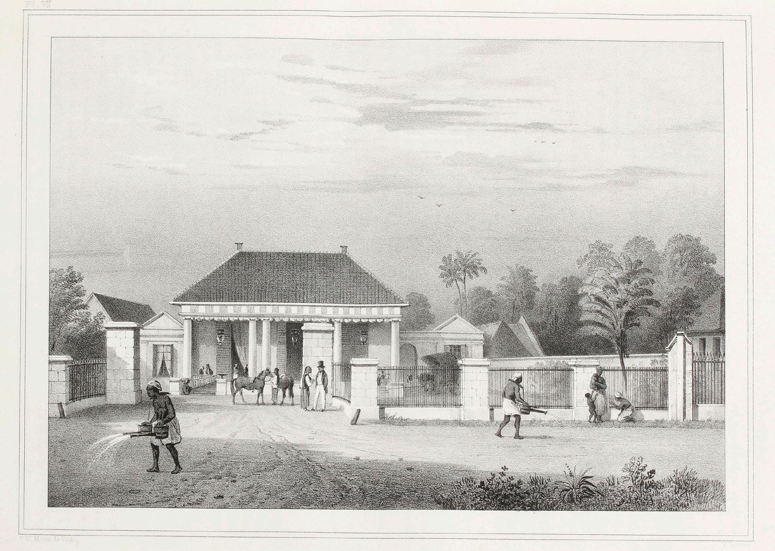
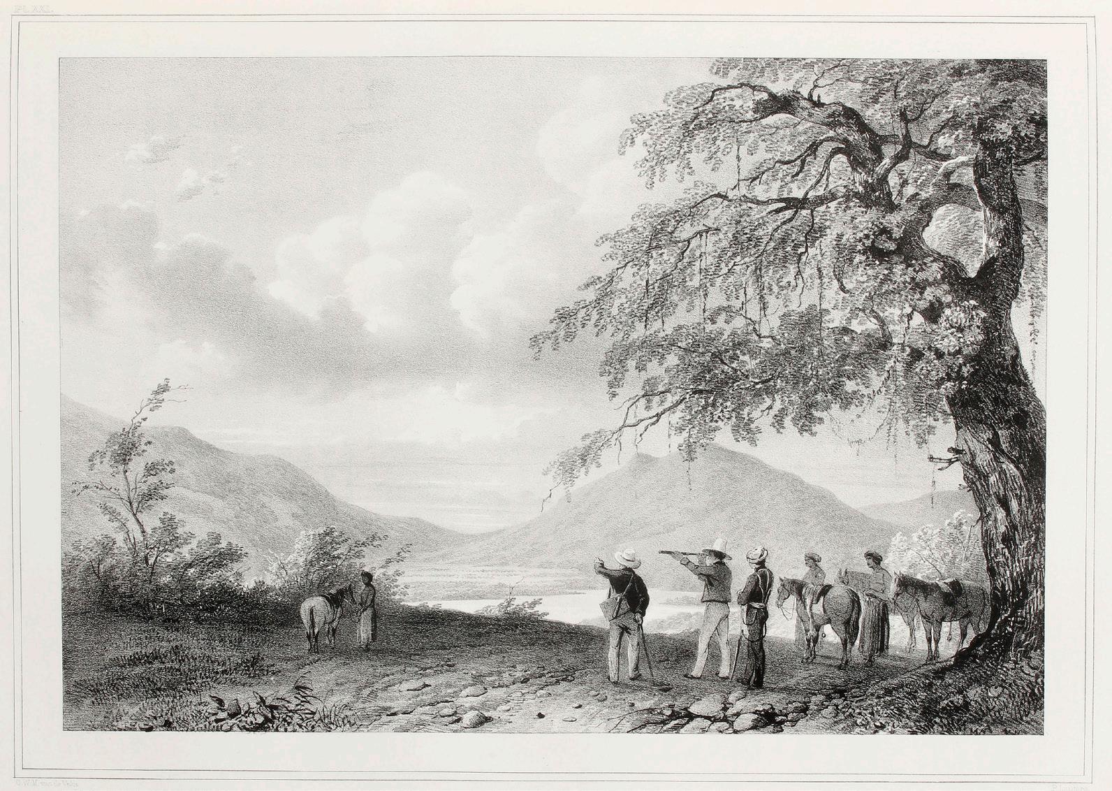
SUPERB VISUAL RECORD OF LIFE IN THE DUTCH EAST INDIES AT MID-CENTURY
38. VELDE, Charles William Meredith, van de.
Gezigten uit Neêrlands iut Indië, naar de natuur geteekend enbeschreven.
Small folio, engraved title and 50 lithographed plates by P. Lauters, accompanying letterpress; a fine and complete copy in handsome original binding of green half morocco. Amsterdam, Frans Buffa en Zonen, circa 1845-46.
An exquisitely-produced view book of the ports and peoples of the Dutch East Indies. Van de Velde’s remarkably handsome book, produced at the famous lithographic workshop of Frans Buffa & Sons in Amsterdam, is a benchmark in the development of such works. The superb plates, with captions in Dutch and French, share much in common with other early mid-century works of voyages, especially those produced on the continent — one is reminded of the views associated with the near-contemporary account of the second Dumont d’Urville circumnavigation, by artists including Sainson, for example. They were lithographed by the master Paulus Lauters (18061876), who had earlier worked with Goubau in Brussels and been appointed to the Royal School for Engraving in that city in 1836. His earlier work on Bénoit’s Voyage à Surinam used more traditional engraved plates, but lithography was considered to be his true métier.
The book is the magnum opus of Charles William Meredith Van de Velde (1818-1898), who took the original sketches while still a very young junior officer in the Dutch Navy, having travelled to the East Indies to take up a position at the topographical office at Jakarta. He remained in the region for over a decade before returning to Europe for his health, and later made a tour of the Holy Lands, publishing his Narrative of a Journey through Syria and Palestine (1854) and a renowned ‘Map of the Holy Land’ in London.
For such a young artist, the views in the present book are remarkably accomplished. Some of the earliest date from his time on the Triton — a Dutch corvette which had earlier claimed part of New Guinea — and show the great set-pieces of his voyage to the region, including passage of the Sunda Strait, views in Java and the roadstead of Batavia, the sky bristling with the masts of a whole host of European and local ships. The plates relating to this major port are some of the most detailed and interesting of any published in this era, when Dutch power and influence was waning but still paramount.
Although almost half of the book is devoted to places in Java, Van de Velde travelled widely, notably making two important early views in Timor, a major series on the Moluccas and Celebes, as well as Borneo, Bintang and Padang.
Copies are genuinely scarce, with the only firmly recorded copy in Australia being that originally owned by David Scott Mitchell himself.
Bastin & Brommer, 360; Landwehr, 459; Tiele, Bibl., 1136.
$22,500 [5000858]
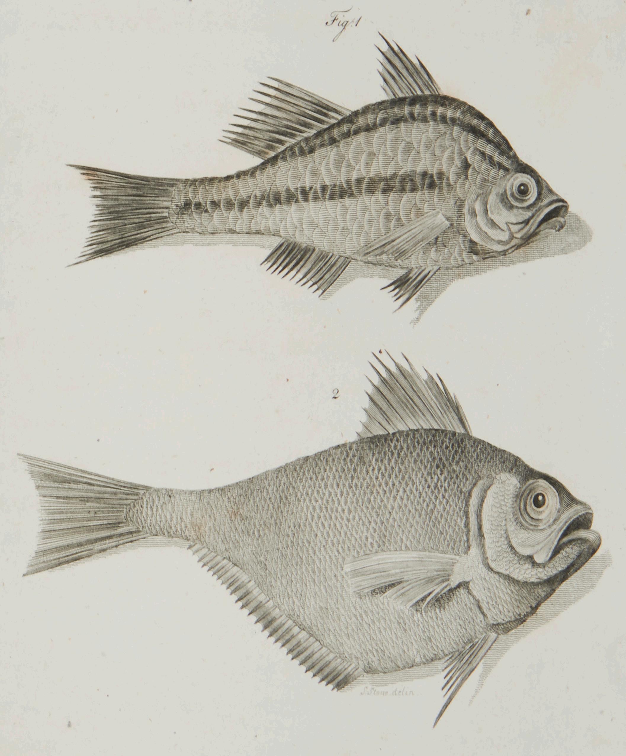
THE FIRST FLEET SURGEON'S ACCOUNT WITH NOTEWORTHY NATURAL HISTORY
39. WHITE, John.
Journal of a Voyage to New South Wales…
Quarto, with 65 engraved plates; old half calf. London, J. Debrett, 1790.
First edition. White was chief surgeon of the First Fleet, and was particularly successful in that he overcame serious medical problems in appalling conditions both on the voyage out and once the settlement had been founded. He was also a keen amateur naturalist and after arriving at Port Jackson found time to accompany Phillip on two journeys of exploration. On joining the First Fleet he had begun to keep a journal in which he made notes about birds in the new colony. It was this manuscript which formed the nucleus of his book. White’s Journal also contains an interesting and valuable account of the voyage from London, with long, detailed accounts of the stops at Rio de Janeiro, Cape Town and of the colonial voyages to Norfolk Island.
The natural history content of the published account makes White’s particularly noteworthy amongst the First Fleet journals. Many of the plates were drawn in England by leading natural history artists of the day, such as Sarah Stone, from original sketches done in the colony. White’s interest in natural history continued until he left New South Wales in December 1794. When the convict artist Thomas Watling arrived in the colony in October 1792 he was assigned to White and in the next two years made many drawings of birds for him. It is possible that White himself had some skill as an artist and that he was responsible for the original sketches of some of the engravings here.
The book was an immediate success, with subscribers alone accounting for 700 copies, and remained in print at least until the end of the decade; European interest led to its translation into Swedish, German and French. Davidson, ‘A Book Collector’s Notes’, pp. 81-6; Ford, 2495; Wantrup, 17.
$8500 [5001146]
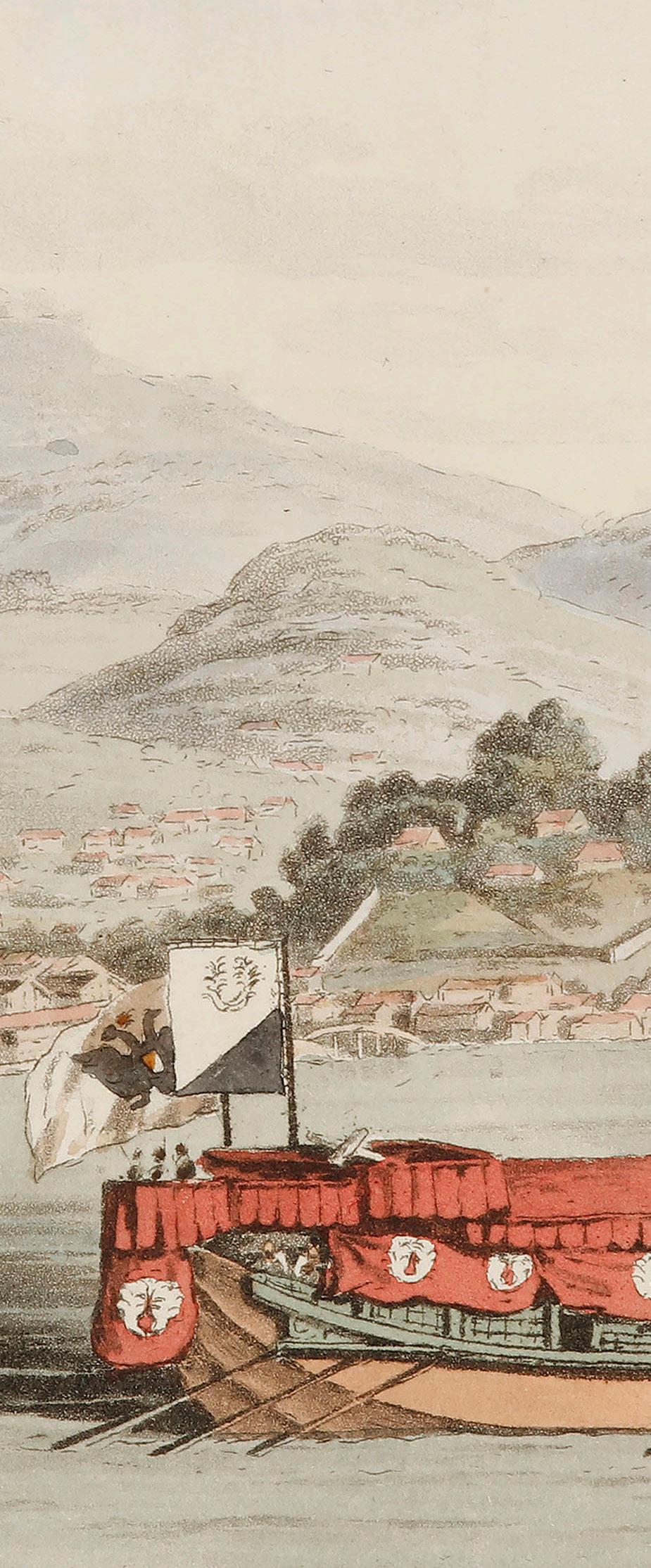
HORDERN HOUSE
RARE BOOKS · MANUSCRIPTS · PAINT
INGS
Anne McCormick +61 416 299 021
Derek McDonnell derek@hordern.com +61 416 299 022
Rachel Robarts anne@hordern.com rachel@hordern.com rogerio@hordern.com
Rogerio Blanc-Ramos
Matthew Fishburn (consultant)
Anthony Payne (UK representative)
Mike Garabedian (US representative)


46A MACLEAY STREET POTTS POINT · SYDNEY · NSW 2011 · AUSTRALIA PO Box 11 · POTTS POINT · NSW 1335 (+61) 02 9356 4411 www.hordern.com rare@hordern.com