This catalogue can also be viewed online, where each catalogue entry is linked to longer descriptions, condition reports, and usually more images: there is a link to the catalogue from our homepage at hordern.com. Alternatively the 7-digit reference number shown for any specific item can be searched at hordern.com.
Please note that all prices are in Australian dollars Anne McCormick anne@hordern.com +61 416 299 021
Derek McDonnell derek@hordern.com +61 416 299 022
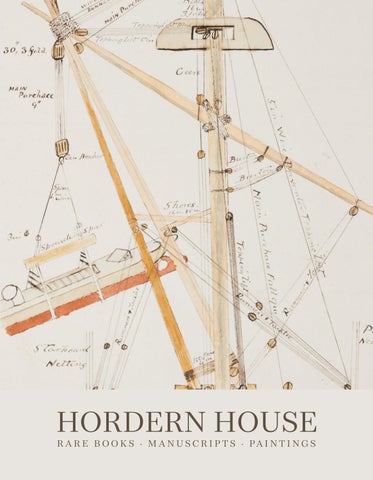
Front cover: Illustrated journal of HMS Nelson, Admiral Tryon’s flagship of the Royal Navy’s Australia Station. Aboard ship, 1885-1887 (Item 1) Frontispiece: Portrait of Daniel Colwall from Nehemiah Grew, Musæum Regalis Societatis… London, 1681 (Item 8) Back cover: Vue prise à Georges Town [Penang] by Bênoit-Henri Darondeau from suite of original watercolours. Straits of Malacca, 1837 (Item 21)
Frontispiece portrait of Francois Valentijn from an exceptional set of his Oud en Nieuw Oost-Indiën…(Item 22)
46A MACLEAY STREET · POTTS POINT · SYDNEY · NSW 2011 · AUSTR ALIA PO BOX 11 · POTTS POINT · NSW 1335 (+61) 02 9356 4411 · www.hordern.com · rare@hordern.com
ORIGINAL ILLUSTR ATED JOURNAL OF ADMIR AL TRYON’S FLAGSHIP 1.
AUSTRALIA STATION. HMS NELSON, Flagship.
“HMS Nelson. Admiral G. Tryon C.B.; Captain Atwell Lake”. [Illustrated Journal of HMS Nelson, Flagship on the Australia Station, 25 April 1885 to 6 June 1887 [with] Journal entries for HMS Tyne, 7 June to 14 July 1887]. Folio journal, 325 x 200 mm; about 200 pp. manuscript entries in ink, with hand coloured title page, two diagrams (one in colour), and altogether 14 fine original charts of Australian, New Zealand and Pacific waters (ten of them folding) coloured in outline and some detail; original full parchment binding with a later lettering label, original London stationer’s label. Aboard ship, 1885-1887.
An extensively illustrated manuscript journal recording service aboard HMS Nelson, f lagship of the Royal Nav y’s Australia Station, during a pivotal period in the development of British and Australasian naval policy. Finely executed charts trace the ship’s movements through Australian and New Zealand waters, with a particularly detailed chart of Bass Strait densely annotated with depth soundings. The journal was kept while the Australia Station was commanded by Vice-Admiral George Tryon, one of the most inf luential naval officers of the time, with Atwell Lake his f lag-captain. Lake, a trusted subordinate who had previously served with Tryon in HMS Raleigh, assumed command of Nelson in January 1885. The journal coincides with increasing colonial concern over the adequacy of British naval protection in the Pacific amid expanding French, German and Russian influence. From HMS Nelson, Tryon and Lake were central participants in discussions that led to the Australasian Naval Agreement of 1887, under which the Australian colonies agreed to subsidise an enlarged Royal Navy squadron. This landmark agreement represented one of the earliest examples of inter-colonial cooperation on a shared strategic policy and is now recognised as an important precursor to Australian Federation and, ultimately, the establishment of the Royal Australian Navy. HMS Nelson joined the Australia Station in 1881 and became f lagship in 1885. The journal records her extensive movements from her Sydney base, including cruises to Hobart, Melbourne, Brisbane and repeated voyages to New Zealand, visiting the Bay of Islands, Auckland and Wellington. Together with its attractive and finely-drawn charts, the journal offers an unusually vivid visual and documentary record of service aboard the principal symbol of British naval authority in the South Pacific. Catalogue number 15 includes an actual photograph of Commodore Erskine addressing the chiefs of Hood Bay, New Guinea, aboard HMS Nelson one year earlier.
$14,500 6000091
2
3
TELLING “A GOOD STORY”—SAILING WITH DARWIN ON THE BEAGLE 2.
[BEAGLE] BURGESS, Thomas.
A series of six letters from Thomas Burgess, Royal Marine, to his father Israel Burgess at Lancashire Hill, near Stockport, Cheshire.
Six autograph letters and a seventh printed document completed in manuscript, various sizes; housed in a custom made case. Various places, during the voyage of the Beagle and on earlier passages, 1831-1835.
A remarkable unpublished archive of six original letters written by Royal Marine Private William Burgess (1810–1882), including the only three known surviving letters written by any member of HMS Beagle’s crew during Darwin’s circumnavigation (1832–1836). Addressed throughout to his “dear father and mother”, the letters span Burgess’s entire sea service, from his first appointment in 1830 to his discharge in 1837, culminating in vivid voyage letters written from Rio de Janeiro, Montevideo and Valparaiso. Literate, observant and engaging despite his idiosyncratic spelling, Burgess wrote with obvious pride in his appointment, explaining that he embraced the opportunity through a combination of adventure, generous pay, and the hope that “if ever I do live to Come home I will be able to Sit Down and tell a good Story.” His correspondence records the excitement and hardships of the Beagle expedition, describing the surveys of South America, encounters with Indigenous peoples, Tierra del Fuego, Patagonia, the destruction caused by the 1835 Chilean earthquake, and the astonishing natural phenomena witnessed during the voyage. The letters are of exceptional historical importance not only because original Beagle manuscripts are of the utmost rarity, but because they preserve the otherwise almost silent voice of an ordinary crewman. Burgess is also the sailor remembered as the only member of the ship’s company later to leave a personal recollection of Darwin, whose affection for his former companion is well documented. The postal concessions afforded to soldiers required each letter to be countersigned by a senior officer, with one bearing the signature of Bartholomew James Sulivan and two that of John Clements Wickham, adding a further level of historical interest and direct association with the expedition’s officers. A substantial study of the letters can be found on our website at hordern.com/papers.php
$125,000 5001015 Charles Darwin, Narrative of the Surveying Voyages… Vol. III (1839); Darwin Correspondence Project (online); Darwin Online; Life and Letters of the late Admiral Sir Bartholomew James Sulivan (1896); Robert FitzRoy, Narrative of the Surveying Voyages … Adventure and Beagle (1839).
4
5
ENSIGN WHISTLEBLOWER: THE NSW CORPS AND LIFE IN SY DNEY 3.
BOND, George.
A Brief Account of the Colony of Port Jackson in New South Wales; Its Native Inhabitants, Productions, etc. with an interesting account of the Murder of Mr. Clode, late of that settlement, as communicated by the Rev. Richard Johnstone, late Chaplain of the Colony. Octavo, 24 pages; title-page somewhat stained but a good copy in quarter blue morocco. London, printed by R. Wilks, for the Author, 1809.
A famous rarity and one of the very few books written by a junior officer in early colonial Sydney. The only substantial published description of life in the New South Wales Corps apart from the proceedings of the Rum Rebellion, Bond combines personal narrative with advice for prospective emigrants. Bond reached Port Jackson aboard the Barwell in 1797, but arrived in irons having been implicated in an alleged mutiny. He was saved from court martial only through the intervention of Major Joseph Foveaux, with Governor Hunter accepting his resignation. Hunter later regretted this leniency, for Bond remained in Sydney and associated closely with officers, notably John Macarthur, whose growing opposition foreshadowed the conf licts culminating in the Rum Rebellion. Writing soon after his enforced return to England, Bond provides a personal account of Hunter’s New South Wales from the perspective of an officer of the Corps. Although touching on the Aboriginal people and the colony’s natural history, its chief importance lies in its observations on the convict system, free settlement, and the corruption and patronage that permeated the administration. It offers an insider’s view of the tensions that would later erupt in the conf lict between Bligh and Macarthur and ultimately usher in the reforms of Governor Macquarie. This is the fifth edition. Of the first (Southampton, 1803) no copy has emerged for many decades. None is known of the purported second or third editions, if they were indeed issued. The Oxford (1806), London (1809), Dublin (1810) and Cork (1810 or later) editions are all scarce, making the publication history of the work an intriguing puzzle. This was the first edition to describe Bond on the title-page as “Late Lieutenant of Marines”. The fourth edition had him still an Ensign in the New South Wales Corps, suggesting that he entered the Marines in the interim, perhaps also explaining the geographically dispersed sequence of later editions from Oxford, London, Dublin and Cork.
$15,500 5001025 Ferguson, 480; Wantrup, 30 (first 1803 edition).
6
7
“ONE OF THE MOST SIGNIFICANT BOTANICAL BOOKS OF ALL TIME” 4.
BROWN, Robert.
Prodromus Florae Novae Hollandiae et Insulae Van-Diemen, exhibens characteres plantarum… [A prologue to the Flora of New Holland and Van Diemen’s Island…] Octavo; a fine copy in quarter blue morocco, by Aquarius, edges rough-trimmed only. London, J. Johnson, 1810.
An exceptionally rare book: this ground-breaking study of the botany of New Holland and Van Diemens Land was the work of one of the most important figures of Australian science and botany. Brown sailed with Flinders on the Investigator, staying on with his great friend and colleague Ferdinand Bauer to make his own explorations in Australia and Tasmania, only returning to England in 1805 with his collection of over 4000 plant specimens. The history of Brown’s books in print is famously complex, not least as almost all were effectively privately published and he was reticent, obsessive even, about who was allowed to have copies of his books. Although he produced this first part of his famous Prodromus in 1810, he never completed the book, and since little more than a handful of copies are known today it must have been a very limited printing.
$18,850 5001060 Ferguson, 491; Mabberley, Peter Crossing Collection, 82; Stafleu and Cowan, TL-2, 825; Wantrup, 70.
THE R ARELY SEEN SEPAR ATELY-PUBLISHED SUPPLEMENT 5.
BROWN, Robert.
Supplementum Primum Prodromi Florae Novae Hollandiae… [First supplement to the Prodromus…].
Octavo, 40 pp.; a very good copy in the original plain brown wrappers, a little chipped at extremities; in a quarter morocco bookform case. London, R. Taylor, 1830.
Rare: the significant supplement to Brown’s magnum opus, the Prodromus. It clarifies some omissions dating back to the voyage of Flinders, but also catalogues the more recent discoveries of luminaries such as Baxter, Caley, Cunningham, Fraser and Sieber.
$6750 6000019 Ferguson, 1329; Mabberley, 142; Stafleu and Cowan, TL-2, 835; Wantrup, p.190, and 71.
8
Portrait of Robert Brown, archive of Hordern House
9
SAMWELL’S HAWAIIAN NARR ATIVE: AN OUTSTANDING R ARIT Y 6.
[COOK: DEATH] SAMWELL, David.
A Narrative of the Death of Captain James Cook. To which are added some Particulars, concerning his Life and Character. And Observations respecting the Introduction of the Venereal Disease into the Sandwich Islands. Quarto (300 x 232 mm.), pp. iv, 34 [without final blank]; recently bound in speckled half calf to style, smooth spine with triple gilt fillets, gilt f loral motif at foot, red morocco label, contemporary marbled paper sides, top edge cut, others uncut. London, Printed for G.G.J. and J. Robinson, 1786.
First edition: one of the rarest and most desirable of all Pacific voyage narratives, and among the earliest books devoted to Hawaii. We have traced only five copies at auction in the past fifty years, confirming its reputation as one of the most elusive of all eighteenth-century voyage accounts. The catalogue of the Hill Collection aptly describes it as “the highlight of a Cook collection”. David Samwell (1751–1798), a Welsh surgeon who sailed on Cook’s final voyage, joined the Resolution as surgeon’s mate before becoming surgeon of the Discovery in 1778. His account of Cook’s death at Kealakekua Bay is of exceptional importance, providing what Sir Maurice Holmes described as “the fullest, most detailed and most objective” narrative of the event. Drawing carefully on eyewitness testimony, Samwell’s work fills significant gaps left by the official account and remains a cornerstone source for understanding the circumstances surrounding Cook’s death. The book was written in part to correct the impression created by the official narrative of the voyage published under the editorship of James King in 1784. As Samwell observed in his preface, public opinion had come to attribute Cook’s death “in some measure, to rashness or too much confidence on his side; whereas nothing can be more ill-founded or unjust” (p. iii). Holmes later remarked that the work is particularly valuable because it addresses matters “suppressed in the official account”, especially regarding responsibility for Cook’s death, and because Samwell’s assessment of Cook’s character, coming from “an educated man who knew him well”, must be read alongside King’s in order to gain a balanced view of the navigator as he appeared to those who served under him. Samwell provides a detailed reconstruction of the fatal encounter at Kealakekua Bay. In several respects his account differs from the official version. Discussing Cook’s first wound, he notes that although one eyewitness supported the claim made in the official voyage that Cook had been stabbed first, the testimony of numerous other witnesses convinced him that Cook was initially struck with a club, a conclusion later confirmed to him by the Hawaiian priest Kaireekea (pp. 15–16). Samwell also places considerable responsibility on Lieutenant John Williamson, whom he accuses of failing to support Cook during the attack.
10
11
The narrative of Cook’s death is followed by a biographical memoir, largely reverential in tone, and concludes with observations on the spread of venereal disease among the indigenous peoples of the Pacific. As a surgeon, Samwell was particularly well placed to discuss the subject, although his contention that there was insufficient proof that Europeans first introduced the disease to Hawaii is now generally regarded as doubtful. He records that despite Cook’s efforts to prohibit intercourse between his sailors and Polynesians during the first visit in 1778, the disease had become widespread by the expedition’s return later that year. Apart from its rarity, the work exercised considerable inf luence. It provided a major source for Andrew Kippis’s Life of Captain James Cook (1788) and his contribution to Biographia Britannica (1789). Unlike many contemporary accounts of Cook’s third voyage, which appeared in numerous European editions and piracies, Samwell’s narrative was published only in this English edition and a French translation. Not until David Magee’s Captain Cook and Hawaii (1957), introduced by Sir Maurice Holmes, was the text reprinted. Holmes noted on that occasion that the original printing was “of great rarity and correspondingly expensive”. The book holds a prominent place in Hawaiian bibliography. The Hill catalogue observes that, among the earliest books relating to Hawaii, it ranks alongside Zimmermann’s Reise um die Welt (1781) and Shaw’s Catalogue of the Different Specimens of Cloth (1787—see catalogue number 19) as one of the most significant publications of the eighteenth century. Combining exceptional rarity with fundamental historical importance, Samwell’s account remains one of the indispensable primary sources for Cook’s final voyage and death.
$325,000 5000990 Beddie, 1620; Forbes, 117; Hawaii Hundred, 6; Hill 1521; Holmes, 61; Kroepelien, 1143; Lada-Mocarski, 39; Parks Collection, 100; Sabin, 75970.
12
13
THE LADY NELSON AND HER IMPORTANT EARLY COASTAL VOYAGES 7.
GRANT, James.
The Narrative of a Voyage of Discovery, performed in His Majesty’s Vessel The Lady Nelson, of sixty tons burthen, with sliding keels, in the years 1800, 1801 and 1802, to New South Wales… Quarto, with a large folding plan, chart, coloured plate of a cockatoo and five other engravings including a portrait of Bennelong; complete with the “List of the Encouragers” and the blank leaf; a handsome copy, with wide margins, in original calf binding, respined to match by Aquarius. London, C. Raworth, 1803.
First edition: a handsome copy of this desirable work on early Australian coastal exploration. In 1800, as a lieutenant in the Royal Navy, James Grant brought the Lady Nelson—the first ship to be built with sliding keels to allow closer exploration of shallow coastal waters—to Australia. He sailed the unusually designed ship through Bass Strait, the first to do so from the west but, on arrival at Sydney, discovered that he had missed Flinders to whom he was to deliver the ship and was sent back to survey the southwestern coast of the continent, assisted by Francis Barrallier. However the lateness of the season (March to May 1801) meant that instead of the planned survey they concentrated on Bass Strait and the Victorian coast instead. The chart of Bass Strait here was the first to be published of the newly-discovered Victorian coast. Over the next two years Grant made several voyages of discovery along the New South Wales coastline but is best remembered for his work in the Hunter River area which resulted in the establishment of Newcastle. Two engravings in this book illustrating the exploration of the Hunter were probably engraved after sketches by the colony’s first professional artist, John William Lewin, who accompanied the expedition. The beautiful hand-coloured plate of the “Fringe Crested Cockatoo” is present here in 1`fine condition. There are also portraits of the important Aboriginal figures Pimbloy (an alternative spelling of Pemulwuy, the great warrior) “in a canoe of that country” and Bennelong. This is “a rare book, even more so in fine contemporary condition. It is of the highest significance to any collection of Australian books and no collection of books dealing with coastal discovery or with Victoria can be without it…” (Wantrup).
$13,500 5000643
Davidson, ‘A Book Collector’s Notes’, pp. 125-6 (‘a rare and most desirable item’); Ferguson, 375; Hill, 718; Wantrup, 75.
14
15
A CATALOGUE OF R ARITIES FROM THE ROYAL SOCIET Y 8.
GREW, Nehemiah (1641-1712).
Musæum Regalis Societatis, or a catalogue and description of the natural and artificial rarities belonging to the Royal Society and preserved at Gresham Colledge…
Small folio, with a frontispiece portrait of Daniel Colwall and 31 very fine engraved plates; an excellent copy in contemporary dark calf, spine gilt in compartments with red-brown label. London, Printed by W. Rawlins, for the author, 1681.
F i r s t e d it ion of t h i s l a nd m a rk cata log ue of the Roya l Societ y ’s museum. Nehemiah Grew (1641– 1712), secretary of the Royal Society, pioneering microscopist, botanist, and early advocate of comparative anatomy, produced one of the defining works of seventeenth-century natural history and museum studies. The Musæum Rega lis Societatis c at a log ue s t he R oy a l S o c iet y ’s Repositor y at Gresham Col lege, one of t he ea rl iest scient if ic museums in Europe. Its collections comprised natural history specimens, ethnographic artefacts, anatomical preparations, fossils, shells, minerals, scientific instruments, and curiosities gathered from across the k nown world. Commissioned to bring order to this repository, Grew produced a catalogue of more than 400 pages, illustrated with a substantial series of engraved plates and published in 1681. More than an inventory, the work is among the earliest systematic attempts to describe and classify a museum collection according to observable characteristics. It embodies the empirical principles of the Royal Society, anticipates later developments in naturalhistory taxonomy, and foreshadows modern museum documentation and curatorial practice.
16
The catalogue also preserves an invaluable record of early modern global collecting networks. It describes material from the Americas, Africa, Asia, the East Indies, and the Pacific, including shells, corals, ethnographic artefacts, preserved animals, minerals, fossils, anatomical specimens, scientific instruments, exotic plants and plant products, acquired through merchants, missionaries, trade, and exploration. As much of the Repository was later dispersed or absorbed into collections that ultimately contributed to the British Museum, Grew’s catalogue is the sole record of many objects now lost or otherwise lacking provenance. As in a number of other recorded copies, the present example contains contemporary manuscript corrections on pages 62, 81, 239, 312, and 343.
$4250 6000098 ESTC, R23326; Garrison-Morton, 297; Nissen, ZBI, 1714; Heirs of Hippocrates, 640; Osler, 2840; Russell, British Anatomy, 333; Wellcome III, 164; Wing, G1952; Wood, p.369.
17
FIRST MAPPING OF THE SYSTEMATIC OPER ATION OF TR ADE WINDS 9.
HALLEY, Edmond.
[Meteorological/Astronomical Chart showing trade winds and monsoons in the tropics]
Engraved chart, 155 x 492 mm., with old folds. London, Royal Society, 1686.
First issue of Halley’s first cartographic achievement. Published in 1686, this is a fine example of his important meteorological and astronomical trade wind chart. The chart shows the Atlantic and Indian Oceans, with parts of the far eastern and western Pacific, between thirty degrees latitude north and south, the area where the trade winds blow. The outline of the western shores of the Australian continent is delineated and the land mass titled Hollandia Nova. Curved, dotted lines indicate the direction of the winds in particular areas, showing the systematic operation of weather patterns for the first time on a map. The great scientist and Astronomer Royal Edmund Halley (1656-1742) would later build on this early thematic map with his use of isogonic lines on maps of magnetic declination, but this was his f irst published cartographic output. He compiled information from a variety of logs, journals, and mariner testimony, and importantly included his own first-hand observations from his voyage to St. Helena in 1676-8 on which he made his famous astronomical observations of the stars of the southern hemisphere.
18
This chart would have considerable inf luence on contemporaries including William Dampier (1651-1715), explorer, navigator and naturalist, the first person to complete three circumnavigations, and the most significant explorer between Drake and Cook. Dampier was also the first Englishman to explore any part of the Australian continent and used this chart on his Pacific voyages. This very rare chart was published to illustrate Halley’s corresponding article, “An Historical Account of the Trade Winds, and Monsoons, Observable in the Seas between and near the Tropicks, with an Attempt to Assign the Physical Cause of the Said Wind”, in Philosophical Transactions of the Royal Society (vol. 16, issue 183, 1686). A French edition was published in 1687. The contributions of to the science and advancement of cartography were of the utmost importance.
$9750 6000094
19
WITH ONE OF THE EARLIEST ENGLISH MAPS OF AUSTR ALIA 10.
HARRIS, John; edited and revised by John CAMPBELL.
Navigantium atque Itinerantium Bibliotheca… Or, a Complete Collection of Voyages and Travels… Two volumes, large thick folio, with altogether 61 engraved maps and plates (several folding) by or after Emmanuel Bowen; a fine copy in contemporary calf. London, for T. Woodward [and others], 1764.
A splendid copy of this substantial and significant work in the history of exploration literature, a comprehensive compilation of accounts from numerous explorers and travellers. Harris’s great collection first appeared in 1705, but it was John Campbell’s extensive revision for the second and third editions that transformed it into the foremost English compendium of voyages before Cook. Campbell’s editorial achievement lay not merely in enlarging Harris’s original compilation but in reshaping it into the standard English survey of global exploration at a time when British interest in the Pacific was rapidly increasing. His own comments reveal how strongly he advocated renewed southern exploration, recommending an expedition to Van Diemen’s Land and a voyage to New Guinea so that “all the back coast of New Holland, and New Guiney, might be thoroughly examined; and we might know as well, and as certainly, as the Dutch, how far a Colony settled there might answer our Expectations” (quoted by Williams and Frost, Terra Australis to Australia, 1988). He concluded with the striking prediction that “Whoever perfectly discovers and settles [the southern land] will become infallibly possessed of territories as rich and fruitful and as capable of improvement as any that have hitherto been found.” Campbell incorporated accounts of the many expeditions undertaken or published since the appearance of the first edition, particularly those relating to the Pacific and the Southern Hemisphere, and commissioned Emmanuel Bowen to prepare a new series of maps. Foremost among them is the Complete Map of the Southern Continent surveyed by Capt. Abel Tasman, one of the earliest English maps devoted to Australia and a landmark in the transmission of Tasman’s discoveries to an English readership. The present copy, a third edition, is one of the two preferred early issues of the book, with the complete complement of maps, including the important Bowen/Tasman map.
$16,000 5001072 Davidson, ‘A Book Collector’s Notes’, pp. 37-8; Hill, 775; Lada-Mocarski, 3; Perry, p. 60; Schilder, ‘Australia Unveiled’, map 87; Tooley, 241; Wantrup, ARB (2025), 2.11 (1744 issue).
20
21
THE KING AND QUEEN OF HAWAII: POIGNANT LONDON PORTR AITS 11.
HAYTER, John (1800-1895).
“Tamehameha 2d. His Majesty the King of the Sandwich Islands” [and] “Tamehamalu. Her Majesty the Queen of the Sandwich Islands”. Pair of coloured lithograph portraits, 325 x 250 mm (platemarks) on sheets 560 x 385 mm; one plate watermarked “J Whatman 1824”. London, printed by C. Hullmandel, published by J. Dickinson, 1824.
A beautiful pair of poignant lithographic portraits depicting King Kamehameha II of Hawaii and his queen, Kamāmalu, during their celebrated visit to London in 1824— the first overseas journey undertaken by a reigning Hawaiian monarch and one of the defining diplomatic missions in Hawaiian history. A pair of the lithographs occupied a central position in the recent wonderful Hawaiian exhibition at the British Museum. Produced from life by the court artist John Hayter and printed by the pioneering lithographer Charles Joseph Hullmandel, the portraits record a moment of extraordinary optimism in the history of the Hawaiian Kingdom. Kamehameha, known at the time as Tamehameha II and also as Liholiho Iolani, had succeeded his father Kamehameha the Great in 1819 and presided over a period of profound political and cultural change, including the dismantling of the traditional kapu system. In November 1823 he and Queen Kamāmalu left Honolulu on a diplomatic mission intended to strengthen relations with Britain and secure recognition of Hawaii as an independent sovereign kingdom. Arriving in London in May 1824 after a voyage of five months, the royal party became the focus of intense public interest while awaiting an audience with George IV. During their stay they visited the British Museum and sat to Hayter for these portraits. Dressed in contemporary European court dress, they appear not as exotic visitors but as fellow sovereigns, consciously presenting Hawaii as a modern nation engaged with the wider world. The images therefore served not merely as portraits but as visual expressions of the diplomatic purpose of the mission itself. Their historical significance is inseparable from the tragedy that followed. Within weeks both king and queen contracted measles, to which the Hawaiian party possessed little immunity, and died in July 1824 at the ages of twenty-six and twenty-two. These portraits consequently became almost at once memorial images, preserving the last likenesses made from life of the young royal couple.
$18,500 6000095 “Hawaiʻi: a kingdom crossing oceans”, British Museum (2026); Nan Kivell & Spence, Portraits of the Famous and Infamous, p. 274.
22
23
PORTUGUESE EXPAND INTO INDIA, EAST INDIES, & CHINA 12.
LOPES DE CASTANHEDA, Fernão.
The first Booke of the Historie of the Discoverie and Conquest of the East Indias, enterprised by the Portingales, Small quarto, title page printed within a typographical border, with woodcut tailpieces and historiated initials; early 19th-century russia leather binding, neatly rebacked to style, sides with blind decorative panels, gilt edges. London, Thomas East, 1582.
First edition in English, dedicated to Sir Francis Drake, of one of the great narratives of the first age of discovery and among the rarest contemporary English accounts of Portuguese expansion in Asia. It is one of the essential English sources for the history of European expansion in the East and, through its account of Pedro Álvares Cabral’s voyage of 1500, one of the earliest authorities in English for the discovery of Brazil. Nicholas Lichefield’s “florid but energetic” translation of the first book of Castanheda’s História do descobrimento e conquista da Índia pelos portugueses (Coimbra, 1551) introduced English readers to the formative history of the Portuguese maritime empire at precisely the moment when England itself was beginning to contemplate overseas expansion. Although Castanheda ultimately published eight books between 1551 and 1561, it was this foundational first volume that appeared in English. As Hill observes, “the English edition is very rare.” Dedicated to Drake and published during England’s emergence as a maritime power, the translation offered English readers their first sustained account of the navigations, commerce, diplomacy and military campaigns through which Portugal had established its eastern empire, providing a practical as well as historical model of overseas expansion. Lopes de Castanheda (c.1500–1559) accompanied his father to India with the fleet of Nuno da Cunha in 1528 and spent almost a decade in Asia, travelling widely while assembling the materials for what became the first comprehensive history of Portuguese expansion in the East. Drawing upon official records, eyewitness testimony and his own experience of the Estado da Índia, he produced a work distinguished by both its accuracy and breadth. Returning to Coimbra in poor health, he devoted the next two decades to ref ining his history, which Donald Lach praised for its remarkable success in establishing “a factual record” from such varied evidence. At a time when many chronicles blended hearsay with legend, Castanheda consciously compared documentary evidence with
24
25
personal testimony, establishing a standard of historical method that gave his work an authority recognised for centuries thereafter. The original Portuguese version appears to have been withdrawn shortly after publication, probably because it offended inf luential interests, making surviving copies exceptionally rare. The work traces the creation of Portuguese power from Vasco da Gama’s first voyage onwards, drawing upon such fundamental sources as the anonymous Roteiro, Tomé Pires, Francisco Rodrigues and Duarte Barbosa. Through Lichefield’s translation, English readers encountered the exploits of Bartolomeu Dias, Vasco da Gama, Pedro Álvares Cabral, Afonso de Albuquerque and the other architects of the Portuguese empire in Asia for the first time. At the same time, the account of Cabral’s accidental landfall in Brazil ensured that the volume assumed an important place in the literature of the Americas, preserving for English readers one of the earliest substantial printed narratives of the Portuguese discovery of South America. Provenance: William Prest (1744-1818) of Bedale, North Yorkshire, maltster, with his gilt device on covers (his library sales of 1819 and 1827); George Wilbraham (1779-1852) of Delamere Lodge, Cheshire, Whig MP (with his armorial bookplate); J.C. MacCoy (with his morocco book label); subsequently in the famous collections of Pierre S. Dupont III and Frank S. Streeter.
$115,000 6000052
Alden, ‘European Americana’, 582/54; Borba de Moraes, I:143; ESTC, S108825; Hill, 1035; Palau, 262; Penrose, Travel and Discovery in the Renaissance, pp.274-79; Sabin, 11391 (“A most interesting and rare book”); STC, 16806; Streeter sale, 26. Ivo Kamps and Jyotsna G. Singh, eds., “Travel Knowledge: European ‘Discoveries’ in the Early Modern Period”, 2001.
26
27
BROOKES’S MUSEUM: A SIGNIFICANT DEBT TO THE MACLEAYS 13.
[MACLEAY] BROOKES, Joshua.
A Prodromus of a Synopsis Animalium, comprising a Catalogue Raisonné of the Zootomical Collection of Joshua Brookes Esq. F.R.S. etc…
Octavo, general title followed by a second individual title leaf, pp [1]-20; stitched and unbound as issued, edges uncut. London, printed by Gold and Walton, 24 Wardour Street, Soho, 1828.
Scarce and important description of the Brookesian Museum, the celebrated private anatomical and zoological museum in London founded by the anatomist Joshua Brookes. The museum contained more than 6000 human and animal specimens assembled for the study of comparative anatomy and ranked among the finest private scientific collections in Britain. A lt hough resembl ing a preliminary notice issued i n 1 8 2 7, t h e p r e s e n t substantially changed issue is of greater significance. Produced after Brookes embraced William Sharp M a c l e a y ’s “ Q u i n a r i a n S y s t e m” of z o ol o g ic a l c lassif icat ion, it was rewritten to incorporate Macleay’s ideas and thereby preserves an important contemporary link between the Brookes Museum and the Macleay family, whose collections and scientific work would become one of the foundations of Australian zoology. Issued in advance of the series of sales that dispersed the museum in 1830, the pamphlet incorporates extensive revisions and addition, the most striking of which is the Venn-like diagram on page 19 illustrating the relationships proposed by Macleay’s work, while the final third of the text has been comprehensively rewritten, expanding the publication from sixteen to twenty pages and introducing an entirely new zoological arrangement based upon Macleay’s classification. Brookes was evidently well acquainted with both Alexander Macleay and his son William Sharp Macleay; the inf luence of their zoological researches may well explain the museum’s unusually rich representation of Australasian marsupials. The catalogue records: “Skeletons of most of the Genera… There are two Skeletons of adult Kangaroos… A Skeleton likewise of the Halmaturus Rufus, Hypsiprymnus Potoroo; as well as the Petaurus… and many Crania of other Genera.”
28
William Sharp Macleay followed closely in the scientific footsteps of his father Alexander. Although born in London and remaining in Europe until his early forties, he settled in Sydney in 1839, occupying and later inheriting Elizabeth Bay House, where he became one of the colony’s leading scientific and intellectual figures. On his death in 1865 his collections and library passed to the Macleay Museum, ensuring that the scientific ideas ref lected in this revised catalogue would become closely associated with the history of Australian natural history. Despite the Brookes Museum’s engagement with the scientific work of the Macleays, and the significance of this catalogue for the history and inf luence of Australian zoology, this is not recorded as being held in any Australian public collection.
$9600 6000099
29
THE “SELECT ISSUE” OF THE GREAT PACIFIC SHELL BOOK 14.
MARTYN, Thomas.
The Universal Conchologist, exhibiting the figure of every known shell, accurately drawn and painted after nature…
Two volumes, square folio, engraved frontispiece with a Greek-key border applied in gold, and 80 engraved plates, all finely coloured by hand, edged in black, each plate presented on a larger sheet of blue paper, each with manuscript edging in black and numbered in manuscript; two engraved title-pages (in English and French), and with 27 pages of bilingual text, each volume with an engraved explanatory table; in the original binding of full tan marbled calf, Greek-key border reprised to boards, banded and lettered in gilt, marbled endpapers. London, [the Author], 1784.
An exceptional “select issue” of Thomas Martyn’s magnificent shell book, widely regarded as one of the supreme achievements of eighteenth-century natural history illustration. Prepared from specimens collected on the great voyages of Pacif ic exploration, including those of Byron, Wallis and Cook, it contains “exquisite renderings of shells collected on Cook’s three voyages and on other voyages, with specimens identified as having been obtained from New Holland, New Zealand, Tahiti, Tonga, and the Hawaiian Islands” (Forbes). The delicately engraved and brilliantly hand-coloured plates possess such subtlety that they are frequently mistaken for original watercolours. Prepared under Martyn’s personal supervision, the work drew upon col lections assembled du r ing the great era of British maritime discovery. As he explained in his i nt roduc t ion, “sp ec i mens were prov ided by the severa l off icers of the ships under the command of Captains Byron, Wallis, Cook and others…”. Among the most important sources was the celebrated Por t la nd Museum of Ma rga ret Cavendish Bentinck, second Duchess of Portland, whose collection was acknowledged as one of the finest natural history cabinets in Europe.
30
This copy belongs to the rare “select issue” prepared for Martyn’s patrons. The plates are bordered in black and mounted on blue paper similarly edged in black in manuscript, each page numbered by hand. The engraved frontispiece is enclosed within an applied gilt Greek-key border echoing the gilt decoration of the bindings, while an inscription on the front free endpaper of the first volume signed by Martyn himself reads “a select copy”. Such elaborate presentation transformed an already luxurious publication into one of the finest productions of the eighteenth-century colour-printing press. Provenance: With the bookplates of Francis Basset, 1st Baron de Dunstanville (1757-1835) of Tehidy in the parish of Illogan in Cornwall, English nobleman and politician.
$78,500 5000264 Bagnall, 3437 (listing the later 1789 edition; Ferguson, 4; Forbes, ‘Hawaiian National Bibliography’, 80; Nissen, ZBI, 2728; see also Smith, pp. 213-4; see also S.P. Dance: ‘A History of Shell Collecting’, Leiden, 1986.
31
MAGNIFICENT PHOTOGR APHIC RECORD OF EARLY CONTACT 15.
[NEW GUINEA] ERSKINE, Commodore James E. Narrative of the Expedition of the Australian Squadron to the south-east coast of New Guinea.
Large square folio, with a folding map, three coloured lithograph plates, 33 original silver albumen photographs (283 x 212 mm) mounted on card with printed captions and borders, and two superb panoramas, one of them double-page (240 x 553 mm) and the other on four sheets (242 x 1053 mm); original dark blue grained morocco binding, bevelled edges, spine banded and sides with multiple borders in gilt, front cover lettered in gilt, all edges gilded. Sydney, Thomas Richards, Government Printer, 1885.
This rare and sumptuous album, published in very small numbers and illustrated with original photographs, has been described as the first example of Australian photojournalism: “the most magnificent example of an Australian work in this genre, the high point in relation to which all other examples can be considered” (Holden). It is equally significant as one of the earliest ethnographic photographic albums produced in the South Pacific. The photographs record the 1884 expedition during which Commodore Sir James Erskine proclaimed a British protectorate over the south coast of New Guinea. Although unpublished at the time, they were produced by the New South Wales Government Printing Off ice and were principally the work of Augustine Dyer (1873–1923). Intended as a visual record of the expedition, they also reveal the strategic importance attached to the Hood Lagoon region, represented by six photographs, together forming almost one-sixth of the completed album. Printed and assembled in Sydney in a small presentation edition, the album is remarkable in treating photographs not simply as illustrations but as the narrative itself. Official ceremonies are interwoven with topographical views and portraits, producing a visual account of first contact between Imperial officers and local communities. Particularly striking is the photograph of Erskine addressing assembled chiefs aboard HMS Nelson, one of whom holds an ebony staff distributed by Erskine as an emblem of authority, “with a f lorin let in at the top, the Queen’s Head being uppermost” (Lyne). See also catalogue number 1 for a journal kept aboard Nelson the folllowing year. Although produced to commemorate the proclamation of the British Protectorate, the album is equally important as an early ethnographic record of coastal Papua New Guinea. Despite its official purpose, its photographs frequently possess an immediacy and humanity uncommon in imperial publications of the period. A complete list of the photographs appears on the Hordern House website.
$55,000 4504633 Robert Holden, ‘Photography in colonial Australia: the mechanical eye and the illustrated book ’, 79 and pp 24-31; Gael Newton, ‘Shades of Light: Photography and Australia 1839–1988’, pp. 57-9. Not in “The Truthful Lens”.
32
33
R ARE AND BEAUTIFUL: TATTOOING IN THE SOUTH PACIFIC 16.
NOURY, Charles-Gaëtan.
Album Polynésien de M. C. Noury, Capitaine de Vaisseau.
Folio (390 x 260 mm), 17 leaves in all, untrimmed and unbound as issued, with lithographed title-page and single sheet of description, and 15 lithographed plates, seven of which are coloured and eight in black on a tinted background, on paper watermarked either “Rives” or “D & C Blauw”; in a modern full morocco fitted case. Nantes, Olivier Merson, 1861.
An exceptionally rare illustrated study of Marquesan tattooing, decorative carving and material culture, providing one of the earliest substantial ethnographic records of the islands following the establishment of French authority at Nuku Hiva. Compiled from the observations and collections of Charles-Gaëtan Noury during his service as commandant of the French settlement, it records objects, customs and artistic traditions at a formative moment in the history of the archipelago, when sustained European administration was still in its infancy. Described by O’Reilly as “d’un grand intérêt ethnographique”, it combines careful personal observation with finely executed lithography to preserve a visual record of Marquesan life that was already beginning to transform under French administration.
The most celebrated plate depicts the tattooed hand of Queen Vaekehu (1823–1901), wife of King Moana and one of the best-known historical figures of the Marquesas. Reproduced by Karl von den Steinen in his monumental Reise nach den Marquesas (1897), it became the standard nineteenth-century representation of Marquesan tattooing and one of the principal visual documents of Polynesian body art.
34
Produced by a small lithographic press in the author’s native Nantes, the work survives in remarkably few copies and has seldom appeared on the market. Its nine lithographic plates, after original drawings by B. de Girardot, Bourgerel and Alfred Clericeau and printed principally by Olivier Merson, possess an unusual freshness and delicacy that preserve the immediacy of the artists’ sketches. They illustrate a remarkable range of Marquesan artefacts, including surgical instruments, tapa-making implements, a coconut-shell cover used after trepanning, carved whale teeth, canoe idols, ornaments, jewellery, pipes, fishhooks, clubs, puzzles, a ceremonial conch and numerous examples of sculptural and decorative carving. Together they constitute one of the most comprehensive visual records of traditional Marquesan craftsmanship published during the nineteenth century. Although modest in scale, the work occupies an important place within the earliest French ethnographic literature on the Marquesas. Rather than presenting picturesque scenery or the familiar imagery of Pacific travel, the plates concentrate upon objects and practices, recording tools, ornaments, carvings and tattooing with unusual precision. Produced only a few years after the French occupation of the islands, they preserve aspects of Marquesan material culture before missionary inf luence and colonial administration had substantially altered many traditional artistic practices. A more substantial study can be seen on our website at hordern.com/papers.php
$28,750 5000260 O’Reilly-Reitman, 5289a; R. Teissier. Tahitiens: répertoire biographique de la Polynésie française, p. 415.
35
THE EARLIEST IMAGES OF AUSTR ALIA 17.
PELSAERT, Francois.
Ongeluckige Voyagie, van’t Schip Batavia, Nae de Oost-Indien. Gebleven op de Abrolhos van Frederick Houtman… [The disastrous voyage of the ship Batavia, sailing for the East Indies. Wrecked on Frederick van Houtman’s Abrolhos…]. Small quarto, pp. [ii] (title leaf ), 118, with six folding plates comprising 15 separately engraved images of the bloody mutiny and its aftermath; two large woodcut decorated initials, and an ornamental woodcut tailpiece; title-page reinserted; bound in modern half morocco, spine lettered in gilt. Amsterdam, Jan Jansz, 1647.
Francisco Pelsaert’s 1647 account of the wreck of the Batavia is among the greatest rarities of Australian exploration literature and is widely regarded as the first Australian book. Published in Amsterdam by Jan Jansz, it combines one of the most dramatic narratives of maritime disaster ever printed with the earliest published account of a European landing in Australia and the earliest visual representations of the Australian continent and its surrounding waters. These images add greatly to the significance of the first edition, where the engraved plates appear as large folding illustrations, as opposed to the reduced and compressed versions that illustrate later editions. The celebrated work recounts the disastrous 1629 voyage of the VOC ship Batavia, commanded by the Dutch East India Company officer Francisco Pelsaert (1595–1630). Sailing from the Netherlands towards Java with more than 300 passengers and crew, the vessel struck the reefs of Houtman’s Abrolhos off the coast of Western Australia in June 1629. Survivors were dispersed across barren islands near the wreck while Pelsaert undertook an extraordinary open-boat voyage to Batavia (modern Jakarta) to obtain assistance. In doing so, he effectively confirmed the existence of the Australian mainland and charted a substantial section of the Western Australian coastline, from the Abrolhos north towards North-West Cape. When Pelsaert returned months later aboard the Sardam, he encountered one of the darkest episodes in maritime history. During his absence, a mutinous faction led by the former apothecary Jeronimus Cornelisz had seized control among the stranded survivors. More than one hundred men, women and children were murdered in a campaign of terror across the islands, women were forced into concubinage, and dissenters systematically slaughtered. Some conspirators even planned to seize the rescue ship and turn pirate.
36
37
Pelsaert responded with ruthless eff iciency. The ringleaders were captured, interrogated, tortured and executed on the islands themselves, several being hanged on makeshift gallows—it is ironic that these instruments of punishment were the first European structures to be erected on Australian soil. Others were returned to Batavia for further punishment, while two mutineers, Wouter Loos and Jan Pelgrom, were abandoned on the Australian mainland near the Hutt River, becoming the first known Europeans to settle permanently in Australia, albeit under compulsion. The trials and executions constitute the earliest recorded exercises of European judicial authority in Australia. The engraved plates vividly complement the narrative, depicting the wreck itself, the desperate encampments on the islands, the massacres, armed clashes among survivors, the capture of the mutineers, and the gruesome executions that followed. The 1647 first edition is of extraordinary rarity and has long been recognised as one of the foundation books of Australian discovery. Its combination of exploration narrative, ethnographic observation, judicial record and visual documentation has ensured its enduring importance, while the dramatic events it records have inspired generations of historians, novelists and artists, with major modern studies by Henriette Drake-Brockman, Hugh Edwards, Mike Dash, Simon Leys and Peter FitzSimons cementing the Batavia story as one of the defining tragedies of early European contact with Australia. Less well known is that the text is also notable for containing the first published European description of a kangaroo, which Pelsaert likened to a strange cat-like creature with disproportionately long hind legs that moved by hopping.
38
The engraved illustrations are I.
The Batavia wrecks and the crew and passengers take to the ship’s boats (3 scenes).
II.
The first camps ashore and salvaging goods from the wreck; exploring the other islands (2 scenes).
III. The mutiny (full plate). IV. Rescue and restoration of order, including an image of signal fires being lit and another showing sailors on a cutter firing their muskets (3 scenes). V.
Overcoming resistance on some of the islands, culminating in the imprisonment of the mutineers (4 scenes).
VI. Punishment: six mutineers hanged in Australia and a seventh having his hands cut off, with the torture and hanging of five (six?) more in Batavia (2 scenes). Provenance: Private collection; Rodney Davidson (celebrated Melbourne book collector; sale Australian Book Auctions, 7 March 2005 lot 15; with bookplate).
$345,000 6000092 Davidson, pp. 27-8; Landwehr, VOC, 406; Robert 700; Schilder, ‘Australia Unveiled’, p.111; Sharp, ‘Discovery of Australia’, p.59; Tiele, ‘Bibliography’, 235; Tiele, ‘Mémoire’, 850.
39
AMONG THE R AREST DOCUMENTS OF EARLY PACIFIC EXPLOR ATION 18.
QUIROS, Pedro Fernández de.
Memorial: La parte incógnita Austral. [Incipit:] Señor. El Capitan Pedro Fernandez de Quirós. La parte incógnita Austral es justamente quarta del Globo, sin saberse si es tierra, o si es agua, o que partes tiene de las dos… // [Explicit:] que en ella pueden merecer, y tener parte, juntamente la mia. Folio, 314 x 217 mm, 4 numbered leaves; inscribed in ink on the last leaf in a contemporary hand “curioso” (!) and “el Capitan Quirós”. Madrid, 1612.
“The unknown southern land represents a quarter of the globe.” So begins the twelfth of Pedro Fernández de Quirós’ fourteen printed Presentation Memorials, a rare surviving document of the early European search for the Southern Continent. Through these Memorials, Quirós sought to persuade the Spanish Crown to establish a colony in the southern continent he believed he had discovered in the South Pacific and named Austrialia del Espíritu Santo. Addressed to King Philip III after a year in which Quirós had been forbidden to publish further Memorials, it was—like all but the so-called “Eighth Memorial”, which alone escaped these restrictions—printed in strictly limited numbers for distribution among the highest levels of the Spanish administration. The present example is only the fourth recorded copy, the others being preserved in the Mitchell Library, Sydney, Madrid, and the Huntington Library. The Memorial culminates Quirós’ campaign following the failure of his Pacific expedition of 1605–06. Having become separated from his fleet in the New Hebrides, he returned to Spain convinced that he had reached the threshold of the long-sought southern continent. Between 1607 and 1614 he devoted himself to persuading the monarchy that these lands should be occupied before rival European powers, producing a succession of printed Memorials in a sustained campaign of geographical advocacy. The Memorials were not successive editions of a single proposal: each introduced fresh evidence, revised plans and new appeals to answer objections within the Spanish court. Within the sequence, the present Memorial marks a further stage in this evolving campaign. Printed at Quirós’ own expense for presentation to the King and the Councils of State, War and the Indies, the Memorials circulated in strictly controlled numbers. These have long been recognised as fundamental printed documents of Pacific exploration. Their limited distribution as part of an official policy of suppression accounts for their extraordinary rarity today.
$285,000 4004774
Dunn, Quirós Memorials, 1612A, p.47 (MLS1/50); Kelly, Calendar of documents, 711 (48 in list); Medina (BHA); Palau, 341; Pinochet de la Barra, Pedro Fernández de Quirós: Memoriales de las Indias Australes, Memorial 48.
40
41
THE “BOOK” OF 18TH-CENTURY TAPA CLOTH FROM THE PACIFIC 19.
SHAW, Alexander.
A Catalogue of the Different Specimens of Cloth collected in the three voyages of Captain Cook, to the Southern Hemisphere; with a Particular Account of the Manner of the Manufacturing the same in the various Islands of the South Seas…
Quarto, eight pages printed text, followed by original blank leaves separating the 36 actual cloth specimens, several full page as well as many smaller; original calf binding, neatly lettered and decorated spine. London, Alexander Shaw, 1787.
This rare and exotic publication of original Pacific artefacts is perhaps the most remarkable of all books associated with eighteenth-century voyages. Rather than merely illustrating or describing the objects brought back from the South Seas, it incorporates original eighteenthcentury specimens of tapa cloth collected in the Pacific, principally in Hawaii, Tahiti and Tonga, transforming the volume itself into a cabinet of authentic ethnographic material. Published only a few years after Cook’s third voyage, it is now recognised as one of the great rarities of Pacific exploration and one of the most unusual productions of the eighteenth-century book trade. This is an example of the first issue of the publication, and bears the contemporary bookplate of Sir Corbet D’Avenant (1752–1823), Baronet of Stoke and Adderley, whom Donald Kerr has suggested was probably an original subscriber. Little is known of Alexander Shaw, although recent research has shed some light on his activities. The edition must always have been extremely small, constrained by the limited quantity of original bark cloth available. Donald Kerr’s census recorded only sixty-six surviving copies in institutions and private hands, a figure embracing all issues published until about 1806. No standard collation is possible because Shaw continued to assemble copies from whatever material remained available. His dedication refers ambiguously to both thirtynine and forty specimens, while surviving copies differ widely in their contents. Shaw also sold individual tapa samples and pieces of bark separately from his premises in the Strand, further reducing the material available for the book. This copy contains
42
thirty-six specimens, including many impressive full-page examples that have escaped the clipping suffered by so many copies during the nineteenth century, when collectors created separate “snippet books” by cutting specimens from Shaw’s publication. Their survival allows Shaw’s original conception of the work—as a comparative collection of Pacific bark cloth accompanied by contemporary ethnographic observation—to be appreciated much as it would have appeared to its first subscribers. A fuller study can be found on our website at hordern.com/papers.php
$310,000 5001042
Beddie, 3640; Forbes, ‘Hawaiian National Bibliography’, 139; Hawaii One Hundred, 7; Holmes, 67; not in the catalogue of the Hill collection; Donald Kerr, Census of Alexander Shaw’s ‘Catalogue of Different Specimens of Cloth Collected in the Three Voyages of Captain Cook to the Southern Hemisphere, 1787’ (University of Otago, Dunedin, 2015); Morrison, ‘The Cloth, the Catalogue, and the Collectors’ (2003); Ryan, ‘Alexander Shaw’s Remarkable Enterprise’ (2018).
43
FREYCINET AGONISES OVER INSTRUCTIONS FOR A SUCCESSOR 20.
[VAILLANT VOYAGE] FREYCINET, Louis Claude de Saulces de.
‘Note relative à la circumnavigation de la Corvette la Bonite’ [Note relating to Vaillant’s circumnavigation in the Bonite]. Four-page handwritten manuscript on wove paper, 300 x 205 mm., extensively annotated and corrected, some tiny losses to the paper from deterioration of the original iron gall ink but generally excellent, legible and complete; held together with an old hand-made pin. Paris, circa 1835.
This manuscript is an exceptional survival. Almost uniquely among the substantial archive of Louis de Freycinet’s known papers, it offers a rare and highly revealing view of his methods of composition, preserving with unusual clarity the act of writing rather than its finished result. Prepared during the planning of the Bonite expedition, and intended for the instruction of its commander Vaillant (see following catalogue entry), its four closely written pages are crowded with cancellations, insertions and rewritten passages, allowing us to watch one of France’s most experienced navigators distil a lifetime of scientific voyaging into instructions for the commander of one of the nation’s last great voyages of circumnavigation. Unlike the polished manuscripts that survive from Freycinet’s extensive scientific writings, this autograph draft derives its significance less from its text than from the evidence of composition preserved on every page. Prepared in Paris about 1835 while Freycinet served on the scientific commission advising Captain Auguste-Nicolas Vaillant, the manuscript belongs to a period when the aims of maritime exploration were changing. Future voyages would contribute less through geographical discovery than through increasingly precise observation. Freycinet expressed the principle succinctly: « ce ne peut être donc que par des travaux de détail qu’on se rendra désormais utile à la science. » Beneath the revisions a coherent programme gradually emerges, embracing hydrography, astronomy, tides, currents, meteorology, water supplies, marine phenomena and philology. Although repeatedly revised, its essential structure remained substantially unchanged when published in the Comptes rendus hebdomadaires des séances de l’Académie des sciences on 23 November 1835. Its importance lies not in preserving a substantially different text, but in recording the visible process by which Freycinet’s instructions assumed their final form. Few surviving documents allow us to observe so directly one of the nineteenth century’s foremost scientific voyagers at work. Further analysis and a partial transcription can be seen on our website at hordern.com/ papers.php Provenance: Freycinet family archives.
$12,750 6000012
44
45
THE MALACCA STR AIT: DARONDEAU ON VAILLANT’S BONITE 21.
[VAILLANT VOYAGE] DARONDEAU, Bênoit-Henri.
A suite of seven original pen and sepia wash drawings of historic cities of the Straits of Malacca, George Town, Penang and Malacca, from Vaillant’s 1836-7 circumnavigation in the Corvette La Bonite. Seven original sepia wash drawings, approximately 170 x 250 mm (one larger at 250 x 195 mm), most signed within the image, each laid to early backing sheet, with original captions in ink, in later paper mounts (within double ink rule). Straits of Malacca, February/March 1837.
An exceptional and apparently unrecorded suite of seven original watercolours by Benoît -Henri Darondeau (1805–1869), ingénieur-hydrographe attached to the French circumnavigation of the Bonite (1836–1837), preserving an unusually coherent visual record of George Town, Penang, and Malacca at a formative moment in the history of the British settlements commanding the Strait of Malacca. Executed on the spot during the expedition’s passage through Southeast Asia in February and March 1836, the drawings depict harbour approaches, public buildings, colonial architecture and tropical landscapes observed at one of the nineteenth century’s principal maritime crossroads. They remain unpublished in their original form, though five served, with significant editorial alteration, as the basis for engravings in the official Atlas du voyage autour du monde sur la corvette La Bonite, attributed to other artists; two were never published. Although appointed hydrographer rather than official expedition artist, Darondeau belonged to a generation of French naval officers for whom drawing formed an essential instrument of observation. Personally selected by Captain Auguste-Nicolas Vaillant, with the support of Louis de Freycinet, he was responsible not merely for hydrographic survey but for recording coastlines, anchorages, settlements and prominent landmarks with a precision beyond written description. The artistic accomplishment of his surviving work arises naturally from that professional discipline. The voyage of the Bonite occupied a distinctive place among the great French circumnavigations of the nineteenth century. By the 1830s the era of dramatic geographical discovery had largely given way to hydrography, commercial intelligence and the systematic observation of regions already known to European navigators. During its passage through the Strait of Malacca the expedition encountered the expanding British settlements of Penang and Malacca at a moment when imperial commerce, colonial administration and maritime strategy were reshaping Southeast Asia. Darondeau’s drawings ref lect those wider objectives. Rather than picturesque compositions prepared for publication, they are working documents created in the course of official duties. George Town appears as a vigorous commercial port, while Malacca retains the architectural legacy of successive Portuguese, Dutch and British
46
47
administrations. Throughout the series, careful observation consistently takes precedence over picturesque imagination. Comparison with the published Atlas reveals the collaborative process by which field observations became printed illustrations. Additional foreground figures were introduced, compositions regularised and several engravings attributed to Barthélemy Lauvergne or Théodore Fisquet, although clearly derived from Darondeau’s original work. The surviving watercolours therefore preserve the expedition’s visual record before it entered the editorial process through which the official publication was created. Particularly important are Vieille Église à Malacca and Admiral House à Georges Town, omitted entirely from the Atlas and surviving only in their original watercolour form.
48
Taken together, the drawings constitute one of the most coherent surviving groups of original works from the voyage of the Bonite. They illuminate the working methods of one of the expedition’s principal observers, document two of the most important settlements of the Strait of Malacca during a decisive period in their history, and preserve the rare interval between observation in the field and publication in one of the nineteenth century’s great illustrated voyage accounts. We have prepared a separate catalogue of the drawings which can be found on our website at hordern.com/papers.php
$38,500 6000027
49
AN EXCEPTIONAL SET OF THE VOYAGE CLASSIC 22.
VALENTIJN, Francois.
Oud en Nieuw Oost-Indiën, vervattende een Naaukeurige en Uitvoerige Verhandelinge van Nederlands Mogentheyd…
Five volumes in eight, folio, with an engraved allegorical frontispiece, engraved vignette on general title, engraved dedication leaf, folding engraved portrait of the author, and a magnificent series of some 367 various other images (comprising 24 engraved maps, most of them folding, 265 engraved plans, views, portraits and plates of plants, animals, costumes, etc., of which many are double-page and/or folding and 78 engravings in the text), eight folding printed tables; an excellent copy in contemporary Dutch vellum, blind-stamped medallions to sides, spines with contemporary manuscript titling in ink. Dordrecht and Amsterdam, Joannes van Braam and Gerard Onder de Linden, 1724-1726.
An exceptional set of François Valentijn’s five-part, 3,500-page Oud en Nieuw OostIndiën, in its original Dutch vellum binding. This was the most ambitious account of the Dutch East India Company’s eastern world ever to appear in print. Drawing upon unusual access to official VOC archives, it preserved an extraordinary body of geographical, cartographic, and visual material that transformed European understanding of Australia, New Zealand, and the wider Pacific. In quietly breaching the Company’s long-standing culture of secrecy, it replaced speculation surrounding the Terra Australis Incognita with an unprecedented documentary record more than seventy years before the voyages of James Cook. Its greatest significance lies in preserving the history of the Dutch discovery of Australia and New Zealand. Central to this achievement is its publication of Willem de Vlamingh’s expedition of 1696–1697. A splendid threepanel copperplate engraving records the voyage from the remote staging points of Amsterdam and Saint Paul Islands to the Swartte Swaane Drift at Rottnest Island and the Swan River. Executed from the watercolour sketches of expedition artist Victor Victorszoon under the direction of Amsterdam burgomaster Nicolaes Witsen, it constitutes the earliest printed view of inland Australia and the f irst European depiction of the remarkable black swan. To European audiences, long accustomed to the classical belief that all swans were white, the image became at once a geographical revelation and a scientific curiosity. The work further preserves the expedition’s natural history by recording the rare shells collected along the Southland coast for the cabinet of curiosities assembled by Simon Schynvoet.
50
51
The work is fundamental to the history of the South Pacific. It publishes the second comprehensive public account of Abel Tasman’s voyages of 1642–1644, including the celebrated Kaart der Reyse van Abel Tasman, tracing the navigator’s route along the western and northern coasts of Australia, the southern coast of Tasmania, and the western shores of New Zealand. The first large-scale printed map of Australia since Thévenot’s famous map of 1696, it is accompanied by detailed coastal profiles adapted from Tasman’s manuscript journals. Among these appears the remarkable Staeten Landt bezylt en ontdekt met de Schepen Heemskerck en Zeehaen, introducing European readers to the coastal profiles of Tasmania, the earliest published ethnographic representation of Māori, and the fatal encounter at Moordenaars Bay. By bringing these closely guarded VOC records into print, the work demonstrated that the lands encountered by Tasman were distinct and navigable territories rather than the uncertain margins of a vast southern continent. The volume also preserves some of the defining episodes of Australia’s earliest recorded history. Drawing upon the journals of Francisco Pelsaert, it recounts the wreck of the Batavia on the Houtman Abrolhos in 1629 and the notorious mutiny led by Jeronimus Cornelisz. It likewise records Willem Janszoon’s voyage of the Duyfken to Cape York in 1606, preserving the earliest documented European encounter with the Australian mainland and one of the foundations of Australian coastal cartography. See also catalogue numbers 18 and 24 for the original editions of both the Pelsaert and Vlamingh works. Oud en Nieuw Oost-Indiën extends far beyond Australasia. Encompassing Java, Ceylon, China, Japan, South Africa, and the wider Dutch East Indies, it became the great encyclopaedia of the VOC world, bringing together geography, commerce, natural history, ethnography, and colonial administration on an unprecedented scale. Its historical importance has only increased with time. Much of the VOC archive once preserved at Batavia was destroyed during WWII, leaving many of its transcriptions, maps, and documentary extracts as the sole surviving witnesses to lost originals. Its incorporation of Georg Eberhard Rumphius’s unpublished Amboinsch Dierboek likewise preserved zoological observations from a manuscript that has since disappeared. Illustrated by leading Dutch engravers including Ottens, Philips, and Goeree, Oud en Nieuw Oost-Indiën remains one of the greatest documentary monuments of the Dutch Golden Age and an indispensable source for the history of exploration, science, and empire. A more extensive essay can be found on our website at hordern.com/papers.php Provenance: Dr. Oscar I. Norwich (1910-1994, Johannesburg, South Africa; book and map collector, map collection now at Stanford University Library; with bookplate).
$75,000 6000079 Bastin-Brommer, n11-12 (incorrect plate count); Landwehr, ‘VOC’, 467; Mendelssohn, IV, 594; Nissen ZBI, 4213; Tiele, II, 1121.
52
53
“ONE OF THE MOST IMPORTANT VOYAGES EVER MADE” 23.
VANCOUVER, Captain George.
A Voyage of Discovery to the North Pacific Ocean, and round the world… in the Discovery sloop of war, and armed tender Chatham, under the command of Captain George Vancouver. Three volumes, quarto, with 18 engraved plates of views; separate folio atlas with the 16 large plates of charts and views, with the scarce half-titles; a handsome set. London, Printed for G.G. and J. Robinson… and J. Edwards, 1798.
First edition of one of the great voyage accounts of the eighteenth century, complete with its magnificent atlas, recording what Hill described as “one of the most important voyages ever made.” George Vancouver’s expedition of 1791–1795 reasserted British claims on the Northwest Coast following the Nootka Convention, disproved the longsought Northwest Passage south of the Arctic, and transformed European knowledge of the Pacific coast of North America. At the same time it made discoveries of lasting importance in Australia and Hawaii. Lada-Mocarski regarded it as “one of the most important voyages for the history and the cartography of the Northwest Coast in general and of Alaska in particular.” Vancouver (1757–1798) was uniquely qualified for the command. As a midshipman and lieutenant he had served with Captain Cook on the second and third voyages,
54
before spending most of the 1780s in the West Indies. His new vessel was named Discovery, deliberately commemorating Cook’s famous ship, ref lecting the continuity between the two great programmes of British exploration. Sailing to the Pacific by way of Australia, Vancouver made the first English landfall on the south-west coast since Dampier, discovering and naming King George III Sound (modern Albany). He also explored the western extremity of the Great Australian Bight, charting Point Hood before continuing through New Zealand to Hawaii and the Northwest Coast. Over three successive seasons Vancouver conducted surveys of extraordinary precision, charting the coasts of Alaska and British Columbia, examining the Strait of Juan de Fuca, discovering the Strait of Georgia, and proving Vancouver Island to be an island. He also visited San Francisco, Monterey and the Spanish settlements of Alta California, while introducing cattle from Monterey to Hawaii. The engravings after drawings by John Sykes include the first published views of California, while the atlas remains one of the masterpieces of eighteenth-century hydrography. Provenance: James Whitehall (early signature on flyleaf ); Athol H. Lewis (bookplate).
$48,000 6000002 Cowan, p.655; Forbes, ‘Hawaiian National Bibliography’, 298; ‘Hawaii One Hundred’, 14; Hill, 1753; Howes, V23; Judd, 178; Lada-Mocarski, 55; O’Reilly-Reitman, 635; Sabin, 98443; Tweney, 89, 78; Wantrup, 63a; Zamorano, ‘Eighty’, 77.
55
THE R AREST OF ALL AUSTR ALIAN VOYAGE ACCOUNTS 24.
VLAMINGH, Willem Hesselszoon de. TORST, Maandrop or G.H. COLLAERT (attributed to).
Journaal wegens de Voyagie derwaarts gedaan op order de Hollandsche Oost-Indische Maatschappy In de Jaaren 1696 en 1697… [Journal kept on a voyage made on the orders of the Dutch East India Company in the years 1696 and 1697… to the unknown South-land and further to Batavia] Small quarto, 24 pp., with a small woodcut vignette on the title page and one woodcut decorated initial at the start of the text; in fine condition in old marbled wrappers, quarter blue morocco bookform case lettered in gilt. Amsterdam, Willem de Coup, Willem Lamsvelt, Philip Verbeek, and Jan Lamsvelt, 1701.
Exceptionally important West Australian rarity: the sole contemporary published account of Willem de Vlamingh’s great Dutch exploration of some 1,500 kilometres of the West Australian coast, including the first systematic examination of the Swan River and the region of modern Perth. The expedition surveyed the coast from Rottnest Island northwards through the Geelvink Channel, Red Bluff, Wittecarra and Dirk Hartog Island, completing the most important Dutch exploration of Australia after Tasman. The Journaal is one of the most conspicuously rare books of Australian exploration. Although institutional copies survive in a small number of major libraries, the work has been virtually absent from the antiquarian market for well over a century. Unlike the great Dutch voyage books of the seventeenth century, which appear occasionally in commerce, the Journaal has remained in the long-established collections into which it passed during the nineteenth and early twentieth centuries. This is the Davidson copy, privately owned since its auction in 2005 and the only example whose public sale has been documented in modern times. As the compilers of the Davidson catalogue noted, they could trace no previous auction record or appearance in the principal antiquarian booksellers’ catalogues of the preceding century. The only other twentieth-century acquisition we have identified is the copy obtained privately by Dr James Sykes Battye for the Battye Library (State Library of Western Australia) in 1916. In his inf luential Book Collector’s Notes (1970), Rodney Davidson described the work as “one of the earliest and rarest journals relating to Australian discovery.” That judgement has only been reinforced by subsequent research. Among the great printed monuments of Australian discovery—the 1647 Batavia of Pelsaert (catalogue number 17), Blaxland’s 1823 account of the Blue Mountains crossing, the various “Officer” accounts of the First Fleet, or Lhotsky’s haphazardly issued 1835 narrative of his journey to the Australian Alps—none rivals the Journaal for its combination of historical importance
56
57
and market rarity, with the possible exception of the proof issue of the unpublished 1831 account of the Hume and Hovell expedition to Port Phillip. Willem de V lamingh ’s voyage of 1696–1697 was the last great Dutch voyage of discovery to Australia and one of the most important exploratory expeditions undertaken in Australian waters. Sponsored by the Dutch East India Company (VOC) under the inf luence of the Amsterdam bu rgomaster a nd VOC d irector Nicolaes Witsen, it marked the first deliberate Dutch attempt to explore the west coast of New Holland rather than arriving there accidentally, as earlier navigators had done. Although prompted by the search for survivors of the Ridderschap van Holland, lost in 1694, and the Vergulde Draeck, wrecked in 1656, the expedition was also instructed to chart the poorly known coastline wherever possible. De Vlamingh sailed from Texel with nearly 200 men aboard the Geelvinck, Nijptangh and Wezeltje. Reaching Rottnest Island in December 1696, the expedition spent six weeks surveying the coast around present-day Perth, exploring the Swan River inland before continuing northwards to Dirk Hartog Island and North-West Cape. Although abundant evidence of Aboriginal occupation was observed, no direct contact with Indigenous Australians was achieved. One of the voyage’s most celebrated episodes occurred on Dirk Hartog Island, where de Vlamingh recovered the pewter plate left by Dirk Hartog in 1616. He replaced it with a new commemorative plate and returned the original to the Netherlands, where it survives today. De Vlamingh’s replacement was later removed by Freycinet and ultimately returned to Western Australia by the French Government in 1940. Despite its remarkable hydrographical achievements, the VOC regarded the expedition as commercially disappointing, concluding that the country offered little prospect for trade or settlement. That judgement effectively ended serious Dutch interest in Australia, although modern scholarship recognises the voyage as one of the greatest exploratory achievements of the seventeenth century. Besides completing the charting of much of the western coastline, the expedition made important scientific observations, collected natural history specimens and produced the earliest surviving artistic depictions of Australia.
58
The sole contemporary published account appeared in Amsterdam in 1701 in this exceptionally rare volume. Although long attributed to Gerrit Collaert, Gunter Schilder has shown that the author was the Nijptangh’s upper surgeon, Mandrop Torst. Unlike the formal journals of the commanders, Torst’s narrative combines technical observation with vivid personal experience, making the Journaal one of the most engaging first-hand accounts of early Australia. Provenance: Private collection; Rodney Davidson (Melbourne book collector; sale 7 March 2005 lot 24; with bookplate); acquired from James Dally, Hobart, 1968.
$485,000 6000093
Davidson, pp. 29-30 (“one of the great highlights of Australiana”); Landwehr, VOC, 373; Robert, 243; Schilder, G. Voyage to the Great South Land, Willem de Vlamingh 1696-1697, p. 73-75; Tiele 2, 487; see Schilder, map 27 (the Vlamingh plate).
59
© First published in 2026 Hordern House Rare Books
Anne McCormick anne@hordern.com +61 416 299 021
Rachel Robarts rachel@hordern.com
Derek McDonnell derek@hordern.com +61 416 299 022
Rogerio Blanc-Ramos rogerio@hordern.com
Matthew Fishburn (consultant) Anthony Payne (UK representative) Mike Garabedian (US representative)
Design: Sevenpoint Design shay@sevenpoint.com.au
Hordern House Rare Books 46a Macleay Street, Potts Point, Sydney, NSW 2011 Australia PO Box 11 · Potts Point · NSW 1335 www.hordern.com · rare@hordern.com · +61 2 9356 4411
46a Macleay Street, Potts Point, Sydney, NSW 2010 Australia PO Box 11 · Potts Point · NSW 1335 (+61) 02 9356 4411 · www.hordern.com · rare@hordern.com