Water Technology Project Manager Ben Hughes/Bailey Hume
Water Technology Project Director Johanna Theilemann
Authors Bailey Hume
Document Number 25010516_R01V04.docx
COPYRIGHT
Water Technology Pty Ltd has produced this document in accordance with instructions from Hindmarsh Shire Council for their use only. The concepts and information contained in this document are the copyright of Water Technology Pty Ltd. Use or copying of this document in whole or in part without written permission of Water Technology Pty Ltd constitutes an infringement of copyright.
Water Technology Pty Ltd does not warrant this document is definitive nor free from error and does not accept liability for any loss caused, or arising from, reliance upon the information provided herein.
15 Business Park Drive
Notting Hill VIC 3168
Telephone (03) 8526 0800
Fax (03) 9558 9365
ACN 093 377 283
ABN 60 093 377 283
Figure
Figure
Figure
FIGURES
GLOSSARY
Annual Exceedance
Probability (AEP)
Australian Height Datum (AHD)
Average Recurrence Interval (ARI)
Cadastre, cadastral base
Catchment
Design flood
Discharge
Flood
Flood frequency analysis
Flood hazard
Floodplain
Flood storages
Refers to the probability or risk of a flood of a given size occurring or being exceeded in any given year. A 90% AEP flood has a high probability of occurring or being exceeded; it would occur quite often and would be relatively small. A 1% AEP flood has a low probability of occurrence or being exceeded; it would be fairly rare but it would be of extreme magnitude.
A common national surface level datum approximately corresponding to mean sea level. Introduced in 1971 to eventually supersede all earlier datums.
Refers to the average time interval between a given flood magnitude occurring or being exceeded. A 10 year ARI flood is expected to be exceeded on average once every 10 years. A 100 year ARI flood is expected to be exceeded on average once every 100 years. The AEP is the ARI expressed as a percentage.
Information in map or digital form showing the extent and usage of land, including streets, lot boundaries, water courses etc.
The area draining to a site. It always relates to a particular location and may include the catchments of tributary streams as well as the main stream.
A design flood is a probabilistic or statistical estimate, being generally based on some form of probability analysis of flood or rainfall data. An average recurrence interval or exceedance probability is attributed to the estimate.
The rate of flow of water measured in terms of volume over time. It is to be distinguished from the speed or velocity of flow, which is a measure of how fast the water is moving rather than how much is moving.
Relatively high stream flow which overtops the natural or artificial banks in any part of a stream, river, estuary, lake or dam, and/or overland runoff before entering a watercourse and/or coastal inundation resulting from elevated sea levels and/or waves overtopping coastline defences.
A statistical analysis of observed flood magnitudes to determine the probability of a given flood magnitude.
Potential risk to life and limb caused by flooding. Flood hazard combines the flood depth and velocity.
Area of land which is subject to inundation by floods up to the probable maximum flood event, i.e. flood prone land.
Those parts of the floodplain that are important for the temporary storage, of floodwaters during the passage of a flood.
Geographical information systems (GIS)
Hydraulics
Hydrograph
Hydrology
Intensity frequency duration (IFD) analysis
LiDAR
Peak flow
Probability
Probable Maximum Flood
RORB
Runoff
Stage
Stage hydrograph
Topography
A system of software and procedures designed to support the management, manipulation, analysis and display of spatially referenced data.
The term given to the study of water flow in a river, channel or pipe, in particular, the evaluation of flow parameters such as stage and velocity.
A graph that shows how the discharge changes with time at any particular location.
The term given to the study of the rainfall and runoff process as it relates to the derivation of hydrographs for given floods.
Statistical analysis of rainfall, describing the rainfall intensity (mm/hr), frequency (probability measured by the AEP), duration (hrs). This analysis is used to generate design rainfall estimates.
Spot land surface heights collected via aerial light detection and ranging (LiDAR) survey. The spot heights are converted to a gridded digital elevation model dataset for use in modelling and mapping.
The maximum discharge occurring during a flood event.
A statistical measure of the expected frequency or occurrence of flooding. For a fuller explanation see Average Recurrence Interval.
The flood that may be expected from the most severe combination of critical meteorological and hydrologic conditions that are reasonably possible in a particular drainage area.
A hydrological modelling tool used in this study to calculate the runoff generated from historic and design rainfall events.
The amount of rainfall that actually ends up as stream or pipe flow, also known as rainfall excess.
Equivalent to 'water level'. Both are measured with reference to a specified datum.
A graph that shows how the water level changes with time. It must be referenced to a particular location and datum.
A surface which defines the ground level of a chosen area.
1 INTRODUCTION
1.1 Overview
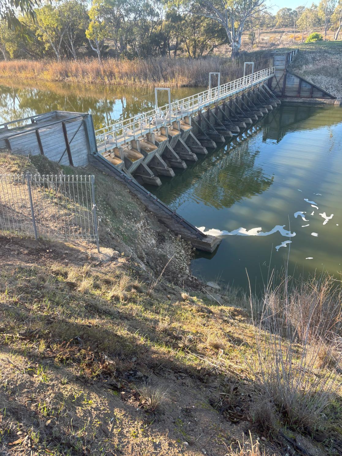
The Jeparit Weir sustained significant damage during the 2011, 2016 and 2022 flood events, with the 2011 event the largest of the three. Combined with the weir’s age, this damage has caused operation of the weir to be difficult and dangerous for Hindmarsh Shire Council (HSC) staff. Leaving the weir inoperable has the potential to cause complete structural failure of the weir or exacerbate flooding for the Jeparit township.
Water Technology was commissioned by HSC to assist with the replacement of the Jeparit Weir by developing a case for its replacement and assisting with the funding, approvals and design stages.
This study explores the weir’s purpose, potential impacts of the current weir arrangement and reviews weir replacement options to ultimately assist HSC in seeking future investment from the Victorian and Commonwealth Governments for its replacement
1.2 Objectives and Purpose
This report is intended to assist the HSC in applying for funding for the redevelopment or replacement of the Jeparit Weir by defining a redevelopment plan that outlines the key considerations, recommendations and benefits associated with the construction or redevelopment of the weir. The objectives of this report are described below:
◼ Undertake a site visit, review the structure to understand and outline the condition of the weir.
◼ Obtain and update existing best-practice hydrological and hydraulic models for the study area.
◼ Determine the flood impact of the weir when operated as designed, removed and closed (i.e. non operable).
◼ Determine potential options for replacement.
◼ Define the monetary benefit the weir provides the community.
This information will be used as the basis for future designs to be undertaken. It will also be used as the foundation for the HSC funding application.
1.3 Study Area
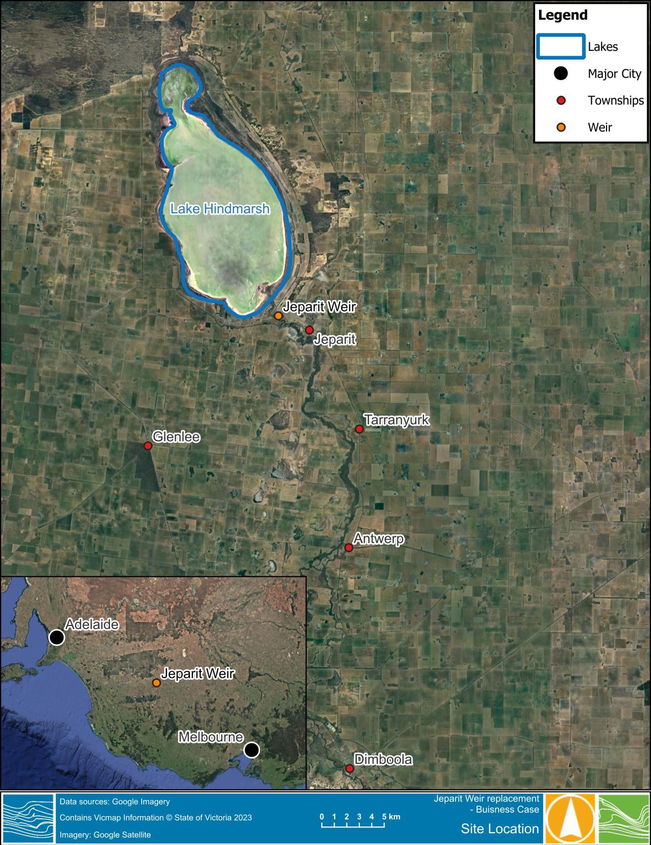
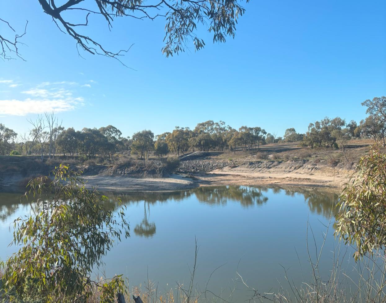
Jeparit is situated on the border between the Southern Mallee and Wimmera regions of western Victoria, located 67 km northwest of Horsham and 38 km west of Warracknabeal. The township situated on the banks of the Wimmera River, around 5 km south east of Lake Hindmarsh, with the potential to be flooded from the Wimmera River The Wimmera River originates in the Pyrenees Ranges, near the township of Elmhurst, and flows generally westward, towards Horsham, and then northwards to Lake Hindmarsh.
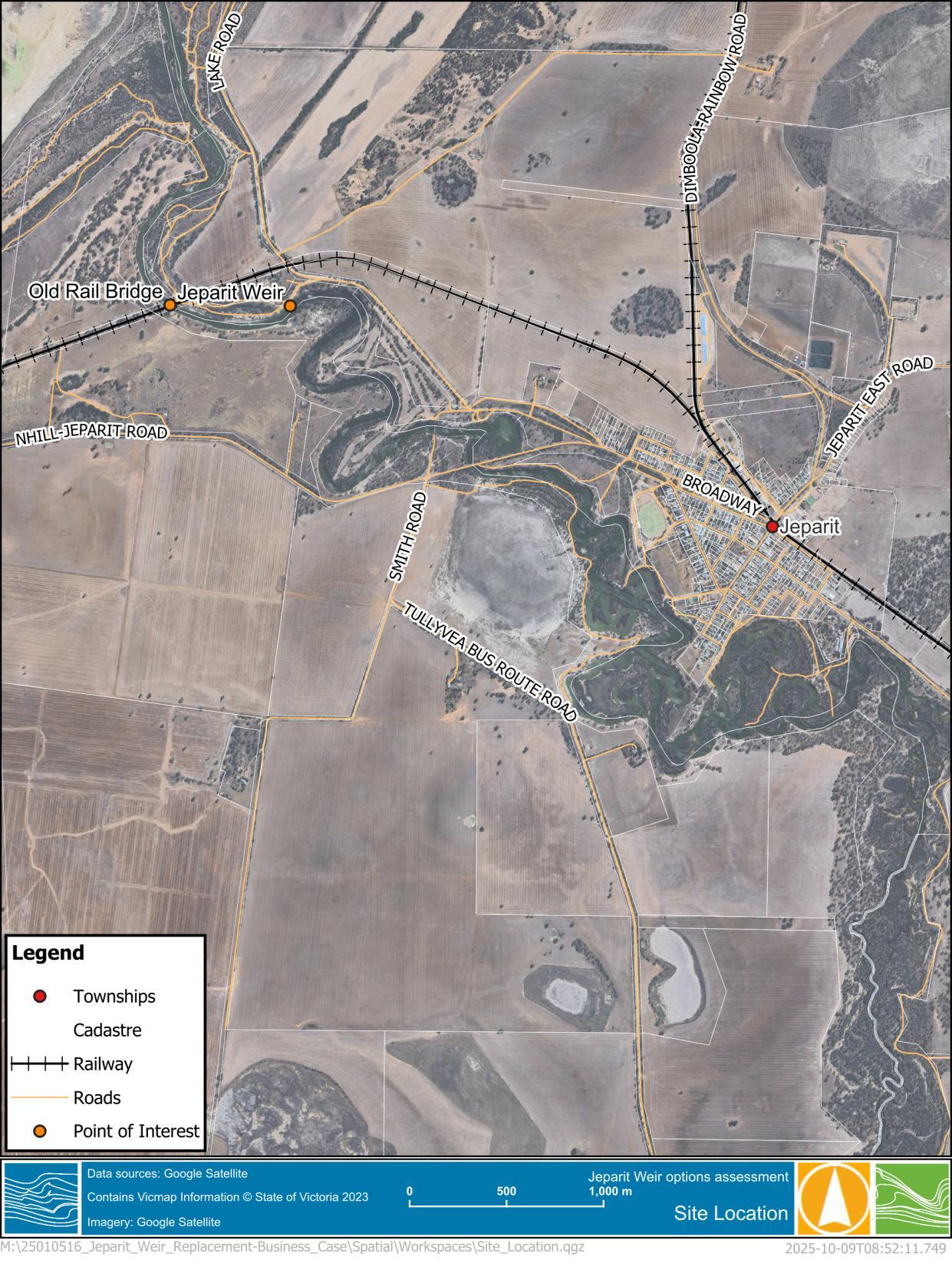
The Jeparit weir is located approximately 4.5km downstream of the Jeparit township. The weir location with respect to the broader region is shown in Figure 1-1, with a closer perspective shown in
Figure 1-2
The investigation addresses the specifics of Jeparit Weir but also covers the broader Jeparit township and its surrounds with respect to the weir’s role in water availability and flooding.
Figure 1-2 Jeparit weir location – close perspective
2 JEPARIT WEIR STRUCTURE
2.1 History
On December 30, 1902, 30 men constructed the concrete and timber Jeparit weir. The work was on direction from the Victorian Government Parliamentary Railways Standing Committee. The Committee instructed the construction of four weirs, including Jeparit, Dooen, Dimboola and Antwerp. This move was designed to compensate downstream landowners in response to constructing an embankment across Mt William Creek to create Lake Lonsdale near Stawell. There are limited records available around the weirs maintenance, construction and operation history.
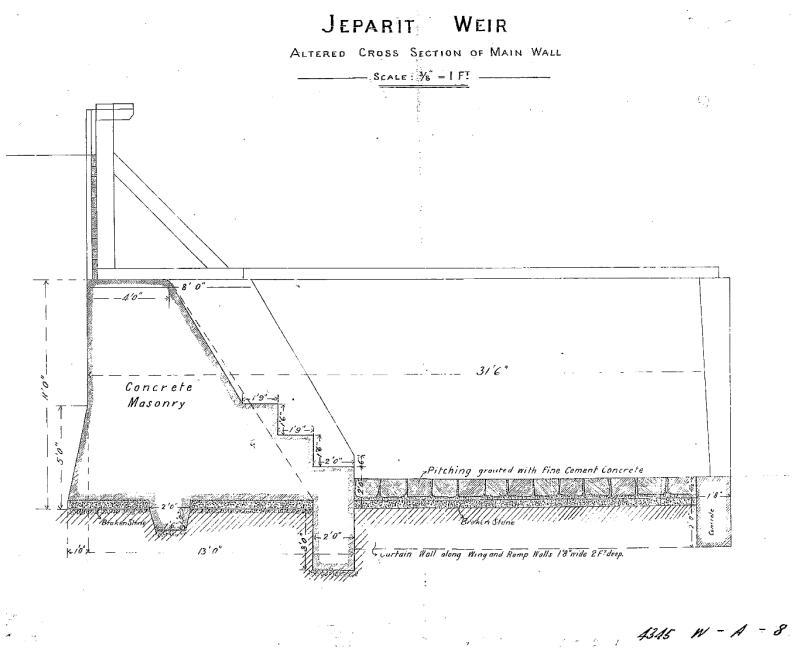
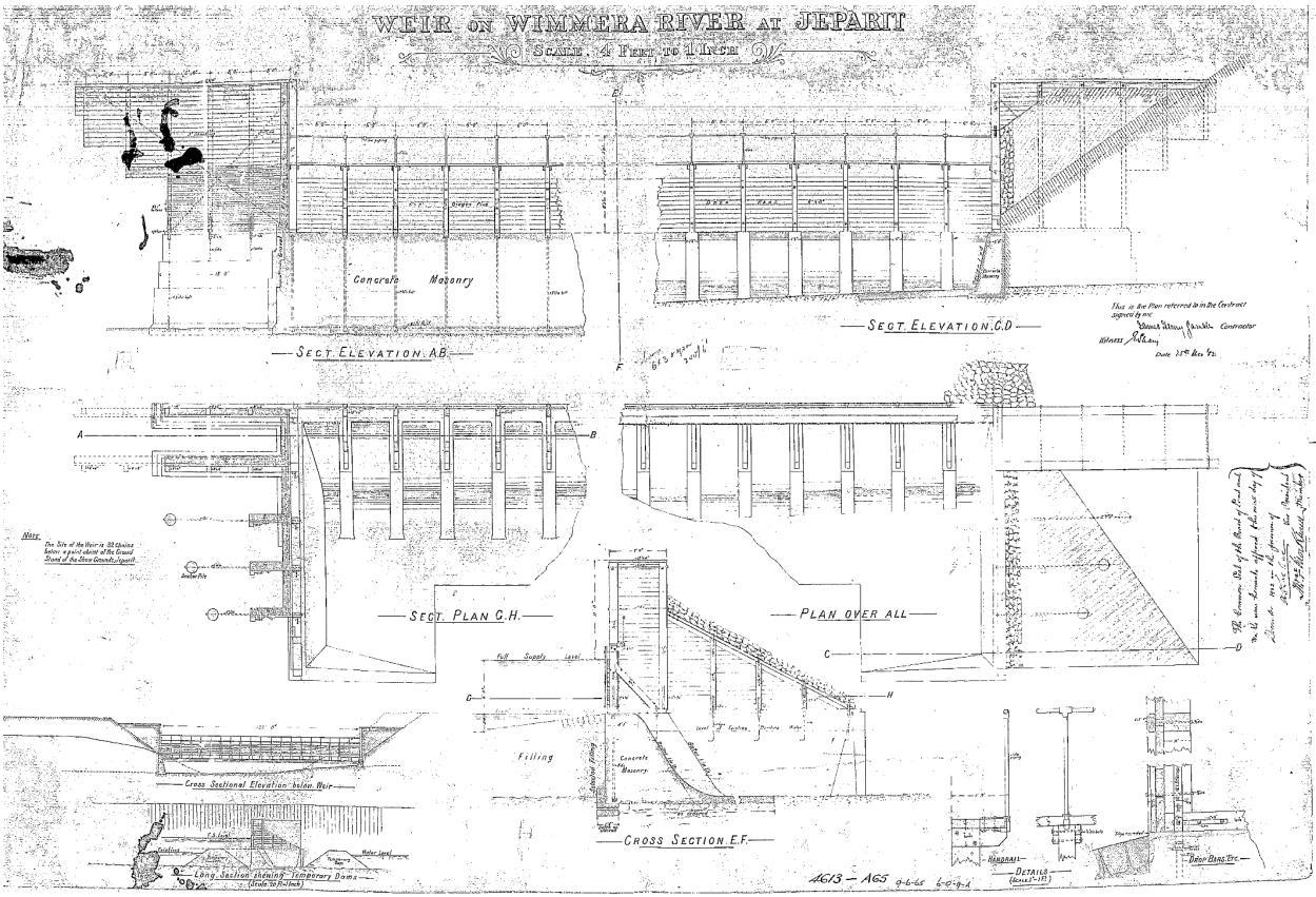
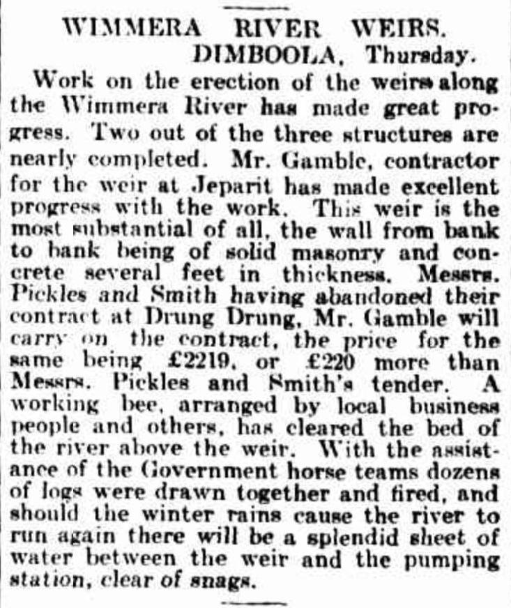
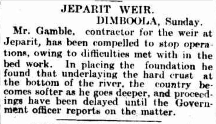
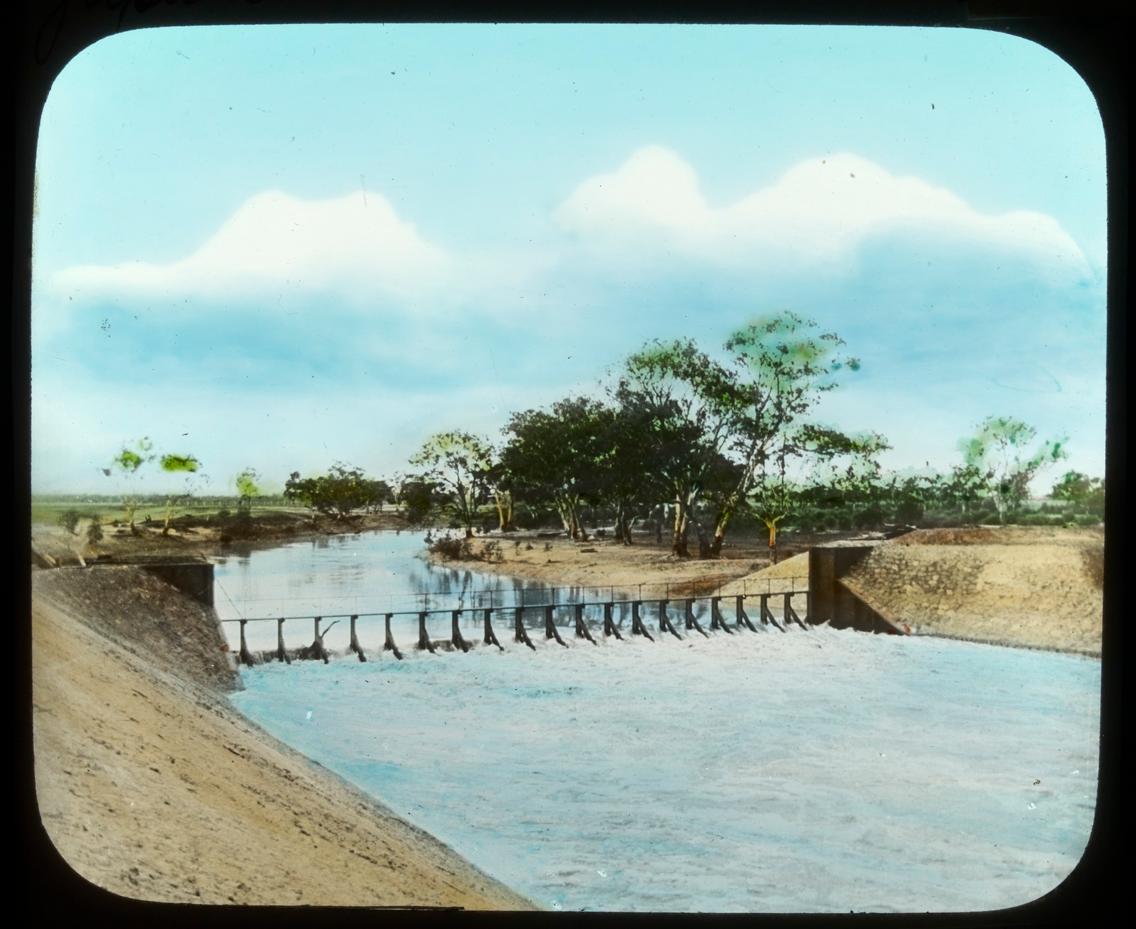
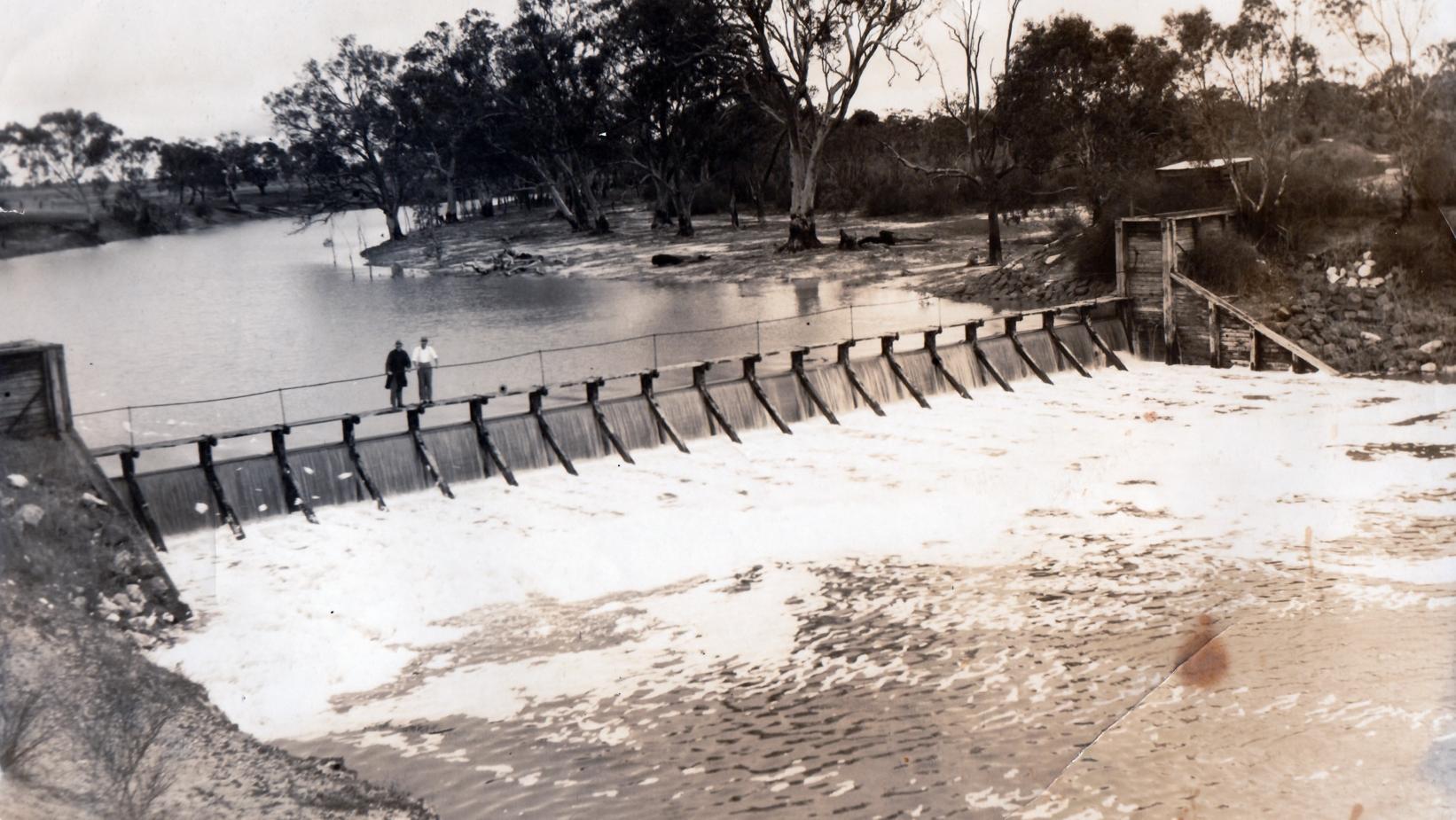
It is known that repairs were required following the 2011 flood event which also brought the establishment of the spillway adjacent to the weir. The repairs were completed around 2014 and included repairing the bent spindles, walkway, handrail, overhead support wire, support structure and overflow gates. Historic drawings, newspaper articles and photos of the weir are available and are presented from Figure 2-1 to Figure 2-6
The condition and longevity of the Jeparit weir has been questioned post flooding in 2011 and 2016, with major concerns around potential risks of failure. In 2011, the weir endured significant flows following record rainfall in the Wimmera River catchment.
Post the 2016 flood event, SMEC completed the Jeparit Weir Condition Assessment (2017). A second inspection and condition assessment was also undertaken in 2025 by F.C.H Consulting Pty. Ltd.
2.2.2 SMEC Condition Assessment (2017)
2.2.2.1 Overview
The worsening condition of the weir and its surrounding area led to a conditions assessment being undertaken by SMEC in 2017. The assessment summarised the impacts and conditions of the upstream and downstream pools, weir structure, foot bridge, abutments and stilling basin. It was concluded by SMEC in 2017, that the weir did not meet current industry standards. SMEC also presented the likely modes of failure for the weir structure and the major underlying issues with the area. The potential modes of failure that were established can be given below:
◼ Sliding of the weir structure.
◼ Overturning of the weir structure.
◼ Collapse of one or several trestles during a flood event.
◼ Piping through the foundation; and
◼ Piping failure through the right abutment.
Each component’s assessment is summarised below.
2.2.2.2
Upstream and Downstream Pool
2.2.2.2.1 Upstream Pool
◼ The upstream pool was found to be in good condition.
◼ The left-hand-side and right-hand-side rims of the upstream pool had no observable evidence of slips, depressions or slope instability.
◼ The area of the pool directly upstream also appeared to be in good condition, suggesting no major leaks under the weir.
2.2.2.2.2 Downstream Pool
◼ Exposed sections generally appeared to be in good condition.
◼ Cracks were present at the bottom of several concrete piers, which has led to exposure of reinforcement and may cause durability issues.
◼ An inspection of the concrete base was not performed. A detailed inspection of this section is recommended.
2.2.2.3 Weir Structure
Each bay group was assessed and is labelled 1 to 20 from the right hand side to the left of the structure looking downstream. These bays are summarised below.
2.2.2.3.1 Bay No. 1
◼ Constructed from fixed drop boards.
◼ Evidence of leakage.
◼ Overall good condition, given their age.
◼ Free of structural distress, damage or deterioration.
2.2.2.3.2 Bay No. 2 to 7
◼ Radial type gates.
◼ Gates appear in good condition.
◼ No evidence of leaking, suggesting that the seals are working well.
◼ Actuators in good condition, however, no written record regarding the operation and maintenance of the actuators.
2.2.2.3.3 Bay No. 8 to 20
◼ Timber trestle section of the weir.
◼ Trestles have undergone significant deterioration.
◼ Most bolts seem to have been replaced.
◼ The concrete base appears to be in satisfactory condition, with some signs of cracking, erosion and deterioration.
Due to the deteriorated status of the timber trestles, the structural integrity of the weir was judged as poor.
2.2.2.4 Foot Bridge
◼ No evidence of structural or other defects that could undermine the integrity of the bridge.
◼ Deck and handrails in good condition.
2.2.2.5 Abutments
The abutments are cantilevered type retaining walls with multiple tiebacks. The location of the abutment is taken from the side it is on when looking downstream of the weir. A summary of the abutment conditions is given below.
2.2.2.5.1 Left abutment
◼ Bolts replaced, in good condition.
◼ Wooden planks have deteriorated significantly, undermining the integrity of the abutment.
◼ The integrity of the left abutment has been judged as poor.
2.2.2.5.2 Right abutment
◼ Bolts replaced, in good condition.
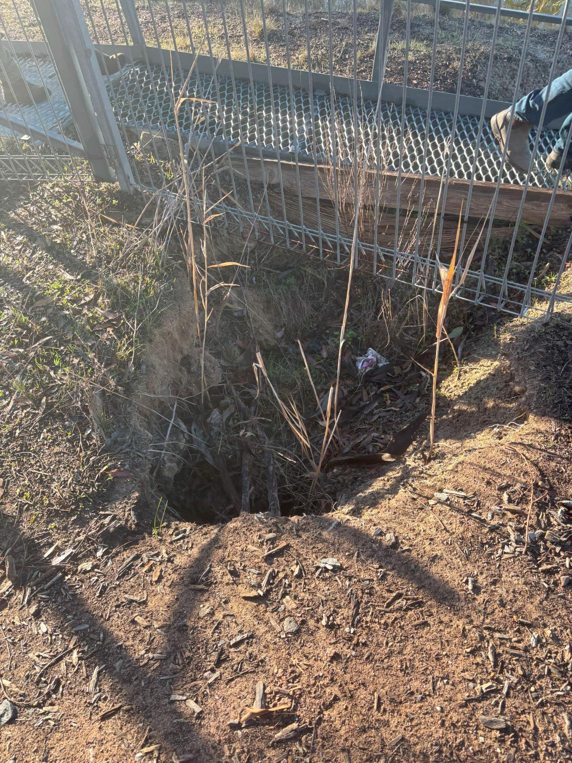
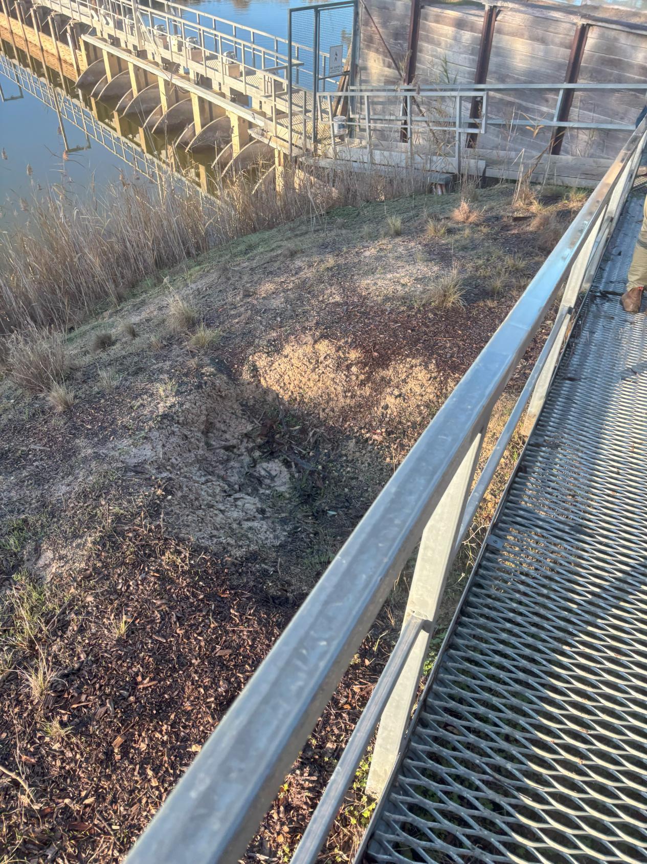
◼ Erosion holes present surrounding the abutment, resulting from poor drainage.
◼ Erosion holes on top of the abutment, resulting from poor drainage.
◼ Abutment considered to be in poor condition.
2.2.2.6 Stilling Basin
◼ Stepped section of the weir could not be assessed.
◼ Depths in the upstream pool appear to be relatively consistent with expectations, suggesting no significant undermining is occurring.
◼ Possible material deposition may be present along the lined section of the downstream channel.
◼ Material is present downstream of the concrete cut off.
◼ Erosion downstream does occur progressively but does not appear to be happening close to the concrete cut off to be of immediate concern.
◼ Concrete cut off area is still at risk of being undermined and should be probed after major flood events.
2.2.2.7 Summarised Issues
The major issues of the weir structure are limited to certain components. These components should be prioritised when considering the weir redevelopment. A summary of the underlying and future issues is given below and should be used to consider potential solutions relating to the weir redevelopment.
2.2.2.7.1 Major Issues (immediate concern)
◼ Timber drop board deterioration.
◼ Timber trestle deterioration.
◼ Abutment plank deterioration.
◼ Drainage on and around abutments (leading to erosion holes, drainage paths, etc.)
2.2.2.7.2 Minor Issues (potential concern)
◼ Cracking of concrete structures, such as piers, base, etc. (potential for durability issues)
◼ Possible downstream erosion.
◼ Concrete cut off undermining.
Some components of the structure were unable to be investigated, which may present new considerations for the potential redevelopment. These should be undertaken in future to ensure our outputs address all concerns.
F.C.H Consulting Pty. Ltd. Inspected the Jeparit weir on the 2nd of November 2025. This inspection was undertaken to evaluate the current condition of the structure and assess the needs for repair or replacement. The observations made during this investigation are summarised and presented below. The full investigation is given in Appendix B – Condition Assessment and replacement Costing
2.2.3.2
Observation Summary
Overall, the condition of the weir was deemed to be ‘very poor’, with numerous cracks present in the timber cells, headwalls, and supporting trestles. The bolts connecting the timber trestles with the concrete supporting walls were observed to be impacted by corrosion and the walls themselves show signs of cracking. The condition of the abutments was also deemed as poor, with steelwork found to be badly rusted and the lighter gauge angle bracing had completely corroded. Many of the redgum planks showed signs of cracking and splitting. The operation of the weir was also investigated. It was noted that the radial gate actuators are not currently operable. Every timber cell was observed to be leaking.
The conclusion of the investigation was that the structure has reached its operational life expectancy and should be replaced. The structure is incapable of withstanding the loads from a flooding event and is exacerbated by the fact that the structure cannot be safely configured in an open flow condition to alleviate the loads from a peak flood event. It was also suggested that it would be much safer and cheaper to construct a new weir while the existing weir was in place to hold back the downstream pool rather than wait until the weir had failed. The proposed weir replacement is recommended to be constructed 200m south of the existing structure. An initial cost analysis completed within the condition assessment presents a cost estimate for the construction stage of the project of $4,000,000. It should be noted that this estimate is for the construction of the weir and does not include all other expenses likely to be incurred within the overall project (eg. existing weir removal, cultural heritage assessments, weir design, etc.).
3 SITE VISIT
3.1 Overview
A site visit to the Jeparit weir was undertaken on the 23rd of July 2025, to inspect and observe the current conditions and function of the weir. At the time of inspection Water Technology had access to a SMEC Condition Assessment Report (2017) report which detailed the key areas and issues that should be inspected during the visit. Water Technology also had access to the original construction drawings made available by HSC and those attached to the SMEC report.
The inspection team compromised:
Name Representing
Lachlan Inglis
Water Technology
Simon Landrigan Hindmarsh Shire Council
Bailey Hume Water Technology
Photographs of the site visit are given in Appendix A.
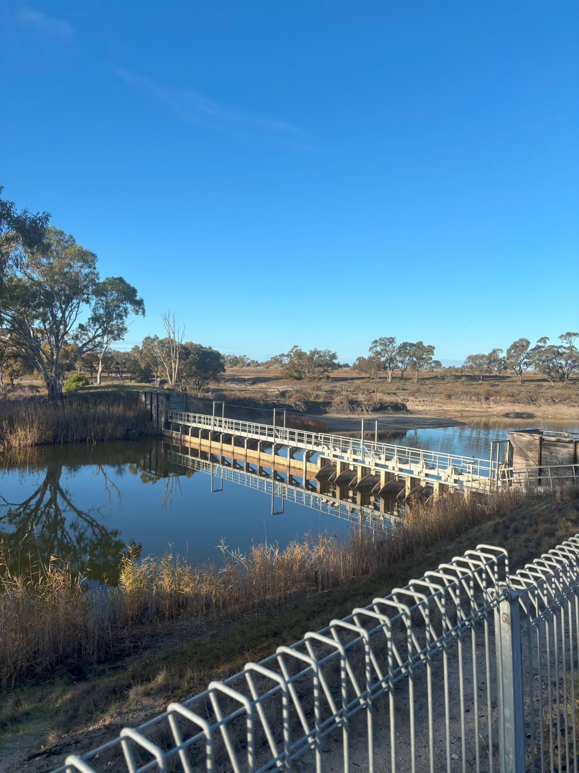
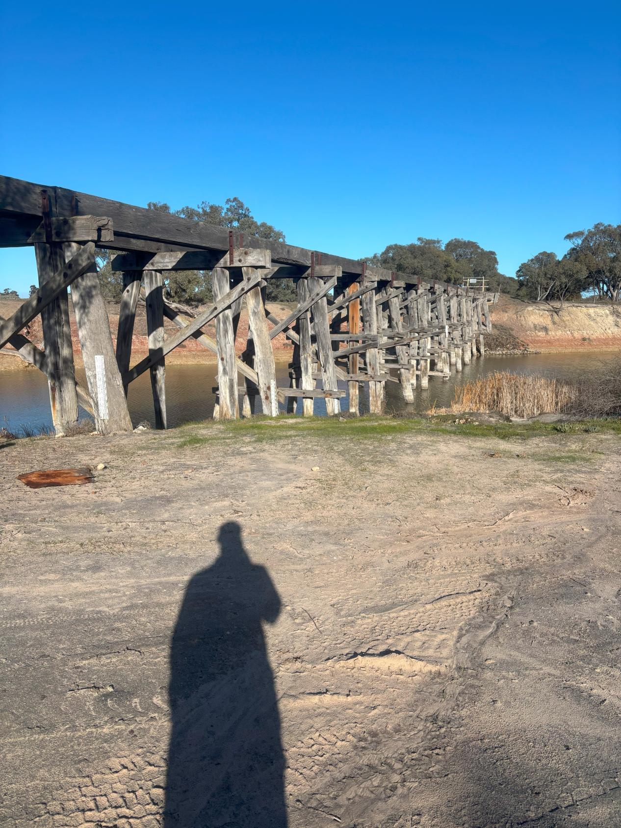
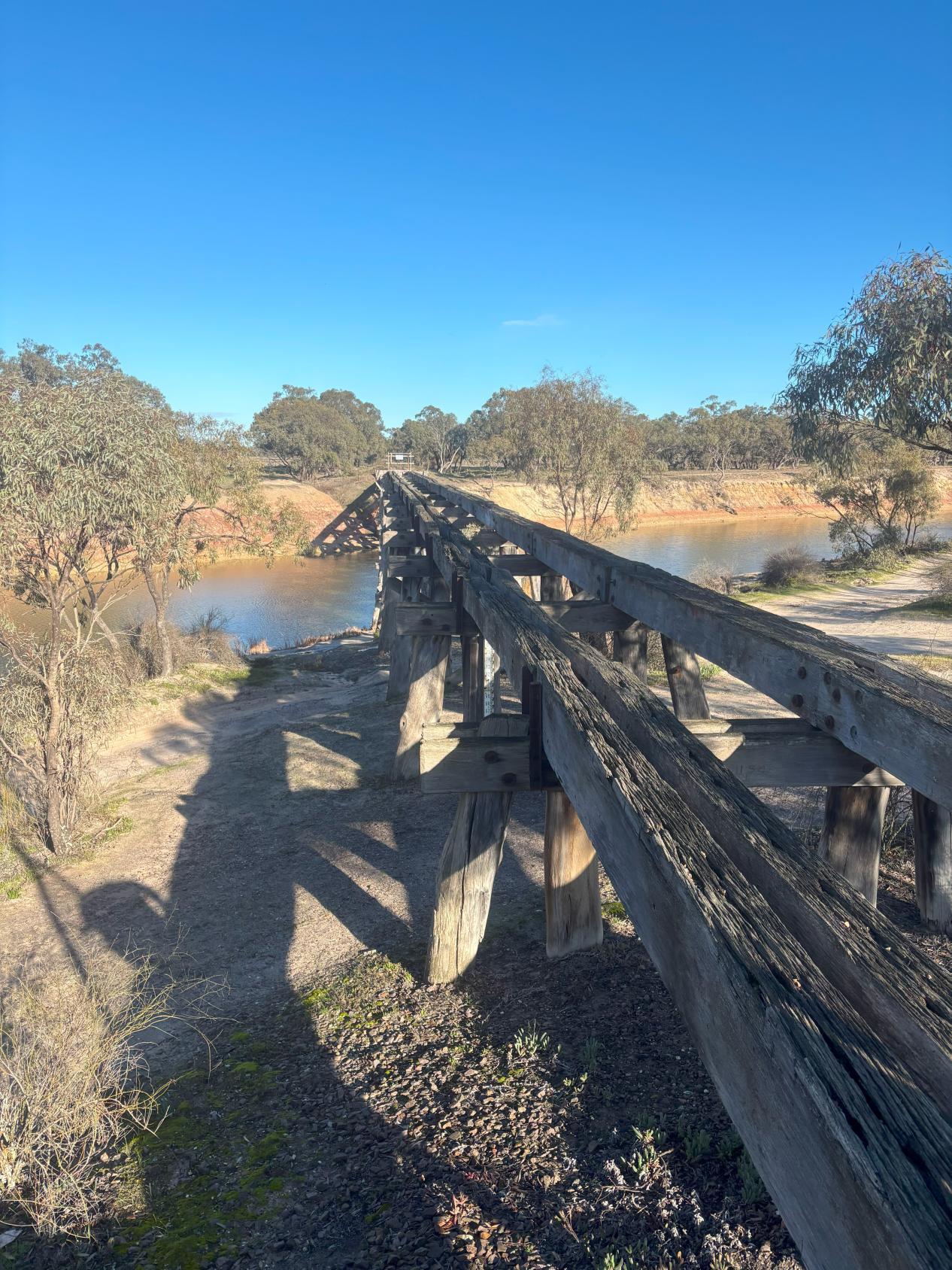
The site visit involved a walk around and a brief inspection of the weir from the Lake Road side of the weir. The inspection included the abutments, spillway, weir boards and gate systems and the banks upstream and downstream of the weir. The old road bridge, Nhill-Jeparit Road bridge and the old rail bridge were also inspected to understand the arrangement of structures surrounding the Jeparit Weir. A summary of the visit is detailed in the following sections
3.2 Weir Structure
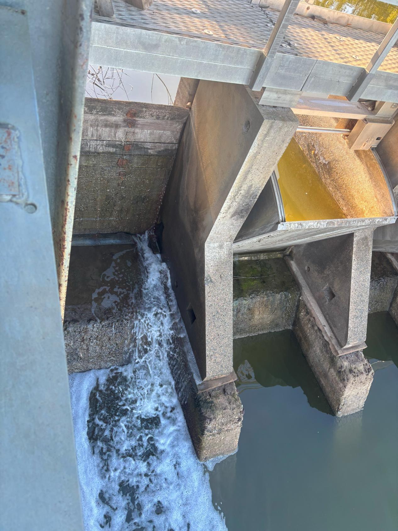
Bay No.1 (From RHS looking downstream) has been constructed using fixed-drop boards. The boards themselves appeared to be holding water adequately; however, the 2017 SMEC condition assessment noted that they perceived their condition as deteriorated with signs of leaking. Site observations indicated the water passing through this bay is actually doing so through the bottom of the boards. Photograph 17 highlights where the water is bypassing the boards, which appeared to be in the bottom right corner where the seal at the bottom of the bay has been damaged.
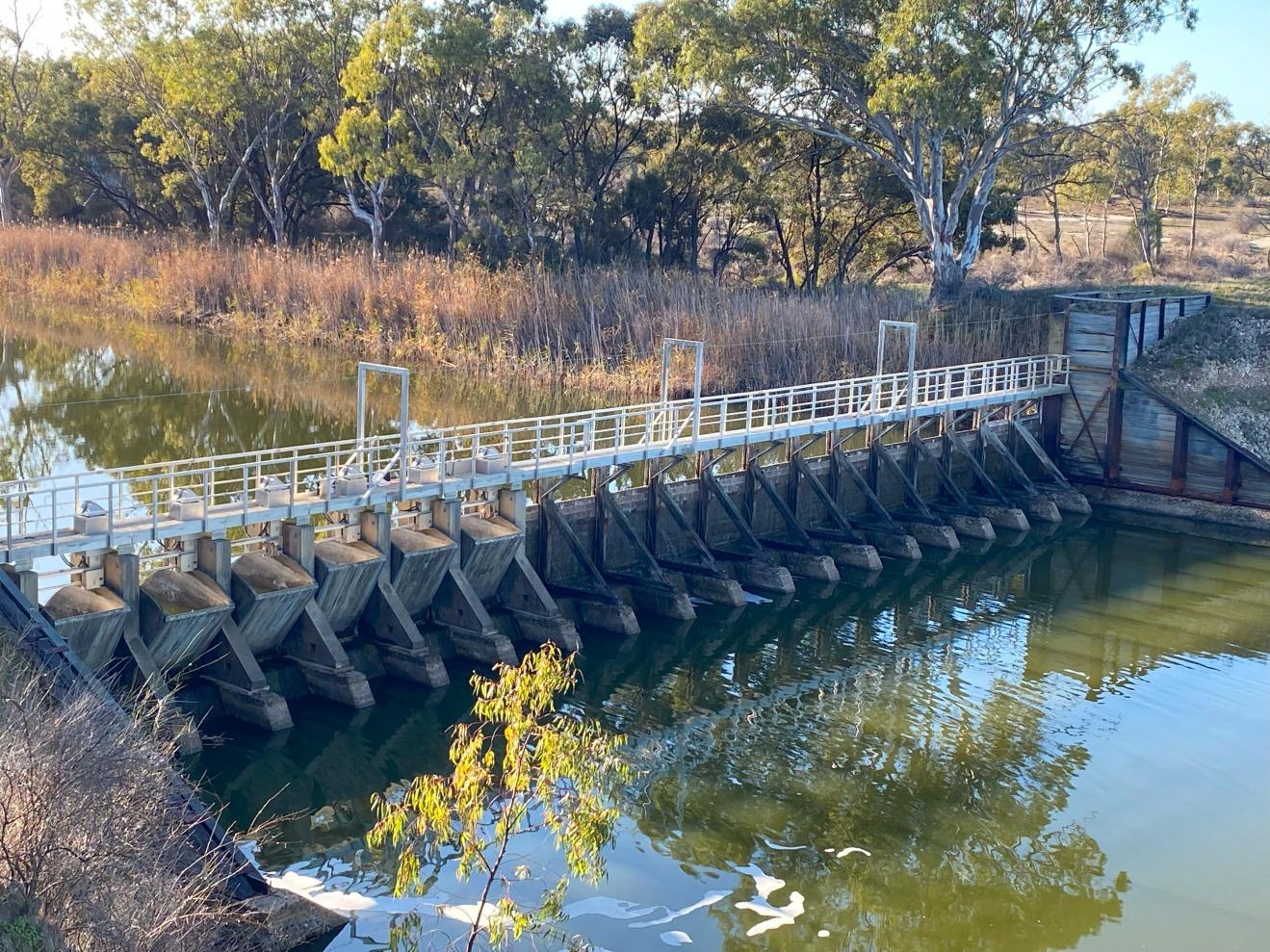
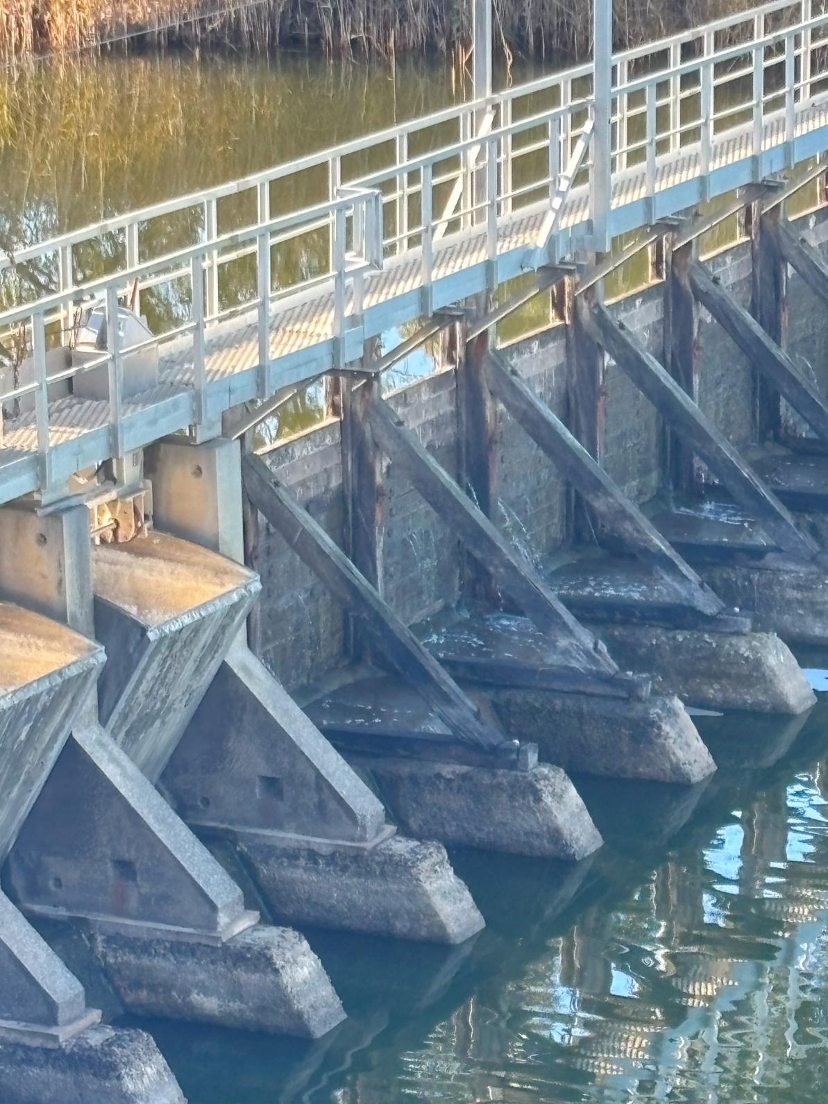
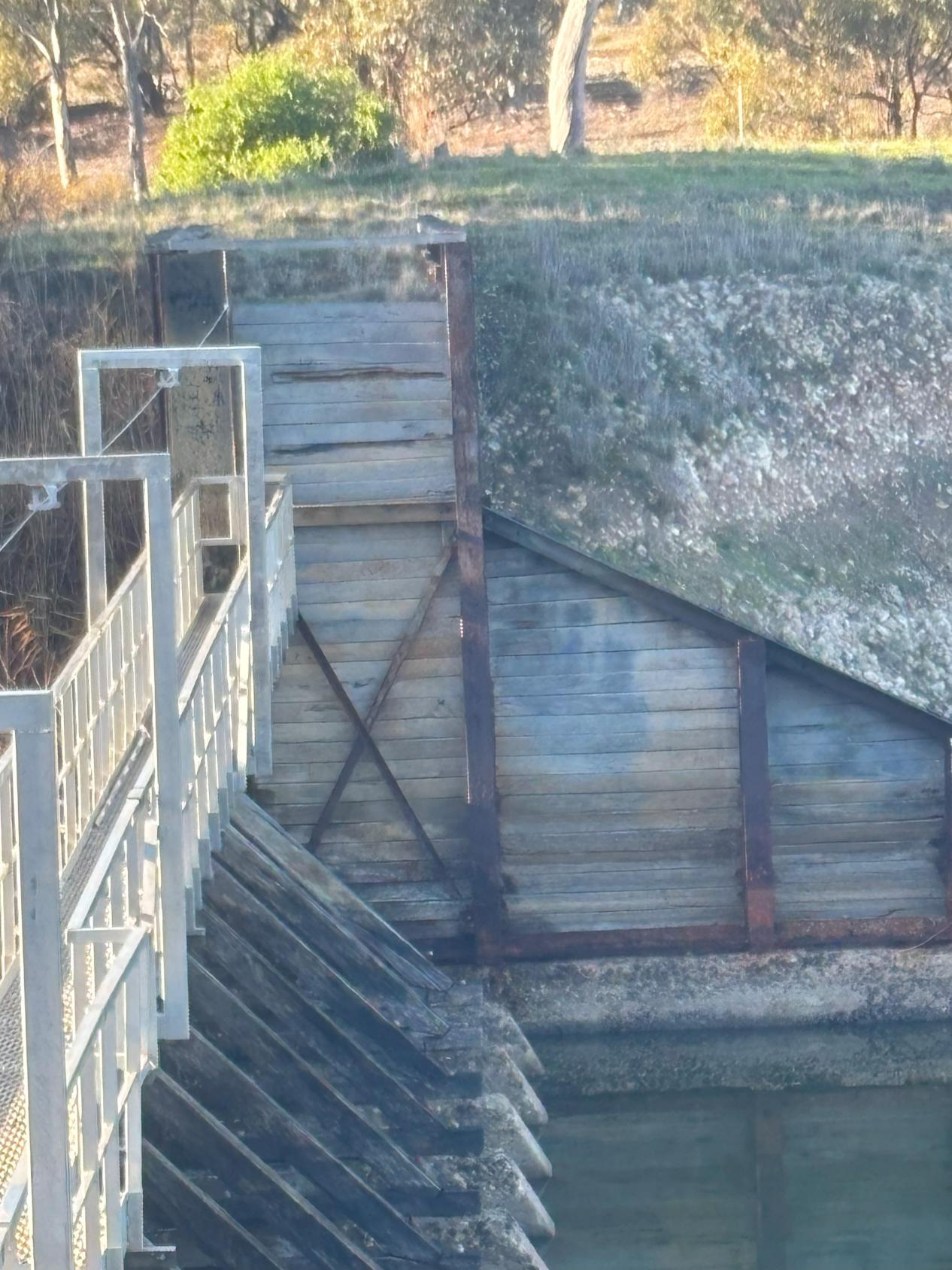
Bays Nos. 2 to 7 are fitted with overshot type gates. There were no signs of leakage or damage; however, it is understood the gates are not operable. The timber trestles from bay 7 to 20 were seen to have signs of deterioration that match the SMEC assessment. This damage includes signs of concrete cracking and deterioration of the timber trestles.
3.2.1 Abutments
The left side abutment was not inspected in detail, but signs of damage to the retaining wall and erosion on the top and either side of the abutment were evident.
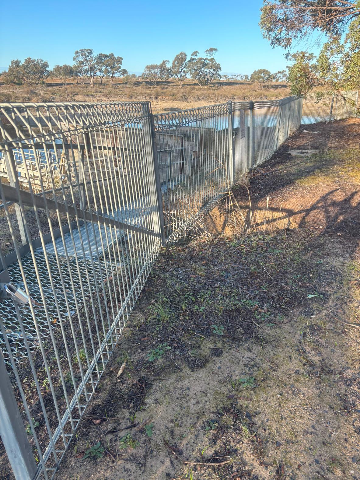
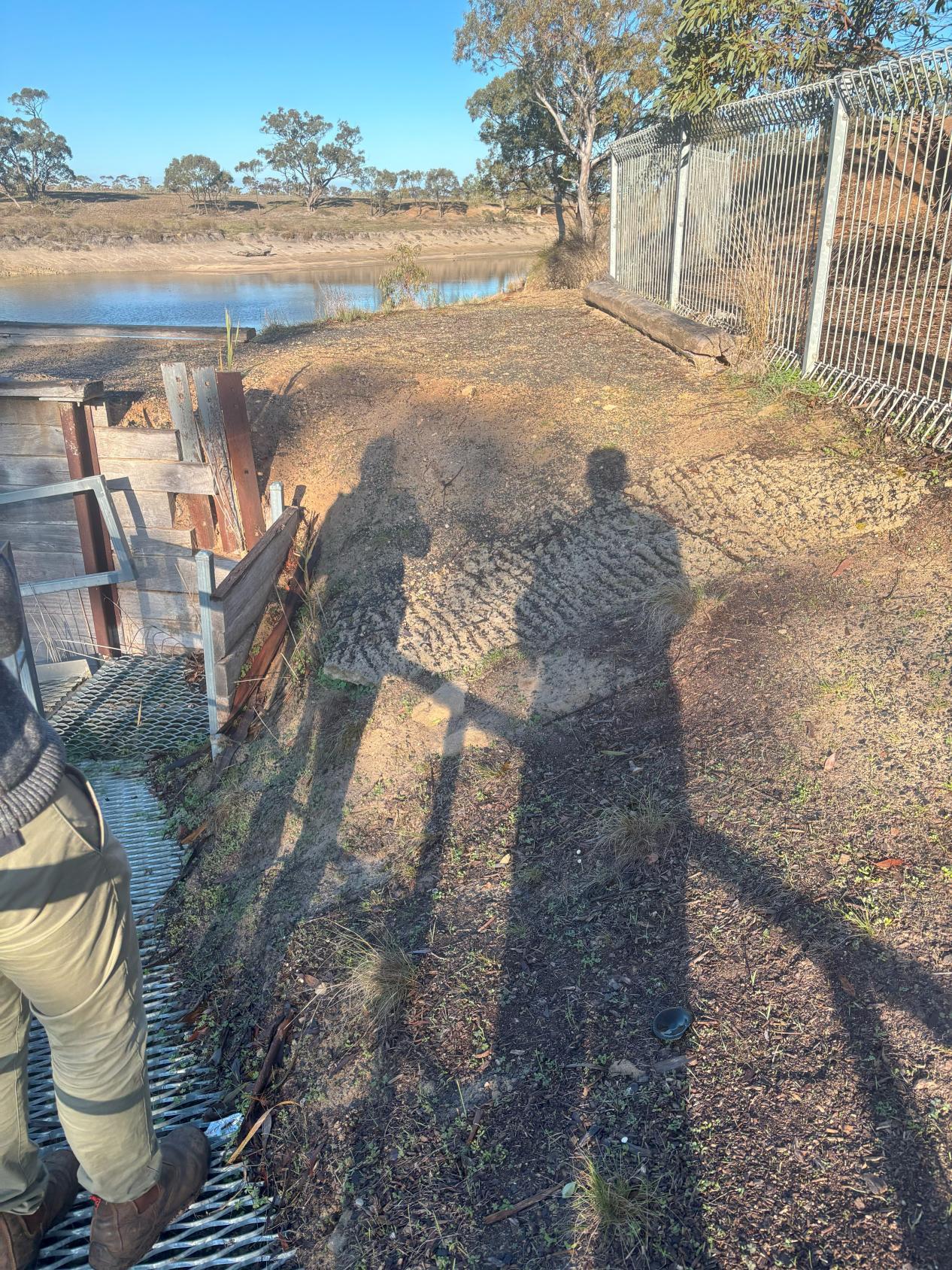
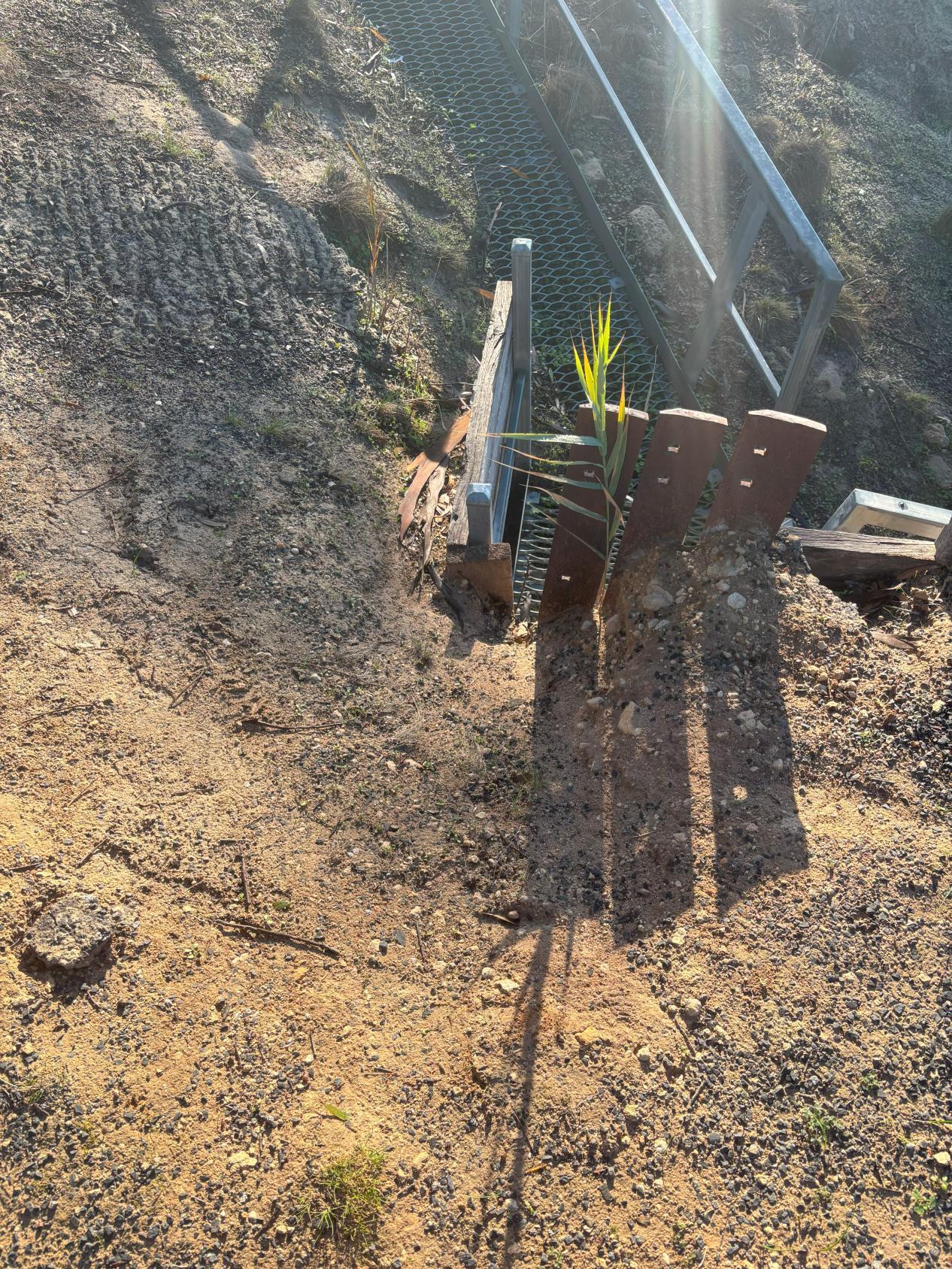
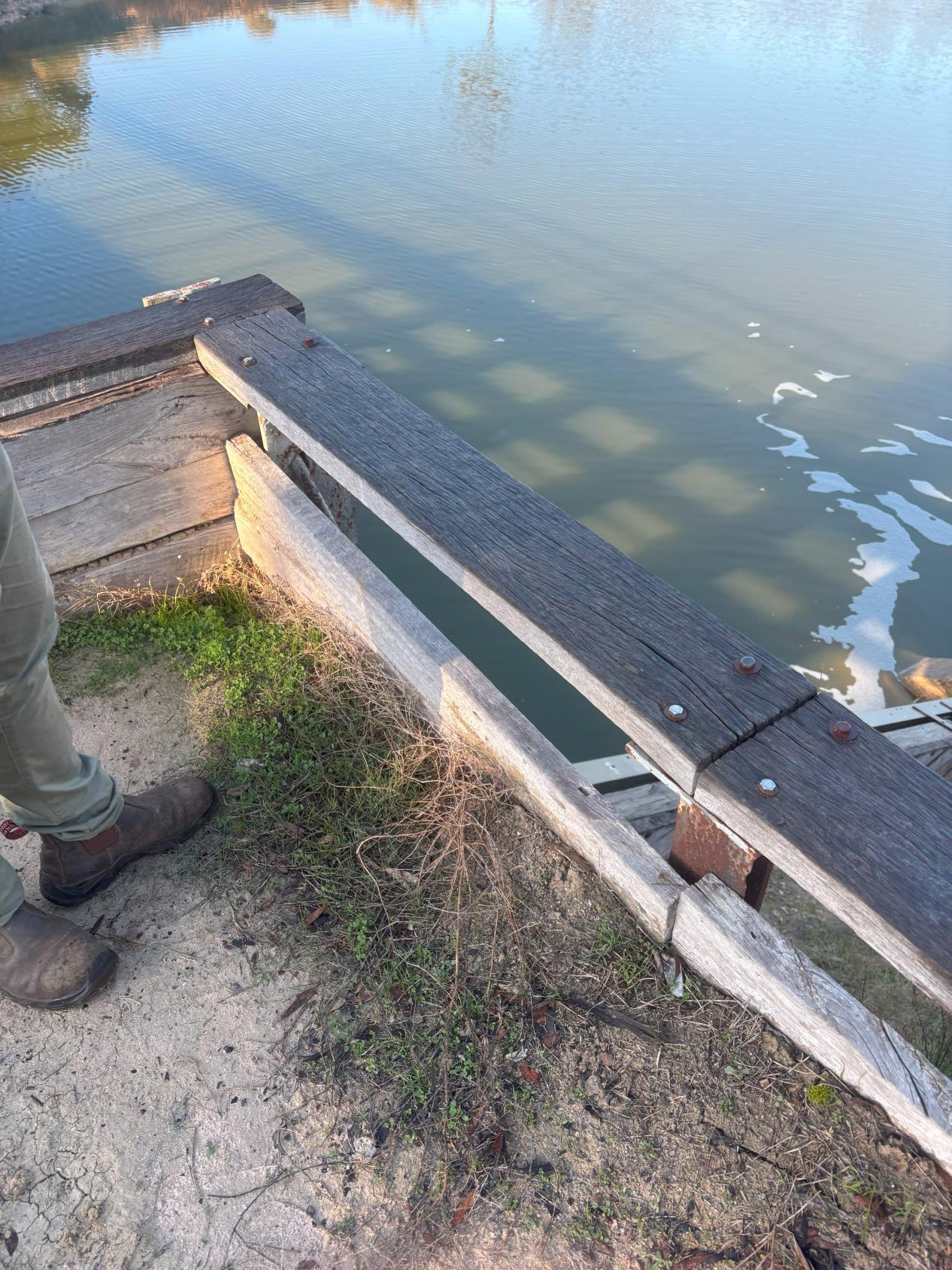
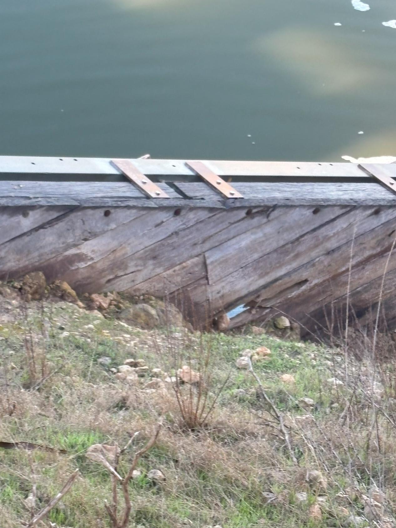
The right side of the abutment was inspected in more detail. Damage to the retaining wall was evident on all sides of the abutment, this damage was mostly specific to the timber boards. Erosion on this abutment was observed to impact all sides and the top of the abutment. The top of the abutment had signs of erosion developing in the corners of the retaining wall. Poor drainage on top of the abutments has led to erosion on the top surface of the abutment and also led to the formation of drainage channels which drain back towards the river, as shown in Photograph 12.
Table 3-1 Site Visit Team
3.2.2 Riverbanks
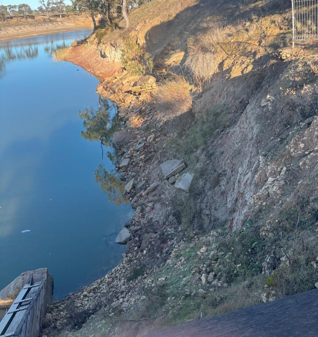
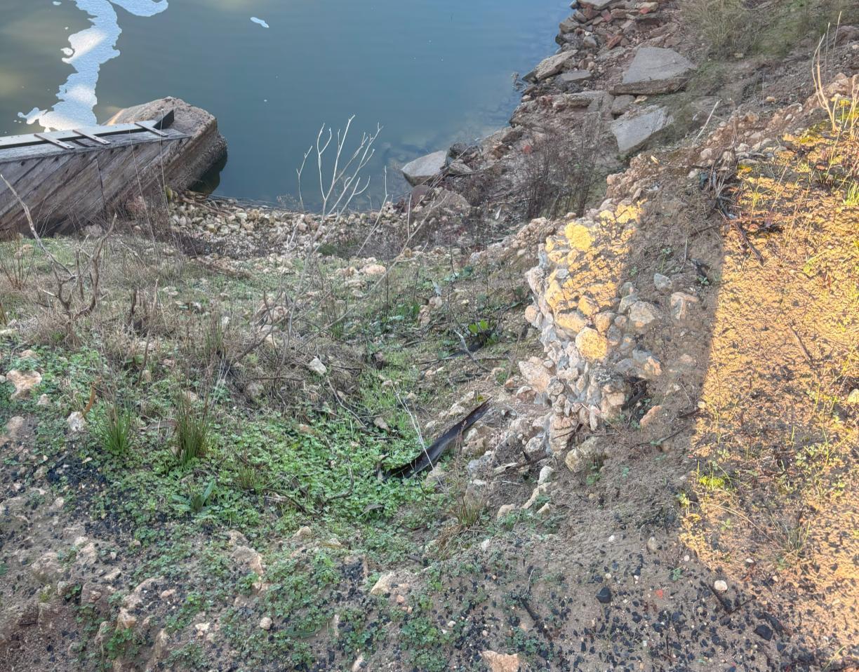
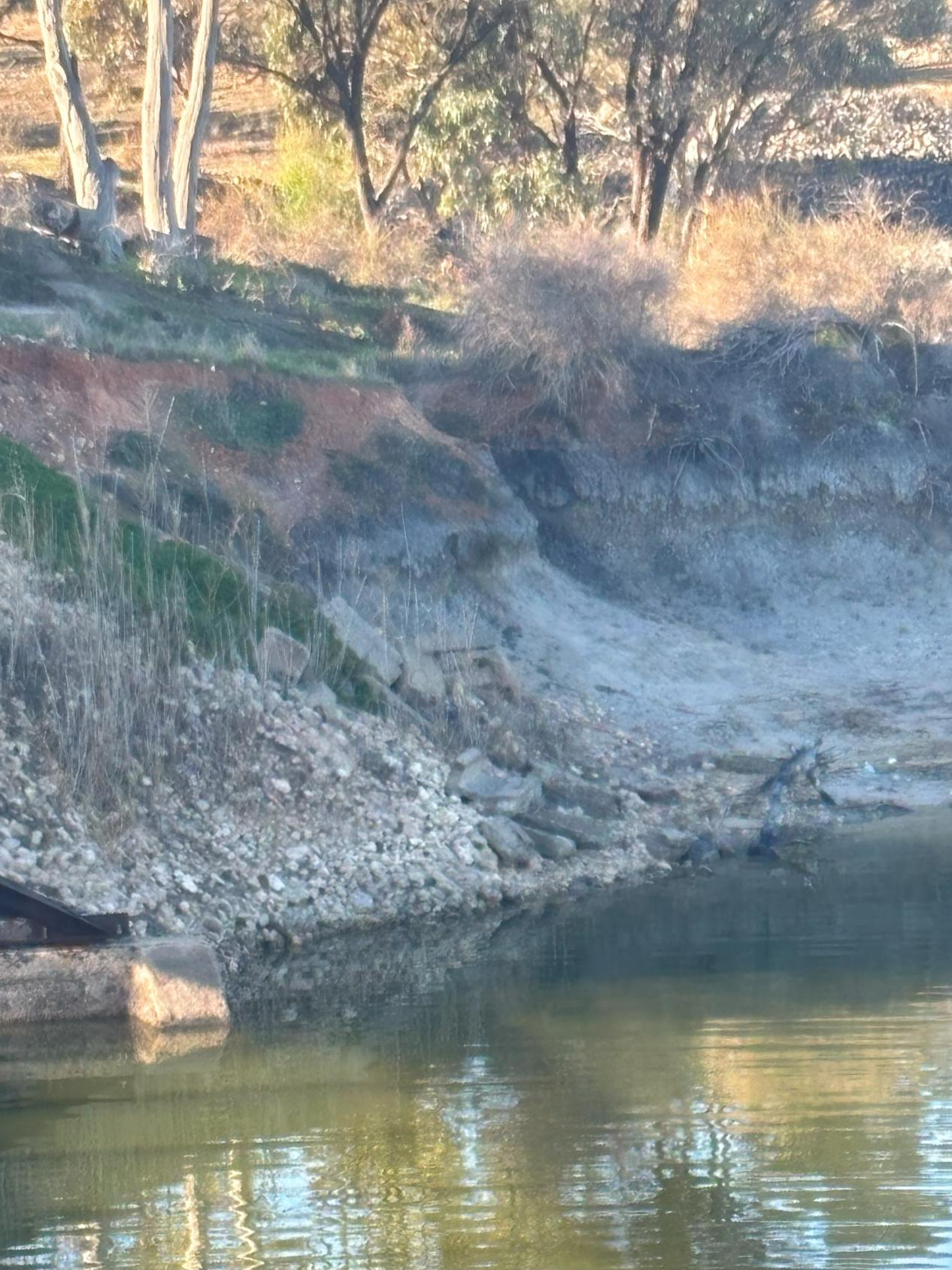
The riverbanks on either side immediately downstream of the weir show signs of significant erosion. This portion of the bank is typically baren and lacks significant vegetation, which is further exacerbating the impact of erosion. The lack of vegetation, steepness of bank slopes and lack of erosion control measures, such as rock bank stabilization, leaves the banks exposed with no protection to fast moving water when the weir overtops. There has been some dumped waste concrete to provide some slope stability, but this stabilisation is only present over a small area either side.
4 AVAILABLE FLOOD INFORMATION
4.1
Previous Studies
The following previous studies were identified producing flooding information for the Wimmera River at Jeparit as part of the data collation and review:
◼ Water Technology – Regional Flood Mapping: Lower Wimmera (2017)
◼ Water Technology – Jeparit Flood Study (2008)
Other previous studies around the broader region include:
◼ BMT – Upper Wimmera Flood Investigation (2014)
◼ Bureau of Meteorology (BOM) – Wimmera River Basin URBS model (2004)
◼ Water Technology – Wimmera River and Yarriambiack Creek Flow Modelling Study (2009)
◼ Water Technology – Horsham Flood Study (2003)
◼ Water Technology – Dimboola Flood Study (2003)
◼ Water Technology – Horsham Bypass Hydrologic and Hydraulic Investigation (2013)
◼ Water Technology – East Horsham Channel Decommissioning Hydraulic Assessment (2013)
The modelling used in these studies has formed a framework for the modelling undertaken as part of this project
4.2 Historical Flood Records
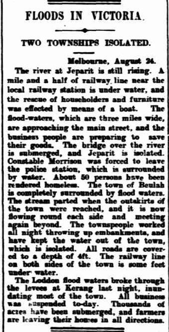
There are a significant number of historical flood observations within the study area. Since 1894 there have been more than 16 significant floods that have affected Jeparit. The 1909 flood event is reported as the most severe, with nearly all the town and surrounding areas affected by floodwater. The 1909 event had an estimated Annual Recurrence Interval (ARI) expressed as greater than 1 in 190 years. An article from the 25th of August 1909 can be seen in Figure 4-1, which summarises the impacts of the event.
Flooding in the town has been reported as greatly influenced by the level of Lake Hindmarsh; however, the lake has only filled five times in the last century, with 1996 being the most recent.
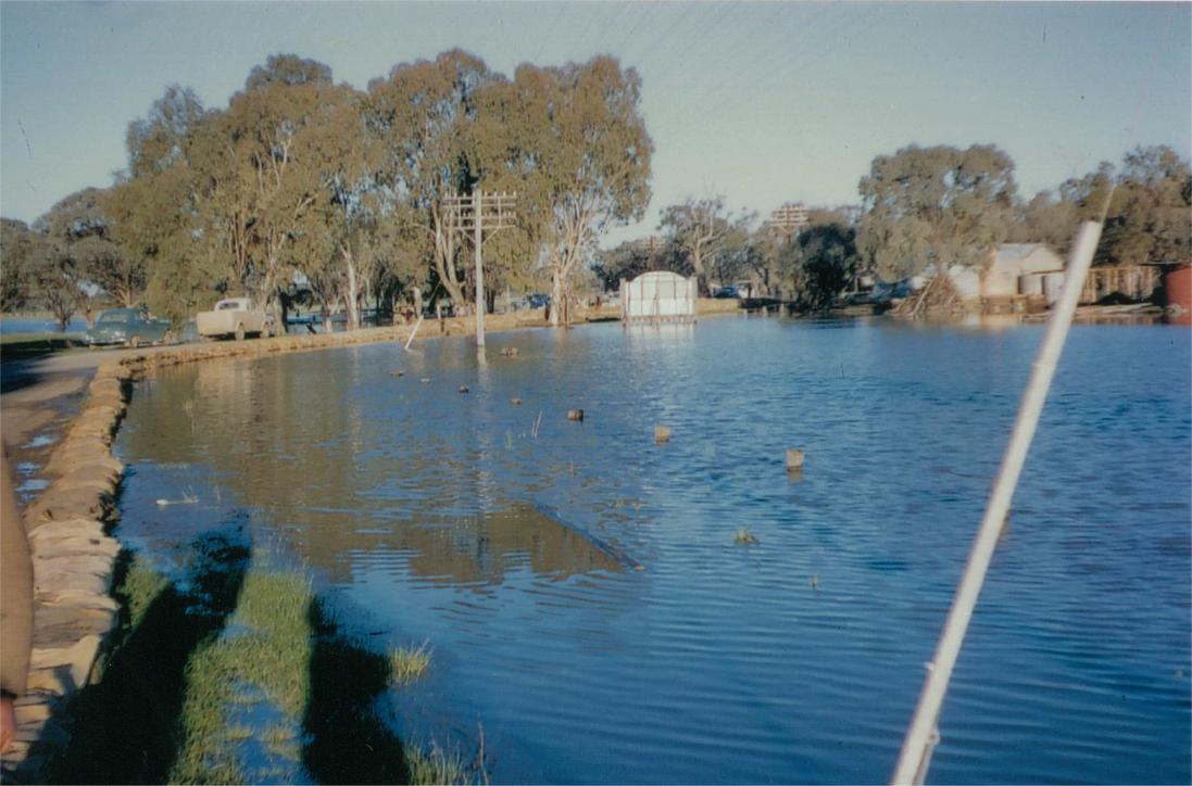
Flooding prior to 2000 was common, additional to 1909, floods were reported in 1956, 1974 and 1981 The 1956 flood was the second largest event in this period, and it resulted in the construction of two levees in the Jeparit township to mitigate the flooding impacts. A photo of sandbagging around the Jeparit Museum is shown in Figure 4-2. These levees were constructed at the football club (Sands Avenue) and near the museum (Dimboola-Rainbow Road).
Figure 4-1 Floods in Victoria, 1909 (Source: Trove)
4.3 January 2011
The January 2011 flood event was the largest flood on record for most waterways in the Wimmera River catchment. The event involved record rainfall over the Wimmera River catchment, with Jeparit experiencing 197.2 mm over a five day period, from and including the 10th to the 14th. The Wimmera River at Lochiel Railway Bridge and the Wimmera River at Horsham gauges are the closest streamflow gauges to Jeparit along the Wimmera River. The Lochiel Railway Bridge gauge recorded a maximum streamflow of 28,166 ML/day in January 2011. This was exceeded by the Horsham gauge which recorded a flow of 30,947 ML/day.
Fortunately for Jeparit, no flooding occurred in the township.
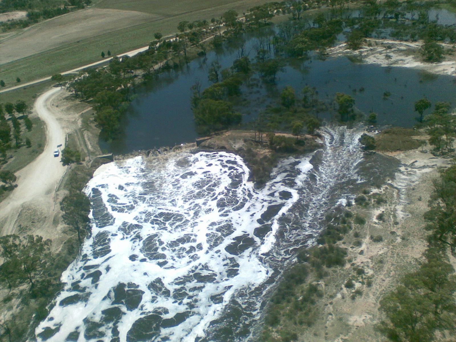
This event did cause major damage to the Jeparit weir which was repaired a year later. A photo taken during the 2011 flood event that displays the overtopping of the weir is shown in Figure 4-3 The image above also shows a breakout to the right of the weir which is where a new spillway was developed following the event.
Figure 4-2 Sandbagging around the Jeparit Museum, August 1956
Figure 4-3 Overtopping of the Jeparit weir during the 2011 flood event
5 FLOOD MODELLING
5.1
Overview
The hydraulic modelling undertaken in this project used the model developed during the Lower Wimmera Flood Mapping Project (Water Technology, 2017). The hydrological analysis adopted consisted of review of the hydrological context of the lower Wimmera River, downstream of Horsham, followed by a flood frequency analysis. The flood frequency analysis was used to determine the peak design flows for the range of modelled design events. RORB modelling was also used where recorded flow for the tributaries was limited For further details of the adopted hydrology see the Lower Wimmera Flood Mapping Project (Water Technology, 2017) final report
The hydraulic model developed for the area adopted the MIKE21FM (Mike by DHI) software Hydraulic modelling was calibrated to the January 2011 and September 2010 flood events, through comparison to water level gauges, surveyed flood heights, imagery, and community anecdotal observations.
For the purpose of this study, the Lower Wimmera Flood Mapping Project hydraulic model was reestablished in the most recent version of the MIKE21FM software to reestablish the existing inundation conditions. The model was then modified to assess potential changes to the weir arrangement. These changes included:
◼ Complete removal of the weir and its associated abutments to maximise potential conveyance. This scenario is intended to demonstrate potential flood benefits of removing the weir.
◼ Modelling of the weir with no removal of the weir boards or operating infrastructure.
The following sections outline a brief description of the previous modelling and the scenarios modelled as part of this project. All modelling was undertaken for the 1% Annual Exceedance Probability (AEP) event.
5.2 Previous Modelling
5.2.1
Extent and inflows
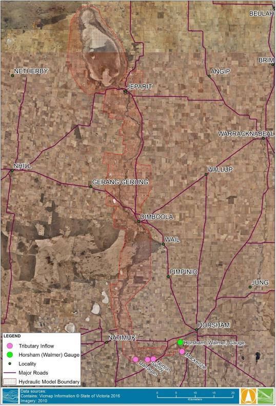
The Lower Wimmera Flood Mapping Project (Water Technology, 2017) hydraulic model covers the Jeparit township and weir as well as, areas upstream and downstream This model extent is shown in Figure 5-1, highlighting key model inflows.
Figure 5-1 Previous hydraulic model extent
5.2.2 Grid Size and Topography
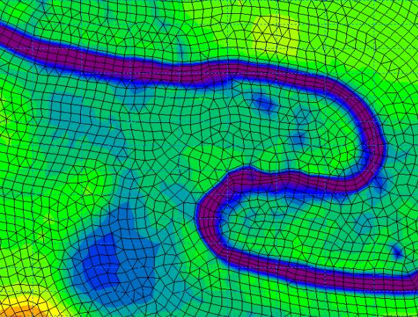
The previous study utilised the process of combining the available survey and gridded topographic data The topographic mesh comprised of triangular and rectangular elements of varying size. An example of adopted mesh schematisation for the study is illustrated in Figure 5-2
The mesh resolution along the river was approximately 10 m2 with quadrilateral elements aligned along the length of the river.
Lake Hindmarsh was included as a receiving waterway and downstream extent of the model. Schematising Lake Hindmarsh at a coarse resolution of approximately 0.25 km2 sized elements allowed good representation of the storage capacity of the lake without influencing run times of the model.
5.2.3
Roughness
Due to the relatively homogenous nature of the vegetation and waterway condition along the length of the Wimmera River from Horsham to Lake Hindmarsh, a consistent representation of hydraulic roughness was deemed appropriate. Hydraulic roughness was represented within the hydraulic model using Manning’s ‘n’. A range of Manning’s ‘n’ values were applied during the model calibration, with a uniform roughness of 0.06 adopted for all events
Figure 5-2 Example mesh schematisation
5.2.4
Boundary Condition
The lower Wimmera River catchment receives inflows from the Wimmera River and Burnt Creek which flows into the river upstream of the Western Highway at Riverside. Mackenzie River, Norton Creek, Sandy Creek and Darragan Creek all flow into the Wimmera River off the southern catchment between Horsham and Quantong. These flows were applied to the hydraulic model in the locations shown in Figure 5-1
Tributary inflows were applied, with their impact analysed through hydraulic modelling. The RORB model developed during the Horsham and Wartook Valley Flood Investigation (Water Technology, 2016) was used to assist in determining inflows where a lack of available and reliable stream datasets were present.
5.2.5 Sensitivity Testing
The roughness values and tributaries inflows were sensitivity tested for the January 2011 event. Multiple roughness values were tested and analysed, with a Manning’s n value of 0.06 underlined as the most appropriate value.
5.2.6
Results
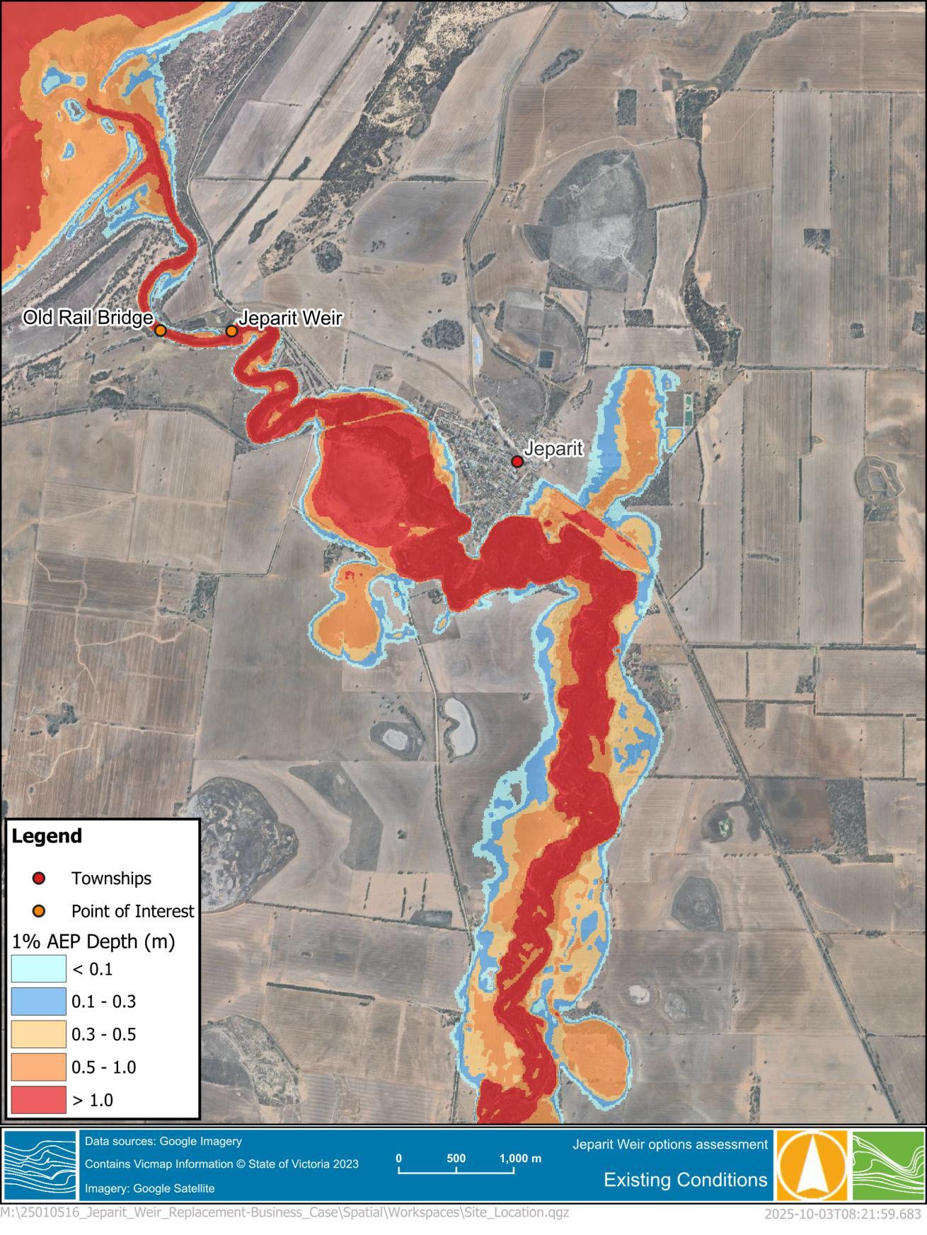
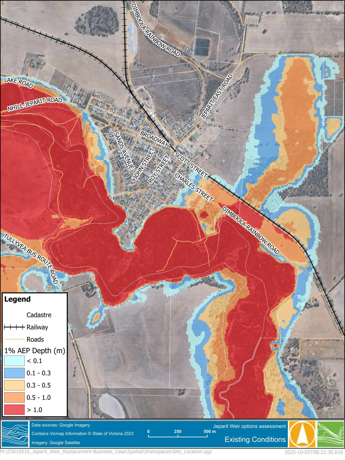
The existing conditions 1% AEP model results (inundation depth) assuming full conveyance of flow through the weir structure (i.e. boards removed and gates open) are shown in Figure 5-3 for the broader area and Figure 5-4 for a closer perspective of Jeparit
Figure 5-3 1% AEP Flood Depth of the broader area
Figure 5-4 1% AEP Flood Depth at Jeparit
5.3 Scenario modelling
5.3.1 Weir removal
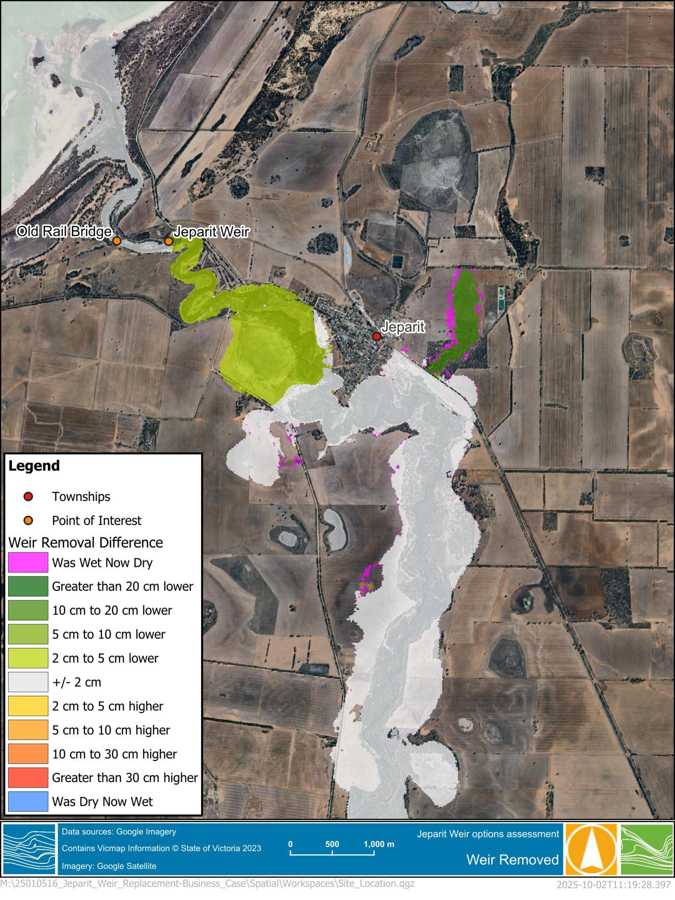
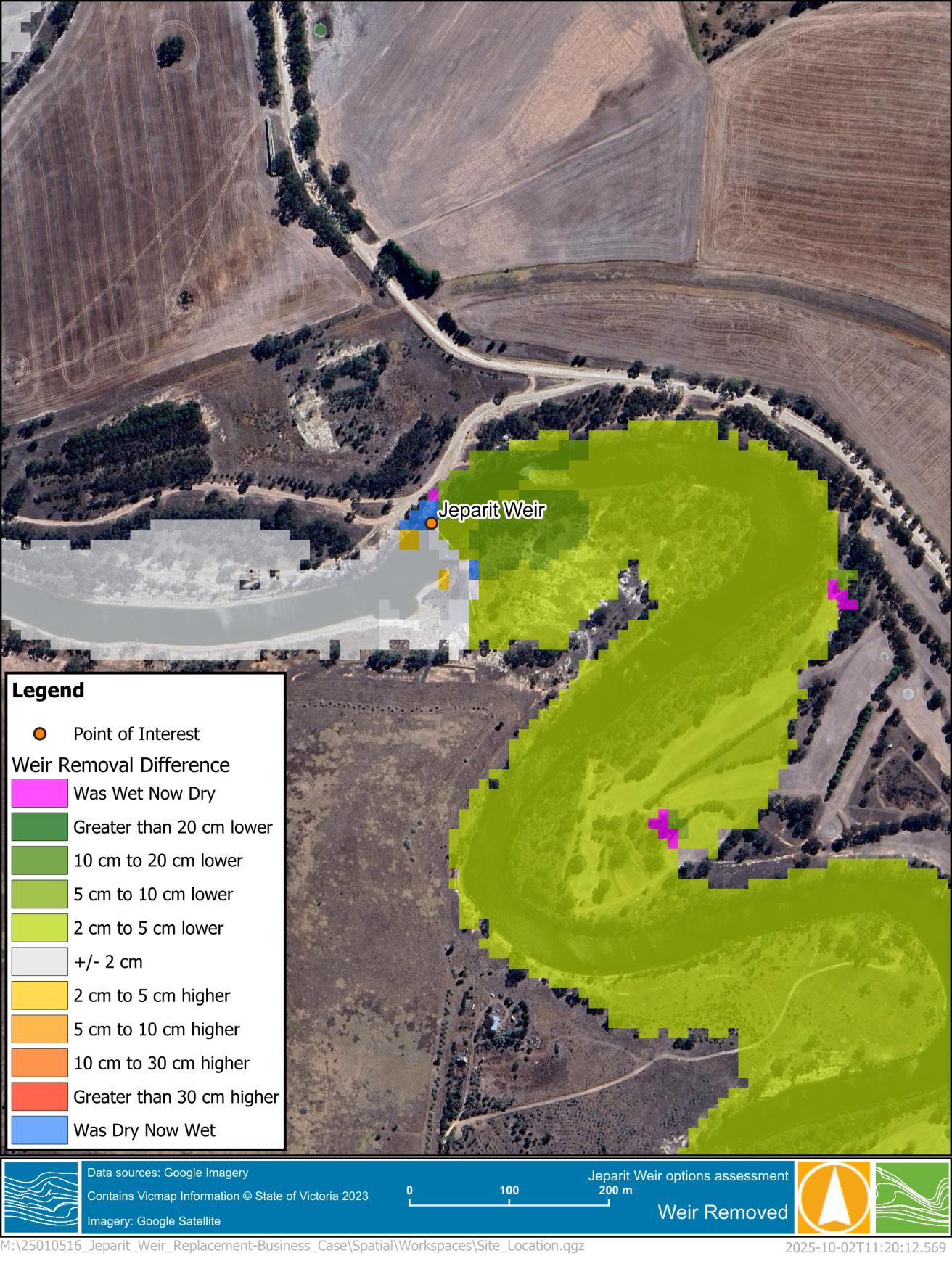
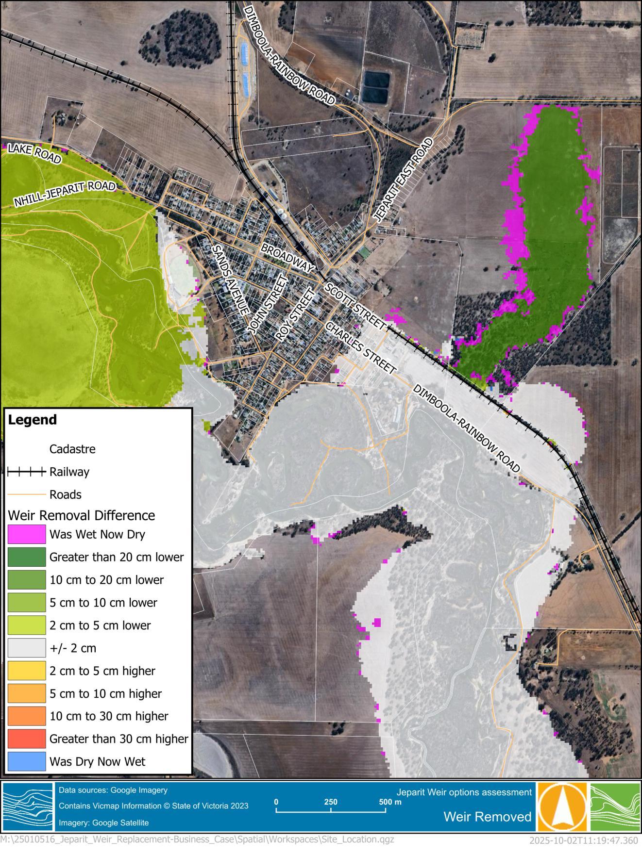
Complete removal of the weir structure including the abutments was undertaken to confirm the maximum potential benefit which could be achieved through changes to the Jeparit Weir. The topography of the existing hydraulic model was modified to represent this scenario and the model rerun. The results were then compared to those of existing conditions, showing the change in water levels and extents as a result of changes. The change in model results is shown in the following figures:
◼ Figure 5-5 – changes at a broader scale.
◼ The model results show decreased in 1% AEP flood levels upstream of the weir, up to Jeparit but through the township. There is some decrease on the norther side of railway line east of Jeparit and some minor decreases in inundation extent.
◼ Figure 5-6 – changes local to Jeparit Weir
◼ The water level decreases directly upstream of the Jeparit Weir reach up to around 5cm.
◼ Figure 5-7 – changes within Jeparit.
◼ Changes in Jeparit are less than 2cm; however, this small change is sufficient to reduce overtopping of the railway embankment to the north east of town.
Modelling of complete weir removal suggests the weir structure when open has a limited impact on flooding in Jeparit.
Jeparit Weir Replacement
Figure 5-5 1% AEP Flood Difference of the broader area – Weir Removal
Figure 5-6 1% AEP Flood Difference at the Jeparit Weir – Weir Removal
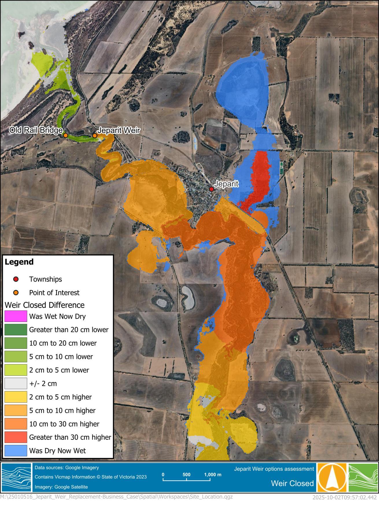
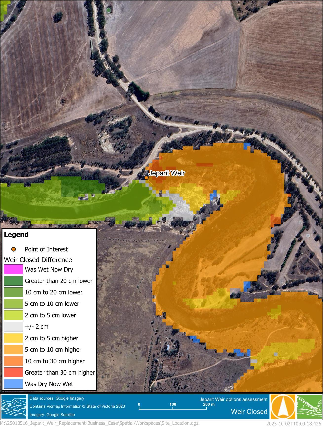
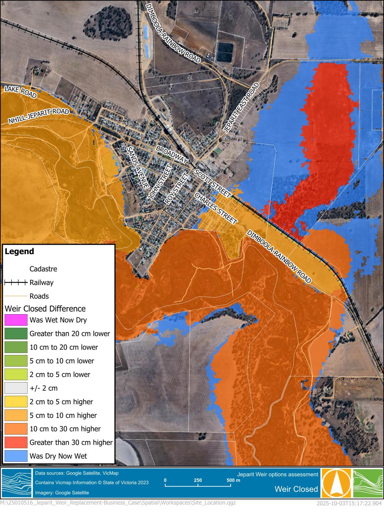
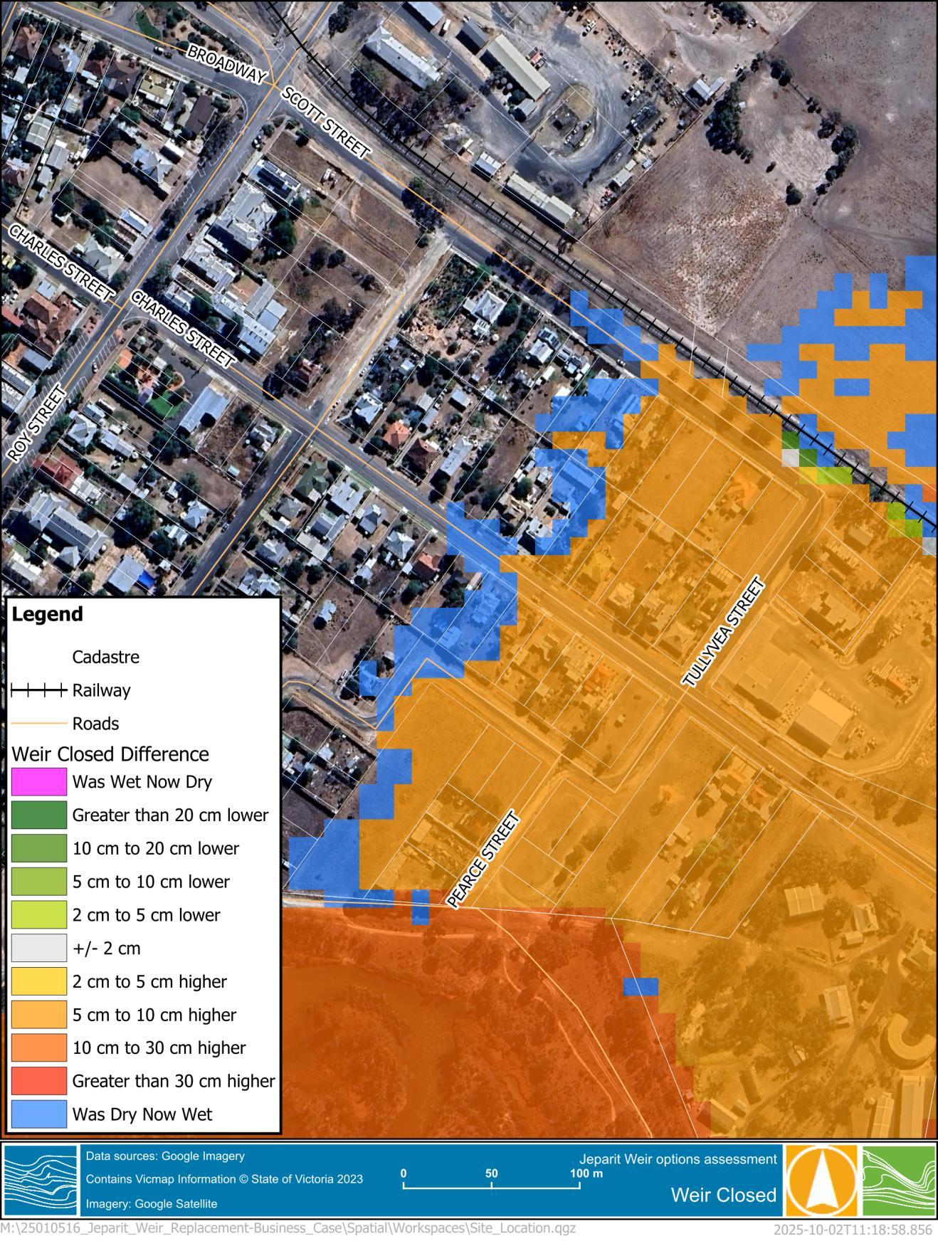
In a similar manner to complete weir removal, the impact of leaving the weir closed was modelled. The weir was included in the hydraulic model with all the board in and gates closed. The results were then compared to those of existing conditions, showing the change in water levels and extents as a result of leaving the weir closed. At the time of this reports production, this is a likely scenario as Council may not be able to operate the weir due to the safety risks associated with the manual removal of the weir boards
The change in model results is shown in the following figures:
◼ Figure 5-8 - changes at a broader scale
◼ The water level increases upstream of Jeparit Weir extend through Jeparit and continue upstream.
◼ Figure 5-9 – changes at Jeparit Weir
◼ Increases at the weir itself reach a maximum of around 10cm, but for an extended area.
◼ Figure 5-10 – changes in Jeparit
◼ Flood level increases are just over the 10cm threshold, but covered several properties in Charles Street and Scott Street. The increase in depth has caused significant additional overtopping of the railway line, north east of Jeparit.
◼ Figure 5-11 – changes in Scott Street.
◼ Flood level increases of 5-10cm through numerous residential streets.
Figure 5-8 1% AEP Flood Difference of the broader area – Weir Closed
Figure 5-9 1% AEP Flood Difference at the Jeparit weir – Weir Closed
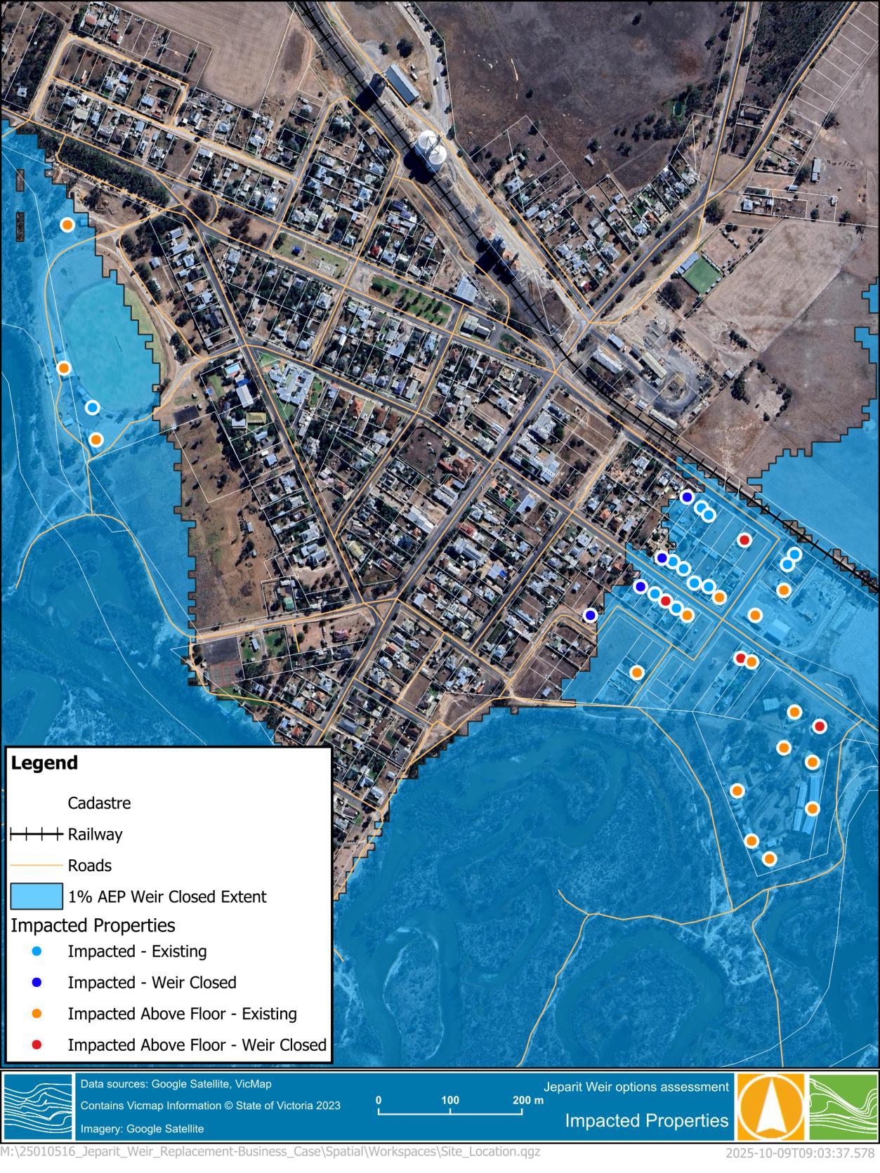
During the Lower Wimmera Regional Flood Mapping Project floor level survey completed within Jeparit. This information has been used to determine the potential impact on properties caused by leaving the weir closed. Table 5-1 shows the depth of flooding in both the existing and weir closed scenarios, for flooded properties in Jeparit.
Above floor flooding exceeds 10cm at multiple properties, and several properties become flooded as a result of the lack of conveyance through the weir. The property level impact is summarised in Table 5-2 These properties are highlighted in Figure 5-12
Table 5-1
Table 5-2 Summarised impacts to properties (1% AEP event)
Figure 5-12 Impacted Properties
6 PROJECT WORKSHOP
A project workshop was organised on the 30/10/2025 to discuss project progression and direction. Water Technology, AWMA Water Solutions and HSC contributed to this workshop to determine a clear path forward Discussions were based around certain considerations related to construction, design and funding targets.
The personnel involved in the project workshop are shown in Table 6-1
Table 6-1 Project Team
Name Representing
Ram Upadhyaya
Simon Landrigan
Jeremiah Hicks
Hindmarsh Shire Council
Hindmarsh Shire Council
AWMA Water Solutions
Ben Hughes Water Technology
Bailey Hume Water Technology
Notes were taken during this meeting and detailed in the following section
6.1 Meeting notes
◼ Configuration of gates most likely comes before the design of structural elements. To be confirmed in discussions with structural designers and gate supplier.
◼ Wimmera CMA is keen on fish ladders. Ram suggested that Dean Lawson (CMA representative) is keen on the establishment of fish ladders.
◼ Disaster fund is the target; this has recently become an option. Funding application to place emphasis on safety issues for workers and the wider community.
◼ Manual operability of the weir is a major concern.
◼ Dimboola has experienced safety issues with workers swept away during weir board removal in the past
◼ Feature survey may be a requirement. Something that the Hindmarsh Shire Council would like to know to get things sorted in a timely manner.
◼ The six most recently redeveloped weir gates at Jeparit are likely not operational, hence the need to remove the drop boards in large events.
◼ Council is comfortable sending workers in large events for board removal. Local downpour events with minor warning present significant safety issues.
◼ Timber components are of concern, there is a real risk of failure during extreme events (floods, bushfires, etc).
◼ Current arrangement experiences significant leakage.
◼ Current arrangement costing a lot to maintain.
◼ Community wants a walkway atop the weir.
◼ Same location preferable, most likely immediately upstream or downstream.
◼ Concrete structure most beneficial and appropriate. Corrosive water conditions (due to groundwater in the area) places a risk on other material structures.
◼ Ease of maintenance is top priority.
◼ Sections could be cut down through the use of particular weir gates. Current arrangement has a significant number of bays, reducing the number of bays would reduce the blockage factor and risk of large debris getting caught between sections.
◼ Manually operated gates or actuated gates discussed. Will be considered further when assessing costs.
◼ Looking for a mid-range weir in terms of cost. Something practical and easy to maintain.
◼ Only lowered around every 5 years, should be considered when selecting operation types.
◼ Current height is acceptable and should likely be maintained.
◼ Fishway was discussed – further research indicates no need for a fishway; however, this could be discussed further with council and potentially Wimmera CMA.
◼ Operational height is fine.
◼ Overshot and undershot gates discussed. Overshot provides a better option. Benefits below:
◼ Better for fish (pressure differential related)
◼ Less replacement and maintenance required for the seals compared to the undershot gates.
◼ Seals have a 20year life span. Easy to replace.
◼ Overshot gates are better for debris passage.
◼ As expensive as an undershot gate.
◼ If manual operation of the weir gates is selected, could supply a series of spindles controlling the gates (4 or 5 potentially).
◼ Stainless steel gates 25% to 30% more expensive. Aluminium is the standard material (should be acceptable). Both costs to be presented.
◼ Communication between gate supplier (AWMA) and structural engineer is critical. Will provide clarity in identifying needs and constraints.
◼ Council has no faith in the current structure. Replacing the entire structure is the ideal scenario.
7 REPLACEMENT JUSTIFICATION
7.1
Overview
Justification for the weir’s replacement is based on multiple considerations and the potential implications that may arise if these issues are ignored. The major structural issues have been expressed though the condition assessments and the workshop with Council The structure has been deemed as vulnerable to failure which could have significant impacts on the township and the broader community. If failure does not occur and the weir continues to be maintained and operated in the same manner, it still poses risks to the safety of operation staff and the Jeparit residents and the potential impact on flooding it may have if not operated. The below sections explore the risks associated with the current arrangement and provide justification for its replacement.
7.2 Safety
The largest safety issue with the weir is the current board arrangement of the weir. With this in place, manual removal of the boards is required to ensure flood water can be conveyed through the structure. In its current condition the actuated gates either do not allow enough flow to pass through the structure in a large event or are entirely inoperable. Removal of boards and/or operation of the gates is dangerous and requires manual handling from the middle of the weir itself, with HSC’s preference to not operate the weir at all due to the high risk of injury to staff undertaking this task (both in the manual handling of the boards and risk of falling into the waterway).
7.3 Weir flooding influence
The Jeparit township is vulnerable to flooding from the Wimmera River. Mitigation strategies have been undertaken over the last century to ensure that Jeparit and its residents are protected from significant flood events. If the weir is not operated (i.e. weir board removed) the presence of the weir has the potential to cause buildings in Jeparit to be flooded above floor level and buildings already flooded to be flooded to a deeper depth, increasing flood damage within Jeparit. The impact of the weir on flooding is discussed in Section 5.3
7.4 Social, Environmental and Economic considerations
7.4.1
Overview
The structural condition of the current weir is inadequate and it is unlikely to survive future flood events, with the inevitable outcome of this complete failure. The costs associated with replacing the weir post failure are likely to be considerably greater than replacement while the current weir is still operating. This is due to the current weir preventing inundation of any downstream works and the required cleanup costs if the weir was to fail.
The weir also provides the township and surrounding area with various economic and social benefits. The local community is reliant on water availability within the Wimmera River and the absence of a weir structure is expected to have considerable social consequences.
Several Wimmera Southern Mallee: Socio-Economic Value of Recreational Water reports and summaries have been completed by Street Ryan, commissioned by the Wimmera Development Association. The reports detail the economic and social benefits of the local lakes and weir pools was undertaken for the Wimmera Southern Mallee region. The ongoing assessment is a joint initiative involving the Wimmera Development Association, GWMWater, the Wimmera Catchment Management Authority and Local Councils. The economic contributions are measured in a ‘recreational water supply chain’ at three levels:
◼ Level 1: Service providers (supplying products and services to the lakes/weirs) including water, camping/caravanning, maintenance, construction, management, research and catering.
◼ Level 2: Users of the Recreational Water Lakes/Weir Pools including residents, community groups and visitors.
◼ Level 3: Local businesses (servicing the users of the lakes/weirs) including accommodation, food services, health, sport and recreation, transport, retail and personal services.
Information was obtained using interviews, with these being conducted with recreational water participants (Level 2), businesses (Level 3), and supplier organizations (Level 1). The eight year investigation included 33 water bodies in its assessment across eight local government areas, including the Jeparit Weir Pool.
The reports available which detail the benefits of the Wimmera River and use various ways to measure them. These include:
◼ Wimmera River: Value of Environmental Water 2023-24 report (Street Ryan, 2024)
◼ Wimmera Southern Mallee: Socio-Economic Value of Recreational and Environmental Water (Street Ryan, 2021).
◼ Socio-Economic Value of Environmental Water: Wimmera River Sites, 2016-17 (Street Ryan, 2018).
◼ Wimmera Southern Mallee: Socio-Economic Value of Recreational and Environmental Water 2018 (Street Ryan, 2018)
◼ Wimmera Southern Mallee: Socio-Economic Value of Recreational and Environmental Water 2019 (Street Ryan, 2019)
◼ Wimmera Southern Mallee Recreational and Environmental Waer: Socio-Economic Value Trends and Insights 2016-2017 to 2019-2020 (Street Ryan, 2020)
◼ Wimmera Southern Mallee: Socio-Economic Value of Recreational and Environmental Water (Street Ryan, 2023).
◼ Wimmera Southern Mallee Recreational and Environmental Waer: Socio-Economic Value Trends and Insights 2016-2017 to 2023-2024 (Street Ryan, 2024).
The economic contribution of the Jeparit weir pool has been estimated using these reports and the proportion of visitors the site has within the context of the Wimmera River as a whole, which is around 5.7%, as detailed in the Wimmera River: Value of Environmental Water 2023-24 report (Street Ryan, 2024)
7.4.2 Events – Jeparit Fishing Competition
Economic contributions can be attributed to the Jeparit weir pool under organised events. These events are typically associated with fishing and have occurred multiple times in the last decade, providing additional economic benefits to Jeparit and surrounding communities. The 2016-17 Socio-economic value of environmental water: Wimmera River sites (Street Ryan) revealed that the Jeparit fishing competition in 2017 generated a total regional economic contribution of $144,700. This competition was also held in 2022, which yielded a similar outcome, with an additional $105,616 generated during this competition for the region. This is an average of around $125,000 per event.
7.4.3
Estimated Social Value
The Jeparit Weir provides a significant benefit to community members in terms of physical and mental health. The 2017 Street Ryan report also details the socio-economic value of Wimmera River sites presented an overall contribution to both physical and mental health of approximately $2,507,387 over the 2016-17 period. This was the only year in the eight-year study that detailed the social value in depth. To quantify the direct contribution of the Jeparit region towards this total, a reasonable contribution percent from previous studies
has been estimated, based on participation at each site. The 2023-24 year of the study provides the following participation numbers at each contributing Wimmera Site.
Table 7-1 Wimmera River weir pool visitor per site
From this table, Jeparit had roughly a 5.7% share in the total Wimmera site visitors. This can be assumed as a reasonable representation of the social value in an average year, and it can be estimated that the Jeparit region provides a social benefit valued at around $142,000 per year.
7.4.4
Estimated Ecological Value
The potential ecological value the weir pool provides is difficult to determine. However, a link can be drawn between the ecological value of the weir pool and supplier expenditure on environmental management for the Wimmera River on the basis the expenditure is less than the ecological value it has enabled. The 2024 Wimmera River: Value of Environmental Water 2023-24 report (Street Ryan) details that there was $2.094 million spent on environmental management, water releases, facilities for all Wimmera River sites
Using the 5.7% share of Wimmera visitors, this determines an estimated ecological value for the Jeparit weir pool of $119,000 annually.
7.4.5
Potential Improvements
The investigation also provided some suggestions for an increase in economic and social benefits at the Jeparit weir. Those focused on infrastructure should be considered in the replacement of the structure where applicable. These are summarised below.
◼ Infrastructure:
◼ Directional signage.
◼ Landscaping and ‘clean-ups’ along some river access points (particularly on the Jeparit – Nhill Road)
◼ Cycling/hiking track along the river and Lake Hindmarsh.
◼ Recreational water traits:
◼ Peaceful retreats.
◼ Cross promotions:
◼ Re-position Jeparit as a ‘river town’ in tourism promotions (replacing the former branding around Lake Hindmarsh) with a master plan linking the central activities area to the river.
◼ Redevelopment/upgrade of the Edward John Eyre Heritage River Walk.
◼ History and heritage, part of Jeparit and Rainbow town promotions.
◼ Potential events:
◼ Kayaking, canoeing or paddleboarding.
7.4.6 Summary
Using the available economic assessment and data undertaken by Street Ryan, the total annual economic benefit provided by the Jeparit Weir pool is estimated to be $386,000 per annual, as detailed in Table 7-2
Table 7-2 Economic benefit of the Jeparit Weir Pool Benefit Value (per annum)
Jeparit Fishing
$125,000
$386,000
8 POTENTIAL OPTIONS
8.1 Overview
Following review of the structural condition assessment and other sources of information, the most prevalent and significant failure risk and it’s encompassing area has been identified as erosion. There are also numerous structural components identified that have the potential to fail Given the multiple modes of failure, refurbishing the existing weir is not considered an option and replacement is required.
8.2 Replacement of the weir structure
Replacement of the weir structure will have a significant cost associated with it but will provide the highest level of security and flexibility for the weir. New considerations and priorities can be addressed in this structure, and it may result in a less constrained weir design.
From the initial workshop with Council, discussion of a new weir constructed immediately downstream of the current arrangement would be preferable From this discussion the following potential options and requirements for the structure were identified.
8.2.1 Gate Selection
Discussions with AWMA water solutions resulted in several gate recommendations and their corresponding characteristics. These are summarised below.
8.2.1.1
Gate Type
Gate type operational structures were discussed, with options based around overshot and undershot gates. The benefits of each gate were presented and compared, which led to the general agreeance that the overshot gates would provide the most positive influence on a new weir structure. These gates are a similar cost, and require less frequent maintenance and as easy to operate as the alternative undershot gates. It was also noted that the overshot gates allow fish to pass more safety than undershot gates, which related to the pressure differential that the undershot gates produce.
8.2.1.2
Operability
The ability to operate the gates was discussed with agreement that both manual and actuated options should be considered. While manual operation is not as convenient, the benefits of an actuated system may be relatively minor due to the infrequency in which the weir is operated. The weir gates would only need to be opened in large flood events, with the weir only having to be operated around once every 5 years. The costs of operation and maintenance for each option should be addressed to determine the most advantageous option.
If the manual operation option is selected, it is likely to be undertaken using multiple spindles. These could be removed or locked from the public during normal flow conditions and only required during large events. There is some safety risk associated with this manual process, but it is largely negligible as the response time would be manageable in large events, and a handrail is likely to be in place to support operation procedures.
8.2.1.3
Material
The material options for the gates were also provided, with the option of either stainless steel or aluminium. The stainless-steel gates are 25% to 30% more expensive than the aluminium gates. It was suggested that aluminium will be adequate for our application, however, both option costs will be provided.
8.2.2
Structural Components
At this stage the various structural requirements for a new weir structure are being considered; however, it was determined that due to the corrosiveness of the water in the Wimmera River it may be necessary to implement a concrete structure and limit the inclusion of metal structures.
8.2.3
Functionality
The construction of a new weir should consider what additional functions could be utilised to provide a more appealing and beneficial structure.
8.2.3.1
Fish ladders
Wimmera CMA has suggested the consideration of fish ladders. It is noted that the Environmental Water Management Plan put forth by Wimmera CMA in 2024, ‘fish passage is not a requirement for weirs along the Wimmera River system’. This should be considered in the weir construction planning, with budgetary constraints potentially limiting the ability to include a function that is not necessary for the development.
8.2.3.2
Traversable walkway
It has also been mentioned that the public may appreciate a weir that incorporates a pathway along the structure. This additional function may provide a greater appeal to the structure, providing potential community and tourism benefits to the township.
8.2.4
Other considerations
In addition to the structural considerations, we also need to consider the surrounding area of development and the potential risks that may present themselves beyond construction. Erosion is the largest factor that needs to be considered in the concept, functional and detailed design stages. Proper mitigation strategies should be assessed in depth to reinforce the desired outcome and design life of a new structure, while also maintaining a healthy river system.
8.2.5
Cost Estimate
A condition assessment provided by F.C.H. Consulting included a preliminary cost estimate for the construction of a replacement. This suggested that the construction costs of a new structure would total around $3.4M. With the inclusion of environmental, engineering, administration and contingency costs, this totals around $5.4M. A breakdown of the estimated construction costs is shown below, followed by the additional costs and total cost in Table 8-1
◼ Stage 1: Coffer Dam Construction. Cost Estimate: $350,000
◼ Construct a coffer dam using locally sourced clay material.
◼ Position the coffer dam to redirect river flow to the bypass spillway.
◼ Utilize the existing weir to maintain the downstream pool during construction.
◼ Concrete base slabs for new weir. Estimate $750,000
◼ Curtain walls, headwalls and supporting walls. Estimate $250,000
◼ Precast concrete cell frames. Estimate $200,000
◼ Structural steelwork, supporting frames and walkways. Estimate $400,000
◼ Weir gates, door seals, actuator control system, threads and seals. Estimate $750,000
◼ Fish ladder. Estimate $200,000
◼ Stage 4: Final Commissioning Estimate: $300,000
◼ Remove coffer dam.
◼ Construct safety handrails, fencing, access gates etc.
◼ Total Construction Cost Estimate: $3,400,000
Table 8-1 Cost estimate with the inclusion of additional costs
The cost estimate is considered approximate and further costing should be undertaken post a design is completed.
8.2.6 Benefit Cost Ratio
A benefit cost analysis was undertaken to assess the economic viability of replacing the Jeparit Weir. It should be noted the benefits of replacing the weir are difficult to determine given the ability to quantify the nonmonetary benefit it provides the community. The reality is the weir is the largest asset the community have
An indicative benefit-cost ratio was based on the construction cost estimate and monetary benefit the weir provides. For the analysis, a net present value model was used, applying a 6% discount rate over a 50 year project life. The assessment determined a benefit cost ratio of 1.1, indicating the benefits outweigh the costs.
The cost benefit ratio is highlighted in Table 8-2
Table 8-2 Cost benefit ratio
9 SUMMARY
The report details the justification for intervention at the Jeparit weir. The structure presents economic risks given the potential it will not be open preceding a flood event, exacerbating the consequences of flooding and the impact to the community it the weir fails. Replacement of the structure is required.
There are multiple potential pathways which HSC could follow to replace the Jeparit Weir. The weir is an imperative community asset and funding should be sought with that in mind
The estimated cost of the weir replacement is $5.4M, with a benefit cost ratio of 1.1 However, this is considered to be an underestimate given the unquantified non-monetary benefit the weir provides to the community
APPENDIX A
APPENDIX A– SITE VISIT PHOTOS
Photograph 1 – General downstream of the weir
Photograph 2 – General upstream of the weir
Photograph 3 – Right abutment immediately downstream of the weir.
Photograph 4 – Downstream end of the RHS retaining wall.
Photograph 5 – Erosion along entry fence line
Photograph 6 – Spillway on downstream left side of river.
Photograph 7 – Weir boards downstream.
Photograph 8 – Right side abutment downstream of the weir.
Photograph 9 – Erosion along the entry fence line
Photograph 10 – Continuation of the erosion along the entry fence line.
Photograph 11 – Right abutment and retaining wall.
Photograph 12 – Right abutment.
Photograph 13 – Right side retaining wall and abutment.
Photograph 14 – Right side retaining wall.
Photograph 15 – Left abutment.
Photograph 16 – Left bank downstream of the weir.
Photograph 17 – Right most bay.
Photograph 18 – Old rail bridge.
Photograph 19 – Old rail bridge.
Photograph 20 – Nhill-Jeparit Road bridge.
Photograph 21 – Nhill-Jeparit Road bridge.
APPENDIX B – CONDITION ASSESSMENT AND REPLACEMENT COSTING