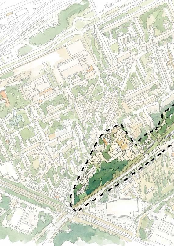
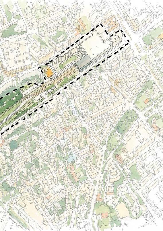
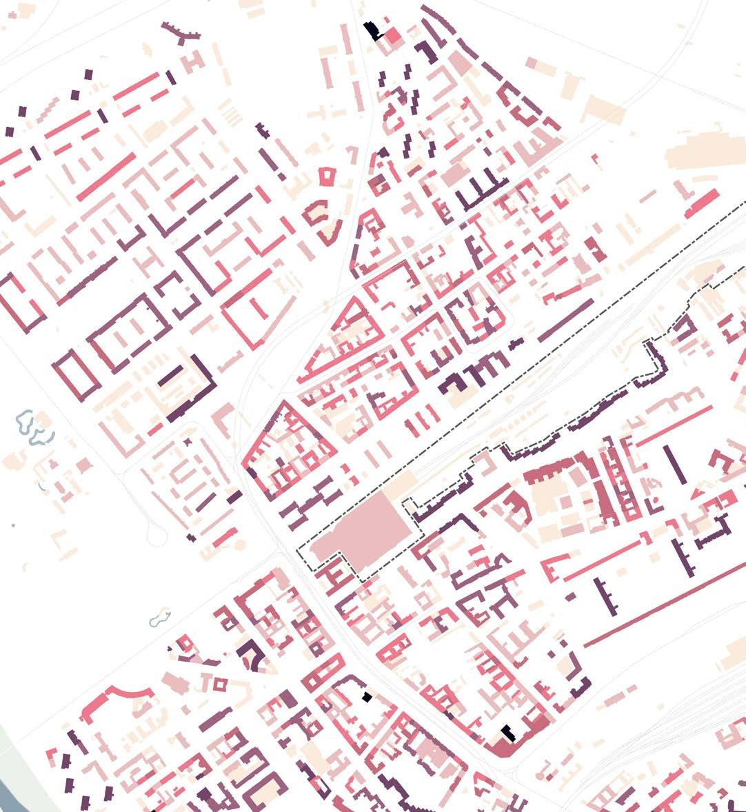
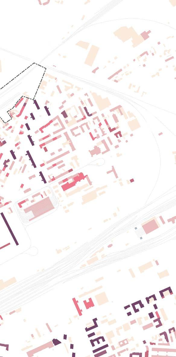
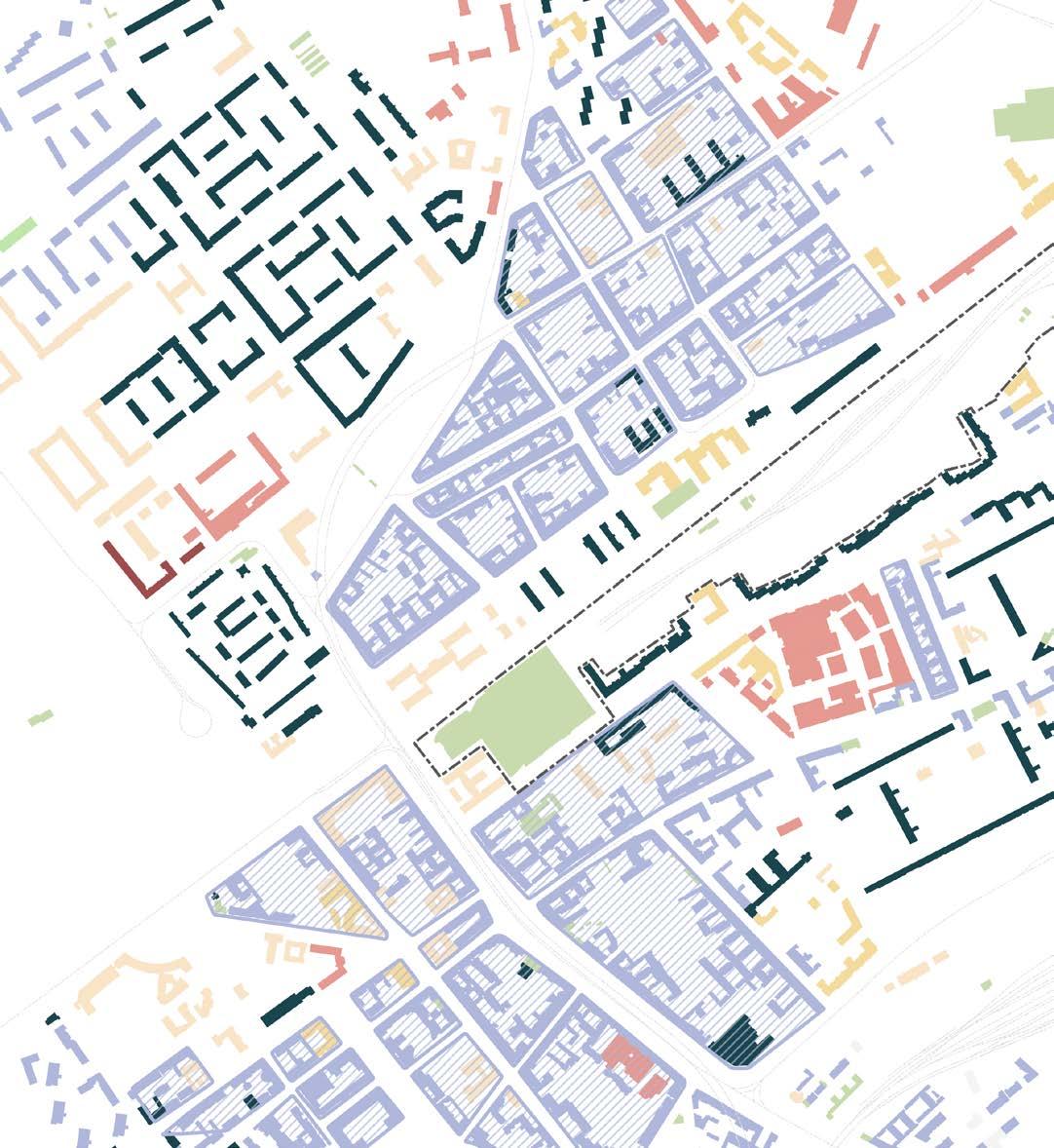
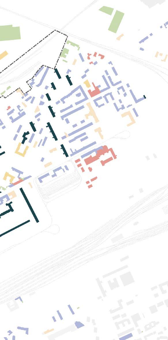
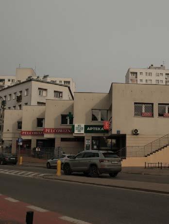
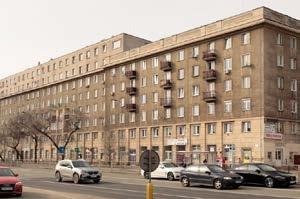
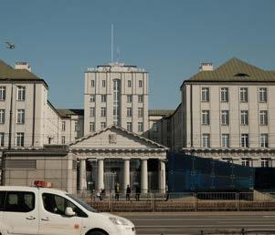
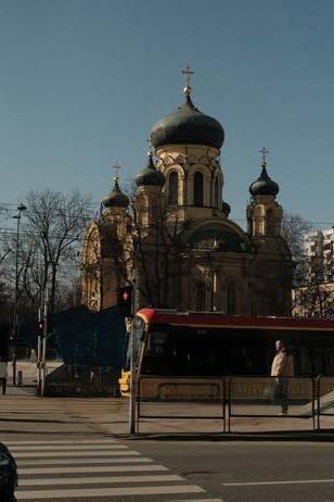
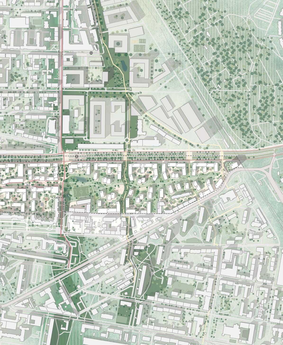
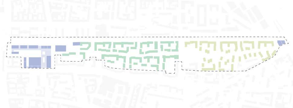
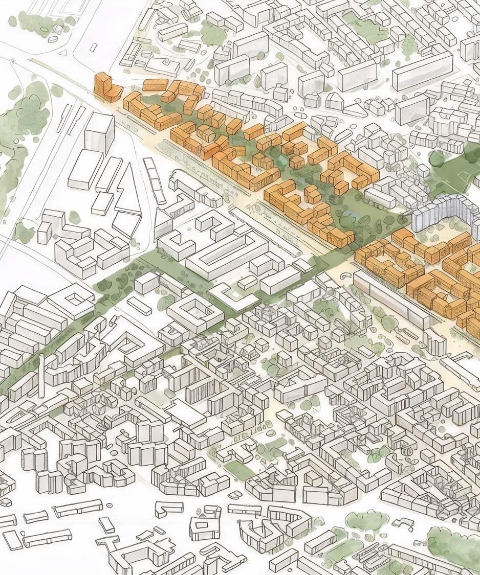
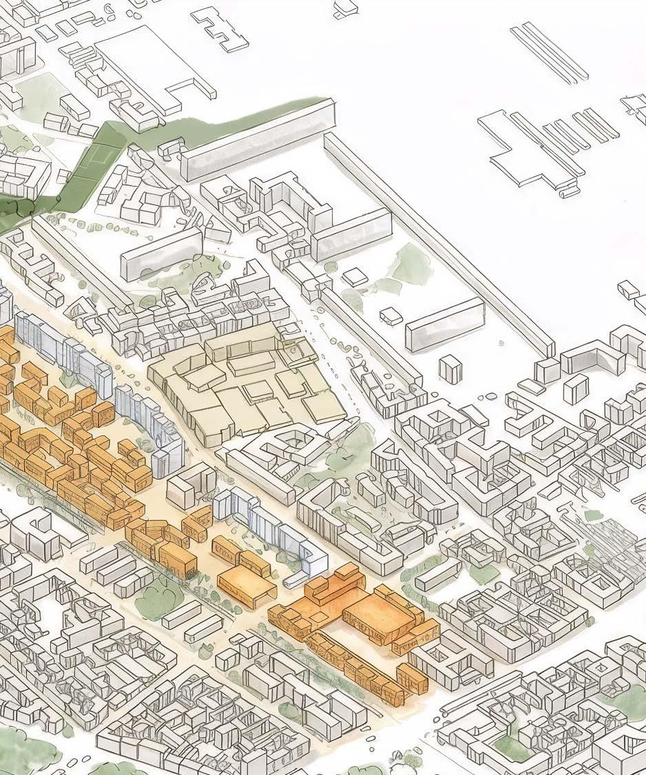
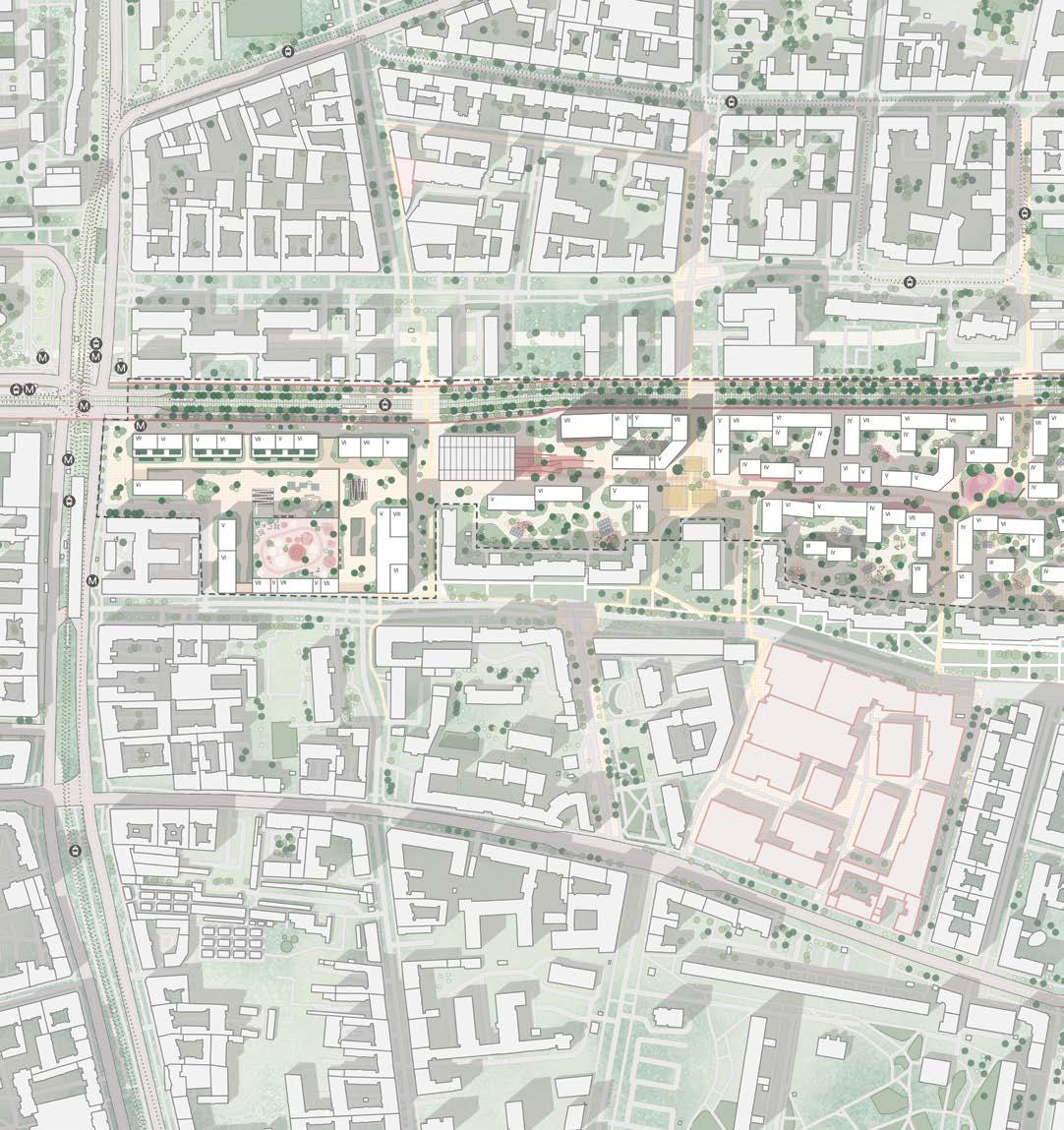
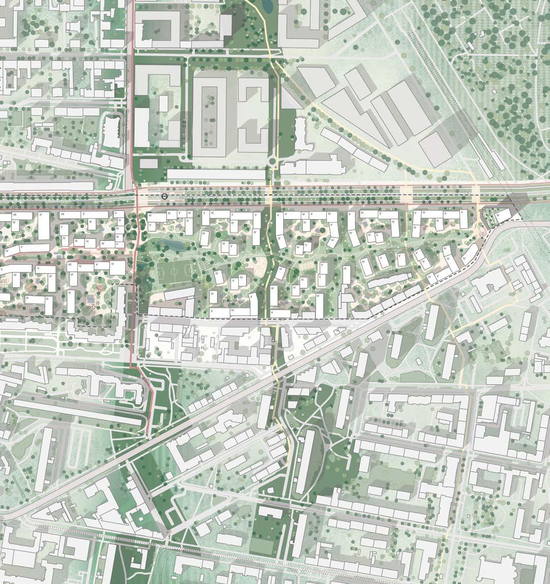
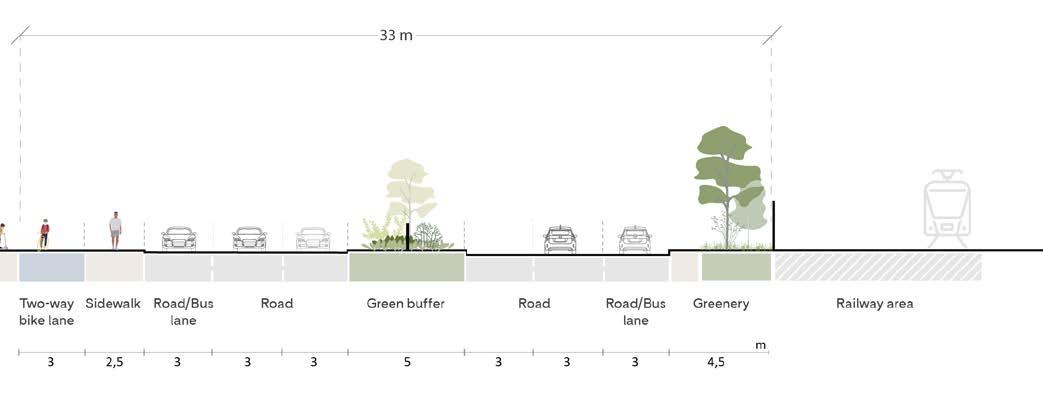
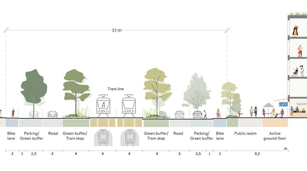
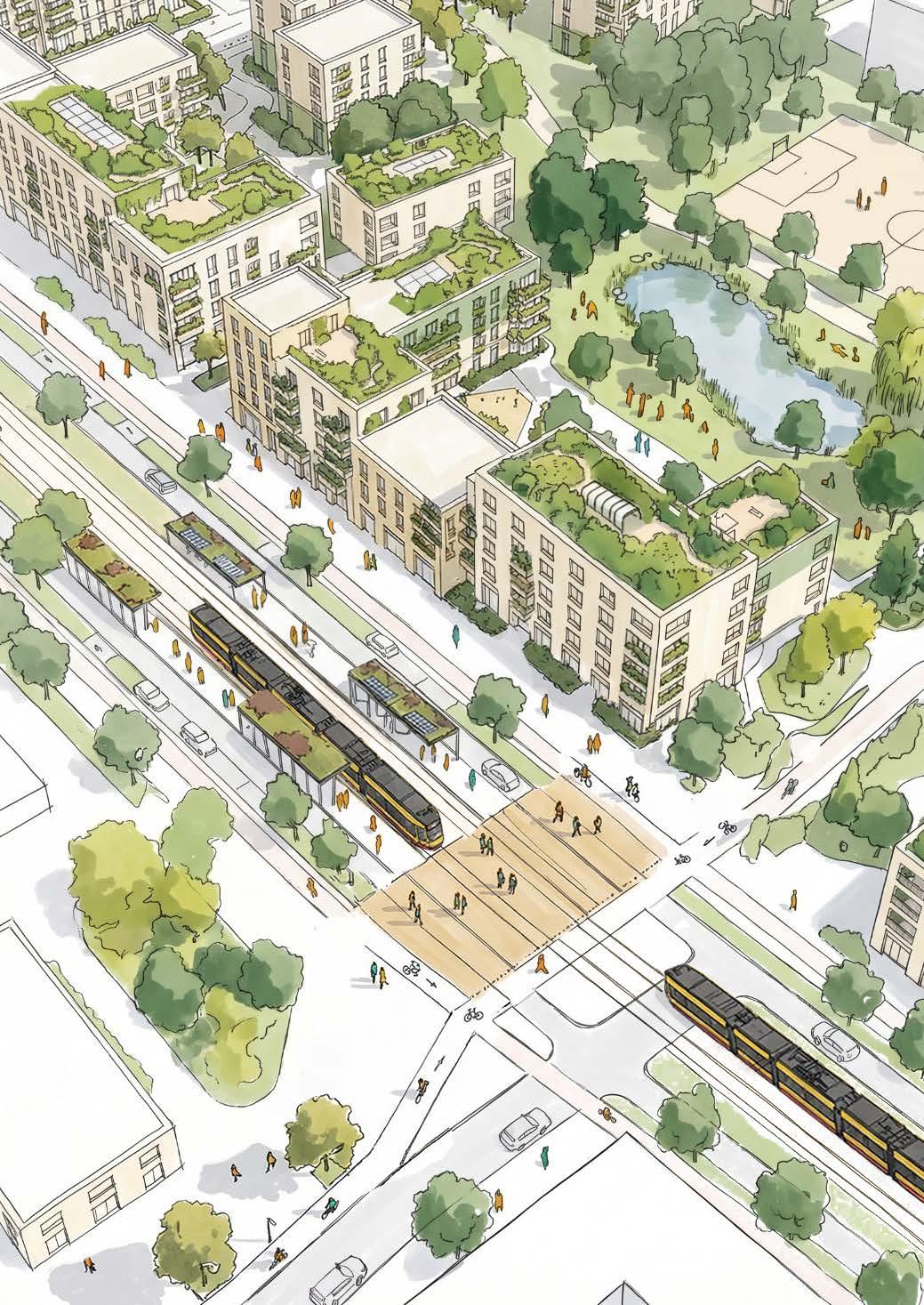
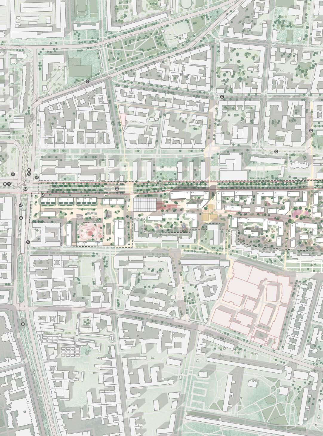
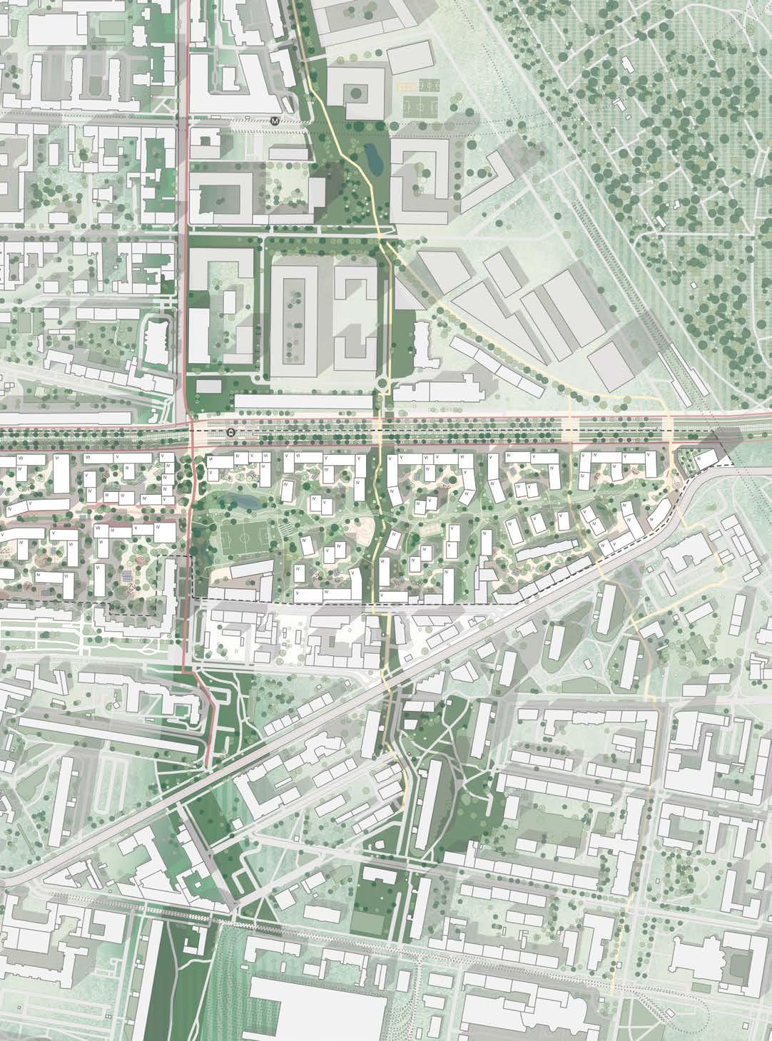
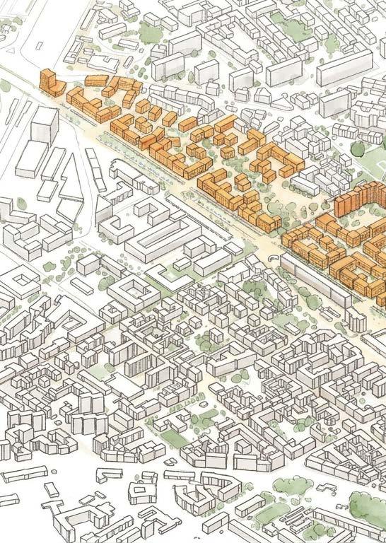
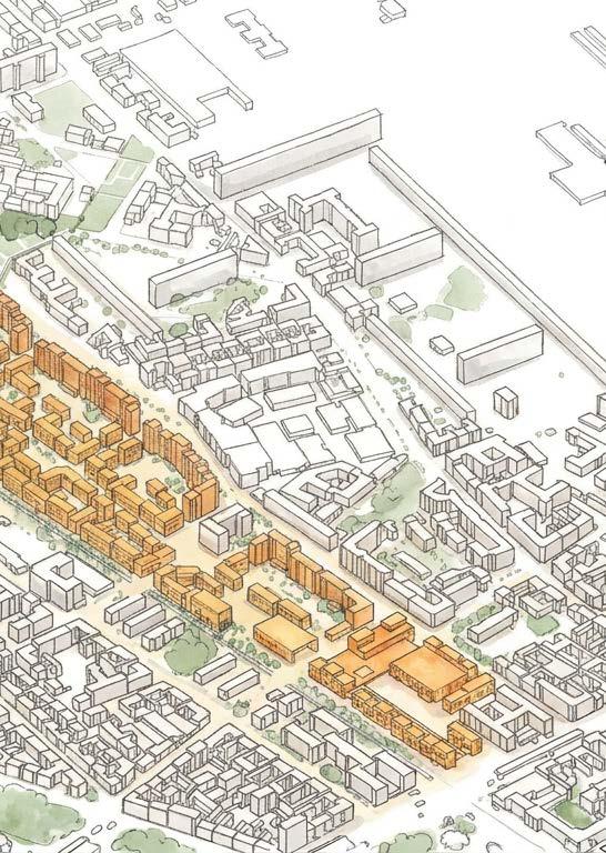
A Regenerative Design Strategy for the Railway Barrier in Praga Północ, Warsaw.
A regenerative design strategy for the railway barrier in Praga Północ, Warsaw
The multifaceted impact of transport infrastructure on spatial, social, and cultural barriers in the city
Hanna Galas
May 2026
A regenerative design strategy for the railway barrier in Praga Północ, Warsaw
The multifaceted impact of transport infrastructure on spatial, social, and cultural barriers in the city
ASBM01: Master Degree Project in Sustainable Urban Design
School of Architecture
Faculty of Engineering, Lund University
Author: Hanna Galas
Supervisor: Teresa Arana Aristi
Examiner: Ida Sandström
Jury: Andreas Olsson, Jonna Ekholm
All graphics, materials and photos are produced by the author unless otherwise stated.
Acknowledgements
First and foremost, I would like to thank my supervisor Teresa and examiner Ida for their guidance, feedback, and support throughout this thesis. Their advice pushed me in the right direction and helped this project become what it is today.
I would also like to thank Gosia Dembowska from WXCA and Miastonatura Foundation for our conversations and for sharing her knowledge about Praga-Północ with me. It was through her that this topic found its way to me, and for that I am truly grateful.
A special thank you goes to my team at Henning Larsen, whose support and belief in me throughout this process meant more than I can express. Your encouragement gave me the confidence to see this work through.
To my fellow students at SUDes - thank you for an extraordinary one and a half years. Your company, creativity, and friendship made this journey something I will always look back on with warmth.
To my friends and family - thank you for always believing in me. You have shaped who I am, and I am deeply grateful for everything you have given me.
And finally, to my partner Paweł - thank you for being by my side through every moment of my journey. Your support, patience, and positive energy gave me the motivation to keep going, and I could not have done this without you.
Preface
I grew up in a small village in Poland, far from the nearest city. There were no tram lines, no metro, no frequent bus connections - only a handful of buses a day, timed around school schedules and little else. As a child, this felt normal. But as I grew older, I began to understand what limited mobility actually meant: it meant depending entirely on my parents, on their time, their willingness to drive, their ability to rearrange their days around mine. Without them, I would not have been able to attend after-school activities, visit friends in other towns, or access the cultural and educational opportunities that shaped who I became. Mobility, I learned early, is not a convenience - it is a condition for participation in life.
As a teenager without a driving licence, I felt this most acutely. The city - with its libraries, cinemas, sports facilities, and social life - was physically close but functionally distant. Every trip required planning, negotiation, and someone else's sacrifice. I was fortunate to have parents who made that sacrifice willingly. But I was also aware, even then, that not everyone was so lucky - and that the geography of where you grow up should not determine the opportunities available to you.
This personal experience is what drew me to the subject of this thesis. The relationship between transport infrastructure and social access is not abstract to me - it is something I lived. The question of who can move freely through a city, and who cannot, feels urgent and personal in a way that has shaped how I think about urban design.
Poland is a country that is changing rapidly. Its cities are growing, its infrastructure is being rebuilt, and its public spaces are being reimagined. Warsaw, in particular, is at a moment of transformation - grappling with the legacy of post-socialist planning while looking towards a more sustainable and inclusive urban future. Living in Warsaw for around six months gave me a deep familiarity with the city's rhythms, contradictions, and possibilities. I came to know Praga-Północ not as an abstraction on a map but as a neighbourhood with a distinct identity, a complex history, and a remarkable potential for transformation.
The former railway corridor that cuts through Praga-Północ is, in many ways, a microcosm of the broader challenges this thesis addresses. It is a barrier - physical, social, and symbolic - that has long divided a community from itself and from the rest of the city. But it is also an opportunity: a rare expanse of underused urban land, waiting to be reclaimed for public life. Designing for that reclamation - and doing so in a way that is genuinely inclusive, walkable, and connected — feels like a meaningful response to everything I experienced growing up on the wrong side of an inadequate bus timetable.
This project is, in the end, about the simple idea that everyone deserves to participate fully in the life of their city - regardless of where they live, whether they own a car, or how many buses a day stop near their home.
5. The site
Territorial and Metropolitan Context
Demographics and User Analysis
Historical and Urban Context
Analysis
Targeted User Groups
Key Spatial and Social Challenges
Potentials and Opportunities
Vision
Structural plan
Design Strategy and Conceptual Framework
Masterplan
Ground floor program distribution
Diagrams
Axonometry
Introduction to the problem
Background and Context
Cities have long functioned as complex social systems in which the movement of people, goods, and information shape the daily life of inhabitants.
Within this framework, transport infrastructure becomes more than just a set of roads, tracks, or bus lines - it functions as the city’s circulatory system, enabling mobility, exchange, and social integration.
As Graham and Marvin (2001) argue, urban infrastructure systems are deeply intertwined with the social and economic organization of cities, simultaneously enabling and constraining access to urban resources and opportunities.
The Challenge of Urban Barriers
Urban space, as Henri Lefebvre (1991) demonstrated, is never neutral. It embodies social structures, political decisions, and cultural hierarchies. In this sense, transport is not only a matter of movement - it is also a question of social equity. Access to efficient transport determines residents’ ability to reach education, work, and cultural life. Where this access is restricted, cities develop what might be called a “geography of exclusion,” in which certain neighborhoods remain isolated, both spatially and symbolically.
History provides many examples where infrastructure became a tool of control rather than connection. In mid-twentieth-century American cities, the construction of urban highways through predominantly minority neighborhoods resulted in widespread displacement and the physical reinforcement of racial and economic segregation (Mohl, 2002). Similar patterns can be found in cities worldwide, where roads, railways, or transit lines serve as invisible borders separating social groups. These examples reveal that segregation is not only a social condition but also a spatial process embedded in urban form.
Contemporary approaches to urban mobility aim to address these historical challenges by rethinking transport planning through the principles of inclusion, accessibility, and environmental sustainability. One key example is Transit-Oriented Development (TOD), an urban planning approach that focuses on concentrating housing, services, and public spaces around transit hubs to reduce reliance on private cars and promote walkable, mixed-use neighbourhoods (Cervero & Kockelman, 1997). When implemented effectively, TOD can improve access to jobs, services, and opportunities for a wide range of residents, particularly those with lower incomes. From this perspective, transport planning is not only a technical task but also a normative one, as it directly shapes who is able to fully participate in urban life.
Transport infrastructure therefore has a dual role in the urban environment. On the one hand, it can act as a connecting system that links different communities to the wider city. On the other hand, if it is poorly designed or neglected, it can reinforce existing social and spatial inequalities. Recognising this dual role is important for planning cities that are not only efficient in terms of function, but also equitable and socially cohesive.
Global Street Patterns
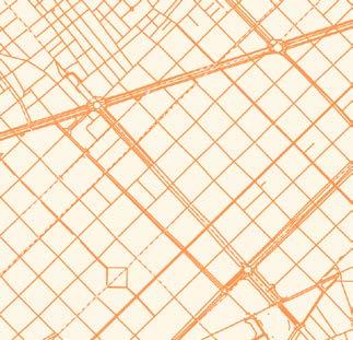
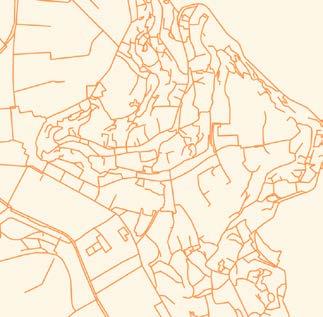
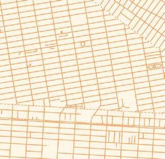
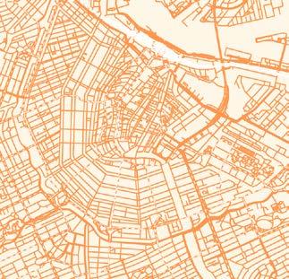
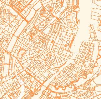
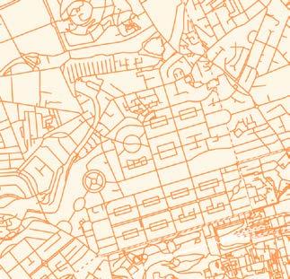
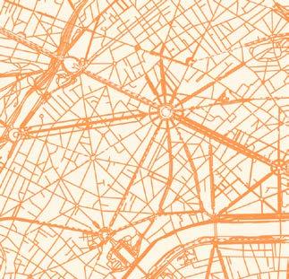
A comparative mapping of transport infrastructure across seven world cities. Each city reveals a distinct structural logic: orthogonal grids, radial boulevards, riverdriven organics, canal networks. Together they illustrate how infrastructure is never neutral - it is the force that determines the grain and character of the city.
Edinburgh
Paris
Barcelona
Matera
New York
Amsterdam
Copenhagen
Aim and Objectives
The aim of this thesis is thus to examine how transport infrastructure influences urban barriers, both spatially and socially.
A review of the literature, historical examples, and contemporary case studies will identify mechanisms of barriers, assess their impacts, and indicate areas where sustainable transport planning can contribute to greater social integration.
The following chapters present the theoretical framework, literature review, and analysis of selected cities, enabling a deeper understanding of the complex relationship between transport infrastructure and urban segregation.
The final part presents an original design project that applies the insights developed in this thesis to a specific urban context and proposes practical strategies for addressing similar challenges.
Research Questions
How can regenerative design strategies transform the railway barrier in Praga Północ into a more connected, inclusive, and human-centered urban environment?
- How does transport infrastructure influence mobility, accessibility, and everyday urban life in a city?
- How do the railway tracks in Praga Północ contribute to spatial, social, and cultural fragmentation?
- Which regenerative urban design strategies can help reconnect fragmented urban areas and improve social and spatial integration?
"The right to the city cannot be conceived as a simple visiting right or as a return to traditional cities; it can only be formulated as a transformed and renewed right to urban life."
~
Henri Lefebvre, Le Droit à la ville, 1968
Key Concepts and Perspectives
Dimensions and Definitions of Urban Barriers
Cities are often perceived as open, interconnected systems - networks of people, flows, and opportunities. Yet beneath this ideal of openness lies a deeply stratified reality. Urban barriers emerge not only in where people live, but in how space is structured, accessed, and experienced. It is both a social process and a spatial condition, inscribed in the physical structure of the city. In this sense, urban barriers can be seen as a geography of inequality: an uneven distribution of accessibility, visibility, and belonging.
From the perspective of urban theory, such barriers are rarely accidental. Henri Lefebvre, in The Production of Space (1991), argued that space is “a social product” - shaped by power relations, economic forces, and everyday practices. The streets, walls, railways, and highways of the city become physical expressions of these forces, dividing territories and determining who can move freely and who is constrained. These barriers may arise through planning decisions, infrastructural projects, or economic restructuring, but their consequences are always spatially inscribed.
Modernist planning approaches of the twentieth century frequently intensified this fragmentation. Driven by principles of efficiency and functional separation, planners organized cities through zoning and mobility hierarchies that prioritized vehicles and large-scale infrastructure over local connectivity (Jacobs, 1961).
The result was a fragmented urban landscape: neighborhoods severed by highways or rail corridors, urban voids created by technical zones, and hard edges that disrupted everyday social life (Mohl, 2002).
In many European and post-socialist cities, including those in Poland, such inherited infrastructures continue to fragment the urban fabric long after their functional necessity has diminished.
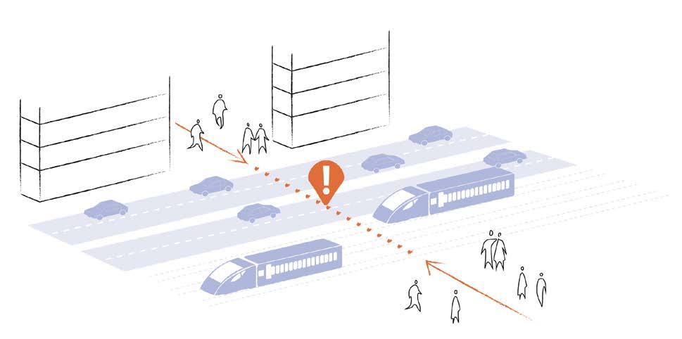
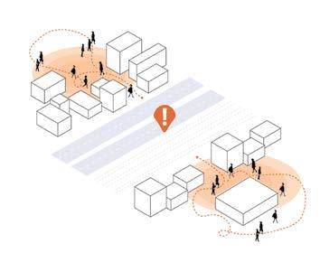
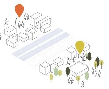
Urban barriers, however, extend beyond physical division. They also operate through accessibilitythrough the ability, or inability, to cross, reach, or inhabit certain spaces. A railway cutting through a city does not only move passengers; it establishes a border. It limits pedestrian movement, reduces spatial permeability, and symbolically separates one side of the city from the other (Lynch, 1960; Gehl, 2010).
Over time, these physical interruptions generate social distance: reduced interaction between communities, uneven patterns of investment, and distinct - often stigmatized - neighborhood identities (Wacquant, 2008). In this way, spatial form actively reinforces social differentiation.
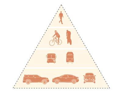
Left: The modernist mobility hierarchy, in which private cars occupied the dominant position in urban transport planning, with pedestrians and cyclists reduced to the margins.
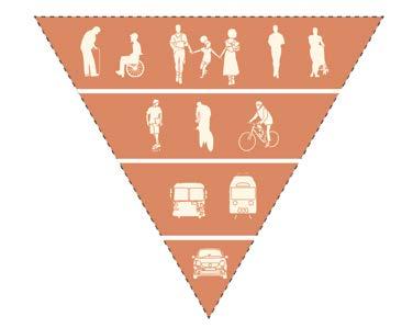
Right: The contemporary reorientation of priorities - placing people, active mobility, and public transport at the centre of urban design, with private vehicles relegated to the base.
Urban barriers can therefore be understood as a multilayered condition, operating across four interconnected dimensions:
Physical – the built infrastructure that divides or isolates; Functional – the unequal distribution of services and mobility networks;
Social – differentiated access to opportunities, amenities, and participation in urban life; Symbolic – perceptions of safety, prestige, or stigma attached to certain areas (Madanipour, 2003).
Recognizing these interlinked dimensions is essential for addressing urban barriers through design. Reconfiguring infrastructure - through covering, relocating, or transforming railway lines and highways - is not merely a technical operation; it is a planning decision with social and political significance (Graham & Marvin, 2001). It challenges existing divisions and creates the conditions for reconnection.
In this context, the concept of urban stitching offers both a useful metaphor and a concrete design strategy. By reclaiming spaces occupied or obstructed by infrastructure, cities can transform structural scars into shared public assets — places where mobility and community life coexist. Designing for permeability, accessibility, and encounter is, in this sense, an act of spatial justice (Soja, 2010): affirming the right to move freely, to meet, and to belong in the city.
Instrastructure as Urban Framework
Infrastructure has long been understood as the foundation of urban life - the hidden skeleton that enables movement, exchange, and connection. Roads, bridges, railways, and transit systems form the physical framework of cities, determining how people and goods circulate within them. Yet this framework is far from neutral. As Stephen Graham and Simon Marvin argued in Splintering Urbanism (2001), infrastructure both reflects and reproduces social power. It determines not only where we can go, but also who is included in - and who is excluded from - the rhythms of the city.
From an urban design perspective, infrastructure organizes the city at every scale. At the metropolitan level, it defines patterns of expansion, accessibility, and land value. At the neighborhood scale, it shapes everyday movement and perception - a highway dividing two districts can be as decisive a border as a river or a wall (Lynch, 1960). These infrastructural systems construct spatial hierarchies, defining centers and margins, zones of access and exclusion, networks of connection and isolation.
Historically, the development of transport infrastructure has often followed a logic of separation rather than integration. Modernist planning in the mid-twentieth century embraced functional zoning, where infrastructure served to distinguish between different flows - of cars, trains, pedestrians, and goods (Jacobs, 1961). This pursuit of efficiency produced a spatial order based on fragmentation: traffic corridors replacing local streets, viaducts overshadowing humanscale spaces, and railway lines cutting through neighborhoods. These systems prioritized speed and movement over continuity and community, turning infrastructure into a mechanism of division - not only in form, but in lived experience.
In contemporary cities, these inherited structures continue to define urban morphology. Railway embankments, multi-lane roads, and industrial corridors frequently act as barriers that interrupt pedestrian and ecological continuity. The spaces adjacent to such infrastructures often become residual - underused, unattractive, or perceived as unsafe (Gehl, 2010). They mark the city's fractures: zones where the logic of mobility collides with the need for connection, producing landscapes where places are physically close but socially and functionally far apart.
At the same time, infrastructure holds the potential for transformation. The same structures that once fragmented the urban fabric can, when reinterpreted through the lens of sustainable and inclusive design, become catalysts for spatial and social reconnection (Calthorpe, 1993).
Understanding infrastructure as an urban framework therefore requires reading it not only as a technical system but as a spatial and social structure (Graham & Marvin, 2001).
It actively shapes the sensory and social experience of urban life - influencing how spaces are perceived, navigated, and inhabited (Lynch, 1960). Its form and alignment carry political agency, determining who moves freely through the city and who faces friction or constraint.
In this sense, the framework of infrastructure is also a framework of justice. The challenge for sustainable urban design lies in transforming this framework from a rigid grid of control into a flexible, dynamic spatial interface that supports movement without producing barriers (Soja, 2010).
Mobility and Social Inequality
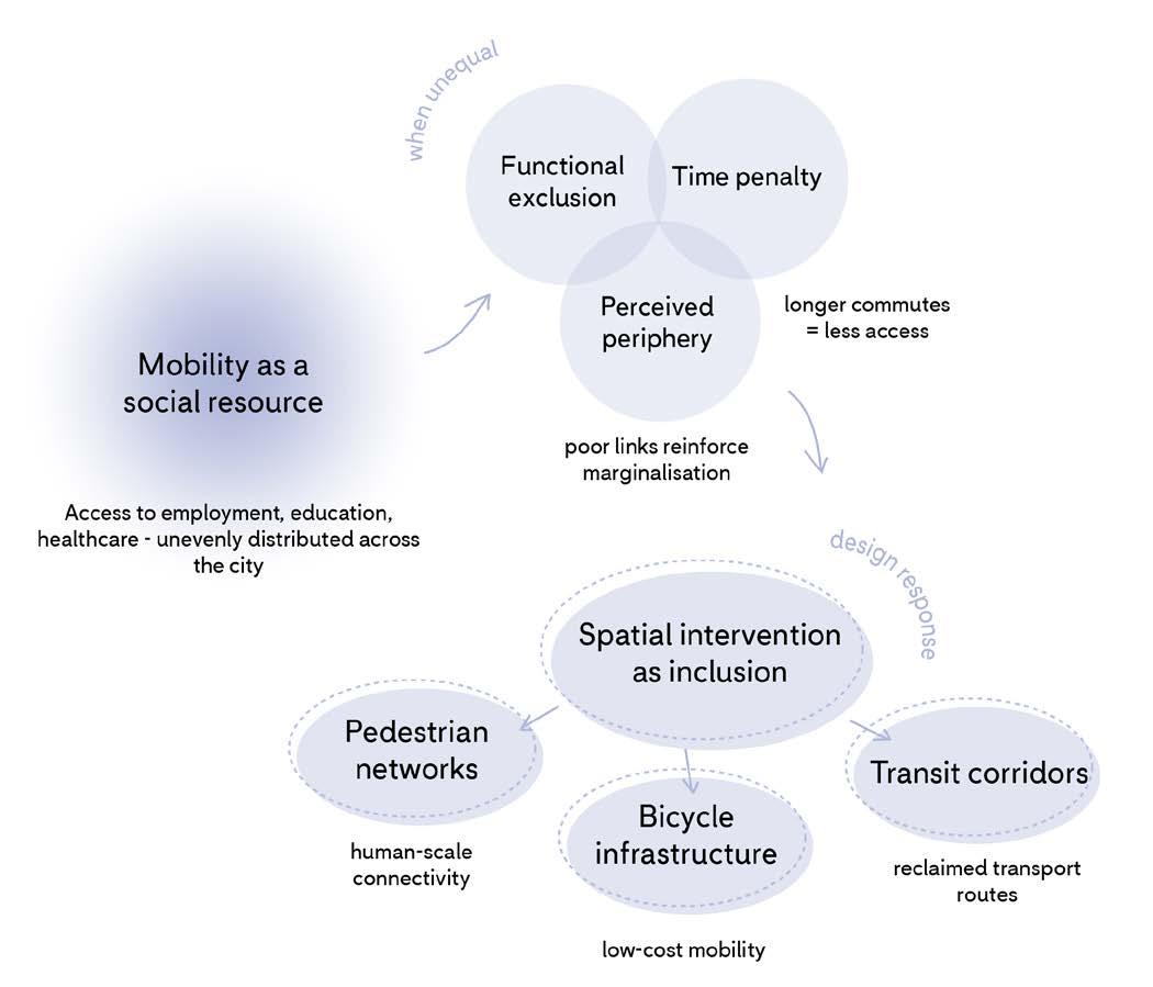
Mobility in urban contexts is not merely a matter of movement - it is a critical dimension of equity. The ability to reach employment, education, healthcare, and cultural amenities determines participation in city life and shapes life opportunities (Martens, 2012). Transport infrastructure, while enabling connectivity for some, can simultaneously generate functional exclusion for others. Understanding mobility as a socially embedded phenomenon allows us to analyze urban inequality beyond residential location, focusing on who can move freely and who is constrained.
A key dimension of this inequality is the unequal distribution of commuting time and service quality. Differences in travel times, frequency of service, and network accessibility create a hierarchy of urban experience. Residents in areas with dense transit options enjoy short and convenient journeys, while those in less connected neighborhoods face longer, more burdensome commutes. This "time penalty" translates directly into social and economic disadvantage, limiting access to jobs, education, and public services (Lucas, 2012). In this sense, access to mobility is a resource - unevenly distributed across the city and directly shaping life opportunities.
Mobility also shapes social inclusion and perception. Neighborhoods that are difficult to reach or poorly connected are often perceived as peripheral or marginalized, reinforcing social boundaries even when physical distances are short (Wacquant, 2008). Conversely, accessible and well-integrated spaces promote interaction, participation, and a sense of belonging. Infrastructure thus mediates not only movement but also the social experience of the city, defining which populations are included in its rhythms and which are left at the margins (Gehl, 2010).
From a design perspective, these dynamics highlight the potential of spatial interventions to mitigate inequality. Urban strategies that enhance connectivity - through pedestrian networks, bicycle infrastructure, or the reclamation of underused transport corridors - can reduce functional isolation and restore permeability (Calthorpe, 1993). By focusing on accessibility, temporal equity, and integration, sustainable urban design can transform mobility infrastructure into a tool for inclusion rather than division.
Patterns of Division - Urban Case Studies
To understand how transport infrastructure contributes to the formation of urban barriers, it is useful to examine patterns documented across different urban contexts. The following examples illustrate recurring mechanisms through which roads, highways, and railways have shaped social and spatial divisions.
Road intrastructure as a spatial barrier
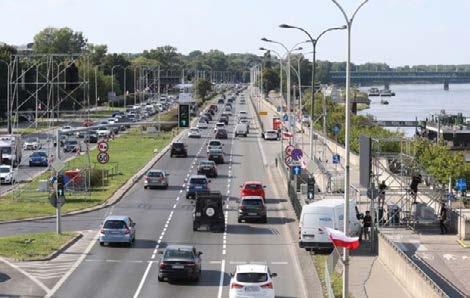
Wislostrada, Warsaw, Poland
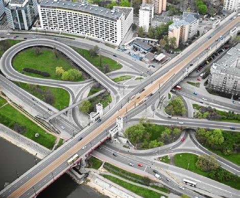
Wisłostrada is one of the primary traffic arteries in Warsaw, running along the west bank of the Vistula River. While it serves an important function in the city's transport network, its scale and traffic intensity create a significant barrier within the urban structure. Located close to the city centre, the road physically separates riverside areas from surrounding neighborhoods and limits pedestrian access to the waterfront.
The high volume of traffic generates persistent noise and air pollution, frequently exceeding acceptable thresholds for adjacent public spaces and residential areas (EEA, 2022). As a result, Wisłostrada not only divides physical space but also degrades the quality of the urban environment along one of the city's most significant natural assets.
Due to its width, traffic speed, and limited number of crossing points, the road reduces spatial continuity between the city and the riverfront making the Vistula less accessible despite its central location.
Road loops of Poniatowski Bridge at Wisłostrada (Photo: Adam Stępień)
Wisłostrada as a physical barrier (Photo: PAP/Rafał Guz)
Reduce the barrier
The scale, width, and layout of Wisłostrada create a strong physical barrier between the city and the Vistula River, interrupting urban continuity and limiting access to the waterfront
Prioritise crossings
Few crossing points and high traffic speeds discourage pedestrian and cyclist movement, leading to weak integration between riverside public spaces and adjacent neighbourhoods
This tension between the functional demands of road infrastructure and the need for pedestrian permeability has been widely recognized in Warsaw's architectural and planning discourse. The Miastonatura Foundation, in collaboration with architects and urban planners, has proposed replacing Wisłostrada with a more human-scale street structure - arguing that the current form of the road represents a missed opportunity to integrate the riverfront into the life of the city (Dembowska & Celiński, Architektura Murator, 2024; Miastonatura, Raport Warszawski, 2024).
This case illustrates a broader pattern identified in urban planning literature: the subordination of public space and pedestrian life to traffic flow (Gehl, 2010).
Key takeaways
Public realm over traffic
The dominance of traffic infrastructure diminishes the social and recreational potential of the riverfront - one of the city's most significant natural assetsreducing its role in everyday urban life.
Plan beyond the car
Wisłostrada reflects a planning logic that prioritized vehicular movement over public space and pedestrian access. Despite shifts in planning priorities, its physical presence continues to shape urban experience decades later.
Railway lines as spatial and social barriers
Sofia, Bulgaria
In Sofia, rapid urbanisation and industrial development during the late nineteenth and twentieth centuries significantly transformed the city's spatial structure. The construction of largescale transport infrastructure - particularly railway lines - introduced strong urban barriers that divided the city both physically and socially.
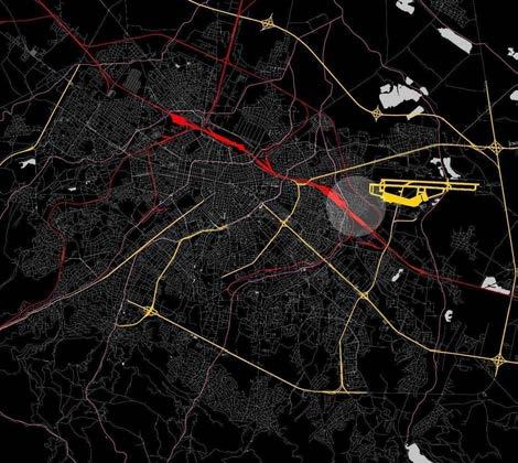
The most significant of these is the railway corridor connecting Belgrade and Istanbul, which effectively separates Sofia into two distinct urban zones: a generally wealthier southern part and a more disadvantaged northern part (Yanchev, Stefanova & Valkanova, 2024).
These infrastructural barriers do not only shape the physical layout of the city - they also influence social relations, accessibility, and urban inequality. Neighbourhoods located in close proximity to major infrastructure frequently experience reduced environmental quality and weaker access to public services.
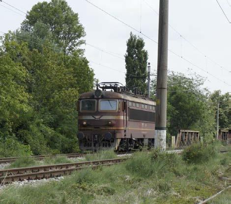
A particularly clear example is the Hristo Botev neighbourhood, where residential areas are almost entirely enclosed by railway lines and other linear barriers, creating strong spatial isolation from the rest of the city. This pattern reflects what Wacquant (2008) describes as territorial stigmatization - a process through which physical marginality reinforces social marginality over time.
Figure 1: The main railway line - the south-eastern border of the neighbourhood (2016).
Figure 2: Infrastructural barriers in Sofia – railways (red), urban motorways and the airport (yellow), river beds (purple)
Infrastructure in Sofia thus functions not only as a transport system but also as a mechanism that reinforces urban segregation, limiting mobility, connectivity, and equal access to opportunities for certain communities (Yanchev, Stefanova & Valkanova, 2024).
This case underlines the broader argument that infrastructural landscapes must be critically rethought in order to promote more inclusive urban development and spatial justice (Soja, 2010).
Key takeaways
Break the social divide
The railway lines, especially the Belgrade–Istanbul corridor, strongly separate Sofia into richer southern and poorer northern areas, reinforcing social and spatial inequality.
Need for reconnection
Sofia’s example shows that transport infrastructure shapes accessibility and social relations. Redesigning these areas is key to creating a more connected and inclusive city.
Reconnect the isolated
The Hristo Botev neighbourhood illustrates how linear infrastructural barriers can almost completely enclose a residential area, cutting it off from the surrounding city and its public services.
History shapes the city today
The barriers in Sofia were shaped by industrialisation and railway expansion in the nineteenth and twentieth centuries. Their social and spatial consequences persist today, long after the original planning logic has changed.
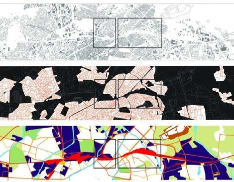
Figure 3: Mapping of infrastructural and spatial barriers around the main railway lines
Peripheral transit gaps
Even without dramatic physical barriers, limited transport access can effectively isolate neighbourhoods from the rest of the city. Peripheral districts or post-industrial areas may be served by infrequent bus lines, lack direct connections to metro or tram networks, or have inadequate cycling infrastructure.
In such contexts, reduced mobility translates directly into reduced access to employment, education, and public services - reinforcing existing social and economic divides (Lucas, 2012).
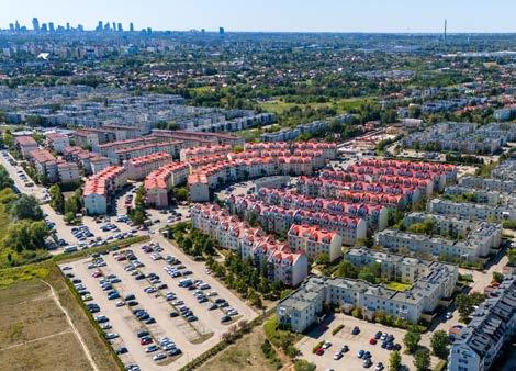
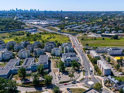
Białołęka, one of Warsaw's fastest-growing northern districts, illustrates this dynamic clearly. Despite significant residential development over the past two decades, public transport provision has not kept pace with population growth. The district relies primarily on bus lines that are subject to congestion on bridges and arterial roads leading to the city centre, while access to metro or tram services remains limited to its southern edge (Warszawskie Badania Ruchu, 2022).
As a result, many residents face long daily commutes, limited mobility options, and a high degree of dependency on private cars - increasing both social costs and environmental pressure. This lack of efficient connectivity reduces access to jobs, education, and cultural amenities in central Warsaw, deepening the sense of peripheral isolation even within the administrative boundaries of the capital.
As Martens (2012) argues, when transport infrastructure does not keep pace with residential growth, the result is not just inconvenience, but a clear form of social exclusion.
Białołęka District, Warsaw
Bird eye view of the area (Photo: Szymon Starnawski)
Bird eye view of the area (Photo: Szymon Starnawski)
Growth needs transit
Rapid residential growth without adequate public transport has led to poor connectivity, long commute times, and high dependence on cars.
Key takeaways
Transport cannot be an afterthought
Białołęka demonstrates that residential development without parallel investment in public transport creates long-term mobility deficits that are difficult and costly to reverse.
Infrastructure and social patterns
Segregation arises not solely from infrastructure itself, but from its interaction with social, economic, and historical factors. In many cities, transport barriers coincide with the locations of lower-income or marginalised populations, illustrating how mobility and access can reproduce and entrench pre-existing inequalities.
The spatial separation created by highways in American cities, for instance, frequently mirrors historical patterns of racial and economic segregation, while in Paris, the périphérique functions as a visible and symbolic boundary between inner-city residents and those in the outer suburbs (Graham & Marvin, 2001).
Detroit, USA
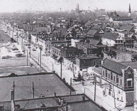
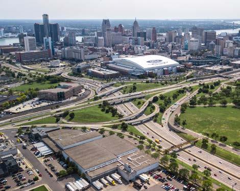
One of the most extensively documented examples of infrastructure-driven urban segregation is Detroit. In the mid-twentieth century, large-scale highway projects - including Interstate 75 and Route 10 - were constructed directly through Black Bottom, a historically African American neighbourhood with a wellestablished commercial and cultural life (Mohl, 2002).
City authorities designated the area a "slum" during the 1950s, using this classification to justify the clearance of large parts of the neighbourhood to make way for highways, hospitals, and new developments.
The construction required the demolition of thousands of homes and the forced relocation of entire communities, effectively destroying the social fabric of the district.
The resulting highway infrastructure created strong physical barriers within the city, reinforcing racial and socio-economic segregation. Many displaced residents were directed towards public housing or excluded from predominantly white neighbourhoods, deepening existing inequalities and reshaping Detroit's spatial and social structure for decades (Bullard, Johnson & Torres, 2004).
Hastings Street used to be the main thoroughfare in the Detroit neighbourhood of Black Bottom. (Photo: Detroit Historical Society)
Aerial photograph of Detroit nowadays, from the “Unequal Scenes” project (Photo: Johnny Miller)
Protect existing communities
The construction of major highways like Interstate 75 and Route 10 destroyed the Black Bottom neighbourhood, displacing thousands of residents and breaking apart a vibrant community.
This case illustrates a pattern observed across many American cities of the same period: infrastructure was not merely a neutral technical intervention but an instrument through which existing social hierarchies were spatially consolidated (Mohl, 2002).
Avoid displacement at all costs
Forced relocation did not resolve the social conditions of displaced residents - many were moved to segregated public housing or excluded from wealthier neighbourhoods, deepening rather than addressing existing inequalities.
Key takeaways
Question the language of planning
The deliberate labelling of Black Bottom as a "slum" reveals how planning decisions can be used to justify the clearance of minority neighbourhoods, masking racial and economic agendas behind technical language.
Break the inherited divide
These infrastructures reinforced racial and economic divisions in Detroit, leaving lasting barriers that continue to shape the city’s spatial and social structure.
Literature Review
on Sustainable Urban Design Perspectives
This chapter reviews key theoretical frameworks and design approaches that inform contemporary thinking about urban mobility, neighbourhood quality, and the design of new urban spaces. The frameworks are organised not by author or publication, but by design theme - reflecting the way in which these concepts are applied in practice, where multiple theoretical traditions converge around shared spatial and social objectives.
The review is structured around four interconnected themes.
The first concerns the design of streets and public spaces for people on foot - examining how walkability and human scale shape the quality of urban life. The second addresses transport networks and accessibility, exploring how transit-oriented approaches can ensure equitable access to the city for all residents.
The third theme addresses tactical urbanism - the use of temporary, low-cost interventions to activate new spaces and build community ownership during the transition from infrastructure to inhabited neighbourhood. The fourth and final theme examines mixed-use development and the principle of proximity, drawing on the 15-minute city model to argue that the distribution of functions within a neighbourhood is as important as its connectivity to the wider city.
Together, these frameworks provide the theoretical foundation for the design project presented in Chapter 4.
This chapter draws on the following sources:
Gehl, J. (2010). Cities for People.
Speck, J. (2012). Walkable City.
Jacobs, J. (1961). The Death and Life of Great American Cities.
Gehl, J. & Gemzøe, L. (2000). New City Spaces.
Calthorpe, P. (1993). The Next American Metropolis.
Cervero, R. & Kockelman, K. (1997). Travel demand and the 3Ds. Transportation Research D, 2(3), 199–219.
Martens, K. (2012). Justice in transport as justice in accessibility. Transportation, 39(6), ww1035–1053.
Lucas, K. (2012). Transport and social exclusion. Transport Policy, 20, 105–110.
Jacobs, J. (1961). The Death and Life of Great American Cities.
Calthorpe, P. (1993). The Next American Metropolis.
Moreno, C. et al. (2021). Introducing the 15-minute city. Smart Cities, 4(1), 93–111.
Lydon, M. & Garcia, A. (2015). Tactical Urbanism.
Walkability and Human-Scale Design
A foundational principle of contemporary sustainable urbanism is that cities should be designed for people on foot. This argument, developed most systematically by Jan Gehl in Cities for People (2010) and Jeff Speck in Walkable City (2012), holds that the quality of pedestrian experience is the primary measure of urban quality - not the efficiency of traffic flow or the density of development, but whether a person walking through a city feels comfortable, safe, and engaged.
Gehl's argument is rooted in empirical observation of how people use urban space. He distinguishes between three categories of outdoor activity: necessary activities, which occur regardless of environmental quality; optional activities, which happen only when conditions are pleasant; and social activities, which emerge spontaneously when people share space comfortably (Figure 4). The quality of the built environment determines the proportion of optional and social activitiesand therefore the degree to which a city supports genuine human interaction. Streets designed for cars generate necessary activity at best; streets designed for people generate all three.
Speck develops a complementary argument through his "General Theory of Walkability"the proposition that a walk must be useful, safe, comfortable, and interesting in order to be chosen over driving (Speck, 2012). Each condition has specific spatial implications: useful means daily destinations are within reach; safe means pedestrians are protected through street design; comfortable means the relationship between building height and street width creates human scale; and interesting means ground floor uses and architectural variety provide continuous engagement.
Jane Jacobs' The Death and Life of Great American Cities (1961) provides the theoretical foundation for both. Jacobs identified four conditions essential to vibrant urban neighbourhoods: mixed primary uses, short blocks, buildings of varying age, and sufficient density. Her critique of modernist planning - which destroyed these conditions through functional separation and the prioritisation of vehicular movement - remains directly relevant to the urban contexts examined in this thesis.
Figure 4 - Diagram showing how design quality expands the range of urban life according to Jan Gehl, Cities for People (2010)
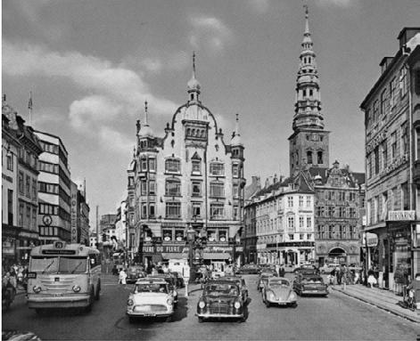
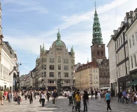
Copenhagen's gradual pedestrianisation of Strøget, developed over several decades in collaboration with Gehl, is one of the most documented examples of human-scale urban transformation — demonstrating that incremental redesign of streets and public spaces can fundamentally change how a city is experienced and used (Gehl & Gemzøe, 2000).
Key takeaways
Ground floor uses should be active and diverse
Block lengths should be kept short to maximise route choice
Streets should offer continuous pedestrian frontages with frequent crossing points, shade, and protection from traffic
Buildings should address the street with transparent, engaging facades
Street width should be proportionate to building height to create a sense of enclosure and human scale.
Strøget Street in 1960 occupied by cars (Photo: richmond33, Reddit)
Walking Strøget Street in 2016 (Photo: richmond33, Reddit)
Transit and Accessibility
Access to efficient public transport is one of the most significant determinants of social equity in cities.
When transport networks fail to keep pace with urban growth, or poorly serve peripheral areas, the result is not merely inconvenience - it is a measurable form of social exclusion.
As Karel Martens (2012) argues, conventional transport planning focuses on system efficiency - journey times, network coverage - obscuring a more fundamental question: whether transport provision gives all residents equal access to the opportunities the city offers.
Peter Calthorpe's concept of Transit-Oriented Development (TOD), introduced in The Next American Metropolis (1993), is a direct response to that question. TOD proposes organising urban growth around transit nodes: compact, mixed-use neighbourhoods built within walking distance of high-quality public transport.
The model rests on a simple but powerful observation: when daily destinations - work, shops, schools, healthcare - are reachable on foot from a transit stop, the need for car ownership diminishes, and the city becomes more accessible to those who cannot or choose not to drive.
TOD organises space into three concentric zones around the transit node.
The core zone (within 200 m of the stop) concentrates services, retail, offices and public space - everything a resident should be able to reach without a transfer.
The residential zone (up to 400 m) is mediumto-high-density housing, connected to the hub by a dense network of footpaths and cycling infrastructure.
The outer zone (up to 600 m) accommodates lower-density housing, green space and Park & Ride facilities for commuters arriving from further out.
What matters, however, is not only what sits close to the stop, but how the path to it feels.
Cervero and Kockelman (1997) confirmed that TOD reduces car dependency and improves access to opportunities for lower-income residents - but only where the pedestrian environment is genuinely comfortable and the mix of uses is sufficiently diverse.
A poorly designed node surrounded by surface parking and gated housing blocks does not fulfil the model's promise, however modern the station itself may be.
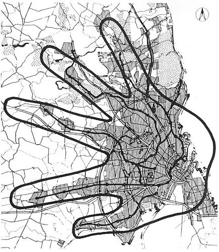
Copenhagen has been consistently applying principles aligned with TOD since the 1950spredating the formal concept by decades.
The Fingerplan (1947) directed the city's growth along five railway corridors radiating outward from the centre, like fingers on a hand.
Each corridor is anchored by a chain of S-tog (suburban rail) stations, around which housing and services are concentrated.
The land between the fingers is protected as green space.
The results are well documented. The share of journeys made by bicycle to rail stations in the Copenhagen region exceeds 25%, and the model has shaped one of the most transit-dependent metropolitan areas in northern Europe.
It is a rare example of a metropolitan structure where the logic of TOD was embedded not station by station, but at the scale of the entire citymaking transit not an alternative to car travel, but the default around which everyday urban life is organised.
Key takeaways
TOD neighbourhoods should be organised within a 400–800 metre walking radius from a transit stop (Figure 5)
Land use within this zone should mix residential, commercial, and civic functions, with density highest immediately adjacent to the transit node
Streets should prioritise pedestrians and cyclists, with direct and legible connections to the transit stop
Housing affordability within TOD areas should be actively managed to prevent the displacement of lower-income residents who stand to benefit most from improved transit access
Figure 6: Finger plan for Copenhagen, 1947 (source: Egnsplan for Storkøbenhavn (Regional Plan for Greater Copenhagen)
Tactical Urbanism
Tactical urbanism, as systematised by Mike Lydon and Anthony Garcia in Tactical Urbanism: Shortterm Action for Long-term Change (2015), refers to a city-building approach that employs shortterm, low-cost, and scalable interventions to catalyse long-term urban transformation.
Rather than waiting for large-scale planning processes to produce change, tactical urbanism works incrementally - testing ideas in real urban conditions, gathering community feedback, and building the case for permanent investment.
Interventions range from temporary parklets and pop-up markets to trial pedestrianisations and community gardens, and are typically initiated by municipalities, community groups, or designers working in collaboration.
The significance of tactical urbanism lies not only in its physical outcomes but in its process. By making change visible and tangible before permanent decisions are made, it builds community ownership, reduces political risk, and generates evidence about how spaces are actually used (Lydon & Garcia, 2015).
This iterative, bottom-up logic represents a direct counterpoint to the top-down planning approaches that historically produced the urban barriers discussed in earlier chapters.
Tactical urbanism does not replace long-term planning - rather, it complements it by creating conditions for more informed, communitysupported permanent interventions.
1
4 5 Tactical urbanism
EMPHATIZE understanding the stakeholders DEFINE opportunity and the root cause
2 3
IDEATE brainstorming ideas to solve the problem PROTOTYPE plan the project TEST implement the project plan
Figure 7: Diagram showing the steps of Tactical Urbanism method
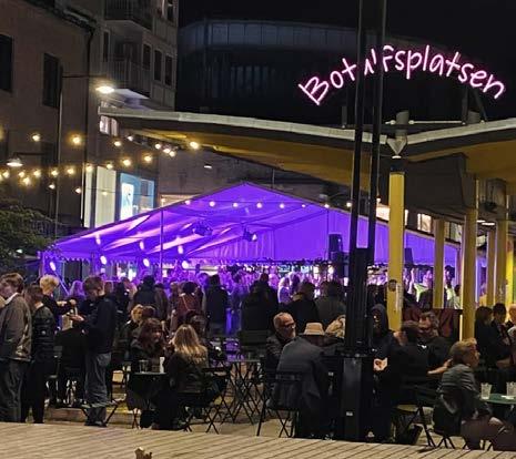
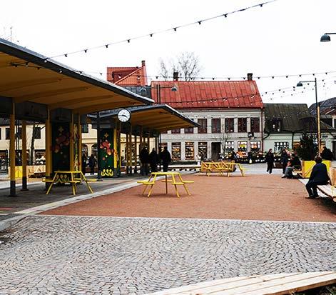
Botulfsplatsen in Lund, Sweden, illustrates how a city can use temporary activation as a deliberate step in the design process. When buses left the square in 2023, the municipality converted the former terminal into an interim public space — repainting existing shelters, laying gravel, adding timber seating and seasonal events - rather than proceeding straight to permanent reconstruction. phase revealed.
Tactical interventions should be designed as experiments with clear objectives and evaluation criteria
They should be easy to install and remove, and should invite participation rather than simply provide amenity.
Example
Over two years, the space served as a live testing ground, allowing the city to observe how people used it and gather feedback before committing to a final design. The permanent square, completed in 2026, grew directly out of what that temporary phase revealed.
Key takeaways
Successful interventions should be documented and used to inform permanent design decisions
Community groups and local businesses should be involved in the design and programming of interventions from the outset
Figure 9. Botulfsplatsen, Lund, a temporary activation as public realm through low-cost interventions including gravel surfaces, timber decking and movable furniture (photo: unknown [online image])
Mixed-Use Development and the 15-Minute City
One of the most consistently supported principles in urban planning literature is that diversity of uses is a primary driver of neighbourhood vitality, resilience, and social inclusivity.
Jacobs (1961) argued that mixed primary uses are the single most important condition for generating the street activity that makes neighbourhoods liveable - ensuring that people are present throughout the day for different reasons, sustaining local businesses and a sense of safety.
Where functions are separated, streets empty at different times of day, local businesses lose customers, and the vitality that comes from the presence of other people disappears.
Together, mixed use and the 15-minute city framework converge on the same spatial logic: that a good neighbourhood is one where the diversity of functions and the proximity of services reinforce each other, generating both urban vitality and social equity.
From a design perspective, this requires attention not only to zoning but also to building typology and ground floor programming - with active, accessible ground floors that engage the street, and a distribution of civic, commercial, and residential uses across the neighbourhood that ensures activity at different times of day.
Carlos Moreno's concept of the 15-minute city (Moreno et al., 2021) reframes this principle in terms of proximity and equity: all essential services and amenities - work, education, healthcare, retail, and recreation - should be reachable within a fifteen-minute walk or cycle from any resident's home. The model is not simply about convenience - it is an equity argument. When services are distributed throughout the city rather than concentrated in central districts, residents of all neighbourhoods gain more equal access to urban life, and the need for long, car-dependent commutes diminishes.
Figure 10. Diagram illustrating the 15-minute city concept, in which all essential urban functions are accessible within a 15-minute walk or cycle from home.
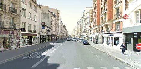
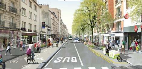
Paris has applied the 15-minute city framework directly to its urban planning strategy under Mayor Anne Hidalgo, investing in cycling infrastructure, local services, and the transformation of school streets into car-free public spaces on weekendsmeasurably increasing cycling rates and reducing car journeys in central districts.
Key takeaways
Zoning should encourage mixed use at the block and building scale
Ground floors along primary streets should be reserved for active uses
Employment, civic, and everyday services should be distributed throughout the neighbourhood rather than concentrated in a single zone
Neighbourhood planning should map service provision against the fifteen-minute catchment to identify gaps from the outset
Figure 11. Rue de Vaugirard in Paris, before intervention (Photo: Céline Orsingher (LP) / Olivier Corsan)
Figure 12. Rue de Vaugirard in Paris, after intervention (Photo: Céline Orsingher (LP) / Olivier Corsan)
Case Studies
This section highlights inspiring examples of transport infrastructure transformed into vibrant public spaces. Each project demonstrates how roads, railways, and industrial structures can be reimagined to prioritize people, reconnect neighborhoods, and create new urban experiences. From elevated parks to riverside promenades, these case studies showcase the potential of design to turn functional infrastructure into places of social life, culture, and recreation.
Reclaiming Infrastructure for People
King’s
Cross, London Allies and Morrison, Porphyrios Associates, Townshend Landscape Architects
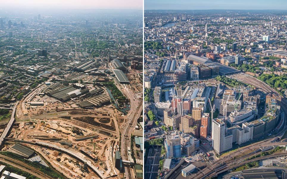
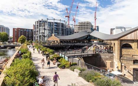
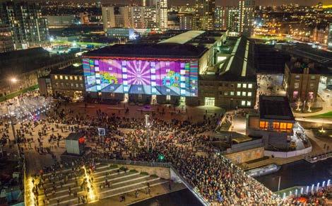
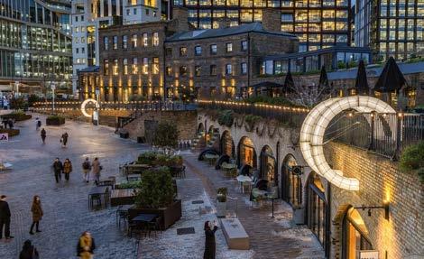
The redevelopment of King’s Cross in London is an example of how former railway and industrial land can be transformed into a mixed-use, pedestrianfriendly district. Over the past two decades, the area has changed from underused “railway lands” into a lively neighbourhood with housing, offices, cultural spaces, and public institutions.
An important factor in this process was the decision to locate the Channel Tunnel Rail Link terminus at St Pancras International, which created new development opportunities and encouraged the reorganisation of unused rail infrastructure. A long-term masterplan, developed in cooperation with public authorities and local communities, focused on walkability, functional diversity, and high-quality public space.
The project includes the adaptive reuse of historic industrial buildings. For example, the Granary Complex was transformed into a campus for University of the Arts London, showing how existing structures can be given new uses while preserving their heritage value.
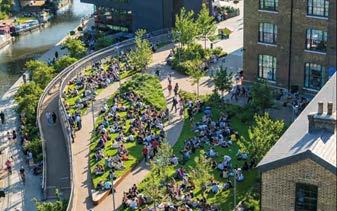
New public spaces such as Granary Square, Gasholder Park, and Lewis Cubitt Park were also created, replacing former industrial areas with accessible and well-designed urban environments. At the same time, the district has attracted international companies, local businesses, and residents, supporting the development of a diverse urban community. [1]
Figure 13 - Aerial view of the rail area - before, photo: Courtesy King’s Cross
Figure 14 - Aerial view of the rail area - after, photo: Courtesy King’s Cross
Preserve the memory of place
Preserving and reusing existing railway and industrial structures helps maintain a connection to the site’s history
Strategic relocation creates opportunity
The relocation of the high-speed rail terminus enabled redevelopment, showing how strategic infrastructure can unlock the regeneration of underused railway land.
Activate the in-between
High-quality public spaces help reconnect fragmented areas, turning former barriers into accessible and active places.
Diversity makes the neighbourhood
Combining housing, workspaces and cultural functions creates an active, resilient neighbourhood rather than a single-purpose area.
Figure 16 - Neighbourhood rooted in the history
Figure 15 - Mixed use neighbourhood
Figure 17 - A festival event at Granary Square, 2016; photo: John Sturrock/King’s Cross
Figure 18 - People-centric green space along the canal, photo: Argent St George, King’s Cross Overview 2018
Integrating Railway Heritage into Urban Planning
Köpenicker Rails, Berlin
ADEPT
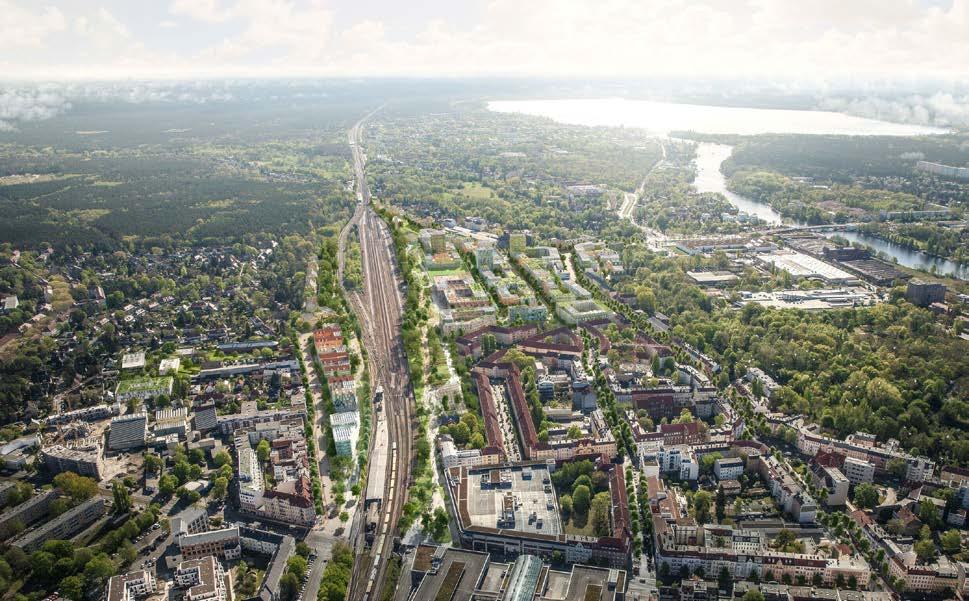
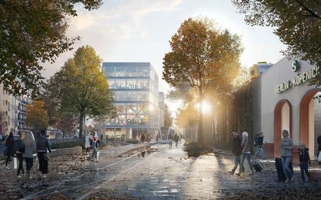
The former Köpenick freight rail station is being transformed from disused railway land into a new mixed-use neighbourhood for housing, workplaces, and public spaces (ADEPT & Karres en Brands, 2023)[2]. The site, located between the city and the former railway infrastructure, offers an opportunity to reconnect previously separated areas and increase inner-city density.
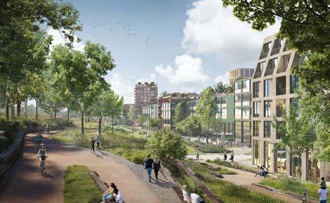
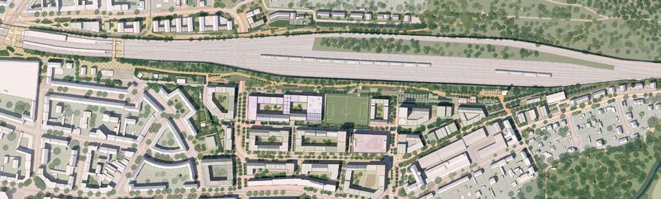
The masterplan uses green infrastructure as the main structuring element. Linear parks and green wedges cross the former tracks, linking different parts of the city and creating continuous public space. The plan reopens the Deichpark to the railway, combining ecological and social functions (Karres en Brands, 2025)[3].
Urban design follows a pedestrian-focused approach using a classic European block structure. Walking and cycling routes are integrated with social infrastructure, while the neighbourhood centre is based on community programs, sports, and landscape rather than commercial activity. Sustainability measures include urban biodiversity, circular economy strategies, and low-carbon mobility (ADEPT & Karres en Brands, 2023)[4].
Figure 19 - Aerial view of the rail area
Key takeaways
Embed the new in the existing
The plan integrates railway heritage and the site’s surroundings into the new urban layout
Use green to connect
Linear parks and green wedges link previously separated areas and structure the neighbourhood
Human scale first
Human-scale movement is prioritised through safe walking and cycling routes
Embed sustainability in the plan
Urban biodiversity, low-carbon mobility, and circular economy principles are part of the design
Figure 22 - Structural plan
Figure 20 - Urban Mobility in the center
Figure 21 - Pedestrian and cycling networks
Adaptive Reuse of Railway Infrastructure
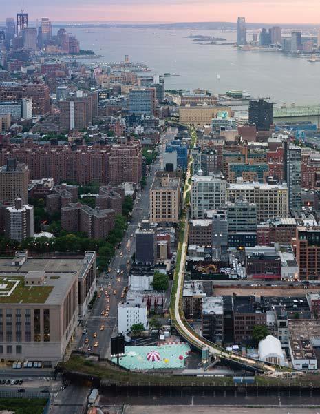
High Line, New York
James Corner Field Operations, Diller Scofidio + Renfro
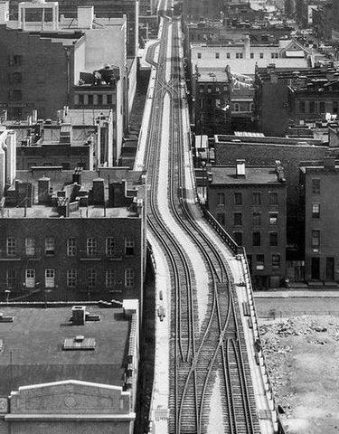
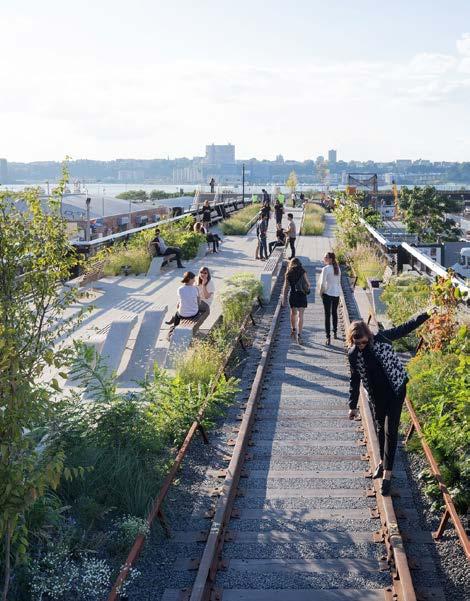
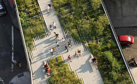
The High Line is a 2.3 km elevated park on Manhattan’s West Side in New York City, built on a disused freight rail line that was part of the New York Central Railroad. The railway was constructed in the early 20th century to replace street-level freight tracks and serve industrial areas in West Chelsea and the Meatpacking District, but it was abandoned by 1980.
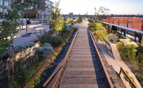
The park project was led by the non-profit Friends of the High Line, who prevented demolition, and designed by James Corner Field Operations, Diller Scofidio + Renfro, and Piet Oudolf. The design preserved parts of the original railway, introduced resilient plantings inspired by spontaneous vegetation, and created spaces for walking, seating, and public art.
The first section opened in 2009, and the full park was completed by 2014, with later extensions added.
Historical elements such as steel rails and structural features were deliberately retained, connecting the site’s industrial past with new ecological and recreational uses. [5]
Figure 23. View north from West 17th Street, 1934 (Photographer unknown)
Figure 24. Aerial view of the rail area now (Photo: Iwan Baan) 2014
Key
Retain to remember
Original rails and structural elements are retained to preserve industrial heritage
The park as catalyst
The park stimulated residential, commercial, and cultural growth in surrounding neighbourhoods
Design against gentrification
Redevelopment can raise property values, so equity and inclusion need to be considered
Let nature lead
Planting schemes reference spontaneous vegetation and support urban ecology
Figure 26. Living on the trucks (Photo: Iwan Baan)
Figure 25. Landscape rising from the old tracks (Photo: Iwan Baan)
Figure 27. Former rail structure as a main pedestrian link (Photo: Iwan Baan), 2011
Healing the Former Railway Space
Nordwestbahnhof, Vienna
Ernst Niklaus Fausch Partner AG
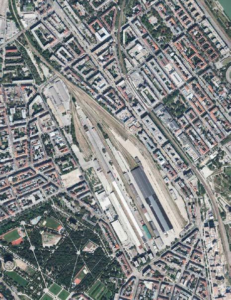
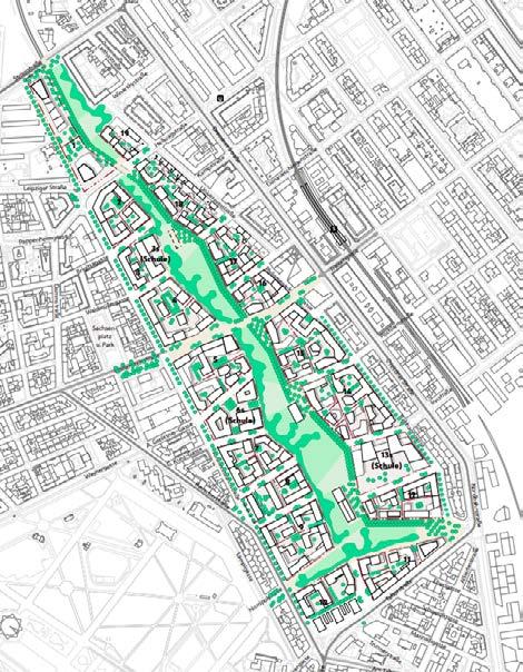
The transformation of Nordwestbahnhof represents a large-scale effort to convert former railway infrastructure into a new, integrated urban neighbourhood. The 44-hectare site, previously used as a freight terminal, is being redeveloped into a mixed-use district for approximately 16,000 residents and 5,000 jobs, reconnecting parts of the city that were historically separated by rail infrastructure.
A key concept is “healing” the railway void by turning it into a connective urban space. This is achieved through the Green Centre (Grüne Mitte) - a central park that structures the district, links surrounding areas, and provides ecological and social value.
The development is guided by a detailed quality framework, which ensures consistent urban design, supports sustainable mobility, and promotes climate-responsive solutions. The project demonstrates how former railway spaces can be re-integrated into the city as accessible, connected, and liveable environments while maintaining a link to their historical role. [6]
Figure 28 - Aerial view of the rail area - before
Figure 29 - Masterplan of the area
Key takeaways
Green space as a structuring element
The “Grüne Mitte” acts as the core of the district, using landscape to organise urban form and reconnect surrounding areas
Build green infrastructure first
The project prioritises walking, cycling, and green infrastructure, supporting climate-responsive and liveable urban development
Barriers become neighbourhoods
The transformation of Nordwestbahnhof shows how former railway barriers can be turned into integrated and accessible neighbourhoods
Enhance accessibility by cross-site connections
Pedestrian and cycling routes across the former railway area link previously separated parts of the city, improving permeability and social interaction
Figure 31 - Active ground floors, mixed use neighbourhood
Figure 32 - Aerial view of the area
Figure 30 - Public Realm
The site
28,2ha
Territorial and Metropolitan Context
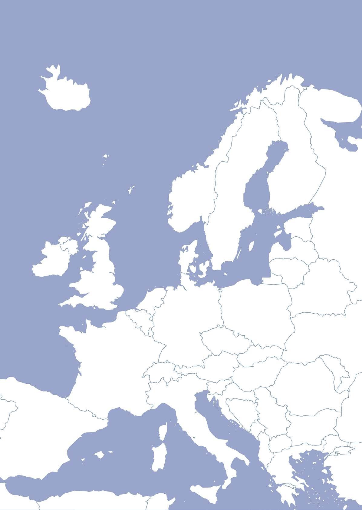
The site is located in Warsaw, the capital city of Poland, which constitutes the country’s principal political, economic, and cultural centre. At the European scale, Warsaw functions as a major metropolitan node within Central Europe, integrating national and transnational networks of mobility, governance, and economic exchange. Its strategic location between Western and Eastern Europe has historically shaped its development dynamics and continues to influence its contemporary urban transformation processes.
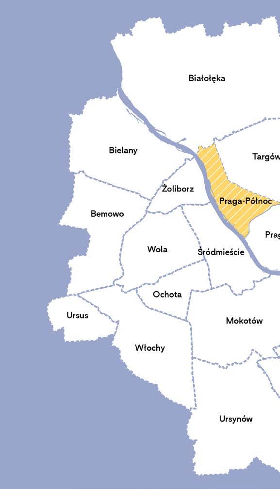
Within the internal spatial structure of Warsaw, the project area is situated in Praga-Północ, on the right (eastern) bank of the Vistula River.
Country
Voivodship
City Area
Population
Density
Name of the district Area
Population Density
Poland
Mazowieckie
Warszawa
517,2 km²
1 863 845
3604 os./km²
Praga-Północ
11,31 km²
59 183 5233 os./km²
Demographics and User Analysis
Understanding the current and potential users of the Dworzec Wileński area is essential for designing inclusive and effective public spaces. Praga-Północ is a diverse district, where historical continuity and recent socio-economic changes have created a complex demographic profile.
Area
Praga-Północ covers an area of 11.31 km², making it one of the smaller districts of Warsaw by surface area.
Source: Urząd Dzielnicy Praga-Północ, 2023
Population
The district is home to 59,263 residents as of December 2023, representing just under 3% of Warsaw's total population. Over recent years it has experienced a modest decline, with a reduction of about 1,672 people since 2021 and a negative migration balance of −128 residents in 2023.
Source: GUS, Bank Danych Lokalnych, 2023
11,31 km2 59 263
Gender Distribution
The district exhibits a noticeable female majority, with women representing 54.1% of the population - equivalent to roughly 118 women for every 100 men.
Source: GUS, Bank Danych Lokalnych, 2023
Age Distribution
The population is predominantly of working age, with 38,799 residents aged 18–64, alongside 7,840 children and young people (0–17) and 12,993 seniors (65+). The significant elderly population underscores the need for age-inclusive urban interventions.
Source: GUS, Bank Danych Lokalnych, 2023
Historical and Urban Context
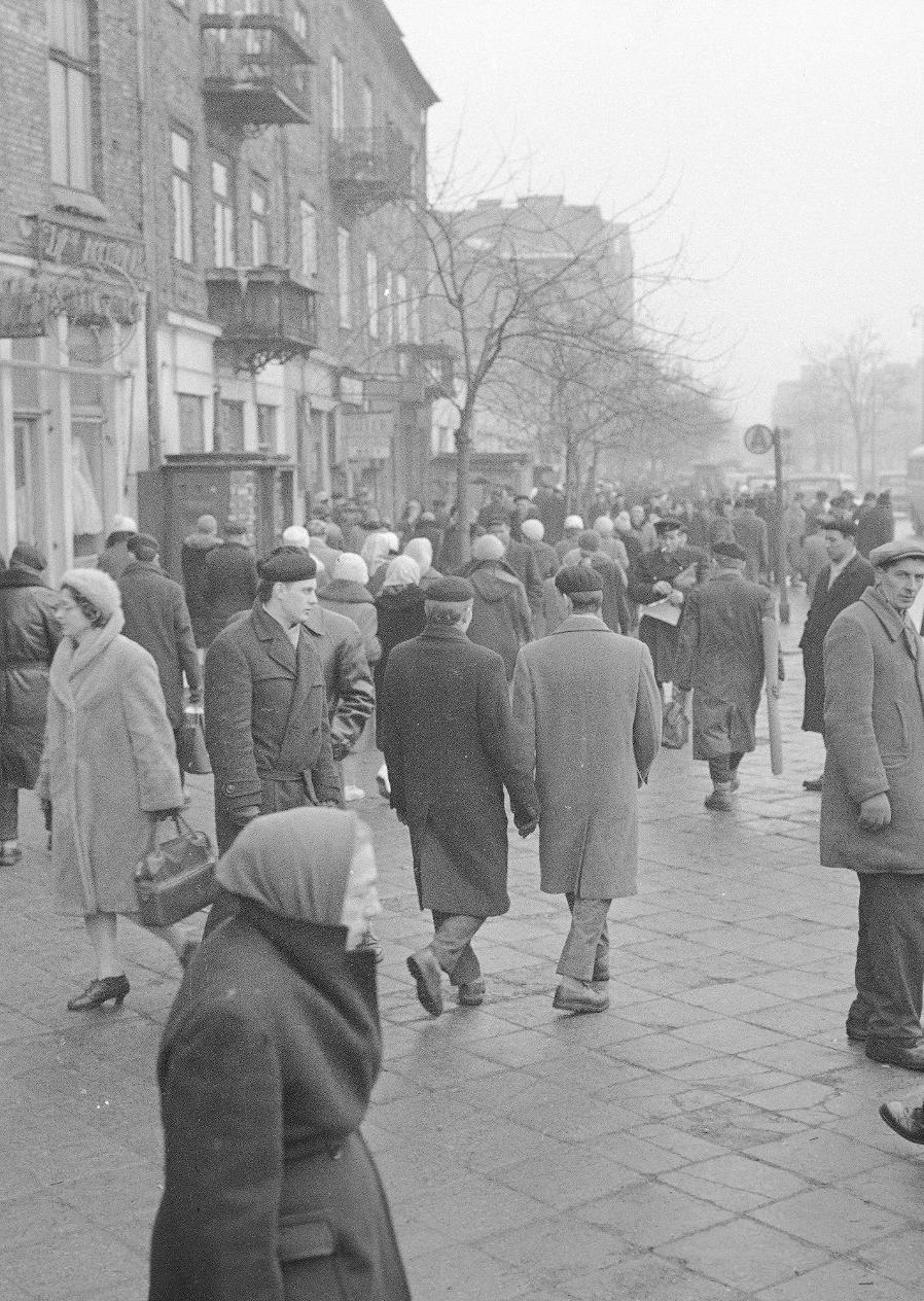
Praga-Północ occupies a distinctive and historically complex position within the social and spatial structure of Warsaw. Located on the right bank of the Vistula River, it stands in clear contrast to the left-bank districts, which were almost entirely destroyed during the Second World War and later reconstructed according to modernist, top-down planning principles. Praga, by contrast, retained a significant portion of its pre-war urban fabric, making it one of the few areas of the city where historical continuity remains visible in the built environment.
Surviving tenement buildings, an intimate street scale, and mixed-use ground floors are often interpreted as signs of authenticity and cultural richness. At the same time, these characteristics also reflect decades of uneven investment, infrastructural neglect, and political marginalisation. As a result, Praga-Północ has developed as a district with a strong local identity, yet one that continues to face persistent socio-economic challenges.
A District Historically at the Urban Periphery
In the post-war period, reconstruction efforts focused primarily on the left bank of the river, leaving many streets, courtyards, and residential buildings in Praga in deteriorating condition well into the late twentieth century. This material neglect intersected with broader social and economic processes: higher unemployment rates, lower average incomes, and underdeveloped public services shaped both everyday life and external perceptions of the district. Over time, Praga acquired a dual reputation - valued for its historical character and social vitality, yet simultaneously stigmatised as “the other side” of Warsaw.
This condition cannot be separated from the role of the Vistula as both a physical and symbolic boundary within the city. For much of Warsaw’s modern history, the left bank functioned as the political, economic, and cultural centre, while the right bank - despite its early industrial significance - was treated as peripheral. Limited bridge connections throughout the nineteenth and early twentieth centuries reinforced this division, restricting everyday mobility and slowing Praga-Północ’s integration into the wider metropolitan system.
Infrastructural Margins and Their Social Effects
Beyond its physical form, Praga-Północ has long been shaped by strong local communities and informal social networks. Limited post-war investment and relative isolation from the city’s main development currents fostered a form of everyday self-reliance, where social ties, neighbourhood familiarity, and shared use of public space played a central role in daily life. Courtyards, streets, and local services functioned not only as spatial elements, but as social infrastructures supporting community cohesion.
At the same time, Praga has been persistently associated with narratives of insecurity and danger. For decades, popular discourse and media representations portrayed the district as unsafe, criminal, or socially “problematic.” These perceptions were often reinforced by visible signs of neglectpoorly maintained buildings, inadequate lighting, and fragmented public spaces - rather than by crime statistics alone. As a result, fear and stigma became attached to specific streets and areas, shaping how the district was experienced not only by outsiders, but also by its residents.
Importantly, these narratives frequently diverged from everyday realities. For many inhabitants, Praga-Północ was experienced as a place of strong social control through familiarity: people knew each other, recognised faces, and shared unwritten rules of coexistence. In this sense, perceived safety was often produced socially rather than institutionally. The contrast between internal lived experience and external reputation highlights how urban safety is not only a matter of policing or infrastructure, but also of symbolic meaning and collective imagination.
In recent years, processes of revitalisation and gentrification have begun to reshape both the physical environment and the social image of PragaPółnoc. While new investments have improved public space and accessibility, they have also introduced tensions between long-term residents and newcomers, raising questions about displacement, affordability, and the future of local communities. These dynamics further complicate the district’s identity, positioning Praga simultaneously as a place of heritage, vulnerability, and transformation.
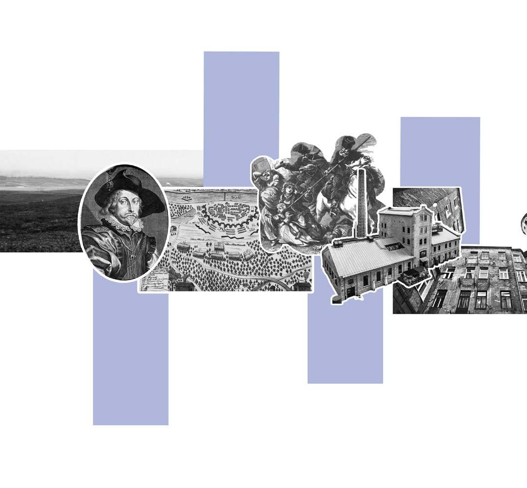
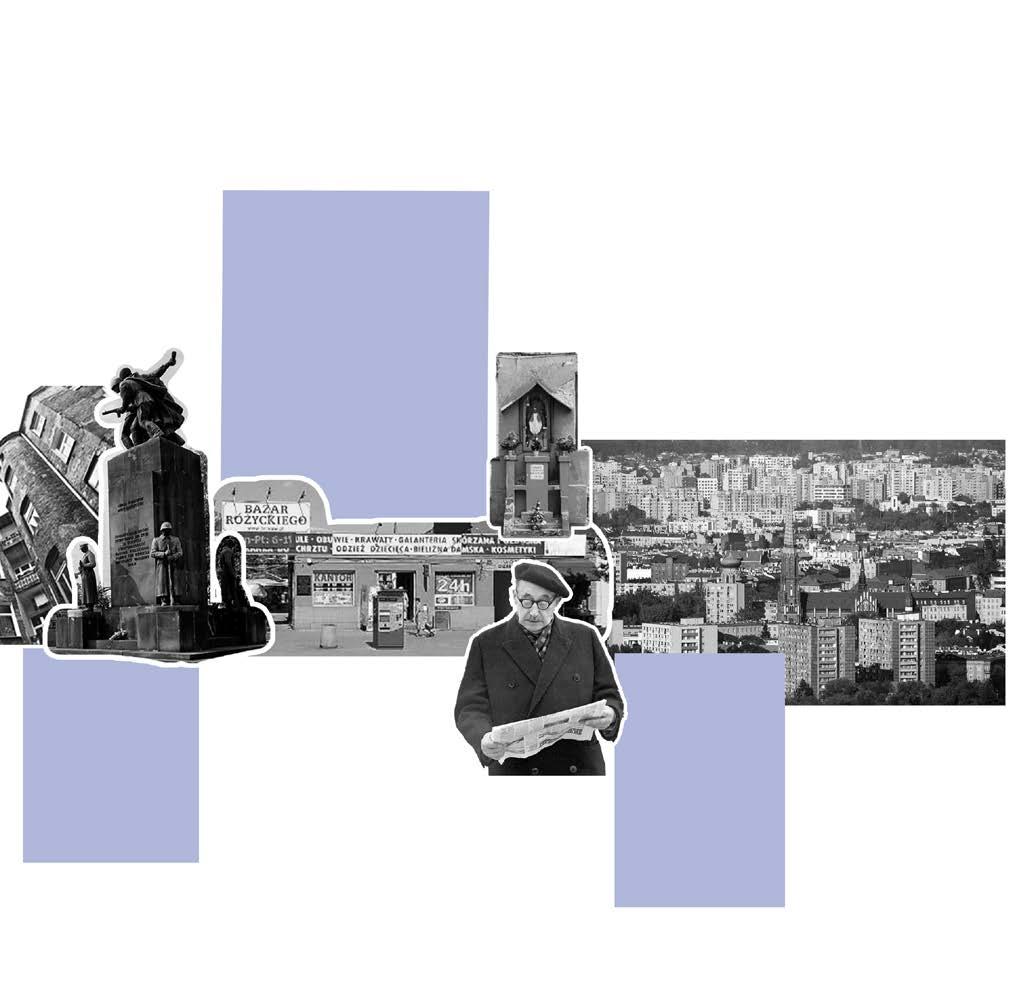
Timeline - history
1794
The Massacre of Praga. Russian forces massacred roughly 20,000 residents
The district's darkest chapter. After the fall of the Kościuszko Uprising, Russian forces under Suvorov captured Praga and massacred roughly 20,000 residents, leaving it long regarded as the "poorer, lesser part of Warsaw."
1918 - 1939
A working-class district of contrasts
17th/18th century
A noble village on the Vistula that became an independent city for 150 years before joining Warsaw
The name "Praga" derives from the word for "clearing a forest" for settlement. Originally a noble village on the right bank of the Vistula, King Władysław IV granted it town rights in 1648. It operated as an independent city for ~150 years before being formally incorporated into Warsaw following the 1791 act abolishing private jurisdictions.
A thriving industrial and commercial hub 19th
century Railway connections to the Russian Empire and Western Europe drove rapid industrialization. Major factories emerged, including Wedel and the Koneser vodka distillery.
The Różycki Bazaar opened in 1901, becoming a beloved hub of trade and daily life.
Praga largely escaped destruction 1939 - 1945
The Communist Era and Beyond
Praga became a hub of heavy industry and prefab housing. The Różycki Bazaar thrived as a legendary grey-market trading spot through the communist era and into the 1990s.
Praga earned a reputation as a working-class district of contrasts - industry and commerce alongside poverty and the underworld - and became celebrated in culture for its authenticity, humor, and distinct character.
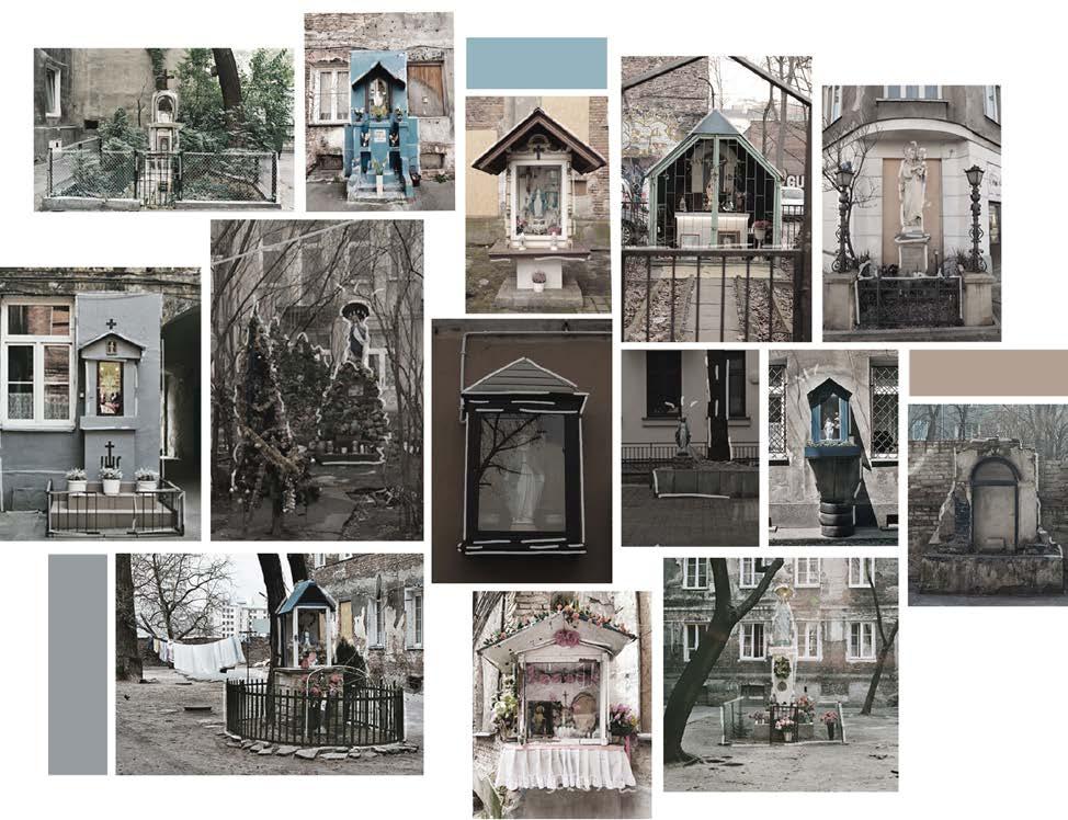
Unlike left-bank Warsaw, Praga largely escaped destruction, preserving its original tenements and courtyards. Courtyard shrines became gathering places during the occupation. On September 14, 1944, Praga was the first part of Warsaw liberated from German forces.
Today
A historic yet trendy neighborhood
Today Praga-Północ is one of Warsaw's trendiest and most authentic neighborhoods, blending old tenements and courtyards with new developments like the Koneser Warsaw Center. Its courtyard shrines, murals, Ząbkowska Street, and the Różycki Bazaar remain enduring symbols of the district's identity.
Historical Development of Praga Północ
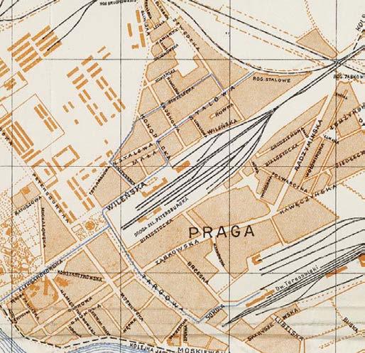
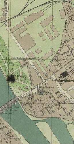
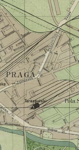
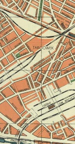
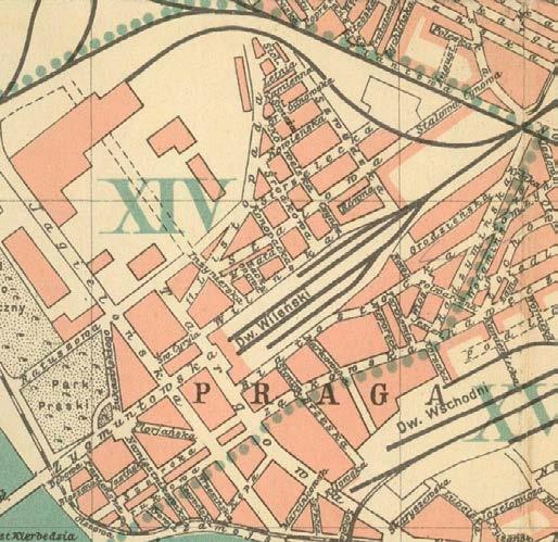
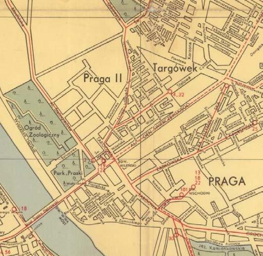
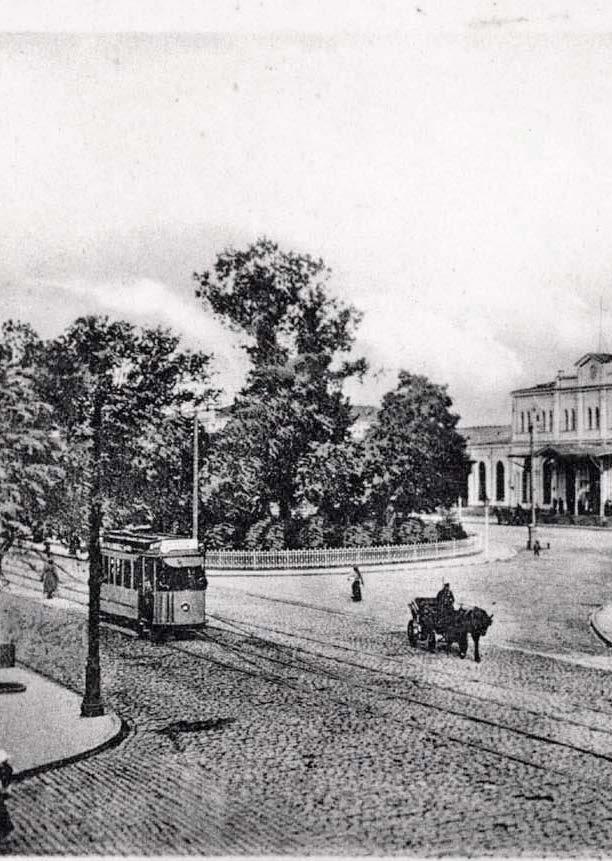
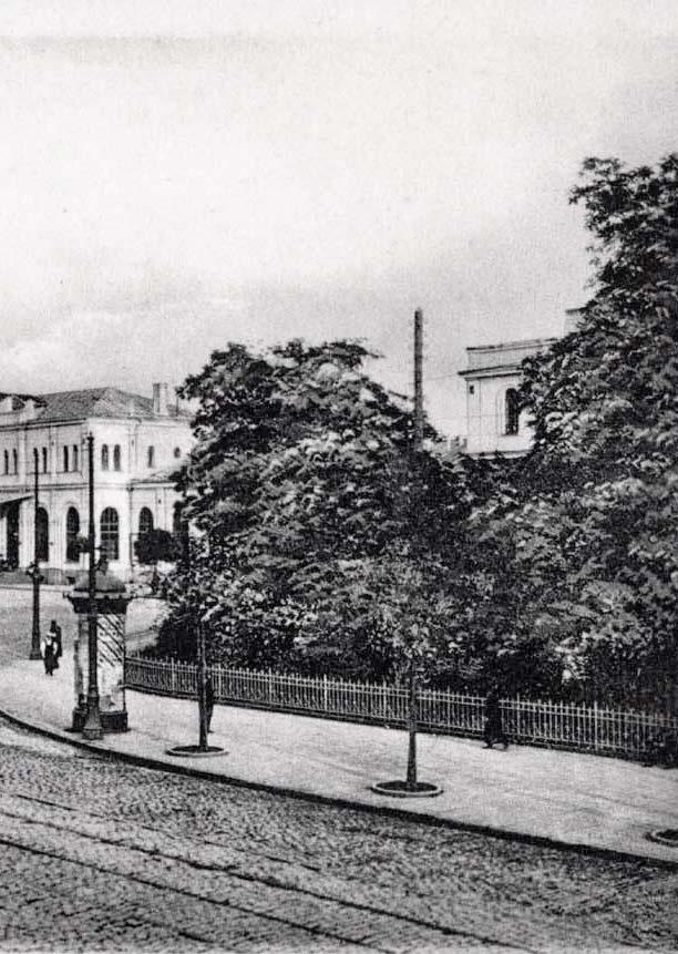
The area was already an important transport zone under Russian rule. The St. Petersburg Railway (later Dworzec Wileński) functioned as a key rail connection, surrounded by dense tenement housing, small industries, warehouses, and unregulated urban fabric typical of Praga.
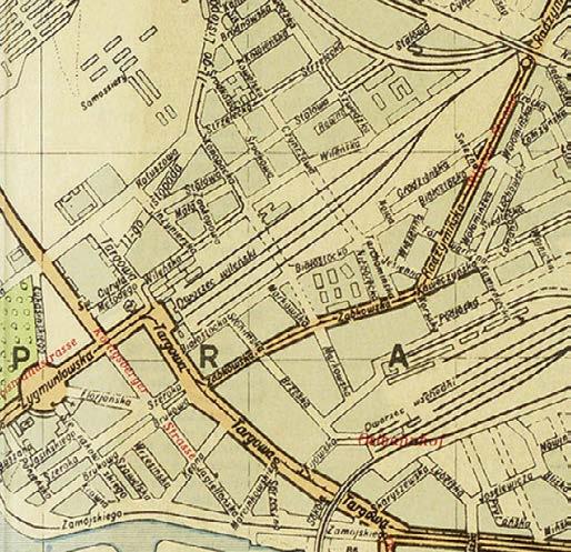
Under German occupation, the station remained operational but served the needs of the occupying authorities. The surrounding district functioned under strict control, with increasing restrictions and deteriorating living conditions.
During World War I, after the takeover, the station area gained infrastructure was adapted to and Ząbkowska Streets remained concentrating movement and trade.
The area continued to operate infrastructure was heavily used everyday urban life was limited economic hardship.
the Russian retreat and German gained military importance. Rail wartime needs, while Targowa remained the main local arteries, trade.
operate under wartime pressure. Rail used for military transport, while limited by occupation policies and
In the interwar period, the area developed as a busy district of Praga Północ. The station operated as a significant passenger hub, with compact residential quarters, local commerce, and services concentrated particularly along Targowa and Ząbkowska.
1955
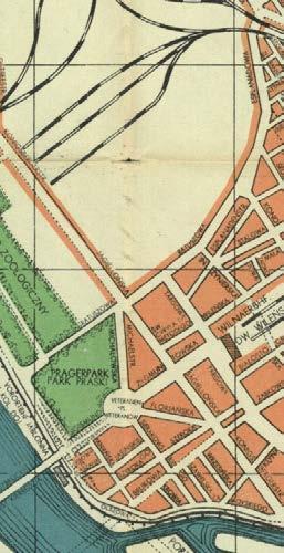
In the post-war socialist period, the station was rebuilt and adapted to new functional needs. The surrounding area reflected socialist urban policies, with partial reconstruction, simplified architecture, and the gradual introduction of largerscale housing and infrastructure projects.
The Role of Railway Infrastructure
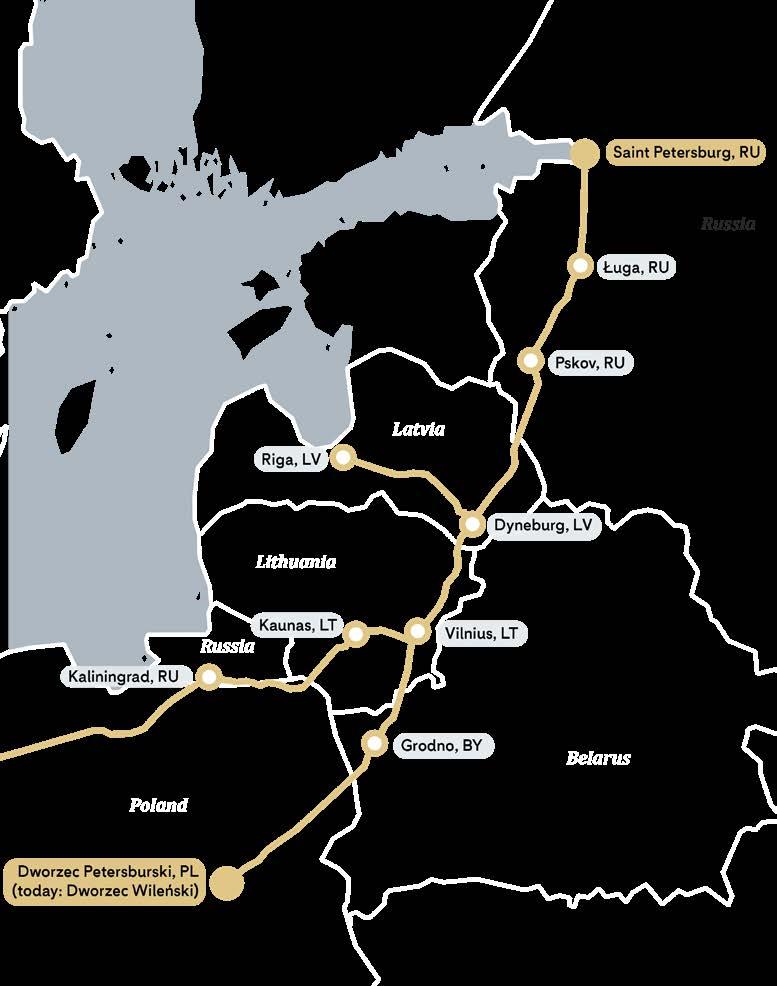
Within this context, Dworzec Wileński has long served as Praga’s primary infrastructural anchor. Established in the mid-19th century as the terminus of the Warsaw - Saint Petersburg railway, it positioned the district as one of the city’s earliest international gateways. Its presence reinforced Praga’s logistical importance even as the surrounding urban area remained socially and economically peripheral.
Petersburski, Construction: 1859–61 Destroyed in 1915
Dworzec
Dworzec Wileński as a Contemporary Multimodal Transport Hub
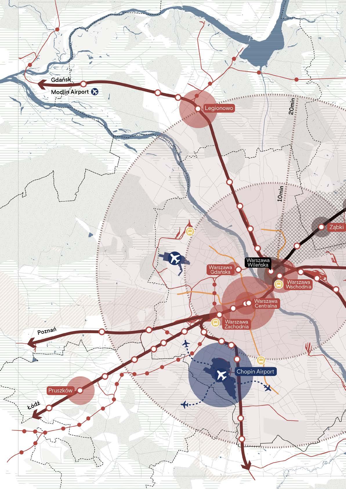
Dworzec Wileński functions today as one of the most important transfer nodes on Warsaw’s right bank, integrating regional rail services with the metro, tram, and bus networks. This concentration of modes makes it a critical point of intersection for daily commuters travelling from eastern districts of Warsaw, the broader metropolitan region, and towns along the lines toward Tłuszcz, Małkinia, Wołomin, and further east. The station’s position strengthens Praga’s connectivity despite its historically peripheral status, linking the district efficiently to employment, education, and cultural opportunities across the city.
With the opening of the M2 metro line, the area gained a significantly expanded catchment: journey times to the city centre and left-bank districts were shortened, and multimodal transfers became more seamless. Tram lines running along al. “Solidarności” and Targowa Street offer additional high-frequency routes, while the dense bus network serves both local and regional passengers. As a result, Dworzec Wileński operates not only as a neighbourhood-scale station but as a strategic piece of Warsaw’s integrated transportation infrastructure.
to the city center
Main urban mobility node around
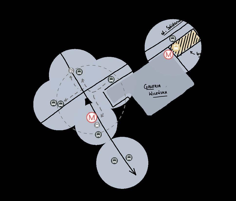
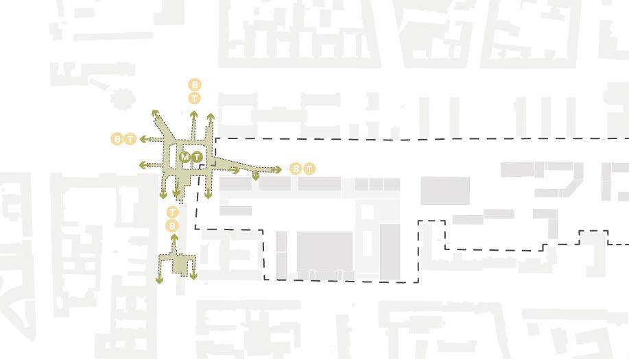
The area around Dworzec Wileński serves as an important transport interchange. In the immediate surroundings of the station there are several additional stops, including bus, tram, and metro services, where passengers transfer between different modes of transport. All stops are located within a distance of several dozen meters, forming a compact transfer area.
However, they are not directly connected. Passengers need to cross busy streets when changing between modes of transport, which reduces the comfort and safety of movement. Most transfer flows are directed toward Targowa Street, along which the main interchange activity is concentrated.
A Gateway Between City and Region
The station’s regional rail connections position it as a gateway between Warsaw and its eastern corridor. Daily commuting flows illustrate its importance: thousands of passengers use the node as their first urban point of contact. For many, it functions as the threshold between metropolitan peripheries and the urban core, shaping perceptions of accessibility, mobility, and the overall experience of entering Warsaw. This makes the quality of the surrounding public space especially important, as the area serves as the city’s first point of encounter for a significant share of the region’s population.
Local plan
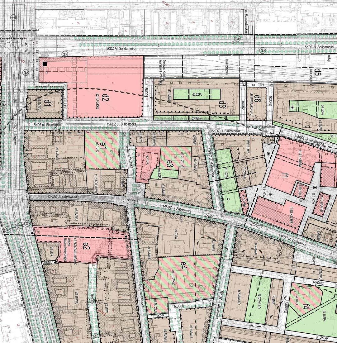
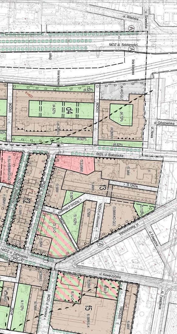
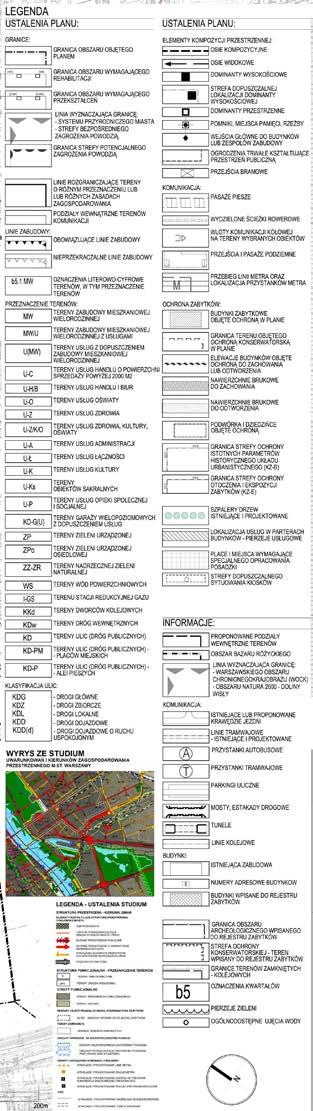
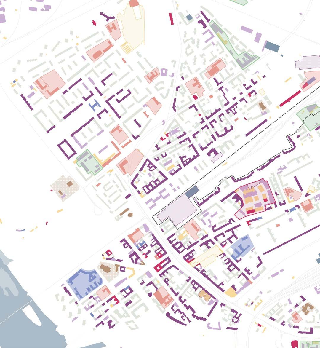
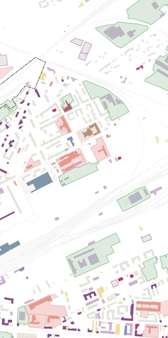
The local plan defines the area around Dworzec Wileński as a dense, mixed-use structure with a strong service and public character. It includes residential blocks with ground-floor services, public facilities, and larger commercial plots near the station and main streets, structured by public spaces and inner courtyards.
The main urban axes are Targowa Street (running north–south) and al. Solidarności (east–west), both functioning as primary transport and service corridors. They concentrate commercial frontages, public transport lines, and the most intensive pedestrian flows. Secondary but still important streets include Ząbkowska, Białostocka, and Kijowska, which organize the internal urban grid.
source: City of Warsaw, Local Spatial Development Plan (MPZP) for Praga-Północ, Bureau of Architecture and Spatial Planning, um.warszawa.pl
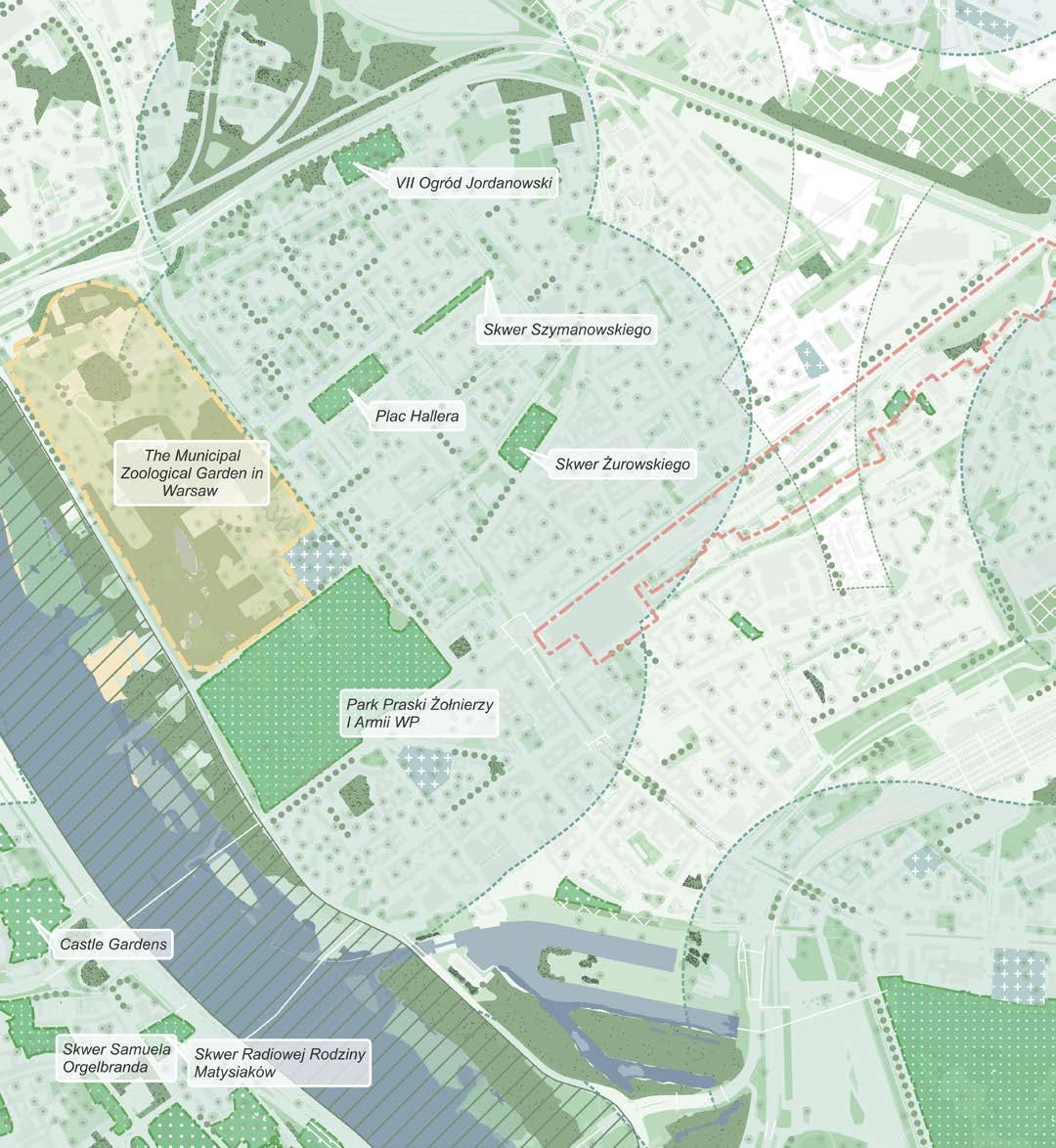
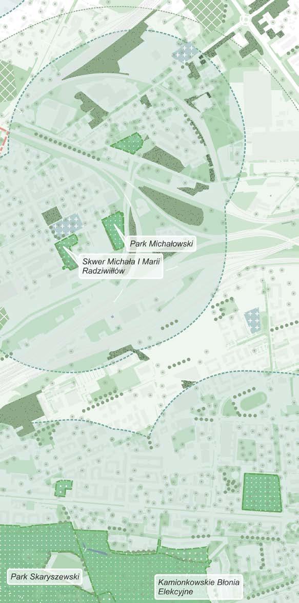
Green areas appear mainly as linear elements and pocket spaces within quarters. A larger green structure is located toward the Vistula riverfront, while smaller green courtyards and planted street sections are distributed inside the blocks.
Tree-lined streets reinforce the main corridors and improve pedestrian continuity.
Along the railway tracks near Dworzec Wileński, the plan maintains transport-related functions and infrastructure zones. The railway corridor acts as a strong physical barrier, with limited transversal connections. Adjacent plots include service, technical, and redevelopment areas, indicating potential urban transformation while preserving the operational rail function.
Road Network Analysis
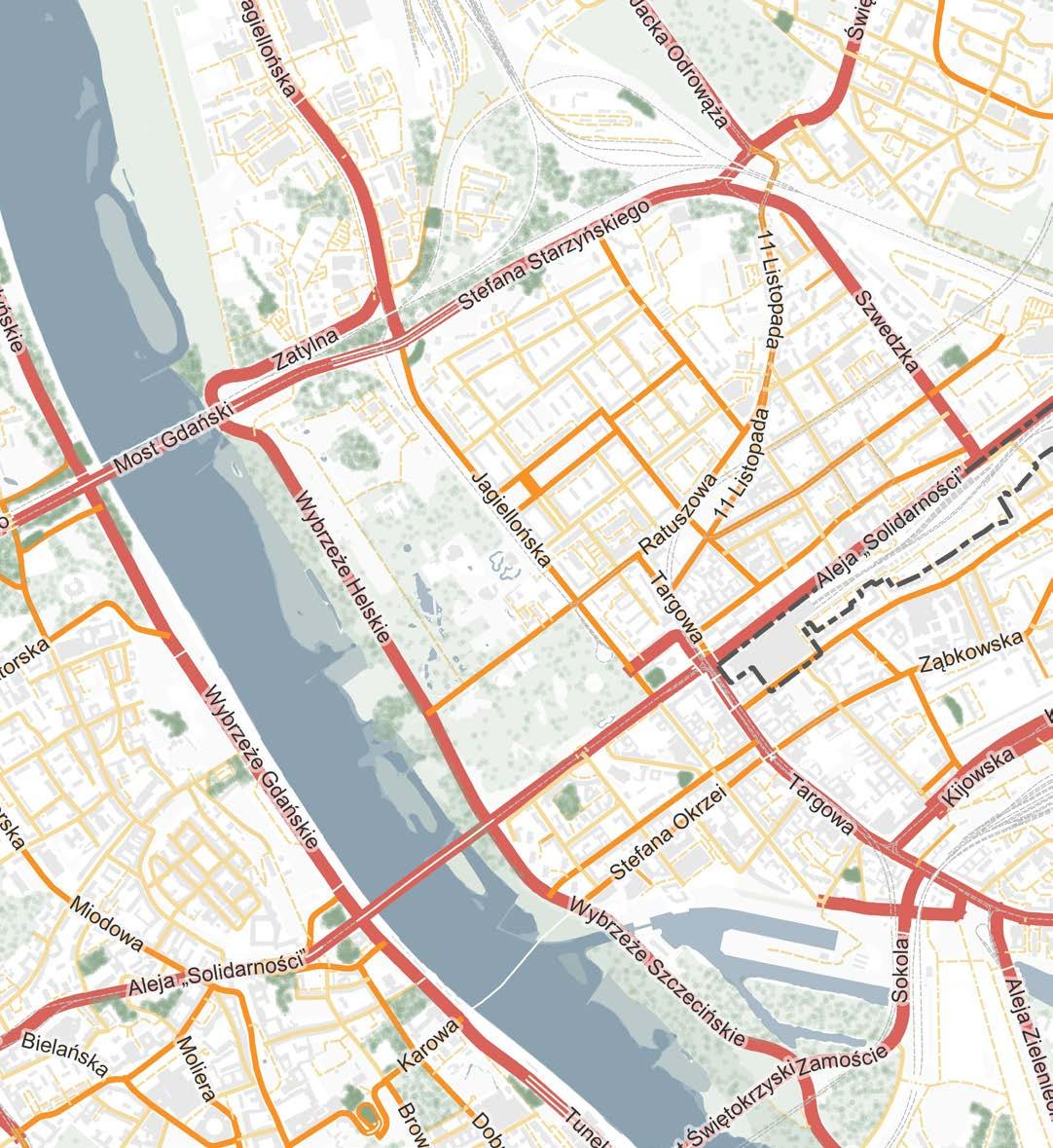
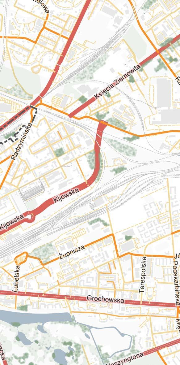
This map highlights the dense road infrastructure surrounding Warszawa Wileńska railway station, revealing a highly car-oriented urban structure. The area is served by multiple primary and secondary roads, creating strong vehicular connectivity but also reinforcing traffic dominance within the public space.
A key element is Aleja Solidarności, a major arterial road running directly adjacent to the station. With three lanes in each direction, it functions as a highcapacity traffic corridor carrying significant daily vehicle flow. While it ensures efficient cross-city movement, it also generates considerable noise, air pollution, and safety concerns.
Its width and traffic intensity make pedestrian crossings difficult and uncomfortable, creating a physical and psychological barrier within the district. As a result, despite strong road connectivity for cars, the overall spatial quality and pedestrian accessibility in the immediate station area are significantly reduced.
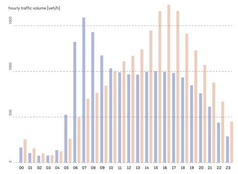
* Hourly Traffic Volume - Aleja Solidarności
The chart shows hourly traffic volume on Aleja Solidarności at the project site, recorded in both directions. Two clear peaks are visible: a morning peak around 07:00, as commuters travel towards the city centre, and an evening peak between 16:00 and 17:00, as traffic flows in the opposite direction on the return journey.
The predominantly commuter-driven pattern confirms that the road functions primarily as a arterial corridor for daily work trips rather than a local street serving the immediate neighbourhood.
Praga Południe
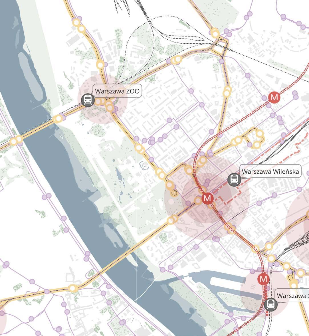
Public Transport Accessibility Analysis
Warsaw offers very good access to public transport, supported by an integrated network of metro, trams, buses, and regional rail.
The system ensures efficient connections between districts and provides fast links to the city center and surrounding areas.
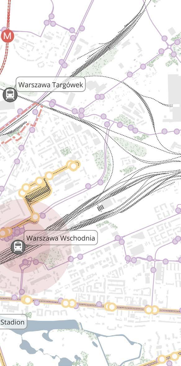
One of the main urban nodes in this part of the city is the area around Warszawa Wileńska station, which combines metro, tram, bus, and rail services, making it a key interchange and everyday transport hub.
Another key node is Warszawa Wschodnia, a major
regional and long-distance railway station that strengthens connectivity at both city and metropolitan levels.
These hubs are the most frequently used transport points in the area, generating high passenger flows and reinforcing the accessibility of the district.
border
Train station
Metro stop Bus stop
Tram stop Metro route
Train route
Bus route
Tram route
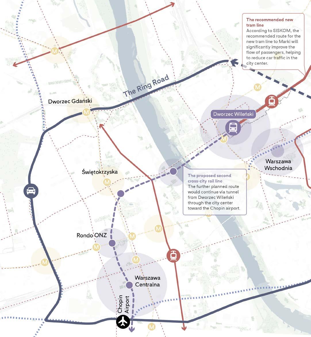
Warsaw 2050 Transit Plan
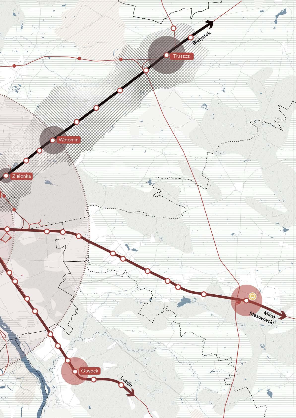
This map presents Warsaw's strategic vision for rail transport to 2050, highlighting a major expansion of the metro and regional rail network. The city plans to grow from two metro lines today to five by 2050, significantly increasing access to rapid transit across the capital. Extensive upgrades to tram routes and high-capacity public transport corridors are also
planned, better connecting residential and employment areas citywide. Among these, new tram lines on the eastern side of the city will be particularly beneficial for Praga-Północ, greatly improving accessibility and movement capacity for residents of the right bank. At the same time, modernisation and additional tunnel projects along the cross-city rail
line (Linia Średnicowa) will increase capacity for regional and long-distance trains, with the line also providing a direct connection to the airportstrengthening key interchange hubs, particularly Warszawa Wileńska, and integrating metro, rail, and bus services into a more efficient metropolitan network.
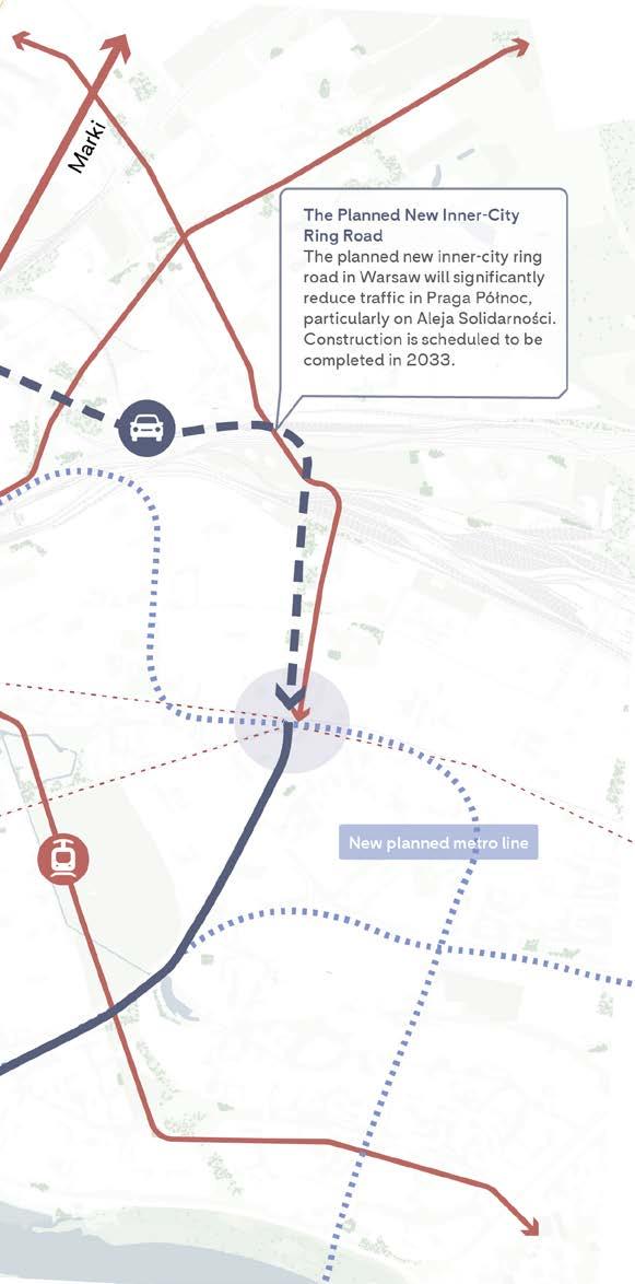
The map also shows the planned completion of the ring road on the Praga side, which will redirect through-traffic away from the inner neighbourhoods. By containing movement within the loop, streets inside will become calmer and more people-friendly - a significant step toward improving the quality of urban life in Praga.
M
Existing Road
Planned closure of the ring road
Proposed extension of the rail line
Recommended extension of the tram line
Planned metro line
Existing metro line
Existing tram line
Existing metro stop
Primary Metro Nodes
Key Interchange Nodes
Upcoming Urban Developments in the Area
Several urban projects are planned in close proximity to the site, each of which has the potential to significantly influence the future development of the area.
Site around Szwedzka Street
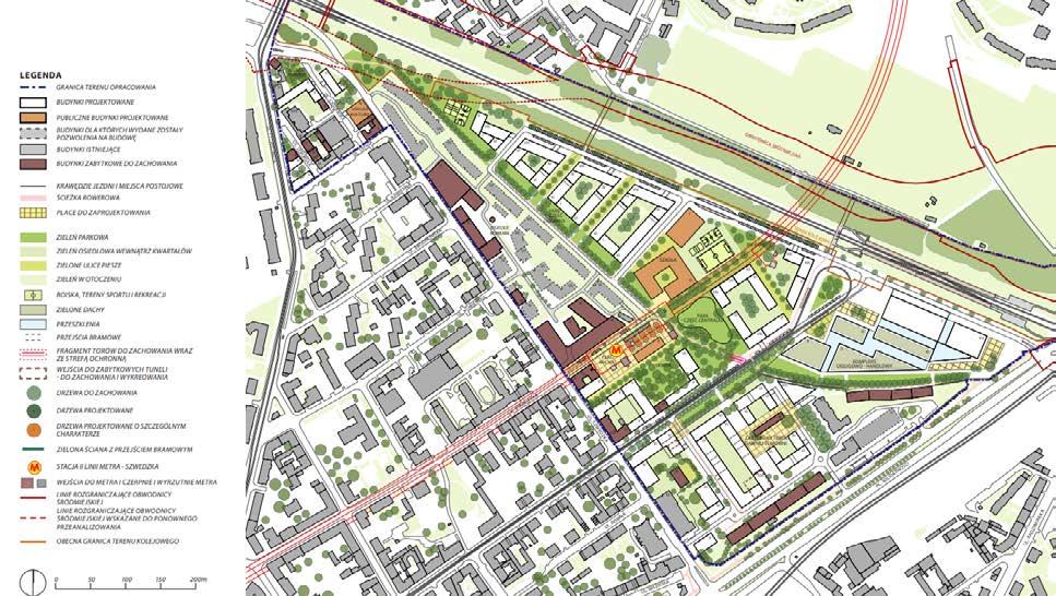
One of the most relevant projects focuses on the Ulica Szwedzka area, where plans include new housing, ground floor services, and the revitalisation of the surrounding urban fabric. This project has the potential to bring new life to an underused part of the district, creating a more cohesive and active neighbourhood edge directly adjacent to the site.
Status:
BOHEMA - Strefa Praga, a large-scale mixed-use development combining revitalised historic factory buildings with new residential, office, and cultural spaces, was completed in 2025. The City of Warsaw is also preparing a local development plan for the wider Szwedzka area, currently at an early planning stage.
These initiatives share a common ambition - to strengthen connectivity, introduce new public spaces, and support the ongoing transformation of Praga-Północ.
source: Mycielski Architecture & Urbanism (MAU), Szwedzka — Urban Development Concept, City of Warsaw, Bureau of Architecture and Spatial Planning, um.warszawa.pl/szwedzka
Aleja Tysiąclecia - New Green Link
Trasa Tysiąclecia was originally conceived as a wide arterial road connecting Praga-Północ and PragaPołudnie, forming part of an inner ring road around Warsaw's right bank. The current vision, however, moves away from the original car-dominated concept - proposing instead a green north–south link with tram and bike lanes only, prioritising sustainable mobility and public space over traffic capacity.
Status:
The chances of realising the full original route are now practically non-existent. A shorter variant, running from Grochowska Street to Rondo Żaba, remains under consideration in local development plans, but no construction timeline has been confirmed. The corridor has been reserved in planning documents for decades and remains a longstanding planning ambition without a clear path to implementation.
source: City of Warsaw, Bureau of Architecture and Spatial Planning, Aleja Tysiąclecia - Presentation, 2022, architektura.um.warszawa.pl
This map illustrates the existing pedestrian and bicycle connections used on a daily basis, revealing the fine-grain structure of local movement across the district. While the street grid appears relatively dense, the railway corridor near Warszawa Wileńska railway station acts as a strong physical and psychological barrier.
The tracks divide the urban fabric into two separate zones, significantly limiting east–west permeability.
There are very few formal crossings across the railway line, forcing pedestrians and cyclists to make detours of several hundred meters to reach designated underpasses or bridges. As a result, many users
Source of the quotes: Social media platforms and Google Maps user reviews
choose to cross the tracks informally to shorten their routes. This exposes a disconnect between infrastructure design and everyday movement, creating unsafe conditions. Instead of functioning only as a transport corridor, the railway line acts as a barrier that fragments space and limits walkability.
Activity Patterns – Strava Heatmap
The Strava heatmap reveals where people choose to walk, run, and spend time outdoors. The most intense activity concentrates along riverside paths, larger green areas, and continuous corridors that provide comfortable, uninterrupted movement.
While the first map reflects everyday functional connections, the Strava data highlights preferred and attractive routes - spaces that feel safe, open, and enjoyable for soft mobility.
Site border
Water
Buildings
Bicycle path
Pedestrian path
Pedestrian crossing
Schools
Shopping malls
Recreational area
Greenery accessibility analysis
The area is characterised by a well-developed system of green spaces of varying scale and function. Large parks, such as Praski Park of the Soldiers of the Polish Army, the Municipal Zoological Garden in Warsaw, Park Michałowski, and Park Skaryszewski, form the main elements of the green structure and provide important recreational and ecological value.
These major green areas are complemented by a network of smaller squares and local green spaces, including Plac Hallera, Skwer Szymanowskiego, and Skwer Żurowskiego, which ensure everyday access to greenery within walking distance. The majority of green areas are located within approximately 500–1000 metres, supporting good accessibility for
residents and users of the area.
Green spaces are linked by tree-lined streets, pedestrian routes, and linear green corridors, creating spatial and ecological connections between larger parks.
Site border
Water
Buildings
Access to green areas (500 m)
Access to bigger green areas (1000 m)
Natura 2000 area
Beach area
Zoo
Wetland Forest
Tree row
Cemetery area
Park
Allotment gardens
Grassland Tree
Land use analysis
The analyzed area is predominantly a multi-family residential district with a mixed-use structure, supplemented by local commercial and service functions. A significant concentration of educational facilities increases daily activity and attracts users commuting from other districts and surrounding towns.
Industrial and economic complexes, located mainly along major transport corridors, may act as urban barriers, limiting pedestrian permeability and separating residential areas from other functions. Similarly, large-scale transport infrastructure contributes to spatial fragmentation and reduces continuity of public space.
Site border
Marketplace
Main attraction point
School area
Healthcare area
Churches and cemeteries
Industrial area
Mixed-use - commestical
Healthcare services
Housing with services on the ground floor
Mixed-use
Culture places
School and university
Housing
Churches
Transport hub
Services accessibility analysis
The area has a high concentration of public, educational, and service functions, confirming its role as an important everyday-use center attracting users from beyond the neighborhood. Educational and cultural facilities dominate, generating strong daily flows, while shops and services support activity throughout the day.
However, large mono-functional complexes, transport infrastructure, and waterfront edges reduce permeability, and clusters of single-use functions weaken urban integration by limiting activity to specific times.
Stalowa Street Bar mleczny "Rusałka"
New Cultural CenterInzynierska 6
Koneser Praga Center
Wileńska
Ząbkowska Street Muzeum Warszawskiej Pragi Bazar Różyckiego
Galeria
Museum of Polish Vodka
Cathedral of St. Florian Bazar Namysłowska
Wschodnia station
Access to the school within 10 minutes
Co-working space
Healthcare point
Cultural/Social facilities
Language school
Library
Pharmacy
Post Office
Public building
Restaurant
Museum
Healthcare area
Kindergarten
University area
School area
Public hub
Museum
Zoo
Shopping mall
Warszawa
1. Plac Wileński
Plac Wileński is often perceived by residents as the symbolic center of Warsaw’s Praga Północ district.
As a major transport hub - connecting the metro, trams, buses, and the Warszawa Wileńska railway station - it concentrates everyday movement and public life.
The square functions as an important urban node where commercial activity, pedestrian flows, and local identity intersect.
Nearby developments, including Galeria Wileńska, further reinforce its role as a key gathering and transit point in the district.
2. Koneser Praga Center
Koneser Praga Center is a mixed-use complex created through the revitalization of the historic former vodka factory in Warsaw’s Praga Północ district.
Today it combines cultural institutions, offices, housing, restaurants, and public courtyards. The project is often cited as an example of postindustrial regeneration, transforming a closed industrial site into an open urban quarter.
Due to its cultural program, gastronomy, and public spaces, it has become one of the main attraction points in the area and an important destination for both residents and visitors.
3. Bazar Różyckiego
Bazar Różyckiego is one of the oldest and most historically significant marketplaces in Warsaw’s Praga Północ district, established in the late 19th century.
For decades it served as a major center of local trade and everyday social life, especially during the communist period.
Although its commercial role has declined in recent years, the bazaar remains an important symbol of Praga’s identity and a place strongly embedded in the district’s cultural memory.
Stalowa Street is one of the characteristic streets of the Praga Północ district, known for its historic late-19th- and early-20th-century tenement houses.
The street reflects the traditional urban fabric of Praga, with dense residential buildings and ground-floor services.
In recent years, the emergence of small cafés, cultural venues, and local initiatives has contributed to its revitalization, making it one of the most well-liked and lively streets in the district.
4. Stalowa Street
Schwarzplan - Urban fabric analysis
The Schwarzplan shows a diverse and nonuniform urban fabric. The central part of the area is characterised by a dense block structure, where buildings form continuous street frontages and clearly define public spaces. Enclosed and semienclosed courtyards are visible within the blocks,
indicating a relatively compact development pattern. Towards the edges of the area, the building structure becomes more scattered and fragmented, with larger building footprints and irregular layouts. The continuity of the urban fabric is interrupted by open spaces and linear gaps, resulting in weaker spatial enclosure.
Overall, buildings play a key role in shaping the street network and public space by creating a clear contrast between compact urban blocks and more open structures.
Site border Water Buildings
Building height analysis
The area is mainly built up with low- and midrise buildings, most of them 3–7 storeys high. This type of development clearly dominates and gives the area a fairly uniform scale.
Taller buildings (8 storeys and more) appear only in a few places, usually along main roads or near transport infrastructure. They stand out from the surrounding buildings but do not form larger groups.
The lowest buildings (1–2 storeys) occur less frequently and are scattered across the area, mostly outside the main built-up zones.
Site border
1 - 2 floors
3 floors
4 - 5 floors
6 - 7 floors
7 - 8 floors
8 - 14 floors
14 - 19 floors
Typology of built fabric analysis
The diagram maps the spatial character of the built fabric across Praga Północ. Rather than classifying buildings by function or ownership, the typology is based on morphological criteria - how each building relates to the street, how it sits on its plot, and what kind of urban space it generates around it.
Six categories emerge from this reading, reflecting the layered history of the district: from dense prewar tenement blocks and large civic institutions, through socialist-era housing estates and inherited industrial complexes, to contemporary developer insertions that are gradually transforming the existing fabric.
Site border
Pre-war tenement blocks
Historic tenement
Civic / monumental
New development
Post-industrial
Retail / commercial standalone
Socialist housing block
Exploring Local Building Typologies Around the Study Site
19th/20th-Century Tenement Houses
The historic tenement houses give Praga Północ its unique character, as they are the authentic buildings that survived the war largely intact - one of the few areas in Warsaw where pre-war urban fabric remains at district scale.
Typically 4–5 storeys high with varied heights, they feature tall floors and distinctive roof forms, often with attics or parapets.
Ground floors are usually active, hosting shops and services, while rear wings and passageways create enclosed courtyards defining semi-private spaces within the blocks.
The narrow parcel structure inherited from 19th century land subdivision gives the streetscape its rhythmic quality, with slight variations in facade width, height and ornament between neighbouring buildings.
The socialist housing blocks represent a radical break from the tenement fabric in both scale and spatial logic.
Freestanding slabs and towers set back from the street create open and largely undefined space between buildings - grass, parking, circulation paths - that lacks the enclosure of the tenement courtyard. Heights range from four-storey prefabricated blocks to the extreme case of Kijowska 11, at 508 metres the longest building in Warsaw, which cuts across several historic street lines.
Facades are repetitive and unornamented, and ground floors are rarely active, with entrances set back and no commercial continuity along the frontage.
Socialist housing block
Exploring Local Building Typologies Around the Study Site
Civic / monumental
Civic and monumental buildings punctuate the tenement fabric at key locations - along main boulevards, at squares and at neighbourhood centres.
These large-footprint buildings address public space rather than the intimate scale of the tenement parcel, and include pre-war institutional buildings, socialistrealist blocks framing Plac Hallera, and churches and schools distributed throughout the district. Their scale, symmetry and representational facades signal a relationship oriented towards collective life and public presence.
Ground floors are often less active, with forecourts or fencing creating a degree of separation from the street.
Post-industrial
Praga Północ developed as an industrial district in the late 19th and early 20th century, and the legacy of this history remains visible throughout the fabric.
Originally factories, breweries, warehouses and tram depots, these complexes operated according to a different spatial logic - large rectangular footprints, brick halls, internal service yards, and a relationship to the street defined by gates and loading access rather than active frontage.
Some remain in industrial use, others have been revitalised - Koneser being the most prominent example - but the morphology remains legible regardless of current function.
The building turns inward: the street is access, not address.
Exploring Local Building Typologies Around the Study Site
Contemporary Residential and Office Development (2000s–present)
Post-1990 insertions mark the most recent phase of transformation in Praga Północ.
Developer housing, infill buildings and new institutional objects are classified here by date of construction regardless of architectural style.
New development ranges from small infill plots filling gaps in the tenement frontage to large consolidated sites introducing entirely new spatial typologies into the district.
Their footprints and spatial logic reveal where contemporary investment is entering the historic fabric - and where the tension between old and new is most visible.
Commercial and Service Buildings
Standalone retail and commercial buildings represent a more recent layer of transformation.
Single-storey or low-rise volumes set within large surface parking areas - supermarkets, discount stores, petrol stations, small shopping galleries - have no relationship to the street frontage and generate dead edges at ground level.
Their plot logic is driven by car access and loading requirements, producing footprints and setbacks incompatible with the scale and continuity of the surrounding tenement fabric.
They are most visible along main arterial roads and at the edges of historic blocks where land became available for redevelopment.
Photo location
Art, Craft and Street Art in Praga-Północ
Praga-Północ in Warsaw is one of the most unique creative districts in the city. Unlike many other parts of Warsaw that were heavily rebuilt after World War II, Praga preserved much of its pre-war urban fabric. Because of this, its courtyards, workshops and old tenement houses became home to a vibrant community of artists, craftsmen and independent creators. Small studios, traditional workshops and handmade production still exist here, making the district an important centre of art and craft culture.
Another important element of Praga’s identity is street art. Street art refers to artistic works created in public space - including graffiti, murals, installations or small visual interventions placed directly in the urban environment. The term “street art” began to be widely used in the 1990s, and since then it has become a powerful form of artistic expression that often aims to provoke emotions, start conversations or draw attention to social issues.
Praga-Północ became a natural place for this kind of art. For many years the district remained somewhat neglected, and many pre-war buildings waited for renovation while the rest of Warsaw was being rebuilt after the war. The worn facades and large blank walls of the tenement houses created a perfect canvas for artists. Over time, murals and street art interventions began to appear throughout the neighbourhood, transforming the streets into an open-air gallery.
Today Praga is known as one of the most creative areas of Warsaw. Murals, craft workshops, independent galleries and artistic initiatives can be discovered simply by walking through its streets and courtyards. Even though some artworks disappear due to renovations or weather conditions, new ones continue to appear, keeping the district alive and constantly evolving.
Chodz na Pragie!
kapela podworkowa monument
murals
colourful
bollards
steel sculptures
Targeted User Groups
Working-Age Adults / Commuters
Who appreciate efficient, legible, and comfortable connections between transport modes, as well as easy access to workplaces, services, and amenities
Families and childrens
Who look for safe and accessible spaces for walking, playing, and social interaction pedestrianfriendly streets, playgrounds, green areas, and secure routes to ensure that children can move freely and safely, while parents can supervise and navigate the area comfortably
Senior Residents
Who require safe crossings, seating, and barrierfree routes
Who encourage mobility, social interaction, cultural engagement, and informal gathering, contributing to a lively and attractive public realm Students and Young People
Residents from surrounding streets and neighborhoods
who should feel safe, comfortable, and welcome in public spaces that support everyday life, social interaction, and local identity
Pedestrians and Cyclists
for whom soft mobility and local accessibility are essential. Continuous, safe walking and cycling infrastructure, human-scale design, and barrierfree movement are key priorities
Commuters and transit passengers
for whom smooth, legible, and comfortable connections between transport modes are critical, requiring clear orientation, efficient circulation, and safe waiting areas
Potential New Residents / In-Migrants
attracted to high-quality public spaces, mobility options, and overall quality of life, which encourage in-migration and support long-term demographic and social sustainability
Visitors, Tourists, and Temporary Residents
who seek legible, safe, accessible, and inviting public spaces, as well as amenities that support walking, sightseeing, and orientation
Local Entrepreneurs and Small Business Owners
retailers, cafés, and service providers benefit from increased pedestrian activity, improved accessibility, and enhanced public spaces
Key Spatial and Social Challenges in the Dworzec Wileński Area
Although Dworzec Wileński serves as a major transport node, the urban environment surrounding it remains fragmented, difficult to navigate, and disconnected from the everyday life of Praga-Północ. The challenges are both spatial and social, reflecting long-standing infrastructural patterns that prioritised movement efficiency over publicspace quality.
1. The Railway Cut as a Physical and Social Barrier
While the railway connects Warsaw at the metropolitan scale, locally the tracks divide Praga, creating the district’s largest barrier. With no tunnels or bridges, pedestrians must take long detours or cross the tracks illegally in dangerous spots, as there are too few crossings.
The railway also creates dead-end streets and breaks the street network, reinforcing a real spatial barrier.
2. Car-Dominated Area
The area around Targowa Street and al. Solidarności is car-friendly, generating high noise and pollution. Its traffic-heavy design makes it unsafe for pedestrians, and the space feels chaotic and congested.
Large surface parking lots and garages occupy significant space on the site, further reducing the area available for public life and greenery.
3. Fragmented and Underdefined Public Realm
Despite heavy pedestrian traffic, the public spaces around the station are fragmented and unclear, with weak edges, ambiguous functions, and leftover spaces. This limits opportunities for local commerce, culture, and social life.
4. Contrasting Urban Typologies
Around Warszawa Wileńska station, the urban fabric is divided by contrasting typologies: pre-war tenement buildings on one side and post-war panel buildings on the other. This sharp contrast creates a fragmented streetscape, disrupts visual continuity, and reinforces social and functional differences between the two areas.
Potentials and Opportunities
The area holds significant potential for transformation due to its strategic location, existing infrastructure, and strong local identity. Despite current challenges such as fragmentation and underused spaces, these conditions create opportunities for thoughtful intervention. By building on existing assets and addressing spatial and social gaps, the site can evolve into a more connected, vibrant, and inclusive part of the city.
1. Strengthening Local Identity
Praga-Północ’s regeneration should build on its historic fabric and strong local character. New development can reflect existing scales and materials, while ground floors and public spaces support culture, small businesses, and local heritage.
Existing railway tracks can be reused in public space to preserve their memory, and the Dworzec Wileński structure can be transformed into a unique, vibrant community hub.
4. A Seamless Cultural Connection
A seamless cultural link can be established between the new cultural center at Inżynierska 6 and Centrum Praskie Koneser.
By strengthening pedestrian routes and activating public spaces along the way, this connection can form a continuous cultural corridor that encourages movement, interaction, and engagement with local art, history, and community life.
2. Integrating Green Networks
The project also introduces a new green connection by linking the site to the planned Aleja Tysiąclecia. This creates a park space that directly connects with the avenue, forming a continuous green corridor.
Additionally, since the eastern part of the area already contains well-preserved greenery, it can be integrated with the new park to strengthen ecological continuity and expand accessible green space.
5. A Gateway Landmark
From the eastern side, the site is often the first point of arrival for visitors coming from outside Warsaw. This gives it the potential to become a distinctive landmark that supports orientation within the city.
At the same time, it can function as a symbolic gateway to Warsaw, creating a strong first impression and marking the transition into the urban environment.
3. Creating a Human-Centred Interchange
Dworzec Wileński is one of Warsaw’s key transport hubs, but the surrounding space does not reflect its importance. Redesigning the connections between rail, metro, tram, and bus systems could create a clear and coherent mobility hub.
By prioritising short walking distances, intuitive wayfinding, and comfortable transfers, the station could become a recognisable urban place - an active anchor in Praga’s public realm rather than a disconnected void.
6. Infrastructure as Opportunity
Aleja Solidarności presents a significant opportunity for transformation - from a busy traffic corridor into a green urban boulevard with a dedicated tram line. Widening the green infrastructure along the avenue would improve both the quality of the public realm and the ecological connectivity of the district.
The introduction of a tram line would reduce reliance on private cars, improving accessibility and capacity for residents and visitors moving through PragaPółnoc and connecting it more effectively to the wider city.
Vision
The core vision of this project is simple: to transform a century-old infrastructure barrier into a vibrant, people-centred place - and in doing so, to give back to Praga-Północ the urban continuity it has long been denied..
Warsaw has plans to relocate and expand the railway tracks underground beneath Aleja Solidarności. This unlocks a remarkable opportunity - a large stretch of former railway land running through the heart of Praga-Północ, freed up for something entirely new. A rare chance to reclaim space that has divided the neighbourhood for generations and return it to public life.
The proposal is also grounded in the city's existing plans for Praga-Północ, aligning with and building upon Warsaw's long-term development strategies for the area. This ensures that the vision is not just an architectural idea but a realistic and considered contribution to the future of the district.
Crucially, the new neighbourhood is not designed in isolation. It is conceived as an extension of the existing city - one that opens up new spaces, routes and amenities to the people who already live nearby.
Current residents gain access to green space, better connections and a higher quality of everyday life, making this transformation beneficial not only for future inhabitants but for the whole community around it.
At the same time, the proposal stays true to the character of Praga - its industrial past, human scale, and distinctive identity - ensuring that change builds on what makes the district special rather than erasing it.
from car- and railway-dominated fragmentation...
...to reconnected neighbourhoods shaping vibrant, people-centred urban life
Structural plan
The former railway corridor is reinterpreted as a continuous public spine - a linear green infrastructure that stitches together the fragmented urban fabric of Praga-Północ.
Rather than a single park or street, the spine operates as a sequence of distinct urban moments: a Mobility Hub anchoring the western gateway, a mixed-use heart at Koneser, and a wider green zone to the east.
Movement flows through and across the corridor, restoring the permeability that the railway once severed.
Stitching and Connecting
The railway corridor currently divides Praga-Północ physically and socially. By placing the tracks below ground along al. “Solidarności,” the project creates a new surface level that allows safe, direct, and continuous pedestrian and cycling routes.
Urban Gateway and Landmark
The design introduces a distinctive landmark at the entrance to Warsaw, creating a clear gateway to the city. Located along a main arrival route, it marks the transition from infrastructure to urban space and serves as both a visual focal point and a point of orientation.
Emphasizing Urban
Dworzec Wileński’s role as a multimodal design. The intervention prioritizes metro, rail, tram, and bus, while improving circulation.
Adding a sequence of experiences
The design introduces a range of area - cultural hubs, active retail streets, flexible event zones - each with its This sequence creates varied experiences and visitors. Such spatial and programmatic urban life and encourages a natural site.
Urban Mobility
multimodal hub is central to the prioritizes smooth transfers between improving pedestrian and cyclist circulation.
experiences to the city
distinct identities across the streets, quiet green spaces, and its own character and purpose. experiences for both daily users programmatic diversity supports natural flow of people through the
Activating a range of diverse spaces
The reclaimed area becomes a network of public spaces - plazas, paths, and pocket parks - linked with shops, cultural venues, and flexible event spaces. Active ground floors encourage social interaction, extending Praga’s cultural character into the surrounding area and making it a vibrant urban destination.
Preserving Praga’s Strong Identity
Praga-Północ’s historic fabric, cultural richness, and distinct street patterns are maintained and reinforced. Architectural interventions respect scale, materiality, and rhythm characteristic of the area, while public spaces celebrate local heritage.
Masterplan
Stitching the City - A New District on Reclaimed Railway Land
Long section
Ground floor program distribution
The ground floor program is distributed along the full length of the site, ensuring activity at street level throughout the neighbourhood.
Rather than concentrating uses in one place, amenities are spread along the pedestrian spine - creating multiple points of attraction at different moments of the day.
The program balances everyday essentials such as a supermarket, pharmacy and bakery with more social and cultural uses including community centres, art gallery, ceramics workshop and artist residency.
Wellness and leisure are supported through a spa, pilates studio, yoga studio and wine bar, while co-working spaces and offices serve those working locally.
The western end, closest to the mobility hub, accommodates the highest concentration of commercial uses including a hotel and offices.
Moving eastward, the program gradually becomes quieter and more residential in character, reflecting the softer, parkfacing typology at the eastern end of the site.
Sustainable mobility
Movement through the site is structured around public transport and soft mobility, with the car deliberately deprioritised.
A tram line runs along the full length of Aleja Solidarności, providing frequent and direct connections to the wider city, with multiple stops serving the new neighbourhood.
Bus stops and metro connections at the western end ensure seamless interchange between modes, making car-free movement a practical and attractive choice for residents and visitors alike.
Car access is limited to the site's edges, with a single multistorey parking facility absorbing demand without allowing traffic to penetrate the neighbourhood.
The 500m walking catchment shown on the map confirms that all parts of the site are within comfortable reach of public transport, reinforcing the ambition of a neighbourhood where sustainable mobility is not an afterthought but the foundation of how people move.
Soft mobility
Walking and cycling are placed at the heart of how the neighbourhood functions.
A continuous Urban Pedestrian Spine runs the full length of the site, forming the primary space for movement on foot, supported by main pedestrian connections that extend outward and link the new neighbourhood to the surrounding streets on both sides.
Secondary connections provide finer-grain permeability, ensuring all parts of the site remain accessible and wellconnected.
A dedicated bike route runs parallel to the spine, offering a direct cycling connection along the full length of the site.
The Transitional Pedestrian Space along the edges softens the boundary between the new development and its context, creating an accessible and welcoming threshold rather than a hard urban edge.
Site border
Main pedestrian connections
Main bike connections
Secondary pedestrian connections
Urban Pedestrian Spine
Transitional Pedestrian Space
Hierarchy of green spaces
Green space is distributed across the site in a clear hierarchy, from large public areas to intimate semi-private pockets between buildings.
The main green link forms the primary ecological corridor, extending Aleja Tysiąclecia green route and connecting the site to the wider city in both directions. This opens up into a public park and areas of shared greenery for the whole neighbourhood.
Moving closer to the buildings, space becomes more intimate - semi-private greenery offers residents sheltered outdoor space away from the public realm. Water features, urban farming plots, sport fields and the tree-lined green boulevard add further variety, forming a rich and continuous green network across the entire site.
Site border
Main green link
Public greenery Park
Semi-private greenery
Water features
Green boulevard
Sport fields
Urban farming
Main urban spine - sequence of characters
The urban spine runs the full length of the site, transitioning gradually from a hard, urban character in the west to a soft, green landscape in the east.
The western part is defined by the main urban spine and its active edges - a paved, people-filled corridor lined with ground floor uses and public space.
Moving eastward, the spine opens up into the main green spine, where hard surface gives way to continuous planting and open parkland. Green spine edges soften the boundary between built form and landscape, ensuring a gentle and natural transition between the two characters.
Together, the two spines form a single, connected public space that offers both urban vibrancy and green calm within the same neighbourhood.
Site border
Main urban spine
Urban spine edges
Main green spine
Green spine edges
Building heights
Building heights vary across the site in response to context, daylight access, and human scale.
The western part of the site features taller volumes, reflecting its proximity to the denser urban edge of the district. Moving eastward, heights step down gradually, creating a lower-rise character that sits more comfortably within the existing neighbourhood.
A single landmark tower on the eastern end provides vertical emphasis and aids orientation within the masterplan.
This gradation in height ensures that daylight reaches streets and shared spaces at ground level, while keeping the overall scale of the neighbourhood approachable and comfortable for people.
Architectural typologies
Three distinct typologies structure the masterplan, each responding to a different part of the site and its context.
On the western end, the Vertical Landmark and Mobility Hub establishes a dense, high-rise gateway that marks the main entrance to the site and anchors the public transport interchange. Moving eastward, Perimeter Blocks form the backbone of the new neighbourhood - defining streets and shared courtyards while maintaining an active and continuous street edge. Further east, the typology transitions to Soft Density Park Residential, where lower-rise buildings are loosely arranged within the green landscape, prioritising openness, daylight, and proximity to nature.
This gradation from dense and urban in the west to soft and green in the east reflects the broader ambition of the masterplan - to create a neighbourhood that steps down in scale and intensity as it moves deeper into the park.
Site border
Vertical Landmark / Mobility Hub
Perimeter blocks
Soft Density / Park Residential
landmark
green link
aleja solidarności
Aleja Solidarności transformation
Street Section
Solidarnosci - Existing condition
Solidarnosci - A new pedestrian-friendly proposed boulevard
Transforming Aleja Solidarności
The proposed cross-section reinterprets Aleja Solidarności - currently a six-lane arterial road - as a human-scale urban boulevard.
The transformation reduces the dominance of private vehicles in favour of a tram line, dedicated cycling lanes on both sides, and generous tree-lined pedestrian frontages. Car traffic is not eliminated but significantly calmed, redistributed to parallel routes and reduced in volume through improved public transport provision.
The design strategy was developed in consultation with Warsaw-based traffic engineer Jan Jakiel, whose expertise informed the technical feasibility of the proposed reconfiguration.
The core argument underpinning the strategy is that the proximity of high-frequency tram service makes it possible to reduce car lanes without compromising overall mobility - shifting the corridor's primary function from vehicular throughput to public urban space.
The result is a street that moves people efficiently while also functioning as a safe, attractive, and ecologically rich part of the neighbourhood - lined with trees, legible for cyclists, and comfortable for pedestrians of all ages.
Aleja
Aleja
Architectural Typologies
Type A - Perimeter block
Architectural Typologies
Type A - Perimeter block
Type A is the primary residential typology of the masterplan, directly referencing the historic tenement fabric of Praga Północ.
Like the pre-war tenement housing, it operates on the principle of a continuous street frontage enclosing a semiprivate courtyard - restoring the perimeter block logic that defines the character of streets such as Ząbkowska, Brzeska and Stalowa.
Active Ground Floor
Ground floors are activated with retail, services and entrances, continuing the tradition of the commercial ground floor that characterises the tenement streets of Praga.
Bakeries, cafés, co-working spaces and local services animate the street edge and create a continuous frontage of activity that draws pedestrians along the block during the whole day.
Praga Proportions
The base building height of 4–5 storeys maintains a human scale along the street and respects the proportions of the existing historic fabric.
Corner conditions are accentuated with additional storeys of 6–7 floors, creating vertical landmarks at street intersections that enter into dialogue with the scale of the surrounding socialist-era housing blocks.
This variation in height gives the roofline a rhythmic quality reminiscent of the varied parapet and attic forms of the historic tenements.
Permeability
The block is not a closed boundary. Pedestrian routes pass through the perimeter at key points, connecting the street network to the courtyard and through to the next block.
This permeability maintains the movement logic of the historic fabric while allowing the interior to remain protected and defined.
Courtyard Life
The enclosed courtyard provides a protected semi-private green space for residents, referencing the intimate backyard culture of the historic Praga tenement block - where courtyards were not just circulation space but the social and spiritual heart of the block.
Planting, seating and shared amenities create a contemporary version of the courtyard shrine - a place of pause, care and community within the density of the urban fabric.
Zoom-in Plan, 1:1000
Echoing the past
Aleja Solidarnosci
The Courtyard as Community Heart
Inspired by the historic courtyard typology of PragaPółnoc, the new neighbourhood turns inward to create intimate shared spaces for its residents.
Climbing plants soften the facades, a community greenhouse invites gathering, and generous planted courtyards offer a place to relax, play, and connect.
These spaces are not just green - they are the social heart of the neighbourhood, where everyday life unfolds quietly and naturally.
Type B - Soft Density / Park Residential
Architectural Typologies
Type B - Soft Density / Park Residential
Type B is a lower-density residential typology embedded within the park landscape connecting Aleja Tysiaclecia green link, responding to the existing pattern of green open space and the looser spatial fabric of the socialist housing estates.
Blended into the landscape
Rather than treating the landscape as leftover, planting is continuous - threading between and beneath the buildings to blur the boundary between built form and open space. These in-between spaces are intentional and programmed, designed to encourage everyday gathering, movement, and informal activity.
Volumes are kept compact and loosely arranged, allowing the green spine to read as one coherent and accessible public space.
Public to Private Gradient
The scheme is organised around a clear gradient from public to private. Shared open space flows between the building clusters, providing generous movement and gathering space at ground level.
As one moves closer to the buildings, the space becomes more intimate - green roofs offer a private or semi-private outdoor space for residents above, separated from the activity below.
This layering ensures that both communal life and individual retreat are embedded within the same typology.
Architecture as Environmental Buffer
Building heights range from 3 to 6 storeys, with the taller buildings positioned along the street edges where they serve a dual role: defining the public realm and acting as a noise buffer between the roads and the quieter park interior. Lower buildings sit deeper within the park, stepping down in scale as they move away from the street and into the green.
This sectional logic - taller at the edge, lower within - creates a gradient of density and noise protection that makes the park residential environment viable alongside the intensity of the surrounding urban fabric.
Proximity to Active Amenities
Ground floors facing the park are activated with communal amenities, co-working spaces and informal seating, blurring the boundary between building and landscape.
The green spine extends this offer outward, embedding sports courts, play areas and open recreational space within a continuous corridor.
Rather than isolated destinations, these facilities are woven into everyday movement through the site, making active use a natural part of daily life.
Zoom-in Plan, 1:1000
Aleja Solidarnosci
Architecture blended into the landscape
The building grows from its landscape rather than standing apart from it. Planting climbs the facade, terraces extend outward, and the rooftop becomes a shared green space - blurring the boundary between built form and nature at every level.
The buildings sit within a green park, bringing residents close to nature and away from the noise of the city. The landscape creates a calm, quiet atmosphere - a quality of life that feels more rural than urban, while still being part of the wider city.
Type C - Vertical Landmark / Mobility Hub
Architectural Typologies
Type C - Vertical Landmark / Mobility Hub
The mobility hub anchors the western side of the site adjacent to Dworzec Wileński, one of Warsaw's key intermodal nodes.
Here the podium takes on a more complex programmeintegrating car parking, bicycle infrastructure, bus and tram connections, and active retail and service frontages at street level.
The mixed-use towers above bring residential and office uses directly onto the mobility node, maximising the value of the interchange location and ensuring activation at all hours.
Mixed-use
building program
The building is designed as a mixed-use development that brings together a range of functions within a single block.
Ground floor services activate the street edge, offering spaces that are open and accessible to everyone - including community areas where people can wait for a train or simply spend time without the need to buy anything.
Upper floors accommodate offices and mixed-use spaces, providing flexible workspace for residents and visitors alike.
Residential units are located above, benefiting from private terraces oriented to the south, offering daylight and a sense of retreat within the building.
The multistorey parking is integrated into the block in a way that contributes to the public realm rather than detracting from it, maintaining an active and welcoming street presence at ground level.
Multilayered outdoor space distribution
Seamless ground floor connections
The ground floor connects the mixed-use building and parking structure into one continuous space. Cafés and services spill outward onto the street, blurring the boundary between inside and outside.
The stepped section allows sunlight to reach ground level, while people move freely between functions - from café to office to parking - without encountering barriers.
The outdoor space is organised across multiple levels, creating a layered public realm with different activities at each height.
At ground level, entrances lead up to the elevated podium
- a raised platform at +2 that connects all the buildings and becomes a shared public space with seating and programa comfortable place to wait for a train or simply spend time outdoors.
urban farming public space - podium
playground
private terrace green roof
A dedicated playground sits within the heart of the block, protected from traffic and noise.
Private terraces offer residents their own outdoor retreat, while urban farming and green roofs on the upper levels add a productive and ecological dimension to the scheme.
Together, these layers ensure that outdoor space is not limited to the ground but is woven through the entire building section. underground entrance
Architectural Typologies
Type C - Vertical Landmark / Mobility Hub
The landmark is positioned on the eastern side of the site, at the point of arrival from the east along Aleja Solidarności. Its role is primarily orientational - a vertical accent that signals the threshold of the new district and engages the visual approach along the boulevard.
The building's chamfered or angled form responds to the diagonal geometry of the arriving street, and its active roofscape - gardens, terraces and public programmemakes it legible as a destination rather than merely a marker.
Landmark Gateway
The landmark tower acts as a gateway to Warsaw for those entering the city through Praga. It is the first significant building that marks the beginning of the urban fabric, signalling arrival and giving the neighbourhood a strong and recognisable identity. Visible from a distance, it serves as a point of orientation and anchors the western end of the site, setting the tone for the new neighbourhood that unfolds behind it.
Vertical program
The development stacks a range of uses vertically, creating a compact and active mixed-use block. At ground level, services and amenities connect directly to the base of the tower, ensuring an active and welcoming street edge.
Above, the integrated multistorey parking is topped by an active roof terrace. The tower above accommodates offices across its floors, while the very top is reserved for a public viewpoint - opening up views across Praga-Północ and the Warsaw skyline to residents, workers and visitors alike.
Active parking roof
The roof of the three-storey parking structure is designed as an active public space, fully integrated into the surrounding plaza. Rather than being a leftover or purely functional surface, it becomes a natural extension of the public realm - a raised platform that invites people to gather, move through, and spend time.
Viewpoint
The landmark tower provides a public viewpoint at its top, offering stunning views across Praga-Północ and the Warsaw city centre skyline. It is a place where residents, workers and visitors can experience the district from above and feel connected to the wider city. The tower becomes a destination in itself - a recognisable landmark that gives the new neighbourhood its own identity.
The Underground Interchange
Warsaw's plans to route the railway underground beneath Aleja Solidarności create the conditions for a new underground station - one that connects directly to the existing tunnel infrastructure and integrates seamlessly with tram, bus, and metro connections through a continuous network of underground passages. What was once a fragmented interchange, where passengers crossed busy streets to transfer between modes, becomes a coherent, legible, and comfortable system operating beneath the surface.
Above ground, the former railway station building is reimagined as a multifunctional public space, open and accessible to all. A food hall, a small library, and flexible meeting spaces give the building a new civic roletransforming a place of transit into a place of destination. Rather than a threshold to pass through, it becomes somewhere to arrive, to stay, and to return to.
The Mobility Hub above the underground station extends this offer further. Passengers emerging from below find themselves in a generous, well-designed public space - a place to wait for a tram or bus not out of necessity, but in comfort. The hub is designed not as infrastructure, but as urban space: active, welcoming, and connected to the life of the neighbourhood around it.
Reinterpretation the idea of the courtyard shrines
Praga-Północ in Warsaw is known for its unique courtyard shrines, small religious altars placed inside the courtyards of pre-war tenement houses. Warsaw is one of the European cities with an unusually large number of such shrines, and many of them can still be found on the right bank of the Vistula River, especially in the neighbourhoods of Old and New Praga.
Most of these shrines were built during World War II, particularly around 1943, during the German occupation. At that time they became very important places for residents. People gathered there to pray together, but also simply to be with one another. In a period marked by fear, repression and uncertainty, the courtyard shrines created a sense of community, hope and belonging.
They were symbolic spaces where neighbours met, shared their worries and supported each other. In these small courtyards, people rarely felt alone.
Today many of these shrines still exist and remain an important part of Praga’s identity. Despite urban changes, they continue to be cared for by residents and are deeply embedded in the character of the district.
In my project, I would like to reinterpret the idea of the courtyard shrine as a symbolic communal place. It would be a small shared space where people can gather, feel connected to their surroundings, and build a sense of belonging — a place that residents value and care for together, much like the historic shrines of Praga.
highlighting the place by colors
a place that stands out
a place where community life is visible
Designing for People
Public spaces draw inspiration from Praga’s tradition of courtyards and intimate communal spaces, creating a humanscale urban environment shaped by everyday life. The design prioritises accessibility, safe crossings, and clear pedestrian routes, ensuring barrier-free movement for diverse usersincluding children, seniors, and people with limited mobility.
Daily Activation & User Groups
The neighbourhood is designed to be active throughout the entire day - not just during peak hours, but from early morning to late evening, across a diverse range of users and needs.
Early mornings belong to commuters and transit passengers moving through the Mobility Hub, collecting coffee from a ground floor café on their way to the underground station.
As the day builds, working-age adults settle into co-working spaces and offices, while families bring children to playgrounds and parents run everyday errands along the active spine.
During the day, students and young people gather in the food hall, library, and cultural spaces of the former station building. Senior residents move through the neighbourhood at their own pace - along barrier-free routes, past shaded seating, through quiet green courtyards. Pedestrians and cyclists pass through continuously, drawn by safe, legible, and comfortable infrastructure.
In the afternoons and evenings, the character shifts. The park and green spine attract residents from surrounding streets seeking outdoor recreation, sports, and informal gathering. Visitors and tourists explore the cultural corridor connecting the new neighbourhood to Koneser. Local entrepreneurs and small business owners benefit from the steady flow of people along the spine throughout the day.
The result is a neighbourhood that is never empty - one where different people find their place at different times, and where the diversity of uses ensures that public space remains alive from morning to night.
Figure 19 - morning coffee
Figure 20 - working outdoors
Figure 21 - yoga classes
Figure 22 - evening life
Phasing
The transformation of the site is conceived as a sequence of five phases, each building upon the last and ensuring that the project delivers value at every stage of its realisation.
Phase 1
Infrastructure
The first phase addresses the fundamental project - without it, the land cannot be reclaimed
The first phase addresses the fundamental precondition for everything that follows: the relocation of the railway tracks into a tunnel beneath Aleja Solidarności, and the simultaneous transformation of the avenue into a human-scale urban boulevard. This phase establishes the physical foundation of the entire project - without it, the land cannot be reclaimed and the connections cannot be made.
Temporary activation
While construction is underway, temporary construction barriers are transformed into public art installations and information boards, keeping the community engaged with the transformation of their neighbourhood.
Phase 2
The Underground Station & Mobility Hub
With the infrastructure in place, the new underground station is brought into operation, connecting seamlessly to the existing metro, tram, and bus network. Above ground, the former railway station becomes a multifunctional public space, and the Mobility Hub replaces Galeria Wileńska - creating a people-centred interchange at the western gateway of the site.
Temporary activation
Before permanent development begins, the reclaimed land along the spine is temporarily activated - pop-up markets, outdoor seating, and community events test how people use the space and begin to build a sense of ownership.
Phase 3
Urban Spine & Perimeter Blocks
Building on the activity generated by the Mobility Hub, this phase develops the pedestrian spine and perimeter block typology extending eastward from Plac Wileński. Ground floors are activated, streets are defined, and the neighbourhood begins to take shape as a place of everyday life.
Temporary activation
Community gardens, temporary sports facilities, and informal gathering spaces are introduced in the eastern part of the site - giving residents a first experience of the future park and landscape.
Phase 4
Soft density residential area & Public Park
The fourth phase introduces the park and soft density residential typology to the eastbuildings loosely arranged within the landscape, completing the transition from urban to green. This phase can progress in parallel with Phase 3.
Phase 5
The Landmark
The final phase completes the project with the landmark tower at the eastern end - a vertical marker that signals arrival into Warsaw and gives the new neighbourhood its identity on the city skyline.
This project began with a personal experience of limited mobility - and a conviction that where you grow up should not determine what you have access to. That conviction shaped every stage of the research and design process that followed.
The literature review, case studies, and analysis of Praga-Północ all pointed toward the same conclusion: transport infrastructure is never neutral. It can divide communities or connect them, exclude or include - and that choice is made through design.
From the case studies, a set of key principles emerged: prioritise pedestrians over traffic, create connections across barriers, preserve local identity, design for people of all ages and backgrounds, and never let infrastructure outpace community needs.
Each of these principles found its way into the proposal.
The railway barrier becomes a continuous public spine. The car-dominated street becomes a human-scale boulevard. The courtyard becomes a place of community and belonging. The scale, materiality, and character of Praga are preserved and reinforced throughout - ensuring that transformation builds on what makes the district special rather than erasing it.
The three theoretical frameworks - walkability, transit-oriented development, and the 15-minute city - are not abstract ideas here. They are embedded in the spatial decisions of the masterplan: in the active ground floors, the proximity of services to transit, and the distribution of amenities across the full length of the site.
This project is, in the end, built on a simple ideathat everyone deserves to participate fully in the life of their city, regardless of where they live, whether they own a car, or how many buses stop near their home.
Bibliography
Literature Websites
Bullard, R. D., Johnson, G. S., & Torres, A. O. (2004). Highway Robbery: Transportation Racism and New Routes to Equity. South End Press.
Calthorpe, P. (1993). The Next American Metropolis. Princeton Architectural Press.
Cervero, R. & Kockelman, K. (1997). Travel demand and the 3Ds. Transportation Research D, 2(3), 199–219.
Mohl, R. A. (2002). Interstate highway politics and urban freeway revolts. In The Making of Urban America. Scholarly Resources.
Moreno, C. et al. (2021). Introducing the 15-minute city. Smart Cities, 4(1), 93–111.
Soja, E. (2010). Seeking Spatial Justice. University of Minnesota Press.
Speck, J. (2012). Walkable City. Farrar, Straus and Giroux.
Wacquant, L. (2008). Urban Outcasts: A Comparative Sociology of Advanced Marginality. Polity Press.
Warszawskie Badania Ruchu. (2022). Warszawskie Badania Ruchu 2022. Zarząd Transportu Miejskiego.
Yanchev, P., Stefanova, T., & Valkanova, I. (n.d.). Infrastructural Railway Barriers and Spatial Segregation in Sofia: From historical roots towards possible entanglements.
Nordwestbahnhof: bestehende Situation „Datenquelle: Stadt Wien – data.wien.gv.at“, Idealtypische Bebauung und Gestaltung https://www.wien.gv.at/pdf/ma21/qualitaetenhandbuchnordwestbahnhof.pdf
Figures
Figure 1, 2, 3: Yanchev, P., Stefanova, T., & Valkanova, I. (2024). Infrastructural Railway Barriers and Spatial Segregation in Sofia: From historical roots towards possible entanglements. European Journal of Spatial Development, 21(5), 31–60. https://doi.org/10.5281/zenodo.13627745
Figure 4,5: Author's own diagram
Figure 6: Egnsplankontoret. (1947). Skitseforslag til egnsplan for StorkøbenhavnFingerplanen. Copenhagen: Egnsplankontoret. Available at: https://www. plst.dk/Media/637915973918389410/skitseforslag_til_egnsplan_for_ storkoebenhavn_fingerplanen_egnsplankontoret_1947%20(1).pdf