building partnerships for a healthier gulf

20 19
GULF STAR GULF OF MEXICO ALLIANCE

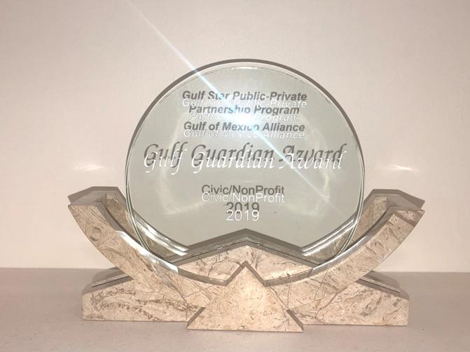
The Gulf Star Program recently received a Gulf Guardian Award from the EPA Gulf of Mexico Division.
Protecting the Gulf of Mexico requires innovative approaches and proactive measures.
The Gulf Star Program is a Gulf Guardian winner who paves the way for out of the box thinking and replicable practices.
- MARY WALKER EPA REGION 4 ADMINISTRATOR
Gulf Star is a public-private initiative designed to increase the Gulf region’s ecosystem health and resilience by supporting the implementation of our priority issue projects. Gulf Star Partners are committed to a Gulf region that includes healthy beaches, clean waters, productive marine ecosystems, and thriving coastal communities. Gulf Star Partners also share our vision of supporting regional collaboration to address these issues. Working together with the five Gulf States and Federal agencies, the partners in the Gulf Star Program are essential to its success.
 STATE Alabama Florida Louisiana Mississippi Texas
REGIONAL COASTAL RESILIENCE | VARIOUS GULF COMMUNITIES | Project Location: Gulfwide
This project provided small grants to 10 communities to implement programs that will enhance their coastal resilience. Selected communities were eligible to receive up to $45,000 in funding assistance as well as technical assistance from state and federal agencies and local knowledge experts.
LINKING SCIENCE COMMUNICATION AND MUNICIPAL PLANNING | UNIVERSITY OF TEXAS MARINE SCIENCE INSTITUTE | Project Location: Texas Coastal Bend
This project brought scientific researchers together with planners, floodplain managers, and other local decision makers to facilitate deeper understanding of resiliency issues along the Texas coastal bend.

CROSS-SECTOR SNAPSHOT OF COMMUNITY RESILIENCE | LOUISIANA SEA GRANT | Project Location: Morgan City, LA In this project, Morgan City, Louisiana, utilized the four Resilience Indices (Community Resilience Index, Ports Resilience Index, Tourism Resilience Index, and Fisheries Resilience Index) to develop a cross-sector evaluation of overall community resilience.
FOSTERING RESILIENT BUILDING PRACTICES | SMART HOME AMERICA | Project Location: Gulfwide
This project educated decision-makers on state-based mitigation programs, policies, and tools to promote resilient building practices and trained them in the FORTIFIED Home Program. This program helped homeowners become more resilient by strengthening their homes against severe weather.
COMMUNITY
| FIRST PEOPLE’S CONSERVATION COUNCIL, LOWLANDER CENTER, AND LOUISIANA SEA GRANT | | Project Location: Lafourche and Terrebonne Parishes, LA
Focused on improving community resilience for the Pointe-Au-Chien Indian Tribe in coastal Louisiana, this project assists the community in performing a self-assessment and implementing habitat restoration and resilience projects to address identified vulnerabilities.
UPDATED HOMEOWNER HANDBOOKS | GULF OF MEXICO ALLIANCE, SMART HOME AMERICA | Project Location: Gulfwide
The Homeowners Handbook to Prepare for Natural Hazards helps homeowners take a proactive approach to planning for natural hazards to reduce risks to family and property. Homeowners can use this tool to implement small and cost-effective steps to significantly lower their risk of damage to their home while also saving money on their wind and flood insurance. The updated version is streamlined, making it easier to find pertinent information. It also contains new sections on insurance, building to Fortified standards, and new mitigation techniques.
| Project Location: Gulfwide
This project assesses how socio-economic and ecosystem service indicators can be incorporated into the Community Resilience Index (CRI). These indicators capture the benefits we receive from natural features and projects such as living shorelines.
INSTITUTE | Project Location: Gulfwide
This project updated and upgraded the GOMAportal (www.gomaportal.org) to better support new metadata standards and interoperability, relocated the entire system to a new server with more storage capacity, and enhanced the interface to be more user-friendly.
| GULF COAST RESEARCH LAB | Project Location: Gulfwide
To enhance the success of current and future living shoreline projects, this project identified existing shoreline habitat datasets across the Gulf states and gaps in coverage. The results are accessible in a publically-available geodatabase.
DATABASE | APTIM | Project Location: Louisiana Louisiana Coastal Protection and Restoration Authority (CPRA) is developing a budgeting and allocation tool for multiple agencies to coordinate use of sediment sources. This project adds sediment resource data from other Gulf States into the management system that CPRA is building. The comprehensive database will provide state resource managers with the information needed to beneficially use dredged sediments for restoration, which can significantly reduce the time and cost for restoration projects.
Expanding an intuitive and interactive online mapping interface used to catalog monitoring sites and management areas, this project expands the current Florida-focused Terra-CAT and Water-CAT platforms to Alabama, with a vision of growing to cover the entire Gulf region.
COMPLETED IN PROGRESS JUST STARTED

| Project Location: Gulfwide
Currently, there are numerous data catalogs that point users to available datasets, but there is no one source that provides easy to use data all in one place. This project creates an open data portal platform that makes it easier for users to discover, understand, and use standardized habitat data. As a pilot proof-of-concept, the project will include existing state and local seagrass distribution datasets to demonstrate the platform’s ability to bring together data from multiple providers.
COMPLETED
TRACKING TRASH | DAUPHIN ISLAND SEA LAB | Project Location: Alabama
Educating middle and high school students and teachers about the marine debris problem in coastal Alabama, this project showed students how technology can be used to study a problem, and develop an engineering/solutionbased mindset and instill a sense of stewardship for their local waterway.
MARINE DEBRIS EDUCATION & PREVENTION | BARATARIA-TERREBONNE NATIONAL ESTUARY PROGRAM | Project Location: Louisiana
This project engaged high school and college students in the data collection and monitoring of marine debris and sediment microplastics on a private beach in Louisiana. The students spent one day per quarter in the field researching, collecting, and analyzing marine debris data and preparing action items to stop it at the source.
WIND ENGINEERING TESTING FOR OPTIMAL DESIGN FOR WIND HAZARDS | LOUISIANA STATE UNIVERSITY | Project Location: Louisiana
This project developed and promoted wind engineering tools to help audiences identify opportunities to improve resilience, and to enable the building of smart, resilient, and sustainable infrastructure. The project tested innovative ways to reduce wind-induced loads on flexible structures.
MONITORING WITH UNDERSERVED HIGH SCHOOL STUDENTS | MOBILE BAYKEEPER | Project Location: Alabama
Providing classroom and hands-on training, this project taught students at LeFlore High School in Mobile, Alabama, about issues impacting water quality, trained them in water monitoring, and empowered them to become active environmental stewards.
VIDEO CASE STUDIES | MISSISSIPPI STATE UNIVERSITY TELEVISION CENTER AND DAUPHIN ISLAND SEA LAB | Project Location: Gulfwide
Outreach videos were developed to highlight coastal community resilience and marine debris projects, emphasizing success stories and providing inspiration for other coastal communities Gulfwide.
URBAN YOUTH CONSERVATION CORPS | LIMITLESS VISTAS, INC. | Project Location: Louisiana
This project expanded the recently completed Gulf Coast Vulnerability Assessment to increases awareness of the losses and degradation of coastal habitats caused by invasive species. This project also educated and trained students in conservation field techniques that can be used to pursue jobs in the conservation industry and/or generate interest in seeking an environmental or conservation college degree.
| Project Location: Gulfwide
As part of the Embrace the Gulf awareness campaign, educational messages will be shared across multiple social media platforms each day in 2020 to highlight the value and vitality of the Gulf of Mexico.

SEAGRASS ASSESSMENT | CNL WORLD CONSULTANTS | Project Location: Gulfwide
Leveraging against an existing U.S. Geological Survey and EPA project, this project developed a plan to assess additional seagrass resources throughout the Gulf region. This assessment is needed to inform restoration plans.
LIVING SHORELINES SITE SUITABILITY MODELING | FLORIDA FISH AND WILDLIFE CONSERVATION COMMISSION | Project Location: Florida
GOMA partners recently concluded the development of a living shorelines site suitability model and pilot tested it on Mobile Bay, Alabama. It was very successful in predicting where natural shoreline restoration techniques will be successful and where they won’t. As a continuation of the project, this new project conducted the recently developed living shoreline model on additional sites in Tampa Bay, Florida.
GULF COAST ADAPTATION STRATEGY | GULF OF MEXICO ALLIANCE | Project Location: Gulfwide
This project expanded on the recently completed Gulf Coast Vulnerability Assessment to inform the new Gulf Coast Adaptation and Resilience Plan.
SEA LEVEL RISE WORKSHOP | GULF OF MEXICO ALLIANCE AND NORTHERN GULF OF MEXICO SENTINEL SITE COOPERATIVE | Project Location: Gulfwide
Because past sea level rise modeling efforts are difficult to compare due to varying magnitudes and time frames, this project brought together experts from around the Gulf region to develop a recommended standard that is appropriate for use in future modeling efforts.
SEAGRASS STATUS AND TRENDS | CNL WORLD CONSULTANTS | Project Location: Gulfwide
This project is addressing the need for an update and re-assessment of seagrass resources across the Gulf. The last comprehensive seagrass assessment was conducted more than a decade ago and was limited in the type of data that was available at that time.

REGIONAL SEDIMENT MANAGEMENT | TBD | Project Location: Alabama, Mississippi, Louisiana, Texas
Building on an existing GIS-based decision support tool that identifies sediment availability and distribution at sites in Louisiana, this project increases access to information on regional sediment sources across the northern Gulf of Mexico. The expanded tool will fill a critical need for information on sediment resources that can be used for creation and restoration of coastal habitats.
Project Location: Gulfwide
Recognizing that effective adaptation and resilience programs require knowledge and understanding of successful methods, this project develops a six-month training course for resource managers and decision-makers across the region. Course topics will include vulnerability, adaptation, overcoming barriers, and communicating solutions.
COMPLETED
This project expanded the application of a handheld generic harmful algal bloom (HAB) sensor to other species of HABs. This is important because it allows: (1) more timely confirmation of less toxic or nontoxic species to provide managers with definitive criteria for response decisions, and (2) a rapid, sensitive method for quantifying toxic species which are notoriously difficult to differentiate.
Deploying additional harmful algal bloom (HAB) observation gliders helped to identify, evaluate, and predict the initiation of blooms in northwest Florida, the most common location of initial development. This information is critical for improving the seasonal forecast which can devastate commercial and recreational fishing opportunities. The additional gliders were deployed and retrieved from existing research vessel missions in the area, keeping the costs low.
This project added additional states to an existing social and civic engagement survey conducted by the Hypoxia Task Force to determine social values associated with reducing nutrients in stormwater runoff. The information gained from the surveys are important because it can be used to institute incentives to reduce nutrients in stormwater runoff, which are the primary cause of the hypoxic (or dead) zone in the Gulf of Mexico each summer.
CITIZEN SCIENCE WATER
IN THE FLORIDA PANHANDLE | UNIVERSITY OF FLORIDA | Project Location: Florida
This project expands “Water Watch,” a community-based volunteer coastal water quality monitoring program, to three counties in the Florida panhandle and is filling data gaps identified by local governments and organizations.

AUTHORITY | Project Location: Louisiana
Filling a critical water quality monitoring gap in coastal Louisiana, this project establishes a new monitoring transect from the coast into the open Gulf. These data will improve understanding of baseline conditions for restoration, water quality dynamics, and changes in the Gulf dead zone.
CITIZEN SCIENCE WATER MONITORING IN LOUISIANA | LAKE PONTCHARTRAIN BASIN FOUNDATION | Project Location: Louisiana
This project is expanding a citizen science volunteer monitoring program along the south shore of Lake Pontchartrain to sample for algal pollution and microplastics; the project also tracks public engagement.
| Project Location: Texas
This project expands a protocol for monitoring macro-plastics in the Houston-Galveston area, incorporates this protocol into the Texas Stream Team water quality monitoring program, and trains community volunteers in macroplastic monitoring and cleanup.
WATER QUALITY ECONOMICS PROJECT | THE BALMORAL GROUP | Project Location: Gulfwide/Florida
Focusing on the impact of harmful algal blooms, this project quantifies the linkages between economic outcomes and Gulf of Mexico coastal health. Economic metrics representing tourism, housing sales, and fishing activity will be collected and analyzed and GIS data will be used to enhance temporal resolution of HAB data impacts. A dashboard tool will be developed to allow resource managers easy access to high quality HAB data and economic outcomes.
COMPLETED
This project focused on various stages of sea turtle life and their dependence on healthy habitats in Venice, Louisiana, the Big Bend region of Florida, and Marquesas Keys, Florida.

This project identified specific conservation actions that can be prioritized in order to downlist or delist particular threatened or endangered species in the region. Once obtained, the prioritized actions will be included in regional restoration plans developed by state and federal agencies.
IN PROGRESS
Focusing on fish, shrimp, and crab use of oyster reefs, this project is updating resources, analyzing data, and developing a user-friendly guidebook summarizing the key factors that affect species recovery following coastal habitat restoration projects.
This project worked systematically to clean up specific shores in northwest Florida, collecting debris and tracking the items on the NOAA marine debris tracker. Using the data, this project worked with local businesses and government officials to curb their incidence on the shore.
| Project Location: Mississippi
This project reduced the use of single-use plastic in the three coastal counties of Mississippi and provided data showing this reduction.

| Project Location: Gulfwide
This microplastics project demonstrated the type and location of degraded microplastics. This grant was a citizen science project where sediment and water samples are collected and processed for microplastics, then integrated into an existing visualization tool. The data collection and visualization tool is already being used by Florida Microplastic Awareness Project and is being expanded to marine debris programs in other Gulf states.
MARINE DEBRIS DASH | OCEAN HOUR | Project Location: Florida
GOMA is unique in providing public-private funding for projects of regional concern. No other entities in the Gulf bring that to the table.
1151 Robinson St. Ocean Springs, MS 39564 www.gulfofmexicoalliance.org