3 minute read
Storm Terminology

from Stay Alert 2022

Storm Surge Warning: There is a danger of life-threatening inundation from rising water moving inland from the shoreline somewhere within the specified area, generally within 36 hours. If you are under a storm surge warning, check for evacuation orders from your local officials.
Hurricane Warning: Hurricane conditions (sustained winds of 74 mph or greater) are expected somewhere within the specified area. NHC issues a hurricane warning 36 hours in advance of tropical storm-force winds to give you time to complete your preparations. All preparations should be complete. Evacuate immediately if so ordered.
Advertisement
Tropical Storm Warning:
Tropical storm conditions (sustained winds of 39 to 73 mph) are expected within your area within 36 hours.
Extreme Wind Warning:
Extreme sustained winds of a major hurricane (115 mph or greater), usually associated with the eyewall, are expected to begin within an hour. Take immediate shelter in the interior portion of a well-built structure.
Storm Surge Watch:
There is a possibility of life-threatening inundation from rising water moving inland from the shoreline somewhere within the specified area, generally within 48 hours.
Hurricane Watch:
Hurricane conditions (sustained winds of 74 mph or greater) are possible within your area. Because it may not be safe to prepare for a hurricane once winds reach tropical storm force, The NHC issues hurricane watches 48 hours before it anticipates tropical stormforce winds.
Tropical Storm Watch:
Tropical storm conditions (sustained winds of 39 to 73 mph) are possible within the specified area within 48 hours.

DIFFERENCE BETWEEN A TORNADO WATCH AND A TORNADO WARNING
• Tornado Watch: Be Prepared! Tornadoes are possible in and near the watch area. Review and discuss your emergency plans and check supplies and your safe room. Be ready to act quickly if a warning is issued or you suspect a tornado is approaching. Acting early helps to save lives! Watches are issued by the Storm Prediction Center for counties where tornadoes may occur. The watch area is typically large, covering numerous counties or even states. • Tornado Warning: Take Action! A tornado has been sighted or indicated by weather radar. There is imminent danger to life and property. Move to an interior room on the lowest floor of a sturdy building. Avoid windows. If in a mobile home, a vehicle or outdoors, move to the closest substantial shelter and protect yourself from flying debris. Warnings are issued by your local forecast office. Warnings typically encompass a much smaller area (around the size of a city or small county) that may be impacted by a tornado identified by a forecaster on radar or by a trained spotter/law enforcement who is watching the storm.
HURRICANE HAZARDS
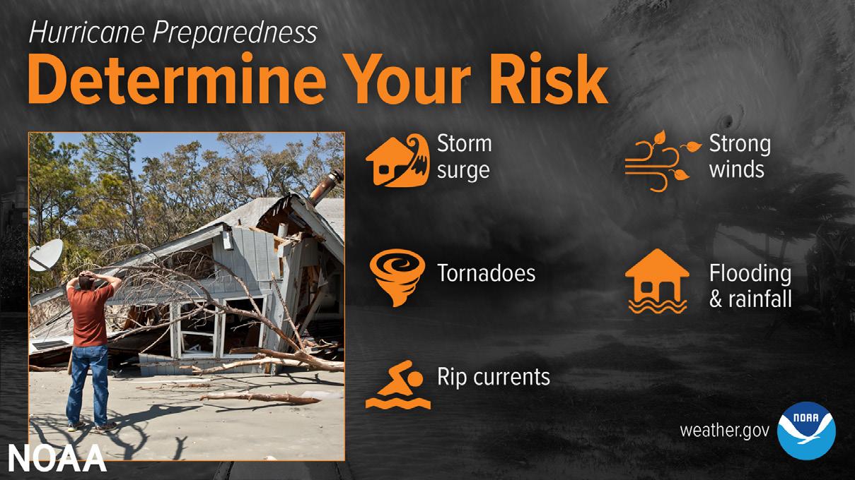
Hurricanes are incredibly powerful and devastating storms that can pack a real PUNCH to our area. On average, 12 tropical storms, six of which will develop into hurricanes, form in the Atlantic and Gulf of Mexico each year. Hurricane Season begins June 1 and ends Nov. 30 of each year. Peak activity for the season is mid-August through mid-September. You need to know what precautions and actions to take before the threat of a storm arrives.
BEFORE HURRICANE SEASON
Here are some preparedness activities you can take BEFORE hurricane season: • Know your evacuation zone • Make your emergency kit • Learn about the risks associated with hurricanes: • Storm surge • High winds • Flooding • Long-term power outages • Property damages • Tornadoes • Rip currents & high surf • Review your insurance policies • Verify your coverage • Make sure you have flood insurance • Visit www.floodsmart.gov to learn about your flood risk • Know where your insurance documents are and make a copy to take with you • Maintain trees trimmed around your residence to prevent property damage. • Prepare your emergency plan: • Consider evacuation plans & routes • Consider communication methods among family and friends • Determine a re-unification plan if separated by an emergency • Make arrangements for family members with special need
IF A STORM THREATENS OUR AREA
Monitor the weather. Identify reliable sources of information. The National Hurricane Center (NHC) and the National Weather Service (NWS) are the professional experts providing information to local emergency managers. Listen to authorities regarding evacuation orders and heed the warnings.
Here are some activities you can do should Baldwin County fall under a Hurricane Warning: • To mitigate damages to your residence, you can board up your windows and doors • Secure outdoor furniture and lawn décor • Secure your doors.
When evacuating, take your emergency supplies and important documents with you. Leave early to avoid traffic congestion.