LAND USE
RESIDENTIAL & COMMERCIAL
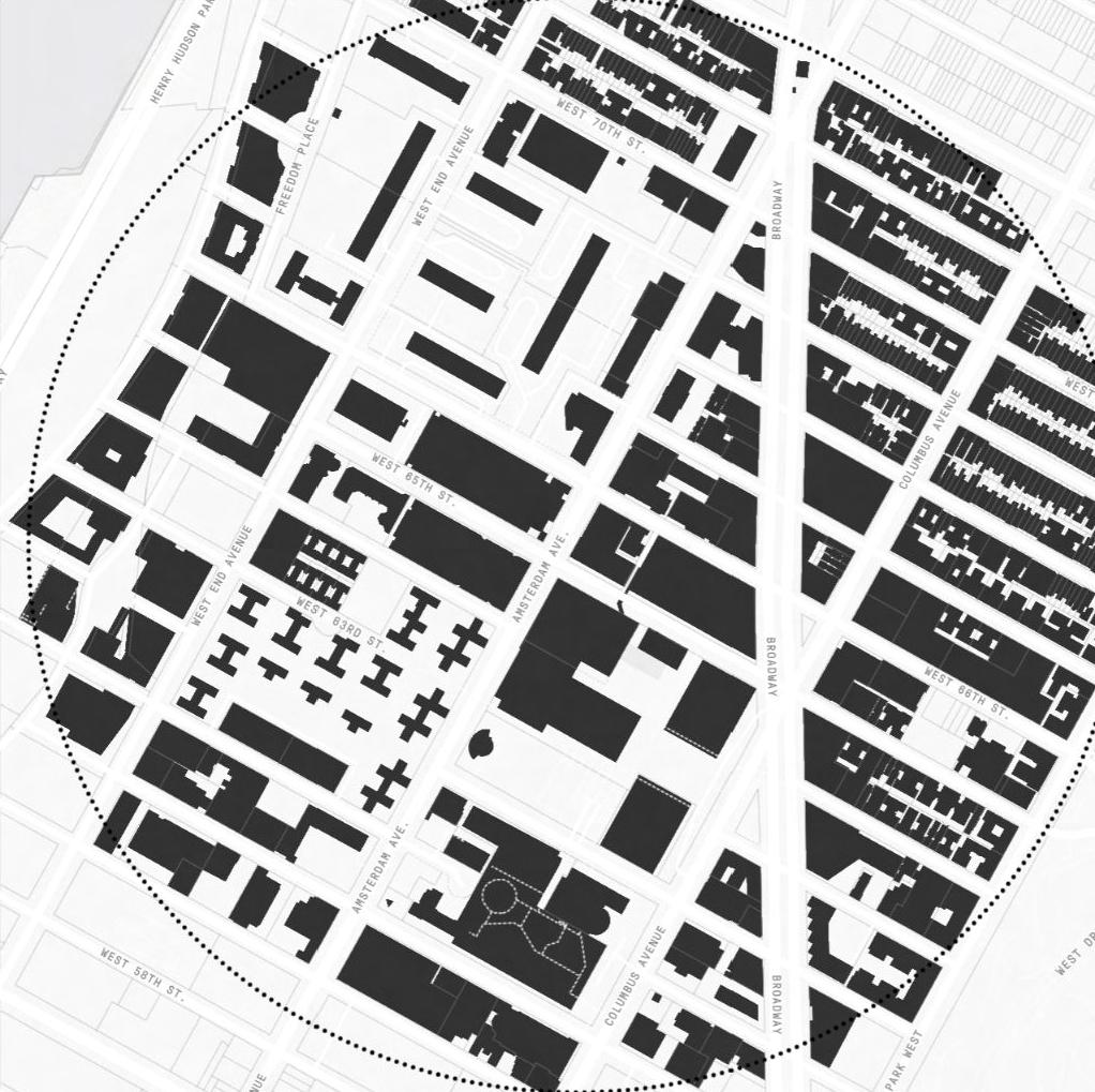
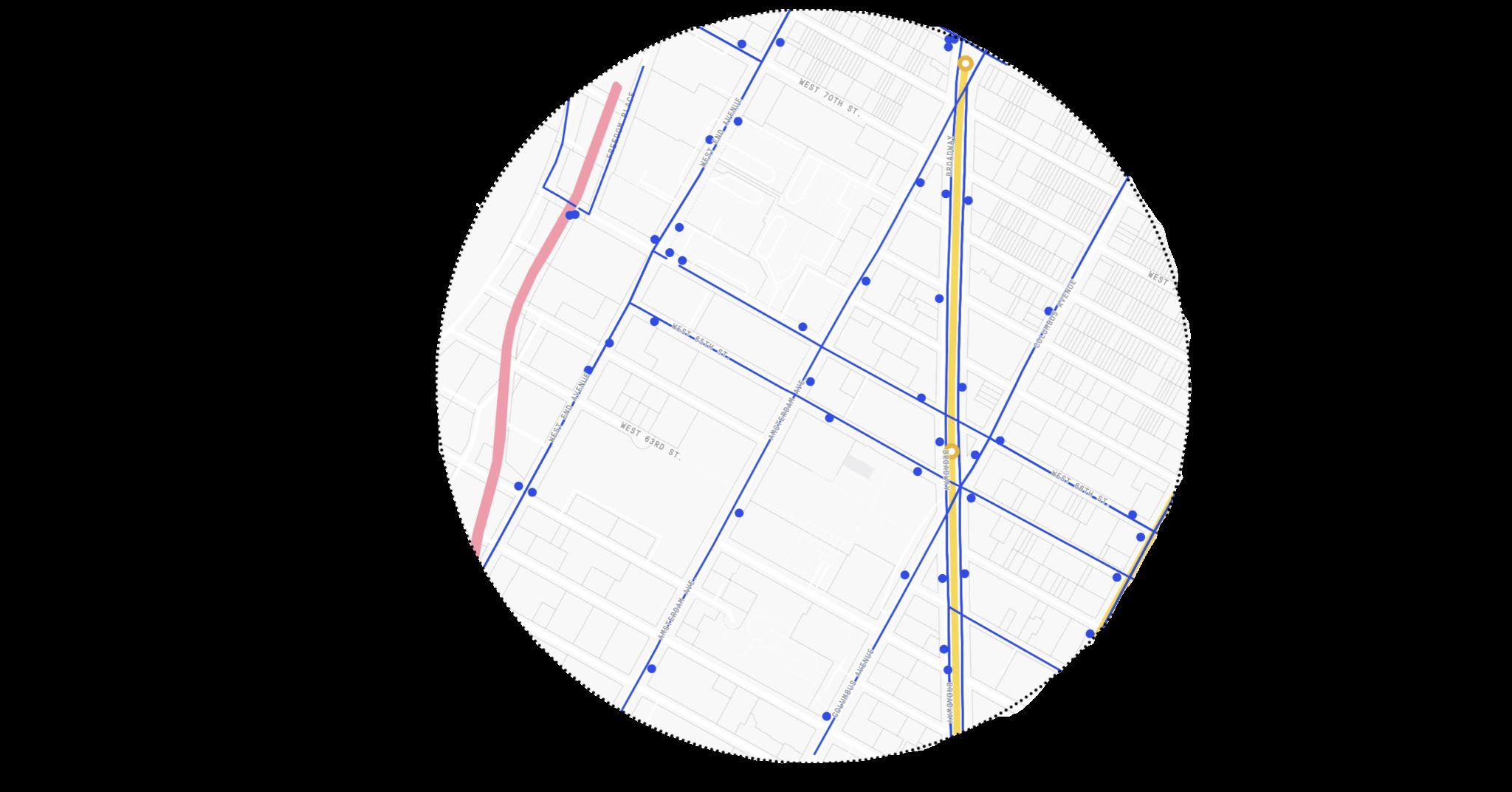
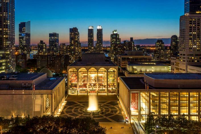
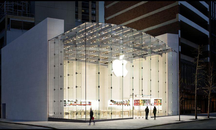
Some examples of famous landmarks and locations that could be found in this typical area can be:
◦ Lincoln Center
◦ Damrosch Park
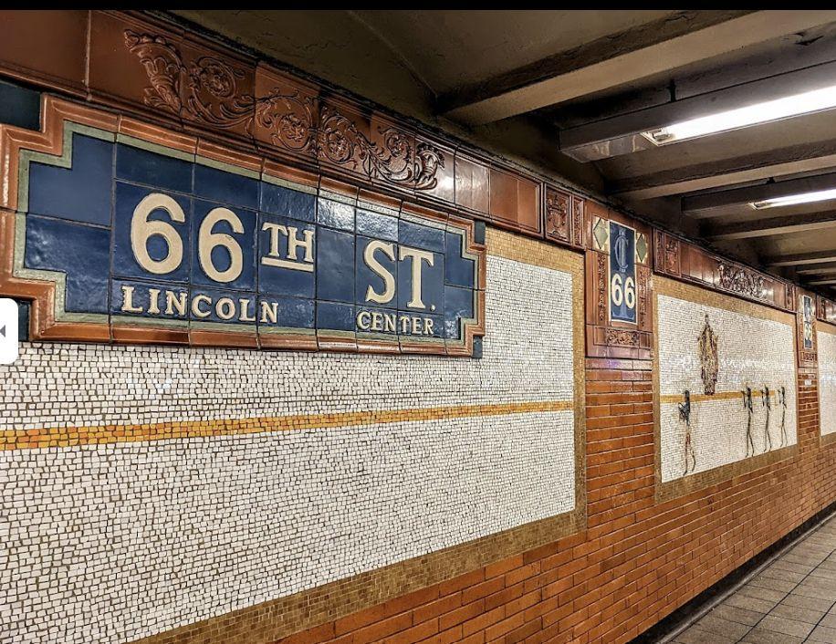
◦ 66th Street Train Station
◦ Apple Headquarters
% USAGE
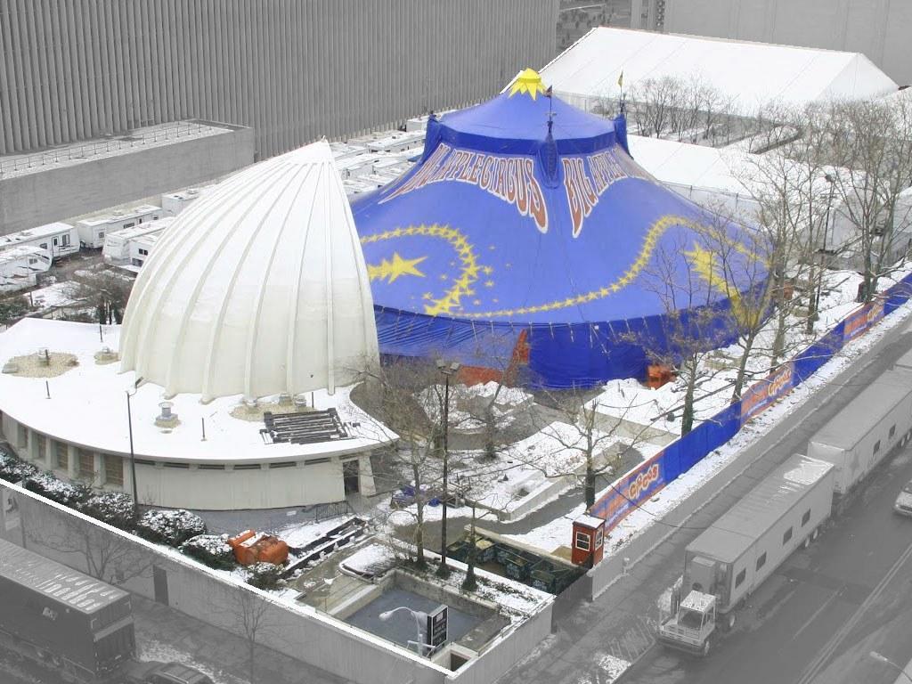
PUBLIC FACILITIES 27.8 % USAGE
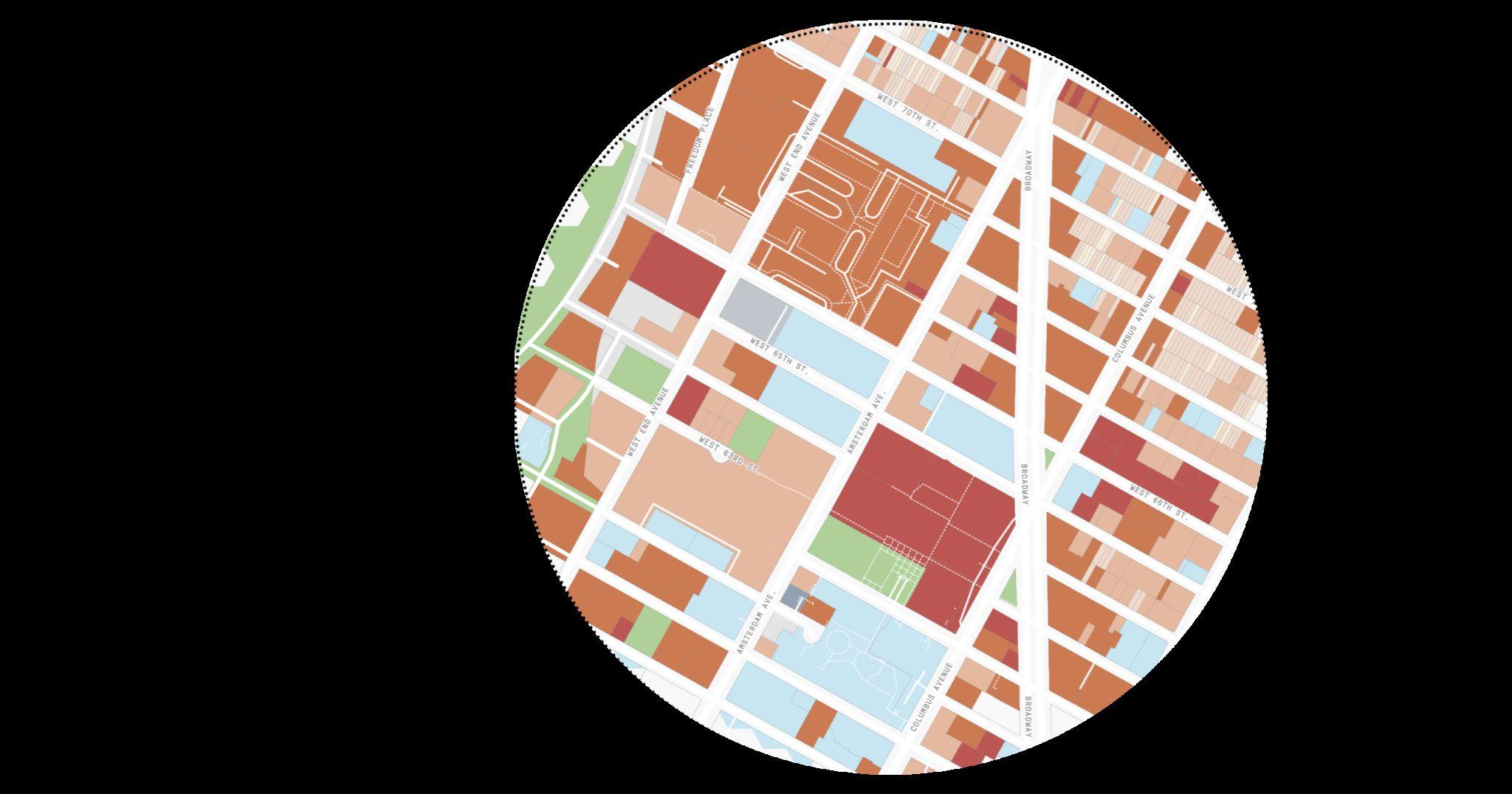
COMMERCIAL OFFICES
19.1 % USAGE

PG. 6
55.6
11.4
% USAGE OPEN SPACE
The subway system, particularly the 66th Street Station, is another integral part of the area's history. The station underwent significant improvements in 1959, extending its platforms to accommodate full-length trains on the IRT #1 Line. This was part of a larger project known as the IRT West Side Improvement, which modernized and expanded the subway infrastructure to better serve the growing population of the Upper West Side.
Some existing public transportation lines are:
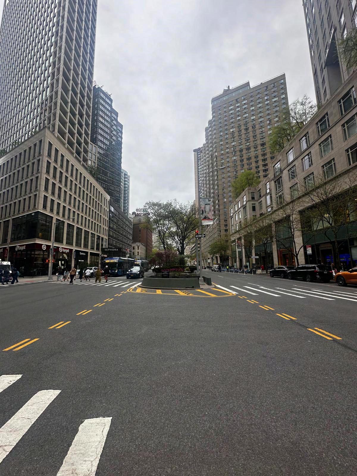
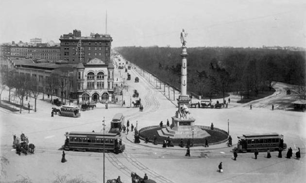
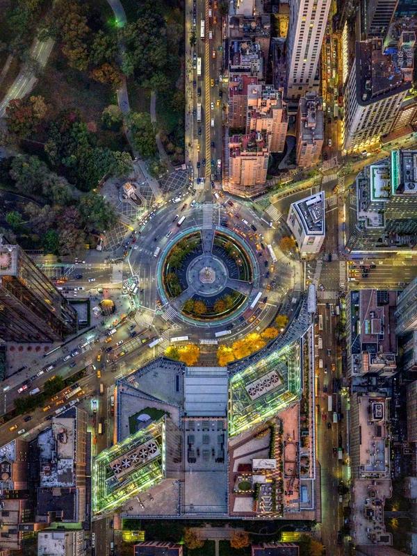
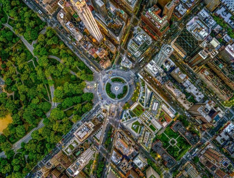
The bidirectional traffic pattern through Columbus Circle failed to eliminate congestion. The proposed reorganization of Columbus Circle was widely praised by civic groups and city officials. This allowed for the streets near Columbus Circle to develop their own characteristics. The major redevelopment of the Lincoln Center developed a new pedestrian promenade designed to improve accessibility.
BUS [46 Stops]: M5, M7, M10, M11, M20, M57, M66, M72, M104
SUBWAY [2 stations]: 1, 2, 3, A, C
RAILROAD: 1 Railroad Amtrak
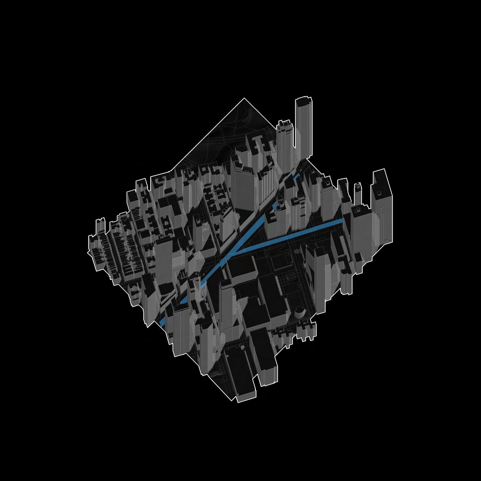
INTRODUCTION l HISTORY OPEN STREETS PG. 9 62nd Street - 66th Street, West Side NYC [Transportation Map] P.6 62nd Street - 66th Street, West Side NYC [Traffic Map] -
-
-
-
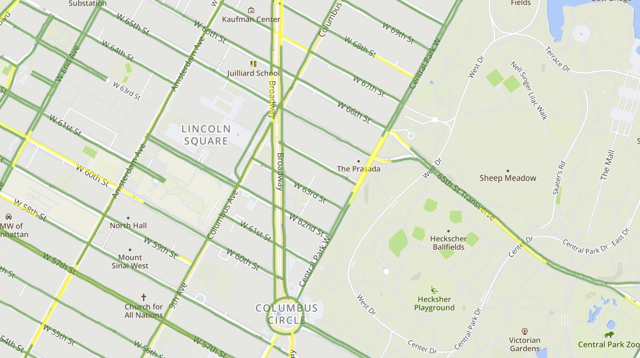
Fast Pace Traffic
Medium Pace Traffic
Slow Pace Traffic
Stopped Traffic
The history of road diets in Manhattan has a long history. One of the early examples includes the transformation of portions of Broadway, one of Manhattan's most famous streets. The "Green Light for Midtown" project, initiated in 2009, was a significant step towards reimagining urban space. It involved closing Broadway to vehicle traffic at Times Square and Herald Square, creating pedestrian plazas and safer crossings.
▪ Expansion and Policy Support: Following the success of early projects, New York City expanded its commitment to road diets and complete streets policies under the leadership of the Department of Transportation (DOT). The city introduced more bike lanes, expanded pedestrian zones, and implemented traffic calming measures across Manhattan and other boroughs. These efforts were supported by comprehensive studies showing reductions in traffic injuries and improvements in traffic flow in areas where road diets were implemented.
Vision Zero and Recent Developments: The adoption of the Vision Zero initiative by New York City in 2014 further accelerated the implementation of road diets. Vision Zero is a strategy to eliminate all traffic fatalities and severe injuries while increasing safe, healthy, equitable mobility for all. Under this initiative, Manhattan saw significant changes, including the redesign of streets to reduce vehicle speeds, the expansion of bike lanes, and the enhancement of pedestrian infrastructure.
Safety Improvements: Road diets can significantly reduce vehicle speeds and minimize conflicts between road users, leading to a decrease in accidents and fatalities. By narrowing or reducing the number of vehicle lanes, road diets naturally calm traffic, making streets safer for pedestrians, cyclists, and drivers alike.
▪ Sustainable Transportation: By providing dedicated lanes for bicycles and improving pedestrian infrastructure, road diets encourage alternative modes of transportation. This can lead to a reduction in vehicle emissions, contributing to environmental sustainability and public health.
▪ Economic Benefits: Improved street environments can boost local businesses by increasing foot traffic and making commercial areas more accessible and attractive to customers. Road diets can also increase property values in the surrounding areas.
▪ Efficient Use of Public Space: Urban areas often face challenges related to space constraints. Road diets are a way to repurpose existing roadways to accommodate a broader range of activities and modes of transportation, making better use of limited urban space.
INTRODUCTION l HISTORY OPEN STREETS PG. 10 PG. 11
INITIATIVES l GOALS l STRATEGIES
02 INITIATIVES l GOALS l STRATEGIES OPEN STREETS PG. 12 PG. 13
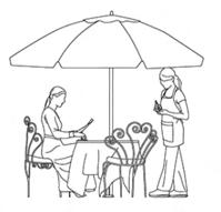
In today’s time period, New York City has seen multiple changes for the better of the community, and environmental status of the island. Even though some of these changes can be questionable by some residents, the initiatives that made marks to how people live their daily lives. Some initiatiives that NYC has implimented fall under the general topic of “Open Streets”.
▪ Some topics and categories of Open Streets are:
◦ Open Restuarant Spaces [During COVID-19 period]
◦ Open Cultutre Programs [JapanFes l Smorgasburg]
◦ Public Space Activation Spaces [Pedestrian Plazas l Play Streets]
All of these initiatives began to attempt to lower car traffic and use throughout the city landscape. Essentially the NYC Department of Transportation [DOT] created these initatives to promote economic development. Some additional things in that development also includes
◦ Support school zones
◦ Facilitate pedestrian and bike mobility
◦ Provide and create new ways for New Yorkers to enjoy cultural programming and build community.

P.7 Open Street “Full Closure” data example [NYC DOT]
There are two different types of NYC Open Street initiatives that are located throughout each borough.
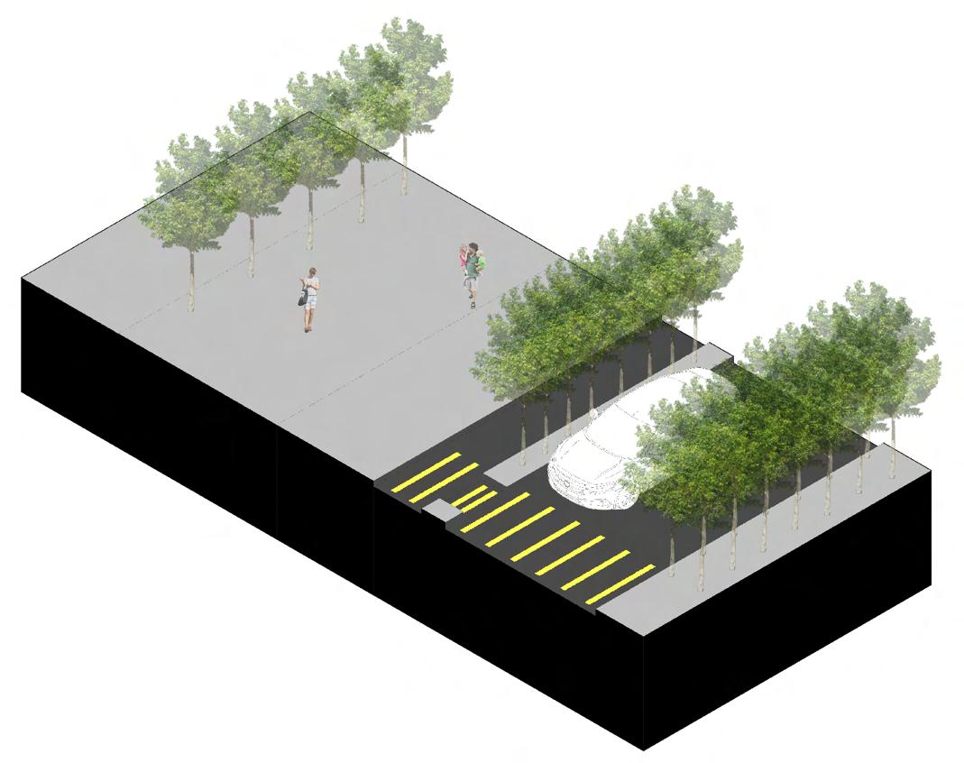
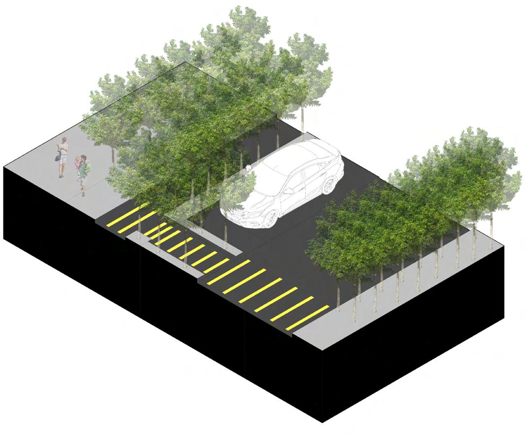
◦ Limited Local Access: Street designated for pedestrian and cyclist use and enjoyment, during a specified set of hours and days each week, where local vehicle access is permitted, such as for parking, collecting or dropping off passengers, making deliveries and loading, Access-A-Ride vehicle access, or emergency vehicle access. Drivers are advised to drive 5 MPH.
◦ Full Closure: Street that is temporarily closed to vehicles to allow for a range of car-free activities that support local businesses, community organizations, and schools, to create a space for the public to gather. Emergency access and an emergency lane must be clear at all times for emergency vehicle access.
INITIATIVES l GOALS l STRATEGIES OPEN STREETS PG. 14 PG. 15
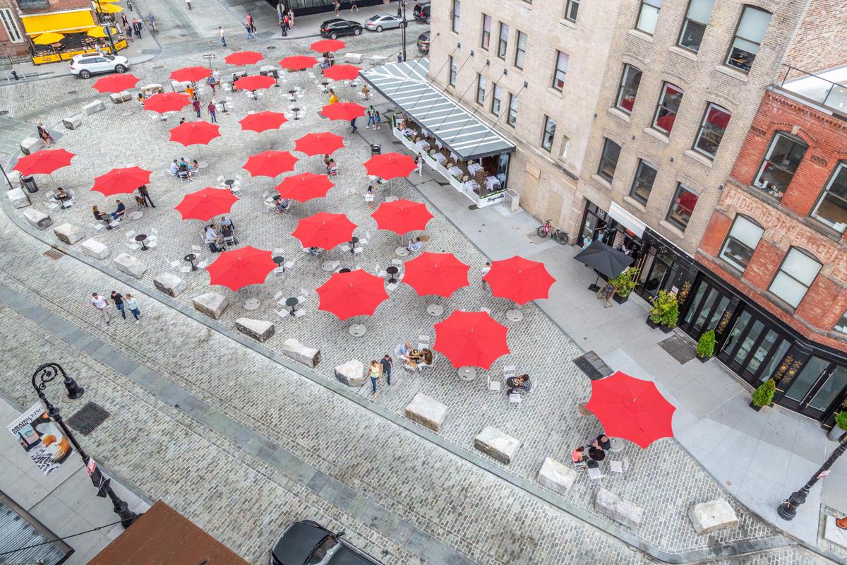
Open Street Example 1 [Pedestrain Plaza - Meatpacking District]
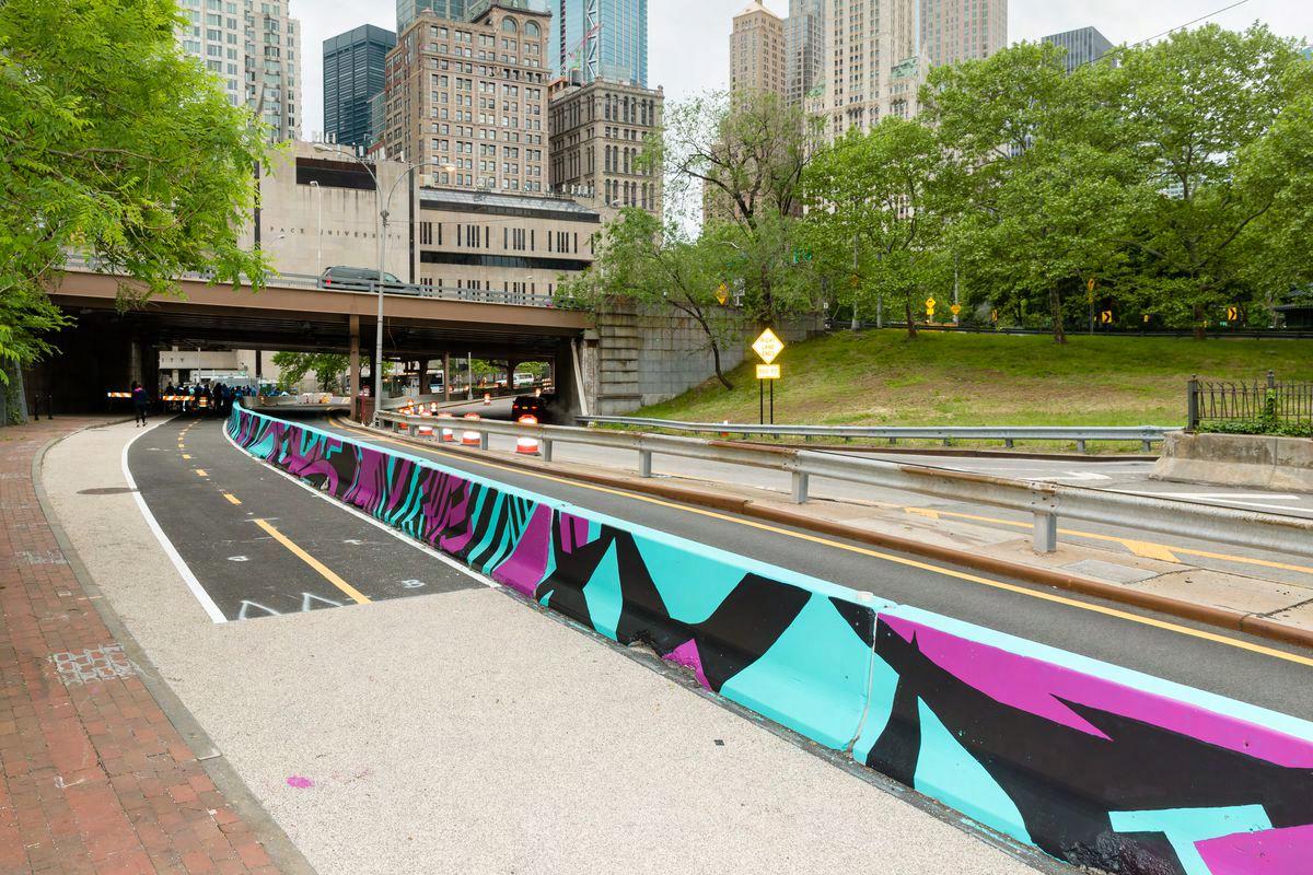
Street Example 2 [Highlighted Bike Lanes]
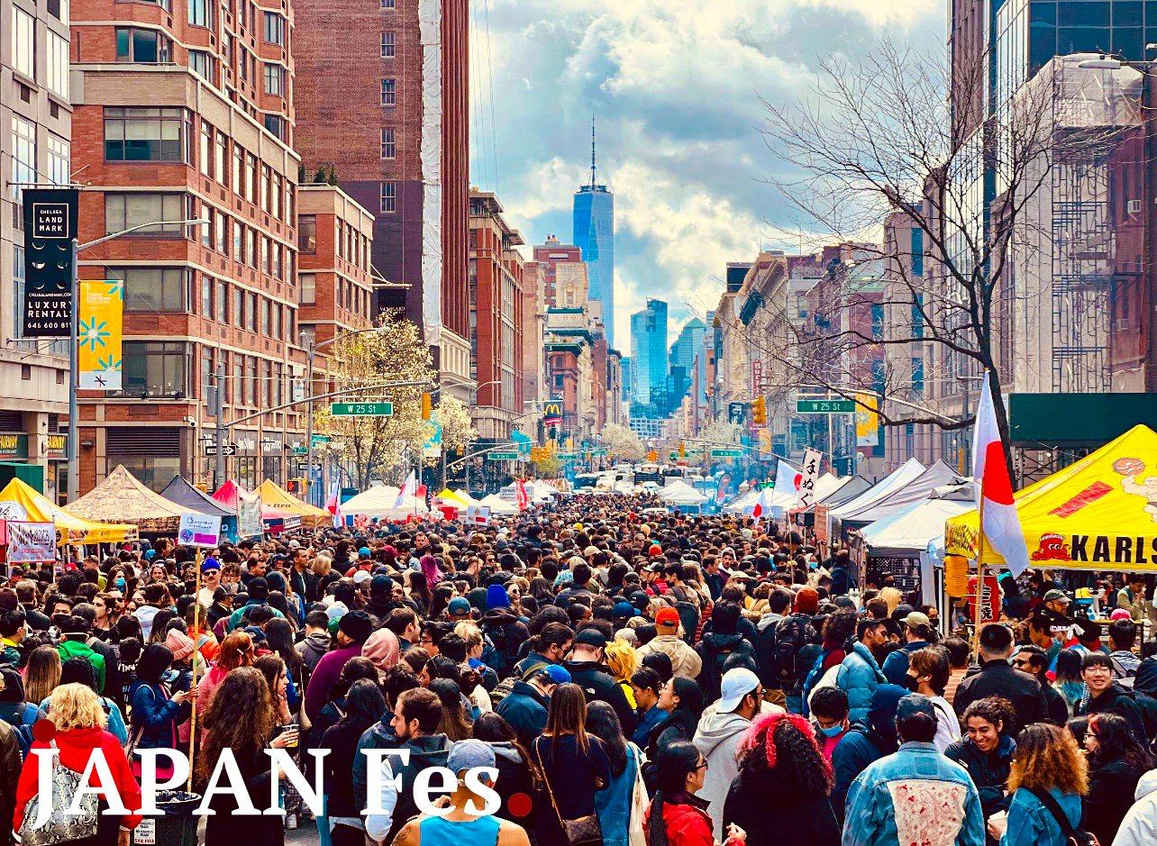
Open Street Example 3 [Open Culture Programs - JapanFes]
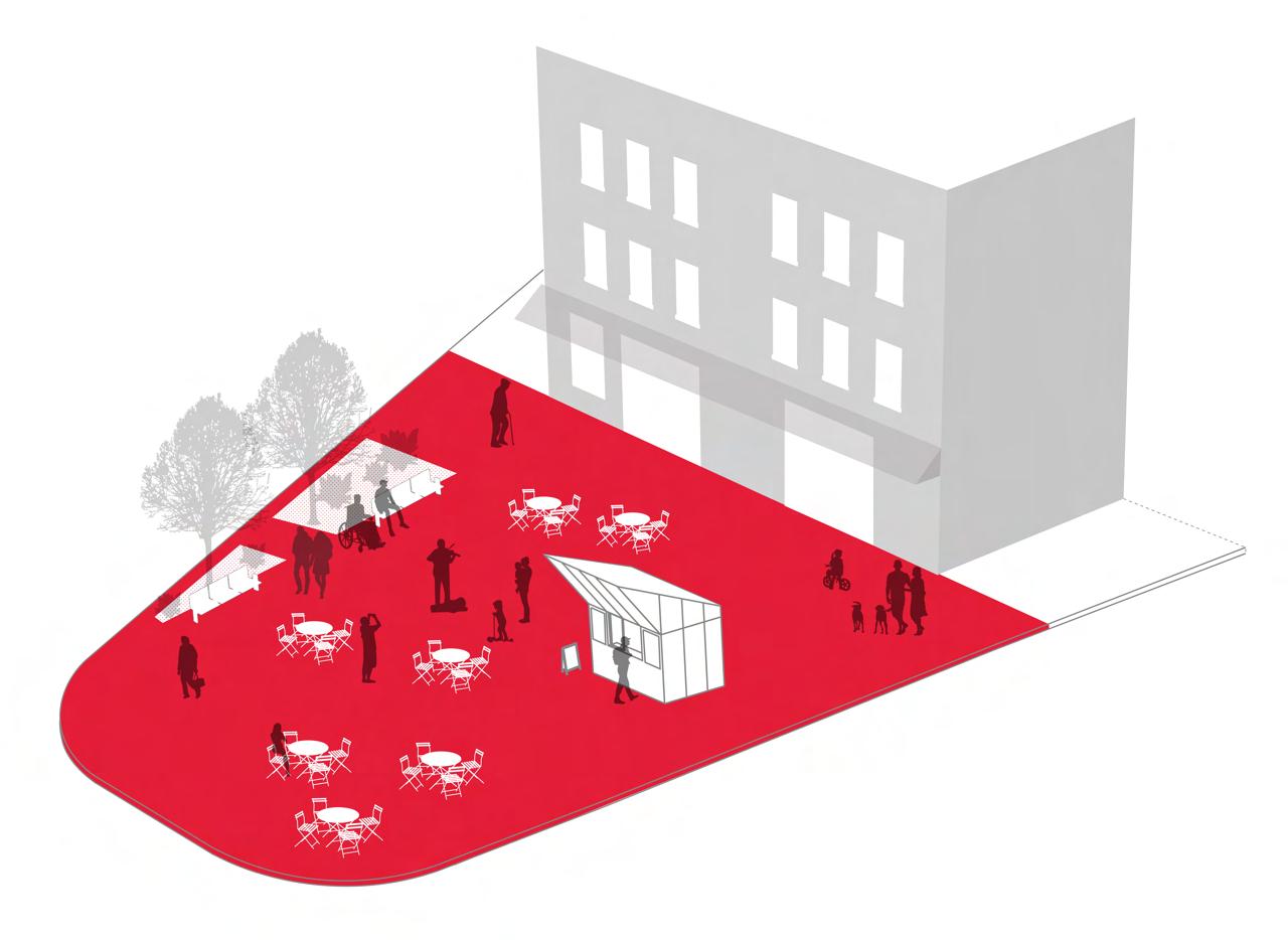
Open Street Example 4 [NYC DOT Pedestrian Plaza Diagram]
INITIATIVES l GOALS l STRATEGIES OPEN STREETS PG. 16 PG. 17
P.8
P.10
P.11
P.9
Open
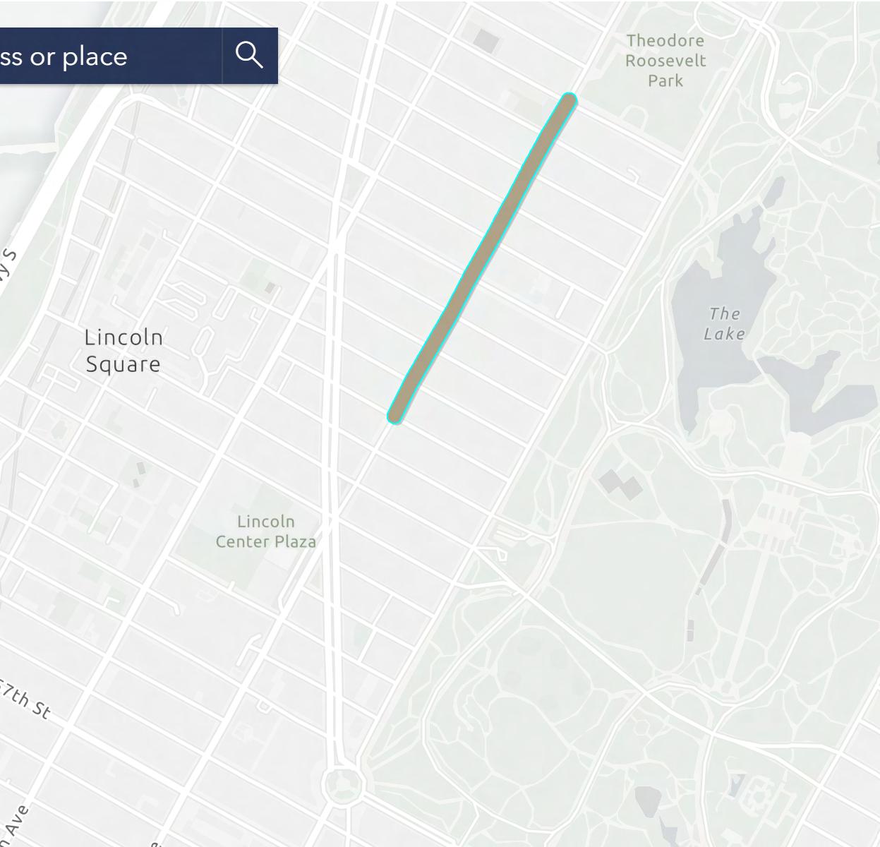
Our approach to developing a Open Street Program that runs from 62nd Street through 66th Street, West Side Manhattan, NY is to provide more public space for pedestrians and cyclists, promoting outdoor activities. We aim to transform the pre-existing streets into areas for walking, biking, and dining to support local businesses and enhance outdoor experiences within the neighborhood. This development will foster the community to enhance local economies and encourage inclusivity and accessibility amongst each other.
These changes within the site area will essentially be a revitilization towards smaller business owners and pedestrians that will incorporate the VisionZero program to a stronger phase. The “Open Streets” program was introduced in response to the COVID-19 pandemic. This aimed to provide more public space for pedestrians and cyclists, which promoted social distancing and outdoor activities. This initiative led to the temporary closure of streets to vehicular traffic, transforming them into areas for walking, biking, and dining, among other activities. The program sought to address the need for safe outdoor spaces and support the recovery of local businesses, particularly bars and restaurants, by allowing them to expand outdoor dining options. Therefore, how would this change affect buisnesses and residents?
▪ Business Owners: Our program will aim to develop a safe outdoor environment and boost the oppurtunity for local businesses, especially bars and restaurants, to expand their outdoor dining options.
▪ Pedestrians & Cyclists: Our development will promote a wide range of possible outdoor activities through the temporary closure of streets. This will facilitate walking, biking, dining, and other potential activities.
Essentially, the development of an Open Street initaitve in this vicinity will allow for people to expand past the base commercial spots located between these blocks. Placing this development in this area also has its multiple benefits that can impact people in a positive way.
▪ Health: In terms of living a healthy lifestyle, this Open Street space will promote walking and other forms of physical activity in the area.
▪ Sustainability: In terms of providing and emphasizing sustainability in the community, this program will allow for new green space development, alongside the removal of vehicles which will provide multiple alternate modes of transportation in the vicinity.
▪ Economy: In terms of how this will positively affect the economy in the exisiting area, this development will relocate foot traffic through this region which will then allow for small businesses and other markets to benefit from the purchase class.
▪ Community: In terms of the community, this will bring out residents from the exisitng living building complexes to interact with people as well as allow for real estate agents to push for ownership in the area due to the engangement of the community.
INITIATIVES l GOALS l STRATEGIES OPEN STREETS PG. 18 PG. 19
PRECEDENTS
03 PRECEDENTS OPEN STREETS PG. 20 PG. 21
New York City isn’t the only place in the nation, let alone the world that impliment the “Open Street” program to the residents. In fact, New York City is still trying to impliment this program to the residents of the island all due to the fact that NYC is one of the most heavily vehicular transported cities in the world. People rely on cars here to move them from point A to point B. Regardless if its to the supermarket, train station, a friends house, or even to go to the park. Most of the people in NYC rely on their cars since it makes the means of transportation faster than what it would take to walk or use public transportation on a day to day basis. This is one of the common struggles a New Yorker has to go through. As of now, the NYC DOT are implimenting methods to reduce car usage through the tri-borough state.
Other boroughs, states, and locations of the world have made their attempts to the “Open Street” program, and most of them became successful. In this set of analysis, the exploration of different site locations that have successfully implimented Open Streets will break down how it affected the residents, traffic control, the approach of sustainabilty, and more.
▪ Precedent Study Order
▫ Jackson Heights, Queens NY
▫ Williamsburg, Brooklyn NY
▫ New Orleans, Louisiana
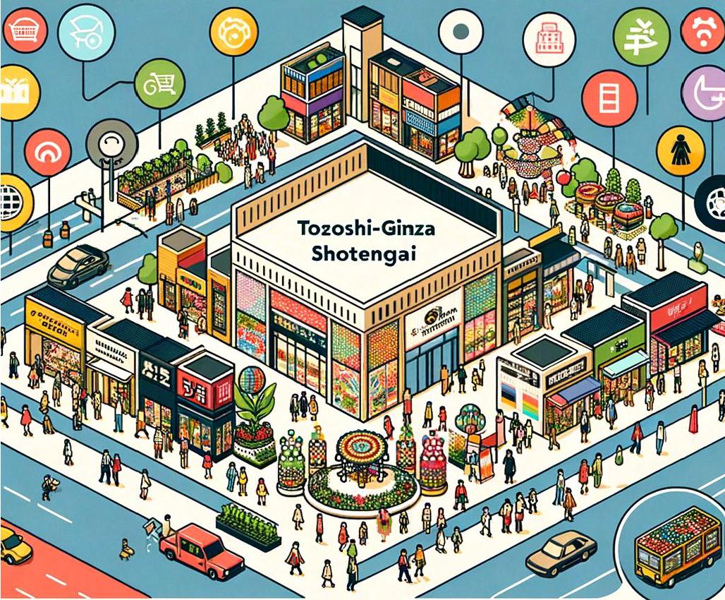
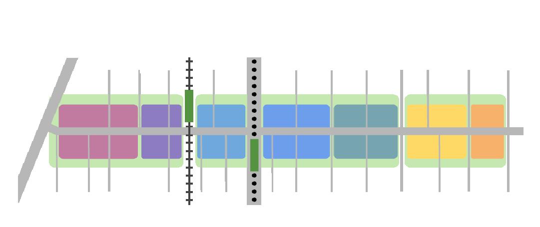
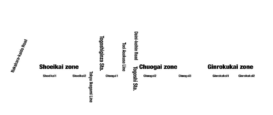
▫ Togoshi-Ginza Shotengai, Japan
NY
PRECEDENTS OPEN STREETS PG. 22 PG. 23
JACKSON HEIGHTS, QUEENS
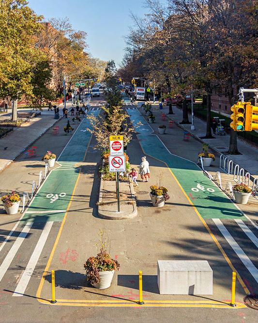
Throughout the year, DOT worked with the 34th Ave. Open Street Coalition to host several bike helmet give-aways and educational outreach events to address cycling conflicts. Through this specific contract, the services that were offered ranged from barricade services, litter removal, horticultural services, and storm drain clearing. This project development is considered to be one of the longest Open Street projects in Queens. This development spans 26 blocks from 34th Avenue which equivilates to 1.3 miles. This allows for those who have disabilities or elderly ones to travel faster throughout the neighborhood, as well as have first responders travel fast and with ease. According to data and research, 77% of residents favor the permanent bike and pedestrian improvements. This essentially recorded a 41% drop in crashes involving pedestrians.
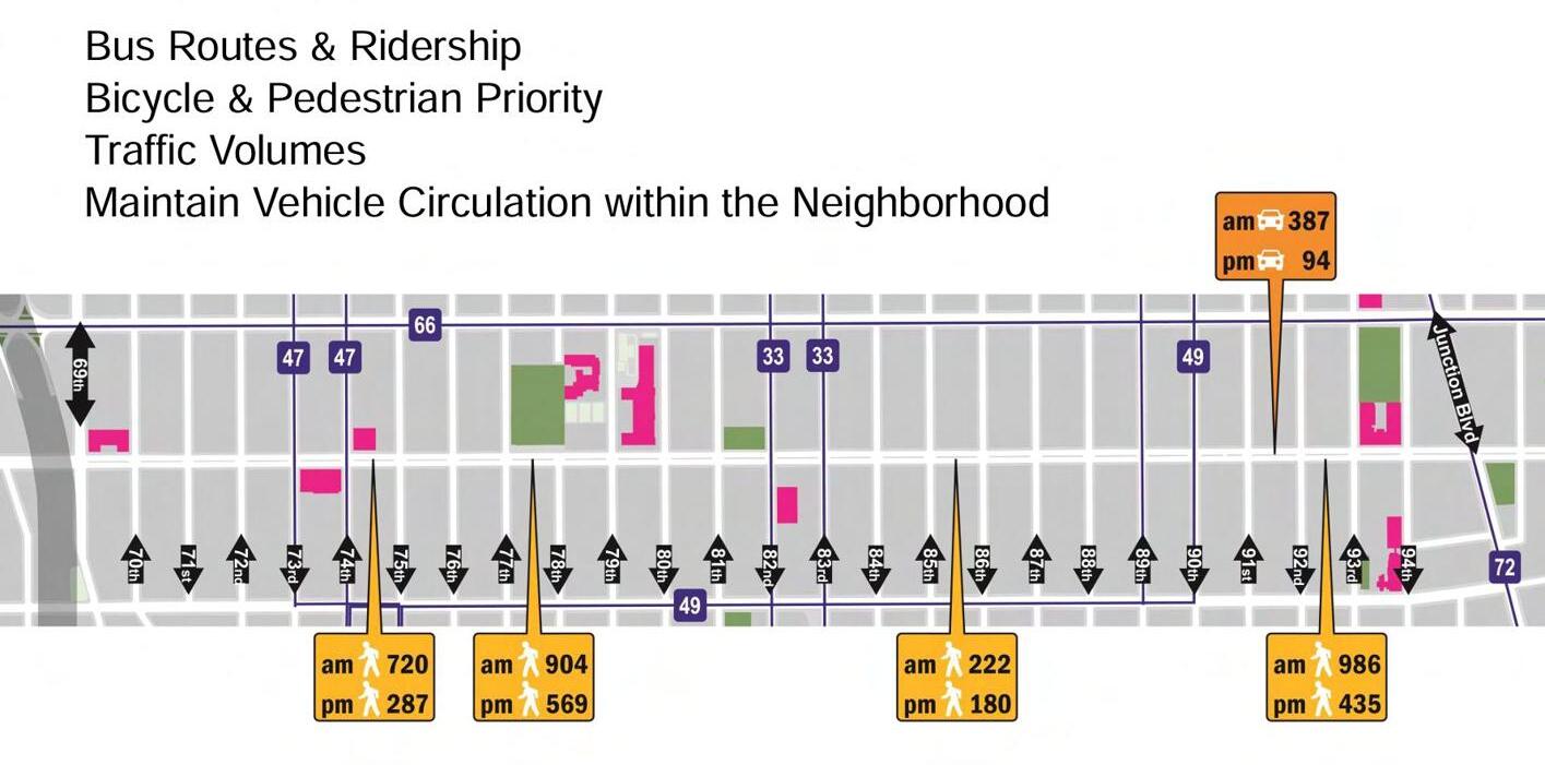
▪ Transportation Goals:
◦ Improve Bus Routes & Riderships
◦ Prioritize Cyclists & Pedestrians
◦ Study Traffic Volume
◦ Maintain Vehicle Circulation within the neighborhood
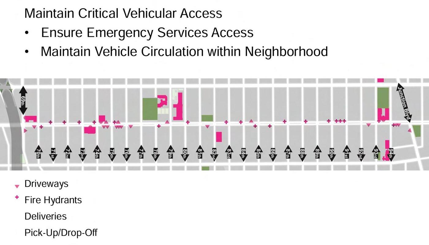
▪ Accessibility Goals:
◦ Maintain Critical Vehicle Access
▫ This ensures emergency services easy access
▫ This mainatins the vehicle circulation
◦ Key Factors are driveways l fire hydrants l delivery stations l pick-up & drop-off stations
▪ School Goals:
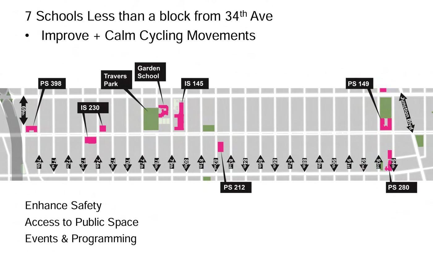
◦ In this vicinity, there are 7 schools less than a block away from 34th Street. A key factor to consider in this area all allocate for the improvement and calmness of cycling movement.
▫ This ensures an enhanced safety l accessibilty to public space l coordinate events & programs with ease
PRECEDENTS OPEN STREETS PG. 24 PG. 25
P.13
P.12
Transportaion Diagram for 34th Ave. [NYC DOT]
P.14
School Diagram for 34th Ave. [NYC DOT]
Accessibility Diagram for 34th Ave. [NYC DOT]
PRECEDENTS OPEN STREETS PG. 26 PG. 27
P.15
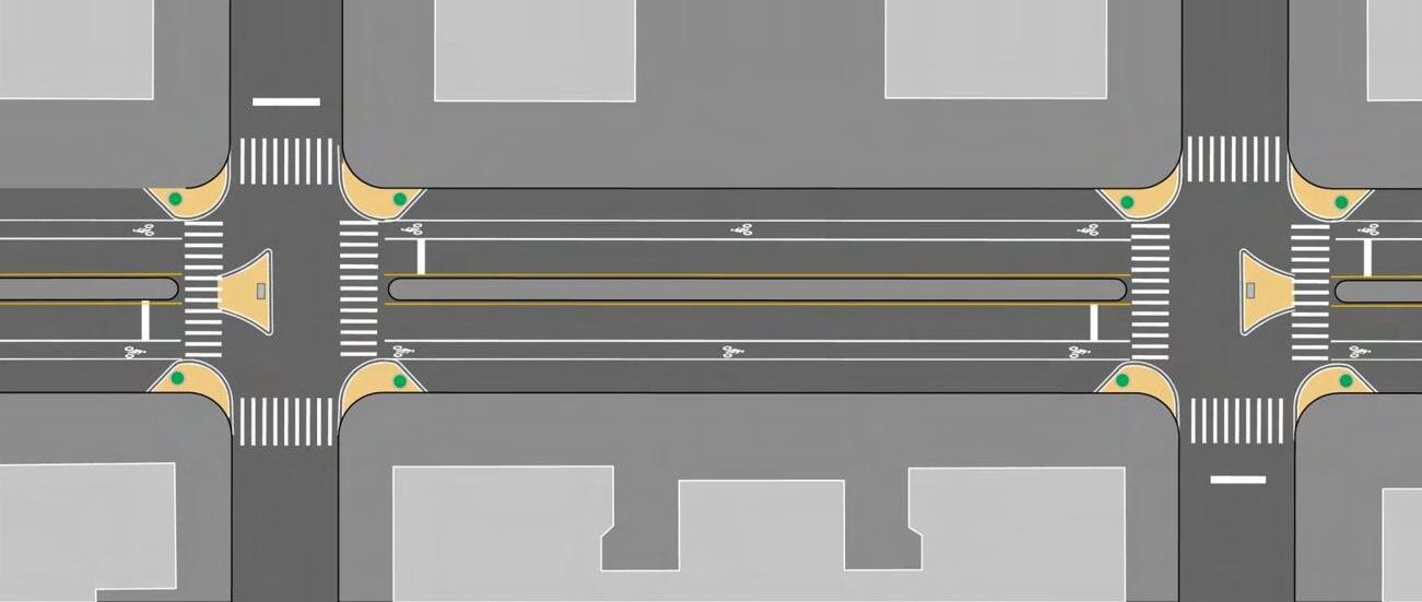
Old Traffic l Road Condition at 34th Ave. [NYC DOT]
P.16
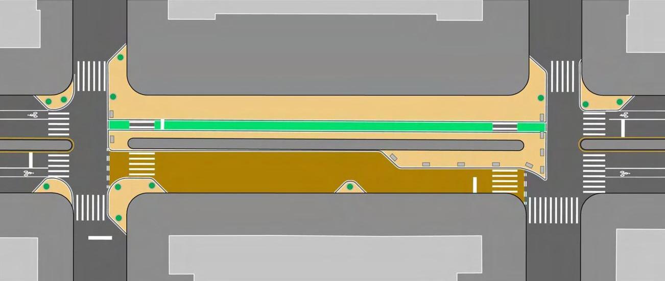
Proposed Traffic l Road Condition at 34th Ave. [NYC DOT]
P.17
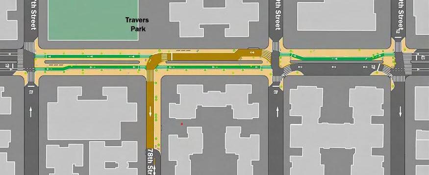
New Traffic l Road Condition at 34th Ave. [NYC DOT]
WILLIAMSBURG, BROOKLYN NY
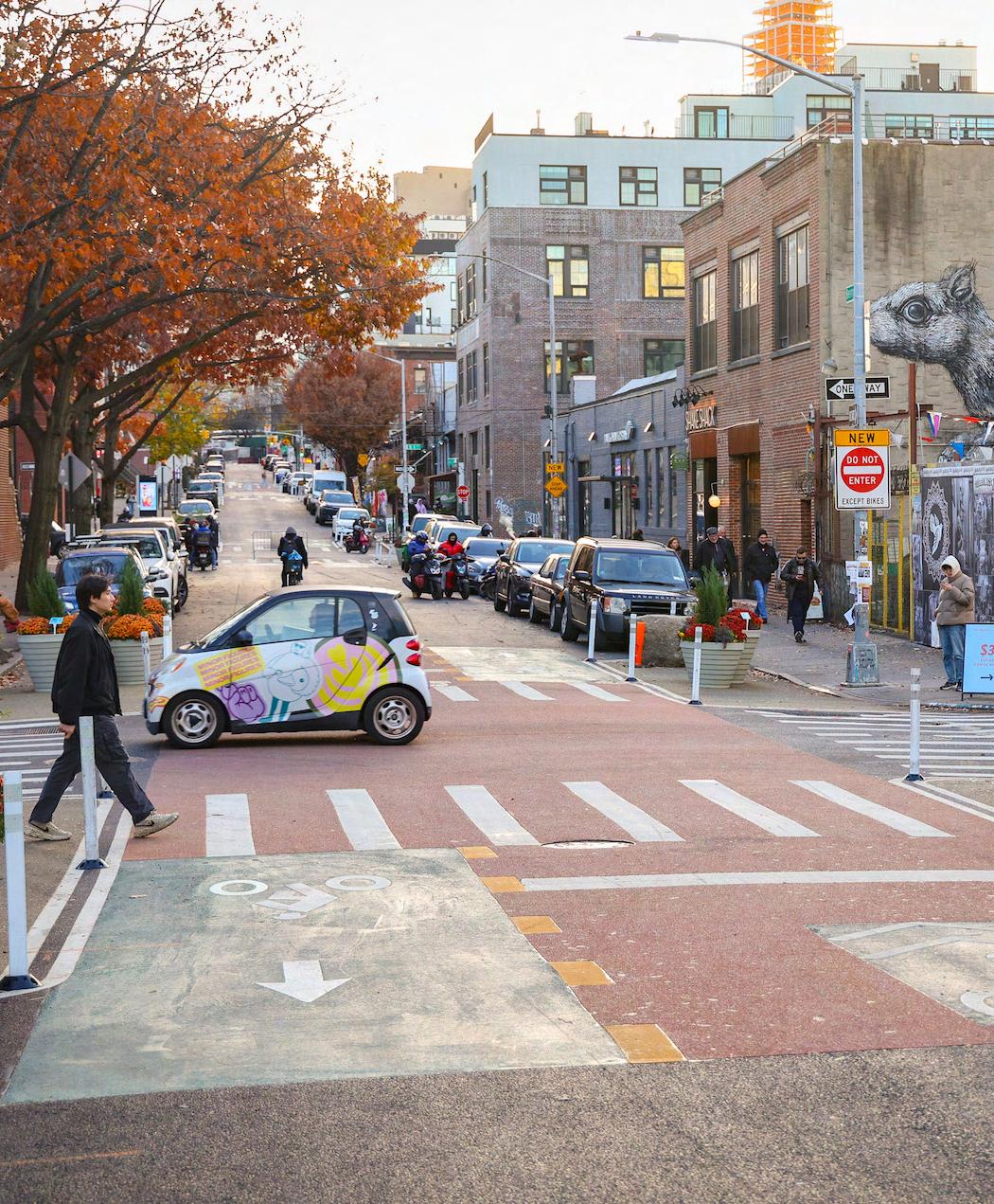
The Open Streets program across North Brooklyn was developed first as an emergency response program during COVID-19 pandemic. This program also launched with NYPD management, then shifted to community partner managed model by North Brooklyn Open Streets Community Coalition. This activated the Open Streets program through events and programming. The robust community outreach since program’s inception. The overall design proposal here in Williamsburg is to do the following:
▪ Enhance pedestrian safety & priority
▪ Formalize Northern & Southern path two-way cycling
▪ Add Neighborhood Loading Zones at the start and end of every block
▪ Calm traffic along corridor
▪ Maintain local access for freight and passengers
▪ Strengthen park-to-park connection with new pedestrian crossings
▪ Add new plaza at N 15 Street
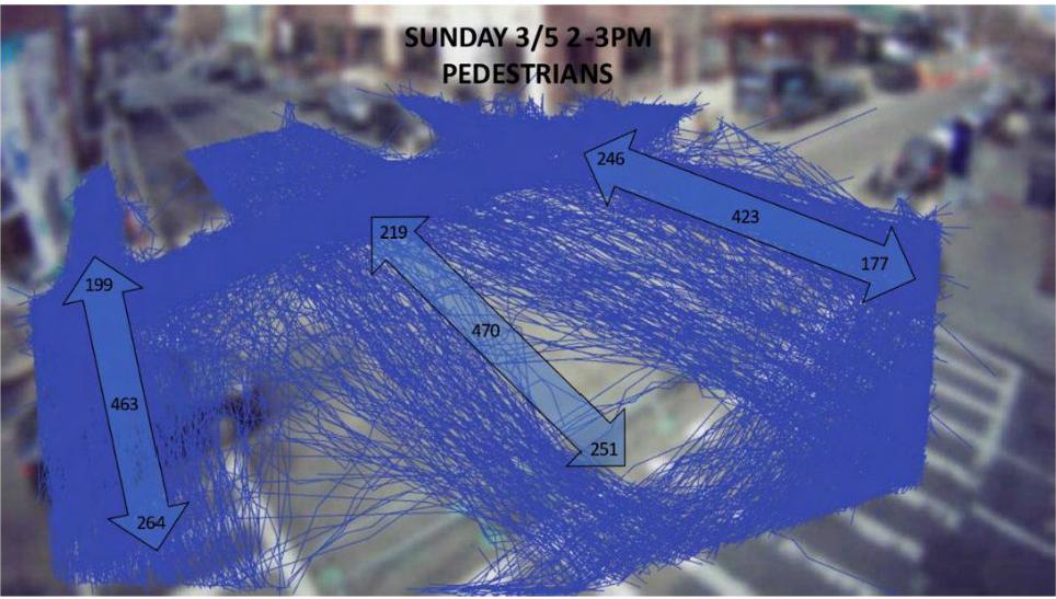
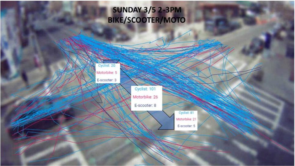
Some tactics that the NYC DOT used in their studies to approach a safer transportation method in Bedford was by using new technologies that would track and record the amount of people that use and move around the space during the day. Regarding the time of the day, week, month, and year. The “pilot” program that was used to conduct this research came from VivaCity Labs and their research essentially expressed how the split between the usage of Open Streets compared to the crosswalks were fairly even in capacity quantaties throughout the day. This also showed that approximately 20% of bike lane trips kept working against the regular flow of traffic [contra-flow] that headed southbound.
PRECEDENTS OPEN STREETS PG. 28 PG. 29
P.18
VivaCity Lab Pedestrian Usage Recordings [NYC DOT]
P.19
VivaCity Lab Vehicle Usage Recordings [NYC DOT]
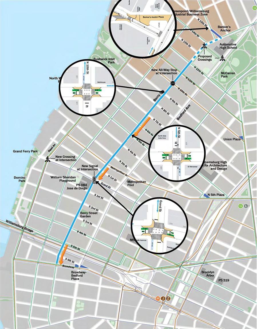
Open Street Active Program Locations [NYC DOT]
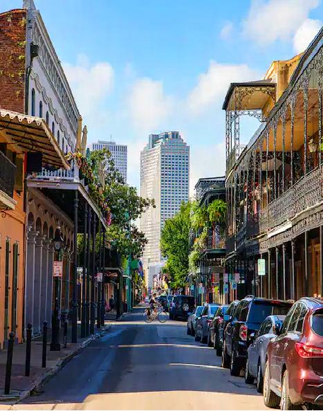
NEW ORLEANS, LOUISIANA
PRECEDENTS OPEN STREETS PG. 30 PG. 31 P.20
Williamsburg
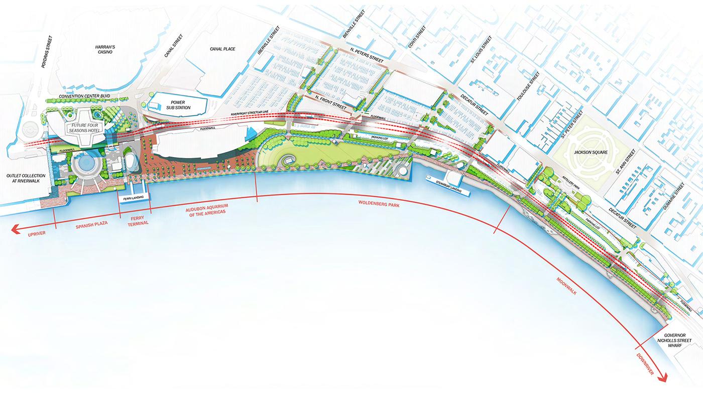
In terms of development and approach, New Orleans aimed to tackle their Open Streets initiatve quite differently. Their mission of utlizing Open Streets in the neighborhood, the attempt is to build awareness and gain support from their residents so that the streets are built to be safe and accessible for people of all ages and abilities whether they’re driving, walking, biking, or taking transit. In addition to that New Orleans attempt to build this awarness is all for the positivity of improving health, equity, economy, and quality-of-life benefits from safe and accessible transportation options. This development will allow for the rapid expansion of the low-stress bikeway network, and implementation of an updated Open Streets policy that is data-driven, equity-focused, and transparent.
What is their main motive in changing how their traffic situation is at the moment? This change is pushed forward in regards to having an institutionalized and normalized street design that will incorporate new forms of construction and operations that will impact and emody the value of having a safe and convenient form of transportation by foot.
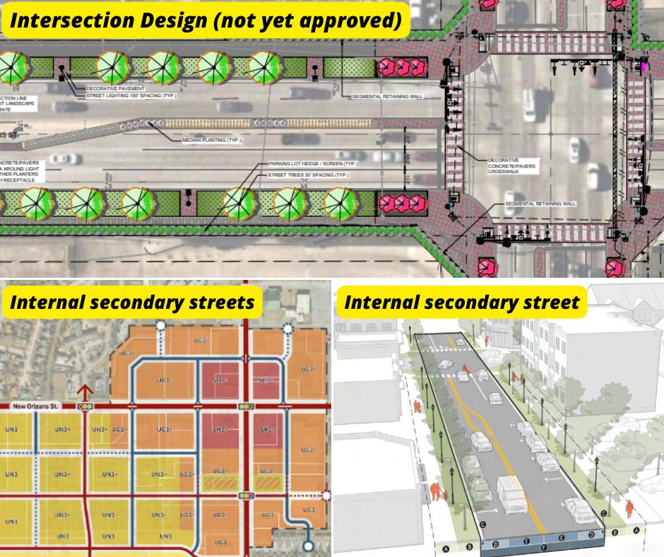
Essentially, they are aiming to target these major groups of people:
▪ People who drive: For residents to still enjoy comfortable travel speeds, improved safety, more clearly organized roadways, and increased predictability from people biking and walking.
▪ People who walk: For residents to enjoy well-maintained sidewalks and walking paths, street trees, benches, and high-visbility crosswalks.
▪ People who bike: For residents to enjoy dedicated spaces for riding and low speed limits, making for a safe comfortable riding experience and increased adherence to rules of the road from fellow riders. Numerous bicycle racks also allow easy parking next to popular destinations.
▪ People who ride transit: For residents to enjoy covered shelter, benches, and easy-to-read transit signage. Loading platforms are strategically placed away from active traffic to make getting on and off the vehicle a safe and stress-free transition.
▪ People of all ages and abilities: For those whom can travel in confidence knowing that ADA curb ramps, low speed limits, and high visibility will make for a safe and comfortable journey.
PRECEDENTS OPEN STREETS PG. 32 PG. 33
P.21 New Orleans Riverfront Redevelopment Master Plan P.22 New Orleans Square Center Redevelopment Proposal
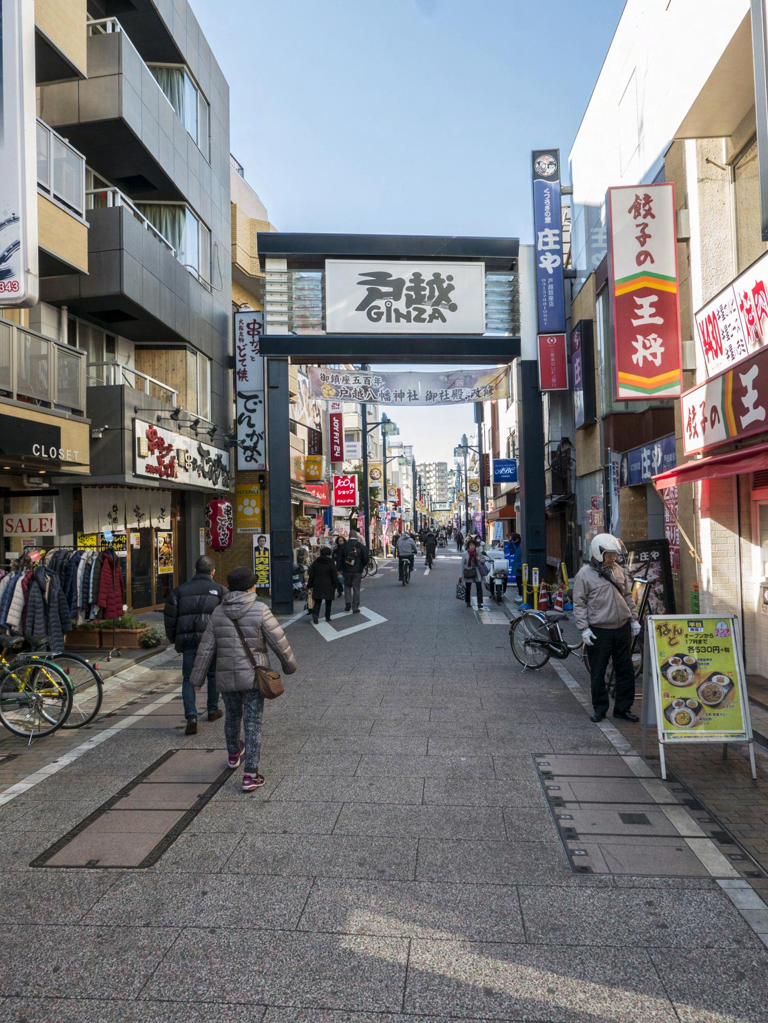
RESOURCES 05
RESOURCES OPEN STREETS PG. 54 PG. 55
“Open Streets.” NYC DOT - Open Streets, New York City Department of Transportation www.nyc.gov/html/dot/html/pedestrians/openstreets.shtml. [5 Borough Map]
“Open Streets Forever.” Transportation Alternatives, Transportation Alternatives, transalt.org/open-streets-forever-nyc.
“North Brooklyn Open Streets.” North Brooklyn Open Streets Community Coalition nbkos.cc/
“Open Streets.” NYC DOT - Open Streets, New York City Department of Transportation, www.nyc.gov/html/dot/html/pedestrians/openstreets.shtml. [Pedestrian Overview]
“Are Jackson Heights Open Streets a Major Victory or a Hurdle?”
Jackson Heights Open Streets: A Major Victory or a Hurdle?, CLODAGH MCGOWAN ny1.com/nyc/queens/news/2023/03/01/are-jackson-heights-open-streets-a-major-victory-or-a-hurdle-.
“The Future of 34th Avenue Open Street.”
The Future of 34th Avenue Open Street, New York City Department of Transportation www.nyc.gov/html/dot/downloads/pdf/ 34th-ave-open-street-cb3-full-board-oct2021.pdf.
“New Orleans Open Street .” New Orleans Complete Streets Coalition, 23 Nov. 2021 nolacompletestreets.org/.
“Complete Streets.” Bike Easy, 23 Nov. 2020 bikeeasy.org/our-work/advocacy/complete-streets/.
Richard. “New Orleans Riverfront.” Dana Brown and Associates, 13 Jan. 2022 www.danabrownassociates.com/new-orleans-riverfront/.
News Archive | City of Broken Arrow www.brokenarrowok.gov/Home/Components/News/News/1953/1317.
“Togoshi Ginza Shopping Street.” Tokyo Cheapo tokyocheapo.com/place/togoshi-ginza-shopping-street/
“Street Food Adventure at Togoshi Ginza, Tokyo’s Longest Shopping Road.” DiGJAPAN!, digjapan.travel/en/blog/id=11797.
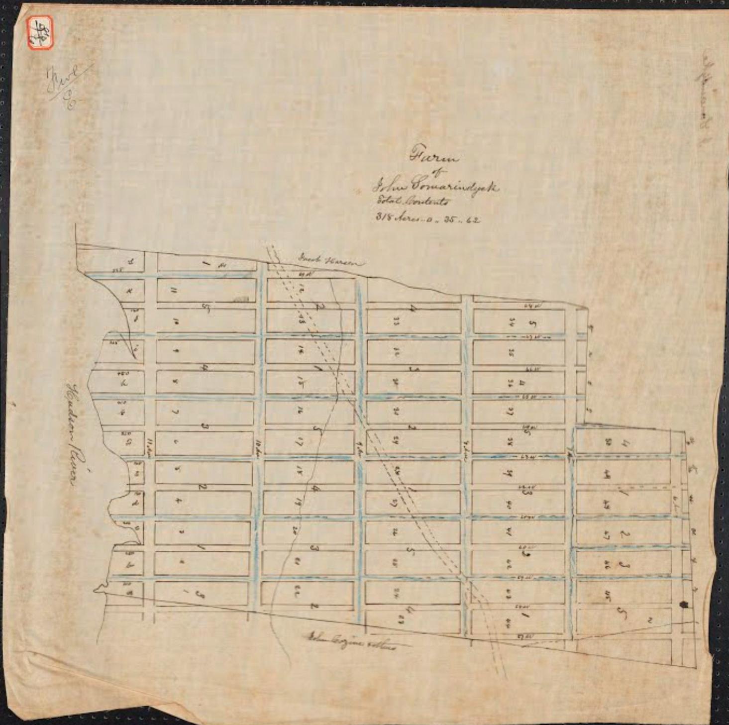
“History of Columbus Circle.” Columbus Circle eportfolios.macaulay.cuny.edu/columbuscirlce15/history-2/
“The West Side’s Story - Google Arts & Culture.” Google, Google artsandculture.google.com/story/the-west-side-s-story-museum-of-the-city-of-new-york/XgWhvJfOd-TwKg?hl=en.
NYC Transportation l Traffic Diagrams: New York City Department of Transportation l VivaCity Labs
New Orleans Master Plan Concepts l Proposals: Dana Brown & Associates l Broken Arrow Co.
Togoshi-Ginza Shotengai Diagrams: Ginza Workshops l Tokyo Guides
Cover l Back Page Photo credit: Sean Guadron [tphotography_93]
NYC Neighborhood Photographs: New York City Department of Transportation
RESOURCES OPEN STREETS PG. 56 PG. 57
O P E N
T R E E T
S
S

 P.1
Columbus Circle 1905
P.2