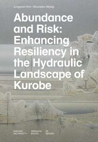
Jungyoon Kim / Shunsaku Miyagi
Abundance and Risk: Enhancing Resiliency in the Hydraulic Landscape of Kurobe
FallJungyoon 2024 Kim / Shunsaku Miyagi Studio Report
Abundance and Risk: Enhancing Resiliency in the Hydraulic Landscape of Kurobe
Jungyoon Kim / Shunsaku Miyagi
Abundance and Risk
Enhancing Resiliency in the Hydraulic Landscape of Kurobe
Abundance and Risk: Enhancing Resiliency in the Hydraulic Landscape of Kurobe This report presents the process and results of the design studio offered by the Department of Landscape Architecture at Harvard Graduate School of Design (GSD) in fall 2024, which aimed to project the sustainable future of Kurobe, Japan, centering around its abundant water resources. The current stable land use of the Kurobe River alluvial fan owes much to the flood control and water supply projects carried out since the turn of the 20th century. At the same time, constructing a mechanized artesian agricultural network system of irrigation canals and farmland consolidation covering most of the area led to substantial growth in rice paddy cultivation. Combined with flood control measures, the hydrological structure of the alluvial fan has transformed significantly throughout the 20th century. But the delicate balance among aspects of nature, industry, land, and economy will be challenged by the anticipated physical and social changes of great magnitude. Landscape architecture is the agent and medium of this projection for the future in this studio. The 11 students from all three departments of the GSD were asked to consider the practices of water use for agricultural development and industrial production holistically so that, as a result, these initiatives would draw the meaningful interaction in order to envision the future of Kurobe, its industries, its nature, and its people. The semester began by mapping the town through the lenses including demographics, energy, hydrology, industry, mobility and so forth. During the trip to Kurobe, the students performed field research and acquired local knowledge through interviewing the community and the workshops with YKKAP’s associate members. Thoughts and ideas were tested and developed through various lectures and workshops during the semester, including the topics of Japanese rural landscape,
traditional and contemporary Japanese landscape language, environmental engineering, and model making. On December 11, the works were shared with the prominent experts and stakeholders in the studio’s final review. On behalf of the studios, the instructors thank the Dean of the GSD Prof. Sarah Whiting and the Chair of the Department of Landscape Architecture Prof. Gary Hilderbrand, for their care and support. The support from the YKK AP was much beyond that of monetary--- the studio is grateful for their heartful care and consideration throughout the semester. The studios invite all the readers to the studio’s journey to Kurobe’s envisioned future, which will unfold in various other forms in the near future. Studio Instructors Jungyoon Kim, Associate Professor in Practice of Landscape Architecture, GSD Shunsaku Miyagi, Visiting Professor in Landscape Architecture, GSD Teaching Assistants Chadwick Bowlin, Manaka Hataoka Students Catherine Betz, Chadwick Bowlin, Sophie Flinner, Gio Hur, Mauricio Cohen Kalb, Jemma Liu, Fearghal Rooney, Genesis Solano, Rikki Tan, Karissa Xu, Jorge Gonzalez Yanez Final Review Critics Danielle Choi, Lorena Bello Gómez, Gary Hilderbrand, Alex Krieger, Alistair McIntosh, Mark Mulligan, Tom Oslund, Ed Wall, Sarah Whiting, Robert Zimmerman
Introduction
131
Sediment Harvesting: Contemporary Satoyama for Agriculture & Coast-building Mauricio Cohen Kalb
12
Foreword Gary Hilderbrand
13
Course Overview
155
Saline Threads of Kurobe: Wetland Ribbons of Transition Jemma Liu
Part 1 Mapping Kurobe
181
Nursery Village Fearghal Rooney
195
The Path Lightly Taken Genesis Solano
209
Open Levees: Broadened and Borrowed, Expanding the Floodplain for Post-Industrial Resilience and Regeneration in Kurobe’s Central Alluvial Fan Rikki Tan
223
Symbiotic Design: Reimagining Human and Oriental White Stork Coexistence in Kurobe City Karissa Xu
239
Archipelago Forest Jorge Gonzalez Yanez
257
Contributors
17
Site Analysis
Part 2 On Site 43
Field Trip
Part 3 Language of Climate, Water, and Rural/ Agrarian Landscape Part 4 Spatialization of Climate and Water 59
Domaine without Borders: Regenerative Viticulture Practices To Restore Kurobe’s Landscapes Catherine Betz
79
At the Edge of the World Chadwick Bowlin
101
Lots of Life! Sophie Flinner
113
Extending Horizons: Restoring Kurobe’s Pathways to the Sea Gio Hur
11
Gary Hilderbrand Chair of the Department of Landscape Architecture and Peter Louis Hornbeck Professor in Practice of Landscape Architecture
Option studios in the Department of Landscape Architecture provide a platform for collaborative investigations into the urgent environmental, social, and climate issues of our time. Frequently, we shape studios in partnership with corporations and institutions who share our curiosities, our worries, or our urgencies on matters of grave environmental consequence. In these endeavors, students who are mostly completing the final year of their professional degree program engage with local partners, research maps/ plans and data sets, and conduct field reconnaissance on their visit to the site. Building upon this, they derive frameworks for action and speculate imaginatively on adaptive and regenerative futures for cities and regions. What results is not a set of answers to specific problems, but a compilation of frames for how to prioritize actions that may be taken in the years ahead.
materials, carbon drawdown, urban forestry, and more. It extends to housing and sustainable urbanism and real estate development. The company’s ongoing housing efforts at K-Town, K-Hall, and especially PASSIVETOWN, now in its fifth phase of construction, are achieving and exceeding sustainability benchmarks, with renewable energy, water management and reuse, low-carbon strategies, and nature-based resilient landscape solutions.
This year we were honored and privileged to join with YKK AP Corporation to investigate matters of great consequence in the city of Kurobe, Toyama Prefecture, in the Chubu region of Japan. Kurobe is the headquarters for YKK and YKK AP research, technology, and production, and some 6,000 employees live in or near the city. With the good fortune of access to abundant groundwater in the broad and flat alluvial fan of Kurobe—the city is known as “the village of great waters”— YKK manufacturing keeps apace with a bustling worldwide market for its fastenings and architectural products. But will the groundwater remain abundant in the face of climate change? YKK’s founder, Tadao Yoshida, committed his firm to the “Cycle of Goodness” which claims that “no one prospers without rendering benefit to others.” Today’s YKK and YKK AP leadership honors this axiom as an ethic of care and stewardship for the city that supports the company and its people. This care is manifested through commitments to sustainable manufacturing processes and continued research and innovation on
What more can YKK do to ensure its partnership with Kurobe towards a prosperous and sustainable future? This is the question at the heart of the student projects chronicled in this report. I congratulate the students on their compelling visions for taking Kurobe’s abundant resources towards imaginative and realizable trajectories. On behalf of the Department and the students, I am more than grateful to Associate Professor in Practice Jungyoon Kim and Visiting Professor Shunsaku Miyagi for conducting this fascinating inquiry into Kurobe’s possible futures. The combination of these two remarkable designers and teachers was a joy to observe, and the outcomes prove its great benefit. They will repeat this enterprise again in another city, Kyoto, in the next academic year, again with YKK AP. I also wish to thank Chairman Hori, his wonderful senior colleagues, and the associate members at YKK AP for their partnership and their hearty embrace of our students. There has been bi-directional learning in this studio, without any doubt. Finally, very special thanks to Michael Voligny and Shun Miyagi MLA ‘86, who had the idea to bring together the Department of Landscape Architecture and the good stewards of YKK AP. We trust more will come of this engaging and beneficial alliance.
12
Foreword
13
Course Syllabus
This studio aims to project a sustainable future for Kurobe, Japan, where the delicate balance among aspects of nature, industry, land, and economy will be challenged by the anticipated physical and social changes of great magnitude. Landscape architecture is the agent and medium of this projection for the future. The current stable land use of the Kurobe River alluvial fan owes much to the flood control and water supply projects carried out since the turn of the 20th century, especially the construction of upstream dams and a continuous protective embankment alongside the braided Kurobe River system within the alluvial fan. At the same time, constructing a mechanized artesian agricultural network system of irrigation canals and farmland consolidation covering most of the area led to substantial growth in rice paddy cultivation. Combined with flood control measures, the hydrological structure of the alluvial fan has transformed significantly throughout the 20th century. In the meantime, from the mid-1950s, largescale manufacturing businesses (YKK and YKKAP) that use non-ferrous metals as raw materials have established operations here, taking advantage of the alluvial fan’s abundant groundwater resources and stable electric power supply. Such efforts have contributed to driving the local economy and improving the livelihoods of Kurobe’s working population. However, practices of water use for agricultural development and industrial production have not been considered jointly or holistically, and as a result, these initiatives have drawn no particularly meaningful interaction despite the prosperity they owe to the same alluvial fan. The climate crisis requires us to think about an alternative sustainable future for Kurobe, especially given the overutilized groundwater resource, extreme power demand, declining population, and the dynamics of the current industry that will be affected. The abundance of water resources,
once treated as a danger (i.e., flood control) and then as an unlimited asset (i.e., industrial and agricultural establishment), must be reexamined holistically to allow for water, industry, and civic life in this region to become much more intertwined and nourish each other mutually. The studio will travel to Kurobe to perform field research and acquire local knowledge. Thoughts and ideas will be tested and developed through various lectures and workshops during the semester, including the topics of Japanese rural landscape, traditional and contemporary Japanese landscape language, environmental engineering, and model making. The students enrolled in this studio are strongly recommended to take the discussion-based seminar, “Origins and Contemporary Practices of Asian Landscape Architecture: Korean Perspectives and More (PRO-7453),” to gain a more fundamental understanding of the vicissitudes and unrealized potentials of Japanese landscape architecture.
WK1 (9/5) Introduction Syllabus reading Pairing up/ theme allocation Themes: settlement/ agriculture/ local industry (e.g. fishing, sake maker, miso maker) / architecture (both traditional and contemporary)/ hydraulic engineering/ energy/ YKK, all in relation to the alluvial fan and Kurobe River Q&A Base files and references explanation by TA Meeting with Shun (via Zoom) WK2 (9/10) Desk Crit Sharing the mapping/ research progress WK2 (9/12) Desk Crit & Workshop Desk crit (2-4pm) to share the progress of mapping/ research ‘Tunnel Book Making’ workshop 1 (4-6pm) by Lara Trimarco Prebble (MLA ’23, a designer at MVVA, Cambridge) WK3 (9/17) Lexture Shun Miyagi, the co-instructor of the studio, will give a talk in person. 2:00- 3:30 pm Lecture, “Understanding a City through Kurobe Water.” 3:45- 6:00 pm Desk crit WK3 (9/19) Pin-up 2:00- 6:00 pm : Students are to share the mapping and research on Kurobe on their assigned topic and first design idea. Deliverables: Powerpoint presentation, planar map (about 1:20,000) , deep section Students are expected to attend others’
presentations as well. WK4 (9/24) Lexture & Trip Preparation & Desk Crit 2:00- 3:30 pm Trip Preparation 3:30- 4:30 pm Loeb Library Special Collection visit 4:30- 6:00 pm Gareth Doherty on “Landscape Fieldwork” WK4 (9/26) Desk Crit Students will work individually after the trip. During the desk crit, please share with the instructor which area you are interested in for personal exploration while in Kurobe. Have your first design idea ready to discuss with your instructor.
14
PART 1 MAPPING KUROBE In the first four weeks of the semester, students will work in pairs to study Kurobe, in charge of a theme out of seven, utilizing the GIS resources and literatures. Most of the references are prepared in advance by the teaching assistants although it is always encouraged and appreciated for students to explore their theme and share with the class. On the other hands, students will collaborate to create a set of ‘tunnel book’ showing the existing topography both above and below ground of the town, with the alluvial fan as the axis. The model will be brought to the site trip, along with the maps.
15
PART 2 ON SITE The sponsored eight-day trip will provide an opportunity to test the findings of the initial analysis and to conduct field research. Students will hike to the upstream of the Kurobe River and visit the alluvial fan and also to be introduced to some of the noteworthy cultural destinations which would showcase how much the community has relied on the abundance of water. Engagement with the ‘associate members’ of YKK AP will provide an opportunity for students to exchange their findings and to expose themselves to local knowledge. Please refer to the below schedule for the preliminary trip schedule; more precise details will be provided during WK4. WK5 Field Trip 9/28 (Sat) In flight to Tokyo Depart from Logan International Airport (JL7, 13:55) 9/29 (Sun) In Tokyo Arrive at Narita International Airport, Tokyo Japan (16:15) Accommodation: Sumida Club, Tokyo (around 20- minutes from Tokyo Station) 9/30 (Mon) In Kurobe Depart from Tokyo Station to Kurobe (Hakutaka 553, 07:52) Arrive in Kurobe Unazukionsen (10:24) Accommodation: Passivetown or Aqua Kurobe Hotel in Kurobe 10/1 (Tue) In Kurobe Hike to the upstream of Kurobe River Alluvial fan visit, with Prof. Hirokazu Oku 10/2 (Wed) In Kurobe Visit to sake brewery, fish market, and soybean paste maker. Visit to the seashore 10/3 (Thu) In Kurobe Individual exploration, to specify the site for Part 3 and 4 Workshop with the YKK AP associate members 10/4 (Fri) Kurobe (am), Tokyo (pm) Studio internal meeting to plan ahead PART 3 (am) Depart from Kurobe Unazukionsen to Tokyo (Shinkansen 14:34)
Arrive in Tokyo Station (16:52) Accommodation: Sumida Club, Tokyo 10/5 (Sat) Depart to Boston Tokyo exploration Depart from Narita to Logan (JL8, 18:25) Arrive in Logan (18:15)
WK6 (10/8) Workshop: Tunnel Book Making 2 4:00- 6:00 pm Lara will come back for the second workshop, now that students will have their site area chosen, and have workshop and individual sessions with each students to discuss relevant media. WK6 (10/10) Workshop 5- 6:30 pm Prof. Jungmin Ellie Han of Yonsei University, Dept. of Architectural Engineering will offer online workshop on environmental and sustainability engineering, especially on Low Impact Design for water resiliency. WK7 (10/15) Desk Crit Students are expected to share their mid review presentation draft, and the list of the drawings. Please upload all the materials to the studio’s Miro board prior to the crit. Due to the time difference between Seoul and Boston, the actual workshop time will be discussed once the course schedule of all students are confirmed. WK7 (10/17) Desk Crit & Lecture Shun will speak about agricultural and rural landscape of Japan. Due to the time difference between Tokyo and Boston, this lecture will happen 5:00- 6:30 pm online. WK8 (10/22, 24) Mid Review - Mid review will be conducted over two days. On 10/22 we will have a group of guest critics, and there will be studio- internal recap on 10/24. The list of deliverables will be announced during at the end of PART 2. - Deliverables to be announced after the trip.
PART 4 SPATIALIZATION OF CLIMATE AND WATER Through PART 1 to 3, students might have seen the possibilities of how landscape can facilitate a solid framework for a rural town that is heavily relying on the abundance of hydraulic resources. In preparation for the final review, they will advance to the site-specific design on the site of their choice, in which the subterranean, aboveground, water network and people work together for more resilient Kurobe. Students will develop at least two plans in two different scale, 1:1000 and 1:200. WK9 (10/27) Desk Crit WK9 (10/29) Desk Crit WK10 (11/5) Desk Crit WK10 (11/7) Desk Crit WK11 (11/12) Desk Crit WK11 (11/14) Desk Crit WK12 (11/19) Desk Crit WK12 (11/21) Pin-up WK13 (11/26) Desk Crit WK13 (11/28) THANKSGIVING RECESS WK14 (12/3) Desk Crit WK14 (12/5) Final Review Dry Run 12/11 Final Review 12/12 Exit Interview
16
PART 3 LANGUAGE OF CLIMATE, WATER, AND RURAL/ AGRARIAN LANDSCAPE For the rest of the semester, students will specify their individual site, chosen and confirmed during and after the trip. In this phase of the studio, PART 3, students will learn the tools that can be utilized when designing for a more resilient environment that is culturally respectful.
Part 1 Mapping Kurobe
Firstname Lastname
19
Topography, Bathymetry Catherine Betz Jorge Gonzalez Yanez
24
Water Runoff/Watershed, Agriculture, Settlement Pattern Jemma Liu Fearghal Rooney Karissa Xu
32
Regional Location/Mobility, Architecture Sophie Flinner Genesis Solano
35
Industry, Agriculture Gio Hur Mauricio Cohen Kalb
40
Energy, Hydraulic Engineering Chadwick Bowlin Rikki Tan
19
Topography, Bathymetry Catherine Betz, Jorge Gonzalez Yanez
20
https://www.mlit.go.jp/river/toukei_chousa/kasen/jiten/nihon_kawa/0409_kurobe/0409_kurobe_01.html
© Jungyoon Kim Top: Kurobe River Alluvia Fan aerial view Bottom: Kurobe Gorge
21
KUROBE ALLUVIAL FAN SECTION A - B
JAPANESE MESOZOIC OLD ALLUVIAL DEPOSITS
KUROBE RIVER SECTION SECTION AA - BB
22
SEDIMENT RUNOFF LANDSLIDES & WEATHERING
E ALPS C GRANITE DEPOSITS
HIGH POINT 3000 M CONTOUR MESOZOIC DACITE AND RHYOLITE LAVA
JUNIKANNO PLAIN MAESAWA PLAIN
SEDIMENT BUILD UP FLOOD ZONE
CORE SECTION AA-BB
ALLUVIAL FAN
MIOCENE TERRACE
KUROBE RIVER 500 M
Topography, Bathymetry Catherine Betz, Jorge Gonzalez Yanez
23
© Shunsaku Miyagi
© Gio Hur Top: Inside of the only remaining patch of Sugisawa currently. Its disapperance is closely related to the disturbance to groundwater. Bottom: One of the street springs of Kurobe where the community drink the pure water at any time
24
Water Runoff/Watershed, Agriculture, Settlement Pattern Jemma Liu, Fearghal Rooney, Karissa Xu
25
Unazukimachi Akebi Kurobe River
Pre-Quaternary Base 1,000 m
Sand Gravel
Sand
26
YKK Center Park
Spring Water
Spring Water in Sea
Caly
Water Runoff/Watershed, Agriculture, Settlement Pattern Jemma Liu, Fearghal Rooney, Karissa Xu
Title
27
Water Runoff/Watershed, Agriculture, Settlement Pattern Jemma Liu, Fearghal Rooney, Karissa Xu
28 © Shunsaku Miyagi
© YKK AP
© YKK AP Top: Industrialized patches of rice paddies after the land consolidation process Bottom: Irrigation channels that serve both industries and agriculture
29
a b c d
a. Plough Layer - Rich in nutrient and organic matter b. Plow Layer - Compaction by machinery, water and fertilizer preservation c. Leached Layer - Light color result in soil iron reduction and leaching loss caused by water d. Hydroponic redox Layer - Sediment of iron and manganese oxide
1
Sea Level
Yield Bank 2 Flying Sand, Cedar Plantation 30
3
Rice Paddy 4
5
6
7
8
Cedar Plantation 9
10
11
12
Sea Level
Water Runoff/Watershed, Agriculture, Settlement Pattern Jemma Liu, Fearghal Rooney, Karissa Xu
31
© YKK AP
© Sophie Flinner Top: Passivetown shows the effort of YKKAP to make the town’s sustainable future. Bottom: A typical street of Kurobe’s residential area
32
Regional Location/Mobility, Architecture Sophie Flinner, Genesis Solano
33
①soil ②sandy clay ③clay silt ④sand
⑤sandy gravel
⑥bedrock
⑦salt + fresh water area
34
Regional Location/Mobility, Architecture Sophie Flinner, Genesis Solano
35
Industry, Agriculture Mauricio Cohen Kalb, Gio Hur
36
© YKK AP
© Gio Hur Top: Soft seashore of Toyama Bay Bottom: Engineered seashore of Toyama Bay
Kurobe Deep Section: Kurobe Deep Section: Groundwater Groundwater andand Level Impact SeaSea Level RiseRise Impact
HUMUS SOIL HUMUS SOIL
COBBLE MIXED GRAVEL COBBLE MIXED GRAVEL
CLAY MIXED FINE GRAVEL CLAY MIXED FINE GRAVEL CLAY MIXED FINE SAND CLAY MIXED FINE SAND
0
0.5
0.5
1
1
WATER
WATER
2Miles
2Miles
37
0
GRANITE BEDROCK GRANITE BEDROCK
+1.03m
L SA N
N
IO
IO
AT
AT
OL
OL
RC
RC
PE
PE
ER
ER
AT
AT
TW
TW
L SA
SHOZU (CLEAN WATER) SPRINGS
30-40
30-40
40-60
40-60 60-70
60-70 70-80
70-80
80 - 90
80 - 90
SHOZU (CLEAN WATER) SPRINGS
SLR PROJECTION 2090 SLR PROJECTION 2090 +1.03m
70-80
70-80
60-70
60-70
40-60
40-6
IM
CONTRIBUTION OF PRECIPITATION TO GROUNDWATER % CONTRIBUTION OF PRECIPITATION TO GROUNDWATER %
GROUNDWATER RECHARGE
GROUNDWATER RECHARGE
SEA-WALL WAVE BREAKERS SEA-WALL WAVE BREAKERS
SLR PROJECTION 2090 SLR PROJECTION 2090 SLR PROJECTION 2070 SLR PROJECTION 2070 SLR PROJECTION 2050 SLR PROJECTION 2050
+1.03m +0.54m +0.31m
+1.03m +0.54m +0.31m
SEDIMENT SEDIMENT BUILD U
38 HUMUS SOIL 0-2 m RIVERBED
60
30-40
20-30
30-40
40-50
50-70
70-80
80-90
COBBLE MIXED GRAVEL 30-50 m
90-100
CLAY MIXED FINE GRAVEL 50-90 m IMPERMEABLE CLAY LAYER
T BUILD UP
CLAY MIXED FINE SAND 90-115 IN
U
O
SEDIMENT BUILD UP
M
M
A NT
O
GE
FR
AR
CH
ER
RE
AT
DW
UN
RO
G
GRANITE BEDROCK 115+ m
Industry, Agriculture Mauricio Cohen Kalb, Gio Hur
39
© YKK AP
© Gio Hur Top: Power Station #1 Bottom: Biomass for Passivetown boiler
40
Energy, Hydraulic Engineering Chadwick Bowlin, Rikki Tan
41
Kurobe Dam Rest House (Home of Arch Curry)
Viewing deck
Viewing deck
50 m
42
Passivetown Kurobe
YKK Zipper Facility
Electrical grid
Groundwater wells
Groundwater wells
Impermeable clay layer Geothermal pump Aquifer
50 m
Energy, Hydraulic Engineering Chadwick Bowlin, Rikki Tan
Part 2 On Site
Firstname Lastname
45
© YKK AP
© YKK AP
46
© YKK AP
© YKK AP
Day 1
47
© Jungyoon Kim
© YKK AP
48
© YKK AP
© YKK AP
Day 2
49
© YKK AP
© YKK AP
50
© YKK AP
© YKK AP
Day 3
51
© YKK AP
© YKK AP
52
© YKK AP
© YKK AP
Day 4
53
© YKK AP
© YKK AP
54
© YKK AP
© YKK AP
Day 5
Part 3 Language of Climate, Water, and Rural /Agrarian Landscape Part 4 Spatialization of Climate and Water
Firstname Lastname
Domaine without Borders: Regenerative Viticulture Practices To Restore Kurobe’s Landscapes Catherine Betz
181
Nursery Village Fearghal Rooney
195
The Path Lightly Taken Genesis Solano
79
At the Edge of the World Chadwick Bowlin
209
101
Lots of Life! Sophie Flinner
113
Extending Horizons: Restoring Kurobe’s Pathways to the Sea Gio Hur
Open Levees: Broadened and Borrowed, Expanding the Floodplain for Post-Industrial Resilience and Regeneration in Kurobe’s Central Alluvial Fan Rikki Tan
223
131
Sediment Harvesting: Contemporary Satoyama for Agriculture & Coast-building Mauricio Cohen Kalb
Symbiotic Design: Reimagining Human and Oriental White Stork Coexistence in Kurobe City Karissa Xu
239
Archipelago Forest Jorge Gonzalez Yanez
59
155
Saline Threads of Kurobe: Wetland Ribbons of Transition Jemma Liu
57
Grape Valley Catherine Betz
Wheat & Energy Field Chadwick Bowlin
Rewilded Shore Mauricio Cohen Kalb
Water Gardens Sophie Flinner
Porous Walking Town Gio Hur
Brackish Shore Jemma Liu
58
New Floodplain Karissa Xu
Open Islands Jorge Gonzalez Yanez
Nursery Village Fearghal Rooney
Open Levee Bike Town Genesis Solano
Open Levee City Rikki Tan
Diagrams: 11 Envisioned Future of Kurobe Within the simplified outline of alluvial fan, with the two curves cutting through as the Kurobe River does, These 11 diagrams summarize the students’ proposals for Kurobe’s sustainable future.
59
Domaine without Borders
Catherine Betz
In response to the decline in rice paddy production and population in Kurobe, the project “Domaine without Borders” envisions a transformative approach to Kurobe’s landscapes by introducing regenerative viticulture practices as a solution to revitalize the region’s alluvial fan. The fertile, clay-rich soil, combined with Toyama’s unique climate and water resources, presents an opportunity to create a distinctive terroir, fostering both ecological diversity and economic growth through wine tourism. This proposal reimagines Kurobe’s agricultural identity by repurposing existing rice paddies and vacant land into productive, multifunctional viticultural landscapes. These monocultural vineyards are interwoven with agroforestry, native ground cover, and integrated farm animals, ensuring biodiversity and promoting soil regeneration. Public and private settings are blended seamlessly throughout the vineyards, fostering community engagement, tourism, and a new sustainable agricultural lifestyle. Grounded in detailed research of Kurobe’s geological and soil conditions, the design strategically situates vineyards on the upper alluvial fan, leveraging terraced farming, existing irrigation channels, and natural protection from sea breezes. This thoughtful placement ensures compatibility with grape varieties like Merlot, Chardonnay, Cabernet Sauvignon, and Pinot Noir, chosen for their adaptability to the clay-rich soil and climate. The project also incorporates traditional Japanese viticulture practices, such as grape guards and rain shelters, while acknowledging Kurobe’s specific local history with water quality and sake production. By reimagining agriculture through the lens of viticulture, “Domaine Without Borders” creates a resilient future for Kurobe—one that enhances tourism, sustains biodiversity, and strengthens its connection to the land.
60
61
1,000m
62 1,000m
63
64
Catherine Betz
65
50m
66
Catherine Betz
67
68
Catherine Betz
69
70
71
72
73
74
75
76
Firstname Lastname
77
78
Domaine without Borders In response to Kurobe’s decline in population and rice paddy production, this design aims to repurpose rice paddies and vacant land into a productive and regenerative viticultural landscapes to increase tourism and biodiversity in the alluvial fan. While optimizing the existing soil and geomorphologic conditions, this rendering proposes how viticultural landscapes can offer a new agricultural identity for the alluvial fan.
79
At the Edge of the World
Chadwick Bowlin
‘At the Edge of the World’ explores the dynamic interplay between hydroelectric power, agriculture, and geomorphology at the edge of Kurobe old alluvial fan, reimagining this edge condition as a site of productivity and aesthetic delight. The proposal integrates hydroelectric battery storage, diversified agriculture, and a new alluvial trail system, harnessing Kurobe’s unique relationship between water and land. Central to this vision is maximizing energy efficiency and creating year-round agricultural output while enhancing the region’s natural beauty and accessibility. Clay berms retain water for hydroelectric storage, releasing it to generate power during peak demand. Diversified crops, such as winter wheat and barley, introduce a second growing season, reducing water demand and contributing to Japan’s domestic food supply. These fields, juxtaposed with the golden hues of rice, create seasonal spectacles, framing Kurobe’s cliffs with a visual narrative of abundance. A new trail system transforms the edge of the fan into an immersive experience, with observation decks and paths connecting visitors to this overlooked geomorphology. The berms and cedar-framed vistas invite visitors to traverse the old fan’s edge and its slopes, celebrating a symbiosis of energy, agriculture, and landscape. ‘At the Edge of the World’ envisions a future for Kurobe that redefines its edge as a site of generative intersection, productivity, and visual poetry.
80
81
30-Year Alluvial Master Plan
82
Mapping Timescales of Hydrologic, Productive, and Sociopolitical Phenomenon Affecting the Kurobe Alluvial Fan
83
84
Firstname Lastname
85
86 10m
87
Section A- Upper and Lower Terrace
88
89
90
Chadwick Bowlin
91
PROPOSED RETENTION CAN IRRIGATION CANAL
WATER RETENTION AREAS
KUROBE EAST POWERSTATION #2
WAT
92
NAL
TER RETENTION AREAS
WHEAT FIELD
93
MAIN IRRIGATION CANAL
WINTER
SPRING
SUMMER
AUTUMN
RICE FIELD
94
WHEAT FIELD
95
96
97
98
99
100 100m
Wheat and Energy Production, Along the Alluvial Fan This deep section drawing is drawn along the old geological edge, perpendicular to Kurobe East Power Station #2. It summarizes my proposal, demonstrating material flows of clay and energy, combined with the natural elevation of the topography, working in harmony. As clay is removed from the former rice fields that have been made into wheat fields, in orange, it is relocated to the top of the fan, to create walls that will make the edges of hydroelectric “batteries”, the ponds in blue. In return, the additional storage capacity can produce more energy, which is used to harvest wheat.
101
Lots of Life!
Sophie Flinner
Lots of Life, transforms empty parcels into an amphitheatre, a learning landscape, and an improved nature reserve that offers learning, gathering, recreation, and participation for people of all ages. These lots emphasize the importance of water while providing ample infrastructure and vegetation for a functional, comfortable, and beautiful Ikuji. Connecting the new Ikuji Amphitheatre, Learning Landscape, and Nature Reserve are constructed water gardens that function as detention basins. The water gardens strengthen the connection between people and water by creating genuine public spaces for all to enjoy. The Ikuji Amphitheatre attracts people into the neighborhood for events, such as concerts or festivals, or can be utilized for relaxation, recreation, etc. The amphitheater is terraced for the accommodation of people and can also hold water during large storm events. It faces the coast, so visitors feel connected to the Toyama Bay. The Ikuji Learning Landscape encases many natural environments that are situated around Kurobe and Japan. Children learn about trees, marshes, perennials, water cycles, and more, all within a short walk of their school building. This learning space type is unique and will likely attract young parents into the Ikuji area. An overlook boardwalk is constructed within the existing nature reserve in Ikuji with little disturbance around the existing trees, as people are mere observers of this landscape. Residents and visitors can walk, run, and bike on the boardwalk for recreation and exploration. People of all ages can enjoy this improved nature reserve. Kurobe is directly influenced by water, so maintaining these water sources while improving human proximity to the water and the outdoors is essential to the city’s identity.
102
103
104
105
106
107
108
Sophie Flinner
109
110
111
112 100m
Lots of Life! Design Implemented in Three Locations in Ikuji Lots of Life! transforms empty parcels into an amphitheatre, a learning landscape, and an improved nature reserve that offers learning, gathering, recreation, and participation for people of all ages. These lots emphasize the importance of water while providing ample infrastructure and vegetation for a functional, comfortable, and beautiful Ikuji. Connecting the new Ikuji Amphitheatre, Learning Landscape, and Nature Reserve are constructed water gardens that function as detention basins. The water gardens strengthen the connection between people and water by creating genuine public spaces for all to enjoy.
113
Extending Horizons: Restoring Kurobe’s Pathways to the Sea
Gio Hur
Kurobe, a coastal city intimately linked to water, grapples with the tension between security and disconnection. The towering seawalls and breakwaters, built for protection after the 2011 earthquake and tsunami, offer safety yet distance people from the sea. Once fluid and accessible, the coastline now feels static, disrupting the natural rhythms that once defined Kurobe’s identity. This project reimagines the relationship between Kurobe’s people and their coastline, seeking a balance between protection and reconnection. It draws inspiration from ma—the space between— as a vital element that shapes interaction and understanding. The design introduces living breakwaters, crafted from locally sourced materials, that allow water to flow naturally. Over time, these structures accumulate sediment, forming sandbanks that create walkable beaches at low tide, restoring the delicate balance between land and sea. In a city where cars dominate, the project also incorporates paving strategies inspired by traditional Japanese techniques like ararekoboshi. These textured surfaces slow movement, encouraging walking, pausing, and reflection, and reorienting pathways to align with natural transitions between the bay and inland streams. This approach fosters a deeper connection with the surroundings, allowing residents to attune to the rhythms of the environment. Unlike rigid infrastructure that blocks wave energy, the proposed living breakwaters absorb it while maintaining a natural flow, softening the coastline and nurturing an evolving relationship with the sea. The gradual transformation provides both locals and visitors with opportunities to connect with the landscape, participate in its changes, and rediscover the slow rhythms of life. This project envisions a future where Kurobe’s coastline becomes a space of both protection and reconnection, creating dynamic, living pathways to the sea that honor its natural and cultural heritage.
114
115
116
117
118
119
120
121
122
123
Living Breakwater
A protective coastal structure, it uses gabions as a stable base filled with locally sourced materials. Gravel and boulders from the Kurobe River are placed on top, creating a porous layer that allows for the natural flow of water and sediments. This design supports sediment accumulation over time, promoting the slow regeneration of the coastline while minimizing disruption to the environment. The approach fosters biodiversity and sustainability, creating a dynamic relationship between land and sea.
Ararekobohi
A traditional gravel paving technique, it is crafted to soften footsteps and heighten awareness of the surroundings. In Kurobe, the gravel will be collected from the river, where natural currents have polished it into smooth shapes (2-4cm in diameter). Each stone will be meticulously arranged with its flat side facing upward and secured in a mortar layer (3-5cm thick). The mortar will rest on a foundation of recycled crusher run (10-15cm thick), ensuring stability, drainage, and sustainable material use.
Black Pine Pinus thunbergii
124
Japanese Cedar Cryptomeria japonica
125
Japa Cryp
Black Pine Pinus thunbergii
anese Cedar ptomeria japonica
Tsukimi Jima Shimizu
Japanese cedar flourishes in Kurobe, where its towering presence acts as a natural windbreak, protecting surrounding areas from strong coastal winds. These dense forests also play a crucial role in supporting the region’s rich biodiversity, providing habitats for various plant and animal species.
126
Black pine thrives in Kurobe due to its adaptability to coastal environments, where it withstands salt spray and sandy soils. The region’s temperate climate and well-drained conditions further support its growth, making it a resilient feature of Kurobe’s natural landscape.
127
128
129
130
The Space Between Water and Land: A Living Breakwater Restores Natural Flow, Enabling People to Reconnect with the Water and its Cycles Kurobe’s coastline, once fluid and accessible, now feels static, dominated by rigid seawalls and breakwaters. This project reimagines the coast as a dynamic interface, introducing a living breakwater that extends into the water.
Made from materials sourced from the Kurobe River, it allows waters to flow naturally inland, forming sandbanks and walkable beaches at low tide. By restoring the flow of water into spaces it once shaped, this design embodies ma, the space between, reconnecting residents with the vital water source Kurobe depends on and honoring its natural rhythms.
131
Sediment Harvesting: Contemporary Satoyama for Agriculture & Coastbuilding
Mauricio Cohen Kalb
“Sediment Harvesting” proposes an adaptive framework to address sea-level rise by leveraging existing infrastructure and the region’s historical and ecological dynamics. Drawing inspiration from satoyama, the Japanese concept of harmonious coexistence in nature, the project integrates sediment management, agriculture, and ecology into a cohesive, 100-year vision. The design focuses on two critical zones: a sediment production and distribution node at the base of the alluvial fan; and a coastal depositional zone shaped by sea-level rise projections. Existing irrigation canals and dam flushing systems are repurposed to transport and distribute sediment, echoing historical clay harvesting practices for rice paddies. Adjacent agricultural plots are diversified through incentives, transitioning from rice monocultures to multi-functional landscapes that support food production, agro-tourism, and aquaculture. The interventions employ modular designs for adaptive landforms—such as wavebreakers, berms, and floating platforms—that support sediment capture, erosion control, and habitat creation. Planting schemes utilize keystone wetland species tailored to varying salinity levels, enhancing ecological function and fostering eco-tourism opportunities. Overall, the proposal seeks to leverage the existing dams and canals, drawing inspiration from historical clay harvesting while balancing hard and soft infrastructure. It actively directs gradual sediment accumulation to prepare for rising seas, avoids prescriptive forms, and captures the spirit of satoyama that emphasizes resource circularity and active human participation in ecosystem creation. Rather than a rigid plan, the project offers a flexible framework for incremental implementation over a century by diverse stakeholders. By harmonizing natural processes with infrastructure, the project envisions Kurobe as a resilient, dynamic landscape that balances ecological integrity, community needs, and an evolving coastline.
132
133
134
135
136
137
RE
DIV ER SIF IED P
LO T
C+ D
PR OC
CO N
ST RU
IN
GP LA NT
DE MO LIT IO
CT IO N
N
C+ DW AS TE T
PEBBLE TO CLAY PARTICLES
MECHANICAL TRANSPORT
COMPOST
NA L
ES S
NE W
WOODY DEBRIS
GIO
DEPOSITIONAL TRANSPORT
PEBBLE
AGRICULTURAL SEDIMENT
64 mm
SAND CO MP
SILT OS T
CLAY
<0.004 mm
WETLANDS + MARSH
SEEDS
WE
FA RM
TO TA B
LE
EX
ISTI NG AG RICU
LTU RA L PL OT
TL AN D
NU RS
ER Y
MECHANICAL TRANSPORT
AGRICULTURAL PLOT TYPES TYPOLOGIES FOR DIVERSIFICATION AND ADAPTATION
DIVERSIFIED NOT ADJACENT TO IRRIGATION CANALS
138
MONOCULTURAL OR EXISTING (UNCHANGED)
MECHANICAL TRANSPORT MODES AID IN LARGE-PARTICLE SEDIMENT TRANSPORT
CONSTRUCTION MACHINERY
+ INFRASTRUCTURE MAINTENANCE EXISTING ADJACENT TO IRRIGATION CANAL
EXISTING ROAD NETWORK
PR OD UC TIV E
FOR EST
DIVERSIFIED ADJACENT TO IRRIGATION CANAL
RAIL NETWORK
DER (L-XL)
COBBLE
ADJACENT TO COAST OR BELOW SLR PROJECTIONS
>1000 mm -64 mm TOURISM
MECHANICAL TRANSPORT
AID IN LARGE-PARTICLE SEDIMENT TRAN EX
ISTI NG AG RICU
LTU RA L PL OT
JACE AD
NT
TO
IRR
TIO IGA
NA N CA
L
CONSTRUCT
REGIONAL SERVICES + INFRASTRUCTURE MAINTENANCE
REGIONAL FOREST MANAGEMENT
EXISTING R
SE RY
INTEGRATED VEGETATION MANAGEMENT BOULDER (L-XL)
AGRICULTURAL PLOT TYPES
>1000 mm -64 mm
TYPOLOGIES FOR DIVERSIFICATION AND ADAPTATION
COMPOST
SEEDS CLAY
COBBLE
MECHANICAL TRANSPORT
EE NU R
MECHANICAL TRANSPORT
TR
WOODY DEBRIS
PEBBLE TO CLAY PARTICLES
AGRICULTURAL PLOT TY
TYPOLOGIES FOR DIVERSIFICATION A
MONOCULTURAL OR EXISTING (UNCHANGED)
MONOCULTURAL OR EXISTING (UNCH
DIVERSIFIED NOT ADJACENT TO IRRIG
EXISTING ADJACENT TO IRRIGATION C
DIVERSIFIED NOT ADJACENT TO IRRIGATION CANALS SE DIM
EN TA TIO
PR OD UC TIV E
NP
ON D
EX
ISTI NG AG RICU
LTU RA L PL OT
JACE AD
NT
TO
IRR
TIO IGA
NA N CA
FOR EST
DIVERSIFIED ADJACENT TO IRRIGATIO
L
ADJACENT TO COAST OR BELOW SLR
EXISTING ADJACENT TO IRRIGATION CANAL
139
140
141
142
143
HISTORICAL BERM HIGHER ELEVATION SEDIMENTAL DUNE BERM
STORM,SURGE AND SEA LEVEL RISE PROTECTION
ADJACENT TO COAST OR BELOW SLR PROJECTIONS
AQUACULTURE AQUACULTURE
HISTORICAL HIGHER ELEVATION SEDIMENTAL DUNE
ZONATION
ADJACNET TO COAST OR BELOW SLR PROJECTIONS
ZONATION
ADJACENT TO COAST OR BELOW SLR PROJECTIONS
SEDIMENT ACCUMULATION SEDIMENT ACCUMULATION
ZONATION ZONATION
CLAY, EXISTINNG SEDIMENTATION DIVERSIFIED TO PEBBLES, POND NOT ADJACENT TO ADJACENT SAND IRRIGATION IRRIGATION CANAL CANALS
WOODY
WOODY
CLAY, PEBBLES, SAND
EXISTING ADJACENT TO IRRIGATION CANAL
EXISTINNG PLOT NOT ADJACENT TO IRRIGATION CANAL EXISTING PLOT NOT ADJACENT TO IRRIGATION CANAL
DIVERSIFIED ADJACENT TO IRRIGATION CANAL
DIVERSIFIED NOT ADJACENT TO IRRIGATION CANALS
SEDIMENTATION POND
PRODUCTIV
PRODUCTI
144 SEDIMENT ACCUMULATION SEDIMENT ACCUMULATION
STORM,SURGE AND SEA LEVEL RISE PROTECTION
STORM SURGE AND ISLANDS SEA LEVEL RISE PROTECTION ISLANDS
WAVEBREAKERS WAVEBREAKERS
ADJACENT COAST OR BELOW SLR PROJECTIONS ADJACENT TO COAST OR BELOW SLR PROJECTIONS
ADJACENT TO COAST OR BELOW SLR PROJECTIONS
INTEGRATED VEGETATION MANAGEMENT INTEGRATED VEGETATION MANAGEMENT
DEBRIS
DEBRIS
COMPOST VE FOREST
IVE FOREST
ADJACENT COAST OR BELOW SLR PROJECTIONS
COMPOST
SEDIMENT ACCUMULATION SEDIMENT ACCUMULATION
145
146
147
148
149
150
151
152
153
154
Sediment Distribution Node The serial sections illustrate how sediment accumulates at the dam and is strategically redistributed along the alluvial fan. As sediment moves through irrigation canals and reservoirs, diversified agricultural plots contribute organic material, enriching sediment before it reaches the coast. There, landforms and modular structures capture and stabilize it, reinforcing coastal resilience against sea-level rise. The rendering showcases an architectural typology—a tea house—set in dialogue with agricultural fields. Visitors enjoy locally grown products, while the fields generate sediment from leaves and agro byproducts, ultimately supporting dune formation and coastal adaptation.
155
Saline Threads of Kurobe: Wetland Ribbons of Transition
Jemma Liu
The nearshore rice paddies of the Kurobe Alluvial Fan are facing a multitude of challenges that stem from social, economic, and environmental pressures. Declining population, reduced demand for rice, and competition with higher-quality rice from upland areas have rendered these paddies increasingly untenable. Compounding these challenges are environmental issues such as excessive heat, saltwater intrusion, and future sea-level rise. These conditions threaten the viability of traditional rice farming, necessitating a reconfiguration of the paddy landscapes. This project proposes transforming the nearshore rice paddies into dynamic brackish water wetlands, leveraging environmental challenges as opportunities for agricultural reformation. By integrating incoming saltwater with existing freshwater agricultural networks, the paddies become transitional zones where the two waters meet. This transformation enables the creation of brackish water ecosystems that support diverse aquaculture, serving as test fields and production landscapes for the local fishery industry . The vision reimagines the paddies as undulating “ribbons” of wetlands, defined by gradients of salinity and water depth. Through minimal interventions, such as cutting and filling with smallscale agricultural machinery, the flat paddies are reconfigured into ponds of varying depths and berms, generating habitats and buffering zones for mixing waters. The project is piloted in the Yoshida area, a triangular site near the YKK factory and Center Park, chosen for its vulnerability to sea-level rise and strategic connections to local fisheries. Existing water channels are adapted to introduce saltwater, producing a sequence of salinity gradients across the paddies, while the berms provide spaces for community activities like seafood markets and restaurants, merging ecological productivity with social programming.
156
157
158
Jemma Liu
159
Ecologies of Varrying Depths through Cut and Fill
a. Existing a. Existing Condtion Condition
b. Scallop b. Scallop Farming Farming
Oyster c. Oysterc. Farming Farming
+ d. Oysterd. +Oyster Scallop Scallop Farming Farmking
e. Oyster +
e. Oyster +Scallop + Scallop Square-stalked + Sea Lavender Square-stalked Sea Lavender
f. Clams + Japanese Knotweed Square-stalked Sea Lavender
-10’
-3’
-3’ -10’
-8” -3’ -10’
-8” -3’ -6’
160
Jemma Liu
10 m
Ecologies of Varying Depths through Cut and Fill
161
e. Oyster + Scallop + Square-stalked Sea Lavender
Clams + f. Clamsf. Japanese Knotweed Square-stalked Japanese Knotweed Sea Lavender Square-stalked Sea Lavender
-8” -3’ -10’
-8” -3’ -6’
-8” g. + Oyster + g. Oyster -3’ Scallop + -6’ ScallopSquare-stalked + -10’ Sea Lavender Square-stalked Blue Mussel Japanese Tiger Shrimp Sea Lavender Japanese Knotweed Blue Mussel Japanese Tiger Shrimp Japanese Knotweed
+1’
h. Oyster + h. Oyster +Scallop + -6’ ScallopSquare-stalked + -10’ Sea Lavender Square-stalked Clams Japanese Tiger Shrimp Sea Lavender Japanese Knotweed Clams Japanese Tiger Shrimp Japanese Knotweed
i. Square-stalked i. Square-stalked Sea Lavender Sea Lavender
+4.5’ -2” -8”
+8.5’ Wind Berm j. Windj. Berm
162 Filled Ground
Filled Ground
Filled Ground
10 m
Ecologies of Varying Depths through Cut and Fill
163
1. Existing Condition Proposed Carp Ponds Existing Building at Yoshida Neighborhood
Yoshida River
2. Phase One: Introduction of Rice-fish System
Rising Water Level
3. Phase Two: Lost Habitat Restoration + Fisheries
164 Existing Irrigation Canal
Existing Rice Paddies
Expanded Irrigation Canal Integrated Rice Farming
Reintroducing Sugisawa
Proposed Fish Ditches
Fish Ways
Establishing Fish Farm
Groundwater Infiltration
165
Bands of Depths and Salinities: Weaving Brackish Water Ecologies
0
-2.0”
-4.0”
-6.0”
-8.0”
-1.0’
-2.0’
Japanese Knotweed
Japanese Iris Square-Stalked Sea Lavender Japanese Water Iris
Bulrush
Bur-Reed Japanese Water Lily Glass Shrimp
Razor Clams Hard Clams
Blu Giant Freshwat Paci Easte Japanese Tige
166 -3.0’
ue Mussel ter Prawn ific Oyster ern Oyster er Shrimp
-6.0’
-10.0’
Scallops
LEGEND Fresh Water
Low 5-10 ppt
Moderate 10- 20 ppt
High 20-30 ppt
Salinity Level in ppt (parts per thousand)
167
Glasswart
Japanese
Sea Lavender Widgeon Grass
Eelgrass Glasswart
Japanese Knotwee
Sea Lavender Widgeon Grass
Bulru 30
25
20
Eelgrass
30
WETLAND RIBBONS PLANT PALETTE
25
20
15
168 +8” +6” +4” +2”
-2”
ed
-4”
Japanese Iris
-6” -8”
Japanese water Iris
-10” -12” -14”
ush
-16” -18” -20”
Bur-reed/ Japanese Water lily
-22” -24” -26” -28” -30” -32” -34” -36” -38” -40”
10
5
0
Salinity Level
169
170
Firstname Lastname
171
172
173
174
175
176
177
178
179
25 m
180
Saline Threads of Kurobe: Wetland Ribbons of Transition This project reimagines the declining nearshore rice paddies of the Kurobe Alluvial Fan, Japan, as dynamic brackish water wetlands. Facing social, economic, and environmental pressures— such as population decline, reduced rice demand, saltwater intrusion, and sea-level rise—the project transforms these paddies
into transitional zones where freshwater and saltwater merge. Through minimal interventions, the flat paddies are reshaped into undulating wetlands with varying salinity and depth gradients, fostering diverse aquaculture and supporting local fisheries. Piloted in the Yoshida area, the design integrates ecological productivity with community spaces like seafood markets, blending environ-
mental adaptation with social and economic revitalization.
181
Nursery Village
Fearghal Rooney
Kurobe’s Alluvial Fan becomes the production center for trees that will repopulate the plains of Toyama. For the past fifty years, rice has been the dominant cash crop in Kurobe. The profit and demand for this product, however, has not kept up to pace with its production, forcing most landholders to lease their land to large scale farmers. Population statistics mirror this decline in the local economy. Young people are forced to migrate to urban settings for work while the aging population in Kurobe are tied to aging houses. Scattered and exposed across the plain, these houses are detached from the social, agricultural and ecological fabric that once underpinned them. This situation is rampant across the Toyama prefecture. There is a solution to this problem, and it lies in the cultural ecological practice of ‘Kainyo’ that has been under decline since the industrialization of rice farming in the region. Kainyo refers to the vegetation planted around a farmstead. Trees provide wind shelter and shade, stabilize the soil and prevent flooding. The undergrowth is a combination of fruit trees, medicine trees, herbs and plants for their sensory qualities and biodiversity. Biomass from leaves and branches are used for fertilizer or heating fuel. Collectively, scattered farmsteads with kainyo, are called ‘sankyo-son’ and serve to stabilize the entire alluvial fan while creating micro-climates for sustainable habitation. Industrial rice farming began at the same time as YKK (a major zip and architectural product factory) set up its headquarters in Kurobe, yet there is still no symbiosis between these industries. This project seeks to utilize the innovation and expertise of YKK to create a techno-ecological symbiosis that will underpin the kainyo and sankyo-son for future generations. Trees will become the new cash crop. Each farm stead will grow trees from their lots and sell them in the linear villages. This will create locally concentrated markets supported by the reintroduction of passive systems.
182
183
Tree Palette These are native trees and plant that have long held a significant place in the farmstead. These will be grown at the nursery villages and planted at dwellings.
184
185
186
187
188
189
190
191
192
193
194
Nursery Village This project sees Kurobe’s Alluvial Fan become a tree nursery that will reinstitute the traditional practice of ‘Kainyo’ (tree grove surrounding a farmstead) and by extension stabilize the soils, manage flooding, and bolster biodiversity across the entire plains of Toyama. Tree production becomes the new cash crop for the region, relieving the dependency on rice production, an industry on decline. This project capitalizes on the existing agricultural irrigation channels which provide a stable flow of water throughout the region at a constant temperature. The rice paddies are converted either into ponds or nurseries. The ponds have two functions. They act as passive cooling systems for the adjacent farmsteads while facilitating groundwater regeneration.
195
The Path Lightly Taken
Genesis Solano
The Kasumitei is a local landscape of Kurobe that has served its role in flood control, situating agricultural plots and settlement patterns. The name comes from “kasumi” meaning “haze.” It is an open or discontinuous levee system located along the edges of the Kurobe River that flexibly functions in controlling large amounts of water flowing downstream as well as acting as a river basin during times of water fluctuation. It is a mark on the land demonstrating the deep historical relationship of the people with the river. At the time of its development, each settlement or village carried out the construction of the open levee in their area. The implementation of the kasumitei provided suitable conditions for people and larger transportation networks to permanently settle in Kurobe’s alluvial fan, creating today’s agricultural landscape. The Path Lightly Taken repositions the oldest existing kasumitei in Kurobe as an emblematic water infrastructure that elevates alternative modes of mobility beyond vehicular transportation, to look at slowness. Focusing on the lowland area and village of Hida, the kasumitei in this area presents us with double embankments and an informal path, making apparent the layers of its use with transportation and mobility of people and goods along and around it. This project highlights a future condition of resiliency, adapting this existing water infrastructure to host both bicycle and pedestrian path for the locals’ daily use and leisure. The project’s incorporation with the village’s shrine also brings a cultural reflection to the land, a gentle break, a chance to visit and enjoy the walk. It signifies the past connections of the movement of people along the river and the temporality of land conditions tied to resilient and future ecologies.
197 Regional Location & Transportation Alluvial Fan Area Map Kurobe, Toyama, Japan
198
Local Map: Bus Route and Mircomobility Kurobe, Toyama, Japan
Site Plan: Kasumitei Bicycle and Pedestrian Path Site Plan: Kasumitei Bicycle and Pedestrian Path Kurobe, Toyama, Japan Kurobe, Site Toyama, Japan Plan: Kasumitei Bicycle and Pedestrian Path
A
A
Kurobe, Toyama, Japan
199
11.0 m
11.0 m
7.2 m
7.2 m
2
2 1
1
A
3
A
3
4
12.0 m
9.0 m
4
12.0 m
9.0 m
5
5
9.5 m
9.0 m
9.5 m
B
B
9.0 m
2 Shrine Stone Paths, Stream, and Stepped Edge
1 Bicycle Path
4 Shrine Extended Forest and Streeam Bicycle Path
1
Scale 1:1,000
100 m
0
Scale 1:1,000
0
0.04
0.04
10.08
0.08
Bicycle Path
5 Pedestrian Path
Shrine Stone Paths, Stream, and Stepped Edge
2
2
0.24 Shrine0.16 Stone Paths, Stream, and Stepped Edge
0.16
3
0.24
6 Water Station Along Pedestrian Path
Shrine Water Feature Edge and Irrigation
3
3 Shrine Water Feature Edge and Irrigation Shrine Extended Forest and Stream
4
0.32 and Irrigation Shrine Water Feature Edge Kilometers
4
0.32
Kilometers
Shrine Extended Forest and Stream
Pedestrian Path
5
5
Pedestrian Path
6
Water Station Along Pedestria
6
Water Station Along P
200 C
B 13.0 m
10.0 m
C
6
n
Pedestrian Path
11.0 m
12.0 m
201
Deep Section C-C Kasumitei in Hida Kurobe, Toyama, Japan Deep Section C-C Deep Section C-C Kasumitei in Hida Kasumitei in Hida Deep Section DeepC-C Section C-C Toyama, Japan Kurobe, Toyama, Japan Kurobe, KasumiteiKasumitei in Hida in Hida Kurobe, Toyama, Kurobe, Japan Toyama, Japan
9.8 m
9.8 m 9.8 m
8.8 m
River Deposit: Sand
River Deposit: Sand
River Deposit: Sand River Deposit: Sand River Deposit: Sand
River Deposit: Sand and Gravel River Deposit: Sand and Gravel River Deposit: Sand and Gravel River Deposit: Sand and Gravel River Deposit: Sand and Gravel
Bedrock Bedrock
Scale 1 : 200
Scale 1 : 200
Scale 1 : 200Scale 1 : 200 Meters 0 0
0 0
10 10
8.8 m
8.8 m
9.8 m
10 10
20 20
20 20
30 30
30 30
40 40
40 40
50 50
Meters 50
Meters 50 Meters
Bedrock Bedrock
Bedrock
8.8 m
202 Water Station Along Pedestrian Path
Kasumitei Bicycle Path Kasumitei Bicycle Path
Water Station Along Pedestrian Path
Kasumitei Bicycle Path Kasumitei Bicycle Path
Water Station Along Pedestrian Path Water Station Along Pedestrian Path
13.0 m 13.0 m 13.0 m
10.0 m
9.8 m 9.8 m 9.8 m
10.0 m 10.0 m
203
204
205
206
207
Kasumitei in Hida Kurobe, Toyama, Japan
11.5 m
8.6 m
River Deposit: Sand
River Deposit: Sand and Gravel
Bedrock
Deep Section A-A Kasumitei in Hida Kurobe, Toyama, Japan
Scale 1 : 200
Meters 0
10
20
30
40
50
13.0 m
11.0 m 10.0 m
existing rice paddy e
river deposit: sand
river deposit: sand and gravel
Scale 1 : 200
Meters 0
10
20
30
40
50 bedrock
Shrine Water Feature Edge and Irrigation
Shrine Extended Forest and Stream
Relocated Irrgation Channel
208
Kasumitei Bicycle Path
11.4 m 9.2 m
9.0 m 8.4 m
Hida Shrine [村社 神明社]
11.0 m
9.0 m
elevation
8.2 m 7.2 m
7.2 m
Kasumitei as an Architectural Space, Stitching Glimpses of Kurobe’s Social and Ecological Considerations The kasumitei’s form on the land in relation to the shrine allows for people to continue with their many life activities reliant on the agricultural landscape and simultaneously witness phenomenological transformations as they physically move along the river. The project as depicted in section drawing A-A imagines a future condition where the left side of the embankment is a potential wetland area, reconsidering this buffered area a place that is more easily accessible by a bicycle or walking. Section B-B illustrates the transition space of relocating an existing irrigation canal and positioning them between the shrine and rice paddies. The repositioning of the canal highlights Kurobe’s water as a continual provider to agriculture and as symbol for the shrine’s presence in the local landscape.
209
Open Levees: Broadened and Borrowed, Expanding the Floodplain for PostIndustrial Resilience and Regeneration in Kurobe’s Central Alluvial Fan
Rikki Tan
Conventional levees confine waters, causing them to rise higher and flow faster. Kurobe’s open levee system was creatively developed as an effective alternative to conventional systems that mitigate flood catastrophe, however it is not full-proof, in light of the intensifying effects of climate change as well as the increasing vulnerability of aging, carbon-intensive, and ecologically disruptive channels and dams. The project borrows and augments the formal logic of the open levee or “kasumi-tei”, bending and broadening them at historical loci of failure (e.g., overtopping and seepage) in order to gently but significantly expand the region’s floodplains. Strategic elisions and reinsertions of green and gray infrastructures such as wetland parks, ecotones, bioswales, detention ponds, etc. are sited upon plots of declining rice paddies and vacant industrial areas adjacent to the riverbank and begin in high-risk areas of the central alluvial fan such as Ogyu, which coincides with the location of one of YKK’s main architectural product manufacturing plants. Cultivation of heritage species such as those once used as thatch roof and insulation for traditional structures – shrines and minka farmhouses – mats (tatami), various textiles, and special screens (sudo) that provide shade and breeze during hot summer months. Stimulating circular applications in crafts, construction, and medicine serves not only to repair and maintain biodiversity and groundwater infiltration rates, but to foster deep cultural and economic connectivity and reciprocity between local residents, visitors, water, and land for generations hereafter.
211
212
213
Existing - Context
Existing - Buildings
Existing - Pavement
Existing Greenspace
Existing - Stormwater Management
Existing - Road Circulation
214
215
Section A-A
216
Rikki Tan
217
Above: Section B-B Below: Section C-C
218
Rikki Tan
219
220
221
222 100m
Open Levees: Borrowed and Broadened Conventional levees often confine waters, causing them to rise higher and flow faster. The project borrows and augments the more creative logic of Kurobe’s open levees or “kasumi-tei”, bending and broadening embankments at historical loci of failure (e.g., overtopping and seepage) in order to gently but significantly expand the region’s floodplains. Strategic elisions and reinsertions of green and gray infrastructures such as wetland parks, ecotones, bioswales, and detention ponds are then sited upon plots of declining rice paddies or vulnerable industrial areas adjacent to the riverbank to restore ecological and cultural heritage.
223
Symbiotic Design: Reimagining Human and Oriental White Stork Coexistence in Kurobe City
Karissa Xu
This project focuses on transforming the Kurobe River ecosystem—spanning upstream, midstream, and downstream—into a sustainable habitat for the Oriental white stork (Ciconia boyciana), promoting biodiversity and fostering a harmonious coexistence between humans and wildlife. Emphasizing ecological restoration, the project integrates scientific landscape design with local community involvement. By utilizing the Patch-Corridor-Matrix theory, the project aims to create a resilient landscape that breaks rigid boundaries, enhances ecological connectivity, and facilitates the return of this once-vanishing species to its ancestral habitat. This project envisions the Kurobe River basin as a dynamic, interconnected ecosystem that promotes the sustainable coexistence of humans and Oriental white storks. Over time, the project will expand the area of protected wetlands, introducing more native species to further enhance biodiversity and improve ecological resilience. The ecological corridors established will not only benefit the storks but will also create habitat opportunities for a variety of other endangered species. The expansion of these areas will increase the population of Oriental white storks, contributing to their long-term survival and providing a model for integrating species conservation into agricultural practices. Ultimately, the project seeks to position Kurobe City as a model for innovative landscape design that blends ecological restoration with agricultural productivity, demonstrating the potential of rural landscapes to support endangered species while providing economic benefits to local populations. By establishing a framework for human-wildlife symbiosis, this project will contribute to global discussions on the role of landscape architecture in biodiversity conservation, climate change adaptation, and sustainable development.
224 Top: Sum, tem est, odi repereiciam re commoditia sus aut ut id eveles autestrum quatiur re vent qui doleni reres.
Bottom: Re commoditia sus aut ut id eveles autestrum quatiur re vent qui doleni reres quaspel est asitatur soluptur aut od quasper estiora turecus simpe molorio.
225
226
227
228
Karissa Xu
229
230
231
232
233
234
235
Upstream - Breeding Zone Provides a natural breeding habitat for Oriental white storks. Wetland Plants supply nesting materials, while emergent plants and shallow water areas support chick-rearing. Willow and alder trees adapt
well to wetland conditions, offering shade and attracting insects. The grassland base enhances biodiversity and offers additional food sources like insects and small invertebrates.
Midstream - Agricultural Zone Rice fields provide Oriental white storks with seasonal food, while diverse systems like rice-crab and rice-lotus improve habitat value. Fruit trees offer supplementary food
Downstream - Estuary Zone Salt marsh plants provide winter food sources such as mollusks and small fish for Oriental white storks. Emergent plants stabilize the soil and improve water quality. Riverbank shrubs and small
trees enhance biodiversity and protect estuary edges. Benthic habitats support the food web and sustain the ecological balance in the estuary area.
236
sources. Aquatic plants in irrigation channels provide food and shelter for aquatic insects and small animals. Field ridge plants stabilize soil, improve fertility, and support insects as part of the food chain.
237
238
From Boundaries to BiodiversityKurobe’s Transformation with Oriental White Storks This project aims to restore the Kurobe River ecosystem—encompassing its upstream, midstream, and downstream regions—into a sustainable habitat for the Oriental white stork (Ciconia boyciana), enhancing biodiversity and
fostering a balanced coexistence between humans and wildlife. Converting rice paddies into yearround flooded fields not only provides critical foraging and nesting habitats for storks but also strengthens the broader ecological network. Integrated farming systems, such as lotus-shrimp and rice-crab cultivation, contribute
to the storks’ dietary needs while generating economic opportunities for local farmers. A detailed hydrological framework ensures water levels range from 5 cm to 20 cm, optimizing conditions for both agricultural productivity and wetland biodiversity.
239
Archipelago Forest
Jorge Gonzalez Yanez
My project is inspired by Tadao Yoshida’s vision of a “factory in a forest.” In this spirit, I am designing a forested landscape around YKK’s facilities to create a forest network, to offset carbon emissions, and restore natural water cycles. To design this forest, I am addressing the groundwater challenges currently facing Kurobe. Research indicates that groundwater levels in the region are decreasing each year, partially due to the reduction of infiltration zones along the Kurobe River. This reduction stems from dam constructions and the shrinking footprint of the river, which impacts the groundwater recharge essential to Kurobe’s towns and the YKK facilities themselves. To support groundwater replenishment, I plan to infiltrate treated wastewater from YKK facilities into permeable areas of the forest. Additionally, the design incorporates floodable zones to capture stormwater and promote natural infiltration, thereby increasing the area available for groundwater recharge. The layout of the forest draws on the existing landscape features, including rice paddies, infrastructure, open levees, topography, and former riverbeds. The result is a series of “forest islands,” reminiscent of the Kainyo rural plot typology. This design blends ecological function with rural identity, creating a landscape that supports Kurobe’s environment and community.
240
241
242
Jorge Gonzalez Yanez
243
244
245
246
247
248
249
250
251
252
253
254
255
256 1km
N
Proposed Infiltration and Retarding Basins Designed for Varying Flood Depths Groundwater in Kurobe is diminishing due to reduced recharge areas related to the construction of levees, dams and rice paddies. The proposed plan restores the floodplain function by creating infiltration and retarding basins. The design reshapes the landscape to guide water flow, redesigns the Yoshida River to slow water and enhance infiltration, and introduces a rural landscape of ponds, rivers, and forested islands. This approach aims to restore water balance, mitigate flooding and repurpose Kurobe’s diminishing rice paddies.
257
Contributors
Jungyoon Kim Jungyoon Kim is the founding principal and design leader of the landscape architecture design office PARKKIM, located in Seoul and Boston, and Associate Professor in Practice at the GSD. Her design work encompasses landscape territories, civic parks, riverfront regeneration, and climate change adaption, across both public and private realms. Jungyoon has taught a series of option studios and elective seminars centering around urban subterrains, landscape practices in Asia, contested political borders, and sustainable visions of cities since 2018. Shunsaku Miyagi Shunsaku Miyagi is a founding partner of PLACEMEDIA, a landscape and urban design firm based in Tokyo and Kyoto, Japan. He has worked on numerous projects of various scales and locations ranging from small-scale housing complexes to largescale urban and resort redevelopment, that harmoniously preserves and enhances value of historic and natural environments. Shunsaku has also extensive experience in design education at academic institutions in Japan including The University of Tokyo and Chiba University.
Mid Review / Pinup Critics Yoonjin Park, Tim Dekker, Yona Chung, Tom Sterling, Tom Oslund Final Review Critics Danielle Choi, Lorena Bello Gómez, Gary Hilderbrand, Alex Krieger, Alistair McIntosh, Mark Mulligan, Tom Oslund, Ed Wall, Sarah Whiting, Robert Zimmerman Special Guests for the Mid and Final Reviews Hidehisa Kita, Toru Ikurumi, Ayano Kikuchi, Yohei Tsukamoto, Masaki Yoshida, Rinako Misu, Ichiro Matsufuji Teaching Assistants Chadwick Bowlin, Manaka Hataoka Students Catherine Betz, Chadwick Bowlin, Sophie Flinner, Gio Hur, Mauricio Cohen Kalb, Jemma Liu, Fearghal Rooney, Genesis Solano, Rikki Tan, Karissa Xu, Jorge Gonzalez Yanez
258
Workshop Jungmin Han, Lara Trimarco Prebble
Colophon
Abundance and Risk: Enhancing Resiliency in the Hydraulic Landscape of Kurobe
Image Credits For the Cover Mauricio Cohen Kalb
Instructors Jungyoon Kim, Shunsaku Miyagi
Acknowledgements The studio was made possible by the generous support of YKK AP.
Report Design and Editor Manaka Hataoka Dean and Josep Lluís Sert Professor of Architecture Sarah Whiting Chair of the Department of Landscape Architecture and Peter Louis Hornbeck Professor in Practice of Landscape Architecture Gary Hilderbrand
Copyright © 2025 President and Fellows of Harvard College. All rights reserved. No part of this book may be reproduced in any form without prior written permission from the Harvard University Graduate School of Design. Text and images © 2025 by their authors. The editors have attempted to acknowledge all sources of images used and apologize for any errors or omissions.
Harvard University Graduate School of Design 48 Quincy Street Cambridge, MA 02138 gsd.harvard.edu
Studio Report Fall 2024
Harvard GSD Department of Landscape Architecture
Students Catherine Betz, Chadwick Bowlin, Sophie Flinner, Gio Hur, Mauricio Cohen Kalb, Jemma Liu, Fearghal Rooney, Genesis Solano, Rikki Tan, Karissa Xu, Jorge Gonzalez Yanez