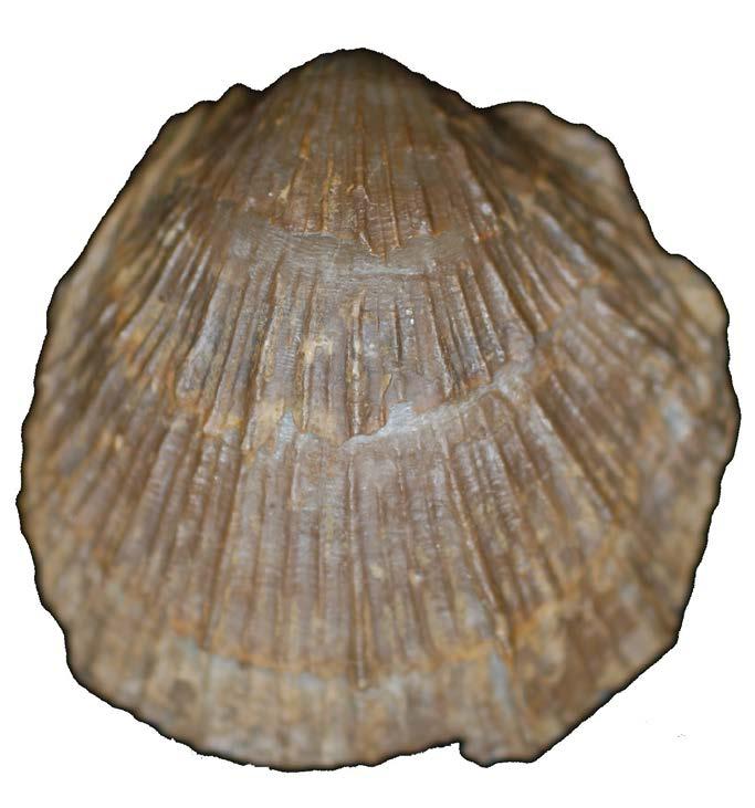
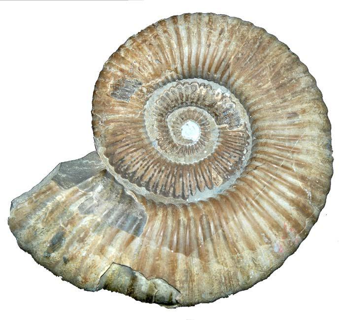
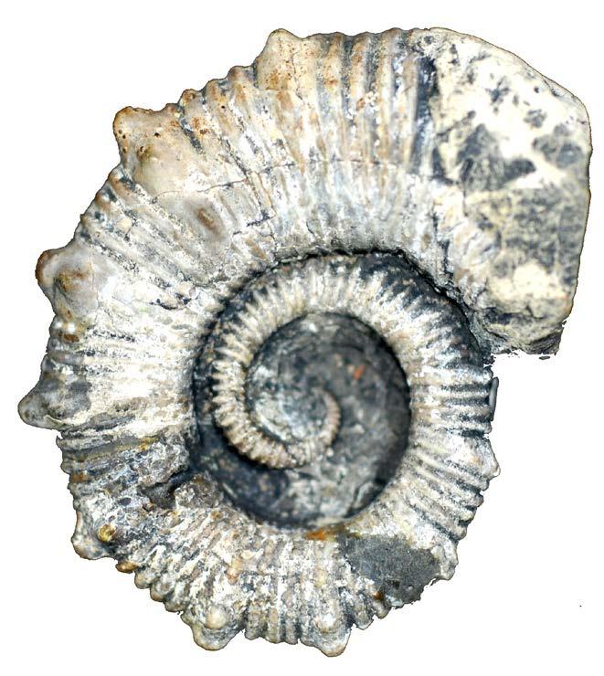
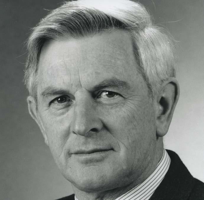
In the spirit of reconciliation, the Geological Society of Australia acknowledges the Traditional Owners of Country throughout Australia and their connections to land, sea and community. We pay our respect to Elders p ast and present and extend that respect to all Aboriginal and Torres Strait Islander readers of TAG . This magazine was produced on the lands of the Kulin Nation, Larrakia and Birpai Countries.
We are committed to fostering a diverse, equitable, and inclusive geoscience community where every geoscientist can thrive.
What do geoscientists need to know about physical, psychosocial and cyber
Learn about the geological and heritage wonders of the Eastern Goldfields of WA
WALKING TOGETHER
Hiking the Larapinta Trail for reconciliation and STEM equity
AJES AUTHOR PROFILES
John Clemens and Jun Cowan share insights into their recent work in AJES
MARINE MACROINVERTEBRATE CHECKLIST
A new manuscript cataloguing Australia’s Mesozoic marine life
Publishing Details
ISSUE 215, OCTOBER 2025
Registered by Australia Post
Publication No. 100010917
ISSN 0312 4711
EDITOR IN CHIEF
Sandra McLaren
DESIGN & TYPESETTING
Sarah Jackson
PRODUCTION MANAGER
Amber Jarrett
PRINTED BY
CMYK Colour Online
DISTRIBUTED BY
The Pack Factory, Sydney
CENTRAL BUSINESS OFFICE
PO Box 576, Crows Nest NSW 1585
Email: info@gsa.org.au
Web: www.gsa.org.au
Phone: (02) 9160 8193
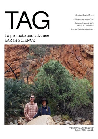
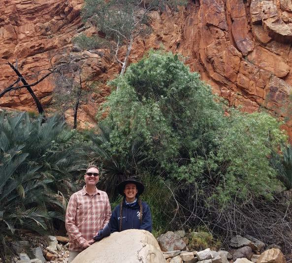
COVER IMAGE
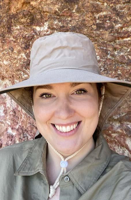
Keegan McGuffie and Nathan Daczko on the Larapinta trail
Photo: Supplied
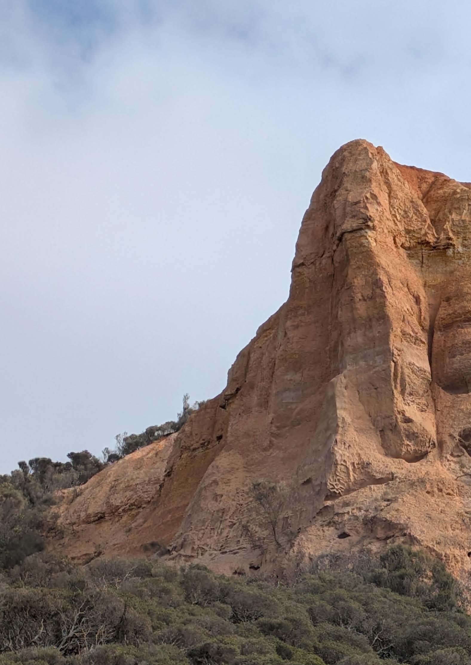
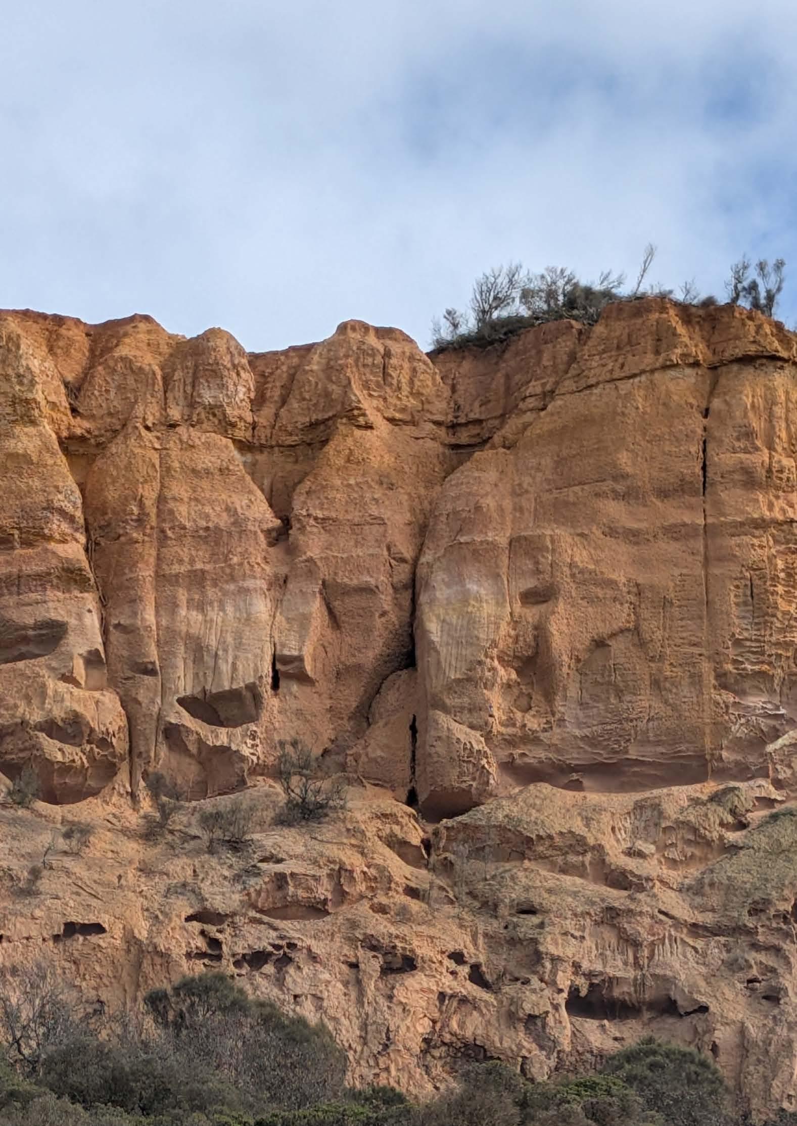
INSIDE COVER IMAGE
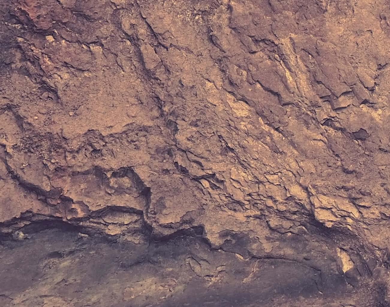
Cliff face view at Point Addis, along The Great Ocean Road, Victoria
Photo: Sarah Jackson
BACK PAGE IMAGE
The Larapinta trail
Photo: Supplied
GENERAL NOTES
The Geological Society of Australia (GSA) is a community that promotes and advances Earth Science across all disciplines, recognising its vital role in understanding, sustaining, and improving the world around us.
The Australian Geologist (TAG) is a quarterly member magazine that includes society news, conference details, special reports, feature articles, book reviews and other items of interest to Earth Scientists. Each issue has a long shelf-life and is read by more than 3,000 geologists, geophysicists, paleontologists, hydrologists, geochemists, cartographers and geoscience educators from Australia and around the world.
SUBMISSIONS
TAG can no longer guarantee acceptance of complete articles without prior notice. Instead, we encourage members to send in their ideas and work with editors to produce new content. If you’d like to get involved, please email tag@gsa.org.au. Artwork must be high resolution 300 dpi or larger.
COPYRIGHT
The Publication is copyright by the GSA Inc unless specifically stated otherwise. However, material in this issue may be used provided acknowledgement is made. Every effort has been made to trace and acknowledge copyright holders of material in this publication. If any rights have been omitted, apologies are offered.
The GSA is a learned society and TAG is published by the Society to provide information for members and as a forum for the expression of their professional interests and opinions. Observations, interpretations and opinions published herein are the responsibility of the contributors and are not necessarily supported by the GSA.
The GSA has taken all reasonable precautions and made all reasonable efforts to ensure the accuracy of material contained in this publication, and makes no warranties, expressed or implied with respect to any of the material contained herein.
BUSINESS CORRESPONDENCE
All business enquiries and correspondence relating to advertising space, inserts and/or subscription matters, should be sent to tag@ gsa.org.au.
THE COUNTDOWN IS ON
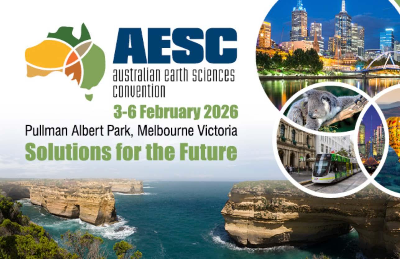
Overlooking picturesque Albert Park, AESC 2026 will deliver a scientific program across the broad spectrum of Earth Sciences. This will be a pro-active and vision-driven program for the growing global interest in solving humanity’s biggest challenges, such as transitioning to a renewable and sustainable energy future, grappling with Big Data and AI in geoscience, food/water security, enhancing intersectional research across sectors (academia, government and industry/commerce), and much more. We will further include emerging and maturing research at the crossroads of Geoscience and other fields, e.g. space research, Archaeological Sciences, Engineering, IT and beyond.
“ This is your opportunity to contribute to shaping the future of Earth sciences. We’re looking for bold ideas, fresh perspectives, and real-world solutions.
”
ANDY TOMKINS CONFERENCE CHAIR
KEY DATES
Scholarship Nominations Close – Friday 3 October 2025
Author Notifications – Thursday 23 October 2025
Early Bird Registration Ends – Friday 17 October 2025
Presenter Deadline to Register – Friday 7 November 2025
AESC 2026: 3 – 6 February 2026
VISIT THE WEBSITE
PROGRAM THEMES
WHY MELBOURNE?
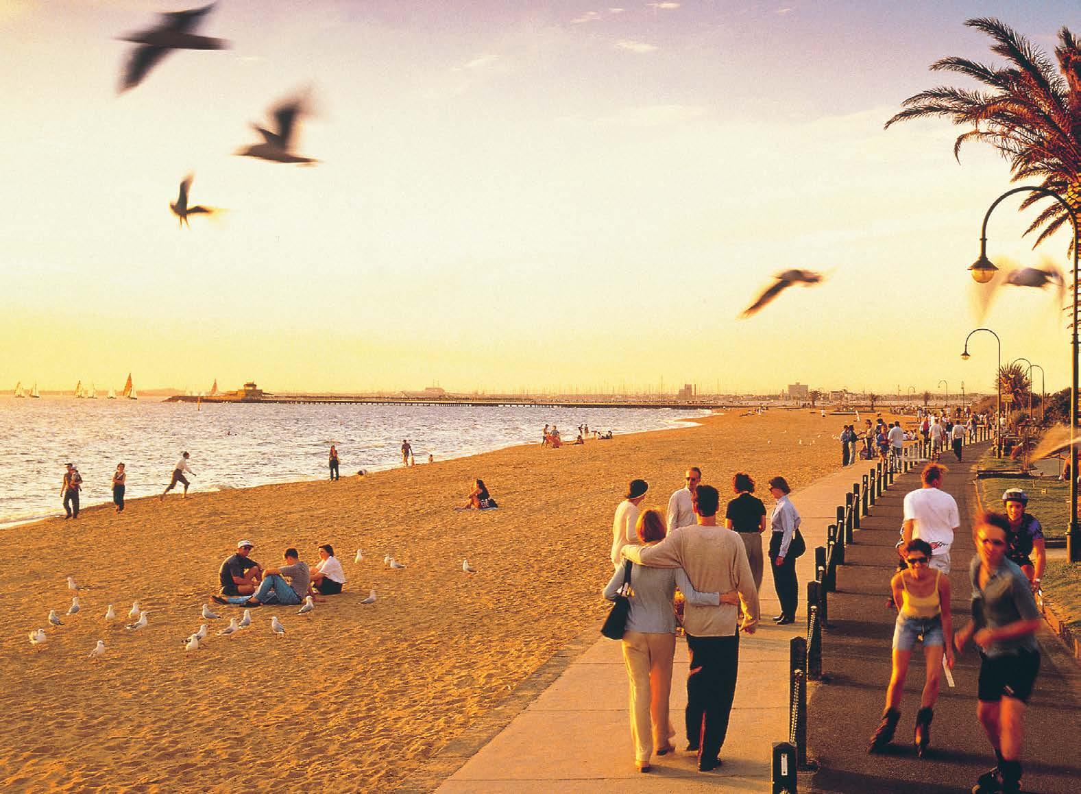
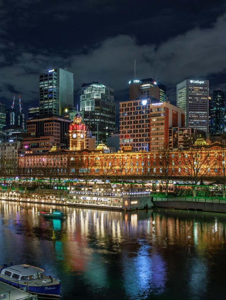
Melbourne is Australia’s unrivalled capital of sport, culture, entertainment and style.
A packed agenda of food, wine, sports and arts is your introduction to the best of Melbourne – from its creative, exciting city centre to its buzzing neighbourhood hubs. It’s the gateway to Victoria’s world-class wineries, natural springs, peninsulas, spectacular coastline and alpine villages, making it the ideal destination for easy access
PROGRAM THEMES
1. Understanding Earth Systems for a Changing Planet
1a. Symposium: Plate Tectonics and other Earth Systems: Alan Collins
1b. Symposium: ARGA Regolith and the Earth’s Surface: Leah Lynham
1c. Symposium: SGGMP, LAVA Technical developments
to pre- and post-convention touring.
Melbourne has a renowned passion for social eating and drinking, which is reflected in the thousands of restaurants serving up gastronomic experiences from around the world. Everywhere you will uncover a vast array of fashionable cafes, where you can enjoy Melbourne’s existential coffee and cafe culture to the fullest.
in geochemistry, mineralogy, volcanology, petrography and data interrogation: Teresa Ubide
Themes relate to Earth’s dynamic systems—from core to climate—and their role in navigating environmental and planetary challenges.
2. SGEG Innovating for a Sustainable Resource Future
2a. Symposium: Copper Ore Deposits and Mining:
2b. Symposium: Gold:
2c. Symposium: Critical Minerals: Carl Spandler
2d. Symposium: Uranium, Ores, Mining and Marketing:
A recurring focus on critical minerals, secondary resources, and energy transitions reflects geoscience’s evolving contribution to sustainable development.
3. Harnessing Technology for Next-Generation Geoscience
The integration of digital tools, big data, machine learning, and advanced instrumentation is emphasised to enhance scientific discovery and decision-making.
4. SGPG Extraterrestrial and Planetary Geoscience: Andy Tomkins
Reaching beyond planet Earth to understand it’s source, history and evolution, that of our Solar System and beyond
5. EOSG Geoscience at the Interface of Society and Culture
5a. Symposium: Society and Geoscience: Sabin Zahirovic
SECURE YOUR SPONSORSHIP
AESC 2026 offers exciting sponsorship and exhibition opportunities to engage with influential earth scientists, researchers, policymakers, and industry professionals.
Whether you’re showcasing new technologies, building brand awareness, or supporting the geoscience community, our tailored packages will help your organisation stand out. Sponsors and exhibitors will benefit from high-visibility branding across digital and onsite materials, exclusive access to decision-makers, opportunities to engage directly with delegates through exhibitions and networking events, and alignment with a globally respected scientific community.
To discuss sponsorship and exhibition opportunities, please contact: sponsorship@aescgsa.com.au
5b. UpGoer5 at the AESC: Myra Keep
Harnessing geoscience concepts and geo-analytics in cross-sector applications including (but not limited to) Archaeological Science, Modern and Paleo Forensics, Health & Medicine, Agricultural Science and Food Security
6. Palaeontology, Biomarkers, Biogeochemistry and Evolutionary Biology
Topics include geoethics, Indigenous sciences, geoheritage, and geotourism, underscoring the relevance of geoscience in ethical, cultural, and social domains.
7. Intersectional Geoscience in Agriculture Food/ Water Security, Archaeological Science, Forensics and Beyond
8. Resilience and Risk in a Volatile World
Themes on geohazards, water security, and environmental science illustrate the role of geoscience in mitigating natural risks and supporting adaptive capacity.
9. Building Capacity and Inclusivity in the Geosciences
There’s a clear commitment to diversity, outreach, education, and inspiring future geoscientists as key to shaping a forward-looking and inclusive discipline.
PLATINUM SPONSOR HOST ORGANISATION
CONVENTION SECRETARIAT
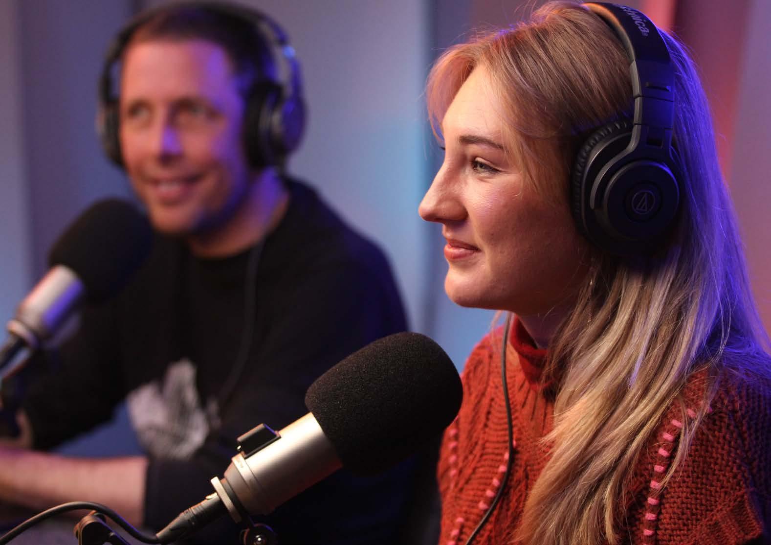
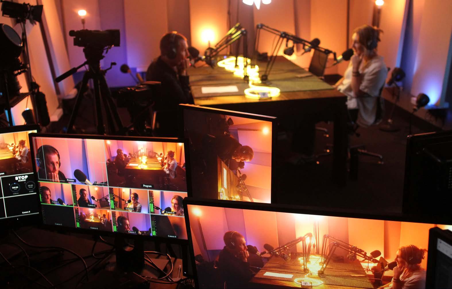
WONDER PODCAST BY GEOCO
A JOURNEY INTO THE EARTH SCIENCES
The feeling of wonder is an innate component of our lives as Earth scientists. Stories about the planet offer precious perspectives that are essential for prosperous human futures. But surprisingly (or not), the science is usually the easy part.
Instead, it is in the commons , places where society gathers to listen to stories, that people’s attention is transformed into interest and action. The commons are wherever there are crowds, culture, and conversation. In the commons, impactful communication evokes emotional connection and curiosity.
For most tertiary-educated Earth scientists, curiosity and connection come from science alone and we enthusiastically share that connection with one another (think conferences, water coolers and LinkedIn).
But these places are not the commons and many will agree that Earth Sciences lack engaging storytelling in cultural places.
We’re reminded of the adage that ‘ civilisation exists by geological consent, subject to change without notice ’. Even though today’s world is defined by colossal and
complex Anthropocene moments, accompanying geological translations in the commons are strikingly absent.
As Earth scientists we are privileged to know and understand how Earth systems weave the human web. These perspectives are precious. They invite spectacular curiosity. Our science is essential to prosperous human habitation of Earth because it comprises the greatest narration of all: how our teeming, living planet makes sense of itself. Wonder podcast is our homage to that narration, and a public invitation for everyone to join a spectacular journey into the Earth Sciences.
WONDER x GSA COLLABORATION
Wonder podcast is produced by GeoCo, a science media company dedicated to curating, producing, and publishing stories about Earth. Wonder podcast is our first major activity. As co-hosts we have developed an idiosyncratic collaboration that spans gender and career stage to create a dynamic that offers unique points of connection for new and existing audiences to engage with the show.
Since our pilot in 2023, we’ve released over 40 episodes of Wonder and engaged an incredible demographic. We have a strong listenership across all Australian states, over half of our streaming audience is 18–34 years old, with a remarkable 50:50 balance of male and female listeners. We also recently surpassed 20,000 views on YouTube from our rapidly growing international community, and our Instagram content has received well over 90,000 views.
In 2025, Wonder has been privileged to have the support of the GSA that has allowed us to focus on the wonder of the Australian continent. Under this collaboration we’ve published episodes in conversation with Steve Hill (Chief Scientist of Geoscience Australia), Caroline Eakin (ANU) and Sabin Zahirovic (University of Sydney); together we are storytelling the deep time and deep Earth aspects of Australia, as well as the evolution of our incredible living landscapes and their distinct ecosystems. There are so many more special conversations to come thanks to the GSA’s support. We are thrilled to curate these incredible Australian stories with our very own Earth Science community.
AN INVITATION
We invite GSA members who believe in the need to improve the standing of our discipline to support the podcast, by liking, sharing and subscribing. As the community of people interested in Earth Science content grows, social media algorithms will share the content more widely, reaching more curious people who seek authoritative, entertaining stories about Earth and its wonderful community of geoscientists.
Access the podcast through the GeoCo website via the QR code below, as well as social media and all major podcast platforms.
HOLLY COOKE
GeoCo and Wonder podcast co-founder, University of Adelaide PhD student
ANTHONY REID
Wonder podcast co-founder, Head of Geology, Fleet Space Technologies
Letter from the Editor
A very warm welcome to Issue 215 of TAG. I’m thrilled to have taken up the role of Editor of this, our flagship GSA member-driven publication.
Before introducing myself, I’d like to acknowledge and thank Athina Mallis, Anthea Batsakis and Emma Berthold for their contributions – together with our amazing past-President Amber Jarrett – to bringing the new-look TAG to print over the past year. I’m also very grateful for Amber’s ongoing stewardship and for having faith in me to step into the ‘TAG team’.
I’m a geologist, Institute of Professional Editors (IPEd) Accredited Editor, Mum to two daughters, novice potter, struggling pilates student and proud
ex-patriate South Australian. I’m currently living and working in Naarm / Melbourne on Wurundjeri Country.
My association with GSA dates to 1995 when I first joined the society as a thirdyear undergraduate geology student at the University of Adelaide. In 2022 I was honoured with Distinguished Fellow status of the society and in 2023 I received the GSA Beryl Nashar Award. As our peak professional body, the GSA plays a key role in our discipline and makes increasingly meaningful contributions to the work of members and across a range of sectors from exploration to education and outreach.
The written word is powerful and enduring. I enjoy guiding others to
make their writing a joy to read. A common thread through my career has been a motivation to share stories of the extraordinary and fascinating breadth of the Earth Sciences, both within and outside our discipline. TAG is an ideal vehicle for this.
As I settle into the role, I’m looking forward to renewing my friendship with many across the GSA, to meeting new friends and colleagues, and to supporting our contributors to tell their stories as we work on TAG together.
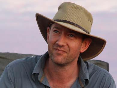
SANDRA McLAREN Editor in Chief
Photo: Supplied
Letter from the past President
October is National Safe Work Month, and it reminds us that safety isn’t just about steel caps and safety signage. It’s about people. The 2025 GSA member survey reinforced that message. Members told us that feeling safe, respected and included is central to belonging in the GSA. For a society run by members, for members, I have always said that culture and care aren’t extras – it is what makes us strong.
This issue of TAG brings you articles on psychosocial, physical and cyber safety. We have made real progress on psychosocial safety over the past two years, consulting widely and developing a strategy to embed respect and inclusion across our committees, field trips and events. But we know there’s
more to do. Members have asked us to strengthen our approach to physical safety in the field and we are seeing unfortunate reminders that we all need to take cyber safety seriously as our work becomes more digital. This issue shares a few practical ways to do just that.
The GSA member survey also reminded us to keep people at the centre of everything — simplifying governance, offering more professional development, and creating more opportunities for industry and regional members to engage. The new Governing Council has already started acting on these priorities, and I look forward to seeing how the team progress our Society.
Celebrating Our New Secretary: Jo Miles
Hi, I’m Jo, a geologist by training and a big fan of all things geoscience. Over the years, my work has taken me from the field to the lab, from the Mediterranean to the Arctic, and now into a national role as a GSA Governing Councillor and Secretary.
What’s always kept me interested in geology is that it’s never just about the rocks – it’s about the processes, environments, and change that shapes them. These pieces of the puzzle come together to tell a story, often one that spans timescales and complexities. Whether I’m working in gold systems, remote sensing, or with geoscience communities, I enjoy exploring the connections between disciplines,
people, and ideas to build a bigger picture.
I currently serve as Secretary for both the WA and Central Divisions of the GSA, which keeps me on my toes but also gives me a great sense of what’s happening across our membership.
I’m a strong advocate for collaboration, curiosity, and supporting early-career geoscientists. One of my key priorities is strengthening the connections between the Governing Council, Divisions, and Specialist Groups, so we can work more effectively together and better support the broader geoscience community.
Looking ahead, I am excited for the Australian Earth Sciences Convention in Melbourne next February. AESC is where our community connects and ideas spark through conversations, posters, and plenaries that inspire new ways of thinking. If you’re coming, bring someone new along or meet someone new. If you’re not yet registered, please consider this your invitation.
See you at AESC, and stay safe in every sense.
AMBER JARRETT Past President
Photo: Supplied Photo:
Celebrating new Governing Councillors
Marissa Betts Alan Collins
Whether I describe myself as a palaeontologist, or a geologist, or a sedimentologist or a stratigrapher or anything else, mostly depends on the research questions I’m thinking about at the time. My research roots are in the multi-proxy work of timescale building and correlation (i.e. biostratigraphy, chemostratigraphy, radiometric dating), focusing on the early Cambrian (I am currently also serving as the Secretary for the International Subcommission on Cambrian Stratigraphy). From defining geological time, I have branched out into many other areas, my favourites being sedimentology in carbonate and siliciclastic systems, and the mysteries of early Palaeozoic palaeobiogeography and tectonics.
Earth science really has something for everyone and there are discoveries to be made everywhere, whether it’s in the field, in a museum drawer, in a spreadsheet or computer program, using high-tech equipment or a hammer and a hand lens. Earth science is about understanding the deep history and future of planet we live on and is at the centre of solving some of humanity’s foremost challenges. Because diversity breeds innovation, elevating the participation of women and underrepresented groups in Earth science is critical for meeting these challenges.
Earth science is a dynamic discipline that is continuously evolving. Hence, we need to make sure that perceptions of our science accord with the reality of what it is that we do, what motivates us, and what we can offer.
I am honoured to be serving on the GSA Governing Council over this next term and am looking forward to working with the team to promote our discipline and tackle key issues facing Australian Earth science.
MARISSA BETTS
I’m Alan Collins, a proud new member of the Governing Council. I’m a Fellow of the GSA and have been a member ever since I first came to Australia in 1999. The Geological Society of Australia is the peak body for earth sciences in the country and has always been a place where people who love geology can get together, talk all things geology, learn from each other and share the wonder and marvel of the planet with the wider community, be they students, school kids or the interested member of the public. I’ve been a long-time member of the South Australian Division and past chairperson, but I’m really looking forward to doing my bit nationally, ensuring that the GSA remains the key society for earth science promotion and support of the subject through Divisions, Specialist Groups and the wonderful Australian Earth Sciences Convention. See you in Melbourne in 2026!
ALAN COLLINS
Photo: Supplied
Photo: Supplied
We are the GSA: Insights from the 2025 Member Survey
What makes a professional society thrive? It’s the people. At the GSA, we are a member-led Society and our members shape who we are and where we go next.
The GSA Decadal Plan sets a clear direction: To build and maintain a strong, collaborative community that reflects the breadth of Australian geoscience, diverse in expertise, culture and demographics, and measure our progress over time. That’s why we began a member survey program in 2022 to understand who is in our community and how well we are serving them. This year, we kept those foundation questions for continuity and added direct questions about what the Society is doing well and where we need to step up.
This year’s survey drew responses from 57 members. It’s a small slice of our community, so we’re careful not to over-generalise, but the responses still offer useful signals: what members value, where friction shows up, and where effort will have outsized impact. The insights summarised here will sit alongside action and we encourage all members to get involved to help shape the path ahead.
As always, we want this to be a conversation. We invite your reflections and ideas by sending a Letter to the Editor for the next edition of TAG. Email the team at: tag@gsa.org.au
What we asked to understand our community
To build a picture of who’s in the GSA, and how people feel about the GSA, the survey asked about:
Age, gender, career stage, qualification and employer type
Aboriginal and/or Torres Strait Islander origin and cultural identity (aligned to Census descriptors)
Languages spoken at home
LGBTIQIA+ identity, caring responsibilities, and disability or accessibility needs
Perceptions of safety, respect and fairness within the GSA community
What the GSA is doing well and practical steps on how we can improve. These questions let us look beyond headcounts and into lived experience.
What we heard
Members told us they value:
Support for geoscience education, especially through grants, field trips and opportunities for students and early-career geoscientists.
High-quality publications and communication, including TAG and the Australian Journal of Earth Sciences.
Advocacy and outreach, from public talks to partnerships that promote Earth sciences across Australia.
Community and networking, through conferences, Division events and specialist groups.
But the survey also provided suggestions on areas we can improve:
Engagement with the minerals industry and more representation of industry geoscientists in our activities.
Professional development opportunities beyond academia, such as short courses and regional field trips.
Inclusivity and culture, with some members expressing concerns about safety, respect and fairness in some pockets in the Society. These are issues we must address urgently (and I encourage anyone to dissuss issues with us).
Simpler governance and communication, especially for members who prefer non-digital engagement.
How the Governing Council will respond
The Governing Council (GC) has taken this feedback seriously. Several actions and priorities address some of the concerns raised:
Promoting inclusivity and safety: The Safety and Culture Standing Committee prioritises activities relating to the GSA’s psychological safety and culture and that the GSA is welcoming for all. The anonymous reporting inbox via safety@gsa.org.au ensures the GC quickly acts on all reportable instances ensuring confidentiality.
Expanding professional development: Divisions, Specialist Groups and the Early Career Geoscientist Advisory Panel (ECGAP) can investigate new opportunities for professional development. Feedback on practical training and industry relevance will be taken on board.
Simplifying governance: The GC is reviewing structures and finances to make life easier for volunteers and improve transparency.
Strengthening outreach: The role of the Geocommunication Standing Committee is to better showcase the role of geoscience in sustainability, and to revamp our website for easier access.
Supporting events: The Conferences Standing Committee will back Divisions and Specialist Groups to deliver local events, while also ensuring the AESC remains our flagship gathering.
And yes, we will be running the survey again in 2025/26 with incentives (including a free membership and a $100 VISA gift card) to boost participation.
Why this matters
The GSA exists for its members. By letting us know your experiences, both the positives and practical ways to address challenges, we can take meaningful steps to improve together.
The results show us that members want to be part of a Society that is thriving and engaging. That means we all need to be working together. We invite everyone to be more involved if you can – this could mean attending a local event or symposium, sending in a letter or photo to TAG, joining a committee or simply sharing your perspectives when the next survey comes around. Together, we can continue to build a society that reflects the diversity, expertise and passion of Australian geoscience.
AMBER JARRETT
NEWS FROM THE DIVISIONS
Putting the rocks into rock climbing in the Canberra region: Science Week success for the ACT Division
Have you ever wondered where rock climbers go in the cold winter months? In the ACT they commonly meet up on a Thursday evening at the BlocHaus climbing walls at Fyshwick. A fantastic facility where you can usually find over one hundred climbers testing their fitness and strength on numerous artificial climbing walls.
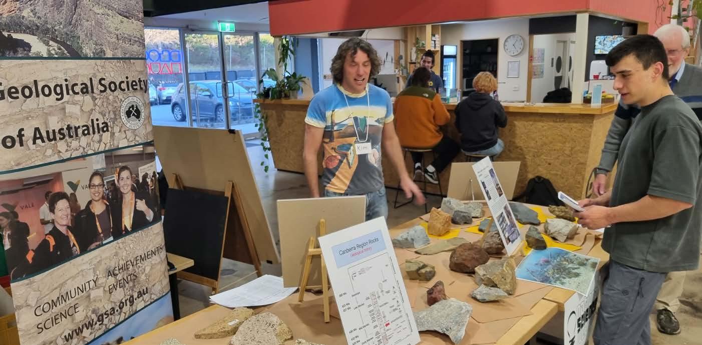
For Science Week 2025 the GSA ACT Division decided to join the climbers for an innovative pop-up education session about the geology of the Canberra region. Members put together a display of rock samples from the Canberra region that climbers may encounter at their favourite summer climbing locations along the Brindabella Ranges and in other parts of the ACT.
Over 100 climbers engaged with the display, sparking lively discussions particularly around the rock specimens, especially those containing fossils! The event also offered an excellent platform to showcase the GSA to the broader ACT community, with several attendees admitting that they had not heard of the organisation before but were interested
to learn about it and were thoroughly appreciative of the educational outreach provided by the event. Self-guided tour booklet guides to ACT geology were provided freely to the public and were received with much enthusiasm. It was great to see moments of wonder as participants realised just how much there was to know about what lies beneath their feet.
This was a great opportunity for GSA member Doug Finlayson to show off his collection of many hand samples from around the ACT acquired over many years of bushwalking. One table of rock samples demonstrated the variety of granite plutons around the ACT from the Murrumbidgee and Bega Batholiths. Around the Eastern Lachlan Orogen, about 36% of basement rock outcrop comprises igneous rocks with a variety of chemical compositions, predominantly of I-type and S-type. Another table had samples of the many other rock types from around ACT, most notably, sandstones, limestones, mudstones, siltstones, conglomerates, rhyodacite, hornfels, gossan, ignimbrites, marble, shale, slate and others.
GSA members also talked to climbers about the rocks underlying the BlocHaus climbing walls. Drilling completed for engineering purposes during construction of the buildings revealed limestones of the Canberra Formation. These limestones were formed during Early Silurian times about 420 Ma when this part of Australia, as part of Gondwana, was at equatorial latitudes in warm shallow waters. Excellent fossil specimens in the drill cores include corals, crinoids and brachiopods. Nonfossiliferous outcrops of the Canberra Formation limestones can be seen around the Australian National Museum on Acton Peninsula.
A big thank you to BlocHaus Bouldering for hosting us, and to The Australian National University, on behalf of Inspiring Australia ACT, for providing an ACT National Science Week grant to cover production costs.
DOUG FINLAYSON CALEB BISHOP
Photo: Supplied
Tasmanian Division
The Tasmanian Division has recently heard some fascinating talks on a breadth of topics. These have included Ron Berry’s discussion on the Eastern Margin of the West Tasmania terrane in July and Jodi Fox’s presentation on recent fieldwork, including new photogrammetry and sampling for geochronology, from the Gaussberg volcano, the only known volcano in East Antarctica.
A successful AGM was held in June and included presentations to student prize winners and the recognition of the efforts of Phil Sansom and Clive Calver in organising and running enjoyable and successful division field trips.
The AGM also marked a change the committee membership and roles within the division. After 6 years at the helm, Karin Orth stepped down as Chair and Jodi Fox stepped into the role. Karin took the opportunity to reflect on the work of the division over the past 6 years, noting 42 ordinary monthly meetings, 3 film nights, 4 student-focused events (including ‘You can’t ask that’ sessions), a community/family picnic, workshops, field trips and social events. Other highlights included the establishment of a divisional website and social media accounts as well as revitalisation of the member newsletter. Karin also recalled the award of the WH Twelvetrees Medal to 5 long-term contributors to geoscientific knowledge of Tasmania
as well as an afternoon tea event to recognise the important contributions of Tasmania’s pioneering female mapping geologists, Jean McClenaghan and Sib Corbett.
Karin thanked all the members of the divisional committees over the last 6 years for their generous volunteering, suggestions, enthusiasm and work to bring the best to GSA Tasmania members and all the members who participated in the many events. Karin’s efforts were acknowledged with a parting gift presented by Grace Cumming. The GSA National Committee joins the Tasmanian Division members in acknowledging Karin’s fantastic contributions to the society.
Reminder of the upcoming Tasmanian Geoscience Forum
Join the AusIMM Tasmania Branch, GSA, AIG and Mineral Resources Tasmania for the 15th Geoscience Forum to be held in Queenstown
DATE Thursday 27th of November 2025
VENUE Paragon Theatre, Queenstown Tasmania
For registration and more information:
Specialist Group in Economic Geology (SGEG)
The turn into a new financial year is always a good time to reflect on any organisation’s activities, both past achievements and current or future goals.
The SGEG and its members continue to focus on two important goals: active engagement in promoting geoscience education, and sustained support for students and early career geoscientists.
Looking back at some of the highlights, we see the sustained efforts the SGEG have been putting into these priorities. These include:
• The ongoing facets of exploration webinar series, available via the GSA YouTube channel and the QR code below.
• Providing opportunities to connect students with industry professionals and
to learn and network. One way we’ve been doing this is by representation at the GSA Careers night. Well done to committee member Aeshah Rafeeque for her help in this event and for ongoing promotional efforts.
• Our copper focussed workshop (held in conjunction with the Centre for Exploration Targeting at the University of Western Australia) where a packed lecture theatre was treated to an outstanding lineup of industry stars speaking about everything from the economics of copper to the mineral systems that generate the critical deposits. Many thanks to SGEG committee member Wally Witt for outstanding work pulling this together.
The coming financial year looks like it’s going to be another bumper one for SGEG members. We have already had
representation at the August SEG ‘Industry Night’ and have lots of exciting webinars in progress as well short courses and conference contributions - including big plans for the upcoming AESC in Melbourne.
And for those who aren’t members yet - a large percentage of geoscientists work in industry - the SGEG is one of the most cost-effective and industry-focused tools at your disposal, I highly recommend joining and getting access to all the great work the SGEG and GSA are doing.
I look forward to the continued growth and sharing more of the contributions of the SGEG in the coming financial year.
DON SMITH Chair
Australasian Palaeontologists
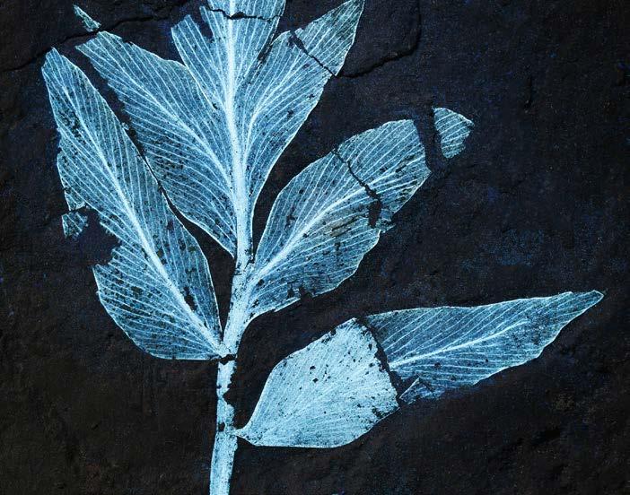
The recent inaugural Australasian Palaeontologists 2025 Fossil Photo Competition was a great success, with many fascinating entries from across the membership.
David Summerhayes is congratulated for being awarded both First Prize and the People’s Choice award for the image Komlopteris cenozoicus, a seed fern that
outlived its Mesozoic relatives by millions of years. UV light revealed its fine venation and glands, providing detail that allows the lineage to be traced into the Jurassic. This ~ 50–53 million-year-old fossil was found in the Macquarie Harbour Formation, Timkarik region, Lutruwita (western Tasmania).
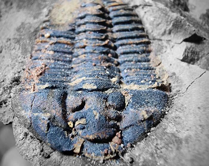
Congratulations also to Lucinda Hook for being awarded Second Prize for her photo
of the trilobite Prophalaron. Prophalaron is a newly identified genus of trilobite belonging to the family Calymenidae. It was discovered in the Late Ordovician Gunningbland Formation, Gunningbland, New South Wales, Australia, Wiradjuri Country. Specimen is 4cm long.
Thanks to all who submitted their photos!
The specialist group also warmly invite palaeontologists from across the Australasian region to join a new Community of Practice focused on building respectful, collaborative partnerships with Traditional Owners and Tangata Whenua. This initiative is being led by a group of volunteers with the goal of establishing an ongoing Community of Practice for the wider Australasian palaeontological community. Researchers of all experience levels in working alongside First Nations communities are welcome. For more information contact Corinne at corinne.mensforth@flinders.edu.au.
A new publication on geological provinces and tectonic cycles in NSW
Quarterly Note 158 is a distillation of previous geological studies in NSW and forms a high-level summary of the geological history of NSW. The document also helps to improve understanding of how the NSW Seamless Geology dataset is organised.
The note was released in June at the Geological Survey of NSW’s symposium to mark its 150th anniversary.
Along with NSW Seamless Geology, it will underpin future updates of the geological history of NSW and associated products such as time-space plots, and metamorphic, igneous, structural and mineralisation histories.
Quarterly Note 158 is available via the QR code below.
Prophalaoron jonesi. Late Ordovician Gunningbland. NSW Australia
Photo: Supplied
Conference double-header for the Specialist Group in Planetary Geoscience and Geodynamics (SGPGG)
In July, Boorloo/Perth and Curtin University welcomed over 300 delegates from the global planetary science community to host two major international conferences: the 12th triennial Meteoroids meeting and the 87th Annual Meeting of the Meteoritical Society (MetSoc).
Together, the back-to-back conferences told the story of meteorites all the way from space, through the atmosphere, into the sample bags and into the lab.
Meteoroids opened the fortnight with discussions of meteor origins and associated phenomena, including observational techniques, dynamics and evolution, ablation physics, and
planetary defence. Tours of the worldclass John de Laeter Centre (JdLC) and Pawsey supercomputing facility were also offered. In true Perth fashion, wild weather from the first two days cleared on the Wednesday and allowed delegates to head out onto the Swan River for an afternoon of (semi-competitive) sailing, before gathering in the Origins gallery of the WA Museum Boola Bardip for a banquet dinner among one of the world’s largest meteorite collections.
The focus then shifted from the sky to the lab, with MetSoc discussions focusing on the analysis of material from both meteorites and sample-return missions, meteorite recoveries, impact cratering,
solar system evolution, and even a special ‘Australiana’ session. The conference opened with a moving public lecture from Distinguished Professor Phil Bland on the ‘Consolations of Science’, and mid-week tours showcased the JdLC and WA Museum meteorite collection. The socialising continued with a dinner at Fraser’s Restaurant overlooking the Perth skyline.
The two weeks were capped off by a postconference field trip to the world’s oldest recognised impact structure, the 70 km wide Yarrabubba impact crater in central WA – perfect for a mix of stargazing and socialising around the campfire.
MICHAEL FRAZER
Australian Regolith Geoscientists Alliance (ARGA)
At the recent AGM, Members of ARGA were excited to welcome their new 2025/26 committee: Anna Petts (Chair), Leah Lynham (Secretary), John Keeling (Treasurer), Ian Roach (webmaster), Nadir De Souza Kovacs (Newsletter Editor), Owen Missen (Symposium Coordinator and general committee member) and Savannah McGuirk and Marcus Wilson (general committee members).
The ARGA specialist group are busy planning for their AGRA Symposium, to be held in conjunction with the upcoming AESC in Melbourne in February 2026. The
symposium will feature keynote speakers, the presentation of society awards and the group’s AGM and informal dinner. Bursaries to support attendance are available for student and early to mid-career AGRA members with more information available from the secretary (secretary@regolith. org.au).
The committee is also busy with a special regolith issue of AJES. Contributions are invited and those interested in sharing their work in the volume are encouraged to contact the committee.
ARGA YouTube Channel
Be sure to check out the ARGA YouTube channel for all the latest group webinars. Recent presentations by Tobias Bamforth (Monash University) and Richard Lily (University of Adelaide) are now available as well as a back catalogue of technical talks.
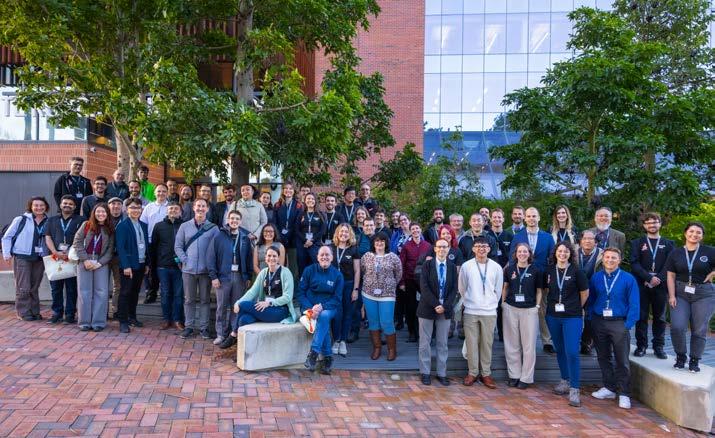
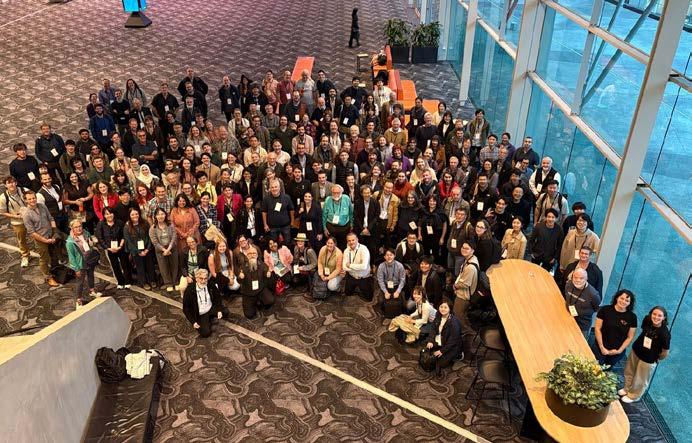
Group photos from Meteoroids (left) on Curtin University campus, and MetSoc (right) at the Perth Convention and Exhibition Centre.
TAG early career geologist profile David Fowler
Tell us a bit about your current role
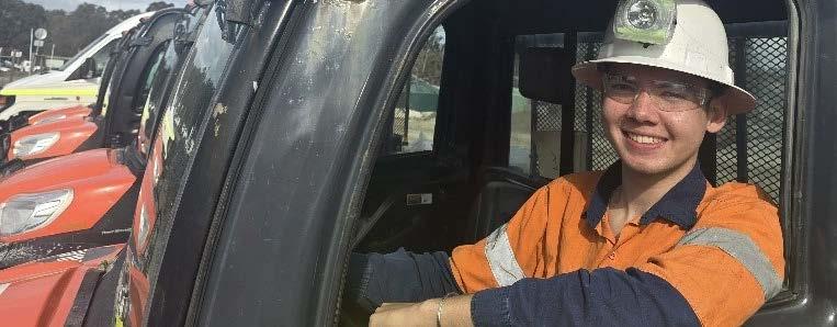
My current role is a mine geologist at Costerfield, a high-grade underground gold and antimony mine. I quite enjoy the role as it is a good split of going underground to collect samples, which is more physical, and staying in the office, which uses more brain power. Day-today, I would analyze face and drill core samples, create and work on geological models (using software such as leapfrog) and work closely with engineers to optimize ore recovery, while minimizing dilution. The role is quite multidisciplinary as it involves a bit of every field, and every day is different.
What other roles have you had before your current job?
Before my current role, I was a graduate geologist at the same company. During my graduate program, I got to experience both mine and exploration geology. This not only helped me get a better understanding of the operation, but of the processes and the industry as a whole. Before my career in Earth sciences, I actually worked in retail and childcare!
What was your motivation to study Earth science? Was it something you’d always thought about or was it something you discovered along the way?
When I was little, Earth sciences never really crossed my mind, but I had the thought of pursuing it as a career when my family moved to Brunei Darussalam, where oil and gas made up over 50% of the GDP. I suppose the passion was sparked by being surrounded by the industry. I really love what I do now and have no regrets choosing a career in this field. It has really expanded my world view.
What do you love about working as an Earth scientist?
Variety is what I love the most. Although I am currently in mining, an Earth scientist can end up in any sector, such as construction, education or government. Even within mining, there is so much variety as every deposit is unique and its a global workplace! Last year, I had the opportunity to work in Sweden on a work exchange and it was a blast.
Describe a challenge you’ve faced in your career so far and how you approached solving it
This is a tough question! One of the challenges I had to overcome in this career would be all the big decisions (or what seemed like big decisions at the time) that I had to make on the fly. The mining industry is quite fast paced; time is money. When I first started, I was rather
timid and often second-guessed my own decisions. I got over this by leaning into it and backing myself more. I trusted my own knowledge, experience and skills, and the process.
Do you have any career plans from here? At this stage, the next position up would be a Senior Mine Geologist. I got a taste of this role when I had to cover for my senior for several months. It was a challenge but I quite enjoyed the people and management aspect of the role. Despite this I’m probably still too young to do this role full time at most sites. The next move might be to experience a different deposit, maybe interstate or overseas. Perhaps zinc, copper or iron.
If you had to have a PR role, what catch phrase would you suggest to promote Earth science as a career or study choice? “Earth Science: Understanding the planet is cooler than just living on it”
What wins for you? Rock, mineral, fossil or structure?
For me, I’d have to go with minerals. My favourite are the two jade minerals, nephrite and jadeite. Not only interesting geologically, I’m also fascinated by how timeless jade is, being a significant part of both ancient and modern cultures.
Photo: Supplied
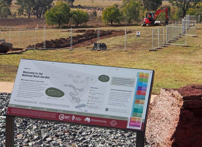
National Rock Garden Stage 2 construction and new information signs installed
In the first week of July 2025, construction of National Rock Garden (NRG) Stage 2 commenced. Two new information signs were also installed.
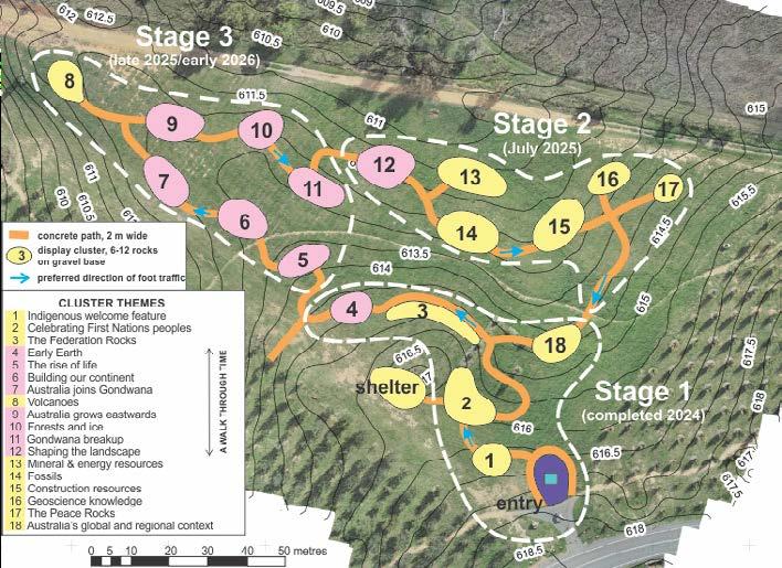
Stage 2 consists of 6 new rock display pads, with interconnecting paths between each pad and links with the existing Stage 1 displays. The result is a doubling of the rock display area, as well as space for an addition 50 or more new rocks, depending on their size. Rocks on display in Stage 1 are in the range 5–15 tonnes, but some newer acquisitions are from 1–5 tonnes, thus allowing more rocks to be displayed.
Rocks on each display pad are grouped according to themes, and a strong feature of Stage 2 are the two resources clusters that include rocks from some of Australia’s most famous mines (Cluster 13) and rocks used in construction of some of our most significant buildings (Cluster 15).
Now with Stage 2 established, we are actively seeking donors to fund Stage 3 – which we hope to complete in late 2025 or early 2026 – as well as the costs for the transportation of more rock specimens to the NRG site.
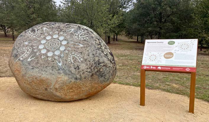
Enhancing the visitor experience, two new information signs have been installed near the entrance to the NRG:
•
an orientation sign, with a simplified map of the existing and planned garden layout, including a geological timescale to introduce visitors to the names of the different intervals of geological time.
•
an explanatory sign, to accompany the carved rocks in the Indigenous welcome feature, that includes designs by local Indigenous artist Lynnice Church. The rocks are large, rounded boulders (tors) chosen by Ngunnawal Elders to welcome visitors to Ngunnawal Country. The welcome included the invitation, ‘you may leave your footprints here’.
We encourage you to visit Canberra, if you can, and experience the National Rock Garden for yourself. Watch it grow, as each new stage reveals more of Australia’s rich geological heritage, one remarkable rock at a time.
BRAD PILLANS
Director,
National Rock Garden
Map of the National Rock Garden showing cluster themes within Stage 1 (completed), Stage 2 and Stage 3 (planned).
The new orientation sign at the entrance to the NRG with Stage 2 construction underway in the background (photo by Brad Pillans)
The new welcome sign and one of the carved tors in the Indigenous welcome feature (photo by Brad Pillans)
Geological Heritage in Focus: A Time to Reflect and Reignite
Ten years on, our geological heritage policy deserves a fresh look – and fresh voices
What is Geological heritage?
Geological heritage, or geoheritage, refers to the outstanding examples of Earth’s history preserved in rocks, landforms, fossils, and the geological processes that shape our continent. These features may be as small as a single fossil-bearing outcrop or as expansive as an escarpment, and they hold scientific, educational, cultural, and aesthetic value. They are an irreplaceable part of Australia’s natural story and deserve both protection and celebration.
Why Does the GSA Have a Standing Committee?
The Geological Society of Australia established the Standing Committee for Geological Heritage to represent the Society on matters of geoconservation. This may include advocating to protect sites, advising on heritage listings, identifying and evaluating new sites, and promoting existing sites. The committee works across federal, state and territory levels through a network of divisional convenors supported by a National Convenor.
In most cases, legislation and planning occur at the state and territory level but nationally, the Committee provides guidance, resources and coordination. It is an important (if often behind-the-scenes) voice for geoscience in land-use decisions.
What Have We Been Doing?
The GSA has a long-standing commitment to geological heritage, with a formal policy first published in TAG Magazine in 2010 and last updated in 2016. That update addressed outdated references – including to bodies like the Australian Heritage Commission – and clarified roles at national and divisional levels. In TAG 154 2010, then Convenor Susan White wrote of the need to modernise the policy and reaffirm the GSA’s advisory, rather than regulatory, role.
In the years since, Committee members have worked hard to identify, describe and promote geological heritage sites across Australia. This work has included submitting nominations to heritage registers, liaising with planners and raising public awareness. The committee have built partnerships with groups in geotourism and palaeontology and have developed resources to support members to advocate for heritage at the local level; this includes the development of the Geoheritage toolkit (Brocx and Semeniuk 2011) that the GSA have refreshed this year.
Photo: Supplied
Where Are We Going?
Now, nearly a decade since our last policy revision, it’s time for another refresh. Emerging development pressures, climate impacts, and evolving expectations around heritage and storytelling make this a critical moment to re-engage. We have refreshed the geoheritage toolkit and are exploring how best to support and grow our network.
Importantly, we recognise that the GSA’s role is not to block developments but to ensure decisions are informed. Indeed, as Susan White wrote in TAG 154 in March 2010, “some of our most significant sites are road or quarry cuttings and may not look impressive to the untrained eye”. That’s why specialist knowledge and respectful advocacy matter.
Share Your Thoughts, or Join Us
As we honour the work of past leaders including Dr Susan White (National Convenor, 2004–2010) and Dr Margaret Brocx (2010–2024) we thank them for their decades of dedicated service to Australia’s geological heritage. Susan continues her contribution as the long-standing Victorian Convenor. With the National Convenor role now vacant, this is a moment to bring fresh voices and perspectives into the conversation.
If you’re passionate about geoconservation, curious about policy, or keen to advocate for Australia’s remarkable geological stories, we encourage you to get involved. Share your thoughts, nominate a site, or express your interest in helping lead this work by contacting the GSA or submitting a letter to the editor. Together, we can ensure Australia’s geoheritage remains visible, valued, and protected.
AMBER JARRETT Past President
Geoheritage in action, the protection of the Hornsby Quarry as a site of geoheritage significance
The Geoheritage Toolkit
The Geoheritage Toolkit (Brocx and Semeniuk 2011) is a systematic method for identifying, categorising, and assessing geoheritage sites at any scale, using a semiquantitative approach to evaluate site specific scientific and educational value.
The toolkit addresses the global gap in national geoheritage assessments and has been recommended as a bestpractice inventory method in the International Union for Conservation of Nature (IUCN) publication Protected Area Governance and Management (Worboys et al. 2015).
The Toolkit can also be used to update existing geoheritage lists, ensuring consistent categorisation and clearer statements of significance.
This year in preparation for our modernised website, the GSA have refreshed the geoheritage toolkit. We hope the tool will continue to be used by the geological community for years to come.
Read Brocx and Semeniukk (2011) and see how it applies to the Kimberly Coast, WA
Cyber Safety Is Everyone’s Business
Staying Safe Online During Safety Month and beyond
As part of Safety Month, we’re putting a spotlight on an increasingly important topic: cyber safety.
Several GSA members have recently been targeted by online scams ranging from phishing emails to fraudulent invoices. These incidents are a timely reminder that cyber threats don’t just affect big corporations. Professional organisations and individuals are increasingly in the firing line, and we all have a role to play in protecting ourselves and our community.
Here are a few key tips to keep your information and your peace of mind secure:
Be cautious of email links and attachments
If you receive an email that seems unexpected or ‘slightly off’ – even if it looks to be from a colleague, a GSA committee member, or a well-known institution – pause before clicking. Hover over links to see where they actually lead, and don’t open attachments unless you’re sure they are legitimate.
Set up multi-factor authentication (MFA)
Wherever possible, enable MFA on your email, banking, and professional accounts. It adds an extra layer of security by requiring a second proof of identity – like a code sent to your phone or email – to log into your account.
The GSA will never ask you for passwords, credit card details, or urgent payments via email
If you receive an email claiming to be from the GSA that pressures you to act quickly, especially one involving money or personal information, it’s almost certainly a scam. A common scam involves a person asking to continue a conversation via email as they have a sore throat.
No genuine request from the GSA will ever ask you to break standard protocols or make hasty decisions. Our Treasurers all have access to credit cards so any request for direct payment is likely to be fradulent.
For additional information see the website of the eSafety Commissioner
When in doubt, call us
If something doesn’t look or feel right, take a moment to phone or email the GSA Secretariat. We would much rather answer a question and delay paying an invoice (even if it is supposedly urgent) than see a member fall victim to a scam.
Remember: nothing is so urgent that it can’t wait
Scammers often rely on panic and urgency to cloud judgment. Trust your instincts and take the time to verify.
For any cyber safety concerns or to report a suspicious message, contact the GSA Secretariat via phone or visit our website for official contact details.
Psychosocial safety: prioritising our mental health and wellbeing
October is Safety Month, and a good time to remember that safety isn’t just about physical hazards or cyber threats, it includes our mental health and wellbeing too.
The GSA is proudly run by volunteers, for volunteers. Our members bring extraordinary commitment, expertise, and energy to everything we do from committees and conferences to newsletters and national initiatives. But with multiple competing priorities at work, at home, and within the Society it can be easy to become overloaded, overwhelmed, and even burnt out.
We’re a community built on passion, but passion needs balance. Here are a few reminders to help you protect your wellbeing while contributing to GSA:
Recognise the signs of burnout
Fatigue, frustration, loss of motivation, or feeling like you’re constantly behind are all signs that your mental load may be too high. If volunteering no longer feels fulfilling, it might be time to pause and reassess.
Set boundaries and communicate early
It’s okay to say no. Let your committee or Chair know if you need to scale back your involvement. We would rather work together to redistribute tasks than to have someone struggle in silence.
You are not alone, please ask
for help
GSA is a team effort. If you’re feeling stuck, unsure, or under pressure, reach out. Most likely, others have been there too and will understand.
Make space for rest and recovery
Taking time out isn’t a weakness, it’s a reset. Whether it’s a short break from committee work, saying no to one more project, or just logging off on time, these small acts protect your energy long-term.
Don’t wait until you’re overwhelmed
If you’re struggling, talk to someone, whether that’s a trusted colleague, a friend, your GP, or a professional support service. Early support makes a big difference.
The GSA is proud to be trialling new wellbeing initiatives for our incredible volunteers this year, including access to the Foremind mental health and safety platform. You are more than your to-do list.
By taking care of yourself, you help keep the Society strong, safe, and sustainable.
If you ever feel like you’re overwhelmed, please speak to your committee chair, the President, or you can send an email to Safety@gsa.org.au that will be treated confidentially.
Physical Safety Is Everyone’s Responsibility
Protecting People at GSA Events and Field Trips
Safety Month is a reminder that physical safety, whether at a field site, conference, or casual gathering, remains a fundamental part of our duty of care.
At the GSA, we’re responsible for creating a safe environment for all members, volunteers, and guests during field trips, events and meetings. That obligation means being proactive about planning, anticipating hazards, and using a modern risk-based approach to identify, assess, and control risks as far as is reasonably practicable.
We already have a fieldwork risk assessment template available to guide organisers, as well as our working with children and vulnerable people policy.
But good safety practice is not about paperwork. It’s about creating a culture where people feel safe, informed, and empowered to speak up.
Here are a few practical reminders for keeping people safe at GSA activities:
Use the risk assessment template and review it regularly
All GSA-led field trips and events should have a completed risk assessment, and these should be reviewed if circumstances change (e.g. weather conditions, attendee needs, or venue access).
Follow the hierarchy of control
As outlined by Safe Work Australia, effective risk management means eliminating hazards where possible, or controlling them through engineering, administrative procedures, or protective equipment. Relying only on personal responsibility or PPE is the least effective option.
Consult participants and consider diverse needs
Field trip participants and event attendees should be encouraged to raise concerns and disclose any accessibility or health needs. This includes checking in with early-career members, students or guests who may not necessarily feel confident to speak up.
For additional information see the website of the eSafety Commissioner
Be aware of environmental conditions
Whether it’s heat exposure in the field, slips and trips at a venue, or COVID/flu risk at indoor events, physical safety requires vigilance. Hydration, first aid, sun protection, and access to emergency support all matter.
Safety is a shared responsibility
Even if you weren’t involved in organising an event, if you see something unsafe, say something. Everyone has the right to feel safe, and you might be the one who prevents an accident. A culture of safety starts with collective awareness and action.
We all have a role in creating safe, inclusive and respectful environments whether we’re organising, attending, or just lending a hand. For field trip leaders and event organisers, the GSA risk assessment template is available via the Secretariat. If you need support or guidance on planning a safe event, please get in touch. We’re here to help.
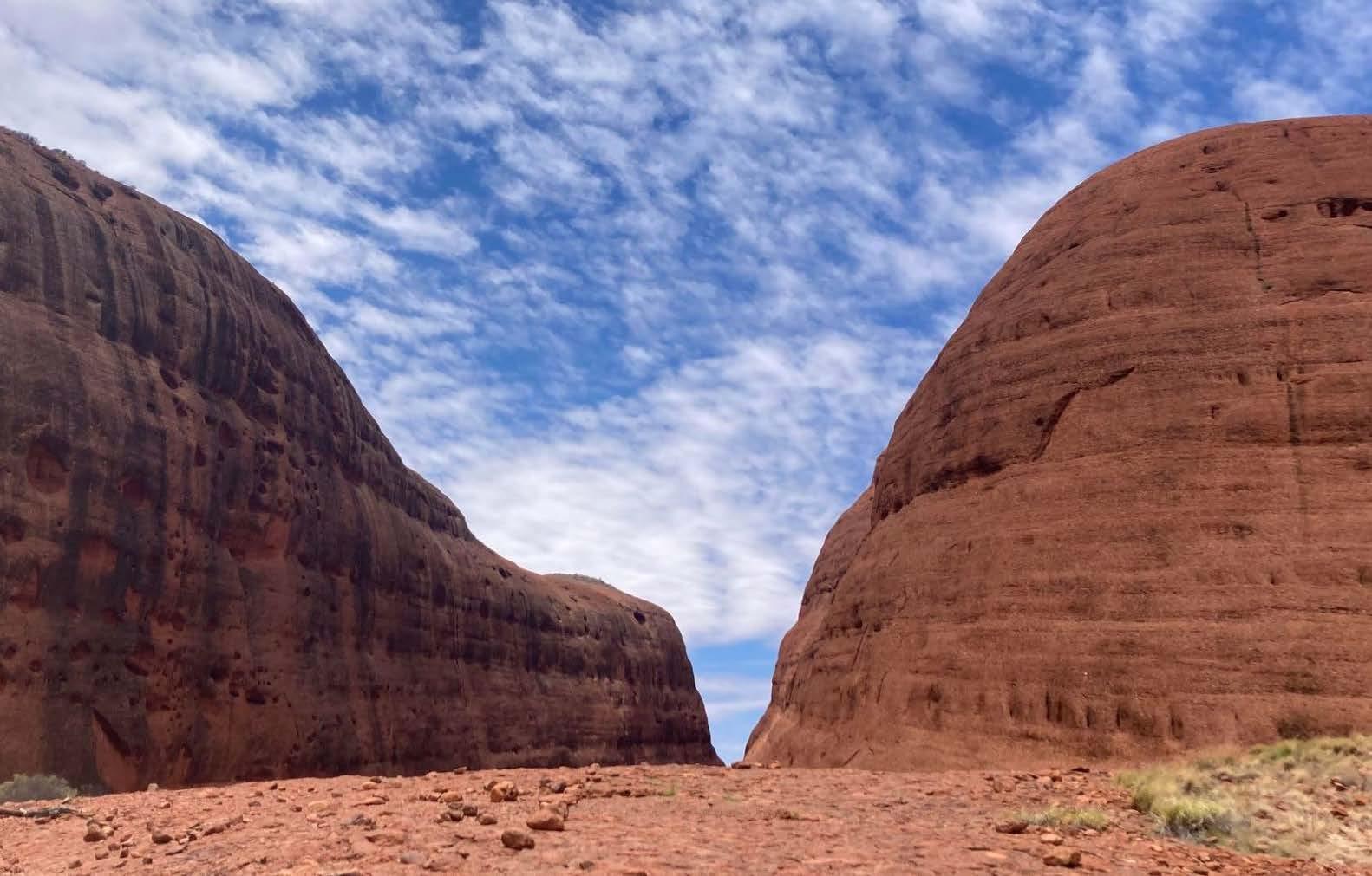
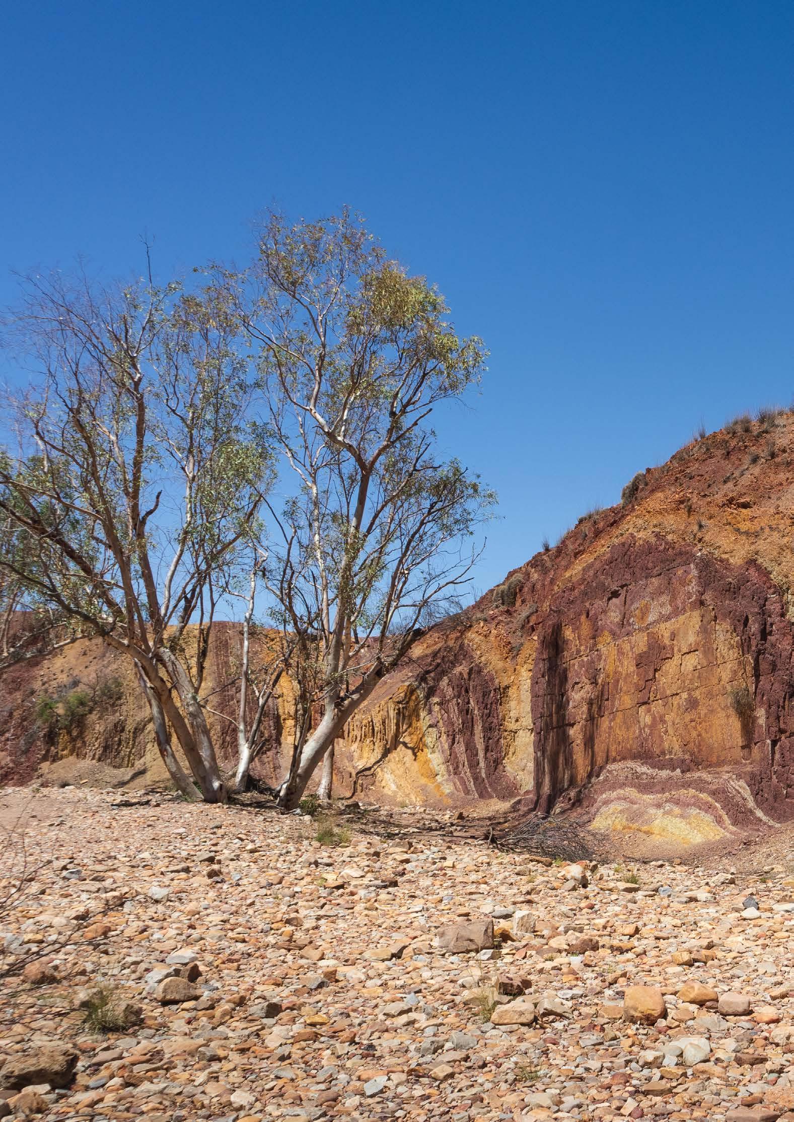
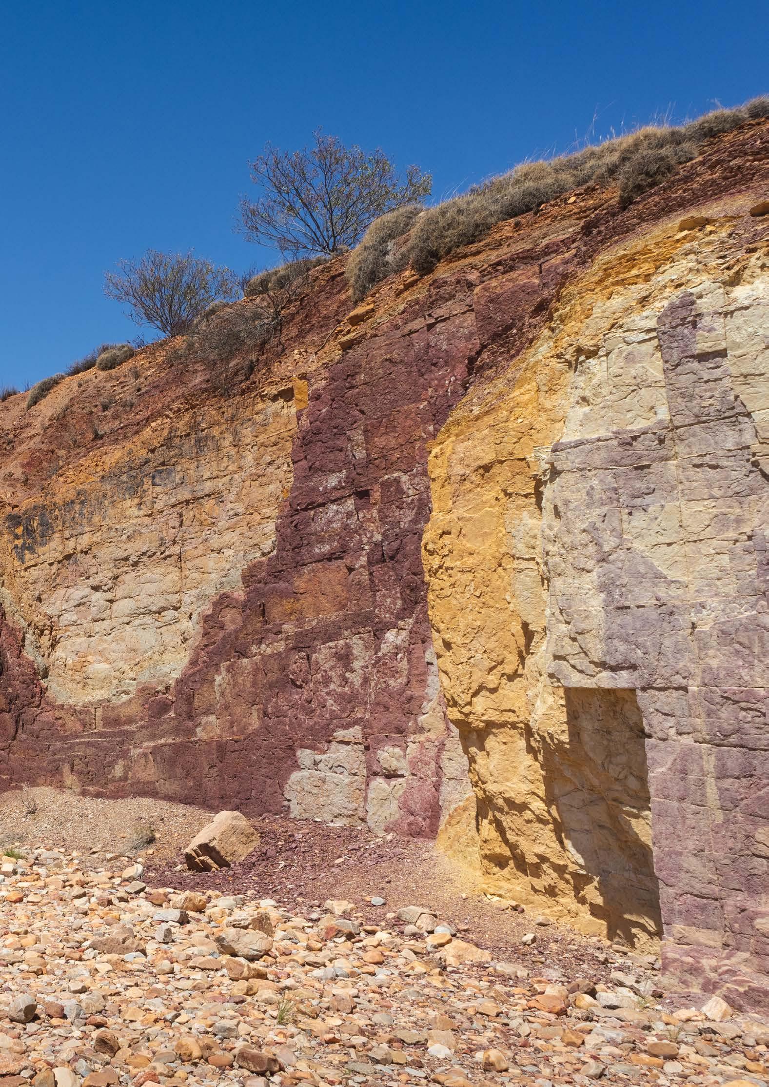
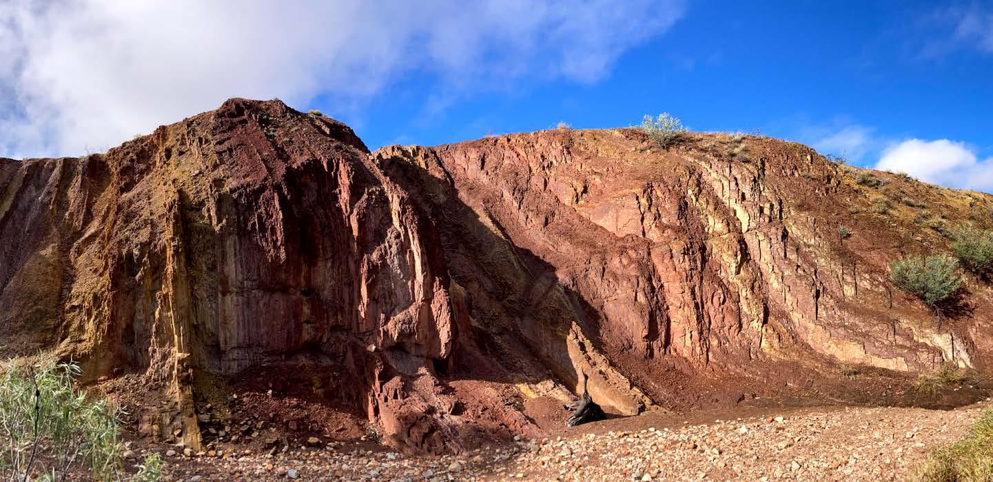
The Ochre Pits are a heritage site where Traditional Owners have long mined, and still collect, vibrant pigments for ceremony and art. The vivid colours derive from weathered Aralka Formation sediments, deposited in a low-energy shallow-marine environment of the Amadeus Basin around 657 million years ago, between two major glaciations and now strikingly exposed along the Larapinta Trail.
Photo: Supplied
Geotrails through the Western Australia Eastern Goldfields
Australia’s National Geotourism Strategy (NGS) provides for the development of geotourism in regional mining communities that have potential geoheritage and cultural heritage sites. This goal focuses on geotourism opportunities in regional areas outside parks and reserves, but which may contain interesting features and narratives including geological, biological, and cultural elements.
Directed by the GSA Geotourism Standing Committee, this goal can be achieved through establishing a framework for creating high-quality, sustainable geotrails. NGS leaders have been inspired by the successful establishment of a major regional geotrail underpinning the Murchison GeoRegion, east of Geraldton in Western Australia. A similar opportunity has now been recognised in WA’s Eastern Goldfields through showcasing the
existing Golden Quest Discovery Trail (GQDT) network.
The Eastern Goldfields is a worldrenowned area for gold and nickel deposits, primarily hosted within the granite-greenstone terrain of the Archaean Yilgarn Craton. This area features highly deformed greenstone belts, composed of metamorphosed volcanic and sedimentary rocks, intruded by granitoid batholiths.
The GQDT network is a self-drive adventure that traverses almost 1,000 km and includes 25 official sites including ‘must-stop-and-see’ locations such as Lake Ballard, Gwalia, Historical Outback Pubs, and Rowles Lagoon Conservation Park.
The GQDT network passes through the Shires of Menzies, Leonora, Laverton and Coolgardie and the City of Kalgoorlie-
Boulder, groups that collaborated, under the auspices of the ‘Goldfields Tourism Network’, to establish the trail.
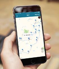
Reflecting another NGS goal – the use and promotion of new digital technologies to highlight and interpret natural and cultural heritage, including geology and landscape – the GQDT app guides visitors through some of the historic and remote regions of the WA Eastern Goldfields. Since the app launched in 2003, tens of thousands of adventurers from all around the world have experienced the unique prospecting heritage of the region.
There are four impressive geotrails that have been devised as either a threeor four-day, self-drive route. All stops include detailed distances, driving times and section notes at and between each location.
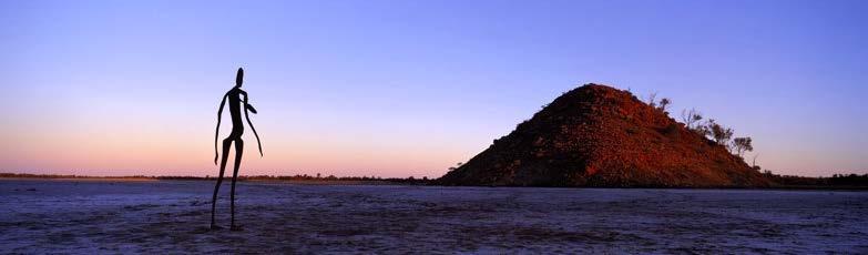
Lake Ballard (near Menzies) the home of the “Inside Australia” sculptures by world renowned artist Anthony Gormely Photo: Golden Quest
Coolgardie to Menzies Geotrail
This is a 220 km road trip commencing in Kalgoorlie with stops at Coolgardie, Kunanalling, Ora Banda, Siberia and Goongarrie, finishing in Menzies. On immediate approach to Coolgardie from Kalgoorlie the trail highlights the original headframe of the Bayley’s Reward mine. This pioneer Eastern Goldfields mine catalysed the greatest goldrush in Australia’s history, beginning
in 1982. Bayley’s Reward was mined continuously until 1963 and produced over 500,000 ounces of gold.
The geotrail also includes the old Bonnie Vale town site, that saw the dramatic rescue of Modesto Varischetti from a flooded mine in 1907, as well as the evocative ruins of the abandoned town of Kunanalling. Between Ora Banda
Menzies to Leonora Geotrail
Covering near 450 km, this geotrail follows a loop road to Laverton and Leonora and highlights the once prosperous abandoned town of Kookynie. The trail also includes the Mt Morgans and Hawkes Nest localities (the former nucleus of gold mining in the Mt
Margaret District), the town of Laverton and the Windarra Nickel Mine. The geotrail passes by Murrin Murrin, one of the largest and most technologically advanced nickel and cobalt mines in the world. The geotrail includes Leonora where gold was discovered
and Serbia a transition zone marks the transition between the Coolgardie Biogeographic Region (dominated by eucalypt woodlands) and the Murchison Biogeographic Region (dominated by acacia-dominated (mulga) woodlands).
The geotrail continues with comments on the locations of once thriving town sites associated with profitable mines such as the Sand Queen.
in 1895 and by the early 1900s, had a population of over 1000 people. Nearby is the abandoned town of Gwalia with its fascinating museum and historical house.
Gwalia the historic gold mining town and ghost town located near Leonora. Photo: Golden Quest
Leonora to Davyhurst Geotrail
Covering 240 km this geotrail has stops at Granite Creek, Copperfield, Lake Ballard, Ularring, and Davyhurst. Granite Creek is part of an extensive drainage system associated with Lake Raeside. The massive river gums are breeding areas for budgerigars and native parrots. The geotrail guide describes many stories of local miners across the 70 year history of mining at Copperfield before
its closure in 1967. Lake Ballard (pictured on page 30) is a mecca for art lovers as dotting the salt plains are 51 enthralling steel sculptures by world-renowned British artist Anthony Gormley. This lake is on the Register of the National Estate and is the breeding habitat for various species of waterfowl, as well as redcapped plovers, red-necked avocets, grey teal and hooded plover. On route
Davyhurst to Kalgoorlie Geotrail
Approximately 170 km in length, this geotrail takes the visitor back to Kalgoorlie via Rowles Lagoon and Broad Arrow. The road to Rowles Lagoon passes through beautiful eucalypt-dominated woodlands that include silver-topped gimlet, salmon gum, goldfields blackbutt, giant mallee, redwood and kurrajong. The heritageregistered Rowles Lagoon system is the largest freshwater wetland in the Eastern Goldfields and is a known habitat for 118 bird species, including at least 41 species of waterfowl. On the lake edges is a dense fringe of tea-tree and lignum that is an ideal habitat for the rare Freckled Duck. As the lagoon rarely dries up, other birds such as grebe, glossy ibis, grey plover, black-tailed godwit, and ruddy turnstone are attracted to the lagoon.
The Broad Arrow town accommodated 15,000 residents during the peak of the goldrush but now has only a handful of buildings including the Broad Arrow Tavern, the former stationmaster’s home, and a heritage-listed four-metrehigh railway water tower.
On arrival in Kalgoorlie there is a spectacular 180-degree view of the largest open cut gold mine in Australia. Officially known as the Fimiston Open Pit, it’s colloquially named the Super Pit. The Super Pit literally swallowed the many truly legendary underground mines that once constituted Boulder’s world-famous Golden Mile, including the Great Boulder, the Golden Horseshoe, the Ivanhoe, the Perserverance, and the Lake View Consols mines. These great underground mining operations,
to Ullarring, many small sites of interest are described such as the Old Mulline townsite and cemetery as well as the Giles Pit. On approaching Davyhurst, the geotrail affords good views of the operating Davyhurst Gold Mine that recently released some significant highgrade intersections of over 10 g/t gold.
with their deep shafts and extraordinary labyrinths of tunnels and stopes, first dazzled the world in the late 1890’s. Many agree the Super Pit occupies the richest piece of ground ever discovered in Australia.
The free GQDT APP or the guidebook as e-book, audio tracks, and hardcopy can be downloaded through the GQDT website https://goldenquesttrail.com/.
DAVID ROBSON Chair, Geotourism Standing Committee
One of the 51 statues individually cast black chromium steel sculptures that stand against the dramatic backdrop of Lake Ballard’s white salt plain.
Photo: Golden Quest
Golden Quest APP ‘in-the-hand”
Walking Together: Hiking the Larapinta Trail for Reconciliation and STEM Equity
During National Reconciliation Week 2025, we undertook a journey that was both physically demanding and emotionally resonant: hiking the legendary Larapinta (Lah-ruh-bpinduh) (Finke River) Trail in Central Australia to raise funds and awareness for DeadlyScience, an organisation empowering First Nations students in STEM. Alongside a passionate group of geologists, educators, and tech specialists, we hiked over 60 km in four days through the stunning but challenging landscapes of Tjoritja (Choor-it-ja) (West MacDonnell Ranges), raising over $10,000 along the way.
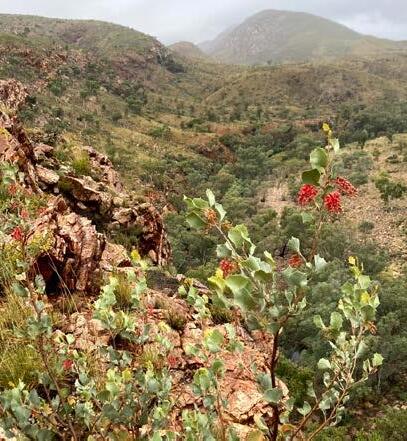
The Larapinta Trail winds across the ancient geological spine of the continent. Each day of our journey offered new views, textures, and insights – both geological and personal. We started our hike near Mparntwe (Mbarn-twa) (Alice Springs) at the historic telegraph station. Here, we walked across ancient basement rocks and shared the concept of thinking in deep time with the group, as rocks in the area include exposures of the Alice Springs Granite, which is around 1.75 billion years old, as well as even older
gneisses. These rocks speak of a long and complex tectonic history well before the main range forming tectonic event, the Alice Springs Orogeny, something we continued to uncover and explain to eager ears throughout the trek.
In places, we walked along ridges of mylonite, fine-grained, foliated rocks that formed in the deep crust during movement along the Charles River Shear Zone. These ridges guided our way like geological signposts, their linear forms shaping both the path and the story of the ranges.
Further on, during Day 2 of the trek the carbonate rocks of the Bitter Springs Formation – familiar to many for their stromatolites and shallow marine origins – proved less friendly underfoot. Hard, uneven, and slippery after rain, they became a physical reminder that geological beauty often comes with blisters.
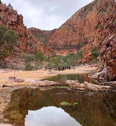
Our path led us through some of the most iconic geological features in Australia. At Kwartatuma (Ormiston Gorge) on Day 3, we marvelled at ripples preserved in
the thickened Heavitree Quartzite. These rocks that now form towering quartzite walls, shaped by folding and faulting, were once tidal sands.
On Day 4, the spectacular Inarlanga Pass revealed huge, overturned folds that had us stopping in our tracks, tracing out their geometry and discussing the incredible forces that bent the rock. This day was particularly special as we also visited the Ochre Pits, where soft, stained layers of various colours have provided important ochre for ceremony, trade and other uses. We learned that the ochre from this site is particularly valuable due to the secondary mineral content that gives it a sheen. Later, as the rain dissipated the sun dramatically and spectacularly illuminated Rutjupma (Roo-choop-ma) (Mt Sonder), to guide us back from Inarlanga Pass.
But the geology was only part of the story.
The land was alive with colour and movement. On Day 2, we wound our way along and across the banks of Larapinta to the Finke River camp and
One of the 51 statues individually cast black chromium steel sculptures that stand against the dramatic backdrop of Lake Ballard’s white salt plain.
Photo: Golden Quest
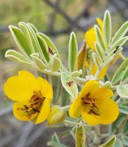
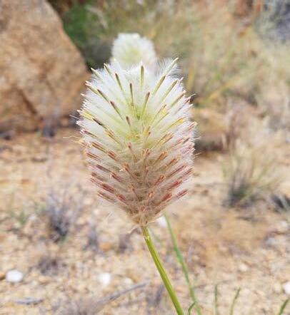
beyond to Kwartatuma, surrounded by five different species of Mulla Mulla, daisies, hakeas and mallees with vibrant blooms contrasting with the grey sky and rain. Birdlife was less abundant than we had hoped, but across the trek we spotted Major Mitchell’s cockatoos, zebra finches, honeyeaters, superb fairy-wrens, galahs, magpie-larks, ringneck parrots, even wedge-tailed eagles and a red-backed kingfisher. After much determined staring into scree slopes, sightings of black-footed/ flanked rock wallabies at Kwartatuma and Rungutjirpa (Roong-goo-chir-buh) (Simpsons Gap) were unforgettable highlights.
We camped in outback luxury, nestled among the folded ridges of the Pacoota Range on the land of Traditional Owners whose deep connections to Country shaped our understanding of where we were walking. We shared the geological significance of the ranges and in turn learned about the cultural importance of the land. This convergence of stories – scientific and spiritual – was humbling and instructive.
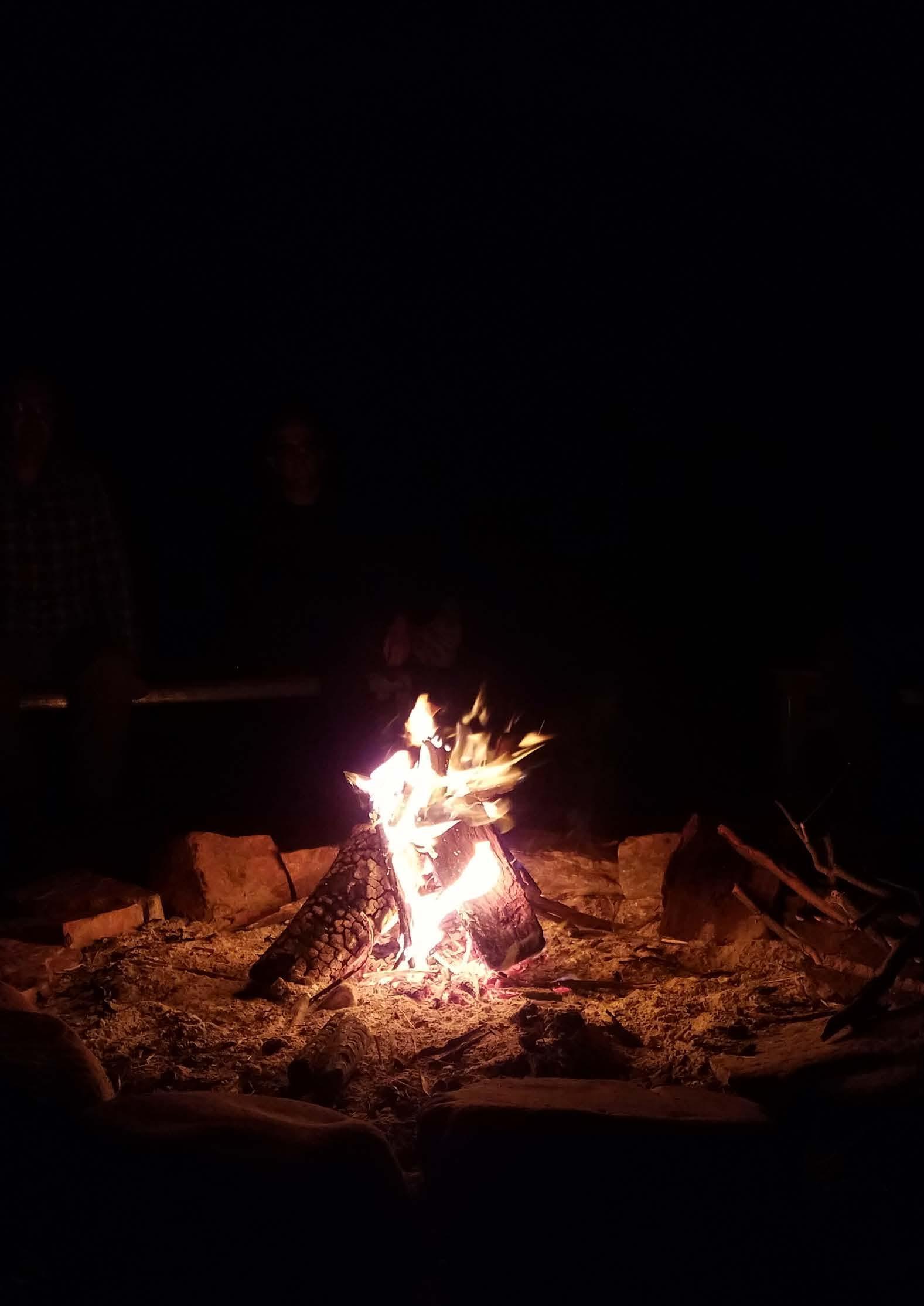
Each night brought fresh challenges. Temperatures dropped sharply, and we learned to appreciate our sleeping bags more than ever. Over two nights, rain crept into some tents but we remained dry. Yet these conditions only brought the group closer. Around the fire, with tired feet and dripping, dust-covered clothes, we swapped stories, not just of the trail, but of science, knowledge, and community.
The week’s theme, Bridging Now to Next, echoed through our conversations. We paused at panoramic lookouts with views stretching across the ranges, reflecting on the connection between the deep time written in the landscape and the urgent work of ensuring equity and reconciliation in the sciences. Our
discussions turned to Custodianship of Country, and how Indigenous knowledge systems – developed and passed down over tens of thousands of years – complement and enrich our scientific understanding of the Earth.
We were a team of 11 hikers and three guides, from a mix of professions but united in our commitment to support equity in science. That unity showed in quiet moments: helping each other up steep climbs, sharing snacks, pointing out birdcalls, or discussing a curious fold or mineral along the way. These connections – built through sweat, mud, and shared wonder – were at the heart of the experience.
To everyone in the GSA and beyond who donated or shared messages of support, thank you. Your generosity is helping DeadlyScience provide science kits, telescopes, books, and culturally relevant resources to students in remote and regional communities. You’re sending a clear message: First Nations Australians belong in every aspect of science, from classrooms and labs to leadership roles and field sites.
The Larapinta Trail reminded us that real progress happens step by step. Sometimes it’s uphill, sometimes it’s muddy, cold, or uncomfortable. But it always moves forward, especially when we walk together.
Here’s to walking further, listening deeper, and working harder. From now to next.
KEEGAN MCGUFFIE Geologist and Preservice secondary school teacher
NATHAN DACZKO Professor, School of Natural Sciences, Macquarie University NSW
Photo: Supplied
Celebrating Our New Distinguished Fellow: Morgan
Blades, DFGSAust
The GSA is proud to welcome Morgan Blades as our newest Distinguished Fellow (DFGSAust). This prestigious honour recognises Morgan’s outstanding service to the Society, excellence in research, and commitment to education and training in Earth sciences.
Meet Morgan Blades
Dr Morgan Blades is a Lecturer in Earth Sciences at The University of Adelaide, where she specialises in tectonics, basin evolution and geochronology. She is also a passionate educator, leading field schools from Arkaroola to Oman and New Zealand, and has built a reputation as a supportive supervisor and mentor for the next generation of geoscientists.
Service to the Society
Beyond the classroom, Morgan has been a stalwart of the South Australia GSA Division for more than a decade. Serving on the Division Executive for 11 years, she has contributed in almost every capacity including as Chair (2019–2020) and Secretary (2014–2019, 2020–2022).
In 2016, Morgan chaired and championed the inaugural Earth Sciences Student Symposium (GESSS) in Adelaide, laying the foundation for what has become a nationally significant platform for student voices.
Her dedication has set a benchmark for early and mid-career members, showing that leadership in the Society is both rewarding and impactful.
Research Excellence
Morgan completed her PhD in 2016 and has since built a strong research profile spanning tectonic evolution, Proterozoic basins, and geochronological innovation. Her work has advanced understanding of the East African Orogen, the greater McArthur Basin, and contributed to the development of novel techniques for dating Proterozoic sedimentary systems.
With 40 publications, 1,900 citations, and h-index of 20, Morgan has already made a lasting mark on Australian geoscience. Her contributions were recognised in 2020 with the award of the GSA (SA Division) Walter Howchin Medal for excellence in early-career research.
Commitment to Education and Training
At The University of Adelaide, Morgan is known as an outstanding teacher and mentor. She has supervised 16 Honours and four PhD students and earned a reputation for supportive, responsive supervision.
She also leads field-based learning at every level, from the iconic 3rd-year capstone mapping course at Arkaroola, to the international study tour to Oman and Honours trips to New Zealand. Her energy, skill and care in the field have, and continue to be, inspiring.
A Fellow for the Future
What sets Morgan apart is the breadth of her contribution across service, research, and education. She exemplifies the GSA’s values of scientific excellence, professional leadership, and community commitment. Recognition as a Distinguished Fellow is not only a celebration of Morgan’s achievements to date but also an investment in her continued leadership in Earth sciences into the future.
Do you know a Fellow deserving of this honour?
The Distinguished Fellowship of the GSA (DFGSAust) is awarded to members who have made a significant contribution of service to the Society and can demonstrate:
Practical application of Earth science
Contribution to research in the Earth sciences
Contribution to education and training of Earth scientists
Supervision or administration of Earth science programs
Contribution to public outreach of an Earth science nature, beyond the presentation of work regarded as part of the nominee’s usual work
Other contributions not covered by the above that may be deemed relevant
Please send your nomination to the Chair of the Awards Standing Committee via info@gsa.org.au
Gneiss one
Illustration: Emma Rehn
Congratulations Marianne Harvey: Women in Resources Inc. Excellence in Technical Innovation
The GSA is thrilled to celebrate Marianne Harvey, Exploration Data Manager at the Northern Territory Geological Survey (NTGS), Department of Mining and Energy, for receiving the award for Excellence in Technological Innovation at the 2025 Exceptional Women in Resources Awards.
The award recognises Marianne’s work in driving major innovation in the public geoscience sector through her leadership in modernising the Northern Territory Geological Survey’s (NTGS) drilling and geochemical datasets (DIP001).
Recognising the limitations of legacy systems, Marianne initiated and delivered a full redesign of DIP001 to better meet the needs of today’s mineral explorers. Through advanced planning techniques and service design tools, Marianne implemented wide-ranging improvements, including modernised data structures, expanded dataset scope, detailed laboratory metadata, and the introduction of new geochemistry products
About Marianne
Marianne has worked as a geologist for over 30 years, across exploration and mining projects in Queensland, New South Wales, and the Northern Territory. Her career has taken her from underground mines and open pits to public sector geoscience and data management, with a strong focus on practical outcomes and continuous improvement.
Throughout her varied career journey, Marianne has approached professional challenges by staying open to learning, recognising that the best way to grow is through experience – listening carefully, observing different approaches, and learning from mistakes along the way. This mindset has allowed Marianne to step into varied roles, from resource estimation and consultancy to leading innovation projects like the redesign of the NTGS drilling and geochemistry dataset.
Prior to her current role and achievements in data management, Marianne’s career highlights included managing her own geological consultancy and delivering JORC-compliant resource estimates for major operations. Each role has been built on a foundation of technical skills, adaptability and persistence.
such as the Drillhole Maximum Assays layer.
These changes have transformed DIP001 into a flexible, highquality dataset aligned to FAIR principles (Findable, Accessible, Interoperable, Reusable), enhancing the value and usability of publicly available exploration data.
Marianne’s work empowers explorers with faster access to richer datasets, supports new discoveries, and strengthens NTGS’s reputation for technical excellence. By mining historical data for future opportunities, Marianne’s project ensures that the Territory’s precompetitive geoscience data remains a powerful driver of exploration investment and resource development.
Marianne’s initiative, technical skill, vision and problem-solving exemplify how innovation in data delivery can help build the next generation of explorers, making her a standout nominee and deserved winner of the Women in Technical Innovation Award.
Work-life balance has always been a challenge. And with a partner also in the resources sector, each role has come with a juggle to manage rosters, project commitments and family life. It’s not been always seamless, but it’s important to both Marianne and her partner that their children see both their parents contributing to an industry that underpins much of life in the Territory.
Marianne notes that her journey has taught her that careers aren’t built in straight lines. She recognises that success often comes down to adaptability – being willing to learn, willing to change, and willing to back yourself – when new opportunities come up.
These lessons continue to guide her work today. Whether managing innovation projects, mentoring younger geoscientists, or contributing to building better systems and data for future explorers, Marianne remains motivated by the idea that we never stop learning – and that every step forward, even the small ones, helps build a stronger industry.
Photo: Supplied
GSA celebrates: Academy of Science 2025 awardees
The GSA extends its congratulations to Earth scientists recognised with prestigious Australian Academy of Science awards in 2025.
Jaeger Medal
Professor Hugh O’Neill FAA FRS, Monash University
Hugh O’Neill is a widely recognised international leader in the field of experimental petrology and geochemistry with applications to the understanding of planetary processes. His research addresses many aspects of the chemical behaviour of minerals and rocks through detailed laboratory studies complemented by thermodynamic modelling. The resulting insights elucidate the diverse processes by which Earth and other planetary bodies were formed and their subsequent chemical evolution. His influential research has provided new insights into the formation of the Moon through the impact with Earth of a Mars-sized body, the segregation and composition of Earth’s iron-rich metallic core, the redox conditions prevailing within Earth’s interior, and the generation of basaltic magmas by partial melting within Earth’s upper mantle.
Anton Hales Medal
Associate Professor Stijn Glorie, University of Adelaide
Stijn Glorie studies the interplay between the thermal history of Earth’s crust and large-scale tectonic processes that drive plate deformation and mountain building. Stijn employs novel mineral-based geochronometers to unravel the cryptic records of ancient geologic events, including the formation of metalliferous mineral deposits, which in turn can assist mineral exploration efforts. His research has focused on the protracted crustal deformation in Central Asia, and vast areas of central Australia, thereby filling crucial gaps in our knowledge of the geological evolution of our continent. At the University of Adelaide, he is currently leading ground-breaking method development work to determine the age of a vast range of minerals that were previously considered undatable. This revolutionary geochronology work now allows for unlocking of records of Earth’s ancient history at unprecedented rates and scales.
AJES AUTHOR PROFILE
John Clemens
I have taken a lot of interest in the Devonian volcanic and plutonic rocks of Victoria, a focus that dates from my time as an undergraduate student at RMIT in the early 1970s; my PhD at Monash partly concerned these rocks.
More than ten years ago, with thinking that had matured since Phillips et al (1981), Neil Phillips proposed that we should do additional research and write a series of papers based around the Strathbogie batholith in northern central Victoria. Neil did a lot of very detailed and careful foot-propelled mapping of the contacts between this 2000 km2, cordierite-bearing, S-type body and its
Silurian to Devonian metasedimentary wall rocks. Neil published several papers on the thickness of this granite, identifying its ‘thin-crust pizza’ shape. Together we published two papers on this body. One subdivided the batholith into several different plutons, each with characteristic petrographic, chemical and isotopic characteristics. The second dealt with the petrology and petrogenesis of the rocks, with special reference to what this could tell us about the structure and composition of the largely unexposed Proterozoic to Cambrian magma source terrane, locally known as the Selwyn Block.
There were also papers dealing with the chemical and isotopic differences between the Devonian granites further to the west in Victoria (outside the area underlain by the Selwyn Block) and, with Ian Buick, constraints on the metamorphic grade and the age of the granite source rocks in the Selwyn Block. Papers based on zircon U-Pb work showed that the Ordovician to Early Devonian metasediments could not have contributed to any significant parts of the Devonian silicic magmas. These had to have come from the Selwyn Block.
Schematic block diagram of the central section of the Melbourne Zone. This illustrates how a warm and plastic middle of the Selwyn Block, when compressed in an east–west direction during the Tabberabberan Orogeny (green arrows), might be thinned and extruded north–south (red arrow). The detachment (Thomas Fault) between this block and the overlying, cool and more brittle Paleozoic cover produced decoupling in which much of the strain was partitioned into the Selwyn Block. This permitted mild thickening (grey-green arrow) in the Paleozoic cover, some of which was also accommodated through movement along conjugate fault systems. A more intricately detailed diagram might include an east-verging fold-fault system and deformation asymmetry related to east-directed shear along the Thomas Fault. Shear along the detachment is suggested by finely spaced lines adjacent to the structure.
All the while, nagging away in the background was another rather vaguely thought out idea for a paper dealing with the tectonic aspects of granite emplacement in central Victoria. I had no focussed ideas on what this might be about, but Neil, Alex Kisters (also at Stellenbosch) and I spoke about the curious difference between the pluton orientations in central Victoria compared with those in other parts of south-east Australia. In central Victoria, the plutons are elongated roughly east-west, approximately orthogonal to the trends of fold axes and major faults in the wall rocks. But in the wider region, granitic plutons are elongated in the same direction as the wall-rock structural trends. Why?
Furthermore, the pre-granite metasedimentary rocks in central Victoria are lower-grade than elsewhere and also less deformed. To add to the mystery, it is apparent that very little erosion had taken place since the Tabberabberan Orogeny; allowing just slight unroofing of shallowly-emplaced granites, like the Strathbogie, and excellent preservation of intracaldera silicic ignimbrite deposits. The implication was clearly limited crustal thickening and no significant uplift, that is, no high mountains.
The existing explanation for the absence of high mountains was that an underlying, rigid Selwyn Block protected the overlying Paleozoic from more intense deformation. That could well be, but the idea did not sit well because the Devonian granitic magmas were produced by high-temperature partial melting of Selwyn Block materials. So those materials must have been at
relatively low metamorphic grades before that thermal event, and therefore far less likely to have been rigid during the preceding Tabberabberan deformation. Without knowing my arguments regarding the physical character of the Selwyn Block, Alex suggested the possibility that the block may have behaved plastically, taking up most of the Tabberabberan strain instead of transmitting it to the younger Paleozoic cover. When I told him about the rigid Selwyn Block idea, he replied that that could also be the case. I pointed out that there is a seismic discontinuity between the Selwyn Block and the overlying cover, so that could have provided a detachment that further enhanced the effect of a plastic Selwyn Block.
So, the original idea was that the three of us should develop the various ideas for publication. That never happened. If I interpret the situation correctly, Alex was less than comfortable with the ‘strange’ tectonic setting involved, in a place he’d never seen, and Neil was also a bit sceptical. I continued to raise the subject with them periodically, sending rough drafts. In the end, about a year ago, I became realised that if the ideas were ever to see the light of day, I’d have to go it alone. I did. And eventually, after a lot of revision and reading of related literature, things became clear enough to submit the work for publication. And so, after interesting and helpful reviews, one by Dave Gray and the other anonymous, the paper was published in AJES as Clemens (2025).
Bear in mind that there are no new data associated with this paper and there is no incontrovertible proof either. However, the ideas I expressed in this work appear
consistent with the full range of data, more so than any other current model. Essentially, the main ideas are that during the Tabberabberan compression the Selwyn Block, underlying mainly the Melbourne Zone, behaved in a more plastic manner than previously suggested. So it was not the rigidity of the Selwyn Block that protected the Silurian to Devonian metasedimentary cover from extensive shortening during the east-west compressive phase of the Tabberabberan Orogeny, but instead deep-crustal extrusion of a relatively plastic Selwyn Block and the presence of the detachment at the base of the Paleozoic cover.
But what about the batholith elongation? Once the Tabberabberan compression waned, approximately east-west extension reduced surface relief and there were probably east-west oriented stress-relief joints in the middle crust. Local stress relief at deeper levels probably facilitated silicic magma ascent and the growth of plutons and batholiths with overall approximate east-west elongation directions. It’s a thought at least.
Reference
Clemens, J. D. (2025). Regional tectonics, crustal deformation and contrasting batholith orientations in southeastern Australia: Why is Late Devonian central Victoria different? Australian Journal of Earth Sciences
https://doi.org/10.1080/08120099.2025.2 505030
Phillips, G. N., Wall, V. J., & Clemens, J. D. (1981). Petrology of the Strathbogie batholith: a cordierite-bearing granite. Canadian Mineralogist, 19(1), 47-64.
Q&A with Jun Cowan
How would you explain “Perkins Discontinuities” in plain language and why is it so important for geologists to know about this feature?
Perkins Discontinuities are abrupt planar features such as fractures, faults or dykes that abruptly cut off mineralisation, whether observed in hand samples or at the deposit scale (Pink arrows in Figure 1).
Annotated figure from Lindgren 1933 (from Cowan and Hobbs 2025)
These terminations are typically attributed to fault movement, but growing evidence suggests that many of them are original features. That is, the planar boundary formed before, not after, mineralisation. This suggestion completely overturns the conventional geological timeline, sometimes resulting in a revision from syngenetic to epigenetic timing. These asymmetric mineralisation patterns have been identified since the 1800s, but it was mine geologist Bill Perkins (JCU PhD supervised by Tim Bell) who recognised their importance in 1997 when he described the significance these features at Mt Isa in terms of the epigenetic timing of mineralisation. So, I’ve named these features after Bill.
A neat example is the Haile gold deposit in South Carolina. It’s generally been considered that the gold there is syngenetic, formed during the late Neoproterozoic prior to any deformation. But about 35 years ago two JCU structural PhD students, Marcus Thompson and Nick Heyward (again supervised by Tim Bell), argued it was epigenetic and syn-deformational. Their work was quickly forgotten, however, and the prevailing view is that the gold formed before folding, probably from a magmatic event.
The evidence for folding itself is obvious in the contact curvature between metasedimentary and metavolcanic rocks. If the mineralisation happened before this folding, then the gold should follow the tectonic trend of 060°. But when you look at the geometry of the gold resources, some of it does follow that trend, yet many zones are abruptly cut off by Triassic dykes that strike across it. Many more lateral terminations run parallel to those dykes.
Recent grade control drilling shows that these resource terminations aren’t due to later faulting. The mineralised zones simply stop at the dykes, suddenly and cleanly. That’s the important clue. It means the gold came after folding, and after the fractures that cross the folds. This is straightforward geometric evidence that the gold is post-fold and post-fracture.
Most geologists can work this puzzle out, but only if they ignore the published models and just observe the patterns in front of them.
Jun Cowan with Bruce Hobbs (May 2025)
Photo: Supplied
You draw a strong line between ‘model-driven’ and ‘observation-driven’ interpretations. How does that difference play out in real mining projects?
The epigenetic story at Haile was hidden in plain sight, just like the grade patterns at Witwatersrand and Mt Isa that clearly point to epigenetic origins. But hardly anyone recognises it. Why? Because the models used to classify mineral deposits haven’t clarified but have instead distracted us from seeing what’s right in front of our eyes. This is the same trick magicians use. And in our industry, that distraction has been running since the 1950s when geochemical analysis became affordable.
When a magician lays out cards and asks you to choose, the cards are already stacked to steer your choice. That’s exactly what’s happened in applied geology. The models have been shaping what we’re allowed to see, and after decades of repetition, and over several generations of geologists, we’ve ended up with a whole industry treating these models like sacred truth, rarely checked against real drilling data and real geometries of mineral deposits.
The cost of this is real. Companies spend millions chasing ‘displaced’ or ‘open’ resources that were never there. Or they build resource models based on assumed geometries like the classic tabular ‘shear zone’, only to find out, too late, that the grade continuity doesn’t continue the way they expected. Mining projects have failed because of this kind of model-first thinking.
You raise doubts about traditional interpretations of syngenetic mineralisation in places like Mt Isa and even parts of the Yilgarn. What has the response been from proponents of those models?
One academic VMS expert dismissed me as someone who’s ‘reinventing the wheel’. Most others just ignore me because I don’t publish regularly. But that doesn’t make my ideas any less relevant to actual mining projects. I write for working geologists and companies, not for academics.
Is there a particular deposit you’d like to reexamine (or see re-examined) through the lens of these structural controls?
Any deposit classified as syngenetic instantly grabs my attention. I’d be very keen to look at the drilling data, especially for something like the giant VMS Kidd Creek deposit in Canada.
Nickel sulfide deposits are also of particular interest to me, such as those at Sudbury and Kambalda, because I’m not convinced they are truly syn-magmatic. Even for me, this might sound like a wild suggestion, but I’ve seen grade patterns that just don’t fit with the conventional magmatic model.
You advocate for bypassing interpolation and modelling in favour of analysing raw desurveyed grade data. What practical skills or tools do geologists need to do this effectively?
While I’ve developed my own software to do this work, outputs of which feature in my paper with Bruce Hobbs, any 3D software will do the job. What matters is having a solid grounding in structural geology from fieldwork. The structural measurements you collect in the field are then manually applied to the grade data using whatever 3D platform you’re working with.
What are the broader implications of your method for mineral exploration, particularly near-mine or brownfields settings?
Correctly recognising Perkins Discontinuities has major implications for brownfields exploration. Chasing a supposedly displaced orebody could end up being a pointless and costly exercise. Instead, a Plan B needs to be on the table, one that’s based on this revised understanding.
What do you think needs to shift culturally in how we train and value geological interpretation?
The only way to break this cycle of expert dependence is to strengthen the interpretive confidence of working geologists. My life’s mission is to free geologists from the dependence of academic models, and to help them trust their own observations, instincts and interpretations to take ownership of their insights and benefit directly from them.
What advice would you give to early-career geologists trying to understand ore deposit controls at the deposit scale?
Start by looking at grade data in 3D – not on sections – and see if patterns begin to emerge. Do this for every deposit you work on, and you’ll start to notice recurring features, maybe even Perkins Discontinuities.
To view the paper, scan the QR code:
VMS model card deck (illustration by Adam Tri Nuryanto)
SPOTLIGHT
Marine macroinvertebrates on a monumental scale: a new checklist for the Australian Mesozoic
Peter A. Jell & Alex G. Cook
Alcheringa, the Australasian Journal of Palaeontology, recently published our 384 page compilation, the Annotated checklist of Australian Mesozoic marine macroinvertebrates. This is a contribution to the Australian Fossil National Species List (auFNSL) project that aims to fully document the fossil taxa of the continent. It joins other fossil lists such as Australian and New Guinean fossil mammals, Australian Triassic dinoflagellate cysts, fossil birds, fossil reptiles and amphibians, trilobites, fossil echinoderms and fossil echinoids, Mesozoic tetrapods and Mesozoic mammals.
Over 900 distinct taxa of marine macroinvertebrates have been described from the Australian Mesozoic in literature from 1866 to 2023. These include the ornate ammonites from the Cretaceous of the Great Australian and Carnarvon Basins, the rich molluscan fauna of the Miria Marl in the Carnarvon Basin, the rare Triassic fauna of the
Gympie Block and the seemingly inexhaustible supply of Cretaceous bivalves from the Great Australian Basin. Settling on a standard stratigraphy was first and foremost. Some of the earlycollected material had rather dubious stratigraphic information. We also made early errors; referring to the Gunbarrel Basin, a term no longer used: Bejah Claystone, Quo Vadis?
When we began, the scale of the task was not apparent to us. We thought it would take us about six months to complete but we were quickly in for a wake-up call and the entire project took more than two years. The aim was to list each species, its stratigraphy and taxonomic history, and to provide an original figure for at least each genus of a type or a representative specimen. This would make a good reference for people to use when working in the Mesozoic sequences and allow a rapid assessment of any major gaps. The task of making this list involved a serious search of the
literature, which was aided greatly by the University of Queensland Library. We also drew upon resources such as the Biodiversity Heritage Library and various speciality organism databases to track taxonomy and literature.
Collections have been destroyed by fires (1882 Garden Palace, Sydney and 1953 BMR, Canberra), lost in Europe to bombing raids during the Second World War, shipwrecked and recovered, and almost certainly misplaced in larger museum collections. Tracking the types and figure specimens for the 900+ species of Mesozoic fossils soon became a major exercise in detective work. Deciding what was destroyed and what was just missing was important. With the helpful co-operation of curators and collection managers all around the world, we managed to track most specimens on our list and to account for those truly missing in action.
Myloceras intermedium, ammonite from the Early Cretaceous (Albian) of central Queensland
Photo: Supplied
Maccoyella barklyi, a bivalve from the Early Cretaceous of North Queensland Photo: Supplied
Every fossil tells a story, such as the Holotype specimen of Aioloceras jonesi (Gregory and Voss Smith 1903) which has been held safely for more than 120 years in the Burke Museum at Beechworth, Victoria. Specimens of bivalves described as several new species by Bob Day in his 1968 PhD thesis were included and formally described at long last. This had been the unpublished part of Bob Day’s major works on the fossils of the Great Australian Basin but was critical in establishing the biostratigraphic framework for the Early Cretaceous.
A major task was establishing a stable classification scheme, which would not offend taxonomists working in the field, for groups such as the ammonites, bivalves and gastropods. Ammonites classified and reclassified in and out of generic names and families added to the difficulties, before even considering the possibility of sexual dimorphism in the group.
While we were working, a major memoir on the fossil bryozoa of the Cretaceous of the Carnarvon Basin was published. Bryozoa were something we were short on, until then. The decision was made to also include the ostracods. Although strictly a microfossil, these were included because they were crustaceans and important in the biostratigraphy of the Mesozoic sequences. A compilation of them would be useful. Then there were the conodonts, certainly microfossils, possibly invertebrates and definitely useful in the Early Triassic; so we included them too.
We think we have covered all the literature, at least we hope we have. Although just a week before this checklist was published, another paper on Cretaceous barnacles appeared; that was one through to the keeper for next time.
We thank our reviewers for their helpful
suggestions on this ridiculously large manuscript. We thank all the collection managers out there who helped. We thank our wives Annette and Christina for their patience.
Tropaeum undatum,ammonite from the Early Cretaceous (Aptian) of North Queensland Photo: Supplied
Tropaeum irregulare, ammonite from the Early Cretaceous (Aptian) of North Queensland Photo: Supplied
David Headley Green AM, FAA, FRS
29 February 1936 –
6 September 2024
With the passing of Professor David Headley Green AM, FAA, FRS on the 6 September 2024 Australia lost one its greatest earth scientists, an internationally recognised leader in petrology and geochemistry.
His studies, and those with the late Professor A.E. (Ted) Ringwood, have shaped our understanding of the Earth’s mantle and the origin of volcanic rocks erupted in different tectonic settings; few Australian geoscience students would have completed their studies without encountering this work.
David also had a significant impact on metamorphic petrology through experimental studies of high-grade metamorphic rocks. Less well known is his role in fostering Antarctic and marine and climate science by championing the establishment of a multidisciplinary research centre at the University of Tasmania (now the Institute for Marine and Antarctic Studies) and his broader contributions to Australian Earth sciences and science policy though his service on many advisory committees, reviews and councils. He also served as a Member of Council, Vice President, and President (1990–1992) of the GSA.
David’s achievements were recognised with many prestigious awards including the Edgeworth David, Stillwell, Mawson, Abraham Gottlieb Werner, Murchison, Centenary, and International Gold medals, and his recognition culminated with a Member of the Order of Australia (AM) for “service to the Earth sciences, particularly in the fields of petrology and geochemistry through research, educational and advisory roles and contributions to public policy formulation”. Recognition also included election as member
or fellow of many learned scientific societies including the Geological Society of Australia, Australian Academy of Science, Norwegian Research Council, European Union of Geosciences, Geological Society of America, Russian Academy of Sciences, the Mineralogical Society, London, the American Geophysical Union, and the Royal Society, London in recognition of his work on the ‘origin of magmas and the nature of Earth and Moon interiors’.
David was born on 29 February 1936 in Launceston, Tasmania, the middle child of five siblings. He attended primary school initially at Trevallyn, near Launceston, and then at Penguin in northern Tasmania. The family moved to Hobart in 1949 where David attended Hobart High School and in 1953 enrolled at the University of Tasmania under Professor S.W. (Sam) Carey. David’s undergraduate studies – particularly his Honours project on ultramafic and related rocks in the Beaconsfield area in northern Tasmania – laid the basis for his career-long achievements.
After graduating with BSc (Honours) in 1957, David spent two years with the Bureau of Mineral Resources (now Geoscience Australia) engaged in field mapping and study of ultramafic rocks at Greenvale (North Queensland), and in the Papuan Ultramafic Belt in Papua New Guinea. A scholarship awarded by the Royal Commission for the Exhibition of 1851 enabled him to undertake PhD studies at the University of Cambridge (UK) under the supervision of Professor C.E. Tilley that involved geological mapping and petrological studies of the Lizard peridotite and associated rocks on the southwest coast of Cornwall.
Photograph courtesy of ANU Archives and reproduced with permission of the ANU
After completing his PhD, David was recruited in 1962 by Professor J.C. Jaeger of the newly formed Department of Geophysics and Geochemistry (now the Research School of Earth Sciences) at the ANU to work with Professor A.E. (Ted) Ringwood to investigate the composition and processes in the Earth’s upper mantle using the recently developed solid-media piston-cylinder apparatus. Over the next fourteen years (1962–1976) their partnership became one of the most creative and influential research collaborations in the earth sciences at that time. David and Ted undertook an innovative program of experiments to reproduce the high pressure and temperature conditions of the deep crust and uppermost mantle and used the newlydeveloped electron probe microanalyser to systematically determine the composition of phases in the experiments. Their studies showed that partial melting of a ‘pyrolite’ mantle could yield a spectrum of basaltic compositions by variations in the depth and extent of partial melting. Melting studies on a wide range of basaltic rocks further demonstrated the effects of varying temperature, pressure and water contents on their origin. This led to studies on the origins of lunar mare basalts returned by the NASA Apollo lunar missions. They also experimentally demonstrated the high-pressure transformation of gabbro to eclogite and its important geodynamic role in initiating, and driving, plate tectonics. The gabbro to eclogite studies led David to experimental studies of mafic and pelitic granulites found in high-grade metamorphic belts, including the garnetcordierite and the sapphirine-quartz assemblages now recognised as characteristic of ultra-high temperature metamorphism.
Following the retirement of Sam Carey, David was appointed Professor at the Geology Department at the University of Tasmania in 1977. There, David established a high-pressure experimental laboratory which he and his large group of postgraduate students used to explore the effects of fluid species (H2O, CO2, CH4) on the melting behavior of mantle peridotite and the role of fluids in the genesis of magmas. Additionally, David’s strong interest in Antarctica attracted a large cohort of postgraduate students, research fellows, and collaborating scientists to an outstanding research program on high-grade metamorphic rocks which combined field and experimental studies.
David and his students also used high-pressure experimental studies to calibrate various mineral cation exchange equilibria (such as garnet-cordierite, garnetpyroxene) enabling their use to determine the pressure and temperatures of equilibration of high-grade metamorphics, ocean floor peridotites and ophiolites, mantle xenoliths in kimberlites and alkali basalts, and mineral inclusions in diamonds. Other experiments calibrated the ferric content of spinel in olivine-orthopyroxene-spinel assemblages as an oxygen barometer for mantle rocks and mantle-derived magmas.
Following a period as Chief Science Adviser, Department of the Arts, Sport, the Environment and Territories, where he advised the Australian Government on a wide range of scientific matters, David returned to the ANU in 1994 where he served as Director of the RSES until 2001, combining his ongoing research in magma genesis with administrative duties.
David supervised 29 postgraduate students, many from overseas. He took a keen personal interest in their welfare, and he and his wife Helen welcomed them into their home and family life. He influenced the development of the careers of many young earth scientists with a significant number of his students going on to academic careers around the world. As well as his extensive engagement with his postgraduate students, David collaborated widely with scientists around the world, with many coming to undertake experimental studies with him. Many of these collaborations resulted in life-long friendships.
As well as his huge scientific legacy, David will be remembered for his consideration and care for others. He employed suggestion, persuasive reasoning and gentle prodding to bring out the best in people and achieve outstanding results. He was proud of Tasmania’s rich scientific heritage and that “discoveries could be made in a small remote corner of our planet as well as at traditional established learned academies”. He felt fortunate for the career opportunities that he had been afforded and lamented the decline in tenured positions in Earth science and the discontinuous nature of career paths common in academia today.
David passed away in Hobart on 6 September 2024 after failing health due to Parkinson’s disease. He left 6 children, 17 grandchildren and 5 great grandchildren. David was married to Helen, who pre-deceased him by 4 months, for 65 years.
A more comprehensive biographical memoir is available in the Historical Records of Australian Science published by the CSIRO:
LYNTON JAQUES, GREG YAXLEY AND SIMON HARLEY
Ron Goldbery
15 December 1943 – 1 April 2024
Ron Goldbery sadly passed away in Sydney after a long illness, aged 80. He was born in Sydney following his parents’ escape to Australia from the Dutch East Indies (DEI) ahead of its occupation by the Japanese in 1942 during WW2. Ron’s father, Max Harry Goldbery, was British and his mother was Dutch. The family returned to the DEI after WW2 to resume working for Ron’s Dutch grandparents’ business, but Ron did not learn English there because it was not his family’s spoken language. Ron’s family returned to Sydney in 1949 before the Dutch Government ceded sovereignty of the DEI (excepting West Papua) later that year.
The family resided in Coogee in Sydney’s eastern Suburbs where Ron began his education. His secondary education was at Randwick Boys High School (1956–1961) and his tertiary education at the University of New South Wales (now UNSW Sydney) where he completed his Bachelor of Science (Honours) in 1966, his Master of Science in 1970, and his PhD in 1974, all in the Department of Applied Geology. Ron’s PhD research was on the sedimentology of the Permian marine formations of the southern and western Sydney Basin with particular focus on the occurrence of the mineral dawsonite and its accompanying suite of rare authigenic minerals. Ron’s BSc (Hons) work on the geology of the western Blue Mountains of New South Wales was published in 1969 as Bulletin No. 20 of the Geological Survey of New South Wales (GSNSW) and remains a foundational reference on the geology of the region. Ron worked at the GSNSW in the Division of Regional Mapping in the period 1967–1970 while undertaking his MSc and produced the first edition (provisional) series of 1:50,000 geological maps covering the western Blue Mountains.
In August 1974 Ron was appointed Senior Lecturer at Ben Gurion University of the Negev (BGUN) in Beer Sheva, Israel, to be taken up in September 1975. Ron and his wife Suzanne left Australia for Israel in late 1974 and took a year to get there via tours of the U.K., the USA, and mainland Europe by car, which they drove overland from France (and via car ferries) to Beer Sheva.
Ron was at BGUN for 10 years (with a sabbatical at the Queensland Institute of Technology in Brisbane in 1980–1981). In Israel Ron specialised in the exploration for and analysis of the country’s resources of bauxitic clay, kaolin, phosphate, and limestone, publishing several papers on the sedimentary and weathering overprint origins of these and other deposits.
Photo: Supplied
After returning to Australia in early 1986, Ron worked as a consultant for Century Metals and Mining NL (on alluvial diamonds and hard-rock gold: 1986–87), and for Kidston Gold Mines Ltd (on regional gold exploration in the Gilberton area of North Queensland: 1988–90).
In 1987 Ron became an Honorary Associate at Sydney’s Macquarie University where he established (and managed until 1996) Geotech Analytical Services, a commercial geotechnical laboratory focused on the technical evaluation of industrial materials and minerals. His work in this space applied new analytical approaches, including some using analytical equipment he developed himself, demonstrating that he was ahead of his time.
Returning to industry full-time in 1997, Ron founded Queensland Opals NL, the first dedicated opal-mining company to be listed on the ASX (ASX ticker: QOP). He was managing director of QOP till 2002, establishing several open-cut opal mines in southwest Queensland and developing QOP’s international sales operations. This further cemented Ron’s reputation as a leader in resource exploration and commercial development. From 2003 to 2010 Ron worked as a consultant for Wallarah Minerals P/L on a marble resource at Coolalie near Yass, and for Zeomin Technologies P/L on zeolite prospects in the Melville Range southwest of Tamworth. From 2019 to 2022 Ron consulted for several Western Australian-based companies exploring for glass-making sand and silica flour deposits; and, as Chief Geologist at InterGroup Mining P/L from 2020 till 2024, he developed a kaolin resource west of Charters Towers in Queensland.
As managing director of Integral Mineral Resources Australia (IMRA) in the period 1994–2000, Ron spearheaded the development of a multi-commodity friable sandstone deposit, known as the Newnes Junction Sand Extraction and Kaolin Mining Project, in the western Blue Mountains for Newnes-Kaolin P/L (NKPL), of which he was the managing director and project manager from 2002.
In 2003 NKPL took on the name Sydney Construction Materials P/L (SCM) and Ron was Managing Director until 2024. Ron’s work for NKPL and SCM led to the successful delineation of a 21-million-tonne mineable resource of construction sand, specialty sand, and kaolin, navigating complex environmental and governmental regulations with unwavering commitment to responsible resource development. From 2009 until the onset of his illness Ron was also Chief Geologist (part-time) at Stratum Resources which consulted for SCM during the development phase of the Newnes Junction project which started in 2003.
During a career of more than 50 years, Ron established himself as a distinguished geologist, industry leader, academic and mentor, who made major contributions to the exploration for, and exploitation of, gold, base metals, heavy minerals, diamonds, industrial minerals and other materials. His expertise in kaolin, refractory clays, limestone, and zeolite for agricultural and pozzolanic applications placed him at the forefront of industrial mineral exploration. His meticulous approach to geological evaluation and JORC resource estimation set a benchmark for accuracy and diligence in the field.
Ron brought wisdom, integrity, and warmth to his work, and to his personal and family relationships. He is deeply missed by his colleagues, friends, and family. His contributions to geology and mineral exploration have left a lasting legacy, inspiring future generations in the pursuit of scientific excellence.
Ron is survived by his wife of 55 years, Suzanne, their son Elon and daughter Tamar, and four grandchildren.
PATRICK CONAGHAN and MURRAY LINES, with input from SUZANNE and ELON GOLDBERY, MICHAEL LEU, ANN BYRNES, PETER FLOOD, and ROBERT COENRAADS
Vale Dr Raymond George Brown
The GSA are saddened to hear of the passing of Dr Raymond George Brown, a long-term member of the WA Division. Raymond was a lecturer and academic at the Geology Department of University of Western Australia for 34 years.
Vale Emeritus Professor Robert W. Nesbitt
The Geological Society of Australia acknowledges the outstanding contributions of Emeritus Professor Robert W. Nesbitt (Bob) to Australian geoscience, particularly during his tenure at the University of Adelaide from the 1960s to 1980.
Bob was at the forefront of scientific developments in petrology, geochemistry and analytical geoscience for 40 years. Testament to this legacy is a trail of literature, particularly in the fields of komatiite petrogenesis, mid-ocean ridge magmatism and mineralisation, and high-Mg volcanic systems.
As a pioneering petrologist and field geologist, Bob led seminal research into the Giles Complex — a suite of mafic–ultramafic layered intrusions spanning South Australia, the Northern Territory and Western Australia. His work established a detailed understanding of the structure, petrology, and geochemistry of these intrusions and was among the first to apply isotopic dating (Rb–Sr methods) to determine their Mesoproterozoic age (~ 1060 Ma). These studies formed the basis for decades of subsequent research and remain a cornerstone of Australian Precambrian geology.
Following 20 years at the University of Adelaide, that included visiting fellowships at Manchester, Yale, Toronto and Rennes, Bob was appointed Chair of Geology at Southampton in 1980. He was Head of Geology for 15 years and served as Dean of the Faculty of Science for 3 years, extending his convivial and humorous manner into a range of departments across the University. One of his greatest achievements was during the ill-fated attempts of the early 1990s to streamline UK university science. Geology across the UK was the test bed subject for closures, with the review seeing the demise of many famous departments. Through inspired research leadership and political guile, Bob not only ensured the survival of Geology in Southampton but moved it from a mid-table department towards the current internationally-renowned research centre, with Geology at Southampton currently in the world top 50.
Beyond his technical achievements, Prof. Nesbitt supervised and mentored a generation of Australian geoscientists, many of whom went on to hold influential roles in academia and industry. His meticulous fieldwork and systematic archiving of samples and thin sections in the Mawson Collection at the University of Adelaide have preserved a lasting scientific legacy. Elected an Honorary Member of the GSA, he is remembered for both his scientific impact and his mentorship of a generation of Australian geologists.
Bob had enormous energy and enthusiasm for science and people: he will be sorely missed by all who knew him.
Vale
Exploration Magnetics: Theory and Practice
Edited by: Phil Schmidt,
James Austin, David Clark, Keith Leslie, Mark Lackie, Clive Foss (CSIRO Publishing 2025) ISBN: 9781486315574 | 320 pages
An essential resource for geophysicists, geoscientists and geological mapping agencies.
Exploration Magnetics provides a comprehensive review of the application of magnetisation and magnetic field studies to mineral exploration. It investigates how subsurface models of magnetisation properties and distribution can be derived from magnetic field data. The book also covers geological controls on magnetisation, including linkage between magnetisation and mineralisation, illustrates the magnetic field expression of those magnetisations and explains how to recognise them.
Purchase the book via the QR code:
Purchase the book via the QR code:
Bent, broken and Melted, Broken HillThe Rocks Speak
Brian (Barney) Stevens
Broken Hill geology has fascinated and baffled scientists for over a century. Now many of these secrets have been unravelled. This book makes the wonders of the rocks accessible to a range of people from the interested amateur to the student, researcher and geologist. This book includes scientific controversies, challenges to long-held theories and ideas for future research.
Cryptic Geological Crossword
VINCE MORAND
ACROSS
1. Free attic, they said, but it’s full of water! (8)
5. Type of rock that should not be confused with camembert. (5)
8. Banger went off between normal faults. (6)
9. Deal badly with metal at Broken Hill. (4)
10. Los Angeles initially produced this rare earth element. (2)
12. Rock made of barium, silicon and carbon also has plenty of iron and magnesium. (5)
13. First, fling Uncle Jim into wellknown volcano. (4)
14. Type of fossil found in crate contents. (5)
16. Even going back backwards you’ll see lots of ice here. (4)
17. Dirge rewritten for a topographic feature. (5)
19. Strange noise or removal of rocks? (7)
21. Right behind place where gold is found. (6)
22. Strangely, I look large in this gold town. (10)
26. A selection that Darwin would approve of. (7)
27. Flash LA characters arranged to make a deposit. (3,4)
DOWN
1. GP tea time disturbed by coarsegrained rock. (9)
2. Arsenic compound harvested from ethereal garden. (7)
3. Tango dance on a volcanic arc. (5)
4. Carbonate mineral formed by mixing up talc and ice. (7)
5. Coral loses right to be combustible. (4)
6. Called out “Eh! You!” That’s precious! (2)
7. Risky: an IT entry hides a metamorphic mineral. (7)
11. Underwater vessel with tubes dives downwards. (8)
12. Bid gone awry in rich gold field. (7)
15. Half of crew keeps this useful metal. (2)
18. Jumps to those places where the water table meets the surface. (7)
20. Cool it, Emma! You’re hiding some limestone. (6)
22. A fold with a slight perversion. (4)
23. Pawnshop also stocks precious stone. (4)
24. This intrusion is a bit silly. (4)
25. Chemically analyse a rock? Every second ex-prof can do that! (1,1,1)