TAG
To promote and advance EARTH SCIENCE
Linking engineering and geology under the microscope Glacial processes in the Yilgarn Craton Special minerals of the Stornes Peninsula, Antarctica Mulligans Flat Geoheritage Trail SA Geoscience goes mobile Geology x ceramics, clay, minerals and potters
THE AUSTRALIAN GEOLOGIST September 2026 | Issue 219
In the spirit of reconciliation, the Geological Society of Australia acknowledges the Traditional Owners of Country throughout Australia and their connections to land, sea and community. We pay our respect to Elders past and present and extend that respect to all Aboriginal and Torres Strait Islander readers of TAG. This magazine was produced on the lands of the Kulin Nation, Larrakia and Birpai Countries.
We are committed to fostering a diverse, equitable, and inclusive geoscience community where every geoscientist can thrive.
CONTENTS FEATURES 22
AJES FEATURE: GLACIAL PROCESSES IN THE YILGARN CRATON, WA
Sedimentary and stratigraphic evidence from the Lefroy Drainage System
33
THE ANTARCTIC STORNES PENINSULA
45
52
GEOSCIENCE TEACHING
56
ENGINEERING MATERIALS UNDER THE MICROSCOPE material behaviour
60
430 million years of geology comes alive
42
GOING MOBILE
The new SA Geotrails app puts a South Australia’s geological highlights in your hand
43
Reflections from GeoSciEdX attendees
The role of petrography in understanding
recognition for geoscientist, Chris Carson
GEOHERITAGE ALONG THE MULLIGANS FLAT TRAIL, ACT
How Australian clay, rocks and minerals are used in ceramics and pottery
Special protection, special minerals and special
40
THE GEOLOGY BENEATH THE KILN
LAUNCHING THE GSA SECRET SANTA ROCK EXCHANGE
A global geoscience community initiative comes to Australia
63
MUMS IN GEOSCIENCE
IN MEMORIAM
Celebrating Kathleen Grey, Ron Vernon and Mike Rickard
Community, support and research making parenthood visible in geoscience careers
NEWS, VIEWS AND UPDATES 8
TAG updates – results from the TAG reader survey, new ideas and initiatives
10
GSA Business Updates – Ac.Geo. Program and AESC opinions
12 16
News from the Divisions and Specialist Groups National Rock Garden
21
The latest from Alcheringa
19
Engaging geoscience through content creators
23
Upcoming Events
26
OPINION: Using fundamental concepts to connect education and knowledge transfer
28
OPINION: The role of industry in an education fund?
30
Awards and recognition
35
The Stratigraphic Column
62
New books, reports and publications
69
PUZZLES – cryptic and non-cryptic crosswords
Publishing Details ISSUE 219, SEPTEMBER 2026 Registered by Australia Post
GENERAL NOTES
Publication No. 100010917 ISSN 0312 4711
The Geological Society of Australia (GSA) is a community that promotes
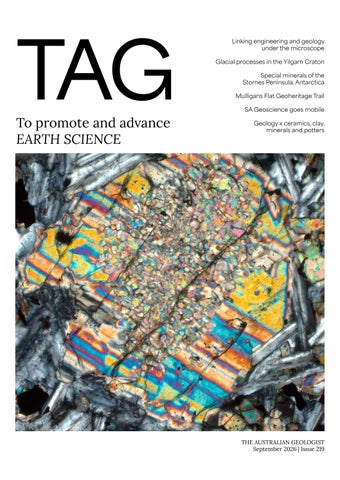
EDITOR IN CHIEF Sandra McLaren DESIGN & TYPESETTING Sarah Jackson PRODUCTION MANAGER Amber Jarrett PRINTED BY Direct Mail Solutions DISTRIBUTED BY Direct Mail Solutions CENTRAL BUSINESS OFFICE PO Box 576, Crows Nest NSW 1585 Email: info@gsa.org.au Web: www.gsa.org.au Phone: (02) 9160 8193 COVER IMAGE Pyroxene in basalt from Queensland, XPL. Source: Don Franks INSIDE COVER IMAGE
Kombolgie Formation sandstone and conglomerate, Ubirr lookout, Kakadu National Park, NT. Source: Sandra McLaren
and advances Earth Science across all disciplines, recognising its vital role in understanding, sustaining, and improving the world around us. The Australian Geologist (TAG) is a quarterly member magazine that includes society news, conference details, special reports, feature articles, book reviews and other items of interest to Earth Scientists. Each issue has a long shelf-life and is read by more than 3,000 geologists, geophysicists, paleontologists, hydrologists, geochemists, cartographers and geoscience educators from Australia and around the world. SUBMISSIONS TAG can no longer guarantee acceptance of complete articles without prior notice. Instead, we encourage members to send in their ideas and work with editors to produce new content. If you’d like to get involved, please email tag@gsa.org.au. Artwork must be high resolution 300 dpi or larger. COPYRIGHT The Publication is copyright by the GSA Inc unless specifically stated otherwise. However, material in this issue may be used provided acknowledgement is made. Every effort has been made to trace and acknowledge copyright holders of material in this publication. If any rights have been omitted, apologies are offered. The GSA is a learned society and TAG is published by the Society to provide information for members and as a forum for the expression of their professional interests and opinions. Observations, interpretations and opinions published herein are the responsibility of the contributors and are not necessarily supported by the GSA. The GSA has taken all reasonable precautions and made all reasonable
BACK PAGE IMAGE
efforts to ensure the accuracy of material contained in this publication,
Leah Lynham
the material contained herein.
Yilgarn landscape. Source:
and makes no warranties, expressed or implied with respect to any of
BUSINESS CORRESPONDENCE All business enquiries and correspondence relating to advertising space, inserts and/or subscription matters, should be sent to tag@gsa.org.au.
4
|
THE AUSTRALIAN GEOLOGIST
What will you be doing to celebrate Earth Science Week? With the greater geoscience community genuinely engaged with the need to promote and showcase our discipline, Earth Science Week comes at the perfect time. Some ideas for individuals and organisations: 1. Promote a cake decorating contest across organisations or staff rooms (in a similar style to the global reach of ‘bake-your-thesis’). Share creations and their geological inspiration online 2. Engage with #earthscienceweek2026 on social media by posting ‘one core a day’ or ‘one mineral a day’ throughout the week 3. Post images of your favourite geological features or places and share their stories 4. Host a geological excursion 5. Get crafty, creating fossils or minerals in various media 6. Host public talks or open day tours of facilities.
The Australian Science Teachers Association (ASTA) has released a media kit of images and social media tiles to help promote Earth Science Week. The kit is available online via the QR code below
GSA UPDATES
From the Editor This issue takes us across the country with a wide variety of features showcasing Australia’s diverse geology and celebrating the research, teaching and outreach efforts of many in our community. Several new initiatives have been launched: the Australian Geoscience Educators Rock Exchange, the inaugural Secret Santa Rock Exchange, South Australia’s new Geotrails app and a community for parents in geoscience. The Divisions have also been busy and it’s always great to hear what goes on in our community. It was inspiring to read the reflections of attendees following the highly successful GeoSciEdX meeting in Adelaide. It is without doubt that the event will generate a significant increase in positive engagement across education levels and all those involved
Photo: Supplied
in the organisation and running of the meeting deserve hearty congratulations. Building on member opinions is a key component of the GSA approach. In this issue we share member feedback on future directions for the AESC, seek feedback on the GSA Accredited Geoscientist Program and share results of the recent TAG reader survey. For TAG, I would particularly like to draw your attention to the new ‘EOI to contribute form’ and encourage you to consider what and how you might like to contribute to TAG. Photos from the field (or lab) are always welcome and if you see a relevant new book, report or publication, please let us know. As Dorothy Hill noted in the first ever TAG, if it is of interest to you, it’s likely to be of interest to others.
But on a very sad note, this issue commemorates the recent passing of three giants of the Australian geoscience community – Kath Grey, Ron Vernon and Mike Rickard. I invite members to seek inspiration from their extraordinary achievements but equally from the approaches they took to their work.
SANDRA McLAREN Editor in Chief
December 2026 issue The TAG team are now accepting ideas and proposals for feature stories for the December issue. Following our regular editorial policy, proposals are required to be assessed and accepted by the editorial team before a piece is submitted. This approach is a way of balancing content by discipline and to ensure opportunities for a diverse range of contributors. Regular contributions (Division and Specialist Group reports and News and Views columns) and feature articles for accepted proposals must be emailed to tag@gsa.org.au by 31 October. As always, we welcome your feedback on TAG and on society activities and directions more generally. Feel free to email the team tag@gsa.org.au.
6
|
THE AUSTRALIAN GEOLOGIST
GSA UPDATES
From the President
Upper beds of the Devonian Buchan Caves limestone, exposed at the Buchan Caves reserve. A lot of the darker beds are death horizons full of spinella Buchanensis brachiopods, thought to caused by upwelling from the anoxic deep ocean. Source: Eleanor Green
Photo: Supplied
THE AUSTRALIAN GEOLOGIST
|
7
TAG UPDATES
Results of TAG reader survey Many thanks to members who engaged with our recent call for feedback on TAG. With over 100 responses we received some very helpful and constructive feedback. We were particularly pleased to see that the overwhelming majority of members are happy with the content of TAG and to read a wide range of positive compliments from respondents. Other highlights were statistics showing: 84% of respondents learnt something new in TAG, 88% consider TAG to be visually appealing, 75% consider it to provide valuable insights, 86% consider it to be a valuable part of GSA membership and 80% appreciate the printed version. Respondents volunteered some great suggestions for content for future issues, both topics to cover and people to profile. As we have now received many helpful content suggestions, we will be maintaining a list of topics to cover and willing contributors so that we can match contributors to topic areas going forward. Please email the team or complete the online TAG EOI content form (QR code below) if you would like to express interest in contributing, if you wish to see a particular topic or profile in the magazine, or, consistent with current editorial policy, you would like to pitch a specific piece. TAG welcomes diverse voices from the GSA membership and we do try to cover the breadth of Australian geoscience topics
STRONGLY DISAGREE DISAGREE
STRONGLY AGREE
The amazing cryptic crosswords put together by superstar Vince Morand were celebrated by many respondents as a highlight. Thanks so much for your continued contributions Vince! A related suggestion was for a ‘regular’ crossword for those who might not be ‘cryptic types’. We’ve put one together for this issue and seek a volunteer to put these together going forward. If that sounds like you, please get in contact with the team. We are also always looking for ‘photos from the field/laboratory’ to feature. If you have photos to contribute please complete the EOI or send via email. Comments about issues accessing and reading TAG were also made. As of the recent June 2026 issue, there is now a download button on our ISSUU page, this allows members to directly download a .pdf format of the magazine. The survey will remain open for members who would like to contribute.
TAG provides valuable insights TAG covers a diverse range of topics
NEUTRAL AGREE
and member voices. But this is an area where some survey responses suggest we have more work to do; we hope our new EOI approach will provide opportunities for us to connect with a broader cross-section of our members.
TAG is visually appealing TAG connects me with the geoscience community I learn something new in TAG TAG represents disciplinary and geographic breadth TAG is a valuable part of GSA membership
0%
8
|
THE AUSTRALIAN GEOLOGIST
100%
TAG UPDATES
Satisfaction with TAG Satisfaction content with TAG
content
Dissatisfied 6%
Other
Which 6% Event coverage Which areas content 14% Event coverage do you enjoy areas content mostdo you enjoy Other 14%
Reading preferences
Reading preferences Both equally
Dissatisfied 23% action with TAG Both equally 6% Neutral Which Satisfaction with TAG content 23% 14% Reading preferences Event coverage Which Neutral content content areasmost Very Satisfied Reading preferences sfied 14% 14% 42%
Both equally Very Satisfied 23%
Dissatisfied 6%
Both equally 23%
42%
Neutral 14% Satisfied Very
Online 22% Very Satisfied Online 42%
42%
22%
Satisfied 36%
Satisfied 36%
Online 22%
How easy is it to navigate and read TAG?
3 x per year 17%
42%
Feature articles 42%
Interviews/profiles
Interviews/profiles 19%
Interviews/profiles 19%
other
2% Publication frequency 3 x per year 17% Publication frequency
3 x per year 17%
Neutral 7%
other 2% 3 x per year 17%
Very easy 70%
other 2%
TAG Reader Feedback Survey – Fill in form
4 x per year 81%
Very easy 70%
Very easy 70%
Feature articles Other 6% 42% Feature ar
19% Opinion pieces 19% Interviews/profiles 19%
other Publication frequency 2%
7%
Somewhat easy 18%
Event coverage 14%
Opinion pieces 19%
Opinion pieces 19%
Publication frequency
How easy isSatisfied it to navigate Neutral and36%read TAG?
Somewhat easy 18%
19%
Print 55%
Online 22%
it to Neutral How easy is it to d read 7% SomewhatTAG? easy 18% navigate and read TAG?
ral
Print 55%
Print 55%
6%
content areas do you enjoy Opinion pieces most
do you enjoy most
Print 55%
Other 6%
4 x per year 81%
Very easy 70%
4 x per year 81%
EOI for TAG content or contributions – Fill in form 4 x per year 81%
Important points: • TAG has a magazine format and its key purposes are to engage • We have had some issues with printing and distribution as we and enthuse. We try to include a breadth of content but obviously try to manage cost and time. We appreciate that recent issues this isn’t always possible in every issue. Feature pieces are written have been arriving in print form very late and thank members in an accessible style for a range of readers; where relevant, links for their patience and understanding as we resolve this are always provided to a more detailed paper for interested • Letters to the Editor are always welcome but note that only readers respectful comment or discussion will be published, consistent • TAG holds space in every issue for any Division, Specialist Group with the GSA Code of Conduct. Topics and views that do not or committee to share an update of their group’s activities, accord with GSA policies will not be considered. Letters to the should they wish to. Such updates would describe committee Editor that connect with individual pieces in previous issues are activity, policy development, upcoming conferences or symposia particularly welcome (or reports on past conferences or symposia) and other activities
THE AUSTRALIAN GEOLOGIST
|
9
GSA UPDATES
Member Survey: Future of the GSA Accredited Geoscientist (Ac.Geo.) Program The Geological Society of Australia (GSA) Governing Council is reviewing the future of the Accredited Geoscientist (Ac.Geo.) program to ensure it continues to provide value to members and represents an effective use of Society resources. Ac.Geo. was established to recognise professional competence, ethical practice, and continuing professional development among geoscientists. As part of this review, we are seeking feedback from members on the program’s current value, future relevance, and potential directions to help inform Council’s decision-making. Whether you currently hold Ac.Geo. accreditation, have considered applying in the past, or have never engaged with the program, we would value your input. Please complete the survey here: https://www.gsa.org.au/member-survey-acgeo-program/ Please ensure you are logged in to your GSA member account before accessing the survey. The survey will remain open until 10 December 2026. Results will be reviewed by Governing Council and a summary of findings will be published in a future edition of The Australian Geologist (TAG).
Update Your Division Preferences
AJES contract update
Several members have recently let us know that they would like to be part of more than one GSA Division, particularly where they live in one state but work in another. We have now updated the membership system to allow members to join multiple Divisions.
Taylor & Francis, publisher of AJES, have approached the GSA Governing Council with a contract for consideration. The decline in the demand for print and our AGMendorsed digital-first initiative have helped keep the per issue cost low. This proposal is currently under review but should see the society receive a healthier royalty balance than in previous years.
For most members, no action is required. But if being affiliated with more than one Division would better reflect your circumstances, please log in to your member profile and update your Division preferences. To make this change: 1. Visit the Member Edit Profile once logged-in. 2. Select Edit Profile from the menu on the left. 3. Scroll down to the Divisions section and select any additional Divisions you would like to join. 4. Click Save. Thank you for your patience as we continue to refine and improve our new membership system.
10
|
THE AUSTRALIAN GEOLOGIST
GSA UPDATES
What do GSA members want from the AESC? AESC 2026 provided us a stimulating and enjoyable scientific convention, and our thanks go to all the convenors, session chairs, student helpers and volunteers who made it happen. But as we consider how to run future AESCs, the national geoscience landscape is shifting: a crowded conference calendar, sponsorship that is harder to win, and ever tighter travel budgets. So, at the 2026 AGM and afterwards online we asked how you, the GSA members, would like future AESCs to run. Eighty-one of you replied.
Member preferences for future AESCs, from 81 responses collected at the 2026 GSA AGM and through the subsequent online survey.
Cost was the clearest signal. 62% would rather buy their own meals and pay a lower registration than to have catering bundled into a higher fee. Written comments also pushed for cost saving measures, with student subsidies and cheaper venues common responses. You also want breadth: 57% prefer 3or more parallel sessions, and only 13% want a single track. Respondents leaned towards a biennial timing at 56%, although more than a third were content to wait 3 years between meetings. There is no clear mandate on format: 52% prefer a hybrid meeting and 48% prefer an in-person meeting (Note: the 2026 planning committee were told that the hybrid option would be considerably more expensive). And there is also no clear preference for the venue of the next AESC with nearly a third of respondents being happy to travel to either of the proposed locations. Read together, these results are difficult to reconcile, with the majority wanting both an AESC that is more frequent and richer in programme while also desiring a conference that is cheaper to attend and that avoids clashing with international meetings and Specialist Group events. Unfortunately, not all these preferences can hold at once. A biennial cycle, 3 or more parallel streams and hybrid delivery all raise conference costs. The GSA has already subsidised the costs for all conference attendees for recent AESCs, particularly the costs for students, and this is not sustainable. But not every preference option costs money, and some clearly cut cost (like the suggestion to drop catering to lower registration fees). GSA members are also near-evenly split on an in-person versus hybrid format and relaxed about venue, so there is real room to move on both as we work to keep registration fees down. Thank you to everyone who took the time to provide valuable feedback as we begin planning the next AESC and beyond. The results now go to the Governing Council and the AESC Organising Committee and will shape the next round of planning.
Member’s AESC preferences and their effect on budget.
SAM BOONE, on behalf of the AESC organising committee and GSA Governing Council
THE AUSTRALIAN GEOLOGIST
|
11
GSA UPDATES
Members of the Coalfield Geology Council of NSW on a site visit to the Wambo Coal Mine in March 2026 (Supplied)
UPDATES NEWS THE DIVISIONS AND SPECIALIST GROUPS Coalfield Geology Council of NSW CGC NSW has continued to provide valuable opportunities for industry collaboration, professional development and outreach throughout 2026. Quarterly meetings and site visits – at United Wambo Coal Mine in March and at Vickery Coal Mine in June – gave members insights into mining operations, geological challenges and industry developments. The September meeting included a guided tour of the Newcastle Institute
12
|
THE AUSTRALIAN GEOLOGIST
for Energy and Resources (NIER) at the University of Newcastle, exploring research and innovation relevant to the resources sector. The Council has also maintained a strong focus on professional development, delivering the Fundamentals of Coal Geology online course on 21–22 May and the in-person Downhole Geophysics course on 22 July 2026. CGC NSW
also supported outreach and industry engagement through activation tables at NSW Mining Careers Events, promoting geoscience career pathways and engaging with students interested in the resources sector. Looking ahead, the Council will deliver its Coal Logging Training Program in November, providing practical training and further strengthening capability within the coal geology community.
GSA UPDATES
Victoria Division The GSA Victoria welcomes Prof Fabio Capitanio (Monash University) as the new Chair. During May to August, three major awards were announced: the Early Career Geologist Award went to Dr Ashleigh Hood (University of Melbourne), the Mid Career Geologist Award was presented to Dr Mark McLean (Geological Survey of Victoria and University of Melbourne), and the Selwyn Medal was awarded to Dr Rodney Boucher. Also in May, the society hosted Dr Victoria Milanez Fernandez (Monash University), who presented on landscape evolution in Southern Patagonia, showing how mantle convection and glacial-interglacial cycles together shape river terraces over more than a million years. The June program featured the Howitt Lecture, held jointly with the Royal Society of Victoria, where Dr Helen Green (University of Melbourne) discussed dating Australia’s oldest rock art in the Kimberley, highlighting vital partnerships between Indigenous communities and Western science. This collaborative spirit continued in July with a joint meeting alongside AIG, ASEG, WOMEESA, and PESA, featuring Dr Fernanda Alvarado-Neves (Aurelia Metals and WOMEESA Secretary) on 3D geological modelling of igneous intrusions. The winter schedule concluded in August with Student Night, showcasing four excellent presentations: Mohammad Humand on blueschist metamorphism in the Lachlan Orogen; Rory McNab on high-grade gold deposit controls at Fosterville; Louisa Sheridan on millennial-scale climate events in southern Australia during the Last Glacial Period; and Nellie Rowan on ductile shear zones as ore fluid conduits at the Mt Isa Inlier. FABIO CAPITANO, ANNE-MARIE TOSOLINI
Frank Canavan Award for the best Second Year Geologist in a Victorian University, presented to Rita Fortune (left) of The University of Melbourne.
D.E. Thomas Medal for best Masters/ Honours mapping research project, presented to Ayla Edwards (left) of Monash University
Western Australia Division Update GSA WA was proud to sponsor PEG2026, the 11th International Symposium on Granitic Pegmatites, held at UWA in August. The conference brought together leading researchers, industry professionals and students from around the world to explore pegmatite geology, mineralogy and critical minerals. As part of our commitment to supporting the next generation of geoscientists, GSA sponsored two student registrations,
providing students with the opportunity to attend, network and engage with the wider industry community. We also launched our new GSA WA merchandise at PEG2026, giving members a new way to show their support for geoscience. JONATHAN STOKES
THE AUSTRALIAN GEOLOGIST
|
13
GSA UPDATES
ACT Division
NSW Division
Good news, the ACT Division is back up and running! In August the division held their first monthly meeting for about 18 months and has a full dance-card of events planned for September, October and November.
The GSA NSW Division participated in the highly successful
Regular monthly meetings are being held on the third Tuesday of the month, with socialising commencing 4:30 pm, and the formal meeting and invited talk to start at 5 pm (for a 6 pm close). All events are kindly hosted at Geoscience Australia and all welcome in-person or online.
should be welcoming new talent soon! Huge thanks to Kelsie
RICHARD BLEWETT
Harbour Trust. The NSW Division, the National Rock Garden
Science in the Scrub held in the Western Sydney Parklands during National Science Week. The GSA booth was more popular than
ever. Kids loved the new metal detector activities, so geophysics Dadd, Chris Fergusson, Jonathon Leonard, Abhilash Katara and Ben Greenrod for volunteering on the day.
On Father’s Day, the Division also took part in a public outreach
event at North Fort (North Head) organised by the Sydney and the University of Sydney School of Geosciences teamed up
Upcoming talks:
to bring the rocks and geomorphology of the Sydney region to
life. We talked about the huge, Andean-like mountains that likely
once rose along Australia’s eastern margin during the Cretaceous, the collapse of that mountain belt, and the unzipping of the
13 OCTOBER (coinciding with Earth Science Week) GARY LEWIS (GEOETC) – “Understanding the Geoscience Pipeline: How to fix the leaks from curiosity to career.”
Tasman Sea, and interactions with coastal and marine processes, all helping to shape the coastline and Sydney Basin that we
call home today. Huge thanks to Kelsie Dadd, Chris Fergusson (who travelled all the way from Wollongong for the day), Marita
Bradshaw (who travelled from Canberra), Mike Smith and Kevin H. (who was visiting from Stanford!) for their help in making the event such a success.
17 OCTOBER DR CAROLINE EAKIN (RSES ANU) – “Seismic Anisotropy of the Australian Cratonic Lithosphere”
Stay tuned for details of a special event planned for Earth Science
Week and the new multi-day Sydney Festival of Geosciences to be held in November. The November event is planned to celebrate
160 years of geoscience and geology from the University of
EARLY-MID DECEMBER (DATE TBA)
Sydney. This is a public event, so all are welcome!
ACT Division Christmas party
SABIN ZAHIROVIC
OFFICE BEARERS Chair Richard Blewett Secretary Vacant Treasurer Alanah Hughes
GENERAL COMMITTEE Alan Whitiker Brad Opdyke
Doug Finalyson (Publications Officer)
Christo Marais van
Gary Lewis
Cathy Brown
Grace Shepard
Vuuren
Jackie Hope
ACT STRATIGRAPHY SUBCOMMITTEE Convenor Christo Marais van Vuuren
Subcommittee Members Cathy Brown
ACT GEOHERITAGE SUBCOMMITTEE Convenor Cathy Brown
Subcommittee Members Doug Finlayson
14
|
THE AUSTRALIAN GEOLOGIST
Kelsie Dadd, Kevin H., Marita Bradshaw, Chris Fergusson, Mike Smith and Sabin Zahirovic at North Fort public outreach day. Photo: supplied
GSA UPDATES
Tasmania Division Update The Geological Society of Australia Tasmania Division has enjoyed an active and successful 2026 to date, marked by outstanding research presentations, student engagement, outreach activities and continued support for the next generation of geoscientists. New student representatives Rekha Nair and Sophia Minter have recently joined the Division Committee, strengthening student involvement in division activities. • A diverse program of presentations has been a clear highlight: • Taryn Noble (IMAS) presented new insights into East Antarctic Ice Sheet behaviour over late Pleistocene climate cycles using marine sediment cores and geochemical proxies. • Rebecca Carey reported on findings from the 2025 RV Investigator expedition studying the aftermath of the 2022 Hunga Tonga-Hunga Ha’apai eruption.
• Jack Mulder challenged long-held ideas about the Selwyn Block beneath Victoria. Mineral Resources Tasmania geologist Grace Cumming showcased major advances in geological mapping across northwest Tasmania. • Sebastian Meffre and student members Flynn Robertson and Matthew Bristow updated members about the important role of field work in geoscience student education, including the University of Tasmania’s expanding local and international field-based Earth Sciences curriculum connecting classroom concepts with real-world geology. The New Caledonia field course was again a standout success, exposing students to ophiolites, peridotite nappes, eclogitefacies rocks, nickel laterite deposits and active environmental geology issues.
Peter McGoldrick engages with the public at the Hobartica Festival in early August.
Tasmanian Division members viewing an unconformity between Triassic and Paleogene sedimentary units on the Derwent Valley Autumn Field Trip Photo: supplied
Our annual Division autumn field trip was to the Derwent Valley region and another highlight. Led by Phil Sansom, Clive Calver and Karin Orth, 17 participants examined the geological evolution of the Derwent catchment, focusing on the relationship between faulting, river development and volcanism during the Paleogene and Neogene. Division members have contributed to Hobartica and the Beaker Street Science Festival and to National Science Week activities, the Festival of Bright Ideas and UTAS Open Day. Thousands of Tasmanians engaged with Earth science through
Education engagement speakers Sebastien Meffre, Flynn Robertson and Matt Bristow with Division Chair Jodi Fox.
interactive displays, Antarctic geology exhibits, mineral identification activities and hands-on demonstrations. We are delighted to celebrate several notable achievements by Tasmanian geoscientists. Sheree Armistead received the prestigious E.S. Hills Medal, while David Gray, Michael Vicary and Andrew McNeill were awarded the Stillwell Medal for the best paper published in the Australian Journal of Earth Sciences in 2024. Student excellence was recognised through the presentation of the GSA Tasmania Division undergraduate prizes, including the S.W. Carey Honours Prize awarded to William
Sinclair. We congratulate 3 Tasmanian recipients of the 2026 GSA Endowment Fund grants: PhD student Amy Wells and Honours students Kaitlyn Ainscow and Angelika Schouten. The Division looks forward to a busy remainder of 2026, including the GSA Earth Science Student Symposium (GESSS) in Hobart (5-6 November) and the 16th Tasmanian Geosciences Forum in Queenstown on 26 November followed by a spring field trip in Tasmania’s northwest. JODI FOX AND KARIN ORTH
THE AUSTRALIAN GEOLOGIST
|
15
NEWS AND VIEWS | NATIONAL ROCK GARDEN
Colour, community and new connections at the National Rock Garden On a cold Canberra morning, a rock wrapped in a hand-knitted scarf can stop people in their tracks. That is part of the quiet charm of the National Rock Garden at the National Arboretum Canberra: it invites visitors to look again at the materials beneath their feet, and to see geology not as something distant or abstract, but as something colourful, tactile and deeply connected to people and place. This winter, the National Rock Garden
From June to August, the scarves
visit from a delegation from the
joined the Arboretum’s much-loved
weathered rain, cold and curious hands
Autonomous Bougainville Government,
Warm Trees program for the first time.
with little trouble. The installation sat
led by Minister Amanda Masono. After
Usually, Warm Trees brings colour to
comfortably within the wider Winter
a Welcome to Country by Aunty Violet
the forests through community-made
in the Woods program, which brought
Sheridan in the Arboretum Visitor
knitted and crocheted installations.
strong visitor numbers during the school
Centre, the delegation continued
This year, the rocks joined in. Six
holidays and evening events. For the
through the fog to the National Rock
specimens in Forest 13 were dressed
National Rock Garden, the yarn-bombed
Garden. There, conversations turned to
in bright handmade scarves, with a
specimens were more than decoration.
the rocks already on display and to the
few crocheted creatures adding extra
They were an invitation: come closer, ask
possibility of a future ‘friendship rock’
personality. The result was playful,
what this rock is, where it came from,
from Bougainville. Such a specimen
photogenic and surprisingly effective:
and what story it carries.
would sit comfortably in a garden devoted to connection: between
visitors who might otherwise have walked past the rocks were drawn in for
The Garden’s stories also took on an
landscapes, cultures, tectonic histories
a closer look.
international dimension with a recent
and the people who care for them.
Brad Pillans, chair of the National Rock Garden Steeering Committee, hosting a visit from the Autonomous Bougainville Government, led by Minister Amanda Masono and including representatives from the Australian Department of Foreign Affairs and Trade. Also pictured at top of page 17. Image courtesy of Michelle Cooper.
16
|
THE AUSTRALIAN GEOLOGIST
NEWS AND VIEWS | NATIONAL ROCK GARDEN
Closer to home, another new chapter
move our Doonba Dunite specimen to
friendship, geology and regional
arrived in the form of the Currajong
a local stonemason for polishing. Early
connection. The Currajong Limestone
Limestone specimen from Wee Jasper,
photographs suggest the polished
adds another piece to an expanding
NSW, on Ngunnawal Country. This
surface has revealed striking colours,
record of Australia’s remarkable
spectacular limestone, containing fossil
offering a reminder that even familiar
geological heritage. This is the strength
corals and brachiopods of Devonian
rocks can surprise us when we take the
of the Garden: it does not simply display
age, has been safely delivered to its new
time to look closely.
rocks. It gives people a reason to pause beside them, talk about them, and see
home in our fossil-themed cluster and is already being celebrated as a terrific
These winter activities capture the
in them the long, layered stories of
addition to the collection. The next task
momentum building at the National
Country, community and deep time.
is interpretation: preparing a plaque
Rock Garden. Knitted scarves have
that helps visitors understand not just
made the collection warmer, brighter
what the rock is, but why it matters. The
and more approachable. The ministerial
delivery also created an opportunity to
visit has opened a conversation about
MICHELLE COOPER
DIRECTOR, NATIONAL ROCK GARDEN
Left and right: Crocheted critters on display at the National Rock Garden as part of the Warm Trees installation. Images courtesy Michelle Cooper.
THE AUSTRALIAN GEOLOGIST
|
17
NEWS AND VIEWS
The Australian Geoscience Educators Rock Exchange (AGERE) was born at the GeoSciEdX Conference in Adelaide in August 2026. Many teachers identified logistics and the cost of fieldwork as barriers to getting kids out of the classroom to see relevant rocks in their natural environment, especially given how large Australia is. The AGERE program is a way for anyone – teacher, industry professional or rock enthusiast – to offer a rock to a geoscience educator to bring the field to the classroom. The google form is simply filled out and educators are matched to someone that can provide their rock! Please remember to collect responsibly and to obey all state and federal laws. Be aware of your safety. Rocks are not to be bought or sold, this is an exchange and community activity to support education and outreach. Never pass on your bank details to strangers! For more information about the project and to find out how you can support AGERE contact the team by email: ausgeosciedrockex@gmail.com LEAH LYNHAM
18
|
THE AUSTRALIAN GEOLOGIST
GSA JOURNALS | ALCHERINGA
The latest from Alcheringa New genus and species of semi-aquatic bug (Mesoveliidae: Hemiptera: Heteroptera) from the Kachin amber of Myanmar A new bug, Imesovelia unispina gen. et sp. nov., is described from three specimens preserved in Upper Cretaceous Kachin amber of Myanmar. The taxon is assigned to Mesoveliidae based on the presence of three pairs of cephalic trichobothria inserted in deep cuticular pits, coxae inserted close to the ventral midline of the thorax and a well-developed ovipositor. The new genus is distinguished from other mesoveliids by a character state combination: head longer than thorax, antennae shorter than body, antennomere III longest, ventral head with a pair of long carinae, pronotum longer than mesonotum, metatarsomere II longest. XIAOYU ZHANG, BOYA WEI, DONG REN & YUNZHI YAO
Redescription of the ammonite Himalayites treubi and taxonomic implications for Jurassic–Cretaceous Himalayitidae This study presents the first comprehensive revision and illustration of the type material of the himalayiatid ammonite Himalayites treubi, preserved as a plastoholotype of the lost original type specimen from Upper Jurassic strata of the Sula Islands in Indonesia. Detailed comparisons with closely related members of the Himalayitidae allow clear taxonomic distinctions. Himalayites treubi is closely allied with the Himalayites seideli–hollandi group from the Indo-Pacific Sub-realm. A phyletic connection between those Himalayites taxa and the neocomitid genus Blanfordiceras is hypothesized, as the diagnostic ornamental stage of Himalayites likely represents a derived innovation originating from a neocomitid morphology. Our analysis indicates that Indo-Pacific Himalayitidae do not exhibit clear phyletic links with the Suaritidae Cantú-Chapa, from the Caribbean Sub-realm, either in shell morphology, ontogeny, or ribbing pattern. The same applies to the newly proposed families Micracanthoceratidae fam. nov., predominantly known from the Mediterranean–Caucasian Sub-realm with occasional Tethyan occurrences; and Windhauseniceratidae fam. nov., which were mainly distributed along the southern margin of the Indo-Pacific Sub-realm. Several of their representatives were long assigned to the Himalayitidae. Yet, phylogenetic evidence indicates they derive from the Ataxioceratidae ancestral lineage. Finally, the genus Birobagoczkyceras gen. nov. is introduced herein based on Ammonites tripartitus, to recognize a group of upper Berriasian taxa from the Indo-Pacific Sub-realm that have long been conflated with Himalayites. Pseudohimalayites gen. nov. is also formally established to accommodate Himalayites nieri, which ranged across the Berriasian–Valanginian boundary in the Mediterranean Tethys. Both genera are assigned to the Neocomitidae based on ontogenetic development and suture-line characteristics. CAMILLE FRAU
THE AUSTRALIAN GEOLOGIST
|
19
GSA JOURNALS | ALCHERINGA
New spiriferide and spiriferinide brachiopods from the upper Palaeozoic Tepuel Group of Patagonia Permo-Carboniferous ‘Spirifer-like’ brachiopods from the Tepuel-Genoa Basin in Patagonia, Argentina, have been recognized for many years. Yet, their taxonomy has not been thoroughly evaluated. This study provides systematic descriptions of six species representing six different genera. Spiriferides include Kitakamithyris booralensis, Spirelytha trilagoonensis sp. nov., Crurithyris salinensis sp. nov. and Biconvexiella raqueliae sp. nov. Spiriferinides include Punctospirifer cf. P. ambiguus and Spinuliplica guangrongshi sp. nov. These new records enhance the diversity of Patagonia’s southern cold-water Permian–Carboniferous faunas. They also support previous biostratigraphic schemes and strengthen the palaeobiogeographical links between southwestern Gondwana (represented by Patagonia) and eastern Gondwana during the late Palaeozoic. ARIANA VALERIA ROBLES VILCHES, ARTURO CÉSAR TABOADA & MARÍA ALEJANDRA PAGANI
Severginaria nomen novum: a replacement name for the preoccupied Ordovician brachiopod genus Salairella The Upper Ordovician brachiopod genus Salairella is preoccupied by the Devonian stromatoporoid genus Salairella and therefore constitutes a junior homonym. Accordingly, Severginaria nom. nov. is proposed herein as a replacement name for the brachiopod genus. YONG YI ZHEN
Investigation of finger motion in two quadrupedal dinosaurs: the sauropod Camarasaurus and stegosaur Stegosaurus The metacarpals of sauropod dinosaurs were arranged to form a tube or semi-tube, and those of stegosaurs were arranged to form a semi-tube. This orientation aimed the fingers toward each other during flexion and would have caused the fingers to crowd each other and obstruct each other’s movements during flexion if the fingers were as mobile as they were in other dinosaurs. I therefore sought to determine whether finger movement in members of these two lineages involved any special modifications to prevent such obstruction. I posed the bones of the hand skeletons of the sauropod Camarasaurus sp. and the stegosaur Stegosaurus sulcatus in sandboxes to measure their range of motion (ROM). The results indicate that limitations upon finger mobility in both Camarasaurus and Stegosaurus prevented the fingers from crowding each other or obstructing each other’s movement. In Camarasaurus, ROM in fingers I–IV was limited to the field of hyperextension. In Stegosaurus, ROM in finger II was limited to the field of hyperextension, and the other fingers were immobile. These two dinosaur lineages thus provide a remarkable example of convergent evolution, not only in metacarpal configuration but also in the special modification (limited finger mobility) to prevent the potential predicament (fingers obstructing each other’s movements) that said configuration would otherwise have caused. PHILIP J. SENTER
20
|
THE AUSTRALIAN GEOLOGIST
FEATURE | OPINION
Geoscience has the stories. It just needs more people to post them The first time I realised I knew almost nothing about geoscience; I was standing in my living room, staring at a bookshelf of rocks I’d never thought twice about. I’m not a geologist; I’m a psychology graduate who runs community sport competitions. Over the last two years, I’ve been introduced to the world of geoscience through my partner completing his PhD. Most of my education has come in the form of intermittent fascinating facts about the rocks decorating our home or explanations of landscapes on road trips. The more I learned, the more fascinated I became. But alongside that curiosity came a question: why had something so important, so connected to everyday life, taken me this long to notice? That question became more pressing as I learnt about the challenges facing the discipline. Globally, geoscience is grappling with declining student enrolments, university program closures, low public awareness and an identity crisis. Numerous researchers have proposed thoughtful solutions, from curriculum reform to stronger industry partnerships and national roadmaps (Capello & Howes, 2022). However, after reading this literature, I’ve found myself asking a much simpler question that seemingly underpins all the above issues. How can someone choose a career/ course/identity they’ve never heard of? Psychology tells us that familiarity shapes what we notice, what we
remember and what we can see ourselves becoming. The things we encounter regularly are more likely to feel relevant and accessible, while those outside our everyday experience can remain invisible. My experience suggests that geoscience’s challenge is not capturing interest once people discover it, it’s getting them to discover it in the first place. This is a problem I’ve also grappled with at work. When I first began running community sports programs, we constantly heard the same comment: “I didn’t know this place existed”. So, to increase the public’s familiarity with our centre, we started a TikTok account and began posting twice a week. The content we posted followed trends and consistently showed our workplace and programs in a funny, authentic manner. Within months, people knew who we were. Our competitions filled, our programs developed wait lists, and our videos reached hundreds of thousands of people who previously had no idea we existed. Our programs hadn’t changed; they’d simply become visible. This leads me to a suggestion from an outsider; universities should employ a casual content creator. Whether they’re a marketing graduate or digitally savvy geoscience student, give someone the job to tell the stories the discipline already has.
Explain why the Blue Mountains are blue. Show what happens on a field trip. Reveal what’s inside a rock under a microscope. Connect the minerals inside a smartphone to the geologists who help find them. Introduce the people behind the science, not just the science itself. Social media isn’t a silver bullet. It won’t reopen university departments or solve funding pressures. But it may be one of the few interventions capable of addressing several challenges at once. It can increase awareness, broaden outreach beyond schools and industry events, challenge outdated perceptions of geology, showcase diverse career pathways and reach audiences that traditional recruitment efforts rarely touch. The goal isn’t to “go viral”. It’s to make geoscience visible, familiar and relevant to people who would never think to look for it. Geoscience has no shortage of extraordinary stories. As someone who discovered them almost entirely by accident, I can’t help wondering how many future geoscientists are still waiting to discover the discipline. Maybe the next challenge isn’t finding the next great geological discovery. Maybe it’s making sure the next generation discovers geoscience. LIZ REEVES
Allow them access to researchers, laboratories and field trips with the aim of posting two videos a week.
THE AUSTRALIAN GEOLOGIST
|
21
SPOTLIGHT | AJES
Evidence of glacial processes within the Lefroy Drainage System, Western Australia The idea of glacial activity in the arid, peneplanated goldfields of Western Australia seems a little incongruous today. But investigating that exact concept motivated a study by Leah Lynham and collaborators, with their results are published in the most recent issue of AJES. Their work is focused on the Lefroy Drainage System (LDS) – one of 6 large-scale drainage systems incised into the Eastern Goldfields Region on the southeastern margin of the Yilgarn Craton in Western Australia. Glacial origins had previously been confirmed for other drainage systems further north on the Yilgarn Craton (via striated bedrock, polished pavements, and tillite infill) but until now there has been no direct evidence of a glacial origin for the LDS. The research team examined 2 field sites east of Lake Lefroy (Madoonia Breakaways and Fitzgerald Lagoon) at the downstream confluence of lakes Lefroy and Cowan. Using field stratigraphic logs, sedimentary rock descriptions (including grainsize, sorting, bed thickness measurements), field images and hand samples, the team identified a range of sedimentary rock units: • Facies 1: A gravelly conglomerate interpreted as fluvio-glacial outwash deposited near the edge of an ice sheet; the rocks contain polished clasts with Stoss and Lee morphology consistent with subglacial
abrasion and a preferred orientation suggesting a southwest–northeast paleoflow direction. • Facies 2: A bimodal sandstone layer with coarse, angular quartz grains within a matrix of clay-sized grains; observed microscopic deformation features (crushed and stacked grains) are typical of subglacial stress and the matrix is interpreted as rock flour characteristic of a glacigene environment; the unit is interpreted to represent sandy lenses within the lower section of a meltout tillite. Facies 3: A polymict, pebbly diamictite with a silt-rich matrix, faceted clasts, clasts with characteristic stoss and lee morphology and a high number (60%) of polished clasts. Facies 3 is interpreted as a tillite deposited by the in situ melting of debris-rich, stagnant ice at the base of a glacier. • Facies 3 rocks are overlain by a surface lag of polymictic pebbles and boulders of a variety of lithologies and highly variable clast size (up to 1 m across). The largest boulders are gneissic lithologies with accessory garnet and banded iron formation that do not occur in the local basement and suggest transport distances of at least 60 km. To support these interpretations, the team used clast form analysis (measurements of the shape and roundness) of 286 rock clasts recovered from the field sites; the results
LINK TO PAPER L. Lynham , E. Knutsen, G. Smith & R. Vaucher (2026). Evidence of glacial processes within the Lefroy Drainage System, Western Australia. Australian Journal of Earth Sciences, 1–20. https://doi.org/10.1080/08120099.2026.2 701983
22
|
THE AUSTRALIAN GEOLOGIST
matched patterns typical of subglacial deposition. Leah also used a 3D depth-to-basement model of the buried valley floor, constructed using over 82,000 historical drill holes and provided by St Ives Gold Mine (WA), as well as additional subsurface data in the public domain. This model revealed a broad, flat, asymmetrical U-shaped valley crosssection that is cut by younger V-shaped river channels, a morphology characteristic of glacial erosion rather than purely fluvial erosion. An “overdeepened” basin (where the valley floor dips below what a river alone could carve) was also identified where Lake Lefroy transitions into Lake Randall. The sedimentary observations and detailed subsurface model allowed Leah and the team to conclude that the LDS was originally carved by glacial scour and may represent a buried glacial tunnel valley (analogous to buried tunnel valleys known in Canada). Moreover, the orientation of the system was shown to match the pattern already established for other, parallel drainage systems on the Yilgarn Craton. The authors suggest the glacial erosion occurred during the Late Paleozoic Ice Age (c. 299–290 Ma) but cannot confirm an age without direct radiometric dating of the sediment, something they hope will be done in the future.
SPOTLIGHT | AJES
Author Reflections – Leah Lynham
“
we realised we’d found the glacial outcrop!
This paper represents more than 8 years of (literal) blood, sweat and tears. From conceptualisation to publication, it’s been a wild ride! This paper, and the story behind it, is, in a way, the reason for my PhD research. More than 8 years ago now I was on parental leave and found myself browsing local geological maps and their accompanying notes (as you do!). I found myself intrigued by a small outcrop of supposedly Permian glacial material in the lower reaches of the Lefroy Drainage System (LDS). Eventually I found myself as a PhD Candidate at James Cook University, unravelling the geological history of the LDS, and through discussions with colleagues discovered that although there was a generally accepted
consensus that the drainages traversing the Yilgarn originated from glacial scour, there was no direct evidence published from the LDS. I kept coming back to the small outcrop on the 1:250,000 map sheet, and with the support of my PhD advisors set out to locate and document it. Spoiler alert – it took multiple trips driving through some very remote country, gorgeous sunrises and sunsets, a few tantrums and literal blood shed falling over in the dense saltbush and scrub before we located it. And it was nothing like the map notes suggested. There was no “100 ft of tillite”, only a couple of quite unremarkable, very heavily weathered polymictic conglomerates ~2 m in thickness situated in breakaways as well as some polymictic boulders scattered across the
”
surface above the breakaways. But when we saw that most of the clasts had a distinctive “bullet” shape, and noticed that there were gneissic rocks present (especially as boulders), we realised we’d found the glacial outcrop! Over the next couple of years I revisited the outcrop, measured pebbles and collected samples to build up our interpretations. Lots of patience in building and working with subsurface data provided the extra evidence we needed to demonstrate the drainage to be a scour. I’m really proud of this, my first published journal paper. I feel the results prove beyond a reasonable doubt that the LDS has its origins in glacial scour, I hope you enjoy reading all about it!
THE AUSTRALIAN GEOLOGIST
|
23
GSA UPDATES
UPCOMING EVENTS SOUTH AUSTRALIAN EXPLORATION AND MINING CONFERENCE FRIDAY 4 DECEMBER 2026 ADELAIDE CONVENTION CENTRE
MORE INFORMATION
The South Australian Exploration and Mining Conference – co-organised by the GSA SA Division, AIG, AUSIMM, ASEG and AMEC – is a great event for our geoscience community. SAEMC brings together the South Australian geological, mining and METS community to examine the science, discoveries
and innovations shaping the state’s exploration and mining sector. Featuring presentations from active explorers, miners and researchers, the conference provides insights into South Australia’s mineral systems, exploration challenges and resource potential. It continues to be an important forum for
advancing geological knowledge and industry collaboration. Any profits are reinvested in geoscience education programs.
SELWYN SYMPOSIUM THURSDAY 29 OCTOBER 2026 FRITZ LOEWE LECTURE THEATRE, SCHOOL OF GEOGRAPHY, EARTH & ATMOSPHERIC SCIENCES, THE UNIVERSITY OF MELBOURNE OUTLINE: 1.00-1.30 pm Registration SESSIONS: 1.30-2.00 pm Fabio Capitanio 2.00-2.30 pm Saini Samim 2.30-3.30 pm Hayden Dalton 3.30-4.00 pm afternoon tea 4.00-4.30 pm John Webb 4.30-5.00 pm Heather Handley 5.00-6.00 pm drinks 6.00-7.00 pm Keynote – Associate Professor Teresa Ubide Title: “Under the volcano: Unveiling magma histories with microanalysis”. The keynote presentation will be followed by dinner in nearby Lygon St. Contact – gsavictoria@gmail.com
24
|
THE AUSTRALIAN GEOLOGIST
SGTSG The 2026 meeting of the Specialist Group in Tectonics and Structural Geology will be held at: THE GOODS SHED BALLARAT, VICTORIA NOVEMBER 9-13, 2026 Registration and abstract submission will open in June. For more information please visit the website.
Any enquiries please email Melanie Finch and Peter Betts at sgtsg2026@gmail.com
GSA EARTH SCIENCES STUDENT SYMPOSIUM REMINDER! NATIONWIDE GESSS 5–6 NOVEMBER 2026 Following highly successful divisional GESSS events over recent years, 2026 will be the first year where a nationwide ESSS will take place. This free annual conference is organised by students, for students, with presentations hosted at universities across Australia and streamed online nationwide. It is a great opportunity for students to showcase Australian geoscience research and connect with the wider geoscience community. Students interested in presenting, attending, or helping organise the event are encouraged to register their interest. The GSA is also calling for sponsors to support this year’s event. Sponsorship opportunities are available through the prospectus on the GESSS website. THE AUSTRALIAN GEOLOGIST
|
25
FEATURE | OPINION
Education and knowledge transfer in the geology industry – a fluid example The future of geology may depend not only on preserving existing knowledge, but also on reconnecting the discipline with some of the powerful scientific ideas developed over the past half century. Doing so would strengthen research, education and exploration practice, while helping students see geology not as a mature data-handling exercise, but as an active frontier for understanding complex natural systems. A simple question After several recent presentations on hydrothermal mineralisation in Australia and South Africa, we received substantial feedback. Much of it circled around a deceptively simple question: how do we explain clearly that fluids can move through consolidated and metamorphosed rocks? The comments came from people ranging from an undergraduate student to senior industry managers and consultants. They also raised broader concerns about exploration approaches in which geochemical signatures and large datasets sometimes substitute for understanding the physical processes that form ore deposits. At the surface, rainwater runs over a granite headstone rather than through it. It is therefore easy to imagine that water cannot pass through rock. But rocks several kilometres below the surface are not fixed granite monuments. Geological time, deformation, pressure, temperature, fluid pressure, mineral reactions, grain boundaries and transient fractures create a very different environment. 26
|
THE AUSTRALIAN GEOLOGIST
Bill Fyfe and others demonstrated decades ago that progressive metamorphism involves substantial loss and redistribution of water. Rocks cannot progress from hydrous lower-grade assemblages to relatively anhydrous high-grade assemblages without fluid being released and transported elsewhere. The question is therefore not whether fluids moved through the crust, but how they moved, where they were focused, and where they reacted sufficiently to produce mineral deposits. Learning to see fluid flow Different geological environments involve different styles of fluid movement. Near the surface, groundwater can move along open fractures in otherwise impermeable basalt or granite. Fluids can also move through porous sediments. Deeper, at metamorphic depths, fluid migration may occur through extremely small grain-boundary networks and transient fractures generated during deformation and with significant changes in fluid pressure. Large, permanently open cracks are not required. Ore deposits are not simply products of fertile rocks or fertile fluids. They form where metals are mobilised, transported, focused and deposited within an evolving crustal architecture. This involves deformation, changing permeability, pressure fluctuations and chemical reaction. Much of the evidence is nevertheless visible in ordinary outcrop. One of us recalls teaching groundwater geology to second- and third-year students.
On the first laboratory day, the class walked three blocks from campus to basalt outcrops. Everyone “knows” basalt is impermeable, yet water was visibly oozing from fractures. The students measured the flow. It was a simple and memorable lesson. In another course, students visited coastal schist. Schist has extremely low matrix permeability near the surface, yet the rocks contained repeated quartz veins, fractures and rusty ankeritic alteration. Significant volumes of hydrothermal fluid had clearly passed through these supposedly impermeable rocks but under moderate deep metamorphotic conditions. There is a broader lesson here: geologists tend to see what they have been trained to see. One of us studied sedimentology in the Narrabeen Group on Sydney’s northern beaches and barely noticed the structures. Returning decades later, structures are among the first things he sees. They were always there; what changed was the geological eye. A geologist concentrating on sedimentary textures may overlook quartz veins and fractures, while a structural geologist may overlook important sedimentary architecture. What we observe is strongly influenced by what we have been shown and taught to expect. This is the powerful argument for field teaching, independent mapping and exposure to competing geological interpretations.
FEATURE | OPINION
On the coast southwest of Dunedin, New Zealand. The Chinese coin — reflecting the photographer’s sense of humour — is about 2 cm across. The outcrop shows schistosity-parallel quartz veins (approximately left–right in the photograph) and a later brittle fracture forming a small fault (approximately up–down) at the centre of the photograph. Limonite staining along the late fractures records oxidation of ankerite. Together, these features provide clear evidence of early metamorphic fluid flow and focusing, followed by later brittle fracturing, fluid movement, and reaction during the evolution of the rock.
Education and knowledge transfer Geology is becoming extraordinarily data-rich. Exploration now uses huge geochemical and geophysical datasets, hyperspectral imagery, numerical modelling, machine learning and increasingly sophisticated analytical techniques. These are major advances. The danger is that, in becoming data-rich, geology becomes conceptually poorer. Field work, structural geology, petrology, metamorphism, and mineralogy are fundamental. They should be linked to wider scientific questions: how fluids move through evolving crust, how permeability develops and disappears, how deformation reorganises pathways, and how physical and chemical feedbacks create extraordinary local concentrations of metals. University curricula, however, are increasingly crowded. Data science, modelling, isotope geochemistry, environmental studies, safety training and other legitimate demands all compete for limited teaching time. Something inevitably receives less attention, and in some courses, this appears to include field geology, metamorphism, structural geology and crustal fluid-flow processes. Industry often assumes universities
will provide these foundations, while universities reasonably expect industry to provide more specialised training. Important knowledge can fall into the gap between them. The solution should not simply be to demand more from already heavily committed academics. Universities, industry and professional societies could instead collaborate much more extensively in field-based short courses and continuing professional development. There is precedent, Australia’s former Key Centres played an important role in connecting university expertise, postgraduate education, industry problems and professional training. Similar mechanisms could again provide a bridge between fundamental geological science and exploration practice. Industry also has an important role because it experiences directly the success and failure of geological ideas. If increasingly sophisticated exploration programmes repeatedly fail, the answer is not necessarily still more data. Sometimes a better geological question is needed.
Conclusion Education and knowledge transfer are central to the future of geology. Universities, industry and professional organisations share responsibility for ensuring that fundamental geological understanding is not lost as new analytical and computational capabilities are added. Fluid flow through rocks is but one simple example. Ore-forming systems involve deformation, fluid movement, heat transfer, chemical reaction and changing permeability across scales from individual grains to crustal provinces. The processes are complex, and much of the evidence can be seen directly in the rocks. The first step is therefore straightforward: take young geologists into the field, show them the evidence and teach them to see it. This is not about preserving old geological ideas for sentimental reasons. It is about ensuring that geology remains connected to the scientific thinking needed to understand some of the most fascinating — and economically important — natural systems on Earth. JULIAN VEARNCOMBE, JUN COWAN, DAVE CRAW, MIKE GRIGSON, BRUCE HOBBS, ALISON ORD & NEIL PHILLIPS THE AUSTRALIAN GEOLOGIST
|
27
FEATURE | OPINION
Digging deep or dodging the bill? Does the resource sector owe Earth science an education fund? In the global push to implement and develop green energy solutions, the demand for critical minerals such as lithium, copper and rare earth elements is set to increase. Both geologists and the extractive industries themselves will become increasingly important agents in upholding a number of the United Nations Sustainable Development Goals. Yet, paradoxically, there has been a long-observed decline in the geoscience pipeline nationally and globally. The 2022 Australian Tertiary Geoscience Education Profile report shows a persistent decline in tertiary students studying geoscience since 2013 despite renewed exploration activity in the critical minerals space in the last 5 years. Despite the documented lag-time between exploration peaks and geoscience enrolment peaks, the failure of student enrolments to meaningfully rebound in the last 5 years suggests a deeper cultural and structural problem. The minerals industry globally is set to be crippled by talent loss with the American Geosciences Institute and the European Federation of Geologists remarking that a deficit of over 100,000 geoscientists is expected to occur by 2029 driven by widening skill gaps, mass retirements, economic rationalisation, declining earth science enrolments and rapid evolution of skills required for modern practice. The situation in Canada and Australia is similar with a number of reports and articles framing the geoscience pipeline
28
|
THE AUSTRALIAN GEOLOGIST
problem as a result of underinvestment in exploration, poor incentivisation and weak industrial policy. When we look at the Australian economy we find several interrelated vulnerabilities around the mining industry that exacerbate the geoscience pipeline issue. Australia’s investment in research and development stands at ~1.7% of GDP which is significantly lower than the OECD average of 2.7% and markedly lower compared to countries such as South Korea which boasts a 4.5% investment. This poor economic complexity, coupled with Australia’s resource-forward and resource-rich environment, leads to ‘Dutch disease’ wherein resource inflows reduce the competitiveness of other sectors. It is well documented that regions that rely heavily on mineral resources spend significantly less on education than more diversified economies. This reduced spending in turn limits investment in the very area that are necessary to manage the economic success and ethical stewardship of the mining industry, Earth science education. While Australia is yet to see a total collapse of its domestic manufacturing sector, it is clear that the nation is riding the coat tails of nonrenewable resources without planning further into the future and critically this extends to the geoscience pipeline. Cyclical volatility is particularly acute for geoscience in Australia due to its
close association with the resource sector. When the industry is booming, it cannibalises the academic sector by hiring away potential faculty members and research students but when the industry busts, it abandons the academic sector by withdrawing research grants and student support. Another aspect of this cyclical volatility that is often skirted around connects with my own personal experiences working within the mining industry; that is, when companies seek to maximise profits by slimming down their workforce, in a manner reminiscent to the Silicon Valley layoffs in the technology industry in the advent of AI and automation, they prioritise a business decision model of satisficing. This is the practice of prioritising the first solutions or candidates that are good enough to fill a gap or answer a problem. This approach prioritises immediate availability and operational continuance over high-level technical capability and innovation. While satisficing has its place in the industry, when it becomes the default strategy, as demonstrated by a number of mining companies (Rio Tinto’s recent annexure of their Centre of Excellence, General Manager Technical Excellence and numerous Principal Geologist positions), this inevitably leads to a workforce that is less adaptable and less capable of solving complex geoscientific problems.
FEATURE | OPINION
Further, by rapidly adopting automation and AI tools, we grow the risk of deskilling our workforce in removing focus from core discipline-specific knowledge as a driver of value again. This all points towards an industry shift from the 1980s and 1990s era of technical excellence embodying industry scientists towards technical operatives that mirror a devaluation in well-trained Earth science graduates and established geoscientists. Framed comically, mining companies spend an asymmetrically large timelength optimising a 1% increase in production and hardly any time thinking about future talent pipelines internal and external to the business.
under the Morrison government in 2019.
So, my question is, what role does the resource sector have in answering to this broken pipeline? While it can be argued that the mining sector was never a causal factor in the pipeline problem, I think it’s impossible to say that it isn’t inextricably linked to the state of geoscience education in Australia today.
• to fulfill economic obligation – addressing the geoscience pipeline problem ensures economic sustainability of the mining industry in both operational aspects and in developing its future resources
A potential solution reveals itself as an education fund to target Earth science education at all levels nationally. It is disappointing to see that there had been an education fund implemented since 2009, that aimed to provide capital investment in higher education and vocational training, but these funds were transferred to a natural disaster relief package totalling $3.9 billion dollars
That mining companies are increasingly being viewed under the framework of Corporate Social Responsibility is one argument for the mining sector to act, or to at least be part of an education fund solution towards the geoscience pipeline problem. This framework would ensure that companies maximise shareholder profits while being held accountable for the sustainability of the company and its stakeholders. There are 4dimensions to this framework: economic obligations, legal responsibility, ethical responsibility and philanthropy. The role of an education fund in this context is:
• to promote and nurture ethical approaches – Earth science graduates promote and uphold stewardship for all Earth systems
others have previously raised concerns about corporate influence on funds and education so the challenge is to design a funding model that provides financial security while insulating the academic mission from direct corporate influence. China and the Philippines both exact an education levy and mining tax so an education fund is not without precedent. The resource sector in Australia will need to see past immediate shortterm profits and successes if it is to better see and respond to the looming “Geoscience Malady” as Samuel Boone and his colleagues call it (https://eos. org/opinions/australias-unfoldinggeoscience-malady ) but to do so will require voices that are unafraid to call the sector to action and, in the direst of situations, for the government to intervene to mandate action. The extraction of talent must be replaced by the cultivation of talent if the resource industry is to survive the many challenges of this and the coming century. MARTIN NGUYEN
• p h i l a nt h ro p i c – c o m m u n i t y development is a natural byproduct of investing in education. But there is an added complexity to this solution. The Australian Institute (https://australiainstitute.org.au/) and
THE AUSTRALIAN GEOLOGIST
|
29
AWARDS AND RECOGNITION
You Rock
Celebrating Martin Nguyen The GSA General Committee and GSA members join to celebrate and acknowledge Martin Nguyen’s contributions to the society. We recognise Martin with a You Rock award for his outstanding work developing the GSA Earth Science Education Resource Hub and contributions to the Education and Outreach Specialist Group. Martin has done a phenomenal job creating a professional, engaging and highly functional online resource that will benefit teachers, students and geoscience educators across Australia. He not only curated and organised a large collection of education resources, but also designed and coded the webpage himself, developing a sophisticated, user-friendly interface that makes it easy for users to find relevant content. Content is structured around 12 core Science Understanding topics from the Senior Secondary Earth and Environmental Science curriculum (Units 1–4). Content can be filtered by topic and education stage.
Photo: NTGS
Photo: Supplied
You Rock Martin!
Photo: Supplied
30
|
THE AUSTRALIAN GEOLOGIST
AWARDS AND RECOGNITION The GSA General Committee and GSA members and Coalfield Geology Council of NSW (CGCNSW) recognise the contribution of two departing CGC executives. The CGCNSW, under the Coal Geology Group of the GSA, was formed in October 1961 with the stated aim of advancing the coalfield geology of New South Wales. Its membership is dominated by current and retired geoscientists from industry and the NSW Geological Survey. The Council is increasingly involved with identifying, promoting, and maintaining education, professional-development and recruitment pathways that support current and future coal-industry geoscientists. The Council would like to recognise the significant contributions of 2 Executive members who have recently resigned and wish them well for their future.
Celebrating Polina Trost (née Zvezdina)
Celebrating Tennille Mares
Polina served as the very hard-working Secretary of the Council from June 2023 to May 2026; she also made sustained and key contributions as a member of the organising committee for the highly successful 42nd Sydney Basin Symposium held in Newcastle in August 2024. Polina worked tirelessly on advancing the Council’s website, IT systems and social media presence as necessary for our communications and to help achieve the aims of the group.
Tennille served on the executive of the Council from June 2025 to August 2026, and over that time established the inaugural integrated course framework and training delivery schedule for the activities of the Council. The framework identifies the foundational training requirements of new geoscientists entering the coal industry and a multi-year schedule for the cyclical roll-out of that training by the CGC. Tennille has a passion for gas reservoir characterisation and the modelling and management of the fugitive emissions that are critical to the modern coal industry; importantly, she has worked to integrate training in these important areas into the curriculum of the Council. In her capacity as a Geotechnical Engineer at Bulga Surface Operations in the Hunter Valley, she further assisted the activities of the Council by working to secure fossil specimens for use in outreach activities with schools to foster an interest in students in geoscience.
Many thanks Polina – you rock!
Many thanks Tennille – you rock!
Photo: Supplied
A reminder to members that nominations for recognition in our ‘You Rock’ column are welcome. Please complete the form online using the QR code on the right.
Photo: Supplied
THE AUSTRALIAN GEOLOGIST
|
31
AWARDS AND RECOGNITION
Congratulations Chris Carson AAM
Chris Carson AAM (centre), Alix Post (left, Office of the Chief Scientist, Geoscience Australia), and Her Excellency the Honourable Ms Sam Mostyn AC (Governor General of Australia) at the Government House reception to celebrate Chris’s award of the Australian Antarctic Medal.
The GSA Governing Council and members congratulate Chris Carson on the award of the Australian Antarctic Medal. Chris was honoured for his contributions, over several decades, to Antarctic geoscientific research and more generally to Australia’s Antarctic Program. The award citation noted Chris’s work having exemplified exceptional leadership and innovation in advancing Australia’s scientific understanding of Antarctica.
notably at Geoscience Australia. A career highlight was his pioneering work on the Stornes Peninsula in the Larsemann Hills. His research, in partnership with international colleagues, led to the discovery of new minerals and provided crucial insights into Antarctica’s geological history. This work was instrumental in the designation of Stornes as an Antarctic Specially Protected Area (ASPA) one of only a few established based on its geological significance, rather than biological or heritage values.
Chris completed numerous summer field seasons in remote locations and held a range of leadership roles, most
The award also recognised Chris’s work fostering of international collaboration and the protection of
32
|
THE AUSTRALIAN GEOLOGIST
geologically significant areas. He was the driving force behind the creation of the Scientific Committee on Antarctic Research (SCAR) Action Group and later the Expert Group on Geological Heritage and Geoconservation. He has fostered vital collaborations that have resulted in improved bathymetric mapping and safer Antarctic navigation. He also co-led the Antarctic Field Notebooks Project, digitising decades of field records and making them accessible to the global scientific community. ANTARCTIC FIELD NOTEBOOKS PROJECT
AWARDS AND RECOGNITION
The geologically significant Stornes Peninsula, Antarctica: special protection for some special minerals
Southwest of Davis Station, Australia’s most southerly Antarctic base, lie the Larsemann Hills. Rocks of the Larsemann Hills are Mesoproterozoic to Neoproterozoicaged felsic-dominated orthogneisses that form basement to a younger sequence of pelitic, psammitic and felsic paragneisses and intrusives.
and phosphate minerals identified in the region based on Chris’ and Ed’s fieldwork, and on earlier programs, 4 new minerals were discovered for which the Stornes Peninsula is the type locality.
It was in the Larsemann Hills on the remote Stornes Peninsula, an area of rocky islands on the eastern short of Prydz Bay, that Chris Carson and colleague Ed Grew uncovered remarkable mineralogical and geological treasures. And it was through their work that in 2014 the peninsula was designated an Antarctic Specially Protected Area (ASPA) – the highest level of environmental protection under the Antarctic Treaty – one of the very few defined based on geological significance alone. The rocks Chris and Ed went to study were highly deformed and metamorphosed to granulite facies. Earlier work had collected minerals high in Boron and Phosphorous and so the field campaign aimed to understand the geological origins of these enrichments. Among the unusual boron-bearing
Prismatine, a borosilicate composed mainly of Mg, Fe and Al and found in only around 80 localities worldwide (all similarly ancient rocks from significant crustal depths). Its identification led to the naming of the prominent hill on central Stornes Peninsula as Prismatine Peak.
Tourmaline with characteristic, unusual worm-like intergrowths of black tourmaline and quartz. Tourmaline in the area also occurs as ‘tourmalinite’ a massive rock composed almost completely of just tourmaline and quartz.
Photo: Supplied
Photo: Supplied
Boron minerals include:
Grandidierite, a green-blue borosilicate that also contains Mg, Fe and Al and is found in only around 40 localities worldwide.
THE AUSTRALIAN GEOLOGIST
|
33
AWARDS AND RECOGNITION
Boralsilite, a new borosilicate mineral discovered in the Larsemann Hills and now known from only two other localities worldwide. Dumortierite, a borosilicate, that in the Larsemann Hills is found in bright-blue fibrous mats and cm-sized grey prisms. Werdingite, a borosilicate composed mainly of Mg, Al and Fe that is related to boralsilite by its crystal structure but appears as a microscopic constituent in only a single thin section. Chris and Ed identified that the sedimentary precursors to the metamorphic rocks were unusually enriched in boron and that this boron was, unusually, retained in the rocks during high-temperature metamorphism.
Chopinite, a Mg-dominant analogue of the Fe-phosphate mineral sarcopside discovered in the Larsemann Hills and to date only found there. Remarkably, only 4 grains each less than 1 mm across in a single thin section are the only known terrestrial examples (one meteoritic example is also known). Mélonjosephite, a microscopic Ca-Fe phosphate enclosed in apatite and known for only 4 other localities outside the Larsemann Hills. Isokite, a Ca and Mg fluorphosphate found in microscopic veins and known from less than 10 localities worldwide.
Tassieite, a blue-green, Na-Ca-Fe-Mg phosphate discovered in the Larsemann Hills and to date only found there.
The boron and phosphate minerals are found both in the metasediments and in granitic pegmatites. The sedimentary protolith rocks were interpreted as rift-related sediments that were dominantly sandy and clayey. But the sequence also included evaporites and Chris and Ed interpreted the areas unique mineral diversity to have resulted from leaching of boron from the evaporitic sediments and transport and hydrothermal enrichment within the clastic sediments before metamorphism. Two-stages of metamorphism were interpreted, the first around 1000–900 Ma and the second around 530 Ma. Metamorphic conditions in both events allowed boron to remain in the rocks and gave rise to the special mineralogy of the region.
Photo: Supplied
Photo: Supplied
A number of phosphate minerals were also identified: Wagnerite, a new polytype of magnesium fluorphosphate Stornesite-(Y), Na-Ca-rich phosphate, named for the Stornes Peninsula, discovered in the Larsemann Hills and to date only found there. Its closest relative is the yttrium-free meteoritic mineral chladniite.
34
|
THE AUSTRALIAN GEOLOGIST
PHOTOS FROM THE FIELD
Some photos from the recent University of Queensland 3rd year undergraduate field camp to Mount Isa contributed by Sarah Wood (PhD candidate, School of the Environment, University of Queensland)
Spectacular folding in late Palaeoproterozoic to Mesoproterozoic metasediments at Lake Moondarra, Mount Isa
Students and staff on the prominent outcrops of Mesoproterozoic-aged metavolcanic and meta sedimentary rocks at Mica Creek, southwest of Mount Isa.
THE AUSTRALIAN GEOLOGIST
|
35
Cross-beds in the fluviatile sediments of the 1800–1700 Ma Kombolgie Subgroup, Kakadu National Park, NT. Source: Sandra McLaren
PHOTOS FROM THE FIELD
Detail of rounded clasts in the Proterozoic Kombolgie Subgroup,sediments, Kakadu National Park, NT. Source: Sandra McLaren
“Here’s an altered gabbro (I think, although I didn’t have a hand lens) from the east coast of Macquarie Island, north of Finch Creek. The small white curved things are penguin feathers as the birds were moulting, which they have to do on land in summer. The white network vein system is serpentinite formed from seawater alteration.
The age of the rocks is maybe 500,000 years. They form the SE corner of the Australian Plate that has been uplifted by the westdrifting Pacific Plate being subducted under it. I also saw pillow lavas at the north tip of the Island, but sadly I didn’t manage to get any photos of sufficient quality for publication”. DAVID MOORE
38
|
THE AUSTRALIAN GEOLOGIST
FEATURE | STRATIGRAPHY
Dramatic and stratigraphic For this ASUD-focused contribution, I went looking for emotion in Australian stratigraphic nomenclature. Drawn from geographic localities, these descriptors may preserve the impressions of those who first named the harsh yet beautiful Australian landscape.
Fierce formations A small number of stratigraphic names capture an aggressive emotional tone. Four currently formal names reference “angry” (one unit), “cranky” (2 units) and “mad” (one unit). Examples include the Angry Hill Sandstone (VIC), Cranky Corner Sandstone (NSW), and the Mad Gap Monzogranite (WA). While these terms read strongly emotional today, they likely originated as practical descriptions of rugged landscapes or challenging travel routes rather than any geological attribute.
Lonely landscapes
Pretty Hill Formation thin section: fresh trachyte clast in poorly sorted, subangular sandstone, Laira 1, 2689 m. Garnets and chloritised grains are present; porosity is indicated in blue. Plane polarised light, field of view 8.3 mm.
A slightly larger group of stratigraphic names conveys a more isolated or sombre tone. Thirteen currently formal names reference “dead” (6 units), “lone” (3 units), “last” (one unit) and “bitter” (3 units), while darker landscape descriptors such as “black” (37 units) and “bog” (3 units) also contribute to this atmospheric language. Examples include the Last Hope Gneiss (NT), Dead Finish Tonalite
(WA), the Lonesome Creek Quartz Monzodiorite (QLD) and the Bitter Springs Group (NT/WA). While the word bitter originally described mineralised or unpleasant water rather than emotion, it contributes to the stark and atmospheric language preserved in Australian stratigraphic nomenclature.
Positive places In contrast to harsher language, some stratigraphic names reflect beauty, optimism or landscape appreciation. Twentysix currently formal names reference “golden” (10 units), “emerald” (5 units), “fairy” (5 units) and “pretty” (6 units). Examples include the Golden Valley Group (TAS), Emerald Creek Microgranodiorite (QLD), Fairy Glen Sandstone Member (NT) and the Pretty Hill Formation (SA/VIC). These names highlight how stratigraphic nomenclature can capture moments of discovery and aesthetic appreciation alongside more dramatic language. Across the ASUD, emotionally charged words are far less common than geographic or lithological descriptors, yet their presence highlights the cultural dimension of Australian stratigraphy. From cranky corners to pretty hills, these names remind us that the language of geology is inseparable from the landscapes and histories in which units were first described. AMBER JARRETT
Amber Jarrett sitting on the Bitter Springs Group during her PhD work in 2012. Feeling positive, maybe fierce but definitely not bitter or lonely.
THE AUSTRALIAN GEOLOGIST
|
39
FEATURE | GEOTOURISM
From bedrock to bettongs:
how the Mulligans Flat Geoheritage Trail engages new audiences
A geological story beneath the woodland A new self-guided Geoheritage Trail, at Mulligans Flat Woodland Sanctuary in Canberra’s north, is putting 430 million years of Earth history in front of an audience that rarely thinks of the ground beneath their feet. Designed to promote geotourism and geoscience literacy, the trail integrates geology with biodiversity and cultural heritage in an approximately 7 kilometre, all-terrain, stroller-accessible trail. The trail links 7 interpretive signs across a landscape celebrated for its critically endangered Box-Gum Grassy Woodland and reintroduced wildlife, like the near-threatened Eastern Bettong and endangered Eastern Quoll, but rarely for its rocks.
430 million years in seven stops The signs trace a genuine geological narrative. You can watch an introductory fly-through here: https://www.wildbark.org/ geo0-1. The siltstones and limestones of the Silurian-aged Canberra Formation preserve trilobites, brachiopods, crinoids and tabulate corals. Pyroclastic flow deposits of the Mount Ainslie Volcanics link to early colonial heritage. The Gungahlin Fault, likely formed during the Devonian Tabberabberan Orogeny, has a 4 m wide quartz-filled fracture zone. The geological story interweaves with the enduring relationship of the Ngunnawal People to Country, including their use of the local quartz reef and metamorphosed tuff as sources of stone for tools. QR codes link to extended interpretations, including a local Ngunnawal-Wiradjuri man discussing connection to Country, and an archaeologist examining a rounded quartzite
40
|
THE AUSTRALIAN GEOLOGIST
Stop 2 — Megan Lech outlining the palaeoenvironment and landscape evolution at Mulligans Flat
rock found on the faultline that was brought in by Indigenous ancestors. The QR content at Stop three is linked here: www.wildbark.org/geo3. This extends the interpretation beyond the panels themselves.
Geology comes alive in the classroom The trail has already made an encouraging impact on education, giving students an authentic outdoor learning experience. A curriculum-linked evaluation of a Year 8 excursion (80 students, 9 teachers) produced remarkably consistent results, with 92.5% of students and 88.9% of teachers saying they would recommend the trail. 73.2% of students and 66.7% of teachers also agreed it strengthened their understanding of the relationship between geology, cultural heritage and human history. Teachers highlighted the trail’s alignment with the Australian Curriculum’s Earth and Environmental Sciences and Aboriginal and Torres Strait Islander Histories and Cultures priorities, areas rarely taught together in a single excursion. Beyond formal education, the project makes geology accessible to the wider community through self-guided interpretation, intermittent guided walks and bus tours, and a geological display in the Wildbark Learning Centre. The Geoheritage Trail is already attracting interest beyond schools. Conservation groups and other community organisations have booked guided walks, and additional school excursions are planned later this year.
FEATURE | GEOTOURISM
Small budget, big impact
Stop 3 — The NNE-trending multigenerational quartz outcropping along the Gungahlin Fault
The project cost under $30,000 to deliver, largely through inkind contributions from geoscientists, designers and volunteers. This demonstrates that impactful geoheritage interpretation need not be expensive. It also shows that presenting geology as the foundation of landscapes, ecosystems, and cultural practice, rather than as an isolated technical subject, can measurably improve engagement with diverse, non-specialist audiences.
A model worth replicating
As Australia’s network of geotrails continues to grow, Mulligans Flat offers a transferable model: (1) partner early with Traditional Custodians and land managers; (2) embed geology within biodiversity and cultural heritage stories that visitors already value; (3) align interpretation with the school curriculum to broaden relevance; and (4) remind visitors that every landscape has a geological story. Understanding this can deepen visitors’ appreciation of the natural world, strengthen recognition of geoheritage and help inspire the next generation of geoscientists.
Stop 7 — Silurian crinoids, tabulate corals and brachiopod species in a fossiliferous limestone outcrop near Wildbark Learning Centre.
MEGAN LECH Acknowledgements: Funded by the Australian Capital Territory (ACT) Government via Canberra Tracks and the Geological Society of Australia (GSA) (ACT Division). Developed by volunteers of the GSA including Megan Lech, Doug Finlayson, Tiah Penny and Marita Bradshaw, and volunteers and staff of the Woodlands and Wetlands Trust. These efforts were supported with assistance from ACT Parks and Conservation Service, ANU design students, Ken Heffernan of the Hall Heritage Centre and Tyson Powell.
Stop 7 — Silurian crinoids, tabulate corals and brachiopod species in a fossiliferous limestone outcrop near Wildbark Learning Centre.
THE AUSTRALIAN GEOLOGIST
|
41
FEATURE | GEOTOURISM
South Australian Geoscience Goes Mobile
AND RO ID
iO S
Announcing the new SA Geotrails App Over many years South Australia has documented its rich
Because content is downloaded when the app is installed,
geodiversity with very many geosites, geoheritage sites,
it can be used at many of the remote geoheritage sites and
geotrails, geotourist areas and parks and larger-scale
trails where internet access is not available. The app also
georegions that are of great interest to the wider public
includes a glossary and reference information. Each geotrail
and tourists as well as to geoscientists. South Australia also
description includes maps and detailed notes with in-situ
has a long and distinguished record of documenting these
links to the glossary. There are GPS crumb-trails that provide
remarkable geoheritage treasures and promoting them to
a guide to keep the user on-track as well as optional audio
interested visitors through geotourism at the international
alerts as points of interest are approached.
scale; examples include geo-information in the World Heritage listed Naracoorte Caves National Park and the proposed
To download the App, search the Google Play Store (Android)
Flinders Ranges sites including Nilpena Ediacara National Park.
or Apple App Store (iOS) for ‘South Australia Geotrails’ or simply scan the QR code below. Once you press INSTALL,
From the earliest promotion in the late 19th century of key
the app code will download to your phone or iPad displaying
sites such as Selwyn’s Rock, Hallett Cove and Sturt Gorge
the number of files/bytes to be downloaded. The download
– all sites of globally significant early glaciations –- to the
should take between 15 and 45 seconds (approx.) depending
recognition of the Ediacaran fossils in the Flinders Ranges,
on your internet connection.
geologists have recorded and promoted South Australian geoheritage as significant not only to the Australian public
MARG BEAL AND PAT JAMES
but also the wider world. There are more than 400 individually documented and published SA Geoheritage sites and a plethora of geotrails, geological guides and guidebooks. These have been documented and shared as books, maps, guides, brochures and more recently digital publications. Most recently, members of the GSA – SA Division Geological Heritage, Field Guide and Geotourism Subcommittee have been instrumental in developing a free app (both iOS and Android) for the geoheritage sites and geological trails of South Australia. The app also includes South Australian Geology Field Brochures, developed by many geologists over the decades, as well as geotrails developed by other organisations such as the Geological Survey of South Australia, the Field Geology Club of South Australia, and the Royal Geographical Society of SA (who host the app). The logo for the app features a line drawing of Spriggina floundersi, the official fossil emblem of South Australia. Part of the Ediacaran biota, its fossils have been found only in South Australia.
42
|
THE AUSTRALIAN GEOLOGIST
Black Cliff, Hallet Cove where 100 geoscience teachers were invited to use the SA Geotrails App during their highly successful day trip to the cove, SA’s first Geoheritage Site, during the recent GeoSciEd-X conference in Adelaide.
Photo: Supplied
FEATURE | MUMS IN GEOSCIENCE
Making parenthood visible in geoscience careers Geoscience is a wonderful profession. Many of us are attracted
enough insight into what a career in geoscience can look like
to it because it offers opportunities to travel, spend time
at different stages of life. This though was one of the starting
outdoors, take on challenges and experience environments
points for Mums in Geosciences.
that few other professions can offer. Mums in Geosciences was born from a desire to hear Yet, when geoscientists become parents, or even begin
more stories about combining parenthood and a career in
thinking about becoming parents, they may face important
geoscience. The project aims to make the experiences of
questions about how to sustain their careers while caring for
parents working in our profession more visible by collecting
young children. Many geoscience roles involve substantial and
and sharing their stories on a website that is freely accessible
regular travel for fieldwork, including campaigns or FIFO-style
to all. The website brings together stories kindly shared by
rosters, which can be difficult to reconcile with the practical
parents working in geoscience and provides an opportunity for
realities of parenthood.
others to share their own experiences. These stories can give future parents practical insights into the many ways a career
These challenges may be particularly significant for parents’
can evolve through different stages of family life. Importantly,
career progression and retention in the profession, and
they can also provide reassurance that becoming a parent
disproportionately so for mothers. Importantly, these
does not mean that a fulfilling career in geoscience is no
considerations may arise long before parenthood itself. Some
longer possible.
geology students are already expressing concerns about whether a career in geoscience will be compatible with future
The website is also collecting stories from fathers whose
caring responsibilities, leading some to question whether
careers have evolved with their caring responsibilities. This
geology is the right career choice for them.
might include those who changed roles, reduced travel, moved away from FIFO rosters or changed their working
This raises questions about whether we are giving students
arrangements.
Ashleigh Hood and son Charlie in the field in Kingsmill Canyon, Arkaroola, South Australia (Supplied: Ashleigh Hood)
THE AUSTRALIAN GEOLOGIST
|
43
FEATURE | MUMS IN GEOSCIENCE
The idea for Mums in Geosciences is also rooted in my
solutions. The aim is to provide a realistic understanding of the
own experience. I am a geologist who began my career in
different roles and career pathways available in geoscience,
exploration, working in campaign-style roles, before moving
and how these might evolve as people’s circumstances
into research. Becoming a mother made me reflect on my
change.
own career in a different way and, in particular, on how little we talk about the practical realities of combining parenthood with a career in geoscience. Alongside the website, two research projects have now started at Curtin University, looking at two different stages of the career journey: students who are planning their future in geoscience, and mothers who are already navigating a career in the profession. Both are led by me with gender researchers Professor Linley Lord and Associate Professor Samantha Owen at Curtin University. The first project, “Supporting Women Students in Geosciences: Balancing Care and Career,” explores whether women and sex and gender diverse students are already considering how a geoscience career might fit with future family and caring responsibilities, and how these expectations may influence their career confidence, sense of belonging and decisions about their future. Through focus groups with students, funded by the Curtin Academy, we are exploring what could make a difference and involving students in developing possible
Get involved
The second project, “Mothers’ Career Progression in Australian Geosciences,” looks at the experiences of mothers or mums working across industry, academia and government. Through questionnaires and interviews, we will explore how motherhood intersects with fieldwork, travel, career interruptions, flexible work and workplace expectations. The aim is to understand what works: the strategies, support and workplace arrangements that have enabled mothers to remain and progress in the profession. Overall, Mums in Geosciences aims to make the diverse career pathways available to parents in geoscience more visible, because visibility can itself be a form of career support. By listening to parents and to students, I hope we can better understand how geoscience careers can evolve alongside people’s lives. It is difficult to imagine yourself having a future that you cannot see. LAURA PETRELLA
If you are a parent working, or who has worked, in geoscience
and follow the project on LinkedIn to stay up to date with new
and would like to share your story on the website, please
stories and the research as it develops.
contact me at laura.petrella@curtin.edu.au. If you are a parent working in geoscience and would like to take part in the
Acknowledgement: Supporting Women Students in Geosciences:
research itself, get in touch at the same address. Both studies
Balancing Care and Career is funded by the Curtin Academy. Both
have been approved by the Curtin University Human Research
projects are conducted with Curtin University Human Research Ethics
Ethics Committee (HRE2026-0283 and HRE2026-0269).
Committee approval.
You can also read and share stories through the Mums in Geosciences (https://mumsingeosciences.com/) website
44
|
THE AUSTRALIAN GEOLOGIST
FEATURE | GEOLOGY AND CERAMICS
The geology beneath the kiln
As geologists, if we look around our home,
a core component of identity and cultural
taken from the same source. First Nations
office or work environment we are drawn to
practice for many First Nations people.
people clearly understood these variations
understand the many Earth materials used
There are hundreds of recorded traditional
with some ochres being more highly-prized
in our everyday lives. Metallic or petroleum-
ochre quarries and many have been used
than others and so an important trading
derived products are often front of mind,
continuously for many thousands of years.
commodity.
but everyday items like ceramic plates or
Most are open cut although some are
mugs are also drawn from the Earth and
underground; Wilgie Mia in the Weld
Traditional sources of clay are rightly
the geology of their raw materials is equally
Ranges of Western Australia is the largest
highly significant and protected sites. But
interesting.
and deepest.
elsewhere commercial clay extraction
Long before any commercial ceramics
But clay is not a homogeneous material.
country. For potters and ceramic artists,
industry, Aboriginal and Torres Strait
Clay used in potteries is sourced from
the geology of these sites underpins
Islander people across the continent used
different parent rocks, is refined in different
clay extensively and ochre (a mixture of
ways, and can contain different amounts of
their choices and artistic expression; all ceramics start life as blocks of clay.
clay and rock fragments) continues to be
water and different minerals, even when
occurs at a range of locations across the
THE AUSTRALIAN GEOLOGIST
|
45
FEATURE | GEOLOGY AND CERAMICS
Types of clay Broadly, there are ‘red’ clays and ‘white’
and where North American potteries
most commercial clays in the state were
clays but a huge range of variations. The
first developed. Elsewhere in England,
produced from brick pits but these have
main types used in the manufacture of
heavily weathered and decomposed late
mostly closed with the rationalisation of
ceramics are:
Carboniferous to early Permian granites
the brick industry and land holders taking
in Cornwall have yielded pure white kaolin.
advantage of soaring land values. For
• CHINA CLAY: pure, very fine-grained clay with very high kaolin content and low iron content
Australia’s commercial clay resources
example, until the early 2000s, a rare and highly-prized fire clay was produced at Hallam, in southeast Melbourne. But the source pit is now completely built over by
• BALL CLAY: a highly plastic, fine-grained
Commercial clays are almost always
the extensive Hallam industrial estate and
secondary clay that adds plasticity to a clay
blends of ball clay (for plasticity), kaolin (for
fire clay is no longer produced anywhere in
body so it can be worked more easily
structure, whiteness and heat resistance),
Australia (although there are some known
feldspar or nepheline syenite (as a flux to
occurrences, including in Tertiary alluvial
• FIRE CLAY: which has a low flux content
aid vitrification) and quartz (for strength). To
and detrital deposits in Tasmania).
and can withstand very high firing
produce a commercial clay, quarried raw
temperatures
materials are added to water and blended
In New South Wales, transported
into ‘slip’ (liquid clay). To make plastic clay
sedimentary clay (associated with
For potters, clays are first classified by their
for use in pottery, the slip is pumped under
weathering of the Carboniferous-aged
application.
high pressure through a filter press which
Gulgong Granite) was quarried around
removes excess water. Filter cakes of clay
Gulgong in the Eastern Highlands. Gulgong
Earthenware clays are usually made from
are produced and then ‘pugged’ to remove
clay was prized as a ball clay with china
primary sedimentary clay deposits and do
air and shaped ready for forming.
clay whiteness but, similarly to Hallam, the
not vitrify during firing (so remain porous
pit was closed for commercial reasons in
unless glazed). They are typically dominated
In Australia, clay is produced in commercial
the early 2000s. Elsewhere, thick lenses of
by illite and montmorillonite-group clay
quantities from both primary sedimentary
Tertiary-aged kaolinitic clay are found in the
minerals rather than kaolin and even in
clay deposits and from the products of
Oaklands–Coorabin area, near Deniliquin
commercial production are only lightly
weathering or hydrothermal alteration
in central NSW and are still producing.
processed, if at all.
of rocks containing aluminosilicates
Western Australia has large kaolin deposits
(particularly granites). Walkers Ceramics –
but these are mostly used for large-scale
In contrast, stoneware clays produce a
Australia’s largest ceramics manufacturer,
industrial rather than pottery applications.
dense vitrified body during firing and so
wholesaler and retailer – has operated
are used for domestic applications like
continuously for 140 years and today
In contrast to the wide spread of kaolin
plates and bowls. Typically, a stoneware clay
sources ~ 70–80% of their clay from
sources, Australia’s ball clay industry is
includes several different clays blended to
Australian rocks.
remarkably concentrated. A single seam
achieve specific properties and, importantly for commercial clays, consistency.
at Axedale, near Bendigo in central Victoria, Kaolin, relatively pure kaolinite (hydrous
is the only commercial source. The Axedale
aluminium silicate, Al4[Si4O10](OH)8), is the
ball clay is a highly plastic sedimentary
most common clay mineral used and is
clay and has been quarried in the same
pieces where translucency and uniform
found in some form in every state. It yields
location for nearly 100 years. It is a staple
white colour are important. Porcelain is
a pale, fine-grained clay body and near pure
in Australian pottery bodies and glazes and
composed dominantly of kaolin and is
kaolin gives porcelain its characteristic
valued for the workability and plasticity it
typically very highly refined.
whiteness and translucency; kaolin is also
gives to clays that would otherwise be too
found in many stoneware bodies.
crumbly for use.
have historically developed around areas
In Victoria, the area around Ballarat
Feeneys BRT (Buff Raku Trachyte) is a brown
of outcropping clay-rich rock. For example,
(including Pittong and Lal Lal) yields
stoneware clay that is popular among
the world-famous potteries of Staffordshire,
significant kaolin, from weathered
potters, particularly for hand-building. The
England, are all located along linear
Devonian-aged granites, and high-quality
clay contains trachyte nodules – sourced
outcrops of the Carboniferous-aged, red
kaolin is also produced around Bendigo.
from mid-Cenozoic alkali volcanic rocks
Etruria Marl. Similar Carboniferous-aged
Rowsley, near Bacchus Marsh, produces
of the Scenic Rim region south of Ipswich
clays in Ohio and New Jersey, USA, have
a ball clay that has a lower feldspar
in Queensland – that partially melt and
been historical sources of ceramic material
content and so is less plastic. Historically,
produce a speckle effect when fired.
Porcelain is used for very fine ceramic
Globally, centres of ceramic production
46
|
THE AUSTRALIAN GEOLOGIST
FEATURE | GEOLOGY AND CERAMICS
Walker’s manufacturing plant at Ipswich–
with oxidising and reducing kilns yielding
Colours are added to glazes by the addition
which uses as much as 95% Australian
different crystallisation sequences and so
of oxides and/or opacifiers. Rutile is a
materials – sources raw clay from
different surface effects.
commonly used opacifier that can give a
nearby pits maintained largely for brick
range of colours and a beautiful milky or
manufacture. Clay of sufficient quality for
Silica is the main base for a ceramic glaze
opalescent gloss. Cassiterite is a powerful
ceramic applications is a smaller volume by-
and sourced from quartz. The Lang Lang
white opacifier and crystal-forming agent
product at these sites but highly significant
quarries southeast of Melbourne previously
that yields a soft white colour but has
for artisan potters across Australia.
supplied silica for the ceramics industry –
become increasingly expensive to source.
sourced from Tertiary–Quaternary aged
The rise of #WildClay
fluvial and aeolian sands and gravels – but
Commercial clays are used by most potters
sourced from India.
now 70–80% of silica used in Australia is
SANDRA McLAREN (with many thanks to David Walker of Walker Ceramics)
but locally some artists may choose to dig their own clay. The trend, often shared
But silica’s 1700°C melting temperature
under the banner #WildClay, has grown
means a flux needs to be added to allow the
into an active online community and
glaze to melt at the typical stoneware kiln
members across Australia share finds and
temperature of 1280°C. Fluxes are materials
techniques. Potters have found workable
containing Na, Ca, Sr, Ba, K, Mg, Li or Zn.
clay in regional areas and even in suburban
Feldspars provide key flux elements so form
backyards – including a chance discovery
the base of most glazes. Combinations
after heavy rain that led one potter to use
of K-feldspar and plagioclase are used
clay from under her own house in the
depending on the ratio of K and Na needed
central Queensland town of Mount Morgan,
for a particular effect; Na gives a glaze a
likely sourced from weathering of the local
turquoise colour, for example. Nepheline
Devonian volcanic and intrusive rocks.
Syenite is a rock source for both K and Na and can be added to glazes.
Character, accessibility and cost are all factors and the appeal is partly in the
Australia has some of the most
unknown with minimally processed local
exceptionally pure high-K feldspar in the
material unpredictable and often yielding
world. Historically, world-class K-feldspar
particularly distinctive effects.
has been sourced from 2890 to 2830 Ma Archaean pegmatite intruding the Carlindi
Minerals and decoration
Granitoid Complex in the Pippingarra area
Glazes, the materials potters use to treat
smaller crystals of mixed microcline,
and decorate clay surfaces prior to firing, are
plagioclase and quartz on its margins. Near
also sourced from rocks and minerals and
Mukinbudin in the Yilgarn Carton, feldspar
glaze (geo)chemistry is whole discipline.
from Archaean pegmatites was quarried
A brief look around a ceramics studio
in the mid-late 1990s. Similarly, coarse-
reveals tubs of powdered glaze ingredients
grained pegmatites in the Broken Hill
that will be familiar to geologists: quartz,
area of NSW have previously provided Na
wollastonite, rutile, zircon and others.
feldspar to the ceramics industry. In Victoria,
of the Pilbara Craton, southeast of Port Hedland. Giant crystals of pure microcline make up the core of the pegmatite with
a quartz-feldspar blend from granitic rocks As the glaze cools, crystals form in
near Beechworth was previously used
essentially the same way they would
for ceramics but now supplies only the
do in a cooling rock. Understanding the
glass industry. With this steep decline in
crystallisation temperature of minerals
onshore production, feldspar for ceramic
gives insight into how a glaze will behave
applications is now sourced from India.
in the kiln. The behaviour of glazes also depends on the atmosphere of the kiln, Fired piece made using a BRT clay body showing characteristic speckle effect from the trachyte nodules
THE AUSTRALIAN GEOLOGIST
|
47
FEATURE | GEOLOGY AND CERAMICS
Nepheline syenite
Nepheline syenite is a common flux that lowers the melting temperature of both clay and glaze. Added to a clay it reduces porosity and increased strength and added to glaze it promotes smooth melting. Nepheline syenite has never been produced in Australia. Norway, Canada and to a lesser extent the USA all provide material but most nepheline syenite used in ceramics is now sourced from India and Thailand.
Rutile
Rutile, as very-finely ground ‘flour’, is used in glazes to give warm, natural, brown tones. It is highly valued for its potential to yield speckling, streaking and mottling effects, and when used with Co, a milky opalescent surface. High-quality rutile for the ceramics industry was previously sourced from heavy mineral sands deposits – including those recovered from the maintenance of shipping channels – around Corrumbin, SW Queensland. That deposit is now focused on production for other applications and rutile for the ceramics industry is imported from a variety of sources via wholesalers in the USA. Rarely, other heavy minerals like ilmenite and magnetite are added to clays and glazes for specific effects.
Calcite
Calcite is known to potters as ‘whiting’ and pure calcite is a common ingredient in clay and glaze. Wollasonite (CaSiO3) is an alternative calcium source in glazes, it is more expensive than calcite but is preferred as it produces a smoother surface and reduces shrinking and cracking. Wollastonite has never been produced commercially in Australia and is instead imported.
48
|
THE AUSTRALIAN GEOLOGIST
Dolomite and Talc
Both dolomite and talc have low thermal expansion and used in small quantities (5%) can help prevent ‘bubbling’ of a glaze surface. In larger amounts (20%) they produce ‘soft’ satin matte surface effects that are prized by ceramic artists. Dolomite was previously produced in SW Victoria and around Mount Gambier in South Australia but lucrative agribusiness applications mean those sources are no longer suitable for ceramics and instead dolomite is sourced from the USA.
FEATURE | GEOLOGY AND CERAMICS
Aluminium oxide
Aluminium oxide is a versatile material that increases the heat-resistance of glazes – preventing glaze run or blistering – and at high concentrations produces a soft matte finish. It also increases the hardness and durability of stoneware and porcelain bodies. Western Australia is a significant global source of alumina (Al2O3) but production is focused exclusively on the export market. All material used for the ceramics industry is imported from a range of sources via wholesalers in the USA.
Rare Earth Element Oxides
Praseodymium, neodymium and erbium are popular glaze additives that produce impressive colours (pink, yellow-green and pale lavender, respectively) that are otherwise impossible to obtain. Although Australia has very large reserves of both light and heavy REE, production is focused on the clean energy and defence sectors and oxides for use in ceramics are all imported from the USA.
Cordierite
Cordierite can be added to plastic clay to produce flameproof clay bodies. These clays minimise thermal expansion and mean a fired piece can be used on an open flame or stovetop without cracking. Lithium-bearing minerals like spodumene are also used for this purpose but with the rapidly expanding use of Li in the battery and technology sectors it is no longer on market for the much smaller ceramics sector.
THE AUSTRALIAN GEOLOGIST
|
49
FEATURE | GEOLOGY AND CERAMICS
Introducing Linda De Toma, professional potter and ceramic artist Welcome to TAG and thanks for joining us Linda. Can you tell us a little bit about your ceramics journey and what got you started working with clay My first experience was in year 11 and 12 at high school. I was very passionate about pottery and would have loved to go straight to study, but parental guidance led me to a career in finance instead. I took pottery up as a hobby in my early 30’s, then went on to complete a diploma in ceramics. In 1999 I established Claydreamers in Melbourne, where I now teach and share my passion with children and adults. There is a limitless array of finished ceramic pieces with no two being precisely the same. Apart from the potter who made the piece, what are the key variables that impact what a piece will look like? The main variable is clay type. It defines the feel of a finished piece, the way glaze looks like on it and the function of the piece (for example, an earthenware clay would be used in a garden pot but would be too porous for a coffee cup). Heat in the kiln also plays a large part in the way a finished work looks. Placing a pot in a cooler place in the kiln can change the way a glaze feels and looks (including its colour). Artistic concept and decorative techniques also contribute, and even the subtle makers mark can render a piece unique. Can you tell us a bit about the different type of clay used in the studio? We exclusively use stoneware clay bodies in the studio. They vitrify at 1280°C. Our range includes a smooth white throwing clay (Keanes No.7) and also an iron rich clay body (Keanes 33) which has a warm hue. Both of these clays are also available as with the addition of ilmenite, which gives a fine speckle finish. We also stock 2 hand building clays, one of which is heavily grogged (the addition of coarse sand) and also includes a generous amount of added Trachyte, which together give large iron spots throughout the finished ware. Finally (Raku T) is an iron-based medium grogged clay that is suitable for both hand-building and wheel throwing.
50
|
THE AUSTRALIAN GEOLOGIST
Linda De Toma in her pottery studio. Source: Linda De Toma
Do you have a favourite clay to work with and why? My preferred clay is porcelain. I love its smooth white translucent properties. Its appearance is delicate, but in fact it’s one of the strongest clays to use. Have you ever harvested your own clay? No, I haven’t tried to dig my own clay. However, I have had a few students bring in wild clay to fire. One I recall came from a dredging site near the coast somewhere. It was of earthenware quality and when fired turned a lovely terracotta red.
FEATURE | GEOLOGY AND CERAMICS
Bowl from Sands series, porcelain, Linda De Toma
Like coffee or chocolate, are ‘single origin’ clays a thing? Yes, they can be. Clay pits vary, in parts can be more or less ‘pure’ (a pure clay has a high kaolin content, white porcelain is one example). But as the clay moves or is washed father away from the original source it can become contaminated by other minerals, such as iron, which can lower the vitrification point. Many commercially available clays are blends that are put together to yield clay with particular properties. Are there ways to include other non-clay minerals in ceramics practice? I believe many potters through time have experimented with other additives, minerals and non-minerals. Chinese potters often use rice pressed into their porcelain in floral designs, which leaves translucent patterns in the finished piece. Obviously, the decoration that you apply is just as important as the form of the piece itself. What materials or methods do you use to apply colour. We use glazes that are formulated using a glass former, a flux and a stabiliser. To that base we add oxides as colourants, examples are rutile (TiO2), iron oxide and copper oxide. These are traditionally either brushed onto the ware or the ware is dipped into them.
What are your favourite glazes to use and what materials go into a glaze? My favourite glaze is a Shino type glaze, originating from Japan it is likened to the first snow of winter. It has an opaque appearance and is very white. It is silky smooth to touch. I use it with an iron-based clay and sometime apply iron oxide slip so that the glaze breaks to a warm orange over it. The ingredients are Soda Feldspar, Kaolin, Whiting (Calcite), Talc and Tin Oxide. Given clay is a natural material, do you use nature to inspire shape, form or decoration in your work? Yes, my porcelain series (entitled Sands) is influenced by our wonderful Australian beaches, I’m inspired by their sands and creatures that dwell there, leaving their beautiful trails and impressions. If you could ask a geologist one question about clay, what would it be? Where can I find a good source of feldspar?
THE AUSTRALIAN GEOLOGIST
|
51
FEATURE | GEOSCIED X
Reflecting on GeoSciEd X: Inspiration and motivation for geoscience teaching Attending GeoSciEd X 2026 in Adelaide was a valuable
and developing our own interpretations before comparing
professional development experience and gave me many
results. Standing on a glacial pavement and seeing direct
practical ideas to take back into the classroom. Over 3 days, the
evidence of an ancient ice age was a strong reminder of why
conference brought together teachers, educators, researchers
fieldwork is so effective. It is one thing to explain deep time
and geoscientists from Australia and overseas, all with a
in a classroom; it is another for students to investigate the
shared interest in improving Earth and Environmental Science
evidence themselves.
education and encouraging more students to consider it as a future pathway.
One of the main things I will bring back to my teaching is the need to make geoscience more visible as a future study and
One of the biggest benefits was the practical focus. I came
career pathway. I plan to connect classroom topics more
away with a strong collection of classroom-ready activities,
clearly to real-world issues such as climate, water security,
resources and teaching approaches that can be adapted
natural hazards and the resources needed for the energy
across different year levels. Sessions on inquiry-based learning
transition, while also showing students the range of careers
and using local geology as a teaching context were particularly
in these areas.
useful and demonstrated how engaging geoscience can be taught without specialised equipment or expensive excursions.
I will use several activities from the conference in my Year 8 and 9 programs and Year 11–12 courses, develop a local field
The opportunity to work with educators from different states
investigation based on the Hallett Cove approach, and share
and countries was also valuable. Group activities led to plenty
the resources with my faculty.
of discussion about what works in different classrooms and how the same concepts can be approached in different ways.
My sincere thanks to the Geological Society of Australia – WA
A highlight was the field excursion to Hallett Cove Conservation
Division for making my attendance possible.
Park. Rather than simply being shown the geology, we worked in groups on the outcrop, measuring and recording structures
ROYA SAYGIN – ROSSMOYNE SENIOR HIGH SCHOOL, PERTH WA
Photo: Supplied
52
|
THE AUSTRALIAN GEOLOGIST
FEATURE | GEOSCIED X
Hannah Moore – Lead Educator at Australian Earth Science Education, Tasmania I came away from GeoSciEd X feeling hugely
what schools actually need. Having spent
I also really valued the international aspect
positive and inspired. One of the things
several years delivering geoscience education
of GeoSciEd X. I had conversations with
that struck me most was just how much
programs in schools and working closely with
people from places including Japan, Namibia
geoscience education is happening across
teachers and students with Australian Earth
and New Zealand, and it was fascinating to
Australia, through education organisations,
Science Education (AusEarthEd), I know
hear about how geoscience education is
universities, schools and passionate
how important it is that the resources we
approached in different countries. While there
individuals. There was such a strong exchange
develop are genuinely useful in the classroom.
is already so much fantastic work happening
of ideas throughout the conference, and it
Those conversations gave me plenty of new
in Australia, I think there is a lot we can learn
was exciting to see the range of approaches
ideas and perspectives to take back into my
from what is being done elsewhere. More
people are taking to engage students with
own work. It was also great to strengthen
than anything, the meeting reinforced for
the geosciences.
connections with other geoscience educators
me how valuable it is to bring geoscience
working in my state and to start conversations
educators together to share ideas, learn from
For me, one of the most valuable parts of
about how we can collaborate more towards
each other and build collaborations.
the meeting was connecting directly with
our shared goal of increasing and improving
teachers and hearing their perspectives on
geoscience education across the state.
Ashley Chamberlain, Georgiana Molloy Anglican School, Busselton WA The conference was fantastic! To be able
colleagues and get students excited about the
to make connections with a range of other
earth science space, I have so many amazing
educators and learn how to implement
ideas running through my head already!
geoscience ideas back into the classroom was so valuable. As someone without a big
At my school we have a seismometer on site
background in geoscience, having the field
and now I know more about how we can
day was also really beneficial, as I could put
use it from the sessions that were held at
curriculum into real life examples. The people
the conference. I can’t wait to set it up fully
taking the tours were so knowledgeable and
and show everyone what a valuable resource
helpful to someone like me who doesn’t know
it is. Unfortunately it hasn’t been used to its
as much as others.
potential so far but I’m determined to get it up and running and really integrate it into our
I can’t wait to go back to my school and use all
school community.
the knowledge from the conference with my
Photo: Supplied
THE AUSTRALIAN GEOLOGIST
|
53
FEATURE | GEOSCIED X
Mia Gild and Jacob Herringer, CoRE Learning Foundation The CoRE Learning Foundation was
student-led discovery, the field experience
this learning with visits to the University of
immensely proud to co-host the 10th
demonstrated how natural landscapes serve
Adelaide, exploring hands-on geomodelling,
International Conference on Geoscience
as inclusive, living classrooms that build
coastal tsunami simulations, and interactive
Education (GeoSciEdX 2026) alongside
critical thinking and keen observation skills
fluorescent mineral displays.
the Australian Geoscience Council (AGC)
for all learners.
at Adelaide Botanic High School. Marking
Looking toward the future, the conference
a milestone four-year culmination, the
Here’s what primary school teacher,
concluded with “Big Ideas Day”, facilitated by
event brought together over 130 national
Rebecca Ratzclaff, had to say about the field
Katrina Rees (BHP) using a SOAR framework
and international delegates, educators, and
trip experience:
(Strengths, Opportunities, Aspirations,
industry leaders to celebrate the power of
Results). Delegates collaborated to evaluate
hands-on, industry-aligned Earth Science
“Absolutely brilliant! I am so excited to share
classroom successes, consider untapped
education.
with my students what I have learned. Just
industry synergies, and outline actionable
so appreciative to have been a part of this
strategies to evolve Earth Science education
amazing opportunity.”
both across Australia and globally.
of Hallett Cove, where delegates broke
Indoor sessions on Day 2 further emphasised
The resounding success of GeoSciEdX 2026
into streams, with the primary stream co-
accessible, high-energy learning through
reinforces CoRE’s commitment to expanding
led by CoRE Lead Suzy Urbaniak OAM
CoRE’s ‘Old As Dirt’ game; the sessions
#TheRealClassroom, strengthening
and Lachlan Hallett from AusEarthEd. By
showcased how gamification opens
educator and industry partnerships, and
breaking down traditional learning barriers
complex Earth Science concepts to diverse
preparing tomorrow’s workforce to tackle
and replacing static textbook theory with
learning styles. Delegates complemented
pressing global challenges.
Highlights began with an immersive field trip to the ancient coastal geology
Photos (pages 50 - 51): Supplied
54
|
THE AUSTRALIAN GEOLOGIST
FEATURE | GEOSCIED X
THE AUSTRALIAN GEOLOGIST
|
55
FEATURE | PETROGRAPHY
When Test Results Aren’t Enough:
How Petrography Explains Material Behaviour Laboratory testing has long been the cornerstone of material
Materials that comfortably meet specification can perform
assessment in the quarrying, mining, and construction
poorly in service. Two products with near-identical test results
industries. Strength, abrasion resistance, density, durability
can behave very differently in the field. Unexpected durability
and chemical analysis all provide valuable information
issues can emerge years after construction, despite exhaustive
about a material’s suitability for a particular application. Yet
compliance testing. When these situations arise, the question
experienced engineers, geologists and quarry managers know
is often no longer what happened? but why did it happen?
that sometimes these numbers fail to tell the whole story.
This is where petrographic analysis becomes an invaluable investigative tool and failure diagnostic.
Photo: Supplied
Looking Beyond Rock Names In industry, petrography is commonly
alteration products, fabric development,
influences its engineering behaviour.
misunderstood as useful only in the
weathering characteristics and potential
This distinction is critical. Material
identification of minerals and rock types.
deleterious constituents. These
performance is rarely controlled by
While accurate classification remains
observations allow us to predict how
a single property. Instead, it is often
a core component of the discipline,
materials are likely to behave in service.
governed by an interaction between mineralogy, texture, fabric, alteration
modern petrographic analysis offers much more than just naming rocks.
Petrography bridges the gap between
and weathering. These characteristics
geology and engineering performance.
can be invisible to routine physical
Through microscopic examination
Rather than focusing solely on what a
testing but are often revealed under
of thin sections, petrographers can
material is, petrographic analysis seeks
the microscope.
identify mineral assemblages, grain
to explain how that material developed
relationships, deformation features,
and how its geological history
56
|
THE AUSTRALIAN GEOLOGIST
FEATURE | PETROGRAPHY
The Power of Optical Mineralogy At the heart of petrography lies optical
twinning and isotropism all provide clues
reduce durability; fibrous alteration
mineralogy. Using transmitted-light
to a mineral’s identity and condition.
products may reveal hydrothermal
microscopy and a combination of
But what makes petrography particularly
overprinting capable of affecting
plane-polarised and cross-polarised
powerful is that these optical properties
material performance; volcanic glass,
illumination, petrographers exploit the
can also function as engineering
despite appearing insignificant at
unique optical properties of minerals
diagnostics:
hand specimen scale, can become a
to identify and characterise geological materials.
critical factor in concrete durability A strained quartz grain may indicate elevated
alkali-silica
assessments.
reactivity
Properties like colour, pleochroism,
risk; altered feldspars may point
relief, birefringence, cleavage, extinction,
towards weathering processes that
Understanding Why Materials Behave Differently One of the most common challenges
durability yet one performs reliably
Similarly, a change in blasting practice,
faced by producers and users of
for decades and the other shows
extraction location or processing
construction materials is explaining
premature degradation. Petrographic
methodology may introduce previously
why apparently similar products can
analysis often reveals the difference.
unseen lithologies into production
perform differently in service. Physical
Subtle variations in alteration intensity,
streams. The resulting performance
testing provides measurable outputs,
grain interlocking, mineral proportions
issues are often difficult to diagnose
but it rarely reveals the mechanisms
or weathering state can profoundly
through routine testing alone. By
responsible for those results.
influence long-term performance. These
examining the material at the mineral
characteristics may not significantly
scale, petrography provides the missing
Consider 2 crushed rock products
affect laboratory test results but can
context needed to understand these
sourced from separate quarries. Both
have substantial consequences once
discrepancies.
may satisfy specification requirements
the material is exposed to real-world
for abrasion resistance, strength and
service conditions.
Photo: Shutterstock
THE AUSTRALIAN GEOLOGIST
|
57
FEATURE | PETROGRAPHY
Diagnosing Durability Risks Before Failure Occurs Perhaps the greatest strength of
all create pathways towards future
indicators of geological processes that
petrography lies in its predictive
performance issues. A petrographic
may influence future performance.
capability. Many material failures
examination can identify these warning
Identifying such risks early enables
begin long before large-scale visible
signs during project planning, resource
informed decision-making and reduces
deterioration occurs. Weathering,
evaluation or quality control programs.
both commercial and reputational
hydrothermal alteration, deformation
These features are not necessarily
exposure.
and mineralogical instability can
failures in themselves. Rather, they are
Beyond the Microscope In quarrying and mining, for example,
role in evaluating Friction Ignition or
For
m i n e ra l o g i c a l
Incendive Sparking Potential. Rocks
petrographic analysis extends to
abrasiveness can be used to calculate
with certain mineral assemblages
particle morphology. Detailed shape
Equivalent Quartz Content and
(sandstones or conglomerates with low
analysis of sands and proppants,
Schimazek Abrasivity values, providing
clay and carbonate contents, siliceous
including measurements of roundness
an indication of the wear that a material
cherty tuffs and rocks containing
and sphericity, can provide insight
may impose on excavation, crushing
pyrite) can generate sparks when
into depositional history, processing
and processing equipment. Materials
struck by picks, cutters, or mechanical
efficiency and likely engineering
with similar strength characteristics can
excavation equipment. Understanding
performance. The geometry of individual
exhibit vastly different wear behaviours
the distribution and abundance of these
grains often controls behaviour in ways
depending on their mineralogical
assemblages can provide important
that bulk test results alone cannot fully
composition, making petrographic
information for risk management in
explain.
assessment a valuable complement to
underground mining, tunnelling and
traditional engineering tests.
other hazardous operating environments
assessment
of
where exposure to flammable gases Petrographic techniques also play a
58
|
THE AUSTRALIAN GEOLOGIST
may be a concern.
unconsolidated
materials,
FEATURE | PETROGRAPHY
Occupational health and safety is another area where
resource modelling, quality control and long-term mine planning.
role. Increasing regulatory and industry focus on respirable
Beyond the quarrying space, petrography can serve as a forensic
content, but also to understand how quartz occurs within a
Microscopic examination can identify thermally induced changes
petrographic investigations are playing an increasingly important crystalline silica has created a need not only to quantify silica material. Petrographic examination can assist in identifying silica-
bearing phases, particle characteristics and textural relationships
that influence dust generation and potential exposure pathways. Similarly, asbestiform minerals are sometimes observed in altered
rocks, and petrography allows assessment of the potential for liberation of asbestos fibres during crushing or processing of quarry materials.
Quantitative assessment of secondary minerals and weathering products can provide valuable information regarding resource
investigative tool in the analysis of fire-damaged concrete. within aggregates, cement paste degradation, microcracking, differential thermal expansion effects, and evidence of mineralogical alteration resulting from exposure to elevated
temperatures. By examining the extent and distribution of these
features, petrographic analysis can estimate the temperatures
experienced by different components within a structure, determine the severity of fire damage, assess residual material
integrity, and support decisions regarding remediation, repair, or demolition of affected structures.
quality, durability and variability. Weak alteration products, clay
Many of these investigations are augmented with analytical
material performance despite being present in relatively small
(XRF).
minerals and weathered constituents may significantly influence proportions.
Petrographic investigations are also routinely used to explain unexpected variability within a resource. Materials extracted from
the same quarry may exhibit very different engineering behaviour due to subtle changes in mineralogy, alteration, weathering state
techniques such as X-ray diffraction (XRD) and X-ray fluorescence
Although the analytical methods may differ, the underlying
question remains remarkably consistent: how does mineralogy influence behaviour? The answer often begins with understanding the geological history of the material itself.
or rock fabric. Identifying these variations early can assist with
The Missing Link Between Geology and Engineering material behaviour, manage risk and
resource variability or unexplained test
contacted when conventional testing
make informed technical decisions,
results, petrography provides a direct
fails to provide clear answers. As
understanding the geology behind a
link between geological processes and
resource industries continue to pursue
material is often the key to understanding
engineering outcomes.
greater efficiency, sustainability and
its performance.
In practice, petrographers are often
performance reliability, understanding
Laboratory testing can tell us what
the relationship between geology
Whether the challenge involves
and
happened. Petrography tells us why.
behaviour
aggregate durability, equipment wear,
becomes increasingly important. For
respirable silica exposure, incendive
DAN FRANKS
organisations seeking to understand
sparking potential, fire damage,
Instagram: @aussie.petrologist
engineering
THE AUSTRALIAN GEOLOGIST
|
59
FEATURE
GSA SECRET SANTA ROCK EXCHANGE 2026 The GSA is excited to launch a new outreach, education and community connection activity, the Secret Santa Rock Exchange.
2019–2022 place, including through the COVID19 pandemic when postal restrictions played an interesting role in the exchange logistics!
The idea of a rock and mineral exchange was first developed by Kayla Iacovino, a volcanologist, experimental petrologist and planetary scientist (now Principal Investigator at the SETI Institute Carl Sagan Center for Research USA) and connected a vibrant community of geos from across the globe. Kayla ran the exchange for 4 years from
GSA Governing Council has recently approved a local Australian version of the exchange to run for the first time this year. Like the original exchange, the aim is to bring the Australian geological community together by sharing rocks (or minerals) and their stories.
60
|
THE AUSTRALIAN GEOLOGIST
Online registrations will be open on 14 October. The program team will then randomly ‘match’ participants. You will then send a rock/mineral to your matched participant and can expect to receive a rock/mineral from a different participant. The stories accompanying the rocks are a key part of the exchange, remember to include information about the type of rock, where it’s from, how you came to have it, and any other relevant anecdotes or information.
FEATURE
IN CONVERSATION WITH KAYLA IACOVINO What inspired you to originally set up the Secret Santa Rock Exchange?
The stories behind the rocks were just as interesting to participants as the rocks themselves, yes?
It actually started on Reddit. Some folks were discussing the famed “Erebus crystals”: anorthoclase megacrysts up to ~10 cm in length that are ejected from the Erebus volcano lava lake in volcanic bombs. One user expressed how much they wanted one. I did my PhD research there so had several. I offered to send the user some, and they proposed a trade. When I posted about it on Twitter, I got lots of comments like, “I didn’t know we could trade minerals with strangers on the internet!” Inspired by the Reddit Secret Santa program, I figured, why not? Let’s do it. I immediately got a lot of positive responses.
Absolutely. The whole idea behind the Exchange was that the story of the rock is really what we are exchanging. My favourite stories were ones where the Santa simply liked the rock and explained why and how it brought wonder into their lives and that’s why they wanted to share that with a stranger on the internet.
The exchange was promoted exclusively using social media, right? What level of engagement did you get in terms of numbers of participants?
I always had a field in the signup form for participants to describe what they might like, noting that this isn’t about getting a particular or expensive rock. I always put down that I would love to receive any rock that was special to my giftee, so long as it came with a story explaining why.
That’s right. That’s back when Twitter was Twitter. I had to go back and look. In 2019 I got 135 sign ups. I forgot it was so many! We had 221 in 2020, 198 in 2021, and 254 in 2022. I was so sad to stop the Exchange, but there really isn’t a platform like Twitter anymore. It was always a lot of work. I did just about everything by myself, with some automation from python scripts. But my database and internet security and privacy skills were even more lacking than they are now. On top of losing a coherent platform, I just lost the motivation to keep it going.
If you were participating in another Secret Santa Rock Exchange what rock or mineral would you be posting out and what rock or mineral would you love to receive?
Being a truly global science the exchange had unlimited potential to reach people. Which countries did participants come from, and what was the most ‘remote’ location rocks were sent or received? As I’m based in the US, it was probably not surprising that the vast majority of participants were from the US. Next was the UK, then Europe (usually a handful from Germany), then Australia actually. In 2022 we had one participant from southern India. I think they were the furthest from any other person. We also had people from Russia, a couple from New Zealand, and at least one from South Africa.
THE AUSTRALIAN GEOLOGIST
|
61
BOOKS
New books, reports and publications Exploring paleovalleys
Critical minerals in Victoria
Hou, B., Krapf, C. 2026. RB 2026/00007 Characteristics of paleovalleys in the northwestern Gawler Craton, South Australia. Departmental Publication - Geological Survey Geoscience Publication. Government of South Australia.
The Geological Survey of Victoria in collaboration with CSIRO have released an evaluation of critical minerals in alkaline silicate igneous rocks across Victoria. Andrews, T.M., Pinter, Z., Cayley, R.A., Boger, S.D., 2025. An evaluation of zirconium, niobium and rare earth elements in alkaline silicate igneous rocks in Victoria. Victoria’s Critical Minerals and Strategic Materials Report 8. Geological Survey of Victoria, Department of Energy, Environment and Climate Action, Melbourne, 102 pp.
Life in the rock record: New fossil posters and education resources from Geoscience Australia Geoscience Australia has released a series of free downloadable fossil posters showcasing the variety of flora and fauna that have evolved through geological time. The posters provide details of when and where different organisms lived, as well as what’s known about their habitat and lives based on fossilised evidence. The posters can be viewed and downloaded from the GA website.
High-purity silica Geoscience Australia has released a new report, developed through the Australian Critical Minerals Research and Development Hub, detailing the first national-scale mineral potential assessment of highpurity silica mineral systems in Australia. McGovern, J., Senior, A., Ford, A., Jennings. A., Richards, S. and Guerin, K. 2026. National-scale mineral potential assessment of high purity silica mineral systems in Australia. Record 2026/28. Geoscience Australia, Canberra. https://dx.doi.org/10.26186/151195
New global dataset released to support critical minerals research Together with the U.S. Geological Survey (USGS) and the Geological Survey of Canada (GSC), Geoscience Australia has released a new mineral chemistry dataset through the Critical Minerals Mapping Initiative (CMMI). The release adds around 13,000 mineral chemistry data points from deposits across the world, helping researchers, governments and industry better understand critical mineral occurrence and recovery. The dataset is freely available through the CMMI portal and will continue to grow as new data is contributed.
The history of metalliferous mining in NSW The latest issue of the Geological Survey of NSW Quarterly Notes (160) series presents an overview of the history of metalliferous mining in NSW, spanning the 1840s to 2000. Drawing on several more detailed papers by Ken McQueen, the issue explores early gold rushes and booms in copper, tin and silver, along with later discoveries of a wide range of metals in diverse geological settings. Downes PM, McQueen KG and Meakin S (2026) ‘The rise, fall and rise again of the metalliferous mining industry in New South Wales: 1840s to 2000’, Quarterly Notes of the Geological Survey of New South Wales, 160.
Commodity reviews in the Northern Territory Critical Minerals and Gold in the Northern Territory 2026 is the NT Government’s annual overview of the Territory’s exceptional mineral resources across 21 globally recognised critical minerals. This includes five new additions to the Territory’s critical minerals list bismuth, iron ore, lead, silver and uranium.
Bloods Range, NT, explanatory notes and new mapping Verdel C, Normington VJ, Simmons J and Edgoose CJ, 2026. BLOODS RANGE, Northern Territory (Second Edition). 1:250 000 geological map series explanatory notes, SG 52-03. Northern Territory Geological Survey, Darwin.
New Statewide map for WA
62
|
THE AUSTRALIAN GEOLOGIST
Venkataramani, D 2026, Aboriginal land, conservation areas, mineral and petroleum titles, and geology, Western Australia — 2026, (1:2 500 000 scale): Geological Survey of Western Australia, Land Use Planning.
IN MEMORIAM
Kathleen Grey — palaeontologist, geologist, trailblazer and pioneer of Precambrian palaeontology A life lived without regrets, and such enormous fun Kathleen ‘Kath’ Grey was a palaeontologist, geologist, field scientist
first week, she reactivated a pre-existing back injury in a mishap
and former Chief Palaeontologist at the Geological Survey of
involving a bus and a newly purchased geological hammer. As a
Western Australia (GSWA), whose five plus decades of geological and
result, Kath spent much of her first term as a university student in
palaeontological research have transformed our understanding of
hospital suspended in traction. In a bid to continue her studies, Kath
some of Australia’s oldest evidence of life. Kath combined meticulous
read a copy of Holmes’ (reportedly 10 inches thick!) Principles of
observation, an instinct for following elusive clues, and extraordinary
Physical Geology ‘cover to cover’ thanks to a mirror installed over
enthusiasm to investigate fossils spanning 3.5 billion years of
her hospital bed. This ingenious approach not only allowed her to
Earth history. Her work on microbialites (especially stromatolites)
continue studying but meant that she became proficient in the art
and microfossils, from across the state of Western Australia and
of reading text backwards!
beyond, established her as an internationally recognised authority in Precambrian palaeontology and stratigraphy. Kath navigated the challenges of remote fieldwork, professional setbacks and the barriers faced by women in a largely male-dominated profession with grit and she met misadventure and adversity with characteristic humour. This positive outlook, combined with her famed hospitality and enthusiasm for sharing knowledge, endeared her to countless geoscientists both in Australia and internationally.
Kath graduated from Sheffield in 1969 and, despite disruption to her undergraduate mapping project by an outbreak of foot and mouth disease in the field area, went on to complete a Master’s degree in palynology studying Early Carboniferous miospores from the Scottish borderlands. This training in the identification, morphology and stratigraphic interpretation of organic-walled microfossils provided a strong foundation for the biostratigraphic work that would become a central part of her career. In 1971, Kath accepted an
Born in 1946 in Blackpool, England, Kath’s fascination with the
editing position within the Geological Survey of Western Australia
natural world was apparent from a young age. While her classmates
(GSWA) and moved to Perth as part of a cohort of international
collected flowers and seashells, Kath collected rocks, and she
geologists employed to fill staffing gaps caused by local geologists
recalled being regarded as somewhat odd by children her own age,
leaving for resource industry careers during the late 1960s ‘nickel
preferring David Attenborough to the Beatles and Elvis Presley. She
boom’. She soon moved from editing to the palaeontology section,
later credited her father, a Blackpool police detective, with instilling
thereby beginning a long and influential career in Western Australian
in her the forensic approach to science that would later become a
geology.
hallmark of her geological work. Holidays in the Scottish Highlands nurtured her love of geology and remote landscapes, while Scouting gave her practical skills that would later prove invaluable during fieldwork in the Australian bush.
In the early 1970s, opportunities in field geology were limited for women. At GSWA, Kath was initially told that fieldwork north of the 26th parallel was too ‘wild and woolly’ and she was required to study fossils collected by her male colleagues instead. Kath would later
In 1966, Kath entered Sheffield University to study geology, with a
recall the absurdity of this restriction with humour, but it reflected
characteristically eventful introduction to university life. During her
the very real institutional barriers encountered early in her career.
THE AUSTRALIAN GEOLOGIST
|
63
IN MEMORIAM
Kath camping at the North Pole Dome, Pilbara region, Western Australia, in the 1970s. Supplied Stephanie Rusyn.
Despite this, the strong social bonds formed with her colleagues
After two decades at GSWA, Kath took study leave to join a
and the exciting mapping work being undertaken across the
research group at Macquarie University investigating the newly
state proved an irresistible lure that overtook Kath’s original plans
recognised Ediacaran Period. There she completed a PhD
to return to the UK after a few years’ experience in Australia. Her
focused on organic-walled microfossils from Australian late
early project work at GSWA included studies on Devonian and
Neoproterozoic successions, graduating in 1998. Her substantial
Carboniferous palynology and Devonian brachiopods, primarily
monograph on the Ediacaran palynology of Australia, published
from the Canning Basin. Finally in 1975, in the absence of any
as a Memoir of the Australasian Palaeontologists, documented
volunteers from the palaeontology section, Kath was asked to
the systematics and distribution of approximately 60 new
investigate stromatolites in the Mesoproterozoic Bangemall Basin
fossil species and provided a biostratigraphic framework with
(now the Edmund and Collier Basins), although she later admitted
applications well beyond individual geological basins.
she had to look up what a stromatolite was before setting out! The resulting six-week expedition was, in true Kath fashion, memorable for all the wrong reasons.
On returning to GSWA, Kath continued her stromatolite (and other microbialite) and microfossil research with characteristic fervour. Her work was closely integrated with GSWA’s regional mapping
Kath had to overcome an intractable, dishonest and drunken field
program, contributing to the interpretation, correlation and age
assistant, bogged and broken vehicles, and approximately 30
of sedimentary successions across Western Australia, and finding
flat tyres, but did so with her characteristic determination. This
applications for this knowledge in the resources industry. Over
experience not only cemented her enthusiasm for field geology
the course of her career, Kath published more than 100 scientific
but ultimately introduced her to the subject that would define
papers, produced more than 200 geological reports and was
much of her scientific career.
responsible for the description and naming of more than 100
Kath soon became fascinated by stromatolites, layered structures produced through the interaction of microbial communities and their environment. She undertook extensive field investigations, ultimately documenting stromatolites from more than 1000 localities based on her own fieldwork and the specimens brought to her by colleagues; this collection representing a remarkable proportion of the State’s geological record. Together with her detailed studies of Precambrian organic-walled microfossils, her stromatolite observations provided the basis for interpreting the age, environment and correlation of numerous ancient sedimentary successions.
64
|
THE AUSTRALIAN GEOLOGIST
new taxa. Counted among the many scientific achievements are her contribution to the award-winning book The Rise of Animals: Evolution and Diversification of the Kingdom Animalia published in 2008; work on the enigmatic ‘chain of beds’ fossils; and the study of stromatolites from the Strelley Pool Formation, including the recovery of an iconic slab of ‘egg-carton’ stromatolites now on display in WA Museum Boola Bardip. CONTINUES OVER PAGE.
IN MEMORIAM
Her proudest achievement was the publication in 2020 of the
she approached the diagnosis pragmatically, carefully considering
Handbook for the Study and Description of Microbialites, co-
her options before deciding to ‘give her body up to science’
written with friend and long-time collaborator Stanley Awramik,
by participating in a clinical trial. She embraced the trial with
which brought together decades of accumulated knowledge and
characteristic curiosity, taking a keen interest in the science
experience studying these still-underappreciated fossils. Kath
behind her treatment and enjoying discussions with the doctors
continued her research after formally retiring from GSWA in 2013,
and researchers involved. The treatment proved successful in
maintaining collaborations with colleagues and contributing to
extending her life well beyond her initial prognosis, allowing her
projects both in Australia and internationally.
to continue her scientific work for years more. Despite the initial
Outside of her scientific research, Kath was deeply committed to site conservation and geoheritage. She spearheaded GSWA’s effort to conserve a set of key early life sites as State Geoheritage Reserves and involved herself in efforts to protect living
success, complications of her treatment saw an eventual decline in her health. Kath died peacefully in August 2026, with her final days spent in the company of many of her former GSWA colleagues, past classmates and friends she had made during her life in Perth.
microbialite localities such as Lake Clifton and Lake Thetis. She
The significance of Kath’s scientific contributions and her service
was also aware of the importance of geotourism and geological
to the Australian geoscience community has been recognised
education opportunities for those outside the geological profession
through numerous awards, most notably the Gibb Maitland
and championed the application of paleontological studies to
Medal awarded by the Geological Society of Australia’s Western
exoplanetary exploration and astrobiology. Finally, Kath devoted
Australian Division in 2003, and the Robert Etheridge Jr Medal for
much of her later career to mentoring students and early-
Lifetime Achievement in Australasian Palaeontology awarded by
career researchers – both local and international – and regularly
GSA Special Interest Group Australasian Palaeontologists in 2019.
invited visiting researchers to stay with her. Her home became
In accepting the Robert Etheridge Jr award, Kath reflected on the
an informal extension of the laboratory and field camp: a place
enormity of her career and legacy, concluding: ‘Perhaps my biggest
where visiting researchers could stay, ideas could be discussed
achievement is to be able to say that I have very few regrets and
late into the evening, and Kath could share her extraordinary
that my life has been such enormous fun.’ A parting wish to be
knowledge of Precambrian palaeontology, often accompanied by
scattered on some nice stromatolite outcrop in Western Australia
a good meal and a story or two. She was known to be particularly
will come as no surprise to anyone who knew her. With this final
fond of children; many of her colleagues’ children grew up in
act, Kath will remain exactly where she has always belonged, in the
her garden listening to chatter about rocks and fossils and were
field among the rocks she spent a lifetime exploring, reminding us
gifted bookshelves of science books by Kath for Christmases and
to look a little closer.
birthdays. Kath faced her final formidable challenge in 2018 when diagnosed with the advanced stages of oesophageal cancer. True to form,
Vale Kathleen HEIDI ALLEN, SARAH MARTIN (Geological Survey of Western Australia)
THE AUSTRALIAN GEOLOGIST
|
65
IN MEMORIAM
Michael John Rickard Mike Rickard grew up in Thames Ditton, London,
• Mike was an amazing leader showing what it
going to school in Surbiton where he was active in
means to be a generous person and to live with a
scouting and became a King’s Scout. Mike’s dream
passion for being a geologist.
was to become a scientist working in the field – so geology was a logical choice – and he took night courses in geology at Kingston Polytechnic to supplement his school studies. At Imperial College London he graduated BSc Honours first in his class with the award of the Watts medal. He continued toa PhD at Imperial working under Wally Pitcher on the stratigraphy and structure of the Errigal area, County Donegal, Ireland, that work published in Quarterly Journal of the Geological Society of London in 1960. A Canadian National Research Council Postdoctoral Fellowship in 1957 saw Mike and his wife Jan spend 3 years at McGill University in Toronto where he mapped in the Canadian Appalachians. He was then appointed geologist with the Fiji Geological Survey where for 3 years he mapped in both Viti Levu and Vanua Levu.
• He was a great and enthusiastic lecturer at the old Geology Department. He made structural geology and stereo nets almost fun. Loved his field trips. • Mike was empathetic and caring ; my memories of him may be because of the way he made us feel – comfortable, supported and happy.
enthusiastic. I mainly think of him in association with excursions.
geology and tectonics in the Geology Department of the Australian National University where he always kept field work at the centre of his teaching. He ran the third-year field camps and supervised many Honours and Post-graduate students in their mapping projects. In the 1970s Mike acquired a Pilkington-Jackson 6-foot diameter relief globe of Earth. With the help of students, he painted it as a geological map showing different colours for geological provinces as well as fracture features on the sea floor that helped understanding the shifting of tectonic plates. Mike was thrilled to see this globe installed at Geoscience Australia last year where it is available for all to see.
informed
by his
own research experiences. He had world-wide experience and was involved in projects in England and Ireland, America, Canada, Fiji, Scandinavia and Patagonia. In 1967 he and Kerry Burns mapped and sampled the Magellenes Orocline in Patagonia for allowed the extent and timing of this orocline to be established. Mike’s publications include 5 regional map bulletins and other regional structural studies. He presented work on cleavages, dating of cleavages, quartz- vein arrays, monoclinal kink folds, pluton-spacing geometries, polygonal arrays, and orogenesis on an expanding Earth. He also assisted with the publication of a GSA field guide to the geology of the Canberra region. Mike was Australian Convener of the International Geodynamics Project of 1970–1980 on Mountain Chains & Tectonics that produced the first structural section across the Lachlan Fold Belt from Wagga Wagga to Batemans Bay. In 1976 he mapped in the western Caledonides of Norway as part of the Swedish Geotraverse. His work on the South Coast of NSW and the Tumut Trough, with the late
In honour of Mike’s passion for education and excellence, in 2011 the GSA ACT Division and the Research School of Earth Sciences at ANU established the Mike Rickard prize for the best third
Keith Crook in 1979
was a further contribution
to the International Geodynamics Project. Such work continued through the 1980s as he was the Australian correspondent for UNESCO, IGCP 233
year student in Geology at ANU.
(Terranes in Circum-Atlantic Palaeozoic Orogens)
Comments from his students included:
Terranes in the Circum-Pacific. In 1987 he was part
• Mike had an infectious way of making structural geology most appealing. • A true Gentleman Geologist…privileged to have had him guide me through my undergraduate studies.
66
|
and the Australian Leader of the IGCP 267 Paleozoic of the team that developed a geophysical transect across the Tumut Synclinorial Zone. In 1996, with Ken McQueen and Peter Hayden, Mike was awarded the AB Edwards Medal by the Specialist Group in Economic Geology of the Geological Society for the best paper in Economic Geology.
THE AUSTRALIAN GEOLOGIST
as Vice-Chair, Chair, Councillor and Committee member. Nationally, he has been Public Officer, Secretary, Vice-President and President of the GSA. He was a foundation member (1981) and a Fellow of
much
paleomagnetic studies. Analysis of these samples
From there he was appointed to teach structural
Mike Rickard was very active in the Australian Geological Society. In the ACT Division he served
• I remember him fondly, he was so hearty and
Mike’s teaching was
Mike Rickard examining folded rocks with cleavage structures at Bermagui during the SGTSG International Conference
the Australian Institute of Geoscientists. If there was a geological community job to be done, chances were Mike was in it. At ANU Mike was Head of the Department of Geology for 9 years where he was well known for being a very amicable person with a great interest in his colleagues and all the students. He had time for all. As Head he oversaw the difficult relocation of the Geology Department into the former Botany building with firm but calm management. He was Sub-Dean and also Deputy Dean of the Science Faculty. For 5 years he held the ceremonial position of University Marshall and Esquire Bedell. He was on the Accreditation Committee of the ACT Education Department for College Geology courses and on a working party on examinations and student assessment. He was a Fellow of the Australian Institute of Geoscientists After his retirement in 1997 Mike joined the newly formed Emeritus Faculty at ANU where he served on the Committee. He gave introductory Geology Courses with the University of the Third Age both in Canberra and Nelson Bay which were well attended as one participant tells: “Mike’s enthusiasm kept everyone going to class. Recreational classes don’t always hold their numbers but Mike’s certainly did”. In 2010 he published Geology at ANU (1959-2009), a history of the former Department of Geology (now merged with the Research School of Earth Sciences). He also wrote a History of Structural Geology. In lieu of flowers at his memorial his family requested friends and family bring a small rock instead. TONY EGGLETON
IN MEMORIAM
Ronald H. Vernon Source – Macquarie University
Ron Vernon passed away on 20 August 2026, aged 90. With his passing, Australia and the world lost a giant of geological research, considered by many in the field as one of the pillars of modern petrology and the pillar of microstructural analysis.
well throughout his long academic career. His arrival at Macquarie University as a Senior Lecturer in 1969 brought
considerable
expertise
in
rock microstructure
and
metamorphic geology at a formative time for the young university.
As Professor and then Emeritus Professor of Geology, Ron was a vital
The students who had entered Macquarie as its first undergraduates
member of the School of Earth Sciences at Macquarie University
in 1967 were now beginning their third year, and Ron was able to
for 27 years. Ron came to Macquarie in 1969 as a Senior Lecturer,
contribute to the development of advanced courses in these areas.
bringing with him a BSc (Hons) and MSc from the University of New England, completed in 1957, and a PhD from the University of Sydney.
The first cohort of Macquarie students was unusual. The university had began enrolling undergraduates at a time when relatively
Prior to joining Macquarie, he had spent 4 years as a Research
few students had left high school the previous year, following the
Officer with CSIRO and 9 years as a Lecturer and Senior Lecturer
introduction of the 6-year HSC. Nevertheless, Macquarie attracted a
in the Geology Department at the University of Sydney, where he
substantial number of students who had either taken a year or more
completed his PhD on the high-grade metamorphic rocks of Broken
away from study after school or who had begun working and then
Hill. These positions allowed him to develop an exceptionally broad
recognised the opportunity presented by the new university. They
range of geoscience skills.
were, by all accounts, a fantastic group of students.
His time at the University of New England was particularly important
Macquarie’s School of Earth Sciences itself grew remarkably rapidly
in developing his interest and expertise in granitic rocks and igneous
during these early years. In just 3 years, the staff had increased from
microstructures. His first research paper, on the Uralla Granodiorite,
Professor Alan Viosey and 3 colleagues to almost 20, while the range
was based on his Honours thesis. At CSIRO, Ron worked under
of Earth Science units expanded dramatically. When Ron arrived, the
Dr A.B. Edwards, who had an impressive research record in the
program listed eight 100-level units, nineteen 200-level units and
microstructures of rocks, particularly those associated with ore
twenty-six 300-level units. Ron taught across all 3 levels, although his
deposits. This experience was instrumental in developing Ron’s
principal teaching was at the 200 and 300 levels. He also attracted
deep and enduring interest in rock microstructure which became a
and supervised honours and postgraduate students, contributing to
major theme of his PhD research at the University of Sydney.
the development of the next generation of Earth scientists.
These early years also provided Ron with extensive teaching
Ron’s research career was equally distinguished. His international
experience. He had been a tutor at UNE while a postgraduate student,
reputation and sustained publication record enabled him to
and at CSIRO he gave lectures to students at local universities in
secure numerous Australian Research Council research grants. His
Melbourne. He subsequently took on a major teaching role at the
productivity was remarkable, particularly given the length of his
University of Sydney. This breadth of experience would serve him
career.
THE AUSTRALIAN GEOLOGIST
|
67
IN MEMORIAM A young Ron in 1955 during his undergraduate studies at the University of New England. Ron is intently viewing thin sections on a microscope that includes his beloved U-stage. The photo still hangs in the UNE department, and his influence on learning the importance of microstructure in petrology remains for future students. Source – University of New England via Tim Chapman
Ron during the Cooma field trip with Macquarie University students in 1983. Ron was not entirely impressed by his students’ goofy behaviour on that trip, as demonstrated here by Paul Hesse who is now a lecturer at Macquarie University. Source – Jun Cowan
In the decade before joining Macquarie, he published 12 papers;
igneous and metamorphic rocks. His influence was felt by the many
in the following decade this increased to 25, followed by 41 in the
students he taught and supervised, the researchers with whom he
next decade. He published 37 papers between 1990 and 1999 and
collaborated, the journals he helped to shape, and the books and
a further 27 between 2000 and 2009. Remarkably, his research
papers through which he shared his knowledge.
continued long after his retirement, with 8 publications between 2010 and 2019.
As colleagues we cannot remember ever hearing Ron complain during many shared, and sometimes arduous, field trips (although
His contribution extended well beyond research papers. Ron
perhaps except when he was given poor red wine). Memories of
authored 5 books that included works aimed at researchers and
the long drives and dusty conditions don’t remain, but those of
students as well as at least one beautifully illustrated, coffee-table-
the academic discussions, and of how easily time passed in Ron’s
style volume. He also edited 2 volumes of research papers and
company, do. His passion to be certain of microstructural detail once
published 14 poems in the recent years.
led to us laying in a creek bed in the Arunta Block with a Reichert
Ron made an important contribution to scientific publishing in Australia and internationally. He became honorary editor of the
microscope and thin sections checking whether sillimanite really was epitaxially growing on andalusite.
Australian Journal of Geology and was instrumental in changing
Ron’s scientific legacy is carried on by the many students he
its name to the Australian Journal of Earth Sciences; he served as
inspired, especially by the PhD students and post-doctoral fellows
editor for many years. He was also involved in the establishment of
who worked with him and went on to hold positions around the
the Journal of Metamorphic Geology and served as an editor for
world. But perhaps his greatest legacy is less tangible: a generation
more than 20 years.
of geologists taught to look carefully, to question what they see, and
Macquarie University has been fortunate to have had many outstanding academics, but there would have been few who achieved such distinction across such a broad range of activities as Ron Vernon. His contributions to teaching, research, supervision,
to recognise that a small detail in a rock can fundamentally change our understanding of its history. That is a lasting contribution to geology, and one that will continue through the many people he taught and influenced.
scientific publishing and the broader geological community were
His contribution to Macquarie and to the geological sciences will
substantial and enduring.
be long remembered. May his memory live on.
Ron was a passionate teacher and researcher, perhaps most evident
RICHARD FLOOD, NATHAN DACZKO AND GEOFF CLARKE
in his infectious curiosity about the crystalline microstructure of
68
|
THE AUSTRALIAN GEOLOGIST
Name: _____________________________________________________
Date: _______
Geological Crossword
Non-cryptic geological crossword SANDRA MCL AREN
1
2
Q U
O
E 4
M
T 7
S
C
A
P
L
17
S
S H
O
D
R
C
I
O
M
A
8
P
P
M
P
A
I
I
A
I
L
I
B 11
A
H
L
12
Q
G
13
I
Z
A
R
R
T
U
I
I E
L
I
A
N
D
B
E
25
G
E
R
T
18
T
B
O
O
E
C
S
K
H
T D
E 16
F
A
G
A 20
R
Y
L
G
C
A
I
R
E
N
U
T
B A
I
E
N W
F
C
M
Y
O
R
O
E
G
22 23
L
S
R
E
E
A
E
T
S 24
L
T
D
E
E
I
N
T
R
K
S
I
F
A
C 19
N
M
M O
14
E
A H
L
L 6 9
A 21
A
L 15
T L
L
D O
A 5
Z 10
3
C
A
S
H
A
R
E
ACROSS
N
4. Abbreviation for commonly used geophysical technique
T
5. Fragments of pyroclastic rock between 4 and 32 mm
DOWN
6. Jo
1. Winner of the 2021 #MinCup
10. Type of mollusc with a tubular mantle and open at both ends
2. Australia’s second largest export commodity
3. Dominant surface rock of Tasmania 11. Drill core with typical diameter of 63.5 mm Across 18. The best geological7.society 7. Analytical instrument first Analytical instrument first developed in Australia developed in Australia 12. Fossil emblem of Westernused Australia magazine 4. Abbreviation for commonly 8. SGTSG meeting location geophysical technique 21. Location of the NSW Geological 8. SGTSG meeting location 15. Used as a stain to identify carbonate minerals Survey 9. A type of fumarole 5. Fragments of pyroclastic rock 9. A type of fumarole 17. Mineral emblem between 4 and 32 mmof Queensland 23. Geologist and first female Deanfossil 13. Opalised pliosaur found at 13. Opalised pliosaur foundfossil at Coober Pedy of an Australian university 6. Jo Coober Pedy 18. The best geological society magazine 14. Epidotegas rich rock with granitic characteristics 24. Australia’s newest producing 10.21. Type of mollusc with a tubular 14. Epidote rich rock with granitic Location of the NSW Geological Survey resource mantle and open at both ends 16. Term used incharacteristics both metamorphic geology and 25. Geologist first female Dean of anArenaceous Australian rock sedimentary geology 11.23. Drill core withand typical diameter 16. Term used in both metamorphic university of 63.5 mm Down geology and sedimentary geology 19. Commonly used building stone in Sydney 12.24. Fossil emblem of Western 1. Winner of the 2021 #MinCup 19. Commonly used building stone in Australia’s newest producing gas resource 20. Common Australia Sydney mineral 2. Australia's second largest export metamorphic found in low temperature and low pressure pelitic rocks Arenaceous 15.25. Used as a stainrock to identify commodity 20. Common metamorphic mineral
carbonate minerals 17. Mineral emblem of Queensland
found in low temperature 3. Dominant surface rock 22.of Type of fold with a horizontal axial surface and low pressure pelitic rocks Tasmania 22. Type of fold with a horizontal axial surface THE AUSTRALIAN GEOLOGIST | 69
Cryptic Geological Crossword VINCE MORAND
ACROSS
DOWN
1. What kind of fold is this? Hmm, now that’s a curly one! (9)
1. Choose a field assistant. (4)
5. Odd fuel made of common element. (2)
2. Old part of W.A. would upset any girl. (7)
6. Icelandic volcano might leak H all over the place. (5)
3. Completely change this plate boundary. (9)
7. A cradle upturned on a volcanic edifice. (7)
4. “Hey Billy Bob, who can tell me what this here mineral
8. First two cuts expose transition metal. (2)
is?” “Well Zeke, I heared a crow might.” “Whatchu ravin’
9. Gone roughly ENE at this time. (7) 11. You can count on these to provide a measure of time. (6) 13. Odd sand made of shiny metal. (2) 14. Component is charged to gain entry to minerals. (3) 15. This is needed to get the right balance. So it says, in a roundabout way. (8) 17. Seam comes unstuck on small plateau. (4) 19. Ropes unravelled in tiny water containers. (5) 22. Unroll bra carelessly on a karst area. (9) 24. To see common structures, first fly over lower
5. Looks toward prisms and pyramids. (5) 10. Land surface lowered when Cupid takes a charged particle. (7) 12. They say the search for gold can be in vain. (4) 14. Time line updated for accessory mineral. (8) 16. I heard that she used to see changes in sea level. (7) 18. Livers chopped up to produce a precious metal. (6) 20. Further up, the contents explode. (5) 21. Guys deserted mentor for a big lump of granite. (3)
Dead Sea. (5)
23. Part of pelitic layer made of sheet silicate. (4)
26. I dupe Terry badly about Paleozoic predator. (10)
25. Not even this can produce a component of kaersutite. (2)
27. By going backwards you get a rare earth element. (2)
TAG ISSUE 218 SOLUTIONS
70
about, boy.”
|
THE AUSTRALIAN GEOLOGIST
THE AUSTRALIAN GEOLOGIST
|
71
TAG THE AUSTRALIAN GEOLOGIST SEPTEMBER 2026 | ISSUE 219 WWW.GSA.ORG.AU