In the spirit of reconciliation, the Geological Society of Australia acknowledges the Traditional Owners of Country throughout Australia and their connections to land, sea and community. We pay our respect to Elders p ast and present and extend that respect to all Aboriginal and Torres Strait Islander readers of TAG . This magazine was produced on the lands of the Kulin Nation, Larrakia and Birpai Countries.
We are committed to fostering a diverse, equitable, and inclusive geoscience community where every geoscientist can thrive.
Turning
Igniting
TEACHER
Art
Ideas
GEOAWE
Outreach
CLASSROOM IDEAS
GEOSCIENCE FUTURES
Opportunity and the case for national support
BOOKS
Introducing Sally Hurst and Find-a-fossil
The
BUILDING
Publishing Details
ISSUE 218, JUNE 2026
Registered by Australia Post
Publication No. 100010917
ISSN 0312 4711
EDITOR IN CHIEF
Sandra McLaren
DESIGN & TYPESETTING
Sarah Jackson
PRODUCTION MANAGER
Amber Jarrett
PRINTED BY Direct Mail Solutions
DISTRIBUTED BY Direct Mail Solutions
CENTRAL BUSINESS OFFICE
PO Box 576, Crows Nest NSW 1585
Email: info@gsa.org.au
Web: www.gsa.org.au
Phone: (02) 9160 8193
COVER IMAGE
Photo: Sandra McLaren
INSIDE COVER IMAGE
Photo: Sandra McLaren
BACK PAGE IMAGE
Photo: Sandra McLaren
GENERAL NOTES
The Geological Society of Australia (GSA) is a community that promotes and advances Earth Science across all disciplines, recognising its vital role in understanding, sustaining, and improving the world around us.
The Australian Geologist (TAG) is a quarterly member magazine that includes society news, conference details, special reports, feature articles, book reviews and other items of interest to Earth Scientists. Each issue has a long shelf-life and is read by more than 3,000 geologists, geophysicists, paleontologists, hydrologists, geochemists, cartographers and geoscience educators from Australia and around the world.
SUBMISSIONS
TAG can no longer guarantee acceptance of complete articles without prior notice. Instead, we encourage members to send in their ideas and work with editors to produce new content. If you’d like to get involved, please email tag@gsa.org.au. Artwork must be high resolution 300 dpi or larger.
COPYRIGHT
The Publication is copyright by the GSA Inc unless specifically stated otherwise. However, material in this issue may be used provided acknowledgement is made. Every effort has been made to trace and acknowledge copyright holders of material in this publication. If any rights have been omitted, apologies are offered.
The GSA is a learned society and TAG is published by the Society to provide information for members and as a forum for the expression of their professional interests and opinions. Observations, interpretations and opinions published herein are the responsibility of the contributors and are not necessarily supported by the GSA.
The GSA has taken all reasonable precautions and made all reasonable efforts to ensure the accuracy of material contained in this publication, and makes no warranties, expressed or implied with respect to any of the material contained herein.
BUSINESS CORRESPONDENCE
All business enquiries and correspondence relating to advertising space, inserts and/or subscription matters, should be sent to tag@gsa.org.au.
The 2026 meeting of the Specialist Group in Tectonics and Structural Geology will be held at:
THE GOODS SHED BALLARAT, VICTORIA
NOVEMBER 9-13, 2026
Registration and abstract submission will open in June.
For more information please visit the website.
Any enquiries please email Melanie Finch and Peter Betts at sgtsg2026@gmail.com
GSA EARTH SCIENCES STUDENT SYMPOSIUM
Following highly successful divisional GESSS events over recent years, 2026 will be the first year where a Nationwide ESSS will take place. This free annual conference is organised by students, for students, with presentations hosted at universities across Australia and streamed online nationwide. It is a great opportunity for students to showcase Australian geoscience research and connect with the wider geoscience community. Students interested in presenting, attending, or helping organise the event are encouraged to register their interest. The GSA is also calling for sponsors to support this year’s event. Sponsorship opportunities are available through the prospectus on the GESSS website.
From the Editor
The decrease in Earth science graduates in Australia (and globally) has been well documented and sadly is gaining pace as university departments are being closed or merged. The benefits of education and outreach have been clear to our community for a very long time but there is now a groundswell of support for increasing our efforts in these critical spaces.
As well as our regular columns, in this issue we showcase education and outreach across schools and communities.
By highlighting organisations and individuals doing great work – often in their own time and as volunteers – we hope to inspire and encourage everyone to become more involved. Professional educators in our
schools are the frontline of developing Earth science literacy and tertiary educators obviously develop interests and set students up for successful careers.
But the pipeline starts much earlier and sadly it’s currently more leak than pipe. We need to build and maintain our efforts in both education and outreach and broaden these to reach the full breadth of our society. Everyone can play a role in reaching out at community events, visiting schools, kinders and adult education providers and sharing Earth science content online.
I commend the stories we share in this issue. Although we can showcase only a few people and programs in print, there are many, many more of us who regularly and
tirelessly work towards the goals of building our discipline and sharing our stories.
I congratulate all those involved in education and outreach at all levels.
SANDRA McLAREN Editor in Chief
September 2026 issue
The TAG team will be accepting ideas and proposals for feature stories from early July. Following our regular editorial policy, proposals are required to be assessed and accepted by the editorial team before a piece is submitted. This approach is a way of balancing content by discipline and to ensure opportunities for a diverse range of contributors.
Regular contributions (Division and Specialist Group reports and News and Views columns) and feature articles for accepted proposals must be emailed to tag@gsa.org.au by 7 August
As always, we welcome your feedback on TAG and on society activities and directions more generally. Feel free to email the team tag@gsa.org.au.
Photo: Supplied
From the President
This special edition shines a spotlight on something that underpins everything we do as geoscientists - education and outreach.
One recurring message throughout this issue is that education happens everywhere. It’s not confined to classrooms or lecture theatres. Curiosity starts when researchers open their labs, when we lead field excursions, and when we hand someone their first rock or fossil.
For me, it started on a very grey school trip to the seaside of Mersea Island in southeast England. I found a piece of lava washed up on the beach, aged 7, and it somehow made it into the school newsletter.
Geoscience sits at the heart of some of the biggest challenges of our time, and yet we often struggle to communicate this in a way that resonates beyond our own community.
There are encouraging signs. Initiatives like the National Rock Garden, the Earth Science Olympiad (scheduled for Perth in 2028), and new approaches using digital tools and storytelling are finding fresh ways to engage diverse audiences and bring Earth science to life.
Perhaps the most important takeaway from this issue is that everyone has a role to play. You don’t need to be a teacher to contribute to education. Whether it’s mentoring a student, visiting a local school, supporting outreach programs, or simply sharing your passion for geology. These small actions collectively make a real difference.
Finally, it’s a real pleasure to celebrate Phil Gilmore in this issue as our ‘You Rock’ award recipient. Phil’s tireless engagement, from National Science Week to Earth Science
Week and TESEP, is a great reminder of the impact one person can have in connecting our discipline with the broader community.
JO MILES GSA President
Photo: Supplied
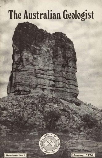
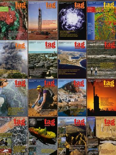
The new GSA website includes a page for TAG. This will always show the latest issue and a link to contact the TAG Team. But TAG has a long history of communicating with members. Following a mammoth effort to digitise past issues, the new TAG webpage now includes a comprehensive TAG back catalogue (currently up to 1993 but soon to be complete).
The first issue was published in January 1974 and designated “Newsletter 1”. This first issue begins with a foreword from then GSA President, Dorothy Hill:
“This new venture is intended to carry short items and articles of interest to Australian geologists. We hope it will bring news of interest to geologists and the things they are doing and discussing far more quickly and authentically than the current grape-vine which depends largely on the travels of those who know this or that item,
Back to the future with TAG TAG reader survey
The TAG team are always happy to receive constructive feedback and suggestions for stories and content. We have set up a short survey to canvas member opinions. Please take a minute or two to respond using the online form and help us shape TAG for the future!
TAG READER FEEDBACK SURVEY – FILL IN FORM
and on their sociability in passing on their knowledge. Four issues a year is our present aim, and this should mean that none of us will be more than three months out of date with our Australian geological awareness. Anything that interests you is sure to interest others.”
It is a great credit to the society and editors and contributors over the years that the aims Dorothy articulated so well are still the core purpose and vision of the current TAG.
These back issues are a fascinating insight into the society’s history and geological issues of the time and I encourage you to browse the collection.
Congratulations to the team involved in this!
SANDRA McLAREN
GSA Annual General Meeting How is GSA organised?
Many thanks to all members who attended the recent Annual General Meeting, held on 19 May 2026 or nominated a proxy to represent them. Four resolutions were passed by majority at the meeting:
•
That a digital-first model will be adopted for the Australian Journal of Earth Sciences (AJES)
•
That an annual $200 printing and distribution contribution will apply for members who elect to receive hard-copy AJES, effective from the 2026 membership year, with the contribution level to be reviewed at the 2027 Annual General Meeting.
•
That the AJES Editors will have the flexibility to adopt either an eight-issue or four combined-issue publication model, as required, to ensure sustainable production and editorial capacity while retaining the same overall volume of journal content.
Several changes to the GSA Constitution and Rules, including changes to membership categories (for example the establishment of a new category of membership, with significantly reduced annual fee, for primary and secondary school teachers).
Further details are available on the GSA website.
The new website includes an infographic illustrating the organisational structure of the GSA. This shows the relationship between the Executive Committee, Governing Council, standing and sub-committees, publications, divisions, specialist groups and affiliated bodies. The diagram illustrates reporting lines, areas of responsibility, and oversight functions across governance, finance, conferences, awards, publications, safety, heritage, and member engagement. It’s also a great illustration of how many people, almost all volunteers, are involved in our society.
If you see a place in the organisational structure where you would like to contribute, feel free to contact the President: president@gsa.org.au
Membership fees
Members who paid their membership renewal fees earlier in the year, prior to the GSA website update, may not have received the 15% discount granted by the Governing Council to compensate for delays in the membership portal update. We appreciate that this wasn’t ideal and want to make it right. Unfortunately we are unable to provide a direct refunds but to thank you for your early renewal and ongoing support of the Society, we’re pleased to offer you a 15% discount on your 2027 GSA membership fee. We truly value your commitment to GSA and hope this goes some way toward recognising it. Further details on how to apply the discount will be shared closer to the 2027 renewal period.
Student members
A reminder to members that students can join GSA for free! No sponsors are required and applications are submitted via the GSA website. Educators and academics please encourage your students to get involved.
Grateful thanks
The Geological Society of Australia (GSA) Endowment Fund was established in 2007 to provide financial support for Australian students undertaking graduate studies in the Earth Sciences. The Fund operates as a separate charity to the GSA and all donations are tax deductible. Awards are available to Australian students at Australian institutions and are not restricted to GSA members.
Since 2007, generous donations from GSA members and supporters have helped students with fieldwork, laboratory analysis, and conference participation. Applications for support consistently outnumber the funds available, showing just how vital this programme is.
Even small contributions make a big difference to students’ ability to complete their projects and share their science. Your donation today will directly support students and help grow a lasting foundation for the future of Earth Sciences in Australia. With your support, we can continue to invest in the future of Earth science research and education.
Donors (with their permission) will be acknowledged in TAG
UPCOMING EVENTS 2026
share details of your upcoming event by contacting tag@gsa.org.au
PNG INDUSTRIAL AND MINING RESOURCES EXHIBITION AND CONFERENCE (PNG EXPO)
1–2 JULY PORT MORESBY PNG
7 JULY
ANZIC WORKSHOP SYDNEY
7–10 JULY
CONASTA 73, AUSTRALIAN SCIENCE TEACHERS ASSOCIATION BRISBANE
15 JULY
GEOSCIENCE ROADMAP PLANNING FORUM ONLINE
3-5 AUGUST KALGOORLIE
DIGGERS & DEALERS 2026
14–16 AUGUST
GEOSCIEDX CONFERENCE
ADELAIDE
15-23 AUGUST
NATIONAL SCIENCE WEEK PERTH
16-19 AUGUST
PEG2026: 11TH INTERNATIONAL SYMPOSIUM ON GRANITIC PEGMATITES PERTH
All GSA events – national, specialist group and divisions – are now listed on the website. The listing also includes relevant events organised by others and is your one-stop information point for all geo events.
Erratum – Issue 217
Issue 217 highlighted GSA award winners across a wide range of fields.
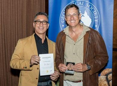
The citation for Ron Reid and Jun Cowan’s AB Edwards Medal was incorrect. The authors were awarded for their contribution to AJES volume 70 (2023). TAG apologises for the error.
The correct citation is:
AB Edwards Medal – Volume 70
Recipients: Ron Reid and Jun Cowan
Towards quantifying uncertainties in geological models for mineral resource estimation through outside-in deposit-scale structural geological analysis.
LINK TO PAPER:
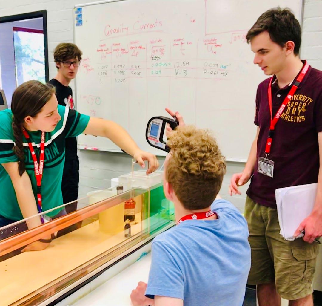
International Earth Science Olympiad participants touring the Research School of Earth Sciences, Australian National University, fluid dynamics laboratory. Image courtesy of Leslie Almberg
GEOSCIED X — 10TH INTERNATIONAL CONFERENCE ON GEOSCIENCE EDUCATION
The GSA is a proud sponsor of GeoSciEd X with the Education and Outreach Specialist Group supporting organisation of the meeting to be held 14–16 August 2026 at Adelaide Botanic High School.
This flagship international conference, held every four years by the International Geoscience Education Organisation (IGEO), is hosted in 2026 by the Australian Geoscience Council (AGC) with support from the GSA and Commission on Geoscience Education (COGE).
The conference theme is ‘Earth Science Education: Our Planet, Our Future’ and spans three days:
DAY 1 (FRIDAY 14 AUGUST)
Field trip to Hallett Cove — participants divide into primary, secondary, and tertiary groups to explore best-practice field engagement.
DAY 2 (SATURDAY 15 AUGUST)
Workshops at Adelaide Botanic High School, spanning classroom-ready hands-on activities, digital tools, curriculum approaches, and cross-sector engagement.
DAY 3 (SUNDAY 16 AUGUST)
‘The Big Ideas Day’ — a facilitated interactive session using the appreciative inquiry SOAR framework to chart the future of geoscience education globally.
Confirmed workshop presenters at Day 2 include (among others): Hannah Moore (AusEarthEd), Pete Loader (Earth Learning Idea), Stuart Clark (UNSW Sydney), Lilly Angel (University of New England), Phil Gilmore (TESEP), Jose Selles-Martinez (Universidad de Buenos Aires), Suzy Urbaniak (CoRE), Sima Mousavi (AuScope), Indrani Mukherjee (UNSW), Dominic Iffland (Geoscience Australia), Melinda McHenry (University of Tasmania), Leah Lynham (EduRock), Gabriel Guy (Fort Street HS), Hayden Dalton (University of Melbourne), Kelly Sharrad (Open Access College), Facson Vargas (Liceo Jose Antonio Carvajal).
Visit the conference website to register.
GEOSCIENCE ROADMAP PLANNING FORUM
In 2025 the Australian Academy of Science published the “Australian Science, Australia’s Future” report, in which it identified eight science disciplines in critical decline. Geoscience was one of these. The issue of the dwindling pipeline of geoscience professionals is the subject of a number of media articles in recent times (see list on the AUGEN web page), with the looming shortage, lack of awareness and reduced tertiary teaching capacity referred to as a “crisis” and a potential sovereign risk. Some of these issues have also been captured in the Australian Geoscience Council’s recent position statement on the “Crisis in Geoscience Education.”
A report commissioned by the Australian Geoscience Council in 2024 into Student Drivers found that awareness of geosciences in schools is virtually non-existent, rarely discussed by students or promoted by staff, with little understanding even at schools that offer Earth and Environmental Science.
The issues are well known and have been discussed in many forums. We’d like to try and do something about that. At the Australian Earth Science Conference in Melbourne in February we proposed a multi-faceted plan to create a national strategy, the Geoscience Education Roadmap. We would like to invite you and interested members of your organisations to participate in this forum. The forum has been scheduled in the week after the Conference of the Australian Science Teachers Association, where Myra Keep (University of Western Australia) will be giving a keynote talk on this issue.
JULY 15TH, 2026, ONLINE 10AM - 1PM AWST 12 NOON - 3 PM AEST
If we can work together we have enormous potential to affect change in this crucial science discipline. Please rsvp to earthroadmap@gmail.com.
UPDATES FROM THE DIVISIONS AND SPECIALIST GROUPS
Coalfield Geology Council (CGC)
The CGC NSW kicked off its 2026 program with a site-based quarterly meeting hosted by the United Wambo Joint Venture at United Wambo Coal Mine. Members took part in an open-cut mine visit and operational briefing.
As part of its professional development and outreach program, CGC NSW delivers a range of training opportunities. Fundamentals of Coal Geology was presented online in late May and covered topics including: coal types and maceral
Divisional and Specialist Group annual reports for 2025 were tabled at the recent GSA AGM. Members are encouraged to view these reports on the GSA website.
analysis, gas reservoir behaviour, fugitive emissions, geological hazard planning and coal utilisation. The program was presented by Joan Esterle, Sandra Rodrigues, Tim Moore and Anthony Williams. Upcoming events include Downhole Geophysics presented by Mark Laycock and a Coal Logging Training program covering lithological logging, coal seam brightness and identification, and field documentation, with an introduction to fit-for-purpose sampling.
Tasmanian Division Western Australian Division
The GSA extends their welcome to new student members of the Tasmanian Division committee: welcome Rekha Nair and Sophia Minter!
The Tasmania Division calls for nominations for the TH Twelvetrees Medal for 2026, awarded to a candidate who has provided significant and meritorious service to geoscientific understanding of Tasmania. Nominations are due 31 July 2026 and should be sent to Ron Berry (ron.berry@utas.edu.au)
The 11th International Symposium on Granitic Pegmatites (PEG2026) will be held 16–19 August 2026 at the University of Western Australia, Perth. PEG2026 will bring together researchers and industry professionals working on granitic pegmatites, critical metals, and economic geology. Abstract submissions and registrations are now open and GSA members receive a 5% registration discount by entering their GSA Membership Number at payment.
MORE DETAILS:
OUTREACH & ENGAGEMENT
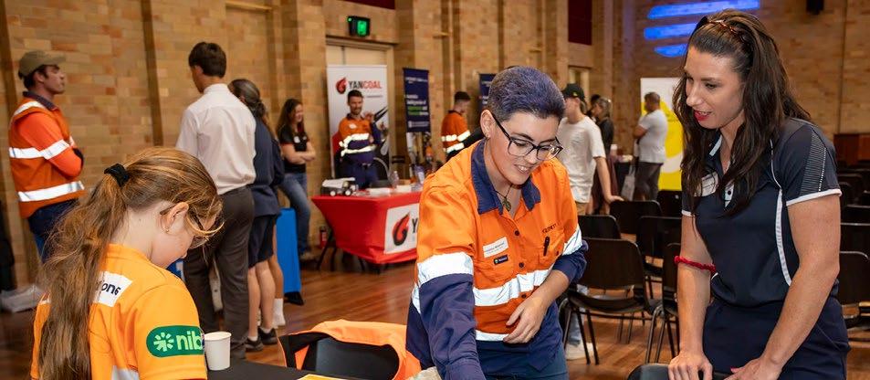
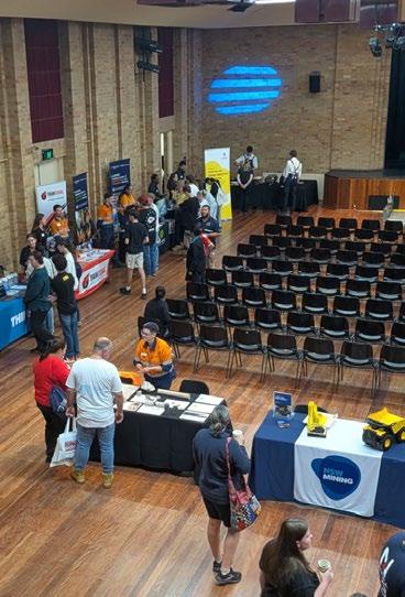
In the outreach and engagement space, CGC NSW was represented at the New South Wales Minerals Council (NSWMC) Careers Information Night held in April, with Susanna Mildenhall supporting the geology activation table and connecting with future geoscientists. The CGC will continue to support these events, at Singleton and other locations, in the future.
Victorian Division
The GSA Victorian Division AGM was held in April in conjunction with a seminar by Eleanor Green and Kevin Hill (The University of Melbourne), entitled “What is the Selwyn Block? An update from Cape Liptrap; Origin and structural/tectonic evolution of the Waratah ophiolite”. Their presentation was a great discussion-starter.
The AGM also marked a change in the GSAV Committee and members welcomed Fabio Capitanio as the new divisional Chair, Kevin Hill as Awards Sub-Committee Chair and Rita Fortune as student representative for The University of Melbourne.
The committee and members of GSAV congratulate Jeremy Wyman (The University of Melbourne) on the GSAV Postgraduate Award and 4 GSAV Student Travel Grant Awardees: Rory McNab, Anastasiia Kazakova and Yuanwei Lin (all Monash University) and Louisa Sheridan (The University of Melbourne).
The division has also established a new scholarship available to students with geoscience field trips and in 2025 established two new awards, the GSAV Early Career Geologist Award and the GSAV Mid-career Geologist Award, which will be presented for the first time in 2026.
Australasian Paleontologists
The Australasian Paleontologists have called for nominations for their 2026 awards: the Robert Etheridge Jr Medal, Dorothy Hill Award, Mary Wade Award, Student Travel Award and AP Research Fund. More information is available on the AP website and self-nominations are welcome for all awards.
The AP is also calling for entries for their Fossil Photo Competition for 2026. This year’s theme is Fossilus neglectus, bringing underappreciated specimens out of the shadows. All entries must be shareable and accompanied by a 50-word summary and submitted to ncampion@une.edu.au by 31 July 2026. The award winners will be announced at the AP AGM in August and featured in September TAG
Geoheritage subcommittee and why Geoheritage is important
•
Geological sites come in many forms and sizes and include the geological formations, landscapes and the detailed evidence of geological time that represents stories of the natural history of the planet’s dynamic processes over time. These sites are critical in understanding Earth’s evolution. The designation of a site as geoheritage signifies its value, with biodiversity, cultural significance and educational potential often adding to the geological significance of the site.
Globally, geoheritage sites vary widely in type and characteristics. They can be colossal formations, such as mountains, valleys and wide plains, or smaller, localized sites, like mineral outcrops and fossil beds. Iconic features such as Uluru or Gibson Desert as well as smaller sites such as the Organ Pipes near Melbourne, all serve as a window into past time. Their importance lies not only in their inherent scientific value but in opportunities for research, tourism, and conservation to inspiring future generations to engage with and protect these remarkable natural formations.
Defining the criteria that qualify a site as geoheritage is essential for effective protection and management. These features should possess scientific significance contributing to our understanding of geological processes,
climate change and biodiversity. But geoheritage shouldn’t be limited to the iconic or unusual sites but also should include good and accessible common sites in an area. These are often overlooked and their omission may seriously diminish the understanding of the geology of an area.
It is important to note that geological, including geomorphological, significance may not necessarily relate to the aesthetics of a landscape. Some sites of very high significance may not be at all aesthetic (e.g. quarry faces or road cuttings) and aesthetically pleasing views may not always be assigned a high geological significance. If processes are involved these can be active or relict.
Geological sites should possess at least one of the following attributes to be
considered for assessment on their significance:
a type section of a geological unit or a fossil locality
exposures of a range of features characteristic of the rock unit, or exposures of features that are unusual in the rock unit
an unusual occurrence of a particular feature or mineral
an illustration of tectonic and/or volcanic processes
features which enable palaeoclimatic reconstruction
demonstration of the effects of weathering, erosion and/or deposition on landform evolution (active or relict)
a representative example of a landform type (especially in a particular region)
AND VIEWS | HERITAGE MATTERS
We need to think about it and then each division needs to see what they need to do! ” “
The criteria for significance is related to whether a site can be regarded as important with regards to it being representative or outstanding. A choice often has to be made between the most outstanding or unusual example and an excellent representative example from a group of very similar ones.
The representative approach has been found to be appropriate in assessing significance but outstanding examples must be considered. Criteria used in such assessment can include:
•
•
how representative is the feature? how adequately is each type of feature represented over a particular scale?
•
•
•
which feature is most appropriate to represent a particular type? how many representatives are justified?
How far would you travel with an interstate/international visitor with an interest in that type of site?
Finally, probably the most important issue with geological site conservation and protection is that once destroyed, these sites cannot be reconstructed. They can be documented, samples stored in museums, pictures taken and occasionally exhumed if buried, but once destroyed that is forever! The documentation of sites is therefore important. This does not always mean that it is “locked up forever” but that we keep records. It also does not mean that the site cannot be exploited for minerals. In many situations, aspects of a mining site may be designated and worked around; abandoned quarries are often very important heritage sites but are damaged by “restoration” (vegetation and filling in with rubbish) rather than suitable management. We need to think about it and then each division needs to see what they need to do!
SUSAN
WHITE Geoheritage subcommittee chair, GSA, Victoria Division
Let’s not take it for granite –rebuilding a rock-solid foundation for Earth Sciences in Australia
One of the first things I wanted to do when I joined the Education and Outreach Committee in the GSA was to better understand the why of Earth Science decline in Australia and how to address that decline. I set out to conduct a literature review covering the better half of a century of research on Earth science education, not just in Australia but also in the US, UK and France. The results paint a sobering picture of the Australian Earth science education landscape, one that is marked by a complex web of:
— fragmentation of responsibility over curriculum and advocacy for Earth Science in schools
— poor understanding of what the 21st century Earth scientist looks like
— chronic underfunding of Earth Science at all education levels — poor academic reputation of the subject
— poor teacher support and incentivisation
But the literature review also reveals a powerfully hopeful and inspiring message: many of these challenges are tractable. We have the means as a community to make tangible contributions to reversing the declining trend in Earth science education in Australia.
It begins with the most powerful agent for influencing Earth Science uptake
amongst students and improving the subject’s academic reputation – teachers. Studies have repeatedly shown how essential the teacher is in influencing student subject perceptions and choices, yet these studies also reveal that teachers are under-supported in all facets of educating students on Earth science and the vast majority have no formal background in the subject.
In the UK, declining numbers of teachers running senior Earth science subjects has been reversed. Also, the development of a long-standing, fully-funded week-long program (Earth Science Teachers Association – European Geoscience Union Geoscience Summer School) targeting recent science teacher graduates to train them to teach A-level (ATAR equivalent) geology has been effective in increasing trained teacher numbers. These successes in turn increase the number of schools offering A-level Geology and, more significantly, mean that more schools are better equipped to teach portions of the Earth Science curriculum in earlier years.
Another solution targets the poor perception of Earth science’s intrinsic value to society and failure for students to see themselves having a career as an Earth scientist. It is no exaggeration to say our community is a passionate one. To someone with an Earth science background, the subject is aweinspiring and deeply rewarding and yet we fail to captivate large swaths of students and the public on the
subject’s deep connections to many of the contemporary issues society faces today. We should absolutely emphasise the grand ideas, such as deep time and plate tectonics, as springboards with which the public can make sense of their natural environments. A big part of why these grand ideas is not as well known within the community is a lack of trained Earth Science teachers and advocates in the first place to proliferate these ideas across all avenues of media and schooling.
Earth Science industries contribute over 12% of our nation’s GDP and yet almost every major national science institution recognises the decline in Earth Science education as a critical risk to the development of Australian infrastructure and economy. The unfortunate reality is that complex problems are expensive to solve and require long-term investments inconsistent with typical political timescales.
There is so much that Earth science can bring to the table of Australia’s future successes, as it has done in the past. This problem is solvable with some grit and we owe it to future students and the wider public to give it a solid push. An Australia more literate in Earth science is an Australia better poised to be at the forefront of the big issues we currently face.
MARTIN NGUYEN
From wonder to evidence: palaeontology as a gateway into science
There is a particular kind of silence that falls over a group of students when they first stand in front of a fossil skeleton. It is not boredom. It is the sound of minds trying to stretch themselves across millions of years. Then the questions start.
How do we know what it ate? How do we know how old it is? Was it fast? Did it live here? Why did it die out? Is that real? For palaeontologists, these questions are wonderfully familiar. For educators, they are gold. They are not just questions about dinosaurs, bones or ancient animals. They are entry points into some of the biggest ideas in science: deep time, evolution, extinction, environments, climate, plate tectonics and the long, changing history of life on our planet.
This is why I think palaeontology deserves to be thought of as a “gateway science”: a scientific domain that acts as an entry point to bigger concepts. It is often treated as the “fun bit” of science education, especially when dinosaurs are involved. I’ve occasionally heard it dismissed as the scientific equivalent of
stamp collecting. But that sells it short. Palaeontology does not simply attract attention; at its best it turns curiosity into evidence-based reasoning.
Fossils have a special kind of educational power because they are both familiar and strange. Many children meet prehistoric life long before they meet formal scientific language. Due to a heavy pop culture influence (thanks, Jurassic Park), dinosaurs appear in picture books, toys, films, games, museum halls and playground conversations. A child may not know the word “Mesozoic”, but they may already know that Tyrannosaurus had enormous teeth, that Triceratops had horns, or that some animals lived in the sea while others walked on land. That familiarity gives educators something to work with.
The next step is to shift the conversation from “what is it?” to “how do we know?” That is where the real science begins. A fossil tooth, for example, can open a discussion about diet, feeding behaviour and ecosystems. A footprint trackway –such as the sites in Broome WA or at Lark Quarry in central Queensland – leads to questions about movement, speed, body size and group behaviour. Fossil leaves from McGraths Flat in the ACT tell us a story of an ancient rainforest in an area which is now arid. Trilobite fossils found far inland can prompt a conversation about changing sea levels, sedimentary rocks and landscapes that looked very different in the past.
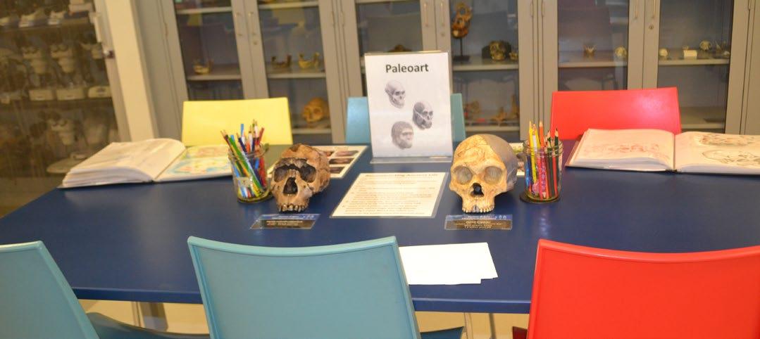
Fossil skulls in a classroom space. Fossils are powerful teaching tools because they invite close observation, questioning and evidence-based reasoning. Photo taken at the American Museum of Natural History by Lachlan Hart.
In each case, the fossil is not just an object to admire. It is evidence. Students can look closely, compare features, make inferences and test ideas against what they can see. These are science skills and the students embrace them.
Palaeontology is also naturally interdisciplinary. It doesn’t sit neatly in one box. To understand a fossil, students may need biology to think about anatomy and adaptation, geology to understand rocks and dating, chemistry to think about preservation, geography to consider ancient environments, and ecology to reconstruct relationships between organisms. A single fossil can become a meeting place for many parts of science.
That makes palaeontology especially useful for Earth science education, because Earth science itself is deeply connected. Rocks, life, climate, oceans, landscapes and time are not separate stories. They are part of one long and complicated planetary history. Fossils help make that history visible.
There are many simple ways educators can use this gateway potential.
FEATURE | PALAEO
In a classroom, students might compare replica teeth and infer diet. They might examine images of trackways and discuss whether animals were moving alone or together. They might use fossil leaves to think about past climates, or place major events on a timeline to confront the sheer scale of geological time. In a museum, a single gallery visit can become an investigation rather than a tour: What can we see? What does that tell us? How can we find out more?
Local examples matter too. Australian fossils can help students connect deep time to place. Diprotodon, Muttaburrasaurus, Koolasuchus, Kronosaurus, and Anomalocaris all show that Australia has not always looked the way it does today. Used carefully, local palaeontology can help learners see their own landscapes as dynamic, ancient and scientifically rich.
This matters because Earth science still struggles for space in many educational settings. Students often encounter only fragments of it: recreating a volcanic eruption with bicarb soda and vinegar, or learning about the causes and effects of erosion. Palaeontology can help join
some of those fragments together. It gives educators a hook, but also a pathway.
Of course, not every student who loves dinosaurs will become a palaeontologist (although some of us did!). That is not the point. The point is that fascination can be a beginning. A fossil can invite a learner to slow down, look carefully, ask better questions and realise that the natural world has a history that can be investigated.
That is the real promise of palaeontology as a gateway science. It starts with wonder, but it does not stop there. It leads students towards evidence, explanation and the bigger story of Earth.
LACHLAN HART
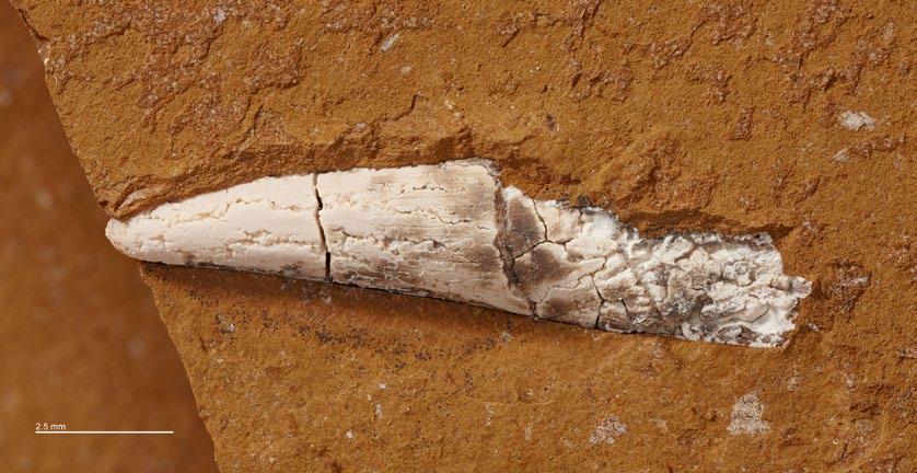
A single fossil (like this temnospondyl tooth) can open conversations about diet, behaviour, ancient environments, geological time and environmental change.
Close up of a tooth.
Photo by Michael Frese.
Unit definitions - a shared responsibility
The National Rock Garden, established in 2013, continues to develop into a fascinating and educational site progressively showcasing more aspects of Australian geoscience. There are various reasons for choosing rocks, but some basic information is available for any rock considered for display. This usually includes a stratigraphic unit definition. While definition details may not be displayed on site, website links to those details provide valuable ‘further information’ for budding geoscientists, as well as current professionals. Unit names and definitions provide an opportunity to demystify geological maps and explain how geologists group rocks on the basis of lithology, mineralogy, distribution, stratigraphic relationships, age etc.
Why am I raising this issue? Aren’t all our current units defined? Well, no. Of ~12,700 current ‘formal’ names recorded in the Australian Stratigraphic Units Database (ASUD), only 4966 of them (39%) are actually recorded as defined.
Ideally, new units are defined at the time they are first established, and the definition submitted to the
relevant State/Territory Stratigraphy
Sub-commission for guidance and approval before publication in the ASUD or elsewhere. See links below for guidelines. Publication in the ASUD is not onerous. Similarly, when new information results in a need to modify a unit definition (e.g. newly visited outcrop, drill core, dating, unit relationships), then a redefinition should be approved and published. In practice, although State and Territory Geological Survey staff do define a lot of units – and some academics, students and industry geologists also properly establish new units – far too few are ever defined.
Some geologists use the excuse that stratigraphy is not the main focus of their work. Others say that they know a unit extends beyond the area they are currently mapping, so plan to define it when they know its full extent. Sadly, many projects are cut short, or people move on, and the definitions never get written.
It is much better to write a definition that may need to be modified when more information is available, than never to define what is meant by a name. If you establish a new name,
then you have a responsibility to define it. So, if you have worked on current or new undefined units in the last couple of decades, please consider finding the time to define them. The rest of the Australian geological community will thank you, as will visitors to the National Rock Garden.
CATHY BROWN
National Convener, Australian Stratigraphy Commission
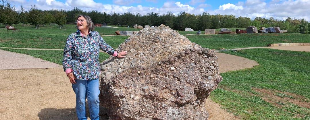
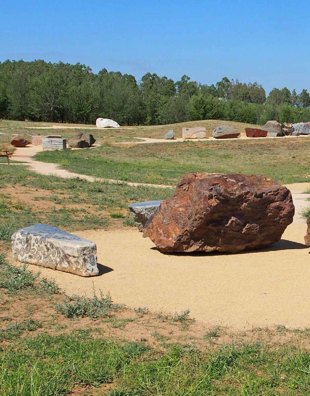
Tallong Conglomerate, one of the defined units on display in NRG cluster 16. Marita Bradshaw provides a human scale for this specimen, with the Federation Rocks behind right. Image courtesy M. Smith
The National Rock Garden: igniting geoscience curiosity
and inspiring public discovery
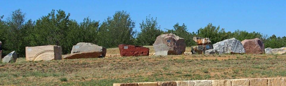
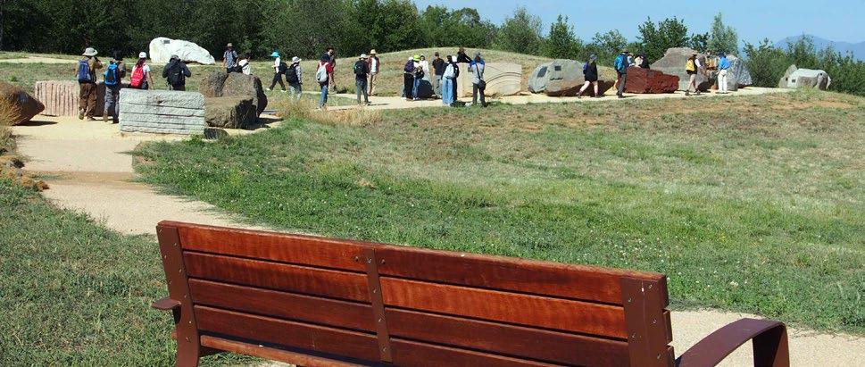
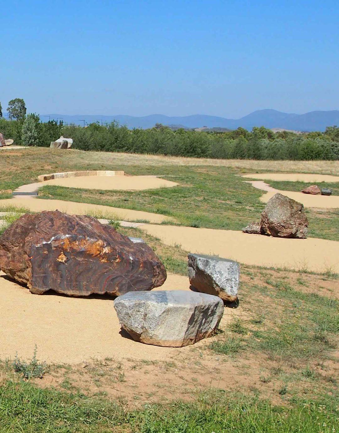
Australia’s National Rock Garden stands as a testament to the country’s rich geological diversity and its commitment to educating both the public and future generations about the wonders beneath our feet. Situated in Canberra, the Garden is a unique outdoor space dedicated to showcasing iconic rocks and minerals from across Australia’s vast landscape. Its mission is not just to display specimens, but to inspire curiosity, foster understanding of earth sciences, and connect communities with their geological roots.
The National Rock Garden offers an excellent platform for geoscience education, providing hands-on learning experiences that go beyond the classroom. Visitors are greeted by impressive rock exhibits, each
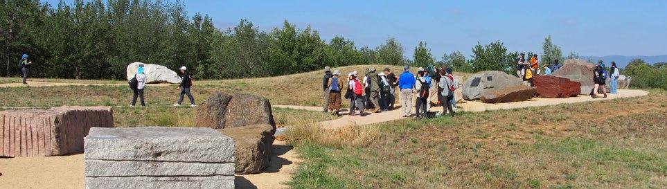
carefully selected to represent significant geological provinces, processes, and histories. For students, the garden serves as an outdoor laboratory where concepts taught in textbooks come alive. Guided tours, interpretive signage, and interactive programs encourage visitors to explore topics such as plate tectonics, mineral formation, and how rocks and soils impact the environment. Hopefully, this immersive approach supports a deeper understanding of the Earth sciences, making complex concepts more accessible and engaging.
Outreach is at the heart of the National Rock Garden’s philosophy connecting the community through a range of engaging programs. A standout initiative is the
Treasure Map activity, a family-friendly and educational experience that invites visitors to search for and identify special rock features across the site, fostering both observation skills and geological knowledge. Additionally, the self-guided tour allows individuals or groups to explore the garden at their own pace, using informational materials and digital resources to deepen their learning and appreciation for the rocks on display.
Photos: Supplied
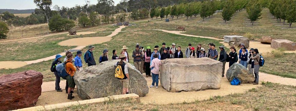
The National Rock Garden also regularly participates in the Canberra and ACT Region Heritage Festival, offering special events and themed walks that highlight the geological heritage of the region. These festival activities attract not only local residents but also visitors from across the country, providing unique opportunities to discover the connections between geology and cultural history. Another major outreach avenue is the garden’s involvement in the Earth Science Olympiad (see page 48 of this issue) when it serves as an open-air classroom, challenging participants to identify specimens, interpret geological histories, and engage in collaborative problem-solving.
Through partnerships with schools, universities, scientific organisations and local communities, the garden facilitates workshops, field days, and public talks. These events are tailored to diverse audiences, from primary school children to
lifelong learners, ensuring that geoscience education is inclusive and adaptable. The garden’s outreach programs also emphasize the importance of geology in everyday life by highlighting how rocks and minerals underpin everything from infrastructure and energy to art and culture. By making geology relevant, the garden helps foster environmental stewardship and appreciation for Australia’s natural resources.
One of the garden’s strengths lies in its ability to showcase the interconnectedness of Australia’s geological history. Each exhibit tells a story, whether it’s the ancient cratons of Western Australia, the fossil-rich rocks of South Australia, or volcanic remnants in Victoria. These stories are woven into broader narratives about climate change, resource management, and sustainable development. The garden also serves as a hub for collaborative projects, inviting geoscientists, educators, and Indigenous
communities to contribute their expertise and perspectives.
In addition to its educational and outreach efforts, the National Rock Garden is a place for reflection and inspiration. Its tranquil setting invites visitors to contemplate the profound timescales and transformative forces that have shaped the continent. In a world where environmental awareness is increasingly vital, the garden offers a tangible connection to the earth’s past, present, and future.
As the National Rock Garden continues to grow, its impact on geoscience education and outreach will only expand. Whether you’re a student, teacher, scientist, or curious traveller, the garden provides a welcoming space to explore, learn, and celebrate Australia’s dynamic geology.
AMBER JARRETT
The GSA’s Geoscience Indigenous Collaboration and Engagement Specialist Group (GICE) provides strategic direction and leadership to the Australian Earth science community. The group’s core aim is to ensure Earth science is inclusive of, and equitable for, Aboriginal and Torres Strait Islander peoples as the traditional custodians of the lands, seas, skies and waters where Australian Earth science is conducted and realised.
The latest from GICE Earth science reaching out to the remote NT
The Northern Territory is unique. With a population of approximately 265,000, it is Australia’s smallest jurisdiction by population, and also its youngest –one in four residents is under 18. It is the least urbanised, with nearly half of its population living outside Greater Darwin and has the highest proportion of Aboriginal and Torres Strait Islander peoples, comprising roughly one-third of residents.
Australian Earth Science Education (AusEarthEd) has been supporting the teaching of Earth Science in the Northern Territory since 2021.
GICE held their AGM in May. The group reflected on the highly successful AESC field trip to Wil-im-ee Moorring (Mount William) guided by Wurundjeri Woi-wurrung Traditional Owners (see TAG 217). The ‘Deadly Science’ program, Australia’s leading Indigenous STEM charity and founded and led by Aboriginal and Torres Strait Islander people, was also discussed. The mission of Deadly Science is simple but powerful: to ignite a passion for STEM (Science, Technology, Engineering and Mathematics) and to create a future
where all Aboriginal and Torres Strait Islander learners have the opportunity to thrive. As part of GICE’s commitment to strengthening community awareness around both the challenges and the benefits of collaboration with Indigenous communities, GICE launched an end-offinancial-year fundraising campaign for the program.
It’s easy to join GICE to keep up-to-date or get involved. Just log on to the GSA website and update your profile.
Their NT Education Lead/Geologist, Lachlan Hallett, runs in-school lessons, excursions alongside community events and professional development sessions for educators. The goal is to lift the understanding of, and appreciation for, Earth Sciences within NT students and to spark interest in the many future career paths in the geosciences.
Teaching Earth Sciences to NT’s students has its challenges. Most schools are in remote, or very remote locations, with only 67 of the 224 schools in greater Darwin. Also, for many students, and educators, English is their second (or
third language). Fortunately, the Earth Sciences are a very visual and tactile science, enabling strong engagement once students connect with the material.
To date AusEarthEd have worked with 10,500 students across 86 different NT schools, including 2,000 indigenous students and educators.
LACHLAN HALLETT
Photo: Supplied
Photo: Supplied
SCAN TO DONATE
Mining outreach in the NT
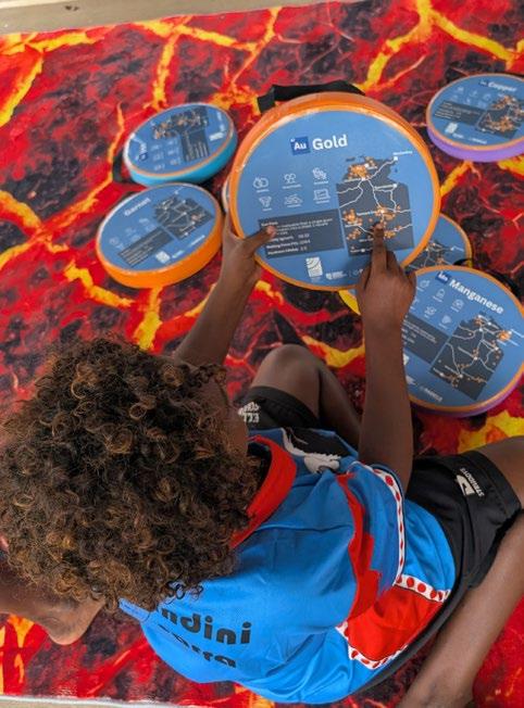
The Charles Darwin University Radicle Centre delivers Earth Science and Careers in Mining outreach programs that inspire curiosity about geology and careers in the mining sector among students across the Northern Territory.
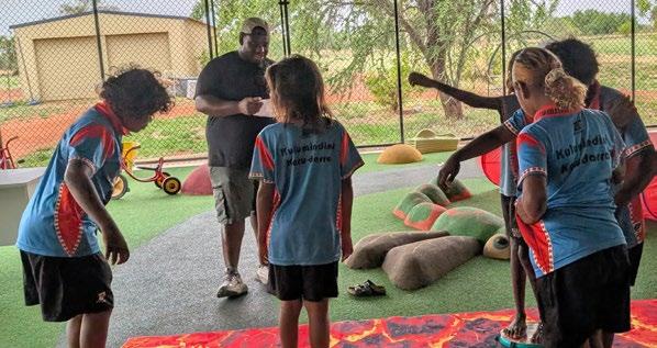
The Radicle Roadshow focuses on remote and very remote Indigenous communities. Through interactive, playbased activities such as Floor is Lava, students explore concepts including mineral identification, geology, resource
management and the importance of critical minerals in everyday life.
Developed in partnership with the Minerals Council Australia NT, these activities demonstrate how Earth Science underpins the sustainable development of the Territory’s mineral resources while showcasing the diverse career opportunities available within the sector. By making Earth Science handson and relevant, the program helps students connect scientific concepts
with the landscapes and communities in which they live. The CDU Radicle Centre has engaged hundreds of students through school visits and community events. The program seeks to inspire the next generation of scientists while strengthening connections between education, industry and local communities.
CARLA EISEMBERG
Radicle Roadshow visit to Elliott School, November 2025
Photo: Clara Eismenberg/Minerals Council of Australia]
Congratulations Jacqui Halpin on the award of the Royal Society of Tasmania Banks Medal
Jacqueline Halpin, from the University of Tasmania, has been awarded one of Tasmania’s most prestigious scientific honours, the Max R. Banks Medal, by the Royal Society of Tasmania.
The medal recognises outstanding and sustained contributions to science, particularly in fields associated with Tasmania’s natural environment. Named after renowned Tasmanian geologist Max Banks, the award is presented annually to a midcareer scientist whose work has significantly advanced knowledge and understanding in their discipline.
Jacqui Halpin is widely recognised for her research into the evolution of continents over deep time, using geological evidence preserved in rocks and minerals to reconstruct how Earth’s surface has changed across millions to billions of years.
Based at the Institute for Marine and Antarctic Studies, her research bridges
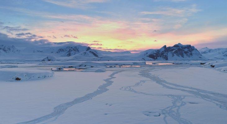
both terrestrial and marine settings. In 2023–24 Jacqui led the geology team in remote fieldwork to the Denman Glacier region, providing crucial new samples and data for interdisciplinary Earth–ice sheet science. Part of this work includes testing a recent model of the assembly of the Gondwanan supercontinent, including the formation of the Gamburtsev Subglacial Mountains – a vast mountain range buried entirely beneath the East Antarctic Ice Sheet.
Currently, Jacqui’s work is focussed on Antarctica’s past, using geological records to understand how ice sheets responded to prior warmer climates. By understanding these mechanisms, her research contributes to improving projections of how the Antarctic Ice Sheet may behave in a warming world – knowledge that is critical for assessing future sea level rise.
Photo: Shutterstock
You Rock
Celebrating Phil Gilmore
Photos: Supplied
The GSA General Committee, Hunter Valley branch, and GSA members join to celebrate and acknowledge Phil Gilmore for his contributions to the society, particularly in education and outreach. Phil has a long and active history with GSA, serving as a Governing Councillor from 2016–2021 and now as Chair of the Hunter Valley Branch.
Phil is a true dynamo. He shares his deep knowledge of geology with enthusiasm and skill. He is an accomplished geotour leader who has led a wide range of tours and was the driving force behind the recent, highly-successful Permian – from whoa to woe Hunter Valley excursion. Phil’s planning, coordination, and on-ground leadership ensured the success of the event, which was not only highly regarded by participants but also delivered a strong financial return for the Society.
He is also a tireless volunteer and is always first to step in when help is needed. He regularly engages the public during National Science Week and Earth Science Week, communicating effortlessly to engage with both children and academics. A strong advocate for geotrails, he is also an active supporter of TESEP. Our geoscience community is fortunate to have such a passionate and knowledgeable champion.
The society acknowledges his outstanding contributions and positive impact on GSA’s activities and reputation. His professionalism, geological expertise, and commitment to delivering a high-quality experience exemplify the values of the society.
You rock Phil!
TEACHER SUPERSTARS
Gabriel Guy (Fort
Street High School, Sydney)
Thanks for joining us for this issue of TAG! Can you tell us a bit about your career background and current role?
I’ve always been a teacher. I began teaching at 21 after studying at the University of New England in Armidale, and have since taught in Cowra, Maitland and now at Fort Street High School in Sydney.
Alongside classroom teaching, I have been involved in resource development, HSC marking, curriculum writing and professional learning through the Science Teachers’ Association of NSW. I have also worked with the NSW Earth and Environmental Science curriculum review team. Despite these roles, the classroom is still the centre of my work and where I most enjoy being.
What motivates you to teach Earth science?
Why science? I was six when Jurassic Park came out, and after that all I ever wanted to do was talk about dinosaurs and the natural world. I love understanding how natural systems work independently of human influence. I see myself as a cheerleader for Earth and Environmental Science and I hope to pass some of that passion onto my students.
Why teaching? Teaching is stressful, time consuming and can become your whole life. However, it is never boring. There is always more to learn, and lessons, programs, assessments and resources can always be improved. Teaching takes more than one lifetime to master. I am experienced, but I will never be an expert, and I love that.
Can you give us an example of your approach to engaging students in Earth science and what a typical Earth science class would look like?
My lessons often include storytelling, whether through personal experiences, historical narratives or evidence-based inference. I take a lot of inspiration from science communicators such as Carl Sagan and Brian Cox, particularly their pacing and humour, use of simple analogies, and the way they draw audiences in before the full reveal.
For example, when teaching the geological history of the Sydney region, I often compare the fossil-rich Permian coal measures around greater Sydney with the largely fossil-poor Triassic sandstones students see around them every day. Through that narrative, students can begin to understand the scale and impact of the Permian mass extinction, and how rocks can be used to reconstruct stories about Earth’s past.
My classroom layout is influenced by libraries and museums. The room is full of popular science books, magazines, DVDs, toys, and even card and board games. I also have display cabinets of fossils, rocks, minerals and specimens, alongside informative posters, memes, student work, artwork and photos from field trips. It can sometimes look cluttered, but I think it helps engage students and brings some of my own personality into the room.
While the room itself can feel busy and full of personality, the teaching approach behind it is highly structured. I place a strong emphasis on evidence-based teaching practices such as explicit instruction and formative assessment, particularly because Earth systems are so interconnected and conceptually complex. I find that when students genuinely understand a concept, engagement tends to follow naturally.
Community is so important in teaching. The GSA is supporting the upcoming GeoSciEd X meeting in Adelaide and you’re speaking at that event. What would you like to see come out of that meeting in terms of practical tools or pathways as well as support for Earth science teaching more generally?
I discovered early in my teaching of Earth and Environmental Science that many EES teachers are the only specialist in their school, and sometimes even their town or region. Like me, many also come from outside a traditional geology background; my own degree was in physics and mathematics.
Because of this, professional networks and the sharing of resources, experiences and teaching ideas are incredibly important. Those connections helped me enormously when I first began teaching EES, and they continue to shape my own practice today.
I would like to see GeoSciEd X continue building those connections between teachers, researchers and industry professionals, while also giving teachers practical ideas and resources they can take back into their classrooms immediately.
More than anything, I hope to plant a seed of a new idea in another teacher’s mind, even just one, just as I hope to leave with new ideas of my own.
What resources are currently available for teachers looking to bring more Earth and environmental science into their classrooms?
Compared to Biology, Chemistry and Physics, there are fewer textbooks and curriculum-specific resources available for Earth and Environmental Science, and many schools also rely on a specialist teacher to organise rock, mineral and fossil collections. However, the range of available resources has grown significantly over the past decade.
There are now several textbook companies publishing EES resources, alongside organisations providing excellent free curriculum-linked material, including AusEarthEd, WASP and the Australian Museum.
Earth science also benefits from resources produced by organisations such as CSIRO, AMSA and ANSTO, alongside international agencies and research groups. Because Earth science is so closely tied to real-world data and current events, teachers can bring authentic scientific examples directly into the classroom.
Professional and social media networks are also incredibly important. In 2018 I created the NSW Earth and Environmental Science Teachers Facebook group to help connect EES teachers, share resources and reduce the sense of isolation many teachers in the subject can experience.
What do the students think? Do you see your students going on to study Earth and environmental science at tertiary level?
You can usually spot the “rock nerd” in Year 7 or 8 and then help guide them towards Earth and Environmental Science a few years later. It also helps when the broader science faculty is on board promoting the subject: “If you’re interested in climate change, fossils, natural hazards or ecological sustainability, you should consider EES in Years 11 and 12.”
Many students simply do not realise what is actually in the subject. Some assume it is just “looking at rocks for two years”, when in reality it covers everything from Earth’s history and climate systems to resource management and natural hazards. Students in the junior years need exposure to the breadth and relevance of the subject, particularly its connection to current global issues. Most years I have at least one student (as far as I know) go on to study Earth and Environmental Science or related fields at university. However, more importantly, I hope students leave with a deeper understanding of the Earth’s history, processes and systems that stays with them for the rest of their lives.
Photos: Supplied
TEACHER SUPERSTARS
Alicia Whan
Welcome to TAG Alicia! Can you tell us about your career background and recent/current roles?
My career began in geoscience, with a focus on geophysics. I completed my PhD on Australian heat flow in 2020. During my postgraduate studies, I undertook several teaching roles at the University of South Australia, where I discovered my greatest enjoyment in demonstrating and teaching. This eventually led to my decision to begin a Master of Teaching, majoring in secondary science. After completing these studies, I was fortunate to begin teaching high school science at a school that allowed me to develop a new approach to its middle years Earth Science curriculum. I have spent the past five years developing lesson and unit plans that provide engaging Earth Science lessons for middle years students.
What motivated your pivot from postgraduate research to the classroom?
As I mentioned earlier, the chance to teach in the tertiary space provided the initial motivation to pursue a Masters of Teaching. I realised my passion for sharing geoscience knowledge with the next generation of STEM students and it is always wonderful to witness the spark of geoscience interest first begin with students in my classes. I realised that this was the career path I wanted to follow.
Can you give us an example of your approach to engaging students in Earth science and what a typical Earth science class would look like?
Hands on experience matters when teaching Earth science. It really is as simple as that. When I first began teaching, I reached out to university and geoscience outreach contacts to ensure that I had a range of mineral
and rock samples that would allow students to physically consolidate the theory presented to them. I also found that opportunities to relate the theory to students on a more local level (whether truly local, or even on an Australian scale) resonated well with students.
A typical lesson often begins with a short introduction of theory, followed by an activity that allows for consolidation - this will often be with drawings, clay modelling or taking photos of samples and annotating relevant concepts. Where possible, I encourage group and/or class discussion around these concepts, which often allows me to add extra depth of geoscience concepts with students. We will often finish lessons with an online quiz (Kahoot, Blooket etc).
Photo: Shuterstock
What advice would you give to geoscience graduates who are looking to move into the education space? What worked for you?
I would certainly encourage any geoscience graduates looking to move into education to take the leap! Geoscientists bring a passion and enthusiasm for a subject that is often overlooked or not given the depth it deserves in the secondary education space. I would also encourage them to network and find other educators with a geoscience background to develop connections and even potential opportunities for mentorship.
How could we, as a geoscience community, smooth that path for geology graduates?
It is important to encourage geology graduates who indicate an interest in following an education pathway. This can sometimes feel like a unique next step (personally, I felt I did not
know many others following a similar path) and finding a way for these graduates to connect – even in an online space – would be a great way to help support a smooth pathway into education. This could also be a place for tertiary educators to help bridge the geoscience education gap between high school and university.
Currently, geoscience outreach and education programs provide excellent support for educators and I am grateful for the wide range of resources and information they offer. It is important that we continue to support these organisations.
What advice would you give to current science teachers (without an Earth science background) who are interested in engaging more with Earth science content?
I would encourage teachers to seek out as many relevant professional development opportunities as possible, particularly those that include field trips
or hands on activities that allow teachers to engage further with the subject. These experiences can provide a range of content and opportunities that can be transferred into the classroom.
What’s next for you?
I’m about to begin a position teaching science and mathematics with a new school, and I look forward to the opportunity to contribute to their Earth Science curriculum.
The Geology of the 12 Apostles in southeast Australia: a 60-year research odyssey
Where else in the world can you see such towers of yellow and grey limestone rock climbing 45 metres out of the sea?
The Twelve Apostles are like an evolving, natural art installation...
Despite iconic status and popularity, there is still so much to learn about their geology: how or why did their distinct yellow and grey layers form? When did they emerge from the ocean?
Prior to our paper (Gallagher, S.J, Mallett, C.W., Soman, R., Auer, G. & Herries, A., 2026, Australian Journal of Earth Sciences, 1–13), our understanding of the geology of the Twelve Apostles and adjacent cliff exposures was based on the pioneering work of Baker (1944) and the Geological Survey of Victoria’s regional maps (Tickell et al. (1992) and Edwards et al. (1994)).
Our research in the Otway region southeast Melbourne has determined how and when the iconic Twelve Apostles came to exist, finding that tectonic plate movements over millions of years lifted and tilted the giant structures out of the
sea. This has revealed that the sediment layers of the Twelve Apostles are one of the world’s best-preserved and accessible records of ancient climate and changes in sea levels from the Miocene Epoch.
Similar to tree rings or environmental time capsules, each layer of these sea stacks and the adjacent cliffs records changes through time with microscopic fossils and information about the Earth’s climate and tectonic activity of millions of years. The microscopic fossils that form much of the yellow and grey layers of limestones (the Port Campbell Limestone) of the Twelve Apostles are shells of single-celled organisms called Foraminifera, along with abundant broken up clams, gastropods and bryozoans (lace-like colonial animals with calcium carbonate skeletons).
While much of the work in our paper was carried out in the last few years, the journey of discovery for our research began in the 1970s with Cliff Mallett’s PhD on the foraminifera of Victoria (Mallett, 1977). Over several field seasons along the Port Campbell coastline – precariously
accessing and sampling cliff edges and steps – Cliff collected hundreds of samples for microfossil studies to date the strata. The coastline was photographically mapped by aeroplane to correlate the layers. Many of the localities sampled are no longer accessible and therefore the data and sample residues (stored in the Museum of Victoria) from this thesis formed an invaluable treasure trove that we integrated into our work.
Cliff and I have revisited, relogged and resampled localities (where accessible) over the last several years with the assistance of Rohit Soman (PhD student University of Melbourne) and other students. Microfossils in new and archived samples have been re-examined for their ages, nanoscopic fossils were analysed by Gerald Auer (Graz, Austria) rock magnetic properties were investigated by Andy Herries (La Trobe University). The coastline previously mapped in analogue photographic format was remapped using digital imagery from the Great Ocean Road 2021 3D Photomesh (https:// map.digitaltwin.vic.gov.au).
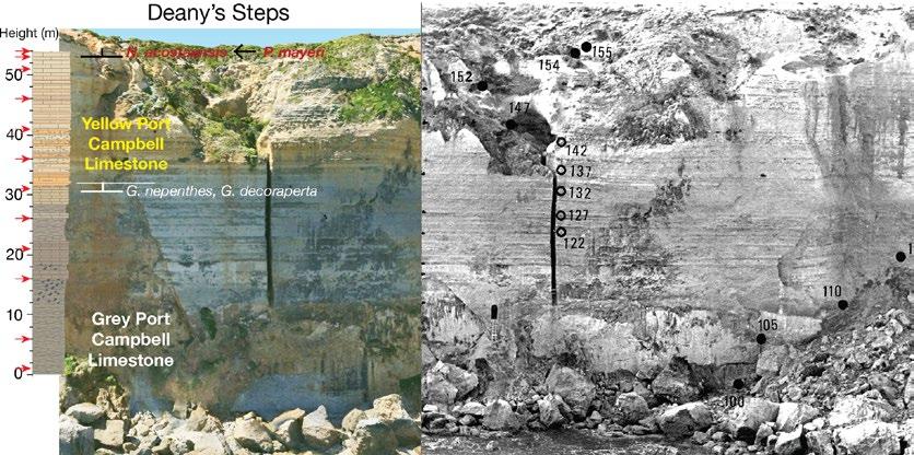
The stratigraphy of Deanys’s Steps, showing digital (2021) and photographic imagery (Mallett, 1977). These steps were carved by fishermen at the start of the 20th century to access the foreshore, and the ladder at the base of the steps was constructed from driftwood to allow recovery of micropalaeontology samples in 1970. Access to these steps was blocked in the 1980’s. The cliffs are 70m high.
The combination of new and archive microfossil and imagery analyses allowed us to map and date the layers along the coastline of the Port Campbell region with great precision to determine the 15 million year geological history of these iconic sea stacks.
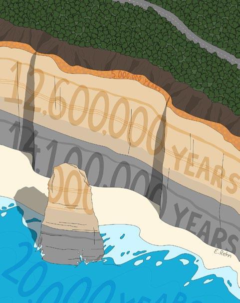
Microfossil evidence has revealed that the grey limestone and clay layers to the east of the sea cliffs and stacks preserve a key time in Earth history. This period, 13.8–15 million years ago, included the Miocene Climatic Optimum (Westerhold et al., 2020) when the climate was much warmer, possibly up to 4°C warmer than today. The overlying layers were deposited during a period of climate cooling 13.8–8.6 million years ago.
We can now use these new microscopic fossil and chemical studies to investigate in detail how Australian sea level and climate changed over thousands of years during Miocene warm and cool periods. Studies that investigate change during “short” geological intervals in warm periods in Earth history are important as they tell us how sea level and environments might respond with future climate change.
The youngest limestone layers were found to be 8.6 million years
old. This suggests neotectonic uplift after this time lifted the limestones out of the sea, gently folding the layers to form broad anticlines and synclines with localised reverse faults. Red-brown iron-rich soil and gravels accumulated in a terrestrial landscape setting on top of these limestones over the next several million years.
It was only in the last few thousand years, after the last Ice Age (20,000 to 23,000 years ago), that sea level rise and coastal erosion exposed and shaped the towering rock pillars that we see today.
The iconic sea stacks of the Twelve Apostles are the latest phase in the fascinating multi-million year geological history of the region. The story they preserve is one to be valued, celebrated and shared with the broad community who experience the wonder of these landscapes.
STEPHEN
J. GALLAGHER
CLIFF W. MALLETT
FULL ARTICLE
REFERENCES
Baker, G. (1944). The geology of the Port Campbell district. Proceedings of the Royal Society of Victoria, 56, 77–111.
Edwards, J., Tickell, S., Abele, C., Willocks, A., Eaton, A., King, R., & Bourton, S. (1994). Port Campbell Embayment 1:100,000 geological map Geological Survey of Victoria, Department of Energy and Minerals.
Gallagher, S.J., Mallett, C.W., Soman, R., Auer, G. and Herries, A., 2026. The geology of the Twelve
Apostles in the Port Campbell Embayment in southeast Australia. Australian Journal of Earth Sciences, pp.1-13.
Mallett, C. W. (1977). Studies in Tertiary foraminifera: Neogene planktic faunas (Unpublished doctoral dissertation). University of Melbourne.
Tickell, S. J., Edwards, J., & Abele, C. (1992). Port Campbell Embayment 1:100,000 geological map
report (Geological Survey of Victoria Report No. 95). Department of Energy and Minerals.
Westerhold, T., Marwan, N., Drury, A.J., Liebrand, D., Agnini, C., Anagnostou, E., Barnet, J.S., Bohaty, S.M., De Vleeschouwer, D., Florindo, F. and Frederichs, T., 2020. An astronomically dated record of Earth’s climate and its predictability over the last 66 million years. Science, 369(6509), pp.1383-1387.
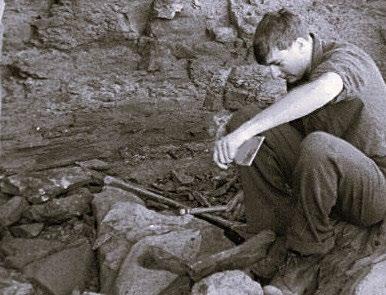
Cliff Mallett mapping and sampling the Port Campbell coastline in 1970. Image provided by author.
Emma Rehn
National Rock Garden panorama southwest
Photo: Supplied
AJES and AI – what’s new and what’s changed?
Taylor & Francis, publishers of the Australian Journal of Earth Science, have shared updated information on the use of AI in publications that will be relevant to all members considering AJES submissions. The new homepage is a new one-stop resource to view T&F Editorial Policies regarding AI use in scholarly publishing.
Using artificial intelligence (AI) in your research and manuscript preparations:
Key updates include:
A reminder to authors of types of inappropriate uses of AI in research and manuscript preparations.
Highlighting key research reporting guidelines where AI is part of research methodology.
Guidance for authors if they are using AI tools to assist with Plain Language Summary text. •
The use of AI tools for copyediting, reference management, language refinement and translations is now permitted. Attributing authorship to AI tools remains, and will remain, prohibited. It is the authors’ responsibility to ensure the accuracy and integrity of the whole content, including references
The use of AI to visualise research data and for artistic rendering, flow diagrams and teaching illustrations is now permitted Use of AI tools to generate or manipulate images, such as those related to the outputs of scientific and clinical research, remains prohibited.
This is an evolving field, so please bookmark the new policy page as we will continue to develop the content and update the use cases.
Next steps
Highlighting the policy for authors is a key priority, and Taylor & Francis will be adding a specific section on AI use and declaration to our instructions for authors soon. In addition, they are developing a process, expected to go live later this year, to capture information on AI use at submission and publish this as a declaration in the final article.
The AI policy also covers use of AI technology by editors and reviewers. If an AI-assisted tool is being considered in editorial work, please reach out for more information and to discuss options.
Crowning champion minerals – the global outreach phenomenon of Mineral Cup
Set your calendars for 1 September 2026 – new contenders will be stepping to the plate! Will an old favourite beloved by petrographers or a fancy mineral with iridescent crystals take home title of Mineral Cup Champion in 2026?
2026 will be the tenth iteration of the annual Mineral Cup. Since its inception in 2017 as a ‘quick’ Twitter poll run by Eddie Dempsey of the University of Hull, Mineral Cup has rapidly grown and now has its own dedicated website for voting as well as a presence across all social media channels.
Mineral Cup is entirely volunteer run. Led by Mika McKinnon (natural hazards researcher and science communicator based in Vancouver, Canada) the organising team boasts members across the world and includes students, web developers and university staff who
coordinate the Cup by group chat. The Cup is a single-elimination tournament to determine which mineral achieves bragging rights as the best mineral of the year. A total of 32 minerals are featured in the tournament: a mix of the previous year’s top contenders, a handful of comeback minerals returning after elimination in previous years, and new minerals. Each round is a head-to-head, 24-hour battle between two minerals with the winner progressing to the next round. The champion is decided at the end of September.
The global phenomenon meets many of our discipline’s outreach goals. It raises the profile of the Earth sciences with increasing reach via social media. Voters often share their reasons for supporting each mineral, often facts about mineral structure, occurrences, current uses and historical applications – educating
the general reader and Earth scientists more broadly. It highlights individuals passionate about mineralogy and geology. These personalities – people who share information in every battle – bring a great human face to what some in the general public may see as a dry science.
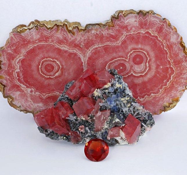
Over the past nine years, there have been nine champions. No champion has been more polarising than ice, the winner in 2019, and no champion more surprising than quetzalcoatlite in 2021. The other champion minerals are more familiar: olivine, garnet, magnetite, fluorite, zircon, rhodochrosite and kyanite. Surprisingly, quartz and calcite are yet to take out a Mineral Cup and find themselves on the outer as participant feedback has increasingly favoured more new minerals.
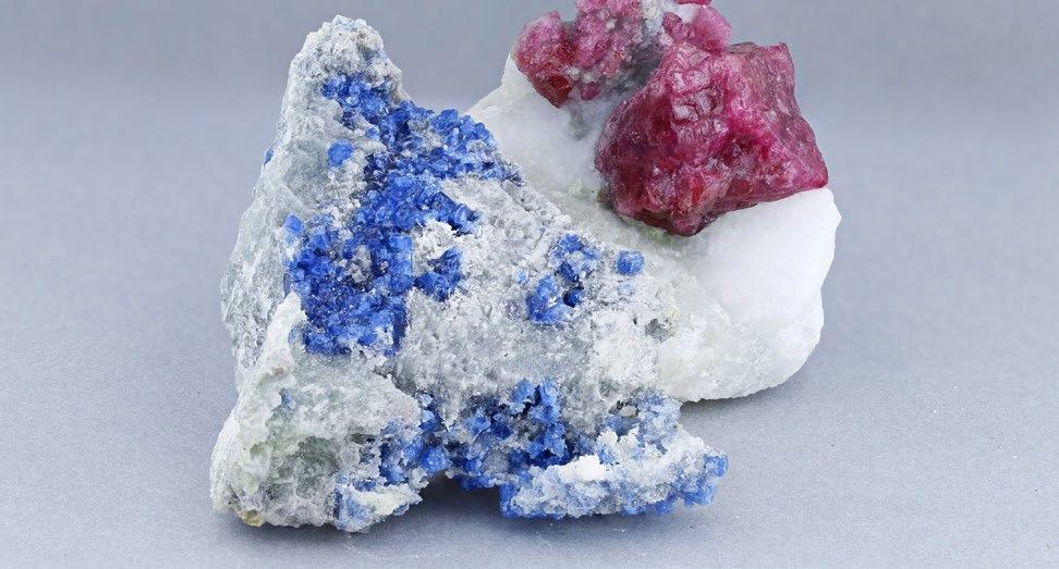
Spinels from Luc Yen, Vietnam.
Photo: Smithsonian Institute
Current rules include: (1) previous champions do not compete; (2) three quarters of minerals each year will be new competitors, and (3) only International Mineralogical Association approved mineral species can compete. The third rule means that past champions olivine (solid solution between forsterite and fayalite) and garnet (several species including andradite and grossular) would no longer be eligible.
Mineral Cup always welcomes new suggestions for minerals to compete. There are 6220 minerals defined by the International Mineralogical Association and just 150 have competed in the Cup so far. And with over 50 new minerals defined each year, it’s not even possible to catch up with the full numeric diversity in the mineral world. You can suggest minerals to participate in the Cup by navigating to the Nominations page of the site.
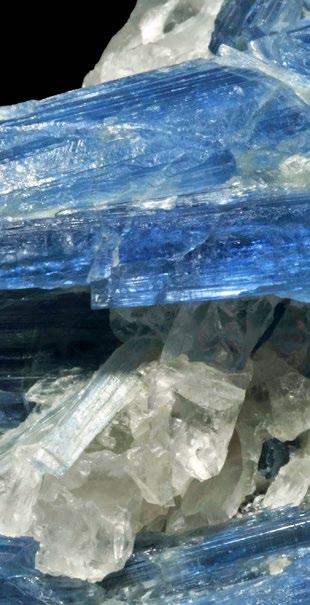
In 2025 kyanite was victorious after 41,010 votes were cast in the final. The mineral sailed through early rounds with 8% to 23% winning margins, but it was a tight 39 vote victory over charming newcomer Tugtupite in the final match. It was a long road to victory for the high-pressure superstar, having competed since the very first Mineral Cup in 2017 with a mixed track record of both first-round losses, semi-final losses and even being runner-up in 2024.
Returning minerals in 2026 will likely include: haüyne, hematite. kosmochlor, perovskite, tugtupite, dioptase and cuprosklodowskite. The other 25 are yet to be decided!
We encourage you to share Mineral Cup with your colleagues, friends, teachers (all the better if there are earth sciences subjects coming up in September), get involved and vote! The official Mineral Cup accounts – and no doubt many fans – will be posting across
a range of social media platforms, and we’d love your input too.
Learn more about minerals, cast your votes, recruit friends and allies to join the game, and campaign for your favourite minerals!
OWEN MISSEN
home page of the Mineral Cup and the place to vote come September
The full list of maintained and updated minerals
Nominate a mineral to compete here!
2025 Mineral Cup champion, kyanite. Sample from Brazil. Photo: Géry Parent
2024 Mineral Cup champion rhodochrosite, Photo: Smithsonian Institute
From art to science and back again
When I started drawing my own comics in high school, I didn’t think I’d become an artist. I had no clear career plan, just a wide range of interests, a love of learning, and a hobby of making art for fun. My early comics were funny although not particularly well drawn, but I improved by experimenting over many years because I enjoyed it.
In the meantime, I studied English and Archaeology at university then took an opportunity to jump from the arts to science, doing a PhD project on palaeofire. As much as I liked research, I discovered that my favourite part of science is sharing it with other people, and that many scientists can struggle with this part.
Art was a natural fit, and I think comics and cartoons are particularly good for this. Visuals grab people’s attention and can help them quickly understand a concept. A cartoon is also a lot less intimidating than a scientific paper. They can be funny, they can be colourful, and they often look simple while communicating complex ideas (which is harder than it looks). All of this aligns with my aims of making science engaging, joyful, and accessible for everyone, including people who might have previously thought science wasn’t for them.
I knew a lot of researchers who were interested in sharing their work this way and that’s how I got started as an illustrator. Some of my first commissions were infographics for friends and colleagues to accompany newly published papers or to use in grant applications.
Since I started drawing things for scientists (informally from ~2016, and as a freelancer since 2022), I’ve worked on lots of fascinating projects including: t-shirt designs for Pint of Science; educational animations for kids; illustrations to accompany podcasts; logos for scientific conferences and apps; and, anatomical diagrams. I still draw comics for fun, but now I also get to share cool science at the same time.
EMMA REHN Freelance science illustrator; communications officer for TropWATER, James Cook University, Cairns
From outcrop to outcome: Why geotourism matters more than ever for Australian geoscience
John Martyn
Geotourism has long sat at the margins of mainstream geoscience in Australia, often viewed as interpretive, educational, or secondary to ‘core’ scientific work. That perception is now changing. A recent review by Geotourism Australia reframes sustainable geotourism as a rigorous, outcomes-driven discipline:
“A place-based form of sustainable tourism that safeguards Earth’s geodiversity and geoheritage while strengthening interconnected biodiversity, cultural values, and the wellbeing of host communities—achieved through inclusive stewardship, meaningful interpretation, positive-impact practices and measurable outcomes.”
This definition signals something important: geotourism is not just explaining rocks. It is about applying geoscience to deliver measurable environmental, social, and economic value.
Moving beyond interpretation
At the recent Australian Earth Sciences Convention, David Robson outlined a practical framework for developing highquality, sustainable geotrails, one of the most accessible and scalable tools in geotourism. The framework is grounded in three principles:
1. Actively contribute to environmental restoration, rehabilitation, and conservation.
2. Empower communities through education and economic opportunity.
3. Build partnerships that deliver positive, lasting change.
This marks a clear shift in emphasis from minimising harm to actively doing good. Sustainable geotourism and geotrails are now expected to generate positive impact: measurable benefits for landscapes, communities, and regional economies.
Karstic potholes and tunneling, The Washtubs, Waitara Creek, Hornsby geotrail KGR.
Photo:
What makes a sustainable geotrail?
A geotrail is more than a series of geological stops. At its best, it is a structured journey that links geosites, landscapes, and communities through a coherent narrative. In the Australian context, geotrails offer several distinct advantages.
They are typically built along existing travel routes, meaning they do not introduce new access pressures or land management conflicts. They are relatively low-cost
Delivering regional value
Strategic investment in geotrails can generate tangible regional benefits. Linked journeys, rather than single-site visits encourage longer stays that support local businesses, creates employment opportunities, and strengthens regional economies.
Equally important are the less tangible outcomes. Geotrails foster community
to establish, yet capable of delivering significant regional development outcomes. Importantly, they have broad appeal to diverse audiences.
A well-designed geotrail integrates geological heritage with natural and cultural narratives, including Indigenous connections to Country. This approach transforms isolated outcrops into part of a larger story that connects deep time with
living landscapes and communities.
This is where disciplinary knowledge becomes powerful. Stratigraphy, geomorphology, structural evolution, and palaeoenvironments are no longer ends in themselves, instead they become the foundation for public understanding, engagement, and stewardship.
pride, support local storytelling, and encourage deeper appreciation of natural and cultural heritage. They can also act as platforms for conservation, helping communities and visitors understand the processes that shape landscapes and the importance of protecting them.
These outcomes align closely with national and state policy settings. The Australian
Government’s THRIVE 2030 Visitor Economy Strategy calls for high-quality, sustainable visitor experiences through geotourism that integrate natural and cultural values while supporting regional communities and traditional owners.
A role for geoscientists Case study: Ku-ring-gai geoRegion
This presents a clear opportunity for the geoscience community. Geoscientists are uniquely placed to interpret the fundamental relationships between rocks, soils, landforms, ecosystems, and climate. When combined with cultural knowledge and community input, this creates a holistic understanding of place.
Rail trails: an untapped opportunity
Across Australia, an even larger opportunity exists in the form of rail trails. There are nearly 200 such trails nationwide. They are accessible, already popular, and embedded within regional tourism networks. These landscapes are rich in geological and engineering significance and often expose otherwise inaccessible rock sequences. Many trails pass through historic mining districts. Yet much of this geoheritage remains under-interpreted. With appropriate interpretation, they can become “linear classrooms” revealing geological processes, landscape evolution, and human interactions with the Earth.
The emerging concept of GeoRegions – place-based frameworks that link geoheritage, biodiversity, and cultural values – provides a broader context for geotrails. The Ku-ring-gai GeoRegion on the northern outskirts of Sydney offers a useful example. Developed through a communityled initiative of the Friends of Ku-ring-gai Environment (FOKE), it demonstrates how geoscience, education, and tourism can be integrated in a coherent regional framework.
From science to stewardship
As Australia continues to develop its GeoRegion framework and strengthen its approach to sustainable tourism, geotrails offer a practical, scalable, and impactful pathway forward. The challenge, and the opportunity, is for the geoscience community to step into this space and help shape how our landscapes are understood, valued, and sustained for future generations.
DAVID ROBSON Chair, GSA Geotourism Standing Committee
For example, a virtual geotrail, sponsored by the Sydney Minerals Exploration Discussion Group (SMEDG), uses video-based interpretation to explain the the Sydney Basin stratigraphy. Upgrades to the NPWS Kalkari Discovery Centre, supported by the NSW Committee of the Australian Institute of Geoscientists, enhance interpretation within Ku-ring-gai Chase National Park. At the same time, professional tour guides deliver high-quality visitor experiences.
Fox Valley Diatreme, Browns Field, KGR.
Photo: John Martyn
Read the Earth, Shape the Future: High school Earth sciences education holds the key to tackling the challenges of the 21st century in Australia and beyond
Picture this: the water in your tap was filtered through rock aquifers that took thousands of years to fill. The fertiliser that grew your breakfast cereal came from ancient seabeds, mined and processed from phosphate and potash deposits mapped by geologists. The concrete in every building, the glass in every window, the copper in every power cable. All of it begins with someone who understands the Earth. And the clean energy future we’re racing toward? At its core, it is a geological story about rocks, fluids, minerals and deep time. Every geothermal well, every onshore and offshore wind foundation, every battery and solar panel is built on knowledge that only Earth scientists can provide.
Australia sits at an important historical junction and holds extraordinary geological endowments: the world’s largest lithium reserves, immense rare earth deposits, huge reserves of critical minerals, and tremendous potential to lead global energy security.
Much of our country’s past and current
economic prosperity has accrued through geology and Earth sciences and the immense challenges of food, water and energy security and intensifying natural hazards demand this same knowledge.
Yet our capability and workforce in these very fields is rapidly eroding. Australia faces a documented national shortage of geoscientists at precisely the moment they are needed most.
The Australian Academy of Science’s landmark Australian Science, Australia’s Future: Science 2035 report is unambiguous: meeting Australia’s sovereign capability needs across the challenges of this century demands a sustained and growing pipeline of Earth scientists.
That pipeline is under pressure from both ends. A large portion of the geological workforce is approaching retirement, taking decades of hard-won expertise with it. Meanwhile, most high school students
remain unaware that geoscience exists as a career (as documented by the Australian Geoscience Council), let alone that it sits at the heart of the problems we will need to address in this century.
At the same time, universities across Australia have been shutting down or dramatically scaling back Earth science departments based simply on student numbers in Earth science majors. The lack of visibility of Earth science in high schools across our nation, compounded by historic negative perceptions of our discipline by those who are aware of Earth sciences, has led us to the precipice of our national capabilities.
But there is good news, the impact and relevance of Earth science on major societal challenges has improved visibility at the high school level. In NSW, enrolments in Earth and Environmental Science (EES) have grown by more than 60% since 2018, with over 2,500 students sitting the HSC subject in 2024. That’s a remarkable vote of confidence from
young people choosing to understand the planet rather than simply inherit its problems. And they’re making that choice against a backdrop of real anxiety, where Curtin University research found that 81% of Australian Gen Z respondents were concerned or very concerned about climate change, and yet fewer than 35% felt they had meaningful ways to act. Geoscience is one of the most direct answers to that frustration. It hands students the tools to model groundwater systems, trace nutrient cycles, map geological hazards, read deep-time climate signals in ancient rock sequences, and understand the planetary systems. Through Earth science we can convert that anxiety of an uncertain future to empowerment and agency, where we can work with the younger generations to pave a more resilient planetary path ahead.
A newly modernised NSW Earth and Environmental Science HSC syllabus, developed with input from university researchers including the author, will be implemented from 2028, weaving in geology, climate science, Earth’s resource systems,
and sustainability in ways that connect directly to the problems students already know they will inherit.
But not every student sits in a school that offers Earth and Environmental Science, and that gap matters. In NSW, TAFE Digital delivers the full HSC Earth and Environmental Science course by distance enrolment. In WA, the School of Isolated and Distance Education (SIDE) provides the equivalent. Queensland students can access Earth and Environmental Science through any of the state’s seven Schools of Distance Education. No student should be locked out of the geoscience pathway because of their postcode and every school careers advisor, teacher and caregiver in Australia should know these options exist.
The support ecosystem is also being transformed. Through AuScope’s FieldScope initiative, Kelsie Dadd and I are developing curriculum-aligned field guides to bring urban and regional teachers, many of whom have never led a geological excursion confidently, into the field with their classes.
From May 2026, the Geological Society of Australia has reduced its annual teacher membership to just $10, a clear signal that teachers are central to the geoscience capability pipeline. The Australian Geoscience Council is meanwhile moving toward a national annual award for high school teaching excellence, because the teacher who ignites a student’s curiosity about deep time, water cycles or planetary systems deserves to be celebrated, not taken for granted.
Australia’s geoscience future is not being decided in boardrooms or lecture theatres. It is being decided right now, in high school classrooms, by students choosing their subjects, by teachers championing a discipline that grows harder to staff every year, and by careers advisors who understand that geoscientist is not a relic of the past but among the most consequential careers of the century ahead.
SABIN ZAHIROVIC
Geo-awe: maps, stories and sharing Earth science
How could we share our wonder about the Australian continent and its geoscience with an adult non-technical audience?
This was our challenge when we decided to offer a course for U3A (University of the Third Age) members in Canberra in early 2026. We wanted to share our enthusiasm and knowledge about Earth science with an audience that was new to us – the curious adult. ‘Australia Revealed: exploring our continent through maps’ was the result of this endeavour.
U3A Canberra is part of a worldwide movement that uses the skills and experience of members to create affordable learning and social opportunities for people over 50. With over 100,000 U3A members across Australia, there are discussion groups and a myriad of courses available in topics including arts, music and current affairs. But there are comparatively few science offerings.
Part of our motivation was simply a desire to share our love of Earth sciences. But there were deeper reasons too: concern about the lack of understanding of Earth science by the general public, falling university enrolments in geology, and recognition that grandparents and retirees often strongly influence the interests and career choices of younger family members.
We quickly realised developing and delivering the course worked best as a ‘double act’. Richard focused on building visually striking, continent-scale maps and on integrating geology, geophysics, geochemistry, landscape evolution, and Earth history into coherent stories. Shona brought her educator background to the fore by ensuring concepts were scaffolded carefully, jargon was unpacked, and there were activities that
encouraged participation rather than passive listening. The unscripted tete-atete between us added a personal touch to the delivery that created many funny moments.
The course ran for 6 weeks with each session 2.5-hours (including a social tea break). The first 3 weeks focused on developing an understanding of our continent through maps, with the following sequence: (1) what is the continent of Australia? (2) how did it develop? and (3) what is it made of and how do we know? We explained basic physics, chemistry and geological principles that were used to create the maps. These sessions were as much about geography as geology, a blend not usually seen in a classroom setting.
Time activity
Photo: Supplied
The following 2 sessions were about resources, mainly focussed on water, energy and the minerals. At the time, the US-Iran war had just started, so the currency of the situation with respect to energy resources and Australia’s endowment provided a clear link between geology and its impact on citizens. We also looked at hazards, change and the future in our last classroom session.
As much as possible the narrative was driven by using the magnificent maps and images that Australia is fortunate to have. Most people had never seen them before. These images were enhanced by zoom-in case studies, graphs and images, as well as 3D models and animations. The content was as much visual art as it was science, which was why creating high-quality maps and graphics were a focus and stretched Richard’s QGIS skills. At the end of each session the slide decks were shared with participants, which was much appreciated and not usually done at U3A.
Supporting activities ranged from simply viewing specimens through to demonstrating physical rock properties like density and conductivity, or porosity, as well as eating thematic food like rocky road! We are very grateful to the Geoscience Australia Education team for lending some samples to supplement our personal rock collection. There were also paper-based challenges involving diagram analysis regarding aquifers and boreholes plus consideration of where different rock ‘families’ are likely to form in plate tectonic settings.
One of the most successful activities involved geological time. Everyone was given an event from Earth history on a slip of paper then asked to line up across the room in chronological order of their events. The room quickly became animated with debate, negotiation, and laughter as people argued about whether dinosaurs came before mountain building, or when oxygen first appeared in the atmosphere. It transformed geological time from an abstract scale into a social and memorable experience. During the visit to the Geoscience Australia’s TimeWalk the same slips of paper were redistributed to be highlighted by class members at the relevant time marker point, thus further strengthening many concepts.
The ‘field trip’ to Geoscience Australia in the final week served to tie much of the content together and provided reinforcement and many touch points with content already presented. The TimeWalk was particularly engaging and helpful as were with the public displays.
We had no idea what sort of audience to expect in U3A before we started. We developed content to suit the needs of complete beginners through to exgeo-professials, as well as to satisfy curiosity about maps and landscapes. In fact, the class contained a broad mix of backgrounds and interests but most attendees were beginners in Earth science; this reinforced the importance of clear explanations without oversimplifying the science.
We had 30 enrolments and people kept coming back week on week; we later realised this does not necessarily happen with all U3A courses. We sought feedback so we could improve the course when we run it again. Responses were excellent, most gave us 5 stars. Some said they would do the course again although some would like a slower pace and/or more sessions. One participant commented: “I love maps. Basing everything on maps was a theme that suited me. Every week there were maps that inspired me to research further and showed Australia in different ways”. For us it was a real pleasure to have such a receptive and attentive audience who lapped up all that we threw at them.
The recent celebrations for the 100th birthday of Sir David Attenborough have reminded us of a role model who has inspired and engaged so many of us over the decades. He said: “ Do not underestimate the audience. The audience have a real appetite to learn, to be engaged, to be enthralled. Don’t ‘dumb down’. They want to be challenged. Want to be ‘wowed’”.
In some small way, we hope our course conveyed a sense of ‘geo-awe’ and that we conveyed our passion, wonder and enthusiasm for the beauty and complexity of the fascinating Australian continent.
RICHARD AND SHONA BLEWETT (Geosystems Consulting)
Photo: Supplied
Mining the building blocks of Earth science education
And for many years it’s also been considered a useful tool for Earth science education. Certainly a quick browse of the blocks that can be used in the game reveals options such as sandstone, rhyolite, basalt, granite, emerald, obsidian and diamond.
A range of educators and organisations have developed resources for use in the classroom and case studies on use of the program for Earth science education can be found in the education literature.
In Australia, a study by Megan Pusey and Grant Pusey (Using Minecraft in the Science Classroom, International Journal of Innovation in Science and Mathematics Education, 23(3), p. 22–24, 2015) describes how Minecraft was used to teach the Earth science component of the Year 8 curriculum at two schools. It includes a summary of the activities used and how they link to different areas of Earth science and explores links between Minecraft learning and the Australian Curriculum. Student responses to the task showed increases in interest in the sciences generally, Earth science specifically and enthusiastic engagement in the task.
Geoscience Australia’s education centre has produced two engaging posters that walk students through a range of the block types available
in the game. The posters compare actual rocks and minerals with Minecraft blocks of the same name, noting key differences and the areas where creative licence has been used for some building components. The poster text includes a summary of some important uses of each material and is accompanied by an explanatory video.
GA GEOLOGY OF MINECRAFT POSTER MEGAN PUSEY PAPER
FEATURE | OUTREACH AND TEACHING TOOLS
Among the classroom-ready tools available for educators online, the British Geological Survey (BGS) has developed a resource to explore the rock cycle and help students understand how igneous, metamorphic and sedimentary rocks are formed. Another accessible world explores volcanoes in more detail and was built by students. This resource covers the structure of a volcano, eruption types and the impact volcanic activity can have on humans. These tools are useful in teaching broad concepts of Earth science.
The BGS has also developed a series of 3D geological models built as Minecraft worlds to help students discover rocks, minerals and maps and see how geology impacts the landscape. Five worlds are currently available: 4 that use real geological data for small scale UK sites and one that is a simplified version of the geology of the whole of the UK. While lacking the connection to place for Australian students, the approach is one that could be expanded to key Australian localities.
Each model begins at a spawn point that includes information about the blocks used and how they represent real world geology. In contrast to many user-built Minecraft worlds, the BGS worlds use only glass blocks. But these glass blocks are coloured in the style of a traditional geological map and allow the student to ‘dig into’ the model and explore underground.
The models are built based on BGS 3D geological models, elevation and topographic data. For each model there is a comparison of how each Minecraft block represents real world geological materials. The available resources typically contain a user guide for Minecraft and lesson plan materials for educators, as well as the Minecraft file.
BGS ROCK CYCLE RESOURCE
BGS WORLDS RESOURCES
The Royal Ontario Museum in Canada has ‘Museum Minecraft’ that includes
the fictional world of Rocklandia where scientists from the museum explore to find and learn more about igneous, sedimentary and metamorphic rocks. The world depicts real scientists from the museum and includes data sets and images of specimens from the museum collection. Students travel to three different ‘research sites’ to ‘collect samples’, making observations, taking photos and speaking to the scientists, all the time documenting their findings. A series of learning guides and lesson plans are provided for educators.
SANDRA McLAREN
MUSEUM
MINECRAFT
Rocking Our Way To Gold: Australia’s Earth and Environmental Science Olympians
Every January, 24 of Australia’s top high school students gather in Canberra for the Australian Science Olympiads Summer School. Hosted at the ANU’s Research School of Earth Science (RSES), this two-week invitational camp (initiated by now retired Director Greg McNamara) offers a chance for students to explore the wonders of geology, astronomy, hydrology and climate science in an academically rigorous, accelerated format. The goal? A chance to become one of Australia’s science olympians representing the nation at the International Earth Science Olympiad (IESO).
While many summer science programs are experience-based, featuring lab visits and guest lectures, the olympiad program is curriculum-driven involving lectures, workshops, team challenges and field experiences. Students spend 10–12 hours each day delving deep into Earth systems thinking. Biologic, hydrospheric, atmospheric and space system knowledge are integrated with the fundamentals of plate tectonics and rock identification to build a deep understanding of planetary science.
Students have a range of opportunities to build and apply their newly acquired knowledge throughout the program. From peppering our generous and engaging guest lectures from RSES, Geoscience Australia, CSIRO, AuScope, and ANZIC with zinging questions, to taking a close look at many RSES facilities (including the always popular fluid dynamics lab and SHRIMP geochronology facility), students leave summer school inspired by the many opportunities available. Beyond formative daily quizzes and hands-on practical exercises, student teams present scientific posters about one of the Federation Rocks from the National Rock Garden at a conference-style session with the Canberra research community and a short talk on their self-led field investigations. These activities push students outside of their comfort zone, forcing them to move beyond exams into synthesis thinking required in scientific disciplines.
Despite the intense workload, there’s plenty of room for fun. The days are punctuated with regular dance breaks. Yes, the Earth systems dance has morphed over the last decade from Suzy Urbaniak’s wildly popular Plate Tectonics dance, designed to break up the tedium of long classroom hours while engaging kinesthetic learners. Program alumni returning as staff delight in adding their own signature moves, such as, BIFs, axial tilt, unidirectional ripple marks, precession, low/high tide, and the crinoid. The frequent repetition of these coordinated actions to up-beat popular songs breaks down social barriers and creates group cohesion, while reinforcing new vocabulary and concepts.
Away from the classroom, students spend downtime chaperoning our plushie placoderm mascot, Jeff Gnathostomes (generously gifted to us by Marion Anderson @happyplacoderm) and engrossed in earth-science themed games. Carl Spandler’s Mineral Trumps and Volcano Top Trumps have long been program favourites. They are now joined by QUARTETnary and the online fractional crystallisation game Magma Pop. Indeed, the connections built in these slower moments provide many with a true sense of finding ‘their people’.
Photo:
FEATURE
Given the limited visibility of Earth sciences within Australia’s education system, the summer school is the first experience of Earth and Environmental Science for many students. And so the primary responsibilities of staff are to be passionate ambassadors for the discipline and to share the joy of studying our planet. Crucially, we endeavour to have every lesson led by a staff member who is genuinely passionate about the topic. This creates an environment more aligned with university study than high school, and students love it.
Many of our alumni go on to study Earth science at university, even when it wasn’t on their radar before summer school. ANU PhD candidate, Jemma Jeffree, discovered a passion for climate modelling from her summer school experience and the life course of IESO 2023 Team member, James Strickland was changed by his:
“After summer school, I knew that I had no conceivable future ahead that did not involve geology. My study ambitions had always been to study engineering and work in the space industry. However, attending summer school showed that my lifelong dream had been missing an entire component that was now revealed with such clarity. I gained a better appreciation of the importance of geology, understood more about the planet we live on and the stories it can tell, and gained a better appreciation for the significant value geology has to my interests in space exploration. I knew that whatever I did at university had to involve geology, leading me to start the degree that I am still studying now — a double Bachelor degree in Aerospace Engineering and Geology & Geophysics at the University of Sydney.”
The International Earth Science Olympiad (IESO)
IESO is an annual IGEO sponsored activity, drawing competitors from 30–50 countries from around the world. Up to four students from each country gather each August to compete for individual medals in theoretical and practical exams that span the full breadth of Earth systems science.
What makes IESO unique among the international olympiads is its inclusion of two international team competitions, which demand cooperation and compromise across linguistic and cultural divides. Designed
Indeed, our alumni often tackle and excel in second-, and even third-, year University courses. From the other side of the lectern, RSES academics often credit students with enhancing the classroom experience for the entire cohort. Even those who continue into quite different careers happily acknowledge the skills they learned from this unique program helped inspire their choices.
This passion percolates into the workforce, with our graduates now stretching across academia, industry, and government roles where they make substantial contributions to the field. Summer School 2019 alum Nathaniel Henderson is now proudly combining his lifelong interest in lasers and optics with his geological passions by specialising in hyperspectral geoscience and drill core analysis as the NSW State Geological Survey Hylogger operator.
“The program gave me a much deeper appreciation for the physical world and the processes shaping it. It taught me that every rock has a story spanning millions of years and that the landscape around us is constantly recording Earth’s history. More than anything, it fostered a genuine love of learning and curiosity. I think that inquisitive mindset of always wanting to understand how and why things work is something that has stayed with me ever since.”
All Australian citizen high school students are eligible to sit the ASI Earth and Environmental Science Olympiad entrance exam. Top-performing students are invited to attend summer school. The 2026 exam is scheduled for Wednesday 29 July — encourage the inquisitive students in your life to give it a crack!
LESLIE ALMBERG
SEBASTIAN VINER
Scan the QR code to register
to celebrate the multicultural and crossdisciplinary work fundamental to earth sciences, each team member hails from a different country. The Earth Science Project challenges each team to collaboratively investigate, design and present an informative and innovative poster on a problem facing our planet. For the International Team Field Investigation, students have a scant half day to collect data to address a set of open-ended questions before presenting their findings to an international audience.
The extensive time spent on buses and at field sites, working diligently to solve every manner of technical and interpersonal problem, transforms strangers and competitors into lifelong friends. This is reflected in the event’s social atmosphere outside of competition time and extends to the mentors, many of whom develop fruitful professional relationships and deep friendships.
IESO 2026 will take place in Turin, Italy, from 20-27 August. Check back for updates on our team’s success!
Case studies for Earth and Environmental Science classes
One of the biggest opportunities to excite students in Earth and environmental science comes from linking processes and structures of each of the spheres of Earth in a way that shows the relevance of the science to the everyday. Here I’ve
compiled some examples I’ve used alongside high school teachers to connect some of the grand ideas in geology. I am happy to be contacted to discuss ideas and share teaching materials.
Reading 2.5 billion years of Earth History
Banded iron formations (BIFs) of the Hamersley Basin are excellent for drawing student interest into Earth science as they record a unique global atmospheric revolution: the Great Oxidation Event when cyanobacterial photosynthesis first flooded Earth’s oceans and atmosphere with free oxygen (although recent research by Rasmussen, Krapez and Muhling (2021) suggest this process could have occurred entirely abiotically). This event is significant economically (iron ore within the BIFs being Australia’s largest export earner) and biologically as it eventually led to the proliferation of eukaryotic life.
The BIFs represent a direct geosphere–hydrosphere–biosphere interaction: dissolved Fe² + from hydrothermal vents reacted with oxygen produced by shallow-water cyanobacteria to precipitate iron oxides (hematite and magnetite), which settled to the seafloor in seasonal laminations. The rhythmic banding, visible as alternating chert and iron oxide layers centimetres to metres thick, reflects cyclic changes in iron supply, biological productivity and ocean chemistry.
Classroom activities could include:
• Using the dramatic landscape of stunningly folded and faulted rocks to understand past tectonic activity and
introduce the idea of geological map reading.
• Comparing the time delay between when banded iron formation stopped forming ~ 1.8 Ga and the onset of the Great Oxidation Event ~2.4 Ga to explore the buffers between the biosphere, geosphere, hydrosphere and atmosphere.
• Exploring BIF deposition and climatic forcing. For example, by assuming chert-oxide couplets represent annual deposition, students can estimate the total time taken to deposit a 100 m BIF sequence and make comparisons with different Milakovitch cycle intervals.
Megafauna extinction in Australia: climate, human arrival or both?
Australia lost 88 genera of megafauna between approximately 50,000 and 46,000 years ago including Diprotodon optatum (the world’s largest marsupial weighing in at ~2.8 tonnes), Genyornis newtoni (giant bird), and Megalania prisca (giant goanna ~7 m). This extinction event occurred at the intersection of human arrival, intensifying aridity, fire regime change and the loss of perennial water sources. The case study places students directly in the middle of a genuine scientific challenge.
Students can:
• Explore documented Aboriginal and Torres Strait Islander oral traditions and fire-stick farming practices to understand the cultural dimension of the discussion.
• Assess evidence such as the changing isotopic compositions of Genyornis newtoni eggs (that suggest habitat burning around 47,000 years ago) and fungal spores from animal dung (Sporomiella) and charcoal fragments preserved in lake deposits
in Queensland (that suggest ecosystem and biodiversity shifts on the arrival of humans).
• Consider paleontological evidence that shows that megafaunal variety had been diminishing for tens of thousands of years prior to the arrival of humans at the time scale of variations in climate. Explore how the loss of large herbivores would alter geosphere-biosphere interactions after the extinction event, and how this may be preserved in the sedimentary record.
Mexico City the next Atlantis? Groundwater extraction and subsidence
Land subsidence driven by groundwater extraction is one of the most widespread yet least visible geohazards facing modern cities. When water is pumped from aquifer systems, reduced porefluid pressure allows the sediment matrix to compact causing the ground surface to sink. Perth and Mexico City offer an instructive comparison: same mechanism but different geology leading to orders-of-magnitude differences in rate. Contrasting management responses show powerful lessons about Earth system reversibility.
Mexico City is one of the fastest subsiding cities in the world with rates estimated around 50 cm/year. Over 9 m total subsidence has occurred since 1900. Among other impacts, subsidence
has been progressively destroying the Metro system used by 4.7 million people daily. The city is built on 100 m thick clays (~10,000 years old) and compaction of those sediments means subsidence is essentially irreversible.
Similarly, long-term subsidence was identified in the Perth Basin but here subsidence slowed to 2 mm/yr after 2005 following reduced extraction from the Yarragadee Aquifer. In fact, a managed aquifer recharge programme produced measurable ground uplift of 2–4 mm and shows the sensitivity of the geosphere to human activity.
Students can:
• Learn about the importance and fundamental processes of groundwater transport and extraction.
• Be introduced to satellite observation methods (such as GPS) and how they can track changes in ground surfaces and constrain rates and amounts of subsidence.
• Explore possible STEM solutions to subsidence
• Consider how urban design and building construction need to work in tandem with knowledge of the geosphere and hydrosphere to avoid resource overextraction and community risk.
Photo: Shutterstock
The great 2011 Tōhoku earthquake
At 14:46 Japanese Standard Time on 11 March 2011, a Mw 9.0–9.1 megathrust earthquake ruptured ~500 km of the Japan Trench from the Pacific Plate subducting beneath the Okhotsk plate at 9 cm/yr. The sudden release of elastic strain produced ~50 m of seafloor displacement near the trench, generating the most destructive tsunami in recorded Japanese history. Nearly 20,000 lives were lost, the Fukushima Daiichi nuclear plant experienced meltdown and total economic damage exceeded $400 billion.
The Tōhoku earthquake is one of the best-documented megathrust earthquakes in history being monitored by Japan’s network of 1,200 continuous GPS stations. It provides a uniquely data-rich case study. Critically, the earthquake’s magnitude was significantly underestimated by official
hazard maps (predicted maximum Mw ~7.7), despite paleo-tsunami sedimentary evidence of similar events in 869 CE (the Jogan earthquake) and a recurrence interval of 800–1,100 years. This failure to incorporate scientific evidence into infrastructure design is the central teaching point on science–policy interaction.
Students can:
• Use the case study as a springboard into seismology by doing a simple epicentre mapping exercise using a few station readings of differential P-S waves. Then they can use the moment magnitude scale to calculate the ratio between a Mw 7.7 and Mw 9.0 and infer how many Mw 7.7 earthquakes would be needed to equal one Mw 9.0 event which has important implications for the consequence of underestimating
maximum earthquake magnitude.
• Consider the alternative of what the financial and societal cost of overestimating every earthquake as being large like the Tōhoku earthquake.
• Look at paleoseismic evidence from large tsunami deposits, recurrence intervals, post-seismic deformation, and explore tsunami warning systems by using the simple tsunami velocity equation.
• Explore the tsunami risk of Australia’s NW coastline given the proximity of the Sunda Subduction Zone.
Compare and contrast tsunami warning systems in different countries.
MARTIN NGUYEN
Cockatoo island Australian heritage festival: Talking
to the public about the rocks
The National Rock Garden was invited to provide a geological display during the Cockatoo Island Open Day in 2025. As the only NRG director based in Sydney, Mike Smith approached Sabin Zahirovic and Kelsie Dadd of the NSW GSA Division, who readily agreed to collaborate on a display.
Banners, posters and rock specimens were transported to the island by ferry from Circular Quay, and our geology display was erected in front of a huge wall of Hawkesbury Sandstone next to a 180 m long tunnel through the sandstone which was built in 1942 as an air-raid shelter. Our task was to explain that these layers of rock represent the progressive deposition of sediments derived from the breakdown of geological formations in a distant mountain range, which were then transported by
sustained rainfall into a large complex network of river channels. The different layers likely represent sediments sourced from different rock types, or different mountain ranges altogether. We recommend this location as a great place for a day visit to see excellent examples of sedimentary structures and to learn about Sydney’s history. Overnight visits are possible with on-site tents or in large heritage houses (bookable through the Sydney Harbour Federation Trust).
At the end of the Open Day, the representatives of the Cockatoo Island Heritage Trust expressed their enthusiasm for the efforts of the GSA and NRG representatives on the day. Our team has been invited to return to Cockatoo Island. We plan to do that.
MIKE SMITH
The NRG and GSA NSW display on Cockatoo Island as part of the Australian Heritage Festival.
Photo: Mike Smith
Sabin Zahirovic explains the various sedimentary structures readily visible inside the tunnel to visiting children. Photo: Mike Smith
This visiting Scout group had a lot of rock questions. Children loved to touch and lift the rocks (sandstone, conglomerate, shale, ironstone and basalt) leading to discussion of big rocks at the NRG site in the National Arboretum Canberra.
Photo: Mike Smith
FEATURE
Reversing the decline of Australian geoscience
Australian universities are struggling financially. They are endeavouring to maximise income by offering courses they think will be popular, and closing/trimming/ merging departments they consider are ‘not paying their way’.
Most geoscience (or Earth science) departments are amongst those that have suffered over the past decade, not only in Australia but also in other western countries. A major reason for falling graduate numbers appears to be limited awareness of geoscience – particularly its essential roles in supporting Earth systems. There are also concerns about its links to mining –despite mineral and energy resources being essential for human existence, a sustainable future and Australia’s economy.
To help address this decline, it is important to attract as many students into general science degrees as possible; give equal prominence to geoscience in first year subject options; remove any financial or other disincentives for geoscience; and ensure a great first year experience that will encourage students to continue. The latter needs good, engaging lecturers, for whom reward and promotion should take account of this skill – not only research publications. The National Committee for Earth Sciences (NCES) of the Australian Academy of Science (AAS) is considering ways to enhance the public perception of the
societal value of Earth science and reverse the decline in related tertiary training. It is important that this involves people from outside the university sector, given the view by some in government that academics tend to be insular and are over-represented on key committees. A first priority should be to make the case to government for more support for geoscience, based on its essential roles in addressing national and global challenges, including those associated with decarbonisation. Another early focus should be school students –including those in rural areas, who often have an affinity for the land – to boost interest in geoscience as a rewarding career.
The benefits the geoscience community can gain from keeping meaningful contacts with relevant Ministers’ offices and influential officials are demonstrated by the NCES’ 2003 decadal plan, which was developed in consultation with the resources minister. This led to a decade of well-funded programs on exploration for subsurface mineralisation, and investments in research infrastructure, plus funding for Geoscience Australia to extend its activities related to renewable energy, geohazards and enhanced geospatial data and applications.
Opportunity
The significance of geoscience has recently been emphasised in the expert report, Strategic Examination of Research and Development, which was released by Innovation Minister, the Hon Tim Ayres, in March 2026. This report recommends allocating the limited funding for the tertiary sector on the basis of strategic importance. This mirrors the approach in China, where the country’s rapid economic development continues as decarbonisation ramps up.
This R&D report identifies resources, energy and the environment as national priorities, and shortages of geoscientists as a problem. This presents an ideal opportunity for growing the profile of, and support for, Australian geoscience – potentially at the expense of poorly-constrained economic modelling. The geoscience community needs to reinforce this message with the Minister and key officials as a matter of urgency.
STRATEGIC EXAMINATION OF RESEARCH AND DEVELOPMENT
Case for added support to address national priorities
The AAS, which organised a virtual roundtable on Australia’s geoscience capability in March 2026, is best placed to lead the government lobbying. Good outcomes would be formal recognition of geoscience as a strategic field; and agreement to cover the costs of student fee reductions to encourage enrolments in all such priority disciplines. To this end, the representation should emphasise the underpinning nature of geoscience, and how it can address diverse challenges, particularly by drawing on Australia’s unusually extensive coverage of high-quality geoscientific information. The information was collected to support growth of Australia’s minerals and energy sectors and then to incorporate data for risk mitigation efforts. It encompasses data on the types, distributions, ages, physical and chemical properties of rocks, cover materials and waters, plus locations of mineral and energy resources, and detailed geospatial and remote sensing data. It is well-managed and freely accessible through the Geoscience Australia Portal.
This information system has proved very productive in guiding exploration for natural resources, with the current focus on discovery of the vast quantities of critical minerals needed for decarbonisation. As there are ongoing dedicated government programs supporting critical minerals, and exploration more generally, it would be counter-productive to make a case for added funding for these. However, they could be cited to illustrate the effectiveness
of the geoscience community in delivering on major programs, which contribute greatly to the nation’s economy and wellbeing – producing returns much greater than the investments in data collection.
That said, the geoscience information system is multi-purpose. There are other applications of its fundamental data that can be finessed to address a range of other challenging issues, and I consider it is these that need to be featured in the case for additional government support.
Examples of potential broad applications include: infrastructure planning; investigating subsurface features; mapping groundwaters/salinity and soil types; land and water management and rehabilitation; minimising impacts from extreme weather and geological events, including sea level rise and coastal erosion; ongoing minimisation of impacts of resource extraction and processing; green manufacturing; defining links between biodiversity and geological features; achieving good environmental outcomes; assessing potential for replenishing aquifers, CO₂ sequestration, hydrogen storage and underground storage more broadly; linking anomalous chemical compositions to health issues; and managing radioactive and other wastes.
The case for support for developing applications to address national priorities should include extending the scope of
current tertiary geoscience curricula by adding content on diverse real-world challenges, and how to address them using available data and information. Examples to illustrate the sorts of challenges that could be addressed include: (i) the pros and cons of redirecting waters from wet-dry tropics of northern Australia to the dry interior; (ii) the impacts of a large pumped hydro energy storage system on an environmentally sensitive area; and (iii) the impacts of sea level rise and coastal erosion over the next 50 years.
Clearly, the timing is not ideal to be seeking more government funding. But even if our efforts don’t bring immediate support, it is worth making the case that geosciencebased approaches to address major issues are reliable and cost-effective because they are based on actual observations – in contrast with traditional economic analyses of such scenarios, which typically do not take account of all important scientific constraints. Both can be conducted in concert where appropriate.
IAN B LAMBERT
The author is grateful for constructive comments from Allison Britt, Greg Clark, David Cohen, Peter Cook, Steve Hill, Ian Jackson, Lynton Jaques, James Johnson, Sandra Occhipinti and, Neil Williams. FEATURE | IAN B LAMBERT
Celebrating the breadth of education and outreach
So many individuals and organisations in Australia work tirelessly and enthusiastically to bring our discipline to the community. The following sections profile and highlight just some of this work. This is not an exhaustive gazetteer but we hope the summaries here highlight events, direct students and teachers to resources that can be used for education, and help connect educators with organisations who may be able to support their activities.
Thanks to Douglas Finlayson, Kelsie Dadd, Carmen Krapf, Ian Withnall for their contributions.
CoRE Learning Foundation
Geoscience Pathways
The Centre of Resource Excellence (CoRE) Learning Foundation has been developed by Suzy Urbaniak, a Prime Minister’s Prize for Excellence in Science Teaching Award winner, over a nearly 20-year period. It aims to develop, nurture and promote homegrown talent to facilitate the employment needs of Australia’s resources sector. All CoRE programs are based on the principle that education, industry, community, and government should connect to work collaboratively and provide more meaningful, relevant education pathways to students. The learning model emphasises an integrated STEM education by taking an interdisciplinary approach to the development of scientific literacy.
AusEarthEd
Australian Earth Science Education (AusEarthEd) operates across all Australian states and territories creating, producing and delivering Earth science experiences for both primary and secondary students. Recently celebrating 15 years of contributing to Earth science education and outreach, AusEarthEd provide free-to-access content for classroom use as well as resources available for purchase. The resources and activities aim to increase awareness of Earth sciences as an integral part of STEM and to emphasise the importance of earth sciences in understanding contemporary issues. The program is supported by a range of sponsors.
TESEP
Teacher Earth Science Education Programme Ltd (TESEP) provides professional development workshops (in person and online), field trips for teachers, rock and mineral kits, classroom incursions and free online resources in all areas of Australia. The team aims to help teachers understand Earth and Space science and these components of the Australian curriculum. Teachers can join PD events in their area or schools can host their own PD event. TESEP is a NESA recognised PD Provider. TESEP’s aim is to develop confident, well-informed, enthusiastic teachers of STEM / Earth, Space and Environmental Science, with the multiplier effect of flow-on to tens of thousands of students over the years of most science teachers working lifetimes.
Geoscience Pathways Project is a non-profit organisation dedicated to supporting teachers in South Australian schools (and also the Northern Territory Distance Education School). The project is collaborative, linking schools, industry, and professional associations in providing engaging learning and increasing students understanding of contemporary local and global environmental issues. Geoscience Pathways directly supports teachers with resources, professional development, mentoring and funding to help teach Earth and Environmental Science in their schools. The program has a particular focus on high-quality, enquiry-based teaching and learning for the Earth and Space sub-strand of the F-10 Science curriculum. All resources free for all teachers from all schools in SA.
Curious Minds
Curious Minds is a hands-on extension and mentoring program designed to inspire girls’ interest in science, technology, engineering and mathematics (STEM). Funded by the Australian Government, the program supports highly capable girls in Years 8–10 who may face barriers to STEM opportunities due to regional or remote location, socio-economic background, and/or Indigenous status. The six-month program combines two camps with a STEM mentoring program. Since 2022, one camp has been delivered virtually. These virtual camps remain interactive and practical, with students receiving materials to complete activities at home alongside instructors.
During the residential camp, students participate in “supercharge sessions”. In the Earth and Environmental Science (EES) session, students explore topics including plate tectonics, deep time and climate change. The virtual camp includes an interdisciplinary activity focused on plastic waste, particularly microplastics in beach sand. Students sieve sand samples and use smartphone magnifiers to identify microplastics, before brainstorming solutions to reduce plastic pollution and considering plastic waste as a reusable resource.
Post-camp surveys indicate substantial increases in both enjoyment and confidence in EES. Enjoyment rose from approximately 24% before camp to 72% after camp, while confidence increased from 25% to 61%. Students were also more likely to consider studying EES in Years 11 and 12 (10% to 31%) and at university (6% to 24%). Approximately 22% of mentors involved in the program identify EES as a specialty.
FEATURE | EDUCATION AND OUTREACH
Auscope
Seismometers in Schools (SiS) is a flagship education program that brings research-grade science directly to students. The SiS team place seismometers in schools across the nation and then record the data online so that all Australian students can experience our dynamic earth in motion and researchers can study it. Seismometers and teaching resources are now in place in over 50 Australian schools and raise awareness of geoscience through observing our dynamic earth in motion. FieldScope Australia program, led by Kelsie Dadd from the University of Sydney, aims to develop open-source field-teaching materials for both education and outreach.
Working with a national network of educators from a range of organisations, including the Australian Institute of Geoscientists (AIG) and the Teacher Earth Science Education Programme (TESEP), Kelsie’s team aims to create accessible field guides for capital and regional locations that cover deep-time geology, contemporary climate issues, and connections to First Nations Country. These materials will incorporate AuScope data and models, ensuring accessibility while demonstrating Earth Science’s relevance to Australia’s future.
Australian Earth Science Olympiad
The Australian Science Olympiads (ASO), coordinated by Australian Science Innovations, is a staged science enrichment program for highly motivated students in Australian high schools. The program allows schools to test student abilities against the national cohort; provides opportunities for teachers to challenge and extend their very best students; and allows students to build their skills, experience, knowledge and connections. See the profile piece on the Earth and Environmental Sciences Olympiad program on page 48 of this issue.
Geoscience Australia Education Centre
Every working day at Geoscience Australia in Canberra there are busloads of school children from around Australia visiting its Education Centre to learn about the geology, landscapes, rocks and minerals to be found all across Australia. This is part of a national program to ensure every child has an opportunity to visit the nation’s capital city and visit the major national institutions. The Education Centre develops classroom resources, infographics, videos and explanatory notes and curates these – as well as additional external resources – on its website.
Photo: Shutterstock
GSA ACT Division
Self-Guided Tour of the National Rock Garden
As part of the Canberra and Region Heritage Festival 2026 (1 April to 10 May) the National Rock Garden GSA development group created a self-guided tour of the garden. You could view or download the tour information guide: National Rock Garden Self-Guided Tour. You could also engage in a Treasure Hunt Game and explore Australia’s geological history and discover fascinating rocks and minerals.
Mulligans Flat Woodland Geoheritage Trail
In 2025 the group building a geotrail at the Mulligans Flat Woodland Sanctury near the northern ACT suburb of Throsby completed the signage, part-funded by GSA, and opened the trail to the public, complete with web-based notes at each route marker. The geotrail takes the visitor on a walk through the Silurian geological history of the Canberra region and the evolution of the landscapes within the sanctuary and its surrounds.
Geological excursion publications
The division has publications available for students of all ages to explore the landscapes around Canberra. Sites covered include: Black Mountain, Red Hill, Mount Ainslie, Mount Stromlo, Acton Peninsula, Tidbinbilla, Gossan Hill, Dairy Road, State Circle road cut and Woolshed Creek. All publications are available on the division website.
GSA Queensland Division
Rocks
and Landscapes book series
Free pamphlets
The GSAQ also produces an extensive number of free pamphlets called Rocks and Landscape Notes. These pamphlets mostly detail the geology of areas not covered in the district books and are available for free download from the GSA website. The GSAQ also provides links to free educational pamphlets relating to geology and mining.
Rock and Mineral Sets
Following a survey of secondary schools teaching Earth Science, the GSAQ implemented a project in 2018 to assemble integrated rock and mineral specimen sets suitable for these classes. Indications were that while individual specimens were available from a variety of sources, there were a lack of sets containing an integrated collection of the various basic rock types, and similarly for minerals. Currently the following sets are available: Igneous Rocks, Sedimentary Rocks, Metamorphic Rocks, Rock Forming Minerals, Economic Minerals and Moh’s Scale of Hardness. To date the GSAQ have delivered more than 1,200 sets around Queensland, around Australia, and around the world!
The Queensland Division of the GSA has been publishing books in this series for more than 30 years and some of the books are now in their 2nd or 3rd edition. The books are designed for people who have a general interest in landscapes, rocks and natural history. Warwick Wilmott, who has a passion for explaining geology to the public has authored and/or edited most of the books in the series. Proceeds from the sale of these books help fund the Division’s activities, including providing bursaries for conference attendance by Queensland Earth Science students. The latest book, Exploring Rocks & Landscapes in the Etheridge Region by Ian Withnall, focusses on an area which is an increasingly popular ecotourism destination in north Queensland. It describes the geology and geotrails around Georgetown, Forsayth, Einasleigh, Mount Surprise and Croydon. Although pitched at the public, the book will also be useful to professional geologists wanting to know where to travel to get a quick overview of the geology of the Etheridge and Croydon Provinces. The book and others in the series can be ordered through the new GSA website or emailing sales.gsa.qld@gmail.com. Other books in the series include:
National Parks of North Queensland, National Parks of Central Queensland, National Parks of Southern Queensland, the Sunshine Coast, the Gold Coast Hinterland, Brisbane and Ipswich, the Wet Tropics, the Great Artesian Basin, the Toowoomba District and Northwest Queensland.
Photo: Shutterstock
Geological Survey of South Australia
The team at the GSSA and its parent Department of Energy and Mining, contribute to a range of activities including:
• NExUS Program – GSSA staff has contributed in-kind support and provided free access to the SA Crill Core Library for the face to face theoretical and drill core logging components. GSSA staff have contributed to program components including: Regolith Geoscience, HyLogger, Geology of the Yorke Peninsula, field trips along coastal outcrops at Pine Point
• Science Alive (a STEM showcase held annually at the Adelaide Showgrounds)
• GSA Earth Science Student Symposium sponsor and supporter
• Student industry networking events to promote Geoscience and Geological Survey work
National Association of Geoscience Teachers
The National Association of Geoscience Teachers (NAGT) is a community of educators and education researchers working together to improve teaching and learning about Earth. Based in the USA, NAGT includes college and university faculty, K–12 teachers, informal educators, graduate and undergraduate students, and geoscience and education professionals. NAGT promotes and supports high-quality Earth education that is accessible to all, and their Teach the Earth collection provides a wide range of curated and some cases reviewed, teaching materials covering the full breadth of Earth and Environmental Science. NAGT support geoscience education research and publish the Journal of Geoscience Education
Earth Science Teachers Association (UK)
IN MEMORIAM
Douglas Traves OBE
25/11/1925 - 23/07/2025
The GSA was saddened to hear of the death of Douglas Traves, aged 99. As a foundation member of the GSA in 1952, Douglas’ commitment to the society spanned an extraordinary 72 years. Such longstanding support is rare, and it speaks volumes of his dedication to the geoscience community and the people within it.
Douglas grew up in the northern suburbs of Brisbane and excelled both academically and on the sporting field. He was awarded a BSc degree with a major in geology from the University of Queensland in 1947 –the first step in what was to become a distinguished career in mining and exploration.
His work led him all over the world and in 1951 he was seconded to the Pakistan government (under the Colombo Plan) to assess the mineral potential of an area north of the Himalayas. He was then employed at the Bureau of Mineral Resources (BMR, now Geoscience Australia) in Canberra.
The UK-based Earth Science Teachers Association (ESTA) is the professional association for Earth Science education in the UK. It drives debate on the integration of Earth Sciences into the curriculum, is a home for the development of teaching pedagogies and resources and encourages the study of Earth Sciences at all levels. It provides a range of both free and commercial teaching resources.
In 1954 he led the first BMR party into the remote West Australian desert with one of the largest exploration camps in Australia. He acted as managing director of Mines Administration Pty Ltd until 1978 and then went on to consulting work for ESSO, BP, HDBAY and Bundaberg Sugar. He became president of the Queensland Chamber of Mines in 1979 and sat on boards and advised for many institutions and societies.
In addition to his service and membership record with the GSA, Douglas had more than 60 years membership of the AusIMM. One of his proudest moments was being awarded an Order of the British Empire (OBE) in 1974.
Author Profile: Sally Hurst
We’re excited to feature Sally Hurst’s new book Found a Fossil, recently released by CSIRO Publishing. Sally is an accomplished scientist and science communicator. Her volunteer roles include work with the National Indigenous Science Education Program, Curious Minds Mentoring Program, the Harding Miller Education Foundation, and the Widening Participation program at Macquarie University. She is a passionate advocate for equal education and resources and an established role model for young girls and women in Earth science.
Welcome to TAG Sally and congratulations on the publication of Found a Fossil. Can you tell us a bit about your background and your career pathway. What’s inspired the choices you’ve made?
I am both a palaeontologist and an archaeologist, meaning I get to study both fossils (especially dinosaurs), as well as human history and the remains ancient people have left behind.
I was totally a dinosaur kid – but I never knew that being a palaeontologist was a real job. It look me a long time to figure out that this kind of field was something I might want to do! I grew up on a farm in rural NSW. My primary school had a grand total of 65 kids, and in high school, the science classes I wanted to do didn’t run due to lack of students. It was very hard to picture myself doing anything like palaeontology when I’d never met a real scientist.
By Year 12 I was still unsure of what pathway to take. I originally had journalism or publishing on the brain, but I wasn’t convinced that it was my dream pathway, so I took a gap year to figure it out. I had done my Year 10 Work experience at the National Dinosaur Museum in Canberra, and had been able to travel to some incredible museums and archaeological sites in North and South America and thought – “Maybe this is something I can do”. No exact career or job in mind, just a field I was fascinated by. Luckily, when I started a Bachelor of Arts majoring in Egyptian Archaeology and a Bachelor of Science in Palaeobiology at Macquarie University in Sydney, I absolutely loved it. I found my niche, and started building a community of role models, teachers, and mentors around me who always inspired my next steps. From doing a Master of Research, to spending weeks in the field digging up dinosaur bones, to having started my own business running educational fossil workshops for students, it’s very different to what I once thought I’d be doing, but I wouldn’t change it for the world.
Teachers are inspirational at all levels of education. Can you tell us about any teachers, lessons, incursions/excursions that provided a spark for you to pursue science?
My sister had her 6th birthday party at the National Dinosaur Museum, and that was what made me think about asking them to do work experience. Getting to run tours, design displays and research dinosaurs was my first step into this career and my path to becoming a palaeontologist.
It was really only after high school that I seriously started to consider palaeontology as a career, but I’ll always remember my Senior Science teacher Ms Dodd for believing in me. I don’t think either of us knew what was going to be on the cards for a future career, but she always had faith in me that whatever I chose to do, I’d do it well.
Photo: Supplied
What rocks or landscapes are the most inspiring?
The ones that have fossils in them! I’ll be honest that hardcore geology was never really my thing – but those ancient creatures whose bones now reside within those rocks – that’s my kind of science. From the layered mountains in the Flinders Ranges where we find Earth’s first animals, to the hoodoo-rich Badlands of Alberta, Canada, or the deserts of Mongolia where some of the world’s best dinosaurs are found – as long as there’s fossils, I’ll be inspired.
Your first book, Found a Fossil, is published. Congratulations! Tell us a bit about the book and the process of putting it together
Found a Fossil is a love letter to fossils, those who discover them, and all the stories they can tell us. So many fossils around the world are not discovered by scientists, but by members of the public, and this book pays homage to those often-uncredited discoverers. The book walks through what fossils and First Nations artefacts are, why they’re so cool, and why we must protect them. Inside you’ll find accounts of my favourite Australian fossils, what to do if you find something, and tales from my digs around the world. I talk about my mentors and role models who have supported and inspired me, and how science goes beyond the scientists who write the papers. Found a Fossil is meant for everyone – you won’t need any specialised knowledge and hopefully you’ll come away with a renewed sense of the incredible heritage we have in our backyard.
Do you have any plans for your next big project?
I am not a full-time palaeontologist. I work in an office to help pay for my digs, I run fossil workshops on the side, and I get into the field as often as possible. As I am not employed full time, I never quite know what next adventure may be around the corner. However, within this year alone, I’ll be heading on digs in Canada and Mongolia, uncovering tyrannosaurs and ceratopsians, talking to as many kids as possible about the incredible things we’ve found, and the latest adventure will be to start on Book #2! This one will be a kids book exploring how we find fossils and learn from them from different sites all around the world.
We have to ask, do you have a favourite fossil?
There’s a fossil called “Big Mama” which is of a dinosaur called an oviraptor sitting on a nest of eggs. Oviraptors look a bit like an ostrich, but with larger leads and longer tails. If you think about how emus sit on their nest of eggs and sometimes stretch out their short wings and feathers to protect them, that’s exactly what is happening in this fossil – only 70 million years ago.
LINK TO BOOK: PERSONAL WEBPAGE FOUND A FOSSIL WEBSITE
Cryptic Geological Crossword
VINCE MORAND
ACROSS
1. “Hey, Zeke, that there rock is a grain of fire.” “Whachu talkin’ bout, Billy Bob?” “Well, that’s what I heared the man say.” “You got rocks in yo’ head, boy.” (10)
5. Metal found in the odd mine. (2)
7. Grandma made us conceal an Australian basin. (7)
8. Wild panther loses direction amid volcanic fallout. (6)
9. Listen: why be a rare earth element? (2)
10. Explosive volcanoes disrupt car deals. (8)
12. Tie dope in knots to reveal green mineral. (7)
13. Extreme care required to identify this rare earth element. (2)
14. Even bats can be quite toxic. (2)
18. Measuring alkalinity took up two thirds of PhD. (2)
19. Igneous structure breaks down into ruins. (9)
21. Plaster material all over dried up lake bed. (6)
22. Heavy metal marks the end of an era. (7)
24. Take a long cylindrical piece of this part of the Earth. (4)
28. First third of thesis is relevant to geochronology. (2)
29. Strangely true: ID was a coarse-grained rock. (6)
30. The French Virginia came from a volcano. (4)
1. Terrible ingrate gives us a common rock. (7)
2. Sly Asian characters required to work out what’s in a rock. (8)
3. Gulp back a volcanic structure. (4)
4. White pigment rule has it backwards. (6)
5. “Hey Zeke, I heard he’ll marry Anna.” “Where, Billy Bob?” “In a trench, they reckon.” “They ought to ditch that idea.” (7)
6. Accessory mineral occurs where sheep wander around the north. (6)
10. Cuban siesta starts and ends on an asymmetric hill. (6)
11. Oil, suds mixture on the verge of congealing. (7)
15. Common element is going up. (2)
16. True pic interpreted as source of copper. (7)
17. A new version of India or just an old continent? (7)
18. You might find this dog in a fault zone. (3)
20. Fight to become a crystal. (4)
23. Origami casket contains a common type of silicate. (4)
25. Heavy metal opens outdoor show. (2)
26. Hesitates to give the symbol for this rare earth element. (2)