In the spirit of reconciliation, the Geological Society of Australia acknowledges the Traditional Owners of Country throughout Australia and their connections to land, sea and community. We pay our respect to Elders p ast and present and extend that respect to all Aboriginal and Torres Strait Islander readers of TAG . This magazine was produced on the lands of the Kulin Nation, Larrakia and Birpai Countries.
AJES AUTHOR PROFILE
Chris Fergusson discusses the spectacular early Paleozoic geology of the NSW South coast
DECARBONISATION
Ian Lambert gives a geologists perspective on climate change and decarbonisation
MOUNT MAGNET
In one of the worlds classic Archean goldfields Alan Briggs connects art and culture and David Robson describes the tourist geotrail
LEAH CUMMINS
The life and legacy of an artist and geoscientist walking in two worlds
DOROTHY HILL SYMPOSIUM 2025
Celebrating people, passion and community
DIGITAL MAPPING
Introducing South Australia’s new data delivery platform
INSPIRING THE NEXT GENERATION
Kicking goals for mining careers
MEMBER SPOTLIGHT
Celebrating Pablo Farias
GEO-ADVENTURES
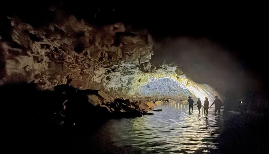
Steve Hill takes us to the Undara Lava Tubes
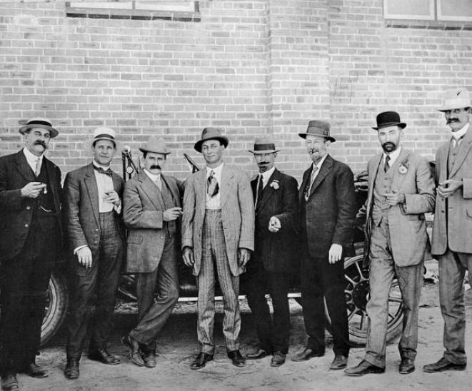
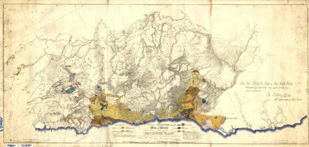
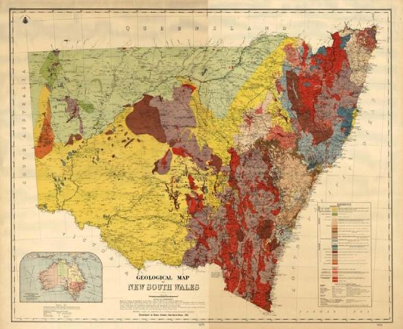
MARKING 150 YEARS
The New South Wales Geological Survey celebrates
AUTHOR PROFILE
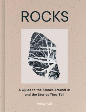
Introducing Vojta Hybl, artist and geoscientist
Shaping the future: Join the GSA townhall
From the editor
Our new GSA President, Jo Miles
Celebrating our Governing Councillors
Calling all GSA cats
Upcoming events
News from the Divisions and Specialist Groups
Education bringing critical minerals to the classroom
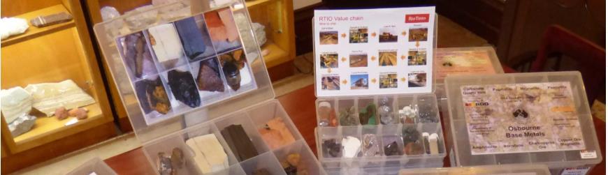
Student rock and mineral sample sets
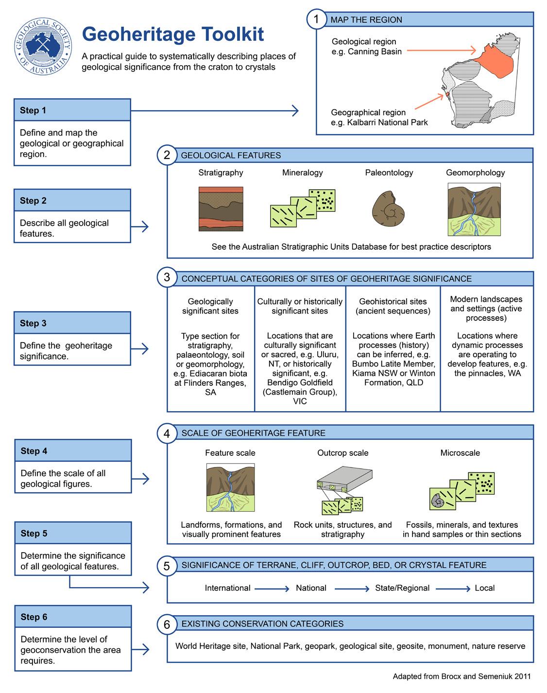
Geoheritage Toolkit
Memoriam
Publishing Details
ISSUE 216, DECEMBER 2025
Registered by Australia Post
Publication No. 100010917
ISSN 0312 4711
EDITOR IN CHIEF
Sandra McLaren
DESIGN & TYPESETTING
Sarah Jackson
PRODUCTION MANAGER
Amber Jarrett
PRINTED BY Mixam AU
DISTRIBUTED BY
The Pack Factory, Sydney
CENTRAL BUSINESS OFFICE
PO Box 576, Crows Nest NSW 1585
Email: info@gsa.org.au
Web: www.gsa.org.au
Phone: (02) 9160 8193
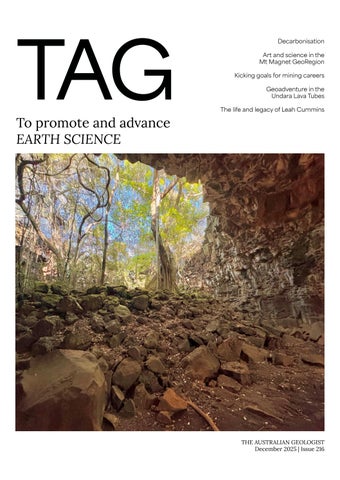
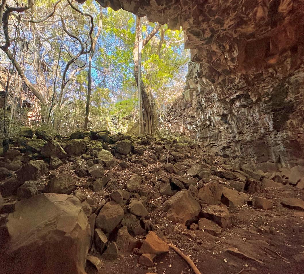
COVER IMAGE
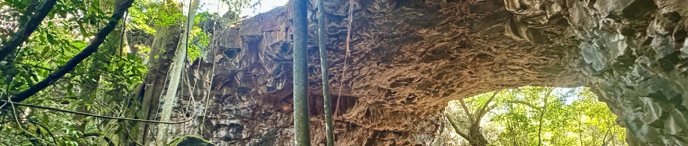
Undara entrance and forest
Photo: Steve Hill
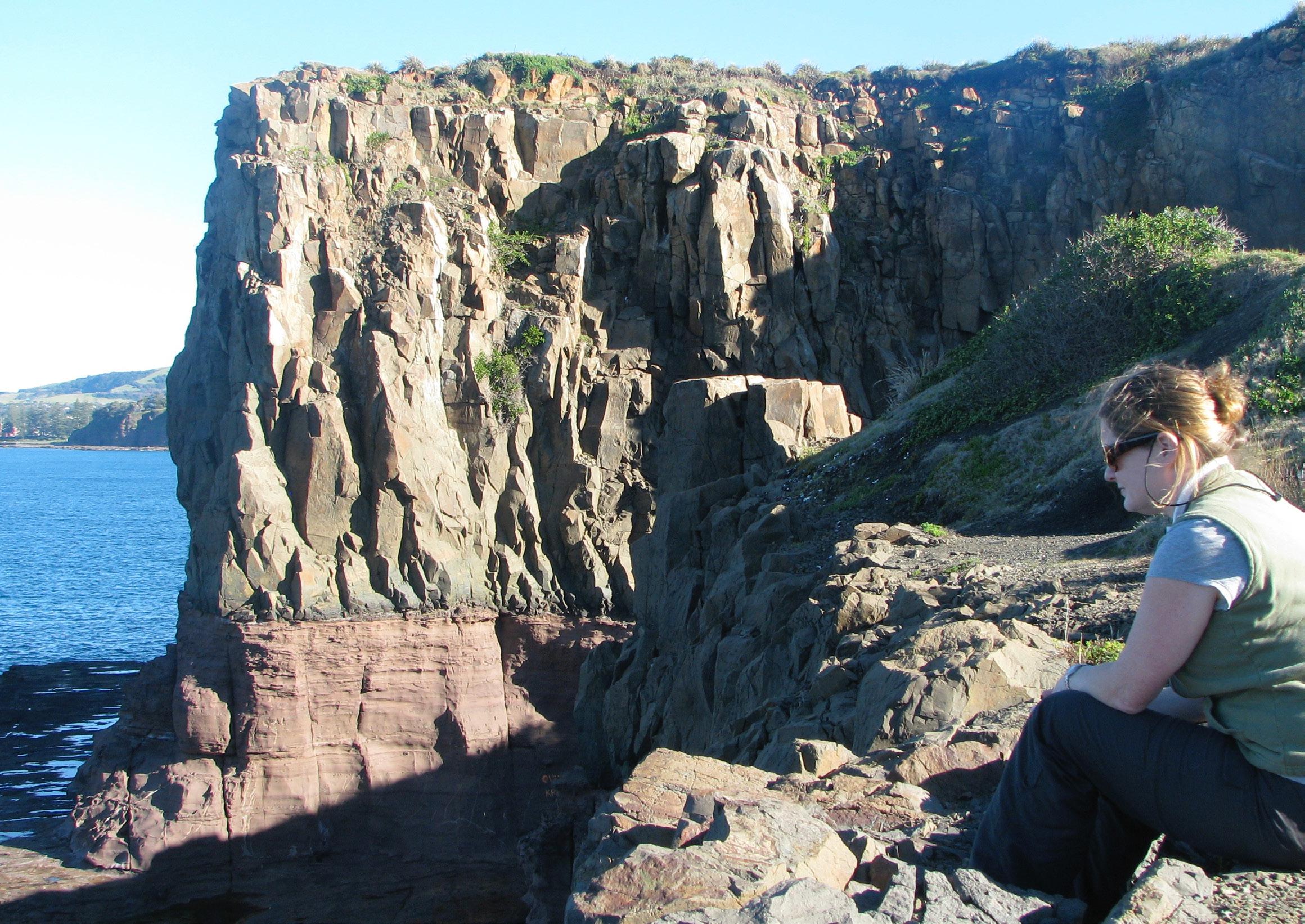
INSIDE COVER IMAGE
Porphyritic basalt of the Bombo Latite Member overlying the Kiama Sandstone Member at the Bombo Quarry, NSW
Photo: Gary Lewis
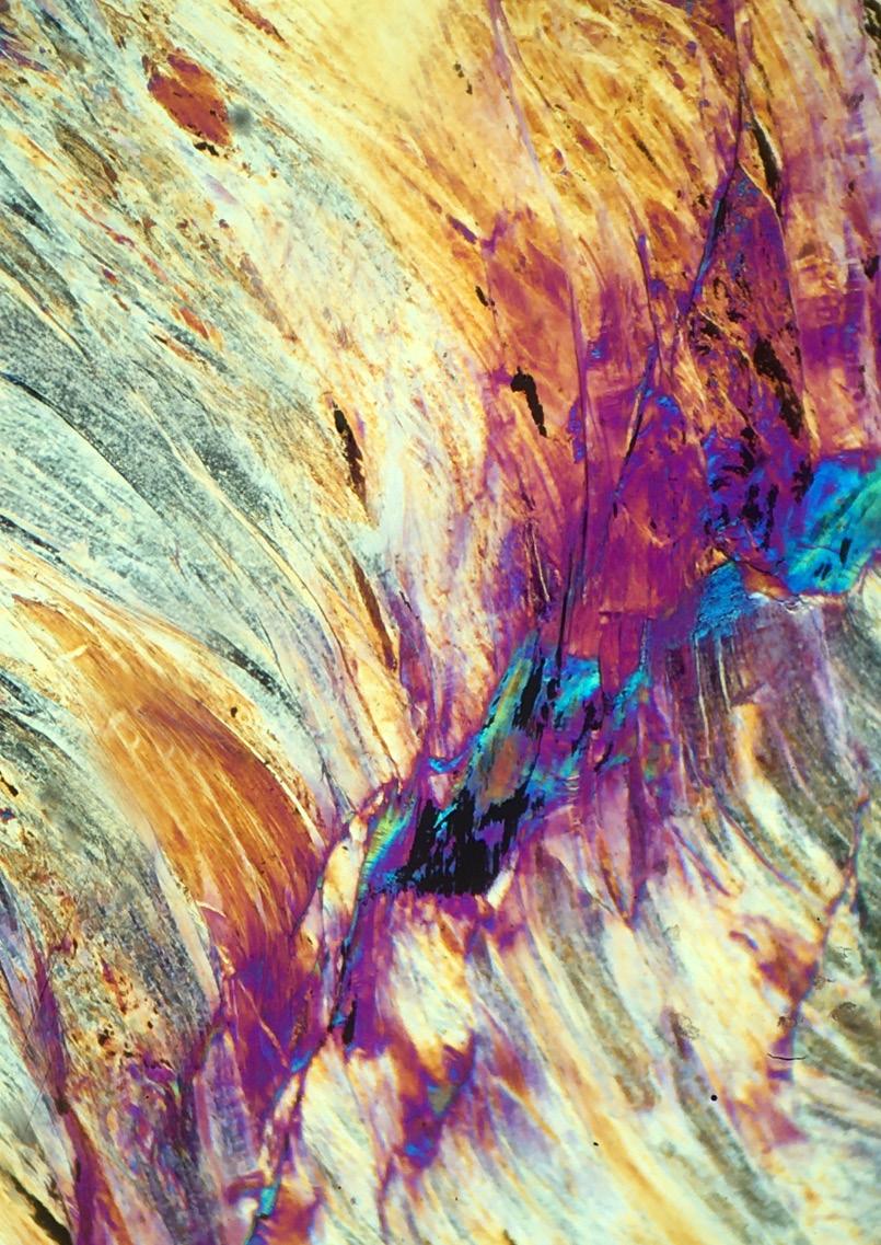
BACK PAGE IMAGE
Photomicrograph (with tint plate) of sheared serpentinite
Photo: Sandra McLaren
GENERAL NOTES
The Geological Society of Australia (GSA) is a community that promotes and advances Earth Science across all disciplines, recognising its vital role in understanding, sustaining, and improving the world around us.
The Australian Geologist (TAG) is a quarterly member magazine that includes society news, conference details, special reports, feature articles, book reviews and other items of interest to Earth Scientists. Each issue has a long shelf-life and is read by more than 3,000 geologists, geophysicists, paleontologists, hydrologists, geochemists, cartographers and geoscience educators from Australia and around the world.
SUBMISSIONS
TAG can no longer guarantee acceptance of complete articles without prior notice. Instead, we encourage members to send in their ideas and work with editors to produce new content. If you’d like to get involved, please email tag@gsa.org.au. Artwork must be high resolution 300 dpi or larger.
COPYRIGHT
The Publication is copyright by the GSA Inc unless specifically stated otherwise. However, material in this issue may be used provided acknowledgement is made. Every effort has been made to trace and acknowledge copyright holders of material in this publication. If any rights have been omitted, apologies are offered.
The GSA is a learned society and TAG is published by the Society to provide information for members and as a forum for the expression of their professional interests and opinions. Observations, interpretations and opinions published herein are the responsibility of the contributors and are not necessarily supported by the GSA.
The GSA has taken all reasonable precautions and made all reasonable efforts to ensure the accuracy of material contained in this publication, and makes no warranties, expressed or implied with respect to any of the material contained herein.
BUSINESS CORRESPONDENCE
All business enquiries and correspondence relating to advertising space, inserts and/or subscription matters, should be sent to tag@ gsa.org.au.
SHAPING THE FUTURE OF THE GSA
Since 1952, the GSA has been a proud, member-driven community dedicated to advancing Earth science. Our 2020–2030 Decadal Plan was shaped by strong member input, but recent university consolidations and shifts in our operating landscape mean it is time to re-examine and refresh our strategic priorities before the end of the decade.
As a member-driven Society, we need member insights before undertaking any strategic redesign. We are seeking your feedback on what is working, what is missing and where we should focus our effort and investment to maintain momentum. Your ideas are vital in shaping the GSA’s next chapter.
JOIN US FOR A GSA TOWN HALL TO DISCUSS THE FUTURE OF OUR SOCIETY.
2 February 2026
3 pm – 5 pm
Pullman & Mercure Melbourne Albert Park
If you’re unable to join us on the day but would still like to contribute, we’d love to hear from you. Please share your thoughts in the GSA Padlet at any time, anonymously or with your name attached.
Photo: Shutterstock
Letter from the Editor
I’m not sure how 2025 has flown by so fast. Putting together this last TAG of the year has been a great opportunity to reflect on the activities and achievements of the GSA and at the same time look forward to 2026, which will start on a spectacular high with AESC.
Importantly, our wonderful year has ended with the handover from our past-President Amber Jarrett to our incoming President Jo Miles. We offer a very warm welcome to Jo as she takes up her role. I know she will be well supported by members across the country and by the GSA councillors.
On behalf of the GSA membership, and geoscientists and the community more
broadly, I would like to take this opportunity to gratefully acknowledge Amber’s incredible contributions over the past two (and a half) years. Amber has worked tirelessly and selflessly to build the society, to increase visibility of the discipline and to advocate for members at all levels. Her contributions have been highly visible but also ‘behind the scenes’, having taken up the role as the new management model was established. She has done remarkable work to build a framework and support for the society that will take us into the future on the front foot. And she has done all of this with a smile and her trademark infectious enthusiasm. Thank you Amber!
Add this issue to your summer reading list as we highlight the activities of a range of Divisions and Specialist Groups, present a number of feature stories, acknowledge contributions from across the discipline and introduce you to some inspiring members.
I wish you all a safe and enjoyable summer and hope you have some time to recharge over the break.
A new chapter for the GSA
It is my great pleasure to announce the incoming President of the Geological Society of Australia for the 2025–27 Governing Council: Dr Jo Miles.
Many readers will already know Jo through her work as Secretary of the WA Division and, since June, as our new National Secretary. Jo brings tremendous energy, insight, and a genuine passion for connection. With her collaborative spirit and drive to bring people together, I can think of no better person to lead
us into the next term. Please join me in congratulating and welcoming Jo to this role.
As the year draws to a close, I hope everyone has the opportunity to take a well-earned break and recharge. I look forward to seeing many of you early next year at the AESC 2026 in Melbourne, where we’ll dive into research, celebrate Earth science, recognise the outstanding Earth scientists honoured as our newest GSA medallists, and take the opportunity
to discuss the future of our great society.
Thank you for your continued support, commitment, and enthusiasm for our GSA community. It has been an honour to serve as President.
SANDRA McLAREN Editor in Chief
Submissions to TAG – editorial policy
As we build TAG for a broad geoscience audience we are aiming to balance contributions by topic, theme, sub-discipline and region. We are also committed to providing opportunities for a diverse range of members to contribute. For these reasons we have an editorial process that involves an initial expression of interest that is considered by the editorial team before a contribution is made. If you have an idea for an article or an image to include, please email tag@gsa.org.au with a 50–100 word summary
of your topic. Although we would love to include all ideas, there will be times when an idea does not fit an upcoming issue. For accepted pitches, a word count and due date will be specified, authors will be required to meet these. Authors should also note that all contributions will be edited for concision, clarity and (where necessary) length. High resolution photos are required and should be submitted as separate files and not embedded in the text file. As the time between submission, editing and layout
is always tight, authors will not receive proofs to check.
We are grateful to all contributors and look forward to supporting you as you make your valuable contributions to our community. Please contact us if you have any questions about TAG policy.
From the President
Hi, I’m Jo, your new President, and I’m excited to step into this role.
I’ve seen the incredible work our previous Governing Councillors have achieved, including the refreshed TAG magazine and the valuable insights gained from our psychosocial survey. Our Divisions and Specialist Groups continue to be at the forefront of GSA, hosting symposia, field trips, and driving engagement across our community.
As we look ahead, I’m keen to explore how we can keep moving forward in ways that respect the time and energy of our volunteers.
Our focus is firmly on you, our members. I’d love to hear your ideas and stay connected, so please feel free to reach out via email at info@gsa.org.au I’m looking forward to meeting many of you at AESC. In fact, please join us at our
upcoming town hall meeting at AESC where we’ll discuss the future of our society. Your input is vital as we shape what’s next together.
Thank you for your continued support. I’m excited to work with you all as we build the next chapter of GSA.
JO MILES
GSA President, 2025–27
AMBER JARRETT GSA President, 2023–25
Photo: Supplied
Photo: Supplied
Photo: Supplied
Councillor profiles
Grace Cumming
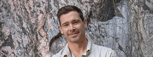
As a geologist with experience across industry, academia, and government, I bring a broad perspective to my work and to the geoscience community. I’m passionate about science communication, geotourism and geoheritage, and am actively involved in public outreach and mentoring emerging geoscientists. Having served on the committee of the Tasmanian Division of the GSA for more than a decade, I’m excited to now contribute to the Governing Council by strengthening connections between industry, research, government, and the community, and by promoting the vital role of geoscience in society.
GRACE CUMMING
Samuel Boone
I’m Sam Boone, a geoscientist and Lecturer in Geology at the University of Sydney. My work is motivated by improving our understanding of the Earth’s dynamic evolution and to do this I study the thermal and tectonic history of the crust in relation to the growth and breakup of continents. I integrate field observations and structural geology with thermochronology, geochronology, geochemistry and numerical modelling techniques.
I am honoured to be joining the Geological Society of Australia Governing Council where I aim to serve the Australian geoscience community which has embraced and empowered me so generously over these last 15 years. I firmly believe that the Australian geoscience community must, and will, play a central role in tackling many key challenges facing our national and global societies. From powering the transition to a more sustainable energy future, and ensuring water security, to mitigating climate change, forecasting natural disasters and beyond. I firmly believe that our deep understanding of our planet will be crucial for guiding strategy and policy well into the future, and so it’s in the best interest of the country to ensure the advancement of a thriving Australian geoscience community.
Hugo Olierook
I’m Hugo Olierook, proud member of the GSA since I first arrived on Aussie shores back in 2007 as a fledgling geologist. In truth, my membership with the GSA has occasionally lapsed in that time, by simply having accidently overlooked the reminder to renew! Still, my heart was always in it even if my financial contribution was not.
I started my journey as a bit of a geological jack-of-all-trades, but finally started specialising after a few postdocs in the UK and Australia. These days, I’d call myself a geochronologist, exploring Earth’s history from Hadean grains to modern microbial systems, and everything in between.
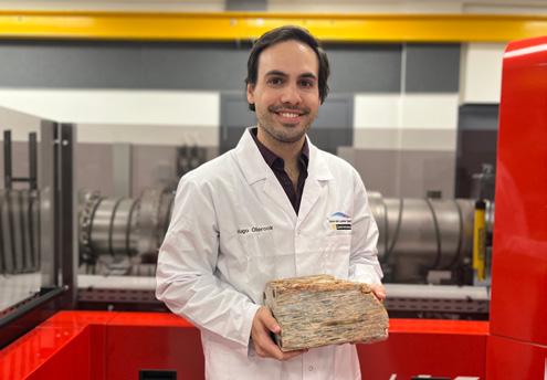
Research-wise, I’m passionate about three things: (critical) mineral systems, past climate–Earth interactions and the development of new techniques and tools for dating rocks. The photo of me below encapsulates much of this: I’m holding the Jack Hills conglomerate, the rock with the oldest grains in the world, in front of a state-of-the-art secondary ion mass spectrometer instrument at Curtin University where we explored the first evidence for fresh water on the early Earth.
I’ve also got a strong commitment to excellence in teaching and geoscience outreach, aiming to equip and inspire the next generation of geoscientists in Australia and abroad. I’ve recently been stepping up into a few more leadership roles and found I quite enjoy seeing the fruits of good governance, even if the tasks are sometimes a bit arduous. For me, good governance is invisible; I live to see the members uplifted while the leadership team ensures that everything runs smoothly. I’m honoured to now be serving at the national level to continue to invigorate the GSA into a brighter tomorrow!
HUGO OLIEROOK
Calling all cats!
Apparently there are a few GSA dogs (TAG Issue 214) but we cats need a moment in the GSA sun too.
Does your geologist keep interesting rocks and minerals on their shelves for you to scratch up against? Do they keep stacks of old geological journals or musty textbooks for you to sit on? Do they provide you with a warm laptop keyboard for your afternoon nap?
If so, we need you!
Document your life with your geo employee for our next issue’s special ‘Cats of the GSA’ column. Send your photos to the TAG team: tag@gsa.org.au
Mapping the Northern Tyennan near the Great Western Tiers Photo: Supplied
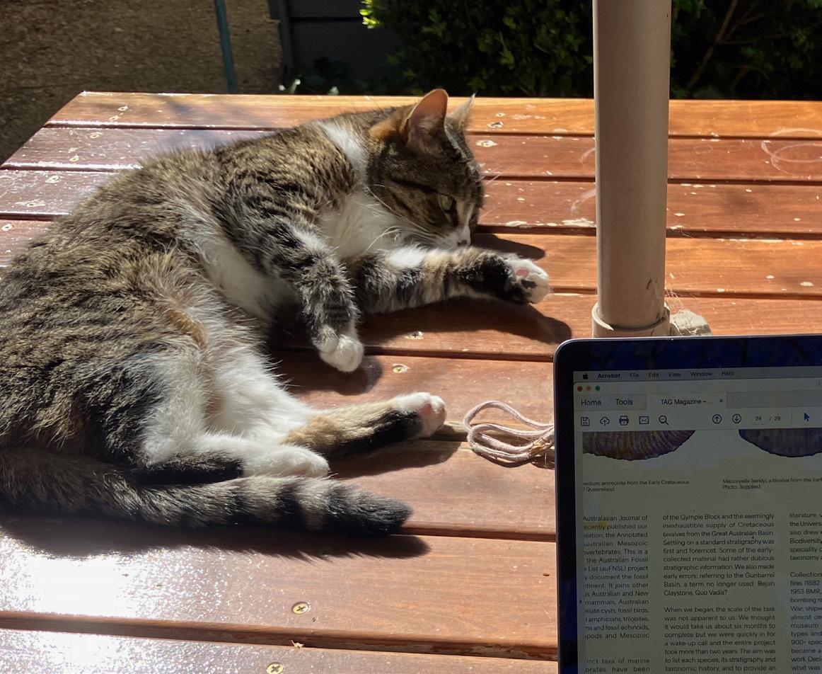
Mo, TAG Assistant Editor, at work proofing Issue 215
Photo: Sandra McLaren
SAMUEL BOONE
Cats of the GSA, do you employ a geologist?
Photo: Supplied
Photo: Supplied
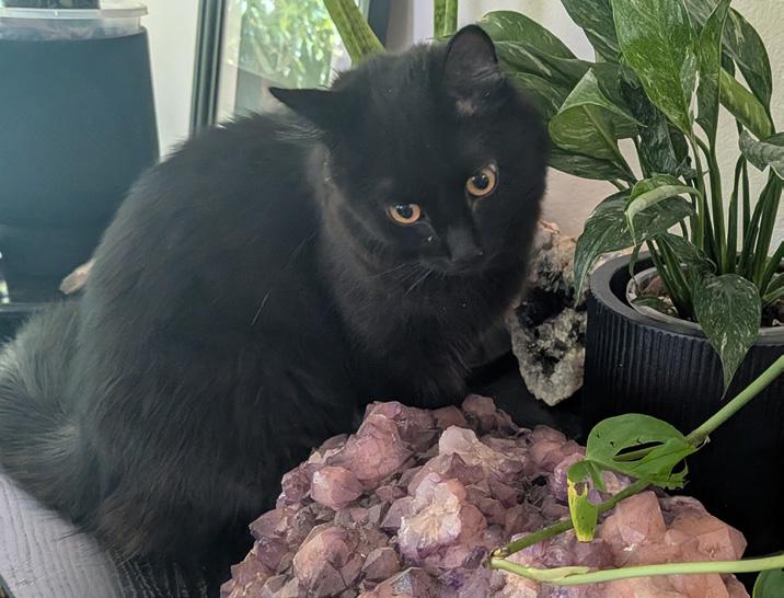
Soot Sprite with amethyst crystals
Photo: Amber Jarrett
UPCOMING EVENTS 2026
NEWS FROM THE DIVISIONS
GSA Tasmanian Division – 2025 Highlights
The Tasmanian Division of the Geological Society of Australia (GSA) had an eventful year, marked by a series of engaging meetings, field excursions, and public outreach activities.
The year began with Rob Scott presenting on the Benambran Orogeny in Tasmania, setting the tone for a strong focus on local geology. Ron Berry followed with new insights from drillholes along the eastern edge of the West Tasmania Terrane. In a joint meeting with the Royal Society of Tasmania (Northern Branch), Rebecca Sproule – Tasmania’s new Chief Geologist – outlined the role of the Geological Survey in shaping the state’s geological understanding, past, present, and future.
Antarctic research was also featured. Jodi Fox shared her field and post-field work on the Gaussberg Volcano in Eastern Antarctica, while Karin Orth reported on her offshore marine voyage to the Denman Glacier earlier in the year.
Economic geology was another key theme. Stephen Cox delivered the Haddon King Lecture in May, titled Shock and Ore, and David Cooke provided a timely overview of copper exploration in the context of the global transition to a low-carbon economy.
The year concluded with the 15th annual Tasmanian Geoscience Forum – a joint event hosted by GSA, AIG, and AusIMM –held at the beautifully renovated Paragon
Theatre in Queenstown. The evening dinner celebrated Ralph Bottrill, recipient of the 2025 WH Twelvetrees Medal for meritorious service to Tasmanian geosciences.
Field Excursions
Two field trips brought members and friends into the Tasmanian landscape. In April, Phil Sansom and Clive Calver led an excursion to Glovers Bluff in the south-east, showcasing Mesoproterozoic siliciclastic sedimentary rocks, Neoproterozoic dolomites, and Cambrian mafic/ultramafic conglomerates, with Jurassic dolerite intrusions forming skarns.
In October, John Everard, Ralph Bottrill, and Karin Orth guided a trip to the Beaconsfield area in northern Tasmania. Participants explored Neoproterozoic rocks, the Cambrian ultramafic complex, and Ordovician successions. A highlight was the excellent tour of the Beaconsfield Mine Museum, led by Ian Blayden.
Student Engagement
A student-focused pizza evening brought together members of GSA and AIG for informal networking and career discussions. Rhona Cartwright (AIG), Jodi Fox, and Owen Missen (GSA) facilitated conversations on career pathways and pivotal moments in geoscience careers.
Public Outreach and Science Festivals
In August, members helped light up Hobart during National Science Week, participating in the Festival of Bright Ideas and the Beaker Street Festival. Sebastien Meffre led the GSA booth at the Festival of Bright Ideas, while Tobias Staal and Anya Reading collaborated with artists to transform seismic data from the Denman Glacier into a unique dance party experience. Several members also took part in meet-the-scientist sessions, including Anya Reading, Nick Roberts, Jo Whittaker, Jacqui Halpin, and Katharina Hochmuth.
Celebrating Achievements and Leadership Transitions
At the AGM in June, the Division congratulated the 2024 Tasmanian undergraduate and Honours student prize winners. The meeting also marked changes to the local committee. After six years of dedicated and enthusiastic service as Chair, Karin Orth passed the baton to Jodi Fox. Barbara Frankel and student representatives Acacia Clark and Jeremy Asimus were farewelled.
Denman Glacier outreach from GSA members and Denman area expeditioners including a model of the melting glacier and some of the area’s rocks and bathymetry. Part of Beaker Street Festival Meet the Scientists. Left to right are Jo Whittaker, Katharina Hochmuth, Jacqui Halpin, Karin Orth, Amy Wells.
Photo: T. Gibbons
Hunter Valley Branch: 2025 Highlights
2025 was a busy and successful year for the Hunter Valley Branch. We enjoyed fascinating and inspiring presentations by Joel Fitzherbert, who spoke on “Mesozoic shear-hosted REE-enriched IOCG mineralisation in the Broken Hill Block: new insights” and Chris Herbert, who spoke on “Sea-level control in deposition – A new interpretation of the Narrabeen Group, Sydney Basin”.
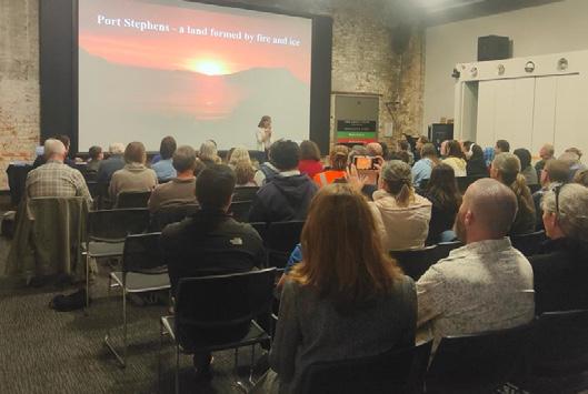
A special presentation for Science Week was hosted by Newcastle Museum and saw Neil Fraser present on the topic “Port Stephens – A land formed by fire and ice” to an engaged audience of 80 people, including many members of the general public and their enthusiastic children.
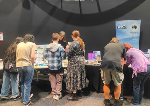
The branch also ran and jointly hosted a number of other highly successful events. In recent years the branch has established itself as a regular presenter at the Hunter Valley Science Festival, held on the Sunday of Science Week at the Newcastle Museum. This year our display covered three themes: fossils and past life, minerals in Minecraft and in everyday life, and the local geology
of Newcastle and the lower Hunter Valley. Our thanks as always to the Geological Survey of NSW for assistance with rock samples and brochures. We were delighted (if a little overwhelmed) with the numbers of people attending and the extent of their engagement with our presentation. Kids and parents didn’t just drop by for a few minutes of play with dinosaurs and rocks, they asked questions, got involved with the displays, and moved through each of the themes. Total attendance was over 7000 people, breaking the Museum’s all-time attendance record. Hunter Valley branch members Simone Meakin, Rosemary Hegarty, Phil Gilmore, Marta Vega and Bob Musgrave fielded questions (and kept little hands from swiping all the fossils).
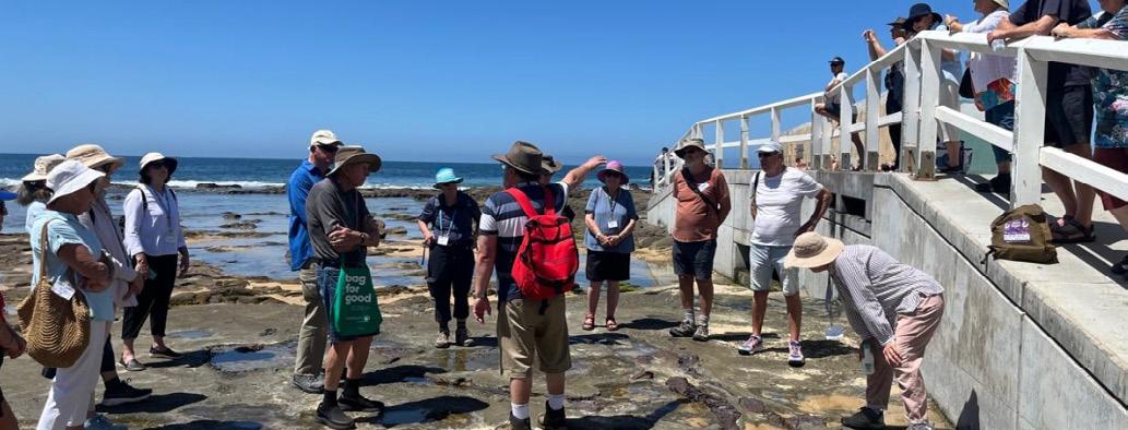
And in October the branch celebrated Earth Science Week by jointly hosting a field excursion with the Maitland branch of the University of the 3rd Age (U3A). Bob Musgrave, who doubles as Branch Chair and U3A course leader, led a group of 25 U3A members along the Newcastle foreshore, following the excellent Newcastle Coastal Geotrail guide provided
on the NSW Geotours app produced by the Geological Survey of NSW. Feedback included one attendee who said she would get her extended family to take the Geotrail, including all her grandkids. Maybe there’s hope for the future…
The zenith of our 2025 activities was a two-day field trip to the Permian sequence of the Hunter Valley, “The Permian from whoa to woe!” held over the weekend of 15–16 November. Hosted by our own Phil Gilmore, this two-day excursion looked at the Permian Sydney Basin, starting with basement Carboniferous volcanic rocks of the New England Orogen, and finishing with Triassic sequences. Highlights of the trip included the earliest sediment deposition and volcanism into the Sydney Basin, the end of the Permian mass extinction event, the beginning of Tasman Sea rifting, Edgeworth David’s local legacy, human history including First Nation peoples and European settlement, the importance of geology in viticulture … and much more!
Geoscience Indigenous Collaboration and Engagement Specialist Group GICE
The GSA Geoscience Indigenous Collaboration and Engagement Specialist Group (GICE) provides strategic direction and leadership to the Australian Earth science community to ensure that Earth science is inclusive of, and equitable for, Aboriginal and Torres Strait Islander peoples, the traditional custodians of the lands, seas and waters where Australian Earth science is designed, conducted and realised.
GICE’s Vision is of equitable Earth science in Australia that is open and inclusive of Indigenous and non-Indigenous contributions to benefit Australians and their environments.
Key highlights for 2025
More LinkedIn activity resulting in people signing up to GICE
Conversations started around making GICE free for GSA members in the future
Event planning for future GICE workshops
Awareness raising – in person at conferences and through our work networks
Four formal meetings (online)
We are looking for a new chair and new committee members in 2026, so reach out to Marina Costelloe if you are interested in supporting GICE!
A big thank you to everyone for doing their best to support GICE in 2025. Stay safe and we look forward to working with you in 2025.
Photo: Supplied
Photo: Shutterstock
The Coalfield Geology Council of NSW
The Coalfield Geology Council of NSW (CGC), operating under the Coal Geology Group (CGG) of the Geological Society of Australia (GSA), continues to champion coal geology through research, education, and collaboration.
As the voice for coal industry geoscientists in NSW, the Council supports sustainable mining, innovation, and outreach across academia, industry, and government.
Quarterly meetings, held at rotating locations across NSW, offer a dynamic mix of technical talks, site visits, short courses, networking and even a free lunch! Regular updates from CGC Committee members and key partners, including the NSW Minerals Council, ACARP, GSA, AusIMM, and various government departments, highlight the Council’s strong collaboration across industry, academia, and government.
In Q4 2024, the Council held a field-based meeting at Mt Arthur Mine, where members had the opportunity to observe geological formations and engage in discussions around seam correlation, structural interpretation, and mine planning. Gwen Stefani from the Department of Primary Industries and Regional Development (DPIRD) discussed modelling coal thickness across NSW. The meeting also included important advocacy efforts, supporting petitions to preserve the Geology Department at the University of Wollongong and to strengthen the Earth Science major at UNSW Sydney.
The Q1 2025 meeting took place at the ALS Laboratory in Mayfield where members had a behind-the-scenes look at coal testing processes and laboratory standards. Michael Ewart delivered a detailed presentation on gas content measurement, petrography, and core preservation. The gathering also
This sorting method supports sustainable mining and offers major cost and energy savings, cutting upfront costs by 40%, reducing electricity use by 50%, and operating with a footprint just one-quarter of the size of traditional washeries. The Council also elected a volunteer to lead the school outreach initiative, aimed at promoting Earth Science education in local schools.
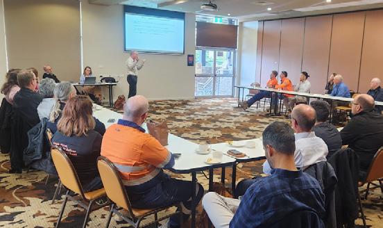
marked two significant occasions: the 150th anniversary of the Geological Survey of NSW and International Women’s Day, celebrating the contributions of women in geoscience. In Q2 2025, members gathered at Singleton Diggers to acknowledge and farewell the outgoing CGC Committee, led by Marcus Trost, and to welcome the newly elected 2025–2027 Committee, chaired by Peter Leah. Christopher McMahon shared an innovative approach to enhancing coal quality spatial models using legacy core data from NSW and Queensland. The Council also announced plans to digitise its coal quality library, making valuable historical data more accessible to the broader community.
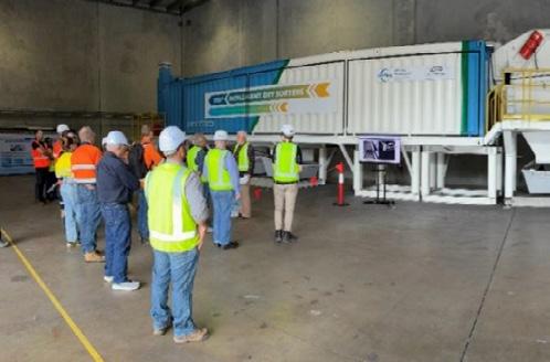
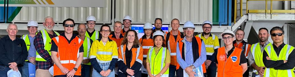
The Q3 2025 meeting was held at MeiTEng’s TDS plant in Newcastle and featured a live demonstration of dry coal processing by Sebastian Chu and geologist Garry Salter.
Looking ahead, the Council is preparing specialists to deliver short professional talks on decarbonisation policy and the reinterpretation of the Triassic Narrabeen Formation, timely topics shaping the future of coal geology and resource development. Despite ongoing challenges in the industry, the Council remains committed to supporting its members, fostering innovation, and strengthening connections across the coal geology community.
If you are interested in further information, or would like to attend future CGC events, please contact the Council via email on: admin@coalfieldgeologycouncilnsw.org.
ZULAA PHOENIX
Publicist, Coalfield Geology Council of NSW
Australasian Palaeontologists: 2025 Achievements and Progress
The Australasian Palaeontologists (AP) has made good progress in 2025, strengthening its position as a vital hub for palaeontological research and community building across the region. Under the leadership of the AP Council – Nic Campione, Phil Bell, Matt McCurry, Pat Smith, and Marissa Betts – the organisation has implemented significant initiatives that enhance member benefits, modernise operations, and expand collaborative networks.
Modernisation of Awards and Funding Opportunities
This year the AP revitalised its awards programme, introducing the AP Research Fund—a new initiative providing up to AUD$1500 for undergraduate to early career researchers. This addresses a critical funding gap for emerging scientists. The organisation also modernised its nomination process, transitioning to a streamlined online form system. These changes, alongside updates to existing awards (Robert Etheridge Jr Medal, Dorothy Hill Award, Mary Wade Award, and Student Travel Awards), demonstrate the AP’s commitment to supporting palaeontologists at all career stages.
Enhanced Member Benefits and International Connections
A major achievement has been securing new partnerships that directly benefit members. The AP negotiated a new discount code for Alcheringa, ensuring members have affordable access. The AP also established an affiliation with the International Palaeontological Association (IPA), granting AP members affiliate status and access to international conference discounts.
Advancing Digital Infrastructure and Data Sharing
The AP has initiated a collaboration with the Atlas of Living Australia (ALA) that represents a significant step toward integrating palaeontological data with modern biodiversity platforms. The AP is actively collating species lists for integration into the ALA system. This initiative will enhance data accessibility and establish new standards for palaeontological data management in Australasia.
Celebrating Excellence
The AP has actively celebrated member achievements and is honoured to highlight selection of palaeontologists Adele Pentland and Liz Reed as Superstars of STEM for 2025-2026, in addition to 2025 AP award winners; Prof Mike Archer (Robert Etheridge Jr. Medal), Dr Vera Korasidis (Dororthy Hill Award), Dr Jorgo Ristevski (Mary Wade Award and the new AP Researcher Grant) and Zachary Pullen and Emil Herbert (AP Conference Travel Awards).
Publications and Knowledge Dissemination
AP Memoir 56 and AP Memoir 57 were published in 2025. APM 56 documents Early Ordovician conodont systematics and biostratigraphy from the Amadeus and Canning Basins, while APM 57 (Cambro–Ordovician Studies VII) features 20 papers from international specialists. Flagship publication Alcheringa had a very successful 2025 and was inundated with submissions for the upcoming 50th Anniversary Volume.
Community Engagement and Future Planning
The AP has initiated quarterly newsletters and fostered community engagement through initiatives like the inaugural Fossil Photo Competition (2025 theme: “Thrill of Discovery”) that will become a regular event on the AP calendar.
The proposed financial consolidation with GSA maintains operational independence but enhances financial efficiency and funding availability for member programmes. These achievements collectively position the AP as a dynamic, forward-thinking organisation successfully balancing scientific excellence with community support and engagement.
Regolith science continues to be a dynamic and essential field - interpreting landscape evolution, elucidating ecosystem interactions, and playing a key role in modifying approaches to advance resource exploration. Whether you are deep in fieldwork, refining lab techniques, or just enjoy a good regolithrelated discussion, the Australian Regolith Geoscientists Alliance (ARGA) Specialist Group provides support, networking and collaboration for a growing number of researchers and practitioners.
We are thrilled to be hosting an ARGA Symposium at the upcoming Australian Earth Science Convention (AESC 2026). Over 20 presentations have been received, highlighting results of recent regolith research in Australia. Join us at the conference to hear the latest in regolith research.
We are pleased to announce that bursaries will be available to support ARGA members
attending AESC 2026. If you are planning to attend, keep this opportunity in mind. We’re also planning a field trip in Victoria as part of the symposium.
Also keeping the committee busy is the Australian Journal of Earth Sciences special edition. We’re currently inviting contributions for our special regolith edition. We welcome any regolith related ideas, so please get in touch if you’d like to know more!
Make sure to check out the ARGA YouTube channel for our latest ARGA Webinars – The ARGA Specialist Group Annual General Meeting was lucky enough to also have Tobias Bamforth (Monash University) to present to our AGM attendees in June. Tobias’ talk on ‘Unsupervised geochemical characterisation of deeply weathered terrains and regolith-hosted REE deposits: Rationale and benefits for exploration’ was such a deep dive into exploration geochemistry and deposit characterisation.
The attendees were invited to extend and expand the discussion in the Q&A Session at the end of the presentation!
We are always keen for new webinar ideas and volunteers – please get in touch if you are interested.
ANNA PETTS ARGA Chair
GSAV Highlights of 2025
The GSAV has had a busy year, celebrating Earth Science in Victoria, and more broadly, and recognising a range of achievements by Victorian based geoscientists.
The committee and members are particularly proud to celebrate three Victorians newly recognised as GSA Distinguished Fellows:
Susan White for > 30 years of service to the GSAV, including as Chair of the Geoheritage & Education Subcommittees.
David Moore for > 20 years of service to the GSAV, including as GSAV Chair (2004-2005).
David Cantrill for many years of service to the GSAV and particularly his 15 years as GSAV Chair (2008-2022).
Victorian awards for 2025
Selwyn Award – Martin Hughes, for his contributions to the geology of gold in Victoria, particularly at the Fosterville Gold Mine.
Early Career Geologist Award – Vera Korasidis, Senior Lecturer and DECRA Fellow, The University of Melbourne.
Postgraduate Award – Mohammad Humand, The University of Melbourne, for his project “Petrological Modelling of the Howqua Hills Blueschists, Southern Lachlan Orogen, Victoria.”
Student Travel Awards - Alanis Olesch-Byrne, James La Greca (both University of Melbourne)
The Division also held a range of successful events, including joint events with AIG, ASEG and WOMEESA as well as the regular division monthly meetings. Speakers for the year included speakers Pete Betts (Monash University) and Ross Cayley (Geological Survey of Victoria), Maxwell Lechte, Rachel Kirby and Vera Korasidis.
The highly successful student night included three amazing presentations:
Alanis Olesch-Byrne (GSAV 2025 Student Travel Award) on ‘The role of structurally-controlled fluid flow in the formation of Australia’s Rare Earth Element deposits’
Jireh Teo (Honourable Mention, GSAV 2025 Postgraduate Award) on the topic ‘Reconstructing the middle to Late Miocene Palaeoclimate and orbital cyclicity in the Otway Basin using well logs and foraminiferal proxies’
Chitrangada Datta, Monash University (GSA 2025 Endowment Fellowship awardee) who spoke on ‘Gneiss dome formation in an intracratonic orogenic system: a case study of the Entia gneiss dome of Central Australia’
The year also brought changes to our committee and we welcomed new members Jack Stacey (Secretary), Saini Samim (Diversity, Equity and Inclusion), Olivia Kulesza (student representative, University of Melbourne) and Natasha Nargle (student representative La Trobe University and Newsletter editor)
ANNE-MARIE TOSOLINI GSAV Chair
ARGA Facebook page | www.facebook.com/groups/10150125426600193/ ARGA seminars and talks are available on YouTube | youtube.com/@australianregolithgeosciences ARGA is on INSTAGRAM! | www.instagram.com/ausregolith/ ARGA is on LinkedIn | www.linkedin.com/company/australian-regolith-geoscientists-alliance-arga/ ARGA is on BlueSky!
The annual Howitt Lecture for 2025 was a joint event with the Royal Society of Victoria and presented by Thomas Rich (Museum Victoria) and Pat Vickers-Rich (Monash University). Thomas and Pat spoke on the topic “Victoria’s Polar Cretaceous Tetrapods (47+ Years of Research: Following in the footsteps of Ferguson)”. We thank them for their wonderful presentation that was superbly illustrated and covered a plethora of scientific discoveries; from amphibians to marine reptiles, pterosaurs, dinosaurs and the smallest jaws of Cretaceous mammals. As a testament to Victoria’s foremost, worldrenowned vertebrate palaeontology experts, a large crowd filled the Ellery lecture theatre and many joined online, despite the cold, wet Melbourne wintery evening.
Minor folds at Cape Conran, Victoria
Photo: Kevin Hill
Using real life data to bring critical minerals into the classroom
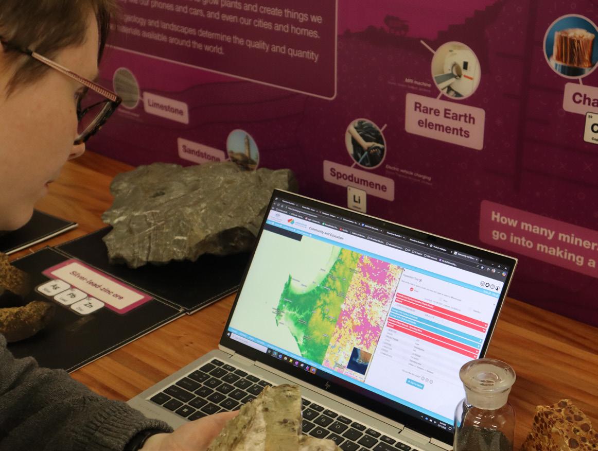
Finding ways to bring real life Earth science datasets into the classroom can be a challenge for many educators. Geoscience Australia is making data more accessible with a new classroom activity ‘Analysing Australian geology, topography, and critical minerals using online datasets’.
This free activity, aimed at secondary science and geography students, explores what critical minerals are and why they are important for Australia. Students will learn how to access and interpret Australian geoscience datasets (through the Geoscience Australia Portal) to make connections between Australia’s geology and geography datasets. This resource provides a holistic approach to understanding how critical minerals form and where they are found across Australia. These data-driven insights assist students to explore the connection between resources extracted from the ground, features seen on the surface and some of the applications of critical minerals. The activity includes educator notes and suggested answers to ensure the fundamental geoscience concepts are understood. A series of short tutorial videos makes navigating the Geoscience Australia Portal more accessible for new users.
This is just one of the many classroom resources on the Geoscience Australia Education website, produced to help Australian educators inspire a love of geoscience and STEM in students. Popular resources on the site help students understand how much energy earthquakes generate, how to identify minerals, and how to observe landscape change over time using real satellite imagery.
To continually improve educational resources and ensure they are aligned educators needs Geoscience Australia is seeking your feedback. To share your thoughts, scan the below QR code or access the feedback survey link from within the educator section of this classroom activity.
You can browse all of Geoscience Australia’s educations products, including printable posters, instructional videos and classroom materials here:
TAMARA
ALDEN
Geoscience Australia
Congratulations on ARC grant success
The Australian Research Council recently announced outcomes of its Discovery Projects scheme, for funding beginning in 2026. Congratulations from the TAG team and GSA members to successful applicants.
TERESA UBIDE
(UNIVERSITY OF QUEENSLAND)
Finding critical copper beneath volcanoes – with Gideon Rosenbaum, John Mavrogenes and Ian Campbell
JACQUI HALPIN
(IMAS, UNIVERSITY OF TASMANIA)
Assessing sea-level risk from the Aurora Subglacial Basin, East Antarctica –with Taryn Noble, Alan Aitken, Jacob Mulder and Katharina Hochmuth
Making a habitable planet: tracking Earth’s thermostat with marine sediment –with Malcolm Wallace, Galen Halverson, Donald Penman, Alan Roobey and Susannah Porter ASHLEIGH HOOD
(UNIVERSITY OF MELBOURNE)
STIJN GLORIE
(UNIVERSITY OF ADELAIDE)
Unlocking the detrital feldspar archive – with Sarah Gilbert, Christopher Kirkland, Janne Liebmann, Laura Morrissey, Pieter Vermeesch
ANDREW GUNN
(MONASH UNIVERSITY)
Evolution of aridity in the Red Centre expressed in linear dunes – with Kathryn Fitzsimmons, Andrew Frierdich and David Rubin
SIMON HABERLE
(AUSTRALIAN NATIONAL UNIVERSITY)
Deeptime history of climate and humans in the most diverse ecosystm on Earth –with Janelle Stevenson, Michael Bird, Jamie Wood, James Russell, Nathalie Dubois, Janet Gagul and Patrick Roberts
Australian geology, topography, and critical minerals using online datasets’.
AJES Author Profile
Chris Fergusson
Mélanges, submarine landslides and subduction in the early Paleozoic geology, NSW South Coast
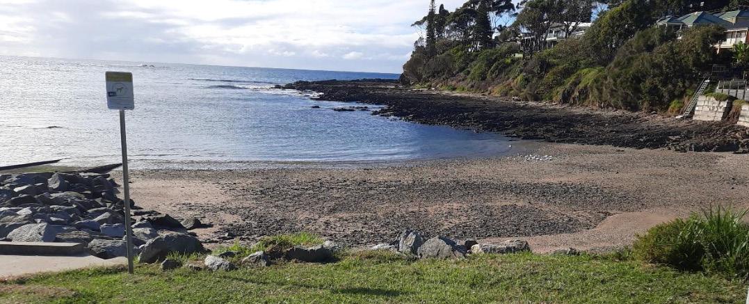
The NSW South Coast is well known for its spectacular geology with great exposures of the Sydney Basin. In the Batemans Bay district, 220 km south of Sydney, Sydney Basin sediments rest unconformably on the Cambrian-Ordovician Wagonga Group of the Lachlan Fold Belt. The Wagonga Group is complexly deformed and its tectonic significance has been much debated in the literature. A range of notable geologists including Dick Glen, the late Gordon Packham, the late Chris Powell and Chris Wilson (very much alive), have all contributed opinions. Arguments over Lachlan Fold Belt tectonics are legion and the Wagonga Group has been no exception with authors vying over whether subduction has or has not played a role in the early history of these rocks.
Dispute over the Wagonga Group extends well beyond the tectonic significance of the rocks and includes debate over basic stratigraphic subdivision (are there 2 or 3 or more main units?) and the roles of soft sediment deformation, diapirism, folding, foliation development and faulting amongst other issues. Even nomenclature has been discussed, for example is a particular rock a conglomerate or mélange, and so on.
The NSW South Coast has always been considered hallowed ground for structural geologists, and the subject of numerous Honours projects, a few PhD projects as well as much attention from academic staff at a range of universities. It is the ‘go to’ place south of Sydney and east of Canberra for seeing good exposures of highly deformed rocks if that tickles your fancy.
My recent AJES paper presents a review of the Wagonga Group in the Batemans Bay and Narooma districts. For the Narooma area, the geological map presently available on the NSW Geological Survey MinView web site has been updated using radiometric images available for the NSW South Coast on the same web site. This has resulted in a map more in keeping with the original Honours thesis mapping published by Chris Wilson in 1968. Unfortunately, radiometric coverage for the Batemans Bay district is largely missing so that the geological units are not easily identified in the less well exposed inland area. A synthesis of all available geological mapping in the Batemans Bay area (honours student mapping, PhD mapping, unpublished mapping of Chris Jenkins) has been compiled to produce an updated geological map of the magnificent coastal exposures.
Emphasis was placed on field checking with the paper including many photographs –mostly in the supplementary material – of these attractive rocks (although that may well be a personal opinion). In these highly deformed rocks way-up criteria are scarce; fossil-specific ages are available from only a relatively few sites around Batemans Bay but are more abundant in the Narooma area. Field relationships are difficult to resolve given the structural complexity but are critical to understanding the overall stratigraphic succession. The detailed work by Ian Stewart is particularly notable and his determinations of conodont ages from chert provided major stratigraphic controls on the CambrianOrdovician succession and have been widely applied throughout NSW by Ian Percival.
As would be expected by someone with my background I have advocated the subduction complex setting for the accretion of the oceanic Wagonga Group and the adjacent Ordovician turbidites. This interpretation has also included
Gordon Packham’s and Tom Hubble’s insight into the Cambrian limestones at Burrewarra Point (5 km east of Tomakin) as being part of submarine landslide deposits slumped off ocean islands (a feature well documented around the Hawaiian Islands). Evidence for accretion-related features – including early imbrication and the development of softsediment deformation – is documented in this and previous work (e.g. AJES paper by Lana Prendergast). However, the subsequent ductile and brittle deformation episodes have strongly overprinted these rocks obscuring their early history. Nonetheless I maintain that there is enough evidence preserved to be confident of the subduction complex interpretation.
first became interested in these rocks when Steve Ralser kindly showed me over the Wagonga Group to the north-east of Batemans Bay, in his Honours area just prior to the 1984 SGTSG Bermagui field conference. had just completed my PhD on subduction complex rocks in the southern New England
Orogen. Following my move to the University of Wollongong in 1986, I participated in many student field trips to the NSW South Coast; these trips continued until 2024 when the university discontinued the geology degree. My interest in the topic was amplified by research on the well-exposed mélanges and subduction complex rocks of coastal central Queensland (northern New England Orogen).
My interest in these rocks was maintained by my participation in two drilling expeditions to the Nankai Trough – where the Philippine Sea Plate is subducted under Honshu and Kyushu in SW Japan – on the JOIDES Resolution in 2000 and on the Chikyu in 2007–2008. I retired from the university in early 2020 and in the post-COVID years undertook numerous field trips to the South Coast; I just could not keep away from these fascinating and well exposed rocks.
CHRIS FERGUSSON
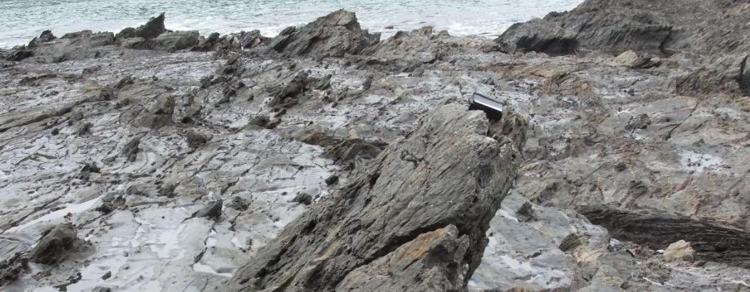
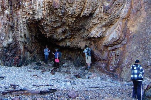
Pebbly mudstone or mélange with rafts of quartz sandstone Rock platform at Lilli Pilli north of Malua Bay
Photo: Supplied
Third year geology students examining the Narooma Chert on the southern side of Melville Point (Tomakin, 240 km south of Sydney). Photo: Supplied
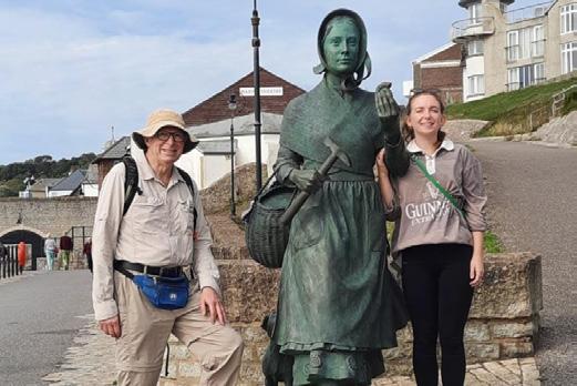
Chris Fergusson (left) and daughter Tessa (right) with statue of Mary Anning, Lyme Regis, UK Photo: Supplied
The attractive coastline north of Malua Bay with rock platforms of the Bogolo Formation mélanges Photo: Supplied
Climate change and decarbonisation: facts and fantasies
The scope and benefits of decarbonisation
The only way of addressing the threats posed by current warming is global decarbonisation. This is a huge technological and economic transformation demanding substantial reductions in GHG emissions across all major sectors: electricity generation, transport, manufacturing, mining, construction, agriculture, and households. While current and projected technological advancements mean that fossil fuels can be phased out over time,
they will be needed in the near-term to help meet growing global power demand resulting from development, increasing population, and the exponential growth of power-hungry crypto mining and AI. The renewable-heavy power grids being developed must be stable under all circumstances, and this is a work in progress.
Decarbonisation will bring major universal benefits but given inertia in the climate system, these will be progressive over several decades. In the medium term, it will deliver cleaner air and water, improved public and environmental health locally, new high-skill industry sectors, and regional economic diversification.
Are there enough critical minerals?
Life on Earth depends on a stable climate regulated by the greenhouse effect. The low concentration of carbon dioxide (CO₂) – the dominant greenhouse gas (GHG) in the atmosphere – plays an outsized role in retaining solar heat and maintaining temperatures that support complex life.
It is vital that the finely balanced greenhouse system is not disrupted, yet since the late nineteenth century, atmospheric CO₂ levels have risen by around a 50 percent above natural background, and there has been increased melting of polar and glacial ice, rising sea levels, warmer and more acidic oceans and changing patterns and intensities of heatwaves, droughts, bushfires, storms, and floods.
current warming, and that urgent actions are necessary to minimise the risks of major, potentially irreversible changes to climate systems by limiting temperature increase to ca, 1.5OC above the pre-industrial level.
Extensive scientific studies and climate modelling have led the Intergovernmental Panel on Climate Change (IPCC) to conclude that human activities, primarily fossil fuel burning, are the predominant cause of
This article summarises my independent analysis of available information to evaluate these conclusions and discuss key issues; it is adapted from my more comprehensive article.
Past Climate Change and Current Trends
The geological record shows evidence of repeated natural changes, from extremely hot to frozen periods, and associated major sea level fluctuations. In all cases, CO2 availability was the fundamental driver of the substantial protracted changes, which were associated with major events such as the evolution of life forms, onset of ice ages or hot conditions, and mass extinctions. CO2 was added to the atmosphere from organic cycles and volcanic sources, and depleted by weathering and formation of carbonate strata.
That climate has changed in the past has been used by sceptics – including many geologists – to claim that the current warming is the latest example of a natural change, However, the former is at least an
order of magnitude more rapid than past changes, so this simplistic claim cannot be correct.
Studies of ice from drill cores in Antarctica and Greenland provide detailed data that explains Recent climate trends. Ancient air trapped in the ice show a good general correlation between CO 2 levels and temperatures (from isotopic measurements of ice). They show cyclic trends of several wavelengths – Milankovitch cycles, which reflect changes ascribed to the tilt and precession of the Earth’s axis and its elliptical orbit around the sun. In detail, temperatures tend to change a little earlier, as expected if solar irradiation was a minor added contributor to temperature changes,
alongside atmospheric CO2 levels. In marked contrast, the measured data for the current warming event shows a much more rapid increase in CO2 levels since industrialisation, from around 280 to 425 parts per million, accompanied by an increase in measured global average surface temperatures approaching the IPCC’s modelled critical level of ca. 1.5OC. We now have the highest level of atmospheric CO2 for at least the past 2 million years, and the only reasonable explanation for such a distinctive trend is an enhanced greenhouse effect, resulting from addition of emissions from burning fossil fuels (supported by the isotopic compositions of atmospheric CO2) –as concluded by the IPCC.
Renewable energy is essential for decarbonisation and this requires vast new sources of critical minerals, which have supply chains at risk. Australia is well-placed to be a global superpower in both. Labor government programs have prioritised renewable power, and exploration and beneficiation of critical minerals, including rare earths, which are essential for strong magnets and semiconductors used in renewables, defence and other advanced technologies.
As a major mining nation, concerns as to whether sufficient critical minerals can be found for global decarbonisation by mid-
Costs of decarbonisation
Decarbonisation is frequently framed in terms of cost, which will undoubtedly be extremely high. But the greater question is cost relative to ‘business as usual’. The latter will be significantly higher, with worsening infrastructure damage, agricultural losses, heat-related health impacts, forced migration, and escalating disaster recovery expenditure placing increasingly high burdens on current and future economies. There is no cheap way to minimise the risks of irreversible impacts on Earth systems.
Conclusion
It is extremely concerning that the vital issue of pursuing a sustainable future through mitigating the impacts of climate change has, to a significant degree, degenerated into arguments between the left and the right. If there was ever a global issue demanding rational, non-partisan, evidence-based, decision-making, this must be it!
IAN B LAMBERT
century offer a great opportunity for Australia..
We already have several world-class critical mineral mines, as well as many deposits that have not been comprehensively evaluated (https://minexcrc.com.au/news/2024australian-critical-minerals-map-releasedby-geoscience-australia/ ), plus considerable experience at exploring under cover where there is considerable potential for more discoveries.
It is impossible to ignore China’s dominance of supply and refining of critical minerals. This is the result of foresight and longterm strategic planning, which has proved
much more difficult to achieve in Western democracies. China has the largest rare earth reserves and stakes in critical mineral mines around the world. Unfortunately, there are ongoing uncertainties about access to the commodities it controls. China’s mining and refining activities at home and in developing countries are far from best practice, and this will become a liability as demand for cleaner products increases and supplies from other sources come on stream.
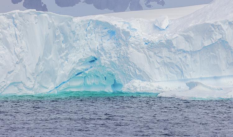
Intense colors from the blue ice in the core of an iceberg
Photo: Shutterstock
Read the full text here
Geoscience Education, Reconciliation and Community Engagement
As a community we need to re-establish positive attitudes towards geoscience. I am an advocate for geoparks in Australia as a means of reintroducing geoscience through communities. I see geoparks as similar to Regional Tourism Organisations, providing an overlay of an area that local communities wish to showcase to increase local tourism and to develop cultural awareness, particularly of Indigenous culture. Geoparks respect geoheritage and Indigenous culture, recognizing there are ‘no-go’ areas, areas that can be showcased only through specialized tours, as well as freely accessible areas such as in national parks.
Importantly, geoparks are not only about geology.
There must also be a strong emphasis on culture and the Genestreaming approach, linking Deep Time, Space, plants and animals and which provides Aboriginal views of each, neatly dovetails to complete the geopark concept.
In 2018 at the Astro Rock Festival in Mt Magnet (WA) I was introduced to the approach with a presentation on the Genestreaming Journey sculptures by Ben Beeton and Aunty Carol Pettersen AO. It was amazing. As a result, the first
augmented reality sculpture was opened in Mt Magnet.
The sculptures were designed by Ben following discussions with Aunty Carol. To link to Aboriginal culture, local Aboriginal artists were encouraged to submit their artwork to be interpreted in digital format for inclusion in the sculptures. The artwork represented Aboriginal interpretation of the landscapes, plants and animals. Ben developed a technique to capture and print the images on the sculptures in both augmented reality and physical formats. Ben collaborated with scientific illustrator Mali Moir who drew images of locally endemic plants and animals for each sculpture.
Using a Lotterywest grant, Geoparks WA worked with Ben and Aunty Carol to document the opening of the sculptures as a unique drive trail. The final documentary will be released to local government, WA schools and to the media. Shorter versions of the documentary will be available for local government to display and promote culture in their regions.
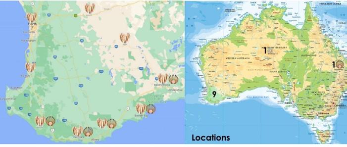
Eight sculptures, both augmented reality and physical, have now been launched in Western Australia at Capel, Northcliffe, Denmark, Bremer Bay, Norsemen, Hyden (Wave Rock), Kellerberrin and Mt Magnet. These sculptures join those in Alice Springs (Northern Territory), Bunya Mountains (Queensland) and Singapore’s Gardens by the Bay. Each sculpture has interpretation panels explaining the project and providing details and QR links for the augmented reality versions.
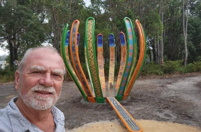
Dr Alan Briggs with the Denmark Genestreaming sculpture. The ramp leads to a circular platform indicating timescales from which plants and animals evolved on the inner “petals”. Aboriginal artwork is shown on the outer side of the “petals”
Local communities came out in force for the opening of each of the eight Western Australian sculptures. Traditional Owners provided a Welcome to Country, and often, local artists explained their artwork.
Geoparks WA promotes geoscience with communities and has assisted in the establishment of four Local Geoparks in WA; each park is keen to support the installation of Genestreaming Journeys sculptures, adding to the development of links between geoscience and Aboriginal culture and to increase broader community engagement. Local geoscientists have been supportive of the sculptures and there is interest in installing more, particularly in the Nannup WA Geopark, the only Local Geopark in Australia.
ALAN BRIGGS
President – Geoparks WA
All images by Alan Briggs except where indicated.
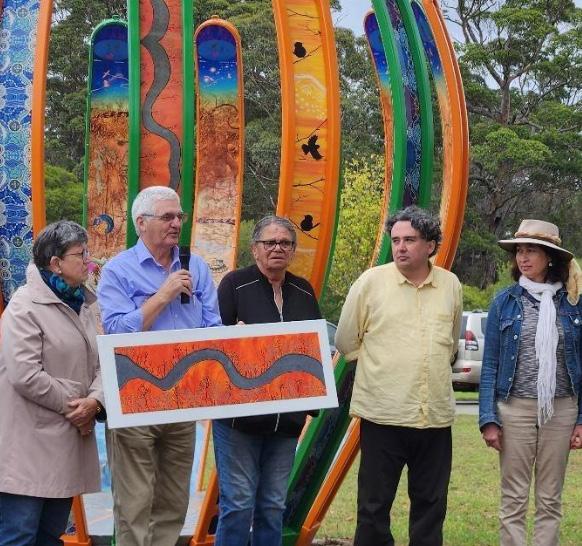
Launching the Genestreaming Journeys sculpture Keith Bradbury (CEO, Gondwana Link) with Aboriginal Elders and Artists Katrina Symes and Glenda Williams, Ben Beeton and Mali Moir (Scientific Illustrator).
Map of Genestreaming Sculptures trail in Australia. Image: Extracted from Sciart.com.au
Mount Magnet:
One of the World’s Classic
Archean Goldfields
When Robert Austin led the first colonial expedition across what is now the Shire of Mount Magnet in 1854, he famously described the district as “one of the finest goldfields in the world.” For modern geologists, that early impression still resonates. The hill he named Mount Magnet immediately caught attention for the distinctive magnetic properties of the summit rock, an early hint that the Murchison GeoRegion was underlain by some of the oldest and richest mineral systems on Earth. Yet long before Austin’s arrival, the region had been home to Aboriginal people for at least 20,000 years, who knew its landscapes, water sources and rock shelters intimately.
Located 560 kilometres north-east of Perth, Mount Magnet is Western Australia’s longest continuously operating goldmining
centre. Gold was discovered here in 1891 –before Coolgardie, Cue or Kalgoorlie had made their mark – and its first mine was operating that same year. Over the next 130 years, mining activity evolved from shallow alluvial workings to deep underground operations and, more recently, large-scale open-cut mining.
The district’s most storied operation is the Hill 50 Mine, long regarded as the giant of the camp. Until its closure in 2007, Hill 50 produced more than 2.1 million ounces of gold and extended to a remarkable depth of around 1500 m, making it at the time Australia’s deepest underground gold mine. Its extensive open pits, waste dumps and haul road networks now form a permanent part of the landscape. Today, Ramelius Resources is the major operator, continuing exploration and production across the field.
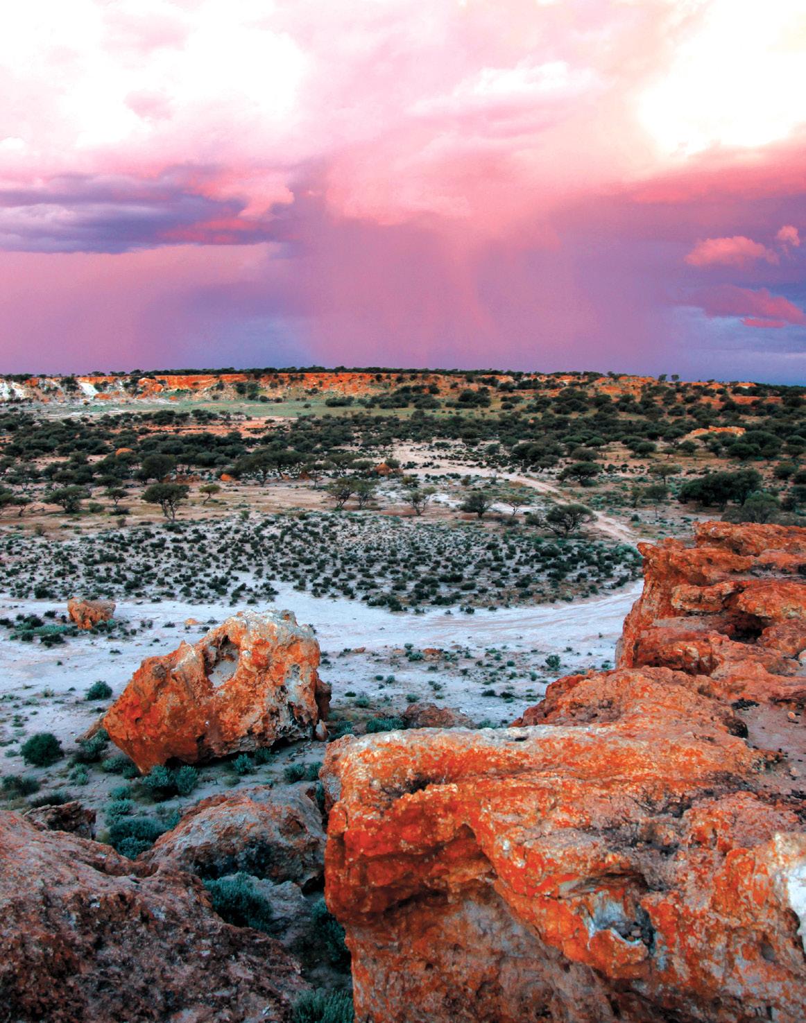
Geologically, Mount Magnet sits within the Meekatharra–Wydgee greenstone belt in the Youanmi Terrane of the Archean Yilgarn Craton, one of the planet’s most intensively studied mineral provinces. The strata belong to the Meso- to Neoarchean Norie and Polelle Groups of the Murchison Supergroup. More than 80% of Mount Magnet’s ore is hosted within banded iron formations, which provided chemically reactive horizons for gold deposition. The remainder of the field consists of quartzvein systems developed within mafic to felsic volcanic and volcaniclastic sequences. For structural geologists, the district offers a textbook example of multi-phase deformation overprinted by hydrothermal alteration, all tightly coupled to the longlived tectonic evolution of the Yilgarn Craton.
The 37-kilometre Mount Magnet Tourist Trail offers visitors, particularly geoscientists, an opportunity to examine many of the area’s classic landforms and mining heritage features. Starting at the Visitors Centre and Mining & Pastoral Museum, the trail traverses granite domes, breakaways, early settlement sites, and cultural landscapes. Highlights include:
Poverty Flats where, in 1891, prospectors famously turned up 259 ounces of coarse alluvial gold “like potatoes,” including a 100-ounce nugget.
Warramboo Hill Lookout, the vantage point originally named West Mount Magnet by Austin and later restored to its Aboriginal name by Surveyor H.S. King in 1886.
The Amphitheatre, a striking weathered granite ridge punctuated by caverns and rock shelters; geomorphologists have suggested it may mark the site of an ancient waterfall.
Mount Magnet today functions as the geo-hub of the Murchison GeoRegion, strategically located at the road junctions connecting Sandstone to the east and Yalgoo to the west. The wider district offers exceptional exposures of laterite development, including the dramatic “London Bridge” formation near Sandstone, as well as classic mining relics such as Paynesville and the remarkable 1896 Jokers Tunnel near Yalgoo (where 550 tonnes of
Cave Area, a window into deeply weathered Archaean bedrock exposed through eons of geomorphic stripping. Lennonville, the remnants of a once-booming reef-gold town of the late 1890’s.
The Granites and Walganna Rocks, 15-metre escarpments with culturally significant Aboriginal rock art, some dated at around 9,000 years, that are among Australia’s oldest known engravings.
rock yielded a modest 3 kilograms of gold).
From July to October, the Murchison’s wildflower displays add an unexpected splash of colour across the red-earth landscapes, complementing the region’s geological spectacle.
For geologists, Mount Magnet is more than a goldfield. It is a rare convergence of Archean tectonics, mineralisation, Aboriginal heritage, and Australia’s mining
legacy. It is an open-air classroom where every ridge, pit and outcrop tells a chapter of an ancient story still unfolding.
DAVID ROBSON Chair, GSA Geotourism Standing Committee
The Granites Dusty Tracks Photography
Photo: David Robson
The Granites Dusty Tracks Photography.
Photo: Karen Morrissey, Mount Magnet Visitors Centre
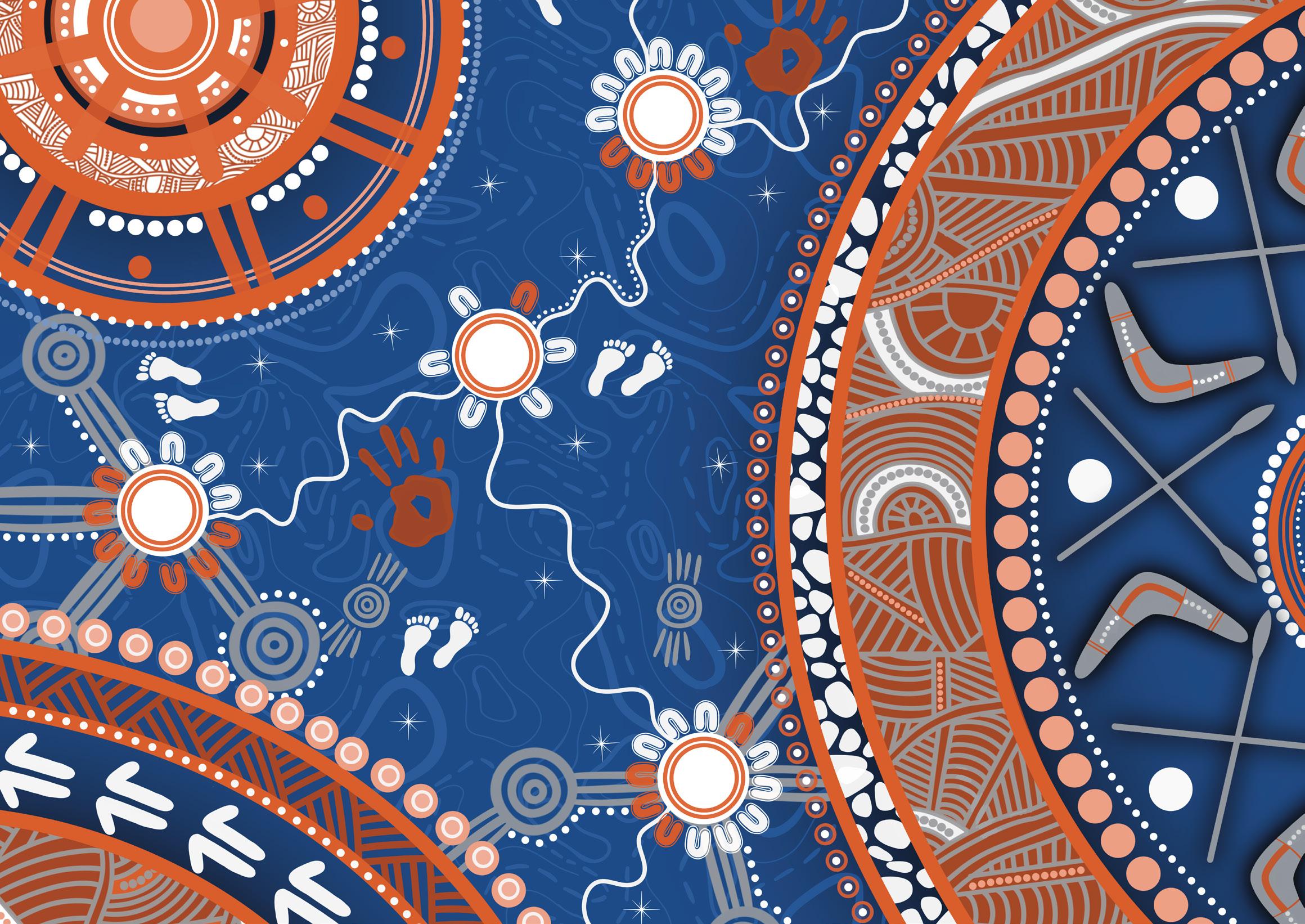
Geological Society of Australia Indigenous Artwork by Leah Cummins.
This digital artwork represents the Society’s purpose of collaboration, connection, deep time, technology, innovation and people.
FEATURE | LEAH CUMMINS
Vale Leah Cummins
This project has taken shape over 18 months before Leah’s sudden passing in October 2025. We now share this piece as a tribute to Leah’s life, her generosity and proud legacy.
Walking in Two Worlds: The life and legacy of artist and geoscientist Leah Cummins
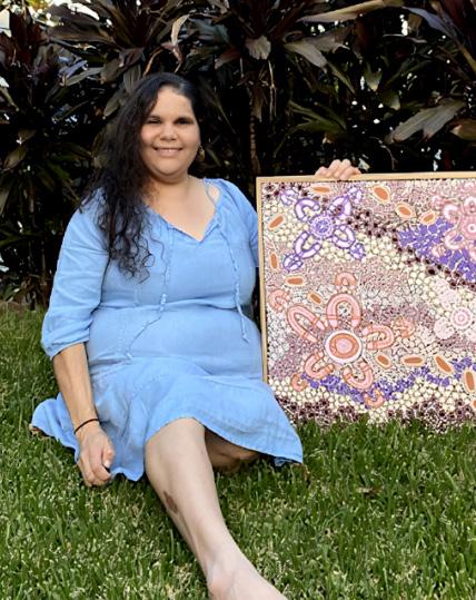
Leah Cummins was a proud Mayi-Kulan and Kalkadoon woman from North West Queensland. Her cultural connections stretched from the Simpson Desert to the Gulf of Carpentaria. Leah was an artist, a geoscientist, a technologist, a mentor and a friend. She carried deep knowledge of Country and a strong understanding of the land through science. These two worlds shaped everything she created.
Through Bunya Designs, Leah brought First Nations stories to life and connected culture, community and Country in every painted or digital artwork. She also used her art to support Indigenous Women in Mining and Resources Australia at events such as IMARC. Through this work she helped bring cultural awareness and a deeper sense of connection to the minerals sector.
From Geoscience to Art
Before she became known through Bunya Designs, Leah was a geoscientist. She held a bachelor’s degree in Geographical Information Systems and worked in mining, exploration, spatial technology and oil and gas. She spent more than 20 years managing geoscience data in the oil and gas sector at Origin Energy and before that she worked for seven years in exploration and mining. Leah often said that her artistic eye came from her time in the bush where she learned to notice colour and pattern and the quiet stories held in landscapes.
During the pandemic Leah felt the same isolation many others faced. Painting helped her ease her anxiety. While on long service leave she painted every day. She painted the stories of her mother’s and father’s Country. She painted journeys and people. She found calm and joy in the work.
It was during this time that she made a life-changing decision. “I kept thinking about time and life,” she said. “This is my chance to do something I want to do.” She realised she no longer wanted to return to her old job. Instead she remarked “I quit science for art during the pandemic because painting brought me peace.” This choice was brave but it opened the door to a new future.
FEATURE | LEAH CUMMINS
Empowering Indigenous Women through IWIMRA
Leah worked closely with Indigenous Women in Mining and Resources Australia (IWIMRA), a network that brings Indigenous women together to share knowledge and strengthen their leadership. Members come from many parts of the resources sector including mining, oil and gas, service companies and even government. The focus is on support, empowerment and pathways for a sustainable future. For several years Leah joined IWIMRA in interactive painting sessions and yarning circles. These gatherings created a gentle and safe way to learn about symbols, stories and Country. Through art she helped people understand culture and connect with one another. Her paintings were also used to raise funds for IWIMRA to support Indigenous women in their careers.
Read more about IWIMRA here
IWIMRA also ran private paint and sip sessions that connected Indigenous women with companies using art to build trust and connection and to facilitate learning and reconciliation. Leah guided many of these sessions and taught participants about symbolism, Country and the meaning held in traditional patterns.
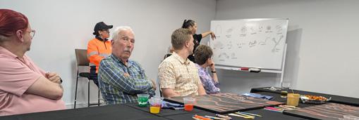
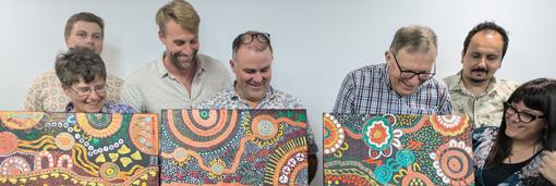
In 2024 the Geological Society of Australia took part in one of these private painting sessions in NSW. Leah shared how symbols carry story and how art can help build understanding. For many in attendance, this experience was a gentle and personal step toward reconciliation. It was a space where people could listen, learn and reflect.
The GSA Commission: A Story Carried in Every Symbol
In 2024 the Geological Society of Australia commissioned Leah to create an artwork that represented the Society’s purpose and its connection to Country. The result is a vibrant and layered work but it is more than a visual statement; it carries a narrative that reflects our Society, connection, collaboration, deep time, technology, innovation and people. Leah reflected on the project, saying “This piece is going back to my roots. I love how fun this project was to design.”
Each symbol in the artwork holds its own story:
The Earth’s Five Layers
Large circles represent the layers of the Earth. This reflects the foundations of geology and the stories held beneath the surface.
Technology and Innovation
These symbols speak to the future of geoscience and to Australia’s place in the world.
Journey Lines and Footprints
These show the paths walked by students, researchers, Elders and communities. They show how knowledge travels, grows and connects people.
Meeting Circles
These symbols show gathering and shared learning. They reflect the GSA as a place where people come together.
Handprints: “We Make the Future With Our Hands” These remind us that Earth science is shaped by people. Our work and our stories matter.
Always Moving Forward Flowing directional motifs show movement and purpose. They reflect progress and the GSA’s commitment to grow and evolve.
A Lasting Legacy
Leah passed away in October 2025. Her loss has been felt across the geoscience, resources and arts communities. She showed what it means to honour both culture and science and she inspired many people, especially young Indigenous women. She taught the industry that respect, curiosity and listening help create better futures.
Leah’s artwork for the GSA now holds a special place in our Society. It reminds us that geology is not only about rocks. It is about people,
stories and the deep relationship between land and knowledge. Her legacy continues in her art and in the many lives she touched. The GSA is honoured to share her story and to hold her work within our community.
AMBER JARRETT
Dorothy Hill Symposium 2025
– reflections and positive pathways for all
Earth and environmental science is stronger when everyone’s in the room. When we think of community, we picture people, relationships, safety, and trust. Seldom do we imagine a group of scientists rationalising over how the earth formed or what natural resources to harness.
And yet, on a sweltering November day, a theatre full of women, and a few lads, passionately discussed their shared love of rocks. Attendees at the Dorothy Hill
Symposium 2025 showed up in pursuit of everything that geoscience stands for.
Regardless of gender identity, culture, or life stage, they shared a sense of commitment to understanding, managing, and protecting the planet we call home. DHS organising committee member Gregg Webb made a personal tribute to Dorothy Hill herself, a reminder of the trailblazer whose legacy we were celebrating. Her extraordinary knowledge of corals had captivated the
young Gregg, who spoke fondly of her longstanding mentorship of him.
High school students, who represent the fields future, were wide-eyed with wonder and wonderful questions. Seasoned professionals compared fieldwork stories in a careers panel. This gathering showed how the Earth and Environmental Sciences community thrives on pluralism.
When we think of community, we picture people, relationships, safety, and trust “”
Organisers Teresa Ubide, Gurion Ang, and Daniel Chew orchestrated a masterclass in bringing women and their allies in Earth Science together across academia, government, industry, and education.
Speakers Esti Handini, Linda Armbrecht, Helen Bostock and Frances Alexander all delivered career insights and trajectories that were inspiring and reassuringly human, proof that breakthrough moments often come wrapped in grit and strategic pivots.
A post symposium scientific writing workshop led by Sandra McLaren reminded us that scientists are writers
and communicators, not just observers.
Three travel bursary awardees, Elizabeth Bruce, Marina Seraine, and Pelina Toprak, supported by Geoconferences (WA) Inc. and WOMEESA provided accessibility for women geoscientists from WA who would have otherwise been unable to attend.
In a field still fighting for a representation that reflects all of humanity, the conversations on barriers for women and other underrepresented groups in geosciences remained both timely and essential.
Here’s to the Dorothy Hill Symposium, a biennial reminder that geology isn’t just about rocks. It’s also about people, passion, and community, uplifting each other as we navigate future earth and environmental challenges together.
TARA DJOKIC Australian Museum, Scientific Officer, Palaeontology Collection
WOMEESA Grants and Sponsorship Manager
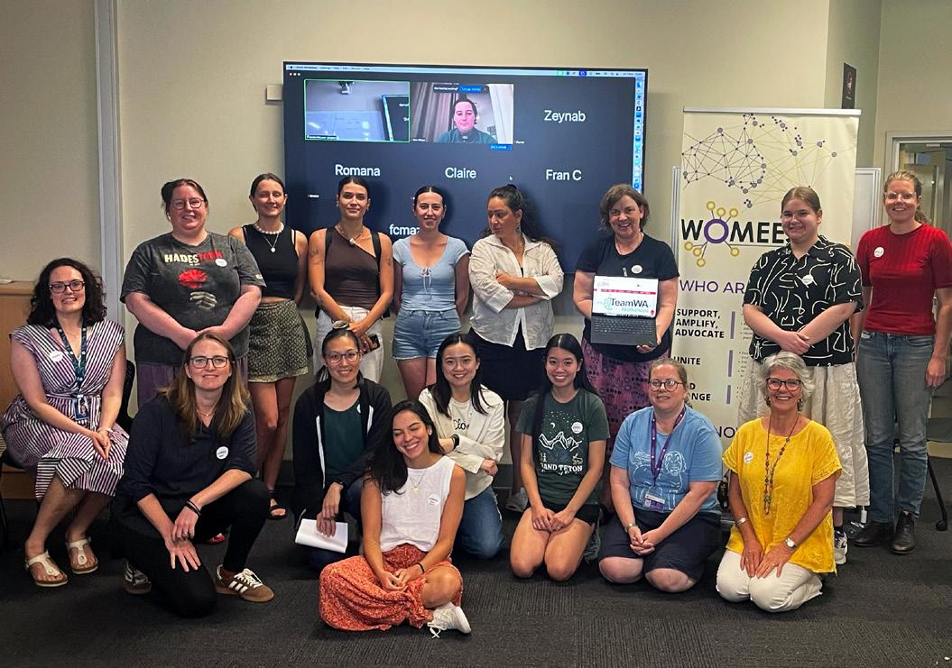
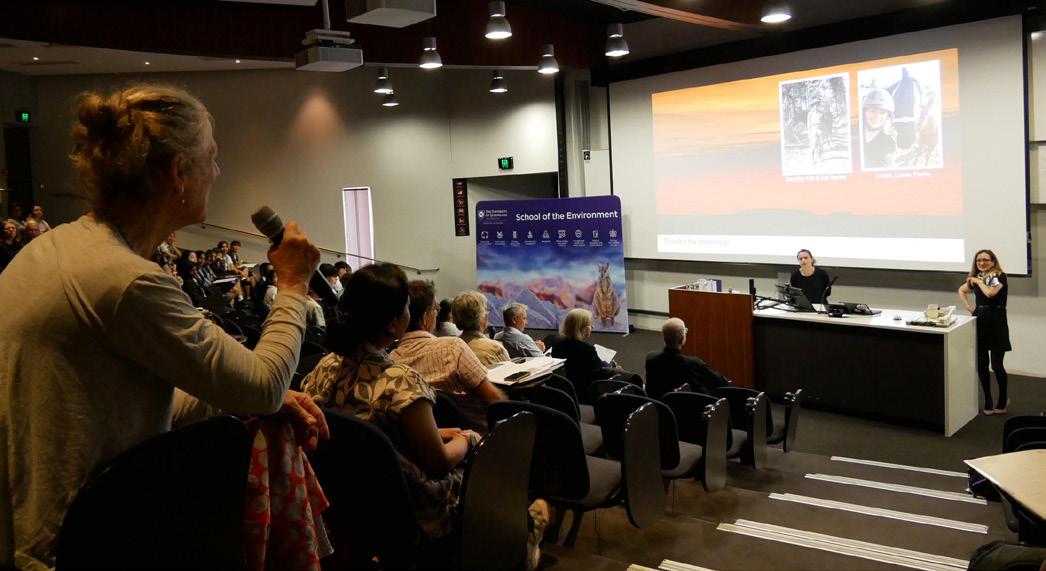
Participants at the WOMEESA post-symposium writing workshop Photo: Supplied
Presentations
South Australia’s digital mapping project innovation in delivery of geological data
Australian Government geological surveys have the important role of providing geological data to help a range of users understand the geology of an area and make informed decisions. An important part of providing this data is preparing and delivering accessible, current information that can be used efficiently.
Traditionally, geological surveys presented information through paper maps, accompanied by explanatory notes to provide additional information. But these maps are divided by arbitrary boundaries that have no geological meaning. Standard map scales also limit how much detail can be shown, and discrepancies often occur along map edges because interpretations developed at the different times the maps were produced are rarely reconciled.
To interpret the geology, we need to know:
where the rocks are what the rocks are how the rocks relate to each other; and what happened to the rocks over time
Breaking up geology based on arbitrary map-sheet boundaries makes it harder to identify these things. Instead, we need to tell the geological story while respecting the true temporal and geographical nature of geology.
The Geological Survey of South Australia (GSSA) has taken the next step in the evolution of geological data management with its recently launched South Australian Discovery Mapping (SADM) project. SADM developed a new system for compiling, preparing, and delivering geological
SA Geology 1st edition
GSSA’s spatial data has evolved over time. The first versions were human readable paper maps. In the 1990s, the paper maps were scanned and digitised to produce statewide coverage. This digital version was used to produce new paper and PDF maps – and could be used in GIS software – but it still had issues with scale and map boundaries because it relied on the original map sheets. The new SADM approach greatly expands the amount and range of information recorded for each mapped feature.
In addition, the data is spread across 15 ‘time slices’. Time slices are periods when similar geological processes were active. For example, the Toondulya Time Slice encompasses c. 1600–1560 Ma volcanism and magmatism of the Toondulya Supersuite – including the Hiltaba Suite and Gawler Range Volcanics – and was responsible for the IOCG deposits in the Gawler Craton.
A single feature in this dataset can have complex and detailed attribution. Lines can have multiple attributes, allowing tectonic events to be recorded across several time slices, making it possible to view the progressive history of a feature including fault geometry and kinematic history. The potential attribution of polygons has also been increased, allowing igneous, metamorphic, sedimentological, or alteration constraints to be assigned.
Digital Explanatory Notes
Much of GSSA’s information is tied up in publications, such as report books, bulletins and articles in the MESA Journal. Updating this information requires the release of new editions, a time-consuming process. To solve this issue, SADM developed a new Digital Explanatory Notes (DEN) system. This system includes new reports that are based on the most current data and research and summarise the four principles to interpreting geology:
•
Time slices – Reports describing the 15 major time periods used in the map data compilation
• • •
Events – Reports detailing the major tectonic and/or metamorphic events that have occurred in South Australia
Provinces – Reports describing key geological provinces and basins
Stratigraphy – Descriptions of individual geological units
The DEN are captured directly into a database, which means a note can be updated at any time, and new information is immediately available to users. Over time the number of notes available will grow as GSSA staff compile new information based on their work programs.
data and information that involved transformation of the GSSA’s spatial (SA Geology 1st edition) and textual (Digital Explanatory Notes) data, and development of a modernised infrastructure for the management and delivery of this data.
Delivery
Cloud-based databases and delivery systems provide seamless statewide geological data that integrates stratigraphy, lithology and structure, and provides access to DEN. GSSA’s SARIG website provides easy web access to the SA Geology 1st edition and a searchable interface for the DEN. SA Geology 1st edition also includes
Outcomes of SADM
To date, the best available spatial data has been incorporated for most of South Australia, but an area in the western Gawler Craton has been recompiled with
an interactive time slider that allows users to easily switch between time slices and overlay different time slices for a personalised experience.
SA Geology 1st edition is also available as a GIS-ready data package and as web services that can be used directly in GIS
software. This reflects the modern reality that any new data should be machine readable, so it can be interrogated using artificial intelligence/machine learning (AI/ ML).
considerable detail, extensive attribution and detailed DEN. As GSSA teams continue their work similar levels of detail will also be available for other areas of the state.
MARK PAWLEY
Geological Survey of South Australia
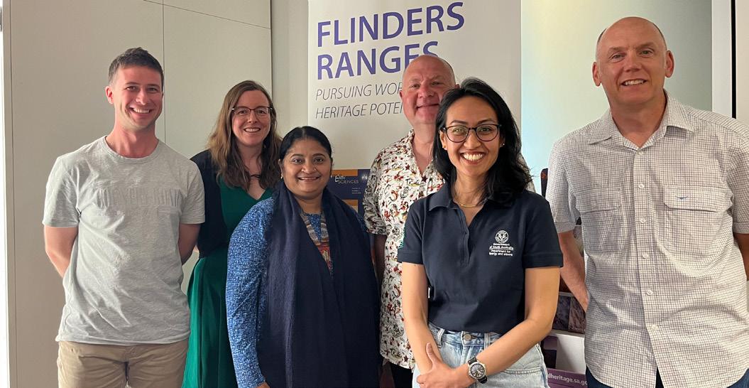
Team photo Photo: Supplied
Team photo. Photo: Supplied
From the field to the future: Kicking goals for mining careers
How sport and science can play on the same team to inspire
the next generation
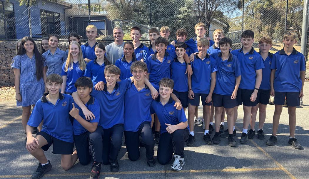
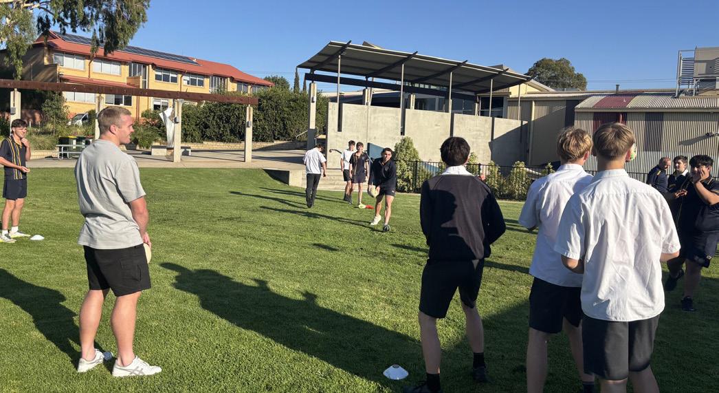
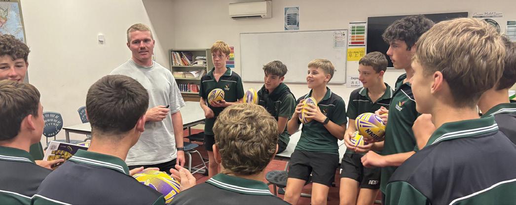
In many regional communities across Australia, two cornerstones of local identity stand out: the mine and the footy club. Both provide employment, opportunity, and connection and, increasingly, they share a new purpose in inspiring the next generation of Australians to consider a future in mining and geoscience.
In June 2024, the Australian Mining and Automotive Skills Alliance (AUSMASA) published its Gen Z Perceptions of Mining Report revealing a worrying trend. Over 70% of Gen Z respondents believe mining does more harm than good. Fewer than half saw mining as important to maintaining their modern lifestyles. Yet, paradoxically, two-thirds of those same young people rated mining as either extremely important
(24 per cent) or very important (42 per cent) to the Australian economy.
This aligns with findings from a November 2024 report commissioned by the Australian Geoscience Council (AGC), which showed that Earth science is one of the least-understood areas of study. Many students surveyed had little grasp of the breadth and modern relevance of geoscience. Some mistook it for geography or thought it was only ‘about rocks’. With such limited awareness, it’s no surprise that students struggle to see the rich diversity of career pathways geoscience offers.
Location also shapes these perceptions. AUSMASA’s research found that 85% of young people in Western Australia believe
“Mining has work to do to improve perceptions and increase inclusiveness and diversity in the workforce,” Sorahan said. “With global demand for gold and critical minerals rising, we’ll need even more skilled workers.”
mining is important to the national economy, compared with just 57% in Victoria. Career conversations mirror this gap with 70% of WA students reported having discussed mining careers, compared with only 24% of Victorian students. These geographic differences show that awareness and engagement with Earth science vary across Australia, influenced by how visible the industry is in local communities and how strongly it features in regional identity.
According to James Sorahan, Executive Director of the Minerals Council of Australia’s Victoria Division, the findings highlight a deep disconnect between mining’s real contribution and its public image.
In 2023–24, Victorian mining companies contributed over $569 million to the state’s economy, supported more than 1,700 local businesses, and paid $181 million in wages to 1,480 Victorians. figures that underscore the sector’s ongoing significance
University departments teaching geology, mining engineering, and metallurgy
are feeling the consequences of these perception gaps, facing declining enrolments and increasing competition from other disciplines. What is happening on campus mirrors what we see in the broader community: a generation uncertain about mining and geoscience careers.
So, what can we do?
The AGC study suggests that early engagement is the key. Students in Years 8 and 9 are just beginning to form ideas about their interests and career goals. This is a crucial early window to introduce students to Earth science. Outreach shouldn’t stop
with students either. Engaging parents, teachers, career advisors, and community role models well before subject selection is essential.
And that’s where footy comes in.
Across regional Australia, partnerships between the minerals industry and local football clubs are creating new ways to connect with young people on the field, in the classroom, and in their communities. Whether it’s through sponsorships, school programs, or mentoring initiatives, these collaborations show that the pathway from rocks to footy boots can be inspiring.
Josh King visiting with students from regional Victoria talking about sports, motivation and careers in mining
Photo: James Sorahan
Josh King visiting with students from regional Victoria talking about sports, motivation and careers in mining. Photo: James Sorahan
Read the AUSMASA Gen Z Perceptions of Mining here: Read the AGC Project Geoscience Summary Report here:
Josh King A player and a professional
MCA Victoria has teamed up with industry partners to bring Melbourne Storm rugby league player Josh King into the classrooms of regional Victoria, not just as a footy star, but as a former mining apprentice.
Back in 2016, during his debut NRL season with the Newcastle Knights, King was also working full-time to complete his electrical apprenticeship with Glencore at the Bulga Open Cut Coal Mine near Singleton, NSW. Vanessa O’Loughlin, Executive Officer of the Wimmera Southern Mallee Local Learning and Employment Network, said King’s visit offers a powerful connection for young people thinking about their futures. “He’s going to do some activities with them related to NRL and sport, but his message
will be about motivation, encouraging young people as they approach their career choices.”1.
King’s message to students is clear: stay in school, gain a qualification, and back yourself on the field and in the workforce. King reflects that his mining apprenticeship gave him both stability and confidence while pursuing professional sport. “It gave me the freedom to dive into rugby league without fear,” he said. “I knew the worst thing that could happen was having to go back to being an electrician”. Not a bad backup plan.
James Sorahan says the initiative tackles a real challenge for regional students. “There
are more barriers to students completing TAFE or university qualifications in regional areas, so it’s critical that our local industries support school engagement and training opportunities. Victorian mining proudly supports school-based apprenticeships and employs locals.”
Vanessa summarised the program, “I think the more messages and mentoring we can get through to our young people, the better”.
Phoebe Desmond Representation from the coalface to the field
was one of the inaugural players in the Knights’ 2021 women’s NRL team, sponsored by NSW Mining, and has become a visible ambassador for women juggling elite sport and skilled trades.
“I’m really proud to have a platform that’s showing girls out there that we can have a mining career, and we can have a football career,” she said.
Phoebe’s story challenges outdated assumptions about who belongs in mining and proves that women, especially those in regional areas, don’t have to choose between physically demanding work and their passions. They can do both.
As a role model, Phoebe exemplifies the value of transferable skills, resilience, and
teamwork, all qualities that make her an asset both in the workplace and on the field. Her journey helps young women, particularly in mining communities, see a future in the industry that’s active, hands-on, and full of opportunity.
Phoebe’s story echoes a broader national effort to support women in both sport and the resources sector. Across Australia, women now make up around one in five workers in mining — a figure that has doubled over the past decade — yet many still face barriers to entry, awareness, and progression. Increasing visibility and representation remain key to shifting those dynamics.
In 2025, the Minerals Council of Australia (MCA) became the naming-rights partner for the Wallaroos’ Pacific Four Series campaign. This was a bold collaboration designed to promote women’s visibility and participation, both on the field and in STEMbased careers. The partnership highlights the shared values of teamwork, leadership, and resilience that underpin both rugby and mining, and it sends a powerful message that opportunities in these traditionally
Why this matters to us
For GSA members, these stories are more than good publicity. They speak directly to our shared challenge of building the next generation of geoscientists and professionals.
Recent research from both AUSMASA and the Australian Geoscience Council paints a consistent picture: young Australians are uncertain about what geoscience is and have mixed perceptions about the role of mining in society. Regional context amplifies these differences: where mining is visible, young people are more likely to value it and talk about it. Where mining is distant, awareness fades.
References
male-dominated arenas are expanding3.
As MCA Chief Executive Officer Tania Constable explains “Just as rugby is working to build a stronger future for women on the field, Australian mining is striving to foster more inclusive and rewarding careers off it. Like rugby, it takes teamwork, grit and a belief in what’s possible. We want to see more women stepping into careers in mining… and encourage women to back themselves, on the field and off it.”
The Wallaroos represent strength, grit, and teamwork qualities essential to both highperformance sport and modern mining careers. Together, these partnerships are helping to rewrite the narrative for young women, showing that leadership, courage, and opportunity exist wherever they choose to play. Whether that’s on the field, in the field, or even at the mine site.
These findings remind us that visibility matters and engaging with communities, understanding identity, and creating messages that resonate across different regions and audiences matter just as much.
As Indrani Mukherjee from the University of New South Wales eloquently stated at IMARC this October, “We need to Swiftly Tailor our communication”. We might not have a Taylor Swift of geology, but we can build partnerships that connect community with Earth science.
When young people see relatable role models like Phoebe Desmond or Josh King bridging sport and skilled trades, they see
possibility. Whether on the field or in the field, they see people who reflect their own communities, values, and ambitions. And they listen. Local heroes and superstars help us change the narrative by making geoscience visible, relatable, and proudly local.
Josh King visiting with students from regional Victoria talking about sports, motivation and careers in mining. Photo: James Sorahan
Pablo Farias Member Spotlight:
Tell us a bit about your current role and what attracted you to it
I am a project geologist at the Northern Territory Geological Survey (NTGS). I am part of the Basement Geoscience team, where we are working to better understand the Pine Creek Orogen, one of the three big Archean–Paleoproterozoic cratonic blocks that make up the geological basement of northern Australia.
After finishing my PhD at Monash, I felt like I needed a bit of fresh air, so I moved to tropical Darwin. What attracted me to this role, at the NTGS, is the exposure to the very diverse NT geology, and to many of its underexplored areas. We get to visit extremely remote places. I also love the science behind our technical reports and the collaboration with researchers, which keep us up to date with new techniques, a real treat.
Have you worked elsewhere and in what roles?
I was lucky to start my career when industry was booming in Argentina back in 2009–2010. I started as a mine geologist working on Cu–Au porphyry deposits in Argentina. Then I moved to the freezing Patagonia to explore for
epithermal gold deposits. It was very cold! So I moved to Perth and landed a job at as exploration geologist, where I was privileged to work in remote WA and Arnhem Land (NT) for some years. I then decided to start a PhD that got me back to Argentina. I studied a Palaeozoic orogen next to the Andes, helping to understand its tectonic evolution and gaining insights into geochronology, which become one of my favourite topics of geology.
What do you love about working as an Earth scientist?
I love travelling to remote and underexplored areas. Working as a geologist in the industry, academia and now government, I get to travel a lot. During field work in Australia, I walked in areas that few people have walked. I am lucky to work very closely with Traditional Owners which I think is amazing. They are always happy to listen my version of the geology, and I love listening to their version of the natural world. I also love collaborating with colleagues at universities, the spear tip of innovation and research.
Tell us about the Earth science community in the NT
We are a small group, always keen to share our enthusiasm about NT geology. We mostly represent industry and government. The lack of tertiary geology or geoscience education in the NT isolates us a bit from the rest of Australia. I think there are many geologists out there, but I do not see them because they are interstate FIFO workers. I hope we can create a hub for geos in NT one day.
Maybe a GSA-NT geo pub?
Earth Science is going through a bit of a challenging time with few new students coming into the discipline and University courses and departments being closed. How do you feel about this, and do you have any ideas on how to address these challenges?
This is a worrying trend, and I think it could have long-lasting negative implications. Australia has been recognised as a hub for geoscience and innovation and I remember reading high-impact papers from Australian Universities during my undergraduate years in Argentina. I saw Australia as an aerospace engineer sees NASA. If we lose geoscience at universities, we lose its world-class research capabilities. From there, we
become users rather than developers. We will have to buy what other countries produce. Does that sound familiar?
In my opinion a way to address this is to invest in education. Not only for kids, but also for adults, particularly those in Parliament.
Mentors are really important at all career stages, have you had any colleagues who have positively impacted your work life?
Absolutely! I’ve been very lucky to cross paths with amazing people who have inspired me. I am very grateful for that. In industry, Penny Sinclair is an absolute legend who guided me and inspired me to pursue further study. She is such a great example of leadership. In the NTGS, Barry Reno and Jo Whelan. They restored my love for geoscience and helped me reshape my professional profile. I also find constant inspiration in Amber Jarrett (GSA Chair). She can do 10,000 things at the same time and keep smiling. What a legend.
Tell us a bit about your work life balance, do you have any other interests outside of geology?
The reason I love my work at the Survey is because I have my afternoons and
weekends free. I am part of a social dance community (Argentinian Tango) and a veggie Community Garden at the Botanical Gardens in Darwin. I love cycling and escapades to unusual restaurants.
What wins for you? Rock, mineral, fossil or structure?
This is a hard choice! I guess “structure” wins today. Not sure about tomorrow.
Adventures in Earth Science: Down-under at Undara Lava Tubes, North Queensland
North Queensland is known for its reef and rainforest, but it also features world-class Cenozoic volcanic landscapes, such as the Undara Lava Tubes. These formations let visitors explore volcanic terrain and some of its sub-terranean world and to observe the connections between geology, ecosystems, and local wildlife.
Stretching over 160 km, these flows and tubes – formed about 190,000 years ago
by basalt volcanism from the Undara Crater to the south-east – are among the longest globally. They even draw close comparison as analogues for volcanic ridges and channels on the Moon. Their size is due to a high lava effusion rate and the thermal insulation provided by granite-confined paleovalleys. The tubes formed as flow margins cooled and solidified, while internal molten lava continued flowing before draining away, leaving hollow tunnels.
In places the tunnel roofs have collapsed leaving long, sinuous chasms punctuated by basaltic archways and tunnel passages. The chasms offer local environments that hold water and offer protection from fires. As a result they are colonised by dry rainforest (vine thicket) in contrast to the surrounding open savannah woodland with its grassy understorey.
The caves themselves also provide refuge and home for a myriad of animals –including micro-bat colonies and diverse assemblages of arthropods – as well as local shelter for wallaroos, birds and insects. The atmosphere in the tunnels is also characteristic with high humidity and in some places CO2 contents up to about 6%, a potential hazard for tunnel visitors.
Located about 200 km south-west of Cairns, the lava tubes are accessible via sealed
roads and offer various accommodation options like Discovery Resorts Undara. Tours led by knowledgeable guides run from May to October, while self-guided surface trails are available as part of the Undara National Park trail network. It’s a top destination for your geo-adventure wish-list!
STEVE HILL
Chief Scientist, Geoscience Australia
Water in tunnels. Photo: Steve Hill
CO2 monitor. Photo: Supplied
Undara tube. Photo: Steve Hill
The Geological Survey of New South Wales – 150 years of geoscience
Throughout 2025, the Geological Survey of New South Wales (GSNSW) has been celebrating its 150th anniversary. Formally established on 1 January 1875, the survey has played a key role in the development of the state by gathering, curating and managing geoscience information across a wide range of sectors.
The history of use of Earth resources in NSW began with First Nations people who mined pigment and materials for cooking and cutting purposes. The first European mining focused on quarrying and cutting for construction.
Early exploration
By the 1840s early scientific studies showed the potential of the colony’s mineral wealth. The Cambridge-trained geologist Rev. W.B. Clarke discovered traces of the gold near Hartley and Paul Strzelecki, a visiting Polish explorer, found gold in the Vale of Clydd. Strezelecki was
the first to suggest a geological survey for New South Wales and Van Dieman’s Land but Parliament did not agree. Eventually the discovery of copper at Carcoar, Molong and Bathurst, iron ore at Berrima, and unconfirmed reports of gold west of the Blue Mountains, prompted the government to act. In 1850 Samuel Stutchbury arrived from England to take up the post of Geological Surveyor; at the same time Rev. W.B. Clarke continued his work privately as he and Stutchbury had quickly became rivals.
Stutchbury returned to England after 5 years and there was no official
Geological Surveyor in again until 1874, when the discovery of significant mineral resources finally prompted the creation of a Department of Mines. The Geological Survey of New South Wales, led by Charles Smith Wilkinson, was established the following year.
The survey’s task was to prepare regional and geological maps, to search for new mineral fields and underground water resources, to report on those already discovered, and to collect rock and fossil samples for the Mining and Geological Museum.
First
geological map of part of NSW, 1834.
Staff with the first GSNSW vehicle, 1930s.
1893 map of NSW
Mining occurred through this period at New England (Sn), Cobar (Cu) and Broken Hill (Pb-Zn-Ag) and the GSNSW published on key mining areas and commodities. The Museum of Mining was established in 1879 with the collection of Rev. W.B. Clarke, and a display at the Garden Palace was organised for the 1879–1880 Sydney International Exhibition.
The first geological map was published in 1878 (of the Hartley–Bowenfels–Rydal
Various studies were completed and published in the years before the First World War, including the Prospector’s Guide, produced to help the unemployed affected by successive droughts, floods and low prices of base metals. Water continued as a focus.
In the 1950s there were record mining figures with global demand for base metals and coal. Increasing populations stretched infrastructure and the Mount Kosciuszko region was mapped for dam sites for the Snowy Mountains Authority. At the same time a systematic program
area by Charles Smith Wilkinson) and work continued with T.W. Edgeworth David, who mapped the state’s tin and coal fields and discovered the coal deposits of the Hunter Valley, Ernest C. Andrews, an expert on mineral deposits, and Joseph E. Carne, whose comprehensive documentation of mines and prospects remained indispensable for many decades.
Discovery of the Broken Hill ore deposit in 1883 changed the focus from gold and
During the First World War, efforts were focused on economic geology including Sn, Cu, Ag–Pb–ZN, Mo, limestone, coal and kerosene shale. A new edition of state geological map was issued in 1915 but early mappers continued to face the obstacles of harsh terrane, lack of transport
extensive droughts meant the GSNSW expanded to include groundwater studies. Tourism also had its place and GSNSW draftsman Oliver Trickett prepared a guidebook to the caves that was used for many years. His edition of the state geological map was published and won a medal at the Chicago World’s Fair of 1893.
and inadequate communication. By the mid to late 1930s, aerial photography and the arrival of the first departmental vehicle, a Chevrolet 6-cylinder roadster, were great advances.
of geological mapping of 1:250,000 sheet areas began.
Marine geology, including estuarine surveys and studies of the offshore continental shelf, was a new focus; in 1961 a geophysics section was established and in 1965 a Cartographic Section was created. In 1964 the Londonderry core facility was established and in 1974 the GSNSW opened an office in Broken Hill. The first computer terminal was installed in 1972.
1980–2000
During this period the GSNSWs focus moved from a consultative role to a broader, regional, scientific role. In 1991, mapping continued under the National
2000–2025
In 2001, the NSW Government Exploration NSW initiative funded the provision of precompetitive geoscience information. In 2006 it was replaced by the New Frontiers Exploration Initiative, which introduced the highly successful Co-operative Drilling Programme. In November 2004, the GSNSW head office moved from Sydney to Maitland.
The last 1:250,000 geological series map
Geoscience Mapping Accord, integrating programs of the Commonwealth’s Australian Geological Survey Organisation (now Geoscience Australia) and state
(Goulburn) was published in 2013 and the last 1:100,000 geological series map (Coolabah) in 2018. From 2018, the NSW Seamless Geology dataset became the new source of best available geological mapping.
Black opal was declared the state gemstone in 2008 and Mandageria fairfaxi was declared the state fossil in 2015, both driven by GSNSW. In 2016 community
surveys. At the same time GSNSW started an innovative geophysical acquisition program with the first edition NSW statewide magnetic data merge.
outreach became another key role of the GSNSW in 2016, with the release of geotourism and educational products.
The work done by the GSNSW will continue to develop and expand, adopting new technologies to lay the groundwork for future exploration in poorly understood areas of the state.
COMPILER: SIMONE MEAKIN
Thanks to Roger Cameron, Phil Carter, Gary Colquhoun, Kevin Capnerhurst, Jola Jaworska. Images are from the Geological Survey of NSW photographic collection.
Cartographer at work, 1969.
Map legend production, early 1970s.
MINGLING ON THE BEACH
HIGHLIGHTS FROM THE SGGMP BIENNIAL CONFERENCE 2025
The Specialist Group in Geochemistry, Mineralogy and Petrology (SGGMP) held its biennial conference in November 2025 in the picturesque coastal town of Port Macquarie, NSW. Under the theme “ Mingling on the Beach ”, the event brought together researchers and students for four days of scientific exchange, networking and field experiences.
The conference featured a diverse program of talks, posters, workshops and a field trip. Sessions spanned the breadth of geochemistry, mineralogy, and petrology disciplines, from the Hadean to the Cenozoic, ultramafic to felsic systems, highto low-temperature processes, metamorphism and critical mineral systems. Mike Brown gave the first keynote talk on using petrology and geochemistry to evaluate evidence of plate tectonics in the Archean. The second keynote, by Wei-Ran Li, showcased the use of apatite to record magma evolution and the triggers of volcanic eruptions.
The meeting also included two hands-on workshops. The MAGEMin workshop, presented by Eleanor Green, introduced and explored computational tools for mineral equilibria modelling. In the second workshop, Balz Kamber and Marco Acevedo Zamora showcased novel tools for petrographic and geochemical image analysis.
A particular highlight of the meeting was the field trip where we explored the subduction mélange and arc processes along the beautiful coastline of the Port Macquarie area. There was much mingling on several beaches, where we saw some very messed up serpentinised rocks, fragments
of high-pressure metamorphic facies, and magma mingling!
A very special thank you to Melanie Finch and Martin Hand for stepping in to enlighten the group about the geology of the region.
The mingling continued at the meeting social events, including a conference dinner and a ‘BBQ on the beach’, which provided many opportunities for networking and catching up with one another.
We had an amazing array of student talks and posters that made a difficult job for our judges! Congratulations to Emma Conway (QUT) for the Best Student Talk and to Francisca Mallea Lillo (Adelaide) and Clara Furness (UQ) for Best Student Posters. Thank you so much to ALS for sponsoring the student prizes. The organisers would also like to thank the judges of the student awards, John Foden, Craig O’Neill, Isra Ezad and Will Defliese, as well as the students and ECRs from the University of Queensland, Queensland University of Technology and James Cook University who convened the sessions.
Finally, we congratulate our colleagues at Adelaide for taking on organisation of the next SGGMP conference!
SGGMP 2025 committee
DAVID MURPHY, BALZ KAMBER, MARK KENDRICK, TERESA UBIDE, HELEN McCOY-WEST
AESC 2026 PROGRAM NOW LIVE!
The AESC organising committee are delighted to share that the full convention program is now available. Delegates can look forward to a dynamic week of keynote presentations, oral sessions, poster viewing with dedicated networking, and outstanding opportunities to connect with colleagues across the sector.
The program showcases the depth, capability and innovation within Australia’s Earth Sciences community — we think you will dig it.
EXPLORE THE FULL PROGRAM
Already 275 delegates from Australia and abroad have registered and we look forward to seeing registrations continue to build as even more members of the Earth Sciences community join our national gathering. It’s not too late to join us! Your participation strengthens our network of geoscientists, researchers, industry partners and students as we continue to uncover new ideas and shake up geological conversations.
THE AESC POSTER EXPERIENCE
Our poster program is designed to elevate visibility and create genuine opportunities for discussion. There will be three dedicated poster networking sessions and posters spanning themes across all symposia will remain on display throughout the conference. We encourage delegates to meet the presenters, exchange insights and explore the remarkable research being showcased — you might even strike intellectual gold.
PLENARY SPEAKERS
Benjamin Mills (biogeochemist and numerical modeller from the University of Leeds) and Carl Spandler (petrologist and geochemist from the University of Adelaide) have been confirmed as plenary speakers and additional plenary speakers will be announced shortly.
SOCIAL FUNCTIONS
A welcome reception and awards night, an early career geoscientists evening and the AESC convention party have all been designed to bring our community together (registration required for all). Whether you want to celebrate achievements, make new connections or simply unwind after a big day of science, there is something for everyone.
PARTNER WITH AESC 2026
A small number of sponsorship and exhibition opportunities remain for the 2025 Congress.
Author Profile: Vojta Hybl
Tell us a bit about your background, you have studied geology and geography right?
I grew up in the Czech Republic and got interested in geology in high school. In 2019 I moved to Scotland to study geology and physical geography at The University of Edinburgh. That degree laid the foundations for the work do now, as use what I learnt every single day. It completely changed how see the world – I can never look at a landscape without trying to figure out how it formed and what its rocks have been through. After graduating, went on to do a master’s degree in outdoor environmental and sustainability education (also in Edinburgh). It introduced me to so many philosophical concepts about nature and our connection to it – something that has been becoming increasingly more prominent in my art practice. It is definitely a more unusual educational and career journey!
How did you make the move into art practice and illustration? Are you a self-taught artist?
I’ve always enjoyed sketching and creating. I did take some classes when I was younger (and those certainly helped when doing field sketches at geology field trips) but I never considered doing it professionally. The first turning point for me was the COVID lockdown in 2020, which happened during my first year at uni. With not much to do, I began drawing rocks and diagrams just for fun and as a way to keep learning. I then started taking it more seriously and communicated geology through art on Instagram (as @Rocks on Paper) and through that I started selling prints of my work. I spent the next couple of years figuring out my style and the media I liked working with. I eventually got my first few commissions and realised that maybe my future was not in academia (I’d always aspired to go into research) but illustration. My practice has grown since then to include all parts of the natural world.
You’re currently based in Scotland but you’ve presumably travelled widely. Have you ever been to Australia or done any illustration work centred on Australian rocks and landscapes?
I haven’t had the opportunity to visit Australia yet but I would love to one day! There are so many places (and rocks) I would like to see. I did paint a few Australian rocks before, including the Jack Hills metaconglomerate, komatiites and orbiculite from Boogardie (one of my favourite rocks to look at and to paint). And I am definitely keen to do more illustrations inspired by Australia.
What rocks or landscape features do you find most inspiring?
That’s a great question, though a hard one to answer! I am the type of person who loves to learn new things all the time, so my answer would probably be all of them! It could be a rock I spotted or the plants growing in a specific soil pH. My inspiration always changes depending on what catches my eye. I currently live on top of metamorphic rocks and granite near the ice-scoured arctic-alpine plateau of the Cairngorm Massif, so the processes of magmatic intrusion and (de)glaciation have definitely been influencing my ideas lately.
What rocks or landscapes are the most challenging to capture?
I have always found granite the trickiest to illustrate well.
How do you balance your inner scientist (trained to document features accurately and precisely) with the artistic aspects of a work?
It comes very naturally to me now, though I must admit it was difficult to fully lean into the artistic side of things at the beginning. We are often made to choose either science or art and taught that we can’t do both at the same time. What I have discovered through my work, though, is that there is so much overlap: both art and science try to explain the world in their own ways. To engage in science and art at the same time means that my understanding of the world expands. It enriches my experience and allows me to see things I could otherwise miss. Many of my illustrations are rooted in my personal experiences in nature, and I then spend a good amount of time researching the topic thoroughly before combining the objective facts with the subjective feelings. When painting, I always work from references to make sure the subject is accurate, but the way I mix colours, and layer brushstrokes and pencil marks is very organic and intuitive. My goal is to create art that is both informative and aesthetically pleasing.
Your first book, Rocks: A Guide to the Stones Around Us and the Stories They Tell, is in production and will be released in March 2026. Congratulations! Tell us a bit about the book, what does it focus on and how was the process of putting it together?
Thank you! The overall idea of the book is how understanding rocks and the processes they represent can help us reconnect with nature –something I felt was especially important in the face of the climate and biodiversity crises. Unlike other geology guides, which often have more entries for minerals than rocks, Rocks is full of igneous, volcaniclastic, sedimentary, metamorphic and, crucially, anthropic rocks. No other published guide really contains rocks made by humans, and yet concrete, plastic and glass are geological materials, too. Including them means we come face-to-face with our influence on the environment. So while it is very much a guide to identifying rocks at heart, I hope that the ideas it conveys will also help everyone who reads it look at the world a bit differently.
I got the idea for Rocks at the end of 2023. I started by putting together lists of rocks I’d like to include and writing the individual entries. When it was somewhat fleshed out, I sent the proposal to a few publishers. It was eventually acquired by Frances Lincoln (Quarto) in the autumn of 2024. The next few months were spent painting rocks every single day (there are over 200 individual illustrations in the book). After I submitted everything, I worked on the text with my lovely editor Kat and approved the final layouts in September. It has been such an exciting journey and so difficult to keep it a secret!
Do you have any plans for your next big project?
Nothing set in stone (hah)! always have multiple ideas floating around in my head, from more books to new prints and products. I also love collaborating with others, so my inbox is always open!
As your work so beautifully meshes and art and the natural world, are you inspired to take your skills and approach into the educational sphere and how would you see opportunities there?
Yes, absolutely! It is one of the reasons decided to do a master’s degree in outdoor environmental education, where I researched artsbased approaches to Earth science education for my dissertation. spent a few days in the northwest Highlands of Scotland and revisited outcrops I first saw as a geology student but this time explored them from an artistic point of view. I wanted to bring science and art together to find out how we can teach about the Earth in more ethical and gentler ways. What happens when we learn not just about rocks, but with them and through them? My research was about blurring the boundaries between science and art, and its benefits for education (as well as the future of geology/Earth science/geoscience, since student numbers have been falling and programmes closing). Since then, I have already applied the ideas during my science-art workshops. I’d love to try this approach at an actual university field trip with a group of geology students – I think it would be fascinating to see how it blends with the traditional approach to teaching. I am also working on developing outdoor workshops that explore rocks and landscapes through science and art.
Rocks: A Guide to the Stones Around Us and the Stories They Tell by Vojta Hybl, Published by Frances Lincoln, Out March 19th 2026, £15.99.
Photo: India Hunkin
Queensland Division Student Rock and Mineral Sample Sets
CALLING FOR VOLUNTEERS
The Queensland Division of the Geological Society of Australia (GSAQ) runs a long -standing project preparing mineral and rock sets for schools. Over 1,200 sets have been despatched around the globe to secondary schools to help students learn about the joys of the earth sciences. These sets illustrate igneous, sedimentary and metamorphic rock suites, rock-forming minerals, hardness; and several economic mineral suites.
This fantastic initiative is managed by Mr Tony Shellshear, a Brisbane-based geologist, and over the last ten years Tony has been supported by many volunteers with many aspects of the project. It’s time for Tony to step down from the role of managing and co - ordinating this program. The GSAQ is excited to call for volunteers to help with a range of tasks to continue the program, including:
• Order Management – Enquiries, orders, invoicing, tracking and authorisation for delivery.
• Stock Management – Sourcing and maintaining stocks of the required materials for the sets.
• Materials Preparation – Sorting, slicing and dicing to specimen size to fit the set boxes.
• Set Assembly – Placing the samples in boxes and attaching labels.
• Set Dispatch – Padding and packing sets for freight and sending them off or arranging for the purchasers to collect them.
Typically, GSAQ receives 2 – 3 orders per month for sets and the Division maintains several sets of each type enabling new orders to be despatched promptly. The most time and effort are required when new sets have to be prepared. This process is achieved by organising divisional working bees on weekends, and remains the plan in the future.
GSAQ is looking for volunteers to take on the various roles within the program. Tony has kindly agreed to help new volunteers learn what is involved and continue to store all materials for the sets.
Anyone can join this important educational initiative. If you are interested, please contact the GSAQ committee, or Tony directly, to understand more or to register your services:
Email: gsa.qld@gmail.com or tony@gdd.net.au
Click the QR code to visit the GSA Rocks and Minerals page
GSAQ thanks Tony for his long-standing dedication and commitment to the mineral and rock sets project
Barry Deane Webby
15 July 1934 –
30 June 2025
Barry Webby was a renowned palaeontologist and international authority on the Ordovician System. But his research was much more than this, and he worked on rocks from the Neoproterozoic to the Quaternary. His published studies included works on radiolaria, conodonts, sponges (particularly stromatoporoids), tabulate and rugose corals, trilobites, nautiloids, trace fossils and even Ordovician algae.
Barry’s publication record consists of more than 140 refereed papers, monographs, edited books, and chapters contributed to books. A major achievement was the publication in 2015 of the revised Treatise on Invertebrate Paleontology Part E on Porifera, particularly focussing on stromatoporoid sponges; together the work was two volumes with a total of 1223 pages. His coordinating editor role in producing these two volumes, as well as contributing several chapters, spanned almost a decade.
Perhaps he was best known internationally as one of the three leaders of (and certainly the driving force behind) the highly successful International Geological Correlation Project 410 (1997-2001) on “The Great Ordovician Biodiversification Event”. From his leadership of this project emerged the famous ‘Webby book’ with the same title as the project, which has been cited innumerable times since and will continue to be referenced for many years. Like the Treatise on Invertebrate Paleontology project, this book fully involved Barry in wrangling contributions from numerous experts around the globe, keeping to strict deadlines, as well as writing several chapters himself.
Barry was a strong supporter of Australasian palaeontological research and championed its advancement in many practical ways. He was a founding member of the Association of Australasian Palaeontologists (AAP) in 1975 and served as one of the initial editors of Alcheringa – the Australasian journal of palaeontology – from 1977 to 1978. In 2016 he was awarded the highest honour bestowed by the AAP – the Robert Etheridge Jr Medal for lifetime achievements in palaeontology. He was also active in local scientific societies, particularly the Linnean Society of NSW (of which he was President in 1977–1978, and subsequently Vice-President for several years). He was invited by the Royal Society of NSW to present the Clarke Memorial Lecture in 1991 and was awarded the Royal Society of Victoria Silver Research Medal for 1987.
Barry participated in many international scientific conferences, visiting Ordovician outcrops worldwide to fully acquaint himself not only with those rocks and the fossils they contained, but also to establish friendships and scientific collaboration with palaeontologists in many countries. Barry achieved further international prominence in the study of Ordovician geology and fossils through his leadership of the global Ordovician community of researchers. He was Secretary (1982–1990) and subsequently Chair (1990–1996) of the Subcommission on Ordovician Stratigraphy. He organised the 6th International Symposium on the Ordovician System held at the University of Sydney in 1991 and served as Chair of this gathering of Ordovician researchers from 17 countries.
But there was a lot more to Barry’s career than leadership roles in international organisations and publishing books and research papers. He was an inspirational teacher and mentor to many students in the former Geology Department at the University of Sydney, several of whom followed in his footsteps and have distinguished themselves as palaeontologists. They include his PhD students Vic Semeniuk, Ross McLean, Ian Percival, and Peter Kruse. Barry was also instrumental in mentoring Dr Yong Yi Zhen (now palaeontologist with the Geological Survey of NSW) in the early stages of his career.
Barry was born in 1934 in Wanganui, New Zealand and despite spending the majority of his life in Australia, he never gave up his New Zealand citizenship and proudly supported the All Blacks. Indeed, both at his school in New Plymouth (where he was halfback in the First XV rugby team), and during his undergraduate years at Victoria University, Wellington NZ, he played rugby with considerable prowess. He also excelled in geology at university, being awarded the prestigious Cotton Prize as the top geology student, graduating in 1957 with a BSc (majoring in Geology and Zoology) followed two years later by a Master of Science in Geology with First Class Honours. His first four scientific papers based on his studies there were published between 1958 and 1960.
After briefly working with the NZ Geological Survey in Greymouth, on the west coast of the South Island, Barry won a scholarship to undertake PhD studies at the University of Bristol in England, for which he meticulously mapped the Devonian sequences of West Somerset. In 1964, his 40 year-long academic career at the University of Sydney began when he took up a Lecturership in Geology. He was appointed Senior Lecturer in 1968 and subsequently rose to Associate Professor in 1974. Barry’s favourite field area was in central west NSW, particularly around Cliefden Caves and Fossil Hill, on which he published numerous papers and supervised many undergraduate students in mini projects on the outcrop.
Barry met his future wife, Elizabeth, at the University of Sydney; they married in 1966 and spent 57 years together until Elizabeth died in 2013. Elizabeth had her own illustrious career at the university, becoming Professor and Chair of Australian Literature. Unsurprisingly with such parents, their children Richard and Rosalind also have established successful careers. To them and their families, the geological community presents its condolences.
IAN PERCIVAL
The Earth science community mourns the passing of Emeritus Professor Cliff Ollier, who died peacefully at home on 26 September 2025, aged 93. A formidable intellect and an independent scientific voice, Cliff devoted his long life to understanding the evolution of landscapes.
Across 62 years of publishing, Cliff authored 131 works that shaped modern geology and geomorphology.
Professor Ollier will be remembered for his sharp mind, his principled scholarship, and his unwavering dedication to understanding the Earth on its own terms. His legacy will continue to challenge and inspire generations of scientists.
Cliff Ollier
Photo: Supplied
Anthony (Tony) Wright
20 July 1937 –
7 July 2025
Tony Wright died suddenly and unexpectedly at home at the age of 87, cutting short a productive and scholarly career. He was a renowned palaeontologist who studied fossils from the Ordovician, Silurian and Devonian Systems mainly in Australia and New Zealand, but also to a lesser extent in Iran, France and Belgium. His research predominantly focused on rugose and tabulate corals, trilobites, brachiopods and graptolites. He was a world-leading specialist in a group of operculate corals of Silurian and Devonian ages.
Tony commenced his geological studies at the University of Sydney in 1957, completing his BSc (Hons) in 1960 supervised by the late Gordon Packham. He was briefly employed as a Teaching Fellow in the Geology Department there in 1961 before embarking on a PhD (also under Gordon’s supervision) from 1962–1965, the first three years funded by a Commonwealth Postgraduate Scholarship. In his final year Tony was awarded the Linnean Macleay Fellowship by the Linnean Society of NSW, and this began his long association with that society. His PhD was conferred in 1966 for his thesis project on the Devonian coral and brachiopod faunas of the Mount Frome area near Mudgee in NSW.
Tony’s first academic role was a Lecturer in Geology at Victoria University of Wellington, New Zealand from January 1966 to December 1969. He was then recruited by Art Boucot to the teaching staff of Oregon State University in Corvallis, before leaving in February 1971 to take up a Lectureship at the University of Wollongong where he
remained for the rest of his career. He was subsequently promoted to Senior Lecturer and finally Associate Professor before his retirement in 1997. But retirement didn’t stop his research and he remained an Honorary Principal Fellow with the University of Wollongong and was also a Research Affiliate of the Australian Museum. In 2000, he was appointed as a Fellow of Emmanuel College, Cambridge a title he held until his death. In fact he was working on several manuscripts at the time of his death, three (possibly four) of which will be completed by his co-authors and colleagues and published so that the research initiated by Tony will not be lost.
Tony’s publication record consists of 95 refereed papers, monographs, edited books, and chapters contributed to books. Notable among these contributions were two brief but significant papers published in Nature arising from his fieldwork while in New Zealand; one reported Tony’s discovery of previously unknown Ordovician conodonts, while the second (with the late Roger Cooper) documented the first known Silurian-age fossils from New Zealand. His research on Silurian graptoloids and dendroids was undertaken in collaboration with the late Professor Barrie Rickards of Cambridge, with whom he wrote nearly one-quarter of all his papers; this productive research partnership (which only ceased with Barrie’s untimely death) advanced the study of Silurian representatives of this group in Australia more than anyone had done previously. He frequently coauthored papers with colleagues and was always a pleasure to work with.
With his knowledge of both Australian and New Zealand geology, Tony was a strong supporter of Australasian palaeontological research and championed its advancement in many practical ways.
He was a long-term member of the Association of Australasian Palaeontologists (AAP) from 1975 until his death and served as the Editor of Alcheringa – the Australasian journal of palaeontology –from 2001 to 2006 and editorial advisor from 2007 to 2010. He was also active in local scientific societies, particularly the Linnean Society of NSW (joining the Council in 1974, serving as President in 1982, and subsequently Vice-President for several years).
He was well-known internationally as the primary organiser of Palaeobiogeography of Australasian Faunas and Floras, a conference at the University of Wollongong in 1999. Subsequently he was the lead author (along with the late John Talent, Gavin Young and John Laurie) of the famous ‘PAFF volume’ (an AAP Memoir) with the same title as the conference but abbreviated for convenience.
This book stands as a monumental work summarising all the thenknown biogeographically-significant fossils from all parts of the Phanerozoic geological history of Australia and New Zealand (except for the Triassic). At the time of its compilation, almost every active Australian palaeontologist contributed to the volume. It remains the go-to reference book for overseas geoscientists seeking basic information on the stratigraphic distribution of Australasian fossils.
Tony was also an inspirational teacher and mentor to many students at the University of Wollongong, and supervised several PhD students including Gary Colquhoun, Alex Cook and Mehdi Hamedi. He was held in high regard by his colleagues throughout the world and was sought out by editors to review manuscripts –his comments on these were invariably incisive and constructive. His passing is a huge loss to Australasian palaeontology.
To his family – Rosemary, whom he married in 1962, and three children Andrew, Jeff and Kate, and several grandchildren – go our sincere condolences.
IAN PERCIVAL
Photo: Supplied
Cryptic Geological Crossword
VINCE MORAND
1. River feature concealed by me and Eric. (7)
4. Damaged carton is full of very old rocks. (6)
6. Metal formed when aluminium is extracted from coal. (2)
7. Does Lin create holes in the ground? (7)
8. Even smug characters can make this metal. (2)
9. Some bored seals seen in a young ocean basin. (3,3)
11. Having Thai tonight? I hear it can be an accessory in igneous rocks. (8)
13. An unpromising start to a landslide. (7)
15. Damage reputed when volcano did this. (7)
17. Confused men etc. in between the grains. (6)
19. Sinner Bar sounds like a good place to score some mercury. (8)
21. Arc-continent collision site found in Baltimore. (5)
22. First basic element deposited in a layer. (3)
23. Confused a tree with glacial landform. (5)
25. Ian must reform this invader from the sea. (7)
DOWN
1. Crazy Ed mounts sedimentary rock. (8)
2. I leapt around on fine-grained rock. (6)
3. Have a good look at item on a microscope. (8)
4. First copper ore occurs deep in the Earth. (4)
5. Pals mingle in a European collision zone. (4)
8. This group of elements is ranked highly by the military. (5)
9. It’s a relief to drop Li in this carbonate environment. (4)
10. Throw dice at felsic rock. (6)
12. This mine needs treatment before infection sets in. (4,3)
14. Seen in context: rude song about what lava does. (8)
16. I jump into swirling rapids to find salt structures. (7)
18. We left mower on oceanic structure. (1,1,1)
19. Right in the middle of coal is a common marine fossil. (5)
20. Molybdenum on this satellite. (4)
24. Same odd characters form a rare earth element. (2)