ROCKSTOPS AROUND HOBART
rJJOLT/RJPE
Geological Society of Australia Inc., Tasmanian Division Excursion Gu+de
Prepared by Dr D.E. Leaman January 1990
D.E . LEAMAN
PLEASE READ THIS FIRST :•
The ROCKSTOPS have been selected for their geological interest and their safety - both in tent\S of any rock face present or traffic conditions. You should, however, give ample warning of your intention to stop.
0
You will not need hammers or other equipment to inspect or enjoy the stops but should you choose to use tools ensure eye protection since some rocks, especially dolerite, are brittle and will splinter if not worked carefully or with experience.
0
Where fossils are present remember that looking, but not collecting, will enable others to see them after your visit.
0
Observe all signs and respect all fences .
0
The sites selected are representative of the dolerite and many of the common conditions may be seen in different parts of the Hobart District. It is possible to visit a subset of the sites, either north, south or east of the GPO, and appreciate the range of properties.
0
Once you have seen such a subset of exposures you will recognise similar properties elsewhere.
0
The descriptions given for site location are the minimum considered necessary. In general, use of a street directory is advised and will be adequate to locate most sites.
0
It is also presumed that many will wish to visit the sites with a geological map. The maps in the centre of this booklet have been reproduced from Reference 1 and colour copies of this map can be obtained from the Mines or Lands Departments in Hobart.
If you have any suggestions for improvement of future editions of this booklet please write to:Hon. Secretary, Geological Society of Australia (Tas Division) c/o Geology Department, University of Tasmania, GPO Box 252C, Hobart, 7001 , or Dr. D.E. Leaman, c/o Leaman Geophysics, GPO Box 320D, Hobart, 7001.
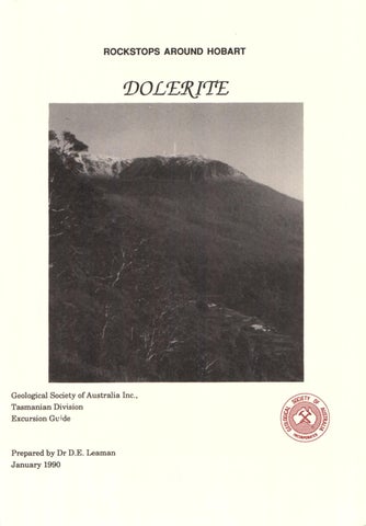
Cover photo:
2
Organ Pipes, Mt Wellington, from Ridgeway. Photograph taken from position above feeder toward continuation of dolerite sheet on the mountain.
DOLERITE OF THE HOBART AREA
INTRODUCTION This guide has been prepared for use on geological excursions organised by the Geological Society of Australia. Care has been taken, however, to use plain language terms wherever possible and to explain specific terms so that school groups and interested people generally may also benefit from it. This geological guide describes a selection of rock exposures within about 15 km of the Hobart GPO. They are representative of all aspects of Tasmanian dolerite. Dolerite is a relatively rare rock type on a worldwide basis and is seldom exposed as accessibly and impressively as in Tasmania. Only in parts of Southern Africa, the north Amazon Basin and Antarctica are similar occurrences common. Few of these can be said to be accessible. Tasmanians take this rock very much for granted - it is so common. To geological visitors used to small tabular masses or rock volumes the Tasmanian occurrences produce stunning surprise. Site descriptions and plates detail the characteristics of the dolerite; its lithological properties, its variability, its weathering, elements of the structural Jorms of the occurrences and relationships with other rocks, and its uses. The sites illustrated are representative of the features and colours of the dolerite. Some alternative sites are described for certain aspects and these may allow appreciation of character within regions and so limit the amount of travel necessary. ABOUT DOLERITE JUST WHAT IS DOLERITE? It forms the capping on Mount Wellington and is well exposed by the "organ pipes" (front cover). It is often called ironstone or bluestone locally; visiting the stops will soon explain these colour terms. It is a hard, brittle rock - especially when in fresh or blue condition. It is an igneous rock, which means that it was introduced into pre-existing rocks in a molten state at a temperature of about 1100 degrees Centigrade. This great
heat has affected those other rocks, usually sandstones, mudstones and limestones, by baking them and sometimes modifying their composition. Each dolerite mass took many thousands of years to cool (reference 4). As the molten magma cooled crystals began to form and interlock. These crystals and their arrangement give the rock its great strength. The crystals are predominantly pyroxene (augite or pigeonite, calcium and magnesium silicates), minor orthopyroxene, and plagioclase feldspar (andesinelabradorite, sodium-calcium aluminium silicates). The pyroxenes are generally brown or green in colour, the feldspars white or grey-blue. These two rock forming mineral groups account for more than 90% of the rock. Small amounts of orthoclase (potassium aluminium silicate), quartz (silicon oxide), magnetite (iron oxide) and ilmenite (iron-titanium oxide) are also present. Other minerals such as zircon may be present in trace amounts. The oxide minerals give the rock its magnetic properties. This entire group of minor minerals is known as mesostasis. When the pyroxenes are enriched in iron, the feldspars in sodium, and the mesostasis volume is significant the rock's character becomes more granitic and is then known as a granophyre. Representative analyses of the chemical composition of the dolerite are given in the table (7). The magma, when intruded in large volumes, could not cool quickly or uniformly. As a result of gradual cooling the minerals were formed in a staged way and the composition of the magma gradually changed, or differentiated. The composition and texture of the dolerite systematically changes throughout each mass of rock. Several researchers have described the systematic changes in composition, grain size and density which may occur (5,6,7). See Figure 1 (6). In general, the rock near the margins of the dolerite mass are fine grained and glassy and it is often not possible to recognise individual minerals. The grain size rapidly coarsens away from the margins and mineral crystals may be more than 2 mm long less than 15 metres away. The largest crystals, sometimes more than 10 mm long may be found in the upper third of the dolerite mass, or near the pipes which fed the magma.Early workers examining these properties and deducing the fractional crystallization process did not encounter any layering of the material within the dolerite bodies but it is now known to occur in at least one quarter of all bodies. Where layers are present they are up to one metre thick
3
D.E. LEAMAN
and the grain size is gradational within them. In such cases the entire body presents a generally mediumgrained appearance and extreme textures or differentiates such as granophyres are absent e':'en though the overall rock volume might have suggested their formation.
gealed enough to chill later pulses since boundaries between intrusions are quite common. This means that each melting-intrusion pulse was separated by at least several thousand years and perhaps millions of years. In the Hobart area there were at least 4 major pulses
Although present evidence is ambiguous it appears that the dolerite magma was generated by melting the lowest part of the continental crust of the earth beneath Tasmania - at a depth of 30 to 35 km. The Tasmanian dolerites are almost identical to those in Antarctica and the enormous melting event was related to the onset of tensions leading to the separation of the Australian and Antarctic land masses which had been part ofthe old super-<:ontinent of Gondwana, the formerly combined land mas of Australia, Antarctica, Africa, India, South America and other continental fragments.
The general form of each intrusion is suggested in Fig. 2 but the final pattern is more complex due to cross cutting by the various intrusive pulses. Intrusive slabs are commonly 300 to 400 metres thick when measured in sill or horizontal forms but vertical thickness may exceed 2 km in dyke limbs. Since the shape of the intrusions may be irregular they are called sheets. Since the material has occupied fractures opened by wedging it is possible to match features at the top and bottom of the sub- horizontal surfaces. This offsetting process is known as dilation and it enables the forms of the intrusions to be estimated even when only part of the intrusion is visible. Figure 2 shows the basic elements of most intrusions (5). Minor intrusions are not uncommon but are generally either about 15 cm, 1 to 2 m or 25 to 30 metres thick. Thickness diversity is rare.
The dolerite magma, once formed, was forced upward by the weight of the unmelted rocks above. This magma then intruded, or squeezed into, relatively flatlying sedimentary rocks. It should be noted that the melting of the original deep crust was only partial and that the volume remains occupied with less dense material than was originally present. Dating of the dolerite using methods based on the radioactive decay of elements such as Potassium to Argon (K-Ar) or Rubidium- Strontium (Rl>-Sr) ratios contained in the various minerals indicates an age of about 160 to 180 million years (3,8). Rocks of this age are termed Jurassic. The sedimentary rocks intruded are up to 100 million years older and either Permian (siltstones, limestones, mudstones) or Triassic (sandstones, mudstones, coal) in age. The intruded rocks were about 1.5 to 2 km thick at the time. The volume of dolerite can be estimated at about 1300 cubic kilometres in the area of the Hobart geological map sheet alone (1,2). The volume in eastern Tasmania was probably about 15 times this figure and it is possible that what is left today represents only half of that originally intruded. The feeding conduits which allowed transfer through the crust have been inferred to be up to 2 km long and 500 m wide from gravity and magnetic surveys (9) and to be from 1 to 10 km apart. The dolerite was not intruded in one huge pulse but as a series of massive pulses (5). Each injection had con-
4
(5) .
Jointing and fracturing of the dolerite bodies reflect the original cooling event and subsequent earth movements. Thermal joints appear to be most common, but tectonic movements may well have been distributed on some of these. Thermal joints yield columnar or prismatic platy forms and the latter are most obvious near the margins of each intrusion. The attitude of the margin is generally perpendicular to the prisms or columns. Large columns are developed well inside the intrusions and when such an intrusion is dissected by erosion these form impressive displays (for example, Mt Wellington). Many original joints are filled by low temperature minerals such as zeolites. These commonly fibrous white crystal coatings often seal the joints. Weathering or rock breakdown begins near, or is most likely at or in, the glassy fine-grained chilled margins or along fractures and joints. Discoloration or loss of strength will be noted in these locations in nearly all exposures, but eventually the entire rock is rotted where air and water have access. Fresh, massive, generally blue rock has very low porosity(< 1%) and so weathering acts always on surface skins or joint faces. The action leads to spheroidal or "onion skin" weathering where skins of crumbly rock enclose a hard kernel yet to be destroyed -a process called exfoliation.
DOLERITE OF THE HOBART AREA
269 1500
I
I ---J } ..... ,,
., ~
u,,t.11 CONTACT
um11 eoNTAGT
,, '
w <I) <I
ID 1000
,'
.
' '~
~
' I
w
>
0
ID
<I
.... 000
:,:
!2 w :,:
~·...~g.,
''
I
w
>
I
0 ID <I
.~,,
:,:
.... 500
"':,: w
\,t
:
10
I
/JI'
;;;1
!!I·
0
.... II
\
I
LOW[II
' 20
CONTAC T
,o
VOLUME
40
00
PERCENT
60
O 2.80
2.90
3.00
DENSITY
( b)
( 0)
Vertical variation in composition and densi~ of Jurassic dolerite through a thick sheet (McDougall). 0 RED HILL e TASMANIAN
00LERITES
0
MgO
Range of compositions of dilferentiates of Tasmanian Jurassic dolerite (McDougall). Oxide represented at apex is FeO.
FIGURE 1 (see references 6 and 7 for details)
5
'T]
H G}
C: ::0 t'l N
U> CD CD
.., CD ..., .., CD
DIAGRAMMATIC SUMMARY OF INTRUSION FORMS
SECT ION 1
West
0 !'Tl r m
East PELVERATA
NIERIN N.t.
CD
::,
:'
1
NOR TH WES T BAY
)>
~
0
CD
...,
)>
SECTION 2
West Mt
DIRECTION
..,
0
11,
CD
3
C'T I)) I-'·
,_.
'"'""'
U>
U A ·- L J J Oolt nh
L- Hlt
SECTION 5 O.E LEAMAN
'971
STRUCTURE
SECTIONS
J Km
~
......... I=,_
lfldc:ot ed)
z
DOLERITE OF THE HOBART AREA
The weathering process is fueled by the susceptibility of the primary minerals to corrosion by water containing dissolved oxygen and carbon dioxide. The minerals are slowly rusted or dissolved with release of calcium carbonate and iron oxides. These products change the blue-grey colour to oranges, reds, browns or yellows with deposition of globular white coatings (travertine). Eventually the entire rock mass is corroded and softened. The chemical processes are aided by temperature changes and frost action which tend to create new small fractures or wedge open older ones. Where rock faces are exposed frost action may force large blocks from the face and these may either accumulate on the slope beneath the face or creep downslope mixed with soil products. Piles of boulders may be ternled rock fields or screes. Where much soil is present, often red in colour, the material is called talus.
Tat;lc 1. Geochemical analyses or Jurassic intrusivcs
54.12 0.64 14.59 1.25 7.66 0. 18 6.59 10.57 1.95 0.88 0.10 0.05
67.29 0.83 I 1.09 3.51 5.32 0.14 0.20 3.60 2.89 3.08 0. 19
Ba Rb Sr Pb Th
224 32.5 136 6 4.0 1.0
Zr Nb
95
635 121 101 17 14.0 2.0 334 16.0 59 40 88 <I <I 1060 I 19 111
SiO1 Ti0 2
Al 10 , Fc 1Oi FeO MnO MgO CaO Na1O K,O
P10 ,
s
u
Dolerite is a tough rock and it erodes very slowly, much more slowly than any other rock in the region. This is why it caps and dominates the terrain and produces the steepest slopes. Its resilient properties suit it well as an aggregate in road making or concrete. The granophyric variety which is more susceptible to weathering and which lacks the angular crystal forms of the normal dolerite produces an excellent surface material for use on unsealed roads. Quarry working is essentially an art form in this rock since choice of the wrong site can be costly. A balance needs to be struck between the fracture spacing, the grain size, and the state of weathering in order to minimise quarry costs and working problems and to be able to offer an array of product for the market. High quality material may be used for concrete aggregate and lower grades may be used as stable fills or road surfacing "gravels". Such sites are not easily found even though the rock is common due to building, planning and environmental restrictions (10). A summary of the engineering characteristics of the dolerite has been provided in reference 11.
y
La Cc V Cr Mn Ni Cu Zn Sc Cs Nd Sm Eu Tb Ho Yb Lu Hf Ta
4.5 20 10.84 24.0 225 108 1372 78 73 79 41 1.5 13.1 3. 1 0.83 0.60 0.76 2.42 0.37 1.3 0.61
54.61 0.63 14.93 9.99(n 0. 16 6.97 10.81 1.97 0.87 0.08
0.05 157 34 125 13 3.71 82 4.0 22 8 22 97 64 46 72
11 2.9 0.79 0.70 2.17 0.32 2.56 n.f.
I. Average chilled margin compos ition for the Tasman ian dolcritcs (based on 37 samples for mosl elemen ts). Major elements determined by XRF; Sc. Cs, La, Cc, Nd, Sm. Eu , Tb. Hb, Yb, Lu , Hf, Ta, Th and U obtai ned by INAA; other trace elements by XRF; 2. A silicic differentiate from the Red Hill dyke , Tasmania . Major and trace elements determined by XRF; 3. Analysis of do lerite 3 m above the lower contact of the Basement Sill , Wright Valley, Anwc1ica. (Sample GFB S3, Thompson ,r al .. , 1983). This sample chosen because of lhe presence of trace clement data. n.f. = not found, • = not given, total as Fc 1O,. Analyst: J. M. Hergt.
m=
Some other facts and figures may be of interest. More than 1.5 million cubic metres of dolerite are quarried annually in crushed form for aggregates and up to 1 million cubic metres as fill and other grade materials within Tasmania.The dolerite weighs between 2700 and 3050 kg a cubic metre depending on composition; rocks near the margin are lightest, those about a third
7
D.E. LEAMAN
of the way up from the base of a sheet are heaviest (Figure 1). Granophyres are relatively light.The dolerite is more dense than most other materials in eastern Tasmania and this property allows use of gravity surveys in order' to define its distribution and structure (9). The dolerite is strongly magnetic since it contains a moderate percentage of iron oxides. The effect is most pronounced in the more differentiated or granophyric forms. The rock has a magnetic susceptibility of about 0.0005 to 0.005 cgs in the earth's present magnetic field . However, since the rock was cooled from high temperature through the Curie Point the minerals also preserve the effect of the magnetic field at the time of intrusion. This field was at least as strong as today's but was differently oriented. The magnetic field in Tasmanian today is oriented about 13 degrees east of north and dips at about 70 degrees. Jn the Jurassic it varied from 60 degrees west of north to about 60 degrees east of north at more than 80 degrees. This means that Tasmania was much closer to the south pole and that, in view of the occasional recording of a reversal in orientation of the rock field, the magnetic field was unstable during the intrusion period (3, 12). The strong magnetic properties allow application of magnetic surveys in order to define many aspects of the intrusions. Sound may be transmitted through the dolerite at speeds approaching 6000 metres per second. In practice transmission is usually slower and the actual speed is an indicator of rock fracturing and general quality or extent of weathering. For example the rock in Plates 8, 9, 10, 12 has a velocity of about 2000 m/s; Plates 3, 14 of 2000-2500 m/s; Plates 5, 7, 17 of 3000-3500 m/s; Plates 13, 15 of about 4000 m/s and Plates 6 and 19, in excess of 5000 m/ s. These observations make seismic refraction methods particularly useful in any appraisal of quarries, foundations or road routes since the relative costs of excavation or problem issues can be evaluated O T predicted.
More information about the sedimentary rocks intruded may be found in references 2, 5 and 9.
SrrES 1 AND 2: Park beside the emergency telephone at the Mt Nelson junction of the Southern Outlet Road. Leave the highway to reach it. Do not park on the highway. Site 1 is about 100 m toward Hobart from the telephone at the point where Proctors Road approaches the highway.Site 2 is under the overpass bridge and should only be inspected from the bridge footpath . Plates 1 and 2 are from site 1 and show the nature of the roof the the Nelson dolerite sheet. At this point the upper contact is multiple and a transgressive contact has been split by the leading wedge of another intrusion. The main sheet is near ground level. Fossiliferous mudstones of the Pennian Deep Bay Formation have been metamorphosed and are locally flinty. The roof to the intrusion at site 2 is simple but the general nature of transgressive steps is clearly exposed. The intrusion steps from bed to bed, southward. This is possible evidence, along with the orientation of the wedge at site 1, for a feeding centre to the north, in Tolmans Hill. (See discussion for sites 10 and 11 ). SITE3: Block jointing is commonly exposed and may be noticr!d at about 25 km south of Nelson Saddle on the Southern Outlet (also site 9). The jointing is generally very regular and rectangular and typical of tectonic fracturing. Large pentagonal or hexagonal joints, such as exposed in the Organ Pipes (cover) are thermal and only generated in the heart of the intrusions. Joint and fracture patterns are generally a complex mixture of thermal and tectonic features. Both typres may be seen. In this region the joints all show some evidence of weathering but fresh blue cores of dolerite are exposed in each block. SITE4: Leave the Southern Outlet at 'The Lea" sign. If travelling from Kingston proceed north on Proctors Road until the ·two roads meet at the stream diversion; if travelling from Hobart proceed south about 800 m to reach this point. Park off Proctors Road in a disused driveway.
Walk 20 m to the side of the southbound lanes of the Outlet. In the cutting very weathered,very coarse
8
8,-m ::0
~ 0 "TI --i
I m I
0
~
~ )> ::0
m
)>
D.E. LEAMAN
grained dolerite is exposed (Plate 3). Discoloration rings related to spheroidal weathering are present. Walk toward Kingston. Plate 4 illustrates the contact between the extremely coarse dolerite first seen and a dyke of moderate scale. The dyke has been intruded into a previously faulted margin of the larger intrusion. Further toward Kingston, in the same cutting, the contact between the dyke and siltstones of the Permian Ferntree Formation is exposed. All contacts can be seen in the cutting across the road but crossing the road is neither advisable nor necessary. The dyke material is very fine grained. SITE 5: The site is reached from Site 4 by walking toward Kingston along Proctors Road toward the large bend from the parking point. Variably-jointed and weathered dolerite is exposed in the low road cutting. It is typical. The joints are symmetrically weathered (Plate 5). The axis of the joint is sealed with calcite or derived products or an altered original zeolite. Some kernels of fresh dolerite in onionskin or spheroidally weathered rock can also be seen in the plate. SITE6: Junction of Proctors Road and Albion Heights Road. Coarse grained rock variably weathered and jointed. Compare with sites 3 , 5, 10, 11, 14, 22, 23, 28. SITE 7: Junction of Proctors Road and Hinman Drive. Fine grained dolerite, part of the dyke exposed at site 4, is to be found along Proctors Road below Hinman Drive. The contact between this dyke and rapidly coarsening dolerite is to be found about 100 m up Hinman Drive and is well exposed in the gutter. SITES: Northbound lanes of Southern Outlet approaching Nelson Saddle. The cutting is 500 m north of the last Proctors Road overpass. Give ample warning if stopping.
The roof of the dolerite sheet is exposed in the upper part of the cutting. The body of the cut is composed of very fresh, massive dolerite. The remnants of drill holes used to place explosive and pre-split the rock are
10
evident. This cutting represents dolerite in prime condition. Weathering of such material and faces is very slow. SITE9: Tolrnans Hill. Northbound downhill lanes of Southern Outlet. 00 NOT ATTEMPT TO STOP OR DRIVE SLOWLY.
This site is included merely to provide a sense of scale for dolerite intrusions. The entire hill, from top to bottom represents one major intrusion.The base of this intrusion is exposed in Lower Sandy Bay and the overall thickness is more than 350 metres within Mt Nelson. The thickness is greater within Tolrnans Hill since this part of the intrusion lies north east of the feeding centre and is transgressive (See notes to sites 10 and 11).
SITElO: Upper Waterworks Road. Drive uphill past entry to Council reservoirs and picnic ground to the first dolerite cutting. A steeply dipping dolerite contact is exposed beneath tree roots in the road cutting at the northern limit of the main dolerite face. Triassic sandstone and mudstone has been slightly metamorphosed, these lithologies rarely preserve the alteration, but the dolerite is chilled over a wide area. Walk uphill, following exposures either in cutting faces or roadside gutter. Exposures are freshest in the gutter. By walking uphill until in sight of the upper Ridgway reservoir systematic changes in texture and grain size may be observed. The sequence is a complement to exposures on the Southern Outlet (site 9). Plate 6 shows medium grained dolerite high on the hill. The normal variability of weathering and jointing is also evident. Plate 7 illustrates fallen blocks from unsafe joint patterns.The sequence includes some very thin dykes (1 m approx) intruded into the main intrusion. These are often indicated in vertical faces by changes in joint or weathering intensity. SITEll: Quarry at western end of Ridgway reservoir. Plate 8 shows completely decomposed dolerite at the
.
'
I :. --...:.::_,-- _%" -~f",.._
--.......J\V
7 ~4,_,, ' :f,r, ~y
~
•
....
O[
)
-
•
cjliss 'oint t:-' ~ ng f on Island
0
0 r-
0
;o
m
;:o
=l
m
-
0 ,, -I
~
I
m
I
0 0::,
> I
)>
~
ii \
)> ;:o
m
w1, ·.,
)>
> .-~,
~,j \
> l ~N(Rf.
~1i~t - -
~ttl, - :..:i--..:. \11\ ,___ •
,1
·,.11
~
_
1,
'(-i,RI/\
Vf Jd(
i'{~ .___ - '\ I ~
I
~ .
\ l
~I
~±': : .'--
•
-r Llndlsfotne Po int
IQ - ~
- '> -·
48!' · \ )llq.
'. Cortwr/
*'
t Poin t
CJ
0 rm
::0
=1 m
0 "T1
.....
I m I
M
0
ClJ
)>
·:
~ i .":
~c.j
--;.<~- ✓
' 7:,:t_-:.'. .' ~trt1_r:i;;f'.:1_\~ . ~I];jiT\ 1' _.,et~;, • •
(.J
'
·. ,
11
... ,.
~
~ )> ::0
m
)>
~
0
m Fn )>
~
> z
DOLERITE OF THE HOBART AREA
eastern end of the quarry which has retained texture and joint positions. A pick point can be driven into a soft rock mass. The material is very coarse grained and includes patches of granophyre. This site lies a little north of the principal feeding pipe for the Nelson intrusion. Dolerite has been intruded as a sub-horizontal sheet to the south (sites 1,2) and a transgressive step to the north (start of site 10) onto Mt Wellington. The transgressive northern margin of the intrusion was a pre-existing Jurassic fault (see maps). All the dolerite seen in sites 1 to 11, and on Mt Wellington, with the exception of the minor intrusions, forms part of one large intrusion.
cate and place in perspective these relationships. The large magnetic anomaly identifies the feed er and the decreasing westward gravity gradient shows that the sheet bulk occurs near Mt Nelson and that it rises out of the surface geology near this site. SITE12: Strickland Avenue, 700 m from Huon Road. Road cutting across rivulet.
Plate 9 illustrates dolerite talus derived ultimately from the dolerite capping Mt Wellington. Blocks of dolerite included in the deposit may be very large and the matrix materials (soils and clays) are often reddish orange in colour. The deposit represents collapse and creep of materials downslope.
Gravity and magnetic data in the region (Fig. 3) help lo-
FIGURE 3 Magnetic field at 1000 m above sea level defines location of Bouguer gravity field shows that most of feeder near Ridgeway. the mass of the sheet is near Mt Nelson. Also se e r e ferences 5 and 9.
15
D.E. LEAMAN
SITE13: Hobart Tip, McRobies Gully Road. Proceed to upper tip level, tum and stop at first cutting on left of road. Variably jointed and weathered dolerite is exposed beneath a very thin soil section. The soil profile is quite normal. Much of the fracturing and general disorganisation of the rock is related to the presence of a major fault beneath the centre of the gully. White soils derived from Permian Malbina Formation siltstones can be seen on the slopes across the tip. At a culvert near the entry to the lowest tip level the dolerite is very weathered and contains vein-style weathering similar to Plate 5 (site 5). There is no chilled margin and the boundary at the foot of the tip is wholly d isrupted.The displacement on the Cascades Fault, which has moved in different directions in Jurassic and Tertiary time, remains more than 1 km. SITE14: Domain cutting, Brooker Highway, from Cleary's Gates Road. Park near the Council works depot in Cleary's Gates Road . At the southern side of the intersection, or the city side, a low cutting contains much dolerite weatheringproducts introduced into weathered Triassic mudstones. The base of the Domain intrusion occurs in the floor of the Council depot quarry and at the top of this small cutting. Proceed down the footpath to the north of Cleary's Gates. Walking down the highway reveals a rapid change in texture due to the dip of the intrusion toward the east. The dip is reflected in the profile of the domain when seen from the north. This intrusion originated from a feeder beneath Lindisfame (also Rosny intrusion, sites 20 to 24). The dolerite also displays many of the weathering characteristics observed at other sites (3, 4, 5, 6, 10, 22, 23, and 28). Some variability reflects the presence of some minor transecting dykes.This cutting was completed in 1957 and much alteration has occurred locally. Many joint blocks contain fresh cores with thin weathering coatings. SITE 15: Above Otago Bay. 400 m uphill from junction of Otago Bay Road and East Derwent Highway. Large cutting. The lower part of the cutting is corn-
16
posed of weathered Triassic mudstones and shales containing some carbonaceous (coaly) material. These rocks have been disrupted (Plate 11) and are overlain by thick piles of talus which have crept downslope from Mt Direction. The talus deposit is irregular in form and partly stratified (Plate 10). The matrix varies in t'Olour from yellow to red and contains much calcite and travertine derived from dolerite weathering.The small thrust shown in Plate 11 ·is not related to talus or hillside creep but reflects horizontal displacements associated with the irregular intrusive boundary concealed near the end of the cutting. Dolerite is exposed beneath the talus in the highest cuttings in this road section.
It will be noted that it is not easy to distinguish between dolerite weathered in situ, with its relatively thin soils and included boulder fragments, and the talus deposit similarly weathered. This is a real problem for the mapper since the implications of the decision may be far reaching. If the material is termed talus and later found to be normal dolerite then the cost estimates for road cuttings may be greatly underestimated. If the opposite decision applies then the cut may be unexpectedly unstable and unsafe. The two conditions can by distinguished by magnetic surveys; the disorganisation of the rock mass by talus creep reduces the magnetic response, or by seismic surveys; the velocity of transmission in talus is typically less than 2500 m/s whereas massive rock beneath a thin soil will display values in excess of 4000 m/s. SITE16: 700 m north of site 15 on the East Derwent Highway. Similar conditions may be observed in all cuttings in this road section.
Plate 12 illustrates concentrations of travertine in deeply weathered dolerite. The rock surface is streaked white and blotches of white travertine occur irregularly. SITE 17: East end of Bowen Bridge, Dowsings Point. Pull off East Derwent Highway at bus stop on river side of road about 200 m south of the bridge/Old Beach interchange. A sub-vertical contact is exposed in the road cutting. The Triassic sandstone is weathered but some evidence
DOLERITE OF THE HOBART AREA
of thermal alteration is observable. The dolerite has been chilled. This is the north side of a dyke about 200 m wide.
river due to Tertiary and Quaternary sediment cover. SITE22: Opposite 23 Rosny Esplanade, Montagu Bay, near slipyards.
SITE18: Saundersons Road, 100 m from intersection with East Derwent Highway. Risdon Cove.
Medium-coarse grained dolerite representative of the central parts of the intrusion. Similar to Plate 6.
Continuation of the dyke seen at site 17. The southern margin is exposed. Platy joints (Plate 13) typical of many contacts are visible in the cutting.
SITE23: Rosny Point, any access from Rosny Esplanade near #61.
SITE19:
Fine to medium grained dolerite typical of lower parts of the intrusion.
East Derwent Highway at intersection with entrance to gaol (east) and Risdon Tavern (west). On gaol side of dual carriageway several complex high angle contacts may be observed with }'riassic sandstone (Plate 14). Similar features may be observed in a small quarry above the entry road to the Tavern opposite. In the quarry the intruded mudstones are markedly metamorphosed, and are hardened and show curved (conchoidal) fractures. The dyke observed trends E-W and is almost perpendicular to the principal structures in the area - a narrow elongated N- S trending graben produced by extension above the throat of the large feeder system below (see 510, section 2, Figure 2). One side of the graben may be seen about 200 m south of site 19. The dolerite is variably weathered and finely jointed. SITE20: Opposite #80, The Esplanade, Llndisfame.
Upper contact of the Domain-Rosny-Llndisfarne dolerite sheet and Permian Malbina Formation siltstone. The siltstone is extensively metamorphosed and hardened . This site is best seen at low tide. SITE21: Beneath eastern abutment of the Tasman Bridge, Esplanade, Montagu Bay.
Coarse grained massive dolerite representative of upper part of the intrusion and comparable with material at sites 4, 6, 11, 28). Good bridge foundation conditions which unfortunately do not persist beneath the
SITE24: Victoria Esplanade, Bellerive. Contact exposed between jetties near #9. The base of the Domain-Rosny dolerite is exposed in contact with Permian Ferntree Formation siltstone. The degree of metamorphism at the base of the intrusion is much less than in similar lithologies at the top (site 20).The site is best seen at low tide. SITE25:
Low cutting at Warrane Primary School, Cambridge Road. Very weathered coarse grained granophyric dolerite is exposed in the bank. The material is typical of weathered granophyres, orange-brown coloured and gravelly. The feeding centre for this intrusion is virtually beneath the site. SITE26: Flagstaff Gully Road bypass, 650 m north of the direction sign at the Mornington interchange on the Eastern Outlet Road. The roof of a large dyke is exposed. The dyke extends up the hill north of the road and intrudes Permian siltstones. Triassic sandstone is exposed on the south side of the road. The dyke is terminated at a fault already extant at time of intrusion. The dyke is traversed for some 600 m in road cuttings. SITE27: Opposite 342 Tranmere Road, Tranmere. On foreshore below road .
17
......
z
<(
~
<( LJ.J _J
u..i
ci
co
DOLERITE OF THE HOBART AREA
Sub-vertical contact between dolerite and Pennian Ferntree Formation siltstone. The dolerite coarsens markedly to the south and pockets of granophyre are visible near the radio transmitter aerial south of the housing estate. The feeder lies offshore. SITE28: Lauderdale Yacht Oub, Clarence City Council Reserve off Kirra Road, Lauderdale. This site includes an array of different features which effectively summarise the properties of dolerite intrusions. The locations are shown in Figure 4. A: On beach point near Yacht Club flag Box. Platy, near contact, jointing (Plate 15). Compare with Plate 13, site 18.
B: Irregular outline of roof of intrusion. Alternate beach exposures of dolerite and Permian Ferntree Formation siltstone. Best observed at low tide but irregular character evident at all states of the tide. C: High angle fault boundary; coarse dolerite and siltstone. This fault trends E-W. D: Coarse grained dolerite (Plate 16) spheroidally weathered with kernels of fresh dolerite standing on the beach (Plate 17). Many beach boulders are released kernels. E: Inclusions of granophyre in fine grained contact dolerite near a vertical contact with Pennian Deep Bay Formation mudstone. (Plates 18, 19). Note that large displacements are implied between the mudstone
19
D.E. LEAMAN
south of C and north of F. F: High-angle contact between dolerite and mudstone. The mudstones are the oldest rocks in this area and lie above the dolerite along the shore. The intrusion rises from beneath the bay onto Single Hill and has the form of Jin Section 1 of Figure 2. The orientation of the abrupt transgression is indicated by the platy joints at A. G: Small intrusions in the mudstone above the intrusion roof, e.g. Plate 20. This intrusion suggests all the characteristics of a full size dolerite sheet; dilatation of bedding, fracture control (splitting of a granite erratic) and general transgression. Note that the mudstone exposures are surrounded by dolerite and were disrupted and uplifted by the large intrusion beneath. Many
20
smaller concordant and discordant bodies can also be seen at this site. See also reference 5. H: Next dolerite headland to north. Many of the conditions at site E are reproduced but many of the coarser inclusions are layered. The feeder for this sheet lies beneath the bay.
SITE29:
600 m east of intersection of Proctors Road and Channel Highway, Kingston. Small quarry of Triassic sandstone wholly surrounded by dolerite. This site is of interest because it illustrates the effect of thermal metamorphism on the sandstones. The sandstone lies above a major intrusion and metamoprhism has hardened the material and imposed a
DOLERITE OF THE HOBART AREA
21
D.E. LEAMAN
cooling joint set. Both effects combine to produce a slate effect in that the rock is now readily split into leaves.
14. Dolerite, A Symposium. 1958. S.W. Carey, convenor. Univ. Tasm.
REFERENCES FOR FURTHER READING
SOME SUGGESTED TOURS, EXCURSIONS OR PICNICS
1.
Leaman, D.E., 1972. Hobart. 1:50000 Geological Map Sheet. Geological Survey Tasmania. 2. Leaman, D.E., 1976. Hobart. Explanatory Notes, Geological Map. Geological Survey Tasmania. 3. Schmidt, P.W., & McDougall, I., 1977. Palaeomagnetic and Potassium-Argon Dating Studies of the Tasmanian dolerites. Jour. Geol. Soc. Aust., 24, 6, 321-328. 4. Jaeger, J.C., 1958. The solidification and cooling of intrusive sheets: in Dolerite-a symposium, Univ. Tasm., 77-87. 5. Leaman, D.E., 1975. Form, mechanism and control of dolerite intrusion near Hobart, Tasmania. J.Geol. Soc. Aust., 22, 75-186. 6. Spry, A.H., 1962. Igneous activity. In Spry, A.H., and Banlcs, M.R., eds. The Geology of Tasmania. J. Geol. Soc. Aust., 9 (2), 255-284. 7. Hergt, J.M., McDougall, I., Banlcs, M.R., & Green, D.H., 1988. Igneous rocks: Jurassic dolerite. In Burrett, CF., and Martin, E.L., eds: Geology and Mineral Resources of Tasmania. Geol. Soc. Aust Spee. Pub!. 15, 375-381. 8. Steiger, R.H., & Jager, E., 1977. Subcommission on Geochronolgy: Convention on the use of decay constants in geochronology. In Cohee, G.V., Glaessner, M.F., and Hedburg, H.D., eds. Contributions to the Geological Time Scale. Am. Assoc. Pet. Geol. Studies in Geology. 6, 67-71 . 9. Leaman, D.E., 1972. Gravity survey of the Hobart District. Bull. Geol. Surv. Tasm., 52. 10. Leaman, D.E., 1974. Evaluation of dolerite quarry sites, Hobart area. Unpub. Rep. Dep. Mines Tasm., 1974/43. 11 . Leaman, D.E., 1973. The engineering properties of Tasmanian dolerite, with particular reference to the route of the Bell Bay Railway. Tech. Rep. Dep. Mines Tasm., 16, 148-163. 12. Green, R., 1978. Discussion: Palaeomagnetic and Potassium-Argon Dating Studies of the Tasmanian Dolerites. J. Geol. Soc. Aust., 25,365. 13. Leaman, D.E., 1978. Some thoughts on dolerite intrusions with particular reference to marginal features. Unpub. Rep. Dep. Mines Tasm., 1978/30.
22
South of Hobart1. Sites 1 to 11, 29 and possibly 12 and 13. Full day. Lunch at Waterworks Reserve. 2. Sites 10, 11. Half day. North of Hobart 1. Sites 14 to 19. Half day. Lunch at Risdon if morning start at 14. East of Hobart 1. Sites 15 to 24. Full day if walk entire Rosny foreshore. Half day otherwise. 2. Site 28. Half day. Picnic spot. 3. Sites 15 to 28. Full day. Lunch at 28. Selected sites 1. Sites 1, 2, 4, 8, either 10/11 or 14 or 20-24, 28. Full day. 2. Sites 1, 2, 4, 8, 10/11, 12, 13. Full day. 3. Sites 1, 2, 4, 8, 15, 19, (25), 28, 24. Full day.
CLASSIFICATION OF SITES BY NATURE OF FEATURES PRESENT Grain size or composition variation Sites 10 to 11, 14, 20 to 24. Exb·eme differentiates - 4, 11, 22, 25. Primary intrusion shapes Roof of sheet: 1, 2, 8, 20, 26, 28. Bottom of sheet: 10, 24. Discordant edges: 1, 4, 7, 10, 17, 18, 26, 27, 28. Minor intrusions: 1, 4, 7, 28. Metamorphism Triassic sandstone: 29. Triassic mudstone: 19. Pennian Femtree Formation: 20, 24. Permian Deep Bay Formation: 1, 28.
DOLERITE OF THE HOBART AREA
Range of weathering properties Partial: 3, 5, 6, 10, 21, 26, 28. Spheroidal: 4, 5, 10, 11, 14, 21, 22, 28. Extreme: 4, 11 . Coatings: 13, 15.
3.
Risdon Cove. Site of first settlement in Hobart area. Passed between sites 17 and 19.
4.
Waterworks Reserve. Picnic site. Original waterworks. If continue inspection of dolerite from site 11 toward Huon Road see old stone flumes and other works.
Derived products Talus: 12, 13, 15. 5. Jointing effects and patterns Jointing and weathering: 3, 5, 10, 14, 17, 22, 26, 28. Platy jointing: 18, 28.
Cascade Brewery. Passed in driving from 12 to 13. Near 13.
6.
Lauderdale picnic site, 28.
Sense of inbusion scale - 9, 10, 14, 20 to 24.
7.
Some possible excursions allow use of both Tasman and Bowen Bridges to cross River Derwent.
SCENIC OR IDSTORIC POINTS 1.
Mt Nelson lookout. Continue on Mt Nelson after leaving highway to vjsit sites 1 and 2.
2.
Shot Tower. Continue back to Hobart via Channel Highway after visiting site 29.
:
/
/ I
I
M i t'I.O+ it\iMJtiOf\~
I
( f\
I
"'vo.sto"t/ r,Htto"•
\
"'Pd-Mia.n
~z~
I
A ( b..1oui 51... ~ co,,hol.)
y o.r.,\..tb Cv ?o..t-l<,l\~O..lt4.
FIGURE 4
Detail of Lauderdale.
localities
des c ribed
at
site
28,
Singl e
Hill,
23
' ',,, ... ~ ; ' \ , ' --'¥,<- -
- Pm
r \
' Jdl
•\ P<\ I ,
'iI
....J
I
~ ..... ,c li Po,nt ~
:I:
z
<(
et:: E-<
z
<(
et:: et:: <(
3:
0 12
- - - -- · I ~ .,, I -~ "'" ... j::o,
)(<D'7 "'\ '
r,onm,,. Po, lS
,_ z~-
.,.- ... , I
,
(D '
})
.....
I
1
/