Landscapes around Canberra -
a geological excursion for students of all ages
State Circle
Rock outcrops around Canberra tell us about the early history and evolution of the region’s landscapes.

Rock outcrops around Canberra tell us about the early history and evolution of the region’s landscapes.
The landscapes around Canberra had their origins over 400 million years ago during the Paleozoic geological era on the margins of the supercontinent called Gondwana. Since those formative years the landscapes have been shaped and deeply eroded to reveal the rocks we now see at outcrops around Canberra.
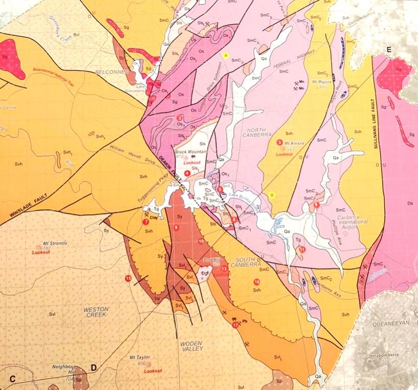
Simplified geology extract from — Geological Map of the ACT, 2008.

This publication was compiled for the ACT Division, Geological Society of Australia, by Douglas Finlayson.
443.8 Ma
Late Ordovician
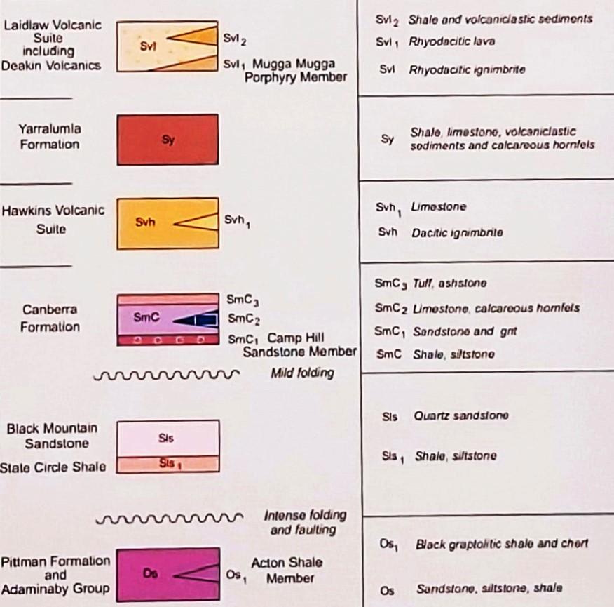
The Canberra region is in the southeastern part of the Lachlan Orogen (or Lachlan Fold Belt), a geological province that stretches from near South Australia to the Australian southeast Tasman Sea coast.
During the Paleozoic era this province was subjected to major orogenic (mountain building) events, the Benambran Orogeny
Phase 1 (444-440 Ma) and Phase 2 (431-428 Ma) and the Tabberabberan Orogeny (about 400—370 Ma).
Ma = million years ago
Paleogeography
480 million years ago
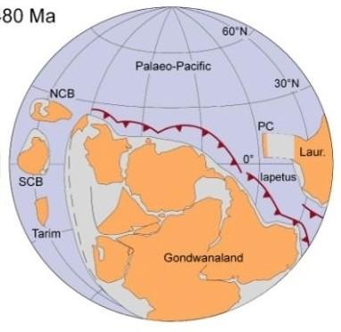
During the early part of the Paleozoic era Australia was part of the Gondwana supercontinent that also included India, Antarctica, Africa, and South America.
Australia was surrounded by warm waters north of the Equator. The Paleo-Pacific Ocean lithospheric plate was colliding with Gondwana and there were subduction zones, with associated volcanoes and earthquakes, dipping under its AustraliaAntarctica-South America margins, much like the tectonic processes happening today under Japan and Indonesia.
420 million years ago
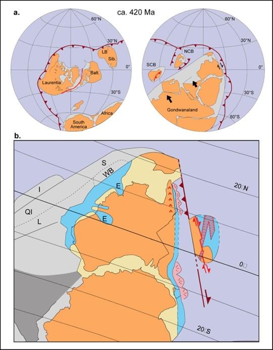
During the later part of the Paleozoic era, during the Silurian geological period, Australia was still part of the Gondwana supercontinent and still at tropical latitudes with the Paleo-Pacific Ocean lithospheric plate still colliding with Gondwana with consequent subduction zones, volcanoes and earthquakes.
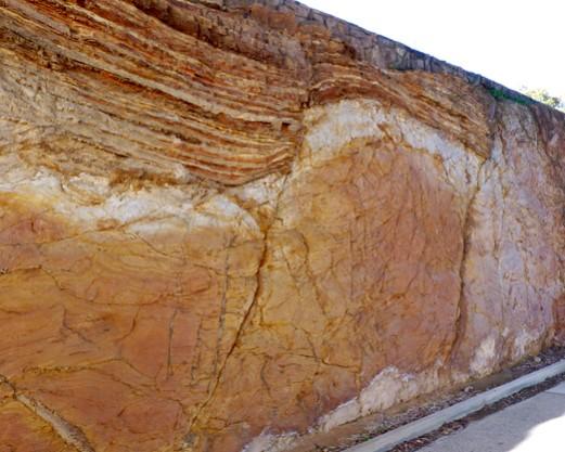
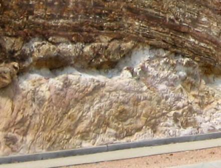
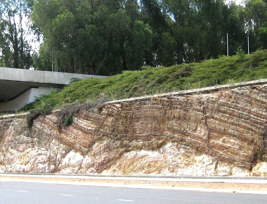
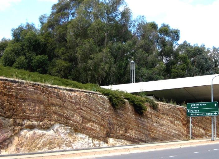
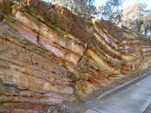
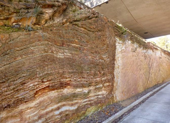
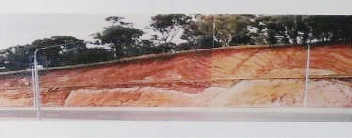
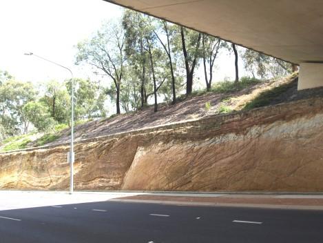
The structural unconformity exposed in this road cutting through Federation Mall between Old Parliament House and the present-day Parliament House separates the Camp Hill Sandstone deposited about 425-428 million years ago (Ma) and the underlying older State Circle Shale deposited about 435 million years ago (Ma). Both formations belong to the Silurian geological period.
Close examination of the older shale indicates that it was folded, uplifted and eroded before the sandstone was deposited on top. Subsequent tectonic events have folded and fractured/faulted the sandstone sequencies.
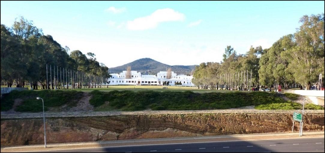
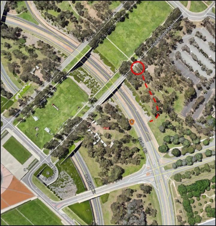
The State Circle road cutting is most easily accessed by parking ( 2 hour free parking on the road) on Federation Mall facing Parliament House and walking through parkland down to the pedestrian sidewalk beside the road.
Follow the road cutting towards Civic and examine the rock face.

The relationship, shown by discordance between the layers in the two geological unitswithin the State Circle road cutting and which geologists call an unconformity, represents a break in sedimentation in middle Silurian times and the transition between two major tectonic cycles across southeast Australia, the Benambran Tectonic Cycle (about 490-428 Ma), and the younger Tabberabberan Tectonic Cycle (about 428-385 Ma). It is thought that the duration of the mid-Silurian break could have been several million years.
The State Circle Road Cutting is a heritage-listed site.
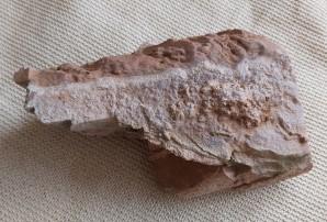
Graptolite fossils (Monograptus exiguous) have been excavated from the State Circle Shale.
The Camp Hill Sandstone (a Member of the Canberra Formation) is fossiliferous, containing corals, trilobites, and brachiopods.
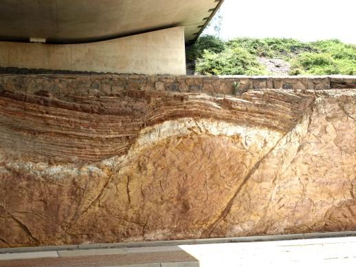

Under the Parliament House building as well as along the State Circle road cutting there is a clear break between an outcrop of Camp Hill Sandstone, 422-433 million years old and underlying Black Mountain Sandstone, the same age as State Circle Shale, 430435 million years old , indicating a dramatic structural boundary between two major tectonic cycles.
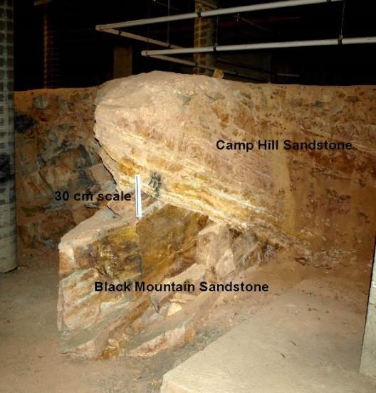
Camp Hill Sandstone
Black Mountain Sandstone
Not open to the public.
Further information on all geoheritage sites around Canberra can be downloaded from the Geological Society of Australia web site—
https://www.gsa.org.au/Public/Geoheritage/ and look for ACT Sites and Maps on the pulldown menu.