Landscapes around Canberra -
a geological excursion for students of all ages
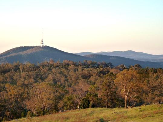
Black Mountain
Rock outcrops around Canberra tell us about the early history and evolution of the region’s landscapes.

Rock outcrops around Canberra tell us about the early history and evolution of the region’s landscapes.
The landscapes around Canberra had their origins over 400 million years ago during the Paleozoic geological era on the margins of the supercontinent called Gondwana. Since those formative years the landscapes have been shaped and deeply eroded to reveal the rocks we now see around Canberra.
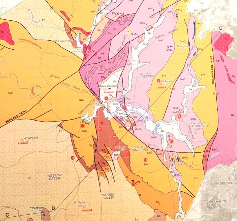
Simplified geology extract from — Geological Map of the ACT, 2008.

publication was compiled for the ACT Division, Geological Society of Australia, by Douglas Finlayson.
443.8 Ma
Late Ordovician
The Canberra region is in the southeastern part of the Lachlan Orogen (or Lachlan Fold Belt), a geological province that stretches from near South Australia to the Australian southeast Tasman Sea coast.
During the Paleozoic era this province was subjected to major orogenic (mountain building) events, the Benambran Orogeny
Phase 1 (444-440 Ma) and Phase 2 (431-428 Ma) and the Tabberabberan Orogeny (about 400—370 Ma).
Ma = million years ago
480 million years ago
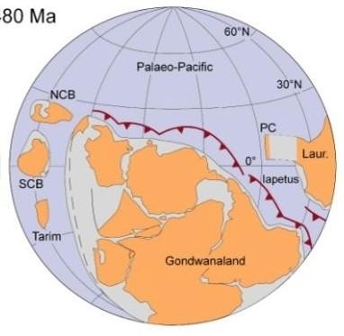
During the early part of the Paleozoic era Australia was part of the Gondwana supercontinent that also included India, Antarctica, Africa, and South America.
Australia was surrounded by warm waters north of the Equator. The Paleo-Pacific Ocean lithospheric plate was colliding with Gondwana and there were subduction zones, with associated volcanoes and earthquakes, dipping under its AustraliaAntarctica-South America margins, much like the tectonic processes happening today under Japan and Indonesia.
420 million years ago
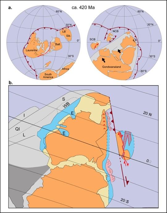
During the later part of the Paleozoic era, during the Silurian geological period, Australia was still part of the Gondwana supercontinent and still at tropical latitudes with the Paleo-Pacific Ocean lithospheric plate colliding with Gondwana and with consequent subduction zones, volcanoes and earthquakes.
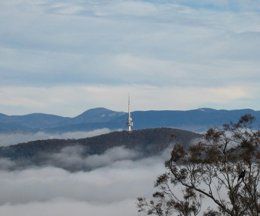
Black Mountain is a prominent feature of the skyline in central Canberra. Topped by the communications tower, restaurants and viewing platforms, it is the feature that visitors look for when approaching the city from north or south and is visible from the Brindabella Mountains and other summits around the city.
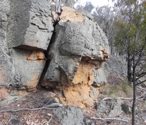
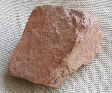
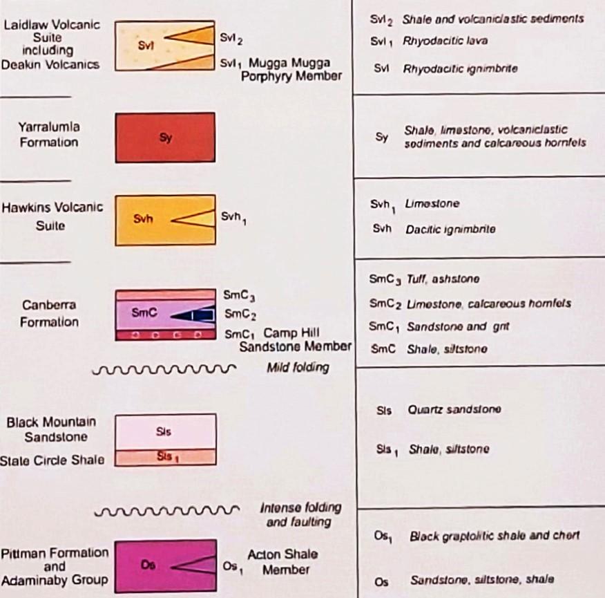
The summit rocks comprise outcrops of Black Mountain Sandstone, a grey-red, medium to fine-grained quartz sandstone with subordinate grey shale interbeds which shows a wide variety of sedimentary structures. The Black Mountain Sandstone is estimated to exceed 800 metres in thickness.
The Black Mountain Sandstone was deposited in a shallow marine environment on the margins of Gondwana about 438433 million years (Ma) ago towards the end of a major Silurian tectonic cycle, the Benambran Tectonic Cycle, identified across southeast Australia in the period about 490-428 Ma. Towards the end of the Benambran Tectonic Cycle there were two orogenic (mountain building) events, the Benambran Orogeny Phase 1 (about 444-440 Ma) and the Benambran Orogeny Phase 2 (about 431-428 Ma). The Black Mountain Sandstone was deposited in the time between these two orogenic events.
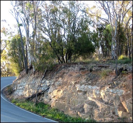
A road cutting on the summit road leading from Clunies Ross Drive near the National Botanical Gardens is the type locality of the Black Mountain Sandstone.
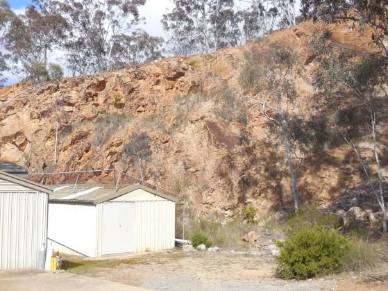
A quarry on the eastern side of the mountain has in the past provided building stone for buildings around Canberra, including St Johns Church on Constitution Avenue near Anzaac Parade. The quarry is now used by the Australian National University for laboratories away from electrical interference.
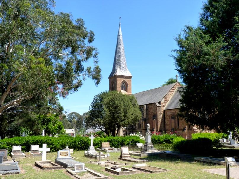
The foundation stone for St Johns Anglican Church near Anzaac Parade was laid on 11 May 1841 on land donated by Robert Campbell the grazier and owner of the Duntroon estate. It was completed in May 1844 and concecrated in 1845.
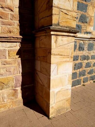
Black Mountain Sandstone was used in the construction along with bluestone (Mount Ainslie Volcanics) from nearby Mount Pleasant.
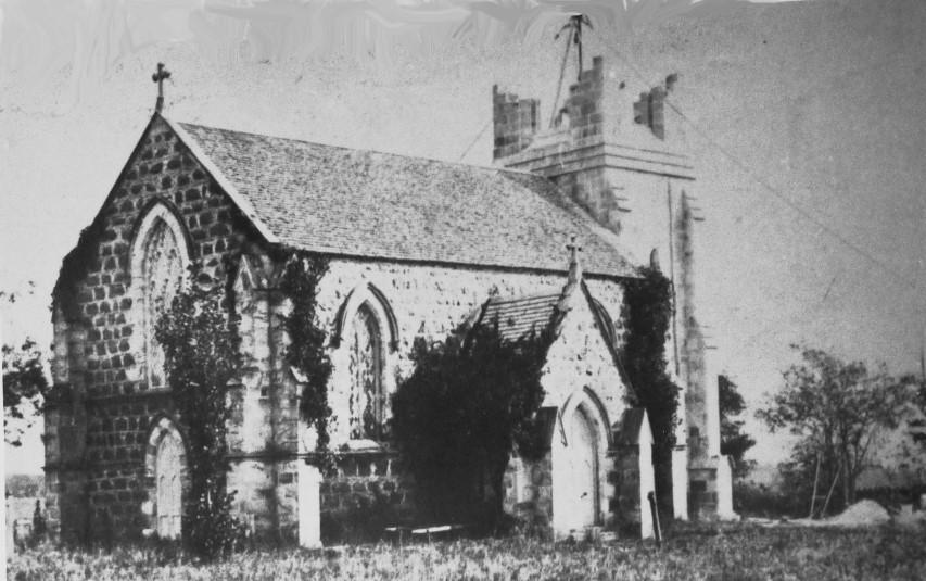
St Johns Anglican Church, Reid, during the construction of the current spire, 1865-70.

Canberra landscape painting submitted by Theodore Penleigh Boyde as part of the 1912 design competition for the city. St Johns Church is in middle right of the painting.
(Parliament House Art Collection)
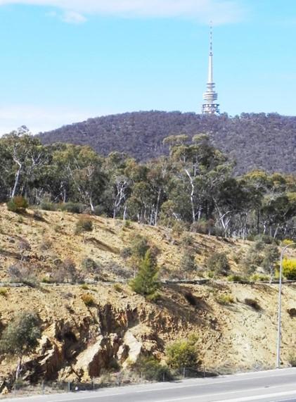
Pittman Formation outcrop on the side of Caswell Drive.
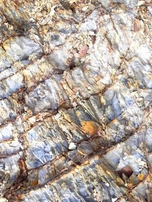
The basement rock unit underlying the Black Mountain Sandstone is the Pittman Formationthat we can now see prominently in the road cutting along Caswell Drive on the western side of the Black Mountain Nature Reserve, the oldest rock unit in the Canberra region. The formation comprises Ordovician tubiditic sediments (siltstone, shale) deposited from Gondwana into a deep ocean basin.
Microfossil conodont fauna (Middle Ordovician Llanvirnian age [mid-to-late Darriwilian], 464-458 Ma) have been recovered from the formation. The tectonic history of the region indicates that Black Mountain is the oldest hill of the presentday Canberra region landscape.
Acton Shale member of the Pittman Formation outcrop on the side of Caswell Drive near Belconnen Way overpass.
Further information on all geoheritage sites around Canberra can be downloaded from the Geological Society of Australia web site—
https://www.gsa.org.au/Public/Geoheritage/ and look for ACT Sites and Maps on the pulldown menu.