Landscapes around Canberra
- a geological excursion for students of all ages
Acton Peninsula
Rock outcrops around Canberra tell us about the early history and evolution of the region’s landscapes.

Acton Peninsula
Rock outcrops around Canberra tell us about the early history and evolution of the region’s landscapes.
The landscapes around Canberra had their origins over 400 million years ago during the Paleozoic geological era on the margins of the supercontinent called Gondwana. Since those formative years the landscapes have been reshaped by geological processes and deeply eroded to reveal the rocks we now see around Canberra.
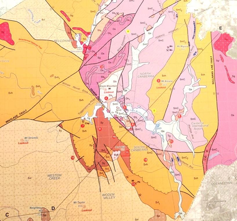
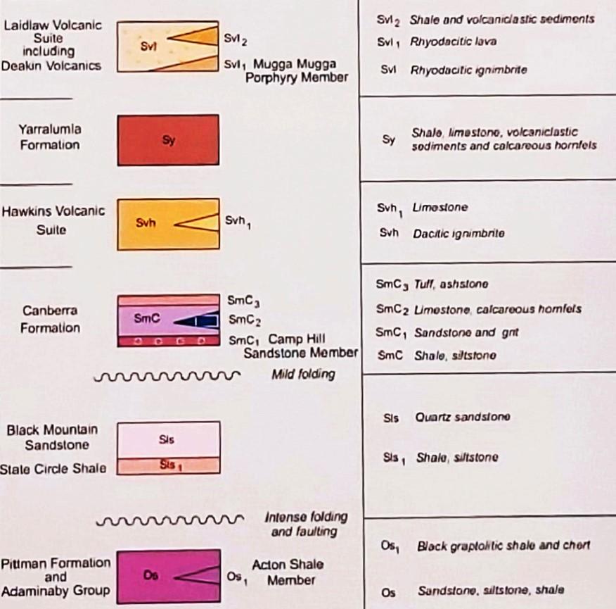
Simplified geology extract from — Geological Map of the ACT, 2008.

This publication was compiled for the ACT Division, Geological Society of Australia, by Douglas Finlayson.
443.8 Ma
Late Ordovician
The Canberra region is in the southeastern part of the Lachlan Orogen (or Lachlan Fold Belt), a geological province that stretches from near South Australia to the Australian southeast Tasman Sea coast.
During the Paleozoic era this province was subjected to major orogenic (mountain building) events, the Benambran Orogeny
Phase 1 (444-440 Ma) and Phase 2 (431-428 Ma) and the Tabberabberan Orogeny (about 400—370 Ma).
Ma = million years ago
Paleogeography
480 million years ago
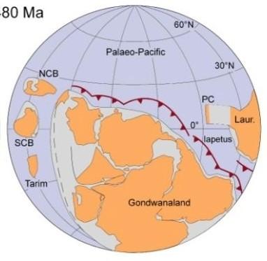
During the early part of the Paleozoic era Australia was part of the Gondwana supercontinent that also included India, Antarctica, Africa, and South America.
Australia was surrounded by warm waters north of the Equator. The Paleo-Pacific Ocean lithospheric plate was colliding with Gondwana and there were subduction zones, with associated volcanoes and earthquakes, dipping under its AustraliaAntarctica-South America margins, much like the tectonic processes happening today under Japan and Indonesia.
420 million years ago Silurian
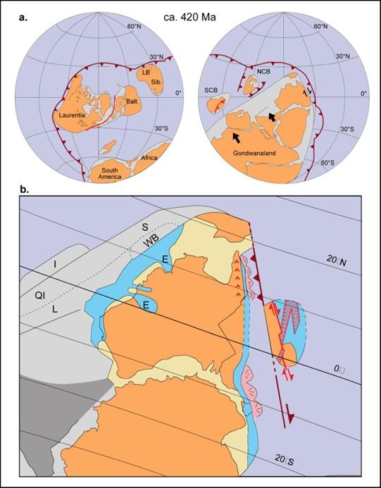
During the later part of the Paleozoic era, during the Silurian geological period, Australia was still part of the Gondwana supercontinent and still at tropical latitudes with the Paleo-Pacific Ocean lithospheric plate colliding with Gondwana and with consequent subduction zones, volcanoes and earthquakes.
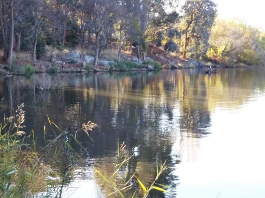
The National Museum of Australia is the principal building on Acton Peninsula near the centre of Canberra. The foreshores of Lake Burley Griffin around the peninsula largely conceal an interesting geological history that includes limestone outcrops. They, together with others now submerged under the waters of Lake Burley Griffin, are thought to have led to the 19th century name for the region“Limestone Plains” after their discovery by the first Europeans to reach the area in early December 1820, Charles Throsby Smith, Joseph Wilde and James Vaughan, who had crossed from Lake George.
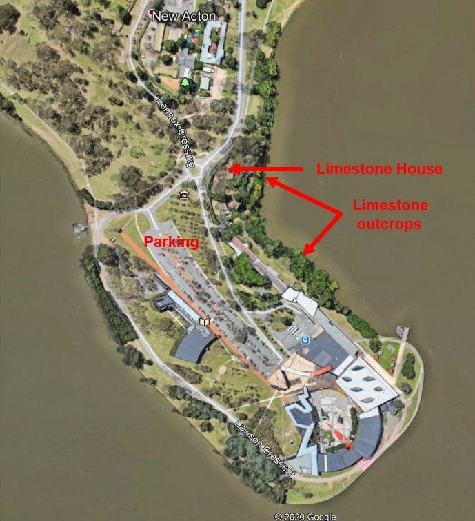
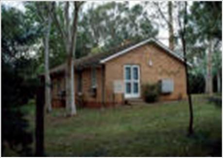
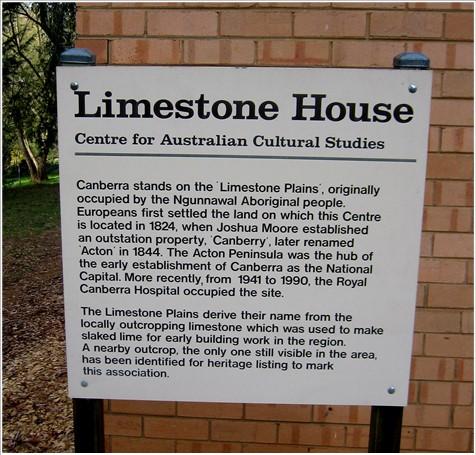
Limestone House is a single storey brick former Isolation Ward building, a significant component of a group of buildings of the former Royal Canberra Hospital complex that operated for the benefit of the Canberra community over a period of five decades. .
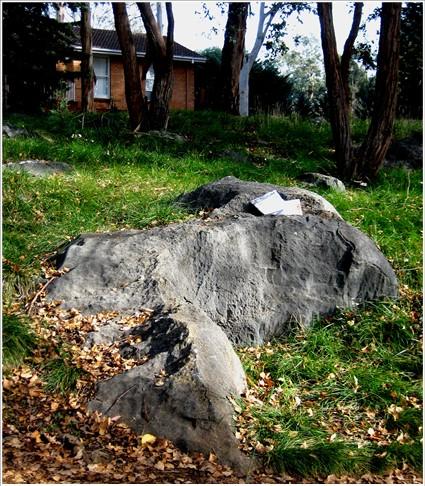
Low outcrops of dark grey, recrystallized limestone are present along the foreshore of Acton Peninsula. Bedding is indistinct but gives the impression of dipping to the south-west at about 45°. The exposures, which extend for about 80 to 100 metres along the shore of the lake, show several karst solution features, particularly rillenkarren (sharp water weathering grooves). Macrofossils (corals) have been found but difficult to see.
The limestone has been described informally as Acton Limestone within the Canberra Formation (428-425 Ma) that also includes collectively other limestones found at shallow levels along Northbourne Avenue near the ABC building, on Mount Majura, near Dairy Road in Fyshwick, under the Treasury Building, and at the Cotter Recreation Area west of Canberra.
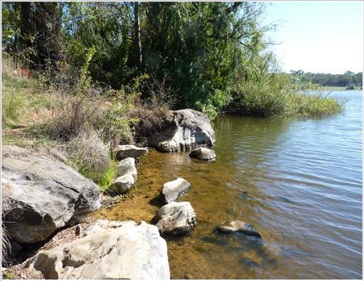
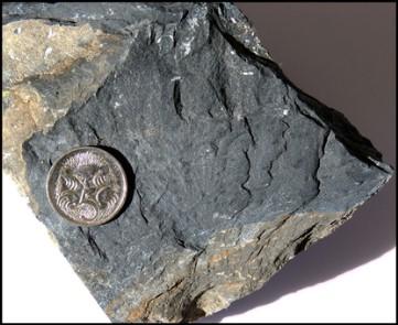
This is the only accessible good exposure of limestone in the suburban part of Canberra and is heritage listed. It is also of importance as the only significant limestone outcrop locality within the Canberra Formation, a unit which is known to contain a large amount of limestone and much of which is now under the lake or is only known from drill core.
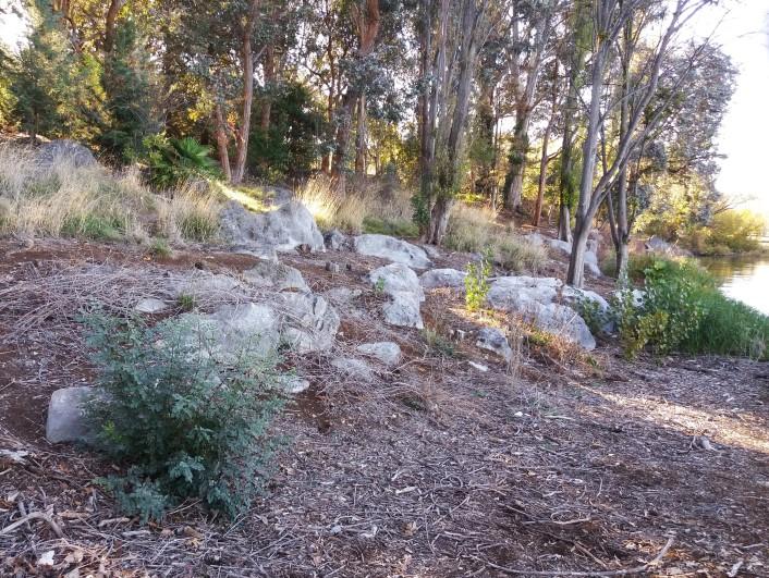
at the Cotter Recreation and Picnic Area west of Canberra.
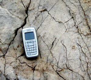
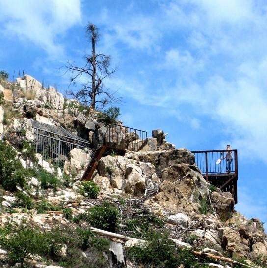
The Acton limestone was used as a rock source for the production of building mortar in lime kilns from the earliest days of European settlement. During the development of the city of Canberra there were lime kilns at Acton Peninsula. A survey of the limestone resource was conducted by Taylor and Mahony in 1913.
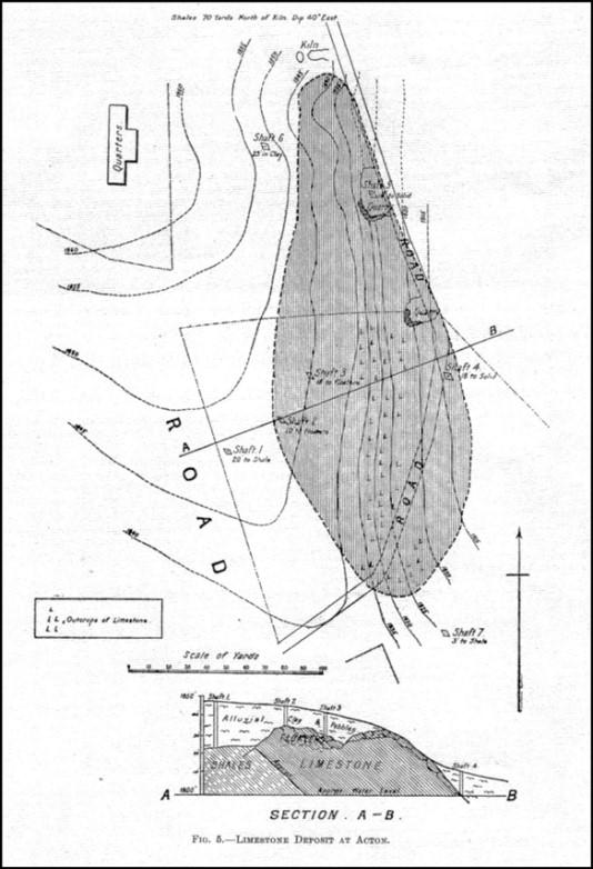
Taylor and Mahony 1913 map of the Acton Peninsula limestone resource.
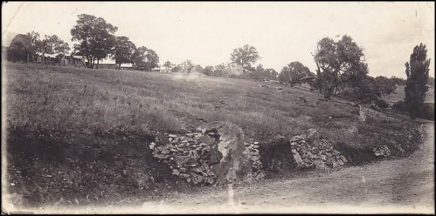
1930’s photo of lime kilns along now Lawson Crescent with now ANU buildings in the background. Photo – Allan Mawer
Limestone rock has been encountered in drillcore acquired during the construction of buildings around Canberra. Within the Parliamentary Triangle the foundations for the Treasury Building encountered voids in limestone that required significant engineering changes to eliminate building collapse.
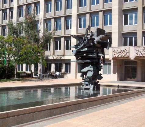
Treasury Building in the Parliamentary Triangle

Best and Henderson, 1968.
Note Riverside Formation now = Canberra Formation
Richly fossiliferous limestone has also been encountered during foundation drilling work associated with buildings in Fyshwick near Dairy Road.
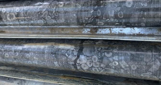
Limestone is a carbonate rock (mostly calcium carbonate). Most carbonate rocks result from the accumulation of bioclasts created by calcareous organisms. Therefore carbonate rocks originate in areas favouring biological activity i.e. in shallow and warm seas in areas with little to no siliciclastic (quartz, sand) input eroded from land areas. The eastern part of the Australian continent was at tropical latitudes for a long time during the Paleozoic geological era including the Cambrian, Ordovician, Silurian, Devonian and Carboniferous periods, from about 500 to 300 million years ago. Consequently limestone outcrops around Canberra should come as no surprise.
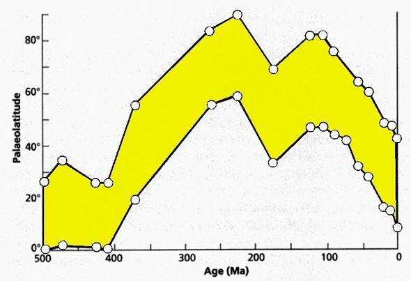
Paleolatitude of continental Australia throughout geological time. Geology of Victoria
There are limestone outcrops throughout the wider Canberra region, both to the north and to the south of the city.
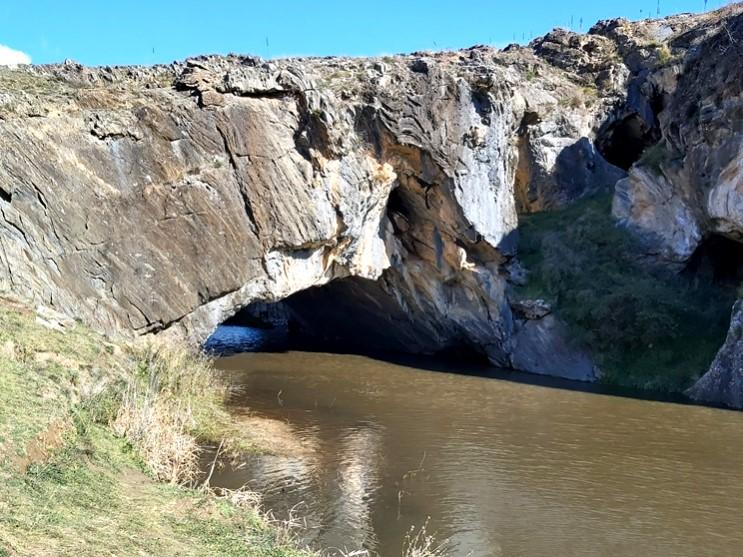
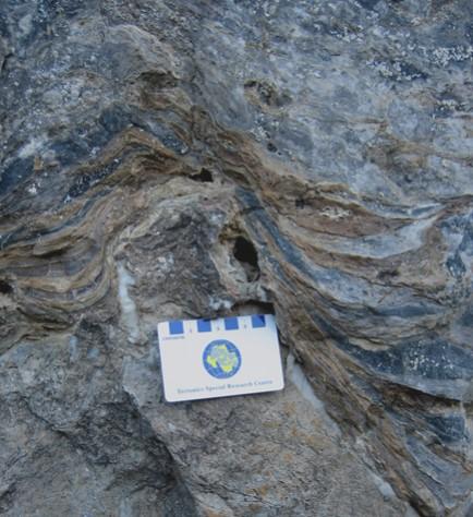
To the south of Canberra, London Bridge is a natural limestone arch which developed as a meander cut-off on Burra Creek that flows into the Googong Reservior. The limestone which contains the arch and caves is a small lens (about 50 metres by 150 metres) developed in the Late Silurian Cappanana Formation. In the area of London Bridge the Cappanana Formation consists mainly of shale and siltstone with local limestone lenses (deposited about 427—423 million year ago).
To the north of Canberra near the town of Yass and the Burrunjuck Reservior, lies the village of Wee Jasper where world-famous placoderm fish fossils have been found.
As continents gathered together in low latitude regions during the Devonian geological period, large warm epicontinental seas opened new ecological niches rapidly colonized by a range of marine species amongst them: gastropods, brachiopods, corals, cephalopods and fishes. Hence the name for the Devonian period—the Age of Fishes.
The deposition of the Taemas Limestone sequences in the Wee Jasper region occurred during the Devonian geological period about 407-393 Ma ago in a warm shallow-marine environment.
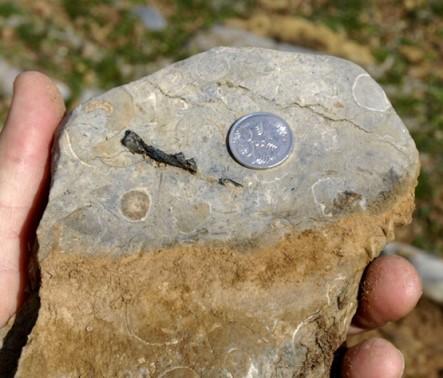
Coral heads are well preserved.
Armour plate scull fragments of placoderm fish are preserved in limestone.
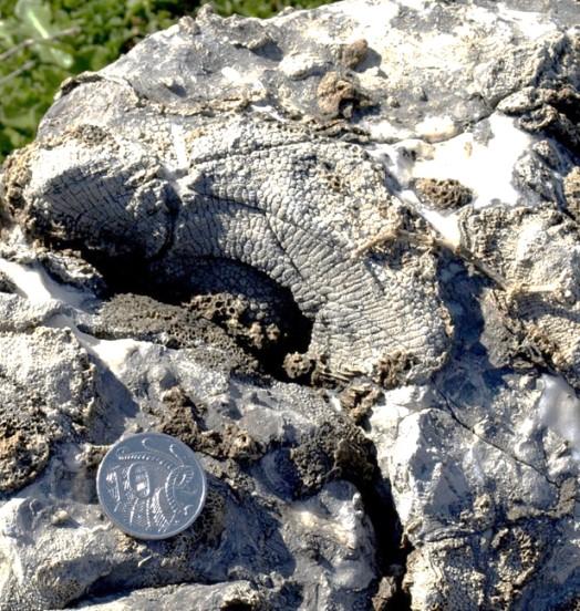
Near Wee Jasper the regional Devonian limestones are well exposed. The structure is simple. At Wee Jasper most of the rocks dip westerly forming a limb of a major anticline, the Taemas Anticline, separating Wee Jasper from the more complexly folded Taemas Formation to the east.
Because of the simplicity of the structure, the Wee Jasper area is an obvious place to study the evolution of a regional shallow sedimentary basin that developed during the Early and Middle Devonian. The area has been the focus for significant palaeontology research at the Australian National University, Canberra, and elsewhere for many years.
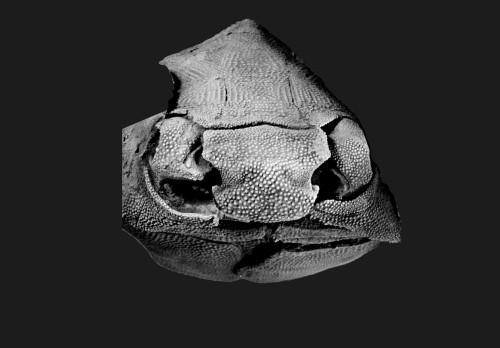
Altogether 45 genera of fishes have been described from all the limestones in the Early Devonian sequences (416-398 Ma) in the Wee Jasper area. There is no doubt that these specimens make the world’s best contribution to our understanding of the evolution of the armoured fishes (placoderms) and the first bony fishes.
The importance of the research at Wee Jasper cannot be overemphasized. The Early Devonian period was a time when some fish were beginning to develop anatomical features that would eventually enable them to develop limbs and breathe with lungs, and thus survive on land.
The bony external skeleton of the placoderm fish Buchanosteus from Early Devonian limestones at Burrinjuck, NSW (about 400 million years old).
(Photo—Gavin Young)
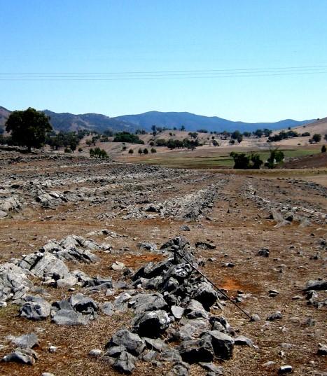
Near Taemas Bridge over the Murrumbidgee River.
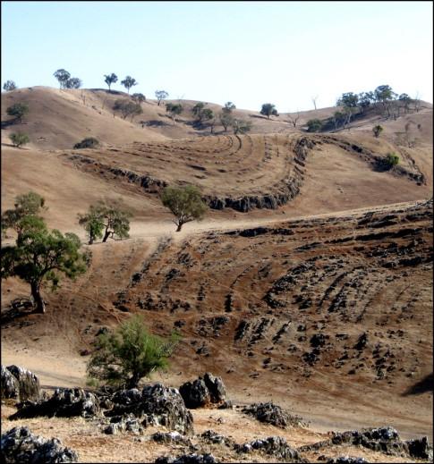
Limestones near Taemas Bridge were deformed during four episodes of folding during the Early Carboniferous Kanimblan Orogeny (about 340 Ma).
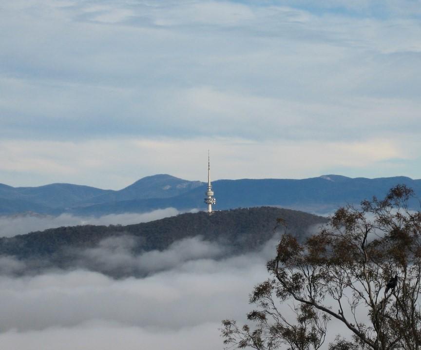
Further information on all geoheritage sites around Canberra can be downloaded from the Geological Society of Australia web site—
https://www.gsa.org.au/Public/Geoheritage/ and look for ACT Sites and Maps on the pulldown menu.