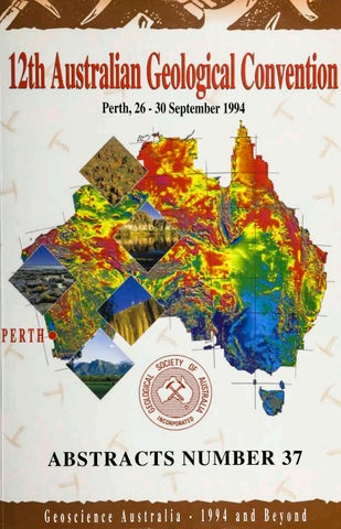
Perth, 26 • 30 September 1994
ABSTRACTS NUMBER 37 Geoscience Australia • 1JM and Beyond
Geological Society of Australia
ABSTRACTS Number 37
GEOSCIENCE AUSTRALIA -1994 AND
12th Australian Geological Convention 26-30th September 1994 The University of Western Australia Perth, Western Australia
GEOLOGICAL SOCIETY OF AUSTRALIA, ABSTRACTS NO. 37 12th Australian Geological Convention, Perth September 1994
Example citation for paper in this volume: Freeman, M.J., Watling, R.J., and Herbert, H.K. 1994. Karpa Spring - the Department of Minerals and Energy of Western Australia's role in a criminal fraud investigation. Geological Society of Australia Abstracts Vol.37: 120-121
Published by the Geological Society of Australia Incorporated. 301 George Street, Sydney, NSW, Australia 2000
1994
ISSN 0729-01IX Printed by: Optima Press, 33 Kensington Street, East Perth, WA 6004
ii
GEOLOGICAL SOCIETY OF AUSTRALIA, ABSTRACTS NO. 37 12th Australian Geological Convention, Perth September 1994
GEOLOGICAL SOCIETY OF AUSTRALIA Office Bearers 1992-1994 President
Mr. Peter Legge
Vice Presidents
Prof David Groves Dr. W. Hall
Honorary Secretary
Dr. Alison Ord
Honorary Treasurer
Mr. Peter Pritchard
Honorary Editor
Dr. Tony Cockbain
Honorary Administrative Officer
Dr. J. Hunt
Honorary Promotions Officer
Mr. Gerhard Krummei
Councillor-Executive Division
Mr David Moore
12TH AUSTRALIAN GEOLOGICAL CONVENTION Organising Committee General Convenor
Dr. Nick Archibald
Secretary
Prof. Simon Wilde
Treasurer
Dr. Peter Collins
Program: Oral Convenor
Dr. John Scott
Digital Convenor
Dr. Rod Hammond Dr. Simon Cox
Poster Convenor
Dr. John Long Dr. Alex Bevan
Excursions
Dr. Tim Griffin
Core and Rock Display
Mr. Mick Elias
Exhibition
Dr. Don Pridmore Mrs Heather O'Rafferty
Sponsorship co-ordinator
Dr. Mike Donaldson
Abstracts Editor
Mr. Mike Freeman
Publicity
Dr. Neal McNaughton
Secretariat
Dr. Sue Ho
Committee members
Prof. David Groves Dr. Alison Ord Dr. William Power
Administration
Ms. Jocelyn Thompson
in
GEOLOGICAL SOCIETY OF AUSTRALIA, ABSTRACTS NO. 37 12th Australian Geological Convention, Perth September 1994
SPONSORSHIPS Grateful acknowledgement is given by the Geological Society of Australia and the Organising Committee of the 12th AGC for the generous support provided by the following organisations:
MAJOR Australian Laboratory Services CRA Exploration Delta Gold Geoconferences Guardian Resources Newcrest Mining North Exploration Sons of Gwalia Western Mining Corporation
BHP Minerals CSIRO (Div. of Exploration and Mining) Drillcorp Great Central Mines Kalgoorlie '91 Conference Normandy Exploration Samantha Gold Western Australian Petroleum Wiluna Mines
SPONSORS Aberfoyle Resources Afmeco Amdel Laboratories Aurora Gold Dominion Mining Forrestania Gold Geol. Soc. Aust. (Qld Div.) Geol. Soc. Aust. (WA Div.) Herald Resources Lac Minerals MIM Exploration North Flinders Mines Pasminco Exploration Plutonic Operations Reynolds Australia Metals Sipa Resources Zapopan
Acacia Resources AGSO Ansett Australia Aztec Mining Eyres Reed Gasgoyne Gold Mines Geol. Soc. Aust. (SA Div.) Geol. Soc. Aust. Spec. Group in Eco. Geol. Homestake Australia Leader Resources Mt Burgess Gold Mining Co. Pancontinental Mining Placer Pacific Resolute Resources RGC Exploration University of WA (Dept. Geol., Geophys; Key Centre in Strategic Minerals)
SUPPORTERS Australian Institute of Geoscientists Perth Convention Bureau Yilgarn Star
Geol. Soc. Aust. Spec. Group in Sedimentology
v
GEOLOGICAL SOCIETY OF AUSTRALIA, ABSTRACTS NO. 37 12th Australian Geological Convention, Perth September 1994
FOREWORD The Organising Committee of the 12th Australian Geological Convention would like to extend its gratitude to all individuals and organisations who have made Geoscience Australia -1994 and Beyond possible. In particular, the Editor of this volume thanks the many contributors, individuals and organisations for help provided in its preparation and, most especially, the Geological Survey of Western Australia for its help in supplying essential resources. Abstracts in this volume appear in alphabetical order of the primary author's surname, with the exceptions that a group of short abstracts follow the main group and then sevaral late submissions conclude the collation. The underlined author's name indicates the presenter as proposed at the time of submission of the abstract.
Mike Freeman Abstracts Editor
GEOLOGICAL SOCIETY OF AUSTRALIA, ABSTRACTS NO. 37 12th Australian Geological Convention, Perth September 1994
CONTENTS Page vii
List of abstracts Abstracts
\
List of subject groups
505
Index of abstracts in subject groups
506
Author index
520
LIST OF ABSTRACTS Page Abbott, Stephen T.; Transgressive sequence architecture of Pleistocene cyclothems, Wanganui Basin, New Zealand
1
Adams, Garry; James, Pat; Both, Ross; Structural evolution of the Proterozoic Granites Gold Mine, Northern Territory
3
Ahmad, Masood; Fluid inclusion and stable isotope studies of the tin and tantalum bearing pegmatites on the Bynoe area, Pine Creek Geosyncline, Northern Territory
5
Ahmad, Raisuddin; Hostetler, Paul Blair; A modified model for the formation of primary dolomite in the Coorong region of Southeast South Australia
6
Anand, R.R.; Smith, R.E.; Classification, origin and geochemistry of laterites and ferruginous regolith materials in the Yilgarn Craton: Implications for exploration
7
Andrew, Anita; Whitford, David J.; Talent, John A.; Mawson, Ruth; Hamilton P.Joe, Mid-Palaeozoic mass extinction events: Isotopic correlation between Australia and Europe
9
Arakel, Aro V.; Hongjun, Tian; Hanna, Rifaat G.; McConchie, David M.; Mora, Surendra; Jones, David; Blake, Steve; Stephens, Kerryn; Sediment quality in Australian river basins: A compartmental approach to assessing controls in regional variation in sediment quality
10
Archbold, N.W.; Shi, G.R.; Western Pacific Permian marine invertebrate palaeobiogeoography: Unravelling the crustal mosaic of Asia
11
Arnold, Jo; Sandiford, Michael; Kyanite and staurolite amphibolites: Their application to constraining the metamorphic history of the Proterozoic eastern Arunta Inlier
12
Baker, Julian C.; Bai, GouP.; Hamilton, P.Joe; Golding, Suzanne D.; Keene, Jock P.; Continentalscale magmatic carbon dioxide seepage recorded by dawsonite in the Bowen-GunnedahSydney Basin system, eastern Australia
13
GEOLOGICAL SOCIETY OF AUSTRALIA, ABSTRACTS NO. 37 12th Australian Geological Convention, Perth September 1994 Barley, Mark E.; Trace element geochemistry of igneous and volcaniclastic sedimentary rocks in the Hamersley Iron Province: Implications for basin evolution, stratigraphy and iron deposition
14
Barley, Mark E.; Krapez, Bryan; Knox-Robinson, Carl; Groves, David I.; Towards a predictive exploration philosophy/methodology for the Yilgarn Craton
15
Barron, B.J.; Robertson, A.D.; Sutherland, F.L.; Olivine leucitites, their xenoliths and megacrystic suites, Hoskings Peaks, north Queensland
16
Barron, L.M.; Liquation in the Mount Townsend tephrite dyke, NSW, Australia
18
Barron, L.M.; Lishmund, S.R.; Oakes, G.M.; Barron, B.J.; Sutherland, F.L.; A new model for the origin of some diamonds in eastern Australia
19
Belperio, Antonio P.; Advances in geoscience data access using GIS
21
Bernecker, Thomas; Partridge, Alan D.; Warne, Mark T.; Berents, Harald; Sedimentary cycles within Cretaceous sediments, Carpentaria Basin, Northern Territory
22
Bernecker, Thomas; Webb, John A.; Sedimentary versus tectonic breccias: Examples from the Chillagoe Formation (SilurianDevonian), Hodgkinson Basin, NE Australia
23
Betts, Peter; Valenta, Rick; Aeromagnetic study of Middle Proterozoic, pre-Isan Orogeny deformation in the Fiery Creek Dome region, Mt Isa Inlier
25
Biddle, Dean L.; Chittleborough, David J.; Fitzpatrick, Robert W.; Assessment of mineral and colloid stability and element mobility within a gneissic terrain
26
Bierlein, F.; Dowling, K.; Plimer, I.R.; Syntectonic to late-stage mobilisation of precious and base metals in the Olary Block, South Australia
27
Bingemer, Annette; Sandiford, Michael; Assessment of fluid and heat transfer in an 'unconformity-related1 low P terrane, Mt Painter Province, South Australia
28
Blake, D.H.; Migmatites, magma mingling, mylonites and other myths in the east Kimberley, WA
29
Blake, D.H.; Page, R.W.; Shaw, R.D.; Warren, R.G.; Correlating geological events between the Proterozoic Arunta and east Kimberley regions
31
Blockley, John G.; Galena lead isotope studies in Western Australia
32
Bone, Yvonne; Clarke, Jonathan; James, Noel; Carbonate sediments of the Woody Island, Esperance region, Western Australia
34
Bone, Yvonne; James, Noel P.; Kyser, T. Kurtis; Shallow burial dolomitisation and dedolomitisation of the cool-water, calcitic Gambier Limestone, South Australia
35
Bons, Paul D.; A computer simulation of grain growth during metamorphism
36
Bosch, Delphine; Bruguier, Olivier; Pidgeon, Robert T.; Furfaro, Dominic; Age and evolution of the Jimperding Metamorphic Belt (Yilgarn Craton, Western Australia): Conventional and SHRIMP U-Pb analyses on accessory minerals
37
Boschetti, Fabio; Dentith, Mike; Jebrak, Michel; List, Ron; Picking first arrivals in seismic data by fractal analysis
38
Vlll
GEOLOGICAL SOCIETY OF AUSTRALIA, ABSTRACTS NO. 37 12th Australian Geological Convention, Perth September 1994 Boucher, Rodney; Igneous associations in the eastern Warburton Basin
4q
Boucher, Rodney; Lineaments: Fact or fiction
41
Brown, Philip E.; Hagemann, Steffan G.; Giant Archean lode-gold deposits in the Abitibi Greenstone Belt of Canada: Pressuretemperature-depth (P-T-d) constraints
42
Bruguier, Olivier; Bosch, Delphine; Pidgeon, Robert T.; Byrne, David; Harris, Lyal B.; U-Pb age constraints in the evolution of the Proterozoic Northampton Complex, Western Australia, using conventional and SHRIMP analyses on accessory minerals
44
Bryan, Scott E.; An extensional model for Cretaceous volcanism of northeastern Australia
45
Buick, Ian S.; Cartwright, Ian; Petrological and stable isotopic studies of the distribution of fluids in Proterozoic LP-HT metamorphic belts: A case study from the Reynolds Range, central Australia
47
Butt, C.R.M.; Douglas, G.B.; Gray, D.J.; Fulward, K; Geochemistry and mineralogy of lignites in the Ambassador Deposit, Mulga Rock, Western Australia
49
Butt, C.R.M.; Robertson, I.D.M.; Schorin, K.H.; Churchward, H.M.; Geochemical dispersion of platinum group elements in lateritic regolith, Ora Banda Sill
50
Campbell, Ian H.; The role of mantle plumes in crustal evolution
52
Cartwright, Ian; Vry, Julie; Sandiford, Michael; Changes in stable isotope ratios of metapelites and marbles during regional metamorphism, Mount Lofty Ranges, South Australia: Implications for crustal fluid flow
54
Cawood, Peter A.; van Gool, Jeroen; Dunning, Greg R.; Lux, Dan; Timing and duration of an orogenic event: Constraints from the collision of the Laurentian and Gondwana plates, eastern North America
56
Chemale, F. Jr; Rosiere, C.A.; Dome and basin architecture on the Quadrilatero Ferrifero, Brazil, and its implications on the deformation of lower Proterozoic banded iron formations
57
Clarke, Donald S.; Developing professional exploration geologists in Asia and the Pacific
58
Clarke, Donald S.; Petrochemical evaluation of the tectono-stratigraphic nature of part of the Owen-Stanley Terrane, Papua New Guinea
60
Clarke, Ian F.; James, Patrick R.; Grid sketching to aid teaching geological mapping in an area of complex polydeformation
62
Clarke, Jonathon D.A.; Bone, Yvonne; James, Noel P.; Marine incursions into palaeodrainages at Kambalda and Norseman, Western Australia
63
Close, Dorothy; The sedimentology of the Mt Difficult Sandstones, northern Grampians Ranges, western Victoria
65
Close, Dorothy; Jones, Merren; Taylor, Jeff; Western Victorian geology revised: Evidence from remote sensing
66
Collins, Lindsay B; Zhu, Zhong Rong; Wyrwoll, Karl-Heinz; Late Quaternary evolution of coral reefs on a cool-water carbonate margin: The Houtman Abrolhos Reefs, eastern Indian Ocean
67
ix
GEOLOGICAL SOCIETY OF AUSTRALIA, ABSTRACTS NO. 37 12th Australian Geological Convention, Perth September 1994
x
Collins, Peter L.F.; McDonald, Ian R.; A Proterozoic sediment-hosted polymetallic epithermal deposit at Abra in the Jillawarra Sub-Basin of the central Bangemall Basin, Western Australia
68
Compston, David M.; Matthai, Stephan K.; Age constraints on Early Proterozoic gold deposits. Pine Creek Inlier and Tennent Creek Inlier, northern Australia
70
Cooke, David R.; Zaw, Khin; Davidson, Garry; Oxygen and carbon isotopic variations within epithermal gold-silver systems: Tracing of depositional processes
71
Cox, S.J.D; Kohn, B.P.; Gleadow, A.J.W.; Towards a fission track tectonic image of Australia: Model based interpolation on the Snowy Mountains using a GIS
72
Cox, Stephen F.; Deformational controls on the dynamics of fluid migration and ore genesis in metamorphic environments
74
Cross, Andrew J.; McQueen, Kenneth G.; Resistate and heavy mineral dispersion around the Paddy's River skarns: Implications for exploration in the regolith
76
Davidson, Garry J.; Dixon, Grant; Along-strike sulphur isotope variations in a stratabound shale-hosted lead-zinc deposit: Dugald River, Australia
77
Davidson, Garry J.; Large, Ross R.; The copper-gold association of the Australian Proterozoic gold episode
78
Davies, Hugh L.; Tethys in New Guinea
79
Davies, Geoffrey F.; Mantle plumes and heating, uplift and subsidence of continental crust
80
Dehghani, M.H.; Jones, B.G.; Evolution of the Narrambeen Group succession in the southern Sydney Basin
81
Denham, David; Seismic hazard assessment: Recent progress and future directions
82
Dent, Victor F.; Gibson, Gary; Gregson, Peter J.; McCue, Kevin F.; Earthquake shaking in the near field and its attenuation in Australia
83
Douglas, G.B.; Gray, C.M.; Hart, B.T.; Beckett, R.; A strontium isotopic investigation of the origin of suspended particulate matter (SPM) in the Murray-Darling River System, Australia
85
Drew, Graeme J.; Gole, Martin J.; Western Australian nickel resources in a global context with emphasis on the geology and resources of the Agnew-Wiluna Belt
86
Duggan, M.B.; Jaques, A.L.; Proterozoic shoshonitic lamprophyres from Tennant Creek
87
Duggan, M.B.; Oversby, B.S; Stewart, A.J.; Whitaker, A.J.; Goleby, B.R.; Sheraton, J.W.; Black, L.P.; Champion, D.C.; Jagodzinski, E.A.; Williams, P.R.; Rattenbury, M.S.; Recent National Geoscience Mapping Accord results from the Australian Geological Survey Organisation in the Eastern Goldfields Province, Western Australia
88
Dyson, Ian A.; An idealised vertical facies succession for hummocky cross-stratification and related sedimentary structures of storm origin in the Neoproterozoic Brachina Formation, Adelaide Geosyncline
90
GEOLOGICAL SOCIETY OF AUSTRALIA, ABSTRACTS NO. 37 12th Australian Geological Convention, Perth September 1994 Dyson, Ian A.; Gatehouse, Colin G.; Jago, James B.; Significance of the sequence boundary at the base of the Early Cambrian Talisker Calcsiltstones and its relationship to mineralisation in the Kanmantoo Trough Eastoe, C.J.; Volcanogenic massive sulphide deposits and chemical events in the Phanerozoic oceans Ehlers, Karin; Lister, Gordon; Stiiwe, Kurt; Reinterpretation of classic models of medium to high pressure metamorphic terranes Eilu, Pasi; Groves, David I.; McNaughton, Neal J.; Mikucki, Edward J.; Ridley, John R.; Nature and exploration significance of wallrock alteration around Archaean lode-gold deposits Elburg, Marlina A.; Mantle melts as a heat source for the generation of peraluminous magmas: Evidence from mafic microgranular enclaves Elliott, Catherine I.; The lineament framework of northwestern Australia: Tectonic and economic implications Ellis, Glynn; The mid-Cretaceous Austral radiolarian depositional event: Palaeogeographic, palaeoceanographic and palaeoclimatic implications Etheridge, Mike; Wall, Vic; Tectonic and structural evolution of the Australian Proterozoic Evans, Lynn A.; Houseman, Gregory A.; Barr, Terrence D.; Implementation, on a DECmmp 1200, of BASIL: A finite element of deformation in a non-linear viscous medium Ewers, Greg R.; Ryburn, Roderick J.; OZMIN - AGSO's new mineral deposits database Faure, Kevin; de Witt, Maarten J.; Willis, James P.; Monteiro, Pedro M.E.; Late Permian global coal discontinuity and Permian-Triassic boundary "events" Fielding, Christopher R.; Stephens, Christopher J.; New insights into the eastern margin of the Bowen Basin, Queensland Firman, J.B.; Regolith of the Australian Precambrian Shield, factors related to mineral exploration Flood, Peter G.; Aitchison, Jonathon C.; Lennox, Paul G.; Limestone-capped seamounts within the late Palaeozoic accretionary prism of the New England Orogen, eastern Australia Flottmann, Thomas; Contrasting modes of convergence at the palaeo-Pacific Gondwana margin of Australia and Antarctica: Implications for the formation of inboard Cambrian basins Foster, C.B.; Gomankov, A.V.; Yaroshenko, O.P.; Dyupina, G.V; Faddeeva, I.Z.; Analysis of selected 'shared* miospores from the Permian and Early Triassic of Russia and Australia: Preliminary report Foster, David A.; Gleadow, Andrew J.W.; Tertiary structural framework of basement flanking the Kenya Rift, constraints from an apatite fission-track thermal-stratigraphy Foster, Jeffrey G.; Lambert, David D.; Frick, Louise R.; Trace element, Re-Os and Sm-Nd isotopic constraints in the genesis of Archaean komatiite associated Fe-Ni-Cu-PGE sulphide deposits, with reference to the Kambalda Dome and Perseverence Ultramafic Complex, Western Australia
92 94 95 96 97 98 100 102 104 105 106 108 109 110 112 113 115 116
xi
GEOLOGICAL SOCIETY OF AUSTRALIA, ABSTRACTS NO. 37 12th Australian Geological Convention, Perth September 1994 Freeman, M.J.; Economic geology and nature conservation in land-use planning case histories from Western Australia
118
Freeman, M.J.; Watling, J.R.; Herbert, H.K.; Karpa Spring - the Department of Minerals and Energy of Western Australia's role in detection of a criminal fraud
120
Gartrell, A.P.; Harris, L.B.; Dentith, M.C.; Analogue models for transfer zones formed between offset rotational normal faults
122
Gellatly, David C.; Recent greenfields gold discoveries in Western Australia - the role of geology, new technology and corporate enterprise
124
George, Annette, D.; Playford, Phillip E.; Powell, Christopher McA.; Controls on lithofacies development on the Devonian marginal slope, Napier Range Reef Complex, Canning Basin, Western Australia
126
Ghobadi, M.H.; Landsliding in the northern Illawarra, New South Wales, Australia
128
Giddings, John W.; Pigram, Chris; Sunata, Wahyu; Late Palaeozoic to late Tertiary palaeomagnetic results from the Kemum Terrane, Bird's Head, Irian Jaya: New perspectives on origin, displacement and deformation
129
Giles, Alan D.; Marshall, Brian; The misidentiflcation and misuse of fluid inclusions in studies of metamorphosed and deformed ore deposit
,130
Glikson, A.Y.; Temporal episodicity of the Precambrian crustal record with reference to the origin of mantle melting events
131
Glikson, A.Y.; Ballhaus, C.G.; Clarke, G.L.; Sheraton, J.W.; Stewart, A.J.; Sun, S.S.; Structure and petrology of the upper Proterozoic Giles Complex, western Musgrave Block, central Australia: Evidence of deep crustal mafic-ultramafic magmatisn and related anatexis
133
Glikson, A.Y.; Creasey, J.W.; Landsat-5 Thematic Mapper correlations in high-grade metamorphic and igneous terrains: The Tomkinson Ranges-Jameson Region, Musgrave Block, central Australia
135
Gordon, F.R.; Problems of earthquake risk maps of Australia
136
Gordon, F.R.; The geological setting of intraplate earthquakes in Western Australia
137
Gorter, John D.; Nicoll, Robert S.; Conodont-based Triassic stratigraphy of the North-West Shelf and Perth Basin
139
Gozzard, J.R.; Tapley, I.J.; Imroved regolith-landform mapping using LANDSAT TM imagery as an aid to mineral exploration in the Lawlers district, northeastern goldfields region, Western Australia
142
Graham, Ian T.; Franklin, Brenda J.; Marshall, Brian; Evidence and timing of remobilisation in upper mantle peridotite
143
Grant, Stephen; Organic-walled microfossils, carbon isotopes and organic carbon content of Neoproterozoic glacial and interglacial deposits in the Amadeus Basin
144
Gray, D.R.; Gregory, R.T.; Cox, S.C.; Veins, tectonite fabrics and oxygen isotopes: Fluid involved deformation within a mid- to upper-crustal thrust-nappe complex; New Zealand
xii
145
GEOLOGICAL SOCIETY OF AUSTRALIA, ABSTRACTS NO. 37 12th Australian Geological Convention, Perth September 1994
Gregson; Peter J., McCue; Kevin F., Comparative earthquake hazards in Australia and southeast China
147
Grey, Kathleen; Ediacarian acritarch biostratigraphy of the Centralian Superbasin
148
Grey, Kathleen; Ediacarian acritarchs of South Australia
150
Griffin, T.J.; Sheppard, S.; Tyler, I.M.; Geochemical constraints on the tectonic evolution of the early Proterozoic orogens in the Kimberley region of Western Australia
151
Groves, David; Witt, Walter K.; Gold metallogeny in Western Australia
153
Gurnis, Michael; Epeirogenic motion of Australia in the Mesozoic and Cainizoic: A mantle dynamics perspective
154
Hackney, Ron I.; Bannister, Stephen; ten Brink, Uri S.; Stern, Tim A.; Katzman, Rafael; Makovsky, Yizhaq; Geophysical investigation of sedimentary basins on the Precambrian East Antarctica Shield
156
Hageman, Steven J.; Multivariate analysis of morphologic variation: Implications for evolutionary studies
158
Hageman, Steven J.; Bone, Yvonne; McGowran, Brian; Bryozoan facies of the cool-water Lacepede Shelf, southern Australia
159
Hagemann, Steffan G.; Brown, Philip E.; Groves, David I.; Ridley, John R.; Valley, John; The Wiluna lode-gold deposits, Western Australia: Surface water influx in a shallow level Archean lode gold system
160
Haines, Peter W.; Palaeoproterozoic sedimentation in a fault-bound trough, Balma and Habgood Groups, northern McArthur Basin, Northern Territory
162
Hamedi, A.; Jones, B.G.; Braided fluvial to marine transition in the basal Early Cambrian deposits in east-central Iran
163
Hamedi, Mir Alireza; Boucot, Arthur J.; Bruton, David L.; Chatterton, Brian D.E.; Jones, Peter J.; Nicoll, Robert S.; Rickards, R.Barrie; Ross, June P.; Wright, Anthony J.; New biostratigraphic and biogeographic data from the Ordovician-Silurian of eastcentral Iran
164
Hamilton, P. Joe; Studies of the sedimentary rock record through isotope geochemistry
165
Harrington, H.J.; The Australian Origins of the International Geological Correlation Programme
166
Harris, C.K.; Franssen, R.C.M.W.; Loosveld, R.J.H.; Gauthier, B.D.M.; Lake, S.D.; Fractal analysis of rock fractures: Applications to exploration
167
Harris, Lyal B.; Correlation of Mesoproterozoic and Neoproterozoic shear zones in eastern India and southern Western Australia: Implications for Gondwanaland assembly
169
Harris, Lyal B.; Beeson,John; Byrne, David R.; Higgins, Richard I.; Dentith, Mike; Middleton, Mike; Pahl, Anja-Karina; Polyphase deformation in the Perth Basin, Western Australia: A field and analogue modelling study
170
xiii
GEOLOGICAL SOCIETY OF AUSTRALIA, ABSTRACTS NO. 37 12th Australian Geological Convention, Perth September 1994 Harris, Paul; Reynolds, Neal; Crowe, R.W.A.; Geographic information systems assist mineral exploration in Vietnam
171
Henderson, Robert A.; Davis, Brett K.; Rift-phase evolution of the Drummond Basin: Extension and magmatism in the back-arc sector of the northern New England Orogen
172
Hill, S.M.; Eggleton, R.A.; Taylor, Graham; Some regolith and landscape features of the Broken Hill Block, western New South Wales
173
Hillis, Richard; Sandiford, Mike; The determination and origin of the contemporary stress field of the North West Shelf, Australia
174
Hinman, Mark; Drillcore structural data generation using a structural manipulation spreadsheet
175
Hinman, Mark; Wall, Vic; Heinrich, Chris; The interplay between sedimentation, deformation and hydrothermal activity at the McArthur Pb-Zn(-Cu) deposit
176
Hirschberg, Klaus-J.B.; The extent of groundwater contamination in the Perth Basin, Western Australia
178
Hoatson, Dean M.; Geological setting and mineral potential of early Proterozoic layered mafic-ultramafic intrusions, east Kimberley, Western Australia
179
Hoatson, Dean M.; Geological setting and platinum-group-element geochemistry of Archaean layered maficultramafic intrusions, west Pilbara Block, Western Australia
181
Hoffman, Paul F.; Australia in its Proterozoic global tectonic setting
183
Hoffman, Paul F.; Neoproterozoic carbonate-diamictite-iron formation association: Consequence of Rodinia breakup, continental flooding and halothermal ocean circulation?
184
Holcombe, Rodney J.; Stephens, Christopher J.; Fielding, Christopher R; Tectonic evolution of the central and northern New England Fold Belt, Queensland
185
Hooper, Bruce; Lindhorst, Jeff; Mills, Mike; Freyberg, Jenny; Geology of the shoshonitic E48 porphyry copper deposit
187
Hooper, Bruce; Stoltz, Ned; Discovery of the shoshonite hosted E48 porphyry deposit, Northparkes NSW
188
Hopf, S.; Roberts, L.; Vaughan, J; Sauter, P.; The ore mineralogy in relation to alteration and lode type in the Golden Mile deposit, Kalgoorlie, W.A.
189
Horowitz, Franklin G.; The IFS (fractal) inverse and interpolation problems for geoscientific data
1 9Q
Horwitz, R.C.; The Hamersley Surface of Western Australia: Its relationship to some Fe deposits such as the Robe Pisolite (channel iron deposits) and detrital deposits (detritals) Ireland, Trevor; Bradshaw, John; Muir, Roddy; Weaver, Steve; Adams, Chris; Zircon age distributions in granites, greywackes and gneisses from the southwest Pacific Gondwana region
192
Janse, A.J.A. (Bram); Danchin, Robert V.; Diamonds of Western Australia - past, present and future Jaques, A.L.; A review of the alkaline rocks of Australia and related mineralisation
xiv
^
GEOLOGICAL SOCIETY OF AUSTRALIA, ABSTRACTS NO. 37 12th Australian Geological Convention, Perth September 1994 Jaques, A.L.; Wyborn, L.A.I.; Gallagher, R.; The role of geographic information systems, empirical modelling and expert systems in metallogenic research Jiang, Zhiyu; Seccombe, P.K.; Fluid inclusion geochemical study of the Peak Gold Deposit, Cobar, NSW Jiang, Zhiyu; Seccombe, P.K.; Some problems of lead isotopic applications in igneous rocks and associated mineral deposits Johnson, B. David; Visualisation of three-dimensional data images of ore grades in open-pit gold mines Johnson, Timothy M.; The regional structure of the southeastern Ophthalmia Fold Belt, Pilbara region, Western Australia, and its implications for the development and distribution of iron ore deposits Jones, J. Amanda; Character and setting of the Camboon Volcanics, central Queensland: Implications for the Early Permian tectonics of the New England Fold Belt Jones, Trevor; Tectonics and relative plate motion on the Macquarie Ridge implied from seismicity and earthquake focal mechanisms Joyce, E.B.; The politics of geological heritage Keay, Sue; Steele, David A.; The chronology and origin of S-type granites from NE Victoria: Constraint from SHRIMP U-Pb zircon systematics Keeling, J.L.; Bacterioform gold - evidence of biochemical accumulation of gold in Australian placer deposits Kelly, Jonathan C.; Webb, John A.; Partridge, Alan D.; Diagenesis of the Palaeogene glauconitic rocks of the Gippsland Basin, southeastern Australia Kempton, Richard H.; Klopper, Jay S.; Warren, John K.; The association of breccias, evaporites, dolomites and hydrocarbons in the Cadjebut region, Canning Basin: Clue to the origin of MVT deposits Kennedy, A.K.; Chisholm, W.P.; Rosman, K.J.R.; Measurement of Pb isotopic compositions and U, Th and Pb concentrations of potential ion microprobe apatite standards Kennett, B.L.N.; van der Hilst, R.; Zielhuis,A.; Cummins, P.R.; Interpretation of broad-band seismograms: Modelling and inversion Kinny, Peter D.; U-Pb chronology: Current methods, developments, applications, limitations Kitto, Paul A.; Cooke, David R.; Large, Ross R; Mechanisms for cassiterite deposition at Renison, western Tasmania Kiyokawa, S.; Taira, A.; Ashi, J.; Yamaguchi, K.; Yokoyama, K.; Barley, M.E.; Powell, C.McA.; Accreted island arc complex of the late Archean greenstone belt, Cleaverville region, Pilbara Craton, Western Australia Kj0lle, Idunn; Walshe, John L.; Surman, John A.; Whitford, David J.; Gold recycled from Ordovician shoshonites in the Browns Creek skarn deposit, New South Wales
196 198 199 200 202 204 205 206 208 209 210 212 213 214 2 1 6
217 219 221
xv
GEOLOGICAL SOCIETY OF AUSTRALIA, ABSTRACTS NO. 37 12th Australian Geological Convention, Perth September 1994 Klootwijk, Chris; Late Palaeozoic palaeomagnetism of the Tamworth Belt: Preliminary constraints on deformation and drift of New England
222
Knight, Joseph T.; Ridley, John R.; Groves, David I.; McNaughton, Neal J.; Gebre-Mariam Musie, The granitoid-gold connection in the Kambalda-Kalgoorlie-Coolgardie-Mt Pleasant district, Eastern Goldfields Province, Western Australia
224
Kohn, B.P.; Gleadow, A.J.W.; Cox, S.J.D.; The rise of the Snowy Mountains - when and how much: Evidence from apatite fission track thermochronology
226
Korsch, R.J.; Totterdell, J.M.; Wake-Dyster, K.D.; The evolution and structure of sedimentary basins, with emphasis on the Bowen Basin, Queensland
227
Kruhl, Jorn H.; Fractal geometry of quartz grain boundaries
228
Kruhl, Jorn H.; The development of extensional dykes: An application of the Cantor-Dust Model
229
Lamb, Peter; Schmidt, Heinz W.; Horowitz, Franklin G.; Power, William L.; A 3-D data model for geological data
230
Lambert, David D.; Shirey, Stephen B.; Bergman, Steven C.; Re-Os and Sm-Nd isotope geochemistry of the Prarie Creek lamproites: Evidence for subduction-related growth of Proterozoic subcontinental lithospheric mantle
231
Lambert, D.D.; Walker, R.J.; Morgan, J.W.; Shirey, S.B.; Zientek, M.L.; Koski, M.S.; Mantle plume-continental lithosphere interactions and the genesis of magmatic ore deposits in Archaean cratons: Re-Os, Sm-Nd and Pb isotopic constraints from the Stillwater Complex, Montana
233
Land, Lynton S.; Geologic evidence for mass transfer in the Gulf of Mexico sedimentary basins
235
Large, Ross R.; Doyle, Mark; Cooke, David; Raymond, Ollie; Evaluation of the role of Cambrian granites in the genesis of world class volcanogenichosted massive sulphide deposits in Tasmania
236
Larsen, David F; The Potosi Orebody - a newly discovered base metal deposit at Broken Hill, New South Wales
238
Lawie, David C.; Ashley, Paul M.; A geochemical and statistical evaluation of gossan and ironstone data from the southern New England Orogen and Lachlan Fold Belt in New South Wales
240
Lawrence, Louisa M.; Exploration geochemistry: A review of element mobility
242
Leyh, Wolfgang R.; Broken Hill "type" mineralization - a diverse empirical geological exploration target
244
Li, Z.X.; Powell, C.McA.; Chen, Z.; Baillie, P.; Balme, B.E.; Revision of the Palaeozoic apparent polar wander path for Gondwanaland, and implications for rapid continental drift
246
Li, Z.X.; Zhang, L; Powell, C.McA.; Were the east Asian continental blocks part of Rodinia?
248
Lister, Gordon S.; Baldwin, S.L., Raouzaios, A., Vandenberg, L.C.; Magmas, metamorphism and deformation during the tectonic evolution of the Aegean Sea
250
Logan, Brian W.; Lithogenetic systems and determinative pressure controls in basinal sections
252
xvi
GEOLOGICAL SOCIETY OF AUSTRALIA, ABSTRACTS NO. 37 12th Australian Geological Convention, Perth September 1994
Logan, Brian W.; Evaporite basin environments and sedimentation; brine outflow and dolomitisation, MacLeod Basin, WA
253
Logan, Brian W.; The geological evolution of the basin-filling Holocene evaporite sequence, MacLeod Basin, WA
253
Logan, Brian W.; Frances, David J.; Economo, Maritsa; A carbonate dilaform, Brooking Springs, Canning Basin WA
253
Lottermoser, Bernd G.; Ashley, Paul M.; Plimer, Ian R.; Lawie, David; Regional reconnaissance study of iron-formations and barite rocks within the Willyama Supergroup, Olary Block, South Australia
254
Loutit, Tom S.; Systematic approach to basin resource evaluation
255
Loutit, T.S.; Wyborn, L.A.I.; Hinman, M.; Idnurm, M.; Cusps, tectonic events, magmatic events and basin responses in the Proterozoic of northern Australia
256
Lu, J.; Seccombe, P.K.; Eldridge, C.S.; SHRIMP S-isotope data as evidence for fluid mixing during gold mineralisation in a slatebelt gold deposit, Hill End, NSW
257
MacCready,Tyler; Snoke, Arthur W.; Wright, James. E; Orthogonal lineations developed at different structural levels during crustal extension, Ruby Mountain core complex, Nevada, U.S.A.
259
Madigan, Tania L.A.; Rawlings, David J.; Low-pressure regional metamorphism in the Bradshaw Complex, northeast Arnhem Land, Northern Territory, Australia
260
Mark, Geordie; Partial melting at the Cannington Ag-Pb-Zn deposit, NW Queensland
261
Marshall, Brian; Mancini, Franco; Metasomatic exchange between granitic dykes and sulphide-bearing peridotite during amphibolite facies metamorphism
262
Martin, David McB; Sequence stratigraphy and tectonic setting of a Proterozoic (-1.9-1.8 Ga) turbidite complex: The Padbury Group, W.A.
264
Masters, Bernie; As the sun sinks slowly in the West: The Western Australian mineral sands industry in the year 2050
266
Mastrangelo, Frederico; Ranieri, Gaetano; Socco, Laura V.; On geoelectroosmosis process for desert areas improvement
268
Mawer, Chris K.; Mount Isa Block, eastern Australia
269
Maxlow, James; Global expansion tectonics: Fact or coincidence
270
Mayer, Wolf; McQueen, Kenneth G.; A new direction in tertiary earth science education
271
Mazzoleni, Antonio; Bone, Yvonne; Gostin, Victor; Holocene sedimentology of Old Man Lake, Southeastern South Australia
272
McBride, Jannene; Greig, Alan; Lambert, David; Nicholls, Ian; Esperan?a, Sonia; Reeves, Shane; Application of the Re-Os isotopic system to the origin and evolution of the Australian continental lithosphere
273
XVll
GEOLOGICAL SOCIETY OF AUSTRALIA, ABSTRACTS NO. 37 12th Australian Geological Convention, Perth September 1994 McCracken, Stuart R.; The Admiral Bay carbonate-hosted Zn-Pb prospect, Canning Basin W.A: The role of extensional and transpressional structures in focussing fluid flow
275
McCue, Kevin; Lenz, Sonja; Jepson, David; A database of tsunamis observed along the Australian coast
276
McFarlane, Kylie; Bone, Yvonne; Mississippi Valley-Type lead-zinc mineralisation at Donkey Bore and Old Wirrealpa Springs, central Flinders Ranges, South Australia
278
McGowran, Brian; Li, Qianyu; The last greenhouse: The Miocene oscillation and climatic optimum in southern Australia
279
McNally, G.H.; Whitehead, J.H.; The Patonga Claystone and Keuper Marl redbeds in engineering geology on the central coast of NSW
281
McNaughton, Neal J.; Groves, David I.; Knight, Joseph T.; Qiu, Yumin; A relationship between granites and lode-gold mineralisation in the Archaean Yilgarn Block, Western Australia
282
McPhail, D.C.; Tellurium geochemistry in hydrothermal fluids
283
Mernagh, Terrence P.; Witt, Walter K.; Early, methane-rich fluids and their role in Archaean gold mineralization at the Sand King and Missouri Deposits, Eastern Goldfields Province, Western Australia
284
Messenger, Paul Robert; Structure and stratigraphy of the host sequence to the Mount Morgan gold-copper deposit, Queensland
285
Metcalf, I; Gondwanaland dispersion, Asian accretion and evolution of eastern Tethys
287
Metcalf, I; The international ocean drilling program
288
Michael-Leiba, Marion; Earthquakes in the Canberra region, 1993
290
Michael-Leiba, Marion; Fluctuations in seismicity in the Dalton area, NSW and relevance to earthquake forecasting
292
Middleton, Mike; Tullborg, Eva-Lena; Larson, Sven Ake; A comparison of the Sydney Basin with the vanished Palaeozoic foredeep basin of Sweden
294
Middleton, Mike F.; Lennane, Mike; Detection of palaeofluid flow using thermal conductivity
296
Mikucki, Edward J.; Gregory, Robert T.; Wall, Victor J.; Petrogenesis of the Cerberean Volcanics: A compositionally zoned, S-type ignimbrite unit from the Marysville Igneous Complex, central Victoria, Australia
297
Mikucki, J.A.; Mikucki, E.J.; McNaughton, N.J.; Jones, M.D.; An integrated model for gold mineralization within the Great Eastern Deposit, Lawlers, Western Australia
298
Milliotti, C.; Stumpfl, E.F.; The Niquelandia Complex, Brazil: Magmatic, hydrothermal and lateritic platinum mineralization
299
Moore; Linda S., Structure and form of the microbiolites of Lake Clifton, southwestern Australia
300
xviii
GEOLOGICAL SOCIETY OF AUSTRALIA, ABSTRACTS NO. 37 12th Australian Geological Convention, Perth September 1994 Mora, Surendra; Arakel, Aro V.; Hanna, Rifaat G.; Hongjun, Tian; Aquatic sediment quality assessment for toxic metals by using acid volatile sulphide (AVS) technique
302
Morante, Ric; Andrew, Anita; Veevers, John; Hamilton P.Joe, Carbon-isotope chemostratigraphy across the Permian/Triassic boundary in Australia
303
Morris, R.C.; Genesis of high grade iron ore from banded iron-formation (BIF)
304
Moss, Graham; McGowran, Brian; The Oligocene in southern Australia: Ecostratigraphy of extratropical neritic foraminifera
305
Muhling, Peter C.; Lennard Shelf Pb-Zn mineralization
307
Munroe, Stuart M.; Structural controls on fluid movement and ore deposition at Porgera Gold Mine, PNG
309
Myers, John S.; The oldest rocks on Earth
311
Myers, John S.; Shaw, Russell D.; Tyler, Ian M.; Proterozoic tectonic evolution of Australia
312
Nelson, David R.; Swager, Cees P.; Ahmat, Anthony L.; Morris, Paul A.; Smithies, R.Hugh; Witt, Walter K.; Wyche, Stephen; SHRIMP U-Pb dating of Archaean greenstones from the Eastern Goldfields
313
Nemchin, Alexander A.; Pidgeon, Robert T.; Wilde, Simon A.; The age of the granulite facies metamorphism southwestern Yilgarn Craton, Western Australia
315
Nicholls, I.A.; Sukhyar, R.; Vukadinovic, D.; Influences on the petrological and geochemical diversity of arc basalts-andesites: Examples from active volcanoes of central Java, Indonesia
316
Nicolaides, Stelios; Origin of carbonate cements in Tertiary non-tropical shelf carbonates (Heytesbury Group) from the Otway Basin, southeastern Australia
317
Nie, Shangyou; Devonian rifting of south China from Gondwana - a case study
319
Nutman, Allen P.; Kinny, Peter D.; SHRIMP zircon geochronology of the southern Gascoyne Province and the northwestern margin of the Yilgarn Craton, WA
320
Oakes, G.M.; Barron, L.M.; Lishmund, S.R.; Alkali basalts and associated volcaniclastic rocks as a source of sapphire in eastern Australia
322
O'Dea, Mark G; Lister, Gordon S.; A partial structural sysnthsis of the eastern edge of the Leichhardt River Fault Trough, Mt Isa Inlier, Australia
323
Ohmoto, Hiroshi; Submarine hydrothermal systems: From Kuroko to banded iron formations
324
Oliver, Nicholas H.S.; Mass transfer during vein/wallrock interaction: Mechanisms and implications for long distance mass transfer and ore genesis in the mid crust
325
xix
GEOLOGICAL SOCIETY OF AUSTRALIA, ABSTRACTS NO. 37 12th Australian Geological Convention, Perth September 1994 Oliver, Nicholas H.S.; Valenta, Richard K.; Chemical and physical evolution of the mid crust by interaction between plutons, migmatites and deformation during low P - high T metamorphism of the Halls Creek Mobile Belt, Kimberley, WA Oliver, Robin L.; Fanning, C. Mark; Australian and Antarctica; precise correlation of Palaeoproterozoic terrains O'Shea, Peter J; An integrated approach to exploration for primary gold deposits in Victoria Otto, Claus; Bates, Lorraine; Barber, Chris; Taylor, Kim; Effects of urbanisation on groundwater quality in the Gwelup wellfield and groundwater quality monitoring strategies using GIS technology and modelling Page, Rod; Sun, Shen-su; Evolution of the Kimberley region, WA and adjacent Proterozoic inliers - new chronological constraints Page, Rod; Sun, Shen-su; Carr, Graham; Proterozoic sediment-hosted lead-zinc-silver deposits in northern Australia - U-Pb zircon and Pb isotope studies Palmieri, V.; Foster, C.B.; Bondareva, E.V.; Late Permian small foraminiferid faunas from Russia and Australia: Implications for correlation and plate tectonics Papp, Eva; Baxter, Rohan; Selection of variables for gold exploration from deep drill hole data using a novel information theory method Passlow, Vicki; Late Quaternary sediments of the continental slope off the southern Australian margin: Their nature and timing Peacey, David; Mean absolute plate motion during the Tertiary and a nonconvective plate tectonic model Pearson, Joanna M.; Barley, Mark E.; Taylor, Wayne R.; Alkaline rocks and fenites of the Mesoproterozoic Gifford Creek Complex, Gascoyne Province, Western Australia Perkins, Caroline; Walshe, John L.; Metallogenic episodes of the Tasman Fold Belt system, eastern Australia Phillips, G. Neil; Factors in the formation of the giant Kalgoorlie gold deposit Pickard, April L.; Barley, Mark E.; Evolution and geochemistry of the Sulphur Springs volcanic-hosted base metal sulphide gossan, East Pilbara, W.A. Pidgeon, Robert T.; Furfaro, Dominic; Clifford, Bretan A., Investigation of the age and rate of deposition of the Gossan Hill Group, Golden Grove, using conventional single grain zircon U-Pb geochronology Pirajno, Franco; Rugless, Craig S.; Griffin, Tim; Tyler, Ian; Hydrothermal vein gold and base metal deposits in the Halls Creek Province, east Kimberley, Western Australia Polito, Paul; Bone, Yvonne; A new use for light hydrocarbons in the search for base metal mineralisation Pontual, A.; Cocks, T.; Huntington. J.F., The PIMA II: A field-portable infrared spectrometer for rapid mineral identification
xx
326 327 329 330 332 334 336 337 338 339 340 342 343 345 346 347 343 349
GEOLOGICAL SOCIETY OF AUSTRALIA, ABSTRACTS NO. 37 12th Australian Geological Convention, Perth September 1994 Post, N.; Hensen, B.J.; The metamorphic history of the Windmill Islands, East Antarctic
351
Pound, K.S.; O'Dea, M.; Ames, C.; Lister, G.S; A partial tectonic deconstruction of selected areas of the Mt Isa Inlier
352
Pound, K.S.; Gray, David; Cas, Ray; Provenance, sedimentologic and stratigraphic relationships of Ordovician sandstones of the Bendigo-Ballarat Zone, Victoria: Implications for the tectonosedimentary evolution of the Lachlan Fold Belt
353
Powell, C.McA.; Li,Z.X.; Neoproterozoic and Palaeozoic tectonic framework of Australia: From Rodinia to Pangea
355
Powell, C.McA.; Li, Z.X.; Tectonic and palaeomagnetic constraints in the assembly of East Gondwanaland
357
Power, W.L.; Perriam, R.P.A.; Crossing, K.; Muir, M; Deformation modelling of the Sand King region, Western Australia
359
Preston, W.A.; Western Australian iron ore resources and changing product tyes in a world market context
361
Raouzaios, A.; Lister, Gordon S.; P-T-t path and implications for tectonic uplift of a coherent eclogite-blueschist terrane, Sifnos, Cyclades, Greece
363
Rawling, Timothy J.; Mesoscopic structurally controlled fluid flow about a Proterozoic mid-crustal decollment; stable isotopic evidence from the northern Shinfield Zone, Mt Isa
365
Rawling, Timothy J.; Streets, Caroline J.; Lister, Gordon S.; The structural evolution and tectonic significance of the mid-Tertiary blueschist-eclogite belt, northern New Caledonia
366
Read, J. Fred; Eustacy, carbonate cycles and depositional sequences in basin architecture
367
Reisser, Ross F.; Moors, Henry T.; Petroleum geology of the North West Shelf of WA, now and the future
369
Rice, Peter J.; Geomorphic linears and mineralisation in Tasmania
370
Rich, Thomas H.; Young, Gavin C.; Vertebrate biogeographic evidence for connections of the E and SE Asian blocks with Gondwana
371
Rickards, R.Barrie; Packham, Gordon H.; Wright, Anthony J.; Williamson, Penny L, Silurian graptolite faunas from the Quarry Creek district, NSW
373
Ridley, John; Groves, David I.; Mikucki, Edward J.; Major Archaean lode-gold deposits: Fluid focussing and chemical evolution in vertically extensive hydrothermal systems
374
Riedel, Michael; Fractal characteristics of nucleation and growth type microstructures
375
Roache, Michael W.; Fanning, C.M.; Timing of mineralisation at the Menninnie Dam Pb-Zn-Ag Deposit, Eyre Peninsula, South Australia
376
Roberts, J.; Claoue-Long, J.; Maidment, D.; Jones, P.; Foster, C.; SHRIMP calibration of the eastern Australian late Palaeozoic
378
xxi
GEOLOGICAL SOCIETY OF AUSTRALIA, ABSTRACTS NO. 37 12th Australian Geological Convention, Perth September 1994 Robinson, Larry J.; Is mineral exploration dead? (A predictive model using chaos theory)
380
Rogers, Jamie; Bull, Stuart; A tectonostratigraphic model for the southern McArthur Basin
382
Rossiter, Allan G.; The substrate of the Lachlan Fold Belt as inferred from granite compositions
383
Rubenach, Mike; Cartwright, Ian; Stable isotope fronts in high-temperature skarns at Chillagoe, Queensland: Implications regarding fluid flow in skarns
384
Rugless, Craig S.; Pirajno, Franco; Copperhead Carbonatite Complex: A newly discovered carbonatite-syenite plug in the Lamboo Complex of the east Kimberley, Western Australia
385
Russell, Michael J.; The generation of sedimentary ore deposits, microbialites and life, at hot intrusive springs
387
Ryan, Chris G.; Heinrich, C.A.; Mernagh, T.P.; Ballhaus, C.; van Achterbergh, E.; PIXE analysis of fluid inclusions: Microprobing ore forming fluids
389
Ryburn, R.J.; Towards open multimedia geoscience databases
391
Ryburn, R.J.; Ewers; G.R.; Blewett, R.S.; Knutson, J.; Cruikshank, B.I. New developments in AGSO's geoscience databases
392
Sadowski, Georg Robert; Bettencourt, Jorge Silva; Amazon and Laurentia, former neighbours
393
Sandiford, Mike; Coblentz, David; Plate-scale potential energy distributions and the fragmentation of ageing plates
395
Sandiford, Mike; Foden, John; Short duration "active" convergence in the Mt Lofty Ranges, southern Adelaide Fold Belt
395
Santoso, Binarko; Sappel, Krishna K.; Petrography and depositional environment of selected Early Permian coal, Perth Basin, Western Australia
396
Sappel, Krishna K.; Recent trends in Australian geoscience education and their impact on Asia develoments
397
Schmitt, F.; Schnertzer, D.; Lovejoy, S.; Hermann, F.; Hooge, C.; Lavallee, D.; Ladoy, P.; Tessier, Y.; Multifractals in geology
398
Shaqour, Fathi M.; Ground anchors under aggressive hydro-environment
399
Shaw, R.D.; Wellman, P.; Whitaker, A .J.; Tarlowski, C.; Morse, M.P.; Implications of the basement tectonic elements map of Australia for reconstructions of proto-Gondwanaland
401
Shepherd, Mark J.; Logan, Brian W.; Seepage face environments and evaporitic carbonate sedimentation, MacLeod Basin, WA
402
Shi, Beilin; Plimer, Ian R.; Geochemistry of the platinum-group elements in ultramafic f Alaskan-type' intrusives and laterites in the Fifield region, NSW Australia
493
Shi, Beilin; Plimer, Ian R.; Platinum-group minerals in bedrocks and laterites in the Fifield region, NSW, Australia
405
Shubber, B.; Bone, Yvonne; McGowran, B.; James, N.P.; Tertiary cool-water carbonate depositional facies; St Vincents Basin, South Australia
497
XXll
GEOLOGICAL SOCIETY OF AUSTRALIA, ABSTRACTS NO. 37 12th Australian Geological Convention, Perth September 1994 Simpson, Colin J.; Environmental geoscience - AGSO perspectives and future directions
408
Sircombe, Keith; Compston, W.; SHRIMP analysis of monazite and applications for provenance studies
409
Skirrow, Roger G.; Walshe, John L; Transport and deposition of gold, copper and bismuth in the Tennant Creek Goldfield, N.T: Evidence for involvement of reducing and oxidising fluids
410
Smith, C.B.; Meyer, S.P.; The mineral potential of alkaline rocks in Western Australia
411
Smith, Ian E. ML; Worthington, Tim J.; The influence of crust on arc magma compositions: A comparison of the oceanic and continental segments of the Kermadec - New Zealand convergent margin
413
Smith, S.G.; Gemmell, J.B: Warrabarty Prospect Proterozoic carbonate-hosted zinc-lead, Yeneena Group, W.A.
414
Southgate, Peter N.; Jackson, Michael J.; Kennard, John M.; Romine, Karen K.; Tectonostratigraphic evolution of the Ordovician-Silurin basin phase, Canning Basin, Western Australia
415
Stephens, C.J.; Ewart, A.; Fielding, C.R.; Holcombe, R.J.; Schon,R.W.; Location and timing of convergent margin volcanism during the Late PalaeozoicMesozoic evolution of eastern Australia
417
Stephenson, A.E.; Predictive palaeogeography on the North West Shelf
418
Stewart, Ross J.; Eades, Geoffrey W.; Rehabilitation of Horn Island Gold Mine
419
Stocklemayer, V; The South West Region, a new heavy mineral province
420
Sun, Shen-su; Wyborn, Doone; Source character and magmatic processes in some Au, Cu and Sn provinces: A trace element and isotope approach
421
Sutherland, F.L.; Alkaline volcanic rocks and gemstones, Australia
422
Sutherland, F.L.; Extended mantle plume and flow systems and lithospheric interactions: Australian and Antarctic plates
424
Swanson, Kerry M.; Latest Quaternary dissolution and oxygen isotope signals from carbonate sediments on the Challanger Plateau, eastern Tasman Sea - palaeogeographic implications
425
Taira, A.; Kiyokawa, S.; Yamaguchi, K.; Nakashima, S.; Stratigraphy of banded iron formations, Hamersley Group, Western Australia: Implications to hydrothermal activity?
426
Thalhammer, O.A.R.; Saini-Eidukat, B.; Occurrence and genesis of unusual high-grade platinum-group element mineralization in the Palaeoproterozoic layered intrusions in the northeastern Fennoscandian Shield
427
Theveniaut, Herve; Klootwijk, Chris; Foster, Clinton; Giddings, John; Revisiting the "Kiaman": Defining the boundaries and magnetostratigraphic correlation in the coal measures
428
Tompkins, Linda A.; Groves, David I.; Mikucki, Edward J.; The stratiform ore and associated halo of the Cadjebut Zn-Pb MVT deposit, Lennard Shelf, Canning Basin
429
xxiii
GEOLOGICAL SOCIETY OF AUSTRALIA, ABSTRACTS NO. 37 12th Australian Geological Convention, Perth September 1994 Tonui, Eric; Eggleton, Tony; Regolith evolution: The guide to landscape evolution models and exploration in Parkes, NSW
431
Trendall, Alec; Parallel development of the Kaapvaal and Pilbara Cratons: A continuing enigma
432
Tunks, Andrew J.; Keele, R.A.; Rovira, T; Structure and mineralisation of the Tanami gold deposit: Tanami - Northern Territory
434
Turcotte, Donald L.; Fractals, chaos and their relevance to geological predictions
435
Turcotte, Donald L.; Global cycles - Earth and Venus
435
Tyler, Ian M.; Griffin, Timothy J.; The Yampi Orogeny in the Kimberley region of Western Australia: An intracratonic response to the assembly of Proto-Gondwanaland
436
Tyler, Ian M.; Thorne, Alan M.; The role of structural geology in the search for high-grade iron orebodies in the Hamersley Basin
437
Unrug, Raphael; Neoproterozoic constrasting histories of east and west Gondwana
438
Unrug, Raphael; Gresse, Pieter; Wolmarans, Leon; Geodynamic map of Gondwana supercontinent assembly
440
Unrug, Raphael; Sultan, M.; Sadowski, G.R.; Cesar, R.F.; Machado, R.; Gresse, P.G.; Hoffman, K.H.; Becker, R.; Correlation of Pan African and Brasiliano Orogens across the Southern Atlantic
441
van der Hilst, Rob; Kennett, Brian; Zielhuis, Alet; SKIPPY: A broad-band study of the seismic structure of the lithosphere and upper mantle below Australia
442
Vearncombe, Julian R.; Holy land, Peter; Rheology, stress mapping and hydrothermal mineralisation: The example of structurallycontrolled antimony-gold deposits in South Africa
443
Vearncombe, Susan; Barley, Mark E.; Groves, David I.; McNaughton, Neal J.; Mikucki, Edward J.; Vearncombe, Julian R.; 3.26 Ga black smoker-type sulphide-sulphate mineralization in the Strelley Belt, Pilbara Craton, Western Australia
44
Verbeeten, Alicia; Crawford, Anthony J.; Maillet, Patrick; Eggins, Steven M.; Petrology, geochemistry and tectonic implications of magmatism in northern Hunter Ridge, Fiji
446
Wall, Raia; Webb, John A.; Cyclicity and related early dolomitization of peritidal shallowing-up sequences in the Early Devonian Lilydale Limestone, Victoria
447
Wallace, Malcolm W: Burial diagenesis, Pb-Zn sulphides and hydrocarbon maturation in the Devonian reefs of the Lennard Shelf, W.A.
443
Walter, M.R.; The Neoproterozoic and Palaeozoic centralian superbasin: A frontier petroleum province
450
Ward, Matthew O.; Horowitz, Franklin G.; Visualising high-dimensional, multi-parameter geological data
451
XXIV
GEOLOGICAL SOCIETY OF AUSTRALIA, ABSTRACTS NO. 37 12th Australian Geological Convention, Perth September 1994 Warren. R.G.; Role of early extensional faults in the Grants Patch District, east Kimberley, Western Australia Webb, John A.; Fabel, Derek; The role of tectonic denudation in the geomorphic evolution of passive mountain ranges; southeastern highlands, Australia, and Appalachians, eastern USA Webster, Anthony E.; A structural interpretation of the Broken Hill orebody as suggested by the internal features and macroscopic geometry of the mineralization Wells, A.T.; Totterdell, J.M.; Brakel, A.T.; Seismic stratigraphy of the dominantly continental Bowen and Surat Basins, southern Queensland Wetherley, Simon; Harris, Lyal B.; Ridley, John R.; The tectonic setting of the Mount Barren Group, Albany-Fraser Orogen, WA: Implications for basin formation and subsequent deformation during compressional orogenies in East Gondwana Whitford, David J.; Allan, Tony L.; Andrew, Anita S.; Valenti, Gerard L.; Hamilton, P.Joe; Application of strontium isotope chronostratigraphy to the Miocene Darai Limestone, Papua New Guinea Wilde, Simon A.; Middleton, Michael F.; Evans, Brian J.; Evidence of terrane accretion in the southwestern Yilgarn Craton Wilde, Simon A.; Wang, Kaiyi; Felsic magmatism in the Wutai Complex, a late Archaean greenstone sequence in the Sino-Korean Craton Williams, Ian S.; Chappell, Bruce W.; Crook, Keith A.W.; Nicoll, Robert S.; In search of the provenance of the early Palaeozoic flysch in the Lachlan Fold Belt, southeastern Australia Williamson, Paul E.; Petroleum prospectivity of Western Australian sedimentary basins: Their position in the Australian context Windrim, Donal P.; Base metals in Western Australia: Geological setting and prospectivity Wingate, Michael T.D.; Age of the Black Range Dykes of the Pilbara Craton, Western Australia Witt, W.K.; Knight, Joe; Mernagh, T.P.; Gold mineralisation in the Archaean Kalgoorlie Terrane: Product of a 'giant synmetamorphic hydrothermal system Wolkersdoirfer, Christian; Changes in mine water geohydrology during the flooding of an abandoned uranium mine in the Erzgebirge/Saxonia/Germany Wyborn, Lesley A.I.; Exploration criteria to determine which Australian Proterozoic granites may be associated with gold ± base metal mineralisation Wyborn, Lesley A.I; Hazell, M.; Constraints on understanding Proterozoic crustal evolution, tectonics and metallogeny: Empirical observations from Proterozoic data sets Yamaguchi, K.; Kiyokawa, S.; Taira, A.; Petrological and geochemical investigations of Mt Bruce Supergroup: Preliminary results 1
453 455 456 457 458 460 461 463 464 465 466 467 468 470 4 7 1
473 475
XXV
GEOLOGICAL SOCIETY OF AUSTRALIA, ABSTRACTS NO. 37 12th Australian Geological Convention, Perth September 1994 Yang, K.; Seccombe, P.K.; A preliminary study of iridium solubility in chloride solutions at 100° C: Significance and problems
476
Yang, K.; Seccombe, P.K.; Platinum-group element mineralisation in the Great Serpentinite Belt of New South Wales
478
Yoshida, M; Unnikrishnan-Warrier, C.; Santosh, M; New tectonic framework of Precambrian south India and its correlation with Antarctica
479
Young, David J; Lister, Gordon S; High T, low P metamorphism during a compressional orogeny in the Mount Isa Inlier: Evidence from microstructures
480
Yunga, Sergei L.; On seismic moment tensor asymmetry and fractal geometry of fracture patterns in rock materials
481
ZawKhin; Gemmell, J.B.; Large, R.R.; Mernagh, T.; Ryan, C.G.; Evolution of VHMS fluids in the footwall stringer zone, Hellyer Deposit, western Tasmania: Constraints from fluid inclusion microthermometry and geochemistry
482
Zhang, L; Li,Z.X.; Powell, C.McA; Correlation of the Neoproterozoic glacigenic sequences between China and Australia
48:
Zhang, Y.; Scheibner, E.; Ord,A.; Hobbs, B.E.; Numerical modelling of crustal deformation of the eastern Australian passive margin
485
Zhao, Jian-xin; Ellis, David J.; Origin of igneous charnockites: Geochemical and isotopic constraints
486
Zhao, Jian-xin; Shiraishi, Kazuyuki; Ellis, David J.; Sheraton, John W.; Geochemical and Sr-Nd isotopic constraints in the origin of syenites from Yamato Mountains, East Antarctica
488
Zhu, J.Q.; Zhu, Z.R.; Collins, L.B.; Marine cementation in a Holocene reef complex in a transitional region of carbonate deposition: The Easter Group, Houtman Abrolhos
489
Greig, Robert; The economics of the northwest shelf gas project
492
Tyrwhitt, David; Western Australia's position in the Australian and world gold scene
492
Clarke, Ian F.; James, P.R.; Concept mapping in teaching structural geology
49 \
Obermann, Sonya; Writing earth science units for the primary school science course
491
Rockett, Georgina M.I.; Jackson, John; Linking in to natural interests in the Earth - new ways to introduce geological concepts
492
Schleiger, N.W.; Interpreting Pleistocene palaeowinds - using structure past and present
491
Nicholls, Bronte; Predicted impact for geoscience education from the statements and profiles for Australian schools
493
Burne, Robert V.; The stromatolite controversies
494
Heithersay, Paul S.; Ren, Shuang Rai; Baxter, Robert W.; Towards an understanding of Kanowna Belle,
495
XXVI
GEOLOGICAL SOCIETY OF AUSTRALIA, ABSTRACTS NO. 37 12th Australian Geological Convention, Perth September 1994 Ingram, Peter; Preston, W.A.; Mineral deposits of Western Australia: Prospectivity in a world metallogenic context overview Warren, John K.; Advances in lacustrine sedimentology Warin, Oliver; Exploration in a changing world: 2000 and beyond Sengor, A.M.C.; The Australian Tethys. Disentangling Asia to read it's record Walshe, John L.; The interplay between magmatic and groundwater stages of magmatic hydrothermal systems and the formation of giant ore deposits Johnson, David; Recent advances in understanding the sedimentology of the Australian continental margin Killick, M.F.; Blackburn, G.V.; Sedimentology of the Mid-Proterozoic Mount Barren Group Lister, Gordon S.; Raouzaios, A.; Ehlers, K.; Stiiwe, Kurt The nature and origin of regional metamorphism
GEOLOGICAL SOCIETY OF AUSTRALIA, ABSTRACTS NO. 3 7 I2th Australian Geological Convention,, Perth, September 1994 TRANSGRESSIVE SEQUENCE ARCHITECTURE OF PLEISTOCENE CYCLOTHEMS, WANGANUI BASIN, NEW ZEALAND Stephen T. Abbott1*2 1 2
Department of Geology, James Cook University of North Queensland, TOWNSVILLE, QLD 4811
Present address; Department of Geology, University of Tasmania, P.O. Box 252C, HOB ART, TAS 7001
Summary - Depositional sequences, exposed in the mid-Pleistocene Castlecliff section, were formed as the result of periodic marine inundation and exposure of the Wanganui Basin palaeoshelf by 5th and 6th order glacio-eustatic sea-level fluctuation. An idealised sequence can be divided into Transgressive, Mid-Cycle Shellbed and Highstand systems tracts, and systems tracts are partitioned by sequence-bounding and mid-cycle unconformities. Castlecliff sequences show an overall transgressive sequence architecture. This is at variance with most sequence models, which depict a transgressive-regressive architecture. This study highlights the need to derive local sequence models which will, vary according to factors such as timescale of cyclicity, palaeogeographic setting and nature of the component depositional systems.
During the Plio-Pleistocene, the Wanganui Basin was a broad, south westerly-facing marine embayment located in the foreland position with respect to a convergent plate margin to the east. Periodic inundation and exposure of the palaeoshelf, in accord with high frequency glacio-eustatic sea-level fluctuations, sponsored a cyclothemic pattern of sedimentation. Ten unconformity-bounded cyclothems, of mid-Pleistocene age, are well exposed in the sea cliffs near Castlecliff, and range in thickness between 8 m and 29 m. They are interpreted as depositional sequences, each deposited during one cycle of relative sea-level fluctuation (Abbott & Carter, 1994). An ideal Castlecliff depositional sequence can be divided, in stratigraphic order, into Transgressive, Mid-Cycle Shellbed and Highstand systems tracts. Cycle-bounding erosional surfaces (Ravinement Surfaces) represent sequence boundaries. A further two types of unconformity occur in the mid-cycle position, forming the lower (Local Flooding Surface) and upper (Downlap Surface) contacts of the Mid-Cycle Shellbed Systems Tract. The sequence stratigraphic architecture of Castlecliff sequences is summarised in Figure 1, and outlined in detail below. FLUVIAL CHANNEL
ESTUARY (TST)
COASTAL PLAIN (LST)
NEARSHORE
OFFSHORE
LOCAL FLOODING SURFACE
TYPE B SHELLBED (MCS)
TRANSGRESSIVE MUD BLANKET
Figure 1. Deposition of a Castlecliff depositional sequence during relative sea-level rise. LST = Low Stand Systems Tract, TST = Transgressive Systems Tract, MCS = Mid-Cycle Shellbed Systems Tract, HST = Highstand Systems Tract.
1
GEOLOGICAL SOCIETY OF AUSTRALIA, ABSTRACTS NO. 37 12th Australian Geological Convention, Perth, September 1994 Sequence Boundary f=Ravinement Surface) and Transgressive System?; Tract: Castlecliff sequence boundaries are erosional surfaces, which usually show gently undulating relief of a few decimetres. They commonly exhibit an abundance of articulated Barnea similis, a marine pholad bivalve which occurs on intertidal hardground surfaces along the modern New Zealand shoreline. Sequence boundaries are therefore interpreted as Ravinement Surfaces, formed by the passage of an erosive transgressing shoreface. At Castlecliff, Ravinement Surfaces are superimposed on the lowstand subaerial exposure surface comprising the sequence boundary sensu stricto. A palaeosol representing such a lowstand surface has been documented in Casdecliffian strata inland from Castlecliff (Abbott, 1992). Facies comprising Castlecliff Transgressive Systems Tracts were deposited in shoreface to inner-shelf environments during relative sea-level rise. Facies successions commonly start with a basal cross-bedded shell conglomerate deposited as tidal bedforms. Above the basal shell conglomerate, most facies successions comprise lenticular-bedded and flaser-bedded siltstones and silty sandstones, indicating deposition on a muddy, tide-dominated inner-shelf. Well sorted fine sand and intensely bioturbated silty fine sandstones are also represented, and were deposited in wave-dominated shoreface and shoreface to shelf-transition settings, respectively. Local Flooding Surface and Mid-Cvcle Shellbed Systems Tract: Relatively thin, richly fossiliferous facies successions occupy the mid-cycle position in Castlecliff sequences, and comprise the Mid-Cycle Shellbed Systems Tract. Shell material accumulated in situ on the starved inner-shelf as coastal clastic depocentres moved landward during continued relative sea-level rise. The lower unconformable contacts, referred to as the Local Flooding Surface, are sharp and variably burrowed, and are interpreted as submarine transgressive surfaces formed by storm or tidal current erosion at the feather-edge of shoreline clastic deposition. Downlap Surface and Highstand Systems Tract: Thick and monotonous siltstone-dominated facies successions that form the upper part of Castlecliff sequences are interpreted as Highstand Systems Tracts, deposited during the late part of relative sea-level rise and in part, highstand. Facies successions are composed mainly of fossiliferous to non-fossiliferous siltstone, deposited in inner-shelf to middle-shelf environments. The base of Castlecliff Highstand Systems Tract facies successions are generally sharp, shell-rich to relatively shell-poor contacts, interpreted as Downlap Surfaces. Most of these contacts formed as mid-shelf shelf mud blankets that down lapped the Mid-Cycle Shellbed in a landward direction, and quenched carbonate accumulation. The transgressive nature of Castlecliff Highstand Systems Tracts is consistent with results of foraminiferal depth palaeoecology (Abbott, 1994). Castlecliff Highstand Systems Tracts are incompletely preserved due to erosion by passage of the shoreface during sea-level fall, lowstand subaerial exposure and passage of the subsequent transgressive shoreface in the interval between any two sequences. Figure 1 depicts the deposition of a typical Castlecliff sequence, during relative sea-level rise. The transgressive nature of Castlecliff Highstand Systems Tracts, which downlaps in landward direction, is a significant departure from the Exxon 3 r d order sequence model, in which the regressive, highstand systems tract progrades in a basinward direction. It is concluded thatdepositional sequence architecture can, in detail, vary from the Exxon model, and probably depends on a number of factors such as time scales of cyclicity, basin palaeogeography and the nature of the depositional systems involved. It follows that the stratigraphic position, number and processes of formation of the various unconformity surfaces, will also vary with regard such factors, and therefore may not strictly correspond to the specific points on the relative sea-level curve implicit in the Exxon model. Abbott, S.T. (1992) The mid-Pleistocene Waiomio Shellbed (Castlecliffian, c. 550-600 ky), Wanganui Basin, New Zealand. Alcheringa 16,171-180. Abbott, S.T. (1994) Sequence Stratigraphy and Sedimentology of Pleistocene Cyclothems in the Castlecliff Section, Wanganui Basin, New Zealand. Unpublished thesis held in the Library, James Cook University of North Queensland. Abbott, S.T. & Carter, R.M. (1994) The sequence architecture of mid-Pleistocene (c. 1.1 - 0.4 Ma) cyclothems from New Zealand: facies development during a period of orbital control on sea-level cyclicity In' de Boer, P.L. & Smith, D.G. (Editors) Orbital Forcing and Cyclic Sequences. Special Publication of the International Association of Sedimentologists 19, 367-394.
2
GEOLOGICAL SOCIETY OF AUSTRALIA, ABSTRACTS NO. 3 7 12th Australian Geological Convention, Perth, September 1994 STRUCTURAL EVOLUTION OF THE PROTEROZOIC GRANITES GOLD MINES, NORTHERN TERRITORY. Garrv Adams. Pat James and Ross Both Department of Geology and Geophysics The University of Adelaide, Adelaide SA 5005
Summary: The Granites gold field was affected by five deformation events and amphibolite facies metamorphism during the Early Proterozoic. It is important to understand the structural evolution of any ore body prior to examining the ore genesis, and this is discussed below. The Granites gold field is located some 550 km northwest of Alice Springs, Fig 1. It consists of four open cut and two underground mines over a strike length of 9 km. The gold field was discovered in 1900 and minor production occurred until 1961. North Flinders Mines Limited commenced exploration in 1983 with production commencing in 1986.
FIGURE 1: Location and generalised geology of The Granites gold field.
The deposits are hosted by the Early Proterozoic Mount Charles Beds which host all known gold mineralisation within the Tanami. At The Granites the Mount Charles Beds have been informally divided into three units by North Flinders Mines Limited, namely the Tootwall Sequence', 'Main Host Unit' and the 'Hanging Wall Sequence'. The Footwall Sequence consists of pelitic schists and semi-pelitic schists. The Main Host Unit is composed of hornblende-cummingtonite and hornblende-almandine schists with carbonate and quartz rich veins interspersed throughout, and is the host to the majority of the known gold mineralisation at The Granites. The Hanging Wall Sequence consists of graphitic, andalusite and quartz-biotite schists. The Granites area has been subjected to amphibolite facies metamorphism and five periods of deformation. The earliest deformation event, Di, is enigmatic due to the strong overprinting relationships of subsequent events. Recognisable early Di structures include isoclinal, rootless and recumbent folds. Ding and Giles (1993) reported the formation of an early mylonitic shear fabric S and elongation lineation Li indicating that Di was an episode of intense subhorizontal shearing. The second deformation event, D2 was a major regional upright isoclinal folding event which transposed the bedding from flat lying to subvertical. D2 is not observed at The Granites, apart from possible interference of F3 on F2. The D3 deformational event was an intense event that produced very tight to isoclinal, moderate to steep, westerly plunging F3 folds (Fig. 2) and a dominant pervasive penetrative schistosity, S3. Cleavage vergence relationships of S3 on So (which parallels S\ and S2) indicate the presence of a number of F3 folds at The Granites. Structural facing interpretations in relation to the cleavage vergence indicate predominandy easterly facing structures. Small scale reversals of the structural facing, as a result of interference of F3 on parasitic F2, indicate the presence of the early F2 folds. Shear reactivation occurred during D4 along with the formation of F4 folds. The F4 folds (Fig. 3) are subvertical, north to northwest plunging, open to close geniculate folds containing an axial planar schistosity, S4, found only within the fold nose of the F4 folds. Transcurrent shearing was dominant along the Main Host Unit — Footwall Sequence boundary and Main Host Unit — Hanging Wall Sequence boundary during this period of deformation. 3 m
GEOLOGICAL SOCIETY OF AUSTRALIA, ABSTRACTS NO. 37 12th Australian Geological Convention, Perth, September 1994 Apart from minor shearing, the Footwall Sequence was relatively unaffected by D4 deformation, as the Main Host Unit — Footwall Sequence shear accommodated most of the strain associated with this event There was then a period of minor reverse faulting with east-west strikes, and north-south dips, which possibly occurred towards the end of D4. D$ deformation produced gentle folding, F5, and late reverse brittle faulting with northsouth strikes and steep east-west dips.
Main Host Unit
Main Host Unit - Hanging Wail Sequence contact
Hanging Wall Sequence
0
45
c«ntim«trM
FIGURE 2: An F3 fold folding the contact of the Main Host Unit and Hanging Wall Sequence at West Bullakitchie.
LJ & — •
Quartz & quartz-carbonate veining
Hombi©nd©-quartz±cummingtonite±almandine
—
Faults F4 folds
Q
Centimetres
FIGURE 3: F4 fold affected by brittle faulting, underground at Bullakitchie in the Main Host Unit. DING, P. and GILES, C„ 1993. Geological Setting of Gold Mineralisation in the Tanami Region Northern Territory, Australia. Proceedings of the International Symposium on Gold Mining Technology, Beijing, June 1993, pp 15-17. Acknowledgments: We would like to thank North Hinders Mines Ltd. for their continuing support of this project and for the opportunity to present this work.
GEOLOGICAL SOCIETY OF AUSTRALIA, ABSTRACTS NO. 37 12th Australian Geological Convention, Perth, September 1994
FLUID INCLUSION AND STABLE ISOTOPE STUDIES OF THE TIN AND TANTALUM BEARING PEGMATITES IN THE BYNOE AREA, PINE CREEK GEOSYNCUNE, NORTHERN TERRITORY Masood Ahmad Northern Territory Geological Survey, GPO Box 2901, DARWIN, NT 0801 Summary- Zoned pegmatite bodies containing tin and tantalum are emplaced in the contact metamorphic aureole of the Two Sisters Granite which is a Palaeoproterozoic S-Ttype pluton. Fluid inclusion and stable isotope data suggest the involvement of both magmatic and metamorphicfluidsin the genesis of Sn-Ta mineralisation. The data also show that widespread kaolinisation of the feldspars resultedfromsurficial weathering processes. INTRODUCTION Over 200 small mineralised pegmatite bodies of lenticular or irregular shape are located in the Pine Creek Geosyncline in a north-trending (up to 10 km wide) belt extendingfromsouth of Darwin to the Wingate Mountains - a distance of about 200 km. These pegmatites were discovered at the turn of the last century and total recorded production is about 1500t of cassiterite concentrate and a similar quantity of tantalite concentrate. The northern part of the belt is the most productive region containing over 100 mineralised pegmatite bodies. Published information on these pegmatites is scanty and includes a generalised account of the distribution, mining, production and geology. The present study provides data on mineralogy, zoning, alteration, stable isotopes andfluidinclusions. The data is used to evaluate the prevailing environment during ore deposition. DISCUSSION The tin and tantalum bearing pegmatite bodies of the Bynoe area are emplaced within metamorphosed (albite-epidote hornfels fades) psammopelitic rocks in the contact aureole of the Two Sisters Granite which is a Palaeoproterozoic, S-type pluton comprising a syn- to late-orogenic, variably foliated, medium-grained biotite granite and a post-orogenic, coarse-grained biotite-muscovite granite containing garnet Sn versus TiO^ Zr and Rb/Sr plots show that the coarse-grained granite is relatively enriched in Sn. The pegmatites have a Border Zone offinegrained muscovite + quartz followed inward by a Wall Zone of coarse grained muscovite + quartz which is in turn followed by an Intermediate Zone of quartz + feldspar + mica. A Core Zone of massive quartz is present in some occurrences. Feldspars in the Intermediate Zone are almost completely altered to kaolinite. Predominant ore minerals include cassiterite, tantalite and columbite which are present as coarse crystals or aggregates. Other oxides noted in the heavy mineral concentrate are rutile, ilmenite, magnetite, hematite and limonite. Phosphate minerals, including amblygonite, wardite and augelite, are present at some occurrences; amblygonite is the most common mineral of this group. Four types offluidinclusions are identified in quartz. Type A (H 0 + CO2 ± CH4) inclusions wore trapped at the H2O-CO2 solvus at P~1 kbar, T~300°C (range 240-328°Q and salinity wt% eq NaCl. Pressure-salinity corrected temperatures on Type B (H 0 + -20% vapour), C (H 0 + <15% vapour) and D (H 0 + NaCl + vapour) inclusions also fall within the range of Type A inclusions. Salinity increases systematically with decreasing temperature from 6% in Type A to about 30% in Type D inclusions. Stable isotope data show that kaolinisation of feldspars resulted from supergene processes involving meteoric waters. Fluid inclusion waters from Core Zone quartz show enrichment in deuterium suggesting a metamorphic influence. Oxygen and hydrogen isotope values on muscovite are consistent with a magmatic origin. Close spatial association and the relatively undeformed nature of the Bynoe pegmatites suggest derivationfromthe post-orogenic coarse grained phase of the Two Sisters Granite. This assumption is also compatible with a higher Sn concentration of this younger granite phase. It is therefore suggested that removal of batches of hydrous silicate melt from this magma and their emplacement in the nearby metasedimentary units resulted in the formation of pegmatites. Possible mechanisms of ore mineral precipitation are acid neutralisation by feldspar consumption (alteration of feldspar to muscovite) and oxidation due to loss of CH4. Loss of C0 will also result in an increase in pH and provides a possible precipitation mechanism for cassiterite. It is suggested that these three factors were the major cause of cassiterite precipitation in the Bynoe pegmatites. 2
2
2
2
2
5
GEOLOGICAL SOCIETY OF A USTRALIA, ABSTRACTS NO. 37 12th Australian Geological Convention, Perth, September 1994 A MODIFIED MODEL FOR THE FORMATION OF PRIMARY DOLOMITE IN THE COORONG REGION OF SOUTHEAST SOUTH AUSTRALIA 1
Raisuddin Ahmad1 and Paul Blair Hostetler2 Department of Geology, The Australian National University, CANBERRA, ACT 0200 ^School of Earth Sciences, Macquarie University, NORTH RYDE, NSW 2109
Summary - Existing models are inadequate to fully explain the formation of primary dolomite in the ephemeral lakes of the Coorong region of southeast South Australia. Based on our several years of detailed study of the sedimentology, geochemistry, and hydrogeochemistry of many ephemeral lakes, and of the Ephemeral Coorong Lagoon in the region a modified model is presented. INTRODUCTION The Coorong region of southeast South Australia is one of the major areas in the world for the formation of modern, primary dolomite in lacustrine and lagoonal settings. A model for the formation of primary dolomite in the ephemeral lakes in the region was presented by Von der Borch et al. (1975). According to their model the formation of primary dolomite has been taking place by direct chemical precipitation from outcroping groundwater and seawater at their interface in these lakes, and the main source of Mg-ions is the Mt. Gambier Limestone, - 200 km to the southeast A subsequent model of Warren (1990) claims that two types of dolomites have been forming in the Coorong lakes of the Salt Creek area: one type is isotopically lighter and forms at the lake margin as a result of evaporation of mixed lake water and seeping ground water; the other type is isotopically heavier and forms at lake centres from evaporating lake waters. In the present study, detailed sedimentological, geochemical, and hydrogeochemical investigations of the surface and subsurface sediments, and water samples from a large number of lakes and the Ephemeral Coorong Lagoon show that the previous models of Von der Borch et al. (1975) and Warren (1990) are inadequate to fully explain the formation of primary dolomites in the above lakes and lagoon. Particularly, they fail to give reasonable explanations for the sources of Mg-ions, and the formation of protodolomite / dolomite in lake marginal flats. TEXT In this study, a few hundred sediment samples obtained from the surface, and from subsurface cores in many ephemeral lakes, and from the Ephemeral Coorong Lagoon were analyzed by light microscopy, XRD, SEM, and XRF. Surface and subsurface water samples were obtained in different seasons during each yearly cycle for several years. Temperature and pH wererecordedon sites, and the major cations and anions were analyzed by AAS and IC. Hierarchial cluster analyses, using thirty nine physicochemical variables, were performed on the sediments of each lake and of the Ephemeral Coorong in order to define facies/microfacies in their Holocene stratigraphic sequences. Dolomite / protodolomite occurs mainly in lacustrine facies, in the uppermost part of Holocene sequences. It occurs in various forms such as globules, clusters of globules, rhombs, imperfectly developed rhombs, and clusters of imperfectly developed rhombs. These vary in size from < 1 to 3 pm. The dolomites are disordered to partly ordered to ordered, and contain 41 to 53 mole% MgC03 in their crystal lattices. Their physicochemical properties vary amongst the lakes as well as within lake basins. The hydrogeochemistry of both surface and subsurface waters also varies widely amongst lakes; pH varies from 7.3 to 10.5, salinity (TDS) from 10 000 to 400 000 ppm), and Mg/Ca ratio from 5 to > 120. According to our modified model the dolomites / protodolomites are primary and have formed by direct chemical precipitation from surfacc waters at various stages of evaporation and at elevated pH (caused by plant photosynthesis and C02-degassing). The pH, salinity (TDS), and the Mg/Ca ratio of the lake waters are the main factors controlling the physicochemical properties of the dolomites / protodolomites. The main sources of ions for the precipitation of the protodolomite/dolomite are: trapped seawater, aerosol and seaspray derived from the Southern Ocean; direct rainfall; surface and subsurface drainage from the surrounding calcrete ridges of the catchment areas of individual lakes; the dissolution of Mg-carbonates and aragonitic; fossil shell material and their recrystallization to pure calcite within the lagoon facies in the lower parts of the stratigraphic sections; the dissolution of wind-blown shell fragments from the modern barrier dune sands of the Younghusband Peninsula to the west CONCLUSIONS Our study provides a more complete explanation for the formation of primary dolomite in the Coorong region than do previous models.
6
GEOLOGICAL SOCIETY OF AUSTRALIA, ABSTRACTS NO. 3 7 12th Australian Geological Convention, Perth, September 1994 CLASSIFICATION, ORIGIN AND GEOCHEMISTRY OF LATERITES AND FERRUGINOUS REGOLITH MATERIALS IN THE YILGARN CRATON: IMPLICATIONS FOR EXPLORATION R.R. Anand and R.E. Smith CSIRO Division of Exploration and Mining, Private Bag, PO, Wembley, Western Australia, 6014
Summary - This paper aims to review the distribution, origin and classification of laterites and ferruginous regolith materials and demonstrate their importance in geochemical exploration. INTRODUCTION Deeply weathered lateritic profiles are generally thought to have developed in tropical or sub-tropical, seasonally humid, conditions, although it has been suggested that they may form in cooler climates. Subsequent differential erosion and chemical modification, particularly under semi-arid to arid conditions inland, have added complexity. As a result, a great variety of regolith material is exposed on the land surface, commonly showing a close relationship to the local and regional landforms. Ferruginous materials are veiy common in the lateritic landscapes of the Yilgarn Craton and have considerable exploration significance because geochemical dispersion patterns from mineral deposits can be preferentially contained or preserved within them (Smith and Anand, 1992; Anand et al., 1993). Some are more representative of primary mineralisation and bedrock than others, due to the differences in their mode of origin and degree of modification, and different geochemical thresholds apply to different types. Consequently, understanding their characteristics and evolution is very relevant to geochemical exploration. SUB-DIVISION OF FERRUGINOUS MATERIALS There are two main groups of ferruginous materials in the regolith, lateritic and non-lateritic\ these groupings, which are not entirely mutually exclusive, are based upon their field relationships and their mesoscopic, mineralogical and chemical characteristics. Lateritic Family: The members of the lateritic family form upper units of the lateritic profile and are generally underlain by saprolite. A close genetic relationship exists between the members of the lateritic family which includes loose lateritic nodules and pisoliths, lateritic duricrusts, hardened mottles and ferruginous saprolite. Lateritic duricrusts can be further sub-divided according to the nature of their secondary structures such as pisolitic, vermiform and massive (Anand et al., 1989). In some districts, laterite form extensive blankets over large areas whereas in others, it is limited in extent. Laterite not only occurs in the higher parts of the landscape, but is also widespread in lower positions, beneath colluvium and alluvium. Materials of the lateritic family are commonly yellowish brown to dark reddish brown and consist dominantly of kaolinite, Al-hematite, Al-goethite and quartz. Lateritic duricrust, nodules and pisoliths can be distinguished from ferruginous saprolite by the loss of primary fabric and by having abundant hematite and less kaolinite. The lateritic family contain highly Al-substituted goethites ( 15-35 mole%), indicating ample availability of aluminium during its formation. Maghemite occurs only in magnetic nodules and pisoliths, formed by the heating of the goethite by bush fires. Most nodules and pisoliths have thin (l-2mm) cutans which are goethiteand kaolinite-rich and developed by the deposition of Fe and Al around a core. Some pisoliths are strongly banded, which suggests a complex history of formation. The original rock fabric may be partly preserved in the core or destroyed by secondary fabrics. The lateritic family results initially from vertical diffusion and local scale lateral movement of Fe in groundwater, followed by precipitation of Fe-oxides in the upper profile. The composition of major and trace elements of lateritic materials is largely lithodependent at a landscape scale. Thus, laterites formed from granite are low in Fe and high in Si, Al and Zr whereas those derived from ultramafic rocks are lower in Al, Si and Zr but higher in Fe, Cr and Ni than those from mafic rocks. Quartz and resistant minerals such as talc, muscovite and chromite survive through much of the lateritic profile and are a further aid towards bedrock identification. These findings contrast those of Oilier (1994) who implies that all laterites form in sediments that unconformably overlie either bedrock or saprolite and do not show lithodependence. Nevertheless, some laterites are undoubtedly developed in colluvial and alluvial sediments whereas others, including some Fe-rich duricrusts, are the product of the lateral accumulation of Fe in valley
7
GEOLOGICAL SOCIETY OF AUSTRALIA, ABSTRACTS NO. 37 12th Australian Geological Convention, Perth, September 1994 floors and now form low hills due to relief inversion. Such materials are, however, readily distinguished from essentially residual laterites. Non-lateritic Family: Non-lateritic ferruginous materials include a wide variety of types whose development is not confined to a single unit of the lateritic profile. These materials include iron segregations (such as stratabound Fe and discordant Fe-rich bodies and gossans), ferruginised bedrock and bog iron ore. They occur as pods, ovoid bodies, lenses and large slabs and range in size from a few centimetres to several metres. As erosion proceeds, some of these materials are progressively exposed at the surface, where they disintegrate and contribute lag. Materials of the non-lateritic family are generally dense, dark brown to black and non-magnetic. They are invariably rich in Fe, Mn, Zn, Cu and Co and are dominated by low A1 substituted goethite (<5mole%), with variable amounts of hematite and quartz. Magheinite and kaolinite are generally absent. Significantly these materials do not have cutans. The very diverse non-lateritic family results from extreme ferruginisation where the Fe is derived from a variety of sources including weathering of Fe-rich and/or sulphidic rocks, leached from upper weathering horizons, and by lateral enrichment by water from upland areas. Very low A1 substitution in the goethite of non-lateritic materials indicates that they must have formed in an environment almostfreeof soluble Al. GEOCHEMICAL EXPLORATION Systematic differences between the lateritic and non-lateritic families occur in morphology, mineralogy and geochemistry which suggest that they formed under different conditions. It also implies that different thresholds must be used in geochemical exploration for the materials of these two families. Regolith-landform mapping is an important first step to determine the nature and distribution of ferruginous materials. One purpose of producing a regolith-landform map is to delineate areas or units within which uniform exploration sample media and data may be obtained. Where the lateritic horizon is preserved, lateritic duricrust, pisoliths and nodules form an ideal sampling medium for seeking widespread dispersion haloes for Au and base metals exploration. These may be collected from the surface or near surface in relict areas or by drilling in depositional areas. In depositional areas, seeking geochemical haloes in buried residual laterite and ferruginous saprolite can be of great advantage. This requires accurate, sub-surface sampling of the lateritic materials and knowledge of regolith stratigraphy (Anand et al., 1993). In drilling to sample buried laterite, it is important to be able to recognise and distinguish between the transported lateritic debris and residual laterite. Where the profile is truncated, ferruginous saprolite and iron segregations are suitable sampling media. ACKNOWLEDGEMENTS Dr C.R.M. Butt is thanked for his comments on the manuscript. Most of the work reported in this paper was carried out in CSIRO/AMIRA projects. The sponsors of the projects are thanked for their support. REFERENCES Anand, R.R., Smith, R.E., Phang, C., Wildman, J.E., Robertson, I.D.M. and Munday, T.J., 1993. Geochemical exploration in complex lateritic environments of the Yilgarn Craton Western Australia. Summary Report for CSIRO-AMtRA Project P240A, CSIRO Division of Exploration and Mining, Report 442R, 297pp. Anand, R.R., Smith, R.E., Innes, J., Churchward, H.M., Perdrix, J.L. and Grunsky, E.C., 1989. Laterite types and associated ferruginous materials, Yilgarn Block, WA. Terminology, Classification and Atlas. CSIRO Division of Exploration Geoscience Report 60R (unpaginated). Oilier, C., 1994. Exploration concepts in laterite terrains. The AusIMMBulletin, 3, 22-27. Smith, R.E. and Anand, R.R., 1992. Mount Gibson gold deposit, Western Australia. In: Butt, C.R.M. and Zeegers, H. (eds): Regolith Exploration Geochemistry in Tropical and Subtropical Terrains. Handbook of Exploration Geochemistry, 4. Elsevier, Amsterdam, 313-318. f
8
GEOLOGICAL SOCIETY OF AUSTRALIA, ABSTRACTS NO. 3 7 12th Australian Geological Convention, Perth, September 1994 MID-PALAEOZOIC MASS EXTINCTION EVENTS: ISOTOPIC CORRELATION BETWEEN AUSTRALIA AND EUROPE
1
Anita S. Andrew1 .David J. Whitford*' John A. Talent2* Ruth Mawson2 and P. Joe Hamilton1 Australian Petroleum Co-operative Research Centre, CSIRO Division of Petroleum Resources PO Box 136, NORTH RYDE NSW 2113 2 Macquarie University Centre for Ecostratigraphy and Paleobiology, NORTH RYDE NSW 2109
Summary - Carbon, oxygen and strontium isotope data show distinct responses at precisely defined mid Palaeozoic extinction events. Carbon and strontium isotope shifts are in the same sense in Australian and European sections but vary between the Silurian and Devonian times. Oxygen isotope shifts are less consistent and may reflect more local effects. INTRODUCTION Nine and as many as twelve extinction events of global or near-global extent can be discriminated in the midPalaeozoic (earliest Silurian to Early Carboniferous), on the basis of brachiopod, coral, conodont and ammonoid data, and the history of carbonate build-ups (Talent et al., 1993). Carbon, oxygen and strontium isotopic data from whole-rock and brachiopod samples are presented for seven of these events, based on Australian and European carbonate sequences precisely constrained by conodont data. By using detailed sampling in limestones across precisely defined boundaries, some preliminary conclusions can be drawn regarding global changes in the mid-Palaeozoic. RESULTS AND CONCLUSIONS Silurian sections from Gotland and NE Queensland are characterized by relatively constant 8 ^ C values with sharp and sustained enrichment in ^ C at recognized Llandovery-Wenlockian, late Ludlovian and PridoliLochkovian extinction events. These enriched values remain relatively constant to the top of each section. The 5 1 3 C values for the Silurian sections are generally enriched in ^ C compared with other early-mid Palaeozoic data (Andrew et al., 1994) and are comparable with Early Carboniferous to Permian limestones. Like the Early Carboniferous-Permian, the Silurian period also coincided with global development of sediments rich in organic carbon. In the Devonian sections from Australia, France and Germany, late Eifelian, late Givetian, Frasnian-Famennian and latest Famennian extinction events correlate with a short-lived depletion in S 1 3 C values. With the exception of the latest Famennian (Hangenberg) event, the sections are characterized by a larger scatter in Sl3 C and 5 1 8 0 values, with no sustained change in isotopic character through the event. The Hangenberg event is characterized by an increase in ^ S r / ^ S r -m se veral European sections where ^ S r / ^ S r c o r r e i a tes closely with S ^ C . The Hangenberg sections also show minor relative depletion in the S 1 3 C values above the extinction event. Unlike the Silurian, most of the Devonian period saw little development of organic-rich sediment. The different isotopic responses to periods of marked reduction of biomass and biodiversity in the Silurian and the Devonian imply fundamentally different causes/responses to the environmental factors leading to the events. The sustained enrichment in 1 3 C after events pinpointed in the Silurian suggests that both organic and inorganic reservoirs were involved in a sustained fundamental change. The short-lived depletions in 5^3C at the events identified in the Devonian sections may represent short-lived catastrophic events. REFERENCES Andrew, A. S., Hamilton, P. J., Mawson, R., Talent, J. A. and Whitford, D. J., 1994. Isotopic correlation tool in the mid-Palaeozoic and their relation to extinction events. APEA Journal 34, 268-277. Talent, J. A., Mawson, R., Andrew, A. S., Hamilton, P. J., & Whitford, D. J., 1993. Middle Paleozoic extinction events: faunal and isotopic data. Palaeogeography, Palaoeclimatology, Palaeoecology 104: 139-152. Acknowledgments: The isotope work has been undertaken under the auspices of the Centre for Isotope Studies and received financial assistance from the Australian Research Council and CSIRO-Macquarie Collaborative Research Grants.
9
GEOLOGICAL SOCIETY OF AUSTRALIA, ABSTRACTS NO. 37 12th Australian Geological Convention, Perth, September 1994 SEDIMENT QUALITY IN AUSTRALIAN RIVER BASINS: A COMPARTMENTAL APPROACH TO ASSESSING CONTROLS ON REGIONAL VARIATION IN SEDIMENT QUALITY Aro V. Arakel1. Tian Hongjun1, Rifaat G. Hanna1, David M. McConchie 2 , Surendra Mora1, David Jones 3 , Steve Blake 4 , and Kerryn Stephens1
3
1 AWT Science & Environment, P.O. Box 73, WEST RYDE NSW 2114 ^Southern Cross University, P.O. Box 125, EAST LISMORE NSW Australia 2840 CSIRO Division of Coal and Energy Technology, P.O. Box 136, NORTH RYDE NSW Australia 2113 4 The Australian National University, CANBERRA ACT Australia 0200
Summary - Sediment at the sediment-water interface of natural and man-made waterways forms an integral part of aquatic ecosystem; it contains also the records of past and present urban and rural runoff, chemical discharges and spills. In recent years sediment quality has received increasing attention following identification of the role of bottom sediments in accumulation and transfer of contaminants and hence a potential influence on ecosystem structure, functioning, and water quality. The problems with elevated concentrations of many hazardous organic and inorganic compounds in aquatic sediments have resulted in the establishment of sediment quality criteria and management guidelines in many countries for the reduction and elimination of adverse environmental effects and human health risks. Whereas more than 70% of the Australian population is clustered around the coastal waterways, little is known about the role of sediments as a repository of environmental pollutants and/or as a source of adverse impacts on the health of the rivers. The paucity of knowledge on the quality of aquatic sediment highlights the need for a coherent approach to sediment quality assessment and development of management guidelines consistent with Australian environmental conditions and landuse practices. Sedimentological, geochemical, hydrological and landuse information collected from eight major river basins along the east coast of Australia provide a framework for comparative evaluation of regional scale variation in aquatic sediment quality. Textural features of bottom sediments form the basis for assessing the variability in bottom dynamics and sediment quality in major depositional areas of the basins. The variation between regions in key sediment quality indicators is largely a function of the hydrology, landuse patterns and sediment yield of the catchments. Local factors such as variations in the total loading of contaminants in sediments and their partitioning between sediment and water play a lesser role in accounting for the observed differences. The size of landscape units used for comparative purposes in this paper correspond closely with the major hydrological zones in the individual drainage basins. The concept of 'Sediment Effect Zone1 is introduced to provide a compartmental approach to the characterisation of aquatic sediments and depositional environments in different hydrologic zones. The compartmental approach to assessment of sediment quality in river depositional areas is compatible with the requirements for assessment of the time involved and the potential for natural recovery of contaminated sediments in river basins with different environmental flows and landuse impacts. This approach also offers a rational basis for follow-up chemical and biological assessments for establishing sediment quality standards and management guidelines. Because of the complex influences of environmental, methodological and statistical factors on defining the sediment variability, the need for implementing proper quality control measures from early design stages of a sediment quality assessment program is highlighted.
10
GEOLOGICAL SOCIETY OF AUSTRALIA, ABSTRACTS NO.37 12th Australian Geological Convention, Perth, September 1994 WESTERN PACIFIC PERMIAN MARINE INVERTEBRATE PALAEOBIOGEOGRAPHY: UNRAVELLING THE CRUSTAL MOSAIC OF ASIA N.W. Archbold, G.R. Shi School of Aquatic Science and Natural Resources Management, Deakin University, Rusden Campus, Clayton, Victoria 3168.
Summary - Palaeobiogeographical data of marine invertebrates, particularly brachiopods, demonstrate an evolving pattern of provincial relationships during the Permian within the western Pacific region. This pattern, recognised using multivariate statistical methods on the basis of time slices of one or two stages in duration (representing some 6 to 9 Ma each) is preferably explained by a complex interplay of plate movements and climatic changes during the Permian Period.
INTRODUCTION Distribution patterns of contemporaneous fossil marine invertebrate faunas and the recognition of provincial relationships are well established tools for identifying palaeobiogeographical anomalies on a map of the current continental distribution. Such data place constraints on past continental reconstructions derived from palaeomagnetic or palaeoclimatic evidence and can assist in identifying the source and history of movement and the timing of docking events of allocthonous terranes. We utilize faunal data primarily derived from occurrence of brachiopod distributions because, during the Permian, the representatives of the Brachiopoda were abundant, diverse, often highly provincial and sensitive to climatic changes.
RESULTS AND INTERPRETATION Our quantitative investigations into the biogeography of Permian marine faunas of the western Pacific have been completed for the Asselian-Tastubian, Baigendzhinian-Early Kungurian and Kazanian-Midian time slices. Preliminary data is available for the Sterlitamakian-Aktastinian and Djhulfian-Dorashamian time slices. An evolving complex pattern of faunal provinces has been identified with provincial boundaries shifting with global warming during the early Permian. Clear evidence for disjunctly displaced provincial boundaries indicates the movement of components by thousands of kilometres from their origin (Shi and Archbold, 1993). The recognition of two "transitional" provinces (the Sino-Mongolian Province in the north and the Cimmerian Province in the south) during the Baigendzhinian-Early Kungurian is particularly significant in terms of the capacity of some genera to migrate across faunal province boundaries throughout the Permian western Pacific there was no Tethyan "gape" to prevent such migration (Shi and Archbold, 1994). Particular attention has been given to the faunal relationships of the Shan-Thai terrane to adjacent faunal provinces (Archbold and Shi, 1994) so that movements of such terranes during the Permian can be tested.
REFERENCES Archbold, N. W., & Shi, G.R., 1994. Permian brachiopod faunas of Western Australia: Gondwana-Asian relationships and Permian climate. Journal of Southeast Asian Earth Sciences (in press). Shi, G.R., & Archbold, N. W., 1993. Distribution of Asselian to Tastubian (Early Permian) Circum-Pacific brachiopod faunas. Memoir of the Association of Australasian Palaeontologists 15, 343-351. Shi, G. R., & Archbold, N. W., 1994. A quantitative analysis on the distribution of Baigendzhinian-Early Kungurian (Early Permian) brachiopod faunas in the western Pacific region. Journal of Southeast Asian Earth Sciences (in press). Acknowledgements. Our work on Permian brachiopod faunas and palaeobiogeography is supported financially by the Australian Research Council (NWA grant A39132112).
11
GEOLOGICAL SOCIETY OF AUSTRALIA, ABSTRACTS NO. 37 12th Australian Geological Convention, Perth, September 1994 KYANITE AND STAUROLITE AMPHIBOLITES: THEIR APPLICATION TO CONSTRAINING THE METAMORPHIC HISTORY OF THE PROTEROZOIC EASTERN ARUNTA INLIER Jo Arnold. Michael Sandiford Department of Geology and Geophysics, University of Adelaide, ADELAIDE 5005
Summary - The pressure-temperature and compositional (P-T-X) constraints on the phase relations of unusual kyanite-staurolite amphibolites and related rocks are discussed. These are combined with petrographical information to determine the pressure-temperature evolution of the Harts Range region and the contrast this poses to the metamorphic history of the northern Arunta Inlier. INTRODUCTION The prevalence of low pressure-high temperature metamorphism in the Proterozoic crustal blocks which make up large areas of the Australian continent has been much cited in the literature (e.g. Etheridge et al., 1987; Loosveld & Etheridge, 1990; Sandiford & Powell, 1991) and has been one of the major supporting factors for the model that tectonic processes during the early history of the earth were significantly different to those acting in modern orogenic belts. Metamorphic studies in the Harts Range region of the eastern Arunta Inlier have been carried out in order to assess the accuracy of this model in the Arunta block. THE PHASE RELATIONS OF AMPHIBOLITES In the absence of more typically 'useful' rocks, e.g. pelitic assemblages, the metamorphic history of the Harts Range region relies heavily on the phase relations in amphibolites. The most reactive and thus, most useful of the amphibolites include unusual assemblages involving aluminous phases such as staurolite, kyanite or cordierite with hornblende (Arnold et al., in press). Similar assemblages reported mainly from modern metamorphic belts such as the European (Selverstone et al., 1984) and New Zealand Alps (e.g. Gibson, 1978) have typically been ascribed to high pressure metamorphism and the occurrence of these assemblages in the Arunta Inlier suggests that metamorphism in this inlier also involved a high pressure component at some stage in its history. P-T phase diagrams and pseudosections determined for amphibolites, using equilibrium thermodynamics calculations (the computer program THERMOCALC, Powell & Holland, 1988), suggest that kyanite-hornblende and staurolite-hornblende assemblages are very rarely sampled subsets of the amphibolite facies. It is likely that their comparative rarity is due to the relatively small P-T-X window appropriate to their formation, i.e. intermediate Xp bulk compositions and conditions in the range 8.2-9.5 kbar, 600-680°C and P > 8.2 kbar, T < 800°C, for staurolite-hornblende and kyanite-hornblende, respectively. The P-T history determined from these phase diagrams indicates that metamorphism in the Harts Range region did indeed involve high P/T conditions. This is supported by recent evidence of high P/T metamorphism from the Strangways Range (Goscombe, 1992) and has important implications for those models of northern Australian Geology that require a common, high temperature, low pressure history for the Proterozoic Inliers. REFERENCES Arnold, J., Sandiford, M. & Wetherley, S., 1994. Metamorphism in the Entia Dome, Harts Range, eastern Arunta Block. Precambrian Research. In press. Etheridge, M.A., Rutland, R.W.R. and Wyborn, L.A.I., 1987. Orogenesis and tectonic processes in the early to middle Proterozoic of northern Australia. In: A. Kroner (Editor) Proterozoic Lithospheric Evolution. Geodynamics Series, 17. American Geophysical Union, Washington D.C., pp. 131-147. Gibson, G., 1978. Staurolite in amphibolite and hornblendite sheets from the Upper Seaforth River, central Fiordland, New Zealand. Mineralogical Magazine 42,153-154. Goscombe, B.D., 1992. High-grade reworking of central Australian Granulites: metamorphic evolution of the Arunta Complex. Journal of Petrology 33, 917-962. Loosveld, RJ.H. and Etheridge, M.A., 1990. A model for low-pressure facies metamorphism during crustal thickening. Journal of Metamorphic Geology 8, 257-267. Powell, R. and Holland, T.J.B., 1988. An internally consistent dataset with uncertainties and correlations: 3. App^adons to geobarometry, worked examples and a computer program. Journal of Metamorphic Geology Sandiford, M. and Powell, R., 1991. Some remarks on high-temperature-low-pressure metamorphism in convergent orogens. Journal of Metamorphic Geology 9,330-340. Selverstone, J., Spear, F., Franz, G. and Morteani, G., 1984. High pressure metamorphism in the SW Tauern Window, Austria: P-T paths from hornblende-kyanite-staurolite schists. Journal of Petrology 25,501-531. e
12
GEOLOGICAL SOCIETY OF AUSTRALIA, ABSTRACTS NO. 3 7 12th Australian Geological Convention, Perth, September 1994
CONTINENTAL-SCALE MAGMATIC CARBON DIOXIDE SEEPAGE RECORDED BY DAWSONITE IN THE BOWEN-GUNNEDAH-SYDNEY BASIN SYSTEM, EASTERN AUSTRALIA Julian C. Baker * . Guo P. Bai , P. Joe Hamilton , Suzanne D. Golding , Jock B. Keene 1 Australian Petroleum Cooperative Research Centre and Division of Petroleum Resources, CSIRO, P.O. Box 136, NORTH RYDE NSW 2113 ^Centre for Microscopy and Microanalysis, The University of Queensland, BRISBANE QLD 4072 Department of Earth Sciences, The University of Queensland, BRISBANE QLD 4072 ^Department of Geology and Geophysics, University of Sydney, NSW 2006 1
2
1
1
3
4
3
Summary - Dawsonite (NaAlC03(0H)2> occurs as an authigenic mineral in a number of Permo-Triassic sedimentary units of the Bowen-Gunnedah-Sydney basin system, eastern Australia. The carbon isotopic composition of the dawsonite, together with geological evidence, suggests that the dawsonite has a magmatic origin. Formation of the dawsonite is likely to be related to igneous activity that occurred in the region during the Tertiary. The widespread distribution of the dawsonite implies magmatic carbon dioxide seepage in the Bowen-Gunnedah-Sydney basin system, probably via deep-seated fractures, on a continental scale. INTRODUCTION Dawsonite is widespread as a cement, replacement and cavity infilling in Permo-Triassic, marine and nonmarine sedimentary rocks of the Bowen-Gunnedah-Sydney basin system. Host lithologies include sandstone, mudrock and coal. Recorded dawsonite abundance ranges up to 13.4% and averages 2.5% to 4.0% of the bulk rock. The origin of the dawsonite was investigated by petrographic and stable isotope analysis. Isotopic analyses were performed on dawsonite in 55 dawsonite-bearing samples that were collected from boreholes and outcrop located throughout the Denison Trough (western Bowen Basin) and within the northern Gunnedah Basin and central-western Sydney Basin. TEXT Dawsonite S^C (PDB) values range from -4.0 to +4.1%c and are remarkably consistent throughout the Bowen-Gunnedah-Sydney basin system. These values indicate either a marine carbonate or magmatic dawsonite carbon source. A magmatic carbon source is favoured on the basis that 1) evidence of and the cause for widespread marine carbonate dissolution in the sedimentary sequences are not apparent, 2) dawsonite is widespread in both marine and non-marine facies, 3) the region has been the site of major igneous activity, 4) other dawsonite deposits of similar carbon isotopic composition are linked to igneous activity, and 5) magmatic carbon dioxide accumulations are known in parts of the Bowen-Gunnedah-Sydney basin system. The timing of igneous activity in the western Bowen Basin constrains the timing of dawsonite formation in the Bowen-Gunnedah-Sydney basin system to the Tertiary (Eocene to early Miocene), consistent with textural relationships, which indicate that dawsonite formed late during the burial history of the Permo-Triassic sequences. CONCLUSIONS Dawsonite in the Bowen-Gunnedah-Sydney basin system is considered to have formed from magmatic carbon dioxide that emanated from igneous masses emplaced below the sedimentary sequences and that migrated upward through deep-seatedfracturesto be concentrated at certain intervals, particularly those that were porous and permeable. Porewaters charged by addition of this magmatic carbon dioxide led to aluminosilicate (particularly plagioclase) breakdown in the host rocks and the consequent availability of sodium and aluminium for dawsonite formation. The distribution and interpreted origin of dawsonite implies magmatic carbon dioxide seepage in the Bowen-Gunnedah-Sydney basin system on a continental scale. Acknowledgements: We thank H. K. Herbert and H. R. Krouse for carrying out some of the isotopic analyses and for making unpublished isotopic data available. The cooperation receivedfromthe Queensland and New South Wales Mines Departments and Santos Petroleum is greatly appreciated.
13
GEOLOGICAL SOCIETY OF AUSTRALIA, ABSTRACTS NO. 37 12th Australian Geological Convention, Perth, September 1994 TRACE ELEMENT GEOCHEMISTRY OF IGNEOUS AND VOLCANICLASTIC SEDIMENTARY ROCKS IN THE HAMERSLEY IRON PROVINCE: IMPLICATIONS FOR BASIN EVOLUTION, STRATIGRAPHY AND IRON DEPOSITION Mark E. Barley. Key Centre for Strategic Mineral Deposits, Department of Geology and Geophysics, The University of Western Australia, NEDLANDS WA 6009 Summary - A preliminary multi-element geochemical study of igneous and volcaniclastic sedimentary rocks in the Jeerinah through to Woongarra Formations in the Hamersley Basin reflects trends in magma source and basin evolution which have implications for the deposition of the important iron formations. CHICHESTER RANGE MEGASEQUENCE The Marra Mamba Supersequence Package contains basalts and dolerites in the Jeerinah Formation which have trace element patterns which resemble modern Mid Ocean Ridge Basalts (MORB) indicating derivation from an upper-mantle source depleted in incompatible elements including light rare earth elements (LREE). This signature contrasts with the LREE-enriched basalts and komatiites in the underlying Mt Jope Supresequence but is also present in mafic tuffs in the Wittenoom Formation. This "oceanic" signature is consistent with sedimentological and stratigraphic evidence that the Hamersley shelf faced ocean to the south from 2.69Ga to after 2.60Ga (Blake and Barley, 1992). The trace element compositions of S-bands in the Marra Mamba Iron Formation are similar to those of typical Archaean shales and are consistent with a non-volcaniclastic origin. Together these observations suggest that the ultimate source of Fe in the Marra Mamba Iron Formation may be a result of hydrothermal activity at a ridge or mantle plume within a major adjacent ocean. HAMERSLEY RANGE MEGASEQUENCE Although most S-bands in the Brockman Iron Formation also have shale-like trace element compositions some S-bands in the Brockman Iron Formation have a felsic volcanic, continental, or arc-like geochemical signature. This signature with distinctive high Zr/Ti ratios is the same as that of the felsic Woongarra Volcanics which, together with basalts and dolerites of the Weeli Wolli Formation, formed a bimodal mafic-felsic magmatic suite at about 2.47Ga. The felsic magmas were most likely derived by crustal melting due to underplating by uppermantle derived mafic magmas, with assimilation and fractional crystallization (ACF) resulting in the range of trace element abundances observed in the basalts and dolerites. This petrogenetic scenario is typical of magmatism accompanying extension (rifting) in a continental, or continental back-arc, setting. The subsequent development of a foreland basin to the south during deposition of the Turee Creek Supersequence implies that a continental back-arc setting is most likely. The locus of extension was probably not far to the south of the present craton margin. CONCLUSIONS Together, these data support a sequence stratigraphy based plate-tectonic model for the Hamersley Basin similar to that first proposed by Blake and Barley (1992). They also suggest that although both the Marra Mamba and Brockman Iron Formations formed at times of significant magmatic and hydrothermal activity, they formed in different tectonic environments with the latter probably related to magmatism and hydrothermal activity during nearby continental back-arc extension. This difference also appears to be reflected by the geochemical signatures of the iron formations themselves. REFERENCES Blake, T.S., & Barley M.E., 1992. Tectonic evolution of the Late Archean to Early Proterozoic Mount Bruce Megasequence Set, Western Australia. Tectonics 11, 1415-1425.
14
GEOLOGICAL SOCIETY OF AUSTRALIA, ABSTRACTS NO.37 12th Australian Geological Convention, Perth, September 1994 TOWARDS A PREDICTIVE EXPLORATION PHILOSOPHY/ METHODOLOGY FOR THE YILGARN CRATON Mark E. Barlev. Bryan Krapez, Carl Knox-Robinson, David I. Groves. Key Centre for Strategic Mineral Deposits, Department of Geology and Geophysics, The Universitv of Western Australia, NEDLANDS WA 6009. Summary - The use of sequence stratigraphy, to reconstruct the tectonostratigraphic evolution and distribution of tectonostratigraphic assemblages within the Yilgarn Craton, combined with GIS and stress mapping has the potential to introduce a more predictive methodology to exploration in that terrane. INTRODUCTION The sequence stratigraphic approach to mapping and interpretation of supracrustal and crustal elements (e.g. Krapez, 1993) has the potentii to resolve the complexity of the Yilgarn Craton as a single geologic unit. This approach also enables prediction of the tectonostratigraphic environments that were potential hosts to different styles of mineralization as well as the most likely times of mineralization. For example volcanic-hosted massive sulphide mineralization is most likely to be found in a marine back-arc or inter-arc extensional basin assemblage (e.g. Sawkins, 1990). These assemblages and this type of deposit are most abundant during the early or rifting stages of a tectonic cycle (e.g. Barley and Groves, 1992). However, by itself tectonostratigraphic analysis does not have the ability to predict where (and what) particular styles of mineralization will be located at the prospect scale. GOLD MINERALIZATION This approach to the geological evolution of the craton suggests (by analogy with younger lode gold provinces) that Late-Archaean lode gold mineralization was a response to large-scale (craton-wide) expulsion of auriferous fluids (e.g. Kerrich and Wyman, 1990). Fluid expulsion was most likely the response to an external, plateboundary process, such as changing direction of subduction, terrane accretion, arrival of a ridge or products of a mantle plume at a convergent margin, collisional orogeny or terminal uplift (or collapse) of an orogen. Thus on a regional scale gold mineralization will be most abundant in those environments where fluid flux is greatest. On the Phanerozoic Earth these environments are characterised by terrane boundary faults, accreted sedimentary successions and ophiolites. In the Yilgarn the closest structural and lithological analogues are the NorsemanWiluna Belt, and greenstone belts in the Yellowdine Terrane and northern Murchison terrane. In this setting the preferred location of gold deposits should be viewed as chaotic, even if synchronous. Zones of high fluid flux are related to structural and lithological heterogeneities within the greenstone belts which can be identified both by using stress mapping techniques to identify areas of low mean stress and by using a GIS to identify empirical and genetic relationships and identify zones of high prospectivity. Although a craton-wide tectonostratigraphic scheme will help predict regional prospectivity, prospect-scale exploration must involve a three dimensional understanding of preferred hosts within a chaotic system. REFERENCES Barley, M.E., & Groves, D.I., 1992. Supercontinent cycles and the distribution of metal deposits through time. Geology 20,291-294. Kerrich, R., & Wyman, D.A., 1990. Geodynamic setting of mesodermal gold deposits: an association with accretionary tectonic regimes. Geology 18, 882-885. Krapez, B., 1993. Sequence stratigraphy of the supracrustal belts of the Pilbara Block, Western Australia. Precambrian Research 60, 1-45. Sawkins, FJ., 1990. Metal Deposits in Relation to Plate Tectonics (second edition). Springer-Verlag, Berlin, 461p.
15
GEOLOGICAL SOCIETY OF AUSTRALIA, ABSTRACTS NO. 37 12th Australian Geological Convention, Perth, September 1994
OLIVINE LEUCmTES, THEIR XENOLITH AND MEGACRYST SUITES, HOSKINGS PEAKS, NORTH QUEENSLAND. BJ. Barron1, AX). Robertson2, and FJL. Sutherland1 division of Earth Sciences, Hie Australian Museum, 6-8 College St, SYDNEY NSW 2000. Queensland Department of Minerals and Energy, G.P.O. Box 194, BRISBANE, OLD 4001.
Summary - Olivine leucitite lavas and breccias contain abundant and some unusual xenoliths from a metasomatised mantle source. Megacrystic 2-3 cm xenocrysts include Ti-phlogopite and high pressure Naaugite, and a single coherent aggregate of these phases. We model a differentiating mantle vein system that moves incompatible elements and alkalies upwards within the system. Thephlogopite and the high pressure augite are proposed to fonn the dominant mantle vein assemblage in the strongly evolved upper part of the vein system. Selective partial melting of this mantle vein assemblage yields theoretical compositions close to the most primitive analysed olivine leucitite. This melting does not involve significant Iherzolitic wall rock. Chemistry of the Hoskings Peaks olivine leucitites is compared with other Australian leucitite suites, and contrasts with some Western Australian lamproites. INTRODUCTION Olivine leucitite lavas and breccia form vent deposits at Hoskings Peaks, 160 km northwest of Cairns, far North Queensland. They contain abundant, and some unusual, xenoliths and xenocrysts, derived from an inhomogeneous metasomatised and veined mantle source. Dating of zircon and phlogopite megacrysts indicate a Pliocene age for the host leucitite. MINERALOGY AND GEOCHEMISTRY Host Rocks- Lavas and volcanic lithic breccia fragments are vesicular and porphyritic. Microphenocrysts include 8-12% of Fo81^7 olivine (about 0.3mm), and 3-15% microphenocrystic pseudoleucite (0.06-0.15mm) enclosing characteristic concentric minute solid inclusions. In spite of extensive microprobe investigation these sites lack stoichiometric leucite or analcime, but contain up to 5.9%K20. The latter analysis, together with their subhedral six sided morphology, and crystallographically controlled inclusions, indicates a leucite rather than analcite precursor. Subordinate microphenocrysts include titanian augite (about 4% 1i0 2 ) and titanian magnetite-ulvospinel. Exceptionally fine acicular groundmass clinopyroxene forms a dense mat intergrown with dusty opaque oxides and partly clay-altered volcanic glass. Vesicles and the breccia matrix contain various proportions of zeolites, carbonate and analcite, while olivine sites are partly altered to 'iddingsite'. Vein-like patches of pegmatoid differentiate in the lavas confirm evolution towards strong alkali enrichment. The patches comprise assemblages amongst the following; sanidine (Or50), Ba- sanidine (up to 2.3% BaO), zoned clinopyroxene (0.8-5.3% N a ^ ; 6.3-16.0% FeO; 0.4-1.5% Ti02), alkali amphibole (titanian magnesioarfvedsonite); ilmenite (up to 5.8% MgO), traces of olivine and phlogopite. Eight whole rock analyses of the least altered olivine leucitites show 39.6-43.1% Si02; 2.8-2.9% Ti0 2 ; 11.311.7% A1A; 5.4-7.9% Fe203; 5.2-7.9% FeO; 9.3-11.3% MgO; 9.3-11.3% CaO; 3.1-5.1% Na.0; 1.2-2.2% K>0; and up to 6.7% normative leucite. Inclusions- Mantle xenoliths include common spinel Iheizolite, and rare spinel-amphibole harzburgite. In an unusual coarse garnet-clinopyroxene assemblage, Cr-spinel is included in the garnet. This assemblage is now partly recrystallised to equigranular clinopyroxene- orthopyroxene- green spinel- amphibole. The resulting two pyroxene-garnet assemblage yields equilibration at 805-810°C and 0.57-0.63 GPa, (Nickel and Green 1985, Brey and Kohler 1990 thermobarometiy), suggesting contact metamorphism, possibly by multiple melt injections. Xenocrysts include abundant magmatically corroded, 2-3 cm megacrystic, titanian phlogopite (up to 9.4% Ti02), and aluminian sodian augite (7.2% A1A; 2.0% Na^). Smaller (<1 cm) megacrysts include apatite, ilmenite, opaque spinels, dark green aluminian sodian diopside (8.4% A i ^ ; 3.7% N a ^ ) , colourless low
16
GEOLOGICAL SOCIETY OF AUSTRALIA, ABSTRACTS NO.37 12th Australian Geological Convention, Perth, September 1994 U-zircon, corundum, sodian anorthoclase, and almandine garnet. Also present are abundant disaggregated lheizolite minerals. The presence of common pyropic garnet suggests derivation from garnet lherzolite, and recombination of xenocrystic garnet, Cr-diopside and orthopyroxene gives a P-T within the range 1.01.5GPa and 860-1005°C, and a possible sampling depth between 35-50 km. Rare aggregates of the coarse augite and titanian phlogopite prove their status as an equilibrium assemblage, and the high AT* in this clinopyroxene indicates a high pressure origin. Therefore the aggregates are interpreted as part of a mantle vein assemblage. PETROGENESIS The model presented here proposes a metasomatic mantle vein system, (cf Foley, 1992), in which veinlocated 'zone refining', a process of cyclic partial melting and crystallisation, depletes deep mantle veins and moves incompatible elements and alkalies upwards in the mantle vein system. Extreme examples of alkali and alumina rich mineral compositions in the uppermost and peripheral mantle veins, could include the Hoskings Peaks megacrysts of dark green aluminian sodian diopside, sodian anorthoclase and corundum. Intact assemblages are necessarily rare, as the coarse grains would tend to disaggregate during eruption, however a coarse grained anorthoclase-corundum assemblage is known from basanite at Mt Leura in central Queensland. Modelling shows that selective partial melting of the present Hoskings Peaks megacrystic augite and titanian phlogopite assemblage, together with apatite, zircon and possibly a titanosilicate, can produce major and trace element compositions close to the least evolved olivine leucitites. Therefore, the olivine leucitite is produced by high energy (volatile assisted) partial melting of strongly differentiated augite-phlogopite dominant, olivine- poor mantle veins, near the top of the mantle vein system. This phase of the melting does not involve significant lherzolitic wall rock. COMPARISON WITH OTHER AUSTRALIAN SUITES The Hoskings Peaks analyses show close similarities with olivine analcimites from the Annan River Tinfield and Butchers Hill (far North Queensland), and particularly the leucitite from Cosgrove (Victoria). The latter has slightly higher Ti and lower AL The Inglewood (Queensland) analcimite also contains higher Ti and lower Mg. The Harden and Griffith (New South Wales) analcimites and that from Glenbawn Dam, are distinct from the main New South Wales leucitites, and are chemically similar to those at Hoskings Peaks. Compared with the average New South Wales leucitite, the Hoskings Peaks analyses are richer in Al, Ca, and Na, and poorer in Si, Ti, Mg, K, Rb, Ba, Zr, Ni and Cr. These suites contrast with the exceptionally KjO rich and NajO depleted olivine and leucite bearing lamproites of Ellendale- Argyle (Western Australia), which are also the most FeO-MgO enriched suite. Total alkalies versus silica published data for the Australian leucitite suites, combined with that for Hoskings Peaks, yields a leucitite trend evolving towards more potassic and silica rich (trachytic) compositions. This trend is due to early crystallisation of phases very low in alkalies and silica, such as oxides, olivine and sodian clinopyroxene. A plot of log (KjO/TiC^) versus silica for the combined leucitite suites also shows a positive correlation. Analysed phlogopite compositions are independent of this trend, so the trend is not driven by crystallisation or resorption of phlogopite. A similar plot of combined Western Australian lamproite suites reveals a contrasting trend, at approximately constant log (K^O/TiC^), away from phlogopite. REFERENCES Brey G. P., Kohler T. 1990 Geothermobarometry in four phases Iherzolites II. Journal of Petrology 6,13131378. Foley S. 1992. Vein-plus-wall-rock melting mechanisms in the lithosphere and the origin of potassic alkaline magmas. Lithos 28, 435-453. Nickel K. G., Green D. H. 1985. Empirical geothermobarometry for garnet peridotites and implications for the nature of the lithosphere, kimberlites and diamonds. Earth and Planetary Science Letters 73,158170. 17
GEOLOGICAL SOCIETY OF AUSTRALIA, ABSTRACTS NO. 37 12th Australian Geological Convention, Perth, September 1994
LIQUATION IN THE MOUNT TOWNSEND TEPHRITE DYKE, NSW, AUSTRALIA L M Barron
Geological Survey of NSW, 29-57 Christie Street, ST LEONARDS 2065
Summary- A vertical microlitic lamprophyritic lm dyke of melanephelinite composition shows strong flow structures and extreme cross-dyke variation in crystal morphology, and in abundances of minerals, spherical vesicles and amoeboid silicate ocelli(6-35%). The bulk chemistry and mineral chemistry are constant across the dyke, so the dyke formed by a single laminar intrusive event with flow-controlled inflationary liquation. Liquation is a fast and efficient process in the formation of alkaline plutonic rocks and their mineral deposits. A Tertiary(?) lamprophyre dyke, on the N slopes of Mt Townsend (NSW, Australia), averages 24% ocelli with them ranging in size from 05mm spherules to irregular 10mm droplets. The dyke is part of a dispersed dyke swarm of lamprophyres, alkali dolerites, tinguaites, and phonolites within the Carboniferous Snowy Mountains Batholith. The development of the dyke is documented with whole rock chemical analyses at seven sites across a cooling column sample of the dyke which spans a half width from dyke edge to core, and with 200 microprobe analyses of minerals and scan analyses of the host and droplet portions. There are extreme variations in crystal morphology and relative phase abundances, BUT silicate mineral chemistries are constant across the dyke, and from host to droplet. The abundance of droplets varies strongly across the dyke, but the bulk rock composition is constant, precluding lateral transport of any components and thus preventing the dropletsfrombeing interpreted as residual accumulations. The dyke shows a liquation gap between tephrite-foidalite and phonolite-alkali trachyte with a bulk composition of melanephelinite, but high magmatic levels of C02 and H20 have forced crystallization of a lamprophyric mineralogy. Some minerals are restricted to either the host(H) or droplets(D), while others occur in both(B). The dyke formed in two stages. Minor microphenocrysts of olivine(H) and magnetite(H) crystallised during the first stage along with initial but limited liquation and vesiculation(B) in an intermediate magma chamber. During intrusion, there was rapid second stage development of inflationary liquation due to the decrease in pressure at near constant temperature, accompanied by vesiculation(D), and quench crystallisation of magnetite(H), Ti-augite(B), hastingsite(D), an interstitial colourless groundmass interpreted as pseudoleucite(B), rare biotite(B), and aegirine-augite(B). The droplets show pronounced internal crystal settling indicating the droplet liquid was highlyfluid,while the amoeboid shape of the >4mm droplets shows that the host was also highlyfluid.Segregated fractionation acted during and after the main period of liquation. The volume proportion of droplets roughly parallels that of olivine(H) microphenocrysts across the dyke, so first-stage crystallization of olivine has influenced second-stage liquation. In addition, about half of the dyke contains thin but pronouncedflowzones with a dramatic increase in the volume of droplets (5 to 35%), while the droplet texture almost vanishes in the core of the dyke. The above chemical constraints show that these liquation zones were not caused by the dyke's temperature profile, fractionation, flow migration of droplets, multiple injection, or magma retraction etc. Electrical and chemical potential fields are able to dramatically change the experimental limits of liquation, so the proposed model for the dyke is: A single laminar intrusive event with inflationary liquation modified on a microscale by aflow-controlledvariation in liquid activities. The expected time for crystallisation of this dyke is under two hours. Thus the Mt Townsend dyke proves that liquation is a very fast efficient process. In thicker dykes, sills, plugs and plutons, the process would go to completion, resulting in separate, paired or collinear intrusions, thereby destroying evidence of it's involvment in the intrusion. Acknowledgements: Published with permission from the Director General, New South Wales Department of Mineral Resources.
18
GEOLOGICAL SOCIETY OF A USTRALIA, ABSTRACTS NO. 3 7 12th Australian Geological Convention, Perth, September 1994 A NEW MODEL FOR THE ORIGIN OF SOME DIAMONDS IN EASTERN AUSTRALIA 1
LM Barron, SR Lishmund, GM Oakes, BJ Barron, and FL Sutherland ^Geological Survey of NSW 29-57 Christie Street, ST LEONARDS 2065 ^Australian Museum 628 College Street, SYDNEY SOUTH NSW 2000 1
1
2
2
Summary - The 500 000 carats of alluvial diamonds produced in New South Wales (NSW) cannot be derived from traditional source rocks such as kimberlite or lamproite. A new model, the Subduction or S-diamond model, shows that during subduction of a thick cool slab, S-diamonds can form in a dynamic low temperature window at about 80km depth. After subduction terminates, carrier magmas such as basanite can bring the diamond assemblages to the surface. The model makes many specific predictions to guide exploration for S-diamonds. Exploration using traditional models for diamond formation requiring thick lithosphere more than 1000 Ma old has been unsuccessful in locating kimberlitic or lamproitic sources of the numerous alluvial diamonds found in eastern Australia. This region is characterised by thin, Phanerozoic crust, but nonetheless has past production of perhaps 500 000 carats of diamonds, mostly from NSW. Diamonds have been found in several intrusive bodies in NSW, but these rocks have come from relatively shallow depths, and are not kimberlitic or lamproitic. Exploration companies have dismissed these hard rock diamond occurrences as contamination during processing, or as freak occurrences of unknown origin. A new model, termed the Subduction or S-diamond model, shows how a range of diamond types can be formed in a dynamic environment at relatively shallow depths, and subsequently be carried to the surface by rocks other than kimberlite or lamproite. If a subducting slab of oceanic lithosphere is thick enough, and descends at an appropriate rate, it will remain comparatively cool, and S-diamonds will form during actual subduction at about half the traditional pressure, see Figure 1. Within the upper parts of the slab, the carbonaceous trench sediments, basalt and rodingite undergo near-isothermal prograde metamorphism to blueschist, eclogite, and diamond eclogite fades. The middle and lower parts of the slab (serpentinized Iherzolite), are converted to ultramafic granulite and then to metamorphic harzburgite-lherzolite. Calculations show that S-diamonds can form at depths as shallow as 80km, making them accessible to magmas such as leucitite, melilitite, nephelinite, basanite, and possibly alkali basalt. These are characteristic rock types of diatremes in eastern Australia, including several of the diamond-bearing diatremes in NSW. Basaltic and ultramafic compositions dominate volumetrically by a factor of more than ten within the Sdiamond window in the descending slab. Graphite will be most abundant in the subducted sediments, so that S-diamonds formed from this source may be subequal in abundance to those from the other lithologies. Each different host rock chemistry will dictate a characteristic diamond isotopic composition and growth mechanism, and a characteristic mineralogy and element geochemistry for included minerals and gases. For example, nitrogen levels are expected to show negative correlation with S C13 for S-diamonds formed from trench sediments, reflecting the fraction of nitrogenous organically fixed carbon, and much higher nitrogen levels than in diamonds formed within the other rock types. Rapid solid state growth is envisaged for diamonds derived from graphite-rich sediments: the unusually tough Copeton (NSW) diamonds may be single stage growth crystals. A vapour stream growth mechanism is more likely to occur in the ultramafic rocks which have low levels of highly dispersed graphite due to the prior serpentinisation, and a complex sequence of asymmetric growth/ablation is expected for diamonds from these rocks.
19
GEOLOGICAL SOCIETY OF AUSTRALIA, ABSTRACTS NO. 37 12th Australian Geological Convention, Perth, September 1994
A substantial time delay may occur between the formation of S-diamonds and their presentation at the surface. The model allows S-diamonds to form at any age, depending on the time of subduction. However, these diamonds are ephemeral, being destroyed as subduction carries them below the S-diamond window. Termination of subduction is the only way to preserve the S-diamonds for later transport to the surface, and the diamonds so preserved must have a crystallization age of the end of subduction. In NSW, likely ages (+lOMa) of S-diamonds found at the surface are thus 520, 435, 380, 305, 290, and 254Ma, representing the known major terminations of subduction. A Copeton (NSW) diamond has been dated at about 300 Ma (P Kennewell, pers. comm., 1993), matching one of these inferred dates. The period 245-320Ma was one of the few periods in geologic history when the pool of atmospheric carbon was significantly isotopically heavy, so the above diamond date also explains the heavy isotopic composition of some Copeton diamonds, an anomaly in terms of traditional models. Many parts of eastern NSW which have already been explored using traditional exploration concepts and techniques are, as a consequence of this new model, now prospective for S-diamonds. In addition to traditional suites, the model suggests a new range of key rock types and indicator minerals which can be used to identify prospective areas. The cold thick nature of the subducting slab is indicated regionally by the presence of lawsonite blueschist-eclogite, and by arc volcanism of a leucocratic latitic rather than mafic andesitic character. In plan, S-diamonds are initially situated between the arc volcanics and the corresponding blueschists, but subsequent tectonic activity may obscure this simple geographic relation. In NSW, Tertiary basaltic rocks may re-use sites of earlier diamond-bearing intrusion. Published analyses of garnet inclusions in eclogitic diamonds show that elevated sodium levels in garnet are an indicator of diamond eclogite fades. Thus, the potential for diamond eclogite material to occur at a particular locality can be assessed by examining sodium levels in garnets from heavy mineral concentrates. The best indicator mineral in Phanerozoic terranes is diamond. The S-diamond model provides new tools to aid exploration, and indicates that previous exploration in the region needs to be re-evaluated. The model may also be applicable to other parts of the world where diamonds are known from alluvial deposits, but where thick ancient lithosphere, kimberlite and lamproite appear to be absent.
ARC VOLCANICS
<D
CORUNDUM
low mafic, Mg - poor feldspathic andesitic to latitic. no olivine or hypersthene
coesite eclogite !> quartz granulite > lawsonite biueschist eclogite Ca - eciogite } calcic granulite Mg - granulite 2?§L amPh'b°lite peridotite peridotite
calcsilicate amphibolite rodingite serpentinite peridotite
aluminous to carbonaceous sediments basalt pillow lavas gabbro dolerite serpentinite peridotite
OCEANIC ASTHENOSPHERE
®
CONTINENTAL ASTHENOSPHERE
DIAMOND GRADES
O O O O O
corundum to diamond ectogite * up to 13% basaltic eclogite j tow corundum eclogite mete j j w z b t a - g i t e _ ___j_tow_ peridotite [
^
— °
: O
.
: •
•
'; - •
1
•":• "GRAPHITE : : - • • ••• •••: DIAMOND
O 20331a
Figure 1. The Dynamic Formation of S-Diamonds During Subduction, With Near Isothermal Prograde Metamorphism in the Upper Margin of the Slab.
20
^'
GEOLOGICAL SOCIETY OF AUSTRALIA, ABSTRACTS NO. 3 7 12th Australian Geological Convention, Perth, September 1994 ADVANCES IN GEOSCIENCE DATA ACCESS USING GIS Antonio P Belperio Geological Survey of South Australia PO Box 151 EASTWOOD SA 5063
Summary - With the advent of powerful desktop PC-based GIS systems, manipulation of digital geoscientific data is now possible by geologists with little or no specialised computing knowledge. The ability to overlay and query selected data is a simple yet fundamental aspect of GIS. Spatial and SQL querying can rapidly retrieve selected data for selected regions that would take weeks or months to locate by traditional means. More powerful spatial modelling tools are also available on the desktop to assist in data interpretation.
INTRODUCTION The most important role of a Geological Survey is the efficient management of geoscientific information; collecting, synthesising, presenting and disseminating technical data to support exploration for and management of, groundwater, mineral and hydrocarbon resources. Traditional methods of information management are time consuming and costly and are rapidly being overtaken by spatial (GIS) and relational (RDBMS) digital databases. These now include cheap, powerful desktop PC - based GIS software.
STATE-WIDE DATABASES Mines and Energy South Australia, has developed an integrated geoscience information system to support both exploration and associated land management. State-wide geological, geophysical and geochemical data sets have been brought together as seamless, spatial coverages, in a GIS where they can be digitally overlain and interrogated. The system, known as SA_DISPLAY, uses Arclnfo and Oracle Software on a distributed UNIX network. A version has simultaneously been developed for desktop PC's using commercially available PC-Arc View software. Both UNIX and PC systems operate on identical or slightly modified data sets. In SA_DISPLAY it is possible to rapidly and easily select, query and overlay different data sets or themes. These include geology, tectonic and basin maps, seismic lines, drillholes, mineral and geochemical data and raster images (gravity, magnetics, Landsat, Spot etc.). Attribute information can be logically queried and can be output in spreadsheet format. This gives instant access to available data that previously would take weeks to locate by traditional means. A typical query may be "show me all drillholes on this tenement that intersected Hiltaba Suite Granite with Au analysis of >50 ppb". Land access information such as existing exploration tenements, parks and reserves and aboriginal lands can also be overlain and queried. Prior to SAJDISPLAY, clients needed many points of contact within MESA to compile all available technical information for an area of interest. Even when all sources of information were exhausted, manual integration was required to bring the pieces of information together. Data are now viewed as part of a seamless, state-wide information system, whilst individual data sets continue to reside with, and are managed and updated by traditional custodians. SAJDISPLAY provides the integrated, spatial view. Active data capture and update programs means the user has, at all times, access to the most up to date information. PC DATA BASES Of particular interest to exploration companies has been the version of SA_DISPLAY for desktop PC's. For the first time, individuals can access State-wide GIS data without specialist knowledge, hardware, software and the expense previously required to utilise corporate GIS systems. ArcView is a cheap and very easy to use windows-based GIS that accesses Arclnfo coverages. It gives novice users the ability to interrogate and manipulate data without any knowledge of complex Arclnfo commands, including the ability to do spatial and attribute SQL queries. Regular updates and a deliberate policy of minimising the purchase price means that upto-date, integrated geological data sets are now within the reach of all who need access to such data. REFERENCES Belperio, A.P., 1993. Integration of geological data using GIS. Preview. August 1993, 18-23.
21
GEOLOGICAL SOCIETY OF AUSTRALIA, ABSTRACTS NO, 37 12th Australian Geological Convention, Perth, September 1994 SEDIMENTARY CYCLES W I T H I N C R E T A C E O U S S E D I M E N T S , CARPENTARIA BASIN, N O R T H E R N T E R R I T O R Y Thomas Bemccker Alan D. Partridge2, Mark T. Wame 2 , Harald Berents3 School of Earth Scienccs. University of Melbourne, PARKVILLE VIC 3052 2 School of Earth Scienccs, La Trobe University, BUNDOORA VIC 3083 3 BHP Minerals Exploration, PO Box 619, HAWTHORN VIC 3122
1
Summary - Cyclic sedimentation in the Carpentaria Basin is outlined by assessing changes in sediment composition as well as microfauna and palynological assemblages and demonstrates that deposition took place in a variety of marine environments characterised by changing sea-floor conditions. INTRODUCTION Numerous drill holes for mineral exploration in the Carpentaria Basin, N.T. were examined to identify sedimentary cycles within the Cretaceous segment of the basin. Integrated sedimentological, micropalaeontological and palynological studies are focussed on the establishment of a valid sequence stratigraphical framework for the region. Initial results from selected drill holes allow the first sequential subdivision of the strata. PETROGRAPHY
AND
STRATIGRAPHY
The studied succession is dominated by fine grained immature sandstones and mudstones with distinctive horizons represented by oolite-beds and breccias. Apart from subangular-subrounded quartz grains, the siliciclastics contain a variety of rock fragments, a relatively high percentage of opaque minerals, rare feldspars and, occasionally, abundant muscovite. Glauconite and ooids are common to abundant in distinct intervals. Biogenic components comprise ostracod, echinoderm and gastropod fragments, forams and some radiolarians. Phosphatic components (vertebrae fragments and fish teeth) are rare to common and were derived from chrondrichythyans which include the sharks and rays. Evidence for algal/microbial activity and bioturbation is provided by rare irregular clotted textures as well as the presence of ?feeding traces in thin section. The palynomorphs include spores and pollen, dinoflagcllates and algae. Dating of microfossil and palynological assemblages revealed that the examined strata is Aptian in age and may be correlated with the Wallumbilla Formation of the Carpentaria Basin. In addition, a K/Ar age of 11 l±lmy was obtained from a glauconite-rich sandstone in the upper portion of the succession. However, immediately above the unconformity to the Proterozoic basement, strongly compacted sandstones, characterised by prominent sutured grain contacts, indicate an age difference between these sediments and the overlying strata. Although no palaeontological data is available for the lowermost segment, these sandstones are suspected to represent preAptian sediment accumulation in the basin. FAUNAL AND SEDIMENTARY
CYCLES
Independent sedimentary, micropalaeontological and palynological assessment of the strata has shown that the sequence can be subdivided in to four main cycles. The overall depositional environment is interpreted as an extensive shallow marine basin in which sedimentation was controlled by sea-level fluctuations. Cyclicity is expressed in the sedimentary record by four distinct couples of coarsen ing-up/fining-up sequences which correspond to changes in the fossil record. During periods of relative high stands fish vertebrae and radiolarians accumulated offshore in anaerobic/dysaerobic sea-floor regions, while benthic foraminifera and echinoderms accumulated in shallower marine, well oxygenated regions. Within bioturbated sediments, mixed assemblages of marine dinoflagellate cysts with palynomorphs of fresh water algal affinities suggest shallow marine hypohaline environments occurred intermittently and may relate to periodic influx of terrigenous material before the onset of Aptian transgressions. CONCLUSIONS Aptian sedimentation in the Carpentaria Basin responded to sea-level variations. Micropalaeontological and palynological analyses show that the strata can be subdivided into four main faunal cycles which correspond well to the sedimentary sequence development. Acknowledgment^: The authors wish to thank BHP Minerals Exploration and their subsidiary GEMCO for providing financial support as well as access to core samples and related information.
22
GEOLOGICAL SOCIETY OF AUSTRALIA, ABSTRACTS NO. 37 12th Australian Geological Convention, Perth, September 1994 SEDIMENTARY VERSUS TECTONIC BRECCIAS: EXAMPLES FROM THE CHILLAGOE FORMATION (SILURIAN-DEVONIAN), HODGKINSON BASIN, NE AUSTRALIA Thomas jtemsctor , John A. Webb 1
1
School of Earth Sciences, La Trobe University, BUNDOORA VIC 3083 Present Address: School of Earth Sciences, University of Melbourne, PARKVILLE VIC 3052
Summary - The Chillagoe Formation is a limestone-dominated sequence which underwent extensive deformation in the Late Palaeozoic. In order to establish facies relationships and a valid stratigraphic framework for the succession it was critical to distinguish between sedimentary and tectonic breccias, a task requiring detailed field observations and careful petrological examination. INTRODUCTION The Chillagoe Formation is exposed at the western margin of the Hodgkinson Basin in North Queensland as part of an extensive, complex thrust-belt. This sedimentary sequence, Llandoverian-Emsian in age, is dominated by limestones and also comprises chert, siliciclastics and minor basalt. Detailed mapping of the Mungana study area revealed that the Chillagoe Formation itself is heavily dissected by numerous faults and is today preserved within three major thrust-sheets. Distinguishing between sedimentary and tectonic breccias is critical with respect to the delineation of facies relationships in such a terrain. BRECCIAS Breccias have long been identified in the area, but were exclusively ascribed to sedimentary processes, believed to represent the products of a collapsed shelf. However, detailed mapping has demonstrated that not all breccias are sedimentary in origin, but also include numerous examples of technically brecciated sediments. Sedimentary Breccias Facies analysis combined with conodont biostratigraphy showed that sedimentary breccias are strictly confined to the Emsian segment of the Chillagoe Formation. Petrologically, they are characterised by large angular clasts, frequently exceeding 20 cm in diameter, which comprise different types of chert and limestones from a variety of microfacies types. Metamorphic and igneous components are also common. These breccias are often developed near the top of siliciclastic successions which in the study area consist of calcareous siltstones, hybrid calc- and litharenites as well as conglomerates. An impressive example of a sedimentary breccia is located immediately north of the Red Dome mine where limestone and chert boulders of up to lm in diameter are exposed. These blocks were derived from various sources, covering almost the entire stratigraphic spectrum of the Chillagoe Formation. The minor amount of matrix in the breccia contains medium to coarse grained arenitic material dominated by detrital quartz from extrabasinal sources. Also present are smaller subrounded cobbles of gneissic and schistose rocks which were derived from the uplifted hinterland. It is remarkable that within this breccia, limestone boulders bearing Silurian halysitid coral colonies are placed next to megaclasts containing Early Devonian Xystriphyllum coral colonies. It is therefore evident that the erosion of the carbonate ramp was substantial in certain areas, reaching down to the lower levels of the sequence. This breccia-type must represent debris flow deposits within a submarine channel which accommodated large blocksfromthe collapse of unstable channel walls and was fed by significant amounts of terrigenous material. The relatively large sizes of extrabasinal lithic components indicates that uplift and erosion of the western hinterland, coinciding with basin subsidence, proceeded rapidly and transport distances between land and sea were short Tectonic Breccias Tectonic breccias are not confined to a particular stratigraphic level, but are widespread in all lithological units and well developed within the limestones. It is significant that tectonic fracturing is developed in relatively narrow (<10-30 m wide) zones which can be traced along strike for several hundred meters, sometimes for kilometres. Stylolitisation and the development of fitted fabrics are common features. In limestones, a prominent increase in calcite veining is observed which often obscures textural details. A transition from veined and fragmented to intact limestones is usually well developed. Although most of these breccias are monomict, some fragmented sediments in the vicinity of thrust-faults are composed of clasts which were derived from different sources in the sequence.
23
GEOLOGICAL SOCIETY OF AUSTRALIA, ABSTRACTS NO. 37 12th Australian Geological Convention, Perth, September 1994
In a few localities, tectonic brecciation in limestones is accompanied by void filling sediments, a feature which has not been previously documented in the area. The irregular voids contain subhorizontally laminated, reddish or yellowish-brown coloured sand- to silt-sized sediments. Soft sediment deformation structures and rare asymmetric folding are occasionally developed. Individual laminae are most commonly graded, varying from 1-4 cm in thickness. The laminae consist of fine grained calcite crystals and also contain finely disseminated iron oxide particles. Coarser internal sediments comprise, apart from calcite grains, crinoid ossicles, as well as brachiopod fragments. In many aspects these sediment-filledfracturesresemble neptunian dykes which are characterised by well bedded infilling sediment, having infiltrated open fractures in the limestone bedrock from the sea-floor above. Various faunal elements, which frequently differ from the host limestone assemblages, are often incorporated in the fracturefillof Neptunian dykes. Also represented arefragmentsof the surrounding limestone which have broken off the sides of the fissures. Thin section examination of the sedimentary infill revealed the brecciated nature of many components. In contrast to Neptunian dykes, the overall composition of the infill resembles that of the host rock. Furthermore, equivalent conodont ages have been obtained from host rocks and internal sediments, indicating that the infill represents crushed host rock material. The above observations are compatible with the hypothesis that the internal sediments within the tectonic breccias represent fault gouge material which has been reworked by sedimentary processes. From this argument, it follows that brecciation and internal sedimentation occurred penecontemporaneously with faulting. The laminated sediment in the cavities between brecciafragmentsoften has subhorizontal orientation, indicating that brecciation postdates deposition of the limestones which show uniformly subvertical bedding. The laminated infill and the surrounding breccia have been contact metamorphosed by Late Carboniferous - Permian intrusives in the area, suggesting that tectonic brecciation occurred during the major Late Palaeozoic (Early - Middle Carboniferous) thrusting event in the Hodgkinson Basin. It is also evident that gold mineralisation in the area (e.g.: Red Dome) is clearly fault controlled, as suggested by the alignment of older shallow mines. The so-called wkarst-collapse breccia" which hosts the Red Dome orebody is probably a zone of strong tectonic brecciation. CONCLUSIONS Two types of breccias can be distinguished within sediments of the Chillagoe Formation. Sedimentary breccias are stratigraphically confined to the Emsian part of the sequence and are composed of angular clasts from a variety of limestone microfacies types as well as intra- and extrabasinal lithic fragments. These breccias are interpreted as debris flow deposits representing the erosional products of a stable carbonate ramp. They were generated during a period of rapid uplift of the Precambrian hinterland coinciding with prominent subsidence of the basin. Tectonic breccias occur in narrow zones throughout the sequence and are characterised by prominent stylolitisation, fitted fabrics and dense calcite veining. Some tectonic breccias show laminated infills composed of host rock fragments as well as brecciated components from adjacent rock units and are interpreted as fault gouge material. Tectonic brecciation is widespread in the Mungana area and occurred during a period of compressional deformation in the Carboniferous, which produced a complex thrust-system within the Hodgkinson Basin.
24
GEOLOGICAL SOCIETY OF AUSTRALIA, ABSTRACTS NO. 37 12th Australian Geological Convention, Perth, September 1994 AEROMAGNETIC STUDY OF MIDDLE PROTEROZOIC, PRE ISAN OROGENY DEFORMATION IN THE FIERY CREEK DOME REGION, MT. ISA INLIER.
1
Peter Betts 1 , Rick Valenta1 Department of Earth Sciences, Monash University, Wellington Rd. Clayton VIC. 3168.
Summary - Despite extensive research and exploration undertaken throughout the Mt. Isa Inlier during the past 20 years little is known about the structures associated with deformation prior to the intense east-west shortening associated with the Isan Orogeny (1620-1510Ma). This, study looks at pre-Isan structures utilising aeromagnetic datasets, geological mapping and rock property analysis from the Fiery Creek Dome Region in the northwest portion of the Mt. Isa Inlier. INTRODUCTION Aeromagnetic interpretation and magnetic modelling constrained by geological mapping and magnetic rock property analysis has been utilised in this study to analyse the location, geometry and kinematics of pre-Isan structures, particularly faults, that were active during the deposition of basin sequences. Much of the structural research that has been undertaken throughout the Mt. Isa Inlier addresses the structures associated with the eastwest shortening which occurred during the Isan Orogeny. Little consideration has been given to deformation active during the deposition of the Cover Sequences of Blake (1987). Studies which have concentrated on early deformation have been undertaken in regions where east-west shortening has been relatively intense, making identification of earlier structures difficult. The Fiery Creek Dome region is located on the Lawn Hill Platform in the northwestern portion of the Mt. Isa Inlier and was chosen to analyse early structures as east-west shortening is less intense here relative to the southern parts of the inlier. The Fiery Creek Dome region is cored by rift-phase volcanics and sag-phase shallow marine sediments of cover sequence 2 (Blake 1987) and is surrounded by sediments of cover sequence 3 (Blake 1987). RESULTS Geological Mapping: Form surface and lithological mapping along the boundary between cover sequence 2 and 3 reveal evidence of faults which were active during extrusion of the Fiery Creek Volcanics and the deposition of cover sequence 3 sediments. These faults are identified by abrupt changes in the stratigraphy, changes in bedding thicknesses across northeast trending faults and rock types that appear to have formed due to slumping down a fault scarp. Other structures observed in the field are upright north-south trending open folds, north trending layer parallel faults which are interpreted to be part of an imbricate thrust system, and northeast to northwest trending strike-slip faults. These later deformations result from east-west shortening during the Isan Orogeny. Image Interpretation: Aeromagnetic interpretation of images corrected to the pole show the dominant magnetic unit is the Eastern Creek Volcanics. The central portion of the imagery is characterised by a magnetic low caused by the emplacement of the Weberra Granite. The first vertical derivative enhances near surface anomalies associated with the Whitworth Quartzite, Fiery Creek Volcanics and the Surprise Creek Formation. Syn-sedimentary faults can be identified on the imagery by thickness variations in primary magnetic responses across faults. Image interpretation can also be used to show the sub surface geometry of the Fiery Creek Fault and the Termite Range Fault, which are interpreted to be syn-sedimentary faults. Magnetite alteration associated with emplacement of igneous bodies is characterised by high frequency magnetic anomalies. These anomalies surround both the Weberra Granite and the Fiery Creek Dome, suggesting that the dome represents the roof zone of an igneous body. Modelling: Preliminary 2 */2 dimensional modelling shows that the Eastern Creek Volcanics exist in the sub surface at a depth of 3 km and near surface magnetic anomalies are caused by the Fiery Creek Volcanics. The Fiery Creek Fault dips steeply to the east but does not display a magnetic signature. Initial modelling of the Termite Range Fault indicates that it dips steeply to the north with the north block down movement sense. REFERENCES Blake D.H. 1987. Geology of the Mt. Isa Inlier and environs, Queensland and Northern Territory. From BMR Bulletin 225 .
25
GEOLOGICAL SOCIETY OF AUSTRALIA, ABSTRACTS NO. 37 12th Australian Geological Convention, Perth, September 1994 ASSESSMENT OF MINERAL AND COLLOID STABILITY AND ELEMENT MOBILITY WITHIN A GNEISSIC TERRAIN Dean L. Biddle , David J. Chittleborough and Robert W. Fitzpatrick 'Department of Soil Science, University of Adelaide, Glen Osmond, SA 5064. CSIRO Division of Soils, Glen Osmond, SA 5064. 1
1
2
2
Summary- Mineral stability and element mobility were studied in gneissic terrain under native eucalypt vegetation. Solutes and colloids were collected using permanently installed solution samplers. Solution composition was modelled using thermodynamics and kinetics to determine the nature of the solid phases likely to precipitate from the system. Calculated and actual compositions of the system were compared to determine the extent to which mineral solubility can be modelled from aqueous analytical data. Understanding mineral stability is important to the storage and handling of mine, nuclear and dangerous chemical wastes, nutrient availability, sensitivity of the regolith to acidification, the transport of Fe, Mn, pesticides and nutrients into water reservoirs and petroleum reservoir rock porosity. The capacity of the regolith to release or adsorb elements principally depends upon soil mineralogy, surface area of minerals, adsoiptivity, temperature, pH, redox potential, hydrology, and vegetation. Element release and adsorption behaviour can be determined in the laboratory, however, these data generally cannot be directly applied to the prediction of element mobility in natural systems. In situ collection of solutions from the vadose zone is one method of determining true element mobility. However, this experimental approach is expensive and commonly results in collection of solutions unrepresentative of short-term temporal variations. Models developed from field studies performed to predict contaminant mobility and mineral transformations will reduce the dependence on experimentation to assess environmental risk within new systems. In this study, solutions flowing through the saprolite and soil within a toposequence under native eucalypt vegetation at Mt Crawford, Williamstown, South Australia were collected using permanently installed capillary wick lysimeters (Holder et al., 1991). A complete data set describing solute concentration, pH, redox intensity, and mineraiogical properties of colloids in suspension was used to define the causes of element release, secondary mineral formation and dissolution. The validity of predicting mineraiogical transformations and element mobility was assessed by comparing results from thermodynamic and kinetic theory with the composition of the system as known from chemical and mineraiogical analysis. Saturation indices of minerals present in the system were calculated using solubility and kinetic data derived at ambient (25 °C) and low (3.8 °C) temperature from minerals separated from the study area. Ion speciation and mineral stability of field solutions were modelled using aqueous chemical modelling programs. The efficacy of a number of aqueous chemical modelling programs was tested before use by modelling ideal solutions and comparing the output of the programs with ionic species and solid phases known to be present in these ideal solutions.
REFERENCES Holder, M., Brown, K.W., Thomas, J.C., Zabcik, D., & Murray, H.E., 1991. Capillary-wick unsaturated zone soil pore water sampler. Soil Science Society of America Journal 55, 1195-1202.
26
GEOLOGICAL SOCIETY OF AUSTRALIA, ABSTRACTS NO. 37 12th Australian Geological Convention, Perth, September 1994 S Y N - T E C T O N I C TO L A T E - S T A G E MOBILISATION OF PRECIOUS AND BASE METALS IN THE O L A R Y B L O C K , SOUTH AUSTRALIA
F. Bierlein K. Dowling, and LR. Plimer School of Earth Sciences, University of Melbourne, PARKVILLE VIC 3052 Symmary - Structural, textural, and geochemical evidence demonstrate that widespread syn-tectonic to late-stage remobilisation and mobilisation of sulphides have occurred in the Olary Block. The polygenetic ore genesis is the result of an interplay of fluid-assisted, brittle and ductile processes. These processes were active during deposition and diagenesis as well as during multiphase metamorphism and deformation events. BACKGROUND AND PURPOSE OF STUDY It is the common view that the Olary Block, which comprises the South Australian section of the Lower-Middle Proterozoic Willyama Inliers, has potential for stratiform ('red bed-type1) Cu-mineralisation. This is based on geochemical constraints and the characteristic lithological succession. In addition, there is strong evidence for early, i.e. syn-sedimentary to diagenetic, Fe-dominated sulphide mineralisation. Despite a teasing regional scale anomaly for a number of transition elements (e.g. Cu, Pb, Zn, Co, Au, W, U), however, the Olary Block has so far failed to disclose an exploitable mineral deposit, in contrast to its somewhat dissimilar counterpart in New South Wales, the Broken Hill Block. In comparison with the Broken Hill Block, the Olary Block has experienced lower peak metamorphic conditions. It therefore provides an ideal area for studying the influence of deformation and metamorphism on pre-metamorphic sulphide mineralisation in the Willyama Inliers as well as for studying the possibility of a syn-tectonic to late-stage (i.e., after the occurrence of peak metamorphic conditions) nature for parts of the mineralisation. There is strong evidence for structural control of at least parts of the sulphide mineralisation and considering the multiphase deformational and metamorphic history of the area, it seems rather likely that widespread remobilisation has indeed occurred. This aspect has not been given much consideration so far, as it is the case with possible roles played by metamorphic fluids as metal carriers during metamorphism and multiphase deformation. This presentation will concentrate on these aspects and will present results and observations that impose important constraints on a polygenetic ewe deposition model. CONDITIONS OF DEPOSITION AND MOBILISATION The presence of disseminated and layer-conformable Fe-dominated sulphides over a large area strongly suggests a syn-sedimentary to diagenetic origin for these occurrences. However, there is no evidence for a well-defined redox boundary or any pronounced lateral and/or vertical zonation in sulphide minerals, both important characteristics in many red bed style deposits. Mineralisation occurs within a wide range of different rock compositions over hundreds of metres in the lithological succession. Transition zones with a gradational change from Fe oxides to Fe sulphide-dominated strata up-sequence occur throughout the upper parts of the succession. Deposition or replacement in these zones is strongly controlled by the composition of each individual layer. Limited reequlibration haloes around disseminated sulphides are also indicative of efficient internal buffering due to low fluid/rock ratios in these occurrences. In the absence of larger amounts of fluids, rare earth element (REE) signatures remained practically unchanged in these rocks throughout deformation and metamorphism, and allow interpretations regarding the nature and origin of various precursor rocks (such as volcaniclastics of rhyolitic and andesitic parentage, shales, hydrothermal exhalative precipitates, etc.). Cu-dominated zones are spatially restricted and commonly they are closely related to veining in fluid conduits such as shear zones and faults. Limited remobilisation of sulphides into transgressive features is often observed in these deposits, as well as mineralised and brecciated fracture systems and cross-cutting veins. Mineralisationwallrock reactions in these late-stage features arefluid-controlledand hydrothermal alteration is pronounced when compared to layer-conformable occurrences. Consequendy, distinct variations in REE distributions can be recognised in these rocks. Well-developed textural and geochemical zoning of sulphides in late-stage veins, sulphur isotope fractionation trends, and changes from high-temperature assemblages to mineralisation at lower temperatures suggest multistage deposition. This is also evident from a wide range of homogenisation temperatures in CH4- and C02-bearing, hypersaline fluid inclusions associated with late-stage mineralisation. Late-stage veins differ significantly from stratabound mineralisation in texture, mineral assemblages and their sulphide geochemistry. The deduction that only limited remobilisation of stratabound sulphides occurred, thus requires an external source for the majority of metals and additional sulphur deposited in late-stage features. It is proposed here that the Olary Block represents a Barrovian-type terrain in which a gap of up to several tens of millions of years might separate the occurrence of peak metamorphic conditions in shallow levels from their occurrence in deeper levels within the crust. In such a scenario it would have been possible to channel and focus fluids, still remaining at greater depths, into fluid conduits, causing the observed metasomatism and hydrothermal mineralisation at shallow levels, the latter being probably unrelated to the mineralisation of synsedimentary and diagenetic origin.
27
GEOLOGICAL SOCIETY OF AUSTRALIA, ABSTRACTS NO. 37 12th Australian Geological Convention, Perth, September 1994 ASSESSMENT OF FLUID AND HEAT TRANSFER IN AN 'UNCONFORMITY-RELATED 1 LOW P TERRANE, MT. PAINTER PROVINCE, SOUTH AUSTRALIA Annette Bingemer, Michael Sandiford Department of Geology and Geophysics, University of Adelaide, ADELAIDE SOUTH AUSTRALIA 5005
Summary7 - Closely spaced metamorphic isograds in a low P terrane of the Hinders Ranges South Australia give evidence for significant changes in metamorphic grade over short distances with peak metamorphic conditions of 520°C and 3 to 4 kbar. Stable isotope resetting in carbonates in the Neoproterozoic cover sequence which unconformably overlies Palaeo- and Mesoproterozoic basement indicates a systematic depletion in d l s O with increasing metamorphic grade and intensive fluidrrock interaction during metamorphism. Locally pervasive fluid infiltration as well as focussed flow along lithological and structurally induced permeabilities rises the possibility that advection of fluid may have contributed to the thermal anomaly of this metamorphic terrane. INTRODUCTION Elevated geothermal gradients in the upper crust are commonly associated with significant lateral changes in metamorphic grade over short distances. Spatial variations of lateral temperature gradients in metamorphic terranes are recorded by the restricted stability of metamorphic mineral assemblages. At elevated temperatures the interaction of a rock with a reactive fluid can be a principal driving force for the formation of metamorphic minerals in particular by decarbonation reactions and for reaction progress. This fluid : rock interaction leads to changes in mineralogy, resetting of stable isotope ratios and major element metasomatism which allow estimations of the influence of the fluid flow system to the thermal evolution of metamorphic terranes. In order to evaluate the metamorphic evolution of the Mt. Painter Province in the Northern Flinders Ranges of South Australia geochemical and penological evidence will be discussed to demonstrate aspects of fluid flow associated with Delamerian (-470-500 Ma) low P metamorphism. The congruency of metamorphic isograds with the basement-cover unconformity as well as large changes in stable isotope ratios close to the interface suggest a unique type of 'unconformity-related1 contact metamorphism with steep lateral temperature gradients of up to 50°C/km suggesting that advective fluid flow might have contributed to the thermal anomaly. ASSESSMENT OF FLUID FLOW The systematic depletion of stable isotope ratios for oxygen and carbon in Neoproterozoic carbonates of the Mount Painter Province gives evidence for intensive fluid : rock interaction of the Adelaidean sedimentary cover sequence. Isotopic profiles across the cover sequence in conjunction with penological studies show a depletion in isotope ratios with increasing metamorphic grade and decreasing distance to the basal unconformity between Adelaidean cover sequence and Meso- to Palaeoproterozoic basement of the Mount Painter Inlier. Variations in 5 at individual outcrops indicate that fluid infiltration mav have varied over the Mount Painter Province. Whereas locally the homogenisation of oxygen isotope ratios perpendicular to strike suggests pervasive acrossstrike flow with high flow rates other areas reveal limited isotope resetting with intensive fluidrrock interaction mainly along lithological and structurally controled boundaries. An episode of up-temperature fluid flow during metamorphism is suggested by the abundance of isobarically di- and univariant assemblages and the not uncommon occurrence of invariant assemblages in carbonates of the cover sequence (Ferry 1991). The progressive depletion in S l s O values with increasing metamorphic grade along the flow path might be due to the temperature dependence of fluidrrock partition coefficients for during equilibrium up-temperature flow (Dipple & Ferry 1992). Superimposed fluid flow down-temperature and metasomatism caused the formation of skarns replacing carbonate lithologies close to the unconformity as well as the abundance of actinolite-, kfeldspar- and quartz-veins and mineralised brittle faults in the cover rocks. Because heat advection is more efficient than conduction if the fluid flow rates are high (Dipple & Ferry 1992) the large-scale interaction between fluid and rock as we demonstrate at the Mount Painter Province rises the possibility of advective heat transfer by high temperature fluid flow which might have contributed to the unique thermal structure of this low P terrane. REFERENCES Dipple, G.M., Ferry, J.M., 1992. Fluid flow and stable isotopic alteration in rocks at elevated temperatures with applications to metamorphism. Geochimica et Cosmochimica Acta 56, 3539-3550. Ferry, J.M., 1991. Dehydration and decarbonation reactions as a record of fluid infiltration. In: Kerrick DM (ed) Contact Metamorphism, Reviews in Mineralogy 26, Mineralogical Society of America Washington DC,
28
GEOLOGICAL SOCIETY OF AUSTRALIA, ABSTRACTS NO. 37 12th Australian Geological Convention, Perth, September 1994
MIGMATITES, MAGMA MINGLING, MYLONITES AND OTHER MYTHS IN THE EAST KIMBERLEY, WA D.H.Blake Australian Geological Survey Organisation, GPO Box 378, CANBERRA ACT 2601
Summary - Several differences in interpretation have arisen during recent geological mapping by AGSO and the GSWA in the East Kimberley. These include: (1) are migmatites and granulite facies metamorphism due to regional deformation and associated metamorphism (myth?) or to local contact metamorphism accompanying gabbro emplacement? (2) do widespread intrusive complexes of gabbro/dolerite, granite and intermediate dioritic rocks represent xenolithic granite (myth?) or mingling of felsic and mafic magmas? (3) strongly foliated and lineated fine-grained quartzofeldspathic rocks - are they mylonites (myth?) or felsic metavolcanics? (4) do pretectonic leucocratic granitic bodies represent plutonic intrusions (myth?) or felsic volcanics and subvolcanic domes? and (5) is the Kimberley Group restricted to within and west of the Halls Creek-Mount Angelo Fault Zone (myth?) or does it persist to the east?
INTRODUCTION Geologists from the Australian Geological Survey Organisation (AGSO) and the Geological Survey of Western Australia (GSWA are currently involved in remapping the East Kimberley, mainly in western Dixon Range and Gordon Downs 1:250 000 Sheet areas, as part of the Kimberley-Arunta Project under the National Geoscience Mapping Accord (NGMA). During the mapping many aspects of the geology have been discussed at some length and, as is to be expected, several of these remain contentious. They include the following.
MIGMATITES Migmatitic upper amphibolite to granulite facies rocks are a characteristic component of the Tickalara Metamorphics, which crop out extensively west of the Halls Creek Fault. They contain sparse to abundant leucosomes indicative of partial melting and show banding which is commonly complexly folded. Most are pelitic and quartzofeldspathic metasediments, and much of the banding represents original bedding, but they also locally include felsic metavolcanics. Coherent to fragmented sheets of equigranular mafic granulite or metadolerite are present in places, notably 2 km west of Turkey Creek. In all cases known to the author the migmatites are located close to large post-tectonic mafic intrusions, and with distance away from these intrusions they merge into lower grade hornfels. Although most of the migmatites have been interpreted as regionally metamorphosed rocks formed during a major deformation, this may be a myth - an alternative interpretation is that they are contact metamorphosed rocks formed during post-tectonic emplacement of large mafic intrusions of several different ages.
MAGMA MINGLING Net-veined complexes, in which pillow-like mafic enclaves, commonly fragmented, are enclosed in and veined by granitic rock, are present at many intrusive contacts between granite plutons and gabbro bodies. These complexes have been regarded by some as indicating that the granite pluton contains xenoliths of the adjacent gabbro and is therefore the younger intrusion. However, this is probably a myth, as the complexes show abundant evidence of magma mingling - of mafic magma coming into contact with, and chilling against, cooler felsic magma, resulting in an intimate mixture of gabbro/dolerite, granite, and intermediate dioritic (hybrid) rocks. The felsic magma in most net-veined complexes was probably derived by partial
29
GEOLOGICAL SOCIETY OF AUSTRALIA, ABSTRACTS NO. 37 12th Australian Geological Convention, Perth, September 1994 melting in situ of already emplaced granite during subsequent intrusion of gabbro; i.e., the gabbro is younger, not the same age or older, than the adjacent granite pluton. MYLONITES Several bands of strongly foliated and lineated fine-grained recrystallised quartzofeldspathic rocks, in places showing disharmonic folding, have been interpreted as mylonites. The rocks have a streaky appearance and commonly contain small augen of feldspar and quartz. The bands range from less than one metre to many metres in thickness and are concordant with bedding in overlying and underlying units. An alternative explanation, that these bands are felsic volcanics (flows and pyroclastics) which have suffered no more deformation than adjacent rocks, is supported by their stratigraphic continuity and by thin-section evidence of many augen being volcanic-type feldspar and quartz phenocrysts. LEUCOGRANITIC BODIES There are two main bodies of leucocratic granitic rocks in the East Kimberley. Both are medium to finegrained, hundreds of metres thick, and chemically distinctive. One forms the core of the Sophie Downs Dome 25 km northeast of Halls Creek, where it has been mapped as Sophie Downs Granite, and the other, informally known as Mr Curly granite, is exposed on the south side of the Ord River to the north. The Sophie Downs body consists mainly of granophyre containing small feldspar and quartz phenocrysts and scattered wispy biotite-rich clots; variants around the margins, and also inside the body, include quartzofeldspathic rocks showing contorted flow-banding, brecciation of flow-margin type, and recrystallised spherulites, all predating the SI foliation. These features indicate that the body may be either an extrusive or subvolcanic dome rather than a granitic pluton. The Mr Curly body contains pink garnet, has a recrystallised granulitic texture, and locally shows internal banding. It forms a concordant band within a folded stratigraphic sequence, and may well be -a metamorphosed felsic volcanic unit instead of a metamorphosed granite intrusion. EXTENT OF THE KIMBERLEY GROUP The Kimberley Group consists of weakly metamorphosed clastic sedimentary rocks, including a distinctive unit of quartz sandstone, the King Leopold Sandstone, at the base, and a conformably overlying formation of mainly basaltic lavas, the Carson Volcanics. The group crops out extensively within the Kimberley Basin and, as previously mapped, extends eastwards as far as the Halls Creek-Mount Angelo Fault Zone, where it rests unconformably on metamorphic and igneous rocks. Current mapping in the Osmond Range area, north of the Ord River, indicates that the King Leopold Sandstone and Carson Volcanics probably make up part of the Red Rock beds, and therefore continue eastwards for many kilometres from the major fault zone; also, that much of the previously mapped Fish Hole Dolerite in this area and to the south is probably Carson Volcanics.
30
GEOLOGICAL SOCIETY OF AUSTRALIA, ABSTRACTS NO. 37 12th Australian Geological Convention, Perth, September 1994
CORRELATING GEOLOGICAL EVENTS BETWEEN THE PROTEROZOIC ARUNTA AND EAST KIMBERLEY REGIONS D.H.Blake. R.W.Page, R.D.Shaw, R.G.Warren Auatralian Geological Survey Organisation, GPO Box 378, CANBERRA ACT 2601
Summary - Recent geological mapping and U-Pb zircon geochronology support a broad correlation of significant geological events between about 1920 and 1800 Ma in the northwestern Arunta, East Kimberley, and intervening Granites-Tanami regions. Following cratonisation the Arunta and East Kimberley regions were overlain by correlatable Neoproterozoic to Palaeozoic basin sediments, including late Neoproterozoic glacials. Sedimentation was terminated by major intracratonic orogenesis at around 300 Ma in the Amadeus Basin (main phase of the Alice Springs Orogeny) in the south and perhaps at about the same time in the Ord Basin in the north.
CORRELATIONS Table 1 shows possible correlations based on recent geological mapping and U-Pb zircon geochronology by AGSO in collaboration with NTGS and GSWA as part of the Kimberley-Arunta NGMA Project. Table 1. Major geological events in the Arunta, Granites-Tanami, and East Kimberley regions Event and Age (Ma)
NW Arunta
1. Bimodal magmatism 1920-1900 2. Turbidite deposition & Lander Rock beds & terminating deformation Yuendumu Event 1900-1855 ?Cu 3.Magmatism 1860-1830 4. Bimodal magmatism, Harverson Granite, Reynolds Range Group clastic sedimentation 1820-1800 Volcanics, granite 5. Felsic magmatism 1800-1770 6. Regional deformation Strangways Orogeny 1780-1750 7. Sedimentation 1700-1600 Megacrystic granite 8. Plutonism 1600-1500 Amadeus Basin: 9. Basin sedimentation Heavitree Qzte, Bitter 850-530 Springs Fm, glacials 10. Basaltic volcanism -530 11. Basin sedimentation Amadeus B: Pertaoorrta & Larapinta Groups 530-390 Pertnjara Group 12. Molasse sediments 390-350 Peak of Alice Springs 13. Orogenesis Orogeny -300
Granites-Tanami
E Kimberley Ding Dong Downs Voles
Tanami Complex & 'Barramundi' Orogeny ?Au
Mt Winnecke Fm, The Granites Granite Granite
Olympio Formation & 'Barramundi' Orogeny ?Au, REE Bow Gr, ?Panton intr (PGE), voles CPb, Zn) Granite plutons, Mcintosh Gabbro, Kimberley Group Hart Dolerite Granite (in south) ?Folding and faulting
?Birrindudu Group
?Mt Parker Sandstone & Bungle Bungle Dolomite
Redcliff Pound Group
Duerdin Group (include. glacials), Albert Edward Group Antrim Plateau Volcanics Antrim Plateau Volcanics Ord Basin succession Pedestal beds
Mahoney Group ?Folding and thrusting
31
GEOLOGICAL SOCIETY OF AUSTRALIA, ABSTRACTS NO. 37 12th Australian Geological Convention, Perth, September 1994 GALENA LEAD ISOTOPE STUDIES IN WESTERN AUSTRALIA John G Blockley Geological Survey of Western Australia 100 Plain St. EAST PERTH WA 6004
Summary - Determination of lead isotope ratios on galena has proven to be a successful reconnaissance tool for dating Precambrian rocks in Western Australia. The technique may also provide useful information on the source of ore fluids in many base metal and gold deposits. INTRODUCTION Although not as precise as other forms of geochronology, Pb-Pb determinations on galena can often provide a quick and cheap method of dating rocks and ores, particularly in Precambrian terranes which have had less opportunity for later re-constitution of lead. The isotope ratios may also provide useful information on the source of gold and base metal mineralization. HISTORY The earliest lead isotope determinations on Western Australian galenas were carried out be Professor J Tuzo Wilson of Toronto University on seven samples provided by the University of Western Australia (UWA) and Anglo Westralian Pty Ltd. The results, published in 1954, were notable for indicating that the Kalgoorlie and Southern Cross greenstone belts were some 2 400 Ma old, or around twice previous estimates. Three further determinations were earned out prior to 1970 by the Australian National University (ANU) and the UWA Physics Department. The first systematic survey of galena lead isotopes began in 1975 when John Richards of ANU analysed a suite of 40 samples provided by the Geological Survey of Western Australia (GSWA). The samples came from old lead mines distributed from Northampton to the Kimberley. Results of this work, particularly some dates >3.4 Ga from the Pilbara Craton, led to further studies in this region, and adjacent Proterozoic basins. In 1980, Curtin University of Western Australia (CURTIN) and GSWA formed a joint project to date the greenstone belts and gold mineralization in the Yilgarn Craton. About 35 galena samples selected from stratabound base metal deposits and various gold mines were processed initially, with further samples being added from time to time. A little later, Paul Browning of UWA independently commenced a similar study as part of an investigation of the age and source of gold mineralization, using the CURTIN mass spectrometer. The two projects were subsequently combined for joint publication in 1987. Also during the 1980s, Brian Gulson and M Vaasjoki of the North Ryde laboratory of CSIRO, undertook studies of lead isotopes in base metal deposits and their associated gossans. Their aim was to demonstrate that the isotope signatures could be used to distinguish gossans from other forms of ironstone. Currently, lead isotope studies on galena are being carried out by GSWA (through CURTIN) to support regional mapping programs in various Precambrian areas; by UWA in its ongoing studies of gold deposits; and by several exploration companies using lead isotope signatures as a guide to ore. In addition, Ralph Thorpe of the Canadian Geological Survey is comparing galena and zircon ages from the Pilbara Craton. SIGNIFICANT RESULTS Results of galena lead isotope determinations carried out since 1975 have, in many cases, provided the first reasonable estimates of ages for a number of important Precambrian sequences. The more significant of these are given in Table 1. Confidence in the method, at least for Archaean rocks, was provided by a study on the Pilbara Craton where Pb ages correlated well with stratigraphic positions of the samples (Richards et. al, 1981). The dating of gold deposits using Pb isotopes on associated galena indicated that the main period of gold mineralization in the Eastern Goldfields was between 2.6 and 2.7 Ga. Similar ages were found in the Southern Cross and Murchison Provinces, but these units also contain older deposits (Browning et. al, 1987). The oldest gold mineralization appears in the Pilbara Craton where ages of between 3.2 and 3.4 Ga were recorded.
32
GEOLOGICAL SOCIETY OF AUSTRALIA, ABSTRACTS NO. 3 7 12th Australian Geological Convention; Perth, September 1994 Investigations of a number of stratabound base metal deposits, including Teutonic Bore, Golden Grove, Duketon, Twin Peaks, Big Stubby and Whim Creek, showed that most lie on the growth curve, fitting the pattern of volcanic exhalative mineralization, and giving Pb-Pb ages corresponding closely to those of their host rocks. However others, notably Bencubbin, probably have an epigenetic origin despite their apparent stratigraphic conformity. Similarly, some vein deposits were formed almost synchronously with their host rocks (Braeside), while others (Northampton, Kooline) postdate their hosts by long time intervals, indicating that metallogenesis was unrelated to the original rock-forming events. Determinations on carbonate-hosted lead-zinc mineralization in the Lennard Shelf gave highly anomalous results typical of Mississippi Valley deposits. Results from some base metal deposits are given in Table 2. Table 1: Significant galena lead isotope ages on Precambrian sequences Tectonic Unit Pilbara Craton - Granite/greenstone terrain Pilbara Craton - Granite/greenstone terrain Pilbara Craton - Hamersley Basin Yilgarn Craton - Murchison Province Yilgarn Craton - Eastern Goldfields Province Ashburton Basin Nabberu Basin Nabberu Basin Bangemall Basin Bangemall Basin Paterson Orogen
Stratigraphic Unit Warrawoona Group Whim Creek Group Fortescue Group Luke Creek Group Kalgoorlie - Wiluna belt Wyloo Group Glengarry Group Earaheedy Group Jillawarra sequence Irregully Formation Yeneena Group
Age (Ga) 3.45 2.95 2.8 3.0 2.8 2.0 1.75 1.6 1.6 1.5 0.85
Table 2: Galena lead isotope determinations on selected base metal deposits Deposit
Type
Pb206 Pb204
Pb207 Pb204
Pb20$ Pb204
Lennon Find Big Stubby Salt Creek Twin Peaks Golden Grove Teutonic Bore Duketon Bencubbin Ragged Hills Kooline Mary Springs
VMS in Warrawoona Gp VMS in Warrawoona Gp VMS in Whim Creek Gp VMS in Murchison Prov VMS in Murchison Prov VMS in E Goldfields Prov VMS in E Goldfields Prov Stratabound? Vein in Fortescue Gp Vein in Wyloo Gp Vein in Northampton Complex
11.886 11.892 13.087 12.908 12.933 13.357 13.458 14.904 13.559 16.179 18.008
13.687 13.694 14.485 14.459 14.416 14.526 14.759 15.234 14.656 15.539 15.708
31.792 31.831 32.913 32.763 32.723 33.145 33.315 34.689 33.433 35.887 38.692
Age Deposit (Ga) 3.46 3.46 2.95 3.02 3.01 2.82 2.78 2.0 2.73 1.5 0.5
Age Host (Ga) 3.46 3.46 3.0 n.d. 3.0 2.8 2.8 3.0? 2.8 2.0 1.0
REFERENCES Browning, P., Groves, D. I., Blockley, J. G. and Rosman, K. J., 1987, Lead isotopic constraints on the age and source of gold mineralization in the Archaean Yilgarn Block, Western Australia: Economic Geology, v. 82, p. 971 -986. Richards, J. R., Fletcher, I. R., and Bockley, J. G., 1981, Pilbara galenas: Precise isotopic assay of the oldest Australian lead; model ages and growth curve implications: Mineral Deposita v. 16, p. 7-30.
33
GEOLOGICAL SOCIETY OF AUSTRALIA, ABSTRACTS NO. 37 12th Australian Geological Convention, Perth, September 1994
CARBONATE SEDIMENTS OF WOODY ISLAND, ESPERANCE REGION, WESTERN AUSTRALIA Yvonne Bone . Jonathan Clarke and Noel James ^ept. Geology & Geophysics, University of Adelaide, SA 5005 ^Western Mining Corporation, P.O. Box 157, PRESTON, VIC 3072 Dept Geological Sciences, Queens University, KINGSTON, ONTARIO K7L 3N6, CANADA Summary - Carbonate sediments of Woody Island have a warm-water affinity rather than the cool-water attributes of sediments further east at the same latitude. INTRODUCTION This study is part of a larger, ongoing research project documenting the cool-water carbonate realm of the southern continental margin of Australia. This area is the world's largest in terms of cool-water carbonate deposition. Rigorous study and consequent understanding of the origin and depositional style of these surficial sediments, and any subsequent sea-floor diagenetic changes, will lead to increased accurate interpretation of analogous Cenozoic and older carbonate sedimentary rocks. TEXT Recent reports suggest a warm-water influence is present in the Woody Island/Esperance region of the south western continental margin of Australia, as evidenced by the fauna and flora present. Oceanographic studies suggest that this warm-water fauna/flora is brought about by the influence of the eastward flowing Leeuwin Current. This current is operative during the summer months, when it travels southwards along the Western Australian coast and then eastwards around Cape Leeuwin. Thus, this warming affect allows warm water biota to become established. The water mass is stratified during the summer months in contrast to the mixed condition operative during the winter. This study is focussed on Woody Island, off Esperance. This is, however, just one of many hundreds of similar islands and submerged sea-floor highs in the Recherche Archipelago, along the "Albany Coast". These islands are erosional residuals of Precambrian granites, gneisses and migmatites. They have steep shore-faces but water depths are only 40 m maximum in the inter-island channels. The water salinity is slighdy <36%o and the temperature varies from 20° C in the summer to l^C minimum in winter. There are many elements of warm-water biota thriving in the area e.g. large colonial corals such as Plesiastrea sp. and Cosineria sp., warm-water foraminifera such as Marginopora vertebralis, codiacean algae such as Udotea sp. and the well-known calcareous Halimeda sp. and molluscs such as the large gastropod Campanile sp. SCUBA diving by Clarke over the last 10 years suggests that these are all flourishing, not just barely surviving. All available substrates are colonised by the fauna/flora typical for that environment e.g. Marginopora vertebralis is common (up to 1000 individuals/m^) on algal "turf and sea-grass beds that are established on sandy substrates. Distinct zonation patterns are seen, particularly where there are steep rock faces forming the shore-face. The warm-water organisms are intimately associated with most of the elements seen in the "normal" cool-water province to the east i.e. bryozoans, calcareous algae, barnacles etc.. Some elements are conspicuous by their rarity e.g. brachiopods. Geochemical appraisal of the biota and comparisons with the same biota in the eastern part of the southern margin at the same latitude, and with their totally tropical counterparts, are underway. Ongoing cruises across the Great Australian Bight are endeavouring to determine the area in which the influence of the Leeuwin Current ceases. CONCLUSIONS This area indicates the complex sedimentological patterns that can be produced at the boundary between major oceanic current systems. 1
3
1
34
2
3
GEOLOGICAL SOCIETY OF AUSTRALIA, ABSTRACTS NO. 3 7 I2th Australian Geological Convention, Perth, September 1994 SHALLOW BURIAL DOLOMITISATION AND DEDOLOMITISATION OF THE COOL-WATER, CALCITIC GAMBIER LIMESTONE, SOUTH AUSTRALIA Yvonne Bone*. Noel P. James^ and T. Kurds Kyser^ *Dept. Geology & Geophysics, University of Adelaide, South Aus. 5005 Dept. Geological Sciences, Queens University, Kingston, Ontario K7L 3N6, Canada •^Dept. Geology, University of Saskatchewan, Saskatoon, Saskatchewan S7N 0W0, Canada 2
Summary - Bryozoan calcarenites of the Mid-Cenozoic Gambier Limestone were altered to dolomite in Late Miocene time by reaction with mixed marine and continental groundwaters. These dolomites provide a well-constrained model for extensive, shallow-burial dolomitisation and unconformity-related dedolomitisation. INTRODUCTION The Gambier Limestone is a 200-300 m thick bryozoan-rich, deep-shelf, calcitic carbonate of Oligocene to Miocene age in South Australia. It is variably altered to grey to green to transparent to reddish-orange Carich, medium crystalline, sucrosic dolomite. This replacement ranges from isolated rhombs to scattered rhombs to total replacement, froming units tens of metres in thickness. Areal extent is also variable, although correlation of some lenses is possible over several km. The resultant dolomitised rock is variable in texture, from friable sands to being dense and well-lithified. There has been preferential replacement, with muddy sediments showing a greater degree of dolomitisation than coarse calcarenites. TEXT Geochemical analyses suggest that sea-water was the most important role-player in the dolomitising fluids responsible for dolomitisation of the Gambier Limestone. Nevertheless, there must have been some admixing from continental,possible meteoric waters. Sr isotope values and dolomitised clasts within the overlying Plio-Pleistocene sediments suggest that this dolomitisation occurred in the shallow burial environment during the mid- to late Miocene. Cathodoluminescence studies show the pure dolomite rhombs are variably zoned, but that they all contain a non-luminescing core. In some areas, the dolomite rhombs have been subjected to dissolution. This dissolution appears to be initiated from within the Fe-rich core region. Dissolution is ragged. Many of the rhombs have hollow cores and dolomite rims whereas in others dissolution has been complete, leaving only a rhombic-shaped mould within the otherwise unaffected limestone. The central areas of some rhombs have been completely or partially filled with calcite cement of meteoric origin. This complex alteration-dissolution-cementation pathway can be illustrated by a combination of staining, petrography and cathodoluminescence. CONCLUSIONS The documentation of dolomitisation in limestones that are known to have never been buried to more than 300 m indicates that this process can occur in the shallow burial environment. Similarly, the occurrence of dedolomitisation indicates that unconformity-related dissolution of dolomite is a viable process to postulate for ancient carbonates.
35
GEOLOGICAL SOCIETY OF AUSTRALIA, ABSTRACTS NO. 37 12th Australian Geological Convention, Perth, September 1994 A C O M P U T E R SIMULATION OF GRAIN G R O W T H DURING
METAMORPHISM
Paul p, Pons VIEPS, Department of Earth Sciences, Monash University, CLAYTON VIC 3168
Summary - I present a two-dimensional computer model of grain growth. An improvement over the more 'traditional' lattice models is that only the grain boundaries are modelled, instead of the grains themselves. The aim is to recognise and quantify topological parameters that characterise a grain growth history. One can then for instance determine the maturity of a statically grown grain aggregate and the possible role of other processes, such as contemporaneous deformation and grain boundary pinning by small second phase particles. THE MODEL The model simulates the process of grain growth or annealing driven by grain boundary energy reduction. Grain growth or annealing often occurs under metamorphic conditions and it can modify or even obliterate any previously existing textures. Grain boundaries are defined by a set of nodes (with floating point coordinates in 2D-space) that link straight boundary segments. Advantages over the more 'traditional' lattice models are: it is more efficient, because far fewer nodes are needed to define boundaries than lattice elements to define whole grains. It needs relatively few nodes to describe a smoothly curved boundary. Finally, the orientations of grain boundaries and hence the shape of grains is not influenced by the lattice type: lattice models typically produce 'faceted' grains. Grain boundary migration is simulated by many small incremental displacements of the boundary nodes. The direction and magnitude of each displacement is governed by the local radius of curvature of the grain boundary, its mobility and energy. Each displacement reduces the local curvature by a small amount, and hence the total grain boundary length, which is proportional to the grain boundary energy. The model is completed with algorithms for the topological events that arise from the reduction of grain boundary length: disappearance of small 3-sided grains and neighbour switching. Statistics of the grain aggregate are calculated and saved at regular time intervals. RESULTS Undisturbed grain growth rapidly produces a stable foam texture with smoothly curved grain boundaries and equidimensional grains (Figure l.a). This texture is time and scale independent. The mean grain area (A) is a linear function of time (t): A(t)=£-t. k is a time independent function of the grain boundary energy and mobility. The second moment of the frequency distribution of n-sided grains is a parameter that can be used to recognise such a stable texture. It settles to about 1.5. Pinning of grain boundaries by small second phase particles can be recognised by the dominance of straight grain boundaries and the retention of small, few sided grains (Figure l.b). The second moment is high: 3-4. The grain growth rate decreases with increasing grain size as more and more grain boundaries get pinned. Passive deformation of grain boundaries during grain growth leads to a elongated grains (Figure l.c) and a moderately high and variable second moment (2-3). The mean aspect ratio of the grains increases slower than the applied finite strain ratio. Strain analysis based on grain shape is unreliable in this situation.
Figure 1. Examples of typical textures resulting from grain growth, (a) Undisturbed grain growth, (b) grain growth and pinning of grain boundaries and (c) grain growth and passive deformation of grain boundaries.
36
GEOLOGICAL SOCIETY OF AUSTRALIA, ABSTRACTS NO. 3 7 12th Australian Geological Convention, Perth, September 1994 AGE AND EVOLUTION OF THE JIMPERDING METAMORPHIC BELT (YILGARN CRATON, WESTERN AUSTRALIA): CONVENTIONAL AND SHRIMP U-Pb ANALYSES ON ACCESSORY MINERALS. Delphine B o s c h O l i v i e r Bruguier^, Robert T. Pidgeon-l and Dominic Furfaro*. * School of Applied Geology, Curtin University of Technology, GPO Box U 1987, PERTH 6001, W.A.. -Laboratoire de Geochronologie-Geochimie-Petrologie, Universite de Montpellier II, PI. E.Bataillon, 34095 MONTPELLIER Cedex 5 FRANCE..
S u m m a r y - This U-Pb geochronlogical study on accessory minerals from igneous and metasedimentary rocks from a small area within the Jimperding belt demonstrates a complex interelationships of igneous and metamorphic processes within a restricted time span. INTRODUCTION Determination of the precise timing of events is fundamental to understanding the evolution of the Archaean crust. Two approaches can be followed. The first is to carry out geochronology on a broad regime scale. The second is to examine in detail the geochronological framework of a restricted area where different rock type can be expected to have experienced a common metamorphic history. This study follows the second approach and an extensive U-Pb geochronological study (using zircon, monazite, titanite and apatite) has been conducted on an association of gneisses, granites, amphibolites and schists outcroping within a restricted area of about 4 km2 in the Toodyay area of the Jimperding Metamorphic Belt. The main aims of this study are to define the timing of magmatic and metamorphic processes in this metamorphic belt and also, to determine the provenance of the sediments by resolving the age spectrum presented by detrital zircons. U-Pb analyses were made using conventional methods with the Curtin VG354 mass spectrometer and using the SHRIMP II at the Curtin University of Technology. RESULTS Zircons extracted from a porphyritic granite yield an age of 2669±2 Ma. This value is indistinguishable from the U-Pb zircon age determined for the adjacent orthogneiss (2666±2 Ma). These ages are interpreted as corresponding to a magmatic event responsible for the emplacement of granitic bodies. This period was quickly followed by deformation and amphibolite grade metamorphism. This event is clearly recorded by monazites extracted from three metasediments (pelitic schist, quartz -schist and xenolith of schist in the porphyritic granite). Indeed, monazites analyzed have a rounded shape typical of growth under metamorphic conditions and provide an age of 2661±2 Ma which is interpreted as dating the peak metamorphic conditions. An amphibolite lens is locally invaded by leucocratic veinlets and the zircons extracted from the leucocratic veins yield an upper intercept age of 2661±4 Ma. Within error margins, this age overlaps both the period of magmatism and the subsequent period of metamorphism. This age could be attributed, either to acid fluids emanating from magmatic plutons, or to remobilisation of preexisting rocks under metamorphic conditions. Titanites from the orthogneiss provide an age at 2649±4 Ma significantly younger than the age of associated zircons (2666±2 Ma). This age, more likely indicates cooling through lower temperatures (500-650°C) or even reseting of the U-Pb systems of the titanites during a discret thermal event. SHRIMP analyses have been performed on single zircon grains extracted from the pelitic schist and from the schist xenolith located in the porphyritic granite. The results emphasize a clearly distinct distribution in the age spectrum presented by the zircon populations of these two samples. Detrital zircons in the pelitic schist clearly evidenced Archaean to Early Archaean (2.95-3.55 Ga) source rocks. Similar ages have been previously recorded in the north western part of the Yilgarn craton (Narryer Gneiss Complex). The schist xenolith exhibits two distinct zircon populations. One provides ages ranging from 2660 to 2670 Ma which might be related to the magmatic and or metamorphic event previously identified. The second yields older ages (from 2.70 to 2.75 Ga) reflecting the age spectrum of the source area. An age of 2711+7 Ma has also been obtained on titanites from the amphibolite lens. This age indicates that the Jimperding Metamorphic Belt has an older history, dating back to 2.7 Ga. This age is coeval with an important period of volcanism well recognized in the Eastern part of the Yilgarn craton. CONCLUSION This study allows to propose that in the Jimperding belt, magmatism (2664-2671 Ma) occurred just before peak metamorphic conditions (2661±2 Ma). Acknowledgments: This research has been supported by an ARC grant to RTP and the award of an ARC International Fellowship to OB.
37
GEOLOGICAL SOCIETY OF AUSTRALIA, ABSTRACTS NO, 37 12th Australian Geological Convention, Perth, September 1994 PICKING FIRST ARRIVALS IN SEISMIC DATA BY FRACTAL ANALYSIS Fabio Boschetti 1 . Dr Mike Dentith 1 , Prof. Michel Jebrak 2 , Dr Ron List 1 1 University of Western Australia, Nedlands, PERTH WA 6009 2 Universite du Quebec in Montreal, MONTREAL, CANADA
Summary - A new algorithm for the automatic picking of seismic first arrivals is proposed. The algorithm discriminates the presence of signal at a particular point of the seismic trace by comparing the fractal dimension of the curve near the beginning of the trace (i.e. in an area containing only noise) and the fractal dimension of the trace before the point itself. The algorithm has been tested on different data sets and compared with the results from a number of algorithms described in the literature. With an appropriate tuning of its parameters, and at the expense of speed, the fractal method proved able to tolerate noise up to 80% of the average signal amplitude. INTRODUCTION One of the most important aspects of seismic data inversion is the accurate estimation of the traveltimes. For this reason, and due to the large amount of data usually collected in a seismic survey, a reliable algorithm for automatic picking of first arrivals is required. Different methods to achieve this purpose have been proposed in recent years whose accuracy depends mainly on the signal to noise ratio. In a situation of very low signal-tonoise ratio their accuracy may be seriously affected. TEXT The basic problem associated with first arrival detection is to determine the time where the seismic trace ceases to be pure noise and starts to include seismic signal. The proposed method analyses the shape of the trace in terms of fractal dimension. The idea of fractal dimension of a curve is closely related to the degree of complexity, or roughness, of the curve itself. Thus, we expect that a section of the seismic trace that contains only noise to have a fractal dimension different from that part of a seismic trace section consisting of signal+noise. The Method: Assume a cursor is moving along the trace in Figure 1(a) and at each point the fractal dimension of the trace to the left of the cursor (i.e. between the beginning of the trace and the cursor itself) is calculated. Different techniques may be used to measure the fractal dimension. The method employed in this work is called the "structured walk" technique (Kaye, 1989). Before the cursor reaches the first-arrival time this section contains only noise while beyond the first arrival it contains both signal and noise. The plot of the fractal dimension calculated in this way is shown in Figure 1(b). Before the cursor reaches the first arrival time the fractal dimension shows a high value. When the cursor reaches and passes the first arrival time the fractal dimension decreases quite rapidly. Eventually, when the amount of signal to the left of the cursor is enough, the signal tends to suppress the influence of noise and the fractal dimension is close to the value it would be if only signal was present. The graph of the variation in fractal dimension has three distinct segments: a flat segment indicating the 'noisy' fractal dimension (A), a steep segment, indicating a rapid change in fractal dimension (B), and a less steep segment indicating that the signal is dominating the trace (C). The intersection between the first flat segment (A) and the steep segment (B) occurs few steps after the first arrival time. This is due to the fact that the algorithm needs a few points to detect the presence of the signal. The delay between the intersection of the two segments and the first arrival time rarely exceeds a signal wave-length. This means that to detect the correct first arrival we can estimate the intersection of the two segments and run backward along the trace until a local amplitude extreme is found. The delay between the first amplitude extreme and the first kick can be determined using traces with a high signal-to-noise ratio, and subtracted from the arrival time determined by the algorithm. More sophisticated methods, taking into account the correlation with adjacent traces may also be implemented. The absolute values of the fractal dimension of different traces may vary, depending on the signal-to-noise ratio, on the amplification of the signal and on the sampling frequency. However, the overall shape of the curve is the same. Experimental Results: The proposed algorithm has been tested in order to compare it with other algorithms described in the literature and to estimate the minimum signal-to-noise ratio the algorithm can tolerate. The code has been tested on three different data sets characterised by high, average and low signal-to-noise ratio. The algorithm was able to pick the correct first arrival on the high and medium signal-to-noise data sets. On the low signal-to-noise data set the algorithm could pick most of the traces, failing only on traces even an human operator would be unable to discriminate between noise and signal on.
38
GEOLOGICAL SOCIETY OF AUSTRALIA, ABSTRACTS NO. 3 7 12th Australian Geological Convention, Perth, September 1994
Figure 1. (a) Seismic trace, (b) Fractal dimension of the seismic trace to the left of the point. A, B and C are the three segments of the curve described in the text The performance of the fractal-based algorithm was compared with those of five picking algorithms described in the literature, using the medium signal-to-noise data set. The five algorithms used in the comparison are those of Ervin (1983), Ramananantoandro (1987), Gelchinsky (1983), Coppens (1985) and Peraldi (1972). The reader is referred to the original publications for details of these methods. The performance of the fractal-based algorithm compared favourably with those of the published algorithms in terms of the accuracy of the pick but took longer to run. Progressively larger amounts of noise were added to the high and the medium signal-to-noise ratio data sets in order to estimate the maximum amount of noise the fractal-based algorithm could tolerate. The code was still able to detect the correct pick after noise whose average amplitude was 80% of the average amplitude of the signal was added. This is better than achieved by any of the published algorithms. CONCLUSION This work shows that the variation in fractal dimension along seismic traces can be used to detect a seismic first arrival. The fractal-based algorithm has been tested on different data sets. It proved to be slower but more reliable than published algorithms, particularly when signal-to-noise ratio is low. REFERENCES Coppens, F. 1985. First arrival picking on common-offset trace collections for automatic estimation of static corrections. Geophysical Prospecting 33, 1212-1231. Ervin, C. P., McGinnis, L. D. et ai. 1983. Automated analysis of marine refraction data: A computer algorithm. Geophysics 48, 582-589. Gelchinsky, B. & Shtivelman, V. 1983. Automatic picking of first arrivals and parameterization of traveltime curves. Geophysical Prospecting 31, 915-928. Peraldi, R. & Clement, A. 1972. Digital processing of refraction data, study of first arrival. Geophysical Prospecting 20, 529-548. Ramananantoandro, R. & Bernitsas, N. 1987. A computer algorithm for automatic picking of refraction firstarrival time. Geoexploration 24, 147-151. Kaye, B. H. 1989. A random walk through fractal dimension. VCH publishers, New York.
39
GEOLOGICAL SOCIETY OF AUSTRALIA, ABSTRACTS NO. 37 12th Australian Geological Convention, Perth September 1994
IGNEOUS ASSOCIATIONS IN THE EASTERN WARBURTON BASIN. Rodney Boucher1 ^artrell School, University of South Australia, Levels Campus, POORAKA, S.A. 5095 Summary- Igneous intrusives and volcanics beneath the CooperXEromanga Basins established the structural grain of the region and exerts control on subsequent tectonism.
Early and Middle Cambrian volcanics and Carboniferous granites occur within the eastern Warburton Basin, central Australia. Middle Cambrian within-plate basalts beneath the southern Cooper Basin are recognisable as aeromagnetic anomalies and can be seen in seismic sections. The geochemistry of these basalts is similar to those of the Wonominta Block and those beneath the Murray Basin. All can be linked by curvi-linear aeromagnetic trends. Kobari 1 in the southern Cooper Basin intersected basic volcanics upon reaching the Warburton Basin. On seismic, the volcanics can be seen as a basement high which closely conforms to the aeromagnetic anomaly over the area. Other undrilled aeromagnetic anomalies may be due to basalt associations which is supported by their seismic and gravity expressions. Granites beneath the Moomba field were emplaced during the Early Carboniferous. Initial Cooper Basin sedimentation occurred at the end of the Carboniferous and the granites had been exposed by this time. Burial metamorphism of surrounding volcanics suggests that up to 10km of sediments has been removed prior to initial Cooper Basin deposition. The tectonics and erosion to produce this must have been catastrophic. This compares to only 4km of gentle sagging and sedimentation since the Late Carboniferous. The occurrence of igneous rocks within the Warburton Basin will significantly influence the subsequent tectonic development of the Cooper\Eromanga Basins. Tectonic modelling of petroleum regimes has not traditionally considered the significance of such rigid bodies. A granite massif will not deform in the same manner as the surrounding sediments. Residual basalts give the misleading appearance of basement anticlines. And the nature of the emplacement of the granites (passive or forceful) has implications for the tectonic regime at that time. Given that the structure of the Warburton Basin controls the subsequent evolution of the overlying Cooper and Eromanga Basins, the significance and extent of igneous associations needs to be understood to successfully model the evolution of the overlying basins.
40
GEOLOGICAL SOCIETY OF AUSTRALIA, ABSTRACTS NO.37 12th Australian Geological Convention, Perth, September 1994 LINEAMENTS: FACT OR FICTION. Rodney Boucher Gartrell School, University of South Australia, Levels Campus, POORAKA, S.A. 5095 1
I
Summary- Lineaments within the earth crust imply fundamental conflictions with plate tectonics and structural geology. However, good evidence suggests lineaments exist. Yet despite continually progressing, the science lacks methods and guidelines which further impedes an understanding of lineaments. Lineaments have been described by numerous authors on all continents during the last two centuries. However, lineament analysis has been hindered by lacking scientific methods and guidelines. The majority of lineament publications are written by single authors. This suggests a reluctance to work with others and similarly reflects a reluctance to further the work of others. Such authors rarely contribute more than one publication, implying there is difficulties in furthering such work; therefore, few experts have emerged. From these hundreds of publications, numerous definitions and utilisation of lineaments exist. Consequently, no methods or guidelines have been established for lineament analysis, unlike fields such as mineralogy or palaeontology. This confusion in terminology only contributes to a lack of understanding of the science. The majority of previous work considers lineaments merely as linear faults, joints etc. and does not account for non-linear features that can be produced from the same deformation events. For this reason, such descriptions must be considered invalid. Lineaments are linear zones of geological anomalies that can cross entire continents and have been proposed to encompass the entire earth. Lineaments are expressed in numerous data and are long-lived, deep-seated zones or corridors which must, at this stage, be considered to be vertical. Networks of intersecting lineaments implies that lineament bound blocks and therefore continents have remained fixed throughout geological time. Herein lies a fundamental conflict with plate tectonics and structural geology because plate movements and rotation will interrupt lineament development. Indeed faulting and folding will offset lineaments. For lineaments to exist, they must control such features and cannot be caused by them. Thus the location of fold belts, basins, igneous activity, economic occurrences etc. must be lineament controlled. The location of such features should become predictable if lineaments can be understood. To date, all lineament analysis has simply been comparative. That is plotting lines and comparing them to other data, especially economic occurrences. When more and more features are found to be coincidental, the lineament is perceived to hold greater significance. By plotting an increasing number of lineaments, a greater coincidence will inevitably be seen. Thus, there is a temptation to continually add lineaments to a map so no geological feature is overlooked. However, by doing so, the complexity of the nature of lineaments is being exaggerated. The next step in lineament tectonics is to gain some understanding of these features. In part, this can be done through modelling expected movements along lineaments. Strike-slip, simple shear and pure shear models are considered. Further to this, the effects of intersecting lineaments is examined. Type examples of lineaments are given as those used in the exploration and subsequent discovery of Olympic Dam. These lineaments must be considered valid as they successfully targeted the ore deposit. Other, simple mechanisms to determine the validity of lineaments is through their expression on differing map projections. Given that continental scale maps are rarely Mercator projections, lineaments are seen to curve away from the equator. When transferred to Mercator projections, these trends are seen to be linear. Data from the southern Cooper Basin area suggests a lineament bound block has been offset with resulting compression, extension, strike-slip deformation and volcanism occurring along these block margins. Structural development of this block influences Middle Cambrian volcanism, Cooper\Eromanga Basin sedimentation and the eastern margin of this block is seen presently by the linear Strzelecki Creek. This example is proposed as a tentative link between theoretical lineament tectonics and geology. By elaborating on these concepts, the significance of lineament tectonics can be established.
41
GEOLOGICAL SOCIETY OF AUSTRALIA, ABSTRACTS NO. 37 12th Australian Geological Convention, Perth, September 1994 GIANT ARCHEAN LODE-GOLD DEPOSITS IN THE ABITIBI GREENSTONE BELT OF CANADA: PRESSURE-TEMPERATURE-DEPTH (P-T-d) CONSTRAINTS Philip E. Brown. Steffen G. Hagemann The University of Wisconsin-Madison, Department of Geology and Geophysics, Madison, WI 53706, USA.
Summary - The Abitibi greenstone belt, which is part of the larger Abitibi subprovince in the Superior province of the Canadian Shield, is host to structurally and lithologically controlled Au quartz veindisseminated Archean lode gold deposits (= 600 million metric tonnes (Mt) at « 8g/t Au; ~ 4,700 metric t Au; Spooner and Barrie, 1993). The P-T conditions of Au quartz vein systems are estimated to be about 225° to 400° C at 1 to 4 kbars. New calculations of P-T-X-d (pressure-temperature-composition-depth) conditions and constraints on fluid sources during gold mineralization in these deposits relate the formation of lode-gold deposits to specific crustal depth zones (Brown, 1993) with magmatic, metamorphic and mantle? fluids contributing to the fluid budget The lode-gold deposits considered here are the HollingerMclntyre (=100 Mt at «10g/t Au; =1000 t Au) and Pamour (= 96 t Au) deposits near Timmins (Ontario), the Kerr Addison mine (= 38 Mt at » 9g/t Au; « 332 t Au) near Kirkland Lake (Ontario), and the Sigma mine (= 254 t Au) near Val d'Or in Quebec (Spooner and Barrie, 1993). FLUID INCLUSION EVIDENCE The giant Archean Hollinger-Mclntyre and Pamour gold deposits are both structurally controlled by ductilebrittle shear zones and gold is hosted predominantly in wallrocks and veins, respectively. At HollingerMclntvre detailed fluid inclusion research revealed three dimensional variation in fluid chemistry with CH4/(C02+CH4) ratios increasing laterally and with depth (Channer and Spooner, 1991). Early fluids H2ONaCl-C02-CH4±N2±H2S show phase separation whereas later, cooler fluids (H20-NaCl±C02) do not (Wood et al., 1986). Gold-bearing H2O-CO2fluidsare characterized by 3-24 mole % CO2 and < 2 eq. wt % NaCl. Calculated pressures range from 1.3 to 2.9 kbar. At Pamour coexisting methane-rich CO2 inclusions (20-45 mole% CH4) and saline water-rich H2O-CO2 inclusions (2-9 eq. wt% NaCl) are interpreted to be the result of fluid immiscibility at 325° ±25°C at 1-2 kbar (Walsh et al., 1988). The Kerr Addison mine is controlled by a ductile shear zone located in ultramafic rocks. Gold is located preferentially at the interface between the carbonate-muscovite and carbonate-albite alteration types. Preliminary fluid inclusion studies reveal pure CO2 and low salinity (3.8 to 4.5 eq. wt% NaCl) fluid inclusions (Channer and Spooner, 1991). Homogenization temperatures range from 220° to 332° C with homogenization to both liquid and vapor phases (i.e. phase separation). Calculated pressures range from 2 to 3.2 kbar. The Sigma mine is a veinhosted lode-gold deposits in a steeply dipping, reverse brittle-ductile shear zone where gold is located predominantly in quartz-carbonate-tourmaline veins. At the Sigma mine ore-bearing fluids are related to secondary H2O-CO2 fluid inclusions with <10 eq. wt% NaCl and 15-30 mole % CO2. Fluid immiscibility and concurrent gold mineralization occurred at 285° to 395° C at pressures of 2±0.5 kbar (Robert and Kelly, DEPTHS Published P-T data on the giant lode-gold deposits of the Abitibi belt have been utilized to determine depth ranges within which these deposits are emplaced in the crust (Fig. 1). Using the pressure determinations above, depths of formation can be inferred by assuming lithostatic pressure conditions with a pressure gradient of 3.6 km/kbar. Giant vein-hosted and disseminated Archean lode-gold deposits appear to be located at mid-crustal levels (4 to 11 km) with Pamour at 4 to 6 km, Sigma at 6 to 9 km, Kerr Addison at 5 to 8 km and Hollinger-Mclntyre at 5 to 11 km. Uncertainties of depth estimates are related to the exact locations of isochores within the chemical systems, temperature estimates and possible pressure corrections due to phase immiscibility. DISCUSSION The interpreted P-T-d conditions of giant Archean lode-gold deposits from the Abitibi greenstone belt in Canada indicate that these deposits are located at mid-crustal (mesozonal) levels. Several observations relative to this interpretation are of interest: (1) the depth range estimated for the emplacement of gold mineralization compares with the greenschist to greenschist-amphibolite transition zones which also broadly correlates with thebntUe-ducQlefransition zone, (2) this depth regime is transitional between regimes where gold is transported as gold-chlonde (high-temperature) and gold-bisulfide (low-temperature) complexes (3) none of the giant deposits appears to be associated with epizonal (0-5 km) or katazonal (>12 km) depth
42
GEOLOGICAL SOCIETY OF AUSTRALIA, ABSTRACTS NO. 3 7 12th Australian Geological Convention, Perth, September 1994 ranges (c.f. Hagemann and Ridley 1993), and (4) based on the relative uniform depth ranges at which these deposits are emplaced, mid-crustal conditions appear to be most favorable for the generation of giant lodegold deposits in the Abitibi greenstone belt in Canada. REFERENCES Brown, P. E. 1993. Ore fluids and Archean lode-gold - fluid inclusion evidence. Geological Society of America, Abstracts with programs, Boston, 1993, Alll. Channer, D. M. DeR., and Spooner, E. T. C., 1991. Multiple fluid-inclusion generations in variably deformed quartz: Hollinger-Mclntryre and Kerr Addison-Chesterville Archean gold-bearing quartz vein systems, Northern Ontario. Ontario Geological Survey, Miscellaneous Paper 156,47-64. Hagemann, S. G. and Ridley, J. R., 1993. Hydrothermal fluids in epi- and katazonal crustal levels in the Archaean; implications for P-T-X-t evolution of lode gold mineralisation. Australian Geological Survey Organization Record 1993/54, 123-130. Robert, F., and Kelly, W. C., 1987. Ore-forming fluids in Archean gold-bearing quartz veins at the Sigma mine, Abitibi greenstone belt, Quebec, Canada. Economic Geology v. 82, p. 1464-148. Spooner, E. T. C., & Barrie, 1993. A special issue devoted to Abitibi ore deposits in a modern context (Preface) Economic Geology v. 88, 1307-1322. Walsh, J. F., Kesler, S. E., Duff, D., and Cloke, P. L., 1988. Fluid inclusion geochemistry of high-grade, vein-hosted gold ore at the Pamour mine, Porcupine camp, Ontario: Economic Geology v. 83, p. 13471367. Wood, P. C., Burrows, D. R., Thomas, A. V., and Spooner, E. T. C., 1986. The Hollinger-Mclntyre Auquartz vein system, Timmins, Ontario, Canada: Geologic characteristics, fluid properties and light stable isotope geochemistry, in Macdonald, A. J., ed., Proceedings Gold '86: Willowdale, Ontario, Konsult International,p. 56-80. Fig. 1 Pressure-depth P (MPa) conditions of some giant 100 200 300 400 500 600 700 Archean lode gold deposits in the Abitibi greenstone belt Depths for different 1deposits were estimated 2using mean pressures from isochores. Lithostatic and 3hydrostatic lines assume 4pressure gradients of 36 and 100 m/MPa, 5respectively. Constant lithostatic pressures are assumed, and the ranges 7" given indicate the ^ 8uncertainties of o. 9estimation.
I
2 io11-
1213-
1415-
16-J
GEOLOGICAL SOCIETY OF AUSTRALIA, ABSTRACTS NO, 37 12th Australian Geological Convention, Perth, September 1994 U-Pb AGE CONSTRAINTS ON THE EVOLUTION OF THE PROTEROZOIC NORTHAMPTON COMPEX, WESTERN AUSTRALIA, USING CONVENTIONAL AND SHRIMP ANALYSES ON ACCESSORY MINERALS. Olivier Bruguier ' , Delphine Bosch ' , Robert T. Pidgeon , David Byrne and Lyal B. Harris . School of Applied Geology, Curtin University of Technology, GPO Box U 1987, PERTH 6001, Western Australia.. Laboratoire de Geochronologie-Geochimie-Petrologie, U.M.II, PI. E.Bataillon, 34095 MONTPELL3ER Cedex 5, FRANCE. ^Department of Geology and Geophysics; The University of Western Australia, Nedlands, WA 6009, AUSTRALIA. 1 2
1 2
1
3
3
1
2
Summary - Results of conventional and SHRIMP U-Pb analyses performed on various accessory minerals from different rocks of the Northampton Complex have identified two events which can be correlated with two major phases of deformation and retrograde deformation INTRODUCTION The Northampton Complex is thought to be part of a Proterozoic mobile belt extending along the western margin of the Yilgarn craton. Previous geochronology is limited and poorly controlled with respect to geology. This study presents precise geochronological results (using U-Pb geochronometers such as zircon, monazite, titanite and apatite) on the timing of metamorphic processes and deformation events which have occurred in this complex. These are the first detailed U-Pb ages from the Northampton Complex and they provide a basis for investigating the origin of this complex which has no affiliation with the nearby Archean Yilgarn Craton. We report U-Pb analyses using conventional techniques on single crystals and "in situ" zircon analyses using the SHRIMP II ion microprobe recently commissioned at the Curtin University of Technology (Perth). RESULTS AND INTERPRETATION The Northampton Complex extends over an area of about 100 kmx30 km, and consists of paragneisses and mafic intrusions which have undergone granulite facies metamorphism prior to the major deformations Dj and D2. These rocks are intruded by granitoids and pegmatites during D . Four samples have been collected: a psammitic gneiss possessing a granoblastic texture and two foliations defined by biotite; a mafic granulite with a welldefined foliation defined by hornblende, phlogopite and ilmenite; a calc-silicate granofels which occurs as ellipsoidal bodies within psammitic gneiss units and a pegmatitic dyke intruding the paragneisses. U-Pb dating allows precise determination of the age of the high grade metamorphic event. The psammitic gneiss contains abundant rounded monazites, typical of growth during metamorphic conditions and rounded zircons characteristic of a detrital origin. SHRIMP analyses performed on these detrital zircons make it possible to access the age spectrum of the source area and to detect the occurrence of old components. Moreover, these grains represent a case study for the interpretation of inherited zircons with metamorphic overprints. Five monazite crystals yield concordant to sub-concordant analytical points on the Concordia diagram with an upper intercept of 1080±5 Ma (MSWD=0.6). Zircons extracted from the mafic granulite yield an age of 1079+7 Ma (MSWD=1.4), which is attributed to new zircon growth during granulite facies metamorphism. This age is indistinguishable to the age defined by monazites of the paragneiss. Together, these results precisely date the first deformation and the onset of retrograde metamorphism from granulite peak metamorphic conditions at 1080±5 Ma and, as samples have been collected at very different location in the Northampton block, this suggests that granulite facies conditions were widespread in the complex at about this time. In both case, the regression lines yield lower intercepts significantly different from zero (664±278 Ma and 654±225 Ma, respectively), which could indicate isotopic disturbance of the U-Pb systems of these minerals during a younger event at about 600 Ma. Brown titanites extracted from the calc-silicate granofels provide a Pb/ Pb weighted average mean of 1060±8 Ma (MSWD=0.2), slightly younger than the age recorded for the peak metamorphic conditions determined from zircons and monazites. This age represents a cooling age of the metamorphism down to 500-650°C associated with D,. Euhedral monazites from a pegmatitic dyke yield an age of 925±14 Ma (MSWD=0.5), interpreted as dating the emplacement of the dyke. This age is coeval to the D phase of deformation. Combined together, these geochronological data yield important information about the age and evolution of the Northampton block. Moreover, these ages have implications for the assemblage of fragments in the Gondwana land mass. Indeed, it is noteworthy that the age of the high grade event in the Northampton Complex is younger than in the AlbanyFraser mobile belt, but, coeval with tectonothermal event occurred in Antarctica (1070-1080 Ma). 2
207
206
2
Acknowledgments: This research has been supported by an ARC grant to RTP and the award of an ARC International Fellowship to OB.
44
GEOLOGICAL SOCIETY OF AUSTRALIA, ABSTRACTS N0.37 12th Australian Geological Convention, Perth, September 1994 AN EXTENSIONAL MODEL FOR CRETACEOUS VOLCANISM OF NORTHEASTERN AUSTRALIA Scott E. Bryan Department of Earth Sciences, Monash University, Clayton, Victoria 3168
Summary- The Early Cretaceous Whitsunday volcanic province records rift-related "calc-alkaline" magmatism during the initial breakup of the eastern Australian plate margin. Volcanism was both pre- and syn-extensional, with extension during volcanism analogous to Basin and Range extension. Sinistral strike-slip fault activity, (transpressional in nature) subsequently deformed the province in the Late Cretaceous to Early Tertiary. This event is implied to account for "Cretaceous compression" seen in the Bowen and Maryborough basins. INTRODUCTION The Whitsunday volcanic province, located and extending for over 300 km along the central Queensland coast, records an Early Cretaceous volcanic-plutonic episode in the New England Orogen. Rb/Sr and K/Ar dating of volcanics from this province, indicate that magmatism spanned a period from 132 to 95 Ma, with a main phase of activity identified from 120 to 105 Ma (Ewart et al., 1992). This magmatic episode, now best preserved in the Whitsunday islands, is dominantly silicic, but comprises a spectrum of compositions from basalt to rhyolite. The volcanics possess a calc-alkaline geochemistry, similar to modern destructive-plate margin volcanics. Sedimentological studies of Cretaceous sediments required an "andesitic" volcanic provenance to the east of the Great Artesian Basin (Smart and Senior, 1980). This has led a number of authors to relate these volcanics to a convergent plate boundary existing a few hundred kilometres offshore from the modem eastern Australian plate margin. Convergence in the Cretaceous has also been suggested to explain compressional features such as reverse faulting and uplift in the Bowen Basin, and folding of strata in the Maryborough Basin (Elliot, 1993). Although extensive geochemical studies have been undertaken (see Ewart et al, 1992), little information on the stratigraphy, facies architecture and structure of this province has been documented. Previous studies of the Whitsunday volcanic province have indicated that the area is structurally complex, and ages of volcanics grossly appear to young from east to west (Clarke et al, 1971; Ewart et al., 1992). Research in the Molle group of islands (MGI) in the Whitsundays has provided stratigraphic control on the observed sequences. Combined with the extensive radiometric age database for the province, detailed facies analysis and structural interpretation are integrated to provide constraints on the timing relationships between faulting and volcanism. VOLCANIC GEOLOGY Mafic to silicic pyroclastics and lavas are exposed in the Whitsunday, Cumberland and Northumberland island groups along the central Queensland coast, and in mainland exposures located to the east of Proserpine. Volcanics are dominantly rhyolitic to dacitic lithic ignimbrites, with intercalated surge, airfall and lag deposits; associated with these thick ignimbritic units are rhyolitic and dacitic domes, subordinate andesite and rare basalt flows (Ewart et al., 1992). Basaltic volcanics are however, substantial in mainland exposures, and also in the MGI. The volcanics are intruded by gabbro/dolerite to rhyolite dykes (0.5 to 100m in width) and comagmatic granites; dyke orientations are dominantly NW to NNE. A gabbro sill, 136 m thick, intrudes the MGI sequences. Within the MGI, the volcanic sequence can be subdivided into two facies: a lowerfacies comprising interbedded dacitic welded to unwelded lithic ignimbrites, airfall and surge deposits. Rarely, andesite lava flows, basaltic scoria and thin basaltic ashfall tuffs containing accretionary lapilli are interbedded with these dacitic ignimbritic units. The upper facies contains the complete spectrum of volcanic compositions seen for the province with basaltic to rhyolitic lavas and pyroclastics exposed, and is distinguished from the lower facies by the predominance of lava flows. A change up sequence in the composition of lava flows is seen; basaltic lava flows occur at the base, while rhyolitic lava domes and flows predominate at the top of the exposed sequence. Intermediate composition lavas are notably rare, especially when considering the thick succession of dacitic pyroclastics in the lower facies. Ignimbrites are dominantly rhyolitic in composition in the upper facies. A thick sequence of basaltic base surges (up to 150 m) and volcaniclastic sediments (up to 74 m) are also preserved in this facies. The base surge deposits record phreatomagmatic eruptions that formed a tuff cone vent at the northeastern end of the study area, while high energy sedimentation occurred within a shallow lake. The paucity of debris-flow deposits within the MGI sequences and across the province is notable.
45
GEOLOGICAL SOCIETY OF AUSTRALIA, ABSTRACTS NO. 37 12th Australian Geological Convention, Perth, September 1994 Facies Architecture: Ignimbritic units are considered to represent medial facies deposits derived from caldera-type vents, located outside the MGL They contrast with ignimbrites seen on islands to the east (Whitsunday, Hook, Hamilton and Lindeman islands), where very coarse lag deposits, some with clasts 3-6 m in diameter are exposed (Ewart et al., 1992). Scoria and lava flows are considered proximal deposits to monogenetic vents located within the island group, while most rhyolite flows represent dome complexes. The base surge sequences are vent deposits to a tuff cone; the basaltic ashfall tuffs are the distal deposits from such vents, and basaltic scoria is the "dry eruptive" vent equivalent to these phreatomagmatic units. Thus, near-vent/proximal and medial to distal facies deposits are juxtaposed both laterally and vertically, indicating that volcanics were derived from multiple vents. The near absence of mass wastage products and the burial of near-vent units by ignimbrites suggests a lowrelief depositional environment. Total thicknesses are in excess of 1 km, typical of an intracaldera facies situation; however, structural data and fanned dips to bedding suggests that at least part of the sequence was deposited within an actively subsiding half-graben. Volcanism thus progressed from an initial explosive phase, producing a thick sequence of interbedded dacitic ignimbrite and fall deposits {lowerfacies), to a later, effusive phase where basalt to rhyolite lavas predominated (upper facies). During this effusive phase, intermittent, large volume ignimbrites blanketed the region; phreatomagmatic eruptions and reworking of the volcanic pile also occurred. STRUCTURE The volcanic sequences within the province, are extensively jointed and veined, and locally, shearing and/or small-scale strike slip faulting is seen. The structure of the MGI is complex; younging is from west to east across the group. The MGI is bound to the east by the Whitsunday Fault, a major NNW-trending structure and aeromagnetic anomaly. The western side of the island group is cut by the Molle Fault, separating Daydream Island and the mainland sequences from the rest of the MGI. Beds are tilted to vertical adjacent to this fault. Structural data, combined with the volcanic stratigraphy and geochronology, indicate that: (1) the large volumes of dacitic to rhyolitic ignimbrites forming the greater than 1km thick sequences on Hook and Whitsunday Islands, represent a pre-extensional phase of volcanism (120 to 115 Ma); this episode is also recorded by the lower facies in the MGI; (2) from approximately 115 Ma, the province began to actively extend forming half-graben and graben depressions, similar to the present-day Basin and Range province; (3) a change in the style of volcanism was associated with the onset of E-W extension; volcanism became predominantly effusive: rhyolite, dacite domes and flows were erupted across the province, with basaltic volcanism evident on the mainland and in the MGI {upperfacies), (4) this effusive phase partly accumulated within an actively subsiding half-graben, now preserved as the MGI; (5) conjugate joint sets from the youngest parts of the MGI sequence suggests some N-S extension late in the extensional history; this correlates with dyke orientations, where E-W dykes are seen to cut the more dominant N-S dyke orientations; (6) post-dating magmatism, sinistral strike-slip fault activity deformed the province; this was dominantly transpressional in nature, where units locally, have been tilted to vertical. CONCLUSIONS Many features described from the Bowen, Maryborough and Great Artesian basins (e.g. Smart and Senior, 1980; Elliot, 1993) have been attributed to convergent plate tectonics for the northeastern Australian plate margin in the Cretaceous. Evidence from the Whitsunday volcanic province, however, indicates that extension prevailed at this time, with volcanism reflecting initial rifting and fragmentation of the eastern Australian plate margin. Strike-slip activity subsequently deformed the volcanic sequences, and compressional features seen in the Bowen and Maryborough Basins would be correlated with this (transpressional) strike-slip tectonic regime. REFERENCES Clarke, D. E., Paine, A. G. L., & Jensen, A. R., 1971. Geology of the Proserpine 1:250,000 Sheet area, Queensland. Bureau of Mineral Resources Geology and Geophysics Report 144. Elliot, L. G., 1993. Post-Carboniferous tectonic evolution of eastern Australia. APEA Journal, 215-236. Ewart, A., Schon, R. W., & Chappell, B. W., 1992. The Cretaceous volcanic-plutonic province of the central Queensland (Australia) coast-a rift related "calc-alkaline" province. Transactions of the Royal Society of Edinburgh: Earth Sciences 83, 327-345. Smart, J., & Senior, B. R., 1980. Jurassic-Cretaceous basins of northeastern Australia. In Henderson, R. A., & Stephenson, P. J., (eds) The geology and geophysics of northeastern Australia, 1-26. Brisbane: Geological Society of Australia, Queensland Division.
46
GEOLOGICAL SOCIETY OF AUSTRALIA, ABSTRACTS NO.37 12th Australian Geological Convention, Perth, September 1994
PETROLOGICAL AND STABLE ISOTOPIC STUDIES OF THE DISTRIBUTION OF FLUIDS IN PROTEROZOIC LP-ETT METAMORPHIC BELTS: A CASE STUDY FROM THE REYNOLDS RANGE, CENTRAL AUSTRALIA. Ian S. Buick , Tan Cartwright-2 ^School of Earth Sciences, La Trobe University, BUNDOORA VIC 3083 department of Earth Sciences, Monash University, CLAYTON VIC 3168. Summary - Greenschist- to granulite-facies rocks from the Reynolds Range Group (central Australia) show a history of channelled fluid/rock interaction that pre-dates regional metamorphism and deformation. We relate this early fluid flow to contact metamorphism around early granites that occur within the Reynolds Range Group at all regional grades. INTRODUCTION The determination of the length-scale, timing and mechanisms of fluid infiltration is a major goal of metamorphic petrology. Complicated patterns offluid/rockinteraction are likely to occur in low-pressure/high-temperature regional metamorphic belts because they typically have polymetamorphic histories that include contact metamorphism. Here we present penological and stable isotopic constraints on the fluid/rock interaction history of the Reynolds Range Group, a mid-Proterozoic low-pressure/high-temperature metamorphic beltfromthe Arunta Block of central Australia. TEXT Regional Setting: The Reynolds Range Group (Figure 1) consists of interlayered quartzites, pelites and carbonates that are continuous along strike for ca. 100 km. Metamorphism of the Reynolds Range Group commenced with M2\ contact metamorphism around early granites. M2\ assemblages were partially overprinted duringregionalM22-D22 metamorphism that ranged from greenschist- (ca. 400 °C) to granulite- (ca. 700-750 °C) facies conditions at 4 to 5 kbar (Dirks et al., 1991). MI2 isograds intersect the strike of the Reynolds Range, and map-scale F22 folds, at moderate to high angles (Figure 1). The mineral assemblages andfluidflowhistory described below are attributed to the M2-D2 tectonic cycle. Petrology and stable isotope geochemistry : The marbles and metapelites crop out at M22 greenschist-, amphiboliteand granulite-facies grades, making it possible to examine the history of M2i and M22fluid/rockinteraction. The fluid composition constrained by the low-variance M22 mineral assemblages that occur in interlayered calcite- and dolomiterich marbles and metamorphosed calcareous marls change from XC02 < 0 05 at greenschist-facies grades, to 0 2 5 < X C 0 2 < 0.75 and, locally, 0.95<Xco2<l-0 at granulite-facies grades. Over the same grade transition metapelitic rocks change from shales to migmatitic gneisses. At the highest grades the metapelites melted under low-aH20 vapourabsent conditions. 1
At greenschist-facies grades the marbles and metapelites have lower values (8 0(carb) = 15.8 to 19.7%* VSMOW, mean = 17.7±1.1%* la; 5 O(WR pelite) = 6.4 to 15.3 %*, mean = 11.7±1.7%* la) than those typical of low-grade metasediments elsewhere, but similar 5^C(carb) values (5^C(carb) =-1.4 to 0.7 %*PDB, mean = 0.0±0.3%<? la). The amount of S^O-heterogeneity of these greenschist-facies rocks, alone, is comparable to the total heterogeneity in stable isotope composition that has been recorded elswhere in similar rocktypes across large metamorphic grade changes. The lowest 8 ^ 0 values indicate that these rocks have experienced significant fluid/rock interaction. In addition, the marbles contain partially-preserved porphyroblasts of intermediate scapolite that pre-date M22-D22 and that formed at much higher temperatures (T>540 °C) than the greenschist-facies overprint (T < 450°C). Marbles and metapelitic rocks at regional amphibolite- to granulite-facies grades have similar average stable isotope values, and similar isotopic heterogeneity (8 O(carb) = 13.1 to 20.5 %* mean = 17.1±1.6 la, 5 C(carb) =-3.1 to 1.4 %*, mean = -0.3±0.8 la; 8 0 (WR pelite) = 4.9 to 14.3 %o, mean = 10.6±2.0 la) to greenschist-facies stratigraphic equivalents. DISCUSSION The distribution of low-variance, h i g h - X c 0 2 mineral assemblages in the marbles at medium and high grades, and the lack of systematic lowering of S 0 and 8 ^C values of carbonate in marbles and whole rock 8 0 values of metapelites with increasingregionalgrade implies that there was littlefluid-rockinteraction during prograde M22 P-T at grades higher than the greenschist facies. We attribute the variable lowering of 8 0 values throughout the Reynolds Range Group to channelled fluid flow that was associated with M2\ contact metamorphism around early 18
lg
ls
13
1 8
1 8
1
1 8
1 8
47
GEOLOGICAL SOCIETY OF AUSTRALIA, ABSTRACTS NO. 37 12 th Australian Geological Convention, Perth, September 1994
granites. These granites crop out from M22 greenschist- to granulite-facies grades, and are associated with hightemperature mineral assemblages, such as andalusite-bearing metapelites, scapolitized marbles, and massive grand!te garnet-rich skarns, all of which are partially preserved through the regional metamoiphic overprint (e.g. Buick and Cartwright, 1994; Buick et al. 1994). The preservation of these assemblages in regionally-metamorphosed rocks also indicates that little pervasivefluid-rockinteraction occuned during M22. CONCLUSIONS The recognition of geographically widespread early contact metamorphism in the Reynolds Range Group is important because the failure to account for contact metamoiphic fluid flow in this, or other low-pressure/high-temperature metamorphic belts, would result in incorrect interpretations of regional metamoiphicfluidflowpatterns and budgets. This is especially likely to be a problem in high-grade metamorphic belts that do not contain lower-grade stratigraphic equivalents. y
REFERENCES
Buick, I.S., & Cartwright, L, 1994. The significance of early scapolite in greenschist-facies marbles from the Reynolds Range Group, central Australia. Journal of the Geological Society ofLondon, (in press). Buick, I.S., Cartwright, I., Hand, M., & Powell, R„ 1994. Evidence for pre-regional metamorphic fluid infiltration of the Lower Calcsilicate Unit, Reynolds Range Group (central Australia). Journal ofMetamorphic Geology, (in press). Dirks, P.H.G.M., Hand, M. & Powell, R., 1991. The P-T-deformation path for a mid-Proterozoic, low-pressure teirane: the Reynolds Range, central Australia. Journal ofMetamorphic Geology, 9, 641-661. Acknowledgment: This research was supported by ARC Grant No. A38930485 to Roger Powell & Chris Wilson, ARC Grant No. A39030662 to IC and a La Trobe University Central Starter Grant to ISB. ISB acknowledges La Trobe University and ARC Australian Research Fellowships and IC acknowledges a ARC Queen Elizabeth II Fellowship. Logistic support from the Alice Springs office of the Northern Territory Geological Survey is greatly appreciated. 132° 33
22° 30'
Arunta Block Reynolds Range Group Basement to the Reynolds Range Group M21 granitoids
biotite-m, 4 = sillimanite-in (after Dirks et al, 1991). 48
M22 isograd post-M22 shear zone
^
metapelites. 3 =
GEOLOGICAL SOCIETY OF AUSTRALIA, ABSTRACTS NO. 3 7 12th Australian Geological Convention, Perth, September 1994 GEOCHEMISTRY AND MINERALOGY OF LIGNITES IN THE AMBASSADOR DEPOSIT, MULGA ROCK, WESTERN AUSTRALIA. C. R. M. Butt , G. B. Douglas , D. J. Gray and K. Fulwood . division of Exploration and Mining, CSIRO, Private Bag, P. O., Wembley, Western Australia, 6014. ^Division of Water Resources, CSIRO, Private Bag, P. O., Wembley, Western Australia, 6014. PNC Exploration (Australia) Pty. Ltd, 26 Lyall Street, South Perth, Western Australia, 6151. 1
2
1
3
3
Summary Mid-Eocene lignites in the palaeochannels at Mulga Rock in the S W of the Officer Basin, Western Australia are strongly enriched in a wide range of elements, including U at potential ore grades, base metals and rare earths elements (REE) and a remarkable number of different minerals. Mulga Rock is about 230 km ENE of Kalgoorlie, on the margin of the Great Victoria Desert. It is located in the S W extremity of the Officer Basin, where sediments of the Lower Permian Paterson Formation overlie the Precambrian basement, predominantly Archaean and Proterozoic granitoids of the Yilgarn Block and AlbanyFraser Orogen, respectively. The lignites lie in a buried palaeochannel 5-15 km wide that can be traced for over 100 km. The palaeochannel connects to the present day Lake Raeside-Ponton Creek drainage system in the SW, but the continuation to the south is not certain. The main channel is confined to a valley underlain by Permian mudstones, thought to have been eroded during the late Cretaceous and early Tertiary, although it is possible that it follows even earlier channels. Originally, the headwaters of the palaeochannel may have been the Lake Minigwal system, which has since been captured by the Lake Rason system. The palaeovalley contains up to 100 m of predominantly non-marine Tertiary sediments, in the following broad units: 1. Fluviatile sands and interbedded lacustrine sediments. 2. Lignites, clay-rich lignites and carbonaceous sands and clays. 3. Basal fluviatile sands and gravels. The lignites have been dated as being Middle Eocene and the whole sequence is covered by a veneer of 2-10 m of aeolian sand. Sediments in the upper units have been weathered and are variably ferruginized and silicified; silcrete formation is locally intense in some sandy units, mostly within 10 m of the surface. The depth of weathering generally exceeds 30 m, with a sharp weathering front at a redox boundaiy at the contact between kaolinitic clay and the lignite, commonly close to the water-table. Three deposits of low grade U mineralization (Shogun, Emperor and Ambassador) occur in the lignites at the redox front beneath the weathering profile. The enriched zone is flat-lying and averages about 2 m thick, using a cut-off of 0.03% U. The U appears to occur principally as an enrichment within the carbonaceous matrix, but there are some rare discrete U minerals, e.g. coffinite and uraninite. The lignite is also enriched in a wide range of other elements, principally base metals and sulphur, with concentrations of 0.3->1.0% Cu, Co, Pb, Ni, Zn and total REE found in some samples. Other elements that are greatly enriched include: Cr, Cs, Sc, Se, Ta, Th, Ti, V and Zr. Most of these elements are present as discrete minerals, of which there appear to be two genetically different components: 1. Zirconium, Ti and REE as detrital heavy minerals (oxides and silicates). 2. Bismuth, Cr, Cu, Hg, Ni, Pb, Se, Ti, TI, U, V, Zn and REE as authigenic minerals (sulphides, vanadates, selenides, oxides, chlorides, native metals) and diffuse impregnations in organic matter. The distributions of several elements vary systematically down the length of the Ambassador deposit palaeochannel, which may indicate the original geochemical structure of the channel or be a reflection of the preferential dissolution and/or redistribution of particular suites of elements. Statistical analyses of the major and trace element data have demonstrated a number of coherent associations of elements. The metal enrichments may be related to processes analogous to those causing high concentrations of base metals in saline groundwaters on the Yilgarn Block, at Lake Maurice and Streaky Bay in South Australia and at Lake Tyrrell in Victoria. However, none of these sites have significant enrichments in the associated sediments. Alternatively, the metals may have been derived from a specific local source. Acknowledgement: The assistance of PNC (Australia) Pty. Ltd., and MERIWA in providing funds for this research is acknowledged with appreciation.
49
GEOLOGICAL SOCIETY OF AUSTRALIA, ABSTRACTS NO. 37 12th Australian Geological Convention, Perth, September 1994 GEO CHEMICAL DISPERSION OF PLATINUM GROUP ELEMENTS IN LATERITTC REGOLITH, ORA BANDA SILL, C.R.M. Butt1,1.D.M. Robertson1, KLH. Schorin2 and H.M. Churchward1, division of Exploration and Mining, CSIRO, Private Bag, P.O., Wembley, Western Australia 6014. 2
Centro de Quimica, IVIC, Apdo. 21827, Caracas 1020-A, Venezuela.
Summary - Exploration for platinum group elements by Carbine Gold N.L. discovered up to 2000 ppb Pt + Pd and >200 ppb Au in lateritic soils developed on pyroxenites of the Ora Banda Sill at Mt. Carnage and Ora Banda. Percussion and diamond drilling demonstrated that the PGE concentrations were related to a broad zone of enrichment in the pyroxenites, but that there was no economic PGE mineralization. This paper describes the nature and origin of the enrichments and discusses their implications for the development of economic supergene PGE deposits' and for exploration for concealed primary PGE mineralization. GEOLOGY, LANDFORMS AND REGOLITH The Ora Banda Sill is one of a number of highly differentiated sills in the Norseman-Wiluna greenstone belt that have anomalous PGE concentrations. The Sill is about 2 km thick and dips shallowly to the south. It was emplaced near the contact between tholeiitic and felsic volcanics and cuts across the contact at a low angle. The sill consists of a basal peridotite (olivine bronzite orthocumulate), a central, coarse-grained orthopyroxene adcumulate and an upper gabbro norite with a thin granophyre near the roof of the intrusion. The Ora Banda site has a moderate relief, with the higher ground having cuesta-like lateritic residuals capped by duricrusts. The lateritic surfaces have gently N-sloping crests, inclined away from the more intensely eroded tracts, and are partly flanked by breakaways. Pediments below some south-facing breakaways may represent dip slopes on the pyroxenite-norite contact. A prominent hill to the south is formed by fresh norite. The peridotites and the pyroxenites are generally weathered to 40-60 m depth, although some nearly fresh pyroxenite outcrops close to the contact, where. low angle faults of small displacement have emplaced small rafts of pyroxenite in the peridotite. In contrast, the norites tend to be unweathered and fresh in outcrop. Essentially complete lateritic profiles are extensively preserved over the pyroxenites, which are therefore mantled by lateritic duricrusts and derived soil. Duricrust is rare to absent over the peridotites, and soils are derived from saprolite. Some massive, blocky duricrusts, developed locally on the peridotites, appear to lie directly on saprolite. These may be partly transported, with apparently exotic lithorelics and a fossil plant assemblage that includes wood, leaf, moss and fern, suggesting humid conditions of formation - e.g., in a swampy depression. The top 1 - 4 m of the regolith contain pedogenic carbonate. PLATINUM GROUP ELEMENT DISTRIBUTION The fresh pyroxenites have a broad zone of sulphide and PGE enrichment, with mean concentrations of 132 ppb Pt (maximum 300 ppb) and 79 ppb Pd (maximum 215 ppb). The distribution is rather uniform, with a possible antipathetic relationship between PGE and Cu indicating successive cycles of PGE-enriched sulphides. The base of the pyroxenite may correspond to the onset of sulphide saturation and the appearance of cumulate sulphides (Witt and Barnes, 1991). The peridotites have mean concentrations of 42 ppb Pt (maximum 235 ppb) and 54 ppb Pd (maximum 420 ppb). The PGE are concentrated towards the top of the peridotite, a few metres below the pyroxenite contact. A two-metre interval has 220 ppb Pt 130 ppb Pd and 260 ppb Au. The overall PGE abundances in the regolith reflect the primary distributions, namely that weathered pyroxenites are PGE-rich in comparison with equivalent horizons of weathered peridotite. The highest PGE concentrations occur in saprolite, confined to one-metre intervals in two drill holes, close to the top of the peridotite. Maximum values are 3000 ppb Pt + Pd, 52 ppb Ru, 114 ppb Rh, 6 ppb Os and 20 ppb Ir. These are probably intersections of weathered, discontinuous primary lenses but, as no similarly PGE-enriched interval was encountered by diamond drilling, it is concluded that they have no significant continuity along strike. Faulting may have contributed to the lack of continuity. There is marked enrichment in all PGE upward through the regolith, with maxima of 800-1150 ppb Pt + Pd in the ferruginous clays, lateritic horizons and calcareous lateritic soils over the pyroxenites, and maxima of 140-500 ppb Pt + Pd in
50
GEOLOGICAL SOCIETY OF AUSTRALIA, ABSTRACTS NO. 37 12th Australian Geological Convention, Perth, September 1994 calcareous soils and saprolites on the peridotites (lateritic horizons being absent over this lithology). The mean enrichment in the lateritic horizons and derived soils on the pyroxenites represent a concentration factor of three- to four- fold, relative to the primary abundance. The accumulations seem to be residual and are of the same order as other elements, such as Cr, Cu, Ti, V and Zr, that also appear to be immobile. There does not appear to be any significant chemical dispersion of PGE in the regolith, in contrast to the known supergene mobility of gold. Nevertheless, there is evidence for some secondary mobility, especially of Pd. Firstly, the surface enrichment may, in part, be due to an association with pedogenic carbonate, as noted for gold in this region. There are significant enhancements of Pt and, particularly, Pd in the calcareous fractions of surficial lateritic materials, compared to the whole sample of the ferruginous horizon, and a decrease in the Pt/(Pt + Pd) ratio. Secondly, there is an upward increase in the Pt/(Pt + Pd) ratio through the regolith due to preferential leaching of Pd; e.g., in pyroxenite, from 63% in fresh rock to 75-88% in the mottled clay, lateritic duricrust and soil, and 85-97% in lag derivedfromthe duricrusts. The high ratios in lag may be due either to further chemical reworking during lag formation or carbonate precipitation, or because Pt is preferentially concentrated in those components of the duricrust, such as the most ferruginous nodules, that comprise the lag. Chemical studies (D.J. Gray, personnel communication, 1992) indicate that Pt is strongly associated with Fe oxides throughout the profile, implying early release from its primary host and relative immobility. In comparison, Pd is present in goethite, but only high in the profile, and is presumed to be released from a primary phase late during weathering. IMPLICATIONS FOR EXPLORATION The data demonstrate that economically significant concentrations of PGE may develop as a consequence of lateritic weathering given a favourable primary lithology. However, neither the PGE concentrations (maximum approximately 2 ppm Pt + Pd) nor the identified resource are sufficiently great to be exploitable. The concentrations are essentially confined to the lateritic ferruginous zone and appear to be residual. There is no evidence for chemical dispersion within that horizon or for absolute enrichment in the saprolite. Similarly, there is no evidence for depletion of PGE in the upper horizons of the profile. The PGE distribution in the regolith thus resembles that of gold with regard to the physical accumulation within the lateritic horizons, but differs in that there seems not to have been any secondary mobilization, either during or after lateritization, and thus no equivalent to the saprolitic supergene Au deposits. For the supergene PGE concentrations in lateritic regoliths to be economic would probably require a rather higher initial PGE content and the possibility of chemical mobilization and reconcentration during weathering. Such mobility might be promoted in rocks that have a higher sulphide content, or in sites where the regolith is saturated by hypersaline groundwater, thus permitting mobilization as thiosulphate and chloride complexes, respectively. Despite loss of Pd, surface sampling of soil and lag are effective in exploration in residual or semi-residual lateritic environments, but routine sampling of the laterite itself may be the best general procedure. High Pt and Pd concentrations are themselves insufficient indicators of strong primary enrichment, so that it is probably necessary to analyse selected samples for the other PGE. Copper, Cr and Ni are not effective pathfinder elements as they are not necessarily associated with primary or secondary mineralization. The restricted mobility of the PGE and lack of suitable pathfinder elements may pose problems to effective exploration of areas eroded to the saprolite or shallow fresh subcrop, since the target will be small and any enlargement is thus dependent on limited physical dispersion at the surface. REFERENCE Witt, W.K. and Barnes, S.J., 1991. The Ora Banda Sill. In: S.J. Barnes and R.E.T. Hill (Editors), Maficultramafic complexes in Western Australia. Geological Society of Australia, Western Australia Division, Excursion Guidebook 3, pp 31-35. Acknowledgements: The research was undertaken through collaboration between CSIRO and the mineral industry through AMIRA. The support of the sponsors of AMIRA Project 252 is gratefully acknowledged. Mr. J.C. Menzies and Mr. W. Fortune (formerly Carbine Gold N.L.) are thanked for their assistance and access to drill core.
51
GEOLOGICAL SOCIETY OF AUSTRALIA, ABSTRACTS NO. 37 12th Australian Geological Convention, Perth, September 1994 THE ROLE OF MANTLE PLUMES IN CRUSTAL EVOLUTION Ian H. Campbell Research School of Earth Sciences, The Australian National University, Canberra, ACT, 0200.
Summary - Mantle plumes offer a simple explanation for a number of features of intraplate geology including flood volcanism, oceanic plateaus, some forms of continental uplift, and anorogenic intraplate felsic volcanism. The arrival of a new manlte plume can also be the trigger that determines when and where continental break-up occurs.
THE STRUCTURE OF MANTLE PLUMES Mantle plumes must originate from a thermal boundary layer deep within the mantle, probably the coremantle boundary. Heat conducted from the core heats the overlying mantle to form a hot boundary layer. This layer, being hotter than the adjacent mantle, is also lighter and it tends to rise. However, before it can rise at a significant rate it must acquire enough buoyancy to overcome the viscous forces that oppose its ascent. As a consequence a new plume consists of two parts: a large spherical head and a narrower tail. The head grows by entrainment as it rises reaching a diameter of about 1000 km as it approaches the top of the mantle. Here it flattens to form a disk 2000 km across and 200 km deep. The head consists of alternate layers of hot mantle from the plume source and cooler lower mantle material entrained into the head during its ascent. The tail of the plume, provided its ascent remains vertical, entrains little of the overlying mantle during its rise. It retains a high temperature similar to that of the boundary layer source region from which the plume originates and it eventually melts to produce high-temperature magmas such as komatiites and picrites. The entrainment of relatively cool lower mantle material into the head of the plume cools the head so that its temperature is intermediate between that of the plume tail and the adjacent mantle. The plume head melts to produce lower-temperature magmas such as basalts.
CONTINENTAL FLOOD BASALTS Continental flood basalts provide strong evidence for the validity of the plume hypothesis. Flood basalts erupt rapidly and large cover equidimensional areas typically 2000 to 2500 km across. Phanerozoic examples were invariably over a known hotspot at the time of eruption. They are connected to the current position of the hotspot by a narrow chain of volcanoes -200 km wide. The Deccan Traps, connecting to Reunion Island by the Chagos-Laccadive Ridge is a good example. The flood basalt is produced by melting the plume head, and the ridge connecting it to the current position of the hotspot is produced by melting the plume tail.
UPLIFT AND SUBSIDENCE Continental flood basalt generally occur in areas of regional uplift and, for this reason, are commonly called plateau basalts. Most of this uplift can be explained by the emplacement of a disc of hot mantle into the upper mantle which leads to 500 to 1000 m of uplift prior to the main phase of volcanism. Uplift is followed by subsidence. During volcanism the surface onto which the volcanics erupt subsides due to deflation of the underlying mantle as melt is removed to produce the volcanics. However this is balanced by the addition of basalt to the surface so that the net change in the Earths surface level is small and may be positive or negative depending on geometric considerations. Rapid subsidence is followed by a period of gradual subsidence as the mantle thermal anomaly decays over a period of-1.0 Ga. The gradual subsidence required to produce the Hamersley basin may have resulted from cooling of a plume head that produced flood volcanism in the Fortescue and Kaapvaal at 2765 Ma.
52
GEOLOGICAL SOCIETY OF AUSTRALIA, ABSTRACTS NO. 37 12th Australian Geological Convention, Perth, September 1994 CONTINENTAL BREAK-UP The break-up of continents is often associated with the arrival of a new mantle plume, but there may be a time gap between flood volcanism and break-up. Uplift associated with the emplacement of a plume head places the lithosphere under tension, but it has been shown that 1 to 3 km of uplift, slightly outside the range of uplift predicted for a plume head, are required to provide enough force to produce continental break-up. Thus, although the driving force for continental break-up is the subduction of plates, the gravitational potential energy provided by plumes can influence where and when break-up occurs. The time gap between volcanism and continental break-up that is often observed is the time taken to conduct heat from the plume head into the overlying lithosphere. Heating lithosphere weakens it and renders it susceptible to break-up.
ANOROGENIC GRANITES Plate tectonics can provide an explanation for felsic magmatism at plate boundaries but can not explain intraplate anorogenic granites. Mantle plume heads, which carry a large amount of heat into the lower lithosphere, may provide the answer. The heat can be transfered between the mantle and the crust by advection or conduction. If the basaltic magma released by melting a plume ponds within the lower crust this can lead to widespread crustal melting and to the production of a large amount of felsic magma. Alternatively, if the basaltic magma ascends through the crust without ponding, heat can be transfered by conduction from the plume to the overlying crust. The conductive transfer of heat is aided if tension produced by the plume head leads to thinning of the lithosphere. Thinning the mantle lithosphere brings the plume head closer to the base of the crust, raising its temperature and increases the amount of melt that can be produced by a plume head of a given size and temperature. The mechanism of heat transfer that has operated in a given case can be readily be identified from the field evidence. If heat is transfered by basaltic magma that ponds in the lower crust, the felsic magma that forms at the roof of the magma chamber will float on the basaltic magma. When the chamber is tapped, either felsic magma will erupt by itself or both magmas will erupt together. The dominantly felsic volcanism of the Baramundi Orogeny may be an example of the former and the bimodal volcanism of the western USA may be an example of the latter. Alternatively, if heat is transfered by conduction, there should be a time gap between mafic and felsic volcanism corresponding to the time taken to conduct heat from the top of the plume to the base of the crust. The felsic volcanism that starts several million years after mafic volcanism in the Karoo and in the Archaean Kambalda area of Western Australia may be examples of this type of heat transfer.
53
GEOLOGICAL SOCIETY OF AUSTRALIA, ABSTRACTS NO. 37 12th Australian Geological Convention, Perth, September 1994 CHANGES IN STABLE ISOTOPE RATIOS OF METAPELITES AND MARBLES DURING REGIONAL METAMORPHISM, MOUNT LOFTY RANGES, SOUTH AUSTRALIA: IMPLICATIONS FOR CRUSTAL FLUID FLOW I^n Cartwright , Julie Vry K Michael Sandiford 1
2
Department of Earth Sciences, Monash University, CLAYTON VIC 3168 Department of Geology & Geophysics, University of Adelaide, ADELAIDE SA 5001
1 2
Summary - Widespread lowering of S 0 values of pelites in marbles and metapelites of the Mount Lofty Ranges, SA occurred during regional metamorphism. The buffering capacity of the marbles was, however, not overcome. Given the lack of early contact metamorphic fluid flow, constraints on across-strike fluid flow, and a lack of observable mesoscopic fluid flow features, these changes are best explained by the up-temperature, strike-parallel flow of synmetamorphic fluids. 1 8
INTRODUCTION Metamorphic fluids may control the stability of mineral assemblages, transport heat and mass, and influence deformation; hence constraining crustal fluid flow is important in understanding tectono-metamorphic processes. Unmetamorphosed sediments generally have characteristic S 0 values: limestones have 5 0 values of 20-30%o (V-SMOW); shales 14-20%©, and quartzites 10-15%o. Metasediments in some terrains have similar 5 0 values; however, the 5 O values of sedimentary rocks are sometimes lowered by several permil during regional metamorphism (e.g. Valley 1986, Wickham 1990). Predicted shifts in 5 0 values due to metamorphic devolatilisation are <1-2%o, implying that the wholesale lowing of 5 0 values reflects fluid infiltration. Here, we document changes in stable isotope ratios of marbles and metapelites in the Mount Lofty Ranges (MLR), South Australia, during regional metamorphism. The MLR is ideal for this study because: 1) a coherent stratigraphy exists from low to high grades; 2) the area has a simple tectono-metamorphic history with little polymetamorphism; and 3) there are few veins or mineralised faults, suggesting that local fluid flow was not superimposed on any regional fluid flow systems. 1 8
I 8
I 8
l s
1 8
I 8
GEOLOGICAL SETTING The MLR comprise an interlayered sequence of marbles, psammitic, and pelitic metasediments that underwent medium-pressure (400-500MPa) regional metamorphism during the Delamarian Orogeny at 470-415Ma. Peak metamorphic grade increases from the lowermost biotite zone (T = 350°C) to the migmatite zone (T = 700°C) along a 50-55km section parallel to lithological strike, and synmetamorphic granite plutons occur in the highest grade areas of the terrain. Figure 1 is a T-XCO2 section in the system K20-Ca0-Mg0-Al203-Si02-H20-C02 system at 400MPa constructed using the data of Berman (1988). The marbles define a general increase in XCO2 with temperature and, aside from a few skarned samples close to a granite, do not contain I0W-XCO2 assemblages. These data suggest that prograde metamorphism of the marbles was dominated by internal buffering. STABLE ISOTOPE DATA Oxygen isotope ratios of 71 marbles and 156 metapelites from the MLR are shown in Fig. 2 (data from Cartwright et al., 1994). The rocks are divided into: 1). "normal" samples; 2) rocks from within 5m of the marble-metapelite contacts that are used to constrain across-strike fluid flow; and 3) skarned marbles <20m from the contact granite. Both the metapelites and marbles show systematic changes in S 0 values with regional metamorphic grade. From the lowermost biotite to the migmatite zone 5 0 values of normal metapelites decrease from 14-16%© to as low as 9.0%o, and calcite (Cc) 5 0 values of normal marbles decrease from 22-24%c to as low as 13%c. Both metapelites and marbles show additional isotopic resetting close to their mutual boundaries; however this is restricted to a l-5m wide zone. In addition, marbles close to the granite have relatively low 5 0(Cc) values (12-13%©). 1 8
1 8
1 8
18
DISCUSSION The isotopic changes in Fig. 2 are greater than can be accounted for by internally-buffered devolatilisation, implying fluid-rock interaction. There are no indications of contact metamorphism prior to the regional event or of extensive localised fluid flow (e.g. mesoscopic veins or mineralised faults). Except for the skarned marbles, down-temperature fluid flow from the granites ( 5 O « 8.4%©) is unlikely to explain the resetting of oxygen isotopes in the metasediments due to: a) the paucity of skarns at granite-metasediment contacts; b) the absence of I0W-XCO2 mineral assemblages in most marbles (Fig. 1); c) insufficient granite to provide the water required for isotopic resetting over 50-55km; and d) the fact that the 5 0 values of the marbles and metapelites retain a several permil l s
1 8
54
GEOLOGICAL SOCIETY OF AUSTRALIA, ABSTRACTS NO. 3 7 12th Australian Geological Convention, Perth, September 1994 difference even at high metamorphic grades. The observed oxygen isotope resetting may be accounted for by fluids flowing up-temperature along strike during the regional metamorphism with time-integrated fluid fluxes of up to 5xl0 9 moles/m 2 (Fig. 2). 700
800
Temperature (°C)
a
Pelites
9
"1x10 7 0 0
*
A
1x10⁷ 1x10d
2X10⁹C
z •
•—_______
. * ' 5x10⁹ 1^X*
•7
A
^3x10 9 •4x10⁹
1 0 -1 -2 -3
-4
600 "
-5
»«
-6
• Normal Metapelite <5 m From Marble
O
A
-7
o2 5 0 0
2
-8 ;
-i
Marbles
b
•
1 x 1 0
1x10⁷ 1X10⁸— —
R
5. Q
*
0 -. :
0
2
:
,r:U 1 0 ... ,5x10 fr -1 9
-2 -3
4 0 0
0 -- ' • '0
° " OQ OA °§
3 0 0
0
0 . 2
0.4
v
„
0 . 6
0 . 8
1.C
a U U 2
Fig. 1. T-XCO2 section in the system K 2 0-Ca0-Mg0-Al203-Si02-H 2 0C 0 2 system at 400MPa. Aside from a few skarns close to a granite, the marbles define a general increase in X C 0 2 (shaded lines) suggesting that prograde metamorphism of the marbles was dominated by internal buffering.
:
5*
*
:
0
0
A
-7
10
-8 0 Normal Marble A <5m From Pelite x Adj Granite
r j * 5
-6
A
:
0
-4 -5
0
-9 -10
-11 -12
15
20 25 30 35 40 45 50 55 Distance (km) Fig. 2. Variation in 5 1 8 0 values of pelites (2a) and marbles (2b) with distance and temperature within the Mount Lofty Ranges. The observed oxygen isotope resetting may be accounted for by fluids flowing up-temperature with time-integrated fluid fluxes (solid lines) of up to 5X10⁹ moles/m2. Many pelites have 5 1 0 O values that are within 1%o of the minimum predicted 5 1 8 0 values (shaded region). Fluids in the pelites may have been derived from these rocks at lower grades: however, the fluids in the marbles were probably, at least in part, derived from the surrounding siliceous rocks.
Fluids in the metapelites may have been derived from these rocks at lower grades; however, the large relative degree of isotopic resetting in the marbles suggests that the fluids in this unit were, at least in part, derived from the surrounding siliceous rocks. Up-temperature fluid flow need not have overcome the buffering capacity of the marbles, explaining the trend in T-XCO2 in Fig. 1. Variations in 5 ^ 0 at individual outcrops suggest that timeintegrated fluid fluxes and intrinsic permeabilities may locally have varied by an order of magnitude. There has ben no wholesale homogenisation of oxygen isotopes perpendicular to strike, and the marble-metapelite boundary represents a discontinuity in both 5 1 8 0 and XH2O values, suggesting that across-strike fluid flow was limited. For fluid flow lasting 0.1 to lOMa actual fluid fluxes are 10"7 to 10~10m/s and intrinsic permeabilities are lO"1^ to 10" 20m 2 . References Cartwright, I., Vry J.K., & Sandiford M.J., 1994. Changes in Stable Isotope Ratios of Metapelites and Marbles During Regional Metamorphism, Mount Lofty Ranges, South Australia: Implications for Crustal Scale Fluid Flow. Contributions to Mineralogy and Petrology, in submission Berman, R.G., 1988. Internally-consistent thermodynamic data for stoichiometric minerals in the system Na20K20-Ca0-Mg0-Fe0-Fe 2 03-Al203-Si02-Ti02-H 2 0-C02. Journal of Petrology 29, 445-522. Valley, J.W., 1986. Stable isotope geochemistry of metamorphic rocks. In: Valley, J.W., Taylor, H.P., & O'Neil, J.R. (eds) Stable Isotopes in High Temperature Geological Processes. Mineralogical Society of America Reviews in Mineralogy 16, Washington DC, pp 445-490. Wickham, S.M., 1990. Isotopic modification of the continental crust: implications for the use of isotopic tracers in granite petrogenesis. In: Ashworth, J.R. & Brown, M. (eds) High-Temperature Metamorphism and Crustal Anatexis, Unwin Hyman, London pp 124-148
55
GEOLOGICAL SOCIETY OF AUSTRALIA, ABSTRACTS NO. 37 12th Australian Geological Convention, Perth, September 1994 TIMING AND DURATION OF AN OROGENIC EVENT: CONSTRAINTS FROM THE COLLISION OF THE LAURENTIAN AND GONDWANA PLATES, EASTERN NORTH AMERICA Peter A. Cawood , Jeroen van Gool , Greg R. Dunning , Dan Lux 1 School of Applied Geology, Curtin University, G.P.O. Box U1987, Perth, WA 6001 2 Department of Earth Sciences, Memorial University, St. John's, Nfld, Canada A1B 3X5 3 Department of Geological Sciences, University of Maine, Orono, Maine 04469-0110, U.S.A. 1
2
2
3
Summary: - Orogenies constitute the building blocks of mountain belts. They reflect convergent interaction of bouyant lithospheric plates resulting in crustal thickening, regional deformation and thermal activity. Accurate definition of an orogenic event is crucial to unravelling the processes responsible for the formation of mountain belts. Traditional constraints on the time and duration of orogenies have been based on studies in the low grade, fossiliferous, external segments of orogens. Recent developments in geochronology, in particular the ability to date a variety of mineral phases with different closure temperatures by several isotopic systems, have allowed accurate absolute dating of orogenic events in the internal higher-grade segments of orogens. U/Pb dating of igneous zircon and metamorphic monazite and rutile, combined with Ar/Ar dating of metamorphic hornblende and muscovite from the eastern margin of Laurentia at Corner Brook Lake in Newfoundland provide important new constraints on the timing of orogenesis and on the interaction between the Laurentian and Gondwanian plates. These data indicate that regional deformation and peak amphibolite facies metamorphism are Early Silurian. A lower limit on deformation in the Corner Brook Lake region is provided by a U/Pb zircon age of 434 +2/-3 Ma for a pegmatite that is affected by the regional foliation and is interpreted to be syntectonic. Monazite and rutile from a garnet-kyanite-staurolite schist, which records peak metamorphic conditions and in which porphyroblasts overgrow the regional foliation gave U/Pb ages of 430 ±2 Ma and 437 ±6 Ma, respectively. Ar/Ar cooling ages for hornblende from amphibolites are 427 ±3 Ma, 425 ±3 Ma, and 424 ±4 Ma, and muscovite from psammitic and pelitic schists are 429 ±3 Ma, 427 ±3 Ma, 423 ±4 Ma, and 413 ±3 Ma. U/Pb data from the Baie Verte Peninsula (Fig. 1), which lies along strike from, and contains rock units similar to, the Corner Brook Lake region, give an age range for peak metamorphism and deformation similar to that of the Corner Brook Lake region. Monazite from a syntectonic leucogranite melt within a psammite from the Fleur de Lys Supergroup yielded a precise concordant U/Pb age of 427 ±2 Ma. Monazite from the muscovite-garnet bearing syntectonic S-type phase of the Wild Cove igneous suite gave an identical age (427 ±2 Ma). Zircon and titanite from a K-feldspar, megacrystic, posttectonic I-type pluton of the suite indicate an age of crystallization of 423 ±3 Ma. Ar/Ar data from the Fleur de Lys Supergroup give ages as old as 429 ±10 Ma for hornblende and 421 ±10 Ma for muscovite. The isotopic data from the Corner Brook Lake and Baie Verte regions are remarkably uniform and indicate that regional deformation, metamorphic mineral growth and cooling of this segment of the eastern margin of Laurentia occurred in the Early Silurian between 435 and 425 Ma. A Silurian age for deformation and metamorphism of the Laurentian margin is coincident with the timing of similar events along the Newfoundland Gondwana margin and suggests that the Silurian was a period of major continent-continent collision.
56
GEOLOGICAL SOCIETY OF AUSTRALIA, ABSTRACTS NO. 3 7 12th Australian Geological Convention, Perth, September 1994 DOME AND BASIN ARCHITECTURE IN THE QUADRILATERO FERRIFERO, BRAZIL, AND ITS IMPLICATIONS ON THE DEFORMATION OF LOWER PROTEROZOIC BANDED IRON FORMATIONS
F. Chemale Jh\ C A. Rosiere2 l
Departamento de Geologia/UNISrXOS, C. P. 275, 93022-000 Sao Leopoldo-RS, Brazil
2
Instituto Geociencias/UFMG, 30270-000 Belo Horizonte-MG, Brazil
Summary - This abstract deal with extensional tectonics of the Lower Proterozoic Banded Iron Formations in the Quadrilatero Ferrifero as well as the resulting geometry. A comparison with coeval banded iron formation sequences of Australia and South Africa is also been made. ABSTRACT Similar to other regions, which host extensive Lower Proterozoic banded iron formations (BIFs), the Quadrilatero Ferrifero (QF) displays a geometry of dome-like structures composed of granite gneiss terranes. These domes are covered by metasedimentaiy and volcanic schists belonging to a greenstone belt and by troughs of BIF bearing sequences, represented by the Minas Supergroup units. The QF is defined by two main structural domains: 1) a western region with mainly extensional features, and 2) an eastern region which is heterogeneously affected by a W-verging thrust and fold belt formed during the Brasiliano orogeny (650-500 Ma). Although the superimposed compressive tectonics caused amplification, translation and rotation of the regional synclines, by the reactivation of pre-existing features and formation of new ones, Chemale Jr. et al. (1991) regard the quandragular shape of the QF as a result of a single event, earlier interpreted to be the consequence of polyphasic deformation evolution. Recently the presence of such structures in the QF is related to the uplift of Archean granite-gneiss bodies during a regional extensional event (Chemale Jr. et al. 1991; Marshak et al., 1992), after deposition of BIF sequences. During these extensional tectonics a resetting of Rb-Sr and Pb-Pb systems of granite-gneiss terranes and the Minas Supergroup carbonate rocks around 2.0 Ga took place. The South-African Transvaal and Australian Hamersley basins display similar strucuture. The Transvaal and Hamersley Basins contain extensive BIFs which are coeval with those of the Minas Basin (Babinski et al. in prep.). The dome and basin architecture is well displayed in these regions but both South African and Australian sequences did not enjoy compressive orogenic processes after their deposition as occurred in the QF region. The available radiometric data of Hammersley and Transvaal Basins point also to a strong isotope reseting around 2000 Ma. Removing the effect of the compressive tectonism in the QF and comparing resulting map and cross-sections with simplified map and cross-sections of the Transvaal and Hamersley Basins, yields a reasonable similarity between the basins. Whether the extensional model of formation of dome and basin geometry for the QF, is valid or not for the Lower Proterozoic BIFs of Australia and South Africa is open to question because there is a lack of geologic and structural data about the contact relationships between infra- and supracrustal rocks arond the domes. Nevertheless there is a clear comparative link between the Archean granite-greenstone terranes, large banded iron formations of Lower Proterozoic age and dome and basin architecture. REFERENCES Babinski, M., Chemale Jr., F. and Van Schmus, R. W. The Pb/Pb age of Minas Supergroup carbonate rocks, Quadrilatero Ferrifero, Brazil, and its implication to the correlation with BIFs from South Africa and Australia (in prep.). Chemale Jr., F.; Rosiere, C. A. & Endo, I. 1991, Evolupao Tectonica do Quadrilatero Ferrifero, Um Modelo: Pesquisas UFRGS, v. 18 (2), p. 104-127. Marshak, S.; Alkmim, F. F. & Jordt-Evangelista, H. 1992, Proterozoic crustal extension and generation of dome and keel structure in the Archean granite-greenstone terrane. Nature, v. 357, p. 491-493.
57
GEOLOGICAL SOCIETY OF AUSTRALIA, ABSTRACTS NO. 37 12th Australian Geological Convention, Perth, September 1994 DEVELOPING PROFESSIONAL EXPLORATION GEOLOGISTS IN ASIA AND THE PACIFIC Donald S. Clarke Consultant, 1 Holland Street, FREMANTLE WA 6160
Summary - Development of Asia-Pacific geologists employed by western exploration companies needs to address all facets of functioning in a western working culture, as well as the skills and capabilities of effective explorationists. Training and education are important types of development, but professional maturation is also critical. Senior supervisory staff are-not, however, necessarily adept (or trained) in mentorship and career guidance counselling, which are vitally important for professional maturation in the Asia-Pacific context. GEOSCIENCE HUMAN RESOURCES IN ASIA AND THE PACIFIC The Demand for Professional Exploration Geologists: Metals exploration companies based in western countries have become very active in the Asia-Pacific region, where share-holders expect their companies to apply the same successful techniques they use elsewhere. Such success is largely generated by relatively young, smart, responsive and responsible exploration geology teams; thus professional exploration geologists with these attributes are very much in demand. Where such geologists are in short supply, they must be brought in as "expatriates" or developed from available resources. The Need for Human Resource Development: National geology graduates have been commonly employed by western exploration companies as technicians only, irrespective of experience, because they are perceived to lack the necessary attributes of professionals. There is no intrinsic reason, however, why national graduates cannot fill the demand for professional staff, and there is financial, logistic, legal and political incentives for companies to have them do so (instead of "expatriates"); clearly, there is need for human resource development (HRD) of national geologist to satisfy this demand. DEVELOPMENT CHALLENGE Many of the challenges associated with the developing of Asia-Pacific region explorationists who have little previous experience in positions of responsibility are similar to those encountered with their western brethren; many, however, are not. This reflects their social background, styles and standards of education, and perceived relationships with corporate structures and senior staff. HRD of Asia-Pacific geologists needs to address all facets of functioning in a western working culture as well as the skills and capabilities of effective explorationists (with no mandate, however, to challenge personal culture and lifestyle). DEVELOPMENT TYPES Training: The types of HRD by which knowledge is gained on "how" a task is carried out, through memorisation and imitation, can be termed "training". It prevails at all levels in Asia-Pacific universities, and is the core to the Asian approach to learning which allows them to function effectively in an ordered, predictable environment. Delivery of training is the main expectation of HRD in Asia and the Pacific.
58
GEOLOGICAL SOCIETY OF AUSTRALIA, ABSTRACTS NO. 3 7 12th Australian Geological Convention, Perth, September 1994
Higher Education: The type of HRD by which understanding is gained on "why" a task is carried out, through analysis of knowledge and critical assessment of concepts and ideas, can be designated as (in contrast to "training") as "higher education". It allows responsiveness in an unpredictable environment. Professional Maturation: From knowing "how" and understanding "why", geologists can progressively learn to take professional responsibility for deciding "when" and "where" a task is carried out. In the Asia-Pacific region, this responsibility is only awarded through long experience, while in western exploration companies it is expected to be assumed early in a career, but is not generally addressed as a type of HRD.
DEVELOPMENT METHODS Traditional Methods: The training and higher education needs of HRD are commonly met by the western exploration industry through university qualification courses, industry-oriented shortcourses, other forms of formal open learning / continuing education, unstructured learning opportunities (conferences, field/mine visit), self education literature access, and planned work experience. Individual Supervision and Guidance: Contact between the individual and supervisor is the cornerstone of on-the-job training. It can also address professional maturation where it takes the form of mentorship (short-medium term) and career guidance counselling (medium-long term). Senior supervisory exploration geologists are not, however, necessarily adept (or trained) in these roles, which are vitally important for professional maturation in the Asia-Pacific context.
DEVELOPMENT AREAS Geological and Organisational Areas: HRD of geologists may be divided into areas: technical, conceptual, managerial, interpersonal/corporate. Training will only satisfy all the development needs of the technical area. Communication Skills: Poor communication (written and verbal) is a common remedial area; it often results (language barriers aside) from a lack of confidence, poor organisation/logic skills, and unrecognised expectations. Personal Attributes: Fostering personal empowerment to allow individual initiative is the most critical need in HRD, but is not normally part of orthodox geoscience training/education.
CONCLUSIONS If HRD of Asia-Pacific geologists is to be effective, then it must be delivered as a wholistic response rather than an ad-hoc reaction. Mentorship and counselling, directed at the nurturing and maturing of professionals to the required calibre, complement the more accepted training and education types of HRD.
59
GEOLOGICAL SOCIETY OF AUSTRALIA, ABSTRACTS NO. 37 12th Australian Geological Convention, Perth, September 1994
PETROCHEMICAL EVALUATION OF THE TECTONO-STRATIGRAPHIC NATURE OF PART OF THE OWEN STANELY TERRANE, PAPUA NEW GUINEA Donald S. Clarke 1 Holland Street, FREMANTLE WA 6160
Summary - Petrochemical discrimination of meta-sedimentary rocks on eastern Misima Island indicates that they were deposited near an andesitic - dacitic volcanic arc; a conformable meta-volcanic unit has the petrochemical signature of a tholeiitic "oceanic" within-plate basalt with some "continental" characteristics. These results are consistent with a back-arc basin origin for the fragment of eastern Gondwana forming this part of the Owen Stanley tectono-stratigraphic terrane.
INTRODUCTION The metamorphosed basement rocks on eastern Misima Island, the Sisa Association, are a conformable sequence of dominantly psammopelitic meta-sedimentary schists enclosing a basic meta-volcanic unit (Clarke et al., 1990). These rocks, and greenschist facies metamorphic rocks elsewhere in the Louisiade Archipelago and on the Papuan Peninsula of southeastern Papua New Guinea, comprise the Owen Stanley tectono-stratigraphic terrane (Pigram and Davies, 1987). The Owen Stanley terrane has been interpreted to have formed on the margin of eastern Gondwana, and rifted away in the late Mesozoic. The Sisa Association rocks are relatively monotonous, and not conducive to any tectonic lithofacies analysis of the Owen Stanley terrane; this study provides a petrochemical evaluation of the tectono-stratigraphic nature of this small fragment of Gondwana.
PETROCHEMICAL EVALUATION
Meta-sedimentary Schists: The combination [Fe203(t)+Mg0] has been used by Roser and Korsch (1988) as an indicator of volcanic provenance for sedimentary rocks. Values for the Sisa Association schists lie between "average" dacite and andesite, the most common sources of sediment in island arc terranes. For two principal component discriminant schemes derived by these authors using major elements to discriminate between four primary provenances (mafic, intermediate and felsic igneous, and mature continental), the schists mostly plot in the intermediate igneous provenance field. Two "immobile" element ratios plots also used to discriminate between felsic and intermediate igneous provenances for metamorphic rocks (Ti/Zr vs La/Sc and Y/Nb vs Th/Sc) provide further confirmation of the andesiticdacitic island arc provenance for these Sisa Association rocks.
Meta-vplcanic Rock?: Using traditional geochemical discrimination plots of major element (e.g., alkali silica, AFM) and trace element (e.g., Zr/Ti vs Nb/Y), analytical results for the meta-volcanic unit consistently cluster in the sub-alkaline tholeiitic basalt field. For major element ternary plots that provide indicators for the tectonic environment of tholeiitic basalt volcanism (Ti-P-K, Mn-Ti-P), the unit reveals an oceanic (as distinct from continental) signature, in the field of within-plate basalts. Similarly, "immobile" element schemes for basalts (Zr-Ti-Y, Zr-Nb-Y, Zr/Y vs Zr) define the unit as within-plate basalt. Although the validity of each of these major and minor element geochemical indicators has been repeatedly questioned recently, particularly in the identification of continental basalts, the results for the Sisa Association meta-volcanic rock are accordant in each case.
60
GEOLOGICAL SOCIETY OF AUSTRALIA, ABSTRACTS NO. 37 12th Australian Geological Convention, Perth, September 1994
A chondritic normalised REE plot for this meta-volcanic unit is also consistent with a within-plate "hotspot" oceanic basalt or a back-arc rift basalt. As well, both the magnitude and trend of hygromagmatophile-element (primordial mantle normalised) spider plots (Holm, 1985) for the normalised compositions lies mid-way between that of oceanic island tholeiite and continental tholeiite, analogous to basalt formed either during inception of a passive margin spreading centre or in back-arc rifting. TECTONO-STRATIGRAPHIC INTERPRETATION Petrochemical discrimination of the Sisa Association meta-sedimentary rocks indicates that they were deposited in a volcanic arc basin accumulating the eroded products of andesitic - dacitic igneous rocks. The conformable meta-volcanic unit was apparently extruded into this basin in a within-plate environment as an "oceanic" basalt with some "continental" characteristics. These results are consistent with an incipient back-arc basin tectonic environment for the Sisa Association, with the meta-volcanic unit representing the attenuated remains of a small volume of rift volcanism into an accumulating basin. Oxide-rich siliceous lenses at the upper contact of the unit appear to represent chemical sedimentation associated with the basaltic volcanism; such oxide-facies manganiferous sedimentation is common in back-arc basins. The interpreted tectono-stratigraphic nature of the eastern Misima component of the Owen Stanley terrane ascribed to here, is not the continental slope-rise margin affinity previously accredited to this terrane by Pigram and Davies (1987), but rather (at least for eastern Misima) an island arc back-arc basin setting. REFERENCES Clarke, D.S., Lewis, R.W., and Waldron, H.M. 1990. Geology and trace-element geochemistry of the Umuna gold-silver deposit, Misima Island, Papua New Guinea. Journal of Geochemical Exploration, 36, 201-223. Holm, P.E. 1985. The geochemical fingerprints of different tectonomagmatic environments using hygromagmatophile element abundances of tholeiitic basalts and basaltic andesites. Chemical Geology, 51, 303-323. Pigram, C.J., and Davies, H.L. 1987. Terranes and the accretionary history of the New Guinea orogen. BMR Journal ofAustralian Geology and Geophysics, 10, 193-211. Roser, B.P., and Korsch R.J. 1988. Provenance signatures of sandstone-mudstone suites determined using discriminant function analysis of major element data. Chemical Geology, 67, 119-139 Acknowledgements: Bedrock sampling on Misima Island for this study was supported by Placer Pacific Ltd, XRF analyses were carried out at the University of NSW, and computer-aided petrochemical plotting was undertaken at Auckland University, NZ.
61
GEOLOGICAL SOCIETY OF AUSTRALIA, ABSTRACTS NO. 37 12th Australian Geological Convention, Perth, September 1994 GRID SKETCHING TO AID TEACHING GEOLOGICAL MAPPING IN AN AREA OF COMPLEX POLYDEFORMATION. Ian F Clark-, Patrick R James 2 , * Department of Geology, University of South Australia, Smith Road, Salisbury East, SA 5109 -Department of Geology and Geophysics, University of Adelaide, GPO Box 498, Adelaide, S A 5000
Summary - This paper describes a method for introducing field mapping at an early stage to undergraduate students by using a simple technique of scaled sketching, to teach fundamental mapping and geological principles. Using fully exposed outcrops , we have designed a simple exercise to get students to progressively transfer l m 2 areas of rock platform, defined by a chalk grid, onto graph paper to quickly produce a geological map. Although detailed grid mapping of well exposed terrains on a variety of scales is very well known and cited as a standard mapping tool and as an aid to more conventional geological mapping techniques (Hobbs et al, 1976; McClay, 1987), it has not received the thorough investigation and recognition it deserves as a basic geological learning method. Field excursions used as an aid to geology teaching vary from fully guided instructional tours to individual mapping projects. Geological mapping is undoubtedly the most challenging, rigorous and stimulating field-based activity and consequently is often not included in introductory subjects. Its correct use as an adjunct to other modes of geological instruction can be a powerful method of enhancing the learning process (including most importantly the enjoyment and satisfaction of learning), especially at the introductory level. In this paper we describe a technique which has been used to introduce mapping skills to beginning geology students and as an introduction to mapping of complex areas for more advanced students. Our method introduces field mapping at an early stage by using a simple technique of scaled sketching to teach fundamental mapping and geological principles. Using fully exposed shore platform outcrops of highly metamorphosed and polydeformed Proterozoic gneisses from Corny Point in South Australia, we have designed a simple exercise to get students to progressively transfer lm 2 areas of rock platform, defined by a chalk grid, onto graph paper to quickly produce a geological map. To ease the introduction of students to geological mapping we have developed a system whereby students can produce an accurate, detailed sketch map of a very small area of complex geology in a couple of hours. This, we find, is the ideal way to bring students to accept that they are able to succeed in the often difficult task of producing their first geological map. It also, as a complementary reward, teaches valuable introductory geological principles and develops in students an appreciation that fieldwork is the basis of most geological study. In the past we chose a small area of simply deformed sedimentary rocks for an introduction to mapping. Mapping was completed at a larger scale and it was impossible for students to see the results of their work after a short time. The advantage of the detail grid-mapping method is that students can see their map in a relatively short time and can compare it with what they see in the outcrop before them. Mapping onto graph paper allows more accurate transfer of field data and the necessity to choose areas with continuous outcrop means that there are no areas of uncertainty about which beginning students must 'guess'. The method also makes students observe the lithology and the rock relationships more closely. Perhaps the biggest advantage of this method is that it enables students to be introduced to the skills of geological mapping very early in their course and can be used in a variety of contexts to make students observe features closely. It is also inexpensive because aerial photographs are not required for the base onto which data is plotted. Graph paper, chalk, a pencil and fair weather are the only requirements for a most successful and invigorating learning exercise. REFERENCES Hobbs, B., Means, W. and Williams, P. 1976. An Outline of Structural Geology. John Wiley McClay, K., 1987. The Mapping of Geological Structures Geological Society of London Handbook Series, Open University Press
62
GEOLOGICAL SOCIETY OF AUSTRALIA, ABSTRACTS NO. 37 12th Australian Geological Convention, Perth, September 1994 MARINE INCURSIONS INTO PALAEODRAINAGES AT KAMBALDA AND NORSEMAN, WESTERN AUSTRALIA Jonathan D. A. Clarke1, Yvonne Bone 2 , and Noel P. James3 1
2 3
Western Mining Corporation, P. O. Box 157, PRESTON VIC 3072. Australia Dept of Geology and Geophysics, University of Adelaide, ADELAIDE SA 5001. Australia Department of Geological Sciences, Queens University, KINGSTON ONT K7L3N6. Canada
Summary - Two marine incursions are preserved in the palaeodrainages of southern Western Australia. These are correlated with the Eocene Tortachila and Tuketja transgressions. The localised deposition in the palaeodrainages mirror more extensive events in the southern ocean.
The Cowan and Lefroy Palaeodrainages at Norseman and Kambalda contain up to 100 m. of sediment ranging in age from Eocene to Holocene (Clarke 1994). The Lefroy Palaeodrainage drained east into the Eucla Basin during the Eocene while the Cowan Palaeodrainage drained into the Bremer Basin to the south. The palaeodrainages preserve excellent examples of continental onlap along the southern margin of Australia. Two marine incursions occurred in the Middle and Late Eocene. Both represent deposition in highstand systems tracts. The Middle Eocene incursion is tentatively correlated with the Tortachila transgression, while the Late Eocene incursion is the result of the Tuketja transgression (terminology of McGowraner al 1992). The Tortachila transgression is estimated to have reached a modern elevation of 280 m. while the Tuketja transgression was 20 m. higher. The two palaeodrainages formed separate drowned estuaries marginal of the Bremer and Eucla basins respectively during the Tortachila transgression. The Tukelja transgression however flooded the interfluve between the two forming a complex shoreline of embayments and islands. The Tortachila deposited the Hampton Sandstone/Pidinga Formation and the Norseman Formation in the Lefroy and Cowan Palaeodrainages respectively. The Hampton Sandstone/Pidinga Formation represent respectively the coarse and fine-grained facies of lignitic and siliciclastic composition that were deposited in a transgressive sequence of fluvial to estuarine sediments. The headwaters of the Lefroy palaeodrainage were not drowned by the transgression, consequently the marine biogenic input was diluted by the clastic component resulting in the Hampton sandstone/Pidinga Formation contains only a sparse marine fauna. The Norseman Formation in contrast consists of a basal carbonate lag deposited on a ravinement surface of non-marine Werillup Formation and Archaean bedrock. The Norseman Formation then rapidly passes up to a calcareous sand which grades vertically into bioclastic limestone. The upper carbonate facies transgress the shoulders of the palaeodrainage where they directly overlie Archaean bedrock. Bioclasts predominate, bryozoans and coralline algae comprise the majority, with lesser contributions from echinoids, molluscs, and foraminifers. Deposition took place in depths of 15-60 m. High energy currents were commonplace, resulting in formation of mega-ripple fields which at times exceeded 4 m in height. The greater abundance of bioclastic sediments during the Tortachila Transgression in the Cowan compared with the Lefroy Palaeodrainage is attributed to the Cowan Palaeodrainage being drowned for most of its length. Siliciclastic inputs were greatly reduced and extensive bioclastic facies could develop. Despite shallow burial (<100 m.), exposure to marine, meteoric and hypersaline waters has resulted in a complex diagenetic history for the Norseman. Carbonate facies are typical of cool water environments and were deposited in tide dominated, shallow marine environments that in size and geometry closely resembled modern Spencer Gulf in South Australia (Gostin et al 1988). These near-shore facies pose an interesting contrast with deeper water cool-water carbonates (James and Bone 1991). The Tortachila Limestone and Aldinga Member of the Port Willunga Formation in the St Vincent Basin (Cooper 1979) are other nearshore analogues.
63
GEOLOGICAL SOCIETY OF AUSTRALIA, ABSTRACTS NO. 37 12th Australian Geological Convention, Perth, September 1994 The end of the Tortachila transgression resulted in erosion of the top of the transgressive sequence. Onset of the Tuketja transgression resulted in the deposition of the second transgressive sequence. This was initially composed of lignitic sediments (Pidinga Formation in the Lefroy Palaeodrainage and Werillup formation in the Cowan) before deposition of the enigmatic Princess Royal Spongolite. This unit contains up to 90% siliceous sponge spicules. Rare body fossils of sponges are present but other remains apart from diatoms and trace fossils are absent. Depositional depths were 15-80 m. The Princess Royal Spongolite is the local expression in palaeodrainages of a shallow marine to estuarine facies rich in biogenic silica deposited in the Late Eocene from Walpole (Darragh and Kendrick 1980) to south of Adelaide (McGowran et al 1992). The coastal spicular units found elsewhere (Pallinup Siltstone, Blanche Point Marl) contain a mollusc-dominated marine fauna (Chapman and Crespin 1934, Cooper 1979) additional to the sponges. The spicular facies regionally pass laterally into deeper water, cool-water carbonate facies. Explanation of this unusual facies is difficult, modern shallow marine spicular facies are reported only from cold high latitude environments (Conway et al 1991). The biogenic silica facies of the Princess Royal Spongolite may have been deposited in response to the latest Eocene-earliest Oligocene cold climate episode of both Australian (McPhail et al 1993) and global (Zachos et al 1993) significance. REFERENCES Chapman F. and Crespin I. 1934. The palaeontology of the Plantagenet Beds of Western Australia. Journal of the Royal Society of Western Australia 20, 103-136. Clarke, J. D. A. 1994. Evolution of the Lefroy and Cowan palaeodrainage channels, Western Australia. Australian Journal ofEarth Science 41: 55-68. Conway, K. W., Barrie, J. V., Austin, W. C., and Luternauer, J. L. 1991. Holocene sponge bioherms on the western Canadian continental shelf. Continental Shelf Research 11 (8-10): 771-790. Cooper, B. J. 1979. Eocene to Miocene stratigraphy of the Willunga Embayment. Department of Mines and Energy Geological Survey ofSouth Australia Report ofInvestigations 50. Darragh, T. A. and Kendrick, G. W. 1980. Eocene bivalves from the Pallinup Siltstone near Walpole, Western Australia. Journal of the Royal Society of Western Australia 63: 5-20. Gostin, V. A., Belperio, A. P. and Cann, J. H. 1988. The Holocene non-tropical coastal and shelf carbonate province of southern Australia. Sedimentary Geology 60: 51-70. James, N. P. and Bone, Y. 1991. Origin of a cool-water, Oligo-Miocene deep shelf limestone, Eucla Platform, southern Australia. Sedimentology 38: 323-341. McGowran, B., Moss, G., and Beecroft, A. 1992. Late Eocene and Early Oligocene in southern Australia: local neritic signals of global oceanographic changes. In Protero, D. R. and Berggren, W. A. (eds). Eocene-Oligocene climatic and biologic evolution. Princeton University Press, N. J. p 178-201. McPhail, M. K., Colhoun, E. A., Kiernan, K., and Hannan, D. 1993. Glacial climates in the Antarctic region during the late Paleogene: evidence from northwest Tasmania. Geology 21: 145-148. Zachos, J. C., Lohmann, K. C., Walker, J. C. G., and Wise, S. W. 1993. Abrupt climate change and transient climates during the Paleogene: A marine perspective. Journal of Geology 101: 191-213.
64
GEOLOGICAL SOCIETY OF AUSTRALIA, ABSTRACTS NO. 3 7 12th Australian Geological Convention, Perth, September 1994 THE
SEDIMENTOLOGY OF T H E MT. DIFFICULT GRAMPIANS RANGES, WESTERN
SANDSTONES, VICTORIA,
NORTHERN
Dorothy Close Department of Earth Sciences, Monash University, CLAYTON VIC 3168 Summary - The ML Difficult Sandstones have been variously described as having formed in shallow marine to fluvial environments, (Spencer-Jones, 1965; Jenkin, 1989; Amey, 1990). Detailed sedimentological investigations incorporating vertical and lateral stratigraphic logging, palaeocurrent trends and provenance studies has concluded that the ML Difficult Sandstones were deposited in a braidplain setting. INTRODUCTION
The ?Late Silurian-Early Devonian Grampians Group sediments outcrop in western Victoria as a thick (> 6000m) sequence of dominantly quartz-rich sandstones with minor conglomerates and siltstones. The Mt. Difficult Sandstones are the second youngest formation within the Grampians Group sequence and comprise 910m of quartz arenite sandstone. TEXT
Composite vertical stratigraphic profiles are constructed through the ML Difficult Sandstones and analysis of these profiles identified two facies associations. A lower flow regime facies association comprising trough crossbedded sandstone (St), planar crossbedded sandstones (Sp), and convolute/sheared crossbedded sandstones (Sd) is interpreted to represent deposition of in-channel, sinous-crested and straight-crested bars. The second facies association includes horizontally stratified sandstones (Sh), massive sandstones (Sm), low angle stratified sandstones (SI) and minor cut and fill structures (Ss). This facies association is interpeted to represent sheetflood sedimentation under upper flow regime conditions. In areas of continous lateral outcrop, lateral profiles were constructed to indicate the geometry of the sandbodies. The bedforms are sheet-like and laterally extensive, suggesting deposition of the ML Difficult Sandstones was relatively unconfined. Palaeocurrents measured within the facies associations are all dominantly unimodal. The mineralogical assemblage of the Mt. Difficult Sandstones comprise dominantly plutonic quartz, minor metamorphic quartz and rare well-rounded tourmaline and zircon. Regional palaeocurrent orientations suggest the ML Difficult sediments were derived from the south. Therefore the source of the Mt. Difficult Sandstones is interpreted to be the quartz-rich gneisses and metasediments of the Precambrian Wilson and Robertson Bay Groups, northern Victoria Land, Antarctica that lay to the south of the Grampians basin during the SiluroDevonian. Vertical tube-like structures previously identified as Skolithos (Jenkin, 1989; Amey, 1990) are observed in the field and reviewed in the literature. It is suggested that a biogenic origin for these structures and their usefulness as environmental indicators is questionable. CONCLUSIONS
Paucity of body and trace fossils, facies associations representing channelised and sheet-like flow, laterally extensive and sheet-like geometry of bedforms, unimodal palaeocurrents and texturally submature and compositionally supermature sediments all indicate that the ML Difficult Sandstones were deposited in a sandy, bed-load dominated braidplain environmenL REFERENCES
Amey, A., 1990: The sedimentology, stratigraphy and structure of the Grampians Group and emplacement of the acid igneous rocks in the Mackenzie Falls area, Mount Difficult Range. BSc (Hons.) thesis. Univ. Melb. (unpubl.). Jenkin, G. A., 1989: The Geology and Sedimentology of the Halls Gap Region (Grampians Group). BSc (Hons.) thesis. LaTrobe Univ. (unpubl.). Spencer-Jones, D., 1965: The geology and structure of the Grampians area, western Victoria. Memoir geological Survey Victoria 25.
65
GEOLOGICAL SOCIETY OF AUSTRALIA, ABSTRACTS NO. 37 12th Australian Geological Convention, Perth, September 1994 WESTERN VICTORIAN GEOLOGY REVISED: EVIDENCE FROM REMOTE SENSING. Dorothy Close1. Merren Jones2, Jeff Taylor* Department of Earth Sciences, Monash University, CLAYTON, VIC 3168 ^Department of Geology and Geophysics, University of Wyoming, LARAMIE, USA 3 c/- Pedogenesis Pty. Ltd, 16 Toorac Rd, UPWEY, VIC 3158 1
Summary - Aeromagnetic images of western Victoria have revealed a) five, large, previously unrecognised greenstone belts, and b) a lithologically and structurally homogenous "basement" west of the Avoca Fault comprising an interlayered sequence of turbidites and basaltic rocks that dating suggests is Upper Proterozoic in age. Available evidence supports the conclusion that the greenstone belts and turbidite/basalt sequence in western Victoria are broadly contemporaneous and constitute the easternmost exposure of the Adelaide Fold Belt. There is no basis for subdivision of the basement into the Stawell and Glenelg zones, and it is considered likely that the Adelaide Fold Belt underlies the Lachlan Fold Belt in at least the central part of Victoria. DISCUSSION AND
CONCLUSIONS
Limited exposure in western Victoria has led to problems placing the pre-Silurian sequence into a regional context. The use of aeromagnetic data, in conjunction with drillcore and outcrop information, has been crucial in overcoming these difficulties. The current interpretation of western Victorian geology involves a sequence of multiply deformed, unfossiliferous ?Cambro-Ordovician turbidites into which slices of older ?Cambrian greenstone have been thrust emplaced. The aeromagnetic image of western Victoria is dominated by a broad blanket of low magnetic intensity, uniformly interspersed with discontinuous, narrow, parallel ridges of moderate to high intensity response. These linear magnetic anomalies trend NW-NNW, are up to 11 km in length, less than 100 m in width, and occur at approximately 1 km intervals. This pattern of evenly spaced linear corridors is continuous across both the so called Stawell and Glenelg zones. Drill hole and outcrop data indicate that the magnetic ridges are generated by basaltic lavas whilst the intervening magnetic lows represent a quartz-rich sedimentary sequence. This distinctive striped-signature indicates that the pre-Silurian "basement" west of the Avoca Fault comprises a sequence of intimately interlayered turbidites and basaltic rocks. Prominent features on the aeromagnetic images of western Victoria are eight, well defined, curvi-linear, NW trending, magnetic highs that extend for distances of up to 170 km, and widths of 5 km. Three of these linear zones are coincident with the Mount Stavely Volcanic Complex, the Mount Dryden Sub-Belt and the Black Range Greenstone Belt. The consistent relationship between outcrop and magnetic signature/intensity indicates that the five other extensive linear features represent previously unrecognised, subsurface greenstone belts. Basalts within a mafic metavolcanic succession faulted against supposedly Cambro-Ordovician sediments at the Magdala Mine, Stawell have yielded a 2 0 7 P b / 2 0 4 P b v's 2 0 6 P b / 2 0 4 P b age of 700 ± 30 Ma (Wilson et al., 1992). The magnetic signature in this area indicates that the basalts are part of the interlayered turbidite/basalt sequence and do not represent a greenstone belt sensu stricto, as proposed by Wilson et al. (1992). Therefore the turbidite/basalt "basement" for this region must be Upper Proterozoic in age. In the light of this new information, it is clear that present understanding of western Victorian geology needs to be revised. The pre-Silurian "basement" in this region of Victoria is considered to be part of the Adelaide Fold Belt, which in Victoria represents an Upper Proterozoic extensional terrain comprising interlayered turbidites and basaltic rocks with several broadly contemporaneous greenstone belts representing thicker, localised accumulations of ultramafic to intermediate igneous rocks and volcaniclastics. The faulted boundaries of exposed greenstone belts and rocks such as the basaltic volcanics at the Magdala Mine, may be the result of strain focussed along major ductility contrasts during regional deformation and/or granite emplacement. The homogeneous magnetic signature west of the Avoca Fault provides no support for the current subdivisions between the Stawell and Glenelg zones. It is possible that lithologically similar (albeit thrust emplaced) greenstone belts further east may be segments of this Upper Proterozoic "basement". The distribution and composition of greenstone belts in central and eastern Victoria support the conclusion that the Upper Proterozoic Adelaide Fold Belt dips ?gently beneath the Lachlan Fold Belt from the Avoca Fault. REFERENCES Wilson, CJJL., Will, T M., Cayley, R.A., & Chen, S., 1992. Geologic framework and tectonic evolution in Western Victoria, Australia. Tectonophysics 214, 93-127.
66
GEOLOGICAL SOCIETY OF AUSTRALIA, ABSTRACTS NO. 37 12th Australian Geological Convention, Perth, September 1994
LATE QUATERNARY EVOLUTION OF CORAL REEFS ON A COOL-WATER CARBONATE MARGIN: THE HOUTMAN ABROLHOS REEFS, EASTERN INDIAN OCEAN Lindsay B. Collins 1 . Zhong Rong Zhu1, Karl-Heinz Wyrwoll 2 S c h o o l of Applied Geology, Curtin University, South Bentley 6102, W.Australia department of Geography, University o f Western Australia, Nedlands 6009 W.AustraIia
Summary - Coral reefs at the outer limits of the geographical range for reef growth have been studied by detailed mapping, stratigraphic coring and high precision radiometric dating. Reef growth and sea-level history have been reconstructed, both at the Last Interglacial (ca 125,000 years ago) and during the Holocene. INTRODUCTION The Houtman Abrolhos are a group of shelf-edge reefs located (at latitude 28.3° to 29°S) in a transitional environment between cool-water shelf carbonates to the south and tropical environments to the north. The reefs extend into a region dominated by temperate communities with the assistance of the Leeuwin Current, a poleward-flowing warm-water stream. Coral faunas are highly diverse, and 184 species and 42 genera have been recorded. Persistent swell with a mean height of 1.2m impinges on the Abrolhos year-round, from the south and west 78% of the time. Though the three island groups differ geomorphologically, a windward reef, leeward reef, and lagoon with a central platform are distinguishable in each of the three reef systems. Extensive "blue-hole" terrains are confined to the leeward reefs. CORAL REEF GROWTH HISTORY AND SEA LEVELS The central platforms are Last Interglacial in age, and the windward and leeward reefs are Holocene. Last Interglacial Reefs: Coral framestones up to 30m thick are overlain by peritidal to emergent facies (coralline algal bindstones, bedded skeletal grainstones and eolianites). High precision mass-spectometric dating (Zhu et al., 1993) indicated that the Last Interglacial sea level was 4m below its present height by ca 134 ka B.P. and probably reached about 2m above present height at ca 133 ka B.P. The exact time at which sea level reached its peak (6m above present sea level) cannot yet be determined, but the sea level high stand lasted until ca 116 ka B.P. and, for much of the Last Interglacial, sea level was at a height of 4m above its present level. Holocene Reefs: Windward and leeward reefs have contrasting thicknesses and lithofacies. The leeward reefs consist mainly of porous, branching coral framestone up to 26m thick, which is commonly emergent by 0.2 to 0.5m and is thinly overlain by 0.2m of algal bindstone. Peritidal and emergent facies (bedded coral rudstone and unlithified coral rubble) form low-relief islands. Windward reefs are dominated by algal bindstone facies with intervals of coral framestone. The windward reefs lack peritidal to emergent veneers, and are only 4.5 to 9m thick, unconformably/overlying/calcretized limestones. Holocene reef accretion and growth rates are similar to those of tropical reefs. Sea level in the area reached to lm above present level at ca 6500 yrs BP and stayed there at least to 4000 14-C yrs BP. After that, relative sea level gradually fell to its present level (Eisenhauer et al., 1993; Collins et al., 1993). The 1994 coring program has extended earlier (Easter Group) findings to the Wallabi Group, where the presence of fast-growing, branching Acropora buildups in the leeward reefs further indicates that the Holocene was a favorable time for reef development, and that "blue holes" were formed by Holocene construction, rather than being karst features. Also similarities in lithology and growth pattern between Holocene and Last Interglacial reefs do not support an earlier conclusion of enhanced Leeuwin Current activity during the Last Interglacial. REFERENCES Eisenhauer, A., Wasserburg, G.J., Chen, J.H., Bonani, G.J., Collins, L.B., Zhu, Z.R. and Wyrwoll, K-H., 1993, Holocene sea level determination relative to the Australia continent -U/Th (TIMS) and 1 4 C (AMS) dating of coral cores from the Abrolhos Islands. Earth and Planetary Science letters 114,529-547. Collins, L.B., Zhu, Z.R., Wyrwoll, K.-H., Hatcher, B.G., Playford, P.E., Chen, J.H., Eisenhauer A., and Wasserburg, G.J., 1993, Late Quaternary facies characteristics and growth history of a high latitude reef complex: the Abrolhos carbonate platforms, eastern Indian Ocean. Marine Geology 111, 203-212. Zhu, Z.R., Wyrwoll, K.-H., Collins, L.B., Chen, J., Wasserburg, G. and Eisenhauer, A., 1993, High precision U-series dating of Last Interglacial events by mass spectrometry: Houtman Abrolhos islands, Western Australia. Earth and Planetary Science Letters 118, 281-293.
67
GEOLOGICAL SOCIETY OF AUSTRALIA, ABSTRACTS NO. 37 12th Australian Geological Convention, Perth, September 1994 A PROTEROZOIC SEDIMENT-HOSTED POLYMETALLIC EPITHERMAL DEPOSIT AT ABRA IN THE JILLAWARRA SUB-BASIN OF THE CENTRAL BANGEMALL BASIN, WESTERN AUSTRALIA. 1
Peter L. F. Collins 1 and Ian. R. McDonald 2 School of Applied Geology, Curtin University of Technology, Kent Street Bentley WA 6102 2 North Exploration, 154 Abernethy Road, Belmont, WA 6104
Summary - Abra is the upper part of a large polymetallic (Fe-Ba-Pb-Ag-Cu±Au±W) epithermal deposit within clastic sedimentary rocks of the Jillawarra sub-basin in the lower Bangemall Group. Hydrothermal fluids have passed through a stockwork feeder zone and vented onto a mid-Proterozoic palaeosurface forming an extensive stratabound layered and replacement deposit during accumulation of the host sediments. The Abra hydrothermal system and nearby coeval(?) high-K rhyolitic volcanism probably are associated with the initial rifting of the Bangemall Basin at about 1.63-1.64 Ga. Abra is situated at the eastern end of the Jillawarra belt in the central Bangemall Basin, about 220 km north of Meekatharra and 180 km southwest of Newman, Western Australia. It does not crop out and was discovered in 1981 after drilling of an aeromagnetic anomaly that was identified in a previous survey in 1977. Initial exploration drilling indicated a resource of about 200 Mt at 1.9 % Pb, 0.18 % Cu, 6 % Ba and 5 g/t Ag, but subsequent work has focussed on zones of potential high grade mineralisation within the deposit. The Jillawarra sub-basin is a 60-65 km long, east-west trending fault-bounded basin that previously was included in the Mulgul basement inlier (Muhling and Brakel, 1984) but is now considered to represent the initial rifting of the Bangemall Basin. At the eastern end of the Jillawarra sub-basin, about 10 km east of Abra, is an inlier of granitoid basement (Coobarra Dome). Tonalite from the Coobarra Dome has a U-Pb zircon age of about 1.78 Ga (D.R. Nelson and A. Nutman, pers comm.) which is much less than the assigned age of the Gascoyne Complex that underlies much of the Bangemall Basin, and may indicate a period of igneous activity that postdates the Ashburton Basin but preceded accumulation of sediments in the Bangemall Group. The Coobarra Dome is unconformably overlain by rudaceous sediments of the Coobarra Formation which here includes high-K rhyolite lava flows and plugs of the Tangadee rhyolite, the only confirmed felsic volcanism within the Bangemall Basin. The rhyolite crops out 15 km east of Abra and attempts at U-Pb zircon dating indicate that it has a maximum age of about 1.63 Ga (D.R. Nelson and A. Nutman, pers comm.) which is similar to a Pb model age of about 1.64 Ga for galena from the Abra deposit (J.R. Richards, pers comm.) but much older than a Rb-Sr isochron age of 1.06 Ga for the rhyolite (Gee et al 1976). Abra is in the upper parts of the Gap Well Formation which consists of -1000 m of laminated to thinly bedded dolomitic siltstone, shale and arkose with minor interbedded massive dolomite that accumulated in a subtidal supratidal terrestrial environment. This is conformably overlain by the West Creek Formation (-1000 m thick) which typically is a coarser grained siliciclastic arenaceous turbiditic sequence that accumulated in a near shore, shallow marine environment. At the top of the Gap Well Formation is a siliciclastic grit - fine pebble conglomerate (up to 40 m thick) with finely laminated ferruginous and jaspilitic bands, and stromatolites and evaporitic textures in argillaceous interbeds within the conglomerate. This is locally overlain by a 1.5-2 m thick unit of fine-coarse pebble conglomerate that contains well rounded pebbles of rhyolite similar to that of the Tangadee rhyolite, which indicates that the Tangadee rhyolitic volcanism at least preceded the West Creek Formation and that the grit - fine pebble conglomerate at the top of the Gap Well Formation may be a distal correlate of the Coobarra Formation. The Abra deposit consists of two main styles of mineralisation: an upper layered hematite-magnetite-barite stratabound zone above a funnel-shaped vein stockwork zone. The deposit is enclosed within a pervasive chlorite-siderite alteration envelope that is expressed chemically by an increase in Si and Fe and decrease in Al, Ca, Rb and Pb when compared with the protolith. A significant hiatus between the Gap Well and West Creek Formations has meant that there was no leakage of late stage hydrothermal fluid into the overlying sediments and hence no hangingwall alteration halo. The stratabound zone consists of variably banded red hematite-barite-chert-carbonate-magnetite mineralisation above banded magnetite-grey hematite-chert-carbonate-barite mineralisation that are referred to as the red and black zones, respectively (Boddington 1987, 1990; Vogt and Stumpfl 1987). Both assemblages are locally interleaved and coeval with the host conglomeratic and siliciclastic sediments, but elsewhere have replaced the enclosing rock. The stockwork zone underlying the stratabound mineralisation consists of veins of crustiform and colloform banded quartz-carbonate-barite that has infilled veins and replaced adjacent host rocks The veining is perpendicular to the palaeosurface and was probably a feeder to the stratabound surface mineralisation. At depth
68
GEOLOGICAL SOCIETY OF AUSTRALIA, ABSTRACTS NO. 3 7 12th Australian Geological Convention, Perth, September 1994 (up to 400 m below the palaeosurface), the veins have infilled brittle fractures and breccias whereas nearer the palaeosurface there is more replacement of the host sediments where the hydrothermal fluids probably have percolated through unconsolidated sediments. Where these fluids have discharged onto the palaeosurface Fe, Si and Ba have been precipitated as laminated hematitic chert or ferruginous siliceous sinter. Sulphide mineralisation is dominated by galena, chalcopyrite and pyrite, with minor tetrahedrite, but there is a remarkable paucity of sphalerite (assays rarely exceed 1000 g/t Zn). Chalcopyrite and gold mostly are confined to veins and breccias in the stockwork zone. Galena is most prominent in the upper stockwork zone and in the stratabound zone, where fine grained galena forms thin bands parallel with crustiform-colloform banding in the veins, fine-medium grained galena is disseminated within veins and stratabound mineralisation, and veins of coarse grained massive galena. Scheelite has been recorded in the stratabound zone (Boddington 1987). The nature of the mineralisation at Abra has some similarities to sediment-hosted base metal deposits, but it is markedly different to most stratiform, exhalative base metal deposits in sedimentary basins. Abra represents the surficial and upper parts of a mid-Proterozoic sediment-hosted epithermal system that was coeval with accumulation of clastic sediments of the upper Gap Well Formation in a subaerial, subtidal-intertidal environment. Although there are no volcanic rocks in the host sequence it is likely that a deep-seated subvolcanic felsic intrusive body associated with the nearby coeval Tangadee rhyolite volcanism was emplaced beneath Abra and that this has caused a convective hydrothermal system resulting in the epithermal style mineralisation. As the Abra mineralisation and Tangadee rhyolitic volcanism have an age of about 1.63-1.64 Ga then this also may be the age of the onset of sedimentation within the central Bangemall Basin and Abra clearly is not related to emplacement of the older granitoids in the Coobarra Dome. Abra is alongside a major northeastsouthwest trending lineament, the Tangadee lineament, and there may have been some tectonic influence on the high-K felsic volcanism and mineralisation during the initial rifting of the Bangemall Basin. REFERENCES Boddington, T.D., 1987. Abra, a middle proterozoic mineralized body, Western Australia. Australasian Institute of Mining & Metallurgy, Bulletin and Proceedings. 292: 59-69. Boddington, T.D., 1990. Abra lead-silver-copper-gold deposit. In F.E. Hughes (ed.), Geology of the Mineral Deposits of Australia and Papua New Guinea. Aust. Inst. Min. Metall., Melbourne: 659-664. Gee, R.D., de Laeter, J.R. and Drake, J.R., 1976. Geology and geochronology of altered rhyolite from the lower part of the Bangemall Group near Tangadee, Western Australia. Geol. Surv. of West. Aust., Annual Report, 1975: 112-117 Muhling, P.C. and Brakel, A.T., 1984. Geology of the Bangemall Group - the evolution of an intracratonic Proterozoic basin. Geological Survey of Western Australia, Bulletin. 128. Vogt, J.H. and Stumpfl, E.F., 1987. Abra: a strata-bound Pb-Cu-Ba mineralization in the Bangemall Basin, Western Australia. Economic Geology. 82: 805-825. Acknowledgment: This research project is supported by North Exploration.
GEOLOGICAL SOCIETY OF AUSTRALIA, ABSTRACTS NO. 37 12th Australian Geological Convention, Perth, September 1994 AGE CONSTRAINTS ON EARLY PROTEROZOIC GOLD DEPOSITS, PINE CREEK INLIER AND TENNANT CREEK INLIER, NORTHERN AUSTRALIA. David. M. Compston. Stephan K. Matthai Research School of Earth Sciences, Australian National University, Canberra, A.C.T., 0200, Australia.
Summary - The ages of gold mineralisation in the Pine Creek and Tennant Creek Inliers are remarkably similar, suggesting that formation of such deposits may be restricted to a short interval during the Early Proterozoic. INTRODUCTION At the Goodall deposit in the Early Proterozoic Pine Creek Inlier, northern Australia, gold mineralisation occurs in a wide halo of potassic alteration (K-spar+biot+and+cord+qtz) which hosts quartz stockworks and beddingconcordant veins, formed at 550 - 620°C and 200 MPa. In general, gold deposits in the region are concentrated within the inner contact aureole of the 1820 - 1835 Ma Cullen Batholith (Stuart-Smith et al, 1993), which is considered to be a potential source of the mineralising fluids. The Goodall deposit is hosted by greywackes and metasiltstones of the Burrell Creek and Mount Bonnie Formations which have a maximum 2 0 7 Pb/ 2 0 6 Pb age of 1885 ± 2 Ma, obtained from the underlying Gerowie Tuff (Needham et al, 1988). The gold deposits in the Early Proterozoic Tennant Creek Inlier (located -750 km to the south) are associated with hydrothermal magnetite/hematite lodes, usually hosted by the 1860 Ma Warramunga Formation greywackes, and formed at lower temperatures (300 - 350°C). THE AGE OF THE GOLD DEPOSITS Zircon, xenotime and monazite were extracted from a gold-bearing quartz-sulphide vein and isotopically analysed by ion-microprobe. The 2 0 7 Pb/ 2 0 6 Pb age distribution of the analysed zircons results from the presence of several distinct populations, the ages of which suggest that the majority of zircons are mechanically incorporated into the vein from the host environment. Minor populations with 2 0 7 Pb/ 2 0 6 Pb ages of ca 2.50, 1.95 and 1.90 Ga, probably represent minor detrital populations within the sediment. The largest group has a mean age 1863 ± 7 Ma, which is interpreted as the maximum depositional age. About 30% of the analyses have a younger mean 2 0 7 Pb/ 2 0 6 Pb age of 1817 ± 16 Ma, within error of the age of the Cullen Batholith. Although there are no chemical distinctions between these populations, the younger analyses were mostly of grain rims and are interpreted to represent the age of the quartz vein. This age of vein formation is supported by preliminary 2 0 7 Pb/ 2 0 6 Pb ages of xenotime and monazite, which have a mean age of 1810 ± 10 Ma. In addition, a small number of analyses are much younger, with a slightly discordant mean 2 0 6 Pb/ 2 3 8 U age of 536 ± 38 Ma. This unexpected result does not represent sample contamination. The age and higher U contents of these grains suggests that they represent new zircon growth. Some of the older zircons appear to have lost some Pb at this time, as their isotopic composition lies on a discordia trajectory between 2.5 Ga and 0.5 Ga. The geological significance of these data is not yet fully understood, but, at the least, they are recording the occurrence of previously unknown fluid activity in the basement of a Cambrian basin. The Tennant Creek gold deposits have 40 Ar/ 39 Ar ages of 1825 - 1830 Ma (from associated muscovite), which are indistinguishable (within error) from the age the Goodall deposit. The Tennant Creek deposits are slightly younger than felsic volcanism in the area, which, along with stable isotope data, suggests there may be °enetic relationship. CONCLUSION The similarity of the gold mineralisation ages in the Pine Creek Inlier and the Tennant Creek Inlier and their apparent relationship to felsic magmatism, suggests that the formation of much of the gold mineralisation in the Australian Early Proterozoic may have been restricted to a short time interval. REFERENCES Needham, R. S., Stuart-Smith, P. G. and Page, R. W., 1988, Tectonic evolution of the Pine Creek Inlier, Northern Territory. Precambrian Research 40/41,543-564 Stuart-Smith P. G., Needham R S., Page, R. W., and Wyborn, L. A. I, 1993, Geology and Mineral Deposits of the Cullen Mineral Field, Northern Territory, Northern Territory: Bureau of Mineral Resources, Geology and 67 Geophysics Bulletin 229.
70
GEOLOGICAL SOCIETY OF AUSTRALIA, ABSTRACTS NO. 3 7 12th Australian Geological Convention, Perth, September 1994 OXYGEN AND CARBON ISOTOPIC VARIATIONS WITHIN EPITHERMAL GOLD-SILVER SYSTEMS: TRACING OF DEPOSITIONAL PROCESSES David R. Cooke. Khin Zaw and Garry Davidson Codes Key Centre, University of Tasmania, GPO Box 252C, Hobart, 7001
Summary - Broad variations in 5 1 8 0 (mincrai) have been noted from the Acupan (Baguio district, Philippines) and Waitangi (Thames district, New Zealand) low sulfidation epithermal vein systems. In both deposits, 1 8 0 contents of quartz and calcite increase with elevation, and the greatest range in 5 1 8 0 (mincrai) values is coincident with known 'boiling zones' and high grade ore shoot development. In this abstract, we discuss how these variations reflect on the depositional processes that operate within the epithermal environment DISCUSSION The shallow, high-level Waitangi low sulfidation vein deposit is hosted by a sequence of Miocene andesitic (Coromandel Group) and Pliocene rhyolitic volcanics (Whitianga Group). Intense phyllic to argillic alteration halos enclose 0.1 - 1 m wide quartz-carbonate-adularia veins and hydrothermal breccias that extend to more than 300 m below the present-day surface. Advanced argillic alteration caps the system. Vein quartz yields 5 1 8 0 values from 6.8 to 12.7%o9 and calcite yields 8 1 8 0 values from 6.4 to 21.0%oand 513C values from -5.6 to -2.4%c. Calculated isotopic composition of ore fluids range between -2.1 and +3.8%o at 250°C. Maximum isotopic variations in quartz occur at depths of 50 to 150 m, coincident with a zone of high gold grades (locally > 20 g/t). The Pliocene Acupan vein system is one of the largest epithermal deposits in the Western Pacific, with over 200 tonnes of gold produced from a series of =460 interconnected metre-wide composite banded quartz-carbonate veins. The principal host rock is the Pliocene Virac granodiorite, which has been subjected to intense sericitic alteration adjacent to the major vein structures. The presently-exposed vertical extent of vein mineralisation is in excess of 1 km, and the top of the original system has been removed by erosion. Five paragenetic stages are recognised in the banded veins: high-level type A chalcedony (5 18 0( quaitZ )= 6.4%o); marginal type B fine grained grey quartz (8 1 8 0 (quaitz)= 6.3 to 10.6%©; intermediate type C white quartz (5 18 0 (quartz)= -1-7 to 10.7%o)\ central type D calcite (5 1 8 0 (calcite) = -0.8 to 11.1%<?; 613C (calcite) = -8.5 to -3.6%o); and barren late-stage type E anhydrite, bands and veins Homogenisation temperatures range between 200° and 300°C, with a gradual decline in temperatures with time. Salinities ranged between 0.0 and 5.1 eq. wt % NaCl, with most below 1 wt. %. Calculated average isotopic composition of ore fluids for the major vein stages at Acupan are: 8 1 8 0 (typcB) = -0.5%o\ 5 1 8 0 Q = -3.5%€\ 5 18 0( lypeD ) = -6.1%o. These values are consistent with a meteoric source for oxygen (5 18 0 (thermal watws) ~ -9.5%c). Isotopic exchange between meteoric waters and igneous rocks in the recharge zone is responsible for most of the isotopic shift away from meteoric values. Declining 5 1 8 0 ^ d ) values with time are interpreted to represent progressively decreasing water-rock interaction within the mineralised environment. Silica mantling of the vein margins, waning temperatures and progressively fewer phreatic brecciation events (which provide intimate fluid-rock contacts) combined to inhibit isotopic exchange of oxygen between the fluid and the wallrocks, allowing more 'pristine' meteoric signatures to be recorded in the later vein stages. The 8 13 C and § 1 8 0 compositions of type D calcites vary systematically and are consistent with deposition from a cooling hydrothermal fluid (5 13 C (fluid ) = -7.0; 5 1 8 0 (fiuid) = -6.1). However, spatial variations of isotopic compositions are not as systematic, with a broad scatter in data between 700 and 1000 m coincident with known boiling zones and high grade ore shoot development. The cooling mechanisms responsible for type D calcite deposition are likely to have been boiling and intermittent mixing with local groundwaters (conductive cooling is sluggish and will only occur in areas of low flow rates and intimate fluid-rock contacts). Fluid mixing probably occurred during episodic descent of the paleogroundwater table, causing the broad scatter in isotopic data. Similar cooling-induced spatial variations in 5 1 8 0 values from type B and C quartz bands at Acupan, and quartz and calcite veins at Waitangi are also best explained by boiling combined with intermittent fluid mixing. CONCLUSIONS Oxygen and carbon isotopic variations in quartz and calcite indicate that mixing with local groundwaters and boiling are the principal cooling mechanisms for deep chloride waters in the Acupan and Waitangi vein systems. Intermittent (seasonal?) descent of groundwaters causes fluctuations in cooling rates (and concomitant large isotopic shifts) in the near-surface environment. Meteoric fluids in the Acupan system underwent partial isotopic exchange of 5 1 8 0 with wallrocks in the recharge zone and (to a lesser extent) in the depositional environment. Wallrock interaction at Acupan decreased with time due to a decreased incidence of hydrothermal brecciation combined with silica mantling of the composite vein structures and waning fluid temperatures.
71
GEOLOGICAL SOCIETY OF AUSTRALIA, ABSTRACTS NO. 37 12th Australian Geological Convention, Perth, September 1994 TOWARD A FISSION TRACK TECTONIC IMAGE OF AUSTRALIA: MODEL BASED INTERPOLATION IN THE SNOWY MOUNTAINS USING A GIS SJD Cox 1 , BP Kohn 2 , AJW G l e a c W Australian Geodynamics Cooperative Research Centre !
CSIRO Division of Exploration and Mining, PO Box 437, Nedlands, WA 6009, s.cox@dem.csiro.au 2
VIEPS School of Earth Science^ La Trobe University, Bundoora, Vic. 3083
Summary - There appears to be a simple relationship between fission track (FT) age and sample site elevation. This allows us to infer the elevation of rocks which would yield a reference age (here: 90Ma) for any FT sample site, thus converting the age into a useful structural parameter. Coherent blocks of rock, with similar ages, are separated by steep gradients in this reference level, indicating relative vertical offsets. In our study area we find that these boundaries are consistent with mapped and inferred faults, and that current areas of elevated topography correspond with blocks with higher reference elevations derived from the thermochronology. The analysis was completed using a GIS: for editing the faults, storing and manipulating the fission-track site data, and interpolation, masking and 3D visualisation operations on the derived field variables. INTRODUCTION Geochronology is an important tool for tectonic analysis. In particular, fission-track (FT) thermochronology provides a method for high precision measurements related to relatively shallow or recent tectonism. Compilation of measurements has shown that Phanerozoic activity may be detected over most of the continent. Following this, it has been suggested that an image-quality compilation of FT data will be a valuable addition to other geological and geophysical databases for interpretation of the broad scale tectonics of Australia. Achieving this goal will be constrained by two factors: (i) the current average sampling density is very low; (ii) a method for broad scale interpolation of appropriate parameters derived from FT thermochronology needs to be developed. The first issue is being addressed through an AGCRC project aimed at radically enhancing the rate of acquisition of new data through automating aspects of the process. This report addresses the second issue, describing a preliminary methodology for development of the image which allows straightforward extraction of technically significant variables. This includes the conversion of FT age data into a kinematic parameter, and an interpolation scheme which allows the incorporation of other geological information in a self consistent way. We have selected an area in the Snowy Mountains of south eastern New South Wales for study: a combination of high relief, Tertiary tectonism, apatite-bearing lithologies and a reasonably large catalogue of data allows us to establish an interpolation procedure in a small area, which can then be used on a broader scale. THERMOCHRONOLOGIC PARAMETERS For the interpretation of FT data, see Kohnef al (1994). For our purpose the main feature is that FT ages within a homogeneous rock mass show a relatively simple relationship to sample site elevation: older ages are found higher up, and overall the data fall on a curve with three approximately linear stages. The middle stage has the lowest elevation-age gradient dz/&4, and most of the data collected in our study area seems to fall in this range. A major change of slope between the middle range and the younger dates appears to occur at about 90Ma, which indicates the timing of the onset of rapid uplift leading to the cooling which recorded the measured ages. However, data collected from different sampling profiles across the study area produces elevation-age curves which, while approximately parallel, are significantly offset from one another on the elevation axis. The amount of this offset is interpreted to indicate relative vertical movements since the ages were set: ie in the last 90Ma. From the linear middle stage of the elevation-age curve, we may select the elevation valuez90 at an FT age of 90 Ma to parameterise the data within a block. Furthermore, since we find that the value of d/<L4 for the middle section B has a consistent value of approximately 6.5m/Ma for all profiles, we may compute z90 for each sample site from the expression z90 = z- B(A-90) where z is the actual sample site elevation in metres,^ is the FT age in Ma, and B = 6.5 m/Ma. This calculation yields a sparse irregular array ofz 90 values across the study area. A smooth surface connecting these values may be constructed by interpolation across the entire data set. This produces an irregular field, which contains some sharp gradients separating relatively uniform areas. These are interpreted to indicate the
72
GEOLOGICAL SOCIETY OF AUSTRALIA, ABSTRACTS NO. 3 7 12th Australian Geological Convention, Perth, September 1994 zones where the major fault offsets occur. Less abrupt gradients will indicate more gentle deformation such as tilting or warping, which nevertheless may also include minor faulting. The interpretation of the z field across the study area was carried out using the GIS package GRASS. A description of how this was accomplished is given in the following section. 90
ANALYSIS TECHNIQUE The inputs to the analysis were: (i) FT site locations, elevations and apatite FT ages, and the uncertainties in the ages (± la) - these were converted to z and dz (uncertainty) as described above and stored as a site list; (ii) faults digitised from AGSO and NSW Geological Survey maps, and from Browne (1967) stored as vector files; (iii) gridded elevation data from AUSLIG, for comparison with the FT parameter field, stored as a raster digital elevation model (DEM). 90
90
Initially, a z^ field for the entire area was generated by interpolating over all the data. We used a thin-plate spline method, with smoothing set so that the surface fell within d of the z value at each of the sample points. Comparison with the DEM showed straight away that areas of high averagez broadly corresponded to areas of higher current surface elevation. This simple field contains the first-order phenomena, and so could be used for a primary interpretation without further manipulation. 90
90
90
However, overlaying the mapped faults on the z field revealed that a simple network of some of the most important of these can be used to define an assembly of polygons, within each of whichz varies only slightly. We interpreted these as fault blocks between which there has been significant vertical movement over the time period of interest, and used these to carry out a more sophisticated interpolation as follows. 90
90
The polygons were used to create a series of masks corresponding to the fault blocks. A spline interpolation was done for each irregular block, using only those z^ values falling within the mask. After inspecting the initial results, minor modifications were made to the locations of two important faults (the Crackenback fault and the Barney's Range fault) to remove anomalous gradients near the block edges. In both cases the faults are known to be compound, and the mapped locations were largely inferred from geomorphology, so the adjustments are not unreasonable. The z fields were then re-interpolated, and the whole assembly merged to form a single image. The result consists of a set of relatively flat areas separated by vertical offsets along the faulted margins, from which the amount of offset on each fault can be directly calculated. This has been displayed in a variety of formats including map and pseudo-perspective views for comparison with the current topography. 90
CONCLUSIONS We have developed a scheme for reducing FT age data to a technically significant parameter, and then for converting a sparse irregular array of data into a plausible continuous field. The interpolation incorporates available geological information to define domain boundaries, and also leads to minor revision of the geological map. The result is directly useful in Tectonic analysis. The mechanics of the process can all be accomplished straightforwardly within the GRASS GIS. A comparison of the derived fault offset field indicates that the current topography of this part of the Snowy Mountains may be largely controlled by vertical movements of fault blocks within the last 90Ma. REFERENCES Browne, W. R. 1967. Geomorphology of the Kosciusko block and its north and south extensions. Proc. Linnean Soc. New South Wales, 92, 117-144. Kohn, B.P., Gleadow, A.J.W., Cox, S.J.D. 1994. The rise of the Snowy Mountains - when and how much: evidence from apatite fission track thermochronology. This volume. Acknowledgments: This work was performed as part of AGCRC project no. 2005L0 73
GEOLOGICAL SOCIETY OF AUSTRALIA, ABSTRACTS NO. 37 12th Australian Geological Convention, Perth September 1994 DEFORMATIONAL CONTROLS ON THE DYNAMICS OF FLUID MIGRATION AND ORE GENESIS IN METAMORPHIC ENVIRONMENTS Stephen F Cox Research School of Earth Sciences, The Australian National University, Canberra, ACT 0200
Summary - The architecture and dynamics of fluid migration in the Earth's crust are influenced by spatial and temporal variations in rock permeability and by the forces driving fluid migration. In deforming rock masses fluid migration is sensitively dependent on the competition between porosity-creation processes and porositydestruction processes. Theoretical, experimental and observational constraints are used to contrast fluid migration patterns around shear zone networks above and below the seismic-aseismic transition in continental crust Steadystate flow regimes can dominate below the seismic-aseismic transition. However, within the seismogenic regime spatial and temporal fluctuations in stresses, fluid pressures and strain-rates, together with the effects of hydrothermal processes, lead to a variety of effects on the dynamics offluidredistribution, mixing and consequent ore genesis in and around active faults and shear zones. STEADY-STATE FLOW REGIMES Microstructural evidence indicates that pore fluid migration in deforming rocks commonly is controlled by the development of networks of connected microcracks, and that the evolution of permeability is dependent on the competition between deformation-induced porosity-creation processes and processes leading to the healing or sealing of microcracks (Cox & Etheridge, 1989). Localisation of deformation leads to the development of hydraulically-linked networks of active faults and shear zones which can govern fluid migration patterns during crustal metamorphism. At depths below the seismic-aseismic transition, where steady-state creep processes can dominate, a balance between rates of porosity destruction and porosity creation in shear zones will generate stable permeabilities that are substantially higher than those of the surrounding rock mass and give rise to steady-state flow regimes. Experimental results (Fischer& Paterson, 1992; Zhang et al, in press a,b ) highlight the importance of low effective pressures for controlling the evolution of permeability in deforming rocks. Significantly, at high fluid pressures, permeability can be enhanced by several orders of magnitude with strains less than several percent. Very low strain deformation events may have a significant impact on the timing and architecture of crustal fluid migration patterns. The critical effect of active shear zones on the geometry of crustal fluid migration is illustrated by analytic solutions of two-dimensional flow patterns around high permeability lenses (Phillips, 1991). For shear zones inclined at high angles to the regional hydraulic gradient, flow focussing and mixing occurs around the lower levels of shear zones, whereas fluid discharge takes place around the upper levels of shear zones. The dimensions of charge regions are comparable to the dimensions of the high permeability segments of shear zones. Creeping ductile faults and shear zones play a key role in focussing the migration of deeply-sourced high pressure fluids upwards to the base of the seismogenic regime. NON-STEADY-STATE FLOW REGIMES At crustal levels above the seismic-aseismic transition, deformation along faults is characterised by episodic and rapid slip events which are associated with sudden shear stress relief and increase in fault permeability. Interseismic periods are characterised by limited deformation, shear stress recovery and progressive decrease in fault permeability due to compaction and hydrothermally-driven fracture healing and sealing processes in fault cores. Large co-seismic changes in fault permeability establish transient fluid charge and discharge regions respectively at the bottom and top of high permeability slip patches. Experimental results on the evolution of pore structures during the compaction of grain aggregates at elevated temperatures (Cox & Paterson, 1991; Zhang et al, in press b) indicate that, during interseismic periods, a rapid transition from a highly permeable fault core to an impermeable core can occur at porosities of several percent. Fault sealing terminates flow patterns initiated by rupture events. Cyclic changes in fault permeability in the seismogenic regime result in faults acting alternately as aquifers and aquitards. Changes in the position of slip patches during successive slip events can lead to a complex superposition of flow regimes during the history of a fault zone. High fluxes of deeply-sourced fluids up through active faults can generate long-term near-lithostatic fluid pressure regimes m and around these structures. Cyclic changes in permeability linked with rupture events lead to "faultvalve" behaviour (Sibson et al, 1988). Associated fluid pressure cycling drives fluid outflow below pressure
74
GEOLOGICAL SOCIETY OF AUSTRALIA, ABSTRACTS NO. 3 7 12th Australian Geological Convention, Perth, September 1994 seals prior to failure. This contrasts with immediate post-failure fluid recharge, especially around dilatant jo<*s. Cyclic reversal of fluid migration patterns around faults during fault-valve behaviour controls fluid-rock interaction, mixing and phase separation asssociated with formation of some types of mesothermal gold deposits (Cox et al, 1991; in press). Poroelastic effects related to stress cycling in broad zones around seismogenic faults may also influence fluid redistribution near these structures (Muir-Wood & King, 1993; Sibson, 1993), especially where they are not zones of high fluid flux from deeper crustal levels. The dependence of deformation-induced microcrack permeability on effective stress states indicates that where microcrak networks have formed in response to the farfield stress regime during faulting, fluctuations in the minimum principal effective stress (03') has the major influence on the poroelastic response of the rock mass around faults during the seismic cycle. Experimentally determined values of rock storativity (ie volume of fluid entering unit rock volume per unit increase in pore pressure; Fischer & Paterson, 1992; Zhang et al, in press a ) indicate that pore volume changes of Wfim3 per km3 of rock are likely for a one megapascal change in 03'. Poroelastic effects due to fluctuations in minimum principal stress are expected to be most significant adjacent to normal faults and will drive fluid migration towards faults during interseismic shear stress recovery, and expulsion of fluids away from faults in response to shear stress relief during and immediately after failure. In the case of a normal fault rupturing in a M6 event, poroelastic effects could potentially redistribute up to 107 m 3 of fluid around a 10 km stike length of the fault. Over the active lifetime of such a fault zone, poroelastic effects could result in a time-integrated flux of several cubic kilometres of fluid through crack networks adjacent to the fault zone. These effects may also be significant in "load-weakening" (Sibson, 1993) strike-slip fault systems, but less important around reverse faults. CONCLUSIONS Deformation processes are a key factor controlling the forces driving fluid migration and the evolution of fluid transport properties in non-hydrostatically stressed rock masses. Enhanced, approximately steady-state permeabilities in creeping shear zones at depth in the crust serve to focus fluid migration into networks of active shear zones. Above the seismic-aseismic transition, spatial and temporal variations in stresses and fault permeability associated with episodic fault slip lead to transient or cyclically changing fluid migration patterns that have important implications for understanding the dynamics of fluid-rock interaction, fluid mixing processes and ore genesis in tectonically active environments. REFERENCES Cox, S JF. and Etheridge, M.A., 1989. Coupled grain-scale dilatancy and mass transfer during deformation at high fluid pressures: examples from Mount Lyell, Tasmania. J. Struct. Geol 11, 147-162. Cox, SJF. and Paterson, M.S., 1991. Experimental dissolution-precipitation crep in quartz aggregates at high temperatures. Geophys. Res. Lett. 18, 1401-1404. Cox, S.F., Wall, VJ., Etheridge, M.A. and Potter, T.F., 1991. Deformational and metamorphic processes in the formation of mesothermal gold deposits - Examples from the Lachlan Fold Belt in central Victoria, Australia. Ore Geology Reviews 6, 391-423. Cox, S.F., Sun, S.-s., Etheridge, M.A., Wall, VJ. and Potter, T.F, in press. Structural and geochemical controls on the development of turbidite-hosted gold-quartz vein deposits, Wattle Gully Mine, central Victoria, Australia. Economic Geology . Fischer, G.J. and Paterson, M.S., 1992. Measurements of permeability and storage capacity in rocks during deformation at high temperature and pressure. In Fault Mechanics and Transport Properties of Rocks, edited by B. Evans and T.-f. Wong, pp 213-252, Academic Press, San Diego. Muir-Wood, R. and King, G.C.P., 1993. Hydrological signatures of earthquake strain. J. Geophys. Res. 98, 22035-22068. Phillips, O.M., 1991. Flow and Reactions in Permeable Rocks. Cambridge Univ. Press, Cambridge, 285pp. Sibson, R.H., 1993. Load-strengthening faulting versus load-weakening faulting. J. Struct. Geol. 15, 123-128. Sibson, R.H., Robert, F. and Poulsen, K.H., 1988. High-angle reverse faults, fluid-pressure cycling, and mesothermal gold deposits. Geology 16, 551-555. Zhang, S.,Cox, S J7, and Paterson, M.S., in press a. The influence of room temperature deformation on porosity and permeability in calcite aggregates. J.Geophys. Res. Zhang, S., Paterson, M.S. and Cox, S.F., in press b. Porosity and permeability evolution during hot isostatic pressing of calcite agggregates. J. Geophys. Res.
75
GEOLOGICAL SOCIETY OF AUSTRALIA, ABSTRACTS NO. 37 12th Australian Geological Convention, Perth, September 1994
RESISTATE AND HEAVY MINERAL DISPERSION AROUND THE PADDY'S RIVER SKARNS: IMPLICATIONS FOR EXPLORATION IN THE REGOLITH Andrew J. Cross, Kenneth .G. McQueen Centre for Australian Regolith Studies, University of Canberra, PO Box 1, Belconnen ACT 2616
Summary - A study of resistate and heavy minerals dispersed in the drainage around the Paddy's River magnetite skarns shows that magnetite minor and trace element chemistry can be used to discriminate magnetite from different sources. This technique can be combined with data on resistate mineral assemblages to delineate the location of the deposits. INTRODUCTION The Paddy's River skarns consist of a series of large magnetite-rich bodies with associated calc-silicate and sulphide zones. They are metasomatic replacement skarns developed at the contact of the Shannon's Flat Adamellite with the Paddy's River Volcanics. The skarns contain Cu, Pb, Zn, Ag, Au, Bi and W mineralisation. Conventional stream sediment geochemistry along the Paddy's River reveals that the skarns cannot be detected using this technique even though they have anomalies for Zn, Cu, Pb and Bi in overlying soil. As the skarns contain large amounts of magnetite and distinctive calc-silicate minerals a study was made of heavy mineral separates in stream sediments collected at the same sites as the geochemical samples. The aim of this investigation was to examine the dispersion of these minerals around the skarns and determine the potential for using magnetite minor element compositions and heavy/resistate mineral assemblages for skarn detection. METHODS A 20 g concentrate was panned from approximately 10 kg of stream sediment at each sample site. Magnetite was separated magnetically and other heavy minerals concentrated using heavy liquids before mounting in epoxy and polishing. Major and minor elements were determined by an electron microprobe analyser in energy dispersive mode. Conventional stream sediment samples (100 g) collected at the same sites were sieved and the -80 mesh size fraction digested in aqua regia for analysis of Cu, Pb, Zn and Ag by atomic absorption spectrophotometry. MINERAL CHARACTERISTICS Magnetites from four different sources (granite, felsic volcanics, skarn and an unknown source) can be recognised using minor element discriminant diagrams. Some textural characteristics also give an indication of likely trace element chemistry and magnetite source. Useful elements include Mn, Ti, Cr V, Mg, Si and Al. Skarn magnetites have higher Mn (generally >0.2%) and very low Ti, Cr and V (<0.01 %). They also show variable but commonly high contents of Zn and Si. The high Si contents (up to 3.4%) probably reflect tiny inclusions of silicate minerals in these magnetites. Granite derived magnetites are characterised by higher V (0.3-0.8%), Cr (0.1-0.4%) and Ti (0.1-0.5%) and low concentrations of Mn, Mg, Si and Zn. Magnetites derived from the felsic volcanic rocks are distinguishable by high Si, Ca and Mg (generally all >0.5%) and low Mn contents. Co, Ni, Cr and Ti contents are higher in some volcanic derived magnetite than in magnetites from the other sources. The assemblage and relative proportions of resistate minerals, including zircons, specific composition garnets and epidotes, and diopsidic/hedenbergitic pyroxenes, are also useful parameters for indicating proximity to skarn mineralisation. Statistical techniques have been developed for quantifying this relationship. CONCLUSIONS In deeply weathered terrain, resistate and heavy minerals which survive the extensive chemical leaching represent potential indicators of anomalous geological features. These minerals are already a widely used medium m diamond exploration. The existing data base from these surveys probably holds important information relevant to exploration for other types of ore deposits. This study has developed some basic concepts for utilising such information and demonstrated the advantages in a situation where conventional stream sediment geochemical techniques have failed.
76
GEOLOGICAL SOCIETY OF AUSTRALIA, ABSTRACTS NO. 3 7 12th Australian Geological Convention, Perth, September 1994 ALONG-STRIKE SULPHUR ISOTOPE VARIATIONS IN A STRATABOUND SHALE-HOSTED LEADZINC DEPOSIT: DUGALD RIVER, AUSTRALIA Garry J. Davidson* and Grant Dixon^ C2. Centre for Ore Deposit and Exploration Studies (CODES), Geology Department, University of Tasmania, Hobart, Australia, 7005 2. 54 Marlyn Rd., South Hobart, Tasmania, Australia, 7004
This study examines the along-strike and down-dip sulphur isotopic variation of the mid-Proterozoic Dugald River stratabound shale-hosted lead-zinc ore deposit, Mt Isa Inlier, Queensland .Although the metal grade of the Dugald River deposit has been substantially upgraded at its southern end by tectonism, petrographic textures and the largescale distribution of metals indicate that the mineralisation was emplaced during early diagenesis, probably in an organic-rich, shallow, evaporitic, intracontinental setting, as has been recognised by other workers. Most of the mineralisation is contained within a single extensive sheet which in handspecimen is parallel to layering, but at prospect scale is slightly bedding transgressive .Cu, Cu/(Cu+Pb+Zn), Pb/(Pb+Zn), Ag, and Mn decrease in the mineralisation northwards independent of the main structural thickening, and so are likely to represent a predeformational primary geochemical dispersion .Newbery et al. (1993) have constructed a detailed structural framework for the mineralisation, concluding that there were three major deformation events, with substantial physical and chemical remobilisation of sulphides occurring during the D2 and D3 ductile events. Along strike in the mineralised sheet, d S in the pynte and sphalerite is zoned from averages of —1 %o in the south, coincident with the highest copper content of the ores, to ~+8 %o in the north, accompanying lode thinning . In contrast, footwall and hangingwall iron-sulphide adjacent to the mineralised horizon does not exhibit isotopic zonation, with a d 3 4 peak between + 3 and + 4 %o (n=33), and some values as light as - 1 4 . 5 %o; metacarbonates throughout the sequence contain isotopically heavy pyrite, = +5.5 to +17.5 %o .These host-rock subpopulations are attributed to varying degrees of diagenetic biogenic sulphate reduction .The carbonaceous shale facies was characterised by open system behaviour, whereas semi-closed system behaviour is a feature of the dolomitic sediment facies, producing values approaching the paleoseawater sulphate value (d-^S ~ 20 %o). 3 4
S
Within the mineralisation, addition of new sulphur during deformation was considered a strong possibility given the extensively disrupted ore textures .This was evaluated by analysing the composition of sulphide in fine-grained "primary" clasts, and comparing it to surrounding coarser "remobilised" sulphur .In seven of nine instances, the values were within the variation expected for single mineralisation types .This data is consistent with physical remobilisation of sulphides during deformation without fractionation, or with complete syn-deformational sulphide replacement/introduction, although the latter interpretation is inconsistent with textural observations. Carbonate carbon-isotopes (d C = -15 %o to-25 %o, d 0=+13 %o to +17 %o) indicate that carbonate in and adjacent to the ore formed by the oxidation of organic carbon .These near-ore carbonates are distinctly different to stratigraphically overlying dolomites, which form a positively correlated array in the range d ^ C = -11 %o to-4 %o, d ^ O + 1 6 % to +20 %o .Oxidised carbon must also have contributed to this population, but its involvement was distinctly less than for the mineralised zone. 13
18
0
Thermochemical fluid sulphate reduction by organic matter is suggested to explain the zonation m mineralisation for three reasons: (1) mass-balance calculations; (2) the d C isotopic shift of ore and near-ore carbonate; and ( 3 ) the temperatures necessary for ore formation (150 - 2 5 0 ° C), which would have prevented biogenic sulphur reduction but promoted abiogenic sulphur reduction .The proposed mineralisation model involves two sulphur sources .Sub-surface H2S- and metal-bearing fluids with d S - 0 %o ascended into the Dugald basin in the south, and permeated laterally northward through carbonaceous sediments, overlain by shallow waters which had begun to precipitate carbonate .These fluids reacted with organic matter and sulphate to form S-rich sulphide by thermochemical reduction .The reaction was catalysed by the deep sourced H2S, and also H2S from other sources such as biogenically-reduced pore-water sulphate and thermally-cracked organic matter .The sources of sulphate for the reaction were two-fold: (1) evaporites locally within the sequence; (2) sulphate diffusing from surface-waters into the diagenetic zone. l j
3 4
j4
REFERENCE Newbery, S.P., Carswell, J.T., Allnutt, S.L. & Mutton, A.J., 1993 .The Dugald River zinc-lead-silver deposit; an example of a tectonised Proterozoic stratbound sulphide deposit. World Zinc '93: 7-21.
77
GEOLOGICAL SOCIETY OF AUSTRALIA, ABSTRACTS NO. 37 12th Australian Geological Convention, Perth, September 1994 THE COPPER-GOLD ASSOCIATION OF THE AUSTRALIAN PROTEROZOIC GOLD EPISODE Garrv J. Davidson and Ross R. Large Centre for Ore Deposit and Exploration Studies, University of Tasmania, GPO Box 252c, Hobart, Tasmania, Australia 7001.
Australian Proterozoic gold-producing deposits, emplaced mainly at 1.55-2.00 Ga, are divided into the following categories: (1) iron oxide-dominated, breccia-hosted, Cu-U ± Au replacement deposits spatially associated with felsic intrusions (273 t Au); (2) stratabound Au ± Cu-bearing iron formations (152.41 Au); (3) unconformitystyle U ± Cu/PGM/Au deposits (53 t Au); (4) Iron oxide-dominated Au ± Cu mineralisation hosted within elements of ductile deformation (146.7 t Au); (5) Broken Hill-type and volcanic-hosted massive sulphides (150 t Au); (6) iron-sulphide-dominated veins and replacement zones spatially related to felsic intrusions (150.7 t Au), and (7) iron-sulphide-dominated veins and replacement zones spatially related to elements of regional deformation (159.9 t Au). This classification is used to emphasise the role of oxidation state, as indicated by the prevailing iron species. Categories (1) to (4) are mainly confined to Proterozoic rocks (i.e., there are no Archean or Phanerozoic counterparts), constituting an assocation in which Au and Cu are commonly present together, with variable amounts of U, Bi, Co, W, Se, Te and REE. Members of the other categories also commonly contain anomalous to sub-economic Cu grades. Most examples in categories 1-4 fall into either of two groups: Cu-Aumagnetitedthematite types formed at relatively high temperature (300—450° C), and Cu-U ± Au -hematite types formed at 150-300° C. We postulate that these ores commonly formed from a high salinity (15-35 wt. % NaCl equiv.), low total sulphur (aZs = 10"3 to 10"^), high f02 fluid-type, in which metal transport was dominated by chloride-complexing. The most effective method of metal deposition was fluid mixing, achieving a synchronous decrease in f02 and temperature. This unusual oxidised fluid association was favoured in high heat-flow extensional settings containing oxidised and/or oxidised-evaporitic volcanosedimentary sequences. The intrusion of oxidised fractionated granites, a parameter emphasised by Wyborn & Heinrich (1993) and others, are commonly temporally associated with metal emplacement. Further work is required to determine if the granites acted only to heat and focus basinal fluids, or were the ultimate metal supply. TABLE 1 Classification of significant Australian Proterozoic gold-bearing deposits and deposit clusters (> 3 t Au). Contained gold is defined as reserves plus indicated reserves CateNumber of Contained Ore-type Examples gory deposits gold (t) 1
2
273.0
Iron-oxide-dominated breccia-hosted replacement deposits spatially-related to felsic intrusions. Cu-U ± Au
Olympic Dam Mount Elliott
2
8
152.4
Iron-oxide-dominated iron formationhosted mineralisation (stratabound). Au ± Cu/As
Starra The Granites
3
3
53.0
Iron-oxide-dominated unconformity-style hydrothermal systems. U ± PGM/Au/Te
Jabiluka Koongarra
4
9
146.7
Iron-oxide-dominated hydrothermal systems related to regional deformation Au ± Cu/Bi
Tennant Creek field
5
3
150.0
6
3
150.7
Seafloor massive-sulphides and Broken Hill-type deposits. Pb-Zn-Ag-Au Iron-sulphide-dominated veins/replacement zones spatially related to intrusions. Au ± As/Cu/Pb/Zn/Bi
Broken Hill Horseshoe Telfer Kuridala
7
14
159.9.
Iron-sulphide-dominated veins/replacement zones related to regional deformation. Au ± As/Cu/Pb/Zn
Total
42
1085.1
Mt Todd Tick Hill
REFERENCE Wyborn, L.A. & Heinrich, C.A., 1993. The relationship between late-tectonic felsic intrusives and Cu-Au mineralisation in the Eastern fold belt, Mount Isa Inlier. Australian Institute of Geoscientists Bulletin 13* 27-30 (abs.)
78
GEOLOGICAL SOCIETY OF AUSTRALIA, ABSTRACTS NO. 3 7 12th Australian Geological Convention, Perth, September 1994
TETHYS IN NEW GUINEA Hugh L Davies Geology Department, University of PNG, University NCD, Papua New Guinea, fax 675-260369 Summary - Basement rocks of southern and central New Guinea are Proterozoic and Palaeozoic Australian craton; most of northern New Guinea is allochthonous (Figure 1). In most reconstructions, southern and central New Guinea formed the Tethyan margin of the Gondwana continent through Late Proterozoic, Palaeozoic and Mesozoic. This abstract traces the history of that margin from Late Proterozoic onwards. Proterozoic and Palaeozoic Sedimentation: Marine sedimentation in western New Guinea began with a rifting event in the Late Proterozoic and the deposition of dolomite (Kariem); followed by end-Proterozoic dolerite and pillow basalt (Awitago); Cambrian turbidites (Otamona); Ordovician-Silurian clastics (Tuaba); Devonian dolomite (Modio); and Carboniferous and Permian clastics, dolomite and coal (Aifam, Aiduna) (A. Quarles van Ufford, unpublished manuscript, 1994). Triassic rifting and Jurassic-Paleocene Subsidence: Major rifting ensued in the Triassic (and possibly Late Permian) and was accompanied by extensive rift-related bi-modal (felsic-mafic) volcanism and sedimentation (Kana, Tipuma). From Early Jurassic to end-Cretaceous or end-Paleocene the rifted margin subsided and was flooded repeatedly with resulting deposition of several km of clastic sediments in transgressive-regressive sequences (Kembelangen; Kopai, Woniwogi, Piniya, Ekmai; Magobu, Barikewa, Bol, Koi-Iange, Imburu, Toro, Ieru, Kerabi, Moogli, Pima; Om; Balimbu, Maril, Kondaku, Chim). Subsidence was interrupted at end-Cretaceous and end-Paleocene by uplift and erosion. Sea-floor spreading may have begun in Jurassic or Cretaceous (Late Cretaceous ophiolite is preserved) and is known through the Paleocene (opening of Coral Sea basin). Volcanic arcs developed to the north in the Cretaceous (and possibly in Jurassic), and collided with craton(?) in MidCretaceous (110 Ma, Prince Alexander Range hornblende gneiss). Early to Mid-Cainozoic Carbonates and Volcanic Arcs: Subsidence resumed in the Eocene and continued to Middle and Late Miocene with the deposition of a thick carbonate sequence in south and central New Guinea (Eocene Faumai overlain by Oligo-Miocene Puncak Jaya in west; less well-developed Eocene overlain by OligoMiocene Darai in east). The Solomon Sea basin opened by spreading in Eocene or Oligocene. Volcanic arcs developed to the north and northeast in the Paleocene (Dabi), Eocene (Salumei, Eia, New Britain), and Oligocene (FinisteiTe, younger Bliri, Merai, New Ireland, Manus, Bougainville). Arcs collided with craton at 55-40 Ma (Dabi, Eia, PUB ophiolite), 35-25 Ma (Salumei), 25-20 Ma (Finisterre, younger Bliri) and 5-0 Ma (New Britain). New Ireland and Bougainville arcs collided with the Ontong Java Plateau at 20-10 Ma. Mid-Miocene-Plio-Quaternary Clastic Sediments and Uplift: Uplift and contemporary volcanism in the Mid to Late Neogene resulted in rapid clastic sedimentation north and south of an emerging central cordillera. Uplift in centre of island was due to crustal shortening, but in southeast (Owen Stanley Range and Milne Bay area) and possibly northwest (Wandamen) was due to extension. The Woodlark Basin and Manus Basin (eastern Bismarck Sea) opened in Plio-Quaternary.
Figure 1: Broad structure of New Guinea. Collisionional zone is mostly allochthonous and includes ultramafic and deep-seated metamorphic rocks.
+
+
+
79
GEOLOGICAL SOCIETY OF AUSTRALIA, ABSTRACTS NO. 37 12th Australian Geological Convention, Perth, September 1994
MANTLE PLUMES AND HEATING, UPLIFT AND SUBSIDENCE OF CONTINENTAL CRUST
Geoffrey F. Davies Research School of Earth Sciences, Australian National University, Canberra ACT 0200
Summary - Mantle plumes may heat the crust by conduction through the lithosphere or by intrusion of mafic melts. Numerical modelling indicates that non-linear lithosphere rheology may control the rates and extents of these processes. Uplift produced by plume heads should be very long-lived, and later thermal collapse may yield broad continental basins.
Mantle plumes are the only clearly identified form of active mantle upwelling. Isolated volcanic centers, the hotspot tracks emanating from them and the broad seafloor swells around them directly imply the presence of buoyant upwelling plumes, and seafloor topography reveals no other form of actively upwelling mantle. Upwelling at spreading centers must be passive, otherwise the profiles of mid-ocean rises would depart from the well-known square-root-of-age subsidence. Laboratory and numerical models predict that new plumes of hot, low-viscosity mantle will be preceeded by large "heads" up to 1000 km in diameter. Recently it has been proposed that plumes have played an important role in continental tectonics, notably in flood basalt eruptions, remelting of the Archean crust and possibly in some episodes of regional metamorphism and basin formation. These proposals have raised important questions about the interaction of plumes with the lithosphere and crust, such as how shallow plumes may rise in the mantle and consequently how much basaltic melt they may generate, how they may thin the lithosphere and at what rate, and how heat may be transferred into the continental crust, either directly by conduction or indirectly via basaltic melts. Relative timing of basaltic and inferred crustal melts indicate that both mechanisms may be important. These questions are being addressed through theoretical and numerical models. A simplified theoretical model has indicated that narrow upwellings like plume tails can penetrate the lithosphere fairly quickly, but broader upwellings cannot. These results suggest that substantial crustal melting may be produced by direct heat conduction from a plume under a slow-moving plate. On the other hand it is not yet clear how plume heads might penetrate to the shallow depths (60-70 km) indicated by petrology. Numerical models of plume heads so far have predicted very little penetration of the lithosphere, either directly or by induced instabilities. It is possible that non-linear rheology may greatly enhance plume penetration. Models of melt volumes from plumes are also being undertaken. These will permit estimates of possible amounts of secondary crustal melting. Uplift of several hundred metres is produced by plume heads. Thermal collapse of these uplifts takes many tens of Ma. Erosion and subsidence of such uplifts may be responsible for some broad continental basins.
GEOLOGICAL SOCIETY OF A USTRALIA, ABSTRACTS NO. 3 7 12th Australian Geological Convention, Perth, September 1994 EVOLUTION OF THE NARRABEEN GROUP SUCCESSION IN THE SOUTHERN SYDNEY BASIN M.H. Dehghani and B.G. Jones Department of Geology, University of Wollongong, WOLLONGONG, NSW 2522
Summary - The terrestrial Narrabeen Group in the southern Sydney Basin was defined on classical rather than genetic stratigraphic criteria. Using the latter approach the group froms part of three depositional sequences with the lowest two formations belonging to the underlying Ulawarra Depositional Sequence and the highest formation forming the base of the overlying Hawkesbury Depositional Sequence. The Narrabeen Depositional Sequence consists of a number of fluvial systems each starting with channel facies and ending with floodplain deposits. The fluvial style changes progressively from bed-load braidplain to a mixed-load floodplain river. TEXT In the southern Sydney Basin the Narrabeen Group lies above the Bulli Seam, the most economically exploited coal seam in this area, and under the Hawkesbury Sandstone, one of the biggest fluvial systems in the world. This succession is exposed along the coast between Scarborough and Garie North Head in New South Wales. Conventional sequence stratigraphy and genetic stratigraphic sequence concepts are not applicable to the whole of the succession, since this part of the basin is mostly terrestrially filled. Here, the sedimentological meaning of unconformity, which indicates changes in sediment input and dispersal in the basin, is applied to sequence boundary definition. It is assumed that rebounding of the basement due to unloading of the crust related to erosion of the source area was a factor controlling sediment dispersal in the southern Sydney Basin. One depositional sequence, one depositional complex and six depositional systems are recognised. The succession starts with the Wombarra Depositional System that has a gradational contact with the underlying strata. It includes low to moderate sinuosity mixed-load fluvial deposits of the Coal Cliff Sandstone, bed-load fluvial deposit of the Otford Sandstone Member and interchannel lakes and floodplain deposits of the Wombarra Shale with several crevasse splays and palaeosol horizons. In the past, the base of the Coal Cliff Sandstone was considered to be a widely developed erosional surface in the Sydney Basin. However, in this area, this boundary is now recognised as a localised scouring surface produced by the Coal Cliff river(s). The Wombarra Depositional System forms the top of the Dlawarra Depositional Sequence. The Narrabeen Depositional Sequence has a widely developed erosional surface with the underlying strata. This surface was produced by allocyclic process in the hinterland area. Above the erosion surface, the sequence exhibits a major change in lithofacies in the basin. The basal Scarborough Depositional System includes sandy to gravelly bed-load fluvial deposits of the Scarborough Sandstone, which is the coarsest-grained unit in this area, and floodplain and crevasse splay deposits of the Stanwell Park Claystone. It is followed by the Bulgo Depositional Complex which constitutes about 65% of the sequence. Three depositional systems were recognised in this complex: a basal low sinuosity braided fluvial system; a middle braidplain system and an upper mixed-load fluvial and floodplain system. The predominantly floodplain deposits of die Bald Hill Claystone were deposited during a calm period when clastic input to the basin was at its lowest rate. It marks end of the Narrabeen Depositional Sequence. The Newport Depositional System exhibits abundant trace fossils, plant fossils and symmetrical ripple marks that were deposited in a lagoonal to marginal marine environment. The sandstone units in this system are petrographically close to the overlying Hawkesbury Sandstone and it marks base of the Hawkesbury Depositional Sequence. The sandstone units in the system are interpreted as tongues of the Hawkesbury Sandstone heralding the approach of the next depositional system, the Hawkesbury Sandstone and its floodplain succession the Mittagong Formation. The accumulation of these depositional systems can be explained in terms of accommodation space and base level changes. Compaction of the Bulli Coal and underlying seams during a period of low clastic sediment input resulted in inundation of the region by a shallow lacustrine environment and then by mixed-load fluvial and associated floodplain systems. This period of slow sedimentation was followed by a dramatic base level fall, or hinterland rise, which heralded the start of Scarborough Sandstone deposition following the development of a basin-wide erosion surface. This marks the base of the Narrabeen Depositional Sequence. An increase in the accommodation space and decrease in sediment supply resulted in the accumulation of floodplain deposits of the Stanwell Park Claystone. Another base level fall occurred at the start of deposition of the Bulgo Depositional Complex and is also marked by an erosional surface and bed-load fluvial deposits. Upsection this complex changes to braidplain, mixed-load fluvial and floodplain environments due to the increasing accommodation space and decreasing sediment input.
81
GEOLOGICAL SOCIETY OF AUSTRALIA, ABSTRACTS NO, 37 12th Australian Geological Convention, Perth, September 1994 SEISMIC HAZARD ASSESSMENT: RECENT PROGRESS AND FUTURE DIRECTIONS David D e n h a m Australian Geological Survey Organisation, PO Box 378, CANBERRA ACT 2601 Summary - Accurate hazard assessment is crucial for mitigating the damage of future earthquakes in a cost-effective manner. Current methods require : a comprehensive earthquake catalogue, representative records of strong ground motion, an understanding of the seismotectonics of earthquake source zones, and robust methods to compute seismic hazard. At present the main uncertainties are associated with the strong ground motion and the seismotectonic modelling. These issues will always be difficult to tackle because of the high variability in ground response to earthquakes and particularly in an intra-plate environment like Australia, because of the lack of a useful model for earthquake occurrences. Earthquakes can inflict enormous damage and they usually attack most severely the poorest people who are least able to protect themselves. So far this century, nine earthquakes have each caused more than 50,000 deaths. In fact, earthquakes cause almost 60 percent of the total number of deaths due to natural disasters. It is not just the large magnitude seven and above earthquakes that cause significant damage. The more frequent moderate sized earthquakes, like the September 1993 earthquake in southern India, can be just as destructive. Seismology can make an important contribution towards the future damaging effects of earthquakes by providing reliable methods of estimating earthquake hazard. Four main steps need to be addressed to improve these assessments: •
the earthquake catalogues and data bases must be consistent and as comprehensive as possible. We need to know : the statistics in time and space of earthquake occurrences in different tectonic zones the size of the largest earthquake that can occur in the region
•
An understanding of the seismic tectonics so that reliable models can be developed to describe earthquake occurrences this is crucial in developing robust source models can 'active' faults be identified?
•
Strong seismic ground motion records need to be obtained from a range of earthquakes and on different ground conditions parameters such as velocity, acceleration and displacement are required for different frequencies and source/ground parameters soil conditions have a major influence on the shaking hazard.
•
Access to robust methods of computing seismic hazard must be readily available because of the statistical nature of earthquake occurrences it is important that the uncertainties in the estimates are realistic and well understood a number of techniques (extreme value/probabilistic seismic hazard) have been used.
As a result of a better understanding in these issues, the hazard assessments for most countries have undergone significant change in the last 20 years. In most regions this has resulted in a smearing of the hazard over larger areas and better estimates due to improved catalogues and records of strong ground motion. Changes to the Australian, Canadian and New Zealand zoning maps indicate the improvements that have recently taken place.
82
GEOLOGICAL SOCIETY OF AUSTRALIA, ABSTRACTS NO. 3 7 12th Australian Geological Convention, Perth, September 1994 EARTHQUAKE SHAKING IN THE NEAR FIELD AND ITS ATTENUATION IN AUSTRALIA Victor F. Dent*. Gary Gibson^, Peter J. Greg son* and Kevin F. McCue^ *Mundaring Geophysical Observatory, AGSO, Mundaring, WA 6073 ^Seismological Research Centre, RMIT, Bundoora Vic 3083 ^Australian Seismological Centre, AGSO, P O Box 378, Canberra ACT 2601
Summary - Digital recording of earthquake in intra-plate Australia over the last 5 years has produced a surprisingly large volume of so-called strong motion data for such a low hazard region. This has been achieved by installing accelerographs in the aftershock zone of the large Tennant Creek earthquakes of 1988 and in recognised seismic zones in Southwest and Southeastern Australia, but also by remarkable improvements in the dynamic range of the new digital recorders. The data are important: They are essential for comparing interplate and intraplate earthquakes - are they different? they enable us to compute source parameters such as fault length, stress drop and seismic moment directly, and they provide the important design spectrum for the Building Code. MODERN INSTRUMENTATION For all but the last l/10th of this century, seismologists and engineers had different sets of instruments of different natural frequency and sensitivity to cope with small distant and close large earthquakes, from array of very sensitive seismometers in quiet locations to insensitive accelerographs in noisy cities. From the very definition of magnitude, the ground motion amplitude at any distance from a magnitude 8 earthquake is 100 million times greater than that for a magnitude 0 earthquake. Modern low-noise force-balance seismometers and non-linear amplifiers are closing the gap so that seismologists can integrate seismograms and engineers differentiate accelerograms to get the time stamped data they each need. EARTHQUAKE SOURCES Tennant Creek earthquakes: The aftershock sequence following the 3 large earthquakes near Tennant Creek on 22 January 1988 is continuing through 1994. For 2 separate intervals of that time a small network of digital seismographs and accelerographs was installed around the 1988 fault scarps to monitor the aftershocks. Several hundreds of records were obtained, most of which are still to be analysed. These data have shown that most of the aftershocks were on the Lake Surprise Fault and distributed along its length at depths ranging from 0 to 9 km depth. The data have also been used to test single station location algorithms and here they are used for source and attenuation studies. Eastern Australian earthquakes: Whilst there were no accelerographs in Newcastle in 1989 to monitor the ground motion from a magnitude ML 5.6 earthquake which resulted in 13 deaths and more than $1 billion damage, 6 far field instruments were triggered. The closest accelerograph was 100km away at Lucas Heights new Sydney, the furthest near Melbourne at 760km. The single aftershock on the following afternoon was recorded on 5 digital seismographs which has been used as a Green's function to compute the near field shaking. A small earthquake 30km west of Newcastle in February 1990 did trigger an accelerograph in downtown Newcastle giving some independent control of the relative amplitude of ground motion. Two small earthquakes near Canberra in 1992 triggered accelerographs in the Capital and many small or microearthquakes since 1986 have triggered recorders in the Dalton Gunning region, 60km N of Canberra, with unexpectedly large accelerations recorded from such small earthquakes. A swarm of small earthquakes in the Bendigo area northwest of Melbourne has given similar results. The filling of reservoirs seems to trigger earthquakes and sometimes to trigger large enough earthquakes that the dam may be damaged. Numerous small earthquakes were triggered at Talbingo NSW, Thompson Dam Victoria and Argyle Dam in WA. Several accelerograms have been recorded at a free field site near Thompson Dam and these have been included in the analysis. Western Australian earthquakes: A large number of digital accelerograms have been recorded from the southwest of Western Australia. All but a few accelerograms resulted from numerous small earthquakes located in the seismically active areas of Meckering and Cadoux, where major earthquakes occurred in 1968 and 1979 respectively.
83
GEOLOGICAL SOCIETY OF AUSTRALIA, ABSTRACTS NO. 37 12th Australian Geological Convention, Perth, September 1994 Large accelerations are being recorded from some very minor events in the Cadoux area, but this is probably due to the extreme shallowness of the events. For example a magnitude close to ML 0.0 earthquake recorded a peak acceleration of 94 mms' 2 at a distance of less than 1km. The largest earthquake, magnitude ML 5.5, for which accelerograms have been recorded occurred on 17 January 1990 and was located 7km south of Meckering. This was recorded digitally at Dowerin at an epicentral distance of 78km where the peak acceleration was 93mms~2The accelerogram is shown in Figure 1. Other accelerographs were triggered at Mundaring Weir (90km) where the peak acceleration was 287 mms" 2 across the dam wall, compared with 75mms"2 anlong the wall. It also recorded at Canning Dam (100km) and Cadoux (110km).
Figure 1. Accelerogram of the Meckering earthquake, 17 January 1990 recorded at Dowerin at an epicentral distance of 78km. The ordinate scale is in counts where 20,000 is about 0.01 g. The attenuation vs distance relationship is being more precisely defined, but suffers from clustering of accelerograms around specific distances, related to the source of the earthquakes and locations of permanent accelerograph sites. SOURCE DIMENSIONS AND ATTENUATION Are intraplate earthquakes different from interplate earthquakes and Western Australian from Eastern Australian ones? Are their rates of attenuation different giving rise to larger isoseismal maps and different magnitude scales? Sample accelerograms and the spectra of a few earthquakes in Western Australia are compared with those recorded at a similar distance in Eastern Australia. These are similar but the amplitudes near the epicentre are much larger than expected. If scaled up to a 1 unit larger magnitude by a factor of 10 then they far exceed ground motions recorded in the Western USA from which the design ground motions in the building code were derived. Moments derived from the digital records are compared with those obtained by converting from magnitude and source radii computer from the corner frequency are then compared with observed rupture lengths of recent & shallow earthquakes in western and Central Australia.
84
GEOLOGICAL SOCIETY OF AUSTRALIA, ABSTRACTS NO. 37 12th Australian Geological Convention,, Perth, September 1994
A STRONTIUM ISOTOPIC INVESTIGATION OF THE ORIGIN OF SUSPENDED PARTICULATE MATTER (SPM) IN THE MURRAYDARLING RIVER SYSTEM, AUSTRALIA 1
•G.B.Douglas1. C-M.Gray2, B.T.Hart1 and R.Beckett1 Water Studies Centre and Department of Chemistry, Monash University, CLAYTON VICTORIA 3168 ^Department of Geology, La Trobe University, BUNDOORA VICTORIA 3083 Present address: CSIRO Division of Water Resources, Private Bag, P.O. WEMBLEY W.A. 6014
Summary - The strontium isotopic composition of suspended particulate matter from the MurrayDarling River system has been demonstrated to vary systematically as a function of particle size. Implications for the origin of fluvial sediments and the isotopic dating will be discussed. INTRODUCTION A major problem in elucidating the origin, evolution and geochemistry of suspended particulate matter (SPM) in fluvial systems is the lack of a natural geochemical tracer to complement studies of particle size, transport flux and chemical speciation. Accordingly, isotopic tracers have been employed in numerous studies investigating the flux and Sr isotopic composition (87Sr/86Sr ratio) of SPM and nominally dissolved phases (i.e. usually <0.45 (im or <0.2 |im) undergoing transportation from river systems to the oceans. Little attention, however, has been paid to the reasons for the distinct and often large differences in the Sr isotopic composition (and geochemistry - Douglas, 1993, Douglas, et. al, 1994) between the particulate (>1 |Lim), colloidal (<1 |im) and dissolved (<0.003 (im) phases. These differences are potentially important to an understanding of the origin and geochemistry of the various SPM fractions and dissolved fraction entering the ocean. DISCUSSION The Sr isotopic composition of suspended particulate matter (SPM) from the Murray-Darling River system (M-DRS) in eastern Australia varies significantly as a function of particle size. Colloidal matter (<1 Jim) defines a linear trace (colloidal mixing line) on both 87Sr/86Sr versus 1/Sr mixing and 87 Sr/86Sr versus 87Rb/86Sr isochron diagrams, with isotopic compostion decreasing as a function of particle size (e.g. Murray River - Merbein, 87Sr/86Sr = 0.7221 - 0.7160) indicating simple two component mixing. This is the first time this type of mixing has been recognised in fluvial systems. The two components involved are detrital silicate grains (aggregrates) and varying amounts of natural organic matter present as surface coatings with the proportion of natural organic matter increases from approximately 10% to 80% with decreasing particle size. The natural organic matter contains high concentrations of unradiogenic Sr which has been complexed from solution (e.g. Murray River Merbein, 87Sr/86Sr = 0.7164). Particulate fractions (>1 (im) are dominated by the silicate component and are isotopically heterogeneous from the colloidal mixing line, with distinctly more radiogenic Sr (e.g. Murray River - Merbein, 87 Sr/ 86 Sr = 0.7316 - 0.7354). The variation in the Sr isotopic composition is due to the differential weathering of minerals in the sediment source. Weathering of plagioclase produces unradiogenic Sr which dominates the colloidal and dissolved (<0.003 \im) fractions; the particulate fractions are mainly produced by the weathering of relatively radiogenic Kfeldspar and mica. The Murray and Darling River systems have dramatically different ranges of 87Sr/86Sr , 0.7160 0.7316 and 0.7076 - 0.7114 respectively, due to differences in the composition and ages of rocks in their catchments. The total SPM (>0.003 |im) and dissolved (<0.003 |im) contains much less radiogenic Sr and higher Sr and lower Rb concentrations than mean estimates of the catchment rocks. Relative to 'World Average' estimates, the M-DRS has similar 87Sr/86Sr and Sr concentration, but markedly lower Rb content and Rb/Sr. REFERENCES Douglas, G.B., (1993). Characterization of suspended particulate matter from the Murray-Darling River system. Unpublished PhD thesis, 343 pp. Douglas, G.B., Gray, C.M., Hart, B.T. and Beckett, R , (1994). "A strontium isotopic investigation of the origin of suspended particulate matter from the Murray-Darling River system, Australia". Geochimica et Cosmochimica Acta (submitted).
85
GEOLOGICAL SOCIETY OF AUSTRALIA, ABSTRACTS NO. 37 12th Australian Geological Convention, Perth, September 1994
WESTERN AUSTRALIAN NICKEL RESOURCES IN A GLOBAL CONTEXT WITH EMPHASIS ON THE GEOLOGY & RESOURCES OF THE AGNEW-WILUNA BELT. Graeme J. Drew l , Martin J. Gole2 CRA Exploration Pty. Ltd., 21 Wynyard St., Belmont WA 6104 ^Martin Gole and Associates, 8 Landor Rd, Gooseberry Hill 6076 l
During the past 10 years Australia's share of the Western Worlds nickel mine production has fallen from 22% (in 1982) to 9% (in 1992). This trend is set to change with the advent of new production from the large low grade nickel sulphide deposits in the Agnew-Wiluna belt of Western Australia. Resource estimates indicate the amount of contained nickel in this belt ( - 4 M tonnes) is now comparable with current reserves in other world class nickel sulphide provinces at Thompson (~ 1.7 M tonnes Ni) and Sudbury 5 M tonnes Ni) where mining operations continue to get deeper and deeper. Twenty five years ago during the "nickel boom", when most of these large low grade deposits were discovered, the world's nickel sulphide resources were significantly different than they are todayThompson had only been in operation for 8 years, Sudbury apparently had unlimited reserves, and the large high grade deposits of Noril'sk in northern Siberia had recently been discovered. In Western Australia exploration efforts had also been successful, locating higher grade resources at Kambalda (3% Ni) and Perserverance (2% Ni) effectively relegating the low grade deposits of the Agnew - Wiluna belt to the economic back benches. It wasn't until the mid to late eighties when nickel prices began to rise and some sulphide resources began to be depleted, that interest in nickel exploration was rejuvenated and industry attention again focused on the Agnew-Wiluna belt. Economic studies indicated that the benefits of cheap open cut mining and production of high grade nickel concentrates could compensate for the lower nickel grades encountered in the area, although economic viability remained highly sensitive to nickel price and grade. Exploration and research, efforts since the mid eighties have upgraded the resources at Yakabindie (134 M tonnes at 0.52% Ni) and Mt. Keith (342 M tonnes at 0.6% Ni) and lead to the discovery of new deposits at Honeymoon Well which now has a resource base of some 96 M tonnes at an average grade of 0.9% Ni. Massive nickel sulphides are now known to occur sporadically throughout the belt with the discovery of massive mineralisation at Sir Samuel, Sarah's Find and Wedgetail (Honeymoon Well) in addition to the known resources at Perserverance - Rocky's Reward and Cliffs - Mt. Keith. The Honeymoon Well project, which is a Joint Venture between CRA (65%) and Outokumpu (35%) provides a good example of new development potential in the Agnew-Wiluna belt. The geology of this area is generally poorly known due to lack of outcrop, with all useful information generated by drilling and/or geophysics. The ultramafic sequence at Honeymoon Well varies from 1.5km to 3.0km in width and consists of a variable suite of komatiite lithologies including spinifex textured flows, olivine mesocumulates and orthocumulates and coarse grained olivine adcumulates. All ultramafic lithologies have been strongly altered to serpentine and talc carbonate assemblages. In general, adcumulates form the core of the complex and appear to make up the bulk of the sequence, whereas the mesocumulates, orthocumulates and thin flows occur around the margins or as narrow zones within the complex. The current distribution of lithologies appears to be controlled by a combination of stratigraphy and structure. Disseminated nickel sulphide mineralisation is confined to the orthocumulate - mesocumulate sequences with the more massive and matrix sulphides occurring within the thin flow rocks. The coarse grained olivine adcumulate is generally barren of sulphides. To date five potential open cut deposits have been located varying in size from 4 to 30 M tonnes with grades ranging from 0.75% Ni to 1.1% Ni. The project is currently the subject of pre-feasibility studies by the Joint Venture partners. Acknowledgements: The authors wish to express their gratitude to CRA Exploration and Outokumpu Exploration Australia for permission to present this paper, with special thanks to Dr. Warren Atkinson, Neil Herriman, Dave Jackson and other CRAE and OEA staff who have contributed to the success of the Honeymoon Well project throughout its long history.
86
GEOLOGICAL SOCIETY OF AUSTRALIA, ABSTRACTS NO. 3 7 12th Australian Geological Convention, Perth, September 1994 PROTEROZOIC SHOSHONITIC LAMPROPHYRES FROM TENNANT CREEK M.B. Duggan and A.L. Jaques Australian Geological Survey Organisation, GPO Box 378, CANBERRA ACT 2601
Summary - Post-mineralisation phlogopite-bearing lamprophyres (minettes) intrude sediments of the Warramunga Group in the Tennant Creek Inlier. Strong enrichment in incompatible elements in the lamprophyres, together with negative Sr, Nb and Ti anomalies suggest a high-K plate-margin (shoshonitic) association and imply that the source region carried a significant crustal component.
Post-mineralisation lamprophyres intruding Warramunga Group sediments in the Tennant Creek Inlier are relatively common and have been dated at 1660 Ma. The dykes are generally small and, at the surface, very deeply weathered. Re-examination of drill core shows that the lamprophyres are mostly phlogopite-bearing and are best classified as minettes. The suite ranges from olivine (now talc) + Cr-rich spinel-bearing varieties with high MgO (up to 20% MgO, 300 ppm Ni, 800 ppm Cr), clearly of mantle derivation, through clinopyroxene-bearing rocks (typically 12 to 15% MgO) to more fractionated types with modal quartz and low MgO and Ni ( < 120 ppm ). Trace element data show that the suite as a whole is strongly enriched in incompatible elements (Rb up to 760 ppm, Zr 200 - 800 ppm, Th 45 - 170 ppm). Although indistinguishable petrographically and in major element abundances, the lamprophyres are divisible into two distinct groups on the basis of trace element geochemistry, and in particular, their Zr/Nb ratio. A high-Zr/Nb group (Suite 1; Zr/Nb > 20) is geochemically more variable, with generally higher Sr, Ba, LREE and Sr/Sr*, and lower U, Th, HREE, Ti/Ti* and Nb/Nb* when compared with the low-Zr/Nb group (Suite 2; Zr/Nb < 12). Both groups show pronounced negative mantle-normalised Nb, Sr and Ti anomalies (Figure 1). The two suites are also substantially spatially distinct, with the Suite 2 rocks mostly restricted to the southeastern outcrop portion of the Warramunga Group. There is no strong correlation of incompatible elements with Mg-number, or between pairs of incompatible elements, in either group, suggesting that the variation is not a product of simple fractionation processes. The variation probably represents inhomogeneity in the source region. This is consistent with the greater geographic spread of the more variable Suite 1 rocks. The inhomogeneity may reflect differences in the degree and nature of mantle metasomatism prior to melting. Most major and trace element characteristics, including negative mantle-normalised Ti, Nb and Sr anomalies, are typical of high-K plate-margin (shoshonitic) volcanism and strongly suggest that the source region has included a major crustal component.
10000 . 0 ®
1000.0
ri
100.0
S
10.0
a
Ti g10000.0 2
~
1000.0
a, o o
PS
Figure 1. Mantle-normalised element abundance diagrams for Suite 1 (lower) and Suite 2 (upper) lamprophyres The Tennant Creek minettes represent a small but nevertheless significant Palaeoproterozoic input of mantle-derived alkaline magmatism to the crust and represent the youngest igneous event in this province, post-dating the known mineralisation. The presence of a significant crustal component in the mantle source region at the time of generation of the lamprophyres has important implications for the Proterozoic and pre-Proterozoic history of the Tennant Creek Inlier. Although the tectonic setting was almost certainly intraplate at 1660 Ma, the sub-continental lithosphere had apparently previously been modified by ?subductionrelated addition of crustal material.
87
GEOLOGICAL SOCIETY OF AUSTRALIA, ABSTRACTS NO. 37 12th Australian Geological Convention, Perth, September 1994 RECENT NATIONAL GEOSCIENCE MAPPING ACCORD RESULTS FROM AUSTRALIAN GEOLOGICAL SURVEY ORGANISATION IN THE EASTERN GOLDFIELDS PROVINCE, WESTERN AUSTRALIA M. B. Duggan 1 , B. S. Oversby1, A. J. Stewart1. A. J. Whitaker1, B. R. Goleby 1 , J. W. Sheraton1, L. P. Black 1 , D. C. Champion1, E. A. Jagodzinski1, P. R. Williams2, M. S. Rattenbury3 1 Australian Geological Survey Organisation (AGSO), G.P.O. Box 378, CANBERRA, A.C.T., 2601 2 AGSO: currently Etheridge & Henley - Geoscience Consultants, CSIRO Laboratories, Underwood Avenue, FLOREAT, W.A., 6014 3 AGSO; currently Institute of Geological & Nuclear Sciences, P.O. Box 30-368, LOWER HUTT, NEW ZEALAND
Summary - High-quality aeromagnetic, seismic, geological, geochemical, and geochronological data acquired by AGSO as part of the Eastern Goldfields NGMA (National Geoscience Mapping Accord) Project (joint with the Geological Survey of Western Australia) is leading to new understanding of the tectonic evolution of this major part of the Yilgarn-Pilbara proto-craton, and of aspects of the Province's geology which might be critical in predicting mineral-deposit distribution. GNEISSIC BASEMENT AGSO's deep seismic reflection profile (Goleby & others, 1993), and gravity data (Trench & others, 1993), to the north of Kalgoorlie show greenstone (mafic and ultramafic, and some intermediate volcanics and related intrusives) and "whitestone" (felsic, and some intermediate, volcanics, volcaniclastics, and subvolcanic porphyries ) sequences there to be underlain by material interpreted as layered felsic rock, and assumed to be "old" gneissic basement. Farther north in the Eastern Goldfields Province, the extent of gneissic granitoid tracts at the present sub-regolith level of "exposure" is greater than previously recognised. Some of these tracts probably represent genuine basement which originally underlay greenstone-"whitestone" sequences. However, zircon U-Pb SHRIMP dating of gneisses specifically selected in the belief that they (or a precursor) should represent such basement, yielded ages suggesting that at least some of the material is the same age, or younger, than dated greenstone stratigraphies. As yet (May, 1994), no unequivocally "old" basement gneiss (as distinct from inherited zircons or protolith modelled from lead isotopes) has been detected. STRATIGRAPHIC CORRELATIONS Understanding of stratigraphies within and between, greenstone-"whitestone" belts has also been improved by U-Pb zircon geochronology; structural interpretations have been concomitantly enhanced. Correlations of komatiite-bearing greenstone associations which are judged to be stratigraphically meaningful have been made, albeit only tentatively at present, and can be tested critically. The correlated associations cross previously proposed "terrane" boundaries. The correlations are thus incompatible with plate (terrane)-accretion models for the origin and juxtaposition of adjacent major greenstone-"whitestone" belts in the Eastern Goldfields Province and other parts of the Yilgarn block. The case for formally embedding a terminology reflecting, even implicitly, the "classical" terrane concept in the nomenclature (and conceptual) framework of the Province is thereby weakened considerably. DEEP STRUCTURE Deep seismic reflection profiling across the Province has constrained the maximum depth to the bases of greenstone"whitestone" belts at about 7 km. The essentially horizontal basal contact with underlying layered felsic material is interpreted as a probable zone of detachment faulting. Most steep faults mapped at the surface appear to have overall listric geometries, curving towards and merging into the basal greenstone-"whitestone" contact. However, a few of these mapped faults (most notably the Ida Fault) cross and displace the contact greenstone-"whitestone", extending beyond it to mid-crustal depths of 25 km to 30 km. EXTENSIONAL TECTONISM Listric fault geometries are further support for (although not in themselves confirming) the previously-presented AGSO extensional model (e.g. Williams, 1993), and future variants anticipated here, for the evolution of the Eastern Goldfields Province, involving: (a) crustal extension and accumulation of greenstone-"whitestone" sequences (and emplacement of intrusive equivalents) in large-scale half-graben "basins" on sialic basement before 2.69 Ga;
88
GEOLOGICAL SOCIETY OF AUSTRALIA, ABSTRACTS NO. 3 7 12th Australian Geological Convention, Perth, September 1994 (b) compressional crustal shortening, with thrust-stacking of greenstone-"whitestone" and gneissic basement units and emplacement of voluminous granitoids in sheets and vertically-flattened plugs, at approximately 2.68 Ga;' (c) renewed extension and normal faulting, with re-activation of extensional faults and uplift of "basin" margins, accompanied by emplacement of some of the 2.68 Ga-old granitoid sheets as metamorphic core complexes; and (d) another major compressional (transpressional in at least waning stages) event at approximately 2.66 Ga, causing tightening of extensional ("reverse-drag") anticlines into upright folds and reverse-slip on reactivated extensional faults, followed by further voluminous granitoid emplacement and semi-regional- to regional-scale sinistral wrenching. A suspicion is growing that at least the first compressional event, (b), may be more apparent than real. It could perhaps represent a transient second-order compressional environment within a first-order, overall continuous, extensional one represented by (a) and (c) combined. Broadly, clues to further unravelling of intricate extensional and compressional structural interactions might lie in the substantial second-order extensional South Tibetan Detachment System (which appears to contain third-order compressional domains internally) within the major first-order compressional Himalayan Orogen. TRANSFER STRUCTURES The single continuous Keith-Kilkenny Fault of previous workers has been revealed as an artefact of early reconnaissance-scale datasets by Oversby & Whitaker (1993). The alternative series of linked dislocations identified by them as trending obliquely into and across the main northwest-trending greenstone-"whitestone" corridor of the Keith-Kilkenny Tectonic Zone of previous investigators may, cumulatively, be reflections of a major extensional transfer zone. Qualitative palinspastic reconstruction (viz. opening-out of compressional features, plus reversal of movement on semi-regional sinistral wrench faults, within the Keith-Kilkenny Tectonic Zone) rotates the structures back into an approximately orthogonal strike orientation with respect to the Mobile Zone's trend. Komatiites with economically significant nickel deposits are abundant to the northeast of the structures, but the combination is absent immediately to the southeast, even though levels of exposure appear to be broadly comparable. Some sectors of the structures are also spatially associated with exploitable gold deposits, suggesting that the postulated transfer zone precursor was "leaky" with respect to mineralising fluids during at least part of its history. REFERENCES Goleby, B. R., Rattenbury, M. S., Swager, C. P., Drummond, B. J., Williams, P. R., Sheraton, J. W., & Heinrich, C. A., 1993. Archaean crustal structure from seismic reflection profiling, Eastern Goldfields, Western Australia. Results from the Kalgoorlie seismic transect. Australian Geological Survey Organisation Record 1993/15. Oversby, B. & Whitaker, A., 1993. The Keith-Kilkenny lineament - fault or fiction 1AGSO Research Newsletter 20, 17-18. Trench, A., House, M., Miller, D. R., Withers, J. A., Goleby, B., & Drummond, B. J., 1993. On the gravity signature of Archaean greenstones in the Widgiemooltha - Tramways area, Eastern Goldfields, Western Australia. Exploration Geophysics 24, 811-818. Williams, P. R., 1993. A new hypothesis for the evolution of the Eastern Goldfields Province. Australian Geological Survey Organisation Record 1993/54, 77-83.. Acknowledgements: Barry Drummond reviewed an early version of this text, and provided some useful information. Publication is with the permission of the Executive Director, Australian Geological Survey Organisation.
GEOLOGICAL SOCIETY OF AUSTRALIA, ABSTRACTS NO. 37 12th Australian Geological Convention, Perth, September 1994 AN IDEALISED VERTICAL FACIES SUCCESSION FOR HUMMOCKY CROSSSTRATIFICATION AND RELATED SEDIMENTARY STRUCTURES OF STORM ORIGIN IN THE NEOPROTEROZOIC BRACHINA FORMATION, ADELAIDE GEOSYNCLINE Ian A. Dyson School of Earth Sciences, Flinders University of South Australia, GPO Box 2100, ADELAIDE, SA 5001
Summary - Storm-influenced sedimentary structures of the Neoproterozoic Brachina Formation include hummocky cross-stratification (HCS), swaley cross-stratification (SCS) and quasi-planar lamination (QPL). The position of HCS in an idealised vertical facies succession suggests it is genetically related to SCS and QPL. It also provides some general environmental constraints that can be used to infer hydrodynamic conditions that produced the association of sedimentary structures in wave and storm-dominated systems. INTRODUCTION Storm-influenced sedimentary structures in ancient successions were deposited in environmental settings ranging from inner shoreface to outer-shelf. Combined flows are considered important in the formation of most of these sedimentary structures, involving unidirectional offshore-moving currents and oscillatory currents. A thick, complete record of storm sedimentation in the Neoproterozoic Brachina Formation has allowed the construction of an idealised vertical facies succession (Figure 1). The Brachina Formation crops out in the Adelaide Geosyncline of South Australia. It lies within the Sandison Subgroup, an unconformity-bounded depositional sequence that is well-exposed at Hallett Cove, about 25 km south of Adelaide. The sandstone-shale lithology of the Brachina Formation, over 500 m thick at Hallett Cove, is contained within a highstand systems tract that was deposited in a storm-dominated but tidally-modified environment. STORM SEDIMENTATION IN THE BRACHINA FORMATION
The suite of storm-influenced sedimentary structures in the Brachina Formation is interpreted to have formed in response to the relative strength and direction of unidirectional versus oscillatory flow. In the lower part of the Brachina Formation, thin to medium-bedded, fine-grained sandstones show an upward transition from parallel lamination into unidirectional current ripple cross-lamination, analogous to the Bouma sequence for turbididtes. Parallel lamination is absent in very thin beds. Higher in the section, thin-bedded tempestites are overlain by thicker-bedded sandstones displaying HCS. This gradation occurs on a parasequence scale and explains the proximal to distal changes in storm beds of the Brachina Formation. HCS may be simply classified as anisotropic or isotropic in nature; both styles occur in the Brachina Formation. Storm wave base is identified at the first appearance of HCS that is anisotropic in character. It commonly contains basal downlapping laminae that dip in the interpreted offshore direction and climbing, unidirectional current ripple cross-lamination. Above this level, thick-bedded sandstones display quasi-planar lamination capped by ripples of combined-flow origin. Quasi-planar lamination is a gently undulating, almost planar lamination where the basal laminae downlap in the offshore direction. Higher in the section, this style of lamination is capped by oscillation ripples. Palaeocurrent data for quasiplanar-laminated sandstones capped by oscillation ripples suggest that sediment-laden offshore-directed currents were initially strong and decayed with increasing strength of the oscillatory flow. In an inner-shelf setting, it is interpreted as an accretionary, anisotropic form of HCS that is transitional to isotropic forms deposited under more oscillatory-dominant flow. This is suggested by the occurrence of quasi-planarlaminated sandstones that display an upper erosional or second-order surface that is characterised by laterally alternating synforms and antiforms where wavelengths commonly range from 4 - 7 m. Some beds were reworked into discrete lenses. Airy wave calculations from these beds suggest deposition in about 100 m depth of water. Higher in the section, sandstones display an increasing number of second-order surfaces, thereby forming the distinctly hummocky appearance that is typical of 'classical' HCS. Quasi-planar lamination also occurs at or above interpreted fairweather wave base in the Brachina Formation where it is intimately associated with SCS and cross-bedding of tidal origin on a parasequence scale. SCS was formed on the shoreface where ebb-tidal currents were interactive with oscillatory currents. Two forms of SCS are shown in Figure 1. Accretionary SCS contains a basal interval of quasi-planar lamination that passes
90
GEOLOGICAL SOCIETY OF AUSTRALIA, ABSTRACTS NO. 3 7 12th Australian Geological Convention, Perth, September 1994 upwards into superimposed concave-upward shallow scours. Erosive SCS is a scour-and-fill structure thought to have formed in shallower water, possibly on the upper shoreface. CONCLUSIONS The Brachina Formation represents the progradation of a storm-dominated shoreface into a storm-dominated outer-shelf. The different associations of storm-influenced sedimentary structures can be placed in an idealised vertical facies succession (Figure 1). Their palaeoenvironmental significance may be explained by their relative position within the proposed succession. It can be used to infer the hydrodynamic conditions that resulted in formation of the different sedimentary features, all of which were deposited from a waning flow. sand
-Ii ^I 6I I6
FACIES
ENVIRONMENT SHELF
QUASI-PLANAR-LAMINATED & SCS SAN0ST0NE
LOWER SHOREFACE
BASAL CONGLOMERATE CROSS-BEDDED SANDSTONE
COASTAL PLAIN
CROSS-BEDOED SANOSTONE UPPER SHOREFACE SCS scour ond drape
SCS occretionory
o UJ
TIDAL CROSS-BEDDED SANDSTONE
UJ z
QUASI - PLANAR—LAMINATED SANDSTONE
o CO
TIDAL CROSS-BEDDED SANDSTONE 1
S <c cc o
^
^
FAIR WEATHER WAVE BASE
LOWER SHOREFACE
ISOTROPIC HCS scour and drape
E o o o
o« — CL I
ISOTROPIC HCS accretionary
OUASI-PLANAR-LAMINATED SANDSTONE WITH WAVE RIPPLES
I 3
<r
INNER SHELF
o
i
STORM WAVE BASE
ANISOTROPIC HCS
OUTER SHELF BOUMA SEQUENCES PARALLEL-LAMINATED & CROSS-BEODED SANDSTONE
CONGLOMERATIC LAG/ CAP DOLOSTONE
TRANSGRESSIVE/ MAXIMUM FLOODING
Figure 1. An idealised vertical facies succession for HCS and related sedimentary structures of storm origin.
91
GEOLOGICAL SOCIETY OF AUSTRALIA, ABSTRACTS NO. 37 12th Australian Geological Convention, Perth, September 1994 THE SIGNIFICANCE OF THE SEQUENCE BOUNDARY AT THE BASE OF THE EARLY CAMBRIAN TALISKER CALC-SILTSTONE AND ITS RELATIONSHIP TO MINERALISATION IN THE KANMANTOO TROUGH Ian A Dyson1, Colin G Gatehouse2, James B Jago3 School of Earth Sciences, Hinders University of South Australia, GPO Box 2100, ADELAIDE SA 5000 2 Mines and Energy of South Australia, Greenhill Road, PARKSIDE SA 5063 department of Applied Geology, Gartrell School of Mining, Metallurgy and Applied Geology, University of South Australia, POORAKA SA 5095
Summary - A preliminary model for stratiform mineralisation in the Talisker Calc-siltstone was based on a genetic or sequence stratigraphic framework. The sandstone-hosted mineralisation is dominandy lead-zinc and occurs within incised valley fills. INTRODUCTION The concepts of sequence stratigraphy provide techniques for chronostratigraphic correlation of well logs and outcrop data, resulting in more accurate surfaces for mapping and correlation, and higher resolution stratigraphy for definition of new target areas. The present study has interpreted the Talisker Calc-siltstone of the Cambrian Kanmantoo Group in terms of sequence stratigraphy and subsequently identified an unconformity-bounded depositional sequence which is host to several base metal sulphide deposits. Furthermore, it is the first documented example in the Adelaide Geosyncline whereby sequence stratigraphy has been used to explain the association of mineralisation with the development of a major unconformity or sequence boundary. This study is part of the South Australian Exploration Initiative that was launched in 1992 by the South Australian Government to stimulate an increase in expenditure on mineral and petroleum exploration. It involved the implementation of a Geographic Information System with the production of second generation digital geological maps. As part of this program, geological mapping of the Kanmantoo Trough was undertaken in which a number of key outcrop localities were considered important to the understanding of the stratigraphy and style of mineralisation in the Kanmantoo Trough. SEQUENCE STRATIGRAPHY OF THE TALISKER CALC-SILTSTONE Early to Middle Cambrian sedimentation in the Kanmantoo Trough represents a renewed phase of rifting in the southeastern part of the Adelaide Geosyncline. The Kanmantoo Trough was a deeply subsiding, fault controlled basin where storm-dominated sedimentation rarely reached fair weather wave base. Abundant supply of siliciclastic sediments, combined with sufficient accommodation as a result of extensional tectonics, resulted in deposition of a very thick sediment pile that is referred to as the Kanmantoo Group. It unconformably overlies the dominantly platform carbonate succession of the basal Cambrian Normanville Group. The Kanmantoo Group can be subdivided into four depositional sequences or subgroups (Table 1). The unconformity-bounded depositional sequence represented by the Silverton Subgroup is a major transgressiveregressive cycle and comprises the Tapanappa Formation and basal Talisker Calc-siltstone. The base of the Talisker Calc-siltstone is defined as a sequence boundary at or near the top of the Backstairs Passage Formation Formation. Above this unconformity, a channelised unit consisting of siltstone and fine-grained sandstone, often pyritic, grades upward into carbonaceous and calcareous shale. Grey siltstone and sandstone of variable thickness at the base of the Talisker Calc-siltstone is referred to as the Cooalinga Sandstone Member. It was deposited in a storm-dominated environment. Pebbly sandstone at the base of the Cooalinga Sandstone Member and its lateral equivalent in the Karinya Syncline, referred to as the Malabena Sandstone Member, is fluvial in origin. It unconformably overlies the tidally-influenced sandstones of the Backstairs Passage Formation. The Nairne Pyrite Member consists of pyritic siltstone and sandstone and was deposited in a shallow marine to estuarine environment. It is best developed in the central part of the Kanmantoo Trough where it is the major sandstone unit of the Talisker Calc-siltstone. The Cooalinga Sandstone and Nairne Pyrite Members of the Talisker Calcsiltstone are contained within what is interpreted to be an incised valley fill (Fig. 1). The Talisker Calc-siltstone is overall transgressive and in turn grades upward into interbedded siltstone and sandstone of the Tapanappa Formation. The Tapanappa Formation was deposited during a regressive cycle of sedimentation. An unconformity at the base of the overlying Tunkalilla Formation (Table 1) caps the Silverton Subgroup.
92
MINERALISATION
GEOLOGICAL SOCIETY OF AUSTRALIA, ABSTRACTS NO. 3 7 12th Australian Geological Convention, Perth, September 1994
It is significant that sandstone units at the base or within the interpreted valley fill succession of the Talisker Calc-siltstone (Fig. 1) are host to mineralisation. The mineralisation is classified as sediment-hosted stratiform. It is often sub-economic due to low volume and is dominated by lead and zinc deposits. Lateral chemical zoning appears to be present. To the north, zinc is dominant in the Karinya Syncline; lead is the major base metal at Talisker in the southern part of the Trough; and both lead and zinc are important in the central region near Mount Torrens where typical grades of 6.6% Pb, 4.1% Zn and 23 g/t Ag were obtained. Mineralisation appears to be associated with palaeo-aquifers and may be related to groundwater movement of local or basinal extent. Metal rich fluids of hydrothermal origin were focussed by structural features such as lineaments and shear zones. Previous studies have suggested that biogenic reduction of sea water resulted in precipitin of base metal sulphides in the Nairne Pyrite Member. Subsequent remobilisation of metals may have occurred by aquifers acidified by pyrite oxidation with metal transport by chloride complexes. Alternatively, pyrite in the Talisker Calc-siltstone may have formed at a higher temperature (e.g. >80° C) by chemical reduction related to biogenic methane generation. Both of these contrast with some of the sulphide deposits of the overlying Tapanappa Formation where isotope data suggested a hydrothermal source for the sulphur. CONCLUSIONS A revised stratigraphic scheme for the Kanmantoo Group, based on sequence analysis, reflects the genetic relationship between constituent formations (Table 1). It has led to the recognition of an unconformity bounded depositional sequence referred to as the Silverton Subgroup that is host to base metal mineralisation. Incised valley fills within the basal Talisker Calc-siltstone contain stratiform lead-zinc deposits. Mineralisation is associated with unconformities or flooding surfaces that are contained within the incised valleys. Exploration for base metal mineralisation in the Talisker Calc-siltstone should focus on the recognition of incised valleys at this stratigraphic level within the Kanmantoo Trough in areas of high structural deformation. Middleton Sandstone Petrel Cove Formation
MIDDLE CAMBRIAN
Balquhidder Formation T0Y0NIAN
Tunkalilia Formation KANMANTOO GROUP
Tapanappa Formation Karinya Shale 1 Talisker Calc-Siltstonc Backstairs Passage Formation Carrickalinga Head Formation
MORALANA SUPERGROUP
B0T0MIAN
Heatherdale Shale NORMANVILLE GROUP
HEYSEN SUPERGROUP
TAPANAPPA FORMATION Pyritic member Sdtstone and sandstone TALISKER CALC-SILTSTONE NAIRNE PYRITE MEMBER Siltstooe. carbonaceous stale; pyritic Sandstone Pyritic sitstone and sandstone
Fork Tree Limestone Sellick Hill Formation Wangkonda Formation Mount Terrible Formation
METASEDIMENTS OF WILPENA AND UMBERATANA GROUPS
ATDABANIAN 7T0MM0T1AH
ADELAIDEAN
COO AUNG A SANDSTONE MEMBER SUtstone and stale Sandstone BACKSTAIRS PASSAGE FORMATION Sandstone
93
GEOLOGICAL SOCIETY OF AUSTRALIA, ABSTRACTS NO. 37 12th Australian Geological Convention, Perth, September 1994 VOLCANOGENIC MASSIVE SULPHIDE DEPOSITS AND CHEMICAL EVENTS IN THE PHANEROZOIC OCEANS C.J.Eastoc Department of Geosciences, University of Arizona, Tucson, AZ 85721, U.S.A.
Summary - The geology of certain volcanogenic massive sulphide (VMS) deposits suggests formation under anoxic bottom water. The mineralogy and sulphur isotope characteristics of VMS deposits can be interpreted as reflecting various degrees of anoxia at the recharge and discharge sites of VMS hydrothermal systems. Anoxia is probably critical to the preservation of VMS deposits. TEXT The behaviour of sulphur in the oceans is strongly affected by the development of anoxic water. Sulphide minerals are preserved in contact with anoxic water, bacterial reduction of sulphate with consequent isotopic fractionation becomes feasible, and sulphate may disappear entirely from extremely anoxic water. Anoxia in the modern oceans is limited to restricted basins such as the Black Sea and, in the open oceans, to intermediate levels in the tropics. The ocean depths are in general oxygenated. In the Lower Palaeozoic and the Jurassic-Cretaceous there is evidence of more widespread and persistent anoxia, potentially affecting entire ocean basins (e.g. Schlanger and Jenkins, 1976). The behaviour of sulphur in submarine hydrothermal systems is greatly influenced by the degree of anoxia both in recharge water and in water into which discharge takes place. Aspects of the mineralogical and isotopic variation of VMS deposits can be explained by variation in the degree of anoxia of bottom water. Hydrothermal systems recharged with sulphate-free water produce sulphide deposits with narrow, commonly near-zero per mil ranges representative of sulphide in subjacent igneous rock. Hydrothermal systems recharged with sulphate-bearing water may deposit sulphide with broader ranges reflecting the incorporation of sulphate-sulphur. Pyrrhotite may be preserved in VMS deposits formed under extremely anoxic water. Barite may form only as a result of hydrothermal discharge into sulphate-bearing water. The ranges of barite commonly indicate partial bacterial reduction of sulphate. The abundance of known Phanerozoic VMS deposits increases in the broad intervals of widespread anoxic events (e.g. Force et al., 1983). Many deposits formed at other times show evidence of anoxia, presumably local. Sulphide deposits formed on the sea-floor oxidize unless protected by rapid burial. While rapid burial may be important in preserving ancient VMS deposits, the data suggest that anoxia governs the preservation of VMS deposits, and influences their chemical character. REFERENCES Schlanger, S.O., and Jenkyns, H.C., 1976. Cretaceous ocean anoxic events: causes and consequences. Geologie en Mijnbouw, 55, 179-184. Force, E.R., Cannon, W.F., Koski, R.A., Passmore, K.T., and Doe, B.R., 1983. Influences of ocean anoxic events on manganese deposition and ophiolite-hosted sulfide preservation, in Cronin, T.M., Cannon, W.F., and Poore, R.Z., eds., Paleoclimate and mineral deposits. U.S. Geol. Survey Circ. 822, 26-29.
94
GEOLOGICAL SOCIETY OF AUSTRALIA, ABSTRACTS NO. 3 7 12th Australian Geological Convention, Perth, September 1994 REINTERPRETATION OF CLASSIC MODELS OF MEDIUM TO HIGH PRESSURE METAMORPHIC TERRANES Karin Ehlers*. Gordon lister1, and Kurt Stuwe2 Department of Earth Sciences, Monash University, Clayton, Vic 3168 ^Department of Geology & Geophysics, University of Adelaide, Adelaide, SA 5005 1
Summary - Evidence of a transient thermal event within a high pressure terrane in the Eastern Alps (Koralm Region) are discussed as an alternative to the classical England & Richardson model. TRANSIENCE vs AMBIENCE Low-pressure high-temperature terranes are characterised by high peak metamorphic temperatures at very shallow depths and a more or less simultaneous occurrence of metamorphism and deformation. These temperatures at depth are too high to be satisfactorily explained by conductive heating on the scale of the whole lithosphere. Thus granite and/or mafic dyke intrusions have been proposed as an additional advective heat source (Wickham & Oxburgh, 1987, Hanson & Barton, 1989). The consequence of such advective heat input may be discrete thermal heat pulses, which may be able to trigger deformation on a local and regional scale. In contrast, medium to high pressure terranes are characterised by peak metamorphic temperatures that may be explained by a conductive geotherm appropriate to a perturbed deformation geometry of crust and mantle lithosphere. The characteristic time span that separates metamorphism from deformation in these terranes is of the order of tens of millions of years. This latter observation led England & Thompson (1984) and England & Richardson (1977) to their classical model in which metamorphism is solely a consequence of deformation. Within their model, burial of rocks is the consequence of continent-continent collision and heating is the subsequent thermal response of the deformed pile. Isostatic uplift due to erosion is responsible for bringing these rocks to the surface. Pressure-temperature paths predicted are characterised by isothermal decompression . While the model of England and Richardson has found wide application in the interpretation of collisional orogens, it has a number of problems, including, the assumption of constant heat flux at the bottom of the crust and that deformation is largely absent during the thermal evolution. Taking the Koralm Region, Eastern Alps as a case study for a high pressure terrane we found evidence that the pressure-temperature-deformation-time history is, in part, inconsistent with the "England and Richardson" model. Fast cooling rates, inferred from high temperature mineral assemblages, the simultaneous occurrence of metamorphism and deformation and almost identical absolute ages (Thoni & Jagoutz, 1992) from different isotopic systems are evidence for a short lived event in Eoalpine times. Modal proportion studies in minerals, indicate cooling from the thermal peak was largely isobaric, at least in the high temperature region. In conclusion, we propose that transient thermal events are not restricted to low pressure high temperature terranes, but may also be responsible for metamorphism and deformation in many medium to high pressure teiranes. REFERENCES Hanson, R.B. & Barton, M.D., 1989. Thermal development of low-pressure metamorphic belts: results from two-dimensional numerical model. Journal of Geophysical Research 94,10363-10377. England, P.C. & Richardson. S.W., 1977. The influence of erosion upon the mineral facies of rocks from different metamorphic environments, Journal Geological Society London 134,210-213. England, P.C. & Thompson, A.B., 1984. Pressure-temperature-time path of regional metamorphism I. Heat transfer during evolution of regions of thickened continental crust. Journal of Petrology 25,894-928. ThOni, M. & Jagoutz, E., 1992. Some new aspects of dating eclogites in orogenic belts: Sm-Nd, Rb-Sr, and Pb-Pb isotopic results from the Austroalpine Saualpe and Koralpe type-locality (Carinthia/Styria, southeastern Austria), Geochimica Cosmochimica Acta 56,347-368. Wickham, S.M. & Oxburgh, E.R., 1987. Low-pressure regional metamorphism in the Pyrenees and its implication for the thermal evolution of rifted continental crust. Philosophical Transactions of the Royal Society of London A 321, 219-242.
95
GEOLOGICAL SOCIETY OF AUSTRALIA, ABSTRACTS NO. 37 12th Australian Geological Convention, Perth, September 1994 NATURE AND EXPLORATION SIGNIFICANCE OF WALLROCK ALTERATION AROUND ARCHAEAN LODE-GOLD DEPOSITS Pasi Eilu. David I. Groves, Neal J. McNaughton, Edward J. Mikucki, and John R. Ridley Key Centre for Teaching and Research in Strategic Mineral Deposits, Department of Geology, University of Western Australia, NEDLANDS WA 6009
Summary - Alteration indices are an under-utilised tool in the exploration for lode-gold deposits. However, new alteration indices and integrated methods based on mass balance calculations, pathfinder elements, and stable isotopic compositions, in combination with other geochemical parameters, can potentially provide directional vectors to areas of increased fluid-rock ratio and zones of likely gold mineralisation within hydrothermal systems. INTRODUCTION Most hydrothermal ore deposits are surrounded by altered wallrocks and related geochemical and isotopic dispersion haloes. A number of empirical alteration indices have been established to equate alteration intensities and styles, and to provide directional vectors to areas of likely mineralisation. In the exploration of lode-gold deposits, the value of alteration indices is diminished because of the variable host rock lithologies, alteration styles and metamorphic grades that characterise the deposits, and by the fact that some of the previously used indices were based only on elements which are highly mobile during alteration processes. NEW INDICES TO DESCRIBE ALTERATION Alteration indices are commonly based on simple mineralogical assumptions which, however, can be oversimplifications in certain cases. If a rock is sulphidized in addition to being carbonated, as is common in the proximity of lode-gold deposits, the carbonation index CC>2/(Ca+Mg+Fe) (Kishida & Kerrich 1987) is lowered, although the rock may be intensely carbonated. Thus, in any sulphidized zone the carbonation index will give more realistic results if corrected as shown in Table 1. Table 1. Possible corrections to the index CC>2/(Ca+Mg+Fe). Corrected index (molar ratio) sulphide(s) in altered rock C02/(Ca+Mg+Fe-0.5S) pyrite C02/(Ca+Mg+Fe-S) pyrrhotite ± arsenopyrite CC>2/(Ca+Mg+Fe-As-0.5(S-As)) pyrite + arsenopyrite Mass balance calculations are the most effective and reliable way to describe the mobility of the elements in alteration zones. Changes in composition and volume in unmineralised shear zones are different from those in mineralised zones, but also vary with host rock. In addition, the use of an immobile element as the denominator of an alteration index reduces the interpretation problems common with indices based only on potentially mobile elements, and at least partially compensates for the effect of heterogeneities within host rocks. Alteration indices of the type "element/Al203" can be based on molar or weight ratio. The use of a major immobile component (e.g., Al) as the denominator makes the indices even more reliable, as analytical error is minimised. In addition, specific trace elements, mostly semi-metals, are commonly associated with lode-gold deposits, and hence potentially provide pathfinders in normal lithogeochemical exploration. With respect to isotope dispersion, reconnaissance studies of carbonation zones (e.g., Hronsky 1993) importantly have shown that the depletion haloes in 8 1 3 C extend further from the centre of the mineralised system than the visible alteration. Such variations in 8 1 3 C are not dependent on rock composition, as is the case for the geochemical indices. Thus, combined with other indices, they have the potential to define the directional vectors to areas of increased fluid-rock ratio and zones of likely mineralisation.
REFERENCES Hronsky, J.M.A., 1993. The role of physical and chemical processes in the formation of gold ore-shoots at the Lancefield gold deposit, Western Australia. PhD thesis, University of Western Australia, Perth (unpubl.). Kishida A. & Kerrich R., 1987. Hydrothermal alteration zoning and gold concentration at the Kerr-Addison Archaean lode gold deposit, Kirkland Lake, Ontario. Economic Geology 82, 649-690.
96
GEOLOGICAL SOCIETY OF AUSTRALIA, ABSTRACTS NO. 3 7 12th Australian Geological Convention, Perth, September 1994 M A N T L E M E L T S AS A H E A T S O U R C E F O R T H E G E N E R A T I O N OF PERALUMINOUS M A G M A S : E V I D E N C E F R O M M A F I C M I C R O G R A N U L A R ENCLAVES Marlina A.Elburg Department of Earth Sciences, Monash University, Clayton 3168.
Summary - Mafic microgranular enclaves in peraluminous granites and felsic volcanic rocks are interpreted as globules of a more mafic, perhaps mantle-derived, magma that mingled with the host magma. INTRODUCTION The origin of mafic microgranular enclaves in granites and volcanics is still controversial. They have been interpreted as either restite (unmelted material entrained from the source region); accumulations of earlycrystallized minerals from the host magma; or globules of a more mafic magma that mingled with the host magma. This mafic magma can either have a sedimentary or a mantle origin. DATA
COLLECTION
Electron- and proton-microprobe analyses have been performed on minerals in mafic microgranular enclaves and their peraluminous (S-type) host rocks from the Lachlan Fold Belt to determine the origin of these enclaves. The advantage of the proton microprobe is its better detection limits for trace elements than the electron microprobe, but the beam size is generally larger. Enclaves from granites as well as an ignimbrite suite were analysed. Electron microprobe: The main difference between enclaves and host is the higher modal proportions of ferromagnesian minerals in the enclaves; some enclave-suites contain mafic minerals that are either less aluminarich than those in the host rock (orthopyroxene, cummingtonite instead of aluminous biotite) or have a higher magnesium-number. These high-Mg orthopyroxenes are usually found in the cores of crystals with a strong normal zoning. Plagioclase in the enclaves usually has a higher anorthite-percentage than plagioclase in the host, but reversely zoned crystals are also observed. These reversely zoned crystals have cores with an anorthitepercentage that is similar to the plagioclase in the host rock. K-feldspar, cordierite and garnet are usually absent in the enclaves. Neither olivine nor clinopyroxene is present. The chemical contrast between the minerals from enclaves and host is more pronounced in the ignimbrite than in the granites. Proton microprobe: Concentrations of trace elements in orthopyroxene and plagioclase from both enclaves and host rock have been measured. Some samples show pronounced differences in the orthopyroxene-cores with respect to Ni and Cr content (up to 1200 and 2500 ppm resp.in the enclaves, up to 20 and <500 ppm in the host). Normally zoned plagioclase is often lower in Sr, Ga, Ba and Pb in the enclaves. Reversely zoned plagioclase crystals have trace-element characteristics that are more similar to the host rock plagioclase. These reversely zoned crystals suggest that the enclaves have incorporated crystals from the host rock. This can only have happened if the enclaves were liquid at some stage, therefore an orgin by magma-mingling seems most likely. INTERPRETATION The trace-element concentrations of the crystals in the enclaves can be used to back-calculate the chemical characteristics of the magma in which they grew, assuming Rayleigh fractionation and using published mineral/melt distribution coefficients . The high concentrations of Ni and Cr in the orthopyroxene suggest that these crystals are derived from a mafic, probably mantle-derived magma. The exact chemical characteristics of the enclave-magma are hard to pinpoint due to a large variation in published mineral/melt distribution coefficients. Whole rock analyses of the enclaves are not suitable for this purpose either due to substantial interaction between the mafic magma and the host. This interaction includes mingling (either at depth of emplacement, or of magma generation), and diffusion between enclaves and host after the enclaves were partially solidified, but probably also at some earlier stage. This is envisaged to have happened during the melting of sediments to form the peraluminous magma. The heat for this melting event is thought to have been supplied by a mantle-derived magma, a small amount of which got incorporated in the granitic magma as mafic enclaves. Isotopic data might be presented to elucidate the nature of the mafic melt that formed the enclaves.
97
GEOLOGICAL SOCIETY OF AUSTRALIA, ABSTRACTS NO. 37 12th Australian Geological Convention, Perth, September 1994 THE LINEAMENT FRAMEWORK OF NORTHWESTERN AUSTRALIA: TECTONIC AND ECONOMIC IMPLICATIONS Catherine I. Elliott School of Earth Sciences, University of Melbourne., Parkville, VICTORIA 3052 Summary - The tectonic and depositional history of Northwestern Australia has been influenced by several continental-scale lineaments that are constituents of the Australian framework. The influence of the largescale trends can be recognized in the subsurface and at the field scale. Lineament intersections of northwestern Australia are zones of enhanced prospectivity for mineral and hydrocarbon accumulations. The Australian continent is transected by a systematic network of continental-scale lineaments that can be verified by their geophysical, geological and morphological response. The pervasive basement fracturing was first documented in Australia as a system of large scale morphological lineaments that could be related to the ancient, underlying structural grain (Hills, 1956). Australian lineament research has subsequently been dominated by the works of O'Driscoll (1990) who identified a series of continental-scale lineaments, often referred to as corridors. He demonstrated HCMZ Halls Creek Mobile Zone a recurrent spatial association between the FMZ Fitzmaurice Mobile Zone lineaments and the major mineral _ _ . Lineaments interpreted from accumulations. aeromagnetic and satellite images Structural elements Continental-scale corridors are ancient zones G11 of concentrated tectonic activity which have undergone reactivation histories, G5 often sincecomplex the earliest Proterozoic. Lineaments are scale invariant and as such can be broken down into a number of aligned / \ Shelf segments from continental through to prospect scale. Continental-scale corridors can be Bonaparte^X A Slf Basin \ V A / verified by their expression in the geophysics, geology and morphology of terranes through which they pass. The regional tectonics and depositional history of northwestern Australia can be related to the interactive influence of several continentalscale gravity lineaments including the G2, G3, G5, Gil and G12 corridors. The lineaments G11 reflect large scale basement discontinuities which major structural elements of Figure 1: Regional tectonic elements of northwestern along Australia tend to coincide and Australia showing the coincidence between major northwestern align (Figure The west-northwest G3 structural trends and continental scale gravity lineaments. gravity lineament1).and the north-northeast G5 lineament are examples of ancient basement discontinuities that have undergone a complex reactivation history from the Early Proterozoic / Archaean through to the Holocene (White @ Muir, 1989). Deep seismic across the G3 corridor supports the lithospheric nature of the lineament with major faulting interpreted below the Moho (Drummond, et al., 1989). The G5 corridor comprises the Halls Creek Mobile Zone and its lateral extension, the Fitzmaurice Mobile Zone. The corridor can be traced offshore from Darwin where it has played an important role in the structural configuration of the Arafura Basin. Seasat data and tectonic element distribution indicate the north- northeast zone of basement weakness extends across the Australian Plate to Irian Jaya. The northwest Gil corridor can be broken into a number of aligned segments that coincide with several northwest orientated, regional structural elements. These include the southern margin of the Bonaparte Basin (Lacrosse Terrace), the Kimberley coastline and aeromagnetic lineaments in the Timor Sea (O'Brien, 1993).
o
\
,
DARWIN
100 km
Satellite lineament analyses of the Kimberley Craton revealed a framework of regional, basement trends that only became apparent after compiling a mosaic from the individually interpreted images. The regional lineaments are expressed in the field as an alignment of jointing, faulting, drainage channels, morphological alignments and dykes.
98
GEOLOGICAL SOCIETY OF AUSTRALIA, ABSTRACTS N0.37 12th Australian Geological Convention, Perth, September 1994 The NW G i l corridor comprises a number of northwest orientated components one of which the B1 lineament, was the subject of a field investigation. Ground checking showed the expression of the regional lineaments was dependant on the geology and additional interacting structural elements. The configuration of subsurface Devonian - Carboniferous faulting interpreted from seismic mapping could be related to the surficial expression. Tournasian faulting Sinistral, northwest deflections in the Early Carboniferous subsurface, north-south faulting coincide with faulting __-j o the satellite derived traces of the Bl, B2 and B3 northwest lineaments (Figure 2). % Bonaparte #1 5
Hydrocarbon and mineral accumulations are preferentially ass.ociated with lineaments and Bonaparte #2 in particular, lineament intersections, from continental down to prospect scale (Elliott, \ 1994). Where geochemical and geological conditions are favourable for mineralization or hydrocarbon entrapment, the coincidence of a lineament intersection enhances the Garimala #1 prospectivity the site. Northwestern s V B 3 Australia is an ofexample where intersection | Kg Edge < zones of large-scale lineaments appear to be a J; Ningbing focus for hydrocarbon accumulations and a 2500m outcrop ;; variety of mineralization. Deposits include the BKs) Argyle and Bow River diamonds at the G5, Figure 2: Subsurface faulting of the Ningbing Range at the G11/G12 intersection; Cadjebut and Blendevale Pb-Zn at the G3/G5 intersection; Late Devonian - Early Carboniferous horizons. The faulting shows sinistral offsets that can be related to the and the Jabiru, Challis and Skua oilfields of the offshore Timor Sea at the G11/NS1 Bl, B2 and B3 satellite lineaments at the surface. intersection. In the southeastern Kimberley region, major mineralization is preferentially located at the intersection zones of regional basement corridors interpreted using satellite lineament analyses. N
X
N
B 1
Lineament tectonics is an approach to understanding the regional framework of northwestern Australia in terms of the continental picture. Modelling basement structure is imperative to understanding lithospheric fluid movement and therefore an important tool in the exploration process. REFERENCES: Hills, E.S. 1956. Journal Geological Society. Australia 3, 1-5. O'Driscoll, E.S.T. 1990. In. Geology and mineral deposits of Australia and Papua White, S.H., and Muir, M.D., 1989. Geology. 17. 618-621. Drummond, B.J., Sexton, M.J., and Etheridge, M.A., 1989. Project 170.08. Australian Geological Survey Organization Yearbook 101-102. O'Brien, G.W., 1993. Petroleum Exploration society Australia (PESA) Journal 1. 95-114. Elliott, C.I., 1994. In. Proc. 7th Australasian Conference on Remote Sensing. Melbourne. Acknowledgments: The author gratefully acknowledges the following companies for their financial support of the Ph.D. study; BHP Petroleum, BHP Minerals, AMDEL-Core Services, Western Mining Corporation, Billiton Australia and Stockdale Prospecting. Thanks are also due to my supervisors, I.B. Campbell, E.B. Joyce and C J. Wilson.
99
GEOLOGICAL SOCIETY OF AUSTRALIA, ABSTRACTS NO. 37 12th Australian Geological Convention, Perth, September 1994 THE MID-CRETACEOUS AUSTRAL RADIOLARIAN DEPOSITIONAL EVENT: PALAEOGEOGRAPHIC, PALAEOCEANOGRAPfflC AND PALAEOCLIMATIC IMPLICATIONS Glynn Ellis hnstitut de G^ologie et Pateontologie, University de Lausanne, BFSH-2, LAUSANNE, SWITZERLAND, CH-1024 1
Summary - The widespread deposition of shallow-water radiolarian-rich sediments in many regions of the southern hemisphere during the mid-Cretaceous contrasts with currently accepted models for radiolarite deposition in Modern and Ancient oceans. It is proposed that the enhanced radiolarian productivity resulted from increased supply of nutrients due to higher rates of continental weathering and run-off. Concomitant increased fragmentation of Gondwanaland and world oceanic crust production released large quantities of CO2 and heat to the atmosphere leading to climatic "Greenhouse" development in the mid-Cretaceous. INTRODUCTION Widespread deposition of radiolarian-rich facies occurred in the Australian intracratonic and coastal epicontinental seas from the Aptian to Turonian, and particularly in the late Aptian-early Albian. Coeval sediments have also been identified in Ocean Drilling Program and Deep Sea Drilling Program cores from many southern hemispheres sites (Figure 1). Deposition of these sediments coincided with increased sea-floor spreading of the nascent Indian, Atlantic and Pacific oceanic plates and with one of the most extensive marine transgressions to have affected Australia. This facies records a significant regional and possibly global palaeoceanographic event. The known structural setting of these basins and the present research highlight that radiolarian productivity and deposition occurred in shallow water depths (inner to middle neritic) far (up to 2000 km) from the open ocean. This depositional setting contrasts with current understanding of radiolarian productivity in Modern and Tertiary oceans and with Mesozoic Tethyan radiolarites generally assumed to be open ocean and deeper water in origin. In today's global biogeochemical silica cycle, dissolved silica uptake and deposition is controlled by oceanographic rather than geochemical mechanisms. Regardless of where silica enters the system, it is extracted and deposited as radiolarian and diatom oozes in distinguishable masses only beneath areas of extensive upwelling, where nutrient-rich waters are supplied to the photic zone. Recently, "upwelling" has been invoked in depositional models to explain the presence of radiolaria in Mesozoic sediments. Radiolarian-bearing facies have also been recognised to be associated with other palaeoceanographic events such as transgression, anoxia and the deposition of organic-rich sediments (which may or may not be related with upwelling). However, as little is known of the environmental supply of silica versus the metabolic control of silica uptake by radiolaria, a simple relationship between upwelling and radiolarian silica production and deposition may not be always possible. The vast deposition of "shallow-water depth" radiolarian-rich sediment across the Australian continent (and in other "Austral" sites) cannot be explained by upwelling alone. Instead, an interaction of other factors controlled radiolarian presence and abundance. The widespread correspondence in facies development within widely separated basins suggest that the "Mid-Cretaceous Austral Radiolarian Depositional Event" reflects a major change in oceanographic and climatic conditions. Increased supply of nutrients to the Australian epicontinental seas resulted from accelerated continental weathering and run-off (Figure 2). Such conditions probably reflect times of intensified humid climatic conditions and deep chemical weathering. Concomitant increased rates of sea-floor spreading of the Indian, Atlantic and Pacific oceanic plates, and of continental volcanic extrusion on India, Australia and Antarctica indicate that large quantities of carbon dioxide were released to the atmosphere, dramatically modifying the global carbon cycle. The presence of increased excess atmospheric carbon dioxide led to intensified climatic "Greenhouse" development in the mid-Cretaceous. Hydrothermal activity associated with this increased spreading may also have released significant dissolved silica to the southern oceans that aided radiolarian preservation after deposition.
100
GEOLOGICAL
SOCIETY
OF AUSTRALIA,
12th Australian
Geological
Convention,
ABSTRACTS Perth,
September
NO. 3 7 1994
Figure 1: Lithostratigrahic units recognised in basins on the Australian continent, Indian Ocean and Weddell Sea.
Accelerated Gondwanaland break-up
Fast oceanic plate spreading widespread volcanism
n
Mantle outgassing, release of heat, C0 2 , nutrients
Warm "greenhouse" climate
Sluggish oceanic circulation
i
Salinity stratification, Oxygen depletion preservation
Eustatic sea-level rise
Tectonically enhanced transgressions
Intensified continental weathering accelerated nutrient runoff
Increased fertility in the oceans
K
Enhanced primary productivity
I RADIOLARITE DEPOSITION
Figure 2: Model for deposition of "shallow-water" radiolarian-rich facies
101
GEOLOGICAL SOCIETY OF AUSTRALIA, ABSTRACTS NO. 37 I2th Australian Geological Convention, Perth, September 1994 TECTONIC AND STRUCTURAL EVOLUTION OF THE AUSTRALIAN PROTEROZOIC MilceEtheridge and Vic Wall ^Etheridge & Henley - Geoscience Consultants, 7/50 Geils Ct, Deakin, ACT 2600 MIM Exploration Pty Ltd, Prime Business Centre, 55Little Edward St, Spring Hill, QLD 4000 1
2
2
Summary - The Australian Proterozoic record is dominated by a complex period of widespread, intense geological activity from about 1900Ma to about 1500Ma, during which time several major basin sequences and a disproportionate number of Australia's giant mineral deposits were formed. Two subsequent periods of activity (~1300Ma to llOOMa; ~850Ma to 600Ma) were less geologically complex, more spatially and temporally discrete, and contributed little to Australia's mineral wealth. Episodic extensional basin formation was the key process during the major period of early to middle Proterozoic activity. This paper concentrates on an analysis of the timing, extent, kinematics and structure of these basin-forming events, and examines their role in crustal evolution and architecture, tectonic process and metallogeny. EARLY TO MIDDLE PROTEROZOIC (1900MA - 1500MA) There is a virtually complete geological record for the period from about 1900Ma to about 1500Ma in various parts of Australia . In addition, the record correlates remarkably well across the continent, and with sequences and event histories on other continents. The 1900Ma to 1500Ma period comprises three major extensional events, the associated basin sequences, and two principal compressional orogenic hiatuses, the second of which was somewhat diachronous and is considered to have terminated this major period of crustal evolution. Barramundi Event and Sequence (-1900 - 1850Ma): The early to middle Proterozoic record commences across much of Australia with a widespread basin sequence (Barramundi sequence). Equivalents of this sequence are now known or strongly suspected throughout northern Australia and from the Capricorn, Arunta and Gawler provinces. It is considered that the Barramundi sequence was deposited in a linked network of extensional basins, but little is known of the kinematics or regional structural framework of the extension. Recent work in the Glengarry Basin indicates NNW-SSE extension. The main extension took place at or just earlier than 1900Ma, and the post-rift sag sequence was terminated by the compressional Barramundi orogeny at 1870-1850Ma. Very similar extensional basin sequences, orogenic character and ages (especially the distinctive Barramundi igneous suite), are found in the early Proterozoic of North America and Scandinavia. Leichhardt Event and Sequence (1810 - 1740Ma): The most widespread and coherent basin-forming event that can be convincingly reconstructed across much of the Australian continent was triggered by a major continental extension event between about 1810 and 1780Ma. Approximately (N)NE-(S)SW extension gave rise to a linked array of basins across northern and central Australia, and was responsible for the dominant grain in the regional gravity and magnetics. WNW to NW trending normal faults and NNE to NE trending tranfer zones are interpreted to have accommodated, bounded and compartmentalised the array of rift basins across the continent at this time. The same structural / geophysical grain and remnants of similar sequences of identical ages are found in southern (Gawler, Olary) and western (Eeraheedy Basin) Australia. The consistent kinematics and structural grain across the continent suggests that the present configuration was established by the beginning of the Leichhardt event. The scale of the Leichhardt extensional basin system was approximately the same as that formed in several well documented Phanerozoic continental extension teTranes, such as the Tertiary Basin and Range Province, the late Palaeozoic Westralian Superbasin and the Mesozoic to Tertiary passive margin and back-arc basin systems. McArthur Event and Sequence (1740 - 1600Ma^: Post-rift subsidence in the basins formed during the Leichhardt event was interrupted by renewed extension on the continental scale which commenced at about 1740Ma. This extension continued episodically until about 1670Ma and was followed by an extensive thermal subsidence basin system. Representatives of this basin system are best preserved in eastern and central Australia (e.g., McArthur / Fickling / MacNamara / Mt Isa Groups of the McArthur-Mt Isa basin system, Willyama Supergroup and equivalents of the Broken Hill / Olary area). However, the Bangemall Basin and parts of the Paterson Province are interpreted to have formed during this event. The major controlling structures active during initiation of these basins trend N to NNW (e.g., Emu Fault), but these structures are interpreted to have been sidewall, transfer or strike-slip faults in a broadly N-S extension event. The McArthur event rift basins are interpreted to have been relatively small, approximately E-W trending structures linked and compartmentalised by the N to NNW-trending sidewall faults. There appears to have been some preferential localisation of these small rift basins where the N to NNW trending faults intersected major WNW to NW trending normal faults inherited from the Leichhardt event.
102
GEOLOGICAL SOCIETY OF AUSTRALIA, ABSTRACTS NO. 37 12th Australian Geological Convention, Perth, September 1994
Isan Orogeny (-1600 - 1500Ma^: Deposition of the McArthur sequence was interrupted by the onset of the Isan orogeny in northeastern Australia. Equivalent compressional orogenesis, metamorphism and post-tectonic igneous activity is also found in the Willyama / Olary region and large parts of the Gawler Province. The effects of the Isan orogeny are also seen sporadically and less intensively throughout the Davenport, Arunta, Paterson and Capricorn Provinces. The end of the Isan orogeny and its equivalents, and indeed of the period of early to middle Proterozoic tectonic activity is marked by a distinctive felsic igneous suite (e.g., Williams Batholith of eastern Mt Isa, Hiltaba granite suite and Gawler Range Volcanics of the Gawler Province).
MIDDLE TO LATE PROTEROZOIC (1300MA - 1100MA) The tectonic activity in this period was largely limited to narrow belts of deformation, generally very high grades of metamorphism and the dominance of bi-modal igneous intrusive activity (e.g., Albany-Fraser Belt; Musgrave-Giles Complex). There is little evidence of extensive basin formation, although the bi-modal igneous activity and large, mantle-derived, mafic to ultramafic intrusions are suggestive of extreme lithospheric thinning. The structure of these belts is, however, dominated by compressional to oblique-compressional structures, and their origin is enigmatic. It is certainly simplistic to regard them as sutures between amalgamating continental fragments.
LATE PROTEROZOIC (850MA - 600MA) An extensive, but generally thin assemblage of late Proterozoic sedimentary sequences occurs throughout the western two-thirds of Australia. Thicker sequences are known from the Officer Basin and the Adelaide Fold Belt These basins clearly developed in an intracratonic environment, and have been interpreted to comprise stacked sequences related to episodic lithospheric flexure in response to in-plane stresses in the lithosphere.
TECTONIC IMPLICATIONS The early to middle Proterozoic period is characterised by three discrete episodes of extensional basin formation which can be correlated in time across the whole continent In addition, the kinematics and structural trends of the Leichhardt and McArthur extension events appear to be consistent across the continent, arguing against subsequent assemblage of unrelated microplate fragments. In addition, the structural styles, igneous geochemistry and thermal character of the compresional orogenic events appear to be consistent with intracontinental rather than with typical convergent plate margin orogeny. The palaeomagnetic data clearly indicate that rapid plate motions were taking place throughout the period from 1900Ma to 1500Ma, but the weight of the geological evidence suggests that the preserved basin sequences and orogenic processes formed in intracontinental settings. We suggest that the early to middle Proterozoic (and indeed the Archaean before it) was characterised by propagation of both extensional and compressional deformation further into continental interiors than is common in the Phanerozoic. Plate tectonics was the principal tectonic driving mechanism in the Proterozoic. However, we suggest that the thermal and compositional structure of the continental lithosphere led to a substantially less marked partitioning of deformation to narrowly defined plate boundaries.
PROTEROZOIC METALLOGENY The early to middle Proterozoic sequences host a disproportionate number of Australia's large mineral deposits, and especially of its base metal deposits. The increasingly refined tectonostratigraphic framework for the early to middle Proterozoic period in particular has provided quite tight constraints on the range of ages and settings of several major categories of deposits as follows. Shale-hosted Pb-Zn-Ag deposits: All of the major deposits of this type, including the recently discovered Century and Cannington deposits, appear to have formed within a few tens of Ma during the post-rift sag-phase of the McArthur sequence. These deposits are considered to be localised by minor mutual reactivation of extensional structures formed during the Leichhardt and McArthur extensional events, rather than during the principal rift episodes. Au±Cu deposits: This increasingly important class of deposits formed during two quite discrete events, is largely genetically and spatially associated with granitoids, and has a common but not necessary association with magnetite. The first mineralising event was related to continental extension at about 1800Ma (Leichhardt events and was responsible for the Au-rich deposits of the Pine Creek, Granites-Tanami and Tennant Creek provinces. The second event, which produced more Cu-rich mineralisation, was associated with the late to post-tectonic granitoids ot the Isan and equivalent compressional orogenies (e.g., Cu-Au deposits of the Cloncurry district, the Olympic Dam and associated Cu-Au-U mineralisation). In many of these cases, reactivation of extensional and/or compressional structures formed during earlier events provide the dominant structural control on the localisation of the deposits.
103
GEOLOGICAL SOCIETY OF AUSTRALIA, ABSTRACTS NO. 37 12th Australian Geological Convention, Perth, September 1994
IMPLEMENTATION, ON A DECmpp 12000, OF BASIL: A FINITE ELEMENT MODEL OF DEFORMATION IN A NON-LINEAR VISCOUS MEDIUM Lynn A. Evans , Gregory A. Houseman and Terence D. Barr^ Australian Geodynamics Cooperative Research Center, Monash University, CLAYTON VIC 3168 Department of Mathematics, Monash University, CLAYTON VIC 3168 VIEPS Department of Earth Sciences, Monash University, CLAYTON VIC 3168 1
1
1,2
2
3
Summary - We have developed and implemented a finite element code on a massively parallel computer, the DECmpp, to facilitate the calculation of ductile deformation in materials with non-linear rheologies at sufficient spatial and temporal resolution.
ABSTRACT In order to model ductile deformation in earth materials at length scales ranging from microscopic to lithospheric, we have developed a finite element code named Basil which calculates deformation in a medium that has a non-linear viscous rheology and contains discrete faults. Specific examples for which this code has been used are: 1) to model the deformation of the lithosphere in the India-Asia collision, 2) to model deformation about the termination of a discrete crustal-scale fault, and 3) to model the deformation of polyphase materials with different non-linear rheologies. This finite element approach can be expensive in terms of time when the problem requires a fine spatial resolution or when the problem is very non-linear and thus needs many iterations to converge. For this reason we have implemented the finite element code, Basil, on a massively parallel computer. The DECmpp 12000 is an array of 64x64 processor elements (PEs) with a DECstation 5000 front end. The PEs operate in lockstep mode, simultaneously executing instructions broadcast by a single control unit. Memory is local to each PE and data may be transferred from PE to PE by either the fast X-Net for near-neighbour communications or by the slower global router network for communication between arbitrary pairs of PEs. In thefiniteelement method, we solve the force balance equations over a region that is divided into discrete triangular elements each defined by six nodes. This method results in a matrix equation of the form: Ax=b, where A is a sparse square matrix constructed from integrals of the basis functions over each element, b contains the boundary conditions and x is a vector of unknown velocities and pressures at each node. A preconditioned conjugate gradient method is used to solve for x. Only this stage of the solution has been parallelized as it accounts for most of the run time (about 90% on a typical test problem). The reduction in execution time of Basil on the DECmpp is limited by the inter-processor communication required at each iteration of the conjugate gradient matrix solver. The finite element mesh does not necessarily correspond to a regular grid with the dimensions of the parallel array of processors, therefore, it is necessary to map the finite element nodes to the processors. With an arbitrary initial mapping of nodes to processors the execution speed was increased by a factor of 3, compared with a SUN Sparcstation 2, for a test problem with 29,000 degrees of freedom. This was far from optimum. A greater improvement in speed (9 times) was obtained when the array and vectors were mapped to maximize the use of the X-Net communication between PEs rather than the slower global network communication. The speed, relative to the SUN Sparcstation, would increase with problem size; however, a comparison is not possible as larger problems do not fit on a conventional workstation. The memory available on the DECmpp allows the solution of problems with a greater node density. As the size of A increases, multiple nodes are layered into the PE memory and the time taken for the parallel code remains constant for all problems requiring a given number of layers. The greatest increase in speed over the sequential code occurs when a layer is filled, i.e., all PEs compute an equal number of nodes. Finite element calculations are not ideally suited for implementation on the DECmpp 12000 architecture but a significant increase in execution speed was achieved when the data was arranged to better fit the machine topology.The primary advantage appears to be that the DECmpp will allow the solution of larger problems than was otherwise possible on coventional workstations, and that if the problem is tailored to use an integer multiple of the total number of processors, the apparent increase in speed over conventional sequential computers will be greatest. We will present some example solutions of the continental collision of India with Asia and of the deformation about a fault embedded in a ductile medium.
104
GEOLOGICAL SOCIETY OF AUSTRALIA, ABSTRACTS NO. 3 7 12th Australian Geological Convention, Perth, September 1994 OZMIN - AGSO'S NEW MINERAL DEPOSITS DATABASE Greg R. Ewers, Roderick J. Rybum Australian Geological Survey Organisation GPO Box 378, CANBERRA ACT 2601
Summary - OZMIN is a new AGSO database containing geological and resource information for more than 1000 of Australia's most significant mineral deposits. The database contains information across all mineral commodities and includes major undeveloped deposits, those currently being mined, and abandoned mines: it is for use within the National Geoscience Mapping Accord (NGMA) and in national metallogenic research. The information has been structured so that attribute data can be retrieved and analysed in relation to spatial data contained in geographic information systems. OZMIN (Ewers and Ryburn, 1993) is one of a family of geoscience databases that have been developed by AGSO using Oracle's relational database management software. The objective in setting up OZMIN has been to establish a database which can be supported, to standardise entries by different users, and to make interrogation of the database more effective. There are 8 main data tables which are linked to enable the entry of data on a given deposit through five screen forms. These forms are: Sites - a form common to other AGSO databases that contains all the necessary location information thereby standardising the way point data is recorded and ensuring that the accuracy and lineage of coordinates are noted. Deposits - contains data specific to the deposit. This includes the common name for the deposit and any synonyms, whether it is exposed or concealed, the age of mineralisation, the production and resources for each commodity, gangue and ore mineralogy, operating status, the shape of the deposit and its relationship to host rocks, its expression, major ore controls, mineralisation style and texture, and its classification (where possible) in terms of the USGS Cox and Singer mineral deposit models. Host Rocks - information is structured around each host rock lithology present in a deposit and provides details of the stratigraphic unit to which it belongs, its depositional or emplacement age, its metamorphic grade and age, its common rock forming mineralogy and alteration. Deposit Environment - this form summarises information about major structures and igneous bodies that may be genetically related to the mineralisation and gives their proximity to the deposit. References - a subset of the corporate bibliographic reference database giving details for each deposit. The information in OZMIN has been tightly structured so that, for a given attribute, the user can select from a list of legal values contained in an authority or reference table. These tables are either corporate authority tables (e.g. geological provinces, stratigraphic names, geological time scale, mineral names, etc with selected subsets as appropriate) shared by other AGSO databases or reference tables set up specifically to service OZMIN attributes (e.g. the attribute 'operating status' has values such as 'abandoned mine', 'mineral deposit', 'operating mine', etc). Drop down menus of legal values for a given attribute can be listed and selected from within the screen form or entered directly using designated acronyms (e.g. OPS for 'operating status', AM for 'abandoned mine', etc). Some unstructured text fields have been provided to enter information which may be regarded by the compiler as important but cannot be captured adequately by the structured responses. However, the length of these fields has been limited to between 64 and 255 characters to discourage unrestricted text entry that cannot be searched.Information can be retrieved from the database either through a simple query within a screen form, or by using Structured Query Language (SQL). REFERENCE Ewers, G.R. and Ryburn, R.J., 1993 Users' guide to the OZMIN mineral deposits database. Australian Geological Survey Organisation, Record 1993/94.
105
GEOLOGICAL SOCIETY OF AUSTRALIA, ABSTRACTS NO. 37 12th Australian Geological Convention, Perth, September 1994 LATE PERMIAN GLOBAL COAL DISCONTINUITY & PERMIAN-TRIASSIC BOUNDARY "EVENTS'1 Kevin Faure1, Maarten J. de Wit1, James P. Willis1 and Pedro M.E. Monteiro 2 department of Geological Sciences, University of Cape Town, Rondebosch 7700, South Africa department of Environmental Affairs, Sea Fisheries Research Institute, Cape Town 8001, South Africa
Summary - Voluminous Late Permian and Middle Triassic coal deposits occur throughout the "Karoo" basins of Gondwana and in Laurasia. However, there is an abrupt and major worldwide coal hiatus just prior to the Permian-Triassic (P-TR) boundary. Evidence from a South African coalfield suggests that organic matter continued to accumulate in some of the sediments that possibly straddle the P-TR boundary, but that this organic matter was not preserved. At this time Gondwana and Laurasia were subjected to accretion tectonics ultimately resulting in the formation of Pangea (Veevers, 1988). This tectonism is considered to have caused uplift and climate change which affected vast areas that were accumulating and burying organic matter. Stable isotope measurements of Permian and Triassic freshwater coal and organic matter shows that there was a decrease in the 13 C/ 12 C ratio during the P-TR transition. Several "events", possibly interrelated, also occurred during the P-TR times such as a major sea-level regression (Holser and Magaritz, 1987), significant 13 C/ 12 C decrease of marine carbonates (Veizer et al., 1980), a large positive ^ S r / ^ S r isotope spike in the
Figure 1. A. The distribution of the Karoo Sequence and the coalfields of South Africa. B. Plot of b13C values of coal and organic matter in carbonaceous mudstones from the Late Permian Waterberg and Pafuri basins and the Middle Triassic Molteno basin. In southern Africa the Karoo Sequence, which is host to most of the coal, is best preserved in the Main Karoo Basin (Fig. 1A). Subsidiary Karoo basins such as the Waterberg and Pafuri Basins which are also a major source of coal, occur to the north of the Main Karoo Basin (Fig. 1A). The majority of Permian age coalfields occur in Gondwana foreland basins. Minimum age estimates of the Permian coalfields in South Africa, Australia, Brazil, Antarctica, India and China also indicate minimum ages of Mid-Tartarian (Fig. 2). After a break in the formation and(or) the preservation of coal during the P-TR boundary times, coal reappears in South Africa in the Molteno Coalfields, which are Middle Triassic in age. This break in coal formation and(or) preservation during the Tartarian Stage was global and very abrupt (Fig. 2). The b13C values of coal and organic particulate matter from two selected coalfields in South Africa are plotted in Figure IB according to their ages based on palynological studies. These are the first 5 / 5 C values of South African coals to be published. The S ; J C organic values of the Permian coals and particulate organic matter range between -23.8 and -21.2%o. The Triassic Molteno coals have a remarkably narrow range of values from ( - 2 4 . 4 to -24.0%o). Compared to the Triassic coals the Permian coals are more variable and do
106
GEOLOGICAL SOCIETY OF AUSTRALIA, ABSTRACTS N0.37 12th Australian Geological Convention, Perth, September 1994 not have values less than - 24%o. The shift to more negative b13C values in the Triassic freshwater plant matter is due to an increase in PC0 2 and/or a decrease in atmospheric 6 /5 C values. Period
Stag©
South Africa Karoo
4
Australia Sidney Basin North
South
Bowen Basin Taroom Denison
India GalitM
Cooper
5
6
ParanA
Beacon
7
South AntChina America arctica Yunan
Figure 2. A comparison of the minimum ages of Upper Permian coal formations of Gondwana and Asian fragments show that they all have mid-Tartarian ages ( ! MacRae, 1988; 2Hobday, 1987; 3Briggs, 1993; Krishnan, 1961; 5 Daemon, et al., 1991; 6Balme and Playford, 1967; 'Shouxin and Yongyi, 1991). Black shading represents coal formations and stippled shading formations without any coal.
4
During the short period of time that Pangea existed (250 ±50 Ma) the entire supercontinent, bar the southern shores of Tethys, was under compressive stress. Along the southern margin of Gondwana this manifested itself in large scale deformation and uplift of foreland basins; in the heartland of Gondwana, extensive horst and graben formation with associated strike slip/thrust faults seems to simulate a "central Asian" type of expulsion tectonics. Away from the Alleghanian-Variscan-Ural-Altaid collisional mountains similar compressive stresses and uplift effected the entire heartland of Pangea, prior to the onset of break-up (Sengor, 1993). These tectonic conditions must have affected world climates as well as accelerating aerial continental erosion. Oxidation of peat deposits, and possibly the basinal expulsion of oil and gas, played a major role in the Palaeozoic-Mesozoic surface and atmospheric carbon flux. Ultimately, it seems that during the P-TR times the driving force of atmospheric C0 2 budgets, and the repercussions thereof, was due to collisions and amalgamation of the supercontinent Pangea. REFERENCES
Balme B.E. & Playford G., 1967. Late Permian plant microfossils from the Prince Charles Mountains, Antarctica. Revue Micropaleontologie, 10, 179-192. Briggs D J.C., 1993. Time control in the Permian of the Sydney-Bowen Basin and New England orogen. In: Findlay R.H., Unrug R., Banks M.R. & Veevers JJ., Eds. Gondwana Eight: Assembly, evolution and dispersal, 371-383. Daemon R.F., Casaletti P. & Ciguel J.H.G., 1991. Biopaleogeografia da Bacia do Parana. Curitiba: PETROBRAS internal report. Edmond J.M., 1992. Himalayan tectonics, weathering processes, and the strontium isotope record in marine limestones. Science, 258, 1594-1597. Hobday D.K., 1987. Gondwana Coal Basins of Australia and South Africa: Tectonic Setting Depositional Systems and Resources. In: Coal and Coal-bearing Strata: Recent Advances. Ed. Scott A.C. Geological Society Spec. Publ. No. 32, 219-213. Krishnan M.S., 1961. Geology of India and Burma. Higginbothams, Madras, 555p, 2nd Ed. MacRae C.S., 1988. Palynostratigraphic correlation between the lower Karoo sequence of the Waterberg and Pafuri coal-bearing basins and the Hammanskraal plant macrofossil locality, Republic of South Africa. Geological Survey of South Africa, Memoir 75, p217. Raup D.M., 1979. Size of the Permo-Triassic bottleneck and its evolutionary implications. Science, 206, 4415, 217-218. Sengor A.M.C., Natal'in B A . & Burtman V.S., 1993. Evolution of the Altaid tectonic collage and Palaeozoic crustal growth in Eurasia. _ , __ . , r Shouxin Z & Yongyi Z , 1991. China. In: Moullade M. & Nairn A.E.M., Eds.. The Phanerozoic geology of the world: I the Palaeozoic. Elsevier, Amsterdam. 219-272. Veevers J J 1988. Gondwana fades started when Gondwanaland merged in Pangea. Geology, 16, 732-734. Veizer J , Holser W.T., & Wilgus C.K., 1980. Correlation of 13 C/ 12 /C and ^S/^S secular variations. Geochimica et Cosmochimica Acta, 44, 579-587.
107
GEOLOGICAL SOCIETY OF AUSTRALIA, ABSTRACTS NO. 37 12th Australian Geological Convention, Perth, September 1994
NEW INSIGHTS INTO THE EASTERN MARGIN OF THE BOWEN BASIN, QUEENSLAND Christopher R.Fielding and Christopher J. Stephens Department of Earth Sciences, University of Queensland, QLD 4072
Summary - Analysis of stratigraphic and sedimentological data suggests that the original eastern margin of the Permian-Triassic Bowen Basin was strongly disrupted by thrust deformation during the latest Permian to early Late Triassic Hunter-Bowen Orogeny, and that areas now within the New England Fold Belt (Gogango Overfolded Zone, Strathmuir Synclinorium) were originally part of the Bowen Basin. Some Early Permian volcanic sequences in this area conventionally regarded as representing a continental volcanic arc, are here reinterpreted as products of the early extensional phase of the Bowen Basin. INTRODUCTION The Permian-Triassic Bowen Basin in eastern Queensland has conventionally been regarded as forming as a retro-arc foreland basin flanked on its eastern side by an intermittently active, continental volcanic arc (the Camboon Volcanic Arc). Recent work by the authors and colleagues has established a three-part model for the evolution of the basin, based on the analysis of sedimentological and stratigraphic data: 1) an initial. Early Permian phase of limited back-arc extension and subsidence, 2) a subsequent passive thermal sag phase, and 3) a final phase of compressional loading and foreland basin subsidence. Evidence for volcanic activity is recognised sporadically throughout the basin's history, but is concentrated in the early extensional and final foreland phases. Our recent research has concentrated on resolving the context of Permian volcanic and sedimentary successions preserved along the eastern margin of the Bowen Basin and adjacent New England Fold Belt (NEFB). Our results neccessitate a considerable revision of accepted views on the geological interpretation of the area. RESULTS Within the Bowen Basin, the stratigraphic record of each phase is distinct. Phase 1 (Extension) is represented by locally thick (< 3 km), laterally restricted accumulations of fine- and coarse-grained clastic sedimentary rocks of interpreted lacustrine and alluvial fan/plain origin, interbedded with a bimodal suite of felsic and mafic, extrusive and intrusive, igneous rocks. Phase 2 (Thermal subsidence) is recorded by a basin-wide blanket of mainly finegrained clastic sediments of marine shelf and coastal origin, interbedded locally with submarine basalt lavas. Phase 3 (Foreland loading) is represented by a thick succession of coarse, first-cycle volcanogenic sediments of mainly fluvial character, the major depocentre located adjacent to the eastern basin margin. Representatives of all three Phases have been found at outcrop not only within the Folded Zone of the eastem Bowen Basin, but also within the adjacent NEFB (Gogango Overfolded Zone: GOZ, Strathmuir Synclinorium: SS), Not only are sedimentary facies identical and stratigraphic thicknesses comparable, but palaeocurrent data from the NEFB indicate sediment dispersal from west to east (ie. into the Bowen Basin). These results suggest that the Bowen Basin must have originally extended as far as the eastem boundary of the GOZ and SS, and that these zones and the Connors Arch that now separates the Basin from the NEFB owe their character to HunterBowen thrust deformation. Furthermore, Early Permian volcanic successions (Lizzie Creek Volcanics, Carmila Beds, Youlambie Conglomerate) conventionally regarded as components of the Camboon Volcanic Arc are here reinterpreted as belongmg to the early extensional phase of the Bowen Basin. These bunodal volcanics and associated intrusives are geochemically and petrographically distinct from the somewhat earlier Camboon Volcanics, which show a calc-alkaline signature. The location of the ?Late Carboniferous to Early Permian Camboon Volcanic Arc north of Rockhampton remains uncertain at present, although the Au-lie Volcanics near Proserpine may be equivalent. It is concluded that volcanism associated with the Camboon Volcanic Arc had largely ceased before the early extension of the Bowen Basin began in Early Permian times (c. 280 Ma).
108
GEOLOGICAL SOCIETY OF AUSTRALIA, ABSTRACTS NO. 37 12th Australian Geological Convention, Perth, September 1994 REGOLITH OF THE AUSTRALIAN PRECAMBRIAN SHIELD FACTORS RELATED TO MINERAL EXPLORATION J.B. Firman Jon Firman and Associates PO Box 783 Applccxoss WA 6153
Summary - Ore and mineral deposits are particularly important in the regolith of the Australian Precambrian Shield and in associated sedimentary basins. The deposits are due to weathering and erosion such as clays and sands, alluvial gold, tin etc., bauxite and heavy minerals in beach sandsconcentration in the zone of surface waters such as pisolitic iron ore, limestone and coal; and concentration by circulating ground water, as with metals derived from rock masses and primary deposits of metallic minerals. INTRODUCTION Based upon the Greek regos (blanket) and lithos (stone) the term regolith embraces the entire mantling cover on the surface of the earth. The definition is extended to include fractured and weathered basement rock, sediments and diagenetically altered material of all kinds. PALEOSURFACES Economically important mineral deposits are found on or close to paleosurfaces which can be traced across the shield and through different landscapes, where they are marked by weathering zones and paleosols, into marginal basin sequences where they form nonconformities. Some of the paleosurfaces are of great antiquity and include surfaces on Archaean basement overlain by flat-lying Proterozoic sediments; unconformities within Proterozoic and early Palaeozoic sediments; paleosurfaces around diapirs and as traces on younger erosion surfaces. PALEOSOLS IN LATE RITE AND SILCRETE PROFILES Many of the weathered rocks, sediments and soils which constitute the regolith are found in laterite profiles: older weathering zones after the early Palaeozoic; bleached zones after the Mesozoic; ferruginous mottled zones, ferricrete and silcrete pans after the early Cainozoic; ferricretes and mottled clay paleosols during and after the Pliocene, and calcretes after the early Pleistocene. Laterite and silcrete profiles are assemblages of paleosols, stratigraphically associated deposits and companion materials formed in response to changes in groundwater conditions at particular times in the past. The assemblages are characteristic of particular morpholithogical provinces. The paleosols in profiles are themselves host rocks for economic mineral deposits. Younger paleosols were formed in different ways at different times. They include older (Pliocene) structured clays, some containing gypsum etc., and Pleistocene calcretes and calcareous earths, younger structured clays, horizons of carbonate accumulation, and sands and sandy overlays near modern ground surface. The younger paleosols blanket older mineral deposits, provide a ready source of some construction materials and industrial minerals and their geochemical signatures are important in mining exploration.
109
GEOLOGICAL SOCIETY OF AUSTRALIA, ABSTRACTS NO, 37 12th Australian Geological Convention, Perth, September 1994
LIMESTONE-CAPPED SEAMOUNTS WITHIN THE LATE PALAEOZOIC ACCRETIONARY PRISM OF THE NEW ENGLAND OROGEN, EASTERN AUSTRALIA Peter G. Flood ^ Jonathan C. Altchison^. Paul G. Lennox^ ^Geology Department. University of New England. ARMIDALE NSW 2351 ^Geology Department. University of Sydney. SYDNEY NSW 2006 ^Applied Geology Department, University of New South Wales. KENSINGTON NSW 2052
Summary- Limestone-capped oceanic-island basalts, preserved within the Late Palaeozoic accretionaiy prism of the New England Orogen of eastem Australia, are interpreted to be remnants of accreted seamounts. These seamounts provide a unique opportunity to decipher part of the history of hot-spot activity within the Panthalassa Ocean, and they provide a window into the composition of the Late Palaeozoic mantle. INTRODUCTION The New England Orogen of eastem Australia provides a unique opportunity for the study of Mid to Late Palaeozoic accretion along the convergent margin of Gondwana. The accretionary prism of the southern New England Orogen (SNEO) contains numerous occurrences of shallow-water limestones ranging in age from Ordovician to early Carboniferous, (Bradley, 1982; Chappell, 1961; Jenkins et aL, 1993; Hall, 1975, 1978). These limestones are surrounded by deep-water turbidites and radiolarian cherts. The volcanics underlying the limestones display igneous flow textures, variable degree of crystallization, partial chloritization and a moderate degree of metamorphism to greenschist facies assemblages. GEOCHEMISTRY Preliminary geochemical analysis of the volcanics associated v^th the limestones indicate high Ti and Nb values consistent with an origin related to intra-plate hot spots. (Table 1). The compositions of the volcanics. in general, are similar to oceanic-island basalts (OIB) (Cheng et aL, 1993). Samples 1 to 3 are from the Carboniferous (Visean) seamount in the Ashford Caves area (OR 035688 Rocky Dam map sheet 9039 I & IV). Sample 4 is from a Devonian seamount in the Barry area (OR 407057, Barry map sheet 9134-1-N). Traceelement and isotopic signatures of the volcanics permit the identification of different mantle sources (plumes) and enable the composition of the mantle throughout time to be speculated upon (see Baker, 1992; Cheng etat., 1993). CONCLUSION These results provide a way of deciphering part of the history of hot-spot activity in the Panthalassa Ocean. Furthermore recognition of Mid-to-Late Palaeozoic OIB's will enable comparative studies to be made with the Mesozoic-Recent OIB of the Pacific Ocean. Once palaeomagnetic data has been obtained on the SNEO accreted seamounts, it will be interesting to determine whether the Dupal Anomaly in the southem Pacific Ocean has maintained its location throughout Phanerozoic time. Comparative studies of the SNEO seamounts and the Mesozoic-Recent accreted seamounts of Japan (Kanmera and Sano, 1991; Matsuda and Ogawa, 1993; Okamura, 1991; Sano, 1991; Yamazaki and Okamura, 1989) is underway. REFERENCES Baker, P.E., 1992. Oceanic islands and the manUe: historical perspectives. Journal of Volcanology and Geothermal Research 50. 17-32. Bradley, G.M., 1982. Silurian System - stratigraphic units: New England area. In, J. Pickett (ed). The Silurian System in New South Wales. Geological Survey New South Wales Bulletin 29, 192-200. Chappell, B.W., 1961. Stratigraphy and stioictural geology of the Manilla - Moore Creek distilct, NSW. Journal and Proceedings Royal Society of New South Wales 95, 63-75. Cheng, Q.C., MacDougall, J.D. and Lugmair, G.W.. 1993. Geochemical studies of Tahiti, Teahitia and Mehetia, Society Island Chain. Journal of Volcanology and Geothermal Research 55. 155-184, ^^ Hall, R.L.. 1975. Late Ordovician coral faunas from north-eastern New South Wales. Journal and Proceedings Royal Society of New South Wales 108, 75-93. 110
GEOLOGICAL SOCIETY OF AUSTRALIA, ABSTRACTS NO. 3 7 12th Australian Geological Convention, Perth, September 1994
Hall, R.L., 1978. Silurian (Upper Landoveiy) coral faunas from the Woolomin Beds near Attunga, New South Wales, Proceedings Ltnnean Society New South Wales 102 85108. Jenkins, T.B.H., Crane, D.T. and Moiy, A.J., 1993. Conodont biostratigraphy of the Visean Series in eastern Australia. Alcheringa 17, 211-283. Kanmera, K. and Sano, H., 1991. Collisional collapse and accretion of Late Palaeozoic Akiyoshi seamount. Episodes 14, 217-223. Matsuda, S. and Ogawa, Y., 1993. Two-stage model of incorporation of seamount and oceanic blocks into sedimentary melange: Geochemical and biostratigraphic constraints in Jurassic Chichibu accretionaiy complex, Shikoku, Japan. The Island Arc 2, 7-14. Okamura, Y., 1991. Large-scale melange formation due to seamount subduction: an example from the Mesozoic accretionary complex in central Japan. Journal of Geology 99, 661-674. Sano, H., 1991. Collapse of ancient oceanic reef complex — What happened during collision of Akiyoshi reef complex? Sequence of collisional collapse and generation of collapse products. Journal of Geological Society of Japan 97, 631-644. Yamazaki, T. and Okamura, Y., 1939. Subducting seamounts and deformation of overriding forearc wedges around Japan. Tectonophysics 160, 207-229. Table 1: Major and trace element analyses of volcanics. 1 to 3, Carboniferous (Visean); 4 and 5, Devonian. 1
2
3
4
Si0 2 Ti0 2 AI2O3 Fe2C>3 TOT MnO MgO CaO Na 2 0 K20 P2O5 S LOl
44.73 2.31 15.34 12.08 0.16 7.33 9.79 3.71 0.34 0.50 0.01 3.38
46.86 2.34 15.25 13.19 0.18 5.02 7.72 4.21 1.54 1.02 0.00 2.19
45.01 2.52 16.37 13.46 0.17 5.06 7.71 3.52 2.34 0.82 0.00 2.32
52.37 0.76 17.34 9.68 0.22 3.84 5.47 5.07 0.52 0.29 0.01 3.82
Total
99.67
99.51
99.29
99.39
Nb Zr Y Sr Rb Th Pb As U Ga Zn Cu Ni Cr Ce Nd Ba V La Sc
45 222 28 567 7 8 5 4 5 17 75 91 158 398 66 37 357 209 27 32
53 289 37 329 29 9 5 8 2 18 126 18 118 284 71 43 367 105 32 30
57 311 37 484 43 11 9 5 5 22 117 20 114 304 78 44 689 203 45 25
2 51 16 305 7 5 4 12 2 16 102 85 10 13 26 20 204 207 15 24
Ill
GEOLOGICAL SOCIETY OF AUSTRALIA, ABSTRACTS NO. 37 12th Australian Geological Convention, Perth, September 1994 CONTRASTING MODES OF CONVERGENCE AT THE PALAEO-PACIFIC GONDWANA MARGIN OF AUSTRALIA AND ANTARCTICA: IMPLICATIONS FOR THE FORMATION OF INBOARD CAMBRIAN BASINS Thomas Flottmann Department of Geology and Geophysics, The University of Adelaide, ADELAIDE, SA 5005
Summary- The Early Palaeozoic Ross and Delamerian Orogens of Antarctica and Australia formed during accretion of outboard terranes along the eastern craton margins of the respective continents. The orogenic infrastructure of the formerly continuous inboard portions of the Ross/Delamerian orogen is contrasting at the Australian and Antarctic segments of Gondwana's Palaeo-Pacific margin. In particular different amounts of orogenic contraction result in an intracontinental transfer fault which controls the location and geometry of Cambrian basins in southeast Australia. CHARACTERISTICS OF THE ROSS CHARACTERISTICS OF DELAMERIAN OROGEN (ANT) OROGEN (AUS) • Dominantly migmatitic rocks with regional • Broad sinuous foreland fold and thrust belt LP-HT metamorphism (3-4 kb, 680-750° (Nackara and Fleurieu arc) consisting of: C) Early stage (540 Ma) granites intruded Late Proterozoic ( Adelaidean ) deposits and unfossiliferous sedimentary rocks which • Cambrian Kanmantoo Group which was have isotopic affinities to the Adelaidean rapidly deposited (526 -518 Ma, Cooper et strata of SE Australia al., 1992, Foden et al., in press) into a basin with an angular, right stepping geometry. • No fossil or isotopic (eNd) evidence for the • Higher grade metamorphism is of 'Buchan presence of Cambrian sediments (ie Style' ie is spatially and temporally related Kanmantoo Group equivalents) to isolated syn-late kinematic intrusions of • Suture zone marks the boundary with the I-Type granitoids (518 - 495 Ma) accreted terranes. The suture zone contains • Murray basin province with A-type intrusives ultramafic lenses, and is characterized by HP (490 - 475 Ma) which result from melts metamorphism (P >8kb, T 500 - 650° C). related to post-orogenic collapse (Turner et • I and S-type granites (500 - 470 Ma) form a al., 1993). linear belt west of the suture zone • Eastern inboard margin is characterized by • Orogenic contraction lasted until ~ 460 Ma obduction of ophiolite relics. No high (Sm-Nd dating) pressure belt. • Tectonism along the Antarctic part of the • Orogenic contraction was shortlived and Palaeo-Pacific margin attests to long occurred in several pulses, the earliest of lasting, west-directed subduction/collison which may even predate the Kanmantoo from 540 - 460 Ma. Group deposition. The main deformation occurred between 518 and 495 Ma. Shortening in the foreland portion is about 30 - 50%. Subsequent to the deposition of the Neoproterozoic sequences along the craton margins of Gondwana, which may be related to a fundamental rifting along the Palaeo-Pacific margin there are substantial contrasts in tectonic style at the Antarctic and Australian segments of the Palaeo-Pacific margin. Whereas along the Antarctic margin long lasting subduction-related contraction is prevalent, the Australian segment of this margin underwent repeated, probably short lived extension cycles, which are manifested by the development of the Cambrian Kanmantoo basin and by the intrusion of postkinematic A-Type granites. Contemporaneous structures in Antarctica show clear evidence for ongoing contraction. Collision of outboard terranes along the Australian segment of this margin is not preceded by subduction, but is characterized by obduction processes. Overall the different orogenic modes of the Delamerian and Ross orogenies are a reflection of contrasting boundary conditions during the convergence/accretion of outboard terranes at the PalaeoPacific margin of Australia and Antarctica, respectively. In particular different amounts of orogenic shortening at the Antarctic and Australian segments of this margin are accommodated by a dextral transfer fault between the two continents. Displacement along this transfer fault controls the location, geometry and tectonic style of Cambrian sedimentary basins in southeast Australia (ie. the Kanmantoo basin. Equivalent Cambrian deposits are absent in Antarctica. ,
112
T
GEOLOGICAL SOCIETY OF A USTRALIA, ABSTRACTS NO. 3 7 12th Australian Geological Convention, Perth, September 1994 ANALYSIS OF SELECTED 'SHARED' MIOSPORES FROM THE PERMIAN AND EARLY TRIASSIC OF RUSSIA AND AUSTRALIA: PRELIMINARY REPORT, C.B. Foster1, A. V. Gomankov2, O. P. Yaroshenko2, G. V. Dyupina3, L Z. Faddeeva4 1 Australian Geological Survey Organisation, PO Box 378, Canberra, Australia, 2601 2 Geological Institute, Russian Academy of Sciences, Pyzhevskii Per. 7, Moscow, 109017, Russia 3 Institute of Geology and Geochemistry, Urals Branch, Russian Academy of Sciences, Ekaterinburg, 620219, Russia 4 All Union Scientific Research Geological Institute (VSEGEI), Sredny pr., 74, St Petersburg, 199026, Russia
Summary - Spores and pollen which are apparently the same have been reported from both Russian and Australian Permian and Early Triassic assemblages, and on this basis, are implicated in interregional correlation. Plant megafossil evidence, however, suggests that each country belonged to distinctly different floral provinces; Gondwanan and Euramerian/Angaran (Russia). Do the shared taxa reflect migration of the parent plants, or parallel evolution? Our studies rely, primarily, on light microscopy to determine synonymy: we show significant differences occur between certain specimens assigned to Weylandites (Vittatina pars), Protohaploxypinus, Striatopodocarpites, Barakarites, Marsupipollenties, Bascanisporites, and confirm common morphotypes among, inter alia9 Cordaitina, Limatulasporites, Aratrisporites, Microbaculispora, and Scheuringipollenites. Joint morphologic studies, and those of in situ miospores, are continuing and results will be used to test correlation potential. Plant megafossil evidence suggests that during the Late Paleozoic at least four very distinct phytogeographic provinces existed: Angaran, Euramerian (both recognised in Russia and FSU), Cathaysian, and Gondwanan (Australia and other Gondwana countries). Yet despite the megafloral differences, the palynofloral record from each of these areas contains some apparently similar taxa. Most obvious of these are the striate pollen of presumed gymnospermous origin, but as has been discussed elsewhere (e.g. Foster 1979), such grains have been produced by at least three distinct parent plant groups. This evidence has fuelled the argument of parallel evolution, and the downgrading of the use of spores and pollen for intercontinental correlation. Meyen (1979, p 47), for example, is emphatic that comparable miospore types cannot be used, when megafossil remains are so distinctly different. Other workers have argued that as the morphology of spores and pollen is controlled by a genetic blue print, "a well defined palynotaxon is an assembly of characters which represents a plant taxon or a few, closely related plant taxa; therefore palynomorphs are the reflection of the mother forest-components (or parent plants; Vijaya & Tiwari 1991). Irrespective of these arguments, correlations between the various provinces are demanded for age determinations, and all evidence, including that from palynology, is evaluated. For example Gomankov (1992) has suggested a correlation between the uppermost Tatarian (Vyatksy Horizon) of the Russian Platform and eastern Australia, via the palynofloras from the Salt Range, Pakistan, an area which occupied a junction between the Angaran and Gondwanan provinces (see Balme 1970). Pollen which appear common to Permian palynofloras of Salt Range, Australia (and other Gondwana countries), and Russia, include members of Weylandites Bharadwaj & Srivastava 1969 (as Vittatina pars), Luecldsporites Potonie & Klaus 1954, Scheuringipollenites Tiwari 1973, Protohaploxypinus Samoilovich 1953, and monosaccate pollen. We are able to confirm the observation of Meyen (1975, see also Koloda 1989), that the Gondwanan Weylandites is structurally distinct from Russian taxa assigned to Vittatina, as a consequence various synonymy lists require revision. Our conclusion, currently, is based solely on studies using conventional light microscopy. Similarly, more detailed observations on certain members Protohaploxypinus and Striatopodocarpites Sedova 1956 from the Tatarian (Late Permian) of the Russian Platform show differences with Gondwanan forms assigned to these genera ( Foster & Gomankov 1994). Visscher (1980) has also emphasised the importance of detailed morphologic studies when applying results of his presumed evolutionary lineage for Lueckisporites. The quality of many of the earlier palynological illustrations, and descriptions, are not adequate for accurate assessment of morphology. This problem is being overcome by joint collaborative studies, such as reported here, with reillustration and study of Russian and Australian taxa. It does however emphasise the danger of compiling data simply from lists of taxa, particularly those without accompanying illustrations. We re-examined other Russian Permian taxa from the Urals (Dyupina 1974), and Siberian Platform (Dibner 1971), which have been assigned to either Gondwana species or genera; and identified other conspecific Gondwanan forms, such as Microbaculispora tentula Tiwari 1965 [= Turrisporites trimodius (Andreeva) Dijagina 1988, pp. 142-144, pi. 78, fig. 15 in Betekhtina et al 1988] from the Late Permian of the Kuznetsk and Tungus Basins. Turrisporites resistens Luber, which from published illustrations seemed similar to the Australian index form Pseudoreticulatispora
113
GEOLOGICAL SOCIETY OF AUSTRALIA, ABSTRACTS NO, 37 12th Australian Geological Convention, Perth, September 1994
pseudoreticulata (Balme & Hennelly) Bharadwaj & Srivastava 1969 (see Oshurkova 1973, pi. 1, fig 11), is morphologically distinct, and unrelated to P. pseudoreticulata. The Early Triassic palynofloras appear more cosmopolitan, with the almost universal appearance of lycopod spores (Aratrisporites spp., and Densoisporites spp.) and of spores of the Limatulasporites complex. In the Pechora Basin (Induan), Yaroshenko et al. (1991) reported these spores, together with Rewanisporafoveolata De Jersey 1962, first described from Bowen Basin, Queensland. Re-examination of the holotype of R. foveolata has shown that it differs from these Russian specimens, although similar morphotypes, as yet undescribed, occur in the Australian succession. Plant migration, particularly in the Early Triassic would account for the wide spread occurrences of shared taxa. The questions of either reflected plant migration or of parallel evolution, from the appearance of shared taxa, and the subsequent use of palynology for interregional correlation, will only be answered through continuing joint studies through interchange of samples and specimens, and studies of in situ spores and pollen (e.g. Gomankov & Meyen 1986). REFERENCES
Balme, B.E., 1970, Palynology of Permian and Triassic strata in the Salt Range and Surghar Range, West Pakistan; in Kummel, B.[ and Teichert, C. (editors) STRATIGRAPHIC BOUNDARY PROBLEMS: PERMIAN AND TRIASSIC OF WEST PAKISTAN. University of Kansas Press, U.S.A., 306^53. Betekhtina, OA., Gorelova, S.G., Drjagina, L.L., Danilov, V.L, Batyaeva, S.P., & Tokareva, P.A., 1988, UPPER PALAEOZOIC ANGARIDE FAUNA AND FLORA- Nauka, Novosibirsk, 265 pp. (in Russian). Dibner, A.F., 1971, Cordaitales pollen of Angaraland Uchenye zapiski Paleontologii i. Biostratratigrafi, NauchnoissledovateVskogo instituta geologii Arktiki 32, 5-66 (in Russian). Dyupina, G.V., 1974, New miospores from Permian deposits of the Middle Urals. Trudy Instituta Geologii i Geokhimii, Akademiya Nauk SSSR, Uralskii Nauchnyi Tsentr 109,135-169 (in Russian). Foster, C.B., 1979, Permian plant microfossils of the Blair Athol Coal Measures, Baralaba Coal Measures, and basal Rewan Formation of Queensland. Publication of the Geological Survey of Queensland 372, Palaeontological Paper 45. Foster, C.B. & Gomankov, A.V., 1994, A new structure in pollen assigned to Striatopodocarpites Sedova 1956 and Protohaploxypinus Samoilovich emend. Morbey 1975fromthe Late Permian (Tatarian) of the Russian Platform. Journal of the Australian Geological Survey Organisation 15 (in press). Gomankov, A.V., 1992, The interregional correlation of the Tatarian and the problem of the Permian upper boundary. International Geological Review 34,1015-1020. Gomankov, A.V. & Meyen, S.V., 1986, Tatarina flora (composition and distribution in the Late Permian of Eurasia)., Trudy Geologicheskogo instituta. Akademiya nauk SSSR 401 (in Russian). Koloda, N A , 1989, Ventralvittatina, a new genus of Permian costate pollen. Trudy Instituta geologii Komi nauchno tsentra UrO, AN SSSR 71,60-67 (in Russian). Meyen, S.V., 1975 - Comparison of the Late Paleozoic saccate miospore assemblages of Angaraland and the Indian part of Gondwanaland. Geophytology 5,117-125. Meyen, S.V., 1979 - Relation of Angara and Gondwana floras: a century of controversies. In FOURTH INTERNATIONAL GONDWANA SYMPOSIUM: PAPERS (VOLUME 1), Hindustan Publishing Corporation, India, 45-50. Oshurkova, M.V., 1973, Peculiarities of Late Palaeozoic microspore complexes of the Tunguska Floristic Region in the case of the Minusa Basin. Trudy Vsesoyuznogo nauchno-issledovatel 'skogo geologicheskogo instituta, Leningrad, novaya seriya 195 15-27 (in Russian). Vijaya & Tiwari, R.S., 1991, Impact of Gondwanic palynofloras on the East Tethyan Realm during Permian and Triassic times. Saito Ho-on Kai Special Publication 3, 101-122. Visscher, H., 1980, Aspects of a palynological characterisation of Late Permian and Early Triassic standard units of chronostratigraphical classification in Europe. Fourth International Palynological Conference Lucknow (1976-77) 2,236-244. Yaroshenko, O.P., Golubeva, L.P. & Kalantar, LZ., 1991, Miospores and stratigraphy of the Lower Triassic Pechorskaya syneclise. Trudy Geologicheskogo instituta Akademiya nauk SSSR 470 (in Russian). Acknowledgments: C.B. Foster is grateful to the Australian Government Department of Industry, Technology & Regional Development (Bilateral Science and Technology Program), AGSO, and the various Research Institutes of the Russian Academy of Sciences for the opportunity to study in Russia and the FSU. f
114
GEOLOGICAL SOCIETY OF AUSTRALIA, ABSTRACTS N0.37 12th Australian Geological Convention, Perth, September 1994 TERTIARY STRUCTURAL FRAMEWORK OF BASEMENT FLANKING THE KENYA RIFT, CONSTRAINTS FROM AN APATITE FISSION-TRACK THERMAL-STRATIGRAPHY David A. Foster and Andrew J.W. Gleadow VIEPS, School of Earth Sciences, La Trobe University, Bundoora, Victoria 3083
Summary - We use an apatite fission-track thermal-stratigraphy (layers of crust with similar Mesozoic to Recent thermal histories) to elucidate the nature of crustal extension adjacent to the Kenya Rift Valley. Our results indicate that the large basement cored mountain ranges east and west of the Kenya Rift are regional scale tilted fault blocks with dip directions similar to the fault blocks in the Rift itself. Faulting and minor extension in the areas flanking the Rift probably pre-dated focussing of deformation into a central Rift Valley. ABSTRACT The Kenya Rift Valley in central Kenya (between ~0_ and 2_ north latitude) is a classic area for observing the effects of slow extension on old continental crust. In the 100 years since Gregory first deduced the structure of the Rift Valley, the near-surface fault structure has become relatively well known. Likewise, the nature of the deep crust and lithosphere beneath the Rift is relatively well constrained from numerous geophysical studies. In spite of 100 years of intense research on the Rift very little is known about the extent of extensional deformation along the flanks of the Rift Valley. This is mainly because the Rift is flanked by vast areas of Proterozoic crystalline rock where simple stratigraphic markers useful for constraining Mesozoic to Recent structures are absent The limited knowledge of the fault block geometry on the rift flanks is largely based on offsets in proposed erosion surfaces, most of which we have demonstrated are incorrectly dated and impossible to correlate regionally. Apatite fission-track age and length data from about 100 samples collected from (1) elevation profiles in north south trending mountain ranges and (2) east - west transects between mountain ranges constrain the structural framework of Tertiary faulting in the areas flanking the Kenya Rift. The data from the profiles reveal regionally consistent age/elevation trends characterised by four distinct elevation intervals, of 600 to 1200 m within which the apatite apparent ages are nearly concordant. The four isochronous age/elevation intervals yield apparent ages of -180, -115, -65, and -50 Ma, and are interpreted to be the result of cooling caused by episodes of relatively rapid denudation separated in time by prolonged periods of slower exhumation. The isochronous intervals of crust allow fault displacements and block tilting to be estimated when used in conjunction with the pattern offission-trackage and length variation along the transects. The fault block geometry revealed by the fission-track "thermalstratigraphy" indicates that normal faults related to rifting, with relative displacements >1 km, extend at least 100 km east and west of the Kenya Rift Valley (Figure 1). The data indicate a consistent direction of block tilting for the segment of the Rift studied, which is similar to the asymmetric extension observed for other sections of the East Africa Rift System and other narrow rifts. Regionally distributed block faulting in this area probably occurred during the early stages of Tertiary extension in a setting similar to the present morphotectonics of northern Tanzania, to south of the Rift Valley. Focussing of faulting within a central rift valley appears to have occurred after regional extension with minor total strain. This may be related to the mechanism by which narrow rifts propagate through old, cold continental crust. Section through the Kenya Rift it 1*10' N OvTingtni HUls Karina Tugpa .. Hills Hills Kenya Rift D
35-E
AnzaRift
Basement apatite fission-track "thermal-stratigraphy" (Ma) ' >150 (n0| 3000 115-150 80-115 2000 ; 60-80 1000 S 40-60 0
Figure 1. Cross section through the Kenya Rift with the block faulted structure east and west of the Rift Valley constrained by the apatite fission-track data shown to the right.
115
GEOLOGICAL SOCIETY OF AUSTRALIA, ABSTRACTS NO. 37 12th Australian Geological Convention, Perth, September 1994
TRACE ELEMENT, RE-OS AND SM-ND ISOTOPIC CONSTRAINTS ON THE GENESIS OF ARCHAEAN KOMATHTE ASSOCIATED FE-NI-CU (PGE) SULPHIDE DEPOSITS, WITH REFERENCE TO THE KAMBALDA DOME AND PERSEVERANCE ULTRAMAFIC COMPLEX, WESTERN AUSTRALIA. Jeffrey G. Foster * , David D. Lambert and Louise R. Frick . Western Mining Corporation, Kambalda Nickel Mines, KAMBALDA WA 6442 VIEPS, Department of Earth Sciences, Monash University, MELBOURNE, VIC 3168 1
2
2
2
1
2
Summary- Preliminary Re-Os data are presented allowing constraints to be placed on AFC processes thought to be involved in the genesis of magmatic Fe-Ni-Cu (PGE) deposits.
INTRODUCTION The formation of a magmatic Fe-Ni-Cu (PGE) deposit is dependant on the host magma attaining sulphur saturation. Experimental work indicates a komatiite with 23% MgO will attain saturation with between 0.33% and 0.47% sulphur. Factors affecting sulphur saturation include magma composition, temperature, pressure, /O2 and /S2. The ultimate composition of the sulphides produced is dependant on Nernst partition coefficients, sulphide-silicate mass ratios (R factors), sulphide droplet surface area and /O2. Assimilation-Fractional Crystallisation (AFC: A= 25%, F= 50%) processes involving older Archaean crust or sulphidic sediments (S= 4%-7.3%) have been proposed as a mechanism by which the komatiites were brought to sulphur saturation. KAMBALDA - PERSEVERANCE The Kalgoorlie group volcano-sedimentary package that hosts the magmatic Fe-Ni-Cu (PGE) deposits of the Kambalda dome was formed within a 36 Ma time period 2726-2690 Ma. The 2000 m thick Lunnon basalt forms the basal unit and is overlain by the Kambalda Komatiite Formation (KKF), which is subdivided into the Silver Lake Peridotite (SLP) and the Tripod Hill Formation (THF). Between 50% and 90% of mineralisation occurs within trough-like embayments at the interface between the SLP and the Lunnon basalt. The Perseverance ultramafic complex consists of a lenticular core of olivine adcumulate flanked to the north and south by laterally extensive sequences of komatiitic olivine orthocumulate. Massive Fe-Ni-Cu (PGE) mineralisation of the 1A shoot is found at the western contact of the olivine adcumulate lens and can be traced continuously northwards 600 m. This mineralisation is thought to be part of a number of pre-existing komatiite flows including the net textured ore of the Main Mineralised Flow (MMF). The MMF contains 32% MgO and is compositionally similar to the initial liquid at Kambalda. The olivine adcumulate hosts cloud sulphides and is thought to represent a later thermal erosion channel that cross cuts local stratigraphic markers. Post depositional tectonic activity resulting in the formation of garnet-blastomylonites has obscured primary contacts. TRACE ELEMENT AND ISOTOPIC CONSTRAINTS Calculated £Nd values for the KKF at 2.7 Ga range from +2 to +5.5, broadly consistent with unmineralised komatiites from Munro Township, Newton Township (Can) and Tipasjarvi (Fin). In a standard parent-daughter isochron diagram the data from these localities define a line "komatiichron" yielding an age of 2701 Ma ± 20 Ma with an initial e^d of+3.24 (Figure 1). This suggests aluminium undepleted komatiites (AUK) were erupted globally within 40 Ma and were sourced from well mixed depleted mantle (DM). The limited data distribution for the KKF and the komatiichron initial is inconsistent with significant contamination by non-radiogenic crustal material. Moreover, the KKF commonly exhibits light-REE depletion with (La/Sm)n ratios varying from 0.4 to 0.8. These ratios are distinct from sulphidic sediments which exhibit enriched light-REE patterns with (La/Sm)n typically 3.1. Preliminary Re-Os data are presented in a standard parent-daughter isochron diagram (Figure 2). The ores fall on a 2.7 Ga chondritic reference isochron (yOs = +6 to -3.5) as do samples of unmineralised and uncontaminated komatiites from Munro Township. This indicates that the Re-Os systematics are undisturbed. The siliceous sulphidic contact sediment from the Hunt flanking environment (KD1204) appears to be significantly supra-chondritic exhibiting a 70s of +1331 at 2.7 Ga. The sediment therefore contains an old radiogenic component consistent with the presence of zircons up to 3.45 Ga old in the volcanic pile. Moreover this is further evidence for eruption and emplacement of the volcanic sequence in an intracontinental setting. Significantly the sediment has an Os concentration of 0.92 ppb. Bulk assimilation of this radiogenic material by a komatiite with 1.5 ppb chondritic Os followed by sulphide segregation would lead to the formation of highly radiogenic ores. Preliminary model contamination pathways limit assimilation to less than 0 5% sulphidic sediment and less than 2% continental crust (Figure 3). This indicates the ores were derived from magmas uncontaminated by radiogenic Os and non-radiogenic Nd and therefore suggests that ground meltinc is not a necessary component of ore genesis.
116
GEOLOGICAL SOCIETY OF AUSTRALIA, ABSTRACTS NO. 3 7 12 th Australian Geological Convention, Perth, September 1994 0.5150
0.5140 0.5130
Z 3
0.5120
Z ^ 0.5110 i—( 0.5100
0.5090 0.00
0.05
0.10
0.15
0.20
0.25
0.30
147Sm/144Nd Figure 1: The Komatiichron. Sm-Nd array for AUK. • • A g
Munro Township Kambalda; Otter Perseverance KD1204 Contact Sediment
o -
oo QO
3
Contact Sediment \ yOs (2700Ma)— +1331
Cfl $
GO
2
2700Ma Chondritic Reference Isochron
0 0
10
20
30
187 Re /188 0 s Figure 2: Preliminary Re-Os data for Kambalda-Perseverance. 10
**
l> c<i w Z
CO
4
2 0n -2 -4
-10
-10
0
10 20 30
40 50
60 70 80
90 100
YOs (2.7Ga) Figure 3: Sulphidic sediment and crustal contamination pathways.
117
GEOLOGICAL SOCIETY OF AUSTRALIA, ABSTRACTS NO. 37 12th Australian Geological Convention, Perth, September 1994
ECONOMIC GEOLOGY AND NATURE CONSERVATION IN LAND-USE PLANNING CASE HISTORIES FROM WA
Michael J. Freeman Geological Survey of WA, 100 Plain St, EAST PERTH, WESTERN AUSTRALIA 6004.
Summary - With an earnest approach from all concerned, wealth generation through utilisation of mineral resources and conservation of the native flora and fauna and their environments can often be achieved together. Wise land-use planning at an early stage of resource definition can possibly lead to a reduction in potential conflicts when mining is planned for many years later. Three cases from WA attest to this.
CASE HISTORIES The Geological Survey (GSWA), part of the Department of Minerals and Energy (DOME), applies geological concepts to ensure mineral resources are not sterilised without the implications of the sterilisation being known by decision-makers. The Department of Conservation and Land Management (CALM) aims inter alia to conserve WA's wildlife and manage lands and waters entrusted to it for the benefit of present and future generations. At times these two roles can be opposed and there are many cases in the public media where such opposition is headlined and given a high profile, but there many cases, often not realised, where common goals are achieved harmoniously. Three cases where this occurred are described below. Case 1 - Locke Estate: Near Busselton, a 178 ha block covered by native vegetation was used for grazing dairy-cattle on a licence granted by the Department of Land Administration. CALM identified the site as important for conservation, particularly because it contained a healthy woodland dominated by peppermint trees (Agonis jlexuosa) and which was a habitat for ring-tailed possums in an area rapidly becoming depleted in such habitats. It was proposed that the grazing licence not be renewed and that the land be converted to a nature reserve. DOME initially opposed the creation of a nature reserve because of underlying coal seams which are part of the Sue Coal Measures of Permian age. An Exploration Licence was held over the area by a major mineral resource company, and the drilling and evaluation was still proceeding when the reservation was proposed. Following completion of the exploration drilling, it was clear that the coal, which occurs at depths of 150-300 m, was not going to be open-cut mined in the foreseeable future and future extraction would be by underground mining. Because of the shape of the area, access could be gained from around the land. However, with urbanisation encroaching from the nearby Busselton any proposal to mine the resource would probably be very contentious, and therefore to continue to oppose the creation of the nature reserve was considered to be probably inappropriate. CALM made a further approach to DOME and, following negotiations between officers of the two Departments, it was proposed that the Nature Reserve could be created although restricted to a maximum depth of 30 m. This proposal was subsequently agreed to by the necessary Authorities. The importance of separating the coal from the land title is that consideration of any future coal-mining proposal will be based on the impacts of the proposal, and not to the presence of a particular type of Crown reserve. Before the negotiations could be commenced with the company, which had earlier expressed opposition to the reserve creation, the tenement was surrendered. DOME formally agreed to the proposal and thus CALM is now able to manage the flora and fauna of the area and give it the protection accorded by a Nature Reserve. Case 2 - Witchcliffe: Near Augusta a relatively large area of vacant Crown Land is covered by jarrah forest. There had been drilling intersections of heavy mineral sand in the area in the 1970s. An Exploration Licence covered the area, and the major mineral resource company which held the tenement was drilling to assess the mineralisation. CALM wanted to manage the timber resources as a State Forest but this vesting was opposed by DOME. Under the Mining Act the Minister responsible for forest management could refuse to give his concurrence for exploration or mining which would prohibit any
118
GEOLOGICAL SOCIETY OF AUSTRALIA, ABSTRACTS NO.37 12th Australian Geological Convention, Perth, September 1994 activities. The mineral industry, the company and DOME opposed creating State Forest over identified mineralisation for this reason. Subsequently, biological surveys located a species of rare frog, Geocrinia alba, living in swampy parts of the area. It became urgent to vest the land in some authority which would allow CALM to manage the habitat and in particular to prevent unauthorised burning of the native vegetation. Simultaneously, the company continued its exploration drilling, and concluded that only the southern part of the area was underlain by potentially economic mineralisation. Negotiations between GSWA, CALM and the company resulted in agreement for the unmineralised area to become State Forest and the remainder to become a Class C reserve for Conservation and Resource Management and be vested in the Lands and Forest Commission. The vesting will allow CALM to manage the area to protect the frog habitat. Mining is not likely for several years at the earliest, and in the meantime research could be conducted to address environmental factors likely to have an influence on consideration of a mining proposal for the area. If any mining proposal is approved through the Environmental Protection Act approval process in the future, more data will exist on the frog and its habitat, allowing the conservation requirements to be better addressed at that time. The needs of CALM and the Company have been achieved, and the present decision allow management for conservation and do not pre-empt making decisions regarding mining in the future. Case 3 - Capel: The Capel Nature Reserve is located immediately southwest of the township of Capel which is adjacent to a number of heavy mineral sand mining and processing operations. Re-examination of previously collected geological data for the area indicated there was a possibility that mineralisation occurred in the reserve. A Prospecting Licence application was lodged by one of the major heavy mineral sand mining companies. The application was referred for the recommendations of the Minister for the Environment and the National Parks and Nature Conservation Authority as required by the Mining Act. The recommendations were to not grant the tenement. The GSWA believed that exploration should be allowed to resolve the prospectivity, rationalising that if there was economic mineralisation present, even if the present tenement application was refused, future interest could develop and therefore the interests of the State would be best served by resolving the prospectivity now. Following negotiations with CALM and agreeing on appropriate conditions to protect the conservation values of the reserve, the GSWA recommended that the company be granted special consent by the Minister for Mines under Section 24 of the Mining Act to drill along available tracks in the reserve using very low-impact techniques. This consent was given, the company drilled in the reserve, and although traces of heavy mineral sand were located, the grades were so low and disseminated that it will probably never be mineable. The company subsequently withdrew its tenement application. This was not the outcome favoured by the company, but now CALM can continue managing the reserve with no threat of mining, and with the data having been obtained in a way that through interdepartmental negotiations appropriate conditions to protect the reserve were imposed.
CONCLUSION Conflict can develop where mining or mineral exploration activities appear to oppose the conservation ethic. However, with goodwill and open discussions about the potential problems, negotiations involving Government and the mineral industry can maximise the benefits to our society, by ensuring acceptable levels of resource utilisation are achieved whilst allowing for management of the conservation estate. Not all issues can be resolved by compromise. Sometime environmental values have been so high as the make mining unacceptable, whereas mining is sometimes allowed in apparently strong competition with conservation values. Notwithstanding these usually contentious decisions, often achieved at the political level of decision-making, there is scope for goodwill to be exercised at all times and to try to achieve harmonious working arrangements.
Acknowledgment:- The author acknowledges the patient good-will of officers of the Environmental Protection Branch of CALM during negotiations to find solutions to land-use problems involving minerals and conservation issues.
119
GEOLOGICAL SOCIETY OF AUSTRALIA, ABSTRACTS NO. 37 12th Australian Geological Convention, Perth, September 1994 KARPA SPRING - THE DEPARTMENT OF MINERALS AND ENERGY OF WESTERN AUSTRALIA'S ROLE IN A CRIMINAL FRAUD INVESTIGATION Michael J. Freeman-, R.J Wading * & H.K. Herbert • Geological Survey of Western Australia, 100 Plain Street, EAST PERTH, WESTERN AUSTRALIA 6004 - Chemistry Centre (Western Australia), 125 Hay Street, EAST PERTH, WESTERN AUSTRALIA 6004 2
1
2
2
Summary - A criminal fraud was proven and three prospectors jailed for selling tenements which, on the basis of their investigations, contained a major gold orebody. Detailed geological, geochemical and mineralogical investigations proved the prospector's claim to be completely false and indicated that suspicious circumstances surrounded the compilation of the original data. This case underlines the need for independent expertise to be available to Government to prevent fraudulent manipulation of geochemical data and of the Stock Exchange. INTRODUCTION In 1990 three prospectors completed firstly a rotary air-blast drilling program of nine holes, which contained insignificant gold, and then a reverse circulation (RC) program of six holes. The RC holes were spaced over a distance of a kilometre and every hole produced samples which gave excellent gold assays. The best averages for drillhole sections were 33 m @ 20.7 g/t, (RCH2, 15-48 m), 21 m @ 37.2 g/t (RCH6, 30-65 m) and 15 m @ 33.4 g/t (RCH7, 48-63 m). An arrangement was made whereby a group of prospectors and financiers, referred to as the Acarus syndicate organised for the prospect to be sold to a consortium of Perilya Mines and Noranda Mining, for a cash payment of just over $6M. The arrangement included the completion of a confirmatory RC drilling and assaying program. The confirmatory drilling program was completed in June 1990 and consisted of six holes, five being near earlier holes and one being about 200 m from earlier holes. Every one of these holes produced samples which implied the presence of high-grade gold, with the best intersections being 30 m @ 23.99 g/t (RCH11, 38-68 m), and 31 m @ 13.98 g/t (RCH12, 19-50 m). In addition, one of the prospectors was observed panning exciting amounts of gold from samples taken straight from the drillhole sample splitter. During this drilling program, representatives of the purchasers were able to assist with the sample handling, but were forbidden by the prospectors from doing any other work or collecting other samples. A consultant reported that the drilling results could be used to infer there was 12.9 Mt of mineralised rock at 19.5 g Au/tonne (Whitehouse, 1990) at the prospect. However, the consultant was concerned about the the lack of correlation between assays of duplicate samples split during the drilling. The report states that the assays reported must be qualified until further check sampling was conducted. The purchase was concluded and immediately confirmatory RC and diamond drilling was commenced. Assays of samples from this work did not produce any gold. The companies reported the matter to the Police alleging a fraud had been committed. The Police then approached the then Department of Mines requesting technical support to conduct the investigation. GEOLOGY AND LOCATION OF THE SITE Karpa Spring is 300 km northeast of Perth. It is located over an area of monzogranite, referred to as post-tectonic granitoid of the Yilgarn Craton, and about 2 km east of the Mount Gibson Shear Zone. West of the shear zone are altered sedimentary and volcanic rocks of Archaean age. These rocks are host to the Mount Gibson gold orebody, located 13 km southeast of the prospect. The site overlies rocks which are, in the usual context of gold exploration in the region, not normally considered to be gold-prospective. INVESTIGATION AND TRIAL Three scenarios were possible, with either (1) the Prospectors' or (2) Company's data and interpretation being correct and the other one totally wrong, or (3) there may have been an alternative. An investigation was conducted to a standard which would be beyond question in a criminal trial if necessary. The field program was successfully completed under very high security (six armed detectives maintained a 24hour guard during the drilling). Four RC holes were drilled using 'industry standard' techniques. Previous holes were backfilled to prevent blowouts, then two of them (RCH6 & 11) were recollared with larger diameter drills (16.5 cm over 11.5 cm holes) a third hole was collared 1.5 m from an earlier hole and a fourth drilled between 120
GEOLOGICAL SOCIETY OF AUSTRALIA, ABSTRACTS N0.37 12th Australian Geological Convention, Perth, September 1994 two earlier holes collared 2.3 m apart. All sample material was retained and three smaller (1-5 kg) assay splits were made at the time of sample collection, with one for each of the Department, the prospectors, if requested, and the plaintiff with the balance remaining for other test work. Three costeans were excavated to expose drillholes where shallow mineralisation (up to 80 g/t) was reported in earlier holes. The plaintiffs sample splits were delivered to a commercial laboratory, and the gold assays of these were below detection (at 0.005 g/t). These results were, however, not considered acceptable for the Crown to commence criminal proceedings. Initially alternate samples from the Departmental program were analysed in triplicate using fire assay, finishing with AAS and with final quantification achieved by careful calibration against artificial standards. Eleven of the triplicates gave results above 0.01 g/t, and each of these with the other two subsamples from that sample interval was then determined using ETA-AAS. These results consistently gave assays in the range of 0.001 - 0.050 g/t (with one at 0.100 g/t). The assay results clearly demonstrated that there was no oregrade gold mineralisation present at the site. Wall mapping of the costeans near a drillhole demonstrated that some of the prospector's samples were collected from the soil and not from in situ or weathered bedrock. Subsequently all samples were assayed, along with samples from the earlier drilling. Samples of gold obtained from the concentrates allegedly panned during the drilling supervised by the prospectors were fingerprinted (Watling et al, 1994) using laser ablation inductively coupled plasma mass spectrometric methods. These studies indicated two gold populations were present; one high and one low in platinum, mercury, palladium and silver. The variation in the trace element associations of the two gold populations, coupled with their intimate association in the drill samples demonstrated that the gold was added to the samples by a non-natural mechanism. Assessment of the gold and heavy mineral concentrates from the various drilling phases using a scanning electron microscope with accompanying energy-dispersive x-ray analysis showed that the the samples were from the same rocks, but that some contained gold while others had none. Two types of gold were identified, larger more rounded particles up to 2 mm which contained extremely low levels of silver, and smaller flakes which contained significant silver. The distribution of the two gold types and the lack of correlation of the types from adjacent holes implied the origin of the gold was not natural. Significant silver chloride and bromide salts were present on some of the gold particles, suggesting the gold had been 'cleaned1 using acid. Analyses of the samples demonstrated overwhelmingly that there would have been no gold in the samples in the earlier programs, with most samples reporting Au below detection at 0.01 g/t. The prospectors were charged and arrested. There followed over two years of preparation for the matter to be brought to trial. After the prosecution spent 8 out of the 10 weeks of the trial presenting the Crown's case, the jury announced a guilty verdict after 2.5 days deliberation. The three prospectors were given sentences of three years in jail after agreeing to return the remains of the proceeds of the sale. CONCLUSION Lessons which can be learnt from the case by explorationists include: the need to adequately consider the potential for fraud when purchasing prospects, taking steps to thoroughly test sites independently, the need to check and double check all sources of data/samples and the processing they have been subjected to prior to accepting their validity, and being prepared to walk away from prospects if there is serious doubt. The case demonstrates the value in having associated with the Department of Minerals and Energy both the Geological Survey of WA and the Chemistry Centre of WA which have industry familiarity, excellent scientific capabilities, no pecuniary interests and are totally independent and with staff who are experienced in producing robust evidence that will stand rigorous scrutiny in a legal environment. REFERENCES Watling, R. John, Herbert, Hugh K., Delev, Dianne, and Abell, Ian D., 1994. Gold fingerprinting by laser ablation inductively coupled plasma mass spectrometry. Spectrochimic Acta. 49B: 205-19 Whitehouse, L.E, 1990. The Emu Fence Prospect, Mt Gibson, Western Australia. Unpublished report on a confirmation drilling programme undertaken during June, 1990.
121
GEOLOGICAL SOCIETY OF AUSTRALIA, ABSTRACTS NO. 37 12th Australian Geological Convention, Perth, September 1994
ANALOGUE MODELS FOR TRANSFER ZONES FORMED BETWEEN OFFSET ROTATIONAL NORMAL FAULTS A.P. GartreU, L.B. Harris. M.C. Dentith Department of Geology and Geophysics, The University of Western Australia, Nedlands WA 6009, Australia
Summary - This paper brings the results of a sandbox analogue modelling program, designed to investigate the formation of transfer zones between offset rotational normal faults. These results are then related to two theoretical models for the structure of transfer zones. INTRODUCTION In any given extensional system, offset normal faults may form which link via transfer zones. Presently, two end member theoretical models exist for the structure of transfer zones; the cross-fault model (e.g. Gibbs, 1984) and the relay transfer systems model (e.g. Ellis et al., 1988). The exact 3-D geometry and spatial variability of transfer zones is not well illustrated by these theoretical models. Furthermore, no consensus has been reached regarding which of these models is the most applicable. Sandbox analogue models were employed to investigate transfer zone formation, in particular the effects of along strike variations (curved steps, Figure 1 and 90° steps) in a listric master fault or detachment surface. RESULTS Sections parallel to the extension direction, show the formation of typical roll-over anticline structures (cf Ellis et al., 1988). Figure 2 shows the surface expression of faulting after about 80% extension. In overall terms, three offset graben form out from each section of the detachment block, with the central graben stepped in towards the detachment block. Between offset graben, transfer zones form which link the graben faults via a series of interlinking en echelon stepping normal faults and relay structures including relay ramps. Transverse oblique-slip faults propagate out from the steps in the detachment and join into major synthetic faults in the outer graben. Section AA' (Figure 3a) shows a flower-like fault geometry typical of sections taken perpendicular to the transfer zone in the graben. The upper branches of the "flower" consist of normal faults that strike obliquely across the transfer zone (Figure 3b), whereas the stem of the "flower" consist of oblique-slip vertical to steep reverse faults. Section BB\ taken across the transverse faults, shows the transfer zone to tighten up into a more discrete fault with large vertical displacement. The fault runs vertically upwards from the basement and shallows at the surface to give reverse offset of beds. CONCLUSIONS Transfer zones formed in the analogue models display features of both the cross-fault model (flower structures, oblique-slip and reverse faulting) and the relay system model (relay ramps, interlinking minor faults etc.). They accommodate the effects of two basic processes resulting from an offset rotational master fault: 1) crestal collapse graben systems developed are offset in the same direction as the offset in the master fault and transfer structures form to transfer extension between the offset graben and; 2) horizontal offset in the master fault effectively places two horizontally offset rotating blocks next to each other. Horizontal and vertical displacement difference result which are accommodated on oblique-slip normal and reverse faults within the transfer zones. REFERENCES Ellis, P. G., McClay, K. R. 1988. Listric extensional fault systems - results of analogue model experiments. Basin Research 1,55-70. Gibbs, A. D. 1984. Structural evolution of extensional basin margins. Journal of the Geological Society of London 141,609-619. Morley, C. K., Nelson, R. A., Patton, T. L., Munn, S. G. 1990. Transfer Zones in the East African Rift System and Their Relevance to Hydrocarbon Exploration in Rifts. The American Association of Petroleum Geologists Bulletin 74,1234-1252. Acknowledgments: This project was jointly supported by Western Mining Corporation and the Australian Research Council through a Collaborative Research Grant.
122
GEOLOGICAL SOCIETY OF AUSTRALIA, ABSTRACTS NO. 37 12th Australian Geological Convention, Perth, September 1994
Figure 1. Detachment block.
Figure 2. Surface expression after 80% extension.
Figure 3. a) Cross section AA' with interpretation, b) Schematic block diagram representative of section AA'.
123
GEOLOGICAL SOCIETY OF AUSTRALIA, ABSTRACTS NO. 37 12th Australian Geological Convention, Perth, September 1994
"RECENT GREENFIELDS GOLD DISCOVERIES IN WESTERN AUSTRALIA - THE ROLES OF GEOLOGY, NEW TECHNOLOGY AND CORPORATE ENTERPRISE." Compiled by David C. Geilatly Delta Gold NL, 46-50 Kings Park Road, West Perth, WA 6005
INTRODUCTION Recent greenfields gold discoveries in WA have added substantially to the nation's gold resources and production, and the steady rate of discovery continues. As geologists and companies have moved away from the old gold mining centres which were the focus of renewed exploration in the early 1980's, major new discoveries have been made in greenfields areas remote from previous gold mining activities. Major factors contributing to these successes have included personal initiative of geologists and prospectors, low level gold geochemistry, low cost RAB drilling, improved airborne magnetics, new developments in structural geology, and the determined efforts of many small exploration companies. This paper outlines the factors which have led to those discoveries, and provides some brief case histories of the more important recent discoveries with emphasis on the early stages of discovery.
CONTRIBUTING FACTORS The initial driving factor which initiated the upsurge in gold exploration in 1979-80 was of course the substantial rise in the price of gold which saw a peak price of more than $30/g ($800 USper ounce). Most of the early work was carried out around previously mined deposits where low grade haloes around old stopes, and adjacent zones of supergene enrichment within the oxidised zone provided economically-mineable resources for open-pit mining. The limited nature of many of these resources soon led to the search for virgin greenfields deposits, using traditional prospecting methods (eg. Granny Smith, Jundee), soil geochemistry (eg. Yilgarn Star, Chalice) and reconnaissance rotary-air-blast (RAB) drilling (eg. Kanowna Belle, Bronzewing). The use of gold geochemistry in exploration has been greatly facilitated by analytical developments particularly by AAS and by bulk cyanide leach technology (both Australian developments). AAS with ketone concentration and carbon rod finish routinely gives 1 ppb lower limit of detection, and cyanide leach methods (with zinc or carbon collection) give ppt levels of detection, whereas the classical gravimetric fire assay could achieve only 0.1 ppm. RAB drilling, developed in WA for nickel search in the early 1970s has reduced substantially the cost of "shallow" (up to 80 m) geochemical drilling in soft weathered rocks. The low cost has resulted in reconnaissance RAB drilling being used in places as the primary exploration method, but more generally as the first-stage follow-up of soil geochemistry. Airborne magnetic surveys have been much improved recently by developments in satellite navigation and is generally used for structural interpretation. Results of the letter can now be enhanced and computerised by techniques such as stress mapping.
BRIEF DISCOVERY HISTORIES Granny Smith: This was one of the earlier greenfields discoveries. It lies about 5 km south of the Euro Mine - the nearest significant workings. The first indication was the discovery by prospector Ray Smith of small specks of visible gold in cherty sediments in 1979. Early soil sampling and trenching by Teck Exploration produced disappointing results and it abandoned the prospect. In 1982 Canyon Resources, the predecessor of Delta Gold found chert and granite floaters containing up to 20 g/t of gold, achieved initial 2 m RAB intersections of 6.5 g/t in granite and 4.4 g/t in sediments, and recognised the potential of the granite contact.
124
GEOLOGICAL SOCIETY OF AUSTRALIA, ABSTRACTS NO. 37 12 th Australian Geological Convention, Perth, September 1994 The next drilling programme on the granite contact (by CSR in 1987) returned ore grade/width intersections. Subsequent drilling by CSR and then Placer identified three deposit - Goanna, Granny and Windich - and indicated a resource which has subsequently risen to about 4.7 tonnes (1.5 million ounces). Bronzewing and Jundee: The discovery of the Bronzewing deposit was due in large part to the recognition of the gold potential of the Yandal greenstone belt by prospector Mark Creasy. Mark had initially found gold in this belt in 1978 by dollying and panning outcropping gossans near Jundee in the northern part of the belt. He subsequently acquired more than 1000 km 2 of ground in this belt which, prior to the discovery of Bronzewing, had no known major gold deposits. When this ground holding was joint ventured to Great Central Mines in the most advanced prospect was Jundee. However, because of heavy widespread rain around Jundee in the northern part of the belt, in 1992 the initial reconnaissance RAB drilling programme was carried out along fenceline tracks further south at Bronzewing near where Mark Creasy has found traces of gold in stream sediments and gossans. Hole 65 of a 70 hole programme encountered 4 m @ 1.73 g/t at 44 m depth and 12 m @ 1 g/t from 72 m depth. This was the top of the discovery zone. Subsequent intensive drilling programmes by Great Central have outlined a resource of 8.4 tonnes (2.7 million oz) at Bronzewing, and in addition have outlined a resource of about 1.2 tonnes (400 000 oz) at Jundee. Both deposits are at a relatively early stage of exploration and have substantial additional potential. Kanowna Belle: This deposit is 3 km from the principal former mines at Kanowna and is not associated with any previous workings. The ground was acquired by Delta Gold for its deep lead potential which eventually led to the development of the QED mine by North Broken Hill-Peko and Delta. The first indications were found in late 1987 when Geopeko drilled some widely spaced reconnaissance RAB traverses in the search for previously undiscovered deep leads in order to provide additional feed for the QED mine. Two holes in one of these traverses returned mineralised bottom of the hole intercepts - 2 m @ 11 g/t and 4 m @ 3 g/t. Following additional target delineation by Delta Gold using soil sampling and RAB drilling, the first RC drillhole intersected 11 m @ 7.4 g/t, and by mid 1991 an economically mineable resource of 1.2 million oz of gold had been defined. This subsequently grew to 12.4 tonnes (4 million ounces), with additional untested potential remaining below 1000 m depth. Chalice: The Chalice discovery area southwest of Higginsville was initially acquired by Mike Barker for Great Southern Mines and a soil sampling programme was carried out under option to Billiton. Billiton located soil anomalies of up to 7 ppb gold but did not consider the prospect worth following up and terminated the joint venture agreement. Samantha recognised the similarities between the Chalice greenstones and those of the Southern Cross belt and farmed in to the Great Southern-Geographe joint venture. Three stages of soil sampling at spacings down to 100 m x 40 m produced an anomaly of +20 ppb which was 1.2 km long with a peak of 360 ppb. The first drilling programme - after one stage of soil sampling - was unsuccessful, but the second programme returned a discovery intersection of 20 m @ 5 g/t. Subsequent drilling has proved up more than 1.6 tonnes (500,000 oz ) of gold. This is still increasing. Yilgarn Star: The Yilgarn Star deposit southeast of Southern Cross is about 1 km from previous workings at Harris Find. An initial reconnaissance rock chip and soil sampling programme for Gasgoyne Gold and its joint venture partners located a 3 g/t quartz sample on surface at the site of Yilgarn Star. This programme, designed by geologist P. Cunningham-Dunlop and carried out by prospector-miner Rob Johnson was followed by systematic soil sampling which located a 600 m soil anomaly of 200 ppb with a peak value of 600 ppb. Drill testing was delayed for two years by the 1987 stock market crash, but initial drilling in 1989 produced oregrade intersections in 24 out of 32 sections drilled. Subsequent drilling by Orion in joint venture with Gasgoyne proved up an economically mineable resource which now stands at more than 2.8 tonnes (900 000 oz). Acknowledgements: The writer wishes to acknowledge the assist of all those who have contributed information to this abstract including particularly, C. Schauss, M. Creasy, C. Bonwick, and T. Peachey.
125
GEOLOGICAL SOCIETY OF AUSTRALIA, ABSTRACTS NO. 37 12th Australian Geological Convention, Perth, September 1994
CONTROLS ON LITHOFACIES DEVELOPMENT ON THE DEVONIAN MARGINAL SLOPE, NAPIER RANGE REEF COMPLEX, CANNING BASIN, WESTERN AUSTRALIA. Annette D. George . Phillip E. Playford , Christopher McA. Powell Department of Geology and Geophysics, U.W.A., NEDLANDS WA 6009 ^Geological Survey of Western Australia, 100 Plain Street, EAST PERTH WA 6004 1
2
1
1
Summary - Much of the Napier Range consists of a late Frasnian to late Famennian mixed carbonate-siliciclastic succession deposited on steep, high-relief and channelised slopes adjacent to reef-rimmed platforms. In the Dingo Gap to Windjana Gorge area, the marginal-slope succession can be divided into five lithofacies associations (LFA1 to LFA5) with successively deeper water (basinward) conditions represented upsection (Fig. 1). The lower two and the upper two associations are carbonate dominated, whereas the middle association is composed of siliciclastic rocks. Sedimentological analysis of these marginal-slope associations indicates two short-lived relative sea-level lowstands. The first is at or near the Frasnian-Famennian boundary and is represented by an abrupt change from fossiliferous breccias and limestones of LFA1 to very poorly fossiliferous limestones and deep-water stromatolites of LFA2. A second relative lowstand is inferred at the top of the siliciclastic association (LFA3) from the presence of coarse limestone-clast breccias and common reef-derived allochthonous blocks. It is likely that relative sea-level changes produced by local and regional tectonic activity and the influx of siliciclastic sediments from the nearby uplifted Kimberley landmass, were important controls on carbonate production and therefore slope sedimentation during the Late Devonian.
200
NE
Frasnian':j:|; platform.:-:!: 5
d
2 150
100
SW
Frasnian-Famennian boundary
i
500 m
Talus breccia
fossiliferous limestones, allochthonous blocks, breccias
LFA1
fcgftj reefal blocks | | sponge bioherm
Crinoidal-peloidal QuartzoOolitic-peloidal feldspathic Oolitic-peloidal limestones limestones and limestones sandstone and matrix-bearing breccias intraclastic breccias
allochthonous blocks stromatolites, breccias
silts tones, breccias, stromatolites
LFA3 LFA2 matrix-bearing breccia | | intraclastic breccia
sandstone lenses, intraclastic breccias, allochthonous blocks
LFA4
sandstone channel fills, allochthonous blocks
LFA5
l-y.":':l quaitzo-feldspathic sandstone :
Figure 1. Schematic cross-section of marginal-slope strata in central Dingo Gap, Napier Range, showing the distribution and composition of the five lithofacies associations (LFA1 to LFA5). Note position of the FrasnianFamennian boundary. Modified from George et al. (1994). Abstract - The sediment that accumulated on the Napier Range marginal slope was deposited mainly by sediment-gravity flows (turbidity currents and debris flows) but allochthonous blocks emplaced by sliding/rolling, and talus accumulations proximal to the platform, are also present. The carbonate turbidites and debris-flow deposits contain reef-derived detritus with an associated shallow-water fauna, admixed with slope clasts and skeletal debris incorporated during flow. There is a clear trend to higher proportions of slopereworked debris downslope. In situ accumulation of carbonate rocks is volumetrically minor, and little mudsized detritus is present. The carbonate associations are conformable, continuous slope-parallel belts of regional extent, and around Mount Behn they interfinger with the margins of the siliciclastic Behn Conglomerate. Talus breccias are particularly well preserved in the basal association at Dingo Gap where they abut the near-vertical eroded margin of the Frasnian (Pillara) platform (LFA1; Fig. 1). They display lensoidal geometries, and although poorly bedded, locally form packets up to 25 m thick. The talus breccias are interbedded with fossiliferous turbiditic limestones, skeletal breccias (rudstones and floatstones), quartzo-feldspathic sandstones, debris-flow deposits and minor deep-water stromatolites. Fossils are abundant and diverse, and both autochthonous and
126
GEOLOGICAL SOCIETY OF AUSTRALIA, ABSTRACTS NO.37 12th Australian Geological Convention, Perth, September 1994 allochthonous assemblages indicate a Frasnian age for this association. Allochthonous blocks of Frasnian reefal limestone are common. Towards the northwest, the Frasnian breccias are mainly debris-flow deposits which are locally interbedded with siliciclastic conglomerates and sandstones. The Frasnian-Famennian boundary is marked by an abrupt change in sedimentary style (Fig. 1) and the disappearance of most of the fossil groups, particularly stromatoporoids and Atrypa brachiopods. Lithofacies in this interval include heavily burrowed fine-grained limestones and deep-water stromatolites, indicative of very slow sedimentation rates. Allochthonous blocks are also locally conspicuous in this interval. Very slow sedimentation rates on the slope are consistent with the short-lived relative sea-level fall near the FrasnianFamennian boundary proposed by Playford et al. (1989). The limestones of LFA2 are principally grainstones that display normal and inverse-normal grading indicative of turbidity current deposition. They contain abundant grains derived from an active platform (e.g. ooids and peloids) and also become increasingly fossiliferous upsection, containing brachiopods, gastropods and crinoids. The turbidites comprise finingupwards packets capped by thick (-5 m+) stromatolite horizons which represent intervals when little sediment was exported from the platform. Water depths are poorly constrained, but the stromatolites could have been deposited in depths of -100 m. The fining-upward packets record transgressive conditions following the relative sea-level fall. The siliciclastic association represents a major change in style of sedimentation and dispersal, and restricted carbonate production at this time is inferred. This association is discontinuous laterally, being present as a series of lensoidal units at the same stratigraphic level along the range. The simple intercalation of lensoidal channel sandstones (deposited by high-density turbidity currents) and thinly bedded interchannel sandstones and siltstones (deposited by low-density turbidity currents) throughout the association represents deposition on a channelised siliciclastic slope apron. This association has been interpreted previously as accumulating during slowly rising sea-level (Playford et al., 1989) or a relative lowstand (Kennard et al. 1992). An alternative interpretation is that the platform was drowned by a relatively rapid sea-level rise which severely inhibited carbonate growth and production. The bulk of the siliciclastic association is interpreted as sediment delivered to the slope from a prograding siliciclastic wedge, the bulk of which was deposited during falling relative sea-level in the latter stages of the highstand. A brief sea-level fall towards the top of this association is suggested by the presence of limestone breccias and allochthonous blocks of reefal limestone. The base of LFA4 consists of very thinly bedded turbidites that have muddy tops and contain abundant crinoid debris. The turbidites thicken and coarsen upward, with increasing ooid, peloid and algal-bound aggregate components. The basal turbidites suggest transgressive conditions whereas the oolitic-peloidal turbidites represent an increasing sediment supply to the slope due to renewed growth and production on the carbonate platform. Debris-flow deposits are a conspicuous lithofacies within this association, together with common allochthonous blocks of reef-margin limestone. They represent local and regional platform-margin collapse events probably triggered by tectonic activity and/or oversteepening due to rapid progradation of the reef. Their association with the ooid-rich turbidites suggests deposition during rising or relatively high sea-levels. Abundant quartzo-feldspathic sand in the turbidites and breccia matrices, and the presence of discrete sandstone beds and lenses, represents contemporaneous siliciclastic sedimentation during platform growth. Crinoidal-peloidal limestones and associated breccias of LFA5 typically display sedimentary structures indicative of turbidity-current deposition. The breccias are intraclastic, consisting almost entirely of slopederived clasts with common crinoid debris, gastropods, goniatites and pieces of fish armour. They are interpreted as distal highstand deposits which accumulated near the base of the slope. REFERENCES George, A.D., Playford, P.E., Powell, C.McA., 1994. Carbonate breccias and quartzo-feldspathic sandstones of the marginal slope, Devonian reef complexes of the Canning Basin, Western Australia: implications for sea-level changes. Proceedings of the West Australian Basins Symposium, Perth, August 14-17, pp 101112.
Kennard, J.M., Southgate, P.N., Jackson, M.J., O'Brien, P.E., Christie-Blick, N., Holmes, A.E., & Sarg, J.F., 1992. New sequence perspective on the Devonian reef complex and the Frasnian-Famennian boundary, Canning Basin, Australia. Geology 20.1135-1138. Playford, P.E., Hurley, N.F., Kerans, C., & Middleton, M.F., 1989. Reefal platform development, Devonian of the Canning Basin, Western Australia. In Crevello, P.D., Wilson, J.L., Sarg, J.F. and Read, J.F. eds. Controls on carbonate platform and basin developmentx Society of Economic Paleontologists and Mineralogists Special Publication 44,187-202.
127
GEOLOGICAL SOCIETY OF AUSTRALIA, ABSTRACTS NO. 37 12th Australian Geological Convention, Perth, September 1994 LANDSLIDING IN THE NORTHERN ILLAWARRA, NEW SOUTH WALES, AUSTRALIA M.H. Ghobadi Departments of Geology/Civil & Mining Engineering, University of Wollongong, WOLLONGONG, NSW 2522
Summary - Land stability in the northern Illawarra region is a function of the stratigraphy, lithology, geomorphology and climate in the region. The occurrence of swelling clays and impermeable units in the sequence are the major factors that control the position and orientation of failure surfaces in the Illawarra area. INTRODUCTION Talus is a geological material which has moved down slope under the influence of gravity, i.e. a landslide or debris creep. Talus slopes are natural slopes which have a geological history of landslides or creep, or both. The zone of colluvium along these slopes is potentially unstable because the shearing displacements associated with past movements have reduced the shear strength along the surface (or surfaces) of sliding or creep, or both. When a cut is made in a talus slope, failure is frequently initiated along the existing surface (or surfaces) of sliding due to unloading the toe of the slope. More than one hundred landslides have occurred in the northern Illawarra area, some of which are along the Lawrence Hargrave Drive. LANDSLIDES AND ROCKFALLS The northern Illawarra district in the New South Wales has long been known for its landslide activity. This is directly related to the geology and geological history of area. The interbedded strong sandstone and weak shale succession has been acted upon by erosion, stress relief, weathering, creep and sliding processes to produce masses of talus on many of the steep hillsides (Chowdhury, 1976). Rockslides are rare but rockfalls and toppling are common on the steep rock slopes in the area. Generally, talus slopes are clay-rich containing abundant mixed layer clay and montmorillonite (Ghobadi, 1994). These parameters, together with in-situ ground stress, pore water pressure fluctuations and the gradient of the natural slopes, indicate that the talus is unstable in the long-term on steep slopes. Failure surfaces of landslides are located at or near the base of the highly weathered shale or claystone. Movements in the landslide reduce the shear strength along these failure surfaces to residual levels. The strength of the failure surface materials probably remains at or very near residual level during dry periods. The most extensive landslip damage occurs during or immediately after intense storm periods that follow a month or more of heavy rainfall (generally above 400 mm per month; Ghobadi, 1993). Man's construction activities have also caused some landslides in the northern Illawarra, especially the excavations for railways and roads. Cost data on landslide damages are limited, but these damages are known to be economically and socially significant, e.g. $6.5M for road reconstruction following the landslips and rockfalls in 1988. REFERENCES Chowdhury R.N. 1976. Mechanism of natural slope failure in the Greater Wollongong area of New South Wales. Search 7, 396-397. Ghobadi M.H. 1993. Landslides in the Coalcliff area of the northern IllawaiTa. International Conference on Environmental Management, Geo-water and Engineering Aspects, Wollongong, New South Wales (poster paper). Ghobadi M.H. 1994. Geology and slope stability in the northern Illawarra, NSW, Australia. 7th Congress of the International Association of Engineering Geology, Lisbon, Portugal, in press.
128
GEOLOGICAL SOCIETY OF AUSTRALIA, ABSTRACTS NO. 37 12th Australian Geological Convention, Perth, September 1994 LATE PALAEOZOIC TO LATE TERTIARY PALAEOMAGNETIC RESULTS FROM THE KEMUM TERRANE, BIRD'S HEAD, IRIAN JAYA: NEW PERSPECTIVES ON ORIGIN, DISPLACEMENT AND DEFORMATION John W. Giddings \ Chris Pigram \ Wahyu Sunata 2 ^Australian Geological Survey Organization, GPO Box 378, CANBERRA, ACT2601 %chool of Earth Sciences, Macquarie University, NORTH RYDE, NSW 2109 Summary - Updated palaeomagnetic results from the Kemum Terrane, Bird's Head, Irian Jaya interpreted against the revised regional reference (Australia) Apparent Polar Wander Path (APWP) provide evidence that the Kemum terrane was derived from the northeastern margin of the Australian craton. The data agree with geological arguments favouring a similar derivation.
The northern margin of the Australian craton has developed during the major part of the Tertiary from the convergent interaction of the three major plates of the region - the Australian, Pacific, and Southeast Asian. Terranes born of this interaction are now accreted to the northern margin or are caught up in the zone of collision between the plates, stretching from eastern Indonesia to the South West Pacific. Models for the evolution of this margin and the former position of terranes have been based mainly on detailed syntheses of the geological and incomplete oceanic records. To constrain and discriminate models, palaeomagnetism has a clear role to play by virtue of its potential to identify terrane rotations and translations and to verify those postulated. We present updated palaeomagnetic results from Late Palaeozoic to late Tertiary formations from the Bird's Head (Kemum terrane). The study illustrates that the usefulness of palaeomagnetic input is a function not only of the quality of local palaeomagnetic results but also of a regional reference APWP that is well-defined: effectiveness is compromised if either or both conditions are not reasonably met. The Bird's Head is one of the many crustal fragments caught up in the collision zone between the three major plates. Its tectonic history and origin have been the subject of continuing speculation over the years. Hypotheses have invoked clockwise or counterclockwise rotation in the Neogene, a fixed position since the Mesozoic, a drift history separate to that of Australia for part of the time since the early Mesozoic, a derivation from the northeastern margin of the Australian craton, and that it is a mosaic of a terranes. Palaeomagnetic work focussed on nine formations ranging in age from Late Carboniferous to Middle Miocene. The rocks form part of the carbonate and clastic cover sequence that drapes over, and crops out along, the southern margin of the Kemum Terrane. Ancient, but different, magnetizations were identified for most formations in addition to a common, late Tertiary overprint magnetization. Results for the critical Miocene and Eocene however, suffered from poor resolution. In conjunction with our knowledge of the reference APWP at the time, our original interpretation was compromised. We could conclude only that fixed position with respect to Australia and large-scale, Neogene clockwise rotation models are ruled out and that some motion independent of Australia had occurred. Improved resolution of the Miocene and Eocene poles with extra data and recent improvements to our knowledge of the Late Palaeozoic reference APWP however, now allow us to constrain further the drift history of the Bird's Head (Kemum Terrane). There is now substantial support in the data for an origin of the Kemum Terrane off the notheastern margin of the Australian craton ( ~150(E), the geologically preferred location. Sometime between the early Mesozoic and the Middle-Late Eocene, the Kemum Terrane underwent a —55° counterclockwise rotation. This event may represent initiation of rifting of this terrane from the northeastern margin and, therefore, most likely occurred in the latest Mesozoic to early Tertiary, a period for which there is ample geological evidence that this sector of the margin was breaking up. Transport westwards to its current vicinity was completed by the Early-Middle Miocene. It started at or after the Middle-Late Eocene, which is consistent with the timing of major change in Pacific plate motion at ~43 Ma, from northerly to west-northwesterly, underscoring a causative relationship. A small post Early-Middle Miocene - 1 0 ° counterclockwise rotation can be identified in the data. Completed by about the Early Pliocene, the rotation, perhaps associated with docking of the Bird's Head (member terranes by now amalgamated) with the craton, may have driven development of the Bintuni Basin in the southern Bird's Head and western Bird's Neck. The basin deepened eastwards very rapidly in the post Early-Middle Miocene, but by the Late Pliocene paralic conditions, interpreted as signifying an end to fast deepening, had been established. The timing of events and geometry of the basin are entirely consistent with our palaeomagnetic observations.
129
GEOLOGICAL SOCIETY OF AUSTRALIA, ABSTRACTS NO. 37 12th Australian Geological Convention, Perth, September 1994 THE MISIDENTIFICATION AND MISUSE OF FLUID INCLUSIONS IN STUDIES OF METAMORPHOSED AND DEFORMED ORE DEPOSITS Alan D. Giles, Brian Marshall Dept. of Applied Geology, University of Technology, Sydney, PO Box 123., BROADWAY NSW 2007
Summary - Many studies of deformed, metamorphosed ore deposits use supposed primary inclusions to interpret derived microthermometric data in terms of ore genesis. The misidentification of primary (versus secondary) inclusions has direct ramifications on the interpretation of fluid evolution of the deposit. These problems are identified, and two examples from deformed, metamorphosed, massive sulphide deposits are given. A technique of combined structural analysis and fluid inclusion studies is used to derive a partial fluid evolution. The derivation of pressure, temperature, composition and density of fluids by microthermometric techniques can provide information on fluids associated with the tectonic and metamorphic events that affect sulphide ore. This is based on analysis of fluid inclusions in translucent gangue minerals (quartz, calcite), and less commonly Fepoor sphalerite. Although the numerical data derived from microthermometry may be precise, interpretation of these data in relation to fluid movements, characteristics and mechanisms of trapping is frequently less so. The complications associated with interpretation of these data lie with the inclusions themselves. That is, (a) whether the inclusions are primary (fluid inclusions trapped at the time of formation and recognized by the occurrence of growth zones), or secondary (fluids trapped as inclusions within healing microfractures), and (b) the entrapmenttiming of populations of inclusions throughout the history of an ore deposit (pre-, syn-, or post-ore formation and/or remobilization). Many fluid inclusion studies of ore deposits (deformed, metamorphosed or otherwise), focus on the conditions of ore genesis based on the identification of primary inclusions. Whether an inclusion (or inclusion population) is primary or secondary in origin is based on the identification of characteristics peculiar to each inclusion type using the information of Roedder (1984, pp.43-45). However, defining whether an inclusion is primary or secondary (on an individual basis) is often difficult, and strict adherence to Roedder's criteria can lead to misidentification of the type of inclusion present. This is particularly the case with secondary inclusions that show a high degree of maturity (i.e. a tendency to develop 'negative crystal1 morphologies), and a high degree of healing such that the initial microfracture is no longer obvious. The problem is exacerbated by the tendency for very well healed and mature inclusions to migrate away from the microfracture plane. Determination of the timing of fluid events represented by different inclusion populations, requires examination of many thin sections throughout the ore body and country rock. In the case of deformed, metamorphosed ore bodies, the distribution and relative age of healed microfractures are keyed to structural and metamorphic events. The interaction of deformation and metamorphism is established by overprinting relationships of noncrystallographic fabric elements, and by the interplay between non-cry stallographic and crystallographic fabric elements, particularly with respect to porphyroblast-matrix relationships. The chronology of fluid inclusion populations is established using Roedder's criteria (1984, pp.343-346). The most important of these are: primary growth zones crossed by microfracture type secondary inclusions; the relationship of inclusions to recovery and/or recrystallization of strained quartz; and the use of decrepitation (inclusion leakage or rupturing) events as time lines. By combining meso- and micro-fabric studies with these criteria, a paragenesis can be established in terms of structural and metamorphic events relative to the development, distribution, and subsequent modification of various types of inclusions. Two examples from deformed, metamorphosed, massive sulphide deposits illustrate the difficulty involved in interpreting a fluid evolution using fluid inclusions. By combining the technique of structural analysis with the relative ages of the fluid inclusions found, at least a partial fluid evolution is derived. The two deposits are the Cu-Zn volcanic-associated massive sulphide deposit, Joma Mine, Norway, and the epidiagenetic Pb-Zn-Ag orebodies of Woodcutter's Mine, Northern Territory, Australia. In both cases none of the inclusions relate to the ore forming event. REFERENCE Roedder, E., 1984. Fluid Inclusions: Mineralogical Society of America Reviews in Mineralogy 12, 644 p.
130
GEOLOGICAL SOCIETY OF AUSTRALIA, ABSTRACTS N0.37 12th Australian Geological.Convention, Perth, September 1994
TEMPORAL EPISODICITY OF THE PRECAMBRIAN CRUSTAL RECORD WITH REFERENCE TO THE ORIGIN OF MANTLE MELTING EVENTS A.Y. Glikson Australian Geological Survey Organization, P.O. Box 378, Canberra, A.C.T. 2601
Summary - An understanding of the long term thermal pulsation of the Earth is central to interpretations of the Precambrian crustal record. This paper considers alternative explanations of the isotopic age episodicity observed in the Precambrian record. Periods of peak igneous and tectonic activity, originally suggested by broad K-Ar and Rb-Sr isotopic age maxima (2.75+/-0.05, 1.95+/-0.05 and 1.075+/-0.05 Gyr)(Gastil, 1960; Sutton, 1963; Dearnley, 1966; Stockwell, 1968; Moorbath, 1977) are further resolved by accurate U-Pb zircon and baddeleyite studies (Card, 1990; Pidgeon and Wilde, 1990). Compilations of age frequency distribution of isotopic ages from Precambrian terrains in several continents (Fig. 1) allow definitions of peak igneous activity and faulting/rifting events, e.g. c.3.45, c. 3.2, c.3.0-2.9, c.2.7, c.2.45, c.2.1, c.1.8, c. 1.5, c.1.2-1.1, and c.0.7-0.6 Gyr, among other. In some instances lateral accretion of age domains is indicated, for example in the Archaean of the Superior Province and the Yilgarn Craton. The data suggest (1) a short-lived nature of the major basic/ultrabasic and contemporaneous felsic magmatic events in Archaean greenstone-granite terrains, spanning periods of 10-30 m.y.; (2) near-coeval relationships between felsic volcanic and plutonic activity. Since exposed Archaean terrains occupy <5% of the continental crust, it has been suggested that the isotopic age irregularities represent an apparent rather than real feature of the data, due to factors such as (1) selective preservation of age domains inherent in subduction and mountain building processes; (2) differential outcrop unrepresentative of original abundance/proportions of age domains, and (3) sampling strategies that are biased due to factors such as geographic location, terrain accessibility and selective economic or scientific targets. Confident estimates of primary three-dimensional volume/proportion of age domains reflecting the importance of thermal/melting events are unlikely, and near-reliable estimates of present-day abundances are only possible in small intensely studied areas. On the other hand, the superposition/overprinting of particular thermal events across large tracts of preserved Precambrian crust militates for the primary signifcance of at least some of the isotopic age peaks. Episodic distribution is also suggested in connection with very large submarine and passive offshore plateau basalt provinces (Coffin and Eldholm, 1994). Peak events are also suggested for apparent palaeo-polar wander rates and loops (Piper, 1987). Whereas short-term thermal pulsations (<10 years) of the mantle can be interpreted in terms of present understanding of mantle kinematics and intermittent plate tectonic processes, longer term episodicity (> years) is difficult to reconcile with thermal and rheological models of the mantle, which cancels thermal build up through near-continuous thermal equilibration achieved by viscous flow (Gurnis and Davies, 1986). Explanations in terms of periodic changes in the convection cell structure (Dearnely, 1966) and core-mantle interaction (Loper and McCartney, 1986) remain model dependant. Hoffman (1989) suggested episodic mantle melting events due to radiogenic heat accumulation beneath Proterozoic supercontinents. Stothers and Rampino (1990) and Rampino and Caldeira (1993) argue for genetic links between episodic asteroid impacts, continental flood basalts, variations in sea floor spreading rates and related events including mass extinctions of the K-T boundary type during the Phanerozoic. A periodicity of continental mafic igneous volcanic events in the range of 26 to 33 m.y. has been suggested in this regard, and a weak periodicity of 29 m.y. for accurately dated Precambrian dyking and continental volcanic events is detected. The close connections between mantle melting events, ensialic crustal anatexis and continental accretion requdire elucidation of the reality, origin and consequences of episodic mantle pulasations. The present paper will discuss the pros and cons of alternative models pertaining to this question, with reference to the constraints posed by the Precambrian crustal record and theoretical considerations related to the behaviour of the mantle. 6
131
GEOLOGICAL SOCIETY OF AUSTRALIA, ABSTRACTS NO. 37 12th Australian Geological Convention, Perth, September 1994
100
N = 995
N = 271 « • • • • • • •
n r
N = 275 frj not i^inrYA-ynriTl • b • •
i W
N = 645
GYR i i
• ia
Figure 1- isotopic age distribution frequencies: A. global Rb-Sr and K-Ar ages (3284 ages; Dearnley, 1966); B. Rb-Sr isochron ages (612 ages; compilation by AYG); C. Archaean ages (995 ages; compilation by AYG); D. global palaeomagnetically measured mafic rocks (1133 ages; Lock & McElhinny, 1991); E. global palaeomagnetically measured felsic rocks (385 ages; Lock & McElhinny, 1991); F. Proterozoic of continental USA (271 ages); G. Australia U-Pb ages (275 ages; AGSO compilation); H. Australia Rb-Sr isochron ages (645 samples; AGSO compilation).
References: Alvarez, W., 1986. Toward a theory of impact crises, Eos, 67, 649-658, Card, K.D., 1990. A review of the Superior Province of the Canadian Shield, a product of Archaean accretion. Precambrian Research., 48, 99-156. Coffin, M.F. and Eldholm, 0., 1994. Large igneous provinces: crustal structure, dimensions and external consequences. Review of Geophysics, 32, 1-36. Deamley, R., 1966. Orogenic fold belts and a hypothesis of Earth evolution, in: L. Aherns, F. Press, S.K. Runcorn and H.C. Urey, eds, Physics and Chemistry of the Earth, Pergamon Press, Oxford, pp. 1-114. Gastil, G.,1960. Distribution of mineral dates in time and spac t. American Journal of Science., 258, 1-35. Gurnis, M. and Davies, G.F., 1986. Apparent episodic crustal growth arising from a smoothly evolving mantle, Geology, 14, 396-399. Hoffmann, P.F., 1989. Speculations on Laurentia's first Gigayear (2.0-1.0 Ga). Geology, 17, 135-138. Lock, J. and McElhinny, M.W., 1991. The Global Palacomgnetic Database. Kluwer Acadmic Publishers, Dordrecht, 491 pp. Loper, D.E. and McCartney, K., 1986. Mantle plumes and the episodicity of magnetic field reversals, Geophysics. Research Letters, 13, 1525-1528. Moorbath, S., 1977. Ages, isotopes and evolution of Precambrian crust. Chemical Geology, 20, 151-187. Pidgeon, R.T. and Wilde, S.A., 1990. The distribution of 3.0 Ga and 2.7 Ga volcanic episodes 'in the Yilgarn Craton of Western Australia. Precambrian Research, 48, 309-325. Piper, J.D.A., 1987. Palaeomagnetism and the Continental Crust, University Press, Milton Keynes,434pp. Rampino, M.R. and Caldeira, K., 1993. Major episodes of geologic change: correlation, time structure and possible causes, Earth and Planetary Science letters, 114, 215-227. Stockwell, C.H., 1968. Geochronology of stratified rocks of the Canadian Shield. Canadian Journal of Earth Science, 5, 693-698. Stothers, R.B. and Rampino, M.R., 1990. Periodicity in flood basalts, mass extinctions and impacts: a statistical view and a model. Geological Society of America Special Paper, 247, 9-18 Sutton, J., 1963. Long term cycles in the evolution of continents. Nature, 198, 731-735.
132
GEOLOGICAL SOCIETY OF AUSTRALIA, ABSTRACTS NO.37 12th Australian Geological Convention,, Perth, September 1994 STRUCTURE AND PETROLOGY OF THE UPPER PROTEROZOIC GILES COMPLEX WESTERN MUSGRAVE BLOCK, CENTRAL AUSTRALIA: EVIDENCE OF DEEP CRUSTAL MAFIC-ULTRAMAFIC MAGMATISM AND RELATED ANATEXIS A.Y. Glikson1. C.G. Ballhaus2, G.L. Clarke3, J.W. Sheraton1, A.J. Stewart1 and S.S. Sun1 1. Australian Geological Survey Organisation, P.O. Box 378, Canberra, A.C.T. 2. Max Planck Institute for Chemistry, Mainz, 55122, Germany. 3. Department of Geology, University of Sydney, Sydney, NSW 2000.
Summary - This paper reports and discusses some of the principal results of the NGMA (National Geoscience Mapping Accord) project in the western Musgrave Block, central Australia (Ballhaus and Glikson, 1989; Glikson, 1989, 1990; Glikson et al, 1990; Glikson and Mernagh, 1990; Ballhaus and Berry, 1991; Ballhaus et al., 1991; Stewart and Glikson, 1991; Ballhaus, 1992; Feeken, 1992; Clarke, 1992; Sun and Sheraton, 1992; Stewart, 1993; Clarke et al., 1993; Glikson, 1994). The Giles Complex in the Tomkinson Ranges and adjoining ranges to the west consists of 17 medium- to large-scale layered mafic-ultramafic intrusions, including Claude Hills, Ewarara, Kalka, Gosse Pile, Mount Davies, Teizi anorthositic suite, Wingellina Hills, Hinckley, Michael Hills, The Wart, Bell Rock, Blackstone, Cavanagh, Morgan, Murray Hills (two bodies) and Jameson. Some of the layered intrusions are believed to have been originally contiguous, for example Blackstone - Bell Rock, The Wart - Bell Rock and Kalka Gosse Pile. The layered intrusions can be classified in terms of several types: (1) large (10-40 km along strike) ol-cpx-plg troctolite to troctolite-anorthosite bodies, in places magnetite-rich, including little or no ultramafic component, e.g. Jameson, Blackstone, Cavanagh, Bell Rock ;(2) large opx-cpx-plg gabbronorite to norite intrusions, including a significant (up to about 30%) ultramafic component (Michael Hills, Mount Davies, Kalka); (3) small to medium-sized (5 to 10 km along strike) layered pyroxenite-peridotite-gabbro intrusions (Murray Range, Claude Hills, The Wart, Gosse Pile, Ewarara), and (4) stratiform anorthosites emplaced as lenses and recrystallised tongues interlayered with felsic granulites, mainly around Teizi bore. The most fractionated troctolitic intrusions, with Fe-rich olivine and plagioclase as liquidus phases, crystallised from highly evolved silica-undersaturated liquids produced by high-pressure orthopyroxene fractionation at deeper crustal levels. High oxygen fiigacities of these liquids are represented by monomineralic magnetite seams. Ultramafic units crystallised from unfractionated primitive basaltic magmas saturated with olivine+/-spinel formed late magmatic pulses emplaced into resident gabbroic magma at above-solidus temperatures. The silica activity of the magmas from which the various bodies of the Giles Complex formed is represented by the Mg' values at which olivine is replaced by orthopyroxene (Fig. 1). Emplacement of the mafic/ultramafic bodies into multiply deformed felsic granulites (Dj and P ^ shear > T>750°C, P=5+/-l kb) was followed closely by peak granulite facies metamorphism about 1.2 Gyr. Intrusion and isobaric cooling of the mafic/ultramafic magmas (P=6+/-l kb) and lower pressures (c. 4kb) in the western, less deformed, Blackstone, Cavanagh and Jameson intrusions, was followed by intrusion of anatectic porphyritic/rapakivi granites about 1.188 Gyr. This was succeeded about 1.06 Gyr by coeval bimodal mafic/felsic volcanic activity (Tollu Group of the Bentley Supergroup), extensive granite veining and granulite facies recrystallisation of parts of the Giles Complex along with D 3 deformation (simple shear; early stage T=650-700°C, P=llkb; late stage P=4.5+/-l.lkb). Northward thrusting along the western extension of the Woodroffe thrust about 550 Myr was associated with elevated pressures along and south of the fault zone (P=14.0+/-l.l kb; T=750°C) contemporaneous with the Petermann Ranges deformation. The peak granulite facies metamorphism about 1.2 Gyr, emplacement of the Giles Complex and closely related anatexis of felsic granulite, and formation of porphyritic and rapakivi granites about 1.188 Gyr are regarded as manifestations of a major mantle melting event. A similar interpretation is suggested for the younger Tollu Group maficfelsic volcanic event and related granitic veining and granulite facies recrystallisation. It is suggested that major ensialic anatectic events in the Proterozoic of central Australia were genetically linked with episodic mantle melting events, a model subject to testing by further isotopic studies and by seismic reflection studies for deep seated infracrustal zones..
133
GEOLOGICAL SOCIETY OF AUSTRALIA, ABSTRACTS NO. 37 12th Australian Geological Convention, Perth, September 1994
Olivine-plagioclase relationships - Giles Complex, central Australia
1.0-T
0.9-
a>
• Wingellina Hills
•
Bell Rock Range Hinckley Range Blackstone Range
B
Mt. West
•
•
Latitude Hill
a
•
Murray Range
•
Wingellina Hills Murray Range Mt. West
Jameson Range
J2
TJ
o OX)
a 0.8-
•
a
0.7
eg
•
•
•
,^-e.ccgp
03
u ^
•
cr •
Z+
0.6-
H I
Jameson
0.5- Blackstone 0.40.5
Latitude Hill
Hinckley //i;
Bell Rock
Ultramafic cumulates where p lag ioc lose is intercumulus
0.6
0.7
0.8
0.9
Mg/(Mg+Fe) in olivine Figure 1 - Relationships between olivine and plagioclase compositions in several layered intrusions of the Giles Complex, indicating points at which the most fractionated olivine is replaced by orthopyroxene.
References Ballhaus, C.G., 1992. Petrology of the Giles Complex, Musgrave Block, central Australia: the Jameson, Blackstone, Bell Rock, Murray,The Wart, Latitude Hill and Hinckley intrusions. Australian Geological Survey Organization Record 92/73. Ballhaus, C.G. and Berry, R.F., 1991. The crystallization pressure of the Giles layered complex: an example for geobarometry in the spinel stability field. Journal of Petrology, 32, 1-28. Ballhaus, C.G. & Glikson, A.Y., 1989. Magma mixing and intraplutonic quenching in the Giles Complex, central Australiafowrna/ of Petrology, 30, 1443-65. Ballhaus, C.G., Glikson, A.Y. and Keays, R.R., 1991. Magmatic evolution and economic potential of the Giles layered igneous complex, central Australia. BMR Research Newsletter, 16, 6-9. Clarke, G.L., 1992. Field relations and tectonic history of the Hinckley Gabbro, felsic to mafic granulites and ganitoids, western Hinckley Range and Champ de Mars areas, Tomkinson Ranges, Musgrave Block, Western Australia. BMR Record 1992/33. Feeken, E., 1992 - Notes on the 1:100 000 environmental map of the Tomkinson Ranges, Western Musgrave Block, central Australia. AGSO Record 92/34. Glikson, A.Y., 1990. The Giles Complex, central Australia: new insights into tectonics and metamorphismfiMR Research Newslet-
ter,, 12, 18-20. Glikson, A.Y., 1989. New evidence on the significance of ultrabasic components of the layered, Giles Complex, central Australia. BMR Research Newsletter, 10, 4-6 Glikson, A.Y., 1994. Application of remotely sensed data to NGMA mapping, western Musgrave Block, central Australia. Australian Geological Survey Organization Record 1994/17. Glikson, A.Y., Ballhaus, C.G., Golby, B.R. and Shaw, R.D., 1990. Major thrust faults and crustal zonation of the middle to upper Proterozoic crust in central Australia. NATO Advanced Study Institute on Exposed Cross Sections Through the Continental Crust, Kluwer Academic Publishers, Netherlands, 285-304. Glikson, A.Y. and Mernagh, T., 1990. Major pseudotachylite breccia-vein networks, Giles layered basic-ultrabasic complex, Musgrave Block, central Australia. BMR Journal of Australian Geology and Geophysics, 11, No. 4, 509-519. Stewart, A.J. and Glikson, A.Y., 1991. The felsic metamorphic/igneous core complexes hosting the Giles Complex£A/# Research Newsletter, 14, 6-7. Sun, S.S. and Sheraton, J.W., 1992. Isotopic geology of the Giles Complex and environs, Tomkinson Ranges, central Australia, BMR Research Newsletter, 17, 9-10. Stewart, A. J., 1993. Extension of the Woodroffe thrust in Western Australia. AGSO Research Newsletter, 18, 5-6. Clarke, G.L, Stewart, A.J. and Glikson, A.Y., 1993. High pressure eclogite facies metamorphism associated with the Woodroffe thrust. AGSO Research Newsletter, 18, 6-7.
134
GEOLOGICAL SOCIETY OF AUSTRALIA, ABSTRACTS N0.37 12th Australian Geological Convention, Perth, September 1994
LANDSAT-5 THEMATIC MAPPER CORRELATIONS IN HIGH-GRADE METAMORPHIC AND IGNEOUS TERRAINS: THE TOMKINSON RANGES-J AMES ON REGION MUSGRAVE BLOCK, CENTRAL AUSTRALIA A.Y. Glikson and J.W. Creasey Australian Geological Survey Organisation, P.O. Box 378, Canberra, ACT 2601
?ummary - This poster presents the results of Landsat-5-Thematic Mapper studies conducted in conjunction with the NGMA (National Geoscience Mapping Accord) Musgrave project (Glikson, 1994), indicating that the mapping effort in the arid terrains of central Australia is significantly enhanced by application of sophisticated image processing techniques. Landsat-5-TM and Geoscan Mark-I imagery processed and interpreted in conjunction with detailed mapping of granulite fades metamorphic/igneous suites, including the mafic/ultramafic Giles Complex, allow effective distinction between the clay/carbonate component and the iron oxide component of surface types. Variations in the proportions of these components allow the discrimination of a range of weathering crusts which fingerprint bedrock types, as well as of duricrust types and alluvial deposits. Logarithmic residual analysis of single bands and principal components analysis of band ratios facilitate correlations of individual surface types, including mafic and ultramafic rocks characterised by varying proportions of orthopyroxene, clinopyroxene and plagioclase. This allows development of a remotely sensed stratigraphy for layered mafic/ultramafic bodies. Good discriminations are achieved between the scanned spectra and surface deposits, including laterite, calcrete, silcrete and a variety of detrital types. Mapping of isolated bedrock outcrops is facilitated by the remotely sensed identification of associated alluvial haloes, including mafic source-derived iron oxide-rich detritus and felsic source-derived clay and quartz-rich detritus. Effective discriminations of a wide range of materials are allowed by (1) RGB images of Landsat-5-TM which combine principal components of mineral and vegetation ratios with band ratios, i.e. (pc2[4/3;5/7]:5/4:4/3) for clayiiron oxidergreen veg; (2) log residual images, and (3) pixel unmixing images which allow a resolution of some individual end members in composite pixels according to the method of Bierwirth (1990). A combination of the various image processing methods with a sound field knowledge of the penological, structural and morphological characteristics of the terrain, allows discriminations between several surface types, including (1) peridotite (partly magnesite covered); (2) orthopyroxenite (iron oxide-rich weathering); (3) clinopyroxenite (weaker iron oxide weathering); (4) gabbro (clay and carbonate-dominated weathering); (5) ferrogabbro (iron oxide-rich weathering); (6) anorthosite (high albedo carbonate-rich weathering); (7) mafic granulites (iron oxide and silica-rich crusts); (8) felsic granulites and granites (clay and silica-rich crusts) commonly crossed by lineaments representing the iron oxide-rich weathering crusts of dykes; (9) laterite (iron oxide-rich); (10) calcrete (high-reflectance, common along creeks); (11) silcrete (very high reflectance); (12) mafic source-derived alluvium (iron oxide-dominated); (13) felsic source-derived alluvium (clay and quartz dominated); and (14) clay pans and silty (in places ferruginous) dry lake (playa) deposits. Discrimination between old vegetation and fireburn vary between mafic terrains, where the increase in albedo is small and is highest in band 4, and felsic terrains which show a strong increase in albedo with a maximum in band 5. Identifications of surface types are significantly enhanced through the application of Geoscan (10m pixel) airborne imagery, which allows 9-fold spatial pixel resolution. In the absence of airborne imagery it is possible to enhance Landsat-5-TM imagery to a degree allowing the resolution of a few metre-thick units, thanks to the contribution of typical lithologies to composite pixel reflectances. Once the characteristic weathering products of the different bedrock types are identified and correlated, using field spectrometers and/or laboratory X-ray diffraction studies, this approach allows a relatively economic and rapid resolution and mapping of surface type in the context of regional mapping survey. Bierwirth, P.N., 1990. Mineral mapping and vegetation removal via data-calibrated pixel unmixing, using multispectral images. International Journal of Remote Sensing, 11:1999-2017. Glikson, A.Y., 1994. Landsat-5-TM image correlations: applications to NGMA mapping of the western Musgrave Block, central Australia. Australian Geological Survey Record 1994/17.
135
GEOLOGICAL SOCIETY OF AUSTRALIA, ABSTRACTS NO. 37 12th Australian Geological Convention, Perth, September 1994 PROBLEMS OF EARTHQUAKE RISK MAPS OF AUSTRALIA F.R. Gordon Gordon Geological Consultants, 6/168 Hampden Rd., NEDLANDS WA 6009
Summary - Earthquake risk maps of Australia have changed from trying to define the boundaries of a zone of no earthquakes (1979) to a series of source zones based on probabilistic theory (1990) to Newcastle driven smoothed contours of risk that override basement geology (1991). The basic assumptions of the risk zones are shown to have doubtful validity. INTRODUCTION The 1979 Seismic Zone Map of Australia issued by the BMR showed nine Australian zones of seismicity of which four were in WA. The zones were drawn with apparent accuracy with most of the continent in Zone Zero. The map was based entirely on earthquake epicentres mainly 1960 to 1976 with no geological input. By 1990 the seismic data base had quadrupled, and Gaull, Michael-Leiba and Rynn published a new set of probabilistic earthquake risk maps of Australia. These contained 29 discrete source zones of which six were in WA, and each zone was given its own risk. The destructive Newcastle Earthquake (Ms 5.6) occurred before the maps were published, and there was a problem as Newcastle was zoned 'probably' in Zone A (no specific design needed). Old newspaper reports were then used to show Newcastle should have been in Zone 1 if not Zone 2. (McCue, 1990) 1991 EARTHQUAKE HAZARD MAP In 1994 following pointed criticism by the Newcastle Coroner about the need for better risk maps the AGSO issued the "Earthquake Hazard Map of Australia - 1991" which was "based on the hazard analysis of Gaull Michael-Leiba and Rynn." The separate source zones were eliminated, and contours of what was called an acceleration coefficient (a) were drawn to smooth out the data. This "coefficient" was not defined, and ranged from a low value of 0.03 to a high of 0.22 (centred on Pingelly), so Zone Zero has vanished. The acceleration coefficient has a "10% chance of being exceeded in 50 years" or a 500 years return period. Use of three colours: green (<0.005), yellow (0.05 - 0.10) and red (>0.10) gave the impression of red for danger. There was just one red zone in WA, but it stretched from Katanning in a broad band round the coast to end at Kununurra. The map thus ignored source zones, aseismic areas cratons, orogens and basins, in other words geology was overridden, as well as the source zones. PROBABILISTIC ANALYSIS Probabilistic seismic analysis relies on a perceived relationship between earthquake magnitude and time, (Gutenberg-Richter, 1949). The relationship log N = a - b M where N = number of events, a = constant for source area, M = magnitude and b = constant controlled by earthquake numbers. The following assumptions are made in probabilistic theory: (i) b values for larger areas can be used to model individual faults, (ii) Earthquakes occur uniformly at random through time, (iii) Earthquakes occur uniformly at random through space, (iv) Characteristic earthquakes recur with established regularity, (v) The occurrence of earthquakes is independent between sources - eg one fault does not influence another, (vi) Projected b lines are successful predictors of earthquake occurrences through time. These assumptions essential for the working of probability theory, have recently been shown to have limited validity (Krinitzsky, 1993). Furthermore the assumptions given above are based entirely on interplate earthquakes, and are not necessarily valid for intraplate events with a deficient data base. The seismic zoning basis (CornellMcGuire) is likewise made for numerous interplate faults and fault segments, and may have no applicability to a few isolated intraplate source zones. A new approach involving geology is needed, and observations in a companion paper indicate some directions for the evaluation of seismic risk in Western Australia. REFERENCES AGSO, 1993. Earthquake hazard map of Australia 1991. Gaull, B A . Michael-Leiba, M.O. & Rynn, J.M. 1990. Probabilistic earthquake risk maps of Australia. Australian Journal of Earth Sciences. 37, 169-187. Gutenberg, B. & Richter, C.F. 1949. Seismicity of the Earth. Princetown University Press. Krinitzsky, E.L., 1993. Earthquake Probability in Engineering. Part 2. Earthquake Recurrence. Engineering Geology 36, 1-52 McCue, K. 1990. Newcastle and the seismicity of Eastern Australia. Bureau of Mineral Resources Record 1990/44.
136
GEOLOGICAL SOCIETY OF AUSTRALIA, ABSTRACTS NO.37 12th Australian Geological Convention, Perth, September 1994 THE GEOLOGICAL SETTING OF INTRAPLATE EARTHQUAKES IN WESTERN AUSTRALIA F.R. Gordon Gordon Geological Consultants, 6/168 Hampden Rd., NEDLANDS WA 6009
Summary - Seismic risk in WA hitherto evaluated by seismicity alone must be reassessed in terms of the geologic record of historical, prehistorical and fossil earthquake scarps. In the WA intraplate Wheatbelt Zone the evidence has allowed mechanisms to be developed. A revised series of seismic source zones is presented. INTRODUCTION Australia in the middle of the Australia-India Plate is referred to as a stable continental interior (SCI) remote from the seismic activity and stress relief of the plate margins. Six types of source zones have been defined for SCIs Aseismic, Seismogenic, Seismotectonic, Seismic, Tectonic, Background. To zone Australia for seismic hazard the source zones have to be delineated and defined and characteristic and maximum earthquakes assigned to each. Three methods of characterizing source zones are; (i) The instrumental (seismic) record, (ii) The geological record and background, (iii) The historical record - newspaper and personal. The geological record includes tectonism, (cratons and orogens) historical fault scarps, and fossil fault scarps. INSTRUMENTAL RECORD All the magnitude 6 or greater earthquakes since 1890 are known, magnitude 5 or greater from about 1930, and magnitude 4 or greater from 1960. (AGSO, 1993). This short and inhomogenous data base has been the basis of earthquake risk maps of WA. HISTORICAL RECORD The historical record is limited and reflects the sporadic settlement of the interior largely following the gold rushes. Nevertheless some valuable patterns can be detected, for example the notable events felt at Geraldton and Greenough in 1885 - 1904, and Giles's MM IX at Barrow Range in 1873. GEOLOGICAL RECORD Of eight fault ruptures that have been recorded in SCIs in the world, five occurred in Australia Table 1 and three (Meckering Calingiri and Cadoux) in WA. Table 1. 1. Meckering 2. Calingiri 3. Cadoux 4. Marryat Creek 5. Tennant Creek
HISTORICAL FAULT SCARPS - AUSTRALIA Length Height Net Slip Type Magnitude 3.0 25 3.7 6.8 ADT 03 3.5 5.1 AST 13 13 15 6.0 ADT 0.8 13 5.8 AST 2.0 35 ADT 63/6.4/7/7 -
-
-
Depth (Km) 5 1 1 >10 3 -65
Type: A = Arcuate, D = Dextral, S = Sinistral, T = Thrust The scarps are all arcuate thrusts with minor transcurrent components. At present count some 16 prehistoric (Recent) fault scarps have been identified in WA Table 2. Further search of air photos will undoubtably reveal many more. LINEAMENTS Based on the three arcuate thrusts that have appeared in the Wheat Belt a regional investigation of stream patterns was made in 1970 (Gordon and Lewis, 1980). Two types of lineament were identified - linear features upto 250 kms long trending about 315° and arcuate lineaments with a radius of up to 50 km.
137
GEOLOGICAL SOCIETY OF AUSTRALIA, ABSTRACTS NO. 37 12th Australian Geological Convention, Perth, September 1994 Table 2.
PREHISTORIC (RECENT) FAULT SCARPS IN WA Type
1. Canning Basin 2. Rocky Pool 3. Mt Narryer E 4. Mt Narryer W 5. Landor 6. Errong 1. Byro (2) 8. Wilyun Bore (Mileura) 9. Merredin 10. Merredin 11. Merredin 12. Hyden (Wheeler Rock) 13. Hyden (Chalk Hill) 14. Hyden (Mt Gibbs) 15. Hyden (Mt Holland) 16. Lort River
L A A A ?
A ? A L L L L L L L A Type:
Length
Height
_ ? 11 33 15 40 2 x 10 2 x 10 15 12 4 40 40 30 30 40
_ 3-7.5 ? ? ? ? 9
? ? ? ? 4m? 4m -
2m
Magnitude (Ms) Source Zone _ 7.0 6.0 6.8 6.1 6.8 6.0 6.0 6.1 6.1 5.8 6.8 6.8 65 65 6.8
Canning Basin Rocky Pool Meeberrie Meeberrie Meeberrie Meeberrie Meeberrie Meeberrie Wheatbelt Wheatbelt Wheatbelt Wheatbelt Wheatbelt Wheatbelt Wheatbelt Fraser Range
A = Arcuate, L = Linear, T = Thrust
The zone of arcuate lineaments is about 150 km wide and extends from Perenjori to Cheynes Bay on the south coast. The main South West Seismic Zone is covered and overlapped and includes the Muckinbudin area of recent seismicity, but which is not included in the seismic maps. The lineaments in other aseismic (basin) areas are quite different. The zone is a seismo-tectonic zone of past faulting and earthquake occurrence, and is thus a zone of possible seismicity in the future. CRUSTAL STRESS Crustal stress has been analysed by Denham and Windsor (1991) from reliable earthquake focal mechanisms, borehole deformations in deep drill holes and insitu stress measurements. The stress levels are very high upto (20 mPa) at depths of less than 10 km (The highest stress was located 90 km north of Meckering in 1979, which became the June 1979 Cadoux Earthquake) High stresses have been noted in Kalgoorlie and Fraser Range in mines and quarries. EARTHQUAKE MECHANISMS The extreme SW corner of Australia is inferred to be narrowing EW and widening NS on a series of strike-slip faults (NNW sinistral and NNE dextral) that connect seismic epicentres and determine many of the river courses. The Meckering to Calingiri to Cadoux series of earthquakes from 1968 to 1975 defines first the NNW sinistral strike and then the NNE dextral strike. For Meckering, the largest earthquake, the 37 km long east dipping thrust is inferred to have been generated by a dextral south-east dipping fault being jambed by a south-west dipping sinistral fault. This mechanism can be applied to determine possible future centres of activity. A revised series of seismic source zones is presented. The defined seismic zones have been surveyed as to geological origin - craton, orogen, and basin, their specific fault structures and kink zones and have been correlated with seismicity. REFERENCES A.G.S.O., 1993. Earthquake Hazard Map of Australia 1991. Denham, D. & Windsor, C.R., 1991. The crustal stress pattern in the Australian continent. Exploration Geophysics 22, 101-105. Gordon, F.R. & Lewis, J.D., 1980. The Meckering and Calingiri Earthquakes, October 1986 and March 1970. Geological Survey of Western Australia. Bulletin 126.
138
GEOLOGICAL SOCIETY OF AUSTRALIA, ABSTRACTS NO. 3 7 12th Australian Geological Convention, Perth, September 1994
CONODONT-BASED TR1ASSIC STRATIGRAPHY OF THE NORTH WEST SHELF AND PERTH BASIN
John D. Gorteri. Robert S. Nicoll* 1 Hardy Petroleum Limited, WEST PERTH, WA 6005; ^Australian Geological Survey Organisation, CANBERRA, ACT 2601 SUMMARY - Triassic conodont biostratigraphy allows greater precision in the correlation of Australian rock units, previously dated primarily by palynology, to eustatic cycles, source rock development and reservoir distribution. INTRODUCTION The correlation of Triassic hydrocarbon reservoirs and source rocks of the North West Shelf has been dependant on the biostratigraphy of spore/pollen assemblages. More accurate correlations can be made in Late Triassic marine sediments using dinoflagellates. However, application of internationally recognised zonal schemes and chronologies, necessary for the accurate recognition of eustatic cycles, has been hampered by the endemic nature of the floras. Cosmopolitan Early Triassic conodonts in the Carnarvon and Perth basins provided a more definitive correlation of eustatic cycles, and new studies on the North West Shelf now permit better correlation of younger palynozones with Late Triassic sea level curves (Fig. 1). CONCLUSIONS The Triassic depositional history in Western Australian basins is not a simple picture of basal Triassic transgression and regression during the remainder of the period eustatic events localised the development of sandstone reservoirs and played a major role in the deposition and preservation of source beds. Broad shelves like the Timor Sea region were not conducive to the deposition and preservation of basal Triassic source rocks due mainly to open circulation and relative shallow water deposition. However, the greater precision in correlation now allows the recognition of eustatic and tectonic events that created localised developments of source and reservoir rocks. Subsidence of the Dandaragan Trough in the northern Perth Basin during earliest the Triassic is one example of the concentration of source beds in an areally restricted basin. Similar restricted basins may be developed west of the Flinders Fault zone in the Carnarvon Basin, and have been interpreted from seismic profiles in the Browse Basin. REFERENCES GORTER, J.D., 1994. Eustatic controls on Triassic marine and non marine clastic sequences: Examples from western and central Australian and Queensland. PESA Journal, in press. HAQ, B.U., HARDENBOL,J., & VAIL, P.R., 1987. Chronology of fluctuating sea levels since the Triassic. Science, 235, 1156-1167. NICOLL, R.S., & FOSTER, C.B., 1994. Late Triassic conodont and palynomorph biostratigraphy and conodont thermal maturation, North West Shelf, Australia. AGSO Journal of Australian Geology & Geophysics, 15, 101-118. HELBY, R., MORGAN, R., & PARTRIDGE, A.D., 1987. A palynological zonation of the Australian Mesozoic. Association of Australasian Palaeontologists, Memoir 4,1-94.
139
GEOLOGICAL SOCIETY OF AUSTRALIA, ABSTRACTS NO. 37 12th Australian Geological Convention, Perth, September 1994
TRIASSIC CHRONOLOGY Marine Stage
THIS STUDY
MODIFIED SEA LEVEL CURVE
Conodonts
HAQ etal., (1987)
HELBY, MORGAN & NICOLL& FOSTER (1994) PARTRIDGE (1987) Spore Pollen
Spore Pollen
SubStage
RHAETIAN
S10 H. balmei
SEVATIAN
H. balmei ALAUNIAN NORIAN
S9b S. listen! LACIAN
ft wigginsii S9a
TUVAUAN
S. wigginsii
SHORT TERM
S8
CARNIAN
S7
JULIAN
LONG TERM LATE LADINIAN EARLY
S6
S. ottii
ILLYRIAN ANISIAN
S5
PELSONIAN AEGEAN
S4 T.playfordii
SPATHIAN
T. piayfordii S3 S2
GRIESBACHIAN
S1 GANGETIAN
Zones recongnised in this study
FIG1. Revised palynozones and Triassic chronology. Sequence boundaries and sequences (S1 to S11) from Gorter (1994) 140
GEOLOGICAL SOCIETY OF AUSTRALIA, ABSTRACTS NO.37 12 th Australian Geological Convention, Perth, September 1994 IMPROVED REGOLITH-LANDFORM MAPPING USING LANDSAT TM IMAGERY AS AN AID TO MINERAL EXPLORATION IN THE LAWLERS DISTRICT, NORTH-EASTERN GOLDFBELDS REGION, WESTERN AUSTRALIA J.R. GOZZARD1 and I J. TAPLEY2 * Geological Survey of Western Australia, 100 Plain St, EAST PERTH WA 6004 CSIRO Division of Exploration and Mining, Private Bag, WEMBLEY WA 6014
2
Summary - Regolith-landform mapping provides a framework for exploration geochemical sampling programs. A regolith-landform map of the Lawlers district was produced from an interpretation of Landsat TM enhancements. Field and laboratory studies of surface materials complemented the interpretation and verified the within- and between-unit variation observed in the enhancements. The improved regolith-landform mapping capability from remotely sensed data in semi-degraded lateritized terrains indicates that an incremental increase in information about regolith-landforms can be gained from remotely sensed data and should be a valuable aid to any exploration program. INTRODUCTION The Yilgarn Craton of Western Australia is characterized by a complex semi-degraded, deeply weathered mantle of material overlying unweathered rock - the regolith. In an exploration program it is important to understand the regolith-landform relationships so as to allow appropriate sampling methods to be chosen, to permit sampling programs to be optimized and to permit sensible data presentation and interpretation. This study demonstrates the distinctive contribution Landsat TM data can make in mapping the regolith-landforms and revealing the compositional variability between and within the mapping units. The Lawlers region is 370 km north of Kalgoorlie. The area is characterized by undulating terrain with scattered belts of hills providing local relief. It can be divided into two areas by the distinctive Lawlers lateritic breakaway scarp that can be traced around the Lawlers anticline. Northeast of the scarp are lateritic and colluvial outwash-covered plains that merge downslope into broad, braided alluvial valley floors with a complex bar and channel topography. South of the breakaway the terrain is dominated by the strike ridges of the Lawlers greenstone sequence. These give way, southwards, to the smoother, rounded terrain of the granitoid outcrop.
AIR-PHOTO INTERPRETATION OF THE REGOLITH-LANDFORM UNITS A regolith-landform map derived from 1:25 000-scale colour air-photos describes 27 landform units within both mafic and felsic terrains. Each unit has a distinctive position in the landscape and its own characteristic soils, lag gravels and outcrop, although boundaries between units are often gradational. The basic mapping unit is one where there is a recurring pattern of landform, geology, regolith materials and vegetation. Recognition of this allows a rationale for extrapolative mapping so that observed attributes can be used to predict the distribution of regolith material attributes which are observed at selected sites and traverses in the field. IMAGE ENHANCEMENT FOR REGOLITH-LANDFORM MAPPING The radiance measured by the Landsat TM is a measure of the integrated spectral response of soil, rock, landform and vegetation characteristics. A processed image should show a high degree of correspondence to a regolith-landform map and show that spectrally homogeneous units can be equated with regolith-landform units and therefore named and described. Extraction of land characteristics from remotely sensed data should, therefore, be relatively straightforward. The decorrelation stretch image of TM bands 4:5:7 forms the basis for mapping the regolith-landforms, regional and local structural features, and spectral analysis of the Lawlers study site, although other enhancements did provide complementary information.
141
GEOLOGICAL SOCIETY OF AUSTRALIA, ABSTRACTS NO. 37 12th Australian Geological Convention, Perth, September 1994 THE IMAGE-DERIVED REGOLITH-LANDFORM MAP Comparison of the image-derived regolith-landform map with that derived from the interpretation of airphotos shows that, particularly within the transported materials of the braided stream tracts, the colluvial outwash plains, and variably stripped mafic bedrock areas, significant subdivision of the units has been possible. Each subunit is spectrally homogeneous and can be considered to be relatively homogeneous in terms of the regolith materials of that subunit. These subunits comprise particular associations of regolith-materials characteristics as a function of their source or provenance, relative disposition of the regolith materials, and patterns of sedimentation. That is, they comprise, at a high level of classification, discrete regolith-landform associations. This information is of particular importance when planning an efficient and effective geochemical exploration program because different geochemical thresholds usually apply to different sampling media and hence to different regolith-landform mapping units.
SPECTRAL DISCRIMINATION BETWEEN REGOLITH-LANDFORM UNITS Surface regolith-landform components at Lawlers do not have unique spectral characteristics owing to variations in the mineralogy of their source rock and length of exposure to external weathering processes. Rather, the spectral variation exhibited by TM data is largely related to variations in the relative amounts of a small number of different regolith materials contributing to the overall response. The major spectral absorption features associated with the soils and lag gravels are attributable to the presence of iron oxides (goethite, hematite and maghemite) and clays (principally kaolinite). Canonical variate analysis demonstrates that the spectral resolution of TM imagery is sufficient to allow mapping of the within-unit variability of the subunits. A comparison of field and laboratory spectra of the same surface components demonstrated reliability in the field sampling methods and, importantly, that the laboratory-acquired site reflectance spectra are reliable recordings of the surface reflectance characteristics of the combined components at each site. Thus comparisons between these spectra and the Landsat TM spectra of the same sites can be performed with reasonable confidence.
BENEFITS OF REGOLITH-LANDFORM MAPPING The regolith-landform map interpreted from enhancements of TM imagery provides a wealth of information about the regolith characteristics of the Lawlers area and thus provides a framework for exploration geochemical sampling programs. An integrated view of terrain is particularly valuable during small-scale (1:100 000- to 1:250 000-scale) mapping projects or the reconnaissance stage of mineral exploration. At larger scales it is possible to subdivide the regolith-landform units in terms of soil and lag types and gross mineralogy. It is equally important to be aware of the source or provenance of transported material and to be able to assess how far the material has been transported.
CONCLUSIONS Regolith-landform maps are an integral and invaluable component of geochemical exploration programs. Spectrally enhanced TM data can improve the efficiency and effectiveness of regolithlandform mapping for mineral exploration. Acknowledgments: The project on which this report is based was funded by the mineral exploration industry through AMIRA. The work benefited greatly from discussions held between the authors and their colleagues in CSIRO, particularly Dr Tim Munday and Dr Ravi Anand, to whom our appreciation is extended. J.R. Gozzard publishes with the permission of the Director, Geological Survey of WA.
142
GEOLOGICAL SOCIETY OF AUSTRALIA, ABSTRACTS NO. 3 7 12th Australian Geological Convention, Perth, September 1994 EVIDENCE AND TIMING OF REMOBILISATION IN UPPER MANTLE PERIDOTITE Ian T Graham. Brenda J Franklin and Brian Marshall Department of Appled Geology, UTS PO Box 123, Broadway NSW 2007
Summary- A large number of elements including the PGE, Cr and the REE have undergone varying degrees of remobilisation during the alteration/serpentinisation of the primary ultramafic rocks of the southern serpentinite belts of NSW. The remobilisation process has been facilitated by intense fracture permeability and the passage of large volumes of aqueous fluid. Elements such as PGE and Au are locally remobilised during the alteration/serpentinisation of upper mantle peridotites, but the mobility of other elements (particularly Cr and the REE) is poorly understood, as also is the process of remobilisation. The alpine-type ultramafic belts of southeastern NSW are ideal for studying this process as the full spectrum of weakly metamorphosed to completely metamorphosed mafic and ultramafic rocks (i.e from primary massive dunites/harzburgites/pyroxenites and gabbros to completely serpentinised and altered schistose varieties) occur and enable us to study the different stages of this process. Remobilisation is examined in the context of peridotite chemistry, podiform chromitites and gabbroic dykes, all of which occur within the tectonised upper mantle harzburgite. Progressive serpentinisation of the ultramafic rocks has resulted in strong decreases in Al 0 , FeO and CaO and small increases in Ni and V. The chemistry of the primary ultramafic rocks strongly influences the remobilisation of elements during serpentinisation. Fresh harzburgites have extremely low total REE contents, as do their serpentinised equivalents. Fresh dunites also have low total REE contents, although the contents are significantly higher than the fresh harzburgites. Serpentinised dunites display similar LREE contents to the fresh dunites but have depleted HREE contents. The completely serpentinised rocks also exhibit significant decreases in Si0 , V and Sr. Talc-carbonate rocks have increases in Si0 , C0 , total REE and CaO and decreases in MgO, Cr, Ni and rock density. Serpentinisation of the ultramafic rocks has resulted in enrichment in both As and Sb, both elements being introduced via the serpentinising fluids. 2
2
3
2
2
Podiform chromitite deposits (with associated PGE mineralisation) occur within two of the belts and provide an ideal opportunity for studying remobilisation of elements during alteration/serpentinisation within the upper mantle peridotites. The chromitites vary from being weakly to intensely fractured. This fracturing has resulted in a high permeability and a large surface area thereby promoting interaction between the serpentinising fluids and chromite. This has resulted in local remobilisation from the chromite into the fracture-fill phases of Al, Mg, Ni, Ti, S, PGE, Au and to some degree Cr. It has also enriched the chromite in iron and introduced As to the environment. This is expressed in the various fracture-fill phases (i.e uvarovite garnet, PGE-enriched heazlewoodite, aluminous lizardite 6T). The chromitites have extremely low total REE contents. This probably reflects partitioning of REE into the magma from which the chromitites crystallised, rather than losses from the chromitites during serpentinisation. Rodingites are widespread in one of the belts. Field evidence (such as the partial rodingitisation of gabbro) and geochemical data (particularly REE and trace elements) indicate that the rodingite bodies were initially gabbros that have undergone significant Ca metasomatism during the alteration/serpentinisation of the belts. This metasomatic process has resulted in a significant increase in CaO and Al 0 (due to the dissolution of calcic pyroxenes in the surrounding peridotites), significant decreases in Si0 , FeO, V, Ba, Sr and Rb and a slight increase in density. The fresh gabbros are generally enriched in total REE and are divisible into three distinct groups according to their total REE content. The rodingites have highly variable total REE contents from depleted to highly enriched. Although the REE content of the rodingites partially reflects the original REE composition of the parental gabbro, there is strong evidence that LREE enrichment has occured during the rodingitisation of some of the gabbros. 2
3
2
The transition from fresh primary ultramafic/gabbro to completely serpentinised ultramafic/rodingite has been facilitated by brittle fracturing of the parental rocks. Movement of vast quantities of fluids through these fractures has resulted in significant remobilisation of a large number of elements including the PGE, Cr and to some extent, the REE.
143
GEOLOGICAL SOCIETY OF AUSTRALIA, ABSTRACTS NO. 37 12th Australian Geological Convention, Perth, September 1994
ORGANIC-WALLED MICROFOSSILS, CARBON ISOTOPES AND ORGANIC CARBON CONTENT OF NEOPROTEROZOIC GLACIAL AND INTERGLACIAL DEPOSITS IN THE AMADEUS BASIN Stephen Grant School of Earth Sciences, Macquarie University, NSW 2109
Summary - The Neoproterozoic of central Australia contains glacial and interglacial deposits that have been correlated with Sturtian to Marinoan successions in the Adelaide Geosyncline of South Australia, as well as the Officer and Savory Basins in Western Australia. Correlations with glacigenic deposits in Tasmania and the Kimberely Region have also been proposed. In this study, biostratigraphic and chemostratigraphic results from the "Sturtian to Marinoan" of the Amadeus Basin enhance many of these regional correlations and provide a basis for assessing proposed global correlations with other Neoproterozoic glacial successions. INTRODUCTION The Neoproterozoic glacial period was perhaps the most severe in Earth history and is thought to contain at least two discreet intervals of major glacial advance: an older Sturtian (700-750 Ma) and a younger Varangerian (=Marinoan 620-600 Ma) interval. Neoproterozoic glacial deposits have been reported from all continents and there is some evidence that glaciation was nearly synchronous in these several regions. In fact, many global correlation schemes assume synchroneity of glacial intervals and this presents a serious challenge to climate modelling for it requires extensive global glaciations, even down to low latitudes. The true diachroneity of these glacial intervals, however, remains uncertain. In Australia glacigenic deposits representing two major glacial intervals, Sturtian and Marinoan, are known throughout the Centralian Superbasin. Correlation of these deposits has been greatly facilitated by the occurrence of distinctive 'cap dolomites' which overlie diamictites. In fact, these 'cap dolomites' may serve as lithostratigraphic markers for correlation with northwest Canada. Thicknesses of interglacial deposits are quite variable but a wide range of interglacial sedimentary facies is known from the Centralian Superbasin. RESULTS In this study, samples from the Areyonga Formation diamictite and Aralka Formation of the Amadeus Basin, representing a presumed Sturtian diamictite and subsequent interglacial deposit, have yielded organic-walled microfossils, carbon isotopic data and total organic carbon (TOC) values. The microfossils are a fairly wellpreserved low diversity flora with leiosphaerids and a common form characterised by highly variable shape, size, and a granulose wall structure. Often aggregates of morphs appear to be budding one from the other. These microfossils are not biostratigraphically significant as they have been noted from older Proterozoic deposits and younger Phanerozoic successions. It is likely that shallow water cherts and shales/siltstones would be more likely to contain stratigraphically-significant, complex acritarchs, but neither cherts nor unweathered, shallow-water shales/siltstones were sampled or encountered. Analysis of the isotopic composition of carbon in carbonates (513Ccarb) and preserved organic matter (5I3Corg) has been used as a tool for correlation and a means to infer changes in the burial rate of organic carbon and oxygen content of past atmospheres. In some circumstances changes in 813C have been related to shifts in pC0 2 and climate changes. Carbon isotopic data from the glacigenic Areyonga and interglacial Aralka Formations show significant features: 1) a distinctive drop in §13COIB from the glacial to interglacial sediments; 2) Aralka Formation shales exhibit 513Corg values between -30 and -33.8%o and are comparable to the few values known from the Tapley Hill Formation of the Adelaide Geosyncline; 3) 513COIg values in the Aralka Formation shales are significantly lighter than 513Corg values from Ringwood Member carbonates; 4) TOC values in Wallara #1 are high enough to be of economic interest and suggest that biomarker analyses may provide important palaeobiologic information; and 5) the S 1 3 ^ curve from the Ringwood Member, Aralka Formation shows significant variation and may provide a basis for regional and global correlation. Sulphur isotopic and ^Sr/^Sr analyses are also underway. The combined data will be used to constrain regional and global correlation of Neoproterozoic glacial deposits and to refine our understanding of the biogeochemical cycling of carbon and sulphur during this unusual interval in Earth history.
144
GEOLOGICAL SOCIETY OF AUSTRALIA, ABSTRACTS NO37 12th Australian Geological Convention, Perth, September 1994 VEINS, TECTONITE FABRICS AND OXYGEN ISOTOPES: FLUID INVOLVED DEFORMATION WITHIN A MID- TO UPPER CRUSTAL THRUST-NAPPE COMPLEX, NEW ZEALAND D. R. Grav1. R.T. Gregory2 and S.C. Cox3 Department of Earth Sciences, Monash University, MELBOURNE VIC 3168 2 Department of Geological Sciences, Southern Methodist University, DALLAS, U.S.A. 3 Department of Geology, University of Otago, DUNEDIN, NEW ZEALAND 1
SummaryStructural and oxygen isotopic studies of veins and deformed host-rocks within interbedded quartz greywackes and argillites from a mid- to upper crustal thrust-nappe complex (Otago Schist, South Island, New Zealand) suggest that deformation took place under conditions of a low integrated fluid flux (10 3 cm 3 /cm 2 ) and low fluid rock ratio (W/R < 0.1) on less than 100 m scales. New data from the Otago Schist coupled with previous work on the Lachlan Fold Belt (Gray et al., 1991) suggests that deformation and vein formation in mid- to upper crustal environments did not necessarily require infiltration of massive amounts of externally derived fluids. This conclusion is supported by thermal modelling of "critical taper wedge" models which suggest that fluid circulation is not important for the heat budget of evolving thrust-nappe complexes (Barr & Dahlen, 1989). The Otago Schist is characterised by stacked nappes, a regionally extensive flat-lying schistosity/transposition layering and quartz-albite veining up to 30% of rock volume. Individual nappes are bounded by high strain zones with transposition foliation, sheath folds, and highly stretched and attenuated veins. Progressive textural changes (textural zones; Bishop, 1972) within quartzofeldspathic psammitic schist (Torlesse terrane) and syn-metamorphic thrust-juxtaposition of volcaniclastic greywackes and argillites (Caples terrane) with the quartzo-feldspathic greywackes and argillites (Torlesse terrane) provides a unique comparison of vein and whole-rock oxygen signatures from different lihologies and varying grades of metamorphism and deformation. Textural zone I rocks (prehnite-pumpellyite facies) are folded, but not pervasively deformed, whereas Textural zones III and IV rocks (greenschist facies) are strongly deformed and have suffered multiple transposition cycles. Metrescale psammitic layers (Textural zone I) are represented by cm-scale layers in Textural zone IV rocks. Slaty cleavage appears at texural zone HA (prehnite-actinolite facies/ -40% shortening) and becomes segregation layering at Textural zone IDA (-70-80% shortening) (Norris & Bishop, 1990). New oxygen isotope data on over 150 samples of veins and whole rocks from the Otago Schist (Table 1), including 80 wall-rock vein pairs shows: 1) Otago Schist whole rock oxygen isotope values maintain a similar range and degree of heterogeneity independent of the degree of deformation and metamorphism (Fig. 1). 2) Otago Schist veins reflect the same heterogeneous isotopic pattern as the coexisting host rocks requiring either a stronger local control on the isotopic composition of the veins (Textural zones IIIA) and/or re-equilibration of the veins with the host rocks during post vein-growth deformation involving dynamic recrystallisation and annealing (Textural zones IDB-IV). 3) There is a contrast in the overall average S 1 8 0 values of the Caples and Torlesse terranes reflecting the arc-derived volcanic-lithic component of the Caples terrane (7.9 ± 1.9 per mil) versus the quartzo-feldspathic dominated Torlesse terrane (10.2 ±1.7 per mil). 4) The difference in the bulk 5 1 8 0 values of the terranes is also reflected in the average values of their veins: Caples (11.9 ± 1.9 per mil) and Torlesse terrane (14.7 ± 1.7 per mil) supporting rockbuffering of the isotopic composition of the veins. 5) The average bulk fractionation between host rocks and veins is relatively uniform independent of metamorphic grade or textural grade; both terranes exhibit an average diference in 5 1 8 0 values between veins and host rocks of ~+4 per mil (Table 1). Dynamic recrystallisation and annealing of the veins and schist fabrics has preserved the initial variability within the Torlesse (Textural zone I). Vein growth is driven by diffusive processes coupled to local advection driven deformation (cf. Gray et al, 1991, fig. 14b). The mobility of the fluid phase is controlled by episodic dilatancy "pumping" in localised fracture networks within the evolving nappe pile. In this setting, 1) the isotopic composition of the fluid averages inputs on the layer scale and 2) the host rocks are not isotopically homogenised by the processes that produced the transposition fabrics, "segregation layering", and veins. CONCLUSIONS This study in conjunction with previous work in the Lachlan Fold belt shows that while fluids are ubiquitous in the crust as shown by the relatively common occurrence of veins, these veins by themselves are not unequivocal evidence for enormous fluid fluxes (>108 cm3/cm2) inferred for midocean ridges. Veins are clearly the result of fluid-rock interaction but do not necessarily form by
145
GEOLOGICAL SOCIETY OF AUSTRALIA, ABSTRACTS NO, 37 12th Australian Geological Convention, Perth September 1994 "infiltration metasomatism". The general lack of isotopic homogenisation of host-rocks and the strong evidence of rock-buffering of quartz veins in siliciclastic turbitite successions indicates that veins can form in relatively "closed" deformation environments where fluid-rock ratios are very low (w/r <0.1). Veins form by an hydraulic fracturing mechanism involving diffusion-advection of fluids at characteristic length scales less than 1 km, and typically less than 100 m (cf. Gray et al., 1991). Sources of vein fill are probably local.
6 18 0-VEIN Fig. 1 :
Vein-whole rock S 1 8 0 diagram for Torlesse and Caples schists, New Zealand, whole-rock fractionation factor
A: vein
REFERENCES Barr, T.D & Dahlen, F.A., 1989. Brittle frictional mountain building, 2: Thermal structure and heat budget. Journal of Geophysical Research 94,3923-3947. Bishop, D. G., 1972. Progressive metamorphism from prehnite-pumpellyite to greenschist facies in the Dansey Pass area, Otago, New Zealand. Geological Society of America Bulletin 83,3177-3198. Gray, D.R., Gregory, R.T. & Durney, D.W., 1991. Rock-buffered fluid-rock interaction in deformed quartz-rich turbidite sequences, eastern Australia. Journal of Geophysical Research 96, 19681-19704. Norris, R. & Bishop, D.G. 1990. Deformed conglomerates and tectural zones in the Otago Schist, New Zealand. Tectonophysics 174, 331-349. Table 1: Textural, metamorphic and isotopic data for veins and whole rocks from the Torlesse and Caples terranes, Otago Schist , New Zealand. A: the fractionation factor between vein and whole-rock; n: sample size for vein- whole rock pairs
TORLESSE Textural Zone I II m IV
Metamorphic Grade
Vein
Whole Rock
A
n
prehnite-pumpellyite pumpellyite-actinolite greenschist facies greenschist facies
5 1 8 0 per mil 12.8 ± 1.8 13.5 ± 1.1 15.1 ± 1.6 14.5 ±1.7 14.07 ±1.7
S 1 8 0 per mil 9.8 ± 2.4 9.3 ± 1.4 11.1 ±1.0 10.6 ± 1.7 10.2 ±1.9
3.0 4.2 4.0 4.0
21 15 15 31
11.0 ±1.7 12.9 ± 1.8 11.9 ±0.8 11.2 ± 3 . 1 12.0 ± 0.5 1 1 . 9 ± 1.9
7.3 ± 2 . 1 9.1 ± 2.6 7.9 ± 1.0 7.1 ± 0 . 6 7.4 ± 0.9 7.9 ± 1.9
3.7 3.8 4.0 4.1 4.0
13 14 20 11 7
CAPLES II A HB IDA IIIA GS III B
146
pumpellyite-actinolite pumpellyite-actinolite greenschist facies greenschist facies greenschist facies
GEOLOGICAL SOCIETY OF AUSTRALIA, ABSTRACTS NO. 3 7 12th Australian Geological Convention, Perth, September 1994 COMPARATIVE EARTHQUAKE HAZARDS IN AUSTRALIA AND SOUTHEAST CHINA Peter J. Gregson*r Kevin F. McCue2 * Australian Geological Survey Organisation, Geophysical Observatory, Mundaring, WA 6073 ^Australian Geological Survey Organisation, P O Box 378, Canberra ACT 2601
Summary - Earthquake hazards in Australia and southeast China are compared. China has a much longer history of recording earthquakes than Australia so their data set can be used as a guide to the reliability of assessment in Australia. Different length time windows are examined to determine the affect on assessment of earthquakes hazard. INTRODUCTION Seismic activity in southeast China and Australia is low relative to the active regions related to the tectonic plate margins. Because of the low seismicity there are difficulties in making accurate earthquake risk assessments in Australia as the data set covers only a relatively short period of time, approximately 200 years. China on the other hand has data on large earthquakes spanning at least 2000 years. The longer history of recording in China is used to determine whether the limited data in Australia is sufficient to give a reliable estimate of hazard. TECTONICS Both southeast China and Australia are in an intra-plate environment. Southeast China is bounded on the southeast by the Philippine Plate. The latter is moving in a north-west direction towards China at about 7 cm/year forming a collision subduction zone. This zone is approximately 200 km from the south-east coast of China. The Australian continent is bounded by the Pacific Plate in the east, the boundary being about 1000 km from the east coast. In the north it is bounded by the Java Trench which is a collision subduction zone. Australia is moving northwards at about 5 cm/year and the zone is about 700 km from the northern coast of Australia. The Chinese State Seismological Bureau (SSB) has produced an earthquake hazard map of China (1990) showing peak ground intensity (Modified Mercalli). This map is based on hazard data provided by various provinces in China and compiled by the SSB. An Australian risk map also showing peak ground intensities was published in 1990 using Cornell McGuire methodology. Portions of both maps are shown in Figure 1. Although methods of risk assessment vary, there is generally a common basis of considering earthquake zones, magnitude frequency reoccurrence relations (b-value) and attenuation of ground amplitude with distance. In comparing short and long time windows attenuation will not vary. In the long term new earthquake zones may occur because in a region of low seismicity there may be a long period of quiescence prior to activity. This will have a significant impact on risk for areas close to the zone. In China there are periods of increased activity around 1600 and the early 1900's. The b-value determined varies depending on whether the time window encompasses these active periods or not. Consequently the assessment of earthquake hazard will vary. CONCLUSION In intraplate regions such as southeast China and southwest Australia the assessment of earthquake hazard can be affected by the length of the time window examined. The controlling factors will be the definition of source zones and the determination of b-values.
Figure 1. Peak ground intensity (MM) with a 10% chance of being exceeded in a 50 year period (a) southwest Australia (b) southeast China.
147
GEOLOGICAL SOCIETY OF AUSTRALIA, ABSTRACTS NO. 37 12th Australian Geological Convention, Perth, September 1994
EDIACARIAN ACRITARCH BIOSTRATIGRAPHY OF THE CENTRALIAN SUPERBASIN Kathleen Grey School of Earth Sciences Macquarie University NSW 2109 (current address: Geological Survey of Western Australia 100 Plain St. EAST PERTH WA 6004)
Summary - Neoproterozoic acritarchs show good potential for biostratigraphic zonation because of their complexity and taxonomic diversity. Palynological studies were designed to complement ongoing investigations of the tectonic framework, lithostratigraphy, sedimentology, general palaeontology and isotope geochemistry of the Centralian Superbasin (comprising the Amadeus, Officer, Georgina, Ngalia and Savory Basins). Studies focussed on Supersequence 3, the interval between the end of the Marinoan glaciation and the sandstones stradling the Proterozoic/Cambrian boundary. INTRODUCTION The discovery of acritarchs in the Neoproterozoic Pertatataka Formation of the Amadeus Basin (Zang and Walter, 1992), prompted a more widespread analysis of their biostratigraphic potential as part of an investigation of the Ediacarian of Australia being carried out at Macquarie University. Over 1000 drillcore and field samples were processed from the Centralian Superbasin and coeval Adelaide Geosyncline. At least 50 well-defined acritarch species and another 50 morphological variants of less certain status have been documented so far, mainly from the Rodda beds in Munta-1, Ungoolya-1, Observatory Hill-1, and Lake Maurice West-1 (Officer Basin), the Arcoona Quartzite in SCY Wla (Stuart Shelf), and the Pertatataka Formation in Rodinga-4 and Wallara-1 (Amadeus Basin). Field sections, particularly those of the proposed global statatype for the Ediacarian System in the Flinders Ranges, were barren. However, the drillholes can be tied to the Flinders Ranges sections by means of several important marker horizons, such as the Acraman impact ejecta horizon. ACRITARCH BIOSTRATIGRAPHY Systematic documentation of the assemblages recognized is in progress. A few species have been recorded elsewhere, e.g. Tanarium irregulare and Tanarium conoideum from the Khamaka Formation in Siberia (Moczydlowska et al. 1993), and some genera have widespread geographic and stratigraphic distributions. Several taxa have previously only been found in thin sections of chert. However, many species are new, and specimens are present in sufficient numbers to allow statistical analysis of taxonomic characteristics. Not all variation is biological. Some is the product of degradation, i.e. of changes resulting from decay and decomposition. Preservational differences have been documented because they not only influence perceptions of biodiversity, but also encode data about taphofacies (postmortem environments). Taphonomic variation is particularly noticeable in comparisons of assemblages from the Rodda beds and Pertatataka Formation, highlighting different burial histories between the Amadeus and Officer Basins. Biostratigraphic analysis is not only constrained by taphonomy, but also by facies-related distributions. Other limitations result from intervals of poor preservation in some strata and from erratic taxonomic abundances. Some distinctive species are represented by only one or two specimens, while others occur abundantly but sporadically, e.g. hundreds of specimens of Octoedryxium truncation may dominate a single sample (indicating an algal bloom). Such species may be significant if it can be demonstrated elsewhere that the range is narrow. In spite of taphonomic and palaeoenvironmental complications, a broad biostratigraphic framework has been deciphered. Several palynofacies have been identified, and can be categorized as: acanthomorph-dominated, leiosphere-dominated, filament-dominated, benthic-mat-dominated or palynodebris-dominated. It is also possible to identify some broad palaeogeographic contraints, with filaments and robust-walled acritarch species dominant in inner shelf environments, and deeper water characterized by abundant thin-walled spiny forms, and forms having complex, ramifying branches. Palynofacies assist palaeoenvironmental determination, and once they have been recognized, a clearer picture of palynomorph evolution emerges. Biostratigraphically the successions comprise a post-glacial interval that is more or less barren, overlain by a leiosphere-dominated assemblage, followed by an interval of poor preservation, then by an interval of well148
GEOLOGICAL SOCIETY OF AUSTRALIA, ABSTRACTS NO. 37 12th Australian Geological Convention, Perth, September 1994 preserved highly diverse spiny acritarchs capable of division into three assemblage zones, and finally by a return to an interval of poor preservation. The Marinoan is represented by glaciogenic sediments of the Elatina Formation in SCYWla and the Pioneer Sandstone in Wallara-1, and is overlain in both drillholes by shales probably equivalent to the Brachina Formation. This part of the succession contains a sparse assemblage of fossils of uncertain affinities (possibly fungal), but is mainly devoid of palynomorphs. A rich assemblage of Leiosphaeridia spp. occurs in overlying sandy intervals, probably equivalent to the ABC Range Quartzite, in both drillholes. At present it is not clear whether this assemblage is biostratigraphically significant or facies controlled. The overlying interval is more or less barren in SCYWla and not present in Wallara-1. The extent of the sample gap is uncertain, but the upper Pertataka Formation in Rodinga-1, which is probably equivalent to the Bunyeroo Formation and part of the Wonaka Formation, contains a rich assemblage that can also be traced in the Rodda beds of Munta-1, Observatory Hill-1 and Lake Maurice West-1. This diverse and well-preserved palynoflora can be divided into three assemblage zones. The lowermost is characterized by Alicesphaeridium medusoidum and Gyalosphaeridium pulchrum, the middle zone is marked by the first appearance of Mutifronsphaeridium pelorium, and the upper zone is dominated by several new species with complex morphologies, including apical-horned forms and forms with process-supported membranes. In Munta-1 and Ungoolya-1 part of the succession is replaced by sparse assemblages of degraded filaments and rare, degraded acritarchs that coincide with the 'Canyon-cutting event' of the Wonoka Limestone. Part of the rich assemblages in Observatory Hill-1 are probably co-eval with the Julie Formation of the Amadeus Basin. The assemblages contain wall structures and morphologies commonly found in Phanerozoic acritarchs, but species are 5 to 10 times the size of their younger counterparts. Moreover, most samples examined appear to be devoid of the acritarchs in the 25 to 50 um size range that are typical of younger assemblages. The upper three assemblages immediately pre-date first records of the "core" Ediacaran fauna, and the acritarch record in the latest part of the Proterozoic succession, i.e. those parts containing evidence of a metazoan fauna, is poor. However, complex morphologies and large sizes have not been observed in this part of the succession, and the assemblage seems to consist mainly of degraded spheres and rare, small, acanthomorphs. The significance of the size difference and the distribution of the highly complex morphological types typical of the upper Pertataka Formation and Rodda beds requires further assessment because of its possible relationship to the first appearance of the Ediacaran fauna CONCLUSIONS Recognition of a tentative zonation for part of the Neoproterozoic will aid hydrocarbon and mineral exploration over a wide area of Australia, and should prove valuable for stratigraphic analysis of Neoproterozoic basins both in Australia and globally. In particular, the Ediacarian of the Centralian Superbasin contains species also found in the Khamaka Formation, a gas reservoir of the hydrocarbonproducing Neoproterozoic rocks of the Siberian platform. Although further refinement of the zonal scheme is required, preliminary indications are that the Late Neoproterozoic is capable of biostratigraphic subdivision in a manner similar to younger Phanerozoic sucessions. REFERENCES Moczydlowska, M., Vidal, G. and Rudavskaya, V.A., 1993. Neoproterozoic (Vendian) phytoplankton from the Siberian Platform, Yakutia. Palaeontology, 36,495-521. Zang, W.L. and Walter, M.R., 1992. Late Proterozoic and Cambrian microfossils and biostratigraphy, Amadeus Basin, central Australia. Memoirs of the Association of Australasian Palaeontologists, 12, 132 pp. Acknowledgements: This research was carried out while in receipt of an Australian Postgraduate Research Award at Macquarie University.
149
GEOLOGICAL SOCIETY OF AUSTRALIA, ABSTRACTS NO. 37 12th Australian Geological Convention, Perth, September 1994 EDIACARIAN ACRITARCHS OF SOUTH AUSTRALIA Kathleen Grey School of Earth Sciences Macquarie University NSW 2109 (current address: Geological Survey of Western Australia 100 Plain St. EAST PERTH WA 6004) Summary - Over 50 species of morphologically complex acritarchs were identified during extensive studies of the Ediacarian (Late Neoproterozoic) of the Centralian Superbasin and Adelaide Geosyncline. Many have restricted stratigraphic distributions, providing the basis for a preliminary zonation of this previously poorly correlated part of the succession. INTRODUCTION Acritarchs are acid-insoluble microfossils of uncertain affinities with distributions ranging back into the Proterozoic (Palaeozoic acritarchs are significant zone fossils). They were probably resting cysts of singlecelled, mainly phytoplanktonic, organisms. Some were probably related to prasinophyte algae, whereas others are reminiscent of dinocysts (dinoflagellate cysts). Vesicle walls are composed of a sporopollenin-like, acid-resistant protein. The poster illustrates the highly complex morphologies and diverse assemblages obtained from South Australian successions, features that allow development of a tentative zonation of part of the Ediacarian. EDIACARIAN ACRITARCHS OF SOUTH AUSTRALIA The potential of acritarchs for biostratigraphic zonation in the Late Neoproterozoic was investigated as part of a Macquarie University project on the Ediacarian of the Centralian Superbasin. Specimens are mainly from the Rodda beds of the Officer Basin, which form part of Supersequence 3 (the succession between the top of the Marinoan glacials and sandstones stradling the Proterozoic/Cambrian boundary). Extremely wellpreserved specimens were extracted from continuously cored drillholes in Observatory Hill-1, Lake Maurice West-1, Munta-1 and Ungoolya-1 in the Officer Basin, and SCY Wla on the Stuart Shelf. Other drillholes and field samples (mainly from the Adelaide Geosyncline) yielded only scarce, poorly preserved palynomorphs. Preparation techniques are critical, and extraction methods have had to be modified to avoid fragmentation of large, brittle specimens. Taphonomic degradation plays a significant role in morphological variation, and has required careful documentation before systematic identifications could be finalized. Assemblages are characterized by giant (>200 um in diameter) spiny acritarchs, including forms displaying complex morphologies such as multi-layered walls or the development of an apical process, together with a variety of filaments and some problematica. More than 50 distinctive acritarch species were identified, and there are a farther 50 morphological variants of less certain status. Over 30 specimens are illustrated here to demonstrate the diversity. (Stratigraphic distributions and correlations will be presented orally). CONCLUSIONS Extensive geographic and stratigraphic palynological studies have resulted in a preliminary acritarch zonation of part of the Ediacarian of the Officer and Amadeus Basins that is capable of extension into other areas such as the Adelaide Geosyncline and Georgina Basin, and has potential for global application. Actaowleflgemems: This research was carried out while in receipt of an Australian Postgraduate Research Award at Macquarie University.
150
GEOLOGICAL SOCIETY OF AUSTRALIA, ABSTRACTS NO. 37 12th Australian Geological Convention, Perth, September 1994
GEOCHEMICAL CONSTRAINTS ON THE TECTONIC EVOLUTION OF THE EARLY PROTEROZOIC OROGENS IN THE KEMBERLEY REGION OF WESTERN AUSTRALIA. T. J. Griffin, S. Sheppard and L M. Tyler Geological Survey of Western Australia, Mineral House, 100 Plain Street, EAST PERTH 6004, Western Australia
Summary - Geochemical data for the extensive Early Proterozoic felsic igneous rocks of the Kimberley region are consistent with tectonic models based on the regional geology that suggest development of magmatic arcs followed by continent-continent collision between 1.86 and 1.82 Ga.
In the Kimberley region in northwestern Australia, Early Proterozoic felsic and mafic plutonic and volcanic igneous rocks, and metasedimentary rocks are exposed in two linear orogenic belts. The Hooper Complex in the west Kimberley is 400 km long and 100 km wide and trends northwest, whereas the Lamboo Complex in the east Kimberley trends northeast and is about 500 km long and 100 km wide. The confluence of these belts in the south defines a transition in trend through 90 around the margin of the Kimberley Craton that underlies 1.83 to 1.80 Ga sedimentary and minor volcanic rock of the Kimberley Basin. Components of the Kimberley Basin and associated rocks overlie the Hooper and Lamboo Complexes unconformably. Calcalkaline felsic volcanic rocks (Whitewater Volcanics), associated high-level intrusive porphyries and large masses of granitoid ranging from syenogranite to tonalite dominate the Hooper Complex. These rocks give SHRIMP U-Pb ages from zircons of 1.85 - 1.86 Ga. Small amounts of gabbro are associated with the granitoids. The host turbiditic metasedimentary sequence (Marboo Formation), containing layered mafic sills, as deformed prior to the felsic magmatic event. The Lamboo Complex is divided into three northeasterly trending zones, which are interpreted as separate tectonostratigraphic terrenes. The western zone is similar to the Hooper Complex being dominated by Whitewater Volcanics and 1.85 - 1.86 Ga granitoids of the Bow batholith, however, it also contains large layered mafic intrusions. The granitoids and gabbros intruded generally low-grade turbiditic metasedimentary rocks, and are locally associated with high-grade contact zones. In the central zone, the bulk of the granitoids give SHRIMP U-Pb ages from zircons of 1.82 Ga, and are referred to as the Sally Downs batholith. The granitoids and associated gabbros intruded low- to high-grade metavolcanic and metasedimentary rocks of the Tickalara Metamorphics, which include deformed and metamorphosed 1.86 Ga granitoid sheets, and layered mafic-ultramafic bodies. Felsic volcanic rocks of the Koongie Park Formation, which host VMS mineralization, are dated at 1.84 Ga and crop out in the southwestern part of the central zone. The eastern zone is dominated by low- to medium-grade mafic metavolcanic and metasedimentary rocks of the Halls Creek Group. Trachyandesite volcanics, with anomalous REE contents, of the Butchers Gully Member were erupted at 1.85 Ga and form a distinctive, yet restricted, unit in the upper part of the Halls Creek Group. The Halls Creek Group overlies the 1.91 Ga felsic and mafic volcanics of the Ding Dong Downs Formation and the 1.91 Ga Sophie Downs Granite. Mafic sills intruded the Halls Creek Group. The 1.85 - 1.86 Ga granitoids of both complexes and the 1.82 Ga granitoids of the Lamboo Complex are Itype, and are mainly granodiorite and monzogranite, although the Sally Downs batholith includes considerable amounts of tonalite. On an AMF plot granitoids and associated volcanics of the Hooper Complex, and Bow and Sally Downs batholiths have calcalkaline trends (Fig.l). The granitoids lack ironenrichment at intermediate compositions, in contrast to other Early Proterozoic granitoid suites of the North Australian Craton. Normalized multi-element plots have high LELE/HFSE ratios, and distinct Nb and Ti depletions (Fig. 3), typical of subduction generated magmas. Discrimination plots also support a magmatic arc rather than a within plate origin. Granitoids of the Bow batholith and Hooper Complex plot on a K 2 0Na 2 0 diagram with other northern Australian granitoids, whereas Sally Downs batholith rocks overlaps the field for Cretaceous granitoids of the American Cordillera (Fig. 2). The rock associations and regional outcrop patterns are most consistent with rocks formed at modern convergent continental margins, and the geochemical data from the two major felsic igneous rock suites are also consistent with a convergent margin tectonic model for both the Hooper and Lamboo complexes. These voluminous felsic magmatic suites can be interpreted as the products of a major crustal suturing event,
151
GEOLOGICAL SOCIETY OF AUSTRALIA, ABSTRACTS NO. 37 12th Australian Geological Convention, Perth, September 1994
involving collision between the Kimberley Craton, which underlies the Kimberley Basin, and a composite craton that included Archaean rocks within the Pine Creek Geosyncline and the Gianites-Tanimi Inlier, which cratonised this northwestern part of the North Australian Craton in the Early Proterozoic. The variable chemical characteristics for Early Proterozoic felsic magmas in this environment, which we suggest involved significant subduction of oceanic crust followed by continent-continent collision, can be attributed to possible thinner crust and a higher heat flow than in Phanerozoic collision orogenies. The 1.85 - 1.86 Ga event is regarded as essentially a direct collision in the west Kimberley, whereas it was probably oblique to the east. Rocks in the central and eastern zones in the Lamboo Complex appear to reflect a complex history of compression and extension resulting from oblique collision, which has produced the Butchers Gully Member alkaline volcanics, the Kongie Park Formation felsic volcanics and the Sally Downs batholith. The lack of inheritance in zircons from the granitoids, in conjunction with possible primary magma compositions suggests that some of the precursors were variably fractionated basaltic rock, accreted to the base of the crust shortly before 1.86 Ga.
FeO*(wt%) • • • • i • 1 1 * i 1 1 1 • i1 1 Bow River balhoim
Salty Downs bathoith
Earty Proterozoic
K20+Na20(wt%)
Bow River batholith
1
MgO(wt%)
F i g . l . APM diagram for major granitic units in the Kimberley
2
3
4
5
6
K20 (wt%) Fig. 2. Fields defined by granitic units in the Kimberley, and those of Cretaceous granites of U.S. Cordillera, and Early Proterozoic granites of north Australia. Hooper Complex
Sally Downs batholith E-1000
wt% Si02
65 wt%SKD2
75 wt% SKD2 75wt%S'02
Fig. 3. Spidergrams of typical samples from the three major groups of granitic rocks in the Kimberley.
152
GEOLOGICAL SOCIETY OF AUSTRALIA, ABSTRACTS NO. 3 7 12th Australian Geological Convention, Perth, September 1994 GOLD METALLOGENY IN WESTERN AUSTRALIA David Groves 1 . Walter K. Witt 2 Key Centre for Strategic Mineral Deposits, UWA, NEDLANDS WA 6009 2 Geological Survey of Western Australia, 100 Plain St, EAST PERTH WA 6004 l
Summary - The Precambrian terranes of Western Australia are well endowed with epigenetic gold mineralization, with the late Archaean deposits of the Yilgarn dominating production. Smaller deposits occur in the older greenstone belts of the Pilbara Block and in the early Proterozoic Glengarry Basin, and the Telfer deposit is sited in the late Proterozoic Paterson Province. The deposits occur in different associations and tectonic settings, but all were deposited within the latter stages of orogeny in each terrane. INTRODUCTION Gold has been important to the mineral economy of the State since 1890, being either its most important or second -most important (to iron ore) mineral commodity since then. Traditionally, most production has come from lode-gold deposits in the greenstone belt of the Yilgarn Block, with the giant Golden Mile deposits providing about half of the States historical gold production. However, in the past two decades, significant deposits have been developed in the largely sedimentary Proterozoic successions of the Glengarry Basin and Paterson Province. GOLD METALLOGENY Lode-gold deposits with a wide range of structural and alteration styles occur in an equally wide range of host rocks and metamorphic settings in both ca. 3.0 and 2.7 Ga greenstone belts of the Yilgarn Block. These clearly epigenetic deposits form a continuum that reflects their deposition under PT conditions of 0.5 to 5kb and 200650°C during the latter stages of deformation, metamorphism and granitoid magmatism, probably related to accretionary tectonics, in the late Archaean (mostly at 2.63±0.01 Ga). The low salinity, H20-CC>2±CH4 ore fluids were largely deeply sourced, although the precise source is equivocal. The Boddington deposit is exceptional in that it appears to be a synvolcanic, rather than late-orogenic, deposit of porphyry style. Similar, although smaller deposits occur in the ca. 3.5 to 2.9 Ga granitoid-greenstone terrane of the Pilbara Block. The deposits formed in a similar range of structures and from equivalent fluids at a similar range of PT conditions to their Yilgarn counterparts, but are much older, with reconnaissance data suggesting formation at ca. 3.5 to 2.9 Ga, broadly synchronous with major granitoid magmatism in the region. A number of small, but significant, epigenetic and structurally controlled lode-gold deposits occur in the early Proterozoic Glengarry Basin, largely in sedimentary rocks or cherts related to mafic volcanism, in greenschist facies domains. Gold was deposited from moderate salinity H2O-CO2 fluids, at temperatures up to 320°C, during the latter stages of deformation of the basin. The precise age and tectonic setting of the basin and age of mineralization are equivocal. The Telfer deposits, and several smaller Au and/or Cu deposits, are epigenetic, structurally controlled, veinhosted deposits that are sited in the low metamorphic-grade sedimentary sequences of the middle to late Proterozoic Yeneena Group in the Paterson Province. They formed from very complex, hot (250-420°C), saline and C02-rich fluids during the last stages of deformation, associated with the emplacement of fractionated, possibly collisional, granitoid at ca. 690 Ma. Prolonged deep weathering of the Precambrian terranes of Western Australia from the Tertiary has caused supergene enrichment of most primary deposits, enhancing their economic potential for open-pit mining.
153
GEOLOGICAL SOCIETY OF AUSTRALIA, ABSTRACTS NO. 37 12th Australian Geological Convention, Perth, September 1994 EPEIROGENIC MOTION OF AUSTRALIA IN THE MESOZOIC AND CAINOZOIC: A MANTLE DYNAMICS PERSPECTIVE Michael Gurnis Seismological Laboratory, California Institute of Technology, Pasadena, CA 91125, USA
Summary - Australia underwent about 250 meters of downward vertical (epeirogenic) motion since the end of the Cretaceous with little apparent tilting. If the subsidence of the Eromanga basin is excluded, then Australia was relative stable for about 50 Myr during the Cretaceous, but 250 meters higher. This epeirogenic event is discussed in terms of recent advances in geodynamics. It is suggested that the continent primarily moved off of a dynamic topography high and towards a dynamic topography low. INTRODUCTION During the Cretaceous, the inundation of Australia and global (e.g. eustatic) sea-level curves are out of phase. Maximum flooding of Australia occurred in the Late Aptian/ Early Albian when large fractions of the eastern and southern craton and margins experienced marine inundation. During the Late Cretaceous, Australia became progressively exposed, with a minimum in flooding occurring approximately when global sea-level was inferred to be near a maximum (Veevers 1984). PLANFORM OF EPEIROGENY These apparently incongruous sea-level curves support the hypothesis that Australia experienced several episodes of possibly craton-wide vertical motion as well as local vertical movement during the Cretaceous (Veevers 1984). Veevers (1984) and other investigators have used one dimensional hypsometric curves to infer the magnitude of the motion. Recently, we have extended this quantitative analysis in planform with continent-wide isopach maps constructed from the information contained in the BMR Paleogeographic Atlas. Estimates of epeirogenic motion of Australia were produced by modeling the pattern of marine inundation and comparing the results with inferred paleogeography. Interpretive paleogeographic maps and raw sediment data maps presented in the Cretaceous Paleogeograhic Maps (BMR Paleogeographic Group, 1990) were used to construct sediment isopach maps for eleven time intervals. Isopach maps were constructed using constraints on the areas of deposition from the paleogeographic maps. These areas were digitized and gridded, with sediment thickness values from the data maps, on to a 5 x 5' mesh. Before estimates of motion can be made, subsidence due to sediment loading and eustasy have to be accounted for. Estimates of epeirogenic motion of Australia were produced by modeling the pattern of marine inundation obtained from the paleogeographic reconstructions. Modeling was accomplished by backstripping sediments from current Australian topography and compensating for changes in relative sea-level. Dynamic motion was determined by the displacement needed to approximate the observed flooding. This method allows for tilting of the continent in two orthogonal directions rather than just a uniform vertical translation. When this procedure is applied to Australia the results are dramatic. Near the end of the Cretaceous, sealevel was 180 meters above present, but a significantly smaller fraction of the continent, relative to the present day, was flooded. The model for inundation that accounts for sediment unloading and eustasy shows that flooding would have extended a large distance inland around most of the perimeter of the continent and into large portions of the east and center of the continent A lack of marine sediments of this age in the continental interior suggests that the bulk of the continent was exposed at the end of the Cretaceous. Raising the continent an average of 253 m brings the extent of modeled flooding into good agreement with the paleogeographic reconstruction except in the northeast. This conclusion is not so different from that of Veevers (1984) and others. However the new results show a rather small amount of tilting in proportion to the vertical translation. T
Only small vertical translations and small tiltings are required to fit the observed paleogeography with model shorelines for the next three intervals backward in time (from 70 to 99 Ma). However, the vertical motion becomes more complicated in the next time interval. The late Albian, about 99 - 104 Ma, saw the regression of marine inundation from the eastern interior of Australia. When we attempted to model the flooding by a simple bulk vertical motion of the entire continent downward by 350 meters we obtain extensive flooding of the continent when little of the continent was observed to be flooded. The 350 m vertical motion is the value required to flood the Eromanga and is similar to the estimate Veevers (1984) obtained from a hypsometric analysis. It is clearly not a valid scenario to explain the flooding in the eastern interior seaway by a simple vertical translation of the entire continent. We excluded this region from the analysis of general continental motion. Interestingly enough, when the flooding in the Eromanga is excluded, the best fit vertical translation is only about 5 m of subsidence during the Cenomanian* 154
GEOLOGICAL SOCIETY OF AUSTRALIA, ABSTRACTS NO.37 12th Australian Geological Convention, Perth, September 1994
We were able to fit the next two time intervals (between 104 and 114 Ma) with rather small vertical translations (< 10 m) and somewhat larger (but still small) tilts of a few 10's of meters. Unfortunately, we were not successful in extending our analysis back prior to 114 Ma because of differential vertical motion within Australia. In summary, when the subsidence of the Eromanga is excluded, the vertical motion of Australia was rather simple: for a period of about 50 Myr the continent was relatively stable, but 250 meters higher than it is today. Explaining this epeirogenic motion is a paramount problem for geodynamics. DISCUSSION In terms of dynamic topography and the geoid, there may be some straightforward explanations of the bulk post-Cretaceous vertical shift of the continent A horizontal translation of the continent from a dynamic topography high (or a geoid low) to a dynamic topography low (or a geoid high) could account for the observed motion. In the maps of the non-hydrostatic geoid, there is a positive gradient in the observed long wavelength geoid amounting to 60 m over the entire distance from Antarctica to Australia. Horizontal translation with respect to this geoid gradient would have lead to an apparent subsidence of Australia since differential sea-level would have risen as Australia moved northward. However, the total apparent vertical motion of Australia would be a few tens of meters. In addition to the variation in the geoid, there is a hint of a gradient in residual topography between Antarctica and Australia as seen in maps by various authors. Residual topography between Antarctica and Australia is characterized by the lowest depression in mid-ocean ridge depth — the so called AntarcticAustralian discordance. Perhaps because of the prominence of the discordance in residual topography, this gradient has not been described. Stacked bathymetry profiles along lines of longitude and plotted with lithospheric age show residual topography closer to Antarctica to be 100 m to 400 m higher than residual topography just to the south of the Australian margin. Because of the discordance, it is unclear if this residual topography is better characterized as a simple ramp or function with a sharper ramp somewhere within 500 km of the ridge. If we assume that this residual topography is indeed dynamic and that the gradient between Antarctica and Australia is stationary with respect to a hot-spot reference frame, then from at least the end of the Cretaceous to the beginning of the Cenozoic, Australia would have been ~ 100 m to = 200 m higher than today. If we consider the northward positive gradient in the geoid, in addition to the negative gradient in topography, then we would predict Australia would have fallen about 150 - 250 meters — remarkably consistent with the average drop in the height of Australia. This result could be fundamental if it can be corroborated with detailed work because it would allow us to link a period of observed continental epeirogeny with a known geophysical process. I would like to suggest three avenues where further work would be particularly enlightening. First, detailed studies to establish the planform of epeirogeny during the Cenozoic; did Australia undergo an ephemeral tilting event? Second, detailed studies of the residual topography are needed between Australia and Antarctica, especially studies which account for the load of sea-floor sediments since these are substantial just north of the Antarctic margin. Third, three dimensional modeling of mantle flow with both internal buoyancy and plates are needed to explore how the surface pattern of dynamic topography changes as Australia separated from Antarctica and moved northward. Clearly, an acceptable model will have to be consistent with both the flooding of Australia and the present-day residual topography. REFERENCES BMR Paleogeographic Group (1990) Cretaceous Paleogeographic Maps Record 1990/30 Paleogeographic Series 14. Bureau of Mineral Resources, Canberra. Struckmeyer, H. I. M., & P. J. Brown, 1990, Australian sea level curves part 1: Australian inundation curves, BMR Record 1990/11. Bureau of Mineral Resources, Canberra. Veevers, J. J., Editor, 1984, Phanerozoic Earth History of Australia. Clarendon Press, Oxford. Acknowledgments: This work has been made possible by the generous support of the David and Lucile Packard Foundation and NSF grant EAR-9496185.
GEOLOGICAL SOCIETY OF AUSTRALIA, ABSTRACTS NO. 37 12th Australian Geological Convention, Perth, September 1994 GEOPHYSICAL INVESTIGATION OF SEDIMENTARY BASINS ON THE PRECAMBRIAN EAST ANTARCTIC SHIELD Ron I. Hacknev*. Stephen Bannister , Uri S. ten Brink , Tim A. Stem , Rafael Katzman , and Yizhaq Makovsky^ * Institute of Geophysics, Victoria University, PO Box 600, WELLINGTON, NEW ZEALAND ^Institute of Geological and Nuclear Sciences Ltd, PO Box 1320, WELLINGTON, NEW ZEALAND U.S. Geological Survey, WOODS HOLE, MA, 02543 "HVoods Hole Oceanographic Institute, Clark South 272, WOODS HOLE, MA, 02543 ^Geophysics Department, Stanford University, STANFORD, CA, 94305 2
3
1
4
3
Summary - During previous Antarctic field seasons, scientists from the above institutions have carried out several geophysical studies in the vicinity of Ross Island and the TransAntarctic Mountains (TAM). This work has been principally targeted to examine the uplift of the TAM and, as a consequence, to gain further understanding of the poorly known mechanisms involved in rift margin mountain uplift During December 1993 and January 1994 the East Antarctic Seismic Traverse (EAST 93) was carried out to image the sedimentary layers of the Wilkes Basin under the East Antarctic icecap immediately west of the TAM. The data from this traverse will provide new constraints for understanding the tectonic history of the region. INTRODUCTION The EAST 93 traverse began about 300 km west of the New Zealand and American Bases on Ross Island (Figure 1) and continued west at a latitude of 78 S for a further 300 km. The traverse had three main objectives: 1) to test and provide quantitative constraints for modelling the uplift of the TAM and the associated subsidence of the Wilkes Basin as a flexed lithospheric plate with a free edge at the boundary between the West Antarctic Rift System (the Ross Embayment) and East Antarctica. 2) to examine the extent of the Ferrar Dolerite sills and basalts into East Antarctica in order to determine if they originated from an active mantle plume or whether they were a byproduct of rifting and passive upwelling. 3) to examine the sedimentary features within the Wilkes Basin in order to make a contribution to resolving the debate about the climatic conditions and the size of the Antarctic ice sheet in the Cenozoic, in particular whether parts of East Antarctica Figure 1. Sketch map showing the location of were deglaciated for much of the late the EAST 93 traverse and the Wilkes Basin Cenozoic. underlying the East Antarctic ice-cap. DATA ACQUISITION Collecting geophysical data requires a substantial amount of equipment in the field, and combined with temperatures averaging -20°C and winds averaging 20-30 km/hr, the harsh climate on the polar plateau of East Antarctica renders the logistics of any operation quite complex. The success of this traverse is based on many years of experience collecting geophysical data in Antarctica (eg. ten Brink et al, 1993). During the traverse we successfully collected 236 km of multi-channel seismic reflection data at intervals of 150 m, 312.5 km of gravity and barometric data at 2.1 km intervals, 312.5 km of magnetic data at 500 m intervals, and 180 km of radio echo sounding data at 75 m intervals. The seismic line to be traversed was marked by flags positioned every 150 m. These flags were positioned by an advance survey team ahead of the main traverse team. Relative elevations were determined by the surveyor every 2.1 km and tied to GPS elevations determined on reconnaissance trips to the plateau in late November 1993. #
156
GEOLOGICAL SOCIETY OF AUSTRALIA, ABSTRACTS N0.37 12th Australian Geological Convention, Perth, September 1994 Detonating cord was chosen as the seismic source based on good results from previous years work (Melhuish et al, 1993). The cord was efficiently layed in advance of a shooting team through the use of a plough that layed the cord into a shallow trench, the trench serving to minimise the air-wave. The plough was towed behind the first of two Snocats which also towed sleds with fuel and explosives. Following behind the shot-laying team was a shooting team consisting of a shooter on a snow-mobile (who attached detonators), and a Hagglunds oversnow vehicle which housed digital recording equipment and towed a 300m long snow streamer. The snow streamer was a kevlar cased cable with 60 channels spaced at 5 m intervals, each channel consisting of four single-axis gimballed geophones. A second Snocat remained stationary during the days work, enabling establishment of barometer and magnetometer base stations. The combination of plough-laid explosive and seismic streamer allowed a much greater rate of data acquisition (up to 100 shots/15 km a day) than possible with methods involving shot hole drilling and traditional seismic cable. RESULTS At the time of preparing this abstract, there has been minimal processing of data collected on the traverse. However, we expect to make rapid progress over the next few months. We will be able to present results of gravity data with much improved elevation control compared to the only other work undertaken over the Wilkes Basin 30 years earlier as part of the International Geophysical Year (IGY). We will obtain high resolution radar images of the sub-ice topography representing the Wilkes Basin and the reflection seismic work will effectively give our first detailed image of the structure within the Wilkes Basin. We are confident that this data will provide much information to address the geological problems outlined above. CONCLUSIONS The EAST 93 seismic traverse serves as a good example of what can be achieved through careful experimental design. We believe that we have developed an efficient technique for collecting geophysical data in the harsh Antarctic environment that may also be a viable method in other parts of the world, including the deserts of Western Australia. As data processing continues we will gain a detailed view of the characteristics of the Wilkes Basin that have until now remained hidden. Application of the results will further our understanding of the processes involved in rift margin mountain uplift and associated basin down-warp. Such application is relevant to many rift margins in the world, including the south-east highlands and the Murray Basin in Australia. REFERENCES Melhuish, A., Bannister, S., ten Brink, U., Beaudoin, B. and Stern, T., 1993. Seismic Experiment Ross Ice Shelf 1990/91: characteristics of the seismic reflection data. Institute of Geological and Nuclear Sciences Science Report 93/6. ten Brink, U., Bannister, S., Beaudoin, B. and Stern, T., 1993. Geophysical investigations of the tectonic boundary between East and West Antarctica. Science 261,45-50. Acknowledgments: East 93 would not have been possible without the financial support of National Science Foundation (U.S.), Foundation of Research Science and Technology (N.Z.) and the Internal Grants Committee, Victoria University of Wellington; logistical support from United States Antarctic Program and New Zealand Antarctic Program and personnel field support from Mike Collins, Bill King, Dave King, Jan de Vries and John West. R. Hackney supported under New Zealand government Commonwealth Scholarship and Fellowship Plan. The snow streamer was lent by Norsk-Hydro and the University of Bergen, Norway.
GEOLOGICAL SOCIETY OF AUSTRALIA, ABSTRACTS NO. 37 12th Australian Geological Convention, Perth, September 1994 MULTIVARIATE ANALYSIS OF MORPHOLOGIC VARIATION: IMPLICATIONS FOR EVOLUTIONARY STUDIES Steven J. Hageman Department of Geology & Geophysics, University of Adelaide, SOUTH AUSTRALIA 5005 Summary - Consequences of ignoring ecophenotypic variation in microevolutionary studies are varied, but are biased systematically depending on initial assumptions. A series of tests that place reasonable limits on potential errors, however, can strengthen conclusions from empirical microevolutionary studies. INTRODUCTION Documentation of microevolutionary changes in morphologic character complexes through geologic time is one of the most significant contributions that palaeontology can provide to evolutionary science. Bryozoans are well suited to these types of studies because of their colonial nature (fragments can provide viable data) and their wealth of morphologic characters, most of which have interpretable biological significance. Late Paleozoic cyclothems of the North American Midcontinent, with their fine stratigraphic resolution and well-documented paleonenvironments that can be correlated over large distances, provide a unique opportunity to study patterns of microevolution and concomitant ecophenotypic and geographic variation. TEXT Intercolonial variation: Specimens of the rhabdomesoid brvozoanStreblotrvpa prisca were collected from eight localities from a 15 cm interval distributed along a 300 km north-south transect; all from nearly identical environments of very nearly the same age. Discriminant analysis documented differences between localities based on morphology of the specimens and canonical variates analysis demonstrated a morphologic cline associated with thickening of skeleton from south to north. This study demonstrates that patterns of subspecific morphologic varaition can be documented over significant geographic distances using fossil material. Xntracolonial variation: In addition, individual composite zooids (OTUs) were assigned to the colony fragment from which they were measured with a very high confidence using cluster analysis and discriminant analysis. Analysis of transects of sequentially measured zooids along the exterior of large colonies yielded morphologic gradients within colonies. In some colonies, changes appear cyclic and are presumably associated with microenvironmental changes during growth rather than predetermined astogeny. Whereas overall morphologic variation among colonies is much greater than that within one colony, there is considerable overlap resulting in segments of a single colony morphologically more similar to regions of other colonies than to other segments of the same colony. These observations have serious implications for species recognition from fragmented material in microevolutionary studies. They also suggest strategies for data collection. Implications for microevolutionary studies: Models employed in most previous microevolutionary studies have assumed that all observed morphologic variation is genotypic (ie. mean of the true genotype rather than mean of a shifting phenotype); and that all variation in the study area has been observed. Based on the results of this study, the potential that unobserved variation and phenotypic variation exist is very real. Consequences of ignoring ecophenotypic variation in microevolutionary studies are varied, but are biased systematically depending on initial assumptions. Therefore, existing models can be modified to account for these factors. A series of empirical tests employing these four models (genotypic-all observed; phenotypic-all observed; genotypicunobserved; phenotypic-unobserved) can then be used to constrain likely patterns of evolutionary change. CONCLUSIONS Applications of multivariate morphometric methods to Paleozoic Bryozoa have proven fruitful in the development of refined taxonomic concepts and the evaluation of sources of morphologic variation (eg. ecophenotypic, geographic, ontogenetic, other) in microevolutionary studies.
158
GEOLOGICAL SOCIETY OF AUSTRALIA, ABSTRACTS N0.37 12th Australian Geological Convention, Perth, September 1994 BRYOZOAN FACIES OF THE COOL-WATER LACEPEDE SHELF, SOUTHERN AUSTRALIA Steven J. Hageman. Yvonne Bone and Brian McGowran Department of Geology & Geophysics, University of Adelaide, SOUTH AUSTRALIA 5005
Summary- The taxonomic distribution of modern bryozoan skeletal fragments on the Lacepede Shelf is controlled primarily by water depth. Six (indiscrete) zones can be recognised objectively across the Lacepede shelf, which are defined by the distribution of 88 species from 16 dredge sites.
INTRODUCTION Modern sediments in the Lacepede Shelf off South Australia area are dominated by fragments of biyozoan skeletons (up to 80% by volume, locally). The bryozoan fauna on this shelf is very diverse, with over 200 species present. The modern day carbonate production in this area may provide a model for cool water carbonate settings in the past.
TEXT Previous studies have demonstrated that local bryozoan sediment composition is environmentally controlled and related to water depth, energy, temperature and substrate. These observations were based on presence-absence of nine architectural growth forms of bryozoan colonies. Henee, the distribution of bryozoan architectural forms has potential as a paleoenvironmental indicator. Although nomenclaturally difficult at this time, recognition of species-level morphs in this diverse fauna is viable. The current study evaluates the distribution of bryozoans on the Lacepede Shelf at the species level. The relative abundance and gross taphonomic history are indexed for each of 88 species from 16 localities. Q- and R-mode cluster analyses are performed on these data to determine the relative similarity of localities (and trends amongst) and to determine the affinities of species within localities. Results from species-level distributions support and refine observations based on architectural growth forms. Six ecologic zones corresponding to water depth are objectively recognised using cluster analysis from the Lacepede Shelf. These include: 1). near shore barren, 2). shallow shelf, 3). middle shelf, 4). deep shelf, 5). slope, 6). deep slope. Lateral differences also exist among the three transects, which are attributable to differences in upwelling currents and shelf width. Species contributing most to these trends have also been isolated. The data were also analysed using presence-absence coding for species, genera and architectural growth forms in order to determine the working level of resolution that will provide the optimal information from diverse bryozoan faunas with the most efficiency.
CONCLUSION The distribution of species-level morphs provides additional insight into the distribution of carbonate skeletal particles on the Lacepede Shelf and the ecology of the diverse bryozoan fauna. These data are contributing to our understanding of the development of cool water carbonates.
159
GEOLOGICAL SOCIETY OF AUSTRALIA, ABSTRACTS NO. 37 12th Australian Geological Convention, Perth, September 1994 THE WILUNA LODE-GOLD DEPOSITS, WESTERN AUSTRALIA: SURFACE WATER INFLUX IN A SHALLOW LEVEL ARCHEAN LODE-GOLD SYSTEM. Steffen G. Hagemann1. Philip E. Brown1, David I. Groves2, John R. Ridley2, and John Valley1 The University of Wisconsin-Madison, Department of Geology and Geophysics, Madison, WI 53706, USA 2 Key Centre for Strategic Mineral Deposits, The University of WA, Nedlands, Western Australia 6009,
1
Summary - Fluid inclusion and stable isotope studies on the Archean Wiluna lode-gold deposits show that these deposits formed at a high crustal level and that both deep, (magmatic/metamorphic/±mantle?) advecting fluids and shallow, convecting surface water played important roles in ore-forming processes. STRUCTURAL SETTING The Wiluna lode-gold deposits are located near the northern end of the Archean Norseman-Wiluna greenstone belt in Western Australia, and are hosted in (very-low-grade) prehnite-pumpellyite facies metamorphic mafic and ultramafic rocks. Thirteen individual lode-gold deposits have been mined since 1901. The current mine is fully owned by Wiluna Mines Ltd. Combined underground and open pit mining has produced, up to 1993, approximately 80 t of Au, 39 t As and 3.5 t Sb with reserves of >20 t Au. Individual ore bodies have normal widths from 5 to 10 m, but up to 60 m, strike lengths of up to 700 m and down-plunge continuities of at least 700 m. Mineralization is controlled by the Wiluna strike-slip fault system which consists of N- and NEtrending, steeply E- and NW-dipping sets of consistently dextral strike-slip faults with maximum displacements of 1350 m. Calculations of stress tensors (using the method of Angelier, 1989) indicate that the orientation of the greatest principal stress, si, for both fault sets is indistinguishable, with s1=070°/85°; s2=179°/58°; and s 3 =340704°; n=77. Importantly, both fault sets have a fit of 89 %, which strongly suggests that the N- and NEtrending faults were generated in a single deformation event. Deposits are located at structural complexities in the principal displacement faults, such as intersecting and overstepping faults, divergent bends and dilational jogs including horsetail splays. The ore zones are associated with a variety of fault-hosted breccias, cataclasites, Stectonites, and shear veins. Veins show open-space filling textures, including comb-textures and bandedcockade, and -colloform textures. HYDROTHERMAL ALTERATION AND MINERALIZATION Gold mineralization occurred in two stages with distinct mineralogical associations: (1) Stage I gold-pyritearsenopyrite mineralization occurs finely disseminated in wallrocks locally enveloping small (<0.5 m) quartz veins and is accompanied by ubiquitous distal and proximal alteration zones defined by chlorite-calciterutile(leucoxene)-magnetite and albite-quartz-ankerite/dolomite-sericite (fuchsite), respectively. Gold occurs as small (<10 mm) inclusions in arsenopyrite and pyrite. Chlorite, carbonate and arsenopyrite geothermometry yields temperatures of 300° ±30°C, 325° ±50°C and 330°C, respectively. Mass balance calculations reveal that metasomatized rocks display significant increase in Si0 2 , Na 2 0, K 2 0, S, As, Sb, and Au. (2) Stage II goldstibnite mineralization is located in quartz veins and breccia matrices within the area mineralized by gold-pyritearsenopyrite, but has a restricted vertical extent, being almost exclusively developed in the uppermost 200 m (old '625 foot level') of some of the gold lodes. Gold is located as minute (<10 mm) inclusions in stibnite. The two stages are considered part of the same mineralizing system. ORE FLUID GEOCHEMISTRY Fluid inclusions associated with Stage I gold-pyrite-arsenopyrite ore include three different groups: Group 1 comprises early, dense (0.72±0.07 g/cc, n = 36) CO2-CH4 inclusions (av. 5±3 mole% CH4, n = 36) observed only in graphite-bearing quartz veins along the Graphite fault. Group 2 includes three coexisting types of inclusions: (1) aqueous inclusions of low salinity (av. 3.7±2.7 eq. wt% NaCl, n = 20), (2) H 2 0-C0 2 ±CH4-salt inclusions of low salinity (av. 2.9±2.1 eq. wt% NaCl, n = 40) containing approximately 17±14 mole% C0 2 n = 40, and (3) C0 2 ±CH 4 inclusions (XC02+CH4 > 0.9, n = 59) with rare, thin rims of water. TTiese three types of fluid mclusions are interpreted to have been produced by phase separation at 280°±50° C at <0.5 to 1.5 kbars. Group 3 inclusions are restricted to quartz veins and breccia matrices, and comprise homogeneous low to high salinity (range 0.2 to 21, av. 6.9±5.9 eq. wt% NaCl, n = 53) H 2 0-NaCl inclusions with'a range of homogenization temperatures (155° to 376°C, av. 220°±55° C, n = 56). Fluid inclusions related to Stage II goldstibnite mineralization consist of two coexisting types: (1) aqueous inclusions of medium salinity (av. 5.0±1.8 eq. wt% NaCl, n = 37), and (2) H 2 0-C0 2 ±CH4 inclusions of low salinity (av. 3.8±.2.2 eq. wt% NaCl, n = 92)
160
GEOLOGICAL SOCIETY OF AUSTRALIA, ABSTRACTS NO.37 12th Australian Geological Convention, Perth, September 1994 containing approximately 16±8 mole% C0 2 ,n = 60. The total homogenization temperature of both inclusion types is 260°±50° C at pressures of <0.5 to 1.5 kbar. Stage II fluids may thus have formed through cooling of Stage I type fluids which had earlier undergone phase separation. This explains their lower homogenization temperatures and the lack of a high Xc02 phase in Stage II mineralization. Calculated pressures for both stages of mineralization correspond to paleodepths of <5 km assuming lithostatic fluid pressures. Calculated pH values for Stage I mineralization vary from 5.3 to 5.7, indicating neutral to slightly alkaline ore fluids. Calculated fo 2 values for Stage I ore fluids range from about 10~31 to 10~32-7 bars and correspond to oxidation states roughly 1 to 1.5 log f02 units above the CO2-CH4 redox buffer. Reduced sulphur activities are high, afj2S ranging from 10"17 to 10~2. Calculated fo2 for Stage II gold-stibnite mineralization ranges from 10"39-3 to lO"^0 * bars, slightly above the CO2-CH4 buffer, and aH2S values of the ore fluids are between 10"3-3 to 10~3*8. Results of stable isotope studies on alteration minerals associated with both mineralization stages are as follows: Stage I gold-pyrite-arsenopyrite mineralization: < 5 1 3 C c 0 2 (carb) = -4-3 to -l.l%o (av. -3.0±0.7%o, n = 33), <5180fluid (carb) = 2.8 to 13.3%o (av. 6.1±2.8%o, n = 33), <5Dfluid ( s e r , chl) = -6 to 9%o (av. 0±4%o, n = 9), <5Dfluid incl. = -66 to -37%o (av. -47±13%o, n = 7), and<534SH2S (py)== 02 to 1.5%o (av. 1.0±0.5%o, n = 6). Oresamples containing Group 2 fluid inclusions have<5180fluid (qtz) = -1.2 to 7.0%o (av. 4.0±1.8%o, n = 98) while ore samples containing Group 3 fluid inclusions have<5180flujd (qtz) = -2.8 to 1.6%o (av. -1.2±1.6%o, n = 11). Stage II gold-stibnite mineralization has<5i8Ofluid (qtz) = 2- 1 1 0 6.9_%o(av. 5.5 ±1.0%o, n = 36),<5Dfluid incl. = 57 to -19%o (av. -42 ±17%o, n = 4), and<534SH2S (stib) = -2.1 to -2.6%o (av. -2.4 ±0.3%o, n = 4). Carbon and sulphur isotope signatures are not diagnostic of a particular fluid source, allowing igneous, sedimentary and/or metamorphic sources for carbon and magmatic and/or sedimentary sources for sulphur. In contrast, the combination of enriched D and depleted 1 8 0 relative to magmatic and metamorphic fluids implies the involvement of surface waters in some of Stage I mineralization. In particular, ore samples that contain Group 3 H20-NaCl inclusions are interpreted to have experienced a major input of surface waters. DEPOSITIONAL MODEL A fluid flow model for the Wiluna lode-gold deposits suggests a contemporaneous, dual hydrologic system in which shallow surface water convected in the upper parts of the strike-slip fault system and mixed with pulses of advecting deep-seated magmatic/metamorphic/ ±mantle? fluids. Stage I gold-pyrite-arsenopyrite mineralization is interpreted to have precipitated in equilibrium with a mixture of deep fluids that experienced major dilution by surface fluids. The relatively reduced, slightly alkaline and low-salinity composition of the ore fluid favours gold bi-sulphide complexes as transport mechanism for gold. The close spatial association between gold and the sulphide-rich proximal alteration of Stage I ores argues for wallrock sulphidation as the predominant gold depositional mechanism. The resultant concurrent drop in ore fluid an2S f<02 would cause destabilization of gold-bisulphide complexes and trigger gold precipitation. Phase separation of Stage I ore fluids is characterized by no or only minor sulphide precipitation, and thus the magnitude (extent) of phase separation was evidently insufficient to allow vapor separation to compete with fluid:wallrock reactions in influencing gold solubilities. Stage II gold-stibnite mineralization is interpreted to result from a renewed pulse of deep (magmatic/metamorphic/ ±mantle?) fluids with no or only minor dilution by surface fluids. Given the temperature conditions of stibnite mineralization (260°±50° C) and the lack of evidence for acidic alteration within the stibnite-bearing lodes, stibnite solubility was probably controlled by hydroxothioantimonite species and stibnite precipitation caused by loss of H2S (cf Krupp, 1988). In the absence of conclusive evidence for phase separation during Stage II, simple conductive cooling of the ore fluid probably reduced stibnite solubility, and decreased concentration of H2S, in turn ,might have destabilized complexes such as Au(HS)2" thereby triggering gold precipitation. REFERENCES Angelier, J., 1989. From orientation to magnitudes in paleostress determination using fault slip data. Jour. Structural Geology 11, 37-50. Krupp, R. E., 1988. Solubility of stibnite in hydrogen sulphide solutions, speciation, and equilibrium constants, from 25 to 350° C. Geochimica et Cosmochimica Acta 52, 3005-3015.
161
GEOLOGICAL SOCIETY OF AUSTRALIA, ABSTRACTS NO. 37 12th Australian Geological Convention, Perth, September 1994 PALAEO PROTEROZOIC SEDIMENTATION IN A FAULT-BOUND TROUGH, BALMA AND HABGOOD GROUPS, NORTHERN MCARTHUR BASIN, NORTHERN TERRITORY Peter W. Haines Northern Territory Geological Survey, GPO Box 2901, DARWIN NT 0801 Summary- The Balma and Habgood Groups are thick (up to 4.5 km) laterally equivalent sequences of shallow water mudstone, sandstone and carbonate which crop out only within the confines of the Walker Fault Zone of the northern McArthur Basin. They preserve evidence of syn-depositional tectonic activity and were apparently deposited within a fault-bound trough (Walker Trough) analogous to the contemporaneous McArthur Group within the Batten Fault Zone (Batten Trough) of the southern McArthur Basin. The McArthur Basin is the term given to an extensive (-200 000 km ) outcrop belt of unmetamorphosed Palaeoto Mesoproterozoic sedimentary and minor volcanic rocks, about 10 km thick, extending northwest from the Queensland-Northern Territory border, to the north coast of Arnhem Land. Structurally the McArthur Basin is bisected by the north-south-trending Batten (south) and Walker (north) Fault Zones, separated by the westnorthwest-trending Urapunga Fault Zone. These relatively narrow fault zones (tens of kilometres wide) are bordered by more extensive shelves of generally very gently dipping and sparsely faulted sequences. The Batten and Walker Fault Zones contain thick late Palaeoproterozoic sedimentary sequences not present elsewhere in the McArthur Basin and Plumb and Wellman (1987) interpret these zones as the sites of former syn-depositional grabens, the Batten and Walker Troughs respectively. The McArthur Group, a 4.5 km thick sequence of shallow water carbonate, mudstone and minor sandstone hosting the huge HYC base metal deposit, is localised within the Batten Trough, while the Balma (defined by Haines, 1994) and Habgood Groups crop out within the southern and northern Walker Fault Zone respectively. These three groups are considered to be laterally correlative, but fades changes necessitate separate stratigraphic nomenclatures (Haines, 1994). Tuffaceous rocks at the top of the Balma Group have been dated at 1599+11 Ma, while tuffaceous rocks low in the McArthur Group have produced a date of 1640+7 Ma (Pietsch et al, 1994). Study of the Balma and Habgood Groups is hampered by extensive surficial weathering and silicification and neither group has been intersected by diamond drilling. The Balma Group is estimated to be about 4.5 km thick and concordantly overlies the - 6 km thick arenaceous Parsons Range Group, which is also restricted to the Walker Fault Zone. The Balma Group displays a variety of shallow marine to possibly fluvial and lacustrine facies arranged in three essentially transgressive-regressive cycles. The cycles are separated by two breaks in the sequence, the upper of which is associated with a significant local unconformity. Both are overlain by locally thick wedges of possibly fluvial conglomeratic material derived from older units (down to Parsons Range Group). Haines (1994) interprets these breaks as tectonically-induced sequence boundaries also present within the McArthur and Habgood Groups. The Habgood Group is presumably continuous with the Balma Group in subsurface, but in outcrop these entities are separated by about 35 km of younger cover. Despite significant facies changes, the same cycles and sequence boundaries can be recognised. The thickness of the group is uncertain due to some structural complexities but it is probably of similar magnitude to the Balma and McArthur Groups. In general the carbonate content of sequences decreases while arenaceous detrital content increases towards the north from McArthur Group to Habgood Group. 2
REFERENCES Haines, P. W., 1994. The Balma and Habgood Groups, northern McArthur Basin, Northern Territory: stratigraphy and correlations with the McArthur Group. Australasian Institute of Mining and Metallurgy, Darwin Conference, in press Pietsch, B. A., Plumb, K. A., Page, R. W., Haines, P. W., Rawlings, D. J., & Sweet, I. P., 1994. A revised stratigraphic framework for the McArthur Basin, N.T. Australasian Institute of Mining and Metallurgy, Darwin Conference, in press Plumb, K. A., & Wellman, P., 1987. McArthur Basin, Northern Territory: mapping of deep troughs using gravity and magnetic anomalies. BMR Journal of Australian Geology and Geophysics 10, 243-251.
162
GEOLOGICAL SOCIETY OF AUSTRALIA, ABSTRACTS NO. 3 7 12th Australian Geological Convention, Perth, September 1994 BRAIDED FLUVIAL TO MARINE TRANSITION IN THE BASAL EARLY CAMBRIAN DEPOSITS IN EAST-CENTRAL IRAN A. Hamedi and B.G. Jones Department of Geology, University of Wollongong, WOLLONGONG, NSW 2522 Summary - A terrestrial to marine depositional system has been defined in east-central Iran. It constitutes the basal Early Palaeozoic sequence in this region which formed after or during a period of extensional tectonism that produced a series of north- and northeast-trending grabens. The alluvial fans and fluvial succession of the Mohammad Abad Sandstone is a syntectonic deposit that accumulated along the graben margins. INTRODUCTION Recent detailed mapping in Kerman, Tabas and Golpaygan regions of Central Iran has identified a thick terrestrial red-bed sequence of fluvial origin beneath Cambrian trilobite-bearing horizons. In the Tabas (Ruttner et al. 1968) and Golpaygan (Thiele et al. 1968) regions this fluvial sequence was included in the Lalun Formation. However, during the earlier regional mapping of the Kerman-Saghand area by Huckriede et al (1962), the red bed sequence was attributed to the Dahu Series. This series, which ranges in thickness from 400 m to 1000 m, has now been elevated to group status and includes the previously mapped portions of the Lalun Formation. Three formations are recognised within the Dahu Group; namely the basal Zaigun Formation overlain successively by the Mohammad Abad Sandstone and the Lalun Formation. The Zaigun Formation consists of continental lake and floodplain deposits which was followed by the thick predominantly fluvial Mohammad Abad Sandstone and a thinner transgressive sequence of the tidal to shallow marine Lalun Formation. The latter includes high energy nearshore sands forming discontinuous members at the base and top of the formation. The Lalun Formation indicates the start of epicontinental shelf deposition on a stable continental platform over a wide area of Iran and adjacent countries. MOHAMMAD ABAD SANDSTONE The Mohammad Abad Sandstone has its thickest development between Mohammad Abad and Shabdjareh villages about 40 km northwest of Zarand, and the nominated type section for the formation is 600 m south of Mohammad Abad. The Mohammad Abad Sandstone can be subdivided into three subunits. (1) A lower 58 m thick alluvial fan succession including debris-flow facies (Gms, Sh and Sm) and sheet-flood facies (Gm, Sh and Fl). The overlying sandy channel and sheetflood deposits (150 m thick consisting of facies Gm, Sp, SI, Sr and Fl) are interstratified with aeolian dune sands (mainly large Sp). (2) A central alluvial plain succession (100 m thick) which consists of silty shale and fine-grained sandstone (mainly Fl and Sh). (3) A second pulse of medium to coarse-grained braided stream deposits (facies Gm, Sp, Sh, Sr and Fl) which is 275 m thick and represents further rejuvenation of the source region. TECTONIC SETTING Deposition of the Mohammad Abad Sandstone is confined by a series of north- and northeast-trending faults. It is interpreted to have accumulated in a series of grabens formed during a tensional tectonic regime that post-dates the cratonisation of the Iranian-Arabian basement in the Late Precambrian Assyntic Orogeny. The evidence for an Infracambrian tensional or rifting episode is supported by the occurrence of bimodal volcanism and early-rift evaporite and phosphate deposits in central and northern Iran. A Late Precambrian to Early Cambrian rift model for Iran also fits with equivalent structural and depositional systems in Saudi Arabia, Oman, Afghanistan and Pakistan. Block faulting along the earlier rift trend has modified the Early Palaeozoic sedimentation patterns and the block faults acted as suture zones during the rearrangement of crustal blocks in the Late Palaeozoic to Early Mesozoic. REFERENCES Huckriede R, Kursten M & Venzlaff H. 1962. Zur Geologie des Gebietes Zwischen Kerman und Sagand (Iran). Beihefte zum Geologischen Jahrbuch Heft 51, 193 pp. Ruttner A., Nabavi M.H. & Hajian J. 1968. Geology of the Shirgesht area (Tabas area, East Iran). Geological Survey of Iran Report 4, 133 pp. Thiele O., Alavi M., Assefi R., Hushmandzadeh A., Seyed-Emami K. & Zahedi M. 1968. Golpaygan quadrangle map. Scale 1:1250, 000 with explanatory text. Geological Survey of Iran Report 4. f
y
163
GEOLOGICAL SOCIETY OF AUSTRALIA, ABSTRACTS NO. 37 12th Australian Geological Convention, Perth, September 1994 NEW BIOSTRATIGRAPHIC AND BIOGEOGRAPHIC DATA FROM THE ORDOVICIAN-SILURIAN OF EAST-CENTRAL IRAN Mir Alireza Hamedi , Arthur J. Boucot , David L. Bniton , Brian D. E. Chatterton , Peter J. Jones , Robert S. Nicoll , R. Barrie Rickards , June P. Ross , Anthony J. Wright Department of Geology, University of Wollongong, WOLLONGONG NSW 2522 ^Department of Zoology, Oregon State University, CORVALLIS ORE 97331, USA Paleontologisk Museum, Universitet i Oslo, Sars Gate 1, N-0562 OSLO, NORWAY ^Department of Geology, University of Alberta, EDMONTON ALBERTA T6G 2E3, CANADA Australian Geological Survey Organisation, P.O. Box 378, CANBERRA ACT 2601 ^Department of Earth Sciences, University of Cambridge, Downing Street, CAMBRIDGE CB2 3EQ, ENGLAND Department of Biology, West Washington State College, BELLINGHAM WASHINGTON 98225, USA 1
2
5
3
6
4
7
5
1
1
3
Summary - New studies of Ordovician and Silurian rocks of east-central Iran have yielded important new collections of well-preserved invertebrate fossils vital to biogeographic studies; they also provide pivotal data on the ages of strata and the geological history of the region. INTRODUCTION New collections of well-preserved, abundant invertebrate fossils from the Kerman area and the Derenjal Mountains near Tabas have provided important new data for the Cambro-Ordovician, Early Ordovician and Silurian of east-central Iran. Fossils collected during the expeditions of Huckriede, Kiirsten & Venzlaff (1962) and Ruttner, Nabavi & Hajian (1968) remain largely unstudied. Recent field work by Hamedi has yielded important new fossil collections, and has been followed by extraction of important conodonts. The region occupies a crucial biogeographic position between Turkey and the Afghanistan-Pakistan block, and also provides a basis for comparison with Chinese faunas. Iran, shown 'floating' on the northern margin of Gondwanaland in most palaeogeographic reconstructions, should be more confidently related to adjacent crustal blocks and other biogeographic entities, as a result of our ongoing studies. RESULTS Important faunal occurrences are in:1. the Shirgesht Formation (Tremadocian: Early Ordovician), Derenjal Mountains. A low diversity trilobite fauna, described initially by Pillet (1973), is dominated by Paraszechuanella, a widely distributed genus. This formation is underlain by Billingsella-bearing limestones of the Derenjal Formation, and overlain by the Niur Formation. 2. the Katkoyeh Formation (Arenig-Caradoc?), Desu gorge section, near Kerman. Graptolites have been described (Rickards, Hamedi & Wright 1994) from the Desu section in the southern part of the region. Of these, Dictyonema ghodsiae is the first unequivocal float-bearing graptolite known, and Yutagraptus is recorded for the first time outside north America. Ordovician shelly faunas from this section were reported by Huckriede et al. (1962); bryozoans include Hallopora and Diazipora. 3. the Niur Formation (?Llandovery to at least Pridoli), Derenjal Mountains. These Silurian strata yield coral, brachiopod, ostracod and trilobite faunas, as well as good conodont faunas of Llandovery to possibly Ludlow age; only the corals (Flugel & Saleh 1970; Hubmann 1991) have been described. Brachiopod faunas under study include both endemic (Xerxespirifer) and cosmopolitan (Pentamerus) genera. Overlying this Silurian unit is the ?Early Devonian Padeha Formation. Contrary to previous opinions, much of the Ordovician is missing near Tabas. Faunal studies to date indicate that cosmopolitan elements are abundant in the faunas. REFERENCES Flugel, H. & Saleh, H., 1970. Die palaozoischen Korallenfauna Ost-Irans. I. Rugose Korallen der Niur-Formation (Silur). Jahrbuch der Geologischen Bundesanstalt 113, 267-302. Hubmann, B., 1991. Halysitidae aus dem tiefen Silur E-Irans (Niur Formation). Jahrbuch der Geologischen Bundesanstalt 134, 711-746. Huckriede, R, Kiirsten, M. & Venzlaff, H., 1962. Zur Geologie des Gebietes zwischen Kerman und Sagand (Iran). Beihefte zum Geologischen Jahrbuch Heft 51, 197 pp. Pillet, J., 1973. Sur quelques trilobites ordoviciens d'Iran oriental. Annales du Society Geolomue du Nord 93, 33-38. Rickards, R.B., Hamedi, M.A. & Wright, A.J., 1994. A new Arenig (Ordovician) graptolite fauna from the Kerman district, east-central Iran. Geological magazine 138, 35^2 Ruttner, A., Nabavi, M.H. & Hajian, J., 1968. Geology of the Shirgesht area (Tabas area, East Iran). Geological Survey of Iran Report 4, 133 pp.
164
GEOLOGICAL SOCIETY OF AUSTRALIA, ABSTRACTS NO. 3 7 12th Australian Geological Convention, Perth, September 1994 STUDIES OF THE SEDIMENTARY ROCK RECORD THROUGH ISOTOPE GEOCHEMISTRY P. Joe Hamilton Australian Cooperative Petroleum Research Centre and CSIRO Division of Petroleum Resources, PO Box 136, N Ryde, NSW 2113 Summary - A review is presented of some of the recent progress in the application of isotope geochemistry to the study of sediments. The emphasis of the review is on case examples where isotopic data have been integrated with other types of data in order to address issues of broad geological interest and of direct interest to the petroleum and mineral exploration industries. Examples given address issues such as the absolute age of sedimentary deposition, characterisation of sedimentary provenance, the timing of fluid transport processes in sedimentary sequences and thermal histories of sedimentary basins. INTRODUCTION The isotopic composition of an element may vary in natural samples as a consequence of fractionations accompanying physico - chemical processes and, in some cases, as a result of radioactive decay. Variations in the isotope composition of elements may thus provide fingerprints of the age, origin and history of the host phase (rock or mineral) for those elements of interest. Such information provides quantitative data critical to a successful basin analysis approach in support of exploration for petroleum and / or sediment - hosted mineral deposits. TOPICS Timeframe of Basin Evolution: Successful exploration for petroleum depends on models that describe how prospective basins have formed and acquired their sedimentary fill in the context of the time - temperature framework of source rock burial and migration of hydrocarbons. Time is a master variable in such models and ages that describe sedimentary provenance and sedimentary deposition are fundamental input data for successful play concepts. Accurate timing and recognition of periods of rapid deposition, slow deposition, non - deposition and uplift and erosion are particularly pertinent to deciphering depositional and thermal histories. Correlation of time transgressive seismic sequence boundaries is also of great importance. Correlations between and within basins, especially where well control is sparse, are greatly facilitated by reference to time scales provided by absolute ages or to relative time scales provided by model ages. Isotopic approaches are exemplified by reference to (i) definition of the K / T boundary through documentation of shifts in isotopic compositions in the oceans, (ii) the determination of radiometric ages from single grains of glauconite as a possible measure of sediment depositional ages, (iii) use of model Nd ages as a tracer of provenance and for correlation of non - fossiliferous sediments. Fluid History Analysis: Research conducted into petroleum migration can benefit from integrating isotopic analyses of diagenetic cements with other techniques such as fluid inclusion and petrographic analysis, and numerical simulations. The timing and nature of petroleum charge to reservoirs may be inferred from radiometric ages of diagenetic phases such as illitic clays and potassium feldspar overgrowths. The determination of the age of formation of feldspar overgrowths which contain hydrocarbon bearing fluid inclusions is a direct measure of a time when oil and / or gas was present in adjacent pore spaces and has now been successfully undertaken in a number of instances. Illite is one of the few other diagenetic products amenable to radiometric age determination . Such ages appear to reflect the time at which diagenesis ceased as a consequence of replacement of aqueous pore fluid with hydrocarbons. Illite age profiles against well depth can reflect the nature (sudden / gradual / pulsed) of hydrocarbon charge to the reservoir section Hydrodynamic flow of groundwater in response to topographic uplifts may affect the thermal structure of the basin, petroleum generation and migration pathways and can be documented through an integrated Fluid History investigation. Examples will be discussed for the Palm Valley gas field in the Amadeus Basin and the Sydney and Cooper - Eromanga Basins. The isotopic data from sandstones in these basins are testament to scales of fluid movement that are on the order of thousands of metres in a vertical sense.
165
GEOLOGICAL SOCIETY OF AUSTRALIA, ABSTRACTS NO. 37 12th Australian Geological Convention,, Perth, September 1994 THE AUSTRALIAN ORIGINS OF THE IGCP (INTERNATIONAL GEOLOGICAL CORRELATION PROGRAMME) H.J. Harrington Department of Geology, Australian National University, CANBERRA ACT Australia 0200
Summary: Between 1964 and 1971 a group of younger Australian geologists proposed an international geological programme. The proposal was not easy to make and there was major follow-up work before it was adopted by the IUGS and UNESCO and became the IGCP. One assessment of its success is given in the last paragraph of this abstract. From 1957 to 1959 physicists arranged the International Geophysical Year with a breathtakingly simple mission: to make a physical survey of our planet from Pole to Pole and into space. They mobilised nearly all nations, hundreds of millions of dollars, and hundreds of ship, aircraft and rockets, and built dozens of observatories. Geologists did not think like that. They were excluded from the IGY (Harrington, 1991). However as a leader of Antarctic expeditions, the writer became involved with IGY on national and international committees, and was stimulated to think about the reasons for the exclusion from IGY, and the needs of geology. These were highlighted when handling Antarctic geology. For example, the Beacon Supergroup caps the Transantarctic Mountains for 3000 km and is divided into units which could be correlated, so far as one could tell from the literature, with rocks in other Gondwana lands. Hardly any living geologists, or none, had seen those sequences in more than two countries. The geologists were surrounded by physicists who had freedom to fly to almost anywhere in the world to do their work. That freedom paid off in major advances in understanding the physical earth as a total system. It was time for a geological initiative, but it was difficult, in part because geology did not even have the IUGS until 1961. In 1964 a letter was sent by the writer to the IUGS and 50 leading geologists around the world proposing an international Gondwana Project to facilitate and test correlations between southern continents. The letter has been published recently (Branagan & McNally, 1994). It was received enthusiastically, but with several replies warning that the words Gondwana and continental drift should not be used. There was then a name change to Southern Continents Project. W.S. McKerrow of Oxford asked for another name change to Trans-Oceanic Correlations Project to include groups who were testing correlations between Ireland and Canada. Leaders of the IUGS were particularly encouraging because they had been searching without success for an international project to match some that had been proposed by physicists and biologists. A year of regional meetings and correspondence was followed by a request from the IUGS to form an Australian Committee and to prepare a more formal submission. Late in 1965 K.S.W. Campbell and J.M. Dickins formed a committee of people with ages close to 40 and after a year of meetings and heavy correspondence a formal submission had been completed in time for IUGS and UNESCO meetings. At the IUGS there was a final change of name to International Geological Correlation Programme to meet the wishes of Eastern Bloc countries, and further expansions to include a huge range of geological problems. The programme was ready to be put before its International Geological Congress in Prague in 1968, but was not actually approved because of the appearance of tanks in the streets. That caused a frustrating delay of 4 years but the IGCP became an approved joint programme of UNESCO and the IUGS at the Montreal Congress in 1972, after a gestation period of 8 years. Current Australian participation is summarised in a long report in TAG (National Committee, 1994). It lists 23 international projects with Australian participants, including leaders, contains reports on those projects and lists 16 new projects that were to start in 1993. The history of IGCP before 1972 became obscured by the Prague event, but the history since 1972 has been summarised by Skinner (1992). He also concluded that: "I have nothing but admiration for the successes of IGCP the achievements have so far greatly exceeded the wildest dreams of the founders. IGCP has become a global program in every sense of the word One simple statistic makes it clear how pervasively important IGCP has become. At the 28th International Geological Congress in Washington, D.C., USA in 1989 approximately 50 percent of the symposiums and sessions were either sponsored by or directly involved with research topics of IGCP projects".
REFERENCES Branagan, D.F. & McNally, G.H., 1994. Youthful and Curious Geological Enquiries Beyond the World, 59-62. International Commission for the History of the Geological Sciences, Proceedings, 19th Symposium, The University of Sydney. Harrington, H.J., 1991. The scientific objectives of the IGY years. In D.F. Branagan, G.S. Gibbons & K.L. Williams, Eds., Geological Mapping of Two Southern Continents, 113-116. The First and Second Edgeworth David Day Symposia, Department of Geology and Geophysics, The University of Sydney. National Committee (Australia), 1994. International Geological Correlation Program (IGCP): Annual Report of National Committee. The Australian Geologist 90, 29-41. Skinner, Brian J., 1992. Scientific highlights of two decades of international cooperation at the grassroots level Episodes 15, 200-203. Acknowledgement?; Membership of The Australian Preparatory Committee had to be flexible because few people could get to all meetings in Canberra, but it included B.E. Balme, M.R. Banks, D.F. Branagan, K.S.W. Campbell, J.M. Dickins, J.J. Frankel, H.J. Harrington, M.J. Rickard and J.J. Veevers. For an important period in 1966-67 most of the work was done by Dickins and Campbell. Critical help was given by many people, especially in the USA and South America.
166
GEOLOGICAL SOCIETY OF AUSTRALIA, ABSTRACTS N0.37 12th Australian Geological Convention, Perth, September 1994 FRACTAL ANALYSIS OF ROCK FRACTURES: APPLICATIONS TO EXPLORATION C.K. Harris ' . R.C.M.W. Franssen ' , R.J.H. Loosveld ' , BJD.M. Gauthier ' & SJD. Lake Shell Research BV, Volmerlaan 6, 2288 GD Rijswijk, The Netherlands Shell UK Exploration & Production, Shell-Mex House, Strand, London WC2 ODX, United Kingdom Present address: Shell Research BV, PO Box 38000, 1030 BN Amsterdam, The Netherlands "Present address: Nederlandse Aardolie Maatschappij, PO Box 23, 1950 AA Velsen, The Netherlands Resent address: Petroleum Development Oman, PO Box 81, Mina al Fahal, Muscat, Sultanate of Oman 1 3
1 4
1 5
1 4
2 5
Summary - This presentation will start with an explanation of the concept of self-similarity and fractals, and will continue with a critique of the measurement techniques applied to fracture patterns in order to determine whether or not they are fractals. The role of image analysis will be emphasised. The two field applications that will be considered in the latter part of the presentation are probabilistic modelling of faults below the seismic resolution limit and assessment of the sealing potential of a fault gouge. INTRODUCTION - WHAT IS A FRACTAL? Since their introduction to a wider public by Professor Benoit Mandelbrot in the late seventies and early eighties [1],fractalshave movedfrombeing obscure mathematical curiosities to making an appearance in many branches of science and engineering. A fractal can be defined as an object or process made up of parts that are similar to the whole in some (non-trivial) way. This presentation starts by explaining the concepts of exact and statistical self-similarity and how to calculate the simplest measure of fractal dimension, the similarity dimension. MEASUREMENTS ON FRACTALS - CHALLENGES AND PITFALLS The next part of the talk will deal with the measurement methods that are used to determine whether an object or process can be regarded as a fractal, and will focus on the analysis of fracture patterns. By far the most commonly used technique is the box-counting technique, but the pitfalls of this method will be highlighted with reference to analyses [2,3] of work carried out in the literature. The use of appropriate fractal (with known fractal dimension) and non-fractal test objects to evaluate measurement methods before the latter are applied to natural structures is crucial. On a more positive note, the usefulness of automated image analysis software, whose power has increased dramatically in the past few years, will be demonstrated. GENERAL APPLICATIONS AND IN-HOUSE FIELD STUDIES Applications of Fractals in General: In general applications offractalscan loosely be divided into three categories. These are: (a) To interpolate or extrapolate the structure or statistics of an object or process into a range of length- or timescales for which there is a dearth of measurements. (b) To characterise an object or process, either qualitatively, in terms of the underlying mechanism that produced it, or quantitatively (using the fractal dimension) to some parameter of interest. (c) To produce cheap, realistic simulations. Regarding (b) above, a complete description relating a fractal-producing mechanism that occurs in nature to the fractal structure is rare and progress in this area is in general only possible with the help of large-scale computer simulations.
167
GEOLOGICAL SOCIETY OF AUSTRALIA, ABSTRACTS NO. 37 12th Australian Geological Convention, Perth, September 1994 Specific In-House Field Applications: We shall present two field applications that use fractal analysis techniques to help determine the oil bearing capacity or oil extraction capability of fractured reservoirs. One of these provides an example of (a) above, the other of (b).
The first application [4] concerns the probabilistic modelling of faults below the seismic resolution limit for the Pelican Field in the North Sea (UK sector). Both the size and spatial distributions of the faults are assumed to be fractal, while their orientation distribution is also taken to be scale-invariant Before extrapolating to subseismic faults, the fractal character of the fault pattern was checked by dividing up the faults interpreted from the 3D seismic survey into two groups - 'large' faults (throw > 15m) visible on vertical seismic sections and 'small' faults (throw < 15m) interpreted from dip and azimuth techniques. Analysis of the size and spatial distribution of the large faults, for the three orientation families identified, yielded results consistent with those obtained by analysing all the interpreted faults, and probabilistic simulation of the small faults using only the large faults resulted in a reasonable match with the true pattern of interpreted small faults. Thus probabilistic modelling of the non-interpreted faults could proceed with confidence. These faults act as barriers to the flow and their presence, when incorporated into a reservoir simulation model, results in a less favourable estimation of field performance than that based on well permeabilities alone. As a result of this work, development well locations were revised. The second application of fractals we shall treat here is in modelling the sealing potential of a single fault. This work makes use of a recent treatment [5] of the comminution process involved in the production of a fault gouge, which suggests that the particle size distribution of a cataclastic fault gouge is fractal with a universal fractal dimension [6]. Using automated image analysis techniques to characterise the particle size distribution of experimentally derived cataclastic fault gouges leads to a reliable estimate of the permeability of these gouges, and hence to the sealing potential of the faults.
CONCLUSIONS Following the explosion of papers on fractals during the eighties, approaches based on fractals are now entering a more mature phase, and their place as one of a number of tools available to the geologist is now fairly well established. Future work in the area should concentrate on improving and standardising fractal measurement procedures as well as, for fracture patterns, striving to achieve a more complete understanding of the relation between the mechanics of fracture genesis and the evolution of fractal structures.
REFERENCES 1. 2.
Mandelbrot, B.B., 1983. The Fractal Geometry of Nature, 468 pp. Freeman, New York. Harris, C.K., Franssen, R. & Loosveld, R., 1991. Fractal analysis of fractures in rocks: the Cantor's Dust method - comment. Tectonophysics 198, 107-115. 3. Walsh, J.J. & Watterson, J., 1993. Fractal analysis of fracture patterns using the standard box-counting technique: valid and invalid methodologies. Journal of Structural Geology 15, 1509-1512. 4. Gauthier, B.D.M. & Lake, S.D., 1993. Probabilistic modelling of faults below the limit of seismic resolation in Pelican field, North Sea, offshore United Kingdom. The American Association of Petroleum Geologists Bulletin 77, 761-777. 5. Sammis, C., King, G. & Biegel, R., 1987. The kinematics of gouge deformation. Pure & Applied Geophysics 125, 777-812. 6. Turcotte, D.L., 1986. Fractals and fragmentation. Journal of Geophysical Research 91, 1921-1926.
168
GEOLOGICAL SOCIETY OF AUSTRALIA, ABSTRACTS NO. 3 7 12th Australian Geological Convention, Perth, September 1994
CORRELATION OF MESOPROTEROZOIC AND NEOPROTEROZOIC SHEAR ZONES IN EASTERN INDIA AND SOUTHERN WESTERN AUSTRALIA: IMPLICATIONS FOR GONDWANALAND ASSEMBLY Lval B. Harris Department of Geology and Geophysics, The University of Western Australia, NEDLANDS W. A. 6009
Summary - A coherent framework for displacements between terranes within eastern India and southern Western Australia is observed during the Mesoproterozoic and Neoproterozoic. The Eastern Ghats and Fraser Mobile Belt were deformed in a dextral transpressional regime at -1.3 Ga during the E-W convergence of the Indian Shield-Western Australian Shield with the Gawler Craton-East Antarctic Shield. The Eastern Ghats and Fraser Mobile Belt were then offset by dextral transpressional displacements along the Albany Mobile Belt, its continuation across the Meghalaya and Chotangapur terranes of north-eastern India, and along the southern margin of the Singbhum Craton, at -1.2 Ga. Sinistral displacements along the Darling Mobile Belt form part of a network of shear zones across north-eastern India which, along with Estriking thrusts and probable NW-striking dextral shear zones in southern India (± Madagascar?), mark the indentation of Peninsular India into other Gondwanaland terranes in the Neoproterozoic. INTRODUCTION Field mapping has been combined with interpretation of earth-sensing imagery in southern Western Australia in the Fraser and Albany mobile belts (on the south-eastern and southern margins of the Yilgarn Craton), and in eastern India in the Meghalaya terrane (the closest Indian terrane to the Albany Mobile Belt in Gondwanaland reconstructions), the Eastern Ghats mobile belt (along the south-eastern margin of the Bhandara Craton) and the Chotangapur terrane within the Central Indian Tectonic Zone (on the northern margin of the Singbhum Craton). DISPLACEMENT HISTORY ALONG SHEAR ZONES 1300 Ma event: Dextral transpressional shear zones within the Fraser Mobile Belt at - 1300 Ma accompanied by N-S folding of Archaean and/or Paleoproterozoic fabrics and N-striking thrusts, indicate EW convergence between the Yilgarn and Gawler cratons. Ages of -1.3 Ga recorded in the Bunger Hills and Windmill Islands provide evidence for the continuation of this event in East Antarctica. No penetrative deformation has, however, been recorded in the Albany Mobile Belt or Meghalaya terrane at this time; intrusion of the Albany Enderbite and E-W dolerite dykes on the southern Yilgarn margin may suggest N-S extension within the southern Yilgarn during E-W shortening on its eastern margin. In the Eastern Ghats, EW shortening between Peninsular India and the East Antarctic Shield may be deduced from: (i) reverse displacements along steeply dipping, N-striking shear zones separating the Phulbani, Baliguda and Rampur terranes (with possible closure of sedimentary basins) formed along with N-S folding of granulite facies gneisses in both terranes in the northern Eastern Ghats of Orissa; and (ii) NE-striking dextral transpressional shear zones spatially associated with regional-scale folds with N-S axial surfaces in the central Eastern Ghats in Andra Pradesh. 1190-1150 Ma event: N-S sinistral shear zones and NE-striking thrusts and folds deform previous structures in the Fraser Mobile Belt at 1190-1150 Ma. In the Albany Mobile Belt and Meghalaya, E-striking dextral ± reverse ductile shear zones, and NE-striking thrusts and axial surfaces of folds indicate an E-W dextral transpressional regime, dated in both terranes at 1190-1150 Ma. Interpretation of Landsat imagery and regional maps for the Chotangapur terrane suggests a comparable deformation regime at this time. In the Eastern Ghats of Orissa, dextral ± reverse displacements along broad, E-striking ductile shear zones are accompanied by amphibolite facies metamorphism and charnockite formation at 1150 Ma; folds with NEstriking axial surfaces are reoriented towards parallelism with major E-W shear zones. Sinistral displacements are also observed on conjugate, N-S structures. Neoproterozoic event: In the Neoproterozoic, alkaline granitoids, mafic and anorthositic bodies intruded a dilatational bend in a sinistral shear zone in the Darling Mobile Belt from along the western margin of the southern Yilgarn Craton and Albany Mobile Belt, to west of the Northampton Complex, forming the Leeuwin Complex. This shear system is thought to continue west of the Denman Glacier in Antarctica. A network of sinistral shear zones displace Mesoproterozoic structures in the Meghalaya and Chotangapur terranes and define the NW margin of the Eastern Ghats. E-W Mesoproterozoic shear zones in northern Orissa are reactivated and cross-cut by shallower dipping reverse and thrust faults, linking with NNEsinistral and NNE dextral shear zones. Acknowledgments: Research in the Albany Fraser Province was funded by Australian Research Council (ARC) grants to L.H.; fieldwork in Meghalaya was funded by an ARC Small Grant to L.H. and J. Ridley and in Orissa by World Geoscience Corporation. The Geological Survey of India (N.E. Division) is thanked for collaboration and field support in Meghalaya. P. Leeming and C. Nash collaborated on work in Orissa.
169
GEOLOGICAL SOCIETY OF AUSTRALIA, ABSTRACTS NO. 37 12th Australian Geological Convention, Perth, September 1994
POLYPHASE DEFORMATION IN THE PERTH BASIN, WESTERN AUSTRALIA: A FIELD AND ANALOGUE MODELLING STUDY LvalB. Harris , John Beeson ' , David R. Byrne , Richard L Higgins , Mike Dentith, Mike Middleton ' , Anja-Karina Pahl . Structural Geology Analogue Modelling Laboratory, Department of Geology and Geophysics, The University of Western Australia, NEDLANDS W.A. 6009. Current address: Pancontinental Mining Limited, 16 Hehir St, BELMONT, W.A., 6051. Department of Exploration Geophysics, PERTHCurtin W.A.University 6001. of Technology, GPO Box U1987, Current address: Department of Geology, Chalmers University of Technology, S-412 96, G0TEBORG, SWEDEN. 1
1 2
1
3 4
1
1
1
1
2
3
4
Summary - Field studies and paleostress analysis indicate that the Perth Basin of Western Australia has undergone a polyphase deformation history. From analogue modelling studies, en Echelon NNW-striking faults formed during Permo-Triassic NE-SW extension may have reactivated as oblique-slip faults, transferring displacement on NE-striking normal faults, during NW-SE extensional. Differences in the age and nature of basement exert a strong control on structuring. Permo-Triassic, and possibly Neotectonic events resulted from far-field stresses due to convergence along a distant margin; stresses induced by the interaction between mantle hot-spots aligned along craton margins may have lead to break-up. FIELD STUDIES Field studies of faulting in Siluro-Ordovician and Permo-Carboniferous to Cretaceous sedimentary rocks of the Perth Basin, Western Australia, and Archaean gneiss and granitoid on the basin margin indicate a polyphase deformation history. Palaeostress analysis (using Angelier's method) has been used to determine the orientation of stress fields and provides the basis for an analogue modelling study to determine the influence of the reactivation of basement and early-formed structures during basin development. The Darling Fault, the bounding structure to the basin, has been localised by reactivation of Archaean and Neoproterozoic ductile shear zones. NE-SW extension in the Permo-Triassic produced NW-striking normal faults and sinistrally oblique displacement on N-striking structures, including the Darling Fault. Permutation of maximum and minimum stresses with continued NE-SW extension resulted in a change from sinistral transtension to sinistral transpression, with reverse faults and thrusts of probable Middle Triassic age. A period of ?Early Jurassic E-W extension was followed by NW-SE extension in the latest Jurassic to Early Cretaceous, at which time Greater India rifted from Western Australia in a north-westwards direction. During this event, NE-striking normal faults, along with dextral ± normal displacement on N-striking structures, constituting a dextral transtensional regime. One or more periods of N-S compression postbreakup formed E-striking reverse/thrust faults and folds, and conjugate NNW (dextral, dominant orientation) and NNE (sinistral) strike-slip faults. Kink-band folds and faults in the Pliocene Tamalla limestone indicate previously undocumented Neotectonic activity in the basin. ANALOGUE MODELLING Analogue modelling (using silicone putty, clay and sand to represent basement, rigid Yilgarn Craton and sedimentary sequence respectively) confirms that regional fault patterns may result from the superposition of a NW-SE extensional regime upon structures developed during NE-SW extension. Elongate structural highs in the model developed in comparable positions to the Turtle-Dove and Beagle ridges. Differences in basement rheology and curvature of the craton margin exert a strong control on the localisation and orientation of faults. En echelon NNW- striking faults formed in the first event continued to be active for a considerable time following an orthogonal change in applied stress, acting as oblique-slip transfer faults accommodating displacement on NE-striking normal faults. Late in the second extensional phase, pervasive, regularly spaced NE-striking normal faults developed. Sub-basins in the northern, central and southern parts of the model may equate with those in the Perth Basin. Fault reactivation models suggest that differences in the orientation of basement structures will result in different fault patterns in a cover sequence. TECTONIC CONTROLS Permo-Triassic events in the Perth Basin may be correlated with those in other Gondwana basins and are related to convergence along the Panthalassa margin of Gondwanaland. Reconstructions of the position of hot-spots for periods during basin development suggest that their alignment beneath mobile belts on craton margins corresponds to Gondwanaland break-up events and changes in stresses in the Perth Basin. Acknowledgment?: Field research was funded through an Australian Research Council (ARC) Small Grant to L.H.; the experimental modelling laboratory was funded through an ARC Collaborative Research Grant with Western Mining Corporation (L.H & M.D); funding for Perth Basin modelling was provided by an ARC grant to M.M., S. Wilde, and B. Evans, with additional support from J. Scott.
170
GEOLOGICAL SOCIETY OF AUSTRALIA, ABSTRACTS NO. 37 12th Australian Geological Convention, Perth, September 1994
GEOGRAPHIC INFORMATION SYSTEMS ASSIST MINERAL EXPLORATION IN VIETNAM Paul Harris 1 . Neal Reynolds2, R.W.A Crowe3 *NGIS (Australia) Pty Ltd, 58 Kishorn Road, Mt Pleasant WA 6153 2
Crowe Schaffalitzky Associates, 2A Beechhill, Dublin 4, IRELAND 3
Leader Resources NL, 58 Kishorn Road, Mt Pleasant, WA 6153
Summary - This paper describes Leader Resources use of Geographic Information Systems (GIS) to assist with mineral exploration in Vietnam. ABSTRACT Leader Resources' exploration licence in Vietnam covers an area of 105 square kilometres near the town of Cho Don, 135 kilometres north of Hanoi. The topography is steep and much of the area is forested. The region is rich in lead/zinc/silver deposits many of which have been mined on a small scale. Much geological data exists for the area but it is generally of uncertain quality and in a number of different coordinate systems. Leader has now initiated an active exploration programme, which is rapidly accumulating new geological, geochemical and geophysical data. Faced with the problems of isolation, uncertainty of previous data quality and lack of facilities in northern Vietnam, the use of the latest technology was necessary to gain maximum benefits from the exploration data that can be obtained. Leader Resources opted to use GIS and image processing technology on this project. GIS technology has the capabilities to not only store and manage large quantities of spatial data, but also to integrate information into a single spatially referenced database. This allows relationships between different data sets to be analysed. A Landsat Thematic Mapper (TM) image was acquired for the area. This was used as the base map for all exploration data Geology, geochemical anomalies, contours, roads and hydrology were digitized from a variety of maps. These ranged from U.S. Army topographic maps to hand-drawn maps produced by the Vietnamese Geological Survey. Some of the maps were in UTM co-ordinates, others used a Gauss system. It was decided to register all maps using latitude and longitude. From these co-ordinates they could be projected into either UTM co-ordinates (still used in the south of Vietnam) or to Gauss coordinates (more common in the north). Geophysical and drill hole data were later added to the data set. The GIS (on this project ARC/INFO) enabled all the data to be integrated and co-registered. This alone greatly assisted the exploration program.
The integration of the TM imagery and the geochemical
anomalies have led to the identification of areas that deserve additional more detailed investigation. The GIS was also used to produce high quality maps of the area. GIS proved to be the most cost-effective method of managing spatial data from a variety of sources, collected at various scales and using a number of co-ordinate systems.
171
GEOLOGICAL SOCIETY OF AUSTRALIA, ABSTRACTS NO. 37 12th Australian Geological Convention, Perth, September 1994 RIFT-PHASE EVOLUTION OF THE DRUMMOND BASIN: EXTENSION AND MAGMATISM IN THE BACK-ARC SECTOR OF THE NORTHERN NEW ENGLAND OROGEN Robert A. Henderson, Brett K. Davis Department of Earth Sciences, James Cook University of North Queensland, Townsville Q4811
Summary - The base of the Drummond Basin, a major extensional feature of the northern New England Orogen, is extensively exposed in eastern central Queensland. It provides an insight into the magmatic and structural style associated with back- arc rifting. The Late Devonian-Early Carboniferous Drummond Basin is an inboard, back-arc element of the northern New England Orogen, coeval with a classic active margin suite of subduction complex, forearc basin and magmatic arc stratotectonic elements located to the east. Its main division, located to the west of crystalline basement of the Anakie Inlier, covers an area of some 100 000 sq km. It is asymmetric in profile, with the thickest infill of some 10km in the east, thinning to the west. Seismic reflection data indicate that the main division of the Drummond Basin formed by extension on west-dipping detachment faults. Three major sequences are recognised in its infill. The lowermost of these (cycle 1) is characterised by voluminous volcanics and displays largescale thickness variations related to syndepositional movement on detachment structures. Cycle 1 is considered to been emplaced during the rift phase of basinal evolution. Broadscale monoclinal folding of the southeastern basinal margin during Late Carboniferous inversion has extensively exposed the basinal floor and overlying cycle 1 sequence consisting of Silver Hills Volcanics. The basal stratigaphy is also displayed in anticlinal cores within the southern part of the basin to the west. Detailed mapping and logging of the Silver Hills Volcanics in this region shows them to consist of a complex sequence up to 2km thick of ash-flow tuffs, predominantly lithic-rich ignimbrites, and phenocryst^poor to aphaitkic lava flows with high aspect-ratios ranging to 1:100 in across-flow sections. Intervals of volcaniclastic sediment are minor contributors to the succession. Voluminous, late rift-stage basaltic sills intrude the Silver Hills Volcanics and the basal part of cycle 2. Gravity modelling indicates that this phase could explain the Beresford Gravity Ridge, a prominent geophysical feature located near the axis of the Drummond Basin. At the SE margin, volcanic units directly overlie the basement indicating that volcanism was coincident with extension and subsidence. Thickness changes in units across faults allow the early rift-phase extensional fabric to be documented. A complex mosaic of fault blocks with throws of less than 200m is apparent, in a configuration predicted by the detachment faulting model. To accomplish the extension and observed subsidence, master detachments should be located to the west. There is no evidence of such structures but the lithological layering and dominant fabric in the subjacent Anakie Metamorphics is steeply dipping and parallel to the basin margin. We suggest that distributed shear within the basement may have accommodated major downthrow required for the basin origin. Magmatic products contributing to the basinal infill are bimodal. Volcanics range from basaltic trachyandesites to rhyolites but units of basic and intermediate composition are volumetrically insignificant, with rhyolitic pyroclastics and trachytic and rhyolitic flows dominating the succession. We conservatively estimate that some 10 000 cubic km of predominantly silicic volcanics are represented in the floor of the Drummond Basin. Basic intrusives which include basalts, basaltic trachy-andesites and basaltic andesites, are also voluminous. If responsible for the Beresford Gravity Ridge, they represent a major part of the rift-phase basinal infill. Continuous variation in major elements and common trace element signatures show that the volcanics were consanguineous whereas the basic intrusives are geochemically diverse. We attribute the silicic volcanics to the tapping of subduction-related magma accumulations within the lithosphere by detachment faults, coincident with the initiation of extension. The subsequent episode of basic magmatism we attribute to a primary source within the sublithospheric mantle induced by adiabatic decompression that accompanied more advanced stages of lithospheric extension.
172
GEOLOGICAL SOCIETY OF AUSTRALIA, ABSTRACTS NO. 3 7 12th Australian Geological Convention, Perth, September 1994 SOME REGOLITH AND LANDSCAPE FEATURES OF THE BROKEN HILL BLOCK, WESTERN NEW SOUTH WALES S.M. Hill . R.A. Eggleton , and Graham Taylor ^Centre for Australian Regolith Studies, The Australian National University, CANBERRA ACT 0200 ^Centre for Australian Regolith Studies, University of Canberra, PO Box 1, BELCONNEN ACT 2616 1
1
2
Summary - Landscapes of the Broken Hill Block are fundamentally controlled by the Proterozoic lithologies and the tectonic history. Faults bound major upland areas which are covered by bedrock outcrop, truncated weathering profiles and thin aeolian mandes. The lowland areas conversely are characterised by deeply weathered bedrock, a variety of duricrusts, alluvium and thicker aeolian mandes. The bounding slopes are generally draped by colluvium and abutted by alluvial fan debris. INTRODUCTION Geological investigations in the Broken Hill Block have traditionally focused on the complexly folded and metamorphosed Proterozoic metasediments and metavolcanics of the Willyama Supergroup. Little consideration has been given to areas with deep weathering profiles and surficial cover. This study is an early attempt to identify, characterise and correlate components of the regolith and landscape in this region. LANDSCAPE SETTING The Broken Hill Block is located in far western New South Wales, about 1200 kilometres west of Sydney. The area under investigation is approximately 80 by 100 square kilometres centred on the city of Broken Hill. The Barrier Ranges trend north-south through the centre of the study area, with flanking undulating plains that extend towards Lake Frome in the West, the Murray-Darling drainage basin in the South and the Lake Bancannia drainage system to the East. The Broken Hill Block has experienced major episodes of uplift since the deposition of its Proterozoic sediments and volcanics. Later tectonism is expressed in the landscape as a series of fault blocks that, in most cases, are tilted downwards towards the south-east. These tilt blocks are a major regional geomorphological feature and have significant influence on the distribution of regolith materials. For instance the downthrown parts of the fault blocks of low topographic relief, typically contain deep weathering profiles (>100m deep) often with silcretes, ferricretes and fluvial sediments. The uplifted blocks feature bedrock exposures and truncated weathering profiles, with greater topographic relief and only local areas of fluvial sedimentation. REGOLITH AND LANDSCAPE FEATURES Deep Weathering Profiles: Kaolinitised deeply weathered profiles occur south of Broken Hill, in the eastern areas of the Broken Hill Block and beneath the Mundi Mundi Plains in the far west of the study area. The profiles generally extend for depths of approximately 30 metres, although in some areas they are over 100 meters deep. Duricrusts: A variety of duricrusts occur in the region. Silcrete is common in deeply weathered terrain usually cropping out at the summits of low rounded hills. In many cases the silcretes contain rounded quartz pebbles indicative of topographic inversion of ancient fluvial deposits. Some silcretes also contain clasts of silcrete that developed during earlier phases of silicification. Ferricrete outcrops are also common in deeply weathered terrain and in many intimately associated with silcrete. Calcrete and gypcrete are common in low lying landscape settings, particularly in the modern valley alluvium. Fluvial and Colluvial Sediments: These range from topographically high-level gravels deposited in ancient northerly flowing streams, to recent alluvium associated with the present drainage system. Fault scarps such as along the Mundi Mundi Fault contain a complex array of colluvial slope mantles and series of alluvial fans. Aeolian Sediments: A mantle of aeolian material covers much of the landscape. This overlies the regolith materials as well as fresh bedrock. In areas such as in the northwestern Mundi Mundi Plains and to the South of Broken Hill it can be tens of metres thick, and form longitudinal dunes. Source bordering dunes are also a common feature on the western side of many Quaternary watercourses. CONCLUSION The landscape of the Broken Hill Block contains a great variety of types of regolith material. As mineral exploration moves away from the areas of bedrock exposure and into areas of regolith, a greater understanding of the evolution of this landscape and its materials is essential. These results are part of an ongoing study that should lead to this understanding. 173
GEOLOGICAL SOCIETY OF AUSTRALIA, ABSTRACTS NO. 37 12th Australian Geological Convention, Perth, September 1994 T H E DETERMINATION AND ORIGIN OF THE CONTEMPORARY STRESS FIELD OF THE NORTH WEST SHELF, AUSTRALIA Richard Hillis1, Mike Sandiford 1 * Department of Geology and Geophysics, University Adelaide, Adelaide, SA 5005
Summary - Borehole breakouts and drilling-induced hydraulic fractures indicate that the maximum horizontal stress direction swings anticlockwise from approximately 100°N in the Carnarvon Basin (south-west end of the North West Shelf) to approximately 060°N in the Bonaparte Basin (north-east end of the North West Shelf). Modified leak-off tests (similar to hydraulic fracture tests) in the Wanaea/Cossack fields of the Carnarvon Basin suggest that the magnitude of the vertical stress (a v ) is approximately the same as the maximum horizontal stress (OHmax)> and that both are greater than the minimum horizontal stress (ohmin)» The swing in the direction of OHmax along the North West Shelf is matched by theoretical models of the stress field of the IndoAustralian Plate as a whole based on the tectonic forces acting on the plate. THE STRESS FIELD OF THE NORTH WEST SHELF In the crust, a v is generally one of the principal stresses. Hence the other two principal stresses are OHmax crhmin- Provided that a v is lithostatic, its magnitude at depth z can be determined from the relation: 0 crv (z) =
g J P (D) dD, z
where p (D) is the density at depth D, and g is the acceleration due to gravity. This equation can be evaluated using data from the density log or from the sonic log (with sonic velocities empirically transformed to densities), both of which are commonly run in hydrocarbon exploration wells. The only remaining data required to fully constrain the contemporary stress field are the orientation and magnitude of the horizontal stresses. Stress concentrations around a borehole may cause compressional shear failure known as 'breakout'. Breakouts are characterized by an elliptical wellbore cross-sectional shape. In vertical wells, the long axes of breakout ellipses are aligned with the crhrmn direction. Boreholes may also fail in tension. When the weight of the mud used to stabilise the hole exceeds the sum of the minimum principal stress and the tensile strength of the rocks forming the borehole wall, a hydraulic fracture forms. In the extensional ( a v > OHmax > ^hmin) strike-slip (°Hmax > °v > QTimin) stress regimes, hydraulic fractures are vertical and strike parallel to OHmax- Breakouts and hydraulic fractures can be recognised on the records of the four-arm dipmeter, and more modem formation microscanner tools commonly run in hydrocarbon explorations wells. Analysis of data from these tools in 38 wells on the North West Shelf shows that the OHmax direction swings anticlockwise from approximately 100°N in the Carnarvon Basin to approximately 060°N in the Bonaparte Basin. -Assuming that the vertical stress is not the least principal stress: i.e. the stress regime is not compressional (OHmax > QTimin > d v ), horizontal stress magnitudes can be determined by monitoring the mud weight required to induce a hydraulic fracture in controlled tests (the modified leak-off test). Such modified leak-off tests have been undertaken in the Wanaea/Cossack fields of the Carnarvon Basin. The OHmax values yielded by such tests are similar to a v , determined as outlined above, and some 10 MPa greater than QTimin i.e. the stress regime is on the boundary of extension and strike-slip. MODELLING THE STRESS FIELD OF THE NORTH WEST SHELF The stress field of the Indo-Australian Plate (IAP) as a whole, and the North West Shelf in particular, can be theoretically (finite element) modelled by consideration of the tectonic forces acting on the plate. An important result of the modelling is that while other tectonic forces, such as the pull of cold, dense subducting oceanic lithosphere may be locally important, a combination of mid ocean ridge push and resistance to ridge push at collisional boundaries can account for the broad-scale features of the observed stress field of the LAP. The complex north-western, convergent boundary configuration of the IAP (which comprises a mixture of subducting and collisional segments) seems to result in significant stress concentration along the collisional segments, and the observed complex regional stress field of the IAP. The anticlockwise swing in OHmax direction along the North West Shelf can be explained in terms of the 'free', subducting boundary of the IAP under the Sunda Arc and stress focusing along the collisional Banda Arc/New Guinea segment of the LAP boundary.
174
GEOLOGICAL SOCIETY OF AUSTRALIA, ABSTRACTS NO. 37 12th Australian Geological Convention, Perth, September 1994 DRILLCORE STRUCTURAL DATA GENERATION USING A STRUCTURAL MANIPULATION SPREADSHEET Mark Hinman Australian Geological Survey Organisation, PO Box 378, Canberra. ACT. 2601 Summary- The Structural Manipulation Spreadsheet (SMSS) allows easy, rapid and accurate generation of structural data from drillcore. The spreadsheet is applicable in a wide variety of drilling scenarios where the recovered diamond drillcore has varying degrees of orientation constraint. This poster demonstrates the SMSS and presents a number of examples spanning the spectrum from full orientation to minimal geological constraint. ABSTRACT The Structural Manipulation Spreadsheet will generate structural data from diamond drillcore recovered in a wide variety of drilling scenarios represented by varying degrees and methods of core orientation. These can range from full downhole core orientation (without any necessary additional geological control) to no physical downhole orientation with only minor geological control. The spreadsheet eliminates the tedious and messy necessity of accurate physical reorientation of drillcore in sand buckets or more sophisticated orientation gigs and compass structural measurement. A set of standardised angular measurements made on the core (Hinman, 1993) characterise the relative orientation of structures of interest relative to a reference line (of known position relative to the bottom-of-the-hole) or to a reference structural feature of known or assumed orientation. The spreadsheet also has the advantage that further manipulation of the data is possible (and simple) later when more information has come to light without returning to the core and physically re-orienting it. The spreadsheet has a modular design so that customised spreadsheets can be set up to accommodate the particular scenario's drillcore orientation constraints and to return the orientation of surfaces (bedding, cleavages, joints, veins..) and lineations (fold axes, intersection lineations (calculated or measured), stretching lineations, slickensides....) of the user's choice and in addition return the surfaces' apparent dips on the user's choice of section. The poster presents a number of examples representing a spectrum of drillcore orientation constraints. The best constrained is the case where drillcore is fully oriented with a downhole device such as a downhole spear, coraylis or etching technique. Structures are measured relative to a reference line whose rotational location with respect to the bottom-of-the-hole is known. The particular example comes from the Cooley Zone at McArthur River, NT where a complexly brecciated zone was poorly understood. The second and third cases are ones in which one structural element has a constant (or assumed constant) known orientation and other structural elements of interest are measured relative to this known feature. The first example is from the Peak Gold Mine, Cobar, NSW where a second generation cleavage had known orientations within a large drilled volume from surface mapping and some underground exposure. Bedding, veining, intersection and stretching lineations were all measured relative to the cleavage and so spatially resolved (Hinman, 1993). At HYC, McArthur River within the stratiform Pb-Zn orebodies, correlations between closely-spaced, vertical drillholes are so good that the gross orientation of bedding can be determined. This has allowed the determination of the orientations and kinematics of many of the ore microstructures. In the final case, where a ubiquitous, constantly oriented structural element does not exist which could be used to orient the drillcore, a concert of geological features can be used to fix the rotational position of a string of fitted together drillcore (or potentially a fully fitted drillhole) and hence resolve other structural features of interest. All the features of interest are measured relative to an arbitrary reference line and then the length of drillcore can be iteratively rotated about its own axis within the spreadsheet until the understood features match the known geology, thus resolving the remainder of the measured structural elements.The example comes from a vertical drillhole within the Cooley Zone at McArthur River, NT where only the gross orientation of bedding and the orientation of a sporadically-developed but distinctive, late carbonate vein set was known. On rotation of the drill string when a best fit was achieved with these features, a set of important reverse faults and their kinematics were resolved. REFERENCE Hinman, M.C., 1993. A Lotus 1-2-3 diamond drillhole structural manipulation spreadsheet: Drillcore structural data generation. Computers & Geosciences 19-3, 343-354.
175
GEOLOGICAL SOCIETY OF AUSTRALIA, ABSTRACTS NO. 37 12th Australian Geological Convention, Perth, September 1994 THE INTERPLAY BETWEEN SEDIMENTATION, DEFORMATION AND HYDROTIIERMAL ACTIVITY AT THE MCARTHUR Pb-Zn(-Cu) DEPOSIT Mark Hinman , Vic Wall and Chris Heinrich 1
2
3
Australian Geological Survey Organisation, PO Box 378, CANBERRA ACT 2601 MIM Exploration Pty. Ltd., PO Box 1042, BRISBANE QLD 4001 'Department Erdwissenschaften, ETH Zentrum, 8092 ZURICH SWITZERLAND 2
Summary- Recent surface, underground and drillcore structural work at McArthur River has placed constraints on the processes and timing of the Palaeoproterozoic HYC Pb-Zn mineralization. The HYC mineralized shales formed after dolomitic crusts, nodular dolomite, diagenetic pyrite and concretions, but before the formation of abundant and kinematically distinctive, drillcore-scale structures. These structures are consistent with layer-parallel failures driven by more rapid subsidence (and reflected in thicker accumulation) in the northeast during Barney Creek time. Larger-scale structural and stratigraphic relationships indicate, also within Barney Creek time, that hydrothermal fluids, having formed the stratiform HYC Pb-Zn orebodies, subsequently refocussed to form overprinting styles of base metal mineralization during an overprinting, transpressive inversion event. This inversion culminated in the formation, and Cu(-Pb-Zn) mineralization, of the Western Fault Block "Cooley Breccias". This is now understood to be composed of a block of largely coherent but locally, strongly tectonically-brecciated Teena, Mitchell Yard and Mara Dolomite units transpressively, reverse-faulted over stratigraphically higher Barney Creek Formation. The upper time constraint on these events is afforded by the onlapping with high angle unconformity of upper Barney Creek Formation sediments over the steeply-dipping, brecciated and mineralized dolomitic units of the Western Fault Block.
ABSTRACT The HYC deposit at McArthur River, Northern Territory is a world class stratiform Pb-Zn deposit containing a mineral resource of 103.7Mtonnes @ 14.1%Zn, 6.4%Pb, 64g/tAg hosted by the dolomitic-carbonaceous-pyritic shales of the Barney Creek Formation. Controversy has surrounded the origin of deposits of this type with respect to the timing of mineralization relative to sedimentation, diagenesis and deformation. This study places some constraints on the processes and timing of mineralization at HYC. Fine grained sediments within the Barney Creek Formation at HYC, including the mineralized shales, contain distinctive, drillcore-scale structures reflecting layer-parallel compression and extension associated with syndiagenetic, failure on bedding. These structures postdate laminated Pb-Zn ore, concretions, diagenetic pyrite, dolomitic crusts and nodular dolomite and indicate a predominance of "Top-to-NE" failures. They are interpreted to have formed in a compacting and seismically-active sediment pile composed of the relatively brittle crusts, concretions, laminated pyrite and Pb-Zn ore interlayered with actively consolidating, dolomitic, organic-rich muds which fail in a ductile fashion within a rapidly and inhomogeneously subsiding, NE-tilting sedimentary wedge. The "Top-to-NE" kinematics of these early structures are consistent with what is understood about the regional extensional framework and the more local geometry, tectonics, evolution and sediment distribution patterns (Logan, 1979) of the basin at HYC during Barney Creek time. Drillcore structural work across the HYC-Western Fault Block zone has shown the "Cooley Breccias" to be a largely coherent block of Teena, Mitchell Yard and Mara Dolomite transpressively, reverse-faulted over the stratigraphically higher Barney Creek Formation. This transpressive inversion comprises two distinctive kinematic phases: a SE-NW shortening phase characterized by "Top-to-NW" kinematics and a later NE-SW shortening phase characterized by "Top-to-SW" kinematics. Folds, shallow thrusts and reverse faults associated with these transpressive events are well developed within the Teena, Mitchell Yard and Mara Dolomite and Barney Creek Formation units. Within the Barney Creek Formation, they clearly overprint and postdate the layer-parallel compressional and extensional structures described above. The kinematics of the two groups of structures also strongly contrast ("Top-to-NW & SW" vs "Top-to-NE") and are consistent with the transition from a (?local) extensional regime to a transpressional regime. The Cu(-Pb-Zn) mineralization of the Cooley Breccias occurred during the second kinematic phase of this transpressional inversion along the major reverse structures within the overthrust dolomitic units in the Cooley Block. The same phase of mineralization also occurs as an overprint in technically re-brecciated Barney Creek
176
GEOLOGICAL SOCIETY OF AUSTRALIA, ABSTRACTS NO. 3 7 12th Australian Geological Convention, Perth, September 1994 Formation sedimentary breccias in the immediate footwall of the Basal Cooley Reverse Fault. This transpressive inversion event probably initiated in early Barney Creek time as gentle warping in the Cooley region that shifted the depocentre of sediments sourced to the north and east (Logan, 1979) from an eastern depocentral axis in lower Bamey Creek time to the west in middle (and ?upper) Barney Creek times. Thickness and grain size variations in east-west sections support this. The inversion ended in upper Barney Creek time when upper Barney Creek Formation (to Lower Reward Dolomite) sediments onlapped with high angle unconformable relationships over the reverse faulted, steeply-dipping, brecciated and mineralized Teena, Mitchell Yard and Mara Dolomite of the Western Fault Block. Where onlap occurred slightly earlier and where hydrothermal fluids were still circulating through the "Cooley Breccias" and forming discordant mineralization, stratiform mineralization developed in the onlapping shales and silts (eg. Ridge II; Williams, 1978a). North of HYC, where upper Barney Creek (to lower Reward) onlap is best preserved, fluid flow within the Cooley Zone had ceased prior to onlap sedimentation. These structural and stratigraphic relationships place considerable constraint on all base metal mineralization within the HYC-Cooley zone and, in particular, on the formation of the stratiform HYC Pb-Zn orebodies. The observation that stratiform base metal mineralization postdated early diagenetic features, which formed within 1-2 metres of the sediment-water interface, has been made before (Williams, 1978b; Eldridge et al., 1993) but real upper time or depth constraints have been lacking. The relationships described here suggest that the mineralization formed at depths greater than 1-2 metres within the accumulating Barney Creek sediment pile but at shallower depths than those in which gravity-driven, northeast-directed, layer-parallel failures occurred. These failures predate folds and failures of the transpressive inversion, which were well advanced by upper Barney Creek "Upper Breccia" time when fluids had refocussed into the "Cooley Breccia" system. This provides a coarse maximum depth constraint on the formation of the stratiform HYC mineralization at "considerably less than 250 metres" below the sediment-water interface. A finer depth constrain is suggested by the metal distribution patterns of the individual ore bodies. These indicate sequential orebody formation from a hydrothermal fluid whose source and flow pattern shifts from a northeast origin in the lower ore bodies towards the east in the higher orebodies (Logan, 1979), reflecting early refocussing effects of the inversion. Distinctive metal distribution patterns in stacked orebodies would not be favoured by processes of sub-sediment-water interface hydrothermal fluid flow that interacted with a stack of reactive shale horizons. Therefore, one process would be to have one shale horizon mineralized before the next is either deposited or becomes diagenetically amenable to mineralization. This would imply that mineralization occurred at depths of the order of ten to a couple of tens of metres beneath the sediment-water interface.
REFERENCES Eldridge, S.C., Williams, N. and Walshe, J.L., 1993. Sulphur isotope variability in sediment-hosted massive sulphide deposits using the ion microprobe SHRIMP: II. A study of the HYC deposit at McArthur River, Northern Territory, Australia. Economic Geology 88, 1-26. Logan, R.G., 1979. The geology and mineralogical zoning of the HYC Ag-Pb-Zn deposit, McArthur River, NT. Unpubl MSc Thesis, Australian National University. Williams, N., 1978a. Studies of the base metal sulphide deposits at McArthur River, Northern Territory, Australia: I. The Cooley and Ridge deposits. Economic Geology 73, 1005-1036. Williams, N., 1978b. Studies of the base metal sulphide deposits at McArthur River, Northern Territory, Australia: II. The sulphide-S and organic-C relationships of the concordant deposits and their significance. Economic Geology 73, 1036-1056. Acknowledgments: Many MIM staff geologists produced the extensive data base on which this work builds. In particular, Ross Logan, Matt Williams and Dugi Wilson have done excellent work at HYC and on the internal structure of the Western Fault Block. I thank Martin Neudert for many lively sedimentological discussions. This work is presented with the permission of MIM Exploration.
177
GEOLOGICAL SOCIETY OF AUSTRALIA, ABSTRACTS NO. 37 12th Australian Geological Convention, Perth, September 1994 THE EXTENT OF GROUNDWATER CONTAMINATION IN THE PERTH BASIN, WESTERN AUSTRALIA Klaus-J. B. Hirschberg Geological Survey of Western Australia, 100 Plain Street, East Perth WA 6004
The onshore Perth Basin is approximately 1000 km in length, has an average width of 45 km, and covers an area of about 45 000 km 2 . Approximately 1.3 million people, or about 81% of the population of Western Australia, live on the basin, and of these, about 1.2 million, or about 70% of the total population, reside in the Perth metropolitan area. Large parts of the Perth Basin are overlain by predominantly sandy sediments which contain large amounts of usable groundwater, often at shallow depth, particularly on the Swan Coastal Plain. This groundwater is extensively used, but because of the generally permeable nature of the sediments, and the shallow watertable, it is particularly vulnerable to contamination. Groundwater contamination is almost unavoidably connected with human activities, including industrial development, agriculture, residential development, solid and liquid waste disposal, and outdoor sporting facilities. Contamination can originate from point sources and from non-point sources. Of the more than 1100 point sources of groundwater contamination recorded for the Perth Basin, about 700 are in the Perth metropolitan area, while about 400 are located in the remainder of the basin. The magnitude of the adverse impact of contamination on the environment is to a large extent dependent on the type and amount of the contaminant. A risk ranking has been assigned to major groups of point sources. Most sources of a high or moderate to high risk ranking are concentrated in zoned industrial areas in Perth. Of these, only the Kwinana area has been studied in detail, and several cases of severe groundwater contamination have been identified. While the other industrial areas are unlikely to be as extensively contaminated, they all require detailed investigations. The only concentrations of contamination sources of a high or moderate to high risk ranking outside the Perth metropolitan area are in the Bunbury-Kemerton and the Geraldton-Narngulu areas. Contamination sources with a moderate or low risk ranking are more widely distributed over the whole basin. However, the risk of serious groundwater contamination from these sources can be considered small for most of the basin. The groundwater resources in the Perth Basin outside the metropolitan area are presently at little risk from point sources in the high risk categories, due to the concentration of the population, and also the secondary industry, in the Perth area. The major impact on groundwater quality in the rural parts of the Perth Basin is likely to be from non-point sources, e.g. fertilizer, herbicide, and pesticide application in agriculture and horticulture. Non-point sources, e.g. unsewered areas, are also suspected of being major contributors to groundwater contamination in the metropolitan area. Recent studies have found large fluxes of nutrients discharging with groundwater into the nearshore marine environment. A regional survey of non-point sources in the basin has just been completed. Samples from about 600 selected shallow bores, at a spacing of approximately 5 km, were analyzed for a wide range of parameters. The results of this comprehensive survey will be published in the near future. Recently published contamination vulnerability maps for the Perth Basin should prove a useful tool in regional landuse planning. The results of these regional investigations by the Geological Survey indicate that the groundwater beneath the Perth Basin is so far largely unaffected by serious contamination, with the exception of some industrial areas. Improved landuse planning, especially for the major groundwater production areas, is required to ensure that the quality of our groundwater remains as good as it is at present.
178
GEOLOGICAL SOCIETY OF AUSTRALIA, ABSTRACTS NO. 3 7 12th Australian Geological Convention, Perth, September 1994 GEOLOGICAL SETTING AND MINERAL POTENTIAL OF EARLY PROTEROZOIC LAYERED MAFIC-ULTRAMAFIC INTRUSIONS, EAST KIMBERLEY, WESTERN AUSTRALIA
Dean M. Hoatson Australian Geological Survey Organisation, GPO Box 378, CANBERRA ACT 2601
Summary - Recent field mapping by AGSO and the Geological Survey of Western Australia as part of the National Geoscience Mapping Accord Kimberley-Arunta project has re-evaluated the geological setting and economic potential of the early Proterozoic layered mafic-ultramafic intrusions in the East Kimberley. These intrusions are prospective for different styles of stratiform and hydrothermally-remobilised platinum-group elements (PGEs), chromium, nickel, copper, gold, titanium, and vanadium mineralisation. On the basis of their relative age of emplacement, contact relationships with country rocks, degree of fractionation, style and intensity of deformation, and types of mineralisation, the intrusions can be assigned to five major groups. The mineralised layered intrusions display regional spatial relationships that provide a powerful exploration tool. Geological setting and mineral potential: The layered mafic-ultramafic intrusions in the East Kimberley (Figure 1) have long been of interest to mineral exploration companies. Exploration programs have often been of restricted scope since they have generally focussed on chromitite layers in the ultramafic zones and there has been little effort to identify different phases of mafic-ultramafic magmatism and associated mineralisation on a regional scale. Based on field relationships the large layered bodies of the East Kimberley have been classified into five major groups that contain various alternative styles of mineralisation that may be applicable to them. Group 1 mafic-ultramafic intrusions are the oldest (71850-1860 Ma) layered bodies recognised in the East Kimberley. They have been deformed by tight, upright, northeasterly-trending folds, and metamorphosed under lower amphibolite facies conditions to produce steeply dipping folded bodies up to 2 km thick. Chilled and contaminated margins, narrow contact aureoles, and comagmatic satellite intrusions in the country rocks indicate that they crystallised in situ, rather than being exotic blocks as previously proposed. Group 1 intrusions are considered prospective for laterally extensive chromitite or sulphide-bearing pegmatoidal layers enriched in PGEs, Cu, Ni, and Au near the ultramafic/gabbroic zone contacts, chromitite layers in the mafic cumulates, and structurally controlled hydrothermal concentrations of PGEs, Cu, and Au in thick sequences of serpentinised olivine-rich cumulates. Group 2 intrusions intrude group 1 and form homogeneous sheet-like gabbroic bodies. Their high degrees of fractionation, lack of layering and cyclicity indicate that these intrusions have little potential for base- or precious-metal mineralisation. Group 3 intrusions comprise two sub-groups of large basinal and funnel-shaped gabbroic bodies and smaller faultbounded blocks; they intrude the Tickalara Metamorphics and group 2 intrusions east of the Springvale Fault (subgroup 3a) and the Bow Granite batholith west of the fault (subgroup 3b). Nickel-Cu-PGE mineralisation associated with chromite is hosted by plagioclase-rich cumulates (troctolite and anorthosite) in the lower and upper parts of subgroup 3b bodies. The upper parts of thick fractionated subgroup 3a intrusions (e.g., the Mcintosh intrusion, which is ~ 7 km thick) have potential for stratiform titaniferous magnetite layers, and for remobilised Au-Pd-Cu mineralisation related to movement of intercumulus fluid above the stratigraphic level where cumulus apatite first crystallised. This latter style of mineralisation, recently documented in the Platinova Reef of the Skaergaard intrusion, East Greenland (Bird & others, 1991), has not been explored for in the East Kimberley. Steeply-dipping troctolite plugs of group 4 are discordant to biotite gabbros of subgroup 3b and have limited economic potential. Peridotite-troctolitegabbro-anorthosite cycles in group 5 mafic-ultramafic intrusions host basal segregations of massive and disseminated Ni-Cu-Co sulphides. Their sulphide-rich nature and the pervasive faulting which characterises these intrusions also indicates potential for hydrothermally-remobilised mineralisation within the intrusion and the adjacent country rocks. The regional distribution of the mineralised intrusions (groups 1, 3b, and 5) defines two northeast-trending corridors (Figure 1) that should focus exploration for the different styles of mineralisation described above. The 'metallogenetic corridors' indicate that mafic-ultramafic magmatism in the East Kimberley occurred progressively later towards the northeast and that PGE-sulphide associations appear to have become dominant with time relative to PGE-chromite associations.
179
GEOLOGICAL SOCIETY OF AUSTRALIA, ABSTRACTS NO. 37 12 th Australian Geological Convention, Perth, September 1994 REFERENCE Bird. D. K., Brooks, C. K., Gannicott, R. A., & Turner, P. A., 1991. A gold-bearing horizon in the Skaergaard intrusion, East Greenland. Economic Geology 86, 1083-1092.
Group 5 Group 4 Group 3b Group 3a
INM'^I
Group 2 Group 1
Figure 1. Regional distribution of early Proterozoic layered mafic-ultramafic intrusions investigated in the East Kimberley. The two northeast-trending corridors containing mineralised intrusions are indicated by the dashed lines. Intrusions shown include: 1 = Panton, 2 = Melon Patch, 3 = South Melon Patch, 4 = West Mcintosh, 5 = Mini, 6 = Highway, 7 = West Robin Soak, 8 = Big Ben, 9 = Wild Dog Creek, 10 = West Panton, 11 = Mcintosh, 12 = Northeast Mcintosh, 13 = Three Sisters, 14 = Armanda, 15 = Panton River, 16 = Springvale, 17 = Toby, 18 = Juries, 19 = Paperbark-Sandys Dam, 20 = Billymac Yard, 21 = Sandy Creek, 22 = Togo, 23 = Black Hills Yard, 24 = Egg , 25 = McKenzies Spring, 26 = Spring Creek, 27 = Tickalara Bore, 28 = Dave Hill, 29 = Three Nuns, 30 = Sally Malay, 31 = Keller Creek, 32 = Fletcher Creek.
180
GEOLOGICAL SOCIETY OF AUSTRALIA, ABSTRACTS NO. 37 12th Australian Geological Convention, Perth, September 1994 GEOLOGICAL SETTING AND PLATINUM-GROUP-ELEMENT GEOCHEMISTRY OF ARCHAEAN LAYERED MAFIC-ULTRAMAFIC INTRUSIONS, WEST PILBARA BLOCK, WESTERN AUSTRALIA Dean M. Hoatson Australian Geological Survey Organisation, GPO Box 378, CANBERRA ACT 2601 Summary - Considerable exploration interest has been generated by the platinum-group-element (PGE) and Ni-Cu potential of the major Archaean layered mafic-ultramafic intrusions in the west Pilbara Block. The Munni Munni Complex (Sm-Nd mineral isochron age 2927 ± 1 3 Ma: Sun & Hoatson, 1992) contains the largest known primary resource of PGEs (20-30 Mt @ 2.9 ppm Pt+Pd+Au) associated with a layered intrusion in Australia, and the Radio Hill and Mount Sholl complexes contain significant resources of Ni and Cu. The intrusions display similar field relationships and mineralogical, geochemical, and isotopic features, but their contrasting PGE distribution patterns show that the timing and mechanism of the Ssaturation event were critical for the development of PGE-enriched sulphide-bearing units. Geological setting and mineralisation: The Munni Munni, Mount Sholl, Andover, Maitland, and Radio Hill mafic-ultramafic intrusive complexes (Figure 1) form a northeast-trending 25 by 80 km belt in a granitegreenstone terrane. They are thick (> 5.5 km) 'dyke'-like or relatively thin (1-2 km) sheet-like bodies that were emplaced at different levels and along major lithological discontinuities in the upper crust under pressures of ~ 3.5-5 kb and magmatic temperatures of 1050-1250°C. Rhythmically layered ultramafic components are generally thinner than, and occur along the northern sides of, more massive overlying mafic components. The ultramafic zones consist of dunite, lherzolite, wehrlite, olivine websterite, clinopyroxenite, and websterite. Inverted pigeonite gabbronorite, magnetite gabbro. olivine gabbro, anorthositic gabbro. and anorthosite comprise the mafic sequences. Olivine and clinopyroxene were generally the first minerals to crystallise, except in the Andover Complex, where orthopyroxene preceded clinopyroxene and possibly reflects greater contamination of the parent magma by felsic crustal material. The crystallisation of chromite was inhibited in the ultramafic zones (except in the Andover Complex) by the partitioning of Cr into early crystallising clinopyroxene; this reduces the potential of the west Pilbara intrusions for PGE-chromite associations. The parent magmas are believed to have been siliceous high-Mg basalts of Al-depleted komatiitic affinity (Barberton-type) with MgO = 9-12%, low Al 2 0 3 /Ti0 2 ~ 11, Sc = 15-25 ppm, Y = 12-18 ppm, and light-rare earth enrichment (chondrite-normalised La/Sm = 2.7, La/Lu = 9.0: Sun & Hoatson, 1992). The PGE mineralisation in the Munni Munni Complex occurs in the upper levels of a porphyritic plagioclase websterite orthocumulate layer directly below the ultramafic/gabbroic zone contact (1850 m level). Field relationships and mineral compositional trends indicate that PGE enrichment resulted from crystal fractionation and magma mixing processes. Cyclic variations of olivine (mg 83 .7i) and clinopyroxene (mgg9_5g) compositions and trends of incompatible-element concentrations normalised to 100% melt indicate that the lower and middle parts of the ultramafic zone formed from repeated pulses of S-undersaturated primitive magma (S - 600 ppm), whereas above the 1400 m level magma input was more limited. The Sundersaturated magmatic conditions and closed-system fractionation allowed the incompatible elements, such as Pt, Pd, Au, Cu, S, Se, Cs, and Zr, to increase in concentration in the residual melt in the upper part of the ultramafic zone. Mixing of the PGE-enriched fractionated component of the resident magma with a voluminous input of S-saturated gabbroic magma (S - 2000 ppm) by fountaining triggered S saturation and PGE precipitation in the hybrid magma along the floor and walls of the chamber. The platinum-group minerals, comprising arsenides, sulpharsenides, tellurides, native metals, and Hg-bearing phases, form small (< 10 \xm) grains enclosed in silicates or are associated with chalcopyrite-pentlandite-pyrrhotite blebs. In contrast to the Munni Munni Complex, the siliceous high-Mg basaltic magmas that formed the small sheet-like Mount Sholl, Radio Hill, and Maitland intrusions were saturated in S before they were emplaced into the magma chambers. It is believed that gravitational and structural controls were important for the concentration of massive and disseminated Fe-rich sulphide assemblages near the basal contacts of these intrusions.
181
GEOLOGICAL SOCIETY OF AUSTRALIA, ABSTRACTS NO. 37 12th Australian Geological Convention, Perth, September 1994 REFERENCE Sun, S-S., & Hoatson, D. M., 1992. Chemical and isotopic characteristics of parent magmas of the west Pilbara layered intrusions: Implications for pedogenesis, magma mixing, and PGE mineralisation in layered intrusions. In Hoatson, D. M., Wallace, D. A., Sun, S-S., Macias, L. F., Simpson, C. J., and Keays, R. R. Petrology and platinum-group-element geochemistry of Archaean layered mafic-ultramafic intrusions, west Pilbara Block, Western Australia. Australian Geological Survey Organisation, Bulletin 242, 141-149.
DAMPIER 8 km
CAPE LAMBERT 18 km
Magnetic lineament (from Mathison & Marshall, 1981: Economic Geology. 76. 1581-1596)
18/F50/19
Figure 1. Distribution of Archaean layered mafic-ultramafic intrusions in the west Pilbara Block.
182
GEOLOGICAL SOCIETY OF AUSTRALIA, ABSTRACTS NO. 3 7 12th Australian Geological Convention, Perth, September 1994 AUSTRALIA IN ITS PROTEROZOIC GLOBAL TECTONIC SETTING Paul Hoffman
Earth and Planetary Sciences, Harvard University, 20 Oxford St.,CAMBRIDGE, MA 02138, USA
Summary - The presentation will highlight some outstanding problems in fitting Australia into larger continental assemblies at various times in the Proterozoic.
Eldridge Moores' (1970) concept of a Laurentiocentric supercontinent has come of age: squabbling has arisen over its configuration. As now conceived, it was mainly around about 1.05 Ga and began to breakup at about 0.75 Ga. The pre-Tasman margin of eastern Australia was placed conjugate to the Mackenzie Mountains in northwestern Canada in the 1991 SWEAT reconstruction and its antecedents, but newer reconstructions have positioned Australia successively further south, relative to Laurentia. New reconstructions have also shifted Amazonia and Baltica northward along the eastern margin of Laurentia. The cumulative effect has been to negate the primary reason for postulating Neoproterozoic supercontinent in the first place—to provide conjugates for the rifted Eocambrian margins in the southern Appalachians and the northern Cordillera. Existing Rodinia reconstructions assume a coherent East Antarctic craton. However, late Neoproterozoic U-Pb ages for high-grade metamorphic rocks in southern Madagascar, southern India, Sri Lanka and Llitzow-Holm Bay (Antarctica) challenge the assumed coherence of East Gondwanaland. If a Neoproterozoic suture zone extends beneathe the inland ice from Lutzow-Holm Bay to the Trans-Antarctic Mountains, then Dronning Maud Land can be split off the rest of East Antarctica, along with the Kalahari craton. That would allow the Mesoproterozoic Namaqua-Natal belt of southern Africa to face the coeval Grenville orogen of West Texas and the ancestral Gulf of Mexico. The ultimate test for any Rodinia reconstruction is that it produce a coherent restoration of the great Mesoproterozoic orogenic system responsible for its creation. Culminating at about 1.05 Ga, it compared in scale with the Cenozoic Alpine-Himalayan system. In Australia, extending the Albany-Fraser belt eastward beyond the Musgrave inlier is problematic. The full eastward extent of the Mesoproterozoic belt is important because there is a potential connection in Laurentia—the Racklan orogen of northwest Canada. If the Albany-Fraser and Racklan orogens belong to a connected Mesoproterozoic collision zone, then Paleoproterozoic comparisons between northern Australia and Northwest Canada (e.g. Pine Creek and Coronation supergroups, Barramundi and Wopmay orogenesis) have no bearing on Rodinia configurations. The Paleoproterozoic Capricorn orogen has always aroused interest in North America because of its possible contemporaneity with the assembly of ancestral Laurentia. That assembly, an aspiring supercontinent in some eyes, began at 1.97 Ga, culminated around 1.85 Ga, and ended at 1.65 Ga. The geochronology of the Capricorn orogen, the Gacoyne province in particular, needs upgrading. If the western Pilbara margin remained active until 1.68 Ga, as existing geochronology has been interpreted, then the Pilbara would be a candidate to belong to the lost continent that collided with southern Laurentia at the time of the Mazatzal-Labrador orogeny, terminating a vast region of accretion.. The large areas of juvenile crust produced around 2.1 Ga throughout Gondwanaland present an interesting contrast to Laurentia and Baltica, which were undergoing rifting and breakup at that time. This may be understood as an example of the "Peter Coney effect". He pointed out that rapid accretion of juvenile crust in the Phanerozoic occurred when continents underwent long fast drift trajectories in a mantle reference frame. In the case of the Canadian Cordillera and Alaska, most of the accretion occurred in late Jurassic-early Cretaceous time, when Laurentia drifted rapidly to the northwest accompanying the breakup of Pangea. Accordingly, continental accretion in one part of the globe is linked genetically to continental breakup in another.
183
GEOLOGICAL SOCIETY OF AUSTRALIA, ABSTRACTS NO. 37 12th Australian Geological Convention, Perth, September 1994
NEOPROTEROZOIC CARBONATE-DIAMICTITE-IRON FORMATION ASSOCIATION: CONSEQUENCE OF RODINIA BREAKUP, CONTINENTAL FLOODING, AND HALOTHERMAL OCEAN CIRCULATION?
Paul F, Hoffman Department of Earth and Planetary Sciences, Harvard University, 20 Oxford St., CAMBRIDGE, MA 02138, USA
Summary - The dichotomy of intimately associated carbonates and glacial deposits in the Neoproterozoic is attributed to halothermal ocean circulation and attendant effects on carbon cycling as a result of continental flooding following supercontinental breakup. It is proposed that Neoproterozoic glaciations have more in common with the Ashgill (late Ordovician) event than with the late Paleozoic or late Cenozoic paradigms.
The intimate association of platformal carbonates and glaciogenic sediments in geons 6 and 7 has been interpreted as connoting either subtropical glaciations or rapid continental drift. Whether the glacial deposits can serve as a basis for inter-regional stratigraphic correlations depends on which interpretation is correct. Not only do carbonates occur stratigraphically above and/or below the glacial deposits, but carbonate debris is a prominent component of the glacial deposits themselves. This suggests that the glaciated continents were extensively blanketed by carbonates and that the glaciations were initiated during relative sea level highstands. Enhanced sea-floor spreading activity and/or continental subsidence related to the breakup of the supercontinent Rodinia could have caused the sea level rise, consistent with the very low 87 Sr/ 86 Sr ratios observed in contemporaneous seawater proxies. The carbonates underlying Neoproterozoic glacial deposits are highly enriched in 13C, signifying a high proportional burial of organic carbon. Massive carbonate deposition would have reduced the total available carbon reservoir, thereby facilitating the extreme fractionation of carbon isotopes observed. Enhanced organic carbon burial could have occurred in various environmental settings associated with high sea levels: (1) on extensive continental shelves and inland seas, (2) on abyssal plains due to the formation warm, saline, oxygen-poor, bottom waters discharged from evaporative continental seas, and (3) on continental slopes, which would have increased in total length as a result of supercontinental breakup and would potentially have been sites of high productivity due to upwellings of anoxic bottom waters. High rates of organic carbon burial may have triggered the glaciations by lowering atmospheric pC02Upwellings of anoxic bottom waters driven by halothermal ocean circulation would account for the common occurrence of iron formations associated with the glacial deposits. Genetically, the Neoproterozoic glaciations may have had more in common with the short-lived Ashgill (late Ordovician) glaciation than with the Cenozoic and Permo-Carboniferous ice-age paradigms.
184
GEOLOGICAL SOCIETY OF AUSTRALIA, ABSTRACTS NO. 3 7 12th Australian Geological Convention, Perth, September 1994 TECTONIC EVOLUTION OF THE CENTRAL AND NORTHERN NEW ENGLAND FOLD BELT, QUEENSLAND
Rodnev J Hoi combe. Christopher J Stephens, Christopher R Fielding Department of Earth Sciences, The University of Queensland, Queensland, 4072
Summary - In the central and northern New England Fold Belt (NEFB) of Queensland a regime of welldefined subduction-related convergence existed from at least Middle Devonian? up to the Middle to early Late Carboniferous (-220-240 Ma), was replaced by extension, and a major thermal event, within the old accretionary complex by the Late Carboniferous (-305 Ma). By the Early Permian moderate extension by block faulting continued throughout the old New England Orogen and across the back-arc region (initiating the Bowen Basin). Following a period of passive thermal sag in the late Early Permian, the region underwent a protracted period of crustal contraction from the Late Permian (-260 Ma) through the Middle Triassic (to -235 Ma). This event, the Hunter-Bowen Orogeny, was dominated by thin-skinned thrusting which was much more intensely expressed in the northern NEFB than in SE Queensland, and occurred diachronously from east to west, forming, and subsequently deforming, a thrust-loaded foreland basin (Bowen Basin). The contraction was accompanied by arc-like magmatism but by the Late Triassic (-230 Ma) this was extensional-related magmatism. The thrust-tear fault geometry of the Hunter-Bowen Orogeny has controlled the subsequent structural grain of the central and northern NEFB and many of the coastal terranes of northern Queensland may be allochthonous.
DISCUSSION The New England Fold Belt (NEFB) is a loosely defined belt of Late Palaeozoic to Early Mesozoic folded rocks and igneous bodies exposed for over 1000 km along the east coast of Australia. Although a common thread in the evolution of the NEFB is its convergent margin setting, the relative position of this margin, the subduction geometry, and the degree of plate coupling has almost certainly changed throughout this 150+ Ma interval, resulting in the composite fold belt sometimes called the New England Orogen. The southeast Queensland segment of the NEFB has a much simpler tectonic geometry relative to the southern NEFB with its "oroclinal" structure and complex terrane relationships, and it has only undergone moderate deformation in the Late Permian and late Middle Triassic contractional deformations (Hunter-Bowen event) relative to the intense thrust architecture of the northern NEFB. Over the past few years RJH and co-workers have established a structural and tectonic framework for the Late Palaeozoic accretionary rocks of the New England Orogen in southeast Queensland, and the imposed Early Permian successor basins. Recently this study has become intertwined with long-standing studies by CRF on the sedimentological evolution of the Bowen Basin, with work by CJS on Late Triassic volcanism, and more recently with several multidisciplinary projects examining the evolution of Permian sediments and volcanics in the northern NEFB. This paper is an overview of the Late Palaeozoic-Mesozoic tectonic evolution of eastern Australia based on these studies. Late Devonian to Early Carboniferous rocks in eastern Queensland define a reasonably well-constrained convergent subduction margin with all elements of the arc, fore-arc, and accretionary complex, variably preserved. Active accretion had ceased by the Late Carboniferous when the accretionary rocks in southeast Queensland were overprinted bv extensional deformation accompanied by syntectonic granitoid intrusion at -305 Ma. This well-defined 4 Ar/39Ar amphibole cooling age provides an upper limit on the age of the Carboniferous accretionary orogenic event. A much less well-defined white mica age of -340 Ma, from high-level siltstones not reset by the metamorphism accompanying the extensional event, probably reflects the accretion-related deformation in those rocks. This mid-Carboniferous accretionary convergent event (New England Orogeny!) is the last major orogenic episode in eastern Australia associated with a distinct, preserved, arc-trench morphostructure and references to the New England Orogen most properly are confined to elements of this event.
185
GEOLOGICAL SOCIETY OF AUSTRALIA, ABSTRACTS NO. 37 12th Australian Geological Convention, Perth, September 1994 Maximum extension in the Late Carboniferous occurred within the old accretionary complex where detachment-style faulting exhumed deeply subducted rocks (locally within metamorphic core complexes) and juxtaposed them against much higher levels of the accretionary complex. Such metamorphic culminations occur periodically throughout the NEFB (the Tia and Wongwibinda Complexes in the southern NEFB, the North D'Aguilar Block in the central NEFB, and probably the Broome Head Metamorphics in the northern NEFB). Extension in the old accretionary complex was accompanied by syntectonic magmatism, and this magmatic event, which includes the Hillgrove Suite of the southern NEFB, is a major thermal event in eastern Australia. Modest extension was also localized within the old arc which continued to produce magmatic rocks with an arc-like signature. Whether these are true slab-derived arc rocks remains to be shown - they are conventionally regarded as such (the Camboon arc). The structural grain in SE Qld at this time was dominantly north-south. Although in the Late Carboniferous extension was most intense within the old accretionary complex, by the Early Permian moderate horst-graben-style extension occurred throughout the old New England Orogen and across the back-arc region (initiating the Bowen Basin sedimentation and volcanism - see papers by Fielding et al. and Stephens et ai, this volume). Within the old accretionary pile such fault basins accumulated marine sediments, commonly diamictites, and volcanics, and include the Marumba beds and Cambroon beds in SE Queensland (and marked inception of the Esk Trough), and probably includes the Berserker beds in the northern NEFB. These basins correlate with the Barnard Basin in the southern NEFB. To the west, within the Bowen Basin, the period of extensional basin formation was followed by late Early Permian thermal sag deposits. In the central NEFB, 260 Ma white mica Ar/ Ar cooling ages in blueschists at Mt Mee mark the inception of a prolonged convergent event throughout the central and northern NEFB that continued intermittently through the Early and Middle Triassic (to -235 Ma). This event, the Hunter-Bowen Orogeny, occurred by thin-skinned thrusting and folding which was much more intensely expressed in the northern NEFB than in SE Queensland, and occurred diachronously from east to west (from the old accretionary complex toward the old back-arc). The Bowen Basin proper developed as a thrust-loaded foreland basin in the Late Permian, deriving, and subsequently deforming, molasse sediment from the encroaching thrust front. In the central NEFB in southern Queensland known thrusts are restricted to the earliest (-260 Ma) phase and are concentrated along the margins of the Esk Trough. Thrust-related contraction appears to be minimal in SE Qld and this is reflected by the low cleavage intensity related to this event. In the northern NEFB fold and thrust-belt contraction of thp order of 100-200 km has truncated and imbricated the arc, fore-arc, and accretionary elements of the old New England Orogen together with the eastern margin of the original Bowen Basin. The structural grain in the northern NEFB is characterised by thrust-tear fault geometries, the latter indicating that thrust convergence was obliquely directed from NE to SW, oblique to the pre-existing north-south structural grain. This event shaped the structural grain of the northern NEFB, and the marked swing in the Australian coastline, and in NEFB structural trends, from NSW into Queensland probably reflects the northerly increasing intensity of the Hunter-Bowen convergence. The implication of this observation is that many of the coastal terranes of northern Queensland may be markedly allochthonous. 40
39
The Hunter-Bowen contraction was accompanied by extensive arc-like magmatism in the NEFB but by the Late Triassic (-230 Ma) this is again replaced by bimodal, but dominantly silicic, magmatism characteristic of extension which dominates the remainder of the geological record of this region. Cretaceous and Tertiary extensional faulting in the northern NEFB, and Cretaceous? sinistral strike-slip faulting in the central NEFB has re-used the Permo-Triassic thrust-tear fault weaknesses, effectively masking many of the older structures.
186
GEOLOGICAL SOCIETY OF AUSTRALIA, ABSTRACTS NO. 37 12th Australian Geological Convention, Perth, September 1994
GEOLOGY OF THE SHOSHONITIC E48 PORPHYRY COPPER DEPOSIT. 1
Bruce Hooper1. Jeff Lindhorst2, Mike Mills3 and Jenny Freyberg 4 Inversiones North (Chile) Ltd, c/o 476 St Kilda Road, Melbourne, VIC 3004 2 3,4 * North Exploration. Cnr Clarke & Alluvial Sts, Parkes NSW 2870
Summary - The E48 deposit is a porphyry copper/gold deposit recently discovered in the Goonumbla porphyry centre. The copper-gold mineralisation is dominantly fracture and vein controlled. Mineralisation is associated with a series of small sub-vertical monzonite intrusives. INTRODUCTION The Goonumbla region near Parkes NSW contains numerous porphyry intrusive pipes with associated mineralisation of which four now form part of the developing Northparkes mine. The newest discovery was the Endeavour 48 (E48) deposit hosted by Late Ordovician Goonumbla Shosonitic Volcanics. The E48 deposit is located 26 km northwest of Parkes, 1.8 km south of the Endeavour 27 (E27) open cut mine and 1.8 km north of the Endeavour 26 North (E26N) underground mine. The E48 deposit was discovered by drilling an aeromagnetic anomaly with associated anomalous geochemistry. A resource has been defined to 850m below surface (10 290 m RL) with an Indicated Resource of 8.4 Mt at 1.4 % Cu and 0.6 g/t Au between 10 240 - 9800 m RL and an Inferred Resource of 11 Mt at 1.0 % Cu and 0.7 g/t Au between 9800 - 9400 m RL at a greater than 1.2 % Cu cut off. GEOLOGY The E48 mineralisation is hosted by Late Ordovician Goonumbla Shosonitic Volcanics consisting of interbedded very immature coarse volcaniclastics (mass flows and lava breccias) that commonly include latite lavas and well reworked crystal rich medium to coarse volcanic sandstones. The volcanic sequence has been intruded at depth, by a medium grained biotite quartz monzonite (BQM) stock intersected 650 m below surface. Several NNW trending porphyritic monzonite to quartz monzonite pipe-like bodies (QMP) intrude both the volcanic sequence and the BQM. Copper-gold mineralisation at E48 occurs as veins, in fractures and as disseminations. Several stages of quartz sulphide veining can be noted at E48. Crosscutting relationships of the different vein sets suggest that the majority of the events were contemporaneous. The proportion of veining ranges from 0 to 25 % of the rock and is strongest on the margins of the QMP. The fluid paths were fracture controlled. A typical vein composition is quartz + minor carbonate, bornite ± chalcocite dtchalcopyrite ± covellite ± digenite. A stage of disseminated to fine fracture controlled mineralisation is related to strong sericite alteration. Sulphide minerals in the disseminated phase include bornite-tennantite/tetrahedrite ± (chalcocite) ± (chalcopyrite) ± (covellite) ± (digenite) ±(enargite). The sulphide mineralogy suggests a change in fluid geochemistry between the vein mineralisation (Cu) and the disseminated mineralisation (Cu, As, Sb). Mineralisation at E48 is broadly zoned. Gangue minerals in the veins grade from carbonate on the edge, to quartz in the centre of the deposit. Sulphide minerals grade from pyrite peripherally to chalcopyrite, thence to a predominantly bornite core. Minor mineralisation was remobilised by late stage sericite-carbonate rich faults. Sulphide mineralogy in these faults includes coarse pyrite, chalcopyrite, sphalerite and galena. CONCLUSIONS Mineralisation at E48 is dominantly fracture and vein controlled and is intimately associated with a series of small, pipe like sub-vertical monzonite intrusives. Mineralisation is broadly zoned with sulphides grading from pyrite to chalcopyrite to bornite in the centre of the deposit. Acknowledgements: Permission to publish this paper has been kindly granted by North Exploration.
187
GEOLOGICAL SOCIETY OF AUSTRALIA, ABSTRACTS NO. 37 12th Australian Geological Convention, Perth, September 1994 DISCOVERY OF THE SHOSHONITE HOSTED E48 PORPHYRY DEPOSIT, NORTHPARKES N.S.W. 1
Bruce Hooper1, Ned Stoltz2 Inversiones North (Chile) Ltd, do 476 St Kilda Road, Melbourne, VIC 3004 2 Geology Dept., Macquarie University, North Ryde, Sydney, NSW
Summary - The E48 deposit is a porphyry copper/gold deposit recently discovered in the Goonumbla porphyry centre. The deposit was initially drilled as an aeromagnetic anomaly with associated geochemical and structural anomalies. INTRODUCTION The Goonumbla region near Parkes NSW contains numerous porphyry intrusive pipes with associated mineralisation, of which four now form part of the developing Northparkes mine. The newest discovery was the Endeavour 48 (E48) deposit hosted by Late Ordovician Goonumbla Shosonitic Volcanics. The E48 deposit is located 26 km northwest of Parkes, 1.8 km south of the Endeavour 27 (E27) open cut mine and 1.8 km north of the Endeavour 26 North (E26N) underground mine. HISTORY OF DISCOVERY The E48 deposit was discovered by drilling of the MT9 aeromagnetic anomaly. The anomaly was picked as a high priority paired low and high aeromagnetic feature. An associated although not coincident RAB geochemical anomaly reported 3400 ppm Cu. The anomaly lay close to an important NW trending structural lineament. A fence of four 120 m deep percussion holes were drilled covering the magnetic and geochemical anomalies. The hole MT9RP1 encountered 84 m at 1% Cu with minor anomalies in the surrounding holes. A further seven percussion holes drilled to outline the anomaly were not encouraging. The first diamond hole E48D1 was drilled E-W and encountered 96 m at 1.2% Cu and 0.17 ppm Au. A further hole E48D2 drilled SN reported 200 m at 1.8% Cu and 0.47 ppm Au with a mineralised intersection of 500 m. A significant discovery! A resource has been defined to 850 m below surface (10 290 m RL) at a greater than 1.2 % Cu cut off. An Indicated Resource of 8.4 Mt at 1.4 % Cu and 0.6 g/t Au between 10 240 - 9800 mRL and an Inferred Resource of 11 Mt at 1.0 % Cu and 0.7 g/t Au between 9800 - 9400 m RL. The body has a pipe like geometry broadening from 55 by 35 m in plan dimension at 40 m below surface to 120 by 220 m (elongate NNW) at 600 m below surface of greater than 1.2% Cu. The mineralisation passes downwards into a large region of lower grade with a narrowing high grade pipe-like body. E48 GEOLOGY At the E48 deposit the copper-gold mineralisation is dominantly fracture and vein controlled and is intimately associated with a series of small, pipe-like subvertical intrusives of monzonite. These porphyry "pipes" (to dykes) intrude a regularly bedded sequence of volcanics. The top of mineralisation at E48 has been truncated by the low angle Altona fault zone. This fault zone has emplaced ~50 m of barren cover rocks over the E48 deposit. Below this fault zone, sulfide mineralisation has a continuous vertical extent of at least 800 m. Mineralisation at E48 is broadly zoned. Gangue minerals in the veins grade from carbonate on the edge, to quartz in the centre of the deposit. Sulphide minerals grade from pyrite peripherally to chalcopyrite, thence to a predominantly bornite core. CONCLUSIONS The E48 deposit is masked from the surface by 50 m of barren material. The prospect was drilled as a magnetic low with associated anomalous RAB geochemistry within a known mineralised province. A pipe like mineralised body of at least 800 m continuous vertical extent has been defined. Acknowledgements: Permission to publish this paper has been kindly granted by North Exploration.
188
GEOLOGICAL SOCIETY OF AUSTRALIA, ABSTRACTS NO. 3 7 12th Australian Geological Convention, Perth, September 1994 THE ORE MINERALOGY IN RELATION TO ALTERATION AND LODE TYPE IN THE GOLDEN MILE DEPOSIT, KALGOORLIE, W.A. S.Hopf . LRoberts , J. Vaughan , P. Sauter * Geology Department, WA. School of Mines, PO Box 597, Kalgoorlie, WA 6430 KalgoorIie Consolidated Gold Mines, PMB 27, Kalgoorlie, WA 6430 1
1
1
2
2
Summary - In the Golden Mile gold-telluride deposit at Kalgoorlie, gold and tellurides generally occur as inclusions in pyrite, and their abundances vary widely depending on lode type and alteration style. INTRODUCTION The Golden Mile gold-telluride deposit at Kalgoorlie is hosted by a low-grade metamorphosed sequence of mafic rocks (Golden Mile Dolerite and Paringa Basalt) which are part of the Kalgoorlie Terrane in the Eastern Goldfields province of Western Australia. The gold-telluride mineralisation occurs in three principal lode types: main, caunter and cross lodes which show variations in alteration and mineralisation style in different parts of the deposit. TEXT In the current pit, three main alteration zones can be distinguished. These are from E to W: zones A, B, and C. Zone A principally contains caunter lodes, whereas in zones B and C, main lodes are the dominant type. The alteration assemblages are similar in each zone (quartz, sericite, carbonate, albite, chlorite), but the proportions of the constituent minerals vary from one zone to another. Alteration zone A consists of very narrow, sharply defined zones in weakly altered host rock, in which the gold and telluride grades are typically very high. In zone B, alteration haloes are relatively large and poorly defined and they grade into unmineralised, chloritised host rock. By contrast in zone C, the alteration is not extensive and it is typically associated with strong shearing and fracturing. A "reddish" colouration is typical of zones C and B which distinguishes them from zone A. Ore Mineralogy: The principal ore minerals are pyrite, hematite and magnetite. Pyrite is rare in zone A, but more abundant in zones B and C, consistent with variations in bulk-rock sulphur content (<2 wt% in zone A and 2-6 wt% in zones B and C). At the current pit level, tellurides occur only as inclusions in pyrite, whereas gold is present as free grains, inclusions in pyrite and telluride gold. In zone A, gold-tellurides account for the majority of the gold (mainly calaverite), whereas in zone B, native gold dominates over tellurides (mainly coloradoite). Across the lodes, the grain size and distribution of gold and tellurides varies substantially. For example, there are areas where the lodes are rich in tellurides and gold is rare, others in which the lodes are rich in free gold, and still others in which gold and tellurides are absent Preliminary results suggest that the telluride-bearing lodes are associated with sericite-rich alteration. CONCLUSIONS The ore mineralogy in the Golden Mile deposit is generally extremely variable, and the tellurides tend to be concentrated in lodes associated with sericite-rich alteration. Acknowledgments: I would like to thank Kalgoorlie Consolidated Gold Mines for their support.
189
GEOLOGICAL SOCIETY OF AUSTRALIA, ABSTRACTS NO. 37 12th Australian Geological Convention, Perth, September 1994 The IFS (Fractal) Inverse and Interpolation Problems for Geoscientific Data Franklin G. Horowitz CSIRO Division of Exploration and Mining, Nedlands, WA 6009.
Summary - This paper presents an overview of techinques for representing arbitrary 2 and 3-dimensional geoscientific raster datasets as Iterated Function Systems (IFS) Fractals. 1
INTRODUCTION
Many datasets of geoscientific interest are naturally representable as a 2 or 3 dimensional rasters (e.g. potential fields, geochemical fields...). Unfortunately, raster datasets require copious amounts of memory, both in RAM and for external storage and transmission. Iterated Function Systems (IFS) fractals, popularized by Barnsley[l], can closely approximate rasters. IFS fractals work by transforming segments of a dataset into smaller segments that are self-similar. The resulting IFS parameterization has advantages over the raw rasters: considerably less storage is required, the data may be graphically manipulated, and other operations performed while the data are in a compressed form. 2
THE INVERSE PROBLEM
The so-called "Inverse Problem" of finding IFS parameters for a given image is nontrivial. Originally, [1] solved it by laborious human manipulation (requiring about 100 hours of effort per image). Early automated attempts (e.g. [4]) relied upon matching power moments of candidate IFS with those of the target image. They require huge (and slow) searches through parameter spaces, and tend to work poorly for target images of dimension 2 and higher. Later attempts (e.g. [2], [3]) simplified the problem drastically by making assumptions about the character of the transformations. Our current solution to the IFS Inverse Problem is a descendant of the [2] style algorithm. With one of our variants, we are currently able to perform (2D) image compressions at a factor of about 20 with about 3% RMS error. Compression for 3D datasets gets better. 3
INTERPOLATIONS
Our algorithm framework is sufficiently flexible that we are able to perform "fractal" interpolations of sparse data. One approach is simply to treat sparse control points as a decimated "image", and to apply the same style of algorithm as in the solution for fully dense (image) data. We are working on other variations on the same general theme. 4
DISCUSSION
It is worth emphasizing that the popular notion of the fractal approximation or the fractal interpolation of a dataset is a misconception. It is posible to write infinite families of "fractals", all sharing the same fractal dimension, yet each family member producing a distinctly different function. The fractal approximations and interpolations we generate select only one family member. Rather than viewing our approximations and interpolations as "the" best fitting fractal, it is perhaps more useful to think of them as capturing some of the rough or nuggety character of the datasets, in a statistical sense. References [1] M. F. Barnsley. Fractals Everywhere. Academic Press, Boston, 1 edition, 1988. [2] A. Jacquin. Image coding based on a fractal theory of iterated contractive image transformations. IEEE Transactions on Image Processing, 1:18-30, 1992. [3] D. M. Monro and F. Dudbridge. Fractal block coding of images. Electronics Letters, 28:1053-1055, 1992. [4] E. R. Vrscay. Moment and collage methods for the inverse problem of fractal construction with iterated function systems. In H.-O. Peitgen, J. M. Henriques, and L. F. Penedo, editors, Fractals in the Fundamental and Applied Sciences. Elsevier B.P. North-Holland, 1991.
190
GEOLOGICAL SOCIETY OF AUSTRALIA, ABSTRACTS NO.37 12th Australian Geological Convention, Perth, September 1994
THE HAMERSLEY SURFACE OF WESTERN AUSTRALIA: ITS RELATIONSHIPS TO SOME Fe DEPOSITS SUCH AS THE ROBE PISOLITE (CHANNEL IRON DEPOSITS) AND DETRTTAL DEPOSITS (DETRITALS) R.C.Horwitz CSIRO Div. Exploration & Mining, Private Bag PO WEMBLEY WA 6014
Summary - The Hamersley Surface is an etch surface, conspicuous throughout the Hamersley Iron Province and its adjoining regions of northern Western Australia. Different characteristic forms of this surface recur on particular units of the underlying stratigraphy. The younger Fe mineralisation of the region is directly related to the surface, to its evolution and its destruction; different types of deposits being determined by differences in the base level and hence affected by tectonic uplift.
THE HAMERSLEY SURFACE The name Hamersley Surface was proposed by B. Campana and others in 1964 for a dissected fossil landscape which is very conspicuous throughout the Hamersley Iron Province and its margins. This paleosurface was named the Pilbara Plateau or Peneplain, and quite rightly concidered a part of the Great Plateau of Western Australia by J.T. Jutson in 1950. The Surface is conspicuous by its smooth, undulating profiles and, where dissected, by an abrupt erosion scarp, or breakaway. It is best preserved on cherty banded-iron formations (BIF), and on orthoquartzites, as far north as the Shay Gap area on the margin of the Canning Basin. The Hamersley Surface is an etch surface which has not retained whatever lateritic saprolith existed. Some remnants of lateritic gravel remain on the surface, in traps or depressions of all scales whilst, in the intermontane plains or plateaux, a lateritic saprolith, itself sometimes dissected, does occur. Following H.W.B. Talbot in 1920, J.T. Jutson (in his classical treatise on the geomorphology of this state) and later workers thought that the Pilbara Plateau was technically dismembered into the Hamersley-Ophthalmia Plateau and the Nullagine Plateau, both separated by the Fortescue Rift Valley. Geological mapping in the early sixties indicated however that the prominent scarps and high plateaux of the Hamersley Surface were well accounted for by the distribution of rocks of different resistance to lateritisation and erosion, in particular the BIF, in contrast to the carbonates and shales. The age of lateritisation is believed to be earlyto mid-Tertiary. According to Prof. C. Mc. Powell (pers. com. 1992), the uplift of areas such as the Hamersley Surface are thought to have occured when the Australian Plate, in its migration northwards from Antarctica, first crossed the inferred extention of the Sunda Arc during the mid-Miocene The saprolith remains in lower lying areas, or where protected by overlying deposits such as channel iron deposits (CID) or detritals. It is assumed that laterite did not form as extensively on the higher ridges of BIF and quartzites as it did in the lower-lying areas of carbonates and argillaceous rocks. According to Dr E.R. Ramanaidou (pers. comm.), the thickness of lateritic saprolith depends on the aluminous content of the bedrock. Thus, in areas of strong dissection, etching with removal of the duricrust has progressed much deeper on rocks with clay-forming minerals, due to deeper weathering. Frequently, depression formation had already started during lateritisation. In profile, the Hamersley Surface varies in mode of expression and morphology and several typical profiles can be recognised. Lateritisation and the Hamersley Surface have directly or indirectly engendered different types of iron ores. On the margins of fossil valleys, particularly on the Marra Mamba, Dales Gorge and Joffre Members, the Hamersley Surface is sometimes enriched in iron. Broad depressions in the Hamersley Surface occur on carbonates and aluminous rocks, which are here referred to as strike valleys. Economic Fe detritals, formed dominantly from the detritus of the Fe enriched surface during its formation, are hosted in the strike valleys above the buried laterite. CID, which are Fe deposits with ooidal textures, with abundant replaced wood fragments have recently been fully reviewed and described by Morris, R.C., Ramanaidou, E.R. and Horwitz, R.C. They occupy fossil valleys, also floored by laterite, and restricted to the areas of Precambrian basement, outside the Phanerozoic of the adjoining basins, but oblique to the strike of the underlying Precambrian rocks. The fossil channels have a determined course towards the oceans with straight courses in the hills and meandering courses in the fossil foothill or intermontane plains. Evidence suggests that the river courses were formed under high energy conditions, with the uplift after the mid-tolate Tertiary. They end abruptly on the margin of the Carnarvon and Canning basins.
191
GEOLOGICAL SOCIETY OF AUSTRALIA, ABSTRACTS NO. 37 12th Australian Geological Convention, Perth, September 1994 ZIRCON AGE DISTRIBUTIONS IN GRANITES, GREYWACKES, AND GNEISSES FROM THE SOUTHWEST PACIFIC GONDWANA REGION. Trevor Ireland . John Bradshaw , Roddy Muir , Steve Weaver , & Chris Adams 1
1
2
2
2
3
Research School of Earth Sciences, Australian National University, Canberra ACT 0200 ^Department of Geology, University of Canterbury, Christchurch, New Zealand ^Institute of Geological and Nuclear Sciences, Lower Hutt, New Zealand.
Summary - Zircon ages have been determined from a number of rock types around the southwest Gondwana region, comprising southeastern Australia, New Zealand, and western Antarctica. Granite crystallisation ages from New Zealand are broadly confined to two episodes - Carboniferous-Devonian and Cretaceous, which have close correlatives in Northern Victoria Land, Marie Byrd Land, southeastern Tasmania (Paleozoic) and western Antarctica (Mesozoic). Greywackes from the Western Province of New Zealand, the Lachlan Fold Belt, Northern Victoria Land and Marie-Byrd Land, Antarctica, all have a similar age-distribution pattern suggesting original continuity. Eastern Province Torlesse greywacke from the South Island of New Zealand also appears to have a small component from this source but is dominated by Permian zircons. The Charleston Metamorphic Group in New Zealand has been previously described as Precambrian basement under New Zealand, but has a Cretaceous age with source protoliths of the surrounding granites and greywackes. INTRODUCTION The southwest Pacific region consists of New Zealand, eastern Australia, and western Antarctica which were once contiguous on the margin of Gondwana prior to continental fragmentation and dispersal in the Cretaceous. Despite the plate tectonic reconstructions that have been attempted, there is still a great deal of doubt as to the correlation of geological units because of large areas of submerged crust and the extreme tectonic disruption New Zealand has experienced on the Pacific - IndoAustralian plate boundary. Ion probe zircon dating offers a powerful method for the rapid characterization of terranes and sedimentary provenances. The ages yield direct chronological information on the source rocks and the zircon age profile can be used as a fingerprint for a given unit. In addition, U and Th concentrations can be used to place constraints on protoliths. NEW ZEALAND GRANITES AND CORRELATIVES New Zealand has been broadly divided into two provinces on the basis of regional geology of the South Island separated by the Median Tectonic Zone. The Western Province consists of sediments, gneisses and granites of continental (Gondwana) affinity, while the Eastern Province consists predominantly of PermianCretaceous arc margin rocks that were accreted onto New Zealand. In the Western Province, two major phases of granite plutonism are recognized in the CarboniferousDevonian and Cretaceous. In the northwest Nelson region (north of the Alpine Fault), Paleozoic granite magmatism is dominated by the Karamea batholith (375 Ma) with subordinate plutons around 325 Ma. These granites have incorporated large components of Ordovician Greenland Group greywacke. The Cretaceous granites can be divided into two age groups at 120 Ma (e.g. Separation Point Batholith), and the younger Rahu series at 110 Ma (e.g. Buckland Granite). In eastern Fiordland (south of Alpine Fault), Mesozoic magmatism is also evident but shows a much larger range in ages from 120 to 160 Ma. In addition, Paleozoic granites at 300 and 350 Ma are found. While Fiordland and NW Nelson were once contiguous, there are major differences in the plutonism these regions experienced. Granitic plutonism of mid-Paleozoic age occurs in both northern Victoria Land and in Marie Byrd Land, and also occurs extensively in both the Lachlan and New England Fold Belts in southeastern Australia, and in Tasmania. Cretaceous granites are common in Marie Byrd Land in West Antarctica and along the central Queensland coast in NE Australia, but are not found in northern Victoria Land, southeast Australia or Tasmania. GREYWACKES Lithic greywackes are common around the Gondwana margin but definitive correlations are difficult since they are often sparsely fossiliferous and the lithologic properties are generally not diagnostic. Zircon characteristics show that there is a clear correlation between the Greenland Group greywacke in New Zealand with Ordovician sediments of the Lachlan Fold Belt in southeastern Australia. These sediments are dominated by 500-600 Ma zircons with a smaller 1000-1200 Ma peak, an indistinct 1600-1800 Ma peak, and scattered ages out to 3400 Ma. It is interesting to note that rocks of these ages are not volumetrically significant in SE Australia or New Zealand. This pattern is also found in paragneisses from Westland and Fiordland. The 192
GEOLOGICAL SOCIETY OF AUSTRALIA, ABSTRACTS NO. 37 12th Australian Geological Convention, Perth, September 1994
Swanson Formation in Marie Byrd Land also shares this pattern as do sedimentsfromNorthern Victoria Land, and Campbell Island. Clearly an extensive source terrane(s) is(are) required as well as an efficient mechanism for maintaining near identical zircon age patterns. While Eastern Tasmania appears to be an extension of the Lachlan Fold Belt, zircons from a schist from the Tyennan Nucleus of western Tasmania show contributions from only two components at 1400 and 1700 Ma. Such ages are not found locally and an allocthonous source is required. It should be noted that these ages are common in western North American but it would be premature to suggest that Western Tasmania is afragmentof Laurentia. 20 15 10 5 0
0
500
1000
Age (Ma)
1500
2000 0
500
1000
Age (Ma)
1500
2000
Figure 1. Left Zircon age distribution from the Victoria Paragneiss is the same as that in Lachlan Fold Belt, southeastern Australia; the Greenland Group, New Zealand; the Swanson Formation, Marie Byrd Land, Western Antarctica; and the Robertson Bay Group and Bowers Terrane, Northern Victoria Land, Western Antarctica. Right: The Chatham Island Schist has a pattern typical of South Island Torlesse. The zircon age distribution is dominated by 270 Ma zircons but there is a small but significant Western Province signature as exemplified by the Victoria paragneiss sample. The Eastern Province of New Zealand is dominated by the Permian-Creataceous Toriesse greywackes and Haast Schist equivalents. A Triassic Torlesse greywacke in the South Island is characterized by a major peak of Permian age, and a small but significant contribution of zircons with the Western Province greywacke signature. In the North Island, a Jurassic Greywacke has a smaller Western Province component and also has fine structure in the age distribution of the young zircons. This suggests a secular change in the provenance of the Torlesse. The Torlesse zircon signature has been found on the oudying Chatham Island and indicates an extensive body of this greywacke as well. A volcanogenic sediment from the adjacent Caples Terrane gives only magmatic ages at around 255 Ma. GNEISSES Metamorphic core complexes in the Western Province of New Zealand reveal Cretaceous gneisses in the lower plates of the Fiordland MC complex and the Paparoa MC complex. In Fiordland, orthogneisses have been dated at around 120 Ma. In the Charleston Metamorphic Group (of the Paparoa MC complex), direct dating of the metamorphism is not so straightforward. The metamorphic grade is much lower and very little zircon growth occurred. The age of the metamorphism is constrained by the components in the gneisses and the age of crosscutting intrusions. Two paragneisses analysed have the same zircon signature as the surrounding Greenland Group sediments of probable Devonian age. Two orthogneisses have remarkable similarities m their zircon age distribution to the neighbouring Buckland granite. This granite is dated at around 110 Ma and has inherited components from Greenland Group material as well as Paleozoic and Cretaceous granites. The Red Jacket granite and the White Horse Creek pegmatite intrude the Charleston Metamorphic Group south of Charleston The White Horse Creek sample yielded only inherited zircons but the sample of Red Jacket yielded two zircons (from 1kg of granite!) which were dated at around 110 Ma. Therefore, the age of the Charleston Metamorphic Group is tighdy constrained in age at around 110 Ma. 193
GEOLOGICAL SOCIETY OF AUSTRALIA, ABSTRACTS NO. 37 12th Australian Geological Convention, Perth, September 1994 DIAMONDS OF WESTERN AUSTRALIA - PAST, PRESENT AND FUTURE A.J.A.fBram) Janse . Robert V. Danchin 11 Rowsley Way, CARINE, WESTERN AUSTRALIA 6020 Stockdale Prospecting Limited, 60 Wilson Street, SOUTH YARRA, Vic. AUSTRALIA 3141 1
2
1
2
Summary - Western Australia, already the world's largest diamond producer, is a prime target for further discoveries of kimberlites. lamproites and alluvial diamond deposits. Diamond exploration and production for the next decade are reviewed in the context of recent discoveries and projected production scenarios world-wide. The first diamonds were discovered in Western Australia in 1895, 44 years after they were found in New South Wales and about 30 years after diamonds were discovered in South Africa. The first Western Australian kimberlites were found only in 1976, six years after they were found in South Australia, and about 100 years after they were first recognized in South Africa. Western Australia attracted world-wide attention in 1978 when, for the first time, diamonds were found in lamproite, a rock which up until then had been merely an academic curiosity. Moreover, the Argyle olivine lamproite, discovered in October 1979, became the first recognized large primary diamond deposit hosted by a rock other than kimberlite. Currently it is the only large diamond mine developed on a lamproite host rock. After the discovery of Argyle it took only six years, from 1980 to 1986, to transform Australia from a virtual nonproducer of diamonds to number one in world production. Annual production for 1993 reached 38.4 million carats, which is about 35 % by weight and 7 % by value of world production. The runners up, Jwaneng in southern Botswana and Udachnaya in Yakutia produce less than half that amount at respectively 9 and 10 million carats annually, although their share of world production by weight is much higher, being 18% and 20%. Argyle has also the highest average grade of any large primary diamond deposit, i.e. 6 carats per tonne, which is matched only by some small kimberlites in Zaire and in Yakutia. The Zairian deposits and Argyle contain on average poor quality diamonds, but Argyle is characterized by the presence of pink diamonds and is the only regular producer of these rare and valuable stones. Apart from Argyle there are two other diamond producing deposits in Western Australia, i.e. the Smoke Creek/Limestone Creek alluvials and the Bow River alluvials with a present annual production of 2.5 and 1.1 million carats respectively. Systematic diamond prospecting started in the early 1970's and concentrated first in the Nullagine area of the Pilbara and later in the Kimberley region. A claim staking rush took place in 1978 when the Ashton Joint Venture discovered that the lamproites in the Ellendale area of the Western Kimberleys were diamondiferous. After the discovery of Argyle prospecting activities were scaled down but they have continued to the present day. After the Aries kimberlite was discovered in the southern part of the Kimberley Plateau in 1987 there was another flurry of activity. At present several companies are active in the northern part of the Kimberley Plateau in the Seppelt Range and Beta Creek areas where a number of small kimberlites have been found which apparently show some economic potential. Other active areas are located along the northeastern margin of the Yilgarn block in the Nabberu - Lake Carnegie areas and in the Pilbara block near Nullagine. World-wide observation shows that economic kimberlites occur only in parts of the earth's surface which are underlain by Archaean basement, whereas economic lamproites may occur in Early Proterozoic mobile belts surrounding Archaean cores, i.e. respectively in Archons and Protons (Janse, 1994). Western Australia contains large areas of basement rocks of Archaean age in the Yilgarn, Pilbara and Kimberley regions. Compared to the number of kimberlite occurrences discovered in other cratonic areas world-wide, especially in Southern Africa, Siberia and Canada, Western Australia has only a low number of discoveries. This implies that many more kimberlite occurrences have yet to be found and thus future prospecting for kimberlites and their derived alluvial deposits is certainly warranted. Recent discoveries of high-grade diamondiferous kimberlites in the Northwest Territories, Canada, and in the province of Ontario, Canada, and in northwestern Russia, have raised doubts on the assertion that the diamond industry can absorb further increases in diamond production and maintain stable price levels. However, the time frame from discovery to full production for a diamond deposit ranges from six to ten years, so that any viable Canadian occurrences and any new discoveries in Australia or elsewhere will not come into production until the end of this decade. It is widely accepted that the expected growth in personal wealth in South-east Asia, China and Russia during the next decade will create a considerable rise in demand for small diamonds which will absorb increases in production and that by the year 2008 there could be a shortfall. REFERENCE Janse, A.J.A. 1994. Is Clifford's Rule still valid? Affirmative examples from around the world. In: H.O.A. Meyer and O. Leonardos eds., Proceedings of the Fifth International Kimberlite Conference 2, pp. 215-235. Departamento Nacional da Produ?ao Mineral, Brasilia.
194
GEOLOGICAL SOCIETY OF AUSTRALIA, ABSTRACTS NO. 3 7 12th Australian Geological Convention, Perth, September 1994
A REVIEW OF THE ALKALINE ROCKS OF AUSTRALIA AND RELATED MINERALISATION A.L. Jaques Australian Geological Survey Organisation (AGSO), GPO Box 378, Canberra, ACT, 2601.
Summary - This paper provides a review of the alkaline rocks of Australia and related mineralisation. Mineralisation of economic importance include diamonds in lamproite and porphyry Cu and Au in shoshonite suites. A mantlederived alkalic component is important in other Au and base metal deposits. INTRODUCTION Alkaline rocks form a broad spectrum of compositions - silicate to carbonatite melts - of mantle and crustal origin and world-wide are associated with a diverse range of mineral deposits. Petrologic studies show that many (most?) alkaline suites are either of mantle derivation or contain a mantle component, and form distinct lineages (Na, K and ultrapotassic), commonly forming rocks of extreme composition. The unusually high abundances of volatiles, F, CI, K, Ti, Rb, Sr, Zr, Nb, Ba, REE, Pb, Th and U in alkaline rocks results in unusual and in some cases characteristic mineral deposits especially in geochemically evolved rock compositions (e.g. Kola Peninsula). KIMBERLITES, LAMPROITES AND RELATED ROCKS, AND DIAMONDS Diamond exploration over the past 20 years has resulted in the discovery of a diverse range of mantle-derived ultramafic rocks including kimberlite, lamproite, and ultramafic lamprophyres. Kimberlites occur in the Kimberley Basin and Halls Creek Mobile Zone (800 Ma), the McArthur Basin (360 Ma), the Gawler Block (180 Ma), and the Stuart Shelf-Adelaide Fold Belt (160 Ma). Some of the Kimberley and McArthur Basin bodies contain diamond, the most significant of which is the Aries pipe, but none are economic. Lamproites host diamonds in a world-class deposit at Argyle (1200 Ma) and at subeconomic grades in the West Kimberley (20 Ma). Ultramafic lamprophyres and related rocks, in some cases carrying traces of diamonds, occur in the Nabberu Basin, the eastern Yilgarn Block, the Halls Creek Mobile Zone, and the Carnarvon Basin. CARBONATITES AND RARE METAL MINERALISATION Most of the carbonatite complexes known in Australia are of late Proterozoic age and intrude either cratonised mobile belts or the margins of Archaean blocks. The oldest is the Mount Weld carbonatite in the Eastern Goldfields (2020 Ma) which hosts a major supergene REE resource (15 Mt @ 11% REO) and discrete regolithic deposits of Y, Ta, Nb and P. The Cummins Range carbonatite (including pyroxenite) hosts sub-economic LREE, Nb, U and P mineralisation. SHOSHONITIC AND OTHER HIGH -K MAGMATISM, AND AU - BASE METAL MINERALISATION Ordovician shoshonitic volcanics and related intrusives (monzonite-syenite) are associated with porphyry Cu-Au mineralisation in the Lachlan Fold Belt in central western NSW. Significant deposits include North Parkes (100 Mt @ 1.2% Cu, 0.7 g/t Au), Cadia (100 Mt @ 1.1 g/t Au), Endeavour 42, and Copper Hill. Recent studies by AGSO have shown the mineralisation to be associated with intrusives formed by fractional crystallisation in sub-volcanic intrusive complexes with a characteristic mantle Nd-isotopic mantle signature. Other mineralisation associated with K-rich calc-alkaline to shoshonitic intrusive rocks includes the Archaean porphyry-style Au deposit at Boddington (43 Mt @ 1.4 g/t Au) and major Au±Cu deposits in the SW Pacific, SE Asia and the Andes. The rich VMS deposits of western Tasmania (Au-rich Cu-Zn-Pb deposits totalling more than 200 Mt - Hellyer, Que River, Roseberry, Hercules, and Mount Lyell) associated with the Cambrian Mount Read Volcanics which include high-K andesite and shoshonite volcanics. A MANTLE ALKALIC INPUT TO CRUSTAL MELTS AND MINERALISATION There is increasing evidence for a role of a mantle-derived component in some mineralised granitic systems (crustal melts). For example, the giant Cu-Au -U mineralisation at Olympic Dam is associated with alkali metasomatism with a potential link to alkaline magmatism.
195
GEOLOGICAL SOCIETY OF AUSTRALIA, ABSTRACTS NO. 37 12th Australian Geological Convention, Perth, September 1994 THE ROLE OF GEOGRAPHIC INFORMATION SYSTEMS, EMPIRICAL MODELLING AND EXPERT SYSTEMS IN MET ALLOGENIC RESEARCH A.L. Jaques-. L.A.I. Wyborn , and R. Gallagher 1. Australian Geological Survey Organisation (AGSO), GPO Box 378, Canberra, ACT, 2601. 2. GISolutions, GPO Box 2237, Canberra, ACT, 2601. 1
2
Summary - This paper provides an overview of GIS and focuses on the development and application of GIS and supporting databases used in the Australian Mineral Systems project for metallogenic analysis by AGSO. INTRODUCTION The potential for the mathematical treatment of geological and, in particular, mineral resource information has long been recognised. However, computerised methods for evaluation of mineral resource potential and mineral exploration (eg, SIMSAG (Chung, 1983) and PROSPECTOR (Duda, 1980)) have not been widely employed. This is due in part to the limitation imposed by the technology available, eg, lack of computing power, difficulty in integration of diverse spatial data sets, and limited graphics and output capabilities. GEOGRAPHIC INFORMATION SYSTEMS Modern Geographic Information Systems (GIS) capitalise on recent advances made in image processing, computing hardware (both processing power and data storage), and in relational databases, to provide a unique environment for spatial analysis of geological information. GIS is a powerful new tool which permits rapid integration of multiple spatial data sets as layers and is being increasingly used in earth science modelling, including metallogenic modelling and predictive analysis of mineral resource potential. Many forms of geological information can be stored in digital format (as either point data bases, images, or vector maps which combine points, lines and polygons) and then incorporated into a GIS. Digital layers considered important for metallogenic analysis and mineral resource potential include maps of geology (lithology, metamorphism, structure), geophysical images (gravity, magnetics, gamma-ray spectrometric data), satellite images (SPOT, Landsat thematic mapper (TM) or Multi-Spectral Scanner (MSS)), and point data bases (mineral deposits, rock and surficial geochemistry, petrology, mineralogy, tectonic events, magmatic events, etc). A series of derivative layers can be formed from the primary data sets, for example, solid geology, geological provinces, basement tectonic elements, metamorphic grade, mineralogical and rock geochemical maps (Wyborne/ al., 1994a). Methods of analysing metallogenic data GIS can broadly be divided into two approaches: statistical and empirical. THE STATISTICAL APPROACH - MULTIVARIATE ANALYSIS Multivariate and similar statistical approaches have been supplemented by unique conditions approaches in largely raster-based systems which generate new maps by the overlay of two or more maps. The 'weights of evidence' method (Bonham-Carter et al., 1990) uses Bayesian principles for combining multiple maps to produce new maps showing probabilities of mineral occurrences and their associated uncertainties. 'Fuzzy logic provides an alternative method of combining binary map layers by applying algebraic operators to a fuzzy membership number (0 to 1.0) assigned to each map class. 7
AN EMPIRICAL APPROACH - AUSTRALIAN MINERAL SYSTEMS AGSO has adopted a more empirical approach to regional metallogenic analysis. Projects to date have focussed largely on Proterozoic provinces (South Alligator River, Mount Isa and Pine Creek) and included empirical analysis for granite-related Au ± base metal systems, Mount Isa-style Cu and 'unconformity-style' U± Au ± PGE (Wyborn et al., 1994b). A further project examined magmatism and mineralisation in the Palaeozoic rocks of north Queensland (Champion and Mackenzie, 1994). Our empirical approach is underpinned by the recognition that most mineral deposits are a spatially small part (less than 1 km ) of an associated mineralising system which can cover tens if not hundreds of kilometres. A mineralising system is defined as 'all geological factors which control the generation and preservation of mineral 2
196
GEOLOGICAL SOCIETY OF AUSTRALIA, ABSTRACTS NO. 3 7 12th Australian Geological Convention, Perth, September 1994
deposits, and stress the processes that are involved in mobilising ore components from a source, transporting and accumulating them in more concentrated form and then preserving them throughout the subsequent geological history The geological factors include the source of mineralising fluids, metal sources, fluid pathways, thermal gradient or heat source, and the traps for metal deposition, both structural and chemical. Most of these factors occur on a district to regional scale and all are mappable features within a GIS (Wyborn et al., 1994b). The empirical approach of GIS offers at least two methods of metallogenic analysis. Both approaches are based on the development of digital 'maps' and data sets which highlight the distribution of geological factors significant to mineral systems in general. Essential data include the distribution of key minerals and rock types (Al silicates (Kfeldspar, sericite or kaolinite), Fe-bearing minerals (magnetite, ilmenite, hematite, graphite, pyrite, or chalcopyrite), evaporites, carbonates (calcite, magnesite, dolomite, siderite)), metallogenically significant igneous rock types, regional alteration, thermal history, structure (faults, folds, shear zones etc). A relative chronology must be assigned to all geological units and if possible structures. The first method of analysis involves developing a digital 'picture' of the relevant geological factors around any ore deposit by intersecting its exact location and adjacent region (defined as variable radius), with layers selected from the GIS to examine which key geological criteria are common to that specific locality or region. Other areas which meet all of the same unique conditions can then be readily identified. An extension of this method involves quantification of relationships by assignment of preferred relative weightings to the individual geological parameters. The second method involves examination of specific ore deposit styles or types to define theessential ingredients of the mineral system(s). Expert systems can be developed which link digital 'catalogues' that list the essential ingredients and mappable criteria for a specific ore deposit and then utilise the GIS to define where all the essential parameters occur. Within the GIS it is possible to set up a series of interactive menu driven systems in which some of the basic parameters can be varied (eg, proximity relationships such as the width of a buffer around a granite or fault system) and relative weightings given to any of the parameters. Some parameters should be able to be determined directly by the expert system. For example, any interactive system modelling mineralisation around an intrusive body(ies) should automatically select only those adjacent polygons that are equivalent in age or older than the intrusive(s). Once prospective areas are defined they can be validated by comparison with known mineral deposits. If valid, the areas can then be integrated with remotely sensed and other map data to facilitate ground truthing. CONCLUSIONS The conceptual approach to metallogenic analysis developed in this paper relies heavily on an understanding of the geological factors believed necessary to form a particular deposit style, and for the modeller to interactively be able to vary the parameters and their relative importance. This approach, i.e. a focus on the processes of ore formation, has advantages over statistical analytical methods in that it is not dependent on the existence of known mineral deposits in the region and is not limited to known mineral deposit types. REFERENCES Bonham-Carter, G F, Agterberg, F P and Wright, D F, 1990. Weights of evidence modelling: a new approach to mapping mineral potential, Geological Survey of Canada Paper, 89-9:171-183pp. Champion, D C and Mackenzie, D E, 1994. Igneous rocks of North Queensland .Australian Geological Survey Organisation, Metallogenic Atlas Series, 2, 46pp. Chung, C F, 1983. SIMSAG: Integrated computer system for use in evaluation of mineral and energy resources, Journal ofMathematic Geology, 15, 47-58pp. Duda, R O, 1981. The PROSPECTOR System for mineral exploration. Menlo Park, California, Artificial Intelligence Centre. SRI International, Final Report, SRI Project 8172, 120pp. Wyborn, L A I , Gallagher, R, Jaques, E A, Jagodzinski, E A, Thost, D and Ahmad, M, 1994a. Developing Metallogenic Geographic Information Systems: examples from Mount Isa, Kakadu and Pine Creek. AUSIMMDarwin Annual Conference Proceedings Wyborn, L A I , Heinrich, C A, Jaques, A L, 1994b. Australian Proterozoic Mineral Systems: essential ingredients and mappable criteria, AUSIMMDarwin Annual Conference Proceedings. Acknowledgements: This paper is published with the permission of the Executive Director, Australian Geological Survey Organisation.
197
GEOLOGICAL SOCIETY OF AUSTRALIA, ABSTRACTS NO. 37 12th Australian Geological Convention, Perth, September 1994 FLUID INCLUSION GEOCHEMICAL STUDY OF T H E PEAK GOLD DEPOSIT, COBAR, NSW Zhivu Jiang and P.K. Sec com be Department of Geology, The University of Newcastle, CALLAGHAN NSW 2308
Summary - Fluid inclusion microthermometry for four major stages of quartz vein development at the shear-zone hosted Peak mine, Cobar monitors the evolution of the mineralising system during deposition of the sulphidedominant Cu-Au and Zn-Pb orebodies. Maximum fluid temperatures (Th near 370°C) and highest salinities (to 12.4 wt% NaCl equivalent) prevailed during deposition of Cu-Au mineralisation, following the formation of early barren quartz veins. Later Zn-Pb sulphides and two stages of barren quartz±calcite veins formed under a generally declining temperature and salinity regime.
TEXT The Peak Gold mine, 8 km southeast of Cobar, has produced Cu-Au-Pb-Zn ores from 1990. The gold and sulphide mineralisation occurs as disseminations, splashes, fracture fillings and veins within shear zones developed within a package of multiply deformed slates and metagreywackes of the Early Devonian Nurri Group and along sheared contacts between metasediments and felsic metavolcanics (rhyolite tuff and breccia). Four generations of inclusion fluids have been recognised at the Peak mine, corresponding to four paragenetic stages of vein quartz deposition and recrystallisation. First-generation quartz is represented by disrupted and commonly sub-rounded vein fragments preserved within the shear zones. Major copper and gold mineralisation at Peak forms sulphide-dominant veinlets which truncate disrupted first-stage quartz veins and which precede the formation of second-generation vein quartz. By contrast with the major episode of copper-gold mineralisation, most lead and zinc sulphides were precipitated from the fluids during the formation of second generation vein quartz and prior to the major period of third-stage quartz-calcite veining. Heating studies of primary fluid inclusions in first-generation quartz indicate fluid temperatures of approximately 250° to 300°C, corrected for a pressure about 200 bars from a Th range of 232° to 287°C. Salinity measurements (Tmicc) ranging from -0.5° to -2.6°C for these inclusions correspond to fluids with a low salinity (0.8 to 4.3 wt% NaCl equivalent). Sulphide and gold deposition at Peak appear to be related to fluids of moderately high Th (range 205° to 368°C) and of higher salinity (range 1.9 to 12.4 wt% NaCl equivalent) accompanying the formation of the second generation of vein quartz. Th in fluid inclusions of this stage may be equal to trapping temperatures, based on evidence of boiling for primary inclusions in quartz from open-space fissure infill. Th data for fluid inclusions in vein quartz formed close to the body of rhyolite are distinctly higher compared with those in quartz veins formed in altered slates developed further away from the rhyolite contact, highlighting the structural (or lithological) significance of that rock type in focussing mineralisation. Following the deposition of most of the economic gold and sulphide mineralisation, fluids responsible for the third paragenetic stage in the evolution of the Peak vein system are characterised by both a decrease in temperature and salinity. Th for fluid inclusions from the third generation of vein quartz and calcite range from 249° to 355°C and salinities range from 2.9 to 6.4 wt% NaCl equivalent. In the final post-ore event, a further decline in temperature and salinity is noted for fluid inclusions from fourth-stage vein quartz, which yield Th data ranging from 209° to 300°C and salinities ranging from 1.4 to 4.2 wt% NaCl equivalent. A laser Raman microprobe study identified CH* as the dominant gas in the two-phase fluid inclusions, especially those from the first and second generations of quartz. Fluid inclusions in third-generation quartz contain variable proportions of C0 2 and CH* in the gas phase, ranging from 30% to 80% C 0 2 and 20% to 70% CH4, which indicate variable, but relatively high oxidation states in the mineralising fluids for these paragenetic stages. Mole ratios of near 67% CH4 and 33% other hydrocarbons (the latter principally C2H4) identified in the gas phase of fluid inclusions associated with the final generation of quartz (stage 4) suggest that more reducing conditions prevailed in the fluid. Mineralisation relating to this final paragenetic stage is attributed to post-ore fluid release accompanying episodes of late-stage movement on the principal shear zones at Peak.
GEOLOGICAL SOCIETY OF AUSTRALIA, ABSTRACTS NO. 3 7 12th Australian Geological Convention, Perth, September 1994 SOME PROBLEMS OF LEAD ISOTOPIC APPLICATIONS IN IGNEOUS ROCKS AND ASSOCIATED MINERAL DEPOSITS Z. Jiang and P.K. Seccombe Department of Geology, The University of Newcastle, CALLAGHAN NSW 2308
Summary - The addition of excess radiogenic Pb within igneous rocks and lead-poor minerals since the time of their formation is often ignored, leading to unnecessary complications in geological interpretations involving discussion of the heterogeneity of the mantle, magma evolution and the genesis of ore deposits associated with magmatic activity. The isotopic ratios of lead in igneous rocks and associated ore deposits would be more homogeneous and greater significance could be placed on their interpretation, if isotopic data were corrected for the subsequent addition of radiogenic lead to lead-poor, rock or mineral systems. TEXT The feldspars of igneous rocks may not preserve an isotopic composition record of the Pb that was initially incorporated into those rocks. The isotopic composition of lead from whole-rock, and lead-poor minerals such as pyrite, chalcopyrite, sphalerite, pyrrhotite, molybdenite, native gold and nickel sulphides etc., may contain excess radiogenic Pb. The Pb isotopic ratios plot usually to the right of the geochron for rock and mineral formation and even to the right of the growth curve. Pb isotopic compositions for rocks and minerals may vary after their formation due to trace U and Th contained within the rock and mineral, even under conditions where the concentrations of U and Th are tens times less than the concentration of lead within the rock or mineral. Therefore they do not really represent the original isotopic compositions of the lead incorporated in the rocks and the minerals at the time of formation. For instance, the lead isotopic ratios of the K-feldspars from the Yaochun Granite (132 Ma) in China have increased in the range 0.13 to 0.58 for ^Pb/^Pb and by 0.01 to 0.03 for ^Pb/^Pb since mineral formation; the ratios for whole rocks from porphyries (2690 Ma) at the Dome Mine, Timmins area, Ontario, Canada have increased in the range from about 4.6 to 9.2 for ^Pb/^Pb and 0.7 to 1.7 for ^Pb/^Pb, and the ratios in chalcopyrite and pyrite from the Skuppe base metal sulphide deposit (1800-1900 Ma) in the Rappen area, northern Sweden have increased by about 7.2 to 62 for ^Pb/^Pb and by 0.9 to 6.7 for ^Pb/^Pb since they formed. This addition of radiogenic lead since the time of formation is one of the most important reasons for the generation of excess radiogenic Pb within igneous rocks and lead-poor minerals. The amount of radiogenic lead addition since the time of formation is dependent on the age of the sample and the initial U/Pb and Th/Pb ratios. Unfortunately the addition of radiogenic lead is usually ignored, especially in some studies involving young igneous rocks. The differences in lead isotopic ratios attributed to addition of radiogenic lead since the time of formation within various igneous rocks and lead-poor minerals limit the significance of comparisons among data from various igneous rocks and minerals and have resulted in unnecessary complications in geological interpretations involving discussion of the heterogeneity of the mantle, magma evolution or genesis of ore deposits associated with magmatic activity. The best mineral for preserving a record of the isotopic composition of the Pb that was initially incorporated into igneous rocks and associated deposits is galena, for which the isotopic composition of Pb remains virtually unchanged with time. Actually, the isotopic ratios of lead in igneous rocks and associated ore deposits would be more homogeneous like the data from galena, if a correction is made for the radiogenic lead addition since the time of formation. The data from galena can usually yield a reasonable age of magmatic emplacement or an age for the formation of a mineral deposit, by employing regression analysis relative to the model age, even if a mass-dependent isotope fractionation error exists. An isotopically homogeneous signature of lead derived from igneous melts is also important in determining whether lead may have been mobilised from igneous rocks to form stratabound deposits hosted by sedimentary or metamorphic rocks.
199
GEOLOGICAL SOCIETY OF AUSTRALIA, ABSTRACTS NO. 37 12th Australian Geological Convention, Perth, September 1994 VISUALISATION OF THREE-DIMENSIONAL DATA IMAGES OF ORE GRADES IN OPEN PIT GOLD MINES B David Johnson Earth Ware Systems, PO Box 704, Jamison Centre, Macquarie ACT 2614
Summary - Three-dimensional images of ore-grade distribution in open-pit gold mining operations provide the mine geologist with a rapid and effective tool to aid in understanding the geological and structural controls of ore distribution. Effective techniques for visualising three-dimensional images are available, require little training in their use, and provide a low-cost and effective solution.
INTRODUCTION Grade control in open pit gold mining operations may involve the collection of a million samples. The cost of acquiring these data is very large. However, most of the information is not utilised except for that adjacent to the floor of the pit at any given time. The aim is to present the mine geologist with a method to utilise this information to readily appreciate the pattern of ore grade distribution and thus better understand the geological and structural controls which govern the distribution. More information can be found in a previous paper where we presented some results from applying these techniques at the Cosmo Howley Gold Mine (Johnson and Bacigalupo-Rose, 1993).
GRADE-CONTROL DATA Many grade-control programs require that sampling be carried out on a semi-regular pattern. The sampling density is controlled by the requirements for accurate grade control, efficient blasting or some compromise between these. Sampling patterns, in the horizontal plane, may take the form of a staggered grid or sets of closely sampled lines. Vertical sampling patterns are dictated by the bench geometry, with sampling at the top of the bench or at one or more points through the bench. Horizontal sampling densities of 3 to 5 m are common while vertical sampling is often between 1 and 3 m. Thus moderate sized open pit operations of, say, 600 m long by 300 m wide by 150 m deep can easily result in more than a million samples being collected and assayed.
TRANSFORMATION Assay grades in the gold deposits that we have examined are all skewed with a log normal style of distribution which may contain more than one population. The presence of this kind of distribution for gold is well known (see for example, Chapter 16 of Koch and Link, 1971). We therefore log transform all the data prior to interpolation. For convenience we have used a log transform base of 2.0.
INTERPOLATION An image is a representation of the data obtained by interpolating the original sample data onto a regular grid with equal spacing in each direction. We have applied a very simple but efficient nearest neighbour type of interpolation. The interpolation process does not try to produce a smooth result and tries to preserve as much as possible of the original data The resulting three-dimensional grid of interpolated grade-control values are then converted into a coloured image with low grades represented by blue and high by red. Intermediate grades are
200
GEOLOGICAL SOCIETY OF AUSTRALIA, ABSTRACTS NO. 3 7 12th Australian Geological Convention, Perth, September 1994 coloured using a continuous rainbow colouring of 256 colours. Areas with no data present are left white. VISUALISATION Visualisation of three-dimensional images requires some special functionality to examine the interiors of the image. We have employed a number of approaches which fall into two categories: those involving motion and those where part of the image is selected for viewing. Two-dimensional movies. The image can be sliced either horizontally or vertically and then assembled into a movie showing the change as the slice moves vertically or horizontally through the three-dimensional image. Two or three runs through the movie is normally sufficient for a good appreciation of the patterns in the image. Interactive selection. The SpyGlass visualisation software that we utilise allows the user to interactively select slices and blocks from the image in order to explore within the interior of the image. This process is surprisingly effective and encourages the user to seek relationships and patterns in three dimensions. Transparency. The user can also select a range of colours for which the image is transparent hence we can select a block and show the parts of that block which are above a given grade level. This process provides a rendered surface of the grade level in the block - a technique, until recently requiring a large computing facility, now available on desk top computers. Three-dimensional movies. Movies showing selected slices or blocks moving through the image or showing changing levels of transparency are extremely effective and are quite simple to produce. These techniques have allowed us to demonstrate the effects of varying cut-off grade on continuity of high grade zones.
CONCLUSIONS We have applied visualisation techniques, which are easily used and readily available, to the problem of understanding the geology of the interiors of ore bodies. The technique is not constrained by a priori geological models but is more a method for looking at the data. We believe that imaging techniques have a significant role particularly in the development of mature open-pit operations as the image obtained from the completed mining can be used to gain a better understanding of the geology below and around the pit.
REFERENCES Johnson, B.D. and Bacigalupo-Rose, S., 1993. Three-Dimensional Data Imaging in Mine Geology Applications. Paper presented at the International Mining Geology Conference, Kalgoorlie Boulder, 5-8 July 1993. Australasian Institute of Mining and Metallurgy, Publication Number 5/93, pp 35-46. Koch, G.S. and Link, R.F., 1971. Statistical Analysis of Geological Data, 11:438, John Wiley, New ' York. Acknowledgements: I would like to acknowledge the inspiration of Mike Etheridge and Richard Henley who provided the challenge of visualising ore-grade information in three dimensions and facilities for developing the techniques.
201
GEOLOGICAL SOCIETY OF AUSTRALIA, ABSTRACTS NO. 37 12th Australian Geological Convention, Perth, September 1994 THE REGIONAL STRUCTURE OF THE SOUTHEASTERN OPHTHALMIA FOLD BELT, PILBARA REGION, WESTERN AUSTRALIA, AND ITS IMPLICATIONS FOR THE DEVELOPMENT & DISTRIBUTION OF IRON ORE DEPOSITS Timothy M. Johnson Department of Geology & Geophysics, University of Western Australia, NEDLANDS 6009, W.A.
Summary - The SE Ophthalmia Fold Belt deforms the late Archaean to early Proterozoic Fortescue and Hamersley Groups. The regional structural geometry is dominated by two approximately coaxial fold sets labelled F2 and F3. F2 corresponds to the early Proterozoic Ophthalmia Orogen whilst F3 has been correlated with the later Ashburton Orogen. Stratigraphic evidence for the timing of metamorphosed Proterozoic iron ore deposits suggests that these deposits postdate F2 but pre-date F3. Mesozoic-Tertiary non-metamorphosed iron ore deposits appear to be best developed in areas characterised by F2 folding. Abstract - The SE Ophthalmia Fold Belt is a zone of folded and faulted Hamersley Basin rocks located on the SE margin of the Pilbara Craton. The SE Ophthalmia Fold Belt displays a complex polyphase deformation history which includes multiple phases of folding and faulting. At least five fold sets have been recognised, two of which define the regional geometry of the fold belt. F] consists of locally developed small-scale recumbent isoclines that have no influence on the regional geometry of the fold belt. F4 and F5 are locally developed small to mesoscopic-scale open, upright folds that have been related to the development of late extensional faults. F2 was described by Tyler (1991) as the main expression of the late Palaeo-Proterozoic Capricorn Orogen and was considered to be the main regional fold set. F2 folds are characterised by tight to close interlimb angles, moderate to shallow ly—dipping axial planes, northward vergence, and overturned northern limbs. F2 axial trends vary from NE to SE. Plunge angles are generally shallow and non-cylindrical folding on all scales results in abundant plunge reversals. Tyler (1991) considered that F2 folding within the Hamersley Basin could be directly related to deeper metamorphic and structural levels represented by ductile shear zones within the Sylvania Inlier. Differentiation between regional scale F2 and F3 folds within the SE Ophthalmia Fold Belt has not occurred prior to this study. The majority of SE-ESE trending open, upright folds belong to the F3 fold set. F3 is also characterised by shallow doubly-plunging axes and is observed to refold and hence post-date F2 folds throughout the fold belt. F3 folds are present throughout the SE Ophthalmia Fold Belt but are masked to a certain extent within zones where the more intense F2 folds are well developed. The SE Ophthalmia Fold Belt can be divided into two structural domains defined by the distribution of F2 folds. The southern domain is dominated by intense F2 folding developed on all scales. F3 folds are present in this domain but are masked by F2. The northern domain is dominated by large-scale doubly-plunging F3 folds that produced the elongate dome-and-basin outcrop pattern characteristic of the majority of the SE Ophthalmia Fold Belt. Isolated but laterally continuous zones of F2 folds are developed within the northern domain. Development of F2 structures is interpreted to have formed during the Ophthalmia Orogeny which pre-dates deposition of the Ashburton Basin. The geometry and orientation of F3 in the SE Ophthalmia Fold Belt suggest that the hinterland orogen to this fold set is located to the SW and is most likely to be the Ashburton Fold Belt. Investigations of the SW margin of the Hamersley Province by Horwitz and Powell (1992) indicate that F3 folding occurred during the Ashburton Orogeny which postdates deposition of the Wyloo Group. The Ophthalmia and Ashburton Orogens occurred during two unrelated convergent events separated by a period of extension (from Horwitz and Powell, 1992 and Krapez, pers. comm. 1994). The distribution of'zones' of F2 folding is thought to reflect the sub-surface geometry of SE Ophthalmia Fold Belt which is interpreted as a foreland fold-and-thrust belt. The main zone of F2 folds along the northern margin of the Sylvania Inlier is thought to have developed above a blind imbricate thrust stack. F2 zones within the northern domain may correspond to isolated blind thrust ramps. The thrust geometry may have been controlled by early basement structures such as the ESE-trending extensional faults inferred by Blake (1993) to have controlled deposition of the Fortescue Group along the southern margin of the Pilbara Craton. The Jeerinah-Sylvania Fault Zone is referred to by Myers (1993) as a transfer fault separating major facies and thickness changes within the Fortescue Group. This fault zone approximately corresponds to a zone of F2 folds within the SE Ophthalmia Fold Belt. Buckling above a basal decollement (possibly reactivation of an F2 age decollement) during the Ashburton Orogeny formed the set of F3 folds in the SE Ophthalmia Fold Belt. Steep reverse faults with minor displacements probably formed during this time as break thrusts located within the core of F3 anticlines, the location of which may be partly controlled by earlier fault zones.
202
GEOLOGICAL SOCIETY OF AUSTRALIA, ABSTRACTS NO.37 12th Australian Geological Convention, Perth, September 1994 Two main types of iron ores have been described by Morris (1987) as forming iron ore deposits within the Hamersley Basin and SE Ophthalmia Fold Belt. Proterozoic metamorphosed Martite-microplaty Hematite (M-(mpl H)) ore is the dominant ore type in large deposits such as Mount Whaleback and Mount Tom Price. Mesozoic-Tertiary nonmetamorphosed Martite-Goethite (M-G) ores are present in the majority of ore deposits, examples being Mining Area C, Marandoo, and Orebody 29. Morris (1987) describes a supergene model driven by an electrochemical cell to produce both types of ore deposits, the M-(mpl H) deposits being modified by low-grade burial metamorphism and leaching. Structural control is an integral part of this model, orebodies being located in structures that achieve a "mini-artesian basin" shape such as synclines cut by faults/dykes or within crossfolds. A palaeomagnetic study by Li et al. (1993) considered that a hypogene system involving orogenic/thermal fluids is also a possible alternative model for iron ore genesis. The structural controls on such a hypogene-derived deposit would not be significantly different from those invoked for the supergene model. The presence of metamorphosed iron-ore pebbles within conglomerates at the base of the Mount McGrath Formation (within the Upper Wyloo Group) was considered by Morris (1987) to represent evidence for iron-ore mineralisation prior to deposition of this unit but after deposition of the Beasley River Quartzite at the base of the Wyloo Group (no metamorphosed ore pebbles have been found within the Beasley River Quartzite). The Ashburton Orogeny post-dates deposition of the Wyloo Group, hence F3 post-dates this mineralisation. F2 folds which formed during the Ophthalmian Orogeny and pre-date the Mt. McGrath and overlying Ashburton Formations would be suitable structures hosting mineralisation. Cross-cutting faults or dykes related to Wyloo-age extension would complete the "artesian basin" shape necessary to initiate the mineralisation process. Deposits of Proterozoic metamorphosed iron-ore deposits are located almost exclusively within the F2-dominated southern domain of the SE Ophthalmia Fold belt. The main exception, Mount Tom Price, may be located on a laterally persistent zone of F2 folds that runs in a WNW-ESE orientation from Kalgan Pool north of Newman through Mining Area C to Mount Tom Price in the west. Mesozoic-Tertiary M-G ore deposits postdate both F2 and F3; however, they appear to be developed best in zones of F2 folding. Perhaps the more intense nature of the F2 folds and greater abundance of minor structures provide more pathways for fluid flow enabling mineralisation. Large deposits such as Orebody 24, Jimblebar and Mining Area C are located in zones of F2 folding. There is no reason, however, that F3 structures can be dismissed as potential hosts for mineralisation. Identification of the fold set hosting iron-ore mineralisation will enable an exploration model to be developed. The Morris supergene model for ore genesis does not preclude the existence of blind orebodies or orebodies currently located under younger cover. Knowledge of the geometry of the fold belt and the target fold set or its associated basement structure (especially for the Proterozoic ores) is necessary if remote sensing methods such as seismic or aeromagnetic methods are used for exploration. REFERENCES Blake T.S. 1993. Late Archaean crustal extension, sedimentary basin formation, flood basalt volcanism and continental rifting: the Nullagine and Mount Jope Supersequences, Western Australia. Precambrian Research 60, 185-241. Horwitz, R.C. & Powell, C.McA. 1992. Geological Evolution of the southwest margin of the Hamersley Province, 43-68. In: Tyler, I.M., Horwitz, R.C., Powell, C.McA (Eds.) Excursion guide to the southern margin of the Pilbara Craton, Specialist Group in Tectonics and Structural Geology, Geological Society of Australia. Li, Z.X., Powell C.McA., Bowman R. 1993. Timing of Genesis of Hamersley Iron-ore Deposits.Exploration Geophysics 2 4 , 631-636. Morris, R.C. 1987. Iron ores derived by the enrichment of banded iron-formation, 231-267.In: Hein, J.R. (Ed.), The Genesis of ores and Petroleum Associated with Sedimentary Siliceous Deposits, Van Nostrand Reinhold Company: New York. Myers, J.S. 1993. Precambrian history of the West Australian Craton and adjacent orogens Annual Reviews of Earth and
Planetary Sciences 21,453-485.
Tyler, I.M. 1991. The Geology of the Sylvania Inlier and southeastern Hamersley Basin. Western Australia
Survey Bulletin 138.
Geological
203
GEOLOGICAL SOCIETY OF AUSTRALIA, ABSTRACTS NO. 37 12th Australian Geological Convention, Perth, September 1994 CHARACTER AND SETTING OF THE CAMBOON VOLCANICS CENTRAL QUEENSLAND: IMPLICATIONS FOR THE EARLY PERMIAN TECTONICS OF THE NEW ENGLAND FOLD BELT J. Amanda Jones Department of Earth Sciences, University of Queensland, Qld, AUSTRALIA 4072
Summary- The Camboon Volanics are a complex meridionally trending package of calk-alkaline volcanic and volcaniclastic rocks which outcrop along the eastern margin of the Bowen Basin in Central Queensland. INTRODUCTION The Early Permian Camboon Volcanics comprise of predominantly intermediate volcanic and volcaniclastic rocks which outcrop along the eastern margin of the Bowen Basin and extend for over 600 km from south of Cracow to Banana in central Queensland. The rocks overlie Late Carboniferous rocks of the New England Fold Belt to the east and are generally interpreted to be equivalent to Early Permian sedimentary rocks within the New England Fold Belt. The Camboon Volcanics host significant epithermal-style gold mineralisation. DISCUSSION Very little data has been published on the geology or geochemistry of the Camboon Volcanics. Understanding of the relationships between the Camboon Volcanics with the Bowen Basin and New England Fold Belt is significant to the interpretation of the tectonic evolution of both. The virtual absence of data means that debate currently exists regarding the Permian evolution of the New England Fold Belt. The Camboon Volcanics are thought to be part of an Early Permian volcanic arc. Volcanism during this period has been interpreted to have been activated by subduction or related to widespread extension during this period. Current research on the Camboon Volcanics have concentrated on the southern most outcrops of the volcanic sequence. The results of this work have shown that the volcanic belt consists of a complex package of rocks dominated by andesitic volcanism with substantial amounts of rhyolitic and basaltic lavas and ignimbrites. The volcanics are intruded by rhyolitic and basaltic dykes and by large dioritic intrusions. Dyke orientations commonly trend NNE and NNW. The phenocryst phases of the volcanics include plagioclase, augite, hypersthene and magnetite with rare hornblende. Geochemical results indicate a calc-alkaline signature for the Camboon Volcanics. CONCLUSIONS The volcanic package is typical of the deposits produced from composite volcanism. The deposits are composed of complex stratigraphic successions which show rapid lateral and vertical changes in lithology. The volcanic facies of the Camboon Volcanics suggests a proximal, subaerial environment of deposition. The geochemistry and petrographic data together with the volcanic framework suggest that the Camboon Volcanics may be the remnants of a volcanic arc developed east of and during the initial stages of formation of the Bowen Basin.
204
GEOLOGICAL SOCIETY OF AUSTRALIA, ABSTRACTS NO. 37 12th Australian Geological Convention, Perth, September 1994 TECTONICS AND RELATIVE PLATE MOTION ON THE MACQUARIE RIDGE IMPLIED FROM SEISMICITY AND EARTHQUAKE FOCAL MECHANISMS Trevor Jones Australian Seismological Centre, Australian Geological Survey Organisation, GPO Box 378, CANBERRA ACT 2601
Summary - Velocity vectors for the Australian plate, relative to the Pacific plate, are determined for the Macquarie Ridge from summations of seismic moment release since 1918 and fault slip directions deduced from earthquake focal mechanisms. Implied plate-plate motion along the ridge is predominantly strike slip with minor convergence and subduction, either actual or incipient, is unlikely except within 200 km of South Island, New Zealand TEXT The Australian-Pacific plate boundary south of New Zealand is marked by the Macquarie Ridge - an arcuate system of sub parallel ridges and trenches extending 1900 km from New Zealand to the triple junction of the Australian, Pacific and Antarctic plates at about 61.5°S, 160.5°E. Earthquakes are shallow and most epicentres are in a narrow band some tens of kilometres wide, coincident with the physiographic features of the ridge. Large earthquakes occur frequently and the return period for earthquakes of magnitude Ms > 7 is 4.7 years. The level of seismicity along the ridge approximates that in New Zealand in the past 150 years. Macquarie Island, the only significant land mass along the ridge, is the most seismically active part of Australian territory and Antarctic Division expeditioners at the island's base are subject to a moderately high level of seismic hazard. The largest known earthquake on the ridge occurred in 1989 and had a magnitude of Ms 8.2. It was the largest global earthquake since 1979 and is one of the largest strike slip earthquakes this century. Although rupture from this earthquake propagated bilaterally approximately NE-SW along the ridge axis, aftershocks were located up to 200 km west of the ridge. Relocations by the author of pre-1960 earthquakes with magnitudes of Ms > 7.5 were combined with epicentres of more recent earthquakes from the global catalogues to define an area approximately 300 km by 300 km, including the epicentres of the 1989 earthquake and its aftershocks, of extraordinarily high seismicity. Large earthquakes occurred in this zone in 1924, 1926, 1943, 1960, 1982 and 1989. This area may be bounded in the southwest by a northwest-trending reactivated fracture zone, a remnant of Australian-Antarctic seafloor spreading beginning 45 Ma ago, now truncated by the Macquarie Ridge. Summations of slip vectors from 43 earthquake focal mechanisms, including three previously unpublished, show that the nature of the plate-plate motion along the Macquarie Ridge is oblique compression, dominated by right lateral strike slip along the ridge axis. There is only minor convergence across the ridge. The slip vector makes an angle of 20 degrees with the plate boundary in the north and zero degrees in the central and southern ridge. Magnitudes of the slip vector, determined from 1918-1989 seismicity, are 1.8, 7.7 and 0.8 cm per year in the northern, central and southern ridge respectively, and mean slip along the entire ridge is 3.6 cm per year. This latter value is in good agreement with estimates made from other data and indicates that aseismic creep is not the principal form of plate-plate motion on the Macquarie Ridge, The low rate of convergence probably excludes subduction, or incipient subduction, anywhere on the ridge except perhaps within 200 km of New Zealand.
GEOLOGICAL SOCIETY OF AUSTRALIA, ABSTRACTS NO. 37 12th Australian Geological Convention, Perth, September 1994 THE POLITICS OF GEOLOGICAL
HERITAGE
E.B. Joyce School of Earth Scicnces, The University of Melbourne, PARKVILLE VIC 3052
Summary- Geologists need access to rock and regolith exposures, and to features such as landforms—for research and reference, and for teaching. W e need to conserve the most important of these sites for future use, but today our geological heritage is under threat, and exposures and landforms are being damaged or lost.
W H Y G E O L O G I S T S N E E D T O H A V E S I T E S AND F E A T U R E S
CONSERVED
A professional geologist has a responsibility to ensure the protection and if possible the enhancement of the various ways in which geological evidence is available to researchers. Exploration geologists need to have access to potentially valuable areas, to allow sampling and the application of other exploration techniques, and mining geologists may be involved with the development of mine sites and facilities. Geologists involved in school and university teaching, and those carrying out research at museums and institutes also need access to field areas. Not only do they need to observe and obtain samples, but they will also want to be sure that sites known for their scientific and educational values are managed in a way which will allow continuing access, sampling and study. A professional society should reflect the attitude of its members, and so the Geological Society of Australia would be expected to support the study of geological sites and features of possible major significance, promoting their identification, documentation and evaluation, and supporting whatever means seem appropriate, such as making nominations to government registers, to ensure their recognition and conservation.
G E O L O G I C A L H E R I T A G E STUDIES BY T H E G E O L O G I C A L S O C I E T Y O F AUSTRALIA Divisional Subcommittees of the Society carry out a continuing inventory of geological sites and features in Australia. This involves the recognition of new sites and features, and also the reassessment of sites and features in the inventory. This process of reassessment is required by the changing nature of geology as a science e.g. as new concepts are developed. The voluntary work of the Geological Society of Australia Inc. has been combined with the use of funding by state and federal government departments to employ consultants and prepare documentation (McBriar and Hasenohr 1991). This work leads to nominations of sites to the systems of state government registers, and the Register of the National Estate. With funding from the Australian Heritage Commission the Standing Committee for Geological Heritage of the GSA has compiled listings of sites significant at the National and International level (Cochrane and Joyce 1986). Australian work in geological heritage is now recognizcd internationally, and was featured at the most recent international conference on Geological and Landscape Conservation, held in Malvern, U.K. in July 1993 (Joyce 1994).
C O N F L I C T S AND P R O B L E M S IN G E O L O G I C A L H E R I T A G E W O R K IN
AUSTRALIA
The assessment of the significance of features, and the value to be placed on them, and thus the effort they may deserve in their conservation, has sometimes led to controversy. Nomination to and registration of sites on the Register of the National Estate of the Australian Heritage Commission has been a source of unease to geologists engaged in exploration, development and mining, and even to geologists engaged in research who fear restriction of access and collecting. In some cases, there is a misunderstanding of how registration of a feature may affect access, collecting and research. Almost all registered sites remain available for scientific research, and few registered sites have ever been actively sought as leases by exploration groups. In general it is only those sites and features included in National Parks and Reserves which have restricted access, and even then access for mapping and collecting for research purposes can normally be arranged. The overwhelming number of features on the Register of the National Estate are not in National Parks or similar reserves, and most likely will never be so.
GEOLOGICAL SOCIETY OF AUSTRALIA, ABSTRACTS NO. 37 12th Australian Geological Convention, Perth, September 1994 Case studies can help illustrate the discussion: • Damage to or loss of sites—re-excavation of a fossil site buried by filling of a former quarry in the city of Brisbane, Queensland; overcollection of Ediacara fossils from a declared Fossil Reserve in South Australia; successful replanning of the State Circle road cutting in the ACT . • Conflict of interest—Red Rock scoria quarrying lease appeal in Victoria; forced closure of a limestone quarry to protect Exit Cave in the World Heritage area of southwestern Tasmania; successful marina planning permit negotiations near Adelaide, South Australia; aboriginal control and surficial geology field work at the Willandra Lakes National Park and World Heritage area in NSW; mining restrictions due to National Park extensions at Kakadu in the Northern Territory. • Review and reassessment of sites and features—successful appeal against the nomination of Copper Hill, NSW, to the Register, making exploration and mining possible; revocation of conservation areas and state reserves to allow economic exploration in Tasmania. Reservation of land for National Parks and for World Heritage, and land claims by Aboriginal and Torres Strait Islanders continue to present problems, not only for exploration geologists, but also for geologists involved in teaching and research, and in reserve management. We need to consider how as geologists we might all work together to achieve our various aims.
THE NEED TO REVIEW PAST STUDIES Which sites and features form such an important part of our geological heritage that they must be fully protected? To answer this question we need to be able to establish relative levels of significance. We need to review the listings made by the Divisions, some up to twenty years ago. The Register of the National Estate in Canberra also needs to have its geological and geomorphological sites reviewed. Recently the Australian Heritage Commission provided a grant of S27,000 to the Society's Standing Committee for Geological Heritage for a methodology study which will develop techniques for carrying out such reviews, both of the Divisional studies, and of the Register of the National Estate.
THE FUTURE How well are old sites surviving? As geologists we owe a debt to past quarry operators, to miners, to road engineers, and even to those responsible for accelerated erosion of stream banks and hillsides across Australia. But how many new sites are being discovered by field work, or more often, revealed in artificial exposures made by new construction and mining activities? Three recent trends need to be studied: • Consolidation of quarrying—many small pits are now commonly being replaced by one or two large excavations which generally develop rapidly, and then almost as rapidly are reclaimed or completely filled in. New techniques of slope-battering and vegetation planting may limit exposures even during operation. And related landforms such as scoria cones may be altered or completely destroyed. • Decrease in mining and exploration activities—mines which do go ahead are often larger-scale than in the past, and give rise to problems like those of large-scalc quarrying. • Covering over of road cutting exposures—new cuttings are now routinely being covered over and planted with grass and bushes. Under Australian conditions this often does not work very well anyhow! But consider how many of our teaching and conference excursions stops are road cuttings—where would be without these exposures? Perhaps our next problem is with the greening of the Australian roadside!
REFERENCES Cochrane, R.M. and Joyce, E.B. 1986. Geological features of National and International Significance in Australia. A report prepared for the Australian Heritage Commission, Geological Society of Australia, Melbourne, 43 p. + VI apps. , ^ ... Joyce E B. 1994. Keynote address—Identifying geological features of international significance: the Pacific Way. //zO'Halloran, D., Green, C., Harlcy, M., Stanley, M. & Knill, J. (eds), Geological and Landscape Conservation, Geological Society, London, pp. 507-513. McBriar, M., and Hasenohr, P. 1991. Some Australian examples of Geological Conservation. TERRA Abstracts Suppl. 2 to TERRA Nova 3, 1.
207
GEOLOGICAL SOCIETY OF AUSTRALIA, ABSTRACTS NO. 37 12th Australian Geological Convention, Perth, September 1994 THE CHRONOLOGY AND ORIGIN OF S-TYPE GRANITES FROM NE VICTORIA: CONSTRAINTS FROM SHRIMP U-PB ZIRCON SYSTEMATICS. Sue Keay1 & David A. Steele2 * Research School of Earth Sciences, Australian National University, CANBERRA, ACT 0200 2 VIEPS, Department of Geology, La Trobe University, BUNDOORA, VIC 3083
Summary - Zircons from Cooma-type granites record emplacement of the granites during the Mid-Silurian into a fault-bounded sequence of high grade gneisses and Ordovician metasediments. These zircons also preserve a MidOrdovician age thought to reflect an earlier metamorphic event. INTRODUCTION The Wagga Metamorphic Belt (WMB) is a major tectonometamorphic component of the Lachlan Fold Belt (LFB) of south eastern Australia. Upper amphibolite fades metasediments and migmatites are locally exposed in the NE Victorian section of the WMB. These high grade rocks show chemical and structural differences when compared to the routine Ordovician turbidites that dominate the LFB. Gneissic S-type granites, closely associated with the high grade rocks, intrude and metamorphose the local Ordovician sediments. SHRIMP U-Pb ages from zircons were obtained for some of the S-type granites and their surrounding metasediments with the aims of: i) determining the relationships between the granites, the high grade rocks and the local Ordovician turbidites, and ii) confirming the ages of emplacement and metamorphism obtained from an Rb-Sr study (Steele, 1993). RESULTS The results largely confirm the Rb-Sr work. U-Pb zircon ages suggest granite emplacement at around 420Ma. In addition, an earlier (Mid-Ordovician) age is preserved by the S-type granites, which is interpreted from both structural and Rb-Sr work, to represent an early metamorphic episode. This event is not recognised in zircons from either the Early Ordovician sedimentary rocks or the high grade gneisses, which instead preserve a common Late Cambrian-Early Ordovician component Well terminated zircons showing little or no rounding effects suggest that these sediments are locally derived or have not been transported over large distances. Both low and high grade sediments also contain the older zircon populations commonly cited for Lachlan Fold Belt rocks (Williams et al., 1991). CONCLUSIONS The U-Pb systematics of the zircons are consistent with derivation of S-type granites by partial melting of a fertile component in the high grade rocks (or equivalents at deeper crustal levels). Alone the U-Pb datafromthe zircons do not rule out derivation of the granites from the routine Ordovician in SE Australia. However, bulk chemical and structural considerations (Steele et al., 1992) preclude such a model. The high grade rocks do not represent the metamorphosed equivalents of the routine Ordovician but might be a component of the elusive basement thought to underlie the Lachlan Fold Belt REFERENCES Steele, D.A., Price, R.C., Fleming, P.D. & Gray, C.M., 1992. The origin of Cooma Supersuite granites: protolith and early magmatic processes. Transactions of the Royal Society of Edinburgh: Earth Sciences 83, Steele, D.A., 1993. Penological studies on gneisses and granites of the Tallangatta region, NE Victoria. PhD Thesis, La Trobe University, 620pp. Williams, I.S., Chappell, B.W., McCulloch, M.T. & Crook, K.A.W., 1991. Inherited and detrital zircons clues to the early growth of crust in the Lachlan Fold Belt. Geological Society of Australia Abstracts 29, 58.
208
GEOLOGICAL SOCIETY OF AUSTRALIA, ABSTRACTS NO. 3 7 12 th Australian Geological Convention,, Perth, September 1994 BACTERIOFORM GOLD - EVIDENCE OF BIOCHEMICAL ACCUMULATION OF GOLD IN AUSTRALIAN PLACER DEPOSITS J.L. Keeling Mines and Energy, South Australia, 191 Greenhill Road PARKS IDE SA 5063
INTRODUCTION Placer gold deposits have supplied more than two thirds of the world's total gold production. Yet the nature of gold in placer deposits and, in particular, the origin of gold nuggets have been the subject of debate and scientific argument for over 100 years (Boyle, 1987) . The discovery in 1992 of gold replaced bacteria in a high proportion of fine-grained Alaskan placer gold (Watterson, 1992) is strong evidence for secondary chemical accumulation of gold in these deposits. Similar bacterial forms were identified in alluvial gold from Watts Gully, South Australia (Keeling, 1993). This paper presents results of investigations of other South Australian gold deposits and alluvial gold from Heathcote and Castlemaine in Victoria and Palmer River in Queensland. PROCEDURES Gold used in this investigation was panned from surficial deposits. Specimens were pretreated to remove surface oxide coatings and infillings of quartz, clay or carbonates. This involved immersion in concentrated hydrofluoric acid (40% HF) for six days at around 25°C, followed by immersion in concentrated nitric acid (70% HNO3) and heating to 200°C for 6 hours. Gold particles were mounted on aluminium stubs using plastic conductive carbon cement. These were examined directly using a Cambridge Stereoscan S250 scanning electron microscope. RESULTS Examination of over 200 gold grains showed widespread presence of gold replaced microbial forms. These ranged from minor accumulations on the surface of the grains to individual grains composed almost entirely of replaced bacterial forms. Microbes encased or replaced by gold comprised spheroidal, oval and composite "cells" 0.3 - 2 diameter. These were clustered together in irregular-shaped colonies that included single cells attached to the surface of gold and, more commonly, linked cells that projected outward from the surface in an open branching network. In some instances, smaller spherical cells were clearly attached to larger cells by a short slender rod (hypha). Size, shape and structure of the microbial pseudomorphs closely resembled bacteria-like morphologies described by Watterson (1992) from Alaskan placer gold and assigned by him to Pedomicrobiurnlike budding bacteria. The proportion of bacterial gold in samples from South Australian deposits was highly variable. Individual deposits often included gold particles without any obvious microbial forms together with rare grains composed mostly of replaced bacteria. Microbial forms were usually best preserved in pits and crevices and often comprised less than 5% of the surface of the grain. In contrast, samples from alluvial deposits near Heathcote and Castlemaine in Victoria and from the Palmer River in Queensland showed consistently high proportions of bacterial gold together with lumpy surface textures suggestive of chemically accumulated colloidal gold. CONCLUSIONS The results indicate that micro-organisms have played a significant role in accumulation of gold in surficial environments in Australian gold deposits. Recognition of microbial morphologies on gold grains strengthen the argument for substantial mobilisation of gold at or near the surface and indicate that in this environment organic acid complexes may be an important mechanism in the transportation of colloidal gold. REFERENCES Boyle, R.W., 1987. Gold: history and genesis of deposits. Van Nostrand, New York. Keeling, J.L., 1993. Microbial influence in the growth of alluvial gold from Watts Gully, South Australia. South Australia. Geological Survey. Quarterly Geological Notes 126, 12-19. Watterson, J.R., 1992. Preliminary evidence for the involvement of budding bacteria in the origin of Alaskan placer gold. Geology 20, 315-318.
FOOTNOTE: Recent investigations suggest that an alternative cause for these gold particles is possible and is related to an interaction with mercury. John will clarify that on the poster at the Convention. 209
GEOLOGICAL SOCIETY OF AUSTRALIA, ABSTRACTS NO. 37 12th Australian Geological Convention, Perth, September 1994 DIAGENESIS OF THE PALAEOGENE GLAUCONITIC ROCKS OF THE GIPPSLAND BASIN, SOUTHEASTERN AUSTRALIA. Jonathan C. Kellv. John A. Webb and Alan D. Partridge Department of Geology, Latrobe University, BUNDOORA, VICTORIA 3083
The Middle to Late Eocene Gurnard Formation lies within the Gippsland Basin, eastern Victoria, and is widespread in eastern offshore parts of the basin where it constitutes a component of the seal on the major hydrocarbon reservoirs. The Gurnard Formation is a greensand unit characterised by ubiquitous, but variably abundant authigenic and perigenic (locally reworked) glauconite. The unit is up to 60 m thick, and comprises coarse grained and poorly sorted conglomeratic quartzwackes which grade up into glauconitic sandstones, siltstones and/or sandy claystones. The greensands unconformably oveiiie fluvial/paralic coarse clastics of the Latrobe Group and were deposited in marginal to open marine conditions during a transgressive Middle-Late Eocene event The greensands span the Proteacidites asperopolus, Nothofagidites asperus, and Lower Proteacidites tuberculatus spore-pollen Zones, which represent a period of around fifteen million years (-35-50 Ma). Thus the Gurnard Formation is inferred to have developed during a period ofretardedsedimentation. The diagenetic history of the Gurnard Formation is complex and is reflected in the mineralogy and textures observed. The diagenetic phases present are predominantly iron-rich: glauconite, pyrite, siderite, and ankerite; minor amounts of authigenic silica, clay and collophane also occur. The paragenetic sequence glauconite-pyritesiderite-ankerite, deduced from textural relationships, can be used to reconstruct the diagenetic history of the Gurnard Formation. The stability of authigenic iron minerals is controlled by the activities of dissolved H2S, HCO3" and Fe . Pore waters in steadily accumulated marine sediments display a depth related geochemical zonation which results from the degradation of organic matter via a succession of processes during burial (Claypool and Kaplan, 1974; Froelich et al., 1979). The paragenesis of the Gurnard Formation is consistent with sequential authigenesis in such a geochemically zoned profile (see Table 1). In the uppermost oxic zone dissolved oxygen oxidises organic matter and iron exists as relatively insoluble ferric compounds such as goethite. In the underlying zone of partial reduction redox reactions between ferric detritus and organic matter produce soluble ferrous iron. In this zone iron may be incorporated in silicates such as glauconite, as the activities of sulphide and carbonate are relatively low. 2+
In the underlying sulphate reduction zone, bacteria couple the degradation of organic matter with the reduction of marine derived sulphate to sulphide. Pyrite would inevitably precipitate in this zone as iron sulphide is stable even at very low sulphide activities. At greater depth bacterial fermentation (methanogenesis) and abiotic reactions (thermal cracking and decarboxylation) produce methane and carbon dioxide. Iron carbonates can precipitate in sediments which lie below the zone of sulphate reduction as the activity of sulphide is low, and the concentration of dissolved bicarbonate is elevated by methanogenesis and decarboxylation. Carbon stable isotopes indicate that the secondary carbonates of the Latrobe Group comprise carbon derived predominantlyfrommethanogenesis and the decarboxylation (Bodard, 1987). Electron microprobe analysis indicates that no solid solution exists between the authigenic carbonates of the Gurnard Formation. This suggests that the change from siderite to ankerite authigenesis reflects precipitation from different fluids rather than the gradual exhaustion of available iron. Some parts of the Latrobe Group display a similar two stage carbonate cementation history which involves two isotopically distinct basinal fluids (see Bodard, 1987). The argillaceous, poorly sorted character of the Gurnard sediments probably contributed to the development of distinct geochemical zones by restricting permeability and the equilibrating effects of diffusion. The slow sedimentation rate of the Gurnard Formation undoubtedly enhanced the effects of diagenesis by prolonging sediment residence times in each of the geochemical zones.
210
GEOLOGICAL SOCIETY OF AUSTRALIA, ABSTRACTS NO. 3 7 12th Australian Geological Convention, Perth, September 1994
The origin of the iron in the sediments of the Gurnard Formation is uncertain. There is insufficient detrital biotite present to account for the iron-rich authigenic phases, and the other detrital components are iron-poor: quartz, orthoclase, plagioclase, muscovite, clay, carbonaceous material, collophane and occasional lithic fragments. The iron may be sourced from fine grained ferric oxides/oxyhydroxides associated with the clay fraction and/or ferric coatings on detrital grains. These iron oxides may have been adsorbed during weathering and sediment transport or chemically precipitated at the site of sedimentation during periods of sedimentary hiatus. It is noteworthy that ferruginized and oxidised barrier or beach sands of similar age are reported in the underlying Latrobe Group sediments (Blake, 1986). The diagenetic model proposed for the Gurnard Formation may provide constraints on the glauconitization process. The juxtaposition of ferric detritus and organic matter appears fundamental to the process as the redox reactions which ensue produce iron in the required ferrous state. Argillaceous substrates probably favour glauconite authigenesis as they constitute a potential source of important chemical components (Si, K and Al) and facilitate the development of distinct geochemical zones in the sediment pile. It seems likely that glauconitization occurs in the zone of partial reduction, where low concentrations of sulphide and carbonate allow ferrous iron to be fixed in silicate structures. Low net sedimentation appears essential as it allows substrates to remain in the zone of partial reduction sufficiendy long for the complex glauconite structure to form. Table 1. Sequential authigenesis in geochemically zoned marine substrates. Geochemical Zone Chemical characteristics Stable Iron Mineral Oxic Zone High dissolved 0 Ferric compounds eg goethite Partial Reduction Ferriferrous silicates eg glauconite Fe2+, low H2S- and HCO3Sulphate Reduction Pyrite Fe * elevated H2S" Methanogenesis/Thermal Fe , low H2S-, elevated HCO3- and CH4 Iron carbonates eg siderite and Decarboxylation ankerite 2
2+
REFERENCES
Blake,R., 1986. Seismic-Sratigraphic Interpretation of Coastal Barrier Systems of Late Eocene Age, Offshore Gippsland Basin. In Glenie, R.C. (ed.), Second South-Eastern Australia Oil Exploration Symposium: Technical Papers, Petroleum Exploration Society of Australia, pp 159-169. Bodard,JJM., 1987. Lithostratigraphy and Diagenesis of the Latrobe Group, Offshore Gippsland Basin, Eastern Victoria, Australia. Unpubl. PhD. Thesis, Monash University. Claypool,GJE., and Kaplan,I.R.,1974. The Origin and Distribution of Methane in Marine Sediments. In: I.R. Caplin (Ed.), Natural Gases in Marine Sediments. Plenum Press, New York, pp 99-139. Froelich,P.N., Klinkhammer,G.P., Bender,M.L., Luedke,N.A., Heath,G.R., Cullen,D., Dauphin,P., Hammond,P , HartmanJB., and Maynard,V., 1979. Early Oxidation of Organic Matter in Pelagic Sediments of the Eastern Equatorial Atlantic: Suboxic Diagenesis. Geochimica et Cosmochimica Acta, 43: 1075-1090. Acknowledgments: The authors wish to thank Esso Australia Ltd., for providing access to data from the Esso/BHP Palaeontological Collection.
211
GEOLOGICAL SOCIETY OF AUSTRALIA, ABSTRACTS NO. 37 12th Australian Geological Convention, Perth, September 1994 THE ASSOCIATION OF BRECCIAS, EVAPORITES, DOLOMITES AND HYDROCARBONS IN THE CADJEBUT REGION, CANNING BASIN: CLUE TO THE ORIGIN OF MVT DEPOSITS. Richard H. Kempton . Jay S. Klopper , John K. Warren *WA Centre for Petroleum Exploration, Curtin University, GPO Box U1987, PERTH WA, 6001. 8 A Birdwood Circus East, BICTON WA, 6157. 1
2
1
2
Summary- The Cadjebut MVT lead-zinc deposit is hosted by intensely dolomitised carbonate platform sediments which were deposited as a number of upward shoaling cycles. Capping these cycles are evaporite units which can be correlated with major ore zones within the mine. Regionally extensive fine rock matrix breccias are diagenetic in origin resulting from the dissolution of evaporites in the subsurface. Hydrothermal karsting and large scale collapse in the mine has given rise to ore matrix breccias. Hydrocarbon occurrence is thought to have played a major role in the localisation of lead and zinc in the Cadjebut mine area.
INTRODUCTION The Cadjebut ore deposit is a Mississippi Valley-type (MVT) lead-zinc deposit situated on the margin of the large intracratonic Canning Basin. It is hosted by carbonate units in the Givetian lower dolomite unit of the Pillara Limestone platform. Mineralisation occurs as two temporally distinct types (a) an early, banded, stratiform zinc-rich ore, and (b) a later, crosscutting, breccia-fill, lead-rich ore.
TEXT The host to the Cadjebut deposit is a 30m thick carbonate unit (lower dolomite unit) which is composed of a number of upward shoaling platform cycles deposited on a carbonate platform. These cycles typically begin with oolitic shoaling units and pass upward into siltstones which were deposited in restricted lagoonal environments behind the barriers. Capping these cycles are evaporites that were precipitated syndepositionally but landward of the marine carbonates. The evaporites are typically composed of bedded to massive anhydrite which was deposited subaqueously in water depths ranging from 1 to 10m. Other evidence for evaporites includes halite moulds, gypsum spar, enterolithic and nodular structures in dolomite. Intense secondary dolomitisation of the lower dolomite unit appears to be most pervasive and intense adjacent to the Cadjebut and Pinnacle Faults. This later stage dolomitisation overprints a syndepositional dolomite associated with brine reflux in the evaporite-capped platform cycles. There are three morphologically and chronologically distinct breccia types in the lower dolomite unit; (a) synsedimentary, stratiform breccias, (b) fine rock matrix breccias, and (c) ore matrix breccias. Synsedimentary breccias are interpreted to have an erosional origin. They are volumetrically minor and occur throughout the lower dolomite unit. Fine rock matrix breccias and ore matrix breccias are both diagenetic in origin. Fine rock matrix breccias can be correlated laterally with evaporites in the subsurface and banded ore horizons in the Cadjebut mine. These breccias are interpreted to have an evaporite dissolution origin which has lead to collapse and creation of open space or enhanced secondary porosity. This major stage of brecciation is prior to or contemporaneous with the emplacement of open space fill ore at Cadjebut. The ore matrix breccias at the Cadjebut mine are interpreted as having a hydrothermal karst origin and are associated with reverse and normal faulting. Brecciation has been enhanced by the passage of hydrothermal ore forming fluids under high fluid pressure. Hydrocarbon occurrence is thought to have played a major role in the localisation of lead and zinc in the Cadjebut mine area. Some sphalerite textures otherwise interpreted as vadose indicators may have formed in the methanefilled fissures. Banded ore textures may in part reflect the positions of hydrocarbon-brine contacts.
CONCLUSIONS Evaporites occur in the area of the Cadjebut mine and their vertical position in the carbonate succession correlates with ore horizons in the mine. Subsurface dissolution of evaporites is laterally extensive and predates lead-zinc mineralisation. Lead-zinc emplacement at Cadjebut is burial diagenesis driven and reflects a porosity/hydrocarbon control in association with oil-filled structures. Exploration models for MVT's in the region should be driven by petroleum-exploration models rather than evaporite-association models.
212
GEOLOGICAL SOCIETY OF AUSTRALIA, ABSTRACTS NO. 37 12th Australian Geological Convention, Perth, September 1994
MEASUREMENT OF Pb ISOTOPIC COMPOSITIONS AND U, Th AND Pb CONCENTRATIONS OF POTENTIAL ION MICROPROBE APATITE STANDARDS Kennedy A.K. Chisholm W. P, Rosman KJ.R., Curtin University of Technology, GPO Box U1987, Perth, WA, 6001; e-maU:ikennedy@info.curtin.edu.au Summary- Preliminary secondary ion mass spectrometry (SIMS) and thermal ionization mass spectrometry (TIMS) measurements of Pb isotopic compositions and U, Th and Pb concentrations have been made on potential apatite standards. A crystal from Madagascar is isotopically homogeneous, has 645 ppm Th, 15ppm radiogenic Pb, <25ppb common Pb, and a U/Pb ratio of 0.99. A Brazilian phosphate has 23.6 ppm U, 5.2 ppm Th, a U/Pb ratio of 3.48 and 6.8 ppm Pb which is predominantly common Pb. Gem crystals from Mexico and Africa do not have sufficient Pb to be used as geochronological standards, but may be useful for the generation of calibration curves for REE, U, Pb and Th concentrations. INTRODUCTION Well calibrated standards are essential in ion microprobe research and finding large, homogeneous specimens that qualify as standards is extremely difficult The SHRIMP II ion microprobe at the Western Australian Isotope Science Research Centre is being used to identify mineral standards for U/Th/Pb geochronological applications and we have made preliminary U/Th/Pb measurements of possible apatite standards by both SIMS and TIMS. The potential apatite standards examined are large single gem crystals from Mexico, Africa, Brazil and Madagascar. The ages of these crystals range between 30 Ma and 530 Ma TEXT Preliminary SIMS measurements show the Madagascar and Brazilian phosphates have very different 248ThO/208pb, 207pb/206pb, 208pb/206pb, 254u/248Th, and Th concentrations (Table 1), and thus these phosphates are ideal for assessing the viability of apatite U/Th/Pb geochronological measurements by SIMS analysis. Conventional U/Pb isotope measurements (Table 2) show the Madagascar crystal has extremely low common Pb and is discordant in U/Pb. The Brazilian apatite is also discordant A standard must be homogeneous, showing no variation of isotopic composition, parent/daughter ratio and concentrations. The uncertainty on the mean of isotope ratios and concentrations from SIMS analysis along core to rim traverses (Table 1) show the Madagascar phosphate is very homogeneous. The Brazilian apatite is also homogeneous. Our results show that it is possible to obtain the sensitivity and reproducibility required for SHRIMP II ion microprobe dating of apatite by a variety of methods. Older high 238u/204pb apatites can be dated by both 206pb/238u and 207pb/206pb techniques. Young, high Th/Pb apatites can be dated with the 208pb/232Th approach. The Madagascar gem is the best potential standard for dating of apatites with high Th and low common Pb. Table 1. Preliminary isotopic ratios and concentration ratios by SIMS 206/238 248/208 207/206 208/206 254/248 Th 41.8 645 12.3 274 0.09 0.61 MAD-1 0.8 0.8 4 20 1.8 2 2a (n=9)* 0.22 5.2 1.03 0.45 1.89 0.73 BRA-1 7 8 3 2 11 2 2a (n=9)* * Data was collected along core to rim traverses. Uncertainties are 2a on the mean given as %. All ratios are measured ratios. MAD-1 ratios are corrected for 180ppb common Pb. Table 2. Preliminary Pb isotopic composition & Pb and U concentrations by TIMS U/Pb U 207/206 208/206 208/204 Pb 0.99 15.44 15.66 5718 0.08764 12.151 MAD-1 3 2 2 2 0.1 0.05 2a 23.55 3.48 6.76 41.94 0.42891 1.0637 BRA-1 3 2 2 0.2 0.1 0.05 2o Uncertainties are 2c giveni as %.
213
GEOLOGICAL SOCIETY OF AUSTRALIA, ABSTRACTS NO. 37 12th Australian Geological Convention, Perth, September 1994 INTERPRETATION OF BROAD-BAND SEISMOGRAMS: MODELLING AND INVERSION BJL.N. Kennett, R. van der Hilst, A. Zielhuis and P.R. Cummins Research School of Earth Sciences, Australian National University, CANBERRA ACT 0200
Summary - Broad band seismograms contain a wide range of information about the structure within the Earth which can be extracted with suitable modelling and inversion procedures. INTRODUCTION Broad-band seismograms recorded on high-fidelity digital recorders contain a wealth of information about the nature of the seismic source and the internal structure of the Earth. An illustration of the quality of such records is provided by figure 1 which shows records from an event near Tonga (mb 5.5) at a depth of 39 km, recorded on a portable Reftek recorder with a Guralp CMG-3 seismometer near Tennant Creek in the Northern Territory. Such seismograms display the full range of seismic phases which have sampled different paths through the Earth and contain important additional information through the frequency content of the different arrivals about the influence of anelastic processes at depth. The earliest P body wave arrivals are high frequency but the later arriving shear wave phases have been more attenuated on their 5000 km passage from source to the receiever. The large amplitude arrivals late in the records (LQ,LR) represent surface waves which have been trapped between the surface and the velocity gradients in the upper mantle.
P
PcP PPP PP
ppp pp
ss
ScP
PcS
;
Sp.
SSpL
ss
ScS S i p L
time duration 30 min Figure 1: Broad-band seismogram displaying the three components of ground velocity (Zvertical motion, N- horizontal motion in North/South direction, E- horizontal motion in east west direction. The event lies almost due east so that horizontal polarised shear waves arrive predominantly on the N component
METHODS In order to exploit the information content of the seismograms, we have to use a variety of different techniques which are adapted to the character of the different portions of the record such as the high frequency onset of P and the much lower frequencies of the surface wave trains at the tail of the event. Modelling techniques which have proved to be of value include the use of ray-theoretical or WKBJ seismograms to model high frequency body waves and modal techniques for the lower frequency surface waves. The ray based methods provide a rapid means of assessing the nature of body wave arrivals, more detailed analysis to include the effect of attenuation requires the use of computational procedures based on integration in the frequency-wavenumber domain such as the reflectivity method. The modal methods for low frequencies can be very efficient because the suface wave portion of the seismograms can be synthesised from a limited number of modal contibutions.
214
GEOLOGICAL SOCIETY OF AUSTRALIA, ABSTRACTS NO. 3 7 12th Australian Geological Convention, Perth, September 1994 A new approach which helps to link the high and low frequency regimes is based on a Galerkin procedure in which the seismic wave field in a sphere is built up from a linear combination of three-dimensional basis functions. Unlike the other techniques, the Galerkin procedure can be used directly for Earth models with threedimensional variation in structure. The times of arrival of P and S phases (P, PP, S, SS etc) for a sufficiently large number of source receiver pairs can be used to construct tomographic models of the structure in the earth. For source inversion, the relative excitation of different seismic phases can provide useful constraints on source processes, and the combination of a number of records from separated azimuths allows the construction of a moment tensor model for the source. Once the source mechanism is known, via a preliminary inversion or from external information, it is possible to start to invert the seismic waveform for Earth structure. The low frequency part of the later S arrivals and the surface waves can be used in a non-linear waveform inversion scheme. An effective procedure devised by Nolet uses non-linear inversion to derive an structure averaged along each source-receiver path and then employs these path averaged structures as constrains on the 3-dimensional model in a linear inversion. This partitioned waveform inversion procedure has proved very effective for determining medium scale variations in shear wave structure in the top 400 km. The Galerkin approach offers the possibility of direct inversion for three dimensional structure and this is being actively explored.
215
GEOLOGICAL SOCIETY OF AUSTRALIA, ABSTRACTS NO. 37 12th Australian Geological Convention, Perth, September 1994 U-Pb GEOCHRONOLOGY : CURRENT METHODS, APPLICATIONS, LIMITATIONS
DEVELOPMENTS,
Peter D. Kinnv Western Australia Isotope Science Research Centre, Department of Applied Physics, Curtin University Of Technology, GPO Box U1987, Perth WA 6001
INTRODUCTION It is now possible using conventional U-Pb mass spectrometry to analyze single zircon crystals and even fragments of single crystals weighing as little 20 micrograms and achieve an age precision, at least in the Precambrian, of ± 2 million years. Still higher spatial resolution can be achieved using an ion microprobe which samples material ionized from an area on a mineral grain as small as 25|im across. The precision of individual ion-probe spot analyses is an order of magnitude lower than single crystal TIMS, and typically the data from many such spot analyses must be combined in order to achieve a comparably low analytical uncertainty on the final quoted age. On the other hand, considering the often complex and fine structure of individaul zircon grains and the unpredictability of the U-Pb isotopic systematics, the importance of microanalysis to achieving accurate, geologically meaningful ages from zircons cannot be understated. Also the rapidity of the ion-probe method - 25 minutes per full spot analysis - lends itself to provenance studies of detrital populations in metasediments or of inherited cores in granites, both of which can have important tectonic implications. ZIRCONS The greatest subjectivity in zircon geochronology lies in the selection of material for analysis and in the geological interpretation of the isotopic data so obtained. Unless samples are carefully scrutinised prior to analysis to identify the full range and distribution of isotopic components within the population, the value of the data will be diminished and, in the worst case, the wrong geological interpretations will be made. It happens. The subtleties of zircon structure and isotopic characteristics dictate that one cannot select the optically clearest, least-magnetic fraction and expect a simple concordant age, or assign unequivocally an external crystal morphology to a particular origin. While examination of zircon shapes and petrographic relations as viewed in thin section can provide useful information, of far greater importance is examination of the internal zonation patterns. However, important intragrain zone boundaries are not always visible optically which is why cathodoluminescence imaging is being recognized increasingly as a vital accompaniment to isotopic studies of zircons. CL images invariably provide much more detail than either optical or backscattered electron imaging methods, and ought to be carried out routinely. ... AND OTHER MINERALS Structural geologists would like to be able to date the time of formation of rock fabrics. Attempts to link zircon growth events with particular fabrics have been largely unsuccessful. There are documented instances of zircons which have remained isotopically unaffected by extreme mylonitization, and equally of others that have appear to have undergone static recrystallization. Obtaining age constraints on tectonic processes has been achieved more readily by dating particular units which exhibit cross-cutting relationships in areas of relatively low strain, eg dykes and veins cutting earlier structures. However, there are often problems with correlating such units regionally. Also, mafic dykes usually do not crystallize zircon, although some may contain baddeleyite instead which has a high U content and tends to give reliable concordant U-Pb ages. Another approach to studying metamorphic histories is to analyze, subject to availability, a series of different U-bearing minerals such as zircon, monazite, rutile and sphene. Each mineral behaves differently under metamorphism (although the exact closure temperature for each is not well known) and may record different points along a PTt path or else a series of events of differing metamorphic grade. Sphene and rutile tend to give the youngest ages. Their application is limited, however, by their relatively low U and high common Pb contents. Another potential application for these and other less common U-bearing minerals (eg xenotime, perovskite) is to dating types of mineralization with which they can be associated. Monazite has additional interesting properties. Like zircons, monazite grains may contain multiple growth zones within individual crystals and preserve an older age in an inherited core. So although zircon is the best all round mineral for U-Pb dating, particularly in felsic igneous rocks, there are a number of other phases with unique isotopic characteristics and varied parageneses which can and ought to be applied more widely to geological dating problems.
216
GEOLOGICAL SOCIETY OF AUSTRALIA, ABSTRACTS NO. 3 7 12th Australian Geological Convention, Perth, September 1994 MECHANISMS FOR CASSITERITE DEPOSITION AT RENISON, WESTERN TASMANIA Paul A. Kitto. David R. Cooke & Ross R. Large CODES Key Centre, University of Tasmania, GPO Box 252C, Hobart, Tas 7001
Summary - Computer based thermodynamic models for cassiterite-rich pyrrhotite ore deposition at the Renison Tin Mine predict that dolomite dissolution by a 350°C magmatic hydrothermal fluid with a pH=4 and a log/c>2= -33.5 is most effective in precipitating >90% of the cassiterite in solution. Processes such as cooling, boiling or mixing with ground waters prove to be very inefficient mechanisms for cassiterite deposition. INTRODUCTION At the Renison Tin Mine in western Tasmania, forceful emplacement of the Devonian Pine Hill Granite initiated a period of faulting coeval with mineralisation. The first, second and third order fault structures developed during granite emplacement represent large, well constrained and mineralised conduits that focussed magmatic hydrothermal fluids away from the underlying Pine Hill Granite. The Pine Hill Granite is a typical ilmenite series tin granite, dominated by a quartz-feldspar porphyry intrusion that has generated a late stage, high temperature, boron and fluorine-rich fluid resulting in alteration of the granite beneath the mine area. Geochemically the granite is reduced [Fe 3 +/(Fe 2+ + Fe 3 +) ratio = 0.14], peraluminous and has corundum normative values between 0.8 and 0.5. Major, trace and REE analyses illustrate well developed fractionation trends for the unaltered granite. Stage 1 mineralisation, an oxide-silicate assemblage dominated by quartz-arsenopyrite-cassiterite, was associated with the initiation of the Federal-Bassett Fault. Stage 2, the main sulphide stage of mineralisation, dominated by pyrrhotite-cassiterite-chalcopyrite and minor base metals, was associated with dextral-wrench reactivations responsible for dilational jogs on the Federal-Bassett Fault. The massive replacement of the host dolomite horizons by pyrrhotite dominated mineralisation occurred at this time. Stage 3 mineralisation consists of minor uneconomic base metal veins of sphalerite-galena-carbonate-quartz associated with minor fault reactivations. Over-printing these earlier assemblages are Stage 4 vug-fill carbonate-quartz veins and later supergene alteration of sulphides. Homogenisation temperatures of primary fluid inclusions in cassiterite and quartz from stage 1 mineralisation ranged from >400°C, at the base of the Federal-Bassett Fault where it contacts the Pine Hill Granite, to ~300°C near the top of the mine workings. Salinities average 12 wt% NaCl equivalent, and critical fluid behaviour indicates a minimum depth of granite emplacement during the Devonian of -3000m. Oxygen isotope values for quartz from Stage 1 show a systematic increase from \\2%o to \l.\%c within the Federal-Bassett Fault above the granite and indicate that the cooling hydrothermal fluid associated with mineralisation was clearly magmatic, and remained essentially unchanged (constant S ^ O f ^ d value of l%c), during ascent until contacting the carbonate horizons. Stage 2 mineralisation on the Federal-Bassett Fault has primary fluid inclusion homogenisation temperatures in quartz that range from >300°C immediately above the granite to ~200°C at the top of the mine workings. The salinities range between 5-10 wt% NaCl equivalent. Homogenisation temperatures clearly delineate two tin-rich dilational jogs as do sulphur isotopes. 5 3 4 S values for pyrrhotite and pyrite exhibit a systematic increase from 5%o at the bottom to l%o at the top of the Federal-Bassett Fault, mirroring the homogenisation temperature patterns and coinciding with the Sn-rich dilational zones. MECHANISMS FOR MINERALISATION Static thermodynamic models for Renison were used to constrain the physico-chemical parameters required for dynamic modelling of the ore-forming systems. Numerical models of the reduced hydrothermal fluids were undertaken using the software packages GEOCAL, SOLVEQ and CHILLER. Modifications to the thermodynamic database SOLTHERM (250 bars and 350°C) were made using SUPCRT 92 to deal with the high temperature, reduced conditions that prevailed in the Renison system. The principal aim of our simulations has been to investigate whether vein mineral assemblages and possibly carbonate replacement assemblages, observed at Renison, can be derived from a Renison type fluid by a variety of depositional mechanisms. The composition of the mineralising fluid was initially estimated from fluid inclusion data (temperature, salinity, XK, etc.) and from conclusions drawn from static thermodynamic models (log / Q 2 , pH, I S , aM g2+ , etc.). For the unknown species (eg., Si, Al, Fe, Cu, Pb, Zn) forced mineral equilibration techniques were used to calculate the maximum amount of each component that could be carried in the fluid under equilibrium conditions. The concentrations of these species were then decreased by up to one
217
GEOLOGICAL SOCIETY OF AUSTRALIA, ABSTRACTS NO. 37 12th Australian Geological Convention, Perth, September 1994 order of magnitude below saturation levels. The fluid was assumed to be saturated with respect to quartz. The concentrations of the components in the Renison fluid used for modelling purposes are shown in Table 1. Table 1. Composition of a potential 350°C Renison-type fluid (relative to 1kg H20) used for numerical modelling experiments. This fluid is saturated with respect to quartz and has an initial log/02 = -33.5. Estimates of ZC, I S & XMg are 0.10m, 0.01m and 0.0013m respectively and log/fo = 0-96 at 250 bars. Component Concentration (ppm) Component Concentration (ppm) PH 4.0000 10.9036 Fe 2 + + + 6.4487 16475.7 K H + H2O 1.000kg 31434.7 Na 2+ 64167.8 0.8744 Zn cr H2S aq 1475.15 0.7298 Cu + 5166.63 0.6966 Pb 2 + HCO3+ H2aq 794.282 0.0224 Ag SiC>2 aq 726.217 7.6139 F" 6.6774 Al 3+ H3ASO3 1.2717 2+ 192.706 16.2292 Ca 2+ Sn 51.1875 Mg 2 + The concentrations of the components, although only estimates, allows us to evaluate the most efficient deposition mechanism for these metals. The numerical modelling technique suffers, however, from the limitations imposed by the quality of the thermodynamic data and by our understanding of metal speciation in hydrothermal fluids (eg., iron). A total of twenty-five simulations of metal deposition were undertaken to approximate both the vein and carbonate replacement mineral assemblages observed at Renison. In all simulations at 350°C, Sn(OH>2Cl2 and SnCl3- were the major tin complexes. Below 300°C the stannic complex was dominant. Cassiterite (Sn02) deposition is / 0 2 dependant and occurs above log/02 values of -34.5 at 350°C. Below these values herzenbergite (SnS) is the stable tin phase. Heizenbergite has not been recognised in the Renison deposit which indicates that log/02 values were never <-34.5. The pyrrhotite dominated field is also / 0 2 dependant and occurs below log/02 values of -31.7 at 350°C. Tin solubility is strongly pH dependant, with the Renison-type fluid carrying lQppm Sn at a pH=4 and T=350°C. Tin solubility decreases to O.lppm at pH=5.2 and 350°C. Cooling of a Renison-type fluid from 350°C to 150°C, without boiling or rock interaction, results in a quartz dominated assemblage (>97% Qz) without cassiterite deposition due to decreasing log/02 (-57) and pH (2.5) values. Mixing of cold ground waters (represented by 25°C pure water) with a 350°C Renison-type fluid yields a sequence of minerals almost identical to those predicted by the cooling simulations, indicating that temperature decrease plays a fundamental role in this process. Isoenthalpic boiling similarly produces a quartz dominated assemblage (>99.8% Qz) but with minor cassiterite (<0.2% Cass). Cassiterite deposition only occurs at 350°C prior to decreases in temperature, log/02 (-50) and pH (2.3). The results of these simulations suggest that neither cooling, boiling or mixing with a cool ground water were major mechanisms for cassiterite deposition at the Renison deposit Modelled titrations of the Renison-type fluid with the various host sequences was undertaken by using an averaged rock composition for the following units: No.3 Dolomite, Dalcoath Siltstone, Pine Hill Granite, Crimson Creek Limestone and Crimson Creek Tholeiite. Cassiterite deposition was most efficient in all fluidrock titrations at 350°C, particularly in dolomite where >90% cassiterite precipitation required only a third of the rock mass (0.3g per lOOOg of H2O) relative to other units. Titrations of the Renison-type fluid with dolomite also resulted in a mineral assemblage which agrees most closely the observed mineral paragenesis at the mine. Stage 1 oxide-silicate mineral assemblages, dominated by cassiterite-arsenopyrite-quartz, were simulated by reacting the Renison-type fluid (lOOOg H 2 0) with <0.20g of dolomite at 350°C. Continued titration with up to 0.35g of dolomite best simulated the Stage 2 sulphide paragenesis dominated by pyrrhotite-cassiterite-quartz. Further titration with up to a total of 1.5g of dolomite simulated the mineral assemblages seen along the carbonate replacement fronts of the major cassiterite-rich pyrrhotite orebodies. These assemblages consist of talc-tremolite-pyrrhotite-chalcopyrite ± chlorite. Although the relative percentages of cassiterite (1.1 to 1.3%), quartz and arsenopyrite approximate those observed at Renison, pyrrhotite values remained <6 0% of the total assemblage.
218
GEOLOGICAL SOCIETY OF AUSTRALIA, ABSTRACTS NO. 3 7 12th Australian Geological Convention, Perth, September 1994
ACCRETED ISLAND ARC COMPLEX OF THE LATE ARCHEAN GREENSTONE BELT, CLEAVERVILLE REGION, PILBARA CRATON, WESTERN AUSTRALIA S. Kivokawal A. Taira1, J. Ashi 2 , K. Yamaguchi1, K. Yokoyama3, M. E. Barley4 and C. M. Powell 4 1 Ocean Research Institute, Univ. of Tokyo, 1-15-1 Minamaidai Nakano-ku TOKYO JAPAN 164 2 Dept. of Geology, Univ. of Tokyo, 7-3-1 Hongo Bunkyo-ku TOKYO JAPAN 113 3 National Science Museum, 3-23-1 Hvakunin-cho Shinjuku-ku TOKYO JAPAN 169 4 Dept. of Geology, Univ. of Western Australia, Nedlands WA 6009
Summary - We show that the greenstone belt of western Pilbara Craton, Australia represents one of the oldest ophiolitic sequences. The belt is composed of a series of thrust slices of a probable immature oceanic island arc crustal sequence. The detail stratigraphy and tectonics history of this belt are presented in this paper. INTRODUCTION Stratigraphic and structural studies of a late Archean greenstone belt in the western margin of the Pilbara craton of Western Australia, here called West Pilbara Coastal Greenstone (WPCG) Belt, revealed that this belt is composed of a series of thrust slices of a probable immature oceanic island arc crustal sequence. We mapped in detail and a new lithostratigraphic scheme is proposed. We also propose a new tectonic evolution model based field mapping data as well as a new set of radiometric dating data. STRATIGRAPHY Regional reconnaissance field investigation showed that the WPCG Belt forms a pile of nappe including six tectono - stratigraphic units from north to south: (1) bimodal volcanics and tuff/chert/BIF sequences (Cleaverville Unit), (2) granitic rocks and associated metasediments (Karratha Granitic Rock Unit), (3) mafic amphibolite (Nickol Well Amphibolite Unit), (4) highly folded chert/BIF sequence (Point Samson BIF-Chert Unit), (5) mafic granulite-peridotite and hybridized granite- gabbro sequence (Roebourne Granulite-Peridotite Unit), and (6) continental flood basalt and associated sediments (Cape Lambert - Mt. Anketelp Unit: Fortescue Group). These units were structurally emplaced from south to north. Among these, we suggest that (1) and (4) are lithologically equivalent and (6) is the cover sequence. Excluding (6), other complexes compose a ophiolitic crustal stratigraphy which reaches 16km thick comprising of peridotite, gabbro and tonalitic granite, hybridized granite and gneiss, mafic granulite and amphibolite including a few granite and felsic volcanic rocks, basaltic and rhyolitic volcanics (mostly lava), and sediments (tuff / chert / BIF) from lower to upper. Radiometric dating data suggest that the age of crustal formation of this ophiolitic sequence is about 3.2Ga. Detailed field investigation of the Cleaverville Unit, which is the upper most part of this sequence, established a new lithostratigraphic scheme. The Cleaverville Group, a newly defined name, contains three formations form lower to upper; 1) Lagoon Volcanics: rhyolite lava and thick pillow basalt, 2) Dixon Island Formation: rhyolite, rhyolitic tuff, black shale and chert, bedded vari-colored chert, and well preserved pillow basalt, 3) Snapper Beach Formation: finely laminated black siliceous shale, alternating acidic tuff and chert, bedded chert, and BIF to the upper. Characteristics of the Cleaverville Group are bimodal volcanism and absence of continent-derived detrital sediments. These formations are unconformably overlain by a cover sequence which is called the Lizard Hills Formation. The Lizard Hills Formation is composed of tidal and deltaic sediments. STRUCTURE The structural evolution of the WPCG Belt is complex. We identify four main phases of deformation and a later episode of volcanism (flood basalt volcanism of the Fortescue Group). Latest deformation is responsible for the formation of thrust - nappe structure with northwest vergence and dips toward southeast. Recognition of nappe structure is based on five lines of evidence; 1) Field contact relationship (low angle sheared zone), 2) amphibole K-Ar age, 3) distribution of metamorphic minerals, 4) conglomerate clast species of the Hardy Formation, 5) exotic rocks (klippe). The complex later was intruded and covered by the Fortescue Group (Cape Lambert-Mt. Anketelp Unit) but the deformation of the Fortescue Group indicates a part of volcanism might have been contemporaneous with thrust nappe tectonics. Before flood basalt volcanism, three deformation phases are indicated probably related to the accretion and collision of oceanic island arc; phase 3 is the strike-slip deformation, phase 2 is the gentle
219
GEOLOGICAL SOCIETY OF AUSTRALIA, ABSTRACTS NO. 37 12th Australian Geological Convention, Perth, September 1994 folding deformation (post cover sequence), phase 1 is the primary deformation associated with accretion tectonics. CONCLUSION We believe that the crustal sequence of the WPCG belt resembles very closely to the crustal profile of oceanic island arc such as the Izu-Bonin island arc. We suggest that the WPCG Belt represents accreted immature oceanic island arc crustal section, emplaced as overthrust sheets against the continental block which is represented by the Karratha Granitic Rock Unit. The two stage collision events: one between island arc crust and continent mass and the other event between microcontinent and the previous collision zone seem to best explain the phases of deformation. In this study, we demonstrated at least a part of Archean greenstone belt was formed as an accretionary belt of oceanic island arc. Arc magmatismrelated materials might have played a principal role in the formation of Archean continent.
STRATIGRAPHIC COLUMNS OF THE WEST PILBARA COASTAL GREENSTONE BELT Cover Sequence
Unconformity
44 H1H member
Poarty •orttd
68HLL 66 Hil member
\
B lack and whit* | chart
\ \
m 11
fUP BF and fad chart mambar Snapper Beach Altamatad pink shala, ackUc tuff Formation CLA OX pillow member
c•mniih rhyoM* 1 v. Wmf
,
Vari-color bedded Chert member CLD
Black Chert member
Dixon Island Formation
S7HLL
BCD Rhyollte member
Upper Pillow member U ar carbonatizad piplopw
10 y —
Lagoon
Volcanics
Middle pilow baaalt Dolarfta zona (till) Lower Pillow member PIUow baaatt
151
Maasiv* baaalt Western Rhyolite member maaalva bas ait maaahra rhyoIHa BIF and black * whha chart
20 km I
Peridotite bearing shear zone
2000m
Figure: Stratigraphic column of the Western Pilbara Coastal Greenstone Belt, Pilbara region Western Australia. Detailed column shows the Cleaverville Group and cover sequence in the CL unit.'
220
GEOLOGICAL SOCIETY OF AUSTRALIA, ABSTRACTS NO.37 12th Australian Geological Convention, Perth, September 1994 GOLD RECYCLED FROM ORDOVICIAN SHOSHONITES IN THE BROWNS CREEK SKARN DEPOSIT NEW SOUTH WALES 1 9 -2 J
Idunn Kj0lle , John L. Walshe , John A. Surinam , David J. Whitford * Geological Survey of Norway, Postboks 3006-Lade, N-7002 Trondheim, Norway ^Department of Geology, ANU, Canberra, ACT 0200 Mount Gibson Gold Mine, Dalwallinu, WA 6609 CSIRO Division of Petroleum Resources, PO Box 136 North Ryde, NSW 2113 4
Summary - The Browns Creek gold-copper deposit is one of a number of gold and copper-gold deposits that are spatially associated with the Ordovician volcanic rocks in the central west of NSW. Isotopic dating indicates a late Ordovician age and a temporal link between volcanism and mineralization for many of these deposits (Perkins et al., in press). In contrast geological, paragenetic and isotopic studies of the Browns Creek deposit show that this deposit is younger, being of Silurian age. It is however genetically linked to the Ordovician volcanics, as radiogenic isotope tracing indicates that the metals must at least be partially sourced from these volcanics. INTRODUCTION The Browns Creek gold-copper skarn deposit is situated 8 km west of Blayney, NSW. The host rocks of the deposit include the Ordovician shoshonitic Blayney Basalt, the Cowriga Limestone which occurs as localized lenses within the basalt, and the Silurian Long Hill Diorite which intruded the limestone and the basalt. The ore deposit is located in the axis of a 2 km wide shear zone. TIMING OF GOLD MINERALIZATION Gold occurs with bornite and chalcopyrite in veins and as fracture infill in wollastonite-garnet-pyroxene skarn developed along lithological contacts, and within all three host rocks, particularly in structurally favourable zones. Skarn formation is clearly post intrusion of the Long Hill Diorite which has been dated at 418.9 ±1.4 Ma (Perkins et al., op. cit.). The crosscutting and replacive relationships of the mineralization with respect to the wollastonite, garnet and pyroxene show that the sulfides and the gold deposited subsequent to prograde skarn formation. The microstructures indicate continual shearing pre- and post-formation of the skarn. The deformation of the skarn and granitoid is however minor relative to that in the Ordovician volcanics and indicates that the major deformation along the shear zone occurred prior to the intrusion of the Long Hill Diorite. FLUID SOURCES The sources of the ore fluid and the metals were studied using the radiogenic isotope tracers Nd, Sr and Pb. Although there is a tendency for light REE- Sr- and Pb- depletion rather than enrichment in the deposit, the technique still proved applicable and powerful. The radiogenic signatures of the ore and country rocks at the time of ore formation indicate that the source of the ore fluid and metals is not solely the adjacent granitoid as commonly regarded for skarn deposits. Gold and copper to a significant degree have been recycled from the Ordovician shoshonites after emplacement of the Long Hill Diorite. Stable isotope data of ore and gangue minerals are also consistent with these conclusions. It is proposed that the fluid flow around the cooling mid-Silurian intrusion was focused in the shear zone, with strong upward flow along the margins of the granitoid. Gold and copper were leached from the Blayney Basalt and the metals deposited at a late stage subsequent to prograde skarn formation. REFERENCES Perkins, C., Walshe, J.L. and Morrison, G.W., in press, Metallogenic episodes of the Tasman Fold Belt System, Eastern Australia: Economic Geology Acknowledgements: This research is the subject of a PhD thesis undertaken by I. Kj0lle at the ANU and has been supported by a PhD scholarship from the Norwegian Research Council, an Overseas Postgraduate Research Scholarship from the Australian Government, a grant from BHP Gold/Newcrest Mining and an ANU-CSIRO Collaborative Research Grant.
221
GEOLOGICAL SOCIETY OF AUSTRALIA, ABSTRACTS NO. 37 12th Australian Geological Convention, Perth, September 1994
LATE PALAEOZOIC PALAEOMAGNETISM OF THE TAMWORTH BELT: PRELIMINARY CONSTRAINTS ON DEFORMATION AND DRIFT OF NEW ENGLAND Chris Klootwijk Australian Geological Survey Organisation, G.P.O Box 378, Canberra, ACT 2601
Summary' A new Late Palaeozoic apparent polar wander path (APWP) for the Tamworth Belt is presented. The path is compared with an APWP for (neo-) cratonic Australia, and is interpreted in terms of constraints on oroclinal bending of the southern New England Orogen and on latitudinal movements. An extensive collection of Late Palaeozoic, mainly acid, volcanics from the Tamworth Belt has been studied. The samples come from four tectonic units: the Gravesend, Rocky Creek and Werrie Syncline regions of the western Tamworth Belt, north of the Liverpool Ranges; the Rouchel Block; the Gresford Block; and the Western Myall Block. Thermal demagnetization data from about 500 pilot samples from the various units indicate no obvious rotational deformation between the western Tamworth Belt and the Rouchel Block, but suggest local thrust-related rotations within the Gresford Block and a moderate counterclockwise rotation of the Western Myall Block with respect to the western Tamworth Belt and Rouchel Block. These data, together with observations for clockwise rotation from Permian inliers in the Texas Block, support and constrain models for oroclinal bending of the southern New England Fold Belt. Collectively, the Tamworth Belt data indicate a Carboniferous-Permian APWP trajectory for New England that resembles the Late Palaeozoic APWP for Australia as proposed by Klootwijk and Giddings (1988, 1993), albeit with more extensive swings. It differs significantly from the conventional Late Palaeozoic APWP, recently refined by Li et al. (1994), Lackie and Schmidt (1994) and Schmidt et al. (1994). Whether these more extensive swings indicate differential movement between New England and (neo-)cratonic Australia during the Late Palaeozoic, or, more probably, represent a significant upgrade of a common APWP that is representative for the Australian plate, needs to be more firmly established. The New England APWP is very extensive, and indicates large-scale latitudinal and rotational movements that can be well-calibrated in age from ongoing SHRIMP U-Pb dating (Roberts et al., 1994a,b; Claou6-Long et al., 1994). Results from the Rouchel Block, the Waverley Formation and particularly the Isismurra Formation, show an extensive eastward swing for the Early Carboniferous part of the proposed APWP. The early part of this swing matches an APWP trajectory for the Lachlan Fold Belt that is based on overprints of assumed Kanimblan origin, thus supporting models for preCarboniferous accretion of New England (Flood and Aitchison,1992). The extent of this swing depends on the polarity interpretation for results from the Martins Creek Andesite (332.3 ± 2.2 Ma; Roberts et al., 1994a).In the preferred interpretation, the Martins Creek Andesite pole defines the eastern apex of this eastward swing. The initial part of the following large-scale westward swing is ill-constrained because of the complexity in results for the Gilmore Volcanics and the Paterson Volcanics from the Gresford Block, probably the result of local thrust tectonics. The younger end of this westward swing is better established by results from the lower part of the Currabubula Formation and the Rocky Creek and Gravesend successions of the western Tamworth Belt. Its western apex is near to the Middle Carboniferous apex of Li et al.'s (1994) APWP. The following eastward swing is defined by the upper part of the western Tamworth Belt successions. The proposed APWP indicates a slight northward movement of Australia during the earliest Carboniferous from about 15% (Waverley Formation) to the equator (Isismurra Formation). The preferred polarity interpretation for the Martins Creek Andesite invokes continuing northward movement, up to 2 5 ^ at the time of extrusion. This is followed by large-scale southward movement to about 4 0 % as indicated by the Paterson Volcanics ( 3 2 8 . 0 ± 1 . 7 Ma) and to about 7 0 % by the Early Permian. Interpretation of this palaeolatitude pattern against SHRIMP U-Pb ages requires an unrealistically high movement rate for the Martins Creek Andesite-Paterson Volcanics timespan. The alternative polarity interpretation for the Martins Creek Andesite result would invoke a start to southward movement soon after extrusion of the Isismurra Formation and no northern hemisphere excursion. This interpretation implies a more realistic movement rate. Its attractiveness is countered, however, by the very considerable rotation of - 15CP, that has to be invoked for the timespan between extrusion of the Isismurra Formation and the Martins Creek Andesite. This ambiguity in interpretation urges further scrutiny of some of the palaeomagnetic results in terms of primary or overprint origin, and better understanding of the U-Pb dating results.
222
GEOLOGICAL SOCIETY OF AUSTRALIA, ABSTRACTS NO. 3 7 12th Australian Geological Convention, Perth, September 1994 Pending resolution of this polarity uncertainty, an attempt is made to relate the interpreted midCarboniferous northward movement and following fast southward movement to evolution of the Gondwana-Laurentia contact and Late Palaeozoic accretion of Gondwana fragments to the Altaids (Sengor et al., 1993). Such a suggested mid-Carboniferous 'yo-yo'movement across the equator and back to high southern latitudes is not unique and has a younger counterpart in the better established TriassicJurassic excursion of Eastern Gondwana from high southern latitudes to low southern latitudes and back. Accretion of Gondwana fragments to the Altaids during both 'yo-yo' movements is proposed to have occurred by transfer of a northern rim from Eastern Gondwana upon reversal of Eastern Gondwana's movement back to high southern latitudes. This is contrary to the prevaling conception that individual Gondwana fragments crossed, at various times, a wide "Tethys" from a high southern latitude and collided with the southern periphery of the Altaids during Late Palaeozoic and Cimmerian orogenic phases. This proposed evolutionary scheme for a mid-Carboniferous 'yo-yo' movement constrains the time of accretion of Gondwana fragments onto the Altaids to the Visean-Namurian ( — 340-330 Ma). It offers a possible explanation for intermixing of the equatorial Cathaysia flora with a north Gondwana flora, and relates the —330 Ma Kanimblan orogeny to Eastern Gondwana-Altaids contact. Such a "Variscan" origin for the Kanimblan orogeny, rather than a proto-Pacific origin, may have driven the well-established, but ill-understood, north-south crustal shortening of —100 km across the Amadeus Transverse Zone and the Tasman Fold Belt that occurred during the 340-320 Ma interval (Powell, Veevers and Powell, in Veevers, 1984). It is likely that the above movement pattern affected the structural integrity of Gondwana. REFERENCES Claou 6-Long J. C., Compston W., Roberts J. & Fanning C.M. 1994. Two Carboniferous ages: a comparison of SHRIMP zircon dating with conventional zircon ages and ^Ar/ 39Ar analysis. In: Berggren W. ed. Geochronology, Timescales and Stratigraphic Correlation Society of Sedimentary Geologists. (SEPM), Special Publication, in press. Flood P.G. & Aitchison J.C. 1992. Late Devonian accretion of the Gamilaroi terrane to eastern Gondwana: Provenance linkage suggested by the first appearance of Lachlan Fold Belt-derived quartzarenite. Australian Journal of Earth Sciences 39, 539-544. Klootwijk C. T. & Giddings J. W. 1988. An alternative APWP for the Middle to Late Palaeozoic of Australia - Implications for terrane movements in the Tasman Fold Belt. Geological Society of Australia Abstracts 21, 219-220. Klootwijk C. & Giddings J. 1993. Palaeomagnetic results of Upper Palaeozoic volcanics, northeastern Queensland, and Australia's Late Palaeozoic APWP. In: Flood P. G. & Aitchison J. C. eds. New England Orogen, eastern Australia, NEO y93 Conference Proceedings, pp. 617-627. University of New England, Armidale. Lackie M.A. and Schmidt P.W. 1994. Remagnetisation of strata during the Hunter-Bowen Orogeny. In: Barton C., Chamalaun F., Klootwijk C., Schmidt P.& Clark D. eds., Proceedings Third Geomagnetism Workshop - Palaeomagnetism Seminar. Exploration Geophysics 24, 269-274. Li Z. X., Chen Z. & Powell C. McA. 1994. New Late Palaeozoic palaeomagnetic results from cratonic Australia, and revision of the Gondwanan Apparent Polar Wander Path. In: Barton C., Chamalaun F., Klootwijk C., Schmidt P.& Clark D. eds., Proceedings Third Geomagnetism Workshop - Palaeomagnetism Seminar. Exploration Geophysics 24, 263-268. Roberts J., Claou6-Long J. C. and Jones P. J. 1994a. Australian Early Carboniferous time. In: Berggren W. ed., Geochronology, Timescales and Stratigraphic Correlation. Society of Sedimentary Geologists. (SEPM), Special Publication, in press. Roberts J., Briggs D., Claou6-Long J., Foster C.B. and Maidment D. 1994b. Permian SHRIMP ages and correlations within eastern Australia. Proceedings of the 28th Newcastle Symposium on Advances in the study of the Sydney Basin, pp. 24-30. Department of Geology, University of Newcastle. Schmidt P. W., Clark D. A. & Rajagopalan S. 1994. An historical perspective of the Early Palaeozoic APWP* of Gondwana: new results from the Early Ordovician Black Hill Norite, South Australia. In: Barton C., Chamalaun F., Klootwijk C., Schmidt P.& Clark D. eds., Proceedings Third Geomagnetism Workshop - Palaeomagnetism Seminar. Exploration Geophysics 24, 257-262. Seng a- A.M.C., Natal'in B.A. & Burtman V.S. 1993. Evolution of the Altaid tectonic collage and Palaeozoic crustal growth in Eurasia. Nature 364, 299-307. Veevers J.J. 1984.Phanerozoic earth history of Australia. Oxford Geological Sciences Series 2. Clarendon Press, Oxford, p418.
223
GEOLOGICAL SOCIETY OF AUSTRALIA, ABSTRACTS NO. 37 12th Australian Geological Convention, Perth, September 1994 THE GRANITOID-GOLD CONNECTION IN THE KAMBALDA-KALGOORLIE-COOLGARDIE-Mt PLEASANT DISTRICT, EASTERN GOLDFIELDS PROVINCE, WESTERN AUSTRALIA
2
Joseph T. Knight1. John R. Ridley^, David I. Groves^, Neal J. McNaughton^, Musie Gebre-Mariam2 *R.G.C. Exploration Pty Ltd, 265 Great Eastern Highway, BELMONT, W.A. 6104 Key Centre, Dept. of Geology and Geophysics, University of Western Australia, NED LANDS, W.A. 6009
Summary- The Kambalda-Kalgoorlie-Coolgardie-Mt Pleasant segment of the Eastern Goldfields Province, Western Australia contains abundant epigenetic gold mineralisation which formed at <200°C up to 580°C, at <14 kb. There is a broad correspondence between the location of metasomatic alteration isograds and metamorphic isograds, and a systematic variation between the temperature of mineralisation and metamorphism and distance from syntectonic I-type granitoids which intrude the segment. Regional Pb and Rb-Sr isotope systematics suggest: (i) that all the internal granitoids, irrespective of age or bulk composition were probably derived from a single source rock or region, (ii) the source of Pb and Sr in the ore fluid was homogeneous at the regional scale, and (iii) the ore fluid was derived, in part, from the same source region as the internal granitoids. In view of the above relations, a magmatic model is proposed which speculates that the ultimate source of the ore fluids across the Kalgoorlie region was the source region of the internal granitoids which intrude and probably underlie the region. Ore fluid components are interpreted to have been transported in solution with the felsic magmas, and exsolved into a separate fluid phase due to decompression and second boiling. INTRODUCTION The >150 km Kambalda-Kalgoorlie-Coolgardie-Mt Pleasant greenstone transect (hereafter referred to as the KKCM) represents the best mineralised and most thoroughly studied segment of the Eastern Goldfields Province. The region comprises complexly deformed greenstones, metamorphosed to the low-greenschist to low-amphibolite facies, which are intruded by voluminous I-type granitoids. Abundant epigenetic gold mineralisation is hosted by all greenstone lithologies and some internal granitoids, and appears to have been deposited either syn- or post-peak regional metamorphism. The aim of this contribution is to investigate the relationship between gold mineralisation and the internal granitoids, and to propose a speculative model for gold mineralisation based on regional field relationships, absolute and relative timing constraints, and Pb and Sr isotope systematics. MINERALISATION IN THE KKCM Gold deposits in the KKCM are hosted by all greenstone lithologies and some internal granitoids, and are sited in structures which either formed late in the tectonic history of the terrane, or in structures which can be genetically related to the forceful emplacement of syn-tectonic granitoids. Gold-associated alteration assemblages vary from high temperature (480-580°C) assemblages of gamet-homblende-plagioclase-Kfeldspar-calcite-pyrrhotite and calcic amphibole-biotite-plagioclase-calcite-arsenopyrite at Coolgardie, to medium temperature (370-390°C) assemblages of tremolite-talc-chlorite-dolomite-sericite-pyrite (in ultramafic rocks) and albite-dolomite-ankerite-biotite-chlorite-pyrite (in mafic rocks) at Kambalda. At Kalgoorlie, gold lodes are enveloped by low temperature (250-330°C) inner alteration assemblages of pyrite-muscovite-quartzsiderite-albite±ankerite/dolomite at the Golden Mile, and of quartz-albite-sericite-ankerite/siderite-calcite-pyriteleucoxene at Mt Charlotte. The lowest temperature wallrock alteration currently exposed in the Kalgoorlie Terrane occurs at Mt Pleasant. Here, gold lodes are enveloped by assemblages of muscovite-ankerite-pyritepyrrhotite at Golden Kilometre, and muscovite-ankerite-dolomite-calcite-pyrite-arsenopyrite at Racetrack (T of formation = 190-260°C). TIMING OF GOLD MINERALISATION Relative Timing: Establishing the timing of gold mineralisation with respect to regional tectonic events such as peak metamorphism and granitoid emplacement can place significant constraints on models for gold mineralisation in the KKCM district. At Coolgardie, the high thermodynamic variance of assemblages within silicate alteration haloes together with: (i) the equilibrium textural relationships between high temperature silicate phases, sulphide minerals and native gold, (ii) the similarity of the P-T conditions indicated by wallrock alteration and peak-metamorphic assemblages, and (iii) the oxygen isotope systematics of coexisting hydrothermal calcite and quartz suggest that gold mineralisation was deposited in an open system during peak amphibolite-facies metamorphism. In contrast, at Mt Pleasant and Kambalda, the replacement of metamorphic phases by retrograde hydrothermal minerals, together with geothermometric data suggest that gold mineralisation was significantly post the peak of metamorphism. At Kalgoorlie, the broad similarity between the estimated P-T conditions of peak metamorphism (low- to mid-greenschist facies) and the P-T conditions of gold mineralisation (250-360°C, 1.5-2.3 kbar) suggests that gold mineralisation was peak- to post-peak metamorphic. Hence, there is a variation in the relative timing of gold mineralisation across the KKCM with respect to
224
GEOLOGICAL SOCIETY OF AUSTRALIA, ABSTRACTS NO. 3 7 12th Australian Geological Convention, Perth, September 1994 regional metamorphism, suggesting either diachronous metamorphism or more than one phase of gold mineralisation. Absolute Timing: The absolute timing of gold mineralisation across the KKCM is poorly constrained. The timing of retrograde gold-associated alteration at Victory mine, Kambalda has been estimated at 2627±14 Ma using conventional U-Pb dating techniques on rutile. This age is within error of: (i) the age of mineralisation determined at Reedys in the Murchison Province and Griffins Find, Southern Cross Province (both Pb-Pb isochron ages), implying that a craton-scale mineralisation event occurred at ca. 2.63 Ga, and (ii) the SHRIMP U-Pb age of the Mungari Granite (2602±11 Ma), suggesting possible temporal overlap between magmatism and gold mineralisation in the KKCM. METAMORPHISM Regional metamorphism in the KCCM is characterised by uniformly low- to medium-pressure conditions (2-4 kbar), as indicated by widespread stability of andalusite. In contrast, metamorphic temperature varies from lowto mid-greenschist facies conditions in the centre of the greenstones, increasing to low- to mid-amphibolite facies conditions in broad aureoles around syn-tectonic granitoids. Peak metamorphic conditions across the KKCM were attained late in the tectonic history of the region, as indicated by porphyroblast-fabric relationships. The absolute timing of peak metamorphism across the KKCM district is constrained by the age of emplacement of the syn-tectonic Kambalda Trondhjemite (2662±4 Ma), and by 40 Ar/ 39 Ar ages of metamorphic hornblende from Coolgardie (ca. 2650 Ma), which represents a minimum estimate due to blocking temperature effects. These available timing constraints suggest that, at the scale of the KKCM, peak metamorphic conditions were attained broadly synchronously at around 2660 Ma. GRANITOIDS IN THE KKCM The KKCM is intruded by voluminous internal granitoids, which vary in composition from pre-tectonic tonalites (e.g. the Bonnievale Granite), to syn-tectonic monzogranites and granodiorites (most abundant type) and posttectonic fractionated leucogranites (e.g. the Mungari Granite). These granitoids were intruded from ca. 26802600 Ma. The main phase of felsic intrusive activity occurred at ca. 2660 Ma, broadly synchronous with regional-scale metamorphism. Despite the temporal and compositional variation of the internal granioids, these plutons have several common characteristics including: (i) occurrence as composite, ovoid to elongate batholiths, (ii) presence of accessory magnetite±apatite±allanite±titanite±zircon, (iii) A/CNK ratios <1.1, (iv) depletion in Ta-Nb and Ti relative to the enrichment of LELE, (v) high Na20/K20 ratios, (vi) high LREE, low Y and HREE, and (vii) highly fractionated REE patterns (13< (La/Yb)n <118), with absent or negligible Eu anomalies. Collectively, these features characterise the internal granitoids as fractionated, oxidised I-type granitoids. RADIOGENIC ISOTOPE SYSTEMATICS Regional-scale Pb and Sr isotope studies of granitoids, greenstones and gold deposits in the KKCM suggest: (i) the internal granitoids, irrespective of emplacement age and bulk composition, were potentially derived from a similar source region characterised by a low, mande-like |±i and a low initial 87 Sr/ 86 Sr, and (ii) the source of the Pb and Sr to the ore fluid was homogeneous at the scale of the KKCM, was more radiogenic than contemporaneous greenstones and the Archaean mantle, and most likely derived from the same source region as the internal granitoids. Hence, available data suggest that the internal granitoids and auriferous hydrothermal fluids, which deposited gold across the KKCM, shared a common ultimate source region. These data cannot, however, unequivocally distinguish the nature of this source region. SUMMARY: THE RELATIONSHIP BETWEEN GRANITOIDS AND GOLD MINERALISATION The broad parallelism between gold-related wallrock alteration isograds, metamorphic isograds, and the contacts of the internal granitoids suggests that gold mineralisation across the KKCM was broadly synchronous with magmatism and regional metamorphism. Furthermore, the regional-scale radiogenic isotope relations suggest that the internal granitoids and hydrothermal fluids shared a common source region. Therefore, it is proposed that the ultimate source of the gold-bearing fluids across the KKCM was the source region of the internal granitoids, and that ore fluid components were transported in solution with felsic magmas, and exsolved into a separate fluid phase due to decompression during emplacement and second boiling. It is likely that this fluid phase interacted with greenstones and surface water during migration through upper crustal levels. A significant and testable consequence of this model is that if gold and the internal granitoids shared a common source, then any melt derived from this region had the potential to exsolve an auriferous fluid. Since the internal granitoids were emplaced at ca. 2680 Ma, 2660 Ma and 2602 Ma, the implication is that gold could have been carried by advecting hydrothermal fluids into the greenstones during each of these magmatic events.
225
GEOLOGICAL SOCIETY OF AUSTRALIA, ABSTRACTS NO. 37 12th Australian Geological Convention, Perth, September 1994 THE RISE OF T H E SNOWY MOUNTAINS - W H E N AND H O W MUCH: EVIDENCE FROM APATITE FISSION TRACK THERMOCHRONOLOGY BP Kohn . AJW Gleadow * SJD Cox VIE PS, School of Earth Sciences, La Trobe University, Bundoora, Vic. 3083 CSIRO Division of Exploration and Mining, PO Box 437, Nedlands, WA 6009. 1
1
2
1
2
Summary: An apatite fission track (AFT) study of the ML Kosciusko massif reveals that uplift commenced at ~90±10 Ma and indicates pre-uplift geothermal gradients of ~25-30°C/km. The age establishes a clear temporal link between development of the Snowy Mts and late Cretaceous rifting to the east. Mean exhumation of the massif was -2-2.4 km and the tectonic uplift component = -1.2-1.25 km. Similarity in AFT ages of an ancient erosion surface preserved on the ML Kosciusko summit plateau, the Monaro Tableland and Geehi Flat covering -1600 m of relief imply very low denudation rates and/or a young age for the final uplift of the massif. A further outcome of the study is a regional reference profile for AFT age versus elevation which permits calculation of relative offsets between the fault blocks which characterise the morphotectonic style of the SE Australian highlands. ABSTRACT
Flank uplifts at rifted continental margins frequently preserve uplifted peneplain surfaces of an earlier cycle of stability which pre-date the tectonic reactivation. Long periods of tectonic quiescence should lead to the establishment of a stable thermal regime in which a well-defined partial annealing gradient is established within the upper -2-5 km of the crusL Where an erosion surface is later disrupted by neotectonic reactivation, block faulting and erosional rejuvenation, the AFT ages, characterised by relatively rapid variations with elevation in the uplifted annealing zone, will serve as paleo-depth markers in the pre-uplift crusL Mapping the vertical and horizontal variations in AFT age can thus be used to reconstruct the structural and tectonic evolution of an area particularly where the former erosion surface has been removed and the regional architecture is not clear from the geomorphology. This method is particularly powerful in crystalline basement settings where the use of conventional stratigraphic and structural parameters is not possible. The Snowy Mts of SE Australia, centred around Mt. Kosciusko (2228 m), mainly comprise Paleozoic granitic rocks of the Lachlan fold belL A striking feature of the region is the contrast between the stepped fault block morphology of the uplifted Kosciusko massif and the old, gently dipping, erosion surface of the Monaro Tableland to the east. The mountain blocks rise up to -1 km above the Tableland surface. Remnants of the erosion surface are also preserved at higher elevations in the Kosciusko uplift. In this geomorphic setting, vertical and areal variations of AFT parameters in basement rocks potentially provide unique kinematic and thermochronological markers. Such markers can be used for reconstructing the neotectonic "disruption" of the old erosion surface. In the area of the Kosciusko massif five separate vertical profiles, covering -1700 m of relief yield apatite FT ages ranging from -90-290 Ma. Such an age range has only previously been revealed in the vicinity of the SE Australian margin where it is exposed laterally over some 150 km inland from the present coasL A positive correlation between age and elevation describes a regional reference profile which preserves a pre-uplift partial FT annealing zone. The slope and form of the profile suggests a pre-uplift geothermal gradient of -2530°C/km. A break point in the age-elevation profile at 90 ± 10 Ma on the western side of the massif, approximates the time of onset of the Kosciusko massif uplift, indicates the area of greatest uplift and records the position of the pre-uplift -110°C isotherm. The age establishes a firm temporal link between Snowy Mts. tectonism and the formation of the SE Australian passive margin during Cretaceous rifting. Further analysis indicates the mean thickness of crust removed by exhumation was -2.0-2.4 km and that the tectonic component of uplift (ie the residual uplift component after subtracting the isostatic rebound due to exhumation) was -1.20-1.25 km. Similarity in AFT parameters of the summit plateau of Mts. Kosciusko-Perisher (2000-2200 m) and the old erosion surface of the Monaro Tableland 01100 m) and Geehi Flat (-450-500 m) imply very low denudation rates and/or a relatively young age for the final uplift phase of the Kosciusko massif. The reference profile permits determination of relative offsets and differential erosion between fault bound blocks of the massif and the Monaro Tableland (Cox et al. 1994). RFFFRFNCFS
Cox, S J.D., Kohn, B.P. and Gleadow, AJ.W., 1994. Toward a fission track tectonic image of Australia: model based interpolation in the Snowy Mountains using a GIS. This volume. Acknowledgments: This study was supported by the Australian Research Council and the Australian Institute of Nuclear Science and Engineering.
226
GEOLOGICAL SOCIETY OF AUSTRALIA, ABSTRACTS NO. 37 12th Australian Geological Convention, Perth, September 1994 THE EVOLUTION AND STRUCTURE OF SEDIMENTARY BASINS, WITH EMPHASIS ON THE BOWEN BASIN, QUEENSLAND R.J. Korsch. J.M. Totterdell & K.D. Wake-Dyster Australian Geological Survey Organisation, GPO Box 378, Canberra, ACT 2601
Summary - Several processes that occur on a scale much greater than that of a sedimentary basin need to be understood to predict the evolution of the basin and its contained resources. Some of these processes, such as subsidence/uplift history and tectonic events, are examined through examples from several sedimentary basins, with particular emphasis on the Bowen Basin, Queensland. INTRODUCTION In order to understand the evolution of sedimentary basins and to predict the character and distribution of resources within them, it is necessary to understand the processes that have contributed to their formation. Processes such as plate interactions, intraplate deformation, subsidence and uplift history, eustasy and climate, all contribute to the accommodation in a basin, and, in general, these processes occur on a scale much greater than that of the basin or its contained resources. Key information to be collected and assessed includes indentification of the basement elements, a list of key tectonic events, the nature of the basement structure and its grain/fabric, the first and second order stratigraphy, the subsidence/uplift history, identification of the basin phases and fill history, and the regional palaeogeography. In this paper we examine the role of some of these studies in understanding the evolution of sedimentary basins, presenting examples from several basins. In particular, we look at the evolution of the Bowen Basin in Queensland based on its subsidence history and structural geometry. We attempt to identify some of the tectonic events and elements in the New England Orogen that have had an impact on the development of the basin. We establish the subsidence and uplift history and identify the main phases of basin evolution. This leads to a delineation of the stratal geometry and structures within the basin phases that will then enable more accurate predictions about the nature and timing of the basin's resources. In describing tectonic events in the New England Orogen and the basin responses, we will attempt to illustrate these, where possible, by examples from industry and AGSO seismic reflection data. BOWEN BASIN The subsidence history of the Bowen Basin is based on the backstripping of stratigraphic columns determined from petroleum exploration wells and seismic sections. The tectonic subsidence curves document the initiation of the basin by an extensional event in the Early Permian followed by a period of thermal relaxation. This was then interrupted by a major foreland loading event in the Late Permian which drove the subsidence until the Middle Triassic. The subsidence curves show that the effects of the foreland loading commenced at different times in different parts of the basin; initially foreland loading occurred in the eastern part of the basin, but the loading effects were not felt in the western part of the basin for up to 10 Ma later. The structures in the central Taroom Trough, Denison Trough and Blackwater-Shotover area are very different and are best observed in industry seismic sections. In this study, over 900 seismic sections (totalling over 15 000 linekm) have been interpreted, allowing the structural geometries and structural history to be developed. The Denison Trough contains extensional faults that initiated subsidence in the western part of the basin. These faults have been reactivated as thrusts during partial basin inversion that occurred periodically throughout the subsidence history, with the main period of inversion being in the Middle-Late Triassic. The eastern margin of the Taroom Trough was tilted in the Middle-Late Triassic by a backthrust that forms the roof of an upper crustal thrust duplex that developed in the New England Orogen. The structures in the Blackwater-Shotover area consist of an east-dipping imbricate thrust fan rooting onto a gently-dipping detachment. These structures developed during major deformation in the New England Orogen to the east of the basin. Three deep crustal seismic sections, spaced about 500 km apart, cross most of the basin system and parts of the New England Orogen, and show very different crustal architectures, providing fundamental constraints on the structural geometries that developed in the basin. Acknowledgement: - Published with permission of the Executive Director, Australian Geological Survey Organisation.
227
GEOLOGICAL SOCIETY OF AUSTRALIA, ABSTRACTS NO. 37 12th Australian Geological Convention, Perth, September 1994 FRACTAL GEOMETRY OF QUARTZ GRAIN BOUNDARIES Join H. Kruhl Geologisch-Palaontologisches Institute JW Goethe-Universitat, D-60054 Frankfurt am Main, Germany
Summary - The fractal dimension of quartz grain boundaries in metamorphic rocks is a potential measure of the metamorphic temperature and contains information about the general deformation-temperature history of the rock. DISCUSSION During regional deformation and metamorphism, above characteristic temperature levels, most rock-forming minerals show plastic deformation behaviour. Specifically, during post-deformational annealing, grain-boundary sutures are developed by grain-boundary migration. The geometry of these patterns depends on the temperature reached during static annealing and the duration of annealing. Quartz is a good example of the development of these structures because in quartz grain boundary migration is active above temperatures of c. 300°C, i.e. in most metamorphic regimes. The grain boundary patterns of quartz, formed during different metamorphic facies, from greenschist to granulite, have been studied. They show fractal outlines with low fractal dimensions D at high temperatures and higher dimensions at lower temperatures (Fig. 1). At high magnifications, as a result of diffusion-controlled grain boundary equilibration, Euclidian boundaries exist, leading to D values near 1.0. Moreover, cyclic changes of the fractal dimension, usually seen as the fingerprint of different deformation events, can be also interpreted as resulting from one single diffusion-controlled process. A satisfying model for this type of sutured grain boundary is the Koch curve which also shows cyclic changes. Speci-fically, weakly sutured curves give D-values similar to those of natural boundaries. The fractal dimension of grain boundaries appears to be a useful measure not only related to the metamorphic temperature enjoyed by a specific mineral but also to its general deformation-temperature history.
10
400
600
800 °C
Fig.l: P-T diagram with the approximate conditions of quartz grain boundary formation of the studied samples. The D-values continuously decrease from 1.29 at sub-greenschist facies conditions to 1.1 at granulite facies condi-tions.
228
GEOLOGICAL SOCIETY OF AUSTRALIA, ABSTRACTS NO. 3 7 12th Australian Geological Convention, Perth, September 1994 THE DEVELOPMENT OF EXTENSIONAL DYKES: AN APPLICATION OF THE CANTOR-DUST MODEL Jorn H. Kruhl Geologisch-Palaontologisches Institute JW Goethe-Universitat, D-60054 Frankfurt am Main, Germany
Summary - The brittle widening of rocks during regional extension follows a power-law relationship and, therefore, is scale-invariant. The development of extensional veins during this process is best described by the Cantor-Dust model with a fractal dimension 0.955 < D < 0.970. D is independent of the rock types, their anisotropics, the amount of widening, the vein type and the vein thickness. The model implies that successively thinner veins are formed reflecting the increase in irregularity of the total stress field with time. DISCUSSION Four different types of extensional dykes have been measured: (A) Micro-fractures in garnet and sillimanite from metapelites of the Hercynian lower crust of Calabria, (B) quartz-filled extensional dykes from the Rhenish Massif (mid-European Hercynides), (C) aplitic dykes within the Sesia Zone of the Western Alps, (D) porhyric dykes related to the late Caledonian granites of Scotland. The development conditions and the geological environment of the four different types of extensional veins are clearly different. They cut rocks ranging from nearly non-metamorphic sediments to granulites, which are either isotropic or anisotropic parallel to the extension direction. The veins seem to have been formed during one single step of rock widening. It has been shown that the distribution (N) of vein thicknesses (w) may follow a power-law relationship such as N=w~ . Consequently, fracturing is a scale-invariant process. The N/w relationships of the studied dykes give D-values between 0.997 and 1.655 and, therefore, support previously reported fractal relationships for dyke thicknesses. However, a more strictly linear relationship in a log-log diagram is given between the profile length R not covered by veins of thicknesses greater than or equal to a specific value w and this value (Fig.l). The slope m of the linear R/w relationship defines the fractal dimension of the unveined rock, D = 1-m. A possible mechanism to extend rock would be to successively produce veins of the same or different thickness. The algorithm leading to the Cantor dust follows such a mechanism. D of the studied dykes is independent of the rock type, the anisotropy of the rocks, the amount of widening, the vein types, and their ranges of thickness. It may be speculated that, therefore, D is governed by a more general process. A continuous formation and subsequent broadening of veins would lead to successively thinner veins and to an increasing irregularity of the total stress field. With regard to the Cantor-dust model, D is related to the probability that a dyke of a certain thickness occurs. In addition, it may be considered as a measure how "fast" the initial profile length "disappears". A high D-value indicates a low "rate of disappearance" and contrary. Consequently, in relation to the dyke formation, D would be a measure how "fast" the dyke thickness decreases with successive formation of dykes or how "fast" the irregularity of the stress field inceases. However, the relationship to the different types of stress acting upon a rock and to other parameters, or to a combination of them, is not evident. D
C.
o-© J*o©'~m _= 0-030 n non
j/
0
.9 H
D = 0.970
V
L = 90 mm E=12.7% n = 979
I
1pm
'
i
10
I
100
I
1mm
m
P^m = 0.0*4 D = 0.956 L = 10m E = 11.5 % n = 336
"'I ' 10
/
=
D= 0.955 . LE== 237 22.*m% / 0 X n = 351 jr ^ X
1
100
I
1m
D.
oV^
m a 0.032
D = 0.968 1*000 m LL == 6.95 ttOOi % EE == 6.95 n = 18*
I
10
"
W
Fig.lA-D. Relationship between thickness (w) of extensional veins from localities A,B,C,D and rock widening (log-log-diagram). R: total profile length minus the accumulated thickness of veins thicker than a specific w-value (normalized to the total profile length), m: slopes of the regression lines of the different data sets. The data represented by filled symbols have been omitted for regression. D: fractal dimension of the data sets (D=l-m); L: total length of the measured profiles; E: extensional vein portion of the total profile length; n: number of measured vein thicknesses.
229
GEOLOGICAL SOCIETY OF AUSTRALIA, ABSTRACTS NO. 37 12th Australian Geological Convention, Perth, September 1994 A 3-D DATA M O D E L F O R GEOLOGICAL DATA Peter Lamb1, Heinz W. Schmidt1, Franklin G. Horowitz2, and William L. Power2 1CSIRO Division of Information Technology, GPO Box 664, Canberra ACT 2601, 2 CSIRO
Division of Exploration and Mining, PO Box 437, Nedlands WA 3149
The growth in the use of Geoscientific Information Systems (GSIS) by geologists brings a greater need to focus on data modelling issues in order to permit a wide variety of applications to store, retrieve, manipulate and exchange data. The foremost requirements for advanced GSIS systems include: • 3D geometry including topological aspects; • multi-D data including, beside geomechanical and geophysical dimensions, temporal aspects such as, for example, occurrences of major geological events; • direct geology orientation in support of geologists interpreting computer-animated volume representations or guiding computer-aided analyses and decision processes; • reusability of structural-geological models to increase the productivity of geologists; Current standards such as the SDTS[2] data model for 2- and 2§-dimensional data do not or only partly address the data model problem central to such GSIS. This paper presents an object-oriented core data model that we are developing in a collaborative research project aiming towards advanced GSIS prototypes for the mining sector. A number of challenging problems arise in addressing the above requirements in a way supporting the most important functions in the exploration process efficiently. The data model presented here is based on elements of SDTS used widely in GIS systems and is complementary to the proposals in AMDEX-P347[3]. It adds the geometrical and topological structures necessary to model simple 3-d surfaces and solids, which can be used for the construction of 3-d isosurfaces and region-of-interest boundaries (eg. ore body delineation). These structures are the 3-d analogues of the SDTS chains, rings and polygons. More complex 3-d structures, such as geological block models, can be constructed based on the geometrical and topological framework of the 3-d manifold (analogous to the 2-d manifold in SDTS). By attaching application-specific data to the 3-d manifold structure, a single composite object can describe both unit boundary information (eg. type of boundary (fault, bedding), mechanical properties of interface) and bulk material properties (eg. material type, volume properties). Relationships between volumes and their boundaries are explicit; volumes are tied explicitly to their boundary elements, and boundary elements explicitly identify the volumes that they separate. Boundary elements are unique. The interface between two volumes is represented by a single boundary element, which is shared by the volumes which it separates. The structure of the data model follows work by Pigotfl], but represents boundary surfaces by triangulations. While the topological relationships in the model are explicit, the model does not require that they are stored in the database. Topological relationships may be stored or generated when the data is loaded. The data model is intended to be implementable in a wide range of contexts, in particular, it should be suitable both for data exchange and for persistent storage in native file system formats, relational or object-oriented database management systems. A skeleton implementation of the data model and a small number of geological data types derived from the model's geometric and topological corner has been produced in the object-oriented programming language Sather, and the model plays a central role in the design of application data structures for joint projects currently in progress in the CSIRO Divisions of Exploration and Mining and Information Technology. References [1] S. Pigot. A topological model for a 3-D spatial information system. In Proc. 5th Symposium on Spatial Data Handling, pages 344-360, Charleston, USA, Aug. 1992.
International
[2] Spatial data transfer standard. Draft NIST standard, ver 02/92, Feb. 1992. [3] AMDEX - P347, final report. Australian Mineral Industries Research Association Ltd., May 1993.
230
GEOLOGICAL SOCIETY OF AUSTRALIA, ABSTRACTS NO. 37 12th Australian Geological Convention, Perth, September 1994 RE-OS AND SM-ND ISOTOPE GEOCHEMISTRY OF THE PRAIRIE CREEK LAMPROITES: EVIDENCE FOR SUBDUCTION-RELATED GROWTH OF PROTEROZOIC SUBCONTINENTAL LITHOSPHERIC MANTLE
2
David D. Lambert 1 . Steven B. Shirey 2 and Steven C. Bergman 3 W l E P S Department of Earth Sciences, Monash University, CLAYTON VIC 3168 Carnegie Institution of Washington, Department of Terrestrial Magnetism, WASHINGTON DC 20015 3 A R C O Oil and Gas Company, 2300 Piano Parkway, PLANO TX 75075
Summary - Geochemical and isotopic studies of the Cretaceous (106 Ma) Prairie Creek olivine lamproites in southwestern Arkansas indicate that these diamond-bearing ultrapotassic magmas were derived from metasomatised Proterozoic subcontinental lithospheric mantle. Re-Os isotopic data yield non-radiogenic and sub-chondritic initial Os isotopic compositions and depleted mantle separation ages of 0.9 to 1.3 Ga. Sm-Nd isotopic data yield non-radiogenic initial Nd isotopic compositions and depleted mantle separation ages of 1.2 Ga. These data are consistent with initial stabilisation of low-density lithospheric mantle at ca. 1.3 Ga, followed closely in time by re-enrichment of the mantle in incompatible trace elements. This middle Proterozoic lithospheric mantle source is substantially younger than overlying early Proterozoic crust. Pre-Grenville (>1.1 Ga) subduction may have juxtaposed 1.3 Ga oceanic lithosphere beneath 1.6 to 2.0 Ga Proterozoic crust of the southern U.S. midcontinent and may have imparted the necessary slab-derived chemical components for the growth of diamonds.
INTRODUCTION An assumption of many geochemical and geophysical models for the growth of the continental lithosphere is that the melt-depleted subcontinental lithospheric mantle and overlying continental crust are mechanically as well as genetically "coupled", requiring them to have broadly concordant depleted-mantle separation ages. This assumption has important implications for petrologic models that "decouple" major periods of orogenic crustal growth from periods of subcontinental lithospheric mantle growth, e.g. underplating of ultra-depleted lithospheric mantle during intraplate basaltic magmatism or subduction-related accretion of buoyant oceanic lithosphere at the margins of older cratons. These models would predict younger lithospheric mantle beneath older crust, particularly in regions where the continental lithosphere has been modified by later magmatic or tectonic events. One method to test these models is to obtain accurate ages of both lithospheric components. Cratonic crustal ages may be derived from geochronological studies of exposed crustal terranes or by the application of Nd depleted mantle model ages for melts of the deep crust. However, it is far more difficult to obtain reliable ages for the lithospheric mantle. Because melt depletion of the upper mantle is often followed by extensive metasomatic enrichment of the lithospheric mantle in large-ion lithophile elements (LILE) and light-rare earth elements (LREE), Sr and Nd isotopic information relating to the original age of the basalt depletion event is often obscured. In some cratonic areas, shallow mantle metasomatism and concomitant resetting of Sr and Nd isotopic systematics can be correlated with periods of major crustal additions or to reworking of the margins of older cratonic nuclei. In other areas, metasomatic events in the lithospheric mantle are not recorded in the overlying older continental crust (e.g., Leucite Hills and Smoky Butte, Wyoming Craton). By contrast, the Re-Os isotopic systematics of peridotitic upper mantle may be relatively unaffected by some styles of metasomatism. Hence, it should be possible to place important constraints on ages of lithospheric mantle formation and crustal extraction by the application of the Re-Os isotopic system to depleted lithospheric mantle xenoliths as well as to melts derived from the lithospheric mantle. Re-Os isotopic studies of garnet peridotite xenoliths and kimberlitic magmas derived from Archaean subcontinental lithospheric mantle of southern Africa and of spinel peridotite xenoliths derived from suboceanic lithospheric mantle clearly demonstrate the unique information that Re-Os isotopic data can provide when used in concert with trace element and Sr, Nd and Pb isotopic data. The objective of this study was to document the initial melt-depletion age of the lithospheric mantle underlying the southern U.S. midcontinent, in order to test petrologic and tectonic models for the growth of the continental
231
GEOLOGICAL SOCIETY OF AUSTRALIA, ABSTRACTS NO. 37 12th Australian Geological Convention, Perth, September 1994 lithosphere in this region. This was accomplished by determining the Re-Os isotopic compositions of the Cretaceous Prairie Creek madupitic olivine lamproites (106 Ma), which are considered to be small-degree partial melts of a metasomatised harzburgite source in the subcontinental lithospheric mantle. Trace element and SmNd isotopic data were also obtained for the lamproites in order to determine the nature and chronology of lithospheric mantle enrichment that may be genetically linked to tectonic processes operative at the southern edge of the North American craton.
GEOLOGICAL SETTING OF THE LAMPROITES The Prairie Creek lamproites occur in a northeast-trending 2 x 4 km belt in southwestern Arkansas, less than 100 km from the inferred southern edge of the Proterozoic North American craton. The lamproites occur in a complex region of the midcontinent lithosphere that has experienced repeated tectonic disturbances, including late Proterozoic-early Cambrian extension associated the the southern Oklahoma aulacogen and buried Reelfoot rift, late Paleozoic compression associated with the Ouachita orogenic belt, late Mesozoic extension associated with the Mississippi embayment, and present-day transcurrent motion associated with the Montana-Florida lineament. The lamproites intrude a nearly flat-lying Carboniferous-Cretaceous clastic sedimentary section and are underlain by deformed early to middle Paleozoic sedimentary, metamorphic and igneous rocks of the Ouachita orogen as well as Proterozoic (1.3 to 1.85 Ma) metamorphic rocks. Sm-Nd isotopic data for 1.4 Ga igneous and metamorphic basement rocks exposed in the core of the Arbuckle Mountains in southeastern Oklahoma, 200 km west of Prairie Creek, yield Nd depleted mantle model ages (Tqm) of 1.6 to 2.0 Ga, consistent with early Proterozoic crustal extraction. Therefore, if continental crust and subcontinental lithospheric mantle are mechanically and genetically coupled in this region, isotopic data for the Prairie Creek lamproites should record mantle depletion ages of 1.6 to 2.0 Ga.
GEOCHEMICAL AND ISOTOPIC RESULTS Prairie Creek olivine lamproites are characterized by high MgO, Cr and Ni (26.7 wt %, 1447 ppm and 1356 ppm, respectively) and high incompatible trace elements (K, Rb, Ba, light-REE), but low CaO, AI2O3 and HFSE (e.g., Nb, Ta). Crustal contamination is not a viable option to explain the enriched trace element geochemistry of the lamproites because, like most ultrapotassic magmas, the Prairie Creek lamproites have trace element abundances greater than average crust. The very low Re concentrations (<0.1 ppb), high Os concentrations (>1 ppb) and sub-chondritic Re/Os ratios in the Prairie Creek olivine lamproites are distinctly different from ultrapotassic melts of fertile asthenospheric mantle (e.g., group 1 kimberlites), consistent with their derivation from a refractory (melt-depleted) harzburgitic mantle source. Re-Os isotopic data for two samples from Praire Creek yield a non-radiogenic and sub-chondritic initial 1 8 7 0 s / 1 8 8 0 s = 0 . 1 2 2 4 to 0 . 1 2 2 9 (YOS = -2.8 to -3.2) and a depleted mantle separation age (TCHUR) of 0-9 to 1.3 Ga. Sm-Nd isotopic data also yield a non-radiogenic initial e^d = -10 and a depleted mantle separation age (TDM) of 1.2 Ga.
DISCUSSION AND
CONCLUSIONS
These data are thus consistent with initial stabilisation of low-density lithospheric mantle at ca. 1.3 Ga, followed closely in time by re-enrichment of the mantle in incompatible trace elements. These data demonstrate that the subcontinental lithospheric mantle in the lamproite source area is substantially younger than overlying early Proterozoic (1.6 to 2.0 Ga) crust. These data suggest that crust and lithospheric mantle in this region were mechanically and thus genetically "decoupled" prior to 1.3 Ga. Based on these geochemical and isotopic data, we propose that subcontinental lithospheric mantle growth and enrichment may have been a consequence of preGrenville (>1.1 Ga) subduction, which juxtaposed 1.3 Ga oceanic lithospheric mantle and slab-derived crustal components under the southern margin of the ca. 1.6 to 2.0 Ga North American craton. This lithospheric mantle growth and enrichment model is thus in accord with a tectonic model in which the continental lithosphere grew by episodic, subduction-related processes at the periphery of the craton. Moreover, subduction modification of the deep lithospheric mantle may have imparted the necessary slab-derived chemical components for the growth of diamonds, consistent with the identification of eclogite-suite diamond inclusions from Prairie Creek.
232
GEOLOGICAL SOCIETY OF AUSTRALIA, ABSTRACTS NO. 37 12th Australian Geological Convention, Perth, September 1994 MANTLE PLUME-CONTINENTAL LITHOSPHERE INTERACTIONS AND THE GENESIS OF MAGMATIC ORE DEPOSITS IN ARCHAEAN CRATONS: RE-OS, SM-ND AND PB ISOTOPIC CONSTRAINTS FROM THE STILLWATER COMPLEX, MONTANA P . P . Lambert 1 - R.J. Walker 2 , J.W. Morgan 3 , S.B. Shirey 4 , M.L. Zientek 5 , and M.S. Koski 6 1 VIEPS Pepartment of Earth Sciences, Monash University, CLAYTON VIC 3168 2 Department of Geology, University of Maryland, COLLEGE PARK MD 20742 3 U.S.Geological Survey, RESTON VA 22092 4 Carnegie Institution of Washington, Pepartment of Terrestrial Magnetism, WASHINGTON DC 20015 5 U.S. Geological Survey, SPOKANE WA 99201 ^Stillwater Mining Co.. NYE MT 59061
Summary - Re-Os and Sm-Nd isotopic data have been obtained for the 2700 Ma Stillwater Complex in order to constrain better the geochemical characteristics of Stillwater parental magmas and to trace the source(s) of the precious metals that have been concentrated in the J-M Reef, the major platinum-group element mineral deposit in the complex. Re-Os isotopic data document a contrast between PGE-poor cumulates from the Ultramafic series and PGE-enriched cumulates from both the Ultramafic series and the J-M Reef, suggesting that Os and likely the other PGE were derived from at least two isotopically distinct sources. Moreover, these Re-Os isotopic characteristics correlate with petrogenetic subdivisions of the Stillwater Complex based on field mapping, petrology, REE geochemistry and Sm-Nd isotope geochemistry. The data are best explained by mixing of two magma types, referred to as U-type and A-type magmas, with differing major element, trace element and precious metal abundances and isotopic compositions. Although crustally-contaminated plumederived komatiites can mimic the Os and Nd isotopic characteristics of the U-type magma, the combination of low initial Os isotopic values with low initial Nd isotopic values, high 2 0 7 P b / 2 0 4 P b for a given 206p b/ 204pu and high (Ce/Yb) n ratios in U-type cumulates is more consistent with the involvement of a Re-poor, but incompatible trace element-enriched portion of the subcontinental lithospheric mantle in the pedogenesis of these magmas. However, the radiogenic initial Os isotopic compositions of the J-M Reef and other portions of the intrusion with elevated PGE concentrations suggest that A-type parental magmas incorporated Os from radiogenic early Archaean crust. The intimate association of these magma types, derived from or modified in the Archaean continental lithosphere, may then be crucial to the formation of magmatic PGE mineral deposits.
INTRODUCTION A major uncertainty in petrogenetic models for mafic layered intrusions and their magmatic ore deposits is the chemical composition of the parental magma(s). Previous investigators have suggested that assimilationfractional crystallization (AFC) processes acting on deep mantle plume-derived komatiitic magmas may yield siliceous high-MgO basalts or U-type magmas parental to mineralised layered intrusions of Archaean cratons (e.g., Bushveld, Stillwater, Great Dyke, Jimberlana). Although crustally-contaminated komatiites provide a good chemical fit to some U-type magmas, a potential problem with an AFC model is that assimilation of crust by komatiites may induce sulphur saturation. The loss of even small amounts of immiscible sulphide melt from the contaminated magmas in deep crustal magma chambers or en-route to the surface would result in significant PGE depletion, which is not observed. Alternatively, other researchers have suggested that U-type magmas may be primary melts of more refractory (harzburgitic) lithospheric mantle. The subcontinental lithospheric mantle is also believed to be moderately enriched in the precious metals as a result of their retention in residual sulphide/metallic phases following "first-stage" partial melting. "Second-stage" partial melting of subcontinental lithospheric mantle may then yield U-type magmas with high PGE contents. However, a problem with this model is that the subcontinental lithospheric mantle is likely more refractory than the asthenospheric mantle at comparable depths and 300-400 °C below its melting point. The refractory nature of the lithospheric mantle thus requires the addition of substantial heat, via mantle plumes, or a combination of heat, attenuation and hydration for significant melting to occur. We have assessed these two models for the petrogenesis of PGEenriched U-type magmas parental to the 2700 Ma Stillwater Complex, Wyoming Craton, using REE and Re-Os, Sm-Nd and Pb isotopic data. The Re-Os isotopic system, based on the (3-decay of 1 8 7 R e to 1 8 7 0 s , has great potential in understanding magmatic sources and processes in the crust and mantle and is particularly useful in investigating the source(s) of precious metals in ultramafic cumulates and mineral deposits because Os is one of the six PGE.
233
GEOLOGICAL SOCIETY OF AUSTRALIA, ABSTRACTS NO. 37 12th Australian Geological Convention, Perth, September 1994
GEOLOGICAL SETTING OF THE STILLWATER COMPLEX The Stillwater Complex is exposed in a WNW-ESE-trending belt approximately 45 km long in south-central Montana. Magmas parental to the complex were emplaced at 2700 Ma into metasedimentary rocks in the northern portion of the Beartooth Mountains, one of several Laramide uplifts that expose sections of the Archaean Wyoming Craton. This craton consists predominantly of 2730 to 2790 Ma granitoid rocks. These rocks carry Nd and especially Pb isotopic characteristics suggestive of the input of much older crustal material (>3200 Ma). Similar geochemical characteristics are found in 3000 to 3250 Ma granitoid rocks from the craton which, coupled with the recent discovery of zircons as old as 3960 Ma from quartzites in the Beartooth Mountains, indicates the existence of a core of early Archaean (3500 Ma or older) crust in the Wyoming Craton. Of significance for the Stillwater isotope data discussed below is that the majority of late Archaean igneous rocks of the Wyoming Craton show very little isotopic variation and are characterised by low initial 1 4 3Nd/ 1 4 4 Nd ( £ N d = - 1 . 5 to -3.2) and high 2 0 7 P b / 2 0 4 P b (14.93 to 16.25) for a given 2 0 6 P b / 2 0 4 P b (13.75 to 20.67). Previous investigators have concluded that upper crustal contamination of this diverse suite of late Archaean magmas, ranging from the basaltic magmas of the Stillwater Complex to granites, is unlikely to have produced this observed isotopic uniformity. Rather, subduction-related recycling of ancient (>3200 Ma) crustal materials may have imparted a "crustal" chemical and isotopic signature to the subcontinental lithospheric mantle of the Wyoming Craton. Magmas derived from or erupted through this subduction-modified mantle and crustal column could inherit an enriched trace element and isotopic signature. An enriched component also is present in postArchaean mantle-derived magmas of the Wyoming Craton (e.g., Smoky Butte, Crazy Mountains). Five major stratigraphic subdivisions of the Stillwater Complex have been recognized. They are (1) the Basal series, consisting of approximately 50 m of norite and bronzitite; (2) the Ultramafic series, which is further subdivided into a Peridotite zone consisting of about 670 m of cyclic units consisting of olivine, bronzite and chromite cumulates and a Bronzitite zone consisting of 400 m of bronzitite; and the (3) Lower Banded series, (4) Middle Banded series, and (5) Upper Banded series, consisting in total of about 4500 m of norite, gabbronorite, gabbro, olivine gabbro, anorthosite, and troctolite. A vast amount of field, petrological, and geochemical data have demonstrated that the Stillwater Complex is the crystallization product of at least two geochemicallydistinct groups of parental magmas: one of siliceous high-Mg basalt affinity (U-type magma) and the other a high-Al tholeiitic basalt, referred to as the A-type magma. U-type magmas are considered to be the parent of the Basal series, Ultramafic series and the noritic-gabbroic portions of the Lower Banded series below the J-M Reef. A-type magmas or U+A-type hybrid magmas are considered to be the parent of the olivine-bearing horizons in the Lower Banded, Middle Banded and Upper Banded series (e.g., Troctolite-Anorthosite zone I which contains the J-M Reef). A-type magmas are also believed to have been influencial in the formation of the thick anorthosite members of the Middle Banded series. Noritic-gabbroic portions of the Lower Banded series above the J-M Reef as well as from the Upper Banded series likely crystallized from U+A-type hybrid magmas.
RESULTS AND DISCUSSION Initial Os isotopic compositions ( ] 8 7 0 s / 1 8 8 0 s ) of chromitites from the Ultramafic series range from a radiogenic isotopic composition of 0.1321 (yo s = +21) for the PGE-enriched B chromitite to a near-chondritic isotopic composition of 0.1069 to 0.1135 (yo s = -2 to +4.1) for the PGE-poor G and H chromitites. Osmium isotopic data for the A chromitite are generally isochronous with data for the PGE-rich J-M Reef (yos = +12 to +34). The Os and Nd isotopic contrast between PGE-rich and PGE-poor cumulates is consistent with the involvement of at least two magma types with differing major element, trace element and precious metal abundances and isotopic compositions. Although crustally contaminated komatiites can mimic the Os and Nd isotopic characteristics of the PGE-enriched U-type magma, the combination of low yo s (< 0) with low e^d (< -1), high 2 0 7 Pb/ 2 0 4 Pb for a given 2 ° 6 Pb/ 2 0 4 Pb, and high (Ce/Yb)n is more consistent with the involvement of a Re-poor but REE- and U-enriched portion of the Wyoming Craton subcontinental lithospheric mantle. However, the radiogenic initial Os isotopic compositions of the PGE-rich J-M Reef suggest that the second Atype magma, a high AI2O3 tholeiite, incorporated Os from early Archaean upper crust or mafic-ultramafic lower crust. Interactions between hot asthenospheric mantle plumes and Archaean continental lithosphere, both crust and subcontinental lithospheric mantle, may then be important in the formation of these magmatic ore deposits. This may explain why Archaean cratons with thick (>200 km) subcontinental mantle "keels" (Kaapvaal, Wyoming, Siberian, Yilgarn?) host some of the world's most prolific magmatic ore deposits.
234
GEOLOGICAL SOCIETY OF AUSTRALIA, ABSTRACTS NO. 3 7 12th Australian Geological Convention, Perth, September 1994 GEOLOGIC EVIDENCE FOR MASS TRANSFER IN THE GULF OF MEXICO SEDIMENTARY BASIN Lvnton S. Land Deptartment of Geological Science, University of Texas, Austin, TX 78 713 USA
Summary - Material transfer in the Gulf of Mexico sedimentary basin is much too large to be explained solely by fluid flow resulting from simple compaction. Free convection within the overpressured zone seems to be required. Transport of material into the sedimentary basin from the underlying basement is also likely.
TEXT The Gulf of Mexico sedimentary basin is a "mature" basin from the standpoint of hydrocarbon exploration. Yet despite a long history of data acquisition, many fundamental problems remain, including the scale and mechanism(s) of mass transfer in the approximately 12 km thick post-Paleozoic sedimentary column. One-dimensional, compaction-driven models of water/rock interaction in sedimentary basins during burial are inadequate to explain a great many observations. Numerous processes in the Gulf of Mexico sedimentary basin demonstrate complex and long distance mass transfer. Demonstrated processes include: 1) Natural seepage of oil and gas, including "black smoker" marine communities and 13C-depleted CaCC>3cemented zones on the continental shelf and slope. 2) The presence of hydrocarbons above, and in cases laterally distant from, mature source rocks. 3) The discharge of NaCl at the land surface, contributing to the dissolved chloride load of rivers. 4) Lead-zinc mineralization in salt dome caprocks and subsurface units, with dissolved lead and zinc being characteristic today only in very saline formation waters produced from Mesozoic strata. 5) Allochtonous, non-metalliferous saline formation waters in Cenozoic clastic units. 6) Uranium mineralization in volcanogenic Oligocene sandstones where they overly growth fault zones. Thermal convection: Thermal convection within the self-fractured overpressured zone is inferred, based on: 1) The volumes of water necessary to emplace authigenic cements (dominated by quartz and calcite) in sandstones, and to remove CaC03 from mudrocks. 2) The presence of low salinity water and liquid hydrocarbons near the top of the overpressured zone, possibly as the result of bouyancy forces. 3) The loss of potassium from sandstones and potassium gain by mudrocks, demonstrating two-way transport between sandstones and shales. 4) Absence of a kerogen-rich source for Cenozoic oil, suggesting the need for an efficient mechanism to remove oil from large volumes of relatively lean source rocks. Basement contribution: Material transfer into the sedimentary basin from the basement, which may be undergoing prograde metamorphism, is also inferred, based on: 1) Potassium concentrations in shales apparently in excess of postassium available from local sandstones. 2) Local 3 He anomalies. The rate at which water (and CCb) are added to the basin from underlying basement can potentially affect not only the volumes of water available for mass transfer, but can maintain geopressures (and convection) long after pressure would normally decay back to hydrostatic values if compaction were the only operative process.
CONCLUSIONS Data which have been acquired during (now declining) exploration and production should be transferred to appropriate repositories so that they can be critically scrutinized on a regional basis. Ultra-deep drilling may ultimately be necessary to characterize the basal 2/3 of the sediment volume in the basin, which is currently unsampled.
235
GEOLOGICAL SOCIETY OF AUSTRALIA, ABSTRACTS NO. 37 12th Australian Geological Convention, Perth, September 1994 EVALUATION OF THE ROLE OF CAMBRIAN GRANITES IN THE GENESIS OF WORLD CLASS VOLCANOGENIC-HOSTED MASSIVE SULPHIDE DEPOSITS IN TASMANIA 1
Ross R. Large1, Mark Doyle 1 , David Cooke1 and Ollie Raymond2 CODES Key Centre, Geology Dept., University of Tasmania, HOB ART TAS 7005 2 AGSO, GPO Box 378, CANBERRA ACT 2601
Summary - New data on the distribution, composition and alteration zonation of Cambrian granites in the Mt. Read Volcanics provide evidence that there may have been a direct input of magmatic fluids during the genesis of the copper-gold volcanogenic-hosted massive sulphide (VHMS) mineralisation in the Mt. Lyell district. INTRODUCTION There has been considerable debate on the role of granitic magmas during the generation of volcanic hosted massive sulphide deposits; are they simply heat engines driving seawater (e.g. Ohmoto & Rye 1974, and Solomon 1976) or do they directly supply magmatic components to ore-forming solutions (e.g. Henley & Thornley 1979, Stanton 1985)? Pioneering research by Solomon and his students in the Mount Read Volcanics (e.g. Solomon 1976, Solomon 1981, Polya et al 1986 and Eastoeetf.a/. 1987) clearly demonstrated a relationship between hydrothermal alteration and sulphur isotope zonation around the granites, indicating that the granites acted as heaters for the oreforming convective fluid. In this paper we provide evidence to suggest that the Cambrian granites may have also provided important metal contributions to the ore-forming fluid, especially Fe, Cu, Au, P, F ± Ti and Zr. FACTORS LINKING THE CAMBRIAN GRANITES TO MINERALISATION Distribution: Two narrow bodies of Cambrian granite (Murchison Granite and Darwin Granite) intrude the eastern margin of the Central Volcanic Complex (CVC) in the Mt. Read Volcanics. Interpretations based on magnetic and gravity data indicate that the two granite bodies form a semi-continuous narrow vertical sheet of granite 65 km long and about 2 km wide. A series of copper-gold and basemetal prospects occur along the margins of the granite sheet (e.g. Prince Darwin, Jukes Pty., Lake Selina). The Mt. Lyell Cu-Au VHMS deposits are located immediately west of the projected continuation of the subsurface granite. Timing: Previous mapping by Corbett (1989) suggested that the Murchison granite intruded the Tyndal Group volcanics (which unconformably overlie the CVC) and is therefore younger than the VHMS deposits. However, later work (e.g. Corbett, 1992) has revised this interpretation, and recent dating by Perkins and Walshe (1993) has confirmed that the Murchison granite has an age of 501 ± 5.7 Ma (Ar/Ar), the same age as the host rocks to the massive sulphide deposits. Composition: Both the Murchison and Darwin granites are high-K, magnetite series granites which show anomalous enrichment in barium and potassium. The Murchison granite varies in composition from granodiorite to granite (58 to 78% Si02 ; Abbott, 1992), while the Darwin granite is composed of two highly fractionated granite phases (74 - 78% Si02 ; Jones, 1993). K2O varies up to 8.5% and Ba up to 3000 ppm; however, some of this enrichment is related to alteration. Alteration: Well developed zones of hydrothermal alteration have been mapped around the margins of the granites (e.g. Polya et. al 1986, Eastoeef. al. 1987, Hunns 1987, Doyle 1990). An extensive zone (Zi)of pink K-feldspar alteration extends from the outer part of the granites into the surrounding volcanics. An overlapping shell (Z2) of chlorite ± pyrite ± magnetite alteration overprints and extends outwards from the K-feldspar zone. Sericite chlorite ± pyrite forms a distal alteration zone (Z 3 ). At both Jukes Pty. and Lake Selina, Cu ± Au mineralisation occurs in the chlorite ± pyrite ± magnetite zone (Z2). Magnetite - apatite association: The strongest link between the granites and VHMS Cu-Au mineralisation is provided by the common occurrence of magnetite - apatite - Cu ± Au vein style and disseminated mineralisation both within the Z2 alteration halo of the granites and within the centre of the Prince Lyell ore deposit in the Mt. Lyell VHMS district. A good linear correlation exists between Cu and P 2 0 5 > and Fe and P2O5 both within the mineralised alteration halo of the granites and in the Prince Lyell ores. Oxygen'isotopes indicate that the magnetite veins within the granite halo and the Prince Lyell deposit have d 1 8 0 values that are consistent with a magmatic source (Doyle 1990, Raymond 1993, ). Apatite, which is commonly intergrown with magnetite, pyrite and chalcopyrite, has consistently high F/Cl ratios, with a mean of about 6 wt% F.
236
GEOLOGICAL SOCIETY OF AUSTRALIA, ABSTRACTS NO. 3 7 12th Australian Geological Convention, Perth, September 1994 RELATIONSHIP OF COPPER-GOLD TO LEAD-ZINC-COPPER VHMS DEPOSITS The Mt. Lyell field contains both stringer-style copper-gold deposits such as Prince Lyell and separate stratiform lead-zinc-copper deposits such as Comstock and Tasman & Crown Lyell Extended. Most previous workers (e.g. Solomon 1976, and Walshe & Solomon 1981) consider that the Cu-Au and Pb-Zn-Cu deposits formed as part of the same hydrothermal system; the Cu-Au stringer-style forming by subsurface replacement and the Pb-Zn-Cu massive sulphides by contemporaneous seafloor exhalation. Although our work suggests a source for Cu and Au from the Cambrian granites, the source for Pb, Zn, Ag and S remains unresolved and may be either magmatic or related to seawater leaching. CONCLUSIONS Cambrian granites in the Mt. Read Volcanics form a thin linear discontinuous sheet 65 km long which is spatially related to Cu-Au mineralisation, including the VHMS deposits at Mt. Lyell. The highly fractionated, oxidised, magnetite series granites have overlapping alteration shells of K-feldspar, chlorite-magnetite and sericite. Preliminary evidence suggests that the VHMS copper-gold mineralisation at Mt. Lyell may be associated with fluids enriched in Fe-Cu-Au-P2C>5-F-Zr-Ti released directly from the granite magma.
REFERENCES Abbott, P.D.B., 1992. Geology of a barite-galena occurrence exposed in the Anthony Power Development Tunnel, western Tasmania. Unpublished Honous Thesis, University of Tasmania, 62p. Corbett K.D., 1989. Stratigraphy, palaeogeography and geochemistry of the Mt. Read Volcanics. In Burrett, C.T., and Martin, E.L. (eds.), Geology and mineral resources of Tasmania: Special Publication: Geological Society of Australia 15, 86119. Corbett, K.D., 1992 Stratigraphic-volcanic setting of massive sulfide deposits in the Cambrian Mount Read Volcanics, Tasmania. Economic Geology 87, 564-586. Doyle, M.G., 1990. The geology of the Jukes Proprietary prospect, Mt. Read Volcanics. Unpublished Honours Thesis, University of Tasmania, 114p. Eastoe, C.J., Solomon, M., and Walshe, J.L., 1987. District-scale alteration associated with massive sulfide deposits in the Mount Read Volcanics, western Tasmania. Economic Geology 82,1239-1258. Henley, R.W., and Thornley, P., 1979. Some geothermal aspects of polymetallic massive sulfide fovrndXionEconomic Geology 74, 1600-1612. Hunns, S.R., 1987. Geology and geochemistry of the Lake Selina prospect, western Tasmania: Unpublished Masters Qualifying Thesis, University of Tasmania. Jones, A.T., 1993. The geology, geochemistry and structure of the Mount Darwin - South Darwin Peak Area, western Tasmania. Unpublished Honours Thesis, University of Tasmania, 120p. Ohmoto, H., and Rye, R.P., 1974. Hydrogen and oxygen isotopic compositions of fluid inclusions in the kuroko deposits, Japan. Economic Geology 69, 947-953. Perkins, C., and Walshe, J.L., 1993. Geochronology of the Mount Read Volcanics, Tasmania, Australia Economic Geology 88, 1176-1197. Polya, D.A., Solomon, M., Eastoe, C.J., and Walshe, J.L., 1986. The Murchison Gorge, Tasmania - a possible cross-section through a Cambrian massive sulfide system. Economic Geology 76, 1341-1355. Raymond, O.L., 1993. Geology and mineralisation of the Southern Prince Lyell Deeps, Queenstown, Tasmania. Unpubl. MSc Thesis, University of Tasmania, 160p. Solomon, M., 1976. "Volcanic" massive sulphide deposits and their host rocks - a review and an explanatio./zz Wolf, K.A., ed., Handbook of strata-bound and stratiform ore deposits, II, Regional studies and specific deposits: Amsterdam^/sevzer, 21-50. Solomon, M., 1981. An introduction to the geology and metallic mineral resources of Tasmania. Economic Geology 76, 194208. Stanton, R.L., 1985. Stratiform ores and geological processes: Royal Society of New South Wales 118, 77-100. Walshe, J.K. and Solomon, M., 1981. An investigation into the environment of formation of the volcanic-hosted Mount Lyell copper deposits using geology, mineralogy, stable isotopes, and a six-component chlorite solid solution model. Economic Geology 76, 246-284. Acknowledgements: Permission to use geochemical data for Cambrian granites from the Mineral Resources Tasmania data-base, and from Steve Hunns for unpublished analyses on the Lake Selina prospect, is gratefully acknowledged.
237
GEOLOGICAL SOCIETY OF AUSTRALIA, ABSTRACTS NO. 37 12th Australian Geological Convention, Perth, September 1994 THE POTOSI OREBODY - A NEWLY DISCOVERED BASE METAL DEPOSIT AT BROKEN HILL, NEW SOUTH WALES David F. Tarsen Pasminco Mining, PO Box 460, BROKEN HILL NSW 2880
INTRODUCTION Recent exploration drilling on Pasminco's Northern Leases at Broken Hill has located a new zinc-rich base metal deposit with an Inferred Resource of 1 million tonnes at 2% Pb and 8.5% Zn (Pasminco Limited Annual Report, 1993). A feasibility study is presently being undertaken and it is anticipated that the deposit will be mined as a small open cut, the ore being milled with that from Pasminco's underground operations in the Broken Hill orebody. Despite its relatively small size, being several orders of magnitude behind the Broken Hill orebody with an estimated pre-mining resource of over 250 million tonnes, the Potosi deposit should take on the distinction of being the second largest known orebody in the Proterozoic Willyama Complex, ahead of the Pinnacles orebody. DESCRIPTION Location and Geological Setting: The Potosi deposit is located only 2km north of the North Mine, but on the opposite limb of the Hanging Wall Synform to that in which the Broken Hill orebody is positioned. The deposit occurs near the top of Freyers Metasediments which is characterised by abundant meta—psammite, and stratigraphically below the Hores Gneiss which hosts the Broken Hill orebody and is characterised by pelitic to psammopelitic metasediments, Potosi gneiss and garnet quartzite. A strong retrograde shear zone, the Potosi Shear, splays off the regionally significant Globe Vauxhall Shear Zone and hosts a significant portion of the Potosi mineralisation. Discovery: Mineralisation at Potosi was found as outcropping gossans shortly after the discovery of Broken Hill in 1883. A number of small mining ventures were carried out sporadically until about 1930, recovering an estimated 4000 tonnes of hand sorted, high grade lead-rich ore. The prospect was first drilled in 1927, then in the early 1950s and again in the period 1968 to 1970. Despite several significant high grade intersections being obtained, the continuity and potential of the mineralisation remained unrecognised, probably due to its zinc-rich mineralogy and relatively small size. The open cut potential was recognised in 1990 and from 1992 to May 1994 over 75 shallow diamond holes have been drilled to define the deposit and explore for extensions. Mineralisation: Sulphide mineralisation consists of black, coarse grained sphalerite (marmatite) with minor galena, chalcopyrite and pyrrhotite, occurring as irregular veins and splashes in meta-psammite and blue quartz-gahnite lode. The sulphide veins commonly contain rounded fragments of bluish quartz. Minor gangue minerals include gahnite, biotite, garnet and sericite. Structure and Stratigraphy: The mineralisation is concentrated into a number of discrete semi-conformable lenses that tend to merge near the centre of the deposit, giving a total thickness of up to 30 metres. The lenses have variable but generally very steep dips and overall display a shallow plunge to the north-east where the mineralisation remains open at depth. To the south-west the mineralisation terminates in the Potosi Shear. The bulk of the deposit is within 90 metres of the surface. The deposit has a strike extent of almost 350 metres, however the mineralised zone is know to continue to the north-east for at least a further 1000 metres. The overall zone of Potosi style mineralisation is quite pipe-like in distribution. The plunge of this zone appears to flatten at approximately 300 to 400 metres below the surface.
238
GEOLOGICAL SOCIETY OF AUSTRALIA, ABSTRACTS NO.37 12th Australian Geological Convention, Perth, September 1994 Up to one third of the deposit occurs within the Potosi Shear as rod-like lenses that diverge northwards from the bulk of the mineralisation, which in plan imparts a 'V shape to the entire deposit. The unsheared portion of the deposit occurs on the limb of a local, poorly defined synform with most of the other limb being caught up in the Potosi Shear. The mineralised lenses occur in the top 30 to 40 metres of a massive psammitic unit with generally thinly interbedded pelitic bands, interpreted as the top of Freyers Metasediments. This is stratigraphically overlain by a massive pelite up to 20 metres thick and in turn by Potosi gneiss up to 30 metres thick which together are interpreted as Hores Gneiss. The Potosi gneiss is overlain by Sundown Group pelitic metasediments. Geophysics: In general the electrically conductive sulphides pyrrhotite, galena and chalcopyrite occur in only minor amounts so that the overall conductivity of the mineralisation is very low. This is reflected in the results of several EM and IP surveys which failed to highlight the prospectivity of the Potosi area. Several downhole EM surveys have given strong but very localised responses which can be shown to relate to small galena-rich patches. However, an Applied Potential survey was very successful in defining the strike extent of the mineralisation. Mainstream geophysical techniques cannot be relied upon to locate Potosi style mineralisation. CONCLUSIONS The Potosi orebody will become a significant addition to Pasminco's Broken Hill Operations and major part of current exploration activities on the Mine Leases is directed towards locating ore within the Potosi zone. This presents a challenging exploration target which ultimately requires considerable close spaced diamond drilling. Regional exploration for larger Potosi type or other zinc-rich orebodies should not rely solely on geophysics and requires perseverance and sometimes brave decisions to be made in order to turn minor intersections into major orebodies.
239
GEOLOGICAL SOCIETY OF AUSTRALIA, ABSTRACTS NO. 37 12th Australian Geological Convention, Perth, September 1994 A GEOCHEMICAL AND STATISTICAL EVALUATION OF GOSSAN AND IRONSTONE DATA FROM THE SOUTHERN NEW ENGLAND OROGEN AND LACHLAN FOLD BELT IN NEW SOUTH WALES. David C. Lawie . Paul M.Ashley Department of Geology and Geophysics, University of New England, Armidale NSW 2351
Summary - Multivariate classification techniques are applied to gossan and ironstone data to characterise surficial samples of varying genetic type. Samples of doubtful, or unknown affinity are compared with data of known affinity and allocated to a genetic type, or form a group of their own. Element associations indicative of the genetic type of the deposit are sought from the classified data to further facilitate allocation. INTRODUCTION Geochemical data from 182 gossan and ironstone samples drawn from 16 deposits in the New England Orogen (NEO), and 451 samples drawn from 41 deposits in the Lachlan Fold Belt (LFB), are evaluated to determine whether the genetic type of a deposit is reflected in its surficial chemistry, and to classify deposits of doubtful or unknown affinity. Additionally, element associations are sought from surficial material which best characterise identified genetic types. CLASSIFICATION Multivariate classification techniques, especially principal components analysis (PCA) and multidimensional scaling (MDS), field relations and sample texture, have revealed the NEO samples may be classified into five genetic types; silica-carbonate ironstones, barren ironstones, precious metal, Kuroko and Cyprus types of deposits. In the NEO, deposits of problematic origin include Huntingdon, Cangai and Europambula. Huntingdon was previously interpreted to represent a feeder zone developed under Kuroko style VHMS mineralisation. Field relations and statistical classification indicate the deposit is a previously unrecognised epithermal deposit, similar chemically and texturally to the well known Mt Carrington deposit at Drake. In Figure 1, Huntingdon and Drake are both shown as precious-metal deposits and are clearly differentiated from other deposit types. Cangai was previously considered to represent Cyprus-style mineralisation, and more recently, epigenetic mineralisation related to adjacent plutons. Although texturally and mineralogically similar to other Cyprus-style deposits considered in the study, classification, (Figure 1) reveals Cangai is chemically unique, containing anomalous amounts of the granite related elements Sn, Mo and Bi, and so may represent epigenetic mineralisation. The Europambula samples, described as a Cu(Au) multiple vein system in the literature, share a strong affinity with the Cyprus group (Figure 1), and are likely to represent a Cyprus-type deposit.
-4 - 6 - 4 - 2
— 0
2
Component 1 A
Kuroko
X
Cyprus
+
4
6
Variance = 65%
X
•
•
Cangai Prcc.Metal Fc-stone F/p»mhnl«
Figure 1. PCA of NEO data. Sample scores plotted against the first two principal components.
240
The LFB deposits are broadly separable into ironstones, Kuroko, Cyprus and skarn styles of mineralisation. Of the 41 deposits considered, a number are anomalous with respect to their interpreted genesis. Examples include Tumut, which classification indicates is transitional between Cyprus and Kuroko styles of mineralisation, and may be a "Besshi" style of deposit, and Leadville, which exhibits a chemical signature distinct from deposits of volcanogenic origin, and is more consistent with skarn style mineralisation.
GEOLOGICAL SOCIETY OF AUSTRALIA, ABSTRACTS NO. 37 12th Australian Geological Convention, Perth, September 1994 ASSIGNMENT Stepwise discriminant analysis (DA) was applied to define element associations most diagnostic of deposit types identified for both provinces. Additionally, a broad based classification was carried out to determine tlie best set of predictor elements for differentiating between barren ironstones and gossans potentially indicative of economic mineralisation. Results are presented in Table 1. Table 1. Element associations diagnostic of genetic deposit type Deposit Type NEO LFB Kuroko Pb-As-Ag-Zn Pb-Sb-As-Mo Cyprus Cu-Ni Cu-Cr ironstone Ni + low base metals Mn + low base metals epithermal Pb + low Fe skarn Cu-Mn Gossan vs ironstone (total data set)
Mo, Cu, As, Ni, Pb, Ag
Figure 2 shows LFB samples plotted against the first two discriminant functions. Elements displayed on the figure are those most highly correlated with the first two functions. The Pb-Sb-As-Mo association completely separates the Kuroko samples from the other three deposit types. Similarly, the Cu-Cr association forces the Cyprus type samples high on the plot. The position of the ironstones on the plot is controlled by a slight negative loading of Mn on the first function. The third function, which if it were visible would project out of the plane of the page, contains a Cu-Mn association which characterises the skarn deposits. Element associations characteristic of deposit type form from complex factors operating in the weathering zone. The most important control on the constitution of weathered products derived from all styles of mineralisation is the pH of co-existing groundwater, which is itself controlled by primary sulphide mineralogy, buffering induced by reactive gangue mineralogy and the oxidation and hydrolysis of iron. CONCLUSIONS
0
2
Of the classification techniques employed throughout the study, PCA and MDS are preferred. Both methods make no assumptions about the data and their implementation is straightforward. MDS is more suited to preliminary data analysis, as a fast, initial approach to classifying multivariate data. PCA is preferred as a detailed investigative procedure, as the method provides qualitative information on variable associations responsible for producing observed groups. DA calculates optimised, quantitative element associations diagnostic, or most important in the allocation of samples to their correct genetic group as identified during classification. Additionally, the exploratory nature of DA may indicate redundancy in the variables included in the analysis, leading to the formulation of a best subset of predictor variables for further allocation.
4
Function 1 A Kuroko •
Festone X Cyprus +
Skarn
Figure 2. DA of the LFB data set. Sample scores plotted against the first two discriminant functions.
Acknowledgments: The NEO data are supplied by the authors. The LFB data are supplied by PM Ashley, from work carried out while working for Esso Minerals.
241
GEOLOGICAL SOCIETY OF AUSTRALIA, ABSTRACTS NO. 37 12th Australian Geological Convention, Perth, September 1994 EXPLORATION GEOCHEMISTRY: A REVIEW OF ELEMENT MOBILITY Louisa M. Lawrance Louisa Lawrance and Associates Pty. Ltd., P.O. Box 302, NEDLANDS WA 6009
Summary - The behaviour of trace elements in the supergene environment is controlled by the oxidation state they are forced to adopt under particular conditions of Eh and pH. The availability of water and oxygen and the primary rock composition determine the profile geochemistry. Generally, Eh and pH increase towards the surface. Element behaviour under near-surface oxidising, alkaline conditions controls the surface expression associated with mineralisation. Oxidation causes elements to lose elections, become smaller in size and more positively charged. In their most oxidised state, elements form cations, insoluble oxides or oxyanions. Elements that form +1 or +2 oxidation states are mobile as unassociated cations in solution under acid conditions and generally associate with iron oxides under alkaline conditions. Elements that form a +3 oxidation state commonly precipitate as insoluble oxides. Elements that form +5 to +7 oxidation states form oxyanions (anionic complexes) which favour alkaline solutions for mobility and generally associate with clays under acid conditions. INTRODUCTION The geochemistry of the supergene environment is controlled by the availability of water and oxygen from the atmosphere. Rock weathering occurs because most primary minerals are unstable under supergene conditions. Their susceptibility to weathering depends on their chemical composition. The dominant (major) elements in primary minerals control the secondary minerals formed and the solution chemistry. First formed weathering products may also be destabilised in the upper profile due to increased availability of water and oxygen. This evolution of secondary minerals forms the weathered profile in which horizons have characteristic geochemistries. However, of particular importance to exploration geochemistry, is the influence of these supergene environments on the behaviour and expression of the less abundant elements associated with mineralisation. An overview of the chemical mobility and transport of elements in the weathered environment has been given by Thornber (1992). This presentation reviews the principles summarised by Thornber (1992) in terms of element quantum chemistry and the geochemistry of the regolith and their significance to exploration. ELEMENT BEHAVIOUR Quantum mechanics dictates that no two elements behave the same. Elements have different numbers of electrons in their atoms (atomic number) and these fill energy fields (orbitals) around the nucleus. The way in which electrons fill the orbitals is referred to as an element's electron configuration and characterises the element and its chemical behaviour. An element's electron configuration will determine whether it is likely to form a positively or negatively charged ion in solution. The charge an element adopts is referred to as the oxidation state. The oxidation state of an element varies with solution chemistry, but is predictable. The state in which elements may occur can be divided into five groups (Table 1). Table 1. Element states. State (1) Anions (2) Metals (3) Cations (4) Oxides (5) Oxyanions
Form
e.g. Fe
negatively charged free ions uncharged solids positively charged free ions variously charged insoluble solids negatively charged soluble oxide ions
As
Cu
As ' 3
Cu° Cu /Cu
-
-
_ Fe Fe 0 AS 0 2+ 2
-
3
2
+
3
AS03"
Most Reduced Form 2+
Most Oxidised Form
The oxidation state of the weathered profile controls the oxidation state of an element. However, the solubilities of the anions, cations and oxyanions that an element is forced to adopt in the groundwater depends on pH. Cations are more mobile at low pH (acid solutions) whereas anions are more mobile at high dH (alkaline solutions). 242
GEOLOGICAL SOCIETY OF AUSTRALIA, ABSTRACTS NO. 37 12th Australian Geological Convention, Perth, September 1994 THE REGOLITH SITUATION During weathering, distinct Eh-pH zones develop in the profile. Typically, Eh and pH increase towards the surface. Limited oxygen fugacities below the watertable generally result in at least mildly reducing conditions in the lower part of the weathered profile. With the exception of those profiles that have become locally watersaturated (e.g. saltlakes), the upper profile is generally oxidising. The access of oxygen and water from the surface cause the upper part of the profile to be the most oxidising. Elements will be in their most oxidised state in the near surface. Oxidation causes elements to lose elections, become smaller in size and more positively charged. Those elements that form insoluble oxides in their most oxidised state are the most strongly affected by a change in redox conditions. The most significant of these is iron, which is precipitated as iron oxides in the upper oxidising zone. Under reducing conditions, iron, weathered from primary iron-bearing minerals, is mobile as the ferrous ion (Fe^ + ). Where the profile becomes sufficiently oxidising, the Fe^+ is destabilised and is converted to the ferric ion (Fe^ + ). The Fe^+ is insoluble, except at very low pH, and is hydrolysed and precipitated to red, brown and yellow iron oxides. This iron oxidation front is referred to as the redox front (Lawrance, 1991). Reducing Environment Oxidising Environment 2 Fe 2 + + 0.5 0 2 + 3 H 2 0 => 2FeOOH + 4 H + mobile ferrous ion goethite This reaction produces acid and is irreversible in the supergene environment, except by specialised organic processes. Hence, the iron oxide is insoluble and, therefore, represents a permanent, highly visible record of the position of the redox front within the regolith. This production of acid at the redox front enhances the mobility of cations (e.g. Ag+, Li + , Cu 2 + , Zn 2 + and Cd 2 + ) within the oxidising environment of the upper profile. However, under strongly oxidising conditions some elements are capable of losing up to five or six electrons. These strongly positively charged ions are unstable and readily react with oxygen to form oxyanions which have a negative charge. Elements which do this are As, Se, Nb, Mo, Sb, Te, Ta, W and Bi. Thus, under strongly oxidising conditions these elements behave as anions. SAMPLE COMPOSITION The geochemical environment not only affects the oxidation states of elements, but it also controls the surface charge minerals adopt Like solubility, adsorption is pH dependent. Under acidic conditions mineral surfaces become increasingly positively charged and under alkaline conditions become negatively charged. The point at which there is a net zero charge can be used to give a measure of whether the surface is likely to be positively or negatively charged at a particular pH. This charge is referred to as the point of zero charge (pcz). Most clays have a pcz between 2-6 and are negatively charged under alkaline conditions. Iron oxides have a pcz between 6-8 and are positively charged at low pH and negatively charged at high pH. As pH increases in the upper oxidised part of the profile those elements which form cations are generally associated with iron oxides and those which form anions are associated with clays. APPLICATION TO EXPLORATION GEOCHEMISTRY The importance of the above information to the geologist is that we are able to predict the relative mobilities of ore-associated elements in solution and their relative adsorption capacities on weathered materials under given geochemical environments. It is also clear that to properly interpret data, it needs to be segregated on the basis of element behaviour, sample composition and profile geochemistry. Supergene geochemical data can only be directly compared if it comes from similar weathering environments. The correct data presentation is critical so as not to mask geochemical signatures produced by different element behaviours. REFERENCES Lawrance, L.M., 1991. Distribution of gold and ore-associated elements within lateritic weathering profiles of the Yilgarn Block, Western Australia, (unpub) Ph.D. Thesis, University of Western Australia. Thornber, M.R., 1992. The chemical mobility and transport of elements in the weathered environment, in Regolith Exploration Geochemistry in Tropical and Subtropical Terrains, eds. C.R.M. Butt & H. Zeegers, Handbook of Exploration Geochemistry, 4, 79-96.
243
GEOLOGICAL SOCIETY OF AUSTRALIA, ABSTRACTS NO. 37 12th Australian Geological Convention, Perth, September 1994 BROKEN HILL "TYPE" MINERALIZATION - A DIVERSE EMPIRICAL GEOLOGICAL EXPLORATION TARGET Wolfgang R. Leyh Eaglehawk Geological Consulting Pty. Ltd., 47 Albert Morris Avenue, BROKEN HILL. N.S.W. 2880.
Summary - The Proterozoic Willyama Complex is a multicommodity terrain with enormous exploration potential. This is a function of the presence of probable syngenetic, diagenetic, epigenetic and metamorphic styles of empirically inter-related mineralization.
The geological history of the Broken Hill Pb-Ag-Zn orebodies is clearly complex, mainly because they occur in a multiply deformed high grade metamorphic terrain. Difficulties in exploration are related to the highly variable nature of surrounding rocks encompassing numerous rapid facies changes. These are found both within the metasediments, quartzofeldspathic gneisses and the complex lode indicator host rock package. The mineralization and host rock package clearly exhibit a primary sedimentary control being mainly stratabound within a defined stratigraphy. Extensive metamorphic and structural modification is evident, both internally and externally, resulting in multiple vein development, ore brecciation, upgrading in fold hinges and/or extreme attenuation on fold limbs plus "dropper" formation. This deformation has occurred in association with complex, shear related, often near isoclinal folding and is present over much of the 8 km length of the deposit. The detailed understanding of facies relationships and enclosing structures influencing ore distribution is very significant when searching for this apparently almost unique type of mineralization. Unfortunately, the majority of exploration in the Broken Hill Block has focused on discovering a blue print of this deposit with the expectation that this target must conform to the upper portion of the Broken Hill Group (Suite 4) as defined by Willis et.al. (1983). This approach is considered very short-sighted because clear indications exist for a wide variety of empirically related, but notably different styles, of stratabound mineralization. These prospects are known both in relatively close proximity to Broken Hill itself and throughout the Willyama Complex. This other group of Broken Hill "types" together with the Broken Hill deposit appear to constitute part of a broad spectrum of diverse styles throughout Willyama deposition and deformation. Mineralization is most frequently associated with iron formations, chemical sediments and calc-silicates within amphibolitic and/or quartzofeldspathic gneiss rich but primarily metasedimentary sequences. Mineralization is recognised in a wide range of variably magnetic host lithologies, complex structures and more specific lode rock packages associated with a corresponding range of alteration features - Leyh and Larsen, 1983, and Leyh, Larsen and Oppie, 1992. Prospects range from pyritic Cu±Co±Mo plus Cu-Zn(Pb) in the lowest unit of the Mulculca Formation and overlying Thackaringa Group (Suite 3) through to Pb+Ag+Zn±W near the top of the Broken Hill Group. Minor stratabound Au occurrences are also known throughout the sequence. Further exploration potential also exists for remobilised or protracted vein equivalents described by Barnes (1983). Recognition of the different styles in the spectrum of Broken Hill "types" is crucial in determining effective geological, geochemical and geophysical exploration methods between different prospects. Geological prospect ranking criteria in relation to mineralization are based on the following frequently observed associations within the Willyama Complex:1.
Association with variably altered and magnetic metasediments, iron formations, calc-silicates, amphibolites and certain quartzofeldspathic gneisses. Complex facies changes may be present in all of these. Transition of oxide to sulphide bearing units may be rapid. Interpretation of magnetic signatures combined with a thorough knowledge of lithomagnetic stratigraphy is essential.
2.
Some stratigraphic association with calc-silicate or graphite bearing units, either as layered or concretionary calc-silicate or graphitic rocks.
244
GEOLOGICAL SOCIETY OF AUSTRALIA, ABSTRACTS NO. 3 7 12th Australian Geological Convention, Perth, September 1994 3. Intimate association with a regionally unique complex package of metasediments and/or various facies of iron formation and/or calc-silicates. Such a package may contain more specific lode indicators including abundant fine-grained garnet, garnet banding, garnet quartzite or other garnet-rich rocks and/or blue quartz, quartz gahnite, lead bearing K-spar pegmatites, tourmalinites. 4. Intimate association with regionally unique alteration zones represented by more massive concentrations of quartz, garnet, biotite, chlorite, sericite, pyrite, magnetite, tourmaline and possibly epidote, albite, carbonate and zeolite. 5. Increasing levels of minor disseminated base metal sulphides, pyrite and pyrrhotite in surrounding units. 6. Associated quartz veining ± sulphides including several early to late stage metamorphic types, shear controlled "dropper" mineralization or post-metamorphic fault and joint controlled sulphides. 7. Association with widespread, often geochemically anomalous, mainly sedimentary sequences, characterised by rapid thickness variations. The following geochemical indicators are important:- Pb, Ag, Zn, Cu, Ni, Co, As, Au, Hg, Sb, Cd, W, Mo, U, Mn, Fe, Ti, P, Ba, B, F. 8. Regional and local stratigraphic changes including rapid facies or unit thickness changes, possible depositional discontinuities, and embayments. These may be associated with depositional redox changes marked by a variation in magnetite content. 9. Structural discontinuities including zones of complex attenuated structures, boudinage, tight shear related folds, slides and early shear zones (thrust like). 10. Proximity to major regional lineaments may be significant. The empirical understanding of the broader spectrum of Broken Hill "type" mineralization is enhanced with the recognition of other Proterozoic analogs. In Australia these occur in the remainder of the Curnamona Province and the Gawler Craton (S.A.), the Arunta Block (N.T.) and the Mt. Isa Inlier (Qld.). Overseas, numerous analogs occur in South Africa, Namibia, Sierra Leone, Sweden, U.S.A., Canada, Brazil, India and China, etc. Recognition of the diverse nature of the Broken Hill "types", together with understanding of the detailed geological relationships of individual styles, opens the way for a wide range of empirical exploration targets applicable to other under-explored Proterozoic terrains throughout Australia as well as in the Broken Hill district. REFERENCES Barnes, R.G. 1988. Metallogenic Studies of the Broken Hill and Euriowie Blocks N.S.W. Geological Survey N.S.W. Bulletin No.32 (1,2), 67-81. Leyh, W.R. and Larsen D.F. 1983. Iron Formation Related Base Metal Prospects, Broken Hill, N.S.W. AusIMM 1983 Broken Hill Centenary Conference, Vol. 133-156. Leyh, W.R., Larsen, D.F. and Oppie, I.D. 1992. Iron Formations, Chemical Sediments and Base Metal Mineralization at Broken Hill N.S.W. Geological Society of Australia Abstracts No.32, 93-95, Ballarat Conference. Willis, I.C., Brown, R.E., Stroud, W.J. and Stevens, B.P.J. 1983. The Early Proterozoic Willyama Supergroup; Stratigraphic Sub-Division and Interpretation of High to Low Grade Metamorphic Rocks in the Broken Hill Block. Journal Geological Society Australia Vol.30, 195-225.
245
GEOLOGICAL SOCIETY OF AUSTRALIA, ABSTRACTS NO. 37 12th Australian Geological Convention, Perth, September 1994 REVISION OF THE PALAEOZOIC APPARENT POLAR WANDER PATH FOR GONDWANALAND, AND IMPLICATIONS FOR RAPID CONTINENTAL DRIFT Z.X. Li . C.McA. Powell , Z. Chen , P. Baillie , B.E. Balme Department of Geology and Geophysics, The University of Western Australia, Nedlands, WA. 6009 2 Petroleum Division, Department of Minerals and Energy, East Perth, W.A. 6004 1
1
1
1
2
1
Summary - High-quality palaeomagnetic results have been obtained from Late Devonian-Early Carboniferous rocks in cratonic Australia, and we now regard the Late Devonian-Early Carboniferous segment of the apparent polar wander path (APWP) for Gondwanaland as well defined. Other relatively better defined segments of the APWP includes those for the Cambro-Ordovician and Permo-Carboniferous intervals. The data indicate rapid (>18 cm/yr) movement of Gondwanaland during at least three intervals of the Palaeozoic. INTRODUCTION Australia has been the major source of palaeomagnetic data for Gondwanaland. However, the uncertain tectonic relationship between the Tasman Fold Belt and the craton has caused confusion about how to define the apparent polar wander path (APWP) (Schmidt et al., 1993). In the past few years we concentrated our work on rocks from the craton in order to improve the situation. NEW RESULTS Our best results came from the Late Devonian reefal complex of the Canning Basin (CB2 pole in Fig. 1) (Chen et al., 1994a), the latest Devonian Brewer Conglomerate of the Amadeus basin (BC pole in Fig. 1) (Chen et al., 1993), and the Early Carboniferous Mount Eclipse Sandstone of the Ngalia Basin (MES pole in Fig. 1) (Li et al., 1991; Chen et al., 1994b). In the Canning Basin study we demonstrated, through positive field tests using syn-sedimentary features, that the earlier results by Hurley and Van der Voo (1987) are indeed of primary origin. In the Central Australia studies, we were able to isolate pre-folding remanence from the drilling-induced-remanence and syn-deformational overprint. The BC pole was based on a prefolding remanence identified in eight industry diamond-drill cores. The rock age is constrained to be at the Devono-Carboniferous boundary by a spore analysis. The MES pole was from a pre-folding remanence found in 10 industry diamond-drill cores, and the age of the rocks is constrained by spores to mid-Visean. Work in Tasmania revealed a possible primary remanence from Late Cambrian redbeds (pole SP in Fig. 1), but Mesozoic overprints only from the Ordovician-Silurian rocks. A Delamerian overprint was revealed from the mid-Cambrian succession in the Central Hinders Zone (pole DO in Fig. 1). Other SilurianDevonian rocks from the Tasman Fold Belt are still being processed. THE PALAEOZOIC APPARENT POLAR WANDER PATH FOR GONDWANALAND The agreement of SP pole with other Cambrian palaeopoles from cratonic Australia suggests that northwestern Tasmania has not moved significantly relative to the craton since the Late Cambrian. The Late Devonian poles from both the craton and the Tasman Fold Belt can also be accommodated by a single path, implying a coherent tectonic history since then. The lack of reliable Silurian-Early Devonian data from the craton makes that part of the path still debatable. Palaeomagnetic data from other Gondwanan continents are mostly of Cambro-Ordovician and PermoCarboniferous age, and poles of these two age bands can all be accommodated by the path shown in Figure 1. Recent Devonian results from Africa (Bachtadse and Briden, 1991) are in conflict with such a path. However, the age of those data can be reinterpreted within the constraints to make them conform with the Australian path (Chen et al., 1993). We now consider the Late Devonian to Early Carboniferous part of the Gondwanan APWP well defined and the Cambrian reasonably well defined. There are large concentrations of Ordovician and PermoCarboniferous poles, but details of how the path moved during those intervals are unclear The SilurianEarly Devonian part of the path is still poorly known. POTENTIAL FOR GLOBAL CORRELATION, AND RAPID MOVEMENT OF GONDWANALAND DURING THE PALAEOZOIC The APWP in Figure 1 consists of several relatively straight segments separated by sharp turning of direction. The Cambro-Ordovician "hair-pin" coincides with the final amalgamation of Gondwanaland (e.g., 246
GEOLOGICAL SOCIETY OF AUSTRALIA, ABSTRACTS N0.37 12th Australian Geological Convention, Perth, September 1994 Li and Powell, 1993), and the Devono-Carboniferous bend marks the end of low-palaeolatitude position of East Gondwanaland in the earlier Palaeozoic and its rapid drift towards the South Pole. A possible bend at - 3 2 0 Ma marks the formation of Pangaea. It is therefore potentially possible to correlate the sudden changes of curvature in the APWPs of different continental blocks and relate them with global tectonic events. Figure 1 also indicates that Gondwanaland could have wandered across the South Pole a few times during the Palaeozoic. Each of these relative straight segments of the APWP represent a phase of rapid movement of Gondwanaland. Assuming the size of the Earth was similar to its present size during the Palaeozoic, the implied rates of continental drift for those intervals are in excess of 18 cm/yr. Intervals of rapid drift have also been speculated for Laurentia in the Palaeozoic. (Meert et al., 1993). If correct, a geodynamic explanation for such rapid plate movement is required.
Australia Q
Craton
a
•
Tasman F.B. •
B
•
•
C
•
A Perm. Carb. Dev. Sil. Ord. Camb.
Figure 1 Palaeozoic apparent polar wander path of Gondwanaland based on Australian results. Q - quality clissification according to Li and Powell (1993). REFERENCES Bachtadse, V. and Briden, J. C., 1991. Palaeomagnetism of Devonian ring complexes from the Bayuda Desert, Sudan — new constraints on the apparent polar wander path for Gondwanaland. Geophys. J. Int. 104, 635— 646. Chen, Z., Li, Z. X., Powell, C. McA. and Balme, B. E., 1993. Palaeomagnetism of the Brewer Conglomerate in central Australia, and fast plate movement during the Late Devonian. Geophys. J. Int. 115, 564-574.. Chen, Z., Li, Z.X. and Powell, C.McA., 1994. Paleomagnetism of the Late Devonian barrier reef complexes, the Canning Basin, Western Australia. Tectonics (in press). Chen, Z., Li, Z. X., Powell, C. McA. and Balme, B. E., 1994. An Early Carboniferous paleomagnetic pole for Gondwanaland: new results from diamond-drill core materials of the Mount Eclipse Sandstone in the Ngalia Basin, central Australia. J. Geophys. Res. 99, 2,909-2,924. Hurley, N. F. and Van der Voo, R., 1987. Paleomagnetism of Upper Devonian reefal limestones, Canning Basin, Western Australia. Geol. Soc. Am. Bull. 98, 138—146. Li, Z. X. and Powell, C. McA., 1993. Late Proterozoic to Early Paleozoic paleomagnetism and the formation of Gondwanaland. pp 9—21. In: R. H. Findlay, M. R. Banks, J. J. Veevers and R. Unrug (Eds), Gondwana 8: Assembly, Evolution and Dispersal, A.A. Balkema, Rotterdam. Li, Z. X., Powell, C. McA. and Morris, D. G., 1991. Syn-deformational and drilling-induced remanent magnetizations from diamond drill cores of the Mt. Eclipse Sandstone, central Australia. Aust. J. Earth Sci. 38(4), 473—484. Meert, J., Van der Voo, R., Powell, CMc.A., Li, Z.X., McElhinny, M.W., Chen, Z. and Symons, D.T.A., 1993. A plate-tectonic speed limit? Nature 363, 216-217. Schmidt, P. W., Clark, D. A. and Rajagopalan, S., 1993. Early Palaeozoic APWP of Gondwanaland: the Delamerian revisited, pp 27-32. In: C. Klootwijk (complier), Palaeomagnetism in Australia: Dating, Tectonic, and Environmental Applications, AGSO Record 1993/20, Canberra. Acknowledgments; This work was supported by the Australian Research Council.
247
GEOLOGICAL SOCIETY OF AUSTRALIA, ABSTRACTS NO. 37 12th Australian Geological Convention, Perth, September 1994
WERE THE EAST ASIAN CONTINENTAL BLOCKS PART OF RODINIA?
1
Z. X.Li 1 . L. Zhang1*2 and C. McA. Powell1 Department of Geology and Geophysics, The University of Western Australia, Nedlands, WA 6009 2 Department of Geology, China University of Geoscienees, Beijing, China
Summary - All of the three major east Asian cratonic blocks, the Tarim, North China, and South China Blocks, have records of the Neoproterozoic rifting events which break-up the supercontinent, Rodinia. A preliminary tectonostratigraphic analysis indicates that the Tarim and South China Blocks were probably adjacent to the Kimberley region and eastern Australia, respectively, whereas the North China Block was adjacent to the northwestern corner of Laurentia, during the Neoproterozoic. All three blocks were probably separated from the larger cratons towards the end of the Neoproterozoic, but stayed close to Australia from Cambrian until Devonian. INTRODUCTION Global correlations of the late Mesoproterozoic Grenvillian orogenic events (1.3-1.0 Ga) and the late Neoproterozoic rift systems have led to the recent postulation of a Neoproterozoic supercontinent (e.g. Hoffman, 1991; Dalziel, 1992) named Rodinia (McMenamin and McMenamin, 1990). Powell et al. (1993) demonstrated that the currently available palaeomagnetic data are largely consistent with such a supercontinent reconstruction for the time interval of 1050-720 Ma. Realising the similarities between the Neoproterozoic rift systems in the Adelaide "Geosyncline", in the South China Block and in western North America, Eisbacher (1985) suggested that the South China Block was north of Australia at that time, opposite northwestern North America. Hoffman (1991) suggested that all the East and Southeast Asian blocks were around the northwestern margin of Australia in his Neoproterozoic supercontinent reconstruction. However, no attempt was made to examine, either geologically or geophysically, the exact positions of the major eastern Asian blocks in the proposed supercontinent. NEOPROTEROZOIC TECTONOSTRATIGRAPHY AND CORRELATIONS South China: The South China Block is traditionally divided into two major geological provinces: the Yangtze Craton to the northwest, and the South China Fold Belt to the southwest. Recent isotopic and geochemical studies (e.g. Jahn et al., 1990) confirmed an early belief that the South China Fold Belt is floored by a mid-Proterozoic crust, and suggested that the South China Block had grown to its present size by about 1 Ga. Between angular unconformities or disconformities of -1050 Ma and -800 Ma, a succession of marginal to shallow-marine volcanics and turbidites were deposited around the Yangtze Craton. This package can be correlated with the Callanna Group at the base of the Adelaidean sequence (sequence sets I & II, Preiss, 1993). During the Early Sinian (-800-640 Ma), two disconformity-bounded rock packages were developed along a northeastly trending marine trough in southeastern South China. The first package consists of clastics, volcanics and turbidites. The second package consists of two major horizons of glacigenic deposits and a Mn-Fe-bearing interglacial horizon along the palaeo-shoreline and the marginal sea. Deeper in the marine trough a succession of volcaniclastics and turbidites were deposited, but no glacial deposits have been reported along the southeastern margin of the trough. Volcanics dominated the Lower Sinian along the northern and western margins of the South China Block. A compressional event along the northwestern margin of the block at the end of the Early Sinian caused an angular unconformity and a low-grade metamorphism. We correlate the two Lower Sinian rock packages with sequence sets III-VI and VII-VIII of the Adelaide Geosyncline (Preiss, 1993), respectively. During the Late Sinian (~640-540Ma), shallow marine carbonate and dolomite were deposited around the Yangtze Craton, whereas volcaniclastic and argillaceous flysch continued to be deposited in the southeast China marine trough. Similar depositional environments maintained through the Cambrian and Ordovician, and ended when the southeastern China marine trough was almost completely folded and uplifted during the Silurian. This tectonostratigraphic record differs from that of eastern Australia. Tarim: The -1050 Ma tectonic event is not clearly shown on the Tarim Block, and the pre-800Ma stratigraphy is dominated by shallow-marine carbonate and siliciclastic formations. However, above a -800 Ma angular unconformity, two volcaniclastic and tillite associations were deposited during the Early Sinian and an argillaceous and carbonate association, locally with tillite, developed during the Late Sinian both in marginal-sea environment. This Sinian succession, and possibly the volcanics above it along the
248
GEOLOGICAL SOCIETY OF A USTRALIA, ABSTRACTS NO. 3 7 12th Australian Geological Convention, Perth, September 1994 northeastern margin, make the Tarim Block comparable with the Kimberley region of the Western Australia. North China: The North China Block has an almost continuous sedimentary record of up to six kilometres during the -1,400-1,000 Ma interval. Carbonates dominate within the craton, but siliciclastics increase towards the southern margin. This rock succession (the Jixian System) is comparable with the Mckenzie Mountain Supergroup of northwestern North America. The acritarchs (Chauria and Tawuia) in the two successions also have a close provincial link. Uplift around 1,000 Ma caused a disconformity. Granitic intrusions of similar age occurred near the southern margin of the craton. Above this disconformity a shallowing-upward, shallow-marine clastic and carbonate association was deposited Another uplift occurred during the Early Sinian, causing an hiatus in the interior of the craton, but shallow-marine carbonate and siliciclastic deposits continued to accumulate along the southern and eastern margins. During the Late Sinian, a tillite horizon was deposited along the southern margin, where is overlain by a shallow-marine siliciclastic and argillaceous succession. Above an end-of-Proterozoic disconformity, shallow-marine siliciclastics and carbonates were deposited over the North China Craton. This post-1,000 Ma tectonostratigraphy is comparable with that of northwestern North America (i.e., the Tindir Group). PALAEOMAGNETIC CONSTRAINTS Little palaeomagnetic work has been done on the Precambrian rocks of east Asia, and the available results commonly conflict with each other. Work done with modern techniques on the Sinian succession of northwestern Tarim Block (Li et al., 1991) revealed little change in the remanent directions for the entire succession, which give equatorial palaeolatitudes. Preliminary results by one of the authors (ZXL) on the lower Sinian Liantuo Formation of the Yangtze Craton indicate intermediate palaeolatitudes for the South China Block. PALAEOGEOGRAPHIC RECONSTRUCTIONS AND CONCLUSIONS Based on the tectonostratigraphic correlations, we tentatively reconstruct the South China Block between eastern Australia and western North America, the Tarim Block adjacent to the Kimberley region, and the North China Block adjacent to northwestern North America and Siberia, in the Neoproterozoic supercontinent (Rodinia) reconstruction. The -1,000-800 Ma stage of deposition around the Yangtze Craton and in the Adelaide Geosyncline probably represents the first phase of rifting after the amalgamation of Rodinia. Extensional environments continued throughout the Sinian interval for all the continental blocks. Although the breakup between East Gondwanaland (including the South China and Tarim Blocks) and North America (with the North China Block) could have occurred at -700 Ma, breakup of the South China and Tarim blocks from East Gondwanaland, and the North China Block from North America, probably did not happen until the latest Neoproterozoic. The southeast China marine trough, which received massive volcanic and flysch deposits during the Neoproterozoic, represents a failedrift,or a minor pull-apart oceanic basin, parallel to the major break-up (probably with North America) away from the southeastern margin of South China. REFERENCES Dalziel, I.W.D., 1992. Antarctica: a tale of two supercontinents? Annual Review of Earth and Planetary Sciences 20, 501-526. Eisbacher, G.H., 1985. Late Proterozoic rifting, glacial sedimentation, and sedimentary cycles in the light of Windermere deposition, western Canada. Palaeogeography, Palaeoclimatology, Palaeoecology 51, 231-254. Hoffman, P.F., 1991. Did the breakout of Laurentia turn Gondwanaland inside-out? Science 252, 1409-1412. Jahn, B.M., Zhou, X.H. and Li, J.L., 1990. Formation and tectonic evolution of Southeastern China and Taiwan: Isotopic and geochemical constraints. Tectonophysics 183, 145-160. Li, Y., Li, Y., Sharps, R., McWilliams, M. and Gao, Z., 1991. Sinian paleomagnetic results from the Tarim block, western China. Precambrian Research 49, 61-71. Powell, C.McA., Li, ZX., McElhinny, M.W., Meert, J.G. and Park, J.K., 1993. Paleomagnetic constraints on timing of the Neoproterozoic breakup of Rodinia and the Cambrian formation of Gondwana. Geology 21, 889-892. Preiss, W. V., Compilers, 1993. Chapter 6: Neoproterozoic, In: Drexel, J. F., Preiss, W. V. and Parker, A. J., (Editor), The Geology of South Australia. Vol. 1, The Precambrian. Geological Survey of South Australia, Bulletin, 54, 171203. Acknowledgments: Supported by the Australian Research Council and the National Natural Science Fundation of China.
249
GEOLOGICAL SOCIETY OF AUSTRALIA, ABSTRACTS NO. 37 12th Australian Geological Convention, Perth, September 1994 MAGMAS, METAMORPHISM AND DEFORMATION DURING THE TECTONIC EVOLUTION OF THE AEGEAN SEA Gordon S. Lister 1 . S.L. Baldwin 2 , A. Raouzaios 1 , and L.C. Vandenberg 1 1
Victorian Institute of Earth and Planetary Sciences, Department of Earth Sciences, Monash University, Melbourne , Australia 3168 ^Department of Geological Sciences, University of Arizona, Tucson, Arizona, USA
Summary - The view that tectonism is a more or less continuous process dominates modern geodynamic theory, but it provides a poor match for what is actually observed in young orogenic belts. A better model might consider the consequences of episodic processes during collision, such as the mantle response to convective thinning of overthickened lithosphere. Short-lived periods of mineral growth may take place as the result of propagation of heat waves caused by large-scale intrusion of mantle-derived partial melts at different times during Alpine collisional orogenesis. These heat waves can trigger regional metamorphism, and major periods of tectonic activity can also result. INTRODUCTION At the onset of the Alpine collision, the continental crust in the Aegean region was over-thickened, and a significant mountain chain must have existed. But Eocene subduction of the African lithosphere slowed after the Caucasus collision reduced the rate of convergence, and "roll-back" (Dewey 1980) of the flexure of the subducting African lithospheric slab began to take place. A paired metamorphic belt then developed, the Aegean "Alps" were torn apart, and the Mediterranean basin was formed. This paper concerns the relation between magmatism, metamorphism and deformation in the Cyclades, an island group in the modern back-arc region of the presently subducting African slab. There are two structural domains in the Cyclades (Blake et al. 1981), characterized by different lineation trends. These domains are the result of Miocene continental extension superimposed on (rotated) fabrics formed during earlier collisional orogenesis (see palaeomagnetic data provided by Kissel & Laj (1988). The central southern domain is characterized by N-S trending extension lineations produced during Miocene stretching of the Aegean continental crust. Lineation trends in the NW structural domain are more variable and Miocene (?) stretching lineations have E-W to NW-SE trends. Older mineral lineations have been rotated towards the NE-SW. There is an abrupt transition between the two structural domains, and we can confirm their existence as distinct structural entities (cf Blake et al. 1981). MIOCENE PLUTONISM AND CRUSTAL SCALE DUCTILE SHEAR ZONES Our work in the south-central Cyclades suggests a close spatial and temporal relation between Miocene granitoid plutonism and the formation of the Aegean metamorphic core complexes. There is considerable plutonic activity associated with the Miocene extension event (e.g., Altherr et al. 1982). Nowhere are these relations more clearly expressed than on the island of Naxos, where a domed Miocene ductile shear zone exposes a migmatite core and syn-kinematic granitoids. It is possible to trace deformation fabrics from these bodies into the surrounding country rock, and thus constrain the absolute age of deformation. Although N-S trending L3lineations are found in older metamorphic rocks, they are also present in Miocene granitoids. Overprinting relations leave no doubt as to the (Miocene) age of N-S stretching during (central domain) D3. We provide a different vision of how crustal-scale ductile shear zones interact with rising batholiths in extensional terranes. Rather than the slow and steady operation of a ductile shear zone over the 2-3 MYr that it takes to form a metamorphic core complex, we infer intermittent and very rapid shear events during and after batholith intrusion. We suggest that the rocks now exposed on Ios and Naxos (see also Wijbrans & McDougall 1988) were subjected to a thermal pulse during the Miocene as a result of the intrusion of granitoids. This caused greenschist facies retrogression of older metamorphic fabrics, and initiated theD 3 deformation event, involving a major episode of continental extension, and the formation of crustal-scale (normal-sense) ductile shear zones. The effect of specific P-T-t histories on 40 Ar diffusion profiles has been modelled, and the apparent age spectra produced have been compared with those for white mica, K-feldspar and biotite in samples from the South Cyclades shear zone on Ios.
250
GEOLOGICAL SOCIETY OF AUSTRALIA, ABSTRACTS NO. 37 12th Australian Geological Convention, Perth, September 1994 This work suggests that ambient temperatures in the "basement" unit on Ios were below 250-270°C prior to the Miocene thermal event {i.e. less than the temperatures required to form greenschist facies mylonites), and cooling subsequent to the thermal pulse may have involved timescales as short as 100 000 a. Yet large strains accumulated in these major ductile shear zones during the MioceneD3 event. Therefore strain rates must have been rapid (in the order of 10 ~9 - 10 s"1 while strains involving as much as 70-80% shortening took place). Rapid cooling continued after the Miocene thermal pulse because the core complexes were unroofed due to ongoing extension. EARLIER TRANSIENT EPISODES OF METAMORPHISM AT HIGH PRESSURES? On Sifhos in the NW structural domain, there was a major period of porphyroblastic mineral growth at high pressure, during the Eocene, in an event that marked the onset of a major period of deformation (D3). [D3 on Sifhos is probably the same as D 2 in the central Cyclades, and M 2 on Sifhos is probably part of the Mj event on Ios - we can see more of the older history on Sifhos!]. Kilometre-scale ductile shear zones formed duringD3 and widespread recumbent folding took place. Significant retrogression of older mineral assemblages occurred in zones where D3 strains were intense. Widespread breakdown of jadeite took place in these zones as the result of pressure decrease during this episode. Modelling suggests that flat apparent age spectra as observed by Wijbranser al (1990) can only be obtained if the rocks cooled rapidly below 250-300°C after with cooling rates in excess of 250°C/Ma, i.e. rapid cooling after a transient growth event under high pressure eclogite-blueschist facies conditions. CONCLUSION This work suggests that there is a possible link between magmatism, metamorphism and deformation, even at deep crustal levels. We assume that the heat wave (?)that triggered blastic growth during (Sifhos) M2 took place during collisional orogenesis under high pressure. The subsequent history suggests that (Sifhos) D3 was a major deformation event caused by thrusting. We propose that continental collision led to the initial phase of blueschist facies metamorphism (M|) and ongoing deformation (during D j and D2) develops the first fabrics (Sj and S2). Collision is followed by orogenic collapse and associated lithospheric thinning triggers the introduction of mantle derived mafic magmas into the thickened crust. These magmas cause a heat wave that leads to M2 during the Eocene. D3 occurs during the period of orogenic collapse and is associated with the emplacement of the Cyclades high pressure nappe over relatively cool "basement" terrains, such as exposed on Ios. Mafic magmatism during the Miocene leads to granitoid emplacement and the associated thermal pulse(s) cause widespread greenschist facies retrogression throughout the Aegean. Subsequent roll-back of the flexure in the subducting lithosphere caused the mountain belt to be torn apart during a major episode of continental extension. Acknowledgment - This is a collaborative project with the Institute of Geological and Mining Exploration (I.G.M.E.), Athens, Greece. Financial support provided by ARC grant "Continental Extension Tectonics". REFERENCES CITED Altherr, R., Kreuzer, H., Wendt, I., Lenz, H., Wagner, G.A., Keller, J., Harre, W., & Hohndorf, A. 1982. A Late Oligocene/Early Miocene high temperature belt in the Attic-Cycladic crystalline complex (SE Pelagonian, Greece). GeoLJb. E23, 97-164. Blake, M.C., Bonneau, M., Geyssant, J., Kienast, J.R., Lepveier, C., Maluski, H. & Papanikolaou, D. 1981. A geological reconnaissance of the Cycladic blueschist belt, Greece. Geol. Soc. Amer. Bull. 92, 247-254. Dewey, J.F. 1980. Extensional collapse of orogens. Tectonics 7,1123-1139. Kissel, C., and Laj, C. 1988. The Tertiary geodynamical evolution of the Aegean arc : a palaeomagnetic reconstruction, Tectonophysics, 146, 183-201. Wijbrans, J.R. and McDougall, I. 1988, Metamorphic evolution of the Attic Cycladic metamorphic belt on Naxos (Cyclades, Greece) utilising 40 Ar/ 39 Ar age spectrum measurements. J. Metamorphic Geol. 6 : 571-594. Wijbrans, J.R., Schliestedt, M., York, D., 1990. Single grain argon laser probe dating of phengites from the blueschist to greenschist transition on Sifhos (Cyclades, Greece). Contrib. Mineralogy and Petrology 10, 582-594.
251
GEOLOGICAL SOCIETY OF AUSTRALIA, ABSTRACTS NO. 37 12th Australian Geological Convention, Perth, September 1994 LITHOGENETIC SYSTEMS AND DETERMINATIVE PRESSURE CONTROLS IN BASINAL SECTIONS Brian W Logan Department of Geology and Geophysics; The University of Western Australia; Nedlands, WA 6009
This synthesis is about lithogenesis in domains down to about 6000 m depth in Earth's sedimentary basins and accretionary wedges. The synthesis is organised around the concept that two gradational lithogenetic systems operate in accretionary piles: i) compressional, and ii) dilational. This categorisation is used as the broad organisational basis of the paper and various ramifications of it explained. Compressional lithogenetic systems are composed of the following interactive processes: PHYSICAL CHEMICAL Deflation Solution (incl. "pressure-solution") Compaction Inhalation Shear fracture (cataclasis) Maturation Mineral transformation Ductile flow Dilational systems are composed of the following interactive processes: CHEMICAL PHYSICAL Precipitation Dilation Exhalation Fluidisation Replacement Injection Inflation Process interactions are variable according to controlling environmental factors, namely pressure balance, temperature, fluid media and dynamics and therefore give rise to complex products. JL/11UUV11UX J J J l V l l l i J UI W
VVUl^Vi^VU VJL WAV JlVUV
The competitive pressure balance between fluid pressure (Pf) and solid pressure (Ps) is environmentally definitive and thus the determinant of which of the two system exists at any time. The geopressure balance is expressed by the equation: Pb = Ps - Pf. Expanded versions of this equation will be discussed. For purposes of this abstract it is enough to assert that zero balance is the system threshold. In compressional environments (Ps > Pf) materials are in solid-support state and pressures are transmitted both by solid identities and interstitial fluid. Responses here are functions of compressional and shear strengths and to a lesser extent of solubility and reactivity. The overall trend is towards voidage diminution and/or a concurrent fluid pressurisation. At larger scale voidage reduction is reflected in deflation of precursor features. Outflow of fluid and ductile material also is promoted. At the transition to negative geopressure balance (Pf _ Ps) there is voidage increase (dilation) and transition occurs to a fluid-support state in which pressure is transmitted by fluid alone, and equally. Materials respond according to fabric, tensile strength, solubility and reactivity. Heterogeneous, granular materials transform to slurries; while strong, homogeneous materials tend to develop fractures. The net result is volume increase, that is inflation of precursor features. Mobilisation and flow along pressure gradients also are consequences of dilation. Chemical processes are closely interwoven with geopressure balance. This is because the solubilities of carbonate minerals, quartz, and interactive fluid agents- carbon dioxide, methane and petroleum are enhanced by fluid pressurisation. Thus there is loading up of solutes with the pressurisation incidental on burial and whenever there is deviatory pressurisation towards a dilational threshold. Depressurisation is inevitable and fluids then unload at rates and in amounts set by pressure and temperature differentials. This is a key principle in relation to mineralisation in shallow basinal domains. Lithogenesis basically involves change of fabric and composition but alteration at this scale also flows on to modification of large-scale spatial relationships, as between formations. Thus while the focus mainly is at the petrologic scale there also is consideration of macroscale structures: dilaforms, spatial relations and lithofacies gradations that are created, or significantly reshaped after burial.
252
GEOLOGICAL SOCIETY OF AUSTRALIA, ABSTRACTS NO. 37 12th Australian Geological Convention, Perth, September 1994 EVAPORITE BASIN ENVIRONMENTS & SEDIMENTATION; BRINE OUTFLOW AND DOLOMITISATION, MACLEOD BASIN, WESTERN AUSTRALIA Brian W Logan Department of Geology and Geophysics; The University of Western Australia; Nedlands, WA 6009
The paper deals with the geomorphic, climatic and hydrologic controls that create and maintain the 2000 km2 marine evaporite basin at Lake MacLeod. A model for the regional (extrabasinal) hydrologic system and interplay between the regional groundwater system, seawater incursion and evaporite brines of the basinal domain is presented. The inter-relationship between the Usiglio precipitation sequence and system water balances (inflow - outflow = storage) in controlling the status of the basin and intrabasinal environments (brine sheets, ponds and majanna) therein, is developed. Basinal brine and salt budgets are used as the basis for the definition of system status. The fate of the brine outflowing from the basin is traced and interactions between outflowing brines and receptor limestone aquifers involving dolomitisation are examined.
THE GEOLOGICAL EVOLUTION OF THE BASIN-FILLING, HOLOCENE EVAPORITE SEQUENCE, MACLEOD BASIN, WA Brian W Logan Department of Geology and Geophysics; The University of Western Australia; Nedlands, WA 6009
The paper is an account of the geological evolution of the MacLeod Evaporite Basin throughout the Holocene. The synthesis is developed in terms of a series of basin models that commences with free marine connection and ehds with a basin that is topographically closed but sustained by seepage inflow of seawater ("dessication basin"). The models are outlined in terms of brine and salt balances and the factors that have been influential in shaping them and the basin-filling evaporite sequence throughout the past 8000 a. The main factors are closure, sealevel history, basin-filling sedimentation and permeability diminution through diagenesis.
A CARBONATE DILAFORM, BROOKING SPRINGS, CANNING BASIN, WA 1
Brian W Logan1. David J Frances2 and Maritsa Economo^ Department of Geology and Geophysics; The University of Western Australia; Nedlands, WA 6009 ^Mining Project Investors, W Perth, WA 3 Maritsa Economo; Ampolex, Perth, WA
The paper is an account of the nature and genesis of a carbonate dilaform that is embedded in Devonian formations that crop out on Brooking Springs station in the northern Canning Basin. It is a kilometre-scale, composite structure composed of a 30 km-long vertical wall and a sub-horizontal, 20 m-thick, tongue-like apophysis. The dilaform is an example of range of congeneric structures that occur in the Canning and other basins. The term "dilaform" is used to denote carbonate masses that occur in basinal sections and which are recognisable as having grown therein during the burial phase or ensuing tectonic events. Dilaform growth reflects the volume increases (inflation) and mass gains that are consequences of dilation of the host (precursor) formation by pressurised fluids. Cavity-cast networks composed of materials that were introduced at the time of inflationary growth make up the greater part of the structure along with subordinate quantities of precursor limestone. The cavity-fillings include various carbonate precipitates and also materials that were injected as pressurised slurries.
253
GEOLOGICAL SOCIETY OF AUSTRALIA, ABSTRACTS NO. 37 12th Australian Geological Convention, Perth, September 1994
REGIONAL RECONNAISSANCE STUDY OF IRON-FORMATIONS AND BARITE ROCKS WITHIN THE WILLYAMA SUPERGROUP, OLARY BLOCK, SOUTH AUSTRALIA Bernd G. Lottermoser , Paul M. Ashley , Ian R. Plimer , P?vj<j La^i? Department of Geology and Geophysics, University of New England, ARMIDALE, NSW 2351 ^School of Earth Sciences, University of Melbourne, PARKVILLE, VIC 3052 1
1
1
2
1
INTRODUCTION The early Proterozoic Willyama Supergroup in the Olary Block comprises upper greenschist to amphibolite grade metamorphosed sedimentary and minor igneous rocks. It has been interpreted to have formed in an intracontinental rift setting with a sequence dominated by clastic and chemical sediments, the latter including evaporites and exhalites (Cook & Ashley, 1992). Modern analogues include the Salton Sea-Gulf of California, Red Sea and East African Rift Valley settings. The aim of this contribution is to present field and laboratory data of an iron-formation/barite rock association which constrains the genetic modelling of the enclosing Willyama Supergroup lithologies. FIELD AND LABORATORY DATA Included in the sequence are several iron-formations (quartz+magneate±_hematite±albite±barite±pyriteicalcsilicates) which grade into, or are associated with, strongly baritic facies (barite+quartz+magnetite±hematite± CuFe-sulphides). Syngenetic, finely laminated iron-foimations occur within the Quartzfeldspathic Suite (a unit dominated by clastic rocks of felsic igneous derivation and evaporites) and are stratigraphically overlain by calcsilicate-bearing rocks. Minor, apparently epigenetic, iron-formations show replacement of quartz-albite host rocks by magnetite-hematite-quartz veins, as well as local breccia textures. The presence of syngenetic ironformations as lenticular horizons, lateral and vertical gradations into baritic facies and enclosing quartz-albite rocks, and the stacking of iron-formations and barite rocks are interpreted as facies changes in the original sedimentary environment, competing volcanogenic and chemical sedimentation and multiple hydrothermal fluid events resulting in the deposition of different hydrothermal products. Apparent epigenetic iron-formations may have developed from hydrothermalfluidscausing Fe remobilisation at various times up to and including the D3 retrograde event Electron microprobe and neutron activation analyses of barite indicate a composition unlike metamorphic, veintype, intrusive-hydrothermal, sedimentary and karstic barites. In contrast, the Olary barites are compositionally similar to submarine hydrothermal barite formed on the sea-floor. Geochemical analyses of the iron-formations and barite rocks generally show low Mn, Pb, Zn, As and Sb concentrations, and elevated Au and Cu values (max.: 1.27ppm Au; 0.3 wt% Cu). Major (Al, Si) and trace (REE, U, Tl) element data indicate that the barite rocks are of a hydrothermal origin and that mixing occurred between oxidised surficial waters and a hydrothermal fluid. Their geochemical similarities may result from rapid burial in the volcano-sedimentary pile or sub-seafloor replacement. The associated iron-formations exhibit a range of REE patterns, some of which are similar to lowtemperature hydrothermal fluids, seawater and oxidised hydrothermal precipitates. Their geochemical signatures are due to precipitation from hydrothermal fluids of lower temperature, with further influence by prolonged exposure to the overlying water column and subaqueous oxidation. CONCLUSIONS Previous interpretation of the Willyama Supergroup in the Olary Block considered that the evaporitic rocks were dejK>sited in a continental-lacustrine environment (Cook & Ashley, 1992). However, results from this study indicate that a marine influence and a sabkha-type setting may be more appropriate. Hot spring activity leading to the precipitation of the iron-formations and barite rocks probably involved oxidising fluids and potential for massive sulphide deposits is only likely in adjacent, more reduced environments. However, elevated Au and Cu values of both rock types indicate a distinct potential for stratabound Cu-Au mineralisations in the Olary Block similar to those found in the eastern succession of Mt Isa. REFERENCES Cook, N.DJ. & Ashley, P.M., 1992. Meta-evaporite sequence, exhalative chemical sediments and associated rocks in the Proterozoic Willyama Supergroup, South Australia: implications for metallogenesis. Pre Cambrian Research 56, 211-226.
Acknowledgements: Support for the project through the ARC is gratefully acknowledged.
254
GEOLOGICAL SOCIETY OF AUSTRALIA, ABSTRACTS NO. 3 7 12th Australian Geological Convention, Perth, September 1994 SYSTEMATIC APPROACH TO BASIN RESOURCE EVALUATION
Tom S. Loutit Australian Geological Survey Organisation GPO Box 378, ACT 2601 Summary - Basin analysis is the systematic application of a wide range of geoscience disciplines to evaluate the resource potential of an area. In relatively underexplored regions such as Australia the systematic approach is essential to developing an efficient and effective exploration strategy. The approach outlined attempts to combine petroleum and mineral exploration techniques in the evaluation of the distribution of sedimentary resources .
The talk illustrates a systematic methodology for evaluation of the distribution, timing and character of petroleum and mineral resources in sedimentary basins in Australia. The approach is based on an understanding of the hierarchy of processes that control the evolution of sedimentary basins.The systematic component of the method emphasises the importance of developing the structural and stratigraphic framework for each basin from the bottom-up within an overall tectonostratigraphic framework for the continent. The emphasis is on understanding geological processes and their influence on the development of mineral and petroleum systems. The use of big-picture data sets such as gravity and magnetics is imperative in a relatively unexplored region as large as Australia. More effort must be spent on analyzing bigger picture datasets prior to detailed "play" element analysis in a specific basin. The emphasis is on more effective use of these datsasets, using fewer people and to make strategic decisions concerning "plays" earlier in basin evaluation. The aim is to avoid committing work effort to areas that do not warrant it under current economic conditions while at the same time maintaining access to key information in each area. The approach improves our ability to consistently and quickly evaluate the potential of a basin and specific "plays" within a basin.
In its simplest form basin analysis can be split into four main stages. The first stage involves the identification of the tectonic events and elements that influence the evolution of the basement beneath sedimentary basins. The second stage is to establish the subsidence/uplift history of the basin, subdivide the basin into its phases, and define the character, timing and distribution of the main sedimentary cycles (megasequences) that fill each phase. The lithofacies "play" elements such as source, reservoir and seal for both petroleum and minerals are generally predictably distributed within the megasequences. The timing of formation of traps is often controlled by the tectonic events that produce basement-involved deformation at the beginning of a phase. The third stage is to define the timing, character and distribution of "play" elements. The final stage is to recognise the combinations of "play" elements that constitute "plays", and petroleum and mineral systems.
The approach advocated involves a process/procedure-based research and evaluation strategy that is designed to address a number of key questions: 1) What is the minimum amount of information required to make a correct prediction at any level of evaluation, from frontier to mature exploration settings? 2) What is the most efficient approach to basin analysis? This question is directly concerned with how best to benefit from and apply the experience gained in the analysis of sedimentary basins. 3) How do we know when an idea is documented sufficiently to create a model or to be incorporated into the evaluation process? 4) How can we make better use of the information available on Australia's sedimentary basins? Have we fully utilized this information? How can we utilise the information generated by explorers and researchers during the past decade and currently being generated? 6) Can we help improve current exploration strategies by making key information more accessible for strategic decision making?
255
GEOLOGICAL SOCIETY OF AUSTRALIA, ABSTRACTS NO. 37 12th Australian Geological Convention, Perth, September 1994 CUSPS, TECTONIC EVENTS, MAGMATIC EVENTS AND BASIN RESPONSES IN THE PROTEROZOIC OF NORTHERN AUSTRALIA. T.S. Loutit. L.A.I. Wyborn, M. Hinman and M. Idnurm Australian Geological Survey Organisation GPO Box 378, Canberra, ACT 2601 Summary - Correlation of an Apparent Polar Wander Path (APWP) to Proterozoic rocks of Northern Australia suggests that the sedimentary-record can be subdivided into a series of megasequences corresponding to the intervals between significant bends in the APWP. The APWP provides an underutilised technique to help construct a tectonostratigraphic framework for the unevenly constrained stratigraphy in the Proterozoic. INTRODUCTION The timing of events associated with the development of petroleum and mineral systems in sedimentary basin during the Proterozoic of northern Australia is of major importance for mineral exploration. The general lack of "dates", the inapplicability of "traditional" correlation tools and the vastness of the area have made it difficult to reconstruct the history of events that resulted in the formation of a succession of basins and basin phases during the Proterozoic. A systematic approach, integrating different techniques is needed to unravel this history and the associated mineral and petroleum systems. The purpose of this paper is to illustrate how the Apparent Polar Wander Path (APWP) may help to determine the framework of events that controlled the evolution of northern Australia during the Proterozoic. ABSTRACT Evaluation of the Apparent Polar Wander Path and the geology of part of the Australian continent during the Proterozoic suggests that a number of discrete interplate tectonic events, recognised as "cusps" or significant bends on the APWP, may control tectonic events, sedimentary basin evolution, magmatic events and the timing of mineralisation. Obvious bends on the APWP occur at 1.70, 1.67, 1.65, 1.55, and 1.50 Ga. Each of these ages has been correlated with either major regional compressional or extensional deformation events, or significant changes in styles and types of sedimentation. At least four of the events associated with magnetic overprints that reflect discrete pulses of fluid movement. More accurate dating of the APWP "events" and primary pole mapping throughout the region will further improve the calibration of the tectonostratigraphic framework for northern Australia. Similar features in the APWP determined for the North American plate during the Phanerozoic appear to correlate with major orogenic events, basin deformation, movement and "entrapment" of hydrocarbons and minerals. Interplate tectonic events, expressed as changes in relative plate motion, may produce intraplate deformation that in turn controls the subsidence/uplift history of the basement beneath sedimentary basins. Basin fill history and large-scale stratal geometry are determined by the space available for sedimentation (accommodation) and the rate at which new space is added. Accommodation is dominated by tectonic processes that control the subsidence/uplift history of the basement. Subsidence is generated by mechanical (extension or flexure) or thermal processes in the lithosphere, and appears to be closely tied to interplate and intraplate deformational events. The amount of subsidence in a basin is related therefore to the degree of extension, heating or cooling of the lithosphere, its strength and/or the amount of applied load. These processes are capable of producing large accommodation at relatively high rates especially at the beginning of a basin phase. Thus the geometry of major stratigraphic packages (megasequences) that fill sedimentary basins is a function of the specific subsidence/uplift mechanism active during each basin phase. During periods of relatively low subsidence/uplift rates, (eg late in a basin phase) eustatic and other processes may dominate the accommodation history. Reservoir, seal and organic-rich rocks are, in general, predictably distributed within the megasequences. This paper is an initial attempt to place observations on northern Australian Proterozoic stratigraphy within a process-oriented tectonostratigraphic framework. Several other major bends between about 1.4 and 0.54 Ga in the first order Australian APWP may also be significant for the evolution of Neoproterozoic basins. In addition, a number of roughly dated magnetic overprints have been recognised in the Neoproterozoic. Further work is required to con-elate the cusps and alteration events and understand their regional significance. Also of significance is the recent palaeomagentic evidence by Idnurm and others which suggests that Australia and North America were adjacent in the late Palaeoproterozoic as predicted by the South West US East Antarctic (SWEAT) hypothesis. This suggests that for a large part of the Proterozoic the geological histories of eastern Australia and western North America were similar.
256
GEOLOGICAL SOCIETY OF AUSTRALIA, ABSTRACTS N0.37 12th Australian Geological Convention, Perth, September 1994 SHRIMP S-ISOTOPE DATA AS EVIDENCE FOR FLUID MIXING DURING GOLD MINERALISATION IN A SLATE-BELT GOLD DEPOSIT, HILL END, NSW J. Lu1, P.K. Seccombe2, C.S. Eldridge3 School of Earth Sciences, The University of Melbourne, PARKVTLLE VIC 3052 2 Department of Geology, The University of Newcastle, CALLAGHAN NSW 2308 3 Department of Geology, Australian National University, CANBERRA ACT 2601
Summary - Sensitive high-resolution ion microprobe (SHRIMP) sulphur isotope data for sulphides formed during three stages of gold deposition in syntectonic quartz veins at Hill End are accounted for by fluid mixing involving two sources of sulphur during evolution of the vein systems. A local sulphur source and reduced fluids derived from Siluro-Devonian turbidites are implicated in the first two gold-bearing events, whereas a more oxidised fluid and a sulphur source from turbidites and volcanics in deeper parts of the crustal sequence appear responsible for gold deposition late in the second gold-forming event and are the dominant influences in the final gold-forming stage.
TEXT The Hill End goldfield, NSW, Australia, is an example of a syntectonic slate-belt deposit. Bedding-parallel quartz veins are hosted by multiply deformed trough-fill turbidite sequences of a Silurian-Devonian pull-apart basin developed between two segments of a pre-existing Ordovician volcanic belt dominated by andesitic flows, pyroclastics and derived sediments in the eastern Lachlan Fold BelL Auriferous quartz veins formed in five paragenetic stages over a protracted period corresponding generally to the peak of upper greenchist facies metamorphism and accompanying deformation. However, gold mineralisation occurred in three paragenetic stages (Stages III-V) after two major periods (Stages I-II) of barren quartz deposition (Lu and Seccombe, 1993; Seccombe et al., 1993). O- and H-isotope studies (Lu, 1993) indicate that at least two sources of fluid have been involved in quartz vein formation and gold mineralisation. Lead isotope studies performed by Seccombe et al. (1993) indicate that the auriferous quartz veins at Hill End are characterised by two isotope populations in pyrite, galena, arsenopyrite and pyrrhotite, with ^ P b / ^ b ratios of about 0.862 and 0.860. These data and conventional S-isotope analyses of vein and wallrock sulphides highlight the possibility that remobilisation and mixing of preexisting rock sulphide (and other background rock lead) are a major contribution to the mineralisation. SHRIMP S-isotope analysis enables determinations to be carried out on individual sulphide mineral grains that can be well constrained in the mineral paragenesis. This permits the S-isotope study to be linked directly to particular stages of fluid activity, and thus it can be used to trace the evolution of the isotopic composition of the ore-forming fluid. SHRIMP S-isotope results for pyrrhotite, pyrite, galena and chalcopyrite identified from polished thin sections, clearly reveal that a fluid mixing process took place during the stages of gold mineralisation at Hill End and that S^S compositions of vein sulphides are controlled either by the source of sulphur or by the redox conditions of the mineralising fluid. S^S compositions of pyrrhotite, pyrite, galena and chalcopyrite can be assigned to two populations, with 534S near zero and near 7 per mil. The mean sulphur isotopic composition of the fluids (&*Snuld) in equilibrium with Stage III pyrrhotite (S^S = 6-9 per mil) and Stage IV pyrrhotite (S^S = -2 to 2 per mil) maintain the same range as the data for the sulphides. The difference of about 7 per mil in the value for S ^ S ^ ^ reflected by these two groups of pyrrhotite cannot result from potential variations in the redox condition of the mineralising fluid, because S ^ S ^ ^ is neither sensitive to a change in logf0 2 nor to pH in the pyrrhotite stability field. Therefore, the data indicate that two fluids, which have distinct S34Sfluid values, have been involved in the precipitation of the vein pyrrhotite during successive paragenetic stages when gold was precipitated. Most Stage IV pyrite has a sulphur isotopic composition close to zero per mil (534S = -2 to 1 per mil). Heavier S^S compositions are obtained from two pyrite samples (4 and 7 per mil). On the basis of the mineral paragenesis, pyrite started to precipitate late in Stage IV, when the redox conditions in the fluid became relatively oxidising and moved above the pyrrhotite/pyrite buffer (Lu and Seccombe, 1993). Although most Stage IV pyrite can be accounted for by a mineralising fluid with S ^ S ^ near zero, the two samples of vein pyrite with S^S values of 4 and 7 per mil are out of equilibrium with such a fluid, but appear to have been derived from a second fluid with S^SQ^ about 7 per mil. The generation of heavy compositions in pyrite might also reflect the
257
GEOLOGICAL SOCIETY OF AUSTRALIA, ABSTRACTS NO. 37 12th Australian Geological Convention, Perth, September 1994 S^S compositions of pyrrhotite formed in earlier paragenetic stages (range 6-9 per mil), since replacement of pyrrhotite by pyrite is not uncommon in the veins. Galena samples give a range in S-isotopic composition from -3 to 3 per mil At a temperature of 300°C, appropriate for mineralisation at Hill End, the fractionation factor between aqueous H2S(aq) ( A p ^ ^ ^ and galena is approximately 1.9 per mil (Ohmoto and Rye, 1979). Therefore, the corresponding S ^ S ^ ^ for the fluid in equilibrium with these galena samples would have ranged from -1.1 to 4.9 per mil. In the mineral pangenesis, galena appears in Stages III and IV, where it is associated with pyrrhotite, chalcopyrite and pyrite. The S^S composition of Stage IV galena ranges from 0 to 2 per mil, corresponding to fluid compositions ranging from 1.9 to 3.9 per mil, slightly heavier than that of pyrite. We suggest that these disequilibria compositions for Stage IV galena samples result from fluid mixing processes. Similarly, values of chalcopyrite fall into two compositional ranges near zero and near 7 per mil. In places, coarse-grained Stage III chalcopyrite is replaced by fine-grained anhedral Stage IV pyrrhotite and pyrite. The chalcopyrite has a S*S value of 8 per mil, reflecting the S^S character of the early fluid, whereas the replacing pyrrhotite and pyrite have 8*S values of 2 and -2 per mil respectively, showing the signature of the Stage IV fluid. By contrast, anhedral Stage IV chalcopyrite, which is present as fine-grained interstitial grains in pyrite, 34 exhibits 5 S compositions close to zero per mil and characteristic of later stage fluids. One pyrite sample taken from barren carbonate quartz veins which probably formed much later than gold mineralisation, has a relatively depleted ^S composition of -14 per mil, and may even be of supergene origin. The isotopic data are consistent with a model of syntectonic vein accumulation involving the development of early barren quartz veins overprinted by stages of auriferous quartz deposition. Whereas fluid and sulphur sources for stages of barren quartz deposition appear to be of local origin, later gold-bearing fluids were likely to have been derived from deeper crustal levels, where source-rocks may have involved troughfill sequences and probable basement shoshonitic volcanics.
REFERENCES Lu, J., 1993. Geochemical studies of a turbidite-hosted auriferous vein system, Hill End goldfield, NSW. Unpubl. PhD Thesis, Univ. Newcastle, 207p. Lu, J., & Seccombe, P.K., 1993. A fluid inclusion study of auriferous quartz veins - Hill End goldfield, NSW, Australia. Mineralium Deposita 28, 310-323. Seccombe, P.K., Lu, J., Andrew, A.S., Gulson, B.L., & Mizon, K J., 1993. Nature and evolution of metamorphic fluids associated with turbidite-hosted gold deposits: Hill End goldfield, NSW, Australia. Mineralogical Magazine 57, 423-436. Ohmoto, H., & Rye, R.O., 1979. Isotopes of sulfur and carbon, in Barnes, H.L., ed., Geochemistry of Hydrothermal Ore Deposits, 2nd edtn.: New York, Wiley-Interscience, 509-567. Acknowledgments: We thank Robert Cleaver, Hilary and Barry Montgomery and Alan Dennington of Silver Orchid Pty Ltd., Hill End for assistance with sampling and access to geological records, drill core and underground mines. Funding for the study was provided by the Research Management Committee (University of Newcastle).
GEOLOGICAL SOCIETY OF AUSTRALIA, ABSTRACTS NO. 3 7 12th Australian Geological Convention, Perth, September 1994 ORTHOGONAL LINEATIONS DEVELOPED AT DIFFERENT STRUCTURAL LEVELS DURING CRUSTAL EXTENSION, RUBY MOUNTAINS CORE COMPLEX, NEVADA, U.S.A. j
Tvler MacCreadv*A Arthur W. Snoke 1 and James E. Wrighr ° Department of Geology and Geophysics. University of Wyoming, LARAMIE, WYOMING, USA 82071 -Department of Geology and Geophysics. Rice University. HOUSTON. TEXAS, USA 77251 J Present address: Department of Earth Sciences, Monash University, CLAYTON. VICTORIA 3168
Summary - Orthogonal lineations occur in two distinct structural levels exposed in the Ruby Mountains core complex, Nevada, U.S.A.. U-Pb geochronology indicates that deformation at both levels occurred during midTertiary regional crustal extension. The elongation lineation in the upper mylonitic shear zone trends westnorthwest parallel to the direction of crustal extension. The elongation lineation in the deeper infrastructure trends north-northeast outlining a compensating mid-crustal flow pattern. Recognition that an entire structural level may develop lineations perpendicular to the regional extension direction may be useful in the interpretation of inferred Early Proterozoic crustal extension of the Mount Isa inlier.
MID-CRUSTAL FLOW IN THE NORTHERN RUBY MOUNTAINS, NEVADA The Ruby Mountains - East Humboldt Range metamorphic core complex in northeastern Nevada, U.S.A., exposes Paleozoic metasediments and Mesozoic and Tertiary intrusive rocks strongly deformed during midTertiary regional crustal extension. This study concerns recent field work and geochronologic results from the northern Ruby Mountains where a transition between two distinct styles of plastic deformation has been exhumed. The upper structural level is a shallowly west-dipping, mylonitic shear zone that accommodated mid-Tertiary crustal extension. It contains a consistent and strongly developed west-northwest trending lineation defined by elongate aggregates of quartz and feldspar and sparse sillimanite. The lower structural level is a migmatitic infrastructural core of complex upper amphibolite-grade deformation. It contains a generally north-northeast trending elongation lineation defined by oriented sillimanite and/or elongated aggregates of quartz and feldspar. Three igneous rock samples containing this infrastructure lineation have been analyzed using U-Pb geochronometric techniques. Zircon fractions from a biotite monzogranitic orthogneiss yielded a crystallization age of 30±1 Ma. Monazite fractions from two leucocratic granitic orthogneisses indicated a preliminary crystallization age of about 37 Ma. These results, coupled with published geochronological data, constrain the infrastructure flow outlined by the lineation as mid-Tertiary. In addition, field relationships with the older orthogneiss samples indicate syndeformational intrusion of this unit with the formation of overlapping, oppositely verging fold-nappes that root to the east and west. The orthogonal relationship of flow directions, outlined by the lineations at the two structural levels, developed during the same overall tectonic event. We interpret the deformation and intrusive history in terms of a wholecrust extension model. The geometry of the deeper flow appears to have been governed by the developing geometry of the extending upper crust. Magmatic underplating in the lower crust stimulated the production of late Eocene-early Oligocene granitic magmas which invaded metasedimentary and Mesozoic granitic rocks of the middle crust. The mid-crustal rocks, weakened by the magmatic heat influx, acted as a low-viscosity, compensating material, decoupled from the extending upper crust. The convergent flow outlined by the foldnappes and the north-northeast flow outlined by the infrastructure lineation represent infilling beneath the zone of maximum upper crustal extension.
SIGNIFICANCE OF ORTHOGONAL LINEATIONS Although the infrastructural deformation in the northern Ruby Mountains is fundamentally decoupled from the direction of upper crustal extension, the orthogonal nature of the lineations associated with these deformations indicates that motion at one structural level is being controlled by the other. An enigmatic episode of deformation in the Proterozoic Mount Isa inlier shows a similar geometry. There is substantial structural evidence for a large-scale extension event prior to the Isan orogeny. Extension directions associated with this event lack consistent orientations. In particular, one of the structurally deepest deformation levels, the Shinfield zone, is characterized by a north-south trending elongation lineation, but the zone appears to have accommodated east-west stratigraphic omission. This orthogonal geometry suggests that a case like the Ruby Mountains, where an entire structural level is characterized by a lineation orthogonal to the regional extension direction, may apply.
259
GEOLOGICAL SOCIETY OF AUSTRALIA, ABSTRACTS NO. 37 12th Australian Geological Convention, Perth, September 1994 LOW-PRESSURE REGIONAL METAMORPHISM IN THE BRADSHAW COMPLEX, NORTHEAST ARNHEM LAND, NORTHERN TERRITORY, AUSTRALIA. TANTA T^A. MADIGAN and DAVID J. RAWLINGS Northern Territory Geological Survey, P.O. Box 2655, ALICE SPRINGS, NT 0871 Northern Territory Geological Survey, P.O. Box 2901, DARWIN, NT 0801 1
1
2
2
Summary- The Bradshaw Complex forms a northeast-trending belt of upper amphibolite and granulite facies metamorphic rocks in the northeastern Arnhem Inlier (Plumb & Roberts, 1992). It comprises a continuum of deformed paragneisses, migmatites, granitic gneisses and granites. Field evidence is consistent with varying degrees of in-situ partial melting of a metasedimentary protolith that generated inhomogenous partial melts (migmatites) through to heterogeneous granites. INTRODUCTION The Bradshaw Complex forms a northeast-trending belt of upper amphibolite and granulite facies metamorphic rocks in the northeastern Arnhem Inlier (Plumb & Roberts, 1992). This complex is the main exposure of syntectonic low-pressure Palaeoproterozoic metamorphic rocks in this inlier. The rest of the inlier is composed of younger post-tectonic granites. The geologically similar Mirarrmina Complex, a small, poorly exposed inlier/ terrain to the west (P.E. Pieters, pers. comm. 1993) is considered coeval to the Bradshaw Complex. TEXT The Bradshaw Complex comprises a continuum of deformed paragneisses, migmatites, granitic gneisses and granites. Field evidence is consistent with varying degrees of in-situ partial melting of a metasedimentary protolith that generated inhomogenous partial melts (migmatites) through to heterogeneous granites. The common mineral assemblage of sillimanite, andalusite, cordierite and garnet in pelitic paragneisses suggests that abnormally thick crust was not produced and that the metamorphism was low pressure-high temperature. The complex has been divided into five informal groups on the basis of metamorphic grade and field relationships. Thefivegroups are: Buymarr type (upper amphibolite facies migmatitic paragneiss); Holley Inlet type (granulite facies paragneiss, cordierite-bearing granitic gneiss and undeformed cordierite-bearing granite); Daliwoy type (upper amphibolite facies migmatitic paragneiss); Bremer type (granulite facies cordierite gneiss with small pods of garnetiferous leucogranite) and Drimmie Head type (garnet-rich granitic gneiss and undeformed garnetiferous leucogranite). The Drimmie Head type leucogranites intrude the Bremer type granulite facies rocks. The Bradshaw Complex is intruded by the post-tectonic, orthopyroxene- and fayalite-bearing Giddy and Bukadul Granites (ages not yet determined). A significantly younger (-1710 Ma R.W. Page, pers. comm.) suite of fayalitebearing, sub-volcanic granites, the Garrthalala and Latram Granites, intrude the Bukadul and Giddy Granites and the Bradshaw Complex. These younger, sub-volcanic granites are approximately the same age as the Spencer Creek Group volcanic rocks in the McArthur Basin, hence the concept that all plutonic rocks are "basement" to the basin has been significantly revised. The Bradshaw Complex, previously thought to be Archean, has given a combined age of 1870 Ma from four samples of granite and gneiss by the U-Pb zircon method (R.W. Page, pers. comm. 1992). This age corresponds with the 1870-1885 Ma Barramundi Orogeny (Page & Williams, 1988) which is responsible for widespread tectonism and low-pressure metamorphism in northern Australia. REFERENCES Page, R.W. & Williams, I.S., 1988. Age of the BaiTamundi Orogeny in northern Australia by means of ion microprobe and conventional U-Pb zircon studies. Precambrian Research, 40/41,21-36. Plumb, K.A. & Roberts, H.G., 1992. The Geology of Arnhem Land, Northern Territory. Bureau of Mineral Resources, Geology and Geophysics, Australia, Record 1992/55. Acknowledgements: This abstract is published with the permission of the Director of the Northern Territory Geological Survey. 260
GEOLOGICAL SOCIETY OF AUSTRALIA, ABSTRACTS NO. 37 12th Australian Geological Convention, Perth, September 1994 PARTIAL MELTING AT THE CANNINGTON Ag-Pb-Zn DEPOSIT, NW QUEENSLAND. Geordie Mark James Cook University, TOWNSVEXE QLD 4814.
Summary- The gneissic rocks enclosing the Cannington Ag-Pb-Zn deposit host quartzofeldspathic segregations which were derived by the preferential partial melting of muscoviterichsedimentary units. Partial melting was induced by the breakdown of muscovite ± biotite in fluid-absent conditions, forming quartzofeldspathic segregations and mafic selvedges with garnet and sillimanite accessory phases. Mass balance calculations of the muscoviterichunits suggest they have undergone between 63 % and 76 % melting. Such extensive melting of preferential units within a stratigraphic package may enable specific segregations to be used as marker horizons within stratigraphic sections. INTRODUCTION Study of the mechanisms controlling the formation of quartzofeldspathic segregations is fundamental to the understanding of the early genesis of granitic magmas and to the metamorphic processes forming them. This is important because quartzofeldspathic segregations (or migmatites) provide information about how melting first starts in the crust. Are quartzofeldspathic segregations formed by the preferential melting of host lithologies? What mechanisms have formed them? To what degree have the host lithologies melted to produce the quartzofeldspathic segregations? Research into these questions is limited and only few studies have recognised preferential melting within lithologies. Further study into this question will provide fundamental evidence of how lithostratigraphic packages behave during the early stages of melting in high grade metamorphic terrains. A key locality for such a study into quartzofeldspathic segregations in high grade gneiss is the Cannington AgPb-Zn deposit in NW Queensland as it is hosted in a gneissic package within the Maronan Supergroup of Proterozoic age, and has experienced upper amphibolite facies metamorphism with temperatures ranging between 665°C and 690°C and pressures between 4 and 6 kbars. QUARTZOFELDSPATHIC SEGREGATIONS Quartzofeldspathic segregations are composed principally of three zones (Figure 1): Adjacent Rock
^.VAVXvVyX^VVjiWW^
SHBBS Mafic Selvedge
t^msm
Quartzofeldspathic Segregation Mafic Selvedge Adjacent Rock
j
Figure 1. Diagrammatic representation of a quartzofeldspathic segregation. Quartzofeldspathic segregations at Cannington are defined as the leucocratic pods, bands or layers < 15cm thick which are commonly enclosed by mafic selvedges. Segregations are predominantly hosted within migmatitic and nebulitic gneissic units. These segregations grade in size from thin (mm's) concordant bodies with bordering mafic selvedges, to thick (em's) discordant bodies without bordering mafic selvedges. Quartzofeldspathic segregations and adjacent mafic selvedges are thought to represent products of partial melting of the precursor rock (Figure 1). In order to determine the composition of the precursor host, the ratio of the quartzofeldspathic segregation to the mafic selvedge must be estimated. This ratio can be either visually estimated, by comparing their relative proportions, in hand specimen, or by calculating their proportions using trace element modelling. Once the ratio of quartzofeldspathic segregation to mafic selvedge is estimated, their compositions can be mixed in proportion to estimate the composition of the precursor host.
261
GEOLOGICAL SOCIETY OF AUSTRALIA, ABSTRACTS NO. 37 12th Australian Geological Convention; Perth, September 1994
METASOMATIC EXCHANGE BETWEEN GRANITIC DYKES AND SULPHIDE-BEARING PERIDOTITE DURING AMPHBBOLITE FACIES METAMORPHISM 1
Brian Marshal!1. Franco Mancini2 University of Technology - Sydney, PO Box 123 Broadway, NSW 2007 2 Turku University, SF 20500 TURKU, Finland
Summary - Metasomatic interaction between static granitic melt and Ni-bearing metaperidotite occurred during high-amphibolite facies metamorphism and caused zones of wallrock alteration in the metaperidotite. This transition was subsequently masked by serpentinization of the metaperidotite. The pre-serpentinization transition, including remobilization of the Ni-Cu-Fe sulphides, is semi-quantified and the transfer-mechanism is outlined. Migmatite-derived granitic melt intruded a magmatically-driven fracture system in a 1.89 Ga Ni-Cu-Fe sulphidebearing metaperidotite sheet, near Vammala, southwest Finland. Alteration zones of amphibolephlogopite/chlorite, after metaperidotite, separate the leucocratic dykes and the now-serpentinized metaperidotite. The mineralogy of the zones and of the gneisses hosting the metaperidotite, and the production and intrusion of granitic melt, reflect conditions of at least 600°C and 4.5 kb. Later, hydration of the metaperidotite at lower temperature and pressure partly serpentinized the olivine. This partially masked and precluded direct investigation of the transition related to development of the medium- to high-grade alteration zones in the metaperidotite at the interface with the leucocratic dykes. The metaperidotite has a well-preserved cumulate texture, and the portions consisting of Ni-Cu-Fe sulphide matrix ore exhibit classical net texture. The partly serpentinized olivine is embedded in poikiloblastic tremolitic hornblende, but this is separated from the olivine by narrow rims of magnesio-cummingtonite. In the narrow tracts of wallrock alteration abutting the leucocratic dykes, the metaperidotite undergoes textural and mineralogical modification such that four distinct zones can be recognized (Table 1). The dykes concurrently change from quartz + K feldspar + Na plagioclase + biotite to Na-Ca plagioclase + phlogopite/chlorite, with distance into the metaperidotite away from its contact with the gneissic hostrocks; that is from granitic to more intermediate compositions. Because serpentinization was largely accommodated by volume increase, rather than mass-loss of MgO and SiC>2, the relative concentrations of most components in the serpentinized peridotite should mirror those in the peridotite. Based on this contention, the composition-volume behaviour of the apparent transition from serpentinized peridotite to alteration zones has been documented, and the mass-balance trends of the real peridotite-to-zone transition have been inferred. The zones were analysed and data evaluated using a percentage-change approach and Gresens' compositionvolume diagrams. The methods collectively suggest that K2O, Rl^O, P2O5, TiC>2 and AI2O3 form a group of relatively enriched components in the alteration assemblages, and that AI2O3 was particularly mobile. This resulted in the apparent transition giving rise to a calculated volume decrease of 10-15%. Based on the percentage of olivine in the metaperidotite and the amount of olivine actually serpentinized, an estimated volume increase of 10-20% accompanied serpentinization. This means that a volume increase of <5% was involved in the real transition. For "best-fit" volume factors, Gresens' equation shows that the 10-15% volume-loss of Xhtapparent transition involved mass-gains in Si0 2 , AI2O3, K 2 0 , P2O5 and Ti0 2 , and mass-losses in FeO, MgO, CaO, Ni, S and volatiles (LOI), these amounting to net losses of 32.5 kg of volatiles and 10.8 kg of other components per 1000 kg of serpentinized metaperidotite. The real transition involved similar relative gains and losses, except for Si0 2 -gain (a slightly lesser amount), MgO-loss (a slightly greater amount) and LOI-loss (a negligible amount). It respectively requires inward transfer of components from a feldspar-rich source to the metaperidotite, and outward transfer to that source. This is consistent with metasomatic exchange between the metaperidotite and the probably supra-solidus granitic intrusions. Although a dry-state diffusion mechanism is a remote possibility, wet-state transfer is by far the more probable. Wet-state diffusion probably occurred within a static film of aqueous fluid that derived from the granitic melt, permeated the immediately adjacent metaperidotite, and became incorporated in the alteration-zone minerals.
262
GEOLOGICAL SOCIETY OF AUSTRALIA, ABSTRACTS NO. 37 12th Australian Geological Convention, Perth, September 1994 During the real exchange, Ni-Cu-Fe sulphides were retained and redistributed (internally remobilized) in the outer alteration zones, but transferred into the dyke from the zone 4 abutting it (externally remobilized). The extent of external remobilization was in the order of centimetres to a few metres, rather than tens of metres. This is based on the dykes containing slugs of massive sulphide where they abut matrix ore, and being sulphide-poor against disseminated low-grade mineralization. Support is also provided by only weak sulphide-concentrations in the gneissic hostrocks immediately above ore-rich metaperidotite. The same genetic interpretations and economic considerations most probably apply to similar dyke and alteration systems in the other Proterozoic ultramafic bodies and their associated Ni-Cu-Fe sulphide deposits in southwest Finland. Table 1. Characteristics of the "parent" rock, alteration zones and dykes. Material
Thickness (cm)
"Parent" rock
Mineralogy and texture
Sulphide distribution
serpentinized olivine sub-hedra (2.5mm) in oikocrystic tremolitic hornblende and/or Fe-Ni-Cu sulphides; an igneous, commonly cumulate texture.
disseminated or net-textured pyrrhotite, pentlandite and chalcopyrite; primary distribution.
Zone l a
0 b -0.5
"iddingsite" products after olivine incoming of phlogopite; blurring of the primary (igneous) texture.
disseminated and net textures similarly blurred.
Zone 2
0-2.5
sheaf-like disoriented patches of prismatic magnesio-cummingtonite with minor phlogopite/chlorite; all primary texture lost.
ragged patches due to invasion by amphibole sheaves.
Zone 3
0.2-1.5
fibrous magnesio-cummingtonite, oriented with the fibres normal to the zone boundaries.
planar and wedge-shaped screens between prismatic magnesiocummingtonite.
Zone 4
0.2-1.5
phlogopite/chlorite (up to 5mm) and minor stubby magnesiocummingtonite; either disoriented or in weak planar preferred orientation against the dyke.
sparse to irregular concentrations between the silicate phases.
Leucocratic dyke
0-100 c (usually <20)
from equigranular feldspar (12mm), to coarse feldspar (up to 3cm) and phlogopite (up to 1.5cm) in a finer grained (<3mm), commonly serpentinized and foliated matrix; where the matrix is foliated, the pegmatitic feldspar is porphyroclastic.
most variable; may lack sulphides, or contain discrete splashes in the matrix, or form slug-like bodies of massive, commonly durchbewegt sulphide.
a b c
Numbered from the "parent" rock to the dyke. Zero implies that the zone is not always developed. Most uncertain due to extremely intermittent core recovery.
263
GEOLOGICAL SOCIETY OF AUSTRALIA, ABSTRACTS NO. 37 12th Australian Geological Convention, Perth, September 1994 SEQUENCE STRATIGRAPHY AND TECTONIC SETTING OF A PROTEROZOIC (-1.9-1.8 Ga) TURBIDITE COMPLEX: THE PADBURY GROUP, W.A. Pavid McB. Martin Key Centre for Teaching and Research in Strategic Mineral Deposits, University of Western Australia, Nedlands, W.A. 6009
Summary - The sequence stratigraphic paradigm is applied to the stratigraphic subdivision of the lower Padbury Group, Western Australia. Four third-order sequences are identified within a 5000 m thick turbidite complex. These sequences are interpreted to reflect deposition on the cratonic margin of a foreland basin developed due to tectonic loading of the northern margin of Yilgarn Craton during the Capricorn Orogeny. INTRODUCTION The 1.9-1.8 Ga Padbury Group is the uppermost lithostratigraphic subdivision of the Glengarry Basin. This basin unconformably overlies the northern margin of the Archaean Yilgarn Craton, and is unconformably overlain by the Earaheedy and Bangemall Basins. The western margin of the basin was over-thrust by the Narryer Gneiss Complex of the Yilgarn Craton at approximately 1.8 Ga. Stratigraphic subdivision of the Glengarry Basin is poorly constrained, but consists of broadly defined rift, starved, and orogenic stages. The Padbury Group was deposited in response to closing of the-Glengarry Basin during the orogenic stage. This paper is based on a detailed stratigraphic and sedimentological study aimed at determining the tectonostratigraphic significance of the Padbury Group through application of the sequence stratigraphic paradigm. SEQUENCE STRATIGRAPHY Lithostratigraphic subdivision of the Padbury Group consists of, from base to top, the Labouchere, Wilthorpe, Robinson Range, and Millidie Formations. This paper focuses on the siliciclastic Labouchere and Wilthorpe Formations that have previously been regarded as shallow-marine and fluvial deposits. However, these formations are now recognised as a coarsening-upward turbidite complex that was shed predominantly from the Yilgarn Craton, but also had a small component derived from a source area to the north (Martin, 1992). Sequence stratigraphic studies of turbidite deposits have advanced significantly within the last decade (Mutti, 1985; Posamentiere/ al, 1991), although this approach has not been extensively applied to deformed Precambrian successions. In this study, sequences are identified on two scales. Third-order sequences are comparable in origin, but not scale, to those of Vailet al., (1977). Second-order sequences (or supersequences) are of higher rank, and document a particular style of basin-fill. The Padbury Group contains one complete supersequence that is bounded by the unconformities at the base of the Padbury Group and Millidie Formation. Formation of the unconformity at the base of the Padbury Group involved minor folding of the underlying Glengarry Group and truncation of >500 m of strata in places. This unconformity is present at the base of the Labouchere Formation in the type-area around Mt. Labouchere, and at the base of isolated outcrops of the Wilthorpe Formation to the southeast. The unconformity at the base of the Millidie Formation is less well-defined, but truncates the Robinson Range Formation in the Millidie Syncline. Unconformity-bounded sequences within the Padbury Supersequence must by definition be of third-order rank. These sequences are bounded by Type-1 unconformities that are characterised by submarine erosion and a basinward shift of depositional systems. Bounding unconformities are planar low-angle features marked by distinctive quartz-arenite beds derived from the northern margin. Submarine erosion at the base of the Wilthorpe Formation defines a fourth third-order sequence. A distinctive pattern of growth characterised by aggradational, progradational, and retrogradational third-order sequences defines the Padbury Supersequence. This pattern is used to interpret the dynamics of sequence evolution and basin-filling in the Padbury Supersequence. The lower two sequences are aggradational (cf. Martin, 1992), indicating a balance between sediment flux and the rate of creation of accommodation space. Sediment grades and interpreted depositional systems indicate the existence of a wide shelf on the Yilgarn Craton. The third sequence is progradational, and is dominated by channel-levee complexes derived from the Yilgarn Craton. Boulder conglomerates at the base of the fourth sequence (Wilthorpe Formation equivalent) are interpreted to be derived from a fan-delta complex on the shelf, and record the maximum limit of progradation of the system. Progradation indicates that sediment flux exceeded the creation of accommodation space. The bulk of the fourth sequence is retrogradational
264
GEOLOGICAL SOCIETY OF AUSTRALIA, ABSTRACTS NO. 3 7 12th Australian Geological Convention, Perth, September 1994 and was deposited during relative sea-level rise. This sequence is also the only sequence within the Padbury Supersequence that records lowstand, transgressive, and highstand systems tracts. The highstand systems tract of this sequence is represented by the progradational iron formation and siltstone of the Robinson Range Formation. TECTONIC SETTING The tectonic evolution and setting of the Glengarry Basin is reflected in the holistic meaning of second-order unconformity-bounded supersequences. Supersequences correspond to the rift-, starved-, underfilled foreland-, and filled foreland-basin stages of the Glengarry Basin. Together these stages constitute a first-order cycle of opening and closing of a back-arc basin during the 2.0-1.6 Ga Capricorn Orogeny. The rift- and starved-basin stages can be interpreted from the lithostratigraphy, and are represented by the Thaduna and Horseshoe Supersequences respectively (Krapez and Martin, in review). Conversion of the back-arc basin to a retroarc foreland basin is interpreted to have initiated turbidite sedimentation in the Padbury Supersequence. The predominance of deep-water turbidites indicates that the basin constituted an underfilled foreland basin. A Yilgarn Cratonic foreland setting is indicated by the position of the basin with respect to the fold-thrust belt, provenance polarity, and sequence architecture. The stacking of sequences within the Padbury Supersequence indicates that these are composite third-order sequences formed in response to an excess of accommodation space. This scenario is typical of a foreland basin undergoing tectonic loading in the fold-thrust belt and peripheral uplift in the foreland. The origin of third-order sequences can be tied to loading of the Yilgarn Craton in the retroarc orogen, and peripheral uplift on the craton. CONCLUSIONS Turbidite deposits are most favoured during relative sea-level lowstands, when sediment is remobilised from the shelf and transported to the deep sea. However, regional synthesis of the sequence stratigraphy of the Capricorn Orogen suggests that the Padbury Group formed during a second-order lowstand superimposed on an early first-order highstand (Krapez and Martin, in review). This implies that models of simple third-order sea-level fall may be too simplistic, and that tectonic controls are probably also involved. This interpretation is supported by the fact that the Padbury Group turbidite complex was always in a catch up situation with respect to accommodation space, and never filled the basin to sea-level. REFERENCES Krapez, B. and Martin, D.McB. (in review). Record of a Palaeoproterozoic (2.05-1.68 Ga) Global Tectonic Cycle in supracrustal sequences of the Capricorn Orogen, Western Australia: breakup and assembly of PalaeoAustralia. Precambrian Research. Martin, D.McB. (1992). Turbidite fades and depositional environments of the Precambrian Labouchere Formation, Padbury Groupt W.A. Eleventh Australian Geological Convention, Ballarat. Geological Society of Australia, Abstracts, 32: 168-170. Mutti, E. (1985). Turbidite systems and their relations to depositional sequences.in Provenance of Arenites. G.G. Zuffa (EdVs.). Reidel, Dordrecht: 65-93. Posamentier, H.W., Erskine, R.D. and Mitchum, R.M., Jr (1991). Models for submarine-fan deposition within a sequence-stratigraphic framework, jn Seismic Fades and Sedimentary Processes of Submarine Fans and Turbidite Systems. P. Weimer and M.H. Link (Ed./s.). Springer-Verlag, New York: 127-136. Vail, P.R., Mitchum, R.M., Jr. and Thompson, S., Ill (1977). Seismic Stratigraphy and Global Changes of Sea Level, Part 4: Global Cycles of Relative Changes of Sea Level In Seismic stratigraphy - applications to hydrocarbon exploration. C.E. Payton (Ed.). American Association of Petroleum Geologists, AAPG Memoir 26: 83-97. Acknowledgements: This research was funded by Dominion Mining Limited as part of a PhD study supported by an Overseas Postgraduate Research Scholarship and University of Western Australia Postgraduate Research Award, while the author was a student in the Key Centre for Teaching and Research in Strategic Mineral Deposits at the University of Western Australia. All sources of funding, and permission to publish, are gratefully acknowledged.
265
GEOLOGICAL SOCIETY OF AUSTRALIA, ABSTRACTS NO. 37 12th Australian Geological Convention, Perth, September 1994 AS THE SUN SINKS SLOWLY IN THE WEST: THE WESTERN AUSTRALIAN MINERAL SANDS INDUSTRY IN THE YEAR 2050 Bemie Masters B K Masters and Associates. P O Box 315. CapeL Western Australia 6271
Summary - Exhaustion of known reserves and a low geological probability for discovering further large higher grade reserves suggests that by the year 2050. the Western Australian mineral sands industry will produce a much smaller proportion of global ilmenite and zircon than at present. Large unexploited shoreline deposits occur in India, southern Africa, Madagascar, USA and possibly Brasil. These are expected to supply the bulk of the world's alluvial mineral sand output at that time. INTRODUCTION In 1989, Western Australia's mineral sand products (ilmenite, zircon, rutile, monazite) were the state's sixth most valuable mineral commodity. The recent industry downturn and aggressive competition from South Africa have combined to diminish the industry's importance, with a 30% reduction in output tonnage from 1989 to 1992. A lack of recent discoveries, low geological probability for finding further larger and higher grade deposits and the presence of very large deposits overseas combine to suggest that the state will decline in importance as a global mineral sand producer. THE CURRENT SCENE IN W.A. In the past 10 years, the state's only significant new mineral sands discovery has been the Beenup discovery of BHP-Utah near Augusta, where 20 million tonnes of contained ilmenite have been reported. Industry sources suggest that this resource is may be as large as 40 million tonnes of ilmenite. Cable Sands (WA) Pty Ltd is exploring the D'Entrecasteaux National Park on the south coast. A 1% excision of land from the Park containing deposits of similar thickness and grade to the nearby Jangardup deposit would equal a resource of some 14 million tonnes of contained heavy mineral (HM). Westralian Sands Limited has large exploration and mining tenement holdings but has never published data on its resource base, beyond saying that it can maintain existing production well into the next century. RGC Mineral Sands controls the Eneabba mineral sand province. It has been severely affected by the industry downturn, with reported difficulties of rock, clay and lower ore grade increasing production costs. The Tiwest Joint Venture has announced resources of some 19 million tonnes of HMC at its Cooljarloo deposits north of Perth. Mining should be sustainable to beyond the year 2020. To date, mining in W.A. has occurred within marine shoreline and back-beach dunal deposits of Quaternary age. The Tiwest deposits appear to be relatively low grade (6% HM) offshore shallow marine sand sheets, with only minor sub-aerial concentration of minerals within a shoreline environment. The Beenup deposit is part of an estuarine in-filling of a former course of the Blackwood River. The low grade (4%), high clay content and presence of significant amounts of organic fragments and sulphide minerals attest to the absence of a marine or shoreline environment during deposition and a rapid rate of sedimentation. WESTERN AUSTRALIA TO THE YEAR 2050 The mineral sands industry in W.A. has now reached the mature phase of its evolution since the first mine was opened in 1956. At present, six synthetic rutile plants and two pigment plants are down-stream processing raw materials into value-added products. Based upon the author's 20 years' experience in the industry, the potential for additional large mineral sand deposits in W.A. is considered to be only moderate, at best. The high prices and strong demand of the 1980s allowed one company (Tiwest) to commence mining deposits first discovered in the 1970s. ISK Minerals
266
GEOLOGICAL SOCIETY OF AUSTRALIA, ABSTRACTS NO. 3 7 12th Australian Geological Convention, Perth, September 1994 mined a previously known deposit for 4 years but ceased operations in 1992, pending higher prices and stronger demand for products from its complex Burekup deposits. Other producers carried out major exploration programs but with little success. Only Cable Sands has been able to announce a major increase in ore reserves through exploration within the D'Entrecasteaux National Park on the state's south coast. However, since the new deposits occur within Crown land, the potential for Aboriginal land claims to be lodged over the National Park is high. OVERSEAS MINING POTENTIAL Overseas, potential for large new HM discoveries or mining of as-yet undeveloped deposits is high. BHP have entered a joint venture with Kenmore Resources to assess the economic potential of a 5 million tonne HM resource in northern Mozambique. Anglo American Corporation are developing the 20-30 million tonne HM deposit on South Africa's western coast. Renison Goldfields Consolidated Ltd has announced resources in excess of 15 million tonnes of HM in North Carolina. Consolidated Rutile has made major discoveries on the east coast of the USA, while QIT of Canada have announced a resource of at least 40 million tonnes of HM on the south east coast of Madagascar. Little information is available on deposits in India and Brasil. India is a modest producer from younger Quaternary dunal deposits that are largely free from clay and induration. Deposits of older and hence clay-rich and partially indurated beach placers are known, with reserves estimated to exceed 100 million tonnes of HM. The Indian lack of expertise in mining these more difficult deposits has caused them to defer mining, but existing overseas producers are likely to provide their expertise and commence mining in due course. Until recently, Brasil has discouraged overseas companies from HM exploration and mining because of that country's desire to produce monazite as a source of uranium and possibly thorium for their nuclear fuel industry. As support for nuclear power generation declines, access by existing overseas producers will probably be granted All overseas deposits mentioned above are derived from the shoreline concentrations of HM within placer or dunal accumulations. While the Sierra Leone rutile deposits are probably fluvial/alluvial in origin, no significant deposits with estuary or off-shore sand sheet origins are known. Deposits formed in shallow inland seas similar to the Murray Basin deposits of south eastern Australia are unknown. Overall, overseas mineral sand resources are very large, with major potential for new large discoveries in normal shoreline/dunal and currently poorly explored non-traditional depositional environments. SYNTHETIC RUTILE The one optimistic aspect of the Western Australian industry is its expertise in synthetic rutile (SR) production. Westralian Sands Limited is producing SR at 120% of design capacity from its North Capel plant. A second plant and upgrading of the existing facility is planned. Similar expertise is found within RGC and Tiwest. Western Australia now has a global advantage in SR production, through its 25 years of expertise, a secure supply of coal from the Collie mines well suited for use as the ilmenite reductani relatively few land conflicts and a supportive political system. It is predicted that within 20 years, the state will become a significant importer of ilmenite for conversion into synthetic rutile. CONCLUSIONS The W.A. mineral sands industry has a low likelihood of significant future expansion, with the large Beenup deposit possibly being the last new mine of any size to be opened before the state's overall mineral sand output declines. As reserves are exhausted over the next 50 years, the state's prominence in the world mineral sand scene will significantly reduce. At the same time, overseas production is expected to increase significantly, further eroding the state's share of global mineral sands markets.
267
GEOLOGICAL SOCIETY OF AUSTRALIA, ABSTRACTS NO. 37 12th Australian Geological Convention, Perth, September 1994 ON GEOELECTROOSMOSIS PROCESS FOR DESERT AREAS IMPROVEMENT Federico Mastrangelo1. Gaetano Ranieri1, Laura V. Socco1 Dipartimento Georisorse e Territorio - Politecnico. Cso Duca degli Abruzzi, 24 - 10129 - TORINO - ITALIA
l
Summary - A new application of geoelectroosmosis for desert area improvement is presented in this work. The first experimental results have pointed out the effectiveness of an electric field to increase the possibility of vegetation survival in arid soil, as a consequence of water confinement and the concurrent induction of the pedogenesis.
INTRODUCTION Over the last twenty years the problem of desertification and its natural causes, connected to climate fluctuations, has become alarming not only in developing countries but also in industrialised countries. The methods now used to try to prevent the desertification process are usually empirical, quite rudimental, and not so effective; it is therefore necessary to set up scientific methods that could be applied to solve the desertification problem at least in local circles.
TEXT Laboratory experimental verification of the possibility of applying geoelectroosmosis to modify natural water migration and stratification in sandy soils is presented in this work. The application of this kind of method could create better conditions for the vegetation growth. It can in fact concentrate the soil water in the layer in which the roots grow and can limit the water percolation in deeper layers, even in very permeable soils such as in desert areas. A reference desert site, on which climate and hydrogeologic data was available, was chosen in order to verify the possibility of applying the method to the desertification problem. The chosen area is in the southern part of the Gobi Desert, in China, where the Lanzhou Chinese Research Institute on Desertification has been studying and carrying out experiments for several years. The mineralogical characterisation of the soil samples received from the Lanzhou Institute has pointed out an anomalous presence of K-feldspars. The laboratory model, on which the experiments have been conducted, has been set up using atmospheric, pedologic and mineralogical data, in order to simulate a portion of a motile dune subjected to a typical rain fall. After the simulated rain fall, the soil portion was energised. As the goal is not the water removal from the soil as it is normally in the practice of geoelectroosmosis - but rather the moisture confining in a well defined portion of the subsoil, the first step was the determination of the correct value of the applied voltage. This has been selected equalising k g * grad H = ke * grad V, where k g is the dynamic permeability coefficient (depending on Darcy - like properties) while k e is the electroosmotic^permeability coefficient (almost not dependent on Darcy - like properties ). After defining the experimental conditions in this way . the following development of the research was to evaluate the role of other concurrent phenomena. In particular the possibility of the transformation of the Kfeldspars and the consequent electrophoresis of the colloidal micelles that accumulate in the layer that presents the most favourable conditions of apparent Eh and pH. This phenomenon seems to be able to cause an irreversible change in the soil structure and the formation of an impermeable layer that could prevent the excessive percolation of water.
CONCLUSION The first experimental results confirm, even though qualitatively, the effectiveness of the proposed method, that could be considered a powerful instrument to increase the possibilities of vegetation survival in desert areas also because of the small quantity of energy necessary for the electroosmosis process.
268
GEOLOGICAL SOCIETY OF AUSTRALIA, ABSTRACTS NO. 3 7 12th Australian Geological Convention, Perth, September 1994 MOUNT ISA BLOCK, EASTERN AUSTRALIA Chris K. Mawer RIFTEC Consultant Geoscientists, PO Box 1113, Belconnen, ACT 2617
Summary — The Mount Isa Block of Eastern Australia (MIB) is one of the easternmost Proterozoic blocks of the Australian continent. It preserves a complex geodynamic and tectonostratigraphic history, critical elements of which are now reliably dated. The MIB is an important element in global Proterozoic plate reconstructions, allowing linkages between Australia and other continents (such as cratonic western North America). DEFINITION AND MARGINS The area of MIB exposure represents around 30% of its total area interpreted from regional geophysical data sets (> 250,000 sq. km). Moho depths exceed 50 km, from regional seismic studies. MIB margins are not exposed, and none have been drilled; all inferences of their character are geophysical. MIB internal architecture is complex, regional geological and geophysical correlations inconsistent, and radiometrically-dated sites widely scattered and commonly not geologically well-constrained. A major late shearing and folding event reorients all earlier regional structures and lithological distributions to north-south, and thus regional palaeoenvironmental reconstructions based on present rock distributions are certainly incorrect. Margins: Western appears to be a dextral strike-slip shear zone against the E-W-trending Central Australian Proterozoic domains; its history is unknown. Eastern is diffuse, probably a wide zone of continental rifting based on major volumes of granitoids and volcanics. Southern is extensional and young, but multiply reactivated. Northern consists of several E-W to ENE-trending linear fault zones, probably extensional and/or transcurrent in character, which truncate the dominantly N-S MIB geophysical grain. Major Internal Structures: 2 major internal fault zones have regional gravity and magnetic expression, and form significant lithotectonic breaks (the Quilalar and Pilgrim fault zones s±\ implying either large vertical or large horizontal displacements or both. Most major internal fault zones have been multiply reactivated; some show demonstrable Phanerozoic movement. Regional kinematic history and amount of movement on most major fault zones is poorly known. STRATIGRAPHY AND IGNEOUS ACTIVITY Existing regional divisions {i.e. 'successions') imply stratigraphic continuity. This is misleading; major regional unconformities occur throughout the Western Zone ('succession'), regional low-angle extensional shear zones occur in the Eastern Zone ('succession'), and regional contractional fault systems may occur in both. Basement: a series of enigmatic, high-grade, locally migmatitic, meta-igneous and metasedimentary packages. Their ages are unknown, but assumed to be Early Proterozoic. Western Zone: several thick, shallow-water, continental clastic sequences exist, interpreted to be rift-sag deposits developed in extensive linked basins, and bounded by regional unconformities. Accumulation was mostly between about 1.8-1.75 Ga, and about 1.68-1.6 Ga. The sequences are truncated by the Quilalar Fault Zone to the east Eastern Zone: a thick accumulation of bimodal volcanics, carbonates and evaporites, and clastics. Accumulation was mostly between 1.8-1.7 Ga. Complex structural relations and variable radiometric dates indicate several distinct sequences are technically juxtaposed. Major igneous activity: the Western lane shows groups of crystallization dates at around 1.8-1.78 Ga, 1.7 Ga, and 1.67 Ga, the Eastern Zone at around 1.87-1.85 Ga, 1.8-1.78 Ga, 1.75-1.73 Ga, 1.65-1.63 Ga, and 1.5-1.45 Ga, though dating is sparse and errors are commonly large. The 1.8-1.78 Ga event developed major bimodal igneous assemblages in both zones; earlier and later events are dominated by felsic volcanism and plutonism. DEFORMATION AND METAMORPHISM Major deformation occurred in the Western Zone at around 1.89-1.88 Ga, 1.8 Ga, 1.68-1.65 Ga, 1.6 Ga, ?1.52 Ga, 1.5 Ga, and 1.45 Ga, and in the Eastern Zone at around 1.89-1.88 Ga, 1.75-1.73 Ga, 1.6 Ga, 1.55 Ga, 1.5 Ga, and 1.45 Ga. Most deformation in both zones of the MIB prior to 1.6 Ga, and after 1.52 Ga, is demonstrably extensional, or is so interpreted. Deformation from 1.6-1.52 Ga in both zones seems dominantly contractional. Thermal peaks are associated with all igneous events, though the most regionally extensive are related to the 1.75-1.73 Ga and 1.5-1.45 Ga events in the Eastern Zone. Metamorphic grades are generally greenschist and below in the Western Zone, but amphibolite to locally granulite and migmatite in the Eastern Zone. The break corresponds to the Quilalar Fault Zone.
269
GEOLOGICAL SOCIETY OF AUSTRALIA, ABSTRACTS NO. 37 12th Australian Geological Convention, Perth, September 1994 GLOBAL EXPANSION TECTONICS: FACT OR COINCIDENCE
James Maxlow Curtin University of Technology, Kent Street, BENTLEY, WA 6102
Summary - modelling of world oceanic isochron data indicates that an exponential increase in palaeoradius with time is viable; hydrosphere and atmosphere are cumulative and palaeomagnetism is consistent.
INTRODUCTION With the completion of isochron coverage of all ocean basins (CGMW/UNESCO, 1990) the Earth expansion concepts of Carey (1976), and models of Vogel (1983), are now able to be critically examined independendy of palaeomagnetism.
GLOBAL EXPANSION TECTONICS Global Expansion Tectonics (GET) is a revitalized, internally consistent, geodynamic hypothesis based on extensive modelling of the isochron data. To quantify Vogel's (1983) global expansion models it is assumed that the preserved oceanic lithosphere (CGMW/UNESCO, 1990) represents the total lithospheric budget since approximately 160 Ma. Computation of areas of successive isochron intervals indicates that preserved oceanic lithosphere conforms closely to an exponential increase in the Earth's surface area with time. An exponential palaeoradius curve was calculated and ten polystyrene foam sphere models constructed for chron intervals from the present to 160 Ma. The models demonstrate that, by progressive removal of oceanic lithosphere, remaining continental plus oceanic lithosphere can be accurately refitted to a predetermined sphere of reduced radius. This coincidence can be repeated for each successive chron interval until oceanic lithosphere is eliminated, whereby continents unite as a single supercontinent. Modelling further demonstrates that the hydrosphere and atmosphere are cumulative with time, and is considered intimately linked with devolatilization of the upper mantle during fractionation of basaltic oceanic lithosphere. The process is considered to be related to a reduction of the mantle/core T,P,g gradient in sympathy with an exponential increase in palaeoradius with time. By incorporating a variable palaeoradius with time to the fundamental dipole formula palaeomagnetism was found to be consistent with Global Expansion Tectonics.
REFERENCES CAREY, S.W., 1976. The Expanding Earth. Elsevier, 488p. CGMW/UNESCO, 1990. Geological map of the World. VOGEL, K., 1983. Global models and Earth expansion. In: Carey, S.W. (ed.), Expanding Earth Symposium, Sydney, 1981. University of Tasmania, 17-27.
270
GEOLOGICAL SOCIETY OF AUSTRALIA, ABSTRACTS NO. 3 7 12th Australian Geological Convention, Perth, September 1994 A NEW DIRECTION IN TERTIARY EARTH SCIENCE EDUCATION Wolf Mayer. Kenneth G. McQueen Faculty of Applied Science, University of Canberra, P.O. Box 1 BELCONNEN ACT 2616
Summary - A new program in earth science is outlined which allows students to combine basic studies in their professional field with relevant studies in resource and environmental management.
INTRODUCTION The widely accepted need to protect and to effectively manage the environment, together with the recognition of the importance of the regolith as a valuable, but fragile, economic resource, has led to a considerably broadening of the role of the professional earth scientist. The greater sophistication of exploration methods in the regolith, for example, together with the need for the effective environmental management of areas affected by exploration and mining, requires that earth scientists have an adequate knowledge and an appreciation of areas of science with which they had litde involvement in the past It also calls for closer working relationships between scientists in related fields. Both employer groups and the wider community increasingly expect earth scientists to have broader skills and a greater awareness of the implications and consequences of their work. Mining companies, for example, now place greater emphasis on studies of the regolith in the search for ore deposits, while the Australian Minerals and Energy Environment Foundation provides annual awards for environmental excellence in the mining industry.
THE NEW COURSE In response to these changing circumstances the School of Resource, Environmental and Heritage Sciences in the Faculty of Applied Science at the University of Canberra has over the last few years introduced a program that provides a basic and common core of subjects for its students specialising in the areas of geology, soil science, land management and biology. Students build on this core by taking subjects in their various discipline areas to aquire a professional qualification. The common core subjects in the School at first year level include studies in geology, biology, chemistry, physics and data analysis. This is followed in second and third year by technique- and skill-oriented subjects and studies in resource and environmental management. The latter fulfills the important function of providing students with an understanding of the management and environmental protection of both natural and cultural resources. This core program has the added advantage of providing non-geology students with a broader basic education and, importantly, with a better knowledge of earth processes and their importance to environmental science, resource exploitation and management. The sequence of subjects that form part of the a students professional stream allow the geology student to include subjects in soil science along with specialised geological topics and, vice versa, the soil science students has the opportunity to gain an understanding of aspects of geology. The course includes extensive fieldwoik based on projects that make use of the knowledge and skills which students have aquired in the above mentioned areas. Geology and soil science students work together in teams to solve field-based problems. All earth science students cap off their course by undertaking a professional experience program through an attachment to a mining company or government organisation for a period of up to 100 days. CONCLUSION The new course prepares students to cope better with changing requirements in their profession and to deal more effectively with future challenges in earth science.
271
GEOLOGICAL SOCIETY OF AUSTRALIA, ABSTRACTS NO. 37 12th Australian Geological Convention, Perth, September 1994 HOLOCENE SEDIMENTOLOGY OF OLD MAN LAKE, SOUTHEASTERN SOUTH AUSTRALIA Antonio Mazzoleni, Yvonne Bone and Victor Gostin Dept. Geology & Geophysics, University of Adelaide, SA 5006
Summary - Small athalassic lakes in southeastern South Australia, which are geological cameos in their own right, do, nevertheless, provide information on the overall fluctuating climatic and associated hydrologic conditions prevailing through the recent past. INTRODUCTION The Holocene stratigraphy of Old Man Lake differs in comparison to other lakes studied in southeastern South Australia. Complex mineral assemblages, such as magnesite, hydromagnesite, monohydrocaicite and dolomite are common to many of the Coorong and Robe lakes further north, but are absent in the stratigraphic record of Old Man Lake. Its simple mineralogy consists of various ratios of calcite, aragonite and quartz. Holocene sequences observed in cored sections from the lake show a distinct 3-layer sequence - a basal dune sequence, overlain by an estuarine sequence, overlain by the currently-depositing lacustrine sequence. This simplicity allows for a clear understanding of Holocene sea level changes and its influence on local geology and for interpretations of climatic variations. TEXT Changes in both surface (lateral) and stratigraphic (vertical) fades are observed at Old Man Lake. Laterally, lithologic differences enable interpretation of depositional changes e.g. a sub-Recent thrombolitic terrace, similar to that currently forming at Lake Clifton, W.A., indicates a different depositional scenario to that operative to-day in teims of salinity. The thrombolites contain small colonies of the bryozoan Conopeum aciculata , in concentrations similar to Lake Clifton rather than as the dense build-ups that are common in the Coorong Lagoon. An aragonitic gastropod, Coxiella sp., occurs sparsely in the thrombolites but is very common in the lake to-day. This gastropod luminesces a bright apple-green under cathodoluminescence (CL). This is in marked contrast to the dull to non-luminescing character of modern marine gastropods and the bright yellow-orange luminescence exhibited by the gastropods as their mineralogy is altered during diagenesis from aragonite to calcite. Indeed, some of the older Coxiella sp. show zoning from green to yellow, indicating a "diagenetic" front. Similarly, aragonitic cement within the thrombolites luminesces a bright green. In contrast to this lateral lacustrine facies, the immediate underlying facies exhibits a marine fauna, including e.g. the foram Cibicides sp., the molluscs Clanculus sp., Katelysia sp. and Batillari sp., the bryozoans Cellaria sp., Idmonea sp. These sediments also contained marine diatoms. C25 highly branched isoprenoids (HBI) were indicated by organic geochemical analyses of these marine sediments. Their observation, coupled with their appearance in Hamelin Pool (Shark Bay, W.A.), may imply a restricted marine environment rather than an open marine environment. Assuming a restricted marine environment, C25 - HBI may be used in the extrapolation of Holocene sea level changes, reflected in core sequence stratigraphy. CONCLUSIONS The Holocene history of Old man Lake can be postulated according to the organic geochemical, stratigraphic, diagenetic alteration and lateral facies variations. This history can then be compared to that postulated for other lakes in the area that contain different or additional sequences and mineralogies, thus allowing a regional picture to be built in terms of sea level and climatic changes.
GEOLOGICAL SOCIETY OF AUSTRALIA, ABSTRACTS NO. 37 12th Australian Geological Convention, Perth, September 1994 APPLICATION OF THE RE-OS ISOTOPIC SYSTEM TO THE ORIGIN AND EVOLUTION OF THE AUSTRALIAN CONTINENTAL LITHOSPHERE Jannene McBririe1. Alan Greig1, David Lambert1, Ian Nicholls1, Sonia Esperai^a1 and Shane Reeves 2 *VIEPS Department of Earth Sciences, Monash University, CLAYTON VIC 3168 2
VIEPS School of Earth Sciences, Melbourne University, PARKVILLE VIC 3052
Summary - Geochemical and Re-Os isotopic studies of a refractory spinel harzburgite xenolith from the Newer Volcanics demonstrate that portions of the shallow subcontinental lithospheric mantle (SCLM) beneath western Victoria have undergone depletion in basaltic melt 330-520 Ma ago. These Re-Os model ages are consistent with zircon U-Pb lower concordia intercepts for granulites and eclogites from South Australia and 300-500 Ma Sr-Nd isotopic model ages for SE Australian mantle xenoliths. Our 520 Ma age is compatible with formation of lithospheric mantle as a complement to Cambrian basaltic crust (Heathcote Greenstone Belt). A fertile spinel Iherzolite xenolith has a very radiogenic Os isotopic composition, consistent with derivation from "enriched" mantle. Ancient subduction of Re-rich oceanic crust into the upper mantle or intra-mantle melt metasomatism may have generated similar enriched mantle volumes sampled by some ocean-island basalts (OIB) and komatiites. INTRODUCTION Geochemical studies of the dominant spinel Iherzolite-harzburgite xenoliths in basalts of the Newer Volcanics field have shown that the SCLM beneath western Victoria has undergone depletion in basaltic melt. Sr and Nd isotopic studies suggest that this SCLM segment may also have been affected by at least two post-depletion metasomatic events (McDonough & McCulloch, 1987). Griffin et al. (1988) suggested, on the basis of Sr-Nd isotopic mixing models, that the oldest metasomatic event affecting the SCLM beneath western Victoria occurred at 300-500 Ma. Here we report the first Re-Os isotopic data for the Australian mande, as represented by four ultramafic xenoliths. These data document the initial melt-depletion age of a portion of the SCLM beneath western Victoria and shed new light on the genesis and location of enriched "OIB-type" components in the mande, a highly controversial topic (e.g., Walker et al., 1991). PETROLOGY AND GEOCHEMISTRY OF THE XENOLITHS Samples P-7, A-6 and A-13 were selected from a suite of spinel Iherzolite-harzburgite xenoliths that displays negative correlations between whole rock concentrations of compatible elements (MgO, Ni) and moderately incompatible elements (V, Sc, Al), suggesting that they represent either residues from variable degrees of partial melting or mixing between harzburgite and picritic melt. P-7 is an anhydrous spinel harzburgite from Mt. Porndon that contains glass and sulphides in narrow veins along grain boundaries and as blebs within clinopyroxene. P-7 is characterised by high MgO and Ni (47.4 %, 2600 ppm), low CaO and A1203 (0.48 0.65 %) but high incompatible trace elements (Sr, Ba, Zr, light-REE) indicating subsequent metasomatic enrichment. A-6 is a spinel Iherzolite from the Anakies that is characterised by near-primitive mantle abundances of MgO, CaO, A1203 and Ni (35.8 %, 4.13 %, 5.04 %, 1750 ppm). A-13 is a clinopyroxene-rich spinel Iherzolite also from the Anakies which shows pyroxene banding as well as sulphide blebs/veins in clinopyroxene and minor phlogopite. A-13 is characterised by moderate MgO and Ni (37.4 %, 1930 ppm), high CaO and A1203 (3.44 %, 4.64 %) but generally low incompatible trace elements. Sample B-555 is a garnet metapyroxenite from Bullenmerri that has low MgO and Ni (14.8 %, 366 ppm), high CaO and A1203 (13.1 %, 15.2 %) but generally low incompatible trace elements. These metapyroxenites have been interpreted as cumulates from basaltic melts that traversed the SCLM and lower crust (Griffin et al., 1988). RE-OS ISOTOPIC RESULTS AND DISCUSSION Re and Os concentrations and Os isotopic compositions were determined by isotope dilution negative-thermal ionisation mass spectrometry (N-TIMS), following a low-blank Carius tube digestion. P-7 harzburgite has a low Re concentration (0.07 ppb), high Os concentration (2.1 ppb) and a sub-chondritic I87 Re/ 188 0s ratio of 0.148. A-6 has a low Re concentration (0.06 ppb), high Os concentration (0.93 ppb) and a near-chondritic 187 Re/188Os ratio of 0.311. A-13 Iherzolite has a low Re concentration (0.18 ppb), high Os concentration (1.97 ppb) and an enriched 187Re/188Os ratio of 0.494. All three peridotites have Os concentrations and Re/Os ratios within the range of peridotite xenoliths from the Archaean Kaapvaal Craton, South Africa (Walker et al., 1989). B-555 metapyroxenite has a very low Re concentration (0.030 ppb), high Os concentration (1.53 ppb) and a very low 187Re/188Os ratio of 0.106, consistent with a cumulus origin for this xenolith. The Re-Os isotopic data for the harzburgite allow us to place constraints on the age of the SCLM in this region. Because melt depletion of fertile asthenospheric mantle will leave mantle residues depleted in Re, refractory lithospheric mantle evolves along retarded 187Os growth trajectories relative to near-chondritic asthenospheric mantle (Fig. 1). P-7 harzburgite has a sub-chondritic y 0s = -1.6, a TRD model age of 330 Ma and a T MA model
273
GEOLOGICAL SOCIETY OF AUSTRALIA, ABSTRACTS NO, 37 12th Australian Geological Convention, Perth, September 1994 age of 520 Ma (Fig. 1). These data are thus consistent with derivation of this harzburgite from unradiogenic "sterile" SCLM that separated from the convecting asthenospheric mantle during the Palaeozoic. Our Re-Os model ages are also consistent with zircon U-Pb lower concordia intercepts for granulites and eclogites from South Australia (Chen et al., 1994) and 300-500 Ma Sr-Nd isotopic model ages for SE Australian mantle xenoliths (Griffin et al., 1988). Moreover, our 520 Ma model age is compatible with formation of lithospheric mantle as a complement to Cambrian basaltic crust (e.g., Heathcote Greenstone Belt; Crawford & Keays, 1978). A-6 lherzolite has a near-chondritic Os isotopic composition (y 0s = +1; Figconsistent with derivation of this xenolith from "fertile" asthenospheric mantle or recently accreted lithospheric mantle. A-13 lherzolite has a very radiogenic Os isotopic composition (y0s =+32; Fig. 1), consistent with derivation of this xenolith from "enriched" mantle with a long-term history of high Re/Os. However, this Os isotopic composition is not supported by measured Re/Os, demonstrating that the mantle source has experienced a multi-stage history of enrichment/depletion. Ancient subduction-related recycling of Re-rich oceanic crust into the upper mande or intra-mantle melt metasomatism have been invoked to explain similar enriched Os isotopic compositions reported for some OIB and komatiite sources (OIB and Gorgona; Fig. 1). B-555 garnet metapyroxenite cumulate also has unsupported radiogenic Os (y 0s = +22; Fig. 1) that may have been derived via anatexis of an ancient, Re-enriched portion of the SCLM. This could be consistent with the "crustal" Sr and Nd isotopic compositions of this xenolith type (Griffin et al., 1988). Alternatively, the high Os isotopic composition of B-555 could be attributed to contamination of parental asthenospheric mantle melts with enriched mantle (A-13) or lower crust. REFERENCES Chen, Y.D., O'Reilly, S.Y., Kinny, P.D., & Griffin, W.L., 1994. Dating lower crust and upper mantle events: an ion microprobe study of xenoliths from kimberlitic pipes, South Australia. Lithos 32, 77-94. Crawford, A.J., & Keays, R.R., 1978. Cambrian greenstone belts in Victoria: marginal sea-crust slices in the Lachlan fold belt of southeastern Australia. Earth and Planetary Science Letters 41, 197-208. Griffin, W.L., O'Reilly, S.Y., & Stabel, A., 1988. Mantle metasomatism beneath western Victoria, Australia: II. Isotopic geochemistry of Cr-diopside lherzolites and Al-augite pyroxenites. Geochimica et Cosmochimica Acta 52, 449-459. McDonough, W.F., & McCulloch, M.T., 1987. The southeast Australian lithospheric mantle: isotopic and geochemical constraints on its growth and evolution. Earth and Planetary Science Letters 86, 327-340. Walker, R.J., Carlson, R.W., Shirey, S.B., & Boyd, F.R., 1989. Os, Sr, Nd and Pb isotope systematics of southern African peridotite xenoliths: Implications for the chemical evolution of subcontinental mantle. Geochimica et Cosmochimica Acta 53, 1583-1595. Walker, R.J., Echeverria, L.M., Shirey, S.B., & Horan, M.R., 1991. Os isotopic constraints on the origin of volcanic rocks, Gorgona Island, Columbia: Os isotopic evidence for ancient mantle heterogeneities. Contributions to Mineralogy and Petrology 107, 150-162.
0.22
| I i » i | i 1 I i \ 1 i i i | i » i i j ' ' »
Victorian Mantle Xenoliths
0.20
Q
P-7 = Mt. Porndon harzburgite A-6 & A-13 = Anakies spinel lherzolitel B-555 = Bullenmerri garnet pyroxenite ]
0.18
o© QO
o r-
QO
0.16 Gorgona Komatiites (Walker et al., 1991)
0.14
2 ^ d r i t i c Asthenospheric Mantle
0.12 0.10
Kaapvaal Peridotites J (Walker etal., 1989)
-I 1 1 1 1 1 1 1 1 1 I L_ 0
100
200
300
400
500
600
Time (Ma) Figure 1. Os isotopic evolution of proposed geochemically-distinct mantle reservoirs (near-chondritic MORB source; enriched OIB and Gorgona sources; Kaapvaal SCLM). Victorian mantle xenoliths shown as open boxes with internal dot. Re-Os model ages (T RD and T MA ) of 330 and 520 Ma shown for refractory harzburgite P-7.
274
GEOLOGICAL SOCIETY OF AUSTRALIA, ABSTRACTS N0.37 12th Australian Geological Convention, Perth, September 1994 THE ADMIRAL BAY CARBONATE-HOSTED Zn-Pb PROSPECT, CANNING BASIN, W.A.: THE ROLE OF EXTENSIONAL AND TRANSPRESSIONAL STRUCTURES IN FOCUSING FLUID FLOW Stuart R. McCracken Department of Geology and Geophysics, University of Western Australia, NEDLANDS WA 6009
Summary - The Admiral Bay Zn-Pb prospect is hosted in Lower Ordovician evaporitic carbonates on the northern flanks of the Willara Sub-basin, Canning Basin. Mineralisation is hosted by compaction-induced structures and structures formed by the transpressional re-activation of the Admiral Bay Fault Zone (ABFZ). There is a close spatial relationship between high-grade mineralisation and large transtensional fault systems that offset the ABFZ. These faults are interpreted to have formed as transfer zones during the extension of the Willara Sub-basin. ABSTRACT The Admiral Bay Zn-Pb prospect was discovered in 1981 and has been intersected by three petroleum wells and eight mineral exploration drill holes over a strike length of 19 km. The top of the mineralised zone is 1280 to 1420 m below surface. Owing to a limited quantity of drilling, no reliable resource estimate has been calculated and the limits of mineralised zone are still unknown (see Connor (1990) and M^Cracken (1994) for detailed descriptions of the Admiral Bay prospect). The ABFZ developed as a northwest-trending, extensional fault array, forming the northern margin of the Willara Sub-basin. Extension was initiated in the earliest Ordovician, during deposition of the Nambeet Formation and ceased in the late Early Ordovician during deposition of the upper Goldwyer Formation. In its central part, the ABFZ is offset by transfer zones, defined by a series of north-northeast-trending transtensional faults, formed contemporaneously with the northwest-trending faults. Sag of the Willara Sub-basin occurred during deposition of the upper Goldwyer and Nita Formations and the Carribuddy Group. A period of limited basin inversion commenced in the ?Late Silurian, after the deposition of the Carribuddy Formation. In the central part of the ABFZ, compression was oblique to the trend of the fault array, leading to transpressional reactivation of the normal faults. Warping and folding of the post-Carribuddy Group strata are primarily the result of dissolution of the Mallowa Salt of the Carribuddy Group during the latest Carboniferous, Late TriassicEarly Jurassic and the Late Cretaceous. Zinc and lead mineralisation is present in two main zones; an upper zone, in the Cudalgarra Member of the Nita Formation and lower Bongabinni Formations is zinc-rich, and a lower zone, in the upper Goldwyer Formation, is lead-rich. The main ore minerals are sphalerite and galena. Barite and dolomite are the major gangue minerals with variable amounts of fluorite, marcasite, pyrite, siderite and quartz. Two main phases of mineralisation are observed in the upper zone. Phase 1 mineralisation is dominated by sphalerite, disseminated in grainstones, wackestones and mudstones, lining burrows and dissolution vugs and as crustiform linings of sub-horizontal dilational fractures. The dilational fractures cross-cut, and are cross-cut by horizontal stylolites. This indicates that early mineralisation occurred during the onset of pressure-solution. Phase 2 mineralisation is dominantly colloform sphalerite and cubic galena infilling of sub-vertical fractures, probably associated with transpressional reactivation of the Early Ordovician extensional faults. The sub-vertical wall-rock contacts of mineralised veins are commonly stylolitised indicating significant horizontal compression preceded and accompanied phase 2 mineralisation. High-grade mineralisation in the prospect area is associated with the transfer zones that offset the ABFZ. It is suggested here that these zones act to compartmentalise fluid expulsion out of the Willara Sub-basin, focusing the fluid into the ABFZ. Expulsion of metalliferous fluids probably occurred for a combination of reasons; dilational release from overpressured source rocks, as a result of compression associated with basin inversion in the ?Late Silurian and possibly gravity-driven flow from areas uplifted during this inversion. REFERENCES Connor, A. G. 1990. Admiral Bay zinc-lead deposit. In Hughes, F. F., ed. Geology of the mineral deposits of Australia and Papua New Guinea, Monograph No.14, pp. 1111-1114. Aus.I.M.M., Victoria. M c Cracken, S. R. 1994. Timing of hydrocarbon migration into the Admiral Bay Fault Zone, Canning Basin. In Purcell', P. G. and Purcell, R. R., eds. West Australia Basins, (in press). P.E.S.A., Perth. Acknowledgments: Permission to publish, access to the Admiral Bay core and geophysical data, and financial support are provided by CRA Exploration Pty. Ltd.
275
GEOLOGICAL SOCIETY OF AUSTRALIA, ABSTRACTS NO. 37 12th Australian Geological Convention, Perth, September 1994 A DATABASE OF TSUNAMIS OBSERVED ALONG THE AUSTRALIAN COAST Kevin McCue . Sonja Lenz and David Jepsen * Australian Seismological Centre, AGSO, GPO Box 378 Canberra ACT 2601 information Systems Branch, AGSO, GPO Box 378 Canberra ACT 2601 1
2
1
Summary - Tsunamis or seismic sea waves are, in the public perception, uncommon and non threatening visitors to Australian shores. The record of the last two hundred years shows however that potentially damaging waves have occurred and that small tsunamis are not so infrequent. The recorded time interval of less than 200 years is probably too short to exclude some of the sources of possibly damaging tsunamis. INTRODUCTION Floods, cyclones, droughts and bushfires are well recognised hazards in Australia yet the most expensive event in dollar terms, more destructive than cyclone Tracey, was the 1989 Newcastle earthquake. This earthquake came as a shock to many Australians but not to seismologists and some engineers; after all the AGSO earthquake database has more than 30 000 events tabulated for the region in the period 1856 to 1989 and many of them were substantially larger than the magnitude 5.6 earthquake at Newcastle. Tsunamis pose an even less credible risk in the eyes of the public and planners than earthquakes did prior to 1989 but that assessment has not yet been quantitatively assessed. OBSERVED TSUNAMIS Historical events The earliest information on tsunamis in Australia was in notes by Perrey (1843 1871) who reported anomalous tidal fluctuations in Sydney Harbour in the 19th century which threw boats around on their moorings and pounded them against wharves. None was large enough to do much damage. Great earthquakes in Chile in 1868 and 1877 caused Pacific-wide tsunamis which aroused considerable interest and debate in the new colony though they caused no damage in Australia. However a recent paper by Bryant (1992) postulates that prehistoric tsunamis could have been the cause of uplifted beach deposits in southeastern Australia which does give rise to concern for future safety. Recent events The M 9.5 Chilean earthquake in 1960 and M 9.0 Alaskan earthquake in 1964 caused Pacific-wide tsunamis which washed along the east Australian, New Zealand and Bougainville coasts and were well recorded on tide gauges (Fig 1). The Ms 7.9 Sunda earthquake of 1977 caused a tsunami along the northwest coast of WA, and the same year an earthquake of similar size caused a small tsunami on the Queensland coast. The magnitude Ms 8.1 Macquarie Ridge earthquake of May 1989 caused a small well-recorded tsunami and seiches along the coast of Tasmania, Victoria and southern NSW. Jepsen and McCue (1994) analysed this data and some earlier tide gauge records originating from other earthquakes on the Macquarie Ridge. w
23 May
w
24 May
25 May
26 May
Fig 1 Tide gauge recording in Sydney of the 1960 Chilean earthquake
276
27 May
GEOLOGICAL SOCIETY OF AUSTRALIA, ABSTRACTS NO. 3 7 12th Australian Geological Convention, Perth, September 1994
TECTONIC SETTING Tsunamis can be caused by undersea earthquakes of either magnitude 8 + at great distances or 6 + at short distances. Shallow magnitude earthquakes have occurred offshore from Australia in the last century particularly off the WA coast, and of those with computed mechanisms all have been of the thrust type - the type most favourable for tsunami generation. The onshore 1968 Meckering and 1988 Tennant Creek earthquakes produced thrust scarps more than 30 km long and up to 2 m high. One tsunami observed from such a source was that at Geraldton in 1885. Australia being in the middle of a plate is surrounded by earthquakes along the plate boundary (Fig 2). Furthermore there are oceanic paths from more distant plate boundaries off South America and Alaska where the 2 greatest earthquakes of the century have occurred. And these did generate tsunamis recorded in Australian harbours. Large earthquakes along the Sunda Arc are the closest source to the Australian coastline and the large 1977 Sunda earthquake caused a substantial tsunami in WA. Smaller tsunamis have been recorded in northern Queensland from large earthquakes in the Solomon Islands. Underwater volcanic eruptions and landslides are another source of tsunamis but their potential for tsunami generation along the Australian coast has yet to be evaluated. The 1883 eruption of Krakatoa generated a large tsunami which propagated along the northwest coast of Australia, where the waves were more than 2 m high as far south as Geraldton. A localised source of frequent small earthquakes in the Tasman Sea coincides with a submarine seamount, a volcano presumed inactive, associated with rifting of the Tasman Sea. In 1983 a shallow magnitude 6.0 earthquake occurred there and it had a thrust mechanism though no tsunami was observed.
Fig 2 Magnitude 7 + earthquakes 1900 - 1993 THE DATABASE A computerised database of tsunamis observed along the Australian coast has recently been set up (SL). AGSO's relational database management system Oracle on the corporate Unix database server was chosen for this database as it enables links to other corporate data collections such as the world earthquake and corporate geographic information systems. Tables were established in Oracle to contain the attributes of tsunamis, tide gauge location and observation details, digitised maregrams where available, and pertinent references. HAZARD POTENTIAL It is too early yet in the life of this project to undertake a hazard analysis. Tsunamis have been observed and recorded in Australia but the database is still too sparse. Based on the known tsunamis and causative earthquakes, a systematic search will be made of the tide gauge records on the days following other large earthquakes in the same areas. Once the Australian database is finalised it will be extended to cover the southwest Pacific.
277
GEOLOGICAL SOCIETY OF AUSTRALIA, ABSTRACTS NO. 37 12th Australian Geological Convention, Perth, September 1994
MISSISSIPPI VALLEY-TYPE LEAD-ZINC MINERALISATION AT DONKEY BORE AND OLD WIRREALPA SPRINGS, CENTRAL FLINDERS RANGES, SOUTH AUSTRALIA
Kylie McFarlane and Yvonne Bone Deptartment of Geology & Geophysics, University of Adelaide, South Australia 5005
Summary - Anomalously high light hydrocarbon haloes detected around subtle surface expressions of leadzinc mineralisation suggest this technique may be a useful exploration tool for Mississippi Valley-type deposits (MVT).
INTRODUCTION The majority of the world's lead resources and a large proportion of its zinc come from MVT ore deposits. Geological environments, localising structures and host rocks in which these hydrothermal ore deposits are found vary considerably, however, from one deposit to another. This makes them difficult to discover, especially when they are hidden. Nowhere is this more true than in Australia, with it's deeply-weathered profile.
TEXT Anomalous values of lead and zinc (<1%) occur within the Wilkawillina Limestone at Donkey Bore and Old Wirrealpa Springs in the Central Flinders ranges, South Australia. This limestone onlaps the Wirrealpa Diapir, which formed the basin margin and a paleogeographic high during deposition of the limestone. Lower Callana Group beds were uplifted by the diapir. The Wilkawillina Limestone is a laterally extensive and stratigraphically thin unit (<150 m) containing paleokarst features in which the metals were precipitated. Mineralisation of MVT deposits consists of galena and sphalerite with minor copper minerals. The Lower Callana Group beds were the source for these metals as well as for the sulphur from associated evaporites. Mineralising fluids were low temperature (~100°C) with high salinities of -20 w t % NaCl equivalent. These brines consisted of chloride compounds (NaCl, MgCl2 and CaCl2) which provided complexing ligands for metal transportation of the metals as organometallic ligands, or in the reduction of sulphur from the evaporites. From isotopic analyses 5 1 3 C values indicate that the carbonates are similar to the original marine carbonate values (0 ± 4%o), indicating a closed system with little diagenetic alteration. T h e 8 1 8 0 values show meteoric alteration with values highly depleted from the -5.5 to -4.5 %o values for Cambrian marine cements. Contouring of the light hydrocarbon values from the headspace of dissolved Wilkawillina Limestone gave haloes of higher concentrations around the known mineralised zone at Old Wirrealpa Springs.
CONCLUSIONS The relatively new exploration technique of hydrocarbon analysis of country rock shows potential for being successful in detecting hidden ore-bodies in deeply weathered, carbonate terrains. It also has potential for differentiating between different MVT deposits and other hydrothermal ore deposits, such as the higher temperature Moorowie Mine deposit (see Polito and Bone poster this same session).
278
GEOLOGICAL SOCIETY OF AUSTRALIA, ABSTRACTS NO. 3 7 12th Australian Geological Convention, Perth, September 1994 THE LAST GREENHOUSE: THE MIOCENE OSCILLATION AND CLIMATIC OPTIMUM IN SOUTHERN AUSTRALIA Brian McGowran and Qianyu Li Department of Geology & Geophysics, The University of Adelaide, South Australia 5005 Summary: - The Cainozoic global trend of cooling and regression is reversed temporarily during the Miocene. The Miocene reversal is recorded in southern Australia by the best record of extratropical carbonates on the planet, extensive transgression, biogeographic migrations out of the tropics. We investigate this second-order configuration (107 yean' scale) at the third order of biogeohistorical phenomena (106 years' scale). Our main data source is the Lakes Entrance section in Gippsland and we present key time series from the foraminiferal profile (Figure 1). We find that the scenario of putatively global climatic and sealevel change holds together well, and that the regional evidence supports the second-order trajectory and the third-order fluctuations (Figure 2). INTRODUCTION In the past fifty million years the world has tumbled towards the later Neogene icehouse state-not in a smooth decline but in geologically sudden steps with temporary reversals, most notably in the later Eocene and the early Miocene. The Miocene oscillation represents the last major "attempt" by the planet to clamber back to the greenhouse states of the Cretaceous. Recorded as a second-order phenomenon in two separate time series~the oceanic oxygen-isotopic record and sequence-stratigraphic configurations (in good mutual agreement)~it extends at 107 years' scale from the late Oligocene to the late Miocene with its culmination or optimum at the early/middle Miocene boundary, 16-15 Ma. Superimposed on that parabolic trajectory are third-order fluctuations in both time series at 106 years' scales. In southern Australian chronology the Miocene oscillation extends from the late Janjukian and Longfordian to the climatic optimum in the Batesfordian plus Balcombian stages, declining again through the Bairnsdalian to the Cheltenhamian. We are establishing bio-profiles in the neritic record, beginning with the foraminifera, as an age and environmental reference for four research programs sensu lato in the Cainozoic of Australia: the neritic bio-configurations themselves, their relevance to continental problems (faunal and floral and landscape evolution), the shelf-ocean problem and the case for ODP drilling on and off the outer margin, and the actualistic problem (the modern shelf as analogue for the past 40 Ma). RESULTS (i) Can we see the putatively global, second- and third-order trajectories in our mid-latitude, presumably environmentally sensitive, shelf-carbonate biofacies? Indeed yes! The broad pattern is there; and we see third-order fluctuations in the plankton and the benthos, we see switches from more eutrophic to more oligotrophic regimes as well as upwellings, we see the optimum marked by a warm twin-peak, we see a switch on/off in the Leeuwin Current. We even see a manifestation in this hemisphere of the Monterey effect of global cooling by CC>2 drawdown. The main source of data is the Lakes Entrance Oil Shaft section in east Gippsland. The dominant groups in the planktonic assemblages alternate as a reflection (at both second and third orders) of nutrient levels. Parallels between plankton and benthos show that "upwellings" are productivity-driven not preservation-driven (Figure 1). (ii) Looking landward, do we see coherent patterns? Again, yes, subject to problems in correlation and age determination. Thus the great change from extensive tracts of rainforest to a less wet regional vegetation promises to match excellently with the Bairnsdalian onset of decline. The recent extensive revision in the ages of Miocene vertebrate faunas—a shift from later to earlier Miocene-has the right "feel" to marine biostratigraphers. The controversy over the Riversleigh assemblages-rainforest biotas or distinctly cooler and drier?-may well be resolved by accommodating both possibilities in a third-order scenario: recurring rainforest faunas fossilizing in karsted carbonates formed in the intervening cooler times. It is a short step to similar models of episodic lateritization; students of the continental carapace of duricrusts have been reluctant to explore the genetic and chronological implications of repeated alternations between warm and wet and cool and dry transcontinental regimes. (iii) Looking seaward, can we see convincing neritic/oceanic patterns? That question is central to a recent palaeoceanographic ODP submission by one of us for drilled onshore-offshore transects. They will clarify urgent problems at the third order such as biofacies and chemofacies patterns and palaeoproductivity, among others. At the same time, ODP drilling will solve our most urgent problem-the regional lack of magnetostratigraphic controls and refinements. (iv) Looking forward in time, can we usefully compare the modern biota with a "greenhouse" biota fom the Miocene optimum? Both foraminifera and bryozoans are good subjects for testing the notion that icehouse communities are more robust, greenhouse communities more fragile, metastable, "perched". Early indications are that those epithets apply to the Miocene climatic optimum. One implication is that the modern shelf is not a particularly good model for Cainozoic production of extratropical carbonates; contrasts between the present and the Miocene optimum are more heuristic than are their similarities. 279
GEOLOGICAL SOCIETY OF A USTRALIA, ABSTRACTS NO. 37 12th Australian Geological Convention, Perth,, September 1994
planktonic factor 1
% infaunal foramlnifera
benthic factor 1
40
60
90%
N17 MITCHELLIAN N16
N8 & N7 N6
N5
N4b JANJUKIAN
Figure 1. The Miocene foraminiferal record ar Lakes Entrance in east Gippsland. Infaunal/epifaunal ratio (%infauna; three-point running average) trends strongly towards epifaunai dominance with four pronounced reversals (stippled) coinciding with upwellings. Western Murray Basin units are included to emphasize chronological parallels in TRC signals in another basin far from the ocean. Further afield, onset of the Monterey excursion and Florida phosphate events are also shown. In the factor analysis, parallel scores for planktonic factor 1 and benthic factor 1 suggest intergroup associations, suggesting in turn the same environmental forcing factor-which has to be increased production rather than enhanced preservation.
5 1 s O PDB
eustatic curves
local stages
falling
JANJUKIAN i ~ 2 4 . 5 Ma f i f scenario for the Miocene. The two oceanic 5 I 8 0 curves have been correlated independently of the Exxon curve (with third-order nonauon). TTiere is excellent agreement at level IV or the second order in the rise-to peak transgression and chmatic opumum (the last greenhouse>-and fall of sealevel and of oceanic temperature. Level III (106 years s d S T S consistent, but merely need testing and fine mrnng Warm intervals and upwellings are based on locaU forams are level III divisions of the succession at Lakes Entrance. regional cviacnce, u z .
280
GEOLOGICAL SOCIETY OF AUSTRALIA, ABSTRACTS NO. 3 7 12th Australian Geological Convention, Perth, September 1994 THE PATONGA CLAYSTONE AND KEUPER MARL REDBEDS IN ENGINEERING GEOLOGY ON THE CENTRAL COAST OF NSW 1 2
G.H. McNallv 1 . J.H. Whitehead 2 Dept Applied Geology, University of NSW, Sydney, Australia 2052 Dept Community Programmes. Newcastle University, Australia 2308
Nummary - The Patonga Claystone is a redbed formation about 150 m thick, which outcrops poorly and disintegrates rapidly in excavations. This paper argues that a better understanding of its engineering behaviour can be obtained from a comparison with the Keuper Marl in the UK. The Patonga Claystone is the main representative of the Triassic 'chocolate shales' of the Narrabeen Group on the Central Coast of NSW. It occurs close to the surface, though natural outcrops are rare, in a belt between Wamberal on the coast, through the Wvong district, to the vicinity of Cooranbong. Typically about 150 m thick, it is composed of siltstone, fine sandstone, shale and claystone. The sandstones are light grey-green to pale grey, weathering brown, lithic in composition and make up about 20% of the formation's thickness. The finer-grained units are composed mainly of silt-sized quartz, with clay minerals - chiefly kaolinite, illite and mixed layer clays - constituting 25-50% of the rock (Loughnan et al., 1963). The dominant claret colour is imparted by 2-7% of hematite, but grey-green mottling is common. The depositional environment is thought to have been shallow marine, lagoonal and tidal deltaic (Herbert, 1993). From a geotechnical viewpoint the Patonga Claystone is the most troublesome formation encountered in the Central Coast region. It slakes rapidly in excavations, small wedge failures are common and near-surface layers are often saturated due to the presence of perched water tables. In addition, fossil landslides are widespread in the upper weathered zones, one of which (the Hue Hue slide) caused $3M damage to a freeway cutting west of Wyong in 1983 (Feller al., 1987). Despite the general opinion that the Patonga Claystone is a problem rock unit in excavated slopes, building foundations and road subgrades, very little has been written about it. The Keuper Marl, another Triassic redbed sequence outcropping in west and central England, on the other hand, has been subjected to a great deal of geotechnical research, mainly arising from foundation problems encountered during the construction of motorways through the Midlands during the 1960s. Significant contributions have been made by Chandler (1969), and Davis (1967 and 1968). The principal findings of this research were that the Keuper Marl is characterised by: * Considerable inhomogeneity in its geotechnical properties, ranging from those of a weak mudstone rock to those of a heavily overconsolidated clay soil. Furthermore, even within the soil units several weathering grades were recognised. These were based largely on the size and angularity of rock-like lithorelics ('floaters'), lithorelic/matrix volumetric ratios, and moisture content. The clay size percentage and plasticity of the matrix are also useful criteria for assessing the degree of weathering. * Distictive clay cementation within the microfabric of the unweathered mudstone, defined by ^^Aggregation Ratio, A r (%clay mineral / % clay size <2 jim). This ranges up to 10.0, indicating that most clay mineral flakes are bound together into 'pseudosilt' particles. Where the bonding is strong this can result in engineering properties superior to those expected in a material with over 80% clay content, but conversely it can also mean that the mudstone breaks down excessively under compaction or slakes when exposed. * A mineral assemblage dominated by illite (30-60%), fine quartz (<20%) and chlorite (10-40% including both swelling and non-swelling varieties, plus corrensite, a diagenetically altered form). This has parallels with the quartz-illite-mixed layer clay assemblage in the Patonga Claystone, though the Keuper has a higher proportion of clay mineral plus species such as sepiolite-palygorskite, which are indicative of hypersaline and alkaline desert lake deposition. Some of these characteristics appear to be also present in the Patonga Claystone. In particular, it is tempting to postulate an aggregated clay fabric to account for the weathering behaviour and low bulk density of this formation. However, this and other similarities to the Keuper Marl have yet to be demonstrated and will - it is hoped - be the subject of future research. REFERENCES Chandler, R.J. (1969) The effects of weathering on the shear strength of Keuper Marl. Geotechnique 19, p321-334. Davis, A.G. (1967) The mineralogy and phase equilibrium of Keuper Marl Quarterly Journal of Engineering Geology 1, p25-38. Davis, A.G. (1968) The structure of Keuper Marl Ouarterly Journal of Engineering Geology 1, pl45-153. Fell, R, MacGregor, JP, Williams, JR and Searle, P (1987) A landslide in Patonga Claystone on the Sydney-Newcastle freeway Geotechnique 37, p255-269. Herbert, C. (1993) Marine environments in the Narrabeen Group Abstracts. 27th Sydney Basin Symposium, Newcastle, April 1993. Loughnan, F.C, Koko, M and Bayliss, P (1963) The red beds of the Triassic Narrabeen GroupJournal Geological Society of Australia 11, p65-77.
281
GEOLOGICAL SOCIETY OF AUSTRALIA, ABSTRACTS NO. 37 12th Australian Geological Convention, Perth September 1994 A RELATIONSHIP BETWEEN GRANITES AND LODE-GOLD MINERALISATION IN THE ARCHAEAN YILGARN BLOCK, WESTERN AUSTRALIA Neal J. McNaughton1, David I. Groves1, Joseph T. Knight1, Yumin Qiu 1 , John R. Ridley 1 , Lianggen Wang 1 and Walter K. Witt 2 1 Key Centre for Strategic Mineral Deposits, University of Western Australia, NEDLANDS WA 6009 2 Geological Survey of Western Australia, 100 Plain St., EAST PERTH WA 6004 Summary - Evidence is presented that Archaean lode-gold deposits of the Yilgarn Block are related to a coeval suite of I-type (and A-type?) granites which are generally not spatially related to the deposits. These granites are crustally derived, mostly occur below the crustal level of mineralisation, and are coeval with both anatectic melting in the mid-crust and minor granite emplacement at upper crustal levels. INTRODUCTION Lode-gold mineralisation in the Archaean Yilgarn Block has been variously ascribed to form from ore fluids derived by metamorphic, crustal anatectic or mantle magmatic processes, or combinations of these. An input of surface water has been inferred for near-surface environments. Recent models are tending towards a ubiquitous, deep and mainly distal, ore fluid sourced well below the crustal level of mineralisation from either metamorphic devolatilisation or exsolution during granitoid crystallization. The available data indicate broadly synchronous mineralisation across the Yilgarn Block at ca. 2640-2630 Ma, slighdy after the final major felsic-magmatic pulse at ca. 2665 Ma. Minor late granites emplaced at upper crustal levels, and peak metamorphism at near-anatectic crustal levels, are coeval with mineralisation and may be fundamentally linked to this major mineralisation event. The synchroneity of gold mineralisation with granulite-amphibolite facies metamorphism and granitoid emplacement, now provide additional constraints to be explained by a single genetic model for Archaean lodegold deposits. DISCUSSION The data allow a model in which gold mineralisation at all crustal depths is related to a specific suite of late- to post-tectonic, I- type (or possibly A-type) granites produced by anatectic crustal melting of basaltic-intermediate (or depleted felsic granulite) sources. Mineralisation is generally not spatially related to outcropping coeval granites, implying a deeper ore fluid (granite) source for most known lode-gold deposits, and hence compatibility with the observed crusti continuum of gold deposits. Current isotope data suggest that almost all 2.7-2.6 Ga granites within discrete regions of the Yilgarn Block (on the 10-100's km scale) form from the same crustal source, which may be subdivided using granite geochemistry. Precise timing relationships between individual suites of granites and mineralisation are not well constrained on the regional scale, but overall are compatible with gold enrichment by magmatic melting and crystallization processes following the ca. 2665 Ma peak in felsic magmatism. Experimental evidence suggests separation of a low-salinity, gold-enriched H20-C02±CH4 fluid during granite evolution and crystallisation at mid-crustal levels, which could be focussed within major structures to deposit gold over a range of crustal levels by a number of mechanisms. Acknowledgements: This synthesis would not be possible without the large number of previous ore deposit and field studies by students and staff from the Key Centre, and the Geological Survey of Western Australia. The University of Western Australia, Curtin University, MERIWA and the ARC are thanked for financial support of facilities.
282
GEOLOGICAL SOCIETY OF AUSTRALIA, ABSTRACTS NO. 37 12th Australian Geological Convention, Perth, September 1994 TELLURIUM GEOCHEMISTRY IN HYDROTHERMAL FLUIDS D . C McPhail Vic. Inst. Earth and Planetary Sci., Department of Earth Sciences, Monash University, CLAYTON, VICTORIA 3168
Telluride minerals are important in a number of precious-metal hydrothermal ore deposits, two spectacular examples of which are The Golden Mile in Western Australia and Emperor in Fiji. In order to understand their formation we need to understand the geochemistry of aqueous tellurium, especially because of the intriguing possibility of precious-metal-tellurium complexes. The work reported here adds to our knowledge of tellurium geochemistry and consists principally of 3 parts: i) Measurement of tellurite solubility (Te02); Derivation of a comprehensive set of thermodynamic properties for known tellurium species up to 300°C; iii) Measurement of hessite (Ag2Te) solubility at 300°C. Tellurite Solubility: The solubility of Te02(s) has been measured at pH's between approximately 1 and 8 at temperatures of 25, 50 and 80°C. The concentrations of aqueous Te decrease between pH 1 and approximately 4.5 and then increase with further increases in pH at all three temperatures. This reflects the change in speciation of aqueous tellurium, where H3Te03 + dominates at pH<3, H2TeC>3(aq) dominates at 3.5<pH<5 and HTeC>3" dominates at pH>5 . Reliable free energies of formation have been calculated for the 3 aqueous Te species up to 80°C, which are important in modelling aqueous tellurium in low-temperature environments (e.g. supergene). Thermodynamic Properties of Aqueous Tellurium Species to 350°C The free energies of aqueous species were derived or estimated using the above results plus published experimental data at 25°C and an isocoulombic method of extrapolation. Tellurium species can be grouped according to valence state: telluride (Te"**) H2Te(aq), HTe" and Te 2 ' (and the polymer, Te 2 2 "); tellurite (Te + I V ) - H 3 Te03 + , H 2 Te0 3 (aq), HTe03~ and TeC>32-; tellurate (Te + V I ) - H6TeC>6(aq), HsTeCV, H4Te06 2 ". The calculated predominance areas of the at aqueous species are shown as a function of log a(>2(g) anc* 300°C Figure 1. The most important species in geological environments are likely to be H2Te(aq), HTe", H2TeC>3(aq) and HTeC>3". Note that Te22" is not important in the presence of native tellurium, until pH greater than approximately 8 or 9. -20
-25
-
-30
-
-35
-
3S
o
es 0£ o
-40
10
12
14
pH Figure 1. Phase diagram for aqueous tellurium at 300°C. The contours are drawn for constant log activities of tellurium species, where the dashed lines are metastable in the presence of native tellurium. The area outlined in the bottom right corner of the figure is the maximum predominance area of the dimer Te22" if equilibrium with native tellurium is assumed. Hessite Solubility The solubility of the assemblage hessite + native tellurium + chlorargyrite (AgCl) was measured in solutions of known HC1 or NaCl concentrations (0.1 to 3m) at 300°C. In the experiments with HC1, Te concentrations ranged from l's to 1000's of ppm, first increasing and then decreasing markedly with increasing HC1. In contrast, the results from the experiments with NaCl show Te concentrations ranging from 1000's to°10,000's of ppm, where there is an initial decrease and then a strong increase in Te concentration with increasing NaCl. The results suggest Te"11 species in the HC1 experiments, with possible Ag-Te complexing, and Te+'V species in the NaCl experiments, with Te-Cl complexes (TeCl4?) dominating above lm NaCl.
283
GEOLOGICAL SOCIETY OF AUSTRALIA, ABSTRACTS NO. 37 12th Australian Geological Convention, Perth, September 1994 EARLY, METHANE-RICH FLUIDS AND THEIR ROLE IN ARCHAEAN GOLD MINERALIZATION AT THE SAND KING AND MISSOURI DEPOSITS, EASTERN GOLDFIELDS PROVINCE, WESTERN AUSTRALIA1 2 Terrence P. Mernagh and Walter K. Witt
1
Australian Geological Survey Organisation GPO box 378, CANBERRA ACT 2601 Geological Survey of Western Australia 100 Plain SL, EAST PERTH WA 6004
Summary - Based on the distribution of fluid inclusions in quartz and carbonate from the Sand King and Missouri deposits and on the microthermometric and Raman microprobe data, the earliest, CH4-rich fluid was trapped at temperatures between 500 to 600°C and a pressure of at least 3 kbar. At approximately the same time as peak metamorphism and the intrusion of the nearby granitoids there was an influx of C0 2 -rich fluid. Mixing of this fluid with a CH4-H20 fluid and heterogeneous entrapment generated inclusions with a wide range of densities and C0 2 /CH 4 ratios. Partitioning of H2S into the vapour phase leads to destabilisation of the gold-thio complexes in the fluid, and hence, triggers gold deposition. INTRODUCTION The Sand King and Missouri deposits are situated within an amphibolite facies metamorphic aureole flanking a monzogranitic batholith which crops out less than 1 km to the west. Both deposits are hosted by fractionated, Ferich tholeiitic basalt which forms the uppermost part of the Missouri Basalt. The basalt is intruded by a series of quartz-feldspar porphyritic dykes which are generally conformable with primary layering in the greenstones and may be genetically related to the nearby monzogranite intrusions. RESULTS AND DISCUSSION Fluid inclusions in quartz and carbonate veins from these deposits have been studied by microthermometry and Raman spectrometry and they have been classified into the following six types according to their chemical composition: I. Aqueous inclusions with 20 - 95 vol.% CH4 vapour. II. Inclusions with up to 4 solid phases and >50 vol.% CO^CHLj vapour. III. Aqueous inclusions with quite variable amounts of CO2/CH4 vapour. IV. C02-rich (± H 2 0) inclusions. Some contained both liquid and vapour C0 2 . V. Low salinity aqueous inclusions which may or may not contain - 5 vol.% vapour. VI. Highly saline, CaCl2-rich brines (some with daughter crystals). Textural evidence suggests that the earliest generation of fluid trapped in inclusions is represented by the CH4rich, Type I inclusions and the trapping conditions are estimated to be between 500 to 600°C and 3 - 4 kbar. The fluid inclusions also provide evidence for the mixing of the CH4-rich, Type I fluid with the C02-rich fluid, which may be correlated with a pervasive synmetamorphic fluid responsible for regional carbonation of the deformed greenstones. Heterogeneous trapping is thought to be largely responsible for the wide variations in the vapour content and C02/CH4 ratios in Type III inclusions. The presence of muscovite in Types II and III inclusions also links them to the potassic alteration event which is evident at both deposits. Type IV inclusions which contain little or no detectable CH4 indicate that C02-rich fluids continued to circulate after most of the CH4 and H2 in the system had been consumed. The aqueous Type V and Type VI inclusions are thought to represent the late influx of meteoric waters and connate brines respectively. CONCLUSIONS The prevalence of C02-bearing fluids in Archaean greenstone belts throughout the world suggests that gold deposition was associated with the influx of the C0 2 -rich fluids. Methane enrichment of these fluids will greatly increase the P-T range of fluid immiscibility and H 2 S, CH4 and C0 2 would all be strongly partitioned into the vapour phase during unmixing of the ore fluid leading to a decrease in the sulfur content of the residual fluid, and ultimately, gold precipitation. These mechanisms may operate over a wider range of pressures and temperatures than for the corresponding CO^H^O system, thus enabling gold precipitation to occur at considerable depths within the crust.
284
GEOLOGICAL SOCIETY OF AUSTRALIA, ABSTRACTS NO. 3 7 12th Australian Geological Convention, Perth September 1994 STRUCTURE AND STRATIGRAPHY OF THE HOST SEQUENCE TO THE MOUNT MORGAN GOLD-COPPER DEPOSIT, QUEENSLAND. Paul Robert Messenger Department of Earth Sciences, University of Queensland Brisbane QLD 4072 Australia
Summary- The Mount Morgan deposit lay within a sequence of silicic volcanics and volcaniclastics of Devonian age. Replacement sulphide mineralisation occurred within a sub-circular collapse structure associated with a transgressive body of fragmental and coherent rhyolitic porphyry. This suggests that proximal volcanism maybe genetically related to mineralisation. Relationships; however, have been complicated by a spatially and temporally close, hypabyssal intrusion. Excellent examples of both fluidal and blocky peperite indicate the synsedimentary nature of volcanism.
INTRODUCTION Mount Morgan is located 37 km SSW of Rockhampton, central Queensland. Officially discovered in 1882, opencut mining commenced immediately. From this date to the cessation of operations in 1989 a total of 250 tonnes of gold and 360 000 tonnes of copper were produced, ranking Mount Morgan as Australia's most productive operation and third most productive field in terms of gold. Hosting the deposit was a sequence of mostly silicic, calc-alkaline, arc-related volcanics and volcaniclastics within the Calliope Volcanic Assemblage. Conodonts extracted from an intraformational limestone lens at Mount Morgan are Eifelian (381-386 Ma). Postdating volcanism and deposition of the sequence by about 10 million year was the intrusion of the hypabyssal Mount Morgan tonalite (372±1.0,40Ar/39Ar; Golding et al., 1994). The genesis of the deposit is the subject of much debate. A Permian breccia pipe theory (Cornelius, 1968) was discredited by an 40 Ar/ 39 Ar date of 358.2±1.1 Ma for an equivocal sericite sample taken from the orebody (Golding et al, 1994). Debate now revolves around the timing of mineralisation and its relationships with volcanism and/or intrusion of the Mount Morgan Tonalite.
STRATIGRAPHY The stratigraphy of the mine sequence is summarised in Table 1. The Upper and Lower Mine Sequence are indistinguishable and are thought to represent reworked, water-supported mass flows of extra-basinal or shallow water-derived pyroclastic material. Interbedded with these are small limestone lenses and marly volcaniclastics. Regionally, the basin is considered to have been mostly shallow marine. At Mount Morgan, there is no constraint on water depth. The mass flow units are crystal-rich (quartz and feldspar) and contain scattered lithics (rhyolite and dacite) with minor chloritised pumice fragments. Separating the upper and lower sequence is a jasperoidal exhalite horizon peperitically intruded by quartzfeldspar porphyry. This is known as the Jasper Sequence and, together with the Upper Mine Sequence, it outcrops extensively along the Dee Range to the east of Mount Morgan. The Dome Complex occupies a restricted area immediately south and north of the open cut and underlies the Jasper Sequence. It consists of crystal-poor dacites and rhyolites together with thinly bedded, well graded sediments containing quartz and feldspar crystals and devitrified lava clasts set in a fine grained matrix. Maximum thickness is 250m. Relationships and gross morphology suggest it to be a series of largely intrusive, high aspect ratio cryptodomes. The base of the Jasper Sequence lies about 100 m higher over the Dome Complex than it does elsewhere. It is thought the lavas arched the overlying sediments through a process of repeated magma injection. In situ hyaloclastite is present but not common. Highly irregular contacts between lava and sediment indicate a syn-volcanic origin. An interesting aspect of the host sequence is the occurance throughout, of peperitic intrusions of quartz-feldspar porphyry. In the fine-grained Jasper Sequence fluidal peperite is well developed, while in the Upper Mine Sequence blocky peperite is developed within sandy siltstones. Busby-Spera and White (1987) suggest that sediment grain size is an important consideration in determining the style of peperite. In fine grained sediments with abundant environmental water and lacking great confining pressure, sedimentary particles may be entrained grain by grain and removed from the magma-wet sediment boundary. In coarse-grained sediments large clasts are trapped with fluid which subsequently expands explosively resulting in quench fragmentation and mixing.
285
GEOLOGICAL SOCIETY OF AUSTRALIA, ABSTRACTS NO. 37 12th Australian Geological Convention, Perth, September 1994
Porphyry is particularly abundant in the Jasper Sequence around the orebody. The immediate host to mineralisation is a pipe of intensely altered, quartz-feldspar bearing rock. Both fragmental and coherent textures have been identified in this unit, which transgresses the distinctive Dome Complex and Jasper Sequence to the north and south of the pit. Table 1. Mine Corridor Volcanics stratigraphy Unit Upper Mine Sequence
Thickness (m)
?
Interpretation reworked, volcaniclastic mass flows and coherent porphyry
Jasper Sequence
30-80
exhalite with peperitic porphyry
Dome Complex
250 max.
partly emergent cryptodomes
Lower Mine Sequence
>400
reworked, volcaniclastic mass flows
STRUCTURE The Mine Corridor Volcanics are completely enclosed within the Mount Morgan Tonalite. Very few, reliable dips are known away from the Jasper Sequence, which indicate gentle NW-SE trending folds. The Jasper Sequence south of the Mine describes a monoclinal fold previously termed the Mine Anticline. Much of this apparent folding may be due to syn-volcanic doming . The Slide and Ballard's Faults cut the orebody, trend NE and dip 50°-70° to the SE. The Slide Fault is known to have undergone at least two phases of post-ore movement resulting in a net displacement of about 50m sinistral and 50m normal dip slip. These faults may have been active during volcanism and mineralisation as there appears to be some control on mineralisation along the Slide (I W O Jones, pers comm., 1994). The Linda Fault lies to the east of the orebody and trends NNW. The geometry of this fault is not well constrained. The Footwall Faults are a series of arcuate, inward-dipping, normal, listric faults which enclosed the orebody in the east and south. Various workers considered these to be syn- or post-mineralisation. They mark the surface expression of the quartz-feldspar-bearing pipe discussed above. Superficially these collapse faults and fragmental? pipe resemble a distreme structure. Further petrographic work is currently underway to better clarify the lithologies represented within this area. CONCLUSIONS Mineralisation at Mount Morgan was focussed at the intersection of NNW and NE trending faults within a subcircular collapse structure. Host lithologies are silicic volcanics and volcaniclastics representing proximal, submarine volcanism in a regional framework of silicic, basin-margin, pyroclastic activity.
REFERENCES Busby-Spera, C. J. & White, J. D. L., 1987. Variation in peperite textures associated with differing host-sediment properties, Bulletin of Volcanology 49, 765-775. Cornelius, K. D., 1968. The ore deposit and general geology of the Mount Morgan area:Unpublished PhD thesis, 539 p (University of Queensland: Brisbane). Golding, S. D., Messenger, P. R., Dean, J. A., Perkins, C., Huston, D. A. & White, A. H., 1994. Mount Morgan gold-copper deposit: geochemical constraints on the source of volatiles and lead and the age of mineralisation, in Extended conference abstracts-New developments in the geology and metallogeny: Northern Tasman Orogenic zone (Eds: R A Henderson and B K Davis), pp 89-95 (EGRU, James Cook University: Townsville). Acknowledgements: The author wishes to thank Mr J Hartley of Perylia Mines and Mr D Mason of CRAE for permission to publish this abstract. Dr S D Golding is also thanked for reviewing this work.
286
GEOLOGICAL SOCIETY OF AUSTRALIA, ABSTRACTS NO. 3 7 12th Australian Geological Convention, Perth, September 1994 GONDWANALAND DISPERSION, ASIAN ACCRETION AND EVOLUTION OF EASTERN TETHYS L Metcalfe Department of Geology & Geophysics. University of New England, ARMIDALE NSW 2351
Summary - Palaeozoic to Cenozoic evolution of eastern Gondwanaland and Tethys involved the rifting of three continental slivers from the northeast margin of Gondwanaland, their northwards translation by the opening and closing of the Palaeo-Tethys, Meso-Tethys and Ceno-Tethys oceans. Present-day East and Southeast Asia resulted from the amalgamation and accretion of these Gondwanaland-derived teiranes. ABSTRACT A wide range of geological and geophysical evidence suggests that all of the east and Southeast Asian continental blocks had their origins on the margin of Gondwanaland in the southern hemisphere. The Asian continental blocks that are placed adjacent to the northeast Gondwanaland margin in the Early Palaeozoic include North & South China, Indochina/East Malaya (which includes the Qamdo-Simao block of western China), Tarim (here regarded to include the Kunlun and Ala Shan terranes), Qaidam, Sibumasu, Qiangtang, Lhasa, Kurosegawa, NW and SE Hainan, West Burma and Woyla terranes. The Palaeozoic to Cenozoic evolution of eastern Gondwanaland and Tethys involved successive rifting of continental slivers/fragments from northeastern Gondwanaland, their northwards drift, and amalgamation/accretion to form East and Southeast Asia. Three continental slivers (now recognised as collages of terranes) were rifted from the northeast margin of Gondwanaland in the Early Devonian (North China, South China, Indochina/East Malaya/Qamdo-Simao, Qaidam and Tarim terranes), Early-Middle Permian (The Cimmerian continent including the Sibumasu, Qiangtang and Lhasa terranes and possibly NW and SE Hainan), and Late Jurassic (West Burma terrane, Woyla terranes). The northwards drift of these terranes was accompanied by the opening and closing of three successive Tethys oceans, the Palaeo-Tethys, Meso-Tethys and Ceno-Tethys. The Meso-Tethys and Ceno-Tethys are broadly equivalent to the Neotethys of previous workers. The persistent rifting of northeast Gondwanaland, successive northwards translation of terranes, and northwards subduction of Tethyan oceanic crusts, implies a long-lived Tethyan transit plate system and an equally long-lived causative mechanism. Assembly of Gondwanaland-derived terranes, now located in Asia, began with the amalgamation of South China and Indochina/East Malaya during the Early Carboniferous along the Song Ma Suture to form "Cathaysialand". Cathaysialand and North China formed large continental regions within the Palaeotethys during the Late Carboniferous and Permian, and palaeomagnetic data indicates they were located in low northern/equatorial latitudes. The development of the tropical Cathaysian flora on these terranes is consistent with the palaeomagnetically determined palaeolatitudes. The Tarim, Kunlun, Qaidam and Ala Shan terranes accreted to Kazakstan/Siberia in the Permian. Rifting and northward drifting of the Cimmerian continent from Northeast Gondwanaland in the late Early Permian resulted in the opening of the Meso-Tethys. This was followed by the suturing of Sibumasu and Qiangtang to Cathaysialand in the Late Permian - Early Triassic, largely closing the Palaeo-Tethys. North and South China amalgamated and accreted to Laurasia in the Late Triassic-Early Jurassic. The Lhasa terrane accreted to the Sibumasu-Qiangtang terrane in the Late Jurassic and the highly disrupted Kurosegawa terrane of Japan, believed derived from Australian Gondwanaland, accreted to Japanese Eurasia, also in the Late Jurassic. The West Burma and Woyla terranes rifted from NW Australian Gondwanaland and drifted northwards during the Late Jurassic and Early Cretaceous as the Ceno-Tethys opened and the Meso-Tethys was destroyed by subduction beneath Eurasia. These terranes accreted to proto-Southeast Asia in the Early to Late Cretaceous. The South West Borneo and Semitau terranes amalgamated to each other and accreted to Indochina/East Malaya in the Late Cretaceous. The NW and SE Hainanese terranes, which formed part of Early Palaeozoic and possibly Late Palaeozoic Gondwanaland, reached their current positions, relative to South China, sometime in the Jurassic-Cretaceous. Palaeozoic to Cenozoic palaeogeographic reconstructions of eastern Pangea, Gondwanaland, Laurasia and Tethys, showing postulated palaeopositions of the various continental blocks and fragments, are presented.
287
GEOLOGICAL SOCIETY OF AUSTRALIA, ABSTRACTS NO. 37 12th Australian Geological Convention, Perth, September 1994 THE INTERNATIONAL OCEAN DRILLING PROGRAM I. Metcalfe ODP Secretariat, Department of Geology & Geophysics, University of New England, ARMIDALE NSW Australia 2351
Summary - The Ocean Drilling Program (ODP) is presently the premier international Earth science research program, and it will remain so for the next decade. It is a unique partnership of nineteen nations that have pooled financial' resources and scientific expertise to explore the structure and history of the Earth's ocean floor, and the records preserved there of variations in ocean chemistry and hence climate, through time. About SUS50M is spent annually on the ODP, 60 % contributed by the US National Science Foundation. The Ocean Drilling Program is based around the research drill ship, the JOIDES Resolution, leased by ODP from SEDCO/BP for 10 years and profoundly modified for scientific drilling and on-board research. This state-of-the-art drill ship operates as a floating laboratory, with a seven storey laboratory stack, including laboratories for sedimentology, palaeontology, petrology, palaeomagnetics, physical properties, geochemistry, and a sophisticated underway geophysical laboratory. A computer-controlled dynamic positioning system using twelve powerful thrusters maintains the vessel on-station, so that drilling can continue in even quite severe weather conditions. Since its deployment, the Resolution has successfully completed 58 cruises (called Legs, each 2 months duration) covering the Atlantic, Pacific, Indian, Mediterranean, Weddell, Norwegian and Labrador Seas, drilling over 750 holes and recovering approximately 90 km of cored rock and sediment from the oceanic crust. More than 1350 scientists from 25 countries have taken part in these cruises, and have taken -500 000 samples to their home institutions for additional studies. Since its first operational leg in January 1985, ODP has contributed in a major way to our understanding of a number of geological processes of global significance, in particular, of: (1) evolution of global climate; (2) fluids in accretionary complexes; (3) exploration of the oceanic crust; (4) hotspot evolution and true polar wander, (5) plate divergence; (6) drilling and coring technology; and (7) downhole measurements. ODP, over the next few years, will continue to contribute in a unique way to our understanding of the Earth by addressing four major themes: i. ii. iii. v.
Structure and composition of the crust and upper mantle Dynamics, kinematics and deformation of the lithosphere Fluid circulation in the lithosphere Cause and effect of oceanic and climatic variability
FINANCIAL YEAR f95 SHIP SCHEDULE An exciting and challenging drilling schedule has been set for FY '95 :1. Drilling of the Cote d'lvoire-Ghana (ICG) Margin in the eastern equatorial Atlantic which is considered one of the best known examples of a transform boundary between continental and oceanic crust. Drilling on the ICG Margin will document a) the relationship between deformation and sedimentation and the development of the transform margin, b) the nature, structure and deformation history of this transform boundary, and c) the history of the oceanic gateways between the Central and South Atlantic during the opening of the Equatorial Atlantic, particularly in Cretaceous times; 2. Investigation of the tectonic and paleoceanographic history of the Eastern Mediterranean Sea focusing upon the processes associated with accretion at incipient continental collision on a salt-bearing accretionary complex, and the origin of sapropels, laminated organic-rich layers deposited in the eastern Mediterranean Basin; 3. Drilling to investigate the tectonic and paleoceanographic history of the Western Mediterranean Sea focusing upon the evolution of the Alboran Sea, a typical "Mediterranean backarc basin", and the origin of sapropels; 4. Drilling in the the Northern Atlantic Gateway Region, the East Greenland Margin, the Greenland-Norway Transect (Iceland Plateau), and the Southern Atlantic Gateway Region aimed at reconstructing the temporal and spatial variability of the oceanic heat budget and the record of variability in the chemical composition of the ocean; 5. Drilling in the Blake Ridge - Carolina Rise area which will a) determine the amounts of gas trapped in extensively hydrated sediments, b) contribute to an understanding of the lateral variability in the extent of gas hydrate development, c) investigate the distribution and fabric of gas hydrates within sediments, d) establish the physical property changes associated with gas hydrate formation and decomposition in continental margin sediments, e) assess
288
GEOLOGICAL SOCIETY OF AUSTRALIA, ABSTRACTS NO. 37 12th Australian Geological Convention, Perth, September 1994 whether the gas captured in gas hydrates is produced locally or has migrated in from elsewhere, f) measure changes in the porosity (and permeability?) structure associated with gas hydrate cemented sediments, and g) determine the role of gas hydrates in stimulating or modifying fluid circulation.; 6. Engineering test for the Diamond Coring System (Phase II) - drilling of limestone-basalt on the Vema Fracture Zone. AUSTRALIAN DRILLING PROPOSALS FOR ODP One of the major reasons for Australia joining ODP was to have the opportunity to submit drilling proposals that would see the JOIDES Resolution in the Australasian region, gathering and providing data not obtainable by any other vessel, agency or method. Under the aegis of the Australian ODP Scientific Committee, a number of large, multi-disciplinary ODP drilling proposals have been worked up. Several of these have been, and others are shortly to be submitted to the ODP Planning Committee for assessment and review, and some have been submitted to the international office responsible for instigating the review process. The Australian-based proposals are listed below, and copies of the proposals are available from the ODP Secretariat. 1. NEOGENE/OUATERNARY COLLISIONAL TECTONISM AND FORELAND BASIN DEVELOPMENT. NORTHERN AUSTRALIAN MARGIN (Australian ODP Scientific Committee - coordinator P.A. Symonds, AGSO) The main scientific objectives of this proposal are (1) to investigate the Neogene-Quaternary collisional tectonism and foreland basin development across the northern Australian margin, probably the only place on Earth where ocean drilling can be used to investigate the earliest stages of foreland basin evolution , and (2) to understand Cenozoic global climate evolution by a detailed examination of its record across the northern Australian margin as Australia moved northward from Antarctica and the Southern Ocean opened. 2: DRILL PROPOSALS. SOUTHERN OCEAN - CONJUGATE MARGINS AUSTRALIA - ANTARCTICA (Australian ODP Scientific Committee - coordinators A.Crawford, J. B. Willcox, C. Jenkins & B. McGowran) This includes a series of related and complementary proposals for several drilling legs in the Australia-AntarcticaSouthern Ocean region, addressing three main themes: (1) lithospheric extension and passive margin models for rifting between Australia and Antarctica, (2) magmatism associated with Southern Ocean opening and incipient subduction along the Macquarie Ridge, the Mesozoic magnetic quiet zone, and the Australian-Antarctic Discordance (AAD), and (3) climatic-sea-level changes in the Southern Ocean, and implications for global climate change. 3. ABSOLUTE AMPLITUDE OF NEOGENE SEALEVEL FLUCTUATIONS FROM CARBONATE PLATFORMS OF THE MARION PLATEAU. NORTHEAST AUSTRALIA (CJ. Pigram et al. AGSO) These carbonate platforms preserve a decipherable record of the absolute value of composite Middle to Late Miocene eustatic sealevel fall, and drilling will enable calibration of Neogene sea-level change and data relevant to timing of the establishment of the East Australian Current 4. OCEAN DRILLING PROGRAM TESTS OF THE SEDIMENTARY ARCHITECTURE OF THE EXXON SEALEVEL CURVE (R.M. Carter (James Cook Uni) and colleagues from NZ and USA). The main science objectives of this proposal are (1) to test an outstanding example of a series of mid-Late Pleistocene Lowstand Systems Tracts for which the contemporaneous Highlands Systems Tracts are well-exposed nearby on land in western North Island, New Zealand, and (2) to compare well-demarcated southern hemisphere late Neogene sequences with the established northern hemisphere ("global") patterns. 5. DRILL PROPOSAL. PAPUA NEW GUINEA-BISMARCK SEA REGION (N. Exon (AGSO), USGS colleagues) This proposal concerns a number of potential drill sites in the Manus forearc north of New Guinea where there are extensive flat-lying basalts of unknown age, thickness and origin, and in the region around the intersection of the Mussau and Manus trenches, where the existence, amount and direction of plate convergence are very poorly known. In fact, igneous rocks emplaced in forearc rifts and occurring as sills have been recovered in the Western Pacific round of drilling on Legs 125, 126 and 135 in the Bonin, Mariana and Tonga forearcs. Considerable controversy revolves around the genesis and emplacement mechanisms of these magmas. 6. NORTHEAST AUSTRALIA - HEATFLOW. DIAGENESIS AND RESERVOIR DEVELOPMENT QN A MARGINAL PLATFORM (Australian ODP Scientific Committee - coordinator P.J. Davies) This proposal is aimed at a greater understanding of dolomitisation of carbonate platforms and its bearing on the production of porosity in carbonate sequences.
289
GEOLOGICAL SOCIETY OF AUSTRALIA, ABSTRACTS NO. 37 12th Australian Geological Convention, Perth, September 1994 EARTHQUAKES IN THE CANBERRA REGION, 1993 Marion Michael-Leiba, Australian Geological Survey Organisation, GPO Box 378, CANBERRA ACT 2601
Summary - This paper outlines the earthquake activity which took place near Canberra and in the Dalton area, approximately 60 km to the north, in 1993. Three microearthquakes occurred at distances of 20 km or less from the Canberra GPO and two of these were felt An additional three events, all felt, had epicentres on the Canberra 1:100 000 map sheet. Two were near the township of Murrumbateman, 31 and 32 km NNW of the Canberra GPO, and the third on the Lake George Fault, 32 km NE of the Canberra GPO. Only two earthquakes within 15 km of Dalton had magnitudes ML 2.0 or greater, a comparatively very quiet year for this area. There the mean yearly number of events of this magnitude for the period 1960-1992 is 21 including foreshocks and aftershocks. The only other year during this period to have had so few events was 1992. The mean recurrence interval for magnitude ML>2.9 main shocks within 15 km of Dalton is 2.0 years and none have occurred since July 1992. EARTHQUAKES WITHIN 20 KM OF THE CANBERRA GPO During the period 1982-1992,15 earthquakes with magnitudes 1.0-2.4 had occurred at distances of 20 km or less from the Canberra GPO (Leiba, 1993), a mean of 1.4 per year. An additional three happened in 1993 Although three in one year is twice the annual average for the preceding 11 years, 68 earthquakes occurred in this area in the 33 years to the end of 1992. During this period, yearly numbers varied between zero and nine with a mean of 2.1, so three in 1993 is not an abnormal number. However, these numbers of earthquakes include foreshocks and aftershocks. When only main shocks are considered, there were 44 in the 33 years to the end of 1992 - a mean of 1.3 per year, with yearly numbers ranging from zero to six. Of the three events in 1993, two were main shocks so, when foreshocks and aftershocks are excluded, the level of earthquake activity in the year is again not abnormally high. Two of the three 1993 events were under the suburb of Hawker, 10 km WNW of the GPO at 11.53 and 12.00 UTC (9.53 and 10.00 pm Eastern Australian Standard Time) on 28 July and had magnitudes of MD 1.3 and 1.4. MD is the duration magnitude, an approximation for the Richter magnitude ML. The first earthquake was heard as a muffled explosion at Hawker. People near the epicentre ran outside to investigate because they thought it might have been the work of a letter box bomber who had been active there recently. The second shook houses and rattled things, convincing residents that both events were indeed earthquakes and not the work of vandals! It was felt in the suburbs of Hawker, Scullin and Higgins but the intensity with which it was experienced varied from not felt to one report of things being shaken off shelves. These two earthquakes were clearly related, the first being a foreshock to the second. The third earthquake occurred near the township of Sutton at 15.22 UTC on 12 August (1.22 am E.A.S.T. on 13 August). Its epicentre was 20 km NE of the Canberra GPO, its magnitude was ML 1.2 and there were no reports of it being felt. OTHER EARTHQUAKES ON THE CANBERRA 1:100 000 MAP SHEET Three additional earthquakes in 1993 had epicentres on the Canberra 1:100 000 map sheet. Two occurred at Murrumbateman, 31 and 32 km NNW of the Canberra GPO at 07.16 UTC (5.16 pm E.A.S.T.) on 29 May and 09.34 UTC (7.34 pm E.A.S.T.) on 1 June. These are probably related. Their magnitudes were ML 1.2 and 1.6 respectively. Thefirstof these earthquakes was felt inside and in the open by residents near the epicentre. It made windows and saucepan lids rattle and sounded as though something had hit the house or landed on the roof. The second was felt by residents of the township and sounded like a loud explosion. The third was on the Lake George Fault, near the western margin of Lake George, 32 km NE of the Canberra GPO. The scarp of this fault is a spectacular topographic feature which has weathered back from its original position at the western edge of the lake (Abell, 1992). Recently it has been almost inactive. Prior to the June 1993 earthquake which had a duration magnitude of MD 2.0, the only two earthquakes recorded on the section of the fault beside Lake George were of magnitude MD 1.0 and 1.3 at 13.11 and 13.31 UTC (11 11 and 11 31 pm E.A.S.T.) on 10 January 1992 (Leiba, 1993). The 1993 event occurred at 00.39 UTC (10.39 am E.A.S.T.) on 18 June and was heard and felt by residents near the epicentre. Closest to the epicentre, it was described by a resident as 'an almighty bang as though something hit the house . She actually heard a series of three bangs in quick succession with the first being the loudest. Two to 3 km south of the epicentre, it was experienced as "a 1
290
GEOLOGICAL SOCIETY OF AUSTRALIA, ABSTRACTS N0.37 12th Australian Geological Convention, Perth, September 1994 bit of a rumble" which shook the house. Nine to 10 km SSW of the epicentre, a woman playing the piano felt it momentarily and said it sounded like a loud truck and wall beams creaked. Thirteen to 14 km ESE of the epicentre, the earthquake was reported felt like a big explosion. There was a loud noise and a shake with only the fly screens rattling a bit EARTHQUAKE FREQUENCY IN THE CANBERRA 1:100 000 MAP SHEET If we assume that the frequency of occurrence of earthquakes in the Canberra region is the same as for the rest of eastern New South Wales and northern Victoria (excluding the Dalton-Gunning Zone), we can calculate the average time interval which would be expected between earthquakes on the Canberra map sheet with magnitudes equalling or exceeding a given value. A magnitude ML 3.0 or greater would occur on average once every 7.5 years and a potentially damaging ML 4.0 once every 85 years. An event the size of the December 1989 Newcasde earthquake (ML 5.6) would be expected to happen in the Canberra map sheet area on average once every 4070 years, but it must be remembered that earthquakes are not evenly spaced in time. RELATIONSHIP TO MAPPED FAULTS AND LINEAMENTS The accuracy of location of earthquakes in the Canberra region using AGSO and ANU seismographs is presently of the order of 1-4 km. Mapped faults and lineaments on the Canberra map sheet typically have a spacing of about this size. Consequently, except for the event on the Lake George Fault, it is difficult to associate the 1993 earthquakes with particular faults of any other geological structures with any confidence. DALTON-GUNNING ZONE EARTHQUAKES The township of Dalton, 60 km north of Canberra, is the population centre nearest to the most active part of the Dalton-Gunning Zone. The Australian Geological Survey Organisation (AGSO) runs three accelerographs and a seismograph in Dalton and Oolong, the district immediately to the south of Dalton, to monitor the seismic activity. The larger events are also recorded on the ANU's SE Australian network and AGSO and ANU cooperate to locate the earthquakes. Since June 1993, AGSO has been publishing a monthly bulletin of events recorded within 15 km of the seismograph on the Klein's property at Dalton. During the seven months, June December 1993, these bulletins reported a total of 68 events with magnitudes ranging from ML -0.1 to ML 2.7. AGSO was able to determine the locations of 17 of these earthquakes. During this period eight microearthquakes with magnitudes ML 1.1 to 2.7 were reported felt, but several may have gone unreported as felt earthquakes in this area are sofrequentthat they are not not considered newsworthy! During 1993 only two earthquakes within 15 km of Dalton had magnitudes ML 2.0 or greater. The largest was a magnitude ML 2.7 event 11 km NE of Dalton on 18 August, and the other was a magnitude ML 2.0 earthquake 2 km SW of Dalton on 27 September. Both were felt strongly near the epicentre. 1993 was a comparatively very quiet year for earthquakes in the Dalton area. During the period 1960-1992 there were 684 events including foreshocks and aftershocks within 15 km of the Dalton seismograph with magnitudes ML 2.0 or greater, giving a mean of 21 per year. By contrast, there were two in 1993. The only other year in the last 34 to have recorded so few was 1992. The mean recurrence interval for magnitude ML>2.9 main shocks is 2.0 years and none have occurred in the area since July 1992. The Dalton area earthquakes in 1993 were too small to be felt in Canberra REFERENCES Abell, R. S., 1992. Geology of the Canberra 1:100 000 sheet area. BMR Bulletin 233. Leiba, M., 1993. Earthquakes in the Canberra region. The Macedon Digest 8(4), 13-18. Acknowledgments: I thank David Denham and Kevin McCue for critically reading an earlier version of the manuscript and suggesting improvements.
GEOLOGICAL SOCIETY OF AUSTRALIA, ABSTRACTS NO. 37 12th Australian Geological Convention, Perth, September 1994 FLUCTUATIONS IN SEISMICITY IN THE DALTON AREA, NSW AND RELEVANCE TO EARTHQUAKE FORECASTING Marion Michael-Leiba Australian Geological Survey Organisation, GPO Box 378, CANBERRA ACT 2601
Summary - In the Dalton area, 60 km north of Canberra, earthquakes are strongly clustered in time. However, when foreshocks and aftershocks are removed,, the null hypothesis of a Poisson distribution to describe the occurrence of the residual magnitude ML>2.7 main shocks cannot be rejected. The presence of multiple events with magnitudes around 2.8 is not a useful criterion for earthquake forecasting in this area, but if ML>2.7 events less than 14 months apart during the period 1960-1993 are grouped together, the magnitude ML(MAX) of the largest event of a group may be forecastfromthe relationship: ML(MAX) = 0.097 + 2296 log t, where t months is the quiescent interval preceding the group in question. However, its time of occurrence may not be able to be estimated with sufficient accuracy for warning purposes. INTRODUCTION The Dalton area, 60 km north of Canberra, is one of the most seismically active regions of eastern Australia. Several earthquakes have caused damage near the epicentre, and been felt in Canberra where at least one, magnitude ML 5.5 in 1949, produced minor cracking in some buildings. The largest recorded earthquake had magnitude ML 5.6 and occurred in 1934 (McCue et al., 1989). It was the same size as the destructive December 1989 Newcasde earthquake. Michael-Leiba et al. (1988) discussed earthquake swarms as short-term precursors. The aim here is to investigate other fluctuations in seismicity and their usefulness for earthquake forecasting. FLUCTUATIONS IN SEISMICITY In this zone, the level of activity appears to have decreased since 1954. During the 39 year period 1916-1954, eight events with magnitude ML>3.9 are known to have occurred within 15 km of Dalton, compared with only two during the period 1955-1993. However, when foreshocks and aftershocks are removed, the number of pre1955 events decreases to five and the difference in seismicity between the two periods may be an artifact of a Poisson process. However, the data are too few to test whether there has been a real decrease in seismicity. Also, data may not be complete to magnitude ML 4.0 prior to 1960 as much of the ANU seismic net was established in 1958-59. However, the three known magnitude ML>4.9 events occurred prior to 1955, in 1888, 1934 and 1949 (McCue et al., 1989). During the period 1960-1993,73 magnitude ML>2.7 earthquakes and 686 with ML>1.9 occurred within 15 km of Dalton. The events are strongly clustered, with annual numbers of magnitude ML>2.7 ranging from zero to 19, and of ML>1.9 from two to 115. When foreshocks and aftershocks of magnitude ML>2.7 events within one month of each other or of a main shock are removed, the annual number of residual events fluctuates between zero and two, except for 1984 when there were five. A magnitude ML 4.1 earthquake occurred in 1984 and the elevated residual seismicity may be due to foreshocks and aftershocks more than one month apart. However, the null hypothesis of a Poisson distribution for the residual magnitude ML>2.7 events during the period 1960-1993 cannot be rejected at the 0.05 level on the basis of chi-square and Kolmogorov-Smirnov tests despite the elevated seismicity in 1984, so the occurrence offiveevents in that year may be coincidental. The presence of multiple events with magnitudes around 2.8 is not a useful criterion for earthquake forecasting in the Dalton area. The magnitude ML 4.0 earthquake in Novenber 1971 had no ML>2.7 foreshocks in 1971 whereas the ML 4.1 event in August 1984 had several foreshocks. Also, elevated seismicity with multiple events with magnitudes around 2.8 occurred in 1965, 1979 and 1987 without being precursory to ML>3.9 earthquakes. FORECASTING FROM QUIESCENT PERIODS The magnitude ML 4.0 and 4.1 earthquakes in 1971 and 1984 were both preceded by quiescent periods of more than three years 8 months with respect to magnitude ML>2.7 events. These periods ended 12 and 16 months respectively prior to the ML>3.9 earthquakes. Intervals of three years with no magnitude ML>2.7 events do not happen on any other occasion during the period 1960-1993. This suggests a relationship between the magnitude of an event and the length of the quiescent interval preceding it. If magnitude ML>2.7 events less than 14 months apart are grouped together, there 10 such groups during the period 1960-1993. If ML(MAX) is the magnitude of the largest event in a group and t months the time interval between the last event in the preceding group and the first event of the group in question, then the least squares line for nine pairs of observations is ML(MAX) = 0.097 + 2.296 log t (1)
292
GEOLOGICAL SOCIETY OF AUSTRALIA, ABSTRACTS NO. 3 7 12th Australian Geological Convention, Perth, September 1994 with a standard error of estimate of ML(MAX) of 0.15. Despite the small number of observations the largest residual was only 0.25 ML (see Table 1) and the magnitude range used to derive the relation was ML 2.9-4.1, so (1) may be useful for forecasting the magnitude of an impending event after a quiescent (in ML>2.7 events) period. However, it does not indicate if two or more events of equal maximum magnitude will occur in the group. This happened in two instances in Table 1. At the time of writing (10 May 1994) it is 22.2 months since the last ML>2.7 earthquake. If the next group of events were to start now, the expected value of ML(MAX) from (1) would be 3.2. Table 1. Relationship between magnitude, ML(MAX), of largest event in group and length, t months, of quiescent period preceding it Date of Group t (months) ML(MAX) Least Squares ML Residual Comments 14.08.1960 - 21.08.1961 2.8 3 events with ML 2.8 18.04.1964 - 27.03.1966 31.9 3.3 3.55 -025 21.10.1970 -16.08.1972 54.8 4.0 4.09 -0.09 22.03.1974 - 04.08.1975 19.2 3.04 -0.04 3.0 05.04.1977 20.0 3.0 3.08 -0.08 18.01.1979 -12.07.1979 21.4 3.3 3.15 0.15 24.03.1983 - 07.01.1986 44.4 4.1 0.22 3.88 20.06.1987 - 26.06.1987 17.4 2.9 2.95 -0.05 14.11.1989-15.04.1990 28.6 3.44 3.5 0.06 24.11.1991-02.07.1992 19.3 3.1 3.05 0.05 2 events with ML 3.1 -
-
If T months is the time interval measuredfromthe start of the preceeding quiescent period to the occurrence of the largest event of the group then the date of this event may be estimatedfromthe least squares relationship log T = 0.029 + 0.4295 ML(MAX) (2) where ML(MAX) in (2) may be calculated from (1) provided that the largest event in the group is not the first. Three of the 10 groups started with the largest earthquake and in this case (2) could not be used as a forecasting tool. For the nine pairs of observations used to derive (2) the standard error of estimate of the residuals was 52 months. Only two residuals exceeded this value but the greatest was 11.4 months for the ML 4.0 event in 1971. The residual for the ML 4.1 earthquake in 1984 was only -0.8 months, but the 11.4 months residual for the 1971 event suggests that (2) may not be of sufficient accuracy to use as a short-term warning system for damaging earthquakes in the Dalton area. CONCLUSIONS The null hypothesis of a Poisson process cannot be rejected for describing the occurrence of magnitude ML>2.7 main shocks in the Dalton area. Clustering occurs in the original data containing all ML>2.7 events but does not appear to be useful for predicting ML>3.9 earthquakes, though the data are too few to formulate a hypothesis. The relationship between the magnitude of the largest event of a group of magnitude ML>2.7 earthquakes and the preceeding quiescent period (with respect to ML>2.7 events) suggests that this magnitude is a function of stress build up during the quiescent period. It may be a useful magnitude forecasting tool, but the date of occurrence may not be able to be estimated with sufficient accuracy to be useful for short-term warnings of potentially damaging earthquakes. REFERENCES McCue, K., Kennett, B. L. N., Gaull, B. A., Michael-Leiba, M. O., Weekes, J., & Krayshek, C., 1989. A century of earthquakes in the Dalton-Gunning region of New South Wales. BMR Journal ofAustralian Geology & Geophysics 11,1-9. Michael-Leiba, M., Klein, V., Weekes, J., & Krayshek, C., 1988. Earthquake swarms as short-term precursors m the Dalton-Gunning region, 34.70-34.86°S, 149.11-149.26 E, New South Wales, Australia. Physics of the Earth and Planetary Interiors 53,12-16. Acknowledgments: Brian Gaull and I discovered the quiet periods prior to the magnitude ML>3.9 earthquakes of 1971 and 1984 when working on another project in 1985. I thank Phil McFadden for useful discussions on statistics and the nature of the earthquake process, Kevin McCue for critically reading the manuscript, the staff of Research School of Earth Sciences, ANU, particularly Jan Weekes, for their data and cooperation, and the Late Vicki Klein for many years of help and support with the Dalton earthquake monitoring project. 0
293
GEOLOGICAL SOCIETY OF AUSTRALIA, ABSTRACTS NO. 37 12th Australian Geological Convention, Perth, September 1994 A COMPARISON OF THE SYDNEY BASIN WITH THE VANISHED PALAEOZOIC FOREDEEP BASIN OF SWEDEN
Mike Middleton. Eva-Lena Tullborg, Sven Ake Larson Geological Institution, Chalmers University and University of Gothenburg, Gothenburg, S-41296, Sweden
Summary - A tectonic model of changing upper-mantle convective flow is proposed as the cause of uplift and erosion of some 2 km of Palaeozoic sedimentary cover in Sweden, and the loss of 1km of Mesozoic sediments from the Sydney Basin. INTRODUCTION Various lines of evidence suggest that a foreland basin covered much of Sweden during the Palaeozoic, and has since been uplifted and eroded. This scenario has many features in common with the Mesozoic sequence of the Sydney Basin, which appears to have lost approximately 1 km of sediment since the Triassic. The aim of this paper is to propose a tectonic model for the uplift and loss of significant sedimentary thickness in these two foreland basins.
ERODED THICKNESS Carbon isotope, fission track and organic maturation indices all suggest maximum palaeotemperatures of 80-120 °C for near-surface Cambrian to Silurian sediments on the Scandinavian Platform to the east of the Caledonides, which formed during the Late Silurian and Devonian (Tullborg et al, 1994). These data, in conjunction with tectonophysical modelling, suggest the development of a basin with some 2 km of sedimentary fill. Only remnants of this sedimentary sequence exist today. The Sydney Basin formed as a foreland basin during the Late Permian and Mesozoic, when about 3 km of sediment was deposited in the central part of the basin. The basin has subsequently lost about 1 km of Triassic, and possibly Jurassic, sedimentary cover (Middleton, 1993).
TECTONIC MODEL Uplift and the loss of significant sedimentary thicknesses in foreland basins is enigmatic, especially in the light that heat flow is generally low and tectonic activity is waning towards the end of the formation of such basins. A model of foreland basin formation, which accommodates late-stage uplift and erosion, is herein proposed and comprises the following four elements: (1) Iithosphericplate collision (where at least one plate is continental) causes mountain building, and is also accompanied by descending mantle flow; (2) the (assumed) elastic lithosphere is loaded by the mountains, which causes an adjacent depression (Beaumont, 1981), and also the force exerted by the descending mantle flow causes a regional depression of similar magnitude (Middleton, 1989); (3) when collision ceases, the downward-convective flow of the mantle is also waning, therefore the mountain building ceases and the basin deposition wanes, and (4) the lithosphere rebounds with the removal of the force from the downward-convective flow, and so uplift and erosion is experienced. This uplift is further enhanced by thermal uplift of about 300 m, which will also accompany the change of thermal regime at the base of the lithosphere (Middleton; 1989). In quantitative terms, the maximum thickness (S) of the foreland basin is approximated by S « S 0 {L + 0.4A/a}, where S Q is the sediment loading factor (about 4), L is the depression (not loaded by sediment) in the lithosphere due to the downward-convective force, A is the crosssectional area of the adjacent mountain chain and a is the "flexural parameter" (typically, a = 60
294
GEOLOGICAL SOCIETY OF AUSTRALIA, ABSTRACTS NO. 3 7 12th Australian Geological Convention, Perth, September 1994 km). After the downward convection has ceased, a rebound (uplift) of magnitude L will occur. The magnitude of L can be 0.5-1.0 km. This rebound can also circumvent the "excessive" foldbelt-topography problem encountered by the simpler models of Beaumont (1981). When complete erosion occurs, the rebound and thermal uplift displacements will be magnified by the factor S 0 .
CONCLUSIONS The proposed tectonic model for the formation of foreland basins can satisfactorily account for the loss of 1 km of sediment from the Sydney Basin and 2 km upon the Scandinavian Platform in Sweden. In both cases, the convergent tectonic regime was replaced by a divergent regime with rift development and associated igneous activity: Tasman Sea opening adjacent to the Sydney Basin, and the development of the Oslo Rift in Scandinavia. Thus, it can be clearly demonstrated that a downward mantle-flow regime gave way to a distinctly different flow regime, and the conditions required to apply this model are met.
REFERENCES Beaumont, C., 1981. Foreland basins. Geophysical Journal of the Royal Astronomical Society 65, 291-329. Middleton, M.F., 1989. A model for the formation of intracratonic sag basins.Geophysical Journal International 99, 665-676. Middleton, M.F., 1993. Thermo-tectonic influences on the Sydney Basin during the breakup of Gondwana. In Findlay R.H., Unrug R., Banks M.R. and Veevers J.J. eds. Gondwana Eight, Assembly, evolution and dispersal, pp.613-622. A.A. Balkema, Rotterdam. Tullborg, E-L., Larson, S.A., Bjoklund, L., Samuelsson, L., & Stigh, J., 1994. Thermal evidence for the former existence of a thick, Caledonide, foreland, molasse cover in Scandinavia. Proceedings of the Nordic Symposium on Petrophysics in Computer Modelling of Reservoir and Basin Processes. Chalmers Tekniska Hogskola och Goteborgs Universitet, Geologiska Institutionen.
295
GEOLOGICAL SOCIETY OF AUSTRALIA, ABSTRACTS NO. 37 12th Australian Geological Convention, Perth, September 1994 DETECTION OF PALAEOFLUID FLOW USING THERMAL CONDUCTIVITY 11 9 4 2
Mike F. Middleton , Mike Leimane' ' 1 Department of Geology, Chalmers University of Technology, Gdteborg, S-412 96, Sweden Department of Exploration Geophysics, Curt in University of Technology, GPO Box U19S7, Perth, 6001, Australia.
Summary - Thermal conductivity of cuttings samples from wells in the Carnarvon Basin appears to reflect the passage of basinal fluids through rock units near faults. INTRODUCTION Fluid flow can occur both through rocks with granular porosity and fracture porosity. The aim of this paper is to present some petrophysical data suggesting that palaeofluid flow zones can be detected in the vicinity of faults in the Carnarvon Basin, using matrix thermal conductivity of the formation rocks. MATRIX THERMAL CONDUCTIVITY The matrix thermal conductivity of the rock is a function of a rock's mineralogy, and is readily estimated from drill cuttings (Middleton & Lennane, 1993). Typically, matrix thermal conductivity in the claystone dominated Jurassic and Early Triassic sequences of the Carnarvon Basin is in the range of 2 to 3 W/m °C. However, zones of anomalously high matrix thermal conductivity occur in the Hermite-1 and Kybra-1 wells on the eastern margin of the basin (see Figure 1).
Figure 1: Cross-section, based on seismic data, showing Hermite-1 and matrix thermal conductivity. CONCLUSION The zones of high matrix thermal conductivity in both wells are coincident with major fault terminations, as seen on seismic reflection data, and it is tempting to speculate that these zones were caused by fluid movement up the faults. Other data, such as vitrinite reflectance and sonic-log travel times, lend support to this interpretation. REFERENCE Middleton, M.F. & Lennane, M., 1993. Thermal properties of Western Australian sediments, Minerals and Energy Research Institute of Western Australia (MERIWA), Report No, 114.
296
GEOLOGICAL SOCIETY OF AUSTRALIA, ABSTRACTS NO. 3 7 12th Australian Geological Convention, Perth, September 1994
PETROGENESIS OF THE CERBEREAN VOLCANICS: A COMPOSITIONALLY ZONED, S-TYPE IGNIMBRITE UNIT FROM THE MARYSVILLE IGNEOUS COMPLEX, CENTRAL VICTORIA, AUSTRALIA
Edward J. Mikucki * Robert T. Gregory and Victor J. Wall * Department of Geology and Geophysics, University of Western Australia, Nedlands, WA. 6009. Department of Geological Sciences, Southern Methodist University, Dallas, TX 75275, U.S.A. ^Carpentaria Exploration Pty. Ltd., Brisbane, Qld. 4001. 1
2
3
Summary - Studies of the Devonian intracaldera-fill Cerberean Voicanics of the Marysville Igneous Complex, central Victoria, indicate formation of the Cerberean parental magmas by anhydrous partial melting of metasedimentary protoliths in the lower crust. Magmatic differentiation within the resulting high temperature (>850°C), markedly H20-undersaturated S-type magma was dominated by convective crystal fractionation and assimilation of pelitic country rock. These processes resulted in a pre-eruptive magma chamber zoned from 7769 wt% in Si02, in 5 O from +12.9 to 11.7%<> and from -650 to ~850°C with increasing depth. l s
+
ABSTRACT The Cerberean Voicanics of the Marysville Igneous Complex, central Victoria, form a >1600m-thick, S-type intracaldera ignimbrite cooling unit zoned from basal high-silica rhyolites of the Rubicon Rhyolite through to overlying rhyodacitic and dacitic rocks of the Lake Mountain Rhyodacite (Birch et aL, 1970). Detailed modal, geochemical and oxygen isotope studies throughout a 2km thick section of the stratigraphy document systematic changes that are indicative of eruption from a compositionally, thermally and isotopically zoned magma chamber. The lower, rhyolidc portion of the stratigraphy, representing the roof zone of the magma chamber, is characterised by phenocrysts of quartz, sanidine, plagioclase (An36_29) * lesser cordierite (~mg43.32), garnet (almgg gr3), biotite (~mgig) and andalusite, and crystallised from low temperature (~650-700°C), watersaturated magmas. Corroded, grossular-rich (alm75 gri2) garnet cores form minor xenocrysts within the Rhyolite, while Fe-rich cordierite (mgQ-ig) most likely formed by metastable crystallisation from the magma. anc
Transition to the rhyodacite unit, representing the dominant volume of the magma chamber, is accomplished by an abrupt increase in the relative proportions of biotite (mg40) and plagioclase (An4g) at the expense of cordierite (mg6i), quartz and sanidine. The disappearance of andalusite, appearance of orthopyroxene (~mg46) and the more Mg-rich composition of garnet phenocrysts (alm70 gr4) also mark the transition to the more mafic unit. Mineral geothermometry and crystallisation sequences within the rhyodacite indicate significantly higher temperatures (>850°C) and markedly less H20-rich (-2-5 wt% H2O) compositions characterised this portion of the magma chamber. Variations in whole-rock geochemical and phenocryst isotopic compositions parallel changes in modal mineralogy throughout the ignimbrite sheet All major element oxides except Si02, Na20 and K2O are depleted in the basal, rhyolitic portions of the section along with Ba, Sr, Zr, Th, Nb, Ce, Nd, Y, Sc, V, Cr, Ni and Cu. Rubidium, U and Pb are enriched. Estimated magma 5 ^ 0 values based on phenocryst values reflect a pronounced roofward enrichment in ^Q/ISQ within the Cerberean magmas prior to eruption, from around 11.7%o in the Lake Mountain Rhyodacite to 12.9%o in the Rubicon Rhyolite. In addition, isotopic fractionation between quartz and feldspar phenocryst separates further corroborate eruption of the Cerberean Voicanics from a thermally zoned magma chamber. Geochemical models suggest that the Rubicon Rhyolite formed by 50-80% crystal fractionation of early phenocryst phases from the parental rhyodacitic magma, presumably by convective fractionation mechanisms. Isotopic gradients within the magma chamber and the presence of a complex suite of exogenous peraluminous minerals, especially in the Rhyolite, are best explained by the concomitant assimilation of supracrustal pelitic rocks at the depth of magma emplacement (-9- 13km). The net effect was to produce a magma chamber that was zoned in chemistry from 77-69 wt% SiC>2, in isotopic composition from + 12.9 to 11.7%o and in temperature from -650—850°C, and that ranged from water-saturated to markedly undersaturated conditions with increasing depth. +
+
+
REFERENCES Birch, W.D., Gleadow, AJ.W., Nottle, B.W., Ross, J.A., & Whately, R., 1970. An investigation of the Upper Devonian Cerberean Cauldron Complex in central Victoria. Unpubl. B.Sc. (Hons.) Thesis, Univ. of Melbourne.
297
GEOLOGICAL SOCIETY OF AUSTRALIA, ABSTRACTS NO. 37 12th Australian Geological Convention, Perth, September 1994 AN INTEGRATED MODEL FOR GOLD MINERALIZATION WITHIN THE GREAT EASTERN DEPOSIT, LAWLERS, WESTERN AUSTRALIA J.A. Mikucki , E.J. Mikucki , NJ. McNaughton , and M.D. Jones Key Centre for Teaching and Research in Strategic Mineral Deposits, Department of Geology and Geophysics, University of Western Australia, NEDLANDS WA 6009 -Plutonic Operations, Lawlers Gold Project, P.O. Box 47, LEINSTER WA 6437 1
l
1
1
2
Summary - The Great Eastern deposit at Lawlers is unusual amongst Archaean lode-gold deposits in that it shows evidence of a progressive change in the siting of gold and nature of gold depositional mechanisms with time. Mineralization occurred within an evolving system in which two distinct hydrothermal fluids were dominant at different times. Early gold mineralization was developed within pyritic biotite alteration zones and was deposited at greenschist/amphibolite transition facies conditions at 380°C and 1.0 Kbar from a fluid of magmatic and/or metamorphic origin. Later brittle gold-telluride-bearing veins and breccias clearly cross-cut the earlier deformation fabrics within the shear zones, and are associated with more restricted chlorite-hematite-epidote alteration halos around veins that replace biotite alteration assemblages. These formed at 300°C and have an isotopic composition which suggests that a dominantly surface-derived fluid was present during deposition. The Great Eastern deposit at Lawlers, situated -320 km northeast of Kalgoorlie within the Norseman-Wiluna Belt, Western Australia, is unusual amongst Archaean lode-gold deposits in that it shows evidence of a progressive change in the siting of gold with time, from gold-bearing pyritic alteration halos in brittle-ductile shear zones to free-gold and telluride mineralization within brittle quartz veins and breccias, developed in crosscutting structures. This transition was characterized by marked changes in the isotopic and chemical composition of the ore fluid, as well as a significant decrease in temperature with time. Mineralization occurred within an evolving system in which two distinct hydrothermal fluids were dominant at different times. Gold mineralization is hosted within diorite and tonalite of the Lawlers Tonalite. It is localized along the northnorthwest-trending, subparallel Lawlers and Great Eastern shear zones. Gold occurs within pyritic biotite-plagioclase-calcite alteration zones, and within later brittle gold-telluride-bearing veins and breccias which developed along 080°-trending structures that clearly cross-cut the earlier deformation fabrics within the shear zones. The shear zones and adjacent foliated rocks correspond to a biotite alteration halo extending the full length of the orebody and approximately 100-120 m in width. More restricted chlorite-hematite-epidote alteration halos are found around the late gold-bearing veins, which replace biotite alteration assemblages. These later brittle structures have an orientation which is consistent with the same regional stress field that produced the shear zones, and probably developed during a late-stage relaxation of compressive stress in the regional deformation sequence. Stable isotope, fluid inclusion, and phase equilibria studies confirm the presence of different fluids during each distinct alteration and deformation phase. Early gold was deposited within greenschist/amphibolite transition facies biotite alteration at 380°C and 1.0 Kbar from a 'typical Archaean mesothermal gold-bearing fluid with a relatively high XC0 (XC0 = >0.1). This early fluid was relatively reduced and was of magmatic and/or metamorphic origin (5180 = 5.5 %o,5D = -45 %o, 513C = -7 %o). Fluid inclusions indicate that phase separation occurred, probably somewhat late during the biotite alteration event. The late gold-bearing veins and related chlorite-hematite alteration formed at a similar pressure but at a lower temperature (~300°C), and from a relatively oxidized fluid. The alteration and vein minerals have an isotopic composition which suggests that they were formed from a dominantly surface-derived fluid (5180 = 2.5 %o,5D = -18 %o, 513C = -8.5 %o). Phase equilibria and fluid inclusion data indicate that the XC0 of this fluid was relatively low (XC0 < 0.005). 1
2
2
2
2
The alteration distribution and geochemical relationships observed at Great Eastern can be described by the evolution of a system in which an early fluid deposited gold as part of a pyritic alteration halo in the shear zone during brittle-ductile deformation. The relaxation of the regional compressive stress coincided with the waning of this system and the influx of oxidized surface fluids along reactivated structures, such as normal faults. The change in conditions brought about by the influx of this different, cooler fluid led to the deposition of free-gold and tellurides in late veins. Acknowledgments: Forsayth Mining Services (1990-1992) and Plutonic Operations (1993-1994) have supported this project. Thanks are extended to Professor David Groves for his stimulating ideas and continued support, and to UWA and the Australian Research Council for the support of analytical facilities. The authors gratefully acknowledge the contribution of Associate Professor Robert Gregory, who made the acquisition of silicate stable isotope data possible by providing access to the laboratory at Southern Methodist University.
298
GEOLOGICAL SOCIETY OF AUSTRALIA, ABSTRACTS NO. 37 12th Australian Geological Convention, Perth, September 1994 THE NIQUELANDIA COMPLEX, BRAZIL: MAGMATIC, HYDROTHERMAL AND LATERITIC PLATINUM MINERALIZATION CJMilliotti 1 ' 2 , E.F.Stumpfl 2 * Department of Geology, University of Amazonia, Manaus, Brazil 2 Institute of Geological Sciences, Leoben, Austria Summary: - The ultramafic unit of the Niquelandia Complex comprises dunites, harzburgites, websterites and two chromitite layers. The Upper Chromitite, which has been affected by intense lateritization, carries three generations of platinum group minerals. Laterization has resulted in extensive dissolution, transport and redeposition of platinum group elements and in the formation of PGE-bearing goethite, ruthenium oxides and palladium iodates. These observations underline the potential significance of lateritization for the formation of near-surface concentrations of precious metals. INTRODUCTION The Niquelandia complex is a large layered mafic-ultramafic cumulate sequence subdivided into five major stratigraphic units, displaying a continuous penological evolution from east to west. It has been emplaced into a Mid-Proterozoic crustal rift in the Archean granite-gneiss basement of Goias State, Central Brazil, with subsequent deformation and high grade metamorphism in the Upper Proterozoic; the prograde metamorphism grades eastward from amphibolite facies via hornblende granulite to hypersthene granulite facies. The present investigation devotes particular attention to the ultramafic unit, which comprises dunites, harzburgites and interlayered websterites. There is a lower sequence with predominant dunite and harzburgite, and an upper sequence with interlayered harzburgite and websterite.Chromite layers occur in both sequences and are designated CHR1 for the lower chromitite horizon and CHR2 for the upper chromitite horizon. Lateritization is widespread and the chromitite horizons have been strongly affected. MINERALOGY Chromite compositions show a stratiform affinity. The Ti02 content of chromite increases from 0.07 wt.% in disseminated spinels to 0.17-0.36 wt% in CHR 1, and up to 0.52 wt.% in the CHR 2 horizon, being correlated with its Fe +2 /Fe +2 +Mg ratio. This trend has been considered a distinctive feature of stratiform as opposed to ophiolitic chromitites. A wide spectrum of platinum group minerals (PGM) occur in the CHR2 chromite horizon. Grain size is in general less than 30 microns, although maximum diameters exceed 80 microns. Laurite and erlichmanite are most abundant, but there are also Ir-Pt-Cu sulphides, Ir-Cu-Pt-Rh sulphides and Ir-Ag-Pt sulphides, sulpharsenides, alloys (platinum, iridosmine and PtFe alloys) as well as oxides and an iodide (Pd2FeI). Average platinum group element (PGE) contents of chromites are 1.1 ppm. There are three distinct generations of PGM: 1. Laurite and erlichmanite occur either as euhedral crystals included in chromite or as corroded grains enclosed in kaolinite and goethite within weathered chromite. These PGM vary extensively in composition within the RuS2-OsS2~IrS2 system. Os-laurite predominates in most analysed grains. The Ru ratio (Ru/Ru+Os+Ir) of laurites ranges from 0.52 to 0.93; these values exceed those reported from ophiolites (Troodos and Vourinos) and layered intrusions (Bird River Sill). The coexistence of Os-poor laurite with erlichmanite and iridosmine within a given sample indicates that these PGM are not in equilibrium, and suggests they have crystallized over a large range of temperature and sulphur activity. 2. Irarsite and Ir-Pd sulphides occur in the silicate matrix and post-date crystallization of chromite. Irarsite is present: a) as inclusions in interstitial phases (kaolinite+goethite) within chromite, and b) as composite grains with laurite inclusions on the edges of chromite grains. Ir-Pt sulphides (probable xingzhongite (IrCu)S, (IrCuPt)2S3 and (IrAgPt)s) occur: a) in interstitial phases (kaolinite+goethite) and b) associated with base metal sulphides or silicates entrapped by chromite. This suggests that irarsite and Ir-Pt sulphides did not form until chromite ciystallization was almost completed. Alteration textures in Ir-Pt sulphides are products of lateritization. 3. Lateritization of chromitites has led to the formation of ruthenium oxide, palladium iodate, and Pt-Fe and Os-Fe-Ir alloys from alteration fluids. Goethite and limonite, hosting PGM phases and containing platinum group elements, fill interstices within chromite. The PGM are Os-Fe-Ir alloys, ruthenium oxide, irarsite, Pt-Fe alloys and native platinum. Two PGEbearing types of goethites can be distinguished by microprobe analyses: Ru-bearing and Pt-bearing. The Ru-bearing goethites host either irarsite, ruthenium oxide or Os-Fe-Ir alloys, whereas platinum and Pt-Fe alloys are hosted by Pt-bearing goethites. These observations represent convincing proof for supergene activity as the motor of PGE mobilization. The disintegration of laurite, erlichmanite and Ir-Pt sulphides contributed to PGE enrichment in alteration fluids; these later deposited the PGE in goethite. The formation of ruthenium oxide is also a significant source of PGE in the fluids. The complex interaction of organic and inorganic processes during lateritization probably leads to fluids of complex composition. CONCLUSIONS Formation of PGM in laterites is attributed to dissolution at temperatures of about 25°C of PGE from pre-existing PGM as organic and/or inorganic complexes, incorporation of PGE in supergene fluids and finally deposition as PGM and PGE bearing phases, including goethite. Humid tropical climate is considered relevant in this context, and so are high Eh and low pH values. The results are considered relevant for the formation of platinum concentrations and for exploration in tropical terrains.
299
GEOLOGICAL SOCIETY OF AUSTRALIA, ABSTRACTS NO. 37 12th Australian Geological Convention,, Perth, September 1994 STRUCTURE AND FORM OF THE MICROBIALITES OF LAKE CLIFTON, SOUTHWESTERN AUSTRALIA Linda S. Moore Water Authority of Western Australia, PO Box 100, LEEDERVTLLE, Western Australia 6007
Summary - Clots are the essential frame-building component of all thrombolitic microbialites. Living thrombolites occur in Lake Clifton, a marine-derived lake south of Perth. The internal structure of these thrombolites consists of a calcified framework composed of mesoscopic clots (mesoclots) of microcrystalline aragonite, and an interframework of fenestrae and detrital sediment. The mesoclots vary in width from 3-12 mm and exhibit a variety of geometrical shapes. The clots constitute as little as 20% of the total volume of small thrombolites, but as much as 60% in larger examples. Complex microstructures are not discernible within the mesoclots of the Lake Clifton thrombolites. A comparison is made with Cambro-Ordovician examples from the Amadeus Basin, Northern Territory and Western Newfoundland, Canada. INTRODUCTION Lake Clifton is one of eleven interdunal lakes comprising the Clifton-Preston lakeland system on the south-west coast of Australia (32° 47'S, 115° 38'E). This coastal system of lakes lies some 30 km south of Mandurah and 100 km south of Perth. All the Clifton-Preston lakes are less than 4 km from the Indian Ocean and act as groundwater sinks. They occupy interdunal depressions between a series of linear coastal barriers that formed as a result of repeated sea level changes during the Quaternary. The vast majority of the Lake Clifton microbialites are thrombolites which exhibit a wide variety of shapes and sizes. Most of the thrombolites occur along the nearshore, shallow water margins of the lake, i.e. between 50 and 100 m from the high water mark. The largest numbers are located along the north-eastern shoreline. Of the 21 km length of eastern foreshore at Lake Clifton, thrombolites have been found along the first 14 km from the north end. Along the section which runs 6.5 km from the north end to a point opposite the lake's only vegetated island, the thrombolites form a reef complex. The presence of living microbialites in Lake Clifton offers the opportunity to assess the roles which physical, chemical and biological components of the environment may play in the formation of microbialites. A positive correlation between microbialite distribution and groundwater discharge zones in Lake Clifton has already been established. However, the processes of carbonate deposition and lithification that produce the characteristic internal structures seen in microbialites, and the specific roles of ground water, lake water and the benthic microbial community, are subjects of continued controversy. This paper will discuss the mineralogy of the Lake Clifton thrombolites, the process of mineralisation, the resulting fabrics and their similarity to ancient thrombolites. INTERNAL STRUCTURE AND FABRICS X-ray diffraction analyses and SEM with EDAX demonstrate that the mesoclots of the Lake Clifton thrombolites arise from the accretion of arrays of 10-200 \im aragonitic crystal laths. These crystals are initially precipitated at the surface of the thrombolite, immediately around the mucopolysaccharide sheaths ofScytonema. The unusual form of the crystals closely resembles that of the "aragonite lath cement" described by Schroeder (1972) from the algal cup reefs in Bermuda. Although fine laminae are sometimes conspicuous in the top 2-5 mm living-layer of a thrombolite, continued precipitation of aragonite and the formation of mesoclots leads to their destruction. Thus microscopic examination of the mesoclots lying just below the living benthic microbial community (BMC) frequently reveals numerous radiallyarranged and intact filaments of Scytonema embedded in a microcrystalline matrix i.e. the forming mesoclot. Stable carbon isotope analyses of the thrombolites and the lake and groundwater were undertaken to differentiate between inorganic and biologically influenced carbonate precipitation. The 8 C values for the carbonate forming the mesoscopic framework of Lake Clifton thrombolites are markedly elevated (+4.57 to +10.56 %o) compared to those of the lake water (-7.3 %o)and groundwater (-11.8 %o). The fractionation evident in the Lake Clifton thrombolites is most probably the result of C0 uptake by the photosynthesising BMC, and indicates that the precipitation of the 13
2
300
GEOLOGICAL SOCIETY OF AUSTRALIA, ABSTRACTS NO. 3 7 12th Australian Geological Convention, Perth, September 1994 carbonate constituting the mesoclots is biologically-influenced. These data support the view that the major process involved in the formation of the Lake Clifton thrombolites is the precipitation of aragonite in a microenvironment determined by Scytonema and other members of the BMC i.e. a process of biologically-influenced non-skeletal mineralisation. Mesoclots in Cambro-Ordovician examples are generally millimetre to centimetre sized clots which are typically dark-coloured and have a micritic microcrystalline texture. They display a variety of shapes mcludmg^sub-rounded, amoeboid[ grape-like, arborescent, digitate, prostrate, pendant and cerebra.V\ and can bz"isolated, interconnected or coalesced" (Kennard and James, 1986). Compared with Lake Clifton fabrics, the clots in many sections of Cambro-Ordovician examples are more widely separated by patches of mud and sand-sized sediment or sparry carbonate. The fossil clots have been reported to make up to 40% of the volume of individual thrombolites. The wider separation of the clots in these fossil structures explains why the volume occupied by clots in Lake Clifton sections is often much higher (50-60%). The calcitic mesoclots of most Cambro-Ordovician thrombolites also have a complex microstructure consisting of one or more of the following types: lobate, grumous, peloidal, vermiform, filamentous, spongeous, tubiform, mottled, massive, compound, variegated, as well as specifically named calcified 'microfossils' such asRenalcis, Girvanella, and Nuia (Kennard, 1988). Kennard and James (1986) concluded that the microstructures are the result of in-situ calcification of coccoid or coccoid-dominated communities. The variety of microstructures observed within the mesoclots of Cambro-Ordovician thrombolites is not a feature shared by the Lake Clifton microbialites. The remains ofScytonema filaments are common within the mesoclots of these microbialites, however, complex microstructures cannot be discerned. The arrangement of the Scytonema filaments observed in thin sections varies according to the plane of the section. In vertical sections, the filaments typically exhibit a radial arrangement, while individual strands and coccoid-like 'circles' are more common in horizontal sections. Perhaps these filament moulds are themselves modern equivalents of Kennard's (1988) fossil microstructures. Indeed Kennard (1988) refers to the calcified filaments of Scytonema from the freshwater marshes of Andros Island, Bahamas as modern examples of the filamentous microstructure. The similarity between the calcified filaments in the Andros 'pincushions' and those observed in the Lake Clifton mesoclots has already been noted (Moore, 1993) and strongly supports this suggestion. CONCLUSIONS The internal framework of the various morphological types of thrombolites in Lake Clifton is remarkably consistent and appears to be controlled by the dominant microbial component, the filamentous cyanobacterium,Scytowema, which is common to all these thrombolites. Both stable carbon isotope and SEM studies have shown that the development of the clotted framework of the thrombolites is the result of biologically-influenced precipitation of aragonite within the microenvironment of the dominant BMC, Scytonema. Given the variety of morphological types of thrombolites present in Lake Clifton and the similarity of internal fabrics between these, it is now apparent that biological or rather microbial control over internal structure is dominant. REFERENCES Kennard, J.M., 1988. The structure and origin of Cambro-Ordovician thrombolites, Western Newfoundland. PhD Thesis, Department of Earth Sciences, Memorial University of Newfoundland, Canada. Kennard, J.M. and James, N.P., 1986. Thrombolites and stromatolites: two distinct types of microbial structures. Palaios 1:492-503 Moore, L.S., 1993. The Modern Microbialites of Lake Clifton, South-western Australia. PhD Thesis, Department of Microbiology, University of Western Australia. Schroeder, J.H.,1972. Fabrics and sequences of submarine carbonate cements in Holocene Bermuda cup reefs. Geologische Rundschau 61: 708-730
301
GEOLOGICAL SOCIETY OF AUSTRALIA, ABSTRACTS NO. 37 12th Australian Geological Convention, Perth, September 1994 AQUATIC SEDIMENT QUALITY ASSESSMENT FOR TOXIC METALS BY USING ACID VOLATILE SULPHIDE (AYS) TECHNIQUE.
Surendra Mora, Aro V. Arakel. Rifaat G. Hanna, Tian Hongjun AWT Science & Environment, PO Box 73, WEST RYDE NSW 2114. Summary - The assessment of toxicity of contaminated sediments has become an important factor in eco-toxicological evaluation. The metal activity in the aquatic sediments is strongly influenced by the sulphide and metal concentrations that are extracted from the sediment using cold hydrochloric acid. This sulphide fraction is referred to as the Acid Volatile Sulphide (AVS). The metal concentration that is simultaneously extracted is called Simultaneously Extracted Metal (SEM) (Allen, H.E., et al., 1990). The description of principles of AVS and procedure for conversion of solid phase sulphides to aqueous H2S by purge and trap technique is provide. Tests have been carried out on sediment samples collected from Brisbane River (Qld.), Hawkesbury-Nepean River and Georges River in NSW. Results indicate that the SEM/AVS ratios and hence the toxicity potential of sediments in the individual rivers are dependent on the mud content and redox potential of bottom sediments. In a system involved solution/solid interaction, "mobility" typically reflects the flux of metal species in a certain medium which contain both accelerating and inhibiting factors and processes. Accelerating factors comprise the effects of pH, redox changes (Eh), and organic/inorganic complexation (Forstner et al., 1990). A comparison of SEM/AVS results with data from sequential extraction of trace metals for the same samples is provided. The results indicate the usefulness of a combined AVS and sequential extraction methods in sediment toxicity assessments, and particularly for the assessment of spatial and temporal variability in sediment quality of aquatic systems with diverse sources of contaminant imput and bottom dynamics.
REFERENCES Allen, H.E., F. Gongmin., W. Boothman., Di Toro D.M., J.D. Mahony., 1990. Determination of Acid volatile Sulphide (AVS) in sediment, Report on Environmental Protection Agency Office of Water Regulations and Standards, Washington, December 1990,1-26. Forstner, U., W. Ahlf., W. Calmano., M. Kersten & J. Schoer., 1990. Assessment of metal mobility in sludges and solid wastes. In: J. A. C. Broekarert, S. GHcer, F. Adams (eds) Metal speciation in the environment, NATO ASI Series, G23, Springer-Verlag, Berlin/Heidelberg, 1-41.
GEOLOGICAL SOCIETY OF AUSTRALIA, ABSTRACTS NO. 3 7 12th Australian Geological Convention, Perth, September 1994 CARBON - ISOTOPE CHEMOSTRATIGRAPHY ACROSS THE PERMIAN/TRIASSIC BOUNDARY IN AUSTRALIA Ric Morante*, Anita Andrew2, John Veevers*, P. Joe Hamilton^ School of Earth Sciences, Macquarie University, NORTH RYDE NSW 2109. 2 Australian Petroleum Cooperative Research Centre, CSIRO Division of Petroleum Resources,PO Box 136 NORTH RYDE NSW 2113 1
Summary - The well documented negative 513C excursion found at the Permian/Triassic boundary (P/Tr ) in China and Eurasia has been located within or at the base of thoProtohaploxypinus microcorpus palynological zone in seven Australian marine and nonmarine basins. INTRODUCTION A negative §13C excursion at the palaeontologically determined P/Tr in marine sediment is well established from sections in China and Eurasia. In Australia this 513C excursion has been found in organic carbon in pelitic rocks from cores. Organic carbon values are about 28 %o more negative than comparable values from carbonate carbon but this constant difference enables profiles from organic carbon and carbonate carbon to be directly compared. RESULTS AND DISCUSSION In Australian sections the 513C excursion in marine and nonmarine sediments occurs within or near the base of the P. microcorpus palynological zone which is therefore interpreted as straddling the P/Tr. The size of the 513C excursion, the interpreted environment of deposition and degree of palynological control for studied Australian basins is summarised in Table 1. Table 1.
Summarised interpreted environment of deposition and degree of palynological control for several Australian basins. Palynological control Depositional 813C %o excursion Basin environment Good Marine -8 Bonaparte Spot Marine -4 Carnarvon Good Marginal marine -8.5 Canning Good Fluvial -6 Bowen Spot Fluvial -6 Cooper Good Fluvial -6 Sydney Spot Fluvial -5.5 Perth
The 813C excursion in marine and nonmarine sediments alike is interpreted as reflecting a shift of up to -10%o in the 513C of atmospheric CO2. The shift is large enough to mask any secondary effects. The global extent of the 513C excursion in P/Tr sediments provides a correlation tool enabling calibration of biostratigraphy schemes world wide across a range of sedimentary environments. The 813C excursion is explained by a flux of carbon enriched in12C as CO2 from the reduced to the oxidised global reservoir. Possible sources of 12C enrichment include a) oxidation of organic facies and clathrate methane and b) volcanic eruption of mantle carbon as carbon dioxide. Depleted513C values continued until at least the Late Triassic. The coincidence of the beginning of the palynologicalFalcisporites Superzone and the extinction of the Glossopteris flora with the 513C excursion in Australia suggests a major floral extinction event parallel with the dramatic P/Tr faunal extinction. A large transfer of carbon from the reduced to the oxidised global reservoir and the release of methane at the end Permian may have produced greenhouse conditions that contributed to the P/Tr mass extinction. Acknowledgments: Analyses performed at the Centre for Isotope Studies. Supported by an ARC grant to John Veevers and a Macquarie University Postgraduate Award to Ric Morante. Robin Helby provided supplementary palynology data.
303
GEOLOGICAL SOCIETY OF AUSTRALIA, ABSTRACTS NO. 37 12th Australian Geological Convention, Perth, September 1994 GENESIS OF HIGH GRADE IRON ORE FROM BANDED IRON-FORMATION (BIF) R C.Morris Division of Exploration and Mining. CSIRO Underwood Ave. Floreat WA 6015 Summary - BIF-derived iron ores include the world's largest secondary concentrations of any single metalliferous element. They can form (1) by direct leaching to give residual (blue dust) ores or, more importantly, (2) by supergene replacement of gangue by goethite. Metamorphism of the latter ore type gives rise to the prime targets for exploration, the high grade hematite-dominated iron deposits of the Precambrian. INTRODUCTION There are four basic iron ore types in the Hamersley Province, two in situ enriched BIF types, and two essentially detrital. (1) The most recent are the detrital or scree ores formed from bedded enrichment ores during the erosion of the Tertiary Hamersley Surface. (2) About the late Miocene, cemented colluvial/illuvial placer deposits, characterised by oolitic-pisolitic textures and abundant fossil wood fragments, formed the paleovalley channel iron deposits (CID) of the Robe Formation. Equivalent ores are found outside WA only in Kazakhstan. (3) The third group make up the dominant reserves of the Australia. Formed in the Mesozoic to early Tertiary, they comprise the non-metamorphosed bedded hematite-goethite deposits, such as at Marandoo, derived from the metasomatic supergene iron enrichment of BIF in situ. (4) The final group include the early Proterozoic, metamorphosed equivalents of this supergene bedded ore, characterised by the low phosphorus (< 0.07% P) hematite deposits of Tom Price and Whaleback in the Hamersleys, and the dominant hematite ores of Brazil (Carajas and the Iron Quadrangle), India, and Africa (Sishen). Giant ore deposits of this type are the prime targets for exploration. Residues of hematite and martite resulting by direct leaching of gangue from BIF, the so-called 'blue dust ores', are not present in the Hamersleys. These are common in the high rainfall areas of India and Brazil, often associated with highly leached residues of metamorphosed supergene ores. SUPERGENE ENRICHMENT AND METAMORPHIC UPGRADING Special conditions are needed for supergene enrichment to ore grade. If the requirements were simply a question of passive surface weathering for a long period, then virtually every BIF outcrop in the Hamersleys or indeed elsewhere, would be iron ore. At the same time, supergene deposits are very common, are typically very large, and have formed at various times from the Precambrian to the Tertiary, which would suggest that though the required conditions are special, they are not unusual. BIF has remarkable electrical properties that explain the absolute dominance in ore of oxidised components at depths normally beyond the reach of atmospheric oxygen, despite the apparently contradictory need for growth of the ore zones upwardfromthese great depths. Broadly, deep supergene enrichment by metasomatic replacement in BIF requires a suitable gravity driven hydraulic system with the right combination of essential factors. The major requirements are, firstly, that suitable stratigraphy and structure be present to enable water movement within and through the BIF, and secondly, that the BIF be exposed at the surface to enable atmospheric-driven solution, oxidation, and hydrolysis processes to work at depth in a massive electrochemical cell. More specifically, the essential factors needed to produce the massive metamorphosed hematite-rich deposits of the Tom Price-Whaleback type are:• Extensive iron-rich horizons capable of acting as an aquifers, eg. BIF • Suitable blanket horizons, such as shales, to act as aquifuges • Suitable structures such as plunging synforms to promote gravity driven hydraulic systems • Access of oxygen and water to the systems, with exits for the dissolved gangue components • Suitable electrochemical conditions including conductive components such as magnetite • Redox conditions that enable solution of iron near surface and its precipitation at depth (Fe3* >Fe2+ >Fe3+) • Adequate time and tectonic stability to complete the slow process • Later burial to depths sufficient to convert much of the supergene 'goethite' to hematite • Finally, re-exposure, with leaching of residual goethite, resulting in lower phosphorus levels CONCLUSIONS Iron ore genesis from BIF is essentially a matter of the right blend of plumbing and electrical connections. The widespread and massive nature of these ores is testimony to the unique properties of the parent BIF.
304
GEOLOGICAL SOCIETY OF AUSTRALIA, ABSTRACTS NO. 3 7 12th Australian Geological Convention, Perth, September 1994 THE OLIGOCENE IN SOUTHERN AUSTRALIA: ECOSTRATIGRAPHY OF EXTRATROPICAL NERITIC FORAMINIFERA Gr^h^m Mms and Brian McGowran Department of Geology and Geophysics, The University of Adelaide, SA 5005. Summary - The palaeoenvironmental theatre is the neritic muds on the mid-Cainozoic southern margin facing the maturing southern Ocean. The evolutionary players are 350-odd benthic species and 30-odd planktonic species of foraminifera suffering the slings and arrows of climatic and sealevel change. The major change in global sealevel lagged the great oceanic chilling by some 4 Ma (for obscure reasons). Our foraminiferal communities in open marine and more restricted basins reacted much more strongly to the first physical impact than to the second. INTRODUCTION The late Eocene and Oligocene were a critical time in the transformation of a Cretaceous-type world to a Neogene-type world The mid-latitude southern Australian continental margin had a seat in the dress circle facing the engine room—the widening and maturing Southern Ocean with development of the circum-Antarctic current and Subtropical Convergence. It should be an ideal place to address a central question in macroevolution: what can we say about environmental impact on organic evolution at geological time scales? We investigate changes in the succession of neritic foraminiferal faunas in order to relate them to the most obvious and perhaps measurable environmental parameters—sealevel and climate, and we focus on the third order, the critical level of the putatively global Exxon eustatic cycles and the so-called Oi and Mi glaciations based on oceanic 5 1 8 0 shifts. The research is vertical and horizontal in that it contrasts simultaneously foraminiferal successions from the restricted St Vincent and Murray Basins and the more open marine Gambier Basin. Procedures: (i) Foraminiferal profiles for each section include first and last appearances of species and relative abundances of genera, families and orders. Using profiles of change in relative abundance in each section, focusing on groups indicating habitat preference, and on comings/goings per sample, we attempted to identify third-order changes that might reflect or identify third-order sequences. Twelve stratigraphic sections and about 350 benthic and 30 planktonic species are involved. (ii) Sections were correlated using a regional biostratigraphic framework based only on planktonic foraminiferal events. As well as for correlation, biostratigraphy was necessary to organize sample-by-sample data into manageable intervals, or local third order assemblage zones (assemblages A to I in Figure 1). Graphic correlation techniques established composites of species ranges for the St Vincent, Murray and Gambier Basins. This regional compilation was correlated to an integrated global geochronology to which the global sealevel and oceanic 5 l s O curves have also been correlated. (iii) Cluster analysis was used to identify faunal breaks that might be matched to sequence stratigraphic or oxygen isotope patterns of change. RESULTS Environmental changes signalled by deep-sea stable isotope curves and the Exxon sea-level curve are reflected in the neritic foraminiferal record thus: (i) There is a major faunal break in benthic species succession at the Terminal Eocene Event which is a type 1 sequence boundary (SB) (TA4.3/4.4) and the horizon of glaciation Oil. Numerous disappearances are followed by first appearances (speciations and/or immigrations of taxa). This sweeping event involving common taxa is recorded in both the restricted St Vincent Basin and the more open marine Otway Basin. It is easily the most pronounced taxic change in the entire faunal succession. (ii) The regional Aldingan-Willungan Stage boundary is at the maximum flooding surface in the first 3rd order cycle TA4.4 in the earliest Oligocene; cluster analysis shows a significant faunal change coinciding with a prominent lithological change to a chert-carbonate association in two basins (implying a pronounced change in nutrient supply), and with a sharp reversal terminating the Oil glaciation. (iii) The most pronounced drop in putative global sea level-according to sequence stratigraphy, the greatest since the Gondwana glaciation (type 1 SB TA4.5/TBl.l)-is in the late early Oligocene, lagging the major oceanic chilling by 4 Ma but with a glaciation (Oi2) and a global dolomitization. In the neritic faunal succession however there is only a relatively minor faunal change (compared to the Eocene-Oligocene boundary)
305
GEOLOGICAL SOCIETY OF AUSTRALIA, ABSTRACTS NO. 37 12th Australian Geological Convention, Perth, September 1994
in the Gambier Basin at this horizon. There is prominent faunal change at that level in the Murray Basin following a major regression. (iv) During the late Oligocene there was a series of minor transgressive cycles and also glaciation Oi2a. Speies additions exceeded species losses in the Gambier Basin. At the type 1 SB 1.3/1.4, also the horizon of glaciation Mil, close to the Oligocene-Miocene boundary, there is a relatively minor faunal change on the southern margin. Spatiotemporal configurations of faunal succession permit these generalizations: (v) Some transgressive sequence tracts show alternations of infaunal taxa (Uvigerinidae, Bolivinidae, Pullenia, Fissurina, Dentalina and Cassidulina) and epifaunal taxa (Cibicides, Cibicidoides, Anomalinoides, miliolids and Gyroidinoides).
(vi) Highstands, when preserved in the stratigraphic record and most often prior to type 2 sequence boundaries, have higher numbers of infauna and display less taxic turnover. (vii) The Terminal Eocene Event is marked very strongly in open and in restricted basins. The mid-Oligocene event in contrast is not signalled so strongly. (viii) Patterns-both taxic and biofacies—imply more volatile biotic responses to environmental perturbations in the late Eocene than in the Oligocene. Perhaps communities in the newly chilled world are more robust and resistant to change. =s §§ EXXON 3RD ORDER CYCLES o K SOUTHERN AUSTRALIAN sz £ * I BIOSTRATIGRAPHIC EVENTS transgressions a<o 1 z a 250 200 150 100 50 Om 3 a Ml MIOC.3J 2 § e s s s.
r
&
-LGloboquadrinadehiscens CUPJOS "T~ GMrigerinacuapertura - - Paragloboroialiakugleri x.' Globigerinaangulisuturalis Guembelilria triseriata Oiilogu&nbelinawinmana cubmsis — CassigerineUa Subbctina angiporoidts ^ L
>ja
CHEMOFAOES
C/i
^ £
^ .
"warm ingressioo"
'x /x /x x/ //x /. / chert-carbonate association
TBI3// / / / / /
mmm ammm mmmm
./ / / / / / /
mAJJMA ./
NERrnc
FAUNAL EVENTS
2.0 1.8 1.6 \A 12
__ TBIJ2 / s .s / / / ^ / / / / S/ S /S. S S S — TB1.1 . . »,
.Guembchtria trucrirta ALDINGA f ^^ Subbotina linaperta — ^ -p-Praetemdlella Globigerinatheka index insoliia L ^^ Hanlkenmaaculeate primitiva TUKETJA \ Tcmiitella Praetenuilella insoliia Acarinma collactea ^ ^Acarvzinaprwutiva TORTACHILLA Subbotina fromosa ^ Chiloguembelina cubensis mmm mmtm
V ,- .TBI./
OCEANIC OXYGEN ISOTOPE 5 O
9
MINOR TURNOVER INTRODUCTION OF WARM-WATER TAXA Oi2a SPECIES GAIN EXCEEDS LOSS 052 MUTED TURNOVER — IN OTWAY BASIN ROBUSTTAXA DOMINATE MAJOR TURNOVER IN ALL BASINS
%Ys////V/s/
VOLATILE RESPONSE TO CHANGES IN PHYSICAL ENVIRONMENT
TA4.1
Blanche Point silicas
It.
opal-CT
m»in dolomitization
Magneto- and biostratigraphy, sequence stratigraphy and the deep-sea oxygen isotope curve matched against neritic chemofacies for the Late Palaeogene of southern Australia. There is a marked contrast between organicand opal-rich facies of the Late Eocene and the widespread chert-caibonates associations and dolomitization in the Oligocene. Faunal events parallel the contrast with the change from the volatile faunas of Late Eocene to the more robust faunas of the Oligocene. 306
GEOLOGICAL SOCIETY OF AUSTRALIA, ABSTRACTS NO. 3 7 12th Australian Geological Convention, Perth, September 1994 LENNARD SHELF Pb-Zn MINERALISATION Peter CMuhling BHP Minerals Pty Ltd, Level 3 , 3 Plain Street, EAST PERTH, Western Australia 6004
Summary - The Lennard Shelf has many of the attributes of classic Mississippi Valley type (MVT) terrains world wide. Exploration carried out indicates that commercial resources are controlled by structure and distance from the Fitzroy Trough. The direct geological links between the Lennard Shelf and the Fitzroy Trough should enable future research to provide insight into fluid sources and fluid flow mechanisms. MVT CHARACTER The Lennard Shelf shows many of the attributes of MVT terrains world wide: Clean carbonate, deposited in shallow water conditions - the carbonate platforms, fringing reefs and associated basin sediments. Dolomite is present, especially in platform facies. Basement highs of Precambrian crystalline rocks of the Halls Creek Province. A major unconformity is present above the carbonate host sequence. The sequence is mildly deformed with stratigraphy tilted from depositional attitudes. No large scale occurrences of igneous rocks are present Minor, epigenetic occurrences of Pb-Zn are widespread. EXPLORATION AND DISCOVERY Pb-Zn mineralisation has been known on the Lennard Shelf since at least 1901 with the pegging of the Narlarla Deposit which briefly became the largest producer of Zn in Western Australia. However, the potential for the area to host significant Pb-Zn deposits was not widely recognised until 1971. The Lennard Shelf shows many of the attributes of MVT terrains world wide and the first widespread exploration program was carried out in 1971 by Trend Exploration Pty Ltd, a small Canadian company, which conducted a stream sediment sampling program over more than half the Lennard Shelf and then in JV with various companies delineated almost all the surface occurrences of Pb-Zn known today. Follow-up programs tended to comprise mostly percussion drilling on IP, geochemical and geological targets. In 1976, BHP entered into exploration and concluded that the mineralisation at Pillara was MVT style. In 1978, grid-based diamond drilling intersected the first high grade mineralisation at Blendevale. Following the discovery and delineation of the resource at Blendevale, BHP together with joint venture partners discovered the Cadjebut, 12 Mile Bore and Kapok resources. Pb-Zn DEPOSITS The settings of the Pb-Zn deposits can be subdivided into those associated with faults and those which are not. It is clear that all the important resources are directly linked with faults and these can be further subdivided, as follows: Hosted in fault zones: Examples are Blendevale and Kapok where mineralisation fills cavities in tectonic breccias. Cavities alongside faults: The cavities host clusters of high grade lenses. Examples are 12 Mile Bore and Narlarla. These are possibly due to hydrothermal karst processes. Replaced evaporites: The example is Cadjebut in the footwall of the Cadjebut Fault. Deposits which show no association with faults. Vein networks: The Pinnacles Pb Prospect.
307
GEOLOGICAL SOCIETY OF AUSTRALIA, ABSTRACTS NO. 37 12th Australian Geological Convention, Perth, September 1994 Up dip wedge out: These are characterised by disseminated mineralisation. The best examples are Wagon Pass and Chedda Cliffs. REGIONAL DISTRIBUTION OF Pb-Zn Mineralisation on the Lennard Shelf is epigenetic and thus occurs in all facies of carbonate. However, the significant resources occur in the eastern Lennard Shelf and are hosted in lithologies of the platform and platform margin. The east Lennard Shelf is immediately adjacent to a single large fault (Pinnacles Fault) which separates the trough from the shelf and formed a major, single focus for fluids expelled into the host carbonates. The carbonate platforms overlie and fringe basement highs and the stratigraphy wedging out against these highs provides an additional focus for mineralising fluids in conjunction with faults. In contrast, the western Lennard Shelf shows host rocks which are both suitable for Pb-Zn mineralisation and at a depth accessible for current exploration only at the northern edge of a wide platform set well back from the Fitzroy Trough and separated from it by a number of widely spaced faults and basement highs. ORIGIN OF THE MINERALISATION The Lennard Shelf is unusual compared with many classic MVT terrains such as in the USA and Canada, where it has been difficult to not only define the age of mineralisation, but to determine in which basin the fluids originated and therefore, what stage of basin evolution produced brines bearing Pb-Zn. In contrast, direct geological links can be established between mineralisation on the Lennard Shelf and the history of the Fitzroy Trough. Ongoing research programs, will hopefully differentiate between a number of models which have been postulated to account for fluid flow resulting in formation of these MVT deposits. These include fluid flow by compaction and dewatering of overpressured zones leading to episodic expulsion of fluid (eg. Cathles & Smith 1983); gravity induced flow from an uplift (eg. Garven 1985) or expulsion of brines by eustatically induced hydrocarbon generation (eg. Eisenlohr & others 1994). REFERENCES Cathles L.M., & Smith T.M., 1983. Thermal constraints on the formation of Mississippi Valley - type lead-zinc deposits and their implications for episodic basin dewatering and deposit genesis. Economic Geology, 78, 983-1002, Eisenlohr B.N., Tompkins L.A., Cathles L.M., Barley M.E. and Graves D.I., 1994. Mississippi Valley - type deposits: Products of brine expulsion by eustatically induced hydrocarbon generation? An example from northwestern Australia: Geology 22, 315-318. Garven G., 1985. The role of regional fluid flow in the genesis of the Pine Point deposit, Western Canada sedimentary basin Economic Geology 80, 307-324. Acknowledgements: Permission to publish was provided by BHP Minerals Pty Ltd and Western Metals NL. Thanks to all the exploration geologists who have contributed over the years to delineation and understanding of the deposits.
308
GEOLOGICAL SOCIETY OF AUSTRALIA, ABSTRACTS N0.37 12th Australian Geological Convention, Perth, September 1994 STRUCTURAL CONTROLS ON FLUID MOVEMENT AND ORE DEPOSITION AT PORGERA GOLD MINE, PNG Stuart M. Munroe Research School of Earth Sciences, The Australian National University, CANBERRA ACT 0200
Summary - Fault hosted epithermal gold mineralisation at Porgera is associated with alkaline intrusion in a locally extensional tectonic setting. High grades of gold mineralisation are promoted by efficient focussing of hydrothermal fluids into extensional faults. On a smaller scale, vertical extension fractures have channelled fluid flow into footwall breccias adjacent to the principal displacement zone. Intrusion and mineralisation at Porgera occurred after regional folding and thrusting and before uplift. Therefore the Porgera area has a history of shortening followed by extension and mineralisation followed by uplift INTRODUCTION The Porgera gold mine is located in the highlands of Papua New Guinea. Currently the mine operates underground and at the surface. Mineralisation at Porgera is associated with Late Miocene (6 Ma) high level stocks and dykes of the Porgera Intrusive Complex. The stocks and dykes are co-magmatic, alkaline (high sodium), gabbroic intrusives (Richards 1990). Airborne magnetics indicate a larger intrusion at depth (~ 5 km in diameter). The intrusives are hosted by Mid Jurassic to Late Cretaceous black carbonaceous shale and Early-Mid Miocene limestone deposited on a continental shelf at the northernmost edge of the Australian continent. In the southern part of the Porgera Intrusive Complex the Roamane Fault Zone strikes SW and dips 60-75° SE. The Roamane Fault Zone consists of a two metre wide principal displacement zone and numerous subsidiary faults which strike west into the intrusive and carbonaceous shale wall rock. The subsidiary faults are most prevalent within 50 m of the principal displacement zone. The slip sense on the subsidiary faults is sympathetic to that on the principal displacement zone. Movement on the Roamane Fault Zone is post-intrusive and was initially normal and later dextral strike-slip indicating a change in the local tectonic environment from extensional to transcurrent movement. MINERALISATION Two stages of hydrothermal mineralisation are evident at Porgera. 1. Early compositionally banded base metal sulphide veins strike NNE and overprint the intrusive stocks and dykes. This mineralisation occurs within extensional fractures which are overprinted by movement on the Roamane Fault Zone. Therefore it is suggested that the Roamane Fault Zone was not active until after this stage of mineralisation. 2. Later mineralisation is hosted by faults and fractures of the Roamane Fault Zone. Arsenical pyrite + quartz + roscoelite + native gold mineralisation occurs as a matrix to breccias formed during faulting. In the underground mine this mineralisation is concentrated in breccias associated with the principal displacement zone but is also hosted by the footwall splay faults and fractures. In the surface mine mineralisation is concentrated in hangingwall splay faults up to 1.5 m wide. Structural Controls on Hydrothermal Fluid Movement: Early sulphide vein mineralisation was precipitated in high permeability extension fractures formed in response to rising fluid pressure. Later fault hosted veins were mineralised from hydrothermal fluid channelled by the Roamane Fault Zone. Vertical extension fractures striking parallel to and intersecting the principal displacement zone formed during periods of low stress difference (low 01-02) and high fluid pressure. Vertical extension fractures in the immediate footwall of the principal displacement zone were particularly important in focusing fluid flow into breccias adjacent to the principal displacement zone. It is suggested that the location of mineralisation is due to focussing of fluid flow by fault activity in a locally extensional tectonic setting. On a smaller scale, mineralisation of the fault zone was promoted by vertical extension fractures adjacent to the principal displacement zone.
309
GEOLOGICAL SOCIETY OF AUSTRALIA, ABSTRACTS NO. 37 12th Australian Geological Convention, Perth, September 1994 Deformation and Uplift: The intrusive stocks and dykes have not been deformed significantly since emplacement. Similarly both stages of mineralisation appear undeformed. Therefore regional folding and thrusting of host sediments must have occurred before mineralisation. The Mid-Late Miocene limestone has a similar bedding orientation to the Late Cretaceous carbonaceous shale at Porgera constraining the latest folding event to have occurred after the Late Miocene but before intrusion of the stocks and dykes (between -13 and 6 Ma). Some of the carbonaceous shale-limestone contacts at Porgera are brecciated and some areas of brecciation are evident within the carbonaceous shale. These structures are overprinted by early sulphide vein mineralisation and are thought to represent thrust contacts which now dip at 45-70°. The moderate to steep dip of the thrusts suggests movement occurred before or during folding. There is no evidence for post-mineralisation thrusting at Porgera. Uplift to form the New Guinea highlands is thought to have been initiated at 5 Ma and been largely complete by 4 Ma (Hill and Gleadow 1989). It is suggested that thin-skinned folding and thrusting is unrelated to uplift and that uplift may be due to lower crustal shortening beneath the highlands, in response to island arc collision from the north. CONCLUSIONS Mineralisation at Porgera is associated with alkaline (high Na), Late Miocene (6 Ma), high level stocks and dykes. Host rocks to the intrusives are Late Cretaceous black carbonaceous shale and Early-Mid Miocene limestone deposited at the continental shelf edge. Regional folding and thrusting can be constrained to have occurred between approximately 13 and 6 Ma before intrusion and mineralisation at Porgera. Uplift to form the PNG highlands at 5-4 Ma is unrelated to thin-skinned deformation. Uplift may be a result of convergence of an island arc which may have created lower crustal shortening. Two stages of hydrothermal mineralisation post-date the intrusives. Early compositionally banded sulphide veins are contained within fractures up to 0.5 m wide and 100 m in length. Later pyrite + quartz rich mineralisation is hosted by faults and fractures of the Roamane Fault Zone. The Roamane Fault Zone and vertical extension fractures near the principal displacement zone of the Roamane Fault Zone have acted as the main pathways for hydrothermal fluids. Overprinting relationships and differing orientations of mineralised veins suggest the Roamane Fault Zone was not active until after mineralisation of the early sulphide veins. Both stages of mineralisation contain gold but the later fault hosted mineralisation contains less refractory gold at higher grades. REFERENCES Hill, K. C. and Gleadow, A. J. W., 1989. Uplift and thermal history of the Papuan fold belt, Papua New Guinea: Apatite fission track analysis. Australian Journal Earth Sciences 36, 515-539. Richards, J. P., 1990. Petrology and geochemistry of alkalic intrusives at the Porgera gold deposit, Papua New Guinea. In: J. W. Hendquist, N. C. White and G. Siddeley (Eds.), Epithermal Gold Mineralisation of the Circum-Pacific: Geochemistry, Origin and Exploration, Journal of Geochemical Exploration 35, 141-199. Acknowledgments: I would like to thank Stephen F. Cox, Vic Wall, Greg Cameron, Greg Hall and the geological and geotechnical staff at the Porgera gold mine for many helpful discussions, feedback and permission to do this study.
310
GEOLOGICAL SOCIETY OF AUSTRALIA, ABSTRACTS NO. 3 7 12th Australian Geological Convention, Perth, September 1994 IGCP LECTURE
THE OLDEST ROCKS ON EARTH
John S. Myers Geological Survey of Western Australia, 100 Plain Street, East Perth, Western Australia 6004. Summary - IGCP Project 280 led to substantial advances in knowledge of the oldest rocks on Earth. Australian rocks, equipment and geoscientists made significant contributions to this project which involved widespread international collaboration. Australian geoscientists from ANU, Curtin and GSWA were major participants in IGCP Project 280, the oldest rocks on Earth (1988-93). The project was initiated by A. Kroner (Germany), S. Moorbath (UK) and B.M. Jahn (France) to promote detailed geological investigations of the oldest surviving fragments of continental crust It involved geoscientists from 15 countries and led to substantial international collaboration. Field workshops were held in Siberia (1989), Australia (1990), southern Africa (1991), Brazil (1992) and China (1994). Australia provided a major contribution through U-Pb zircon geochronology with the ANU SHRIMP (sensitive high resolution ion microprobe). This included work on the oldest known rocks, the 3.96 Ga Acasta gneiss from Canada by Williams (ANU) and Bowring (USA); determination of 3.96 and 3.73 Ga ages for detrital zircons in 3.3 Ga quartzite in the Wyoming Province of the USA by Compston and Nutman (ANU) and Mueller and Wooden (USA); dating of the 3.8 Ga Anshan gneiss, the oldest known rock in Asia, from the Sino-Korean Craton by Nutman and Compston (ANU) and Liu and others (China); and confirmation of an age of 3.4 Ga in the oldest known rock in South America from the Sao Francisco Craton of Brazil by Nutman (ANU) and Cordani (Brazil). Further important Australian contributions to our understanding of the early history of the Earth were made through continuing studies of the c. 3.7 - 3.3 Ga Narryer Gneiss Complex in the northwest part of the Yilgarn Craton of Western Australia by Bennett, Kinny and Nutman (ANU), Pidgeon and Wilde (Curtin) and Myers (GSWA). Elsewhere, in Canada and Germany, precise zircon geochronology on early Archaean granites and greenstones from the Kaapvaal and Pilbara cratons of southern Africa and Western Australia continued to indicate an almost identical temporal development of Archaean crust in these two regions at c. 3.47 - 3.1 Ga. Detailed mapping of early Archaean rocks in the Yilgarn and Kaapvaal cratons by Myers (GSWA) and Tomkinson and King (South Africa), and reappraisal of previous mapping in West Greenland by Friend (UK), McGregor (Greenland) and Nutman (ANU), distinguished terranes that were assembled by tectonic processes similar to those of younger Earth history. The best exposed early Archaean rocks are the Amitsoq gneisses of West Greenland and equivalent Uivak gneisses of Labrador. The oldest known rocks in Canada, China and Antarctica have only been found in small areas. All these are parts of high-grade gneiss complexes. The oldest best preserved low-grade rocks (c. 3.47-3.1 Ga) occur in the granite-greenstone terrains of the Pilbara and Kaapvaal cratons and contain the first direct evidence of life. The most extensive early crustal rocks occur in Australia in the Narryer Gneiss Complex. They occur as thin strips and trains of inclusions within and between sheets of late Archaean granite. The oldest known rocks include Meeberrie Gneiss that formed from 3.73 Ga tonalite and 3.68 - 3.6 Ga granites, and the Manfred Complex of 3.73 Ga layered megacrystic gabbro-anorthosite. After deformation and metamorphism, these rocks were intruded at 3.4-3.3 Ga by granite (Dugel Gneiss) and metamorphosed at high-grade. Sedimentary rocks, now mainly quartzite, pelite and BIF, were deposited on the older rocks at c. 3.1-2.7 Ga. They contain detrital zircons ranging back to 4.27 Ga that are the oldest known fragments of terrestrial rocks. Granite was widely emplaced as sheets and plutons at 2.782.63 Ga, accompanied by intense deformation and high-grade metamorphism associated with collision and amalgamation of the Narryer and Murchison terranes. The dominant tectonic pattern reflects upright fold interference structures that formed from recumbent folds and thrusts, refolded successively by upright folds with east-west and then north-south axes. What have we learned about the early history of the Earth? The presence of abundant BIF and general scarcity of carbonates reflect atmospheric conditions that differfromthose of recent Earth history. Komatiites and megacrystic anorthosites reflect steeper geothermal gradients. But these features continued until 2.5 - 1.8 Ga. Most rocks and structures, and the processes of rock formation, deformation and metamorphism, from the period 4.0 - 3.0 Ga are not significantly differentfromthose of younger Earth history. None of the rock types or geological processes are unique to this period. The oldest, well preserved, low-grade granite-greenstone terrain of the Kaapvaal Craton indicates plate tectonic processes and tectonic accretion. If BIF's reflect the presence of oxygen-generating life forms, then life may have existed since at least 3.8 Ga, the age of the oldest known BIF at Isukasia in West Greenland. 311
GEOLOGICAL SOCIETY OF AUSTRALIA, ABSTRACTS NO. 37 12th Australian Geological Convention, Perth, September 1994
PROTEROZOIC TECTONIC EVOLUTION OF AUSTRALIA John S. Mvers 1 . Russell D. Shaw 2 and Ian M. Tyler 1 * Geological Survey of Western Australia, 100 Plain Street, East Perth 6004, Western Australia ^Australian Geological Survey Organisation, PO Box 378, Canberra 2601, ACT
Summary - A new interpretation of Proterozoic Australia shows how it was assembled from diverse crustal fragments by plate tectonic processes, and how resulting zones of crustal weakness were repeatedly reactivated.
Proterozoic Australia has long been interpreted as a single intact continent in which all tectonic and magmatic activity was intracratonic. This paper proposes a completely different scenario in which numerous fragments of continental crust were assembled by plate tectonic processes. These fragments were not finally amalgamated until they were incorporated into the Rodinian Supercontinent between 1300 Ma and 1000 Ma. This conclusion is compatible with recent interpretations of Proterozoic geology elsewhere in the world. Late Archaean rifting and fragmentation of Archaean supercontinents continued into the Proterozoic (to c. 1900 Ma). Therefore the first major tectonic activity in the Proterozoic led to the formation of passive margins, such as can be seen in the Hamersley Basin. Fragments of Archaean crust were subsequently assembled to form three isolated cratons by c. 1800 Ma. A West Australian Craton was established by collision of the Archaean Pilbara and Yilgarn cratons, that were joined along the Capricorn Orogen. Similarly, a South Australian Craton developed by suturing of the Gawler and Curnamona cratons along the Kimban Orogen. A North Australian Craton formed by accretion of numerous crustal fragments, including the Kimberley, Rum Jungle, Lucas and Aljawarra cratons, and development of the Halls Creek Orogen, and the Tennant Creek and "pre-Isan" fold belts. The southern margin of the North Australian Craton was the site of repeated orogenic activity and terrane accretion between 1880 Ma and 1400 Ma. This included: orogenesis at 1880 - 1870 Ma; the Strangways (1780 1730 Ma); Arglike (1680 - 1660 Ma ), and Chewings (1620 - 1580 Ma) orogenies; and the intracratonic Anmatjira uplift (1500 - 1400 Ma). Intracratonic rifting at c. 1740 and c. 1640 Ma produced the McArthur Basin, part of which was deformed along the eastern margin of the North Australian Craton by the Isan Orogeny at c. 1600 - 1500 Ma. Tectonic reactivation along the Capricorn Orogen led to deposition in the overlying intracratonic Bangemall Basin (1650 - 1400 Ma). The Olarian Orogeny (1700 - 1580 Ma) occurred along the eastern margin of the South Australian Craton. Tectonic activity between 1300 and 1000 Ma led to the assembly of Proterozoic Australia as part of a supercontinent called Rodinia. This first involved the amalgamation of the West Australian and South Australian cratons along the Albany - Fraser Orogen to form the Austral - Antarctic Craton, followed by collision with the North Australian Craton and its outboard terranes. The latter terranes were involved in orogenic activity and further accretion immediately prior to collision and amalgamation with the Austral - Antarctic Craton. Likewise, terranes (including the Rudall Complex and other terranes beneath the southern Canning Basin) may have finally accreted to the northeastern part of the Austral - Antarctic Craton at this time. Tectonic reactivations along old lineaments, and deep-seated thermal processes, led to the formation of the Centralian Superbasin (830 - 700 Ma). Initiation of the Adelaide "geosyncline" (c. 830 Ma), was linked to the break-up of Rodinia, including rifting from Laurentia beginning at c. 750 Ma. In northwestern and central Australia, this was followed by episodes of north-south compression (700 - 550 Ma) and major reactivation resulting in the King Leopold, Paterson, Petermann and Pinjarra orogenies. Reactivation, related to eruption of continental flood basalts, led to crustal thinning that continued into the Phanerozoic with the formation of intracratonic basins (540 - 530 Ma).
312
GEOLOGICAL SOCIETY OF AUSTRALIA, ABSTRACTS NO.37 12th Australian Geological Convention, Perth, September 1994 SHRIMP U-Pb ZIRCON DATING OF ARCHAEAN GREENSTONES FROM THE EASTERN GOLDFDELDS David R. Nelson^ Cees P. Swager , Anthony L. Ahmat , Paul. A. Morris R. Hugh Smithies , Walter K. Witt and Stephen Wyche Geological Survey of Western Australia, 100 Plain Street, EAST PERTH, WA 6004 ^Ashton Mining Limited, 24 Outram Street, WEST PERTH, WA 6005 1
1
1
2
1
1
1
gummarv - U-Pb zircon dates on 7 felsic volcanic rocks from the Eastern Goldflelds are reported. Felsic volcaniclastic rocks from 5 localities within 3 tectonostratigraphic domains were deposited within 2673 2684 Ma. A dacite interleaved with komatiitic rocks of the Kalgoorlie Terrane has been dated at 2709±1 Ma and a felsic tuff interleaved with ultramafic rocks of the Bulong Complex in the Gindalbie Terrane was deposited at 2705±4 Ma. The new geochronological data indicate that the stratigraphic complexity observed within mapped tectonostratigraphic domains of the Eastern Goldflelds greenstones is at least in part due to the rapid and localised deposition of felsic volcanic rocks in and adjacent to isolated volcanic centres in a technically highly active environment. A continental margin back-arc basin setting offers the closest modern analogous tectonic setting for the formation of the Eastern Goldflelds granite-greenstone terranes. INTRODUCTION Mapping by the GSWA of the Eastern Goldflelds greenstones has delineated a series of fault-bounded tectonostratigraphic domains (Swager et al., 1990, Swager, 1993). Within each of these domains, a relatively coherent regional stratigraphy can be established. In order to investigate relationships between adjacent domains and between greenstones and granitoids, a comprehensive programme of U-Pb zircon dating in the Eastern Goldflelds, using the Perth Consortium SHRIMP (or Sensitive High-Resolution Ion MicroProbe), is currently in progress. This programme is in its early stages at the time of writing, with only 7 of an anticipated 25 dates completed. THE KALGOORLIE TERRANE In general terms, the Kalgoorlie Terrane stratigraphy consists of a lower basalt unit, an overlying unit dominated by ultramafic (komatiitic) and mafic flows, an upper basalt unit and an uppermost felsic volcanic and volcaniclastic unit commonly referred to as the Black Flag Group. A thick dacitic flow within the komatiite unit in the Boorara Domain was dated at 2709±11 Ma (all errors given are at 95% confidence), consistent with the date of 2692±4 Ma obtained by Claoue-Long et al. (1988) for the Kapai Slate overlying the komatiite. The deposition age of a felsic volcanic from the Black Flag Group in the Parker Domain was determined to be 2681±5 Ma. These data provide support for the concept of a relatively simple general stratigraphic sequence for the entire Kalgoorlie Terrane, but the inferred simple stratigraphic succession has been locally disrupted by the eruption of felsic volcanic rocks from isolated vents, both during and after the eruption of the komatiitic lavas. Deposition of the komatiite and Black Flag units of the Kalgoorlie Terrane stratigraphy occurred over a period of at least 12 Ma. THE KURNALPI TERRANES The Kurnalpi Terranes, to the east of the Kalgoorlie Terrane, have diverse and complex stratigraphic sequences consisting predominantly of basaltic and minor ultramafic units and proximal felsic volcaniclastic units. The lower part of the structural-stratigraphic column of the Gindalbie Terrane is dominated by a calc-alkaline association. The rocks of this association have yet to be reliably dated. They are structurally overlain by komatiitic flows of the Bulong Complex. A bimodal basalt-rhyolite sequence is in faulted contact with the underlying Bulong Complex. A date of 2705±4 Ma has been determined for a felsic tuff interleaved with ultramafic rocks near the base of the Bulong Complex. This date is within error of the date of 2709±11 Ma obtained on a dacite interleaved with the komatiite unit from the Boorara Domain. The ultramafic rocks of the Bulong Complex may therefore be correlated with the komatiite unit of the Kalgoorlie Terrane. A date of 2683±3 Ma was obtained for a felsic tuff from the upper unit of the Gindalbie Terrane. A volcanic breccia containing black aphanitic clasts, sampled near the Mount
313
GEOLOGICAL SOCIETY OF AUSTRALIA, ABSTRACTS NO. 37 12th Australian Geological Convention, Perth, September 1994 Monger Fault, was dated at 2675±3Ma. Parts of the upper unit of the Gindalbie Terrane may therefore also be correlated with the Black Flag Group of the Kalgoorlie Terrane. A date of 2684±3 Ma has been obtained from a thin rhyodacite unit at the base of a basalt sequence from the Kurnalpi Domain, located further to the east of the Gindalbie Terrane. Within the Mulgabbie Domain near the eastern margin of the exposed greenstones, a dacite separating basalt from an andesitic-basaltic sequence was dated at 2673±3 Ma. Despite the complex and diverse lithostratigraphic successions of these domains evident from field mapping, the geochronological data indicate that all of the domains from which dates have so far been obtained contain similar felsic volcaniclastic lithologies which were deposited synchronously at c. 2680 Ma. FORMATION OF THE EASTERN GOLDFIELDS GRANITE-GREENSTONE TERRANES Emplacement ages of 2690 - 2680 Ma for early (pre-D2) granitoids from the Eastern Goldfields (e.g. Hill et al. 1992) are similar to those obtained in this study for the felsic volcanics. Geochemical and Nd isotopic data suggest that the early granitoids and felsic volcanics were probably at least partly derived from similar sources and may have been cogenetic. The greenstone successions were therefore deposited during emplacement of at least some of the early granitoids, in a technically active environment. The following evolutionary model of the formation of the Eastern Goldfields granite-greenstone terranes is consistent with the available field and geochronological constraints. At c. 2710 - 2690 Ma, asymmetric rifting, mainly along N - S-trending normal faults, of pre-existing granitic and gneissic crust resulted in the development of a series of adjacent basins, into which predominantly basaltic and ultramafic volcanics were deposited. Felsic volcaniclastic rocks were also erupted from a few isolated volcanic centres synchronously with the ultramafic volcanism. At c. 2685 Ma, felsic volcaniclastic rocks were erupted from numerous volcanic centres and early (preD2) granitoids were emplaced mainly as thick sheets into the base of the greenstone sequences. This was followed at c. 2670 - 2665 Ma by regional (D2) compression involving reactivation of early structures. Additional episodes of granitoid emplacement have been identified at c. 2665 - 2660 Ma and c. 2630 - 2600 Ma (Hill et al. 1992). Tectonic models advocating the involvement of mantle plumes (e.g. Hill et al. 1992) cannot account for the compressional regime responsible for D2 structures and the volcanic rocks lack many of the diagnostic geochemical features found in the volcanic rocks of modern subduction zones. Furthermore, the field and geochronological data obtained so far also do not support currently popular tectonic models for the formation of the Eastern Goldfields granite-greenstone terranes by lateral accretion of "exotic" terranes or by accretion of a series of separate island arcs, although future work further to the west or east of the Eastern Goldfields greenstones may identify such terranes or arcs. On present evidence, a continental margin back-arc basin setting offers the closest modern analogous tectonic setting for the formation of the Eastern Goldfields granite-greenstone teiTane. The Kalgoorlie greenstones are envisaged to have been deposited within a series of narrow back-arc rift basins formed along a continental margin and above an active subduction zone, which was then located to the east of the rift basins. REFERENCES Claoue-Long J.C., Compston W. and Cowden A., 1988. The age of the Kambalda greenstones resolved by ionmicroprobe: implications for Archaean dating methods. Earth and Planetary Science Letters 89, 239-259. Hill R.I., Chappell B.W. and Campbell I.H., 1992. late Archaean granites of the southeast Yilgarn Block, Western Australia: age, geochemistry, and origin: Transactions of the Royal Society ofEdinburgh' Earth Sciences 83,211-226. Swager C.P., Griffin T.J., Witt W.K., Wyche S., Ahmat A.L., Hunter W.M. and McGoldrick P.J., 1990. Geology of the Archaean Kalgoorlie Terrane- an explanatory note. Western Australia Geological Survey Record 1990/12. Swager C.P., 1993. Stratigraphy and structure in the southeastern Goldfields Province. Australian Geological Survey Organisation Record 1993/54. Acknowl edgements: Published with the permission of the Director, GSWA.
314
GEOLOGICAL SOCIETY OF AUSTRALIA, ABSTRACTS N0.37 12th Australian Geological Convention, Perth, September 1994 THE AGE OF THE GRANULITE FACIES METAMORPHISM SOUTHWESTERN YILGARN CRATON, WESTERN AUSTRALIA Alexander A.Nemchin. Robert T.Pidgeon and Simon .A.Wilde School of Applied Geology, Curtin University of Technology, BENTLEY, W.A. 6102
Summary - We report U-Pb age determinations using conventional mass spectrometric techniques and SHRIMP II measurements on zircons and titanite from mafic granulites from the Wheatbelt region of southwestern Western Australia. Zircons interpreted to have formed during the granulite facies event record ages within the time range of 2650-2640Ma. INTRODUCTION The regional granulite facies metamorphism in the southwestern part of the Yilgarn Craton is a major event in the evolution of the craton. Our aim in this study was to determine the precise age of this metamorphism as an important step in the elucidation of the evolution of the craton Outcrops of hypersthene-bearing granulites can be found in a broad region of the south-west Yilgarn Craton, referred to as the Wheat Belt Region by Wilson (1958). The western limit of the granulite facies rocks appears to correspond with a rapid change in the Bouguer gravity anomaly from positive in the west to negative in the east The eastern boundary of granulite facies rocks is difficult to trace because of extensive regolith cover. It may be transitional into the amphibolite facies rocks of the Southern Cross Province or it may terminate at a boundary which has yet to be identified. Descriptions of the granulite occurrences are contained in the explanatory notes of relevant 1:250,000 geological maps prepared by the Geological Survey of Western Australia (e.g.Wilde and Low, 1978 ) and in a small number of earlier reports on the geology of the southwest Yilgarn (e.g. Wilson, 1958). U-Pb ZIRCON RESULTS Conventional U-Pb analyses of single zircon grains were made from six samples of mafic granulite from localities distributed throughout the region. SHRIMP II analyses were made on one of the samples. Zircons present in the mafic granulites show morphological features interpreted to be due to metamorphic processes and some populations retain evidence of a possible igneous origin. Despite morphological complexities the U-Pb ages of zircons from four samples from the northern part of the area are identical at ca 2650Ma. One sample from the south of the region has a zircon U-Pb age of ca 2640Ma. Interpretation of this as the age of the granulite facies metamorphism is supported by an identical age on metamorphic titanite from this sample Both ages are interpreted as dating the regional granulite facies metamorphism, with the slightly younger age for the southern sample possibly indicating a southerly migration of the peak of metamorphism or slower cooling in this part of the area. One of the samples of mafic granulite contains a zircon population that includes rounded zircons with complex forms which record an age of ca 2798 Ma, indicating that these are inherited from an older protolith. At present there is no geochronological evidence for rocks of this age in greenstone belts in the Yilgarn Craton placing in doubt suggestions that all the mafic granulites are high grade metamorphic equivalents of greenstone belts found elsewhere in the craton. The granulite facies metamorphism is significantly younger than the age of ca 2670Ma for lower grade greenstones to the west, supporting the hypothesis that the western limit of granulite facies rocks marks the boundary between two terranes that accreted after the peak of metamorphism. The complexity of the igneous and metamorphic history of this region is indicated by a comparison of the ages determined in this study with the geochronological results on igneous and metamorphic rocks from the Jimperding Metasedimentary Belt by Bruguier and others in this volume REFERENCES Wilde, S.A. and Low, G.H., 1978. Perth, Western Australia : Western Australian Geological Survey 1:250 000 Geological Series Explanatory Notes. 36 pp. Wilson, A.F., 1958. Advances in the knowledge of the structure and petrology of the Precambrian rocks of south Western Australia. Jour. Roy Soc. West. Aust. 41: 57-83. Acknowledgements: This research has been supported by grants from ARC and MERIWA.
315
GEOLOGICAL SOCIETY OF AUSTRALIA, ABSTRACTS NO. 37 12th Australian Geological Convention, Perth, September 1994 INFLUENCES ON THE PETROLOGICAL AND GEOCHEMICAL DIVERSITY OF ARC BASALTS-ANDESITES: EXAMPLES FROM ACTIVE VOLCANOES OF CENTRAL JAVA, INDONESIA I.A. Nicholls 1 , R. Sukhyar 2 , D. V u k a d i n o v i c 3 * Department of Earth Sciences, Monash University, CLAYTON, Victoria 3168, Australia Volcanological Survey of Indonesia, Jaian Diponegoro 57, BANDUNG, Java, Indonesia 3 Department of Geology, University of Regina, REGINA, Saskatchewan, Canada, S4S OA2 2
Lavas and pyroclastic deposits of major volcanic complexes of northern Central Java (the Dieng Plateau complex and the Slamet, Sumbing and Sundoro strato-volcanoes) consist predominantly of calc-alkaline to high-K calc-alkaline basalts and andesites, with minor but significant dacites. Geochemical studies of the most primitive lavas have provided evidence for the nature of olivine-rich basaltic primary magmas of these complexes and the major influences on their diversity: (1) The chemistry of mantle sources prior to modification during subduction and arc formation (dominantly depleted MORB-type mantle, with the possible involvement of "plume" or OIB-type mande) (2) Selective metasomatic enrichment of these sources (and consequent distinctive changes in incompatible trace element ratios such as Nb/La and NbAJ) as a result of migration of hydrous fluid from subducted oceanic crust into the overlying mantle wedge (3) Variation in degree of melting of subduction-modified mantle sources Reconstruction of Slamet and Dieng primary magma compositions, subtraction from their trace element compositions of contributions due to mantle metasomatism and estimation of degrees of melting (5-15%) required to produce them from unmetasomatised MORB-source mantle have allowed constraints to be placed on key source parameters. HFS/LIL element and isotopic ratios of the metasomatised mantle sources are most compatible with the involvement of small amounts (1-3 weight %, relative to the weight of the affected mantle volume prior to metasomatism) of material transported by fluid derived from both metabasalts and sediments in the subducted oceanic crust. Some basaltic to andesitic lava groups of both the Dieng and Slamet complexes show evidence for interaction between primary magmas and the sub-arc crust, with variation in trace element and isotopic ratios most compatible with small degrees of crustal assimilation-fractional crystallization. Other distinctive andesitic to dacitic lavas, particularly those which carry basaltic enclaves and crystals of quartz and sodic plagioclase, provide strong evidence for both physical mingling and partial to complete chemical mixing/hybridization between mafic and more felsic magmas. A distinctive dacite of Slamet volcano (Sirumiang dacite) carries prominent quartz and plagioclase "xenocrysts", the latter with melt inclusions which indicate derivation from a more felsic magma. The strongest evidence of this type comes from potassic biotite andesites of the Dieng complex, some of which carry both basaltic enclaves and olivine phenocrysts significantly more magnesian (F090) than those of the enclaves. These dacites are successfully modelled geochemically as the products of mingling/mixing between highly mafic basaltic parental magma (the source of highly magnesian olivine), more evolved basaltic magma (the sources of basaltic enclaves) and potassic high-silica dacite magma. Examples from the complexes of Central Java illustrate very well the wide range of magmatic processes which may be involved in the evolution of a single arc volcano. Further detailed petrological/geochemical studies, with sampling strategies based on stratigraphic and age relationships, are needed to outline the evolution of mantle sources with time and the periodic interplay of processes such as assimilation and fractional crystallization (in both the crust and the mantle) and magma mingling/mixing during the life of the magmatic systems associated with these volcanoes. REFERENCE Vukadinovic, D and Nicholls, I.A. 1989. The petrogenesis of island arc basalts from Gunung Slamet volcano, Indonesia: Trace element and 87 Sr/ 86 Sr constraints. Geochimica et Cosmochimica Acta 53, 2349-2363.
316
GEOLOGICAL SOCIETY OF AUSTRALIA, ABSTRACTS N0.37 12th Australian Geological Convention, Perth, September 1994
ORIGIN OF CARBONATE CEMENTS IN TERTIARY NON-TROPICAL SHELF CARBONATES (HEYTESBURY GROUP) FROM THE OTWAY BASIN, SOUTHEASTERN AUSTRALIA Stelios Nicolaides School of Earth Sciences, The University of Melbourne, PARKVELLE, VIC 3052, AUSTRALIA
Summary - The Oligo-Miocene Heytesbury Group is a non-tropical carbonate shelf succession of the Otway Basin. Subsurface samples are composed of bioclastic grainstones to mudstones which commonly contain bryozoa, benthonic and planktonic foraminifera, echinoderms, brachiopods, and molluscs. Six morphological types of carbonate cements have been observed in the succession which appear to have formed in three successive stages: early shallow burial, late shallow burial, and moderate burial Pressure solution is interpreted to be the main calcite cement-producing mechanism. The differences in mineralogy and permeability within a unit appear to control the pore water chemistry and, therefore, non-, brighdy, and perhaps dully luminescent cements may be precipitated contemporaneously in different parts of a lithological unit INTRODUCTION Non-tropical carbonates are formed in shelves beyond the subtropics (Nelson, 1988). The mineralogical and faunal character as well as the diagenetic potential of modern and Tertiary non-tropical carbonates are quite distinct from those of modern tropical carbonates. It was only in recent years that scientists began to recognise these differences as well as the fact that Palaeozoic tropical shelf limestones are mineralogically similar to their modern non-tropical counterparts (James and Bone, 1989). Therefore, studying therightpresent and applying it to therightpast would be a better uniformitarian approach. Aims: This study documents the petrography and cementation history of the previously undocumented OligoMiocene non-tropical carbonate succession (Clifton Formation, Gellibrand Marl, and Port Campbell Limestone of the Heytesbury Group)fromthe Otway Basin. Methods used include standard transmitted-light microscopy, cadiodoluminescence, X-Ray Diffraction, and trace element analysis using an electron microprobe. Petrographic and geochemical data suggest a shallow to moderate environment of cement generation. Geological Setting: The Otway Basin originated in the Late Jurassic as a result of the separation between Australia and Antarctica. Sedimentation began in the Basin with volcaniclastic and fluvial deposits, followed by coastal and shallow marine clastic deposits. A significant cooling event occurred across the Eocene-Oligocene boundary which affected the biological balance in die southern Australian continental shelf. Non-tropical, open marine conditions prevailed during the Oligocene with a reduction in terrigenous input and deposition of the carbonate-dominated succession of the Heytesbury Group, as a result of increased seafloor spreading. The studied portion of the Heytesbury Group has not been subjected to a great deal of burial or uplift COMPOSITION The basal Clifton Formation is a relatively porous, coarse-grained, skeletal grainstone-packstone with less porous wackestone intervals, and mainly contains bryozoa, echinoid plates, benthonic foraminifera, brachiopods, serpulid worm tubes, and calcareous algae. The intermediate Gellibrand Marl consists of muddy, non-porous and impermeable skeletal wackestones-mudstones. The skeletal components (mainlyfragmentedbioclasts) include common planktonic and rare benthonic foraminifera, gastropods, bivalve shells, ostracods, bryozoa, brachiopods, echinoderm ossicles, sponge spicules, corals, and possible calcispheres. Light-brown clay is widespread and forms the matrix. The upper Port Campbell Limestone typically consists of a friable, porous and permeable bioclastic grainstone with occasional packstone interbeds. This fine- to medium-grained skeletal assemblage mainly consists of benthonic foraminifera and brachiopodfragments,echinoderm particles, occasional planktonic foraminifera tests, bryozoa, and rare serpulid worm tubes. Occasional very-fine sand-sized siliciclastic grains (mostly quartz) and rare glauconite pellets make up the rest of the allochems. CEMENTATION Six morphological types of carbonate and two types of non-carbonate cements have been observed: 1) scalenohedral calcite spar, present in the Clifton Formation and the Port Campbell Limestone, is associated with mosdy the intraparticle pore space of bryozoanfragmentsand has a non- to bright cathodoluminescence; 2) blocky equant calcite spar, commonly observed in the interparticle porosity of all three formations, is dully luminescent (non-luminescent in the Gellibrand Marl) and appears to postdate the scalenohedral type; 3) syntaxial calcite overgrowths on echinoderm particles have a zoned cathodoluminescence, with an initial non-, an intermediate brightly, and an outer dully luminescent rim in the Clifton Formation, whereas in the Port
317
GEOLOGICAL SOCIETY OF AUSTRALIA, ABSTRACTS NO. 37 12th Australian Geological Convention, Perth, September 1994 Campbell Limestone is dully luminescent; 4) euhedral dolomite crystals, mainly observed in the interparticle porosity of the Port Campbell Limestone, have a zoned dull-non cathodoluminescence; 5) bladed-prismatic calcite spar, associated with planktonic foraminifera in the Gellibrand Marl, is non-luminescent and appears to be contemporaneous with the blocky equant type; 6)fibrouscalcite sparfillingbioclastic intraparticle pore space is volumetrically insignificant; and 7) glauconite and iron-oxides, both observed in association with intraparticle porosity in the Clifton Formation, postdate the scalenohedral type. Geochemically, all CaC03 cements are low-Mg calcite (<4 mol% MgCOs). The dull cements of the three formations have similar Sr concentration ranging between 288 and 1514 ppm. Conversely, the Fe content of the dull cements has a wide range, from 1081 to 3927 ppm in the upper Port Campbell Limestone, between 2543 and 10701 ppm in the basal Clifton Formation, and 13294 to 26513 ppm in the clay-rich, stratigraphically intermediate Gellibrand Marl (non-luminescent). Manganese concentrations increase from the Port Campbell Limestone (113-304 ppm) to the Gellibrand Marl (232-664 ppm) to the Clifton Formation (786-32596 ppm). ORIGIN OF CEMENTATION The various morphological types of cement appear to have formed in three successive stages. The first stage, the early shallow burial, affected the sediments in the marine/shallow burial diagenetic environment from the sediment-water interface to approximately 200-300 m below the surface. Cementation was exceptionally low and included precipitation of the early Fe- and Mn-poor non-luminescent syntaxial overgrowths and the nonluminescent scalenohedral calcite under oxidising conditions. Aragonite dissolution is regarded here to be the main source of CaC03. The second stage, the late shallow burial, had an affect on sediments from 200-300 to approximately 400-500 metres of depth. Cementation was limited and included the bright, more Mn-rich (than the initial nonluminescent) zone of echinoid overgrowths, and the brightly luminescent scalenohedral calcite from moderately reducing pore waters. Aragonite dissolution was a possible source of the calcite cements in the initial phase of this shallow burial stage. However, the onset of pressure solution, by means of interparticle dissolution, is thought here to be another cement-producing mechanism. The third stage, the moderate burial, affected sediments that were in a few hundreds of metres of depth. Cementation was widespread and included all of the Fe- and Mn-rich dull blocky equant calcite spar, precipitated in the intra- and interparticle porosity, and the dully luminescent calcite overgrowth zone on echinoid fragments. Both the dull blocky equant calcite and the dull echinoid overgrowth zones commonly healfracturedbioclasts and completely fill pore space adjacent to pressure solution features. Pressure solution is here regarded to be the principal mechanism for the supply of CaCOs in the pore fluids. IMPLICATIONS Diagenetic features, such as ferroan dully luminescent blocky equant calcite and syntaxial overgrowths, healing fractured allochems or growing adjacent to interpenetrated allochems, are typically interpreted as products of deep burial in ancient carbonate successions. However, ferroan dully luminescent blocky calcite cements and syntaxial overgrowths are observed in the shallow-buried Port Campbell Limestone. Furthermore, while non-luminescent scalenohedral cement is precipitated in the more porous parts of the moderately buried Clifton Formation, bright scalenohedral cement could be precipitated in the more clay-rich, less porous intervals. Thus, the lithological character as well as the porosity and permeability of a unit appear to be significant controlling factors of the pore water chemistry and subsequenrty of the chemical composition of the precipitated cements, as indicated by their cathodoluminescence and trace element concentrations. REFERENCES James, N.P., & Bone, Y., 1989. Pedogenesis of Cenozoic, temperate water calcarenites, South Australia: a model for meteoric/shallow burial diagenesis of shallow water calcite sediments. Journal of Sedimentary Petrology 59, 191-203. Nelson, C. S., 1988. An introductory perspective on non-tropical shelf carbonates. Sedimentary Geology 60,3A<pknQwlQ<jgm$nts: This paper presents thefirstresults of a Ph.D. project The author is receiving an Australian Postgraduate Research Award. Thanks are owed to M.W. Wallace for his supervision, J.A. Webb and HA. Moxham for discussions on trace element analysis, and J.D.A. Clarke for reviewing an earlier version of this paper. In addition, I would like to thank the Geological Survey of Victoria for access to core material.
318
GEOLOGICAL SOCIETY OF AUSTRALIA, ABSTRACTS N0.37 12th Australian Geological Convention, Perth, September 1994
DEVONIAN RIFTING OF SOUTH CHINA FROM GONDWANA - A CASE STUDY NIE. Shangvou Department of Earth and Space Sciences, University of California, Los Angeles, California, 90024, U.S.A. Email: nie@argon.ess.ucla.edu. 310-825-5505. A close Early Palaeozoic biogeographic similarity between South China and Australia and other parts of eastern Gondwana has long been recognized, which is the basis for most palaeogeographers to place South China in the general vicinity around eastern Gondwana. Palaeomagnetic, palaeoclimatic, and biogeographic data strongly suggest that South China was certainly not a part of Gondwana by the Carboniferous and Permian times as it occupied equatorial latitudes while eastern Gondwana drifted into cold temperate to polar regions. A breakup time of middle Palaeozoic of South ChinafromGondwana has thus been previously conjuctured by various researchers, though no direct evidence has been presented from either China or Gondwana. The conspicuous Devonian unconformity of South China and the subsequent Devonian-Triassic passive margin sequences from Guangxi, Guizhou, Yunnan, Hunan, and Jiangxi provinces is here interpreted as recording a major episode of rifting and continental separation. The unconformity developed following the mid-Ordovician to Silurian Guangxfan orogeny (the Chinese equivalent of the Caledonian event), which has probably resulted from a collision between South China and an island arc along the present east coastal provinces of Zhejiang and Fujian. This collision terminated the Early Palaeozoic deep marine facies southeast of the so-called "Jiangnan" Oldland, a positive post-Triassic topographic feature that was in the Cambrian and Ordovician the shelf to slope transition. The effect of this collision was felt as far west as the Yangtze platform in western Hunan and eastern Sichuan provinces as >2,000 m of Early Silurian coarse clastic rocks were deposited there with an easterly source. By the Middle-Late Silurian, much of South China was probably above sea level and a region of net erosion. Starting from the Emsian in Early Devonian, South China entered a new palaeogeographic era, as thick (>5,000 m) platformal carbonates began to accumulate first along the southern margin in Guangxi and Guizhou and then to other northern provinces. These sediments were found to be interbedded with pillow basalts that are presently the subject of a palaeomagnetic investigation. Interfingering with these thick carbonate sequences are the thin black shale, pelagic fauna-rich Nandan facies that can be interpreted as representing the starved basins within a quickly subsiding passive continental margin. Backstripping on a number of the carbonate sectionsfromGuangxi and Guizhou provinces reveals a phase of rapid basement subsidence at about 390 Ma. The dominance of Late Palaeozoic shallow marine environment for the entire South China ensured after the Devonian rifting event and topographic collapse, despite a major global glaciation event and its inherent low sea level stands during this time span. This study on the southern margin of South China points to the need of carefully studying the stratigraphic record along the margins of other major Chinese blocks (i.e. North China and Tarim) to determine the time of continental separation and possible parental continent. It also helps to identify a conjugate margin within the eastern Gondwana that should have a compatible pre- to syn-rifting history.
319
GEOLOGICAL SOCIETY OF AUSTRALIA, ABSTRACTS NO. 37 12th Australian Geological Convention, Perth, September 1994 SHRIMP ZIRCON GEOCHRONOLOGY OF THE SOUTHERN GASCOYNE PROVINCE AND THE NORTHWESTERN MARGIN OF THE YILGARN CRATON, W.A. Allen P. Nutman . Peter D. Kinny * * Research School of Earth Sciences, Australian National University, Canberra, A.C.T. 0200 ^Department of Applied Physics, Curtin University of Technology, Perth, W.A. 6001 Summary - SHRIMP U-Pb zircon geochronology has so far failed to find reworked Archaean Yilgarn Craton lithologies (2620-3730 Ma) in the southern part of the Proterozoic Gascoyne Province. Instead, 2500 and 2000 Ma gneisses and 2000 and 1950 Ma granitoids (some previously correlaicd with Archaean gneisses in the Yilgarn Craton) have been identified. Furthermore, a quartzite from the southern Gascoyne Province (lithologicaly similar to Archaean quartzites at ML Narryer) is derived from predominantly 2300-2600 m.y. sources and must therefore have been deposited in the Proterozoic. These results suggest that the southern Gascoyne Province may not contain Yilgarn Craton rocks reworked in the Proterozoic or that their importance has been overestimated. INTRODUCTION The northwest of the Archaean Yilgarn Craton and adjoining parts of the Proterozoic Gascoyne Province to the north are dominated by orthogneisses with granitic (sensu lato) compositions, foliated granitoids, lesser amounts of metasedimentary rocks and rare mafic rocks. There is no doubt that the northwestern edge of the Yilgarn Craton was metamorphosed and deformed (reworked) in the early Proterozoic (e.g., Williams, 1986; Muhling, 1988; Myers, 1990). Furthermore, field interpretations by these authors have regarded the southern Gascoyne Province as containing reworked (allochthonous?) Archaean Yilgarn Craton basement. A reconnaissance Nd isotopic transect revealed a marked drop in model ages at the margin of the Gascoyne Province, suggesting a decreasing importance of Archaean crustal components in the Gascoyne Province (Fletcher et al., 1983). The region is characterised by a poor degree of exposure and a preponderance of lithologies of "unremarkable" appearance. Thus, field-based lithological correlations must be founded on faith that rocks of similar appearance were not generated twice in the same region, and that originally distinct lithologies can still be distinguished after a multi-event tectonothermal history. In order to aid in the interpretation of this complex region we have undertaken a reconnaissance SHRIMP U-Pb zircon study of several gneisses and granitoids plus one quartzite from the southern Gascoyne Province. RESULTS Analyses were undertaken on SHRIMP 1 using the Australian National University standard zircon SL13 to calibrate U-Th-Pb isotopic ratios and elemental abundances. Our new results are presented in Figure 1 and Table 1 (along with some previously published ones on northwestern Yilgarn Craton Archaean rocks; e.g. Nutman et al., 1991). Table 1. SHRIMP U-Pb zircon geochronology Sample Igneous age or detrital provenance metamorphism SOUTHERN GASCOYNE PROVINCE ~ Quartzite, amphibolite facies 2290 to 2930 Ma (see Figure 1) 1950 Ma Banded gneiss 2500 Ma Schlieric gneiss 1990 Ma Mafic granitoid 2000 Ma NORTHWESTERN YILGARN CRATON Granitoid 1950 Ma Banded gneiss 2620 Ma Banded gneiss 3000 Ma Schlieric gneiss 3300 Ma 1
320
1
2
GEOLOGICAL SOCIETY OF AUSTRALIA, ABSTRACTS NO. 3 7 12th Australian Geological Convention, Perth, September 1994 Qyart^itck cruith*>rn 3000 Ma G; 0.5 CO s 0.4 -O Q. CO 8 0.3 0.2
0.0
10.0
20.0
207
PbJ 235 U
2295
2445 f2550 \ \2640 2750 2800 2515 2585 2620
2934
Figure 1. SHRIMP U-Pb zircon geochronology of quartzite, southern Gascoyne Province DISCUSSION Although we accept our current database is small, it is noteworthy that our two samples of orthogneisses from the southern Gascoyne Province have yielded ages younger than anything in the northwestern part of the Yilgarn Craton (Table 1). Furthermore both granitoids and gneisses of ca. 2000 Ma have been recognised, and could be representatives of an important syntectonic magmatic episode. The quartzite sample is dominated by 2450-2590 Ma grains (approx. 2/3) and thus has received large amounts of detritus from a source different to the Yilgarn Craton (2620-4230 Ma). However, 1/3 of the grains have ages between 2600 and 2930 Ma and could well have been derived from Yilgarn sources. On the basis of these results the southern Gascoyne gneisses and granitoids could represent a terrane "exotic" to the Yilgarn Craton. If this is the case, where is the boundary of this terrane and when did "cratonisation" take place? The Errabiddy fault zone might contain this boundary and "cratonisation" might have taken place at or just before 1950 Ma, when granites were emplaced into the northernmost Yilgarn Craton and the Gascoyne Province underwent high grade metamorphism. REFERENCES Fletcher, LR., Williams, SJ., Gee, R.D., & Rosman, KJ.R., 1983. Sm-Nd model ages across the margins of the Archaean Yilgarn block, Western Australia; northwest transect into the Proterozoic Gascoyne Province, Geological Society ofAustralia Journal, 30,167-174. Muhling, J.R., 1988. The nature of Proterozoic reworking of early Archaean gneisses, Mukalo Creek area, southern Gascoyne Province, Western Australia, Precambrian Research, 40/41,341-362. Myers, J.S., 1990. Precambrian tectonic evolution of part of Gondwana, southwestern Australia, Geology, 18,537-540,1990. Nutman, A.P., Kinny, P.D., Compston, W., & Williams, I.S., 1991. SHRIMP U-Pb zircon geochronology of the Narryer Gneiss Complex, Western Australia, Precambrian Research, 52, 275300. Williams, S.J., 1986. Geology of the Gascoyne Province, Western Australia. Geological Survey of Western Australia Report 15,85 pp. Acknowledgments: This work was supported by Prof. W. Compston as part of the "First Billion Years Project" to study early crustal evolution.
321
GEOLOGICAL SOCIETY OF AUSTRALIA, ABSTRACTS NO. 37 12th Australian Geological Convention, Perth, September 1994 ALKALI BASALTS AND ASSOCIATED VOLCANICLASHC ROCKS AS A SOURCE OF SAPPHIRE IN EASTERN AUSTRALIA
GMOakes, L M Barron, and S R Lishmund Geological Survey of NSW, 29-57 Christie Street, ST LEONARDS, New South Wales 2065
Summary - Sapphire shows several different associations in eastern Australia, indicating relatively shallow origins, and is xenocrystic in alkali basaltic rocks, particularly early explosive phases at specific sites. Varying characteristics of the sapphire suggest varying influence of source mechanisms in the region, and a spatial association with diamonds may reflect stacked sources or multiple carrier magma intrusion.
Australia has been the dominant world producer of sapphires for many years, with combined annual production from Queensland and New South Wales currently averaging about $A25 million. Much of this is from alluvial deposits with a strong spatial association with Cainozoic alkali basalt. Sapphire is occasionally found in the basalts, and previously it was thought that these were the source of the detrital sapphire. However, in 1982 discoveries of sapphire-bearing volcaniclastic rocks in the Inverell region in northeastern NSW lead to the realisation that these volcaniclastic rocks are the probable source of much of the detrital sapphire. Two facies have been recognised: comparatively restricted clay-altered variably reworked volcaniclastic rocks with interbedded fluvio-lacustrine sediments; and more widespread, generally poorly bedded, reddish, clay-altered lahars, debris flows, and associated tuffs and breccias. Both facies occur throughout the eastern Australian highlands, commonly at or near the base of the basaltic pile, and mark the explosive onset of Cainozoic volcanism. Original textures in the laharic facies are commonly obscured by subsequent ferruginisation and some previous workers have considered them to be weathered basalt, basaltic soils, palaeosols, or similar. However, original volcanic textures are commonly preserved and, together with other features such as small scale intrusive relationships with country rocks, mineralogy, and chemistry, clearly indicate their volcaniclastic nature. Sapphire occurs throughout both facies, but is particularly abundant in the reworked volcaniclastics. It is suggested that these sapphires were carried to the surface as xenocrysts in the alkali basaltic magmas, particularly in the earliest, deeper-sourced explosive phases at specific sites. The sapphires appear to have been multiply sourced. Samples exist which indicate the following sources: (1) subcrustal alkali aluminous pegmatites; (2) corundum schists and granulites ; (3) magmatic conversion of aluminous carapace blocks; (4) corundum eclogite, and; (5) corundum growth by interaction between wall rocks and magmatic carbonatite exsolved from nephelinite at depth. Sources (1), (2), and (5) tend to produce zoned euhedral crystals, compared to anhedral corundum from sources (3) and (4). Regionally, whole rock residual element geochemistry indicates that where fractionated alkali basalt makes a disproportionate contribution to tuffs compared to lavas, sapphires are also abundant, possibly by correlation with source (1). Low uranium zircon and barium feldspar would also be expected from sources (1) and (5). Sources (3) and (4) may originate from subcrustal metamorphic rocks but dynamic subduction metamorphism of clay-rich sediments may also contribute. Discontinuous corundum sources probably underlie extensive areas of eastern Australia, with some sources dominant in or even exclusive to some areas. Variations in the character of corundum within and between known sapphire provinces support this suggestion. It is conceivable that these relatively shallow corundum sources could be sampled by ascending magmas of deeper origin. Re-intrusion at specific sites is commonly observed, and suggests that in some situations an initial diamondiferous intrusive with relatively low corundum content could be followed by a diamond-poor corundum-rich intrusive. Subsequent intrusions and lavas may contain little or no corundum. Such a series of intrusives and related extrusives would readily explain the strong spatial association of corundum and diamond in post-Tertiary alluvial settings in eastern Australia. Step-back subduction may be an important mechanism, creating a tectonic environment where corundum schists and granulites and corundum eclogites could be stacked above diamonds in hanging palaeo-subduction slabs. This would allow the incorporation of both types of gem xenocryst in rapidly rising, basanitic to alkali basaltic magmas.
322
GEOLOGICAL SOCIETY OF AUSTRALIA, ABSTRACTS NO. 3 7 12th Australian Geological Convention, Perth, September 1994 A P A R T I A L S T R U C T U R A L SYNTHESIS O F T H E EASTERN EDGE OF T H E L E I C H H A R D T R I V E R F A U L T T R O U G H , M O U N T ISA INLIER, AUSTRALIA Mark G. O'Dea. Gordon S. Lister Department of Earth Sciences, Monash University, Clayton, Victoria, 3168, Australia
Summary- We attempt a partial structural synthesis of the eastern edge of the Leichhardt River Fault Trough based on detailed structural mapping in conjunction with magnetic modelling. The integration of these tools provides insight into the deformational styles and kinematic linkage between different structural levels. We suggest that decollement horizons may have originated within the lower Mount Isa Group resulting in localised decoupling between the high level cover rocks and underlying mechanical basement. Structural analysis of the Crystal Creek block, in the context of its surrounding fault blocks, suggests the development of stylistically different structural levels within sediments of the Leichhardt River Fault Trough.
TEXT The structural associations of the Leichhardt River Fault Trough are diverse, and taken collectively, do not fit neatly into any "type" terrane (i.e. wrenching, thrusting or extensional). For example, there are features which have been caused by an early history of rifting. There are also many features which can be explained by thrusting and structural inversion. Equally so, many elements of Mount Isa geology can be best explained in terms of large-scale transpressional wrenching. Controversy surrounding the structural development of the Leichhardt River Fault Trough is largely due to the difficulties in determining the kinematic relationship between fault blocks which exhibit different degrees of complexity. Using the geometry and structural associations of the Crystal Creek block as a testing ground, we describe how the integration of geophysical data with surface observations can be used to help constrain the mechanical linkage between basement and cover rocks at the various structural levels currently exposed. Within the Leichhardt River Fault Trough, many early structural features which developed in the stratigraphically highest cover sequences are either not manifested the same way, or do not occur in adjacent fault blocks which expose mechanically stronger lithologies. In the Crystal Creek block for example, tight east-trending upright folds appear to be at odds with the surrounding N/S grain. This disparity has been a major stumbling block for geologists intent on correlating structures within the region. The Crystal Creek block exposes non-magnetic pelites of the Mount Isa Group and is surrounded almost entirely by much older, highly magnetic Eastern Creek Volcanics. This pronounced magnetic contrast makes it possible to model the geometry of the magnetic basement beneath the Crystal Creek block and determine if it is folded harmonically with the overlying sediments. The contact between the Mount Isa Group and the underlying Eastern Creek Volcanics can be successfully modelled as a shallowly north dipping planar surface, which is in marked contrast with the tight folds developed in the overlying Mount Isa Group. This interface can therefore be interpreted to be a decollement horizon separating structural levels characterised by different deformational styles. Within the Crystal Creek block, the combination of surface mapping and forward magnetic modelling suggests that the Mount Isa Group sediments were locally decoupled from the underlying stratigraphy and developed a unique family of structures. Based on these preliminary results, it appears that stylistically different structural levels developed locally within the sediments of the Leichhardt River Fault Trough. Variations in deformational history between adjacent fault blocks may have arisen due to ductility contrasts and heterogeneities in boundary conditions, rather than from different deformation events.
323
GEOLOGICAL SOCIETY OF AUSTRALIA, ABSTRACTS NO. 37 12th Australian Geological Convention, Perth, September 1994 SUBMARINE HYDROTHERMAL SYSTEMS: FROM KUROKO TO BANDED IRON FORMATIONS MROSHIOHMOTO Institute of Mineralogy, Petrology and Economic Geology, Faculty of Science, Tohoko University, Aobayama, Sendai 980-77, Japan Department of Geosciences, The Pannsylvania State University, University Park, Pannsylvania 16 802, USA
Volcanogenic massive sulfide deposits (VMS), barite beds, and banded iron formations (BIF) represent some of the principal types of submarine hydrothermal deposits that formed in extensional tectonic settings (midoceanic ridges, intracontinental rifts, and backarc rifts). Our recent investigations on BIFs in the Hamersley Basin suggest that the geologic settings and the hydrothermal processes in the Archaean Hamersley Basin were similar to those in the modern Red Sea: they were deep intracontinental basins; the hydrothermal fluids were discharged into the basins, rather than brought into the basin from distal sources, and accumulated as deep brine pools; and the iron oxides and silica nucleated in the mixing zone between the brine pool and the overlying oxygenated water, and accumulated on the seafloor. The duration of submarine hydrothermal activity to foral activity to forrmal activity to form a single orebody (or orebodies in a district) appear to range from -100 a to ~1 Ma for volcanogenic massive sulfides, and -1 Ma to n x 10 Ma for large BIF. The fundamental processes leading to the formation of submarine hydrothermal deposits are: (1) intrusion of a heat source (a pluton) into an oceanic crust or a submarine continental crust; (2) deep convective circulation of seawater around the pluton; (3) transformation of the deep circp circulating seawater to ore-forming fluids through interaction with the heated crustal rocks; (4) discharge of the ore-forming fluids to the seafloor; (5) reactions of the ore-forming fluids with local seawater to precipitate primary ores; and (6) transformation of the primary ores to matured ores by later ore-forming fluids. Direct contributions of magmatic components to submarine hydrothermal fluids are generally minor, except for some volatiles (S0 , C0 ) in some systems associated with felsic magmas. 2
2
Variations in the mineralogical and elemental characteristics (e.g., metal ratios), the geometry, and the size of submarine hydrothermal deposit are, therefore, controlled largely by: (A) the chemical and physical characteristics of the seawater (compositions, temperature, density); (B) the chemical and physical characteristics of the plumbing system (e.g., lithology, fractures); (C) the thermal structure of the plumbing system, which is determined largely by the ambient geothermal gradient, and the size and temperature of the intrusive; and (D) the physical characteristics of the seafloor (depth, basin topography). For example, the submarine hydrothermal deposits developed in basaltic plumbing systems are generally poor in Pb and Ba. The lower temperature systems are generally poorer in sulfides, but richer in iron oxides and sulfates. The higher temperature and larger hydrothermal systems tend to produce chalcopyrite and pyrite rich ores. Contrasts in the various characteristics between the Pilbara-type VMS and the Noranda-type VMS probably reflect the differences in the thermal structure of the plumbing systems. The submarine systems developed in the near equatorial regions tend to form large continuous bedded type ores (e.g., the Red Sea metalliferous deposits, the Hamersley Banded Iron Formations), because of the likeliness of creating large stratified basins. The basic processes of submarine hydrothermal mineralization have operated throughout the geologic history, from at least 3.8 Ga to the present. However, the intensity of subalization have remained the same throughout the geologic history, from at least 3.8 Ga to the present. However, the intensity of submarine hydrothermal activity has decreased since -2.2 Ga, reflecting the cooling of the Earth.
324
GEOLOGICAL SOCIETY OF AUSTRALIA, ABSTRACTS NO. 3 7 12th Australian Geological Convention, Perth, September 1994 MASS TRANSFER DURING VEIN/WALLROCK INTERACTIONMECHANISMS AND IMPLICATIONS FOR LONG DISTANCE MASS TRANSFER AND ORE GENESIS IN THE MID CRUST Nicholas H. S. Oliver School of Applied Geology, Curtin University of Technology, GPO Box U1987, PERTH, WA 6001 Summary - Pervasive fluid flow can potentially dissolve and transport the metals required for subsequent ore deposition, which, in contrast, typically involves channelized flow. Yet channelized flow, not pervasiveflow,is more likely for mid-crustal rocks undergoing deformation synchronous with metamorphism. Significant metals leaching and transport can occur, however, by channelizedfluidflow,if the mechanism offluidflowallows fluid cycling in a localized zone between vein and wallrock. This paper explores such mechanisms. Epigenetic ore deposits formed in the mid- to upper crust require substantial metals source regions, and effective transport and focussing mechanisms. Regional metals extraction is thought to be best achieved by pervasive fluidflowalong a temperature and/or pressure gradient which involves a change in the solubility of the metal species of interest. As observed in many mesothermal deposits, the ideal conditions for metal deposition involves chemical and structural traps in specific, localized environments. Hence, two endmembers for fluid flow over long distances are pervasive and focussed fluid flow, and this talk aims to discuss some of the mechanisms and conditions for pervasive and focussed fluid flow, using examples from mineralized and unmineralized hydrothermal systems. Giant calcite veins from Mary Kathleen, NW Queensland formed at 550-600°C and 3.5 to 4kb, providing evidence for fluid flow through metre-scale fractures at 15 to 20 km depth. C- and O-isotopes, as well as detailed geochemical profiling across vein boundaries, reveals a major component of through-flow, and a significant component of vein-wallrock interaction (Oliver et al., 1993). Although the flow system operated vertically over km-scales and throughout a 1000 km area, the fluidflowwas structurally focussed and does not affect all rocks. Despite this channelization, mass transfer between veins and wallrocks was significant Thisfluidflowhas the appropriate timing and geochemical characteristics to have been involved in (he regional hydrothermal system that nearby (50 km) led to formation of the Mount Isa copper orebody. In the Mt Lofty Ranges east of Adelaide, the Kanmantoo copper deposit contains syn-tectonic quartzchalcopyrite-pyriteiandalusite-staurolite veins as the primary ore material. The surrounding wallrocks show discrete cm-scale staurolite selvages at cm-scales, in addition to lOOm-scale homogenization of 5 0. These patterns indicate components of both pervasive and focussedfluidflow,operational during and possibly before ore deposition. Likewise, mid-crustal hydrothermal systems in Maine and Vermont involve regionally pervasive flow (e.g. Ferry, 1992), but locally intense veining. The isotopic signatures of these veins are testimony to a component of channelizedflowin systems that are supposedly dominated by pervasivefluidflow. At shallower crustal levels, all types offlowsystems are possible, but fracture-dominated types away from major convective systems show a range of behaviour from near-complete equilibrium between fractures and wallrocks (e.g. Cartwright et al., 1994), to near-complete disequilibrium (e.g. Valenta et al., 1994). Closer to areas of elevated geotherms around shallow level plutons, pervasive fluidflowsystems are common. These observations allow classification of flow systems based on variation in wallrock permeability,fluidpressure, and Theological contrasts. Deformation characteristically results in channelized fluid flow, with varying degrees of fracture/ wallrock interaction depending on both wallrock permeability and the specific stress conditions during fracturing. The best conditions for pervasivefluidflowin the mid-crust are around late-tectonic plutons, when reduced strain rates and/or stress relaxation after major deformation events is coupled with high permeabilities and additional fluid input and thermal effects related to intrusion. A sequence of metal scavenging during regionally pervasivefluidflow followed by structurally focussed flow to produce a major ore deposit does not correlate well with this predicted transitionfromfocussed flow to pervasive flow during a tectonic cycle involving deformation followed by late-tectonic plutonism. Cycles with early plutonism followed subsequently by deformation and regional metamorphism may be more favourable. Alternately, channelizedfluidflow involving localizedfracture-wallrockmass transfer, such as the type displayed at Mary Kathleen, may provide just as an effective mechanism for metals scavenging and transport as regionally pervasive flow. 2
18
Cartwright, I., Power, W.L., Oliver, N.H.S., Valenta, R.K., & McLatchie, G.S., 1994. J. Met. Geol., 12, in press. Ferry, J. M., 1992. J. Petrol. 33, 45-94. Oliver, N.H.S., Cartwright, I., Wall., V.J., & Golding, S.D. 1993. J. Met. Geol, 11, 705 - 720. Valenta, R.K., Cartwright, I., & Oliver, N.H.S. 1994. J. Met. Geoi, 12, 197-206.
325
GEOLOGICAL SOCIETY OF AUSTRALIA, ABSTRACTS NO. 37 12th Australian Geological Convention, Perth, September 1994 CHEMICAL AND PHYSICAL EVOLUTION OF THE MID CRUST BY INTERACTION BETWEEN PLUTONS, MIGMATITES AND DEFORMATION DURING LOW P - HIGH T METAMORPHISM OF THE HALLS CREEK MOBILE BELT, KIMBERLEY, WA Nicholas H.S. Oliver , Richard K. Valenta Curtin University of Technology, School of Applied Geology, GPO Box U1987, PERTH WA 6001 VTEPS/Monash University Department of Earth Sciences, CLAYTON, VIC 3168 1
1
2
2
Summary - Granitoid and gabbro plutonism in the Proterozoic Halls Creek Orogen occurred immediately before, and probably during, a major high-T, low-P regional metamorphism and deformation (1870-1850 Ma), raising the possibility that crustal deformation was localized by melt advection in the upper mantle and lower crust. Observations of the synchroneity of peak metamorphism and deformation have led to the development of a new model for regional metamorphism that does not invoke continental collision as the primary cause. Sandiford et al (1991) and other workers have suggested that melt advection through the upper mande and lower crust may provide a sufficient thermal softening event to trigger widespread and synchronous deformation and regional metamorphism. This model is elegant in that it apparently provides an explanation for anticlockwise P-T-t paths during crustal thickening. Many Proterozoic orogenic belts do not conform to a model of crustal thickening followed by a thermal response, because partial melting and granite emplacement commonly occur early or during the regional deformation and metamorphism, and because peak metamorphism and deformation are essentially synchronous. The central (Tickalara) zone of the Halls Creek Orogen is a well-exposed area of amphibolite- to granulite facies rocks, polydeformed, intruded, and metamorphosed in the mid-Proterozoic between 1870 and 1820 Ma. These rocks are ideal for testing the hypothesis of thermally driven deformation and regional metamorphism, because of the apparently close temporal interrelationships of intrusion, deformation and regional metamorphism. Careful field mapping in the high grade part of the belt, coupled with geochronology (e.g. Page & Sun, this volume), is used here to add local details to the regional tectonothermal framework. Tyler et al (1994) have also proposed that the East Kimberley represents a Proterozoic plate margin collisional zone, unlike most other northern Australian mid-Proterozoic belts which are generally thought to have developed intracratonically. This hypothesis clearly warrants further examination. Regional deformation triggered by thermal weakening should be immediately preceded by magmatism, at various crustal levels depending on the rate of rise of the magmas. The contribution of individual plutons to the metamorphic heat budget may be assessed by determining the lateral thermal field gradients. In the Ord River region north of Halls Creek, granitic and gabbroic intrusions of inferred 1870 to 1860 Ma timing have discrete and relatively narrow contact aureoles, indicating emplacement at relatively high crustal levels. Deformation of these plutons and their aureoles occurred at 1855 Ma, accompanied by high grade regional metamorphism and anatexis of pelitic metasediments and pre-existing granitoids. A prograde amphibolite-granulite transition has been identified in mafic rocks that involves overprinting of an amphibole-plagioclase foliation by cross-cutting mm- to cm-scale veins and blebs of 2-pyroxene granulite, and may reflect the migration of melts through the amphibolites, or the infiltration of a non-magmatic fluid with aH20 < 1- During and after peak metamorphism, melt-wallrock and wallrock-melt contamination occuiTed, as evidenced by the generation of anatectic garnetbearing melts syn-peak regional metamorphism, migration of these through a variety of (generally more mafic) adjacent rocks, and production of biotitic and more exotic alteration selvages. Similar high temperature but retrograde, amphibolite facies alteration selvages are observed in a variety of rocks adjacent to granitoid veins that postdated peak metamorphism but were synchronous with further regional deformation (D3 to D4 locally) as regional cooling commenced. These observations suggest that the regional metamorphism and major deformation spanned approximately 20 m.y. (maximum), and were immediately predated by emplacement of mid to upper crustal plutons. Production of low-P high-T migmatites at the metamorphic peak, relatively gentle variations in the lateral field metamorphic gradient, and the only isolated occurrence of plutons of exactly this age, suggest that the regional metamorphism may have been "floored" by a broad region of lower crustal and upper mantle melts. It is not yet clear what type of deformation was associated with the initial thermal perturbation. As in other terrains, shallow high grade early fabrics are present and widespread. Some of these are associated with unroofing of basement (pre-1900 Ma) rocks in domes (Dix, MSc in prep.) at around 1870-1860 Ma, suggesting that extension occurred in the early part of the thermal history, probably synchronous with the earliest Tntrusives. It is thus postulated here that the "chicken-and-egg" problem of synchronous shortening and melt emplacement in the East Kimberley, and perhaps elsewhere, can be resolved by invoking initial crustal extension, which provides the locus for mantle upwelling, underrating of melts, and consequent tectonism and metamorphism. Page. R.W., & Sun, S.-S., 1994. Geol. Soc. Austr. Abstr. this volume. Sandiford, M., Martin, N., Zhou, S., & Fraser, G. 1991. E.P.S.L. 107, 164-172. Tyler, I.M., Griffin, T.J., Page, R.W., and Shaw, R.D. 1994. GeoL Soc. Austr. Abstr. 36, 167-168.
326
GEOLOGICAL SOCIETY OF AUSTRALIA, ABSTRACTS N0.37 12th Australian Geological Convention, Perth, September 1994
AUSTRALIA AND ANTARCTICA; PRECISE CORRELATION OF PALAEOPROTEROZOIC TERRAINS 1
Robin L. Oliver^ and C Mark Fanning2 Department of Geology and Geophysics, University of Adelaide, SA 5005 ^Research School of Earth Sciences, ANU, CANBERRA, ACT 0200 *
Summary - A low grade phyllite from Cape Hunter, 10 km west of Cape Denison, George V Land, Antarctica has had a problematical age and stratigraphic position (eg Stuwe and Oliver, 1989). We present petrological and isotopic evidence that the sedimentary precursor to this phyllite was deposited during the Palaeoproterozoic, and it is here correlated with similar rock types on southern Eyre Peninsula (Gawler Craton), South Australia.' On the basis of new U-Pb zircon data and published Rb-Sr and K-Ar total rock analyses (Webb, 1980) we conclude that the deformation and metamorphism occurred during the waning stages of the Kimban Orogeny, as defined for the Gawler Craton. Our correlation of the unique phyllite at Cape Hunter with similarly unique rocks in southern Eyre Peninsula is a suggested precise link between Proterozoic outcrops in Antarctica and Australia. INTRODUCTION Efforts to reassemble Antarctica and Australia in Gondwanaland are hampered by a lack of well defined stratigraphic and isotopic data necessary to make precise correlations. There have been several attempts to correlate the sequences of the Ross Orogen and magmatism in Northern Victoria Land with the Adelaide Geosyncline and southeastern Australia. Juxtaposition of North America, the so called SWEAT hypothesis, has stimulated further discussion and reassessments of the Australia - Antarctica connection (see Moores, 1991). We are concerned in this paper with the enigmatic geological relationship of the Cape Hunter phyllite to neighbouring rock units in George V and Adfilie Lands, the solving of which is of considerable importance in the tracing the geological history of the terrain. Previous workers have correlated the phyllite with Adelaidean sediments (Grew, 1982). A similar enigma in southern Eyre Peninsula has been ignored in recent geological compilations though it has been evident for some time (see Webb, 1980). STRATIGRAPHY, PETROLOGY AND ISOTOPIC RESULTS Cane Hunter : A specimen (A786-71) recently collected from Cape Hunter which forms a prominent coastal outcrop on the west side of Commonwealth Bay, George V Land, Antarctica, is a phyllite, of low metamorphic grade. The well-developed foliation is vertical in the outcrop and trends at 340°, according to Stillwell (1918). The foliation of specimen A786-71 displays a weak crenulation lineation the orientation of which is unknown because the outcrop orientation of the specimen was not recorded and the lineation is not referred to by Stillwell floe cit). As seen in thin section, specimen A786-71 consists mainly of quartz, chlorite and muscovite, the chlorite and muscovite showing strong preferred orientation (presumed Si); the quartz, plus subsidiary plagioclase, is essentially granular, interstitial between the chlorite and muscovite, but occurs also as streaky veins parallel to the foliation and cross cutting. Some of the chlorite forms elongated patches somewhat larger than the very finegrained muscovite grains. A few of these chlorite patches have relict biotite cores, the cleavage of some of which is oblique to the predominant foliation. The preferred orientation of the chlorite and muscovite is axial planar to faintly discernible asymmetric micro-folds of intercalated quartz-rich and mica rich layers which are likely to represent bedding (=S0)- As mentioned above, the Si foliation is weakly and patchily crenulated, the axial plane of the crenulations manifesting a distinct S2 crossing Si at a high angle. Scattered roughly euhedral garnets averaging 0.2 mm diameter deflect the muscovite foliation to some extent but in general truncate it The age relationship of the garnet crystallisation to that of the other minerals is thus uncertain. Iron oxide (ilmenite and/or magnetite) also is relatively abundant in the form of roughly equidimensional blebs and smaller elongate grains oriented parallel to the foliation. The equilibrium (?) relationship of the phases: chlorite + K feldspar = phengitic muscovite + biotite + quartz + V suggests < 350°C at - 5 kb. Low PT is indicated also by the relatively low Na/Na^K and FeO+MgO+MnO compositions of muscovites and by the relatively low A1 content of the chlorite. Spessartitic composition of the garnets also is compatible with a low equilibration temperature. Alternatively, the high Mn content might be indicative of an (earlier) igneous origin of the garnets and hence xenocrystic in the phyllite. However, the somewhat higher whole rock Mn than in comparable metasediments elsewhere may account for an acquired spessartitic composition of the garnet during metamorphism.
327
GEOLOGICAL SOCIETY OF AUSTRALIA, ABSTRACTS NO. 37 12th Australian Geological Convention, Perth, September 1994 Zircons separated from this phyllite form a heterogeneous population which is dominated by elongate clear grains. Many are zoned from centre to rim consistent with formation as simple igneous zircons. Others are clear and ovoid in outline and may have been reworked on or within the earth's crust SHRIMP U-Pb analyses record a range in ages, but the dominant elongate clear ? magmatic grains give a preliminary magmatic age of 1764 ± 10 Ma. Older ages are recorded, at about 2400 to 2500 Ma consistent with reworking of detritus from the nearby high grade gneisses and granitoids at Cape Denison and Port Martin (Peucat, Menot & Fanning, unpubl data). From the ion probe zircon analyses we conclude that the sedimentary precursor was deposited no earlier than 1760 Ma ago. Gawler Craton : Low grade metasedimentary rocks are uncommon in southern Eyre Peninsula. The early Palaeoproterozoic Hutchison Group consist of metasediments that have been metamorphosed at least to the middle amphibolite fades during the Kimban Orogeny (ca 1850 to 1710 Ma, Parker, in Drexel et al, 1993). There are a number of retrograde shear zones in southern Eyre Peninsula but these are of a higher metamorphic grade than the phyllitefromCape Hunter and lithologically distinctly different However, in the subsurface of Coffin Bay Peninsula and cropping out nearby, offshore on Golden and Price Islands, a low metamorphic grade metasediment has remarkable similarities to the Cape Hunter material. A prominent north south trending magnetic anomaly is associated with this metasediment (see Fig. 2.5, in Drexel et al, 1993) and this attracted exploration drilling (1969-1970, Pine Vale Minerals) in search of iron ore. We have sampled both the drill core from Lake Wangary DDH#3,541' depth, and nearby outcrop on Price Island, sample 5928 RS34. Both samples are grey-green phyllites identical in hand specimen to sample A786-61 described above. A similar structural and metamorhic history may be proposed and equated with D3 of the Kimban Orogeny at about 1710 Ma or older. Webb (1980) presents petrographic descriptions and K-Ar total rock analyses of the Lake Wangary DDH material. Garnets are present in both our Lake Wangary DDH and Price Island samples and electron probe analyses confirm a spessartine composition identical in the major elements to those found in the garnets from the Cape Hunter phyllite. K-Ar total rock analyses are considered to be contaminated by extraneous Ar and a preferred isochron interpretation placed the cooling age at about 1550 Ma. This is younger than a Rb-Sr total rock isochron age of 1784 ± 15 Ma for the same drill core. Zircons separatedfromthese two samples are equant to elongate grains. Some are zoned from centre torimand considered to be simple igneous grains; others are more equant in outline and may be detrital in origin. In general the latter record older ages, of the order of 2400 to 2500 Ma, consistent with derivationfromthe nearby Dutton Suite or Carnot Gneisses (Daly and Fanning, in Drexel et al, 1993). The dominant zircon population in the Price Island phyllite has a preliminary ion probe age of 1764 ± 16 Ma. A similarly dominant zircon population is seen in the Lake Wangary DDH#3 sample, but further analyses are required to define the age. CONCLUSION Our SHRIMP U-Pb zircon analyses from samples either side of the Southern Ocean support the lithological correlation of the phyllite at Cape Hunter with that cropping out on Price Island and as seen in the Coffin Bay drill core. Garnet analysesfromall three samples are identical and support the lithological similarity and/or the comparable metamorphism. We believe that Cape Hunter is likely to have been joined with the extension of the magnetic anomaly trending southfromCoffin Bay Peninsula through Price Island during Gondwana time. Such a correlation would fix the alignment of the Australian and Antarctic continents for the time interval 1710 to 1765 Ma and provides the basis for our continuing research in both George V Land and the Gawler Craton. REFERENCES Drexel, JJ? Preiss, W.V. and Parker, AJ., 1993. The geology of South Australia. Vol.1, The Precambrian. South Australia. Geological Survey, Bulletin, 54.
M o
4 ° ^ 8
^ S ^
M
-
^
Antarctic margin. In: E. M. Nairn and F. G. Stehli (Editors), The Ocean Basins and
199L
Southwest U.S. - East Antarctica (SWEAT) connection: A hypothesis. Geology, 19, T ^ ? ^
r0CkS
°f A d d i e ^
Australasian
Antarctic Expedition 1911-14,
Stuwe K. and Oliver, R. L.', 1989. Geological History of Adflie Land and King George V Land, Antarctica: Evidence for a polycychc metamorphic evolution. Precambrian Research 43 317-3^ Webb, A.W., 1980 Discordant K-Ar dates from Proterozoic metasedimentar^ rocks in southwestern Eyre 311 e x a m p l e o f e x c e s s * " s l a t e s ? J o ™ * * the G e o l o * i c * 1 S o c i e t y ° f
328
GEOLOGICAL SOCIETY OF AUSTRALIA, ABSTRACTS NO. 3 7 12th Australian Geological Convention, Perth, September 1994 AN INTEGRATED APPROACH TO EXPLORATION FOR PRIMARY GOLD DEPOSITS IN VICTORIA PeterJ.OrShea Geological Survey of Victoria, PO Box 98, EAST MELBOURNE, VIC3002
Summary - The methodology of exploration for primary gold deposits in Victoria has changed significantly since the gold rush days of the mid 1800's .Examples of studies carried out by the Geological Survey of Victoria are discussed, (O'Shea et al, 1992) together with an outline of future programs to stimulate mineral exploration. INTRODUCTION With the advent of remote sensing technology and image enhancement of satellite and geophysical data, exploration for primary gold deposits has shifted to a more integrated approach. A series of studies have been carried out by the Geological Survey of Victoria to stimulate mineral exploration in the State These studies have defined target areas for future gold exploration in different structural zones, based on a synthesis of the known geology, geophysics and remote sensing data. Future initiatives by the Geological Survey of Victoria to further stimulate both mineral and hydrocarbon exploration include the flying of close spaced magnetics and radiometrics in northwest Victoria and in the eastern Highlands, together with targetted mapping programs in designated areas. TEXT Early prospecting in Victoria relied on panning and foaming to discover primary gold deposits. A shift to a more integrated approach to gold exploration took place in the 1950s with the incorporation of geochemical and geophysical techniques in exploration programs. Exploration techniques employed in the search for primary gold deposits in Victoria have become increasingly sophisticated with the advent of computer technology, image enhancement of remote sensing and geophysical data, advances in geochemical sampling and analysis and the development of new geological models. Major technological advances in the 1970s and 1980s coincided with an increased effort to explore for blind deposits both in areas of Palaeozoic outcrop and in areas with post Palaeozoic cover. Metallurgical developments in the 1980s led to changes to what constituted an economic target and sparked a search for low grade, high tonnage gold deposits exploitable by open cut mining techniques. Studies of the Stawell zone, the Bendigo-Ballarat zone, the Melbourne zone and the Tabberabbera zone have been completed by the Geological Survey of Victoria, between 1991 and the present time, to define areas prospective for different styles of primary gold deposits. Special initiative funding from the State Government over the three year period 1994 to 1997 will allow for the flying of regional magnetic and radiometric surveys, backed up by geological mapping, which will further enhance the identification of target areas for both gold and base metals in Victoria. REFERENCES O'Shea, PJ., Finlay, I.S., & Willocks, A.J., 1992. Primary gold mineralisation potential in the BendigoBallarat zone of the Lachlan Fold Belt, central Victoria. Geological Survey of Victoria, Unpublished Report 1992/12.
329
GEOLOGICAL SOCIETY OF AUSTRALIA, ABSTRACTS NO. 37 12th Australian Geological Convention, Perth, September 1994 EFFECTS OF URBANISATION ON GROUNDWATER QUALITY IN THE GWELUP WELLFIELD AND GROUNDWATER QUALITY MONITORING STRATEGIES USING GIS TECHNOLOGY AND MODELLING
2
Clans Otto, Lorraine Bates, Chris Barber1, Kim Taylor2 l CSTRO Divsion of Water Resources, Private Bag, PO Wembley, WA 6014 Water Authority of Western Australia, 629 Newcastle St. Leederville, WA 6007
Summary - A GIS supported study was carried out in the Gwelup Underground Water Pollution Control Area (UWPCA) and surrounding areas to evaluate changes in groundwater quality in relation to land-use changes. This was followed by a numerical modelling study to simulate the stressed groundwater flow regime, delineate capture zones and define wellhead-protection areas. Groundwater quality in production wells has been affected by increasing nitrate levels and incidences of contamination by volatile organic compounds (VOCs) derived from urban and industrial developments. The study highlights problems caused by diffuse sources of nitrate in unsewered urban areas and VOCs from point sources. Regular monitoring for these contaminants in a network of observation wells is essential. A calibrated groundwater flow model was utilised to identify capture zones of production wells and define wellhead-protection areas for specified production scenarios. This model will be used to design a network of early-warning monitoring wells. INTRODUCTION The Gwelup wellfield was developed for drinking water supply for Perth in 1974. It consists of 13 wells (30 - 50 m deep) which abstract groundwater from the unconfined Quaternary surficial aquifer system underlying the Perth metropolitan area. Five artesian shallow wells are emplaced in the underlying confined aquifer (Pelc, 1990). It was considered important to assess the impact of urbanisation on groundwater quality and its long-term effects, given the rapid expansion of Perth, and its reliance on groundwater (35% for drinking water supplies, Gwelup extracts about 6%) from the unconfined aquifer on the coastal plain. The Gwelup area has been developed since the 1940's, initially for horticulture on low lying land, and later for unsewered and sewered urban and some light industrial development. The change in land-use in 1945 within and 4-5 km upgradient of the wellfield have been analyzed using a Geographical Information System (ARC/INFO). Digital records and sewer connection data were imported into the GIS database. Aerial photos provided separate land-use distributions for seven time periods between 1945 and 1989. Data on point sources in the area have been collated from compilations by the Geological Survey of WA and in-house data. Groundwater quality data were obtained from the State Water Resources Information System database (Water Authority of WA). There was less information on trends with time in organic constituents in groundwater from production wells. RESULTS The most problematic effects of land-use changes and urban development are increasing concentration of nitrate to above the drinking water standard of 10 N-mg/L, and the localised incidences of VOCs contamination (Barber et al. , 1993). Highest nitrate concentrations are found in the southeastern part of the Gwelup UWPCA. In this section elevated nitrate concentrations were detected in production bores only after 1985 and are clearly related to upgradient unsewered urban development since the mid-1970's. The lack of impact of horticulture on nitrate in groundwater is most likely due to nitrification within the lower lying peaty areas. High variability in nitrate occurs in the central segment and low concentrations are found in the northern segment of the Gwelup area downgradient of sewered residential areas. VOCs are mostly derived from localised point sources such as petrol stations, chemical storages, liquid waste storages and land fills distributed in throughout the area, especially in the central segment (Balcatta). Recently two production bores were shut down because of organic contamination. It is clear from this study and experiences to date that the existing monitoring network (22 shallow wells, 1-2 m below water table) is inadequate to define any organic contamination of this nature. This study emphasises the need for protection of water resources, particularly within well capture zones. MODELLING CAPTURE ZONES AND TRAVEL-TIMES The groundwater system of the unconfined aquifer was modelled using a quasi-three dimensional modular finitedifference groundwater flow model (MODFLOW). ARC/INO was used as a pre and post processor of land-use and other data included in the numerical modelling. The unconfined aquifer was modelled for transient conditions as a single isotropic layer It was assumed that no leakage occurred from the underlying aquifer. A recharge boundary was set 5000 m to the east of the Gwelup wellfield beyond the likely area of influence of the production scheme. The unsewered areas are a source of
330
GEOLOGICAL SOCIETY OF AUSTRALIA, ABSTRACTS NO. 3 7 12th Australian Geological Convention, Perth, September 1994 additional recharge to groundwater and imported into the model as grid cells of higher recharge. The production period March till October 1990 was chosen to simulate the hydraulic head distribution and observed water levels for June and October 1990 were used to calibrate the model. The computed hydraulic heads from the calibrated groundwater flow simulation were used to track particles in a advective flow velocity field (MODPATH, 3 D, steady-state) and calculate travel-time along the pathlines. To simulate the pathlines and the extent of capture zones, particles were placed in cells on the eastern boundary of the grid and tracked forward in the direction of groundwater flow. Travel-times of particles captured by production bores were estimated by reverse tracking four particles from each bore at a 60 day time interval for 10 timesteps. The trajectories and travel-times were computed for production periods for high and low water demands. RESULTS For high production rates and all production wells in operation, capture zones of individual wells are wide and most particles originating in the upgradient areas are captured. Notably, groundwater is also withdrawn from areas west of the central segment of the Gwelup UWPCA. This reversal in regional flow direction is transient. Potential contaminants from the southeastern unsewered residential area will reach the first downgradient wells (distance ± 1 km) after 120 to 180 days. When low production rates are low and not all wells are operative, the capture zones are much narrower and particles can by-pass some wells. No groundwater is captured from the west. Travel-times are lower and pollutants from the southeastern unsewered area reach the first downgradient wells after about 240 days. DISCUSSION The modelling results can be used to select appropriate sites for additional monitoring wells upstream of production bores. This network can provide early detection of contaminated groundwater which might effect the quality of pumped groundwater. The locations of any additional monitoring wells should be based on the modelling of pathlines and isochrones for specified production scenarios and a time-of-travel criterion (TTC) which defines a wellhead-protection area. The TTC is determined by the distance of a potential contaminant source from the production bore and by the frequency of groundwater sampling of the monitoring bores. For wells downgradient of the unsewered areas, a TTC of 60 days would position the monitoring wells at a radial distance of about 400m from the production well. This would ensure that there was sufficient time to shut down production wells should contamination be detected during monthly sampling of monitoring bores. For wells in the central industrial segment the TTC would be much smaller. Given the proximity of contaminant sources the criterion should be set in days.Continuous monitoring of both production and monitoring bores would be required. The required number of additional monitoring wells for a production bore and the spacing between them will depend on the radius of the wellhead protection zone. The higher the TTC value, the greater the wellhead protection zone radius and the width of the capture zone, i.e., more monitoring wells will be required. The width of the capture zone decreases towards the production well and particles converge to a single point. Therefore, a lower TTC value would imply a smaller radius, with fewer monitoring bores and higher probability of capturing contaminated groundwater, and a reduced warning time. The design of a monitoring network should also consider the depth of monitoring. For monitoring organic compounds sampling at various depths intervals will be required. REFERENCES Barber, C., R. Barron, J. Broun, L.E. Bates and K. Locksey, 1993, Evaluation of changes in groundwater quality in relation to land-use changes in the Gwelup wellfield, Western Australia: A study for the Water Authority of Western Australia: CSIRO Division of Water Resources, Water Resources Series No. 12. Pelc, J., 1990, Gwelup Groundwater Scheme Review: WAWA Confidential Report WG115. Acknowledgments: This study was funded by the Water Authority of Western Australia
GEOLOGICAL SOCIETY OF AUSTRALIA, ABSTRACTS NO. 37 12th Australian Geological Convention, Perth, September 1994
EVOLUTION OF THE KIMBERLEY REGION, W.A- AND ADJACENT PROTEROZOIC INLIERS - NEW GEOCHRONOLOGICAL CONSTRAINTS Rod Page and Shen-su Sun Australian Geological Survey Organisation, Canberra, A.C.T., 2601 Summary - SHRIMP U-Pb zircon ages and Sm-Nd whole-rock isotopic data are reported for a variety of 1920-1800 Ma igneous rocks and metasediments in the East Kimberley. These are compared with data from the Hooper Complex in the West Kimberley, igneous rocks in the Granites-Tanami region, and the Litchfield Complex in the western Pine Creek Inlier. The connection between the post-1840 Ma granites in these terranes is examined, because granitic activity of this age may have linked previously separate blocks, and in some areas is thought to have been an important contributor to the metallogenic evolution. BASEMENT INLIERS IN THE EAST KIMBERLEY AND TANAMI REGIONS Metavolcanic and sedimentary rocks within anticlinal domes are the oldest known units of the Halls Creek Group in the East Kimberley. New U-Pb zircon results, from recrystallised felsic volcanics and microgranites in four domes, indicate crystallisation ages of 1910-1920 Ma. This igneous suite is characterised by high-Th zircon populations which, in another anticlinal structure between the Sophie Downs and Saunders Creek Domes, indicate a volcanic crystallisation age of 1912±3 Ma. Depleted mantle model ages (TDM> startingfrom4.56 Ga, present-day eNd = +10) of 2450 Ma and initial eNd of around -1 suggest that these rocks contain components derivedfroman Archaean source. In The Granites-Tanami region there is mounting isotopic evidence for the preservation of an Archaean basement, or at least source rocks of this age. Granitic rocks within the Browns Range Dome, as well as overlying immature meta-arkoses (containing detrital zircons of 2500 Ma, 3000 Ma, 3200 Ma, 3400 Ma) have T D M ages between 2580 and 2950 Ma. One granite has an emplacement age of -1920 Ma, and it too contains abundant Archaean zircon inheritance (at 2300 Ma, 2500 Ma, and 3000-3500 Ma) consistent with the old Nd model ages. A tonalitic gneiss enclave from the southern Browns Range Dome has a crystallisation age of 2506±4 Ma, and a significantly older source indicated by zircon xenocrysts up to 3600 Ma old and a T D M age of 3280 Ma. These are clear relics of an Archaean basement which might be at least as old as the Rum Jungle and Nanambu Complexes in the Pine Creek Inlier. AGES AND TECTONIC COMPLEXITY IN THE EAST KIMBERLEY The medium- to high-grade Tickalara Metamorphics, their possible supracrustal precursors in the Halls Creek Group, and the relatively undeformed Whitewater Volcanics, formed in contrasting tectonostratigraphic situations. Based on the close grouping of their conventional U-Pb zircon ages, Page and Hancock (1988) suggested that the tectonic transition represented by these contrasting packages took place in a few million years or less. Structural, metamorphic, and stratigraphic discontinuities from east to west across a number of major fault systems, form the basis of the three terranes within the Complex advocated by Tyler et al. (1994). New isotopic results show that age differences between these postulated terranes are indeed less than a few tens of millions of years, and in some instances discrete and contrasting tectonic development across terranes may have been synchronous. Detrital zircon ages in the Halls Creek Group: Zircon U-Pb and Nd characteristics of arkose in the Saunders Creek Formation reflect sediment source(s) dominated by Archaean rocks, with discrete age components at -2450 Ma, 2600 Ma, 3300 Ma and 3500-3600 Ma. These ages and the T D M of 3230 Ma are similar to those in arkoses in the Browns Range Dome in the Granites-Tanami region. These sediments contain no detrital zircons that are contemporaneous with their depositional age. U-Pb ages from felsic igneous suites: Felsic volcanics within the Olympio Formation are host rocks for the Brockman rare-earth deposit southeast of Halls Creek, and have crystallisation ages of 1870±4 Ma and 1868±3 Ma. A second episode of felsic volcanism is evident from a conventional U-Pb zircon age of 1856±5 Ma on a spherulitic rhyolite (Page and Hancock, 1988). This -10 million year period separating volcanic pulses within the Olympio Formation is now confirmed by SHRIMP ages of 1857±5 Ma for the same zircon suite, and a further age of 1857±2 Mafroma felsic pyroclastic sequence in the same unit Felsic rocks in the Whitewater Volcanics and granitoids of the Bow River Complex separate highly deformed and metamorphosed Tickalara Metamorphics to the east from the overlying Kimberley Basin in the west Both conventional and SHRIMP U-Pb zircon ages demonstrate that part of the Bow River Granite / Whitewater Volcanics formed in the interval 1850-1865 Ma, similar to several granitic plutons in
GEOLOGICAL SOCIETY OF AUSTRALIA, ABSTRACTS NO. 3 7 12th Australian Geological Convention, Perth, September 1994
the Hooper Complex in the West Kimberley, and the Litchfield Complex in the Pine Creek Inlier. New UFb ages for the Whitewater Volcanics in the East and West Kimberley are inseparable at 1855±5 Ma and 1854±5 Ma. Some crustal prehistory is indicated by an Archaean TDM model age of 2640 Ma for the Bow River Granite. Because these rocks are undeformed, this magmatism has generally been considered to postdate deformation of the Halls Creek Group. The new ages, however, indicate that Bow River Granite / Whitewater Volcanics felsic magmatism was temporally coeval with the latter stages of volcanism and turbidite sedimentation (dated at 1857±5 Ma and 1857±2 Ma) in the Olympio Formation. AGE OF HIGH-GRADE METAMORPHISM It has been conventionally considered that regional metamorphism took place after major gabbro emplacement, but prior to the Bow-Whitewater magmatism. However, Blake and Hoatson (1993) advocate that major mafic plutonism, preceded by felsic intrusions, were largely instrumental in migmatite formation in the Tickalara Metamorphics. It seems likely that there is more than one event In the West Kimberley, one high-grade gneiss-forming event is dated at 1861±5 Ma. In the East Kimberley, Page and Hancock (1988) dated zirconsfroma felsic anatectic rock associated with migmatitic gneisses at 1851±1 Ma (assuming zero-age Pb loss). This is substantiated by the SHRIMP age (1852±2 Ma) for a distinctive, low Th/U metamorphic zircon suite in this 'sweat pegmatite. The 1852±2 Ma age for this high-grade event is marginally younger than rocks in the Bow-Whitewater magmatic belt, suggesting that this belt might have been a separate terrane at the time of metamorphism. KOONGIE PARK FORMATION A fault-bounded belt of deformed and metamorphosed sedimentary and felsic volcanic rocks hosts subeconomic VMS deposits southwest of Halls Creek. U-Pb zircon ages of 1845±2 Ma, 1843±5 Ma, and 1840±4 Ma for three felsic volcanic rocks along this belt indicate that the volcanism is significantly younger than that in the Halls Creek Group. POST 1840 Ma-GRANITES AND THE SHTCH TO THE TANAMI BLOCK Felsic magmatic activity in the Granites-Tanami region is exemplified by the Winnecke Granophyre and associated volcanics with U-Pb ages in the range 1815-1830 Ma, and volcanism in the Nanny Goat Creek Beds (Tanami Complex) at about 1790-1800 Ma. The Granites Granite has a similar emplacement age, but with considerable 1870 Ma zircon inheritance, and Nd TDM of 2500 Ma. Granites of similar age are now known to occur in the Halls Creek Inlier. Emplacement ages of 1800-1820 Ma are found for various granitic bodies that were formerly assigned to the Bow River Granite and other suites. These granites, the youngest of which is the 1788±6 Ma Taylor Lookout Granite, are distinctly younger than the -I860 Ma Bow-Whitewater magmatism. Tyler et aL (1994) suggested that these young granites may have stitched the boundaries between three Kimberley terranes that had been apart and tectonically discrete up to that time. Given that granites of this age are present further to the southeast, this linkage and the proposed stitching tectonics may be extrapolated to incorporate the Granites-Tanami Inlier as well. KIMBERLEY BASIN AND HART DOLERITE The U-Pb zircon age of 1834±3 Ma for felsic volcanics interbedded with sediments in the Valentine Siltstone provides a direct depositional age for this part of the Speewah Group. These rocks and the overlying Kimberley Group are invaded by the Hart Dolerite and associated granophyre. The latter has a zircon U-Pb age of -1800 Ma, and initial eNd of about -1. This 1800 Ma igneous crystallisation age for the Hart Dolerite coincides with the period of widespread magmatism at the time of proposed terrane amalgation, and may have been part of this same tectonothermal event. REFERENCES Blake, D.H. and Hoatson, D.M., 1993. Granite, gabbro, and migmatite field relationships m the Proterozoic Lamboo Complex of the East Kimberley region, Western Australia. AGSO Journal of Australian Geology & Geophysics. 14/4, 319-330. Page, R.W. and Hancock, SX., 1988. Geochronology of a rapid 1.85-1.86 Ga tectonic transition: Halls Creek orogen, northern Australia. Precambrian Research, 40/41,447-467. Tyler, I.M., Griffin, TJ., Page, R.W., and Shaw, R.D., 1994. The Halls Creek Fault system: repeated reactivation of a major tectonic boundary within the north Australian craton. Abstract, Geol. Soc. Aust. Spec. Group Tectonics and Structural Geology, Jindabyrte. 1
t
f
333
GEOLOGICAL SOCIETY OF AUSTRALIA, ABSTRACTS NO. 37 12th Australian Geological Convention, Perth, September 1994
PROTEROZOIC SEDIMENT-HOSTED LEAD-ZINC-SILVER DEPOSITS IN NORTHERN AUSTRALIA - U-Pb ZIRCON AND Pb ISOTOPE STUDIES Rod Page . Shen-su Sun , and Graham Can Australian Geological Survey Organisation, Canberra, A.C.T., 2601 ^CSIRO Division of Exploration and Mining, North Ryde, N.S.W., 2113 1
1
2
Summary - Some of the cover sequences that host Pb-Zn-Ag deposits in the Mount Isa Inlier and McArthur Basin also contain sparse felsic tuff beds. These tuffs are commonly concordant with the syngenetic or late-diagenetic mineralisation, and their SHRIMP U-Pb zircon ages thus effectively define times of deposition of the associated stratabound ores. Arrays of Pb isotope data from galenas associated with some northern Australian deposits can now be used to fine tune Pb evolutionary models, test the significance of Proterozoic Pb model ages, and in some cases constrain models of ore genesis. INTRODUCTION Models for the tectonic and metallogenic evolution of major stratabound Pb-Zn-Ag deposits are enhanced by knowledge of both the sediments' age(s) and the coherence or otherwise of Pb isotope patterns associated with the primary sulphides. In the last few years, motivation to better understand such economically important sequences in northern Australia has coincided with the large growth and success of exploration for base metals and gold, especially in the Mount Isa Inlier and McArthur Basin. The present cooperative work between AGSO and CSIRO has been expedited by close cooperation with a number of companies, in particular CRAE, WMC, Pancontinemtal, and MIMEX. FELSIC TUFFS AND PREVIOUS U-Pb AGES The presence of felsic tuffs within late Palaeoproterozoic sequences of northern Australia, such as the "crossfracturebeds" or "tuff marker beds" in the Mount Isa Group, is well known (Croxford, 1964). The first zircon agesfromrocks such as these were based on multi-grain, conventional U-Pb analyses (Page, 1981). Although results obtained then were in accord with other geological constraints, the discordant UPb data and high proportion of inherent common Pb gave rise to large errors for the volcanic crystallisation ages that were then determined (e.g. 1670±19 Ma for tuffs in the Urquhart Shale of the Mount Isa Group, and 169Q±27 Ma for the Barney Creek Formation in the McArthur Group). SIGNIFICANCE OF NEW U-Pb AGES SHRIMP U-Pb zircon work better defines these tuff ages, because the minute common Pb-rich inclusions can be avoided by the SHRIMP ion beam, and detrital grains that are not part of the contemporary volcanic population can be specifically excluded if necessary. In this way, new work on felsic tuffs from the Mount Isa and Hilton orebodies provides a more precise depositional age for this part of the Mount Isa Group at 1652±7 Ma. In addition, data on high-grade rocks equivalent to those hosting Cannington PbZn-Ag ore, in the eastern part of the Mount Isa Inlier, show that this succession has an age no older than 1677±9 Ma, and is therefore probably part of the same cover sequence that hosts the Isa and Hilton orebodies. None of the sediment-hosted deposits in the Mount Isa Inlier appear to be quite as old as the depositional age of Broken Hill ore host at 1690±5 Ma (Page & Laing, 1992). Lithostratigraphies similar to the Mount Isa Group are found in a number of basins and fault-bounded troughs containing the McNamara, Fickling, and McArthur Groups between Mount Isa, north to the Gulf of Carpentaria, and into eastern Arahem Land. Generally, these sediments deposited in the Lawn Hill Platform and McArthur Basin are less deformed and metamorphosed than those at Mount Isa (Sweet and Hutton, 1982). Syngenetic or late diagenetic Pb-Zn-Ag deposition in these sequences has again been indirectly dated by means of SHRIMP U-Pb zircon work on concordant tuffs. The ages obtained, again somewhat younger than previous conventional results, show that these shallow water to supratidal, carbonate platform sequences were formed close to the time of, or very soon after, deposition of the Mount Isa Group. This is demonstrated by tuff ages of 1653±7 Ma in the lower McNamara Group Paradise Creek Formation, 164Q±7 Ma (HYC orebody, McArthur Group), and 1640±7 Ma (Walford Cieek deposit, Mount Les Siltstone of the Fickling Group).
334
GEOLOGICAL SOCIETY OF AUSTRALIA, ABSTRACTS NO. 37 12th Australian Geological Convention Perth, September 1994 f
Turbidite-rich fonnations in the upper McNamara Group represent a deeper basinal setting that is significantly younger than the above mentioned cover sequences, as the depositional age of a reworked felsic tuff in the Lawn Hill Formation is 1595±6 Ma. This is some 3,500-4,000 m stratigraphically above the 1653±7 Ma tuff horizon, and part of the hanging wall sequence of the Century orebody (G. Broadbent, pers. comm.). These data suggest a depositional hiatus of up to 50-60 million years, separating the dominantly carbonate platform sequence in the lower McNamara Groupfromdeeper water sediments of the upper McNamara Group. A similarly distinct depositional break, although of less magnitude, is also suggested within the Fickling Group, as tuff deposition in its upper part (Doomadgee Formation) is found at 1613±5 Ma, clearly younger than the 1640±7 Ma age of the underlying Mount Les Siltstone. This accords with the regional correlation of the Doomadgee Formation with the upper McNamara Group as proposed by Hutton and Sweet (1982). In the interval when the 1595±6 Ma Lawn Hill Formation was being deposited, the 1530-1600 Ma Isan Orogeny had been initiated, causing uplift and erosion of affected terranes to the south and east Zircon of the same age as the 1800-1820 Ma Yeldham Granite dominates the detrital populations so far measured in the upper McNamara Group sediments, and this presumably represents debris derivedfromsuch terranes and shed into a deepening basin (containing upper McNamara Group sediments) during the Isan orogenic event In eastern Arnhem Land, sediments of the Balma Group deposited in the Walker Trough, have long been considered equivalents of McArthur Group rocks in the Batten Trough, within the southern McArthur Basin. New U-Pb zircon ages from tuffs and tuffaceous siltstones in the Bath Range Formation and Yanawinie Formation constrain the depositional age of this upper part of the Balma Group to the interval 1599±11 Ma to 1620±21 Ma. The latter is in fact a maximum age derivedfromone of the detrital zircon components in the Yarrawirrie Formation sample. These ages suggest that this northernmost part of the McArthur Basin sequence is significantly younger than the 164Q±7 Ma lower McArthur Group. However, it may be equivalent to the upper part of the McArthur Group. The data confirm that the upper Balma Group is a time correlative of upper Fickling Group and/or upper McNamara Group packages near the Queensland-Northern Territory border. GALENA Pb ISOTOPES FROM STRATABOUND DEPOSITS Comparison of depositional ages with the abundant Pb isotope data for some of the sediment-hosted deposits allows us tofinetune the Pb evolutionary model and test the significance of these Pb model ages for the Proterozoic. The subtle variation and two-stage model ages for PbfromBroken Hill, Pegmont, Mount Isa, Lady Loretta, McArthur River (HYQ, and Century broadly coincide with their progressively young stratigraphic ages (-1690 to 1590 Ma). The connection between stratigraphic age and primary Pb isotope signature in northern Australian Proterozoic terranes supports a syngenetic or diagenetic origin for the mineralization. Such a nexus between Pb model age and actual depositional age of the sediment-hosted Pb deposits is clearly applicable to refinement of Pb evolution on a local regional basis, but may not have universal application. The regional credibility of this approach in the northern Australian setting means that model ages for stratiform Pb ores may be valid geochronological markers. Pb model ages that are variable and younger than the stratigraphic age of the deposit suggest an epigenetic contribution. The coherence or otherwise of Pb isotope signature and stratigraphic age in sediment-hosted deposits has clear implications for mineral exploration strategy. REFERENCES Croxford, NJ.W., 1964. Origin and significance of volcanic potash-rich rocks from Mount Isa. Transaction Institute of Mining Metallurgy, 74, 33-43. Hutton, LJ. and Sweet, IP., 1982. Geological evolution, tectonic style, & economic potential of the Lawn Hill Platform cover, northwest Queensland. BMR Journal ofAustralian Geology & Geophysics, 7, 125-134. Page, R.W., 1981. Depositional ages of the stratiform base metal deposits at Mount Isa and McArthur River, Australia, based on U-Pb zircon dating of concordant tuff horizons. Economic Geology 76, 648-658. Page, R.W. and Laing, W.P., 1992, Felsic metavolcanic rocks related to the Broken Hill Pb-Zn-Ag orebody, Australia: geology, depositional age, and timing of high-grade metamorphism. Economic Geology, 87, 2138-2168. Sweet, IP. and Hutton, LJ., 1982. Lawn Hill Region Queensland - 1:100 000 geological map commentary. Bureau of Mineral Resources, Geology & Geophysics, 36p. 335
GEOLOGICAL SOCIETY OF AUSTRALIA, ABSTRACTS NO. 37 12th Australian Geological Convention, Perth, September 1994 LATE PERMIAN SMALL FORAMINIFERID FAUNAS FROM RUSSIA AND AUSTRALIA: IMPLICATIONS FOR CORRELATION AND PLATE TECTONICS V. Palmieri , C.B.Foster & E.V. Bondareva 1. 39 Greens Road, COORPAROO, 4151, Queensland Australia 2. Australian Geological Survey Organisation, PO Box 378, CANBERRA, 2601, Australia 3. VNnOkeangeologya, 120 Moyka, ST PETERSBURG, RUSSIA 1
2
3
Summary:- A correlation between eastern Australia and Arctic Russia (and adjacent areas) is made on the basis of small foraminiferids. The fauna is of Late Permian (Kazanian) age. Ancestral forms to the key species, Pseudonodosaria borealis (Gerke), also occur in older sequences in both areas, suggesting that seaway connections existed between Australia and Arctic Russia from the Early Permian, and that faunal development was contemporaneous. At least 12 species of small, calcareous foraminiferidsfromearly Late Permian assemblages from Arctic Russia, and adjacent areas, occur in assemblages from the eastern Australian Ingelara Formation of the Bowen Basin (Queensland). A key species is Pseudonodosaria borealis (Gerke), newly recognised in Australia, which allows direct correlation with Late Permian Russian assemblages of Kazanian age. This is the first microfaunal evidence of correlative strata in Gondwana; previous chronologic ties in this region have relied on rare, scattered records of ammonoids from both eastern and western Australia. Other shared foraminiferids from the Ingelara Formation include taxa described in 1914 by Tscherdynzev [Nodosaria krotovi, N. noinskii andK netchajevi, Lenticulina (Astacolus) rotaliaeformis]\ and by Gerke in 1952 and 1962 [Frondicularia inflata, F. bella, F. prima, F. tijanica, F. dilemma, Tristix permicma, Nodosaria cuspidulata]. Our brief synonymy suggests that all of these Russian taxa may have been recognised previously in Australian assemblages, but under different names (Table 1). P. borealis grew in relatively cold-waters; it is not found in association with warm-water fusulinid faunas from the Russian Platform. Pseudonodosaria serocoldensis (Crespin 1945) is considered an ancestor ofP. borealis and its appearance in stratigraphically lower, older assemblages in both Spitsbergen (Kungurian), and Australia ( Bowen Basin, Late Artinskian) suggests that similar evolutionary developments of the faunas occurred because continuous seaway connections between these areas had existed since the Early Permian. Migration of these benthic forms is presumed to have occurred via deep, cold ocean currents, and suggests that Arctic Russia (Nordvik Basin, Siberia; parts of Novaya Zemlya) and Spitsbergen were in closer proximity to eastern Australia than is generally accepted in modern plate reconstructions for the Permian. TABLE 1: Forams occurring with P. borealis in the Ingelara Formation, GSQ Springsure 18, core 479-483m.
TAXA FROM AUSTRALIA Howchinella aulax (Crespin 1958) Howchinella costata n.sp. ( Palmieri, in press) Howchinella hillae (Crespin 1958) Howchinella impolita (Crespin 1958) Howchinella incisa n.sp. (Palmieri, in press) Howchinella parri (Crespin 1958) Howchinella striatosulcata (Crespin 1958) Howchinella woodwardii (Howchin 1894) Icthyolaria crassatina n.sp. (Palmieri, in press) Icthyolaria limpida (Crespin 1958) Icthyolaria sutilis (Crespin 1958) Nodosaria draperi n.sp. (Palmieri, in press) N. ex gr. N. raggatti (Crespin 1958) N. ex gr. N. raggatti (Crespin 1958) N. ex gr. N. raggatti (Crespin 1958)
TAXA FROM RUSSIA Frondicularia inflata Gerke 1952 Frondicularia bella Gerke 1952 Frondicularia prima Gerke 1962
Frondicularia dilemma Gerke 1952 Frondicularia tijanica Gerke 1962 Nodosaria krotovi Tscherdinzev 1914 N. noinskii Tscherdinzev 1914 N. netchajevi Tscherdinzev 1914 N. cuspidulata Gerke 1952 Pseudonodosaria borealis (Gerke 1952)
Pseudonodosaria serocoldensis (Crespin 1958) Eocristellaria initialis (Crespin 1958) Lenticulina (Astacolus) rotaliaformis (Tscherd. 1914) Pseudotrisix sp. 2 (Palmieri , in press) Tristix permiana (Gerke 1952) Names in bold face italic are accepted identifications, synonyms shown in non-italic
336
GEOLOGICAL SOCIETY OF AUSTRALIA, ABSTRACTS N0.37 12th Australian Geological Convention, Perth, September 1994 SELECTION OF VARIABLES FOR GOLD EXPLORATION FROM DEEP DRILL HOLE DATA USING A NOVEL INFORMATION THEORY METHOD 1
£va Pappl. Rohan Baxter2 Dept of Exploration Geophysics, Curtin University, GPO Box U, Perth, WA 6001. Australia 2 Dept of Computer Science, Monash University, Clayton, Victoria 3168. Australia
Summary - We want to reduce the number of variables in drill hole data sets so that the remaining subset best represents the original data with as little loss of information as possible. Our method is Minimum Message Length (MML) analysis. The MML criterion is a Bayesian model selection technique that has been successfully applied to variable selection in multiple regression, factor analysis and as a stopping rule in nonparametric models. The common theme to MML applications is the need to choose between models with different dimensionality. The basic idea is to balance the trade-off between better fit of data by more complex models against the less accurate estimation of parameters in more complex models. We use the Granny Smith Gold Deposit as our test area. Our results will be used in a GIS based data integration project for gold exploration. MINIMUM MESSAGE LENGTH AND PRINCIPAL COMPONENT ANALYSIS In this paper we apply MML to the problem of selecting the number of principal components, k, from p attributes where k < p. Widely used existing stopping criteria for selecting k are based on essentially choosing the threshold of variability of the sample covariance to be explained. They do not take into account the complexity of the model i.e. the accuracy to which the parameters are known. This is undesirable if the data are noisy, because then the principal components model represents the noise rather than the underlying variables. MML applications start with a likelihood model. The second derivative of the likelihood model is also needed to calculate the optimal discretization of the parameter space. The current MML approximation requires the regularity assumption that the likelihood function has defined second moments. Some may argue that a likelihood model undesirably introduces a distribution, whereas conventional PCA avoids this. We have two responses. Firstly, there is an implied distribution (orthogonal least squares) in the straight PCA anyway. Secondly, the likelihood model and MML also is scale invariant, an important advantage. An MML application requires the specification of prior distribution for the parameter space. Bayesian analysis in Principal Components Analysis does not appear to have been explored and so we need to experiment with some priors to find suitable ones for the present application . In particular the priors of eigenvectors and eigenvalues, the parameters of the PCA model, are an interesting area to be investigated. We desire a suitably flat parameter space to mostly allow the data to speak for itself. However, we may obtain prior information about the variance of the data or particular variables and include this where possible. GRANNY SMITH GOLD DEPOSIT The Granny Smith Gold Deposit is 25 km south of Laverton in the Eastern Goldfields of Western Australia. The deposit contains three ore zones, Goanna, Granny and Windich at the contact between a multiphase granodiorite body and metasediments. Drilling has been confirmed the continuity in mineralisation between the deposits. Deep diamond drilling has confirmed that significant gold mineralisation continues down dip into the primary zone. (Hall 1990) The drill log data contains numerous attributes sampled at lm intervals over many thousands of meters of drilling. The significance of these attributes can be established using MML analysis, helping to optimise the data analysis for further exploration. REFERENCES Hall, G.C. and Holyland, P.W., 1990. Granny Smith gold deposit, in Geology of the Mineral Deposits of Australia and Papua New Guinea (Ed. F.E. Hughes), pp. 519-524 (The Australian Institute of Mining and Metallurgy) Acknowledgment: The authors wish to thank Placer Granny Smith for their permission to use their database and to publish this paper.
337
GEOLOGICAL SOCIETY OF AUSTRALIA, ABSTRACTS NO. 37 12th Australian Geological Convention, Perth, September 1994 LATE QUATERNARY SEDIMENTS OF THE CONTINENTAL SLOPE OFF THE SOUTHERN AUSTRALIAN MARGIN: THEIR NATURE AND TIMING Vickd Passlow Australian Marine Quaternary Program Department of Geology, Australian National University, Canberra A.C.T. 0200
Summary - Late Quaternary sedimentation on the continental slope off Australia's southern margin, between South Australia and Tasmania, is largely controlled by mass transport processes. Mud flow deposition dominates modem sedimentation on upper and mid slopes to depths of at least 2300 metres, while hemipelagic sediment deposition is restricted to lower slopes. Mud flow deposition has been nearly continuous through the Late Quaternary and is relatively unaffected by sea-level change. In contrast, deposition of turbidites and debris flows occurs during low sea level stands and subsequent transgressions. The nature of slope sediments is strongly influenced by the cool-water carbonates of the shelf and upper slope. The factors which govern shallow-water sediment production and deposition also contribute to the widespread sediment transport on the slope. INTRODUCTION This study of sediments from the continental slope on the southern margin between Victoria and Tasmania is based on cores from two transects across the slope. A survey of core top and grab data was used to determine modern sediment distribution. The bulk of cores used are from a Rig Seismic cruise by the then Bureau of Mineral Resources; supplementary material was obtained from Eltanin and Franklin cruises. The region studied forms part of the cool-water carbonate province which extends along the entire southern margin of Australia. SEDIMENT FACIES AND THEIR DISTRIBUTION Five sediment fades can be identified. These are attributed to four sedimentary processes: debris flows, mud flows, turbidites and hemipelagic settling. The sediments are predominantly fine-grained in nature and difficult to differentiate in cores. Facies are best distinguished on the basis of structures visible in x-ray photographs and the composition of the sand-sized fraction of the sediment. Shallow-water derived material, particularly bryozoans, makes up a significant proportion of the downslope transported sediments. Modem sedimentation on the upper slope is dominated by mud flows to depths of between 2300 and 2500 metres in both regions. Hemipelagic sediments accumulate only on slopes below these depths. There is little evidence of present-day turbidite activity, while deposition of debris flow sediments is localised. Sedimentation on the upper slope through the Late Quaternary has been similarly dominated by mud flow deposition. There is evidence of increased deposition of coarse sediments, both debris flows and sandy mud flows, on upper slopes during the last transgression. Otherwise, sea-level variations appear to have had little effect on mud flow deposition. The deposition of fine-grained turbidites on lower slopes is restricted to low sea-level stands and subsequent transgressions. The main factors influencing the extent of downslope transport are the high energy nature of the region, the high biogenic content of sediments, the depth of production of the cool-water carbonates of the shelf and upper slope and localised oversteepening. CONCLUSIONS Deposition on upper slopes through the Late Quaternary has been dominated by mud flow sediments, while significant accumulation of hemipelagic sediments is limited to slopes below 2300 metres water depth. The extent of downslope sediment transport is much greater than has been recorded in previous studies of sediments, due to the fine-grained nature of the bulk of sediments. Sea-level variations have had little impact on mud flow deposition. In contrast, deposition of turbidites and debris flows occurs predominantly during low sea level stands and subsequent transgressions. In terms of nature and timing of sedimentation this margin is more analogous to a siliciclastic system than to the typical carbonate model. This region provides an important model for the interpretation of other cool-water carbonate systems. It is also applicable to many fossil carbonate deposits and may be more relevant than modern tropical models, given the importance of ramp-style margins in ancient systems. "
338
GEOLOGICAL SOCIETY OF AUSTRALIA, ABSTRACTS N0.37 I2th Australian Geological Convention, Perth, September 1994 MEAN ABSOLUTE PLATE MOTION DURING THE TERTIARY AND A NONCONVECUVE PLATE TECTONIC MODEL
David Peacey PNC Exploration Pty Ltd, 26 Lyall Street, SOUTH PERTH, WA 6151
Summary: - A mapping of absolute plate motion during the tertiary is used to help define limitations on the types of dynomic mantle models that could account for plate tectonics. A non convective model based on a comparative expanding core with respect to the mantle is discussed.
TEXT This is a pictorial presentation of a set of absolute plate motions, with respect to the Pacific hotspots, of the major tectonic plates during the last thirty million years. These motions are mapped using, for each plate, latitudes and longitudes corresponding to the rotation direction and rotation rate respectively. The relative motion of plates are determined vectorially from the rate of growth along common spreading ridge margins at points adjacent to transform faults which are assumed to have transcurrent movement only.
An imaginary line encircling the Earth, called the line of convergence, is used to show that all subduction zones are linearly related to each other. At depths of 600-800km a contour line can be drawn along the Projected Benioff zones of subducted plates which link all subducting plates together. This line, which encircles the Earth, is broken in only two places, however geological evidence suggest that in both these places the adjacent plate had once been subducted.
It can be seen from this set of plate motions that spreading ridges, have motions relative to the Pacific hotspots, to trench systems and to each other. The trench systems remain relatively stationary, in as much that the line of convergence is stationary and the trench is mobile within the limits defined by the angle of dip of the subducting plate. For most plates the equatorial line of motion is orthogonal to the line of convergence and intersects it near the midpoint along the subducted margin of the plate. This geometry indicates an economy of plate movement for the amount of plate subducted.
Analysis of plate motions indicate that plates are controlled by the subductive processes rather than the plate generation process, as for convective models. It is proposed that plates slide over a relative rigid mantle on a plastic layer in the mantlecalled the low velocity. This layer lies above the source rock for the hotspots and the degree of development of this layer beneath the plates accounts, in part to the variation in velocity of the overlying plates.
It is proposed that the subductive processes are related to radial fracture system, mapped by the line of convergence, in the mantle which are caused by a hydrostatic radial stress in the mantle generated by a comparative expansion of the core with respect to the mantle. The opening of the radial fracture system is compensated by the subduction of the Earth's surface skin, above the low velocity, into the fractures to maintain the geostatic pressure is in equilibrium within the Earth. This process may be more energy efficient than total plastic deformation of the mantle to compensate for core expansion.
Core expansion could be caused by numerous reasons such as disequilibrium between the core and mantle or that the core is still in the final stages of growth and fractionation from the mantle.
339
GEOLOGICAL SOCIETY OF AUSTRALIA, ABSTRACTS NO. 37 12th Australian Geological Convention, Perth, September 1994 ALKALINE ROCKS AND FENITES OF THE MESOPROTEROZOIC GEFFORD CREEK COMPLEX, GASCOYNE PROVINCE, WESTERN AUSTRALIAJoanmMJPearsonl, Mark E. Barleyl and Wayne R. Taylor2 iKey Centre, Department of Geology and Geophysics, University of Western Australia, NEDLANDS, WA ^Department of Geological Sciences, University college, London University, Gower St, LONDON, UK. Summary - The Mesoproterozoic Gifford Creek Complex in Western Australia is a newly recognised suite of high level alkaline intrusions which has both kimberlitic and carbonatitic affinities. The alkaline rocks intrude granites and migmatites of the Paleoproterozoic Gascoyne complex and the lower most sedimentary units of the unconformably overlying Mesoproterozoic Bangemall Group.
INTRODUCTION A province of high-level alkaline intrusions and extensive fenite zones has been recently recognised in the northern part of the Gascoyne Complex, Western Australia. Various mining companies have explored the Yangibana Ironstones1 since the mid 1970's for rare earth element resources, however recent mapping has indicated that the 'ironstones1 are only one of a number of different, but associated alkaline intrusives. The Gascoyne Complex is the high grade metamorphic core of the Capricorn Orogen, an orogenic belt between the Archaean Yilgarn and Pilbara Cratons. The complex is comprised of high grade metamorphic quartzofeldspathic gneisses, migmatites and numerous granite intrusives. Post-orogenic Bangemall Group sediments unconformably overly the complex. ALKALINE INTRUSIONS There are six recognisable types of alkaline intrusion present; l)metasomatised ultrabasic sills and lenses; 2)ferrocarbonatite-magnetite-REE enriched, metasomatic veins; 3)aegirine-apatite-pMogopite-magnetite sills and dykes; 4)poorly exposed, Sc-Nb-U enriched, limonitic intrusions along the granite-sediment unconformity; 5)fluidisation breccia veins; and 6)minor metasomatic quartz-iron oxide veins with possible carbonatite replacement textures. The best exposed and most significant of the intrusions are the ultrabasic sills and lenses which occur in two forms; 1) a swarm of sills within a broad metasomatic halo that is up to 1km wide and traceable over 10km before becoming obscured by cover rock. 2) lenses up to 150 X 200m in size observed at two outcrops, which appear to be the rheomorphic equivalents of the ultrabasic sills i.e. the rocks have been mobilised and have intruded plastically into the overlying sediments. The ultrabasic sills texturally and geochemically resemble calcite kimberlites. (Chondrite normalised REE patterns are compared on Fig.l). There is evidence of multiple magma injection, gravity settling of phenocrysts and carbonate segregations with d ^ C -5.5 and 3 ^ 0 +10, shown on Fig.2, that are remarkably similar to the Benfontein calcite kimberlite sills of South Africa. FENITISATION Each type of alkaline intrusion has a specific associated fenite zone. The ultrabasic sills occur within a Kfeldspathised halo which is up to 1 km wide, with intense local Na-amphibole and lesser Na-pyroxene alteration. Ferrocarbonatite-magnetite REE veins are accompanied by less extensive K-feldspathisation and local magnetite veining. Aegirine-apatite sills occur within an intensive K-feldspathised and Na-pyroxene alteration halo, similar to but less extensive than the fenite surrounding the ultrabasic sills. The quartz-iron oxide veins have a local intensive feldspathised halo that disrupts the metasomatised ultrabasic sills. No alteration has been observed associated with the fluidisation breccias, or the limonitic intrusions. TECTONIC SETTING The occurrence of high level alkaline intrusions in the basal layers of the Bangemall Group sediments suggests a relationship with the initial opening phase of the Bangemall Basin.
340
GEOLOGICAL SOCIETY OF AUSTRALIA, ABSTRACTS NO. 3 7 12th Australian Geological Convention, Perth, September 1994 ultrabasic sills 'rheomorphic' lenses Sc-Nb-U enriched limonitic intrusives • aegirine-apatite-phlogopitemagnetite rocks benfontein calcite kimberiite siU
• X •
10000 1
IOOO 7
100 " I
1 0 1
L =
0.1
1
I
1 1 1
I
I I
I I
I
I I
I I
LaCeR- Nd SmEu GdTb DyHo Er TmYbLu
Figure 1. Chondrite normalised REE plot of the Gifford Creek alkaline intrusives.
Figure 2. Oxygen and carbon isotope compositions of samples from the Gifford Creek ultrabasic sills (•) and the Benfontein Sill.
341
GEOLOGICAL SOCIETY OF AUSTRALIA, ABSTRACTS NO. 37 12th Australian Geological Convention, Perth, September 1994 METALLOGENIC EPISODES OF THE TASMAN FOLD BELT SYSTEM, EASTERN AUSTRALIA Caroline Perkins^ John L. Walshe * Geology Department and Research School of Earth Sciences, Australian National University, CANBERRA ACT 0200 ^Geology Department, Australian National University, CANBERRA ACT 0200 2
Summary - The ages of base and Pfecious metal deposits in the Tasman Fold Belt System (TFBS), eastern Australia, have been determined by Ar/ Ar and U-Pb dating. Synthesis of the dates provides insight into the timing of metallogenic episodes. 40
39
INTRODUCTION The ages of base and precious metal emplacement in the TFBS, eastern Australia, have long been a matter of speculation. Determining the age of mineralization and host rocks to deposits is important for the interpretation of ore genesis on a local-scale, and the synthesis of dates from a number of deposits in a region may provide an insight into the timing of metallogenic epochs or regionally significant mineralizing events. Constraining such episodes in the TFBS is of relevance to the crustal development of eastern Australia, and is of particular interest to minerals exploration. In this paper, we provide a brief overview of the ages of some significant mineralizing events in parts of the TFBS, particularly in the Lachlan Fold Belt (LFB), New South Wales (NSW). RESULTS AND CONCLUSIONS Base and precious metal mineralization was emplaced in the Mount Read Volcanics, Tasmania, at about 500 Ma, and other hydrothermal or deformational events may have occurred in the Hellyer deposit between approximately 480-440 Ma. Copper and gold mineralization in the LFB in central western NSW is spatially associated with approximately 480-430 Ma Ordovician largely shoshonitic volcanic rocks. Mineralization occurs in porphyry or porphyry-style deposits (e.g. Goonumbla, Copper Hill), skarns (e.g. Junction Reefs) and is associated with advanced argillic alteration assemblages (e.g. Gidginbung, Peak Hill). The deposits appear to have largely formed at about 440 Ma, and are related to the end stages of the Ordovician magmatism. The Gidginbung and Peak Hill gold deposits, which occur in major shear zones, may have an Ordovician origin, but and have experienced significant overprinting in the Siluro-Devonian. Gold deposits (± base metals) which formed in NSW at about 420-380 Ma are broadly related to Siluro-Devonian magmatism which largely occurred from about 420-390 Ma, and/or are essentially coeval with deformation. The Browns Creek skarn Au-Cu deposit, NSW, has an age of about 420 Ma and is broadly contemporaneous with the adjacent Long Hill Diorite. Gold mineralization in the Dargues Reef deposit, NSW, was essentially coeval with the approximately 410 Ma Braidwood Granodiorite which hosts the mineralization. Gold and base metals at the Peak Mine, Cobar, NSW, are related to deformation and occurred in two distinct episodes in the Devonian. Copper-gold mineralization was broadly contemporaneous with cleavage formation, and occurred at about 400 Ma, and a later episode of replacive Ag-Pb-Zn formed at about 385 Ma. Deformation-related gold was emplaced in the Adelong deposit, central western NSW, at about 390 Ma. Acknowledgments: Financial support for this investigation was provided by an Australian Research Council Fellowship awarded to C. Perkins, and was also partially financed through an Australian Mineral Industries Research Association project. Profs. I. McDougall and W. Compston are thanked for access to analytical facilities at the Australian National University.
342
GEOLOGICAL SOCIETY OF AUSTRALIA, ABSTRACTS NO. 3 7 12th Australian Geological Convention, Perth, September 1994 FACTORS IN THE FORMATION OF THE GIANT KALGOORLIE GOLD DEPOSIT G. Neil Phillips National Key Centre In Economic Geology James Cook University, Townsville, 4811, Qld
Summary - The great size of Kalgoorlie can be attributed to a number of geological factors being favourable on regional and local scales. Other Archaean gold deposits display some, but not all, of these favourable attributes. INTRODUCTION Kalgoorlie, by its enormous size, raises two important questions: 1. What geological factor is responsible for this size? 2. How do processes at Kalgoorlie relate to processes at other Yilgarn gold deposits? There have been numerous attempts to address Kalgoorlie's size, including favourable structure, host rock, metamorphism and/or alteration; but no single explanation is adequate in terms of mine geology, district geology and global gold metallogeny (Travis et al., 1971; Phillips, 1986; Groves et al., 1987; Mueller et al., 1988; Phillips and Gibb, 1993). An integrated study covering all these aspects suggests that searching for the prime control or a unique process might be akin to "asking the wrong question". The factors responsible for the size of Kalgoorlie can be addressed within the fairly classical subdivision for hydrothermal ore deposits of: depositional site, fluid channelways, transport in solution, and source area. The focus of this discussion is on the Golden Mile. IMPORTANT FACTORS Depositional site: There are several features of the depositional site that make Kalgoorlie so favourable. The bulk rock composition of the Golden Mile Dolerite is unusual within the Yilgarn Block, and is extremely favourable due to its high Fe/(Mg-f Ca+Fe) ratio. Tectonic thickening of the Golden Mile Dolerite within the Golden Mile area is also important. Vertical concentration of gold (i.e. 1000 tonnes per vertical km) would be favoured by minor uplift during deposition, but this factor is yet to be demonstrated. Abundant magnetite in the host rock promoted redox changes during fluid - wallrock interaction, which in turn enhanced gold precipitation. Carbon in interflow sediments also enhanced gold deposition. Fluid channelways: Mechanical properties of the Golden Mile Dolerite have contributed to a network of channelways to give favourable fluid access during progressive deformation. These channelways include the regionally continuous Boulder Fault, narrow shear zones for confined flow, and grain-scale cracks to give pervasive flow and extensive fluid - rock contact. Importantly, these channelways were active during introduction of the auriferous fluid. The discrete nature of the shear zones (i.e. typically 0.01 to 1 m thick) can be attributed to deformation while muscovite is stable, leading to strong partitioning of strain (and alteration, and fluid flow). Transport in solution: Fluid temperatures slightly over 300°C were favourable for gold transport. The temperature of gold deposition at Kalgoorlie appears slightly lower than that at many other Archaean gold deposits, and as a result, fluid - rock interaction would be a potent depositional mechanism. With a fluid temperature of around 300°C and little scope for viable gold transport much below 250°C, any small changes in fluid composition due to wallrock interaction could have major effects on gold solubility. Source area: Little is definitively known about the source area for the auriferous fluid at Kalgoorlie, but an origin through metamorphic devolatilization would have required sufficient thickness of crust to generate the necessary amount of fluid and metal components. The thickness of the greenstone pile beneath Kalgoorlie at the time of metamorphism is an important, but poorly understood, parameter. The composition of the rocks undergoing devolatilization is restricted such that they must have contained carbonates, mica and sulphides, along with gold. Although these restrictions are poorly quantified, they place limits on the nature of any early alteration of the source rocks.
343
GEOLOGICAL SOCIETY OF AUSTRALIA, ABSTRACTS NO. 37 12th Australian Geological Convention, Perth, September 1994 One important unknown is the thermal regime during metamorphism, and the ultimate cause of the thermal perturbation. The coincidence of timing between Kalgoorlie gold introduction and mineralization in many other Archaean gold deposits may prove the key link in unravelling the driving force for the thermal event. Over half the World's gold was emplaced during the Archaean, and rather than this emplacement being distributed over 1.5 billion years, there is good evidence it was strongly concentrated between 2.6 and 2.7 Ga. This coincidence of timing on a global scale suggests a close link between the widespread cratonization and gold metallogeny: the thermal event is likely to be part of this link. CONCLUSIONS This study suggests that the search for a single feature or a unique process to account for the exceptional size of Kalgoorlie is inappropriate. Instead, its great size results from a combination of favourable factors that are individually knownfrommany other deposits. Smaller Archaean deposits represent a combination of a lesser number of these factors. Exploration: In the search for a simple parameter on which to base Kalgoorlie-type exploration, the above conclusion may seem sub-optimal. However, it readdresses the question of "what went right at Kalgoorlie?" and concludes that the deposit owes its size to a number of favourable features none of which are unique to Kalgoorlie. The study highlights the importance of understanding the processes in deposit formation, and helps to see beyond the often over-emphasized differences in superficial appearance of gold deposits. REFERENCES Groves, D. I., Phillips, G. N., Ho, S. E., Houstoun, S. M., & Standing, C. A., 1987. Craton-scale distribution of Archean greenstone gold deposits: predictive capacity of the metamorphic model. Economic Geology, 82, 2045-2058. Mueller, A. G., Harris, L. B., & Lungan, A., 1988. Structural control of greenstone-hosted gold mineralization by transcurrent shearing: a new interpretaion of the Kalgoorlie mining district, Western Australia. Ore Geology Reviews, 3, 359-387. Phillips, G. N., 1986. Geology and alteration in the Golden Mile, Kalgoorlie. Economic Geology, 861, 779-808. Phillips, G. N., & Gibb, H. C. F., 1993. A century of gold mining at Kalgoorlie. Economic Geology Research Unit, James Cook University, Contribution 45, 68p. Travis, G. A., Woodall, R., & Bartram, G. D., 1971. The geology of the Kalgoorlie goldfield. Geological Society of Australia, Special Publications, 3, 175-190. Acknowledgements: Support for this research was provided by Kalgoorlie Mining Associates, Western Mining Corporation, the National Key Centre In Economic Geology, Australian Research Council Large Grant (GNP), Co-operative Research Programme Award, and Richard Ward Endowment Fund (University of the Witwatersrand). The staff of CSIRO (Floreat Park) are thanked for access including microprobe facilities, particularly Bruce Robinson. This study benefitted from the ideas of David Groves, Megan Clark, Mike Fotios, Jeff Ion, Isobel Brown, Zollie Ramos, Sara Kerr, Helen Gibb, Greg Corbett, Russell Myers and Tahie Zhou. Peter Pollard and Geordie Mark are thanked for their comments on the abstract.
344
GEOLOGICAL SOCIETY OF AUSTRALIA, ABSTRACTS NO. 3 7 12th Australian Geological Convention, Perth, September 1994 EVOLUTION AND GEOCHEMISTRY OF THE SULPHUR SPRINGS VOLCANIC-HOSTED BASE METAL SULPHIDE GOSSAN, EAST PILBARA, W.A. April L. Pickard, Mark E. Barley. Key Centre for Strategic Mineral Deposits, Department of Geology and Geophysics, University of Western Australia, NEDLANDS WA6009
Summary - This poster will describe and illustrate the textures, mineralogy, multi-element geochemistry, and evolution of gossan types at the Sulphur Springs Archaean base-metal sulphide deposit. THE SULPHUR SPRINGS GOSSAN Archaean volcanic-hosted massive sulphide mineralization at Sulphur Springs in the Panorama district of the east Pilbara, Western Australia, was discovered in the 1980 s by prospectors tracing a trail of iron and magnesium sulphates up a drainage system to an outcropping gossan. Subsequent drilling has indicated significant Fe-Zn-Cu sulphide mineralization with identified resources of 33 million tonnes (Mt) @ 11% Zn and 2.9Mt @ 4% Cu (Sipa Resources Quarterly Report, April 1994). The primary mineralization mainly comprises pyrite, sphalerite, chalcopyrite, barite and quartz as lenticular bodies with typical upward zonation from Cu to Zn and Pb. Gossan types at Sulphur Springs (Pickard, 1993) include gossans after pyrite-chalcopyrite stockwoik, ironstones after massive pyrite-chalcopyrite mineralization and highly porous siliceous gossans after sphalerite mineralization as well as conglomerates and breccias containing gossanfragments.The distribution, textures and geochemistry of different types of gossan broadly reflect the zonation, textures and geochemistry of the primary sulphide deposit. However, the conglomerates and breccias formed as alluvial and fluvial deposits during formation of the weathering profile. Gossan outcrops have undergone almost complete leaching, with quartz and iron oxides the dominant minerals. Diagnostic boxwork textures except those of pyrite are not well developed due to the fine grainsize of primary mineralization and low pH during weathering which in combination resulted in the formation of large solution cavities and empty pyrite moulds. Verification that some of these cavities reflect original sulphide-quatrz intergrowths can be based on the recognition of textures reflecting the difference in free energy between sulphide and quartz. However, many samples also contain relict sulphide inclusions (sphalerite, chalcopyrite and pyrite) or resistant minerals such as cassiterite. Although leached and depleted in target and pathfinder elements relative to the sulphide body, the surface gossans are geochemically anomalous. An increase in Zn/Cu ratio from the stockwork gossans to siliceous gossans reflects the primary zonation within the sulphide body. Gossan geochemistry is typified by high Pb values compared to the other target elements indicating a well-developed mature weathering profile. Of the pathfinder elements high As, Ag, Bi and Ba are the most diagnostic. In comparison a suite of pseudogossans developed near by over pyritic shales have distinctly different geochemical characteristics. Although having higher than background values for some elements associated with VHMS mineralization (in particular Zn), they have consistently lower values for most pathfinder elements than the Sulphur Springs gossans. r
Acknowledgments? The Sipa Resources - Outokumpu Australia joint venture is thanked for their generous logistic and financial support of ALFs BSc (Honours) project Particular thanks go to Bruce Uren for his help in thefieldand to Mike Doepel and Nick Archibald for their help. REFERENCE Pickard, AX., 1993. Textural, mineralogical and geochemical evaluation of gossans developed over a volcanichosted massive sulphide deposit, Sulphur Springs, East Pilbara, Western Australia. BSc (Honours) Thesis, The University of Western Australia, (unpublished).
345
GEOLOGICAL SOCIETY OF AUSTRALIA, ABSTRACTS NO. 37 12th Australian Geological Convention, Perth, September1994 INVESTIGATION OF THE AGE AND RATE OF DEPOSITION OF PART OF THE GOSSAN HILL GROUP, GOLDEN GROVE USING CONVENTIONAL SINGLE GRAIN ZIRCON U-Pb GEOCHRONOLOGY Robert T.Pidgeon1. Dominic Furfaro1 and Bretan A. Clifford2 * School of Applied Geology, Curtin University of Technology,Perth ^Normandy Exploration Ltd, Townsville
INTRODUCTION The Golden Grove district is situated in the central part of the Yalgoo-Singleton Greenstone belt in the Murchison Terrane of the Yilgarn Craton of Western Australia. The region has gained prominence with the discovery of economic volcanogenic massive sulphide deposits in the Gossan Hill Group. The geology of the Murchison terrane has recently been described by Watkins and Hickman (1990) and a major study of the geology of the Golden Grove district has recently been completed by Clifford (1992). Clifford concludes that the Gossan Hill Group felsic volcanic-sedimentary succession was deposited in a setting analogous to a modern subduction related marginal basin. As part of a regional geochronological study Pidgeon and Wilde (1990) reported a conventional multigrain zircon U-Pb age of 2938±10 Ma for a sample of brecciated rhyolite flow (W90) located in member 3 of the Gossan Valley formation. The purpose of this paper is to report a revised age for this sample determined using conventional single grain zircon U-Pb techniques and in addition an age, determined using the same techniques, on zircons separated from a second sample from the base of a dacite flow, referred to as Scuddles formation member 1 by Clifford (1992) The Scuddles formation is hanging wall to the major VMS mineralisation. RESULTS AND INTERPRETATION The ability of the conventional single grain zircon U-Pb age technique to determine precise ages has been demonstrated by numerous studies. In the present study we report 7 single grain analyses on zircons from the dacite flow (W311) and 9 analyses on single zircons from the rhyolite flow (W90). Close inspection of the mounted grains gives no indication that these have inherited zircon cores and the range in ages for the two samples is from 2957Ma to 2951 Ma which, within the uncertainties, is not significantly different. If it is assumed that the two ages are separated to a maximum extent by the 95% uncertainties then the maximum age difference, of about 10 Ma, represents a maximum time span for the deposition of the section between Gossan Valley member 3 and the base of the Scuddles formation, using the stratigraphy of Clifford (1992). However, on the basis of a comparison of the ages of the concordant and nearly concordant data points it is more probable that this time interval is closer to 3-6Ma.. The Gossan Hill Group felsic volcanic-sedimentary succession is interpreted as being deposited in a setting analogous to a modern subduction related marginal basin and the preserved thickness of ambient sedimentary facies between the two sample points is estimated by Clifford (1992) to average 550metres. The present estimate of a deposition time interval of about 3-6Ma is in accord with modern high rates of extensional marginal basin sedimentation of 50 - 300 m/Ma (Cary and Sigurdsson, 1984). The age determined for this section of the Gossan Hill Group at Golden Grove provides a basis for correlation with other greenstone sequences in the Murchison. Detailed geochronological studies on a number of these belts are presently in progress. REFERENCES Cary, S. and Sigurdsson,H. 1984. A model of volcanogenic sedimentation in marginal basins, p37-58. In: KokelaarJB-P. and Howells, M.F. 1984. Marginal basin geology : volcanic and associated sedimentary and tectonic processes in modern and ancient marginal basins. Geol. Soc. Spec. Publ. No 16. Blackwell Scientific Publications: London, 322pp. Clifford, B.A. 1992. Facies and palaeoenvironment analysis of the Archaean volcanic-sedimentary succession hosting the Golden Grove Cu-Zn massive sulphide deposits, Western Australia. PhD thesis, Monash University. Pidgeon, R.T. and Wilde, S.A. 1990. The distribution of 3.0Ga and 2.7Ga volcanic episodes in the Yilgarn Craton of Western Australia. Precambrian Research 48, 309-325. Watkins,K.P. and Hickman, A.H. 1990. Geological evolution and mineralization of the Murchsion province, Western Australia. Western Australian Geological Survey Bulletin 137. Acknowledgements - This research was supported by an ARC grant (RTP). We gratefully acknowledge Murchison Zinc for support for this project by providing accommodation for RTP and assistance in the field from Tim Boddington and Geoff Phillips.
346
GEOLOGICAL SOCIETY OF AUSTRALIA, ABSTRACTS NO. 3 7 12th Australian Geological Convention, Perth, September 1994 HYDROTHERMAL VEIN GOLD AND BASE METAL DEPOSITS IN THE HALLS CREEK PROVINCE, EAST KIMBERLEY, WESTERN AUSTRALIA 1
1 Tyler1 Franco Pirajno1, Craig S. Rugless2 ,Tim Griffin and Ian Geological Survey of Western Australia, 100 Plain Street, EAST PERTH, WA 6004 Pathfinder Exploration Ltd, 11 Denison Drive, OCEAN REEF. WA 6027 2
Summary - Granite-hosted base and/or precious metal hydrothermal vein deposits are present in the Halls Creek Province. They are compared to vein deposits in Queensland and the Northern Territory. INTRODUCTION A number of northwest- and north-northeast-trending structures cut across the granitic and metasedimentaiy rocks of the Lamboo Complex in the Halls Creek province (East Kimberley). Some of these structures contain hydrothermal quartz veins, gossanous quartz-breccia dyke-like bodies, quartz feldspar porphyry and mafic dykes, emplaced within and between granitic plutons. HYDROTHERMAL QUARTZ VEINS The Gnewing Bore, Lady Helen and the Five Mile Bore are three mineral prospects which occur in the Moola Bulla area between 10 and 28 km west and northwest of the town of Halls Creek. The mineralisation on these prospects includes hydrothermal veins containing base metals with minor precious metals (Gnewing Bore and Five Mile Bore) and precious metals (Lady Helen). The Gnewing Bore vein is a northeast-trending, 50 m long, gossanous outcrop consisting of brecciated quartz material and Fe oxides after sulphides. The gossan is aligned along the dominant northwest trend of the faults in the area and although no other outcrop is present in the immediate vicinity it is likely that the Gnewing Bore vein is emplaced within granitic rocks. Assays of rock chip samples indicate a Cu+Pb+Zn±Au±Ag metal association. The Five Mile Bore gossanous quartz-breccia vein is enriched mainly in Cu, Pb and Au, and is hosted in the granitic rocks of the Bow River batholith. The vein has a lenticular shape and is approximately 300 m long and up to 40 m wide. The Lady Helen Au-Ag prospect is a lode emplaced along the northern margin of a granitic pluton and is hosted by a hydrothermally altered quartz-feldspar porphyry. A number of small excavations have exposed pervasively silicified (quartz and chalcedony) and hydrofractured gold- and sulphide-bearing material. The Lady Helen mineralised zone trends approximately E-W, and parallels the margin of the pluton. In all three prospects wall-rock alteration, is dominated by phyllic assemblages (e.g. quartz + sericite ± microcline) and intense silicification (mainly chalcedony) and pyrite. Chlorite and clay minerals are also present (propylitic and argillic). The mam components of the veins are quartz, gouge material, Fe oxides and sulphides. Apart from pyrite, other ore minerals, as inferred from the geochemical data, may include arsenopyrite, chalcopyrite, galena, sphalerite and gold. The style of alterationmineralisation and the nature of the veins indicate that they were formed in late brittle structures and within an epithermal regime. They, were probably initiated around 1300-1100 Ma and were controlled by deeper structures, which provided the conduits for the hydrothermal fluids. The hydrothermal event post-dated the granite emplacement, although there is no clear genetic relationship between the granitoids and the mineralised veins. CONCLUSIONS The mineralised hydrothermal veins in the Halls Creek Province share similar characteristics with those which occur in the Charters Towers goldfield in northeastern Queensland (Peters and Golding 1987), and in the southern Pine Creek Inlier in the Northern Territory (Cullen Mineral Field) (Wyborn and Stuart-Smith 1993, Stuart-Smith et al. 1993). The precise relationship between the spatially associated granitic plutons and the hydrothermal veins is not known, but the above authors (e.g. Wyborn and Stuart-Smith 1993) advocate a relationship between the nature of the granite and the rock types hosting the hydrothermal vein lodes. This type of mineralisation has not been previously recorded in the East Kimberley, although explorers have evaluated the veins discussed in this paper (e.g. Davies 1974). Detailed studies are needed to constrain their nature and origin. REFERENCES Davies H. 1974. Interim Report on Five Mile Bore. Australian Anglo American Ltd, unpublished report to Dept. of Minerals and Energy, M4259 Peters S.G. and Golding S.D. 1987. Relationship of gold quartz mineralisation to granodioritic phases and mylonites at Charters Towers goldfield, northeastern Queensland.P<zc#zc Rim Congress 87, Proceedings :363-367 Stuart-Smith P.G., Needham R.S, Page R.W. and Wyborn L.A.. 1993. Geology and mineral deposits of the Cullen Mineral Field, Northern Territory. AGSO Bulletin 229, 145 pp Wyborn L. And Stuart-Smith P. 1993. The relationship between granite magmatism, host rock types and Au± base metal mineralisation in the Cullen mineral field, Pine Creek Inlier. AGSO Research Newsletter 19:5-8
347
GEOLOGICAL SOCIETY OF AUSTRALIA, ABSTRACTS NO. 37 12th Australian Geological Convention, Perth, September 1994 A NEW USE FOR LIGHT HYDROCARBONS IN THE SEARCH FOR BASE METAL MINERALISATION. Paul Polito and Yvonne Bone Dept. Geology & Geophysics, University of Adelaide, South Australia
Summary - Results from analytical work carried out on samples from the Moorowie Mine Workings, Northern Flinders Ranges, South Australia, indicate that a relatively new exploration technique adapted from European research has excellent potential for application in Australia. INTRODUCTION A relatively new exploration tool involving analysis of methane contained within the rocks associated with mineralisation was used for the first time in Australia in this study, which aimed at renewing interest in base metal exploration in previously worked prospects. The method (dissolution of sample by sodium salt of ethyl diamine tetra-acetic acid [E.D.T.A]) aims at targeting haloes of methane that form around base metal deposits in response to the precipitation of the metals in a sedimentary environment Results indicate that this technique is as successful in Australia, in deeply weathered sedimentary rocks, as it is in Europe on lesser weathered units. TEXT The Moorowie Mine (workings), South Australia, is an epigenetic, hydrothermal vein type, copper deposit hosted by mid-Early Cambrian carbonates of the Moorowie Formation. Mineralisation occurs along partially silicified fractures within the Kandramooka Member. It is thought that the metalliferous brines were related to events associated with the nearby Chambers and Frome Diapirs. Mineralisation is mainly in the form of secondary sulfides, chalcocite and digenite. The Moorowie Formation is a shallow to deep water formation, rich in archeocyathids and calcimicrobial reef mounds. Large redeposited reef clasts of Wilkawillina lithologies and diapiric material, mainly in the form of well rounded quartz grains, are notable features of the formation. Diapirically induced basinal formation apparendy controlled the various environments responsible for each subunit. The Billy Creek Formation conformably overlies the Moorowie Formation in this area, but is in low relief, in comparison to the topographically higher Moorowie Formation, which has led to a blanket of unconsolidated Tertiary sediments overlying it Its extent is therefore uncertain from surface mapping. Extensive sea floor diagenesis lithified much of the formation prior to deep phreatic and burial diagenesis. Burial diagenesis appears to have been limited mainly to congressional forces instigated by tectonism and meteoric diagenesis appears to have been minimal. Cathodoluminescence studies helped unravel these different diagenetic stages. Fluid inclusion studies indicate that the mineralising fluid was a Ca, Na, K, Mg brine. Homoginisation temperatures range from < 78.6°C for calcite precipitating from sediment dewatering to temperatures > 149°C for calcite associated with mineralisation. Research has found that hydrocarbon gases are associated with mineralisation and can be used as ore-pathfinders, as they have a broader distribution in the sediments than the ore minerals themselves. Twenty-one samples were collected around a known mineralised vein at Moorowie. The samples were analysed according to the method oudined by Ferguson, (1987). The methane concentrations were very low associated with mineralisation along the fault, but steadily increased to high concentrations east and south of the mineralised fault. Haloes plotted from methane and ethane values estimated from the samples indicate that hydrocarbon concentrations are low associated with sediment-hosted vein-type deposits and moderate to high associated with MVT and sedimenthosted stratabound deposits. These haloes have assisted in establishing the range and extent of Cu mineralisation at Moorowie. They also suggest the range and distribution of nearby sphalerite mineralisation. The results show that this technique can be applied successfully to outcropping surface rocks over a number of different sediment stratigraphies. CONCLUSION Methane haloes are an exciting and promising exploration tool. It is recommended that it be implemented on potential mineralisation-hosting sedimentary sequences before drilling programs are undertaken. REFERENCES Ferguson, J., 1987, A possible role for light hydrocarbons in Pb/Zn mineral exploration. Mineralogical Magazine, 51, 527-533.
348
GEOLOGICAL SOCIETY OF AUSTRALIA, ABSTRACTS NO.37 12th Australian Geological Convention, Perth, September 1994. THE PIMA D: A FIELD-PORTABLE INFRARED SPECTROMETER FOR RAPID MINERAL IDENTIFICATION
A Pontual . T Cocks and J F Huntington *SPic Pty Ltd, 7 Upalong Road, Mount Dandenong, Vic 3767 ^Integrated Spectronics Pty Ltd, PO Box 437, Baulkan Hills, NSW 2153 CSIRO Division of Exploration and Mining, PO Box 136, North Ryde 2113 1
3
2
3
Summary: This paper provides an introduction to the PIMA II: a field-portable infrared spectrometer designed for field-based identification of phyllosilicates, hydroxylated silicates, carbonates and sulphates. The spectra recorded by the PIMA are of also laboratory quality which permits the determination of fine spectral details, such as crystallinity variations and elemental substitution. As such the instrument is ideally suited for alteration mapping and provides an added dimension of mineralogical information to field, exploration and mine geologists. INTRODUCTION
A comprehensive understanding of mineralogical variations in an alteration system is often impeded by time and economic constraints, and may also be further hampered by reliance on expensive and time consuming x-ray diffraction analyses and thin section studies. These impediments may be overcome by using field-based analytical instruments, which provide immediate results. The Portable Infrared Mineral Analyser (PIMA II) is one of this new generation of instruments, providing rapid and cost effective data on the alteration mineralogy of a sample essential for effective alteration mapping. The PIMA II is a fully field-portable infrared spectrometer that measures the reflectance spectra of rocks, soils and minerals in the short wavelength infrared (SWIR; 1300-2500 nm) using an internal light source. The spectra recorded by the PIMA are of laboratory quality which permits species identification and the determination of fine spectral details, such as crystallinity variations and elemental substitution. Each measurement requires no sample preparation, although samples should be dry, and takes 30-60 seconds, allowing the rapid collection of a large number of analyses. Over recent years, the PIMA technology has been effectively applied to mineral exploration and characterisation of alteration suites in Australia, USA, South Africa, Chile and Europe. The spectral absorption features observed in the SWIR, and measured by the PIMA, are the result of combinations and overtones (or harmonics) of fundamental lattice vibrations observed at longer wavelengths, which are the result of bending and stretching of molecular bonds. In addition, the wavelength positions of the absorption features are dependent on various crystallographic factors unique to each mineral species, resulting in characteristic spectral signatures for different mineral groups. The molecules giving rise to absorption features in the SWIR include OH, H 0, Al-OH, Mg-OH, Fe-OH, C0 'and NH4. These molecules are found as major components in phyllosilicates (including clay, chlorite and serpentine minerals), hydroxylated silicates (such as epidotes and amphiboles), sulphates (alunite, jarosite and gypsum) and carbonates. Examples of the distinct differences between the spectral responses of various minerals is illustrated in Figure 1. The majority of the spectral absorption features that distinguish different minerals in the SWIR are due to vibrational transitions associated with hydroxyl and water producing absorption features near 1400 nm (OH and water) and 1900 nm(water), although usually the hydroxyl absorption features dominate the 1400 nm spectral band. Other important and diagnostic spectral absorption features occur at or near 2200 nm, 2250 nm and 2330 nm and are related to the bending and stretching of the bonds between Al-OH (2190-2220 nm, eg most clay minerals), Fe-OH (22402260 nm, eg chlorites, biotites and Fe-smectites), and Mg-OH (2310-2360 run, eg chlorites, biotites, talc, amphiboles and Mg-smectites). 2
3
EXAMPLES OF APPLICATIONS
Mount Levshon. Queensland: An exploration problem common to many regions in Australia is the differentiation between weathered-altered and weathered-unaltered mineralogies in environments where there may be no unique set of phyllosilicates to delineate an alteration halo. In such a case, the ability of spectral analysis to identify the mineralogies present at the surface is, alone, not sufficient to delineate the extent of alteration. However, SWIR spectral data may also be used to determine variations in crystallinity, which are indicated by variations in theshapes of the diagnostic absorption features. Typically, the diagnostic spectral absorption features increase in sharpness and depth with increasing crystallinity, which is a function that may be parameterised in a similar way to the crystallinity indexes used in XRD. This application of spectral data was used at Mount Leyshon, in North Queensland by the CSIRO in an AMIRA funded project (Fraser et al, 1990). At Mount Leyshon, the depth of the 2200 nm (Al-OH) absorption feature distinguished the weathered-altered halo from the weathered-unaltered background, as a result of a
349
GEOLOGICAL SOCIETY OF AUSTRALIA, ABSTRACTS NO. 37 12th Australian Geological Convention, Perth, September 1994 . crystallinity contrast between the alteration-related clays and the weathering clays. These results were compared to those from conventional XRD analyses, with excellent correlation. Distinguishing Hydrothermal and Lateritic Kaolinites: Another exploration problem in Australia is that of distinguishing lateritic clays from hydrothermal clays, particularly those which have undergone subsequent erosion and weathering. In this respect, neither spectral analysis nor XRD affords an easy way of distinguishing lateritic kaolinites from hydrothermal kaolinites, as both can be highly crystalline. However, if dickite is observed in a clay sequence, the sequence is more likely to have had hydrothermal origins as dickite is typical of high temperature conditions. Importantly, dickite is readily identified using PIMA technology. In addition, spectral analysis can also identify disordered, or weathered, dickites, which are not easily distinguished from weathered kaolinite using XRD. This is because XRD requires a high degree of long-range crystal order to distinguish kaolinite and dickite, whereas spectral analysis can detect relict highly crystalline domains in the disordered mineral (Pontual and Cuff, in prep). Mapping Compositional Variations: The PIMA technology is also valuable for discriminating compositional variations within minerals. Compositional variations are typically represented in the spectra by shifts in the wavelength positions of diagnostic absorption features, with the overall characteristic spectral signature of the mineral remaining unchanged. Minerals such as chlorites, carbonates and sericites display distinct wavelength shifts in absorption features associated with compositional variations and cation substitution. In chlorites, for example, the wavelength positions of the Fe-OH and Mg-OH absorption features near 2250 nm and 2300 nm appear to depend on the relative proportions of Fe and Mg Generally, the more Fe-rich the chlorite, the longer the wavelength position of the Mg-OH feature, which trends from 2315 nm in the most magnesian chlorites to 2360 nm in the Fe-rich ones. As the chemistry of chlorite in volcanogenic massive sulphide deposits can give an indication of proximity to the orebody (McLeoder al, 1987), the PIMA can be used to vector-in on mineralised zones. CONCLUSIONS In situ measurements made with the PIMA II spectrometer, can provide valuable additional information in cases where alteration minerals are either unfamilar to field geologists or are bleached by alteration or weathering. These data may be used for targeting altered ground or homing in on and identifying alteration zones or chemical variations. This Australian-developed technology is increasingly being taken up by exploration companies and mapping agencies as an additional weapon in their exploration armoury. REFERENCES Fraser, S J, Camuti, K, Huntington, J F, and Cuff C, 1990. A study of the superficial clay distribution at Mount Leyshon, in Proc. of the 5th Australasian Remote Sensing Conference, pp 906-914. McLeod, R L, Gabell, A R, Green, A A, Gardavsky, V, 1987. Chlorite infrared spectral data as proximity indicators of VMS mineralisation, in Proc. ofthe Pacific Rim Congress, pp 321-324. Pontual, A, and Cuff, C, (in preparation). Orderdisorder effects on the SWIR spectra of kaolinites, for Clays and Clay Minerals.
350
Figure 1: SWIR Spectra of selected minerals.
GEOLOGICAL SOCIETY OF AUSTRALIA, ABSTRACTS NO. 3 7 I2th Australian Geological Convention, Perth, September 1994
THE METAMORPHIC HISTORY OF THE WINDMILL ISLANDS, EAST ANTARCTICA NPost&BJHensen
Department of Applied Geology, University of New South Wales, PO Box 1 Kensington NSW 2033
Summary - The Windmill Islands represent a complexly deformed supracrustal sequence that has been metamorphosed to amphibolite-granulite grade. INTRODUCTION The Windmill Islands and adjacent mainland peninsulas consist of a multiply deformed sequence of Proterozoic para- and ortho- gneisses which have been intruded by minor porphyritic granites and an extensive suite of charnockites, synplutonic mafic dykes and late stage dolerite dykes. STRUCTURAL AND METAMORPHIC GEOLOGY Structural Evolution: Four significant phases of deformation (D1-D4) have been recognised in the area, with Di and D2 associated with high grade metamorphism, D3 with open folding and D4 with retrograde shearing. Heating of the terrane outlasted the last main phase of deformation (D2) and resulted in the widespread annealing of the Di and D2 fabrics. Metamorphic History: The Windmill Islands are characterised by a change in metamorphic grade from amphiboUte to granulite fades (Blight 1975). Low grade shear zones are associated with the contact between the two areas, suggesting that the boundary is tectonic. In the northern amphibolite grade rocks intermediate-mafic gneisses lack orthopyroxene. In contrast, in the southern granulite facies region intermediate-mafic gneisses contain orthopyroxene. Cordierite bearing partial melts are common throughout the area and rare boron-bearing kornerupine occurs in cordierite/orthopyroxene ± garnet-bearing partial melts in the higher grade rocks. Peak metamorphic conditions for the granulite facies rocks, derived from garnet-orthopyroxeneplagioclase gneiss are 700 ± 50° C at 4-5Kb. The relatively low pressure estimate is substantiated by the restriction of garnet to Fe- and Mn- rich mafic gneisses, the absence of the assemblage gametclinopyroxene and the widespread occurrence of cordierite in pelitic compositions. Relics of coarse grained garnets, now largely replaced by undeformed orthopyroxene and plagioclase are indicative of early high pressure conditions followed by near isothermal decompression or reheating at lower pressure. Cordierite coronas on garnet in pelitic compositions provide further evidence for decompression. CONCLUSIONS The Windmill Islands have undergone four main phases of deformation. Peak metamorphic conditions are estimated to be 700 ± 50° C at 4-5 Kb. Partial melting is common throughout the region and rare kornerupine bearing melts are locally developed in the higher grade rocks. Large scale uplift and decompression of the terrain occurred post D2. REFERENCES Blight, D.F., 1975. The Metamorphic geology of the Windmill Islands and adjacent coastal areas, Antarctica. PhD dissertation, University of Adelaide.
351
GEOLOGICAL SOCIETY OF AUSTRALIA, ABSTRACTS NO. 37 12th Australian Geological Convention, Perth, September 1994
A PARTIAL TECTONIC DECONSTRUCTION OF SELECTED AREAS OF THE MOUNT ISA INLIER K.S. Pound. M. O'Dea, C.Ames and G.S. Lister Australian Crustal Research Centre, Earth Sciences Department, Monash University, Clayton, VIC 3168 Summary - We use a commercial digital animation package to present the initial results of a tectonic deconstruction of the Mount Isa inlier west of the Pilgrim Fault Zone. The deconstruction removes dextral and sinistral strike separation across post- regional D2 faults by restoring offset lithologic units and earlier-formed structures. Regional D2 folds are then unfolded to reveal the paleotilt of part of the Haslingden 'basement', and the original thickness and lateral extent of the overlying cover rocks.
INTRODUCTION We attempt to 'deconstruct' the Mount Isa inlier in order to provide insight into the original orientation of structures, the % shortening and the overall kinematic framework; this will allow us to develop inlier-wide working model(s) which can be used to direct research to key issues. The deconstruction allows us to visualize the geometrical consequences of retrodeforming a complex area. We also want to understand the geometry of the evolving basins (e.g. identify long-lived faults which feature in each phase of 'deformation' and basin formation), so as to aid stratigraphic and sedimentologic-based research. The ultimate aim is the production of a 4-D (x, y, z, time) animation of the evolution of the Mount Isa inlier. METHOD The initial deconstruction is accomplished manually in a series of stages. Regionally extensive fault zones such as the Quilalar Fault, Mount Isa Fault and Mount Gordon Fault have been treated as single faults, and used to divide the inlier up into large separate 'blocks' to facilitate the deconstruction. The deconstruction requires numerous geologic assumptions and simplifications such as (1) movement on the post regional D2 faults is largely strike-slip, although the displacement vector responsible for the present strike separation across faults is largely unconstrained, and (2) the existing stratigraphic framework is workable. The stages of the deconstruction that follow are: Stage 1: 1:100000 geological maps were simplified by removing extraneous data and retaining only those geologic subdivisions considered important for regional deconstruction. Faults with inferred regional significance (e.g. Mount Isa and Gordon Faults, Quilalar Fault, Fountain Range Fault, Conglomerate Creek Fault and numerous unnamed late faults) were identified as well as regionally significant and continuous folds (e.g. Wagaboonyah Syncline, Bull Creek Syncline, Little Beauty and Rosebud synclines). Stage 2: Initial deconstruction was then achieved by removing the effects of post-regional D2 transcurrent faults (e.g. Wonga Fault, Saint Paul Fault, Fountain Range Fault, Termite Range Fault and Mammoth Extended Fault). Stage 3: Movement on E-W striking normal faults is restored via restoring offset of lithologic units. Stage 4: The effect of E-W D2 shortening is removed by unfolding D2 folds. Animation: Following manual deconstruction (cutting and pasting, and cross-sections) each stage of the deconstruction is animated. PRELIMINARY RESULTS The major problem encountered thus far involves interpretation of the sense of movement on many of the eastwest and north-south striking faults; these are longstanding problems that have been the focus of previous work. Many faults have been active as normal faults (early in their history) and have then been reactivated as thrusts, and again as post regional D2 strike-slip faults. The post-regional D2 faults form a conjugate set, the acute bisectrix of which is oriented ENE-WSW which may approximate a l at the time of faulting. Resulting space problems provide an indication that this is a three-dimensional problem, and that significant rotation and possible folding occured in association with this phase of movement. Some of the folding within the Mount Isa Group may be related to drag associated with the post-D2 faults.
352
GEOLOGICAL SOCIETY OF AUSTRALIA, ABSTRACTS NO. 3 7 12th Australian Geological Convention, Perth, September 1994 PROVENANCE, SEDIMENTOLOGIC AND STRATIGRAPHIC RELATIONSHIPS OF ORDOVICIAN SANDSTONES OF THE BENDIGO-BALLARAT ZONE, VICTORIA : IMPLICATIONS FOR THE TECTONOSEDIMENTARY EVOLUTION OF THE LACHLAN FOLD BELT Kate Pound. David Gray and Ray Cas Victorian Institute of Earth and Planetary Sciences (VIEPS). Department of Earth Sciences , Monash University. MELBOURNE VIC 3168
Summary- Seventy-seven modal analyses show the progressive "maturing" over 20 Ma of a formerly 4 km thick quartz-rich turbiditic sequence composed of sandstone, siltstone and mudstone that was originally deposited in a "Bengal Fan" type submarine environment with a minimum sediment volume of 2.1 x 10⁵ km 3 (BendigoBallarat Zone, Lachlan Fold Belt). Compositional changes of sandstones within different biostratigraphic stages show a general decrease in lithic components from 37% in the Lancefieldian through to 1% the Darriwillian, and an increase in the relative proportion of quartz from 61% in the Lancefieldian to 95% in the Darriwillian. These data combined with sedimentologic and stratigraphic relationships support the interpretation that the developing turbidite fan underwent a protracted and progressive period of internal folding and imbrication with probable influences on sedimentation to the east involving cannibalisation of deformed and structurally thickened turbidites to the west. Structural data (Gray, in review) requires little movement (< 50 km) on zone-bounding faults (apart from the Mount Wellington Fault zone) suggesting that the structural/strato-tectonic zones of the Western Lachlan Fold belt are part of a "super-terrane" (cf. Coney et aiy 1990). INTRODUCTION The Ordovician of the Lachlan Fold Belt of eastern Australia is dominated by an extensive quartz-rich turbidite succession. This lateral extent and the commonality of facies over some 2,000 km has led to disputes on tectonic setting and evolution, the identification of tectonostratigraphic terranes, and palaeogeographic setting. Postulated tectonosedimentary settings include (1) separate depositional troughs (2) an eastwards migrating continental margin and (3) a "Bengal fan" type sediment prism. Sedimentologic, stratigraphic and provenance data are required to assess depositional environments and possible linkages between sediments within individual strato-tectonic zones. This paper utilises sedimentologic, stratigraphic and new provenance data to assess the Ballarat-Bendigo zone within the framework of the western Lachlan Fold belt. The Bendigo-Ballarat zone is dominated by the Ordovician quatrz-rich turbidites of the Castlemaine Supergroup represented by Lancefieldian-Darriwilian stages (Cas & VandenBerg, 1988). Essential facies include amalgamated sandstone facies, sandstone dominated facies, mixed sandstone-mudstone facies, and mudstone facies. Lateral variations in particular stages suggest channelised sandstone bodies, and the whole assemblage is consistent with a mid-fan setting of a very large (Bengal Fan-type) submarine fan system, with an ENE-directed paleotransport direction. Area balancing of a structural profile across the zone indicates a preserved 4 km thickness for this turbidite succession (Gray, in review). PROVENANCE APPROACH The sandstone samples were collected from sequences covered by detailed measured sections where graptolite zones are identified to substage level. The depositional environment (channel, encroaching channel, braided channel, crevasse channel-lobe, interchannel, abandoned channel, levee) for each sample is inferred from facies analysis, and the Bouma interval of each sample is known. Sample localities were chosen where cleavage is least well developed, away from fold hinges. Sandstone samples are dominantly composed of framework-supported very fine to coarse sand, and are mostly moderately sorted. Grains range from very well rounded (polycyclic quartz) to moderately rounded with rarer angular grains (felsic volcanics). All thin sections were stained for potassium feldspar and plagioclase. A modified Gazzi-Dickinson method was used for modal analysis and 500 points were counted per thin section. RESULTS Provenance The data (Table 1) show a greater proportion (1-37%) of lithic grains than previously assumed; lithic grains include chert, siltstone, quartz muscovite schist and metavolcanics, all with subgrains <0.03mm. The majority of lithic fragments are felsic volcanic-derived chert. More plagioclase is present than previously recognised (up to 30%); the volume of plagioclase present is high in the Bendigonian (11-21%) and the lower (Cal-Ca2) Castlemainian (12-13%); plagioclase is largely albite, with minor oligoclase. There is a decrease in the volume of lithic grains and an increase in quartz over time. In addition to common detrital heavy minerals (zircon, rutile, tourmaline, muscovite and sphene), detrital andalusite is present locally. Isotopes Previous stable isotope investigations of quartz vein and whole rocks through the Ballarat-Bendigo zone (Gray et al.y 1991) has shown "enrichment" of vein quartz up through the stratigraphy (Table 1); the heaviest veins occur
353
GEOLOGICAL SOCIETY OF AUSTRALIA, ABSTRACTS NO, 37 12th Australian Geological Convention, Perth, September 1994 in the Upper Ordovician rocks (5 I 8 0= 19.3 ± 0.8 per mil) and the lowest within the Lancefieldian (Lower Ordovician) ( s I 8 0 = 16.3 ± 0.7 per mil). The difference in 8 l s O values between veins and host rocks is between 0 and +5 per mil. Pelites are the most isotopically heterogeneous rock type with an average 5 1 8 0 of 13.9 (range from 8.5 to 17.0 per mil). Sandstones have an average 5 1 8 0 of 15.5 (range from 12.0 to 16.4 per mil). These data have been used to model the 5 1 8 0 of quartz veins as rock-buffered. CONCLUSIONS New provenance data and whole rock oxygen isotope data from the Bendigo-Ballarat Zone of the Western Lachlan Fold belt indicate (1) These sandstones are not 'primitive first cycle' sediments (2) That the sedimentary succession shows an overall "maturing" through time (3) That the source area involved a high grade metapelitic sequence with anatectic granites [reflected by the relatively high S 1 8 0 values of the sandstones (13-17 per mil)]. The specific source of the felsic volcanic-derived chert' grains is uncertain; it is possible that the chert was derived from a contemporaneously active source, although there is no corroborative evidence for this in the sediments of the Bendigo-Ballarat 'zone*. Alternatively, it is most likely that the 'chert' was derived from preexisting felsic-volcanic-derived sediments; it is possible that this source was the 'Delamerian' of Antarctica and South Australia (Cas and VandenBerg, 1988). The overall "maturing" of sandstones could involve cannibalisation of already deformed and structurally thickened turbidites to the west as part of an easterly progression of both sedimentation and deformation. Examination of sandstones from similarly well-constrained localities elsewhere within the Ordovician of the Lachlan Fold Belt would allow (1) better assessment of the mechanisms controlling composition (material available, climate, transport and depositional mecyhanisms) and (2) evaluation of the evidence for provenance linkage of the Bendigo-Ballarat 'zone' with the Melbourne 'zone'. REFERENCES Cas, R.A.F. & VandenBerg, A.H.M., 1988. Ordovician. In: "The Geology of Victoria", J.G. Douglas & J.A. Ferguson Eds, Victn. Div. geol. Soc. Aust. pp. 63-102. Coney, P.J, Edwards A., Hine, R. Morrison, F. and Windrum, D. 1990, The regional tectonics of the Tasman orogenic system, eastern Australia. Journal of Structural Geology 12, 519-543. Gray, D.R., Gregory, R.T. & Durney, D.W., 1991. Rock-buffered fluid-rock interaction in deformed quartz-rich turbidite sequences, eastern Australia. Journal of Geophysical Research 96, 1968119704. VandenBerg, A.H.M., 1991. Kilmore 1:50,000 Geological Map and accompanying text. Geological Survey of Victoria Report 91, 81 p.
Table 1 -
Summary of Modal Analysis on a Biostratigraphic Stage basis
BIOSTRATIGRAPHIC STAGE
MODAL
COMPOSITION Q-F-L (Standard Deviation)
La 3
(n=l)
61: 2: 37
(-)
Be
(n=3)
76: 21 : 3
(5: 8: 3)
Be 4
(n=10)
87: 11: 1
(8: 7: 1)
MEAN 5 l s O FOR Q U A R T Z VEIN POPULATIONS* 16.3 (n=76; SD=0.7)
17.3 (n=51; SD=0.6)
Ch 2
(n=4)
91: 1: 8
(10: 1 :10)
Ca 1 Ca 2- C a 3
(n=l) (n=17)
(-)
Ca 3 low
(n=2)
77: 13 :10 76: 12: 12 (9: 10 : 9) 6 9 : 2 : 29
(n=13) (n=12) (n = 2 )
80: 4 : 16 89: 3 : 8 95: 0: 5
(13: 6 :11) (5: 5 : 4) ( 1 : 0 : 1)
17.7 (n=26; SD=0.8)
(11: 1 : 12) 18.0 (n=22; SD=1.1)
Ca 3 Ya 1 Da
(Late Ordovician) # quartz vein oxygen isotope data from Gray et al (1991, fig. 7)
354
19.3 (n=14; SD=0.8)
GEOLOGICAL SOCIETY OF AUSTRALIA, ABSTRACTS NO. 3 7 12th Australian Geological Convention, Perth, September 1994 NEOPROTEROZOIC AND PALAEOZOIC TECTONIC FRAMEWORK OF AUSTRALIA: FROM RODINIA TO PANGEA C. McA. Powell. Z. X. Li Department of Geology and Geophysics, The University of Western Australia, NEDLANDS WA 6009
Summary - The tectonic history of Australia from 1,050 Ma to 230 Ma can be divided into six stages: 1. From late Mesoproterozoic to -700 Ma, Australia was part of the supercontinent, Rodinia, whose continental margins were remote from Australia. 2. From -700 Ma, the time of the birth of the Pacific Ocean, until 525 Ma (Middle Cambrian), Australia had passive continental margins associated with two continental breakups. 3. Commencing at 520 Ma, the time of final amalgamation of South American and African blocks with pro to-East Gondwanaland to form Gondwanaland, until 490 Ma (earliest Ordovician), the Palaeo-Pacific Ocean was subducted along Australia's eastern margin. 4. From 490 Ma until 380 Ma (Middle Devonian), Australia's eastern margin was a zone of alternating extension, transtension and transpression. 5. From 385 Ma to 320 Ma (mid-Carboniferous), the time of the collision of Gondwanaland and Laurussia to form Pangea, the Pacific Ocean was subducted beneath Australia's eastern margin. 6. From 320 Ma until the 230 Ma (midTriassic) Australia was part of Pangea, initially largely covered with a continental ice sheet, and, after 280 Ma (earliest Permian) accumulating coal-bearing sediment in Gondwanan basins. From 1050 Ma until 340 Ma, Australia was in low latitudes, north and south of the Equator. From 320 Ma until 230 Ma and continuing to 65 Ma, Australia was in relatively high latitudes. This palaeolatitudinal history has influenced the type of sediment deposited. INTRODUCTION In the past 1,050 million years Australia has been part of three supercontinents, viz. Rodinia, Gondwanaland and Pangea. In this paper, we consider the principal global tectonic events which shaped the geological history of Australia in the interval from 1050 Ma until 230 Ma, and show their influence on the style, history andfillof Australia's sedimentary basins. AUSTRALIA AS PART OF RODINIA Precambrian Australia was assembled as a single continent during the Mesoproterozoic, and by the latest Mesoproterozoic was part of the supercontinent, Rodinia, which comprised most of the continental blocks of Australia, Antarctica, India, Laurentia (North America), Baltica and parts of South America and Siberia. In Rodinia, the eastern margin of Australia along the western margin of the younger Tasman Orogen lay adjacent to the western Precambrian edge of Canada. Sedimentation on Australia was in a broad epicontinental sag basin, which occupied most of central Australia and adjacent parts of South and Western Australia. Siliciclastics passing upward into carbonate, shale and evaporite characterise the basal successions of the Adelaide Geosyncline, and the Amadeus, Ngalia, Savory and Georgina Basins, which were all part of the epicontinental sag basin. CONTINENTAL BREAKUP AND FORMATION OF THE PALAEO-PACIFIC OCEAN Around 700 Ma, Laurentia began to separate from Australia-Antarctica giving birth to the Palaeo-Pacific Ocean (Powell et al., 1993, 1994). Initial extension was ENE-WSW. South China may also have broken away from Australia at this time, while, further west, Africa was being assembled by subduction of the Mozambique Ocean as the India-Madagascar margin of pro to-East Gondwanaland collided with African blocks to the west The Sturtian glaciation accompanied the rifting related to the breakup, and was followed by marine transgression during basin sag on the passive margin facing the Palaeo-Ocean. A second glacial interval, the Marinoan, is inferred to have occurred around 610 to 600 Ma, just prior to the onset of a transcontinental shear along the Paterson- Musgrave tectonic zone, which led, in the latest Precambrian (-550 Ma), to a second continental breakup as part a latest Precambrian global continental breakup. Extension was oriented ESE-WNW. CONVERGENCE ALONG THE PALAEO-PACIFIC MARGIN In the Middle Cambrian (-520 Ma) subduction began beneath Australia's Palaeo-Pacific eastern margin. Early Middle Cambrian ophiolite obduction in Tasmania was followed by contractional deformation over a 25-million-year interval, which culminated in formation of the Ross-Delamerian orogen along the Gondwanan Pacific margin. Sedimentation in the Adelaide Geosyncline reflects the change of tectonic regime, with Lower Cambrian carbonates giving way to Middle and ?Upper Cambrian siliciclastics. The Cambrian orogenic events mark the end of the first cycle of opening and closing in the Pacific Ocean, and
355
GEOLOGICAL SOCIETY OF AUSTRALIA, ABSTRACTS NO. 37 12th Australian Geological Convention, Perth, September 1994 coincide with the final amalgamation of the continental blocks in Africa and South America which led to the mid-Cambrian formation of Gondwanaland (Li and Powell, 1993). TRANSTENSION AND TRANSPRESSION ALONG AUSTRALIA'S PACIFIC MARGIN Renewed breakup in the Early Ordovician (-490 Ma) led to the formation of an Ordovician quartzose turbidite apron adjacent to a passive Eastern Australian continental margin, while the WNW-trending Larapintine Sea extended across central Australia to the northwestern margin of Australia. Subsidence commenced in the Canning Basin in Northwestern Australia. By the Late Ordovician, an oceanic island arc separated by marginal sea had formed along the eastern margin of Australia. Earliest Silurian folding along ESE-trending axes in the Lachlan Orogen marked a change to dextral transtension in the Thomson-Lachlan orogen, which continued from the Early Silurian to the mid-Devonian. Widespread silicic magmatism accompanied development of N-trending horst and graben formed by transtension in the eastern Lachlan Orogen, and coeval zones of folding mark local areas of transpression. Aeolian sedimentation occurred in the Amadeus and Canning Basins. RENEWED SUBDUCTION LEADING TO PANGEAN COMPRESSION Renewed convergence between the Pacific and Australian plates in the early Middle Devonian (380 Ma) led to widespread Middle Devonian deformation in eastern Australia and to uplift, culminating in the Late Devonian (365 Ma), along the northern margin of the Amadeus Basin. By the end of the Devonian, a continental Andean-type magmatic arc was established along the eastern margin of the Lachlan-Thomson Orogen, with associated forearc and foreland basin deposition in the New England and Lachlan-Thomson Orogens, respectively. The mid-Carboniferous Kanimblan and Alice Springs deformation and uplift, part of the global Hercynnian Orogeny, stabilized the Lachlan-Thomson orogens and caused widespread deformation throughout eastern and central Australia. This deformation was associated with the mid-Carboniferous collision of Gondwanaland and Laurussia to form Pangea (Chen et al., 1994). AUSTRALIA AS PART OF PANGEA In the Late Carboniferous, dextral transtension resumed along the eastern margin of Australia, and a continental ice sheet covered much of Australia. Glacial meltout in the earliest Permian led to deposition of thick glacigenic sediments at the base of the Gondwana Series basins. By the Late Permian, an Andean-type magmatic arc, which had been established along the southern South American Pacific margin in the Late Carboniferous, migrated northward along the Gondwanan margin to eastern Australia, thereby establishing a foreland basin in the Sydney-Bowen Basin. In Central and Western Australia, Gondwanan basins continued to receive sediment until the onset of Pangean breakup in the mid-Triassic (-230 Ma). PALAEOLATITUDE AND SEDIMENT TYPE The apparent polar wander path for Australia from 1050 Ma to 250 Ma shows that from 1050 Ma until 340 Ma, Australia was in low latitudes, which accounts for the predominance of carbonates, redbeds and evaporites. The occurrence of two intervals of Neoproterozoic glaciation in these low latitudes remains an enigma. Between 340 Ma and 320 Ma Australia moved to high latitudes and thus the Late Carboniferous and Permian are dominated by sediments deposited in cold water, including glacigenic sediments and coal. REFERENCES Chen, Z., Li, Z. X., Powell, C. McA. and Balme, B., 1994. An Early Carboniferous paleomagnetic pole for Gondwanaland: New results from the Mount Eclipse Sandstone in the Ngalia Basin, central Australia. Journal of Geophysical Research 99, No. B2: 2909-2924. Li, Z. X. and Powell, C.McA., 1993. Late Proterozoic to Early Palaeozoic palaeomagnetism and the formation of Gondwanaland. In: Findlay R. H., M.R. Banks, J J. Veevers & R. Unrug (eds), Gondwana 8: assembly, evolution and dispersal. A.A. Balkema, Rotterdam, p.9-21. Powell, C. McA., Li, Z. X., McElhinny, M. W., Meert, J. G and Park, J. K., 1993 Paleomagnetic constraints on the Neoproterozoic breakup of Rodinia and the mid-Cambrian formation of Gondwana Geology 21: 889-892. Powell, C. McA., Preiss, W.V., Gatehouse, C.G., Krapez, B. and Li, Z. X., 1994. South Australian record of a Rodiman epicontinental basin and its mid-Neoproterozoic breakup to form the Palaeo-Pacific Ocean. Tectonophysics (in press). Acknowledgements: This work is supported by Australian Research Council. 356
GEOLOGICAL SOCIETY OF AUSTRALIA, ABSTRACTS NO. 3 7 12th Australian Geological Convention, Perth, September 1994 TECTONIC AND PALAEOMAGNETIC CONSTRAINTS ON THE ASSEMBLY OF EAST GONDWANALAND C. McA. Powell. Z. X. Li Department of Geology and Geophysics, The University of Western Australia, NEDLANDS WA 6009 Summary - Analysis of the Proterozoic tectonic history of Australia shows that by 1650 Ma the Pilbara and Yilgarn Blocks were amalgamated into the West Australian craton, the Kimberley Block was joined with various Palaeoproterozoic mobile zones to form the North Australian craton, and the Gawler Block formed part of a larger craton which extended into Antarctica. Subsequently, various orogenic domains in northeastern Australia were stabilised by 1400 Ma and added to the Northern Australian craton. The Gawler and West Australian cratons amalgamated across the Albany-Fraser Orogen between 1300 Ma and 1100 Ma to form a combined Southern Australian craton. The Northern Australian craton also could have amalgamated with the Southern Australian craton across the Paterson-Musgrave tectonic zone in the late Mesoproterozoic. Using this amalgamation history we examine the available palaeomagnetic data for East Gondwanaland and conclude that there is insufficient information to test palaeomagnetically whether the Australian cratons were part of a single continent before the Neoproterozoic. INTRODUCTION Australia, together with India and the southern part of South Africa, contains some of the oldest cratonic regions in the World. In Australia, the Pilbara Block was stabilised between 3000 Ma and 2700 Ma and the Yilgarn Block between 2600 Ma and 2500 Ma. Other blocks were stabilised in the Palaeoproterozoic and then amalgamated into larger cratons to form East Gondwanaland by the late Mesoproterozoic. Archaean and Proterozoic palaeomagnetic data are sparse and unevenly distributed across the various cratonic blocks, but the data can, and have been, fitted to a single Proterozoic APWP (e.g., Idnurm and Giddings, 1988; Plumb, 1993). A recent study of the McArthur Basin, part of the cover succession to the Northern Australian craton, increased the Australian Proterozoic palaeomagnetic database by 30% (Idnurm et al., 1993). The new information revealed a hitherto-unsuspected large movement of -120° in around 100 Ma in the trajectory of the palaeopole, which is one sixth of the total angular movement postulated for the Australian APWP in the 2000 million years of the Proterozoic (Plumb, 1993). The McArthur Basin data raises questions about whether there are other large loops in the Proterozoic APWP yet to be discovered (Plumb, 1993). It also raises the questions of whether all the Proterozoic poles from Australia plot on a single APWP, and whether there has been any substantial relative displacement between the various cratons since the Archaean. In this paper, we assess how well constrained the APWPs for each of these blocks are prior to their amalgamation into a single late Mesoproterozoic continent, and comment on whether the conclusion that Australia has been virtually intact as a single continent since 1800 Ma (e.g. Etheridge et al., 1987) is justified. DEFINITION OF ARCHAEAN AND PALAEOPROTEROZOIC CRATONS The Pilbara craton is the oldest of the Australian cratons, and was stabilised between 2840 Ma and 2765 Ma (Myers, 1993). It is overlain by the Mt Bruce Supergroup, which spans the Archaean-Proterozoic boundary, and which in turn is overlain by gendy to strongly deformed strata on its southern margin with the late Palaeoproterozoic Ashburton Fold Belt The Yilgarn craton contains the oldest known rocks in Australia (the -3,730 Ma Narryer Gneiss Complex), and was stabilised between 2600 Ma and 2550 Ma It was joined to the Pilbara Craton along the Capricorn Orogen near the end of the Palaeoproterzoic, and the -1650 Ma to 1150 Ma Bangemall Group was deposited as an overlap assemblage. The Gawler craton contains late Archaean to earliest Mesoproterozoic granite, gneiss, and metasedimentary and metavolcanic rocks which were stabilised by 1450 Ma and mantled by Neoproterozoic and younger sediments. It is bounded on its northern margin by the Musgrave Orogen and on its western margin by the Albany-Fraser Orogen, along which it was joined with the West Australian craton to form the Southern Australian craton between 1300 Ma and 1100 Ma (Myers, 1993). The Kimberley craton contains Palaeoproterozoic metasediment and metavolcanic rocks, which were deformed along its eastern margins between 1900 and 1850 Ma and subsequently overlain by Kimberley Basin sediments in the late Palaeoproterozoic to Neoproterozoic. The Kimberley craton was joined to the rest of northern Australia to form the Northern Australian craton by 1800 Ma. The succeeding 1700 to 1600 Ma McArthur Basin is platform cover, which extended across the adjacent Mt Isa Inlier in the early Mesoproterozoic. The North Australian craton could have been joined to the Southern Australian craton along the Rudall-Musgrave Orogen between 1300 Ma and 1100 Ma. 357
GEOLOGICAL SOCIETY OF AUSTRALIA, ABSTRACTS NO. 37 12th Australian Geological Convention, Perth, September 1994
PALAEOMAGNETIC
INFORMATION
Late Archaean and Early Palaeoproterozoic (-3000 to 1850 Ma). Some palaeomagnetic data are available for the Pilbara craton (e.g., Schmidt and Embleton, 1985), and for the 2550 to 2450 Ma dykes in the Yilgarn craton (Idnurm and Giddings, 1988). The data are insufficient to test whether the Yilgarn and Pilbara cratons were in close proximity or widely separated in this interval. No information is available for any of the other cratons during this interval. Late Palaeoproterozoic (1850 to 1600 Ma). Palaeomagnetic poles are available from the Kimberley and Gawler cratons in the 1850 to -1800 Ma interval, and the extensive McArthur Basin palaeomagnetic data set spans the 1700 to 1600 Ma interval, but there is no information from the West Australian craton in this interval. Early Mesoproterozoic (1600 to 1300 Ma). Palaeomagnetic data are available from the West Australian craton, the Gawler craton and the North Australian craton around 1600 Ma, but only the Gawler craton pole is a dated primary pole, the rest being overprints of uncertain age. No substantive conclusions about the coherence of the Australian cratons can be drawn from this data. Sporadic poles in some cratons during the rest of the interval are not matched by coeval counterparts on other cratons. Late Mesoproterozoic (1300 to 1000 Ma). Palaeomagnetic poles are available from the -1050 Ma postorogenic Kulgera Dyke swarm (Comacho et al., 1991) and from -1100 Ma Lakeview Dolerite in the Mt Isa Block, by which time the Australian cratons were amalgamated into a single East Gondwanaland continent The -1050 Ma Kulgera Dyke pole overlaps with similar-aged poles from Laurentia indicating that East Gondwanaland was by that time part of Rodinia (Powell et al., 1993). CONCLUSION We conclude that the current level of knowledge of the Palaeoproterozoic and Mesoproterozoic palaeomagnetism of Australia does not permit any robust test of whether the cratons were widely separated during the interval, and that the single APWP connecting all the palaeopoles (Idnurm and Giddings, 1988; Plumb, 1993) is only one of a number of possible interpretations of the data. REFERENCES Comacho, A., Symons, B. and Schmidt, P. W., 1991. Geological and palaeomagnetic significance of the Kulgera Dyke Swarm, Musgrave Block, NT, Australia. Geophysical Journal International 107: 37-45. Etheridge, M. A., Rutland, R. W. R. and Wyborn, L. A. I., 1987. Orogenesis and tectonic processes in the early to middle Proterozoic of northern Australia. In: Kroner, A. (Editor), Precambricui Lithospheric Evolution. American Geophysical Union Geodynamic Series 17: 131-147. Idnurm, M. and Giddings, J. W., 1988. Australian Precambrian polar wander: A review. Precambrian Research 40/41: 61-88. Idnurm, M., Giddings, J. W. and Plumb, K. A., 1993. Palaeomagnetism of the Southeastern McArthur Basin: Poles, overprints and reversals. Exploration Geophysics 24: 227-230. Myers, J. S., 1993. Precambrian history of the West Australian craton and adjacent orogens. Annual Reviews of Earth and Planetary Sciences 21: 453-485. Plumb, K. A., 1993. Proterozoic geology of Australia and palaeomagnetism. Exploration Geophysics 24: 213-218. Powell, C. McA., Li, Z. X., McElhinny, M. W., Meert, J. G. and Park, J. K., 1993. Paleomagnetic constraints on timing of the Neoproterozoic breakup of Rodinia and the Cambrian formation of Gondwana. Geology 21: 889-892. Schmidt, P. W. and Embleton, B. J. J., 1985. Prefolding and overprint magnetic signatures in Precambrian (2.9-2.7 Ga) igneous rocks from the Pilbara Craton and Hamersley Basin, NW Australia. Journal of Geophysical Research 90: 2967-2984. Acknowledgements: This work is supported by Australian Research Council.
GEOLOGICAL SOCIETY OF AUSTRALIA, ABSTRACTS NO.37 12th Australian Geological Convention, Perth, September 1994 DEFORMATION MODELLING OF THE SAND KING REGION, WESTERN AUSTRALIA W. L. Power . R. P. A. Perriam , K. Crossing , M.Muir CSIRO Division of Exploration and Mining, Nedlands, WA 6009 -Western Mining Corporation, Private Mail Bag 10, Kalgooriie, WA 6430 Department of Geology and Geophysics, University of Western Australia, Nedlands, WA 6009 1
2
3
3
Summary - Finite difference modelling techniques can be used to simulate the mechanical and fluid migration processes which control the location, size, and structure of mineral deposits. There are two major challenges in application of this technology in exploration. First, it is difficult to provide sufficient constraint to the central modelling inputs, chiefly the problem geometry, the rock properties, and the boundary conditions. Astute field observations coupled with wise integration of available data prior to modelling are critical. Second, it is usually difficult to select the most important parts of the geological history for modelling. This is critical because it is very difficult to simulate an entire deformation history, particularly in a structurally complex region. This paper summarises a trial application of finite difference modelling techniques in an exploration environment If the inputs to the modelling are carefully chosen, finite difference modelling can help prioritise exploration targets by providing additional insight into the factors which control mineralisation. INTRODUCTION The Sand King region is located north west of Kalgooriie, Western Australia, and was the site of a mining operation between the years 1981 to 1991. Information available for the Sand King region includes 1:10000 scale geologic mapping, low elevation aeromagnetics, drill hole logs and assays, costean logging and sampling, and mine production summaries. The extensive information available for the Sand King mine (including exploration data as well as mine production information) provides an opportunity to test the utility of finite difference modelling techniques in an exploration scenario. For this study, the discrete element, finite difference code UDEC (Itasca Consulting Group, 1993) was used. UDEC is normally used in geotechnical studies to simulate the elastic or plastic behaviour of blocks of rock separated by intervening discontinuities, such as faults or joints. In this case, UDEC was used to simulate the behaviour of larger scale faults and major fracture zones, separated by relatively more undeformed rock blocks. Because UDEC is two dimensional, the solutions it provides are only strictly correct if the deformation is planestrain (no strain or displacement in one direction). Three types of input data are required for the modelling. These are 1) the geometry of the problem, 2) the rock properties, and 3) the boundary conditions. In geotechnical applications it is usually easier to constrain the modelling inputs than it is in geological or exploration applications. For this reason, it is valuable to investigate many different problem geometries, differing rock properties, and different boundary conditions. The challenge in use of these techniques in exploration is choosing the inputs which allow the closest simulation of the deformation which occurred synchronously with mineralisation. METHODS For the purposes of this study, a 5 km square region was chosen for modelling. The study area is deeply weathered, but direct observation of the basement rock types was possible in many places. The characteristics of areas where surface outcrop was limited were inferred from aeromagnetic data. Three different geometries were investigated. The first was based chiefly on aeromagnetic data. This might be the type of interpretation generated in reconnaissance investigation. The second interpretation used the geologic mapping, resulting in a good approximation to the current distribution of rock types. This interpretation might be the type generated in the prospect evaluation stage of a project, perhaps after site visits. The third interpretation added some inferences about the geological history, namely that late stage dykes (which host most of the gold mineralisation) were intruded along pre-existing faults. For this interpretation, the dykes were included in the geometry as faults. The UDEC code allows for at least three different constitutive relations. We used a Mohr-Coulomb criterion for the faults and geologic contacts, and both linear elastic and Mohr-Coulomb criteria for the intervening rock. During the mineralisation, it was deemed likely that the basalts and granites did not experience large
359
GEOLOGICAL SOCIETY OF AUSTRALIA, ABSTRACTS NO. 37 12th Australian Geological Convention, Perth, September 1994 deformations. In contrast, dolerites and various ultramafic rocks were weaker, and more prone to deformation. Properties which were used in the modelling are summarised in Table 1. Table 1. Rock, fault and joint properties used in Sand King UDEC modelling. All units are MK. Tholeiite Dolerite Granite Komatiite Contacts 3000 2650 3000 Density (Kg/m ) 3000 2.5xl0 2.5xl0 2.5x10 Bulk Modulus (Pa) 2.5xl0 1.4xl0 1.4xl0 ° 1.4xl0 Shear Modulus (Pa) 1.4 xlO 10 Normal Stiffness (Pa/m) _ 10 Shear Stiffness (Pa/m) 1.2xl0 1.4xl0 3.0xl0 2.8xl0 Cohesion (Pa) 3.2xl0 0.6x0 0.7x10 1.5xl0 1.4xl0 Tensile Strength (Pa) 1.6xl0 30 30 30 30 Friction Angle (degrees) 30 2 2 2 2 Dilation Angle (degrees) 2 3
10
10
10
10
10
10
-
-
10
l
10
10
-
-
6
6
6
6
6
6
6
s
Faults
-
-
6
6
10 10 0 0 30 2
10
10
Boundary conditions included uniform stress boundary conditions (the same state of stress was applied to the entire boundary) as well as simple boundary displacements. For the uniform stress boundary conditions, three different compression directions were employed. These involved compression from the NNE, the ENE, and from the E. INTERPRETATION The results were interpreted to provide summaries of 1) locations where extensive plastic yield of the rock material, or slippage along faults occurred, and 2) areas where low compressive stresses, low differential stresses, and low mean stresses prevailed. To provide a means to compare the computer results with the actual mineralisation, a map showing the production sites and areas where high assay results were obtained was prepared, and compared to the modelling results. The results suggest four major conclusions. First, the geometrical interpretation in which the dykes were modelled as mineralisation-age faults provides the best results. This is suggestive evidence that the intrusion of the porphyry dykes may have been synchronous with mineralisation, or at least that similar conditions prevailed at the time. Second, comparison of the gold assays and production data with the computer results indicates that the closest correspondence was obtained with a linear elastic rheology for the rock materials. This could be interpreted as evidence that plastic behaviour of the rock material during mineralisation was not important, but this is only one way to interpret the results. Third, the ENE compression direction seems to provide a closer correspondence between computer results and assay results than the other compression directions. Fourth, with the third geometry and ENE compression, the modelling successfully highlights the major concentrations of economic mineralisation. CONCLUSIONS In this type of modelling, it is essential to perform a wide variety of model runs in order to fully investigate the breadth of possible models. In practice this often means investigating two or more model geometries, two or more realisations of the rock and fault/interface properties, and two or more compression directions or boundary conditions. Clearly, finite difference modelling techniques can simulate elements of the deformation that occurs synchronously with mineralisation. These simulations can be used profitably in exploration, if sufficient constraint on the basic modelling inputs can be provided. REFERENCES Itasca Consulting Group, Minneapolis, Minnesota, USA, 1993. UDEC - Universal Distinct Element Code, Version 2.0, User's Manual, Volume 1. Acknowledgments: This study would not have been possible without the generosity of Western Mining Corporation, who have provided permission to present this paper, as well as permission to release the basic data about the Sand King deposit. Special thanks also to Rod Hammond, Nick Archibald, and Frank Horowitz, who assisted in interpretation of the aeromagnetic data and geologic maps.
360
GEOLOGICAL SOCIETY OF AUSTRALIA, ABSTRACTS NO. 3 7 12th Australian Geological Convention, Perth, September 1994 WESTERN AUSTRALIAN IRON ORE RESOURCES AND CHANGING PRODUCT TYPES IN A WORLD MARKET CONTEXT W. A. Preston Geological Survey of Western Australia, 100 Plain Street, EAST PERTH, WA 6004
Summary - The Western Australian export iron ore industry was established on premium quality, hematitic, low phosphorus lump ores from the Brockman Iron Formation and niche markets for limited quantities of pisolitic limonite ores. The progressive depletion of these premium ores has dictated a need for diversification in the industry with the development of medium phosphorus Brockman ores in the blend, scree or detrital operations to sustain significant proportions of lump ore, Marra Mamba ore developments and expansion of pisolite production. The acceptability of increasing quantities of these ores in a tight and changing market is the major challenge confronting the industry. The resource base to sustain such production is substantial, but the natural advantage afforded by these premium Brockman ores in the market place is sufficient incentive for the companies to continue the search. INTRODUCTION The Western Australian (WA) iron ore industry has been a significant contributor to the world market and Australian and WA economies for nearly 30 years. In 1993 exports were 111 million tonnes valued at $2800 million; a level of output placing the industry in the premier world position alongside Brasil. The operations established between the mid 1960s and early 1970s continue to form the major base of production, but, over the last five years in particular, replacement, satellite and new project developments have played an increasing role and will continue to do so in the future. THE NATURAL ADVANTAGE The initial development of the industry in the Pilbara region was based on ores which had major quality advantages over many other world suppliers. The deposits at Tom Price, Mt Whaleback and Mt Goldsworthy produced high proportions of premium quality lump ores with good physical strength, good reducibility, reasonable iron grade and relatively low phosphorus levels. Such ores were and still are in high demand and were used to carry sales of the less favoured sinter fines. Also the Robe River pisolitic ores, promoted initially also as a direct blast furnace feed product through pelletising, eventually established a niche market for limited quantities of sinter fines product. Based on these products the WA industry was established in close association with the growth of the Japanese steel industry. The current mining industry has had to compete in an increasingly competitive market with little overall growth in steel production and where stringent quality controls and demand for improvements have been imposed by consumers at a time of change in the operational base. MARKET AND TECHNOLOGY DEVELOPMENTS The current industry faces a number of new challenges with changing market outlets, changing steelmaking technologies and a changing blend of ore products from the new generation of Pilbara mines. Already the industry is making big inroads with traditional blast furnace feedstocks into the rapidly expanding markets of China, Korea and Taiwan. In respect to technological advances, standard products from the Pilbara do not meet chemical qualities currently being demanded for direct reduction processes, but processes are being researched which may change this in the future. Selective mining could produce such natural ore products but economics and logistical handling complexities have precluded this being considered. Beneficiation and pelletising of primary magnetite banded iron formations, now being looked at, could produce products to meet such specifications.
361
GEOLOGICAL SOCIETY OF AUSTRALIA, ABSTRACTS NO. 37 12th Australian Geological Convention, Perth, September 1994
IRON ORE PRODUCT CHANGES Despite extensive exploration and research, discoveries of premium quality deposits, similar to Tom Price and Mt Whaleback, have not been forthcoming. The smaller Giles Mini deposit is the only other significant deposit of this type. Early in its operating history Hamersley Iron developed medium phosphorus, slightly softer Brockman ores at Paraburdoo for its blend. Subsequently the Channar deposits have also been developed. However the progressive depletion of the Tom Price resources and the need for BHP to be less reliant on the single Mt Whaleback orebody has seen the instigation of major diversification plans in recent years. Small satellite detrital ore developments have been used to supplement the lower proportions of premium lump ores from existing operations, whilst BHP, first with its Orebody 29 at Newman, and now Hamersley Iron with its Marandoo development have embarked on the 'second generation' of developments — hematite-goethite and hematite-limonite ores of the Marra Mamba Iron Formation. Extensive testing of these ores has shown reasonable sintering characteristics, whilst recent work has suggested higher lump ore proportions than originally envisaged may be producible. Market acceptability of significant proportions of Marra Mamba ore in a blend as well as possible standalone product sales could be critical to the longer term future of the industry. On another front, expansion of pisolitic limonite ore developments, with Deepdale, Marillana Creek (Yandi) and the potential at Yandicoogina, has placed an added competition in the market between WA producers. The challenge of new markets and increased levels of acceptability in ironmaking blends will be important issues facing the producers of this type of ore. RESOURCES TO MEET THE CHALLENGE Western Australia's resource base has eventually dictated a route of increased diversification from primarily a premium Brockman lump ore producer. However the overall measured and indicated resources of acceptable market qualities at present amounts to 15 000 million tonnes, with another 5 000 million tonnes in the inferred category. This tonnage splits into 2 400 million tonnes of low-medium phosphorus Brockman ore, 5 900 million tonnes of Marra Mamba ore, 6 500 million tonnes of pisolitic ore and 300 million tonnes of others. A further 26 500 million tonnes of high phosphorus and low iron (+50% Fe) ores have been identified. This inventory can support current and indeed increased levels of production, provided market penetration can be achieved in the changing balance of ore types. CONCLUSIONS The natural advantage afforded to WA iron ore producers from high quality lump ores is progressively waning. The challenge ahead is to further establish new markets and gain product acceptability for new blends and increased tonnages of particular ores in ironmaking mixes. In the meantime exploration will continue in the search for more premium Brockman ore deposits. Technological developments may eventually unlock the door for high phosphorus ore usage and mini mill-type iron and steelmaking applications for the range of natural high grade ores. Perhaps the development of primary BIF deposits may satisfy some of the markets these vast tonnages of natural high grade ores cannot satisfy.
GEOLOGICAL SOCIETY OF AUSTRALIA, ABSTRACTS N0.37 12th Australian Geological Convention, Perth, September 1994
P-T-t PATH AND IMPLICATIONS FOR TECTONIC UPLIFT OF A COHERENT ECLOGITE-BLUESCHIST TERRANE, SIFNOS, CYCLADES, GREECE. A. Raouzaios and Gordon S. Lister Victorian Institute of Earth and Planetary Sciences, Department of Earth Sciences, Monash University, Melbourne 3168, Australia
Summary - A detailed fabric and microstructural analysis has been combined with metamorphic and geochronologic data from the island of Sifnos, Aegean Sea, Greece. The objective of this study is to constrain the tectonic history of a rock sequence that contains well preserved Eocene eclogite-blueschists underlain by Oligo-Miocene greenschists. It is demonstrated that the entire rock sequence has evolved with a similar history, implying that observed differences in pressure-temperature-time paths do not require separate tectonic evolution of the two rock types. Available ^Ar/^Ar data is used to constrain possible pressure-temperature-time paths in the context of different tectonic models. INTRODUCTION Exposures on the island of Sifnos in the north west Cyclades are entirely from the Cycladic Blueschist belt (Papanikolaou, 1987). These can be divided into two metamorphic domains the eclogite-blueschist domain (EBD) which is exposed in the north and the greenschist domain (GSD) which occupies the central and south east part of the island. Both units appear to have reached peak metamorphism at eclogite-blueschist facies ( M I n the EBD the eclogite facies assemblages containing preserved omphacite and jadeite have been overprinted by poiphyroblasts of garnet, glaucophane, clinozoisite and white mica (during Mj). In the GSD the overprinting has been more extensive. Jadeite has been completely replaced by albite, glaucophane has altered to crossite or actinolite, there has been considerable growth of epidote and calcite, and much of the garnet is replaced by chlorite. This indicates that porphyroblastic growth in the GSD continued through to albite bearing epidoteblueschist and to greenschist faciesCMj). P-T paths constructed for these two domains can show different histories particularly when time is added. 40at/39at geochronology has been carried out on phengitic white mica in the EBD and the GSD (Wijbrans et
al., 1990). Wijbrans et al. (1993) suggest that the results of this work indicate that the EBD had cooled below 360°C at 40Ma whereas the GSD cooled much slower and did not fall below 360°C until 30Ma. A thermal pulse is thought to have occurred between 30 and 20 Ma which has reset the ^ A I / ^ A I ages in some GSD micas to 18 Ma. This pulse does not appear to have affected the overlying EBD.
FABRIC AND MICROSTRUCTURAL ANALYSIS Field observations indicate that the EBD and the GSD have experienced very similar structural histories. l>2 produced a pervasive schistosity (S2) in which the high pressure minerals jadeite, omphacite and glaucophane are aligned. S2 forms the predominant foliation in the EBD. D3 often reorients S2 by shear/slip along the S2 surface, in discrete shear bands, and locally as the result of folding. S2 and post-S2 micas are stretched out by D3 and realigned to form S3. More rarely S2 is crenulated to form S3. Evidence for reorientation of S2 during D3 is seen in inclusion trails in porphyroblasts, slip along individual mica cleavage planes and in the development of extensional crenulations. D3 is most intense in the GSD in which S3 forms the predominant foliation. In the EBD, where S3 has developed, jadeite has broken down to albite. This indicates that it is during D3 that the EBD depressurizes to levels above which jadeite + quartz are unstable (~12kbar). There is little post-D3 mineral growth in the EBD. However, in the GSD, albite and epidote commonly overgrow S3. This suggests that the GSD remained hotter allowing more extensive metamorphism and more intense deformation to occur during and after D . Both domains have an intense NE trending mineral lineation, L3, usually defined by aligned glaucophane needles. 3
363
GEOLOGICAL SOCIETY OF AUSTRALIA, ABSTRACTS NO. 37 12th Australian Geological Convention, Perth, September 1994 A fourth deformation affects both units. This was most intense in the GSD where NW trending recumbent folds were formed, but the effects of D4 are also evident in many localities in the EBD. Island scale arching took place late in the geological history, but this did not normally produce structures on the mesoscopic scale. TECTONIC HISTORY Different tectonic models have been proposed for Sifnos, taking account of the PT data inferred for the EBD and the GSD, coupled with available A r / * Ar geochronological data. These models have varied between those that argue for the existence of a coherent body of rock, with differences in metamorphism primarily related to fluid ingress (e.g., Matthews & Schliestedt, 1984), to those that suggest the existence of a major tectonic contact between the EBD and the GSD, with large relative displacements resulting in the juxtaposition of the two domains (e.g., Avigad, 1993; Wijbrans et al, 1993). However, the similar structural history and the consistency of the orientations of the different fabric elements between the two domains suggests that they have evolved either together, or within the same deformation domain. Variation of lineation patterns in the northwestern structural domain of the Cycladic blueschist belt can occur over the scale of a few kilometres, so it is unlikely that lineations produced during the same deformation would have similar orientations in both the EBD and the GSD if they were ever greatly separated. 40
9
Different temperature-time histories for the EBD and the GSD are implied by the A r / A r geochronological data of Wijbrans et al (1990). Wijbrans et al. (1993) modelled these histories in terms of subduction of continental lithosphere followed by buoyancy driven uplift along shear zones parallel to the subducting slab. However their modelling showed that the types of thermal histories needed for the blueschists to be preserved could only be obtained within 5-10 km of an active subducting slab. The position of the well preserved blueschist belt in the Cyclades along the island chain of Sifnos, Syros and Tinos makes this hypothesis technically unlikely. Therefore, to constrain the types of P-T-t paths that are possible, we have modelled the development of existing A r / A r apparent age spectra. The modelling suggests that the flat apparent age spectra obtained from the EBD require rapid cooling after M2, at rates too high to be explained by tectonic uplift 40
40
39
39
CONCLUSIONS Therefore we advance the hypothesis that a period of mineral growth (M2) took place as the result of the propagation of a heat wave (e.g. caused by large-scale intrusion of mande-derived partial melts early during the history of Alpine collisional orogenesis). Rapid cooling after this event at high pressure eclogite-blueschist facies conditions was possible because of an initially low geotherm. The propagating heat wave may have triggered a tectonic event (D3) during which the high pressure rocks were thrust to the north and juxtaposed against cooler, shallower levels of the crust The difference in P-T-t of the two domains can be explained by their proximity to the heat source and to the juxtaposition of the EBD above the GSD during D3. Acknowledgment - This is a collaborative project with the Institute of Geological and Mining Exploration (I.G.M.E.), Athens, Greece. Financial support provided by ARC grant "Continental Extension Tectonics". REFERENCES Avigad, D., 1993. Tectonic juxtaposition of blueschists and greenschists in Sifnos Island (Aegean Sea) implications for the structure of the Cycladic blueschist belt. J. Struct. Geol. 15,1459-1469, 1993. Matthews A, Schliestedt M, 1984. Evolution of the blueschist and greenschist facies rocks of Sifnos, Cyclades Greece. Contrib Mineral Petrol 88, 150-163. Papanikolaou, D., 1987. Tectonic evolution of the Cycladic blueschist belt (Aegean Sea, Greece). In: Chemical transport in metasomatic processes, (ed. Helgeson, H.C.) Reidel Publishing Company, 429-450. Wijbrans, J.R., Schliestedt, M., & York, D., 1990. Single grain argon laser probe dating of phengites from the blueschist to greenschist transition on Sifnos (Cyclades, Greece). Contrib. Mineral. Petrol. 104, 582-594. Wijbrans, J.R., van Wees, J.D., Stephenson, R.A., & Cloetingh, S.A.PJL., 1993. Pressure-temperature-time evolution of the high pressure metamorphic complex of Sifnos, Greece. Geology 21, 443-446,1993.
364
GEOLOGICAL SOCIETY OF AUSTRALIA, ABSTRACTS NO. 37 12th Australian Geological Convention, Perth, September 1994 MESOSCOPIC STRUCTURALLY CONTROLLED FLUID FLOW ABOUT A PROTEROZOIC MIDCRUSTAL DECOLLEMENT; STABLE ISOTOPIC EVIDENCE FROM THE NORTHERN SHINFIELD ZONE, MT ISA
Timothy J. Rawling Department of Earth Science, Monash University CLAYTON VIC 3168 Summary - Large-scale fluid flow and fluid-rock interaction occurred within the Shinfield Zone during crustal extension. Deformation driven fluid circulation resulted in significant metasomatic alteration and isotopic exchange between the fluid and the various rock types with which it interacted. Stable isotopic techniques were used to identify possible fluid sources and fluid pathways in an effort to better understand an ancient fluid circulation system. The study suggests that igneous fluids were seismically and thermally recirculated about a cooling and actively deforming, granite cored ductile shear zone. INTRODUCTION
The Shinfield Zone is an originally horizontal large-scale ductile high-strain zone that separates the rocks of the Corella and Argylla Formations in the central part of the Mary Kathleen Fold Belt. The older Argylla Formation is dominated by poly-deformed felsic meta-volcanics and minor meta-pelites. The overlying Corella Formation meta-sediments have also been multiply deformed and are dominated by calc-silicates, impure marbles, quartzites and felsic and mafic intrusives. Both formations have been metamorphosed to upper amphibolite facies. The rocks in the area have undergone three regionally significant deformation events. The oldest of these, Dj, occurred at 1755-1700 Ma and was a major crustal extension event initially characterised by large scale brittle faulting and subsequently by ductile shearing, minor ductile folding and strong S-C fabric development associted with granite implacement. Structures associated with two later compressional events, D2 (1600-1550 Ma) and D3 (1500-1450 Ma), strongly overprint these extensional fabrics. D2 coincided with peak amphibolite facies metamorphism and resulted in up to 80% east-west shortening in the Corella Formation associated with the formation of open to isoclinal folds. This event resulted in reorientation of originally sub-horizontal Dj extensional structures into a dominantly sub-vertical orientation. The Shinfield High Strain Zone is composed mainly of variably deformed meta-dolerites and meta-granites which intruded into dilational sites associated with the formation of a large-scale, gently west-dipping decollement. The granites of the Shinfield Zone contain discrete small-scale ductile shear zones that deflect Dj structures and have been interpreted as syn or late Dj in age. It is about these shear zones that early fluid flow and associated alteration is most pronounced. ISOTOPE SYSTEMATICS
Metasomatic suites associated with a number of these small-scale D] shear zones attest to significant fluid flow within the Shinfield Zone at the time of shearing. Fluids, believed to be derived from the igneous rocks of the Shinfield Zone, flowed upwards into the overlying Corella Formation at this time. This produced potassic alteration and lowered 5 0 values of evaporitic basal Corella Formation sediments by up to 10%ofrom20-24%© to between 12.5 and 13%o. Fluid-rock interaction also modified the chemistry of thefluidsinvolved, particularly increasing the salt content. Within the upper plate strongly fractured dolerite bodies, and the contacts between these dolerites and the surrounding rock, acted as conduits to the salty fluids. Interaction between the fluids and the dolerites caused significant scapolitisation as well as isotopic exchange within these rocks, increasing the 8 0 values to between 9 and 1 l%o. Local thermally driven convection and dilatancy within the shear zones led to recirculation of these 0 depleted fluids back into the Shinfield Zone. This resulted in lowering of 5 0 values in the rocks with which the fluid interacted. Typical granitic 5 O signatures of between 9.5 and 11.5%c are lowered by as much as 2%c in the rocks within and adjacent to the small-scale shear zones. Significant scapolitisation of the shear zones and dolerites indicates that fluid was highly saline and attests to moderate scale fluid recirculation between the Shinfield Zone and the overlying Corella Formation. 1 8
18
1 8
1 8
ls
GEOLOGICAL SOCIETY OF AUSTRALIA, ABSTRACTS NO. 37 12th Australian Geological Convention, Perth, September 1994 THE STRUCTURAL EVOLUTION AND TECTONIC SIGNIFICANCE OF THE MID-TERTIARY BLUESCHIST-ECLOGITE BELT, NORTHERN NEW CALEDONIA Timothy J. Rawling. Caroline J. Streets, Gordon S. Lister Department of Earth Science, Monash University CLAYTON VIC 3168
Summary - High pressure metamorphic rocks exposed along the north-eastern coast of New Caledonia formed as a result of Tertiary collisional orogenesis. There is significant division amongst previous workers in the area as to the style of this collision as well as the role of extensional processes in the present day exposure of these rocks. It is the contention of this study that the high pressure metamorphic rocks formed as a result of a period of obduction tectonics and that significant, post-peak metamorphic, extension was associated with the uplift of these rocks probably related to the "pull back" of the overlying oceanic slab. INTRODUCTION New Caledonia is an elongate northwest trending island situated in a technically complex zone in the southwest Pacific Ocean. The island represents a fragment of mainly continental crust that lies on a branch of the Norfolk Ridge System on the western edge of a series of active opposite facing subduction zones. Today these zones separate the oceanic crust of the Pacific plate from the continental crust of the Indo-Australian plate. In the lateJurassic and early-Cretaceous the island was thought to be the non-volcanic outer arc of an island arc system. The northeastern coast of the island is dominated by a sequence of mid-Tertiary high-pressure low-temperature schists with both sedimentary and igneous precursors. Isolated lenses of eclogite facies material have been identified in this region, however, the high grade sequence is dominated by blueschist facies rocks. The metamorphic grade steadily decreases across a series of northwesterly striking isograds towards the west coast where the metamorphic sequence is truncated by a large northwest trending strike-slip fault known as the "sillon". The lowest grade rocks in the western part of the sequence include tuffaceous schists and weakly recrystallised limestones. RESULTS This study presents the preliminary results of a detailed mapping program within the high pressure schist belt of northeast New Caledonia. Two styles of mapping were carried out in the area; 1) outcrop scale mapping of a number of "key" localities in an attempt to identify and place in chronological context die various structural elements preserved in the area, and 2) regional scale mapping of a number of structural traverses intended to place the key localities in a tectonic framework and to identify any significant regional scale structures. The key locality mapping was undertaken within a number of rivers on the east coast including the Amoss, Mayavetch and Ouebata whilst the traverses follow two roads that bisect the high grade belt. High pressure metamorphism occurred early in the tectonic history of the exposed rocks. Eclogite boudins occur within highly deformed and transposed blueschist gneisses and are associated with the first identifiable fabric in the rocks. The dominant fabric in these rocks is a steeply dipping, northeast trending, differentiated cleavage that post dates peak metamorphism but formed under blueschist stable conditions. A number of post-peak metamorphic shear zones have been identified throughout the belt associated with this period of fabric development. Interestingly, these shear zones are typically associated with high pressure minerals such as glaucophane even in localities high in the metamorphic pile at which blueschist stable conditions were never reached within the host rocks. Previous workers have identified a series of thrust faults within the metamorphic sequence as well as a zone of highly deformed schists and serpentine rocks that are interpreted as tectonic melange. As a result it has been suggested that the region represents an ancient subduction zone with the high pressure schists forming at the base of the accretionary prism and being exposed as a result of subduction related thrusting. Several large faults were identified within this zone across which significant grade changes and fabric reorientation were noted. However, no repetition of stratigraphy or metamorphic grade could be identified across these faults. Many of these faults are actually associated with significant grade reductions and commonly re-orient structures formed significantly later than the peak metamorphic event. Therefore it is thought that these faults are more likely to represent normal or strike slip faults formed or reactivated late in the tectonic history of the region. The results of this study suggest that the high pressure schists of northern New Caledonia evolved in an obduction setting where significant extension was initiated as a result of pull back of the denser overlying oceanic slab from the more buoyant continental crust beneath. As a result the movement sense on the thrust faults formed during collision was reversed, thus accommodating large scale and rapid extension and uplift.
366
GEOLOGICAL SOCIETY OF AUSTRALIA, ABSTRACTS NO. 3 7 12th Australian Geological Convention, Perth, September 1994 EUSTASY, CARBONATE CYCLES AND DEPOSITIONAL SEQUENCES IN BASIN ARCHITECTURE J. Fred Read Dept. of Geological Sciences, Virginia Polytechnic Institute and State University, Blacksburg, VA 24061
Summary: Depositional sequences and component parasequences of carbonate platforms develop distinctive stacking patterns depending on whether they developed during times of major continental glaciation, or during times that were relatively ice-free.
Recognition of depositional sequences and component parasequences has provided a powerful tool to understand basin-fills, because it subdivides the stratigraphy into genetically related units, rather than arbitrary map units. Strict application of the stratigraphic code sometimes has resulted in a proliferation of rock unit names that have tended to mask this genetic stratigraphy. Subdivision of the basin-fill into unconformity bounded, third order depositional sequences (0.5 to 5 Ma duration) and low-stand, transgressive and highstand systems tracts has provided new insights into the development of basin fills, and has stimulated exploration for previously unsuspected targets. Such depositional sequences are a product of changing accommodation (sea level plus subsidence) and sedimentation. Unfortunately, it commonly is difficult to unequivocally distinguish between the effects of tectonic subsidence/uplift vs global eustasy because precise dating of 3rd order depositional sequences commonly is at the limit of the time resolution provided by biostratigraphy and radiometric dating. However, from the perspective of the explorationist working within a single basin, whether the sequences are related to globally synchronous eustatic events or reflect basin tectonics is of less importance than developing a workable stratigraphy capable of being applied basin-wide. One of the major challenges today is relating the large-scale seismic sequences based on stratal geometries, such as onlap and downlap, to the detailed bed-by-bed lithologic data based on outcrop and wells. Sequence-bounding unconformities may be clearly recognizable where they are associated with karsting updip and major basinward shifts in facies belts. The parasequence-scale vertical and lateral stacking of facies types, sources, reservoirs and seals within depositional sequences on carbonate platforms is intimately tied to high-frequency sea level fluctuations driven by Milankovitch orbital forcing of climate and hence sea level, with quasiperiods of roughly 20 ka (precessional), 40 ka (obliquity), 100 and 400 ka (short and long term eccentricity). The 20 and 40 ka precessional and obliquity signals become shorter back into the Phanerozoic. Large errors associated with the absolute time scale, plus numerous disconformities in platform sections prevent simple conversion of stratigraphic thickness to time and thus prevent time-series analysis providing unequivocal proof of Milankovitch orbital forcing of platform cycles. These superimposed higher frequency cycles or parasequences may mask the recognition of depositional sequences and systems tracts in outcrop and core lacking obvious large unconformities. This is particularly true during times of continental glaciation, when moderate frequency, high-amplitude sea level fluctuations may overpower longer term, 3rd order changes in accommodation. However, on conformable downdip regions of some cyclic carbonate platforms (particular greenhouse platforms) lacking major downward shifts in facies belts, depositional sequences may be defined by stacking patterns of carbonate cycles using Fischer plots. These graph cumulative deviation of cycle (parasequence) thickness from mean cycle thickness, which reflects changes in accommodation through time. During times of continental glaciation (e.g. Pennsylvanian-Early Permian, Miocene to Pleistocene), parasequences on carbonate platforms appear to be dominated by 400, 100 and possibly 40 ka climatic and eustatic changes with 50 to 100 m shifts in sea level. Carbonate cycles updip have conspicuous disconformities and associated eolianites, lack tidal flat facies except near the continental shoreline, and downdip cycles have deeper water facies sandwiched between shallow water deposits and reflect much unfilled accommodation space. The large changes in sea level
367
GEOLOGICAL SOCIETY OF AUSTRALIA, ABSTRACTS NO. 37 12th Australian Geological Convention, Perth, September 1994 cause ramps to have significant gradients, platform tops to have much depositional relief (pinnacle reefs) and erosional topography and rimmed reefal margins to be highly shingled and show major upward and downward migration of shelf-edge facies. Under wet climates, meteoric diagenesis may be intense and karsting at tops of cycles may extend downward through many cycles of the platform stratigraphy. Deeper water muds within cycles may act as aquitards limiting the downward extent of meteoric diagenesis. At the other extreme typical of global greenhouse conditions when the earth had little global ice (e.g. Late Cambrian-Early Ordovician, Triassic, Cretaceous), parasequences are dominated by roughly 20 ka precessional cycles that formed under small (possibly less than 10 m or so) sea level fluctuations possibly coupled with an autocyclic component. The carbonate cycles may be bundled into 100 and 400 ka sets but "missing beats" on the platform commonly obscure simple 5:1 and 20:1 ratios typical of Milankovitch forcing. However that Milankovitch climate forcing is occurring is evidenced by time-equivalent cyclic lake deposits. Carbonate ramps commonly have very low gradients and platforms tend to be aggraded with little topography; any buildups during these times relate more to longer term changes in accommodation in downslope positions. Cycles commonly are dominated by shallow water facies, and cycle tops have only minor disconformities, but may have regional tidal flat facies and reworked siliciclastic sheets capping cycles. In arid zones, early dolomitization of platforms is intense and aided by Milankovitch-driven shifts of the shoreline. Reservoirs are associated with dolomitized subtidal units and local parts of cycle capping sands. On the margins of these platforms, vertical shifts in facies belts may be associated with 100 and 400 ka sea level fluctuations and may partition reservoir facies laterally and vertically. During times with only moderate amounts of continental ice sheets (that may be transitional into major global glaciations (e.g. Late Mid-to-Late Ordovician, Early Carboniferous), cycles rarely have regional tidal flats except within 3rd order high stand systems tracts or located downdip during 4th order low-stands, eolianites are common updip, disconformities are variably developed on cycles, and margins show moderate shingling. Grainy facies that may form reservoirs are developed in strike-parallel bands that may mark still stands on the ramp. Fore-shoal muddy carbonates may be dolomitized to form reservoirs. Integration of depositional sequence stratigraphy and component parasequences, global icevolume, and high frequency, Milankovitch forcing of global climate and sea level promises to lead to a better understanding of the complex vertical and lateral stacking of facies and reservoirs of carbonate platforms. It is also leading to more realistic sea level curves incorporating both low frequency (1st to 3rd order) as well as the superimposed higher frequency Milankovitch driven components.
GEOLOGICAL SOCIETY OF AUSTRALIA, ABSTRACTS N0.37 12th Australian Geological Convention, Perth, September 1994 PETROLEUM GEOLOGY OF THE NORTH WEST SHELF OF WA NOW AND THE FUTURE Ross F Reiser and Henry T Moors West Australian Petroleum Pty. Limited 250 St Georges Terrace, PERTH WA 6000
In the 70's and 80 's Australia was dominated by the Gippsland basin of Victoria with its giant gas and oil accumulations. The 90's and first decade of the 21st Centuiy are likely to be dominated by the North West Shelf of Western Australia. Apart from the giant Barrow Island oil field which was brought onstream in 1967, the only discoveries of significance were giant and super giant gas accumulations of the Rankin Platform, Browse Basin, Bonaparte Basin and Exmouth Plateau, which gave the region the reputation of being gas prone. Because of their isolation from the main Australian market and their huge development costs only two of these accumulations, North Rankin and Goodwyn, have been developed to date, with other fields such as Gorgon still in the early feasibility stage. Commercial oil accumulations were later found on the North West Shelf, with a rush of new fields being developed in the 80' s and 90's. Though not super giants like the gas fields, some of these are in the giant category with resources in excess of 100 million barrels (16 million m3). The majority are smaller but the number of fields continues to grow. The Carnarvon Basin, or more specifically the Barrow and Dampier Sub-basins, has the highest success rate, but as the other basins become more mature in an exploration sense, discoveries are being made there too: for example, Nebo the first oil find in the Beagle sub-basin. With the discovery of the Jabiru oil field in the Timor Sea, emphasis swung to this region. A subsequent exploration area release was characterised by unrealistically high commitment bids, resulting in a splurge of activity without an adequate data base, which was remarkably unsuccessful. Only a few sub-commercial oil and gas accumulations resulted. The next area of interest was the Timor Gap, over which the Indonesian and Australian governments developed the Zone of Co-operation. It is hoped that the data gained from the current round of exploration will enable a realistic evaluation of the area for the future. Already 63 000 line-km of seismic have been shot and eleven wells drilled. Though the enormous Kelp structure proved to contain no hydrocarbons, a number of the wells had significant shows and the Elang structure appears to be a commercial oil field. The Carnarvon Basin is an old fashioned address, but as we get a better understanding of the geology, petroleum resources are being discovered in new plays at a surprising rate. Oil has now been found in the Triassic and gas in the Tertiary, giving exploration potential to the entire stratigraphic section, with wide geographic distribution. Production will soon rival the Gippsland Basin and is predicted to pass it in 1996. Exploration and exploitation of this region are predicted to extend for many decades yet, based on the developing technologies of 3-D seismic for both exploration and development, and horizontal drilling to develop thin oil columns.
GEOLOGICAL SOCIETY OF AUSTRALIA, ABSTRACTS NO. 37 12th Australian Geological Convention, Perth, September 1994 GEOMORPHIC LINEARS AND MINERALISATION IN TASMANIA
Peter J. Rice Centre for Ore Deposits and Exploration Studies, University of Tasmania, GPO Box 252C, HOBART TASMANIA 7001
Summary - Geomorphic linears have been defined from digital elevation models of Tasmania. These linears have a subdued expression in eastern Tasmania compared to the western side of the island. The major mineral deposits of the west coast lie between two sets of linears.
TEXT Digital Elevation Models (DEMs) of mainland Tasmania have been created from 100 m contours and the drainage network using the ARC/INFO triangulated irregular network (TIN) model. By using a hillshade filter, linear geomorphic features in the DEM are made conspicuous. In addition, the definition of more obscure linear features can be enhanced by the presence of sympathetic linear features in gravity and magnetics data. The most prominent linears have a west-northwest and east-northeast orientation which cut across the gross north-south strike of major Precambrian and Palaeozoic rock units. The former orientation is parallel to the Tethyan system of O'Driscoll (1980). The major ore deposits of western Tasmania lie on or between two sets prominent linears. Therefore these linears may indicate possible sites of mineralisation in acid-intermediate volcanics buried beneath post Carboniferous cover on the eastern side of the Tyennan nucleus. East and west sides of the island separated by the proposed Tamar Fracture System have different geomorphic textures. The western terrain is highly dissected and the north-south strike of Palaeozoic,rocks has a strong influence on the appearance of the DEM. This contrasts with the smoother appearance of the eastern terrain with lower frequency dissections. A number of west-northwest and east-northeast linears are subdued to the east of Tamar Graben which covers the Tamar Fracture System. Geophysical modelling of the Tasmanian crust suggest that the physical properties are continuous across the Tamar Fracture System (Leaman 1994) and that the eastern terrain is an allocthonous block of sediments thrust over western terrain rocks. Thus the allochthonous slab may be attenuating underlying linears.
REFERENCES Leaman, D. E., 1994. Geological Note. The Tamar Fracture System in Tasmania: Does it exist?Australian Journal of Earth Sciences 41, 73-74. O'Driscoll, E. S. T.,1980. The Double Helix in Global Tectonics. Tectonophysics 63, 397-417 .
370
GEOLOGICAL SOCIETY OF AUSTRALIA, ABSTRACTS NO, 37 12th Australian Geological Convention, Perth, September 1994 VERTEBRATE BIOGEOGRAPHIC EVIDENCE FOR CONNECTIONS OF THE E & SE ASIAN BLOCKS WITH GONDWANA Thomas H. Rich1, Gavin C Young2 Museum of Victoria, 328 Swanston S u MELBOURNE VIC 3000 Australian Geological Survey Organisation, PO BOX 378, CANBERRA ACT 2601
Summary - With the sparse record of tetrapods, the most useful data provided by their past distribution in regards to reconstruction of plate motions are instances where their occurrence rather than their absence is the critical evidence invoked. The anomalous late Cretaceous tetrapod assemblage of India is an example where palaeobiogeographic evidence can make a real contribution in this area. By contrast, the record of Middle Palaeozoic fish is regarded as sufficient to justify the recognition of absences in the record as significant INTRODUCTION Palaeobiogeography can be done in two fundamentally different ways. The first is to assess the similarities and differences between regions at a given time on the basis of taxa either shared in common or absent from one region of a pair being considered. This method provides a pattern against which to test hypotheses constructed using other, independent lines of evidence. Where there is enough data to give some confidence in negative evidence, this is clearly the desirable method to be utilised. The second mode, which of necessity is employed to provide the palaeobiogeographer with the most detailed picture of the former distribution of tetrapods, is to regard the taxa considered somewhat like moving actors upon a stage. Other sciences provide the layout of the stage; i.e. the configuration of the land and sea upon which the drama took place. To then infer the configuration of the land and sea by the analysis of the distribution of the taxa utilising the foreknowledge of what that configuration might have been is fraught with the risk of circular reasoning. TEXT Clearly, for the purposes of this conference where the primary objective is to chronicle the pattern of accretion and breakup of Gondwanaland, the first method of analysis is desirable. During the Palaeozoic and Mesozoic, the record of tetrapods in Australia and the adjacent land masses that may have once abutted it is so sparse that absence of shared contemporaneous taxa is almost meaningless. During the past decade, several tetrapods that were once thought to be exclusive of one region have been found in others, admittedly often on the basis of extremely fragmentary material; e.g. therapsids and neoceratopsians from the Triassic and Cretaceous respectively of Australia and Lystrosaurus, virtually the symbol of Gondwana, has recently been discovered in Mongolia. There is no reason to think that such discoveries are at an end. Prior to the Cainozoic, the tetrapod data is sufficient to realistically address the question of whether or not at different times there was a cosmopolitan fauna versus separate Gondwanan and Laurasian ones. Proposed finer subdivisions within Gondwana during those Eras are based for the most part on extremely scanty evidence, tantalising to the palaeobiogeographer but not of much assistance in corroborating or denying proposed plate reconstructions. In the Tertiary the situation improves but in Australia the record for the first half of that period is so poor as to be all but non-existent The situation is better during the latter half of the Tertiary when the fossil record of tetrapod distribution can be readily reconciled with the current geography. The fossil tetrapod evidence can best contribute to the objectives of this symposium where solely the joint occurrence rather than a combination of that plus absence of taxa provides the pattern in need of explanation. Foremost in this category is the late Cretaceous tetrapod fauna of India. Having broken off from the other Gondwana continents in the Jurassic, by the late Cretaceous that landmass which most reconstructions of plate motion have shown as having been isolated for at least 50 million years by then would reasonably be expected to have harboured a tetrapod fauna as endemic as the pre-hominid Pleistocene one of Australia. On the contrary, the late Cretaceous Indian tetrapods are not endemic above the generic level and show close affinity with the contemporaneous faunas of Eurasia. One attempt to explain this apparent anomaly was the proposal of a landbridge up to 4000 km long between the northern margin of India and the southern one of Eurasia that subsequently was thrust under the latter as the two plates collided (Jaeger et al. 1989).
371
GEOLOGICAL SOCIETY OF AUSTRALIA, ABSTRACTS NO. 37 12th Australian Geological Convention, Perth, September 1994 For Middle Palaeozoic fishes, analysis using a cladistic framework (Young 1986) shows some clear patterns of changing affinities between East Gondwana and the various Asian terranes (Young 1981, 1990, 1993). In the Early Devonian the fish fauna from the South China block, one of the most endemic known from the tetrapod fossil record, has no common elements with that of East gondwana. Its distribution shows that if South China comprised separate Yangtze and Huanan terranes (Hsu et al. 1988), these had coalesced by the middle Palaeozoic, rather than the Mesozoic closure suggested by those authors. By the Middle Devonian some South Chinese similarities are evident in species groups of the antiarch Bothriolepis from east Gondwana (Young 1988,1989). At the end of the Devonian, the only representative of the highly endemic Asian fish fauna known to occur outside the South China terrane comes from the Lachlan Foldbelt of eastern Australia (Ritchie et al 1992). A dispersal event at or near the Devonian-Carboniferous boundary may be related to palaeogeographic change, perhaps the suggested Early Carboniferous closure across the Song Ma suture between the South China and Indochina terranes (Metcalfe, 1990). Of other terranes in southeast Asia, Sibumasu includes microvertebrate faunas from west Yunnan and Thailand (Long 1990, 1993) consistent with a position close to the northwest margin of Australia during the Devonian (Long & Burrett 1989), and the Indochina terrane has yielded remains of several groups of Devonian fishes, but at present too fragmentary for any biogeographic conclusions. Recent discoveries in Tarim and Kazakhstan indicate proximity to the South China block. REFERENCES Hsu, KJ., Sun, S., Li, J., Chen, H., Pen, H., & Sengor, A.M.C. 1988. Mesozoic overthrust tectonics in south China. Geology 16:418-421. Jaeger, J J., Courtillot, V., & Tapponnier, P. 1989. Paleontological view of the ages of the Deccan Traps, the Cretaceous/Tertiary boundary, and the India-Asia collision. Geology 17:316-319. Long, J A. 1990. Late Devonian chondricthyans and other microvertebrate remains from northern Thailand. Journal of Vertebrate Paleontology 10:59-71. Long, J.A. 1993. Vertebrate Faunal Provinces in the Middle Palaeozoic vertebrate biostratigraphy of south-east Asia and Japan. Chapter 11, pp. 277-289, in Long, J.A. (ed.) Palaeozoic Vertebrate Biostratigraphy and Biogeography. Belhaven Press, London, 369 pp. Long, J.A. & Burrett, C. 1989. Fish from the upper Devonian of the Shan-Thai terrane indicate proximity to east Gondwana and south China terranes. Geology 17:811-813. Metcalfe, I. 1990. Allochthonous terrane processes in southeast Asia. Philosophical Transactions of the Royal Society, Series A, 331:625-640. Young, G.C. 1981. Biogeography of Devonian vertebrates. Alcheringa 5:225-243. Young, G.C. 1986. Cladistic methods in Paleozoic continental reconstruction. Journal of Geology 94:523-537 Young, G.C. 1988. Antiarchs (placoderm fishes) from the Devonian Aztec Silstone, southern Victoria Land, Antarctica. Palaeontographica, Abt. A, 202:1-125 Young, G.C. 1989. The Aztec fish fauna of southern Victoria Land - evolutionary and biogeographic significance. In: Crame J.A. (ed.) Origins and Evolution of the Antarctic Biota. Geological Society of London Special Publication No. 47:43-62. Young, G.C. 1990. Devonian vertebrate distribution patterns, and cladistic analysis of palaeogeographic hypotheses. In: McKerrow, W.S. & Scotese, CR. (eds.) Palaeozoic biogeography and palaeogeography. Geological Society of London Memoir 12:243-255. Young, G.C. 1993. Vertebrate Faunal Provinces in the Middle Palaeozoic. Chapter 12, pp. 293-323, in Long, J.A. (ed.) Palaeozoic Vertebrate Biostratigraphy and Biogeography. Belhaven Press, London, 369 pp.
372
GEOLOGICAL SOCIETY OF AUSTRALIA, ABSTRACTS NO. 37 12th Australian Geological Convention, Perth, September 1994 SILURIAN GRAPTOLITE FAUNAS FROM THE QUARRY CREEK DISTRICT, NSW R. Barrie Rickards , Gordon H. Packham , Anthony J. Wright , Penny L. Williamson Department of Earth Sciences, Cambridge University, Downing "Street, CAMBRIDGE CB2 3EQ, ENGLAND Department of Geology and Geophysics, University of Sydney, SYDNEY NSW 2001 Department of Geology, University of WoDongong, WOLLONGONG NSW 2522. 1
1
2
3
3
Summary - Systematic and biostratigraphic studies of graptolites from the Silurian Panuara Formation of the Quarry Creek district, central NSW, show that the sequence begins in the Wenlock (in good agreement with the conodont data of Bischoff 1986) and ranges well into the Ludlow. Endemic elements in the graptolite fauna include two new genera (Korenea and Neoglyptograptus), and material presently interpreted as Ludlow cyrtograptids, as well as many new species and subspecies. DATA 73 species-level and subspecies-level taxa of graptolites have so far been recognised from the Wenlock and Ludlow of the Panuara Formation in the Quarry Creek district, including 15 dendroids, one tuboid and 57 graptoloids. Common forms include Dictyonema, retiolitids, medusaegraptids, Pristiograptus, Monograptus and Linograptus sp. New genera recognised are Korenea and Neoglyptograptus, new species are described from the genera Dictyonema, Korenea, Neoglyptograptus, Paraplectograptus, Monoclimacis, Monograptus, Bohemograptus, Neodiversograptus, Linograptus, Cyrtograptus?> and new subspecies from the species: Dictyonema elongatum, Sokolovograptus textor, Monograptus dalejensis; Monograptus instrenuus, Cucullograptus (Lobograptus) progenitor and Cyrtograptus? elegantulus. CONCLUSIONS In the Panuara Formation, the following biostratigraphic intervals are recognised: the Wenlock riccartonensis Zone; the "middle Wenlock" lundgreni/testis Zone and ludensis Zone; and the Ludlow nilssoni Zone and post-nilssoni strata. The oldest graptolite fauna, previously considered late Llandovery by Packham & Stevens (1955), has been reinterpreted as riccartonensis Zone (Wenlock), in close agreement with conodont data from the district, which are mainly from the Quarry Creek Limestone. The Wenlock/Ludlow boundary is considered in detail, focussing in part on the ludensisAulgaris problem; the boundary is placed at the base of the nilssoni Zone. In the global context, new taxa in these Australian faunas suggest a low level of endemism. New evolutionary lineages for some late Wenlock and early Ludlow graptoloids are suggested, bearing on the origins of Bohemograptus, Neodiversograptus, Cucullograptus, and Linograptus. A major and contentious conclusion of this work is the recognition of Ludlow species of Monoclimacis and Cyrtograptus; Cyrtograptus-like forms are thus found for the first time above the lundgreni/testis Zone. The environment of deposition of the sequence, which contains some hemipelagites and the characteristic association of dendroid graptolites and non-calcareous algae, is inferred to have been dysaerobic, low energy and, at most, outer shelf. Sea level changes inferred for the Silurian show a strong correspondence with some of hiatuses or orogenic events previously discerned in the Quarry Creek region. REFERENCES Bischoff, G.C.O., 1986. Early and Middle Silurian conodonts from midwestern New South Wales. Courier Forschungsinstitut Senckenberg 89, 1-337. Packham, G.H. & Stevens, N.C., 1955. The Palaeozoic stratigraphy of Spring and Quarry Creeks, west of Orange, N.S.W. Journal and Proceedings of the Royal Society of NSW. 88, 55-60.
373
GEOLOGICAL SOCIETY OF AUSTRALIA, ABSTRACTS NO. 37 12th Australian Geological Convention, Perth, September 1994 MAJOR ARCHAEAN LODE-GOLD DEPOSITS: FLUID FOCUSSING AND CHEMICAL EVOLUTION IN VERTICALLY EXTENSIVE HYDROTHERMAL SYSTEMS John Ridlev. David I Groves, Edward J Mikucki Key Centre for Strategic Mineral Deposits, The University of Western Australia, Nedlands, WA 6009.
Summary - Lode-gold deposits form at a range of depths during strongly-channelised, upward movement of relatively deeply sourced hydrothermal fluid in the middle and upper crust. Gold deposition is relatively inefficient at any depth - a feature which allows the formation of vertically extensive mineralised systems. INTRODUCTION It has become recognised over the past few years that Archaean lode-gold deposits in greenstone belts formed broadly syn-metamoiphically, with conditions of formation of individual deposits falling over a broad spectrum of pressures and temperatures from sub-greenschist (= 200°C at 0.5-1 kbar) to lower-granulite 700°C at 5 fcbar) facies conditions. FLUID FOCUSSING The major deposits reflect efficient focussing of upward migrating, buoyant, overpressured hydrothermal fluids into well defined conduits. Fluid focussing as a result of rock mean stress variations gives a conceptual model that can explain the strength and scale of fluid focussing over a few kilometres lateral distance required to form large deposits, and also the variability of deposit structural setting and style. The overall shape of individual deposits is generally of steeply dipping and plunging, tabular to pipe-like ore bodies .Known depth extents are greater than 1 km in many instances, with litde variation in deposit style with depth. Strongly channelised hydrothermal fluid flow was thus in 'pipes', which at most of the larger deposits probably maintained their integrity over vertical distances of several kilometres. CHEMICAL EVOLUTION At all levels the deposits have a similar metal inventory, and are associated with similar patterns of geochemical mass addition to altered wallrock. Importantly, almost all deposits are associated with significant sulphidation. Fluid inclusion data and thermodynamic analysis of alteration and ore assemblages show that the composition of the fluid evolves with respect to depth with respect to some components, but maintains an effectively constant composition with respect to others. Reduced sulphur species are likely to be up to two orders of magnitude more abundant in the fluid at amphibolite-facies conditions than in greenschist-facies conditions. Although the loss of sulphur is a reflection of wallrock sulphidation, sulphur contents are not obviously buffered by any fluidwallrock reaction. Semi-quantitative calculations of the efficiency of gold deposition are made from comparing estimates of gold content of the fluid at different depths in the system with estimates of the total fluid volume passing through the deposit, derived eitherfromthermal considerations orfrommass-balance of gangue components. Gold contents of the fluid are estimated assuming that Au is carried predominantly as reduced sulphur complexes (e.g. Hayashi & Ohmoto, 1991), and through calculations of the fluid sulphur contents using ore assemblages and fluid inclusion analysis (Mikucki & Heinrich, 1993). Given the higher sulphur contents at higher temperatures, gold contents of the fluid are also predicted to be higher at these temperatures. These calculations show that only a small proportion of the gold in solution is in general deposited at any level in the hydrothermal system - a feature which is presumably important in allowing deposits to form at levels throughout the hydrothermal system. The general inefficiency of gold deposition also allows, however, the formation of 'bonanza' high grade shoots where the fluid undergoes specific chemical changes. Mixing of the deeply sourced hydrothermal fluid with meteoric or seawater derived groundwaters may not necessarily induce enhanced gold precipitation. Likewise reaction of the fluid with specific wallrocks (e.g. graphitic shales) appears to enhance gold precipitation at some, but not at all deposits at which such interaction is inferred. REFERENCES b ° 2 ' " y gold in NaCl- and H2S- bearing aqueous solutions at 250350°C. Geochimica et Cosmochimica Acta 55, 2111-2126. Mikucki E. J & Heinrich, C. A., 1993. Vein- and mine-scale wall-rock alteration and gold mineralisation in the Archaean Mount Charlotte deposit, Kalgoorlie, Western Australia. Kalgoorlie 93, An international \°£ nl Record 1993/54, 135-140. P ™ ™ the Eastern Goldfield, Extended Abstracts. AGSO &
e
374
C6
h m
t 0
H
1 9 9 L
S o l u b i l i t
o f
a n d
ex
lorati
GEOLOGICAL SOCIETY OF AUSTRALIA, ABSTRACTS NO. 3 7 12th Australian Geological Convention, Perth, September 1994 FRACTAL CHARACTERISTICS OF NUCLEATION AND GROWTH TYPE MICROSTRUCTURES
Michael R. Riedel University Potsdam, Projectgroup Thermodynamics, Telegrafenberg A43, D-14473 Potsdam, FR Germany.
The microstructure development during nucleation and growth processes is examined within the framework of the classical Kolmogorov model (constant nucleation rate within the metastable phase, constant growth rate of the nucleated grains) using 3D computer simulations. The arising spatial pattern in time may be characterized by two different morphological functions, the grain size distribution (gsd) and the cluster size distribution (csd), respectively. Both functions reveal a characteristic behaviour in dependencce of the transition degree x and are completely scaleable by the inherent Avrami time t a v = (IY3)~1/4 and Avrami length 8 A V = (I/Y)"1^ (I = nucleation rate, Y = growth rate).
The gsd evolves from a starting nearly rectangular shaped distribution to a distribution with a logarithmic depencency for small grains at completed transformation, whereas the csd is generally dominated by an exponentially decreasing function due to the grain impingement during the transition. The mean grain size and mean cluster size is plotted vs. scaled time in 6 A V units, the formation of a continuous chain of new phase grains (percolation transition) is observed at 30% transformed volume. The geometry of a cluster near the percolation transition has a fractal characteristics with a fractal dimension of -2.5. The presence of preferred sites of nucleation (heterogeneous nucleation) such as grain boundaries significantly modifies the microstructures when the spacing of nucleation sites larger than the Avrami length, the main effects being a reduced percolation threshold and an elongated grain shape. These results are applied to the case of the olivine modified spinel transition in subducting slabs. The grain-size reduction due to first-order phase transformations can dramatically reduce the strength of subducting slabs that in turn will affect the fate of subducted slabs. Using the experimental data on the kinetics of olivine => spinel transformation, we have simulated the microstructural evolution during this phase transformation for a realistic p,T-profile in a subducting slab. A significant grain size reduction will occur only for a fast subducting slab, implying that the amount of weakening associated with this phase transition depends on the velocity of subduction. Thus the overall strength of slabs will vary considerably from one to the other and the strength of slab will also change locally as a result of lateral temperature variation. Some consequences to the origin of deep focus earthquakes as well as the applicability of the results to other geophysical processes like crystal settling in a solidifying magma chamber are discussed.
375
GEOLOGICAL SOCIETY OF AUSTRALIA, ABSTRACTS NO. 37 12th Australian Geological Convention, Perth, September 1994 TIMING OF MINERALISATION AT THE MENNINNIE DAM Pb-Zn-Ag DEPOSIT, EYRE PENINSULA, SOUTH AUSTRALIA 1
Michael W. Roache*. C. M. Fanning 2 CODES Key Centre, University of Tasmania, GPO Box 252C, HOB ART TAS 7001 ^Research School of Earth Sciences, A.N.U., CANBERRA, ACT 0200
Summary- Pb-Zn-Ag mineralisation at the Menninnie Dam prospect, Eyre Peninsula, South Australia was previously considered to be Broken Hill in style and deposited at the same time as the host Palaeoproterozoic Hutchison Group metasediments. However, lithological relationships and sulphide textures indicate that mineralisation is not stratiform and has not seen upper amphibolite facies metamorphism. Ion microprobe U-Pb zircon dating of rhyolitic dykes synchronous with mineralisation give an age of 1591±15 Ma. This maximum age is indistinguishable from U-Pb zircon crystallisation ages for the Mesoproterozoic Gawler Range Volcanics and the mineralisation age at Olympic Dam, also constrained from rhyolite dykes and tuffs
INTRODUCTION The Menninnie Dam Pb-Zn-Ag deposit is located on the northern Eyre Peninsula some 50 km north of Kimba and immediately south of the outcropping Gawler Range Volcanics. It was discovered in 1981 by Billiton Australia in the course of exploration for Broken Hill Style mineralisation and is currently a joint venture project between Billiton Australia and Aberfoyle Resources Ltd.
GEOLOGY AND MINERALISATION Host stratigraphy: The main bodies of pyrite, galena, sphalerite, chalcopyrite mineralisation are located in steeply dipping calcitic, ankeritic, dolomitic and magnetite-bearing marbles, and diopside/calcite/talc/epidote/garnet calc-silicates units with barren amphibolitic BEF units (figure 1). These metasediments are equated with the Middleback Subgroup of the Palaeoproterozoic Hutchison Group. The carbonate and calc-silicate stratigraphy is bound to the west by a high angle broad mylonite intruded by highly deformed, syn-tectonic granitoids (Lincoln Complex) and to the east by biotite/sillimanite/garnet schist The age of deposition for the Hutchison Group is constrained from U-Pb zircon dating of the underlying Miltalie Gneiss, and its equivalents, at about 1990 Ma and the Bosanquet Formation at 1854 Ma (see Fanning and Rankin, 1994). In a regional context, Parker et. al. (1988) describe four deformational and metamorphic events that have affected the Hutchison Group during the Kimban Orogeny. The second of these events (D2) is defined by tight to isoclinal folding and axial planer fabrics, and upper amphibolite facies metamorphism (M2). The third deformation (D3) is characterised by tight to open folds, localised highly deformed mylonite zones and retrograde metamorphism (M3). Rb-Sr dating of a weakly deformed pegmatite cross-cutting the mylonite zone at Port Neill places a minimum age for D3 of 1710 Ma (Parkers, a/., 1988). A similar structural history can be seen for the Hutchison Group at Menninnie Dam. Thermobarometric calculations of zoned garnet and garnet/biotite pairs from the eastern biotite/sillimanite/garnet schist at Menninnie Dam record peak conditions of 700±50°C and 1±\ kbar and post-peak conditions of 575±50°C and 2±1 kbar corresponding to M2 and M3 respectively. PQgt HytchigQn stratigraphy: The Hutchison Group has been intruded by altered and unaltered post tectonic porphyritic rhyolitic dykes comprised of embayed quartz and euhedral feldspar phenocrysts in a fine grained matrix. Unconformably overlying the Hutchison Group is a thin veneer of lithic rich volcaniclastic material. Juvenile volcanic clasts contain a crystal assemblage identical to the porphyritic rhyolite dykes. Rare clasts of base metal sulphide contribute to the lithic component The volcaniclastic is locally overlain by a rhyolitic extrusive, again with an identical phenocryst population. A thick lithic-rich ignimbrite unconformably overlies the rhyolite extrusive and forms the current erosion surface. Juvenile volcanic fragments from within the ignimbrite do not contain a crystal population. Calcitic marble lithic clasts within the ignimbrite are commonly altered to concentric bands of sulphide (pyrite-galena-sphalerite), secondary carbonate and phyllosilicate indicative of postemplacement in situ alteration. Sulphide mineralisation The mineralisation was previously thought to be time equivalent with deposition of the host sediments (Higgins et. al., 1990), and described as calc-silicate hosted Broken Hill Style (Beeson, 1990). However, mineralisation often cross cuts the stratigraphy and sulphides have replaced carbonates and calc-silicates producing irregular diffuse contacts. The passage of fluid fronts through the host stratigraphy has formed delicate fine banding of sulphides and secondary gangue. Sulphides textures are post metamorphic and include large pristine zoned sphalerites in a secondary fine grained carbonate/chlorite/sericite gangue with rare adularia and rare zoned calcite. Elsewhere, rare pyrite framboids, atoll structures and colloform textures are preserved in a fine grained siliceous matrix. Intrusion of porphyritic rhyolite dykes resulted in the formation of fluidised breccia pipes along dyke margins. Alteration of the fine-grained breccia matrix and carbonate clasts was frequently accompanied by sulphide mineralisation.
GEOLOGICAL SOCIETY OF AUSTRALIA, ABSTRACTS NO. 3 7 12th Australian Geological Convention, Perth, September 1994
Key ^ ^
Disseminated sulphide mineralisation Lithic rich ignimbrite
^ *
Lithic rich volcaniclastic with sulphide clasts
y
Fluidised breccia zones
v v v
: y y l Rhyoiite dykes and extrusive iV-* +1 Syntectonic granitoids (Lincoln Complex) Is ^SsSsi Mylonite Biotite/sillimanite/garnet Schist : :
• *' : ' •• Calcitic marble
CUE
Amphibolitic iron formation i Marbles and calc-silicates
Figure 1 Schematic cross section showing lithologic relationships (not to scale). Timing: The association of fluidised breccia pipes with rhyoiite dyke intrusion and subsequent mineralisation of the breccia matrix suggests dyke emplacement was either synchronous with, or pre-dated the mineralising event The inclusion of discrete sulphide clasts within the basal volcaniclastic unit and in situ alteration of calcitic marble ciasts within the overlying lithic rich ignimbrite indicates the mineralising system was operative both prior to and after emplacement of these units. Altered and unaltered porphyritic rhyoiite dykes contain a similar phenocryst population and identical immobile trace element geochemistry. The porphyritic rhyoiite dykes, extrusive rhyoiite and the juvenile volcanic clasts in the basal volcaniclastic breccia can be correlated on the basis of the phenocryst population. It is likely that the rhyoiite dykes were feeder systems for the volcaniclastics and the overlying extrusive rhyoiite. Therefore, the rhyoiite dykes and the mineralising event can be considered to be time equivalent Ion microprobe U-Pb zircon dating of the rhyoiite dykes has been used to constrain the age of mineralisation. Zircons have been separated from samples of both the unaltered and altered rhyoiite dykes. The zircons are euhedral grains, some are zoned from centre to rim whilst others are structureless. They are interpreted as having formed by simple igneous crystallisation and give preliminary weighted mean 2 0 7 Pb/ 2 0 6 Pb ages of 1591± 15 Ma (14 analyses) and 1619±25 Ma (6 analyses) respectively. There is the possibility that the dates represent two distinct intrusive events, one pre-mineralisation and a later related to intrusion after the mineralising event However, there is currently no evidence to suggest dykes intruded the altered ignimbrite. The ages are not as precisely defined as may be expected and for the present, are within two sigma uncertainty intervals of each other. The better defined age of 1591 ± 15 Ma may be considered to rreflect a primary igneous crystallisation age of the dykes and is indistinguishable from the mean weighted age of 1589±I6Ma for all dated Gawler Range Volcanics and Hiltaba supersuite granitoids including the felsic dykes and tuffs closely associated with the timing of mineralisation at Olympic Dam (Johnson and Cross, 1991). REFERENCES Beeson, R., 1990. Broken Hill-type lead-zinc Deposits - an overview of their occurrence and geological s&ting.Transactions Australian Institute of Mining and Metallurgy, 99: ppB163-B175. Fanning, C. M., Flint, R. B., Parker, A. J., Ludwig, K. R. and Blissett, A. H., 1988. Refined Proterozoic evolution of the Gawler Craton, South Australia, through U-Pb zircon geochronology. Precambrian Research, 40/41 :pp363-386. Fanning, C. M. and Rankin, R. L., 1994. Magmatic and tectonic evolution of the southern Gawler Craton - new data on timing from U-Pb isotopics. Geological Society of Australia Abstracts 36, pp40-41. Higgins, M. L., Berg, R. C. and Hellsten, K. J., 1990. Menninnie Dam lead-zinc-silver prospect, Eyre Peninsula, in Geology of the Mineral Deposits of Australia and Papua New Guinea (Ed. F. E. Hughes), pp 1055-1058 (The Australian Institute of Mining and Metallurgy: Melbourne). Johnson, J.P. and Cross, K.C., 1991. Geochronological and Sm-Nd isotopic constraints on the genesis of the Olympic Dam Cull-Au-Ag deposit, South Australia, in: Source, Transport and Deposition of Metals, Pagel and Leroy (eds), pp3 95-400 (Balkema, Rotterdam). Parker, A. J., Fanning, C. M., Flint, R. B., Martin, A. R. and Rankin, L. R., 1988. Archean-Early Proterozoic granitoids, metasediments and mylonites of southern Eyre Peninsula, South Australia. Specialist Group in Tectonics and Structural Geology Field Guide Series No. 2. Geological Society of South Australia.
377
GEOLOGICAL SOCIETY OF AUSTRALIA, ABSTRACTS NO. 37 12th Australian Geological Convention, Perth, September 1994
SHRIMP CALIBRATION OF THE EASTERN AUSTRALIAN LATE PALAEOZOIC J.Robcrts * J. Oaoue-Long D. Maidment P. Jones & C Foster Department of Applied Geology, University of New South Wales, SYDNEY NSW 2052 Australian Geological Survey Organisation, GPO Box 378 CANBERRA ACT 2601 1
1
2
2
2
2
2
Summary - Uranium-lead dates obtained by SHRIMP ion microprobe analyses of zircons from Carboniferous ignimbritic successions in the Tamworth Belt of the Southern New England Orogen, and from Permian tuffs within the Sydney-Bowen Basin, are used to calibrate Australian biozones and the relative geological time scale, and to revise the ages of major Carboniferous and Permian geological units and events. INTRODUCTION SHRIMP ion microprobe dating of zircons derived from ignimbrites, tuffs and lavas within biostratigraphically controlled marine and non-marine successions of the Carboniferous Tamworth Belt of the Southern New England Orogen have been used to calibrate Australian marine and non-marine biozones. Those zones with cosmopolitan biotas have enabled dates to be inserted within the relative international geological time scale. Late Carboniferous dates, obtained from rocks with mainly terrestrial endemic biotas, are used to correlate the Australian succession with its counterpart in Europe, which has been dated by Ar-^Ar analyses. In addition to being used for con-elation, the zircon ages also define the timing of events, such as the onset of Late Carboniferous glaciation and the duration of major volcanic centres. Zircon dates from tuffs and ash beds also provide a time framework for Permian rocks and biozones within the Sydney-Bowen Basin. As yet it is difficult to correlate the Permian succession with the Northern Hemisphere-based relative geological time scale because most biotas in the Sydney-Bowen Basin are endemic and isotopic ages are unavailable in Northern Hemisphere successions that define the Permian System. RESULTS Firm international correlations for Australian Early Carboniferous biozones provided by cosmopolitan biota enable zircon dates from Australian successions of this age to be used to calibrate the international geological timescale (Roberts et ai. in press a). Important points established on the timescale by this project include 1) a new age of 353.7±4.2 Ma for the Devonian-Carboniferous boundary based on material from the Kingsfield Formation in NSW and the auxiliary boundary stratotype at Honnetal, Germany; 2) an age of about 243 Ma for the Tournaisian-Visean boundary within the Dinantian Series, from the Kurra Keith Tongue of the Isismurra Formation; 3) the Holkerian Stage of Britain is calibrated by a date of 332.3±2.2 for the Martins Creek Ignimbrite; and 4) the Visean-Namurian boundary is defined at around 327 Ma by zircon dates from the Johnsons Creek Formation, which lies stratigraphically above units bearing the first monosaccate palynofloras (i.e. Namurian palynofloras) and the late Visean zircon age of the Paterson Volcanics, which underlie these palynofloras. Of the volcanic centres responsible for these ignimbrites, the Maitland centre (Gilmore Volcanic Group) has a duration of >lMa, the Port Stephens centre (Nerong Volcanics) about 6 Ma, and the Muswellbrook centre (Isismurra Formation) 9 Ma. Late Carboniferous units of eastern Australia are characterised by cold climate Gondwanan biota and cannot be correlated biostratigraphically with Northern Hemisphere successions. However, a series of Ar- Ar dates from throughout the Upper Carboniferous of Europe (Hess & Lippolt 1986) means that SHRIMP dates from Australia can now be used to recognise the extent of European Upper Carboniferous stages in this country. The Paterson Volcanics, previously dated as 308±7 Ma (Roberts et al. 1991b), is now known to have an age of 328.5±1.4 Ma from SHRIMP and single crystal IDTIMS analyses (Claoue-Long et al. in press). This latest Visean age, together with SHRIMP ages of 321.3±4.4 and 310.6±4.0 from the Mirannie Volcanic Member and an unnamed tuff at the top of the Seaham Formation, indicates that the glacigene Seaham Formation is Namurian to Westphalian, rather than Stephanian, in age. Marine siltstones containing the cold climate Levipustula levis Zone are dated by zircons and palaeontological criteria to lie within the Namurian, and hence are marine equivalents of part of the Seaham Formation. The Nothorhacopteris Flora, previously regarded as being confined to the Late Carboniferous, is now known tofirstappear in the late Visean. Rhyolitic rocks in the Booral, Mclnnes and Koolanock Formations of NSW, previously used to date the upper part of the Carboniferous succession (Roberts et al. 1991a; 1993a) have ages almost identical with that of a flow at the top of the Alum Mountain Volcanics, and have subsequendy proved to be Permian sills (Roberts et al in press b). With a few exceptions, Permian be international timescale. The Lower Permian succession is dated (292 and 294 Ma) bv samDles from above the Trion„ntr*tn n ™ <7™* 40
40
378
39
GEOLOGICAL SOCIETY OF AUSTRALIA, ABSTRACTS N0.37 12th Australian Geological Convention; Perth, September 1994 Formation, and Stage 3a palynofloras at the base of the Alum Mountain Volcanics. A hiatus of more than 15 Ma separates the lowermost successions of the Sydney Basin from the youngest rocks in the Carboniferous Tamworth Belt The Stephanian Stage appears to be unrepresented within either the Sydney Basin or southern Tamworth Belt The Mulbring Siltstone from the upper part of the marine sequence in the Sydney Basin has an age of 264 Ma, conflicting with the conventional zircon date of 266±0.4 Ma (Gulson et al. 1990) for the Thornton Claystone of the overlying Tomago Coal Measures. When compared with SHRIMP datesfromQueensland (Roberts et al 1994), a date of 254±4 Ma (Gulson et al. 1990) from the Awaba Tuff in the uppermost Newcastle Coai Measures is also too old, Within the Bowen Basin zircons from bentonitic clays within the Ingelara Formation (250 Ma and 263 Ma; Pseudostrophalosia ingelarensis and P. n.sp. Zones of Briggs 1993) and Black Alley Shale ( 255 Ma and 250 Ma) give potentially conflicting results. We accept the two oldest ages from each unit because of biostratigraphic constraints (Kazanian foraminifera adjacent to the oldest Ingelara sample), the age of 264 Ma for the older Mulbring Siltstone (Echinalosia n.sp. B and D Zones of Briggs 1993), the age of 256 Ma for the younger Condamine beds in southeast Queensland (£. ovalis and E. n.sp. G Zones of Briggs 1993), and a SHRIMP age of around 251 Ma for the Permian-Triassic boundary (though we recognise that this sample is now known to be latest Permian in age) in China (Claoue-Long et al. 1991). REFERENCES Briggs D J.C. 1993. Chronostratigraphic correlation of Australian Permian depositional sequences. 27th Newcastle Symposium, Advances in the Study of the Sydney Basin, pp. 51-58, Department of Geology, University of Newcastle. Claoue-Long J., Zhang Zichao, Ma Guogan & Du Shaohua. 1991. The age of the Permian-Triassic boundary. Earth and Planetary Science Letters 105,182-190. Claoue-Long J., Compston W., Roberts J. & Fanning CM. (in press.) Two Carboniferous ages: a comparison of SHRIMP zircon dating with conventional zircon ages and ^Ar/^Ar analysis. In Geochronology, Time Scales and Stratigraphic Correlation. SEPM Special Publication. Gulson B., Diessel C.F.K., Mason D.R. & Krogh TJE. 1990. High precision radiometric ages from the northern Sydney Basin and their implication for the Permian time interval and sedimentation rates. Australian Journal ofEarth Sciences, 37,459-469. Hess J.C & Lippolt HJ. 1986. Ar/ Ar ages of tonstein and tuff sanidines: new calibration points for the improvement of the Upper Carboniferous time scale. Chemical Geology (Isotope Geoscience Section), 59 143-154. Roberts J., Claoue-Long J. & Jones PJ. 1991a. Calibration of the Carboniferous & Early Permian of the southern New England Orogen by SHRIMP ion microprobe zircon analyses. 25th Newcastle Symposium on Advances in the Study of the Sydney Basin, pp. 38-43, Department of Geology, University of Newcastle. Roberts, J. Engel, B.A. & Chapman, J., (ed) 1991b. Geology of the Camberwell, Dungog and Bulahdelah 1:100,000 sheets 9133,9233,9333. Geological Survey of New South Wales, xvi+382 pp. Roberts J. Claoue-Long J.C. & Jones PJ. 1993a. SHRIMP zircon dating and Australian Carboniferous time. 12th International Congress of Carboniferous and Permian Stratigraphy and Geology, Buenos Aires 1991,2,319-338. Roberts J. Claoue-Long J.C. & Jones P.J. 1993b. Revised correlation of Carboniferous and Early Permian units of the Southern New England Orogen, Australia. Newsletter on Carboniferous Stratigraphy, 11,23-26. Roberts J., Briggs D., Claoue-Long J., Foster C. & Maidment D. 1994. Permian Shrimp ages and correlations within eastern Australia. 28th Newcastle Symposium on Advances in the study of the Sydney Basin, pp. 24-30. Department of Geology, University of Newcastle. Roberts J., Claoue-Long J.C. & Jones PJ. (in press a). Australian Early Caroniferous time. In Geochronology, Time Scales and Stratigraphic Correlation. SEPM Special Publication. Roberts J., Claoue-Long J., Jones PJ. & Foster C.B. (in press b). Australian Upper Carboniferous time. In Dating and Correlating Biostratigraphically Barren Strata. Geological Society of London Special Publication. 40
39
379
GEOLOGICAL SOCIETY OF AUSTRALIA, ABSTRACTS NO. 37 12th Australian Geological Convention, Perth, September 1994 IS MINERAL EXPLORATION DEAD? (A PREDICTIVE MODEL USING CHAOS THEORY) Larry J. Robinson Mine Finders Australia Pty Ltd (ACN 059 393 619), PO Box 407, Mona Vale, NSW 2103
Summary - The author has discovered a fractal pattern in the earth's crust, which allows the most likely locations of major mineral deposits to be predicted with extraordinary reliability. The pattern can be discerned only through sufficient, high quality data sets. It is palaeothermal in origin and can be shown to be intimately related to hundreds of major gold, base metal, diamond and oil/gas deposits that occur worldwide. Blind test predictions made fourteen years ago, as to the most likely locations of future major mineral discoveries in Australia, have shown a success rate of 100%. The pattern is called The Network.
WHERE TO EXPLORE FOR THE MAJORS? Where are major mineral deposits most likely to occur? Do ail known major mineral deposits have a common characteristic that will allow us to predict where the next new discovery is likely to be made? These are the foremost questions for every exploration manager all over the world. The Network technology provides answers to both.
THE NETWORK TECHNOLOGY The Network, which is a fractal pattern in the earth's crust, allows the user to predict the most likely locations of major mineral deposits with extraordinary reliability. Provided that certain, basic data sets are available this technology is applicable worldwide. Evaluation of the areas covering Australia, South Africa, northern Europe, eastern Canada and western USA shows that the pattern in South Africa and northern Europe is similar, if not identical, to that found in Australia. The pattern in eastern Canada and western USA is obscured (but still identifiable), possibly due to shear at the lithosphere/mantle interface. In Australia, where evaluation of the pattern has been more comprehensive, local and regional variations can be observed. These can be minor distortions to intense disruptions, however within any one province there is a degree of homogeneity to the pattern. Major mineral deposits in each of the above widely separated areas were found to have a single, common characteristic. That characteristic is their relationship to The Network pattern. Equally as interesting but of less immediate, economic significance is the recognition that minor mineral deposits also have a unique, characteristic relationship with the pattern. Application Potential: The Network technology is equally applicable to gold, base metals, diamonds and oil/gas. It is applicable to any mineral deposit where the primary concentrating process, which has created the deposit, is intensified and accelerated by heat Each of the various metal/mineral types mentioned above relate to The Network pattern in a distinctive and consistent way. Successes in Predicting Maior Mineral Deposits in Australia: Thirty two gold deposits were discovered in Australia between 1980 and 1990 (Blain, 1992). When the author set up a series of blind experiments in 1980, which predicted the most likely locations of future gold discoveries, the data available at the time covered the areas around only twelve of these subsequently discovered gold deposits.. The success rate in the twelve areas has proven to be 100%. Recent discoveries (after 1990) at Lake Cowal in New South Wales and Mount Wright in Queensland were also in areas that were evaluated back in 1980; and they also occur exactly as predicted using Network technology. In general, successes included predicting the presence of a major deposit in essentially untouched ground (Copper-Gold at Goonumbla, Parkes, New South Wales); predicting the presence of an unknown larger deposit (Gold at Paddmgton, Western Australia) among previously known smaller deposits; and predicting the presence of unknown smaller deposits (Gold at The Peak Mine, Cobar, New South Wales and Oil/Gas in the Gippsland Basin, Victoria) among previously known major deposits.
380
GEOLOGICAL SOCIETY OF AUSTRALIA, ABSTRACTS N0.37 12th Australian Geological Convention, Perth, September 1994 Description of The Network Pattern: The Network pattern is similar to Russian dolls where there is a doll within a doll within a. A single iteration of the pattern is like a single doll within the overall pattern of the many dolls. However this is where the doll analogy breaks down. The dolls fractal pattern is strictly a self-similar pattern where each iteration is identical (except for size) to the one that came before and the one that followed. This is not so for The Network. In The Network, a random factor (or factors) is introduced at each iteration. The Network fractal pattern is more correctly called a "multifractaT since the pattern is one of overlapping fractal "objects", each with its own fractal dimension. (Hilborn, 1994) This multifractal pattern shows that mineral deposits are "attracted" to a particular location in the earth. These attractors are analogous to the strange attractors of chaos theory but instead of occurring in phase or state space they occur in real space. The Network pattern is palaeothermal in origin. This pattern shows conclusively that most major deposits of gold, base metals, diamonds and oil (and all hydrothermal deposits) occur in that part of the earth where the greatest amount of heat was concentrated for the greatest length of time. These are palaeothermal centres. The Network and Its Power of Prediction: To give the reader a better feeling as to the power of The Network in respect to prediction, I present the following statistics, The state of New South Wales covers an area of approximately 800,000 sq km. The Network shows that there are approximately 100 palaeothermal centres in that area. Since each centre covers an area of approximately 80 sq km, it follows that only 8,000 of the 800,000 sq km (that is only 1% of the total area) are prospective for major metallic minerals deposits. The Network gives us the exact distribution and exact location of that 1%. The Network not only provides us with detailed location information; it also provides a predictable relationship between palaeothermal centre size and potential mineral deposit size. This is shown in Table 1. Table I. Mineral Deposit Size and Related Palaeothermal Centre Size DEPOSIT NAME & STATE
Kalgoorlie, WA Norseman, WA Trunkey Creek, NSW
TONNES OF GOLD
PALAEOTHERMAL CENTRE SIZE
1,500 150 6
Large Medium Small
CONCLUSION In Australia , the typical expenditure merely to find (not to develop) a base metal mineral deposit is $220 million (Woodall, 1990). The Network technology reduces this expenditure dramatically (possibly by 80 or 90%), since it is now possible to reduce a 10,000 sq km search area to a specific target of only four to five square kilometres very rapidly and veiy inexpensively. Mine Finders Australia Pty Ltd (MFA) is currently using The Network to explore successfully in Australia. MFA is willing to negotiate possible joint ventures with those who can see that an exploration tool of the future has arrived in the form of The Network Technology. Once this technology becomes an everyday tool of the exploration geologist, mineral exploration as we now know it, will be truly dead. REFERENCES Blain, C., 1992. Is Exploration Becoming More Cost Effective. Mineral Exploration Symposium 2, National Agricultural and Resource Outlook Conference 1992, 23-34 Hilborn, R. C., 1994. Chaos and Nonlinear Dynamics - An Introduction for Scientists and Engineers. Oxford University Press, 448. Robinson, L. J., 1991. Is Mineral Exploration Dead?. Australian Institute of Mining & Metallurgy, No. 6, Nov 1991, 55. Woodall, R., 1990. Successful Mineral Exploration Management Strategies For The 1990's, Lecture given at the Bundesanstalt for Geowissenshaften und Rohstoffe (BGR), Hanover, Germany: 10 October 1990.
381
GEOLOGICAL SOCIETY OF AUSTRALIA, ABSTRACTS NO. 37 12th Australian Geological Convention, Perth, September 1994 A TECTONO-STRATIGRAPHIC MODEL FOR THE SOUTHERN McARTHUR BASIN Jamie Rogers and Stuart Bull CODES Key Centre, University of Tasmania, GPO Box 252c, Hobart, Tas, Australia 7001
Summary - Detailed structural mapping and fault sense determination in the Tawallah Group and lower McArthur Group in the southern McArthur Basin has recognised at least three distinct compressional tectonic events. One of these events occurred early in the basin history during the deposition of the lowermost Tawallah Group, allowing it to be subdivided into two distinct successions. The "lower succession" records the compression-generated structures and sedimentological analysis of the "upper succession" reveals the effects of compression-generated uplift on sediment provenance, facies and palaeocurrent patterns. Overall, a four stage tectono-stratigraphic model is proposed invoking a complex structural history of large scale block faulting and high-level brittle deformation which controlled sedimentation patterns in the southern McArthur Basin. INTRODUCTION A common misconception is that the McArthur Basin is undeformed. While there is no mesoscopic pervasive fabric or fold development and essentially no metamorphism, there is abundant evidence for high level brittle deformation (faulting, fracturing and brecciation). Detailed structural mapping and sedimentological analysis of the Tawallah Group and lower McArthur Group in the southern McArthur Basin reveal a complex tectonostratigraphic history. TECTONO-STRATIGRAPHIC MODEL The present-day structural geometry of the southern McArthur Basin has been generated during a four stage basin evolution model. Based on a regional stress analysis and palaeogeographic studies, a two-stage subdivision of the lowermost Tawallah Group is proposed. A "lower succession" dominated by clastic sediments (the Yiyintyi and Sly Creek Sandstones) interpreted as alluvial/fluvial/shoreline deposits, mafic volcanics (the Seigal Volcanics) and minor carbonates (the Aquarium Formation) was deposited into an (E-W ?) extensional basin envisaged as a north-trending half graben. This extensional phase was terminated by an E-W compressional event inverting original basin forming structures and creating local areas of substantial uplift. Another extensional phase followed which saw the deposition of the "upper succession" comprising interdigitating clastic sediments (the Wununmantyala and Warramana Sandstones), carbonate intervals (the Wollogorang Formation) and bimodal volcanic units (the Settlement Creek and Gold Creek Volcanics). The clastic units are interpreted as alluvial/fluvial deposits which accumulated in fan or apron systems. Provenance and palaeocurrent studies indicate that these deposits were sourced from erosion of sandstone units of the "lower succession" uplifted by the preceding basin inversion. These high-energy deposits are interpreted to interfinger with lower-energy/more distal fluvial and lacustrine or shallow marine deposits away from inversion-generated topographic highs. Marked structural control on deposition is still evident into the lower McArthur Group (the Masterton Sandstone), however, continued erosion of the inversion-generated topography and resultant deposition eventually led to the suppression of relief. This resulted in the deposition of the carbonate-dominated McArthur and Nathan Groups in conditions of low regional relief. The uppermost unit of the McArthur Basin, the sandstone-dominated Roper Group, may have developed in response to another as yet unrecognised compressional tectonic event. The final and largest structural event to affect the southern McArthur Basin was a NE directed compression post-dating McArthur Basin sedimentation. This reactivated early segmented basinal structures to wrench or thrust fault geometries depending on initial orientation. CONCLUSIONS The southern McArthur Basin contains abundant evidence for high level brittle deformation (faulting, fracturing and brecciation). The lowermost Tawallah Group in particular has seen at least three major compressional tectonic events which have caused brittle deformation (faulting, fracturing and brecciation), created local uplift and (in places) produced quite substantial crustal shortening. The first of the compressional events occurred early in the history of the southern McArthur Basin during the deposition of the Tawallah Group. Recognition of this event has led to the subdivision of the Tawallah Group into two distinct successions. A "lower succession" was deposited prior to the compression and, therefore, records structures generated during this event. An "upper succession" was deposited after the compressional event, and sediment provenance and sedimentation patterns during this phase of deposition were largely controlled by inversion-generated topography. This structural control continued on into lower McArthur Group sedimentation.
382
GEOLOGICAL SOCIETY OF AUSTRALIA, ABSTRACTS N0.37 12th Australian Geological Convention, Perth, September 1994
THE SUBSTRATE OF THE LACHLAN FOLD BELT AS INFERRED FROM GRANITE COMPOSITIONS Allan SL Basatec School of Earth Sciences, La Trobe University, BUNDOORA, VIC 3083 Summary- A new genetic model for S-type granites obviates the need for continental crust older than Middle-Late Cambrian beneath much of the the T achlan Fold Belt (LFB) and potentially overcomes the continental-oceanic basement impasse which has persisted for many years. INTRODUCTION The LFB contains S-type granites whose chemistry is incompatible with derivation from the Early Palaeozoic sediments exposed in the region and this has been cited as evidence that buried Proterozoic sedimentary material must be present The Early Cambrian mafic igneous rocks of the LFB have oceanic affinities, however, and could not have been emplaced above a continental substrate. This paradox has frustrated geological advance in southeastern Australia for many years and given rise to numerous completely implausible tectonic models and geochemical arguments. Hie simple solution to the dilemma is to abandon the concept that S-type granites are derived purely from sedimentary material. A NEW GENETIC MODEL FOR S-TYPE GRANITES The increase in initial S r ratios with increasing Si02 observed in LFB S-type suites is more easily explained in terms of mixing of isotopically different endmembers than by restite unmixing or crystal fractionation. A further petrogenetic constraint is provided by ion-microprobe zircon data which imply derivation of LFB S-type granites from Cambrian source materials. The younger inherited zircons in the Dalgety Granodiorite, for example, peak in the range 500-550 Ma (Williams, 1992). This study seeks to identify potential low- Si and high-Si S-type endmembers among the Cambrian rocks exposed in Victoria. Modelling suggests that most LFB S-type granites were produced when mantle-sourced (in many cases shoshonitic) magma mixed with crustal melts derived from Early Cambrian back-arc/inter-arc tholeiitic rocks and overlying Cambrian sediments. The latter were more feldspathic andricherin Ca, Na and Sr than the Ordovician turbidites which dominate the surface geology of the region: (meta)sedimentary rocks having suitable composition and inferred age are exposed in both western and eastern Victoria. Variation diagrams for a typical S-type suite appear to be mixing lines between a low-Si shoshonite/tholeute/sediment endmember and a high-Si sediment endmember. Crystal fractionation played a role in the formation of granites containing more than about 72 percent Si02ORIGIN OF I-TYPE GRANITES Many of the LFB I-type granites seem to have been derived largely from Early Cambrian calc-alkaline continental-margin/island-arc rocks. Variation diagrams for many I-type suites (at least for rocks containing less than about 72 percent S1O2) probably represent mixing lines between andesitic/dioritic material and feldspathic arc-derived? sediments. Inherited zircons in I-types such as the Kameruka Granodiorite (Williams, 1992) indicate the possible incorporation of some Proterozoic crustal material as well. Mixing may have occurred in a subduction environment long before the granites formed. Contemporaneous shoshonitic mantle magma was probably involved in the genesis of a few I-types but most show no evidence of such input CONCLUSIONS If these genetic models for S- and I-type granitic magmas can be confirmed, it will be possible to use the distribution of granite types to map the lower crust in southeastern Australia. It will be demonstrable that a terxane dominated by S-type granites overlies a substrate consisting of Cambrian sedimentary rocks resting on old oceanic crust The scattered I-type plutons which occur in such terrenes could be explained by the melting of later (Ordovician?) magmatically underplated material. A terrane in which only I-type granites occur will be taken to indicate a Cambrian continental-margin/island-arc fragment in the lower crust Any Proterozoic rocks present will be shown to underlie I-type granite-dominated tenanes e.g. that to the east of the I-S line. REFERENCE Williams, I. S., 1992. Some observations on the use of zircon U-Pb geochronology in the study of granitic rocks. Transactions of the Royal Society of Edinburgh: Earth Sciences 83,447-458. 87/86
383
GEOLOGICAL SOCIETY OF AUSTRALIA, ABSTRACTS NO. 37 12th Australian Geological Convention, Perth, September 1994 STABLE ISOTOPE FRONTS IN HIGH-TEMPERATURE SKARNS AT CHELLAGOE, QUEENSLAND: IMPLICATIONS REGARDING FLUID FLOW IN SKARNS Mike Rubenach , Ian Cartwright Ecology Department, James Cook University, TOWNSVELLE QLD 4811 Earth Sciences, Monash University, CLAYTON VIC 3168 1
2
2
Summary - Large-scale exoskarns at Redcap Creek consist of an inner zone of melilite skarn and an outer zone of massive tilleyite, both of which formed above 700°C from magmaticfluidswhich replaced pure calcite marble. Tilleyite skarns were later replaced by wollastonite-rich skarns at temperatures less than 600°C. A dramatic isotopic front (over 7%o for S O in calcite) corresponds precisely to the skarn/marble contacts, and implies that fluid flow must have been parallel rather than normal to zone and marble contacts, thus necessitating the development of a new infiltrational theory. GEOLOGY OF THE SKARNS ls
The Redcap Creek magmatic skarns formed where syn-plutonic diorite and gabbro dykes and tongues intruded the contact between the Carboniferous Belgravia Granodiorite and pure calcite marble of the SiluroDevonian Chillagoe Formation. The depth of intrusion was estimated at 35 km (1 kbar) on the basis of hornblende geobarometry on granodiorite samples. At two locations along the southern contact, the gabbro and diorite intrusions mingled and mixed with the granodiorite magma, and extended into the hot marble as tabular dykes, tongues, and amoeboid-shaped bodies, leaving numerous screens and inclusions of marble between, or enclosed within, igneous rocks. The high-temperature skarns, up to 200 metres in width, resulted from infiltration of fluids from the granodiorite. Diorite and gabbro were largely converted to garnetdiopside-wollastonite endoskarns. Stage 1 exoskarns, consisting of an inner zone of melilite skarn and an outer skarn of massive tilleyite, were in part replaced by Stage 2 vesuvianite-rich and wollastonite-rich skarns respectively. Key assemblages in Stage 1 skarns include melilite + tilleyite + wollastonite, and monticellite + spurrite formed from the breakdown of the akermanite component of melilite. Phase relationships calculated using THERMOCALC indicate temperatures of over 700°C and values of X ^ less than 0.05. As the exoskarns have replaced pure calcite marble, these values suggest a very highfluxof magmatic fluids over a wide area to form the Stage 1 skarns. On the basis of oxygen isotope values, the Stage 2 skarns probably formed around 550-600°C, which, because of the abundance of wollastonite + vesuvianite assemblages, implies an Xc of less than 0.1. 02
STABLE ISOTOPE RESULTS In addition to oxygen isotope studies of silicate samples, oxygen and carbon analyses have been obtained for 47 marble samples from around, and for 15 calcite-bearing samples within, the high temperature skarns. $ O in calcite from melilite and wollastonite skarns averages at 13.1 and 12.4%o respectively. These values contrast with those in the surrounding marble, most of which are in the range 20-26%o for 5 O, with only three samples out of fourteen in the range 18J>-20%o for marble within 3 metres of the skarn contact. Such a dramatic isotopic front corresponding to the skarn/marble contact is not consistent with the interpreted high flux of magmatic fluids exiting through the marble at the contact, and implies that pure calcite marble (as opposed to silicate-bearing marble) is relatively impervious. The results are not in accordance with currently accepted infiltrational models, which predict fluid flow normal to skarn zonation and marble contacts, but rather imply fluid flow parallel to contacts. Thus the fluid pathways for the Redcap Creek skarns must be analogous to those which formed smaller-scale skarn and other hydrothermal veins of infiltration origin. It is suggested that magmatic fluids initially vertically infiltrated permeability created by small-scale bimetasomatism which formed along the irregular marble/diorite contacts, the skarn front then progressing laterally into the marble with continuing infiltration. At least some formation of the endoskarn and Stage 2 exoskarn was fracture controlled. The sharp melilite/massive tilleyite contacts are difficult to explain, but some components for the former were derived from the formation of adjacent endoskarns. ls
ls
384
GEOLOGICAL SOCIETY OF AUSTRALIA, ABSTRACTS NO, 3 7 12th Australian Geological Convention, Perth, September 1994 COPPERHEAD CARBONATITE COMPLEX: A NEWLY DISCOVERED CARBONATITE - SYENITE INTRUSIVE PLUG IN THE LAMBOO COMPLEX OF THE EAST KIMBERLEY, WESTERN AUSTRALIA. Craig S. Rugless ^
and Franco P i r n j n o ^
(1) Pathfinder Exploration Pty. Ltd.. 11 Dcnison Drive. Ocean Reef, Western Australia 6027 (2) Geological Survey of Western Australia. 100 Plain Street. East Perth, Western Australia 6004
Summary - The Copperhead carbonatite - syenite complex represents a newly discovered, high level intrusive plug into Tickalara Metamorphics of the Lower Proterozoic Lamboo Complex within the Halls Creek Mobile Belt. The tectonic setting combined with trace element (REE ) data indicate a closer temporal relationship with the Cummins Range carbonatite rather than the rare earth mineralised Brockman Formation, near Halls Creek and the carbonaiitc dyke spatially related to the Spcewah Fluorite Deposit. INTRODUCTION Detailed mapping in the Alice Downs area, 70 km north of Halls Creek during 1993 located a hitherto unreported carbonatite - syenite intrusive plug, approximately 200 m in diameter. Preliminary work on the intrusive complex has included detailed geological mapping and shallow RAB drilling into the periphery of the plug which has been informally named, the Copperhead Carbonatite Complex. THE COPPERHEAD CARBONATITE COMPLEX The Complex consists of a medium to coarse grained albitised syenitic core rimmed by a carbonated albitised syenite with localised carbonatite veins and breccias. A fine grained, bedded, syenitic, tuffaceous apron surrounds the intrusive complex and has been affected by at least one deformational event. Leucocratic syenitic dykes cut through the complcx which intrudes amphibolitcs. orthogneiss and retrogressed equivalents of the Tickalara Metamorphics. The tufiaceous apron exhibits moderate northeasterly dips (50 to 70° ), which are consistent with a crenulation cleavage observed in the retrogressed metamorphic country rocks. This supports intrusion during regional D3 deformation of the Halls Creek Group (Griffin and Grey, 1990), representing an Upper Proterozoic to Lower Cambrian event and possibly equivalent to the Cummins Range carbonatite which has intruded Precambrian metasediments and gneisses, south of Halls Creek (Lewis, 1990). In addition, lamprophyre dykes at Bow River which are interpreted by Fielding and Jaques (1988 ) to be genetically related to the Cummins Range carbonate, exhibit similar chondrite normalised patterns to the Copperhead Carbonatite (Fig. 1). Initial rock chip sampling of the complcx confirmed anomalous REE, with Zr (up to 90ppm), Y (up to 76 ppm), Nb (up to 34 ppm). Cc (up to 600 ppm) and Ga (up to 62 ppm) which are lower than values at the Brockman rare earth deposit (Chalmers 1990). southeast of Halls Creek. Shallow RAB drill holes into the periphery of the Complex have helped our understanding of the petrogenesis of the various intrusive phases with a spiderplot of chondrite normalised REE values (Fig. 1) confirming LREE enrichment as well as cogenesis of both the syenitic and carbonatite phases. The syenitic phase shows slight positive Eu anomalism compared with the carbonatite. The Copperhead Complex exhibits a different spiderplot pattern, and probably represents a separate intrusive suite, to a recently identified carbonatite dyke, possibly related to the Speewah fluorite deposit, in Upper Proterozoic rocks. 140 km to the north (Alvin, 1994). Initial petrographic work revealed that, in addition to carbonation. aulomctasomatism has accompanied pervasive albitisation along with the development of minerals such as talc. Fe-Mg chlorite, sericite and biotite. There is little evidence of potential economic minerals (apatite, alianite. zircon, pyrochlore and xenotime) although pervasive alteration suggests that these minerals may have been obliterated, in part, by post magmatic processes, as exemplified by relic leucoxene after amphibolc.
385
GEOLOGICAL SOCIETY OF AUSTRALIA, ABSTRACTS NO. 37 12th Australian Geological Convention, Perth, September 1994 REFERENCES Alvin, P.A. 1994. The Nature. Depositional Conditions and Source of Ore Fluids and Solute of the Speewah Fluorite Deposit, East Kimbcrlev Region, WA B.Sc. Honours Thesis submitted to the University ofWA Chalmers, D.I. 1990. Brockman Multi-Metal and Rare Earth Deposit. In F.E. Hughes (Ed.) Geology of the Mineral Deposits of Australia and Papua New Guinea. The Australasian Institute of Mining and Metallurgy, Melbourne Australia, pp 707-709 . Fielding, D.C. and Jaques, A.L. 1988. Geology, petrology and geochemistiy of the Bow Hill lamprophyre dikes, Western Australia. In: Kimberlites and Related Rocks, . Proceedings of the Fourth International Kimberlite Conference, Perth 1986. Vol. 1. pp206-219 Griffin, T.J. and Grey, K. 1990. King Leopold and Halls Creek Orogens. In Geology and Mineral Resources of WA Geological Sur\>ey of Western Australia, Memoir No. 3, pp 232-249. Lewis, J.D. 1990. Diatremes. in Geology and Mineral Resources of W.A. Geological Survey of Western Australia, Memoir No. 5, pp 589.
Fig. 1 Chondrrte normalised RBEspider plot of the Copperhead SyeniteCarbonatite Complex compared with data from the Bow Hill lamprophyres (Fielding and Jacques, 1988) and the Speewah carbonatite dyke (Alvin, 1994).
CHDSYENTE CHDCBTTTE SFWCBTTTE — — — * — BHILL LMP1 X BHILL LMR2 BHILL LMP3 •
386
GEOLOGICAL SOCIETY OF AUSTRALIA, ABSTRACTS NO. 3 7 12th Australian Geological Convention, Perth, September 1994 THE GENERATION OF SEDIMENTARY ORE DEPOSITS, MICROBIALITES AND LIFE, AT HOT SPRINGS Michael J.Russell, Department of Geology and Applied Geology, University of Glasgow, G12 8QQ, Scotland
Summary- That certain mineral deposits were generated on sea or lake floors is revealed by the development of sulphide and carbonate microbialites over warm spring sites. Such microbialites are also developing today. Life itself probably emerged in such a milieu at 4 Ga from iron sulphide bubbles. A primitive metabolism could have been driven by the exceptionally high and constant potential of 400 millivolts available for thousands of years at submarine alkaline springs. INTRODUCTION It is currently fashionable to deny an exhalative aspect to large stratiform, stratabound base-metal deposits. Perhaps some of us interested in SEDEX (sedimentary exhalative) deposits had been too prone to generalize. Here I list criteria that make an exhalative contribution to (hydro)magnesites, and Irish-type base metal ores, incontrovertible, and show the fertility of the exhalative theory. EVIDENCE Alpine sedimentary magnesites: Large cyanobacterial hydromagnesite microbialites are forming today at springs in the alkaline Lake Salda in southwestern Turkey (Zedef 1994), comparable to calcareous microbialites discovered by Kempe and his coworkers (1991) in Lake Van, eastern Turkey. Perhaps the massive, discordant, but stratabound, Bela Stena magnesite deposit in Serbia (Ilich 1970), hosted by organic-rich lacustrine mudstones, also formed in this way. The Kunwarara magnesite deposit in Queensland (Burban 1990) may bear a similar interpretation. Irish ores: The pattern of primary zoning at Tynagh centres on epigenetic developments of galena and sphalerite with some chalcopyrite and tennantite, and extends outwards through fine-grained bedded and slumped sphalerite with minor galena and barite, sedimentary hematite-(magnetite)-chert, to distal manganese oxides. A symetrical syngenetic manganese-iron halo 15 km in diameter surrounds the deposit (Russell 1975). As to be expected from the exhalative model, pyrite chimneys have been discovered close to the Tynagh Fault And occupying some of these chimneys are fossil polychaete worms (Banks 1985) which are morphologically similar to the modern hydrothermal worm, Paralvinella, collected from a chimney at the Juan de Fuca hydrothermal vents (Juniper*/ al 1992) (Figure 1).
Figurel. Comparison of a fossil polychaete worm 5 mm long from a chimney at Tynagh (Banks 1985) (a), with a modern example (Paralvinella sulfinocola)3 cm in length from a chimney on the Juan de Fuca Ridge (Southward and Dixon 1993) (b).
387
GEOLOGICAL SOCIETY OF AUSTRALIA, ABSTRACTS NO. 37 12th Australian Geological Convention, Perth, September 1994 At Silvermines too, chimneys containing fossil worms have been discovered where epigenetic (feeder) mineralization interfaces exhalative ore, the down-dip extensions of which contain jasper clasts in sedimentary sulphide. The d S values of these pyrite chimneys prove to be light with a bimodal distribution around -20 and -38%o, evidence that this pyrite was produced by the bacteriogenic reduction of seawater sulphate which had a d S ratio of+19%o (Boyce et al 1983). Close by there are mounds about 3 m high and several metres across comprising concentric botryoids of pyrite. Where weathered, some of the sulphide has dissolved to give millimetric layers of pyrite, upwardly convex, separated by voids a millimetre to a centimetre deep. Partly because of our origin of life studies and partly as a result of our interest in carbonate microbialites, we realized that these structures were sulphide microbialites which grew over exhalative centres in Carboniferous times. 34
34
Emergence of life: A feature of the fine exhalative pyrite chimneys at Tynagh is their association with a myriad of hollow pyrite botryoids about a millimetre or so across. The chimneys themselves grew rather like fine sulphidic chemical gardens as acid iron bearing hydrothermal solutions escaped into an alkaline bisulphide bearing brine pool in the depths of the Early Carboniferous sea. The hollow botryoids also grew at the interface of the same solutions but where the exhalation rate was too slow to burst the colloidal membranes. It is these latter structures that inspired our idea of what the first, 'low tech', life might have looked like, when organic molecules were sparse, although at 4 Ga the sea would have been acid and the medium temperature hot springs, alkaline (Russell 1992, Russell et al 1993). CONCLUSIONS The recognition of microbialites in pyritic sulphide (light d^S, Boyce et al 1983, Duhig et al 1992) and magnesite (heavy d^C, Fallick et al 1991, Zedef 1994) deposits could aid 'near field' exploration. Earliest life may have developed as sulphide mounds on the Hadean ocean floor and it is striking that the trace elements required by life are the same as those available at hot springs: as Paracelsus said, "It's the dose that is the poison". REFERENCES Banks, D. A., 1985. A fossil hydrothermal worm assemblage from the Tynagh lead-zinc deposit in Ireland. Nature 313, 128-131. Boyce, A.J., Coleman, M. L., & Russell, M. J., 1983. Formation of fossil hydrothermal chimneys and mounds from Silvermines, Ireland. Nature 306, 545-550. Burban, B., 1990. Kunwarara magnesite deposit, inGeology of the Ore Deposits of Australia and Papua New Guinea (Ed. F. E. Hughes), 1675-1677, The Australian Institute of Mining and Metallurgy. Duhig, N.C., Davidson, G. J., & Stolz, J., 1992. Microbial involvement in the formation of Cambrian sea-floor silica-iron oxide deposits, Australia. Geology 20, 511-514. Fallick, A. E., Ilich,M., & Russell, M. J., 1991. A stable isotope study of the magnesite deposits associated with the Alpine-type ultramafic rocks of Yugoslavia. Economic Geology, 86, 847-861. Ilich, M., 1970. Results of recent studies of magnesite deposits in the neighbourhood of Raskt.Transactions of the Mining and Geological Faculties, University ofBelgrade 11-12, 89-127. Juniper, S. K., Jonasson, I. R., Tunnicliffe, V., & Southward, A. J., 1992. Influence of a tube-building polychaete on hydrothermal chimney mineralization. Geology 20, 895-898. Kempe, S., Kazmierczak, J.J., Landmann, G., Konuk, T., Reimer, A., & Lipp, A. 1991. Largest known microbialites discovered in Lake Van, Turkey. Nature 349, 605-608. Russell, M. J., 1975. Lithogeochemical environment of the Tynagh base-metal deposit, Ireland, and its bearing on ore deposition. Transactions ofthe Instiution ofMining and Metallurgy, Section B 84, 128-133. Russell, M.J., 1992. Mining, metallurgy and the origin of life. Minerals Industry International No 1009, 4-8. Russell, M. J., Daniel, R. M., & Hall, A. J., 1993. On the emergence of life via catalytic iron-sulphide membranes. Terra Nova 5, 343-347. Southward, E., & Dixon, D., 1993. Hydrothermal vent communities on the Juan de Fuca RidgeJVEi?C news. January, 4-6. Zedef, V., 1994. Origin of magnesite in Turkey, a stable isotope study. Unpublished PhD thesis, University of Glasgow. Acknpwledgements: I thank Mike Solomon for his continuing inspiration and help. I am also fateful to my collaborators Allan Hall, Adrian Boyce, Tony Fallick, Veysel Zedef and Stuart Haszeldine for the* help and the N.E.R.C. for financial support. 388
GEOLOGICAL SOCIETY OF AUSTRALIA, ABSTRACTS NO. 3 7 12th Australian Geological Convention, Perth, September 1994 PIXE ANALYSIS OF FLUID INCLUSIONS: MICROPROBING ORE FORMING FLUIDS Chris G. Ryan . C.A. Heinrich , T.P. Memagh , C Ballhaus and E. van Achteibergh CSIRO Division of Exploration and Mining, PO Box 136, NORTH RYDE NSW 2113 Australian Geological Survey Organization, GPO Box 378, CANBERRA Mineriogisch-Petrographisches Institut, Albert Ludwigs Universitat, FREIBURG D-7800, GERMANY ^National Accelerator Centre (NAC), PO Box 72, FAURE 7131, SOUTH AFRICA 1
2
2
3
4
1
2
3
Summary - A new standardless, nondestructive, microanalytical method for quantitative in situ analysis of single fluid inclusions in minerals has been developed, and tested using synthetic inclusions in quartz. The method uses Proton Induced X-ray Emission (PEXE) and enables the analysis of relict ore formingfluidsin hydrothermal systems with sensitivities down to -40 ppm in the fluid. INTRODUCTION The study of ore forming fluids trapped as fluid inclusions in minerals is the key to understandingfluidflow paths at the time of ore formation and to predicting the location of ore bodies within large-scale magmatic hydrothermal systems (Heinrich, et al., 1994). Large penetration depths and the predictable nature of MeV proton trajectories, PIXE yields and X-ray absorption, and high spatial resolution and sensitivity, make the proton microprobe ideally suited to in situ analysis of these inclusions. Major progress has been made in recent years in the calculation of PEXE yields from intactfluidinclusions using a layered yield model (Ryan et aL, 1991), and in the modelling of the complex 3D geometry of the beam-inclusion interaction (Ryan et aL, 1993). The method has been successfully applied to analyzefluidinclusions to study ore formingfluidsassociated with granite-hosted tin deposits (Heinrich et aL, 1992, 1993a), massive sulfide deposits (Zaw et aL, 1994), porphyry copper-gold deposits (Heinrich, et al. 1993b) and metamorphic gold deposits, and in experimental studies of precious metal mobility (Ballhaus et aL, 1994). This paper reports on recent developments to increase the accuracy of quantitative analysis by improving the modelling of the internal inclusion structure and through the use of beam-scanning techniques to provide a uniform beam-dose distribution across each inclusion. Examples of its application to study orefluidsin magmatic hydrothermal systems will be presented y
PIXE METHOD The original method for quantitative microanalysis of individual fluid inclusions using PIXE (Ryan et aL, 1993) was based on modelling the overlap between thefluidinclusion and a proton beam, defocused to intercept the entire inclusion. The method uses no standards and divides into two main problems: (i) Theoretical X-ray yields must be calculated for the structure representing the inclusion in its host mineral, (ii) The PIXE spectrum must be decomposed into its elemental components using accurate line-shapes which reflect these integrated X-ray yields. Comparisons with leachate bulk analysis techniques (Ryan et aL, 1991), and microthermometry (Ryan et aL 1993), show that this approach yields quantitative fluid compositions for all elements heavier than S with an uncertainty of -30-40%, and with sensitivities down to -40 ppm for many elements. Much of the remaining analytical uncertainty stems from the heterogeneous internal structure of each inclusion, which typically contains a vapour bubble and daughter crystals, aggravated by the non-uniform beam dose distribution across the inclusion. Recent development to improve the accuracy of quantitative analysis has focused on improving the modelling of the internal structure effects to better account for large vapour bubbles and through the use of beam-scanning techniques to provide a uniform beam-dose distribution across each inclusion. y
TESTS OF THE METHOD Small raster scans of known spatial dimensions using 3 MeV protons from the proton microprobes at the NAC and the CSIRO were used to provide known proton dose distributions. The scan sizes were adjusted to just envelop an inclusion under analysis using the CI X-ray map as a guide, or using the inclusion dimensions observed under the microscope. The method was tested using specially prepared synthetic fluid inclusions m quartz. The synthetic inclusions were produced from undersaturated aqueous solutions of NaCl and various metal (Na K, Zn, Rb and Cs) chlorides at experimental conditions of T = 700 °C and P = 7 kb, for a period of 389
GEOLOGICAL SOCIETY OF AUSTRALIA, ABSTRACTS NO. 37 12th Australian Geological Convention, Perth, September 1994 3 days, in a piston-cylinder apparatus at the University of Tasmania. Inclusions at depths of 2-15 iim were selected by optical microscopy and analyzed using the proton microprobe; the depth was later determined from the PIXE spectrum to ±1.5 Jim using the CI K / K ratio technique (Ryan et al., 1991). The results of analysis of several individual synthetic inclusions in quartz are shown in Fig. 1. The results demonstrate an improved b
Figure 1. Results of standardless PIXE microanalysis of individual synthetic fluid inclusions in quartz versus the initial fluid charge composition. The error bars indicate statistical uncertainties only. REFERENCES Ballhaus, C., Ryan, C.G., Memagh, TP., and Green, D.HL, 1994, The partitioning of Fe, Ni, Cu, Pt and Au between sulfide, metal, and fluid phases - a pilot study, Geochimica et Cosmochimica Acta 58,811-826. Heinrich, C.A., and Ryan, C.G., 1992, Mineral Paragenesis and Regional Zonation of Granite-related Sn-AsCu-Pb-Zn Deposits: A Chemical Model for the Mole Granite District (Australia) Based on PIXE Fluid Inclusion Analysis, in Proceedings of 7 International Symposium on Water - Rock Interaction, eds. Y.K. Kharaka and A.S. Maest, (Balkema, Rotterdam) p. 1583-1587. Heinrich, C.A., Ryan, C.G., Mernaugh, TP., and Eadington, P J., 1993a, Segregation of Ore Metals betweeen Magmatic Brine and Vapor: a Fluid Inclusion Study using PIXE Microanalysis, Economic Geology 87, 1566-1583. Heinrich, C.A., Ryan, C.G., and Mernagh, TP., 1993b, Ore Metals in Magmatic Brine and Vapour New Evidence from PIXE Micronalysis of Fluid Inclusions, Extended Abstract, Specialist Group in Economic Geology meeting, Armidale 2-6 February, 2 pages. Heinrich, C.A., Walshe, JJL., Harrold, B.P., and Ryan, C.G., 1994, Chemical mass transfer modelling and predictive mineral exploration, these proceedings. Ryan, C.G., Cousens, DP., Heinrich, C.A., Griffin, WJL, Sie, S.H., and Mernagh, TP., 1991, Quantitative PIXE Microanalysis of Fluid Inclusions based on a Layered Yield Model, Nuclear Instruments and Methods B54,292-297. Ryan, C.G., Heinrich, C.A., and Mernagh, TP., 1993, PIXE Microanalysis of Fluid Inclusions and its Application to Study Ore Metal Segregation between Magmatic Brine and Vapor, Nuclear Instruments and Methods B77,463-471. Zaw, K., Gemmell, J.B., Large, R.R., Mernagh, TP., and Ryan, C.G., 1994, Evolution of VHMS Fluids in the Footwall Stringer Zone, Hellyer Deposit, Western Tasmania: Constraints from Fluid Inclusion Microthermometry and Geochemistry, these proceedings. th
390
GEOLOGICAL SOCIETY OF AUSTRALIA, ABSTRACTS N0.37 12th Australian Geological Convention, Perth, September 1994
TOWARDS OPEN MULTIMEDIA GEOSCIENCE DATABASES R.J. Rvbum. Australian Geological Survey Organisation, GPO Box 378, CANBERRA CITY ACT 2601
Summary - Multimedia systems are well suited to geoscience topics, and there are now many proprietary PC packages that can be used However, shared corporate database systems still have some way to go before geologists can use them to store video clips taken at the outcrop. The major database vendors are now broadening the range of data types that can be handled by their systems, and images, maps and hypertext can all be accommodated On the Internet, Mozaic is providing publicly available menu systems, complete with images, hypertext, sound and video. But, open databases still need better standards and higher bandwiths. With a strong reliance on visual media, the geological sciences will benefit greatlyfromthe trend to expand the types of data that can be stored and manipulated in a single seamless database environment. Already, maps, photos, diagrams and sketches can be stored together with structured attribute data, and can now be displayed and printed with relatively cheap software and hardware. Add hypertext capabilities to this and whole documents can be included, as well as the more traditional bibliographic references. Top this up with video and sound and you can see and hear the geologist pontificating while standing on the outcrop. On suitably equipped PCs such multimedia databases are already widely available in the form of CD ROMs, such as Microsoft's 'Encarta' and 'Dinosaurs'. Similarly, in the world of UNIX and Internet (AARNet in Australia), World-Wide Web and Mosaic' provide on-line multimedia access to public-domain databases. You can now log into the US Geological Survey's Mosaic menu system and (amongst other things) see and hear the director talking about USGS's mission - albeit in a small window, and after a significant transmission delay. Although all these thing are now possible, we are still some way from an organisation-wide multimedia database into which geologists can put video clips of their favourite outcrops. Cheap PCs are not yet able to display full-screen video at 30framesper second, although this will become commonplace in a few years. The PCI video bus standard recently released by Intel should ensure this. Another factor is the uncertainty surrounding a digital high-resolution TV standard and the real-time data compression that goes with it. Until this is settled, high resolution PC video will not come cheaply, not to mention the demanding requirements for storage and transmission bandwith. On the other hand, Oracle have recently demonstrated an on-demand video server based on a massively parallel 'N ' computer. This has the capacity to simultaneously and interactively supply thousands of users from a single disk copy. Futhermore, the VHS-standard video it supplies is in compressed form that can be transmitted over an ordinary phone line. 3
However, there is no major demand, as yet, for video in geoscience databases, whereas images and documents are important. As most software systems can now handle a variety of image formats, still images do not present a problem other than their storage needs. In order to store documents in an open database it may be necessary to use an open standard such as Standard Generalized Markup Language (SGML). Otherwise you have to assume every user is using the same text-handling software (e.g. WinWord). On-line access to open multimedia databases implies ISDN data transmission bandwidths of 64 kbits/second, but eventually much higher. The biggest impediment to the widespread adoption of open multimedia databases, though, is the lack of convergence on standards, and until this happens it is unlikely that such systems will be cheap and easy to operate. It will probably be 5 to 10 years before most of these issues are fully resolved In the meantime, the best bet for on-line services appears to be Mosaic, which will play a major role in the planned National Geoscience Information System (NGIS) that AGSO is currently setting up. The major relational database management systems (RDBMSs) appear to be moving rapidly to encompass much of the 'object-oriented' philosophy that is now prevalent in modern software development. This should allow complex data structures, such as those used in geographic information systems, to be handled m the RDBMS. In AGSO we plan to include images in some of our databases using Oracle 7 and SQL*Forms version 4. Oracle version 8 is expected to include many object-oriented features, so enabling better multimedia capabilities. Nevertheless, the focus of most RDBMSs is, and will remain, on data management.
391
GEOLOGICAL SOCIETY OF AUSTRALIA, ABSTRACTS NO. 37 12th Australian Geological Convention, Perth, September 1994 NEW DEVELOPMENTS IN AGSO'S GEOSCIENCE DATABASES R.J. Rvbum. G i t Ewers, R.S. Blewetr, J. Knutson and B.I. Craikshank. Australian Geological Survey Organisation. GPO Box 378, CANBERRA CITY ACT 2601
Summary - A number of new field and laboratory attribute databases have been added to AGSO's suite of databases surrounding the main field database. These make extensive use of data management techniques such as access control, validation triggers and authority tables like the Stratigraphic Lexicon - which are themselves in a process of continuous improvement. With the advent of the National Geoscience Information System (NGIS), external access via on-line menus should improve markedly over the next few years. Linkages to geographic information systems (GIS) such as Arc-Info are now becoming routine. Centred on the OZROX Field Database (new name), a number of geoscience databases have recently been added to AGSOfs suite of relational field and laboratory databases. These include the OZMIN database of Australian Mineral Deposits, the STREAMCHEM database of stream-sediment geochemistry, the ROCKPROPS database of geophysical rock properties, the PETROG database of thin-section data and a shared Corporate Reference database. At the same time, existing databases such as OZROX and the Stratigraphic Authority Database have been extended and refined. Databases of mineral chemistry and ground spectral data for remote sensing are anticipated. Most of these databases will be available to external on-line access via NGIS - the planned National Geoscience Information System. A simplified diagram of the databases follows. The SITES table is pivotal to these databases, as it contains all point location data and ensures that the accuracy and lineage of coordinates are noted. This table acts as the main interface to GIS, but unlike GIS data structures it is scale inde-pendent, as its data is of variable but defined precision. All databases connect directly or indirectly to the SITES table. Databases such as the RTMAP Regolith-Landform database, OZMIN and STREAMCHEM link to SITES, while those relating to rock samples connect to SITES via the ROCKS table.
RTMAP REGOUTH
\ i
ozmH
I—OZROX FIELD DATABASE > i
_ STRATIGRAPHIC AUTHORITY DATABASE
)f
^STREAIICHEM^STRATLEX
STRUCTURES
GEOTIME
•»| LA BB OOR LA RJATORY DATABASESThe data management techniques being applied to these databases are constantly improving. ( — — \ ( \fjl^CHE*^ —\r —\r ^ — \j [ PETROG ] [ « « " » ] [ Production databases are now accessible from PCs throughout AGSO and are visible to all registered users. Contributers of data can add new records, but are usually unable to update records belonging to other users. Data entered from screen forms are tightly validated by triggers embedded in the forms, and extensive use is made of validation tables. Many of our databases make use of an 'extendable attributes table' that controls the terms that may be entered, but allows new attributes to be added to the database without changing its structure. Efforts are underway to upgrade AGSO's Stratigraphic Lexicon, Geological Provinces and Geological Time Scale tables on which so many of our databases depend. With the advent of Oracle version 7, validation and referential integrity rules are migrating into the database kernel, and graphically based screen interfaces are beginning to appear. Field entry versions of OZROX have been trialled on PCs. On-line access to Oracle databases from Arc-Info GIS and Microsoft Excel is becoming increasingly routine. Although there have been many earlier attempts to set up definitive geoscience databases, only recently have technology, dissemination of knowledge, cost of infrastructure, and ease of use of hardware'and software begun to reach a critical mass. The situation will continue to improve as the cost of hardware and software declines and as newly established standards gain wider acceptance. Geologists may be reluctant to enter their data into databases, but when they realise the growing ease and rapidity with which geoscience information can be managed, analysed and presented, most gladly follow. The name of the game is automation and productivity. The alternative - a return to paper-based manual methods - is now virtually unthinkable. The future on-line marketing of AGSO's information base will be greatly facilitated by smoothly functioning attribute databases.
392
GEOLOGICAL SOCIETY OF AUSTRALIA, ABSTRACTS NO. 3 7 12th Australian Geological Convention, Perth, September 1994 AMAZON AND LAURENTIA, FORMER NEIGHBOURS Georg.Robert Sadowski.. Jorge Silva Bettencourt, Contribution to the IGCP Project 288 and 315. Institute de Geociencias, University of Sio Paulo, SP, Brasil.
Smnmarv - A possible paleogeographic link between the Grenville and Rondonia-Sunsas provinces as proposed by Dalziel (1992) is reinforced by the timing of thermo-metamorphic and plutonic events. INTRODUCTION Equivalent terms of regional geological time scales for Amazonia and Grenvillia are: Ketilidian = Transamazonian; Paleohelikian or Elsonian = Rondonian-San Ygnacio; Neohelikian or Grenvillian = Sunsas; Hadrynian = Brasiliano. Remobilization of the older crust is another feature common to both provinces in Helikian times. Two pulses of potash rich plutonism responsible for rapakivi intrusions from about 1.1 to 0.95Ga are detected in Grenvillia from Labrador to Texas and in the RondonianSunsas Province of the Amazon Craton. Differences between the provinces include the large anorthositic massifs in the AMCG associations of Northeastern Laurentia whose equivalents in Rondonia are small layered mafic bodies, besides mangeritic/charnockitic intrusions and the large extensional and transtensional features of Sunsas age in the SW Amazon sector. Significant AMCG plutonism in Grenvillian times, roughly coeval with the cratonic magmatism associated with transtensional features in the Amazon Craton allow two models of evolution to be postulated: a. Amazonian transtensional features originated in response to collision along the Grenville front similar to the reactivation of the Asian continent due to the Himalayan push (diva basins and magmatism on the Sinian Platform); b. Major continental extension preceeding separation of LaurentiafromAmazonia long before the Cambrian. The authors believe that thefirstmodel is more plausible. THE TECTONIC LINK In this model the Sunsas-Grenville mobile belt was pinched inbetween the Superior and Amazon Cratons following the organization illustrated infigures1 and 2. While Grenvillia constitutes an important collision thrust belt, the Sunsas syntectonic granites define the roots of the Grenvillian magmatic arc. The Sunsas-Aguapei clastics represent a foreland assemblage partially backthrusted on the Amazon. Suture rocks of coeval age were found in the Central Andes of Colombia and might be hidden below the Cisandine sediments of Bolivia. In Hadrynian-Brasiliano times the Eastern border of Amazonia started to be subducted and the Paraguay-Araguaia belt originated followed by the Tucavaca rifling episode along a triple junction. CONCLUSION The geochronologic evolution of formerly adjacent Scandinavia, Arequipa, Greenland and Baltica seems to corroborate the proposed model. A better understanding of the basement inliers in the Grenville and its eventual relationship with the South-American correlatives could help to elucidate the nature of this junction. More data from below the sedimentary cover of Bolivia could be crucial to define a former suture. REFERENCES Dalziel, I. W. (1992) On the organization of American plates in the Neoproterozoic and the breakout ofLaurentia.GSAToday, vol.2, no. 11. 1-2.
393
GEOLOGICAL SOCIETY OF AUSTRALIA, ABSTRACTS NO. 37 12th Australian Geological Convention, Perth, September 1994
m
Grenvillian - S u n s a s Cratonic Grenvillian Grabens
L o w e r Proterozoic or Archean
+ + Archean
/ /
Ketilidian-, Rio Negro Juruena 5 Labradorian
/ KP
Z - ' A R E Q U I P ^ ^
r W; L/ & 11
•i
+
/ V
A
N
\
\
/-
%
f
i
s
^
G
0
zoo
R
E
E
N
L
D
+
'
< + ^
800km
+ ^ V » + + + ^ + + +
C
Fi%. 1 -A tectonic model of the formerfit ofLaurentia and Amazonia. Geometry modifiedfrom Dalziel, 1992.
W I SUPERIOR CRATON
GRENV1LLE THRUST BELT
1 ARCH 1 \ Sunsos
BACK THRUST 1 I Paragua Aguaotii
AMAZON CRATON Grabtns
I norm Basitts and metabasites
Little deformed I Sunsas strata
Anorthosites (dark) Charnockites (dashes)
+/ M Arch granites
Anorogenic granites Elsonian « Rondonian rocks
Grenvillian - Sunsas strata G. R. Sadowski & j. Bettencourt 1993
2 l 2 ' Ge°l0giCal
394
SeCti
°" °fthe
pr
°P°sed
««blage
ofLaurentia and Amazonia based on present
GEOLOGICAL SOCIETY OF AUSTRALIA, ABSTRACTS NO. 3 7 12th Australian Geological Convention, Perth, September 1994 PLATE-SCALE POTENTIAL ENERGY DISTRIBUTIONS AND THE FRAGMENTATION OF AGEING PLATES Mike Sandiford*. David Coblentz Department of Geology, University Adelaide, Adelaide, 5005 ^Department of Geosciences, University Arizona, Tucson, AZ. USA 2
1
Summary - Geoid anomalies associated with mid-ocean ridge systems and a number of continental margins imply that, on the scale of individual plates, the old ocean lithosphere represents a gravitational potential energy sink. Since lateral variations in potential energy contribute to horizontal stresses in the lithosphere, the changing potential energy distributions in individual plates associated with the growth and ageing of the oceanic lithosphere may be expected to result in changes in the intraplate stress field. Analytic models for simple plate geometries using lithospheric density models consistent with small positive (+ 6 m) geoid anomalies across continental margins show that the growth of oceanic lithosphere over a period of 200 Ma may contribute to a decline in the mean plate potential energy ([//) of about - 1 x 10 N m"\ These estimates are sensitive to the assumed mean continental potential energy (U ) about which there is some uncertainty. For high U , approaching that of the mid-ocean ridges, the net decline in U\ may be as much as 1.7 x 10 N m" , whereas for significantly lower U , approaching that of old ocean lithosphere, plate growth may increase £// by up to 1.3 x 10 N m' (and, transiently, by up to 2.7 x 10 N m" ) leading to compression in the continents. In the African and Antarctic Plates the ageing of the ocean lithosphere since the late Jurassic is estimated to have contributed to a decline in U[ of about - 0.6 x 10 N m" and - 0 95 x 10 N nT , respectively. While the predicted stress changes associated with ageing of the oceanic lithosphere are significantly smaller than most laboratory-based estimates of the extensional strength of the lithosphere, they may provide an important contribution to the stress fields that eventually lead to the fragmentation of ageing plates. c
c
12
1
c
12
1
12
12
1
1
12
1
SHORT DURATION "ACTIVE" CONVERGENCE IN THE MOUNT LOFTY RANGES, SOUTHERN ADELAIDE FOLD BELT Mike Sandiford, John Foden Department of Geology, University Adelaide, Adelaide, 5005
Summary - The duration of Delamerian deformation in the Mount Lofty Ranges is independently constrained by the thermal response to the evolving deformation and precise age determinations on igneous rocks. In the Mount Lofty Ranges in the southern Adelaide Fold Belt convergent deformation during the delamerian orogen at about 490 Ma resulted in development the large-scale upright folds during low-P, high-T metamorphism. The duration of ths deformation is tightly constrained by the geometry of isograds established during folding (0.3 ^ o M a ) . Precise age determinations of felsic igneous rocks intruded prior to, and following, the deformation constrain the duration to < 3 Ma. The short duration of convergent deformation is consistent with theoretical predictions in which deformation is actively triggered, or at least localised, by the emplacement of mantle magmas into the lithosphere. This interpretation is supported by Nd- and Sr-isotopic signature of the granites which implicates significant involvement of contemporary mantle-derived melts.
395
GEOLOGICAL SOCIETY OF AUSTRALIA, ABSTRACTS NO. 37 12th Australian Geological Convention, Perth, September 1994 PETROGRAPHY AND DEPOSITIONAL ENVIRONMENT OF SELECTED EARLY PERMIAN COAL, PERTH BASIN, WESTERN AUSTRALIA Bin&iko Santoso, Krishna K Sappal School of Applied Geology, Cuitin University of Technology, Perth, Western Australia
Summary - The petrographic analyses in terms of lithotypes and macerals on the Vasse Shelf coal are presented in this paper. The coal is predominantly composed of dull and dull banded lithotypes with minor amounts of bright banded, banded and bright lithotypes, which reflects the peat was largely formed under wet conditions to dry conditions with fluctuating water table during its deposition in the basin. The maceral groups present in the coal in order of abundance are vitrinite, inertinite and exinite. The mineral matter in the coal consists of clay, pyrite and quartz. The maceral analyses and diagnostic macerals are used for the interpretation of depositional environment of the coal. INTRODUCTION The selected samples of coalfromthe sixteen seams of five drill holes of the Sue Coal Measures from the Vasse Shelf, Perth Basin have been petrographically analysed. The shelf is located 200 km south-west of Perth, where the Sue Coal Measures have been delineated during drilling. The Sue Coal Measures overlie unconformably on Precambrian basement, and are overlain unconformably by the Early Cretaceous Leederville Formation. The coal deposits of the coal measures can be mined economically by underground mining. PETROGRAPHY AND DEPOSITIONAL ENVIRONMENT OF COAL The coal is finely banded and it predominantly consists of dull and dull banded lithotypes with minor bright banded, banded and bright lithotypes. The inertinite content in the coal ranges from 14.8% to 63.0%, vitrinite content between 19.6% to 64.2% and the exinite is between 5.3% to 18.0%. The mineral matter associated with the macerals consists of clay, pyrite and quartz with a range of 1.6% to 8.2%. The maximum reflectance of vitrinite is 0.58% to 0.63%, and the rank of the coal is sub-bituminous to high volatile bituminous according to the Australian Classification. The diagnostic macerals of the coal are plotted on DWR and DTF diagrams to interpret depositional environment of coal. The DWR macerals in the triangle consist of: D (dispersed-alginite+sporinite+ineitodetrinite), W (woody-telinite+telocollinite+semifusinite+fusinite) and R (remainder-other macerals ,principally desmocollinite). In the triangle, apex D represents the dispersed macerals of the open moor, apex W represents the wood derived macerals of the forest moor and the remaining macerals are represented by apex R. In the DTF triangle, the macerals are D (dispersed-alginite+sporinite+inertodetrinite), T-telinite+telocollinite and Ffusinite+semifusinite. The depositional environment based on interpretation of petrographic data plotted on DWR and DTF diagrams for the coal is wet to dry forest moor in a fluvial system, during Early Permian.
GEOLOGICAL SOCIETY OF AUSTRALIA, ABSTRACTS NO. 3 7 12th Australian Geological Convention, Perth, September 1994
RECENT TRENDS IN AUSTRALIAN GEOSCIENCE EDUCATION AND THEIR IMPACT ON ASIA DEVELOPMENTS Krishna KSawal School of Applied Geology, Curtin University of Technology, Perth, Western Australia
Summary - Rich geological heritage of Australia has endowed it with mineral and energy resources of world class. The growth in mineral exploration, mining and rehabilitation has put in place excellent provisions for education and training of geoscience graduates. The opportunities now exist in Asia-Pacific region for export of geoscience education and training, thus providing value added benefits to Australian education. INTRODUCTION Australia, with only 0.4% of the world's population ranks very high in mineral production. The ranking of Australia is first in the production of bauxite, tungsten, rutile, ilmenite and zircon; second in the production of iron ore, zinc and lead; third in the production of nickel, brown coal and diamonds; fourth in the production of gold; and fifth in the production of tin, silver and black coal. It is self sufficient in the production of petroleum and gas. The mineral export earnings contribute 51% of Australia's merchandise export earnings, which are vital to the well being and prosperity of Australia. GEOSCIENCE EDUCATION AND ITS IMPACTS During the last five years Australian Geoscience Education and Training at University level has undergone considerable changes, which have resulted into leading edge technologies in geophysics, geochemistry, economic geology, energy resources, remote sensing, application of computers to mineral exploration and environmental geology and hydrogeology. These developments have paralleled the establishment of a number of geoscience related key centres and co-operative research centres funded by the Universities, CSIRO, Industry and the Australian Government The establishment of the centres has stimulated the research and training at post-graduate levels in the Universities, and participation of international students from Asia-Pacific region would enhance Australian contributions to the developments and mutual benefits in Asian countries, because during the last five years the most populous countries like China and India are rapidly moving away from centrally planned economies to liberal economic reforms and privatisation. These reforms have placed mining and energy sectors as one of the priorities for rapid expansion, which consequently impacts on the provision of advanced education and training in geoscience in Asia-Pacific region in the very near future. The education and training component of the Australian Overseas Aid Program ($1.4 billion) consists of some 5,800 overseas students being educated in Australia in 1993. Approximately 10% of overseas students are receiving education and training in the disciplines of geology, geophysics, mining and metallurgy. There is no doubt that Australia benefits directly from the presence of 45,000 fee paying international students, mostly from the Asia-Pacific region, and export returns in excess of $1 billion are earned by Australia. Australia, one of the world's most culturally diverse countries, welcomes international students because the Australian universities realise that the students not only provide revenue but also add breadth and insight into their post-graduate research training. Australian universities in turn have qualifications to offer which are equal to those from the most elite universities in America or Europe. CONCLUSIONS As a consequence of economic reforms and rapid expansion in mineral exploration in Asia-Pacific region, the Australian geoscience education and expertise in research and training projects could be exported in particular to countries like China, India, Thailand and Indonesia.
397
GEOLOGICAL SOCIETY OF AUSTRALIA, ABSTRACTS NO. 37 12th Australian Geological Convention, Perth, September 1994 MULTIFRACTALS IN GEOLOGY F. Schmitt1. D. Schertzer1, S. Lovejoy2, F. Herrmann3, C. Hooge 2 , D. Lavaltee2, P. Ladoy 4 , Y. Tessicr 2 ^LMD-CNRS, University Paris 6, Boite 9 9 , 4 place Jussieu, 75252 Paris cedex 05, France 2 Physics dept, McGill University, 3600 University st, Montreal, Qu6., H3A 2T8, Canada ^Laboratory of Seismics and Acoustics, PO Box 5046,2600 GA Delft, the Netherlands 4 M6t6o France, 1 Quai Branly, F-75340 Paris cedex 07 France
Summary - Geophysical systems show high variability in space and time, which involves the appearance of complex (fractal) structures over wide range of scales. This scale invariance (with no characteristic scale) is characterized by multifractal measures, i.e. different order of singularities described by different fractal dimensions. In a rather general theoretical framework, the statistics of such fields are determined by 3 basic parameters which correspond to universality classes (the extreme of the classes are the lognormal model and monofratals). We analyse here some geological fields: vertical profile of sonic and density logs, earth's topography, earthquake fields, hydrological time series. We present their scale invariance, and determine their basic multifractal parameters. Taking into account the extreme anisotropy of geophysical fields (in a Generalised Scaling Invariance -GSI - framework), realistic simulations of those fields can then be done.
INTRODUCTION Geophysical fields show in general scale invariance over a wide range of time and space scales. This scaling variability can be described using the multiplicative cascade phenomenology (which comes from the turbulence framework). In this context, for the range of scales where scaling is observed, a multifractal analysis can be done.
PRESENTATION OF THE DATABASES Vertical profile of compressional wave speed (sonic log) and density log: this corresponds to well-log data, resolution 60 cm, 10 files of 1024 data each. Earthquake fields: 235 000 Californian earhquakes recorded by the US Geological Survey; the data include time, position and magnitude of each earthquakes. Earth topography: 50 metres resolution digital elevation maps of Deadman's Butte, and 1 km resolution French Topography. Hydrological time series: 12 hours resolution of raingage measurements of Nimes (1949-1992) rainfall; 1 hour resolution of various French river discharge.
MULTIFRACTAL CHARACTERIZATION OF THE FIELDS For continuous multiplicative processes, the statistics of the (universal) multifractal field which is obtained depend only on three basic parameters: which describes the deviation from conservation (i/=0 for a conserved field), is linked to the power spectrum exponent p by p = 1 + 2H-Cj represents the fractal codimension of the mean (Cj=0 for a homogeneous field) — and a is a "degree" of multifractality bounded from a monofractal (a=0) to a lognormal multifractal (cc=2). These parameters describe all the statistics of the multifractal field, and can be estimated with powerful and specific data analysis techniques.
CONCLUSION TTiese results have already multiple applications. This allows us to make multifractal simulations, which can be even more realistic if anisotropy (but still scaling) is taken into account. For well-logs, the simulations can be incorporated in forward and inverse problems.
398
GEOLOGICAL SOCIETY OF AUSTRALIA, ABSTRACTS N0.37 12th Australian Geological Convention, Perth, September 1994 GROUND ANCHORS UNDER AGGRESSIVE HYDRO-ENVIRONMENT Fathi M. Shaqour Mouchel Atkins JV, P.O.Box 4440, Hawalli 32075, KUWAIT
Summary - The first ring road project of Kuwait city incorporates ground anchors to restrain the structure of the road at depressed areas against hydrostatic uplift pressure. About 750 (15% of total) anchors were only partially completed when they were inundated with aggressive groundwater for about two years due to ceased dewatering as a result of the Gulf war. Physical, meteorological and strength tests in addition to long term load monitoring have been carried out in order to assess the degree of corrosion and it's possible influence on the long term performance of these partially completed anchors.
INTRODUCTION The city of Kuwait is located on the northwestern coast of the Arabian Gulf, incorporating a few ring roads with radial intersecting streets heading towards the city center. The first ring road passes under three intersections where it will be depressed below the groundwater table, and therefore a series of anchors were adopted to restrain the hydrostatic uplift. The ground anchors are of two types; the monobars and the strands, both of which were designed to meet the marine double protection criteria as identified by the British Standards 8081:1989. This is to avoid corrosion by aggressive groundwater which is known to be rich in chlorides, nitrates and sulphates. The anchor is typically formed of a fixed end, free length and head details, all of which are designed to be waterproofed. In the fixed end the bar or strands are embedded in double layer of cement grout encased in corrugated PVC pipes, which in addition to under reams enable transfer of the load to the outer grout and soil. In the free length, strands are encased in polyethylene(PE) sheathing filled with grease and all are gathered in a smooth PVC pipe, while the bar is embedded in cement grout within an inner smooth PVC all the way up to the anchor head. The inner PVC is surrounded by grease which is followed by an outer layer of grout and PVC. The purpose of the grease is to reduce friction in the free length. As a result of the Gulf war, the dewatering system was ceased and deep troughs were inundated by groundwater. About 500 strand and 250 monobar anchors were only partially completed and brought into corrosion risk. Comprehensive testing program was followed to assess the degree of corrosion of these anchors. Tests were carried out by the Ministry of Public Works & Kuwait University, Dywidag & Trefil Arbed/Germany, representing the client and the contractor respectively, and by CAPCIS/UK as an independent organization called by the consultant. This paper summarizes the results of these tests.
TEXT Ground anchors that had been covered with groundwater were subjected to high levels of chlorides and thus possible corrosion, typified to be either a general attack, localized attack, or stress corrosion with hydrogen embrittlement. After dewatering was resumed and the groundwater brought down to the required level, the exposed sections of all anchors were cleaned from salt deposits and visual inspection indicated signs of pitting. A number of monobar and strand type anchors were exhumed for further testing. Monobars: The tendon here is either 32 or 36 mm in diameter steel bar, which has a core of strong perlitic structure that gradually changes to weaker perlitic/ferritic structure towards the surface. Microscopic examination of corroded bar sections indicated pits up to 250 microns deep, however still within the range of the outer layer of relatively weak structure. Sections that were embedded in grout found to be free of corrosion products. Tensile strength testing was carried out to samples of monobar anchors and gave results similar to those of non corroded similar steel. Strands: A strand anchor comprises 5 strands each formed of seven wires made of high carbon steel, which
399
GEOLOGICAL SOCIETY OF AUSTRALIA, ABSTRACTS NO. 37 12th Australian Geological Convention, Perth, September 1994 is cold drawn complying with ASTM A416 Grade 270, and all wires are factory mounted in PE sheathing. In early stages it was incorrectly thought that groundwater would never penetrate down the strand due to double protection PE sheathing that extends up to above the anchor head. Groundwater could actually penetrate along the strand following the voids around the central king wire. Visual examination of top strand sections showed signs of surface corrosion and pitting. Microbial effects of sulphate reducing bacteria(SRB) down to a depth of 1.5 meters was evident. Contractor's reports mentioned chloride pitting all the way down to the bottom of the anchor and accordingly concluded a loss of 3% to 5% and 10% to 15% in tensile and fatigue strengths respectively. However, groundwater was used for drilling during initial exhumation and it was not really known whether the penetrated water in the anchor was due to inundation or drilling induced. It is worthmentioning that testing of initially exhumed anchors was conducted long after exhumation. Further exhumation using fresh water and pigment dye proved contamination of drilling induced water and this was supported by obtaining intact exhumed anchor with limited water penetration. Based upon these observations it was concluded that natural penetration of groundwater is limited to 1.5 meters. The trapped air and meniscus forces of the voids could have had prevented water to get through further down. Microscopic examination to sections of the free length, conducted by CAPCIS, indicated a general pit depth of 100 microns with an extreme value of 250 microns. Sections from fixed ends which were previously stripped from PE sheathing and embedded in cement grout showed no signs of pitting. Tensile strength tests showed almost no loss of strength due to corrosion. To predict the possibility of hydrogen embrittlement, slow strain tensile tests were conducted for pitted strand sections emersed in an aggressive solution, in addition to 3-day site load monitoring of selected anchors and both gave positive results. Load cells have been fixed to selected number of infected anchors (10% of total), for long term monitoring. So far and after four months since installation, the anchors are still behaving within specifications.
CONCLUSIONS Investigations showed that the role of sulphate reducing bacteria is more significant than that of the initially accused chloride attack. Much of the recorded chloride concentrations on the anchor tendons could be drilling induced during exhumation. Tests performed on the infected anchors can indicate that the degree of corrosion with regard to pit depth at present time is below critical and this is confirmed by the results of tensile strength tests which showed almost no reduction in strength due to corrosion. This is in quite contradiction with the guidelines given by the British Standard code of practice 8081:1989, which states that " Tendons showing signs of pitting should not be used ". It is not sure whether corrosion will continue and pits will act as stress raisers or not! Seemingly corrosion would stop if the infected sections are kept clean and dry. Exposed monobar sections can easily be cleaned and dried to eliminate further corrosion. The problem is with strands where the wet infected areas are out of reach for cleaning and drying and this implies susceptibility to further corrosion and stress cracking, where time is an important factor. The results of slow strain tensile tests indicated a critical pit depth of 0.3 mm, that is higher than the recorded and extrapolated pit depth within the infected anchors. This was supported by the results of site load tests which demonstrated the capability of the anchor to hold at least 1.25 times the original designed working loads. Based on results of all tests it was decided to retain the installed but corroded anchors. However the design working loads were reduced down to between 55 & 80% and a number of deep wells will be retained for future use in case any anchor problem will arise.
REFERENCES Dawson, J. L., & Beardsley, M. E., 1993. An Assessment of Corrosion of Ground Anchors at the First Ring Road Site Kuwait. CAPCIS DMBFWM-01 Mouchel Atkins JV., 1994. Completion of Affected Ground Anchors. MAJV Final Report, EF/R/61/RA410 Acknowledgment: The Kuwait Ministry of Public Works is highly acknowledged for making the data of project RA410 available.
400
GEOLOGICAL SOCIETY OF AUSTRALIA, ABSTRACTS NO.37 12th Australian Geological Convention, Perth, September 1994 IMPLICATIONS OF THE BASEMENT TECTONIC ELEMENTS MAP OF AUSTRALIA FOR RECONSTRUCTIONS OF PROTO-GOND WANALAND R. D. Shaw, P. Wellman, A.J. Whitaker, C. Tarlowski and M.P. Morse Australian Geological Survey Organisation, GPO Box 378, CANBERRA ACT 2601
Summary - A preliminary version of the new basement tectonic elements map of Australia uses magnetic and gravity anomalies to map the major tectonic domains forming the basement of the Australian continent The map allows us to track geological provinces underneath sedimentary cover and to begin to recognise different types of crust. It has major implications for the tectonic evolution of the Proterozoic in northern and central Australia. A preliminary version of the new basement tectonic elements map of Australia uses magnetic and gravity anomalies to map the major tectonic domains forming the basement of the Australian Continent. The continental area was subdivided into large domains, separated by two main boundary types: (1) those involving a change in trend or pattern indicating a structural domain boundary, and (2) those involving a gross change in field magnitude indicative of a change in upper crustal material - that is a compositional domain boundary that may or may not be structural. Many of the larger domains may be subdivided. Features within domains or subdomains such as trends, boundaries reflecting major rock bodies, and faults/lineations were only mapped where they were of particular tectonic significance. Exposed geological boundaries correlate well with these boundaries of the basement tectonic elements. Cross-cutting trends at domain boundaries can be used to indicate the relative age of magnetisation and 'cratonization1 of crustal blocks. Relative age is also indicated by zones of reworking formed along the margin of the province, typically the older province, and by intrusion, metamorphism and deformation in the adjacent younger orogenic province. Zones of reworking are commonly associated with loss of magnetisation, and a change in the nature and trend of short-to-intermediate wavelength anomalies (<50 km). The map features are based on magnetic and gravity anomalies; however, known geology was used to differentiate between first and second order boundaries and to constrain the ideas. Three sets of features were digitised: from magnetics, from gravity, and the best estimate of positions of the area boundaries at the basement surface (generally the magnetic boundary) - extrapolated where necessary to complete the boundary. The principal materials used to guide construction of the model were the 1:5M images of magnetics and gravity, a 1:2.5M grey-scale image of magnetics less than 50 km wavelength, and 1:2.5M Bouguer gravity and magnetic contour maps. Because the map allows us to track geological provinces underneath sedimentary cover and to begin to recognise different types of crust, it has major implications for the tectonic evolution of the Proterozoic in northern and central Australia. Some implications of particular interest are: 1. Older more coherent 'nuclei-style' domains, surrounded by younger somewhat discordant features, are inferred to underlying all or part of the Pine Creek 'Geosyncline', Kimberley Basin, Kidson SubBasin, possibly the central part of The Granites-Tanarni Block, and possibly the southeastern-most part of the Geogina Basin. 2. The Hall Creek Orogen appears to form an arcuate belt, sub-parallel but slightly discordant to the King Leopold Orogen. 3. The northeasterly extrapolation of the major discordant boundary at the southern margin of the Musgrave Block is not readily linked to the southern margin of the Mount Isa geophysical domain. 4. The markedly discordant southern margin to the Mount Isa domain swings northwesterly to join a major discordance that may continue westwards, through the northernmost Arunta Block, as far as the southern margin of the Fitzroy Trough, effectively separating off central Australia from northern Australia.
401
GEOLOGICAL SOCIETY OF AUSTRALIA, ABSTRACTS NO. 37 12th Australian Geological Convention, Perth, September 1994 SEEPAGE FACE ENVIRONMENTS AND EVAPORITIC CARBONATE SEDIMENTATION, MACLEOD BASIN, WA
Mark J Shepherd1, Brian W Logan2 1 2
Alan Tingay and Associates 35 Labouchere Rd, SOUTH PERTH WA 6151
Department of Geology and Geophysics; The University of Western Australia; NEDLANDS, WA 6009
Summary - Evaporite systems are maintained or developed in topographically confined evaporite basins by seawater inflow through seepage faces. Seepage face environments are distinctive and can be defined by a range of characteristics including biota, sediments, and morphology. Seepage faces are the main portals for seawater inflow into topographically confined evaporite basins and are therefore essential to the maintenance and /or development of evaporite systems in these environments. Cygnet seepage face discharges seawater into MacLeod basin, Western Australia, about 16km inland from the Indian Ocean and, as a consequence, plays an important role in maintenance of the evaporite system in the basin. There are two main environmental units on the seepage face: the brine sheet environment and the majanna environment. Each environmental unit has a specific biotic community, has a variety of distinctive morphologic characteristics, and produces a variety of sediment types. Specific hydrochemical parameters also control sedimentation patterns. Features essential to the function of seepage faces are permeable barrier formations between the ocean and parts of the basin below sea level, and evaporation rates that are high enough to maintain a differential in brine level between ocean and basin. Seawater is discharged freely from Cygnet seepage face, after being forced through permeable barrier sediments by hydrostatic imbalances existing between ocean and basin, to form brine sheets and ponds. Evaporitic concentration of brine sheets leads to precipitation of carbonate, gypsite, and minor halite in barrier-parallel, zonal bands away from discharge points. This distribution is complicated by variations in evaporation, inflow, and topography. Huntite and dolomite are less common precipitates occupying specific parts of the seepage face. The most common sediment types are pelletalskeletal sands and organic muds. A range of sedimentary features such as mounds, crusts and stromatolites also occupy specific parts of the seepage face.
402
GEOLOGICAL SOCIETY OF AUSTRALIA, ABSTRACTS N0.37 12th Australian Geological Convention, Perth, September 1994 GEOCHEMISTRY OF PLATINUM-GROUP ELEMENTS IN ULTRAMAFIC 'ALASKANTYPE' INTRUSIVES AND LATERITES IN THE FIFIELD REGION, NSW, AUSTRALIA Bielin Shi, Ian R. Plimer The School of Earth Sciences, The University of Melbourne, Paikville 3052, Australia
Summary - The anomalous PGE and Au mineralisation has evolved in multi-processes ranging from high to low temperature hydromagmatic, with weathering and lateritic enrichment followed by residual erosion and placer accumulation in alluvial channels. INTRODUCTION The Fifield Platinum Province, situated about 380 km WNW of Sydney, contains up to 40 Alaskan-type maficultramafic complexes intruding the metasedimentary rocks of the Cambro-Ordovician Girilambone Group in the central New South Wales, Australia The intrusions define a NNW trending, 500 km long and 80 km wide belt of magnetic highs and are referred to as the Taikes Terrace'. The Parkes Terrace occurs within the GirilamboneWagga Anticlinorial Zone of the Tasman Geosyncline with the Murga Syncline to the east Sedimentary rocks and acid volcanics of Siluro-Devonian age infill the synclines and overlie the Girilambone metasediments (Elliott and Martin, 1991). Tertiary laterite forms isolated lowrisesover most of the complexes and has been intersected in drill holes in the Owendale and Tout Complexes. The laterite is preferentially developed over the ultramafic rocks and the leached B-horizon contains locally well-developed nodular magnesite which was mined in the Cincinnatti and Fifield magnesite mines. Much of the area over the Owendale Complex is obscured by a thin veneer of eluvial soils and Quaternary alluvium in place up to 10 m thick. Previous studies have focussed on the Owendale and Tout complexes (Suppel and Barron, 1986; Johan et al., 1989) where Pt was found to occur in pegmatitic, monomineralic clinopyroxenite units CP-units ). Slansky et al (1991) suggested that the source for the alluvial nuggets must be different from the source of the bedrock mineralisation on the basis of the distinction between the mineral species and the different chemistry of isoferroplatiunum common to both placer and pegmatoid clinopyroxenite. The purpose of this study is to compare different mineralisation styles and background PGE values in the region and to develop a genetic model for primary and secondary mineralisation in the area. GEOCHEMISTRY AND DISCUSSION The main source of the PGE has been discovered in the dunitic "core" and pegmatoidal units of the complexes. The dunite and clinopyroxenite contain mainly Pt-Fe-Cu-Ni alloys and olivine, chromite and titanomagnetite as accessory phases. Platinum-group element mineralisation associated with the dunite-wehrlite bodies are enriched in serpentinite and serpentinised-pegmatoidal units of the rocks relative to clinopyroxenite. The average Pt content in the dunite is 218 ppb, and 861 ppb in the serpentinised dunite; the PGE mineralisation associated with clinopyroxenite bodies is higher in coarse grained to pegmatitic recrystallised clinopyroxenite bodies. The average Pt content in the clinopyroxenite is 38 ppb, and 102 ppb in the recrystallised hornblende clinopyroxenite. Clearly, either the precursors of the rocks contained a primary platinum content higher than that of the other PGE (Ir, Pd, Os, Ru, Rh) or platinum has been concentrated by the alteration process (platinum is enriched in dunites, relatively to other primary rock type). From dunite, wehrlite to recrystallised hornblende clinopyroxenite platinum correlates positively with palladium (average Pt/Pd ratio is 13). The trend with increasing Pt/Ir and Pd/Ir ratios implies normalfractionalcrystallisation of an Mg-rich basaltic magma. 1
The strongly increasing Pd/Ir and Pt/Ir ratios from wehrlite, dunite to recrystallised clinopyroxenite show the strong depletion of the magma in Ir which is incorporated into early crystallising mineral phases (Os-Ir-Ni alloys). In contrast, Pd does not partition into early mineral phases, and is enriched during fractional crystallisation. The PGE mineralogy and crystallisation sequence of the PGM suggest that fS2 was generally low and has given way to the formation of chromite, olivine and Pt-Fe-Cu-Ni alloy. The cogenetic assembalge of PGM and chromite or titanomagnetite probably not only has mechanical causes of trapping the PGM crystals by simultaneously crystallising and settling but also has geochemical reason. The crystallisation of olivine and chromite leads to an increase in fC>2 of the melt which lowers the solubility of Pt and Ir. The mam factors for the multi-mineralisation are high grade partial melting, S-undersaturation and changing fC>2 conditions. A PGEenriched magma is not required (Tistl, 1993). The data was obtained from two RAB drill holes, FIR 375 and BCR 7. Drilling has shown that zones of PGE mineralisation in the lateritic profiles broadly parallel the dunite-wehrlite bodies and usually have a high grade,
403
GEOLOGICAL SOCIETY OF AUSTRALIA, ABSTRACTS NO. 37 12th Australian Geological Convention, Perth, September 1994 elongate, central zone surrounded by a broad halo of low-grade mineralisation (Elliott and Martin, 1991). The laterite profiles of FIR 375 and BCR 7 show that the laterites have an upper iron-rich zone below which there is a mottled saprolite zone. BCR 7 shows better develpoment of the laterite and so the following discussion relatse to this profile. Platinum is the dominant PGE present and shows enrichment 5-10 times that of primary rocks. Platinum and Ir are elevated at 10 to 35 meters depth with peak values occuring within the upper part of the ferruginous zone, a situation which is probably due to physical concentration of resistant platinum-bearing minerals by reworking of the upper parts of the laterite profile. Gold and Pd are decoupled from Pt and Ir with most of the Au and Pd peaks occurring below the peak Pt values. This implies that gold and palladium have been remobilised down to lower part of the profiles. Peak Au values are sometimes observed at the top of mottled zones and is up to 29 times that of the primary rocks in FIR 375. The behavour of major and minor elements in the laterite share the common natures with primary rocks. Enrichment in iron within the upper parts of the profiles is due to the loss of magnesium and silica during weathering. Chromium, Ni, Co and Mn are also enriched to varying degrees within the upper parts of profile, around the 15 to 30 meters depth. Copper peak values occur at a lower part of the profiles, around the 35 to 45 meters depth. Copper appears to be relatively easily remobilised in the laterite. Residual trend plots of Cr versus Ti02 show that Cr and TiC>2 have a good positive correlation and indicate residual mineralisation is a significant process in the Fifield area. The trend plots of PGE versus HO2 show the same result. The trend with increasing Pd/Ir and Pt/Ir ratios imply the laterite profiles share the common source of the Mg- rich basaltic rocks. The high enrichment in Pt (Ir) within the profiles suggests that the platinum was originally erratically distributed in the primary rocks which have been entirly weathered. CONLUSIONS In the Fifield, PGE with some major elements are enriched by residual or "volume loss" process, Pt and Au are enriched by multi-processes, possibly due to the supergene and residual processes. We suggest that the bedrocks have first undergone a loss of mass and volume during lateritisation, which lead to residual concentration of PGE in the lateritic soil. Pt and Au may have remobilised during the processes of ongoing loss of volume and changing oxidation state within the ferriferous zone. The last stage has furnished the largest quantity of Pt and Au from the area. REFERENCES Elliott SJ, Martin AR. 1991. Geology and mineralisation of the Fifield platinum province, New South Wales. Sixth International Platinum Symposium—Guidebook for the pre-Symposium Field Excursion, by CSIRO, Division of Exploration Geoscience, Private Bag, Wembley WA 6014 Johan, Z., Ohnenstetter, M., Slansky, E., Barron, L. M. and Suppel, D. 1989. Platinum mineralisation in the Alaskan-type intrusive complexes near Fifield, New South Wales, Australia. 1. Platinum-group minerals in clinopyroxenites of the Kelvin Grove prospect, Owendale intrusion. Mineralogy and Petrology, 40, 289-309. Slansky, E., Johan, Z., Ohnenstetter, M., Barron, L. M., and Suppel, D. (1991) Platinum mineralisation in the Alaskan-type intrusive complexes near Fifield, N. S. W., Australia. Part 2. Platinum-group minerals in placer deposits at Fifield. Minerlogy and Petrology, 43,161-80. Suppel, D.W., Barron, LJM, (1986) Platinum in basic to ultrabasic intrusive complexes at Fifield: a preliminary report N.S.W.Geol Surv Quartery Notes 65: 1-8. Tistl, M. (1993) The fractionation of PGE in zoned ultramafic complexes: The Condoto Complex, N.W. Colombia. Current Research in Geology Applied to Ore Deposits. Fenoll Hach-Ali, Torres-Ruiz and Gervilla (eds) ISBN 84-338-1772-8: 575-578. Acknowledgements; This study was carried out with the support of a University of Melbourne Postgraduate Scholarship (for B.S.). Thanks are due to David Sewell, Manna Haukka and Shane Reeves for assistance with the microprobe analyses, X-ray fluorescence spectroscopy and neutron activation analyses. Special acknomledgement is made to the management and geologists of HELIX Resources N.L. who have been generous with samples, exchange of current ideas and assistance at all stage. Dr. Reid Keays is thanked for initiating this study and much
404
GEOLOGICAL SOCIETY OF AUSTRALIA, ABSTRACTS N0.37 12th Australian Geological Convention, Perth, September 1994 PLATINUM-GROUP MINERALS IN PRIMARY ROCKS AND LATERITES, FIFIELD REGION NEW SOUTH WALES, AUSTRALIA Bielin ShL Ian R- Plimcr The School of Earth Sciences, The University of Melbourne, Paikville 3052, Australia
Summary- A multi-stage process model for the PGE mineriisation in terms of hydrothermal solutions is proposed in the Hfield platinum region. INTRODUCTION The Fifield region is about 380 km WNW from Sydney, New South Wales, Australia. The Fifield Platinum field was discovered in 1887, and produced 650 kg of impure alluvial platinum and 325 kg of alluvial gold. Most of this production came from the so-called Platina Deep Lead with lesser amounts won from the Fifield and Gillenbine Tank Leads, eluvial and alluvial deposits and Tertiary gravel remnants (Johan et al., 1989). The source of the metal has been traced to nearby zoned Alaskan-type Siluro-Devonian basic to ultrabasic intrusive complexes. These intermediate to ultramafic circular intrusives are composed of monzodiorite, gabbro-norite, clinopyroxenite, hornblendite, peridotite and dunite. The data we present are from the Owendale and Honeybugle complexes. There are two types of PGE mineralisation associated with these complexes. One type is associated with serpentinised dunite-wehrlite which form irregular lenses and vein-like bodies within biotiteand magnetite-rich, fine grained clinopyroxenites; and another is associated with recrystallised pegmatitic clinopyroxenite (Shi and Plimer, 1994). Tertiary laterite forms isolated lowrisesover most of the complexes and has been intersected in drill holes in the Owendale and Tout Complexes. The laterite is preferentially developed over the ultramafic rocks and the leached B-horizon contains locally well-developed nodular magnesite which was mined in the Cincinnatti and Fifield magnesite mines. Much of the area over the Owendale Complex is obscured by a thin veneer of eluvial soils and Quaternary alluvium in place up to 10 m thick (Johan et al., 1989). MINERALOGY AND DISCUSSION The primary aim of this study is to compare the PGM in bedrock and laterite occurrences evaluating their origin in the Fifield region. Textures and compositions of platinum-group minerals (PGM) and coexisting silicate, oxide and base metal minerals have been examined in platinum-group-element enriched intermediate to ultramafic intrusives of the Alaskan-type Owendale complex and spatially associated laterites. The accessory PGM are occasionally intergrowths with accessory chromite and titanomagnetite but not associated with the chromitites. The euhedral nature of platinum-iron alloys included in chromite, titanomagnetite and clinopyroxene, olivine; the large grains of alloys that enclose olivine and rutile and their demonstrated association with concentrations of chromite and titanomagnetite in dunite - wehrlite in the Owendale complex, leave little doubt that these early PGM represent the products of high-temperature crystallisation of primitive mantle-derived magmas. The first group includes isoferroplatinum, tetraferroplatinum (predominant), cooperite , erlichmanite and Os-Ir-Ni alloys. The order of crystallisation is: cooperite (erlichmanite) - Pt-Fe-Cu-Ni alloys - osmiridium - Os-Ir-Ni alloys - Pt-Ir alloys. Lower temperature and postmagmatic phases are geversite, sperrylite, tulameenite and secondary Pt-Fe alloy. The PGM and associated base-metal minerals and some other oxide minerals that are considered to have formed during later hydrothermal metamorphism and serpentinisation. The common Pt-Fe-Cu-Ni alloys in clinopyroxenite and dunite-wehrlite bodies are tentatively identified as "tetraferroplatinum" [Pt(Fe,Cu,Ni)] and "isoferroplatinum" [Pt3(Fe,Cu,Ni)], whereas laterites commonly contain isoferroplatinum. A low temperature hydrothermal origin is also indicated for native Fe, native Bi and awaruite (NiFe) and the base-metal sulphides (pentlandite, chalcopyrite, arsenopyrite, pyrite, pyrrhotite, and Ni-Co-Fe sulfide). Polyphase PGE mineral grains were found in both bedrock drillcore and lateritic profiles. Electron microprobe images of the grains present the evidence that the earlier Pt-Fe-Cu-Ni, Pt-Ir and Os-Ir-Ni alloys were replaced by later hydrous solutions. The multiphase grains in the bedrocksfrequentlyoccur at serpentinised zone in dunitewehrlite; the multiphase PGE mineral grains found in lateritic profiles occur at weathered dunite, containing relatively higher Pt content This implies that residual enrichment is a main process for the area, and a later 405
GEOLOGICAL SOCIETY OF AUSTRALIA, ABSTRACTS NO. 37 12th Australian Geological Convention, Perth, September 1994 hydrothermal alteration overlayed the earlier mineralisation. In addition, the magnetic feature of Pt-Fe-Cu-Ni alloys suggests too that hydrothermal processes overlayed the Fifield region. CONCLUSIONS
PGE mineralisation in the primary rocks, laterites, and placers at this region has demonstrated a good example of multi-stage process mineralisation including primary high temperature magmatic formation; low temperature postmagmatic hydrothermal alteration and residual lateritic enrichment Concentration of PGE in pegmatoidal units of dunite-wehrlite is explained by the accumulation of platinum-rich alloys that segregated directly from the melt at an early stage in the evolution of the complex. The high-temperature PGM segregate directly from a silicate melt and were not generated by exsolutionfromspinels or magmatic sulphides. These suggest that fS2 was generally low (subordinate sulphide formation) and, after some influence at the beginning, has given way to rising f02 (chromite, olivine and Pt-Fe-Cu-Ni alloys formation). The temperature of primary mineralisation is estimated at range of 850 to 1500 C (Buddington et al., 1964; Haggerty, 1973). Late PGM are dominated by sperrylite-geversite solid solution resultingfromthe reaction of early PGM with a fluid phase. These minerals extensively replace cooperite and locally remobilise the PGE stock during serpentinisation and regional metamorphism. The temperature of hydrothermal alteration is estimated at the range of 300 to 500 C, and residual lateritic enrichment is formed at —100 *C (Bowles, 1990). Although some differences exist in the nature and frequency of the PGM between laterite and bedrock occurrences, coexisting gangue minerals and internal element relationships confirm their derivation from a common source. In particular, the compositions of chromite, rutile and olivine in lateritic platinum alloys match those observed in dunite and clinopyroxenite. Prospective exploration in the area should focus on the serpen tinised and amphibolitised units in the primary rocks and associated lateritic placers. The magnetic nature of the Pt-Fe-Cu-Ni alloys is extremely important in mineral beneficiation if magnetic methods are used to remove magnetic minerals, as some platinum could easily be lost at this stage. #
#
REFERENCES Bowles, J. F. W. (1990) Platinum-iron alloys, their structural and magnetic characteristic in relation to hydrothermal and low-temperature genesis. Mineralogy and Petrology, 43,37-47. Buddington, A. F. and Lindsley, D. H. (1964) Iron-titanium oxide minerals and synthetic equivalents. J.oumal ofPetrology, 5,310-57. Haggerty, S. E. (1973) Luna 20: mineral chemistry of spinel, pleonaste, chromite, ulvospinel, ilmenite and rutile. Geochimica et Cosmochimica Acta, 37,857-67. Johan, Z., Ohnenstetter, M., Slansky, E., Banon, L. M. and Suppel, D. 1989. Platinum mineralisation in the Alaskan-type intrusive complexes near Fifield, New South Wales, Australia. 1. Platinum-group minerals mclmopyroxenites of the Kelvin Grove prospect, Owendale intrusion. Mineralogy and Petrology 40, Shi, B and Plimer, I. R. 1994. Geochemistry of Platinum-group elements in ultramafic 'Alaskan-type intrusives and laterites in the Fifield region, NSW, Australia (in preparation). t
1
Acknpwledgements; This study was carried out with the support of a University of Melbourne Postgraduate Scholarship (for B.S.). Thanks are due to David Sewell, Manna Haukka and Shane Reeves for assistance with the microprobe analyses, X-ray fluorescence spectroscopy and neutron activation analyses. Special acknomledgement is made to the management and geologists of HELIX Resources NL who have been generous with samples, exchange of current ideas and assistance at all stage. Dr. Reid Keavs is thanked for initiating this study and much helpful discussion.
406
GEOLOGICAL SOCIETY OF AUSTRALIA, ABSTRACTS NO. 3 7 12th Australian Geological Convention, Perth, September 1994 TERTIARY COOL-WATER CARBONATE DEPOSITIONAL FACEES; ST. VINCENT BASIN, SOUTH AUSTRALIA. B. Shubber. Y. Bone, B. McGowran and N.P. James Department of Geology and Geophysics, University of Adelaide, SA 5005 1
2
1
1
1
2
Department of Geological Sciences, Queen's University, KINGSTON ONTARIO K7L 3N6, CANADA
INTRODUCTION Cool-water skeletal carbonate rocks comprise a major portion of the stratigraphic record in the St Vincent Basin, South Australia. The Tertiary units are exposed along coastal cliffs on both eastern and western sides of the basin, and can be traced into the subsurface via boreholes. TEXT The Oligocene-Miocene Port Vincent Limestone is exposed for fifty kilometres along the east coast of Yorke Peninsula, on the western side of the basin. It is a bryozoan calcarenite enriched in foraminifers, echinoids, coralline algae, bivalves and poor in brachiopods. The unit exhibits vast contrasts in physical characteristics, it is composed of friable, bryozoan grainstone to rudstone, which are punctuated by several sharp distinctive, 0.5 -1.5 metre thick, layers of-hard, lithified, bryozoan packstone to wackestone. Most bryozoan remains are delicate branching cyclostomes, articulated branching cheilostomes, and less common are erect rigid flat robust branching, encrusting, and vagrant morphotypes. The Port Vincent Limestone Formation overall is interpreted as a cool-water carbonate shelf deposit, that accumulated in water depths between 50 and 180 metres. Warm water sub-tropical interruptions occurred several times during the deposition. Two main types of fades are recognised; l)Type C - cool-water and composed of 70% vol. Bryozoa and 010% vol. matrix. 2)Type W - warm-water and composed of 35% vol. Bryozoa, 50% vol. matrix. Fades CI "bryozoan foraminiferal packstone" comprises abundant delicate branching cyclostomes, articulated branching cheilostomes, common benthic foraminifera with miliolids reaching sizes up to 2 mm, and very rare planktonic foraminifera, common coralline algae and abundant irregular echinoids embedded in a patchily distributed micritic matrix. This fades typifies deposition on a shallow inner shelf with limited access to the ocean. The middle shelf hosts a combination of fades: fades C2 "bryozoan bioclastic floatstone" dominated by flat robust branching, delicate branching with common articulated branching, and rare encrusting bryozoan morphotypes. The foraminifers Cibicides, Subbotina, Chiloguembelina, Guembelitria, as well as coralline algae and echinoids are common. Fades C3 "cross bedded bryozoan grainstone" is dominated by well sorted delicate branching and articulated branching bryozoan morphotypes. Cibicides, Spirillina, Notorotalia, Guembelina, Chiloguembelina and rare Crespinina occur throughout Coralline algae increases in abundance and size towards the top of the facies, with occasional scattered quartz-rich horizons. This facies is devoid of any carbonate mud. Sub-fades C3a " bryozoan algal grainstone" was amplified as an aftermath of the gradual increasing abundance of algal fragments and foraminifera embedded in a marine cemented groundmass which developed a hardground capping the top of facies C3. Facies W1 is a "bryozoan Amphistegina packstone" dominated by robust, articulated, delicate branching and vagrant bryozoan morphotypes together with abundant Amphistegina, common other benthic and planktonic foraminifera, bivalves, and echinoids. Facies C4 "fine highly abraded bryozoan bioclastic grainstone" is composed of fine grained highly abraded delicate, articulated branching bryozoan morphotypes and broken unidentified bryozoan bioclasts, Cibicides, fine grained coralline algae and echinoids. This fades represents deposition on the deeper parts of the shelf. CONCLUSIONS Evidence suggests periodic interruption of cool-water deposition by warmer water episodes that may represent a climatic imposed effect, rather than a major sea level change. Work is in progress to present a model for mixed coolwater/warm-water carbonate sequences.
407
GEOLOGICAL SOCIETY OF AUSTRALIA, ABSTRACTS NO. 37 12 th Australian Geological Convention, Perth, September 1994 ENVIRONMENTAL GEOSCIENCE - AGSO PERSPECTIVES AND FUTURE DIRECTIONS Colin J. Simpson Chief. Environmental Geoscience and Groundwater Australian Geological Survey Organisation GPO Box 378 CANBERRA ACT 2601
Summary - AGSO has recently expanded its activities to address the geoscientific components of environmental issues and under instruction from the Commonwealth Government has developed the National Environmental Geoscience Mapping Accord to progress its involvement in land, water, and coastal zone environmental geoscience. INTRODUCTION The last decade has seen an increasing trend for national geological surveys to become more involved in environmental issues, often accompanied by a reduction in some of their traditional activities associated with resource exploration and development. Such a shift is in line with emerging national and global concerns about environmental degradation, deteriorating conditions for human habitation, and decreasing sustainability of some food producing regions. Given that natural environmental conditions at the Earth's surface are a product of geology, climate, and time one may question why geoscience has not been more widely applied in environmental issues. In part, it relates to the common problem that while scientists communicate well with other scientists they are generally not good at communicating their science to non-scientific people. Geoscience has a lot to offer in the understanding and mitigation of many environmental issues and it is up to the discipline to promote its role at all levels of society and government. The Commonwealth Government decision of 13 August 1992 to change the name of the Bureau of Mineral Resources, Geology and Geophysics (BMR) to the Australian Geological Survey Organisation (AGSO) was, in part, a recognition of the need for a Federal agency with responsibility for the full range of activities of a national geological survey. The associated review led by Dr. Max Richards, resulted in a recommendation to "....expand the scope of the National Geoscience Mapping Accord (NGMA) to include a regolith and environment program to develop the information base necessary to deal with land and water degradation problems and other environmental impacts..." (Richards, 1993). Given that the state agencies involved in the NGMA are different ones to those dealing with other environmental issues, it was not appropriate to expand the existing NGMA to take on the environmental requirements. It was decided to develop a separate mapping accord and now the vehicle for delivery of environmental geoscience in AGSO is the National Environmental Geoscience Mapping Accord (NEGMA). The NEGMA commenced in July 1994 and involves agreed Federal-State collaborative work on a shared funding basis. Within this framework collaborative projects will be established to address land (specifically land degradation processes and improved resource assessment mapping); water (with emphasis on groundwater resource assessment - both quantity and quality); and the land-ocean interface (addressing urban, agricultural and developmental impacts on the coastal and marine environments). AGSO's approach to addressing land, groundwater, and coastal environmental issues regards catchments, coast, and offshore shelf as a continuum in terms of the management required to maintain ecologically sustainable development. To allow appropriate regional management concepts to be developed the NEGMA will place strong emphasis on the adoption of appropriate data standards within and between the Commonwealth and States to ensure conformable and compatible data and data transfer capability. NEGMA project selection will be based on requirements similar to those of the National Landcare Program with strong emphasis on well-planned and well-defined outcomes. REFERENCE Richards, M.S., 1993. Rerview of the Australian Geological Survey Organisa//o«. Australian Government Publishing Service, Canberra.
408
GEOLOGICAL SOCIETY OF AUSTRALIA, ABSTRACTS NO, 3 7 12th Australian Geological Convention, Perth, September 1994
SHRIMP ANALYSIS OF MONAZITE AND APPLICATION FOR PROVENANCE STUDIES KcilhSirwmbg&w.Compston Research School of Earth Sciences, Australian National University, CANBERRA ACT 0200
Summary - Monazite from the Delegate Adamellite in the Lachlan Fold Belt has been used to obtain comparative ^Pb/ !! ages for 'unknown' monazites using the ion microprobe SHRIMP n. The suitability of the Delegate monazite as a standard is examined. Monazite samples analysed are from the Napier Complex, Antarctica and detrital grains from east Australian littoral deposits. The provenance implications of the results of the littoral samples are discussed INTRODUCTION The ability of the SHRIMP ion microprobe to rapidly analyse a large number of single grains is used to develop a procedure and standard for monazite analysis, and to test the potential of detrital monazite ages for tracing sedimentary provenances. The proposed standard Delegate Adamellite monazites are repeatedly analysed by themselves and as a standard to monazite samplesfromProterozoic polymetamorphic paragneiss in the Napier Complex, Antarctica and detrital littoral deposits from the east Australian coast at North Stradbroke Island, Queensland, and Tomago, New South Wales. SHRIMP MONAZITE PROCEDURE Monazites from the Ordovician Delegate Adamellite (426.7 ± 2.4 Ma), previously analysed by massspectrometric isotope dilution by Williams et al. (1983) were used for a standard to allow Pb/^ U age comparisons with monazitesfromthe Napier Complex, Antarctica, also determined by isotope dilution (Black et aL, 1984) and with monazitesfromlittoral deposits. As for zircon analysis, variable discrimination between Pb and U in the collected secondary ions was corrected using the simultaneous U07U . The Ce P 16 O2 + molecule at mass 203 was used for controlling the low-mass end of the peak-stepping sequence, and ^ P b was positioned automatically with respect to this. In contrast with zircon analysis it was essential to employ the retardation lens after the SHRIMP H collection-slit to remove a significant background of ions that had lost energy. This behaviour appears to be characteristic of the sputtering of phosphates. The very high Th content of monazite required the use of a small primary probe diameter to limit the secondary ThO beam to <1.5 MHz. The electron multiplier ion-counter was protected by automatically switching to the Faraday-cup when the beam exceeded 3 MHz as sensed by an independent parallel counter. RESULTS The Napier Complex monazites display the same discordia chord between 2429 Ma and 1087 Ma as found by Black et al. (1984), but differ in showing reverse discordance at the older concordia intersection. Monazites from North Stradbroke Island and Tomago display Late Proterozoic and Early Cambrian ages respectively, separated by approximately 40 Ma. One inherited monazite grain of Middle Proterozoic age is also found in the North Stradbroke Island sample. These results confirm the models of Colwell (1982) and other authors of a distal Precambrian source for some of the littoral material in the eastern Australia. The purity of these age populations is considered remarkable given the proximity of younger potential sources in the Lachlan and New England Fold Belt, and the complex geological history of the material seen in the present littoral environment Some suggestions about the processes contributing to this purity are discussed. Note is also made of the potential provenance significance of the age differences seen between the two littoral deposit samples. REFERENCES Black, L. P., Fitzgerald, J. D., & Harley, S. L., 1984. Pb isotopic composition, colour, and microstructure of monazitesfroma polymetamorphic rock in Antarctica. Contributions to Mineralogy and Petrology 85, Colwell, J. B., 1982. The nature and mineralogy of beach sands on the central and northern New Swedes and Southern Queensland coasts. Bureau of Mineral Resources, Geology and Geophysics Record 1982/1. Williams, L S., Compston, W., & Chappell, B. W., 1983. Zircon and Monazite U-Pb Systems and Histories of I-type magmas, Berridale Batholith, Australia, Journal ofPetrology, 24(1), 76-97. 238
206
+
+
140
8
+
31
+
409
GEOLOGICAL SOCIETY OF AUSTRALIA, ABSTRACTS NO. 37 12th Australian Geological Convention, Perth, September 1994 TRANSPORT AND DEPOSITION OF GOLD, COPPER AND BISMUTH IN THE TENNANT CREEK GOLDFIELD, N.T.: EVIDENCE FOR INVOLVEMENT OF REDUCING AND OXIDISING FLUIDS Roger G. Skirrow1'2 & John L. Walsbe1 * Department of Geology, Australian National University, GPO Box 4, CANBERRA ACT 2601 2 now at Western Mining Corporation Limited, PO Box 114, DAW PARK SA 5041 Summary - Alteration and ore mineral parageneses, fluid inclusion and stable isotope studies and phase relationships among Fe-Mg-silicates, oxides, sulfides and carbonates are used to infer the physico-chemical nature of hydrothermal fluids involved in Au-Cu-Bi ore formation in the Tennant Creek deposits. Several hypotheses of metal transport and deposition are tested by application of chemical mass transfer modelling.
INTRODUCTION The Au-Cu-Bi deposits of the Proterozoic Tennant Creek Inlier share geological and geochemical characteristics that indicate strong links in their genesis, yet the diversity in alteration assemblages, metal ratios and zonation patterns reflect variations in ore-forming processes that previously have not been explained in detail. The West Peko deposit is representative of Cu-rich, pyirhotite-bearing mineralisation with up to 10 g/t gold in magnetite±hem£tite-rich syntectonic 'ironstones'. By contrast, the high grade Eldorado Au deposit contains minor sulfides and very low Cu grades, similar to some of the larger gold producers in the field (e.g. Juno, White Devil, Nobles Nob), and is also hematite-rich. Au, Cu and Bi were introduced into pre-existing ironstone during progressive shearing, either late in the first regional deformation event (Dj) or during a second phase of deformation, with fluid flow along reactivated Dj structures. TEXT Three chemically and isotopically distinct fluids have been characterised. (i) Ironstone-forming fluids at West Peko and Eldorado were Ca-Na-Cl (-Fe) brines containing 12-20 weight % total dissolved salts, and reached temperatures of350-400°C during magnetite deposition. Oxygen and hydrogen isotope compositions of ironstone-related minerals are consistent with an origin of ironstones from formation or metamorphic waters. (ii) The inferred Au-Bi±Cu transport fluid in the Cu- and sulfide-rich West Peko deposit was of low to moderate salinity (3-10 eq. wt. % NaCI), ~300-350°C and N2 + CH 4 - rich. Newly represented phase equilibria among the Fe-silicates stilpnomelane and minnesotaite, chlorite, biotite, sulfides, oxides and carbonates as well as fluid inclusion vapour compositions indicate that the least modified Au-Bi-Cu transport fluid was relatively reducing with near-neutral pH and total dissolved sulfur contents of 0.001 m to 0.01 m. In the Eldorado Deeps Au- and hematite-rich deposit the Au-transporting fluid also may have been of low-moderate salinity, with Au deposition occurring at ~300°C. The reducing Au-Cu-Bi transport fluid at West Peko resembles primary magmatic or metamorphic water in oxygen and hydrogen isotopic composition. (iii) A regionally distributed, oxidising Ca-Na-Cl brine with 20-35 weight percent total dissolved salts, was present prior to, after and probably during ore deposition. Mixing with lower salinity reducing Au-Bi±Cu transport fluids is inferred at West Peko and is suggested to have caused effervescence of N 2 + CH 4 \ y 'saltingout', relatively late in the Au depositional stage. An hypothesis of metal transport and deposition is proposed for the Tennant Creek deposits in which gold, copper and bismuth were transported in a reducing fluid and were deposited in the Cu- and sulfide-rich deposits dommantly by oxidation, desulfidation and initial pH increase as the reducing fluid reacted with magnetite±hematite-rich ironstone. Mass transfer modelling indicates that relatively small amounts of ironstone are required to precipitate Au in the observed grades. In deposits with abundant hematite that precipitated with Au + Bi-sulfides, such as Bdorado, the oxidising brine may have played a significant role in ore deposition either by mixing with a reducing Au-Cu-Bi transport fluid, and/or by producing hematite oxidant additional to any already present in the ironstones. The greater extent of oxidation of an initially reducin* ore fluid in some hematite-nch deposits may have generally prevented saturation of copper minerals, resulting fn low Cu grades. Gold is inferred to have been transported dominandy as uncharged bisulfide complexes, although biselenide complexes were potentially important. New thermodynamic data estimated for bismuth complexes are consistent with bismuth transport as uncharged S-H-O-bearing species in the Tennant Creek ore fluids
410
GEOLOGICAL SOCIETY OF AUSTRALIA, ABSTRACTS NO. 37 12th Australian Geological Convention, Perth, September 1994 THE MINERAL POTENTIAL OF ALKALINE ROCKS IN WESTERN AUSTRALIA C.B. Smith1 and S.P. Meyer1 l
CKA Exploration Pty. Limited, 21 Wynyard St., Belmont, Western Australia 6104
SmmaSL' Alkaline rocks form the primary host for the State's diamond production of some 40 million MC annually (one third of the world's natural diamond supply), valued at around US$ 400 million. Other large deposits containing rare earths, niobium and phosphate are being evaluated and would widen the State's resource base. There is good potential for further discoveries of such deposits. INTRODUCTION Following the scheme adopted for a review of alkaline rocks in Australia by Jaques (AGSO) et al. (1985) who used the Streckeisen (1976) definition of alkaline rocks, included in this category we find in Western Australia alkali syenites, carbonatites, various alkaline and ultramafic lamprophyres, lamproites and kimberlites. The alkali basaltic volcanics so prominent in eastern Australia are not found in this State. In common with other large stable continental landmasses in the world, this State has a widespread distribution of alkaline rocks, often volumetrically small, but concentrated along structurally-controlled linear belts. Prominent in this regard is the Norseman to Wiluna belt within the Eastern Goldfields region of the Archean Yilgarn Craton which contains an assemblage of syenites, ultramafic and alkaline lamprophyres, and carbonatites of early Proterozoic to possibly younger age. Likewise, the early Proterozoic Halls Creek Mobile Belt hosts REE mineralisation associated with trachyte, and has lamproite, carbonatite, ultramafic lamprophyre, and kimberlite ranging from early Proterozoic to Late Proterozoic in age. Periodic emplacement through time is characteristic of alkaline rocks and their settings; this State has examples of some of the oldest diamond pipes (Argyle, 1178 Ma) and the youngest (Ellendale, 18-22 Ma). The widespread peneplanation of much of Western Australia, and the aridity which has largely prevailed during Cainozoic times, has not favoured the development of alluvial deposits of economic minerals such as diamondiferous gravels, but the extensive deep weathering does favour the near-surface enrichment in resistate minerals which has given rise to carbonatite-hosted karsttype mineral deposits in tropical regimes in other countries, e.g. at Araxa, Brazil. OCCURRENCES Diamonds- in Western Australia 11 fields of kimberlite/lamproite or related rocks, e.g. ultramafic lamprophyre (some of which carry diamonds) have been found. Six of these fields contain diamondiferous bodies of which only one (Argyle) has the size, grade and value to be economic and 2 other pipes (at Ellendale) have been shown to date to have potential approaching the economic. The Nabberu Field is the only one outside of the Kimberley Region to contain pipes with measurable diamond grade. Diamond production from Argyle lamproite pipe plus a small component from Smoke Creek alluvials downstream totalled 40.9 MC in 1993. A further 12 MC was produced from the adjacent Bow River alluvials in 1992-93. Total value of diamond production in the State was A$ 565 in 1993. Prospecting of many of the above fields is still being continued and further occurrences are likely to be found. However, the maturity of exploration of these fields may suggest that new occurrences are more likely to be small and therefore need much higher in-situ value to be economic than those currently known. "Greenfields" potential for new kimberlite field discovery still exists within the State. Such exploration requires a long term view and committed sizeable budgets more appropriate for the larger explorers with traditional interests in diamond mining. Exploring for diamonds is not technically easy in those extensive parts of Western Australia that are devoid of well developed drainage networks that lend themselves to the traditional indicator mineral sampling technology, have extensive weathering and lateritisation, are noisy in magnetic response and unsuitable by saline clay development for airborne electrical methods. Expenditure on diamond exploration (including deposit evaluation) within Western Australia is estimated at A$ 842 million (in 1993 $ terms) since 1970, with some $40 million likely to be spent in 1994. Some $ 630 million has been spent since the discovery of Argyle in 1979 without a new mine being found. As search for new fields involves widespread regional reconnaissance, constraints to further search include the political/environmental issues governing land access (native title claims, parks and reserves). Carbonatite-related mineralisation: Five carbonatite intrusions have been reported in Western Australia, two of which carry significant mineralisation. The Mt Weld occurrence is a 2021. Ma sovite-dominant
411
GEOLOGICAL SOCIETY OF AUSTRALIA, ABSTRACTS NO. 37 12 th Australian Geological Convention, Perth, September 1994
carbonatite pluton 4 km in diameter intruded into the Archean Yilgarn Cratonic basement Resources have been identified in the overlying regolith of some 250 Mt of phosphate at 18% P2O5,270 Mt at 0.9% Nb205> and 145 Mt at 0.034% Ta20s A measured resource of 1.3 Mt averaging 23.6% rare earth oxides at a 20% REO cut-off is under investigation, the mineralisation being weathered monazite rich in Ce and light REE. The project could supply 15% of the world's demand for LREE for in excess of 20 years. At Cummins Range a -2 km diameter amphibolitised-pyroxenite-carbonatite complex dated at 905 Ma intrudes early Proterozoic Halls Creek metamoiphics. An inferred resource of 3 to 4 Mt at 2-4% total REO, including 50-100 ppm EU2O3, has been identified but is currently considered too low grade to be economic. The body has a weathered cap of silicified, limonitic collapse breccia generated by karst-type weathering during the Cainozoic and the potential ore is developed by enrichment within the near-surface oxide zone. The principal ore mineral is secondary monazite. Carbonatites commonly occur in clusters, or as part of groups of related alkaline-ultramafic and syenitic bodies. In Western Australia the identified occurrences appear as single entities, except perhaps for the loose association with syenites along the Norseman-Wiluna axis. There would seem to be scope to identify other bodies in the proximity of these isolated occurrences. Many large carbonatite complexes give rise to very strong "bullseye" magnetic anomalies, readily detectable by aeromagnetic surveys. The ML Weld and Ponton Creek occurrences were found by this method. Less magnetic or smaller bodies may remain undetected as yet, especially in magnetically noisy crystalline basement areas. Lamprophvres: A variety of lamprophyres from calc-alkaline to ultramafic in composition have been identified within the Yilgarn. The former, dated at 2600-2700 Ma, include minette, kersantite and spessartite, were accidentally found, primarily during gold mining and prospecting operations. They probably have a much wider occurrence than has been reported to date. A genetic association of these calc-alkaline lamprophyres with the slightly younger gold mineralisation has been speculated as both are spatially associated with deep trans crustal faults and zones of mantle-derived carbonate alteration. No other economic relationship with these lamprophyres has been suggested. In the Pilbara kersantite dykes are recorded, and metamorphosed ultramafic lamprophyres occur NE of the Mundine Well meta-carbonatite, but no mineralisation is reported. Other alkaline bodies: Syenite bodies outcrop within a 500 km long belt from Norseman to Wiluna and are thought to range from late-Archean to ca. 2300 Ma. No mineralisation has been recorded in association with the syenites, but they are found within the region in which carbonatites, ultramafic and other lamprophyres are developed. At Mt. Brockman within the Halls Creek Mobile Belt, a mineralised trachytic tuff within the Biscay Formation of the Lower Proterozoic Halls Creek Group contains of Nb, Ta, Y, Zr, Ga, Hf, and REE. Mineralisation is thought to be syngenetic. The most important ore minerals are zircon, columbite, and yttrium-bearing rare earth niobates; some 50 million tonnes are mineralised. The deposit lies along strike from the Cummins Range carbonatite to the SW and the Argyle lamproite pipe and associate lamprophyres and kimberlites to the NE, and the Halls Creek Mobile Belt may therefore justifiably be called an alkaline province. The Mt Brockman deposit appears to be unique, but may be an extrusive product of a carbonatite-related pipe. CONCLUSIONS
Diamond exploration in Western Australia is in a fairly mature state after some 25 years of intensive modern exploration. Scope tofindfurther, perhaps smaller, kimberlites and lamproites within the known fields exists. Regional exploration for new fields is dependant both upon the persistence of the major explorers and upon constraints due to land access problems. In the case of carbonatites, evaluation and feasibility studies of the REE deposits at Mt. Weld are well advanced. Finds of these rocks in Western Australia have had a degree of serendipity, being made by people well aware of the possible implication of the magnetic signatures, but not found as the result of intensive exploration for carbonatite Hence the potential for more finds seems high, but from an economic standpoint only some 10% of clusters of carbonatite complexes contain an exploitable ore body. Ackwwwgipepis: The authors wish to thank CRA Exploration Pty. Ltd. and the Ashton Exploration Jomt Venture for permission to publish.
412
GEOLOGICAL SOCIETY OF AUSTRALIA, ABSTRACTS N0.37 12th Australian Geological Convention, Perth, September 1994 THE INFLUENCE OF CRUST ON ARC MAGMA COMPOSITIONS: A COMPARISON OF THE OCEANIC AND CONTINENTAL SEGMENTS OF THE KERMADEC - NEW ZEALAND CONVERGENT MARGIN Ian E.M. Smith, Tim J, Worthington Department of Geology, University of Auckland, Auckland, New Zealand Summary - The Kermadec and New Zealand arc segments overlie the southern part of the convergent plate boundary between the Pacific and Australian plates. Although the subduction parameters along the arc are essentially the same, there are important contrasts in the nature of the crust beneath different sections of the arc. Throughout this part of the arc the primary magma composition is essentially invariant; differences in the compositional trends of volcanoes in oceanic vs. continental settings are attributed to the nature of the crust through which the magmas have ascended. INTRODUCTION An important but poorly defined aspect of pedogenesis in subduction environments is the degree of interaction of ascending magma with the crust The Kermadec - New Zealand arc segment traverses both oceanic and continental lithosphere and provides an ideal setting in which to explore the problem. In this presentation we report the initial results of an ongoing detailed geochemical study of the Raoul, Ruapehu and Egmont volcanoes. THE KERMADEC - TVZ ARC SEGMENT The Kermadec Islands are active stratovolcanoes built on oceanic crust 90km above the Wadati-Benioff Zone marking subduction of the Pacific Plate beneath the Australian Plate. Andesite volcanoes in the Taupo Volcanic Zone (TVZ) of northern New Zealand have a similar relationship to active subduction but overlie continental crust The Taranaki volcanoes lie to the west of the TVZ and the seismic zone is considerably deeper (180 km). At each volcano erupted lavas and pyroclastics range from basaltic andesite (and in some cases minor basalt) to rhyodacite, but the relative proportions of felsic eruptives are greater in the volcanoes overlying continental crust The subducting Pacific Plate is early Cretaceous in age throughout this arc segment although the rate of subduction consistently decreases from 9cm a"1 in the Kermadecs to 4cm a"1 at the southern end of the TVZ. Typical Kermadec and New Zealand lavas contain negative Eu anomalies reflecting significant plagioclase fractionation. Parental compositions are uncommon but can be identified by the absence of an Eu anomaly. Kermadec lavas define curvilinear element/element oxide arrays that can be modelled by removal of olivine and clinopyroxene from a primary picritic magma until its bulk composition reached 53wt% Si02 (parental) and thereafter by POAM fractionation. TVZ lavas define arrays that trend toward Kermadec arrays at 53wt% Si02; however, TVZ volcanoes show variable but greater rates of increase in incompatible elements with fractionation indicating that significant assimilation of continental crust has occurred. Taranaki volcanoes show compositional trends which are more comparable to those of the Kermadec lavas but have different starting points. DISCUSSION The compositional contrasts shown by these volcanoes on the same convergent margin provide a means of assessing the relative contribution of the various components in the magmatic system, as the volcanoes differ only in their relationships to the subducted slab and nature of their underlying crust Clearly, the primary magmas feeding the frontal volcanoes are similar although they rarely reach the surface. Low pressure crystal fractionation has been the main factor controlling the evolution of Kermadec magmas, whereas combined crustal assimilation crystal fractionation determines the evolution of the intermediate and silicic TVZ magmas. The Taranaki magmatic system has evolved from parental magmas which are different from those produced closer to the subduction front, but crustal assimilation has not been as important a process as in the TVZ despite significant crustal thickness.
413
GEOLOGICAL SOCIETY OF AUSTRALIA, ABSTRACTS NO. 37 12th Australian Geological Convention, Perth, September 1994 WARRABARTY PROSPECT: PROTEROZOIC CARBONATE-HOSTED ZINC-LEAD MINERALISATION, YENEENA GROUP, WA. S. G. Smith and J.B. Gemmell CODES, University of Tasmania, GPO Box 252C HOB ART TAS 7001
Summary - Significant zinc-lead mineralisation occurs within Upper Proterozoic carbonates of the Yeneena Group, Paterson Orogen WA. Mineralisation is dominated by void fill vein and breccia styles and consists of low Fe sphalerite, galena, pyrite and three major dolomite generations. Dolomitisation, carbonate dissolution, brecciation and mineralisation are intimately related. INTRODUCTION The Warrabarty Prospect was discovered by Western Mining Corporation in 1984. The prospect occurs in the Great Sandy Desert of the East Pilbara district of WA some 100km NW of Telfer. A thin veneer of Quaternary aeolian dunes is underlain by 80-150 m of Permian and Tertiary rocks which cover the prospect. GEOLOGICAL SETTING The prospect is hosted by the Upper Proterozoic Yeneena Group which forms part of the northern exposed portion of the highly prospective Paterson Orogen. In the vicinity of Warrabarty, the Yeneena Group consists of basal continental to shallow marine sandstones (Coolbro Sandstone) overlain by pyrite (± pyrrhotite) bearing shales, siltstones and carbonates of the Broadhurst Formation. The prospect is hosted by dolomites close to the base of the Broadhurst Formation, immediately above the regionally extensive transition zone between Coolbro Sandstone and Broadhurst Formation. The prospect occurs on a splay of a major NW trending regional fault system and appears to be hosted by one of the lowermost carbonate units of the Broadhurst Formation. Both these factors are believed to be important controls on the location of mineralisation. Immediate host rocks to the deposit are dominantly dolomites, with minor limestones occurring higher in the sequence. Dolomites include medium grained, bedded carbonaceous types and medium to coarse grained massive dolomites which occur as both stratiform and crosscutting units. Pyritic black shales occur below the mineralised carbonate unit while a mixed sequence of feldspathic sandstone and minor shale occurs above. The detrital component of the sandstones indicates a provenance dominated by Pilbara Craton granites and felsic volcanics. MINERALISATION Mineralisation is dominated by void fill within dolomite breccia and composite sulphide-dolomite veins. Minor disseminated to massive sulphide mineralisation occurs as stratiform and crosscutting zones. Mineralisation at Warrabarty is zinc-rich with average lOOZn/Zn+Pb > 90, while copper and other elements are very low. Sulphide mineralogy is simple, consisting of sphalerite, galena and pyrite with very minor chalcopyrite and arsenopyrite. Sphalerite is fine grained, well zoned, often contains inclusions of carbonaceous material in growth zones and contains less than 1.5 wt% Fe. It commonly forms early in the paragenetic sequence as thin rims on breccia fragments with remaining open space filled by coarse dolomite. "Snow-on-roof" type textures, consisting of sphalerite and pyrite concentrated on the upper surfaces of breccia clasts, occur in some breccias. Colloform textures of sphalerite, pyrite ± galena are common in veins. Galena is later in the paragenetic sequence than sphalerite and occurs mainly filling central portions of veins or as late stage breccia fill. Base metal sulphides occur intimately associated with three main stages of dolomite: dolomite (i) replaces host rocks prior to mineralisation, dolomite (ii) occurs as replacement and void fill broadly syncrhonous with sulphides while dolomite (iii) occurs as void fill post dating sphalerite. Cathodoluminescence zoning within dolomite (ii) and (iii) can be correlated along strike in excess of 2.5km in both mineralised and unmineralised rocks. A preliminary genetic model describes a complex sequence of epigenetic dolomitisation of host rocks followed by carbonate dissolution, brecciation, mineralisation and hydrothermal dolomitisation. A<?knQwle<jgm$nt$: The considerable and ongoing financial and logistical support provided by Western Mining Corporation for this research is gratefully acknowledged. The work of numerous Western Mining Corporation geologists in the discovery of the prospect and understanding of the regional geology is also acknowledged.
414
GEOLOGICAL SOCIETY OF AUSTRALIA, ABSTRACTS NO. 3 7 12th Australian Geological Convention, Perth, September 1994 TECTONOSTRATIGRAPHIC EVOLUTION OF THE ORDOVICIAN - SILURIAN BASIN PHASE, CANNING BASIN, WESTERN AUSTRALIA. Peter N. Southgate. Michael J. Jackson, John M. Kennard and Karen K. Romine Australian Geological Survey Organisation, PO Box 378, Canberra 2601, ACT.
Summary - In order to model depositional patterns in the Ordovician-Silurian basin phase of the Canning Basin it is necessary to reconstruct the shapes of the sub-basin containers and understand the relationships between subsidence, eustatic sea level change, climate and sediment supply. Only after this regional framework is in place is it possible to predict the distribution of the key petroleum elements of source, reservoir and seal as well as determining possible migration pathways for petroleum and mineral bearing fluids. Extension in the Early Ordovician (Tremadocian) partitioned the proto Canning Basin into a series of half grabens of varying asymmetry, width and lateral continuity. Relatively narrow and markedly asymmetric half grabens characterised the southern parts of the Canning Basin (Willara Sub-basin and southern flank of the Kidson Sub-basin) and in the north probably delineated the basins northern margin against the Proterozoic Kimberley Block. These half grabens are characterised by steeply inclined north-dipping ramp margins and northern depocentres adjacent to south-dipping growth faulted northern margins. In the south growth faults were active during Early to Middle Ordovician time and comprise a set of en echelon southeast-stepping structures that display systematic changes in growth displacement along strike. In the north Devonian extension and subsequent transpressional events have overprinted possible Ordovician normal faults, however, the comparatively thick Early to Middle Ordovician section preserved along the Lennard Shelf suggests proximity to a pronounced depocentre along the present northern margin of the basin. North of the Willara Sub-basin and on the southern flank of the Kidson Sub-basin growth fault displacement is subdued and restricted to the Early Ordovician. In these parts of the basin half grabens display shallowly-dipping ramp margins and subdued depocentres adjacent to the Early Ordovician growth faults. Because growth faults in the Kidson Sub-basin and on the Broome and Crosslands Platforms were only active during the earliest phases of extension sediment packages in these parts of the basin display gradual-thickening trends rather than the rapid-thickening trends present in the steeply inclined and markedly asymmetric half grabens. During the sag phase of basin development broad regional depocentres developed above basement blocks of different structural grain and composition. Sediments of the Ordovician-Silurian basin phase can be grouped into a hierarchy of transgressive-regressive cycles. The entire basin phase is a first order megasequence, commencing with extension and associated rapid subsidence (transgressive phase) followed by a prolonged sag stage with progressively diminished rates of subsidence (regressive phase). A period of minor folding, regional uplift and erosion in the earliest Devonian (Prices Creek Compressional Event) terminated this phase of basin development. Within this megasequence there occur a number of second order supersequences (Fig. 1). Supersequences AO and Al, broadly corresponding to the Nambeet and Willara Formations, are restricted to the transgressive part of the megasequence cycle while supersequences B1 and B2, broadly equivalent to the Carribuddy Group and Sahara Formations correspond with the regressive part of the megasequence. Supersequence A2 (Goldwyer and Nita Formations) contains the megasequence maximum flooding surface and represents the culmination of backstepping transgressive supersequences and the commencement of progradational regressive supersequences. Backstepping and aggradational stacking patterns characterise the gamma log signature of transgressive supersequences; progradational stacking patterns characterise the gamma log signature of regressive supersequences. The combined effects of subsidence and eustasy provide the principal controls on supersequence deposition (Fig. 1). At a third order scale of cyclicity, eustasy, palaeogeography, sediment supply and climate combine to provide the principal controls on 'Vail type' depositional sequences. Thus, although the primary control on source rock deposition is related to the megasequence maximum flooding surface (Fig. 1), palaeogeography and sediment supply affect the distribution and preservation potential of Gloeocapsamorpha prisca and hence source rock richness in the three third order sequences recognised within Supersequence A2 (Goldwyer Formation). Saltern deposits of the Mallowa and Minjoo salts of the Carribuddy Group, although controlled by climate at a third order scale, and relative sea level at a supersequence scale, ultimately owes its geometry to deposition during a period of slow subsidence in the later parts of the sag phase in the first order megasequence cycle.
415
GEOLOGICAL SOCIETY OF AUSTRALIA, ABSTRACTS NO, 37 12th Australian Geological Convention, Perth, September 1994 The lead zinc deposits of the Admiral Bay Fault Zone located on the northern terraces of the Willara Sub-basin lie in a structurally complex zone where displacement on the principal normal faults is transferred to the northeast and accommodated by a relay ramp. The relay ramp is associated with a pronounced basement arch that separates a western depocentre of the Willara Sub-basin from an eastern depocentre. Although the precise relationship between this accommodation zone and the lead zinc deposits is uncertain the basement arch and relay ramp may have focussed migrating basin- or basement-derived fluids into this area during Devonian and Permian transpressional movements along the Admiral Bay Fault Zone. Where these fluids encountered reactive host rocks (carbonates) metals precipitation subsequently took place. A similar cause and effect relationship may be responsible for the carbonate-hosted lead-zinc mineral deposits at Cadjebut on the Lennard Shelf.
Figure 1 Relationships between eustasy, tectonic subsidence and relative sea level curves for the Ordovician-Silurian and Devonian-Early Carboniferous basin phases of the Canning Basin showing the positions of megasequences, supersequences and key petroleum play elements (observed - closed boxes, predicted - open boxes).
416
GEOLOGICAL SOCIETY OF AUSTRALIA, ABSTRACTS N0.37 12th Australian Geological Convention, Perth, September 1994 LOCATION AND TIMING OF CONVERGENT MARGIN VOLCANISM DURING THE LATE PALAEOZOIC-MESOZOIC EVOLUTION OF EASTERN AUSTRALIA Stephens. CJ.. Ewart, A., Fielding, CR., Holcombe, RJ. and Schon, R.W. Department of Earth Sciences The University of Queensland, Queensland, 4072, Australia.
Symmary - Although convergent-related volcanics of late Palaeozoic and younger age are preserved in eastern Australia, the area was also subjected to repeated extension during that time, and was apparently predominantly in extension from the Late Triassic onwards. Evidence for the existence of an offshore trench ceased during the late Carboniferous, and all subsequent events are arguably related to subduction. Importantly, any trench that was active after the earliest Permian must have been located well outboard of the present coastline. We regard the Gympie Terrane as the best evidence for the existence of subduction during most of the Permian. Pre-middle Triassic sequences were significantly dismembered by deformation during the latest Permian to middle Triassic. Importantly, we do not see any evidence of the source for the large volumes of first-cycle volcanic detritus of Jurassic age that are preserved within the Surat Basin. Volcanism of Middle Devonian to Lower Cretaceous age occurring throughout the New England Fold Belt in eastern Queensland and offshore central Queensland has traditionally been regarded as recording a prolonged history of convergent tectonism. Historically, researchers have relied upon relatively old field mapping as their primary data source and inferred a history of almost continual arc volcanism interspersed with periods of strike slip or contractional tectonics, but associated principally with westward convergence and subduction. Volcanic events of Middle to Late Devonian, Middle Carboniferous, Early Permian, Early and Late Triassic and Lower Cretaceous age have all been interpreted as evidence for this history. More recent field and geochemical work carried out by the authors on Permian and younger volcanic sequences in Queensland challenges many of these ideas, arguing that most of these events are poorly defined, and that at least three major extensional events are recorded within these sequences. Middle to Late Devonian volcanics in central Queensland appear to be the remnants of a continental margin volcanic arc that produced both intermediate and silicic volcanics and associated volcanic-rich sediments. The relationship of this volcanic event to the accretionary complex that is extensively preserved along the central and southern Queensland coastline is unclear, but it is possible that the accretionary wedge was developing throughout this time and continued into the Carboniferous. Carboniferous volcanics erupted over an extended period that was terminated by extension in the Late Carboniferous when accumulation ceased in the accretionary prism. The intrusion of granites associated with this volcanism occurred throughout the Middle to Late Carboniferous leading up to this event, but effectively ceased at around 305 Ma. The Carboniferous volcanics are relatively poorly preserved, and understood at this time, but may have been overriden by younger sequences during contraction and thin-skinned deformation during the Late Permian and Early Triassic. Early Permian volcanism is historically linked to a continental volcanic arc, the Camboon Volcanic Arc, that developed over the earlier Carboniferous arc. All of the Lower Permian volcanics have traditionally been assigned to this arc which was interpreted to form the eastern boundary of the Bowen Basin. Our work shows that these rocks represent two separate events, one in the earliest Permian that is predominantly andesitic in character, and a second in the late Early Permian that is bimodal and dominantly basaltic. The earliest Permian event is preserved in the Camboon Volcanics in southern Queensland (J A. Jones, this volume), as andesitic units that have previously been included with older, so-called Connors Volcanics, in central Queensland, and probably extending through the Airlie Volcanics in central Queensland. The character and geochemistry of these volcanics is consistent with their forming a convergent margin volcanic arc. The late Early Permian event, in contrast, comprised most of the Early Permian" volcanic units preserved throughout the New England Fold Belt and beneath the Bowen Basin, and is related to the extension in the early history of basin development The absolute ages of these events is poorly constrained at this time, but may be separated by as much as 15 Ma. Widespread intermediate volcanic and plutonic rocks of Early Triassic age throughout the central New England Fold Belt record a major period of convergence during this time. This period corresponds with a peak in magmatic productivity, and formed an integral component of the tectonic environment that gave rise to the foreland basin phase of evolution in the Bowen Basin and the thin skinned tectonics within the New England Fold Belt during the latest Permian to middle Triassic. Late Triassic volcanism, in contrast, is bimodal but dominatly silicic. Large volumes of silicic magma was emplaced as granites and erupted from discrete calderas throughout the New England Fold Belt. Geochemical and isotopic data confirm the extensional nature of the event, despite the strong calc-alkaline signature to the geochemistry. Lower Cretaceous volcanics preserved extensively along offshore central Queensland are similarly calc-alkaline in character, but are interpreted to have erupted during early extension prior to fragmentation of eastern Australia in the Late Cretaceous (cf. S. Bryan, this volume).
417
GEOLOGICAL SOCIETY OF AUSTRALIA, ABSTRACTS NO. 37 12th Australian Geological Convention, Perth, September 1994 PREDICTIVE PALAEOGEOGRAPHY ON THE NORTH WEST SHELF. A.E. Stephenson Bureau of Resource Sciences, 22 Brisbane Av., BARTON ACT. Australia 2600
Summary - Palaeogeographic studies have been undertaken in two North West Shelf basins as an aid to interpreting hydrocarbon prospectivity (Stephenson & Cadman, in press; Blevin & others, 1993). Available well and seismic data have been used to produce a series of palaeogeographic maps of both the Browse Basin and the Beagle Sub-basin of the Carnarvon Basin. These interpretations have been used to predict likely sources, seals, and reservoirs for petroleum, already with some success in the case of the Beagle Sub-basin. Palaeogeographic interpretations from each basin can with caution be compared to the published sealevel curves of Haq & others (1988) and give only partial support to the global eustasy hypothesis. BROWSE BASIN Ten maps are presented, with time slices from the Middle Triassic to the Oligocene, covering the development of the basin from initial pre-rift subsidence, through syn-rift tectonism, continental breakup, to drift phase sedimentation. Hydrocarbons have so far been discovered in rocks of Late Triassic to Late Cretaceous age, including very large reserves of methane in the Scott Reef gas accumulation. Palaeogeography predicts that Triassic source rocks are likely to be gas prone throughout the Browse Basin, and that untested reservoirs of this age have limited prospectivity. Known Early to Middle Jurassic source rocks are also gas prone, but oil prone sediments are predicted to occur in the central basin lows. Syn-rift fluvio-deltaic to marine sandstones of this age have been the primary exploration targets in the Browse Basin, but stratigraphic plays in the east of the basin have potential, as do Late Jurassic deltaic complexes and submarine fans. Similarly, during the Cretaceous submarine fan development extended a considerable distance from the eastern basin margin, and together with a subsequent thick sequence of prograding near shore sandstones and deltaic complexes form largely untested plays. Browse Basin palaeogeography gives only partial support to the global eustasy curves of Haq & others (1988). Data from the late Valanginian, Hauterivian and Oligocene support the published eustatic curves to varying extents, but those from the Norian, Rhaetian, Kimmeridgian, Portlandian and Berriasian are inconsistent with the same curves; data from other series are inconclusive. BEAGLE SUB-BASIN Eleven maps are presented, with time slices from the Early Triassic to the Barremian (Early Cretaceous). Hie Beagle Sub-basin is technically more complex than the Browse Basin, and can be divided into four palaeogeographic zones: basin margin features, depocentres, intra-basin horsts, and the outer basin platform. Three main palaeogeographic periods are recognised: Early to Middle Triassic back-rift subsidence, Late Triassic to Middle Jurassic complex structural development, and drift phase sedimentation from the Late Jurassic onwards. The study predicted that fluvio-lacustrine to marginal marine source rocks of Early to Middle Jurassic age would occur in the basin depocentres, and that post-breakup submarine fans in this area would be prospective reservoirs. Both predictions were subsequently confirmed by the Nebo-1 oil discovery. Other predictions are that prospective hydrocarbon targets include Early to Middle Triassic horsts, and Late Triassic to Early Jurassic sediments on the outer basin platform. Tectonic and sediment supply factors often mask eustatic effects in the Beagle Sub-basin, but comparison of the data with the Haq & others (1988) sea-level curve is still possible. Data from the Toarcian and younger series generally support the Haq curve, with some qualifications, but data from the Rhaetian to Pliensbachian are inconsistent with the hypothesis; older series are inconclusive. REFERENCES Stephenson, A.E., & Cadman, S.J., in press. Browse Basin, northwest Australia: the evolution, palaeogeography and petroleum potential of a passive continental margin. Palaeogeography, Palaeoclimatology, Palaeoecology. Blevin, J.E., Stephenson, A.E., & West, B.C., 1993. The structural and stratigraphic framework of the Beagle Sub-basin, implications for hydrocarbon migration and trap development. AREA Journal 1993 105-122 Haq, B.U., Hardenbol, J., & Vail, P.R., 1988. Mesozoic and Cenozoic chronostratigraphy and cycles of sea-level change. In Sea-level changes - an integrated approach. SEPMSpecial Publication 42, 71-108
418
GEOLOGICAL SOCIETY OF AUSTRALIA, ABSTRACTS NO. 3 7 12th Australian Geological Convention, Perth, September 1994
REHABILITATION OF HORN ISLAND GOLD MINE Ross J Stewart, and Geoffrey W Eades Department of Primary Industries - Water Resources, GPO Box 2454, Brisbane, Qld, Australia 4001
Summary - Rehabilitation works at Horn Island in the Torres Strait included capping of a tailings dam and construction of artificial wetlands. The strength properties of the tailings were characterised using dynamic cone and shear vane. The capping strategy was to isolate soft tailings into bays using haul roads and then cover with rockfill using geotextile to provide stability. Artificial wetlands were constructed to minimise the effects of acid seepage through the process water dam.
Large scale gold mining commenced on Horn Island in November 1987. The mine closed suddenly in December 1989. Following the failure of the receivers to undertake full rehabilitation, this responsibility was assumed by the Queensland Government through its legislative powers. The rehabilitation work was carried out within an overall strategy of controlling the quality of water discharging from the abandoned mine pits. Hydrological studies indicated that direction of surface runoff through the pits would reduce the concentration of contaminants to acceptable levels. Discharge from the pits was directed into a former watercourse which flowed through melaleuca woodland then mangroves before entering the sea. Discussion of the rehabilitation focuses on the flotation tailings dam and process water dam. Capping of the low grade ore stockpile and sulphide ponds, diversion works and other rehabilitation works were also undertaken. The flotation tailings dam contains up to 7 m of tailings over an area of 8 ha. It is underlain by porphyritic microgranite. At the mine site this rock hosts the late stage gold-base metal - sulphide - quartz veins which form the ore body. The eastern margin of the tailings dam is rimmed by a ridge of volcanic rocks (Endeavour Strait Ignimbrite) which have been brecciated and silicified by late stage hydrothermal activity related to the granitic intrusion. During the construction and operation phases topsoil overlying the granite in the tailings dam area was stripped and stockpiled for rehabilitation purposes. Also, some of the underlying residual soil and extremely weathered granite had been removed for use as impervious zones in the tailings and process water dams. The embankment of the tailings dam consisted of zoned rockfill. In some areas, a sloping impervious layer had been placed on the upstream face of the dam. Parts of the tailings surface were very soft and untrafficable to conventional earth moving equipment. Capping of these materials posed a problem in this remote locality. The capping strategy had to be carefiilly planned so that it was practical and cost effective. The tailings deposit was investigated using simple hand held equipment such as dynamic cone and shear vane. A capping strategy was developed whereby zones of low strength tailings were enclosed by haul roads constructed on woven, low-cost geotextile to form bays. Geotextile was then placed on the soft tailings within the bays and swamp bulldozers used to spread the capping material. This consisted of rockfill used for the existing embankment. Rockfill was placed to a minimum depth of about 300 mm (average 600 mm) to achieve a final landform which would shed rainfall runoff in a controlled manner. The rockfill was capped with the fine cohesive topsoil stockpiled previously. This was designed to act as both a growing medium and a clay capping. Subsurface drains were constructed in low areas in the tailings surface to direct pore water released by consolidation towards the surface water outlet. Drainage from the outlet was directed to the abandoned mine pits. The process water dam is located immediately north of the flotation tailings dam. Acid seepage is occurring through the embankment as a result of oxidation of sulphide bearing rockfill and crushed sulphide ore used as a filter medium. Topographic constraints prevent the seepage water being redirected into the abandoned mine pits so an artificial wetland has been created in an attempt to improve water quality.
419
GEOLOGICAL SOCIETY OF AUSTRALIA, ABSTRACTS NO. 37 12th Australian Geological Convention, Perth, September 1994 THE SOUTH WEST REGION A NEW HEAVY MINERAL PROVINCE V. Stocklmayer BHP Minerals Exploration, 3 Plain St, EAST PERTH WA 6004
Summary - Recent exploration drilling for mineral sands in that portion of the south Perth Basin referred to as the South West Region of Western Australia has delineated in excess of 45 Mt of heavy minerals dominated by clean, low titanium ilmenite with relatively insignificant amounts of zircon and rutile. TEXT The Perth Basin comprises a deep linear trough, almost 1,000 km in length, bounded to the east by the Darling Fault. It is filled with shallow marine and fluvial sediments, ranging in age from Silurian to Late Jurassic, which are overlain unconformably by a relatively thin sequence of predominantly shallow marine and shoreline sediments of Cretaceous to Quaternary ages. Exploration of the Quaternary and Tertiary strand lines in Western Australia commenced in the late 1940s and, since that period, in excess of 50 Mt of heavy minerals have been identified in each of the two significant localities, namely the Capel area in the south and the Eneabba area north of Perth. Both these are situated on the Swan Coastal Plain with the former containing predominantly low titanium ilmenite (54% TiO^ while the latter area is characterized by high titanium ilmenite (62% TiQ^ and significant amounts of zircon and rutile. Until the early 1980s, most of the exploration in the South West Region, a name used to cover the southern portion of the South Perth Basin, was for coal, phosphate, iron ore and for oil and gas. Mineral sands exploration initially concentrated on the Scott Coastal Plain but, with one known exception, Jangardup, the strand line deposits were all small and insignificant. However, limited follow-up of heavy minerals intersected in some of the holes drilled for other commodities indicated that some of the older, unconsolidated sediments of the region contained anomalously high concentrations of heavy minerals, often reaching up to 10 %, but with high slimes (grain size <45 fim). Trash, mostly garnet and pyrite, occurred in significant amounts and the economic potential of many of these deposits was considered to be low. Extensive drilling on the Blackwood Plateau and Scott Coastal Plain during the last decade has identified several large, relatively low grade deposits with a resource aggregating in excess of 45 Mt heavy mineral. These include Beenup, Witchcliffe and the Scott River deposits. Total heavy mineral grades of these deposits average between 3% and 4.5% of which 50-80% is ilmenite. Fresh, low titanium ilmenite (52% TiOj) dominates with relatively little altered ilmenite and even less leucoxene. Zircon is ubiquitous but occurs in minor amounts while rutile and monazite are rare to virtually absent. Garnet, pyrite and siderite comprise the main trash minerals. The ilmenite is extremely reactive, contains little in the way of deleterious elements and is extremely low in NORS (naturally occurring radioactive substances). The overall chemistry is relatively homogeneous throughut these deposits suggesting a common source for the ilmenite, possibly the high grade gneisses of the Leeuwin Block.
420
GEOLOGICAL SOCIETY OF AUSTRALIA, ABSTRACTS NO37 12th Australian Geological Convention, Perth, September 1994 SOURCE CHARACTER AND MAGMATIC PROCESSES IN SOME Au, Cu AND Sn PROVINCES: A TRACE ELEMENT AND ISOTOPE APPROACH Shen-su Sun and Doone Wyborn Australian Geological Survey Organisation, Canberra, A.C.T., 2601
Summary- Lead and neodymium isotope compositions of Ordovician shoshonitic rocks and associated alteration and porphyry Cu-Au mineralistion in central-west New South Wales show strong "oceanic" mantle characters. They are consistent with a model of intraplate magmatism with a mantle source previously metasomatised in an oceanic environment through subduction processes. The data do not support models involving subduction and magma generation at a continental margin with a large sedimentary accretionary wedge or subduction reversal associated with arc-continent collision; a neodymium isotope study of some Snbearing granites in the Tasman Fold Belt favors a model in which magmatic input from the mantle is an important factor in sustaining magma differentiation and eventually leading to Sn mineralisation. SOURCE CHARACTER AND MAGMATIC PROCESSES A detailed Pb isotope study by Can et al. (Econ. Geol., in press) shows that sulphides of porphyry Cu-Au mineralisation associated with Ordovician shoshonites in central-west New South Wales have Pb isotope compositions almost exclusively of mantle character, with P b / P b 17.68-18.21 and P b / P b 15.40-15.49. They are distinctly different from crustal Pb of the Lachlan Fold Belt represented by massive sulphides from Cobar, Woodlawn and Captain Flat. Lead isotope composition of feldsapar, clinopyroxene and hornblende from major volcanic flows and intrusive bodies in this region (work in progress) further define their magmatic character and lend support to conclusions made by Carr et al. Initial P b / P b values for these silicate minerals at 450 Ma range from about 18.0 to 18.25. The P b / P b values range from 15.47 to 15.56, indicating a dominant mantle input, although some samples show a clear influence of crustal contamination. These new data offer additional constraints for using Pb isotope compositions to identify magamtic-hydrothermal mineralisation and to evaluate mineralisation potential. 206
204
207
206
207
204
204
204
On the basis of geological, tectonic and chemical studies, Wyborn (Tectonophysics, 1992) suggested that the Ordovician shoshonites were generated in an intraplate environment from lithospheric mantle metasomatised through subduction zone processes during the Cambrian. The distinct "oceanic" mantle Pb isotope signatures of these shoshonites further suggest an oceanic environment for the subduction modification with a very limited contribution from sediments derived from continental crust. The Ordovician shoshonites have initial eNd values of +5.7 to +8.0 at 450 Ma, much higher than those for adjacent and overlying crustal rocks (-5.5 to -9.5 for S-type granites and 0 to -9 for I-type garanites). Neodymium isotope fingerprinting has been used to evaluate the genetic connection of tourmaline bearing veins, breccia and tourmaline rocks in country rocks adjacent to and overlying the shoshonitic intrusives (Wyborn and Sun, AGSO Res. Newslett. 19,1994). Alkali-feldspar granites with Sn mineralisation at Lotah and Mount Paris of the Blue Tier Batholith, NE Tasmania have initial eNd values (-2.0 to -4.0 at 370 Ma) considerably higher than those (-5.0 to -6.6) for the more mafic Poimena biotite granite which they intrude (Sun et al., BMR Record 1986/10; MacKenzie et al., Geochim. Cosmochim. Acta 1988). The more felsic phase of the Poimena Granite has lower initial eNd values (i.e., -6.6), closer to the value (-11) for the sedimentary country rocks (Mathinna Beds). Thus these alkali feldspar granites can not be derived from the Poimena Granite through magmatic differentiation or metasomatic alteration. It is possible that a mantle component represented by dolerite dykes and diorite bodies (with initial eNd +0.5 to +6.0 at 370 Ma) of similar age to the Blue Tier Batholith may have played a role in the generation of these alkali feldspar granites with Sn mineralisation. Similarly the Sn bearing Ardlethan Granite of the Koetong super suite in the Wagga Belt, NSW has an initial eNd value of about 0 at 420 Ma whereas the associated more mafic Mine Granite has a much lower initial eNd of -9.2 (Walshe et al., Econ. Geol., in press). A tourmaline nodule from the intermediate garnet prophyry and tourmaline bearing ore have initial eNd values of -4.1 and -7.2 respectively (Sun and Wyborn, unpub. data). Walshe et al. suggest that a mantle input during magma generation of the Sn-bearing granite can also explain the mantle-like S isotope composition observed in the associated Sn mineralisation. It is thus possible that mantle input plays an important role in sustaining magma fractionation processes which eventually lead to release of magmatic fluids and Sn mineralisation. The interaction process for this mantle input is unconstrained at present and should provide for fruitful future research.
421
GEOLOGICAL SOCIETY OF AUSTRALIA, ABSTRACTS NO, 37 12th Australian Geological Convention, Perth, September 1994 ALKALINE VOLCANIC ROCKS AND GEMSTONES, AUSTRALIA F.L. Sutherland The Australian Museum, 6-8 College Street, Sydney, NSW, 2000
Summary - Australian alkaline volcanic suites carry diamond, sapphire, ruby and a galaxy of lesser silicate gem minerals. Hosts range from Proterozoic to Quaternary in age. Most gem minerals are accidental mantle phases, but some are crustal or cognate phases. Eastern Australian diamonds, sapphires and rubies indicate unusual source regions and a wide range of alkaline carriers. INTRODUCTION Alkaline gem-bearing eruptives form three distinctive zones across Australia. 1. A major diamond-bearing lamproitic to kimberlitic and possibly alkali picritic association in western and northern Australia. This represents minor Proterozoic to late Cainozoic melting events in deep, variably, enriched lithospheric sources below Proterozoic mobile belts around older cratons. 2. A minor diamond-bearing kimberlitic and possibly lamprophyric association in southern Australia and western New South Wales. This represents minor Palaeozoic-Mesozoic melting of deep lithosphere below Precambrian cratons. 3. A sapphire-rich, marginal diamond, minor n/fty-bearing alkali basaltic association in eastern Australia. This represents minor to moderate Mesozoic-Cainozoic melting events in variably enriched lithospheric sources below Palaeozoic orogens and isolated Proterozoic blocks. DIAMOND ASSOCIATIONS Lamproite/kimberlite diamond associations dominate more western regions and include the commercially valuable Argyle pipe. In contrast, more easterly regions lack lamproite/kimberlite suites and diamonds seem to associate with a spectrum of ultramafic to felsic basaltic eruptives. Western Diamonds: Lamproite hosts show marked age contrasts, around 1180 Ma at Argyle and 20 Ma at EUendale. E type diamonds dominate Argyle suites, while two sets of P type diamonds halve E type content at EUendale. A 1580 Ma E type diamond age suggests ancient dual and time separated deep lithosphere diamond formation, with both E and P types showing - ai3C. Extern Diamond^ Unusual E type New England diamonds with +<513C and 300 Ma(?) age contrast strongly with western diamond associations, although P type - ai3 C diamonds also appear. An active shallow subduction model may explain such young diamond formation (S diamonds) in Palaeozoic fold belts and post-Palaeozoic basaltic hosts. Other diamond suites of separate character appear outside New England, such as the Airly Mount - C suite, suggesting complex diamond sources. SAPPHIRE-ZIRCON ASSOCIATIONS Alkali basalt sapphire associations feature in eastern Australia and include commercially valuable New England and central Queensland gemfields. Main sapphire provinces contain little evolved basalts and only mmor felsic components. Zircon, a common associate, helps date both sapphire formation and eruption. Volcamclastic sources and reworked alluvials provide most sapphire and zircon. Radiometric basalt and zircon fission track dates suggest 28-85 Ma (New England) and 18-56 Ma (central Queensland) sapphire7 bearing eruptions. 'Zircpan' Association: Zircon, corundum and arorthoclase composites suggest existence of coarse mantle/cnis boundary felsK assemblages. Pb-U isotope dating on inclusions in sapphires gives ages related 6 to host basalt generation.
422
GEOLOGICAL SOCIETY OF AUSTRALIA, ABSTRACTS NO. 3 7 12th Australian Geological Convention, Perth, September 1994 Pb-U isotope dating on zircons from sapphire fields suggest sapphire formation may extend from Mesozoic (210-240 Ma, Tasmania; 180-190 Ma, New England), Early Tertiary (28-60 Ma, New England, Barrington, Walcha, NSW and Victoria), Mid-Late Tertiary (16-24 Ma, SE Queensland, SE New South Wales) and late Tertiary (2-9 Ma, north Queensland, central Victoria) episodes. Sapphire-Zircon Origin: Basaltic episodes in several sapphire fields (SE Queensland, New England, SE New South Wales) correlate with Australian lithosphere movement over hotspot lines (Coral Sea-Cato TroughNorth Tasman spreading rift, Tasman Sea spreading rift). Optimal sapphire formation matches moderate rather than full-blown plume-lithosphere interactions. Associated zircons show wide U(50-1000 + ppm) and Rare Earth Element contents, but similar REE patterns without Eu anomalies typical of feldspar fractionation or crustal processes. Restricted volume melting of hydrous mantle to form silicic mantle veins is proposed, with sapphire-zircon-anorthoclase-bearing pegmatoids crystallising from corundum normative K-rich melts, similar to compositions of veins found in mantle xenoliths. Related or later basaltic melts then discharge the refractory gemstones. Zircon Associations: Apart from sapphire associations, some zircons form independent suites. Hosts are usually more fractionated or highly undersatitrated lavas. Boat Harbour, NW Tasmania zircons shed from hawaiite-mugeavite lavas and all show related formation and eruption ages around 15 Ma. This zircon includes quartz indicating crustal interaction, but REE patterns suggest contact metasomatism from mantlederived melt. Low-U zircons (<50 ppmU) erupt with nephelinites or leucitites (north Queensland) or give ages outside basalt field ages (65-70 Ma, central Queensland). All zircon types are cut locally for fine stones. RUBY ASSOCIATION Ruby is a rare basalt associate (Barrington Tops, Tumbarumbah, NSW). Pink sapphire grades to true ruby (over 1% Cr 0 ), shows magmatic corrosion and is cut as gems on occasions. 2
3
Rubv-Sapphire-Sapphirine-Spinel Association: Small corroded composites from Barrington volcano accompany a distinctive high-U zircon (> 1000 ppm). Complete corundum colour range exists, but with sharp contrasts between adjoining grains. Zircon fission track dating suggests young eruption (4-5 Ma) linked to a proposed small hotspot trace. This unique aluminous oxide assemblage needs more study. OTHER ASSOCIATIONS East Australian alkali basalts carry a range of other gem minerals, cut on a local basis. Olivine comes from coarse metaperidotite xenoliths and garnet and pyroxene megacrysts come from coarse garnet metapyroxenites. Anorthoclase megacrysts are cut as moonstone and yellow labradorite in large phenocrysts is cut from several places. Precious volcanic opal in rhyolite and basalt exemplifies a secondary gem mineral. REFERENCES Sutherland, FX., Pogson, R.E. & Hollis, JD., 1993. Growth of New England basaltic gemfields, New South Wales, based on fission track dating. In Flood, P.G. and Aitchison, J.C. eds., New England Orogen, eastern Australia, pp.483-492. Department of Geology and Geophysics, University of New England, Armidale. Sutherland, F.L., Temby, P., Raynor, L.R. & Hollis, J.D., in press. A review of the East Australian diamond province. In Meyer, H.O.A. and Leonardos O.H. eds. Diamonds: Characterization, Genesis and Exploration, Compahia Pesquisa Recursos Minerais - Special Publication 1 B/92, Brasilia. Acknowledgements: P.D. Kinny and C.M. Fanning, A.N.U. Shrimp facility, for PB-U isotope measurements. BJ. Barron, G. Webb, Australian Museum, for ruby determinations. This paper is dedicated to N.M.S. Rock, in appreciation of his alkaline rock contributions. 423
GEOLOGICAL SOCIETY OF AUSTRALIA, ABSTRACTS NO. 37 12th Australian Geological Convention, Perth, September 1994 EXTENDED MANTLE PLUME AND FLOW SYSTEMS AND LITHOSPHERIC INTERACTIONS: AUSTRALIAN AND ANTARCTIC PLATES F.L. Sutherland The Australian Museum, 6-8 College Street, Sydney, NSW, 2000
Summary - A 4000 km N-S mantle plume system underlies SE Australia, Southern Ocean fracture zones and Ross Sea-Antarctic margins. Volcanism from the hybrid plume system records mantle-lithosphere interactions. Older Tasman plumes now impinge on Antarctic lithosphere, but younger Coral Sea plumes still lie under Australian lithosphere. West displaced surges in past plume traces suggest long term mantle flow towards the Australian Antarctic Discordance. INTRODUCTION Extended plume systems interact with the Australian-Antarctic plates, along the Tasman Sea-Ross Sea margin. A 1600 km 65 Ma Coral Sea plume system links into a 2750 km 95 Ma Tasman Sea plume system,, and the latter may extend to Marie Byrd Land for a 5000 km interactive length. The main hotspots originated on triple point junctions and form a hybrid amalgamation of first and second order plumes. First order Coral Sea, Gippsland and South Tasman plumes now survive as Tasmanian, Balleny and Erebus hotspots. PLUME INTERACTIONS FROM SURFACE VOLCANISM Interactions of plumes with lithosphere produced intraplate basaltic volcanism during plume surges. Oceanic and continental lithosphere traversed plumes, with Tasman plumes successively crossing beneath and interacting with Antarctic lithosphere, while Coral Sea plumes still interact with Australian lithosphere. Episodic plume surges were partly controlled by regional compressional or tensional stress fields. The present Coral Sea plume under SE Australia is largely inactive under compression, apart from some seismicity and degassing. The present Tasman plumes, under tensional uplift along the Ross Sea margin, are active or dormant. Plume components: The Gippsland-South Tasman-Marie Byrd Land plume system imparts a high-fi trace element and isotopic signature to its lavas. The Central-North Tasman plumes include depleted mantle (DMM) and enriched mantle (EM II) components, probably from younger ocean floor and older continental elements. The Coral Sea plumes commonly introduce other enriched mantle (EM I) components, both in continental central volcano and oceanic seamount chains. Plume Surges and Crustal Interactions: During peaks in plume surges, voluminous magmas invaded the crust to fractionate and assimilate in chambers below central volcanoes. The surges produced westward displacements in volcano chains, creating volcanic "boomerangs'. Crustal influences in eruptives decrease away from peak surges and mantle alkaline magmas predominate, producing sapphire-zircon gem associations and ultimately ultramafic magmas with diamond potential. Hot mantle and plume components become more dominant in basalts during surges, but so do crustal silicic melts. Plume pointers: West pointing plume surges in their surface traces characterise central volcano chains dating from 80 to 6 Ma. This suggests long term westward mantle flow into the Australian Antarctic Discordance, compatible with the long standing AAD mantle downwelling. Thus, crustal interactions point to deep underlying mantle flows. Plume surges decrease with time indicating a dying plume-crust interaction. REFERENCE Sutherland, F.L., 1994. Tasman Sea evolution and hotspot trails. In Van der Lingen, G J., Swanson, KJVL and RJ. Muir eds. Evolution of the Tasman Sea Basin, in press, Balkema Publishers, Rotterdam. Acknowledgement?: C J. Jenkins, Ocean Science Institute, Sydney and R. Lanyon, University of Tasmania assisted with literature.
424
GEOLOGICAL SOCIETY OF AUSTRALIA, ABSTRACTS NO.37 12th Australian Geological Convention, Perth, September 1994
LATEST QUATERNARY DISSOLUTION AND OXYGEN ISOTOPE SIGNALS FROM CARBONATE SEDIMENTS ON THE CHALLENGER PLATEAU, EASTERN TASMAN SEA - PALEOCEANOGRAPHIC IMPLICATIONS Kerry M. Swanson Geology Department, University of Canterbury, Private Bag 4800, Christchurch, New Zealand
Summary:- A series of core samples of carbonate sediments at intermediate water depths on the Challenger Plateau have been studied in detail. During the last Glacial, the Tasman Sea remained a "warm1 oceanic cell in relation to surrounding waters and surface productivity increased. There is no evidence to suggest bottom-water "activity" (sensu current strength) increased. Initial results of a study of cores from intermediate-depth waters (500-1000 metres approximately) around the southern flank of the Challenger Plateau in the eastern Tasman Sea will be presented. When compared to the Northern Hemisphere, detailed paleoceanographic studies of cores from intermediate depths and greater in southern oceans are relatively few. The present international multidisciplinary study (partly funded by the New Zealand Foundation for Research, Science and Technology) was established to (a) increase the tempo of deeper-water sediment sampling in areas of specific interest to participating laboratories and (b) ultimately to provide a detailed paleoceanographic profile for the Australasian region over the last 150 000 years. The Challenger Plateau, a submerged, north-western extension of the New Zealand sub-continent, penetrates three hydrologically distinct water-masses. The present study will focus on the northward flowing, Antarctic Intermediate Water (AAIW, depth approximately 500-1500 metres) and its interactions with Central Pacific Deep Water (CPDW) below, and subtropical surface water above, over the last 150 000 years. A continuing sampling programme has thus far resulted in the recovery of 10 box-and 6 pistoncores, 50 anchor-box dredge and numerous water samples. Sediments are predominantly foraminiferal oozes; nannofossil remains and finely-fragmented, biogenic debris being of secondary importance. With respect tot he present study, ostracodes are a minor, though scientifically important component. To date, research has focused on the following: (a) sediment composition, grain size and carbonate and clay content; (b) foraminiferal oxygen isotope and fragmentation profiles and latterly, surface-water paleothermomentry using variations in test-diameter of Orbulina; (c) detailed taxonomic and population studies of nannofossil assemblages and, (d) taxonomic, structural and chemical analyses of benthic, podocopid ostracod assemblages. Previous studies of § 1 8 0 in Holocene and Last Glacial sediments from the Tasman Sea have indicated that bottom-water temperature differences between stages 1 and 2 were small ( < 0 . 5 ° C ) , and that perhaps the Tasman Sea became hydrologically isolated from the general, northward flow of cold deep-water. Thus, establishing the Tasman Sea as a %warm' oceanic cell, the character and behaviour of which contrasted hydrologically with other sectors of the Southwest Pacific. Results from the present study also suggest little change in intermediate-water temperature during Last Glacial, surface waters however cooled considerably. Evidence will be presented which indicates two periods of significant surface-water warming over the Challenger Plateau in the last 50 000 years. Nannofossil data and foraminiferal fragmentation profiles illustrate significant increases in surfaceproductivity during these warm periods and reduced dissolution during last Glacial. This provides additional evidence for the observation that deep-sea dissolution patterns tend to reflect regional fluctuations in productivity rather than inter-oceanic changes in deep-water circulation.
425
GEOLOGICAL SOCIETY OF AUSTRALIA, ABSTRACTS NO, 37 12th Australian Geological Convention, Perth, September 1994
STRATIGRAPHY OF BANDED IRON FORMATIONS, HAMERSLEY GROUP, WESTERN AUSTRALIA: IMPLICATIONS TO HYDROTHERMAL ACTIVITY? A. Tairal S. Kiyokawa , K. Yamaguchi , and S. Nakashima Ocean Research Institute, Univ. of Tokyo, 1-15-1 Minamidai Nakano-ku TOKYO JAPAN 164 Dept of Geology, Univ. of Tokyo, 7-3-1 Hongo Bunkyo-ku TOKYO JAPAN 113 1
1
1
2
2
Summary: During the course of our stratigraphic study of the Archean Mt. Bruce Super Group in the Pilbara Craton, Western Australia, we have found unique and consistent lithologic changes above and below the banded iron formations (BIF). We discuss that possible hydrothermal influence on the origin of BIF based on detailed stratigraphic evidence. LITHOLOGICAL CHANGES ASSOCIATED WITH BEF Banded iron formations (BIF) of the Pilbara area mostly belong to the Hamersley Basin (about 26002450 Ma) and lesser amount in the Archean greenstone belts (about 3200 Ma). We have found unique and consistent lithologic changes above and below of these BIF both in the Hamersley Group as well as in the greenstone belts. Regardless of the types of lithologies, we have consistently found a zone of alteration mostly below and sometimes above the banded iron formation. We propose a general sequence model for such stratigraphy consisting offivezones which together is called here "BIF sequence". The components of BIF sequence are as followsfromlower to upper; 1)
Pink zone: alteration consists of white, pale red-purple, wine red colored clay-rich rocks. Usually unaltered rock type is black shale or dark greenish shale or sometimes volcanics.
2)
Lower yellow zone: yellowish colored cherty beds conformably overlie the Pink zone. The Yellow zone includes quartz veins and mineralized pockets which are concentrated in some places.
3)
Porous ironstone/chert zone: Lower part of the BIF consists of the porous and less cherty iron formation which usually include the lenticular black-white cherts and sometimes vivid red chert. The vivid red chert shows similarity to Phanerozoic hydrothermal chert.
4)
True BIF zone: Main part of laminated cherts and ironstones.
5)
Upper yellow zone: the top of the well-banded BIF have a yellow cherty zone. The upper yellow zone is thinner than lower part of the BEF sequence.
Gradation of lithology and preserved textures indicate that the Pink zone and a part of the Yellow zone include altered host rocks of the original underlying or overlying lithology. Especially remarkable example was found the alteration of volcanic rocks underlying the Boolgeeda Iron Formation. INTERPRETATION We have interpreted that the alteration associated with the BIF sequence is caused by hydrothermal activity. Whether alteration is syndepositional or postdepositional has not been determined at present, although a consistent occurrence of this sequence in various tectonic and metamorphic settings indicates that it may be related to syndepositional activity. If so, this lithological evidence might be very important for the origin of BIFs.
426
GEOLOGICAL SOCIETY OF AUSTRALIA, ABSTRACTS N0.37 12th Australian Geological Convention, Perth, September 1994 OCCURRENCE AND GENESIS OF UNUSUAL HIGH-GRADE PLATINUM GROUP METAL MINERALIZATION IN THE PALAEOPROTEROZOIC LAYERED INTRUSIONS IN THE NORTHEASTERN FENNOSCANDIAN SHIELD O.A.R. Thalhammer-1- and B Saini-Eidukat-21
• Institute of Geological Sciences, Mining University of Leoben, Austria - Department of Geology, North Dakota State University, Fargo, ND, USA
2
Palaoeproterozoic (» 2440 Ma) layered intrusions occur across the centre of the Fennoscandial Shield from the Finnish-Swedish border into Russian Karelia (Alapeiti et aL, 1990). These intrusions, represented by approximately two dozen tilted fragments, as a result of postmagmatic deformations are located within the later Archaean granite-gneiss basement complex or at the contact between that an the overlying Proterozoic volcanics and sedimentary sequences. The intrusions have undergone a complex history of postmagmatic metamorphism reaching locally the conditions of the amphibolite facies. The magmatic stratigraphy of the intrusions generally comprises a basal marginal series followed by a layered series, usually comprising a number of megacyclic units (MCU). Each MCU is formed by ultramafic rocks at the bottom and a series of gabbroic and/or noritic rocks above. One layered intrusion, the Koillismaa Complex, is traditionally characterised by a thick cap of granophyres. Two magma types have been recognised by chemical investigations of the MCU and basal dykes associated with the intrusion (Alapeiti et al., 1990: Saini-Edikat and Thalhammer, 1994). The first is enriched in MgO and Cr and depleted in Ta, Ta and Nb and HREE compared to tholeiites, and thus show boninitic affinities. The second type is less enriched in MgO and Cr, and is of typical tholeiitic type. A great variety of platinum group element (PGE) mineralization types has been recognised in these intrusions (Thalhammer et aL, 1993) and PGE grades up to 100's of ppm have been recorded (Halkoaho et al., 1990). Taken as a whole, the magmas of the intrusion must have been extraordinarily enriched in PGE to have formed such a large number of individual concentrations of different types. Apart from PGE mineralization in massive chromites or associated with disseminated Cr-spinels, PGE enrichments in association with dissemination Cu-Ni sulphides, reef-type PGE minerlization in the layered series, and massive pyrrhotite-PGE deposits, there are also PGE mineralization within the granite-gneiss basement, and, most peculiarly, in association with secondary silicates. One of the best examples of the latter occurs in the Siika-K2ma Reef in the Narkaus Intrusion of the Portimo Complex (Thalhammer et al., 1993). The reef is located in a contact zone between the Cr-rich and Cr-poor magma types. The PGE mineralization is hosted either by ultramafic metacumulates, gabbro pegmatoids or by chlorite schists. All host rock types are strongly altered; the primary magmatic mineralogy of the cumulates and gabbros is replaced by zone amphibolites, altered plagioclase and chlorite. Pd-Bi-Te phases predominate and are included in hornblende rims of zoned amphiboles. The chlorite schists consist of >90% chlorite with subordinate mica and magnetite. PGE mainly in sperrylite and Pd-As-Sb phases, occur in the chlorite matrix. Both types of PGE mineralization are the result of prograde metamorphism, and hence we propose that the PGE were remobilized and precipitated from a metamorphic fluid. In the case of PGE concentrations in the clorite schist, we assume there was a preconcentration of PGE during late of postmagmatic metasomatism. Reconstruction of PGE took place during metamorphic fluid circulation through this rock. REFERENCES ALAPEITI, T. T., et al., 1990. Proterozoic layered intrusions in the northeastern part of the Fennoscandial Shield. Mineralogy and Petrology 42, 1-22. HALKOAHO, T. T. A., et al., 1990. The Sumpujarvi PGE Reef in the Penikat layered intrusion, northern Finland. Mineralogy and petrology 42, 39-55. SAINI-EIDUKAT, B. & THALHAMMER, O. A. R., 1994. Geochemical characteristics of Early Proterozoic layered intrusions in the northeastern Fennoscanadian Shield: two magma types (in prep.) THALHAMMER, O. A. R., et al., 1993. PGE mineralization associated with silicates within the Siik-Kama PGE Reef, Portimo layered comples, Fennoscandial Shield: an unusual mineralization type. In Fenoll HachAli, P. et al, (Editors) Current Research in geology applied to ore deposits, 2ndSGA meeting, Granada.
All
GEOLOGICAL SOCIETY OF AUSTRALIA, ABSTRACTS NO. 37 12th Australian Geological Convention, Perth, September 1994 REVISITING THE "KIAMAN" : DEFINING THE BOUNDARIES, AND MAGNETOSTRATIGRAPHIC CORRELATION IN THE COAL MEASURES Hexvf Th^veniaut Chris Klootwijk, Clinton Foster and John Giddings Australian Geological Survey Organisation, G.P.O Box 378, Canberra, ACT 2601
Summary- Newly determined constraints on the older and younger boundary of the Permo-Carboniferous Reverse Superchron (PCRS) in the Hunter Valley and northern Sydney Basin, the original type region of the "Kiaman", show the older boundary to be younger and the younger boundary to be older than previously determined. The Late Permian coal measures of eastern Australia are shown to mainly postdate the PCRS. Their magnetostratigraphic record can be determined, despite regionally severe overprinting related to the opening of the Tasman Sea, and offers prospects for correlation and dating within and between the Gunnedah, Sydney and Bowen Basins. The boundaries of the PCRS ("Kiaman") were broadly defined in the early sixties on the basis of palaeomagnetic results from Middle to Late Carboniferous sections from the Hunter Valley and from Late Permian sections along the Elawarra coast of the Sydney Basin (e.g. Irving, 1966). Since then many magnetostratigraphic studies on suitable sections in various continents have contributed to a better, but not yet precise, knowledge of its boundaries. Such knowledge is important for use of the PCRS for purposes such as global and regional magnetostratigraphic correlation and dating, better understanding of the core/mantle processes that govern such a uniquely prolonged period of reverse polarity, and better insight into the tectonic, heat flow, and fluid movement processes that have led to extensive magnetic overprinting in Hercynian fold belts and adjacent cratonic basins. Although initially defined in southeastern Australia over thirty years ago, and despite some progress to better define the Late Permian younger boundary of the PCRS, no concerted effort has been made since then to further define the PCRS in its original type region. We present new results from magnetostratigraphic and biostratigraphic studies in the type region. We studied the location of the older boundary of the PCRS in the Hunter Valley, mainly in three sections (25 sites) from the Paterson Volcanics (U-Pb SHRIMP age, 328 ± 1.7 Ma; Roberts et al.,1994), the originally defined lower boundary, upwards through the Seaham Formation into the Mirannie Volcanics (U-Pb SHRIMP age, ~ 320 Ma). A few reversals have been observed throughout these sections and a normal polarity was established for the Mirannie Volcanics. This refutes the Paterson Volcanics as the older boundary of the PCRS, which now has to be sought above the the Mirannie Volcanics, in agreement with recent results from North American sections for a Westphalian A older boundary (DiVenere and Opdyke,1991). For better definition of the younger boundary of the PCRS and for establishment of the magnetostratigraphy of the coal measures, we studied surface outcrops (37 sites) of latites and intercalated sediments of the Broughton Formation and tuffs of the Newcastle and Wittingham Coal Measures. In addition we studied seven drill cores from the coal measures of the Sydney and Gunnedah Basins. Results obtained so far (Thdveniaut et al.,1994)locate the younger boundary of the PCRS above the latites, and below the Jerrys Plain Subgroup of the Wittingham Coal Measures. Regions of less pervasive occurrence of the Late Cretaceous magnetic overprint related to opening of the Tasman Sea the northwestern Sydney Basin and the Gunnedah Basin - show better resolution of reversal patterns and good potential for application of magnetostratigraphy as a high precision correlation and dating tool. REFERENCES DiVenere V.J. & Opdyke N.D. 1991. Magnetic polarity stratigraphy and Carboniferous paleopole positions from the loggings section, Cumberland structural basin, Nova Scotia. Journal of Geophysical Research 96, 4051-4064. Irving E. 1966. Paleomagnetism of some Carboniferous rocks from New South Wales and its relation to geological events. Journal of Geophysical Research 71, 6025-6051. Roberts J., Claou^Long J. C. & Jones P. J. 1994a. Australian Early Carboniferous time. In: Berggren W. ed., Geochronology, Timescales and Strati graphic Correlation Society of Sedimentary Geologists. (SEPM), Special Publication, in press. Th 6/eniaut H., Klootwijk C., Foster C. & Giddings, J. 1994. Magnetostratigraphy of the Late Permian coal measures, Sydney & Gunnedah Basins: A regional & global correlation tool. Proceedings of the 28th Newcastle Symposium on Advances in the study of the Sydney Basin, pp. 11-23. Department of Geology, University of Newcastle, Newcastle.
428
GEOLOGICAL SOCIETY OF AUSTRALIA, ABSTRACTS NO.37 12th Australian Geological Convention, Perth, September 1994 THE STRATIFORM ORE AND ASSOCIATED HALO OF THE CADJEBUT ZN-PB MVT DEPOSIT LENNARD SHELF, CANNING BASIN Linda A. Tompkins . David L Groves , Edward J. Mikucki Ashton Mining Limited, 24 Outram St WEST PERTH WA 6005 Key Centre for Strategic Mineral Deposits, University of Western Australia, NEDLANDS WA 6009 1
2
2
1
2
Summary - At the Cadjebut MVT deposit, rhythmically banded textures of high grade Zn ore, and a laterally equivalent dispersion halo of marcasite and/or barite, are considered evaporite-hosted, as recorded by stratigraphic, sedimentological, diagenetic, textural, and geochemical evidence. Mineral chemical analysis of halo marcasites show that ore-stage fluids were enriched in selected trace elements, and are isotopically distinct in sulfur, relative to late-stage fluids. Thermochemical modelling of the stratiform orebody, and its halo, predict marcasite and/or barite growth in the fringes of the orebody during continued lateral infiltration of ore solutions and concomitant evaporite dissolution. The process of in-situ reduction of the host evaporite units resulted in an increase in the activity of sulfur and oxygen fiigacity during mineralization. The model for formation of rhythmically banded ore, and the laterally equivalent halo, is termed the in-situ sulfur model". n
INTRODUCTION The Cadjebut Zn-Pb deposit, with pre-mining reserves of 3.5 million tonnes of 17% combined Zn+Pb, is one of several Mississippi Valley-type (MVT) resources hosted in Devonian carbonates of the Lennard Shelf, Western Australia The 7% Zn + Pb cut-off orebody occurs as two stratabound lenses that extend E-W for 3km along strike, with widths varyingfrom50 to 150m, and thicknessesfrom3 to 6m. The two lenses are separated by 56m of low grade (<7% Zn + Pb) or barren impure dolostones and mudstones. Mining is by conventional room and pillar stoping with access to each mining lens by a main decline. The top lens is referred to as lens 1 and the bottom as lens 2. The Cadjebut mineralization is hosted by carbonate-evaporite units in the Givetian lower dolomite sequence of the Pillara Limestone platform, and occurs as two types: 1) an early Zn-rich, stratiform, rhythmically banded ore and its laterally equivalent halo of banded marcasite, barite +/- calcite, and 2) a later cross-cutting, brecciafill, Pb-rich ore. This paper is on the stratiform ore and associated halo. EVIDENCE FOR EVAPORITES AS HOST TO RHYTHMICALLY BANDED ORE The first Cadjebut mineralizing event resulted in formation of the rhythmically banded ore. This ore type is defined by 0.1 to 1.0m thick beds comprised of repetitive 5 to 15mm thick bands of sphalerite, galena, Fesulfide, and calcite. Evidence for precursor evaporitic laminites as the host rock to the rhythmically banded ore includes (Tompkins et al 1994): 1) preservation of rhythmically banded primary evaporites in stratigraphically equivalent units to the lower dolomite near Cadjebut; 2) the ubiquitous occurrence of ore calcite pseudomorphing primary lenticular laths, rosettes, and mosaic mesh textures in ore-equivalent horizons, both inside and outside the orebody; 3) antiformal tepee structures within the banded ore; 4) enteroliths structures in unmineralized and mineralized ore-equivalent horizons; 5) solution breccias in the rhythmically banded ore horizons; 6) carbon and oxygen isotope values of replacement calcites which overlap values for calcites pseudomorphing evaporites in Recent examples, and 7) homogeneous, heavy sulfur-isotope signatures of the banded ore sulfides, with values just below those of lower dolomite evaporites and Mid-Devonian seawater. In addition, a rough material balance estimate indicates that the amount of sulfur present per unit volume of rhythmically banded ore is equal to the amount of sulfur in an equivalent volume of anhydrite. METAL DISPERSION HALO TO RHYTHMICALLY BANDED ORE Enveloping the orebody, in both lenses, is a halo of well banded marcasite (+/- calcite) that is stratigraphically equivalent to the rhythmically banded ore. Rhythmically banded barite occurs to the north of lens 2 only, where it is partially to completely replaced by late calcite + marcasite in the outerfringesof the halo. Detailed petrography has identifiedfivebarite textural types: rosettes, laths, plumose, polygranular and euhedral. The early barite rosettes and laths are interpreted as pseudomorphs of precursor evaporites. These textures, their paragenetic relationships, and crystallization histories are identical to the laterally adjacent rhythmically banded ore. Although several textural varieties of Fe-sulfide occur, the Fe-sulfide halo can be separated into 429
GEOLOGICAL SOCIETY OF AUSTRALIA, ABSTRACTS NO. 37 12th Australian Geological Convention, Perth, September 1994 ore-stage Fe-sulfides and, late-stage Fe-sulfides, based on paragenetic relationships and the mineral and sulfur isotope chemistries of marcasites. Mineral chemical data from the stratiform Fe-sulfide and barite halos indicate that main ore-stage fluids of the rhythmically banded ore event were enriched in Zn, Pb, Cd, As, Ba and Sr, and to a minor extent Ni and Cu. Late-stage fluids of this event were Pb-poor, precipitating low-Pb marcasites and, replacing rhythmically banded barite along the very outer finges of lens 2. Only the low-Pb marcasites show various stages of pyrite inversion. Laser ablation analyses from the deposit halo show that sulfides precipitated from ore-stage fluids have heavier sulfur isotope ratios than sulfides precipitated from late-stage solutions. CONSTRAINTS ON PHYSIO-CHEMICAL CONDITIONS OF FLUIDS Limited fluid inclusion data show that the incoming ore fluids were hydrocarbon-rich (Etminan and Hoffman, 1989), reduced, ~5molal NaCl equivalent solutions at temperatures of around 125°C. Based on the preservation of trace amounts of detrital K-feldspar and muscovite within the central portion of each rhythmically banded ore layer, K-feldspar-muscovite Na-K exchange equilibria constrain initial pH conditions of the incoming ore solutions to around 6 at 125°C. Under these conditions, and assuming an ore solution with >lppm Zn, the total amount of metals was far greater than the toal amount of reduced sulfur suggesting that insufficient reduced sulfur was transported with the ore fluids to precipitate the Cadjebut orebody. The presence of hydrocarbons as inclusions in sphalerites, and the Fe-rich composition of late drusy sphalerites, constrain oxygen fugacities of the incoming ore solutions to near, or below, the CO2/CH4 buffer, precluding models requiring co-transport of sulfate sulfur and base-metals. Therefore, in order to produce the Cadjebut orebody, and associated halo, sulfur had to have been added to the ore solutions during formation of rhythmically banded sphalerite, marcasite and barite, and the host evaporites are considered to have been the additional in-situ sulfur source required for base-metal precipitation. The entire process of continued sulfur addition to the ore solutions, with sulfide and barite precipitation, results in a systematic increase in activity of sulfur and oxygen fugacity, and a slight decrease in pH during the mineralization event. The model presented is termed the "in-situ sulfur model", and is a modification of the fluid mixing model originally proposed by Beales and Jackson (1966) for other MVT deposits in North America. CONCLUSIONS The banded nature of the ore is considered to reflect original sedimentary textures. During platform burial, the conversion of gypsum to anhydrite is interpreted to have resulted in volume loss and creation of an anastomozing network of microgeode-like cavities along stylolitized cyanobacteria-mat laminations (Tompkins et al, 1994). These open cavities provided the passageway for the introduction of early Zn-rich, hydrocarbonbearing solutions, that were focussed along regional and local faults, to the evaporites. The hydrocarbons introduced with the ore fluids acted as a catalyst for sulfate reduction of the host evaporites, resulting in dissolution of the evaporites, precipitation of base-metal sulfides, and concomitant enlargement of the geode cavities. REFERENCES Beales, F.W. and Jackson, S.A., 1966 Precipitation of lead-zinc ores in caibonate reservoirs as illustrated by the Pine Point ore field, Canada. Institute of Mining and Metallurgy Transactions, 75, B278-B285. Etminan, H. and Hoffinan, C.F., 1989 Biomarkers in fluid inclusions: A new tool in constraining source regimes and its implications for the genesis of Mississippi Valley-type deposits. Geology, 17, 19-22. Tompkins, L.A., Rayner, M.J., Groves, D.I. and Roche, M.T., 1994 Evaporites: In Situ sikir source for rhythmically banded ore in the Cadjebut Mississippi Valley-type Zn-Pb deposit, Western Australia. Economic Geology, 89, in press. Acknowledgments: Permission to publish, access to the Cadjebut mine, and logistical and financial support were provided by the Cadjebut Joint Venture (BHP Minerals-Shell Company of Australia) Electron microprobe and laser ablation analysis were performed at the University of Tasmania. Research was supported by Minerals and Energy Research Institute of Western Australia (MERIWA) grant 201. Financial support to LAT was provided by an Australian Overseas Postgraduate Research Scholarship (OPRS) and University of Western Australia Scholarship. All are sincerely acknowledged.
430
GEOLOGICAL SOCIETY OF AUSTRALIA, ABSTRACTS NO. 3 7 12th Australian Geological Convention, Perth, September 1994
REGOLITH EVOLUTION: THE GUIDE TO LANDSCAPE EVOLUTION, MODELS AND EXPLORATION IN PARKES, NEW SOUTH WALES.
Eric Tonui. and Tony Eggleton Australian National University, Geology Dept. GPO Box 4, CANBERRA, ACT 0200.
Summarv: - Understanding the weathering profiles leads to better interpretetion of landscope evolution and thence to the role of ionic migration in geochemical dispersion.
A current study of weathering profiles and regolith evolution at Goonumbla, Parkes promises to shed light on the formulation of models to explain evolution of the landscape in the area and its use as a tool in geochemical exploration.
The thickness of most of the weathering profiles, developed predominantly on Ordovician mafic trachyandesitic lava and intrusive quartz monzonite porphyries, ranges from 5m to 14 m in most parts and sporadically up to 20 m. The profiles have been exposed by the on - going open - pit mining.
The development of the profiles involves the substitution of rock-forming minerals by secondary minerals such as kaolinite and smectites and iron-aluminium oxi-hydroxides (hematite, goethite and nontronite). Such an alteration of the primary minerals assemblage is of course accompanied by significant changes of the chemical composition, both major and trace elements. The latter are distributed amongst the main secondary mineral phases, but may also be leached totally or partially.
The mineralogical changes within the profiles facilitates a 3-dimensional construction of the regolith stratigraphy which assists in interpretation of landscape features in the area. A deeper understanding of processes responsible for the formation of the weathering profiles taking into account the specific models of geochemical dispersion prevailing in the weathering environment, assists in application of suitable exploration procedures. This is true of the fissural zone of the profiles where copper trends have revealed a potential for chemical analyses for metal enrichments.
431
GEOLOGICAL SOCIETY OF AUSTRALIA, ABSTRACTS NO. 37 12th Australian Geological Convention, Perth, September 1994 PARALLEL DEVELOPMENT OF THE KAAPVAAL AND PILBARA CRATONS: A CONTINUING ENIGMA
Alec Trendall 29 Troy Street, Applecross, Western Australia 6153
Close similarities have long been recognised between the tectonostratigraphic components of the widely separated Kaapvaal Craton (KC) of southern Africa and Pilbara Craton (PC) of northwestern Australia; enough isotopic ages are now available to show that these components also developed in a closely synchronous way throughout a period of at least 1.1 Ga (l.lxl09years). It is a major geoscientific challenge to understand how and why this parallel development of the two cratons took place. This address contributes to the resolution of the enigma by a systematic review of their similarities and differences, and an appraisal of the implications of these. Systematic comparison implies precise definition, and the term craton is here applied to all the older Precambrian rocks bounded by a technically defined perimeter which delimits their occurrence, and separates them from rocks associated with younger events which had negligible, or different, effects within the craton. In the terms of that definition both cratons discussed here have two components: an older granite-greenstone terrane (GGT), and a younger supracrustal sequence. While this two-fold subdivision is conceptually tidy, it is probably less clear-cut than is usually assumed. Although there is a disparity in the granite/greenstone ratios of the GGT of the two cratons (KC 6/1; PC 1.6/1), its geology is essentially similar. The granitoids, compositionally variable but predominantly granodioritic, form large, rounded batholiths which mainly have tectonic or intrusive margins against the greenstone belts. Many such batholiths consist of individual plutons which vary in composition or intensity of foliation, and small plutons also occur within greenstone areas. In both cratons there are main greenstone belts within which a thick (25-30 km) lithostratigraphic succession for the GGT was established about 25 years ago. Although these "standard" stratigraphies are now under challenge each remains as a useful reference point for reappraisal. In broad terms each began with massive ultramafic, mafic and felsic volcanism and closed with epiclastic sedimentation. Each succession contains chert-evaporite-BEF units, concentrated centrally, which locally have barite beds, as well as stromatolitic horzons which have yielded the oldest evidence of cellular organisms. The lithostratigraphic correlation of both successions outside the limited areas of their formal definition is uncertain and controversial. Both cratons have been continuing subjects of study by the various methods of isotope geochronology, and beliefs concerning their geology have changed as those methods have evolved. U-Pb zircon ages have now become an "industry standard", and in those terms the oldest GGT granitoids of both cratons are >3.5 Ga. Granitoid emplacement of a similar style went on until at least 3.0 Ga, but how much longer it continued, and to what extent it was episodic, are unresolved and controversial problems. The big geochronological advance of the last decade has been the clear demonstration that the main greenstone stratigraphic sequences share the same approximate time range, and that granite intrusion and greenstone eruption/deposition were to some extent coeval. The less robust isotopic systems, such as Rb-Sr and whole-rock Pb-Pb, characteristically remained open for some hundred of millions of years, or were reset by a later event, on both cratons; the meaning of this is not yet clearly understood. Between about 3.0 Ga and 2.8 Ga, on both cratons, relatively short-lived intracratonic basins developed whose contents differ from the rocks of the greenstone belts in at least three respects: i) they are predominantly epiclastic, although volcanic rocks are also present; ii) they have clearly preserved basal unconformities; and iii) they are less strongly tectonised. These basins are the Pongola, Dominion, and Witwatersrand on the KC and at least the Whim Creek on the PC. They are seen here as basins of a transitional type, retaining some features of younger
432
GEOLOGICAL SOCIETY OF AUSTRALIA, ABSTRACTS NO. 3 7 12th Australian Geological Convention, Perth, September 1994 "greenstone belt" deposition (e.g. Moodies Group of the KC; Gorge Creek Group of KC), but developing over crust that had attained greater stability; however, granitoid emplacement and associated felsic volcanism continued, concurrently with sedimentary deposition. Both the Pongola and Whim Creek rocks are also associated with extensive mafic stratiform intrusive complexes, respectively called Usushwana and Millindinna. In the following relatively brief period between about 2.8 and 2.7 Ga marginal felsic plutonism and associated volcanism, of unknown extent, immediately preceded episodes of large-volume and areally extensive flood basalt extrusion, interspersed with felsic, and more explosive, volcanism. The successive KC units include the Gaborone Granitic Complex, the Kanye Volcanic Formation, and the successive groups of the Ventersdorp Supergroup; their PC equivalents are the Gregory Granitic Complex, the Koongaling Volcanics, and the formations of the Fortescue Group. The Ventersdorp/Fortescue lithostratigraphic and other similarities are well known, and compel belief in a common cause. At the end of this period, volcanism waned, and changed in style; on both cratons much or all of the preceding volcanic depository sank to receive a cover of largely chemical sediments of the lower Transvaal Supergroup (KC) and Hamersley Group (PC): these include carbonates (Malmani/Campbellrand of the KC; Wittenoom Formation of the PC) and the spectacular BIFs (Chuniespoort/Asbesheuwels/Koegas of the KC; Brockman, etc of the PC), which are the best developed examples of these rocks in the terrestrial stratigraphic record. Again, lithostratigraphic and other similarities are well known, and include the presence of distinctive carbonaceous and potassic shale at the base of each. The lithostratigraphic similarity of the supracrustal successions of the two cratons after the end of major BIF deposition at about 2.4 Ga can be argued to be continued by the general equivalence of the Pretoria Group (KC) and Turee Creek Group (PC): both are principally epiclastic, with subordinate volcanics. However, limited significance can be attached to this "correlation" because of: i) an apparent gap in the geological and geochronological record of the PC between 2.4 Ga and the 1.85 Ga of the Wyloo Group, by definition a component of the younger surrounding rocks rather than of the craton; ii) the locally restricted outcrop of the Turee Creek Group; iii) the apparent absence in the PC of any analogue of the vast c.2.0 Ga Bushveld Complex and possibly related Vredefort structure. Do the close similarities in crustal development of the KC and PC between 3.5 Ga and at least 2.4 Ga imply that they developed as contiguous parts of a single continent (Vaalbara) that has been subsequently disrupted? Or do their resemblances simply reflect global stages of crustal evolution common to the whole Earth? The evidence cannot be discussed fully in an Abstract, but the views to be argued in the address are: i) that there are no present grounds for belief that the PC and KC formed part of a single continent; ii) that, on present understanding of their geology, the KC and PC appear to be more closely similar to each other than to others cratons of similar age, implying that there was no unique global style of continental growth. However, this second judgement may be falsified by a better understanding of other, particularly Gondwana, cratons of the same age.
GEOLOGICAL SOCIETY OF AUSTRALIA, ABSTRACTS NO. 37 12th Australian Geological Convention, Perth, September 1994 STRUCTURE AND MINERALISATION OF THE TANAMI GOLD DEPOSIT: TANAMI - NORTHERN TERRITORY Andrew J. Tunks^R A. Keele ' & T. Rovira 1 CODES Key Centre , University of Tasmania SANDY BAY 7004 2 Zapopan NL. PO Box 625 DARWIN 1
2
Summary - The Tanami Gold Mine (TGM) is one of several Au-only deposits in the highly prospective Tanami Granites Inlier of the Northern Territory. Gold is essentially confined to alteration halos surrounding moderately steep east-dipping brittlefracturesand faults with minimal displacement. Considerable remobilisation has taken place within the weathering environment, resulting in the formation of supergene blanket-style mineralisation. The mine has produced approximately 7.2 million tonnes of ore at 2.1 g/t between 1985 and 1993 REGIONAL SETTING The Tanami Gold Deposit is hosted by the Early Proterozoic Mt Charles Beds of the Tanami Complex which, are unconformably overlain by the Late Proterozoic Gardiner Sandstone. The deposit occurs on the eastern limb of a broad 6-7 km), shallowly SSW-plunging syncline between the Coomarie Dome to the west and the Frankenia Dome to the east. The mine sequence is remarkably undeformed and unmetamorphosed. Bedding attitudes vary only slightly over the entire lease (av 40-507030°NW). Penetrative cleavage and small scale folding are only developed in the vicinity of major faults. The mine sequence is dominated by three basaltic lava flow units ("The Tanami Basalt") that are variably pillowed or massive, and always intensely fractured. Separating the individual flows are moderate to deep water, interbedded quartz-hematite sandstones and siltstones. All units have suffered regional carbonate alteration prior to the mineralisation event. The primary alteration assemblage associated with mineralisation is sericite-quartz-pyrite±carbonate±biotite. Gold generally occurs as inclusions within pyrite and rarely chalcopyrite; free gold in quartz-carbonate veins is rare. MINE SCALE STRUCTURE & MINERALISATION The mineralisation episode was preceded on a regional scale by the formation of broad, shallowly SSWplunging folds. This event is reflected at the mine in the tilting of the beds and the presence of bedding parallel reverse faults that are related to flexural slip folding. The large wavelength of first order folds is controlled by the presence of the competent Tanami basalt in a thick, less competent sedimentary package. Away from the "contact strain zone" of the Tanami Basalt, smaller wavelength folds have formed controlled by the most competent sedimentary layers present, (sandstones or cherts). This produced the polyharmonic fold train observed in the region. An E-W compressional stress regime responsible for the formation of these folds developed during the intrusion of the Frankenia and Coomarie granitic plutons. The absence of ductile deformation at the TGM during the folding episode is thought to reflect the position of the TGM on the limb of a major first order syncline and partitioning of strain into the fold hinges. Gold mineralisation accompanied the development of a complex brittle reidal fracture array that postdates the bedding parallel reverse structures. Ore grades are associated with sinistral normal faults trending 350-000°, reidal shears trending 030-040°, and antithetic R' shears with dextral reverse movement trending 070°. Quartzcarbonate veining is common within these zones. Displacements across structures is minimal with a maximum observed true offset of 15m. Bonanza grades occur at the intersection of the major D and R' shears, where mineralised structures intersect a particularly favourable host unit (ie carbonaceous siltstones or coarse sandstone) and within the remobilised supergene blanket Post-mineralisation deformation has seen the reactivation of bedding parallel faults with a dominantly strike slip displacement. Other post-mineralisation reverse faults trending EW are also present; these faults are accompanied by extensive zones of supergene kaolinitisation that overprint all other structures. CONCLUSIONS Fault striation analysis reflect a change in stress state during formation of the mineralised structures, from compressional during regional folding to wrench style during the mineralisation event. This has occurred under a near constant (E-W) orientation of o The brittle response of the competent Tanami Basalt has allowed the propagation of fractures through the intervening sedimentary units and the presence of these fractures has enabled access of the gold-bearing fluid. The position and grade of ore shoots at the TGM is largely controlled by the presence of major brittle structures and their intersection with favourable lithologies. v
434
GEOLOGICAL SOCIETY OF AUSTRALIA, ABSTRACTS NO.37 12th Australian Geological Convention, Perth, September 1994 FRACTALS, CHAOS AND THEIR RELEVANCE TO GEOLOGICAL PREDICTIONS Donald L. Turcotte Department of Geological Sciences, Cornell University, ITHACA, N.Y. 14853 USA
Summary - Many geological phenomena have been shown to obey fractal statistics to a good approximation. In some cases this can be attributed to scale invariance and in others the non-linear, dynamical system behaviour. Fractal geometries take several forms. The length of a coastline is an example of a self-similar fractal. Topography is an example of a self-affine fractal. Ore concentrations may be examples of multifractals. Distributed seismicity exhibits self-similar fractal statistics. There is also evidence that the associated tectonics is a chaotic process and that the earth's crust is in a state of self-organized criticality The applicability offractalstatistics can aide in seismic hazard assessment, the rates at which small earthquakes occur can be extrapolated to deduce the probabitiys of occurrence of large earthquakes. The global size-frequency statistics of volcanic eruptions also appear to obey fractal statisticcs. This can be used to estimate long term climatic effects. Flood hazard assessment has long been a fertile field for geostatistics. Many distributions have been applied empirically. Reservoir storage has been associated with R/S analyses and fractal power-law statistics since the work of Hurst in the 1950's. Evidence can also be presented that the associated floods obeyfractalstatistics. If this is true then estimates of future floods must be revised upwards by as much as a factor of two or more. Some stratigraphic sequences have also been shown to obey fractal statistics. Fractal statistics can also be applied to a variety of natural resources. Thefrequency-sizedistribution of oil fields appears to be fractal as does the shape of individual fields. Independently it has been found that horizontal variations in porosity are close to Brown noise and vertical variations are close to 1/f noise. The fractal statistics of porosity variations can be related to the sizes and shapes of oil pools. Studies have shown that tonnage-grade and the spacial distributions of ore deposits may also be fractal.
GLOBAL CYCLES - EARTH AND VENUS Donald L. Turcotte Department of Geological Sciences, Cornell University, ITHACA, N.Y. 14853 USA
Summary - Active tectonic processes on the earth can be directly associated with the loss of heat from its mantle. This loss of heat is primarily accomplished by plate tectonics. How plate tectonic rates adjust to transport the requiredd heat is not understood. Recent observations of Venus indicate that there is no active plate tectonics on that planet, but that heat is transported by transient episodes of plate tectonics. Transfer of heat through the mantles of the terrestrial planets is primarily by convective processes. On the earth this transport is directly associated with plate tectonics. About 80% of the mantle heat transfer is accomplished by the subduction of cold plates. An important and unanswered question is how global subduction rates adjust to accomplish this near balance. It appears that the loss and gain of ocean ridges and subduction zones is a selfregulating process. There is observational evidence for about 20% fluctuations in the basic processes due to continental dispersal and super-continent formation. There is also evidence for associated fluctuations in plume flux, subduction rates, and mantle temperature. Because Venus is similar in size and composition to the earth, it was expected that heat would also be lost by plate tectonicc processes. However, radar images and global topography obtained by the Magellan orbiter showed no evidence for active plate tectonics. Studies of the distribution of craters on the surface suggest a global episode of volcanism created the present surface at about 500 Ma ago. This can be interpreted as evidence for episodic plate tectonics on Venus. Periods of active plate tectonics are followed by periods of surface quiescence. The conductive thickening of lithosphere for 500 Ma is consistent with the high topography and associated gravity anomalies, die lack of relaxation of large craters, and the thick elastic lithosphere deduced from flexural studies. Venus tectonics may have large amplitude cyclic behaviour whereas the earth has a modest cyclic component.
435
GEOLOGICAL SOCIETY OF AUSTRALIA, ABSTRACTS NO. 37 12th Australian Geological Convention, Perth, September 1994 THE YAMPI OROGENY IN THE KIMBERLEY REGION OF WESTERN AUSTRALIA: AN INTRACRATONIC RESPONSE TO THE ASSEMBLY OF PROTO-GONDWANALAND Ian M. Tyler and Timothy J. Griffin Geological Survey of W. A., Mineral House, 100 Plain Street, East Perth 6004, Western Australia
Summary - The Middle Proterozoic Yampi Orogeny produced low- to medium-grade metamorphism, together with northeasterly directed thrusting in the King Leopold Orogen and sinistral transpression in the Halls Creek Orogen. This is interpreted as intracratonic reactivation of Early Proterozoic sutures around the Kimberley "Craton" as a response to a collision between a North Australian craton and a West Australian craton during the assembly of a supercontinent at c. 1300 Ma to c. 1000 Ma. Recent attempts at plate reconstructions for the Late Proterozoic have suggested the formation of a supercontinent (here refered to as "proto-Gondwanaland") as the result of a number of plate collisions in the period 1300 Ma to 1000 Ma. The Yampi Orogeny developed in the Kimberley region of Western Australia during the Middle Proterozoic between 1475 Ma and 1000 Ma (based on K - Ar ages). Deformation and metamorphism affected Early Proterozoic (1920 Ma to 1780 Ma) felsic and mafic plutonic and volcanic igneous rocks, and metasedimentary rocks in both the Hooper and Lamboo complexes of the King Leopold and Halls Creek orogens; and Early Proterozoic (1835 Ma to 1800 Ma) metasedimentary and metavolcanic rocks in the Kimberley Basin. In the Halls Creek Orogen deformation is thought to have occurred synchronously with the deposition of the Carr Boyd Group in the Victoria River Basin between 1250 Ma and 1150 Ma. Igneous activity did not accompany the Yampi Orogeny. In the King Leopold Orogen large-scale, northwesterly trending ductile shear zones in the Hooper Complex developed synchronously with low- to medium-grade metamorphism. In metasedimentaiy rocks andalusite porphyroblasts grew early, and are replaced by kyanite - staurolite intergrowths, consistent with an anticlockwise P-T-t path. Garnet and staurolite porphyroblasts grew within shear zones where they show well developed sigmoidal inclusion trails, with garnets locally developing helical trails. The shear zones cut up into the overlying Kimberley Basin rocks where they form thrusts oriented parallel to the axial surfaces of largescale, recumbent to steeply inclined, generally northeast-facing folds of the Yampi Fold Belt. Kyanite chloritoid and kyanite - staurolite metamorphic mineral assemblages are present in Kimberley Basin rocks. In the Halls Creek Orogen a pattern of steeply dipping, north-northeasterly trending synthetic sinistral faults and easterly trending antithetic dextral faults is present, together with a set of oblique, upright, tight folds consistent with an overall sinistral transpression. Deformation was ductile and took place under low- to medium-grade metamorphic conditions with the development of phyllonitic to mylonitic rocks in both Lamboo Complex rocks and Kimberley Basin rocks. Gold mineralisation appears to be related to these structures. The development of pseudotachylite may represent late stage movements during the Yampi Orogeny, or younger reactivations. The Yampi Orogeny represents intracratonic reactivation of Early Proterozoic sutures around the Kimberley "Craton". To the southwest, a southwest-dipping suture that underlies the Fitzroy Trough of the Canning Basin was reactivated as a thrust system by the transfer of horizontal stresses from the Rudall - Musgrave Orogeny, a collision between a North Australian craton and a West Australian craton that occurred to the southwest. The suture at the southeastern margin of the Kimberley "Craton" was oriented parallel to the principal stress direction and was reactivated as a crustal-scale lateral ramp, normal to thrusting. Initial high temperature/low pressure metamorphism was the result of rapid thermal erosion of thickened mantle lithosphere beneath the orogen bringing upwelling asthenosphere to the base of the crust. Cooling was accompanied by continued crustal thickening giving rise to increased pressure and an anticlockwise P-T-t path for metamorphism.
436
GEOLOGICAL SOCIETY OF AUSTRALIA, ABSTRACTS N0.37 12th Australian Geological Convention, Perth, September 1994 THE ROLE OF STRUCTURAL GEOLOGY IN THE SEARCH FOR HIGH-GRADE IRON OREBODIES IN THE HAMERSLEY BASIN Ian M. Tvler and Alan M. Thome Geological Survey of W. A., Mineral House, 100 Plain Street, East Perth, Western Australia, 6004
Summary - Extensional faults systems that formed at the southern margin of the Pilbara Craton during Late Archaean continental rifting have been re-activated as thrusts, strike-slip faults or normal faults during later collisional tectonism. The largest known low-phosphorus hematite orebodies occur at structurally complex sites along these reactivated fault systems. The fluxing of heat by hydrothermal fluids flowing through pre-existing lower grade supergene deposits at dilational sites along the fault systems during reactivation, rather than burial metamorphism, may have upgraded them to form higher grade low-phosphorus ores. The Hamersley Basin, which overlies the southern part of the Pilbara Craton, contains a number of very large deposits of low-phosphorus hematite ore derived from banded iron-formation (BIF). Before mining, Mount Whaleback had ore reserves of some 1400 Mt at +63.5% Fe and 0.05% P. Models for the formation of these ores have generally invoked supergene processes that took place between c. 2.0 Ga and c. 1.84 Ga, after folding and faulting of BIF. A period of burial metamorphism was then required to upgrade the supergene deposits. Recent work has highlighted the structurally complex setting of each of the major orebodies. The Late Archaean to Palaeoproterozoic rocks of the southern margin of the Pilbara Craton can be interpreted in terms of a 900 Ma history of rift and drift, terminated by collision with the Yilgarn Craton during the Capricorn Orogeny. The Hamersley Basin was initiated as a rift in stable continental crust at c. 2765 Ma with the deposition of the Fortescue Group, which is dominated by mafic volcanics. Extension was directed to the southsouthwest and regional variations in stratigraphy and sedimentation patterns, together with the distribution of structures produced during later tectonism, are consistent with the establishment of the Jeerinah - Sylvania Fault system and the Nanjilgardy Fault system as two major sets of west-northwest-trending, en-echelon normal faults. With the transition from a rift to a passive margin environment the faults became inactive and were buried beneath a break-up unconformity at the base of the Jeerinah Formation, dated at c. 2687 Ma. Following deposition of the Hamersley Group, which is dominated by BIF, the fault systems were reactivated periodically as extensional faults, strike-slip faults, and thrusts during various stages of the subsequent oblique continent continent collision at c. 1840 Ma, controlling the formation and deformation of the McGrath Trough and the Ashburton Basin. Although the Nanjigardy Fault is now exposed, the Jeerinah - Sylvania Fault system remains buried beneath upper Fortescue Group and Hamersley Group rocks. The main low-phosphorus hematite orebodies all occur along the two main fault systems. The Paraburdoo and Channar orebodies lie on the Nanjigardy Fault system, while Tom Price, Giles Mini, Mount Whaleback, and Wheelarra Hill (McCameys) are all located on the Jeerinah - Sylvania Fault system. Two structural settings are evident that are of different ages. The oldest occurs in the western part of the Hamersley Basin where orebodies are developed at the western ends of exposed and concealed west-northwest trending fault segments. There they are affected extensively by northwesterly trending late-stage (post-Wyloo Group - pre-Bresnahan Group) dextral strike-slip faulting, which has developed in the transfer zones between en-echelon fault segments. The second, probably younger, setting occurs in the southeastern part of the basin with orebodies occuring in areas of complex faulting where northeasterly trending normal faults, thought to be related to the formation of the late-orogenic Bresnahan Basin, either cut or terminate against, the west-northwest trending fault segments The occurrence of hydrothermal gold mineralisation along the Nanjilgardy Fault system, most notably in a dextral fault "jog" at Mount McGuire, 30 km to the southeast of Paraburdoo, together with minor gold and copper mineralisation along the Jeerinah - Sylvania Fault system, and uranium mineralisation associated with northeasterly trending normal faults in the Bresnahan Basin, suggests that the fault systems have provided pathways for mineralising fluids. We suggest that it was the fluxing of heat by these fluids as they were channeled through existing supergene orebodies at dilational sites along the fault systems, rather than regional burial metamorphism, that produced upgrading of supergene ores to low-phosphorus hematite ores. The identification of such sites will provide exploration targets for concealed low-phosphorus hematite mineralisation.
437
GEOLOGICAL SOCIETY OF AUSTRALIA, ABSTRACTS NO. 37 12th Australian Geological Convention, Perth, September 1994
NEOPROTEROZOIC CONTRASTING HISTORIES OF EAST AND WEST GONDWANA Raphael Unrug1 ^Department of Geological Sciences, Wright State University, DAYTON, OHIO 45435, USA
Summary - The Gondwana supercontinent formed during the Neoproterozoic (1.0-0.56 Ga) by accretion of several West Gondwana cratons to the large East Gondwana continent in multiple lithospheric plate collision events. East Gondwana was a fragment of the older supercontinent Rodinia assembled in the end-Mesoproterozoic global orogeny at 1.35-1.0 Ga, that survived Neoproterozoic rifting. West Gondwana was created by accretion of several ArchaeanPaleoproterozoic cratons containing rocks older than 1.6 Ga, that broke off from Rodinia in Early Neoproterozoic rifting events and docked into East Gondwana during the Neoproterozoic Zambezi (0.82 Ga), and Pan African Brasiliano orogenies (0.75-0.55 Ga). Suturing of Gondwana supercontinent involved the closure of at least three Neoproterozoic oceans. INTRODUCTION Marginal and/or intracratonic mobile belts of Mesoproterozoic (1.6-1.0 Ga) age are present in all ArchaeanPaleoproterozoic cratons of recent continents. This led to the hypothesis of a supercontinent of pangean.size called Rodinia, in which a global network of Mesoproterozoic mobile belts sutured older continental crust fragments. In East Gondwana Mesoproterozoic mobile belts suture older cratons, and Neoproterozoic deformation, metamorphism and magmatism are predominantly intracratonic. Thus, East Gondwana was a surviving portion of Rodinia In West Gondwana Neoproterozoic mobile belts suture Archaean-Paleoproterozoic cratons, but the positions of the latter in the Rodinia supercontinent is not known. Some West Gondwana mobile belts include sutures closing Neoproterozoic oceans, other evolved from Mesoproterozoic failed rifts. Large shear zones associated with transtensional basins later deformed in transpressional events are present in both East and West Gondwana. The contact of East Gondwana and the individual cratons of West Gondwana extends along the western and northern margins of the Kalahari craton with the festoon of Neoproterozoic Saldania, Gariep, Damara, Lufilian and Zambezi mobile belts, and along the Neoproterozoic ANEKT (acronym for Arabia-Nubia-Ethiopia-Kenya-Tanzania) mobile belt suturing the Congo and Ouweinat-Nile cratons to the the Deccan craton {cum Syechelles, Sri Lanka and eastern Madagascar). Accretionary mobile belts present along the Pacific margin of Gondwana include the Adelaide mobile belt, the Beardmore and Ross mobile belts of Antarctica and possibly the N Patagonia terrane of South America. EAST GONDWANA Mesoproterozoic Assembly: in end-Proterozoic reconstruction of the Gondwana supercontinent, East Gondwana included the Deccan and Bundelkhand cratons sutured by the Satpura mobile belt, the East Antarctica craton sutured by the Eastern Ghats-Rayner mobile belt to the Deccan craton, the West Australian craton sutured to East Antarctic craton by the Albany-Fraser mobile belt and to the Bundelkhand craton by the proto-Pinjarra mobile belt, and the Kalahari craton sutured to the Maudheim province of the East Antarctic craton by the Lurio mobile belt. Terranes of Northern Australia were sutured to the West Australia craton by the Rudall - Musgrave mobile belt. The position of the suture(s?) that attached the Gawler craton to the rest of East Gondwana is unknown, but the Neoproterozoic Officer basin encroaches both on the Gawler and West Australia cratons, so the two were in their present relative position since 0.9 Ga. Mesoproterozoic deformation in the Albany mobile belt continues to the east into the Meghalaya mobile belt and the Central Indian Tectonic Zone. Terranes of Gondwana provenance, presently in central and south-east Asia, were probably located at the northern (in present coordinates) margin of Australia and India. Neoproterozoic events: The Pinjarra mobile belt was reactivated, evolving from transtension to transpression in leftlateral shearing between the West Australian craton and the "Greater India" (Deccan + Bundelkhand) craton. East of the West Autralia craton several cratonic basins were installed in two events of accelerated subsidence. The break-up of Laurentia from East Gondwana at 0.725 Ga activated intracontinental shear zones along the Rudall-Musgrave trend, and resulted in the deformation and igneous activity in the Petermann Ranges - Paterson mobile belt In India the Central Indian Tectonic Zone was reactivated by minor shearing. Neoproterozoic granulites of southern India and Sn Lanka were produced by magmatic and metamorphic processes in an extensional tectonic regime associated with shearing m late phases of Gondwana Supercontinent accretion. There is no evidence of ocean closure in East Gondwana during the Neoproterozoic.
438
GEOLOGICAL SOCIETY OF AUSTRALIA, ABSTRACTS NO. 3 7 12th Australian Geological Convention, Perth, September 1994
WEST GONDWANA Neoproterozoic assembly: In West Gondwana the Amazonian and Rio de La Plata cratons of South America, the West African and Uweinat-Nile cratons of northern Africa, and the Congo-Salvador craton of Africa and South America were sutured by Neoproterozoic mobile belts. Rifting and passive margin development at the margins of cratons was completed in the interval c. 1.0 - 0.75 Ga. The earliest collision event dated at 0.82 Ga in the Zambezi mobile belt, involved the northeastern margin of the Kalahari craton and the southeastern margin of the Congo craton. The latest collision events in the Damara mobile belts of West Gondwana are dated at 0.57 Ga. All West Gondwana mobile belts include major transpressional shear zones along which crustal fragmest escaped away from indenters of colliding cratons. Three major oceans closed during the assembly of West Gondwana. The oceans terminate in older cratonic basement (ANEKT ocean), in an intracratonic deformed rift basin (Pharusian ocean), or in a broad shear belt with large batholiths derived from crustal melts (Adamastor ocean). Neoproterozoic oceans: the ANEKT ocean separated the Ouweinat-Nile and the Congo cratons from East Gondwana. The names "Mozambique belt" and "Mozambique Ocean" are discontinued, as neither extended into Mozambique and the original definition of the Mozambique belt by Arthur Holmes referred to Mesoproterozoic ages. The presence of several magmatic arcs of Western Pacific type in the Arabian-Nubian shield suggest a substantial size of this ocean. At the southern end of the mobile belt, in Tanzania and Kenya peak post-collisional metamorphism is dated at 0.759-0.715 Ga. The well documented suture present in the Trans-Saharan mobile belt to the east of the West African craton marks the continental collision closing the Pharusian ocean at 0.67-0.57 Ga. The oceanic crust was subducted under an eastern craton, subsequently remobilized by lithospheric mantle delamination. The OuweinatNile craton is probably a remnant of this largely dismembered craton. The Adamastor Ocean closed between the Congo, Kalahari and Rio de La Plata cratons. In the Damara mobile belt the collision is dated at 0.57 Ga. The suture is reconstructed within the Khomas terrane in the Damara mobile belt. Its southern continuation is concealed in the Southern Atlantic. Other regions: Possible other oceanic areas are indicated by a polyphase magmatic arc dated at 0.9-0.7 Ga in the Tocantins tectonic province of central Brazil and by an ophiolite belt in the Eastern Sierras Pampeanas of Argentina. The Araguaia-Paraguay and Brasilia mobile belts at the south-eastern margin of the Amazonian craton, and the northwestern margin of the Congo-Sao Francisco craton, respectively, mark the collision of these two large cratons with postulated intervening microcontinents. The Oubanguide-Sergipano mobile belt continuous from Africa into South America marks the collision of the Ouweinat-Nile craton and the Congo-Sao Francisco craton. Post-collisional granulite-grade peak metamorphism is dated here at 0.63 Ga. The Rokelide belt marks a large dextral shear zone between the Amazonian and West African cratons. A large area centered on the Borborema tectonic province of northeast Brazil contains a network of polycyclic mobile belts. South of Borborema the Paramirim, Aracuai, Ribeira and Dom Feliciano mobile belts of Brazil and the West Congo mobile belt of Africa include basement inliers and Mesoproterozoic sediments deposited in rift basins that were deformed, metamorphosed, intruded by granitoids and sheared along transcurrent faults during the Late Proterozoic. In the Borborema tectonic province rifts developed at 1 Ga and the same age probably applies to the schist belts of the Nigerian shield which, in reconstituted Gondwana, are continuous with mobile belts of Borborema. The Dahomeide mobile belt developed from an intracontinental rift initiated at at c. 0.8 Ga. ACKNOWLEDGEMENTS I thank colleagues cooperating in Project 288 of the International Geological Correlation Program (IGCP) for discussions and data shared by preprints circulation. This paper is a contribution to IGCP Project 288: Gondwanaland Sutures and Fold Belts.
439
GEOLOGICAL SOCIETY OF AUSTRALIA, ABSTRACTS NO. 37 12th Australian Geological Convention, Perth, September 1994
GEODYNAMIC MAP OF GONDWANA SUPERCONTINENT ASSEMBLY Raphael Unrug1, Pieter Gresse2 and Leon Wolmarans3 department of Geological Sciences, Wright State University, DAYTON, OHIO 45435, USA 2 GeoIogical Survey of South Africa, P.O. Box 572, BELLVILLE 7535, SOUTH AFRICA 3 Geological Survey of South Africa, Private Bag XI12, PRETORIA 0001, SOUTH AFRICA Summary: The Geodynamic Map of Gondwana Supercontinent Assembly is prepared by a team of 70 authors of regional compilations who actively work in various regions of ex-Gondwana continents and cooperate in Project 288: "Gondwanaland Sutures and Fold Belts" of the International Geological Correlation Program (IGCP). The map is compiled at 1:3,000,000 scale. The base map is a tight reconstruction of Gondwana using latest available data. Digital cartographic work is done by the Geological Survey of South Africa, Pretoria, South Africa. The map will be published at 1: 7,500,000 scale by the Bureau de Recherches Geologiques et Minieres (BRGM), Orleans, France. A select part of the map is displayed as a sample of the map appearance. MAP CONCEPT Gondwana comprised a number of Archaean-Paleoproterozoic (>1.6 Ga) cratons sutured by Mesoproterozoic (1.61.0 Ga) and Neoproterozoic (1.0-0.56 Ga) mobile belts. The objective of the map is to present a synthesis of the accretion history of the Gondwana supercontinent. The map is showing results of tectonic, metamorphic and igneous orogenic, post-orogenic and anorogenic events of Mesoproterozoic, Neoproterozoic and Paleozoic age in Gondwana. Line symbols are used in the map to show the limits of cratons and the nature of craton boundaries and the following kinematic and tectonic features in mobile belts: tectonic polarity and vergence of thrust and fold belts; sense of movements on shear zones and transcurrent faults; trend of fold axes and orientation of planar tectonic textures. Metamorphic grade and the nature of igneous rocks is shown by hatching pattern symbols. Sedimentary basin classification and the nature of sedimentary fill is indicated for epi-cratonic and mobile belt sedimentary sucessions also using hatching pattern symbols. Rock units shown on the map are of suite (igneous), complex (metamorphic), supergroup and group (sedimentary and metasedimentary) rank. Age of rocks is color-coded in 0.2 Ga intervals for the Mesoproterozoic and 0.1 Ga intervals in the Neoproterozoic and Paleozoic. Two colors in chequerboard pattern are used to indicate rock units with two dated events, e.g. reactivation of an older basement, or initial rifting and subsequent deformation of a mobile belt. Pre-Mesoproterozoic basement rocks and post-Paleozoic cover rocks are shown by a single color each. Small rock units, individually below mappable size but regionally extensive, or local but important for geodynamic interpretation, are shown by special point symbols, color-coded for age on small white circles. Small intrusions, pegmatite fields, thermally rejuvenated regions,ultramafic tectonites and glaciogenic sediments are treated in this way. RESULTS The map provides a synoptic view of Gondwana and a basis for understanding regional differences in accretion history. In East Gondwana cratons are sutured by Mesoproterozoic mobile belts, and post-orogenic effects lasted into the early Neoproterozoic (c. 0.85 Ga). East Gondwana represent a fragment of the older supercontinent Rodinia, assembled in the global end-Mesoproterozoic orogeny, that survived until the Mesozoic breakup of Gondwana. West Gondwana comprise a number of large cratons and smaller microcontinents sutured by Neoproterozoic mobile belts. The position of the West Gondwana cratons in the Rodinia supercontinent is not known. West Gondwana mobile belts contain a record of rifting events followed by collision or transpressional shearing acompanied by igneous and metamorphic events. Major collisional/transpressive events marking sequential assembly of Gondwana are registered at 0.82 Ga, 0.75-0.7 Ga and 0.66-0.58 Ga. Ductile shear zones formation and tectonic escape of cnistal blocks along transcurrent faults occurred in late stages in all mobile belts. Widespread thermal rejuvenation, shear zone activation and anorogenic magmatism peaked at 0.5 Ga and affected most of West Gondwana and localized regions of east Gondwana. Accretionary marginal orogens developed in Neoproterozoic and Paleozoic at the Pacific margin of Gondwana. The Paleozoic-Triassic Sierra Ventana - Cape intracratonic mobile belt deformed by shearing associated with westward movement of Falklands-Malvinas terrane in relation to southern Africa and central South America. This paper is a contribution to IGCP Project 288: Gondwanaland sutures and fold belts.
440
GEOLOGICAL SOCIETY OF AUSTRALIA, ABSTRACTS NO. 3 7 12th Australian Geological Convention, Perth, September 1994
CORRELATION OF PAN AFRICAN AND BRASILIANO OROGENS ACROSS THE SOUTHERN ATLANTIC 1
RAJnma 2 M Su ltan, 3G. R. Sadowski, 3R.F. Cesar, 3R. Machado, 4P.G. Gresse, 5K.H. Hoffinann and 2R. Becker ! Dept. of Geological Sciences, Wright State University, DAYTON, OHIO 45435, USA 2 Dept. of Earth and Planetary Sciences, Washington University, Box 1169, ST.LOUIS, MISSOURI 63130, USA 3 Institute de Geociencias, Universidade de Sao Paulo, CP 20899, 01498 SAO PAULO SP, BRAZIL 4 Geological Survey of South Africa, P.O. Box 572, BELLVILLE 7533, SOUTH AFRICA 5 Geological Survey ofNamibia, P.O. Box 2168, WINDHOEK 9000, NAMIBIA
Summary: Large (35 scenes) digital mosaics of Landsat multispectral scanner data were generated over AngolaNamibia-South Africa and Uruguay-southern Brazil to correlate tectonic features of south-western Africa and eastern South America. These continent were contiguous in the Gondwana supercontinent prior to the opening of the Atlantic ocean. REGIONAL TECTONICS The southern Atlantic is bordered by a Neoproterozoic (1.0-0.56 Ga) mega-orogen that sutured the Kalahari craton of Africa with the Congo-Sao Francisco craton of Africa and South America and the Rio de la Plata craton of South America in the Gondwana supercontinent. Its component mobile belts are: the Aracuai, Ribeira and Dom Feliciano belts of Brazil and Uruguay, and the West Congo, Kaoko, Damara, Gariep and Saldania belts of Zaire, Angola, Namibia and South Africa. In reconstructions of Gondwana the fit of south-western Africa and eastern South America is well controlled by the excellent match of the continents at shelf-break and by the Cretaceous basalts of the Torres syncline of the Parana basin (Brazil) and the Etendeka plateau (Namibia) as piercing points on the south Atlantic coasts. In spite of matching Paleozoic structural units (Cape and Sierra Ventana belts) Mesozoic basalts and continental outlines, the Neoproterozoic structural units in the reassembled continents are conspicuously mismatched. Transpression, tectonic escape and exotic terrane docking played a major role during the Pan African-Brasiliano orogeny in this region. THE LANDSAT DATA MOSAICS The Lansdat mosaics cover the Dom Feliciano and Ribeira mobile belts of South America, and the Gariep, Damara and Kaoko belts of Africa. These belts consist of terranes made of remobilized pre-Mesoproterozoic basement, Mesoproterozoic rift-related meta-volcano-sedimentary complexes, Neoproterozoic magmatic arc igneous suites and Neoproterozoic molasse basins. The terranes are separated by large mylonite belts with both ductile and brittle deformation phases. Predominantly sinistral sense of shearing in the Dom Feliciano belt and dextral sense of shearing in the Ribeira belt may be the result of the push of an indenter formed by the Angola shield of the Sao FranciscoCongo craton. The coastal belt of Brazil contains a migmatite-charnokite-gra'nite terrane with three generations of intrusions dated at 0.58, 0.558, and 0.520-0.513 Ga. Some, coastal promontories contain Paleoproterozoic age rocks interpreted as fragments of the Angola shield. In Africa, the Gariep mobile belt includes terranes interpreted as rifted passive margin of the Kalahari craton, and an exotic superterrane of oceanic provenance, separated by faults possibly with both thrust and strike-slip components. Across the Damara belt seven fault-bound terranes are distinguished. From the north to the south they include the margin of the Congo craton, a rift volcano-clastic assemblage, and a continental rise turbidite assemblage intruded by a continental margin magmatic arc formed over a NW-dipping subduction zone. The pre-collisional plutonism is followed by syn- to post-collisional granitoids. Farther to the south-west are: a metaturbidite accretionary prism, an imbricated basement nappes stack, and shelf metasediments thrust over a foreland basin on the Kalahari craton. The Kaoko belt includes a foreland fold belt on the passive margin of the Congo craton, and allochthonous fault-bound terranes containing continental slope and rise turbidites. ACKNOWLEDGEMENTS We acknowledge a grant from EOSAT Corporation to M. Sultan to acquire Landsat data. This paper is a contribution to IGCP Project 288: Gondwanaland sutures and fold belts. 441
GEOLOGICAL SOCIETY OF AUSTRALIA, ABSTRACTS NO. 37 12th Australian Geological Convention, Perth, September 1994
SKIPPY: A BROAD-BAND STUDY OF THE SEISMIC STRUCTURE OF THE LITHOSPHERE AND UPPER MANTLE BELOW AUSTRALIA Rob van der Hilst, Brian Kermett, and Alet Zielhuis Research School of Earth Sciences, Australian National University, Canberra ACT 0200, Australia
Summary - With the Skippy project we aim to construct a detailed model of the seismic structure of the lithosphere and upper mantle beneath the Australian region. In this presentation we discuss the project and present preliminary results for the eastern part of the continent. The project: In 1993, the seismology group of the Research School of Earth Sciences started a 5-year broadband seismometry project that aims to study the seismic structure under Australia and surrounding plate boundaries. It exploits the unique location of Australia relative to zones of high seismic activity. Auays of portable broad-band seismometers are deployed for about 5 months at a time, after which the array is dismantled and installed elsewhere, see Figure. The distance between the portable stations is of the order of 400 km. It will take 4 to 5 years to cover the entire continent. The first array operated from May to October 1993 in Queensland. The second array ran in the southeast of Australia between November 1993 and mid April 1994. The third array was deployed in the Northern Territories in May 1994 and will be operational until mid-October 1994. Instrumentation: For the Skippy project we use up to 10 field stations at a time consisting of a Guralp threecomponent, broad-band seismometer (CMG-3ESP) and a Terraprobe (RefTek 72A-07/DAT) recorder with GPS timing and a 24-bit ADC. Ground motion is recorded continuously, as 25 samples-per-second and stored on a 2 Gbyte DAT tape. With these recording parameters the recorders can run autonomously for about 70 days. Preliminary results: In the presentation of the first results of the Skippy project we focus on the analysis of seismograms acquired during the first stage of the project. Results will be shown of the wave form inversion of S waves and Rayleigh waves which resulted in a model for shear wave speed below eastern Australia that reveals much more detail than the available global tomography models.
Locations of stations used for the Skippy project: solid squares depict locations of the stations of the first array (May-Oct, 1993); solid triangles depict the second array (Nov 1993 - Apr 1994)- and solid circles indicate the third array (May-Oct 1994). Open circles depict target locations of stations for the remaining stages of Skippy. Our data will be used along with data from the permanent observatories.
442
GEOLOGICAL SOCIETY OF AUSTRALIA, ABSTRACTS N0.37 12th Australian Geological Convention, Perth, September 1994 R H E O L O G Y , STRESS MAPPING AND HYDROTHERMAL MINERALISATION: T H E E X A M P L E OF S T R U C T U R A L L Y - C O N T R O L L E D A N T I M O N Y - G O L D DEPOSITS IN S O U T H A F R I C A Julian R. Veamcombe1 and Peter Holyland2 *Key Centre for Teaching and Research in Strategic Mineral Deposits, Department of Geology and Geophysics, The University of Western Australia, NEDLANDS 6009 2 Terra Sancta, 48 Peoples Avenue, GOOSEBERRY HILL 6076 Summary - The location of hydrothennal fluid flow and the wide spectrum of styles of hydrothennal mineralisation result from variations in (i) the orientation of host structures relative to the far field stresses, (ii) contrasts in rheology between adjacent rocks and, (iii) the friction and stiffness characteristics of the host structure which are functions of roughness and size. These parameters are modelled in this case study from the Murchison Belt, South Africa. INTRODUCTION Potentially the feature in common to all sites of hydrothennal ore is fluid focussing into sites of low mean stress during mineralisation. Fluid focussing into these sites can be modelled by stress mapping. This technique calculates spatial variations in mean or minimum stress using a solid geology map to provide data on rock geometry and ibeology, and an estimate of regional stress directions as input The method requires an input geometry in the form of an accurate geological map, estimates of the rheology of rock blocks, and deformation properties of all geological contacts or joins. Using the regional geological map, and assuming a N-S field stress, a fault line of structurally-controlled hydrothennal antimony-gold mineralisation in the Archaean Murchison Belt of South Africa can be graphically modelled. The stress mapping technique calculates spatial variations in stress parameters and total displacement (strain). THE A N T I M O N Y LINE The Antimony Line is a fault zone hosting antimony-gold ores within a broad ductile shear zone. The Line is an example of mineralisation within a lineament and contradicts models which require ores to be sited in subsidiary or splay structures. On the Antimony Line mineralisation was syntectonic and spatially related to zones of early carbonate alteration. Mine- to outcrop-scale controls on mineralisation appear to have been competency contrast with veins of quartz-stibnite-gold in competent quartz-carbonate rocks, and the incompetent chlorite- and talc-bearing carbonates lacking economic mineralisation. STRESS
MAP
On the stress map of the Murchison Belt, anomalies in minimum compressive stress (03) are mostly in zones of epigenetic carbonate alteration, on the margins of granitoid bodies, and along the mineralised fault line. At the metamorphic conditions of mineralisation, the carbonates were competent relative to the host schists and the granitoids still more competent In the simulation, carbonates appear to be important in localising low stress anomalies along the Antimony Line, and the granitoids are critical in modelling deposit location. All the low stress anomalies derived from this study correlate with known deposits or represent realistic exploration targets. CONCLUSONS Variations in the orientation of host structures relative to far field stresses, and contrasts in rheology between adjacent rocks, are critical in modelling the location of hydrothennal mineralisation. Structural studies of hydrothennal mineralisation which model only geometry and ignore variations in rheology are an inadequate representation of the controls on mineralisation.
443
GEOLOGICAL SOCIETY OF AUSTRALIA, ABSTRACTS NO. 37 12th Australian Geological Convention, Perth, September 1994 3.26 GA BLACK SMOKER-TYPE SULPHIDE-SULPHATE MINERALIZATION IN THE STRELLEY BELT, PILBARA CRATON, WESTERN AUSTRALIA Susan Veamcombe , Mark E. Barley , David I. Groves , Neal J. McNaughton , Edward J. Mikucki , Julian R. Vearncombe IfCey Centre for Strategic Mineral Deposits, Department of Geology and Geophysics, The University of Western Australia, NEDLANDS 6009. 1
1
1
1
1
1
Summary - Early-Archean (3.26 Ga) volcanogenic massive sulphide (VMS) deposits located within the low strain and very-low metamorphic grade Strelley greenstone belt, East Pilbara, Western Australia, contain exceptionally well preserved sulphide textures which are directly analogous to those of sulphide chimneys formed by black smokers at present-day submarine hydrothermal vents. The VMS deposits are associated with seafloor alteration zones in and below silica-carbonate laminites, at the top of a pile of tholeiitic to calc-alkaline intermediate and felsic rocks with trace element abundances indicative of modern subduction-related processes. VMS mineralization comprises Zn-rich sulphide lenses with significant Cu and barite, and variable Pb and Ag, above Cu-rich stringer zones, all of which are similar to Phanerozoic VMS deposits. Sulphide-sulphate mineralization implicates hydrothermal discharge into sulphate-bearing ocean waters. INTRODUCTION Ancient VMS are considered to have formed by similar processes to those now in operation at mid-ocean ridge black smokers and along active seamounts in back-arc basins. However, the destruction of primary features by metamorphism and deformation normally hinders confirmation. The absence of sulphate in the majority of Archean VMS deposits, particularly the economic examples of late Archean age, has been taken to indicate low sulphate concentrations in the oceans. However, the early Archean VMS deposits in the Strelley Belt demonstrate close similarities to modern VMS. Textures comparable to those in black smoker chimneys of present-day submarine hydrothermal vents and the abundance of sulphates (barite) as part of the original hydrothermal depositional system are features akin to those of Pb-Zn-Cu-type VMS deposits of Proterozoic and Phanerozoic age (eg. Errington, Canada; Hellyer, Australia; Kuroko, Japan). Two VMS deposits in the Strelley Belt, namely Sulphur Springs and Kangaroo Caves, contain several features that are anomalous with respect to other documented VMS deposits of Archean age. These may be the only occurrences documented to date where the combination of critical characteristics described below co-exist in an Archean VMS deposit. SETTING AND MORPHOLOGY OF THE SULPHUR SPRINGS AND KANGAROO CAVES VMS DEPOSITS The Strelley greenstone belt which hosts VMS mineralization is bordered by two major strike-slip fault systems and is allochthonous relative to bounding belts. Mineralization occurs within and below siliceous laminites (silicacarbonate rocks) located at the top of a pile of tholeiitic to calc-alkaline intermediate to felsic volcanic rocks. The volcanic rocks are effusive, and apparently deposited under hydrostatic pressure in water depths of at least 1000 m. The VMS deposits in the Strelley Belt have structural and geochemical features compatible with their formation within zones of extensive fluid flow in elevated grabens within a back-arc basin developed on a continental infrastructure. The extensional phase commenced close to the junction of a continent and remnant arc of 3.5 Ga Warrawoona times, and culminated with pelagite sedimentation in response to thermal decompression. The structure of the deposits is relatively simple, with the present morphology reflecting original deposition rather than significant structural modification. The rocks have been tilted to between 30° and 80°, giving an oblique cross-sectional view of discordant syn-volcanic growth faults and splays which are most common close to mineralization. The mineral assemblage includes pyrite, sphalerite, chalcopyrite, galena, tennantite, arsenopyrite, barite, and quartz. Copper grades and chalcopyrite increase in the areas of inferred conduits, whereas barite and galena are associated mainly with the Zn-rich paragenesis in the upper and outer parts of the deposits. The extensive zones of hydrothermally altered volcanic rocks beneath and lateral to the deposits indicate widespread interaction of the rocks with seawater, probably facilitated by the highly vesicular nature of the upper felsic units. TEXTURES OF THE VMS DEPOSITS The excellent textural preservation of the VMS mineralization at Sulphur Springs and Kangaroo Caves is attributed to very-low grade metamorphism and low strain. Most, if not all, of the observed sulphide recrystallization has resulted from the progressive influx of hydrothermal fluids and/or diagenesis, the latter being most apparent in the
444
GEOLOGICAL SOCIETY OF AUSTRALIA, ABSTRACTS NO. 3 7 12th Australian Geological Convention, Perth, September 1994 peripheral regions of the massive sulphide bodies and within the highly carbonated immediate footwall zone at Kangaroo Caves. Stringer mineralization is only developed beneath fluid conduit zones. The stringer zones comprise siliceous, carbonated, chloritised and sericitised felsic rocks, pyrite and chalcopyrite veins with some sphalerite, silica and carbonate veins, and disseminated granular pyrite. There is distinct textural zoning within the massive sulphide mineralization, both on the broad and detailed scale. At the broad scale, massive, granular, honeycomb and filigree sulphide textures, as well as increased veining, fracturing and recrystallization, are characteristic of the lower parts of the massive sulphide bodies. In the upper parts, sulphide textures include dendritic (arborescent and branching varieties) and colloform textures (globular, coalesced, cauliflower, banded and stromatolitic-like varieties), spherical pellets, and small zoned feeder channels, all developed in open-space conditions. Barite is mostly present in upper zones in association with silica and sulphides. On the detailed scale, sulphide textures and textural zonations show sequences very similar to black-smoker chimneys irrespective of setting (e.g., East Pacific Rise, Ouden, 1981; Manus Basin, Shadlun et al., 1993). The most delicate of the sulphidesulphate textures (arborescent) are indicative of seafloor growth processes. These textures are characteristically most prevalent in the uppermost parts of the sulphide bodies where there is greater porosity and potentially continuous interaction with seawater. The spatial variation of textures, particularly with the upward layered succession of dendrites, suggests that smokers occurred in association with the massive sulphide bodies at Strelley. DISCUSSION AND CONCLUSIONS The Strelley Belt VMS deposits are very similar to modern analogs in both mid-ocean ridge and back-arc settings, whereas Archean deposits have been considered previously to be different to Proterozoic and Phanerozoic deposits (eg. Hutchinson, 1973). In the Strelley Belt, the discovery of sulphide textures which are so well preserved and which are unequivocally analogous to the most modern of VMS systems, suggests that the physical characteristics of ore-forming processes were largely uniform through time. In other ancient VMS deposits, remnants of primary textures exist but are largely destroyed by the effects of metamorphism and deformation. Rare samples from mounds below modern actively venting systems do not necessarily yield the textural preservation demonstrated at Sulphur Springs because hydrothermal fluid discharge and sulphide deposition in potentially confined spaces are conducive to recrystallization and primary textural destruction. Importantly, the primary sulphide textures in the Strelley Belt mineralization are developed under open-space conditions with substantial seawater interaction and sulphide quenching, and this has resulted in their excellent preservation. The sulphide-sulphate occurrences at Strelley have important implications for the composition of Archean ocean waters. The Cu-rich nature of the basal part of the VMS ores at Strelley indicates ore temperatures >300°C (Large, 1992). The initial ore fluids, therefore, were likely to be relatively reduced and markedly undersaturated in sulphate minerals. The precipitation of sulphate minerals during formation of the Strelley Belt VMS deposits is inconsistent with their formation under anoxic conditions. In previous metallogenic syntheses (e.g. Hutchinson, 1973), the Archean has been considered anomalous in terms of biosphere evolution with the sulphate-free, late-Archean VMS deposits reflecting an oceanic environment more reduced than at present. The occurrences of barite-rich VMS deposits, with identical textures and structures to those of Phanerozoic VMS deposits at 3.26 Ga in the Strelley Belt, combined with the occurrence of evaporitic sulphates elsewhere (e.g. North Pole), raises the alternative possibility that the early Archean represented a period of normal oxygenated biosphere, and that it is the late Archean that is anomalous in terms of biospheric evolution. References Hutchinson, R.W., 1973. Volcanogenic massive sulphide deposits and their metallogenic significance. Economic Geology, 86, No 8, 1223-1246,. Large, R.R., 1992. Australian volcanic-hosted massive sulphide deposits: features, styles and genetic models. Economic Geology, 87, No 3, 471-510. Ouden, E., 1981. Etudes mineralogique et geochimique des depots sulphures sous-marin actuels de la ride EstPacifique (21°N). Documents du Bureau Recherches Geologiques et Minieres #5. Shadlun, T.N., Bortnikov, N.S., Bogdanov, Yu.A., Tufar, W., Murav'yev, K.G., Gurvich, Ye.G., Muravitskaya, G.N., Korina, Ye.A. and Topa, T., 1993. Mineralogy, textures, and formation conditions of modern sulphide ores, 127-145. Manus Basin rift zone. International Geology Review, 35, No 2,
445
GEOLOGICAL SOCIETY OF AUSTRALIA, ABSTRACTS NO. 37 12th Australian Geological Convention, Perth, September 1994 PETROLOGY, GEOCHEMISTRY AND TECTONIC IMPLICATIONS OF MAGMATISM IN NORTHERN HUNTER RIDGE - FIJI. Alicia Verfaeeten , Anthony J. Crawford , Patrick Maillet , & Steven M. Eggins Department of Geology, University of Tasmania, GPO Box 252C, Hobait, Tasmania, 7001. ^Centre ORSTOM - BP 70, 29280 Plouzane, France ^Research School of Earth Sciences, The Australian National University, Canberra, 0200. 1
1
1
2
3
Summary - The Fiji Islands are part of a tectonically complex region in the southwest Pacific, where there has been reorganization of plate boundaries and the development of various island arcs, back-arc basins, troughs and ridges. The tectonic setting, petrology and geochemical evolution of the Hunter Ridge and the Kadavu island group (Fiji) may be a clue to understanding tectonic and penological problems associated with the early stages of subduction, and hence, help in understanding the complex tectonic history of the southwest Pacific. INTRODUCTION The Fiji Islands are remnants of a once continuous Solomon-Vanuatu-Fiji-Tonga volcanic arc (the Vitiaz arc), located at the boundary between the Indian-Australian and Pacific plates. They record a history of (i) arc volcanism from the late Eocene to the late Miocene, (ii) an extensive magmatic response to arc rifting (5.53.0Ma) during which volcanism was dominated by shoshoniuc basalts, and as rifting continued, (iii) a transition from arc to intraplate volcanism. At the same time as this OIB volcanism, basalts to dacites formed the Kadavu island group in southwesternmost Fiji. HUNTER RIDGE - KADAVU The Kadavu island group lies at the northeastern end of the Hunter Ridge - Hunter Fracture Zone, which links Fiji and Vanuatu and forms the boundary between the North Fiji Basin and the South Fiji Basin. The Hunter Ridge-Hunter Fracture zone has been considered to be a transform zone, almost parallel to the motion vector of the Australian plate. However rocks dredged during the recent 'Alize cruise from along the northern part of the Hunter Ridge are typical arc tholeiites, and therefore demand that subduction has occurred beneath the Hunter Ridge sometime during the last - 5Ma. The Kadavu island group therefore possibly results from oblique subduction of South Fiji Basin oceanic crust, which may have accompanied the anticlockwise rotation (arc rifting) of Fiji during opening of the North Fiji Basin. These islands consist dominandy of 3.4-0.5Myr old medium-high K andesites and dacites, with many traits typical of subduction-related volcanics, Le predominance of intermediate members (55-65% Si02), little Fe enrichment (FeO*/MgO<2), Ti02<l, and negative Nb anomalies. These features contrast strongly with volcanics from elsewhere in Fiji around this time, where volcanic centres produced OIB-like intraplate olivine basalts. Aside from the main island of Kadavu, which is the fourth largest in Fiji, the group includes the island of Ono and a number of smaller islands lying within the Astrolabe reef. The Kadavu islands become gradually younger to the southwest This temporal change is accompanied by a change in the composition of the lavas, the most notable of which is the significant decrease in K2O with time. The northeastern-most islands (Astrolabe islands) containing the oldest rocks have shoshonitic affinities and are considered to be of similar age and composition to the youngest shoshonites found elsewhere in Fiji. The presence of these shoshonites possibly represents a specific tectonic regime for Kadavu. In other island arcs, the more K-rich rocks are generally younger and occur above the deeper part of the Benioff zone, i.e further away from the trench. One geochemically distinct lava group (Ngaloa group) on Kadavu has affinities to OIB (1.4-2.0% Ti02; 90200ppm Zr). We aim (i) to evaluate petrogenetic scenarios for the high-K shoshonites and the OIB suite in the Kadavu Group and (ii) to compare these compositionally with similar suites erupted elsewhere in Fiji during the last 5 Myr. 1
446
GEOLOGICAL SOCIETY OF AUSTRALIA, ABSTRACTS N0.37 12th Australian Geological Convention, Perth, September 1994 CYCLICITY AND RELATED EARLY DOLOMITIZATION OF PERITIDAL SHALLOWING UP SEQUENCES IN THE EARLY DEVONIAN LILYDALE LIMESTONE, VICTORIA. Raia Wall and John A. Webb La Trobe University, School of Earth Sciences, Bundoora, Vic. Australia 3083 Summary - The Lilydale Limestone is a peritidal sequence, consisting of metre scale cycles shallowing up from shallow subtidal to tidal flat fades. Spectral analysis of cycle thickness indicate the presence of longer periodicities, and the ratios of cycle lengths suggest these are Milankovich cycles.
INTRODUCTION The Lilydale Limestone, east of Melbourne, was deposited during Early Devonian times on the western margin of the Melbourne Trough. It overlies the Humevale Formation, a thick sequence of siltstones of probable turboditic origin. Core logging and the measurement of stratographic sections suggest a thickness greater than 300 m. The upper boundary is strongly eroded, and forms a slightly angular unconformity with the overlying Cave Hill Sandstone.
LITHOFACIES The Lilydale Limestone is composed of stacked shallowing up cycles 1 to 6 m thick. The basal parts of the cycles consist of shallow water subtidal open marine fades. The most common lithofacies comprises well-washed bioclastic peloidal grainstones contain large clasts of bryozoa, colonial tabulata and stromatoporoids, supported by rounded crinoidal grains. Storm events resulted in graded bedding, where stromatoporoidal and tabulate rudstone fine up to fine bioclastic grainstone and indicate open marine conditions. Some cycles have bioclastic peloidal packstones at the base; these may also exhibit graded bedding, but probably reflect a more sheltered or deeper environment than the grainstone fades. Peloids, the dominent component of most subtidal fades, vary in size from 50 \xm to nearly 1 mm. Most peloids are irregular shapes, having originated from bioclasts and dasycladaceans that have been micritized by boring algae or cyanobacteria. Larger irregular peloids are probably intraclasts of peloidal packstone, as well as cyanobacterial colonies, as filaments are visible in some of thees large micritic masses. Shallower subtidal fades contain increasingly abundant cyanobacteria. Coarse algal-peloidal and oncoidal grainstones/packstones are a common facies. Cyanobacteria, usually Girvanella and Rothpletzella, coat bioclasts to form oncoids up to 5 cm in diameter. Cyanobacterial bindstones, where cyanobacterial colonies bind together coarse skeletal grains, is less common. These facies often show early cementation by brown fibrous marine cement Capping these grainstones and packstones in some cycles are muddy units, often preserved as fine dolomite. The lime mudstones are orange in colour, indicating an uppermost intertidal or supratidal environment of deposition, with rare mudcracks indicating prolonged subaerial exposure. Mudstones are most commonly smooth laminated cyanobacterial mats, with rare wave ripples, and sometimes disrupted by burrowing and storm scour, but fenestral and massive mudstones also occur. Fine quartz sandstone interbeds cap some cycles, and are possibly of aeolian origin. Within the massive to finely fenestrate mudstone facies calcite filled nodules occur. These may be as large as 10 cm in diameter, and contain very coarsely crystalline calcite, often with a void in the centre. The margins are very irregular and the surrounding mudstone/fme dolomite has been strongly disrupted by the growth of the nodules. It is probable that these nodules were originally anhydrite. Such evaporitic deposits indicate an arid palaeoclimate.
DOLOMITIZATION AND CYCLITY Dolomitization within the capping mudstones is finely crystalline and preserves fine sedimentary structures. The upper boundaries of these capping units are abrupt, and rare dolomitic intraclasts are reworked into the grainstones of the overlying cycle, indicating dolomitization prior to deposition of the grainstone. Most of the capping units are dolomitized, and the dolomite does not extend far into underlying grainstones. In some sections, particularly in the north of the deposit, there are large thicknesses where later medium crystalline dolomite mosaic has replaced both subtidal and tidal flat facies, making facies and cycle boundaries difficult to determine. Cycles generally have a larger thickness of subtidal facies, compared to tidal flat facies, but by plotting the ratio of subtidal/tidal flat facies thickness against thickness of the cycle it is revealed that stacking of tidal flat facies has occurred, where sea level rises have not been sufficient to completely inundate the tidal flat to subtidal depth.
CONCLUSIONS From stratigraphic sections completed so far, a pattern of relative sea level rises and falls is emerging, by graphing the metre scale cycles on a Fischer Plot. The cycles average 1.6 m thick, and spectral analysis reveals higher order peaks at 2.6 m and 7.1 m. The ratio of these cycle lengths closely matches Milankovich cycle lengths of 20 Ka, 40 Ka and 100 Ka.
447
GEOLOGICAL SOCIETY OF AUSTRALIA, ABSTRACTS NO. 37 12th Australian Geological Convention, Perth, September 1994 BURIAL DIAGENESIS, Pb-Zn SULPHIDES AND HYDROCARBON MATURATION IN THE DEVONIAN REEFS OF THE LENNARD SHELF, W.A. Malcolm W. Wallace School of Earth Sciences, University of Melbourne, Parkville, Victoria, Australia 3052 1
1
Summary - The Devonian reefs of the Lennard Shelf have undergone a complex thernal and burial history which has led to extensive dolomitization, base metal mineralization and hydrocarbon maturation. In order to understand these processes, integrated studies of the sedimentology, diagenesis, structural geology, sulphide mineralization, and petroleum geology are required. This study of burial diagenesis and mineralization illustrates the necessity for integrated studies. TIMING OF BURIAL DIAGENESIS AND MINERALIZATION On the Lennard Shelf, the Devonian-Carboniferous carbonates include reef complexes and shallow shelf carbonates, and outcrop in a belt approximately 350 km long. The reef complexes range in age from Givetian through Famennian. Numerous Pb-Zn prospects are present within the the Upper Devonian reef complexes and these have many characteristics in common with Mississippi Valley-type deposits. Correlation of the diagenetic, thermal, and burial histories for the Devonian carbonates of the Lennard Shelf has provided a time scale for cementation, dolomitization and porosity evolution in these reef complexes. Devonian - Lower Carboniferous burial diagenesis has been established as an important porosity-occluding episode. Using carbonate cement stratigraphic relationships in host rock primary porosity, McManus and Wallace (1992) suggested that a single, widespread sulphide precipitation event (pyrite, sphalerite, galena, marcasite) occurred during early burial diagenesis within the reef complexes of the Lennard Shelf. This indicates a Latest-Devonian-Early Carboniferous age for mineralization. THE CADJEBUT DEPOSIT AND HYDROCARBON MATURATION The Cadjebut zinc-lead deposit is hosted by Middle Devonian evaporitic dolomites and is located on the Lennard Shelf, Canning Basin, Western Australia. The ore lenses are stratabound linear bodies which are vertically aligned above each other and occur within the hinge of a subtle antiformal structure. The majority of sulphides are of cavity-filling origin, but replacement sulphides are also common. Virtually all of the porosity hosting the sulphides is of secondary origin and has been produced either by dissolution or fracturing. Two dominant ore textures are present: banded and breccia ores. The banded ores have textures identical to previously described "zebra textures" and "diagenetic crystallization rhythmites". Mineral zonation in the ore lenses is relatively simple, with a central zinc-lead rich zone, surrounded to the north and south by marcasite-rich zones. The basal lens also has a barite-rich zone to the north of the zinc-lead rich zone. The stratabound ore lenses are laterally equivalent to intraclastic breccias interpreted to be evaporite solution collapse breccias. Preserved evaporites elsewhere in the host carbonates are laterally equivalent to some of the ore lenses (Tompkins et al, 1994). Sulphur isotope values for the zinc and lead sulphides are relatively heavy (d S typically from 15 to 20 %o CDT), consistent with a middle Devonian marine evaporite sulfate source reduced by thermochemical processes (Tompkins et al, 1994). 34
Cathodoluminescence cement stratigraphy indicates that burial dolomitization occurred immediately prior to sulphide precipitation. The dramatic increase in the volume of burial dolomite towards the Cadjebut fault suggests that this fault acted as a conduit for basinal brines prior to mineralization and that burial fluids moved northwards from this fault. Similarly, the assymetric mineral zonation around the ore lenses (with barite only present on the northern side of the deposit) also suggests that the mineralizing fluids were moving from south to north. The host carbonate sequence is relatively organic-rich and contains residual hydrocarbons. Sphalerite from Cadjebut has previously been documented as containing hydrocarbons. Well developed stalactitic fabrics and
448
GEOLOGICAL SOCIETY OF AUSTRALIA, ABSTRACTS NO. 3 7 12th Australian Geological Convention, Perth, September 1994 other textures preserved in sphalerite indicate the presence of a gas or liquid hydrocarbon phase during sphalerite precipitation. The distinctive geometry of the ore lenses and their position within the hinge of a gentle anticlinal structure is strongly suggestive of a suite of small hydrocarbon reservoirs within a structural trap. It is here suggested that the Cadjebut zinc-lead deposit was formed by metal sulphide precipitation occurring within and around a series of hydrocarbon reservoirs trapped within a single anticlinal structure. During burial diagenesis, hydrocarbons accummulated in small structural traps. These hydrocarbons reacted with aqueous sulphate derived from evaporitic anhydrite in the host lower dolomite to produce H2S by thermochemical sulphate reduction. More oxidized, metal-bearing basinal brines flowing from the Cadjebut fault and northwards through the lower dolomite interacted with H2S associated with the hydrocarbon reservoirs to produce metal sulphides. Virtually all of the secondary porosity hosting the sulphides was produced by carbonate dissolution which was associated with metal sulphide precipitation. In this model, the vertical stratigraphic position of the sulphides is controlled by the original position of sedimentary evaporites, while the areal distribution of sulphides is controlled by the position of hydrocarbon reservoirs. CONCLUSIONS Mineralization at the Cadjebut zinc-lead deposit appears to be controlled by the former position of hydrocarbon reservoirs trapped in the hinge of a small anticlinal structure. In addition, a single, widespread sulphide precipitation event occurred during early burial diagenesis within the reef complexes of the Lennard Shelf. It appears possible that the onset of hydrocarbon maturation has played a role in the precipitation of sulphides in these reef complexes. REFERENCES Tompkins, L.A., Rayner, M.J., Groves, D.I., & Roche, M.T., in press. Evaporites: In situ sulfur source for rhythmically banded ore in the Cadjebut MVT Zn-Pb deposit, Westen Australia. Economic Geology McManus, A. & Wallace, M. W., 1992. Age of mississippi valley-type sulfides determined using cathodoluminescence cement stratigraphy, Lennard Shelf, Canning Basin, Western Australi&iEconomic Geology SI, 189-193. Acknowledgements: This is an ongoing collaborative project which is funded by BHP Minerals, Billiton Australia and the Australian Research Council. I would also like to thank the many people who have participated in this project, including Paul Askins, Donna Sewell, Keith Kenny, Donal Windrim, Geoff Woad, Peter Muhling, Craig Gwatkins, Mike Raetz, Heather Moxham, Richard Kempton, Alison Bradley, John Warren and Phillip Playford.
449
GEOLOGICAL SOCIETY OF AUSTRALIA, ABSTRACTS NO. 37 12th Australian Geological Convention, Perth, September 1994 THE NEOPROTEROZOIC AND PALAEOZOIC CENTRALIAN SUPERBASIN: A FRONTIER PETROLEUM PROVINCE M. R. Walter School of Earth Sciences, Macquarie University, NSW, 2109 Rix and Walter Pty Ltd, Bawley Point, NSW Australia ,2539
Summary - In Neoproterozoic times 2 x 10⁶ km2 of Australia was occupied by a single depositional system, the Centralian Superbasin. This was disrupted 580-600 Ma ago by a central uplift, and then dismembered by late Palaeozoic tectonism to form numerous basins, including the Amadeus, Georgina, Ngalia, Officer and Savory. Recognition of the integrity of the original depositional system allows the stratigraphy and petroleum systems of relatively well known areas to be extrapolated to predict that of those that are poorly known. The Superbasin can be analysed in terms of both oil and gas-prone petroleum systems, with four major systems being recognisable: 1. Early Neoproterozoic - Effective source rocks occur in carbonate-evaporite-shale successions such as the Bitter Springs Formation of the Amadeus Basin, reservoirs are closely associated karsted and fractured carbonates or underlying or laterally equivalent sandstones, and seals are the evaporites or overlying thick shales such as the Pertatataka Formation. Comparisons with closely comparable systems in Oman, Siberia and China, some of which are producing and which include giant oil and gas fields, suggest that margins of sub-basins are especially prospective. Gas and oil shows occur in the Amadeus Basin; one is being actively explored at present. 2. Late Neoproterozoic - Effective source rocks occur in thick shales and siltstones such as the Pertatataka Formation and the Rodda beds, reservoirs are interbedded and overlying sandstones and fractured carbonates (some of which are likely to have oomoldic secondary porosity), and seals are the interbedded and overlying shales, and locally also Neoproterozoic and Cambrian evaporites. The presently subcommercial Dingo gas field of the Amadeus Basin occurs in this system. 3. Cambrian - Probable source rocks, some of which are very rich, occur in shales associated with carbonates and locally with evaporites, reservoirs are interbedded and overlying sandstones and fractured carbonates, and seals are the interbedded and overlying shales. 4. Ordovician - Proven source rocks are marine shales and siltstones such as the Horn Valley Siltstone, reservoirs are sandstones with secondary and fracture porosity, and seals are intraformational shales. There are two producing fields in this system, both in the Amadeus Basin (Mereenie and Palm Valley). Much of the oil produced in Oman is derived from source rocks that are very closely comparable with those of the Early Neoproterozoic system, but it is reservoired in Palaeozoic sandstones. Similar plays exist in the Centralian Superbasin. Over the last 30 years, major petroleum discoveries have been made in the Neoproterozoic and Cambrian of the Siberian Platform. At least 50 oil and gas fields and major discoveries including giants are now known in a succession closely comparable with that of the Centralian Superbasin. The average field size is 23.2 x 10² m3 (176 MMbbls), the largest oil field is estimated to have recoverable oil reserves of at least 90-105 x 106 m 3 (700800 MMbbls; some Western estimates place it at 200 x 106 m 3 [1.5 billion barrels]), and the largest gas field has proved and probable reserves of 30 x 109 m 3 (10.5 Tcf). Comparison of the Centralian Superbasin with prospects of similar age in Siberia, Oman and China suggests many plays, mostly untested. Within the Superbasin there are numerous undrilled anticlines and salt structures, not to mention more subtle traps.
450
GEOLOGICAL SOCIETY OF AUSTRALIA, ABSTRACTS NO. 3 7 12th Australian Geological Convention, Perth, September 1994 VISUALIZING HIGH-DIMENSIONAL, MULTI-PARAMETER GEOLOGICAL DATA Matthew O. Ward1, Franklin G. Horowitz2 1 Department of Computer Science, Worcester Polytechnic Institute, Worcester, MA 2 CSIRO Division of Exploration and Mining, P.O. Box 437, Nedlands WA
USA
3149
Summary - This paper presents an overview of several methods for graphically displaying multivariate data and how these methods can be applied to geological data. A software package, named XmdvTool has been developed which allows users to examine their data sets in a variety of ways. 1
INTRODUCTION
Traditional 2-D and 3-D visualization techniques are limited in their effectiveness at conveying details about data sets which are high-dimensional or multivariate in nature, yet this is exactly the type of data being confronted by geologists and geophysicists today. The basic problem is that the number of data attributes to be displayed exceeds the number of graphical attributes (e.g. location, color, translucency) typically used in visualization. In this presentation, XmdvTool, a software package for exploring high-dimensional data, will be described. The system allows users to display and interact with data sets using four classes of projection techniques. A major strength of the system is the ease at which the user can switch from one projection technique to another, which assists in the detection of interesting data features. Another important capability is the ability to define an N-dimensional brush, which allows users to highlight data points which fall within an arbitrary subsection of the N-dimensional space. Several examples of using the system to explore geological data sets will be presented, including the analysis of drill hole data, comparison of results from kriging routines, and the simultaneous display of multi-channel remotely sensed data. 2
MULTIVARIATE DATA DISPLAY
A wide variety of techniques have been developed over the years for mapping high-dimensional data onto a two-dimensional screen. Some of these include; scatterplotsi 2 of the N dimensions are used to control the position of the data point on the display. For N dimensional data, there are N * (N — l ) / 2 distinct scatterplots, which aire usually arranged in a grid on the screen. parallel coordinates: N axes are vertically aligned, and each data point maps to a polyline through the N axes. glyphs: Each data point controls the drawing of a shape on the screen, and each dimension specifies one of the attributes of the shape. hierarchical techniques: each dimension is broken into a discrete finite set of values, and 2 dimensions are selected to initially divide the screen into fixed size subscreens based on their cardinality. These subscreens are then divided by two more dimensions, with this process repeating until all dimensions are assigned. Each data point then maps to a particular section of the screen depending on the order of assigning dimensions. Each technique has its strengths and weaknesses in terms of the number of dimensions which may be effectively displayed, the number of data points which can be accomodated, and the ease in which features of interest within the data may be detected and classified. The effectiveness of each technique may be enhanced by providing users with interactive controls over viewing parameters, color maps, and lighting characteristics.
451
GEOLOGICAL SOCIETY OF AUSTRALIA, ABSTRACTS NO. 37 12th Australian Geological Convention, Perth, September 1994 Exploring the data using the graphical presentation can be facilitated by using an N-D Brush. A user specifies a brush size (a certain percent of the range for each dimension) and a brush location (a point for each dimension), and all data which falls within this subspace can be highlighted. This capability is very important, as any projection technique loses information on spatial relationships. Thus, without brushing it is very difficult to judge the true distance between data points. 3
GEOLOGICAL CASE S T U D Y FOR X M D V T O O L
As an example, we show below scatterplots from a combined SPOT, magnetics, and radiometrics dataset from the Grant's Patch region of Western Australia. The task is to locate in space the two spike anomalies evident in the Magnetics/Thorium scatterplot (found in the first panel diagonally up from the bottom left). One highlights the spikes by selecting the brush size and midpoint such that only the spikes are covered in that panel, and then adjusting the brush such that all of the other variables are fully covered. The results may be displayed in a spatially ordered map view by showing the glyphs. Assuming that the correlations come from a common rock type, this technique effectively identifies and roughly maps the two rock units that correspond to the two spikes. The procedure and resulting map will be demonstrated at the conference.
Figure 1: Scatterplots for the Grant's Patch region.
452
GEOLOGICAL SOCIETY OF AUSTRALIA, ABSTRACTS NO. 3 7 12 th Australian Geological Convention, Perth, September 1994 ROLE OF EARLY EXTENSIONAL FAULTS IN THE GRANTS PATCH DISTRICT, EAST KIMBERLEY, WESTERN AUSTRALIA R.G.Warren Australian Geological Survey Organisation, GPO Box 378, CANBERRA, ACT, 2601
Summary - Early layer-parallel faults become apparent in the Grants Patch district, East Kimberley, because they appear to remove parts of the stratigraphic section within the Early Proterozoic Halls Creek Group. Elision of section in these probably-extensional faults has made some parts of the district less prospective for gold mineralization. GEOLOGICAL SETTING The Grants Patch gold district, and its eastwards continuations are situated east of the Halls Creek Fault and north of the Sophie Downs and Saunders Creek Domes, in a stratigraphic setting analogous to that of the Halls Creek - Ruby Queen gold district southwest of the same domes. Host rocks are the Early Proterozoic Halls Creek Group. Griffin & Tyler (1992) have revised the stratigraphy of the Halls Creek Group: The lower unit, the Biscay Formation, is predominantly mafic volcanics, with minor sediments, and has been intruded by dolerite sills (Woodward Dolerite s.L). The upper unit, the Olympio Formation, is a thick succession of turbidites, which vary from coarse-grained and thickly layered to finegrained, thinly layered. The basal contact of the Olympio Formation on the Biscay Formation is considered conformable and is marked in places by a thin chert bed. About 100 m above the base, there is a unit of felsic volcanics, a substantial part of which consists of fragmental volcanics with a carbonate matrix (and previously mapped as carbonate rocks or calc-silicate rocks). These volcanics have a distinctive A-type chemical signature, and to the south of the domes are known as the Brockman Volcanics or the Butchers Gully Member (of the Olympio Formation). As the A-type volcanics north of the domes may be younger, these are presently referred to as A-type volcanics. STRUCTURAL FRAMEWORK Evolution of the structural framework can divided into four stages:D^: Layer-parallel fault planes, predating regional metamorphism, D : Upright to steeply overturned tight folds with a north to north-northeast trend and a low-angle plunge to the north, Dj: Near north-south faults with tight folds on their eastern side, D : East-northeast trending faults, zones of crenulations, kink-bands and isolated folds. 2
4
Relative timing of these events is recognized through over-printing relationships. In particular, regional D folds the D faults. D folds produce spectacular slate pencils where they refold D 2
1
3
2
Dj fault planes become obvious in the stratigraphic interval from the uppermost Biscay Formation to the lower part of the Olympio Formation where stratigraphic continuity is disrupted. Consistently, younger units overlie older units, and as section "appears" to have been removed, these faults are extensional. The break in the expected succession is usually marked by a recessive foliated layer about 3 m thick. However, where the A-type volcanics, especially the siliceous units, were involved, a lineated laminated
453
GEOLOGICAL SOCIETY OF AUSTRALIA, ABSTRACTS NO. 37 12th Australian Geological Convention, Perth, September 1994
rock may form good outcrop. Thin sections show the laminated rock has been recrystallized in the regional metamorphism, at uppermost greenschist fades. are V>2 compressional, overturned to the east, and become tighter northwards. They appear to be syn-metamorphic, though metamorphic fabric is at best poorly developed. D^and D 4 may have been long-lived or recurrent events. D 4 faults extend up into the cover successions, and there is a distinct similarity between the D^ structures and the thrust complex to the east, in the Albert Edward Range, which disrupted the basement-cover contact in the Palaeozoic.
ROLE OF D x FAULTS 1. During sedimentation: The model proposed here is that the D^ faults formed as syndepositional listric normal faults. The Olympio Formation appears to have been deposited in an intracratonic setting. The felsic rocks of the underlying Ding Dong Downs Volcanics have the high Y, low Sr signature of intracrustal melts. The A-type volcanics themselves have Y/Nb < 1, which is indicative of a within-plate origin. The thickness attributed to the Olympio Formation by Dow & Gemuts (1969) of 3.7 km is probably excessive, given the structural stacking in D ? ; nevertheless the apparent thickness is substantial. Gamma-ray spectrometry and magnetic images show sub-units within the Olympio Formation, and some of the coarsest turbidites are towards the exposed top of the Formation. This suggests changes in sediment supply and uplift in the source region during deposition. Downwarping in the depositional basin must have outpaced sedimentation as there are no shallow-water sediments or emergent features. The evidence points to a within-plate setting for the Olympio Formation, with recurrent uplift of nearby source regions, and a tectonic regime which created space for deposition of an apparently thick succession. The observed features are consistent with an extensional regime, created by normal faults which were steep at the basin margins and became low-angle in the depositional region. 2, Pi$tpfoutjQfl Q£ gold mineralization: Empirical observation of the distribution of gold workings (almost entirely alluvial) shows that primary mineralization appears to be hosted by the interval from the uppermost Biscay Formation to the A-type volcanics and most commonly by the Biscay Formation immediately below the undisturbed contact with the Olympio Formation. The source of the gold was very probably the A-type volcanics; fluids circulating in D 3 /D 4 faults reconcentrated gold at favourable lithological contacts. The role of D 1 is essentially a negative one, in that D 1 faults have locally eliminated the essential change in lithology necessary to precipitate gold: If the lower Olympio Formation has been removed, so that the A-type volcanics abut the Biscay Formation, or if the A-type volcanics are removed, then there is no evidence of gold workings. REFERENCES Dow, D.B. & Gemuts, I., 1969. Geology of the Kimberley Region, Western Australia: Kimberley. Bureau of Mineral Resources, Australia Bulletinl06.
the East
Griffin, T.J. & Tyler, I.M., 1992. Geology of the southern Halls Creek Orogen - summary of field work in 1992. Geological Survey of Western Australia Record 1992/17.
GEOLOGICAL SOCIETY OF AUSTRALIA, ABSTRACTS NO. 37 12th Australian Geological Convention, Perth, September 1994
THE ROLE OF TECTONIC DENUDATION IN THE GEOMORPHIC EVOLUTION OF PASSIVE MOUNTAIN RANGES; SOUTHEASTERN HIGHLANDS, AUSTRALIA, AND APPALACHIANS, EASTERN U.S.A. John A. Webb1. Derek Fabel2 Department of Geology, La Trobe University, BUNDOORA, VICTORIA 3083 ^Department of Geography, Melbourne University, PARKVTLLE, VICTORIA 3052 1
INTRODUCTION Tectonic denudation is the process whereby removal of lithospheric material takes place not by erosion but by normal fault movement along a series of subparallel listric faults during an episode of rifting. Sudden removal of the crustal surface in this way can rapidly alter drainage divides in mountain chains. APPALACHIANS, EASTERN USA Tectonic denudation clearly occurred in the eastern USA during the geomorphic development of the Appalachians. During the final phase of the Alleghanian Orogeny, which ended in the mid-Permian, intense thrusting created a large mountain range as much as 4 km high along the present eastern margin of the USA. The crest of the mountains lay over 100 km east of the present drainage divide. This ancestral range was largely destroyed during the Late Triassic, when rifting between the North American and African Plates occurred along a shallow east-dipping detachment. Many of the Alleghanian thrust faults above this detachment were reactivated as listric normal faults, creating a series of subparallel half grabens which accumulated fluvial and lacustrine sediments. Major delamination of the crust occurred along the deeper faults, resulting in extensive crustal thinning, as shown by the gravity and deep seismic profiles. The western limit of crustal attenuation is marked by a steep gravity gradient The drainage divide of the ancestral Alleghanian mountains was displaced west by tectonic denudation during the rifting to the westward limit of major extensional fault movement, and the orientation and position of the divide closely mirror the gravity gradient Thus the present-day Appalachian divide is largely inherited from the Late Triassic rifting; since then there has been only some minor retreat due to the headward erosion of east-flowing rivers. SOUTHEASTERN HIGHLANDS, AUSTRALIA A similar sequence of events may have shaped the Southeastern Highlands of Australia. A major compressive episode in the mid-Devonian created the Tabberabberan Highlands in the southeastern corner of Australia, and the eroded remnants of these may still have been an upland area in the Cretaceous, preserved by isostatic rebound following erosional unloading. In the Late Cretaceous,riftingoccurred between die Australian Craton and Lord Howe Rise along a probably west-dipping detachment Uplift of the upper plate rejuvenated the highland area to form the Southeastern Highlands; the resultant increased gradients of the headwaters of the inland drainage system caused a greater sediment load to flow down the rivers, to be deposited as a thick Late Cretaceous sediment package in the Ceduna Depocentre. Tectonic denudation occurred as a result of down-to-the-east displacement along high angle antithetic east-dipping listric faults above the major detachment This created the coastal plain and escarpment flanking the highlands, and may also have been responsible for the southerly diversion of the headwaters of the Murray River to form the present day Snowy River. A strong gravity gradient closely parallels the coastal escarpment along the eastern side of the Southeastern Highlands, and presumably reflects the onshore limit of crustal attenuation associated with the rifting. Thus the escarpment was created during the Late Cretaceousrifting,and has probably retreated relatively little since that time. CONCLUSIONS Thus the formation of mountain ranges and associated escarpments along rifted margins is dependent at least partially on the presence of a pre-existing highland area. Tectonic denudation will change the position of the drainage divide and potentially create an escarpment as a result of reduction of relief by normal movement along offshore-dipping listric faults during the rifling episode. Headward erosion of streams flowing towards the coast will cause only minor retreat of the escarpment and/or divide.
455
GEOLOGICAL SOCIETY OF AUSTRALIA, ABSTRACTS NO. 37 12th Australian Geological Convention, Perth, September 1994 A STRUCTURAL INTERPRETATION OF THE BROKEN HILL OREBODY ASSUGGESTED BY THE INTERNAL FEATURES AND MACROSCOPIC GEOMETRY OF THE MINERALISATION Anthony E. Webster Pasminco Mining, PO Box 460, BROKEN HILL NSW Australia 2880
Within 2 Lens in the South Operations at Broken Hill, certain mineralisation styles can be related to certain structural and/or stratigraphic positions within the orebody. Gangue mineral assemblages show the metamorphic grade at which these styles of mineralisation crystallised and their textures suggest the processes that formed them. Recording of this information shows the orebody to be highly structured and stratified and allows a model for the structural evolution of the mineralisation to be constructed (Webster, 1994). Three main categories of mineralisation are recognised: (1) Stratiform; these types preserve banding and layering which predate all folding (and the extensive sulphide mobilisation which occurred during folding. (2) Mobilised; these styles form the structural fabrics and textures which result from deformation and metamorphism. (3) Metasomatically altered; these styles occur only in regions of the orebody which have undergone post-folding attenuation (Webster, 1993). The interrelationships of the three styles of mineralisation and the fabrics they define and preserve, show that two major phases of deformation took place during a single regional metamorphic event at granulite to upper amphibolite fades. The first deformation is characterised by an en-echelon set of east dipping, NE-SW trending (065 degrees), south plunging mesoscopic and macroscopic folds which transect the Line of Lode at approximately 20 degrees. These structures are open to tight at the south end of the field and veiy tight to isoclinal at the north end. It produced the major folded geometry of the orebody with the major arch in the centre of the field representing a single macroscopic antiform. All significant sulphide mobilisation within the orebody took place during this event (Webster, 1994). The second deformation was initiated at granulite facies to upper amphibolite facies and produced a series of complex, stratigraphically controlled, tabular, vertical to steep westerly dipping, NE-SW trending (035 degrees) ductile shear zones. These zones cause extensive attenuation of the earlier mesoscopic fold structures (Webster, 1994). Shearing/faulting persisted throughout retrograde metamorphism with phases of movement at lower amphibolite and greenschist facies producing quartz-sericite-biotite shear zones and later brittle faulting. It can be shown that the current geometry of 2 Lens in the Southern Operations was produced by the interaction of its primary linearity, first generation folding and second generation attenuation. A reinterpretation of the mapping data produced by Gustafson (1939) shows that this geometry remains constant throughout the southern and central areas of the field. Interpretation of mine geological mapping from the North Operation shows that the well-developed stratification which is present within 2 Lens at the south end is also present throughout the 3 Lens orebody in the northern part of the deposit Mobilised styles of mineralisation are much more extensively developed in the North Operation due to the greater intensity of the first deformation in this area. The interaction of folding associated with the first deformation and the primary linearity of the orebody is the dominant control on the consistent geometry which exists throughout the northern part of the field. Stratiform styles of mineralisation preserve pre-deformational features of the orebody and form the bulk of the mineralisation. Mobilised styles of mineralisation are developed in well defined structural/stratigraphic positions and are only pervasively developed in the northern part of the deposit. The distribution of the mobilised styles of mineralisation show that the effects of deformation have been relatively slight, particularly in the southern half of the deposit. The orebody is largely in place, conformable with the surrounding stratigraphy and retains a large degree of its primary geometry and stratification. REFERENCES Gustafson, J.K. Central Geological Survey. Geological Investigations in Broken Hill, Final Report. Unpublished report submitted to Broken Hill Mine Managers. Webster, A.E., 1993. Sulphide Orebodies and Structure: Mapping within an Orebody and What it Can Tell You - An Example from Broken Hill NSW. International Mining Geology Conference. The Australasian Institute of Mining and Metallurgy. Webster, A.E., 1994. The Structure and Stratification of Lead Lode, Southern Operations, Broken Hill, NSW, Australia. MSc Thesis (unpublished), James Cook University of North Queensland.
456
GEOLOGICAL SOCIETY OF AUSTRALIA, ABSTRACTS N0.37 12th Australian Geological Convention, Perth, September 1994 SEISMIC STRATIGRAPHY OF THE DOMINANTLY CONTINENTAL BOWEN AND SURAT BASINS, SOUTHERN QUEENSLAND A. T. Wells, J.M. Totterdell & A.T. Brakel Australian Geological Survey Organisation, GPO Box 378, Canberra ACT 2601
Summary - The successions of the Bowen and lower Surat Basins, Queensland, have been interpreted from a network of seismic lines using the principles of sequence stratigraphy. Sequence packages and their enclosing sequence boundaries have been recognized, many from the non-marine portions of the stratigraphic column. INTRODUCTION As part of the National Geoscience Mapping Accord project Sedimentary Basins of Eastern Australia, a network of about 900 industry and BMR seismic lines has been interpreted, using seismic stratigraphic principles, in the Bowen and Surat Basins between latitude 23° 30'S and the New South Wales border. The Permo-Triassic Bowen Basin succession consists of up to 10 km of largely clastic sediments, along with extensive deposits of black coal. There was substantial shallow marine sedimentation during the middle Permian, but otherwise the environments of deposition were dominantly non-marine. The thickest sedimentary accumulations occur in the Taroom and Denison Troughs, which are separated by the Comet Ridge. The basin was initiated in an extensional setting, accompanied by profuse volcanism in the Taroom Trough. After a period of subsidence driven by thermal relaxation, this rift phase had by the Late Permian given way to a foreland basin phase, with the orogen and its west-directed thrusts situated to the east of the basin. Foreland loading resulted in accelerated subsidence in the Taroom Trough. Following a prolonged interval of tectonism and erosion in the Middle to Late Triassic the Bowen Basin was overlain at a major angular unconformity by Jurassic and Cretaceous sediments laid down in the crustal downwarp of the Surat Basin. The Surat Basin succession consists of up to 2.5 km of generally flat-lying clastics, with some coal. In this study, the only part of the Surat succession examined was that from its base to the top of the Jurassic Walloon Coal Measures. SEISMIC STRATIGRAPHY Seismic stratigraphic analysis has traditionally been applied to the sedimentary deposits of continental shelves. Sequence development in fluvial basins, like that in passive margin settings, also depends on sediment supply and the accommodation space available. The latter is a function of tectonic subsidence and/or sea level change. Within the Bowen Basin we have recognized at least twelve sequences and their bounding unconformities and correlative conformities. The sequence boundaries commonly, but not always, coincide with the boundaries of lithostratigraphic units. Examples in the Bowen Basin are the marine transgressions represented by the bases of the Cattle Creek and Freitag Formations, and the change in fluvial hydraulic regime at the base of the Rewan Group. In the region south from about Roma, erosion surfaces at the base of the Showgrounds Sandstone (Clematis Group) and the base of the Moolayember Formation also become very prominent. Locally, on the western side of the Taroom Trough, the discordance between the Rewan and Clematis Groups is an angular unconformity, implying mild uplift. Sequence boundaries are are also recognized in the lower Surat Basin succession, as well as a maximum flooding surface marked by oolitic ironstone. Some of the sequence boundaries which truncate strata below them (base of Moolayember Fm, intra-Moolayember Fm, and base of Springbok Sandstone) had not been reported as erosion surfaces prior to this study. The sequence packages show differences in seismic response and character of reflectors, that are related to changes in lithology and sedimentary architecture. They indicate episodic basin filling, as a result of tectonics and eustasy, and probably influenced also by climatic changes. The effects of climate, eustatic changes, and tectonics can produce similar sequence patterns, but tectonics probably had the largest single influence on the development of the fluvial sequences. Time-structure contour and time-isopach maps have been produced for many of the mapped horizons and intervals, and can be used to analyse the geometries of the sequence packages and the tectonic histories of the two basins. The poster includes examples of the sequences, and shows where the sequence boundaries have been recognized in the stratigraphy.
457
GEOLOGICAL SOCIETY OF AUSTRALIA, ABSTRACTS NO. 37 12th Australian Geological Convention, Perth, September 1994 THE TECTONIC SETTING OF THE MOUNT BARREN GROUP, ALBANY - FRASER OROGEN, W.A.: IMPLICATIONS FOR BASIN FORMATION AND SUBSEQUENT DEFORMATION DURING A COMPRESSIONAL OROGENY IN EASTERN GONDWANA. Simon Wetherlev. Lyal B. Harris, John R. Ridley Department of Geology and Geophysics, The University of Western Australia, NEDLANDS WA 6009
Summary - The Mount Barren Group is a metasedimentary succession consisting of metaquartzites, metaconglomerates and schists intruded by a series of dolerite sills. It lies in the Albany - Fraser Orogen and records six overprinting fold generations during two major deformation events at up to mid-amphibolite facies metamorphism. All phases of deformation can be correlated with the Mesoproterozoic Albany Fraser Orogeny which resulted from convergence between the East Antarctic Shield and the southern Yilgarn Craton. INTRODUCTION The Mount Barren Group (MBG) is located in the Albany-Fraser Orogen (AFO), 550 km SE of Perth on the south coast of Western Australia in the Fitzgerald River National Park between Hopetoun and Bremer Bay. The MBG was deposited in a foreland basin, which formed during a major deformation event in the eastern AFO due to the convergence between the East Antarctic Shield and the southern Yilgarn Block. The quartzites, metaconglomerates and schists were intruded by a series of dolerite sills. They onlap the Archaean Yilgarn Block in the eastern part of the basin and are thrust onto the Archaean in the west. This suggests that the MBG is para-autochthonous, with no appreciable relative displacement with respect to the southern Yilgarn since their deposition. BASIN SETTING The MBG is characterised by well-sorted mature quartzites that contain virtually 100% quartz, with minor heavy minerals and no feldspar. Kilometre-thick sections of cross-bedded quartzites are interpreted to represent deposition in a high energy environment, either fluvial or shallow marine. Conglomerates interbedded with the quartzites are consist of quartz pebbles in a pure quartz sand matrix indicating periods of more rapid uplift in the source region. Large 'pods' of sedimentary breccia, possibly of mass flow origin, contain clasts of pure quartz up to a metre in diameter. This association of sediments suggests the MBG was deposited in an active tectonic setting such as a foreland basin and was most likely to have been shed off an advancing thrust wedge to the SE; either the eastern AFO (which was undergoing NW directed thrusting) or the East Antarctic Shield. The age of this foreland basin is not certain due to the lack of precise geochronology. Thomef al (1980) give a RbSr age of 1077 Ma which they attribute to the age of deformation and peak metamorphism. Here it is interpreted to be the cooling age for biotite (i.e. when biotite passes through the 300_C isograd) that only dates a portion of the uplift history and not necessarily the peak of metamorphism. Thomef al (1980) also obtained Rb-Sr ages of 1187 and 1307 Ma from mixed muscovite samples and an age of 1741 Ma from a whole rock sample. There are large errors associated with these dates and their geological significance is unclear. The 1791 Ma age is interpreted to be the maximum age of deposition. However it is unlikely that it represents the true age of deposition. Similarly, it is not convincing from the data presented by Thomer al (1980) that the 1307 and 1187Ma ages are of any real geological significance due to their large errors resulting from the lack of data points. SHRIMP II dating of zircons from the MBG is currently being undertaken (D. Nelson,pers. comm., 1994) to enable a more precise timing of the deposition of the MBG. If the MBG was deposited in a foreland basin associated with the 1300 Ma event in the AFO (Bunting et al, 1976) then no zircon overgrowths of this age would be expected in the detrital sediments. Alternatively, if the foreland basin was developed during the Albany - Fraser Orogeny (1150-1190 Ma (Black et al, 1992)) then zircon overgrowths at 1300Ma would be expected in the MBG sediments. DEFORMATION During the Albany Fraser Orogeny the MBG underwent six phases of folding and was subjected to up to mid amphibolite facies metamorphism. The first five phases of folding (three of which occur only locally) occurred in a progressive event that included isoclinal folding, basal thrusting, upright chevron folding and subsequent crenulation. A first phase of isoclinal folding (Fj) is locally developed in the western part of the basin and is evidenced by a strong layer parallel foliation. The second phase of folding (F^ is manifest by kilometric scale E-W
458
GEOLOGICAL SOCIETY OF AUSTRALIA, ABSTRACTS NO. 3 7 12th Australian Geological Convention, Perth September 1994 isoclinal folds which produced a layer parallel foliation seen throughout the MBG and is generally the first phase of folding in most areas. The third phase of folds (F3) are only locally developed in the Steere River area and are present as a cross-cutting crenulation of the second layer parallel cleavage. The fourth folding phase (F^ produced NE/S W open to tight chevron folds on cm to km scales with a well developed axial planar foliation. The fifth phase of folding (F5) is locally developed at the western end of West Beach and is present as tight folds cross cutting the fourth folding phase in quartz veins. Evidence for these deformations can also be found in both the western and eastern parts of the AFO; in the western part, dextral strike slip shearing; and in the eastern part NW directed thrusting has occurred. The sixth and final folding event produced localised kinking and crenulation of the previous foliations and locally forms a strong axial planar foliation. This deformation is also evident in the AFO as broad open folds. There is a very steep metamorphic gradient from high grade (mid-amphibolite facies) rocks in the south, to lower grade (sub-greenschist facies) rocks in the north. The transition from high grade to low grade occurs over a short distance (-100 m). Peak metamorphism occurred during the fourth phase of folding with the amphibolite facies rocks containing kyanite, staurolite, garnet, biotite and ilmenite (after magnetite) whereas the sub-greenschist facies rocks contain chlorite, muscovite and magnetite. CONCLUSION The folding can be attributed to two major deformation events (D\ and D2) with peak metamorphism occurring towards the end of the first deformation. D1 was a continuous deformation event and consists of the first five phases of folding. Thefirsttwo phases of folding are consistent with NW directed thrusting in the eastern AFO and dextral shearing in the western AFO. This stage of folding thickened the crust significantly resulting in burial of the rocks. The next three phases of folding (F3.5) are upright folds with similar axial plane orientations and are also consistent with NW directed transport as seen in the eastern AFO and the dextral shearing in the western AFO suggesting D1 is a continous deformation event resulting from NW-SE shortening of the MBG. Peak metamorphism is associated with F4 which is the most pervasive folding phase. Garnet has overgrown the D] foliations and is wrapped by D2 foliations suggesting growth during D2 Staurolite, kyanite and biotite porphyroblasts are syn - post Dj suggesting peak metamorphism post-dates the major deformation. D2 is represented by the final phase of folding and has no metamorphism associated with it and is considered to be late in the evolution of the MBG deformation with no substantial influence on the thickness of the crust. Little is understood about both the sudden change of metamorphic grade over a short distance and the uplift history of the MBG. The cause of the sudden metamorphic grade change must post-date the first deformation event whereas there is no evidence to suggest that this change was the result of the second deformation phase. The constraints that may be placed upon the uplift of the rocks are the deposition of the Stirling Range Formation in the western AFO during the Neoproterozoic (Cruse and Harris, 1994), the deposition of Penman coals in the river valleys incised in the MBG and the 1077 Ma cooling age for biotite. This allows -500 Ma. in which the rocks have undergone isostatic uplift and erosion to bring the rocks to the surface. REFERENCES Black, L.P., Harris, L.B. and Delor, C.P., 1992, Reworking of Archaean and Early Proterozoic components during a progressive, Middle Proterozoic tectonothermal event in the Albany Mobile Belt, Western Australia, Precambrian Research, 59, 95-123. Bunting, J.A., de Laeter, J.R. and Libby, W.G., 1976, Tectonic subdivisions and geochronology of the northeastern part of the Albany - Fraser Province, Western Australia, Western Australian Geological Survey Annual Report, 1975, 117-126. Cruse, T. and Harris, L.B., 1994, Ediacaran fossils from the Stirling Range Formation, Western Australia, Precambrian Research, 67, 1-10. Thorn, R, de Laeter, J.R. and Libby, W.G., 1980, Rb-Sr dating of tectonic events in the Proterozoic Mount Barren Group near Hopetoun, Western Australian Geological Survey Annual Report, 1980,109-112. Acknowledgements - All research done on this project was supported by an ARC Small Grant. The Fitzgerald River National Park Association is acknowledged for providing financial support and all sampling in the Fitzgerald River National Park was carried out using Conservation and Land Management permit numberNE000731.
459
GEOLOGICAL SOCIETY OF AUSTRALIA, ABSTRACTS NO. 37 12th Australian Geological Convention, Perth, September 1994 APPLICATION OF STRONTIUM ISOTOPE CHRONOSTRATIGRAPHY TO THE MIOCENE DARAI LIMESTONE, PAPUA NEW GUINEA David J. Whitford . Tony L. Allan , Anita S. Andrew , Gerard L. Valenti and P. Joe Hamilton Australian Petroleum Cooperative Research Centre, CSIRO Division of Petroleum Resources, PO Box 136 NORTH RYDE NSW 2113 Department of Applied Geology, University of Technology, Sydney, PO Box 123 BROADWAY NSW 2007 South Pacific Chevron Company, 200 Mary Street, BRISBANE QLD 4000 1
2
1
3
1
1
3
Summary - Measured Sr/ 6sr ratios decrease systematically with depth in the Darai Limestone from the Jnha IX well of Papua New Guinea, recording limestone deposition from approximately 30 to 8 Ma. Primary chronostratigraphic information is retained despite diagenetic alteration manifested by variation in C and O isotope composition and major and trace element abundances. Strontium isotope chronostratigraphy provides a powerful tool for defining the structure and stratigraphy of the limestone. 87
8
INTRODUCTION The Miocene Darai Limestone, which varies in thickness up to 1600 m, crops out extensively in the Papuan Fold Belt, currendy an area of active hydrocarbon exploration. Acquisition of usable seismic data is limited by mountainous, heavily vegetated terrain and well developed karst. Exploration in the area is therefore largely based on photogeologic and surface mapping. Neither biostratigraphy nor lithostratigraphy can be used confidently to make a practical subdivision of the Darai Limestone. In order to refine structural and stratigraphic models, in particular to determine closure on potential underlying trap structures, Sr isotope chronostratigraphy has been tested on samples collected along surface geological traverses. A pilot study has been undertaken on samples recovered from one well, Juha IX, that intersects a complete section of the limestone in order to provide a chronostratigraphic reference section. RESULTS Drill cuttings have been sampled at approximately 30 m intervals over a 1.5 km thick section of the Juha IX well; hand - picked separates were analysed for Sr, C and O isotopic composition and major and trace element abundances. There is a generally consistent decrease in Sr/ Sr with depth that corresponds to an increase in apparent age from approximately 8 - 30 Ma. Comparison of Sr/ Sr in whole - rock and contained fossil fragments shows good agreement between apparent ages, which is consistent with petrographic evidence for early diagenesis. Similarly, samples rich in early-diagenetic dolomite yield apparent ages consistent with the overall trend. Significant deviations from the observed age-depth trend could be related to a number of causes, including "caving" of samples during drilling, sedimentary reworking of older carbonates, and isotopic reequilibration associated with groundwater flow. 87
86
87
86
For samples free of dolomite, carbon isotope values (5 C = + 1±1 %o PDB) do not vary with depth in the Juha IX well. Analysed calcite from dolomite-rich samples shows greater scatter. Oxygen isotope values vary by more than 9 %o over the same depth range, with dolomite-rich samples again exhibiting a greater scatter. From the base to the top, an overall increase in 8 0 in low - dolomite samples from approximately -4.5 to 3.0 %o (PDB) corresponds with the known global cooling curve. A decrease in 5 0 to values as low as -8 %c (PDB) within the apparent age range 22 - 12 Ma correlates with slower deposition rates and may reflect greater involvement of meteoric water during diagenesis. 13
1 8
1 8
Abundances of major and trace elements define two zones: an upper zone corresponding to ages < « 17 Ma where dolomite is sporadically developed and scattered enrichments in Fe, Mn, Si, Na, Al, P and Sr occur; and a lower zone of older (> « 17 Ma) limestones that are "cleaner" and geochemically very uniform. The geochemical zonation appears to correspond to a change in depositional environment from an older shallow platform to deeper, more continuously open marine shelf conditions with significant terrigenous input. A strontium isotope chronostratigraphic study of samples from the Juha IX well show that the technique provides a robust quantitative tool by which to define local and, possibly, regional stratigraphy and structure m the Darai Limestone. Combined C and O isotope studies, together with major and trace element studies, can be used to resolve the effects of primary depositional variations from those due to later diagenetic alteration
460
GEOLOGICAL SOCIETY OF AUSTRALIA, ABSTRACTS NO. 3 7 12th Australian Geological Convention, Perth, September 1994 EVIDENCE OF TERRANE ACCRETION IN THE SOUTHWESTERN YILGARN CRATON Simon.A. Wilde. MichaeLF. Middleton* and BrianJ. Evans Curtin University of Technology, P.O. Box U1987 Perth, Western Australia, 6001 •current address: Department of Geology, Chalmers University of Technology, S-412 96, Goteborg, Sweden Summary - Interpretation of a combined geological and geophysical transect across the western margin of the Yilgarn Craton has led to the identification of three discrete crustal layers. East-dipping reflectors in the upper crust correlate with major shear zones mapped at the surface and are interpreted as major thrusts that have transported crustal slices from the east. These terminate at a depth of about 10 km along a well-defined decollement and indicate a 'thin-skinned' tectonic regime. The shear zones define the boundaries of three tenanes which, from west to east, are named the Balingup, Boddington and Lake Grace Terranes. INTRODUCTION A seismic, gravity and magnetic traverse, located approximately 110km north of Perth, was made across the western margin of the Yilgarn Craton in 1992 in order to establish the nature of the Darling Fault Zone and to determine the relationship of the main components within this portion of the craton and in the Perth Basin to the west The traverse extended for 25 km across the Perth Basin and 75 km across the Yilgarn Craton. GEOPHYSICAL RESULTS Geophysical modelling indicates that the Darling Fault Zone is marked by a steeply rising positive gravity anomaly and is characterised by a general lack of seismic "structure" that may be the result of either steeply dipping mylonites or a "shadow zone" associated with the Phanerozoic Darling Fault. Results from the deep seismic reflection data, recorded to 12 seconds two-way time, reveal a series of shallow, eastward-dipping structures developed throughout much of the crustal profile to the east of the Darling Fault Zone. Within the upper crust, these are interpreted as thrusts that extend to a depth of about 10 km, indicative of the westward transport of several crustal slices. One of these corresponds with the boundary between the Chittering and Jimperding Metamorphic Belts and another with that between the Jimperding belt and the currently-active Southwest Seismic Zone, where recent movement has also been due to westward thrusting. The intermediate crustal layer extends from 10 to 25 km depth and appears to be mainly granitic in character, with a series of closely-spaced, easterly - dipping reflectors in the eastern portion of the traverse being the result of a large mafic intrusion with a distinctive magnetic signature (Middleton et al. in press). The lower crustal segment also contains some eastward-dipping reflectors that may be the result of thrusting. Reflection events between 11 and 12 seconds represent the transition to the Moho, which equates with a depth of between 30 and 40 km beneath the Yilgarn Craton. REGIONAL GEOLOGY Along the western margin of the Yilgarn Craton, rocks of the Chittering Metamorphic Belt consist of trough facies metasediments, believed to have been deposited -2.8 Ga ago and subsequently metamorphosed under medium pressure, amphibolite facies conditions, associated with initial movement along the Darling Fault Zone ca. 2570 Ma ago. The boundary with the Jimperding Metamorphic Belt to the east is marked by a 2 km-wide shear zone composed of phyllonite and quartz boudins, that is also reflected at depth in the seismic data. The Jimperding Metamorphic Belt is complex and consists of a number of segments of essentially similar lithostratigraphy, deposited in a stable shelf environment. About 60 km south of the transect near Toodyay, there is a marked contrast between the flat-lying nappe sequence of the type area at Jimperding Hill and the moderately easterly-dipping sequence to the east of the Avon River. The boundary closely corresponds with the western limit of the Southwest Seismic Zone and is marked by a major change in the gravity signature from high in the west to low in the east. Along the traverse line, the Jimperding Metamorphic Belt is characterised by granitic gneiss, migmatite and granite, with minor amounts of quartzite and banded iron formation, and its eastern boundary is marked by a major shear zone that is recognisable both at the surface and in the seismic record. East of this boundary, the rocks are dominandy quartz-feldspar gneisses which, further south, are associated with high-grade greenstone remnants and charnockitic granitoids. This forms the western portion of what was referred to as the "Wheat Belt" region by Wilson (1958).
461
GEOLOGICAL SOCIETY OF AUSTRALIA, ABSTRACTS NO. 37 12th Australian Geological Convention,, Perth, September 1994 TERRANE MODEL The siting of the geophysical traverse was originally designed so that it would cross all major components of the southwest Yilgarn Craton. When considered in a regional sense, it is now possible to extrapolate the results from the traverse to the southwest Yilgarn Craton as a whole and thereby define a number of discrete crustal components. Because of the distinct nature of the rock types present and significant differences in their age, these are now considered to be distinct terrenes. Balingup Terrane: This is composed of trough facies metasediments of the Chittering and Balingup Metamorphic Belts (Wilde 1990), believed to have been deposited about 2.8 Ga and subsequently metamorphosed under medium pressure, amphibolite facies conditions. This terrane also contains some of the youngest granitoids in the Yilgarn Craton (2,612 and 2,527 Ma) and these have been extensively sheared by Late Archaean movement along the Darling Fault Zone. The boundary with the terrane to the east is not precisely defined south of the traverse line, partly due to lack of exposure. It is however marked in the south by a narrow, 100 km long strip of tectonised quartz monzonite and by a change in the Rb-Sr biotite ages of granitoids; from 400-500 Ma in the west to 2,300-2,500 Ma in the east. Boddington Terrane This contains a sequence of Archaean shelf facies metasediments (part of the Jimperding Metamorphic Belt), believed to have been deposited about 3.1 Ga ago, and metamorphosed up to amphibolitegranulite transition facies under low pressure conditions. It also contains two low-grade greenstone belts, formed between 2,650 and 2,670 Ma and intruded by 2,640 Ma granitoids. The eastern boundary of the Boddington Terrane is marked by a major change in gravity, which also corresponds with a shear zone at the surface and a major change in the nature of the granitoids. Lake Grace Terrane: East of this boundary within the Lake Grace Terrane, granitoids of two ages have been recognised: charnockites formed at 2,640 Ma and post-tectonic granodiorites formed at about 2,580 Ma. Greenstones, giving an initial age of about 2,790 Ma, have been metamorphosed to granulite facies and are caught up as rafts within the charnockites and are thus substantially older than the low-grade greenstones in the Boddington Terrane to the west. They were metamorphosed at -2640 Ma (Nemchin et aL in press), which was coeval with the emplacement of the charnockites. The timing of assembly of these various terranes in the southwest Yilgarn Craton is imprecisely known at present, as too are the depositional ages of the Chittering and Jimperding Metamorphic Belts. Assembly of the Balingup and Boddington Terranes appears to have been completed prior to the emplacement of the Logue Brook Granite at 2,612 Ma. The Boddington and Lake Grace Terranes came together after the 2,640 Ma granulite facies metamorphism and this was certainly completed by 2,411 Ma, the time of emplacement of a major set of eastwest mafic dykes (the Widgemooltha Dyke Suite). Extensive northwest shearing during the Proterozoic may account for the lack of continuation of the Widgemooltha Dyke Suite into the Balingup Terrane. REFERENCES Middleton M. F., Wilde S.A., Evans B.J., Long A., Dentith M. & Morawa M.A., (in press). Implications of a Geoscientific traverse over the Darling Fault Zone, Western Australia. Australian Journal of Earth Sciences. Nemchin A.A., Pidgeon R.T. & Wilde S.A. (in press). Timing of Late Archaean granulite facies metamorphism in the southwestern Yilgarn Craton of Western Australia: evidence from U-Pb ages of zircons from mafic granulites. Precambrian Research. Wilde S.A., 1990. Geology and crustal evolution of the southwestern Yilgarn Craton. In: S.E. Ho, J.E. Glover, J.S. Myers and J.R. Muhling (editors), Third International Archaean Symposium, Perth, 1990, Excursion Guidebook, Geology Department and University Extension Publication, 21: 97-122. Wilson A.F. 1958. Advances in the knowledge of the structure and petrology of the Precambrian rocks of southwestern Australia. Journal Royal Society of Western Australia, 41: 57-83. Acknowledgment?: The students and staff of Curtin University of Technology and the University of Western Australia who took part in the geophysical data acquisition are gratefully acknowledged. The study was supported by the Australian Research Council and is a contribution to IGCP 280 "The World's Oldest Rocks".
462
GEOLOGICAL SOCIETY OF AUSTRALIA, ABSTRACTS N0.37 12th Australian Geological Convention, Perth, September 1994 FELSIC MAGMATISM IN THE WUTAI COMPLEX, A LATE ARCHAEAN GREENSTONE SEQUENCE IN THE SINO-KOREAN CRATON Simon.A. Wilde and Kaiyi Wang1 Curtin University of Technology, P.O. Box U1987 Perth, Western Australia, 6001 1 Institute of Geology, Academia Sinica, P.O. Box 634, Beijing 100029, China Summary - The Wutai Complex is the only well-documented Archaean greenstone belt so far recognised in China. Preliminary results are presented defining the nature of felsic rocks within the complex and their relation to typical Archaean greenstone sequences. THE WUTAI COMPLEX The Wutai Complex is located approximately 400 km west-southwest of Beijing in the Sino-Korean Craton. It consists of a lower sequence of paragneisses, amphibolites and carbonates (metamorphosed to amphibolite facies), overlain by clastic sediments and intermediate to felsic volcanics (metamorphosed to greenschist facies). Granitic intrusions are abundant and, although some appear to cut the complex, many are strongly deformed and marked by tectonic contacts. The Wutai Complex has many characteristics of a classical Archaean greenstone belt, although its age has not been precisely defined. Liu et al (1985) dated zircons from a low-grade 'keratophyre' lava in the central to upper part of the sequence, which gave an age of 2,520 ± 17 Ma. However, Bai (1986) considers this to be a granitic intrusion and not a lava. Preliminary field investigations in 1993 by the authors established the presence of both lavas and granitic sheets in the area - but it is not known which material was actually dated. Existing dates on the various granitic rocks throw little light on the age of the complex, since the field relations are problematical. Recent work by Li and Wang (1992) has indicated that plate tectonic-styled terrane accretion may have occurred during the Late Archaean, resulting in the collision of a typical low-grade Archaean greenstone sequence (the Wutai Complex) with continental fragments composed of a variety of grey gneisses (the Fuping and Hengshan Gneisses). They suggest that the Fuping Gneisses formed part of a -2.9 Ga microcontinent which collided with both the Hengshan Gneisses (another microcontinent) and the Wutai Complex (containing both island arc and fore-arc components) in the Early Proterozoic at ~2.0Ga. A major shear zone (the Longquanguan Main Shear Zone) is considered to be the surface expression of a major decollement that controlled the thin-skin tectonics of the foreland. This paper presents the first results from a major co-operative research project aimed at determining the nature, age and tectonic evolution of the Wutai area. NATURE OF FELSIC MAGMATISM Samples of intermediate to felsic lavas and granitoid sheets were collected over a 2 km interval from roadside exposures, approximaately 15 km ESE of Tai Wei in the heart of the Wutai Mountains. They consist of andesitic and dacitic volcanics and high level intrusives, interleaved with basaltic rocks and a variety of sediments, mainly derived from reworking of the volcanics, and all metamorphosed to greenschist facies. Geochemical data are still being processed, and full results will be presented at the conference. Preliminary evaluation indicates that the basaltic andesites have almost flat REE trends with a LREE enrichment of only ~12x chrondrite and no negative europium anomaly. True andesites show slightly more pronounced LREE enrichment with weak negative europium anomalies. More dacitic lavas and associated porphyries have higher XREE and are more strongly LREE enriched, though the europium anomaly is still only weak. The most evolved rocks are a group of dacitic lavas with steeper LREE patterns and more pronounced negative europium values. These patterns are similar to those observed in many Archaean greenstone sequences in Western Australia and elsewhere. Other geochemical data support a common source for the volcanic suite, which may have developed in an environment similar to a modern day arc of intermediate maturity. REFERENCES Bai, J., 1986. The early Precambrian geology of Wutaishan. Tianjin Science and Technology Press, Tianjin, 435p (in Chinese). Li, J. and Wang, K., 1992. Accretion tectonics of Early Precambrian in North China. Scientia Geologica Sinica, 1, 15-29. Liu, D., Page, R.W., Compston, W. and Wu, J., 1985. U-Pb zircon geochronology of Late Archaean metamoiphic rocks in the Taihangshan-Wutaishan area, North China. Precambrian Research, 27, 85-109. Acknowledgments: This work is being supported by Academia Sinica and the National Natural Science Foundation of China. 463
GEOLOGICAL SOCIETY OF AUSTRALIA, ABSTRACTS NO. 37 12th Australian Geological Convention, Perth, September 1994
IN SEARCH OF THE PROVENANCE OF THE EARLY PALAEOZOIC FLYSCH IN THE LACHLAN FOLD BELT, SOUTHEASTERN AUSTRALIA Ian S. Williams , Brace W. Chappell , Keith A.W. Crook , Robert S. Nicoll Research School of Earth Sciences, The Australian National University, CANBERRA ACT 0200 Geology Department, The Australian National University, CANBERRA ACT 0200 ^Hawaii Undersea Research Laboratory, University of Hawaii, 1000 Pope Rd., HONOLULU 96822 Australian Geological Survey Organisation, GPO Box 378 CANBERRA ACT 2601 1
2
3
4
1
2
4
Summary - Zircons from a number of samples of early Palaeozoic sediments from central and southeastern Australia have been dated with a view to establishing the areal and temporal shifts in the provenance of the flysch wedge which comprises the bulk of the Lachlan Fold Belt Although the age spectra show some local features, the dominant pattern is one of uniformity, with the same zircon age groups recurring in shifting proportions over a vary wide area. Further, a dominant feature of the sediments' chemical compositions is their similarity throughout the fold belt These features suggest sediment transport over long distances and/or derivation from an extensive and uniform terrene. INTRODUCTION The early Palaeozoic history of eastern Australia is dominated by two principal geologic processes—deposition of a huge volume of flysch, followed by extensive plutonism and volcanism. Straightforward though this might appear, there continues to be heated debate over such basic questions as the tectonic setting in which both processes occurred, the nature of the basement beneath the flysch and the extent to which the granite, flysch and basement chemical compositions are mutually related. Before such questions can be answered much more needs to be learned about the flysch sediments themselves, particularly their possible provenance. This bears directly on such factors as the nature of their source rocks, the distance and direction of sediment transport, the tectonics controlling sediment erosion and deposition, and the extent to which the flysch constituents might reflect processes in the southeastern Australian lower crust. Ion microprobe U-Pb dating of zircon is a rapid and direct means of fingerprinting a sediment via its provenance. The presence and absence of zircons of specific ages places a powerful constraint on possible source terranes, and changes in the zircon age mix are a sensitive indicator of shifts in provenance through a sedimentary succession. SEDIMENT ANALYSES Our reconnaissance work so far has established the ages of the principal components in samplesfromacross the Lachlan Fold Belt, and demonstrated a remarkable uniformity of provenance in some areas and a significant shift in provenance with time in others. The type of zircon data obtained is illustrated in Figure 1. The age groups which dominate are 450-650 Ma, 700-1200 Ma and >1200 Ma, the same as those found in other zircon work on the eastern margin of Gondwana. A close analysis of the data has in fact identified about a dozen age components that recurfromsample to sample, giving hope that source areas of mixed age might ultimately be identified by an analysis of covariance.
500
1000
1500
2000
2500
Interpreted age (Ma)
3000
3500
Figure 1. Interpreted ages of 100 zirconsfromPalaeozoic flysch near Eden NSW, the shading identifying the three principal age groups.
464
GEOLOGICAL SOCIETY OF AUSTRALIA, ABSTRACTS N0.37 12th Australian Geological Convention, Perth, September 1994 PETROLEUM PROSPECTIVITY OF WESTERN AUSTRALIAN SEDIMENTARY BASINS: THEIR POSHION IN THE AUSTRALIAN CONTEXT Paul E. Williamson Bureau of Resource Sciences, 22 Brisbane Avenue, BARTON ACT 2000
Summary - The North West Shelf with its Mesozoic petroleum reservoirs is now Australia's main producing area for gas and the second highest producing area for oil and condensate. BRS estimates that the total of undiscovered economic oil and condensate and the total of undiscovered economic gas are both higher for the North West Shelf than for the remainder of Australia at the average level of probabilities. The prospectivity of sedimentary basins depends upon the presence of lithologies and stratigraphic associations that are capable of generating and trapping petroleum. If these are present a further requirement is a geological history which brings the petroleum source rocks to maturity, enables migration of petroleum into traps, and does not subsequently breach those traps allowing the petroleum to escape. The coincidence of these elements constitutes a petroleum play. A number of petroleum plays of different ages can exist in the same basin. Petroleum plays in Australia range in age between Proterozoic in the McArthur Basin, Palaeozoic in the Amadeus Basin, Mesozoic/Palaeozoic in the Cooper-Eromanga and Bowen-Surat Basins, mainly Mesozoic on the North West Shelf and southern margin and dominantly Tertiary in the Gippsland Basin. The North West Shelf is now Australia's tnain producing region for gas. Gippsland has long been and remains Australia's main producing basin for oil and condensate. However BRS assesses that the main potential for fixture discoveries is on the North West Shelf particularly in the Carnarvon and Bonaparte Basins. The BRS ranking for undiscovered oil and condensate potential has the Carnarvon Basin as the most prospective followed by the Bonaparte, Northeast margin, Gippsland, Browse and Perth Basins. BRS estimates that the undiscovered potential at the average level of probabilities of the Carnarvon, Bonaparte, Browse, Perth and Canning Basins is more than the undiscovered potential for the remainder of Australia. The highest potential is assigned to Jurassic strata. Undiscovered potential for gas estimated by BRS at the average level of probability indicates a ranking of the Carnarvon, Browse, Otway, Bonaparte and Gippsland Basins with the highest potential being in Triassic strata. The Carnarvon, Browse and Bonaparte Basins contain the majority of the estimated undiscovered gas resource (Petroleum Resources Branch, Bureau of Resource Sciences, 1994). Estimates of prospectivity and undiscovered potential by BRS are reliant upon identification and definition of individual plays and estimates address each play and associated migration paths for petroleum in some detail. The average density of drilling for Western Australian basins is still very low by international standards. This, coupled with estimates of undiscovered resources, suggests good potential for future petroleum discoveries in the Western Australian sedimentary basins. REFERENCES Petroleum Resources Branch, Bureau of Resource Sciences, 1993. Oil and Gas Resources ofAustralia 1994, Bureau of Resource Sciences, Canberra.
465
GEOLOGICAL SOCIETY OF AUSTRALIA, ABSTRACTS NO. 37 12th Australian Geological Convention, Perth, September 1994 BASE METALS IN WESTERN AUSTRALIA: GEOLOGICAL SETTING AND FROSPECTIVITY Donal P. Windrira BHP Minerals Exploration, 3 Plain St, EAST PERTH WA 6004
Summary - Base metal deposits in Western Australia occur in a wide range of geological settings and economic examples are found in Archaean, Proterozoic and Palaeozoic terranes. Exploration for Cu and Zn has been protracted and intensive but has generally gone unrewarded. This paper examines the regional geological setting of Western Australian base metal mineralizing systems with reference to world-class deposits in other regions and the conclusion is that further commercial discoveries are likely but will require superior exploration performance combined with persistence. Production of Cu, Zn and Pb in WA is currently limited to three mines and, in the period 1989-93 these metals contributed only 1.2% per annum of the mineral revenue in this State. This contribution is disproportionately low compared with annual base metal exploration spending equal to 7.3 % of the State's total exploration for all minerals and also falls short of what would be expected from historical expenditures for WA averaging some 20% of total annual base metal exploration in Australia. These figures beg the question: how likely are additional economic discoveries of base metals in WA? Volcanogenic massive sulfide (VMS) deposits are represented in the Archaean of the Pilbara and Yilgarn Blocks and the Proterozoic of the Halls Creek Mobile Zone. The Archaean examples are located in greenstone belts ranging in age from 3460 Ma (Big Stubby) to 2690 Ma (Teutonic Bore), reflecting at least four major volcanic-metallogenic episodes. Only two deposits have so far proved economic. In the case of the Pilbara, the paucity of strong mineralizing systems may be attributable to shallow water depths although the deposits in the Sulphur Springs area could be a step in the right direction. The poor comparison between the Yilgarn and the Abitibi of Canada could reflect the much more restricted development of thick volcanic cycles but broader range of mineralization ages in the former. Similarities between the Halls Creek setting and the VMS systems of the Trans-Hudson (North America) and Svecokarelian (Baltic Shield) Orogens suggest that additional discoveries similar to the 1850 Ma Koongie Park deposits are possible but these are unlikely to be world-class. Sediment-hosted stratabound base metal deposits occur throughout the mixed clastic and carbonate sequences of the Proterozoic and Phanerozoic basins of WA. The Proterozoic examples range in age from approximately 1650 Ma (Abra in the Bangemall Basin) to 1100 Ma (Nifty in the Yeneena Basin), the latter being the only Proterozoic base metal deposit developed to date. The best known deposits occur in a range of sedimentary lithofacies, are broadly of Sedex type, and have so far proven to be Cu-dominant rather than Zn-rich. However, there is ample evidence that large Zn-Pb deposits remain to be discovered in appropriate structural settings in a similar range of lithofacies in several basins. It must be said that results of exploration to date have been disappointing and it appears unlikely that the Proterozoic of WA will ever match the metal tenor of the Carpentarian Zn belts of eastern Australia. This disparity might reflect a greater degree of repeated basin development within discrete but long-lived structural zones in the latter. Several attempts have been made to locate Broken Hill-type metamorphosed Zn-Pb-Ag deposits in the Proterozoic mobile belts, most notably in the Gascoyne Province. Several minor deposits of this general type have been discovered and, while detailed geological comparisons with the Broken Hill Block are discouraging, the existence of major deposits cannot be ruled out. A possible example of a Palaeozoic Sedex deposit is the giant Admiral Bay Zn-Pb system in the Ordovician of the central Canning Basin which has characteristics more in common with the "Irish-style" carbonatehosted Zn-Pb deposits such as Navan and Lisheen than with the northern Canning deposits such as Blendevale. Clearly, there is scope in several basins for further discoveries of this class of deposit. Mississippi Valley Type (MVT) Zn-Pb mineralization is present in the Devonian or Carboniferous of the Bonaparte, Canning and Carnarvon Basins. Only one of these deposits is currently a commercial proposition (Cadjebut) but further developments on the Lennard Shelf are likely. Recent advances in understanding the setting and genesis of this style of deposit are likely to lead to additional discoveries in the Canning Basin and elsewhere, close attention to structure being crucial. 466
GEOLOGICAL SOCIETY OF AUSTRALIA, ABSTRACTS N0.37 12th Australian Geological Convention, Perth, September 1994 AGE OF THE BLACK RANGE DYKES OF THE PILBARA CRATON, WESTERN AUSTRALIA Michael T.D. Wingate Research School of Earth Sciences, Australian National University, CANBERRA, ACT 0200
Summary: Preliminary results of ion microprobe U-Pb analyses of baddeleyite from four Black Range dykes yield a precise age of emplacement which is in agreement with the age of eruption of the ML Roe Basalt. INTRODUCTION Archean granite-greenstone terranes of the northeastern Pilbara Craton in Western Australia were intruded by an extensive suite of medium- to coarse-grained dolerite dykes known as the Black Range swarm. The dykes were described first in 1861, and since that time, many workers have attempted to determine their age of emplacement Several researchers have suggested also that the Black Range dykes acted as feeder conduits to the ML Roe flood basalts, the basal unit of the latest Archean to Early Proterozoic sequence which lies unconformably on the granite-greenstone cratonic basement Black Range dykes are observed to have intruded, and hence are younger than, the 2847±34 Ma (2a) Cooglegong Adamellite (whole rock Pb-Pb, Bickle et al., 1989). At least one member of the swarm (the Cajuput Dyke) is overlain unconformably by the ca. 2700 Ma Hardey Sandstone (imprecise Rb-Sr isochron, Hickman and de Laeter, 1977). No Black Range dykes are observed unequivocally to have intruded the ML Roe Basalt (Hickman, 1983), for which ion microprobe U-Pb zircon analyses indicate an eruption age of 2767±6 Ma (2a), based on the weighted mean age of three samples discussed by Amdt et al. (1991). WORK IN PROGRESS Baddeleyite separated from samples of four Black Range dykes was analysed for U-Pb using the SHRIMP II ion microprobe at the Australian National University. Preliminary results indicate a precise and unambiguous age of emplacement for the dyke swarm. This age is within error of that determined by Arndt et al. (1991) for eruption of the ML Roe flood basalts. These results strengthen greatly the opinion, advocated by many workers over the decades, that the Black Range dykes acted as feeders to the ML Roe Basalt Samples have been obtained from eight Black Range dykes for paleomagnetic analysis, to supplement original investigations by Embleton (1978). It is envisaged that when current work is completed, the Black Range paleomagnetic pole will be elevated to "key pole" status on the polar wander path for Australia. Current ion microprobe analyses of zircons extractedfromamphibolite-grade dykes intruded into granite-greenstone basement of the Sylvania Inlier, in the southeastern Pilbara Craton, are intended to test proposed correlations between these dykes and those of the Black Range swarm. REFERENCES Arndt, N.T., Nelson, D.R., Compston, W., Trendall, A.F., and Thorne, A.H., 1991. The age of the Fortesque Group, Hamersley Basin, Western Australia, from ion microprobe U-Pb zircon results: Australian Journal of Earth Sciences 38,261-281. Bickle, MJ., Bettenay, L.F., Chapman, HJ., Groves, D.I., McNaughton, NJ., Campbell, I.H., and de Laeter, J.R., 1989. The age and origin of younger granitic plutons of the Shaw Batholith in the Archaean Pilbara Block, Western Australia: Contributions to Mineralogy and Petrology 101, 361-376. Embleton, B J J., 1978. The palaeomagnetism of 2400 m.y. old rocks from the Australian Pilbara craton and its relation to Archaean-Proterozoic tectonics: Precambrian Research 6,275-291. Hickman, A.H., 1983. Geology of the Pilbara Block and its environs, Geological Survey of Western Australia Bulletin 127, 268pp. Hickman, A.H., and de Laeter, J.R., 1977. The depositional environment and age of a shale within the Hardey Sandstone of the Fortesque Group: Geological Survey of Western Australia Annual Report 1976,62-68.
467
GEOLOGICAL SOCIETY OF AUSTRALIA, ABSTRACTS NO. 37 12th Australian Geological Convention, Perth September 1994
GOLD MINERALIZATION IN THE ARCHAEAN KALGOORLIE TERRANE: PRODUCT OF A 'GIANT SYNMETAMORPHIC HYDROTHERMAL SYSTEM
W. K. Witt-. Joe Knight2, T. P. Mernagh3 * Geological Survey of Western Australia, 100 Plain St., EAST PERTH, WA 6004. 2 3
Renison Goldfields Exploration
Australian Geological Survey Organisation, GPO Box 378, CANBERRA, ACT 2601.
Summary - Archaean gold in the Kalgoorlie Terrane was deposited from 350°C to >600°C. Relations among regional zoning of alteration assemblages, regional metamorphic isograds and Bali Suite granitoids suggest gold was deposited from a greenstone belt-scale, synmetamorphic hydrothermal system. A 30 Ma gap between peak regional metamorphism and gold mineralization requires a long-lived hydrothermal system, perhaps driven by repeated granitoid intrusion.
Late-syntectonic (Bali Suite) monzogranites were emplaced at around 2660 Ma, during peak regional metamorphism, in the Kalgoorlie Terrane, Western Australia. Regional metamorphic grade decreases from upper amphibolite facies at monzogranite contacts to lower greenschist facies in the centre of broad (tens of kilometres) greenstone belts. Fluid inclusion studies (Ho et al., 1990; Mernagh and Witt, 1993; Knight, 1994) indicate the presence of CO2-H2O (-CH4) fluids at all gold deposits investigated. Alteration assemblages associated with gold mineralization in mafic rocks vary systematically with regional metamorphic grade. K-metasomatism produces sericite, biotite and K-feldspar, at progressively higher metamorphic grades. The metasomatic assemblages correspond closely to those predicted by thermodynamic calculations, to be stable at temperatures ranging from 350°C to >600°C, at fluid X^02 = 0 0 " Isograds which control the different metasomatic reactions between fluid and host rock are broadly concentric around Bali Suite intrusions (Witt, 1993; Knight, 1994). The relationships between the monzogranites, regional metamorphic isograds and alteration isograds indicate that mineralization was broadly contemporaneous with regional metamorphism. Fabric and textural relationships involving metasomatic minerals indicate that alteration occurred during movement on (late-tectonic) mineralized structures. Metamorphic recrystallization of alteration assemblages (producing late, randomly oriented hornblende, garnet) in thermal aureoles surrounding Bali Suite intrusions probably reflects post-peak metamorphic fluid evolution to relatively low X^02Synmetamorphic fluids containing juvenile carbon (Grovese/ a/., 1988) produced ("retrograde") carbonaterich assemblages in regional shear zones which are comparable to outer zones of alteration at most gold deposits. Gold-related (potassic) alteration is spatially and temporally associated with, but post-dates, regional carbonation. Bali Suite monzogranites are enriched in Na2<3 and Sr, and are depleted in K2O and Rb, compared to spatially and temporally associated, petrographically similar Woolgangie Suite granitoids. Depleted elements are enriched in alteration assemblages associated with gold mineralization. The Bali Suite intrusions appear to have acted as centres of fluid and heat flux in large- (greenstone belt-) scale, synmetamorphic hydrothermal systems. Present constraints on the absolute age of gold mineralization (2630 Ma) suggest the intrusions may have acted as heat engines, driving long-lived (>30 Ma) convection cells involving fluids from diverse sources, possibly including mantle, lower- to mid-crust and the monzogranite plutons themselves. Over time, the fluid deposited carbonate in mafic and ultramafic rocks, and leached K2O, Rb, and other elements (sulphur?), including radiogeneic lead and strontium (McNaughton et al., 1993; Knight, 1994) from granitic rocks. Because gold deposition is not related to decreasing temperature, mineralization could have formed over an extended period, spanning peak metamorphism to some tens of millions of years later. However, regional carbonation reactions will be
468
GEOLOGICAL SOCIETY OF AUSTRALIA, ABSTRACTS NO. 3 7 12th Australian Geological Convention, Perth, September 1994 associated with a decrease in fluid pH, gradually decreasing the gold-canying capacity of the fluid and favouring gold deposition in the latter stages of the evolving hydrothermal system. Rapid accumulation of gold to form ore bodies was triggered by reaction with Fe-rich wallrocks, phase separation and changes in f
02-
REFERENCES Groves, D.I., Golding, S.D., Rock, N.M.S., Barley, M.E. & McNaughton, N.J., 1988. Archaean carbon reservoirs and their significance to the fluid source for gold deposits. Nature 331,254-257. 1990. Fluid Ho, S.E., Bennett,J.M., Cassidy,K.F., Hronsky, J.M.A., Mikucki, E.J. & Sang, J.H., inclusion studies. In Ho, S.E., Groves, D.I. & Bennett, J.M. eds. Gold Deposits of the Archaean Yilgarn Block: Nature, Genesis and Exploration Guides. Geology Department (Key Centre) and University Extension, Service, University of Western Australia Publication No. 20, Knight, J., 1994. The geology and genesis of the Archaean high-temperature lode-gold deposits of the Coolgardie Goldfleld, Western Australia. Ph.D.thesis, University of Western Australia, Perth (unpublished). McNaughton, N.J., Groves, .1. & Witt,W.K., 1993. The source of lead in Archaean lode gold deposits of the Menzies-Kambalda region, Yilgarn Block, Western Australia. Mineralium Deposita, 28, 495502. Mernagh, T. & Witt, W., 1993. The relationship between gold mineralization and metamorphic grade in the Menzies-Kambalda area, Eastern Goldfields, W.A.: Evidence from fluid inclusions. Australian Geological SurveyOrganisation Record 1993/27,27pp. Witt, W.K., 1993. Gold mineralization in the Menzies-Kambalda region, Eastern Goldfields Province, Western Australia. Western Australia Geological Survey Report 39, 165pp.
V t_ 1 Horizon of limited permeability > r I (eg. interflow sediment or D,thrust surface) > | j Greenstone Myologies 5 l*«"'l Post-D tosyn-0 granitoid S pre-tosyn-0 granito<J 2
3
2
tsl>
Generalizedflowpath of hydrothermal system Minor contribution of magmaocfluidsto hydrothermal system Minor contribution from metamorphic devoiattlization to hydrothermal system Greenschist/am phibolite fades transition Major contribution to hydrothermal system from mantleor lower crustaHy-denvedfluids,via regional shear zones
Figure 7 Schematic diagram depicting the hydrothermal convection model for the generation of epigenetic gold mineralization in the Menzies-Kambalda area. Note that whereas a seismic survey has indicated that major structures dip shallowly to moderately steeply, they are shown here as vertical for convenience.
469
GEOLOGICAL SOCIETY OF AUSTRALIA, ABSTRACTS NO. 37 12th Australian Geological Convention, Perth, September 1994 CHANGES IN MINE WATER GEOHYDROLOGY DURING THE FLOODING O F AN ABANDONED URANIUM MINE IN THE ERZGEBIRGE/SAXONIA/GERMANY Christian WOLKERSDORFER Institut fiir Geologie und Palaontologie, Abteilung Ingenieurgeologie, Leibnizstr. 10, D-38678 Clausthal-Zellerfeld, Germany
Summary - Hydrogeochemical investigations of mine water in a flooded uranium mine show the distribution of its constituents. Statistical and thermodynamic calculations to predict future concentrations have been made. INTRODUCTION
The eastern German uranium mines, formerly operated by Wismut, an East-German-Soviet company, have to be closed down due to their detrimental environmental effect. The deepest of these mines, located in the Erzgebirge, was chosen to be flooded with the beginning of January 1991. After the 40 Million m3 of open space will be flooded the outflowing water has to pass a treatment plant. Afterwards, reduced in its sulphate, arsenic and uranium content, the treated water will be discharged into a tributary to the Elbe River. Since the beginning of flooding the maximal arsenic content increased to 6mgL"1, uranium to 2mgL" 1 and sulphate to 1000 mg L"1. The pH and Eh values remained stable at nearly pH 7 and 260 mV (Tab. 1). Table 1. Selection of major parameters from Niederschlema/Alberoda mine waters (12.4.90— 23.12.93). Units in mg L"1, mS cm'1, mV, and °C (TDS: total dissolved solids, cond.: conductivity, temp.: temperature). TDS Mg Ca CI HCO3 U pH As S0 4 187 196 200 200 240 239 276 n 302 298 684,7 1932,8 109,3 179,5 120,3 7,4 781,1 3,2 1,9 X 920,3 69,5 53,5 376,9 66,0 0,6 376,5 2,8 0,9 a
n X (7
Na 143 288,9 142,3
MN 109 2,6 1,4
NO3 166 4,55 3,34
K 112 30,3 12,3
cond. 154 2,7 3,5
P0 4 62 4,0 2,7
O2 99 6,6 5,4
EH 45 263,9 133,1
temp. 174 29,7 9,4
The questions to be solved are: • • •
what changes in content of these constituents will occur during and after flooding how will the water flow through the flooded mine works can the flow regime be influenced to reduce the water contaminants
INVESTIGATIONS
The hydrochemical datasets have been statistically examined for relations between the different parameters. Moreover thermodynamic calculations, using WATEQ4F, have been made. From all the analyses during the three-year flooding period expressive datasets were used to find trends in the contents of mayor constituents. RESULTS
While the saturation indices of uranium phases, being nearly zero, show the relative stability of the uranium content, that of the arsenic phases shows an undersaturation. Assuming the pH and Eh being stable during the lifetime of the treatment plant the uranium content will also be stable until all the exposed uranium phases will be depleted. Contrary the arsenic content will increase until the saturation indices will approach zero. However, the future sulphate contents can not be predicted accurately because of the activity of bacteria, converting sulphides to sulphate. Since Ca-ions buffer the sulphate, the pH of the mine water is expected be stable near pH 7 as in other Uranium mines in the Erzgebirge, flooded about 30 years ago. Acknowledgements: The work was financially and ideally supported by the Wismut GmbH, the DFG (Deutsche Forschungsgemeinschaft, Re 920/1-1) and a personal grant to the author by the Hanns-Seidel-Stiftung, Munich.
470
GEOLOGICAL SOCIETY OF AUSTRALIA, ABSTRACTS NO. 3 7 12th Australian Geological Convention, Perth, September 1994 EXPLORATION CRITERIA TO DETERMINE WHICH AUSTRALIAN PROTEROZOIC GRANITES MAY BE ASSOCIATED WITH GOLD ± BASE METAL MINERALISATION Lesley A. I. Wvborn Australian Geological Survey Organisation (AGSO), GPO Box 378, CANBERRA, ACT, 2601.
Summary - Proterozoic granites associated with Au ± base metal mineralisation in Australia have distinct geochemical characteristics from those which are not associated with mineralisation and also from magmas associated with porphyry Cu deposits. As most mineralisation is hosted in country rock up to 3 km from the granite body, the composition of these rocks has an important influence on whether there is economically significant precipitation of metals. INTRODUCTION As more exploration in the Proterozoic is focussing on hydrothermal Au± base metal mineralisation, granites are now being considered as an essential component of the mineralising system, even though mineralisation can occur up to 3 km from the granite body. An Australia-wide compilation shows that Proterozoic granites which have hydrothermal Au± base metal mineralisation within 2 to 3 km of the contact have many field, petrographic and broad chemical characteristics in common. For this paper, the term 'granite' is used to apply to all felsic intrusive rocks including diorites, tonalites, granodiorites, adamellites, and granites (sensu stricto). SPECIFIC CHARACTERISTICS OF GRANITES ASSOCIATED WITH MINERALISATION In the field, granites related to mineralisation are heterogenous, and individual plutons are often circular in shape. Some plutons consist entirely of leucogranite and have >74 wt% Si02- Pegmatites, aplites and greisens, indicating late-magmatic fluid saturation, are common in some of these more felsic end members. Some plutons are strongly zoned, whilst others are uniform and dominated by granodiorite to adamellite compositions. In any suite, the more mafic varieties contain magnetite, hornblende, and sometimes clinopyroxene. Where comagmatic felsic volcanics occur, they are usually compositionally distinct from their coeval intrusives. The granite intrusions have distinct and mappable contact aureoles up to 3 km wide, and upper amphibolite grade contact metamorphism is often recorded adjacent to the intrusions. Specific geochemical characteristics include a wide range in Si02 contents from at least as low as 56 up to 78 wt%. The more felsic end members have high values of Rb (>250 ppm) and U (>15 ppm), which increase exponentially with increasing Si02 whilst the K/Rb ratio decreases. In some areas Y (> 40 ppm) and Li may also increase with fractionation. The more mafic end members all have the alumina saturation index (ASI) below 1.1, increasing above 1.1 in some of the more fractionated members. A review of ROCKCHEM, the whole-rock geochemical data base of AGSO, shows that granites from the following areas have the above signatures: • Tennant Creek Block: several unnamed porphyries • Davenport Block: Elkedra Granite, Devils Marbles Granite • Granites Tanami Inlier: Lewis Granite and the Winnecke Granophyre • Murphy Inlier: Nicholson Granite Complex • Paterson Province: Mount Crofton Granite (Telfer area) • Pine Creek Inlier: Cullen Batholith • Mount Isa: Ewen Granite (limited data) and Williams and Naraku Batholiths • Gascoyne: Minnie Creek Batholith (limited data) • Stuart Shelf: various granites of the Olympic Dam Region Within this listing, the granites are of two distinctive geochemical types. Most belong to Type 1, which is dominated by hornblende-bearing T-type. Type 2 is represented by the granites of the Olympic Dam region and the Williams and Naraku Batholiths of Mount Isa, which are high temperature granites and are dominated by red-coloured granites. Each geochemical type is associated with a specific mineral district. The mineral deposits associated with Type 1 granites have Au dominant with minor Cu± base metals (eg. Cullen Mineral Field, Telfer and Granites-Tanami areas), whilst Type 2 granites are associated with Cu + Au ± U (Olympic Dam, Ernest Henry).
471
GEOLOGICAL SOCIETY OF AUSTRALIA, ABSTRACTS NO. 37 12th Australian Geological Convention, Perth, September 1994
THE IMPORTANCE OF THE COMPOSITION OF THE COUNTRY ROCK In contrast to Phanerozoic porphyry-style mineralisation, Au± base metal deposits associated with Proterozoic granites commonly occur in the adjacent country rock, and are not always hosted by, or near, the granite itself. The mineralogy of the host rock exerts an important control on the type of commodity precipitated. Carbonate-rich, but carbon-poor rocks, commonly host Pb and Zn mineralisation; rarely, if ever, do they host Au or Cu mineralisation. Au mineralisation is predominantly hosted by reduced (C- or Fe2+-rich) rocks, including banded iron formations, mafic volcanics, magnetite-bearing felsic volcanics, earlier more mafic magnetite-bearing phases of the granite itself (rare), carbon-bearing rocks, sulphide-bearing shales and magnetite-bearing skarns which replace silicate, but not carbonate rocks. Possible causes of this preference for a particular host rock could be related to vapour/brine separation, where Au and Cu are preferentially carried in a S-enriched vapour phase, and will precipitate in reductant-bearing units: Pb and Zn are carried in a Cl-enriched brine, which will preferentially interact with carbonate hosts (Heinrich et aL, 1992). STRUCTURAL CONTROLS As deposits can occur up to 3 km from the granite boundary migration pathways are always along major fracture zones and faults. Therefore structural analysis of the areas surrounding the granite intrusions to identify dilatant, high permeability zones which focussed fluid flow, is essential to target potentially prospective areas. EXPLORATION CRITERIA Key exploration criteria emphasise granites of a specific type, and country rocks that are dominated by reducing hosts, such as rocks rich in magnetite, graphite and/or sulphide (although interaction with a reducing fluid could also cause precipitation). Exploration criteria should focus on the combination of appropriate host rock types with suitable dilatant structures, which show some potential linkage to the granite system. Larger grades and tonnages occur in the deposits hosted by Fe-rich lithologies, as opposed to those hosted by or near graphitic units. This is probably because firstly, the host ironstones are present in greater volumes than carbonaceous hosts, and secondly, the Fe-rich hosts are also more likely to fracture and brecciate, enhancing wall-rock interaction. CAN WE PREDICT WHICH PROTEROZOIC GRANITES ARE NOT PROSPECTIVE? Proterozoic granite types, which to date have no known associated significant mineralisation, are characterised by at least one of the following: abundance of restite; high fluorine content throughout all phases of the granite present; a limited silica range (in particular those suites which are only have more than 70 wt% Si02); and small volume. Some areas which do contain granites of the appropriate composition are unprospective because of unsuitable host rocks. RELATIONSHIP TO TECTONIC SETTING AND AGE Much granite work in the Proterozoic of Australia focuses on trying to define the tectonic setting of the granite. Empirically definitions of the supposed tectonic setting are not particularly useful in selecting which granites have the potential for mineralisation. Proterozoic granites associated with Au± base metal mineralisation also have a considerable range in age, suggesting that base geochemical and mineralogical features of source granites and depositional host rocks, rather than age criteria or tectonic hypotheses, should be used for exploration area selection. REFERENCE Heinrich, C.A., Mernagh, T.P., Ryan, C.G., 1992a. Metal segregation by magmatic gases - first results from new fluid inclusion technique. BMR Research Newsletter, 16, 12-13. Acknowledgments. This paper is published with the permission of the Executive Director of the Australian Geological Survey Organisation.
472
GEOLOGICAL SOCIETY OF AUSTRALIA, ABSTRACTS N0.37 12th Australian Geological Convention, Perth, September 1994 CONSTRAINTS ON UNDERSTANDING PROTEROZOIC CRUSTAL EVOLUTION, TECTONICS AND METALLOGENY: EMPIRICAL OBSERVATIONS FROM PROTEROZOIC DATA SETS. L.A.I. Wvborn and M. Hazell Australian Geological Survey Organisation (AGSO), GPO Box 378, CANBERRA, ACT, 2601.
Summary - AGSO has substantial data sets relating to Australian Proterozoic provinces: when analysed on a national scale, they provide constraints to our understanding of how the continent evolved in the Proterozoic and provide limitations on possible interpretations of the tectonic settings operating during this period of time. On the basis of information from data bases from several geological disciplines, subduction as we know it today could not have played a major role in the Proterozoic unless the products produced and the associated geological features are significantly different. The distribution of Australian Proterozoic mineral deposits, both in space and time, can be relatively easily explained by tectonic models which emphasise intraplate tectonic systems, and an absence of subduction zones. WHOLE ROCK GEOCHEMISTRY The AGSO ROCKCHEM data base contains slightly more than 10 000 whole-rock geochemical analyses from Proterozoic provinces, covering a complete spectrum of rock types including sediments, granites and mafic intrusives. Information and constraints provided by this data base are: a) Substantial volumes of igneous rocks, both mafic and felsic, were added in the Proterozoic. b) Within these igneous rocks there is a paucity of rocks in the range 50 - 60 wt% Si02, in contrast to modern island arc or continental margin settings where rocks in this silica range are dominant c) The felsic igneous rocks cannot be derived by melting of any exposed Archaean crust. d) The compositions of the major felsic igneous rock suites are broadly time-controlled, and on a continent-wide scale some magmatic events have remarkable similarities in composition. There is no variation in composition across provinces, such as is found in subduction associated settings. e) Simplistic use of discriminant variation diagrams on a few minor trace elements, such as those developed by Pearce et al. (1984), has been used to argue that the felsic igneous rocks are identical to those of modern continental margin or island arc settings. However, substantial differences in petrographic characteristics and major and trace element geochemistry make it unlikely that these rocks were derived from subduction zones. f) In any province there is a transition with time in the felsic igneous rocks from restite-rich I-types and S-types, through fractionated I-types, to A-types or anorogenic suites. Mafic rocks are initially high-Mg tholeiites and progress into low-Mg tholeiites which can have high levels of Ti, Zr and Nb. g) Continental tholeiites predominate and many so called 'oceanic' basalts have been defined on geochemical discrimination diagrams rather than on field criteria. GEOCHRONOLOGY AGSO's OZCHRON geochronological data base has age determination data from more than 600 Proterozoic sites by various techniques. This data base shows that crustal growth has been episodic; there have been major periods of crustal growth, followed by little or no detectable deformation or igneous activity. THE AUSTRALIAN APPARENT POLAR WANDER PATH (APWP). Evaluation of the AGSO PALAEOMAGNETIC data base and the derived APWP suggest that the Proterozoic Australian plate was very mobile between 1800 and 1400 Ma. A number of 'cusps' or significant bends are recorded within the APWP, which result in significant changes in direction of the Proterozoic Australian plate. These changes in must be as a result of interplate tectonic events. These can also cause intraplate deformation which is responsible for creating, deforming and destroying sedimentary basins. Similar features m APWP determined for the North American plate during the Phanerozoic appear to correlate with major orogenic events, basin deformations, and movement and 'entrapment' of hydrocarbons and minerals. In Australia, these cusps in the Proterozoic APWP are coincident with intraplate features such as major compressional deformation events, significant changes in styles and types of sedimentation and major metallogenic episodes. Although the APWP between 1800 and 1400 Ma indicates significant interplate events must have occurred, their location has not yet
473
GEOLOGICAL SOCIETY OF AUSTRALIA, ABSTRACTS NO. 37 12th Australian Geological Convention, Perth, September 1994 been unequivocally confirmed within the Proterozoic Australian plate. These events may have occurred external to the present areas of outcrop. THE SEDIMENTARY BASIN RECORD. Much of the Proterozoic sedimentary record is dominated by shallow marine or continental sediments. Most volcanic rocks are subaerial, or else extruded in a shallow-water environment. Evaporites dominate some parts of the sedimentary record, particularly in the period from 1750 to 1600 Ma. Turbidites do occur in parts of the record, but there has been no definitive evidence to argue that the substrate was oceanic. Most turbidites conformably overly shallow marine or continental sediments. METAMORPHISM Proterozoic metamorphic facies are dominated by high-temperature, low-pressure facies series with anticlockwise P-T-t paths. These facies series are atypical of modern collision or subduction zones which are characterised by low-temperature, high-pressure facies series and clockwise P-T-t paths. The Australian Proterozoic metamorphic events are synchronous with deformation events, and high temperature metamorphic events in some Proterozoic province tend to be coeval with major basin forming events in others. Widespread high-pressure metamorphic facies have not been recorded in the Proterozoic, although this could be an artefact of preservation. MINERAL DEPOSITS The AGSO OZMIN database on Australian ore deposits shows that the metallogenic character of Australian Proterozoic provinces is atypical of those of modern subduction-related environments. Porphyry-style mineralisation is not rare because of the assumption that as the Proterozoic is older, it is more deeply weathered, rather it is rare because the typical magma types associated with porphyry-style mineralisation are also rare. Ophiolite-related Ni and Cr are non-existent, reflecting the absence of ophiolites in the Proterozoic. Volcanogenic Massive Sulphide (VMS) deposits are also rare, possibly because most of the volcanics (either felsic or mafic) were extruded in subaerial or shallow-water environments. The Australian Proterozoic is more noted for its World-class sediment-hosted massive sulphide deposits and unconformity uranium deposits. Both are presumably a consequence of the extensive evaporites deposited in the sedimentary sequences. Brines generated from these extensive evaporites, either during diagenesis or later metamorphism, would have had the have the capacity to carry large amounts of metals because of Cl-complexing and the low pH of rock-buffered saline fluids. SYNTHESIS From these Australian Proterozoic data sets it is obvious that substantial crustal growth occurred in the Australia and that the Proterozoic Australian plate was mobile. However, the differences noted above suggest that if subduction zones were active in the Proterozoic, then the products produced were significantly different from those of modern analogues. An alternative suggestion is that subduction did not play a major role in Proterozoic tectonics. If we accept this alternative then the types and styles of mineral deposits that are present in the Proterozoic of Australia are logically explained. REFERENCE Pearce, J.A., Harris, M.B.W., and Tindle, A.G., 1984. Trace element discrimination diagrams for the tectonic discrimination of granititc rocks. Journal ofPetrology, 25, 956-983. Acknowledgments. This paper is published with the permission of the Executive Director of the Australian Geological Survey Organisation.
474
GEOLOGICAL SOCIETY OF AUSTRALIA, ABSTRACTS NO. 3 7 12th Australian Geological Convention, Perth, September 1994 PETROLOGICAL AND GEOCHEMICAL INVESTIGATIONS OF NIT. BRUCE SUPER GROUP: PRELIMINARY RESULTS
K. Yamaguchi. S. Kiyokawa, and A. Taira
Ocean Research Institute, Univ. of Tokyo, 1-15-1 Minamidai Nakano-ku TOKYO JAPAN 164
Summary Stratigraphy, petrology and geochemistry of the late Archean to early Proterozoic Mt. Bruce Super Group, in the Hamersley Basin, western Australia were examined. The large-scale lithological changes within the Mt Bruce Super Group from shallow water sediments/voiocanics associations to organic rich shale, banded iron formation and red beds associated with mafic intrusives indicate important environmental evolution associated with long term transgression, biological burst and atmospheric oxygen accumulation. INTRODUCTION We investigated the ML Bruce Super Group in 3 locations (Gregory gorge, Tom Price and the Beasely River region) in the Pilbara Craton of the WA, and detailed columnar sections were produced in each locality. The detailed penological and geochemical studies are underway using color spectrometry analyze, XRD and XRF methods in conjunction with normal optical microscopy. STRATIGRAPHY AND LITHOLOGY Semi-continuos stratigraphic column of 8000m thick with resolution of 1/500 was recorded in the Beasely River section. The lower 6000m is composed of mostly volcanics and intrusives of basalts and dolerites partly interbedded with quartzose sandstones which show abundant evidence for shallow water high energy environments. We plan to present the results of penological and geochemical analysis in order to assess the origin of this enormously thick volcanic piles, the Fortescue Group. The Fortescue Group is then overlain by black shales of Jeerinah Formation apparently indicating an event of organic activity and high organic preservation possibly in a deeper water environment The black shales are overlain by the banded iron formations (the Hamersley Group) which often interbedded with rhyolitic lavas, tuffs and volcanic breccias. A consistent lithological changes associated with banded iron formations are recognized: alteration of underlain strata (altered volcanics or shales), reddish and yellowish cherts and iron beds and main iron formation from lower to upper. The detailed investigation on the origin of such consistent lithological change is presented in the separate paper by us (Taira et al. in this abstract). The Hamersley Group is overlain by the Turee Creek Group, but about 500m of alluvium covered gap, the region probably represents easily weather dolerite intrusives. The Turee Creek Group here shows a overall finning upward sequence, about 400m thick started from well cross bedded quartzose sandstone and tuffs then to red colored, hematite stained shale and fine-grained sandstone. This group probably represents afirstoccurrence of major terrestrial red beds in the Pilbara Craton. ENVIRONMENTAL CHANGES The Mt. Bruce Super Group represents the following events of environmental changes and tectonic-volcanism from 2.8 to 2.2 Ga. 1) A single phase of very long period transgression-regression episode 2) Enormous piles of intra-continental volcanics 3) Burst of organisms and organic preservation event 4) Deposition of banded iron formation and iron oxidation 5) One of the oldest major continental red beds We plan to present a preliminary scenario to explain possible causes of these events.
475
GEOLOGICAL SOCIETY OF AUSTRALIA, ABSTRACTS NO. 37 12th Australian Geological Convention, Perth, September 1994 A PRELIMINARY STUDY OF IRIDIUM SOLUBILITY IN CHLORIDE SOLUTIONS AT 100°C: SIGNIFICANCE AND PROBLEM K. Yang . P.K. Seccombe * Department of geology and Geophysics, University of New England, NSW 2351 ^Department of Geology, University of Newcastle, NSW 2308 1
2
Summary - Preliminary results of experimental study on Ir solubility in NaCl-HCl solutions at 100°C are presented here. These data have shown that Ir can be transported in a significant amount in low-temperature hydrothermal solutions. The experiment therefore confirms the possibility of Ir remobilisation in lowtemperature processes that has been observed in geological occurrences. But problems were encountered in the experiment so that quantitative processing of the solubility data has not been successful. INTRODUCTION Mineralisation involving platinum group elements (PGE), once believed to be only a high-temperature magmatic process, has been found to take place hydrothermally at low temperatures in various geological environments (Hoatson 1989). Experimental work has demonstrated the hydrothermal mobility of Pd and Pt {e.g. Hsu et al. 1991; Gammons et al. 1992) representing the relatively low melting-point elements among the six PGE, but similar data for the high melting-point elements Os, Ir and Ru {i.e. Ir-subgroup, Barnes et al. 1985) are not available in the literature. As a first approach to investigating the stability of the Ir-subgroup, we. conducted experiments to determine the solubility of Ir dioxide (I1O2) in NaCl-HCl solutions at 100°C. The purpose of the experimental study was to derive the form of Ir chloride complexes in solution and the equilibrium constants of the relevant reactions, so that the data could be applied to geological situations. We have chosen Ir because it is the representative of the Ir-subgroup. EXPERIMENTAL METHOD The employed solid is believed to dissolve in the chloride solution according to the following reaction: Ir0 + nCl" + 4H+ = IrCln " + 2H 0 4 11
2
(1)
2
At equilibrium, K = [IrCl " ]/[Cl"] [H ] n
4
n
n
(2)
+ 4
From (2), logflrCln " ] = logK + nlog[Cl"] + 41og[H ] (3) The design of our experiment was based on Equation (3). In the experiment, Ir solubility was measured in a series of solutions with fixed [H ] (=0.02 m) but varying [CI"] (XC1=0.12 to 2.02 m). Based on Equation (3), a graphical presentation of the Ir solubilities obtained for the series of solutions, derived by plotting logflrCln " ]41og[H ] against log[Cl"], should give information on the coordination number n and the equilibrium constant K. These data then can be used to derive the stability constant of the Ir complexes. Additional runs were performed in pure water or very low pH (HC1=0.1 to 2.4 m) chloride solutions. In experiment, solids and solution were sealed into quartz tubes and the tubes were placed in a drying oven at 100°C for 7 to 30 days. At end of each run, solution samples were collected and analysed for Ir by NAA at the Becquerel Laboratory, Sydney. A total of 53 runs have been conducted up to now. RESULTS The results of our preliminary study show the following features (some selected data are listed in Table 1): 1) Ir solubility in most of the runs varied from <2 to >100 ppb at ZC1=0.2-1.5 m and [H ]=0.02 m; 2) Ir solubility in the range 14 and 21 ppb obtained at £Cl=2.4 m and [H ]=0 m; 3) undetectable or very low (<2 ppb) Ir solubility encountered using pure water; 4) a trend of increasing Ir solubility with [H ], but no discernible correlation of Ir solubility with [CI'] or SCI; 5) no systematic difference in Ir solubility in comparing runs of 7-day with those of much longer duration. DISCUSSION Features (1) and (2) indicate that Ir mobilised as chloride complexes can dissolve in a significant amount in, and therefore be transported by, low-temperature hydrothermal solutions. Although the most favourable condition for this form of Ir mobilisation require acidic and probably relatively oxidised solutions, Ir can be dissolved in neutral, relatively high concentration chloride solutions in amounts that may be sufficient to satisfy Ir +
4 0
+
4 11
+
+
+
+
476
GEOLOGICAL SOCIETY OF AUSTRALIA, ABSTRACTS NO37 12th Australian Geological Convention, Perth, September 1994
mineralisation. Since Ir solubility in hydrothermal solutions is expected to increase greatly with temperature, for the temperature interval 250-500°C, where most hydrothermal activity and low-grade metamorphism occurs, the amount of Ir transported as chloride complexes would be even more significant than our data predict Feature (3) indicates that in neutral or acidic conditions, the amount of Ir transported as hydroxide complexes is minimal or negligible. An attempt to process the solubility data in order to resolve the equilibrium constant K and to extract meaningful information on the coordination number of the dissolved Ir complex has failed. We interpret Features (4) and (5) to result from either disequilibrium of reaction (1) in most runs or, after attainment of equilibrium, the reversal of reaction (1) during sampling. Equilibrium dissolution of I1O2 may not have been achieved because of the very slow dissolution rate of the solid. There also exists a potential for reprecipitation of the dissolved Ir during sampling at room temperature, although many researchers {e.g. Gammons el al. 1992) have found reprecipitation to be negligible. If kinetic effects are the cause for the encountered problem, further experiments should be undertaken at longer run times and, more importantly, at higher temperatures, so that the reaction will be greatly accelerated. If reprecipitation proves to be the main concern, a different sampling technique must be adopted. Table 1, Selected solubility data. 9 10 11 12 6 7 8 1 2 3 4 5 .0204 .0204 .0204 .0204 .0204 .0204 .0204 .0204 .0203 .0206 .0206 .0000 mHCl mNaCl .1001 .1001 .4000 .5997 .7999 .9999 1.2999 1.2999 1.5999 1.9997 1.9997 .0000 6.4 276.0 32.0 23.0 16.0 35.0 5.9 17.0 14.0 26.0 14.0 Irppb 7 24 7 7 7 7 7 7 7 7 7 7 Duration* * in days. — below detection. continued 26 13 14 15 16 17 18 19' 20 21 22 23 24 25 .0000 .0204 .0203 .0204 .0204 .0204 .0206 .0204 .0203 .0204 .0204 .0204 .0204 .0203 .0000 .1001 .2000 .4000 .7999 1.2999 1.9997 .1001 .2000 .5997 .7999 .9999 1.2999 1.5999 2.3 — 11.0 7.0 3.9 6.8 27.4 5.1 63.7 13.5 11.0 17.9 8.6 11.0 18 24 24 24 24 24 24 24 18 18 18 18 18 18 —
REFERENCES BARNES S.-J., NALDRETT AJ. & GORTON M.P. 1985. The origin of the fractionation of platinum-group elements in terrestrial magmas. Chemical Geology 53, 303-323. GAMMONS C.H., BLOOM M.S. & YU Y. 1992. Experimental investigation of the hydrothermal geochemistry of platinum and palladium: 1. solubility of platinum and palladium sulfide minerals in NaCl/H2S04 solutions at 300°C. Geochimica et Cosmochimica Acta 56, 3881-3894. HOATSON D.M. 1989. Geology of platinum-group metals in Australia. In Hoatson D. M. & Glaser L.M. eds. Geology and economics of platinum-group metals in Australia, Resource report 5, pp. 23-38. Australian Government Publishing Service, Canberra. HSU L.C., LESHLER P.L. & NELSON J.H. 1991. Hydrothermal solubility of palladium in chloride solutions from 300° to 700°C: preliminary experimental results. Economic Geology 86,422-427. Acknowledgements: This work was funded by the Australasian Institute of Mining and Metallurgy. The assistance for solution analysis of H. Waldron at the Becquerel Laboratory is gratefully acknowledged.
477
GEOLOGICAL SOCIETY OF AUSTRALIA, ABSTRACTS NO. 37 12th Australian Geological Convention, Perth, September 1994 PLATINUM GROUP ELEMENT MINERALISATION IN THE GREAT SERPENTINITE BELT OF NEW SOUTH WALES K. Yang1. P.K. Seccombe2 * Department of geology and Geophysics, University of New England, NSW 2351 ^Department of Geology, University of Newcastle, NSW 2308
Summary - The Great Serpentinite Belt represents a dismembered Paleozoic ophiolitic sequence in the New England Fold Belt. A variety of platinum group element (PGE) minerals have been found in chromitite from both the mantle and the crustal seccession of this ophiolite sequence. There is a strong differentiation between the relatively low melting-point Rh, Pt and Pd (PPGE) and the high melting-point elements of Os, Ir and Ru (IPGE); the former subgroup is highly enriched in chromitite seams at the base of the crustal seccession, whereas the latter is concentrated in chromitite pods within the mantle harzburgite. PGE MINERALS PGE minerals identified in podiform chromitite are laurite (RuS2), irarsite (IrAsS), unnamed sulfides of (Os,Ir)2S3 and (Ru,Os)4S5, hollingworthite (RhAsS), potarite (PdHg), sperrylite (PtAs2), sudburyite (PdSb) and alloys of various compositions in the Ir-Os-Ru system; these minerals are either as inclusions in, or interstitial to, chromite. PGE minerals located in chromitite seams include Pd-Sb, Pd-Cu-Sb, Pd-Pt, potarite, and unnamed Pd2Hg3, most of which occur interstitially to chromite. CHROMTTITES Chromitite seams show a typical cumulate texture (60-65 vol% chromite) with a relatively low degree of densification, whereas the chromitite pods are massive (70-90 vol% chromite) with the original magmatic texture being obscured by subsolidus sintering. Apart from the distinction in texture, there exists between the two types of chromitite a difference in chemical composition, such that the chromite in the PPGE-enriched crustal seams is lower in both Mg# and Cr# than that of the IPGE-rich pods from the mantle. Such a difference in composition implies a difference in crystallisation temperature: the seams crystallised at lower temperatures, and so probably later, than the pods. This difference in crystallisation temperature between the seams and the pods is in accordance with the difference in melting-point between PPGE and IPGE, which are enriched respectively in each of the two types of chromitite. Therefore, the chemical contrast between the two types of chromitite must be taken into account when the observed differentiation between PPGE and IPGE is interpreted. BASE METAL SULFIDES Abundant base metal sulfides are present as cumulus phases in olivine-chromite cumulate lenses encountered at the base of the crustal seccession. The identified sulfide phases include pentlandite, pyrrhotite, chalcopyrite, bornite, millerite and heazlewoodite and they occur as multiphase aggregates between olivine. However, no PGE mineralisation has been found in the sulfides-rich cumulate. In fact, the concentration of PGE, especially Pd and Pt, becomes anomalously high only in the chromitite seams that are located within the sulfide-rich olivine-chromite cumulate. In contrast to the host olivine-chromite cumulate, these chromitite seams contain very few sulfides. The location of the PGE-enriched chromitite with low sulfide contents stratigraphically between the PGE-poor, but sulfide-rich, olivine-chromite cumulates may indicate that sulfide saturation alone did not result in PGE enrichment, but that the mechanism leading to chromite precipitation triggered the precipitation of PGE. Therefore, an effort to locate Pd and Pt mineralisation in this belt should be placed on the chromitite seams in the lower crustal seccession. CONCLUSION PGE mineralisation in the Great Serpentinite Belt is related to chromitites. Association of the IPGE and PPGE phases with podiform and stratiform chromitites, respectively, suggests that PGE differentiation during magmatic processes where IPGE crystallised at higher temperatures than PPGE. Acknowledgments: Financial supports for this work were obtained from University of Newcastle, Australian Research Council and the Australasian Institute of Mining and Metallurgy. Technical assistance with analyses was provided by D. Phelan, R. Bale and E. Krupic.
478
GEOLOGICAL SOCIETY OF AUSTRALIA, ABSTRACTS N0.37 12th Australian Geological Convention, Perth, September 1994 NEW TECTONIC FRAMEWORK OF PRECAMBRIAN SOUTH INDIA AND ITS CORRELATION WITH ANTARCTICA M. Ynshiria , C. Unnikrishnan-Warner , andM. Santosh 1
1
1
2
Department of Geosciences, Faculty of Science, Osaka City University, Osaka 558, Japan 2
Centre for Earth Science Studies, Trivandrum 695 031, India.
Summary- A new tectonic framework is proposed here for the Precambrian terrains of South India based on recent geochronologic data, and its correlation with Antarctica in the Gondwana assembly is evaluated. The principal Archaean metamorhic units in South India comprise the Dharwar, Bastar, and Singhbhum cratons. These cratons are composed of early to middle Archaean crust, which amalgamated during the middle Archaean to early Proterozoic times, with intense reworking during late Archaean-early Proterozoic, accompanied by extensive granitic activity. The late Archaean-early Proterozoic granulite belts in South India are represented by the Godavari Granulite Belt and the Nilgiri-Madras Granulite Belt. The former comprises the Karimnagar Granulite Belt in the southwest and the Bhupalapatana Granulite Belt in the northeast flanks of the Godavari valley. The Nilgiri-Madras belt lies between the orthopyroxene isograd along the southern margin of the Dharwar craton, and the Palghat Cauvery Shear Zone (PCSZ). Although these granulite belts carry remnants of late Archaean crust, they are principally characterized by extensive formation of juvenile crust during the latest Archean-early Proterozoic times. Proterozoic granulite belts in South India are represented by the Kerala-Tamil Nadu Granulite Belt (KTGB) lying between the PCSZ and the Achankovil Shear Zone (ACSZ), the vast supracrutals of the Kerala Khondalite Belt (KKB) occupying the southernmost part of the Indian Peninsula south of ACSZ, and the Eastern Ghats Granulite Belt (EGGB) extending along the eastern coast. The common feature among these belts is the frequent occurrence of early Proterozoic component, with sporadic middle-late Archaean remnants. Among these granulite belts, the EGGB is characterized by middle and late Proterozoic reworking, and the KTGB and KKB have imprints of early Paleozoic reworking. East Antarctica is juxtaposed with South India along the sector extending from Enderby Land to eastern Queen Maud Land. This region is composed of several lithotectonic units. The Napier Complex in Enderby Land is correlated with the late Archaean-early Proterozoic granulite belts in India, the Rayner Complex with the EGGB, and the Lutzow Holm Complex with the KTGB and KKB. The Rayner and Lutzow Holm Complexes are also correlated with Sri Lanka. The tectonic framework drawn in this study is significant in elucidating the assembly, evolution and dispersal of the East Gondwana megacontinents. Our results indicate that Late Proterozoic tectonics played a key role in defining the configuration of the crustal fragments of the Indo-Antarctic sector within the East Gondwana ensemble.
479
GEOLOGICAL SOCIETY OF AUSTRALIA, ABSTRACTS NO. 37 12th Australian Geological Convention, Perth, September 1994 HIGH T, LOW P METAMORPHISM DURING A COMPRESSIONAL OROGENY IN THE MOUNT ISA INLEER : EVIDENCE FROM MICROSTRUCTURES David J. Young. Gordon S. Lister Department of Earth Sciences, Monash University, CLAYTON VIC, AUSTRALIA 3168.
Summary - Microstnictures in quartz/feldspar/mica rocks chronicle the evolution of a two-phase deformation event accompanied by upper amphibolite facies metamorphism. Static and dynamic recrystallization played a dominant role in the development and preservation of textures. The Mount Isa Inlier was subjected to a regional shortening event in the mid-Proterozoic, between 1600-1500 Ma. The heterogeneous nature of deformation during this event makes regional correlations difficult, hence the tectonic evolution of this orogeny is still a matter for much debate. Detailed structural studies provide a framework to alleviate this problem. The area of this study is located approximately 17 km southwest of Mount Isa, in quartz and feldspar-rich lithologies of the lower Haslingden Group. Granite of the Sybella Batholith structurally overlies the area. Two phases of deformation, both manifest at all scales, have been recognised. A large-scale domal Fj antiform is the dominant structure in the area, with an axial planar foliation (Sj) defined by a mica schistosity and a variable preferred shape orientation of other grains. These features are overprinted by mesoscopic to macroscopic F2 folds, forming complex refolding patterns. S 2 crenulations and grainshape foliations are also developed in F2 fold zones. Figure 1 illustrates the evolution of the microscale as a function of stress, temperature and time. The first stress pulse generated Dj folds and fabrics, and was accompanied by prograde metamorphism. High temperatures outlasted this deformation , resulting in considerable recrystallization of textures under static conditions. The morphology of S! was significantly modified by the growth of grains to impingement and the development of polygonal textures (straight grain boundaries, 120° triple junctions and simple grain shapes). Most dynamic (syn-deformational) features have been erased. The second deformation, D2, occurred as temperatures were waning. The kinematics of D 2 structures (folds and foliations) are similar to Dj, which may suggest this deformation phase followed soon afterwards and was a further increment of the same tectonic event. Dynamic recovery and recrystallization processes were important during D2, characterised by the formation of subgrains within crystals, and grain boundary migration driven by defects within grains. The data indicates both deformations were contained within the space of a single high T metamorphic pulse. The time breaks between the episodes are unknown, however if the heating was due to a nearby igneous body 0not the Sybella Granite=too old), then the thermal event (and hence the compressional orogeny) could be relatively short-lived. This interpretation contrasts with other models, which have postulated the orogeny comprised three discrete deformation episodes over the space of 100 m.y.
Figure 1. Schematic stress/temperature/time diagram of fabric development.
480
GEOLOGICAL SOCIETY OF AUSTRALIA, ABSTRACTS NO. 3 7 12th Australian Geological Convention, Perth, September 1994
ON SEISMIC MOMENT TENSOR ASYMMETRY AND FRACTAL GEOMETRY OF FRACTURE PATTERNS IN ROCK MATERIALS
Sergei L Yunga Joint Institute of Physics of the Earth B Gruzinskaya, 10, 123810, Moscow, RUSSIA
Earthquake source models are usually based on a framework of elasticity and dislocation theories as developed originally for metals (Burridge, R., Knopoff L., 1964). However frictional materials, such as soil and rock, show behaviour patterns quite different from those of metallic materials. One of the distinguishing characteristics of metals and frictional materials is the existence of an internal characteristic length (Eringen, Suhuba, 1964). Fractal nature of fracture pattern in rock materials lead to existence of an internal characteristic length at each scale level (Yunga, 1993). This difference must be recognised in order to develop reasonable body force equivalents for seismic sources (Yunga, 1989). The approach which is presented here takes into account not only the classical average motion but also the local motion in the small region of the earthquake focus (Yunga S. L., 1990). As a result of balance laws, this theory leads to a nonsymmetric equivalent system of body focus (Yunga, 1991). Comparison of theoretical and observed shear wave polarities provide us an indication of some degree of asymmetry (Danilova M., Yunga, 1992).
REFERENCES Danilova M. A., Yunga S. L., 1992. On the possible asymmetry of seismic moment tensor. Russian Acad. Sci., Physics of the Solid Earth. N11. 31-34. Burridge R., Knopoff L. 1964, Body force equivalents for seismic dislocations. Bull. Seism. Soc. Am., vol. 54, No 6. 1875-1888. Eringen A. C., Suhuba E. S. 1964. Non-linear theory of simple micro-elastic media. I. Intern. J. Eng. Sci. vol. 2, N 2. 189-204. Yunga, S. L., 1989. Analyses of Body Force Equivalents for Seismic Sources. Proceedings of the XXI General Assembly of ESC. Sofia, Bulgaria, 248-254. Yunga, S. L., 1990. Methods and results of the study of seismotectonic deformations. Moscow, Science Publ., 193p (Russ.). Yunga, S. L., 1991. Analysis of boy force equivalents for seismic rupture. Complex investigations of earthquake predictions (M. A. Sadovsky, ed.). Moscow, Science Publ., 5-11 (Russ.). Yunga, S. L., 1993. Self-Similarity of Seismotectonic Deformation Process. International Symposium on Fractals and Dynamical Systems in Geoscience. Frankfurt on Main, 1-3 April, p.45.
Acknowledgments: This research and author's participation at the Congress were supported by International Science Foundation of Soros.
481
GEOLOGICAL SOCIETY OF AUSTRALIA, ABSTRACTS NO. 37 I2th Australian Geological Convention, Perth September 1994 EVOLUTION OF VHMS FLUIDS IN THE FOOTWALL STRINGER ZONE, HELLYER DEPOSIT, WESTERN TASMANIA: CONSTRAINTS FROM FLUID INCLUSION MICROTHERMOMETRY AND GEOCHEMISTRY Khin Zaw1. J. B. Gemmell1, R.R. Large1, T. Mernagh2 and C.G. Ryan3
2
1 CODES Key Centre, University of Tasmania, Hobart, Tasmania 7001 Australian Geological Survey Organisation, Geology and Geophysics, Canberra, ACT 2601 3 CSIRO Division of Exploration Geoscience, Box 136, North Ryde, NSW 2113
Summary - Fluid inclusion studies of the Hellyer footwall stringer veins indicate that the mineralisation formed from non-boiling hydrothermal fluids under a waxing and warming thermal environment. Cation composition and higher salinities of ore fluids relative to seawater suggest that recycled seawater alone cannot be the sole source of the ore fluids. INTRODUCTION The Hellyer deposit is a high grade polymetallic volcanic-hosted massive sulphide deposit that occurs in the Cambrian Mt Read Volcanics belt of western Tasmania. Hellyer occurs as a mound-shaped massive sulphide body of 800m north-south and 200m east-west with an average vertical thickness of 45m. Directly underlying the massive sulphide body is an extensively altered footwall with a stringer zone. Gemmell and Large (1992) documented one stage of premineralisation, three stages of synmineralisation, and four stages of postmineralisation veins in the footwall stringer system. The vein paragenesis indicates that premineralisation Stage 1 veins consist entirely of quartz, and occurs throughout the alteration pipe. The synmineralisation Stage 2 veins are most abundant veins and consist of three sub-stages: Stage 2A veins of crustiform quartz, pyrite, and carbonate with minor amounts of chalcopyrite, sphalerite and galena, Stage 2B veins with abundant base metal sulphides with minor quartz, carbonate and barite gangue and Stage 2C veins of coarsely crystalline barite with variable amounts of pyrite, sphalerite, galena and carbonate. Stages 3-6 veins are postmineralisation veins that are related to the Devonian Tabberabberan Orogeny. FLUID INCLUSION MICROTHERMOMETRY AND GEOCHEMISTRY Textural, petrographic and microthermometric investigations of fluid inclusions in the Hellyer stringer system stage 2 synmineralisation veins indicate that Type I primary liquid-vapour inclusions occur along growth planes of crustiform quartz crystals or within colour banding of zoned sphalerite. These inclusions are 10-15 Jim in size, and yielded homogenisation temperatures of 170-220°C in early 2A veins, 165-322°C in mainstage 2B veins and 190-256°C in late-stage 2C veins. However, salinity remained at around 8-11 NaCl equiv. wt % in all Stage 2 veins. These salinity values are higher than seawater (35 NaCl equiv. wt %). Type II chalcopyrite-bearing primary fluid inclusions have been recognised in the base metal-rich Stage 2B veins. No evidence for presence of CO2 (e.g. formation of clathrates) was recorded by microthermometry. However, Laser Raman spectroscopic (LRS) analysis indicates presence of CO2 (<1 mole %) in the Stage 2B veins, and no detectable CO2 in 2A and 2C vein stages. Vapour-rich inclusions which homogenise into the vapour phase were not observed. Semi-quantitative SEM/WDS microprobe analyses of fluid inclusions decrepitates indicate that the Hellyer ore fluid was enriched in potassium and calcium but depleted in magnesium relative to seawater. Preliminary PIXE micro-analysis of fluid inclusions also confirms these results. DISCUSSION AND CONCLUSIONS Homogenisation temperatures of 170-220°C in early 2A veins, 165-322°C in main-stage 2B veins and 190256°C in late-stage 2C veins suggest a waxing and wanning thermal history and mineralisation occurred from non-boiling fluids. Cation composition, and higher salinities relative to seawater, suggest that recycled seawater alone cannot be accounted for as the sole source of the ore fluids. This interpretation is in agreement with sulphur isotopic studies in the Hellyer stringer system (Gemmell and Large, 1993). REFERENCES Gemmell J B., and Large, R. R., 1992, Geological and geochemical evolution of the footwall alteration pipe to the Hellyer deposits: Special Issue on Australian VHMS Deposits. Econ Geol 87 620-649 Gemmell, J. B., and Large, R. R., 1993, Evolution of a VHMS hydrothermal system, Hellyer deposit, Tasmania, Australia: Sulphur isotope evidence. Resource Geology Special Issue 17 108-119
482
GEOLOGICAL SOCIETY OF AUSTRALIA, ABSTRACTS N0.37 12th Australian Geological Convention, Perth, September 1994 CORRELATION OF THE NEOPROTEROZOIC GLACIGENIC SEQUENCES BETWEEN CHINA AND AUSTRALIA McA. Powell* * Department of Geology and Geophysics, The University of Western Australia Nedlands, W. A. 6009, Australia 2 Department of Geology, China University of Geosciences, Beijing 100083, China S u g a r y - Neoproterozoic glacigenic sequences were developed in Australian basins, and on the major cratonic blocks of China. Three shallowing-up glacially influenced sequences have been identified in Australia and in the Tarim Block, two in the Yangtze Block and only one in the North China Block. Most of these sequences are coirelatable. The number of Neoproterozoic glacial sequences in the Chinese blocks may be related to when the different blocks separated from Australia. INTRODUCTION Three shallowing-upward sequences and several tectonostratigraphic interfaces can be recognised within the Neoproterozoic successions on the continental blocks of China (i.e., the North China, Yangtze, and Tarim Blocks) and in several Australian basins (e.g., the Amadeus and Kimberley Basins, and the Adelaide Geosyncline). Up to three horizons of glacially influenced strata have been developed in these successions. The sequence characteristics of these successions, as well as other marker beds such as ironstones, manganese-bearing argillites or marls, dolomites, and volcanics, enable us to correlate some of the successions. Such correlations provide constraints for palaeocontinental reconstructions (Eyles, 1993; Powell et al., 1994). CORRELATION The Neoproterozoic strata deposited in the southeastern margin of the Yangtze Block consist of three shallowing-upward sequences bounded by unconformities and disconformities (Xing, 1989; Qiao, 1989). Sequence I consists of the Changan and Datangpo Formations above a -800 Ma disconformity related to the Chengjiang Movement (Wang, 1985). The Changan Formation, up to 2000-3000 m thick, was deposited as glacial debris flows containing volcanic clastics in a low-stand wedge. The Datangpo Formation, containing ironstones and manganese-bearing argillites of a transgressive system tract and thin dolomite of a high-stand, represents an interglacial interval. Sequence II, composed entirely of massive greenish grey tillite with scattered dolomite at the top, is an incomplete shelf-margin system tract, and is bounded by disconformities of -740 Ma (Lu et al., 1985) and -640 Ma ages (Hu and Liu, 1991). Sequence III consists of phosphatic carbonate and dolomite accumulated in a warm-water, shallow-marine platform environment (the Doushantuo and Dengyeng Formations), which continues upward into Lower Cambrian strata bearing trilobite fauna. Sequences comparable to sequences I and II of the Yangtze Block are observed in the Adelaide Geosyncline (Coats and Preiss, 1987) and in the Amadeus Basin. In the Adelaide Geosyncline, the early Sturtian Pualco Tillite associated with great quantities of turbidite about 3000 m thick, and Benda Siltstone with laminated ironstone and dolomite, rest on an unconformity related to the Areyonga Movement around 800 Ma (Iasky, 1990; Coats and Preiss, 1987). This sequence, equal to the lower half of Preiss* (1993) sequence set VII, can be correlated with sequence I of the Yangtze Block. The overlying sequence in the Adelaide Geosyncline (i.e., the Appila Tillite and the calcareous silty sandstone and dolomite of the Tapley Hill Formation), also of Sturtian age, and the Areyonga Formation tillite in the Amadeus Basin (Grey, 1990), were deposited above a hiatus. These glacigenic rocks, which comprise the upper half of Preiss' (1993) sequence set VII and all of his sequence set VIII, are similar to tillite of the Nantuo Formation in sequence II of the Yangtze Block. The above two glacially influenced sequences accumulated in basins adjacent to localised uplifts formed during rifting. The uppermost sequences in the Adelaide Geosyncline (sequence sets IX to XII of Preiss, 1993) include the Marinoan Mount Curtis Tillite in an otherwise carbonate and shale succession, and pass up into the Pound Quartzite containing metazoan fauna. The equivalent rocks in the Amadeus Basin are the Olympic Formation (tillites), the Pertatataka Formation (siliciclastics) and the Julie Formation (carbonates). These sequences are clastic-dominated and different from sequence III in the Yangtze Block which comprises thinbedded phosphatic limestone and massive dolomite. They indicate that whereas the Yangtze Block and Australia shared a similar sedimentary regime in the Sturtian, they may have been separated during the latest Neoproterozoic. Neoproterozoic sequence associations, including three glacigenic horizons capped by Lower Cambrian
483
GEOLOGICAL SOCIETY OF AUSTRALIA, ABSTRACTS NO. 37 12th Australian Geological Convention, Perth, September 1994 volcanics, can be correlated between the Tarim Block (Gao, 1989) and the Kimberley Basin (Griffin and Grey, 1990). The three glacigenic horizons are the Beiyixi, Tereeken and Hangelchaok Formations for the Tarim Block, and the Landrigen Tillite, the Fargoo Tillite and the Moonlight Valley Tillite for the Kimberley Basin. The first two glacigenic horizons are of Sturtian age, and the last is Marinoan. This correlation suggests that the Tarim Block lay close to northwestern Australia until the beginning of the Cambrian. Only the equivalent of the Marinoan tillite (Luoquan Formation and equivalents) was developed on the North China Block, along its southwestern and southern margins (Liu, 1989), which distinguishes this block from the Yangtze and Tarim blocks, and from Australia. However, like most of the other Marinoan glacigenic successions, the Luoquan Formation is intercalated with several shallowing-up sequences comprising turbidite, carbonate and dolomite, which are bounded by disconformities or unconformities. They were all deposited in mid-Neoproterozoic aulacogens or subsiding shelves and were capped by dominantly phosphatic clastics. CONCLUSIONS Sequence stratigraphy of Neoproterozoic glacigenic successions in the Yangtze and Tarim Blocks shows that they can be correlated with equivalent successions of Australia, and this thus indicates their likely palaeogeographic proximity. The North China Block shares little stratigraphic similarity with Australia. REFERENCES Coats, R. P. and Preiss, W. V., 1987. The Heysen Supergroup, In: Preiss W. V. (Complier), The Adelaide Geosyncline-Late Proterozoic Stratigraphy, Sedimentation, Palaeontology and Tectonics, Bulletin of the Geological Survey of South Australia 53, 125-248. Eyles, N., 1993. Earth's glacial record and its tectonic setting. Earth Science Reviews 35,1-248. Gao, Z., 1989. The Tarim province. In: Xing, Y., (Editor), The Upper Precambrian of China, Stratigraphy of China 3, 51-68. Geological Publishing House, Beijing, China. Grey, K., 1990. Amadeus Basin. Geological Survey of Western Australia Memoir 3, 335-348. Griffin, T. J. and Grey, K., 1990. Kimberley Basin. Geological Survey of Western Australia Memoir 3 293-304. Hu, W. & Liu, H., 1991. The Sinian glaciogenic strata of China. In: The Sinian System in China, 301333. Science Press, Beijing, China. Iasky, R. P., 1990. Officer Basin. Geological Survey of Western Australia Memoir 3, 362-380. Liu, G. 1989. The North China province. In: Xing, Y. (Editor), The Upper Precambrian of China, Stratigraphy of China 3,69-119. Geological Publishing House, Beijing, China. Lu, S., Ma, G. Gao, Z., and Lin, W., 1985. Sinian ice ages and glacial sedimentary facies-areas in China. Precambrian Research 29,53-63. Powell, C., McA., Preiss, W. V., Gatehouse, C. G., Krapez, B. and Li, Z. X., 1994. Record of a Rodinian epicontinental basin and its mid-Neoproterozoic breakup (-700 Ma) to form the Palaeo-Pacific Ocean. Tectonophysics (in press). Preiss, W. V., Compilers, 1993. Chapter 6: Neoproterozoic, In: Drexel, J. F., Preiss, W. V. and Parker, A. J., (Editor), The Geology of South Australia. Vol. 1, The Precambrian. Geological Survey of South J J Australia, Bulletin, 54, 171-203. Qiao, X., 1989. The Jiangnan province. In: Xing, Y., (Editor), The Upper Precambrian of China Stratigraphy of China 3,225-260. Geological Publishing House, Beijing, China Wang Hongzhen (Editor), 1985. Atlas of the Palaeogeography of China. Cartography Publishing House, Beijing, China. * Xing, Y., 1989. The Youngtze province. In: Xing, Y., (Editor), The Upper Precambrian of China, Stratigraphy of China 3, 185-224. Geological Publishing House, Beijing, China. Acknowledgements; This work was supported by the National Natural Science Foundation of China and the Australian Research Council.
484
GEOLOGICAL SOCIETY OF AUSTRALIA, ABSTRACTS NO. 37 12th Australian Geological Convention, Perth, September 1994 NUMERICAL MODELLING OF CRUSTAL DEFORMATION OF THE EASTERN AUSTRALIAN PASSIVE MARGIN Y. Zhang1. E. Scheibner2*, A. Ord1 and B.E. Hobbs1 CSIRO Division of Exploration & Mining, Private Bag, Wembley, WA 6014 2 NSW Geological Survey, FO Box 536, NSW 2065
Summary - Numerical predictions of stress distribution and deformation features in the eastern Australian passive margin are compatible with a hypothesis that seismic activity in the region is caused by gravitational relaxation, perhaps enhanced by plate boundary forces which lead to high horizontal stresses. Geological observations and in situ stress measurements indicate that the eastern Australian continental crust is in a state of horizontal compression (Denham et al. 1979) which is anomalous in respect of the plate rotation. The question which has to be asked is: are the body forces related to Passive Margin Mountains and upper-plate passive margin settings sufficient to cause the observed shallow stress pattern and crustal seismicity? This study aims to answer the above question by numerical modelling of the crustal deformation of the region using the finite difference computer code FLAC (Cundall & Board 1988). The starting geometry is generated according to the tectonic configuration of the eastern Australian margin, approximating an EW cross section 700 kilometres long and 150 kilometres deep (Scheibner et al. 1991). Material properties are chosen with reference to the major rock types constituting the continental and oceanic crust These data describe a crustal profile of eastern Australia, featured by an increasing gradient of density with depth. Finally, different boundary conditions are defined to simulate two types of tectonic situations including gravitational static relaxation and plate margin-induced tectonic compression. Thermal effects are not considered in this early model. The results of the static relaxation model demonstrate that the stress distribution in this situation is determined by gravitationally-induced body forces. Under the effect of gravity, the materials in the various layers of the section overall show a movement inland. Corresponding to this, most of the modelled continental crust is dominated by horizontal compression, as indicated by the differential values of the horizontal and vertical stresses, whereas a portion of the section, which is deep beneath the sea built by oceanic crust, shows horizontal extension. This stress pattern suggests that the gravitational movement of materials alone, associated with the particular density assembly of the eastern Australian margin, could be sufficient to create horizontal compression and account for the seismicity in the region. It can be also recognised from the stress distribution that a small horizontal-extension area is present in the shallow continental crust, separated from the coast line by an area (east of the Coastal Lineament) showing horizontal compression. This accounts for the elevated Hornsby and Woronora Plateaux and subsided Penrith Basin. The superimposition of a tectonic compressive stress of 20 MPa on the model strengthens the horizontal-compression feature of the stress state. The shallow horizontal-extension area as revealed by the static-relaxation model disappears, while the deep horizontalextension region in the oceanic crust of the section shrinks. The distribution of strain confirms that crustal deformation is heterogeneous vertically. Certain layers in the section exhibit clearly localised strain. Consistent with this is the observation that plastic yielding has occurred at certain locations in the modelled section. These locations where plastic and brittle deformations interface may represent seismic zones. REFERENCES Cundall, P. A. & Board, M. 1988. A microcomputer program for modelling large-strain plasticity problem. In: Numerical Methods in Geomechanics (edited by Swobada, C.). Proc. 6th Int. Conf. on Numerical Methods in Geomechanics. Balkema, Rotterdam, 2101-2108. Denham, D., Alexander, L.G. and Worotnicki, G. 1979. Stresses in the Australian crust: evidence from earthquakes and in-situ measurements. BMR Journal of Australian Geology & Geophysics, 4, 289-295. Scheibner, E., Power, C.McA. and Spencer, R. 1991. Broken Hill-Sydney-Tasman Sea Transect, New South Wales, Eastern Australia (2 sheets). Expl. Notes 29p. Inter-Union Comm. Lithosph. & Am. Geophys. Union, BGGT-5. * Published with the permission of the Director General, NSW Dept. Mineral Resources
485
GEOLOGICAL SOCIETY OF AUSTRALIA, ABSTRACTS NO. 37 12th Australian Geological Convention, Perth, September 1994 ORIGIN OF IGNEOUS CHARNOCKITES: GEOCHEMICAL AND ISOTOPIC CONSTRAINTS Jian-xin Zhao and David J. Ellis Department Geology, Australian National University, Canberra, ACT 0200, Australia email: jxzl50@anu.edu.au; dje653@anu.edu.au Summary - Igneous charnockites recognised in high-grade terrains throughout the world differ geochemically from I-type granites. However, both charnockites and I-type granites can be derived by partial melting of similar Nb-depleted crustal sources, with chamockite melts forming under dry, granulitic conditions at elevated temperatures (950 -1050 °C), leaving orthopyroxene, plagioclase and magnetite in the residue. INTRODUCTION Igneous charnockites have been found to intrude high-grade metamorphic zones after peak metamorphism throughout the world (e.g. Antarctica, Africa, Europe and North America), and are often related to either continental collision or mantie underplating. The origin of igneous charnockites is yet poorly understood, with models proposed including intrusion of high-temperature, water-deficient felsic magmas into dry granulitic crust, in-situ dry anatexis during granulite metamorphism, residua after removal of granitic melts, cumulates of igneous fractionation, partial melting of granulitic mineral assemblages enhanced by C02-fluxing, and dehydration melting of dry mafic underplates equivalent in composition to high-Ti continental flood basalts (Kilpatrick & Ellis, 1992). We have compiled geochemical and Sr-Nd isotopic data from published sources as well as our unpublished sources from Prince Charles Mountains and Musgrave Block, and try to use these data to understand the origin of this unusual rock type and its implications for continental crust evolution. THE DATA Petrography & Mineralogy: Igneous origin of the charnockites is supported by their intrusive relations and igneous texture. Orthopyroxene is a diagnostic mineral in these rocks, whilst biotite rather than hornblende is the typical hydrous mineral. Inverted pigeonite and anti-perthite are sometimes identified, which give an equilibration temperature in the range of 950 °C to over 1000 °C. Geochemistry: Geochemical data of the igneous charnockites show they are a distinctive magma suite, unlike either metamorphic charnockites or I-type granites (Kilpatrick & Ellis, 1992). They have a large and continuous Si02 range (50-78%) and are significantly higher in Ti02, P2O5, K20, K 2 0 + N a 2 0 , K 2 0 / N a 2 0 , Ba, La, Ce, Nd, Zr, Nb, Y, and Pb, lower in MgO, CaO, Mg#, and Sr/Ba, whilst show no difference in Rb, Sr, and A/CNK, compared with I-type granites of the Lachlan Foldbelt (Fig. 1). The decrease in Ce, Nb, Zr and Y with increasing Si02 and constant Sr/Ba ratios also sharply contrast with the I-type granites. The significantly higher Ti02, P2O5 and Zr contents correspond to much higher saturation temperatures (950 to >1000 °C) for Ti-rich phases (e.g. sphene), apatite and zircon, respectively, consistent with mineralogical constraints.
0.0 <— 80 50 Si02 (wt%) Figure 1: Geochemical comparison between igneous charnockites and I-type granitesfromLachlan Foldbelt.
Regardless of the significant differences in absolute elemental abundances between the charnockites and the I-type granites, both types of rocks generally display similar patterns on trace element normalized spiderdiagranE characterised by similar degrees of negative Nb anomaly and similar slopes. The only obvious difference is tha the charnockites lack depletion in Ba and have slightly smaller negative Ti and P anomalies as well as comparatively lower and variable U and Th levels. Sr-Nd isptppes: The isotopic data suggest that the charnockites were derived from isotopically evolved sources analogous to those of I-type gramtes. The most significant finding is that Sr-Nd isotopic data for different chamockite suites are distinctive from each other and tend to respectively overlap the fields defined b y T e pre-
486
GEOLOGICAL SOCIETY OF AUSTRALIA, ABSTRACTS NO. 3 7 12th Australian Geological Convention, Perth, September 1994 existing crustal terrains they intrude. This implies a crustal origin for the charnockites, similar to I-type granites. DISCUSSION AND CONCLUSIONS Pedogenesis: Mineralogical, geochemical and isotopic signatures of the charnockites are most consistent with crystal fractionation and cumulate-melt unmixing of a dry and hot magma, with pyroxenes, K-feldspar, plagioclase, apatite, zircon and Ti-rich phases as early-crystallizing phases. The nearly constant Sr/Ba ratios are explicable in terms of combinedfractionationof K-feldspar and plagioclase. This contrasts with I-type granites, in which the falling trend in Sr/Ba is due to dominant plagioclase fractionation. The early crystallization of Tirich phases, apatite and zircon may have controlled the behaviour of Ti, P, REE, Zr, Nb and Y. The large range of Si02 and the relatively uniform initial Sr-Nd isotopic signatures over the whole Si02 range for individual suites are also obvious evidence for crystal fractionation. Sources: We propose that the charnockite magmas were derived from crustal sources geochemically and isotopically similar to those of the I-type granites. However, the partial melting occurs under dry granulitic 100 conditions at elevated temperatures (950-1050 °C), with a residual mineral assemblage consisting dominantly of orthopyroxene (opx), plagioclase (pi) and magnetite (mt). Melting experiments of Naney (1983) suggest that, at 8 kbars pressure, opx-pl-mt phase assemblage is 10 in equilibrium with a vapour-absent melt over a Model source temperature range of 950 - 1100 °C and a water content 30% gtclrrng 50%pl+45')Ujpi'f3')biiii inresiduum• range of 0 - 2%. Since such a residual mineral assemblage will not retain elements such as K, Rb, Ba, Representative calcalkaline basaltic La, Ce, Nd, Zr, Nb and Y, it follows that the bulk of 73 andesites (Proterozoic to Recent) these elements will partition into the melt during partial £ melting. High K2O contents are also expected for ©s 100 strongly water-undersaturated granitic melts, which has — been experimentally confirmed (Ebadi & Johannes, e 1991). In addition, the high melting temperature also cz accounts for high contents of Ti02 and P2O5 in the £4) melts based on the solubility of Ti-phases and apatite. > 10 However, the relatively low and variable U and Th in £ the charnockites are probably due to U,Th-depletion in g the source, which may be caused by dehydration and i Representative continental flood basalts U,Th-removal during amphibolite to granulite transition and dykes (Proterozoic to Recent) of the source. 100 With this in mind, we have undertaken trace element modelling using a residual mineral assemblage containing 50% pi, 45% opx and 3% mt and assuming 30% batch melting. The data are illustrated in Fig. 2. It can be seen that the trace element pattern of the model 10 source is remarkably similar to that of the calcalkaline suites, especially by having similar slopes and typical Nb depletion. The pattern differsfromthose of Rb Ba Nb La Ce Sr Nd Zr Ti the continental flood basalts (CFB) in terms of slopes Figure 2: Trace element modelling of the and negative Nb anomalies, suggesting that a source sources of the igneous charnockites. with a chemical composition similar to CFB is unlikely. Heat sources and tectonic environments: The dry and hot charnockite magmas require a substantial heat input for the proposed granulitic sources to melt Such melting conditions may be achievable during continental collision (decompression melting), or by mantle underplating (dehydration melting). For example, most of the charnockites from Antarctica are likely to be formed during collision, whilst those from the Adirondacks are probably generated under an extensional tectonic environment REFERENCES Ebadi, A. & Johannes, W. (1991) Contrib. Mineral Petrol 106: 286-295. Kilpatrick, J.A. & Ellis, DJ. (1992) Trans. R. Soc. Ed. Earth Sci. 83: 155-164. Naney, M.T. (1983) Am. J. Sci. 283: 993-1033. 1
487
GEOLOGICAL SOCIETY OF AUSTRALIA, ABSTRACTS NO. 37 12th Australian Geological Convention, Perth, September 1994 GEOCHEMICAL AND Sr-Nd ISOTOPIC CONSTRAINTS ON THE ORIGIN OF SYENITES FROM THE YAMATO MOUNTAINS, EAST ANTARCTICA Jian-xin Zhao [1], Kazuyuki Shiraishi [1,2], David J. Ellis [1], and John W. Sheraton [3] [1] Department of Geology, Australian National University, Canberra, ACT 0200, Australia; [21 National Institute of Polar Research, Kaga, 1-Chome, Itabashi-ku, Tokyo 173, Japan; [3] Australian Geological Survey Organisation, GPO Box 378, Canberra, ACT 2601, Australia.
Summary - Geochemical and isotopic evidence suggests that high-K/Na syenites from the Yamato Mountains, East Antarctica were formed by fractionation and crustal assimilation of an alkali basaltic magma which was ultimately derived from metasomatised mantle wedge above the root of the subduction slab. The magmatism occurred in response to Late Proterozoic-Cambrian continental collision in the region. Voluminous syenites were intruded during the waning stage of the granulite metamorphism in the Yamato Mountains of East Antarctica. The area has been interpreted as part of a Cambrian continental collision zone with regional upper amphibolite to granulite facies metamorphism occurring roughly between 500 and 660 Ma ago (e.g. Shiraishi et al., 1994). Based on petrography, geochemistry and geographic locations, the syenites can be divided into four major groups, a Northern Group, a Central Group, a Southern Older Group and a Southern Younger Group, which are characterised by subtle but significant geochemical and isotopic differences, implying slight heterogeneity in their sources or different petrogenetic processes. The geochemical variations within each group are explicable in terms of crystal fractionation combined with some degrees of K-feldspar accumulation and wall-rock assimilation. Regardless of the geochemical variations between different groups, all syenites are characterised by high K20+Na20 (8-12%), K 0/Na 0 (~2), Sr (800-3500 ppm), Ba (2000-8500 ppm), and relatively high T1O2, P2O5, Zr and light REE. They are significantly higher in Mg number (50-75) compared with typical calc-alkaline suites, igneous charaockites or A-type granites and define a distinctive trend on the AFM diagram. Their trace element distribution diagrams are characterised by pronounced enrichment in LIL and REE elements, large negative Nb and Ti anomalies, and no depletion in Sr or Ba relative to the neighbouring elements. In this regard, they closely resemble the -500 Ma post-tectonic syenitic to alkali basaltic dykes widely occurring in East Antarctica (e.g. Sheraton et al., 1992; Shiraishi et al., 1988; Arima and Shiraishi, 1993). Such geochemical features are distinct from rift- or hotspot-related syenites, which are usually characterised by low K/Na ratios, negative Ba and Sr anomalies, and a lack of negative Nb anomalies. Isotopic compositions of the syenites are characterised by relatively low initial £Nd values (-2.6 to -5.5) and high Sri ratios (0.7057 to 0.7088), which fall on the mixing line between the time-integrated hypothetical depleted MORB mantle (DMM) and the subductionrelated Type-II enriched mantle (EMU) components (Zindler and Hart, 1986). Such isotopic signatures are distinct from those of the rift- or hotspot-related syenites which are thought to be derived from depleted asthenospheric mantle. Considering the distinctive geochemical signatures of the Yamato syenites and their analogy to posttectonic alkaline mafic dykes in Antarctica, it is proposed that the syenites were generated by the following processes: (1) partial melting of a metasomatised mantle forming a Si-undersaturated alkali basaltic magma; (2) crystalfractionationcombined with crustal assimilation or/and magma mixing (with crustal melt) within a lower crust magma chamber generating Hy- to Q- normative syenite melts; (3) emplacement of separate batches of syenitic magmas into middle to upper crustal levels (<5 kbars); and (4) crystal fractionation/cumulate-melt unmixing within each magma batch producing individual groups of the Yamato syenites. Technically, it is proposed that the syenites were formed within the hinterland of the proposed Cambrian continental collision zone, with the parental magma being derived by partial melting of the metasomatised mantle wedge above the deepest part of the subduction zone. Similar models may also apply to the origin of some post-tectonic alkaline dykes in East Antarctica (e.g. Bunger Hills, Priestley Peak, Gaussberg, and East Queen Maud Land), with their sources being considered to be the continental lithospheric mantle previously modified by subduction processes during major crust formation events in the region. REFERENCES Arima M. & Shiraishi K. (1993) Proceedings ofNIPR symposium on Antarctic Geosciences, No 6 103-115 Sheraton J.W., Black LP. & Tindle A.G. (1992) Chem. Geol 97, 163-198. Shiraishi K, Kanisawa S. & Ishikawa K. (1988) Proceedings ofNIPR symposium on Antarctic Geosciences, No. 2, 117-132. Shiraishi K., Ellis D J., Hiroi Y., Fanning C.M., Motoyoshi Y. & Nakai Y. (1994) J Geol 10*> 47-65 Zindler A. & Hart S. (1986) Ann. Rev. Earth Planet. ScL 14: 493-571. " 2
488
2
GEOLOGICAL SOCIETY OF AUSTRALIA, ABSTRACTS NO. 3 7 12th Australian Geological Convention, Perth, September 1994 MARINE CEMENTATION IN A HOLOCENE REEF COMPLEX IN A TRANSITIONAL REGION OF CARBONATE DEPOSITION: THE EASTER GROUP, HOUTMAN ABROLHOS J.Q. Zhu1, Z.R. Zhii1'2 & LJB. Collins1 1. School of Applied Geology, Curtin University of Technology Bentley, WA 6102 2. Department of Geography, University of Western Australia Nedlands, WA 6009
Summary - This paper presents the characteristics of marine cementation and controlling factors in coral reefs in the Easter Group of the Houtman Abrolhos, which is located in a transitional zone of carbonate deposition. The work is based on penological, mineralogical and geochemical investigations of 9 cores from the Holocene reef regions. INTRODUCTION Marine diagenesis of tropical coral reefs has long been subject to scientific research, and diagenetic features and processes of these reefs are reasonably well understood (see Macintyre and Marshall, 1989 for a review). Recently extensive work on marine diagenesis of cool-water carbonates has been carried out However, little was known of the marine diagenesis of carbonate sediments and reefs in a transitional zone prior to this study. Coral reefs in the Houtman Abrolhos (29°S and 114°E) of Western Australia occupy a transitional position of carbonate deposition. To the south of the Houtman Abrolhos are the world's largest cool-water carbonate deposits on the southern and southwestern Australian shelf, and to the north are the warm-water carbonate sediments of the northwestern Australian coast The Late Quaternary evolutionary history of the Houtman Abrolhos reefs has been studied (Collins et al., 1993). Holocene coral reefs in the Easter Group range from 9 m thick at the windward to more than 26 m at the leeward side. Lithology of the windward and leeward reefs differs substantially. The windward reefs are dominated by coralline algal bindstone fades, whereas porous branching coral framestone forms a major part of leeward reefs. The sediments in the windward and leeward lagoons consist of up to 3 m thick, unlithified skeletal sands (mostly coral, algal, foraminiferal, and molluscan fragments). Nine cores from the windward and leeward margins of the Holocene coral reefs and lagoons were examined. Thin section and SEM examinations were used to determine fabrics of sediments and cements. XRD was used to determine the mineralogy and electron microprobe analysis was employed to reveal the chemical features of sediments and cements. This paper summaries the characteristics of marine cementation and the controlling factors in coral reefs in the Easter Group of the Houtman Abrolhos. MARINE CEMENTATION The results of penological analysis show that the coral reefs in the Easter Group have experienced extensive marine cementation. The marine cementation exclusively takes place in reef framestone and coralline algal bindstone lithofacies, whereas the sediments in both the windward and leeward lagoons lack any significant cementation. The mineralogies of marine cements are aragonite and Mg-calcite. The cements include micritic, peloidal, and bladed Mgcalcite, and fibrous and spherulitic aragonite, and are similar to those observed in tropical reefs. Mg-calcite cements are most important and volumetrically reach more than 90% of the total cement content The amounts of aragonite cement are substantially reduced, compared to tropical reefs. The amounts of Mg-calcite cements, especially Mgcalcite bladed spar, increase from the top to bottom of coral cores from the leeward reefs. The occurrence of aragonite cements are relatively uniform throughout the coral reef cores examined. Marine cementation in the leeward reefs is significantly stronger than in the windward reefs. Mg-calcite micrite and peloids are the most striking constituents. They occur extensively in the inter- and intragranular skeletal cavities, mostly in the branching Acropora framework of the leeward reefs. They frequently form laminated crusts on coral skeletons, whicH reach up to 3 cm thick. The laminated crusts only occasionally occur in the windward reefs composed of coralline algal bindstones. GEOCHEMICAL FEATURES The results of microprobe analysis are shown in Table 1. Several features are significant, i) Sr, Mg and Na contents in corals and fibrous and spherulitic aragonite cements are in the range of those of tropical reefs, ii) MgC03 contents of Mg-calcite cements (10-14 mol%) are remarkably lower than those recorded in tropical reefs (14-19 mol%). iii) MgCC>3, Sr, Na, P and S contents of peloids are intermediate in between the inorganically precipitated Mg-calcite bladed spars and coralline algae, iv) MgCOs contents in micrite are variable and are normally lower than those of bladed spar and peloids. DISCUSSION AND CONCLUSIONS Our preliminary work examines the marine cementation in a transition-zonal Holocene reef system. Like tropical and subtropical coral reefs, marine cementation in the Easter Group reefs takes place at a very early stage and plays a
489
GEOLOGICAL SOCIETY OF AUSTRALIA, ABSTRACTS NO. 37 12th Australian Geological Convention, Perth, September 1994 Table 1: Results of Electron Microprobe Analysis of the Abrolhos Holocene Reefs P Sr Na S n Mg MgC03 Constituent CaO ppm (wt%) ) (mol%) ( 500-1000 7700-9500 3700-5200 <270 1400-2000 10 52.50-57.59 1 Coral (4300) (1700) (8300) (700) (55.43) 100-500 7400-12600 600-3600 300-700 300-1600 16 2 Fibrous Aragonite 53-37-58.08 (1800) (400) (700) (9100) (55.64) (300) Cement <160-300 8000-11200 1100-2400 300-500 300-800 11 53.92-55.06 3 Spherulitic (1700) (400) (500) (9300) Aragonite Cement (54.62) 1200-3000 1600-4700 <240-500 2600-4200 13 4 Foraminifera 48.06-52.47 7.80-11.05 (3600) (3600) (2300) (49.74) (9.12) 1000-2100 600-1800 400-1100 1200-2600 14 5 Coralline Algae 47.99-51.93 1052-1334 (1500) (1100) (700) (1800) (11.77) (49.68) 900-2100 400-1500 400-1000 1200-2100 14 6 Mg-calcite Micrite 47.65-52.56 8.47-13.03 (1400) (1600) (50.04) (1000) (800) (11.05) 7 Peloid 800-2500 700-2000 500-1000 1400-2800 22 46.74-52.40 9.83-13.93 (1500) (1300) (700) (1900) (49.80) (12.13) SBladedSpar 800-1900 800-1900 500-1200 1500-2300 18 46.87-51.77 10.36-14.29 (1400) (800) (50.06) (12.96) (1500) (1900) Note: The numerals indicate the range of element concentration and those in brackets are the mean values calculated from n analyses for each constituent. significant role in the formation of rigid reef framework. Because of the transitional setting, with distinctive lithologies and local oceanographic conditions in the reef areas, marine cementation in the Easter Group has the following striking characteristics. Although almost all types of marine cements recorded in tropical and subtropical coral reefs have been found in this study, aragonite cements are quantitatively significantly reduced. It has been well documented that while aragonite cements are very important in tropical reefs, they are substantially reduced in coolwater carbonates. The quantitative reduction of aragonite cements may reflect the transitional nature of the Easter Group reefs. Another striking feature is the intermediate concentration of MgC03 in Mg-calcite cements (9-14 mol%), which are remarkably lower than those recorded in tropical reefs (14-19 mol%), but higher than those expected in cool-water environments (8-12 mol%) (James and Bone, 1992). Thisfindingprovides strong evidence to support the suggestion that "the amount of magnesium partitioned into calcite precipitated from seawater seems to decrease with increasing latitude and increasing water depth, and so it is probably a function of temperature and CC>3 concentration" (James and Bone, 1992, p. 869). Marine cementation in the leeward reefs is significantly stronger than in the windward reefs. This contradicts the classic situation found in most tropical coral reefs. The relative absence of marine cementation in the windward reefs reflects strong algal binding and low porosity of the reefs. The high degree of marine cementation in the leeward reefs reflects the high to medium energy regime by the effects of refraction of wind and swell waves in these areas. Peloids in coral reefs have been suggested to be inorganically precipitated cements (Macintyre, 1985). However, several lines of evidence from this study, such as the distinct laminations, the similar size and shape of the fine particles which form peloids to those which constitute coralline algal fragments, and the intermediate elemental contents between Mg-calcite cements and coralline algae, indicate peloids in the Houtman Abrolhos are not entirely composed of precipitated cements and some of these materials are detrital fragments, most probably derived from coralline algae. REFERENCES Collins, L.B., Zhu, Z.R., Wyrwoll, K-H, Hatcher, B.G., Playford, P.E., Chen J.H., Eisenhauer, A, and Wasserburg, GJ, 1993, Late Quaternary facies characteristics and growth history of a high latitude reef complex: the Abrolhos carbonate platforms, eastern Indian Ocean. Marine Geology 111, 203-212. James, NJP. and Bone, Y., 1992, Synsedimentary cemented calcarenite layers in Oligo-Miocene cool-water shelf limestones, Eucla Platform, Southern Australia. Journal of Sedimentary Petrology 62, 860-872 Macintyre, I.G., 1985, Submarine cements - The peloidal question. In: Schneidermann, N. and Harris P M (eds) Carbonate Cements, Soc. Econ. Paleo. Min. Spec. Publ. 36, 109-116. Macintyre, I.G. and Marshall, JJF., 1989, Submarine lithification in coral reefs: Some facts and misconceptions. Proceedings of the 6th. International Coral Reef Symposium, Australia 1,263-272. Acknowledgments: We would like to thank John Hillyer for helping with the microprobe analysis and D.Y. Li for assisting with XRD analysis. The research is funded by Australian Research Council. =
490
GEOLOGICAL SOCIETY OF AUSTRALIA, ABSTRACTS NO. 3 7 12th Australian Geological Convention, Perth, September 1994 CONCEPT MAPPING IN TEACHING STRUCTURAL GEOLOGY Ian F.Clark . P R James department of Geology, University of S.A., South Australia department of Geology and Geophysics, University of Adelaide, South Australia 1
2
The use of concept-mapping to help students learn more effectively has been advocated for a long time and there have been a number of trials reported in the literature, however little has ben reported about their use in the tertiary classroom. We have used the technique of concept-mapping to teach structural geology to second year undergraduate science students. During the past three years the teaching approach has been modified from a traditional one using lectures and practicals to introduce new information to a more integrated and interactive approach. Since 1990 lectures have been illustrated using direct delivery hardware to project computer generated images instead of normal overhead transparencies (James and Clark, 1991). This paper will demonstrate the methods of information delivery and the way in which modern ideas about the way in which students learn science have been incorporated into the teaching procedures. It will also report some of the results which have been used to evaluate the success of the methods.
INTERPRETING PLEISTOCENE PALAEOWINDS - USING STRUCTURE PAST AND PRESENT N. W. Schleiger 1 Astley St, Montmorency, Vic. Australia 3094
From the mapping of pleistocene aeolionite (Bridgewater Formation) of Southern Victoria, Kangaroo Island, and in the southwest of WA, using forest bedding and fossil tree roots and boles, it has been possible to interpret the predominant prevailing wind directions at least during the last ice age 20000 years ago. Using present day tree boles, trunk lean and surface root patterns it has been possible to confirm the wind effect on trees growing in the palaeodunes and swales. Palaeowind patterns suggest a lower latitude for sub-polar lows of sub-tropical highs than today. The activities involved with this project could be used by senior secondary school students especially on coastal field camps and for appreciating changes of climate within the span of archaeological time.
WRITING EARTH SCIENCE UNITS FOR THE PRIMARY SCHOOL SCIENCE COURSE Sonya Obermann Mt Waverley High School, Mt Waverley, Vic., Australia 3149
The author has been involved in observing primary school science classes at work in relation to writing earth science units for use in the classroom. The method of discovery learning is strongly commended for the best results at this level. Children in upper primary and junior secondary school classes are innately interested in minerals fossils (especially dinosaurs) and the common rocks. The dynamics of rock formation, especially volcanoes, and water erosion make good starting points provided it is made as practical as possible. Examples of units involving some of these will be discussed.
491
GEOLOGICAL SOCIETY OF AUSTRALIA, ABSTRACTS NO. 37 12th Australian Geological Convention, Perth, September 1994 THE ECONOMICS OF THE NORTHWEST SHELF GAS PROJECT Robert Greig Economic Research Centre, Dept Economics, University of WA, Nedlands, Western Australia 6009
The influential Clements and Greig study of the economic impact of Australia's Northwest Shelf Project was originally presented in 1991. It has proved valuable in emphasising the importance of the Project to both Western Australian and national economies. In a typical year of the production phase it was estimated that it would boost national output by 1 %, exports by 3 %, and employment by 69 000 jobs. The results were dependent on an oil price of 15.4c/L ($US20/b and an Australian Dollar equivalent to $US0.75). Since that time there have been substantial movements in both these underlying factors. This paper provides updated estimates of the economic impact of the Project and discusses how the Project's economic impact varies with movements in the price of oil and the exchange rate LINKING IN TO NATURAL INTERESTS IN THE EARTH - NEW WAYS TO INTRODUCE GEOLOGICAL CONCEPTS Georgina MI Rockett*, John Jackson^ de C Clarke Geological Museum, The University of Western Australia, Nedlands WA 6009 ^'Geoenergy', PO Box 309, Claremont WA 6010
Many students 'turn-off from geology because their first introduction often comprises activities such as categorising different rock types and splitting geology up into little sections. Somehow the 'magic of integration' is lost - what point is there to the exercise, how does it relate to them? Primary school students after a visit to the Geological Museum seem to remember, or to have enjoyed most, the parts of the sessions where they compared themselves to what was being discussed. For example, comparing their age to that of a trilobite; imagining the differences in life and climate at different times in the past. Have we as geologists all laughed at the uses minerals are put to in the 'New Age' shops? Yet many secondary school students visiting the Museum take an immediate fascination in the science behind the colours of gemstones. Is this a lever for sparking an interest in mineralogy and geology? Similarly, adults have an intrinsic interest in how the dynamics of the Earth relate to them - how does magnetism, gravity, seismic activity affect them. In this presentation, we will introduce activities and ideas which link geology with "me", aimed for teachers to use as introductions to topics within geology. WESTERN AUSTRALIA'S POSITION IN THE AUSTRALIAN AND WORLD GOLD SCENE Dr David Tyrwitt 66 Caroline Street, South Yarra, Vic. Australia 3141
Western Australia has provided over 70 % of the production fuelling this third and largest gold boom in the country's history. Over the past twenty years gold has moved from a minor contributor to the value of mineral production and exports to that of a major commodity. In 1993-94, gold is likely to equal iron ore as the state's most valuable products, each of about A$3G. Most of the production has been won from low-grade open pit mines in the Eastern Goldfields area, although recent discoveries of blind, deeper sulphide gold deposits such as Kanowna Belle, Bronzewing and Junction has led to a move toward large-scale underground mining. Reserves and resources are now likely to sustain production at the present level of 175 t (5.6 M ozs) through to the year 2000. With the exception of Telfer, where large-scale dump leaching of low-grade open pit ore will dominate, production will be increasingly sourced from higher grade underground mines. The production profile of the industry will move closer to the Canadian Archaean gold deposits, but generally on a larger scale, and less like the great Carlin Gold Pits of Nevada, USA. The challenge for Australian gold producers will be to maintain low operating costs in this transition to underground mining. The skills required in both mining engineering and resource/reserve evaluation are more complex than oxidised open pit ore deposits. 492
GEOLOGICAL SOCIETY OF AUSTRALIA, ABSTRACTS NO. 3 7 12th Australian Geological Convention, Perth, September 1994 PREDICTED IMPACT FOR GEOSCIENCE EDUCATION FROM THE STATEMENTS AND PROFILES FOR AUSTRALIAN SCHOOLS Bronte Nicholls Muirden Senior Secondary College 368 King William St,ADELAIDE SA 5000
In recent years there has been much debate in education circles about the possible impact in Australia of a 'National Curriculum'. Australia now has the 'Statements and Profiles for Australian Schools'. These are the result of National collaboration under the direction of the Australian Education Council (AEC). The aim of this document is to define learning areas of the curriculum. Eight areas have been defined, of which Science is one. Within this are the strands which define the content, skills and processes of the curriculum to be taught over the bands. The bands are four broad overlapping stages into which the years of schooling are grouped. These suggest a sequence for knowledge and skills development. The profiles describe the progression of learning typically achieved by students in the Years 1-10. They are concerned with student outcomes. The profiles are not a course outline or a form of assessment. They represent a way of monitoring student progress through a strand. The great advantage of this National approach is that every student in every school using the profiles in the Years 1-10 will be exposed to Earth Science , which is currently not the case. The strands in the Science learning area particularly relevant to Earth Science are Earth and Beyond and Working Scientifically. The impact may be that in a few years time students reaching post-compulsory levels (11-12) will have an exposure to Earth Science and the demand for Senior Secondary Geology courses will increase. Even if there is not a follow through in the school system to Year 11 and 12 it will mean that students leaving school will have developed an appreciation for the Earth processes and the place of the Earth in Space, which was knowledge previously enjoyed by a minority.
493
GEOLOGICAL SOCIETY OF AUSTRALIA, ABSTRACTS NO. 37 12th Australian Geological Convention, Perth, September 1994 THE STROMATOLITE CONTROVERSIES Robert V Burne Environmental Geoscience and Groundwater Program, Australian Geological Survey Organisation, PO Box 378, Canberra City, ACT 2601, Australia. Summary - Almost everything about stromatolites is controversial. They are internally laminated microbialites - organosedimentary structures formed from interaction between a benthic microbial community (BMC) and the environment. Microbialites are neither fossil organisms, nor are they trace fossils. These complex structures are the products of dissipative, self organising systems involving a BMC, the external environment and the accreting microbialite. Functionally analogous BMCs of different species compositions may build similar structures in similar environments in quite separate periods. A natural system of nomenclature is inappropriate for microbialites, a parallel binomial system of nomenclature may be more suitable. The variation in distribution, abundance and character of microbialites through geological time preserves important evidence for the understanding of the history and evolution of the biosphere. INTRODUCTION The definition, mode of formation, nomenclature, biostratigraphic utility and evolutionary significance of stromatolites (Figure 1) and related microbial organosedimentary structures have all proved to be highly controversial topics (GINSBURG, 1991). This paper provides an overview of the subject and suggests approaches to the resolution of some of these controversies. THE NATURE OF MICROBIALITES Microorganisms, which define the limits of life both spatially and temporally, commonly attach to a surface to increase survival. Attached microorganisms acquire ecological and physiological advantage through the formation of benthic microbial communities (BMCs). These range from mono specific communities to complex trophic networks of photoautotrophs, chemoautotrophs and heterotrophs in which both species composition and diversity may change in response to environmental conditions. These communities do not function simply as a multitude of individuals but represent a synergy of individuals into single whole. The BMC can gain functional protection from environmental disturbance by trapping and binding sediment or becoming the locus of mineralisation. Individually or in conjunction, these processes may initiate the growth of organosedimentary structures termed microbialites (BURNE & MOORE, 1987; 1993). Microbialites exhibit a wide variety of forms and internal structures. In this usage stromatolitic microbialites have a laminated internal structure, and thrombolitic microbialites have a clotted internal fabric. Progress in the study of microbialites has been hindered over the past thirty years by opposing opinions over the relative importance of environmental and biological controls on their formation. However, almost two centuries of research has shown that, while they may be described in terms of either biological or lithological nomenclature, they are in fact complex hybrid structures that represent a link between animate and inanimate matter. They are neither casts of the external form of an algal colony, nor are they merely trace fossils. Rather, they are highly complicated structures built by BMCs outside the organisms' 'bodies' which, once created, exist independently of BMCs, but which become the most centrally important part of the BMCs environment. While the construction of organosedimentary structures for functional advantage by BMCs is analogous to the formation of sessile colonies by corals and other colonial animals, both the mechanism and strategies involved are different. Their form is controlled not only by the constraints of the environment, but also by the ability of the BMC to respond to these environmental constraints through the establishment of feedback linkages between environmental effects and biological activity. This process is an example of dissipative self organisation that permits the self renewal, adaptation, and complex evolution of microbialites. Although the processes of interaction between BMCs and the environment that give rise to microbialites have been broadly known for many years, details are only now emerging and the full significance of these interactions has not yet been fully appreciated. D'ARCY THOMPSON (1961) suggested that organisms are shaped directly by physical forces acting upon them. However, for organisms this process is limited to the degree permitted by phenotypic plasticity. Colonies of organisms can exhibit a higher degree of plasticity as a result of differing adjustments by members of the colony to differing forces acting on the various parts of the colony. Benthic microbial communities are not subject to these restrictions. The microbial mats and the microbialites that they produce are optima of form that have a functional morphology which reflects feedbacks generated by the interaction between a BMC and its environment. The biodiversity of the BMC can accommodate change rapidly and this is reflected in the
494
GEOLOGICAL SOCIETY OF AUSTRALIA, ABSTRACTS NO. 37 12th Australian Geological Convention, Perth, September 1994 morphosis of the microbialites they produce. Functionally analogous BMCs of different species compositions may build similar microbialites in similar environments in quite separate periods. Different internal structures may be found in microbialites which have the same external form. The shoaling conditions that givesriseto the microatoll form provide an excellent illustration of this process, forming what may appropriately be termed a microbialite ecomorph. Used cautiously, other sessile life forms which create colonial ecomorphs can serve as analogues for understanding factors controlling the growth and form of microbialites. Since phylogeny plays no direct role in determining the form or internal structure of microbialites, a system of natural classification is inappropriate for their taxonomy, and, although commonly used by some workers, Linnaean binomials are largely unsuitable for the description of these structures. HOFMANN (1975) suggested that a parallel terminology rather than a hierarchical Linnaean taxonomy be adopted for microbialite nomenclature. In this system equal weight is assigned to names designating morphology, microstructure and perhaps to other attributes. The use of microbialites in both environmental analysis and biostratigraphy stem from the fact that they preserve details of the mutual interactions between microbes and the environment. The well documented variation in their character, abundance and diversity through geological time (e.g. AWRAMIK, 1992; WALTER et al., 1993) provides not only scope for biostratigraphic correlation but also critical evidence for understanding the history and evolution of biological and environmental conditions on Planet Earth. REFERENCES Awramik, S. M., 1992. The history and significance of stromatolites, in Schidlowski, M. et al. (eds.) Early organic evolution: implications for mineral and energy resources. Springer Verlag. 435 - 449 Burne, R. V., & Moore, L. S., 1987. Microbialites: organosedimentary deposits of benthic microbial communities. Palaios 2, 241 - 254. Burne, R. V., & Moore, L. S., 1993. Microatoll microbialites of Lake Clifton, Western Australia: morphological analogues of Cryptozoon proliferum Hall, the first formally-named stromatolite. Fades 29, 24 - 31. Ginsburg, R. N., 1991. Controversies about stromatolites, vices and virtues, in Muller, D. W., Mackenzie, J. A., & Weissert, H. (eds.) Controversies in modern geology - evolution of geological theories in sedimentology, earth history and tectonics. Academic Press. 25 - 36. Hofmann, H. J., 1972. Essay review: Australian Stromatolites. Geological Magazine 112, 97 - 100. Thompson, d'Arcy W., 1961. On growth and form. Abridged edition. Bonner, J. T. (ed.) Cambridge University Press. 346 pages. Walter, M. R., Grotzinger, J. P., & Schopf, J. W., 1992. Proterozoic stromatolites, in Schopf, J. W. & Klein, C. (eds.), The Proterozoic biosphere, Cambridge University Press, 253 - 260.
Figure 1. Cross section through a modern sub-tidal stromatolitefromHamelin Pool, Shark Bay. The stromatolite is growingfroma chert nodule. The laminated internal structure is closely controlled by the nature of the benthic microbial community, while the overall clavate form is due to growth amongst migrating sand deposits causing erosion of the sides of the structure.
495
GEOLOGICAL SOCIETY OF AUSTRALIA, ABSTRACTS NO. 37 12th Australian Geological Convention, Perth, September 1994 TOWARDS AN UNDERSTANDING OF KANOWNA BELLE Paul S. Heithersay , ShuangKui Ren , Robert W. Baxter North Exploration 476 St KildaRA, MELBOURNE VIC 3004 North Exploration 154 Abeniethy RA, BELMONT WA 6104 1
1 2
2
2
Summary - The Kanowna Belle gold deposit is one of the most significant discoveries made in the Kalgoorlie region in recent years. The global resource stands at 4 million ounces and remains open at depth. The Golden Valley Joint Venture (50% North Broken Hill Peko Ltd and 50% Delta Gold NL ) discovered the deposit in 1989 (Thomson and Peachey 1993). This paper describes some geological, geochemical and paragenetic constraints on the Kanowna Belle ore deposit model. It concludes that two generations of gold mineralisation are evident: an early event that deposited low grade, refractory gold in a halo around an oxidised granodioritic porphyry that had intruded a rapidly developing felsic volcano-sedimentary pile, followed by a regional structural overprint that remobilised and refined gold into narrow shear veins and faults, upgrading the local tenor of the deposit REGIONAL GEOLOGY The Kanowna Belle gold deposit is located about 20 km north east of Kalgoorlie in Archean felsic rocks that form part of the NNW trending Norseman - Wiluna Belt (Swager 1990). The main stratigraphic elements immediately around Kanowna Belle are felsic intrusions, extnisives and clastic sediments, broadly known as the Kanowna Conglomerate. Intercalated with Kanowna Conglomerate are a series of komatiitic volcanics and high magnesium basalts. The matrix supported polymict conglomerate consists of hydrothermally altered and unaltered felsic and mafic clasts that are considered to be part of a submarine fan eroding a rapidly developing felsic pile (Taylor 1978). This sequence is intruded by numerous porphyry dykes which have a similar whole rock chemistry to the unaltered felsic clasts in the conglomerate. A significant number of the altered clasts have disseminated pyrite and pyritic veins that abruptly terminate at the clast boundaries. Selective assaying of the altered felsic clasts versus the remainder of the conglomerate sample show that many of the altered clasts are anomalous in gold. This points to gold mineralising processes occurring at the same time as the developing felsic centres. PROSPECT GEOLOGY The Kanowna Belle Porphyry is a granodioritic, oxidised porphyry that has intruded the felsic conglomerate and arkosic sandstone sequence locally known as the QED conglomerate. This is in turn underlain by a more mafic polymict conglomerate known locally as the Golden Valley Conglomerate (Ross 1993). The intrusion is broadly conformable with the stratigraphy at shallow levels but becomes discordant at depth. It has been truncated and displaced by the late reverse fault known as the Fitzroy Fault. The Kanowna Porphyry is generally altered and can be difficult to distinguish from altered volcanic grits and sandstones. Trace and REE element geochemistry was successfully used to distinguish porphyry drill intercepts from the host sedimentary sequence. Gold and sulphur geochemistry show a consistent correlation with the Kanowna Porphyry and form a coherent halo around the porphyry except where truncated by the Fitzroy Fault. Structure: The most important structural feature at Kanowna Belle is the Fitzroy Fault, a reverse fault with a planar surface dipping at 55° to the south-east. The fault is a brittle structure within a narrow high strain zone in which mineralised and unmineralised clasts have been deformed. Superimposed on the Kanowna sequence is a steeply dipping, spaced cleavage, which is defined by wispy trails of sericite and pyrite. This relatively weak foliation represents a D structural fabric which some mineralised veins exploit (Ross 1993). This fabric also be can be shown to overprint earlier gold mineralised porphyry and breccia. This paragenetic relationship can be demonstrated in a number of high grade areas suggesting that some gold mineralisation preceded the development of the main structural grain in the area. 3
Alteration: The key hydrothermal alteration phases that form a consistent zonal pattern are albite, sericitecarbonate and chlorite. Hematite occurs on the margins of the mineralised areas. Biotite alteration occurs locally both in the footwall and hanging wall and points to either early magmatic related alteration or regional metamorphism (Ross 1993). Overall the intensity of alteration is moderate to strong with only limited intense texture destructive alteration.
496
GEOLOGICAL SOCIETY OF AUSTRALIA, ABSTRACTS NO. 3 7 12th Australian Geological Convention, Perth, September 1994 Mineralisation: Gold is closely tied with pyrite and three types have been identified. Type A: Dirty pyrite. Typically contains fine inclusions including gold, tellurides, magnetite, sphalerite and galena. Type B: Clean Pyrite: Typically inclusionfreewithfreegold on the grain margins and growth zones. Type C: Zoned Pyrite: Type A dirty pyrite rimmed by type B clean pyrite. Both phases contain gold with type B commonly etching and embaying earlier Type A pyrite containing refactory gold. These paragenetic relations suggest that two generations of gold bearing pyrite are involved. Sulphur Isotopes: Sulphur isotopes have been determined for the various generations of gold and non gold bearing pyrite using the Laser Ablation technique at the CODES Key Centre in Tasmania. Regional non gold bearing pyrite shows a S^S median value around +3% o. In contrast, Type A dirty pyrite returned values ranging from -5.5 %o to + 5.5% o with a bimodal distribution. The more negative values closely relate to refactory gold grains. Type B clean pyrite returned values between - 2.5% o and + 2.5% o. The textural arguments posed above coupled with the overlap of type B and Type A pyrite S^S values support the interpretation that type B and C pyrite, which is commonly located in structural fabric such as shear veinlets, was formed by dissolution of the refractory gold bearing Type A pyrite with reprecipitation in structurally controlled sites. CONCLUSION The recognition of gold mineralised, altered clasts within the Kanowna Conglomerate suggests that high level disseminated gold was deposited and associated with a number of local felsic centres which were eroding into small sub-basins early in the history of the developing felsic pile. Cogenetic porphyries intruded the pile and at least one porphyry developed an albitic and sericitic halo with associated gold bearing pyrite. The overall grade was probably 2 to 3 g/t Au with the gold occuring as inclusions within Type A dirty pyrite. A high strain zone developed that deformed earlier mineralised rocks. A regional deformation event superimposed a weak cleavage development on the altered porphyry/ sediment pile. Gold bearing Type B clean and type C zoned pyrite resulted from dissolution and reprecipitation of sulphides and gold into these structural fabrics and zones including the Troy Shoot. It is proposed that Kanowna Belle represents an early pre deformation gold event followed by a deformation induced remobilisation into overprinting high grade structural zones. REFERENCES Ross, A., 1993. Archean lode gold deposits of the Kanowna Region, in Ridley J. and Groves D.I. Gold Mineralisation at various regional metamorphic grades : Excursion 4 Guidebook An international conference on crustal evolution, metallogeny and exploration of the Eastern Goldfields. Swager, C.P., 1990. Stratigraphy and structure of the Late Archean Kalgoorlie Terrain, Southeast Yilgarn Craton,WA. Third International Archean Symposium Extended Abstract Volume, Glover and Ho (eds) Taylor, T., 1978. Environmental interpretation of the Archean metasediments near Kanowna Dam, Eastern Goldfield Province. Western Australia. MSc thesis, University of Western Australia Thomson, R.M and Peachey T.R., 1993. The Kanowna Belle Case Study: the discovery of a concealed ore body in Williams P.R. and Haldane J.A. eds. An international conference on crustal evolution, metallogeny and exploration of the Eastern Goldfields Extended Abstracts AGSO Record 1993/54 229 - 231 ACKNOWLEDGEMENTS The authors acknowledge the Golden Valley Joint Venture for permission to present this paper.
497
GEOLOGICAL SOCIETY OF AUSTRALIA, ABSTRACTS NO. 37 12th Australian Geological Convention, Perth, September 1994 MINERAL DEPOSITS OF WESTERN AUSTRALIA: PROSPECTIVTTY IN A WORLD METALLOGENIC CONTEXT - AN OVERVIEW P.A.J. Ingram -. W.A. Preston peter Ingram and Associates, 2857 Albany Highway, Kelmscott, Western Australia 6111 - Geological Survey of Western Australia, 100 Plain Street, East Perth, Western Australia 6004 1
2
2
INTRODUCTION Western Australia (WA) is a world ranking producer of a wide range of mineral commodities including iron ore, bauxite-alumina, natural petroleum gas, gold, nickel, diamonds, heavy mineral sands, lithium, tantalum and salt. A large range of other minerals are also produced but on a less significant scale. The total value of WA mineral production in 1993 was $12.4 billion of which $10.4 billion (88%) was exported. This paper evaluates the more important types of mineral deposits occurring in WA using data from the papers presented in this resources session of the convention. The discussion concentrates on the importance of the deposit types in the context of world mineral production, metallogenesis and prospectivity. PRINCIPAL ORE DEPOSIT TYPES All references are to papers in this volume and resources referred to are restricted to measured and indicated or the nearest equivalents of those terms. Iron Ore: Early Proterozoic banded iron formation (BIF) hosted iron ore deposits are the major worldwide source of high-grade iron ores. WA has the second largest resource base with 31.5 billion tonnes, is the fourth largest producer (116 Mt in 1993) and is the largest exporter. The value of 1993 production was $3.0 billion. Worldwide, the Proterozoic is the major source of iron ores. Almost 70% of WA's resources are of Early Proterozoic age with the next most important deposit types being Tertiary channel-fill pisolites and Archaean BIF. WA has large tonnages of high-P martite-goethite (Brockman) ore, martite-limonite (Marra Mamba) ore and pisolitic limonite ores, but its inventory of the premium high-Fe - low-P hematite (Brockman) ore is limited. The surface or near surface potential for such ores has been extensively explored and significant work has been undertaken on their genesis and complex structural setting (Tyler and Thorne; Morris). These premium quality ores continue to be a major target for exploration and potential exists for further discoveries of concealed deposits. Bauxite: All WA's bauxite production is mined from Tertiary laterites located in the Southwest of the State. Other significant deposits located in the Kimberley region await exploitation. The majority of the world's bauxite is similarly located within extensive Tertiary lateritic terrains. WA ranks first with 10% of the world's bauxite resources and is the major producer with refined alumina product valued at $1.9 million in 1993. The very large lateritic bauxite resources already defined obviates the need for further exploration. Diamonds: As noted by Janse and Danchin, WA is the world's largest producer of diamonds (41.9 million carats valued at $570 million in 1993) and the only commercial producer from lamproite (Argyle AK1 pipe which produced 38.4 million carats in 1993). Exploration for diamonds in WA has only been significant since the late 1970's and the number of discoveries has been disappointingly low in a world context. The huge area of prospective ground in WA (Precambrian cratonic terrains) together with significantly increased exploration expenditure of $40 million in 1993 could result in further discoveries in both lamproitic and kimberlitic rocks and their alkali derivatives. Gold: Several papers at this convention (Gellatly; Groves and Witt; Phillips) have discussed the metallogenesis, prospectivity and importance of gold in WA. Discussion concentrated on the Archaean where many more major discoveries are considered likely. Some may end up rivalling the Golden Mile at Kalgoorlie. These deposits are mostly epigenetic located in sheared or shattered rocks including tholeiite, ultramafic, porphyry, BIF, dolerite and granite (syenite). Australia is the world's third largest producer (248 t) , with WA accounting for 74% (8% of world production) valued at $3.1 billion in 1993. Around 65% of WA's mineral exploration expenditure is directed to gold. Major prospectivity in WA is confined to the Precambrian, although some significant recent production has derived from Tertiary laterites (eg. part of Boddington and Mt. Gibson). Proterozoic deposits such as Telfer indicate a high potential for discovery of further large sedimentary-hosted gold mineralisation in the Paterson Province. The Glengarry Basin is highly prospective and palaeoplacers similar to the Wittswatersrand type, of large areal extent and hosting the world's largest deposits of contained gold, may conceivably remain to be discovered in the Proterozoic of WA. Nickel: WA production of 55 000 t of nickel in 1993 was valued at $458 million and accounted for 76% of Australian and 7% of world production. WA is currently the fourth largest producer in the world. When the Mt. 498
GEOLOGICAL SOCIETY OF AUSTRALIA, ABSTRACTS NO. 37 12th Australian Geological Convention, Perth, September 1994 Keith mine is in full production, WA production could exceed 100 000 t/a making it the third largest in the world. WA nickel resources are mostly in sulphide deposits rather than laterites and total 7.2 Mt of contained metal, placing it seventh in the world. Most of these resources are contained in dunite phase komatiite flows in the Yilgarn Craton. Considerable exploration effort was expended between 1966 and 1972 exploring for massive sulphide Ni-Cu deposits of the Kambalda type, hosted by peridotitic volcanic rocks and of disseminated to massive Ni-Cu sulphides in gabbros within layered intrusions. Knowledge of the geologic controls of ore body emplacement were poorly understood and exploration was relatively unsuccessful. Exploration since has been concentrated around the Kambalda and Widgiemooltha domes and has been very successful. No major new nickel provinces have been discovered although there have been significant increases in resources around the large low-grade deposits at Mt. Keith, Yakabindie and Honeymoon Well. There is potential to discover further large resources of nickel in low-grade deposits of dunite phase komatiitic volcanics and in the large but relatively poor explored layered intrusions. Heaw Mineral Sands: Australia is the world's largest producer of heavy minerals sands (HMS) of which WA accounts for some 45% of the country's rutile and leucoxene, 78% of its zircon and 91% of its ilmenite valued at $229 million in 1993. However, WA's (and Australia's) share of resources is much lower on a world basis than is its production, due to the largely undeveloped deposits in India and Africa (Masters). The majority of WA production, and in fact world production excluding slags, is derived from Quaternary deposits in fossil beaches and dunes. There appears to be little scope for further discoveries of similar high-grade deposits in WA (Masters; Stocklmayer). However, discoveries and/or developments of large resources of low-grade deposits near Eneabba, Cooljarloo and Augusta suggests that further low-grade (3-5% HMS) deposits remain to be discovered or fully defined. It is likely that WA will lose its pre-eminent status in world markets. In the long term however, the development of further low-grade resources and a likely increase in production of processed products, may yet prove the pessimists to be wrong. Lithium and Tantalum: WA is the world's leading producer of spodumene and tantalite from complex pegmatite at Greenbushes, and from Wodinga in the Pilbara. Typically, these Archaean pegmatites are small to medium sized producers. The chances of further significant discoveries cannot be ruled out but would seem to be generally low. Base Metals: Volcanogenic massive sulphide (VMS)deposits are well known in the Archaean greenstone terrains of the Pilbara and Yilgarn Cratons and to a lesser extent, the Proterozoic Halls Creek Orogen. Only Golden Grove is of significant economic importance. To date, exploration for VMS deposits has been largely unsuccessful in WA compared to similar terrains in Canada and elsewhere. Muhling comments upon the Mississippi Valley Type deposits of lead-zinc discovered in Devonian carbonates of the Lennard Shelf. Discoveries of significant lead mineralisation in the Proterozoic Glengarry and Bangemall Basins and copper in the Paterson Orogen indicate a potential for discovery of stratiform and stratabound base metal deposits in Proterozoic rocks of WA. Finally, there is the potential to discover large deposits of base metal sulphides in the extensive and as yet almost unexplored Palaeozoic and Mesozoic sedimentary basins of WA. Until recently these areas had only been explored for hydrocarbons. Accidental intersections of lead-zinc in the Admiral Bay area led to the delineation of large low-grade lead-zinc mineralisation and has highlighted the as yet untested potential of such basins to host major metalliferous deposits. PGE's and Chromite: The only production of PGE's in WA is as a by-product of nickel mining and there is no production of chrome. Large mafic-ultramafic layered intrusions are common in the State and several are known to be mineralised. The Panton Sill in the Kimberley and Weld Range in the Yilgarn are the only deposits of significance. Weld Range deposits are at an early stage of exploration. The main PGE horizon is mineralised over a strike length in excess of 12 km and economically significant mineralisation is known to depths of at least 111m. Chrome in laterite has also been discovered at Weld Range and chromite is known from a number of intrusions. Further exploration is warranted to try and locate economic deposits of these minerals. Natural Gas: The North West Shelf (NWS) of WA is destined to become one of the world's largest producers of natural gas and has the largest resources in Australia. The NWS is part of the Carnarvon Basin with rocks ranging in age from Silurian to Recent. Gas dominates in Triassic rocks (Mungaroo Formation) further offshore whilst oil tends to be dominant inshore and in rocks of early Cretaceous age (Barrow Group). All the ingredients are present for this area (maybe other sedimentary basins also) to host many more large hydrocarbon fields than are presently identified. Petroleum exploration in WA has had a remarkable discovery rate since the early 1980's. Further discoveries of potentially world-class importance would appear to be only a matter of time.
499
GEOLOGICAL SOCIETY OF AUSTRALIA, ABSTRACTS NO. 37 12th Australian Geological Convention, Perth, September 1994 ADVANCES IN LACUSTARINE SEDEMENTOLOGY John K Warren, WA Centre Petroleum Exploration, School of Applied Geology, Curtin University of Technology, GPO Box U1987, Perth 6001 Western Australia Advances in lacustrine studies are reviewed in the fields of depositional, diagenetic and sequence stratigraphy. The most obvious advance in the field of depositional analysis is an improved understanding of the effects of changing hydrology on the precipitation of many chemical sediments in lake systems. This is clearly seen in the Lakes of southwest Western Australia where an intimate relationship exists between the stability of the water column and the lake chemical precipitates. Work in Canadian evaporite-depositing perennial lakes have shown a well-defined subdivision between the physical processes that dominate depositional facies in the lake margins and the physicochemical and biologically mediated endogenic and authigenic sediments of the lake centre. U/Th studies in the Quaternary sediments of the western Qaidam Basin of China have shown that lake high stands in the Lake Qaidam basin were terminated at the end of continental glacial maxima. This result is unexpected as previously the large aeolian dust fluxes out of Central Asia during glacial maxima were considered to have been associated with increased aridity in the region not increased humidity. This new lacustrine evidence suggest that the persistence of strong winds may have played a more important role in enhanced dust fluxes than did variations in dust availability due to changes in aridity. Lacustrine deposits have now been identified on another planet in the solar system, namely Mars. Stereogrammetric analysis of newly processed Viking images show that the feature known as White Rock is possibly the remnant of an ancient lacustrine evaporite deposit Diagenetic concretions in lacustrine oil shales in Tertiary Basins of Queensland have been shown to contain two distinctive types of siderite in the ironstone bands: sphaerosiderite in the mudstone and coal and finely crystalline siderite in finely laminated cryptalgal sediment. Isotope evidence shows that the siderite formed in fresh water environments but not in isotopic equilibrium with formation waters. Much of the carbonate in the siderite was derived from methanogenic fermentation processes but there was also the varying influence of bacterial oxidation processes. Studies of sulphur geochemistry in the saline alkaline lake sediments of the Tertiary Green River Formation in the USA shows that diagenetic processes in these sediments are distinct from authigenic sulphides in marine sediments. During saline lake stages a very high H2S:S04 ratio developed in the stagnant bottom waters, aided by high pH, kinetically inhibited iron sulphidization. Progressive removal of H2S by coeval formation of iron sulphides and organosulphur compounds caused the isotopic composition of the entire dissolved sulphur reservoir to evolve to a s 3 4 values greater than that of the inflow sulphate (~20%o). When pore water was exceptionally reducing the unstable FeS phases eventually recrystallised to pyrrohitite during diagenesis. A much later reaction related to weathering altered pyirohitite to marcasite. Sulphur isotope studies of sediment-hosted massive sulphide deposits of the HYC Deposit, McArthur River have shown that the base metal sulphide mineralization in these lacustrine deposits formed diagenetically via permeability-controlled migration of basinal brines along bedding. Sequence stratigraphic concepts have until now been restricted mainly to the marine realm but unconformity bounded units have long been recognised in lacustrine strata. Sequence stratigraphy of late Quaternary deltaic sediments in the Bonneville Lake sediments of the USA gives a high-frequency result that has important implication in the seismic and sedimentary analysis of older lacustrine sediments. In marine settings relative sea level is considered as the stratigraphic as well as the geomorphic base level. In lake systems, the stratigraphic base level, which determines accommodation space as well as geomorphic base level is more complex and takes various forms; a graded profile for fluvial strata, a ground water table for some aeolian strata, and lake water level for some intermontane sediments.
500
GEOLOGICAL SOCIETY OF AUSTRALIA, ABSTRACTS NO. 37 12th Australian Geological Convention, Perth, September 1994 EXPLORATION IN A CHANGING WORLD: 2000 AND BEYOND Oliver N. Warin BHP Minerals, 550 California Street, San Francisco, Ca 34 104 USA
Sir Douglas Mawson was a distinguished Australian geologist and explorer whose life and work came towards the end of the Colonial Era - one of the World's greatest periods of geographic exploration. Since the Colonial Era ended, many have come to doubt the wisdom of much of the 'harnessing the Earth' that was undertaken with such assurance in the name of progress during that era. Times of such uncertainty are bound to be followed by periods of doubt, and the result has been that many of us have lived much of our professional careers against a background of increasing public uncertainty and disillusion with the mining industry, the corporate world and the profession we chose. As the year 2000 approaches, we need to re-evaluate the role of geologists and explorers and the organisations that employ them against the background of a world that continues to need mineral resources and that is, once again, changing attitudes, priorities and alignments.
The Australian Tethys: Disentangling Asia to read it's record A.M.C.SengSr ITU Maden Fakiiltesi, Jeoloji boliiiu, Ayazaga 80 626 Istanbul, Turkey
Australia is one of the three major continental blocks that delimit the Tethys to the south. Classically most south Tethyan margin research has concentrated in the Afro-Arabia and India regions, and Australia has been commonly considered in relation to Southeast Asia ("Australasia"). With the advance of increasingly more sophisticated reconstructions of palaeocontinental positions around the Tethys, however, we are now in a position to appreciate much better the wider relationships of Australia to its original Gondwanian neighbours, now embedded in the vast Tethyside collage in Asia One of the most significant novelties that came out in the work of the Ocean Drilling Programme Legs 122 and 123 was that major breakup from the northwestern Australian continental margin along the Exmouth, Wombat and Scott plateaux occurred during the Berriasian-Hauterivian, some 20 Ma younger than previously thought. In contrast to most recent models, it seems not possible to take out so late of the northwestern Australian Tethyan margin, any major continental piece now embedded in the Tethyside collage in Asia. On the basis of a great similarity of the Mesozoic stratigraphic record, the small Sikulch-Natal sliver, now in southwest of the Wyola suture in Sumatra, plus its possible extensions in northwest Java, may be the piece that left northwest Australia in the Early Cretaceous. The Middle Cretaceous Giumal volcanic episode in the Himalaya may represent a similar, but abortive, attempt further west. That margin contains the record of at least two other major breakup events before the final shaping in the Cretaceous, namely one in the interval Late Triassic-Late Jurassic and the other in the latest Carboniferousearliest Permian ( Westralian basin inception). The former calved off the Lhasa-central Burma block, and the latter the Sibumasu Block. All of these are now located in the southeast Asian Cimmeride collage. The Tethyan history of Australia seems typical of the history of many Atlantic-type continental margins, where strip-calving was a widespread process. The failure to recognise such successive episodes of strip-calving commonly leads to an incorrect view of the history of such margins.
501
GEOLOGICAL SOCIETY OF AUSTRALIA, ABSTRACTS NO. 37 12th Australian Geological Convention, Perth, September 1994
THE INTERPLAY BETWEEN THE MAGMATIC AND GROUNDWATER STAGES OF MAGMATIC HYDROTHERMAL SYSTEMS, AND THE FORMATION OF GIANT ORE DEPOSITS John L. Waishe Geology Dept, Australian National University, Canberra, ACT, Australia 0200
Summary - This paper considers the relative roles of magmatic water and groundwater in the production of lowtemperature (sub 350 °C) hydrothermal deposits spatially associated with intrusive complexes. Reduced groundwaters that are mildly acidified through condensation of magmatic volatiles may acquire significant metal contents during sub-solidus alteration of the intrusive complexes. Such fluids may be important in generating the lower temperature deposits (e.g. gold skarn and tin-sulphide skarn deposits ) formed at some distance from the intrusive complex. INTRODUCTION Ideas about the relative roles of groundwater and magmatic water in the formation of hydrothermal ore deposits and the ultimate source of the metals have waxed and waned over the centuries. Agricola's (1494-1555) concept of ore formation by "lateral secretion" is regarded as the forerunner of models that utilize meteroic or groundwater to leach metals from the country rocks. Descartes (1596-1650) is credited with having originated the concept that ore deposits formed from magmatic-hydrothermal solutions. In the first half of the twentieth century the magmatic-hydrothermal model dominated thinking, in part because of a focus on ores in plutonic settings. With the advent of isotopic studies and emphasis on the study of ores in sedimentary, metamorphic and volcanic environments, Agricola's view was re-emphasised in the middle part of this century. In the last decade of the twentieth century the magmatists are definitely back. In part the shift in thinking seems driven by a renewed interest in deposits spatially related to plutons. In part it comes from an appreciation that magmas may exsolve both a high and low-salinity fluid and that both are potential ore fluids. INTERPLAY OF THE MAGMATIC AND GROUNDWATER STAGES The role of the dense, saline brine in high temperature magmatic systems seems clear. The role of the lowdensity vapour is less clear. It may be the ultimate transporting agent for the metals in many low-temperature (sub 350 °C) systems. Commonly this role may be masked through mixing and fluid-rock reactions along the flow-path. A significant role of the low density magmatic vapour may be to acidify groundwaters above magmatic systems through transfer of acid-volatile components (CO2, HC1, H2S) from the magma to the groundwaters. This process could occur at quite low temperatures depending on P-T regimes. If the mixing takes place within the outer parts of a cooling intrusive complex, then the acidified fluid may react with the igneous rocks and acquire its metal budget through sub-solidus alteration of the intrusive complex. The slow rate of reduction of species such as SO2 and CO2 suggest that the acid-volatiles are unlikely to control the redox state of mixed fluids at low temperature. An exception is the very acidic fluid with high gas contents. The redox state of the fluids may be controlled by the composition of the country rocks of the intrusive complex. Groundwaters, that were reduced through reaction with graphitic shales and then mildly acidified through addition of acid-volatiles from low-density magmatic vapours could potentially leach tin from granites or gold from mafic rock sources. At temperatures around 250 to 350 °C this mechanism could produce a gold-rich, copper-poor fluid. SOME EXAMPLES AND CONCLUSIONS It is suggested that such processes account for the formation of the cassiterite-sulphide deposits of western Tasmania. The sulphur in these systems appears to have originated from the country rocks rather than the granitic magmas. The country-rock sulphur signature occurs within the granites suggesting that fluid mixing and wall-rock reactions also occurred within the granites, not simply above the granites. Similar processes may account for the formation of reduced Au-skarn deposits (Sheahan Grants, NSW; Fortitude, Nevada) which formed at the retrograde stage and at some distance from a potential source of magmatic fluid, and may have also played a part in the formation of the Porgera gold deposit. Such models indicate that the nature of the country rock may play a significant role in the development of low temperature hydrothermal deposits that are spatially associated with intrusive complexes.
502
GEOLOGICAL SOCIETY OF AUSTRALIA, ABSTRACTS NO. 3 7 12th Australian Geological Convention, Perth, September 1994
RECENT ADVANCES IN UNDERSTANDING THE SEDIMENTOLOGY OF THE AUSTRALIAN CONTINENTAL MARGIN David Johnson Department of Earth Sciences, James Cook University, TOWNSVILLE Q 4811
Summary - Three aspects of the Quaternary sedimentology of the Australian continental margin are highlighted: coastal and shelf sedimentation, nature of the continental slopes, and sea-level changes. These studies provide recent advances both in documenting the Australian situation, but also in contributing to global understandings. COASTAL AND SHELF SEDIMENTATION The Australian continent displays an extraordinarily wide range of depositional situations, combining protected embayments to exposed coastlines, with a range of river systems, and spanning climatic and oceanographic regimes from tropical to cold temperate. In several parts of the continental shelf, work has moved beyond regional sampling to detailed process studies. Vast areas remain poorly known. Particularly the studies of the carbonate systems, both tropical and cold temperate are now the basis for comprehensive models. NATURE OF THE CONTINENTAL SLOPES The last 5 years have provided detailed data from precision bathymetric mapping and long-range side-scan sonars on several aspects of the Australian continental slopes. In places the slope has higher relief and greater slopes than any of the onshore landmass. As might have been expected , all areas so far examined show widespread evidence of gravity-driven movements, ranging from incised canyons to debris flows and turbidity currents. It is not yet established how much of this movement is an inherent process of slope sedimentation, and how much is due to loading of the upper slope by terrigenous sediment deposited during Pleistocene sea-level lows. The proposed declaration of an Australian Exclusive Economic Zone (EEZ) offers an opportunity for further data gathering to explore the deeper water parts of the continental margin. SEA-LEVEL CHANGES Studies of sea-level change have relevance for both climatic prediction, and for modelling of sedimentary sequences. Recent Australian studies have shown patterns on both the longer term scale recovered during the ODP drilling and on the short term scale of the last post-glacial transgression. The pattern of the last interglacial shoreline indicates considerable flexing of the Australian landmass despite the common assumption of tectonic stability. Studies of the sea-level rise since 18,000 years BP indicate it may have been episodic rather than a steady rise.
503
GEOLOGICAL SOCIETY OF AUSTRALIA, ABSTRACTS NO. 37 12th Australian Geological Convention, Perth, September 1994
SEDIMENTOLOGY OF THE MID-PROTEROZOIC MOUNT BARREN GROUP M.F. Killick & G.V. Blackburn ' School of Applied Geology, Curtin University, GPO Box U1987, Perth 6001 NOW at: PO Box 6, Glenforrest, WA, 6071 1
1
1 2
2
The mid-Proterozoic Mount Barren Group overlies Archaean greenstones and granitoid rocks of the Yilgarn Craton with a heterolithic or landscape unconformity. The Mount Barren Group comprises a mainly siliciclastic sequence. The southern extent of the basin has been separated from the northern part and lost by movement on the Jerdacuttup Fault. No causal relationship between this fault and sedimentation has been identified. At the (northern) margin of the basin, the sediments are immature, coarse-grained and conglomeratic, becoming finer-grained (south) into the basin. Lenses and sheets of stromatolitic and oolitic dolomite are associated with the marginal conglomerate, and more rarely are seen in the more argillaceous sequence. The argillaceous sediments support and enclose linear or tabular bodies of quartzite and quartz cobble and boulder conglomerate. The Mount Barren Group sediments are interpreted as recording a significant transgressive episode, followed by a regression. The basin margin conglomerate was locally derived from weathering and transport of neighbouring metamorphic rocks, and the carbonate association is typical of deposition in a marginal marine environment in response to transgression. The argillaceous sediments are inferred to have been deposited mainly in a more distal offshore environment. The super-maturity of the quartzites and quartz conglomerates indicates long transport paths from a distal source. The linear and sheet-like geometry of the conglomerates and quartzites suggests deposition from channelled flow. Palaeocurrent evidence for the orientation of the quartzite and conglomerate bodies is inconclusive however, and their apparent WSW-ENE geometry may be an artefact of their metamorphism and exposure. Their continental affinities suggest deposition under conditions of regression. The facies relationships and geometries described above are typical of deposition in sedimentary basins in a variety of tectonic settings, which therefore remains uncertain. The relationship where transgressive facies are followed by regressive facies is common in pre-orogenic basins. Transgression is initiated by crustal downwarping. Coeval and subsequent uplift of neighbouring source areas then causes increased sedimentation. This results in progradation of paralic sands and conglomerates over marine sediments, even while basin subsidence is continuing. Alternatively, the basin-margin to basin-centre succession of locally derived immature sediments, argillaceous sediments and mature channel siliciclastics is typical of half-graben deposits. If deposition occurred in a half-graben, the controlling basin margin fault was probably situated south of the Jerdacuttup Fault, and it is likely that the quartzites and quartz conglomerates were deposited in axial channel systems situated in the basin depocentre.
504
GEOLOGICAL SOCIETY OF AUSTRALIA, ABSTRACTS NO. 37 12th Australian. Geological Convention, Perth, September 1994
LIST OF SUBJECT GROUPS The Mawson Lecture and International Programs Proterozoic of Australia - general Proterozoic of Australia - Kimberley Proterozoic of Australia - Mt Isa Proterozoic of Australia - Middle Proterozoic basins Proterozoic of Australia - mineralisation: Cu-Au and Au Proterozoic of Australia - mineralisation: Pb-Zn-Ag Aspects of mineralisation and ore genesis - Base Metals Aspects of mineralisation and ore genesis - Mineralisation in Mafic and Ultramafic Rocks Aspects of mineralisation and ore genesis - Gold Aspects of mineralisation and ore genesis - Miscellaneous Symposium "The wisdom of Solomon - the conjugation of factors and processes that result in giant ore bodies" Mineral and fossil fuel resources of Western Australia Mineral exploration, remote sensing and regolith Resource estimation The Nick Rock symposium "Alkaline rocks and their associated mineralisation" (IGCP 314) Ancient and modern andesites Igneous geology Metamorphic geology Structural and crustal studies Geochronological constraints on structural and tectonic events Geochronological, isotopic and fission track studies Fractals, chaos and geological prediction New developments in digital techniques Environments, biodiversity and economic deposits of Devonian reefs (IGCP 328) Pressure and fluid flow in sedimentary basins Controls on rocks and fluids in sedimentary basins Diagenesis Lakes, evaporites, associated facies and stromatolites Palaeontology and palaeoecology Tertiary and Recent geology Proterozoic to Palaeozoic palaeontology and petroleum Precambrian sediments Sequences - Precambrian and Phanerozoic Sedimentary basins, eustacy, controls, structure and evolution Gondwanaland assembly (IGCP 288) Gondwanaland dispersion and Asian accretion (IGCP 321) Gondwanaland and Tethys Pilbara - Kaapvaal Cyclicity in global geology Influence of mantle on intraplate crust Earthquakes Hydrogeology, environmental geology and engineering geology Governmental and political aspects of exploration Geoscience education
Page 506 506 506 506 506 507 507 507 507 508 508 508 509 509 510 510 511 511 511 512 512 513 513 513 514 514 514 514 514 515 515 515 515 516 516 516 516 517
517 517 517 CIO
518 518
^*^
505
GEOLOGICAL SOCIETY OF AUSTRALIA, ABSTRACTS NO. 37 12th Australian Geological Convention, Perth, September 1994
INDEX OF ABSTRACTS IN SUBJECT GROUPS THE MAWSON LECTURE AND INTERNATIONAL PROGRAMS Harrington, H.J: The Australian origins of the International Geological Correlation Programme programme Metcalf, I: The international ocean drilling program Myers, John: The oldest rocks on Earth - IGCP talk Warin, Oliver: Exploration in a changing world - 2000 and beyond (Page 501)
PROTEROZOIC OF AUSTRALIA - General Etheridge, Mike et al: Tectonic and structural evolution of the Australian Proterozoic (KEYNOTE) Hoffman, Paul F: Australia in its Proterozoic global tectonic setting (KEYNOTE) Loutit, Tom S., et al: Cusps, tectonic events, magmatic events and basin responses in the Proterozoic of northern Australia Myers, John S., et al: Proterozoic tectonic evolution of Australia (OVERVIEW) Powell, C.McA., et al: Tectonic and palaeomagnetic constraints in the assembly of East Gondwanaland Shaw, R.D., et al: Implications of the basement tectonic elements map of Australia for reconstructions of proto-Gondwanaland Wyborn, Lesley A.I., et al: Constraints on understanding Proterozoic crustal evolution, tectonics and metallogeny: Empirical observations from Proterozoic data sets
PROTEROZOIC OF AUSTRALIA - Kimberley Blake, D.H., et al: Correlating geological events between the Proterozoic Arunta and east Kimberley regions Griffin, T.J., et al: Geochemical constraints on the tectonic evolution of the early Proterozoic orogens in the Kimberley region of Western Australia Hoatson, Dean M: Geological setting and mineral potential of Early Proterozoic layered mafic-ultramafic intrusions east Kimberley, Western Australia Oliver, Nicholas H.S., et al: Chemical and physical evolution of the mid crust by interaction between plutons, migmatites and deformation during low P - high T metamorphism of the Halls Creek Mobile Belt, Kimberley, Western Australia Page R.W., et al: Evolution of Kimberley region, Western Australia and adjacent Proterozoic inliers - new chronological constraints Tyler, Ian M., et al: The Yampi orogeny in the Kimberley regions of Western Australia - an intracratonic response to the assembly of Proto-Gondwanaland Warren, R.G: Role of early extensional faults in the Grants Patch district, east Kimberley, Western Australia
PROTEROZOIC OF AUSTRALIA - Mt Isa Betts, Peter et al: Aeromagnetic study of Middle Proterozoic, pre-Isan Orogeny deformation in the Fiery Creek Dome region, Mt Isa Inlier Mawer, Chris K: Mount Isa Block, eastern Australia O'Dea, Mark G., et al: A partial structural synthesis of the eastern edge of the Leichhardt River Fault Trough, Mt. Isa Inlier, Australia Young, David J., et al: High T, Low P metamorphism during a compressional orogeny in the Mount Isa Inlier: Evidence from microstructures
PROTEROZOIC OF AUSTRALIA - Middle Proterozoic basins Davidson, Garry J., et al: Along-strike sulphur isotope variations in a stratabound shale-hosted lead-zinc deposit: Dugald River, Australia Haines, Peter W: Palaeoproterozoic sedimentation in a fault-bound trough, Balma and Habgood Groups, northern McArthur Basin, Northern Territory Page, Rod et al: Proterozoic sediment-hosted lead-zinc-silver deposits in Northern Australia - U-Pb zircon and Pb isotope studies Rogers, Jamie et al: A tectonostratigraphic model for the southern McArthur Basin
506
GEOLOGICAL SOCIETY OF AUSTRALIA, ABSTRACTS NO. 37 12th Australian Geological Convention, Perth, September 1994
PROTEROZOIC OF AUSTRALIA - Mineralisation Cu-Au and Au Adams, Garry et al: Structural evolution of the Proterozoic Granites Gold Mines, Northern Territory Davidson, Garry J., et al: The copper-gold association of the Australian Proterozoic gold episode Pirajno, F., et al: Hydrothermal vein gold and base metal deposits in the Halls Creek province, east Kimberley Western Australia Skirrow, Roger G., et al: Transport and deposition of gold, copper and bismuth in the Tennant Creek Goldfield, N.T: Evidence for involvement of reducing and oxidising fluids Tunks, Andrew J., et al: Structure and mineralisation of the Tanami Gold Deposit: Tanami, Northern Territory
Pb-Zn-Ag Bierlein, F., et al: Syntectonic to late-stage remobilisation of precious and base-metals in the Olary Block, South Australia Collins, Peter L.F., et al: A Proterozoic sediment-hosted polymetallic epithermal deposit at Abra in the Jillawarra Sub-Basin of the central Bangemall Basin, Western Australia Leyh, Wolfgang R: Broken Hill "type" Mineralization - a diverse empirical geological exploration target Lottermoser, Bernd G., et al: Regional reconnaissance study of iron-formations and barite rocks within the Willyama, Supergroup, Olary Block, South Australia Roache, Michael W., et al: Timing of mineralisation at the Menninnie Dam Pb-Zn-Ag deposit, Eyre Peninsula, South Australia Smith, S.G., et al: Warrabarty Prospect: Proterozoic carbonate-hosted zinc-lead, Yeneena Group, Western Australia Webster, Anthony E: A structural interpretation of the Broken Hill orebody as suggested by the internal features and macroscopic geometry of the mineralisation
ASPECTS OF MINERALISATION AND ORE GENESIS - Base Metals Larsen, David S: The Potosi Orebody - a newly discovered base metal deposit at Broken Hill, New South Wales Mark, Geordie: Partial melting at the Cannington Ag-Pb-Zn deposit, NW Queensland Vearncombe, Susan et al: 3.26 Ga black smoker-type sulphide-sulphate mineralization in the Strelley Belt, Pilbara Craton, Western Australia Zaw, Khin et al: Evolution of VHMS fluids in the footwall stringer zone, Hellyer Deposit, western Tasmania: Constraints from fluid inclusion microthermometry and geochemistry.
ASPECTS OF MINERALISATION AND ORE GENESIS - Mineralisation in Mafic and Ultramafic Rocks Foster, Jeffrey G., et al: Trace element Re-Os and Sm-Nd isotopic constraints on the genesis of Archaean komatiite associated Fe-Ni-Cu-PGE sulphide deposits with reference to the Kambalda Domeand Perseverence Ultramafic Complex, Western Australia Graham, Ian T., et al: Evidence and timing of remobilisation in upper mantle peridotite Lambert, D.D., et al: Mantle plume-continental lithosphere interactions and the genesis of magmatic ore deposits in Archaean cratons: Re-Os, Sm-Nd and Pb isotopic constraints from the Stillwater Complex, Montana Thallhammer, O.A.R., et al: Occurence and genesis of unusual high-grade platinum-group element mineralization in the Paleoproterozoic layered intrusions in the northeastern Fennoscandian Shield Yang, K., et al: Platinum-group element mineralisation in the Great Serpentinite Belt of New South Wales
507
GEOLOGICAL SOCIETY OF AUSTRALIA, ABSTRACTS NO. 37 12th Australian Geological Convention, Perth, September 1994
ASPECTS OF METAMORPHISM AND ORE GENESIS - Gold Brown, Phillip E., et al: Giant Archaean lode-gold deposits in the Abitibi Greenstone Belt of Canada: Pressure-temperature-depth (P-T-d) constraints Compston, David M., et al: Age constraints on Early Proterozoic gold deposits, Pine Creek Inlier and Tennent Creek Inlier, northern Australia Hagemann, Steffan G.? et al: The Wiluna lode gold deposits, Western Australia: Surface water influx in a shallow level Archean lode gold system Hopf, S., et al: The ore mineralogy in relation to alteration and lode type in the Golden Mile deposit, Kalgoorlie, W.A. Jiang, Ziyu et al: Fluid inclusion geochemical study of the Peak Gold Deposit, Cobar, NSW Kj0lle, Idunn et al: Gold recycled from Ordovician shoshonites in the Browns Creek skarn deposit, New South Wales Knight, Joseph T., et al: The granitoid-gold connection in the Kambalda-Kalgoorlie-Coolgardie-Mt Pleasant district, Eastern Goldfields Province, Western Australia McNaughton, Neal J., et al: A relationship between granites and lode-gold mineralisation in the Archaean Yilgarn Block, Western Australia Mikucki, J.A., et al: An integrated model for gold mineralisation within the Great Eastern Deposit, Lawlers, Western Australia Witt, W.K., et al: Gold mineralisation in the Archaean Kalgoorlie Terrane: Product of a 'giant* synmetamorphic hydrothermal system
ASPECTS OF MINERALISATION AND ORE GENESIS - Miscellaneous Ahmad, Masood: Fluid inclusion and stable isotope studies of the tin and tantalum bearing pegmatites on the Bynoe area, Pine Creek Geosyncline, Northern Territory Cooke, David R., et al: Oxygen and carbon isotopic variations within epithermal gold-silver systems: Tracing of depositional processes Giles, Alan D., et al: The misidentification and misuse of fluid inclusions in studies of metamorphosed and deformed ore deposits Hooper, Bruce et al: Geology of the shoshonitic E48 porphyry copper deposit Kitto, Paul A., et al: Mechanisms for cassiterite deposition at Renison, western Tasmania Marshall, Brian et al: Metasomatic exchange between granitic dykes and sulphide-bearing peridotite during amphibolite facies metamorphism Munroe, Stuart M: Structural controls on fluid movement and ore deposition at Porgera Gold Mine, PNG Ryan, Chris G., et al: PIXE analysis of fluid inclusions: Microprobing ore forming fluids. Vearncombe, Julian R., et al: Rheology, stress mapping and hydrothermal mineralisation: The example of structurally-controlled antimony-gold deposits in South Africa
SYMPOSIUM "THE WISDOM OF SOLOMON - THE CONJUGATION OF FACTORS AND PROCESSES THAT RESULT IN GIANT ORE BODIES" Eastoe, C.J: Volcanogenic massive sulphide deposits and chemical events in the Phanerozoic oceans Hinman, Mark et al: The interplay between sedimentation, deformation and hydrothermal activity at the McArthur River Pb-Zn (-Cu) deposit Jaques, A.L., et al: The role of geographic information systems, empirical modelling and expert systems in metallogenic research Large, Ross R., et al: Evaluation of the role of Cambrian granites in the genesis of world class volcanogenic-hosted massive sulphide deposits in Tasmania Ohmoto, Hiroshi: Submarine hydrothermal systems: From Kuroko to banded iron formations (KEYNOTE) Ridley, John et al: Major Archaean lode-gold deposits: Fluid focussing and chemical evolution in vertically extensive hydrothermal systems Russell, Michael J: The generation of sedimentary ore deposits, microbialites and life, at hot intrusive springs (KEYNOTE) Sun, Shen-su et al: Source character and magmatic processes in some Au, Cu and Sn provinces: A trace element and isotope approach Walshe, John L: The interplay between magmatic and groundwater stages of magmatic hydrothermal systems and the formation of giant ore deposits (Page 502)
508
GEOLOGICAL SOCIETY OF AUSTRALIA, ABSTRACTS NO. 37 12th Australian Geological Convention, Perth, September 1994
MINERALS AND FOSSIL FUEL RESOURCES OF WESTERN AUSTRALIA Drew, Graeme J., et al: Western Australian nickel resources in a global context with emphasis on the geology and resources of the Agnew-Wiluna belt Gellatly, David C: Recent greenfields gold discoveries in Western Australia - the role of geology, new technology and corporate enterprise Greig, Robert: The economics of the Northwest Shelf gas project (Page 492) Groves, David et al: Gold metallogeny in Western Australia Heithersay, Paul S., et al: Towards an understanding of Kanowna Belle (Page 496) Ingram, Peter et al: Mineral deposits of Western Australia: Prospectivity in a world metallogenic context an overview (OVERVIEW: Page 498) Janse, A.J.A.(Bram) et al: Diamonds in Western Australia - past, present and future Masters, Bernie: As the sun sinks slowly in the West: The Western Australian mineral sands industry in the year 2050 Morris, R.C: Genesis of high grade iron ore from banded iron formation (BIF) Muhling, Peter C: Lennard Shelf Pb-Zn mineralization Phillips G.Neil: Factors in the formation of the giant Kalgoorlie gold deposit Preston, W.A: Western Australian iron ore resources and changing product types in a world market context Reisser, Ross F., et al: Petroleum geology of the Northwest Shelf of Western Australia, now and the future Smith, C.B., et al: The mineral potential of alkaline rocks in Western Australia Stocklemayer, V: The South West Region, a new heavy mineral province Tyler, Ian M., et al: The role of structural geology in the search for high-grade iron orebodies in the Hamersley Basin Tyrwhitt, David: Western Australia's position in the Australian and world gold scene (Page 492) Williamson, Paul E: Petroleum prospectivity of Western Australian sedimentary basins: Their position in the Australian context Windrim, Donal P: Base metals in Western Australia: Geological setting and prospectivity
MINERAL EXPLORATION, REMOTE SENSING AND REGOLITH Anand, R.R., et al: Classification, origin and geochemistry of laterites and ferruginous regolith materials in the Yilgarn Craton: Implications for exploration Butt, C.R.M., et al: Geochemistry and mineralogy of lignites in the Ambassador deposit, Mulga Rock, Western Australia. Butt, C.R.M., et al: Geochemical dispersion of platinum group elements in lateritic regolith, Ora Banda Sill Close, Dorothy, et al: Western Victorian geology revised: Evidence from remote sensing Cox, Stephen F., et al: Deformational controls on the dynamics of fluid migration during ore genesis in metamorphic environments Cross, Andrew J., et al: Resistate and heavy mineral dispersion around the Paddy's River skarns: Implications for exploration in the regolith Eilu, Pasi et al: Nature and exploration significance of wallrock alteration around Archaean lode-gold deposits Firman, J.B: Regolith of Australian Precambrian shield, factors related to mineral exploration Freeman, M.J., et al: Karpa Spring - the Department of Minerals and Energy of Western Australia's role in detection of a criminal fraud Glickson, A.Y: Landsat-5 Thematic Mapper correlations in high-grade metamorphic and igneous terrains: The Tomkinson Ranges-Jameson Region, Musgrave Block, central Australia Gozzard, J.R., et al: Improved regolith-landform mapping using Landsat TM imagery as an aid to mineral exploration in the Lawlers district, northeastern goldfields region, Western Australia Hill, S.M., et al: Some regolith and landscape features of the Broken Hill Block, western New South Wales Hooper, Bruce et al: Geology of the shoshonitic E48 porphyry deposit, Northparkes NSW Horwiti R.C: The Hamersley Surface of Western Australia: Its relationships to some Fe deposits such as the Robe pisolite (channel iron deposits) and detrital deposits (detritals)
509
GEOLOGICAL SOCIETY OF AUSTRALIA, ABSTRACTS NO. 37 12th Australian Geological Convention, Perth, September 1994
MINERAL EXPLORATION, REMOTE SENSING AND REGOLITH (Continued) Johnson, Timothy M: The regional structure of the southeastern Opthalmia Fold Belt, Pilbara region, Western Australia, and its implications for the development and distribution of iron ore deposits Keeling, J.L. Bacterioform gold - evidence of biochemical accumulation of gold in Australian placer deposits Lawrence, Louisa M: Exploration geochemistry: A review of element mobility (OVERVIEW) Lawie, David C., et al: A geochemical and statistical evaluation of gossan and ironstone data from the southern New England orogen and Lachlan Fold Belt in New South Wales Lu, J., et al: SHRIMP S-isotope data as evidence for fluid mixing during gold mineralisation in a slate-belt gold deposit, Hill End NSW McFarlane, Kylie et al: Mississippi Valley type lead-zinc mineralisation at Donkey Bore and Old Wirrealpa Springs, central Flinders Ranges, South Australia Mernagh, T P., et al: Early methane-rich fluids and their role in Archaean gold mineralization at the Sand King and Missouri deposits, Eastern Goldfields Province, Western Australia Messenger, Paul Robert: Structure and stratigraphy of the host sequence to the Mt Morgan gold-copper deposit, Queensland. Milliotti C., et al: The Niguelandia Complex, Brazil: Magmatic, hydrothermal and lateritic platinum mineralization O'Shea, Peter J: An integrated approach to exploration for primary gold deposits in Victoria Pickard, April L., et al: Evolution and geochemistry of the Sulphur Springs volcanic-hosted base metal sulphide gossan, east Pilbara, Western Australia. Polito, Paul et al: A new use for light hydrocarbons in the search for base metal mineralisation Pontual, A., et al: The PIMA II: A field-portable infrared spectrometer for rapid mineral identification Rice, Peter J: Geomorphic linears and mineralisation in Tasmania Shi, Beilin et al: Geochemistry of the platinum-group elements in ultramafic f Alaskan-type1 intrusives and laterites in the Fifield region, NSW Australia Shi, Beilin et al: Platinum-group minerals in bedrocks and laterites in the Fifield region, NSW, Australia Tonui, Eric et al: Regolith evolution: The guide to landscape evolution models and exploration in Parkes, NSW
RESOURCE ESTIMATION Loutit, Tom S: Systematic approach to basin resource evaluation Wyborn, Lesley A.I: Exploration criteria to determine which Australian Proterozoic granites may be associated with gold ± base metal mineralisation
THE NICK ROCK SYMPOSIUM "ALKALINE ROCKS AND THEIR ASSOCIATED MINERALISATION" (IGCP 314) Barron, B.J., et al: Olivine leucitites, their xenolith and megacryst suites, Hoskings Peaks, north Queensland Barron, L.M., et al: A new model for the origin of some diamonds in eastern Australia Barron, L.M: Liquation in the Mount Townsend tephrite dyke, N.S.W. Australia Duggan, M.B., et al: Proterozoic shoshonitic lamprophyres from Tennant Creek Jaques, A.L: A review of the alkaline rocks of Australia and related mineralisation (OVERVIEW) Lambert, David D.? et al: Re-Os and Sm-Nd isotope geochemistry of the Prarie Creek lamproites: Evidence for subduction-related growth of Proterozoic subcontinental lithospheric mantle Oakes, G.M., et al: Alkali Basalts and associated volcaniclastic rocks as a source of sapphire in eastern Australia Pearson, Joanna M., et al: Alkaline rocks and fenites of the Mesoproterozoic Gifford Creek Complex, Gascoyne Province, Western Australia Rugless, Craig S., et al: Copperhead Carbonatite Complex: A newly discovered carbonatite-syenite plug in the Lamboo Complex of the east Kimberley, Western Australia Sutherland, F.L: Alkaline volcanic rocks and gemstones, Australia Zhao, Jiang-xin et al: Geochemical and Sr-Nd isotopic constraints in the origin of syenites from Yamatc Mountains, East Antarctica
510
GEOLOGICAL SOCIETY OF AUSTRALIA, ABSTRACTS NO. 37 12th Australian Geological Convention, Perth, September 1994
ANCIENT AND MODERN ANDESITES Mikucki, Edward J., et al: Petrogenesis of Cerberean Volcanics: A compositionally zoned, S-type ignimbrite unit from the Marysville Igneous Complex, central Victoria, Australia Nicholls, I.A., et al: Influences on the petrological and geochemical diversity of arc basalts-andesites: Examples from active volcanoes of central Java, Indonesia Smith, Ian E.M., et al: The influence of crust on arc magma compositions: A comparison of the oceanic and continental sedments of the Kermadec-New Zealand convergent margin Stephens, C.J., et al: Location and timing of convergent margin volcanism during the late PalaeozoicMesozoic evolution of eastern Australia Verbeeten, Alicia et al: Petrology, geochemistry and tectonic implications of magmatism in the northern Hunter Ridge, Fiji Wilde, Simon A., et al: Felsic magmatism in the Wutai Complex, a late Archaean greenstone sequence in the Sino-Korean Craton
IGNEOUS GEOLOGY Boucher, Rodney: Igneous associations in the eastern Warburton Basin Bryan, Scott E: An extensional model for Cretaceous volcanism of northeastern Australia. Glickson, A.Y., et al: Structure and petrology of the upper Proterozoic Giles Complex, western Musgrave Block, central Australia: Evidence of deep crustal mafic-ultramafic magmatism and related anatexis Jones, J. Amanda: Character and setting of the Camboon Volcanics central Queensland:Implications for the Early Permian tectonics of the New England Fold Belt Zhao, Jian-xin et al: Origin of igneous charnockites: Geochemical and isotopic constraints
METAMORPHIC GEOLOGY Arnold, Jo et al: Kyanite and staurolite amphibolites: Their application to constraining the metamorphic history of the Proterozoic eastern Arunta Inlier Bingemer, Annette et al: Assessment of fluid and heat transfer in an 'unconformity related* low P terrane, Mt. Painter Province, South Australia Blake, D.H: Migmatites, magma mingling, mylonites and other myths in the east Kimberley. Buick, Ian S., et al: Petrological and stable isotope studies of the distribution of fluids in Proterozoic LPHT metamorphic belts: A case study from the Reynolds Range, central Australia Cartwright, Ian et al: Changes in stable isotope ratios of metapelites and marbles during regional metamorphism, Mount Lofty Ranges, South Australia: Implications for crustal fluid flow Ehlers, Karin: Reinterpretation of classic models of medium to high pressure metamorphic terranes Gray, D.R., et al: Veins, tectonite fabrics and oxygen isotopes: Fluid involved deformation within a mid- to upper-crustal thrust-nappe complex, New Zealand Lister, Gordon S: Magmas, metamorphism and deformation during the tectonic evolution of the Aegean Sea 0OVERVIEW) Madigan, Tania L.A., et al: Low-pressure regional metamorphism in the Bradshaw Complex, northeast Arnhem Land, Northern Territory, Australia McPhail, D.C: Tellurium geochemistry in hydrothermal fluids Oliver, Nicholas H.S: Mass transfer during vein/wallrock interactions: Mechanisms and implications for long distance mass transfer and ore genesis in the mid crust Post, N., et al: The metamorphic history of the Windmill Islands, East Antarctica Raouzaios, A., et al: P-T-t path and implications for tectonic uplift of a coherent eclogite-blueschist terrane, Sifnos, Cyclades, Greece Rawling, Timothy J: Mesoscopic structurally controlled fluid flow about a Proterozoic mid-crustal decollement; stable isotopic evidence from the northern Shinfield Zone, Mt Isa Rubenach, Mike et al: Stable isotope fronts in high-temperature skarns at Chillagoe, Queensland: Implications regarding fluid flow in skarns Yang, K., et al: A preliminary study of iridium solubility in chloride solutions at 100° C: Significance and problems
511
GEOLOGICAL SOCIETY OF AUSTRALIA, ABSTRACTS NO. 37 12th Australian Geological Convention,, Perth, September 1994
STRUCTURAL AND CRUSTAL STUDIES Boucher, Rodney: Lineaments: Fact or fiction Clarke, Donald S: Petrochemical evaluation of the tectono-stratigraphic nature of part of the OwenStanley Terrane, Papua New Guinea Duggan, M.B., et al: Recent National Geoscience Mapping Accord results from the Australian Geological Survey Organisation in the Eastern Goldfields province, Western Australia Elliot, Catherine I: The lineament framework of northwestern Australia: Tectonic and economic implications Fielding, Christopher R., et al: New insights into the eastern margin of the Bowen Basin, Queensland Gartrell, A.P., et al: Analogue models for transfer zones formed between offset rotational normal faults Harris, Lyal B., et al: Polyphase deformation in the Perth Basin, Western Australia: A field and analogue modelling study Henderson, Robert A., et al: Rift-phase evolution of the Drummond Basin: Extension and magmatism in the back-arc sector of the northern New England Orogen Holcombe, Rodney J., et al: Tectonic evolution of the central and northern New England Fold Belt, Queensland Jones, Trevor: Tectonics and relative plate motion on the Macquarie Ridge implied from seismicity and earthquake focal mechanisms Korsch, R.J., et al: The evolution and structure of sedimentary basins, with emphasis on the Bowen Basin, Queensland (OVERVIEW) MacCready, T: Orthogonal lineations developed at different structural levels during crustal extension, Ruby Mountains, Nevada Middleton, Mike et al: A comparison of the Sydney Basin with the vanished Palaeozoic foredeep basin of Sweden Oliver, R.L., et al: Australia and Antarctica; precise correlation of Palaeoproterozoic terrains Pound, K.S., et al: Provenance, sedimentologic and stratigraphic relationships of Ordovician sandstones of the Bendigo-Ballarat Zone, Victoria: Implications for the tectonosedimentary evolution of the Lachlan Fold Belt Rawling, Timothy J., et al: The structural evolution and tectonic significance of the mid-Tertiary blueschist-ecologite belt, northern New Caledonia Rossiter, Allan G: The substrate of the Lachlan fold Belt as inferred from granite compositions Sandiford, Mike et al: Plate-scale potential energy distributions and the fragmentation of ageing plates Sandiford, Mike et al: Short duration "active" convergence in the Mt Lofty Ranges, southern Adelaide Fold Belt Webb, John A., et al: The role of tectonic denudation in the geomorphic evolution of passive mountain ranges; southeastern Highlands, Australia, and Appalachians, eastern USA Wilde, Simon A., et al: Evidence of terrane accretion in the southwestern Yilgarn Craton
GEOCHRONOLOGICAL CONSTRAINTS ON STRUCTURAL AND TECTONIC EVENTS Blockley, John G: Galena lead isotope studies in Western Australia Bosch, Delphine, et al: Age and evolution of the Jimperding Metamorphic Belt (Yilgarn Craton, Western Australia): Conventional and SHRIMP U-Pb analyses on accessory minerals Keay, Sue et al: The chronology and origin of S-type granites from NE Victoria: Constraints from SHRIMP U-Pb zircon systematics Kinny, Peter D: U-Pb chronology: Current methods, developments, applications, limitations (OVERVIEW) McBride, Jannene et al: Application of the Re-Os isotopic system to the origin and evolution of the Australian continental lithosphere Nemchin, Alexander A., et al: The age of the granulite facies metamorphism in the southwestern Yilgarn Craton, Western Australia Nutman, Allen P., et al: SHRIMP zircon geochronology of the southern Gascoyne Province and the northwestern margin of the Yilgarn Craton, Western Australia Perkins, Caroline et al: Metallogenic episodes of the Tasman Fold Belt system, eastern Australia Pidgeon, Robert T., et al: Investigation of the age and rate of deposition of the Gossan Hill Group, Golden Grove, using conventional single grain zircon U-Pb geochronology
512
GEOLOGICAL SOCIETY OF AUSTRALIA, ABSTRACTS NO. 37 12th Australian Geological Convention, Perth, September 1994
GEOCHRONOLOGICAL, ISOTOPIC AND FISSION TRACK STUDIES Andrew, Anita et al: Mid-Palaeozoic mass extinction events: Isotopic correlation between Australia and Europe Baker, Julian C., et al: Continental-scale magmatic carbon dioxide seepage record by dawsonite in the Bowen-Gunnedah-Sydney Basin system, eastern Australia Douglas, G.B., et al: A strontium isotopic investigation of the origin of suspended particulate matter (SPM) in the Murray-Darling River System, Australia Foster, David A., et al: Tertiary structural framework of basement flanking the Kenya Rift, constraints from an apatite fission-track thermal-stratigraphy Hamilton P. Joe: Studies of the sedimentary rock record through isotopic geochemistry (OVERVIEW) Jiang, Ziyu et al: Some problems of lead isotopic application in igneous rocks and associated mineral deposits Kennedy, A.K., et al: Measurement of Pb isotopic compositions and U, Th and Pb concentrations of potential ion microprobe apatite standards Kohn, B.P., et al: The rise of the Snowy Mountains - when and how much: Evidence from apatite fission track thermochronology Morante, Ric et al: Carbon-isotope chemostratigraphy across the Permian/Triassic boundary in Australia Nelson, David R., et al: SHRIMP U-Pb Zircon dating of Archean Greenstones from the Eastern Goldfields Roberts, J., et al: SHRIMP calibration of the eastern Australian late Palaeozoic Sircombe, Keith et al: SHRIMP analysis of monazite and applications for provenance studies Theveniaut, Herve., et al: Revisiting the "Kiaman": Defining the boundaries and magnetostratigraphic correlation in the coal measures Whitford, David J., et al: Application of strontium isotope chronostratigraphy to the Miocene Darai Limestone, Papua New Guinea Williams, Ian S., et al: In search of the provenance of the early Palaeozoic flysch in the Lachlan Fold Belt, southeastern Australia. Wingate, Michael T.D: Age of the Black Range Dykes of the Pilbara Craton, Western Australia
FRACTALS, CHAOS AND GEOLOGICAL PREDICTION Barley, Mark E., et al: Towards a predictive exploration philosophy/methodology for the Yilgarn Craton Boschetti, Fabio et al: Picking first arrivals in seismic data by fractal analysis Harris, C.K., et al: Fractal analysis of rock fractures: Applications to exploration (KEYNOTE) Horowitz, Franklin G: The I.F.S. (Fractal) inverse and interpolation problems for geoscientific data Kruhl, Jorn H: The development of extensional dykes: An application of the Cantor-Dust model Kruhl, Jorn H: Fractal geometry of quartz grain boundaries Robinson, Larry J: Is mineral exploration dead? (A predictive model using chaos theory) Schmitt, F., et al: Multifractals in geology Turcotte, Donald L: Fractals, chaos and their relevance to geological predictions (KEYNOTE) Yunga, Sergei L: On seismic moment tensor assymetry and fractal geometry of fracture patterns in rock materials
NEW DEVELOPMENTS IN DIGITAL TECHNIQUES Belperio, Antonio P: Advances in geoscience data access using GIS Bons, Paul D: A computer simulation of grain growth during metamorphism. Cox, S.J.D., et al: Toward a fission track tectonic image of Australia: Model based interpolation in the Snowy Mountains using a GIS Evans, Lynn A., et al: Implementation, on a DECmmp 1200, of BASIL: A finite element of deformation in a non-linear viscous medium Ewers, Greg R., et al: OZMIN - AGSO's new mineral deposits database Harris, Paul et al: Geographic information systems assist mineral exploration in Vietnam Hinman, Mark: Drillcore structural data and generation using a structural manipulation spreadsheet. Johnson, B.David: Visualisation of three-dimensional data images of ore grades in open-pit gold mines Kennett, B.L.N., et al: Interpretation of broad-band seismograms: Modelling and inversion Lamb, Peter et al: A 3-D data model for geological data
513
GEOLOGICAL SOCIETY OF AUSTRALIA, ABSTRACTS NO. 37 12th Australian Geological Convention, Perth, September 1994
NEW DEVELOPMENTS IN DIGITAL TECHNIQUES (Continued)
Papp, Eva et al: Selection of variables for gold exploration from deep drill hole data using a novel information theory method Pound, K.S., et al: A partial tectonic deconstruction of selected areas of the Mt Isa Inlier Power, W.L., et al: Deformation modelling of the Sand King region, Western Australia Ryburn, R.J., et al: New developments in AGSO s geoscience databases Ryburn, R.J: Towards open multimedia geoscience databases Ward, Matthew O., et al: Visualising high-dimensional multi-parameter geological data Zhang, Y., et al: Numerical modelling of crustal deformation of the eastern Australian passive margin f
ENVIRONMENTS, BIODIVERSITY AND ECONOMIC DEPOSITS OF DEVONIAN REEFS (IGCP 328)
Bernecker, Thomas et al: Sedimentary versus tectonic breccias: Examples from the Chillagoe Formation (Silurian-Devonian), Hodgkinson Basin, NE Australia George, Annette, D., et al: Controls on lithofacies development on the Devonian marginal slope, Napier Range Reef Complex, Canning Basin, Western Australia Kempton, Richard H., et al: The association of breccias, evaporites, dolomites and hydrocarbons in the Cadjebut region, Canning Basin: Clues to the origin of MVT deposits Tompkins, Linda A., et al: The stratiform ore and associated halo of the Cadjebut Zn-Pb MVT deposit, Lennard Shelf, Canning Basin Wallace, Malcolm W: Burial diagenesis, Pb-Zn sulphides and hydrocarbon maturation in the Devonian reefs of the Lennard Shelf, W.A. 0OVERVIEW)
PRESSURE AND FLUID FLOW IN SEDIMENTARY BASINS
Logan, Brian W: Lithogenetic systems and the determinative pressure controls in basinal sections (OVERVIEW) Logan, Brian W: A carbonate dilaform, Brooking Springs, Canning Basin, Western Australia McCracken, Stuart R: The Admiral Bay carbonate-hosted Zn-Pb prospect, Canning Basin, W.A: The role of extensional and transpressional structures in focussing fluid flow Middleton, Mike F., et al: Detection of palaeofluid flow using thermal conductivity
CONTROLS ON ROCKS AND FLUIDS IN SEDIMENTARY BASINS
Land, Lynton S: Geologic evidence for mass transfer in the Gulf of Mexico sedimentary basins (KEYNOTE) Read, Fred J: Eustacy, carbonate cycles and depositional sequences in basin architecture (KEYNOTE)
DIAGENESIS
Bone, Yvonne et al: Shallow burial dolomitisation and dedolomitisation of the cool-water calcitic Gambier Limestone. South Australia Kelly, Jonathon C: Diagenesis of the Palaeogene glauconitic rocks of the Gippsland Basin, southeastern Australia Nicolaides, Stelios: Origin of carbonate cements in Tertiary non-tropical shelf carbonates (Heytesbury Group) from the Otway Basin, southeastern Australia
LAKES, EVAPORITES, ASSOCIATED FACIES AND STROMATOLITES
Ahmad, Raisuddin et al: A modified model for the formation of primary dolomite in the Coorong region of Southeastern South Australia Burne, Robert V: The stromatolite controversies {OVERVIEW: Page 494) Logan, Brian W: Evaporite basin environments and sedimentation; brine outflow and dolomitisation, MacLeod Basin, Western Australia
514
GEOLOGICAL SOCIETY OF AUSTRALIA, ABSTRACTS NO. 37 12th Australian Geological Convention, Perth, September 1994
LAKES, EVAPORITES, ASSOCIATED FACIES AND STROMATOLITES (Continued) Logan, Brian W., et al: The geological evolution of the basin-filling Holocene evaporite sequence, Macleod Basin Western Australia Mazzoleni, Antonio et al: Holocene sedimentology of Old Man Lake, Southeastern South Australia Moore, Linda S: Structure and form of the microbialites of Lake Clifton, southwestern Australia Shepherd, Mark J: Seepage face environments and evaporitic carbonate sedimentation, Macleod Basin Western Australia Warren, John K: Advances in lacustrine sedimentology (OVERVIEW: Page500)
PALAEONTOLOGY AND PALAEOECOLOGY Foster, C.B., et al: Analysis of selected Shared' miospores from the Permian and Early Triassic of Russia and Australia: Preliminary report Gorter, John D., et al: Conodont-based Triassic stratigraphy of the Northwest Shelf and Perth Basin Hageman, Steven J: Multivariate analysis of morphologic variation: Implications for evolutionary studies Moss, Graham: The Oligocene of southern Australia: Ecostratigraphy of extratropical neritic formainifera Rickards, R.Barrie et al: Silurian graptolite faunas from the Quarry Creek district, NSW
TERTIARY TO RECENT GEOLOGY Bone, Yvonne et al: Carbonate sediments of the Woody Island, Esperance region Western Australia Clarke, Jonathon D.A., et al: Marine incursions into paleodrainages at Kambalda and Norseman, Western Australia Collins, Lindsay B., et al: Late Quaternary evolution of coral reefs on a cool-water carbonate margin: The Houtman Abrolhos Reefs, eastern Indian Ocean Hageman, Steven J., et al: Bryozoan facies of the cool-water Lacepede Shelf, southern Australia Johnson D: Recent advances in understanding the sedimentology of the Australian continental margin (OVERVIEW: Page 503) McGowran, Brian et al: The last greenhouse: The Miocene oscillation and climatic optimum in southern Australia Passlow, Vicki: Late Quaternary sediments of the continental slope off the southern Australian margin: Their nature and timing Shubber, B., et al: Tertiary cool-water carbonate depositional facies; St Vincents Basin, South Australia Swanson, Keny M: Latest Quaternary dissolution and oxygen isotope signals from carbonate sediments on the Challanger Plateau, eastern Tasman Sea - palaeogeographic implications Zhu, J.Q., et al: Marine cementation in a Holocene reef complex in a transitional region of carbonate deposition; the Easter Group, Houtman Abrolhos
PROTEROZOIC TO PALAEOZOIC PALAEONTOLOGY AND PETROLEUM Grant, Stephen: Organic-walled microfossils, carbon isotopes and organic carbon content of Neoproterozoic glacial and interglacial deposits in the Amadeus basin Grey, Kathleen:. Ediacarian acritarchs of South Australia Grey, Kathleen: Ediacarian acritarch biostratigraphy of the Centralian Superbasin Hamedi, Mir Alireza et al: New biostratigraphic and biogeographic data from the Ordovician-Silurian of east-central Iran Walter, M.R: The Neoproterozoic and Palaeozoic centralian superbasin: A frontier petroleum province
PRECAMBRIAN SEDIMENTS Dyson, Ian A: An idealised vertical facies succession for hummocky cross-stratification and related sedimentary structures of storm origin in the Neoproterozoic Brachina Formation, Adelaide Geosyncline Hackney, Ron I., et al: Geophysical investigation of sedimentary basins on the Precambrian East Shield of the mid-Proterozoic Mount Barren Group (Page 504) Killick, M., et Antarctica al: Sedimentology 515
GEOLOGICAL SOCIETY OF AUSTRALIA, ABSTRACTS NO. 37 12th Australian Geological Convention, Perth, September 1994
SEQUENCES - PRECAMBRIAN AND PHANEROZOIC
Abbott, Stephen T: Transgressive sequence architecture of Pleistocene cyclothems, Wanganui Basin, New Zealand Bernecker, Thomas et al: Sedimentary cycles within Cretaceous sediments, Carpentaria Basin, Northern Territory. Dyson, Ian A., et al: Significance of the sequence boundary at the base of the Early Cambrian Talisker Calc-siltstones and its relationship to mineralisation in the Kanmantoo Trough. Martin, David McB: Sequence stratigraphy and tectonic setting of a Proterozoic (-1.9-1.8 Ga) turbidite complex: The Padbury Group, Western Australia Southgate, Peter N., et al: Tectonostratigraphic evolution of the Ordovician-Silurian basin phase, Canning Basin, Western Australia Wall, Raia et al: Cyclicity and related early dolomitisation of peritidal shallowing-up sequences in the Early Devonian Lilydale Limestone, Victoria
SEDIMENTARY BASINS, EUSTACY, EVOLUTION
CONTROLS,
STRUCTURE
AND
Close, Dorothy: The sedimentology of the Mt Difficult sandstones, northern Grampians Ranges, western Victoria Dehghani, M.H., et al: Evolution of the Narrambeen Group succession in the southern Sydney Basin Flood, Peter G., et al: Limestone-capped seamounts within the late Palaeozoic accretionary prism of the New England Orogen, eastern Australia George, Annette, D., et al: Controls on lithofacies development on the Devonian marginal slope, Napier Range Reef Complex, Canning Basin, Western Australia Hamedi, A., et al: Braided fluvial to marine transition in the basal Early Cambrian deposits in east-central Iran Santoso, Binarko et al: Petrography and depositional environment of selected Early Permian coal, Perth Basin, Western Australia Wells, A.T., et al: Seismic stratigraphy of the dominantly continental Bowen and Surat Basins, southern Queensland
GONDWANALAND ASSEMBLY (IGCP 288)
Bruguier, Oliver et al: U-Pb age constraints in the evolution of the Proterozoic Northampton Complex, Western Australia, using conventional and SHRIMP analyses on accessory mineral Harris, Lyal B: Correlation of Mesoproterozoic and Neoproterozoic shear zones in eastern India and southern Western Australia: Implications for Gondwanaland assembly Powell, C. McA., et al: Neoproterozoic and Palaeozoic tectonic framework of Australia: From Rodinia to Pangea {OVERVIEW) Sadowski, Georg Robert et al: Amazon and Laurentia, former neighbours Unrug, Raphael: Neoproterozoic contrasting histories of east and west Gondwana Wetherley, Simon et al: The tectonic setting of the Mount Barren Group, Albany-Fraser Orogen, Western Australia: Implications for basin formation and subsequent deformation during compressional orogenies in East Gondwana Yoshida, M., et al: New tectonic framework of Precambrian south India and its correlation with Antarctica
GONDWANALAND DISPERSION AND ASIAN ACCRETION (IGCP 321)
Archbold, N.W., et al: Western Pacific Permian marine invertebrate palaeobiogeography: Unravelling the crustal mozaic of Asia Flottmann Thomas: Contrasting modes of convergence at the palaeo-Pacific Gondwana margin of Australia and Antarctica: Implications for the formation of inboard Cambrian basins Li, Z.X., et al: Were the east Asian continental blocks part of Rodinia? Metcalfe, I: Gondwanaland dispersion, Asian accretion and evolution of eastern Tethys Nie, Shangyou: Devonian rifting of South China from east Gondwana - a case study Rich, Thomas H. Vertebrate biogeographic evidence for connections of the E and SE Asian blocks with Gondwana 516
GEOLOGICAL SOCIETY OF AUSTRALIA, ABSTRACTS NO. 37 12th Australian Geological Convention, Perth, September 1994
GONDWANALAND AND TETHYS Cawood, Peter A., et al: Timing and duration of an orogenic event: Constraints from the collision of the Laurentian and Gondwana Plates, Eastern North America Davies, Hugh L: Tethys in New Guinea Ellis, Glynn: The mid-Cretaceous Austral radiolarian depositional event: Palaeogeographic, palaeooceanographic and palaeoclimatic implications Faure, Kevin et al: Late Permian global coal discontinuity and Permian-Triassic boundary "events" Giddings, John W., et al: Late Palaeozoic to late Tertiary palaeomagnetic results from the Kemum Terrane, Bird's Head, Irian Jaya: New perspectives on origin, displacement and deformation Ireland, Trevor et al: Zircon age distributions in granites, greywackes and gneisses from the southwest Pacific Gondwana region Klootwijk, Chris: Late Palaeozoic palaeomagnetism of the Tamworth Belt: Preliminary constraints on deformation and drift of New England Li, Z.X., et al: Revision of the Palaeozoic apparent wander path for Gondwanaland and implications for rapid continental drift Palmieri, V., et al: Late Permian small foraminiferid faunas from Russia and Australia: Implications for correlation and plate tectonics Sengor, A.M.C: The Australian Tethys: Disentangling Asia to read its record (KEYNOTE: Page 50\) Stephenson, A.E: Predictive palaeogeography on the Northwest Shelf Unrug, Raphael et al: Correlation of Pan African and Brasiliano orogens across the Southern Atlantic. Unrug, Raphael et al: Geodynamic map of Gondwanaland supercontinent assembly Zhang,, L., et al: Correlation of the Neoproterozoic glacigenic sequences between China and Australia
PILBARA-KAAPVAAL Barley, Mark E: Trace element geochemistry of igneous and volcaniclastic sedimentary rocks in the Hamersley Iron Province: Implications for basin evolution, stratigraphy and iron deposition Chemale, F., et al: Dome and basin architecture in the Quadrilatero Ferrifero, Brazil and its implications on the deformation of Lower Proterozoic banded iron formations Hoatson, Dean M: Geological setting and platinum-group-element geochemistry of Archaean layered maflc-ultramaflc intrusions of the west Pilbara Block, Western Australia Kiyokawa, S., et al: Accreted island arc complex of the late Archaean greenstone belt, Cleaverville region, Pilbara Craton, Western Australia Taira, A., et al: Stratigraphy of banded iron formations, Hamersley Group, Western Australia: Implications to hydrothermal activity? Trendall, Alec: Parallel development of the Kaapvaal and Pilbara cratons: A continuing enigma (KEYNOTE) Yamaguchi, K., et al: Penological and geochemical investigations of Mt Bruce Supergroup: Preliminary results
CYCLICITY IN GLOBAL GEOLOGY Glikson, A.Y: Temporal episodicity of the Precambian crusta! record with reference to the origin of mantle melting events Hoffman, Paul F: Neoproterozoic carbonate-diamictite-iron formation association: Consequence of Rodinia breakup, continental flooding and halothermal ocean circulation? (<OVERVIEW) Maxlow, James: Global expansion tectonics: Fact or coincidence? Percey, David: Mean absolute plate motion during the Tertiary and a non conventive plate tectonic model Turcotte, Donald L: Global cycles - Earth and Venus
INFLUENCE OF MANTLE ON INTRAPLATE CRUST Campbell, Ian H: The role of mantle plumes in crustal evolution (<OVERVIEW) Davies, Geoffrey F: Mantle plumes and heating, uplift and subsidence of continental crust Elburg, Marlina A: Mantle melts as a heat source for the generation of peraluminous magmas: Evidence from mafic microgranular enclaves
517
GEOLOGICAL SOCIETY OF AUSTRALIA, ABSTRACTS NO. 37 12th Australian Geological Convention, Perth, September 1994
INFLUENCE OF MANTLE ON INTRAPLATE CRUST (Continued) Gurnis, Michael: Epeirogenic motion of Australia in the Mesozoic and Cainozoic: A mantle dynamics perspective Sutherland, F.L: Extended mantle plume and flow systems and lithosphere interaction: Australian and Antarctic plates van der Hilst, Rob et al: SKIPPY: A broad-band study of the seismic structure of the lithosphere and upper mantle below Australia
EARTHQUAKES Denham, David: Seismic hazard assessment: Recent progress and future directions (OVERVIEW) Dent, Victor F., et al: Earthquake shaking in the near field and its attenuation in Australia Gordon, F.R: The geological setting of intraplate earthquakes in Western Australia Gordon, F.R: The problems of earthquake risk maps of Australia Gregson, Peter J., et al: Comparative earthquake hazards in Australia and southeast China Hillis, Richard et al: The determination and origin of the contemporary stress field of the Northwest Shelf, Australia McCue, Kevin et al: A database of tsunamis observed along the Australian coast Michael-Leiba, Marion: Earthquakes in the Canberra region, 1993 Michael-Leiba, Marion: Fluctuations in seismicity in the Dalton area, NSW and relevance to earthquake forecasting Riedel, Michael: Fractal characteristics of nucleation and growth type microstructures
HYDROGEOLOGY, GEOLOGY
ENVIRONMENTAL
GEOLOGY
AND
ENGINEERING
Arakel, Aro V., et al: Sediment quality in Australian river basins: A compartmental approach to assessing controls in regional variation in sediment quality Biddle, Dean L., et al: Assessment of mineral and colloid stability and element mobility within a gneissic terrain Ghobadi, M.H.,: Landsliding in the northern Illawarra, New South Wales, Australia Hirschberg, Klaus-J.B: The extent of groundwater contamination in the Perth Basin, Western Australia Mastrangolo, Frederico et al: On geoeletroosmosis process for desert areas improvement McNally, G.H., et al: The Patonga Claystone and Keuper Marl redbeds in engineering geology on the central coast of NSW Mora, Surendra et al: Aquatic sediment quality assessment for toxic metals by using acid volatile sulphide (AVS) technique Otto, Claus et al: Effects of urbanisation on groundwater quality in the Gwelup wellfield and groundwater quality monitoring strategies using GIS technology and modelling. Shaqour, Fathi M: Ground anchors under aggressive hydro-environment Simpson, Colin J: Environmental geoscience - AGSO perspectives and future directions {OVERVIEW) Stewart, Ross J., et al: Rehabilitation of Horn Island gold mine Wolkersdorfer, Christian: Changes in mine water geohydrology during the flooding of an abandoned uranium mine in the Erzgebirge/Saxonia/Germany
GOVERNMENTAL AND POLITICAL ASPECTS OF EXPLORATION Freeman, Michael J: Economic geology and nature conservation in land-use planning case histories from Western Australia Joyce, E.B: The politics of geological heritage
518
GEOLOGICAL SOCIETY OF AUSTRALIA, ABSTRACTS NO. 37 12th Australian Geological Convention, Perth, September 1994
GEOSCIENCE EDUCATION Clarke, Donald S: Developing professional exploration geologists in Asia and the Pacific Clarke, Ian F., et al: Grid sketching to aid teaching geological mapping in an area of complex polydeformation Clarke, Ian F., et al: Concept mapping in teaching structural geology (Page 491) Mayer, Wolf et al: A new direction in tertiary earth science education Nicholls, Bronte: Predicted impact for geoscience education from the statements and profiles for Australian schools(Page 493) Obermann, Sonya: Writing earth science units for the primary school science course (Page 491) Rockett, Georgina M.I., et al: Linking in to natural interests in the Earth - new ways to introduce geological concepts (Page 492) Sappal, Krishna K: Recent trends in Australian geoscience education and their impact on Asia developments Schleiger, N.W: Interpreting Pleistocene palaeowinds - using structure past and present (Page 491)
519
GEOLOGICAL SOCIETY OF AUSTRALIA, ABSTRACTS NO. 37 12th Australian Geological Convention, Perth, September 1994
AUTHOR INDEX A Abbott, Stephen T. Adams, Chris Adams, Garry Ahmad, Masood Ahmad, Raisuddin Ahmat, Anthony L. Aitchison, Jonathon C. Allan, Tony L. Ames, C. Anand, R.R. Andrew, Anita Arakel, Aro V. Archbold, N.W. Arnold, Jo Ashi, J. Ashley, Paul M.
192 3 5 6 313 110 460 352 7 9, 303,460 10,302 11 12 219 240,254
B 13 Bai, Gou P. 246 Baillie, P. 13 Baker, Julian C. 250 Baldwin, S.L. 389,133 Ballhaus, C. 246 Balme, B.E. 156 Bannister, Stephen 330 Barber, Chris 14, 15,219, 340,444, 345 Barley, Mark E. 104 Barr, Terrence D. 16, 19 Barron, B.J. 18, 19, 322 Barron, L.M. Bates, Lorraine 330 Baxter, Robert W. 496 Baxter, Rohan 337 Becker, R. 441 Beckett, R. 85 Beeson, John 170 Belperio, Antonio P. 21 Berents, Harald 22 Bergman, Steven C. 231 Bernecker, Thomas 22, 23 Bettencourt, Jorge Silva 393 Betts, Peter 25 Biddle, Dean L. 26 Bierlein, F. 27 Bingemer, Annette 28 Black, L.P. 88 Blackburn, G.V. 504 Blake, D.H. 29,31 Blake, Steve 10
520
392 Blewett, R.S. 32 Blockley, John G. 336 Bondareva, E.V. Bone, Yvonne 34, 35, 63, 159, 272,278, 348,407 36 Bons, Paul D. 37, 44 Bosch, Delphine 38 Boschetti, Fabio Both, Ross 40,41 Boucher, Rodney 164 Boucot, Arthur J. 192 Bradshaw, John 457 Brakel, A.T. 42,160 Brown, Philip E. 37,44 Bruguier, Olivier 164 Bruton, David L. 45 Bryan, Scott E. 47 Buick, Ian S. 382 Bull, Stuart 494 Burne, Robert V. 49, 50 Butt, C.R.M. 44, 170 Byrne, David
c Campbell, Ian H. Carr, Graham Cartwright, Ian Cas, Ray Cawood, Peter A. Cesar, R.F. Champion, D.C. Chappell, Bruce W. Chatterton, Brian D.E. Chemale, F. Jr Chen, Z. Chisholm, W.P. Chittleborough, David J. Churchward, H.M. Claoue-Long, J. Clarke, Donald S. Clarke, G.L. Clarke, Ian F. Clarke, Jonathan Clifford, Bretan A. Close, Dorothy Coblentz, David Cocks, T. Collins, L.B. Collins, Peter L.F. Compston, David M. Compston, W. Cooke, David Cox, S.C.
52 334 47, 54, 384 353 56 441 88 464 164 57 246 213 26 50 378 58, 60 133 62,491 34, 63 346 65,66 395 349 67, 489 68 70 409 71,236,217 145
GEOLOGICAL SOCIETY OF AUSTRALIA, ABSTRACTS NO. 37 12th Australian Geological Convention, Perth, September 1994 Cox, S.J.D Cox, Stephen F. Crawford, Anthony J. Creasey, J.W. Crook, Keith A.W. Cross, Andrew J. Crossing, K. Crowe, R.W.A. Cruikshank, B.I. Cummins, P.R.
72, 226 74 446 135 464 76 359 171 392 214
D Danchin, Robert V. Davidson, Garry Davies, HughL. Davies, Geoffrey F. Davis, Brett K. de Witt, Maarten J. Dehghani, M.H. Denham, David Dent, Victor F. Dentith, M. Dixon, Grant Douglas, G.B. Dowling, K. Doyle, Mark Drew, Graeme J. Duggan, M.B. Dunning, Greg R. Dyson, Ian A. Dyupina, G.V
194 71,77, 78 79 80 172 106 81 82 83 38, 122, 170 77 49, 85 27 236 86 87, 88 56 90,92 113
E Eades, Geoffrey W. Eastoe, C .J. Economo, Maritsa Eggins, Steven M. Eggleton, R.A. Eggleton, Tony Ehlers, Karin Eilu, Pasi Elburg, Marlina A. Eldridge, C.S. Elliott, Catherine I. Ellis, David J. Ellis, Glynn Esperan9a, Sonia Etheridge, Mike Evans, Brian J. Evans, Lynn A.
419 94 253 446 173 431 95 96 97 257 98 486,488 100 273 102 461 104
Ewart, A. Ewers, G.R.
F Fabel, Derek Faddeeva, I.Z. Fanning, C.M. Faure, Kevin Fielding, C.R. Firman. J.B. Fitzpatrick, Robert W. Flood, Peter G. Flottmaim, Thomas Foden, John Foster, C.B. Foster, David A. Foster, Jeffrey G. Frances, David J. Franklin, Brenda J. Franssen, R.C.M.W. Freeman, M.J. Freyberg, Jenny Frick, Louise R. Fulward, K Furfaro, Dominic
417 105, 392
455 113 376, 327 106 108, 185,417 109 26 110 112
395 113,336,378,428 115 116 253 143 167 118, 120 187 116 49 37, 346
G Gallagher, R. Gartrell, A.P. Gatehouse, Colin G. Gauthier, B.D.M. Gebre-Mariam Musie Gellatly, David C. Gemmell, J.B. George, Annette, D. Ghobadi, M.H. Gibson, Gary Giddings, John Giles, Alan D. Gleadow, A.J.W. Gleadow, Andrew J.W. Glikson, A.Y. Golding, Suzanne D. Gole, Martin J. Goleby, B.R. Gomankov, A.V. Gordon, F.R. Gorter, John D. Gostin, Victor Gozzard, J.R. Graham, Ian T. Grant, Stephen Gray, C.M. Gray, D.J.
196 122 92 167 224 124 414,482 126 128 83 129, 428 130 72, 226 115 131, 133,135 13 86 88
113 136, 137 139 272 141 143 144 85 49
521
GEOLOGICAL SOCIETY OF AUSTRALIA, ABSTRACTS NO. 37 12th Australian Geological Convention, Perth, September 1994 Gray, D.R. Gregory, R.T. Gregson, Peter J. Greig, Alan Greig, Robert Gresse, P.G. Grey, Kathleen Griffin, Tim J. Groves, David I. Gurnis, Michael
145,353 145, 297 83, 147 273 492 440, 441 148, 150 151,347, 436 15, 96, 153,282, 160, 224, 374, 429, 444 154
H Hackney, Ron I. Hageman, Steven J. Hagemann, Steffan G. Haines, Peter W. Hamedi, Mir Alireza Hamilton PJoe Hanna, Rifaat G. Harrington, H.J. Harris, C.K. Harris, Lyal B. Harris, Paul Hart, B.T. Hazell, M. Heinrich, C.A. Heithersay, Paul S. Henderson, Robert A. Hensen, B.J. Herbert, H.K. Hermann, F. Higgins, Richard I. Hill, S.M. Hillis, Richard Hinman, Mark Hirschberg, Klaus-J.B. Hoatson, Dean M. Hobbs, B.E. Hoffman, K.H. Hoffman, Paul F. Holcombe, Rodney J. Holyland, Peter Hongjun, Tian Hongjun, Tian Hooge, C. Hooper, Bruce Hopf, S. Horowitz, Franklin G. Horwitz, R.C. Hostetler, Paul Blair Houseman, Gregory A.
522
156 158, 159 42, 160 162 164, 163 9, 13, 165, 303,460 10, 302 166 167 44, 122, 169, 170,458 171 85 473 176,389 496 172 351 120 398 170 173 174 175, 176,256 178 179,181 485 441 183,184 185,417 443 10 302 398 187, 188 189 190, 230,451 191 6 104
Huntington. J.F.
349
T X Idnurm, M. Ingram, Peter Ireland, Trevor
256 498 192
J Jackson, John Jackson, Michael J. Jago, James B. Jagodzinski, E.A. James, N.P. James, P.R. James, Patrick R. Janse, A.J.A. (Bram) Jaques, A.L. Jebrak, Michel Jepson, David Jiang, Zhiyu Johnson, B. David Johnson, Timothy M. Jones, B.G. Jones, David Jones, J. Amanda Jones, M.D. Jones, Merren Jones, Peter J. Jones, Trevor Joyce, E.B.
492 415 92 88 34,35,63,407 491 3,62 194 87, 195, 196 38 276 198,199 200, 503 202 81, 163 10 204 298 66 164,378 205 206
K Katzman, Rafael Keay, Sue Keele, R.A. Keeling, J.L. Keene, Jock P. Kelly, Jonathan C. Kempton, Richard H. Kennard, John M. Kennedy, A.K. Kennett, B.L.N. Killick, M.F. Kinny, Peter D. Kitto, Paul A. Kiyokawa, S. Kjolle, Idunn Klootwijk, Chris Klopper, Jay S. Knight, Joseph T. Knox-Robinson, Carl Knutson, J. Kohn B.P. Korsch, R.J.
156 208 434 209 13 210 212 415 213 214,442 504 216, 320 217 219, 426,475 221 222,428 212 224, 282,468 15 392 72, 226 227
GEOLOGICAL SOCIETY OF AUSTRALIA, ABSTRACTS NO. 37 12th Australian Geological Convention, Perth, September 1994 Koski, M.S. Krapez, Bryan Kruhl, Jom H. Kyser, T. Kurtis
233 15 228,229 35
TL Ladoy, P. 398 Lake, S.D. 167 Lamb, Peter 230 Lambert, David D. 116,231,233,273 Land, Lynton S. 235 78,217,236,482 Large, Ross R. Larsen, David F 238 294 Larson, Sven Ake 398 Lavallee, D. 240,254 Lawie, David C. 242 Lawrence, Louisa M. 296 Lennane, Mike 110 Lennox, Paul G. 276 Lenz, Sonja 244 Leyh, Wolfgang R. 279 Li, Qianyu 246,248,355, 357,483 Li, Z.X. 187 Lindhorst, Jeff 19, 322 Lishmund, S.R. 38 List, Ron Lister, Gordon S. 95,250, 323, 352, 363, 366,480 252,253,402 Logan, Brian W. 167 Loosveld, R.J.H. 254 Lottermoser, Bernd G. 255,256 Loutit, T.S. 398 Lovejoy, S, 257 Lu, J. 56 Lux, Dan
M
MacCready,Tyler Machado, R. Madigan, Tania L.A. Maidment, D. Maillet, Patrick Makovsky, Yizhaq Mancini, Franco Mark, Geordie Marshall, Brian Martin, David McB Masters, Bernie Mastrangelo, Frederico Matthai, Stephan K. Mawer, Chris K. Mawson, Ruth Maxlow, James Mayer, Wolf Mazzoleni, Antonio
259 441 260 378 446 156 262 261 130, 143,262 264 266 268 70 269 9 270 271 272
273 McBride, Jannene McConchie, David M. 10 275 McCracken, Stuart R. McCue, Kevin 83, 147, 276 68 McDonald, Ian R. McFarlane, Kylie 278 407 McGowran, B. McGowran, Brian 159, 279, 305 281 McNally, G.H. McNaughton, Neal J. 96,224,282, 298,444 283 McPhail, D.C. 76, 271 McQueen, Kenneth G. 284,389,468,482 Memagh, Terrence P. 285 Messenger, Paul Robert 287, 288 Metcalf, I 411 Meyer, S.P. 290,292 Michael-Leiba, Marion 170,294,296, 461 Middleton, Mike F. Mikucki, Edward J. 96,297,298,374,429, 444 298 Mikucki, J.A. 299 Milliotti, C. 187 Mills, Mike 106 Monteiro, Pedro M.E. 300 Moore, Linda S. 369 Moors, Henry T. 10, 302 Mora, Surendra 303 Morante, Ric 233 Morgan, J.W. 313 Morris, Paul A. 304 Morris, RC. 401 Morse, M.P. 305 Moss, Graham 307 Muhling, Peter C. 359 Muir, M 192 Muir, Roddy 309 Munroe, Stuart M. 311,312 Myers, John S.
N
Nakashima, S. Nelson, David R. Nemchin, Alexander A. Nicholls, Bronte Nicholls, I.A. Nicolaides, Stelios Nicoll, Robert S. Nie, Shangyou Nutman, Allen P.
o
Oakes, G.M. Obermann, Sonya O'Dea, Mark G Ohmoto, Hiroshi
426 313 315 492.998 273,316 317 139, 164,464 319 320
19,322 491 323,352 324 523
GEOLOGICAL SOCIETY OF AUSTRALIA, ABSTRACTS NO. 37 12th Australian Geological Convention, Perth, September 1994 Oliver, Nicholas H.S. Oliver, Robin L. Ord, A. O'Shea, Peter J Otto, Claus Oversby, B.S
325, 326 327 485 329 330 88
pPackham, Gordon H.
373 31,332,334 Page, Rod 170 Pahl, Anja-Karina 336 Palmieri, V. 337 Papp, Eva 22,210 Partridge, Alan D. 338 Passlow, Vicki 339 Peacey, David 340 Pearson, Joanna M. 342 Perkins, Caroline 359 Perriam, R.P.A. 343 Phillips, G. Neil 345 Pickard, April L. 37,44,315, 346 Pidgeon, Robert T. 129 Pigram, Chris 347, 385 Pirajno, Franco 126 Playford, Phillip E. 27, 254,403, 405 Plimer, Ian R. 348 Polito, Paul Pontual, A. 349 351 Post, N. 352, 353 Pound K.S. Powell, C.McA 126, 219, 246, 248, 355, 357, 483 230,359 Power, W.L. Preston, W.A. 361,498
Q
Qiu, Yumin
RRanieri, Gaetano
Raouzaios, A. Rattenbury, M.S. Rawling, Timothy J. Rawlings, David J. Raymond, Ollie Read, J. Fred Reeves, Shane Reisser, Ross F. Ren, Shuang Rai Reynolds, Neal Rice, Peter J. Rich, Thomas H. Rickards, R.Barrie 524
282
268 250, 363 88 365,366 260 236 367 273 369 496 171 370 371 164, 373
Ridley, John Riedel, Michael Roache, Michael W. Roberts, J. Roberts, L. Robertson, A.D. Robertson, I.D.M. Robinson, Larry J. Rockett, Georgina M.I. Rogers, Jamie Romine, Karen K. Rosiere, C.A. Rosman, K.J.R. Ross, June P. Rossiter, Allan G. Rovira, T Rubenach, Mike Rugless, Craig S. Russell, Michael J. Ryan, Chris G. Ryburn, R.J.
S
Sadowski, Georg Robert Saini-Eidukat, B. Sandiford, Mike Santosh, M Santoso, Binarko Sappel, Krishna K. Sauter, P. Scheibner, E. Schleiger, N.W. Schmidt, Heinz W. Schmitt, F. Schnertzer, D. Schon, R.W. Schorin, K.H. Seccombe, P.K. Sengor, A.M.C. Shaqour, Fathi M. Shaw, R.D. Shepherd, Mark J. Sheppard, S. Sheraton, J.W. Shi, Beilin Shi, G.R. Shiraishi, Kazuyuki Shirey, S.B. Shubber, B. Simpson, Colin J. Sircombe, Keith Skirrow, Roger G. Smith, C.B. Smith, Ian E. M. Smith, R.E. Smith, S.G.
96, 160, 224, 374, 458 375 376 378 189 16 50 380 492 382 415 57 213 164 383 434 384 347, 385 387 389, 482 105,391,392
393,441 427 12, 28, 54, 174,395 479 396 396, 397 189 485 491 230 398 398 417 50 198, 199, 257, 476,478 501 399 31,312,401 402 151 88,133, 488 403,405 11 488 231,233 407 408 409 410 411 413 7 414
GEOLOGICAL SOCIETY OF AUSTRALIA, ABSTRACTS NO. 37 12th Australian Geological Convention, Perth, September 1994 Smithies, R.Hugh Snoke, Arthur W. Socco, Laura V. Southgate, Peter N. Steele, David A. Stephens, C.J. Stephens, Kerryn Stephenson, A.E. Stern, Tim A. Stewart, A.J. Stewart, Ross J. Stocklemayer, V Stoltz, Ned Streets, Caroline J. Stumpfl, E.F. Stuwe, Kurt Sukhyar, R. Sultan, M. Sun, Shen-su Sunata, Wahyu Surman, John A. Sutherland, F.L. Swager, Cees P. Swanson, Kerry M.
313 259 268 415 208 108, 185,417 10 418 156 88, 133 419 420 188 366 299 95 316 441 133,332,334,421 129 221 16, 19,422,424 313 425
Taira, A. Talent, John A. Tapley, I.J. Tarlowski, C. Taylor, Graham Taylor, Jeff Taylor, Kim Taylor, Wayne R. ten Brink, Uri S. Tessier, Y. Thalhammer, O.A.R. Theveniaut, Herve Thome, Alan M. Tompkins, Linda A. Tonui, Eric Totterdell, J.M. Trendall, Alec Tullborg, Eva-Lena Tunks, Andrew J. Turcotte, Donald L. Tyler, Ian M. Tyrwhitt, David
219,426,475 9 141 401 173 66 330 340 156 398 427 428 437 429 431 227,457 432 294 434 435 151,312, 347,436,437 492
u
Unnikrishnan-Warrier, C. Unrug, Raphael
479 438,440,441
VValenta, Richard K.
Valenta, Rick Valenti, Gerard L. Valley, John van Achterbergh, E. van der Hilst, Rob van Gool, Jeroen Vandenberg, L.C. Vaughan, J Vearncombe, Julian R. Vearncombe, Susan Veevers, John Verbeeten, Alicia Vry, Julie Vukadinovic, D.
wWake-Dyster, K.D.
Walker, R.J. Wall, Raia Wall, Vic Wallace, Malcolm W. Walshe, John L Walter, M.R. Wang, Kaiyi Ward, Matthew O. Warin, Oliver Wame, Mark T. Warren, John K. Warren, R.G. Watling, J.R. Weaver, Steve Webb, John A. Webster, Anthony E. Wellman, P. Wells, A.T. Wetherley, Simon Whitaker, A.J. Whitehead, J.H. Whitford, David J. Wilde, Simon A. Williams, Ian S. Williams, P.R. Williamson, Paul E. Williamson, Penny L Willis, James P. Windrim, Donal P. Wingate, Michael T.D. Witt, W.K. Wolkersdorfer, Christian Wolmarans, Leon Worthington, Tim J. Wright, Anthony J. Wright, James .E
326 25 460 160 389 214,442 56 250 189 443,444 444 303 446 54 316
227 233 447 102, 176,297 448 221,342,410, 502 450 463 451 501 22 212, 500 31,453 120 192 23,210,447,455 456 401 457 458 88,401 281 9,221,460 315,461,463 464 88 465 373 106 466 467 153,284,313,468 470 440 413 164,373 259 525
GEOLOGICAL SOCIETY OF AUSTRALIA, ABSTRACTS NO. 37 12th Australian Geological Convention, Perth, September 1994 Wyborn, Doone Wyborn, Lesley A,I, Wyche, Stephen Wyrwoll, Karl-Heinz
Yamaguchi, K. Yang, K. Yaroshenko, O.P. Yokoyama, K. Yoshida, M Young, David J Young, Gavin C. Yunga, Sergei L.
421 196, 256,471,473 313 67
219,475,426 476,478 113 219 479 480 371 481
z Zaw, Khin Zhang, L Zhang, Y. Zhao, Jian-xin Zhu, J.Q. Zhu, Z.R. Zhu, Zhong Rong Zielhuis, Alet Zientek, M.L.
526
71,482 248,483 485 486,488 489 489 67 214,442 233
GEOLOGICAL SOCIETY OF AUSTRALIA, ABSTRACTS NO, 37 12th Australian Geological Convention, Perth, September 1994
THE NATURE AND ORIGIN OF REGIONAL METAMORPHISM 1
Gordon S. Lister1. A. Raouzaios1, K. Ehlers1, and Kurt Stiiwe2 Victorian Institute of Earth and Planetary Sciences, Department of Earth Sciences, Monash University, Melbourne 3168, Australia ^Department of Geology, University of Adelaide, Adelaide, South Australia
Summary - The view that tectonism is a more or less continuous process dominates modern geodynamic theory, but it provides a poor match for what is actually observed in young orogenic belts where distinct episodes of deformation and/or metamorphic mineral growth are very often noted. In particular, in many orogenic belts, transient episodes of mineral growth are followed by major deformation epochs. Alternative models for the nature and origin of regional metamorphism are required, in particular models that take account of the consequences of episodic processes during collisional orogeny. We suggest short-lived periods of mineral growth as the result of the propagation of heat waves caused by large-scale intrusion of mantlederived partial melts. These heat waves cause regional metamorphism, and major periods of tectonic activity then occur in the thermally weakened continental crust. INTRODUCTION Recent studies in many different terrains conclude that transient thermal events are involved during regional metamorphism. During LP-HT metamorphism it is apparent that rocks at relatively shallow depth become unusually hot, over large regions. As a result there are high thermal gradients developed in the upper crust. The Hercynian rocks of the axial zone of the Pyrenees are a good example of this phenomenon with temperatures as high as 700°C attained at depths as shallow as 10km, with geothennal gradients locally exceeding 100-130°C/km. Throughout the axial zone metamorphism and anatexis were accompanied by deformation which transposed layering, generating tight isoclinal folds with axial surfaces parallel to the isograds. Deformation initiated after a period of blastic mineral growth, and major crustal shear zones formed thereafter. Contact relations suggest that the intrusion of large granodiorite plutons postdated the metamorphic peak, so these bodies cannot be held responsible for the transfer of heat that caused LP-HT metamorphism. To make the crust hot enough to allow sufficient melting to allow the ascent of granitic magma, the underlying mantle must exist at temperatures high enough to cause significant partial melting. These basaltic melts can rise through the crust and introduce heat at shallow crustal levels. It is difficult to explain LP-HT metamorphism without calling upon the introduction of heat as the result of the ascent of such basaltic magmas derived from partial melting of the underlying mantle. LP-HT metamorphism in the Pyrenees has been attributed to continental extension. This may not be the case however. The porphyroblastic event in the axial zone of the Pyrenees precedes a major deformation event. If continental extension was the cause of uplifted asthenosphere, and thus ultimately responsible for the resultant partial melting, surely a different scenario would have resulted? Porphyroblastic growth would take place during the deformation epoch, not prior to its actual commencement. In the Pyrenees, the deeper levels of the axial zone are exposed as the result of the operation of extensional shear zones, but these shear zones swung into operation after the growth event was almost complete. Data from fabric and microstructural studies suggests that the heat wave that caused LP-HT metamorphism was introduced prior to the onset of extensional tectonics! TRANSIENT EPISODES OF METAMORPHISM AT HIGH PRESSURES It comes as no real surprise that transient episodes of metamorphic mineral growth might take place at shallow (or even moderate) depths in the Earth's crust. There has never been a clear distinction between contact metamorphism and regional low-pressure high-temperature metamorphism, except in the size of the thermal aureole. It is not unexpected that transient mineral growth events take place during medium pressure metamorphism, especially in terrains associated with granite plutonism (e.g., in sillimanite-cored gneiss domes). But it does come as a surprise to detect possible evidence for transient growth events during high pressure metamorphism. On Sifnos in the NW structural domain of the Cyclades, there was a major period of porphyroblastic mineral growth at high pressure, during the Eocene, in an event (M 2 ) that marked the onset of a major period of 527
GEOLOGICAL SOCIETY OF AUSTRALIA, ABSTRACTS NO. 37 12th Australian Geological Convention, Perth, September 1994 deformation (D3). Kilometre-scale ductile shear zones formed and widespread recumbent folding took place. Significant retrogression of older mineral assemblages occurred in zones where D 3 strains were intense. Widespread breakdown of jadeite took place in these zones as the result of pressure decrease during this episode. Modelling suggests that flat apparent age spectra as observed by previous workers can only be obtained if the rocks cooled rapidly below 250-280°C after M 2 , with cooling rates of 100-250°C/M There are limited circumstances which allow such rapid cooling at great depth in the Earth's crust. These include cooling in the upper-plate of a thrust system during or after a period of rapid convergence, or cooling in the lower-plate of a detachment system, during or after a period of rapid continental extension. Other mechanisms which allow rapid cooling involve first a transient thermal pulse, as would be caused by shear heating, or in the thermal aureole of regionally significant magmatic intrusions. However, since temperatures must decrease to relatively low values (Le. 260-280°C), the ambient geothermal gradient must initially have been abnormally low. Even after the M2 metamorphism the ambient geotheimal gradient may have been as low as 7-8°C/km. Before that time it must have been even lower! A TECTONIC MODEL FOR THE EVOLUTION OF THE AEGEAN REGION We need to establish a geodynamic model that allows explanation of both rapid cooling, and such abnormally low geothermal gradients. Our hypothesis is that the high pressure metamorphic event (M2) was the result of a transient thermal pulse in the aureole of regionally significant magma intrusions, produced by igneous underplating during continental collision. If such a model for high pressure eclogite-blueschist facies metamorphism can be proven correct, a fundamental revision of current geodynamic concepts in regard to the nature and origin of regional metamorphism will be required! Specifically we suggest that continental collision led to the initial phase of blueschist facies metamorphism. Continental collision is followed by orogenic collapse, and convective thinning of the lithosphere overthickened during collision. Convective thinning is associated with the rise of asthenosphere, and as the asthenosphere rises it may pass through the solidus. The resultant partial melting produces basaltic melts that rise into the overlying continental crust. Such intrusions cause heat waves that propagate further into the continental crust. It is possible that one of these transient thermal events triggered blastic growth during the M2 metamorphism. The major D3 event then took place in the thermally weakened crust The initially low geothermal gradient might be a natural consequence of continental collision. If rock masses initially at the earth's surface have been driven down to great depth as the result of thrusting, the overall geothermal gradient will have been continually reduced. It is not difficult to explain an exceptionally low initial ambient geotherm (e.g. 5-8°C/km) as the result of transient relaxation after thrusting has doubled or even quadrupled the thickness of the continental lithosphere. Thrusting is a natural consequence of collision, and a reduced geotherm in colliding lithospheric wedges will create the additional mechanical strength required to allow such a process. Basement terrains in other parts of the Alpine collisional belt have been driven down to depths in excess of -100 km early in their geological history, implying transient crustal thickening to at least that amount (e.g., in the Doira Maira massif in the western Italian Alps). Initial high pressure metamorphism may have involved very low geothermal gradients. Each pulse of magma into the crust generates a wave of heat, metamorphism, and major tectonic events (e.g., orogenic collapse) then occur in the thermally weakened crust CONCLUSION This work suggests a possible link between magmatism, metamorphism and deformation, even at deep crustal levels. The popular England-Thompson model does not take into account such effects, and therefore it does not predict the existence of short-lived periods of mineral growth during regional metamorphism An alternative model has therefore been proposed. We have taken account of the episodic nature of crustal orogeny, and provided an alternative geodynamic model for the nature and origin of regional metamorphism. Acknowledgment - This is a collaborative project with the Institute of Geological and Minino Exploration Q.G.M.E.), Athens, Greece. Financial support has been provided by an Australian Research Council grant for the study of "Continental Extension Tectonics".
528
^sdiSgEgE
Australian Laboratory Services BHP Minerals CRA Exploration CSIRO (Division of Exploration & Mining) Delta Gold Drillcorp Great Central Mines Geoconferences Kalgoorlie 1991 Conference Guardian Resources Normandy Exploration Newcrest Mining Samantha Gold North Exploration West Australian Petroleum Sons of Gwalia Wiluna Mines Western Mining Corporation
Aberfoyle Resources Afmeco Amdel Laboratories Aurora Gold Dominion Mining Forrestania Gold
Acacia Resources AGSO Ansett Australia Aztec Mining Eyres Reed Gasgoyne Gold Mines
Geological Society of Australia (Queensland Division) Geological Society of Australia (South Australian Division) Geological Society of Australia (Western Australian Division) Geological Society of Australia, Specialist Group in Economic Geology Herald Resources Lac Minerals MIM Exploration North Flinders Mines Pasminco Exploration Plutonic Operations Reynolds Australia Metals Sipa Resources Zapopan
Homestake Australia Leader Resources Mt Burgess Gold Mining Co. Pancontinental Mining Placer Pacific Resolute Resources RGC Exploration The University of WA ( Dept. Geol., Geophys; Key Centre in Strategic Minerals)
Australian Institute of Geoscientists Geological Society of Australia, Australasian Sedimentologists Group Perth Convention Bureau Yilgarn Star