Geological Society of Australia ABSTRACTS Number 94
SELWYN SYMPOSIUM 2009 : ;-
f
*
fjm
„*
, .w *
• ,
•
, ,
*
r *
^
'
*
,
-
Origin of the Australian Highlands Iy r 4
4
<r*
'
.
University of Melbourne
The Geological Society of Australia Extended ABSTRACTS Number 94
The Geological Society of Australia Victoria Division www.vic.gsa.org.au
SELWYN SYMPOSIUM 2009 Origin of the Australian Highlands Thursday 24 September 2009
Fritz-Loewe Theatre, The University of Melbourne
Editors: Martin S. Norvick & Stephen J. Gallagher The School of Earth Sciences, The University of Melbourne, Victoria 3010, Australia.
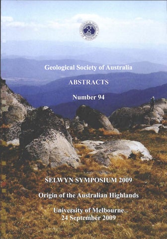
Front page photograph of the upper Murray valley from Watson's Crags, Kosciuszko Main Range, M.S. Norvick
Selwyn Symposium 2009 GSA Victoria Division Origin of the Australian Highlands
Geological Society of Australia Abstracts 94
Melbourne University September 2009
Geological Society of Australia Extended Abstracts Number 94 Geological Society of Australia Victoria Division Selwyn Symposium 2009
Editors: Dr Martin S. Norvick and Assoc. Prof. Stephen J. Gallagher ISSN 0729 01IX ©Geological Society of Australia Incorporated, 2009
Preferred Citation: Norvick, M.S. & Gallagher S.J. 2009. Origin of the Australian Highlands, Selwyn Symposium of the GSA Victoria Division, September 2009, Geological Society of Australia Extended Abstracts No. 94, 88 pp.
Example Citation for papers in this volume: VandenBerg, A.H.M. 2008. Palaeogene basalts prove early uplift of Victoria's Eastern Uplands. In: Norvick M.S. & Gallagher S.J. (eds). Origin of the Australian Highlands, Selwyn Symposium of the GSA Victoria Division, September 2009, Geological Society of Australia Extended Abstracts No. 94, p. 33-39. Copies of this publication may be obtained from: The Executive Director Geological Society of Australia Incorporated Suite 61, 104 Bathurst Street Sydney NSW 2000 Australia
Geological Society of Australia Abstracts 94
Selwyn Symposium 2009 GSA Victoria Division Origin of the Australian Highlands
The Geological Society of Australia Victoria Division presents the
SELWYN SYMPOSIUM 2009 Thursday 24 September 2009 Fritz-Loewe Theatre, Earth Sciences University of Melbourne
Alfred Richard Cecil Selwyn (1824-1902) The Selwyn Memorial Lecture was introduced in 1984 to commemorate the work of A.R.C. Selwyn, the first Government Geologist of Victoria. This year represents the 155^^ anniversary of the Government Geological Survey in Victoria. In recent years the Lecture has followed a symposium, involving invited speakers on a significant theme for Australian Geology, to celebrate Selwyn's work. Alfred Selwyn was born in Somerset, England in 1824, and had a strong Church of England upbringing. He was educated in Switzerland where he developed an enthusiasm for geology. At the age of 21 he joined the Geological Survey of Great Britain under the direction of A. C. Ramsay in North Wales and was soon entrusted with independent mapping of large areas with key Silurian rocks. The discovery of Gold in Victoria in 1851 led Governor La Trobe to ask the Colonial Office in London for "a gentleman possessed of the requisite qualifications and acquaintance with geological science and phenomenon." Selwyn was awarded the post at an annual salary of 500 pounds and arrived in early December 1852. Almost immediately he commenced a series of wide ranging reconnaissance trips during which he studied the geology of Victoria with excursions into Tasmania and South Australia. Among many of the early records, the Geological Survey holds an original watercolour version of his 1856 map of the Yarra Basin and Western Port. Selwyn set up the Geological Survey proper in 1856 and gathered around him and trained a team of geologists including: Alpin, Ulrich, Wilkinson, Daintree, Taylor, Brown and Etheridge. They subsequently occupied senior positions in all mainland State Geological Surveys and became renowned in the early annals of Australian geology. Selwyn and his team established the 6-mile x 9mile Victorian quarter sheet mapping programme of which 65 were produced. Selwyn was quiet and reserved man of indomitable disposition who carried out his plans despite all hindrances and achieved an amount of work that few could emulate. However, conflict arose from the overlapping activities of mining surveyors. The Survey often held views on scientific standards and policies opposed to those of the colonial officials and legistrators, in particular that of R. Brough Smyth, Secretary of Mines. Consequently, Selwyn resigned in 1869 and the Survey was disbanded for a year. Selwyn left Australia and was appointed the Director of the Geological Survey of Canada on retirement of Sir William Logan. He worked with distinction from 1869 until his retirement in 1894. Selwyn was awarded the prestigious Murchison Medal of the Geological Society of London in 1876. Other honours followed in Great Britain. The only recognition from Australia was his Clark Gold Medal from the Royal Society of New South Wales in 1884. He is commemorated in Victoria by an annual Geological Society of Australia Victoria Division lecture, symposium and medal. iii
Selwyn Symposium 2009 GSA Victoria Division Origin of the Australian Highlands
Geological Society of Australia Abstracts 94
Origin of the Australian Highlands Selwyn Symposium Summary: The apparently quiescent continent of Australia lies near the middle of a plate yet there are many mountain ranges and highlands, in particular along the eastern seaboard. The origin and timing of these enigmatic features has been subject to considerable debate, ever since Andrews* (1910) assigned a Pliocene (5-2 million year old) age to the Southeastern Highlands - the "Kosciuszko Uplift event". Some researchers suggest that most highland relief was present by the Cretaceous. Others believe Cainozoic uplift created most of the mountains. This symposium brings together leading researchers in thermochronology, geochronology, stratigraphy and geomorphology to discuss the timing and nature of uplift in southeast Australia. ^Andrews E.G., 1910. Jl of the Proc. Royal Soc. NSW 44, 420-480.
Assoc. Prof. Stephen Gallagher, Dr Martin Norvick, Dr Guy Holdgate and Assoc. Prof. Malcolm Wallace, Selwyn Symposium organising committee The Geological Society of Australia, Victoria Division The Geological Society of Australia (GSA) was established in 1952 as a learned non-profit organisation. The Society's objectives have been expanded to promote, advance and support the Earth Sciences within the scientific and wider communities. The GSA Victoria Division holds scientific meetings on the last Thursday of each month at the University of Melbourne starting at 6.15 preceded by light refreshments from 5.30pm. It publishes geological books (such as the Geology of Victoria), and acknowledges geological leadership and accomplishment through various awards through the Selwyn Award and Symposia. Anyone interested is also welcome to attend the monthly committee meetings of the GSAV, which usually begin at 4 pm in a venue near the general meeting venue. For further information check our website: www.vic.gsa.org.au. GSAV Committee 2009 OFFICE BEARERS Chair: David Cantrill Vice-chair: Vacant Secretary: Adele Seymon Treasurer: Stephen Gallagher SUBCOMMITTEE Awards: Ingrid Campbell Bicentennial Gold: Gerhard Krummel Education: Noel Schleiger Heritage: Susan White Membership: Vacant Newsletter: Peter Hoiles/Alison Fairmaid Program: Vacant Publications: Vacant Promotions Vacant Webmaster: Lindsay Thomas Geology of Victoria: Bill Birch IV
COMMITTEE Alison Fairmaid Erin Matchan David Moore Peter Hoiles Noel Schleiger Lindsay Thomas Susan White
Selwyn Symposium 2009 GSA Victoria Division Origin of the Australian Highlands
NOTES:
Geological Society of Australia Abstracts 94
Selwyn Symposium 2009 GSA Victoria Division Origin of the Australian Highlands
Geological Society of Australia Abstracts 94
Figure 1. SRTM digital elevation model of the Southeast Australian Highlands (prepared by M. Norvick from http://www.geomapapp.org) VI
Geological Society of Australia Abstracts 94
Selwyn Symposium 2009 GSA Victoria Division Origin of the Australian Highlands
Origin of the Australian Highlands September 2009 PROGRAM & PAGE INDEX 8.00-9.00
Registration
9.00-9.05
Introduction: Assoc Prof Malcolm Wallace
Opening address: Prof Peter Rathjen, DVC Research, University of Melbourne Plenary Address: Prof Mike Sandiford 1. Tectonic signals in an ancient landscape The University of Melbourne 3. Mesozoic-Cainozoic volcanism in eastern Australia and its implications 9.50-10.15 Dr Ian Roach Australian National University for long-term landscape evolution 2. Constraints on the evolution of the highlands of southeast Australia from 10.15-10.40 Prof Ian McDougall Australian National University K-Ar dating of volcanic rocks 9.05-9.10 9.10-9.50
Page: 1 Page: 9 Page: 5
10.40-11.10 Morning Tea Chairs of session: Dr Max Brown & Dr Colin Pain 4. Overseas Analogues of Eastern Highland Morphotectonics 11.10-11.35 Prof Cliff Oilier University of Western Australia 5. Why are there mountains in southeastern Australia, or Norway, or 11.35-12.00 Dr Paul Green Geotrack International, Melbourne West Greenland, or Brazil, or Scotland, or ? 6. The significance of peneplains in the uplift history of the Southeastern 12.00-12.25 Assoc Prof John Webb Latrobe University Australian Highlands 7. Palaeogene basalts prove early uplift of Victoria's Eastern Uplands 12.25-12.50 Mr Fons Vandenberg, DPI Victoria
Page: 15 Page: 21 Page: 27 Page: 33
12.50-1.10 Discussion & forum 1.10-2.00 2.00-2.25 2.25-2.50 2.50-3.15 3.15-3.40
Lunch Chairs of session: Prof Ian McDougall & Dr Paul Green 8. No mountains to snow on: palaeoenvironments of the deep lead valleys Dr Guy Holdgate The University of Melbourne in a low-altitude peneplain - today's Victorian Highlands 9. Cainozoic tectonics and volcanism and major changes in drainage and Dr Max Brown Divides in southeast Australia - the Shoalhaven catchment & other examples Canberra 10. Some geomorphic and geological evidence for the age of the eastern Prof Graham Taylor Canberra University Australian Highlands 11. The origin and development of the West Uplands of Victoria: a different Assoc Prof Bernie Joyce The University of Melbourne story to the rest of the Australian Highlands
3.40-4.00
Discussion & forum
4.00-4.30
Afternoon tea
4.30-4.55 4.55-5.20
Chairs of session: Dr Guy Holdgate & Mr Fons Vandenberg 12. Origin of the Australian Highlands Dr Ian Duddy Geotrack International, Melbourne 13. Morphology of the Eastern Highlands of Australia Dr Colin Pain Geoscience Australia
Page: 41 Page: 51 Page: 59 Page: 63
Page: 71 Page: 79
5.20-5.40
Discussion & forum
5.40-6.30 6.30-6.45
Drinks & refreshments 14. Selwyn Medal presentation to Associate Professor Bernie Joyce at the JH Mitchell Theatre - Richard Berry Building, The University of Melbourne for nominations see Page 83 Theories of the Earth and Mountain Building see Page 87 15. GSA VIC SELWYN LECTURE By Prof Cliff Oilier University of Western Australia University House, the University of Melbourne Selwyn Dinner
6.45-8.00
8.15-
Vll
Selwyn Symposium 2009 GSA Victoria Division Origin of the Australian Highlands
Geological Society of Australia Abstracts 94
NOTES (+ location of J.H. Mitchell Theatre)
Vlll
Selwyn Symposium 2009 GSA Victoria Division Origin of the Australian Highlands
1.
Geological Society of Australia Abstracts 94
Tectonic signals in an ancient landscape (plenary address)
Prof. Mike Sandiford
Biography:
School of Earth Sciences University of Melbourne
Professor Mike Sandiford is an ARC Professorial Research Fellow currently studying the factors that have shaped the landscape of Australia and our near northern neighbours such as Timor. His previous work on the thermal structure of the Australian crust provided an important framework for understanding the extraordinary abundance of uranium in Australia, and has led to the current upsurge of interest in geothermal energy exploration. He received the Mawson Medal in 2004, is an editor-in-chief of Tectonophysics, and is Interim Director of the Melbourne Energy Institute.
mikes @ unimelb. edu. au
Australia is the lowest and flattest of all continents, consistent with relatively low-levels of tectonic activity to be expected for a continent that has remained remote from active plate boundaries throughout the Cainozoic. However, low-level tectonic activity is indicated by widespread earthquake activity (Leonard, 2008), and seismic moment release rates are elevated relative to many other stable continental regions (Braun et al., 2008; Johnston et al., 1994). A rich palaeo-seismic record of surface fault breaks and Quaternary faults (Crone et al., 2003; Crone et al., 1997; Quigley et al., 2006) raises intriguing questions about the longer-term record of tectonic activity in the continent. As part of the Indo-Australian plate (lAP), Australia is also the fastest continent, having drifted northwards -3000 km over the last 45 Ma. In so doing it has passed over a complex deep mantle density structure as revealed partly by a --60 m differential in the geoid field across the continent, as well as the unusual ocean bathymetry of the Southern Ocean in the vicinity of the Australian-Antarctic discordance - or AAD (Gurnis et al., 1998). The dynamic topographic effects of such differential motion between the plate and the underlying mantle are significant, and most clearly evident in a fundamental asymmetry in the morphology and stratigraphic relations of its margins (Sandiford, 2007). A further attribute of geomorphic significance is that Australia is amongst the most arid of continents. Aridity has affected much of the interior part of the continent through the late Cainozoic (Bowler, 1976), providing it with a remarkable geomorphic 'memory'. The exquisite detail preserved in extremely old landforms, such as the Eocene beach barrier systems and associated lagoons on the eastern Nullarbor Plain, imply that surface processes have been remarkably ineffective. This preservation of ancient palaeo-shorelines and lake systems, in particular, allows for unambiguous reconstruction of subtle deformations of the landscape, the memory of which would have been greatly obscured or obliterated in environments characterised by more active surface processes. The last few years have seen a resurgence of interest in the tectonic geomorphologic record of the Australian continent (Celerier et al., 2005; Quigley et al., 2007; Sandiford, 2003a; Sandiford, 2003b; Sandiford, 2007; Sandiford et al., 2004). Parallel studies have established basic framework for understanding key neotectonic 'drivers' such as the in situ stress state (Coblentz et al., 1998; Hillis and Reynolds, 2000; Reynolds et al., 2002; Sandiford et al., 1995; Sandiford et al., 2004), mantle structure (Debayle et al., 2005; Kennett et al., 2004) and thermal regime (McLaren et al., 2003; Neumann et al., 2000). In this talk I review the main insights gained from these studies. I begin with a brief summary of the current geodynamic state of the Australian continent, including our current knowledge of the in situ stress and geoid fields and constraints on deformation rates provided by the seismic record. I then explore the neotectonic record at a variety of length and temporal scales that suggest three distinct modes of deformation each with a characteristic temporal and spatial scale. At
Selwyn Symposium 2009 GSA Victoria Division Origin of the Australian Highlands
Geological Society of Australia Abstracts 94
the shortest wavelength (order 10^-10^ kms) active faulting is demonstrably shaping the landscape in several parts of the continent and can be related to propagation of stress from distant plate boundaries. At intermediate w^avelengths (order 10^-10^ kms) low amplitude undulations have produced distinctive patterning of continental relief most clearly associated with modern and palaeolake systems. Finally, at the longest wavelength (> 10^ kms) a pattern of continental tilting can be related to dynamic topography associated with its northward passage from the geoid low, dynamic topography high now lying south of the continent, to a geoid high, dynamic topographic low centred over the subduction zones of South East Asia and Melanesia. Our prime concern is on the topographic record of the Australian continent in the context of the evolution of the lAP. The lAP was born of a complex sequence of correlated events that saw the fusion of the Indian and Australian plates around 45 million years ago. The critical element was the termination of spreading in the north-central Indian Ocean that accompanied deceleration of the Indian plate during the initial stages of Himalayan collision (Patriat and Achache, 1984), and the associated northward acceleration of the Australian Plate (Gaina and Muller, 2007). Prior to 50 million years ago Australia formed the core of a much more slowly moving plate largely surrounded by mid-ocean ridges. As such, its palaeo-geographic setting was more reminiscent of the present-day Africa, in the sense of having a higher degree of symmetry in the plate boundaries compared to today. With termination of spreading in the north central Indian Ocean and the Tasman Sea to the east of Australia, Australia became one of two continental crustal fragments (the other being India) fused into a fast moving plate with strongly asymmetric boundary configurations (mid-ocean ridges to the south, convergent margins to the north). The onset of the modern compressional intraplate stress field (see below) most probably dates to this transition, with the pre-Eocene continent likely to have been subject to mild extensional stress regimes, in analogous fashion to the African continent (Coblentz and Sandiford, 1994; Sandiford and Coblentz, 1994; Sandiford et al., 1995). Understanding just how the Australian landscape has been modified by, and records, subtle tectonic processes should inform how to isolate comparable signals in other slower moving, faster eroding settings such as Europe. With international programs such as Topo-Europe now focussing interdisciplinary work on all manner of phenomena related to the topographic evolution of the continents, my purpose is to briefly summarise our recent insights from Australia that link the active deformation to the contemporary geodynamic setting and various geophysical observables, such as in situ stress, seismic strain rate, geoid and dynamic topographic fields. References Bowler, J.M. (1976). Aridity in Australia: Age, origins and expression in aeolian landforms and sediments. EarthScience reviews 12, 279-310. Braun, J. et al. (2008). Constraints on the current rate of deformation and surface uplift of the Australian continent from a new seismic database and low-T thermochronological data. Australian Journal of Earth Sciences, in press. Celerier, J., Sandiford, M., Hansen, D.L., Quigley, M. (2005). Modes of active intraplate deformation. Flinders Ranges, Australia. Tectonics 24, doi:10.029/2004&C001679. Coblentz, D., Sandiford, M. (1994). Tectonic stress in the African plate: Constraints on the ambient stress state. Geology 22, 831-834. Coblentz, D.D., Zhou, S., Hillis, R., Richardson, R., Sandiford, M. (1998). Topography, plate-boundary forces and the Indo-Australian intraplate stress field. Journal of Geophysical Research 103, 919-931. Crone, A.J., De Martini, P.M., M.N., M., Okumura, K., Prescott, J.R. (2003). Palaeoseismicity of two historically quiescent faults in Australia - implications for fault behaviour in stable continental regions. Bulletin of the Seismological Society of America 93, 1913-1934. Crone, A.J., Machette, M.N., Bowman, J.R. (1997). Episodic nature of earthquake activity in stable continental regions revealed by palaeoseismicity studies of Australian and North American Quaternary faults. Australian Journal of Earth Sciences 44,203-214. Debayle, E., KenneU, B., Priestley, K. (2005). Global azimuthal seismic anisotropy: the unique plate-motion deformation of Australia. Nature 433, 509-512.
Selwyn Symposium 2009 GSA Victoria Division Origin of the Australian Highlands
Geological Society of Australia Abstracts 94
Gaina, C., Muller, D. (2007). Cenozoic tectonic and depth/age evolution of the Indonesian gateway and associated backarc basins. Earth-Science Reviews 83 (3-4), 177-203. Gurnis, M., Muller, R.D., Moresi, L. (1998). Cretaceous vertical motion of Australia and the Australian Antarctic discordance. Science 279, 1499-1504. Hillis, R.R., Reynolds, S.D. (2000). The Australian stress map. Journal Geological Society London 157, 915-921. Johnston, A.C., Coppersmith, K.J., Kanter, L.R., Cornell, C.A.. (1994). The earthquakes of stable continental regions. Electric Power Research Institute Publication TR-102261-V1, Palo Alto, California. Kennett, B.L.N., Fishwick, S., Heintz, M. (2004). Lithospheric structure in the Australian region - a synthesis of surface wave and body wave studies. Exploration Geophysics 35, 242-250. Leonard, M. (2008). One hundred years of earthquake recording in Australia. Bulletin of the Seismological Society of America 98, 1458-1470. McLaren, S., Sandiford, M., Hand, M., Neumann, M., Wyborn, L., Bastrakova, I. (2003). The hot southern continent. Heat flow and heat production in Australian Proterozoic terranes. In: Hillis, R.R., Muller, D., eds. Evolution and dynamics of the Australian Plate, Geological Society of Australia, Special Publication 22, 157-167. Neumann, N., Sandiford, M., Foden, J. (2000). Regional geochemistry and continental heat flow: implications for the origin of the South Australian heat flow anomaly. Earth and Planetary Science Letters 183 (1-2), 107-120. Patriat, P., Achache, J. (1984). India-Eurasia collision chronology has implications for crustal shortening and driving mechanism of plates. Nature 311, 615-621. Quigley, M., Cupper, M., Sandiford, M. (2006). Quaternary faults of southern Australia: palaeoseismicity, slip rates and origin. Australian Journal of Earth Sciences 53, 285-301. Quigley, M., Sandiford, M., Alimanovic, A., Fifield, L.K. (2007). Landscape responses to intraplate deformation in the Flinders Ranges, South Australia: quantitative constraints from lOBe abundances. Earth and Planetary Science Letters, doi:10.1016/j.epsl.2007.06.020. Reynolds, S.D., Coblentz, D.D., Hillis, R.R. (2002). Tectonic forces controlling the regional intraplate stress field in continental Australia: results from new fmite-element modelling. Journal of Geophysical Research 107 10.1029/2001JB000408 Sandiford, M. (2003a). Geomorphic constraints on the Late Neogene tectonics of the Otway Range, Victoria. Australian Journal of Earth Sciences 50 (1), 69-80. Sandiford, M. (2003b). Neotectonics of southeastern Australia: linking the Quaternary faulting record with seismicity and in situ stress. In: Hillis R. R. & Muller D., eds. Evolution and Dynamics of the Australian Plate, Geological Society of Australia Special Publication 22, 101-113. Sandiford, M. (2007). The tilting continent: a new constraint on the dynamic topographic field from Australia. Earth and Planetary Science Letters, doi: 10.1016/j.epsl.2007.06.023. Sandiford, M., Coblentz, D. (1994). Plate-scale potential-energy distributions and the fragmentation of ageing plates. Earth and Planetary Science Letters 126 (1-3), 143-159. Sandiford, M., Coblentz, D., Richardson, R.M. (1995). Focusing ridge-torques during continental collision in the IndoAustralian plate. Geology 23, 653-656. Sandiford, M., Wallace, M., Coblentz, D. (2004). Origin of the in situ stress field in south-eastern Australia. Basin Research 16 (3), 325-338.
Selwyn Symposium 2009 GSA Victoria Division Origin of the Australian Highlands
NOTES:
Geological Society of Australia Abstracts 94
Selwyn Symposium 2009 GSA Victoria Division Origin of the Australian Highlands
2.
Geological Society of Australia Abstracts 94
Constraints on the evolution of the highlands of southeast Australia from K-Ar dating of volcanic rocks
Prof. Ian McDougall
Biography:
R
^^^ McDougall is a geologist, now formally retired, but still active, who has ^^^^^ ^^^^ ^^ J^.^ working life undertaking studies leading to the provision of frameworks for a wide range of geological events and processes by the isotopic dating of rocks using the potassium-argon (K-Ar) and ^^Ar/^^Ar techniques.
h ^ h
1 f F rtVi
Kesearcn ^cnooi or tiartn Sciences,
Australian National University, Canberra ACT, 0200 ian. mcdou gall @ anu. edu. au
Debate on the origin and evolution of the highlands of eastern Australia has been going on for well over a century, with many notable workers of past generations contributing, including W.B. Clarke, T.W.E. David, E.C. Andrews, T.G. Taylor, W.G. Woolnough, F.A. Craft, W.R. Browne and E.S. Hills. It was recognized at an early stage that the highlands developed more or less parallel to the passive eastern margin of the Australian continent as an uplifted peneplain or palaeoplain, to use the non-genetic term introduced by Hills. Indeed, commonly the highlands were thought to show evidence for sequential planation and uplift throughout the Cainozoic, although this view no longer prevails. However, there is broad agreement that the highlands were produced by warping to form a broad arch with the axis approximately parallel to the present Main Divide, the divide between the coastal and inland drainages. The greatest altitude of the highlands is at Mt Kosciuszko at a little over 2200 m, but it has long been noted that the altitude of the culmination varies considerably along strike, and in places it is as low as 300 m. The highlands decrease in altitude relatively gently to the riverine plains to the west, but quite dramatically to the east, where an escarpment, the Great Escarpment of Oilier (1982), is mainly of erosional origin, formed subsequent to uplift. Andrews (1910) proposed the existence of a single mature peneplain that was differentially warped during the Plio-Pleistocene to form the highlands in what he termed the Kosciuszko Uplift. This view was accepted by most workers into the 1970s. However, Craft (1933) recognized that the basalts of the coastal plain south of Nowra are younger than the major uplift and we now know that these basalts are up to 30 Ma old (Early Oligocene). Volcanism, dominantly basaltic, was quite extensive in eastern Australia, mainly confined to the highlands and adjacent areas. In the early 1960s with the setting up of a K-Ar dating laboratory in the Department of Geophysics in the Australian National University (ANU) through the efforts of Professor J. C. Jaeger, it became possible for the first time to measure the numerical age of volcanic eruptions on suitable rocks. A major program of dating of these volcanic rocks was undertaken by Peter Wellman, a PhD scholar at the ANU between 1967 and 1971, culminating in a comprehensive overview of the volcanism by Wellman & McDougall (1974a) who showed from Wellman's results and earlier age measurements that the volcanism began as early as 70 million years (Ma) ago in the Late Cretaceous and has continued intermittently until the present day. They recognized two major types of volcanic provinces consisting of the lava fields, extensive and mainly basaltic stacks of lavas, and the large central volcanoes, commonly with the presence of silicic volcanic rocks as well as basaltic lavas. In addition, they serendipitously identified that the latter volcanoes form a broad line in which the volcanism had migrated southward at about 66 + 5 mm/year, and they suggested that this volcanism was derived from an essentially fixed hotspot or source in the mantle below the crust, which was being carried on the Australian plate northward at about this rate from at least as early as 33 Ma ago in the Early Oligocene.
Selwyn Symposium 2009 GSA Victoria Division Origin of the Australian Highlands
Geological Society of Australia Abstracts 94
In the Wellman & McDougall (1974b) paper on the age of the volcanism in New South Wales, observations v^ere made about the evolution of the eastern Australian highlands based upon the age data and the geomorphology. They pointed out that clearly the surfaces on which the dated volcanic rocks rested must be older than the volcanic rocks. Of course the present elevation of the surface was not necessarily that at the time of volcanic eruption, and needs to be determined from other information. Nevertheless, it became abundantly clear from this work and the geological and geomorphological contexts that much of the warping to produce the uplifted highlands had to be significantly earlier than the Plio-Pleistocene Kosciusko Uplift postulated by Andrews (1910). Although concordancy of altitude in various regions of the highlands suggested that there had existed a broad palaeoplain exhibiting limited topography, the dating measurements, particularly on lavas in river valleys showed that considerable relief was extant in some areas as far back as the Eocene; most of these rivers follow similar courses to this day. Many workers in the field realized the important constraints that the dating of the volcanic rocks provided in relation to the geomorphological evolution of the eastern highlands. Indeed, both Young and Oilier quickly recognized the value of the isotopic ages of volcanic rocks in constraining the geomorphic evolution of the highlands. Subsequent focused studies, combining many additional K-Ar dating measurements by the present author on volcanic rocks in conjunction with geomorphological investigations by R. W. Young, P. Bishop and J. Nott have further clarified the story. In particular, in southeastern New South Wales, strong evidence was assembled for an early major uplift (early Cainozoic, even Mesozoic) to create the highlands. As an example, the evidence from the Shoalhaven area demonstrates that the coastal plain, where basalts of 27 to 30 Ma age occur, is erosional in origin and that the Great Escarpment further inland is also erosional and that its retreat westward averages less than 200 m/Ma. Further inland, basalts that occur on the Sassafras upland at an altitude of between 620 and 750 m have measured ages of 47-51 Ma (Early Eocene), on separated plagioclase, in keeping with earlier measurements of -41 to 47 Ma for basalts on the Shoalhaven plain and in the Endrick River, a tributary of the Shoalhaven River. The base of the basalts in the Endrick River is at an altitude of about 525 m, which together with basalts of similar age nearby at Sassafras shows that a topography of more than 200 m was extant at that time, and that the main uplift to form the highlands preceded this based upon the geology (Young & McDougall, 1985). Upstream of this area the Shoalhaven flows in a broad upland valley, descending gently to the north from an altitude of --700 m to -500 m, whereas downstream the river turns eastward toward Nowra and descends into a major gorge up to 500 m deep. Adjacent to the upland rim are several basalts, including the Caoura flows, indicating that the gorge has been cut subsequent to the extrusion of these basalts, which have measured ages between 29 and 31 Ma (Early Oligocene). These basalts were responsible for damming the Shoalhaven, behind which up to -100 m of sediments accumulated (Craft, 1931; Nott et al., 1996), with the modern Shoalhaven remaining at much the same level in this region. The rate of migration of the gorge upstream from the coast at Nowra is in the order of 2500 m/Ma, much faster than either lowering of the landscape (generally <10 m/Ma) or erosional slope retreat of less than 30 m/Ma in the Endrick River. It is concluded from these observations that headward migration of the Shoalhaven Gorge is the major modifier of the landscape, implying that the topography will continue to increase with time and that the reduction to form a palaeoplain or peneplain will take many millions of years, if ever. Brown (2006) has reinvestigated this region, and although he makes the case first put by Woolnough & Taylor (1906) that the Shoalhaven continued north into the Wollondilly, and that an earlier river draining to the coast around Nowra captured the former Shoalhaven, his overall view on the uplift history only differs marginally from ours, serving to emphasize that second order, relatively minor uplifts or downwarps, as a result of isostatic rebounds or other processes, may also have occurred. Studies of the Lachlan drainage on the inland side of the Great Divide and of the area north of Mt Kosciuszko, with drainage to the north in the Tumut River
Selwyn Symposium 2009 GSA Victoria Division Origin of the Australian Highlands
Geological Society of Australia Abstracts 94
and drainage from the Bago Plateau to the southwest toward the Murray River show that the topography and drainage over the last 20 Ma or so (Early Miocene) has changed little with an incision rate of <30 m/Ma, consistent with the more complete understanding achieved in the Shoalhaven region. The origin of the highlands, at least in the southeastern part of Australia, appears to be the result of uplift of the rift shoulder to the west of the major rift on this passive margin of Australia, owing to plate tectonic processes, with formation of the Tasman Sea and new seafloor being generated between about 80 and 50 Ma, as well argued by Oilier (1982). Lister et al. (1986) suggested that the southeast coast of Australia is in fact an upper plate margin in their asymmetric detachment model. That the marginal uplift remains to this day suggests considerable underplating of the continental crust underlying the uplands by igneous intrusions related to the eruption of the Cainozoic volcanic rocks, as suggested by Wellman (1987); no doubt other factors such as isostatic rebound also have played a role. Nevertheless, the dating of volcanic rocks associated with the uplifted regions, at least in southeastern New South Wales, implies major uplift of early Palaeogene or even Mesozoic age, with possible additional but second order subsequent movements, perhaps in the late Neogene (Wellman, 1987). We are particularly fortunate in having datable volcanic rocks in the highland regions to provide some constraints on the uplift history, as most uplifted marginal areas on continents do not have similar rocks amenable to isotopic dating. Over the last two decades, fission track data on apatite from samples along the southern New South Wales coast and inland to beyond the Great Escarpment, as well as (U-Th)/He dating of the same mineral, indicate that uplift and subsequent denudation adjacent to the present coast actually began -100-120 Ma ago in the Early Cretaceous, before initiation of seafloor spreading in the Tasman Sea (Moore et al., 1986; Dumitru et al., 1991; Persano et al., 2002, 2005). In addition, the results are interpreted as indicating that the lowlands between the present coast and the escarpment were formed by relatively rapid denudation. The data also seem to rule out downwarping as a major process leading to the formation of the coastal plain; this is in keeping with the geology, particularly in the Nowra-Ulladulla area. A full and complete understanding of the development of the eastern Australian highlands undoubtedly will be reached in due course through the integration of geomorphological studies with the depositional history of sediments adjacent to the highlands, by additional isotopic dating of volcanic rocks, and by the further application of fission track and (U + Th)/He dating studies as well as exposure dating of samples on surfaces and geomorphic modelling. Although, we have a long way to go to achieve a full understanding of the formation of the eastern Australian highlands, our knowledge has improved greatly over recent decades. References Andrews, B.C. (1910). Geographical unity of eastern Australia. Journal and Proceedings of the Royal Society of New South Wales 44, 420-480. Brown, M.C. (2006). Ponding and major drainage diversions by late Palaeogene basalts, Shoalhaven River catchment. New South Wales, Australia. Zeitschrift fur Geomorphologie 50, 501-522. Craft, F. A. (1931). The physiography of the Shoalhaven River valley. IV. Nerriga. Proceedings of the Linnean Society of New South Wales 56, 412-430. Craft, F.A. (1933). The coastal tablelands and streams of New South Wales. Proceedings of the Linnean Society of New South Wales 58, 437-460. Dumitru, T.A., Hill, K.C., Coyle, D.A., Duddy, I.R., Foster, D.A., Gleadow, A.J.W., Green, P.F., Kohn, B.P., Laslett, G.M., O'Sullivan, A.J. (1991). Fission track thermochronology: application to continental rifting of southeastern AustraUa. APEA Journal 31, 131-142.
Selwyn Symposium 2009 GSA Victoria Division Origin of the Australian Highlands
Geological Society of Australia Abstracts 94
Lister, G.S., Etheridge, M.A., Symonds, P.A. (1986). Detachment faulting and the evolution of passive margins. Geology 14, 246-250. Moore, M.W., Gleadow, A.J.W., Lovering, J.F. (1986). Thermal evolution of rifted continental margins: new evidence from fission tracks in basement apatites from southeastern Australia. Earth and Planetary Science Letters 78, 255-270. Nott, J., Young, R., McDougall, I. (1996). Wearing down, wearing back, and gorge extension in the long-term denudation of a highland mass: quantitative evidence from the Shoalhaven catchment, southeast Australia. Journal of Geology 104, 224-232. Oilier, C.D. (1982). The Great Escarpment of eastern Australia: tectonic and geomorphic significance. Journal of the Geological Society of Australia 29, 13-23. Persano, C., Stuart, F.M., Bishop, P., Barfod, D.N. (2002). Apatite (U-Th)/He age constraints on the development of the Great Escarpment on the southeastern Australian passive margin. Earth and Planetary Science Letters 200, 79-90. Persano, C., Stuart, F.M., Bishop, P., Dempster, T.J. (2005). Deciphering continental breakup in eastern Australia using low-temperature thermochronometers. Journal of Geophysical Research 110, B12405. DOI: 10.1029/2004JB003325. Wellman, P. (1987). Eastern highlands of Australia; their uplift and erosion. BMR Journal of Australian Geology and Geophysics 10, 277-286. Wellman, P., McDougall, I. (1974a). Cainozoic igneous activity in eastern Australia. Tectonophysics 23, 49-65. Wellman, P., McDougall, I. (1974b). Potassium-argon ages on the Cainozoic volcanic rocks of New South Wales. Journal of the Geological Society of Australia 21, 247-272. Woolnough, W.G., Taylor, T.G. (1906). A striking example of river capture in the coastal district of New South Wales. Proceedings of the Linnean Society of New South Wales 31, 546-554. Young, R.W., McDougall, I. (1985). The age, extent and geomorphological significance of the Sassafras basalt, southeastern New South Wales. Australian Journal of Earth Sciences 32, 323-331.
Selwyn Symposium 2009 GSA Victoria Division Origin of the Australian Highlands
3.
Geological Society of Australia Abstracts 94
Mesozoic-Cainozoic volcanism in eastern Australia and its implications for long-term landscape evolution
Dr Ian C. Roach . .
Biography:
T-, ®
.
Research School of Earth Sciences Australian National University ACT 0200 Ian.Roach@anu.edu.au
Ian Roach was born and bred on the Monaro. He graduated from the University of Canberra with his PhD describing the volcanology, landscape evolution, mineralogy and petrology of the Monaro Volcanic province of southeastern NSW. Since graduating he has taught regolith geoscience at the University of Canberra and the ANU for CRC LEME ai^d maintains interests in eastern Australian basaltic volcanism and landscape evolution.
The landscape evolution story of the Australian Eastern Highlands is a tangle of evidence suggesting that some facets are relatively old (Palaeozoic-Mesozoic), but also that others are relatively young (Cainozoic). There is no doubt that some landscape features may be relatively youthful, indicated by continued seismicity and neotectonic activity, especially in southeastern Australia. Recent publications by Holdgate et al. (2008) and Tomkins & Hesse (2004), amongst many others, argue for a relatively young age (Cainozoic) for some parts of the Eastern Highlands. Braun et al. (2009), especially, argue that up to 50% of the present-day relief has occurred in the past 10 million years, once again raising the spectre the "Kosciuszko Uplift" of Andrews (1910). One wonders exactly which 50% they are talking about. There is also little doubt that other landscape features are moderately old (Mesozoic), indicated by surface features (e.g., Hill 1999), features buried beneath intraplate volcanic rocks (e.g., Taylor et al. 1985; 1990), the ages of the intraplate volcanic rocks (e.g., McDougall & Wellman 1976; Wellman 1979; 1987; Wellman & McDougall 1974; and, others included in Johnson 1989) or the age of continental rifting and its associated landform development (e.g.. Lister et al. 1986; Lister & Etheridge 1989; Oilier & Pain 1994; Betts et al. 2002). Others have also argued for a much older (Palaeozoic) age for the Eastern Highlands, including Lambeck & Stephenson (1986) and Veevers (1987). Some of the arguments for the age of the Eastern Highlands rely on positive evidence (that which exists; it can be physically detected, seen or picked up by hand), but others rely on negative evidence used to be there, but has since been removed/altered") or Uniformitarianism {'It has always been like this"). Regolith scientists know that the latter is a wonderful concept, but has many exceptions. A great deal of the modern landscape evolution research on the Eastern Highlands relies heavily on the use of apatite fission track thermochronology to date thermotectonic events. Certainly, the technique's ability to image or map exposure ages in four dimensions, and therefore landscape evolutionary events, is immensely useful. However, the method has a number of assumptions related to the state of the palaeo-geotherm and the extent and influence of crustal heating from volcanism, magmatic underplating and continental rifting. The method has a Uniformitarian approach to these factors that can singly or combined have a profound effect on the annealing depth of apatite, but are ignored because they are deemed too difficult to account for. Thus, the method has an acknowledged shortcoming in its ability (or inability) to accurately determine the absolute amount of denudation that has occurred within a given area (Kohn et al. 2002). The present-day heat flow regime in Australia ranges from ca. 15 to 160 mW/m" (Geoscience Australia 2009 and references within), which equates (depending on the value of thermal conductivity used, but assuming 2.0-2.5 Wm'^K"^ for compacted sediment) to a geotherm of between > 6.0-7.5°C/km for the Archean cratons and < 64-80°C/km for the South Australian heat flow anomaly, parts of the Murray Basin and King Island. Of course, these data are based on approximately 180 heat flow measurements across the whole continent, so are somewhat rubbery and 9
Selwyn Symposium 2009 GSA Victoria Division Origin of the Australian Highlands
Geological Society of Australia Abstracts 94
swathes of the continent have no data. To overcome the poor data quality and quantity, the Uniformitarian approach to heat flow is to assume that, on average, the Eastern Australian geotherm has remained at the "continental average" of 25°/km, or a Palaeozoic average of 25-30°C/km (Pollach et al. 1993). This again depends on the value of thermal conductivity used, but the present heat flow data show that this can not be applied continent-wide. Indeed, this is also not the case going back into the past. The Eastern Australian heat flow regime has waxed and waned depending on magmatic and tectonic events such as large-scale magmatic underplating, volcanism, continental rifting, uplift and denudation. For instance, Hopper & Buck (1996) suggest that wide passive margins are predicted to be associated with relatively high heat flows (< 120 mWm"^). Their model also suggests that this elevated heat flow occurs up to 300 km either side of the rift axis. If this model is correct, a heat flow anomaly would have existed for tens of millions of years in the Middle-Late Mesozoic after the commencement of rifting between Australia and New Zealand and would have included the present crest of the Eastern Highlands. Additionally, heat flow anomalies would have existed surrounding the Mesozoic volcanic complexes associated with the commencement of continental rifting (Bryan et al. 1997). It is important to have a better knowledge of Phanerozoic heat flow to qualify the thermochronology data and more accurately determine the absolute amount of uplift and denudation that has occurred within the Eastern Highlands (Roach 2000a). The problem with determining heat flow into the past is that geotherms are ephemeral; they wax and wane over tens of millions of years (Lister & Etheridge 1989). What independent evidence can be used to interpret thermochronology data and landscape evolution in the Eastern Highlands and to give some firm absolute ages for uplift and heat flow anomalies? The Mesozoic-Cainozoic volcanic rocks that follow the Eastern Highlands hold many clues in their ages and in the mantle and cmstal inclusions (xenoliths and megacrysts) that they contain. The ages of volcanic and intrusive rocks may be used to quantify the times that uplift and elevated heat flow occurred during major volcanic periods. Mantle and crustal inclusions may also be used to improve our knowledge of crustal thickness and palaeogeothermal conditions by quantifying the pressure and temperature conditions of the mantle and lower crust. These data can then be used to interpret the crustal thickness and age of magmatic underplating (and therefore uplift through isostacy) and quantify the palaeogeothermal conditions in volcanic areas through the thermobarometry of mantle and cmstal inclusions and isotopic dating of the host lavas. Mantle and crustal xenoliths and megacrysts occur as inclusions in volcanic rocks in many eastern Australian basaltic lava fields. Those with well-developed igneous or metamorphic textures can be regarded as having equilibrated under the pressure and temperature conditions of their source region. These can be sampled and used together with their dated host rock to give an indication of the crustal thickness and regional palaeogeothermal conditions at the time of eruption. Pressure-temperature data derived from coexisting minerals in garnet-bearing mantle and crustal xenoliths from a number of eastern Australian lava fields are shown in Fig. 3.1. These data provide a snapshot of the transient palaeogeothermal conditions under the eruption site which could be expected to exist for several tens of millions of years post-volcanism, depending on the size of the lava field. Xenolith and megacryst mineral data from the Monaro Volcanic Province (Roach 1996; 1999; 2004; Roach et al. 1994), located in the Southern Highlands of southeastern NSW, indicate that inclusions equilibrated under a high palaeogeotherm in P-T conditions similar to those of Bullenmerri-Gnotuk (Griffin et al. 1984), Walcha (Stolz 1984) and Table Cape (Sutherland et al. 1984) which equates to a palaeogeotherm of at least 60°/km. Fig. 3.1 also shows several non-equilibrium geotherms in the act of waxing (Jugiong) and waning (McBride).
10
Geological Society of Australia Abstracts 94
Selwyn Symposium 2009 GSA Victoria Division Origin of the Australian Highlands
East Central Queensland
- 30
^ ^ sp pxite
T5
gt pxite
i
8601
- 90
1
9(X}
rc
^
1000
r
1100
1300
Fig. 3.1. Pressure-temperature conditions for selected eastern Australian mantle xenolith suites using the thermobarometer developed by Taylor (1998), described in Roach (1999, 2004). The diagram illustrates average geotherms from different tectonic settings, the South-Eastern Australian (SEA) geotherm and important crustal and mantle mineralogical transition zones (after O'Reilly & Griffm 1985). Data sources are listed in Table 4.6 of Roach (1999). MVP = Monaro Volcanic Province.
Megacryst crystallisation pressures can also be used to make inferences on the thickness of the crust. The Monaro Volcanic Province contains marker horizons of ankaramite lavas which are K-Ar dated at 49-51 Ma (Taylor et al. 1990; Roach 1996). Ankaramites are pyroxene-rich lavas and are common in intraplate volcanoes and lava fields w^orld-wide, including those in eastern Australia, and separate the initial tholeiitic shield-building stage from the final alkali cone-building resurgent stage. Pyroxene megacryst cores from the Monaro Volcanic Province shov^ a peak in calculated crystallisation pressure at approximately 1.8 ± 0.3 GPa (Roach 1999; 2000b). This pressure equates to ca. 52 km depth, marking the level at v^hich the magma paused and crystallised pyroxene before regaining positive buoyancy and moving to the surface. This crystallisation depth coincides w^ith the crust-mantle boundary (seismic Moho) at ca. 48-50 km derived by Collins et al. (2003) and gives us a snapshot of crustal thickness at a particular time in the development of the Southern Highlands. What are the implications of this independent data and how does it affect the interpretation of thermochronology data from the Eastern Highlands? The Southern Highlands, including the Kosciuszko Massif, has the thickest crust (48-50 kms) of the entire Eastern Highlands (Collins et al. 2003). Xenolith, megacryst and lava age data presented here indicate that the crust w^as at this thickness by at least 50 Ma and the Southern Highlands must have been a locus of protracted magmatic underplating to attain this thickness. Magmatic underplating probably commenced in the Jurassic at or around 200 Ma (Betts et al. 2002), also indicated by xenolith isotopic ages (O'Reilly 1989), in the early stages of rifting and passive margin formation along the eastern edge of Gondvv^analand. The magmatic underplating process also formed the 11
Selwyn Symposium 2009 GSA Victoria Division Origin of the Australian Highlands
Geological Society of Australia Abstracts 94
voluminous Tasmanian and Antarctic dolerite sills and many of the mafic dykes common in southeastern Australia. Wellman (1979, 1987) concluded that the Eastern Highlands wtrt at a substantial elevation by 90 Ma, caused principally by magmatic underplating and isostatic rise. The crustal thickness, megacryst crystallisation pressure and host lava age data from the Monaro Volcanic Province support Wellman's hypothesis in the area of the Southern Highlands, indicating that the Monaro Volcanic Province and the broader Kosciuszko Massif v^as substantially elevated by at least 50 Ma, if not before. Sub-basaltic relief (Taylor et al. 1985) can also be interpreted to indicate that the Monaro Volcanic Province was at or near its present elevation by this time. Therefore a Late Mesozoic to Early Cainozoic age for the Southern Highlands portion of the Eastern Highlands is supported by these data. The thermal history of the Eastern Highlands is complex because the geological history of eastern Australia is complex. The assumption that the palaeogeotherm in Eastern Australia was at a relaxed 25°C/km throughout the Phanerozoic is overly simplistic. There is nov^ enough P-T data from mantle and crustal xenolith inclusions from eastern Australian lava fields, active over the last 70 Ma, to show^ that palaeogeotherms have waxed and waned depending on the thermotectonic regime of the day. Over the last 200 Ma, eastern Australia has been subjected to: • Large volume underplating of the Eastern Highland crest, greatest in southeastern Australia, along the line of rifting between Antarctica, Australia, the Lord Howe Rise and New Zealand, concurrent with mafic dyke and sill intrusion; • Large Cretaceous volcanic complexes commencing at ca. 100 Ma more-or-less parallel to the highland crest and rift line and more underplating; • Lava field volcanism commencing at ca. 70 Ma and continuing to the present day along the Eastern Highland crest and more underplating; • Passage of eastern Australia over the remains of Coral Sea Rift; • Crustal thinning in the Murray Basin; and, • Hot spot volcanism down the Eastern Highland crest and more underplating. Each of these events has injected heat into the crust and has altered the annealing depth of apatite, bringing it closer to the surface and therefore reducing the interpreted denudation rates calculated from those data. Over the last 200 Ma, palaeogeotherms have fluctuated between the continental geotherm and an elevated geotherm approaching the SEA geotherm of O'Reilly & Griffin (1985) and were highest during periods of volcanism and accompanying orogeny, when most denudation was occurring. The present-day heat flow in eastern Australia appears to continue to flux between a relaxed and elevated geotherm, illustrated by large differences in the mapped heat flow distribution (Geoscience Australia 2009). Mantle and crustal xenolith and megacryst data can be used to aid the interpretation of thermochronology data, hopefully to achieve a happy medium between thermochronologists and geomorphologists. Neotectonic modification of the Eastern Highlands is not discounted, indeed it is probably very important in modifying the pre-existing uplift, but Andrew's (1910) idea of a "Kosciuszko Uplift" from a peneplain in the last 10 Ma can probably now be laid to rest.
References
Andrews, E.G. (1910). Geographical unity of eastern Australia in the late and post Tertiary time. Journal and Proceedings of the Royal Society of New South Wales 67, 251-350. Betts, P.G., Giles, D., Lister, G.S., Frick, L.R. (2002). Evolution of the Australian lithosphere. Australian Journal of Earth Sciences 49, 661-695.
12
Selwyn Symposium 2009 GSA Victoria Division Origin of the Australian Highlands
Geological Society of Australia Abstracts 94
Braun, J., Burbidge, D.R., Gesto, F.N., Sandiford, M., Gleadow, AJ.W., Kohn, B.P., Cummins, P.R. (2009). Constraints on the current rate of deformation and surface uplift of the Australian continent from a new seismic database and low-T thermochronological data. Australian Journal of Earth Sciences 56 (2), 99-110. Bryan, S.E., Constantine, A.E., Stephens, C.J., Ewart, A., Schon, R.W., Parianos, J. (1997). Early Cretaceous volcanosedimentary successions along the eastern Australian continental margin: Implications for the break-up of eastern Gondwana. Earth and Planetary Science Letters 153, 85-102. Collins, C.D.N., Drummond, B.J., Nicoll, G. (2003). Crustal thickness patterns in the Australian continent. Geological Society of Australia Special Publication 22, Geological Society of America Special Paper 372, 121-128. Kohn, B.P., Gleadow, A.J.W., Brown, R.W., Gallagher, K., O'Sullivan, P.B., Foster, D.A. (2002). Shaping the Australian crust over the last 300 million years: insights from fission track thermotectonic imaging and denudation studies of key terranes. Australian Journal of Earth Sciences 49 (4), 697-717. Geoscience Australia 2009. Geothermal energy project. Available at: http://www.ga.gov.au/minerals/research/national/geothermal/index.jsp Griffm, W.L., Wass, S.Y., Hollis, J.D. (1984). Ultramafic Xenoliths from Bullmerri and Gnotuk Maars Victoria, Australia: Petrology of a Sub-Continental Crust-Mantle Transition. Journal of Petrology 25 (1), 53-87. Hill, S.M. (1999). Mesozoic regolith and palaeo-landscape features in southeastern Australia: significance for interpretations of denudation and highland evolution. Australian Journal of Earth Sciences 46 (2), 217-232. Holdgate, G.R., Wallace, M.W., Gallagher, S.J., Wagstaff, B.E., Moore, D. (2008). No mountains to snow on: major post-Eocene uplift of the East Victoria Highlands; evidence from Cenozoic deposits. Australian Journal of Earth Sciences 55 (2), 211-234. Hopper, J.R., Buck, W.R. (1996). The effect of lower crustal flow on continental extension and passive margin formation. Journal of Geophysical Research 101 (B9), 20175-20194. Johnson, R.W. ed. (1989). Intraplate Volcanism in Eastern Australia and New Zealand. Cambridge University Press, Melbourne. Lambeck, K., Stephenson, R. (1986). The post-Palaeozoic uplift history of south-eastern Australia. Australian Journal of Earth Sciences 33, 253-270. Lister, G.S., Etheridge, M.A. (1989). Detachment models for uplift and volcanism in the eastern highlands, and their application to the origin of passive margin mountains. In: Johnson, R.W., ed. Intraplate Volcanism in eastern Australia and New Zealand, p. 297-313. Cambridge University Press, Melbourne. Lister, G.S., Etheridge, M.A., Symonds, P.A. (1986). Detachment faulting and the evolution of passive margins. Geology 14, 246-250. McDougall, L, Wellman, P. (1976). Potassium-Argon ages for some Australian Mesozoic igneous rocks. Journal of the Geological Society of Australia 23 (1), 1-9. Oilier, C.D., Pain C.F. (1994). Landscape evolution and tectonics in southeastern Australia. AGSO Journal of Australian Geology and Geophysics 15 (3), 335-345. O'Reilly, S.Y. (1989). Nature of the East Australian lithosphere. In: Johnson R.W., Ed. Intraplate Volcanism in Eastern Australia and New Zealand, p. 290-297. Cambridge University Press, Melbourne. O'Reilly, S.Y., Griffm, W.L. (1985). A xenolith-derived geotherm for southeastern Australia and its geophysical implications. Tectonophysics 111, 41-63. Pollach, H.N., Hurter, S.J., Johnson, J.R. (1993) Heat flow from the Earth's interior: analysis of the global data set. Reviews of Geophysics 31 (3), 267-280. Roach, LC. (1996). The formation of the Monaro Volcanic Province, Southeastern NSW, Australia. In: Stephenson, P.J., Whitehead, P.W. eds. Chapman Conference on Long Lava Flows, 60-61. Roach, LC. (1999). The setting, structural control, geochemistry and mantle source of the Monaro Volcanic Province, southeastern New South Wales, Australia. PhD Thesis, Faculty of Applied Science and Design, University of Canberra. Roach, LC. (2000a). Apatite fission track thermochronology and S.E. Australian landscape evolution-can exaggerated denudation rates be reconciled? Geological Society of Australia Abstracts 59,419. Roach, LC. (2000b). Thermobarometry of clinopyroxenes in ankaramite lava from the Monaro Volcanic Province, southeastern N.S.W. Geological Society of Australia Abstracts 59, 420. Roach, LC. (2004). Mineralogy, textures and P-T relationships of a suite of xenoliths from the Monaro Volcanic Province, New South Wales, Australia. Journal of Petrology 45 (4), 739-758. Roach, LC., McQueen, K.G., Brown, M.C. (1994). Physical and Petrological Characteristics of Basaltic Eruption Sites in the Monaro Volcanic Province, Southeastern New South Wales, Australia. AGSO Journal of Australian Geology and Geophysics 15 (3), 381-394. Stolz, A.J. (1984). Garnet websterites and associated ultramafic inclusions from a nepheline mugearite in the Walcha area. New South Wales, Australia. Mineralogical Magazine 48, 167-179. Sutherland, F.L., Hollis, J.D., Barron, L.M. (1984). Garnet Iherzolite and other inclusions from a basalt flow. Bow Hill, Tasmania. In: J. Kornprobst, Ed. Kimberlites II: the mantle and crust-mantle relationships. Proceedings of the Third International Kimberlite Conference, 145-160. Elsevier, Amsterdam. 13
Selwyn Symposium 2009 GSA Victoria Division Origin of the Australian Highlands
Geological Society of Australia Abstracts 94
Taylor, G., Taylor, G.R., Bink, M., Foudoulis, C., Gordon, L, Hedstrom, J., Minello, J., Whippy, F. (1985). Pre-basaltic topography of the northern Monaro and its implications. Australian Journal of Earth Sciences 32, 65-71. Taylor, G., Truswell, E.M., McQueen, K.G., Brown, M.C. (1990). Early Tertiary palaeogeography, landform evolution, and palaeoclimates of the Southern Monaro, N.S.W., Australia. Palaeogeography, Palaeoclimatology, Palaeoecology 7S, 109-134. Taylor, W.R. (1998). An experimental test of some geothermometer and geobarometer formulations for upper mande peridotites with application to the thermobarometery of fertile Iherzolite and garnet websterite. Neues Jahrbook fur Mineralogie 127 (2/3), 381-408. Tomkins, K.M., Hesse, P.P. (2004). Evidence of Late Cenozoic uplift and climate change in the stradgraphy of the Macquarie River valley, New South Wales. Australian Journal of Earth Sciences 51 (2), 273-290. Veevers, J.J. (1987) Stradgraphic constraints on the history of the Eastern highlands. CSIRO Technical Memorandum 87 (2), 3-7. Wellman, P., McDougall, I. (1974). Potassium-Argon ages on the Cainozoic volcanic rocks of New South Wales. Journal of the Geological Society of Australia 21 (3), 247-272. Wellman, P. (1979). On the Cainozoic uplift of the southeastern Highlands. Journal of the Geological Society of Australia 26, 1-9. Wellman, P. (1987) Eastern Highlands of Australia: their uplift and erosion. Bureau of Mineral Resources Journal of Australian Geology and Geophysics 10, 277-286.
14
Selwyn Symposium 2009 GSA Victoria Division Origin of the Australian Highlands
4.
Geological Society of Australia Abstracts 94
Overseas Analogues of Eastern Highland Morphotectonics
Emeritus Prof. Cliff D. Oilier
Biography:
^ V|
^^^^^ OWiQT has worked at Melbourne University, the University of New England and the AustraUan National University. He has studied mountains in many parts of the world and rift valleys in Uganda, Ethiopia, Lake Baikal and elsewhere. He is the author of Tectonics and Landforms, and (with C.F.Pain) The Origin of Mountains.
1 f P rtVi
H
^cnool Ot b a r t n and Environment, The University of Western Australia, Crawley, WA 6009 cliffol@cyllene.uwa.edu.au
4.1. Introduction When a supercontinent like Pangea breaks up, the margins of the resultant fragment are called passive continental margins. They have many geological and geomorphic features in common, but also significant differences. Here I compare features of overseas examples with features in different parts of the eastern highlands of Australia, where we also find considerable variation. It is generally accepted that continental margins start as rift valleys. Indeed the present day rift valleys in Africa are seen as precursors to future dismemberment of that continent. 4.2. Rift Valleys The many variations in rift valleys of today help us to understand the variation in passive margins elsewhere, and suggest various possibilities in interpretation. Many rift valleys are on the crests of swells, and a broad uplift is a precursor of faulting. The Rhine Graben is a familiar example. Passive margins are characterised by a 'marginal swell', which is known in German as 'Randschwellen' and in French as 'bourrelet marginaux' (marginal cushion). Workers from those countries were generally more impressed by the swell than the great escarpments. It is evident that the Western Rift Valley region, in the centre of Africa, was already high when the rifting occurred. People often ask 'what caused the uplift of the highlands', but perhaps they were high from birth. The Albert Rift valley (Fig. 4.1) has about 1700 m of sediment, so the basement is well below sea level, as it is in many rift valleys. Lake Baikal has a maximum water depth of 1,650 m, but this is underlain by 7 kms of sediment. The Red Sea is the only modern example of a rift invaded by the sea, but many others would have been invaded if adjacent to the sea. So sedimentation on passive margins can start quite early in the evolution of the new continental margin. A rise to the rift edge seems to be the preferred model, and there are some real-world examples such as the borders of the Red Sea. Elsewhere there is a rise to a broad swell many kilometres away from the actual fault. The classic is the swell SE of the Lake Albert Rift in Uganda. This is clearly marked by great changes in geomorphology, including drainage reversal and a totally different style of valley on opposite sides of the uplift axis. I think a similar situation prevails in much of eastern Australia. Symmetry varies along the length of Rift Valleys. The central Lake Albert Rift is basically symmetrical, although the Congo side is higher than the Uganda side (Fig. 4.1). Further north the 15
Selwyn Symposium 2009 GSA Victoria Division Origin of the Australian Highlands
Geological Society of Australia Abstracts 94
West Nile Province has a downw^arp with minor faults to the west, meeting a simple fault on the eastern side of the Nile to form a half-graben. Lake Baikal is similar but much larger.
w Congo-Nile divide /
Escarpment zone
i
\
Inseiberg line
L
/
RED PLAIN River Nile
Monocline
En-Echelon faults CONGO UGANDA Lake Albert
Ruwenzori PIPj
Lake George
VALLEY /
Fig. 4.1. Map and cross sections of the Lake Albert Rift Valley region.
Associated with the massive downfaulting of the rift valleys are great uplifts. Rwenzori, bordering the southern Albert Rift, is the highest non-volcanic mountain in Africa (5110 m). To the north it is a true horst, but one fault dies out and to the south the African Surface was simply upwarped. Much has now been eroded by glaciation. Similarly in China the Turfan Depression (the second lowest point on Earth) is adjacent to the fault-bounded Flaming Mountains. I think the Kosciuszko Block might be a similar feature to the Rwenzori block, though smaller and still retaining its planation surface. The classic rift valley has parallel faults, but the rifts change direction and complications ensue. Sometimes there are diamond-shaped patterns of faults, elsewhere there are en echelon faults, as where the Congo Fault goes around the Acholi block. Perhaps the en echelon faults of Queensland reflect a similar pattern, though the Coral Sea has now replaced any former interfering block. Triple junctions are a feature of continental break-up and many have been depicted around Africa. The major axes along the eastern highlands of Australia have the right sort of angles between them to suspect association with triple junctions. Where two uplift axes meet (at about 120^) there may be extra uplift, and Lester King suggested that Mount Kosciuszko and Compassberg (the highest mountain in South Africa) are both in such a situation.
16
Selwyn Symposium 2009 GSA Victoria Division Origin of the Australian Highlands
Geological Society of Australia Abstracts 94
4.3. Rock Control At the greatest scale there is no rock control. Marginal plateaus and great escarpments can occur in metamorphic, igneous and sedimentary rocks which may be horizontal or folded. The Great Escarpment of the Western Ghats is continuous from the metamorphic and igneous rocks in the south to the all-basalt Deccan Plateau to the north. In detail the scarp retreat attacks softer rocks, causing more rapid retreat and carving large basins. For example the Australian Great Escarpment has cut back to the 19 Ma Ebor Volcano, and v^here it overlies soft shale the volcano has been removed entirely. In Australia it appears that headw^ard erosion of the Great Escarpment v^as rapid at the start but has now reached hard rocks and current retreat is slow. We should not use present rates of erosion to extrapolate past rates. There are some places where the rocks are too soft to maintain a large escarpment, and this is why there are difficulties in mapping the great escarpment over the full length of eastern Australia. There are many places where the continental margin consists of horizontal rocks. Such rocks inevitably give rise to plateaus bounded by steep cliffs, so are not the best place to generalise about passive margins. Examples include the basaltic Deccan Traps of India, the horizontal basalt of the Serra Geral escarpment in southern Brazil, the Drakensberg of South Africa and the Blue Mountains of New South Wales. 4.4. The Palaeoplain (Old Surface) An old surface existed before rift valleys were initiated, or sea-floor spreading started. Some assume the present ground surface on the plateaus is roughly the same as the initial surface; others believe there has been substantial erosion and surface lowering. Multiple planation surfaces have often been postulated. King (1962) was the major proponent and tried to match planation surfaces globally. In Australia multiple surfaces have been introduced but quite early Andrews (1910) saw a unity in eastern Australia and a single major peneplain. Hills (1975) introduced the term palaeoplain as a non-committal for the broad feature that was affected by later events of a major kind. The surface is older than the start of rifting and seafloor spreading, which seems to be about 80 Ma for the Tasman Sea, and younger for the Coral Sea. Otherwise the surface can be dated as older than the youngest sediments deposited on it, and sometimes related to neighbouring sedimentary basins. Many other methods have been applied where circumstances permit. Another approach is to equate the planation surface with the break-up unconformity that underlies marine sediments in the offshore region. 4.5. The downwarp to the coast and under the sea Much argument has been spent on the question of whether there is or is not a downwarp to the coast. This is somewhat equivalent to the question of whether there is uplift to the rift fault, or a shoulder to the rift. This is of course related to the offshore story related later. In southern Africa the downwarp model has long been accepted. The Natal Monocline is well documented on geomorphic and geological data. Elsewhere the simple connection has been made between the African Surface inland and the sub-Cretaceous break-up unconformity offshore.
17
Selwyn Symposium 2009 GSA Victoria Division Origin of the Australian Highlands
Geological Society of Australia Abstracts 94
In Brazil a similar downwarp is hypothesised, both in the Serro do Mar in the south and in north-east Brazil. Scandinavia has the common trend, and the present drainage axis seems to be equivalent to the shoulder of the rift that became the Atlantic. Many interpretations have been made for the tectonics of the Western Ghats in India. The watershed corresponds almost everyw^here to top of the Great Escarpment, so the turnover of the shoulder (if there ever w^as one) has been eroded away. Advocates of downwarp equate the plateau of India with the break-up unconformity offshore. Advocates of a faulting initiation (uplift to the rift) have the problem that no great fault has ever been found. In Australia I think there is evidence of downwarp in the area south of the Shoalhaven, where generalised contours depict the slope of the downwarp, and the drainage pattern supports tilting after the initiation of river courses in a different direct. Another argument in Australia relates to the significance of facets. These are triangular hills analogous to planezes on volcanoes or flat-irons on dipping strata. They are interpreted as remnants of downwarped planation surfaces that were isolated by erosion of the major valleys on both sides. The facets have the same deep regolith that is found on the plateau, and which is lacking at the foot of the Great Escarpment. Passive margins are characterised by thick wedges of sediments that started to accumulate as the continental margin was eroded. The base of the sediments is known as the break-up unconformity. King (1962) matched the Gondwana Surface of southern Africa to the sub-Cretaceous breakup unconformity. Similarly Poag & Sevon (1989) match the commencement of offshore sediment with uplift of the Appalachian continental margin and attribute a Late Cretaceous age to the palaeoplain (Schooley Surface). In Scandinavia Dore (1992) regarded the palaeoplain as equivalent to the baseTertiary surface offshore. Riis (1996) suggested it was Jurassic, but concluded there were two main uplift phases - Palaeogene and Neogene. Campanile et al. (2007) studied the Western Indian passive margin that includes the Western Ghats and the Kerala Basin. They conclude there were two pulses of sedimentation. The first in the Palaeocene can be related to rifting between India and the Seychelles; the second beginning in the Pliocene is more enigmatic. In NE Brazil, Peulvast & Claudino Sales (2004) matched offshore sediments and landform evolution in detail, and reached a very complex interpretation.
4.6. Rivers on Passive Margins Some major rivers were in existence before the formation of the marginal swell and rift valleys. If a broad uplift arises across a large river, the river will normally erode fast enough to maintain its direction, cutting a gorge. The Orange River in South Africa is a good example, with terraces dated by fossils and has been in existence for 60 million years (De Wit, 1999). Minor rivers may be reversed. But if the swell is not really an uplift but 'high from birth', then even a major river is reversed by lowering of its headwaters. This is the case of the palaeo-Congo, reversed in Uganda and now flowing to the broad basin holding Lake Victoria and Lake Kyoga. This model accounts for the many reversed rivers in eastern Australia including the Hunter and the Clarence. This also fits with downwarp of the palaeoplain to become the breakup unconformity. Major rivers cut back by headward erosion, with notable waterfalls at their head, such as Dangars Falls and Wallaman Falls in Australia. The Victoria Falls in Africa may be the extreme example. Some rivers appear to be derived from ancient lands where now there is sea - in other words from before the breakup of the continental margin. The Ravensthorpe axis in Western Australia provides the best example, for the rivers to the south are already 10 km wide at their start, and have a northpointing dendritic pattern. In the Eastern Highlands the Cordeaux valley and its neighbours are good examples. 18
Selwyn Symposium 2009 GSA Victoria Division Origin of the Australian Highlands
Geological Society of Australia Abstracts 94
4.7. The course of erosion on Passive Margins The Western Rift Valley might be a starting point. We have an asymmetrical sv^ell. Drainage on the steeper side erodes faster cutting deep valleys w^hich eventually coalesce to form a continuous escarpment. The escarpment retreats by the standard processes of slope development. Erosion may also begin on the inland side of the swell, but is not so intense and does not generally make a notable escarpment. The palaeoplain is eventually consumed. There may be outlying plateaus (e.g. Bulga, Comboyne) in front of a continuous plateau-and-scarp. Some of these can be very large, and perhaps the greatest is the huge plateau of southern India (Cardamom Hills) south of the Palghat Gap. (I know no satisfactory explanation for the Palghat Gap). To the north the Western Ghats are only west-facing and die out at the Gap. To the south the plateau is entirely bounded by its Great Escarpment. Clearly headward retreat of the escarpment is from all directions. There may also be a group of large plateaus like the High Plains of Victoria. Note that no passive margins have any trace of the original rift valley wall. That is now far out to sea, and the entire continental margin results either from downwarp of the palaeoplain, or a fantastic amount of headward erosion from the original rift valley wall. If erosion continues long enough even these will be lost and there would be a rugged landscape with no remnants of planation surface and no Great Escarpments. Such are the Gippsland mountains outside the High Plains. A rough accordance of summits may indicate a former planation surface. This is a gipfelflur, and the best-known example is the European Alps region, which was a low lying planation surface until uplift in the Pliocene.
4.8. Volcanic Associations There are two main kinds of volcanic association with continental margins and rift valleys: massive lava bodies and smaller volcanoes and lava flows associated with rifts and passive margins. The Deccan Traps of NW India occupy the entire landscape, and are essentially the bedrock for subsequent landscape evolution. In southern Brazil basalt flows also make up a large part of the landscape, and this is the case in parts of Ethiopia and the Gregory Rift in Africa. In India one point of contention is the significance of the Bamnoli Range. Some regard it as the original top of the volcanic pile: others see it as a duricrusted valley flow preserved in inverted relief. Australia has the best array of smaller features amongst all the passive margins. There are many examples of inversion of relief on lava flows, indicating the degree of erosion on the plateau. There are many special features, such as the retreat of the Great Escarpment into the 19 Ma Ebor Volcano, removing about a quarter of it where it happened to overlie softer bedrock. The Tweed Volcano (25 Ma) is not eroded as much because it was erupted on to a lowland in front of a monocline produced by downwarping. The Johnstone River flow (1.6 Ma) went over the Great Escarpment and is now bordered by the deeply eroded twin-lateral North and South Branches of the Johnstone River.
4.9. Neotectonic Uplift All over the world there has been a phase of rapid uplift that caused vertical elevation of mountains. Many modem rift valleys, although having older precursors, are remarkably young. In the Gregory Rift Valley Quaternary movements created the present landscape (Dawson, 2008). This is not general in passive margin mountains, which go back to the initiation of Pangea break-up, yet there are certain parts within the area that exhibit younger movement. Rwenzori was uplifted mainly in the Quaternary. In the Australian Alps there was Quaternary rejuvenation in parts, which gave rise to the 19
Selwyn Symposium 2009 GSA Victoria Division Origin of the Australian Highlands
Geological Society of Australia Abstracts 94
concept of the Kosciuszko Orogeny. Several passive margins bear traces of younger uplifts after an older initiation. Figures illustrating many topics in this paper can be found in Oilier (1981, 2004, 2006) and Oilier & Pain (2000).
4.10. References Andrews, E.G. (1910). Geographical unity of Eastern Australia in Late and Post Tertiary Time. J. Proc. R. Soc. N.S.W. 44, 420-80. Campanile, D., Nambiar, C.G., Bishop, P., Widdowson, M., Brown, R. (2007). Sedimentation record in the KonkanKerala Basin: implications for the evolution of the Western Ghats and the western Indian passive margin. Basin Research 3-22. Dawson, J.B. (2008). The Gregory Rift Valley and Neogene-Recent Volcanology of Northern Tanzania. Geol. Soc. London Memoir 33. De Wit, M. (1999). Post-Gondwana drainage and the development of diamond placers in western South Africa. Economic Geology 94, 721-40. Dore, A.G. (1992). The base Tertiary surface of southern Norway and the northern North Sea. Norsk Geoogisk Tidsskrift 72, 259-65. Hills, E.S. (1975). Physiography of Victoria. Whitcombe and Tombs, Melbourne. King, L.C. (1962). Morphology of the Earth. Oliver and Boyd, Edinburgh. Oilier, C.D. (1981). Tectonics and Landforms. Longman, Harlow. Oilier, C.D. (2004). The evolution of mountains on Passive Continental Margins. In Mountain Geomorphology, eds. P.N. Owens and O. Slaymaker. Edward Arnold, London. 59-88. Oilier, C.D. (2006). Mountain uplift and the Neotectonic Period. Annals of Geophysics Supplement to Vol. 49, 437-450. Oilier, C.D., Pain, C.F. (2000). The Origin of Mountains. Routledge, London. Peulvast, J-P. and Claudino Sales, V. (2004). Stepped surfaces and palaeolandforms in the northern Brazilian "Nordeste": constraints on models of morphometric evolution. Geomorphology 62. 89-122. Poag, C.W., Sevon, W.D. (1989). A record of Applachian denudation in post-rift Mesozoic and Cenozoic sedimentary deposits of the U.WS. middle Atlantic continental margin. Geomorphology 2, 119-57. Riis, F. (1996). Quantification of Cenozoic vertical movements of Scandinavia by correlation of morphological surfaces with offshore data. Global and Planetary Change 12, 331-57.
20
Selwyn Symposium 2009 GSA Victoria Division Origin of the Australian Highlands
5.
Why are there mountains in southeastern Australia, or Norway, or West Greenland, or Brazil, or Scotland, or ?
Dr Paul F. Green ^
Geological Society of Australia Abstracts 94
VT f
Biography: f'
1
1
LreotracJc international p.l. 37 Melville Road Brunswick West Victoria 3055 mail @ geotrack.com.au
Technical Director of Geotrack International, a private company specialising in thermal history reconstruction in sedimentary basins, and its application to hydrocarbon exploration. Paul has a Ph.D. from the University of Birmingham, and has held research positions in Birmingham, London and Melbourne. He is the author of over 120 papers, and is a member of AAPG, PESA and PESGB.
The question "Why are there mountains in southeastern Australia?" can equally well be asked of many other locations around the world. On "passive" continental margins in Norway, West and East Greenland, Brazil and northern Scotland, as well as elsewhere, mountains are present with broadly similar characteristics to those in SE Australia. Elevations of dominant peaks are generally between 1 and 2 km above sea level, and at the highest elevations, low relief erosion surfaces (peneplains) with incised valleys can often be recognised (Fig. 5.1). The significance, and even the existence, of these surfaces has been questioned (e.g. Summerfield, 2000, 2005), but modem capabilities for displaying landscapes from digital data leave very little doubt regarding the importance of high level erosion surfaces (Fig. 5.2). At present the mechanism by which these mountains have been formed remains largely unknown. One recurring theme is the attempt to explain them as erosional remnants of former orogens (e.g. Stephenson & Lambeck 1985, Nielsen et al. 2009). But the presence of erosion surfaces at the highest elevations in these mountain belts clearly defines a history involving at least two phases of uplift: an early phase of erosion, presumably as a result of uplift and resulting denudation, created the peneplain, which was then uplifted and dissected to produce the resulting topography. The similar morphology of the mountain belts characterising passive margins around the world suggests a broadly similar development may apply. Despite a long history of investigation into the morphology of the mountains of SE Australia, as noted above there is little consensus regarding their development. One key feature which provides fundamental stratigraphic constraints on the timing of uplift, which has been brought to prominence recently by Holdgate et al. (2008), is the presence of Eocene mudstones and coals, together with associated quartzose gravels, preserved below Late Eocene and Oligocene basalts at elevations of almost 2 kms near the summit of Mt Hotham, as well as elsewhere within the Highlands. Although the presence of these deposits has been known for over 100 years, with the gravels having been explored for gold during the late century, the implications of their presence in relation to the development of the mountains have been largely overlooked. These Eocene mudstones share many characteristics with correlative units at depths of up to 2 kms in the Gippsland, Otway and Murray Basins, suggesting that they represent a formerly continuous depositional system that has been dislocated in post-Eocene times, with basins subsiding while the mountains have been uplifted. Quartzose grits associated with the muds and preserved below basalt cover further suggest the presence of rivers sourced from higher terrain. These observations suggest that during the Eocene, southeastern Australia must have taken the form of a subdued landscape of moderate relief, with deposition of muds in rivers and lakes, between regions of higher terrain contributing gravels to river channels. If this is the case, then the mountains of SE Australia have been uplifted within the last --40 Myr. Many geologists and geomorphologists appear to regard this as ridiculous, so the question must be asked - is this is a reasonable interpretation? 21
Selwyn Symposium 2009 GSA Victoria Division Origin of the Australian Highlands
Geological Society of Australia Abstracts 94
A: Australia (Mt Hotham)
B: Brazil (Chapada Diamantina)
C: Norway (Sognefjord)
D: East Greenland (Milne Land)
F: Scotland (Grampians)
E: West Greenland
G: Brazil (Chapada Diamantina)
Fig. 5.1. Low relief erosion surfaces at elevations between 1 and 2 km above sea level are a common feature of mountains at continental margins around the world.
22
Geological Society of Australia Abstracts 94
Selwyn Symposium 2009 GSA Victoria Division Origin of the Australian Highlands
SE Australia
Natal, SE Africa
Chapada Diamantina, Brazil Fig. 5.2. Digital elevation data from passive margins on three continents, illustrating planation surfaces at elevations between 1 and 2 km above sea level.
23
Selwyn Symposium 2009 GSA Victoria Division Origin of the Australian Highlands
Geological Society of Australia Abstracts 94
On the basis of the similarity in morphology between the mountains of SE Australia and other areas (Fig. 5.1), it is possible to seek support for the above interpretation from these other regions. Of all the locations listed above, the mountains of West Greenland provide unique stratigraphic and geomorphic constraints on their development, v/hich in recent years wt have further clarified by application of apatite fission track analysis and complementary techniques (Japsen et al. 2005, 2006, 2009). The resulting model for development of the West Greenland continental margin is shown in Fig. 5.3. The mountain summits represent an uplifted and dissected peneplain, which cuts across both Paleocene basalts and adjacent Precambrian basement. The presence of marine horizons within the basaltic section clearly shows that the mountains have been uplifted in post-Paleocene time. Apatite fission track data (AFTA) and vitrinite reflectance data (VR) from the Gr0-3 well, drilled within a valley with adjacent summits at 1100 m, show that the sedimentary section intersected in the well began to cool from maximum post-depositional paleotemperatures at the end of the Eocene, ca. 35 Ma. At that time, the AFTA and VR data suggest that between 500 and 1000 m of Late Paleocene to Eocene section was present above the summit peneplain. The AFTA data further show that since the late Miocene to Pliocene (between 7 and 4 Ma), a section of --1100 m has been eroded from above the well location. This thickness corresponds closely to the depth of the valley within which the well was drilled, implying that the valley has been incised within the last 7 Ma. This incision is interpreted as reflecting the last phase of uplift of the mountains of West Greenland, which AFTA data further suggest began at around 13 to 10 Ma. These results all point to the conclusion that the mountains of West Greenland, at elevations of up to 2000 m above sea level, have developed within the last 35 Ma, and largely as a result of late Miocene uplift (within the last ^10 Ma). Similar results from other parts of the world (e.g. East Greenland, Thomson et al, 1999) provide further evidence of late uplift of mountains at "passive" continental margins, while published studies from a number of other areas can be interpreted in similar terms (Japsen et al, 2009). On this basis, the arguments outlined earlier that the mountains of SE Australia have been developed since the late Eocene seem eminently plausible. These conclusions have wider implications, not least of which is that the classic morphology of elevated passive continental margins (EPCMs), with an elevated plateau inland of a low elevation coastal plain, may be a relatively young feature, unrelated to the processes of rifting and continental separation. Simple models commonly advocated to describe the development of EPCMs (e.g. Bishop, 2007; Campanile et al. 2008) are not consistent with data from any known margin, and should be discounted. Another major conclusion, on the basis of our own experience on other passive margins and also from published studies, is that no trace of pre-rift surfaces can be recognised on any of the elevated passive continental margins around the world, contrary to the suggestion by Oilier and Pain (1997).
Acknowledgements
I would like to thank Ian Duddy, Peter Japsen, Johan Bonow, Kama Lidmar-Bergstrom and Jim Chalmers for collaboration and stimulating discussion and arguments over many years, and particular thanks to Johan for photos and images.
24
G e o l o g i c a l S o c i e t y of A u s t r a l i a Abstracts 94
Selwyn Symposium 2009 G S A Victoria Division O r i g i n of t h e A u s t r a l i a n H i g h l a n d s
A' Paleozoic-Jurassic sediments Precambrian basement
160 Ma
120 Ma
CretaceousPaleocene sediments
^ I |
70 Ma A
A Paleogene sediments fPaleocene-€ocene basalts
35 Ma
15 Ma
Miocene sedimi
11 Ma
4 Ma
Present
700 km
_ _
B Present 800 km
H2 Sea bed Base Quaternary
^ ^ Uplift I • (M\r^r (Miocene, Plio-Pleistocene)
Base Pliocene
I I Subsidence ^ ^ (Miocene, Plio-Pleistocene)
Base Miocene
Marine Paleocene sediments
Mid-Eocene unconformity
/
Upper planation surface Lower planation surface Etch surfece I I I Maximum/in-line topography
Fault
Fig. 5.3. Development of the continental margin of West Greenland, based on a synthesis of stratigraphic, geomorphic and thermochronologic data (from Japsen et al. 2006; see also Japsen et al. 2005, 2009).
25
Selwyn Symposium 2009 GSA Victoria Division Origin of the Australian Highlands
Geological Society of Australia Abstracts 94
References Bishop, P. (2007). Long-term landscape evolution: linking tectonics and surface processes. Earth Surface Processes andLandforms 32, 329-365. Campanile, D., Nambiar, C.G., Bishop, P., Widdowson, M., Brown, R. (2008). Sedimentation record in the KonkanKerala Basin: implications for the evolution of the Western Ghats and the Western Indian passive margin. Basin Research 20, 3-22. Holdgate, G.R., Wallace, M.W., Gallagher, S.J., Wagstaff, B.E., Moore, D. (2008). No mountains to snow on: major post-Eocene uplift of the East Victoria Highlands; evidence from Cenozoic deposits. Australian Journal of Earth Sciences 55, 209-232. Japsen, P., Green, P.F., Chalmers, J.A. (2005). Separation of Palaeogene and Neogene uplift on Nuussuaq, West Greenland. Journal of the Geological Society, London 162. 299-314. Japsen, P., Bonow, J. M., Green, P.F., Chalmers, J. A., Lidmar-Bergstrom, K. (2006). Elevated, passive continental margins: Long-term highs or Neogene uplifts. New evidence from West Greenland. Earth and Planetary Science Letters 24S, 315-324. Japsen, P., Bonow, J. M., Green, P. F., Chalmers, J. A., Lidmar-Bergstrom, K. (2009). Formation, uplift and destruction of planation surfaces at passive continental margins. Earth Surface Processes and Landforms 34, 683-699. Nielsen, S.B.,Gallagher, K., Leighton, C., Balling, N., Svenningsen, L., Jacobesen, B.H., Thomsen, E., Nielsen, O.B., Heilman-Clausen, C., Egholm, D.L., Summerfield, M.A., Clausen, O.R., Piotrowski, J.A., Thorsen, M.R., Huuse, M., Abrahamsen, N., King, C., Lykke-Andersen, H. (2009). The evolution of western Scandinavian topography: A review of Neogene uplift versus the ICE (isostasy-climate-erosion) hypothesis. Journal of Geodynamics 47, 72-95. Oilier, C.D., Pain C.F. (1997). Equating the basal unconformity with the paleo-plain: a model for passive margins. Geomorphology 19, 1-15. Thomson, K., Green, P.F., Whitham, A.G., Price, S.P., Underbill, J.R. (1999). New constraints on the thermal history of North-East Greenland from apatite fission-track analysis. Geological Society of America Bulletin 111, 1054-1068. Stephenson, R., Lambeck, K. (1985). Erosion-isostatic rebound models for uplift: an application to south-eastern Australia. Geophysical Journal of the Royal Astronomical Society 82, 31-55. Summerfield M.A. (2000). Geomorphology and global tectonics: introduction. In: Geomorphology and global tectonics, Summerfield M.A. (ed.). Wiley: Chichester, 3-12. Summerfield M.A. (2005). The changing landscape of geomorphology. Earth Surface Processes and Landforms 30, 779-781.
26
Selwyn Symposium 2009 GSA Victoria Division Origin of the Australian Highlands
6.
The significance of peneplains in the uplift history of the Southeastern Australian Highlands
Prof. John Webb _
Geological Society of Australia Abstracts 94
.
t 1 r* • bnvironmental (jreGSCience,
La Trobe University, Victoria 3086 john.webb @latrobe.edu.au
Biography:
John Webb is Associate Professor of Environmental Geoscience at La Trobe University. He obtained his PhD from University of Queensland, and coordinates a research group working on groundwater resources and environmental geochemistry, mostly relating to dryland salinity and contaminated site remediation. He also works on karst geomorphology and neotectonics, particularly of the Southeastern Highlands
Davis (1899) proposed that newly uplifted landscapes progress through a long term cycle of erosion, and are gradually worn down by stream erosion and slope angle reduction to become subdued and gently undulating. The final low-lying erosion surface Davis called a peneplain. The Davisian cycle of erosion has been extensively criticised as oversimplistic and the mechanism of planation may be due to a variety of processes, including slope retreat and rock weathering (solution and decomposition, giving rise to the term etchplain). Nevertheless, the overall peneplain concept has retained validity. Variously called peneplains, etchplains, planation surfaces, palaeoplains or palaeosurfaces, these surfaces have been identified throughout the world. They are never perfectly flat, but rather consist of shallow valleys and broad, gentle interfluves with or without residual hills. A key aspect of their development is that they form due to long term erosion down to base level; in most cases this is sea level. A good example of a peneplain/planation surface is the Piedmont Province of the eastern USA (Fig. 6.1), e.g. Battiau-Queney (1989). This extends laterally for -- 800 km and eastwards from the Appalachian Mountains for over 200 km, and is characterised by very subdued relief developed over a variety of bedrock types, including granites and metamorphics. To the east it extends beneath the shallow marine sediments of the Coastal Plain. The base level for erosion of the Piedmont has clearly been sea level, and the planation surface has been forming for at least 100 million years, as it had already been planed off to a low amplitude topography before being onlapped by Early Cretaceous sediments (Steckler et al. 1988). Similar extensive, low relief planation surfaces have been described from around the world. However, they frequently lie well above sea level, and this has generally been ascribed to uplift. For example, inland southern Africa consists of a very extensive planation surface that cuts across different lithologies and lies at an average elevation of -1000 m. This surface is believed to have originally developed close to sea level; it is now being actively incised by rivers flowing across it. The Southeastern Highlands of Australia, and in particular the Eastern Uplands of Victoria, contain a number of separate, low relief, high elevation areas, called high plains, and these have been interpreted as remnants of an uplifted (Early) Mesozoic peneplain/planation surface (e.g. Gregory, 1903; Hills, 1975; Oilier & Wyborn, 1989; Jenkin, 1991; Hill, 1999). In order to assess whether the high plains of Southeastern Australia do indeed represent a peneplain, it is necessary to describe them and determine the constraints on their erosion history. The high plains comprise small plateaux and broad ridges usually lying at elevations of over 1200 m (the Bogong High Plains rise to over 1700 m), with a low undulating relief of only 100-250m (Joyce et al. 2003). A thick layer of saprolite with corestones is present over the bedrock in places. The high plains comprise separate areas developed on a variety of lithologies: Ordovician sediments (Mt 27
Selwyn Symposium 2009 GSA Victoria Division Origin of the Australian Highlands
Geological Society of Australia Abstracts 94
Gibbo, Dargo) and high-grade metamorphics (Bogong, Cobungra, Nunniong), Devonian rhyolitic ignimbrites (Cobberas, Gelantipy, Wellington), Devonian granite (Baw Baw and Buffalo plateaus), and Early Carboniferous sandstone (Snowy, Bennison, How^itt). Several of the high plains have cappings of Tertiary Older Volcanics. The average elevation of the high plains in eastern Victoria decreases gradually to the south; this is particularly marked for the Bogong-Cobungra-Dargo high plains, which appear to have formed part of a single extensive surface before dissection by rivers and minor disruption by Tertiary faulting (Orr, 1999).
I
Qkm
1
50 km
1
100 km
1 1
150 km
200 km
Fig. 1. Eastern USA, showing the peneplain of the Piedmont extending beneath the Coastal Plain.
The broad open valleys of the high plains' rivers have low gradients, and the sands and gravels preserved as deep leads beneath the basalts are mineralogically mature, typically being dominated by pebbles and cobbles of milky vein quartz. In places these gravels are gold-bearing. At the edges of the high plains, streams fall 300-600m into the adjacent deeply incised valleys at major knickpoints commonly developed on massive outcrops of the more mechanically resistant lithologies (rhyolite, gneiss, quartz sandstone). The development of these major knickpoints has restricted the extent of deep stream incision into the high plains. There are also extensive low-relief plateaus in New South Wales (Monaro Tablelands), and throughout eastern Victoria at intermediate elevations (500-1000 m), e.g. around Omeo, Strathbogie Ranges, Wabonga and Koetong-Corryong plateaus. Northeast of Melbourne there is a low-relief plateau at a lower elevation (-275 m), known as the Kinglake Surface (Hills, 1975). These could potentially all represent faulted remnants of a planation surface that extended across a large part of Southeastern Australia; they are mostly not lithologically controlled, and are often characterised by a deeply weathered regolith. In order to assess whether the high plains represent a Mesozoic planation surface, it is necessary to review the following evidence for the age of the surface and the erosion that created it: age of 28
Selwyn Symposium 2009 GSA Victoria Division Origin of the Australian Highlands
Geological Society of Australia Abstracts 94
overlying sediments and basalts, oxygen-isotope signatures of secondary kaolinites from weathering profiles, and apatite fission track studies. In the Early Permian, most of Victoria was over-ridden by continental glaciers, and Oilier & Wyborn (1989) argued that, in the Eastern Uplands, Permian glacial sediments were deposited in valleys that still exist, e.g. those of Ovens and Goulburn rivers. However, these are not easily correlated with any of the low relief plateaus. Triassic lavas near Benambra (McDougall & Wellman, 1976; Hill, 1999) were erupted onto a land surface adjacent to, but not clearly part of, the Cobberas High Plains. A clearer age constraint is given by the Older Volcanics lavas that occur on the high plains; these are Eocene to Oligocene in age (Wellman, 1974), and on the Cobungra High Plains are underlain by Early Eocene sediments, showing that the high plains' surface had developed by this time. The oxygen-isotope signatures of secondary kaolinites from weathering profiles in the highlands of southeastern NSW have been interpreted as resulting from pre-Late Mesozoic weathering (Bird & Chivas, 1993). This supports the idea of a Mesozoic peneplain. However, recent apatite fission track analysis (AFTA) of the Bogong High Plains (O'Sullivan et al., 1999) and the Buffalo Plateau (O'Sullivan et al. 2000) indicate that rocks presently at the surface experienced palaeotemperatures of 60-90''C at 110 Ma (Early Cretaceous), and cooled rapidly between 110 Ma and 90 Ma. This is consistent with apatite fission track data from throughout SE Australia (e.g. Kohn et al., 1999), and has been interpreted to indicate that the whole area underwent at least 1.5 km of denudation in the mid-Cretaceous. This was immediately followed by the sudden influx of large volumes of Late Cretaceous quartzose sediment into offshore basins along the southeastern Australian margin (Veevers, 1984). Therefore the cooling event must have been due to uplift of the highlands, which created the relief necessary for the extensive erosion recorded by the AFTA data and the sediment influx. This event probably accompanied the cessation of subduction along the eastern margin of the Australian Plate in the mid-Cretaceous (Veevers, 2000). The maximum elevation of the highlands following this uplift event is uncertain. Holdgate et al. (2008) argued for a relatively low elevation (<500 m), but this seems too low to provide the relief necessary to drive the denudation recorded by the AFTA data and the sediment influx. Holdgate et al. (2008), Joyce et al. (2003) and numerous other authors have pointed out that another, later period of uplift is responsible for the current elevation of the Southeastern Highlands, but this is beyond the scope of this paper. Therefore the low relief planation surface represented by the high plains cannot, according to the AFTA data, be an Early Mesozoic peneplain, because the whole area was being rapidly eroded through the mid-Cretaceous. How then, did this surface form? As documented above, planation surfaces develop by long term erosion towards base level. Therefore, if the fission track data is correct, then the planation surface formed as a result of erosion in the Late Cretaceous and Early Tertiary. It had formed by the Eocene, when fluvial sediments were deposited in low gradient river valleys crossing the surface. However, a palaeobotanical analysis of the Eocene flora beneath the basalt on the Bogong High Plains (Greenwood et al. in prep) suggests that the elevation of this area was probably of the order of 750 m, i.e. little different from the elevation in the mid-Cretaceous. This is not unexpected; assuming that the region was in isostatic equilibrium (as it is at present; Wellman, 1987). Isostatic rebound means that for every 600 metres removed by erosion, there will 500 metres of topographic rebound, i.e. 1.5 km of denudation will lower the mountains by only 250 m. Therefore, there is no evidence that the mountains created by the mid-Cretaceous uplift had been eroded down to a planation surface in the -50 million years up until the Eocene sediments were deposited. 29
Selwyn Symposium 2009 GSA Victoria Division Origin of the Australian Highlands
Geological Society of Australia Abstracts 94
Furthermore, the fission track data indicate that -1.5 km of denudation occurred over -20 million years in the mid-Cretaceous, so only this relatively brief time period was available to produce the low-relief planation surface of the high plains, even though many of the rock types in the Southeastern Highlands (rhyolite, gneiss, quartz sandstone) are very resistant to erosion. This, then, is the inescapable conundrum created by the fission track data, which indicate that the planation surface must have formed after the mid-Cretaceous, even though there is no window of opportunity for it to form at this time. Low-relief surfaces like the high plains form most easily at low elevations, yet the uplands were moderately elevated from the mid-Cretaceous to the Eocene. Hill (1999) attempted to explain the conundrum by suggesting that a Mesozoic planation surface extending across SE Australia was buried by kilometres of sediment and subsequently exhumed during mid-Cretaceous denudation. However, there are no remnants of these sediments in the present landscape (Nott & Purvis, 1996), nor is there any evidence of the major subsidence required for them to accumulate (Hill, 1999). There is no easy resolution to this problem. The AFTA data appear to show unequivocally that the planation surface of the high plains formed after the mid-Cretaceous. The geomorphological interpretation of the formation of planation surfaces suggests that this is very unlikely, and the oxygen-isotope signatures of secondary kaolinites indicate pre-Late Mesozoic weathering (Bird & Chivas, 1993), supporting the idea of a Mesozoic peneplain. One possibility is that the cooling recorded by the AFTA data may record dissection of an uplifted planation surface, rather than overall denudation. If the scattered high plains and plateaus through eastern Victoria represent the remnants of a very extensive older planation surface, then there is no doubt that a large amount of erosion has occurred between these remnants, sufficient to derive the Late Cretaceous sediment influx into the offshore southern Australian basins. The crucial point then becomes the reinterpretation of individual AFTA results as recording an overall episode of cooling due to uplift and erosion, that could be due to dissection across a region rather than due to denudation at the particular point where the AFTA sample was collected. Furthermore, the fission track data, while accurately recording the time-palaeotemperature record of the strata, cannot always be interpreted in terms of denudation. Marshallsea et al. (2000), in studies of the Laura Basin in north Queensland, showed that a period of mid-Cretaceous cooling recorded by fission track data does not coincide with denudation but instead probably identifies thermal relaxation following heating due to the circulation of hot fluids. However, the fission track data from the Southeastern Highlands show no evidence of elevated geothermal gradients due to heating by fluids. If the AFTA data can be reinterpreted in terms of regional dissection rather than denudation at a point, then the easiest explanation of the planation surface remnants across eastern Victoria is that they originally formed part of a Mesozoic peneplain. This was uplifted and dissected in the midCretaceous; denudation of the low relief surface undoubtedly occurred, so that the surface covered by Eocene basalts and sediments was not itself Mesozoic in age, although it retained the undulating topography of the Mesozoic surface.
30
Selwyn Symposium 2009 GSA Victoria Division Origin of the Australian Highlands
Geological Society of Australia Abstracts 94
References Battiau-Queney, Y. (1989). Constraints from deep crustal structure on long-term landform development of the British Isles and Eastern United States. Geomorphology 2, 53-70. Bird, M.I., Chivas, A.R. (1993). Geomorphic and palaeoclimatic implications of an oxygen-isotope chronology for Australian deeply weathered profiles. Australian Journal of Earth Sciences 40, 345-358. Davis, W.M. (1899).The geographical cycle. Geographical!oumal 14, 481-504.. Greenwood, D.R., Orr, M., Webb, J.A., in prep. Paleoelevation of the Victorian high plains, Australia, constrained by paleobotanical data. Gregory, J.W. (1903). Geography of Victoria, Whitcombe & Tombs, Melbourne, 373 pp. Hill, S.M. (1999). Mesozoic regolith and palaeolandscape features in southeastern Australia: significance for interpretations of denudation and highland evolution. Australian Journal of Earth Sciences 46, 217-232. Hills, E.S. (1975). Physiography of Victoria. An Introduction to Geomorphology. Whitcombe & Tombs, Australia, 375 pp. Holdgate, G.R., Wallace, M.W., Gallagher, S.J., Wagstaff, B.E., Moore, D. (2008). No mountains to snow on; major post-Eocene uplift of the East Victoria Highlands; evidence from Cenozoic deposits. Australian Journal of Earth Sciences 55,211-234. Jenkin, J.J. (1991) Geomorphology. In: Cochrane G. W., Quick G. W. & Spencer-Jones D. (eds.) Introducing Victorian Geology, pp. 57-96. Geological Society of Australia, Victoria Division, Melbourne. Joyce, E.B., Webb, J.A., and others, (2003). Chapter 18 - Geomorphology. In Birch, W. (ed.). Geology of Victoria. Geological Society of Australia Special Publication 23, 533-561. Kohn, B.P., Gleadow, A.J.W & Cox, S.J.D. (1999). Denudation history of the Snowy Mountains: constraints from apatite fission track thermochronology. Australian Journal of Earth Sciences 46, 181-198. Marshallsea, S.J., Green, P.F., Webb, J.A. (2000).Thermal history of the Hodgkinson Province and Laura Basin, Queensland: multiple cooling episodes identified from apatite fission track analysis and vitrinite reflectance data. Australian Journal of Earth Sciences 47,119-191. McDougall, I., Wellman, P. (1976). Potassium-argon ages for some Australian Mesozoic igneous rocks. Journal of the Geological Society of Australia 23, 1-9. Nott, J.F., Purvis A.C. (1996). Reply. Geomorphic and tectonic significance of Early Cretaceous lavas on the coastal plain, southern New South Wales. Australian Journal of Earth Sciences 43, 689-692. Oilier, C.D., Wyborn, D. (1989). Geology of alpine Australia. In\ Good R. (ed.) The Scientific Significance of the Australian Alps, pp. 35-53. Australian Alps National Parks Liaison Committee, Canberra. Orr, M.L. (1999). Tectonic geomorphology of the Bogong and Dargo high plains region, east Victorian Highlands, Australia. Unpublished PhD thesis. University of Melbourne. O'SulUvan, P.B., Orr, M., O'Sullivan, A.J., Gleadow, A.J.W. (1999). Episodic Late Palaeozoic to Recent denudation of the eastern highlands of Australia: evidence from the Bogong High Plains, Victoria. Australian Journal of Earth Sciences 46, 199-216. O'Sullivan, P.B., Belton, D.X., Orr, M. (2000). Post-orogenic thermotectonic history of the Mount Buffalo region, Lachlan Fold Belt, Australia: evidence for Mesozoic to Cenozoic wrench-fault reactivation? Tectonophysics 317, 1-26.
Steckler M.S., Watts, A.B., Thome, J.A. (1988). Subsidence and basin modelling at the US Atlantic continental margin. In: Sheridan, R.E., and Grow, J.A., (eds). The Atlantic continental margin. Geology of North America, 1-2, 399416. Veevers, J.J. ed. (1984). Phanerozoic Earth history of Australia. Oxford Geological Sciences Series No. 2. Clarendon Press, Oxford, 418 pp. Veevers, J.J. ed. (2000). Billion-Year Earth History of Australia and Neighbours in Gondwanaland. GEMOC Press, Sydney, 388 pp. Wellman, P. (1974). Potassium-argon ages on the Cainozoic volcanic rocks of eastern Victoria. Journal of the Geological Society of Australia 21, 359-376. Wellman, P. (1987). Eastern Highlands of Australia: their uplift and erosion. BMR Journal of Australian Geology and Geophysics 10, 277-286.
31
Selwyn Symposium 2009 GSA Victoria Division Origin of the Australian Highlands
Geological Society of Australia Abstracts 94
NOTES:
32
Geological Society of Australia Abstracts 94
Selwyn Symposium 2009 GSA Victoria Division Origin of the Australian Highlands
7.
Palaeogene basalts prove early uplift of Victoria's Eastern Uplands
A.H.M. VandenBerg
Biography: Fons VandenBerg has been absorbed in all aspects of Eastern Victoria's
GeoScience Victoria, geology for most of his life. Serendipity ruled that this was in accord with the GPO 4440, aims of the Victorian Geological Survey, a win-win situation if ever there was Melbourne, Vic. 3001, one. fons. vandenberg @ dpi. vie. go v. au Regional uplift of a lowland landscape of low relief will result in an upland of the same relief, with a drainage that will initially be no different. Rejuvenated rivers will only affect the fringes of the uplifted region, where a new base level of erosion has been created (Fig. 7.1 A). Farther inland, landscape modification will be delayed. Knick points will form, but above them, conditions will remain much the same as when the region was a lowland. Over time, the landscape will become more complex, with upland plateaus—the remnant fossil lowlands—steadily being encroached on by a drainage that is becoming steadily more deeply incised (Fig. 7. IB).
Fig. 7.1. Stages in the dissection of an uplifted plateau (from Hills, 1975). A - commencement of dissection. B - growth of streams, and deposition of alluvial fans or cones; facets of the fault plane (f) still remain. C - Mature stage of dissection of scarp and back slope.
Basalts erupted onto such a region will flow over a variety of landscapes. On upland plateaus they will preserve a landscape of low relief. In the adjacent deeply dissected terrain the basalt will flow down steep-sided valleys and will preserve the steeper profile and valley shape. Large-volume flows will spread out over alluvial fans in the lowland plains tract. Two factors constrain the use of basalts for inferring the uplift history: (1) dated valley flows will date the valley, but not the uplift that gave rise to the erosion that created the valley, and (2) only those basalts with long tracts will preserve the full range of its host stream's characters. In eastern Victoria, this rules out all north-draining streams for consideration, as they only have their upland tracts preserved. Five Eocene-Oligocene basalt flow fields in eastern Victoria are sufficiently complete to allow reconstruction of the Palaeogene landscape, two in the west and three in the east (Fig. 7.2). I have invented names for them and their host stream systems that combine the names of their modem daughter streams: Toorojil River/flow field (from Toorongo and Tanjil); Aberthomson (from Aberfeldy and Thomson rivers), Timbuchan (Timbarra and Buchan rivers), Butrindal (Butchers Creek and Murrindal River in the Wulgulmerang Plateau) and Bondick (from Bonang and Deddick rivers). Three (Toorojil, Aberthomson and Timbuchan) are long and reasonably continuous and can be tracked from high to low elevations.
33
Selwyn Symposium 2009 GSA Victoria Division Origin of the Australian Highlands
Geological Society of Australia Abstracts 94
The flow field on the Wulgulmerang Plateau is sufficiently extensive to permit reconstruction of the underlying relief. The easternmost flow field, Bondick, lies in a deeply incised valley that provides information on the depth of Eocene dissection. Of necessity, all elevations I use are modern-day ones! An important constraint for reconstructing the Eocene landscape is the uncertainty of how much material has been removed by erosion, particularly from the highest areas. The local relief shown by basalt fields is therefore a minimum, and we could expect the Eocene relief to have been greater. We can however estimate the amount of erosion in the streams themselves because many of Fig. 7.2. Map of eastern Victoria showing the Palaeogene streams, now represented by sublocation of the two study areas: the western study basaltic alluvium, have one or two daughter lateral area northwest of Traralgon, and the eastern streams close by. study area northeast of Bairnsdale. In the Western region (Fig. 7.3), the modern-day landscape in the Toorojil and Aberthomson flow fields shows five elements: (1) the highland massif of Mt Baw Baw; (2) upland plateaus, showing variable dissection; (3) an escarpment; (4) a lower, strongly dissected hill tract and (5) a dissected alluvial fan. Both flow fields traverse elements (2) to (4). On its passage from the Toorongo Plateau, the Toorojil flow field drops from ca 730 m on the Toorongo Plateau to <100 m at Willow Grove where it disappears under Pliocene deposits. In the traced tract of 45 km, 30 km is confined to a valley with relatively steep edges and basalt is >150 m thick. A drastic change at Willow Grove sees the basalt suddenly spreading across a broad plain of Palaeogene fluvial sediments. This change coincides with the northern edge of the Gippsland Basin and was still at the same position in the Pliocene. In its valley tract, the Toorojil basalt base lies well below the adjacent uplands—where it crosses the Mt Toorongo hornfels ridge, its valley is 600 m lower. The Aberthomson flow field descends from ca 1060 m on the Gregory Plateau to 290 m near Erica, where it debouches onto the Gippsland Plain. Its profile is much steeper than that of the Gregory Plateau that flanks it, and for much of its course it is overlooked by the Baw Baw Dome, which near Beardmore towers over the basalt by ca 1000 m. At Aberfeldy, the basalt has a half-valley width of ca 2 km and a depth of >330 m. The three lava fields studied in the Eastern region (Fig. 7.4) (Timbuchan, Wulgulmerang Plateau and Bondick) lie in a mountain landscape in which four main elements are recognised: (1) upland plateaus (Nunniong, Mt Gelantipy); (2) dissected uplands, which dominate the region; (3) the basalt plateau of Wulgulmerang; and (4) intermontane valleys. All basalts have given Eocene K/Ar ages. The Timbuchan flow field (Fig. 7.4) has two distinct tributaries. One of them (Nunniong tributary) is preserved under extensive basalts on the 1100-1300-m high Nunniong Plateau. The other one (Springs tributary) is traceable from a tiny residual above the mouth of Reedy Creek (930 m) via residuals at The Springs (850 m) and Bald Hills (710 m) to near the junction of the Buchan River and Mellick Munjie Creek (630 m), where it joins the Nunniong tributary. Numerous residuals then track its course to Buchan South (220 m), its abrupt terminus. Throughout its course, the Timbuchan lies low in the landscape. Even the highest basalts on the Nunniong Plain are overlooked by mountains 300 m higher, and the Springs tributary flows past a ridge that is 550 m higher. 34
Selwyn Symposium 2009 GSA Victoria Division Origin of the Australian Highlands
Geological Society of Australia Abstracts 94
Fig. 7.3. Digital Terrain Model image of the Western study area, with various landscape elements named. Elevations of named topographic prominences are: Mt Horsfall (1134 m); Mt Matlock (1355 m); Mt Toorongo (1225 m); Talbot Peak (1514 m); Mt Whitelaw (1480 m). Sun angle is from the northeast.
The Bondick flow field lies in the Deddick River valley (Fig. 7.4). It is also the least preserved, with a string of residuals at Bonang and a single residual at Basalt Hill, Tubbut. At Bonang, the lowest basalt has an elevation of ca 750 m, 90 m above the adjacent Bonang River. At Basalt Hill, 11.5 km northwest of the Bonang residuals, basalt overlies gravel whose base lies low in the valley with an 35
Selwyn Symposium 2009 GSA Victoria Division Origin of the Australian Highlands
Geological Society of Australia Abstracts 94
elevation of 670 m, 255 m above the bed of the Deddick River, but overlooked by a ridge with peaks of >1100 m high (Mt Tower, the highest, is 1315 m high). To the northeast, the country rises steadily until it reaches the small plateau remnant of Mt Tingaringy, at an elevation of 1450 m, and 13 km from Basalt Hill. Tubbut is ca 14 km upstream from the Deddick-Snow^y confluence and if we assume that the profile of the Eocene Deddick River was similar to its modern profile, it would place the elevation of the Eocene Deddick-Snowy confluence at ca 310 m. I regard this as a minimum (lowest) estimate. A substantially higher elevation for the confluence, of ca 450 m, would be obtained if the Eocene profile had the same drop as the modern Deddick River over this distance. These two figures give a good guide to the possible range of elevations for the Eocene Snowy River at the Deddick River confluence—an important datum point because erosion has removed all lowlying Eocene basalt farther downstream. The Wulgulmerang Plateau basalt field (Fig. 7.4) is the most extensive of those considered here and preserves the most complex landscape. It preserves original topographic relationships, with basalts lying in a broad 'lowland' flanked by higher ridges. Underlying highly resistant Snowy River Volcanics have prevented topographic inversion. Close inspection suggests that the basalt field is the most elevated remnant of a once much more extensive field that filled much of the Snowy and Deddick River valleys. The field covers the valleys of three Eocene streams, here called the Butrindal River (from Butchers Creek and Murrindal River), Mawarra River (named from a homestead in the headwaters) and Farm Creek (named from The Farm, the sinuous residual midway along the stream course). No remnants of the main stream, the Snowy River, remain but low eastern exits of the Mawarra River (ca 540 m) and Farm Creek (ca 560 m) indicate where it lay. These are somewhat higher than the limits of both the maximum and minimum estimates of the postulated elevation of --450-310 m of the Snowy River at the Deddick River confluence (see above). The base of the Wulgulmerang flow field is mostly gently undulating, covering a hilly landscape in which dissection was hindered by resistant volcanic units that fringed the flow field. The course of the Butrindal River, the main stream draining the plateau, is well constrained by bedrock ridges on both sides. The five Palaeogene flow fields share a number of characters that indicate they flowed across a mountainous landscape. These include (1) basalt bases show high local relief; (2) flow remnants descend from high (>1000 m) to low (<200 m) elevations; (3) residuals lie >500 m (in some cases >900 m) below adjacent mountains. Profiles of the sub-basaltic streams are similar to adjacent modern streams, indicating that Palaeogene and modem-day profiles were produced by the same erosional processes. However, all this shows is that a mountainous landscape existed in Palaeogene time, but does not date the uplift that gave rise to this landscape. For that we must look elsewhere. Where did the sediments go? It is an inescapable fact that major erosion of uplands produces a major pulse in sediment supply to surrounding basins. This nexus provides a powerful tool in dating erosion because it needs to match the sedimentation record in the receiving basins. Significant sedimentation into the Eromanga Basin and the Bass Strait rift system began in the Early Cretaceous with deposition of volcanogenic sediments. Their postulated source was a dacitic and andesitic volcanic arc that lay well to the east of the continent (Veevers et al. 1991; Bryan et al. 1997; Norvick et al. 2001; Duddy 2003). Material derived from the Palaeozoic rocks is very minor in these sediments, demonstrating that the landscape that lay to the north of the Bass Strait rift system was not undergoing significant erosion and therefore must have had low relief.
36
Geological Society of Australia Abstracts 94
Selwyn Symposium 2009 GSA Victoria Division Origin of the Australian Highlands
Fig. 7.4. Digital Terrain Model image of the Eastern study area (see Fig. 7.2 for location) showing the three basalt fields studied. Various geomorphic elements are labelled. Sun angle is from the northeast. Elevations of major high points are Mt Bindi (1484 m), Black Mountain (1026 m), Gelantipy Plateau (1272 m), Mt Nunniong (1620 m), Mt Nugong (1482 m), Mt Seldom Seen (1344 m), Mt Statham (1276 m), Mt Tower (1315 m).
37
Selwyn Symposium 2009 GSA Victoria Division Origin of the Australian Highlands
Geological Society of Australia Abstracts 94
SEDIMENT SUPPLY Bernecker & Partrldgt 2001 ApfK^oxiiMe VoliOMS
VOLCANISIVl
nm'tern^
Toorojii Aberthomson srnim^
ijoita^
Howitt Bogong,Thorpdale Bondick-Butrindal Joombu Hup -linders Bream Moonfish, Thorpdale Carrajung Campanian
Martm
cartjomles
Marim Hon-rmrim to p»iiic ci^s^m^
Fig. 7.5. Stratigraphy and sediment supply of the Late Cretaceous and Cenozoic sequence in the Gippsland Basin. Also shown are dated episodes of volcanism within the basin (Thorpdale, Bream, Moonfish, Carrajung and unnamed Campanian volcanics) and in the uplifted region that includes the basin's hinterland. Modified from Bernecker & Partridge (2001) and Partridge (unpublished).
The picture changed in the Late Cretaceous, which saw the initiation of a major pulse of siliciclastic sediments into the Bass Strait rift system. In the Gippsland Basin this pulse is represented by the Latrobe Group, for which Bernecker and Partridge (2001) noted that maximum sedimentation occurred at the onset of deposition, in the Cenomanian, and waned gradually until deposition had tapered off to almost negligible amounts by the end of the Eocene (Fig. 7.5). A similar pattern is recorded in the Otway Basin, where a major cycle of siliciclastic sedimentation began in the Cenomanian (Sherbrook Group; Boyd & Gallagher 2001; Partridge 2001), and, as in the Gippsland Basin, continued until Late Eocene time (Wangerrip Group, basal Nirranda Group), by which time siliciclastic sedimentation there ceased. This waning pattern of deposition is consistent with kilometre-scale uplift of the source region in mid- to end-Cenomanian time (96-94 Ma) causing major dissection and erosion, with a gradual decrease in erosion rates as the uplifted country was gradually worn down. It is also consistent with the observation that Palaeogene basalts flowed into valleys whose floors lay 600+ m below the level of the pre-uplift landscape. The waning pattern of deposition is not consistent with steady, continuous uplift, which would have resulted in an even, not waning, rate of deposition. Also consistent with major uplift and denudation at this time are apatite fission track studies that indicate Mesozoic cooling, dated variously as 110-100 Ma (Snowy Mountains region; Kohn et al. 2008), 110-90 Ma (Bogong Plains; O'Sullivan et al. 1999), 100-80 Ma (Bathurst region; O'Sullivan et al. 1995), but somewhat later at 75-50 Ma in the Mount Buffalo region not far from the Bogong Plains area (O'Sullivan et al. 2000). 38
p I II II I I II II II
Geological Society of Australia Abstracts 94
Selwyn Symposium 2009 GSA Victoria Division Origin of the Australian Highlands
References
Bernecker T., Partridge A. D. (2001). Emperor and Golden Beach subgroups: the onset of Late Cretaceous sedimentation in the Gippsland Basin, SE Australia. In\ Hill K. C. & Bernecker T. eds. Eastern Australasian Basins Symposium: A Refocused Energy Perspective for the Future, pp. 391-402. Petroleum Exploration Society of Australia Special Publication. Boyd G. A., Gallagher S. J. (2001). The sedimentology and Palaeoenvironment of the Late Cretaceous Sherbrook Group in the Otway Basin. In: Hill K. C. & Bernecker T. eds. Eastern Australia Basins Symposium. A Refocussed Energy Perspective for the Future, pp. 475^83. Petroleum Exploration Society of Australia Special Publication. Bryan S. E., Constantine A. E., Stephens C. J., Ewart A., Schon R. W., Parianos J. (1997). Early Cretaceous volcanosedimentary successions along the eastern Australian continental margin: implications for the break-up of eastern Gondwana. Earth and Planetary Science Letters 153, 85-102. Duddy L R. (2003). Mesozoic. In Birch W.D. (ed.) Geology of Victoria, pp. 239-286. Geological Society of Australia Special Publication 23. Geological Society of Australia (Victoria Division). Hills, E.S. (1975). Physiography of Victoria (5th ed). Whitcombe and Tombs, Melbourne. Kohn B.P., Gleadow A.J.W., Cox S.J.D. (2008). Denudation history of the Snowy Mountains: constraints from apatite fission track thermochronology. Australian Journal of Earth Sciences 46, 181-198. Norvick M. S., Smith M. A., Power M. R. (2001). The plate tectonic evolution of eastern Australasia guided by the stratigraphy of the Gippsland Basin. In: Hill K. C. & Bernecker T. eds. Eastern Australasian Basins Symposium, a Refocused Energy Perspective for the Future, pp. 15-23. Petroleum Exploration Society of Australia Special Publication. O'Sullivan P.B., Kohn B.P., Foster D.A., Gleadow A.J.W. (1995). Fission track data from the Bathurst Batholith: evidence for rapid mid-Cretaceous uplift and erosion within the eastern highlands of Australia Australian Journal of Earth Sciences 42, 597-607. O'Sullivan P.B., Orr M., O'Sullivan A.J., Gleadow A.J.W. (1999). Episodic Late Palaeozoic to Recent denudation of the Eastern Highlands of Australia: evidence from the Bogong High Plains, Victoria. Australian Journal of Earth Sciences 46, 199-216. O'Sullivan P.B., Belton D.X., Orr M. (2000). Post-orogenic thermotectonic history of the Mount Buffalo region, Lachlan Fold Belt, Australia: evidence for Mesozoic to Cenozoic wrench-fault reactivation? Tectonophysics 317, 1-26. Partridge A. D. (2001). Revised stratigraphy of the Sherbrook Group, Otway Basin. In: Hill K. C. & Bernecker T. eds. Eastern Australasian Basins Symposium. A Refocused Energy Perspective for the Future, pp. 455-464. Petroleum Exploration Society of Australia Special Publication.
39
Selwyn Symposium 2009 GSA Victoria Division Origin of the Australian Highlands
Geological Society of Australia Abstracts 94
NOTES:
40
Geological Society of Australia Abstracts 94
Selwyn Symposium 2009 GSA Victoria Division Origin of the Australian Highlands
8.
No mountains to snow on: palaeoenvironments of the deep lead valleys on a low-altitude peneplain - today's Victorian Highlands.
G.R. Holdgate, B.E. Wagstaff & M.S. Norvick School of Earth Sciences, University of Melbourne, Vic 3010. grh @ earthsci. unimelb. edu. au
Biography:
Guy Holdgate is a consultant to the mining and petroleum industries. He is also a research fellow in the Earth Sciences Department of The University of Melbourne working on the southern basins of Australia, with emphasis on their stratigraphy and evolution. This work is funded through Australian Research Council Grants.
8.1. Introduction
From eastern Victoria to southern NSW, extensive highlands form part of the southwestern end of the Great Dividing Range of Eastern Australia. They include the highest parts of this range culminating in Mount Kosciuszko at 2228 m. One distinctive feature of these highlands is their steep slopes and high relief at the highland margins and near the continental divide. Also there are highelevation, low-relief surfaces known as the "high plains" representing former palaeoplain surfaces. Cainozoic deposits are intermittently distributed across the "high plains" and consist of Eocene to Early Oligocene basaltic lava overlying remnant river valley sediments. Tectonism and erosion limits the previously more widespread Cainozoic deposits to a few areas (Fig. 8.1). Development of the steep slopes on the palaeoplain edges is largely post-Oligocene in age, since at most locations present rivers have eroded hundreds of metres below the remnant river bases. For example at Mt Hotham rivers have eroded 260 m to over 600 m below Late Eocene sub-volcanic sediments, with the deepest modem river incision 910 m below sub-volcanic stream gravel at Mt Fainter South at the northern end of the Dargo/Falls palaeoplain. This differs markedly to the 100250 m relief preserved as interfluves on the palaeoplain surface. From a study of the remnant river valley sediments, Holdgate et al. (2008) concluded that significant uplift and exhumation must have commenced during the Late Eocene from a low altitude Paleocene peneplain (itself a remnant from earlier Cretaceous mountains and uplift), and movements on this peneplain continue to the present. It was also concluded that faulting and epeirogenic uplift had tilted and migrated the divide 40 km north, reaching the present position by Pliocene times. Holdgate et al. (2008) showed evidence for north-directed flow directions for many of the Eocene palaeorivers from palaeocurrents, lateral streams and magnetic basaltic valley flows. In this paper we will describe typical sedimentary facies of the various palaeodrainage systems, and then conclude with suggestions about highland evolution.
8.2. Victoria's Eastern Highlands 8.2.1. Dargo/Falls Palaeoplain
On the Dargo/Falls palaeoplain, the best known major Cainozoic palaeovalley system can be over 200 m thick with up to 80 m of sub-basaltic sediment and lesser amounts of inter-basalt-flow sediment. For example borehole cross-section and outcrop mapping on the Dargo High Plains (Fig. 8.2) indicate two north-converging palaeovalleys with interfluves, infilled with up to 119 m of basalt and interbedded ligneous clay, overlying 79 m of ligneous clay and sand (Mines Department Annual Report 1901). Beneath the 260 m thick basalts of the Cobungra High Plains, cross-beds and gravel imbrication at Brandy Creek Mine indicate northward palaeocurrents over a 5 m thick 41
Selwyn Symposium 2009 GSA Victoria Division Origin of the Australian Highlands
^P
Geological Society of Australia Abstracts 94
= highlands peneplains = mid Cenozoic basalts
KIANDI^j PALAEO^I
TOLMIE/WHITFIELD PALAEOVALLEYS :ll / • . Ut'-J
'
. -
^^
^lAEOV^LLEYS
1 -f •
SNOWY PL^NST ^
-
if./-
8gU CH HAN ".C NVALLEYS P A LAA EO
I ^ ^ r . ^ ^ t Baw Baw GIPPSLAND
MOONDARRA PALAEOVALLEYS Fig. 8.1. Interpreted SRTM image of the Eastern Highlands in Victoria and adjacent NSW, showing the location of plateaus (palaeoplains), mid Cenozoic basalts and location of the modern drainage divide. The localities and palaeoriver sections referred to in the text are indicated Mt. Uim b o r e
= palaeocurrent direction
r "TLOCH
=
.
COMPL
Brandy Creek Mine tSOO-t
Fig. 8.2. Outcrop and isopach thickness contours of the Dargo/Falls palaeovalley system. For sections see Fig. 8.3.
Fig. 8.3. Cross-sections of the Dargo/Falls palaeovalley system. Details of typical bore and outcrop stratigraphy shown together with possible faults and interpreted palaeocurrent direction. For location of sections see Fig. 8.2.
42
Selwyn Symposium 2009 GSA Victoria Division Origin of the Australian Highlands
Geological Society of Australia Abstracts 94
sub-basaltic fluvial sandstone interval (Trapnell, 1999) - Figs 8.2 and 8.3. These overlie m of leafy clay sediments resting unconformably on basement at 1460 m. Similar sub-basaltic leafy clays on basement 6 km to the north at Hotham Heights have a present elevation of 1723 m. From the Hotham Heights outcrop, the coal seam provided a palynoflora indicating 800m of palaeoelevation (Carpenter et al. 2004), or even less using the palynological flora from the mudstones. Further north near Falls Creek, the sub-basaltic sediment consist of 11 m of richly fossiliferous lacustrine clays and lignite at Bundara River, --33 m of interbedded ligneous clay, sand and gravel at Whites Mine, and -9 m of gravel at Mount Fainter South (Murray, 1878; Kenny, 1937; Crohn, 1949; Beavis, 1962). In bore data, basalt including intra-basalt flov^ sand, clay, lignite and tuff reach up to 30 m thick at Ruined Castle, 91 m thick at Rocky Creek, and up to 144 m in seven basalt flov^s at Mount Jim bore (Cottle, 1947; Beavis, 1962) - Figs. 8.2 and 8.3. The bore at Mount Jim also contains 24 m of sub-basaltic clay, sand and coal above Palaeozoic gneiss, giving a total palaeovalley infill of 168 m (Fig. 8.3). At Mount Jim the basal contact of sediment on Palaeozoic at 1650 m is higher than the lowest exposed basalt-Palaeozoic contact of 1621 m in the adjacent High Plains Creek (Orr, 1999). Based on these data the maximum potential palaeovalley infill could have been 197 m. An outcrop panoramic photo of this palaeovalley, as exposed along the sides of Tawonga Hut Creek, is interpreted on Fig. 8.4. The most northerly sub-basaltic gravels and sands for the Dargo/Falls palaeoplain occur at Mount Fainter South - a further 5 km north of Tav^onga Hut Creek. Intra-valley relief (the height difference betv^een valley floor and interfluve) from bore and outcrop mapping around the Dargo-Cobungra-Falls Creek palaeovalleys may have reached 200 m, but subsequent faulting may also have effected this relief (Orr, 1999). Peak heights at Cobungra and Falls Creek as measured on resistant Silurian gneiss show the sub-volcanic relief appears to be less than 200 m (Orr, 1999). The localised presence of basaltic dykes and plugs at the surface, such as near Mount Cope, Mount Loch, Rocky Valley Dam and Roper Lookout, indicates some post-basaltic denudation to the high plains has taken place, possibly removing some of the thinner lavas. Higlwst point i n granita beneath obelisk
Mt Cope basement monadnock
Lixwest point i n basalt i n creek above Tawonga Huts
Saddle In basalt
Granite at high point on
Mt Jim 7eruption point
saddle S of Ntggerheads
Ifff1
Layered basaJt
Rare quartz pebbles on track
Top granite/base lava
Fig. 8.4. Three kilometre long profile view of the Dargo/Falls palaeovalley exposed on the southwest side of Tawonga Hut Creek, about 6 km southwest of Falls Creek township. The maximum basalt thickness at the centre of the palaeovalley here is -90 m.
The w^idth, thickness and nature of sedimentary infill in the Dargo-Cobungra-Falls Creek palaeovalleys suggest these w^ere lowland valleys at time of deposition. Abundant ligneous clay and brown coal is present both beneath and interbedded with the basalt, suggesting low gradient streams and rivers typical of low elevation near to coastal plain basins. The burrowing and bioturbation seen 43
Selwyn Symposium 2009 GSA Victoria Division Origin of the Australian Highlands
Geological Society of Australia Abstracts 94
in the clay units both at Hotham Heights and Brandy Creek Mine are typical Gippsland Basin coastal plain bioturbation features. The ages originally given as Early Eocene-Late Paleocene (Partridge, 1998; Greenwood et al. 2000; Carpenter et al. 2004) are now Middle N, asperus zone-Upper Eocene age (Holdgate et al. 2008) similar to the radiometric dates of the overlying basalt (Wellman, 1974). Carpenter et al. (2004) stated that the microflora in the coal bed at Hotham Heights was unlike any modem rainforest due to the high proportion of pteridophyte spores, which suggested prolific amounts of ferns near the site. These included Dicranopteris (Gleicheniaceae) and Blechnaceae, which would have been associated with open and swampy/disturbed sites edging the water, and tree ferns including Dicksonia, Cnemidaria, Cyathea and possibly Osmundaceae. Carpenter et al. (2004) noted that, if the presence of Cyathidites sp. cf. C. splendens represented the mangrove fern Acrostichum, then it extended the ecological range of these ferns to inland sites in the Eocene. Carpenter (2006) further suggested that the spore-pollen assemblage was evidence for cooler adapted vegetation at Mount Hotham in the Eocene due to the extremely high abundance of ferns and bryophyte spores. Carpenter (2006) concluded that the high percentages of tree ferns in the assemblage mirrors the situation in present day tropical mountainous areas, where they become increasingly abundant at cooler elevations. The coal bed at Hotham Heights investigated by Carpenter et al. (2004) contained a restricted swamp flora rather than being a true representation of the regional vegetation. Therefore Holdgate et al. (2008) examined additional samples from the underlying and overlying mudstones and found that the vegetation is dominated by Nothofagus (Brassospora) spp., with subdominants including Nothofagidites flemingii, Proteacidites spp. and small rainforest angiosperms including those attributable to Myrtaceae, Cunoniaceae and Elaeocarpaceae. The fern assemblage is as discussed above, but in all samples other than that with high organics, ferns are present in much lower numbers. The fern species Cyathidites splendens and its affinity with the mangrove fern Acrostichum has been seen as problematical in previous reconstructions. It needs to be noted that Collinson (2002) has shown that Acrostichum-likc spores cannot be reliably assigned to Acrostichum rather than other ferns, and that Eocene Acrostichum macrofossils occur in freshwater settings in Europe and are not associated with Nypa, Macrofossil records from the Eocene in Indonesia found Acrostichum in both a brackish and freshwater settings similar to the modern genus in the Everglades. In regard to dominant taxa, the Hotham Heights site is similar to equivalent aged assemblages from the Murray and Gippsland basins, although industry style preparation would have removed very small angiosperms from some of those records. This new study therefore removes the anomalous nature of previous work and suggestions that it represents an alpine flora can now be discounted. The previously recorded spore-pollen assemblage at Brandy Creek (Partridge in Trapnell, 1999) is of a similar level of diversity as that recorded at Hotham Heights in this study. This study investigated six mudstone samples from Brandy Creek and confirmed that the site was age equivalent to the Hotham Heights location. The palynofloral assemblage is of a similar nature, with abundant Nothofagus {Brassospora) spp., and again variation in the local fern flora related to lithology. At both sites the presence of algae {Pseudoschizea sp. and Saeptodinium sp.) are consistent with a swampy environment, as Pseudoschizea is the zygospore of a filamentous green alga that grows in shallow water or along the littoral zone of lakes (Stevenson et al., 2001) and Saeptodinium is a freshwater dinocyst (Hunt & Rushworth, 2005). The youngest dated sediments on the Dargo/Falls palaeoplain are Lower? P. tuberculatus Zone (Oligocene-Miocene), which occur in ligneous sediment near the top of the upper basalt flow at Dinner Plain airport (Partridge in Trapnell, 1999). However it must be noted this youngest age represents ligneous sediment interbedded within volcanics (Trapnell, 1999), and because of erosion, may not be the youngest sediments deposited within the Dargo/Falls palaeovalleys. 44
Geological Society of Australia Abstracts 94
Selwyn Symposium 2009 GSA Victoria Division Origin of the Australian Highlands
8.2.2. Snowy Plains/Tolmie Palaeoplains
Sub-basaltic sediments of the large palaeoplains overlain by the Snowy Plains/Tolmie palaeorivers are poorly exposed (Figs. 8.5 and 8.6). Two outcrops, possibly now infilled, have been described from shafts and bores near Tolmie comprising l-2m of mudstones, leaf beds, lignites, silty sands and some gravel (Howitt, 1906a & b). Silcrete-cemented coarse-gravels outcrop along Razorback Ridge near Mount Buller - (Fig. 8.6). The silcrete lithologies typically outcrop due to their high degree of cementation but the mudstones less so. Several metres of clayey sand also outcrop on the King Billy Track beneath the basalt of the Howitt Plains at the top end of the Macalister River (Fig. 8.6).
Fig. 8.5. Topographic summary of the TolmieWhitfield area in the East Highlands, showing location of mid-Cenozoic basalts and their interpreted palaeovalley flow directions, lateral valley locations, main ENE faults, plateaus and the present drainage divide. The main sub-basaltic sediment outcrops occur under basalt at the top end of 15 Mile Creek.
Fig. 8.6. Topographic summaries of the Snowy Plains-Mt Buller area in the East Highlands, showing location of mid-Cenozoic basalts and their interpreted palaeovalley flow directions, and lateral valley locations.
8.2.3. Moondarra Palaeoplains
Sub-basaltic sediments are common in the south-flowing palaeovalleys of the west Gippsland highlands, including up to 6 m of silcrete, cemented gravel and sand with lesser ligneous clay and wood at Mount Useful, Aberfeldy, Toner and Beardmore along the Aberfeldy palaeovalley (Fig. 8.7) (Baragwanath, 1925). Continuations to this subbasaltic palaeovalley at Erica include sediments that were drilled and mined for "deep lead" gold (Fig. 8.8). The drill hole cross-sections illustrate subbasalt sediments of clay, sand and gravel up to 9m thick in two parallel valleys that merge 2 km downstream (Hunter, 1909). The positions of surface outcrop basalt/basement contacts are arrowed, and illustrate the problems produced when drawing river-long profiles from surface outcrop that does not take into account the true palaeovalley bases, which can be much deeper than the basalt edge. Such river-long profiles have been used to support the argument for congmency between Oligocene and modem river profiles (Wellman, 1979, 1987) and therefore pre-existing relief and subsequent downcut. The drilling sections (Fig. 8.8) illustrate that palaeovalley floors can be less than 50m above the present Thompson valley floor, whereas using basalt/basement contacts at outcrop, there is up to 220m of difference. Associated Tarago and Tanjil River basalts to the west show similar features, were worked for alluvial gold, and contained fossil flora in beds up to 12m thick (Hunter, 1909).
45
Selwyn Symposium 2009 GSA Victoria Division Origin of the Australian Highlands
Geological Society of Australia Abstracts 94
8.2.4. Buchan Palaeoplains
A number of sub-basaltic sand and gravel localities are recorded in the Murrindal/Buchan area in East Gippsland, although of only a fev^ metres in thickness. Several have associated plant fossil wood (Orth et al. 1995).
Fig. 8.7. Palaeorivers of the Moondarra Palaeoplains as viewed from the Gippsland Basin. Black=aeromagnetic traces probably defining river valley centres; red=outcrop of basalts; yellow=outcrop of overlying Pliocene Haunted Hill Formation. The Moondarra palaeovalley commences near Aberfeldy and trends south to the Gippsland Basin. More details of this palaeo valley at Erica south of Mt Baw Baw are shown on Fig. 8.8. The Tanjil palaeo valley to the west of Mt Baw Baw is similar. L
J
= points on sections where basalt-basement contacts mapped. = heights above Thomson River level
420m
280m
PLANS & SECTIONS Showing bores In the PARISH OF MOONDARRA
Fig. 8.8. Plans and drilling cross-sections of the Moondarra palaeovalleys showing the valley floor heights relative to the adjacent Thomson & Tyers river valleys. Measured outcrop positions (arrows) are relatively too high to the drilled channel bases if comparing palaeorivers to modern river-long profiles.
8.3. NSW Southern Highlands 8.3.1. Kiandra Palaeoplains
These are some of the highest palaeoplains in Australia, where outcropping sediments underlie a series of basalt-capped mesas along the continental divide north of Mount Kosciuszko. The 46
Geological Society of Australia Abstracts 94
Selwyn Symposium 2009 GSA Victoria Division Origin of the Australian Highlands
palaeoplains range in height from Mt Selwyn at 1614 m to 15 Mile Diggings at 1300 m. In the late 1880's the sub-basaltic sediments were prospected for alluvial gold (Andrews, 1901). Later, they were mined for their aggregate (Sharp, 2004). Typically the sediments comprise interbedded ligneous mudstones, minor coal, silts and sands up to 34 m thick. In some measured sections (Fig. 8.9) the vertical succession fines upwards in a typical fluvio-lacustrine sequence underlying basalt. In other sections (Fig. 8.9) the lower beds are massive clays or massive conglomeratic sands. Owen (1988) considered the palynoflora belonged to the Middle P. tuberculatus Zone (Early Miocene) similar to the K/Ar age of the overlying basalts. The assemblages were dominated by Nothofagidites spp., predominantly Nothofagus {Brassospora) spp.; gymnosperms play a minor role with taxa represented within the Podocarpaceae and Araucariaceae. Numerous angiosperm species are present, but no species ever achieves high numbers. Taxa that are represented include Proteaceae, Myrtaceae and Casuarinaceae. However, there is also a diverse suite of unassigned angiosperm species. Owen (1988) concluded that the palaeoflora was distinctive from other sites in Australia of a similar age representing an upland site with moist closed forest and some altitudinal zonation of the forest components. The climate involved high, non-seasonal rainfall and higher temperatures than today. 9-MILE DIGGINGS
8-MILE PLATEAU
KIANDRA-NEW CHUM DIGGINGS
BORE M546 BEACON HILL
BORE M549 BEACON HILL
soil-brown clay soil-brown clay coal seam ligneous clay woody coal seam
yl-brsi-sa grades CO yl-br cl-si-sa yl-brsimin.sa gr-brsisa
massive sandy siitstone
yl-br si-cl
Clay gr-brsisa sa-med-co
cl-sa
wh-yl-brcl
cl-sa
claycoally
valley bottomheavily dug over.
MEASURED SECTIONS OF SUBBASALTIC SEDIMENTSKIANDRAAREA
L40m
Fig. 8.9. Examples of measured sections for the subbasaltic sediments on the Kiandra palaeoplains in NSW. The sections are datumed approximately on the base of the overlying basalt. The line of sections is dog-legged but the direct distance between Beacon Hill (south) and Kiandra (north) is about 10 km. 8.3.2. M o n a r o Palaeoplains
Although a number of sub-basalt sedimentary sections are known across this very extensive 630 km^ palaeoplain, the best-developed usually comprise richly fossiliferous laminated leafy mudstones such as at Cambalong Creek (near Bombala). Here centimetre-scale laminated mudstones constitute all the 5 m thick subbasalt section overlying basement rocks (Taylor et al. 1990). The palynoflora are well described from the recovered macrofossils (Vadala & Drinnan, 1998) and microfossils (Taylor et al. 1990). The age is generally considered to be Upper L. balmei - Lower M. diversus (Late Paleocene) similar to the K/Ar radiometric age of the overlying basalt, making this outcrop one of the oldest on the palaeoplains. Re-examination of the Taylor et al. 1990 palynology slides showed 47
Selwyn Symposium 2009 GSA Victoria Division Origin of the Australian Highlands
Geological Society of Australia Abstracts 94
that the uppermost sample, directly below the basalt, falls within a younger subzone of the L balmei Zone than the rest of the samples, based on the new zonation of Partridge (2004). Quantitatively, Taylor et al. (1990) recorded high frequencies of gymnosperm pollen, including the podocarpaceous genera Dacrydium, Dacrycarpus, Lagarostrobus, Podocarpus, Phyllocladus and Microcachrys, Other dominants were Araucariaceae (including pollen now attributable to Wollemi), Nothofagus {Brassospora) spp., Nothofagidites brachyspinulosus and Nothofagidites flemingii. Proteaceae were common, but of low diversity. They concluded that the assemblage was similar in character to age equivalent sediments in the Gippsland Basin, except that it lacked Myrtaceae and that Nothofagidites was higher at Bombala. Overall Taylor et al. (1990) reconstructed the vegetation as being a rainforest similar in character to the present day cool temperate rainforest of Tasmania. High and consistent rainfall would have been necessary to maintain this flora with a season of low, but not freezing, temperatures to restrict growth annually. None of the authors appeared to consider deposition at anything other than the present outcrop height of 620m. More recent evidence from interbedded soil profiles in the overlying basalt sequence to the north near Nimmitabel included bauxitic paleosols interpreted to have formed under warm-wet climates, despite the high palaeolatitudes at the time. Therefore possible lower palaeoaltitudes than at present could also be invoked if the comparative palaeolatitude of Sydney is required to explain the presence of these bauxites (Retallack, 2008).
8.4. Conclusions
On most Eocene palaeoplains, and (in NSW) Paleocene palaeoplains, ligneous mudstones and minor coal seams are the prominant sediments in the sub-basaltic valleys, and suggest low-altitude fluviolacustrine facies. The sediments suggest deposition in low-gradient 1 to 3 km wide palaeovalleys with surrounding relief of not much more than some few hundreds of metres. Similarities of palynofacies of this infill to the adjacent basins suggest the valleys were low-relief/low-altitude palaeodrainage systems that extended over the Eastern Highlands. Based on the coal seam macrofossils at Hotham Heights (present day elevation 1800 m). Carpenter et al, (2004) estimated about 800m of maximum Eocene elevation. Holdgate et al., (2008) estimates, based on the palynology in the mudstones, suggested a slightly lower maximum palaeoaltitude of around 600m. In contrast, a group of Early Oligocene palaeovalleys close to the Gippsland Basin show southward flow directions, their palaeodrainage systems are shorter, narrower, steeper, and tend to include coarser gravels and sand facies at least in their upper reaches. They show greater interfluve relief, suggesting uplift had commenced during deposition, and may have originated from an Eocene divide at around 800 m palaeoaltitude, although this is lower than their present heights of over 1000m. In southern NSW, present high-altitude palaeoplains at Kiandra comprise similar facies to Hotham Heights and were probably deposited in similar much lower palaeoaltitudes. Sub-basalt sediments on the Monaro palaeoplains are also dominated by mudstones and have the oldest Paleocene sub-basalt ages. Nearby entrained bauxites between basalt flows imply warm-wet palaeoclimates unlikely at the high palaeolatitudes of the time, unless deposited at a low palaeoaltitude where temperatures could be higher. At all the sites discussed above there appears to be no reason to suggest that the spore-pollen assemblages represent a specifically alpine flora. The fact that spore-pollen assemblages were datable using a biostratigraphy that was derived in the Gippsland Basin suggests that the floras have enough in common to allow this to occur. This also argues against the theory that they contain a distinctive alpine flora. The presence in the coal facies of a distinctive fern-dominant low-diversity flora is not unexpected, as thin coal bands indicate short-lived swamps which would contain a predominantly locally derived palynoflora. 48
Selwyn Symposium 2009 GSA Victoria Division Origin of the Australian Highlands
Geological Society of Australia Abstracts 94
8,5. References Andrews, E.G. (1901). Report on the Kiandra Lead. Geological Survey of New South Wales Mineral Resources Bulletin 10.
Baragwanath, W. (1925). The Aberfeldy District, Gippsland. Memoirs of the Geological Survey of Victoria 15. Beavis, F.C. (1962). The Geology of the Kiewa area. Proceedings of the Royal Society of Victoria 75, 349-410. Garpenter, R.J., Hill, R.S., Greenwood, D.R., Partridge, A.D., Orr, M.A. (2004). No snow on the mountains: Early Eocene plant fossils from Hotham Heights, Victoria, Australia. Australian Journal of Botany 52,685-718. Garpenter, R.J. (2006). Vegetation at Mt Hotham Victoria. Australian Plants 23 (188), 321-322. Gollinson, M.E. (2002). The ecology of Gainozoic ferns. Review of paleobotany and palynology 119, 51-68. Gottle, V.M. (1947). Ruined Gasde basalt area. Mining and Geological!ournal of Victoria 3. Grohn P.W. (1949). The geology, petrology and physiography of the Omeo district, northeastern Victoria. Proceedings of the Royal Society of Victoria 62, 1-70. Greenwood, D.R., Vadala, A.J., Douglas, J.G. (2000). Victorian Paleogene and Neogene macrofloras: a conspectus. Proceedings of the Royal Society of Victoria 112 (1), 65-92. Hunt, G.O., Rushworth, G. (2005). Gultivation and human impact at 6000 cal yr B.P. in tropical lowland forest at Niah, Sarawak, Malaysian Borneo. Quaternary Research 64, 460-468. Holdgate, G.R., Wallace, M.W., Gallagher, Wagstaff, B.E., Moore, D. (2008). No mountains to snow on: major postEocene uplift of the East Victoria Highlands; evidence from Genozoic deposits. Australian Journal of Earth Sciences 55,211-334. Howitt, A.M. (1906a). Report on lignite deposits near Mahai Gounty of Delatite. Records of the Geological Survey of Victoria 1, 242-243. Howitt, A.M. (1906b). Report on Wilkinson and Phelan's alluvial gold mine, Whitfield South, Gounty of Delatite, Gounty of Delatite. Records of the Geological Survey of Victoria 1, 242-243. Kenny, J.L.P. (1937). Damsites at Mitta Mitta. Records of the Geological Survey of Victoria 5,467. Mines Department Annual Report (1901). Macphail M.K., Truswell, E.M. (1989). Palynostratigraphy of the central west Murray Basin. BMR Journal of Australian Geology & Geophysics 11, 301-331. Murray, R.A.F. (1878). Report of the geological survey of portions of Dargo and Bogong. Geological Survey of Victoria Report of Progress 5, 96- 111. Owen, J,A.K. (1988). Miocene palynomorph assemblages from Kiandra, NSW. Alcheringa 12, 269-297. Orr, M.L. (1999). Tectonic geomorphology of the Bogong and Dargo High Plains region, east Victorian highlands, Australia. PhD thesis. School of Earth Sciences, The University of Melbourne, Melbourne (unpublished). Orth, K., Vandenberg, A.H.M., Nott, R.J., Simons, B.A. (1995). Murrindal 100,000 map geological report. Geological Survey of Victoria Report 100. Partridge, A.D. (1998). Palynological analysis of macroplant fossil locality, Hotham Heights, Victoria. Biostrata Report 1998/12. (Biostrata Pty Ltd: Melbourne, unpublished). Partridge, A.D. (2006). Late Gretaceous — Genozoic palynology zonations Gippsland Basin. In: Monteil, E. (coord.), Australian Mesozoic and Genozoic Palynology Zonations - updated to the 2004 Geologic Time Scale. Geoscience Australia Record 2006/23. Retallack, G.J. (2008). Gool-Glimate or warm-spike lateritic bauxites at high latitudes. Journal of Geology 116, 558-570. Sharp, K.R. (2004). Genozoic volcanism, tectonism and stream derangement in the Snowy Mountains and northern Monaro of New South Wales. Australian Journal of Earth Sciences 51, 67-83. Stevenson, J., Dodson, J.R., Prosser, LP. (2001). A late Quaternary record of environmental change and human impact from New Galedonia. Palaeogeography, Palaeoclimatology, Palaeoecology 168, 97-123. Taylor, G., Truswell, E.M., McQueen, K.G., Brown, M.G. (1990). Early Tertiary palaeogeography, landform evolution, and palaeoclimates of the Southern Monaro, N.S.W., Australia. Palaeogeography, Palaeoclimatology, Palaeoecology IS, 109-134. Trapnell, R.L (1999). The geology of Horsehair Plain and associated palaeogeography of the Mount Hotham region during the Tertiary. BSc Honours thesis. Department of Earth Sciences, La Trobe University, Bundoora (unpublished). Vadala, A.J., Drinnan, A.N. (1998). Elaborating the fossil history of Banksiinae: a new species of Bankksieaephyllum (Proteaceae) from the Late Palaeocene of New South Wales. Australian Systematic Botany 11, 439-463. Wellman, P. (1974). Potassium-argon ages on the Gainozoic volcanic rocks of eastern Victoria. Journal of the Geological Society of Australia 21, 359-376. Wellman, P. (1979). On the Gainozoic uplift of the southeastern Australian highland. Journal of the Geological Society of Australia 26, 1-9. Wellman, P. (1987). Eastern Highlands of Australia: their uplift and erosion. Bureau of Mineral Resources Journal of Australian Geology and Geophysics 10, 277-286.
49
Selwyn Symposium 2009 GSA Victoria Division Origin of the Australian Highlands
Geological Society of Australia Abstracts 94
NOTES:
50
Selwyn Symposium 2009 GSA Victoria Division Origin of the Australian Highlands
9.
Geological Society of Australia Abstracts 94
Cainozoic tectonics and volcanism and major changes in drainage and divides in southeast Australia - the Shoalhaven catchment and other examples
Dr M. C. Brown
51 Debenham Street, Mawson, ACT 2607 1 /o-ii^^i., , mbr48216 ©bigpond.net.au
Biography: BSc in geology, Melbourne University, 1955. Demonstrator and Senior Demonstrator in geology 1956-61. MSc on geology of Tolmie Highlands, 1961. PhD studies on Carboniferous Limestone of Derbyshire, Reading University, 1961-64 (PhD awarded 1973). Geologist with BMR 1965-70, mapping Barkly Tableland and Victoria River Downs area 1965-66 and Proterozoic sediments of the McArthur River area, NT 1967-69. Lecturer and Senior Lecturer in geology at University of Canberra (formerly Canberra CAE) 1970-94. Retired 1994, Researching landscape evolution in SE NSW since
^^^^
9.1. Introduction In southeast New South Wales, much of the highland is an undulating plateau 600 m to 1200 m in elevation. The Great Divide between inland and coastal drainage is mostly near-parallel to the coast, 60 to 130 km inland, but near Brown Mountain in the south it bends abruptly to a northwest trend. The continental shelf is a narrow 20 to 30 km wide. The Great Escarpment, between the Great Divide and the coast is the boundary between the plateau and country deeply dissected by the coastal drainage. Oilier & Pain (1994) proposed that the coastal zone had been downwarped relative to the plateau after the Late Cretaceous rifting and separation of the Lord Howe Rise from eastern Australia. The plateau has many outcrops of Cainozoic basalt, mainly Palaeogene. In the area around Robinson in the Southern Tablelands and the Monaro region in the far south, large areas are covered by multiple flows of basalt. Smaller outcrops are commonly preserved in palaeovalleys, in places overlying fluvial or lacustrine sediments. Taylor (1911) noted that the coastal drainage, in particular, in eastern Australia was characterized by anomalies such as barbed drainage and boathook bends. He attributed these anomalies to Late Cainozoic diversions, captures, and reversals due to tectonics and volcanism. This interpretation has been rejected by several later authors, who have argued for long term stability of drainage lines and divides, and in some cases have rejected any significant role for Cainozoic tectonics in landscape evolution. In southeast New South Wales, Cainozoic palaeodrainage lines can be reconstructed by mapping of their sediment and basalt fill. This mapping is incomplete, but the evidence to date from the Shoalhaven River catchment, the Clyde River and the Monaro district vindicates Taylor's interpretation (but not necessarily in all its details). It also shows, however, that there were substantial drainage anomalies in the Palaeogene, as early as late Paleocene. 9.2. The Shoalhaven River The Shoalhaven catchment, east of the Great Divide, and adjacent areas (Fig. 9.1) has long been a battleground in the conflict between ideas of stability versus change. The Shoalhaven flows northward parallel to the coast in a broad valley at around 600 m on the highland plateau for 150 km, before bending abruptly east near Tallong, (the "Tallong Bend") 70 km inland, to flow to the coast as the lower Shoalhaven. The Wollondilly River to the north flows east northeast before bending north 18 km north of the Tallong Bend. The divide between the two rivers is low and inconspicuous.
51
Selwyn Symposium 2009 GSA Victoria Division Origin of the Australian Highlands
Geological Society of Australia Abstracts 94
Below a knickpoint 40 km upstream of the Tallong Bend, the Shoalhaven and its tributaries are deeply incised into gorges up to 500 m deep.
Fig. 9.1. Topography and drainage east and south of Goulburn, New South Wales. The elevation of the Shoalhaven Plateau is around 600 to 700 m. Erosional escarpments in highly dissected country east and south of the plateau are on outcrops of resistant units in Permian and Triassic rocks of the Sydney Basin. Outcrops of early Eocene basalt and sediments are not shown.
The lower Shoalhaven has a barbed drainage pattern. A major northern tributary, the Kangaroo River, flows westward for 30 km from headwaters near the coast to join the lower Shoalhaven. Outcrops of basalt and fluvial and lacustrine sediments occur in the catchment upstream from the bend and also for around 16 km downstream (Fig. 9.2). Most of the basalt has yielded early Eocene K/Ar ages of 44 to 49 Ma. There are also late Eocene-Oligocene basalts either side of the river downstream of the bend. Some of the early Eocene basalt outcrops have deep weathering profiles capped by bauxite (Ruxton & Taylor, 1982). The sediments have been dated by palynology as early and late Eocene and early Oligocene (MacPhail, 2002). The early Eocene basalts and sediments in the catchment rest on an erosion surface on Palaeozoic rocks, with palaeovalleys, and a local erosional relief up to 200 m. The oldest landscape remnant is a near planar surface at 900 m on bevelled cuestas of folded Devonian sandstone 20 km west northwest of Tallong in the Wollondilly River catchment. This surface is a remnant of a former earliest Cainozoic or late Mesozoic peneplain. Woolnough & Taylor (1906) mapped gravels on the plateau north of the Tallong Bend, which they took as evidence of a former northerly course for the Shoalhaven to join the Wollondilly. They proposed a former course for the river to join the Wollondilly via a gap in the low divide near Marulan, 10 km northwest of the Tallong Bend. A reconstruction of former drainage by Taylor (1911) showed the lower Shoalhaven east of the Tallong Bend flowing westward and then north to join the Wollondilly. Craft (1931a) concluded that the Shoalhaven had always drained eastward. He showed that the gap near Marulan was in granite bedrock, and that the former river course proposed by Woolnough and 52
Geological Society of Australia Abstracts 94
Selwyn Symposium 2009 GSA Victoria Division Origin of the Australian Highlands
Taylor would have involved uphill flov^ tov^ards the gap. Craft also mapped a palaeovalley v^ith a basalt fill about 60 m thick extending for about 13 km, and around 4 km north of the lov^er Shoalhaven (the Caoura Palaeovalley). He interpreted the palaeovalley as a former east-flowing lower Shoalhaven tributary.
Fig. 9.2. Cainozoic geology and topography of the Tallong area and an interpretation of early and late Eocene palaeodrainage.
Craft (1931b) also proposed that basalt east of the Tallong Bend had formerly dammed the river, causing deposition of Cainozoic sediments upstream. This was confirmed by Nott (1992). Lacustrine and fluvial sediments in a 100 m deep palaeovalley upstream of the bend ("Lake Tolwong") were dated by palynology as early Oligocene; and samples from the top of the basalts in the Caoura Palaeovalley and on the south side of the Shoalhaven Gorge were dated by K/Ar with early Oligocene ages of 29-31 Ma. Some of the Lake Tolwong sediments have since been dated as late Eocene by MacPhail (2002), which implies that the earliest basalts of the dam are also late Eocene. Nott placed the basalt dam in the present lower Shoalhaven valley, then much shallower. He agreed with Craft that the Shoalhaven had not formerly flowed west and north to join the Wollondilly. Nott et al. (1996) noted that there were basalt outcrops on either side of the gorge of the lower Shoalhaven extending 50-70 m down the sides of the gorge. They interpreted these as Oligocene basalts, which had flowed over near-vertical cliffs of Permian sandstone either side of the gorge from palaeovalleys about 5 m deep. They also mapped sediments either side of the gorge, which they interpreted to be earliest Cainozoic or older. They concluded from these observations that the Shoalhaven had flowed east in its present course since the earliest Cainozoic or earlier. Recent observations on the Tallong area (Brown, 2006) have negated the arguments of Craft, Nott and Nott et al. for long term stability of Shoalhaven drainage. The basalt outcrops either side of the Shoalhaven Gorge are erosional cross sections of deep palaeovalleys filled by multiple flows of basalt with sediment interbeds. The sediments either side of the gorge are part of the late Eocene to 53
Selwyn Symposium 2009 GSA Victoria Division Origin of the Australian Highlands
Geological Society of Australia Abstracts 94
Oligocene fill of the palaeovalleys. There remains no evidence that the Shoalhaven, for 15 km below^ the Tallong Bend, has been flow^ing east in its present course since the early Cainozoic. The fill of the Caoura Palaeovalley includes interbedded sediments and basalt in its lower half, and is more than tw^ice as thick as Craft's estimate. The bed of the palaeovalley decreases in elevation from about 520 m in the west, on the north side of the Shoalhaven gorge, to 480 m in the east. The top of a 50-60 m basalt flow at the top of the fill is at about 630 m at both ends (Fig. 9.2). These observations support Craft's interpretation that it formerly drained east. However, I interpret it as a former course of the lower Shoalhaven rather than a former tributary, and the basalt fill of the palaeovalley is a largely intact remnant of the basalt dam which formed Nott's Lake Tolwong. Probably the most significant observation is that the sediments mapped by Woolnough and Taylor continue to the north through the lowest gap (the "Tallong Gap") in the Shoalhaven-Wollondilly divide 7 km due north of the Tallong Bend, and further north into the Wollondilly catchment to near the northward bend in the Wollondilly. This confirms a former connection between the two rivers. If Woolnough and Taylor, over 100 years ago, had observed the full extent of the sediments, then much of the subsequent controversy about drainage history in the region would have been avoided. The gap is at about 615-620 m, and the sediments in the gap are currently exposed in excavations for artificial lakes. A water bore 600 m south of the gap (Marsh's Bore) intersected 40 m of Cainozoic gravel, sand, silt, and clay overlying Permian bedrock. Organic rich clays from a 25 m water bore in Cainozoic sediments 3 km further south (Wintersmoke Cottage Bore) yielded late Eocene spores and pollen (MacPhail, 2002). The present surface of the basalt which formed the dam of Lake Tolwong is 10 m higher than the surface of the Tallong Gap and at least 50 m higher than the bedrock surface of the gap. The top of the basalt would originally have been higher than at present. Lake Tolwong would have overflowed to the north into the Wollondilly catchment, and not to the east over the basalt dam as implied by Nott. In the Warrima district, north of the Caoura Palaeovalley, is an area of early Eocene basalt and sediment (Fig. 9.2). The top of the basalt is at around 700 m, well above much of the ShoalhavenWollondilly divide to the north. Palaeo valleys, with sediment and basalt fill, slope toward the basalt outcrop on its southwest and northeast sides at altitudes of about 600 m. Another, with its bed at a much lower altitude of 520 m extends eastward from the southeast side of the outcrop. I interpret the southwest and southeast palaeovalleys as a former east-draining course of the Shoalhaven, and the northeast palaeovalley as a former tributary. This implies an early Eocene barbed drainage for the lower Shoalhaven, similar to the present pattern. The basalt covers an early Eocene knick point. The basalt of the Warrima area would have dammed easterly Shoalhaven drainage, causing sedimentation upstream, and diverting the Shoalhaven north into the Wollondilly catchment. The younger Caoura Palaeovalley appears to have been eroded as lateral drainage on the southern margin of the Warrima basalt outcrop when easterly drainage was re-established in the late Eocene. The deep incision of the river, up to 500 m in the present gorges, post-dates the early Oligocene basalt of the Caoura Palaeovalley. The barbed drainage of the lower Shoalhaven is strong evidence that it has been reversed from a previous westerly flow as a tributary of a northerly drainage, as proposed by Taylor (1911). However it had already been reversed by the early Eocene, much earlier than the late Cainozoic reversal suggested by Taylor. This implies an early Eocene or older downwarp of the coastal zone relative to the plateau. The observations in the Tallong area, discussed above, indicate that northerly Shoalhaven drainage was twice re-established due to damming of lower Shoalhaven drainage, first 54
Selwyn Symposium 2009 GSA Victoria Division Origin of the Australian Highlands
Geological Society of Australia Abstracts 94
by early Eocene basalt and then by late Eocene-Oligocene basalt. Re-establishment of easterly drainage after the two episodes of damming, leading to the present drainage lines, suggests continuing relative downw^arp of the coastal zone during the Cainozoic. The deep incision of the Shoalhaven in gorges up to 500 m deep suggests coastal dovv^nwarp of 400-500 m relative to the plateau to the west and north after eruption of early Oligocene basalt. 75 km southeast of Tallong, at the coast at Bendalong, Oligocene basalts and non-marine sediments dip east southeast at about 1 degree (Figure 1), and there are no marine sediments of the early Miocene and Pliocene transgressions. This is good evidence for Neogene downwarp of the coastal zone. The question of whether the relative displacement of the plateau and coastal zone also involved absolute plateau uplift remains unresolved.
9.3. The Clyde River
The Clyde River, east and south of the Shoalhaven catchment, flows southward, near- parallel to the coast and 15 km inland, before bending east to the coast at Bateman's Bay. Taylor's 1911 reconstruction of former drainage showed it as a former north-flowing tributary of the Shoalhaven. Spry et al (1999) mapped sediments and basalt of an Oligocene palaeovalley 1 to 3 km east of the south-flowing tract. Where the river bends east, the sediments and basalt of the palaeovalley continue to the south across a divide into the catchment of the Moruya River. The palaeovalley sediments contain clasts of Permian sandstone derived from the headwaters of the Clyde. These occur south of the present divide, showing that the easterly bend of the Clyde is a diversion post-dating the Oligocene sediments and basalt of the palaeovalley. The presence of these clasts shows also that if the river has been reversed, as shown by Taylor, then the reversal occurred before the basalt and sediments of the palaeovalley.
9.4. The Monaro
The Monaro district of far southeast New South Wales is an undulating plateau with elevations between 700 and 1200 m (Fig. 9.3). South of Cooma, where the Great Divide trends northwest, there are large areas of late Paleocene and Eocene basalt and sediments of the Monaro Volcanic Province. The present thickness of the basalt is more than 200 m. It rests on an erosion surface of Palaeozoic rocks with a few hundred metres of local relief. The former erosion surface, particularly around the margins of the basalt, is partly exhumed, and much of the pre-basalt surface can be reconstructed. The Monaro is an area with substantial drainage anomalies in two major rivers, the Murrumbidgee and the Snowy. The Snowy River drains east southeastward toward the main basalt outcrop, then bends abruptly south for 35 km parallel to the basalt margin, before bending again to the west northwest. The Murrumbidgee River flows south toward the main basalt outcrop. 12 km northwest of Cooma it bends east for 8 km before bending again to the north. Taylor et al (1985) concluded that pre-basalt drainage in the area around Cooma was similar to the modem drainage, including that of the Murrumbidgee River. Oilier & Taylor (1988) interpreted major lobes in the southern boundary of the Monaro basalt as basalt-filled palaeo valleys. They concluded that palaeodrainage was to the north, with major tributaries from the south and southeast, and that the northerly palaeodrainage joined the present north flowing tract of the Murrumbidgee River. Brown et al (1993) published a reconstruction of pre-basalt palaeodrainage for the Monaro, based on detailed mapping at 1:1,200 and 1:2,500 scales by University of Canberra students and staff (Fig. 9.3). This showed palaeodrainage substantially different from modern drainage. It suggested major 55
Selwyn Symposium 2009 GSA Victoria Division Origin of the Australian Highlands
Geological Society of Australia Abstracts 94
damming and diversion of drainage by the basalt, except for some north-flov^ing drainage southeast of Cooma. A major difference from Oilier & Taylor's (1985) reconstruction was that palaeodrainage south and west of Cooma was interpreted to be to the southeast, via a major drainage outlet in the position of the present Towamba River, whtvc Oilier and Taylor had placed a northw^est flov^ing tributary of their proposed northerly palaeodrainage. Veitch (1986) showed that the Great Escarpment at the head of the Towamba exposed 200 m of basalt, as multiple flows filling a 3 km wide palaeovalley. The bed of the palaeovalley is at about 520 m, the lowest elevation for the base of the Monaro basalt. The bedrock of the plateau has some of its highest elevations along its eastern margin, so this low elevation is most likely erosional rather than tectonic, and the palaeovalley was correctly interpreted by Brown et al (1993) as a major southeasterly outlet for late Paleocene drainage. A tributary palaeovalley, 20 km southwest of the Towamba palaeovalley, beside Saucy Creek, slopes northwest and flowed in the opposite direction to the Towamba palaeovalley. This anomaly in palaeodrainage strongly suggests earliest Cainozoic or earlier reversal of drainage in the Towamba palaeovalley. Hills of resistant granite are up to 999 m 5 km northeast of the Towamba palaeovalley, and 938 m 3 km to the southwest, indicating late Paleocene relief of around 450 m or more. Monaro palaeodrainage was well adjusted to the predominant north-south grain and northwest trending fractures of the bedrock. The northwest trending Great Divide corresponds to a major concentration of young volcanic centres, which was most likely the highest part of the volcanic province when volcanism ceased. The modem drainage flows to the north, and to the southwest and west, away from the divide, reflecting the original slope of the volcanic province. It clearly cuts across well-defined palaeovalleys. Along the southern and western margins, palaeovalleys sloping toward the basalt are filled with up to 100 m of lacustrine silts and clays, and sand and gravel, overlain by basalt and in places interbedded with it. This drainage was clearly dammed by the basalt and also diverted. The south-flowing tract of the Murrumbidgee River is close to remnants of a basalt and sediment filled palaeovalley mostly well above the incised river, but basalt is at river level where the river bends east. A 2 km wide outcrop of basalt in a palaeovalley continues for 18 km south. The 8 km east flowing tract is in a gorge, without any basalt. Where the river bends north, basalt is again exposed in the river bed where it crosses a narrow southeast trending basalt-filled palaeovalley at right angles. The palaeovalley trending south from the east bend is very likely a former continuation of the river. The east-flowing tract is a post-basalt diversion across a former divide, most likely due to blocking of drainage by basalt flows from the south. Sharp (2004) agreed with Oilier & Taylor (1985) that the south flowing tract of the Murrumbidgee originally flowed north. This could be tested by provenance or palaeo-flow observations on sediments in the palaeovalley north of the east bend. Sharp showed also that the bed of the palaeovalley above the east bend rose gradually southward and then more steeply to below river level, due to gentle northwesterly tilting and southeasterly monoclinal warping (Fig. 9.3). The bend in the Snowy River from east southeasterly flow to southerly flow west of the basalt outcrop is also a post-basalt diversion. It appears to have been diverted in three successive stages as the basalt advanced from the east and north. Three palaeovalleys slope toward the basalt. They have a sediment fill, with well rounded pebble and cobble gravels at the base, overlain by fine grained laminated lacustrine sediments. The northerly palaeovalley, labeled 1 on Fig. 9.3, is clearly a former east flowing course of the Snowy which joined the southeast drainage of the Towamba palaeovalley. It was dammed by basalt flows backing up the palaeovalley from the northeast to form a lake. The lake overflowed to the southeast in palaeovalley 2 into a former north northeast flowing tributary. Further lava flows advancing southward caused a further episode of damming and 56
Geological Society of Australia Abstracts 94
Selwyn Symposium 2009 GSA Victoria Division Origin of the Australian Highlands
Fig. 9.3. Modified from Figure 1 of Brown et al. (1993). Basalts and sediments of the Monaro Volcanic Province; with an interpretation of pre-basalt palaeodrainage by M.C. Brown. The basalts are mainly late Paleocene and Eocene, except for those in the north labelled Miocene.
57
Selwyn Symposium 2009 GSA Victoria Division Origin of the Australian Highlands
Geological Society of Australia Abstracts 94
southerly diversion into palaeovalley 3. It was then again diverted south to cross a divide and join the wtsi northwest flowing Delegate River. Oilier & Taylor (1988) proposed that the east southeast flowing tract of the Snowy originally flowed west, and was reversed by uplift to the west after eruption of the Monaro basalts. However, it was certainly flowing east in the late Paleocene before the eruption of the Monaro basalts.
9.5. Conclusions Taylor (1911) correctly concluded that drainage in southeast New South Wales has been substantially modified by Cainozoic tectonics and volcanism. Some major drainage anomalies resulted from early Cainozoic or earlier events. The highlands had erosional relief of 200 to 450 metres or more in the late Paleocene and early Eocene.
9.6. References Brown, M.C. (2006). Ponding and major drainage diversions by late Palaeogene basalts, Shoalhaven River catchment. New South Wales, Australia. Zeitschrift fur Geomorphologie 55, 501-522. Brown, M.C., McQueen, K.G., Roach, I.C., Taylor, G. (1993). Monaro Volcanic Province. lAVCEI Canberra 1993 Excursion Guide. Australian Geological Survey Organisation Record 1993/61. Craft, F.A. (1931a). The physiography of the Shoalhaven River valley. 1 Tallong-Bungonia. Proceedings of the Linnean Society of New South Wales 56, 99-132. Craft, F.A. (1931b). The physiography of the Shoalhaven River valley. 4 Nerriga. Proceedings of the Linnean Society of New South Wales 56, 412-430. MacPhail, M.K. (2002). Age and environmental implications of a buried organic sediment from Tallong, Southern Highlands of NSW, and a revision of other dated Palaeogene sites in this area. Palynological report prepared 7 June 2002 for Drs M. Brown and C Pain. CRC-LEME, Geoscience Australia. Nott, J.F. (1992). Long-term drainage evolution in the Shoalhaven catchment, southeast highlands, Australia. Earth Surface Processes and Landforms 17, 361-374. Nott, J.F., Young, R.W., McDougall, I. (1996). Wearing down, wearing back, and gorge extension in the long-term denudation of a highland mass: quantitative evidence from the Shoalhaven catchment, southeast Australia. Journal of Geology 104, 224-232. Oilier, C.D., Pain, C.F. (1994). Landscape evolution and tectonics in southeastern Australia. AGSO Journal of Australian geology and geophysics 15, 335-345. Oilier, C.D., Taylor, D. (1988). Major geomorphic features of the Kosciusko-Bega region. BMR Journal of Australian geology and geophysics 10, 357-362. Ruxton, B.P., Taylor, G. (1982). The Cainozoic geology of the Middle Shoalhaven Plain. Journal of the Geological Society of Australia 29, 239-246. Sharp, K.R. (2004). Cenozoic volcanism, tectonism, and stream derangement in the Snowy Mountains and northern Monaro of New South Wales. Australian Journal of Earth Sciences 51, 67-83. Spry, M.J., Gibson, D.L., Eggleton, R.A. (1999). Tertiary evolution of the coastal lowlands and the Clyde River palaeovalley in southeast New South Wales. Australian Journal of Earth Sciences 46, 173-180. Taylor, T.G. (1911). A discussion of the salient features in the physiography of eastern Australia. Commonwealth Bureau of Meteorology Bulletin 8. Taylor, G., Taylor, G.R., Bink, M., Foudoulis, C., Gordon, L, Hedstrom, J., Whippy, F. (1985). Sub-basaltic topography of the northern Monaro and its implications. Australian Journal of Earth Sciences 32, 65-71. Veitch, S.M. (1986). Landscape evolution of the Cathcart area. New South Wales. Australian National University Graduate Diploma of Science Thesis. Unpublished. Woolnough, W.G., & Taylor, T.G. (1906). A striking example of river capture in the coastal district of New South Wales. Proceedings of the Linnean Society of New South Wales 31, 546-554.
58
Selwyn Symposium 2009 GSA Victoria Division Origin of the Australian Highlands
Geological Society of Australia Abstracts 94
10. Some geomorphic and geological evidence for the age of the eastern Australian Highlands Prof. Graham Taylor .
.
^^ , Umversity Ot Canberra
University Drive Bruce, ACT 2617 Graham.Taylor@canberra.edu.au
Biography:
Graham is a Professor Emeritus who has spent most of his career 40 year working on sedimentology, landscape evolution and regolith geology whilst teaching at ANU, UC and the University of Hong Kong. He has published widely in these fields, most recently with a volume of the Australian Journal of Earth Sciences on the nature and origins of the Weipa Bauxite with Professor Tony Eggleton from ANU
The uplift of the Australian Eastern Highlands has and still does fascinate geologists and geomorphologists. Why should this be? Many hypotheses relating to their age and why they formed have been placed before us over the years. Most are based on new data (e.g. field observation, additional radiometric dates, evolution of the plate tectonic hypothesis) and others on new applications of techniques (e.g. apatite fission track data or cosmogenic isotope data) and attempt to confirm one or other of the existing hypotheses or result in a new hypothesis. Most of the hypotheses are in one way or another predicated on the existence of a widespread prior landscape of low relief at a much lower elevation than the present highlands. Perhaps the lack of consensus results from some assumptions in models which do not hold true in reality. This idea of a widespread low elevation plain (peneplain) has been in existence for a long time and still, in various guises, it is retained in modern models. There are few if any modern examples of such plains, so perhaps this idea is in fact incorrect. I am not going to attempt to examine in detail all of the hypothetical models for highland evolution and age in eastern Australia. Instead, I will provide one concrete example based on my and my students work from the 1980s and some newer circumstantial evidence from Far North Queensland (FNQ). Eastern Australia has had substantial highlands along and near its present eastern coast during much of the Phanerozoic; palaeogeographic maps published over the last 50 years show them consistently. The geology clearly demonstrates that substantial tectonic and volcanic mountain chains have existed and been eroded at least from the Devonian onwards. Even though their axis has moved during these hundreds of millions of years, they were nevertheless present. The Palaeozoic sediments of the Lachlan, New England and other eastern Australian fold belts are testament to the former presence of highlands. Similarly the Mesozoic basin stratigraphies adjacent to the present day highland areas indicate the proximity of significant Mesozoic highlands. In the Monaro district, between Cooma and Bombala, mapping of the Paleocene sub-basaltic topography by myself, colleagues and students has shown that, prior to the eruption of the basalts, the landscapes were very similar to today in terms of relief and to some extent drainage (Taylor et al. 1985) , but other drainage elements have been laterally shifted by basalt-filling valleys. The overall relief under the basalts is about 500 m, but where the basalts flowed down the Towamba River to the east, relief may be as much as 800 m (Taylor et al. 1990). This degree of relief indicates that there were substantial highlands within 20 - 40 km of the coast during the Paleocene on the Monaro. At Weipa in FNQ, the plateau along the western shore of Cape York is covered by 1-6 m of transported pisolithic bauxite formed from the Early Cretaceous rocks and Palaeogene fluvial sediments, forming fans which covered the coastal plains west of the Eastern Highlands (Taylor & Eggleton 2008). The pisoliths making up the bauxite initially formed east of their present location 59
Selwyn Symposium 2009 GSA Victoria Division Origin of the Australian Highlands
Geological Society of Australia Abstracts 94
where the Early Cretaceous and Palaeogene sediments onlapped a highland spine. From the highlands, the gravels have been distributed w^estvv^ards across the western Cape until the Wenlock and other rivers isolated the Weipa plateau from the highlands by incision sometime during the Late Palaeogene or Early Neogene. It is clear from this circumstantial evidence that the Eastern Highlands existed in FNQ during the Late Cretaceous and Palaeogene, as they still exist today. It is evident that the highlands existed in the Monaro and FNQ from the latest Cretaceous and probably well before that time, because as they must have been substantially elevated to produce the relief on the Monaro and to facilitate the shedding of pisoliths westward in FNQ. In turn, this means that in these two places at least, and probably in many more, the highlands were a driving force in the landscape and geological evolution of eastern Australia. The questions of how and when the present highland spine appeared are not issues I wish to address here, but it seems to me that hypotheses so far advanced all have underlying assumptions that are difficult to justify. Many also have the highland uplift dating from at least one uplift pulse during the medial Cretaceous. Is the correspondence of this with the beginnings of Tasman Sea opening coincidence or real? On the edge of the Monaro Plateau, the Towamba River has at least 500 m of relief some 90 km up-valley from the present coast. This means that if rifting in the Tasman Sea began 90 million years ago adjacent to this location, escarpment retreat up the valley has been at about 1 km/10^ yr, i.e. about twice the rates near Wollongong and generally faster than is recorded along the east coastal rivers. Perhaps other factors are at work in the evolution of the Monaro Plateau. If however the highlands were already at an elevation of say 500 m, then rifting would have little overall effect except to begin etching the basalt fill from the upper Towamba. The separation of the Weipa Plateau from input from the highlands to the east clearly demonstrates that uplift adjacent to the highlands was occurring in FNQ during the Tertiary, and similarly there is good evidence of post-basaltic tectonism (uplift) in the Monaro. These data points indicate that uplift and warping during the Tertiary continued apace. Tectonism in the Eastern Highlands and adjacent flanks is on-going, with faulting, warping and folding recorded at many places up to the present day. Are the highlands then continuing to evolve? I would argue so. Therefore, I prefer to consider continual adjustments to the crust along eastern Australia in response to many geological processes that operate and have operated through the entire history of the region. No authors have yet demonstrated synchronous tectonism along the whole length of the Eastern Highlands. Instead, there have been models for multiple episodes of mild tectonism, interspersed with more significant events at different places at different times. In my view, it is not productive to talk of highlands evolution as if it were a single event, but it should be considered as a continually evolving part of the Australian continent. David (1932) (Brannagan 2005) wrote in his Explanatory Notes for the Geological Map of the Commonwealth ''These notes inadequately sketch a story with many hiatus. Nevertheless it is hoped that they may not be without use to those who come after and strive to fill in the many gaps, in a tale which will surely never be told. Yet just therein lies its charm, for it is full of the old, but for us as ever new, ever changing, yet wholly elusive mystery of the world around us,'' We have filled some of the gaps, but the mystery remains. I believe the tale is still not told.
References
Brannagan D.F. (2005) T.W. Edgeworth David: a life: geologist adventurer, soldier. National Library of Australia, Canberra. 648pp. Taylor G., Eggleton R.A. (2008). Genesis of Pisoliths and of the Weipa Bauxite deposit, northern Australia. Australian Journal of Earth Sciences 55, S87-S103.
60
Selwyn Symposium 2009 GSA Victoria Division Origin of the Australian Highlands
Geological Society of Australia Abstracts 94
Taylor, G., Taylor, G.R., Bink, M., Foudoulis, C., Gordon, I, Hedstrom, J., Minello, J., Whippy, F. (1985). Pre-basatlic topography of the northern Monaro and its implications. Australian Journal of Earth Sciences 32, 65-71 Taylor, G., Truswell, E. M., McQueen, K.G., Brown, M. C. (1990). The early Tertiary palaeogeography, landscape evolution and palaeoclimates of the Southern Monaro, New South Wales, Australia. Palaeogeography, Palaeoclimatology, Palaeoecology 7S, 109-134.
61
Selwyn Symposium 2009 GSA Victoria Division Origin of the Australian Highlands
Geological Society of Australia Abstracts 94
NOTES:
62
Selwyn Symposium 2009 GSA Victoria Division Origin of the Australian Highlands
11.
Geological Society of Australia Abstracts 94
The origin and development of the Western Uplands of Victoria: a different story to the rest of the Australian Highlands
Assoc. Prof. E.B. Joyce
Biography:
Q v» 1 f TH Q • bctiool Ot barth Sciences
Bernie Joyce is an Honorary Principal Fellow at The University of Melbourne, p^^ ^^^^^ ^^^^ ^^ ^^^^ worked on the Newer Volcanics of Victoria, most recently studying volcanic landforms to see what they can tell us about volcanic eruption risk. In 1992 he published a study of the West Victorian Uplands, and now continues the story.
The University of Melbourne Vic 3010
ebj @unimelb.edu.au 11.1. Introduction
The Western Uplands extend from the Kilmore Gap (north of Melbourne) nearly to the Victoria South Australia border. Much of the uplands is broad, dome-like and elongated E-W, with a lowrelief drainage divide having an average elevation of only 300 m, and high points rarely rising above 500 m (Fig. 11.1). The Campaspe, Loddon, Avoca and Wimmera rivers flow northwards towards the Murray River. To the south, the Maribyrnong, Werribee and Moorabool rivers, and further west the smaller Mount Emu Creek, Hopkins River and Merri River, and beyond them the Glenelg and Wannon rivers, drain southwards onto the Western Plains and thence to the coast (Joyce 1992). The gentle slopes of the uplands, particularly along the low divide, are marked by lakes and swamps, in places the result of lava damming. Within the uplands are several local volcanic plains of low relief (Fig. 11.2). Within the Western Uplands, rock type and structure are major controls of landforms, with bedrock ridges commonly trending N-S. Cainozoic tectonic activity has formed NS and E-W fault scarps and monoclines, and broad domal uplifts (Joyce 1992) such as the Trentham Dome (Singleton 1973a) and the Dundas Tableland (Quinn 1977)(Figs. 11.3, 11.4). A long history of subaerial exposure, weathering and erosion has produced a variable, often deep, regolith. Stream dissection has stripped the regolith in some areas, with alluvial deposition along valleys and out onto the plains. Newer Volcanic activity has dammed or displaced streams and influenced subsequent lateral stream development. Three major subregions can be distinguished within the Western Uplands; from east to west these are the Dissected Uplands, the Grampians, and the Tablelands. The roughly N-S line of the Woomdo Fault Zone and the Mortlake discontinuity, passing near Stawell, divides the Dissected Uplands to the east from the Grampians and the Tablelands to the west. To the east of this line the underlying Palaeozoic rocks belong to the Lachlan Fold Belt; to the west, largely to the Delamerian Fold Belt. 11.2. History of the Western Uplands The Western Uplands probably came into existence in the mid-Cretaceous, at the same time as the major uplift of the Eastern Uplands. In the eastern part of the Western Uplands, Cretaceous and marine Tertiary sediments are absent, indicating that this area had a degree of elevation by the late Mesozoic and has remained an upland since then. The relatively greater uplift in the east is also shown by an abrupt change in fission track ages across the Woomdo Fault Zone, which divides the Tablelands and Grampians (to the west) from the Dissected Uplands (to the east)(Foster & Gleadow 1992). The Woomdo Fault Zone was a transfer fault during the Mesozoic rifting between Antarctica and Australia. To the east of the boundary (Dissected Uplands), the fission track data are interpreted 63
Selwyn Symposium 2009 GSA Victoria Division Origin of the Australian Highlands
Geological Society of Australia Abstracts 94
2? Qfo'
>
C >/3 ^C/3 P o CD
in c
s.
3 P O «q o
§ o'
I.p
64
Geological Society of Australia Abstracts 94
Selwyn Symposium 2009 GSA Victoria Division Origin of the Australian Highlands
Fig. 11.2. The Highlands of Victoria showing High Plains in the east (some with Older Volcanic lava flows) and areas of Newer Volcanic lava flows in the west (from Joyce 1992).
to show that 1-2 km of material was removed in the late Mesozoic, but on the Dundas Tablelands to the west essentially no denudation took place during this time (Foster & Gleadov^ 1992). Indeed, the presence of extensive, largely unconsolidated Permian glacial deposits on the Dundas Tableland indicates that there has been no significant uplift there since the Permian. The relatively small uplift and lack of erosion of the Western Uplands contrast strongly w^ith the greater tectonism and interpreted denudation of many kilometres in the Eastern Uplands during the late Mesozoic (Fig. 11.5). These factors are also responsible for the much lov^er average elevation of the Western compared to the Eastern Uplands. There is little evidence of pre-Cretaceous landscape development of the Western Uplands, apart from a palaeosurface lying at about 1000 m on resistant rocks, especially granites; this has been postulated to be Mesozoic in age (Jenkin 1988, Cayley & McDonald 1995, Hill 1999). Since the Mesozoic, the Western Uplands have largely remained a stable, lov^-lying area. Early writers pointed to the widespread development of an early Tertiary erosion surface (see Singleton 1973a). The Tablelands in the west were briefly inundated by shallow seas during the Miocene and Pliocene, depositing thin Tertiary marine sediments. Thermochronology data indicate about 750 m of section was eroded from the Merino High during Eocene times (Mitchell 1997). Due to its low elevation, little sediment was shed from the Western Uplands into the adjacent Murray and Otway basins during the Cainozoic. The limited stripping of the landscape allowed the survival of deep regolith in some areas. For example, authigenic clay minerals in granite weathering profiles in the Dissected Uplands at Pittong and Lai Lai have oxygen-isotope compositions indicative of middle to late Tertiary weathering (Bird & Chivas 1989, 1993). Nevertheless, extensive Tertiary deposition of gold-bearing White Hills Gravel occurred throughout the Western Uplands along broad north- and south-flowing valleys. Tertiary weathering of the White Hills Gravel, with associated ferricrete and silcrete deposition, was followed by further stream incision. The gravels were eroded and reworked 65
Selwyn Symposium 2009 GSA Victoria Division Origin of the Australian Highlands
0 1
Geological Society of Australia Abstracts 94
10 I
20 30 40 1 l _ J Nilomatfes
Horizontal
50 (
scale
Fig. 11.3. Profiles of the Victorian Highlands (see Fig. 11.2 for locations). A-A^ through Albury, showing Bogong High Plains and Snowy Range superimposed. B-B^ through Ballarat, showing domes superimposed on profile. C-C^ through Dundas Tableland, showing Grampians superimposed (from Joyce 1992).
Fig. 11.4. West Victorian Uplands drainage, with 200 m contour stippled to indicate edge of highlands (from Joyce 1992).
66
Geological Society of Australia Abstracts 94
Selwyn Symposium 2009 GSA Victoria Division Origin of the Australian Highlands
Fig. 11.5. NASA Space Shuttle radar imagery showing the Kilmore geocol (gap) of Hills (1975), and the contrast between the greater tectonism and denudation of the Eastern Uplands and the smaller uplift and lack of erosion of the Western Uplands.
Fig. 11.6. From right to left: The tectonic dome centred on Trentham, with felsic flows and volcanic cones, then the basaltic valleys flows and lava shields of the Daylesford area, and to the west of the Muckleford Fault, a part of the extensive basaltic lava plains and numerous scoria cones of the Creswick area. 67
Selwyn Symposium 2009 GSA Victoria Division Origin of the Australian Highlands
Geological Society of Australia Abstracts 94
to form younger gold-bearing quartz gravels deposited on new^ly-incised valley floors, v^ith remnants of the White Hills Gravel being left on ridge tops and valley sides. Some of the younger alluvial gravels contain bedrock fragments, indicating stripping of the regolith down to fresher bedrock in places. The lowering and general destruction of a possible Mesozoic palaeoplain has been suggested (Taylor & Joyce 1996). Domal uplift and faulting in some areas, and a series of late Tertiary-Quaternary volcanic eruptions (Newer Volcanics), caused derangement of drainage, formation of lakes and swamps, shifting of divides, burial of deep-lead gravels, and establishment of new drainage lines (Fig. 11.6), most recently studied in the Dissected Uplands by Holdgate et al. (2006). Marine deposition in the Miocene and Pliocene buried earlier channel deposits below the surface of the plains to the north and south of the uplands. Post-basaltic alluvial deposition has been followed by modern (post-settlement) erosion and alluviation. 11.3. Neotectonics Near Bacchus Marsh, at the eastern margin of the Western Uplands, intermittent movement on the Rowsley Fault has produced a scarp from 90 to 270 m high and caused strong rejuvenation of the Lerderderg and Werribee rivers and Parwan Creek. This incision produced spectacular gorges in the resistant Palaeozoic sediments and granites, and wide valleys in soft Tertiary sediments underlying Newer Volcanic lava flows along Parwan Creek and the lower course of the Werribee River. Up to three sets of river terraces were also formed (Singleton 1973b). Lava flows dated at 4 Ma are folded monoclinally across the fault (Joyce 1975), indicating that movement may have begun in the Late Pliocene, and probably continued into the Quaternary. Youthful uplift of the Western Uplands margin is demonstrated by the present elevations of Pliocene shoreline deposits, which indicate uplift of 120 m on the Dundas Tableland (Quinn 1997) and in the Mount Stavely area (Camilleri 1999), from 100 to 120 m to the north of Bendigo (Kotsonis & Joyce 2003), and over 100 m in the Berringa-Rokewood area south of Ballarat (Taylor & Joyce 1996). Further evidence of Cainozoic faulting is provided by sub-basaltic gravels, which are displaced by up to 50 m on the Muckleford Fault near Guildford, south of Bendigo (Cherry & Wilkinson 1994), and by 21 m along the Sebastian Fault northwest of Bendigo (Whitelaw 1899). At Marong, the Leichardt Fault has affected the deep lead, and the Huntly deep lead at White Hills has been downthrown from 8 to 22 m across the Whitelaw Fault (Cherry & Wilkinson 1994). Earthquakes are associated with the Rowsley Fault. For example, the ML-4.7 Balliang earthquake of 2nd December 1977 was felt over a wide area in central Victoria and caused local minor damage. Another concentration of earthquake activity in the Western Uplands extends from Bendigo southwest towards Ballarat. Overall however, the area is seismically much quieter than the Eastern Uplands (Joyce 1992). 11.4. Apologia Pro Vita Sua In 1990 I made a determined effort to move to a new research area and topic, leaving behind the volcanic plains of Western Victoria, and moving to the Western Uplands of Victoria. There were several reasons - to study a different landscape (although still with some volcanoes), provide a paper (Joyce 1992) for a planned festschrift for Cliff Oilier, and then later have an area to study in retirement, not the least attraction being a number of interesting vineyards (Joyce 2004). A complete move away from the Volcanic Plains did not happen, and I was also left with only a partly understood Western Uplands landscape.
68
Selwyn Symposium 2009 GSA Victoria Division Origin of the Australian Highlands
Geological Society of Australia Abstracts 94
However, studying the Uplands made me think more about neotectonics in the Victorian landscape, something I had noticed on the otherwise flat Western Plains where eruption points can been found associated with uplifted blocks (Joyce 1975). New digital elevation imagery provided a set of data which can be interpreted both on the Plains and in the Uplands, and make use also of the results of new geological and regolith mapping by the Geological Survey of Victoria, and Honours and Masters students. Fellow geomorphologists and soil workers in the Victorian Government's Geomorphology Reference Group, and contributors to the Geomorphology chapter of the Geology of Victoria (Joyce, Webb, et al. 2003) have all helped me with ideas and discussions. The Western Uplands provide a different story to that of the Eastern Uplands and the Australian Highlands, but that story can be linked to the Western Plains (itself with a different story to the Gippsland Plains), and the two areas together are yet another example of an "old, unchanging Australian landscape" turning out to be quite active! Among those who first realised this were Edwin Hills (1940, 1975) and Cliff Oilier (1978).
11.5. References Bird, M. I., Chivas, A. R. (1989). Stable-Isotope Geochronology of the Australian Regolith. Geochimica Et Cosmochimica Acta 53, 3239-3256. Bird, M. I., Chivas, A. R. (1993). Geomorphic and palaeoclimatic implications of an Oxygen-Isotope chronology for Australian deeply weathered profiles. Australian Journal of Earth Sciences 40, 345-358. Camilleri, M. (1999). Regolith of the Mt Stavely area. Western Victoria. Thesis for Honours Degree of Applied Science, School of Management, Technology and Environment, La Trobe University, Bendigo, Victoria. Cayley, R. A., McDonald, P. A. (1995). Beaufort 1:100 000 map geological report. Geological Survey of Victoria Report 104. Cherry, B. P., Wilkinson, H. E. (1994). Bendigo, and part of Mitiamo 1:100 000 map geological report. Geological Survey of Victoria Report 99, 80pp. Foster, D. A., Gleadow, A. J. W. (1992). Reactivated tectonic boundaries and implications for the reconstruction of southeastern Australia and northern Victorialand, Antarctica. Geology 20, 267-270. Hill, S. M. (1999). Mesozoic regolith and palaeolandscape features in Southeastern Australia: significance for interpretations of denudation and highland evolution. Australian Journal of Earth Sciences 46, 217-232. Hills, E. S. (1940). Physiography of Victoria. An Introduction to Geomorphology. Whitcombe & Tombs Pty. Ltd., Australia. Hills, E. S. (1975). Physiography of Victoria. An Introduction to Geomorphology. Whitcombe & Tombs Pty. Ltd., Australia. Holdgate, G. R., Wallace, M. W., Gallagher, S. J., Witten, R. B., Stats, B., Wagstaff, B. E. (2006). Cenozoic fault control on 'deep lead' palaeoriver systems. Central Highlands, Victoria. Australian Journal of Earth Sciences 53, 445 468. Jenkin, J. J. (1988). Quaternary & Geomorphology. In: Douglas, J. G. & Ferguson, J. A., (Eds) Geology Of Victoria. Victorian Division, Geological Society of Australia, Melbourne. 351-426. Joyce, E. B. (1975). Quaternary volcanism and tectonics in southeastern AustraUa. In: R. P. Suggate and M. M. Cresswell, (Eds) Quaternary Studies, The Royal Society of New Zealand, Wellington, Bulletin 13, 169-176. Joyce, E. B. (1992). The West Victorian Uplands: origin and history. Earth Surface Processes and Landforms 17, 407418. Joyce, E. B., Webb, J. A, Dahlhaus, P. G., Grimes, K. G., Hill, S. M., Kotsonis, A., Martin, J., Mitchell, M. M., Neilson, J. L., Orr, M. L., Peterson, J. A., Rosengren, N. J., Rowan, J. N., Rowe, R. K., Sargeant, I., Stone, T., Smith, B. K., S. White (with material by the late J. J. Jenkin) (2003). Geomorphology, the evolution of Victorian landscapes. Chapter 18, In: Birch W. D. (Ed). Geology of Victoria, 533-561. Geological Society of Australia Special Publication No. 23. Geological Society of Australia (Victoria Division). Joyce, E. B. (2004). Integrating soils, regolith, and slope dynamics in the study of the terroir of wine regions in central Victoria, Australia. In: Roach, I.C. (Ed). Regolith 2004, CRC LEME, 157-160. Kotsonis, A., Joyce, E. B. (2003). The regolith of the Bendigo 1:100 000 map area. Victorian Initiative for Minerals and Petroleum Report 11, Department of Primary Industries, 62pp. Mitchell, M. M. (1997). The thermal and tectonic development of the western Otway Basin and Flinders Ranges region, Australia, from apatite fission track analysis. PhD thesis La Trobe University (p.545). Oilier, C. D. (1978). Tectonics and geomorphology of the Eastern Highlands. In: Davies J. L. & Williams M. A. J. (Eds). Landform Evolution in Australia, 5 - 47. Australian National University Press, Canberra. 69
Selwyn Symposium 2009 GSA Victoria Division Origin of the Australian Highlands
Geological Society of Australia Abstracts 94
Quinn, N. (1997). Regolith of the Balmoral 1:100 000 mapsheet, Western Victoria. Honours Research Report, School of Earth Sciences, The University of Melbourne. Singleton, O. P. (1973a). Outline of the Geology and Physiography of Victoria. In: McAndrew, J., Marsden, M.A.H. (Eds). Regional Guide To Victorian Geology, School of Geology, University of Melbourne, 1-13. Singleton, O. P. (1973b). Geology of the Bacchus Marsh district. In: McAndrew, J., Marsden, M.A.H. (Eds). Regional Guide To Victorian Geology School of Geology, University of Melbourne, 59-64. Taylor, D. H., Joyce, E. B. (1996). Ballarat 1:100,000 regolith-exploration map report. Geological Survey of Victoria, Technical Record 1996/4. Whitelaw, H. S. (1899). Report on the Sebastian Goldfield. Geological Survey of Victoria Monthly Progress Reports 6-7, 3-6.
70
Selwyn Symposium 2009 GSA Victoria Division Origin of the Australian Highlands
12.
Geological Society of Australia Abstracts 94
Origin of the Australian Highlands
Dr Ian R Duddy ,
Biography: •
1
1
Oeotrack International p.l. 37 Melville R d
Brunswick West 3055 mail @ geotrack.com.au
Dr. Ian Duddy is a Director of Geotrack International Pty Ltd, a geological consultancy specialising in the commercial application of AFTA® thermal history reconstruction technology worldwide. As well as studies in the fields of fission track analysis, his research interests include all aspects of Australian Mesozoic-Tertiary geology.
The Australian Highlands as a topographic feature formed during the Cainozoic, probably in a series of episodes that differed in timing and magnitude in different regions (Duddy & Green, 2009). Throughout Victoria, southern NSW and the southern margin of the Gippsland Basin, results from AFTA® apatite fission track analysis on samples from Palaeozoic intrusives and sediments provide clear evidence for a number of major regional episodes of cooling: in the Late Palaeozoic, Triassic, mid-Cretaceous and Cainozoic. There is accumulating evidence from AFTA that the major Late Palaeozoic cooling event in Western Victoria occurred in the Carboniferous, whereas in Eastern Victoria the major Late Palaeozoic cooling event occurred in the Permo-Triassic. Outcropping Palaeozoic rocks in these areas were subjected to palaeotemperatures in excess of 100°C at these times, and it is clear that several kilometres of section have been eroded from the exposed Palaeozoic sequences since then. These episodes appear to be near coeval with the Kanimblan and Hunter-Bowen orogenies, respectively, and indicate that Victoria was a major provenance terrain for adjacent Permian and Triassic sedimentary basins. Based on current sampling, evidence for the Triassic event is restricted to the region around Omeo, where Triassic intrusives and associated volcanics outcrop, but also in the Macalister River Valley a little to the west of Omeo, which suggests the potential for buried Triassic intrusions in this area (Fig. 12.1). While these Palaeozoic and Early Mesozoic cooling episodes are important in filling gaps in the knowledge of Victoria's tectonic evolution between the last recognised Palaeozoic orogeny (Kanimblan) and the onset of continental rifting in the Late Jurassic/Early Cretaceous, they appear to have had little influence on the development of the present-day Highlands which are located in a much more restricted area. Similarly, while evidence for mid-Cretaceous cooling from AFTA is widespread in the current Highlands, the magnitude of post-mid-Cretaceous cooling/denudation (kilometre-scale) has been such that no trace of a mid-Cretaceous palaeo-surface remains anywhere, not even on the high plains palaeo-surface or the summits of protruding monadnocks. For example, AFTA-derived thermal history constraints for Palaeozoic samples from a profile along the a Macalister River system (MR in Fig. 12.1) are illustrated in Fig. 12.2 for two samples covering a range of elevation from --70 maSL at Lake Glenmaggie at the southern margin of the Highlands to --1480 maSL at the Snowy Plains to the north. It is clear from the thermal history of Late Devonian sediment sample RD80-9, now lying at -1480 m elevation and just below Late Eocene-Oligocene basalts (36.5-32 Ma), that this sample was buried sufficiently to reach a temperature of 60-75°C in 71
Selwyn Symposium 2009 GSA Victoria Division Origin of the Australian Highlands
Geological Society of Australia Abstracts 94
the mid-Cretaceous. For any geologically reasonable geothermal gradient (15 to 60°C/km) and palaeo-surface temperature (0 to 30°C, say), heating to this magnitude requires kilometre-scale burial by section which was eroded between the mid-Cretaceous and the extrusion of the basalt in the Late Eocene-Oligocene. Similar comments apply to the Late Devonian sediment at Lake Glenmaggie (RD80-26; Fig. 12.2), but in this case the mid-Cretaceous temperature was --lOG-lGS^C,
Paleogene Latrobe
basalts
and
Group (main
Older Volcanics" K/Ar ages
sediments
55 to 45 Ma
depocentre)
Golden Beach and Emperor Strzelecki Group
\ Strzelecki outcrop
TTiassic intrusions
and
Late Carboniferous to Early ^.^^^^^^^^^glaciogene sediments
45 to 35 Ma
sub-Groups
Permian
Not Cambrian to Late Devonian depicted metamorphic and igneous rocks
35 to 25 Ma 25 to 15 Ma
AFTA thermal History solutions
Group
volcanics
l i i
B e g a profile
CO
Cape Conran
MH
B
Mt H o t h a m profile
L|\/|
Lake Mountain
MR
Macalister R profile S R
S n o w y R profile
T
Trawool
Fig. 12.1. SRTM topographic image of southeastern Australia, with some key geological elements including the Gippsland Basin, K/Ar ages of Cainozoic volcanics, and with locations of AFTA® apatite fission track analysis thermal history solutions including the Kelly-1 and Groper-l wells.
72
Geological Society of Australia Abstracts 94
Selwyn Symposium 2009 GSA Victoria Division Origin of the Australian Highlands
SNOWYPLAINS
Glenmaggie Area
Sample RD80-9: Elevn 1480 m Devn I Carb | Perm |Triassic| Jurassic | E. Cret [LCret|
0
Deposition of Late Devonian sample RD80-9
Eocene-Oligocene basalt (-36.5 to 32 Ma)
Sample RD80-26: 70 m Elevn
TertiaTT"
p 20
Cooling from 7 0 - 8 5 ^ beginning between 65 and 35 Ma v .
V 4 0 -
\
I 60
1 60
Cooling from 100-105°C at some time between 115 and 65 Ma
CD
180
A 00
Cooling through -ISO^C between 220 and 175 Ma
|-80 03
Cooling f r o m j I 60 to 75 °C between 100 and 10 Ma
120
350 300 250 200 150 1 0 0 50 Time (Ma)
ROO 120
-J-H-
Cooling through ~105°C between 135 and 200 Ma
0
Tertiary
|
Oligocene basalt (-23 to 21 M a ) \ ^
Deposition of Late Devonian sample RD80-26
00 20
V
^40
Devn I Carb | Perm |Triassic[ Jurassic | E. Cret |LCret|
0
^
1 \/
f ^ A
^
350 300 250 200 150 100 50 Time (Ma)
0
Fig. 12.2. Schematic illustrations of AFTA-derived thermal history solutions for two samples from the Macalister River profile (Fig. 12.1). Note that the K-Ar ages of the associated basalts are significantly different and this has significant implications for the timing of Cainozoic dissection. It is clear that, for any geologically reasonable geothermal gradient, around 1 km, of section has been eroded from the Snowy Plains (RD80-9) between the mid-Cretaceous and extrusion of basalt at -36.5-32 Ma. Much greater cooling mid-Cretaceous has occurred at Glenmaggie, and at face value this is be due to greater erosion at this location, corresponding reasonably well with the current difference in elevation. Note that the solid and dashed paths represent notional thermal history paths that provide equally valid description of the data.
Temperature (''C) 1700 1600 1500
.1?.. •. .f!.. • •. .y. • .. . 36.5 - 32 Ma
• P. .I??. \
Basalt
."if^. .IPP. -i^P. .ITP, Snowy Plains-Dolodrook River Macalister River-Glenmaggie
• T
1400 1300 1200 1100
C o V-• C >O o LU
1000 900
\
800 700 600
U. Devn Bindaree VR~1.17%(N=12) 150-155»C -850-1000 m Elevn
\
500 400 300
23 - 21 Ma
200
Basalt
100
ROeO-aeQbnrraggt.
> 209 ±30 Ma
lung^pn
;on FT age} ag;
0
35 too Ma
65 to 35 Ma
115 to 85 Ma -35^C/km
240 to 180 Ma >60"C/km
Fig. 12.3. Paleotemperature-depth plot for thermal episodes identified from AFTA in the Macalister River profile (MR Fig. 12.1), from the Snowy Plains to Lake Glenmaggie. The mid-Cretaceous profile is well defined by the results and gives a palaeogeothermal gradient of ~35°C/km. The Triassic-Jurassic profile is less well constrained but appears to be >60°C/km and may be associated with a buried -200 Ma intrusion. A single Cainozoic episode is just possible if cooling commenced at around 35 Ma, but two Cainozoic episodes between 65 and 35 Ma and 35 and 0 Ma) are also allowed by the data. Further work in the region is aimed at providing better resolution of the Cainozoic history.
73
Selwyn Symposium 2009 GSA Victoria Division Origin of the Australian Highlands
Geological Society of Australia Abstracts 94
and the magnitude of denudation between the mid-Cretaceous and extrusion of the nearby Mioceneaged basalt (-23 to 21 Ma) was greater. Indeed, the difference in erosion is consistent with the current elevation difference between the two samples, which is supported by the plot of palaeotemperature versus elevation for these two samples and a number of others from the Macalister River profile, illustrated in Fig. 12.3. This plot shows a linear palaeotemperature profile defining a mid-Cretaceous geothermal gradient of -SS^'C/km, with a mid-Cretaceous palaeotemperature of -SS^'C at the high level palaeoplain (?peneplain) surface on which the Late Eocene-Oligocene basalts flowed. This plot also shows that AFTA results from lower elevation samples also preserve evidence of elevated Cainozoic palaeotemperatures, from which cooling may have begun at -35 Ma, although it is also possible that more than one cooling episode is present; between 65 and 35 Ma, and 35 and 0 Ma. The available results do not allow estimation of a precise palaeogeothermal gradient for the Cainozoic episode(s), and further work is in progress to address this issue. Also note that a Triassic-Jurassic episode is shown in Fig. 12.3, but the nature of this episode is poorly known (?buried Triassic intrusion similar to Omeo), and the palaeogeothermal gradient is not well defined. Timing constraints obtained from new AFTA results from different areas within and surrounding the Highlands consistently indicate initiation of a mid-Cretaceous cooling episode at some time between 100 and 95 Ma, with typical constraints at individual locations varying from 115 to 85 Ma (e.g. Kelly-1), 105 to 80 Ma (Groper-1), 108 to 95 Ma (Cape Conran), 100 to 85 Ma (Macalister River) and 100 to 90 Ma (Bega, NSW). These results (Fig. 12.4) clearly show that this mid-Cretaceous cooling episode is not restricted to the southern basins and the immediate margins, but occurs over a much wider region; from at least the margins of the Murray Basin in the north to the southern margins of the Gippsland Basin, and from the Otway Basin in the west to the Tasman Sea margin in the east (Fig. 12.1). Most significantly, this major cooling event occurs over a much wider area than currently occupied by the Highlands. Analysis of palaeotemperature profiles from elevation sections in these areas has allowed estimation of the palaeogeothermal gradients and, with reasonable assumptions, the kilometre-scale of subsequent denudation from the entire region. Such an interpretation is consistent with the Late Cretaceous to Early Palaeogene sedimentation rates and sediment volumes in the Gippsland Basin (Bernecker and Partridge, 2001), as shown in Fig. 12.5. This major mid-Cretaceous event also marks a significant change in basin configuration throughout southern Australia, and heralded the cessation of contemporaneous "dacitic" silicic volcanism and the close of Strzelecki Group deposition in the Gippsland Basin and Eumeralla Formation deposition in the Otway and Bass Basins. Subsequent Turonian (?Cenomanian) to Eocene sedimentation in these basins was dominated by quartzose detritus derived from reworking of Palaeozoic sediments and igneous rocks from the margins of the basins uplifted in the mid-Cretaceous (Duddy, 2003). The Cainozoic cooling episodes revealed by AFTA and shown in Fig. 12.4 are clearly variable in timing and magnitude, apparently related to geographic location. This variability may reflect the episodic nature of uplift events responsible for the present disposition of the Highlands. Episodic Cainozoic uplift was inferred by Hills (1934, 1940) based on the relationships between palaeosurfaces, Cainozoic basalts and sediments and the subsequent post-basalt dissection of the Highlands, arguments expanded upon by Wellman (1974) and Wellman & McDougall (1974) based on a better knowledge of the basalt ages obtained from K/Ar dating. It is also clear that in assessing the uplift history of the Highlands there is important variation in the ages of basalts in the Highlands, and that this must be taken into account when assessing the significance of, for example, the timing of post-basalt erosion at specific locations, as implied in Fig. 12.2. Furthermore, the presence of Paleocene (L. balmei spore-pollen zone) and Late EoceneOligocene {N. asperus) lacustrine mudstones and coals and fluviatile sandstone and conglomerates 14
Geological Society of Australia Abstracts 94
Selwyn Symposium 2009 GSA Victoria Division Origin of the Australian Highlands
140
Middle Cretaceous and Cenozoic cooling episodes from AFTA Time (Ma) 120
-I L. E. Cretaceous
100 ^
80
60
1 I I I L ^ J 1 1 Cen Con Sant Camp Maa | Paleocene
40
1 1 Eocene
0
20 I
Olig
I I Miocene
Plio
Kelly-1 well
Macalister River
(65 to 35 Ma) Cape Conran Area
Bega-Monaro area
(45 to 25 Ma) Groper-1 well Not defined due to magnitude of preserved Cenozoic sediments
25 to 10 Ma
100 to 95 Ma
Fig. 12.4. AFTA-derived constraints on the time of mid-Cretaceous and Cainozoic cooling episodes, southeastern Australia. The consistent overlap in timing from different areas within and surrounding the Highlands (Fig. 12.1) provides strong evidence for a major cooling episode commencing betv^een 100 and 95 Ma (mid-Cretaceous). The broader timing constraints on the time of Cainozoic cooling is due to the relatively low temperatures from which cooling began, but assuming the most recent events observed in each area represent the same regional event, cooling is interpreted to have begun at some time between 25 and 10 Ma. This event commenced after the bulk of the Cainozoic basaltic volcanism (45 to 30 Ma - orange bar in the figure) now preserved on the high level erosion surfaces of the Highlands, and is considered to reflect cooling resulting from dissection as a response to renewed uplift of the Highlands. Earlier Cainozoic cooling episodes are also observed in the Macalister River and Bega-Monaro areas but the regional significance of these episodes is unclear. In the case of the Macalister River area, a 65 to 35 Ma event clearly occurred prior to extrusion of the local Cainozoic volcanics (-36.5-32 Ma on the Snowy Plains at --1400 maSL and -23-21 Ma near Heyfield at -180 maSL) and may simply represent continuation of the cooling history that began in the midCretaceous. In the Bega-Monaro Area, a 45 to 25 Ma event probably occurred after extrusion of the bulk of Cainozoic lavas on the nearby Monaro Tableland (-55 to 35 Ma - Figure 1), and therefore may indicate that initial Cainozoic uplift was earlier here than at the other locations.
(e.g. Holdgate et al. 2008) preserved below Paleocene to Eocene basaltic volcanics of similar age (e.g. Wellman, 1974; McKenzie et al., 1984), and overlying Palaeozoic sediments and igneous rocks at many high elevation locations, mirrors the stratigraphic sequences found at all places surrounding the Otway and Gippsland basins that underwent kilometre-scale mid-Cretaceous uplift and erosion. For example, exploration well Groper-1 (60 m water depth), on the Bassian Rise of the southern margin of the Gippsland Basin, intersects 106 m of N,asperus-digt(X (--37 to 28.5 Ma) clastic sediments overlying Palaeozoic sediments cooled from -lOO^C in the mid-Cretaceous.
75
Selwyn Symposium 2009 GSA Victoria Division Origin of the Australian Highlands
Geological Society of Australia Abstracts 94
Concluding remarks The basic framework for understanding the origin of the Australian Highlands that comes from the apatite fission track analysis results, combined with consideration of the preserved geology, especially the significance of the nature of the Early Cainozoic sediments and lavas now preserved at high elevation, provides clear evidence for their origin. Furthermore, the post-mid-Cretaceous denudation history established from this framework is perfectly consistent with the preserved sedimentary record in the adjacent Gippsland, Otway and Bass basins (Fig. 12.5). Thus, the Australian Highlands, in terms of their current topographic expression, originated in the Cainozoic, most likely as a result of regional compressional tectonics associated with major plate boundary interactions. Development proceeded through the Cainozoic in a number of discrete episodes, which may have varied somewhat in time and space. Further, historical earthquake data are consistent with continuing active development of the Highlands in a compressional regime. The highland palaeo-surfaces on which Early Cainozoic sediments and volcanics lie were at low elevation when these sediments accumulated in a generally low relief landscape (e.g. Holdgate, et al. 2008) but this does not preclude active erosion of higher peaks as shown by the preservation of more than 100 m of sandstones and conglomerates at several locations. Work in progress on these sediments utilising both AFTA on sandstones and vitrinite reflectance on associated coals and mudstones is building a picture that the preserved sequences represent only a small remnant of a much thicker post-basaltic cover. Furthermore, the AFTA-derived thermal history framework shows that these high level palaeosurfaces are no older than the Paleocene, as kilometre-scale erosion occurred between the midCretaceous and the Paleocene throughout the area now occupied by the Highlands, and in fact over a much wider area. As a consequence, it is clear that no evidence remains for the nature of the prePaleocene topography and previous notions that highland surfaces represent either post-rift surfaces (related to either the opening of the Southern Ocean or the Tasman Sea) or even Jurassic or Triassic surfaces, cannot be sustained. The AFTA results also reveal complexity in the Cainozoic cooling history with possible episodes at 65 to 35 Ma, 45 to 25 Ma and 25 to 10 Ma (Fig. 12.4), although these episodes cannot be uniquely resolved on the basis of the AFTA results currently available. The results also suggest that Cainozoic cooling involved kilometre-scale denudation, but localised to river valleys, currently caught in the process of dissection. Since stream dissection proceeds by the easiest path, softer rocks (e.g. fault zones; low-grade metasediment) were preferentially eroded, leading to rapid cooling being observed in deep valleys away from bounding structures. It is emphasised that there are many aspects of the history of the Highlands than fission track results cannot constrain. Among these are: 1. 2.
The heating, cooling, burial and denudation rates associated with any thermal episodes. The elevation of a palaeo-surface at any time.
Some information on these aspects of the evolution of the Highlands may be available from careful sample selection and integration of the fission track thermal history constraints with the preserved geological section and this is the subject of ongoing research. The long history of publications on the highlands and the plethora of ideas, stories, models and mechanisms for their origin that have been put forward means that many of the conclusions 76
Geological Society of Australia Abstracts 94
Selwyn Symposium 2009 GSA Victoria Division Origin of the Australian Highlands
presented in this abstract have been suggested by others who have not been referenced in this abstract, but will be fully acknowledged with future publications.
Fig. 12.5. AFTA-derived constraints on the time of mid-Cretaceous and Cainozoic cooling episodes in the Highlands and vicinity, in relation to variation of sediment volumes with time through the Late Cretaceous and Cainozoic. The correlation of mid-Cretaceous denudational cooling in the Highlands and vicinity with the major clastic sediment accumulation in the Emperor Subgroup is striking. The sediment accumulation minimum at the Eocene-Oligocene boundary correlates with the time at which non-marine clastic and coaly sediments were accumulating in the Highlands, now preserved by basalt caps in limited areas. The increase in clastic sedimentation from the Late Oligocene, culminating in the Middle Miocene, correlates with a 25 to 10 Ma cooling episode interpreted from AFTA in areas of highland dissection. This episode is the time at which the most recent episode of Highlands development commenced, leading to the present-day disposition and elevation (sediment volume figure from Bernecker and Partridge, 2001).
References
Bernecker, T., Partridge, A.D. (2001) Emperor and Golden Beach Subgroups: The onset of sedimentation in the Gippsland basin, SE Australia. In: Hill, K.C., Bernecker, T. (eds) Eastern Australia Basins Symposium, A Refocussed Energy Perspective for the Future, Petroleum Exploration Society of Australia, Special Publication, 391-402. Buddy, LR. (2003) Mesozoic. In: Birch W.D. (ed.) Geology of Victoria, pp.239-286. Geological Society of Australia Special Publication 23. Geological Society of Australia (Victoria Division). Duddy, I.R., Green, P.P. (2009) Tectonics and landscape evolution in Southeast Australia: the AFTA perspective. International conference on geomorphology (ANZIAG), Melbourne, Australia, July 2009, (Abstract). Hills, E.S. (1934) Some fundamental concepts in Victorian physiography. Proceedings of the Royal Society of Victoria, n.s. 47(1), 158-174. Hills, E.S. (1940) The Physiography of Victoria. An introduction to Geomorphology. (1st edition) Whitcombe & Tombs Pty Ltd, Melbourne, Sydney and Perth, 292 p.
77
Selwyn Symposium 2009 GSA Victoria Division Origin of the Australian Highlands
Geological Society of Australia Abstracts 94
Holdgate, G.R., Wallace, M.W., Gallagher, S J., Wagstaff, B.E., Moore, D. (2008) No mountains to snow on: major postEocene uplift of the East Victoria Highlands; evidence from Cenozoic deposits. Australian Journal of Earth Sciences 55 (2), 211-234. McKenzie D.A., Nott R.J., Bolger P.F. (1984) Radiometric age determinations. Geological Survey of Victoria Report 74. Wellman, P. (1974). Potassium-Argon ages on the Cainozoic volcanic rocks of eastern Victoria, Australia. Journal of the Geological Society of Australia 21, 359-376. Wellman, P., McDougall, I. (1974) Potassium-Argon ages on the Cainozoic volcanic rocks of New South Wales. Journal of the Geological Society of Australia 21, 247-272.
78
Geological Society of Australia Abstracts 94
Selwyn Symposium 2009 GSA Victoria Division Origin of the Australian Highlands
13.
Morphology of the Eastern Highlands of Australia
Dr Colin Pain Geoscience Australia PO Box 378 Canberra ACT 2601 colin.pain@ga.gov.au
Biography: Colin Pain is a geomorphologist and regolith specialist who has worked in New Zealand, Papua New Guinea, the Philippines and the USA as an academic, consultant and government geoscientist. He has authored many papers, and coauthored and edited four books on topics related to regolith and mountains.
13.1. Introduction
Passive margins have a distinctive morphology that has been commented on many times. Yet many explanations of the evolution of passive margins seem to forget about the morphology in favour of other evidence that is harder both to obtain and to explain. Moreover, workers from different backgrounds look at completely different things. In this paper I describe the morphological features of the Eastern Highlands. The main point is that morphology is not explained in many models of passive margin development, yet it is the easiest evidence to obtain.
13.2. Morphology
Oilier (e.g. 1982, 1985) has described the main geomorphic features of passive margins, including a great escarpment, a great divide, a palaeoplain above the great escarpment, and hills and other forms between the great escarpment and the continental edge (Fig. 13.1). These are now discussed in turn, together with some features of the regolith present in each area. great escarpment
outlying plateau
palaeoplain
hill belt coastal plain
Fig. 13.1. The morphological features of passive margins.
13.2.1. Great Divide
On some passive margins the great divide coincides with the top of the great escarpment, but this is the case in only a few places in eastern Australia, where for the most part the Great Divide is inland by 10s or 100s of kilometres (Fig. 13.2). The Great Divide is on the palaeoplain. 79
Geological Society of Australia Abstracts 94
Selwyn Symposium 2009 GSA Victoria Division Origin of the Australian Highlands
The main questions revolve around whether the Great Divide has been stable since before rifting, or has moved to its present location since. In places, drainage patterns strongly suggest that drainage disruption has taken place, leading to divide migration. —T" 150°
Fig. 13.2. Eastern Australia showing the Great Divide, the Great Escarpment and the continental edge.
Fig. 13.3. Drainage patterns in eastern Australia.
13.2.2. Palaeoplain
The palaeoplain, usually referred to as the tablelands in eastern Australia, has relatively low relief, old landforms and older and thicker regolith compared with the lowlands inland and the hilly areas on the coastal side. There is a gentle slope up to the Great Divide, and from the Great Divide to the top of the Great Escarpment. At its edges the palaeoplain is being eroded by the Great Escarpment, and in places by inland streams. It is also being covered by sediments on the inland side. In places, such as the high plains of Victoria, the palaeoplain is discontinuous. 80
Selwyn Symposium 2009 GSA Victoria Division Origin of the Australian Highlands
Geological Society of Australia Abstracts 94
Questions include the age of the palaeoplain, and the amount of denudation that has occurred since rifting. Hill (1999) provides a good review of the problems associated with the palaeoplain and its age. 13.2.3. Great Escarpment Here I use "Great Escarpment" to refer only to the line at the eastern edge of the tablelands. It is the inland limit of post-rifting erosion (as opposed to denudation) on the rifting side. The Great Escarpment is not fault controlled, but differential erosion means it is controlled by lithology in places. It is the site of many waterfalls, and of recent drainage disruptions. Questions revolve around the initiation of the Great Escarpment, and details of its retreat (or otherwise) to its present location. 13.2.4. Marginal landforms I use this term to refer to the landforms that lie between the Great Escarpment and the edge of the continental shelf. It can be subdivided into zones, moving away from the Great Escarpment: 1. 2. 3. 4.
Ridge and V-valley forms adjacent to the Great Escarpment Rounded hills and valleys, coastal facets Coastal lowlands, depositional plains and other coastal forms The continental shelf
Questions revolve around the controls on drainage patterns, the age of various parts of the surface, and the locations and amounts of erosion and denudation. 13.2.5. Continental edge This boundary is rarely considered in discussions of the geomorphology of passive margins, yet it is the location of initial rifting and it is at present everywhere under the sea. This being the case, either rifting everywhere took place below present sea level, or it took place above present sea level and the continent edge has since been down warped or otherwise tectonically lowered. 13.2.6. Drainage Drainage patterns change from west to east (Fig. 13.3). West of the Great Divide drainage tends to be dendritic. The major rivers such as the Lachlan trend towards the southwest, while tributaries join these major streams at acute angles as is normal from dendritic patterns. There is a tendency for southern tributaries to be longer than those from the north. East of the Great Divide and particularly east of the Great Escarpment drainage patterns are no longer dendritic, frequently flowing inland before turning and flowing to the coast, with "boathook" bends and rectangular patterns, showing every indication of reversal or capture. Questions mainly revolve around the stability or instability of these drainage patterns since rifting. 13.3. Explanations? There is a considerable body of data available on the morphology, structure, geology and geophysics of the Eastern Highlands. There is an equally impressive list of explanations and models. To date no single model has brought together the disparate data into an integrated story that pleases everyone. This is probably encouraging, because a model that explains all the facts is suspect, in that at least some of the facts will turn out to be wrong. 81
Selwyn Symposium 2009 GSA Victoria Division Origin of the Australian Highlands
Geological Society of Australia Abstracts 94
13.4. References
Hill, S.M. (1999). Mesozoic regolith and palaeo-landscape features in southeastern Australia: significance for interpretations of denudation and highland evolution. Australian Journal of Earth Sciences 46, 217-232. Oilier, C.D. (1982). The Great Escarpment of Eastern Australia: tectonic and geomorphic significance. Journal of the Geological Society of Australia 29, 13-23. Olher, C.D. (1985). Morphotectonics of continental margins with great escarpments. In: Morisawa, M. and Hack, J.T. (eds). Tectonic Geomorphology. The Binghamton Symposia in Geomorphology, Series 15, Allen and Unwin, Boston, 3-25.
82
Selwyn Symposium 2009 GSA Victoria Division Origin of the Australian Highlands
14.
Geological Society of Australia Abstracts 94
The Selwyn Medal
The Selwyn Medal is named in honour of Sir Alfred Selwyn, an eminent Victorian pioneering geologist and founder of the Geological Survey of Victoria. It is awarded, usually yearly, to recognise significant ongoing or former contributions of high calibre to any field of Victorian geology. A candidate for this medal should have made a major contribution to new knowledge of the geology of Victoria, or a significant reinterpretation of it based on critical observations, or has contributed importantly to a major mineral or oil discovery, or have produced important geological publications or have been involved successfully in the development of the geological profession. 14.1
E.B. (Bernie) Joyce Selwyn Medal Nomination - Proposed by Douglas McCann and Roger Pierson
To: Ingrid Campbell Chair - Awards Committee Geological Society of Australia (Victoria Division) The undersigned nominate Associate Professor E.B. Joyce for the Selwyn Medal for 2009. We believe that Bernie Joyce's commendable and substantial contributions to Victorian geology as lecturer, researcher, project supervisor, public commentator and innovative thinker make him a worthy candidate for the Selwyn Medal. Douglas A. McCann
Roger R. Pierson
18th May 2009 14.1.1. Citation Support Statement Bernie Joyce has made significant fresh contributions to Victorian geology - including geomorphology, regolith, volcanology, natural disaster assessment, geological heritage and history of geology - over a career spanning some 45 years. For 40 years he has studied the Newer Volcanics of Victoria, producing a number of research papers and field guides and supervising many student projects. He has also worked on regolith landform mapping of the Western Victorian volcanic plains, and produced an assessment of volcanic risk and hazard in southeastern Australia. He is the former Chair of the Australian Heritage Commission Natural Evaluation Panel (Victoria), and is currently a member of the National Trust (Victoria) Landscape Committee, working on problems of volcanic landscapes. He has worked on the morphotectonics of the Central Victorian Highlands, and the neotectonics of SE Australia. In liaison with the Co-operative Research Centre for Landscape Environments and Mineral Exploration, universities and the Geological Survey of Victoria, he mapped and interpreted the regolith of central Victoria, and published reports with the Survey. He co-authored the Geomorphology chapter in the Geology of Victoria (2003), and has been a member and chair for over 12 years of the Victorian Government's Geomorphology Reference Committee. 83
Selwyn Symposium 2009 GSA Victoria Division Origin of the Australian Highlands
Geological Society of Australia Abstracts 94
He was the Convenor of the national Standing Committee for Geological Heritage of the Geological Society of Australia from 1983 to 2004. He has secured major grants from the Australian Heritage Commission to organise heritage workshops, produce the first report on Australian sites of national and international heritage significance, and a volume on geological heritage methodology. His geological heritage work at the international level was acknowledged by an invitation to be a keynote speaker at the 1993 Malvern (U.K.) conference on Geological and Landscape Conservation. Recently he has made contributions to historical studies in geology coordinating the "History of the Geology Department Project" at the University of Melbourne, taking over as chair of the GSA's Earth Sciences History Group (ESHG), writing historical articles, and setting up a history website. He proposed, organised and coordinated the ESHG Conference in November 2007. He is currently studying the landforms of Western Victoria to see what they tell us about future volcanic risk, and also how best to look after the landscape heritage of the Plains. Following Bernie's recommendation in 2004 the United Nations Educational, Scientific and Cultural Organisation in 2008 declared the Kanawinka Global Geopark, the first geopark in Australia. 14.2.
E.B. Joyce Selwyn Medal Nomination - Supported by Lindsay Thomas and Charles Lawrence
To: Ingrid Campbell Chair - Awards Committee Geological Society of Australia (Victoria Division) Enclosed is a citation statement from Lindsay Thomas and myself supporting the proposal from D. McCann and R. Pierson for E. B Joyce to receive the Selwyn Medal, in recognition of his significant and enduring contributions to Victorian geology. Yours sincerely, Charles Lawrence
Lindsay Thomas
May 2009 14.2.1. Citation Support Statement It is our pleasure to support the nomination by our colleagues Pierson and McCann. Bernie Joyce has been a long-time colleague in the Geology Department, School of Geology, and School of Earth Sciences at The University of Melbourne, and we propose that his contributions to the School have contributed greatly to the science of Geology in Victoria and beyond. Pierson and McCann have written of Bernie's contributions to Victorian geology. Before discussing his impact through the department, we point out two further claims that have not been included there: • Bemie has been President of the Victorian Branch of the International Association of Hydrogeologists. • Bernie is also a published biographer: Joyce, E. B. 2007. Gill, Edmund Dwen. Australian Dictionary of Biography 17: 434-435. Bemie joined the Department of Geology in 1962 as a Demonstrator, and has supported the Department wholeheartedly ever since. Indeed, when he formally retired, he continued to teach both 84
Selwyn Symposium 2009 GSA Victoria Division Origin of the Australian Highlands
Geological Society of Australia Abstracts 94
undergraduate and postgraduate courses ... at least over the last couple of years he has decided not to attend staff meetings. Bemie has been a strong and passionate supporter of Geomorphology, and its related fields such as Surficial Geology and even Hydrogeology, throughout his career. This influence contributed to the general perception that Melbourne offered a widely balanced undergraduate degree in Geology, which in turn attracted students into the field, to the benefit of state and nation. One of the aspects of Bernie's teaching (which still continues) has been his participation in fieldwork, in his own subjects and assisting others. Fieldwork enables him not only to exercise his own powers of observation, but to show others how to "see" the landscape. While we are more familiar with Bernie's contributions at Melbourne Geology, we also acknowledge that he has reached out not only to other departments, including History and Philosophy of Science, Geomatics, and Archaeology, but also to the other Universities in the city; he was an early contributor to the VIEPS consortium, as well as a participant in the VUEESC annual seminars. Within the Department, we have all benefited from Bernie's involvement with the Library, initially with the Departmental library maintained by Mrs Matthei, and continuing through the development of the Geology Branch library, long considered to be one of the best resources for Earth Sciences in the city. Similarly, Bernie has long cared about (and for) the departmental Map Room and that has led to interactions with the Baillieu and wider map libraries. Here too, his contribution has helped to support the whole of Geology in this state. Our colleagues Pierson and McCann have mentioned some of Bernie's other contributions, including the History project within the School, and the outreach activities which have involved us with several local communities. His conference posters, displayed on the walls of the School, remind us of these activities as we move around the building. We could, of course, continue further, but we conclude here by commending the citation of our colleagues, and hoping that our words above will join with theirs and convince the GSA that Edmund Bernard Joyce will be a worthy recipient of the Selwyn Medal.
14.3. Selected Papers Joyce, E.B., 1962. Geomorphology : present status and trends. Sci. Review 17, 45-48. Oilier, C.D. & Joyce, E.B., 1964. Volcanic physiography of the Western Plains of Vict.. Proc. Roy. Soc. Vict. 77, 357376. Oilier, C.D. & Joyce, E.B., 1968. Ch. 9. Geomorphology of the Western District volcanic plains, lakes and coastline, in A Regional Guide to Victorian Geology, ed. J. McAndrew and M.A.H. Marsden, p. 55-68, Uni. Melb., Department of Geology, (219 p.). Singleton, O.P. & Joyce, E.B., 1969. Cainozoic volcanicity in Victoria. Spec. Pub. No. 2. Geol. Soc. Aust., 145-154. Oilier, C.D. & Joyce, E.B., 1973. Ch. 12 . Geomorphology of the Western District volcanic plains, lakes and coasdine, in A Regional Guide to Victorian Geology, ed. J. McAndrew and M.A.H. Marsden, p. 100-113, Uni. Melb., School of Geology (2nd Ed.), (224 pp). Oilier, C.D. & Joyce, E.B., 1974. Fluidisation and bedrock fragments in ejecta. Bull. Volcanol. 38 (1), 115-123. Joyce, E.B., 1975. Quaternary volcanism and tectonics in southeastern Australia. The Roy. Soc. of New Zealand Bull. 13, 169-176. Joyce, E.B. & Evans, R.S., 1976. Some areas of landslide activity in Victoria, Australia. Proc. Roy. Soc. Vict. 88, 95-
108.
Oilier, C.D. & Joyce, E.B., 1976. Newer Volcanic Landforms. In Douglas, J.G. & Ferguson, J.A. (Eds) Geol. of Vict., Spec. Publ. geol. Soc. Aust., 5, 342-345. Joyce, E.B. & Anderson, J.R., 1976. Late Quaternary geology and environment at the Dry Creek archaeological sites near Keilor in Victoria, Australia. The Artefact 1 (2), 47-74.
85
Selwyn Symposium 2009 GSA Victoria Division Origin of the Australian Highlands
Geological Society of Australia Abstracts 94
Joyce, E.B., 1979. Ch. 15. Landslide hazards in Victoria, in Natural Hazards in Australia, ed. R.L. Heathcote and B.G. Thom, pp 234-247, Australian Academy of Science, Canberra, (xii + 531 pp). Webb, J.A. & Joyce, E.B., 1983. Taylor Creek silcrete cave, north of Melbourne, central Victoria. Helictite, 21, 25-32. Joyce, E.B., 1987. The Publications of Edwin Sherbon Hills. Australian Geographical Studies, 25, 102-109. Joyce, E.B., 1988. Newer Volcanic landforms, in Douglas, J.G. and Ferguson, J.A. (eds) Geology of Vict., Vict. Div. geol Soc. Aust., p. 419-426. Joyce, E.B., 1988. Cainozoic volcanism in Victoria, Ch. 8, in Clark, 1. and Cook, B. (eds) Victorian Geology Excursion Guide, Australian Academy of Science, Canberra, p.71-80. Joyce, E.B., 1988. Colac - Camperdown, Ch. 11-4, in Clark, I. and Cook, B. (eds) Victorian Geology Excursion Guide, Aust. Acad, of Sci., Canberra, p.157-167. Joyce, E.B. & Day, R.A., 1989. Introduction, Victoria and South Australia, East Australian Volcanic Geology, in R.W. Johnson (ed), Intraplate Volcanism in Eastern Australia and New Zealand. Camb. Uni. Press, Cambridge, p. 132133. Nicholls, I.A. & Joyce, E.B., 1989. Newer Volcanics, Victoria and South Australia, East Australian Volcanic Geology, in R.W. Johnson (ed), Intraplate Volcanism in Eastern Australia and New Zealand. Camb. Uni. Press, Cambridge, p. 137-143. Joyce, E.B.. 1992. Volcanoes. Bookshelf Publishing Australia Pty Limited, Gosford NSW, 32p. Joyce, E.B. 1992. Geomorphology of the Melbourne region, in W.A. Peck, J.L. Neilson, R.J. Olds and K.D. Seddon (eds). Engineering Geology of Melbourne, A.A. Balkema, Rotterdam, p.21-25. Joyce, E.B. 1992. The West Victorian Uplands: origin and history. Earth Surface Processes and Landforms, 17, p.407418. Ladd, P.G., Orchiston, D.W. & Joyce, E.B. 1992. Holocene vegetation history of Flinders Island. New Phytologist, 122, p.757-767. Joyce, E.B., 1994. Keynote address—Identifying geological features of international significance: the Pacific Way. In O'Halloran, D., Green, C., Harley, M., Stanley, M. & Knill, J. (eds). Geological and Landscape Conservation, Geol. Soc., London, p. 507-513. Hill, S.M., Oilier, C.D. & Joyce, E.B. 1995. Mesozoic deep weathering and erosion: an example from Wilsons Promontory, Australia. Zeitschrift fur Geomorphologie N.F., 39 (3), p.331-339. Hill, S.M. & Joyce, E.B. 1995. Granitic regolith and landscape evolution of Wilsons Promontory, Victoria. Proc. of the Roy. Soc. of Vict., V. 107, p.1-10. Elliott, C.I, Wilson, C.J.L., Joyce, E.B. & Campbell, I.B. 1997. Field verification of remotely-sensed regional lineaments in the Bonaparte Basin, Northwestern Australia. Global Tectonics and Metallogeny, V. 6, No. 2, p. 141-146. Joyce, E.B. 1998. Regolith mapping—the Victorian experience. In Eggleton, R.A. (ed.) The State of the Regolith, Proc. of the Second Australian Conference on Landscape Evolution and Mineral Exploration, Brisbane, Qld 1996. Geol. Soc. Aust. Inc. Spec. Pub. No. 20, p.69-79. Joyce, E.B.. 1999. Different thinking: The oldest continent. Earth Heritage 12: p.l 1-13. Kotsonis, A., Cameron, K.J., Bowler, J.M. & Joyce, E.B. 1999. Geomorphology of the Hattah Lakes Region on the River Murray, southeastern Australia: a record of Late Quaternary climate change. Proc. of the Roy. Soc. of Vict., I l l , p. 27-42. Bishop, I. D., Ramasamy, S. M., Stephens, P. & Joyce, E.B. 1999. Visualisation of 8000 years of geological history in Southern India. International Jl. of Geographical Information Science, 13, p.417-427. Joyce, E.B., 2002. Review of: Gondwana to Greenhouse: Australian Environmental Geoscience (Spec. Pub. 21). Edited by Victor A. Gostin. Sydney: Geol. Soc. Aust. Inc, 2001, ISBN 1876125225, Geographical Education, v. 15, p. 45. Joyce, E.B., 2003. The Classic Robert Logan Jack Map Collection - Review. The Globe, Number 54, p.62-64. Joyce, E.B., Webb, J.A, Dahlhaus, P.G., Grimes, K.G., Hill, S.M., Kotsonis, A , Martin, J., Mitchell, M.M., Neilson, J. L., Orr, M.L., Peterson, J.A., Rosengren, N.J., Rowan, J.N., Rowe, R.K., Sargeant, I., Stone, T., Smith, B.K., & S. White, 2003. Geomorphology, the evolution of Victorian landscapes. Ch. 18, In: Birch W. D. ed. Geology of Victoria, p. 533-561. Geol. Soc. Aust. Spec. Pub. No. 23. Geol. Soc. Aust. (Vict. Div.). White S., King R. L., Mitchell M. M., Joyce E.B., Cochrane R. M., Rosengren, N. J. & Grimes K. G. 2003. Conservation and Heritage, registering sites of significance. Ch. 27, In: Birch W. D. ed. Geology of Victoria, p. 705-711. Geol. Soc. Aust. Spec. Pub. No. 23. Geol. Soc. Aust. (Vict. Div.). Joyce, E.B., 2004. The young volcanic regions of southeastern Australia: early studies, physical volcanology and eruption risk. Proc. Roy. Soc. of Vict., 116 (1), 1-13. Edwards, J., Cayley, R. A., & Joyce, E.B. 2004. Geology and geomorphology of the Lady Julia Percy Island volcano, a Late Miocene submarine and subaerial volcano off the coast of Victoria, Australia. Proc. of the Roy. Soc. of Vict., 116(1), 15-35. Sutalo, F., & Joyce, Bernard. 2004. Long basaltic lava flows of the Mt Rouse volcano in the Newer Volcanic Province of Southeastern Australia. Proc. of the Roy. Soc. of Vict., 116 (1), 37-49. Joyce, E.B. 2007. Gill, Edmund Dwen (1908-1986), in Australian Dictionary of Biography, Volume 17, 1981-1990, A K, Melbourne Uni. Press, Carlton, p.434-435.
86
Geological Society of Australia Abstracts 94
Selwyn Symposium 2009 GSA Victoria Division Origin of the Australian Highlands
THE 2009 GSAV SELWYN MEMORIAL LECTURE
15.
Theories of the Earth and Mountain Building Emeritus Prof. Cliff D. Oilier
Biography:
School of Earth and Environment, The University of Western Australia, Crawley, WA 6009 cliffol@cyllene.uwa.edu.au
Cliff Oilier has worked at Melbourne University, the University of New England and the Australian National University. He has studied mountains in many parts of the world and rift valleys in Uganda, Ethiopia, Lake Baikal and elsewhere. He is the author of Tectonics and Landforms, and (with C.F.Pain) The Origin of Mountains.
What are mountains, and how are they made? They are topographic features, often in chains. Confusion arises because of their internal structures, and how these are made. We are suffering from the presumed close association of folding and mountain building. Ideas on how mountains are made have always been associated with ideas on how the Earth works. Once it was thought that the Earth was shrinking, and it was believed that fold mountains were created in the way that crinkles appear on the skin of a shrivelled apple. When continental drift came along, it was proposed that as the Atlantic Ocean opened, the western drift of the American continents ploughed into the Pacific making the mountains of Western North America and the Andes in South America. At present the ruling theory is Plate Tectonics. The Earth is thought to be covered by a number of plates and mountains form where the edges of plates collide, and one plate slides under another (subduction). Mountains that are not located at plate edges are said to be formed in the same way but long ago. The subduction idea is often very selective. The Andes are said to be formed by subduction of the Pacific Plate under the South American Plate, but the eastern Andes are thrust in the opposite direction, implying subduction of Brazil. Subduction of India under Asia is supposed to make the Himalayas, but the northern edge of the Tibet Plateau is thrust in the opposite direction (Kunlun Mountains). There are repeated changes of thrust direction across the Asian block (Fig. 15.1). cCO
E
T3 C
.CO
sz
if)
cQ
Fig. 15.1. Diagram (not to scale) showing subduction and thrust directions across central Asia. North is to the right. It seems incredible that the collision of India and Asia should cause such complex and opposed thrusts. Note that the Tarim Basin 'plate' appears to be moving in two opposite directions. 87
Selwyn Symposium 2009 GSA Victoria Division Origin of the Australian Highlands
Geological Society of Australia Abstracts 94
It must be remembered that mountains are topographic features - they are high. All the old theories assume that the vertical movement of mountain uplift is a secondary effect of horizontal forces, a hypothesis that may not be necessary at all. And from early times arguments have been flawed by the basic idea of 'fold mountains': it is assumed that the same forces that folded the rocks also made the mountains. This is a false correlation. Many mountains occur on unfolded, horizontal strata or on granite. In many other mountain regions it is known that the folding of rocks occurred very much earlier than the uplift of the mountains. We also know that submarine sliding can produce many of the features of fold belts, even though mountains were never present. The Niger delta is a good example (Fig. 15.2). NE Sea level
SW Extension
^ ^
Thrust belt
•
-10 km
Fig. 15.2. Simplified cross section of the Niger Delta. This has never been a mountain area, yet the structures are very like those of mountains such as the Apennines.
These mountain building ideas are theory-based. What if we start with facts about actual mountains and try to derive a theory from the facts? Today we have vastly superior information about the topography of mountains than was available to early theorists, and analysis of the data suggests that in most mountain regions there was an early plain, which was uplifted to form a plateau, and the plateau has been eroded to various degrees to make rugged mountains. In many areas any folding of rock is earlier than the formation of the plain that was uplifted. Another important problem is that many mountain regions are in regions of crustal tension compression need not be involved in the uplift of the mountains. A very important discovery is that many of the mountains on Earth are remarkably young in geological terms. A million years might seem a lot to the average man, but in geology it is very little, yet we repeatedly find that mountains are just a few million years old - not on the same scale as the commonly postulated tens or hundreds of million years of seafloor spreading and plate movements. We are living in a Neotectonic Period. All the old theories of the Earth fail to explain what we know about form, distribution and age of mountains. It is time for a paradigm shift.
88