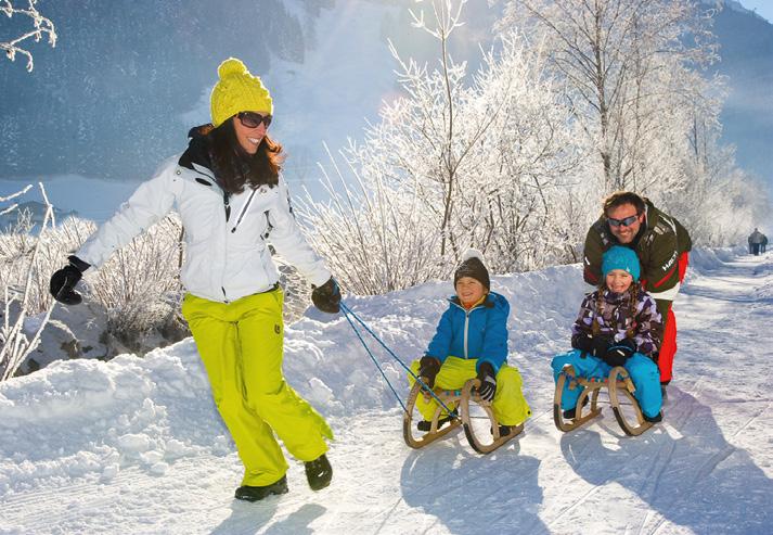
8 minute read
20


10 11
7 8 9
Advertisement
6 1
2
4
5 3
Wegbeschreibungen jeweils vom Tourismusverband Großarltal ausgehend. Planquadratnummern (PQ) laut Lageplan. Details auf touren.grossarltal.info The descriptions of the hiking paths always start at the Grossarltal tourist o ce. Grid square number (PQ) according to the map. Details on touren.grossarltal.info
Richtersteig 1 PQ J13
Gegenüber der Rai eisenbank auf dem Sonnseitweg bis zur ersten Kehre – hier nach links abzweigen – der Weg führt auf gleichbleibender Höhe in nördlicher Richtung – etwas steiler Abstieg zum Hotel Waldhof, ca. 1,2 km. You turn right opposite the Rai eisenbank and take the Sonnseitweg to the fi rst U-curve – here you turn left – follow the path at a constant height to the North – somewhat steep descent to the Hotel Waldhof (about 1,2 km).
Vorderstadluck 2 PQ K13
Gegenüber der Rai eisenbank führt die Straße Sonnseitweg bis zum Bauernhof Vorderstadluck, ca. 3,5 km in eine Richtung. Opposite the Rai eisenbank you follow the Street Sonnseitweg to the Vorderstadluck farm, about 3,5 km in one direction.
Hotel Lammwirt 3 PQ C6
Fahrt mit dem Bus oder dem PKW bis zum Hotel Lammwirt, dann Wanderung neben der Rodelbahn ca. 3 km in eine Richtung. Einkehrmöglichkeit: Hotel Lammwirt. Go by bus or with the car to the Hotel Lammwirt. Walk next to the sled run about 3 km in one direction. Refreshment stop: Hotel Lammwirt.
Loosbühelalm 4 PQ A6
TIPP Ausgangspunkt ist beim Klausbauer (letzte Bushaltestelle) oder beim Parkplatz Grundlehen im Ellmautal. Entlang der Straße bis nach Grundlehen und weiter am Güterweg bis zur Loosbühelalm, ca. 5 km vom Klausbauer oder ca. 3 km vom Parkplatz Grundlehen in eine Richtung. Einkehrmöglichkeit: Loosbühelalm. TIP Starting point is the Klausbauer (last bus stop) or the parking space Grundlehen in the Ellmautal. Follow the street to Grundlehen and further along the forestry road to the Loosbühelalm, about 5 km from Klausbauer or about 3 km from parking space Grundlehen Refreshment stop: Loosbühelalm.
Wanderweg nach Hüttschlag 5 PQ L11
Hiking path to Hüttschlag
TIPP Folgen Sie der Straße bis zum Kreisverkehr, dann taleinwärts. Nach 50 m den Steg über die Ache nehmen und erst der Achenpromenade, dann dem Wander- und Radweg ca. 8 km bis ins Ortszentrum Hüttschlag folgen. Einkehrmöglichkeiten: Landhotel Almrösl, Hotel Hüttenwirt. TIP Follow the street to the roundabout, then turn in direction to Hüttschlag. After 50 m take the bridge over the river and follow fi rst the Achenpromenade and then the hiking and cycling path about 8 km to the village center of Hüttschlag. Refreshment stops: Landhotel Almrösl, Hotel Hüttenwirt.
Bergstraße - Alpentaverne & Zapfenhütte 6 PQ L12
Folgen Sie der Gemeindestraße bis zum Kreisverkehr, dann taleinwärts – nach 50 m den Steg über die Ache nehmen – der Achenpromenade Richtung Hüttschlag folgen, bis Sie auf die Achengasse tre en – bergwärts geht es auf der Bergstraße bis zur Alpentaverne (ca. 5 km). Einkehrmöglichkeiten: Hotel Schützenhof, Alpentaverne, Zapfenhütte. Achtung: Pistenquerung! Follow the Gemeindestrasse to the roundabout, then turn in direction to Hüttschlag. After 50 m take the bridge over the river and fi rst follow this path. When you reach the Achengasse you walk uphill at the Bergstraße to the Alpentaverne, about 5 km in one direction. Refreshment stops: Hotel Schützenhof, Alpentaverne, Zapfenhütte. Attention: Slopes crossing!
Rattersberg 7 PQ I12
Gehen Sie bis zum Kreisverkehr, dann geradeaus in den Ortsteil Unterberg. Marschieren Sie bis zur Brücke vor dem Hotel Johanneshof. Folgen Sie dem Weg Rattersberg bis zum Bauernhof Pointgrün, ca. 5 km in eine Richtung. Einkehrmöglichkeit: Hotel Rattersberghof. Walk to the roundabout, then straight ahead to Unterberg. Walk to the bridge in front of the Hotel Johanneshof. Follow the way Rattersberg to the Pointgrün farm, about 5 km in one direction. Refreshment stop: Hotel Rattersberghof.
Wanderweg nach Au/Schied 8 PQ J13
Hiking path to Au/Schied
TIPP Marschieren Sie bis zum Sportzentrum. Überqueren Sie nach dem Schwimmbad die Landesstraße sowie die Großarler Ache. Gehen Sie rechts vor dem Hotel Tauernhof vorbei zum Wander- und Radweg in Richtung Schied/Au, ca. 4 km in eine Richtung. Einkehrmöglichkeit: Hotel Schiederhof, Großarler Genuss. TIP You walk to the sports center. You cross the main road and the river after the swimming pool. Walk right and pass the Hotel Tauernhof. Follow the hiking and cycling path in direction to Schied/Au, about 4 km in one direction. Refreshment stop: Hotel Schiederhof, Großarler Genuss.
Rosensteinweg 9 PQ D/E4
Zuerst den Wanderweg Schied/Au bis zur Aubrücke nehmen. Überqueren Sie die Landesstraße und folgen Sie dem Rosensteinweg bis zur Heugathalm, ca. 8 km in eine Richtung. First, take the hiking path to Schied/Au to the Aubrücke. Cross the main road and follow the Rosensteinweg to the Heugathalm, about 8 km in one direction.
Schiedweg 10 PQ D2/3
Wanderung entlang des Wanderweges nach Schied/Au bis zum Schiederhof, dann entlang der Landesstraße bis zum Schiedweg (an der Abzweigung ist auch eine Parkmöglichkeit, bis hier ca. 4 km). Wandern Sie bis zum Bauernhof Holzlehen, ca. 4 km in eine Richtung. Einkehrmöglichkeiten: Hotel Alpenklang, Hotel Schiederhof. Walk along the hiking path to Schied/Au, pass the Hotel Schiederhof along the street, then take the Schiedweg on the left hand-side (at the crossroad is also a place to park, until here about 4 km). Hike to the Holzlehen farm about 4 km in one direction. Refreshment stop: Hotel Schiederhof, Hotel Alpenklang.
Sonneggweg 11 PQ 2/3
Fahrt mit dem PKW oder Bus Richtung St. Johann oder gehen Sie am Wanderweg Schied/Au bis zur Wimmbrücke. Wandern Sie am Sonneggweg bis zum Hofl aden Hoamalm, ca. 2 km in eine Richtung. Einkehrmöglichkeit: Großarler Genuss, Hoamalm. Go by car or by bus in direction to St. Johann or walk at the hiking path Schied/Au to the Wimmbrücke, hike along the Sonneggweg to the “Hoamalm”, about 2 km in one direction. Refreshment stop: Grossarler Genuss, Hoamalm.
5
Neuhofen
960
Schappach
1000Neuhaus
1100
Hüttschlag Ort
1 4 0 0 1300
Sc hn ölldrisslwald
1600 1500
1700 Karlalm
1800
Karlkopf
1950
1900 1725
Schlöglhöhe
1930 Sc 1300 Karteisgraben 1500 hlöglalm Hallmoosalm
1661 Karteisalm
1200 1400
Trögenalm
Schrambach
Wolfau
Großarlbach Mühlegg
Oberstein Pfalz wald
Seilsitzberg
4
Schattleitenkopf
1900 2013
M i t t e r e c k
1700 1800
1000 Karteis
Ragglalm
1
1300
1 4 0 0 1100
Maurach
1 3 0 0
1600
H irsc hgruben wald
L wö enber eralmg
2
Aschau
Aschlreit
1200
Kree
1400
Rosswand
1898
Hirschgrubenalm Gensbichl
0401
H sau stein
1600
2092
2 000 Vorderkaseralm
1 600 Hubalm F l e c k m ä h d e r
1500 1100 Talwirt Stockham
3
1500 Pertill
2 1 0 0
1700 1800 1 6 0 0 S e e Karkopf Aschlreitalm Hinterkaseralm 20871341 Wegbeschreibungen jeweils vom Ortszentrum Hüttschlag ausgehend. Planquadratnummern (PQ laut Lageplan. Details auf touren.grossarltal.info ) 1800 1 2 0 SpielkogelHühnerkaralm E b e n 0 The descriptions of the hiking paths always start at the center of Hüttschlag. Grid square number (PQ) according to the map. Details on touren.grossarltal.info
2144 Modereggalm 1063
Hubalmtal Rosskaralm 1 1400 PQ P17
Wandern Sie vom Ortszentrum in Hüttschlag bergwärts an der Volksschu1 900 1 4 0 0 1 3 0 0 Lienkogel Holzknechthütte le vorbei bis Sie zur Kreuzung kommen. Hier führt ein Weg talwärts in den Ortsteil Wolfau, einer bergwärts Richtung Reitalm und einer geradeaus ins Hubalmtal. Auf diesem können Sie bis zur Hub-Grundalm wandern, ca. 4 2000 1500 1700 2100 2 2 0 0 1600 2000 Plattenkogel 2273 1841 I n d e r H ö l l 0 km in eine Richtung. Ab Hub-Grundalm „Ruhegebiet“. You walk uphill from the village center of Hüttschlag. There you pass the 1700 2300 L i e n a l m1 km elementary school until the crossing. One way leads down to the Wolfau, one way leads up in direction to the Reitalm and one straight ahead to the Hubalmtal. You can hike on this path to the Hub-Grundalm, about 4 km in one direction.
Bauernhof Oberneureit 2 PQ Q19
Fahren Sie mit dem PKW oder dem Postbus Richtung Talschluss. Folgen Sie dem Güterweg Oberneureit, gegenüber vom Aschaustüberl, ca. 3 km in eine Richtung. Einkehrmöglichkeit: Aschaustüberl. TIPP Sie können Wanderweg 1 und 2 zu einer Runde kombinieren. Dazu zweigen Sie am Weg zur Hub-Grundalm vor der Kapelle links ab und wandern in Richtung Hirschgrubenalm bis Sie zu einer Kreuzung kommen und nehmen den Güterweg talwärts. Einkehrmöglichkeit: Aschaustüberl. Go by car or by bus in direction to the end of the valley. Follow the Güterweg Oberneureit, opposite the Aschaustüberl, about 3 km in one direction. Refreshment stop: Aschaustüberl. TIP You can combine the hiking paths 1 and 2 to a round tour. Therefore you walk at the path in direction to the Hub-Grundalm and turn left before the chapel and walk in direction to the Hirschgrubenalm until you come to the crossing. There you take the way downwards. Refreshment stop: Aschaustüberl.
Hüttschlag Talschluss 3 PQ R20
TIPP Fahren Sie mit dem PKW oder dem Postbus bis zum Talschluss von Hüttschlag. Wanderung in den malerischen Talschluss zum Ötzlsee, ca. 2 km in eine Richtung. Einkehrmöglichkeiten: Talwirt und Hüttschlager Bauernladenstüberl. Oder Wanderung vom Talwirt entlang des Wanderweges talauswärts bis in den Ortsteil Karteis. Einkehrmöglichkeit: Aschaustüberl. TIP Go by car or by bus to the valleyhead of Hüttschlag. Hike into the Talschluss to the Ötzlsee, about 2 km in one direction. Refreshment stop: Talwirt, Hüttschlager Bauernladenstüberl. Or you hike from the Talwirt along the hiking path out of the valley to Karteis. Refreshment stop: Aschaustüberl.
Güterweg Seilsitzberg 4 PQ P18
Fahren Sie mit dem PKW oder dem Postbus Richtung Talschluss bis zum Ortsteil Karteis. Wanderung auf dem Güterweg Seilsitzberg bis zur Hallmoosalm, ca. 4 km in eine Richtung. Go by car or by bus in direction to the valleyhead of Hüttschlag to the district of Karteis. Then you hike on the Güterweg Seilsitzberg to the Hallmoosalm, about 4 km in one direction.
Güterweg Hinterfeld 5 PQ O16
Gehen Sie zum Tunnel und nehmen Sie die Straße, die rund um den Tunnel führt. Danach gehen Sie ein Stück entlang der Hauptstraße in Richtung Hüttschlag und nehmen den Güterweg Hinterfeld auf der rechten Seite, ca. 4 km in eine Richtung. Go to the tunnel and take the street that leads around the tunnel. Then you go a short distance along the main road in direction to Hüttschlag and take the Güterweg Hinterfeld on the right side, about 4 km in one direction.