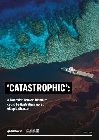
‘CATASTROPHIC’: A Woodside Browse blowout could be Australia’s worst oil spill disaster
AUGUST 2026
(Cover Image) Drone view of Scott Reef, Western Australia © Greenpeace / Michaela Skovranova Oil from oil rig disaster in the Gulf of Mexico © Daniel Beltrá / Greenpeace Close-up of corals on Seringapatam Reef, in Western Australia © Wendy Mitchell / Greenpeace
Acknowledgements Greenpeace Australia Pacific and Environs Kimberley acknowledge the Traditional Owners of Country throughout Australia and the Indigenous peoples of the Pacific Islands, and recognise their continuing connection to land, waters, and culture. We pay our respects to their Elders past and present.
‘CATASTROPHIC’: A WOODSIDE BROWSE BLOWOUT COULD BE AUSTRALIA’S WORST OIL SPILL DISASTER
Contents
Executive summary
4
Key findings
5
Scott Reef: an ancient oceanic reef system
9
A disaster worse than Montara, according to Woodside itself
10
People, places and wildlife at risk
16
A disaster for marine life
22
A threat to fishing, recreation and tourism
28
A threat to Sea Country and Indigenous Protected Areas on the Kimberley Coast
29
Woodside cannot be trusted
31
Woodside’s inadequate response plan
31
Woodside’s alarming track record
33
A lasting legacy for our oceans: save Scott Reef from Woodside’s pollution
39
Appendices
40
Appendix A: Shoreline accumulation from a blowout at the Torosa field
40
Appendix B: Entrained oil from a blowout at the Torosa field
41
Appendix C: Neighbouring countries potentially affected by a blowout at the Torosa field
43
References
45
3
Executive summary Scott Reef is an ancient, biodiverse coral atoll about 270 kilometres off Western Australia’s Kimberley coast, north-west of Broome. It is a fragile, living treasure that supports more than one thousand marine species, including the endangered pygmy blue whale and dusky sea snake, and rare green sea turtles. But this coral sanctuary and marine wonderland is under threat from fossil fuel polluter Woodside, and its proposed Browse to North West Shelf gas project (Browse). Woodside intends to drill at least 50 new wells underneath and around Scott Reef from the Torosa, Brecknock and Calliance reservoirs. The gas would be pumped through a 900-kilometre subsea pipeline to Karratha’s North West Shelf processing facility. Most of the gas would be exported. Gas drilling at Scott Reef would mean years of deafening seismic blasting, industrial noise and light pollution, and heavy ship traffic, threatening the delicate coral reef and the marine life that depends on it — including endangered whales and vulnerable sea turtles. If gas extracted from around Scott Reef is burned, it would contribute to climate change, which would in turn further damage the reef through coral bleaching caused by increased ocean temperatures and through extreme weather and rising sea levels.
Another danger threatens Scott Reef, marine life, coastlines and communities — a major oil spill. This report, prepared and released jointly by Greenpeace Australia Pacific and Environs Kimberley, analyses Woodside’s own modelling of several dangerous oil spill scenarios that could result from Browse. Diver at Scott Reef, Western Australia © Greenpeace / Hayley Baillie
‘CATASTROPHIC’: A WOODSIDE BROWSE BLOWOUT COULD BE AUSTRALIA’S WORST OIL SPILL DISASTER
Key findings: The most severe Browse scenario would be the worst oil spill in Australian history — up to 30 times bigger than the 2009 Montara oil spill disaster.1 According to Woodside, the environmental impact of such a spill would be ‘catastrophic’.2 Scott Reef and Sandy Islet could be covered in oily pollution.3 Woodside has conceded that the impacts to Scott Reef from a major spill ‘would likely be severe and potentially irreversible’.4 A blowout of this scale could see oil washing up on the Western Australian Kimberley Coast5, and affect at least nine marine parks,6 eight reefs, three Indigenous Protected Areas,7 and several islands in Australian, Indonesian and Timor Leste waters. Endangered and vulnerable marine species live, breed, forage and migrate within the potential disaster zone: whales, seabirds, turtles and other marine life are all at risk. A Browse oil spill threatens important tourism, diving, surfing and fishing hotspots, with potential ‘long term impacts’ for tourism operators in the Kimberley or visiting Rowley Shoals or Scott Reef.
Eagle rays near Scott Reef, Western Australia © Wendy Mitchell / Greenpeace
5
EXECUTIVE SUMMARY
Green turtles at Scott Reef, Western Australia © Wendy Mitchell / Greenpeace
Fish near Scott Reef, Western Australia © Wendy Mitchell / Greenpeace
Marine life at Scott Reef, Western Australia © Alex Westover and Wendy Mitchell / Greenpeace
‘CATASTROPHIC’: A WOODSIDE BROWSE BLOWOUT COULD BE AUSTRALIA’S WORST OIL SPILL DISASTER
Aerial view of Scott Reef in Western Australia © Alex Westover / Greenpeace
7
Underwater life at Scott Reef, Western Australia © Greenpeace / Hayley Baillie
‘CATASTROPHIC’: A WOODSIDE BROWSE BLOWOUT COULD BE AUSTRALIA’S WORST OIL SPILL DISASTER
Scott Reef: An ancient oceanic reef system Scott Reef, located around 270 kilometres off the Western Australian Kimberley coast, is one of Australia’s largest oceanic reef systems. Ancient Scott Reef has been thriving for 15 million years, having adapted to changing seas. Today, it is a haven for marine life, providing vital habitat for more than a thousand species, including corals, fish, sharks and rays. The deep waters surrounding the reef are home to 29 known species of whale and dolphin, including endangered pygmy blue whales, which travel along the Western Australian coast and stop at Scott Reef during their annual migration to forage and feed. The dusky sea snake, also classified as endangered, lives at Scott Reef. Sandy Islet, part of Scott Reef, is a nesting ground for a small population of genetically distinct green sea turtles, a species classified as vulnerable. If Woodside, Australia’s largest oil and gas company, were to gain approval to drill for gas at Scott Reef, the ecosystem would face a barrage of industrial impacts, including seismic blasting, gas flaring, underwater noise, artificial lighting, pipelaying, and fast-moving vessels over years of construction and operation. Add to that the risk of a major oil spill that could be Australia’s worst environmental disaster, with consequences spreading far beyond Scott Reef.
9
A disaster worse than Montara, according to Woodside itself Woodside has proposed drilling 50 new wells around Scott Reef to extract oil and gas from beneath the reef as part of the Browse project. Woodside has proposed to build a 900-kilometre-long undersea pipeline to connect the Scott Reef-Browse site with its North West Shelf facility at Karratha in Western Australia, where the gas would be processed, mostly for international export. Woodside has modelled a number of possible oil spill scenarios that could result from the Browse project. 8 Woodside performed this modelling to comply with mandatory environmental impact assessment requirements under Federal and Western Australian laws. To identify which areas are at risk of an oil spill from the Browse project, Woodside engaged experts to conduct probabilistic modelling.9 Experts simulated different spills, noting which locations would be contaminated by oil and how much oil would make it to shore. They also assessed how likely each location was to be affected.
Woodside’s ‘worst case’ scenario is a blowout at the Torosa gasfield, directly under Scott Reef.10
Oil from oil rig disaster in the Gulf of Mexico © Daniel Beltrá / Greenpeace
‘CATASTROPHIC’: A WOODSIDE BROWSE BLOWOUT COULD BE AUSTRALIA’S WORST OIL SPILL DISASTER
Woodside’s toxic plans for Scott Reef
0 0
400
800 km
Gas and oil fields Proposed carbon dumping well site
10
20 km
N
N
Proposed pipelines
Indicative well drilling areas Proposed floating production site
GPAP illustration based on Proposed Browse Development Area and Notional Field Layout & Proposed Browse CCS Development Area
Valaris DPS-1, the drill rig commissioned to build Woodside’s polluting Burrup Hub © Greenpeace / Oliver Clarke
11
A DISASTER WORSE THAN MONTARA, ACCORDING TO WOODSIDE ITSELF
Browse and Montara: Location and extent in the Timor Sea
0
200
400 km
N
2009 Montara oil spill
Potential Browse oil spill 11
GPAP illustration based on maps from ‘The Montara Oil Spill: A 2009 Well Blowout in the Timor Sea’ and a Browse loss of well containment
Greenpeace Australia Pacific and Environs Kimberley’s analysis shows an oil spill at Torosa could see 893,739 barrels of condensate spilled into the Timor Sea.12 This would be up to 30 times bigger than the 2009 Montara oil spill, considered one of Australia’s worst environmental disasters.13 Oil leaked into the Timor Sea for 74 days after an oil rig caught fire off the Western Australian coast, causing a 90,000 square kilometre oil slick that spread all the way to Indonesia.14
‘CATASTROPHIC’: A WOODSIDE BROWSE BLOWOUT COULD BE AUSTRALIA’S WORST OIL SPILL DISASTER
Montara oil spill in the Timor Sea © PR Handout Image / AAP Photos
Montara oil spill © Martin Pritchard Environs Kimberley
13
A DISASTER WORSE THAN MONTARA, ACCORDING TO WOODSIDE ITSELF
Shell oil Spill in the Gulf of Mexico © Derick Hingle / Greenpeace
‘CATASTROPHIC’: A WOODSIDE BROWSE BLOWOUT COULD BE AUSTRALIA’S WORST OIL SPILL DISASTER
Dead fish after oil spill in Karawang, West Java © Jurnasyanto Sukarno / Greenpeace
Peru oil spill © Musuk Nolte / Greenpeace
Burning oil from oil rig disaster in the Gulf of Mexico © Daniel Beltrá / Greenpeace
15
People, places and wildlife at risk
Woodside’s worst case discharge modelled could see oil washing up on the Kimberley coast in Western Australia, as well as over Indonesian and East Timorese waters, threatening wildlife, coastlines and communities across a vast area. Woodside’s modelling shows that an oil spill at Scott Reef could affect eight reefs, at least nine marine parks and three Indigenous Protected Areas.15
Woodside has described the impact of such a spill as ‘catastrophic’.16 In the event of a worst-case oil spill, Scott Reef and Sandy Islet, being closest to the wellhead, would be worst affected.17 Woodside’s modelling finds that the impacts to Scott Reef from a major spill like this ‘would likely be severe and potentially irreversible’.18 The impacts of an oil spill are not confined to Scott Reef – according to Woodside’s modelling, ‘hydrocarbon spills resulting from the proposed Browse to NWS Project have the potential to significantly impact shoreline habitats at Scott Reef, Ashmore Reef, Cartier Island and Rowley Shoals.’19
Oil from oil rig disaster in the Gulf of Mexico © Daniel Beltrá / Greenpeace
‘CATASTROPHIC’: A WOODSIDE BROWSE BLOWOUT COULD BE AUSTRALIA’S WORST OIL SPILL DISASTER
Lacepede Islands, Western Australia © Environs Kimberley
Floating oil is visible at relatively low concentrations (> ~ 0.05 g/m2 ). At 1 g/m2, an oil slick has the classic ‘rainbow’ sheen.20 Woodside predicts that an oil slick ten times more concentrated (10 g/m2) could reach up to 143 km from the spill site.21 An oil slick of this magnitude could harm or even kill seabirds and other wildlife, which can become covered in oil.22 ‘Entrained oil’— oil that has become mixed into water — is predicted to be found up to 863 kilometres from the spill site.23
17
PEOPLE, PLACES AND WILDLIFE AT RISK
A Browse oil spill: Locations at risk
Montgomery Reef
1 2
4 3 5
6 7
9 8 10
11
12 13
15 16 14
18
GPAP illustration based on a Browse loss of well containment
22
21
17
19
20
Montgomery Reef © Wendy Mitchell Buccaneer Archipelago © Wendy Mitchell
Rowley Shoals Marine Park
Kooljaman (Cape Leveque) Dampier Peninsula © Greenpeace / Michaela Skovranova
Buccaneer Archipelago
Walmadany (James Price Point) © Greenpeace / Michaela Skovranova Rowley Shoals Marine Park © Greenpeace / Hayley Baillie
Walmadany (James Price Point)
0
200
400 km
Kooljaman (Cape Leveque) Dampier Peninsula
N
Potential Browse oil spill
Areas identified by Woodside as at risk23
‘CATASTROPHIC’: A WOODSIDE BROWSE BLOWOUT COULD BE AUSTRALIA’S WORST OIL SPILL DISASTER
In fact, Woodside’s modelling shows that an oil spill could reach and threaten numerous important ecosystems across the Kimberley Coast and Timor Sea, including:24 1
2
3
4
5
6
7
South Coast of Lombok, Indonesia West Coast of Sumba, Indonesia South Western side of Sumba, Indonesia Mid Northern Coast of Sumba, Indonesia located inside the Savu Sea Marine Park
11
12
Seringapatam Reef
13
Browse Island
14
Adele Island
15
16
South Eastern Coast of Sumba, Indonesia Pulau, Mangkudu & Halura Island, Sumba Indonesia Palau Dana, Indonesia located in the Savu Sea Marine Park
Scott Reef and Sandy Islet
17
Champagny Island, Camden Sound Marine Park, Dambimangari Vulcan Islands, Camden Sound Marine Park, Dambimangari Buccaneer & Bonaparte Archipelago, including Salier Island, Mayala
18
Dampier Peninsula
19
Lacepede Islands
8
Ashmore Reef
20
Mermaid Reef
9
Hibernia Reef
21
Clerke Reef
10
Cartier Island
22
Imperieuse Reef
The Kimberley Coast is considered by scientists to be in the top 4% of the most intact coastlines in the world.25 Oil from a blowout could also reach neighbouring countries, including Pulau Rote, Savu, Sumba and West Timor in Indonesia, and Timor Leste. This is not an exhaustive list of all places that could be affected by an oil spill at Scott Reef. Once oil hits the water, its spread is influenced by the wind, tides, currents and other external conditions. An oil spill from the Browse project could have a less or more severe impact than the modelling indicates. Equally, Woodside cannot rule out other sites being affected.
19
PEOPLE, PLACES SECTION AND WILDLIFE AT RISK
Montgomery Reef © Wendy Mitchell
Shark at Scott Reef, Western Australia © Wendy Mitchell / Greenpeace
‘CATASTROPHIC’: A WOODSIDE BROWSE BLOWOUT COULD BE AUSTRALIA’S WORST OIL SPILL DISASTER
Clown fish at Scott Reef, Western Australia © Greenpeace / Michaela Skovranova
Aerial view of Seringapatam Reef, part of the Scott Reef system, in Western Australia © Alex Westover / Greenpeace
21
PEOPLE, PLACES AND WILDLIFE AT RISK
A disaster for marine life Woodside’s oil spill modelling shows that a blowout from the Browse project would put whales, turtles, seabirds, coral, significant feedstocks such as plankton and seagrass, fish, dolphins and other marine life at risk.26 According to Woodside, a Browse oil spill would: •
Directly threaten the coral at Scott Reef, with ‘potential for near total coral mortality in the worst affected areas’; a severe spill could also harm coral at Seringapatam Reef and the Rowley Shoals.27
•
‘Significantly impact’ the plankton, seagrass and macroalgae that support the entire food chain.28
•
‘Significantly impact bird species, including protected species’, which are ‘particularly vulnerable’ to oil spills.29
A spill would not only threaten birds at Scott Reef, but those that nest or breed at Ashmore Reef and Cartier Island, Browse Island, islands along the Kimberley coastline (such as the Lacepede Islands) and Rowley Shoals. Woodside’s oil spill modelling specifically notes the potential risk to thirteen species of seabirds.30
GPAP illustration based on a Browse loss of well containment and North-west Marine Parks Network
A Browse oil spill: Marine parks at risk
Oceanic Shoals Marine Park
Ashmore Reef Marine Park Cartier Island Marine Park
rk
e
in
ey
rl
be
ar M
Pa
m
Ki
Kimberley Marine Park
Argo-Rowley Terrace Marine Park
Bardi Jawi Gaarra Marine Park Mermaid Reef Marine Park Rowley Shoals Marine Park (WA)
0
200
400 km
N
Potential Browse oil spill
Marine parks at risk
Lalang-garram Camden Sound Marine Park Mayala Marine Park
‘CATASTROPHIC’: A WOODSIDE BROWSE BLOWOUT COULD BE AUSTRALIA’S WORST OIL SPILL DISASTER
Marine life at Scott Reef, Western Australia © Alex Westover / Greenpeace
23
PEOPLE, PLACES AND WILDLIFE AT RISK
A Browse oil spill: Whale migratory pathways
Potential Browse oil spill Pygmy blue whale known foraging area
GPAP illustration based on Browse loss of well containment and pygmy blue whale and humpback whale biologically important areas
Pygmy blue whale distribution
Pygmy blue whale migratory route
Humpback whale migratory route
More than half of all the marine mammal species in Australia are believed to visit Scott Reef.31 Oil spills also threaten whales and other cetaceans, especially concentrations of oil on the surface of the water. This can cause ‘sublethal and lethal effects’, especially when feeding32, as whales and other marine mammals have been found to aspirate oil when breathing through an oil slick at the sea surface, thus absorbing hydrocarbons directly into their lungs, leading to sublethal and lethal impacts.
‘CATASTROPHIC’: A WOODSIDE BROWSE BLOWOUT COULD BE AUSTRALIA’S WORST OIL SPILL DISASTER
A Browse oil spill has the potential to harm humpback whales and pygmy blue whales, both of which migrate through the area at risk from a spill, and which are ‘the most likely to be significantly impacted by toxic effects [from an oil spill] when feeding’.33 Woodside’s modelling also warns of the risk to sei whales and fin whales, both found in the Timor Sea.34
Humpback Whales along Ningaloo Coastline in Western Australia © Greenpeace / Tiffany Klein
25
PEOPLE, PLACES AND WILDLIFE AT RISK
Dolphins at Scott Reef, Western Australia © Wendy Mitchell / Greenpeace
According to Woodside’s modelling, a Browse oil spill could be particularly harmful to the spinner dolphins living at Scott Reef with the potential for ‘a significant portion of this local population to be impacted in the event of a worst-case hydrocarbon spill’.35 Marine reptiles, including the green sea turtles found at Scott Reef, are also at risk. Woodside’s modelling warns that an oil spill could cause ‘significant mortality amongst adults and hatchlings’, leading to ‘the potential for longer-term impacts on the Scott Reef - Browse Island genetic stock of green turtles’. 36 Further, an oil spill could have lasting impacts on the breeding populations of olive ridley turtles, flatback turtles and hawksbill turtles.37 Essentially, all marine life found at or near the sea surface could be impacted by such a spill.
‘CATASTROPHIC’: A WOODSIDE BROWSE BLOWOUT COULD BE AUSTRALIA’S WORST OIL SPILL DISASTER
Turtle at Scott Reef, Western Australia © Alex Westover / Greenpeace
27
PEOPLE, PLACES AND WILDLIFE AT RISK
Swimmers at Scott Reef in Western Australia © Greenpeace / Sarah Gittoes
Indonesian fishing boat in Australian waters © Wendy Mitchell / Greenpeace
A threat to fishing, recreation and tourism Many people in north-west WA depend on the ocean for their livelihoods. The Browse gas project and its 900km pipeline would overlap with four Commonwealth and 11 WA state fisheries.38 Rowley Shoals and other atolls in the Timor Sea, including Scott Reef, are world-class diving and fishing sites visited by specialist charter operators. According to Woodside, an oil spill from Browse would put these operations at risk. Woodside’s modelling states that an oil spill ‘has the potential to impact tourism, recreational, scientific and traditional fishing activities in localised offshore areas such as Scott Reef and Rowley Shoals’.39 According to Woodside, this includes ‘a potential for long term impacts to a small number of operators and users that visit these areas’.40 Woodside’s modelling notes that six unspecified fisheries are most likely to be threatened by a Browse oil spill ‘given their proximity to potential release locations’.41 It warns not only of the direct impact on fish stocks — ‘with subsequent impacts to fishers as a result of a reduction in catch’ and ‘potentially resulting in lost revenue’ — but of the longer term impacts including exclusion zones that ‘can impact seafood markets long after any actual risk to seafood from a spill has subsided’.42 Woodside’s modelling predicts that oil could wash up on ‘localised areas of the Kimberley coast’; in which case beaches could be closed ‘for a period of days to weeks… until natural weathering or tides and currents remove the hydrocarbons’.43 An oil spill could also do lasting damage to the tourism industry, if tourists and recreational users stay away ‘due to perceived impacts, including after the hydrocarbon spill has dispersed’.44
‘CATASTROPHIC’: A WOODSIDE BROWSE BLOWOUT COULD BE AUSTRALIA’S WORST OIL SPILL DISASTER
A threat to Sea Country and Indigenous Protected Areas on the Kimberley Coast According to Woodside, there is a small chance that a Browse oil spill could reach Lalang-gaddam Marine Park, and Bardi Jawi, Uunguu and Dambimangari Indigenous Protected Areas.45 In 2022, three years after Woodside’s modelling was completed, the WA Government announced three new marine parks in the Buccaneer archipelago: Bardi Jawi Gaara Marine Park, Mayala Marine Park and Maiyalam Marine Park.46 These were the first marine parks in Western Australia to be co-designed and jointly managed by Traditional Owners and the WA Government.47 Woodside’s modelling shows that oil has the potential to reach the Buccaneer Archipelago, however it is unclear how these new marine parks would be affected.48
Bonaparte Archipelago © Wendy Mitchell
29
Protest of Woodside and drill rig Valaris at Scarborough Gas Field in Western Australia © Greenpeace / Oliver Clarke
‘CATASTROPHIC’: A WOODSIDE BROWSE BLOWOUT COULD BE AUSTRALIA’S WORST OIL SPILL DISASTER
Woodside cannot be trusted
Woodside’s inadequate response plan Woodside states that it considers an oil spill to be ‘highly unlikely’ and the threat to the environment and wildlife to be ‘acceptable’.49 We do not believe these are credible assertions. For instance, the WA Environmental Protection Authority (EPA), which is assessing Woodside’s Browse to NWS proposal, did not agree. In August 2024, it emerged that the EPA advised Woodside that its Browse development posed ‘unacceptable’ risks to WA’s environment.50 A potential oil spill from the Torosa field was one of the risks cited by the EPA in its preliminary decision not to approve the project. Woodside has subsequently revised its plans to drill for gas at Scott Reef, proposing to use unproven new technology that the company claims would bring a spill under control more quickly, reducing the spill time from 77 days to 13 days.51 However, an independent assessment commissioned by Woodside did not support these claims. Instead, the expert questioned whether the piece of equipment proposed by Woodside — a capping stack — could be deployed in practice, and the time it would likely take to do so.52 While Woodside has also claimed that a ‘pyrotechnic shear ram’ would reduce the spill time to as little as 24 hours, the company’s expert noted that this had yet to be ‘used in anger’ and that ‘there remains a risk’ that it fails to function.53
31
WOODSIDE CANNOT BE TRUSTED
Humpback Whale at the Woodside Burrup Hub in Australia © Greenpeace / Wendy Mitchell
Multinational oil major, Chevron, has resisted calls to deploy the same technology in the Carnarvon Basin, stating that it cannot be tested, ‘has never been activated to control a subsea loss of containment and its effectiveness is [therefore] based on testing, modelling, and simulation under controlled conditions’.54 To summarise, Woodside is relying on untested and potentially unreliable technologies to mitigate what could be the most devastating oil spill in Australian history. Further, experience around the world shows that subsea wellhead containment technology is notoriously susceptible to failure while little could be contained and recovered from the sea surface.
‘CATASTROPHIC’: A WOODSIDE BROWSE BLOWOUT COULD BE AUSTRALIA’S WORST OIL SPILL DISASTER
Woodside’s alarming track record Woodside’s stated ability to prevent or control a disaster is undercut by its poor environmental and safety track record. There have been numerous incidents at Woodside’s facilities over the last decade threatening the safety of its workers and the environment. These include: •
Whale calf collision: In August 2023, a tugboat operated by a Woodside contractor hit a whale calf in the Port of Dampier.55 The incident was only confirmed by the Department of Biodiversity, Conservation and Attractions (DBCA) after media inquiries.
•
Explosion at Pluto LNG plant: In May 2023, an explosion forced Woodside to shut down and evacuate its Pluto LNG facility. Woodside was accused by unions of downplaying the incident.56 Eighteen months later, Woodside was again forced to put Pluto LNG into an emergency shutdown after the control systems failed.57
•
Oil spill near Ningaloo: In May 2025, Woodside spilled 16,000 litres of ‘hydrocarbons’ into the ocean near World Heritage listed Ningaloo Reef while decommissioning its Griffin facility.58 Three months later, the government regulator ordered Woodside to stop decommissioning operations at Griffin and nearby Stybarrow following a series of ‘preventable health and safety incidents’ at both sites.59
•
Oil spill in Cossack field: In 2016, a Woodside oil rig in the Cossack field leaked over 10,500 litres of oil into the ocean due to a degraded seal.60
Dredging for Woodside’s Burrup Hub in Australia © Greenpeace / Alex Westover
33
WOODSIDE CANNOT BE TRUSTED
Oil spill aftermath in the Bangladesh Sundarbans © Syed Zakir Hossain / Greenpeace
‘CATASTROPHIC’: A WOODSIDE BROWSE BLOWOUT COULD BE AUSTRALIA’S WORST OIL SPILL DISASTER
Dead green sea turtle in nesting area on Sandy Islet, Scott Reef, Australia © Wendy Mitchell / Greenpeace
Oil pollution at Andrew Oilfield in the North Sea © Marten van Dijl / Greenpeace
Oil spil in Rayong, Thailand © Chanklang Kanthong / Greenpeace
35
WOODSIDE CANNOT BE TRUSTED
•
Northern Endeavour clean-up debacle: Woodside evaded a $362 million decommissioning bill for its Northern Endeavour oil platform in the Timor Sea by offloading it onto a one-person operation.61 When the buyer went bankrupt, the Federal Government had to step in, eventually putting a levy on offshore oil and gas companies to recover the clean up costs.62
•
Cost-cutting and corrosion: In 2021, Woodside announced a 30% cut in operating costs, focusing on maintenance, despite repeated warnings from the government regulator about corrosion at its oil and gas facilities.62 The warnings continued. In July 2023, the regulator blamed Woodside’s ‘inadequate maintenance’ for serious corrosion of the flare bridge and support structure at its North Rankin complex.64
•
Abandoned infrastructure: Woodside finished extracting oil from the Enfield field in 2018. In 2019, the government regulator ordered Woodside to remove the Nganhurra Riser Turret Mooring (RTM), an 83-metrelong, 2,452 tonne piece of infrastructure. Woodside instead tried to sink the RTM near the World Heritagelisted Ningaloo Reef.65 After a public outcry, Woodside finally removed the RTM in October 2023.
Activists occupy Woodside’s toxic oil tower in Australia © Greenpeace
‘CATASTROPHIC’: A WOODSIDE BROWSE BLOWOUT COULD BE AUSTRALIA’S WORST OIL SPILL DISASTER
Woodside’s sunken Griffin Field oil tower exposed in Australia © Greenpeace
37
Protest to save Scott Reef at Woodside AGM in Perth, Western Australia © Greenpeace
‘CATASTROPHIC’: A WOODSIDE BROWSE BLOWOUT COULD BE AUSTRALIA’S WORST OIL SPILL DISASTER
A lasting legacy for our oceans: Save Scott Reef from Woodside’s pollution
Woodside’s Browse proposal to drill for oil and gas presents unacceptable risks to Scott Reef and the web of life it supports from Western Australia to Indonesia. Greenpeace Australia Pacific and Environs Kimberley are calling on the WA and Federal Governments to save Scott Reef by rejecting Woodside’s Browse project once and for all. Find out more at savescottreef.greenpeace.org.au and environskimberley.org.au/scott_reef
39
APPENDIX A
APPENDIX A: SHORELINE ACCUMULATION FROM A BLOWOUT AT THE TOROSA FIELD66 Probability (%) of shoreline oil concentration ≥100g/m2
Maximum local accumulated concentration (g/m2)
Maximum accumulated volume (m3) along this shoreline
Average over all scenarios
Worst replicable scenario
Average over all scenarios
Worst replicable scenario
Sandy Islet
92%
8,495 g/m2
34,279 g/m2
339 m3
827 m3
Scott Reef
92%
8,495 g/m2
34,279 g/m2
339 m3
827 m3
Ashmore Reef Marine Park
18%
302 g/m2
6,657 g/m2
23 m3
157 m3
Rowley Shoals: Mermaid Reef
9%
75 g/m2
1,059 g/m2
4 m3
25 m3
Cartier Island Marine Park
22%
87 g/m2
1,744 g/m2
8 m3
38 m3
Buccaneer & Bonaparte Archipelagos
2%
3.9 g/m2
155 g/m2
<1 m3
8 m3
Kimberley Coast
1%
2.7 g/m2
205 g/m2
<1 m3
14 m3
Lalang-gaddam Marine Park
1%
1.5 g/m2
149 g/m2
<1 m3
6 m3
Rowley Shoals: Clerke Reef
8%
38 g/m2
583 g/m2
3 m3
16 m3
Rowley Shoals: Imperieuse Reef
8%
34 g/m2
557 g/m2
3 m3
18 m3
WA Coastline
2%
3.9 g/m2
205 g/m2
2 m3
19 m3
Adele Island
<1%
1.4 g/m2
54 g/m2
<1 m3
2 m3
Camden Sound
<1%
<0.1 g/m2
7.5 g/m2
<1 m3
<1 m3
Dampier Peninsula Coast - Mid Section
<1%
<0.1 g/m2
2.1 g/m2
<1 m3
<1 m3
Dampier Peninsula Coast - North Section
<1%
<0.1 g/m2
2 g/m2
<1 m3
<1 m3
Lacepede Islands <1%
0.2 g/m2
12 g/m2
<1 m3
<1 m3
Location
‘CATASTROPHIC’: A WOODSIDE BROWSE BLOWOUT COULD BE AUSTRALIA’S WORST OIL SPILL DISASTER
APPENDIX B: ENTRAINED OIL FROM A BLOWOUT AT THE TOROSA FIELD The standard threshold used for entrained oil is 100 ppb (parts per billion) – high enough to harm crustaceans and fish, ‘through physical coating of gills and body surfaces, or accidental ingestion’.67
Entrained oil: Islands, beaches and reefs68 Location
Probability of entrained oil concentration
Maximum entrained oil (ppb)
≥100ppb
Averaged over all replicate scenarios
At any depth, in the worst replicate scenario
Adele Island
<1%
2
71
Ashmore Reef
8%
26
502
Browse Island
3%
17
305
Buccaneer & Bonaparte Archipelagos
<1%
<1
53
Camden Sound
<1%
<1
38
Cartier Island
13%
30
301
Dampier Peninsula Coast Mid Section
<1%
<1
<1
Dampier Peninsula Coast North
<1%
<1
3
Hibernia Reef
8%
15
328
Kimberley Coast
<1%
2
98
Lacepede Islands
<1%
<1
3
Rowley Shoals - Clerke Reef
<1%
5
61
Rowley Shoals - Imperieuse Reef
<1%
2
30
Rowley Shoals - Mermaid Reef 8%
9
119
Sandy Islet
91%
2,079
7,648
Scott Reef Central
92%
2,079
7,648
Scott Reef North
100%
7,858
23,584
Scott Reef North - Flats
100%
6,259
18,068
Scott Reef North - Lagoon
100%
3,762
10,505
Scott Reef South
97%
3,576
11,647
Scott Reef South - Flats
94%
2,873
9,004
Scott Reef South - Lagoon
97%
3,387
11,747
Seringapatam Reef
87%
1,241
5,213
WA Coastline
<1%
3
93 41
APPENDIX B
Entrained oil: Marine parks and oceanic ecosystems69 Location
Probability of entrained oil concentration
Maximum entrained oil (ppb)
≥100ppb
Averaged over all replicate scenarios
At any depth, in the worst replicate scenario
Argo-Rowley Terrace Marine Park
21%
64
719
Ashmore Reef Marine Park
8%
28
602
Barracouta Shoal
8%
29
348
Big Bank Shoals
<1%
<1
9
Cartier Island Marine Park
13%
32
345
Echuca Shoal
<1%
10
77
Eighty Mile Beach Marine Park
<1%
<1
2
Eugene McDermott Shoal
6%
17
155
Fantome Bank
1%
6
149
Glomar Shoals & Rankin Bank
<1%
<1
<1
Heywood Shoal
5%
16
144
Kimberley Marine Park
31%
77
1,010
Lalang-gaddam - Camden Sound Marine Park
<1%
<1
50
Oceanic Shoals - Deep Shoal 1
<1%
<1
18
Oceanic Shoals Region Gale-Favell-Baldwin Banks
<1%
2
27
Oceanic Shoals Region Margaret Harries Banks
<1%
<1
24
Oceanic Shoals Region The Boxers
<1%
<1
12
Oceanic Shoals Marine Park
1%
3
101
Rowley Shoals - Clerke Reef State Marine Park
<1%
6
86
Rowley Shoals Imperieuse Reef State Marine Park
<1%
3
44
Rowley Shoals - Mermaid Reef Marine Park
8%
10
137
Sahul Banks
<1%
3
51
Van Cloon Shoal
<1%
<1
25
Vulcan & Goeree Shoals
10%
23
227
‘CATASTROPHIC’: A WOODSIDE BROWSE BLOWOUT COULD BE AUSTRALIA’S WORST OIL SPILL DISASTER
APPENDIX C: NEIGHBOURING COUNTRIES POTENTIALLY AFFECTED BY A BLOWOUT AT THE TOROSA FIELD International sites: Entrained oil70 Location
Probability of entrained oil Maximum entrained oil (ppb) concentration Averaged over all replicate At any depth, in the worst ≥100ppb scenarios replicate scenario
Indonesia
<1%
2
33
Indonesian Boundary
<1%
3
96
Pulau Roti
<1%
<1
2
Savu
<1%
<1
11
Sumba
<1%
<1
19
Timor West
<1%
<1
4
<1%
<1
8
Timor Leste
International sites: Shorelines71 Location
Probability (%) of shoreline oil concentration
Indonesia
Maximum local accumulated concentration (g/m2)
Maximum accumulated volume (m3) along this shoreline
Average over all scenarios
Worst replicable scenario
Average over all scenarios
Worst replicable scenario
10 /m2
457 g/m2
8 m3
52 m3
Sumba
3%
10 g/m2
457 g/m2
4 m3
36 m3
Pulau Rote
<1%
0.2 g/m2
24 g/m2
<1 m3
2 m3
Savu
<1%
0.8 g/m2
38 g/m2
<1 m3
5 m3
Timor West
<1%
0.1 g/m2
65 g/m2
<1 m3
9 m3
1%
1.6 g/m2
160 g/m2
<1
7 m3
Timor Leste
43
Clownfish near Scott Reef, Western Australia © Wendy Mitchell / Greenpeace
‘CATASTROPHIC’: A WOODSIDE BROWSE BLOWOUT COULD BE AUSTRALIA’S WORST OIL SPILL DISASTER
References 1.
2.
The largest oil spill in Australia was the Kirki tanker spill in 1991 (17,280 tonnes/126,662 bbl). However, the volume of oil spilled during the Montara disaster is contested. While the official figure for Montara is 400 bbl/day (29,600 bbl), contemporaneous government estimates put the figure at up to 2,000 bbl/day (148,000 bbl). Woodside’s ‘worst case’ scenario, at 893,739 bbl, would be more than 6 times larger. Sources: Australian Maritime Safety Authority (2020). “Kirki, 21 July 1991” https://www.amsa. gov.au/marine-environment/incidents-and-exercises/ kirki-21-july-1991; Montara Commission of Inquiry (2010). “Report of the Montara Commission of Inquiry” p.30, https://www.industry.gov.au/sites/default/files/2022-09/ montara-commission-of-inquiry-report-june-2010.pdf; Australian Maritime Safety Authority (2020). “Montara Well Head Platform, 21 August 2009” https://www.amsa. gov.au/marine-environment/incidents-and-exercises/ montara-well-head-platform-21-august-2009; Woodside Energy (2019), “Browse to NWS Project - Quantitative spill risk assessment”, p.69, https://www.epa.wa.gov.au/sites/ default/files/PER_documentation2/Appendix%20D%205.pdf Woodside Energy (2019). “Proposed Browse to NWS Project: Draft EIS/ERD”, p. 684, https://www.woodside.com/docs/ default-source/current-consultation-activities/australianactivties/propsed-browse-to-north-west-shelf-project--draft-eis-erd.pdf?sfvrsn=12d274a8_6
3.
RPS Group (2019). “Browse to NWS Project – Quantitative spill risk assessment”, p. 73, https://www.epa.wa.gov.au/ sites/default/files/PER_documentation2/Appendix%20 D%205.pdf
4.
Woodside Energy (2022). “Proposed Browse to North West Shelf Project Supplement Report to the Draft EIS/ERD”, p. 54, https://www.woodside.com/docs/default-source/ our-business---documents-and-files/burrup-hub--documents-and-files/browse---documents-and-files/ proposed-browse-to-nws-project---supplement-reportto-the-draft-eis-(epbc-2018-8319).pdf
5.
RPS Group (2019). “Browse to NWS Project - Quantitative spill risk assessment”, Table 3.1, pp. 75-76, https://www. epa.wa.gov.au/sites/default/files/PER_documentation2/ Appendix%20D%205.pdf
6.
Argo-Rowley Terrace Marine Park, Ashmore Reef Marine Park, Cartier Island Marine Park, Eighty Mile Beach Marine Park, Kimberley Marine Park, Lalang-gaddam Marine Park, Mermaid Reef Marine Park, Oceanic Shoals Marine Park and Rowley Shoals Marine Park (state). Source: RPS Group (2019). “Browse to NWS Project - Quantitative spill risk assessment”, Table 3.1, pp. 75-76, https://www.epa.wa.gov. au/sites/default/files/PER_documentation2/Appendix%20 D%205.pdf
7.
Although not directly referenced in Woodside’s oil spill modelling report, three other marine parks - Bardi Jawi Gaara Marine Park and Mayala Marine Park in WA, and Savu Sea Marine National Park in Indonesia, overlap with areas identified as being at risk should a blowout occur.
8.
RPS Group (2019). “Browse to NWS Project – Quantitative spill risk assessment.”
9.
RPS Group (2019). “Browse to NWS Project – Quantitative spill risk assessment”; Woodside Energy (2019). “Proposed Browse to NWS Project Draft EIS/ERD”; and Woodside Energy (2022). “Proposed Browse to North West Shelf Project Supplement Report to the Draft EIS/ERD”.
10.
RPS Group (2019). “Browse to NWS Project – Quantitative spill risk assessment”, p. 73.
11.
Woodside Energy (2019). “Proposed Browse to NWS Project Draft EIS/ERD”, p. 651.
12.
77 days at 11,607 bbl/day. Source: RPS Group (2019). “Browse to NWS Project - Quantitative spill risk assessment”, p. 69.
13.
The official figure for the volume of oil spilled during the Montara disaster is 400 bbl/day or 29,600 bbl over the 74 spill, as provided by the rig owner PEPTT. Source: Montara Commission of Inquiry (2010) “Report of the Montara Commission of Inquiry”, p. 30; Australian Maritime Safety Authority (2020). “Montara Well Head Platform, 21 August 2009”.
14.
Greenpeace Australia Pacific (2019). “Montara Oil Spill. The massive Australian oil spill you’ve probably never heard of”.
15.
RPS Group (2019). “Browse to NWS Project – Quantitative spill risk assessment”, pp. 51, 75-76, 84-85.
45
REFERENCES
16.
Woodside Energy (2019). “Proposed Browse to NWS Project Draft EIS/ERD”, p. 684.
35. Woodside Energy (2019). “Proposed Browse to NWS Project Draft EIS/ERD”, p. 671.
17.
RPS Group (2019). “Browse to NWS Project – Quantitative spill risk assessment”, Table 3.1, pp. 75-76.
36. Woodside Energy (2019). “Proposed Browse to NWS Project Draft EIS/ERD”, p. 672.
18. Woodside Energy (2022). “Proposed Browse to North West Shelf Project Supplement Report to the Draft EIS/ERD”, p.54.
37. Woodside Energy (2019). “Proposed Browse to NWS Project Draft EIS/ERD”, p. 672.
19.
Woodside Energy (2019). “Proposed Browse to NWS Project Draft EIS/ERD”, p. 669.
20. Woodside Energy (2019). “Proposed Browse to NWS Project Draft EIS/ERD”, p. 643. 21.
RPS Group (2019). “Browse to NWS Project – Quantitative spill risk assessment”, p. 14.
22. Woodside Energy (2019). “Proposed Browse to NWS Project Draft EIS/ERD”, p. 643. 23. Woodside Energy (2019). “Proposed Browse to NWS Project Draft EIS/ERD”, p. 651. 24. See appendices A-C for a complete breakdown of the potentially impacted areas and the severity of forecast impacts for each area. 25. Halpern et al. (2008). 26. Woodside Energy (2019). “Proposed Browse to NWS Project Draft EIS/ERD”, pp. 667-672. 27. Woodside Energy (2019). “Proposed Browse to NWS Project Draft EIS/ERD”, p. 668. 28. Woodside Energy (2019). “Proposed Browse to NWS Project Draft EIS/ERD”, pp. 667-668. 29. Woodside Energy (2019). “Proposed Browse to NWS Project Draft EIS/ERD”, pp. 669-670. 30. Abbott’s booby (endangered), Australian lesser noddy (vulnerable), little tern (vulnerable), ruddy turnstone (vulnerable), brown booby, common sandpiper, great frigate bird, little tern, lesser crested tern, lesser frigatebird, red-footed booby, roseate tern, wedge-tailed shearwater, white-tailed tropicbird. 31.
Oceanwise Australia (2020a). “Review of environmental values of Scott Reef”, p66.
32. Woodside Energy (2019). “Proposed Browse to NWS Project Draft EIS/ERD”, pp. 670-671. 33. Woodside Energy (2019). “Proposed Browse to NWS Project Draft EIS/ERD”, p. 671. 34. Woodside Energy (2019). “Proposed Browse to NWS Project Draft EIS/ERD”, p. 670.
38. Woodside Energy (2019). “Proposed Browse to NWS Project Draft EIS/ERD”, p. 678. 39. Woodside Energy (2019). “Proposed Browse to NWS Project Draft EIS/ERD”, p. 678. 40. Woodside Energy (2019). “Proposed Browse to NWS Project Draft EIS/ERD”, p. 678. 41.
Woodside Energy (2019). “Proposed Browse to NWS Project Draft EIS/ERD”, p. 678.
42. Woodside Energy (2019). “Proposed Browse to NWS Project Draft EIS/ERD”, p. 678. 43. Woodside Energy (2019). “Proposed Browse to NWS Project Draft EIS/ERD”, p. 678. 44. Woodside Energy (2019). “Proposed Browse to NWS Project Draft EIS/ERD”, p. 678. 45. Woodside Energy (2019). “Proposed Browse to NWS Project Draft EIS/ERD”, p. 679. 46. WA Government (2022). “Three new marine parks in the Buccaneer Archipelago”. 47. Kimberley Land Council (2022). “KLC celebrates the first Indigenous-led design of State Marine Parks”. 48. RPS Group (2019). “Browse to NWS Project – Quantitative spill risk assessment”, p. 75. 49. Woodside Energy (2019). “Proposed Browse to NWS Project Draft EIS/ERD”, p. 687. 50. WAtoday (2024). “Unacceptable: Red flag for Woodside’s Browse gas project poses problem for federal government”. 51.
Woodside Energy (2022). “Proposed Browse to North West Shelf Project Supplement Report to the Draft EIS/ERD”, p.131.
52. Wright, S. (2024). “Independent Review of Well Blowout Risk Management at Torosa”, p. 60, https://www.epa. wa.gov.au/sites/default/files/S43A/Attachment%20C_ Independent%20Review%20of%20Torosa%20Well%20 Blowout%20Risk%20Management_Final.pdf 53. Wright, S. (2024). “Independent Review of Well Blowout Risk Management at Torosa”, p. 59.
‘CATASTROPHIC’: A WOODSIDE BROWSE BLOWOUT COULD BE AUSTRALIA’S WORST OIL SPILL DISASTER
54. Chevron Australia (2024). “Dino South-1 Exploration Drilling Environment Plan”, p. 7, https://docs.nopsema.gov.au/ A1165382 55. 55. ABC (2023). “Humpback whale struck in head by boat propeller off Pilbara coastline in WA”. 56. 56. Watoday (2023). “Regulator to investigate explosion at Woodside’s Pluto gas plant”. 57. The West Australian (2024). “Woodside Energy: Pluto LNG plant near Karratha in emergency shutdown”. 58. ABC (2025). “Offshore regulator investigates Woodside spill off WA’s Ningaloo coast”. 59. ABC (2025). “Woodside slammed by regulator for safety incidents at multiple WA decommissioning sites”. 60. The Guardian (2017). “Woodside says it was behind oil spill that regulator kept secret”. 61.
Boiling Cold (2020). “Federal Govt regulates poorly and gets $360M Northern Endeavor clean-up bill”.
62. Department of Industry, Science and Resources. (YOP) “Offshore petroleum cost recovery levy”. 63. Boiling Cold (2021). “Regulator tells Woodside to fix safety issues on ageing North Rankin A platform”. 64. NOPSEMA (2023). “General Direction 1910 - Section 574 Woodside flare bridge”. https://www.nopsema.gov.au/sites/ default/files/documents/General%20Direction%201910%20 -%20Section%20574%20Woodside%20flare%20bridge.pdf 65. ABC (2021). “Woodside’s plans to convert old offshore oil facility into artificial reef could set precedent for industry”. 66. RPS Group (2019). “Browse to NWS Project – Quantitative spill risk assessment”, Table 3.1, pp. 75-76. 67. RPS Group (2019). “Browse to NWS Project – Quantitative spill risk assessment”, p. 51. 68. RPS Group (2019). “Browse to NWS Project – Quantitative spill risk assessment”, Table 3.2, pp. 84-85. 69. RPS Group (2019). “Browse to NWS Project – Quantitative spill risk assessment”, Table 3.2, pp. 84-85. 70. RPS Group (2019). “Browse to NWS Project – Quantitative spill risk assessment”, Table 3.2, pp. 84-85. 71.
RPS Group (2019). “Browse to NWS Project – Quantitative spill risk assessment”, Table 3.1, pp. 75-76.
(Back Cover Image) Soft coral at Seringapatum Reef, Western Australia © Greenpeace / Michaela Skovranova
47
SECTION
www.greenpeace.org.au