Walk in Greater Shepparton
A WAlking guide to greAter SheppArton
Including the Yahna Gurtji Shared Path Network



A WAlking guide to greAter SheppArton
Including the Yahna Gurtji Shared Path Network
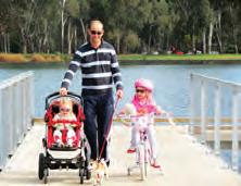
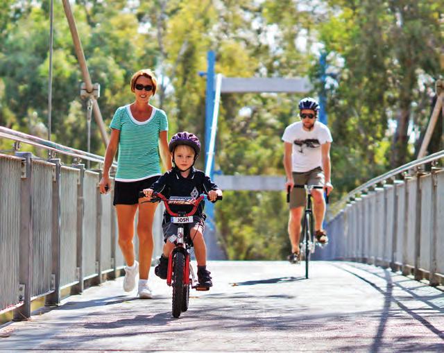
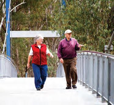
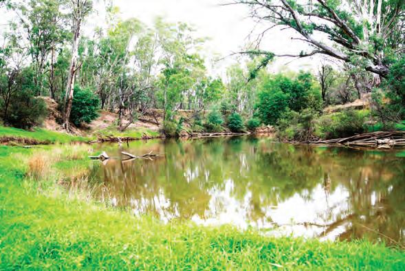
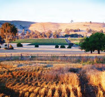
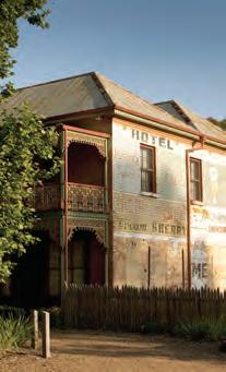
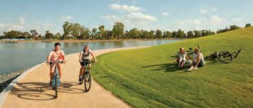
Let this ‘Walk in Greater Shepparton’ booklet be your guide to discovering the great outdoors of Greater Shepparton, which offers visitors and locals alike a plethora of pathways and trails to explore the region.
Home to a population of over 60,000 people, there is an abundance of historical, cultural and natural treasures within the Greater Shepparton region, just waiting to be discovered.
The ‘Walk in Greater Shepparton’ booklet is the local guide to walking in the region, with comprehensive coverage of pathways, tracks and trails within the townships, tips and information on safety and good practice. Inclusions encompass walking club details, annual events and useful and easy to read maps to find your way around, as well as interesting features about each of the walks.
There is also a detailed map of the Yanha Gurtji Shared Path Network along the banks of the scenic Goulburn River.
In preparing this booklet, the Greater Shepparton City Council, respectfully acknowledges the past and present traditional owners of the land which this booklet relates to. It also acknowledges the contributions of all Australians towards caring for the land we all live in and share together.
For further information about walking in Greater Shepparton, and other information for visitors to the region, visit: www.discovershepparton.com.au Happy trails!
While out walking you may wish to make the walk more interesting. Combining walking and some basic technology is referred to as GEOCACHING. Geocaching is a free high-tech treasure hunting activity where you use a Global Positioning System (GPS) to find caches hidden by other players.
Geocachers set off to find the cache at the coordinates that they have downloaded from the web to a hand-held GPS. What is a cache?
Typically it is a lunch box type container holding a log book, pen/pencil and maybe some swappable items. Geocachers write a log in the book about their search, they may swap something they have for something in the box and replace the container exactly as they found it. The container’s size may vary and could be as small as a film canister, or as large as a 44 gallon drum. Caching is all about engaging and exploring areas, some are puzzle based, some take you through several steps before you get to the final point. There are lots of variations and only a few rules. Once located and the log signed, the geocacher logs the cache on the internet so that other finders and the cache owner can see the activity with their cache.
For more information visit www.geocaching.com.au
Please ensure that you abide by the guidance below to ensure your walk is a positive experience for you and others:
What to do before you go walking
• Plan your walk to be well within your physical capacity and level of experience.
• Tell someone where you are going and when you plan to return, or walk with others.
• Ensure that your footwear and clothing are suitable - always wear a hat and at least SPF 15+ sunscreen.
• Be adequately prepared, check the weather forecast prior, eg. in your local newspaper, the radio, the weather channel on TV or visit www.weatherzone. com.au/vic/northern-country/shepparton
What we recommend you should carry
• Basic First Aid equipment, eg. Band aids for blisters, insect repellent etc.
• Drinking water. Allow two litres per person for a full day of walking and possibly more if it is very hot.
• A backpack containing a charged mobile phone, a camera, plastic bags to carry rubbish and / or dog mess.

• Never ever litter!
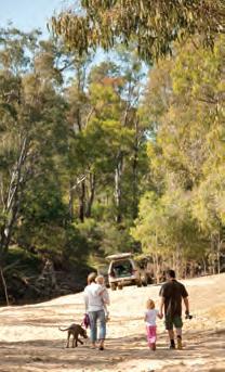
• Always stay on the path - this minimises your impact on the environment and your risk of getting lost.
• Minimise your environmental impact and have respect for all native wildlife, particularly snakes, which can be found in bushland areas. For more information, go to: www.webwombat.com.au/lifestyle/health/snakebites.htm
• Take note of all signage, enjoy the experience and tell others.
Throughout this booklet, wherever possible, we have taken into consideration the accessibility of all of the walks included. The Disability Advisory Committee (DAC) have participated on the walks and their advice has been greatly appreciated, access improved where possible and comments have been provided in order for you to make an informed choice about each individual walk. To encourage participation by all groups and individuals we have marked on the maps the availability of accessible and non accessible toilets and park benches to allow you to ascertain rest stops for individuals. Below you will find the key to the maps included in this booklet.
Key: Walking Path
Secondary Path Recharge Point
S 1 F
Start Point Park Benches Points of interest
Finish Point Picnic Table Wheelchair access
Wheelchair with assistance access

This walk is for those who are keen to experience one of the rail trails scattered throughout Victoria. The Dookie trail is the first in Greater Shepparton.
Start / Finish: Dookie CWA Gardens, Mary Street, Dookie.
Distance: 9.3kms – Return. Follow the path outlined on the map.
Surface / Access: This walk is on sealed gravel path with one small area which is unsealed. Terrain is generally flat with a few small undulations.
Points of Interest:
• CWA Gardens is home to the towns historic clock, originally housed in the historic Dookie Chateau tower and cellars, built in 1889.
• The trail is set at the base of Mount Saddleback. To the South you can see Mount Major, Gentle Annie hill to the South East and to the West you will see St Mary’s Church, built in 1898. The church features stained glass windows dating from 1911.
• The branch line to Katamatite was constructed by the Yarrawonga Shire in 1890 and taken over by the Victorian Railways in 1892. The railway was closed in 1986 and the rails removed shortly after. The branch line from Shepparton to Dookie is still used by grain trains.
• At the third intersection, you might be lucky to spot the local resident “Willy the Wombat” whose den is the under the road drain.
• Spot the various fauna and flora including echidnas, blue tongue lizards, kangaroos and even wedge tailed eagles.
Walk Note: There are no toilet or water facilities offered on the trail, but are available at the Dookie CWA Gardens. This walk provides access to geocaches.
Hazards: Care is required when crossing all roads and also be aware of snakes during the warmer months.
This walk will give you an insight into the history of the Merrigum township.
Start / Finish: Merrigum Museum.
Distance: 1.7km. Follow the path outlined on the map from the museum to the Merrigum Hotel, then north to Judd Avenue and return.
Surface / Access: Designated footpaths, sealed roads and grassy nooks with some road crossings. Be careful of uneven footpaths. Extra care is required when crossing rail tracks, especially on western crossing as the footpath is not complete. Terrain is flat.
• Merrigum Historical Museum is located in the former Rodney Store (1905).
• Site of first general store. A large safe / strongroom remains on site.
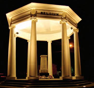
• War Memorial – originally dedicated in 1921 to those locals lost in WWI
• Mechanics Institute was built in 1889 (the sign is wrong!), extended in 1895 and Memorial Hall in 1959. Was home to a library, baby health centre and dances.
• Commercial Banking Company of Sydney Limited building: housed a banking chamber, offices and single mans quarters.
• Railway Hotel, possibly Merrigum’s first business was built, and opened in 1887.
• Platform from the original railway station built in 1887 is still visible. The actual station was demolished after 1981.
• Visiting solicitor’s premises: this small concrete block building was constructed for Morrison and Sawers, Kyabram solicitors in 1935.
• Former Carnation Company factory. The biggest thing to happen to the town with processing beginning in 1952. It closed in 1986.
• The 1908 Methodist (now Uniting) Church was the town’s third Methodist Church.
• The Merrigum Cafe was the site of the town’s first butcher shop, set up in 1887.
• St Matthews Church of England, built in 1898.
Walk Note: Judd Park has BBQ facilities and playground for the kids.
Care is required when crossing all roads and rail crossings.
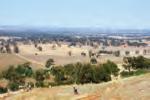
This walk is for those in a fit state of health, as most of it is uphill until you reach the plateau at the summit – well worth the effort for the stunning views however!
Start / Finish: Turn off the Dookie Nalinga Road onto Mount Major TV Road and continue until you reach the entrance gate on the right hand side with the University of Melbourne sign behind it. Climb over the stile and you’re on your way. The walk is up to the top of the hill where there are a number of television and mobile phone signal stations, follow the path on the map. The return walk is back down the same trail.
Distance: 6.4km. Follow the path outlined on the map.
Surface / Access: The walk is on a designated sealed footpath / roadway, until the summit is reached, where there are some unsealed tracks. Take the track leading straight ahead to approach the panoramic lookout. Terrain is hilly. This walk is not considered wheelchair accessible.
• The magnificent views including the canola fields in Spring. Summer gives you the sight of hundreds of rolls of hay that are produced in the district. Autumn brings the patchwork of red volcanic soil and the green growth of a cooler season. Vineyards are scattered throughout the area and there are excellent views of Strathbogie and surrounding ranges from the summit.
• Lions Club fixture at summit indicating the distances to surrounding landmarks.
• At its peak, Mount Major is 381 (1251 feet) metres above sea level.
• Mount Major has special significance in Greater Shepparton because of its native flora and fauna as well as its grazing potential.
• Mount Major is now used as Greater Shepparton’s premier mountain bike event location.
Walk Note: Note the conditions of access at the entrance sign to Mount Major.
Hazards: Be aware of snakes during the warmer months and any uneven ground on the unsealed tracks. 1 2 3 4 5
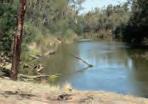
This walking tour will give you the chance to walk some of the tracks in the area known as the ‘Flats’ located between the Peter Ross-Edwards Causeway and the Goulburn River on the south side.
Start / Finish: Chinaman’s Garden Reserve.
Distance: 4.3km. Follow the path outlined on the map and note signage throughout the walk.
Surface / Access: The walk is on both a sealed bike path (Yahna Gurtji Shared Pathway) and unsealed forest tracks and therefore not completely accessible due to the uneven ground and undulations on the forest track.
Points of Interest:
• The establishment of an Aboriginal community in this area by the Yorta Yorta families was a direct result of the Cummeragunja ‘Walk Off’ on 6 February 1939.
• This particular site was chosen, as the Yorta Yorta had an extended traditional association with the environments in close proximity to rivers such as the Kaiela (Goulburn River).
• A September 1946 police report listed 130 people aged from 8 days to 80 years living on the ‘flats’ with a third of them less than 15 years of age. Lodgings consisted of 29 dwellings, 22 being assortments of tin or hessian bag huts and the rest tents.
• The river provided abundant food including crayfish, red fin, yellow belly, cod as well as possum, turtle, turtle eggs, swan, duck, crane and other birds and their eggs. The women predominantly fished whilst the men would hunt for rabbits.
• Every year the river would flood, causing the residents to move to higher ground on Daish’s paddock, now home to KidsTown Adventure Playground.
Walk Note: Extra care needs to be taken when walking in the forest area. Please ensure you remain on the designated tracks and respect the area and its history. Track may not be accessible in times of flood.
Hazards: Be aware of snakes during the warmer months.
This walking tour of Mooroopna will give you a chance to view a number of historical sites.
Start / Finish: Chinaman’s Garden Reserve, Mooroopna.
Distance: 2.2km. Follow the path outlined beginning at Chinaman’s Garden Reserve.
Surface / Access: Mixture of gravel paths, designated footpaths and road shoulders with a few road crossings. Be careful of uneven paths. To avoid the gravel path begin the walk at the Mooroopna War Memorial. Terrain is flat with small undulation to the gardens.
Points of Interest:
• Chinaman’s Garden Reserve – Ah Wong, a Chinese migrant, set up a market garden on this site in 1877 and supplied vegetables to the district.
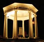
• Mooroopna War Memorial, dedicated April 1928, construction cost £1000.
• Mooroopna’s first stand alone Post Office 1884-1921, was moved due to the erosion of the river bank.
• Kialla Bridge, 1877. Originally had a drawbridge in the centre to allow steamers to reach the wharf.
• Mechanics Hall, built in 1906.
• Royal Mail Hotel 1877.
• Flour Mill, 1872 – Mooroopna’s oldest continuous industry, (now home to Ridleys Agricultural products).
• McLennan’s home 1910, home of Reuben McLennan, original owner of the flour mill and namesake of McLennan Street.
• Punt Crossing on the Goulburn River 1875 – 1877. Further upstream when the river is low enough, you can see the remains of The Wharf, C1877.
• SPCA – Ardmona Plant. Began processing in 1921 as a processor of deciduous fruits. Manufacturing still continues at this site but in a limited capacity.
Note: This walk provides access to Geocaches.
This tour is for those who would like to view a number of sites in Murchison from a historic perspective.
Start / Finish: Meteorite Park, Stevenson Street.
Distance: 1 km – Return. Follow the path outlined on the map along Stevenson Street, across the Goulburn River using existing pathways and return.
Surface / Access: This walk is along designated walkways, both sealed and unsealed and includes several road crossings. Terrain is generally flat with some undulations. This walk is considered accessible up to the Murchison bridge where the path to the old Gregory’s Bridge Hotel is unsealed and the gradient steeper. The bridge can also be slippery when wet.
Points of Interest:
• Meteorite Park is dedicated to a meteorite that fell over Murchison on the 28 September 1969. See the newspaper clippings from across the globe on display. Fragments of the meteorite are on display in museums around the world with the meteorite estimated to be 4.5 billion years old.
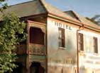
• Head over the bridge to Gregory’s Bridge Hotel, built between 1865 and 1868, it was a substantial country hotel, large general store and cellar with stables at the rear. The tree located out the front was planted in 1916 and is one of Victoria’s finest and largest London Plane trees. This property is now a private residence.
• River bank gardens, boardwalk and three information lecterns. Discover Murchison’s bygone era with images of the old streetscape, pub and paddle steamers. The boardwalk provides an impressive view of the Goulburn River.
• Goulburn River at Murchison saw its first paddle steamer in 1875. At that time Murchison had six hotels, two flour mills and numerous stores and services.
• Murchison Heritage Centre. Located out the side of the museum is a large pump that was used to pump water from the river for the townspeople.
Walk Note: This walk provides access to geocaches.
Hazards: Care is required when crossing all roads.
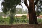
This tour is for those who are keen to view a number of sites of significance from a historic perspective.
Start / Finish: Murchison Heritage Centre - Murchison Wines.
Distance: 3.95km return. Follow the path outlined on the map.
Surface / Access: This walk is on a mixture of footpaths, both sealed and unsealed and road shoulders with a number of road crossings. Terrain is generally flat with a few small undulations.
• Murchison Heritage Centre, displays a range of items of historical significance including a fragment of the Murchison Meteorite. Outside is a large pump which was used to pump water from the river for the townspeople.
• River bank gardens, boardwalk and three information lecterns. Discover Murchison’s bygone era with images of the old streetscape, pub and paddle steamers. The boardwalk provides an impressive view of the Goulburn River.
• Aboriginal Protectorate Station. Signage marks the location of the protectorate that operated from 1840-1853. This is one of only four stations established in the then colony of Port Phillip.
• Roderick Square was the original proposed river crossing point however, the river crossing was constructed in Robinson Street in 1871.
• Murchison Cemetery and the Italian Ossario (Musoleum) are located here with an along with the grave of King Charles Tattambo who died in 1866, a well respected local Aboriginal who was buried here as his dying wish was to be buried in a box like a white man. The Ossario holds the remains of a number of Italians who were interned in Australia during WWII.
• Further past the cemetery you will discover Longleat Wines – home to a selection of delectable indulgences.
Walk Note: This walk provides access to geocaches. To allow a visit to the Heritage Centre, contact numbers are listed on the front door.
Hazards: Care is required when crossing roads and walking on road shoulders.
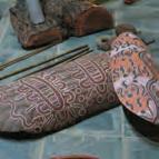
This short walk takes in the Bangerang Cultural Centre, Australia’s first purpose built Aboriginal Cultural Keeping Place / Museum.
Start / Finish: Bangerang Cultural Centre, Evergreen Way, Shepparton. Distance: 1.9km.
Surface / Access: The entire walk is on designated footpaths, road shoulders and gravel pathways. Terrain is flat with a few very small undulations. Not considered accessible due to the kerbs and gravel pathways.
• Bangerang is located on what once was known as the International Village. Opening in 1974 the Village was home to the Keeping Place, Philippine House, Greek House, Chinese Gardens, Dutch Windmill and Japanese Folk Museum. The Village was closed in 1996, with the Keeping Place retained.
• The Bangerang Cultural Centre is the first purpose built Aboriginal Cultural ‘keeping place/museum’ to be developed and managed by the Aboriginal community in Australia. The centre houses a world class collection of artefacts, artworks and dioramas from all over Australia, focussing on local communities of the Murray and Goulburn Valleys. “Immil-ang yahorma, ka-ko annubok” Translation; “Today come on let us go to tall trees”
• Located outside is an outdoor amphitheatre used for traditional welcomes, cultural activities and for personal reflection.
• One FM (98.5FM). This community radio station was established in 1980 and was licensed in 1989. The station supplies the community with live and local content 24 hours a day, seven days a week.
• Greater Shepparton’s sporting precinct is home to a cycling velodrome, BMX track, tennis and netball courts, soccer and hockey pitches. These facilities host a number of regional, state and national events throughout the year.
Walk Note: To ensure a visit to Bangerang Keeping Place (public toilets located here), undertake this walk Monday to Friday from 9.00am – 4.00pm.
Hazards: Care is required when utilising gravel tracks.
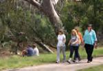
This walk allows you to experience the close proximity of the Goulburn River to our central business district.
Start / Finish: Shepparton CBD, finishing at the Goulburn River behind Aquamoves.
Distance: 1.6km. Follow the path outlined on the map.
Surface / Access: This walk is along designated walkways and footpaths. Terrain is generally flat with one large and several smaller undulations. This walk is considered accessible with assistance. The viewing platform on the Telstra Tower is not accessible.
Points of Interest:
• Maude Street Mall was established as a mall in 1989.
• Shepparton Telstra Tower. Built in 1967-68, the tower has a viewing platform located 35 metres above ground level, giving a 360° view of the area.
• Joseph Furphy Memorial Park. A lifelike bronze of Joseph with a hand carved menhir (standing stone) with words from and about Joseph’s writing.
• Shepparton’s oldest building (C1873), once the Foresters Hall, now houses the Shepparton Heritage Centre.
• Shepparton Historic Wharf (1880) and the site of McGuire’s Punt which operated between 1850 and 1876.
• McGuires Reserve, named after Patrick McGuire, an Irishman who was the first settler in what is now Shepparton City.
• Aquamoves Bridge provides a fantastic view of the Goulburn River whilst linking with the Yanha Gurtji shared pathway to Mooroopna and KidsTown.
• Goulburn River begins at Lake Eildon and flows through the region, eventually flowing into the Murray River near Echuca. The Goulburn and its tributary the Broken River meet in Shepparton and are the lifeblood of the region.
Walk Note: This walk can be linked in with all of the Shepparton walks.
Hazards: Care is required when crossing all roads, utilise traffic lights where possible. Paths may not be accessible in times of flood.
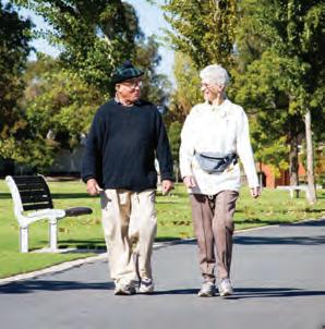
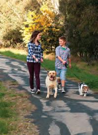
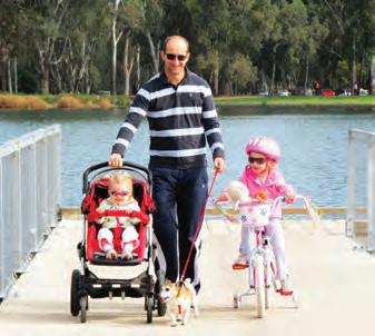
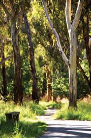
This walk encompasses parts of the Yahna Gurtji Shared Pathway, meaning “Come walk with me friend” and follows the majestic Goulburn River.
Start / Finish: Rear of Greater Shepparton City Council Offices, Welsford Street. Finish is at either Cudgee Park or Jordan’s Bend.
Distance: 2.2km to Cudgee Park, 3.6km to Jordans Bend (one way). Follow the path outlined on the map

across the stream, one known as ‘Casey’ in the Parish of Goorambat, and the other known as ‘Gowangardie’ in the Parish of Currawa.
10 or 12 years after the first farmlands were taken up in the district, two concrete weirs were built
The Broken River is named according to William Howitt in his first book, ‘Two Years in Victoria’, published 1855, ‘As the name imparts, it is broken here and there into a variety of channels only filled at flood time, and lagoons bordering on them’. In the early 1880s (probably 1882), about
The Goulburn River is named after Major Frederick Goulburn, Colonial Secretary and registrar of the records of the Colony of New South Wales (1820 1824). Discovered by Hume and Hovell in December 1824, the River now forms part of an extensive irrigation system which includes three large water storages. broken riVer
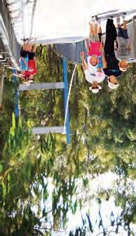
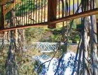
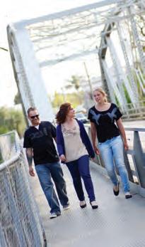
The shared pathway, via a spectacular suspension bridge, directly links two of Greater Shepparton’s most popular passive recreation areas. The bridge is a bright and colourful landmark that allows users of the pathway to move from the Victoria Park Lake precinct to one of Australia’s largest outdoor playgrounds, SPC Ardmona KidsTown. riVer Junction goulburn And broken riVers
VictoriA PArk lAke And sPc ArdmonA kidstown trAil connection
Located adjacent to Aquamoves, this fully fenced all abilities playground features swings, concord net, sand play area, slides and climbing walls. There is full wheelchair access to this free playground and it is open from dawn to dusk. Public toilets on site.
All Abilities PlAyground
Surface / Access: This walk is on a designated bitumen, footpath and granitic sand track / trail with parts being lose gravel. Terrain is generally flat with a few undulations.
Points of Interest:
Extension of Goulburn River. This dead end body of water was the original path of the Goulburn River. In 1969 the river was redirected to where it flows today to negate the need for the construction of two new bridges along the causeway.
Penstock, this valve was used for closing the storm water system in times of flood.
Princess Park, named after HRH Princess Elizabeth, now Queen Elizabeth II, forms part of the Yahna Gurtji Shared Path Network.
Exercise stations are scattered along the path network to encourage health, exercise and wellbeing and forms part of the Shepparton on the Moove project.
Historic pump foundations, this pump supplied water to the first irrigated orchard on the east side of the Goulburn River in 1893.
Cudgee Park, Indigenous Community Garden and Aboriginal totems, meaning “a very good place to visit” features stairway access to the river.
Jordan’s Bend. RiverConnect host a number of spotlight walks throughout the warmer months. Further details visit www.riverconnect.com.au
Walk Note: There are no water facilities and limited accessible seating along the path. The walk has access to geocaches in close proximity.
Hazards: Parts of this walk are not accessible during times of flood and also be aware of snakes during the warmer months.
Walk in Greater Shepparton 26
use Tom Collins Drive and take care as this is not a designated shared pathway.
If you need relaxation, the centre offers a state of the art hydrotherapy pool, spas and sauna. A fully equipped gymnasium is also located within this modern facility. In order to continue to Kialla, please
When you think about fitness, fun and healthy living, Aquamoves is the place to be. With the amazing rapid river ride, challenging water slide and powerful water rays,sp there is something for everyone.
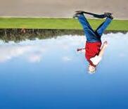
The skate park, in the Victoria Park Lake precinct, provides an exhilarating recreational option for young people. Centrally located with Victoria Park Lake on one side and the John Pick Playground on the other, giving parents and guardians a place to relax and share in the fun and excitement. aquamoveS
S-Cape Skate park
• Lowanna Waters may be accessed from various points including Rocklands Cresent Waranga Drive and Jindabyne Court.
• Lake Amaroo may be accessed via the Archer Street end of Kialla Lakes Drive. Please take care when crossing the road.
• Lake Kialla may be accessed from various points including Gordon Drive via Wellington Court, Pedder Court, Cowen Court.
Concrete shared path surrounds:
1.9km - GV Highway (bridge) to Kialla Park
- GV Highway (bridge) to Gordon Dr. (Lake Kialla)
- Aquamoves to GV Highway (bridge)

(Kialla Park via Broken River and Goulburn Valley Highway)
(Kialla Lakes Drive via Tom Collins Drive, Broken River)
Dainton’s Bridge to Kialla
challenges and is suitable for BMX, roller blades, skateboards and scooters.
Located on McLennan Street, Mooroopna near Ferrari Park, this skate park offers a wide variety of
ABiTionX- eKATS PArK
township of Mooroopna and the surrounding district.
Dainton’s Bridge and the Goulburn River. From there he and his family supplied vegetables to the
Named after Ah Wong, a Chinese migrant, who set up a market garden in the area between
Ah wonGS BridGe
Hatton who, with Jack Goodfellow had started the regular bus service in the early 1920s.
Named after the Geraghty family who, for many years, operated the bus service and a taxi service between Mooroopna and Shepparton. In 1938, Ern Geraghty bought the business from William
hTy’SAGGer BridGe
‘Boolbadah’ is an aboriginal word meaning abandoned camp. For many years (from the late 1930s), many local aboriginals lived in permanent camps in the area around this floodway. In 1958 most of them moved to the then newly constructed housing settlement ‘Rumbalara’, just south of Mooroopna.
BoolBAdAh FloodwAy
snack under the trees or make use of the on-site BBQ facilities.

This short tour is of some sites of historical significance to Shepparton.
Start / Finish: Victoria Park Lake, northern car park. Ends at Shepparton Memorial Park.
Distance: 800m. Follow the path outlined on the map, north along Welsford Street.
Surface / Access: The walk is on designated footpaths, with a small section being gravel, follow the path along Welsford Street. Terrain is flat.
• The Hawdon and Bonney Cairn - Charles Bonney & Joseph Hawdon, the first non-indigenous persons to visit and camp near the junction of the Broken and Goulburn Rivers on 13 January 1838.
• Shepparton Urban Water Works was established here in 1889. The pump building remains and is now home to Goulburn Valley Water.
• Forester’s Hall, Shepparton’s oldest remaining building was built in 1873 and is now home to the Shepparton Museum. It was previously used as a lodge room, court house, dance hall, church and a newspaper office.
• The old Shepparton wharf (1880) and the site of McGuire’s Punt which operated between 1850 and 1876.
• Joseph Furphy Monument and his beloved Wilga tree. The famous Australian novel “Such is Life” was penned at this very spot in 1903, under Joseph’s pen name of Tom Collins.
• Rose gardens and commemorative plaque, established by the womenfolk of Shepparton to honour the visit by Her Majesty Queen Elizabeth II on 5 March 1954.
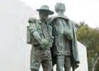
• Shepparton Memorial Park – The sculpture shows Sgt Gordon Ayre MM, of Shepparton helping Pte Wally Johnson across the Francisco River at Salamaua PNG on 20 August 1943.
Walk Note: This walk provides access to geocaches.
Hazards: Some busy crossings at intersections, utilise traffic lights. 1 2 3 4

This walk will let you experience some of the public art on display in the streets of the central business district.
Start / Finish: Monash Park, Fryers Street, Shepparton.
Distance: 1.25km. Follow the path outlined on the map.
Surface / Access: The walk is on designated footpaths. Terrain is flat.
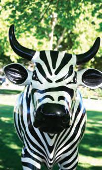
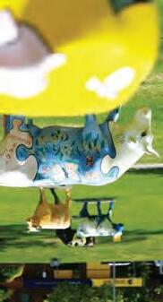
• MooovingArt – is a mobile, interactive public art exhibit featuring life sized 3D cows. Individual and unique, they represent the dairy industry of Greater Shepparton.
• War Memorial. WWI is commemorated by the “Helping Hand” sculpture by Charles Web Gilbert, and WW2 by “Mateship” by Bela Angyl.
• Shepparton Art Museum, affectionately known as SAM, has been voted Victoria’s best small museum by Museum Victoria (Australia) 2012.
• Ceramic pathway by Fiona Murphy, which leads to the entrance of SAM.
• Mechanics Institute Mural (limited access out of office hours) depicts the building which once housed the Regional Library. Lead artist, Vern Alcorn.
• Common ground mural, installed in 1997 and created by local artist Angie Russi.
• Shepparton Story Wall. First year TAFE art students worked with tutor Angie Russi to sculpt this hebel wall.
• City Walk mural. This mural captures some of Shepparton’s history.
• Joseph Furphy Memorial Park. A life like bronze of Joseph Furphy with a hand carved menhir (standing stone) with words from and about Joseph’s writings.
Walk Note: Keep your eye out for more MooovingArt cows scattered around the township. Make time to visit SAM (Shepparton Art Museum) and see the Indigenous works at the Gallery Kaiela.
Hazards: Care is required when crossing all roads.

This short walk is of the tranquil Victoria Park Lake precinct.
Start / Finish: Victoria Park Lake, northern car park.
Distance: 1.8km circuit. Follow the path outlined on the map around the lake.
Surface / Access: The entire walk is on designated footpaths and gravel pathways. Terrain is flat with a few very small undulations. The walk is considered accessible but help may be required over the gravel pathways.
• Construction of the lake began in 1929 on the site of an old swamp and private properties purchased by Council for £1100.
• Raymond West Swimming Pool, opened in 1955, named after Raymond West, Shepparton Town Clerk in 1927. Cost was £23,000 and at the time it was the largest chlorinated, free entry swimming pool in the southern hemisphere.
• Newly established buildings include Aquamoves, which consists of gymnasium, indoor / outdoor pools and splashpark.
• All abilities playground provides a variety of play opportunities for children and families of all abilities.
• Lake Sculpture by artist Peter Cole uses universal symbols to describe the contemporary and historic landscapes of Shepparton.
• Wetlands: Water passes slowly through the wetland where the plants help to filter out many contaminants before passing in to the lake near the “Still” bridge.
• Visitor Information Centre. Discover all the region has to offer.
• Island: once hosted dances for the young people of Shepparton, now home to wildlife including Barking Marsh Frogs, Long necked turtles and birdlife, whilst the water is home to Yabbies and Yellowbelly.
• S-Cape Skate Park, opened in 2001, proves to be popular with families.
Walk Note: This walk provides access to geocaches.
Hazards: Be aware of cyclists who also share this pathway.

town HIS to RY walk
This tour will allow you to take a leisurely stroll along the main street of Tatura and take in the local sights of a town that is steeped in history.
Start / Finish: The old Tatura Court House located on the corner Hogan Street and Flanagan Place. The finish is at Tatura Museum.
Distance: 1.8km. Follow the path outlined on the map.
Surface / Access: The walk is on designated footpaths. Terrain is flat.
• Tatura Court House which dates back to 1891, has been used in a number of movies such as “Till Human Voices Wake Us” with Helena Bonham Carter.
• Private Robert Mactier VC Memorial Gardens. Named after Robert Mactier, a winner of the Victoria Cross who lost his life, aged 28 in circumstances of extraordinary bravery during WWI.
• Peruse some of the shops including Tatura Hot Bread. This bakery dates back to 1878 and houses a historic oven.
• Victory Hall, opened in March 1925 by the then Governor General.
• Sacred Heart Parish Church, was opened on August 7, 1889. It was rebuilt at a cost of £9000 pounds in a Romanesque style and blessed in 1912 as it had outgrown the previous building.
• Sisters of Mercy Convent, blessed in June 1941.
• St Mary’s College Building was built in 1901 with its beautiful balcony and cast iron work.
• Tatura Wartime Camps Museum. Home to a plethora of artefacts depicting the history of the camps in the Tatura / Murchison area from WWII.
Walk Note: This walk can be extended by visiting Cussen Park that is located a short distance north of the Wartime Museum on Ross Street, see Cussen Park Walk page 34.
Hazards: Care is required when crossing all roads.
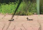
Cussen Park is a bushland style park encompassing 33 ha of wetlands, woodlands and open space on the outskirts of the town of Tatura. It is host to an array of wildlife, birdlife and mammals. It provides ample opportunity for walking and bird watching with well made paths and bird hides.
Start / Finish: Carpark at the information board located on Ross Street, Tatura.
Distance: Variety of short walks can be undertaken. Follow the path outlined on the map for a 2.3km walk and shorter walks are available.
Surface / Access: Gravel walkways. Terrain is flat with slight undulations to the bird hides and the observation deck. Due to the walkways all being gravel, this walk is not considered to be completely accessible.
Points
• The Park has been formed from the reclamation of wastelands by the Tatura community working closely with Council and Government Agencies. Used to biologically treat Tatura’s urban stormwater, it prevents poor quality water being passed onto the wetlands and farms downstream.
• The wetlands area provides educational opportunities and passive recreation with a number of bird hides, an observation deck and an abundance of indigenous plants and animals.
• Approximately 100 bird species have been recorded in Cussen Park. Rare and threatened species are frequent visitors with the park being the only place you are likely to see many of these species in the Goulburn Valley. Many birds have travelled from as far away as Japan and Siberia before resting in Cussen Park.
• The park’s other inhabitants include tortoises, lizards, snakes and frogs which are more likely to be heard than seen.
Walk Note: This walk provides access to geocaches.
Hazards: Care is required when utilising gravel tracks. Also be aware of magpies during breeding season and snakes during the warmer months.
This walking tour of Tatura will give you a chance to view some historical sites, wetlands and one of the regions major event venues.
Start / Finish: Tatura Courthouse, corner Hogan St and Flanagan Place.
Distance: 4.2km loop, follow the path outlined on the map.
Surface / Access: Mostly designated footpaths, some smooth gravel tracks and some steep gutters, which may require assistance for those using a wheelchair or mobility aid. Terrain is flat.
• Tatura Courthouse dates back to 1891 and has been used as a location in a number of movies and also includes a monument to Charles Wilson.
• Private Robert Mactier VC Memorial Gardens. Named after Robert Mactier, a winner of the Victoria Cross who lost his life, aged 28 in circumstances of extraordinary bravery during WWI.
• Tatura Park, home to the largest Dairy expo in the southern hemisphere every January – International Dairy Week. The area also contains the Ballantyne Centre and sports precinct.
• Lake Bartlett, combines wetlands and an ornamental lake used for recreational purposes that provides habitat for wildlife and improving water quality Over 20 bollards are on display here, painted by local artists and community groups.
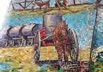
• Stuart Mock Place with its glass murals depicting the history, development and projecting the future of Tatura, emphasising the importance of the Sun, Earth and Water. Named after Councillor Stuart Mock who served from 1973 to 1983.
Walk Note: Option is to include Cussen Park in this walk. Follow the yellow path on the map to get to Cussen Park, then note Cussen Park walk on page 34.
Hazards: Care is required when crossing all roads and railway lines and utilising gravel tracks.
Start / Finish: Gabriel Southon Reserve, Wren Street. Begin your walk at the roundabout near the Primary School.
Distance: 1.9km. Follow the path outlined on the map.
Surface / Access: Varied including designated footpaths, but mostly gravel, dirt or sealed road shoulders. Daunts Bend track is accessed via gates and is uneven forest tracks. Terrain is flat. This walk is not considered accessible.
Points of Interest:
• Original railways pump (restored) which supplied Toolamba’s water from 1880 – 1972, was originally located on the Goulburn River adjacent to the Railway Bridge. Also, one of five original kerosene lamp posts used to light Main Street from late 19th century until electricity came in July 1952.
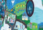
• Mural, painted by the students of the Toolamba PS Grade 5/6 in 2005, depicting what Toolamba means to them.
• Daunts Bend Forest. This bush track may give you the chance to view wildlife such as kangaroos and possums in their natural environment.
• Lions Walk. Constructed by the local Lions club.
• The Junction Hotel / Store, built in 1881 by Mr Currie.
• Toolamba Railway Station platform, can still be seen to the south. The rail from Seymour to Shepparton opened on 13 January 1880 and included a platform for the town with a branchline to Tatura. The Station building was built in 1882 and in 1926 employed 21 people. The Station closed in 1987 and the buildings demolished.
• Wren’s General Store, built in 1891 by Ralph Longstaff. The store still has the old world charm inside.
• Lest We Forget Memorial gates.
Walk Note: This walk provides access to Geocaches.
Hazards: Care is required when crossing all roads and walking on road shoulders. Be aware of snakes during the warmer months.
CWA GARDENS, DOOKIE (page 7 ref B6)
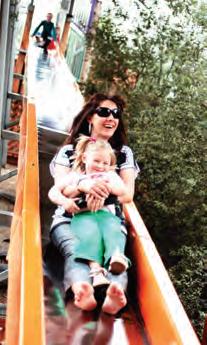
The town’s park and gardens feature barbeque and picnic facilities, shaded playground area and toilets making it a very family friendly stop. The CWA park is home to the historic Chateau Clock, built in 1889.
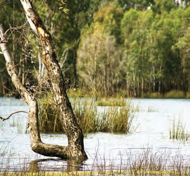
Located between Mooroopna and Shepparton, Gemmills Swamp is a wildlife reserve that encompasses 170 hectares of Red Gum floodplain forest and Tall Spike Rush wetlands. It is not uncommon to see a breathtaking array of pelicans, ibis, swans, egrets and ducks habituating in and around Gemmills Swamp as it provides a unique and diverse environment.
FERRARI PARK,
(page 15 ref A2)
WB Ferrari park was a Mooroopna Lions Club project and recognises the commitment of charter member and past president Bill Ferrari. There is offhighway parking and the site features barbecue facilities, a sheltered picnic area, skate park and public toilets.

(page 17 ref B3)
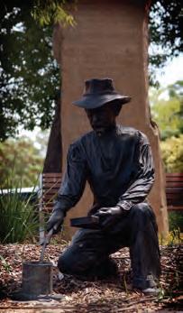
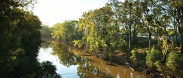
Murchison was the site of the legendary Murchison Meteorite which broke up in the skies above the town on 28 September 1969. Fragments of the meteorite are on display in many museums around the globe with the meteorite estimated to be 4.5 billion years old. Visit the Meteorite Park in Stevenson Street to see the newspaper clippings from across the globe.
(insert map ref F2)
Located along the Boulevard, Brickworks Park is one of the newest parks in Shepparton and has a strong environmental theme. It’s features include a unique and eye catching entrance, an ephemeral wetland area and a large range of native plantings. This park is in close proximity to the Yahna Gurtji Shared Pathway.
(insert map ref E1)
Meaning: ‘a very good place to visit’. Located at the junction of The Boulevard and Balaclava Road, this indigenous parkland fronts the Goulburn and features stairway access to the river. This park links in with the Yahna Gurtji Shared Pathway.
GOYEN RESERVE, PRINCESS PARK, SHEPPARTON (insert map ref F2)
Goyen Reserve was named after Arthur Thomas Bowden Goyen AICA, ACIS, LCA. Goyen was a councillor of the Borough of Shepparton. As Chairman of Parks and Gardens, he, with CR J Riordan, played an active role in developing the original Victoria Park Lake project. A time capsule was buried in this park on 16 April 1985, to mark Victoria’s 150th anniversary. It is to be exhumed 31 May 2027. This park links in with the Yahna Gurtji Shared Pathway.
JACKSON PARK, SHEPPARTON (insert map ref F6)
This park is named to acknowledge the association of the former owners, Mr JA and Mrs NM Jackson. Lighting, an electric barbecue and an automatic watering system of the park were donated by the Shepparton Apex Club. This park is a popular venue for outdoor weddings and links in with the Yahna Gurtji Shared Pathway.
JAYCEE PARK, SHEPPARTON (insert map ref F3)
Located at the western entrance to Shepparton, this bushland park was named after the Jaycees (Junior Chamber of Commerce) Service Club. This park is in a flood prone area and links in with the Yahna Gurtji Shared Pathway.

(insert map ref F3 & F4)
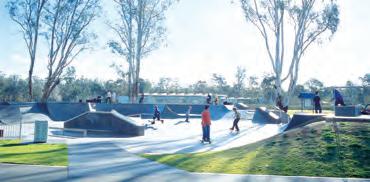
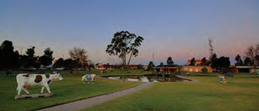
Named after John Pick, JP, a councillor of the Borough of Shepparton from its inception in 1927 until his retirement in 1940 (Mayor 1937 – 38). This reserve provides large open space areas for families to enjoy. Facilities include the S-cape Skate Park, playground equipment and barbecue facilities shaded by a large rotunda.
(insert map ref F3)
Named after John Riordan, JP, a Borough and later a City Councillor of Shepparton from 1927 – 1965 who served as Mayor on two consecutive occasions. As chairman of Parks and Gardens, he devoted much time to their improvement, including the original Victoria Park Lake project and the establishment of the tennis courts, bowling and croquet greens, hence the Shepparton Lawn Tennis Courts and Clubhouse are located on this reserve.
(insert map ref F5)
‘Kalinga’ is an Aboriginal word meaning ‘pleasant’ and ‘cheerful’. It is an appropriate name for this natural bushland park adjacent to the Broken River. This park links in with the Yahna Gurtji Shared Pathway.
(insert map ref F3)
This reserve is named after Patrick McGuire, an Irishman who was the first settler in what is now Shepparton City. Early in 1850 he established a punt crossing on the Goulburn River nearby and erected the first building, the “Emu Inn”. This reserve links in with the Yahna Gurtji Shared Pathway.
(insert map ref F3) (walk page 28)
Named after Colonel and later General Sir John Monash, who was the engineer responsible for the concrete bridge which was built in 1914 to replace the original (1878) wooden bridge over the Goulburn River. This concrete bridge, at the western entrance to Shepparton, was demolished in the early 1970’s when the course of the river was diverted and two causeways were built. Monash Park is now home to many of Greater Shepparton’s MooovingArt cows, and the Chinese Gardens. This park can link in with the Yahna Gurtji Shared Pathway, the Shepparton Public Art Walk and the Shepparton History Walk.
(page 2 ref E4)
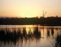
Reedy Swamp is a valued wetland and is an important part of the Goulburn River Floodplain. When full, the Swamp covers approximately 130 Ha and averages about 0.5m in depth. It is also important as a roosting and breeding site for nesting birds such as the Ibis, Spoonbills and Egrets. The surrounding area has a mature red gum (Eucalyptus camaldulensis) overstorey.
(insert map ref G6)
Name after Peter Ross-Edwards, Member of the legislative Assembly in the Victorian Parliament, for his outstanding contribution and commitment as the representative for the Shepparton electorate from 1967 – 1991. He was leader of the National Party from 1970 – 1988. This reserve links in with the Yahna Gurtji Shared Pathway.
Created in June 2010, this section of the Goulburn River is lined with River Red Gums and is an important wildlife corridor linking the mountains of the Great Dividing Range to the Murray River. The picturesque river has narrow strips of vegetation along its meandering banks, with the adjoining River Red Gum forests and woodlands providing a striking contrast to the adjacent farmland. Beginning at the northern end of Shepparton around Reedy Swamp, the park stretches all the way to the Murray River Park.
...encouraging residents to get active.
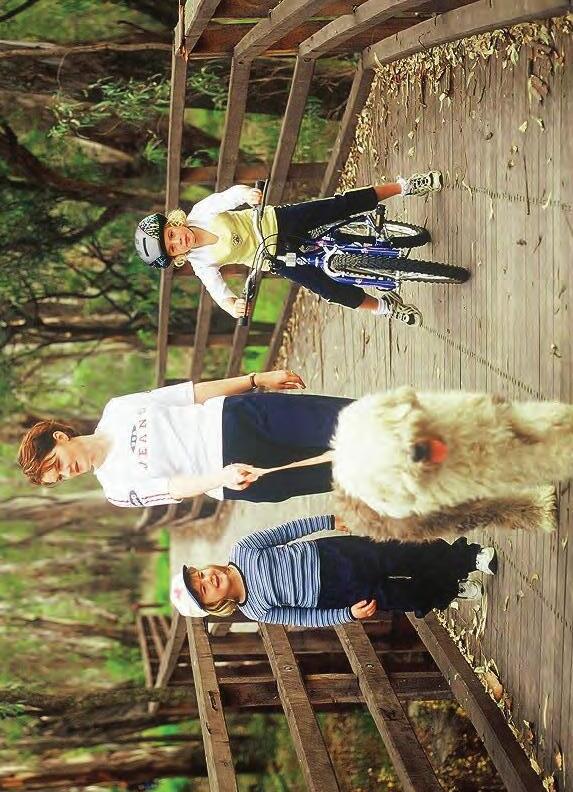
Greater Shepparton on the Moove is an initiative of Greater Shepparton City Council and many local health promotion organisations.
Visit www.onthemoove.com.au for details on walking groups, walking events such as the pedometer challenge, twilight strolls, walk to work days links to physical activity organisations and strength training providers.
For further information visit: www.onthemoove.com.au or contact the Greater Shepparton City Council on (03) 5832 9700.
Walking e vents and Clubs in Greater s hepparton n ame o rganisersContact Relay for Life Cancer Council Australia
Phone: 0447 502 178 Email:shepparton@relayforlife.org.au On the Moove Twilight Strolls
Leisure Facilities Phone: 03 5832 9536 www.onthemoove.com.au
Greater Shepparton City Council
Leisure Facilities Phone: 03 5832 9536 www.onthemoove.com.au Seniors FestivalWalking program
Greater Shepparton On the Moove Pedometer Challenge Greater Shepparton City Council
Greater Shepparton City Council Aged / Children’s Services
Phone: 03 5832 9783 National Walk to Work Day Walktober
Events & Membership Manager Phone: 03 9224 2262 www .rspcavic.org
Phone: 03 8317 0111 www.walk.com.au RSPCA Million Paws WalkRSPCA
For a complete calendar of events of walks and fun runs in Victoria check out www.weightloss.com.au/events/melbourne-events.html For a comprehensive listing of walking clubs in the Greater Shepparton region visit www.onthemoove.com.au
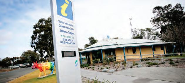






The ‘Greater Shepparton Walking Guide’ booklet is the local guide to walking in the region, with comprehensive coverage of pathways, tracks and trails within the townships, tips and information on safety and good practice.
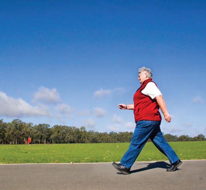
Inclusions encompass walking club details, annual events and useful and easy to read maps to find your way around, as well as interesting features about each of the walks.