






We invite you to explore, experience and enjoy the many great things Greater Shepparton has to offer.
Our region offers amazing cycle paths and routes but also offers a diversity of attractions and events for you to experience. Delight in our attractions, our many cafes and restaurants, savour the many tastes of fresh produce and enjoy our extensive calendar of events.
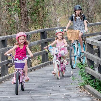
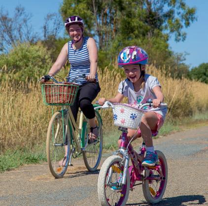
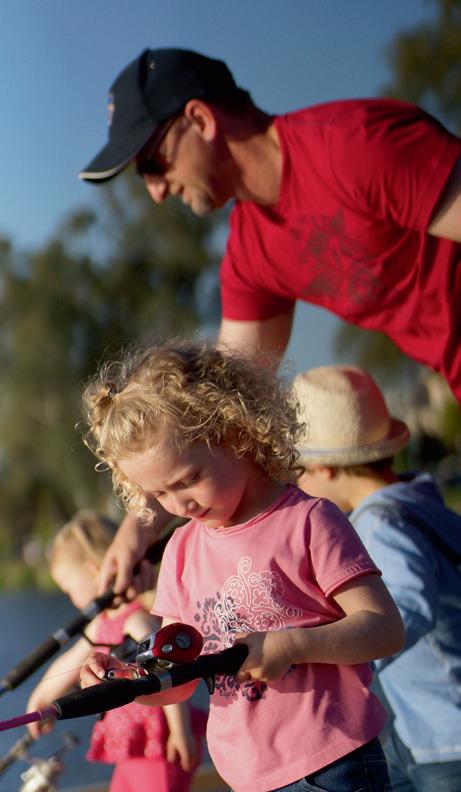
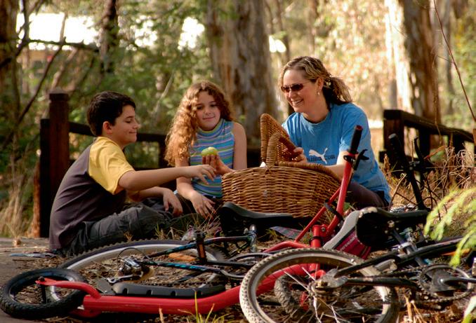
A family friendly destination, Greater Shepparton offers something for everyone. For a relaxing family holiday, arts and cultural experience, or a venue for your next cycling event, Greater Shepparton offers a range of services, attractions and facilities that will both surprise and entertain.
We hope this guide helps you discover some of the unique delights to be found. We encourage you to not only discover our region’s amazing bike paths and routes, but fall in love with our rich agriculture, history and heritage, arts and culture and family friendly activities and attractions. Greater Shepparton is all about experiencing and soaking up our diversity and discovering the many great things our region has to offer.
We, Greater Shepparton City Council, acknowledge the traditional owners of the land which now comprises Greater Shepparton. We pay respect to their tribal elders, we celebrate their continuing culture and we acknowledge the memory of their ancestors.

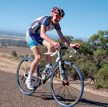

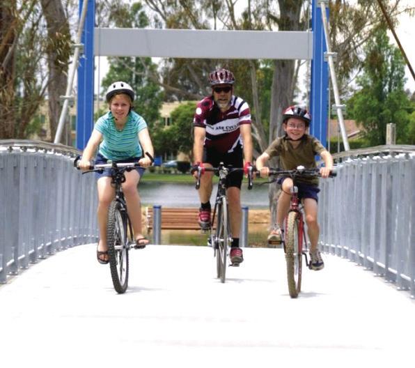
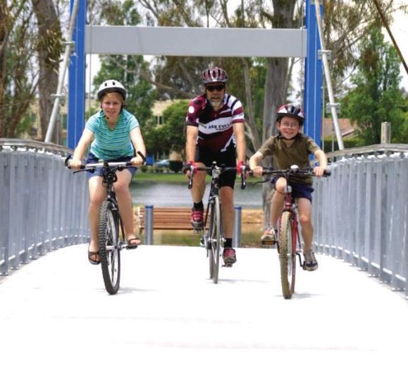
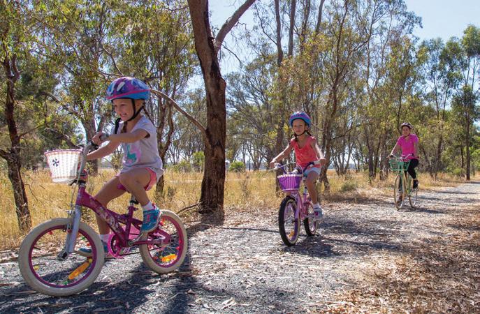
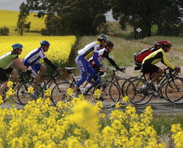
Ideally located, Greater Shepparton offers cyclists a variety of paths and routes to ride. Explore our townships, farmlands and nature reserves whilst undertaking a training ride, or bring the family and leisurely discover all we have to offer.
Home to a population of more than 65,000, Greater Shepparton is internationally renowned as Australia’s original food bowl with farm gate sales, factory sales outlets, cellar door options and restaurants and cafes providing a variety of produce ready for you to taste.
Known as a family friendly destination, Greater Shepparton offers something for everyone. Home to Australia’s largest adventure playground, SPC KidsTown and the renowned Shepparton Art Museum (SAM), the stories of the region are reflected in our range of attractions, services and our intriguing history and diverse culture.
This guide offers riders of all fitness levels and abilities the opportunity to discover the unique delights of the region. It contains comprehensive details of rides that will help you discover our region’s rich agriculture, history and heritage, arts and culture and family friendly activities and attractions. Soak up our diversity and the many great experiences we have to offer.
For more information about cycling in the Greater Shepparton region, please visit www.visitshepparton.com.au
We look forward to welcoming you to Greater Shepparton and all it has to offer and enjoy our “many great things”. Enjoy your ride!
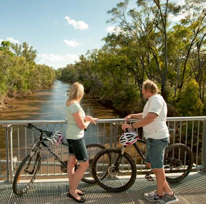
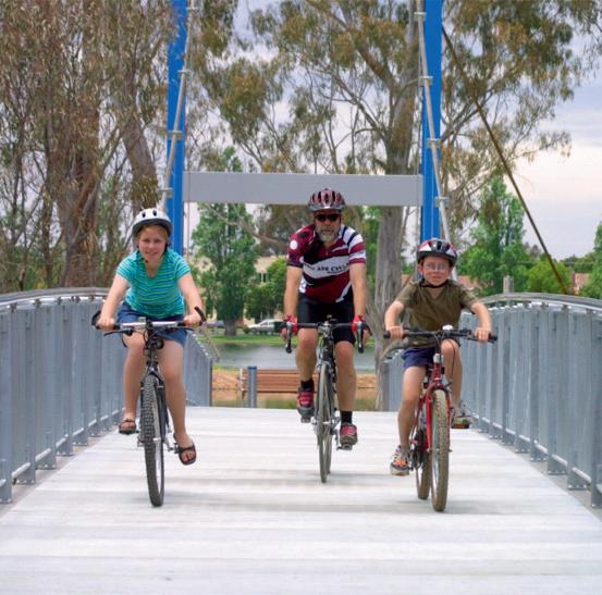
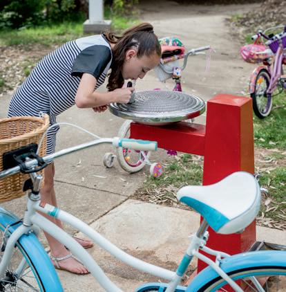
The following are some helpful hints to cycle safely around Greater Shepparton.
Check bike’s steering, brakes and tyres are in good condition.
Check front and rear lights and brake reflectors if riding at night.
Carry adequate water, snacks, money and a charged mobile phone.
Carry a bike pump, spare tubes, tyre repair kit and bike lock.
Wear an Australian standard approved bicycle helmet whenever riding.
Obey all traffic signals and road rules.
Always ride a metre from the kerb or parked cars.
Signal your intentions by hand and establish eye contact with motorists. Keep to the left side of the path or roadway.
Give way to pedestrians.
Let others behind you know when you are slowing or stopping.
Sound your bell, or simply call out “passing on your right” as you approach pedestrians. Move off the path if you stop.
Ride no more than two abreast or in single file in heavy traffic.
Tell someone where you are going and when you plan to return, or ride with others.
Ensure your clothing and footwear is suitable and wear at least an SPF 15+ sunscreen, including padded shorts if you have them, it will make your ride much more enjoyable.
Be adequately prepared, be sure to check the local weather forecast.
Know your limits, don’t overdo it and always ride well within your comfort zone.








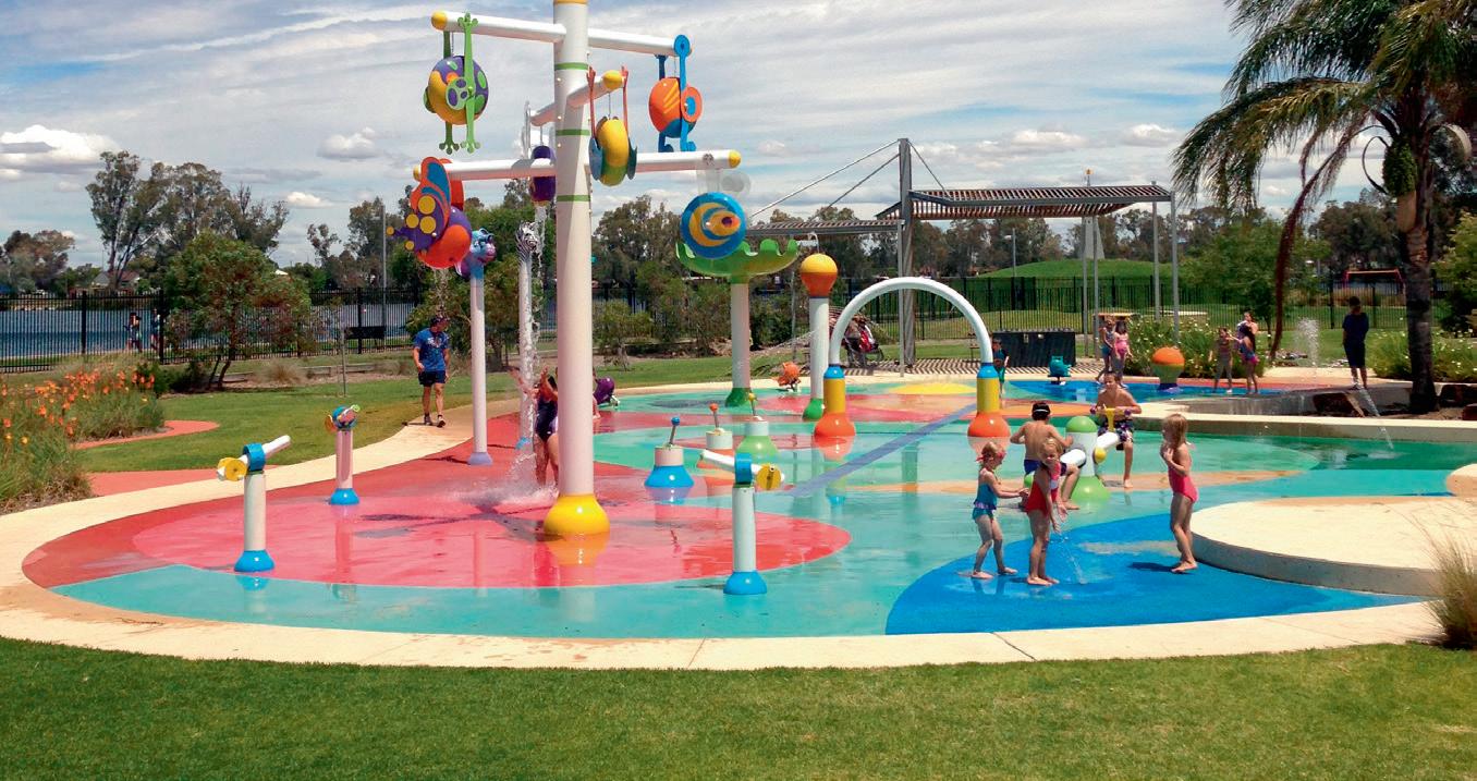
Aquamoves is Greater Shepparton’s premier fitness and leisure centre located in the picturesque Victoria Park Lake precinct in Shepparton. Whether you’re the serious sportsperson or just needing to relax and entertain the family, our facilities are perfect for you.
• OUTDOOR AQUATIC
50m Olympic pool, leisure pool, interactive Splash Park, sandy beach areas and free BBQ facilities.
• INDOOR AQUATIC
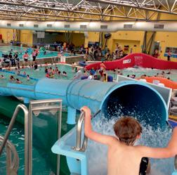
25m pool, leisure pool, hydrotherapy pool, spas (warm and cold), sauna, rapid-river, water slide and Tarzan swing.
Open 6am to 9pm Monday to Thursday, 6am to 8pm Fridays, 7am to 5pm Saturdays and 8.30am to 5pm Sundays. During summer the pools have extended opening hours.
• GYMNASIUM
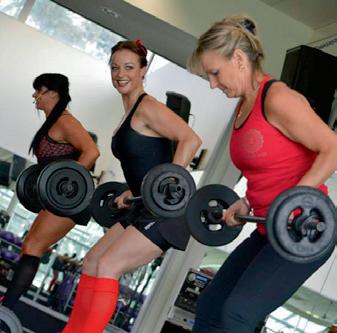
Spacious and well-equipped, featuring a range of free weights, pin loaded equipment and variety of cardio machines.
• GROUP FITNESS
Access to a suite of group f itness classes varying from the relaxation of Yoga to the excitement of RPM (cycling).
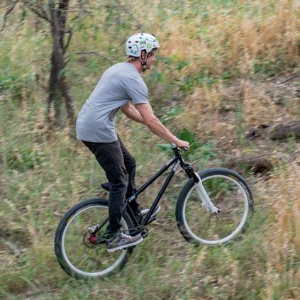
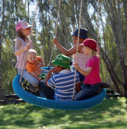
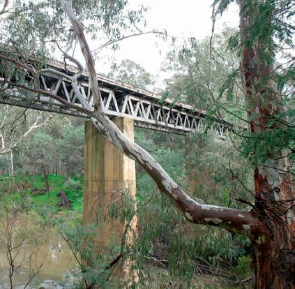
Throughout Greater Shepparton, there are a number of parks and reserves that are steeped in history and character. Beautifully landscaped, some are equipped with playgrounds and barbecue facilities just waiting for you and your family to kick back and relax in. These reserves are located adjacent to our pathway network and our roadways. You will be sure to find a shady nook to relax and enjoy the atmosphere and the surrounds.
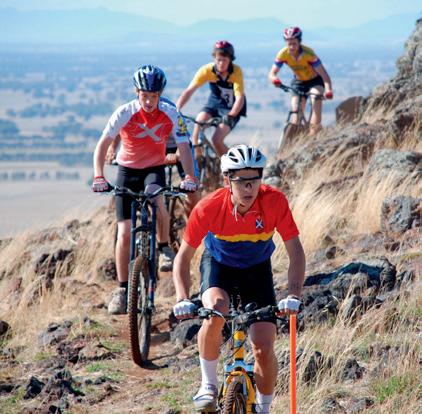
For those daredevils, you can discover a number of tracks with jumps, hills, dips, stairways, ruts and water challenges scattered throughout the Shepparton Regional Park and the many tracks following both the Goulburn and the Broken Rivers. The paths are forever changing, giving you infinite possibilities for “ripping it up” whilst enjoying the Regional Park and the majestic Goulburn and Broken rivers.
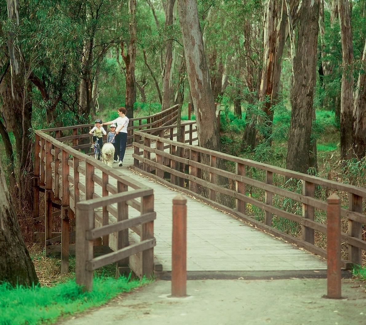
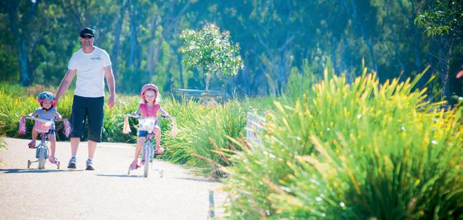
The Yahna Gurtji Shared Path network encompasses over 40km of sealed paths that wind along the Goulburn and Broken Rivers in Shepparton and Mooroopna. Yahna Gurtji means “Come walk with me friend” and the pathways take you to some of the most beautiful locations in Greater Shepparton. Not only can you take in our amazing rivers, but the pathways wind through the Shepparton Regional Park between Shepparton and Mooroopna and encompass the history of the local Yorta Yorta people at The Flats. Playgrounds, drink and exercise stations and even a bike repair station are all along safe pathways for the whole family to enjoy, be it riding, running or walking.

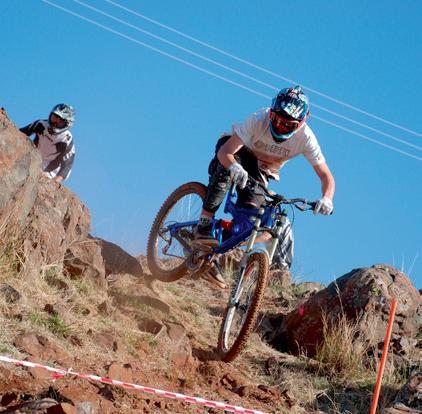
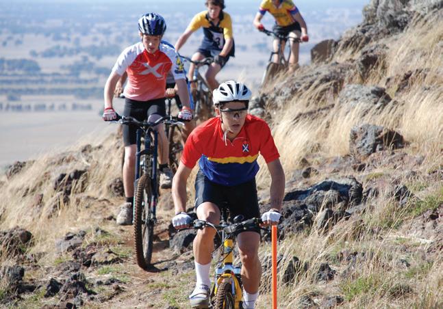
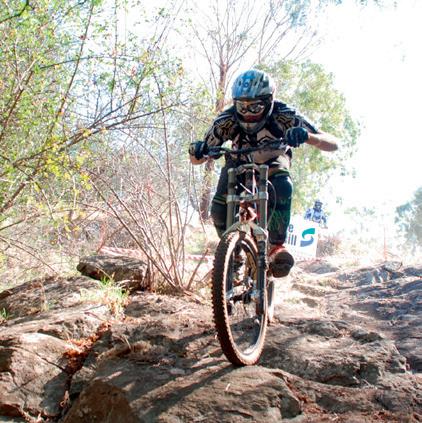
With mountain biking courses and facilities at Mt Major in Dookie, the region has several courses available to ride. Let the adventure begin and discover the challenges that come with rocky outcrops and the odd roaming sheep.
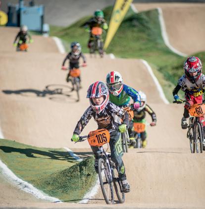
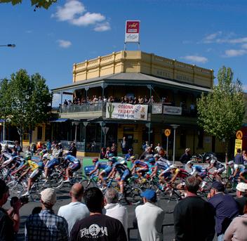
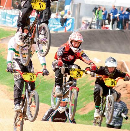
If you are coming for an event, Greater Shepparton hosts many throughout the year including national events at our cycling facilities. Our BMX track, built for our local club, also hosts national events and is one of Australia’s premier BMX facilities. A UCI accredited track, it was designed and built by world renowned Olympic and World Championships builder Tom Ritzenthaler in 2009. Some of the major events more recently hosted include the 2016 State BMX championships, the 2014 BMX Nationals Championships and Oceania Championships. The BMX track is adjacent to our velodrome, which hosts club meets and annual events each year and they are both located in the Shepparton Sports Precinct.
Why not bring your next cycling event to Greater Shepparton? We would love to host you and help ensure your event is successful.
Contact the Greater Shepparton City Council’s Tourism and Events team on (03) 5832 9858 or email events@shepparton.vic.gov.au.











440-452 Wyndham Street, Shepparton Ph. 5821 1002






Open for breakfast, lunch or just coffee and a cake. The Butter Factory welcomes you to relax after that ride and enjoy the good things in life.
Monday to Friday 6.30am - 5.00pm
Saturday and Sunday and public holidays
7.30am - 4.30pm
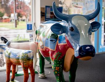
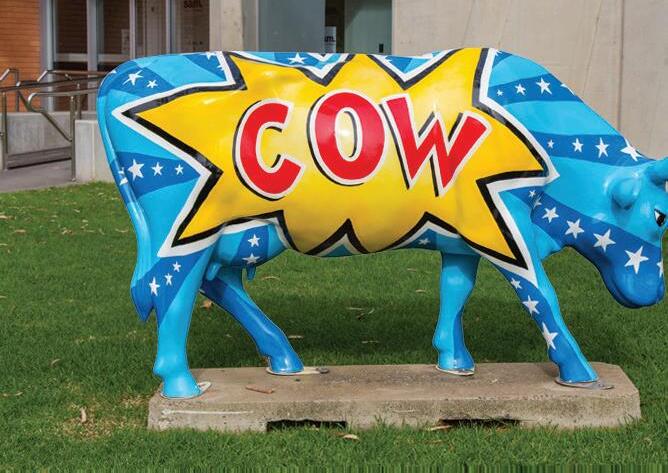
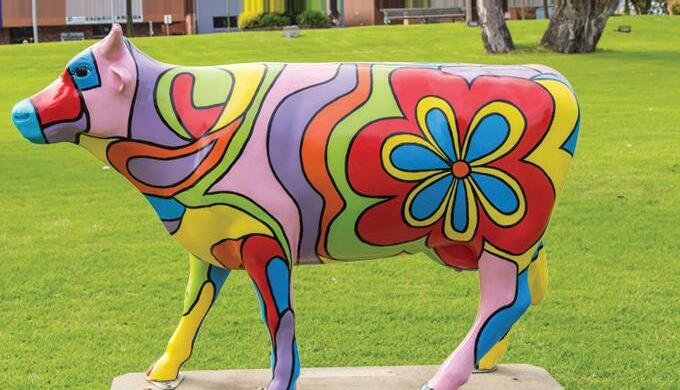
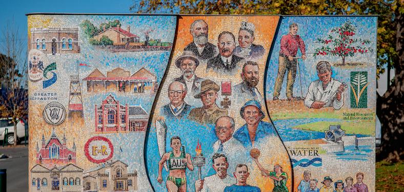
MooovingArt is a unique, ever changing public art display located throughout Greater Shepparton. Discover more at visitshepparton.com.au
Closed Christmas day and Boxing day.
OPEN
Tuesday to Thursday 10am - 3pm
Friday to Sunday 11am - 5pm
Closed Monday.


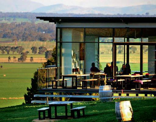
Discover warm hospitality at our relaxed cellar door perched above an everchanging landscape. Be guided through a wine tasting and share a regional grazing platter. Experience captivating natural beauty, fireside or on our relaxed deck. From cellar door, our Rock Correa walking track (1 hour return) offers a chance to take in breathtaking panoramas.
195 Major Plains Road, Dookie Cellar Door: 0437 825 547 Office: 03 5823 5383
E: info@talliswine.com.au www.talliswine.com.au
Mt Major at Dookie offers mountain bike riders several challenges, as well as providing road cyclists with bitumen to the peak. This is private property that allows access to the general public whilst also being an operational farm. Use at own risk. You will need to either access a key to the area from the University of Melbourne Dookie Campus, or just lift your bike over the gate and off you go. Under no circumstances are dogs allowed on Mt Major as well as no camping or fires permitted. All rubbish must be taken away also.
Difficulty Very Difficult
Description Out of the star gate descend over and through rocky terrain across “The Shelf” out in to the open and over some knarly rocky outcrops across the sometimes off camber but fast trail through the trees to the finish.
Distance: 1.29km.
Melon track:
Difficulty Easy
Description Traverse across the top of the hill before taking care through the gully crossing then into wide open flowing corners to the finish.
Distance 1.5km.
Cross Country:
Difficulty Easy
Description This single track cross country course brings together magnificent views and the technical trail features of a mountain bike track. Technical trail features include rock gardens, log crossing as well as up hill and down hill stretches.
Distance 10km.
Hazards: Be aware of other users as well as roaming stock that may be grazing on Mt Major, snakes in summer and magpies during breeding season. Be cautious of road crossings of TV Access Road, this road is used by vehicles to access the communication equipment located at the top of Mt Major. There may be limited access when works are being undertaken so please no interference with natural or built environment.











































Open Monday to Friday 5.45am - 5.30pm Saturday 6.00am - 2.00pm & Sunday 8.00am - 2.00pm






130 Hogan Street, Tatura Ph 03 5824 1267
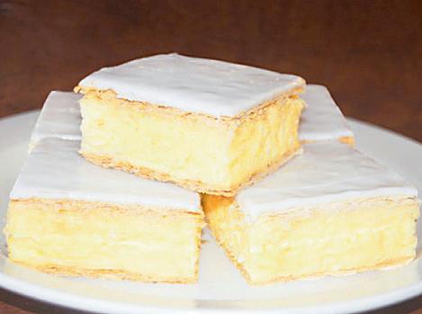
Tatura Hot Bread have one of the Best Vanilla Slices in all of Australia, having won countless awards across the country.
Sit down or takeaway. Enjoy freshly prepared sandwiches, rolls and coffee in air conditioned comfort. Specialising in bread, pies, slices, donuts, iced sponges and birthday cakes.
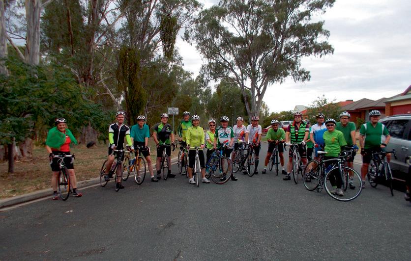
A friendly, socially-oriented group for recreational cyclists, catering for all skill levels, with organised rides every weekend day. We also offer advice for beginners, training in safe cycling techniques and cycle maintenance.
This ride is for those who are rail trail enthusiasts. The Dookie trail was the first in Greater Shepparton. A perfect opportunity to experience the charismatic township of Dookie and view the differing landscapes of Greater Shepparton.
Start / Finish: Dookie CWA Gardens, Mary Street, Dookie.
Distance: 9.3km return.
When: Anytime.
Surface: Sealed gravel path, one small area is unsealed but in good condition.
Topography: Generally flat with small undulations.
Features: Set at the base of Mt Saddleback, to the south you can see Mt Major, Gentle Annie hill to the south east and to the west you will see St Mary’s Church, built in 1898. The church also features stained glass windows dating from 1911.
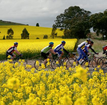
During Summer the countryside is scattered with hundreds of rolls of hay, with Autumn giving you the spectacular sights of red volcanic sands with patches of green growth for which Dookie is renowned. The area in Spring is ablaze with golden canola and green with legumes and grape vines.
Flora and fauna along the path include echidnas, blue tongue lizards, kangaroos and even wedge tailed eagles.
If you are lucky enough, you may even spot the local resident “Willy the Wombat” whose den is under the road drain at the third intersection.
Hazards: Take care when crossing all roads.
Be aware of snakes during the warmer months.
Ride notes: Enjoy a coffee or cake from the Dookie Emporium and discover amazing antiques and bric-a-brac for sale. There are no toilet or water facilities offered on the rail trail but these are available at the Dookie CWA Gardens or the Emporium during opening hours.




























The new Murchison Rail Trail has been constructed on a railway that was built in the 1880’s to connect Murchison and Rushworth with Melbourne. The railway line was closed in 1987.
Start / Finish: Junction of Gregory Road and Bendigo–Murchison Road, Murchison.
Distance: 7.7km one way 15.4km return.
When: Dryer conditions.
Surface: Unsealed, fine gravel.
Topography: Flat.
Features: Doctor’s Swamp Wildlife Reserve, a significant River Red gum wetland is abundant with birdlife.
Irrigation channels linked to Waranga Basin.
Restored timber bridge crossing Stuart Murray Channel. Murchison township, this river bank garden town is home to historic buildings and is the site where the Murchison Meteorite fell on 28 September 1969.
Hazards: The unsealed trail can be slippery when wet so care is required during wet conditions. Beware of snakes during the warmer months.
Ride notes: This ride can be connected with the Rushworth Loop ride on page 58 to extend. For your safety and for the protection of wildlife, please keep to the track. The trail will be extended in the future with further stages planned.
Toilet and water facilities are not available along the trail, these are available in Murchison township. Parking is available on Gregory’s Road.

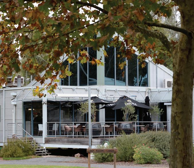

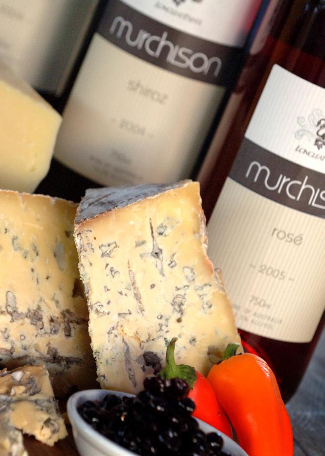
Guido and Sandra invite you to their cellardoor and casual café which is nestled amongst the Longleat vineyard. Taste the wines with the winemaker and relax on the deck, enjoy a house made cake and coffee overlooking the vines.
A truly unique experience.
Open Sat and Sun 10am to 5pm
Lunch bookings required
Free delivery Victoria wide on case (6 or 12) purchases for visiting cyclists.
105 Old Weir Rd Murchison
Ph: (03) 5826 2294
M: 0421 602 520
www.murchisonwines.com.au





These hand made, melt-in-yourmouth treats look too good to eat but when you take that first bite you’ll be lost forever in creamy caramel, chocolate and fresh apple!
Their unique retail outlet also offers an array of other chocolate treats or choose from gourmet goodies such as natural fruit juices, liqueurs, jams and pastes.


TRADING HOURS November, December, January
• Open 7 Days 9am - 5pm
February - Closed March to October
• Open Thurs to Mon 9am - 5pm
• Closed Tues & Wed
95 School Road, Shepparton East
(off Benalla Rd near Shepparton East Primary School) Ph: 03 5829 2353
www.chocolateapplefactory.com.au
The Kialla Circuit begins at Victoria Park Lake in Shepparton and offers riders Goulburn River frontage and views of Seven Creeks. This casual short ride is suitable for all abilities.
Start / Finish: Victoria Park Lake, Wyndham Street, Shepparton.
Distance: 21km – or a little further if you take the Yahna Gurtji shared path.
When: Anytime or particularly during southerly winds.
Topography: Flat, with some very small undulations down Raftery Road.
Surface: Sealed, good condition.
Features: Victoria Park Lake precinct including walking and cycling paths surrounding the lake with its wetlands, skate park and picnic and barbecue facilities.
Goulburn and Broken Rivers. The Goulburn is the lifeblood of Greater Shepparton. Seven Creeks.
Hazards: Goulburn Valley Highway crossing at the Raftery Road and Mitchell Road intersection.
River Road, (Shepparton bypass route) crossing at the Archer Street intersection.
Wyndham Street /Melbourne Road can be very busy as it is Shepparton’s main thoroughfare.
Be aware of magpies during the breeding season along Raftery Road and Mitchell Road and snakes in the warmer months.
Ride Notes: Option is to follow the Yahna Gurtji Shared Pathway from Victoria Park Lake to Kialla Lakes Drive, whereupon you can rejoin the route on the Goulburn Valley Highway close to Raftery Road. This deviation allows greater views of the Goulburn and Broken Rivers and Shepparton. During times of flood, Raftery Road may not accessible.





This trail is in memory of Jodie Ridges, a young mother of four who whilst riding for fitness along the Midland Highway in 2010 was involved in a collision with a motor vehicle and later tragically died from her injuries. The scenic ride links Shepparton to Tatura via dedicated cycle paths, minor roads and bush tracks.
Start / Finish: Rear of Victoria Park Lake, large suspension bridge near Aquamoves. Finish is Cussen Park in Tatura or vice versa.
Distance: 22km (one way), 44km return trip.
When: Anytime, but preferable in the warmer months due to bush tracks.
Surface: Sealed road and path. Bush tracks.
Topography: Flat, with small undulations on the bush tracks.
Features: Yahna Gurtji Shared path network through Shepparton Regional Park. Goulburn River.
The Flats Aboriginal history walk. Orchards, with their ever changing seasonal personas. Cussen Park, a bushland style park encompassing 33ha of wetlands, woodlands and open space hosts an array of wildlife, birdlife and mammals.
Greater Shepparton’s unique public art display, Moooving Art, life sized fibreglass cows are scattered throughout the area including Shepparton, Mooroopna and Tatura.
Hazards: This ride is not suitable for bikes with thin tyres due to the bush tracks. Be aware of uneven surfaces, potholes, puddles, small rocks, fallen branches and snakes in the warmer months. The forest section also passes through known flood plains so could be impassable during times of flood and can be quite slippery in times of wet weather.
Ride notes: There is an option to skip the bush tracks and follow the Mooroopna / Murchison Road, however this is an extremely busy road with no shoulder for bikes.
Please use extreme caution if cycling this road.
This circuit is used for the road race in the Junior Road Nationals during September, which sees the best junior cyclists from Australia battle it out to be the best. Despite the length of this ride, it is a challenging course as the terrain in constantly changing with the undulating hills of the Dookie district. Greater Shepparton’s toughest hill climbs are included in this route.
Start / Finish: CWA Gardens, Mary Street Dookie. Dookie is located 35km east of Shepparton.
Distance: 25km with an extra 7km with deviation.
When: Anytime.
Surface: Sealed, good condition.
Topography: Undulating.
Features: Dookie township.
Amazing views from Major Plains Road intersection of district hills and mountains.
Tallis winery (check for opening hours). Canola, wheat fields in season and the rich red Dookie dirt. Quiet roads.
Greater Shepparton’s unique Moooving Art cows in Dookie CWA Gardens.
Options: Either drive to Dookie, or link with the Devenish Dash ride on page 56 to extend this ride and make it even more challenging. Extend your ride to include Mt Major and ride to the summit for 360 degree views of the area and increased hill climbs (note that road surface does include gravel on Mt Major Road). Or ride the Dookie Rail Trail, an extra 9.3km return ride.
Hazards: Local farm machinery on roads and snakes in the warmer months. If you do extend your ride up to Mt Major, Mt Major TV Road is gravel.
Ride notes: Tallis Winery is well known for its beautiful cellar door, amazing views, regional produce platters and of course their wine. Or enjoy a coffee and cake from the Dookie Emporium and discover an array of antiques and bric-abrac for sale. Be sure to check opening hours.
This cycling circuit begins at Victoria Park Lake and takes you to the eastern outskirts of Shepparton passing some of the Goulburn Valley’s famous orchards and dairy farms before looping back into Shepparton.
Start / Finish: Victoria Park Lake, Shepparton.
Distance: 30km.
When: Anytime.
Surface: Sealed, good condition.
Topography: Flat.
Features: Orchards in blossom during Spring, fruitful in Summer and bare in winter.
Dairy Farms.
Chocolate Apple Factory (on School Road diversion).
Pactum Dairy, a huge new plant that exports all production to China.
SPC Cannery, canning everything from stone fruit to baked beans and spaghetti.
Hazards: Doyles Road crossing at the Channel Road intersection (this is the Shepparton bypass route).
Midland Highway crossing at the Shepparton Euroa Road and Boundary Road intersection.
Ride notes: A visit to the Chocolate Apple Factory is a delight. Apples dipped in caramel and then in chocolate are too good to miss and a bag for your purchases would be recommended. The Chocolate Apple Factory is open November to January, 7 days. Closed February, March to October, open Thursday through to Monday.
The Shepparton Euroa Road has recently been renamed to Coach Road. Signage is being installed to reflect the new name, though most locals will still refer to the old name.
Commencing at Victoria Park Lake this circuit heads south of Shepparton where you can take in the picturesque views of the river frontage on Raftery Road before hitting the flat, straight section along Mitchell Road.
Start / Finish: Victoria Park Lake, Shepparton.
Distance: 39km.
When: Anytime (except in times of flood).
Surface: Sealed and good condition.
Topography: Flat with some very slight undulations over bridges.
Features: Seven Creeks.
Goulburn River.
Broken River Crossing.
Greater Shepparton’s Moooving Art cows (when located at Victoria Park Lake).
Hazards: Goulburn Valley Highway crossing at Raftery Road and Mitchell Road intersections.
Doyles Road crossing (Shepparton bypass route) at the Channel Road intersection.
In times of flood, Raftery Road is not accessible. We suggest doing the Shepparton East circuit as an alternative.
Ride notes: To enjoy more of the natural beauty of the area, take the Yanha Gurtji Shared Path Network from the back of Victoria Park Lake and follow the Goulburn and Broken Rivers along the path, which meets back at the highway at the main highway crossing. The surface is good with some wooden slatted bridge crossings.
The Shepparton Euroa Road has recently been renamed to Coach Road. Signage is being installed to reflect the new name, though most locals will still refer to the old name.
Beginning in Shepparton at Victoria Park Lake, this ride is a short flat circuit with long straight sections. This popular circuit travels towards the townships of Lemnos and Dookie before looping back into Shepparton. This route is popular amongst the local cycling community.
Start / Finish: Victoria Park Lake, Wyndham Street, Shepparton.
Distance: 40km.
When: Anytime, but keep an eye out for head winds on those long stretches!
Surface: Sealed and in good condition.
Topography: Flat open terrain.
Features: Greater Shepparton processing plants with SPC and Campbell’s Soups in the vicinity.
Shepparton weir (Goulburn River) fish ladder (off the actual route at the junction of The Boulevard and Rudd Road).
Cudgee Park, with Aboriginal totem poles, located on The Boulevard.
Shepparton Golf Course.
Reedy Swamp wetlands, orchards and dairy farms.
Hazards: Numurkah Road crossing at the Wanganui Road and Ford Road intersection.
Grahamvale Road crossing (Shepparton bypass route) at the Ford Road intersection.
Railway crossing rumble strips at Pine Lodge North Road.
Doyles Road crossing (Shepparton bypass route) at the Old Dookie Road intersection.
Wyndham Street crossing at the Hayes Street intersection.
Ride notes: You have the option to detour along School Road off Old Dookie Road and visit the Chocolate Apple Factory, the home of the delectable chocolate apples – divine!















Princess Park
Named after HRH Princess Elizabeth (now HM Queen Elizabeth II). In 1948 the Shepparton Branch of the CWA planted trees at the entrance to mark her 21st birthday. A number of sporting facilities are located within this park.
Historical Pump Site
This is the foundation of the pump which supplied water to the first irrigated orchard on the east side of the Goulburn River. Commenced about 1893 by the Mason brothers, the orchard was bounded by Mason Street, Wyndham Street, Balaclava Road and The Boulevard. During the first half of the last century cultivation of most of the area changed to market gardening. It was developed as a residential subdivision after World War 2.
DAINTON’S BRIDGE TO CHINAMAN’S GARDEN – distance 2.9km.
Dainton’s Bridge
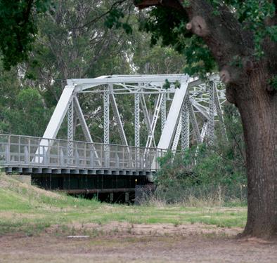
This bridge was named after James Henry Dainton who was the engineer in charge of the first bridge built over the Goulburn River in 1878. This was at the Fryers Street entrance to Shepparton. The bridge was later demolished to make way for the Monash Bridge (1913 14). He also built the jetty at the rear of the Shepparton Heritage Centre.
McGuire’s Bridge
Named after Patrick McGuire who established a punt crossing on the Goulburn River near this spot in the early 1850’s.
Daish’s Bridge
Named after the adjoining area known as Daish’s Paddock. The Daish family had a butcher shop in Shepparton for many years (est. late 1870s). They had their slaughterhouse in the paddock near this bridge. Stock awaiting slaughter were also held there. (Path access to SPC KidsTown).
This ride will begin at Victoria Park Lake taking the Yanha Gurtji Shared Path Network through the Shepparton Regional Park to Mooroopna. The ride then takes you through some prime fruit and dairy areas and the small township of Toolamba.
Start / Finish: Victoria Park Lake, Shepparton.
Distance: 45km (alternate route adds 25km).
When: Anytime.
Surface: Sealed, good condition.
Topography: Flat and open terrain, small undulations through the bush near Toolamba.
Features: Shepparton Regional Park and the Yahna Gurtji Shared Path Network.
Goulburn River crossing using suspension bridge at Aquamoves. Historic bridge over Goulburn River at Toolamba. Many orchards with their blossom in the Spring and fruit in Summer.
Many river and creek crossings. Townships of Mooroopna and Toolamba. Keep an eye out for our Moooving Art Cows in the smaller townships.
Hazards: Pedestrians in the shared path network between Shepparton and Mooroopna.
The Goulburn Valley Highway is a busy thoroughfare.
Ride notes: Along this route you will also see greenhouses with tomatoes and orchards under protective covers. To avoid the busy Goulburn Valley Highway, take the alternate route via Union Road and Euroa-Shepparton Road, recently renamed as Coach Road is a little longer, but you will avoid the major traffic.
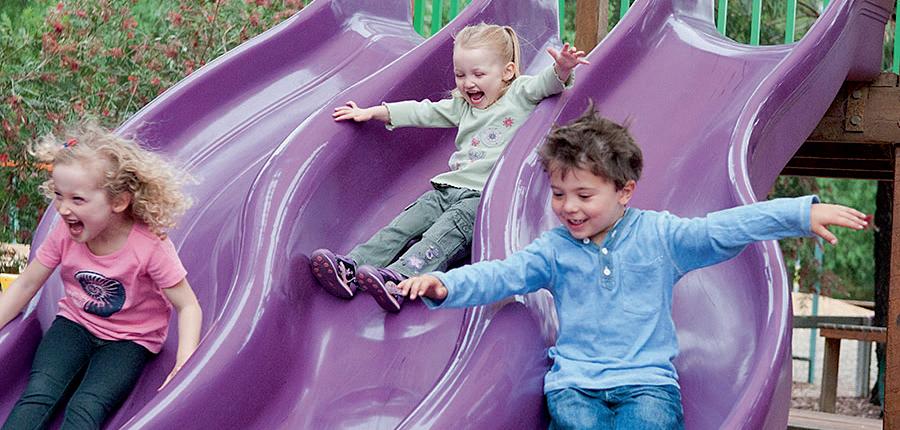
KidsTown
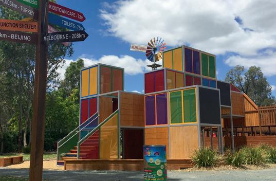
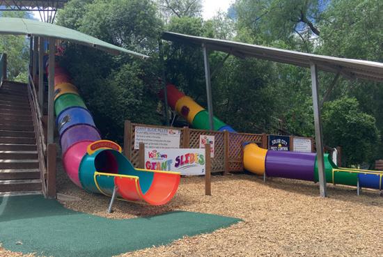
A gold coin donation per person will give the family entry to this wonderful adventure playground that is sure to delight children of every age. Stop a while, enjoy a snack under the trees or make use of the on-site BBQ facilities.
Boolbadah Floodway – The Flats
‘Boolbadah’ is an aboriginal word meaning abandoned camp. For many years (from the late 1930’s), many local aboriginals lived in permanent camps on the Flats area. Interpretive signage on the site gives you an insight to some of the significant people and stories. In 1958 most of them moved to the then newly constructed housing settlement ‘Rumbalara’, just south of Mooroopna.
Geraghty’s Bridge
Named after the Geraghty family who, for many years, operated the bus service and a taxi service between Mooroopna and Shepparton. In 1938, Ern Geraghty bought the business from William Hatton who, with Jack Goodfellow had started the regular bus service in the early 1920’s.
Ah Wongs Bridge
Named after Ah Wong, a Chinese migrant, who set up a market garden in the area between Dainton’s Bridge and the Goulburn River. From there he and his family supplied vegetables to the township of Mooroopna and the surrounding district. Chinamans Garden Reserve was the site of this vegetable garden.
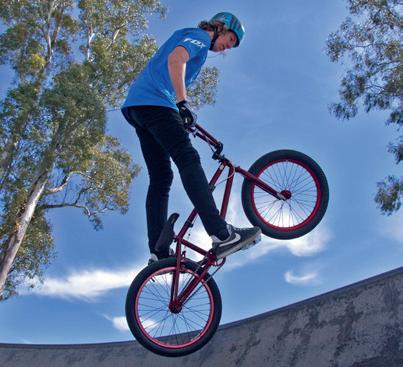
x-abition Skate Park
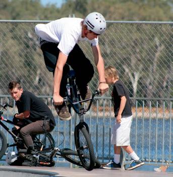
Located on McLennan Street, Mooroopna near Ferrari Park, this skate park offers a wide variety of challenges and is suitable for BMX, roller blades, skateboards and scooters.
DAINTON’S BRIDGE TO KIALLA
(Kialla Lakes Drive via Tom Collins Drive, Broken River)
(Kialla Park via Broken River and Goulburn Valley Highway)
Distance: 1.1km Dainton’s Bridge to Aquamoves
1.9km Aquamoves to SPC KidsTown
3.6km Aquamoves to GV Highway (bridge)
1.5km GV Highway (bridge) to Gordon Dr. (Lake Kialla)
1.9km GV Highway (bridge) to Kialla Park
Concrete shared path surrounds:
• Lake Kialla may be accessed from various points, including Gordon Drive via Wellington Court, Pedder Court, Cowen Court.
• Lake Amaroo may be accessed via the Archer Street end of Kialla Lakes Drive. Please take care when crossing the road.
• Lowanna Waters may be accessed from various points including Rocklands Crescent, Waranga Drive and Jindabyne Court.
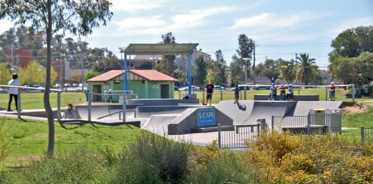
S-Cape Skate Park
The skate park, in the Victoria Park Lake precinct, provides an exhilarating recreational option for young people. It is centrally located adjacent to Victoria Park Lake on one side and the John Pick Playground on the other, giving parents and guardians a place to relax and share in the fun and excitement.
Aquamoves
When you think about fitness, fun and healthy living, Aquamoves is the place to be. With the amazing rapid river ride, challenging water slide and powerful water sprays, there is something to delight everyone. If you need relaxation, the centre offers a wonderful hydrotherapy pool, spas and sauna. A fully equipped gymnasium is also located within this modern facility. In order to continue to Kialla, please use Tom Collins Drive and take care as this is not a designated shared pathway.



















GREATER SHEPPARTON IS HOME TO OVER 40KM

All Abilities Playground
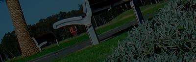
Located adjacent to Aquamoves, this fully fenced all abilities playground features swings, concord net, sand play area, slides, climbing walls, etc. There is full wheelchair access to this free playground and it is open from dawn to dusk. Public toilets on site. Victoria Park Lake and SPC KidsTown Trail Connection
The shared pathway, via a spectacular suspension bridge, directly links two of Greater Shepparton’s most popular passive recreation areas. The bridge is a bright and colourful landmark that allows users of the pathway to move from the Victoria Park Lake precinct to one of Australia’s largest outdoor playgrounds, SPC KidsTown. River Junction Goulburn and Broken Rivers
The Goulburn River is named after Major Frederick Goulburn, Colonial Secretary and registrar of the records of the Colony of New South Wales (1820 - 1824). The Goulburn River was discovered by Hume and Hovell in December 1824. In the early days of its discovery, it had various names - Hovell, Goulburn, Twisden and the native name ‘Bayunga’ or ‘Bayungun’.
None of the other names found favour with the public and the name Goulburn was retained. The Goulburn River now forms part of an extensive irrigation system which includes three large water storages.
Broken River
The Broken River is so named because according to William Howitt in his first book, ‘Two Years in Victoria’, published 1855, ‘As the name imparts, it is broken here and there into a variety of channels only filled at flood time, and lagoons bordering on them’. In the early 1880s (probably 1882), about 10 or 12 years after the first farmlands were taken up in the district, two concrete weirs were built across the stream, one known as ‘Casey’ in the Parish of Goorambat, and the other known as ‘Gowangardie’ in the Parish of Currawa. The Broken River joins the Goulburn River on the southwest boundary of Shepparton. The native name for the Broken River is ‘Marangan’.
This ride will begin at Victoria Park Lake taking the Yanha Gurtji Shared Path Network through the Shepparton Regional Park to Mooroopna. The ride then takes you through some prime fruit and dairy areas and the small township of Toolamba.
Start / Finish: Victoria Park Lake, Shepparton.
Distance: 45km (alternate route adds 25km).
When: Anytime.
Surface: Sealed, good condition.
Topography: Flat and open terrain, small undulations through the bush near Toolamba.
Features: Shepparton Regional Park and the Yahna Gurtji Shared Path Network.
Goulburn River crossing using suspension bridge at Aquamoves. Historic bridge over Goulburn River at Toolamba.
Many orchards with their blossom in the Spring and fruit in Summer.
Many river and creek crossings.
Townships of Mooroopna and Toolamba.
Keep an eye out for our Moooving Art Cows in the smaller townships.
Hazards: Pedestrians in the shared path network between Shepparton and Mooroopna.
The Goulburn Valley Highway is a busy thoroughfare.
Ride notes: Along this route you will also see greenhouses with tomatoes and orchards under protective covers. To avoid the busy Goulburn Valley Highway, take the alternate route via Union Road and Euroa-Shepparton Road, recently renamed as Coach Road is a little longer, but you will avoid the major traffic.





This ride will give you an amazing insight into the diverse agriculture that is based in our region. From the seasonal display of blossoms and fruit of our local orchards to the many dairy farms scattered throughout, you will love the diversity of the views. The roads are long and straight so be aware of those nasty head winds!
Start / Finish: Victoria Park Lake, Shepparton.
Distance: 45km (to be confirmed with the route change).
Surface: Sealed, good condition.
Topography: Flat and open terrain.
Features: Yahna Gurtji Shared Path network including the suspension bridge at Aquamoves over the Goulburn River.
Townships of Mooroopna, Tatura and Ardmona.
Amazing array of blossom in the spring and fruit in the summer.
Private Robert Mactier statue in Tatura, the region’s only Victoria Cross recipient.
DEDJTR - Department of Economic Development, Jobs, Transport and Resources - Tatura.
The Flats Aboriginal History walk.
Greater Shepparton’s Moooving Art cows, located in Shepparton, Mooroopna and Tatura.
Hazards: Pedestrians on shared pathway between Shepparton and Mooroopna.
Midland Highway crossing at Tatura Undera Road and Murchison Tatura Road intersection.
Ride notes: The Flats Aboriginal history walk is located in the bushland between Shepparton and Mooroopna. This is ideal to walk due to the nature of the bush tracks but gives an insight to the history of our local Aboriginal people, the Yorta Yorta.
Why not stop at Tatura Hot Bread and try one of their award winning vanilla slices?
This circuit is commonly used by local cyclists in Greater Shepparton. It comprises long, straight, flat sections of road that take in the beautiful scenery around Raftery Road and our many and varied orchards.
Start / Finish: Victoria Park Lake, Shepparton.
Distance: 57km with an extra 6km deviation.
When: Anytime.
Surface: Sealed, good condition.
Topography: Flat.
Features: Long, straight sections.
Goulburn River frontage along Raftery Road and The Boulevard. Cudgee Park, with Aboriginal totem poles.
Shepparton Cemetery and the monuments to loved ones passed.
Driver Education Centre of Australia.
Greater Shepparton’s Moooving Art Cows.
This route is the most popular amongst cyclists in Shepparton.
Hazards: Goulburn Valley Highway crossing at Raftery Road and Mitchell Road intersection.
Midland Highway crossing at Shepparton Euroa Road and Boundary Road intersection.
Railway rumble strips at Pine Lodge North Road.
Numurkah Road crossing at Wanganui Road and Ford Road intersection.
Ride Notes: The Chocolate Apple Factory is only a short deviation off the main route. Stop in for a delectable treat, worth every bite! There is an environmental fish ladder on the Goulburn River, with access just after the Shepparton Cemetery. Not suitable for road bikes, it is a lovely spot to push your bike to just to see the ladder. In times of flood, Raftery Road may not be accessible.
The Shepparton Euroa Road has recently been renamed to Coach Road. Signage is being installed to reflect the new name, though most locals will still refer to the old name.
Start / Finish: Victoria Park Lake, Shepparton.
Distance: 63km.
When: Anytime.
Surface: Sealed good condition.
Topography: Flat and open terrain.
Features: Goulburn River crossing on shared pathway bridge at Aquamoves.
Small townships including Tatura, Toolamba and Mooroopna.
DEDJTR - Department of Economic Development, Jobs, Transport and Resources - Tatura.
Orchards in their seasonal splendour.
Goulburn River crossing east of Toolamba.
Natural bushland around the Goulburn River crossing.
Hazards: Goulburn Valley Highway crossing at the Bridge Road and Union Road intersection.
River Road crossing (alternate bypass route) at the Archer Road intersection.
Ferguson Road can be very busy.
Ride notes: Be sure to check out the Moooving Art cows that are scattered throughout our smaller towns. They are continually changing and on the mooove. Take your camera and capture the moment and be sure to post it to our visitshepparton Facebook page or #mooovingart and #visitshepparton. Consider stopping and having a coffee at Tatura Hot Bread and an award winning vanilla slice and include a visit to the Tatura War Time Camps Museum or the Victoria Cross Memorial in Mactier Park.





This ride takes you through the Shepparton Regional Park via the Yahna Gurtji Shared path network into Mooroopna and then into the heart of fruit and dairy country.
Start / Finish: Victoria Park Lake, Shepparton.
Distance: 64km.
When: Anytime or particularly during westerly winds.
Surface: Sealed good condition.
Topography: Flat.
Features: Goulburn River, Shepparton Regional Park and Yahna Gurtji Shared Path network.
Townships of Mooroopna, Merrigum and Tatura.
DEDJTR - Department of Economic Development, Jobs, Transport and Resources - Tatura.
Dairy farms. Orchards.
German World War II cemetery.
Hazards: Pedestrians on shared pathway between Shepparton and Mooroopna.
Midland Highway can be busy at times.
Ride notes: The German War Cemetery is located on Winter Road. Almost all German internees and prisoners of war who died in Australia during WWII are interned in this cemetery. Why not stop and have a coffee at Tatura Hot Bread and check out the Moooving Art Cows that are scattered throughout the smaller towns. They are continually changing and on the mooove.
This ride features long straights so beware of the dreaded head winds! Featuring our beautiful orchards and two Broken River crossings, be sure to keep your head up and enjoy the views.
Start / Finish: Victoria Park Lake, Shepparton.
Distance: 65km.
When: Anytime.
Surface: Sealed good condition.
Topography: Flat.
Features: Orchards in their seasonal splendour. Dairy farms. Broken River. Seasonal crops.
Hazards: Channel Road crossing at Doyles Road. Midland Highway crossing at the Cosgrove Caniambo Road intersection.
Ride notes: Be aware that if doing this ride weekdays during the school term, Channel Road can become extremely busy at school drop off and pick up times.
This circuit commences at Victoria Park Lake and travels east of Shepparton taking in some of the regions differing agricultural aspects. From dairy farms, to orchards and horse studs, this route will show you the beauty and diversity of our region.
Start / Finish: Victoria Park Lake, Shepparton.
Distance: 66km.
When: Anytime.
Surface: Sealed, good condition.
Topography: Flat, open terrain.
Features: Long straight stretches.
Dairy farms.
Orchards, with their ever changing seasonal personas. Tallygaroopna township.
DECA – Driver Education Centre of Australia.
Hazards: Railway rumble strips at Pine Lodge North Road.
Goulburn Valley Highway crossing at Victoria Road and Bunbartha Road intersection.
Goulburn Valley Highway crossing at Numurkah Road, Barmah Road intersection.
Numurkah Road can be very busy with heavy vehicle use, be careful when turning right into Wanganui Road.
Ride notes: Be sure to keep an eye out for our Moooving Art cows that are scattered throughout the region. They are located in our smaller townships also – who do you see in Tallygaroopna?
This circuit has long straights heading south and north, so beware the dreaded head wind. Taking in views of pastures, orchards and farms you will see the regions rich diverse agricultural base on flat terrain with some small undulations.
Start / Finish: Victoria Park Lake, Wyndham Street, Shepparton.
Distance: 67km.
When: Anytime. Beware of head winds and enjoy the tail winds also.
Surface: Sealed, good condition.
Topography: Generally flat with some small undulations on the south end of the ride.
Features: The big pear on Channel Road.
The region’s amazing agricultural diversity, crops, dairy farms and orchards. Enjoy them in their seasonal splendour.
Broken River crossing and its smaller tributaries.
Hazards: Doyles Road, Channel Road crossing. This is the Shepparton alternate route and can be extremely busy with heavy vehicles. It can also be extremely busy with school drop off and pick up times. Beware of snakes in the hotter months and swooping magpies during breeding season.
74KM
In December 2006 Scott Peoples was tragically killed in a training ride. Scott was an exceptionally talented and gifted sportsperson and was on the brink of breaking into the competitive world of professional cycling in Europe. As a tribute to Scott, the Scott Peoples Cycling Festival was held with a race and a challenging long distance ride included. Both circuits are included in this book.
Start / Finish: Queens Gardens, corner Wyndham and Nixon Street, Shepparton.
Distance: 74km.
When: Anytime.
Surface: Sealed, good condition.
Topography: Flat, with some small undulations.
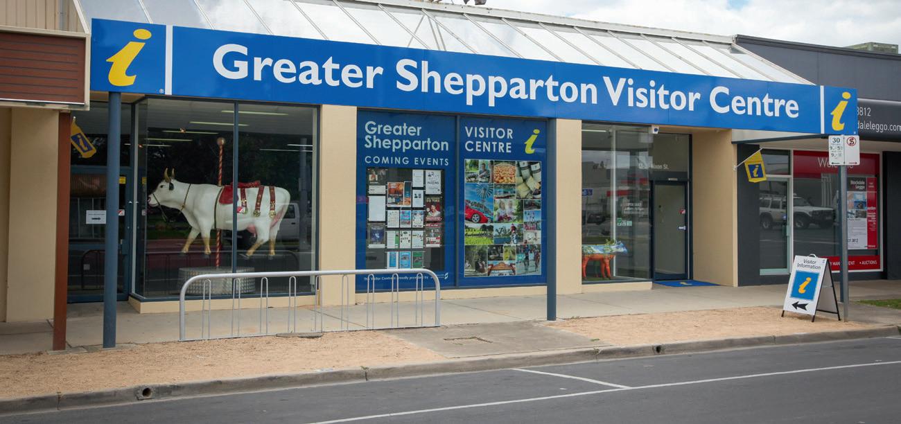
Features: Greater Shepparton Visitor Centre is located opposite Queens Gardens. Drop in and see the friendly staff who can advise you on all the region has to offer.
Driver Education Centre of Australia.
Shepparton Cemetery.
Environmental Fish Ladder (located off Rudd Road). Long straights.
Orchards in their seasonal splendour.
Canola fields (in season) and vineyards.
Hazards: River Road crossing (Shepparton alternate route).
Grahamvale Road at the Ford Road crossing.
Midland Highway crossing at the Cosgrove Caniambo Road crossing.
Ride notes: This ride, dedicated to Scott Peoples is 74km, there is a 128km ride also on page 60. To view the fish ladder, you will need to walk your bike down to the river, due to the nature of the track, road bikes and tyres will not handle the terrain.
The Shepparton Euroa Road has recently been renamed to Coach Road. Signage is being installed to reflect the new name, though most locals will still refer to the old name.
This ride is for the more serious cyclist, the reward being the spectacular view of the magnificent Strathbogie Ranges which rise above Violet Town. Prior to heading back to Shepparton, take some time to visit the many eclectic shops and galleries that can be found in and around Violet Town.
Start / Finish: Victoria Park Lake, Shepparton.
Distance: 99km.
When: Anytime, or particularly during south easterly winds.
Surface: Sealed, good condition.
Topography: Generally flat, with a few small undulating hills.
Features: Big pear along Channel Road. Orchards in their seasonal splendour. Dry farming with cropping and sheep. Undulations east of Tamleugh and east of Miepol. Township of Violet Town.
Hazards: Doyle’s Road crossing (Shepparton bypass route) at the Channel Road intersection.
River Road crossing (Shepparton bypass route) at the Archer Road intersection.
Ride notes: The Violet Town Market is held on the second Saturday of each month. This is one of the largest markets in the area and worth a visit. Be sure to have something to put your purchases in for the day!
To get off the busy Shepparton Euroa Road (now recently changed to Coach Road), there is an option to take the Pine Lodge Road and Arcadia Tamleugh Road for a different perspective. Total distance if this route is taken is 102km.





This ride is a very challenging 102km hit out through Dookie to Devenish and back, especially if there is an eastern or western breeze giving you a dreaded head wind. This ride will give you spectacular views of the undulating hills of the Dookie district whilst testing your legs and stamina.
Start / Finish: Victoria Park Lake, Shepparton.
Distance: 102km out and back.
When: Anytime.
Surface: Sealed good condition.
Topography: Generally flat with undulating hills in the Dookie district.
Features: Dookie and Devenish townships.
Canola fields (in season)and vineyards.
Undulating hills from Dookie to Devenish giving fabulous views of the rich red dirt of the Dookie district.
Pine Lodge Church.
Cashel historic cemetery.
Moooving Art cows, public art in the form of life sized fibreglass cows.
Hazards: Cosgrove railway rumble strips.
Swooping magpies in nesting season. These roads can be busy at times.
Ride notes: Extend your ride in reaching Dookie on your return and take in the Dookie Rail trail. An extra 9.3km, you will pass the historic St Mary’s Church, built in 1898. You may even get to see “Willy the Wombat” who lives under the road drain. See page 14-15 for details of the Rail Trail ride. Stop and enjoy a coffee at the Dookie Emporium, be sure to check their opening times.
This ride begins at Victoria Park Lake and then travels along the Yahna Gurtji Shared Path network between Shepparton and Mooroopna and then onto the townships of Tatura, Rushworth and Murchison. The ride offers a unique experience of cycling through rare box ironbark forest, and Waranga Basin with its large irrigation channels branching off which feed our agriculture base.
Start / Finish: Victoria Park Lake, Shepparton.
Distance: 110km.
When: Anytime or particularly during south westerly winds.
Surface: Sealed, good condition.
Topography: Generally flat, but some small undulating hills.
Features: Goulburn River crossing on shared pathway bridge at rear of Aquamoves.
The Flats Historic Aboriginal walk (as an extra).
DEDJTR - Department of Economic Development, Jobs, Transport and Resources - Tatura.
Townships of Mooroopna, Tatura and Murchison.
Gentle undulating hills around Waranga Basin and Rushworth. Rushworth township and its incredible history relating to gold and mining.
Moooving Art cows, public art in the form of life sized fibreglass cows.
Hazards: Pedestrians on the shared path network.
Narrow bridge over channel at Waranga Basin.
Rushworth Tatura Road can be busy at times and if riding at dusk, kangaroos may be lingering on the road.
Ride notes: As an option, ride out to the open cut Balaclava Gold mine and historic Whroo, just south of Rushworth. However, the road is unsealed and quite rocky – maybe an option to visit when in the car one day!
In December 2006 Scott Peoples was tragically killed in a training ride. Scott was an exceptionally talented and gifted sportsperson and was on the brink of breaking into the cut throat world of professional cycling in Europe. As a tribute to Scott, the Scott Peoples Cycling Festival was held with a race and a challenging long distance ride included. Both circuits are included in this book.
Start / Finish: Victoria Park Lake, Wyndham Street, Shepparton.
Distance: 128km.
When: Anytime, but particularly good during south easterly winds.
Surface: Sealed, good condition.
Topography: Generally flat with some undulations around Violet Town and Dookie.
Features: Undulating, rolling hills around Violet Town and Dookie.
Violet Town and Dookie townships with their country charm. Orchards, vineyards and crops in their seasonal splendour.
Cashel historic cemetery.
DECA – Driver Education Centre of Australia.
Environmental Fish Ladder (located off Rudd Road near Shepparton Cemetery).
Hazards: Railway rumble strips on the Cosgrove Caniambo Roads. River Road crossing on the Shepparton Alternate Route. Grahamvale Road crossing at the Ford Road intersection. Numurkah Rd crossing at the Ford Rd and Wanganui Rd intersection.
Ride Notes: Why not stop off at either Violet Town or Dookie and enjoy a coffee? Browse the antiques and collectables at the Dookie Emporium. To view the fish ladder, you will need to walk your bike due to the nature of the track; road bikes and tyres will not handle the terrain.
This ride will begin at Victoria Park Lake taking the Yanha Gurtji Shared Path Network through the Shepparton Regional Park to Mooroopna and then heading down to the “River Bank Garden Town” of Murchison, nestled on the banks of the Goulburn River. Relax under the vine covered pergola and enjoy the fresh regional produce at Longleat Winery before tackling the straight stretch to Violet Town and completing your loop back to Shepparton.
Start / Finish: Victoria Park Lake, Shepparton.
Distance: 134km.
When: Anytime or during southerly winds.
Surface: Sealed and good condition.
Topography: Mostly flat with small undulations.
Features: Shepparton Regional Park and the Yahna Gurtji Shared Pathway Goulburn River.
Townships of Mooroopna, Murchison and Violet Town. Many orchards with their blossom in the Spring and fruitful in Summer.
Wide and varied crops and farms scattered throughout the area. Undulations on Shepparton Violet Town Road.
Hazards: The Tatura Murchison Road can be very busy at times. Doyle’s Road crossing (Shepparton bypass route) at the Channel Road intersection.
Ride Notes: If riding this route on a weekend, be sure to drop into Murchison Estate and enjoy the amazing Longleat wines in Murchison, or just enjoy a coffee amongst the vines. You can extend this ride and cycle beyond Violet Town for further hills. Stop and enjoy the true charm of our smaller towns and appreciate country hospitality.
Each September, GV Hospice, as a major fundraiser run the GV Hospice Fruit Loop ride. With three different courses, a 50km, 115km and a 180km course, there is a ride that is just right for you. We have featured the 180km course which takes you via the hills of Dookie and the rocky outcrops and beauty of the Strathbogie region. This ride will test you with some long stretches and hills included, but enjoy the flat terrain as well.
Start / Finish: Victoria Park Lake, Wyndham Street, Shepparton.
Distance: 180km.
When: Anytime, but why not join in the actual Fruit Loop event in September.
Surface: Sealed, good condition.
Topography: Generally flat close to Shepparton, hills in Dookie and steeper climbs in the Strathbogies Ranges.
Features: Townships of Dookie, Violet Town, Strathbogie and Euroa.
Cashel Cemetery and its depth of history.
Tallis Wine (just off the route).
Rolling hills with canola fields (in season) and vineyards.
Victoria Cross Memorial in Euroa township.
Rocky outcrops of the Strathbogie Ranges.
Hazards: Midland Highway when crossing from Dookie Nalinga Road to the Dookie Violet Town Road.
Snakes in the warmer months and swooping magpies during the nesting season.
Short stretch along River Road (Shepparton Alternate Route), this road can be busy at times.
Country roads do not have a dedicated cycle lane, be careful riding two abreast on these roads and the pot holes that may lay alongside.
Ride notes: This route takes you to some quaint towns with a plethora of history and an abundance of country hospitality. Be sure to stop and have some refreshments and enjoy your experience.
www.gvvetssheppartonvic.webs.com
www.humeveterans.com.au
SHEPPARTON FRUIT LOOP RIDE
admin@fruitloopride.com www.fruitloopride.com
SHEPPARTON TRIATHLON CLUB info@sheppartontriclub.com.au www.sheppartontriclub.com.au
BICYCLE NETWORK
PO Box 24013
MELBOURNE VIC 3001 4 / 246 Bourke Street
MELBOURNE VIC www.bv.com.au
CYCLING VICTORIA
PO Box 180
FAIRFIELD VIC 3078
vic.info@cycling.org.au www.vic.cycling.org.au

For information on training loops or joining regular cycling training groups in Greater Shepparton please visit www.sheppbugg.com.au or for a full list of events throughout the region, visit www.visitshepparton.com.au
FEBRUARY
BMX Australia National Series .................................................................... Shepparton
MAY
Goulburn Valley BMX Classic ...................................................................... Shepparton
SEPTEMBER
Fruit Loop Ride .......................................................................... Shepparton and Dookie
OCTOBER
Victoria Mountain Bike Downhill Series .............................................................. Dookie
BMX Victoria Pre State Titles ........................................................................ Shepparton
NOVEMBER
Victoria Lake Criterium .................................................................................. Shepparton
Challenge Shepparton Triathlon ..................................................................
BMX Victorian State Championships ...........................................................
DECEMBER
Christmas Track Carnival .............................................................................. Shepparton For a full comprehensive listing of events in the Greater Shepparton region please visit www.visitshepparton.com.au
Greater Shepparton City Council including their officers, agents and contractors have made every endeavor to ensure the details appearing in this publication are correct at the time of printing, but accept no responsibility for any inaccuracy or misdescription, whether by inclusion or omission. The publisher does not accept any responsibility for subsequent change or withdrawal of prices, details or services shown and these are subject to alteration without notice. Any standard of accommodation and / or services contained in this publication are indicative only of a certain class and are based upon information provided to the publisher. Accordingly, the publisher makes no representation or guarantee in relation to the standard, class or fitness for purpose of the services listed. Published September 2015.