9 minute read
Dreams for the Wabash River Corridor take shape


BY RADONNA FIORINI
PHOTOS BY CHRISTINE PETKOV & PROVIDED
There’s more than moonlight shining fair along the Wabash since the announcement of a multi-million dollar federal grant awarded to the Wabash River Enhancement Corporation and its local partners.
The $25 million grant announced in June by the U.S. Department of Transportation is one of 162 grants distributed nationwide as part of the federal Rebuilding American Infrastructure with Sustainability and Equity (RAISE) program. The WREC partnered with Tippecanoe County, Lafayette, West Lafayette and the Tippecanoe County Metropolitan Planning Organization to apply for the grant, says WREC Executive Director Stanton Lambert.
This infusion of money will fund most of the second phase of Tippecanoe County’s portion of the Wabash River Greenway project. The WRG is an effort to create and connect trails, sidewalks and bike paths near the river to historical, cultural and recreational sites in Cass, Carroll, Tippecanoe, Warren and Fountain counties. Connecting natural resources with population centers is beneficial in many ways, some of them economic.
“These efforts encourage a more active lifestyle and the community becomes less auto-centric,” says Lambert. “Easy access to hiking and biking trails is a quality-of-life issue.”
The greenway project in Tippecanoe County also will connect areas where people live to the places they work or go to school. Purdue University is the number one employer in the area, and bicycle and pedestrian paths and bridges make life much easier and safer for those students and Purdue employees who don't have a care, Lambert says.
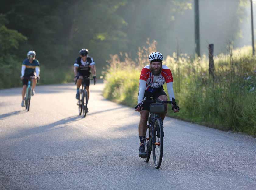
Gary Brouillard, president of the Wabash River Cycle Club, has personal experience with being a bicycle commuter. When working on degrees from Purdue, he regularly biked from Lafayette across the river to campus and now rides for recreation and his health.
“There are lots of people whose primary means of transportation is a bicycle,” Brouillard says. “Traffic is picking up and city streets are getting busier, plus some of the bridges (across the Wa[1]bash) are difficult to use and tend to be congested. The projects planned and funded by this grant will make it much easier to access existing trails and will make (specific) roads more rideable.”
Out of the 162 RAISE grants awarded nationwide this year, 23 projects received the maximum amount of $25 million. Part of the grant criteria required projects to address needs in historically disadvantaged parts of the community, and areas of persistent poverty, says Lambert.
According to the DOT’s awarding document, the WRG meets almost all of the qualifying criteria the department was looking for, including:
Improving the safety of non-motorized travelers
Providing affordable access to essential services in the affected communities
Reducing vehicle miles traveled, thereby reducing greenhouse gas emissions
Incorporating green infrastructure to address stormwater management and ecosystem restoration
Improving low-cost access to employment centers
Enhancing recreational amenities
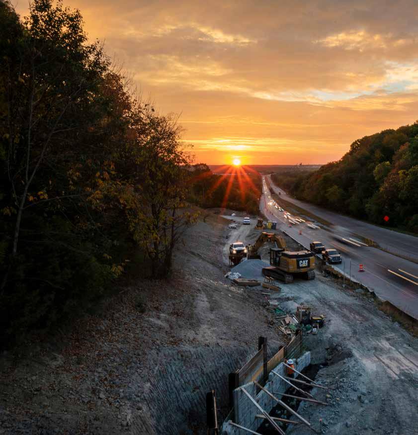
The second phase of the WRG in Tippecanoe County, estimated to cost upwards of $37 million, will allow for construction of or upgrades to about five miles of trails. This includes 2.55 miles of new side paths (built alongside existing roads), half a mile of boardwalk, a mile of new trail facilities, a trail bridge spanning a ravine, more than a mile of upgrades to existing paths, 20 new park/ride spaces for commuters, and five bus stop connections.
The most expensive portion of the project will be a new bike/pedestrian bridge over the Wabash River connecting the neighborhoods of north Lafayette with parks and trails near River Road in West Lafayette, Stanton says.
The new pedestrian bridge, which will be located between the Sagamore Parkway Bridge on the north and the Harrison Bridge on the south, will end in Mascouten Park just west of the river. Existing paths along River Road and Happy Hollow Road will provide a safe way to reach Purdue, near-campus neighborhoods, Happy Hollow Park, and even further north to Sagamore Parkway.
“There is a sizable population of grad students and others living in north Lafayette,” says Lambert. “This will provide a direct, safe route to trails on the west side. It will be much safer and provide more direct access than the Harrison Bridge, which has narrow bike and walking lanes.”
As president of the cycle club that boasts almost 300 members, Brouillard concurs. He has served as president for four years and consulted with city engineers and WREC officials about the WRG plans. While some improvements have been made recently, the avid cyclist cites safety or access concerns with all the bridges currently spanning the river.
The Sagamore Parkway Bridge now has a dedicated bike/pedestrian lane attached to the bridge but currently does not provide access to nearby trails; the Harrison Bridge now has dedicated bike lanes on the roadway, but bikers still must ride close to vehicles; The John T. Myers Pedestrian Bridge now has better ramps, but for years had switchback ramps that were not rideable; and the Columbia/South Street bridge has a raised sidewalk but bikes must compete with pedestrians in a rather narrow space, or with cars and trucks in the vehicle lanes.
The new pedestrian bridge will be accessible in Lafayette from a proposed trail that will begin at the intersection of Canal Road and North Ninth Street. The trail will intersect with an existing trail on North Ninth that goes up to Davis Ferry Park and Tippecanoe Battlefield Park in Battleground. That existing trail will also receive upgrades to make it safer, particularly for folks with disabilities.


The upgrades will include path and sidewalk repair, new bus stops, park-and-ride spaces, and easier access for people who need to get to the Tippecanoe County Jail on Duncan Road, and the Tippecanoe County Community Corrections facility further north on Ninth Street.
“There are people without a car who need to get to one of those facilities for classes and other things, and those trail upgrades will help,” says Lambert.
This project also will tie in with a separate project funded by a state grant and currently underway, in which a wooden ramp is being built under the Sagamore Parkway Bridge. That walkway descends to north River Road, where a park-and-ride lot is planned. This will allow foot and bike traffic coming off Soldiers Home Road and the Sagamore Parkway Bridge access to proposed trails along north River Road, says Lambert.
The WREC already owns about 50 acres of land scattered along the riverfront between West Lafayette and the Tippecanoe County Amphitheater Park. New trails, boardwalks and a bridge over a deep ravine will provide a route to reach that park, which already boasts a number of biking and hiking trails.
The county’s portion of the WRG will eventually create what Lambert calls an active transportation loop, connecting five existing parks, including Prophetstown State Park to the north. Greater Lafayette already boasts several hiking trails and bike paths, but some of them are linear, which means hikers can’t hike the whole trail without going back the way they came, or having someone pick them up at the end.
“The west side has a more extensive trail system, but in Lafayette the trails are in a lot of isolated chunks. Currently you do a trail, then get on a busy road to access another trail,” says Brouillard.
The Wabash Heritage Trail is just such a path, says Trail Manager Wade Garriott. The 13-mile dirt trail begins at the Tippecanoe Battlefield Park to the north, runs south along Burnett Creek, crosses the Wabash River at Davis Ferry Park, runs along North Ninth Street, crosses the river again at the Riehle Plaza pedestrian bridge, and winds its way south and west to Fort Ouiatenon.
The Heritage Trail is a good example of a way to encourage people to get out and observe nature and connect to historic sites, Garriott says. It is for foot traffic only and, while records are not kept of how many people use it, he notices the trail is popular with runners. Garriott sees real benefit to having the Heritage Trail connect to other trails in the county.
“The benefit would be that you could go anywhere you wanted to and connect several places along the way,” he says. “Our numbers have been impacted a little bit this year because the construction on Ninth Street made it harder for people to get to the park. The trail is a very peaceful place and people need access.”
This second phase of the WRG will cost about $37 million, with $1.4 million committed from local partners, Lambert says. Additional funding will come from other grants and cooperative efforts with local partners. Because WREC created a master plan for waterfront development in 2010, the organization is poised to apply for any state and federal grants that come available. And a number of other agencies and organizations are working with the WREC to seek out state and federal dollars for projects adjacent to the river.
The RAISE grant will fund planning, design and construction of this active transportation loop, but don’t expect to see the construction piece start anytime soon. Just the planning, design and permitting phases will take three or four years, says Lambert. And the first step is filling out the complex paperwork and meeting other requirements that come with a federal grant, which will take months.
However, Lambert believes the WRG project provides tangible benefits, even before completion. Part of the project includes clearing out invasive plant species, which improves access to the Wabash River and provides better river views. The WREC also is working with homeowners and other stakeholders to help keep pollution out of the river and to encourage environmentally friendly use of riverfront property.
Some of those benefits are less obvious than new trails and bridges but still a valuable part of the project. And Lambert is committed to helping the community understand the benefits of having a river nearby.
“We want people to have a vested interest in the river,” Lambert says. “Trails help draw people to the river and give them a reason to appreciate and help preserve what’s here.” ★
When completed, the trails project will include:
2.55 miles of new side paths
.50 miles of boardwalk
1 mile of new trail facilities along existing roadways and through various paths
1 dedicated bicycle-pedestrian bridge across the Wabash River
1 trail bridge
1.2 miles of upgrades to existing side path sections
20 new park/ride spaces for commuters
5 bus stop connections


